

RENAISSANCE PARK Connectivity Master Plan
March 2024
This
This


119 East Lafayette Street Norristown, PA 19401 119 EAST LAFAYETTE STREET NORRISTOWN, PA 19401 PHONE: (610) 239 7601 FAX: (610) 239 7606 WWW.SIMONECOLLINS.COM 2
prepared by: March 2024 SC#23006.10
project was
project was prepared for and financed by:

3 Connectivity Master Plan
TABLE OF CONTENTS 1 3
10 - Chapter 1: Overview
10 - 1.1 History
13 - 1.2 King of Prussia District: Inclusion & Visioning
13 - 1.3 Goal & Objectives: Connectivity Master Plan
13 - 1.4 Team

2
16 - Chapter 2: Inventory
16 - 2.1 Existing Conditions
16 - 2.1.1 Sidewalks
18 - 2.1.2 STRAVA
20 - 2.1.3 State Routes
23 - 2.1.4 Transportation Barriers
24 - 2.1.5 Geology/ Water Resources/ Topography
26 - 2.1.6 Parking Areas - Impervious Surface –Stormwater Management
28 - 2.1.7 Existing Transit: SEPTA Bus, SEPTA Regional Rail, Township Shuttle
31 - 2.1.8 Current Renaissance Park Neighbors
31 - 2.2 Existing Zoning Considerations
31 - 2.2.1 Suburban Metropolitan (1) District
31 - 2.2.2 Commercial (General)
31 - 2.2.3 Light Industrial
34 - Chapter 3: Analysis
34 - 3.1 Previous Planning Documents
34 - 3.1.1 MONTCO 2040: A Shared Vision
34 - 3.1.2 UMT-2005 Pedestrian-Bicycle Network
35 - 3.1.3 DVRPC: Safe Routes to Transit-Hughes Park Station
35 - 3.1.4 King of Prussia District: RP-GSK-Discovery Labs Stakeholder Engagement 2021 (Visioning Study)
36 - 3.1.5 West Conshohocken Vision Plan (2019 & 2023)
36 - 3.2 Land Use Considerations for Renaissance Park
36 - 3.2.1 Discovery Labs
37 - 3.2.2 Trending Land Use & Zoning Changes
39 - 3.2.3 Connections to Northern Upper Merion/ West Conshohocken and Conshohocken
39 - 3.2.4 Norfolk Southern Rail Corridor: Opportunities/ Challenges
40 - 3.2.5 Public Meeting & Stakeholder Meeting Input Summary
41 - 3.3 Vehicular Connectivity Considerations
41 - 3.3.1 Upper Merion Township Transportation Authority
42 - 3.3.2 Employee Routes to Renaissance Park
42 - 3.3.3 River Road (SR 0023): Regional Connector
43 - 3.4 Changing Public Transit Patterns
43 - 3.4.1 SEPTA Metro-Norriswtown High Speed Line (M Line)
43 - 3.4.2 SEPTA Bus Revolution
4
46 - Chapter 4: Recommendations
46 - 4.1 Multimodal Connectivity Improvements
46 - 4.1.1 Horizon & Renaissance Boulevard Proposed Bike Lanes
48 - 4.1.2 Horizon & Renaissance Boulevard Proposed Sidewalks
48 - 4.1.3 Vehicle Entry: Renaissance Park
50 - 4.1.3a Hertzog Boulevard– Horizon Boulevard to Flint Hill Road Connector
50 - 4.1.3b Options for Connections from River Road (SR 0023) to Renaissance Park
54 - 4.1.4 Roundabout – Renaissance Boulevard & Horizon Drive
63 - 4.1.5 Multi-Modal Trails: Recreation & Multimodal Function
82 - 4.7.2 Grant Funding Opportunities 4
64 - 4.1.6 Recommended Improvements: Acquisition and Maintenance
67 - 4.1.7 Regional Multimodal Connections to Renaissance Park
68 - 4.2 Improvement Plans
68 - 4.3 Open Space Recommendations
68 - 4.3.1 Flint Hill Road Basin Multi-Open Space
68 - 4.3.2 Roundabout Green Space
68 - 4.3.4 Lighting
68 - 4.4 Master Plan: Other Recommendations
68 - 4.4.1. Review of and Amendments to UMT Zoning/ Official Map
68 - 4.4.2. Public Transit: Transit Rider Support
70 - 4.4.3. Regional Transportation Task Force
70 - 4.5 Future Design Considerations
70 - 4.5.1 Coordination with District Wayfinding/ Branding Signage Initiative
70 - 4.5.2 Materials
70 - 4.5.3 Accessibility/ Universal Design

71 - 4.6 Multimodal Toolbox: Descriptions & Visualizations
71 - 4.6.1 Sidewalks
72 - 4.6.2 Crosswalks
74 - 4.6.3 Multi Use Trail
76 - 4.6.4 Bike Lane
78 - 4.6.5 Sharrow
80 - 4.6.6 Pedestrian Refuge Island
81 - 4.6.7 Speed Cushion
82 - 4.7 Funding Recommendations
82 - 4.7.1 Upper Merion Township Act 209 Fees Updates
86 - Chapter 5: Appendix
90 - 5.1 UMT-Parks Map
92 - 5.2 Innovations 411-Discovery Labs-Master Plan 2022
94 - 5.3 RP/ GSK/ Stakeholder Engagement: Visioning Study 2021
99 - 5.4 Public Participation
131 - 5.5 SEPTA: Bus Revolution Route 95 & 125 (Revision to Service)
136 - 5.6 Vehicular Access-Roadway Plans (Narratives & Costs)
142 - 5.7 Cost Estimate

5 Connectivity Master Plan
5

Executive Summary
Renaissance Park (RP) --- envisioned as a typical 350-acre business park when begun in the early 1980s—took advantage of one of the most interesting locations in Montgomery County. The RP site was nestled among multiple quarries within easy access to the Philadelphia region’s most critical transportation arteries. Rail lines and interstates crisscross the perimeter of Renaissance Park while quaint residential communities and parks have existed at its boundary for decades.
The Park adds the COVID pandemic of 2020-2022 to the long list of economic challenges of the past forty years.
With changing lifestyles and workstyles, the RP community of employers, employees, major land owners and residential neighbors have collaborated with the King of Prussia District on the vision for Renaissance Park for the next several decades. The days of Renaissance park as merely a ‘business park’ are no longer! Acknowledging current conditions and future re-development possibilities, a plan for the enhancement of multimodal connectivity within the Park rose to the top of the priorities list when a visioning study was completed in 2022.
The Renaissance Park Connectivity Master Plan is a major accomplishment for the King of Prussia District and Upper Merion Township as it serves for continued transportation planning that affects a ‘tri’-County region: Montgomery, Chester and Delaware.
Elements of the Renaissance Park Connectivity Master Plan
The Connectivity Master Plan is based on several key project elements:
• Public Participation – Guided by the King of Prussia District and directed by an extensive stakeholder opinion survey in 2020-2021, additional input was sought from the community with three (3) public meetings, wikimapping input and two (2) major stakeholder collaborations between property owners, government officials, SEPTA and PennDOT.
• Comprehensive GIS base mapping and reconnaissance – A comprehensive base map representing current extents of infrastructure and planned development will serve the future planning of RP well.
• Critical Examination of regional transportation issues affecting multimodal transportation in Renaissance Park.
• Multimodal Approach: Transit, Ped/Bicycle & Vehicles.
- While the focus of the plan was pedestrian and bicycle infrastructure within RP, vehicular accessibility challenges, nearby transit opportunities and the desire for access to local destinations became apparent during the plan study.
• Cost Estimates – Calculated for Horizon Drive and Renaissance Boulevard as well as vehicular connection options, multiuse trails and park-let amenities.
6
Improvement Tools & Priorities
Low vehicular volumes, wide cartways and large buffered setbacks provide great opportunities for the connection of parcels in the park through sidewalks and buffered on-road bike lanes. Recommended infrastructure improvements :
• Buffered bike lanes (both Renaissance Boulevard and Horizon Drive)
• Sidewalks (both Renaissance Boulevard and Horizon Drive)
• Multiuse trail options for accessing transit and employment centers outside the Park boundaries
• Park-let, Art and Open Space opportunities
• Providing additional vehicular entry points to Renaissance Park
Costs & Recommended Actions
The total cost for the recommended improvements in Renaissance Park has been broken down by improvements proposed in or near the rights-of-way of Renaissance Boulevard and Horizon Drive. Trails, sidewalks, park-lets, recommended roadway extensions, lighting and open space amenities and improvements outside of Park boundaries have been included in probable cost estimates. Total estimated 2024 Price Index: $8.1M
Other Recommended Actions:
• Review of and amendments to current zoning for Renaissance Park within Upper Merion Township (UMT) Zoning Code and use of an Official Map for improvement implementation
• Support of Transit Users: Investigation into how those persons reliant on public transit can more easily access the RP community. Inter-municipal (West Conshohocken, Conshohocken, Upper Merion, Bridgeport Borough) and private partnerships to investigate a financially viable option for microtransit or shuttle options to align with SEPTA routes
• Regional Transportation Task Force creation: Providing realtime discussion of regional transportation corridor challenges and opportunities.
• Update to UMT transportation service area for traffic impact fees


7 Connectivity Master Plan


INTRODUCTION
Chapter 1: Overview
1.1 History
Renaissance Park was developed as a business park beginning in the 1980s on approximately 350-acres in the southeast portion of Upper Merion Township, Montgomery County. Located within the confines of the major regional highways, the park is adjacent to residential areas, active quarries, recreational areas and industrial sites. The Park was at one time the site of three (3) active quarries and a rail corridor now controlled by Norfolk Southern.
As residents, workers and tourists traverse the King of Prussia area, Renaissance Park has remained largely unknown as a destination. However, the Park has become home to many vibrant and vital businesses. While Montgomery County and Upper Merion Township have changed over the past twenty years, Renaissance Park has remained a sprawling, auto-centric suburban office park. This Connectivity Master Plan seeks to recommend multimodal transportation improvements and open space amenities that will help the park transform into a modern, 21st century part of the King of Prussia District.
10
Renaissance Park Context
Montgomery County
Upper Merion Township
Renaissance Park within the King of Prussia District
Pennsylvania


1 mile 2miles 3miles 202 202 422 202 476 76 76 320 23 23 11 Connectivity Master Plan Renaissance Park Moore Park The Village at Valley Forge Limits of Renaissance Park within the King of Prussia District


12
Swedeland
Railroad Line Former`Railroad Line
Hughes Park
Swedeland
12
Hughes Park
1959 Present Day
1.2 King of Prussia District: Inclusion & Visioning
Renaissance Park (RP) was added by property owner vote to the King of Prussia District. Continuing its service to the Township, County and region, The District promotes the premier attributes and economic opportunities that Upper Merion Township offers to business owners and residents.
As an initial action in incorporating RP into the King of Prussia District, a ‘visioning’ study brought together RP and area residents, property owners, businesses and workers to assess the current needs of RP and prioritize what efforts will best position RP for the future. The visioning plan quickly resulted in a dramatic rebranding of RP with a new logo based on historical precedent and new signage at the park’s primary vehicular and pedestrian access points.
The timing of this visioning study, during the COVID pandemic shutdown, highlighted on-going changes to the office, retail / e-commerce and residential real estate markets, that were exacerbated by the pandemic. These important changes have continued over the last two years. They include:
• Changes in the worker-workplace dynamic with a major shift to work-from-home opportunities that are generally increasing office vacancy rates.
• A renewed appreciation of parks, open spaces and walkable communities.
• A reassessment of parking ratios, especially for office uses.
• The need to thoughtfully assess motor vehicle routes into and out of RP.
A summary of the Visioning Study of 2020 made four (4) important recommendations:
• Make “Placemaking” a priority - a process of creating high-quality outdoor spaces to make Renaissance Park a special place for living, working, and playing.
• Enhance multi-modal connectivity throughout RP.
• Diversify new development in RP to provide complementary land uses.
• Increased RP amenities balancing, multi-modal accessibility with aesthetics, safety, and comfort.
1.3 Goal & Objectives: Connectivity Master Plan
The focus of this Connectivity Master Plan responds directly to the Visioning Study recommendation #2 while also addressing other Vision Study objectives.
The Renaissance Park Connectivity Master Plan will provide the King of Prussia District and Upper Merion Township with recommendations on infrastructure investments that correspond to the Township and County transportation planning goals and both long-term and immediate needs of RP. The plan will serve to educate residents, property owners and developers in Renaissance Park on the critical need for multimodal transportation and open space toward keeping RP a vibrant part of the Township.
An analysis of RP existing conditions along with new programmatic ideas will lead to a final improvement plan with associated costs and recommendations to implement the plan.
While RP extends across and south of Swedeland Road (Rt. 320) into the area becoming known as Innovation 411, property owners there decided not to be a part of this connectivity plan, since they are creating a new master plan and have security concerns about uncontrolled access into the labs area.
However, during completion of this plan, several important motor vehicle connectivity issues have been discussed with representatives of Upper Merion Township, West Conshohocken Borough and their respective traffic engineers. As a result, this plan makes limited comments on these important connectivity issues. It is expected that final resolution of these roadway issues will require several months to resolve following the completion of this Connectivity Plan.
1.4 Team
Simone Collins Landscape Architecture (SC) led the master planning effort for the transportation and open space improvements. Traffic, Planning and Design, Inc., supplemented the planning effort with attention to roadway improvements to address long-term connectivity issues into and through RP.
13 Connectivity Master Plan


INVENTORY
Chapter 2: Inventory
2.1 Existing Conditions
2.1.1 Sidewalks
The current extent of sidewalks within Renaissance Park is limited to nine (9) parcels where pathways have been constructed as part of each site’s development plans. The pathways/ sidewalks represent a pleasing pedestrian circulation element to those sites. Many parcels have considerable green space. However, there is little inter-connectivity between parcels and no consistent application of sidewalk standards in design or materials.
In the southwest section of RP, there is a “beaten lawn” path that connects parcels 2520-2540-2560 Renaissance Boulevard and was created by commuters that use the SEPTA Hughes Station to avoid walking directly on the Renaissance Boulevard and Horizon Drive vehicular cartways.
170 120 115 155 140 190 185 185 185 185 175 175 180 175 175 170 170 155 225 195 145 150 195 185 190 145 170 165 160 155 170 120 215 210 170 165 165 160 160 155 155 150 140145 135 140135130 130 125 120 180 235 230 225 220 215 210 205 200 195 190 185 180 175 170 220 215 210 205 200 276 276 YERKES CROOKED LN CROOKED LN CROOKED LN LAWNDALE HOLSTEIN WINDING TRAYMORE SCHENLEY WESTFALL BENDING PHILADELPHIA STOCKER KINGMANOR WALNUT FOULKROD BELLA WHITE RENAISSANCEBLVD ECHURCHRD HUGHES PARK STATION 16
100 100 100 100 95 95 75 140 140 140 135 135 125 120 110 165 165 165 160 160 150 150 155 155 145 145 145 150 185 185 165 130 125 130 125 120 115 105 100 155 110 125 115 135 160 155 120 145 140 140 135 130135 120 120115 105110 100 95 90 170175 165 160 145150 150 145 170 165 160 125 120 115125 165 160 155 160 155 145140 145 140 115 110 145 140 160 155 150 140 135 150 145 140 135 130 125 320 FLINTHILL FLINT HILLRD BRENTWOOD X W A VIKING SWEDELAND RD WILLIAMSBURG FEHELEY U HERTZOGBLVD V GLENNIE MCCOYSLN A SUMMIT B RENIASSANCEBLVD HORIZONDR 17 Connectivity Master Plan Illustrated plan showing sidewalk gaps within Renaissance Park and on one or both sides of roadways adjacent to Renaissance Park. SIDEWALK GAPS

2.1.2 STRAVA
STRAVA is a fitness APP that is used for tracking and comparing athletic performance. Public data available from STRAVA shows the amount of ‘use’ certain routes have for runners and bikers. A ‘heat’ index (darker lines represent high usage) applied to the mapping is an important analysis tool as walkers/runners/bikers provide excellent field data on which routes are comfortable, safe, well-sued and inviting.

276 320 FLINTHILL FLINTHILL FLINT HILL YERKES CROOKED CROOKED RENAISSANCE RENAISSANCE BRENTWOOD X W A VIKING LAWNDALE HOLSTEIN SWEDELAND WINDING HORIZON TRAYMORE WILLIAMSBURG FEHELEY U HERTZOG V SCHENLEY GLENNIE WESTFALL MCCOYS BENDING PHILADELPHIA STOCKER KINGMANOR WALNUT FOULKROD FEDEX A BELLA SUMMIT B CHURCH WHITE 276 High Volume Low Volume Heat Map Legend STRAVA Ride Heat Map 18
IIlustrated
plan of Renaissance Park showing a heatmap of the volume of bikers that ride within the area
STRAVA data for Renaissance Park indicates that cyclists and walkers take advantage of the relatively low levels of traffic and slow vehicle speeds on its roads.
Additionally, input received at the initial Public Meetings indicate that the current traffic levels (low since the pandemic) in the park are very inviting to residential neighbors who use the park for walking/ jogging and bicycle exercise. Comments received also indicate the desire to have the RP roads or paths lead them outside of the Park and toward other trails and open spaces.

276 320 FLINTHILL FLINTHILL FLINT HILL YERKES CROOKED CROOKED RENAISSANCE RENAISSANCE BRENTWOOD X W A VIKING LAWNDALE HOLSTEIN SWEDELAND WINDING HORIZON TRAYMORE WILLIAMSBURG FEHELEY U HERTZOG V SCHENLEY GLENNIE WESTFALL MCCOYS BENDING PHILADELPHIA STOCKER KINGMANOR WALNUT FOULKROD FEDEX A BELLA SUMMIT B CHURCH WHITE 276 High Volume Low Volume Heat Map Legend STRAVA Run Heat Map 19 Connectivity Master Plan
IIlustrated plan of Renaissance Park showing a heatmap of the volume of runners that run within the area

2.1.3 State Routes
The ‘hidden’ nature of Renaissance Park is due in large part to the large number of regional arteries that surround it. RP is surrounded on three of its four sides by state routes. Each of these three state routes connect directly to the Pennsylvania interstate system: I-76, I-276, and I-476. They are accessible within one (1) mile of the center of Renaissance Park. Renaissance Park’s location provides exceptional convenience in accessing these arteries. However, its own internal circulation routes for vehicles are limited to two (2) entry points.
The proximity of the state highway and interstate system provides an important element as the Township, King of Prussia District and RP pursue next-level cooperation from PennDOT as a partner in creating important infrastructure improvements that will benefit the King of Prussia region.
20


3023 Crooked Ln3027
FlintHillRd-
Rd - 3028
RdChester
Chester
SGulphRd-3039
Church
Church
Valley Trail
Valley Trail
Upper Merion Township
Conshohocken Borough
West Conshohocken Borough
202
276
476 76
23 23 21 Connectivity Master Plan
76 320
IIlustrated plan of existing regional highways, roads, and trails surrounding Renaissance Park

22
HIGHWAYS Renaissance Park within regional highway network
REGIONAL
2.1.4 Transportation Barriers
Renaissance Park does not contain any distinct physical barriers caused by transportation infrastructure. Instead, its internal circulation system is hampered by the lack of access into and out of RP.
Entry to the Park is restricted in the north to the Church Road intersection with Horizon Boulevard and in the south to the Swedeland Road intersection with Renaissance Boulevard. Currently, there is no direct access from the east or west into RP. For workers entering or exiting RP, the 1-mile distance to
VEHICULAR ACCESS
the interstate network may be the most time-consuming part of their journey. Lack of direct access to Renaissance Park hinders the marketability of RP given its premier location in Montgomery County.
SR 202 and I276 are major arterials separating the northern portion of the Township (Moore Park, Valley Forge National Historic Park, the King of Prussia Mall) from Renaissance Park, Hughes Park and Swedeland in the southern portion of the Township. Providing better multi-modal connectivity between these portions of Upper Merion Township, and with adjoining communities, continues to be a challenge.

23 Connectivity Master Plan
Ilustrated aerial of Renaissance Park showing the only two vehicular access points from Church Road and Swedeland Road
2.1.5 Geology/ Water Resources/ Topography
Renaissance Park, like much of Upper Merion Township, is located in ‘Zone 1’ (high probability of Karst subsidence activity) in the 2004 map developed by the Public Works Department. The zone coincides with the USGS assessment of PA for carbonate geology---with a carbonate ridge that follows the ‘North Valley Hills’ of the Chester Valley. For many years, limestone and ‘King of Prussia marble’ were actively quarried here---with some operations that continue today. Sinkhole development associated with uncontrolled subsurface stormwater or groundwater flow will be a design consideration for re-development activities and any infrastructure construction within the Park.
RP exists within the Matsunk Creek watershed --- one of seven (7) watersheds studied as part of the Township’s 2018 Stormwater Management Plan and Hydraulic/ Hydrologic Study. Two
tributaries of the Matsunk flow within Renaissance Park crossing both Horizon Drive and Renaissance Boulevard. With flow that ultimately drains to the Schuylkill River, the Matsunk Creek receives the outflow of the nearby Matsunk Water Pollution Control plant operated by Upper Merion Township on McCoys Lane.
No specific flooding concerns are highlighted in the stormwater management plan for Renaissance Park due in part to the sloping topography that exists in Renaissance Park. Recommendations are made for culvert expansion projects where the 10-year inundation levels are considered problematic.
Topographic changes combined with the large amount of green buffer spaces and mature plant materials on properties in the 350+ acres of RP create an attractive landscape character.

100 100 100 100 95 95 75 65 170 140 140 140 135 135 125 120 115 115 110 110 105 105 165 165 165 160 160 160 150 150 155 155 145 145 145 150 140 190 185 185 185 185 185 185 175 175 180 175 175 170 170 165 130 125 130 125 120 115 105 100 155 110 125 115 225 195 135 145 160 155 150 115 120 75 70 70 195 185 190 145 140 145 140 140 135 130135 120 115 120115 105110 90 170175 170 165 165 160 160 145150 150 145 170 170 165 160 125 120 115125 120 110115 105100 95 210 170 165 165 160 155 160 155 145140 145 80 75 155 150 140145 135 130 115 110 190 180 145 140 140135130 100 95 90 85 95 85 80 180 180 175 155 150 140 220 215 210 205 200 125 95 120 110 85 95 90 195 180185190 175 170 165 160 150 145 140 135 130 125 24
Renaissance Park illustrated to give existing elevations and water features.

25 Connectivity Master Plan
2.1.6 Parking Areas - Impervious Surface – Stormwater Management
In the 2020 Visioning Study, difficulties with an adequate amount of available parking in some sections of RP were noted. Within 18 months of those discussions, the COVID pandemic ushered in a work-from-home culture that has significantly altered the occupancy rates of RP offices.
Notable in RP in the years that have followed the COVID pandemic is the reduced number of workers occupying the office buildings in the Park. Near-empty parking lots have created a ‘deserted’ asphalt landscape. Today, parking ratios are a subject of debate amongst land use planners who cite now out-dated metrics for required parking ratios for office use.
The desire for multimodal connections, increased office vacancy rates, a desire for more diverse land uses and increased appreciation of open space may all affect on-going and future redevelopment decision-making by both the private sector and the township. Stormwater concerns from connectivity improvements will also factor into these discussion.


170 120 115 155 155 170 165 160 155 170 165 160 160 155 120 180 225 220 215 210 205 200 195 190 185 180 175 170 276 276 YERKES CROOKED LN CROOKED LN CROOKED LN LAWNDALE HOLSTEIN WINDING TRAYMORE SCHENLEY WESTFALL BENDING PHILADELPHIA STOCKER KINGMANOR WALNUT FOULKROD BELLA WHITE RENAISSANCEBLV ECHURCHRD HUGHES PARK STATION 26
FLINT HILLRD BRENTWOOD X W VIKING WILLIAMSBURG FEHELEY HERTZOGBLVD GLENNIE A RENIASSANCEBLVD VD HORIZONDR 27 Connectivity Master Plan IIlustrated plan of Renaissance Park showing impervious surface cover
2.1.7 Existing Transit: SEPTA Bus, SEPTA Norristown High Speed Line, Shuttles
SEPTA currently operates Bus Route 95 between King of Prussia Mall and Willow Grove Mall via Renaissance Park. The route includes Horizon Drive and Renaissance Boulevard.
SEPTA Bus Route 125 serves the periphery of RP with a route that originates at the Valley Forge National Historic Park in the northern portion of the Township and extended through Moore Park to South Gulph Road and continues to Center City via the Schuylkill Expressway.
While this plan was being created, the SEPTA “Bus Revolution” restructuring plan was completed and a draft plan for bus service released in September 2023. See ‘Analysis’ section below for more information.
SEPTA Hughes Park Station on the Norristown High Speed Line (M Line) was the subject of a 2017 DVRPC ‘Safe Routes To Transit’ study. The focus of the study was on station area access. Conceptual designs were put forth for recommended improvements to be funded in the short-term by the Township and longer-term improvements requiring grant funding.
As a result of the data collected in the study, the Township implemented improvements to the Crooked Lane-Holstein-Yerkes Road intersection in 2019-2020. The data analyzed considered those properties within RP with 50 or more employees as a factor as well as the pending residential development of a parcel at the terminus of Renaissance Boulevard near Crooked Lane. Sidewalks and locations of curb ramps were mapped.
The drastic difference in elevation between the train platform and the street level access renders any attempts at creating an ADAcompliant station impossible. Currently, there are no plans for
any improvements to this station. It remains a good transit option for residents and workers in RP who are able-bodied.
SEPTA Gulph Mills Station located approximately 0.8 miles to the south of Hughes Park on the Norristown High Speed Line (M Line) has undergone extensive renovations to be ADA accessible. Gulph Mills station also presents a multimodal option that Hughes Park station lacks: service by SEPTA buses. However, there are currently no bicycle/pedestrian connections to this station from adjacent neighborhoods.
The Rambler, a township shuttle system for residents, is managed by GVF Transportation Management Association and has served the northern portion of the Township with circular service through the new Village of Valley Forge, Moore Park, King of Prussia Mall, Upper Merion Middle/ High Schools and DeKalb Pike commercial establishments. The Rambler does not currently serve the Renaissance Park area of the Township.
February 2024 saw the introduction of the ‘Conshohocken Cab’ --a 14-passenger shuttle system ---providing access to twenty entertainment, shopping, dining, residential complexes and the SEPTA train station within the Borough with the goal of reducing single-occupancy vehicles.

28

Tacony Creek Matsu0nkCreek Rose Gen Rd Sycamoe Mills Rd Green La B ooke Rd Hend erson Rd d Rd S Sandy alF s D Sandy Fa h Dr FountainSt Gorg asLa M C eek Rd Rices Mil Rd Remington Rd PossumHollow Marple Rd Beechwood OldCeda Grove Baligomingo Rd Cedar Grove Rd Mali Rd A an Wood Rd New Ardmo e Av Crook d L a P o A berdeen vA Dr Cooper own Rd Highland Av Palmers Mil Rd RidleyCreek Rd Sycamor M Rd B w y ateloo A Bryn Mawr Av B o e Rd R da on r C e s e Rd W Matson Ford Rd MillCreek Rd W amson Rd Knowlton Fai fie dRd Ph i E na S Lincol n D PATC N o rri s t o wn HighSpeed NJ Transit Atlant Manayunk/NorristownLine C ynwyd L n e Paoli/Thorndale Line ChestnutHill West Line Fox Chase Line Manayunk/Norrist o wn L i ne Freight Freight Line Freight Lines FreightLine FreightLine Freight Line SEPTA Owne d Righ t of Way n a c i ev Freight Line Spring Mill C r e k Creek Plymouth Run Mill Creek Run Creek Abrams Creek Gulph Gulph Little Darby Creek Creek Meadowbrook Run Creek Run Foxes Trout Run Crum Creek Creek Creek Naamans Branch West Naamans Creek Creek Stoney Creek Creek Creek Ridley Run Baldwin Creek East Branch Naamans Creek Creek Creek Marcus Hook Crum Little Stoney Creek Darby Creek Mills Ridley Creek Run Crum Run Vernon Crum Creek Darby Creek Cobbs Creek Muckinipates Darby Creek Creek Creek Creek Wissahickon Manor Creek Creek Tookany Cobbs Frankford Creek Mee ng house Rd Media/WawaLine Chestnut Hil l E a s t Lni e DELAWARE EXPRESSWA BLVD ROOSEVELT ROOSEVELT EXPWY EXPRESSWAY DELAWARE PENNSYLVANIA EXPRESSWAY DELAWARE EXPRESSWAY MIDCOUNTY SCHUYLKILL EXPRESSWAY SCHUYLKILL EXPRESSWAY MID COUNTY EXPRESSWAY ADMIRAL WILSON BLVD St Sandy Airy Main E St Dekalb Trooper Forge Rd Henderson St Ford St 4th St Ridge North Butler Joshua 11th St River Rd Rd Av AllendaleRd Valley First Old Rd Rd Church Gulph Rd Swedeland Rd Rd St Front Fayette Hector Av La St La Gypsy King Croton Rd W Valley Pugh Swedesford Rd School Eagle Upper Radnor Gulph Of Rd Prussia Gulph New Morris Av Rd Conshohocken County Line Rd Rd Rd Rd Wayne Rd Devon State Rd Eagle Lancaster Rd Conestoga Av Rd Av Spring Mill Montgomery Rd Rd Rd Sproul Rd Newtown Church Rd Waterloo Rd Rd Darby Newtown Paoli Av Av Lancaster Av Av La Sproul Bryn Mawr Davids Paoli Newtown Rd Rd Saint Rd Street Bryn Mawr West Rd Goshen Rd Av Rd Darby Chester Rd Ardmore College Eagle Manoa DarbyEagle Rd Hathaway Haverford Rd Drexel Line Rd Pk West Chester Sproul Rd Rd Media Line Rd Rd Chester Pk West Providence Palmers Mill Rd Bishop Rd Cedar Rd Hollow Grove Springfield Rd State Rd Av Township Av State Rd Pk Baltimore Bishop Rd By-pass Sproul Woodland By-pass Media State Providence Rd Rd Gradyville Barren Rd Rd Pk Media Beatty Rd Baltimore Rd Swarthmore Rd Kedron FranklinAv Av Av Av Morton Blvd Av Providence Rd Turner Rd Rd Middletown Pennell Baltimore Rd Rd Rd Knowlton Brookhaven Mac Dade Chester Rd Fairview Pk Saville Av St Av 22nd Rd St Trimble Blvd Rd Rd Brook Rd Rd Rd Rd Rd Conchester Concord Pennell Hgwy Rd Chichester Post 10thSt Av Ridge Blueball Laughead Av Rd Rd 2nd Av 7th 6th St St St 9th Verree Pine Rd Pk Greenwood TownshipMeetinghouse Line Rd Rd MillRd Av Av Pk Mill Rd Joshua Flourtown Germantown Pk Rd Stenton Pk Rd Paper Cheltenham Grove Roumfort Rd Easton Michener Av Av Rices Washington La York Rd Av Rhawn Av Oxford Cottman Av Algon Ashbourne Rd Lane Rd Av Central St Oak Cheltenham Old 74th Av Ogontz La Stenton Thouron UpsalSt St Av Willow Mt Airy Av Mt Pleasant Av Mill Bells Ridge Henry Allen La Greene Chew Av Germantown Washington Chelten Av Wister St Av Av Av Godfrey Olney Av 11th St Av Rising Sun Adams Summerdale Castor Frankford Adams Av Av Av Broad Wyoming Av St Av Wissahickon Av Walnut Dr Wayne Av La Ridge Av Av State Old Gulph Rd Conshohocken Belmont State Rd Av Manayunk Av Av Henry Lincoln Ridge Allegheny Av Hunting Park Av Av Hunting Park Av Allegheny 5th St 5th St Whitaker Erie Castor Av G St Av Av Av Torresdale Kensington Av Av Aramingo Av Av Lehigh Frankford Lehigh Av St Av Av Av Rd Av Bala Montgomery Argyle Rd Av Rd 66th Belmont Av 33rd Ridge Broad St Girard Cecil B Moore Blvd 22nd St Av Front St St Av St Vine St St St Market St Haverford Girard Av Lancaster Av St Av 63rd St St Lansdowne Av Rd Rd Rd City Lansdowne Av Pk 60th St Baltimore 48th St 56th Av Av 34th South St Washington Av 2nd Kaighn Av Bro adway Broad St 22nd St Ferry Snyder Av 65th Blvd Chester58thSt Av Woodland Av Grays 61st St Av Rd GarrettRdMarshallRd Burmont Oak Providence Av Rd Av Main Blvd Elmwood Av Av 63rd Island Av St 70th St Pk St Av Passyunk Av Penrose Oregon Av Av 84th St Lindbergh Essington South MacDade Ashland Av Lincoln Chester Av Bartram Industrial Hgwy Av Rd IndustrialHgwy Fede al St Rd GovernorPrintzBlvd MountVenon RidleyCeek Old Middletown R d Gulph Creek Rd Chem ca Rd Levick St Av Prince Freder ck St Darley Rd GreenSt 2ndSt Av St St HewesAvHuddleMarket Carpenter Marsh Rd Price 4th Chestnut Av Av St Highland 3rd Engle St St Keystone Rd Tilghman St LamokinSt Kerlin St 4th St Av of the States MadisonSt PotterStMorton St St Av Eddystone Av 15th 20th St 18th St 12thStLeiperStSimpsonStBullensLa Melrose Av Chestnut St Bullens La Rd Swarthmore Av Haverford Av Pkwy Chestnut Rd Rd Rd RdUpland Crozer St BeechwoodRd MainChurch St Brookhaven Creek Bridgewater Chandler Dr Rd Mill Coebourn Blvd Greenwood St Chester Rd TuscanyRdLampWilliams Rd Rd Rd Rd Rd Rd Mill Rd Goodley Larkin Rd Rd Garnet Mine Bethel Dutton La Weir Av Chichester Cherry Tree Rd Mills Convent Legion Red Hill Rd Convent Rd Mount Aston Rd Crozerville Rd Lenni Llewellyn Rd Rd Rd New Lenni Rd Rd Glen Mount Alverno Moore Rd RoseValley Michigan Yale Av Rd Rose Valley Rd Rd Riddle Rd Valley Forge Old Rd Rd Rd Manchester Av Wallingford Av Plush Mill Rd Rd Cedar La College Av Rd Rd Rd Providence Omosland West Church Leamy Av St St St St 5th St 3rd St Citron St Olive St Jackson Monroe St Edgemont St Orange Orange Rd Kirk La Rose Tree Creek Ridley Front Rd Painter Rd Rd Forge Rd Dog Rose Tree Rd Powell Av Av Rd Saxer Rolling Kennel Rd Rolling Rd Rd Burmont Steel Glendale Blvd Dr CentralBlvd S Lawrence Rd ParkwayRedhill Sussex Langford Rd Rd Boot Ellis Av Barren Rd Rd Rd Springfield Sproul Marple Rd Lawrence Rd Rd BrooklineBlvd Earlington Rd Rd Ellis Rd Rd Malin Earles Saw Rd Rd Wayland Beaumont Rd Mill Rd La Godfrey La Rd Roberts Rd Ithan WyldhavenRd Av Mill ClydeRd Rd Highland La LandoverRd Buck La Railroad Av CricketAv Mill Creek Grays La Rose La Fishers Rd Rd Rd Rd Av Roberts Morris Old Gulph LowrysLa Rd Conestoga Barclay Ithan Av Rd Av Av Abrahams Iven Church Rd Rd Rd Maplewood W Wayne Devon Av Av Rd Rd Old Lancaster Lincoln Hgwy WaterlooDorsetBerkleyFairfield Rd Chester Rd Pugh Rd Rd Rd Valley Timber Forge La School Weadley Steeplechase House La Rd Rd Rd Rd Rd Rd HillsideCrotonDeepdaleCrestline Mt N Ithan Av Moro Rd Harriton Lafayette Mt Pleasant Rd Rd Rd Rd Waverly Rock Creek Green ValleyRd Rd Rd La Stony Spring Mill Rd Pleasant Lafayette Mt Rd Rd Rd Hollow Weadley Arden Rd Rd Fletcher Warner Devon Park Dr Rd Rd Thomas Rd N Gulph Mall Rd Blvd Keebler Rd Jones Flint Hill McCoysLa Rd Rd Colwell Elm St 2nd 4th Av 6th Av 9th Av Maple St La Spring Mill Av Hallowell St Jones St Spring Mill Av Conshohocken Belvoir 5thSt Union St Rd Rd Anderson E Beidler Rd Rd CaleyRd Beidler Abrams Rd S Rittenhouse Forrest Hamilton St Main George St St Swede OakArch St Fairfield Rd Post Colonial Dr Barren Hill Harts River Rd Rd Rd Rd WaverlyMonkYoungsFordRd BlackRd Rock Youngsford Rd La Gypsy GlennCherry Rd La County Line Rd W Wynnewood Rd Shadeland Av Wanamaker Av 3rd St 2nd Dr TaylorGrantRdDelmar Plumstead Av Woodbine Av 77thSt Haverford75thSt Rd E Wynnewood Rd Av Av WynnewoodRd Penn N Dudley Essex Rd Mill Mcclenaghan Woodbine Hagys Ford Hollow Ford Rd Rd Rd Hagys Rd Port Royal Av Manor Rd Rd La Andorra Rd Cricket Club WigardAv La Domino LaManayunkLevering Mill Meetinghouse Av Rd Merion OldLancaster Haverford BowmanAv Rd Rd Rd Overbrook Av 59th 57th St 54th St DrexelWoodcrestAvMalvernAv 60th St Av 69th St Rd Long LaMarshall69thStreetBlvd Church Cobbs Creek Pkwy LongLa PembrokeAv La WycombeBaily Rd Lansdowne Av MacDade 10th St St Chester Calcon Hook Rd Elmwood Sharon Rd Av Hook Dr 4th Av St 9th Greenway Av ChesterAv Av Blvd KingsessingAv La Church LongacreBlvd 57th St Whitby Av 52nd St Chestnut St 52nd St 56th St 57th St Av Av Parkside Wynnefield 52ndSt Rd LyceumAv Leverington Av ChestnutHillAv Gravers Montgomery Patton Av Evergreen Haws Rd La Queen Flourtown St Rd Av Av Av LaArdmore Mermaid Hill Ivy MccallumSt School House Rd Ford Parkside Av 48th St 45th St Walnut St Spruce St 54th St 62ndSt Island Av EnterpriseAv 38th Powelton Av Av St HaverfordSpringGarden Av Mantua 40th St Kelly Dr Manheim St La Vernon Rd Waverly Ashbourne Nedro Av Wister St Belfield Av Germantown Diamond St Av Fairmount 25th St Pennsylvania Av Spring Garden Market St Chestnut St Walnut St St 15th Moyamensing 20th St Pattison Av Packer 7th St 11th St Av Front St Passyunk Av St Av Germantown Av Sedgley Av Rising Sun Tabor Park Av 2nd St Rd Church Church Rd High SchoolForrestCadwaladerAv Jenkintown Av Rd Rd Cedar St Second Tookany Rd Shelmire St Rd Pkwy Martins Mill Rd Creek Front St Av Tabor Rd Av Estate 7th St Newton Av Delaware Av King St JerseyAv Fariview St Ferry Av MtEphraimAv Haddon Av St Bridge Penn Pratt St Av Devereaux Campus Blvd Conco d RdStPenn Wawa Rd C a no Hook R d Thomson Av Da Ing o n Rd Matsons Ford Rd P a no Holow Rd Pa on Hollow Rd S n dy BankRd Av WHITEMARSH SPRINGFIELD CHELTENHAM DARBY TINICUM RIDLEY UPPER DARBY LOWER MERION UPPER MERION NEWTOWN MARPLE RADNOR EASTTOWN HAVERFORD SPRINGFIELD EDGMONT UPPER PROVIDENCE NETHER PROVIDENCE MIDDLETOWN ASTON LOWER CHICHESTER BETHEL UPPER CHICHESTER CHESTER Du ton Mill Rd Villanova Swedesburg Swedeland Hughes Park Cedar Heights Villanova Rosemont Haverford St. Davids Radnor Wayne King of Prussia Gulph Mills Bryn Mawr Harmonville Ardmore Havertown Manoa Broomall Pilgrim Gardens Lawrence Park Llanerch Folsom Milmont Park Crum Lynne Woodlyn Linwood Boothwyn Claymont ARDEN ARDENTOWN ARDENCROFT Betzwood Port Indian Jeffersonville Port Kennedy Newtown Square Berwyn Edgmont Gradyville Elwyn Moylan Wallingford Lenni Mills Lima Wawa Strafford Eastwick Elmwood Kingsessing Sherwood Grays Ferry Northern Liberties Kensington Fishtown Brewerytown Strawberry Mansion Bala Merion Hestonville Haddington Mantua Tioga Hunting Park Nicetown Roxborough Germantown Upper Roxborough Feltonville Northwood Port Richmond Bridesburg Castor Lawndale Olney Fern Rock Juniata Park Frankford Melrose Park Cheltenham Village Fox Chase Burholme East Oak Lane Rhawnhurst McKinley Elkins Park LaMott Wyncote West Oak Lane Laverock Wyndmoor Pelham Chestnut Hill East Mt. Airy West Mt. Airy Flourtown Erdenheim Barren Hill Plymouth Meeting Lafayette Hill Andorra Miquon Cedarbrook Gladwyne Belmont Hills Wynnewood Spring Mill Overbrook Wynnefield Overbrook Park Drexel Hill Primos Secane Holmes Lester Essington Penn Wynne Cold Point Oxford Circle Queen Village Pennsport Girard Estate Packer Park Logan Glenwood Devon Cynwyd BRIDGEPORT WEST CONSHOHOCKEN MEDIA SWARTHMORE RUTLEDGE MORTON ROSE VALLEY RIDLEY PARK EDDYSTONE BROOKHAVEN PARKSIDE UPLAND CHESTER CITY CHESTER TRAINER MARCUS HOOK CONSHOHOCKEN CHESTER HEIGHTS NORWOOD PROSPECT PARK FOLCROFT GLENOLDEN COLWYN SHARON HILL COLLINGDALE ALDAN DARBY LANSDOWNE EAST LANSDOWNE YEADON MILLBOURNE CLIFTON HEIGHTS NARBERTH GLOUCESTER CITY NATIONAL PARK PAULSBORO WESTVILLE BROOKLAWN BELMAWR COLLINGSWOOD WOODLYNNE CAMDEN ROCK LEDGE 422 202 23 76 30 252 352 252 320 320 3 1 1 23 23 276 476 1 1 13 13 13 13 13 13 30 76 76 76 95 95 95 676 Paoli/ThorndaleLine Wilminton/NewarkLine W i lminton/NewarkLine Paper Mill Rd Radnor 69th St Transportation Center Providence Rd Beatty Rd Pine Ridge Springfield Mall Thomson Av Woodland Av Leamy Av Saxer Av Springfield Rd Scenic Rd Drexeline Drexelbrook Huey Av School La Aronimink Anderson Av Sharon Hill MacDade Blvd Andrews Av Bartram Av Magnolia Av Providence Rd Springfield Rd Penn St Baltimore Av Clifton-Aldan Creek Rd Marshall Rd Drexel Manor Garrettford Drexel Hill Junction Irvington Rd Drexel Park Lansdowne Av Congress Av Beverly Blvd Hilltop Rd Avon Rd Walnut St Fairfield Av Parkview Township Line Road Ardmore Jct Ardmore Av Haverford Bryn Mawr Roberts Rd Garrett Hill Penfield BeechwoodBrookline Wynnewood Rd Dekalb St Bridgeport Orange St Stadium Villanova County Line Matsonford Gulph Mills Hughes Park North St Broadway City Hall Ferry H H H H H H H H H H H H H H H H H H H H H H H H H H H H H H H H H 101 101 101 101-102 102 102 36 36 11 13 36 11 11 13 13 13 11-36 34 10 10 27 94 22-77 28 113-115 27 27 L L-97 L-97 27-97 97 L 27 94 124-125 44-52 27 44-52 44-52 27 65 44-52 44 44 44-65 105 106 105 G-105 103 103-115 103 105 106 65 103 G G 115-126 104 103 126 126 126 104-112-120-123 110-115 112-120 123-126 110-111 42 115 G G G 21 111 107 109 107 107109 108 109113 109 107 107 107 113 113114 37-68 68 68-108 G G 113 113 114 115 115 37-108-115 37-108 37 37 37 37 G G-37 37 37 37 G G G 21-42 H H-22 22 XH-22 22-80 55 28 28 XH 55 22-80 18 18 70 18 18 H H L 77 18 24 70-77 18 24 24-28 18-24 70 28 1 24 114-20-50-58-88 H-XH XH 1 65 H-XH 44 1 18 99-124 99 125 125 99-125 125 125139 99 97 97 95 95-97 124-125 99 124-125 105-106 106 105 106 104-120 118 112-115 104-112-115-120 107 -112 110 118 110 109 107 110-111 107-110 109 118 114 117 117 114 114 114 119 117 118 117 117 118 118 113 113 114-117 117 114 109 113 114 113 119113 119 119 111 111 92 124 124 123 123 123 124-125 124-125 131 77 44-62-124-125 42 68 68EXP 68EXP 108 -123 104 131 99 99-131 68-108 115 115 80 111 111 113-116 116 110-111-114-11 7 124-92 37108115 -115-120 115 107 24 113-114 115 37-108 13 11-13 21-68-107-108-113 30-65-103 105-106-123 104-109110-111-112120-126 1 65 22-55-80 77-9497 27 97 H-XH 18 18 27 21-42 44 G 108 42 44-52 44103105 14-20-2450-58-66-88 L 28-70 L H-XH 125 92-99-123 124-125-139 90-91-93-96 97-98-99-131 104 118 112115 107-126 110-111114-117 101 37-109-113-114 117-118-119 119 124-125 37 68 68-108 107 36 34 115 102 10837104 10 105 95 G 113 114117 AmtraktrainstoWashington SEPTA Service to Wilmington and Newark, Delaware Wilminton/NewarkLine Media/WawaLine Airport Line Trenton Line NJ TransitRiver Line Aquarium Suburban Station Gray 30th Street Station Norristown Transportation Center Main St Conshohocken Wyndmoor Jefferson Station Gravers Villanova Overbrook Miquon Spring Mill Ardmore Bryn Mawr Rosemont Haverford Stenton Sedgwick Mt Airy St Martins Highland Chestnut Hill West Chestnut Hill East Carpenter Washington Lane Germantown Highland Av Marcus Hook Chester Eddystone Crum Lynne Morton Swarthmore Wallingford Moylan-Rose Valley Media Elwyn Wawa Radnor St Davids Wayne Strafford Devon Berwyn Wyncote Elkins Park Ridley Park Prospect Park Norwood Glenolden Folcroft Sharon Hill Curtis Park Darby Airport Secane Primos Clifton-Aldan Gladstone Lansdowne Fernwood Angora 49th St Penn Medicine Temple University North Broad North Philadelphia Wynnewood Narberth Merion Bala Cynwyd Wynnefield Av Wissahickon East Falls Allegheny Manayunk Manayunk/Norristown Line Ivy Ridge Queen Lane Chelten Av Tulpehocken Upsal Wayne Junction Wister Allen Lane Olney Lawndale Cheltenham Ryers Fern Rock Transportation Center Melrose Park Fox Chase Eastwick Entertainment Center Walter Rand T.C. Rutgers Pa o li/Thorndale Line St. Michaels Cemetery Chester Rural Cemetery Widener University Crozer Chester Medical Center Chester H.S. Community Hospital Greenlawn Cemetery I-95 Campus Industrial Park Lawn Croft Cemetery Tri State Mall Chichester H.S. Naamans Creek Business Center Rivertown Northely Jr. H.S. Elwyn Bridgewater Sun Valley H.S. Carter Cemetery Mt. Hope Cemetery Neumann University Springhaven Country Club Ridley South Jr. H.S. Plaza 352 Shopping Center Fair Acres Geriatric Center Penn State Brandywine Campus Riddle Hospital Penncrest H.S. Elwyn Institute Granite Run Mall Indian Lane Jr. H.S. Pennsylvania Insitute of Technology Swarthmore College Ridley H.S. Springfield Hospital Springfield Country Club Springfield Mall Calvary Cemetery Media Cemetery Springton Lake Jr. H.S. Rose Tree Park Marple Crossroads Shopping Center Saints Peter and Paul Cemetery Cardinal O'Hara H.S. Rolling Green Golf Course Drexel Hill Jr. H.S. Lawrence Park Shopping Center Lawrence Park Industrial Center Paxon Hollow Golf Course Kent Park Delaware County Community College Springton Reservoir Marple Newtown H.S. Glenwood Cemetery Kindred Hospital Philadelphia CrozerKeystone Lianerch Country Club Haverford Jr. H.S. Merion East Golf Course Merion West Golf Course Aronimink Golf Course Overbrook Golf Course Haverford College Bryn Mawr Hospital Harcum Junior College Ellen Crushing Junior College Radnor Valley Country Club Academy of Notre Dame De Namor Devon Fairgrounds Radnor H.S. Villanova University Rosemont College Bryn Mawr College Harriton H.S. Northeastern Christian Junior College Archbishop Carroll H.S. Eastern Baptist College Valley Forge Military Academy Cabrini College Saint Davids Country Club Valley Forge Military Prep Valley Forge Executive Mall Valley Forge Memorial Gardens Gulph Mills Golf Course Calvary Cemetery Philadelphia Country Club Renaissance Business Center King of Prussia Court and Plaza Upper Merion H.S. King of Prussia Industrial Park Center Riverside Cemetery Montgomery Cemetery Westover Golf Course Park Pointe Corporate Center Club at Shannondell Park Strath Haven H.S. Arcadia College Bishop McDevitt H.S. Westminster Theological Seminary LaSalle College H.S. Springfield H.S. Taylor Hospital Interboro Jr. H.S. Mac Dade Mall Ashland M.S. Har Zion Cemetery Mt. Lebanon Cemetery Mt. Jacob Cemetery Folcroft Industrial Park Academy Park West H.S. Academy Park East H.S. Eden Cemetery John Heinz National Wildlife Refuge Mercy Fitzgerald Hospital Mt. Zion Cemetery Mt. Lawn Cemetery Penn Wood West H.S. Penn Wood H.S Arlington Cemetery Har Jehuda Cemetery Upper Darby H.S. Delaware Co Memorial Hospital Monsignor Bonner H.S. Archbishop Prendergast H.S. Holy Cross Cemetery Penn Wood H.S. Fernwood Cemetery Friends Cemetery McCall Golf Club Karakung Golf Course Haverford H.S. Wynnewood Shopping Center Seminary Lankenau Medical Center Palmer Theological Seminary Overbrook School for the Blind Morris Park Fairmount Park Lower Merion H.S. St. Joseph's University Beeber Jr. H.S. Overbrook H.S. Merion Memorial Park Westminster Cemetery Roxborough H.S. Andorra Shopping Center Eagle Lodge Golf Course Chestnut Hill Hospital Green Valley Country Club Metroplex Shopping Center Chestnut Hill College Whitemarsh Valley Country Club Eugenia Hospital PlymouthWhitemarsh H.S. Holy Sepulchre Cemetery Cheltenham H.S. Cedarbrook Mall Cedarbrook Hills Country Club Leeds Jr. H.S. Cheltenham Square Mall Ivy Hill Cemetery Chelten Hills Cemetery National Cemetery Martin Luther King H.S. LaSalle University Germantown Hospital Germantown H.S. Roxborough Memorial Hospital Philadelphia University E.P.P.I. West Laurel Hill Cemetery Laurel Hill Cemetery Mt. Peace Cemetery PCOM Bala Golf Club Mt. Vernon Cemetery East Park Reservoir Cathedral Cemetery Clara Muhammed H.S. Kirkbride Center Presbyterian University of Pa Medical Center Mercy Hospital of Philadelphia Univeristy of Pennsylvania University Hospital Children's Hospital Woodlands Cemetery Penn Medicine at Rittenhouse Girard College Mt. Moriah Cemetery Shaw Jr. H.S. Bartram H.S. PNC Center Philadelphia International Airport F.D. Roosevelt Golf Course F.D.Roosevelt Park Food Distribution Center South Phila H.S. Methodist Hospital Hahnemann University Hospital Wm. Penn H.S. St. Josephs Hospital Community College of Philadelphia Temple University Episcopal Hospital Temple University Hospital Gratz H.S. Little Flower H.S. Greenmount Cemetery New Cathedral Cemetery Olney H.S. Albert Einstein Medical Center Girls H.S. Central H.S. Penna College of Optometry Cardinal Dougherty H.S. Temple UniversityTyler School of Fine Arts Faith Theological Seminary Pennsylvania College of Optometry Ashbourne Country Club Melrose Country Club Northwood Cemetery Rolling Hill Hospital & Diagnostic Center Foxcroft Country Club Manor Junior College Lawnview Cemetery Montefiore Cemetery Jeanes Memorial Hospital Burholme Park Northeast H.S. Har Nebo Cemetery Oxford Circle North Cemetery Friends Hospital Frankford H. S. Aria Health (Frankford Campus) Greenwood Cemetery Oakland Cemetery Cancer Treatment Center Adath Jeshurun Cemetery Northeast Catholic H.S. Cooper Medical Center Walt Whitman Bridge Juniata Park Golf Course Cobbs Creek Park UPS Air Hub Newtown Square Corporate Campus Edgmont Square Shopping Center Wells Fargo Center Lincoln Financial Field Citizens Bank Park Harrah’s Philadelphia Tinicum Industrial Park Boeing PECO Marple Newtown Jr. H.S. US PO Bortondale Rd Commodore Barry Bridge Pennypack Park Wissahickon Park CHESTER COUNTY DELAWARE COUNTY COUNTYCOUNTY DELAWARE COUNTYCOUNTY DELAWAREGLOUCESTER River ChesterIsland Pettys Island Delaware Ri ver PENNSYLVANIA NEWJERSEY CAMDEN COUNTY MONTGOMERYPHILADELPHIA COUNTYCOUNTY MONTGOMERY CO. CO. Schuylkill River Little Tinicum Island Schuylkill Ri v e r Hermesprote C r e k S E P T A R e gi onalRailLines 32nd St John F 32nd St 322 322 92 13 13 13 491 452 452 352 252 320 420 291 420 495 95 95 476 476 476 23 73 73 76 611 611 33rd St Station LUCY 30 30-31 31-49 21-40-42 Drexel University Main P Office Franklin Field Palestra University Trolley Lines (end of route) 11 Symbols Hospitals Transit Routes Bus and Trackless Trolley Routes 12 (end of route) 12 PATCO High Speed Line Station Station LUCY Gold Loop LUCY Green Loop Peak Hour Service 14 Norristown High Speed Line Broad Street Line and Broad Ridge Spur Station Regional Rail Lines Center City Station Station Station Market-Frankford Line Non-SEPTA Transit Routes Station 11 Cartography by SEPTA Service Planning Department Copyright © 2022 SEPTA TOWNSHIP CITY BOROUGH L M N O P Q R S T Rd Fairfield 29 Connectivity Master Plan
EXISTING ZONING

A-R Administrative Research
CG Commercial
CN Commercial Neighborhood
HI Heavy Industrial
LI Light Industrial
R-2 Residential
R-3 Residential
R-3A Residential
RA Recreational Area
SM-1 Suburban Metropolitan
30
2.1.8 Current Renaissance Park Neighbors
Residential
While the majority of residential developments occupy the western and northern portion of Upper Merion Township, Renaissance Park is bounded by two smaller residential communities: Hughes Park area to the immediate west of RP and Swedeland—an historic neighborhood that abuts the heavy industrial zone abutting the Schuylkill River.
Light Industrial
Long-time Township employer---Glaxo Smith Kline ---has maintained its campus off of Swedeland Road abutting West Conshohocken for many years. As part of the King of Prussia District, it is adjacent to Discovery Labs who has presented a master plan to the Township for the development of this campus into a world-class research and development facility serving the bio/ pharma industries. Significant development within this campus is expected over the next decade. Since Innovation 411 is adjacent to RP and located just across the street from the Renaissance Boulevard entry, land use and traffic from Discovery Labs will be influenced by and influence what happens in RP.
Heavy Industrial
The eastern boundary of Renaissance Park is buffered by small areas of businesses that are ‘light industrial’ before meeting the largest concentration of heavy industrial sites developed along River Road (SR 0023) and the Schuylkill River. FedEx, Target Distribution Center and the former Philadelphia Inquirer site produce and will continue to generate large volumes of vehicular car and truck traffic. There is also an active Norfolk Southern rail that crosses the River into Conshohocken in this vicinity.
Glasgow Quarries is approximately 160-acres of active quarry operations located to the northeast of RP bounded by River Road, McCoys Lane and Flint Hill Road.
2.2 Existing Zoning Considerations
Three (3) zonings districts currently exist within the boundary of Renaissance Park: SM-1 Suburban Metropolitan, CG Commercial General and LI Light Industrial. Each of the districts has varying allowable uses and dimensional requirements. SM-1 comprises over 90% of RP lands. CG occupies only a small portion of RP at its southwest corner and similarly, LI is only a small part of RP, also near its southwest corner.
Specific allowable uses for each of the zoning districts is shown below:
2.2.1 Suburban Metropolitan-1
Permitted Uses by right: transit station, offices, medical offices, laboratories, wholesaling/ warehouse space, multifamily residential (five acres lot min.) and personal care facility (conditional use).
2.2.2 Commercial (General)
Permitted Uses: Retail trade (excluding used cars), transportation, finance, professional scientific and technical services, educational and healthcare services, arts, entertainment and recreational facilities, accommodations (hotels) and food service, repair and maintenance services, personal services, public administration and institutional uses (gov’t offices, worship, courts, fire/EMS).
2.2.3 Light Industrial
Permitted Uses: All uses permitted in the Agricultural Districts as well as auto sales, dry cleaning, bakery, newspaper, plumbing, undertaking, hospitals, warehousing, and several others.
The future potential impact of the current zoning on RP is discussed below in Section 3: Analysis
31 Connectivity Master Plan

32

ANALYSIS
Chapter 3: Analysis
3.1 Previous Planning Documents
3.1.1 MONTCO 2040: A Shared Vision
Updated in 2021, the comprehensive plan for Montgomery County in 2040 envisions connected communities, sustainable places and vibrant economies as the themes that will guide transportation investments for the next several decades. Key to achieving the goals are strategic land use planning and partnerships that will maximize the impact of every dollar spent. Renaissance Park and similar types of communities that exist at important transportation corridor intersections can advance these goals. The RP Connectivity Master Plan Study understands the regional significance of the multimodal connections it proposes to deliver toward the goals of the MONTCO 2040.
3.1.2 UMT-2005 Pedestrian-Bicycle Network
The 2005 Pedestrian-Bike Network Plan (currently outdated) identified the potential for Renaissance Park to provide bicycle and pedestrian connections through the Park to the Conshohocken/ West Conshohocken communities to the east as well as the established commercial center of Upper Merion Township north and east of RP. While published long before the advance of construction of the Chester Valley Trail toward Bridgeport and the extension of the Schuylkill River Trail, the plan prioritizes the movement of pedestrians and cyclists and was evaluated in the analysis of RP connections.


MONTCO 2O4 MONTCO 2040: A SHARED VISION The Comprehensive Plan for Montgomery County Montgomery County, Pennsylvania - Revised 2021 34
3.1.3 DVRPC: Safe Routes to TransitHughes Park Station
DVRPC authored a 2017 report on improving access to Hughes Park Station. Highlights of the report included:
• Recommendations on extending pedestrian access from adjacent neighborhoods through the filling of sidewalk ‘gaps’.
• Recommendations on traffic calming measures
• Critical improvements for safety at pedestrian crossings near the station
• Conceptual designs for pedestrian crossings at the irregular intersection of Yerkes Road, Crooked Lane, Hughes Park Station and Renaissance Park
• Recommendations for short-term and longer-term improvements based on the conceptual designs, costs and funding opportunities.
Find the DVRPC report here: https://www.dvrpc.org/ saferoutestotransit/pdf/srtt-hughes-park-memo_final.pdf
UMT undertook the implementation of some of these improvements in 2019. The RP Connectivity Master Plan includes recommendations to complete the sidewalk network outside of the Park boundaries to provide safe access to the Station.

3.1.4 King of Prussia District: RP-GSKDiscovery Labs Stakeholder Engagement 2021 (Visioning Study)
The King of Prussia District conducted a thorough stakeholder input process to garner opinions from all stakeholders in RP (property owners, property managers, nearby residents, employers and employees) as RP became a part of the King of Prussia District. The findings (below) have provided a road map for the continued revitalization of RP:
• Make “Placemaking” a priority - a process of creating highquality outdoor spaces to make Renaissance Park a special place for living, working, and playing.
• Enhance multi-modal connectivity throughout RP.
• Diversify new development in RP to provide complementary land uses.
• Increased RP amenities balancing, multi-modal accessibility with aesthetics, safety, and comfort.
View the King of Prussia District Visioning Study for Renaissance Park here:
https://issuu.com/kingofprussiadistrict/docs/final_documents_ kop_renaissance_gsk_discovery_revi

HUGHES PARK STATION Improvements for Station Area Access DVRPC Project Contact: Cassidy Boulan Senior Transportation Planner 215.238.2832 cboulan@dvrpc.org Safe Routes to Transit Round 1: Fiscal Year 2017 ABOUT DVRPC DVRPC is the federally designated Metropolitan Planning Organization for the bi-state, nine-county Greater Philadelphia Region. DVRPC works with a variety of stakeholders, including municipal, county, and state representatives, to address issues of transportation, land use, environmental protection, and economic development. For more information, see www.dvrpc.org and www.dvrpc.org/ SafeRoutesToTransit. 35 Connectivity Master Plan
3.1.5 West Conshohocken Vision Plan (2023)
The Borough of West Conshohocken commissioned a ‘vision study’ in 2018 to creatively imagine solutions to some of the most pressing challenges of its location at the crossroads of major regional highway systems and rapid re-development activity of its neighboring communities. Like the visioning study performed in RP, the study looked at West Conshohocken’s existing land use, zoning structure, parks and flood-prone areas first to envision what items could work toward their six-point vision; transportation improvements to traffic volume, a unique ‘gateway’ identity, streetscapes, public places, connections and sustainability. Creative, large-scale amenity and transportation improvements are proposed for further engineering assessments. These improvements will also provide benefits to the RP community. See Section 4.3.3 for plan recommendations on a regional transportation task force that would provide a venue for exploring joint projects.
3.2 Land Use Considerations for Renaissance Park
3.2.1 Discovery Labs
The location of Discovery Labs adjacent tand within RP provides potential for Discovery Lab’s growth to positively affect the future development that occurs in RP. Master planning of the 300+ acres of Discovery Labs is underway within Upper Merion Township and West Conshohocken. As Discovery Labs develops, the proximity of RP could lead to redevelopment “spill-over” into the King of Prussia District. This could be in the form of additional office space, new residential uses in proximity to the labs, or even future lab redevelopment (if and when Discovery Labs space is fully utilized).
Econsult Solutions, Inc. (economic/ market research consulting firm) produced an assessment of the impact of the Discovery Labs/ Innovations 411 sector of Renaissance Park in 2022:
https://econsultsolutions.com/case_studies/economic-impact-ofthe-discovery-labs-and-innovation-sector-evaluation/

36
Portion of Discovery Labs Master Plan
3.2.2 Trending Land Use & Zoning Changes
Nationally, due to sharply increasing office vacancy rates, there is a growing trend of converting office space to residential uses. Many factors can affect which existing office areas may be most prone to these conversions. Upper Merion Township generally and King of Prussia in particular have maintained higher than currently average office occupancy rates. However, it appears that Renaissance Park office occupancy levels may not be as strong as in other parts of the township, for example in Moore Park where office occupancy rates appear relatively robust.
As of the writing of this report, the multifamily residential development of 300 units at 2901 Renaissance Boulevard will be under construction soon. Plans filed with Upper Merion Township indicate that the adjacent 2501 Renaissance Boulevard will also have a redeveloped use. Both parcel developments in close proximity to Hughes Park Station illustrate the desirability of RP as a site for both residential, office and laboratory uses.
Existing offices in RP appear to be primarily class “B” or “C” type space, that are older and with few or no amenities, compared to what can be found in class “A” office space. Generally, when residential rents per SF can exceed office rents per SF, residential conversions from office will begin to occur.
The dominant SM-1 zoning district in RP does allow some multifamily housing on sites five acres or more in size, but current regulations are not applicable to all parcels. Should office owners begin to consider these types of land use conversions, the Township may wish to consider zoning changes that allow these conversions along with adequate protection of community interests.
The 2021 Renaissance Park Vision Study recommends the creation of a “mixed-use center” at the intersection of Horizon and Renaissance Boulevards. This connectivity plan supports and builds on that recommendation through the concept design of a round-about that will enhance the “placemaking” of that location and potentially being a catalyst to new uses, possibly including restaurant, personal service, hotel of other uses that will support and be supported by the future mixed-use RP. Zoning regulations should consider how this type of change could be supported.

37 Connectivity Master Plan


FlintHillRd3023 Crooked Ln3027 Chester Valley Trail Chester Valley Merion
76
38
276
320
Illustrated plan of Renaissance Park showing potential pedestrian connection between Chester Valley Trail and Renaissance Park
3.2.3 Connections to Northern Upper Merion/ West Conshohocken and Conshohocken
The vitality of Renaissance Park is based in large part on its geographic location close to diverse neighborhoods that make up Upper Merion and its neighbors Bridgeport, West Conshohocken, Conshohocken and Norristown.
The RP Connectivity Master Plan will suggest the logical paths for future planning efforts to integrate this regional connectivity.
of Prussia District boundaries. Two (2) properties have buildings on portions of the corridor on either side of Horizon Drive. In its current configuration, the corridor provides a linkage from Flint Hill Road to Crooked Lane and has been noted in the 2005 UMT Bike-Ped study as a potential trail location. This linkage could also serve as a direct pedestrian connection to the Park from the residential neighborhoods that abut it.
3.2.4 Norfolk Southern Rail Corridor: Opportunities/ Challenges
Conshohocken Borough
A former rail corridor connecting the Schuylkill River rail lines to the Pennsylvania Rail lines traveling west from Upper Merion forms a ‘diagonal’ route through Renaissance Park. Inactive at present, the rail bed remnants currently exist along the parcels of the Park that form the border with property outside of the King
Site reconnaissance and analysis has shown that steep side slopes to the rail bed corridor on both the western and eastern sides of Horizon Drive form a natural low point that collects stormwater. While a compliant trail could be constructed based on grades at a trail terminus, significant earthwork and stormwater management (expense) would be required to successfully utilize the corridor. For these reasons, the entire Norfolk Southern rail corridor within Renaissance Park has not been recommended as a multiuse trail. See Section 4.1.4 for discussion of a partial use of this corridor near Horizon Drive.

39 Connectivity Master Plan
1959 Aerial showing the former rail alignment.
3.2.5 Public Meeting & Stakeholder Meeting Input Summary
Two (2) public meetings were held at the start of the project to solicit input specifically to the ‘connectivity’ issue that is the purpose of this plan study.
Public Meeting #1 (PM1): June 15, 2023
Twelve (12) persons attended PM1 representing a cross section of nearby residential neighbors, property owners; employers/ employees and Township staff and consultants.
Discussion points included:
• Potential trail locations within Renaissance Park that could connect to desired destinations outside of the Park (e.g linking River Road and the adjacent golf course)
• Vehicular connections through the Park on the eastern and western sides of the Park boundary
• Requests to consider nearby residents in proposing improvements for Renaissance Park
• “Renaissance Commons’ (2002-2004, 2008-2012 & 2100 Renaissance Boulevard) driveway off of Renaissance Boulevard is steep and difficult for pedestrians
• Safe connection from Hughes Park to Renaissance Park
• Various perceived traffic, sight-line and safety issues outside of RP boundary
Public Meeting #2 (PM2): June 21, 2023
Nine (9) persons attended PM2 consisting of residential neighbors, UMT residents concerned with park/open space connections and traffic, County and Township commission representatives.
Discussion points included:
• Desired pedestrian routes (Gulph Mill area to RP; Sumner Park Dam connection; Conshohocken)
• UMT Chief of Fire & EMS noted concerns about emergency services reaching people on trails; requested consideration of this point
• Environmental concerns: Impervious surfaces; more open spaces. ADA accessibility; former quarry areas
(see Section 3.3.1 below for summary.)
Upper Merion Township Transportation Authority (UMT-TA): July 12,2023
(See Section 3.3.1 below for summary.)
Stakeholder Meeting (SM): September 20, 2023
Attendees included PennDOT 6-0, SEPTA, MontCo Planning Commission-Transportation Section, UMT-TA and DVRPC.
Discussion points included:
• Importance that report acknowledge the need to connect RP and the Chester Valley Trail (CVT)
• PennDOT: Comments on local PennDOT projects of interest; current review of rapid flashing beacon (RFB) at the Crooked Road/ Philadelphia Ave intersection; in favor of roundabout at Renaissance/ Horizon intersection.

40
• SEPTA: Update on Bus Revolution concepts for revised bus service in RP. (See Section 3.4.2 below.)
• Vehicular Connection from Renaissance Boulevard to Crooked Lane: Escrow exists for this connection upon completion of 2901 development. Unlikely due to current local opposition.
• Critical importance of inter-communication of neighboring municipal entities as development pressures build and grow in this area
Discovery Labs/ UMT-TA: September 27, 2023
Attendees included Discovery Labs major property holder-MLP Ventures, UMT-TA member and UMT Transportation consultant.
Discussion points included:
• Updates from UMT-TA on ‘Alternate Transportation Plan’ and Henderson-South Gulph to Saulin improvements on TIP; Traffic Impact Fee Advisory study to be updated in 2024.
• MLP Updates: June 2022 Overall Master Plan: Early phase of development includes Proposed Bldgs 1 & 2; three points of entry envisioned---two from River Road and one extending Renaissance Boulevard across Swedeland Road. PECO land swap discussion updates;
• King of Prussia District: Recent announcement by SK Pharmteco that they had acquired a controlling interest in the Center for Breakthrough Medicines which is a major tenant of Discovery Labs.
3.3 Vehicular Connectivity Considerations
3.3.1 Upper Merion Township Transportation Authority
The RP Connectivity Master Plan study was presented to the Upper Merion Transportation Authority (UMTA) in July 2023 for comment and discussion.
Authority members discussed several items of interest in their planning related to the Renaissance Park location:
• Updates from UMT-TA on ‘Alternatives Transportation Plan’ and UMT-TA restarting the South Gulph Road and South Henderson Road Widening project for future TIP funding
• Act 209 Update in 2024 for the traffic assessment fee.
• Recommendations for connections to the Chester Valley Trail from RP
• Critical pedestrian safety improvements at Crooked/ Yerkes/ Holstein and Hughes Station*
• Suggestions to SEPTA’s ‘Bus Revolution’ revision to services. (See Section 3.4.2 below.)
• Connections to West Conshohocken and potential transit opportunities to connect RP to the Conshohocken Train Station.
*Safety improvements to that four-way intersection were completed in 2020. UMTA believes that signage is an important remaining item to further improve safety.


41 Connectivity Master Plan
3.3.2 Employee Routes to Renaissance Park
The 2021 RP Visioning Study identified the following breakdown of pre-pandemic entrance routes of employees accessing Renaissance Park by personal vehicle:
• East along Church Street to Horizon Drive: 37.29% (employees from the north and west of RP)
• North along River Road to GSK or west along Swedeland Road to Renaissance Boulevard/ Discovery Labs: 20.34% (employees from the south or east of RP)
• East along Swedeland Rd. to Discovery Labs: 13.56% (employees from the north and west of RP)
• North along Holstein Road then east along Swedeland to Renaissance Blvd: 13.56% (employees from south of RP)
• South along Crooked Lane; east on Church Street to Horizon Drive: 10.17% (employees from the north of RP)
3.3.3 River Road (SR 0023): Regional Connector
Similar to I76 (Schuylkill Expressway), River Road (SR 0023) represents a major N-S route along the Schuylkill River connecting major suburban centers of Philadelphia. Noted above, employees and visitors to Renaissance Park use this artery. The UMT 2005 Bike-Ped Plan indicates a ‘Swedeland to River Road’ multiuse trail as a connection to the West Conshohocken-Conshohocken neighbors of Upper Merion. Access to and through Renaissance Park completes these connections in a westward direction.
Note that---prior to the development of Renaissance Park as an office park--- Norfolk Southern rail corridors and quarry roads show these natural connections in an east-west direction through Renaissance Park.

Aerial illustration of vehicular access to Discovery Labs based on proposed master plan submitted to Township
42
3.4 Changing Public Transit Patterns
3.4.1 SEPTA Metro - The Norristown High Speed Line (M Line)
The path forward for public transit agencies across the country after the pandemic is difficult and slow as ridership continues to lag pre-pandemic levels.
SEPTA has made critical budget decisions over the past year that affect how people will access King of Prussia generally and Renaissance Park specifically via public transit.
Discussion with SEPTA planning staff indicates that the station and location planning at SEPTA will continue. Major initiative are focused on modes and systems like Bus Revolution, Reimagining Regional Rail and Trolley Modernization. It is a goal of SEPTA that every rider on a specific system experiences the same levels of amenities and access---no matter where their station is located in the system.
There are no current plans for improvements to the Hughes Park
Station on the Norristown High Speed Line system---soon to be known as the ‘M Line’.
3.4.2 SEPTA Bus Revolution
Unveiled in Spring 2023, SEPTA’s ‘Bus Revolution’ seeks to plan for bus routes based on ridership and schedule considerations. Changes to the existing routes have been advertised in openhouse forums and public input will be evaluated in the formation of new timetables and routes. New technology and amenities are planned to encourage the use of bus transit.
Due to low ridership, SEPTA Bus Route 95 will no longer serve Renaissance Park directly through Horizon Drive and Renaissance Boulevard. Low ridership reflects the limited span of service and frequency. Bus Revolution proposes to operate Route 95 service every 30 minutes 7 days per week---doubling service on the highest risdership segments. Without service into RP, pedestrian connectivity to Swedeland Road where the new stop is proposed is critical for Route 95 riders. As Renaissance Park continues to grow and change, the opportunity may exist in the future for a scheduled stop at the Renaissance Boulevard/ Swedeland Road intersection.
Route 95 (70 9)
Plymouth Meeting Mall to King of Prussia via Conshohocken
We heard you! We’ve updated the draft network, incorporating public feedback to create a bus network that is easier to use, more convenient, and more reliable


| Updated Draft Bus Networ k
SEPTA Bus Revolution | Spring 2023
Visit our
to learn more: Here’s our updated recommendations for Route 95 Shortened Extended More Frequent Route 95 (709): Plymouth Meeting Mall to King of Prussia via Conshohocken The new Route 95 would be realigned to travel from Plymouth Meeting Mall to the King of Prussia Mall via Conshohocken and Gulph Mills Station on the NHSL. Few riders used Route 95 to get from Conshohocken to Willow Grove. By extending the route to King of Prussia, the new bus route would provide more local connections. The new bus route would be every 30 minutes on weekdays and hourly 43 Connectivity Master Plan
website at septabusrevolution.com


RECOMMENDATIONS


Typical Road Section
Proposed
2
6’-0” Bike Lane with Bu er
8’-0” 12’-0” Travel Lane 12’-0” 5’-0” Sidewalk 8’-0” 0 5 10 20 16’-0” 12’-0” 12’-0” 5’-0” Existing Sidewalk Sharrow/South Bound Travel Lane Left Turn Lane Sharrow/ Right Turn Lane
Proposed 0 5 10 20 47 Connectivity Master Plan
6’-0” Bike Lane with Bu er Travel Lane
1
1
at the Intersection of East Church
2 Horizon Drive
Road
3
Renaissance Boulevard Median - 5’ Wide

3 Proposed
Renaissance Boulevard Median - 20’ Wide
4


4 Proposed
East Bound Travel Lane Existing Non-ADA Sidewalk 20’-0” 5’-0” Median 12’-0” 12’-0” 7’-10” 5’-0” 7’-10” West Bound Travel Lane 6’-0” Bike Lane with Bu er ADA Sidewalk 6’-0” Bike Lane with Bu er 0 5 10 20
16’-10” East Bound Travel Lane Sidewalk Sidewalk 5’-0” 8’-0” 5’-0” 5’-0” 12’-0” Median 5’-0” +/- 14’-0” West Bound Travel Lane Right Turn Lane Bike Lane 6’-0” Bike Lane with Bu er 0 5 10 20 49 Connectivity Master Plan
Renaissance Boulevard Median - 20’ Wide


Renaissance Boulevard at the Intersection of Swedeland Road


8 Proposed
5’-0” 12’-11”
12’-11”
Left Turn Lane
Sharrow/ Right Turn Lane
20’-6” Median 18’-0”
Sidewalk
8’-0”
0 5 10 20 51 Connectivity Master Plan
North Bound Travel Lane 6’-0” Bike Lane with Bu er
7 8
Renaissance Boulevard Median - 9’ Wide, Left Turn Lane

Renaissance Boulevard Median - 9’ Wide, Right Turn Lane
6 Proposed

5’-0” ADA Sidewalk
12’-0” +/- 8’- 0” 5’- 0” East Bound Travel Lane 9’-0” 11’-0” Median 5’-0” 14’-0” West Bound Travel
Right Turn
ADA
0 5 10 20 53 Connectivity Master Plan
Lane
Lane
Sidewalk Bike Lane 6’-0” Bike Lane
with Bu er
6
5

TORENAISSANCEPARK

Schematic plans showing the connection of McCoys Lane to Hertzog Boulevard through this parcel were discussed with the Township. The consensus was that the incorporation of a roadway through this parcel would significantly impact the acreage needed to meet the Township MS4 requirements that the composting facility provides---rendering the site unusable for this purpose.
This study has proposed the consideration of the extension of Hertzog Boulevard from its current terminus approximately 975 feet west for a connection with Horizon Drive. Alternate conceptual options for a River-Road connection into Renaissance Park are shown in this report. They serve as starting points for long range planning efforts by both PennDOT 6-0, Montgomery County and the immediate communities of Upper Merion, West Conshohocken and Conshohocken.
River Road-to-Renaissance Park Considerations:
1. Alignments & Access
• The extensions of either McCoys Lane or Hertzog Boulevard across Flint Hill Road would impact existing industrial properties and would require property acquisition.
• Glennie Circle (a 400’ long cul-de-sac ) runs parallel to Flint Hill Road and serves as the direct entrance to five (5) industrial properties. Its cartway width is 40’.
• A McCoys Lane connection across Flint Hill Road to Hertzog Boulevard using Glennie Circle may impact only one parcel.
• Required truck movement and turning radii will impact roadway geometries.
2. Multimodal Considerations
• This study proposes pedestrian access from Renaissance Park to Flint Hill Road and beyond via a Trail A connection to B Street---where existing sidewalks lead directly to Swedeland Park and River Road.
• The use of a potential McCoy Lane connection to Renaissance Park via Glennie Circle of Hertzog is envisioned predominantly as a vehicular route. Incorporation of sharrows or a bike lane would be dependent on safety and alignment considerations.
FLINTHILLRD
FLINTHILLRD
FEHELEY DR
GLENNIE CIRCLE
BST MCCOYSLN ECHURCHRD FEDEX MATSUNK WPPC UMT SITE 8-AC (PROPOSED COMPOSTING SITE)
HERTZOGBLVD
54
Vehicular Access to Renaissance Park: Potential Connections from River Road (SR 0023) to Hertzog Boulevard
4.1.4 Roundabout – Renaissance Boulevard & Horizon Drive
The Renaissance Park visioning study opinion survey completed in 2021 noted ‘placemaking’ as the highest priority. ‘Placemaking’ is the creation of high-quality places for living and working. Elements that announce to residents and visitors that they have arrived in the Renaissance Park community are lacking.
The use of a traffic roundabout at the intersection of Renaissance Boulevard and Horizon Drive creates an important placemaking element that creates:
• A physical and psychological “center” for Renaissance Park. The creation of a civic “Town Center”.
• A traffic calming feature
• Opportunities for artistic/ cultural elements
The intersection of Renaissance Boulevard and Horizon Drive is currently a 4-way stop-controlled intersection. This concept converts the existing intersection into a single-lane roundabout with incorporated bike lanes and multimodal trails to improve traffic flow, traffic safety, and pedestrian safety at the intersection. An alternative design of a mini roundabout was investigated but determined to be infeasible due to the requirement that large tractor-trailer trucks be accomodated. The roundabout design utilized PennDOT Design Manual 2, NCHRP Report 1043, and PennDOT Roadway Construction Standards to determine cartway widths, lane widths, minimum radii, roundabout alignment, etc. The roundabout was sized and designed to accomodate the largest vehicle size allowed in PA without a special permit (WB-67 with shortened wheelbase; 120’ inscribed circle diameter). The WB-67 would be able to travewrse all movement at the roundabout from every approach using the center truck apron. It is estimated that 20% of the land necessary for the roundabout improvements would require Right-of-Way acquisition.
Next Phase Design Considerations and Needs
• Roadway Drainage Design
• Determine the effect of traffic growth on the preliminary design due to possible redevelopment within RP.
• Horizontal and vertical survey along with traffic counts in order to complete detailed roundabout and ADA ramp design.
• Coordination with SEPTA planning for location of any future bus stop.
• Typical project duration for a project of this size is one year.


170 125 120 115 110 155 105 115 120 115 100 95 90 170 165 160 155 170 115 110115 165 160 160 155 130 115 110 135 130 125 120 180 120 110 150 145 140 135 130 125 1 2 3 4 5 6 FLINTHILL YERKES CROOKED CHARLES OWN BRENTWOOD W VIK NG WNDALE SCHOOLLINE WENTWO TH HOLSTEIN WINDING PENNSYL ANIA PENNSY ANIA STURBRIDGE WINDING WINDING TRYMORE WILLIAMSBURG FEHELEY HERTZOG V SCHENLEY GLENNIE WESTALL MCCOYS BENDING PHI ADELPHIA OCKER KINGMANOR WALNUT FOULKROD BEL UNNAMED SUMMIT CHURCH WHITE RENAI ANCE HORI ON HORI ON RENAI ANCE RENAISANCE RENAI SANCE SWEDELAND HORIZON FLINT HILL CROOKED LN CROOKED LN 276 320 276 55 Connectivity Master Plan


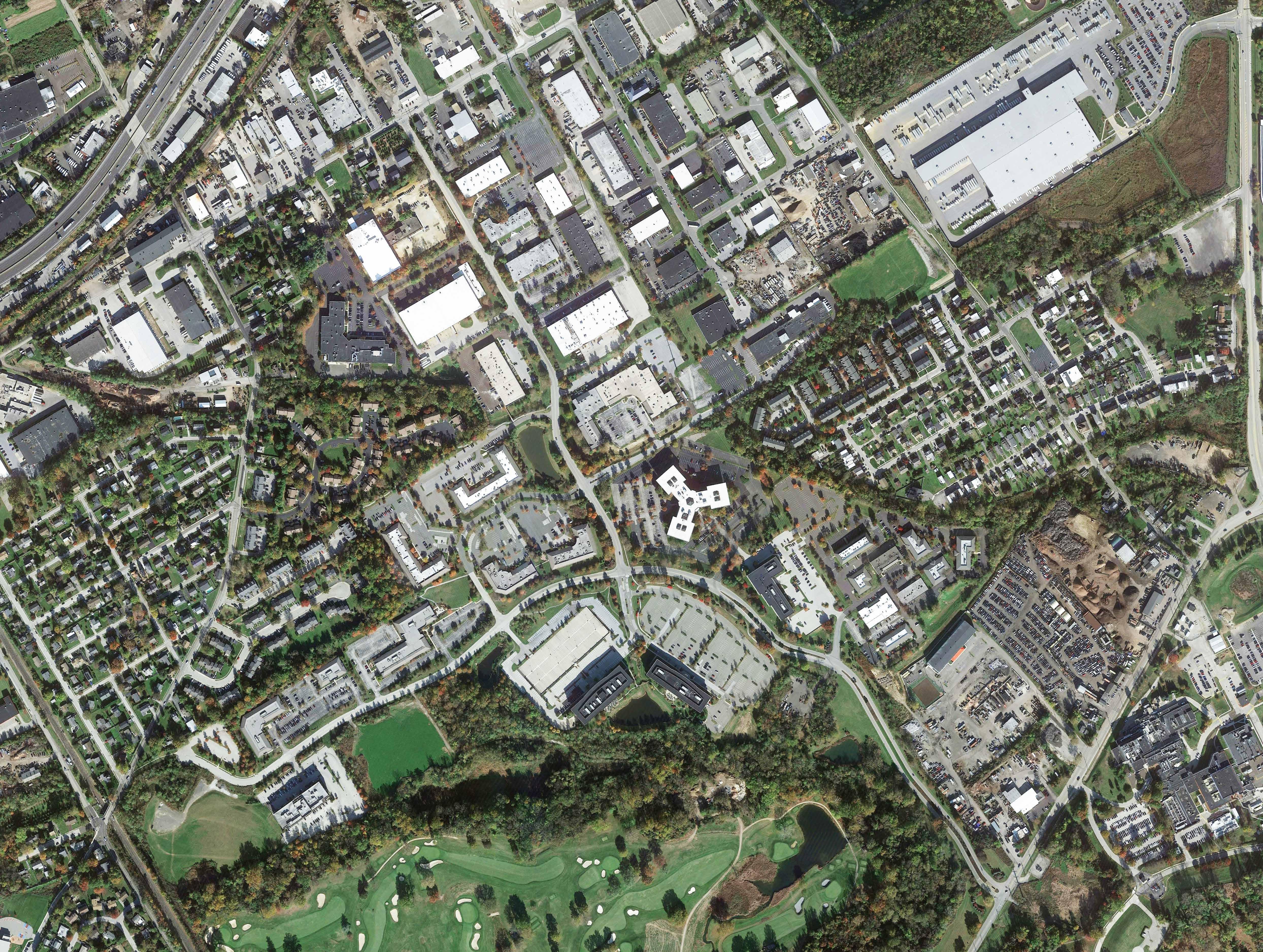
170 115 110 155 160 170 115 165 160 160 155 130 130 125 120 180 276 276 CROOKED LN KINGMANOR WALNUT HORIZONDR ECHURCHRD 0 20' 40' 60' 100' 200' North Crosswalks Wayfinding Signage Pedestrian Lighting Renaissance Park Connectivity Study Proposed Improvements Plan Legend Exisitng Proposed Upper Merion Township, Pennsylvania Renaissance Park Boundary Parcel Boundary Sidewalks Railroad Sidewalk Ramp Sidewalks Multi Use trail Bike Lane Sharrow Speed Cushion ADA Curb Ramp Rapid BeaconFlashing Raised Pedestrian Crossing Bench/Art/ Seating Space 56 MAP 1 OF 6 1 3 5 2 4 6
100 95 90 125 120 FLINT HILLRD BRENTWOOD X A VIKING WILLIAMSBURG FEHELEY U HERTZOGBLVD V GLENNIE MCCOYSLN B 0 20' 40' 60' 100' 200' North Crosswalks Wayfinding Signage Pedestrian Lighting Renaissance Park Connectivity Study Proposed Improvements Plan Legend Exisitng Proposed Upper Merion Township, Pennsylvania Renaissance Park Boundary Parcel Boundary Sidewalks Railroad Sidewalk Ramp Sidewalks Multi Use trail Bike Lane Sharrow Speed Cushion ADA Curb Ramp Rapid BeaconFlashing Raised Pedestrian Crossing Bench/Art/ Seating Space 57 Connectivity Master Plan MAP 2 OF 6 1 3 5 2 4 6

170 155 170 165 160 170 180 CROOKED LN CROOKED LN LAWNDALE WINDING TRAYMORE SCHENLEY WESTFALL BENDING PHI STOCKER FOULKROD BELLA WHITE SANCEBLVD 0 20' 40' 60' 100' 200' North Crosswalks Wayfinding Signage Pedestrian Lighting Renaissance Park Connectivity Study Proposed Improvements Plan Legend Exisitng Proposed Upper Merion Township, Pennsylvania Renaissance Park Boundary Parcel Boundary Sidewalks Railroad Sidewalk Ramp Sidewalks Multi Use trail Bike Lane Sharrow Speed Cushion ADA Curb Ramp Rapid BeaconFlashing Raised Pedestrian Crossing Bench/Art/ Seating Space 58 MAP 3 OF 6 1 3 5 2 4 6
105 100 120 115 115125 115 110 FLINTHILL X W A VIKING RD WILLIAMSBURG V A SUMMIT RENIASSANCEBLVD 0 20' 40' 60' 100' 200' North Crosswalks Wayfinding Signage Pedestrian Lighting Renaissance Park Connectivity Study Proposed Improvements Plan Legend Exisitng Proposed Upper Merion Township, Pennsylvania Renaissance Park Boundary Parcel Boundary Sidewalks Railroad Sidewalk Ramp Sidewalks Multi Use trail Bike Lane Sharrow Speed Cushion ADA Curb Ramp Rapid BeaconFlashing Raised Pedestrian Crossing Bench/Art/ Seating Space 59 Connectivity Master Plan MAP 4 OF 6 1 3 5 2 4 6
YERKES
LN HOLSTEIN TRAYMORE SCHENLEY PHILADELPHIA RENAISSANCEBLVD HUGHES PARK STATION 0 20' 40' 60' 100' 200' North Crosswalks Wayfinding Signage Pedestrian Lighting Renaissance Park Connectivity Study Proposed Improvements Plan Legend Exisitng Proposed Upper Merion Township, Pennsylvania Renaissance Park Boundary Parcel Boundary Sidewalks Railroad Sidewalk Ramp Sidewalks Multi Use trail Bike Lane Sharrow Speed Cushion ADA Curb Ramp Rapid BeaconFlashing Raised Pedestrian Crossing Bench/Art/ Seating Space 60 MAP 5 OF 6 1 3 5 2 4 6
CROOKED
185 105 100 150 145 140 135 130 125 320 SWEDELAND RD 0 20' 40' 60' 100' 200' North Crosswalks Wayfinding Signage Pedestrian Lighting Renaissance Park Connectivity Study Proposed Improvements Plan Legend Exisitng Proposed Upper Merion Township, Pennsylvania Renaissance Park Boundary Parcel Boundary Sidewalks Railroad Sidewalk Ramp Sidewalks Multi Use trail Bike Lane Sharrow Speed Cushion ADA Curb Ramp Rapid BeaconFlashing Raised Pedestrian Crossing Bench/Art/ Seating Space 61 Connectivity Master Plan MAP 6 OF 6 1 3 5 2 4 6

62
The proposed roundabout at Horizon Drive and Renaissance Boulevard will create a focal point for Renaissance Park and will be an excellent location for limited mixed use, such as restaurants and eateries 62
PROPOSED
Renaissance Blvd & Horizon Dr Traffic Circle
EXISTING

4.1.5 Multi-Modal Trails: Recreation & Multimodal Function
While bike lanes and sidewalks represent the most highly used tools for connectivity in Renaissance Park, public and stakeholder input also noted the need for off-road trails to provide connections through Renaissance Park for cyclists and pedestrians to access destinations outside of the boundaries of the Park.
An analysis of existing sidewalk infrastructure neighboring RP in Upper Merion Township has revealed that connections through RP to River Road employment centers including FedEx, Target, (and 800-900 River Road that is under redevelopment) are possible.
Two locations (Trail A and Trail B) were identified for proposed 8’10’ wide multiuse trails both inside and outside of the Renaissance Park boundaries.
The Norfolk Southern rail raight-of-way in Renaissance Park presents the most logical trail connection between Flint Hill Road and Crooked Lane. However, significant grade changes, additional property acquisition needs and stormwater challenges removed this consideration from the recommended list.
Trail A Horizon Drive to River Road
Trail A conceptual alignment takes advantage of existing (and new) sidewalk infrastructure that exists on B Street. Trail A proposes providing a connection at the terminus of B Street near the RP boundary through to Horizon Drive. Connecting the Flint Hill Road detention basin (See Section 4.3.1 below) as a multiuse recreation/ open space for the Renaissance Park community will require eliminating a sidewalk gap on Flint Hill Road to B Street. The addition of a ‘sharrow’ on B Street provides both pedestrian and cyclist access.
Design/ Construction Highlights to include:
• Design and construction of Trail A (approximately 820 lineal feet of 8’-10’-wide multiuse trail with required easement from Norfolk Southern (partial) and 2200 Renaissance Blvd (the Triad parcel)
• Completion of sidewalk gap on Flint Hill Road between the Flint Hill detention basin and B Street (approx. 585 lineal feet)
Connectivity Master Plan 63
Horizon Drive
Renaissance Boulevard
Hertzog Extension

EXISTING
• Application of a ‘sharrow’ on B Street from River Road (SR 0023) to its eastern terminus (approx.2550 lineal feet).
Providing pedestrian/cyclist access from the Hughes Park SEPTA station to two (2) major employment centers outside of the RP boundary (FedEx and the Target Distribution Center) can be accomplished with this multiuse trail. Sidewalks currently exist on Flint Hill Road at the intersection with B Street----thus providing pedestrian access through RP to a critical job center and township park.
Trail B Renaissance Boulevard: E-W Loop
Trail B would connect to the southern side of the proposed Renaissance Boulevard sidewalk near the P&F parcel (the last occupied parcel directly abutting Renaissance Boulevard). The trail will follow the King of Prussia District boundary with the Gulph Mills Golf Club before bending to join access to both the 2201 and 2301 buildings near the rear pond. The trail is proposed to then follow the northern parcel line of the 2501 Renaissance Boulevard ‘panhandle’ west to Renaissance Boulevard. Total approximate length as shown is 2600 lineal feet.
Trail B provides a great recreational trail loop within the Park to a location that is being redeveloped for residential occupancy.
4.1.6 Recommended Improvements: Acquisition and Maintenance
The Renaissance Park Condominium Association currently maintains the area 40’ from the curb lines of Renaissance and Horizon on either side. While the majority of the sidewalk improvements lie within the established right-of-way of the Township roads, easements or access agreements from specific parcel owners will be required for those sidewalks and park-let features that extend beyond those limits. The King of Prussia District, RP Condominium Association and Upper Merion Township will enter into an easement agreement since all four (4) parties are involved in construction, maintenance and programming of the improvements. Likewise, Upper Merion Township will need to approve and assume maintenance responsibilities for bike lane painted markings and crosswalks within the cartways.
64

65 Connectivity Master Plan PROPOSED Rendering of recommended roadway with sharrow treatment for the extension of Hertzog Boulevard from Flint Hill Road to Horizon Drive looking west toward the intersection with Horizon Drive. Note: Dedicated parking on the right.
PROPOSED

66 Rendering of recommended parklet treatment along Horizon Drive looking toward north-west across existing pond
66
Horizon Drive Parklet EXISTING

4.1.7 Regional Multimodal Connections to Renaissance Park
a. Chester Valley Trail (CVT) Connection
The recommended connection to Renaissance Park from the Chester Valley Trail follows the following alignment:
• From CVT intersection with South Henderson Road, proceed 525’ south on South Henderson Road.
• Cross to the south side of Church Road.
• Proceed 4,550’ along Church Road to intersection with Horizon Drive.
South Henderson Road has a 5’ existing sidewalk in the western ROW. However, transitioning from the elevated trail near the Hansen Access Road will require acquisition of approximately 340 lineal feet of trail width to Henderson Road. Available ROW width on Church Road for an off-road trail is minimal, so additional ROW will be needed here also.
b. Swedeland Road: Sidewalk between Renaissance Boulevard and South Gulph Road and Holstein Road / Trinity Lane.
Neighbor interest in connecting through and outside of RP to other Township open space and recreational amenities was strong at the public meetings. Sidewalks are recommended from the Renaissance Boulevard/ Swedeland Road intersection westward toward Gulph Mills Golf Club and continuing onto South Gulph Road to provide pedestrian access to SEPTA Gulph Mills Station. (Total length from RP: 4,900 lineal feet). Extending the sidewalk along Holstein/ Trinity provides access to the Sumner Dam Park on Gulph Creek. (Total length from RP: 4,700 lineal feet).
c. Crooked Lane: Sidewalk Gaps (DVRPC Safe Routes to Transit (SRTT) Recommendation)
The DVRPC SRTT study for Hughes Park Station recommended the extension of sidewalk on Crooked Lane. This recommendation has not yet been implemented. With the construction and opening of the pedestrian path from Renaissance Boulevard to Crooked Lane, the connection from the Renaissance Boulevard pedestrian path to Lawndale Avenue along the eastern side of Crooked Lane
Connectivity Master Plan 67
is highly recommended. The estimated length of this sidewalk connection is 565 lineal feet.
4.2 Improvement Plans
Renaissance Park Connectivity Master Plan figures are presented as part of this report. Renaissance Park is covered by six (6) map tiles with associated legends for existing and proposed multimodal features.
4.3 Open Space Recommendations
This plan considered connections within RP and external connections from RP to points beyond its immediate boundaries. Logical destinations for a walkable, mixed-use community must include open spaces with pedestrian-scale amenities. Within the pedestrian network, Renaissance Park has areas where open space enhancement with passive recreational opportunities, art, lighting and landscaping can create a beautiful, cohesive feeling for this community.
4.3.1 Flint Hill Road Basin Multi-Open Space
A 5+ acre stormwater detention facility occupies a Flint Hill Road parcel that abuts the Renaissance Park boundary. Similar to many surface detention systems, a large amount of open green space is maintained but unused except during storm events. The location of the open space creates a ‘bridge’ between the neighboring residential community and Renaissance Park. Passive recreation features (e.g mown trails) and temporary gathering spaces for events are examples of uses that could be mutually agreed-upon by the District and the property owner. NOTE: Earth disturbance activities would be strictly prohibited as they would impact the hydraulic properties of the basin.
4.3.2 Roundabout Green Space
The center of the recommended roundabout at the Renaissance Boulevard/ Horizon Drive intersection provides space for a signature artistic statement that can help create an identity for RP. The preliminary design shows an 80’ diameter which provides room for landscaping features, lighting and sculpture. 4.3.3 Parklets & Art in the Landscape
The large setbacks and extended buffers of the existing parcels in RP provide several opportunities to carve out space along the proposed pedestrian network for park-let amenities such as shade structures, seating, benches, etc. Park-lets can provide intermediate destinations for both employees and residents of the Park. Two locations have been visualized for park-let treatments in this plan.
4.3.4 Lighting
Lighting along both Horizon Drive and Renaissance Boulevard is recommended, and costs are provided in the cost estimate contained in the report Appendix. Based on the investment in multimodal infrastructure that this Plan represents, the inclusion of lighting to maximize the safe and full use of the facilities is warranted.
4.4 Renaissance Park Connectivity Master Plan: Other Recommendations
4.4.1. Review of and Amendments to UMT Zoning/ Official Map
Renaissance Park currently has three (3) zoning districts. Based on the allowable uses of the Suburban Metropolitan, Light Industrial and Commercial districts, a wide variety of allowable uses may exist as neighbors. A comprehensive review of zoning and use regulations within the Park is recommended to complement the unique location within the Township and to account for on-going development trends.
The King of Prussia Mixed-Use District enacted in Moore Park may provide a model for a zoning changes in Renaissance Park.
The multimodal improvements recommended by the Connectivity Plan serve as unifying green infrastructure within all zoning districts in Renaissance Park.
4.4.2. Public Transit: Transit Rider Support
Access to public transportation is a key quality-of-life feature for residential and commercial developments. The strong bicycle/ pedestrian infrastructure recommended by this Connectivity Master Plan support employers, employees and residents who use the public transit at nearby Gulph Mills Station and Hughes Park Station.
‘Last mile’ connections from public transit are an ever-present challenge in encouraging the use of public transit. Surveys (including the RP-GSK-Discovery Labs Stakeholder Engagement 2021) indicate that route schedules and shuttle service would encourage use of transit in accessing Renaissance Park.
The Upper Merion Rambler shuttle service (operated by the Greater Valley Forge Transportation Management Association (GVF TMA))is a very attractive Township amenity that serves the northern portion of the Township—giving access to the King
68
of Prussia Mall and Rt. 202 commercial corridor to residential neighborhoods. The Rambler once served Bridgeport Borough until financial considerations ended this service.
Recently, the Borough of Conshohocken issued a ‘request for proposals’ to consider a shuttle in the borough to service the retail/ commercial entities from the SEPTA train station and burgeoning residential population that has grown there in recent years. The ‘Conshohocken Cab’ is set to begin operations in 2024. ‘Microtransit’ options (a hybrid concept between private individual transportation and mass transit) may represent options for RP.
In summary, the support of residents and visitors to RP who do not have access to vehicles and are reliant on public transit is an important equity consideration.
4.4.3. Regional Transportation Task Force
The Renaissance Park Connectivity Master Plan brought together stakeholders from adjacent and nearby redevelopment areas, municipalities, SEPTA, Montgomery County, and the King of Prussia District who share an interest in improving all modes of transportation and circulation in and around the Renaissance Park area. The adjacent Discovery Labs expansion located on the south side of Swedeland Road, new warehouse and distribution facilities along River Road and access to the regional highway system that has evolved (poorly) in West Conshohocken Borough all point to the need for additional coordination between the counties and local municipalities who will either benefit (or not) based on how these roadways systems and ancillary multimodal connections are planned and developed.
A preliminary meeting / discussion was held with consultants to several local municipalities who are directly or tangentially involved in several local projects. This meeting clearly pointed to the need for additional and regular communication about these local transportation challenges and their regional importance and impact.
It is a recommendation of this plan that these meetings be held periodically to coordinate these mutually beneficial efforts. The King of Prussia District could play a key role in organizing this effort.
4.5 Future Design Considerations
4.5.1 Coordination with King of Prussia District Wayfinding/ Branding Signage Initiative
Future design phases of the Connectivity Master Plan must coordinate with King of Prussia District’s initiative for signage and wayfinding. Proposed signage locations should be coordinated with this plan for required trail and bike signage and branding signage.
4.5.2 Materials
Sidewalks proposed along Horizon Drive and Renaissance Boulevard are shown as 5 foot-wide concrete paths. Bike lanes are proposed as painted pavement markings. Multiuse trails are proposed as 8 foot-10 foot wide asphalt paths. Crosswalks proposed as part of the roundabout design are proposed as painted pavement markings; however decorative crosswalks at this location are encouraged as part of the placemaking purpose of the roundabout.
4.5.3 Accessibility/ Universal Design
All multimodal improvements shown for Renaissance Park in this Connectivity Master Plan must meet ADA standards for accessibility. There are additional standards which exceed ADA.
Universal Design (UD) is defined as “the design of products and environments to be usable by all people, to the greatest extent possible without the need for adaptation or specialized design” (Center for Universal Design, North Carolina State University).
Universal design is meant to be adaptable to various building types, learning environments, and communities. As RP evolves, additional concepts may apply to re-development efforts. UD is driven by five core principles:
• Equitable Use
• Flexibility in use
• Simple and intuitive
• Tolerance for Human Error
• Low Physical Effort


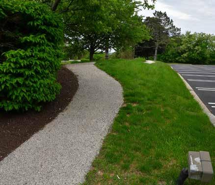
4.6 Multimodal ToolboxDescriptions & Visualizations
Based on the analysis of existing conditions, stakeholder and public comment and considering the design considerations discussed in Sections 3.2.1 through 3.2.4, the following toolbox items for multimodal connectivity in Renaissance Park include the following:
4.6.1 Sidewalks
Sidewalks are the basic transportation network for pedestrians, and probably the most familiar improvement to residents. They are a minimum of five feet wide, constructed of concrete, and located parallel and adjacent to a roadway.
Sidewalks allow pedestrians to safely move and access home, work, school, transit stops, parks, places of worship, and any other desired destinations.
While there are some existing sidewalk networks provided by RP property owners, gaps exist in a desired network that covers all Renaissance Park. Sidewalks should connect all components of the Park and be separate from bike facilities.
70 70

Connectivity Master Plan 71


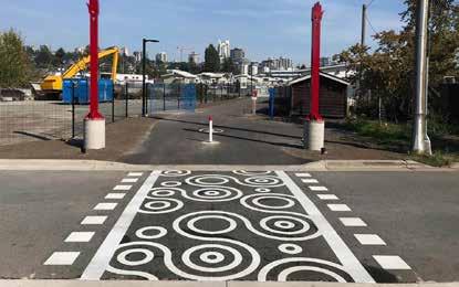
4.6.2 Crosswalks
Crosswalks can be delineated in several ways. The continental crosswalks (“piano keys or “zebra stripes”) are the most common type and highly visible crosswalks and are generally preferred by PennDOT and most regulatory agencies. Few crosswalks currently exist in Renaissance Park. The existing ones connecting existing parcel pathways are dated, fading and non-standard. Continental crosswalks are generally constructed of thermoplastic materials that are applied onto the surface of asphalt paving and are highly durable, with an effective life span of up to ten years (dependent on traffic).
In recent years, thermoplastic materials have been preferred to pavers placed in the crosswalks due to the ability for pavers to become loose from snowplows and heavy traffic. Pavers or thermoplastic materials can also be used to designate a decorative crosswalk---building on the branding themes investigated for Renaissance Park during the visioning process. Decorative crosswalks may include a color, symbol, RP logo, or pattern which further calls attention to pedestrians.
The decision to allow or not allow a decorative crosswalk will be decided in consultation with the Upper Merion Township engineer and is dependent on levels of traffic or level or service at an intersection, accident history, posted speed limit and other contextual considerations.
As the Park grows and faces re-development, crosswalks will be an important safety consideration for the growing population.

72

73 Connectivity Master Plan
Sample illustration of crosswalk along Yerkes Road, Upper Merion Township
AREA CONNECTIVITY OVERVIEW
Critical East to West Connections
Proposed Trails (A,B)
Proposed Sidewalk
Proposed Crosswalks
Exisiting Sidewalk
Proposed Sharrow Route
Proposed Bike Lane inside Renaissance Park
Proposed Sidewalk inside Renaissance Park
Renaissance Park Boundary
Revised Septa Bus Route
Exisiting Septa Station (Hughes Park)
4.6.3 Multi Use Trail
Multi-use trails, also referred to as multi-modal or shared-use trails, are designed to be inclusive and provide a safe and enjoyable space for people to walk, run, bike, rollerblade, or use other non-motorized forms of transportation. Multi-use trails are typically separated from roadways and motor vehicle traffic, offering a more pleasant and peaceful experience for users.
These trails are generally a minimum of 10 feet in width and may be designed at widths of up to 14 feet for high-volume routes. In rare instances where space is limited, trails may be installed at an 8-foot width. Such trails can be paved with asphalt or stone dust / stone screenings.
The Renaissance Park Connectivity Master Plan suggests multiuse trails as off-road connections between parcels and park-let amenities. They will be useful as connections to commercial and residential neighbors of the Park as well as to Hughes Park Station.
 TRAIL
TRAIL
B
TRAILA
HertzogBlvd
Stocker
WhiteAve
raymore Ave SchenleyAve Lawndale
LawndaleAve Horizon D r Croo ked Ln CrookedLn Yerkes Rd EChurchRd 74
Hughes Park Station FlinthillRd
RenaissanceBlvd TraymoreAve
FoulkrodBlvd BellaLane Winding Way WestfallAve
T
Ave

Target Sortation Center Fedex 800-900 River Rd Swedeland Park Former Philadelphia Inquirer Building ASt BSt WilliamsburgWay BrentwoodCt BSt WSt VikingRd U S t VSt SummitSt SwedelandRd R i v e r R d
Renai
75 Connectivity Master Plan
FrontSt
ssanceBlvd
4.6.4 Bike Lane
Bike lanes are designed to separate bicycle and vehicular traffic using pavement markings, striping, and signage. Bike lanes enable cyclists to ride at a comfortable speed without interference from traffic conditions. Design standards for bike lanes are as follows:
• Bike lanes should be provided on both sides of two-way streets.
• Bike Lane Widths without Parking: 4’ minimum (not adjacent to curb) and 5’ minimum (adjacent to curb or other obstacles).
• Bike Lane Widths with Parallel Parking: 5’ minimum to 7’ (wider bike lanes are recommended adjacent to parking areas to reduce conflict with opening vehicle doors).
• Bike lanes should be placed between the parking lane and

travel lane (this applies to diagonal and parallel parking).
• Storm Drains and Utility Covers: Bike lanes should be wide enough to accommodate bicyclists swerving to avoid obstructions.
• Bike Lane Striping: 4” to 6” solid white line (dotted lines are optional at major driveways and intersections, solid lines should be continued at all minor driveways).
• Pavement Marking: Bike Lane Symbols (MUTCD 9C -– 3).
• Bike Lane Signage: Bike Lane (MUTCD R3-17) placed at periodic intervals with either Ahead (MUTCD R3-17aP) or Ends (MUTCD R3-17bP) where appropriate.
Buffered bike lanes, also known as separated bike lanes or cycle tracks, are dedicated lanes for bicycles that are physically separated from motor vehicle traffic by a designated buffer
76
zone. This buffer zone can be in the form of a painted stripe, flexible bollards, a barrier, or a raised curb. Physical separation provides an added layer of safety, reducing the risk of collisions between cyclists and motor vehicles. This enhanced safety feature encourages more people to take up cycling as a mode of transportation, even in areas with heavy traffic.
Contraflow bike lanes are dedicated cycling lanes that allow cyclists to travel in the opposite direction of the adjacent motor vehicle traffic on a one-way street. They enhance the connectivity and accessibility of bike networks, as they provide direct routes that may be more convenient and efficient for cyclists to reach their destinations, especially in areas with limited road options. The Connectivity Master Plan shows the use of bike lanes on both Renaissance Boulevard and Horizon Drive as existing cartway widths are generous and provide ample room for this shared mode.

Rendering of recommended bike lane addition to Renaissance Boulevard looking east toward Swedeland Road
77 Connectivity Master Plan
4.6.5 Sharrow
Sharrows, short for “shared lane markings” are road markings used to indicate that a particular road or lane is intended to be shared by both cyclists and motor vehicles. Sharrows are not exclusive bicycle lanes but rather serve as a visual reminder to motorists that they should expect to encounter cyclists on that road and when they do, cyclists have the right to use the full lane.
Sharrows are proposed in RP on the Hertzog Boulevard Extension and the McCoys Lane Extension to Hertzog Boulevard.
The main purpose of sharrows is to improve safety and communication between cyclists and motorists. They help promote a sense of shared responsibility on the road and encourage cooperation and respect between different road users. By indicating that cyclists are allowed and expected to occupy the

traffic lane, sharrows can help reduce conflicts.
Sharrows are often used in situations where dedicated bike lanes are not feasible due to space constraints or road design limitations. They are commonly found on streets with lower traffic volumes and lower speeds, where cyclists and motorists are more likely to interact closely.
It is important to note that sharrows have their limitations. They are not a substitute for dedicated bike lanes or protected cycling infrastructure. In areas with high traffic volumes and faster vehicle speeds, sharrows may not provide sufficient safety for cyclists. In such cases, cities and communities should consider implementing more comprehensive cycling infrastructure to create a safer environment for all road users.
78

79 Connectivity Master Plan
Rendering of recommended roadway with sharrow treatment for the extension of Hertzog Boulevard from Flint Hill Road to Horizon Drive looking west toward the intersection with Horizon Drive. Note: Dedicated parking on the right.

4.6.6 Pedestrian Refuge Island
A pedestrian refuge island is a pedestrian safety device that is used between lanes of opposing traffic. This provides pedestrians a place of “refuge” to pause or rest when crossing busy or wide streets. Pedestrian refuge islands can take many forms - from basic islands to large expanses of pavement seen in larger urban settings. PennDOT has standards for size and use of refuge islands. Pedestrian refuge islands should be at least 6 feet wide but have a preferred width of 8’–10’. Pedestrian refuge islands may be combined with stormwater management solutions.
Pedestrian refuge islands are proposed as part of the roundabout design at the Renaissance and Horizon intersection.
80
4.6.7 Speed Cushion
A speed cushion is a raised section of pavement that calms traffic and slows speeds by providing a vertical deflection. Installed across a lane of traffic and made of rubber or pre-cast concrete, the structures provide space between the components for ease of bicycle movement and can be placed and removed. These raised platforms are constructed across the width of the road and allow drivers to pass unaffected at reduced speeds. Speed cushions are best used when approaching a pedestrian crossing and where there is an anticipation of large volumes of pedestrian traffic (near parks, open spaces, commercial destinations).
Current traffic levels in Renaissance Park do not warrant cushions, however they remain in the toolbox as an important multimodal/ traffic calming method that may be considered as traffic levels increase in Renaissance Park. (Additional development, redevelopment or vehicular road extensions between Crooked Lane and Flint Hill Road).

81 Connectivity Master Plan

4.7 Funding Recommendations
Funding sources for the multimodal improvements recommended for RP could come from a variety of agencies.
4.7.1 Upper Merion Township Act 209 Fees Updates
Traffic impact fees associated with the adopted resolution of Act 209 provides funds for needed transportation improvements in a designated area of the Township.
In updates from the UMT-TA, an update to the current service area and associated fees is planned in 2024 with the Township Traffic Impact Advisory Committee. It is recommended that the improvements noted on the plans associated with this Renaissance Park Connectivity Master Plan be incorporated into the service area plan and impact fees be adjusted accordingly. Traffic impact fees are an important source of implementation funds for Renaissance Park.
4.7.2 Grant Funding Opportunities
US Department of Transportation (DOT) – BIL (Bipartisan Infrastructure Legislation; IIJA Infrastructure Investment and Jobs Act; 2022 Inflation Reduction Act)
Multiple programs were created within the BIL and IIJA laws and supplemented by the 2022 Inflation Reduction Act that may benefit Upper Merion Township and King of Prussia District Middletown multi-modal efforts.
Safe Streets and Roads for All Grant Program (SS4A)
This program creates a new competitive grant program for “Vision Zero’’ grants for municipalities to develop Safety Action Plans.
A Comprehensive Safety Action Plan is defined as “a plan aimed at preventing transportation-related fatalities and serious injuries in a locality, commonly referred to as a “Vision Zero” or “Toward Zero Deaths” plan.” Elements of the plan include goals; analyses of crash location and community input; a data driven approach to identify projects or strategies; and mechanisms for evaluating outcomes and effectiveness; and a timeline for eliminating causes of fatalities and serious injuries.
Eligible projects include development of a plan itself; planning, design, and implementation activities to execute projects and
82
strategies. Projects are chosen based on whether they are likely to significantly reduce or eliminate transportation-related fatalities and serious injuries involving various road users, including pedestrians, cyclists, public transportation users, motorists, and commercial operators.
A successful grant application demonstrates engagement with a variety of public and private stakeholders; seeks to adopt innovative technologies or strategies to promote safety; employs low-cost, high-impact strategies that improve safety over a wider geographical area; ensures, or will ensure, equitable investment in the safety needs of underserved communities in preventing transportation-related fatalities and injuries; includes evidencebased projects or strategies; and achieves such other conditions as the U.S. DOT Secretary considers to be necessary.
In order to qualify for funding under the BIL, Upper Merion Township would need to complete an Action Plan as defined by the legislation. DVRPC is completing an Action Plan for the entire region; allowing Upper Merion to qualify for SS4A grants.
Available SS4A Funding: $5 billion over five years. The Federal share is 80% with a non-Federal 20% match required. (As of October 2023, three (3) funding rounds remain.) Applications in 2024 will open in February 2024 and be due in April/ May 2024.
https://www.transportation.gov/grants/ss4a
Federal Highway Administration: Transportation Alternatives Set-Aside (TASA)
The Transportation Alternatives Set-Aside (TASA) provides funding for projects and activities defined as transportation alternatives, including on- and off-road pedestrian and bicycle facilities; infrastructure projects for improving non-driver access to public transportation and enhanced mobility; community improvement activities; and environmental mitigation; trails that serve a transportation purpose; and safe routes to school projects. Eligible projects may include the following:
• bicycle and pedestrian facilities.
• bicycle and pedestrian education (grades K-8 only).
• conversion of abandoned railway corridors to trails.
• construction of turnouts, overlooks, and viewing areas.
• outdoor advertising management.
• historic preservation and rehab of historic transportation facilities.
• vegetation management.

83 Connectivity Master Plan

• archaeological activities.
• vulnerable road user safety assessment activities.
• stormwater management; and
• wildlife mortality mitigation.
Application periods are generally open every two to three years through a process administered by regional MPOs and PennDOT.
https://www.penndot.pa.gov/ProjectAndPrograms/Planning/ Documents/cpdm/TASA/TASA%20Statewide%20Program%20 Guidance.pdf
PA Dept. Conservation and Natural Resources (PA DCNR) Community Conservation Partnership Program (C2P2)
The Community Recreation and Conservation Program through the PA DCNR Community Conservation Partnership Program (C2P2) provides funding to municipalities and authorized nonprofit organizations for recreation, park, trail, and conservation projects. Eligible planning project types include feasibility studies, trail studies, conservation plans, master site development plans and comprehensive recreation park and open space and greenway plans.
For trail construction, DCNR prefers to fund off-road trail facilities. Additionally, applicants must show either ownership or have a trail easement in place to qualify for an implementation (construction) grant. DCNR will fund construction and rehabilitation of parks, trails, and recreation facilities.
DCNR also provides funding to acquire land for active or passive parks, trails, and conservation purposes. These projects require a 50% match, which can include a combination of cash and/or non-cash values.
Grant applications for the C2P2 program are accepted annually— usually in April. More information at: http://www.dcnr.state.pa.us/ brc/grants/indexgrantsinstruct.aspx
NOTE: The multiuse trails proposed within the Renaissance Park Connectivity Master Plan represent off-road trails that provide important links to the Circuit Trails system.
Commonwealth Financing Agency (CFA) Dept. of Community and Economic Development (DCED) Greenways, Trails, and Recreation Program (GTRP)
The Greenways, Trails, and Recreation Program (GTRP) provides funding for: public park and recreation area projects, greenway and trail projects, and river conservation projects. The program requires a minimum 15% local cash match of a total project up to a $250,000 maximum DCED share.
More information at: http://www.newpa.com/programs/ greenways-trails-and-recreation-program-gtrp/
Department of Community and Economic Development (DCED) Multimodal Transportation Fund (MTF)
The DCED Multimodal Transportation Fund provides grants to help deliver safe and reliable transportation systems and associated economic development to Commonwealth residents.
Funds may be used for the development, rehabilitation, and enhancement of transportation assets to existing communities, including: streetscape, lighting, sidewalk enhancement, pedestrian safety, connectivity of transportation assets and transit-oriented development. Grants are available for projects with a total cost of $100,000 or more and require a minimum 30% non-federal match. Grants shall not exceed $3,000,000 for any project.
84
This program is eligible to fund preliminary engineering as discrete standalone projects, with construction to be funded separately in a subsequent phase.
Applications for the Multimodal Transportation Fund are accepted annually between March 1 and July 31. All applications and all required supplemental information must be electronically submitted by close of business on July 31st for hopeful consideration at a November CFA board meeting. Please note that technical assistance will not be available after 5pm on July 29th. More information at: https://dced.pa.gov/programs/multimodaltransportation-fund/
PennDOT Multimodal Fund (MTF)
The PennDOT multimodal program seeks to improve freight and passenger mobility options; maximize benefits of capital investment in all modes of transportation; promote safety on all modes of transportation; use transportation improvements to spur economic development; and improve the effectiveness and efficiency of the transportation network. Projects eligible for funding include:
• Projects related to streetscape, sidewalk enhancement, pedestrian safety
• Transit oriented development projects
• Projects related to connectivity improvements
• Projects that coordinate local land use with transportation assets to enhance existing communities
The PennDOT Multimodal fund is federal funds administered through PennDOT and is not eligible to be matched by other federal transportation funds. The PennDOT MTF is separate from the state-funded MTF administered by PA DCED. A local match of at least 30% of the non-federal project costs is required. More information at: http://www.penndot.gov/ProjectAndPrograms/ MultimodalProgram/Pages/default.aspx

85 Connectivity Master Plan


APPENDIX

88
5.1 Upper Merion Township – Parks Map
5.2 Innovations 411-Discovery Labs -Master Plan-2022
5.3 Renaissance Park/ GSK/ Stakeholder Engagement: Visioning Study-Increased Connectivity Recommendations
5.4 Public Participation/ Stakeholder-Meeting Notes
5.5 SEPTA: ‘Bus Revolution’ Route 95 and 125 Revision to Service Maps
5.6 Vehicular Access-Roadways Plans (Narratives and Costs)
5.7 Cost Estimate

89 Connectivity Master Plan
Table of Contents
Appendix:

Connectivity Master Plan
90
5.1. Upper Merion Township-Parks Map


Renaissance Park 91
Connectivity Master Plan
92
5.2. Innovations 411/ Discovery Labs-MASTER Plan
SWEDELANDROAD(SR0320) CLOSED LANDFILL #1 CLOSED LANDFILL #2 CLOSED QUARRY #3 FORMER QUARRY AREA BLVDRENAISSANCE ON E S R OAD ( T871 )
R I VER R OAD ( S R 0023 ) BLVDRENAISSANCE I-476 29A 30 28 29 22 23 21 24 26 27 25 51 36 53 20 32 39 37 34 49 31 --NOV -0-NOVA ON-657--02694-F RC 58-694-02-- - ---- - -- - -- - -- - ----GA I- AYOX F ET S F R T S R 0R I NET LEA E BLE A E 80 640 SF OO P I T 25 200 S RO S A E 118 440 SFS OR B I D NG #1 HAS 1 ET LE S A L R A 92 160 SF FOOT R N 28 80 S G OSS AR A 135 360 SF 4T RY U L ING #2 PHA E 1 2 ET LE S F R T S R 600I I NET LEA EA LE A EA 92 160 F FOO P T 28 800 S G OSS A E 35 360 SFST R BU D NG #4 HASE 4 E LE S A LE R A 92 160 S FOOT R N 28 800 SF GR S R A 135 36 SF 4T Y UIL ING #3 PHA E 2 3 5-LEVELS PARKINGGARAGE'A' PHASE2 5 NETLEASEABLEAREA 115200SF FOOTPRINT 36000SF GROSSAREA 169,200SF4-STORYBUILDING #5 PHASE3 60 ET LEA EABLE AREA 115 200 SF FOOTPRINT 3 000 SF GR SS A EA 169 200 SF 4TO Y BUILD NG #6 PHASE 4 NET LEA EA LE REA 115 200 SF FOOTPRINT 36 000 SF GRO SS A EA 169 200 SF 4STO Y BUILD NG #7 HASE 4 7 6 4-LEVELS PARKINGGARAGE'B' PHASE4 A LE R 42 240 SF 13 200 R SS A 52 800 SFU 4-LEVELS PARKINGGARAGE'C' PHASE4 10 NET LEASEABLE AREA=103,065 SF FOOTPRINT=32,208 SF GROSS AREA=128,832 SF 4-STORY BUILDING #10 PHASE 9 NET LEASEABLE AREA=90,182 SF FOOTPRINT=28,182 SF GROSS AREA=112,728 SF PHASE SWM 4-LEVELS PARKINGGARAGE'D' PHASE6 80' PEDEST IANBRIDG 2 L OR NETLEASEABLEAREA=98,080SF FOOTPRINT=30,650SF GROSSAREA=144,055SF 4-STORY 2-LEVELS PARKINGGARAGEE PHASE5 11 ROAD 'B' 4-LEVELS PARKINGGARAGED 2ND FLOOR R&D 1ST FLOOR WAREHOUSE FOOTPRINT= 79,550 SF 2-STORY 2ND FLOOR R&D 1ST FLOOR WAREHOUSE FOOTPRINT= 80,000 SF 2-STORY 14 13 12 FOOTPRINT 48200SF 2-STORY 2ND FLOOR R&D 1ST FLOOR WAREHOUSE FOOTPRINT= 105,750 SF 2-STORY 15 ROAD'A 2ND FLOOR R&D 1ST FLOOR WAREHOUSE FOOTPRINT= 82,000 SF 2-STORY (460 FOR WEST CONSH.) (252 FOR UPPER MERION) 3-LEVELS PARKING GARAGE 'F' SWM SWM SWM SWM SWM DISCOVERY LABS SKETCH PLAN JUNE 29, 2022 22-06602 1" = 150' 0 150 300 450 600 150 75 MONTGOMERY COUNTY, PENNSYLVANIA UPPER MERION & WEST CONSHOHOCKEN BOROUGH THE DISCOVERY LABS AT 411 SWEDELAND ROAD GRAPHIC SCALE 1-800-242-1776 P E NNSYLVANIAONECALLSYSTEM,I N C B ORE STOP-CALL EF YOUDIG! Plotted By Schmuckler Q:\CAD\06602_Innovation\OUT\211210_All Improvement\00_Proposed Layout.dgn OF 1 SCALE: DATE: DRAWING NO. SHEET: NO. DATE REVISIONS CHECKED: DRAWN: DESIGNED: DATE SIGNED: MMT THOMPSON MARK M. www.taylorwiseman.com ENGINEERS SURVEYORS SCIENTISTS / / Taylor Wiseman & Taylor 5 VALLEY SQUARE, SUITE 100, BLUE BELL, PA 19422 TELEPHONE: (267) 956-1020 FAX: (267) 956-1019 ENGINEER NO. PE073278 PA. PROFESSIONAL 1 40 160 40 80 THE CONTRACTOR AND/OR OWNER SHALL BE RESPONSIBLE FOR LOCATING ALL EXISTING STRUCTURES AND UTILITIES, WHICH HE DEEMS NECESSARY, BOTH ABOVE AND BELOW THE GROUND SURFACE BEFORE HEAVY EQUIPMENT ENTERS THE CONSTRUCTION SITE. FINAL INQUIRIES TO PENNSYLVANIA ONE CALL SYSTEM INC." (PHONE #: 1-800-242-1776) SHALL BE MADE BY THE CONTRACTOR AND/OR OWNER WITHIN SEVEN (7) DAYS OF ENTERING THE SITE. THE CONTRACTOR AND/OR OWNER SHALL COORDINATE AND VERIFY THE METHOD OF UTILITY LOCATION WITH THE APPROPRIATE UTILITY COMPANIES. IN GENERAL, THE VERTICAL DESIGN OF PROPOSED GRAVITY UTILITIES, AS SHOWN, ARE INFLUENCED BY THE EXISTING GRAVITY UTILITIES ONLY, WHICH MAY NECESSITATE THE RELOCATIONS OF OTHER UTILITIES. UTILITY LOCATIONS SHOWN ON THE PLANS ARE APPROXIMATE, AND BASED ON EXISTING INFORMATION RECEIVED FROM UTILITY COMPANIES. JB JS 93
JONESROAD(T-871)
5.3. Renaissance Park/ GSK/ Discovery Labs Stakeholder Engagement Study (2021): INCREASED CONNECTIVITY RECOMMENDATION
Connectivity Master Plan
94
Action
2.Increased Connectivity
Developing a plan for improved connectivity is a multi-step process that involves working with various partners to assess needs, assets, opportunities and infrastructure.
Increase Connectivity to Businesses, Bus Stops and Train Stations by Increasing Pedestrian Infrastructure throughout the District Sidewalk and path connectivity is inconsistent throughout the study area. During engagement meetings, mapping was presented to demonstrate where targeted sidewalk installation could dramatically increase connectivity
Signalize Renaissance Blvd. and Horizon Drive
Intersection
A signalized intersection at this location would help calm traffic, reduce traffic speeds (ignoring the stop signs) through the intersection and help create a central focus point for the sub-district.
•As part of the proposed landscape master plan, add to the scope of services design work to create a pedestrian connectivity plan with recommendations that can be phased incrementally over time.
King of Prussia District + Upper Merion Township + Property Owners Next
•Retain consulting firm to produce a General Access and Circulation Study that includes preliminary design and engineering plans for the signalized intersection, including accommodations for pedestrian crossings.
King of Prussia District + Property Owners $60,000$80,000
$100,000$150,000
highmediumlowshortmidlong
Add Crosswalks at Main Intersections and Bus Shelters
Connectivity (sidewalks and paths) is limited between the bus shelters to area businesses. Strategic sidewalk and crosswalk installation could dramatically increase connectivity
•As part of the proposed landscape master plan, add to the scope of services design work to increase pedestrian connectivity between the bus shelters and area businesses with recommendations that can be phased incrementally over time.
King of Prussia District +
Upper Merion Township + Property Owners
$60,000$80,000
Increase Main Road Connections into the
District – Crooked Lane and Other Potential Locations
Increase Connections into The Discovery Labs Site & Extend Renaissance Blvd
Across Swedeland Road to Connect with River Road
Expand the connector Shuttle service to Renaissance Park, GSK and the Discovery Labs
A physical road connection extending Renaissance Blvd. to Crooked Lane has been proposed in the past. During engagement session, the Stantec team was informed that access to the empty redevelopment site where the connection could exist has had past approval to have a curb cut on Crooked Lane. This proposal is unpopular with adjacent residents.
Increasing connectivity points into the Discovery Labs site is a longer term project as redevelopment plans for the existing facility are underway. Extending Renaissance Blvd. across Swedeland Rd. to the sites major interior connector has been discussed in the past and the Property owner is in negotiations with PECO for a land swap to accomplish this connection.
Stakeholders, Property Owners and the King of Prussia District engaged in conversations about this expansion during the engagement sessions.
•
• Retain consulting firm to produce a General Access and Circulation Study that includes this new hypothetical intersection in concert with traffic movements and counts for the other entry locations into the sub-district - E. Church Road/ Horizon Drive, and Renaissance Blvd./ Swedeland Road. Include movements and counts on rear access drive to E. Church Road.
King of Prussia District + Upper Merion Township + Property Owners
Initial design and engineering for this project could be completed as part of the General Access and Circulation Study mentioned above. The work could include a conceptual site redevelopment study for the Discovery Labs site to make infrastructure and connectivity recommendations for phased development over time. King
•Ongoing - continued conversations between
PARK, GSK, AND DISCOVERY LABS STAKEHOLDER ENGAGEMENT 19 Description Partners + Collaborators Cost Range
RENAISSANCE
Timeline
of Prussia District + Upper
Township + Property Owners (PECO, MLP Ventures) $100,000$150,000 $100,000$150,000
Merion
King of Prussia
Property Owners King of Prussia District + Property Owners N/A
District and
Level of Support from Stakeholders
E
Steps
B C D
F
A
Increasing Connectivity

Currently Renaissance Park only has two entrances connecting its two major roadways – Renaissance Blvd. and Horizon Drive (shown in orange). There is a secondary network of minor connections through and behind properties that front Horizon Drive, at the northern end of the business park (shown in pink). These connections begin to set up a grid and give some entry/exit alternatives for tenants and visitors. Two potential major connection alternatives are illustrated on the diagram (shown in cyan). These new entry points would expand options for tenants and visitors to enter Renaissance Park and create new opportunities for branding and increasing identity and awareness of the sub-district.
A patchwork of sidewalks and trails (shown in light blue) offer some pedestrian connectivity and options for outdoor recreation. A series of sidewalk/path infill section (shown in lime green) at gaps in the network could create a fairly complete network of trails and paths connecting businesses and increasing opportunities for pedestrians hoping to walk through the sub-district, to the existing bus shelters, or to the nearby SEPTA Hughes Park Train Station.

12 STANTEC | KING OF PRUSSIA DISTRICT
Downtown Tucson Infrastructure Improvements Tucson, Arizona Action Item 4E - Add Street Lighting Action Item 2D - Increase Main Road Connections into the District – Crooked Lane and Other Potential Locations Action Item 2A - Increase Connectivity to Businesses, Bus Stops and Train Stations by Increasing Pedestrian Infrastructure throughout the District Action Item 2B - Signalize Renaissance Blvd. and Horizon Drive Intersection Action Item 2C - Add Crosswalks at Main Intersections and Bus Shelters 4 3 2 1 Improve Bus Shelters 1 1 2 2 3 4 4


areas have
Action Item 2C - Add Crosswalks at Main Intersections and Bus Shelters


CNIP Yellowstone-Zebulon -Charlotte, North Carolina

Danville US Route 2 Reconstruction Danville, Vermont
Respondents answers to the survey when asked what route the typically follow to enter Renaissance Park, Discovery Labs, or GSK are below. The results show a fairly even distribution of traffic surrounding the sub-district to its main entry points. ANSWER CHOICES
1. East along E Church Road to Horizon Drive
2. North along Crooked Ln. then East along E Church Road to Horizon Drive 1.69% 1
3. South along Crooked Ln. then East along E Church Road to Horizon Drive
4. South along Flinthill Rd. then West along E Church Road to Horizon Drive 0.00% 0
6
5. North along Flinthill Rd. then West along E Church Road to Horizon Drive 3.39% 2
6. South along Flinthill Rd. then West along Swedeland Rd. to Renaissance Blvd., GSK or the Discovery Labs
7. South along River Rd. to GSK
8. South along River Rd. then West along Swedeland Rd. to Renaissance Blvd., GSK or the Discovery Labs
9. North along River Rd. to GSK or West along Swedeland Rd. to Renaissance Blvd. or the Discovery Labs
10. East along Swedeland Rd. to the Discovery Labs, Renaissance Blvd. or GSK 13.56% 8
11. North along Holstein Rd. then East along Swedeland Rd. to the Discovery Labs, Renaissance Blvd. or GSK 13.56% 8
0
1
DISCOVERY
STAKEHOLDER ENGAGEMENT 13
RENAISSANCE PARK, GSK, AND
LABS
Some
sidewalks and paths, while other areas do not which impedes pedestrians hoping to walk through the sub-district, to the existing bus shelters, or to the nearby SEPTA Hughes Park Train Station.
RESPONSES
37.29%
22
10.17%
1.69% 1
0.00%
1.69%
20.34%
12
Increasing Connectivity
The existing roadways are wide enough to accommodate cyclists and pedestrians without any road widening. The sections on the right illustrate options for accommodating cyclists and pedestrians within the existing roadway, adding new sidewalk along the roadway, and include options for on street parking. Street lighting and pedestrian lighting (Action Item 4E) are also illustrated, but the sub-district would need to become more of a 24/7 live work destination before those alternatives would be feasible to implement.
Extending Renaissance Blvd. to River Road (below) would both increase access options for the Discovery Labs site as well as tie Renaissance Park, Discovery Labs, and GSK together as a more cohesive district.


14 STANTEC | KING OF PRUSSIA DISTRICT
Action Item 4D - Restripe Renaissance Blvd. And Horizon Drive to Accommodate On Street Parking, Cyclists and Pedestrians Action Item 2E - Increase Connections into The Discovery Labs Site & Extend Renaissance Blvd Across Swedeland Road to Connect with River Road 1 1
5.4. Public Participation: MEETING NOTES
• Public Meeting #1-June 13, 2023
• Public Meeting #2-June 21, 2023
• Stakeholder meeting-September 20, 2023
• Key Person Meeting-September 27, 2023
• Public Meeting #3-March 13, 2024
Connectivity Master Plan
99
M EETING NOTES
Project : King of Prussia Renaissance Park Connectivity Master Plan
Location : Conshohocken Brewery / Tap Room
Re: Public Meeting 1
ATTENDEE LIST:
Project No . : 2 3 0 0 6 .10
Meeting Date / Time : 0 6 . 13 .2 3 1 :00 – 2:3 0pm
Issue Date: 0 6 .15.2023
Simone Collins : Pete Simone , Anita Nardone, Geoff Creary, Liz Krohn
King of Prussia District : Eric Goldstein, Chris Basler , Rachel Ammon
Community:
• Mark Vondra
• Kevin Kyle
• Tom Dolley
• Mike Reid
• Vicki Walsh
• Patti Erickson
MEETING SUMMA RY :
P RESENTATION
• Geoff Hickman
• Xavier Riva
• Brian Keaveney
• Tom Puhl
• Ken MacDougall
• Cindy Monyek
Chris Basler of the King of Prussia District and Pete Simone (PS) , Anita Nardone (AN), and Geoff Creary (GC) of Simone Collins (SC) led the group through a brief presentation which included the following elements:
• Project to Date – led by Chris Basler
o 2021 Stantec Report - Renaissance Park, GSK, and Discovery Lab Stakeholder Engagement Stakeholder Engagement: Ideas and Actions for the Future
https://issuu.com/kingofprussiadistrict/docs/final_documents_kop_renaissance _gsk_discovery_revi
100
o Renaissance Park branding, improvements, gateways, signage, public spaces and events
• SC and TPD (Traffic Planning & Design) Team and Experience
• Project Scope
• Project Schedule
• Data and Inventory – relevant existing plans
o Upper Merion 2040 Comprehensive Plan
o Hughes Park Station: Improvements for Station Area Access
o 2021 Stantec Report - Renaissance Park, GSK, and Discovery Las Stakeholder Engagement Stakeholder Engagement: Ideas and Actions for the Future
o DII – Exterior Signage Designs for Renaissance Park
• Existing Conditions: A Site Tour
• Study Area Mapping – Site Context and Conditions
• Trails 101 – A multi-modal primer potential tools
o User groups, Guides, Improvement Toolbox
• Next Steps
o Wikimapping - https://qrco.de/Renaissance-Park-Wikimap
o Next Public Meeting – July 21, 2023 at 6pm
DESIRED ROUTE S, DESTINATIONS & CHALLENGES
SC led the attendees through interactive discussion about desired routes, destinations, and challenges within and around Renaissance Park. Below are images of the corresponding boards with annotations from the public, summarized topics that were discussed , comments for the desired routes, destinations, and challenges, as well as other respo nses gathered dur ing this exercise.
BOARDS : Please see a c companying presentation for the maps presented to assist with meeting discussion.
TOPICS :
• Church Road has sidewalk gaps – a call to fill the gaps
• Discussions with the adjacent golf course for a possible trail connection
• Use the quarries for trail connections
• Connect Hertzog Boulevard to Horizon Drive
• Upper Merion Township is looking for several connections
• Use basin area?
• Connections on private property
• ADA access to Septa, Hughes Park Station
• Existing railroad right-of-way
• Connect Crooked Lane residents to Renaissance Park
• Project team to consider the impact on neighboring residents when planning improvements
101
DESIRED ROUTES
Trails
• Tom Puhl from Patriot Grounds & Site Services and who is responsible for Renaissance Park site maintenance, asked if SC has talked to the owners of the golf course adjacent to Renaissance Park.
o SC responded that it was a great suggestion.
o Tom owns a property to the east of 2201 Renaissance Boulevard. He proposed a trail through the wooded area on his property that connects to Swedeland Road. The rest of the land that the trail would go through is owned by the golf course and is unusable to them. Tom has tried reaching out to the owner of the golf course in the past and has not been able to reach them.

102
o PS suggested a sidewalk connection along the golf course on Swedeland Road.

• Mike Reid from MLP Ventures suggested Quarry 3 for a trail connection.
o Mike Reid also mentioned that while MLP Ventures does not own Quarry 3, they own Quarry 1 (2901 Renaissance Blvd) and Quarry 2 (2501 Renaissance Blvd).
103
• Mike Reid also suggested a trail that would run from River Road along an existing stormwater basin to connect with Flint Hill Road. From there the trail could connect to Horizon Drive by either a trail that runs parallel to Hertzog Road or a trail that runs parallel to Brentwood Drive. Tom Puhl knows the owner of the stormwater basin near River Road and would be able to connect the SC team.

• Geoff Hickman, UMT Public Works Director and liaison for Upper Merion Township Transportation Authority, suggested a trail through the old rail line if an easement could be acquired.
o GC agreed that the land should be utilized for a trail.
o Patti Erikson does not know of anyone who uses that old rail line to walk into Renaissance Park currently.
• An attendee suggested a walking trail from Hughes Park along Crooked Lane to Renaissance Park.
o Patti Erickson from the Hughes Park Civic Association mentioned that people use the paved Renaissance walkway off Crooked to enter Renaissance Park. She is hesitant to suggest that as a pathway because she does not know if the residents who live along there would be comfortable with a trail there.
104
Roads
• Geoff Hickman said there is a lot of development pressure in the area. He suggested an extension from Hertzog Blvd to Horizon Drive to alleviate vehicular traffic. This potential route is currently being studied by the Upper Merion Township Transportation Authority. SC will coordinate with UMT TA to understand current planning on this item.

• Geoff also suggested an additional connection between Flint Hill Road and River Road further to the north, possibly through McCoys Lane, which is currently a private road for quarry use only.
• An attendee mentioned a road connecting Crooked Lane to Renaissance Park since drivers currently have to drive north on Crooked Lane to Horizon Drive in order to enter Renaissance Park. This was particularly in reference to future residents once the multifamily building is constructed at 2901 Renaissance Blvd.
DESTINATION S
• An attendee mentioned that Hughes Park Station is not handicap accessible. She suggested a tunnel on the east side of Crooked Lane.
o GC responded that because the land around the station is so steep it is difficult to overcome design wise. He continued to say that SC could make design recommendations but to determine feasibility a separate study would have to be conducted.
o Cindy Monyek mentioned that Septa had considered replacing the station with a new one further to the west where the required accessibility requirements could be met.
• Mike Reid mentioned that MLP Ventures has businesses in Swedeland as well as Renaissance Park and would like to see a connection between the two areas.
105
CHALLENGES
• An attendee said Church Road has sidewalks in some areas, but most of the road is without sidewalks. Currently she walks in the street. She wants the road to have a continuous sidewalk.
• An attendee mentioned that it is difficult for pedestrians to walk along the driveway leading to “Renaissance Commons”, which is the first driveway on the right along Renaissance Blvd when traveling from Swedeland Road. He elaborated that the driveway is steep, pedestrians have to walk in the street, and that pedestrians are unable to see cars coming around the corner. Since that property is anticipating re-development, connecting it into any ped/bike system in Renaissance Blvd. is important.
o PS responded that the property owner could grant an easement to make it a public way.

• Geoff Hickman said that the intersection of Crooked Lane/ Yerkes/ Holstein is dangerous because there is a double stop sign that causes confusion. He suggested passive traffic calming measures here, such as bump outs. He also said the length restrictions for commercial trucks traveling on Crooked Lane that pass through the intersection are not observed. A resident agreed that trucks are a problem at this intersection.
• A resident expressed concern about sightlines on the roads, especially on the bridges, including the new East Church Road bridge. Currently the crown of the bridge does not allow drivers to see oncoming traffic.
ADDITION AL COMMENTS
• PS told the attendees that there is a trend of office buildings being retrofitted to residential. He guesses that this trend will be seen at Renaissance Park as some offices consolidate. If some commercial is added to the intersection of Renaissance Blvd and Horizon Drive, as recommended in the Stantec report, those businesses would be more viable if some offices are converted to residential.
• AN reminded the group that amenities were important to the employees at Renaissance Park as indicated in the Stantec survey.
106
o PS asked the attendees where they thought parklets and event space (like a civic plaza) could be added.
• Patti Erickson from the Hughes Park Civic Association wants SC to think how residents will be impacted by any future improvements. She gave an example of the lighting of the entrance sign at Yerkes Road and Crooked Lane. It was too bright for residents; the KoP District was advised and had the lighting dimmed.
NEXT STEPS :
• Anita asked attendees to give their input via the project Wikimap
o https://qrco.de/Renaissance-Park-Wikimap
• Geoff Hickman said Upper Merion Township Transportation Authority meets once a month and that he can get SC on the agenda for the next meeting on July 12 at 7pm.
• Next Public Meeting 2 (repeat of PM1 presentation) – July 21, 2023 at 6pm
This report represents the Professional’s summation of the proceedings and is not a transcript. Unless written notice of any correction or clarification is received by the Professional within ten d ays of issue, the report shall be considered factually correct and shall become part of the official project record.
Sincerely,
SIMONE COLLINS, INC. LANDSCAPE ARCHITECTURE Elizabeth Kr ohn , MLA Project Landscape Architect
107
M EETING NOTES
Project : King of Prussia Renaissance Park Connectivity Master Plan
Location : Conshohocken Brewery / Tap Room
Re: Public Meeting 2
ATTENDEE LIST:
Project No . : 2 3 0 0 6 .10
Meeting Date / Time : 0 6 . 2 1 .2 3 6 :00 – 7:3 0pm
Issue Date: 0 6 . 2 7 .2023
Simone Collins : Pete Simone , Anita Nardone, Geoff Creary, Liz Krohn
King of Prussia District : Eric Goldstein, Chris Basler
Community:
• Sam Halaby
• Michele Halaby
• Rob Erickson
• Patricia Burris
• Matt Popek
MEETING SUMMARY :
P RESENTATION
• Vivian Peikin
• James Johnson
• Pamela Rendé
• Jane Downey
Chris Basler of the King of Prussia District and Pete Simone (PS) , Anita Nardone (AN), and Geoff Creary (GC) of Simone Collins (SC) led the group through a brief presentation which included the following elements:
• Project to Date – led by Chris Basler
o 2021 Stantec Report - Renaissance Park, GSK, and Discovery Lab Stakeholder Engagement Stakeholder Engagement: Ideas and Actions for the Future
https://issuu.com/kingofprussiadistrict/docs/final_documents_kop_renaissance _gsk_discovery_revi
o Renaissance Park branding, improvements, gateways, signage, public spaces and events
• SC and TPD (Traffic Planning & Design) Team and Experience
• Project Scope
108
• Project Schedule
• Data and Inventory – relevant existing plans
o Upper Merion 2040 Comprehensive Plan
o Hughes Park Station: Improvements for Station Area Access
o 2021 Stantec Report - Renaissance Park, GSK, and Discovery Las Stakeholder Engagement Stakeholder Engagement: Ideas and Actions for the Future
o DII – Exterior Signage Designs for Renaissance Park
• Existing Conditions: A Site Tour
• Study Area Mapping – Site Context and Conditions
• Trails 101 – A multi-modal primer potential tools
o User groups, Guides, Improvement Toolbox
• Next Steps
o Wikimapping - https://qrco.de/Renaissance-Park-Wikimap
o Next Public Meeting – November 16, 2023
DESIRED ROUTE S, DESTINATIONS & CHALLENGES
SC led the attendees through interactive discussion about desired routes, destinations, and challenges within and around Renaissance Park. Below are images of the corresponding boards with annotations from the public, summarized topics that were discussed , comments for the de sired routes, destinations, and challenges, as well as other responses gathered dur ing this exercise.
BOARDS : Please see accompanying presentation for the maps presented to assist with meeting discussion.
TOPICS :
• Pedestrian and cyclist connections and safety
o Within Renaissance Park
The SC Team emphasized that the primary purpose of the Renaissance Master Plan Connectivity Study was to make recommendations for increased pedestrian and cyclist safety and connectivity within Renaissance Park. This includes sidewalks, trails, cycling paths and amenities within Renaissance Park. The team could make other recommendations, but they would likely need to be a part of other studies.
o In the surrounding area
SC reiterated throughout the meeting that pedestrian and cyclist connections surrounding Renaissance Park will be explored as a part of this study. This includes connections to the Chester Valley Trail, the Schuylkill River Trail, Hughes Park, Swedeland Neighborhood, Gulph Mills, West Conshohocken, etc. Whereas the recommendations within Renaissance Park will be more detailed, the recommendations in the area surrounding Renaissance Park will be more general.
109
• Traffic
o Reduce traffic in the area surrounding Renaissance Park. Note: These issues are not a part of this study. Recommendations will be made so current issues can possibly be addressed by the township through other studies in the future.
o Maintain low traffic within Renaissance Park for pedestrian and cycling activities.
• Current and future uses within Renaissance Park
o Includes: offices, Bio Tech, commercial, residential, and recreational spaces.
• Public safety
DESIRED ROUTES
• Pam Rendé is a part of the Gulph Mills Civic Association. She strongly supports roadway improvements/ traffic improvements that would get people into Renaissance Park without causing the traffic intrusion and snarls that occur in residential neighborhoods.
• Pam wondered if access to Renaissance Park from Gulph Mills, Gulph Mills Station, and neighborhoods south of Renaissance Park were being considered for the study. She was concerned because of the current lack of access to Renaissance Park and that even to access Renaissance Park from Gulph Mills requires traveling on busy state roads. She is also concerned in particular about the intersection of Jones Road, Holstein Road and Swedeland Road.
o AN responded reiterated that the scope is Renaissance Park itself, but that SC recognizes that Gulph Mills Station in particular is an important destination outside of Renaissance Park and will provide recommendations for connections there and to the the surrounding area.
o GC added that in the final report, the detailed recommendations will be within Renaissance Park, whereas more general recommendations will be included for the surrounding area.
• Pam suggested including the 330 Exit from the Schuylkill Expressway as a part of the study since much of the area’s traffic coming from the east comes through that exit.
o PS mentioned that SC will recommend an off-road trail connection to be built on the Gulph Mills Golf Course property that is adjacent to Swedeland Road (Rt. 320) as a means of connecting Renaissance Park to the Gulph Mills Station. This would be dependent on getting an easement from the golf course.
• AN reminded the attendees that the Stantec report analyzed which directions people take to access Renaissance Park and that SC will utilize that information.
• Chris referenced other projects the King of Prussia District is currently working on that will provide more pedestrian and cyclist connections in the area. Some of these projects include the Moore Road Linear Park and a trail connecting Valley Forge National Park to the Village of Valley Forge.
• Pam mentioned that Upper Merion Township owns the 5 acres of Sumner Dam Park, which is southeast of Renaissance Park behind Discovery Labs. She said that could be a possible future connection between Renaissance Park and the Schuylkill River Trail.
110
DESTINATIONS
• A few attendees mentioned the current and future uses of Renaissance Park and wondered what kind of destination it is.
o PS mentioned that though Renaissance Park is primarily offices now, some parts of it might go to other uses in the future. Post COVID, many offices are being retrofitted for residential use. SC is looking at that possibility for other projects and is considering whether it is a good idea for the relevant townships and what the impact on traffic and services might be.
o PS emphasized that no matter what the future use of Renaissance Park will bewhether it remains primarily offices, if more biotech companies move in, or if some offices are retrofitted to residential – the scope of this study is to make recommendations for pedestrian and cyclist connections to the project area.
o PS assured the attendees what Renaissance Park will not become including: parkland (land is too valuable); a heavy industrial area; a distribution center.
o Sam Halaby and his wife Michelle live a half mile south of Renaissance Park and love to come to the Park to walk or cycle. Sam mentioned that he rarely sees cyclists in Renaissance Park. He would be for bike lanes/ paths in Renaissance Park if he had reason to believe people actually wanted to come to Renaissance Park and will use them. He is not convinced current uses make it a desirable destination.
Sam agreed with PS that cyclists will go through Renaissance Park if it was a part of the connection between the Chester Valley Trail and the Schuylkill River Trail.
PS mentioned the Conshohocken Brewery is a great destination in Renaissance Park and is a great example of how land use changes within business parks.
GC mentioned that if a bike lane or sidewalk is built, people will use them.
CHALLENGES
• Pam mentioned that to get to Conshohocken, cyclists go through Renaissance Park to Jones Road, which she identified as a dangerous intersection.
o PS said that SC will be looking at possible connections from Renaissance Park to the Schuylkill River Trail and the Chester Valley Trail so pedestrians and cyclists travel less on major roads.
• An attendee mentioned Holstein Road, a PennDot Roads near Renaissance Park, has signs that say people are not allowed to walk there.
o GC explained that the crossing does not meet regulations by PennDot’s use, but the crossing can be updated to meet PennDOT’s regulations.
111
CO NCERNS
Traffic and Pedestrian and Cyclist Safety
• Sam expressed concern about pedestrian safety with increased traffic on the roads, especially if new entries into Renaissance Park were built. He wanted to know if there were plans to route more traffic through Renaissance Park. He could generally support roadway improvements that would open up Renaissance Park for better car flow, but wants to know that it will still be safe for pedestrians.
• Sam and other attendees agreed that the roads are so dangerous in the area surrounding Renaissance Park that even though they live nearby they end up driving to Renaissance Park instead of walking or riding a bike.
o PS people walk and ride their bikes far more in European countries. He explained to the group that pedestrian connectivity is the future, and the United States is only getting started.
• Pam expressed concern about whether the study boundaries of Renaissance Park would limit other important transportation planning concerns.
o AN and GC clarified that the study can only make recommendations about items that relate to desired pedestrian/ cyclist connectivity.
• Rob Erickson expressed concerns about traffic around Renaissance Park. He mentioned that a connection between Renaissance Blvd and Crooked Lane had been fought for over 25 years as it would create a dangerous intersection. He suggested routing traffic east through Renaissance Park to connect back to Church and Henderson Roads reducing traffic through residential neighborhoods.
o GC explained that this study is about creating pedestrian and cyclist connections.
Public Safety
• The Upper Merion Township Chief of Public Safety and EMS expressed concern about the challenges of accessing people in the event of an emergency. He wanted to know if the police UTVs could use future trails to get to people in the event of an emergency. It could even be faster for the police to reach a scene via UTVs on trails than in other vehicles on the local and state roads due to the increased traffic in the area. (PS: Trail pavement sections can generally support light utility vehicles.)
o GC mentioned the old Swedeland Branch of the PA Railroad as a possible trail connection that could be useful to emergency services, but he also reminded the attendees that this study is primarily planning for sidewalks and bike lanes.
Changes to the Renaissance Park Natural Areas
• Sam Halaby values the current natural aesthetic of Renaissance Park. He questioned whether the current trails within Renaissance Park, some of which have steep slopes, will need to be changed to meet ADA regulations.
o PS said not every trail needs to be ADA accessible, but that SC will recommend ADA connections throughout Renaissance Park.
112
Narrowing of wide roads within Renaissance Park
• Some attendees were concerned with narrowing the roads within Renaissance Park.
o GC told the group that narrowing the roads will allow for bike lanes and traffic calming. Narrower roads causes drivers to slow down. Reducing lanes can only follow a traffic study that verifies volumes.
o PS gave the example of the 1st Ave Road Diet. 1st Ave used to be two lanes. The King of Prussia District did a traffic study that determined that there is not enough traffic to warrant two lanes. Now 1st Ave is one lane with a bike lane; drivers have slowed down as a result, making it safer for pedestrians and cyclists.
A DDITIONAL COMMENTS
• Sam asked what kind of influence the Renaissance Master Plan Connectivity Study will have on recommendations outside of the boundaries of Renaissance Park.
o PS said that the recommendations SC provides in this study can have influence on promoting other recommendations because they will be presented to the township. From this study, the KOP Business District can implement improvements in Renaissance Park and then the township can address other surrounding connections. It is a process and will take some time, but in his experience these recommendations usually move forward.
o Chris of the King of Prussia District concurred. He said the District can only use funding for multimodal projects within their boundaries. The good part about their studies is that other issues can be identified that need to be addressed in the future by other groups.
• Sam asked about the amount of bus shelters within Renaissance Park. He said that many of the bus shelters are located close together.
o Chris answered that shelters were updated to look nicer.
o AN added that Septa may be removing routes through Renaissance Park.
• Pam asked if pervious paving could be incorporated into Renaissance Park improvements because she is concerned about an increase in impervious surface and associated runoff for the neighboring residents
o GC responded that pervious pavement is a great concept, it is very expensive to install and maintain.
o Chris mentioned the study will also include how stormwater management best management practices (BMPs) may be integrated with trail and ped crossing concepts. ‘Linear park’ amenities (e.g. seating areas, possible passive recreation space for games; fitness, etc.) will also be investigated.
• Pam expressed that she was in favor of Upper Merion Township getting control of more open spaces for passive recreation.
• Vivian Peikin, the Upper Merion Township Zoning Board Appeals-Chair, asked for clarification about ADA accessibility on the private trails on properties within Renaissance Park.
o GC explained general ADA guidelines.
• Pam expressed concern over superfund sites within Renaissance Park. Rob elaborated that quarries 1, 2, and 3 were contaminated and that quarries 1 and 2 were capped and quarry 3
113
was excavated. Pam wanted to know if this contamination limited recreational usage at Renaissance Park.
o PS said not necessarily. It is possible to have recreational space on capped sites.
o Pam expressed interest in having the capped quarries as recreational space for Renaissance Park.
NEXT STEPS :
• Anita asked attendees to give their input via the project Wikimap
o https://qrco.de/Renaissance-Park-Wikimap
• Next Public Meeting – November 16, 2023
T his report represents the Professional’s summation of the proceedings and is not a transcript. Unless written notice of any correction or clarification is received by the Professional within ten days of issue, the report shall be considered factually correct and sha ll become part of the official project record.
Sincerely,
SIMONE COLLINS, INC. LANDSCAPE ARCHITECTURE
E lizabeth Krohn , MLA Project Landscape Architect
114
M EETING NOTES
Project :
King of Prussia DistrictRenaissance Park Connectivity Master Plan
Location : Virtual - Microsoft Teams
Re: Stakeholders Meeting
ATTENDEE LIST:
Simone Collins Landscape Architecture :
Project No .: 23006 .10
Meeting Date / Time : 0 9 . 2 0 .2 3 2 :00 – 3:0 0pm
Issue Date: 0 9 . 2 6 .2023
Anita Nardone (AN) anardone@simonecollins.com
Geoff Creary (GC) gcreary@simonecollins.com
Pete Simone (PS) psimone@simonecollins.com
Liz Krohn ekrohn@simonecollins.com
King of Prussia District :
Eric Goldstein eric@kopbid.com
Chris Basler chris@kopbid.com
TPD:
Joe Janos jjanos@trafficpd.com
115
PennDOT:
Tim Stevenson , Assistant District Engineer TSTEVENSON@pa.gov
Nidhi Mehra nmehra@pa.gov
Kevin Lewis kevlewis@pa.gov
Douglas Schmeelk
S EPTA : Harley Cooper HCooper@septa.org
Montgomery County Planning Commission (MCPC) Assistant Transportation Manager
Matthew Popek
Matthew.Popek@montgomerycountypa.gov
U pper Merion Township (UMT) Planning Commission Chair
Matthew Popek
Matthew.Popek@montgomerycountypa.gov
Upper Merio n Township Transportation Authority (UMT - TA) :
Jack Smyth Jr. jsmythjr@bolessmyth.com
DVRPC : Mgr, O ffice of Climate & Environment
Chris Linn clinn@dvrpc.org
116
MEETING SUMMARY :
P RESENTATION
Chris Basler of the King of Prussia District and Anita Nardone (AN) , and Geoff Creary (GC) of Simone Collins (SC) led the group through a brief presentation which included the following elements:
• Project to Date – led by Chris Basler
o 2021 Stantec Report - Renaissance Park, GSK, and Discovery Lab Stakeholder Engagement Stakeholder Engagement: Ideas and Actions for the Future
https://issuu.com/kingofprussiadistrict/docs/final_documents_kop_renaissance _gsk_discovery_revi
o Renaissance Park branding, improvements, gateways, signage, public spaces and events
• Project Scope
• Project Schedule
• Data and Inventory – relevant existing plans
o Montgomery County Comprehensive Plan
o Upper Merion 2040 Comprehensive Plan
o Hughes Park Station: Improvements for Station Area Access
o 2021 Stantec Report - Renaissance Park, GSK, and Discovery Las Stakeholder Engagement Stakeholder Engagement: Ideas and Actions for the Future
• Existing Conditions
• Study Area Mapping – Site Context and Conditions
• Early Design Considerations
DISCUSSIO N
UMT - TA - Jack Smyth Jr.
• Boles Smyth, an UMT-TA Engineer, is working with consultant Casey Moore from McMahon Associates on an “Alternative Transportation Plan”. The plan, for which there is no given date for a report to be released, addresses the number of TIS’s for proposed developments, which is driving the need to think comprehensively of the traffic challenges in UMT. The TA’s comments on the plan (also noted in the July 2023 presentation to the TA) are:
o Hertzog Road Extension to Horizon Drive
o McCoys Lane potential as a public road
o Renaissance Boulevard extension at 2901 to Crooked Lane
This item in particular has been met with conflict over the years, but is being reconsidered with the number of new developments in the area and the need to address the traffic in West Conshohocken.
• Jack also emphasized connections to the regional Chester Valley Trail (CVT) from Renaissance Park. He wondered if it could be a part of Henderson Road or Shoemaker Road improvements.
o GC responded that it would be ideal to connect Renaissance Park to the CVT, but that it was beyond SC’s scope of work.
• Jack and Casey would like to be part of a meeting with MLP that SC will have on 9/27/23.
117
• Jack also mentioned he discussed the Henderson Road/ South Gulph Road project with PennDOT. He also said that the Township Act 209 study is being updated with updated traffic counts to be completed Fall 2023. Traffic impact fees are another way to fund transportation improvements.
UMT Planning Commission Chair – Matt Popek
• Matt applauded the Renaissance Park planning efforts and reminded the group that it was not the township’s project, but the District’s. In particular, he mentioned that he supports more connectivity and consolidated parking within Renaissance Park and updating Renaissance Park for the 21st century.
• He noted that to accomplish the needed improvements it will take everyone on the call with consolidated efforts. He said this is especially important since the Township supervisors have been talking about formally adopting the 2019 Draft Comprehensive Plan MCPC Assistant Transportation Manager – Matt Popek
• Matt mentioned the importance of the Renaissance Connectivity study with regards to the regional traffic impact of the full development of Discovery Labs
• He also said that he would like MCPC to be involved in the discussions and improvements to the area.
PennDOT
• Tim Stevenson
o Tim mentioned that there are no PennDOT projects within the vicinity of Renaissance Park, though they will be collaborating with the Township in the Henderson Road project.
o He said typically they see projects when there is a formal application that affects a state route.
o He also mentioned that he was in favor of a roundabout at the intersection of Horizon Drive and Renaissance Boulevard.
• Nidhi Mehra
o Nidhi asked about pedestrian connections along Swedeland Road.
AN responded that SC would make pedestrian recommendations for accessing Renaissance Park.
• Kevin Lewis
o Kevin noted that the Crooked Lane Rectangular Rapid Flashing Beacon near Philadelphia Avenue has been in the PennDOT 6-0 office for review.
Septa – Harley Cooper
• Thursday, September 28th is the Montgomery County public hearing at the Norristown Library to hear comments on the revision to bus service.
• Due to the low ridership through Renaissance Park (currently 7-9 riders), the revised Route 95 will no longer travel through the Park. Instead, it will originate at the KoP Mall and use Swedeland Road to cut through to River Road and Conshohocken en route to the Plymouth
118
Meeting Mall. Service with be every 30 minutes with service up to 12 am. Septa believes the new route and timing will be very beneficial to mall workers.
• PS asked if a bus stop could be added to the entrance to Renaissance park at the intersection of Renaissance Boulevard and Swedeland Road.
o Harley said that was a good idea for connectivity and made a note of it.
• Jack Smyth asked if SEPTA would consider coming into Renaissance Park and using the proposed roundabout at Renaissance Blvd and Horizon Drive before returning to Swedeland Drive.
o Harley said SEPTA will need to use their formulas to justify the deviation after the roundabout is established. Ultimately it depends on more riders.
• Anita asked if Jen Dougherty (SEPTA Rail and Station Access planning) would be the person to ask about rail station discussion re: Hughes Park Station?
o Harley said yes.
• Current Route 95

• Future Route 95
119

DV RPC – Chris Linn
• Chris applauded the planning effort and looks forward to the technical advancement of the concepts.
• He will circulate the presentation to DVRPC staff as appropriate.
KoP District – Eric Goldstein
• Breaking Announcement: SK pharmteco (a South Korean gene therapy company) has acquired controlling interest in CBM (Discovery Labs) and is replacing MLP as the major investor in the 150 acre bio-pharma site.
• He said it is a game changer because SK has plans to create a strategic HQ location at the Discovery Labs site.
• This would impact Renaissance Park, since it has available office space and places for residential development to support the influx of jobs and people.
• Eric emphasized that THIS IS THE TIME to make every possible effort to enact ped/ bike/ and vehicular connections to prepare for the development.
Follow Up Comments
• Chris Basler to PennDOT: Chris asked if PennDOT establishes ‘how’ they would like to see connections made. He heard that PennDOT preferred the connection of Renaissance Blvd to
120
Crooked ln. He said that 2901 Renaissance Blvd – as a condition of approval – has to escrow that money for the future connection, though it does not sound like it will happen under the current political climate and the opposition from Hughes Park residents. At the conclusion of building (est. 2026), they have to build the crosswalk to connect the current pedestrian route across Crooked Ln. He asked if PennDOT 6-0 has seen these plans and if they could comment. Residents are opposed to the connection and current leadership in UMT has not chosen to advance the connection.
• Tim Stevenson: Tim said PennDOT can only ‘react’ to those plans that are brought before it as part of an application.
• Jack Smyth: Jack said development pressure (similar to what Eric G. has just announced) is building to the point where decisions have to be made. Projects like this one, 800-900 River Road, etc.
• Pete Simone: Pete said West Conshohocken should be considered in the planning as well. He said a wider shoulder or bike lanes should be considered to West Conshohocken as well as connections to the Schuylkill River Trail, not just the Chester Valley Trail.
NEXT STEPS :
• SC will continue conducting key person interviews
• Public Meeting #3 will take place on Thursday, November 16, 2023.
This report represents the Professional’s summation of the proceedings and is not a transcript. Unless written notice of any correction or clarification is received by the Professional within ten days of issue, the report shall be considered factually correct and shall become part of the official project record.
Sincerely,
SIMONE COLLINS, INC. LANDSCAPE ARCHITECTURE A nita Nardone , PE Project Manager
121
M EETING NOTES
Project :
King of Prussia DistrictRenaissance Park Connectivity Master Plan
Location : Virtual - Microsoft Teams
Re: MLP Ventures - Upper Merion
Consultants: Renaissance Park
Connectivity Master Plan
ATTENDEE LIST:
Project No .: 2 3 0 0 6 .10
Meeting Date / Time : 09.27.2023 11:00am - 12n
Issue Date: 10.02.2023
Simone Collins Landscape Architecture : Anita Nardone , PE (AN) anardone@simonecollins.com
Geoff Creary (GC) gcreary@simonecollins.com
Pete Simone , RLA, FASLA (PS) psimone@simonecollins.com
King of Prussia District :
Eric Goldstein eric@kopbid.com
Chris Basler chris@kopbid.com
TPD:
Joe Janos jjanos@trafficpd.com
122
Mc Mahon Assoc. (A Bowman Company) - (Upper Merion Traffic/Transportation Consultant) :
Casey Moore, PE cmoore@bowman.com
Brian DiBiase, PE bdibiase@ bowman .com
Boles Smythe (Upper Merion Transportation Authority Consultant)
Jack Smythe jsmythjr@bolessmyth.com
MLP Ventures
Kevin Kyle kkyle@mlpventures.com
MEETING SUMMARY :
P RESENTATION
• Chris Basler of the King of Prussia District gave brief remarks about the KoP District inclusion of Renaissance Park in 2019 and updates on the Stantec Visioning Study (January 2021 - 2021 Stantec Report - Renaissance Park, GSK, and Discovery L ab S takeholder Engagement Stakeholder Engagement: Ideas and Actions for the Future : https://issuu.com/kingofprussiadistrict/docs/final_documents_kop_renaissance_ gsk_discovery_revi
• Chris also report ed on the recent completion of median plantings along Renaissance Boulevard and wayfinding signage progress.
• Anita Nardone (AN), and Geoff Creary (GC) of Simone Collins (SC) led the group through a brief presentation on the status of the Connectivity Master Plan study which included the following elements. (Presentation attached.):
• Project Scope / Overview / Schedule/ Deliverables
• Existing Conditions
o Photos
o Base Mapping
• Current Study Focus
o Ped/ Bike Connections & Open Space Amenities
o Vehicular Movement Considerations
• Hertzog Ave Extension
• Intersection of Renaissance Blvd & Horizon Drive
• Crooked Lane near Hughes Station
• Extension of Renaissance Blvd across Swedeland
123
PARTICIPANT DISCUSSION
1. MLP Ventures Updates; Kevin Kyle
• Using the Innovations 411 Master Plan drawing, Kevin indicated that the early phases of their development included Proposed Buildings 1 & 2 (near proposed extension of Renaissance Boulevard) followed by Proposed Buildings 11& 12 in West Conshohocken.
• A POA (Point of Access) study will be required for approval looking at the regional aspects of accessing Innovations 411.
• See June 2022 TWT Overall Master Plan (attached).
• The two (2) accesses along River Road (SR 0023) and the Renaissance Blvd extension across Swedeland (SR 0320) represent the three envisioned access points.
• MLP completing a re-financing exercise
• MLP in negotiations with PECo for a land-swap to allow the extension of Renaissance Blvd across Swedeland. PECO desires the 10-12 acres at the campus center near the W. Conshohocken/ Upper Merion boundary intersection. No progress has been made on this negotiation.
• MLP has approached the Re-Development Authority of MontCo for assistance with PECo negotiations.
2. Upper Merion Traffic/Transportation Consultant: Casey Moore (McMahon/ Bowman)
• Casey commented on the elements of the RP Connectivity Master Plan but highlighted the need to talk about ‘connectivity’ locally and regionally.
• Casey highlighted the large development applications that are currently underway affecting UMT (and the region): UMT-Discovery Labs site-Owner? By Pennoni, Discovery Labs site-TPD; 800-900 River Road (Inquirer site-Kimley-Horn).
• Regional pressure experienced by West Conshohocken due to I 476
• Importance of creating alternate access points to relive the pressure
3. Upper Merion Township-Transportations Authority: Jack Smyth (Boles Smyth)
• Informed the group that UMT is developing an ‘Alternate Transportation Plan’ and sharing goals and important information on development applications with its neighbors (West Conshohocken-Brian Keaveney-Pennoni) in an attempt to keep all informed about strategic items that will advance the common goal of providing relief to the expected volume anticipated in the near future.
• The Henderson/ South Gulph Road through to Saulin project is on the TIP (future improvement funding)
• Upper Merion is planning an update to their Act 209 Traffic Impact Fee Advisory study in 2024.
4. Crooked/ Yerkes/ Holstein
• The group discussed the extension of Renaissance Blvd to Crooked which has been the subject of multiple discussions over the years.
• There is strong residential opposition to the extension; the UMT BoS have not chosen to elevate the discussion.
124
• 2901 Renaissance (300 multifamily units) currently underway with construction is proposing the ped crossing of Crooked. Chris B. noted that escrow money for the extension of Renaissance to Crooked was part of the development approval.
5. King of Prussia District: Eric Goldstein
• The resolution of the impasse with PECo needs to happen.
• As a group, taking the common goals for the ‘neighbors’ represented here (and West Conshohocken) to the political entities (Rep. Tim Briggs as a possible start) that could involve Suzanne Ryan (PECo Corp. /Gov’t Affairs) who is part of many local Boards is an important first step.
6. Conclusion
• Anita asked that the attendees review the meeting notes to be sent along with the presentation to all of the participants.
This report represents the Professional’s summation of the proceedings and is not a transcript. Unless written notice of any correction or clarification is received by the Professional within ten days of issue, the report shall be considered factually correct and shall become part of the official project record.
Sincerely,
SIMONE COLLINS, INC. LANDSCAPE ARCHITECTURE
Anita Nard one , PE Project Manager
125
M EETING NOTES
Project : Renaissance Park Connectivity Master Plan Project No . : 23006.10
Location :
Conshohocken Brewery, Horizon Drive, King of Prussia, PA
Re: Review of Renaissance Park Connectivity Master Plan- Draft
ATTENDEES :
See Attached Sign in sheet and Virtual Attendance sheet.
DELIVERABLES:
• Notes
• Presentation
• Teams Recording
NOTES:
1. Introduction: Chris Basler
• Renaissance Park-Overview
Meeting Date / Time : 0 3 . 1 3 .2024 1 :00pm - 2:30pm
Issue Date: 0 3 . 1 8 .2024
• Recent projects in Renaissance Park (Visioning Study (2021); Median Plantings; New Branding for RP Logo; New directional signage)
2. Presentation of Draft Report Recommendations
• Anita Nardone reminded the group that King of Prussia District and Simone Collins would both take comments on the presentation for incorporation into the report through March 22nd.
• Anita Nardone presented an overview of the six-month study and broke the plan/report recommendations into eight (8) categories:
o Bike Lanes
o Sidewalks
o Vehicle Entry Recommendations
Hertzog Boulevard Extension (Flint Hill Road to Horizon Drive)
River Road to Renaissance Park Considerations**
126
**Replacing an original report recommendation for extending McCoys Lane through a Township-owned parcel to Hertzog Boulevard/Flint Hill Road Intersection.
o Roundabout: Renaissance Boulevard/ Horizon Drive Intersection
o Multimodal/ Recreational Trail Connections in RP
o Zoning Considerations & Official Map Recommendation for RP Improvements
o Public Transit: Support of Transit Users
o Regional Transportation Task Force
3. Public Comment/ Questions
a. Clarification on the access from the Ren Ped path to Crooked Lane?
SCResponse:Acrosswalkandrapidflashingbeaconinstallationfromtheeasternsideof CrookedLanetothewesternsidewalknearPennsylvaniaAvenueispartofthecurrent 2901RenaissanceBoulevardconditionsoflanddevelopmentapproval. Theplan/report willaddthoseproposedimprovementstotheRPCMP.
b. Trucks Accessing the roundabout? Size of anticipated trucks?
SCResponse: Preliminarysizingoftheroundaboutbasedona120’inscribedradius allowingforWB-67 sized vehicles.
c. What are the priority recommendations of the RPCMP?
SCResponse: Sidewalksandbikelanesarethepriorities. Bikelaneinstallationsgiventhe cartwaywidthsarearelativelyeasy/inexpensivestarttoimplementingthe recommendations.
d. Why not open up Renaissance Boulevard to Crooked Lane? (If this were open, fewer cars/trucks would travel past the neighborhoods.)
e. What about more green space/ open space in/near RP?
SCResponse: ThoughoutsideofKingofPrussia District’sboundary,theFlintHillRoad detentionarearepresentsanopportunitytocreateagreenspacewithoutdisturbingthe stormwater basis of its use.
4. Conclusion: Chris Basler wrapped up the meeting reminding all about the great King of Prussia District events coming up (check the website at visitkop.com) and reminded the group that the presentation and recording would be posted to the website next week. A link to the final report expected to be posted the week of March 22nd
This report represents the Professional’s summation of the proceedings and is not a transcript. Unless written notice of any correction or clarification is received by the Professional within ten days of issue, the report shall be considered factually correct and shall become part of the official project record.
Sincerely,
SIMONE COLLINS, INC. LANDSCAPE ARCHITECTURE A nita Nardone, PE Project Manager
127

128

129
1. Summary
Meeting title Renaissance Park Connectivity Study Presentation
Attended participants 13
Start time 3/13/24, 12:37:19 PM
End time 3/13/24, 2:18:55 PM
Meeting duration 1h 41m 36s
Average attendance time 56m 42s
2. Participants
Name
Peter Simone
Rick Boyer
Brian Jones
Fabry, Donna
Vernon, Paul
Linda Quam
Konetchy, Timothy
Casey Moore
Pearl, Bettina
Bruce Hurowitz
Kevin
Brian DiBiase
Kevin
3. In-Meeting Activities
Name
Peter Simone
Rick Boyer
Brian Jones
Fabry, Donna
Vernon, Paul
Linda Quam
Konetchy, Timothy
Casey Moore
Pearl, Bettina
Bruce Hurowitz
Kevin
Brian DiBiase
Kevin
130
Routes 95 & 125
Fall 2023
Connectivity Master Plan
5.5. SEPTA: 'Bus Revolution' Draft Service Revisions
131
Route 95 (70 9)
Plymouth Meeting Mall to King of Prussia via Conshohocken
We heard you! We’ve updated the draft network, incorporating public feedback to create a bus network that is easier to use, more convenient, and more reliable.
Visit our website at septabusrevolution.com to learn more:

Here’s our updated recommendations for Route 95.

Shortened Extended More Frequent
Route 95 (709): Plymouth Meeting Mall to King of Prussia via Conshohocken
The new Route 95 would be realigned to travel from Plymouth Meeting Mall to the King of Prussia Mall via Conshohocken and Gulph Mills Station on the NHSL. Few riders used Route 95 to get from Conshohocken to Willow Grove. By extending the route to King of Prussia, the new bus route would pro vide more local connections. The new bus route would be every 30 minutes on weekdays and hourly on weekends, including Sundays.
132
Updated Proposed Schedules for Route 95:
WEEKDAYS EXISTING & PROPOSED ROUTES SERVICE SPAN 4AM 5AM 6AM 7AM 8AM 9AM 10 AM 11 AM 12 PM 1PM 2PM 3PM 4PM 5PM 6PM 7PM 8PM 9PM 10 PM 11 PM 12 AM 1AM 2AM 3AM EXISTING (RTE 95) WAS 6:09 AM TO 8:37 PM 0 0 0 81 64 55 60 62 61 60 62 63 61 61 61 70 59 0 0 0 0 0 0 0 PROPOSED (RTE 95) NOW 6:00 AM TO 12:00 A M 0 0 30 30 30 30 30 30 30 30 30 30 30 30 30 30 30 60 60 60 0 0 0 0 SATURDAYS EXISTING & PROPOSED ROUTES SERVICE SPAN 4AM 5AM 6AM 7AM 8AM 9AM 10 AM 11 AM 12 PM 1PM 2PM 3PM 4PM 5PM 6PM 7PM 8PM 9PM 10 PM 11 PM 12 AM 1AM 2AM 3AM EXISTING (RTE 95) WAS 6:32 AM TO 8:03 PM 0 0 0 61 60 63 72 60 63 61 60 60 60 60 60 0 65 0 0 0 0 0 0 0 PROPOSED (RTE 95) NOW 6:00 AM TO 12:00 A M 0 0 60 60 60 60 60 60 60 60 60 60 60 60 60 60 60 60 60 60 0 0 0 0 SUNDAYS EXISTING & PROPOSED ROUTES SERVICE SPAN 4AM 5AM 6AM 7AM 8AM 9AM 10 AM 11 AM 12 PM 1PM 2PM 3PM 4PM 5PM 6PM 7PM 8PM 9PM 10 PM 11 PM 12 AM 1AM 2AM 3AM EXISTING (RTE 95) WAS NO SERVICE 0 0 0 0 0 0 0 0 0 0 0 0 0 0 0 0 0 0 0 0 0 0 0 0 PROPOSED (RTE 95) NOW 6:00 AM TO 12:00 A M 0 0 60 60 60 60 60 60 60 60 60 60 60 60 60 60 60 60 60 60 0 0 0 0 133
Route 125 (79 8)
Valley Forge and King of Prussia to 30th St. & Market St
We heard you! We’ve updated the draft network, incorporating public feedback to create a bus network that is easier to use, more convenient, and more reliable.
Visit our website at septabusrevolution.com to learn more:
Route 125.

Simplified More Frequent Shortened
Route 125 (798): Valley Forge and King of Prussia to 30th St. & Market St.
Route 125 would become more frequent (every 30 minutes on weekdays and weekends) and operate between BNY Mellon north of King of Prussia Mall and 30th Street Station via Gulph Mills Station and Wissahickon Transportation Center. Shortening the route will allow it to operate more frequently and reliably. Many other SEPTA routes will serve passengers travelling between 30 th Street Station and Center City.
Here’s our updat ed recommendations for134
Updated Proposed Schedules for Route 125:
WEEKDAYS EXISTING & PROPOSED ROUTES SERVICE SPAN 4AM 5AM 6AM 7AM 8AM 9AM 10 AM 11 AM 12 PM 1PM 2PM 3PM 4PM 5PM 6PM 7PM 8PM 9PM 10 PM 11 PM 12 AM 1AM 2AM 3AM EXISTING (RTE 125) WAS 5:02 AM TO 12:30 PM 0 39 34 37 32 46 58 60 60 60 60 63 33 36 39 55 60 58 62 64 58 0 0 0 PROPOSED (RTE 125) NOW 5:00 AM TO 1:00 AM 0 30 30 30 30 30 30 30 30 30 30 30 30 30 30 30 30 60 60 60 60 0 0 0 SATURDAYS EXISTING & PROPOSED ROUTES SERVICE SPAN 4AM 5AM 6AM 7AM 8AM 9AM 10 AM 11 AM 12 PM 1PM 2PM 3PM 4PM 5PM 6PM 7PM 8PM 9PM 10 PM 11 PM 12 AM 1AM 2AM 3AM EXISTING (RTE 125) WAS 5:41 AM TO 11:51 PM 0 0 64 66 57 64 60 62 36 65 60 59 61 63 58 56 65 53 58 60 0 0 0 0 PROPOSED (RTE 125) NOW 5:00 AM TO 12:00 A M 0 60 60 60 30 30 30 30 30 30 30 30 30 30 30 30 30 60 60 60 0 0 0 0 SUNDAYS EXISTING & PROPOSED ROUTES SERVICE SPAN 4AM 5AM 6AM 7AM 8AM 9AM 10 AM 11 AM 12 PM 1PM 2PM 3PM 4PM 5PM 6PM 7PM 8PM 9PM 10 PM 11 PM 12 AM 1AM 2AM 3AM EXISTING (RTE 125) WAS 6:52 AM TO 11:41 PM 0 0 0 22 49 60 72 65 60 65 61 60 60 31 90 59 31 12 9 89 60 0 0 0 0 PROPOSED (RTE 125) NOW 6:00 AM TO 12:00 A M 0 0 60 60 60 30 30 30 30 30 30 30 30 30 30 60 60 60 60 60 0 0 0 0 135
Connectivity Master Plan
136
5.6. Vehicular Access: Roadways Plans, Narratives and Costs


SECTION SHEET DISTRICT 6-0 ROUTE SHEET COUNTY UPPER MERION TOWNSHIP MONTGOMERY 1 1 OF CONCEPT PLAN EXTENSION HERTZOG BOULEVARD 0 50 100 FEET EXTENSION HERTZOG BOULEVARD BOULEVARD HERTZOG HO R I Z ON D R I V E PROPOSED ROADWAY EXTENSION F E H ELE Y D R I V E LANDSCAPED AREA 5' SIDEWALK 5' SIDEWALK 5' SIDEWALK 5' SIDEWALK Est. 1989 AND DESIGN, INC. TRAFFIC PLANNING www.TrafficPD.com 1.877.873.9739 TPD@TrafficPD.com 137


SECTION SHEET DISTRICT 6-0 ROUTE SHEET COUNTY UPPER MERION TOWNSHIP MONTGOMERY 1 1 OF CONCEPT PLAN ROUNDABOUT RENAISSANCE PARK RENAISSANCEBOULEVARD RENAISSANCE BOULEVARD HO R I Z ON D R I V E 10' MULTIMODAL TRAIL 10' MULTIMODAL TRAIL 10' MULTIMODAL TRAIL 10' MULTIMODAL TRAIL 10' MULTIMODAL TRAIL 10' MULTIMODAL TRAIL ROUNDABOUT PROPOSED SINGLE LANE 5' SIDEWALK MATCH EXISTING 6' SIDEWALK MATCH EXISTING 6' SIDEWALK MATCH EXISTING 0 50 FEET 25 19' 19' 120'ICD HO RIZON DRIVE D R I V E HO R I ZON Est. 1989 AND DESIGN, INC. TRAFFIC PLANNING www.TrafficPD.com 1.877.873.9739 TPD@TrafficPD.com 138
4.1.3a Hertzog Boulevard – Horizon Boulevard to Flint Hill Road Connector
The Hertzog Boulevard Conceptual Design includes an extension of Hertzog Boulevard from Feheley Drive to Horizon Boulevard with shared arrow markings for bicycle traffic within Township property and private property consis�ng of exis�ng driveways, parking lots, and undeveloped land. The conceptual design u�lized a combina�on of Upper Merion Township design standards as well as the AASHTO Green Book: A policy on Geometric Design of Highways and Streets to determine alignment, cartway width, lane widths, minimum radii, etc. Addi�onal parking lots were included in the design to offset the loss of exis�ng parking for adjacent businesses. It is es�mated that upwards of 75% of the land associated with the proposed improvements will require Right-of-Way acquisi�on.
Next Phase Design Considerations and Needs
- Roadway Drainage Design
- Determine the affect of traffic growth on the preliminary design due to possible redevelopment associated with SK Pharmteco’s recent announcement regarding the Discovery Labs
- Horizontal and ver�cal survey along with traffic counts in order to complete detailed roadway and ADA ramp design
- Typical project dura�on for a project of this size is one year.
4.1.4 Roundabout – Renaissance Boulevard & Horizon Drive
The intersec�on of Renaissance Boulevard and Horizon Drive is currently a 4-way stop-controlled intersec�on. This concept converts the exis�ng intersec�on into a single-lane roundabout with incorporated bike lanes and mul�modal trails to improve traffic flow, traffic safety, and pedestrian safety at the intersection. An alternative design of a mini roundabout was invesgated but determined to be infeasible. The roundabout design ulized PennDOT Design Manual 2, NCHRP Report 1043, and PennDOT Roadway Construcon Standards to determine cartway widths, lane widths, minimum radii, roundabout alignment, etc. It is esmated that 20% of the land necessary for the roundabout improvements would require Right-of-Way acquistion.
Next Phase Design Considerations and Needs
-Roadway Drainage Design
-Determine the effect of traffic growth on the preliminary design due to possible redevelopment associated with SK Pharmteco’s recent announcement regarding the Discovery Labs
-Horizontal and vercal survey along with traffic counts in order to complete detailed roundabout and ADA ramp design
-Typical project duraon for a project of this size is one year.
139
Conceptual
UNIT DESCRIPTION PRICES TOTALS 1,535CYCLASS1EXCAVATION $ 55.20 $ 84,732.77 370LFSAWCUT $ 6.56 $ 2,426.72 3,196SY SUPERPAVE WEARING COURSE,1.5"DEPTH $ 16.54 $ 52,875.90 1,966SY SUPERPAVE BINDER COURSE, 2.5"DEPTH $ 23.29 $ 45,788.34 1,230SY SUPERPAVE BINDER COURSE, 4"DEPTH $ 32.33 $ 39,769.59 1,966SY SUPERPAVE BASE COURSE,6"DEPTH $ 45.13 $ 88,719.29 3,752SY SUBBASE 6"DEPTH(NO.2A) $ 20.55 $ 77,105.10 198SY PLAINCEMENTCONCRETEPAVEMENT,4" DEPTH $ 145.07 $ 28,723.42 358SY PLAINCEMENTCONCRETEPAVEMENT,10" DEPTH $ 236.61 $ 84,706.38 1,381SY MILLINGOFBITUMINOUSPAVEMENT SURFACE,11/2"DEPTH $ 7.91 $ 10,919.29 1,512LFPLAINCEMENTCONCRETECURB,8"HEIGHT $ 56.23 $ 85,013.71 717LF PLAINCONCRETEMOUNTABLECURB,TYPE A $ 58.05 $ 41,623.14 252LFROUNDABOUTTRUCKAPRONCURB $ 58.05 $ 14,629.05 405SFDETECTABLEWARNINGSURFACE $ 51.16 $ 20,721.38 98SYCONCRETESIDEWALKFORCURBRAMPS $ 171.65 $ 16,802.63 350LF 24"WHITEHOTTHERMOPLASTICPAVEMENT MARKINGS $ 11.69 $ 4,089.79 68LF 12"WHITEHOTTHERMOPLASTICPAVEMENT MARKINGS $ 6.38 $ 433.65 108LF 8"WHITEHOTTHERMOPLASTICPAVEMENT MARKINGS $ 3.17 $ 342.53 2,165LF 4"YELLOWHOTTHERMOPLASTIC PAVEMENTMARKINGS $ 1.74 $ 3,766.88 681LF 4"WHITEHOTTHERMOPLASTICPAVEMENT MARKINGS $ 2.40 $ 1,637.74 200SFPOSTMOUNTEDSIGNS,TYPEB $ 58.63 $ 11,726.78 69LF WHITEHOTTHERMOPLASTICLEGEND, "YIELDLINE",24"X36"TRIANGLE,(MIN4 TRIANGLESPERLINE) $ 78.77 $ 5,434.90 6EA WHITEHOTTHERMOPLASTICLEGEND, "BICYCLEWITHRIDER"8'-0"X4'-0" $ 634.00 $ 3,804.00 23CYTOPSOIL,FURNISHEDANDPLACED $ 141.75 $ 3,260.17 9LB SEEDING&SOILSUPPLEMENTS-FORMULAB INCLUDINGMULCH $ 134.33 $ 1,209.00
Cost
Park Roundabout
NO. KOPD.00002 DATE: 12/14/2023
Renaissance Park Roundabout SECTION TOTAL $730,262.16 Page 1 of 3 140
Estimate Renaissance
TPD
APPROX. QUANT.
UNIT DESCRIPTION PRICES TOTALS 2,829CYCLASS1EXCAVATION $ 45.31 $ 128,169.26 169LFSAWCUT $ 7.63 $ 1,289.81 0.17ACCLEARINGANDGRUBBING $ 9,000.00 $ 1,517.40 24EATREEREMOVAL $ 1,166.11 $ 27,986.65 6,307SY SUPERPAVE WEARING COURSE,1.5"DEPTH $ 12.20 $ 76,945.40 6,307SY SUPERPAVE BINDER COURSE, 2.5"DEPTH $ 18.44 $ 116,292.88 6,307SY SUPERPAVE BASE COURSE,6"DEPTH $ 34.57 $ 218,003.98 6,307SY SUBBASE 6"DEPTH(NO.2A) $ 16.88 $ 106,432.52 3,209LFPLAINCEMENTCONCRETECURB,8"HEIGHT $ 53.86 $ 172,824.87 91SYCONCRETESIDEWALK $ 212.05 $ 19,296.88 81SFDETECTABLEWARNINGSURFACE $ 52.13 $ 4,222.54 342LF 24"WHITEHOTTHERMOPLASTICPAVEMENT MARKINGS $ 11.70 $ 3,999.72 1,765LF 4"YELLOWHOTTHERMOPLASTIC PAVEMENTMARKINGS $ 1.09 $ 1,921.56 1,316LF 4"WHITEHOTTHERMOPLASTICPAVEMENT MARKINGS $ 1.88 $ 2,470.79 10EA WHITEHOTTHERMOPLASTICLEGEND, "BICYCLEWITHRIDER"8'-0"X4'-0" $ 634.00 $ 6,340.00 13SFPOSTMOUNTEDSIGNS,TYPEB $ 93.03 $ 1,162.81 76CYTOPSOIL,FURNISHEDANDPLACED $ 106.64 $ 8,104.68 30LB SEEDING&SOILSUPPLEMENTS-FORMULAB INCLUDINGMULCH $ 155.76 $ 4,672.70 Hertzog Road Extension $901,654.43 Conceptual Cost Estimate Hertzog Road Extension TPD NO. KOPD.00002 DATE: 12/14/2023 APPROX.
SECTION TOTAL Page 2 of 3 141
QUANT.
5.7. Cost Estimates
Connectivity Master Plan
142
TOTAL RECOMMENDED PLAN IMPROVEMENT COSTS 8,104,389 $ Renaissance Boulevard 1,333,950 $ Total Proposed Site Improvements 1,010,250 $ Mobilization, E&S, Stormwater Allowances 71,000 $ Construction Contingency (10%) 101,100 $ Design & Engineering (15%) 151,600 $ Horizon Drive 1,167,680 $ Total Proposed Site Improvements 884,480 $ Mobilization, E&S, Stormwater Allowances 62,000 $ Construction Contingency (10%) 88,500 $ Design & Engineering (15%) 132,700 $ Area 1 - Renaissance Park 7,200 $ Total Proposed Site Improvements 5,200 $ Mobilization, E&S, Stormwater Allowances 600 $ Construction Contingency (10%) 600 $ Design & Engineering (15%) 800 $ Area 2 - Renaissance Park 76,200 $ Total Proposed Site Improvements 57,500 $ Mobilization, E&S, Stormwater Allowances 4,200 $ Construction Contingency (10%) 5,800 $ Design & Engineering (15%) 8,700 $ Area 3 - Renaissance Park 158,350 $ Total Proposed Site Improvements 119,950 $ Mobilization, E&S, Stormwater Allowances 8,400 $ Construction Contingency (10%) 12,000 $ Design & Engineering (15%) 18,000 $ Area 4 - Renaissance Park 270,050 $ Total Proposed Site Improvements 204,450 $ Mobilization, E&S, Stormwater Allowances 14,400 $ Construction Contingency (10%) 20,500 $ Design & Engineering (15%) 30,700 $ Area 5 - Renaissance Park 167,000 $ Total Proposed Site Improvements 126,300 $ Mobilization, E&S, Stormwater Allowances 9,000 $ Construction Contingency (10%) 12,700 $ Design & Engineering (15%) 19,000 $ Area 6 - Renaissance Park 242,910 $ Total Proposed Site Improvements 183,910 $ Mobilization, E&S, Stormwater Allowances 13,000 $ Construction Contingency (10%) 18,400 $ Design & Engineering (15%) 27,600 $ Renaissance Park Connectivity Master Plan-Improvements Cost
January 2024 143
Estimate:
Roundabout: Renaissance Blvd & Horizon Drive 964,362 $ Total Proposed Site Improvements 730,262 $ Mobilization, E&S, Stormwater Allowances 51,400 $ Construction Contingency (10%) 73,100 $ Design & Engineering (15%) 109,600 $ Hertzog Boulevard Extension to Horizon Drive 1,206,014 $ Total Proposed Site Improvements 913,414 $ Mobilization, E&S, Stormwater Allowances 64,100 $ Construction Contingency (10%) 91,400 $ Design & Engineering (15%) 137,100 $ Potential Connections to RP: River Road to Hertzog Boulevard 1,848,803 $ Total Proposed Site Improvements 1,400,303 $ Mobilization, E&S, Stormwater Allowances 98,300 $ Construction Contingency (10%) 140,100 $ Design & Engineering (15%) 210,100 $ Recommended Improvements-Outside of Renaissance Park 661,870 $ Total Proposed Site Improvements 501,170 $ Mobilization, E&S, Stormwater Allowances 35,300 $ Construction Contingency (10%) 50,200 $ Design & Engineering (15%) 75,200 $ 144
Renaissance Park CMP Project #23006.10 RENAISSANCE BOULEVARD $1,010,250.00 Item Description Location Unit Unit Cost Quantity Cost Sidewalks (5') LF $ 127.80 SY $479,250.00 West of Roundabout North Side 2,300 $ 127.80 1,278 $163,300.00 South Side 800 $ 127.80 444 $56,800.00 East of the Roundabout North Side 1,050 $ 127.80 583 $74,550.00 South Side 2,600 $ 127.80 1,444 $184,600.00 Item Description Location Unit Unit Cost Quantity Cost Bike Lanes LF-Roadway $ 5.00 LF-Roadway $51,500.00 West of Roundabout North Side 2550 $ 5.00 2550 $12,750.00 South Side 2650 $ 5.00 2,650 $13,250.00 East of Roundabout North Side 2600 $ 5.00 2,600 $13,000.00 South Side 2500 $ 5.00 2500 $12,500.00 Item Description Location Unit Unit Cost Quantity Cost Lighting EA $ 3,500.00 1/75 LF $479,500.00 North Side Renaissance Boulevard $ 3,500.00 65 $227,500.00 South Side Renaissance Boulevard $ 3,500.00 72 $252,000.00 145
Renaissance Park CMP Project #23006.10 HORIZON DRIVE $884,480.00 Item Description Location Unit Unit Cost Quantity Cost Sidewalks (5') LF $ 127.80 SY $252,980.00 East Side $ 127.44 0 $0.00 West Side $ 127.44 0 $0.00 TOTAL 3100 $ 127.44 1,722 $219,480.00 Item Description Location Unit Unit Cost Quantity Cost Bike Lanes LFRoadway $ 5.00 LF-Roadway $22,500.00 West 2200 $ 5.00 2200 $11,000.00 East 2300 $ 5.00 2300 $11,500.00 Item Description Location Unit Unit Cost Quantity Cost Crosswalks N/A $ 1,300.00 EA $406,000.00 Item Description Location Unit Unit Cost Quantity Cost Lighting EA $ 3,500.00 1/75 LF $203,000.00 West Side Horizon Drive $ 3,500.00 29 $101,500.00 East Side Horizon Drive $ 3,500.00 29 $101,500.00 146
Renaissance Park CMP Project #23006.10 AREA 1 $5,200.00 Item Description Location Unit Unit Cost Quantity Cost Sidewalks (5') LF $ 127.80 SY $0.00 $ 127.80 0 Item Description Location Unit Unit Cost Quantity Cost Multimodal Trail (10') LF $ 90.00 SY $0.00 $ 90.00 0 Item Description Location Unit Unit Cost Quantity Cost Crosswalks EA $ 1,300.00 EA $5,200.00 Crosswalks Hertzog Boulevard Extension intersection with Horizon Drive $ 1,300.00 $ 4.00 $5,200.00 147
Renaissance Park CMP] Project #23006.10 AREA 2 $57,500.00 Item Description Location Unit Unit Cost Quantity Cost Sidewalks (5') LF $ 127.80 SY $0.00 $ 127.80 0 Item Description Location Unit Unit Cost Quantity Cost Multimodal Trail (10') LF $ 90.00 SY $0.00 $ 90.00 0 Item Description Location Unit Unit Cost Quantity Cost Crosswalks EA $ 1,300.00 EA $0.00 0 $ 1,300.00 $0.00 Item Description Location Unit Unit Cost Quantity Cost Parklet LS $ 57,500.00 LS $57,500.00 Passive Open Space Treatment (Parklet-2) Flint Hill Road/ Detention Basin- $ 57,500.00 $ 1.00 $57,500.00 148
Renaissance Park CMP Project #23006.10 AREA 3 $119,950.00 Item Description Location Unit Unit Cost / SY Quantity Cost Sidewalks (5') LF $ 127.80 SY $88,750.00 Sidewalks (5') Extended driveway between Horizon Blvd and Renaissance Boulevard 1,250 $ 127.80 694 $88,750.00 Item Description Location Unit Unit Cost Quantity Cost Multimodal Trail (10') LF $ 90.00 SY $0.00 $ 90.00 0 Item Description Location Unit Unit Cost Quantity Cost Crosswalks EA $ 1,300.00 EA $5,200.00 Crosswalks Renaissance Blvd intersection with Driveway serving: 2300 & 2520 Renaissance Blvd. $ 1,300.00 $ 4.00 $5,200.00 Item Description Location Unit Unit Cost Quantity Cost Parklet EA $ 26,000.00 EA $26,000.00 Parklet-3 Horizon Drive@2900 Horizon Dr. $ 26,000.00 $ 1.00 $26,000.00 149
Renaissance Park CMP Project #23006.10 AREA 4 $204,450.00 Item Description Location Unit Unit Cost / SY Quantity Cost Sidewalks (5') LF $ 127.80 SY $17,750.00 Sidewalks (5') Access from Renaissance Blvd to Triad (2200 Renaissance Blvd) 250 $ 127.80 139 $17,750.00 Item Description Location Unit Unit Cost Quantity Cost Multimodal Trail (10') LF $ 90.00 SY $81,500.00 Trail A Within Norfolk Southern rail corridor to Horizon Drive. 815 $ 90.00 906 $81,500.00 Item Description Location Unit Unit Cost Quantity Cost Crosswalks EA $ 1,300.00 EA $5,200.00 Crosswalks Intersection: Horizon Drive & Driveways to 2700, 2900, 3000 Horizon Dr & 2300, 2520 Renaissance Blvd. $ 1,300.00 $ 4.00 $5,200.00 Item Description Location Unit Unit Cost Quantity Cost Parklet EA $ 100,000.00 EA $100,000.00 Signature Art/ Landscape/ Parklet-4 Center of Roundabout $ 100,000.00 $ 1.00 $100,000.00 150
Park CMP Project #23006.10 AREA 5 $126,300.00 Item Description Location Unit Unit Cost Quantity Cost Sidewalks (5') LF $ 127.80 SY $0.00 $ 127.80 0 Item Description Location Unit Unit Cost Quantity Cost Multimodal Trail (10') LF $ 90.00 SY $99,000.00 Trail B (West) Renaissance Blvd intersection near 2501 Renaissance Blvd and through 2501 Renaissance Blvd property. LF $ 90.00 1,100 $99,000.00 Item Description Location Unit Unit Cost Quantity Cost Crosswalks EA $ 1,300.00 EA $1,300.00 Crosswalks Renaissance Blvd intersection with 2901 Renaissance Blvd Path $ 1,300.00 $ 1.00 $1,300.00 Item Description Location Unit Unit Cost Quantity Cost Parklet EA $26,000.00 EA $26,000.00 Parklet-6 Intersection of Trail B and Renaissance Boulevard 1 $26,000.00 $ 1.00 $26,000.00 151
Renaissance
Renaissance Park CMP Project #23006.10 AREA 6 $183,910.00 Item Description Location Unit Unit Cost Quantity Cost Sidewalks (5') LF $ 127.80 SY $14,910.00 Sidewalks (5') Access from Renaissance Blvd to Triad (2100 Renaissance Blvd) 210 $ 127.80 117 $14,910.00 Item Description Location Unit Unit Cost Quantity Cost Multimodal Trail (10') LF $ 90.00 SY $140,400.00 Trail B-(East) $ 90.00 0 TrailB (East) Renaissance Blvd intersection near P&F Ventures industrial parecel; through parcel 2201 Renaissance Blvd. LF $ 90.00 1,560 $140,400.00 Item Description Location Unit Unit Cost Quantity Cost Crosswalks EA $ 1,300.00 EA $2,600.00 Crosswalks Renaissance Blvd at Driveway entrance to 2000 Renaissanace Blvd. $ 1,300.00 $ 2.00 $2,600.00 Item Description Location Unit Unit Cost Quantity Cost Parklet EA $26,000.00 EA $26,000.00 Parklet-5 Renaissance Blvdnear multiuse trail crossings $26,000.00 $ 1.00 $26,000.00 152
Renaissance Park CMP Project #23006.10 $730,262.15 Item Description Unit Quantity Cost Excavation/ Surface Preparation/ Stabilization LS $102,547.95 Exacavation/ Sawcutting 1 $87,159.49 Stablization/Topsoil 1 $4,469.17 Milling 1 $10,919.29 Item Description Unit Quantity Cost Roadway Construction LS $558,953.92 Paving 1 $304,258.22 Concrete Paving (Ped Refuge Islands, Curbing, Mountable Curbs, Truck Apron Curbing) 1 $254,695.70 Item Description Unit Quantity Cost ADA Curb Ramps LS $37,524.01 Concrete curb ramps, landings, Detectable Warning Surfaces 1 $37,524.01 Item Description Unit Quantity Cost Pavement Markings & Signage LS $31,236.27 Pavement Markings 1 $19,509.49 Signage 1 $11,726.78
Renaisssance Blvd & Horizon Drive (Aproximately 120 LF-Diameter) 153
ROUNDABOUT:
Renaissance Park CMP Project #23006.10 $913,414.45 Item Description Unit Quantity Cost Excavation/ Surface Preparation/ Stabilization LS $171,740.50 Clearing/ Grubbing/ Tree Removal/ Sawcutting 1 $30,793.86 Excavation 1 $128,169.26 Stablization/Topsoil 1 $12,777.38 Item Description Unit Quantity Cost Roadway/Replacement Parking Construction LS $709,796.53 Asphalt Paving 1 $517,674.78 Concrete Paving (Curbing; sidewalks connecting parking; curb ramps) 1 $192,121.75 Item Description Unit Quantity Cost ADA Curb Ramps LS $4,222.54 Detectable Warning Surfaces 1 $4,222.54 Item Description Unit Quantity Cost Pavement Markings & Signage LS $27,654.88 Pavement Markings 1 $14,732.07 Sharrow $6/ LF 1960 LF $11,760.00 Signage 1 $1,162.81 HERTZOG BOULEVARD EXTENSION: Flint Hill Road to Horizon Drive (Approximately 1000 LF) 154
Renaissance Park CMP Project #23006.10 $1,400,302.86 Item Description Quantity Unit Cost Cost Excavation/ Surface Preparation/ Stabilization LS LS $216,206.18 Clearing/ Grubbing/ Tree Removal/ Sawcutting 1 $7,470.00 Excavation 1 $200,658.06 Stablization/Topsoil 1 $8,078.12 Item Description Unit Quantity Cost Roadway/Replacement Parking Construction LS LS $1,142,323.36 Asphalt Paving 1 $817,839.15 Concrete Paving (Curbing) 1 $324,484.21 Item Description Unit Quantity Cost Pavement Markings & Signage LS $41,773.32 Pavement Markings 1 $6,631.91 Sharrow Markings $6/LF 5760 LF (both directions) $34,560.00 Signage 1 $581.41 POTENTIAL CONNECTIONS TO RP FROM RIVER ROAD: River Road to Hertzog Boulevard (Approximately 4,100 LF) 155
OUTSIDE OF RENAISSANCE PARK: Recommended Improvements (Upper Merion Township & PennDOT 6-0)
Flint Hill Road (SR 3023)
B Street
Church Street (Not a PennDOT route within project area described below))
Renaissance Par CMP Project #23006.10 $501,170.00
Item Description Location Unit Unit Cost Quantity Cost Sidewalks (5') LF $ 127.80 SY $113,600.00 Sidewalk (5') Flint Hill Detention Basin to Extg. Sidewalk at B Street intersection 575 $ 127.80 319 $40,825.00 Sidewalk (5') Flint Hill Road: B Street to Swedeland Road 1025 $ 127.80 569 $72,775.00
Item Description Location Unit Unit Cost Quantity Cost Crosswalks EA $ 1,300.00 EA $3,900.00 Crosswalks B Street Crossing Flint Hill 2 $ 1,300.00 2 $2,600.00 Crosswalks B Street crossing to Swedeland Park 1 $ 1,300.00 1 $1,300.00 Item Description Location Unit Unit Cost Quantity Cost Sharrows LF $ 127.80 SY $7,500.00 B Street Sharrow B Street: Trail A intersection with B Street to River Road 2500 $ 3.00 2500/LF $7,500.00
Item Description Location Unit Unit Cost Quantity Cost Sidewalks (5') LF $ 127.80 SY $319,500.00 Sidewalks (5') South side of E. Church Road from Henderson Road to Horizon Drive 4500 $ 127.80 2,500 $319,500.00 Item Description Location Unit Unit Cost Quantity Cost
156
Renaissance Park CMP Project #23006.10 Crosswalks EA $ 1,300.00 EA $9,100.00 Crosswalks Henderson, Yerkes, Crooked and Horizon; driveways 7 $ 1,300.00 7 $9,100.00 Crooked Lane (SR 3027) Item Description Location Unit Unit Cost Quantity Cost Sidewalks (5') LF $ 127.80 SY $47,570.00 Sidewalks (5') Crooked Lane: RP Ped path to Lawndale Ave 670 $ 127.80 372 $47,570.00 157
Site Prep Qty Unit Unit Cost Sub Total Demolition 1 SF 1 Tree Removal EA - $ 2 Concrete Sidewalk Removal SY - $ 3 Asphalt Pavement Removal SY - $ 4 Concrete Wall Removal SY - $ Total - $ Cost / SF - $ Cost / SY - $ Grading SY 1 Topsoil Stockpile SY - $ 2 Gross Trail/Linear Park Grading SY - $ Total - $ Cost / SF - $ Cost / SY - $ Utility Relocation 1 SF 1 Electric Utility Pole 6200.00 EA - $ 2 Catch Basin Relocation EA - $ 3 Storm Pipe Relocation LF - $ Total - $ Cost / SF - $ Cost / SY - $ Existing Wall Relocation 1 EA 1 Concrete Wall EA - $ 2 Stone Wall EA - $ Total - $ Cost / EA - $ Intersection Improvements Qty Unit Unit Cost Sub Total ADA Curb Ramps 1 EA 1 Detectable Warning Strip (DWS) 8' wide 16.00 SF 75.00 $ 1,200.00 $ 2 ADA Curb Ramp + Landing 1.00 EA 5,000.00 $ 5,000.00 $ Total 6,200.00 $ Cost / EA 6,200.00 $ Multimodal Toolbox - Sidewalk/ Trail Surfaces Qty Unit Unit Cost Sub Total Asphalt Walkway - 10' Wide-Asphalt 1 SF 1 Class 1 Excavation 0.03 CY 25.00 $ 0.77 $ Unit Cost Breakdown 158
2 Subbase 6"Depth (No. 2a) 0.11 SY 30.00 $ 3.33 $ 3 Superpave Asphalt Mixture Design, Base Course 2" 0.11 SY 30.00 $ 3.33 $ 4 Superpave Asphalt Mixture Design, Wearing Course 2" 0.11 SY 20.00 $ 2.22 $ 5 Estimated Grading Costs 1.11 SY 2.00 $ 2.22 $ total 9.66 $ Cost / LF 100.00 $ Cost / SF 10.00 $ Cost / SY 90.00 $ Concrete Pavers 1 SF 1 Excavation 0.03 CY 25.00 $ 0.77 $ 2 Grade Subgrade 0.11 SY 1.18 $ 0.13 $ 3 2A Aggregate Subbase - 4" 0.11 SY 14.00 $ 1.56 $ 4 Reinforced Concrete - 4" 1.00 SF 8.00 $ 8.00 $ 5 Sand Bedding - 1" 1.00 SF 2.00 $ 2.00 $ 6 2" Concrete Pavers 1.00 SF 7.00 $ 7.00 $ total 19.46 $ Cost / SF 19.50 $ Cost / SY 175.50 $ Sidewalk-5'W-Concrete Pavement 1 SF 1 Excavation 0.03 CY 25.00 $ 0.77 $ 2 Grade Subgrade 0.11 SY 1.50 $ 0.17 $ 3 2A Aggregate Subbase - 6" 0.11 SY 20.00 $ 2.22 $ 4 Reinforced Concrete - 6" 1.00 SF 11.00 $ 11.00 $ total 14.16 $ Cost / LF 71.00 $ Cost / SY 127.80 $ Cost/SF 14.20 $ Sidewalk-10'W-Concrete Pavement 1 SF 1 Excavation 0.03 CY 25.00 $ 0.77 $ 2 Grade Subgrade 0.11 SY 1.50 $ 0.17 $ 3 2A Aggregate Subbase - 6" 0.11 SY 20.00 $ 2.22 $ 4 Reinforced Concrete - 6" 1.00 SF 11.00 $ 11.00 $ total 14.16 $ Cost / LF 142.00 $ Cost / SY 127.80 $ Cost/SF 14.20 $ Retaining Wall Qty Unit Unit Cost Sub Total 0' - 3' Height 1 LF 1 Class 1 Excavation 1.20 CY - $ 2 10" Wide Wall 1.00 LF 250.00 $ 250.00 $ total 250.00 $ Cost / LF 250.00 $ Cost / SF 250.00 $ 159
Cost / SY 2,250.00 $ 3' - 6' Height 1 LF 1 Class 1 Excavation 1.50 CY - $ 2 1'-0" Wide Wall 1.00 LF 450.00 $ 450.00 $ 3 42" Galvanized Steel Hand Rail (posts 5' off center) 1.00 LF 80.00 $ 80.00 $ total 530.00 $ Cost / LF 530.00 $ Cost / SY 4,770.00 $ >6' Height 1 LF 1 Class 1 Excavation 2.45 CY - $ 2 1'-6" Wide Wall 1.00 LF 600.00 $ 600.00 $ 3 42" Galvanized Steel Hand Rail (posts 5' off center) 1.00 LF 80.00 $ 80.00 $ total 680.00 $ Cost / LF 680.00 $ Cost / SY 6,120.00 $ Renaissance Park Amenities Qty Unit Unit Cost Sub Total Receptacles on Concrete Pavement 15 SF 1 Excavation 0.46 CY 25.00 $ 11.57 $ 2 Grade Subgrade 1.67 SY 1.18 $ 1.97 $ 3 2A Aggregate Subbase - 4" 1.67 SY 12.00 $ 20.00 $ 4 Reinforced Concrete 36.00 SF 71.00 $ 2,556.00 $ 5 Trach & Recycling Receptacles 2.00 EA 1,300.00 $ 2,600.00 $ total 5,189.54 $ Cost / LS 5,190.00 $ Bench on Concrete Pavement 30 SF 1 Excavation 0.93 CY 25.00 $ 23.15 $ 2 Grade Subgrade 3.33 SY 1.18 $ 3.93 $ 3 2A Aggregate Subbase - 4" 3.33 SY 12.00 $ 40.00 $ 4 Reinforced Concrete 36.00 SF 71.00 $ 2,556.00 $ 5 Bench - 6' length 1.00 EA 1,800.00 $ 1,800.00 $ total 4,423.08 $ Cost / EA 4,430.00 $ District Signage 1 EA 1 Custom Outdoor Graphic Panel 8.00 SF 450.00 $ 3,600 00 $ 2 Post with Aluminum Mounting Hardware 1.00 EA 900.00 $ 900.00 $ total 4,500.00 $ Cost / EA 4,500.00 $ Signage 1 EA 1 Trail Signage EA - $ 160
2 Traffic Signage EA - $ Total - $ Cost / EA - $ Bus Stops 1 EA 1 Bus Shelter 2 Concrete Pad 3 Electric Service / Solar Service total 17,300.00 $ Cost / LS 17,300.00 $ Trail Lighting (assume 75' spacing along trail length) 1 Poles / Foundation 1.00 EA 1,000.00 $ 1,000.00 $ 2 Fixtures 1.00 EA 2,000.00 $ 2,000.00 $ 3 Electric Service (as alternate to solar) 1.00 EA 500.00 $ 500.00 $ total 3,500.00 $ Cost / EA 3,500.00 $ Park-let (Typical) 1 EA 1 Adirondack Chairs 6.00 EA 200.00 $ 1,200 00 $ 2 Tables 4 EA 150.00 $ 600.00 $ 3 Concrete Pavers 90 SY 175.00 $ 15,750.00 $ 4 Tree Plantings 2 EA 430.00 $ 860.00 $ 5 Bed Plantings 425 SF 17.90 $ 7,607.50 $ total 26,017.50 $ Cost /EA 26,000.00 $ Passive Open Space Treatment 1 EA 1 Mown Paths EA - $ - $ 2 8 Vehicle Crushed Stone Parking Area 150 SY 150.00 $ 22,500.00 $ 3 Sidewalk Connection to B Street 150 SY 175.00 $ 26,250.00 $ 4 Tree Plantings 2 EA 430.00 $ 860.00 $ 5 Bed Plantings 425 SF 17.90 $ 7,607.50 $ total 57,217.50 $ Cost /EA 57,500.00 $ Signature Art/ Sculpture/ Landscape Feature - 225 SY 1 1.00 LS - $ 2 2.00 CY - $ 3 0.18 CY - $ total 100,000.00 $ Allowance/ EA 100,000.00 $ Bike Lane 1 LF-Roadway 1 1.00 LS - $ 2 2.00 CY - $ 3 0.18 CY - $ total 5.00 $ Cost /LF 5.00 $ Safety Features 161
Rapid Flashing Beacon 1 EA total 30,000.00 $ Cost / EA 30,000.00 $ Hand Man 1 EA total 3,000.00 $ Cost / EA 3,000.00 $ Bump Out 1 EA total 13,000.00 $ Cost / EA 13,000.00 $ Pedestrian Refuge Island 1 EA total 15,000.00 $ Cost / EA 15,000.00 $ Crosswalk 1 EA total 1,300.00 $ Cost / EA 1,300.00 $ Decorative Crosswalk 1 EA total 5,000.00 $ Cost / EA 5,000.00 $ Tunnel - Side Path (Multimodal Access Under Rail and I295) 1 EA total 2,000,000.00 $ Cost / EA 2,000,000.00 $ Speed Table 1 EA total 10,000.00 $ Cost / EA 10,000.00 $ Railroad Crossing 1 EA total 100,000.00 $ Cost / EA 100,000.00 $ Bike Box 1 EA total 500.00 $ Cost /EA 500.00 $ Speed Cushion 1 EA total 4,000.00 $ Cost /LF 4,000.00 $ Small Pedestrian Bridge 1 EA total Cost /LF Cost/SF 300,000.00 $ 162
Bicycle Rack 1 EA total 2,000.00 $ Cost /EA 2,000.00 $ Sharrow Route 1 LF - $ total 3.00 $ Cost / LF 3.00 $ 163

