
4 minute read
INTRODUCTION TO THE SITE


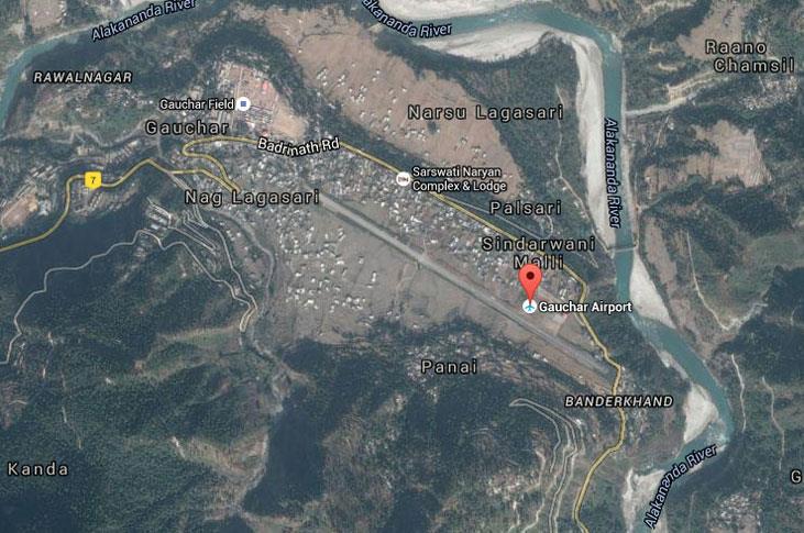
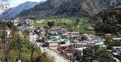
• Gauchar is situated on the left bank of river Alaknanda, surrounded by the Himalayas

Advertisement
• This town is in close vicinity to the holy destinations of Kedarnath and Badrinath.
• It also hosts some of the largest trade fairs across the state and is famous for the Gauchar Mela that takes place every year.
• The Gauchar airstrip is an un-used and is among AAI list of ‘unserved airports’
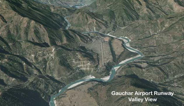
• The airstrip played a vital role in the 2013 Kedarnath flooding as it was a major basepoint for rescue operations.
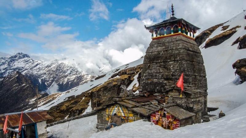
Kedarnath Temple
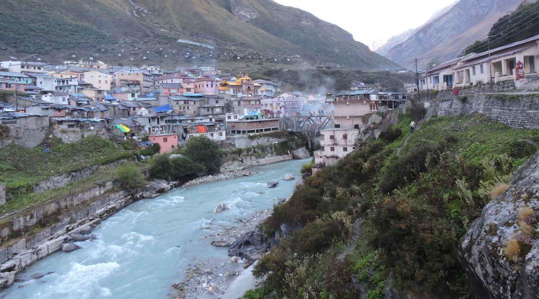
• Kedarnath is a holy Hindu town located in Rudraprayag district of Uttarakhand in India It is one of the Char Dhams located in the Himalayas

• It is one of the most revered Hindu shrines and millions of pilgrims partake in arduous pilgrimages every year.
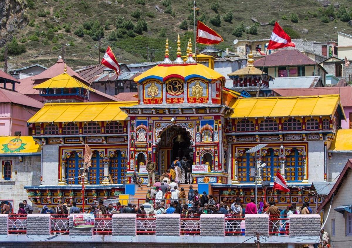
Badrinath Town
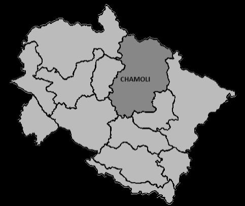
• Badrinath is a Hindu holy town and a nagar panchayat in Chamoli district in the state of Uttarakhand, India
• It is one of the four sites in India's Char Dham pilgrimage and is also part of India's Chota Char Dham pilgrimage circuit.
• It gets its name from the Badrinath Temple.
Location
History Of The Airstrip
• Gauchar came to light in 1938 when Pandit Jawaharlal Nehru along with his sister arrived here on the way to a personal visit to Badrinath.
• The flat land was the property of the Panwar kings of Garhwal and it was donated to the state later on post independence
• The airstrip was constructed between 1998-2000 but due to lack of funding, no proper airport infrastructure could be developed.
TOURISM STATISTICS & DEMOGRAPHY
NEARBY AIRPORTS
Newspaper Articles
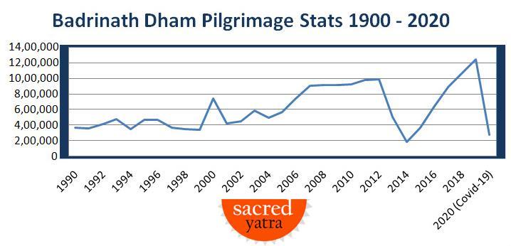
• The number of tourists visiting Badrinath in 2019 is 12,50,000 As per growth rate, it can be assumed that the number of tourists visiting Badrinath by 2030 is 19,50,000.
PROVISION FOR I.A.F
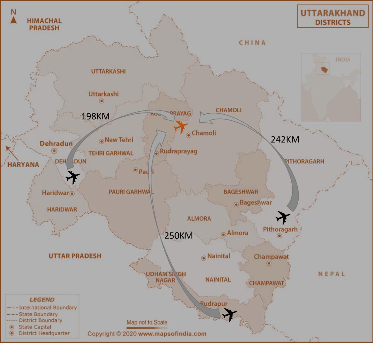
• Dehradun-Gauchar – 198km(5hr 45min)
• Pantnagar-Gauchar – 250km(7hr 52 min)
• Pithoragarh-Gauchar – 242km(8hr 15min)


Other Nearby Tourist Desitnations
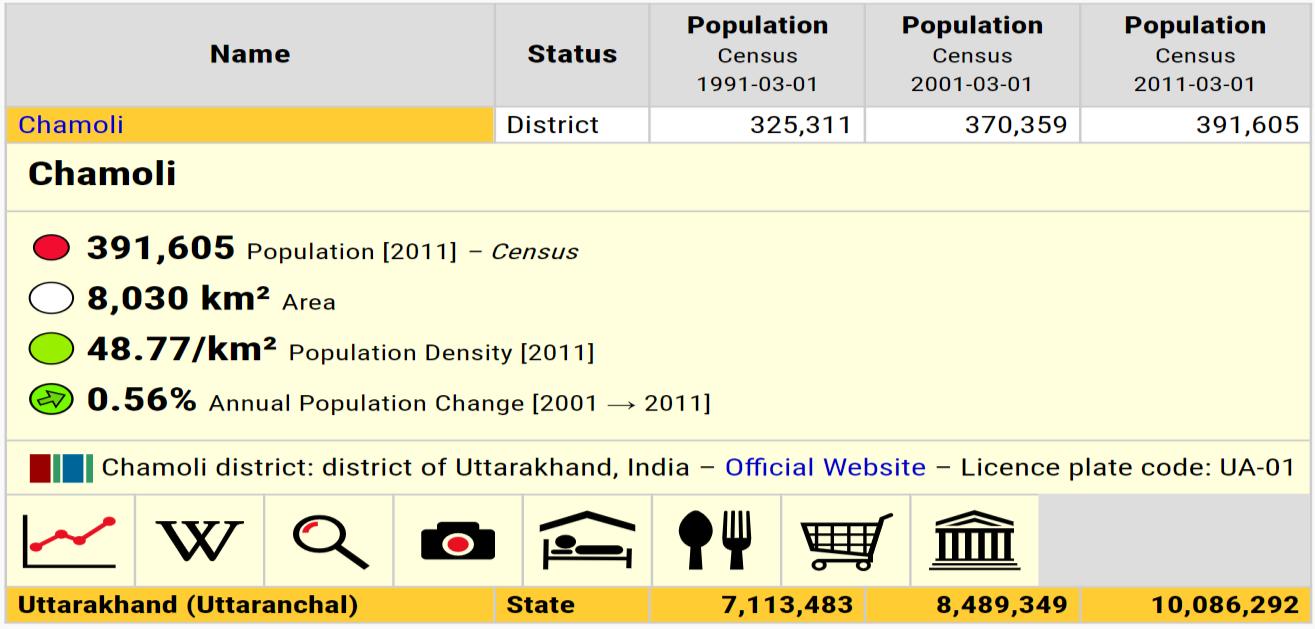
• The population of Chamoli and as per 2011 census is 3,91,605 Considering avg growth rate as per statistics, the population in 2030 is assumed to be 5,50,000
Regional Connectivity Scheme
• According to UDAN scheme and NCAP, the government is promoting air connectivity in remote locations in order to boost tourism and regional air connectivity.
• The Government and AAI is proposing new airports in remote locations and also plans to revive existing unserved airstrips
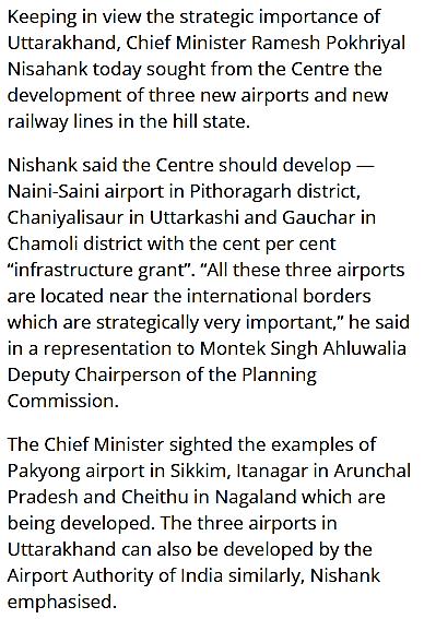
• Gauchar airstrip comes under this list and new interstate air routes have been proposed

Current Route To Badrinath
• An airport in this region will be beneficial for IAF as they can use it as a landing ground during aerial survey
50 MINS (272KM) 9HRS 30 MINS (329KM)
DELHI DEHRADUN BADRINATH
Total time – 10hrs 20mins (11hrs 20mins with road conditions and traffic during peak times)
Route After Proposal Of Airport At Gauchar
1 HR (285KM) 4HRS (130KM)
DELHI GAUCHAR BADRINATH
Total time – 5 Hrs (6hours with road conditions and traffic during peak times)
• This shows that approximately 5hrs 20mins of the travel time could be cut down by proposing the terminal at Gauchar. AIRPORT
S.W.O.T ANALYSIS CLIMATE ANALYSIS SURROUNDING TOPOGRAPHY
Strength
• Location has lot of tourist inflow as it is in close vicinity to Kedarnath and Badrinath towns.
• Has direct connectivity to Badrinath road, hence easy accessibility.
• Many tourist facilities including homestays, medical clinics, travelling service etc are located in the town.
Weakness
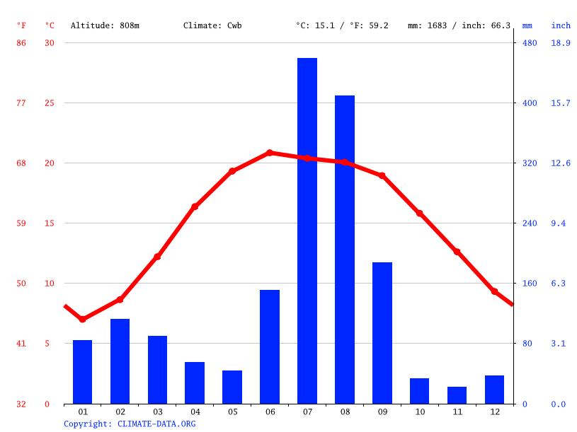
• The climate is warm and temperate in Gauchar.
• The average temperature in Gauchar is 15.1 °C | 59.2 °F. The annual rainfall is 1683 mm | 66.3 inch.

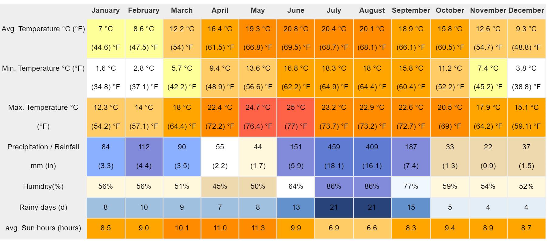
• From the climate analysis we can conclude that the site will face overall suitable conditions but in winter there could be snow
• Most tourists (70%) are likely to visit between April and September, however some tourists (30%) would like to visit even during winters to experience snow.
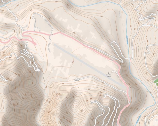
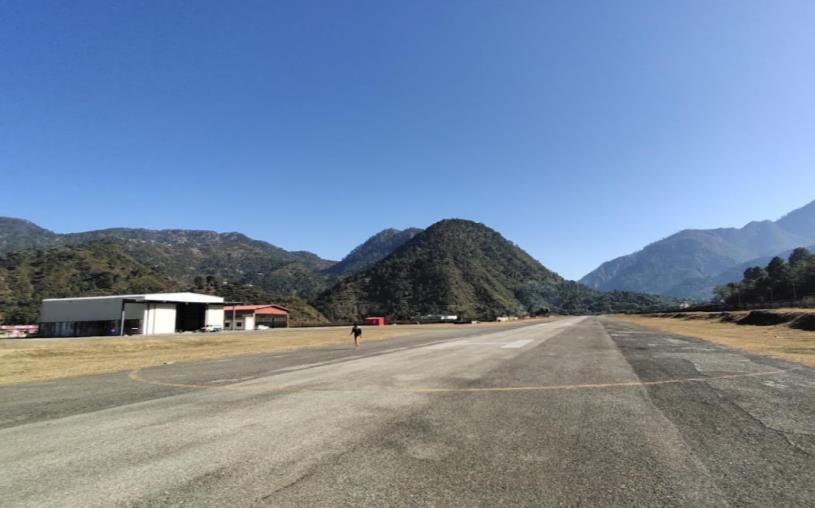
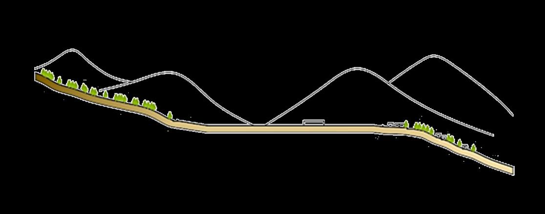
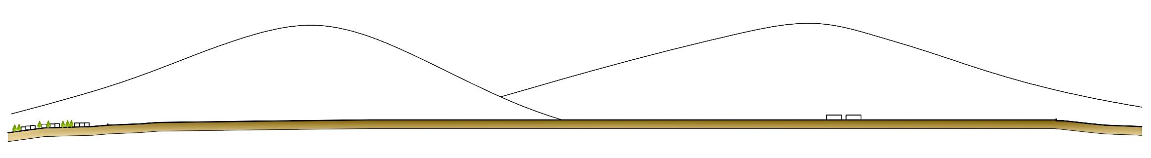
• The airstrip has a tabletop runway at an altitude of 810m above sea level
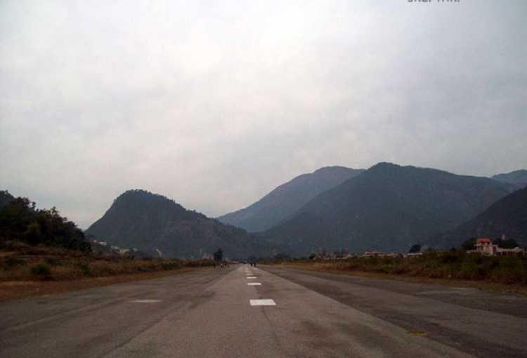
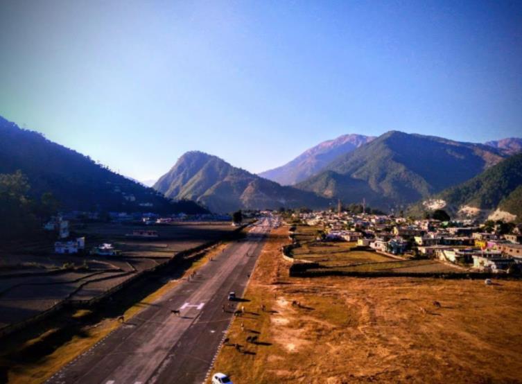

• Based on topography, the most suitable aircrafts that can be used in this region are Dornier 228, ATR 42-600 and ATR 72-600 as they are known for their versatility in steep approaches. They are also lightweight and suitable for all climates.
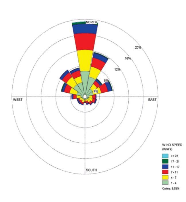
• Being in a hilly region, could occasionally face bad weather conditions like fog and snow during certain months.
Opportunities
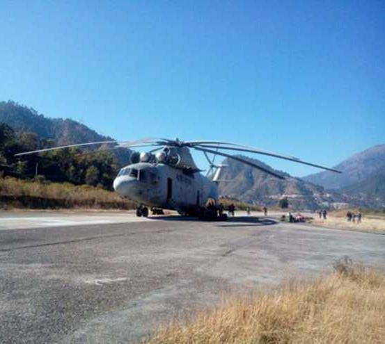
• Site has an existing hangar and Pawan Hans operates helicopter touring facilities from this airstrip hence gives opportunities for a new terminal.
• Will promote tourism and air connectivity in this entire region.
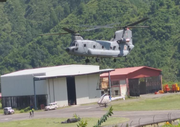
• As it is used occationally as landing grounds by IAF, defence areas could be proposed.
Threats
• Located in the midst of a town, hence town could face noise of aircraft
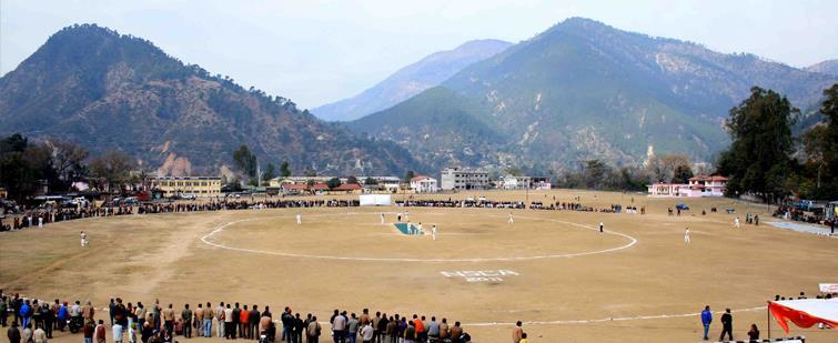
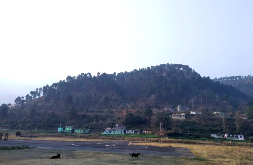
Existing Site Images
Site Plan
• The site has an area of 4,38,365 sqm (108 acres) and has an existing access road from the Badrinath highway, hence the same could be used during planning period

• Central area has space for proposal for defense hangar and aircraft parking spaces and is suitable as it will be away from the domestic terminal
• An access road runs along the site in the southern side Hence this road could be used as an entry point to the site for defense area.
Passenger Capacity During Peak Hours
Type Of Aircraft Arriving At Site

Note: Peak tourism months according to statistics are April, May, June, July, August and September. Hence we can consider 70 % visitors arrive during this time while 30% arrive during the rest of the year.
hours of medium traffic & 2 hours of low traffic
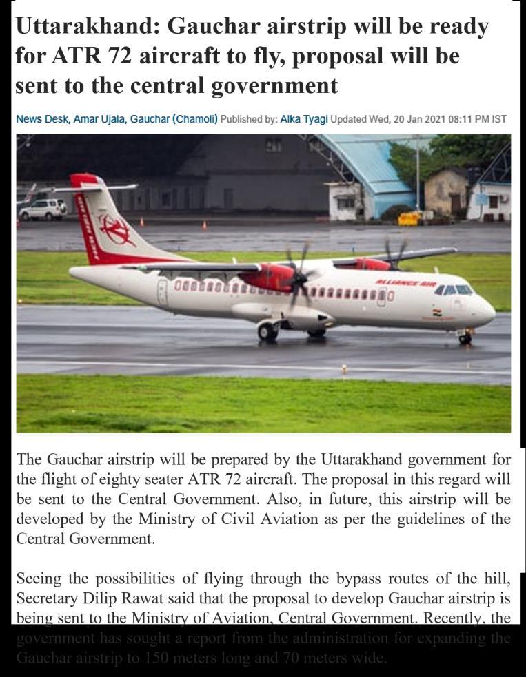
• ATR 72 (Aerei da Trasporto Regionale) is a lightweight regional aircraft with a maximum seating capacity of 80 seats.
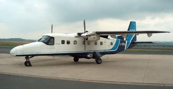

• It is known for its versatility in steep take off and landing approaches and hence is most suitable for this airport.
Other Probable Aircrafts
Note: Airport will be designed as per peak hour capacity.
Considering 8% overload factor, incase of emergency landings and flight delays,
Note: Considering the location, the suitable aircraft which can land here is ATR 72 (80 seater aircraft).
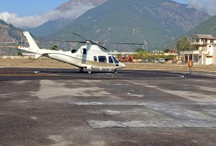
Pawan Hans Touring Facility
Pawan Hans, owned by the government is a helicopter touring facility which is currently operating at the site
• This helicopter takes tourists and pilgrims to the Holy towns of Kedarnath and Badrinath.
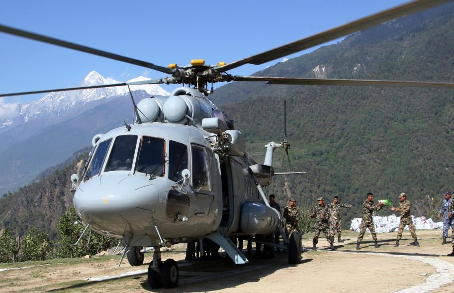
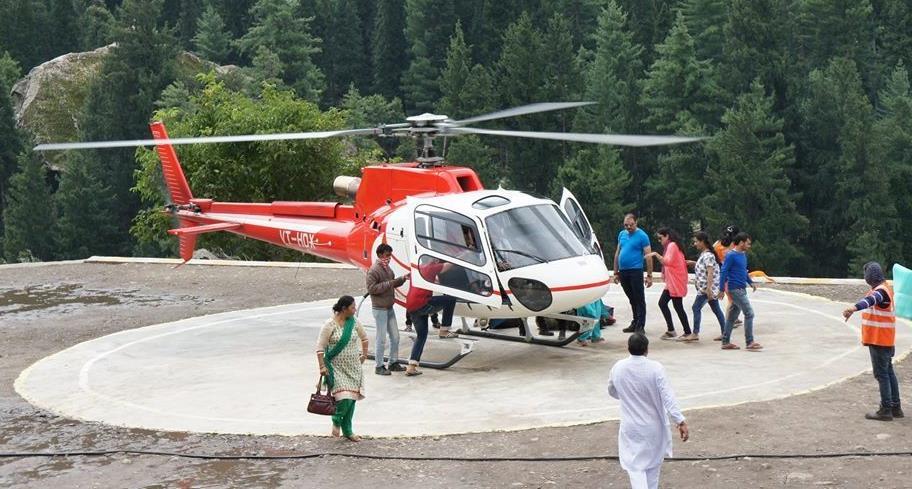

• Provision for this service will be made on site.
DEFENSE HANGAR FOR I.A.F
• Being in close vicinity to the border, the Indian Air Force occasionally conducts aerial surveys, and other activities in these regions
• Provision for a defense hangar will be made at one part of the site.


