Tjerruing/Blackwattle Bay Revitalisation
 Kahlia Rae BAEN3002 Capstone 2022 - Urbanism Stream
•
•
•
•
•
•
•
•
•
•
•
•
•
•
Contents ManWithAToyCamera licensed under Creative Commons 01
02 Strategic
07 Structure Plan 08 Benchmark Analysis
Setting the Scene
Context
Project Introduction
Site Breakdown
Historical Timeline
Demographics
Guiding Documents
Regional Context
District Context
Local Context
Merit
Justification of Strategic
Structure Plan
Overview of Benchmarks
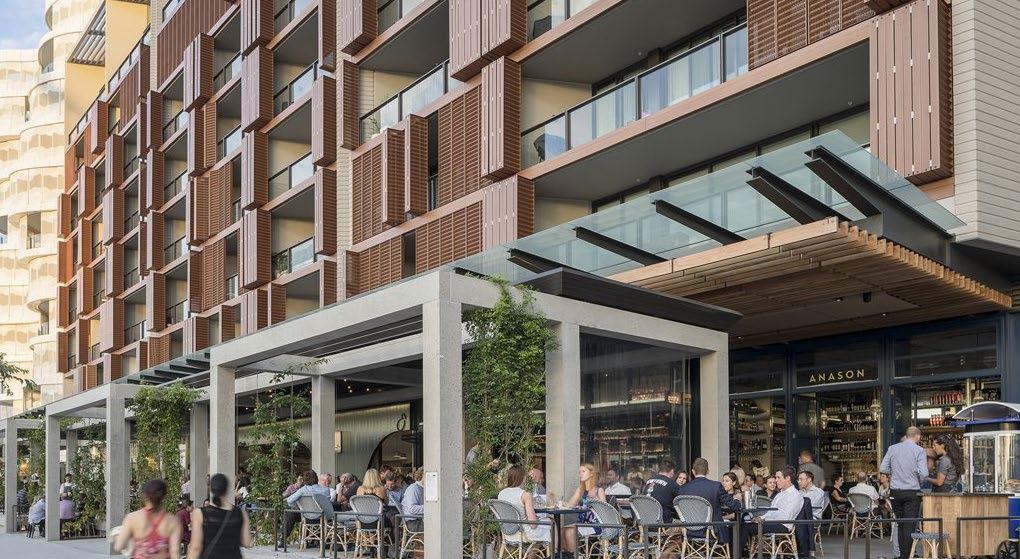
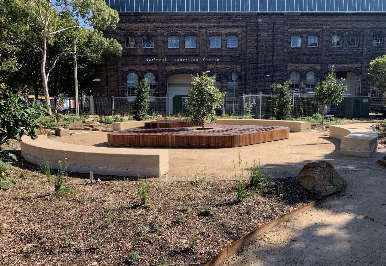
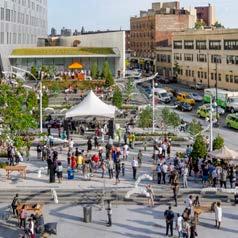
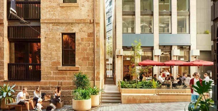
Barangaroo South
Cultural
Garden
Landscape
Seaport 2
Boston
01 Setting the Scene
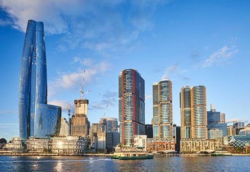
The Opportunity for Sydney
The NSW Government’s ambition for Blackwattle Bay is: “Blackwattle Bay offers an extraordinary opportunity to reconnect the harbour, its surrounding neighbourhoods and the city; to showcase Sydney’s living culture and stories of Country; to build an inclusive and iconic waterfront destination that celebrates innovation, diversity and community.”
Project Introduction
The Opportunity
Throughout history, Sydney’s diverse stories, cultures, people, and places have been preserved and passed on through generations to inform placemaking ventures which have shaped the city into what it is today. This project seeks to conserve the memories and lived experiences of Pyrmont’s dynamic populations whilst providing spaces for the re-telling of stories about past, present and future urban culture and moments.
The NSW Government plans to renew the land in and around the current Sydney Fish Market site to provide jobs, services, and green space in close proximity to the Sydney CBD. Through the development of a renewal scheme which aligns with Sydney’s strategic thinking and site-specific needs, this project will allow us to glean an insight into the cities of tomorrow.
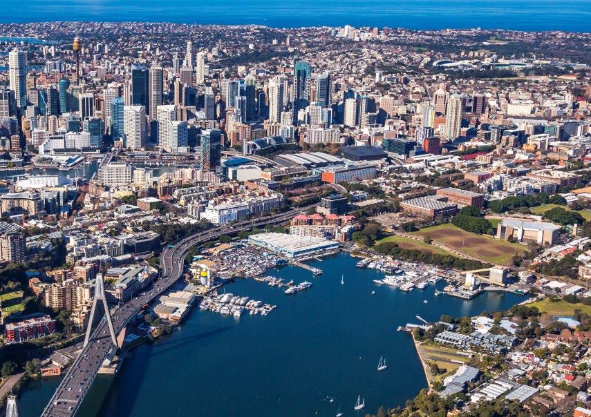
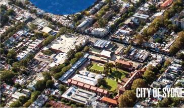
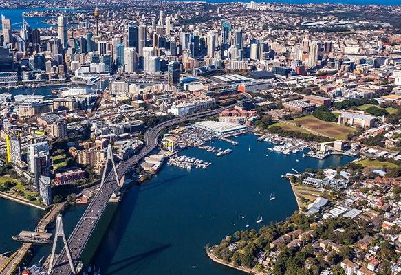
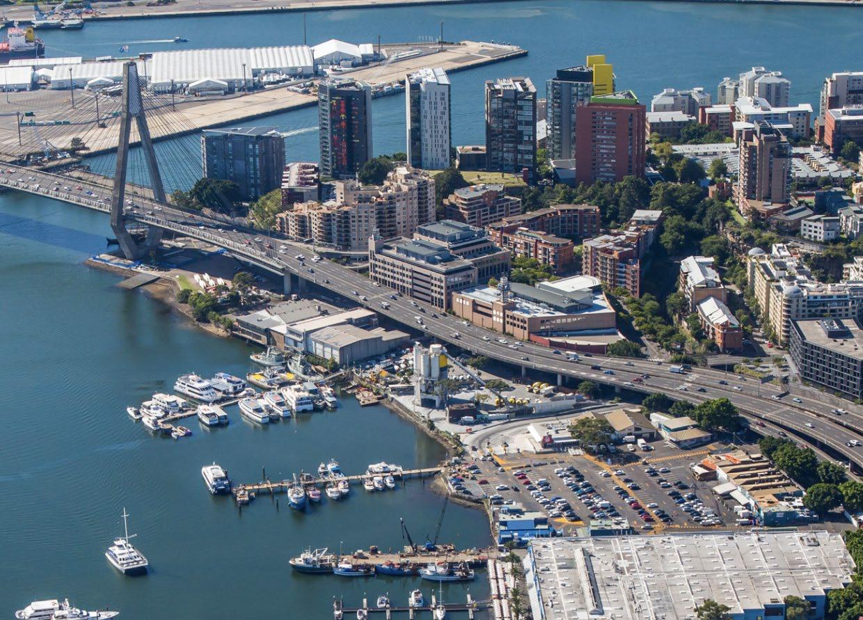
The Site Today
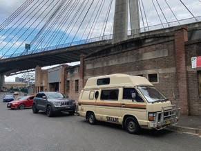
The project site sits within the Harris St Character Area of the City of Sydney LGA. It is bound by Bank St to the north east, Pyrmont Bridge Rd to the south east, and the Blackwattle Bay foreshore to the north and south west. The site is largely characterised by light industrial uses with commercial uses occuring at the site of the current fish market. There is minimal green open space and a majority of the foreshore is lost to privately owned lots. Construction is underway on the new Fish Market which will attract a host of visitors, both domestic and international, to the area though the existing market space will likely be left in disuse, hence the need for renewal of the precinct.
 PYRMONT
GLEBE
BARANGAROO ULTIMO
BALMAIN ROZELLE
ANNANDALE
HAYMARKET
SYDNEY CBD
BLACKWATTLE BAY SITE
PYRMONT
GLEBE
BARANGAROO ULTIMO
BALMAIN ROZELLE
ANNANDALE
HAYMARKET
SYDNEY CBD
BLACKWATTLE BAY SITE
6
9 ha 2.5 ha 242m 1.2km 362m 819m
Site Area Public Space Active Frontages Footpaths Publically Accessible Foreshore Length of Foreshore
Site
7
Breakdown
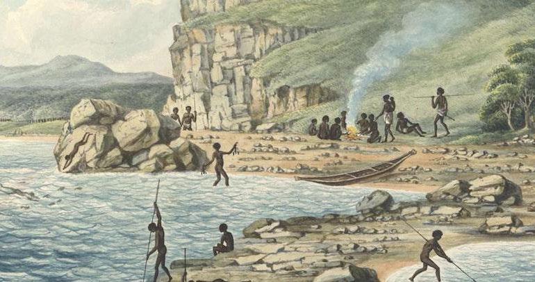
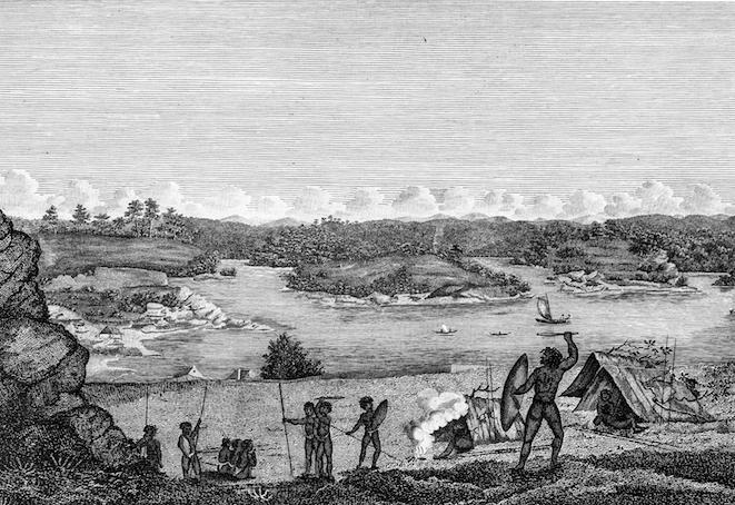
Tjerruing/Blackwattle Bay has a rich and diverse history as a critical site in both First Nations and colonial contexts. Home to the Gadigal and Wangal people, the bay proved a place of sustenance and plentiful resource for hunting,
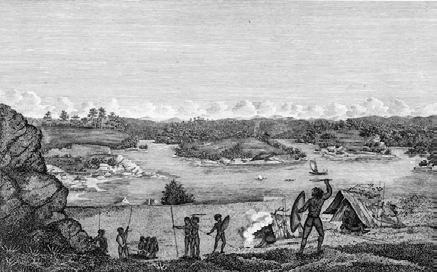

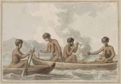
fishing, and making medicine. Central to the site’s topographical history is the historic creekline which was exploited and later ‘reclaimed’ with the arrival of colonial industry. Blackwattle Bay became the source of much of
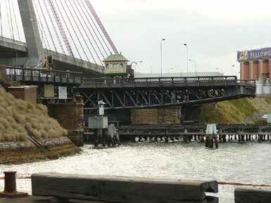
the sandstone used throughout Sydney’s early buildings. The 19th century saw great improvement in transport infrastructure with the construction of Glebe Island Bridge, a timber swing bridge connecting Pyrmont to the Rozelle.
Historical Timeline
1788
Wangal groups W etl a marine resources ustrial creekline 1828 gefirst construction W ork s to r Q uarryi n gb E states leas sandstone quarries 1857 8
digaland
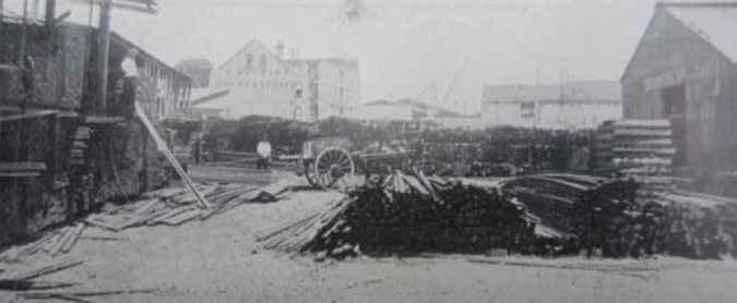
As quarrying industries took off, wharves were erected in mass which later serviced timber industries and enabled importation of goods. 1 - 3 Bank St, at the northern end of the site, was constructed in the early 20th century to

facilitate timber trading. Land uses throughout the 20th century were dynamic, including commercial offices, warehousing, and a concrete batching plant. The construction of the ANZAC Bridge and Western Distributor
improved access to and from the site and the current Fish Market which opened in 1966. Recently, in 2020, construction on the new Fish Market began which will be a major tourist destination and employment hub.
andfrom
egan
, merchants, sawmillsoc nces on the newS tructed to facilitate timbe 1871 ANZAC Bridgeconstructed ySd neyFishMarketrelocates to BW Bay 9
BlackwattleC
1890 1932 1966 1955 2020
The suburb of Pyrmont has a dense, multicultural population which has undergone significant change in recent years. Notably, the impacts of Covid have changed how people work, with a surge in people working from home and reduced use of the public transport networks. As Pyrmont is further cemented as a growing innovation precinct, it is likely that the current top employment industries will continue to grow.
Population by Age Group

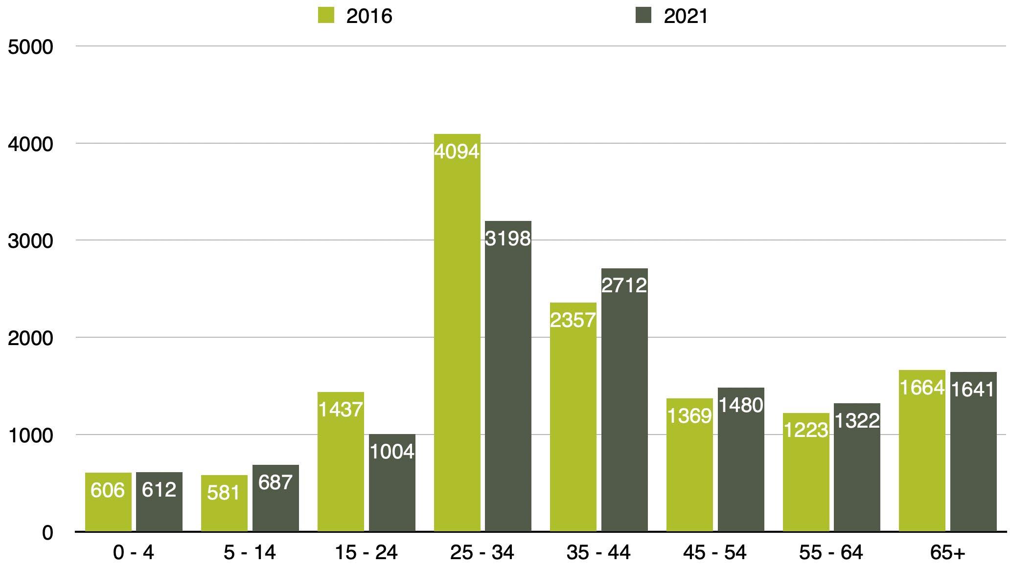
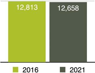
12 658 46.6% 146 Residents Residents aged 24
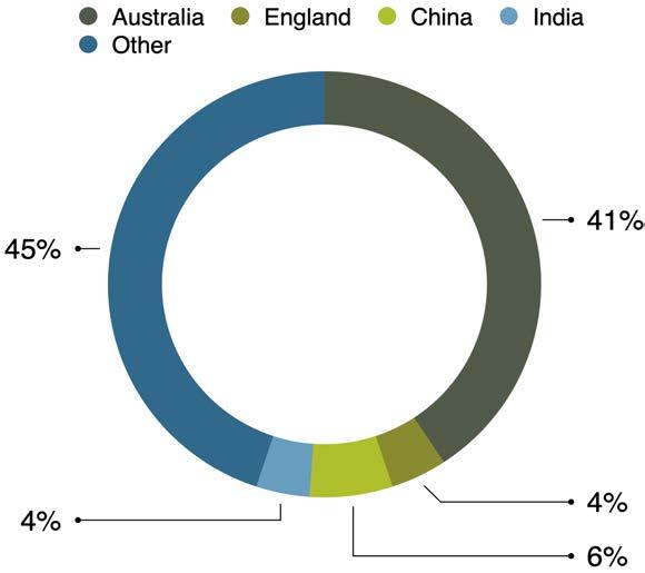
44 Indigenous Residents Country of Birth 1.2% Decrease in Population Size
Pyrmont Demographics
-
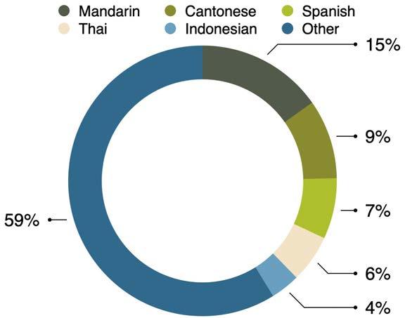
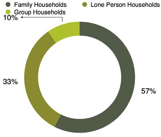
Languages spoken other than English Household Structure 10
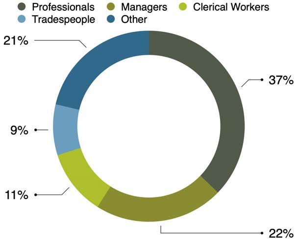
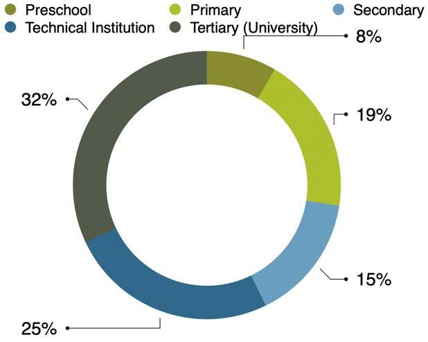
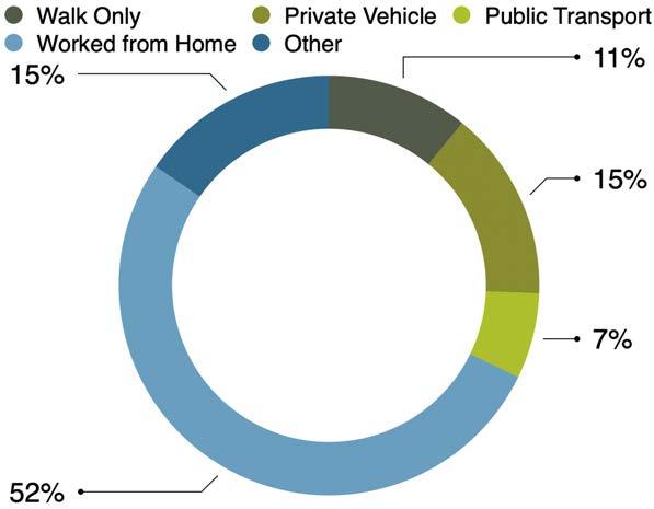


Education Occupation Transport to Work Median Weekly Income 16% Attend an Education Institution Top 5 Employment Industries 36 919 5 770+ Workers in the Pyrmont Peninsula Forecast Job Growth to 2041 Higher Education ICT Creative Industries Tourism Business Services 11
02 Strategic Context


Level Strategic Context A Metropolis of Three Cities Eastern City District Plan District Level Strategic Planning COS Local Strategic Planning Statement COS Community Strategic Plan Local Level Strategic Planning Pyrmont Peninsula Place Strategy 13
Guiding Documents Regional
Regional Level Strategic Context
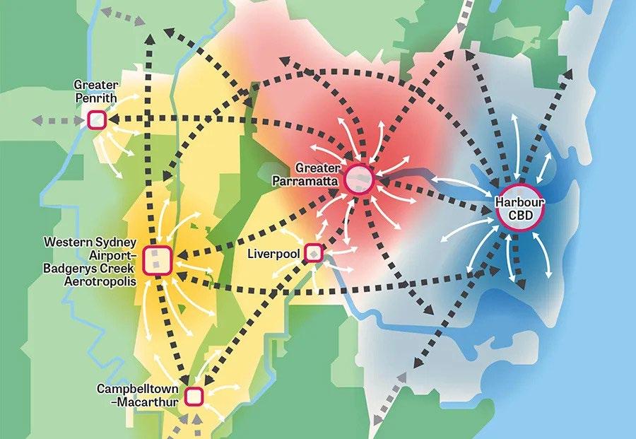
Greater Sydney Region Plan 2018 - Metropolis of Three Cities

Vision: The Greater Sydney Region Plan, A Metropolis of Three Cities is built on a vision whereby most residents live within 30 minutes of their jobs, education and health facilities, services and great places.
The four pillars underpinning this vision include; infrastructure, liveability, productivity, and sustainability.

Relevant Direction Relevant Indicators Relevant Objectives

Infrastructure
A city supported by infrastructure
Liveability
A city for people
Increased 30-minute access to metro clusters/centre
2: infrastructure aligns with forecast residential and employment growth 3: infrastructure is adaptable to technological changes and mega trends
Increased walkable access to local centres 7: communities are healthy, resilient, and socially connected 9: celebrate the arts and support creative industries and innovation
Liveability
A city of great places
Productivity
A well connected city
Increased access to open space 12: great places that bring people together and reflect shared community values and culture
Percentage of dwellings within 30 minutes by public transport of metro centre/cluster
14: integrated land use and transport creates walkable and 30 minute cities to drive opportunities for investment and support a diverse economy
Sustainability
A city in its landscape
Legend
Light Rail Line
Increased urban tree canopy cover; expanded green grid
30: urban tree canopy cover is increased 31: public open space is accessible, protected, and enhanced
Western Sydney AirportBadgerys Creek Aerotropolis
Potential Light Rail Line Train Line
Proposed Train Line
Potential Train Line
Major Motorway
Health/Education Precinct
Metropolitan Centre Major Trade Gateway Economic and Innovation Corridor Indicative Pyrmont Site Location
Metropolitan Cluster
Western City District
Central City District Eastern City District
Blacktown Bankstown
Campbelltown -Macarthur
Liverpool
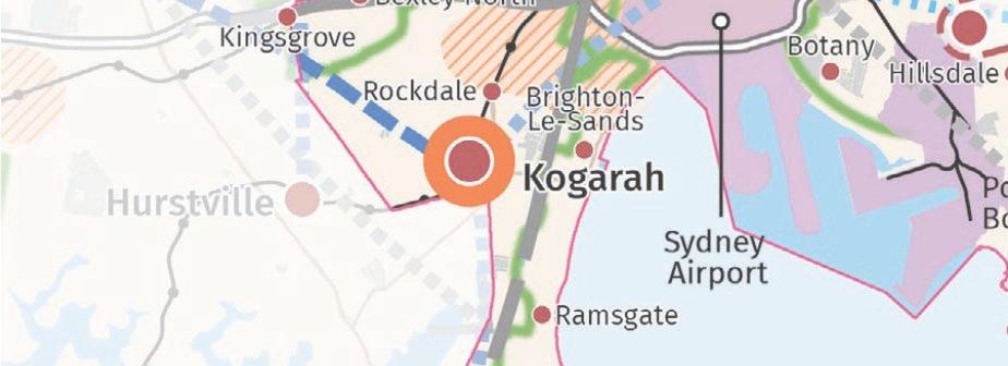
Kogarah
Frenchs Forest Greater Parramatta Harbour CBD
Greater Penrith
St Leonards
Richmond-Windsor
Toward Wollongong and South Coast
Toward Central Coast and Newcastle
Toward Blue Mtns and Central NSW
Toward Goulbourn and Inland NSW
14
Greater Sydney Region Plan 2018 - Eastern City District Plan


Vision: The Eastern City District will become more innovative and globally competitive, carving out a greater portion of knowledge intensive jobs from the Asia Pacific Region.
The vision will improve the District’s lifestyle and environmental assets. This plan has largely the same major outcomes (infrastructure, liveability, productivity, sustainability) and indicators as the Metropolis of Three Cities but with more specific directions and objectives.

Relevant Direction Relevant Indicators Relevant Planning Priorities
Infrastructure Infrastructure supporting new developments
Liveability Celebrating diversity and putting people at the heart of planning
Liveability Designing places for people

Productivity
Developing a more accessible and walkable city
Sustainability Valuing green spaces and landscape
Increased 30-minute access to metro clusters/centre
Increased walkable access to local centres
E1: planning for a city supported by infrastructure

E3: providing services and social infrastructure to meet changing needs
E4: fostering healthy, creative, culturally rich, and socially connected communities
Site positioned in a significant economic corridor which runs through Harbor CBD core

Confirmed Metro Station at Pyrmont between Pyrmont Bridge Rd and Union St
Project Site
Increased access to open space
Percentage of dwellings within 30 minutes by public transport of metro centre/cluster
E6: creating and renewing great places and local centres, and respecting the District’s heritage

E10: integrated land use and transport planning to create walkable and 30 minute cities
Increased urban tree canopy cover; expanded green grid

E17: increase urban tree canopy cover and deliver green grid connections
E18: deliver high quality public open space
New housing will be concentrated in the Bays precinct and will require infrastructure upgrades to support growth
Close proximity to metro centre = good access to services/infras. Connections to green grid could be improved
by author)
Eastern City District Structure Plan (GSC, 2018) (annotated
15
District Level Strategic Context
City of Sydney ‘City Plan 2036’ Local Strategic Planning Statement
Vision: Green, Global and Connected
• Green: low environmental impact, trees/open space, healthy, resilient community
• Global: economic orientation/partnerships, open-minded outlook, diversity
• Connected: physically (walking, cycling, public transport) and through culture (place and social wellbeing)
Relevant Direction Relevant Planning Priorities
Infrastructure
I1: movement for walkable neighbourhoods and a connected city
I2: align development and growth with supporting infrastructure
I3: support community wellbeing with social infrastructure (open space, community/cultural facilities, and state infrastructure (education and health))
Liveability
L1: creative and socially connected city through inclusive and accessible places
L2: creating great places by protecting local character and delivering high amenity
Productivity
Sustainability
P1: growing a stronger, more competitive Central Sydney through appropriate built form facilitating a world class city centre
S1: protecting and enhancing the natural environment for a resilient city including improving water ways, biodiversity corridors, green spaces and tree canopy
S2: creating better buildings and places to reduce emission and waste and improve water efficiency Legend
Green Space
Economic/Innovation Corridor
NSW Gov SItes for Housing/Jobs
Harbour CBD Metro. Centre
City of Sydney LGA
Character Area Boundary
Project Site Boundary
F Glebe Point Road
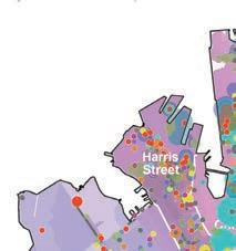
Harris Street
and Harbour Macleay Street and Woolloomooloo Oxford Street
Chinatown and CBD South Crown and Baptist Streets Redfern Street
King Street
Green Square and City South
L
M M F T
Existing/Confirmed Metro Station
Proposed Metro Station
Light Rail Line/Station
Ferry Terminal Train Line/Station
L L L L L L L L L L L L L L L L L L L L L T T T T T T T T T T T T T T M M M M M M M M M F F F F F
CBD
16
City of Sydney Community Strategic Plan 2020
Communities within the City of Sydney support its green, global, and connected vision. A large focus from the city dweller’s perspective is the need for social, business, cultural and physical connections within the city to guarantee feelings of safety, security, and belonging in the city. The community has contributed to the development of 10 targets to measure progress and 6 guiding principles (listed on right).
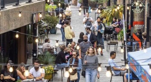
Situated within Harris St Village. Hosts HQs for media and tech sectors and attracts tourists. Foreshore is characterised by new parks, walking and cycling trails, and residential and retail development.
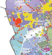
Distribution of Employment Clusters by Industry across Character Areas
Financial services
Property services
Creative industries
Information media
Professional services

Health services
Higher education
Transport and logistics
Manufacturing
Amalgamation of map data from City of Sydney LSPS (COS, 2020) (annotated by author)
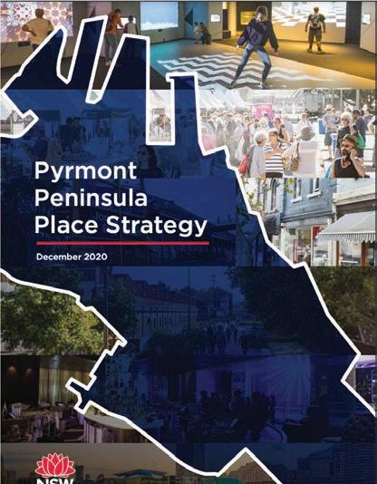
Local Level Strategic Context
Vision: in 2041, the Pyrmont Peninsula will be an innovative, creative and cultural precinct and an engine room of the Eastern Harbour CBD. It will connect to the Innovation Corridor and other innovation and job precincts via Sydney Metro and complement the Sydney CBD.
Under the strategy, Blackwattle Bay has been earmarked as an area capable of accomodating future population and employment growth. Redeveloping private land to unlock the foreshore, providing new social infrastructure, and developing Metro connections are positioned as opportunities for the site.
Target or Planning Principle
Target 2 By 2050 there will be a minimum overall green cover of 40%, including 27% tree canopy cover
Target 5 By 2036 there will be approximately 700,000 jobs in the City of Sydney local area including 200,000 new jobs compared to 2017
Target 6 By 2036 there will be at least 156,000 private dwellings and 17,500 non private dwellings and 15% will be social/affordable housing
Target 7 By 2036 there will be at least 40,000m2 of new cultural production floor space
Target 8 By 2050 people will use public transport, walk or cycle to travel to and from work
Target 9 By 2030 every resident will be around a 10-minute walk to what they need for daily life
Target 10 By 2050 community cohesion and social interaction will have increased
Principle 1 We are accountable to the voices and elevate the knowledge and cultures of Aboriginal and Torres Strait Islander peoples
Principle 2 We respond to the climate emergency
Principle 3 We build the resilience of our society and economy
Five Big Moves for Pyrmont Peninsula
Move 1 A world-class harbour foreshore walk
Move 2 A vibrant 24 hour cultural and entertainment destination
Move 3 Connect to Metro
Move 4 Low carbon, high performance precinct
Move 5 More, and better activated public space
17
Pyrmont Peninsula Place Strategy 2020
Justification of Strategic Merit
Yes, the project proposal is largely consistent with the vision and objectives of the Metropolis of Three Cities: Greater Sydney Region Plan (2018) and Eastern City District Plan (2018). The proposal reflects the following directions:
A City Supported by Infrastructure
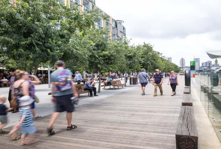
The proposal site is supported by existing transport infrastructure including light rail, bus route, Western Distributor and local roads. Part of the proposal is to connect existing walking and cycling routes primarily through the continuation of the Sydney Harbour Foreshore walk along the site’s waterfront.
In the future, it will be serviced by the Sydney Metro West with a committed station at Pyrmont (Union St) which will contribute significantly to the 30-minute city vision in the Eastern City.
A City for People
The proposal creates a small cluster of cultural and community spaces directly adjacent to the Fish Market light rail station ensuring walkable access and promoting social connectivity.
The Indigenous cultural centre/museum, gathering circle, large expanse of open spaces, and waterfront promenade provide for a mix of community uses and support local creative businesses.
A Well-Connected City
The proposal site is well serviced by existing transport infrastructure which will only be enhanced upon completion of the Sydney West Metro line. Some of such services include the light rail network, bus routes, and a new foreshore walk proposed as part of the project.
Key services, public amenities, and the commercial core are located within close proximity to such infrastructure.
A City of Great Places
The master plan for the site proposes a large expanse of additional green space at Bank St and a number of smaller spaces throughout the commercial and cultural precincts.
The public domain has been activated and there are a number of places within the site which enable the gathering of people including the gatehring circle, green open spaces, temporary activation sites, and public art sites. These are accessible via a public realm which is walkable and located nearby transit hubs.
A City in its Landscape
The proposed street scape will be characterised by native street tree planting to increase canopy cover. The proposal unlocks Glebe Island Bridge as a new public green space as well as Bank St park and smaller green spaces which contribute to the site’s and wider Sydney’s green grid.
As part of the connecting with Country scheme, land has been given back to local Indigenous people for the creation of native seed banks.
Q3. Will the planning proposal give effect to the objectives and actions of the applicable regional or district plan or strategy?
Yes, the project proposal is largely consistent with the vision and objectives of the City of Sydney Local Strategic Planning Statement. The proposal reflects the following directions:
Liveability
Given the narrow nature of the proposal site, the community and cultural infrastructure is provided within the most accessible location which is well serviced by bus and light rail. Such sites extend the cultural offerings in Pyrmont and contribute to the character of the Harris St character area.
Productivity
Infrastructure
The proposal provides opportunities for active transport through pedestrianised streets and a waterfront promenade which connects the site to the wider Sydney harbour foreshore.
The proposal supports knowledge job growth which is aligned with the innovation corridor, whilst providing the supporting services needed to facilitate community wellbeing. Some of the social infrastructure within the site includes cultural education spaces, library, gathering circle, green open spaces, public waterfront promenade, temporary activation sites, and public art.
Active street frontages and an expansive public domain will result in high concentrations of public amenity and cement the proposal site as an inclusive, accessible, and socially connected place.
Sustainability
The proposal rezones land for recreational uses and environmental restoration including green spaces which have been connected through an array of wayfinding mechanisms.
Urban tree canopy has been increased through street tree planting, retaining existing canopy cover, and Indigenous-led land management and seed bank creation. To prevent damaging the ecological health of Blackwattle Bay, the proposal avoids construction over the waterway.
The proposal delivers land for employment uses in both knowledge jobs and supporting services jobs. The site’s commercial core will foster a vibrant, active, and connected character that attracts tech companies, start-ups, and other world-class businesses whilst cultural, community, and retail/dining zones will support employment in the arts and creative industries.
The co-location of tech industry companies will contribute to the Sydney-wide innovation corridor and provide a large number of jobs.
Q4. Is the planning proposal consistent with a council LSPS that has been endorsed by the Planning Secretary or GSC, or another endorsed local strategy or strategic plan??
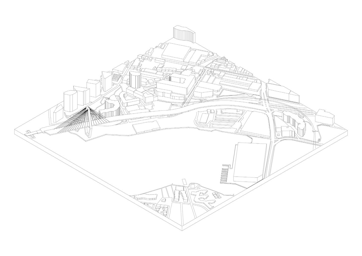
03 Contextual Analysis
Glebe Island
Formerly used as a major port facility for vehicle and dry bulk goods imports. Access to Pyrmont via Glebe Island Bridge.
White Bay Power Station
Heritage-listed coal-fired power station turned hub for knowledge intensive jobs and advanced technology industries.
Rozelle Rail Yards
Mixed-use (residential, commercial, and recreational) precinct built on the former Metropolitan Goods line.
Rozelle Bay
New development proposed for commercial, residential, and open space uses, including recreational and working harbour.
Glebe
Village-like residential suburb with heritage character and a bustling, activated central economic spine.
New Fish Market
World-class food market and dining attraction proposed at the southern end of the Bay.
Pyrmont
Entertainment destination with a mix of residential, commercial, and recreational uses. Superior access to the Sydney CBD.
Blackwattle Bay
Uninterrupted waterfront site currently occupied by the Sydney Fish Market and privately-owned lots.
Wentworth Park
City-serving open green space with places enabling gathering and socialisation as well as passive and active recreation.
21
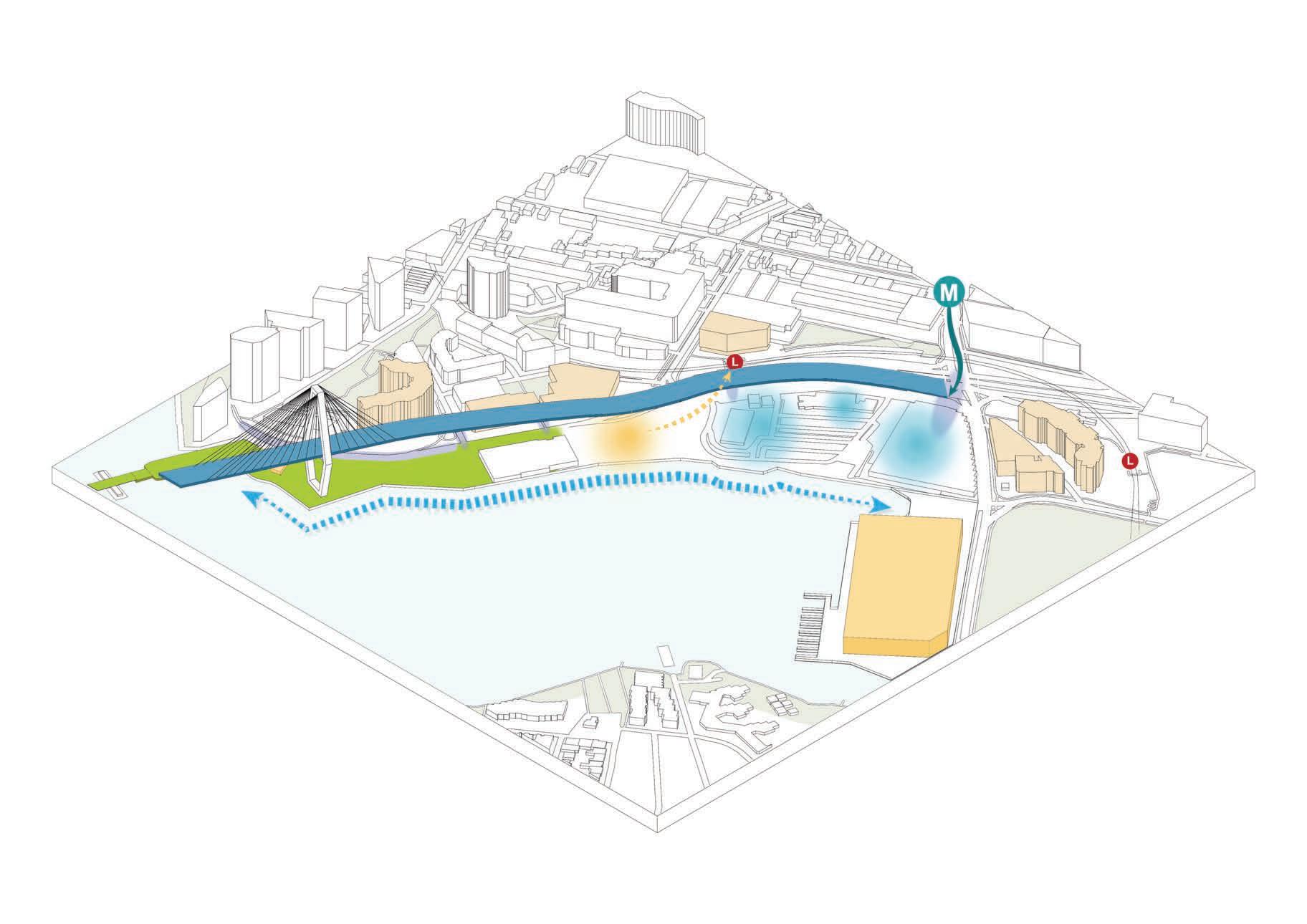
Movement Corridors
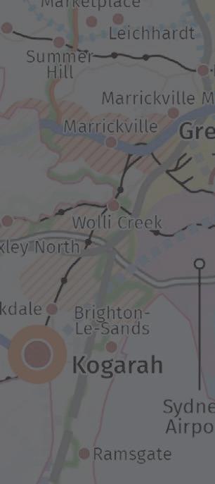
The site is nestled between an existing bus and light rail network although could benefit from improved walking and cycling linkages. The committed City West Metro link will be pivotal to enhancing access to the Pyrmont site.
Completion of the new Fish Market and associated ferry stop will see the introduction of passengers arriving via Blackwattle Bay which will introduce new opportunities for promenade design and connections within the site. Legend
Metro to the Bays Precinct
Path continues across the ANZAC Bridge
Blackwattle Bay Wharf
WESTERNDISTRIBUTOR
Proposed Fish Market Wharf
BOWMANSTREET HARRIS STREET
BRIDGEROAD
Light Rail continues towards Dulwich Hill
UNIONSTREET PYRMONTSTREET
Ferries continue to Barangaroo/Circular Quay
DARLINGDRIVE
Paths continues across Pyrmont Bridge
Metro to CBD
Light Rail continues towards CBD
Primary Walking Network
Seperate Off-road Cycleway
Low Traffic Street or Cycling Lane
Off-road Shared Path
Bus Routes and Stops
Ferry Routes and Wharves
Light Rail Line and Stations M
Confirmed Metro Line and Station
Major Roads Local Roads Character Area Boundary Site Boundary Green Space Waterways
B F 0m 40m
L F F L L L L L L L L F
B B B B B B B B B B B M
L
HeritageThe Harris St area is characterised by a plethora of heritage buildings, most of which feature masonry facades and modern interiors. The project site itself, however, is largely unaffected by heritage constraints.
The light rail stations and Glebe Island Bridge are state heritage items which cannot be removed to make way for development.
Heritage buildings within the Harris St character are characterised by brick masonry, sandstone, and locally sourced timber thus posing as inspiration for the materiality of built form and other built features on the site.
WESTERNDISTRIBUTOR
BOWMANSTREET HARRIS STREET
BRIDGEROAD
UNIONSTREET PYRMONTSTREET
Legend
Character Area Boundary
Site Boundary
Green Space
Waterways
Conservation Area
General Heritage Item
State Heritage Items
DARLINGDRIVE
23
Land Zoning
Surrounding the site is a mix of land uses contributing to the vibrant character of the Harris St precinct. Recreational zones tend to be located nearby the harbour ensuring views of the water from residential and commercial buildings.
The site is currently zoned for commercial uses and could benefit from a more mixed typology of uses, much like the southern end of Harris St.
WESTERNDISTRIBUTOR
BOWMANSTREET HARRIS STREET
UNIONSTREET PYRMONTSTREET
Legend
Character Area Boundary
Site Boundary
R1 General Residential
B1 Neighbourhood Centre
B2 Local Centre
B3 Commercial Core
B4 Mixed Use
BRIDGEROAD DARLINGDRIVE
RE1 Public Recreation Waterways
0m 40m
A number of trip generators surround the site, including the new Fish Market, Star Casino, UTS, and Wentworth Park. Thus, there is a need to provide spaces throughout the proposal that will continue to attract visitors.
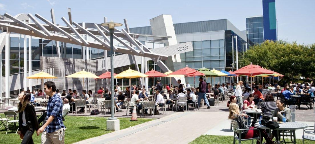
The site’s strategic positioning nearby UTS and the University of Sydney elevate’s its potential to develop into an innovation precinct. The co-location of existing tech companies within the precinct, such as Google, and creative industries, NOVA entertainment and Network 10, further cement the site as a future innovation hub.
1 2 3 4 5 6 7 8 9 10 11 12 13 14 Legend Legend BRIDGEROAD DARLINGDRIVE
Character Area Boundary Site Boundary Green Space Waterways Significant Sites Heritage Conservation Areas 1 2 3 4 5 6 7 Union Square The Star Casino Pyrmont HCA Harris Street HCA Wentworth Park Site of new Fish
Sydney
8 9 10 11 12 13 14 BW Bay Revitalisation Precinct UTS/TAFE Ultimo Goods Line Walk
Pirrama
Darling
UNIONSTREET PYRMONTSTREET BOWMANSTREET HARRIS STREET WESTERNDISTRIBUTOR
Market
Fish Market
Powerhouse Museum
Park
Harbour Pyrmont Waterfront Park Significant Sites
25
Legend
Open Green Space Accessibility
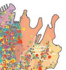
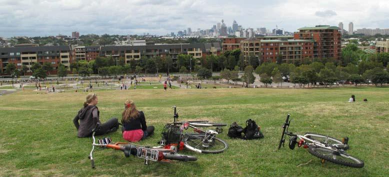
There are two major parks establishing significant connections to the metropolitan-wide Sydney Green GridWentworth Park to the south and Pirrama Park to the north east of the site. Smaller green spaces, such as pockets parks, exist throughout the site acting as supplementary recreation zones to service residential and commercial areas.
The purple inner circles represent 400 metre walking radii which is roughly the distance covered by foot on a 5 minute walk and is the distance most people are willing to walk to reach green spaces (Pikora, Giles-Corti and Donovan, 2001). This analysis shows that the centre portion of the site is slightly underserviced by parkland and the introduction of more green spaces throughout the site would benefit visitors, Pyrmont residents, and workers.

WESTERNDISTRIBUTORUNIONSTREET
BOWMANSTREET HARRIS STREET
PYRMONTSTREET
Legend
Character Area Boundary
Site Boundary
Public, Open Green Space Waterways
400 m/ 5 min walking radius (inner ring)
800 m/ 10 min walking radius (outer ring)
BRIDGEROAD DARLINGDRIVE
Summary of Key Observations
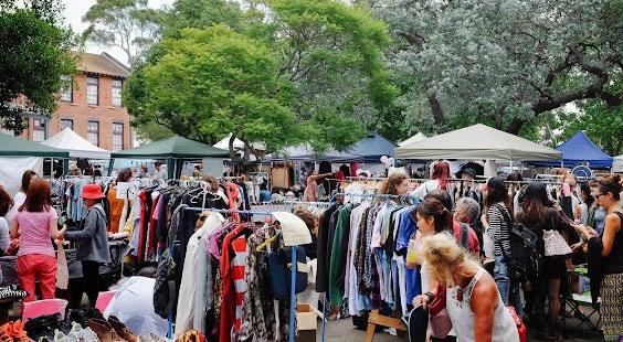
Pyrmont Cafes
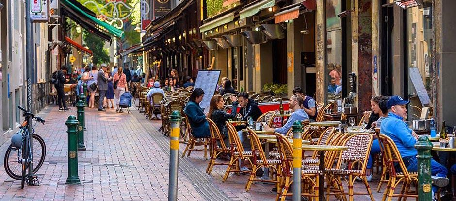
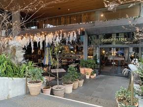
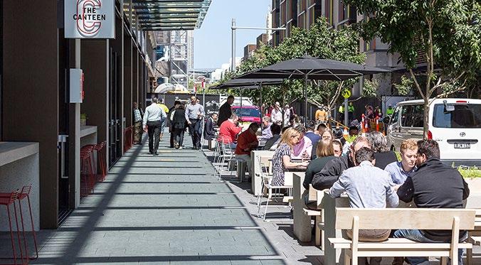
Commercial buildings in Pyrmont tend to be characterised by an active ground plane featuring cafes, bars, and retail.
1-3 Bank St
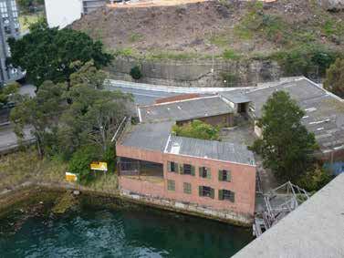
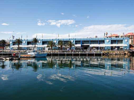
Privately owned building adjacent to foreshore - currently underutilised.
Childcare Centre
Supporting services needed to accomodate job growth already present within Pyrmont precinct.
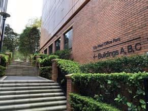
Goodman Office Park
Existing commercial uses in the area to support the proliferation of tech companies and other industries.
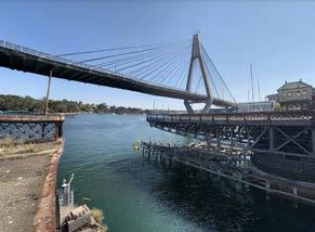
View to ANZAC Bridge
From Glebe Island Bridgehighlighting the juxtaposition between the old and new. A focal point worthy of celebration.
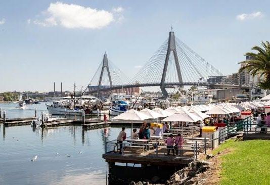
Marina Public Space
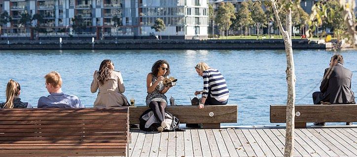
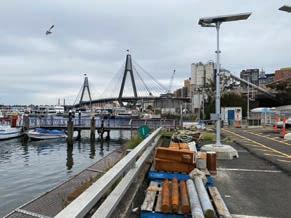
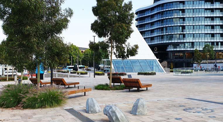
Existing public promenade lacks visibility though despite providing expansive views of Blackwattle Bay
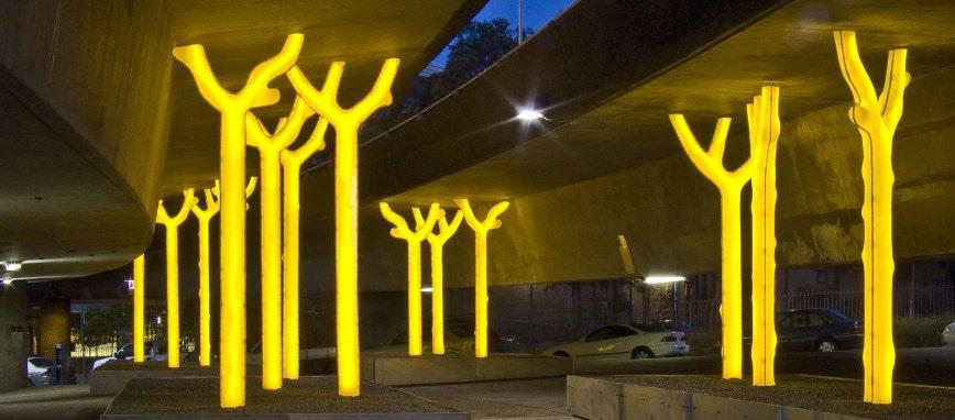
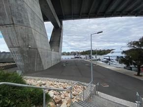
Under ANZAC Bridge
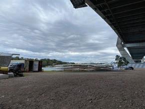
Opportunity to explore open space precinct with active recreation program utilising shaded spaces.
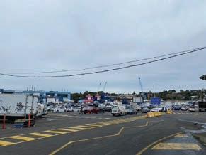
Markets Carpark
Evidence of prioritisation of private vehicle over creating pedestrian-centric public domain.
Bank St
Relatively low traffic at the northen end of Bank St, past Miller St. Potential to explore seperated cycling lanes and/or shareway.
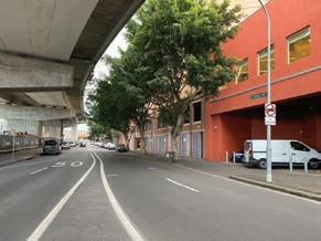
Under-bridge Carpark
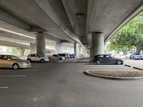
Underutilised space with high potential given its weather protection and proximity to Light Rail and Metro.
Footpath
Footpath along foreshore ends prematurely and is largely inaccessible with industrial equipment either side.
27
04 SWOT Analysis
Strengths & Weaknesses
STRENGTHS WEAKNESSES
Existing waterfront promenade/seated dining space
Existing public open space at Blackwattle Bay Marina
Views of Blackwattle Bay, Glebe foreshore, ANZAC Bridge and Glebe Island Bridge (heritage item)
Future metro link improving accessibility and connecting Pyrmont to the West
Development site unaffected by heritage items constraining development
Potential for new Fish Market site, as a trip generator, to increase quantity and frequency of visitors to the site and surrounds - economic and social benefits
Commercial buildings advertising end of trip facilities for cyclists - businesses encourgaing active transport, signalling a need to improve network connectivity
Minimal road traffic at this section of Bank St - largely residential traffic with vehicular entrances outside the project site boundary
Lack of legible and safe pedestrian crossings across Bank St towards Light Rail station
Poor wayfinding signage to Light Rail - inconspicuous below-ground design contributes to poor visibility
Poor engagement with waterfront - privately owned land preventing public access
Significant sources of noise - largely road and traffic noise
Overshadowing caused by Western Distributor road structure
Disrupted recreational cycling network
Disrupted foreshore pedestrian network
New Fish Market development will likely impeded on existing view corridors to both the waterfront and Glebe foreshore
Lack of ground plane activation at northern end of the site
Prioritisation of private vehicle transport over cycling and walking - no seperated bike lane despite this section of Bank St acting as a gateway from Pyrmont residences to the waterfront
29
Opportunities & Threats
OPPORTUNITIES THREATS
Existing dining and retail infrastructure may offer potential sites for adaptive reuse
Engage with waterfront - connection to water crucial to Indigenous practice and culture
Maintain and enhance visual connection with water and public space (passive surveillance)
Transformation of Glebe Island Bridge (state heritage item) into open green space/active transport link to The Bays
Develop missing links from pedestrian and cycling network along waterfront that prioritises active transport and enhances visual connections with the bay
Waterfront sites provide attractive locations for commercial developments
Improve connectivity to cycling network and increase protections for cyclists through seperated contraflow lanes - current streetscape not conducive to cycling
Currently underutilised covered carpark area could be better used as a community hub for temporary activations
Expanded green spaces and landscaped precinct at northern fringe of site to serve needs of workers and existing Pyrmont residents
Pyrmont Peninsula Place Strategy identifies the site as an innovation corridor
Managing residents investment expectations of views - limitations of building heights
Potential for sea level rise and increased frequency of flooding events which could infiltrate development site
Convenience and efficiency of Western Distributor for private vehicle travel may deter residents/ visitors/employees from using public and active transport modes
Potential for new Fish Market site to draw visitors and therefore economic and social activity away from the site’s waterfront
New development would result in job losses at existing - although new Fish Market development would likely offset employment deficits
Constraints associated with State Heritage Items may infringe upon scale of development and opportunities for greening Glebe Island Bridge
30
Key Takeaways and Priority Actions
Linkages + Movement Corridors
Improve east-west pedestrian connections with transit nodes and north-south cycling and pedestrian connections to promote active transport. Provide ‘fast’ and ‘slow’ spaces and enhance the public domain.
ANZAC Bridge Overshadowing
Consider overshadowing impacts as an opportunity to provide shaded spaces for active recreation and reduce urban heat, and a constraint limiting sun access and built form.
Green Movement Corridor
Glebe Island Bridge poses a promising active transport link to the Bays West renewal area. Consider re-wilding existing vegetation along the banks whilst considering heritage value.
Waterfront Engagement
A waterfront promenade connecting to the wider Sydney Foreshore Walk and bolstered by active frontages, urban furniture, public art, etc. to enable gathering and socialisation.
Visual Connection with Water + Sky
Consider the potential for surrounding lots to maintain visual access to the bay and the sky above. Base building height limitations on best-practice examples.
Cultural Core
Existing light rail infrastructure suited to visitors, thus providing an opportunity to cluster cultural and entertainment uses nearby.
Pyrmont Metro Station
Investment in transport infrastructure will enable jobs growth through increased capacity. Provide a major gateway at Bridge Rd to draw workers from Union St Metro Station.
Innovation Hub
Co-location of start-ups, tech companies, thinktanks, R&D companies, etc. centred around the site’s southern gateway and connected to Metro.
New Fish Market
Leverage the increase in visitors to the area by providing retail, dining, and entertainment uses throughout the site to boost economic prosperity and support for First Nations businesses.
31
05 Vision
The Vision for Tjerruing/Blackwattle Bay
‘Tjerruing/Blackwattle Bay will be transformed into an attractive waterfront innovation hub bolstered by enhanced active transport linkages and diverse retail, commercial, cultural, and landscaped precincts. It will respect and celebrate Country and build on Indigenous stories to shape an innovative place for recreation, working and story-telling.’
Key Objectives
1.
2.
3.
Heritage and Culture
Integrate Indigenous and colonial histories into the site and encourage story telling through innovative design interventions at a range of scales. Provide spaces within the site which enable local Indigenous people to exercise self-determination.
Environmental Sustainability and Climate Resilience
Implement Indigenous knowledge of sustainable land and water practices to reduce current and future impacts of climate change. Preserve and restore existing vegetation on the site and introduce native flora to provide habitat for fauna, establish seed banks, and encourage urban food foraging. Includes the use of locally-sourced materials.
A Connected, Walkable Public Realm
Provide pedestrian-prioritised open green spaces, and community buildings. Enhanced north-south that ensure permeability to and promenades and allow alfresco planting, and street furniture.
34
4.
5.
Walkable
access to the waterfront, community and commercial north-south pedestrian connections and from existing foreshore alfresco dining, street vending,
Density with a Human Scale
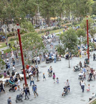
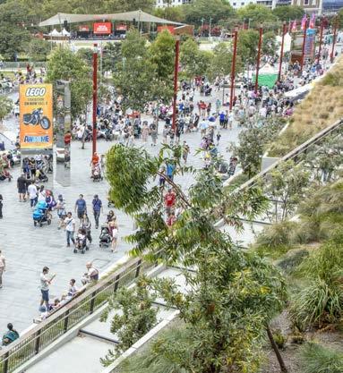
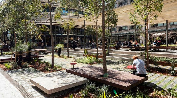
Concentrate social infrastructure whilst enhancing ground plane activation to bring people together in place. Create dynamic precincts through horizontal diversity which integrates retail, commercial and cultural programs and permeable facades inviting people to gather and prompting social and economic activity.
Active Transport
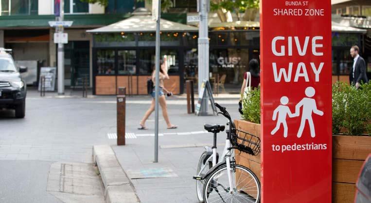
Prioritise walking, cycling, and public transport as modes of transport both for recreational and commuting purposes. Promote social corners at intersections of movement corridors to incentivise walking and cycling.
35
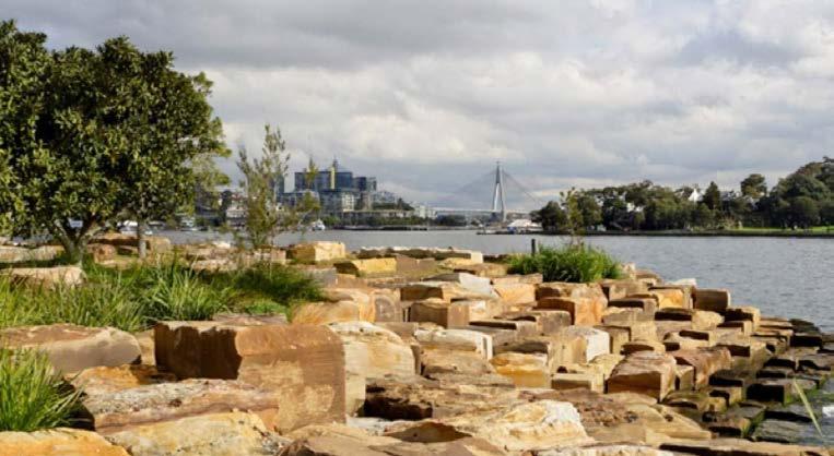
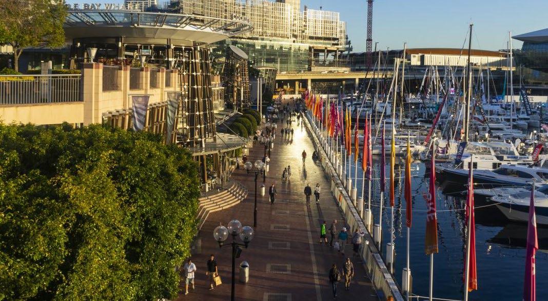
The Pyrmont foreshore is a significant public and environmental asset which should be returned to the Pyrmont community to enhance engagement with the waterfront and expand the public domain. Connecting Blackwattle Bay to the existing Sydney Harbour Foreshore walk will provide an active transport link for commuters and create an attractive destination which draws tourists and visitors through the site. There is potential to connect to the Bays West precinct through an active transport link over heritage-listed Glebe Island Bridge.
The co-location of world-renowned cultural and entertainment destinations within the Pyrmont Peninsula cements the Blackwattle Bay foreshore as an arts and cultural hub. The project will increase the site’s overall public domain and provide new spaces for retail, dining, live music and entertainment attractions. Interpretations of Indigenous stories can be expressed through wayfinding and activation measures such as public art, street naming, and visual and physical connections with water, land, and sky.
Provide commercial buildings capable of contributing to Sydney’s through the provision of supporting placemaking project, such as open green spaces, active pedestrianised cultural infrastructure. Ensure are located near site gateways wayfinding from the future Metro Street and Pyrmont Bridge Road.
Five Key Moves
1.Connect Pyrmont’s foreshore to the Sydney Harbour Foreshore walk
A cultural destination which is meaningfully connected to Country An activate commercial connected to the 2. 3.
36
commercial core the innovation corridor
which attract businesses Sydney’s innovation sector supporting spaces in the an accessible waterfront, pedestrianised streets and that commercial buildings gateways to ensure efficient Metro station between Union Road.
Expand and connect the city’s green grid and public open space networks
4. 5.
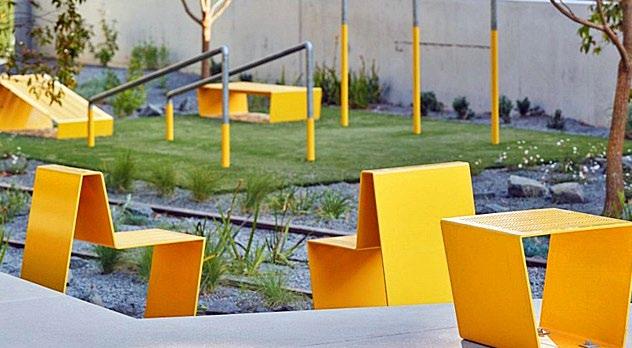
Contribute to the expansion of the Sydney Green Grid by creating additional open green spaces on the site and retaining and conserving existing canopy cover. Ensure suitable wayfinding measures are in place to link such open spaces both within the site and to external green spaces. Within such spaces, provide opportunities for programmed activities, such as playgrounds, table tennis tables and seating, as well as unprogrammed areas for temporary activation sites. Collaborate with Indigenous knowledge holders to implement a native planting scheme.
Provide a pedestrian-centric public plaza at the Pyrmont Bridge Road site entrance as both a gathering and transitory place for workers and visitors alike. Activate the ground plane through street dining, street trees and public art, to encourage loitering and engagement with local businesses. Maintain sightlines from the city to Blackwattle Bay to; connect with Country, improve wayfinding, attract people to the waterfront, and capitalise on the capacity of coastal breezes to cool the street.
A gateway plaza linking Pyrmont to the Metro
M 37
06 Connecting with Country Strategy
The Spirit of Country
Indigenous culture recognises that all things are connected and interrelated which means that all periods of time, ranging from past to present to future, are significant. All things designed and not-designed are influenced by the past, shape present experiences, and impact futures.
The spirit of Country is embodied in oral histories and Ancestral stories passed on through generations of local Gadigal and Wangal peoples. These stories have shaped understandings of Tjerruing Blackwattle Bay through history.
125 000 years ago, the sea level of the bay was 6m higher than current levels. As the water level receded, the low lying sandstone outcrop remained, forming steep banks now characteristic of the Pyrmont area. This phase gave rise to the story of Booambilyee the Shark Spirit.
6000 years ago, the bay flooded to roughly its current level creating a freshwater creek that ran through what is now Wentworth Park. This plentiful supply of freshwater once had and still remains culturally valuable to local Indigenous people.
Colonisation was the catalyst for the destruction of physical evidence of Aboriginal occupation, pollution of the foreshore, and quarrying of sandstone. Despite a sense of physical erasure, the spirit of Country has survived, and through meaningful partnerships with local Indigenous peoples, more and more people are engaging with Country.
39
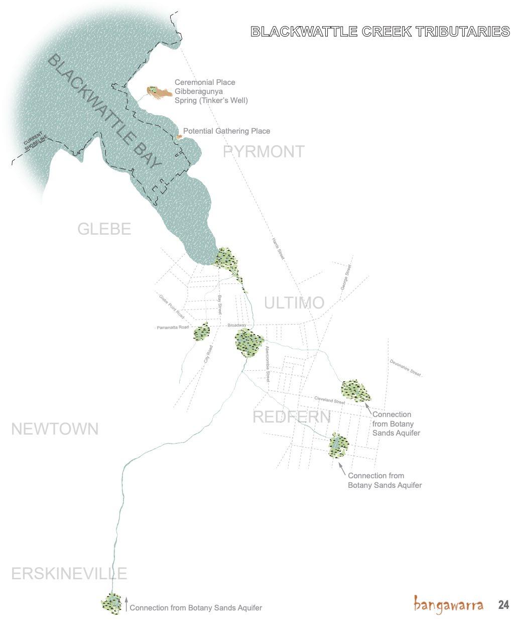
Blackwattle Creek Tributaries (Bangawarra, 2021)
Indigenous Heritage and Stories
Connection to Water
The shoreline of Tjerruing (Blackwattle Bay) was once characterised by low rocky cliffs, small sandy beaches and marshland. Blackwattle Creek flowed into a marshy area named Blackwattle Swamp.
The different types of water courses and riparian corridors provided different uses for local Indigenous peoples; brackish swamp water was ‘sour’, salt water was ‘bitter’ and fresh water was ‘sweet’ and drinkable. The meeting of fresh and salt waters became known as ‘tookera’.
Local Gadigal and Wangal peoples maintained strong relationships and connections with water which was utilised for life-sustaining practices, including fishing for fish and shellfish which were major food sources, native plants used for meals and as raw materials for weaving and tool making, and the bay was also associated with birth and medicines. Fishing was an important cultural and economic practice particularly for Aboriginal women who controlled fish supply and dominated Blackwattle Bay.
Pyrmont’s Aboriginal population have maintained strong connections with Blackwattle Bay through fishing activities and employment at the wharves and surrounding industrial sites.
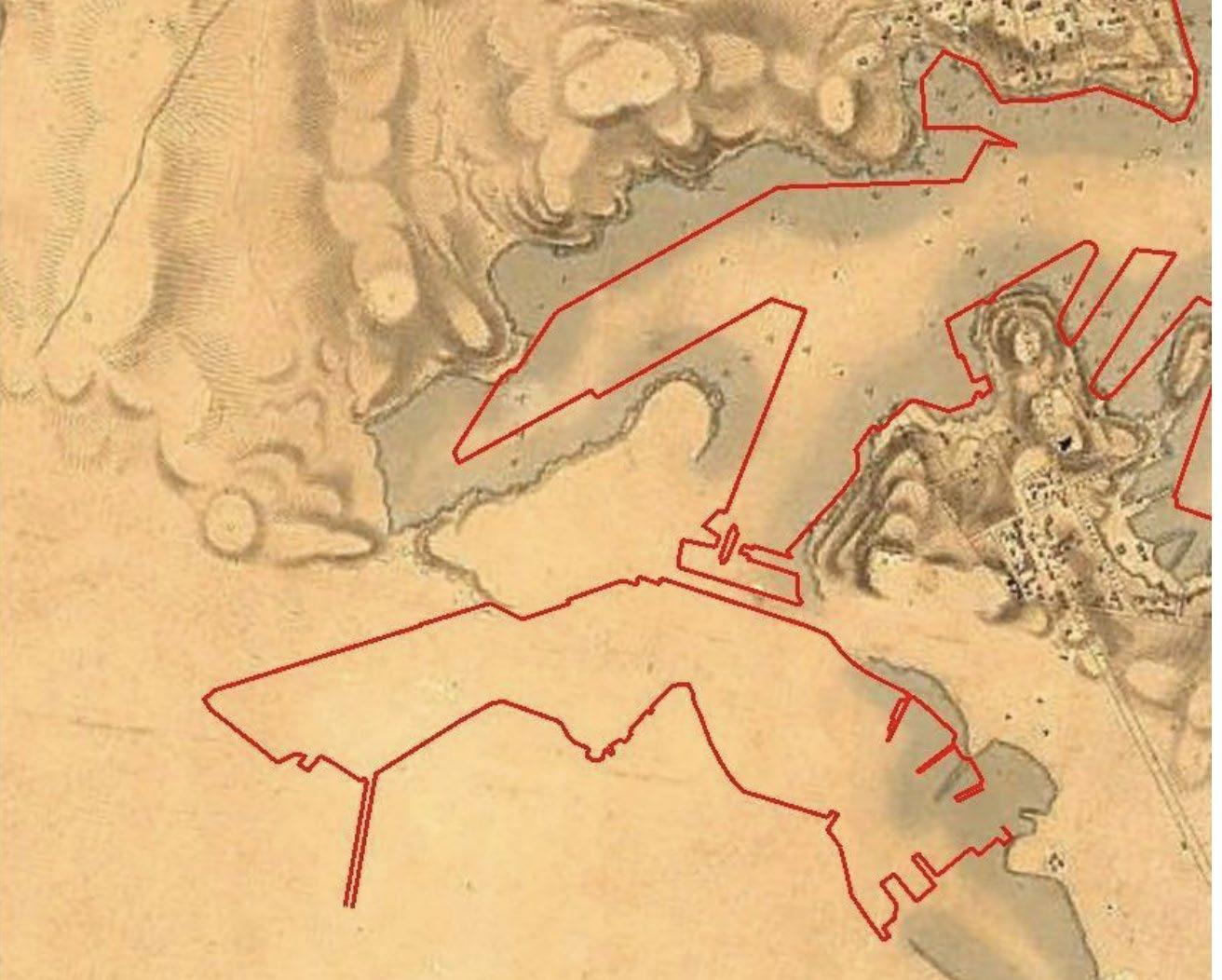
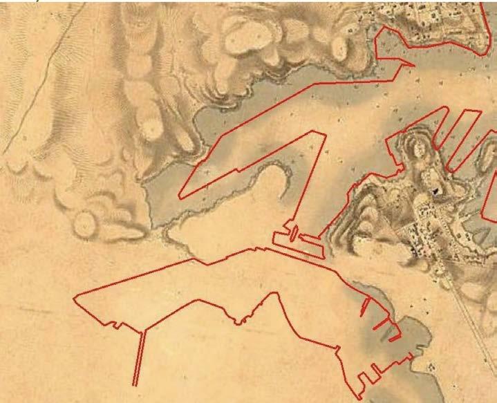
Pre-industrial shoreline (circa 1830) with modern shoreline indicated in red. Potential for interpretation of former shoreline in the site’s wayfinding design. Source: Artefact Heritage, 2019
40
Tjerruing
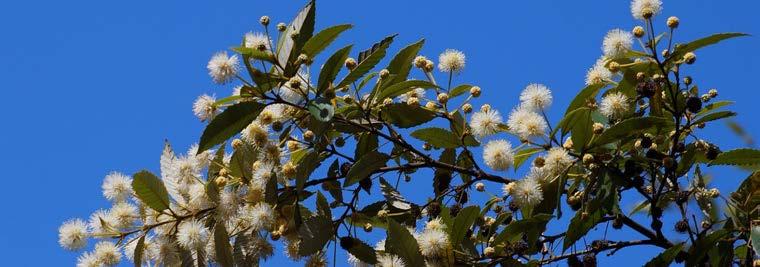
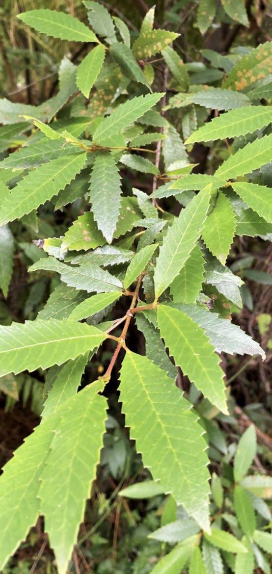
Tjerruing Blackwattle Bay Country is named after Tjerruing, a flowering native plant species which grew prolifically along the creekline and was given the name ‘blackwattle’ by colonists.
The root system of Tjerruing plays an important role in protecting terrestrial environments from aquatic environments by preventing erosion during seasonal flooding and storm events. The plan thas also provided local Aboriginal people with the hard wood resources needed to craft tools and equipment, as well as performing cultural functions as a source of nectar with blooms proliferating in the season of Parradowee (October and November).
The flowers of Tjerruing are crucial to sustainability, providing an important food source for native animals and Insects. When grown around other species, Tjerruing enhances the health and survival of such plants and also increases the effectiveness of their medicinal qualities.
Dahl’wah
Often found alongside Tjerruing is Dahl’wah, an ecologically and culturally valuable species that protects us from the byproducts of urbanisation; pollution, noise, and dust. Dangerous reptiles found the leaves of Dahl’wah to be harsh and exposed, so it was a safe space for children to take refuge.

In Aboriginal culture, Dahl’wah represents the strong spirit of women of Country and their role in protecting and nurturing all living organisms.
Information adapted from Artefact (2019), Artefact (2021), and Bangawarra (2021)
Tjerruing Leaves (Bangawarra, 2021)
Dahl’wah Leaves (Bangawarra, 2021)
Traditional Owners

Pre-colonisation, Tjerruing (Blackwattle Bay) Country was occupied by the Gadigal and Wangal people of the Eora Nation who spoke Dharug and Dharawal.

Summary of Key Thematical Stories
• Freshwater, Bitterwater, Sourwater
• Tjerruing
• Dahl’wah
Begin with understanding the oral and Ancestral histories of Country. Engage with Indigenous knowledge and stories to enrich public spaces. Empower Aboriginal individuals, businesses, and communities to contribute to the Innovation Corridor through the provision of culturally appropriate spaces that celebrate the enduring spirit of Country.
Design natural recreational spaces that enable residents, workers, and visitors to benefit from Country’s healing qualities. People and communities should be empowered to connect to the spirit, knowledge, and native species of Country. Public spaces should be utilised to create opportunities for truth-telling and connection to place.
• Fishing for life
• Deep water, deep time These stories can inspire interpretive media and public art.
Country has always served as civic, public and ceremonial space. Utilise language, stories, and native ecology to create engaging public space. Contribute to the healing of Country by creating built environments and protecting natural environments that enable the co-existence of marine and land ecologies and human inhabitance.
Use local languages (Dharug and Dharawal) to name places after Country and stories - never after people. Consider naming pedestrian boulevards after Indigenous stories about movement and utilise Dharug language to name green spaces after culturally significant stories, species, and natural topographic features.


Acknowledge that aquatic movement and access, including past uses as a food source, are crucial to the ongoing spirit of Country. Integrating stories of saltwater, freshwater, bitterwater and the pre-colonial creekline will enable people to walk the Songlines of the original inhabitants.

Sustainably conserve what is existing on Country. New vegetation must be endemic to place to ensure it belongs to Country. Connect precincts through Songlines that celebrate Aboriginal knowledge, culture, stories, people, and language. Recognise that disruption to terrestrial and aquatic ecosystems has far-reaching effects.
Strategies inspired by Bangawarra, 2021
Places for People
Landscape Design Connection
Water Engagement Place and Street Naming
Overview of Strategies Designing
Recreational
with
Minimise Damage to Country Strategy 1. Strategy 2. Strategy 3. Strategy 4. Strategy 6. Strategy 5.
42
Implementation Strategy
Engagement
1.Work with Indigenous stakeholders to design commercial buildings appropriate for Indigenous businessesenabling contributions to the Innovation Corridor
Recreational Landscape Design
1.Large landscaped precinct with both active and passive programs
2.Implementation of Indigenous-led native plantings encouraging use of edible plant species to allow foraging
Connection with Water
1.Waterfront promenades with steps down to water enabling fishing
2.Maintain visual connections to water


Designing Places for People
1.Empower local Indigenous people to plan and design culturally appropriate spaces for ceremony and story-telling
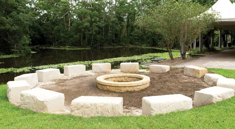
2.Yarning circle and Indigenous performance spaces
3.Aboriginal heritage museum
Place and Street Naming
1.Pedestrian boulevards named after Indigenous stories about water and movement


2.Dharug language utilised to name green spaces after culturally significant native flora species
Minimise Damage to Country
1.Integration of former creekline into wayfinding referencing past movements and practices
2.Re-wilding with natives at Glebe Island Bridge
3.Creation of native seed banks at Bank St parkland
1:3000 020 100
Placenaming Strategy
1 2 3 4 5 6 7 8 9
Pedestrian Thoroughfares
Pedestrian Thoroughfares
Biddi Walk - bitterwater Country
Biddi Walk - bitterwater Country
Nattai Boulevard - freshwater Country Gari Avenue - saltwater Country Tookera Walk - meeting of fresh and salt waters - where shoreline of former creek met the bay
Nattai Boulevard - freshwater Country Gari Avenue - saltwater Country
Tookera Walk - meeting of fresh and salt waters - where shoreline of former creek met the bay
Promenades
Promenades
Garaban Cove - sandstone Maugerry Landing - fishing Songline Esplanade
Garaban Cove - sandstone
Parklands and Green Space
Maugerry Landing - fishing Songline Esplanade Parklands and Green Space
Yiningmah Park - steep cliffs Yarra Reserve - gum/eucalypt tree
1 2 3 4 5 6 7 8 9
Yiningmah Park - steep cliffs Yarra Reserve - gum/eucalypt tree
Portion of former creekline integrated into wayfinding design marked in blue.
8 9
YiningmahPark
YiningmahPark
8 9
Garaban Cove
Garaban Cove
1:3000 020 100
1:3000 020 100
4
7
7
4
5 6
TookeraWalk
SonglineEsplanade
SonglineEsplanade
5 6
TookeraWalk
Maugerry Landing
Maugerry Landing
Yarra Reserve 1
3
2
3
Yarra Reserve 1
Gari Ave
Gari Ave
Biddi Walk Nattai Blvd
2
Biddi Walk Nattai Blvd


 Gathering space with sandstone heritage motifs (Yerrabingin, 2020) Albert Park College Campus native landscaping (LA, 2021) Wildflower Aboriginal horticulturist program (City of Sydney, 2022)
Views to harbour shaped by built form in Barangaroo (Google Earth) Greenline Promenade steps down to water (Architecture Au, 2021) Yarning Circle at University of Newcastle (UON, 2022)
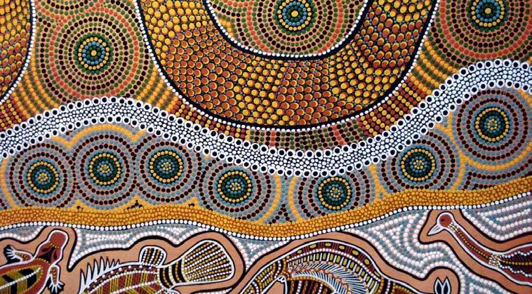
Artwork by Annette Webb, Dunghetti woman. Used as an example of Indigenous art within the performance circle space (see masterplan).
Artwork by Barbara Dieu. Used as an example of potential Indigenous ground art on basketball court (see masterplan).
Gathering space with sandstone heritage motifs (Yerrabingin, 2020) Albert Park College Campus native landscaping (LA, 2021) Wildflower Aboriginal horticulturist program (City of Sydney, 2022)
Views to harbour shaped by built form in Barangaroo (Google Earth) Greenline Promenade steps down to water (Architecture Au, 2021) Yarning Circle at University of Newcastle (UON, 2022)
Artwork by Annette Webb, Dunghetti woman. Used as an example of Indigenous art within the performance circle space (see masterplan).
Artwork by Barbara Dieu. Used as an example of potential Indigenous ground art on basketball court (see masterplan).
45
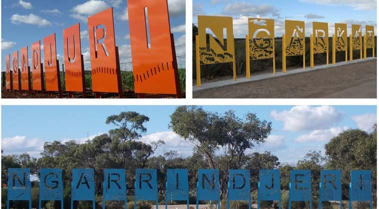
Indigenous placenaming signage in South Australia (Department for Infrastructure and Transport, 2019)
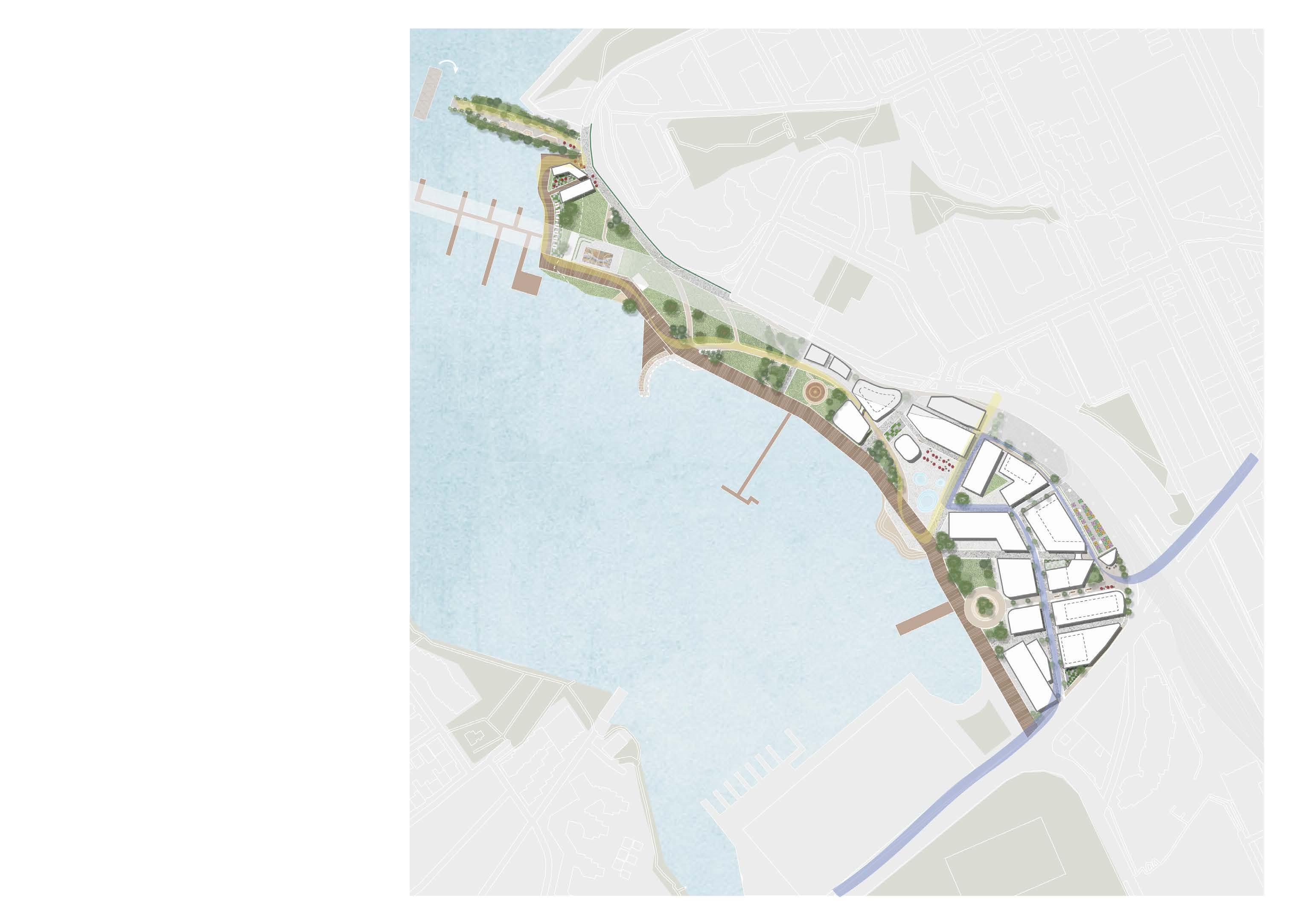
07 Structure Plan
LEGEND Structure Plan
Mixed use (commercial with ground floor retail/dining) up to 10 storeys
Mixed use (commercial with ground floor retail/dining) up to 6 storeys
Proposed open space
Arts, civic, community and cultural facilites
Existing view corridors
Proposed view corridors
Key place opportunity
Activated corners/nodes
Proposed foreshore promenade/ pedestrian and cycling linkage
Proposed pedestrian movement corridors
Proposed road (to service towers)
Opportunity to improve cycle lane connectivity along Bank St
Potential pedestrian crossing Site Boundary
Existing Green Space
Blackwattle Bay
Proposed Metro Line
Light Rail Stations/Line
State Heritage Items retained
Existing shared walking/cycle route
Existing key cycle routes
BowmanSt
Western Distributor
Quarry MasterDr
Harris St UnionSt BankSt
BridgeRd
BankSt
L
L
L
Western Distributor 1:3000 020 100
08 Benchmark Analysis
Overview of Benchmarks
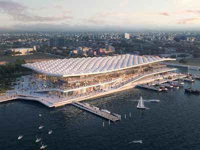
Seaport
Recreational
employees
sqm
sqm
500 5000+ 200+ 40% 11 612 590 000 hectares employees public
of
sqm
dining and retail
7 23 000+ 50% 100% 270 000 90
0.12 10
663 17+ 5+ 49
Boston
Innovation District Boston, Massachusetts Waterfront Tech and Innovation Precinct Barangaroo South Barangaroo, Sydney, Australia Waterfront Mixed-use Precinct Cultural Landscape Garden South Eveleigh, Sydney, Australia
and Cultural Precinct hectares
startups of companies occupy co-working spaces
retail, dining, and community floor space
of car parks revitalised for community use
space
foreshore accessible to pedestrians/cyclist
commercial floor space
establishments
hectares employees in South Eveleigh residents in South Eveleigh native plant species collaborators and designers involved
000+
Barangaroo South
Mixed-use Precinct in Sydney
Socio-Spatial Context
Location: Barangaroo, Sydney, Australia
Local Government Authority: City of Sydney
Surrounding Attractions: Barangaroo Central + Reserve, Darling Harbour, Sydney CBD
Population: 220 residents - 23 000 workers (predicted) - 33 000 visitors/day (predicted)
Project Details
Designers: ASPECT Studios, OCULUS, Rogers Stirk Harbour
Year of Completion: 2018
Project Type: Master-planned waterfront urban renewal on former industrial site
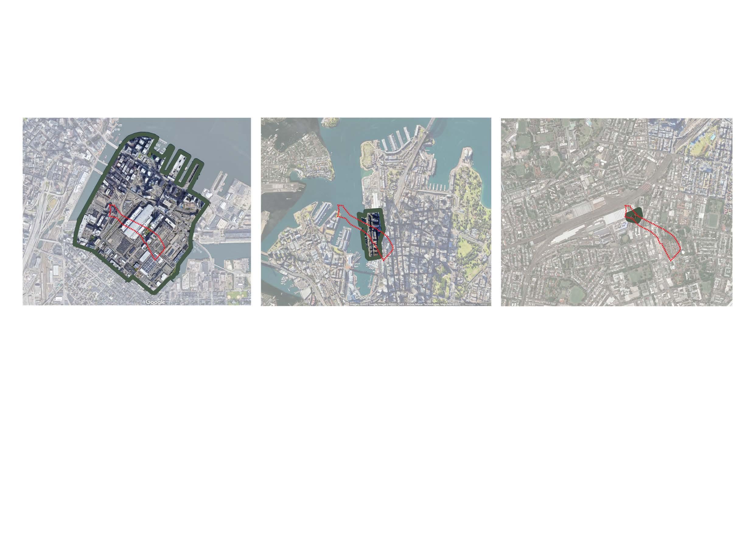
Project Area: 7 ha
Overview of Lessons Learned
• Create and protect culturally significant view corridors through built form - envelope design
• Delivers amenity despite density - 50% of footprint dedicated to open space
• A significant number of cultural and recreational activities can occur within commercial sites
• Provide spaces to sit, rest, and gather along the waterfront
• Use of lower density towers to ensure built form of human-scale density
• Create accessible pathways leading to destinations (promenades, wharves, parks)
Applicable Site Location: Southern District
50
Relevance to Project
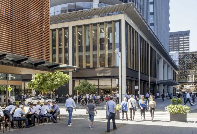
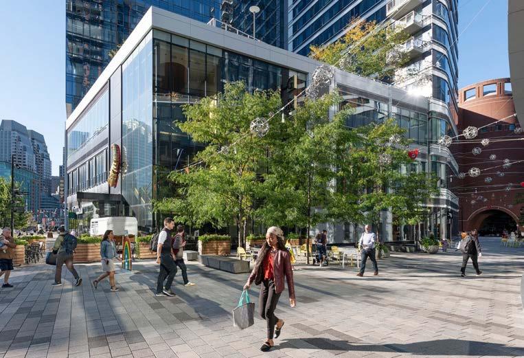
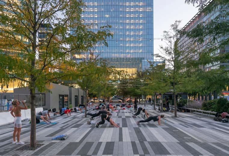
Barangaroo South comprises the commercial precinct of the larger Barangaroo development which provides significant ground plane activation to attract visitors, workers, and residents, Some of the design interventions pictured will be designed into the Pyrmont site to enhance the site’s cultural connectivity, attract tech companies and enhance connections with Country.
Socio-Spatial Comparison
Similarities:
• Users: local residents and domestic tourists
• LGA: City of Sydney Council (similar regulatory restrictions)
• Location: both waterfront developments close to Sydney CBD
• Density: located within medium density districts close to CBD
• Type of Development: greenfield projects - atop industrial sites
Differences
:
• Public Transport: Barangaroo connected to more frequent and efficient train and ferry networks
• Proximity to major roads: project site located beside primary roads bearing high vehicular traffic whereas public promenades in Barangaroo are further from busy roads
• Height of Buildings: 180-275m building in Barangaroo would not be appropriate for the Pyrmont site largely due to overshadowing
Key Transferrable Elements
• Waterfront promenade experiences: open spaces, active recreational areas, transport nodes, retail, popup and permanent artworks, and alfresco dining districts
• Public Art Program: ties stories of Barangaroo’s Indigenous and industrial history into the urban fabric
• Active transport linkages: connects existing foreshore harbour walk (Woolloomooloo to Anzac Bridge)
• Prioritisation of view corridor: shape built form around culturally significant access to views - promote Indigenous connections with waterways
• Reduced density and building height: reduce built form scale towards waterfront to achieve human scale
• Wide waterfront promenade: to promote accessibiity and public
Concept design in plan view highlighting built form which maintains view corridors
Timber bench seating along boardwalk prompting visitors to stay
Lower density commercial towers are more appropriate for Pyrmont site
51
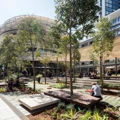
Cultural Landscape
Applicable Site Location: North-Western Fringes
Socio-Spatial Context
Location: South Eveleigh, Sydney, AustraliaGadigal Country
Local Government Authority: City of Sydney
Surrounding Attractions: Commonwealth Bank Office, National Centre of Indigenous Excellence
Population: 663 residents - 10 000+ workers (predicted)
Project Details
Designers: Yerrabingin, Mirvac, Jiwah, Local Indigenous Community members
Year of Completion: 2020
Project Type: landscaping within commercial precinct
Project Area: 1200 sqm - 0.12 ha
Overview of Lessons Learned
• Utilise design guidelines as an opportunity to integrate Indigenous motifs in furniture and streetscape design
• Maintain organic pedestrian paths to juxtapose industrial shoreline and encourage interpretation of Indigenous inhabitance prior to colonisation
• Integrate edible plant species to encourage foraging and cultivation practices - will in turn provide economic opportunities for Aboriginalled tours
• Utilise native planting schemes throughout the site with a focus on species diversity and vulnerable species to create seed banks
Cultural Garden in South Eveleigh
52
Relevance to Project
The South Eveleigh Cultural Landscape Garden is a prime example of a public place landscape project which integrates Indigenous knowledge and practice. The project provides spaces to sit, relax, play and gather with a design approach sensitive to Local Indigenous community interests. Such ideas could be integrated into the landscaped precincts of the Pyrmont site project.
Socio-Spatial Comparison
Similarities:
• Users: local residents and employees
• LGA: City of Sydney Council (similar regulatory restrictions will apply to the site)
• Density: located within medium density, central districts within close proximity to the Sydney CBD
Differences:
• Location: Pyrmont is a waterfront development which will allow connection with waterways as well as native flora and fauna
• Scale: Eveleigh site is smaller than Pyrmont although principles and design elements can still be applied at a larger scale
• Type of Development: The Pyrmont site is considered a greenfield site where as the Eveleigh project occured within the existing building fabric
Key Transferrable Elements
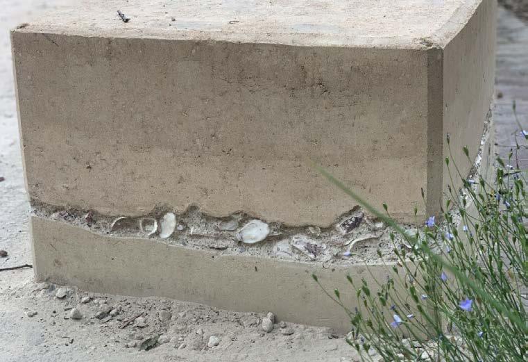
• Seating Layout and Materiality: shells, native flora, timbers prompting discussion and sharing of stories/oral communication of the history of place - circular formation further prompts social connectedness and interaction
• Flora species diversity with cultural significance: the project uses species of significance to the Indigenous community in the area and focusses on using vulnerable species to create an urban seed bank
• Urban Food Forests: utilising edible plants to allow opportunities for seasonal harvesting and allow engagement in Cultural food cultivation practices
• Interpretive Wayfinding: winding paths surrounded by mass plantings create habitat and spaces for contemplation
Gathering place enabling social interactions and
Integration of native flora and Indigenous landscaping within colonial landscape
storytelling
53
Shells middens featured in rammed earth seating referencing connections with waterways
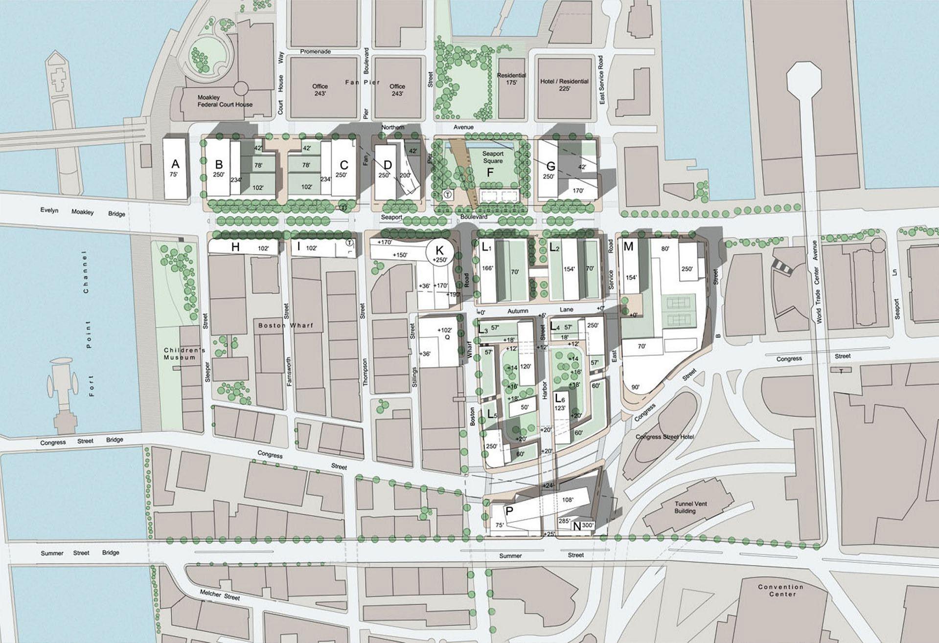
Boston Seaport
Applicable Site Location: Whole of Site
Socio-Spatial Context
Location: Boston, Massachusetts, USA
Government Authority: Boston City Council
Surrounding Attractions: One Seaport (retail), Institute of Contemporary Art, public piers + parks
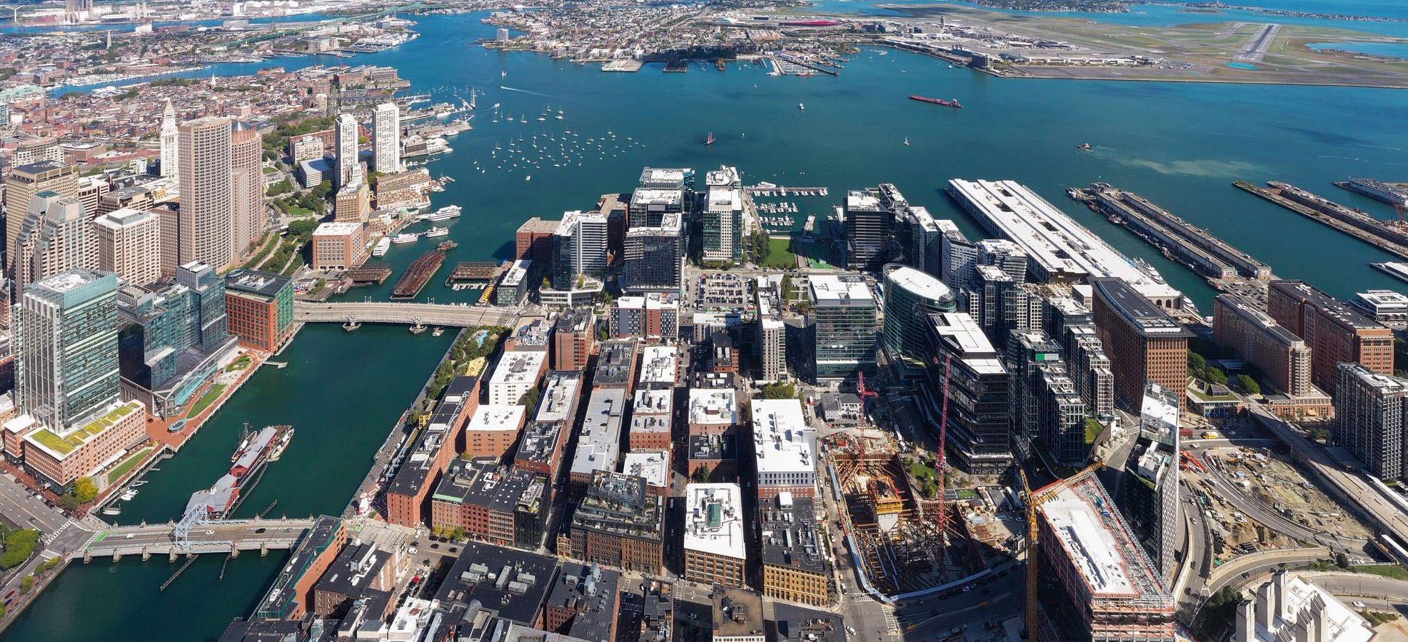
Population: 5 000+ workers and 200+ tech startups
Project Details
Designers: Boston Redevelopment Authority
Year of Completion: under construction
Project Type: brownfield waterfront renewal on a formerly industrial site
Project Area: 400 ha
Overview of Lessons Learned
• Adaptive re-use of heritage buildings with integration of new uses particularly as entertainment, cultural, community, and dining space
• Provide a mix of uses that prioritise walkability and short commutes
• Recognise that increasing liveability and amenity attracts business and a workforce to innovation precincts
• Concentrate bars and cafes to foster collaboration
• Integrate flexible land uses to enable temporary activation and changes in the needs of modern innovation precincts
Harbourside Innovation District in Boston
54
Relevance to Project
The Boston Seaport Innovation District master plan links clusters of diverse land uses to the city’s historic waterfront. Innovation, community and cultural precincts are anchored by retail and dining establishments with green spaces woven between buildings to attract business and maintain dialogue with the public realm. Noteworthy tenants include Amazon, Autodesk, and General Electrics.
Socio-Spatial Comparison
Similarities:
• Users: local residents, employees, tourists/visitors
• Spatial Context: both are waterfront developments with cultural, innovation/commercial, and recreational uses proposed
• Type of Development: both sites sit atop former industrial land with the potential to explore similar heritage themes
Differences
:
• Location: international project with vastly different strategic context
• Scale: Pyrmont site is much smaller although principles and design elements can be applied at a larger scale
• Accessibility: Boston is heavily dependant on private vehicle for commuting to the precinct despite being heavily pedestrianised
• Density: waterfront towers are taller (>16 storeys) than what’s appropriate for Pyrmont despite significant set backs from water
Key Transferrable Elements
• Revitalising underutilised spaces: turning spaces such as car parks, dark alleys, and abandoned building into recreational places that give back to the community
• Extensive use of street trees: to reduce urban heat, activate and define the public domain, contribute to existing green corridors, and increase the environmental amenity of the site, establish a physical barrier between pedestrians and vehicles
• Active street frontages: provide retail, dining establishments, and cultural facilites at ground level to foster a culture of collaboration and social networking
• High density, high amenity: providing a mix of uses in both old and new small footprint buildings to curb urban sprawl and colocate services pertinent to urban life
 Enabling flexible use of unprogrammed space allows for temporary activation and strengthens community Street trees and green open space stitches together a high density urban fabric and offers respite
55
Urban furniture, overhead lighting, street trees, planter boxes, and lower densities enhance the experiences felt in the public domain
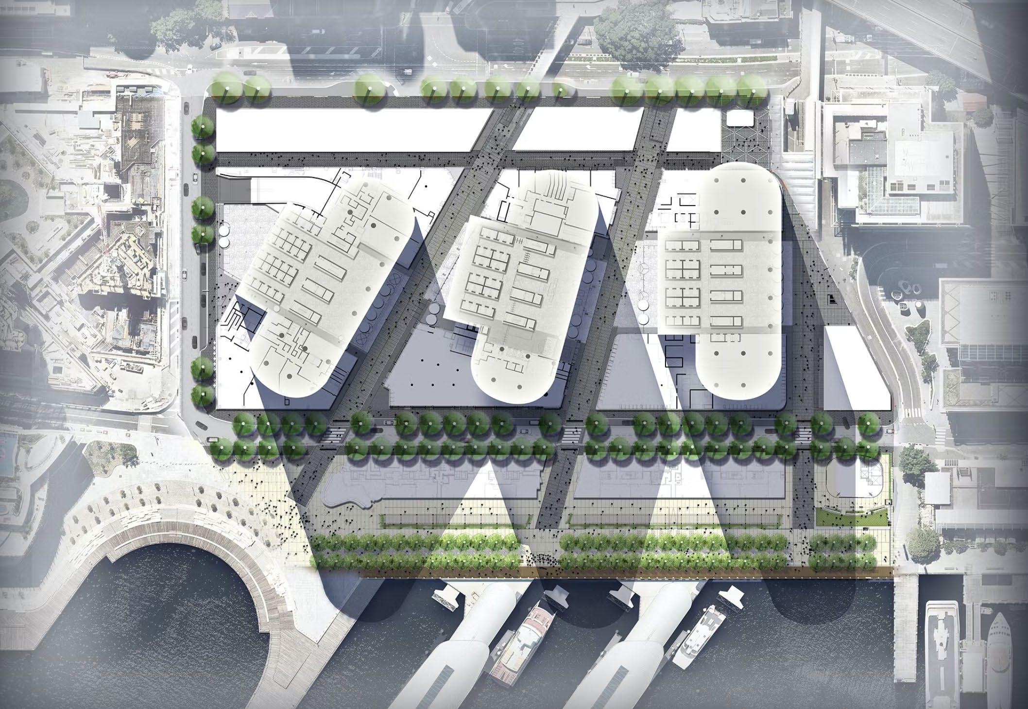
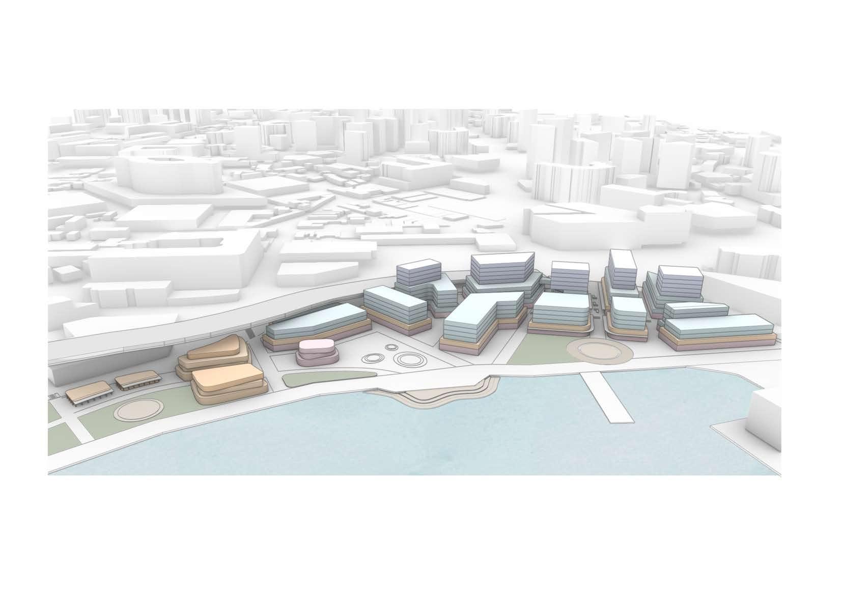
09 Masterplanning
Mixed use (commercial with ground floor retail/dining) up to 10 storeys
Mixed use (commercial with ground floor retail/dining) up to 6 storeys
Proposed open space
Arts, civic, community and cultural facilites
Waterfront promenade
Pedestrian corridors
Eora Track (former Blackwattle Bay creekline)
Views to water
Site entrances/gateways
Public art
Adaptive reuse of Glebe Island Bridge
Adaptive reuse of privately owned buildings - dining uses
Passive and active recreation zone
Indigenous-managed native seed bank
Aboriginal Cultural Centre and Museum (pavillions)
Outdoor Ampitheatre
Dining establishments
Promenade extension zones
Bank St north converted to shareway with contraflow bicycle lane
LEGEND 2 4 5 6 7 8 9 10 11 1:3000 020 100
Urban plaza/pocket parks
1 2 3 4 7
3 3 4 5
8
6
5 5 8
9 10
10 10 10 58
11
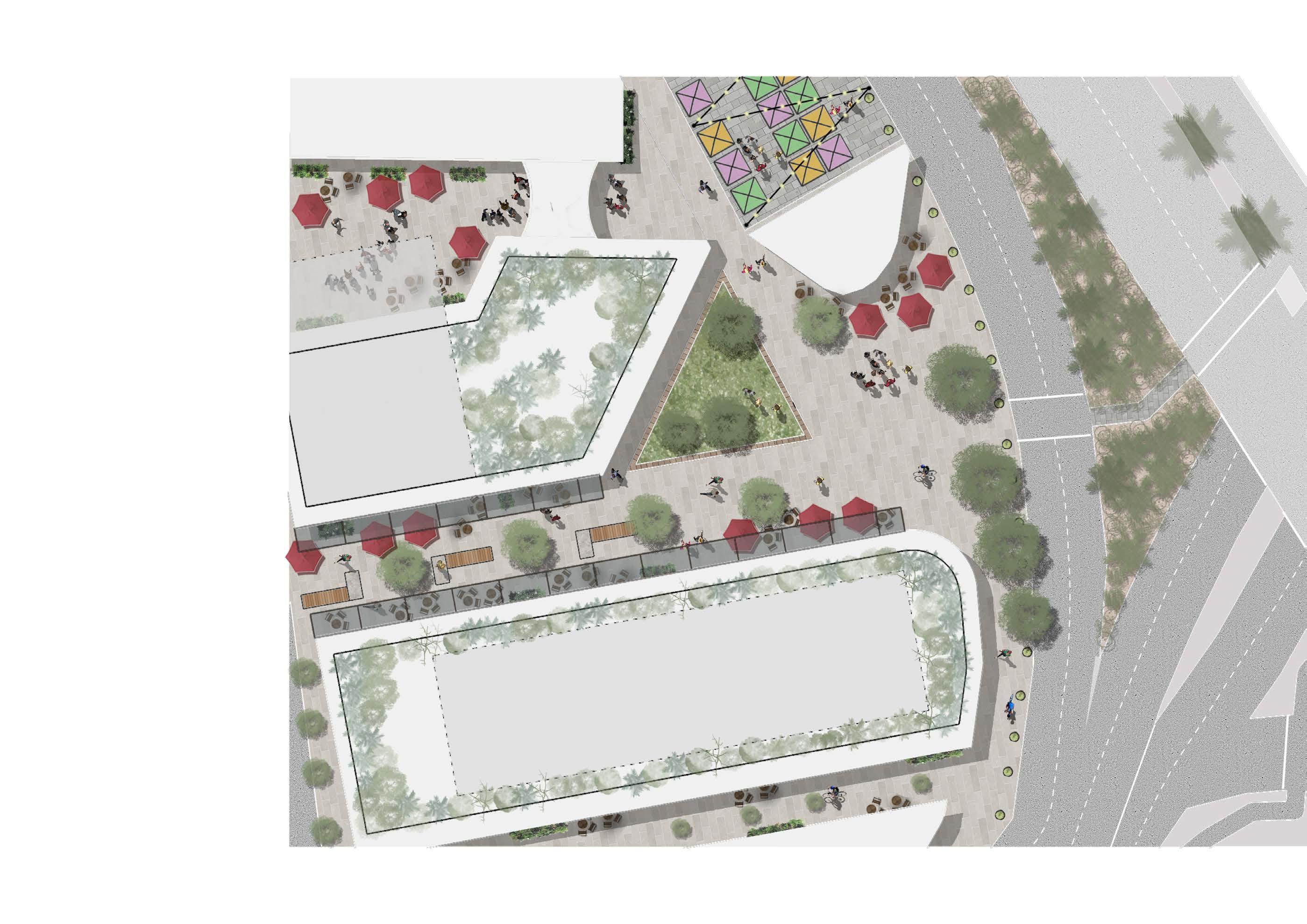
Concept Masterplan
L
L
Yarning Circle 1 3
Public Domain Strategy
Existing Public Domain Areas
Proposed Public Domain Areas
Open Spaces
Open Spaces
Other Public Domain
Other Public Domain
Rail Transport Lines
Rail Transport Lines
The proposed masterplan significantly increases the amount of public space compared to the current site where the public domain is largely confined to roads. A number of laneways and pedestrian thorougfares have been proposed for the site which will connect recreational
(passive and active) spaces and provide access to public squares and activated ground floor retail and dining. These corridors have been instrumental in enhancing movement corridors, particularly connections with public transport and active linkages.
Legend 3 020 100 L L L L 020 100
59
Legend
Commercial and Tech (predominantly co-working space)
Commercial and Tech (predominantly private space)
Cultural, Arts, and Community
Flexible Cultural/Arts/Dining (24hr)
Retail and Dining
Green Open Space
Character Area Mapping
The proposed masterplan is based on three key character areas for Tjerruing Blackwattle Bay; recreation, civic, innovation. In reference to the site’s Indigenous heritage, the three precincts are connected via Tookera Walk which, when translated from Dharug language means ‘the meeting of fresh and salt waters’, symbolises the coming together of people and place.
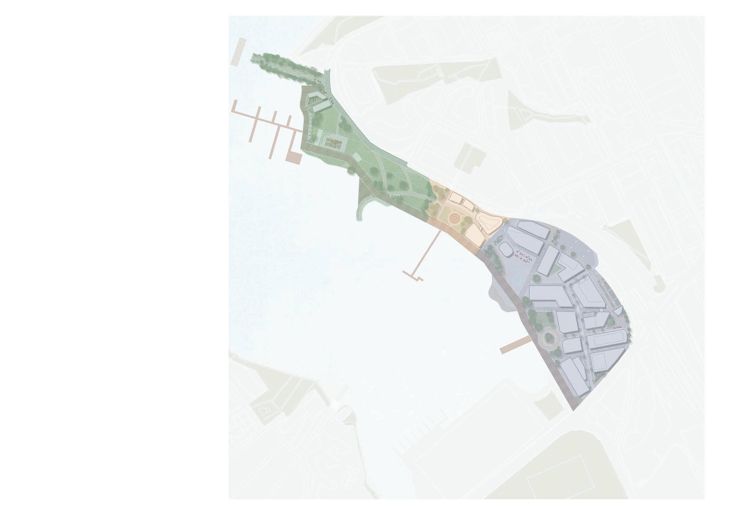
Recreation
This area is characterised by both programmed and unprogrammed green open space with continuous access to the foreshore. The parklands offer places to dwell and enjoy the views of Blackwattle Bay from the shade of a native tree.
Civic
This area features cultural buildings of bespoke architectural character. Within the precinct are opportunities for learning about Country and engaging with Country and Indigenous culture. Building heights are limited and step down towards the water to maintain visual connection with the Bay.
Innovation
The innovation core provides a denser concentration of buildings with spaces for small and large businesses, creative industries, and start-ups. It is supported by community uses, retail, cafes and smaller pocket parks.
Recreation Character
Fish Market Light Rail stop to Pyrmont Metro Station
Civic Character Innovation Character
L M
Continues toward Glebe
towards Darling Harbour and CBD
1:3000 020 100
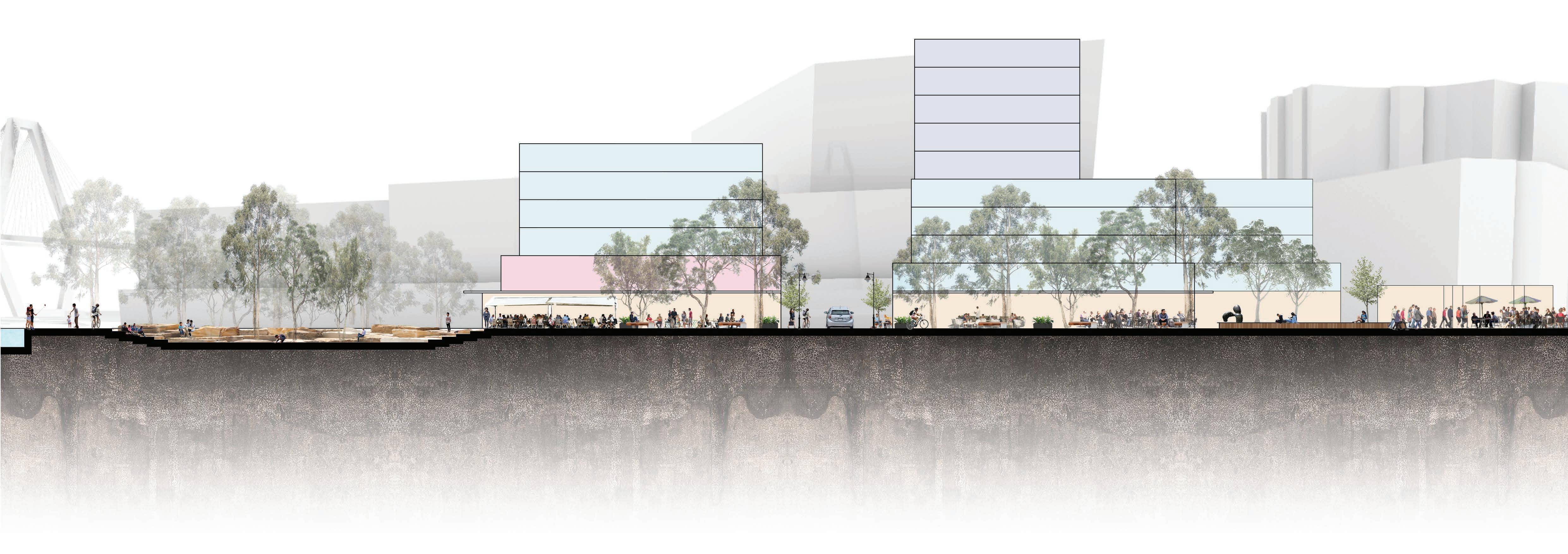
The proposed masterplan for Tjerruing Blackwattle Bay respects and celebrates the stories of Country whilst remaining sympathetic to its industrial heritage. The plan proposes an array of retail, commercial, cultural, and landscaped offerings bolstering the vision for the site to become an attractive innovation hub.
The Blackwattle Bay foreshore has been handed back to the community through the revitalisation of privately owned lots into a world-class harbour foreshore promenade which supports active transport and will connect to the new Fish Market upon completion.
The Renewal of Tjerruing Blackwattle Bay will deliver:
A continuous foreshore promenade - the missing link in the Sydney Harbour Foreshore Walk
Expanded cultural floor space providing opportunities for learning and knowledge-sharing
A gateway plaza and civic meeting place connected to the Metro
New open green spaces contributing to the Sydney Green Grid and connected via the public domain
An active innovation hub supported by places to dwell and socialise
An authentic place which tells the narrative of the past, present and future city
62 1 Glebe potential Bays W Shared Dining Waterfront Existing
seating
Wa
Urban public art Wa
Temporary Bank St Temporary St carpar Yarning Pyrmont Site 2) New Fish Activated Proposed 3 2 4 5 6 7 8 9 10 11 12 13 14 15 16 17 18 19 Legend
Illustrative Masterplan
Community
Dragon
terfront Indigenous-managed Outdoor
terfront
adaptive re-use and transport link to the area (Key Site 1) outdoor seating area wharf basketball court with stepped facility
HISTORY AND CULTURE CORRIDOR
Island Bridge adaptive re-use and potential future active transport link to the West renewal area (Key Site 1) Shared zone district with outdoor seating terfront seating area
Existing recreational wharf Community basketball court with stepped g Dragon boat storage facility terfront Promenade (Key Site 3)
Indigenous-managed native seed bank
Outdoor performance circle plaza adjacent to water feature art and dining establishments terfront promenade mporary exhibition space in existing St carpark
Promenade (Key Site 3) native seed bank circle to water feature establishments promenade space in existing stalls in existing Bank
mporary market stalls in existing Bank carpark rning circle
Pyrmont Bridge Rd gateway plaza (Key Fish Market Activated pedestrian laneways
gateway plaza (Key laneways
L 1:3000 20 100 0
Proposed urban park at new Fish Market
INNOVATION CORRIDOR
6 1 2 3 4 5 7 8 9 11 12 15 16 14 13 17 18 18 10 19
10 Place-based Detailed Design

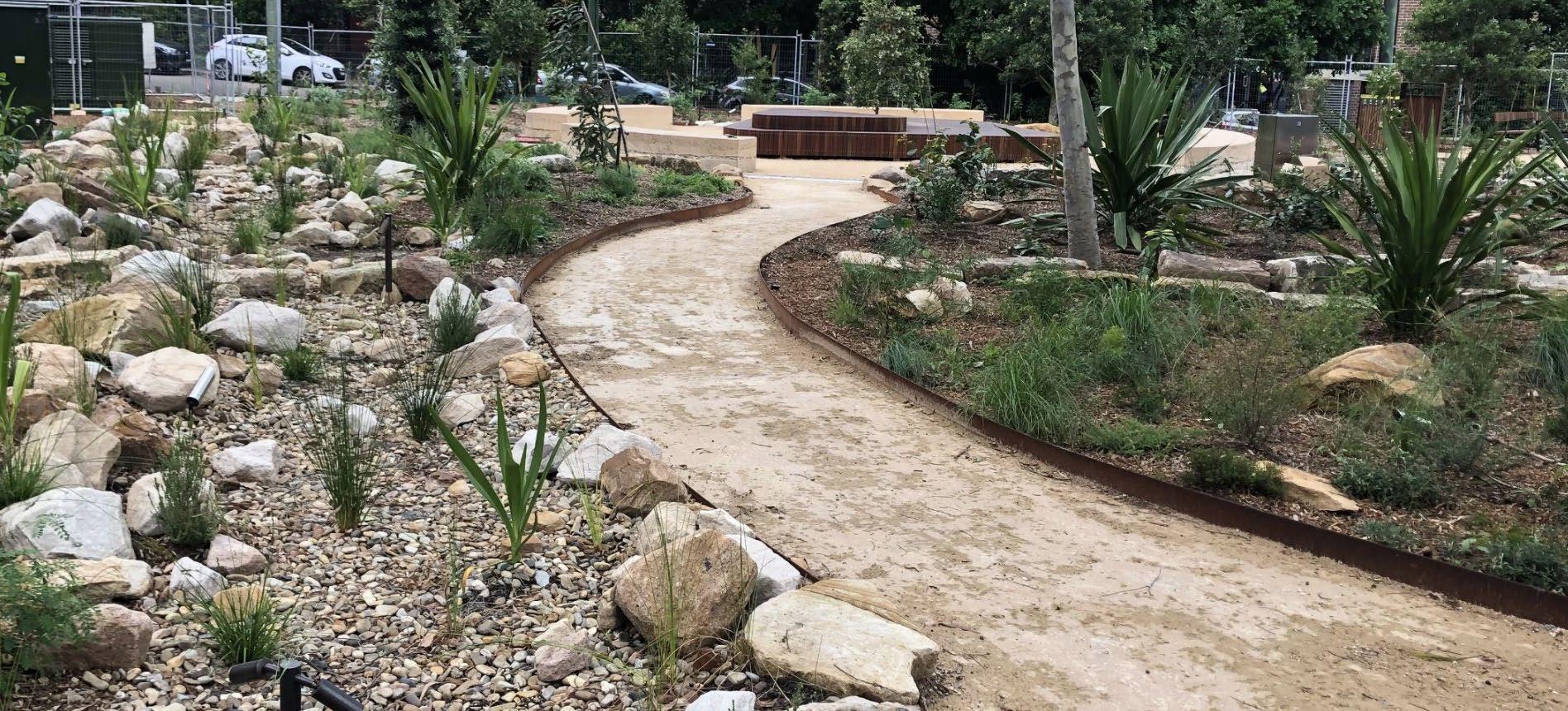
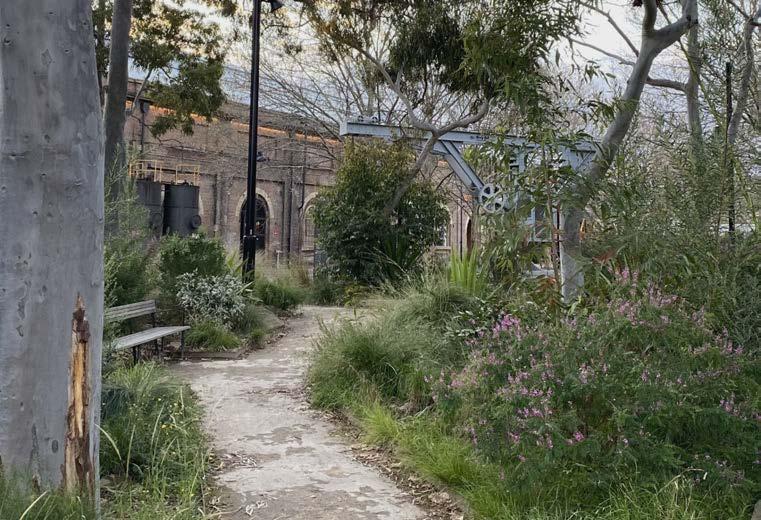
Yiningmah Park - Glebe Island Bridge
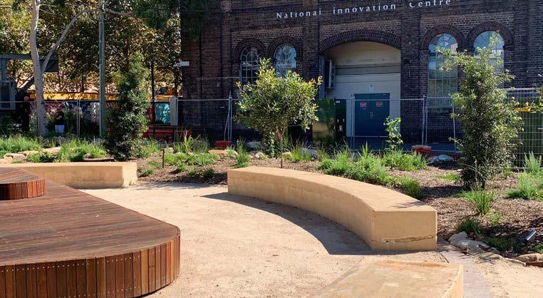
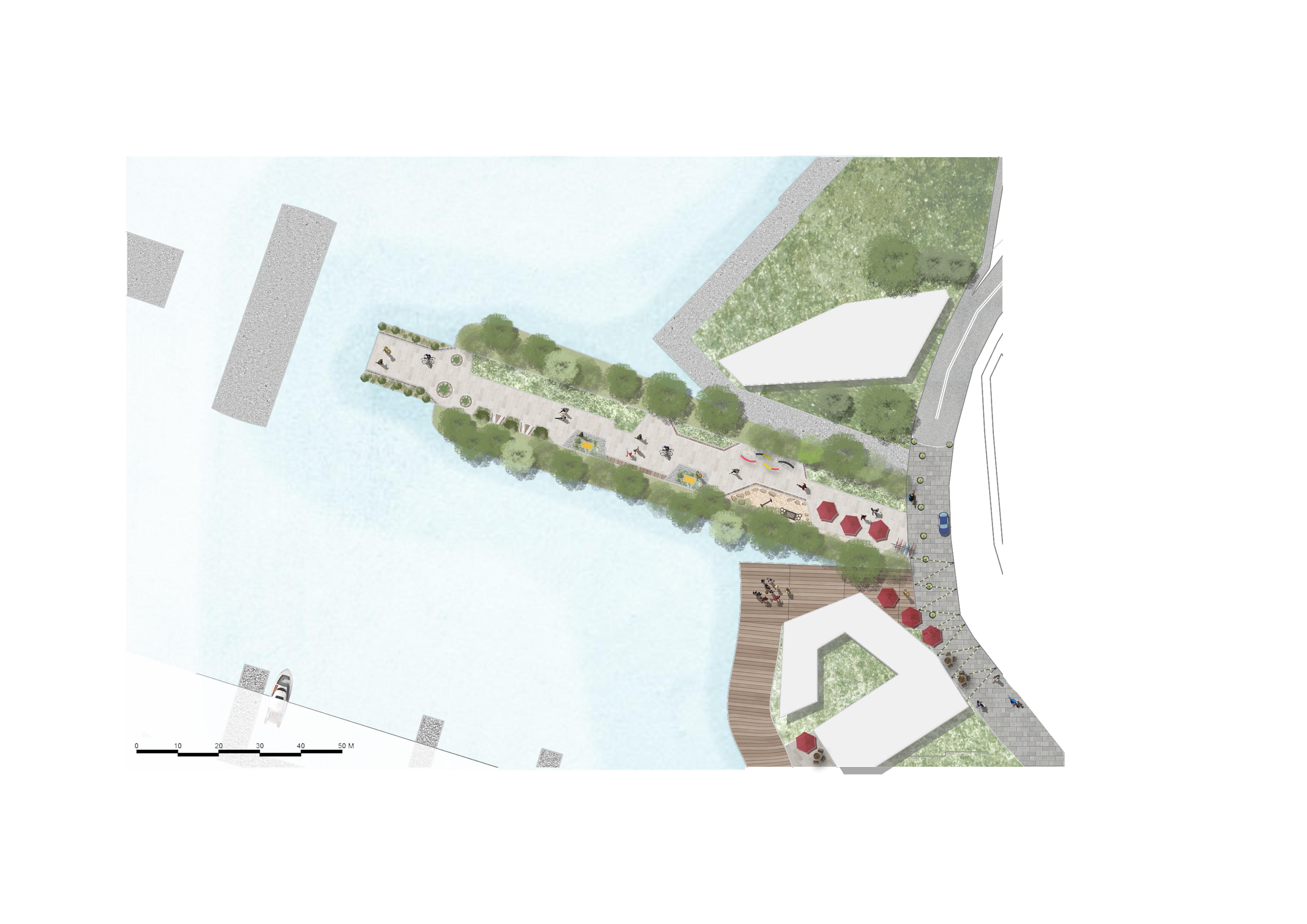
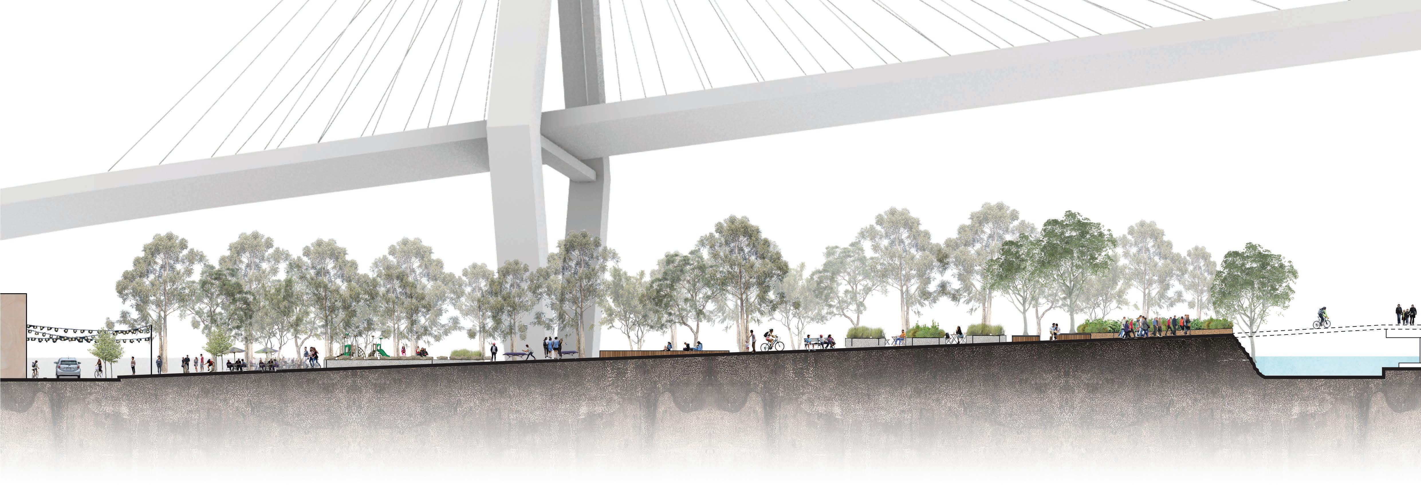
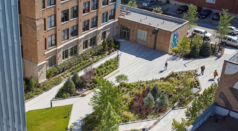
Yinningmah Park, named after the Dharug term for steep cliff, is based on the adaptive reuse of Glebe Island Bridge for the development of a high amenity green space with the possibility of a future active transport connection to the Bays West precinct.
Inspired by the Goods Line, the space provides active and passive recreation spaces and maintains views of the juxtaposing ANZAC and old Glebe Island bridges. Bank St north has been transformed into a shareway and 1-3 Bank St has been revitalised into a dining precinct with street dining, lighting displays and public art to create a vibrant atmosphere.
Section Perspective
Table tennis tables Nature play
Indigenous public art
Outdoor dining
Songline Esplanade (foreshore walk)
Adaptive reuse of existing building for dining uses
Northern end of Bank St transformed into shareway
Vegetated bollards
Contraflow cycle land linking to Quarry St network
Existing residential tower
Potential future active transport connection across Glebe Island swing Bridge to the Bays West renewal area
Rewiliding of banks/slope using native species to establish seed banks
Bicycle parking and repair station
Overhead lighting display
1 Seating Grassed patches
3 2 4 5 6 7 8 9 10 11 12 13 14 15 16 Legend 3 020 100 L L
Perspective 3 020 100 L L
Section Perspective
Site Specific Precedent: The Goods Line by ASPECT Studios
68

1:650 4.5 22.5 0 1 3 2 4 6 7 8 9 11 13 14 15 16 5 10 12 1 1 2 6 6 14
 Preserve the banks Bridge plants
Preserve existing vegetation along banks of the Glebe Island and supplement with native to establish seed banks and enable foraging.
Incorporate native species endemic to place including; Coast Banksia, River Oak, Spotted Gum, Bangalay Eucalyptus, Sydney Blue Gum, Brush Cherry, Native Peach,
Upon completion of the Bays West redevelopment, consider the construction of an active transport link over Glebe Island Bridge.
 Intimate activation sites at the Goodsline, Sydney Shared cycle, vehicle, pedestrian zone at High Street, Maitland Signage in Canberra, ACT
Waterfront dining at Cockle Bay Wharf, Cockle Bay Equipment at the Goodsline, Sydney
Shared zone in Athens, Greece
Intimate activation sites at the Goodsline, Sydney Shared cycle, vehicle, pedestrian zone at High Street, Maitland Signage in Canberra, ACT
Waterfront dining at Cockle Bay Wharf, Cockle Bay Equipment at the Goodsline, Sydney
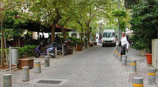
Shared zone in Athens, Greece
73
Coal Drops Yard activated laneways, King’s Cross Heritage facades in Harris St, Pyrmont maintaining permeability Lighting design over pedestrianised Oxford St, London
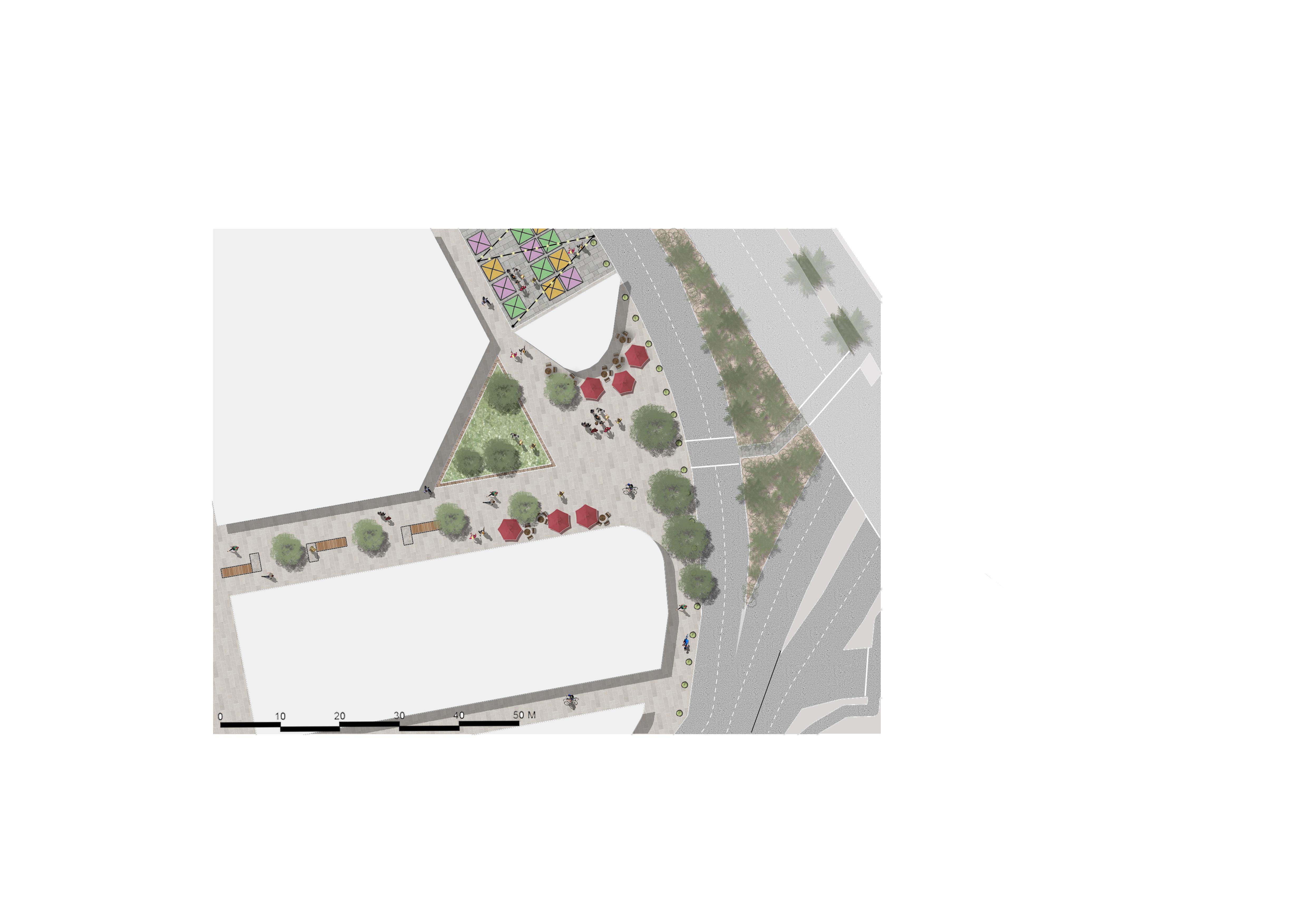
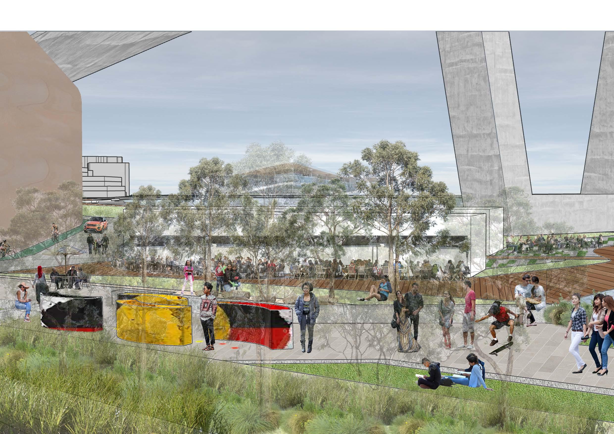
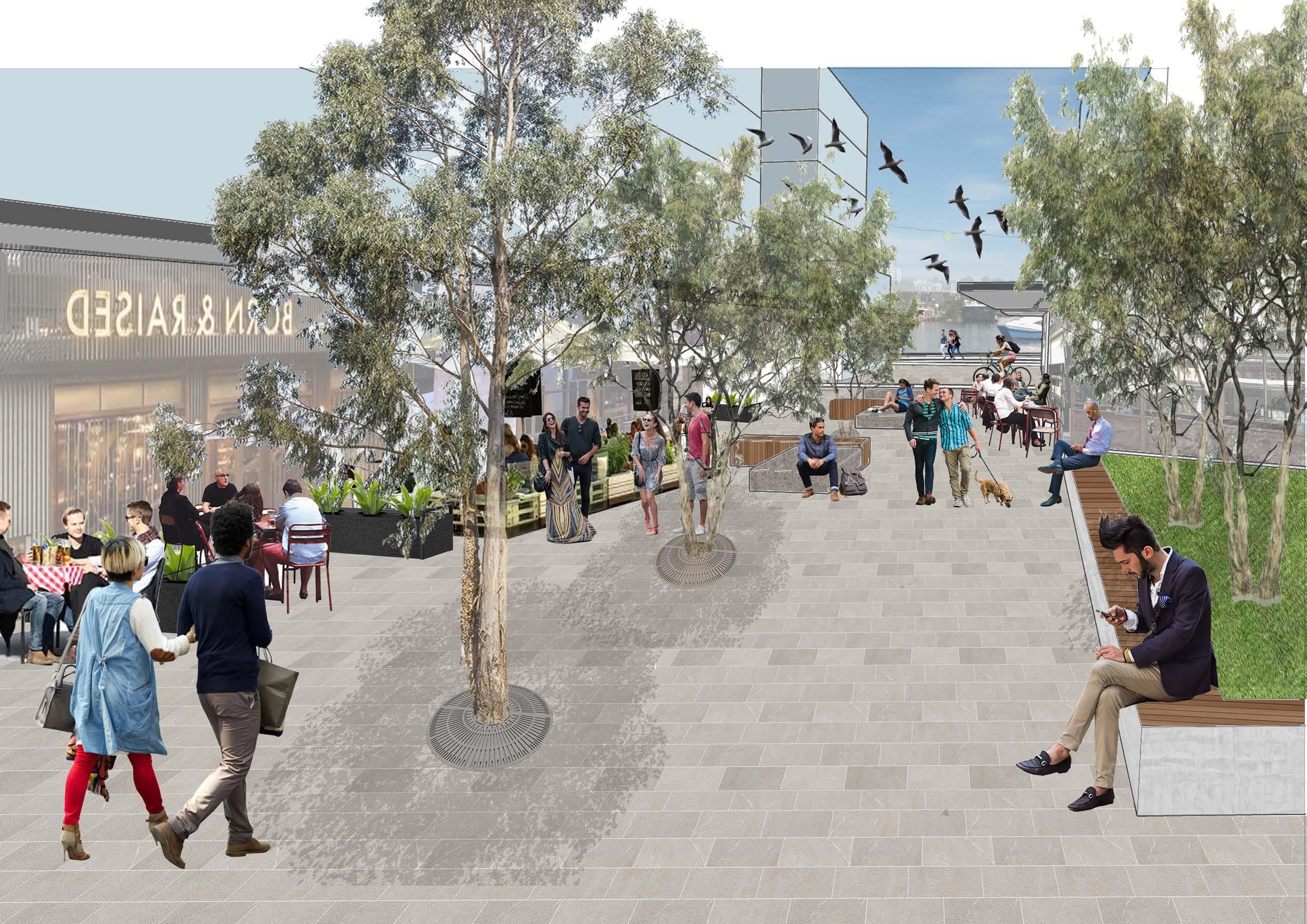
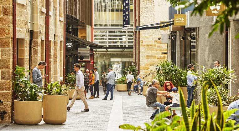
Strategically positioned as a major site gateway from Pyrmont Metro Station, Nattai (freshwater Country) Boulevard is an example of what an activated pedestrian thoroughfare running through the innovation area may look like.
This fine-grained environment of streets and lanes, inspired by Quay Quarter lanes, offers active frontages with street dining, seating, a pocket park, a yarning circle, street trees, and temporary art and market stall spaces creating opportunities for gathering and networking, sparking innovation.
Perspective
Section
1 Nattai Boulevard
Pocket Park Seating Street dining
Dining establishment
Vegetated bollards
Temporary market stall space in existing car park Light display (overhead)
Major site gateway - plaza 2.5m awnings
Square servicing commercial buildin Rooftop gardens where feasibl
Activated laneway/alle One-way road ANZAC Bridge (overhead)
(above podium
g e y )
Nattai Boulevard - Urban Plaza
3 020 100 L L
Section 3 020 100 L L
Tower
3 2 4 5 6 7 8 9 10 11 12 13 14 15 16 Legend
Perspective
Site Specific Precedent: Quay Quarter Lanes by ASPECT Studios, SJB, Studio Bright
74
1:400 2.5 12.5 0 1 3 2 4 6 7 8 9 10 11 12 13 14 15 16 4 4 5 6 10 12
Retail/dining/cafe uses
Multi-purpose studio/creative industries
Commercial uses
Commercial uses (tower)
Provide a yarning circle at the core of the commercial zone which promotes connection with Country and is at least 10m wide to accomodate crowds.
Restrict building heights of buildings adjacent to the Blackwattle Bay foreshore to 6 storeys to reduce visual impact on the public domain and foreshore.
Ensure the ground level floor to ceiling height is a minimum 3.5m to accomodate cafes and retail uses.
1:200 05.2 26m
Provide a one-way street servicing buildings in the commercial core. Reduce speed limit to 20 km/h, line with street trees and urban furniture, raise pedestrian crossings to slow vehicles and ensure pedestrian safety.
Provide floor to ceiling heights at a range of scales to enable flexible uses over time, with a minimum first level floor to ceiling height of 3m.
Focus active uses including retail and food on ground floors and provide continuous awnings of at least 2.5m depth along active frontages.
Provide pocket parks between buildings to activate the public domain, support employee wellbeing and provide ecosystems supporting urban wildlife.
 Zollhallen Plaza in Freiburg, Germany
Green Square Library and Public Plaza
Street dining in Barangaroo, Sydney
Darling Square in Sydney
Night markets along pedestrian corridors in the Rocks, Sydney Weekly market stalls in Glebe Primary School, Sydney
Fulton Pocket Park in Chicago, Illinois
Zollhallen Plaza in Freiburg, Germany
Green Square Library and Public Plaza
Street dining in Barangaroo, Sydney
Darling Square in Sydney
Night markets along pedestrian corridors in the Rocks, Sydney Weekly market stalls in Glebe Primary School, Sydney
Fulton Pocket Park in Chicago, Illinois
79
Green Square Library and Public Plaza Quay Quarter active ground plane in Sydney
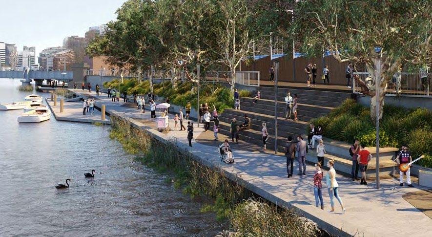
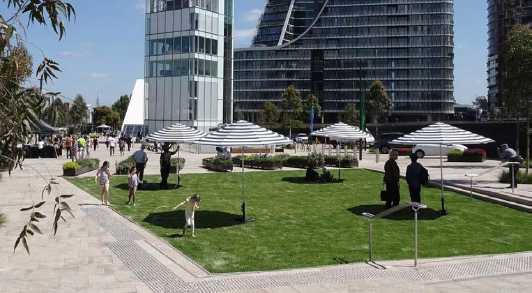
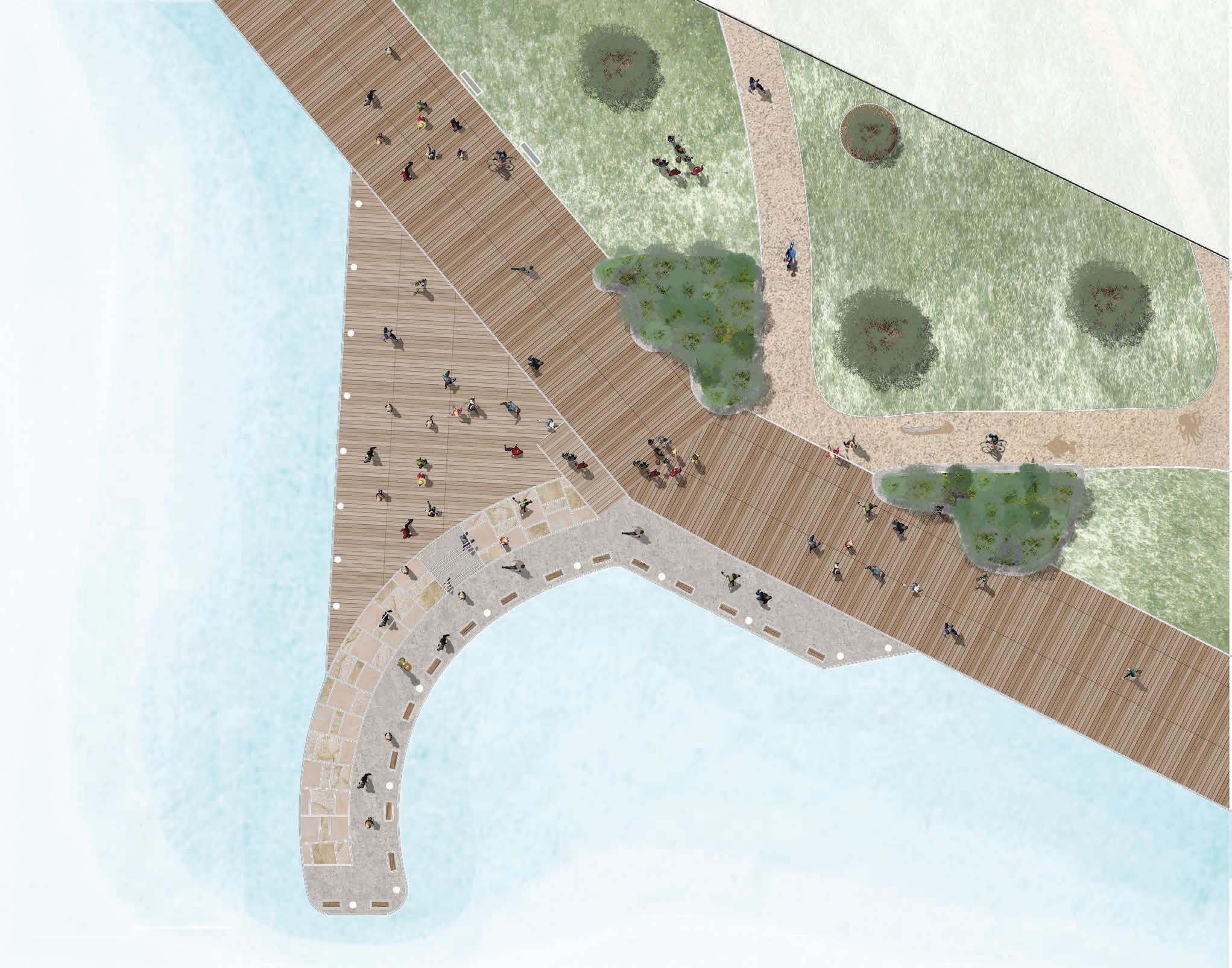
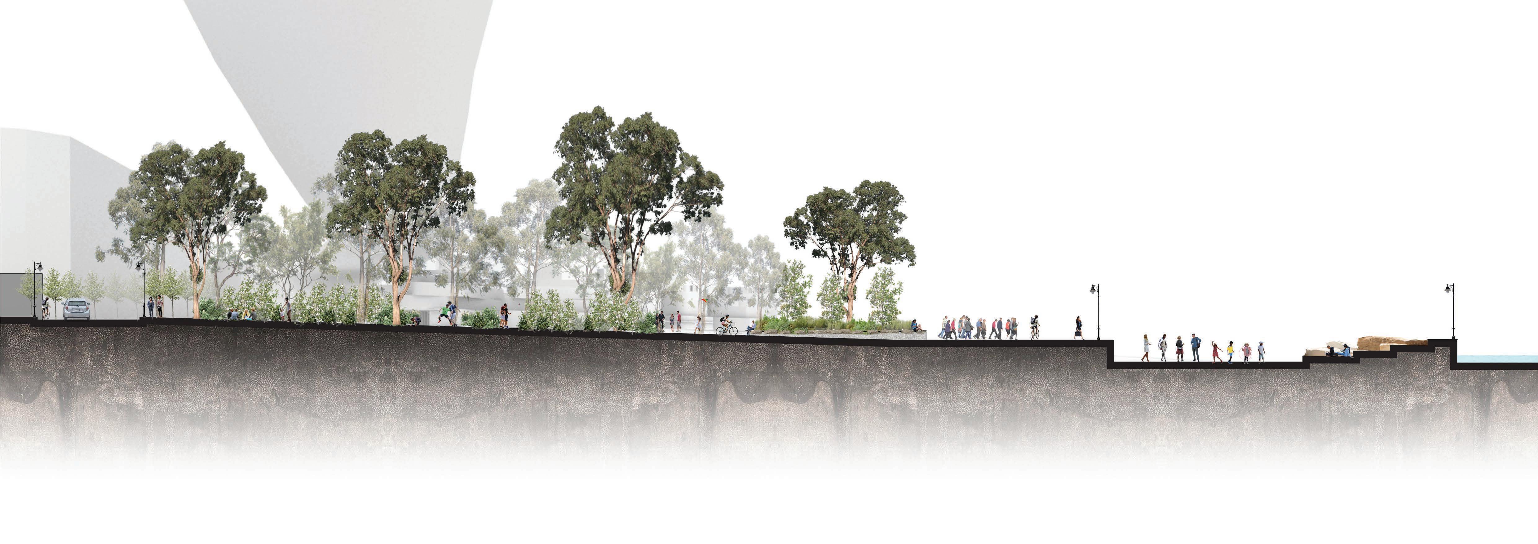
Garaban Cove - Waterfront Promenade
Garaban Cover sits at the end of the Tookera Walk cultural journey, providing a space for gathering and reflection. The use of local timbers and sandstone references the sites industrial history whilst steps down to the water enable intimate visual and physical connections with water and Country.
An open platform, sitting at promenade level, offers space for temporary activation including cultural performances, public art exhibitions, and small group fitness classes. Scattered throughout the site is native plantings creating seed banks and enabling foraging.
Perspective
4.7% Tennis
16.6% Fitness

8.1% Jogging
3.5% Soccer
How do people use open space?
8.6% Swimming 2.7% Football 2.7% Cycling 5.3% Golf 23.6% Walking
1 Songline Esplanade (foreshore walk)
2 4 5 6 7 8 9 10 11
Passive recreation (Yarra Park)
3
Platform Ramp Water-level platform
Sandstone seating
Raised planters with natives and seating along edges
Timber seating
Indigenous land and water motifs etched into sandstone footpath along Tookera Walk
Gum trees with understorey plantings consisting of native shrubs and grasses
ANZAC Bridge (overhead)
020 100
Legend 3
L L Section
80
1:400 2.5 12.5 0 1 2 7 8 10 11 4 5 6 1 2 5 7 8 9 3
Mark pedestrian pathways with efficient street lighting, including motion-sensored light sources at least every 50 m.
Provide an area of at least 1ha for recreation space at the northern end of the site, including uses for both passive and active recreation.
Integrate the site’s historical creekline into wayfinding design to reflect Pyrmont’s pre-colonial history.
Provide walls vegetated
1:200 05.2 26m
Provide seating along the retaining walls of planter boxes and vegetated patches ensuring a seat depth of at least 600 mm.
Maintain visual and auditory connection with physical geographic features (topography, trees, the Bay).
Mark pedestrian pathways with efficient street lighting, including least every 50 m.
Design flexible, outdoor spaces along the foreshore that accomo date community events, markets, temporary art exhibitions, etc.
Incorporate materials reflecting the sites former natural history and industrial uses, including sandstone, timbers, and masonry.
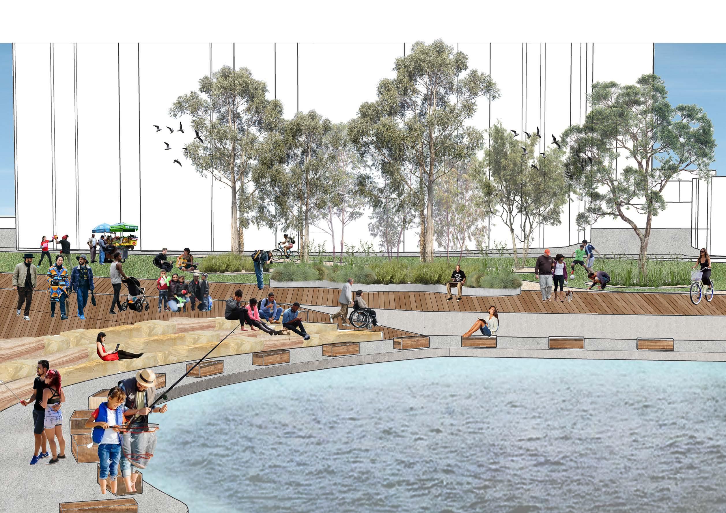
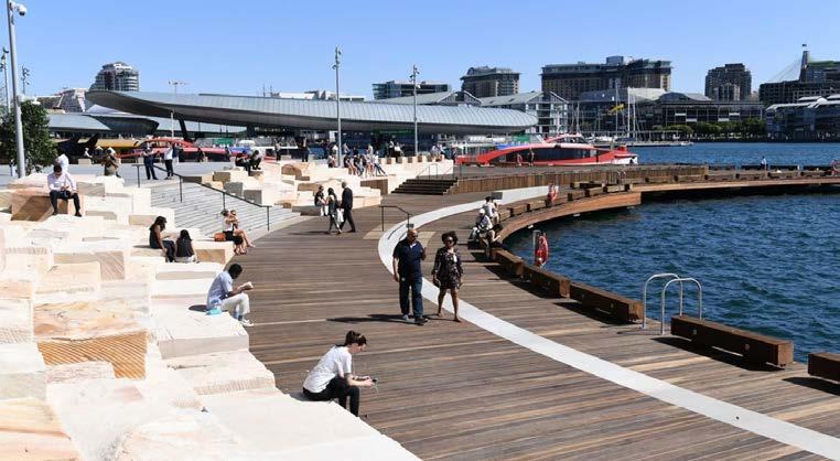
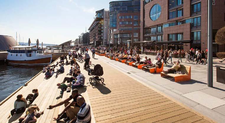
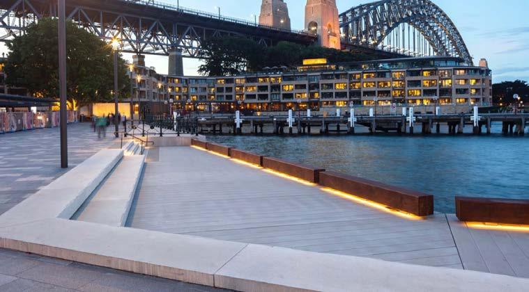
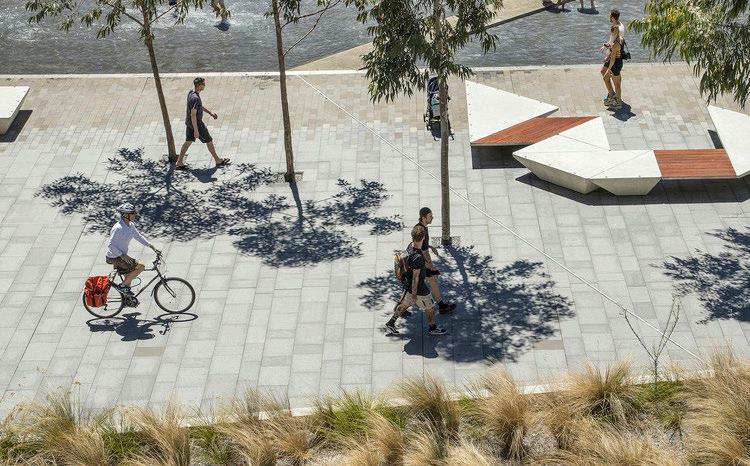
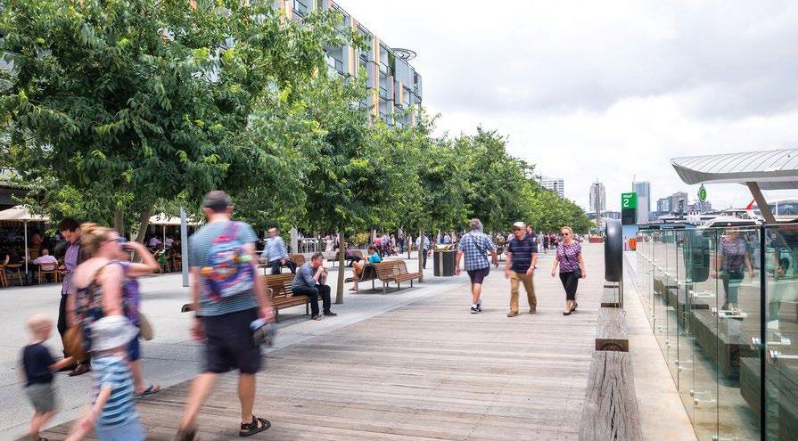
 Watermans Cove in Barangaroo, Sydney Post-industrial waterfront at Aker Brygge in Oslo, Norway Campbell’s Cove, Sydney
Darling Harbour public realm, Sydney Barangaroo South waterfront promenade
Stepped waterfront at Aker Brygge in Oslo, Norway
Daugava Waterfront Promenade in Riga, Latvia
Shekou Coastal Promenade in Shenzhen, China
Watermans Cove in Barangaroo, Sydney Post-industrial waterfront at Aker Brygge in Oslo, Norway Campbell’s Cove, Sydney
Darling Harbour public realm, Sydney Barangaroo South waterfront promenade
Stepped waterfront at Aker Brygge in Oslo, Norway
Daugava Waterfront Promenade in Riga, Latvia
Shekou Coastal Promenade in Shenzhen, China
85
Watermans Cove in Barangaroo, Sydney
11 Design Guidelines
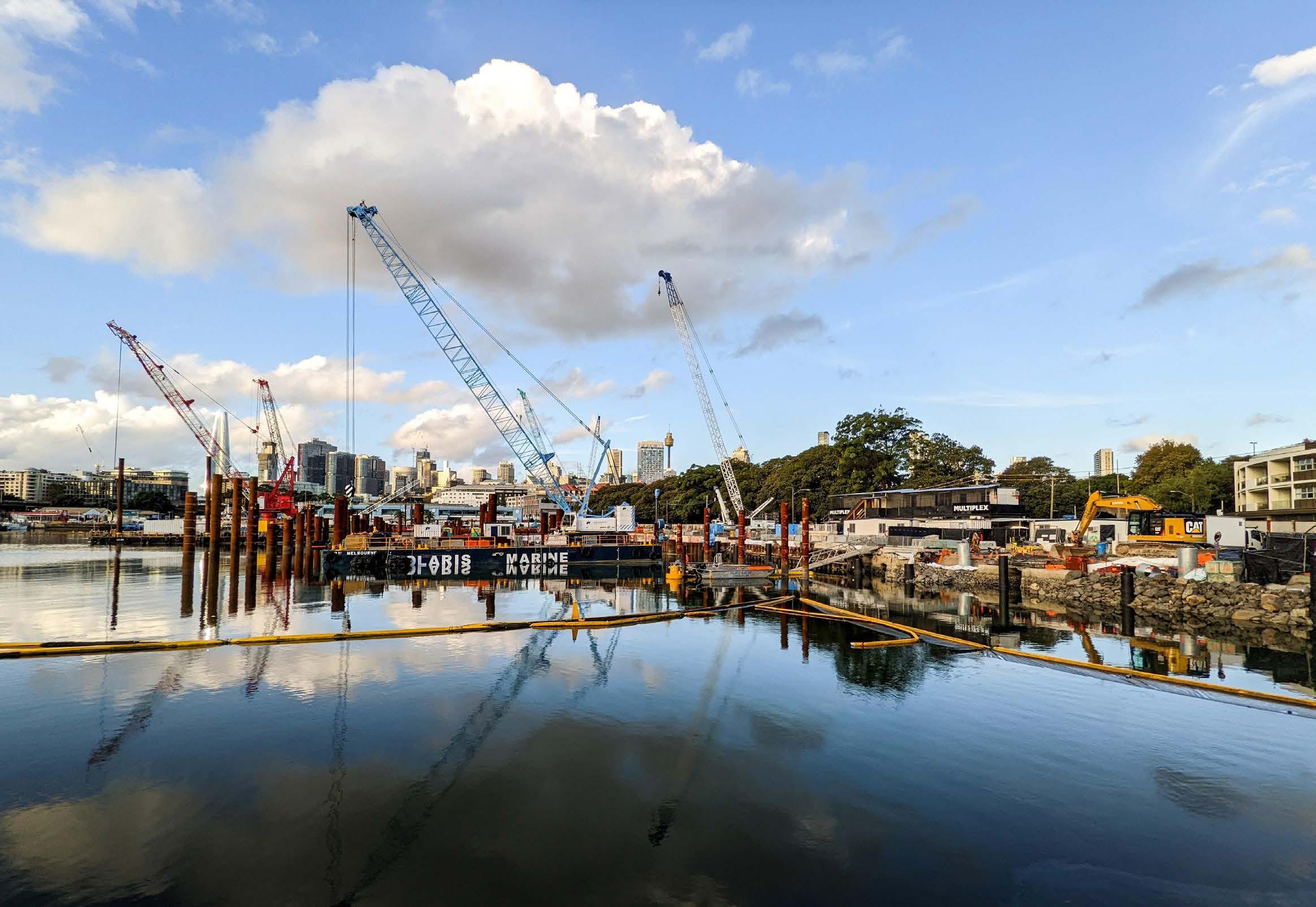
Site-wide Guidelines
Maintain collaborative, working relationships with Indigenous knowledge holders throughout the development process, from inception to completion.
Where physically feasible, provide green roofs and vegetated facades which are visible from the public domain and contribute to sustainable built form.
Limit building heights to 10 storeys along the eastern boundary of the site and ensure built form tapers downwards toward the waterfront to maximise views.
Develop the missing link in the Sydney Harbour Foreshore walk through a boardwalk, waterfront promenade running along the site’s western boundary.
Incorporate materials reflecting the sites former natural history and industrial uses, including sandstone, timbers, and masonry.
6.
Integrate the site’s historical foreshore line into wayfinding design to reflect Pyrmont’s pre-colonial history.
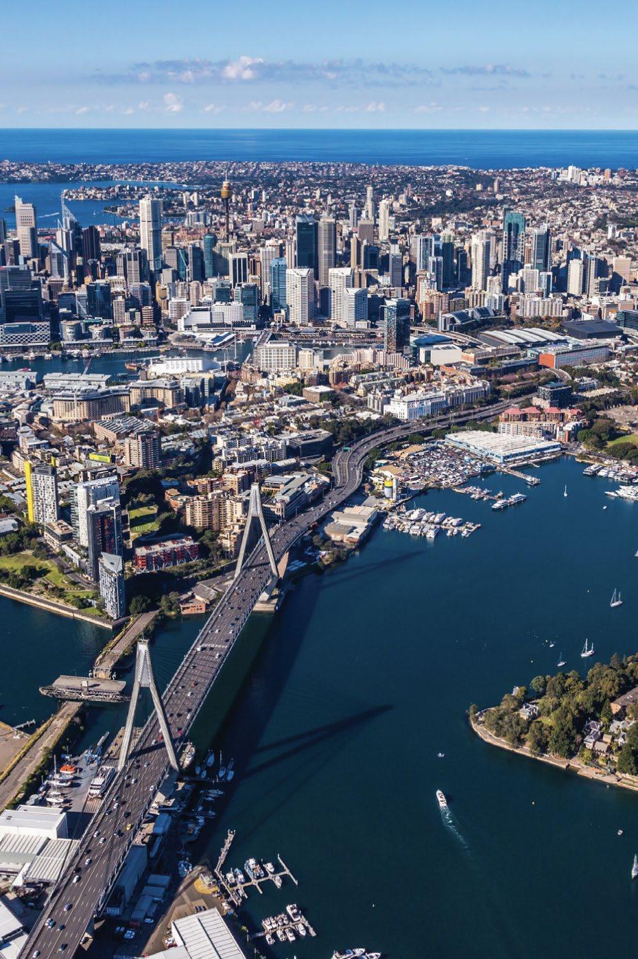
7. Mark pedestrian pathways with efficient street lighting, including motion-sensored light sources at least every 50 m.
8. Where vegetation is proposed along the foreshore, plant Tjerruing (native) and Dahl’wah species to minimise erosion, mitigate the effects of sea level rise, and protect from the effects of urbanisation.
1. 2. 3. 4. 5.
87
Recreation Character Area Guidelines
Upon completion of the Bays West redevelopment, consider the construction of an active transport link over Glebe Island Bridge.
Maintain continuous engagement with local Aboriginal knowledge holders in relation to the Bank St rewilding and seed bank zones.
Workers should have access to green open space, that is shaded and of an adequate size, within 400m of their workplace.
Public open space should be located nearby public transport and connected via pedestrian and cycle links to encourage reduced private vehicle dependency.
Provide a minimum of 40% canopy cover over green spaces, including a mix of native and exotic, deciduous and evergreen species.
6.
Provide an area of at least 1ha for recreation space at the northern end of the site, including uses for both passive and active recreation.
7. Provide seating along the retaining walls of planter boxes and vegetated patches ensuring a seat depth of at least 600 mm.
8. Preserve existing vegetation along the banks of the Glebe Island Bridge and supplement with native plants to establish seed banks and enable foraging. 9. Where new landscaping is proposed, incorporate native species endemic to place including; Coast Banksia, River Oak, Hairy Clerodendrum, Spotted Gum, Bangalay Eucalyptus, Sydney Blue Gum, Brush Cherry, Native Peach.
Prioritise waterfront space for public parkland development to maintain visual and auditory connection with physical geographic features. 10.
Design flexible, outdoor spaces along the foreshore that accomodate community events, markets, temporary art exhibitions, etc. 11. Incorporate nature play and natural elements into playgrounds to encourage learning about and connection with Country.
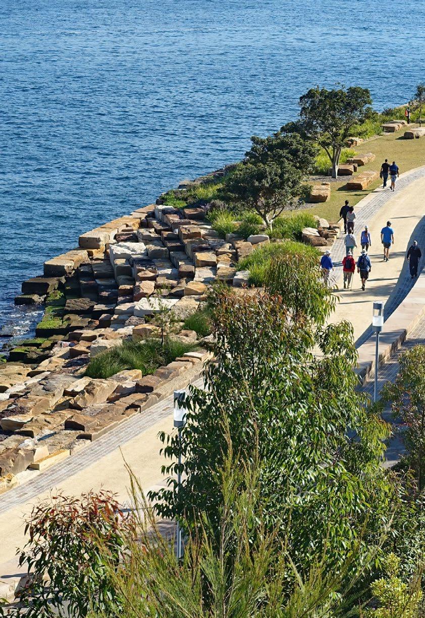
1. 2. 3. 4. 5.
88
12.
Innovation Character Area Guidelines
Provide new pedestrian links through the precinct that ensure visual connections from the Harris St character area and within the site, to Blackwattle Bay.
Extend and enhance the existing public domain through the provision of additional open spaces, pedestrian and cyclist connections, plazas, and linear/pocket parks.
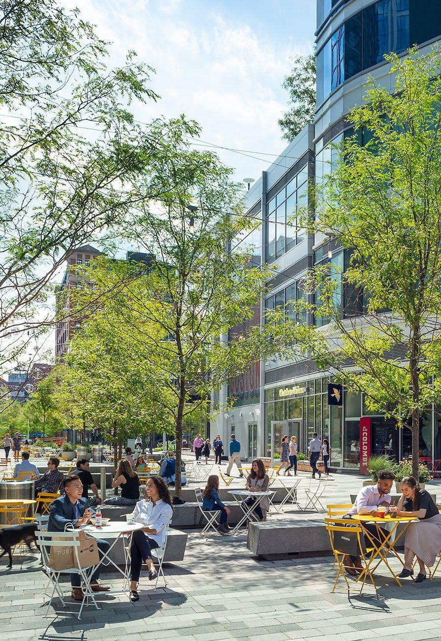
Provide a range of commercial building typologies (including co-working spaces) that attract businesses of varying scales and industries to the site.
Locate taller buildings away from the public domain using podiums and provide a minimum setback of 5m from Bank St and Pyrmont Bridge Rd.
Focus active uses including retail and food on ground floors and provide continuous awnings of at least 2.5m depth along active frontages.
Along primary east-west pedestrian corridors, provide a minimum street width of 10m to minimise overshadowing and 5m along secondary corridors.
7. Ensure the ground level floor to ceiling height is a minimum 3.5m to accomodate cafes and retail uses.
8. Provide floor to ceiling heights at a range of scales to enable flexible uses over time, with a minimum first level floor to ceiling height of 3m.
9. Restrict building heights of buildings adjacent to the Blackwattle Bay foreshore to 6 storeys to reduce visual impact on the public domain and foreshore.
10.
Provide a one-way street servicing buildings in the commercial core. Reduce speed limit to 20 km/h, line with street trees and urban furniture, raise pedestrian crossings to slow vehicles and ensure pedestrian safety.
Provide pocket parks between buildings to activate the public domain, support employee wellbeing and provide ecosystems supporting urban wildlife. 11.
1.
2. 3. 4. 5. 6.
89
Provide multi-purpose, flexible spaces which can be utilised by the community and arts industry for cultural activities and practice spaces
Engage with local Indigenous and non-Indigenous artists and designers to establish a public art strategy that enables storytelling about heritage and culture
Establish an Aboriginal cultural centre which creates business opportunities for local Aboriginal groups and facilitates storytelling and knowledge sharing
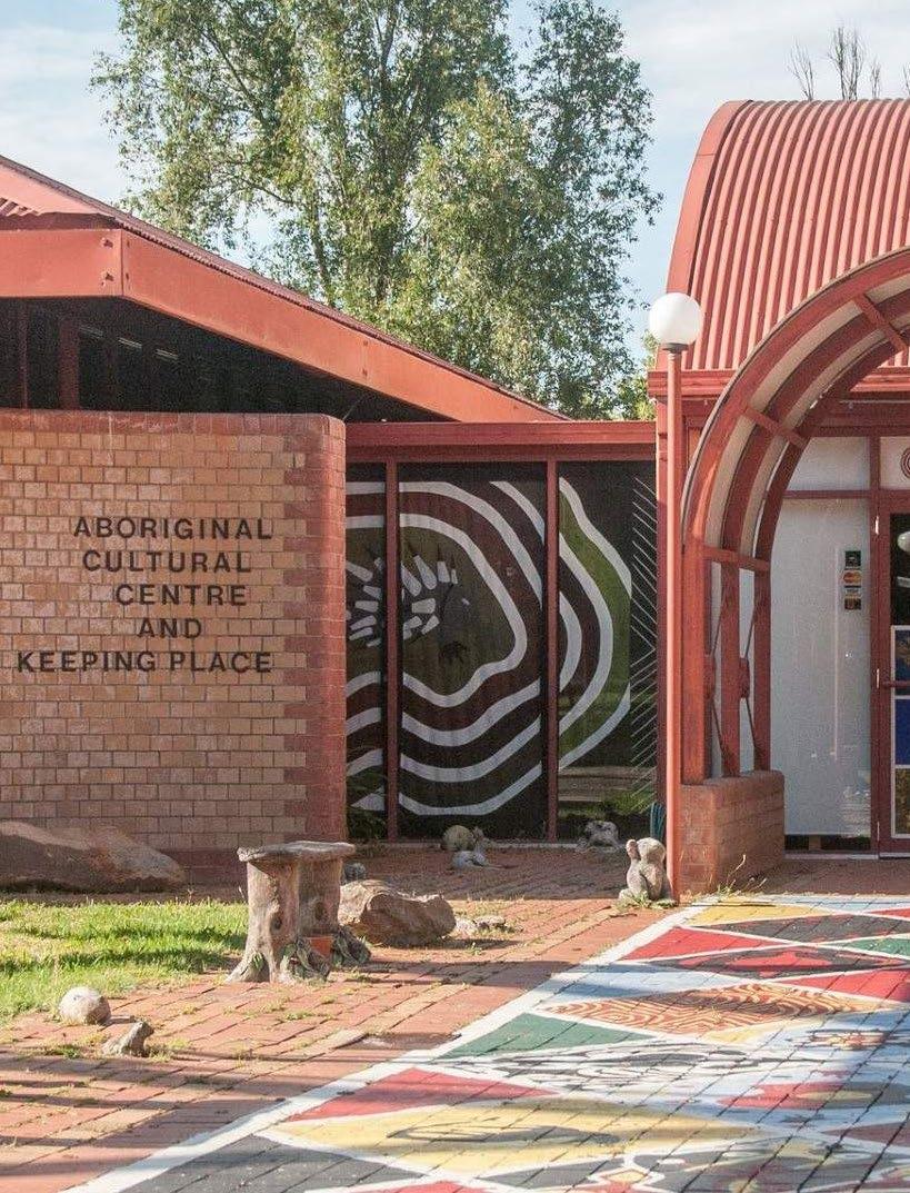
Retrofit existing underutilised spaces to allow temporary activation uses such as markets, performance and gathering spaces.
Provide public art within the commercial core which is connected to the cultural precinct via the waterfront.
Maintain visual connections with water and sky from cultural/community buildings by limiting development and tree planting in front of/above such buildings.
7. Provide a yarning circle at the core of the commercial zone which promotes connection with Country and is at least 10m wide to accomodate crowds.
Civic Character Area Guidelines 1. 2. 3. 4. 5. 6.
90


Street Typologies 91 2.5 3 4 3 2.5 m 2 4 2 m 2 2.25 3.5 2.25 2 m 1.8 0.6 3 0.4 2.4 m
Outdoor Dining/ Awning Pedestrian Path Landscaping/ Seating Outdoor Dining/ Awning Pedestrian Path Outdoor Dining Pedestrian Path Outdoor Dining Outdoor Dining Pedestrian Path Service Road Outdoor Dining Pedestrian Path/ Temporary activation Outdoor Dining/ Temporary Activation Shared Zone Contraflow Cycle Lanes Planter Bed Bollards Lane Seperator Primary Pedestrian Thoroughfares Secondary Pedestrian Thoroughfares Service Road Bank St North Shareway Primary Pedestrian Thoroughfares Secondary Pedestrian Thoroughfares Service Road Bank St Shareway Legend Cultural, Arts, Community Commercial Retail and Dining Commercial (Tower) Service Road Secondary Thoroughfares Bank St Shareway Primary Thoroughfares
Sandstone Wall
12 References
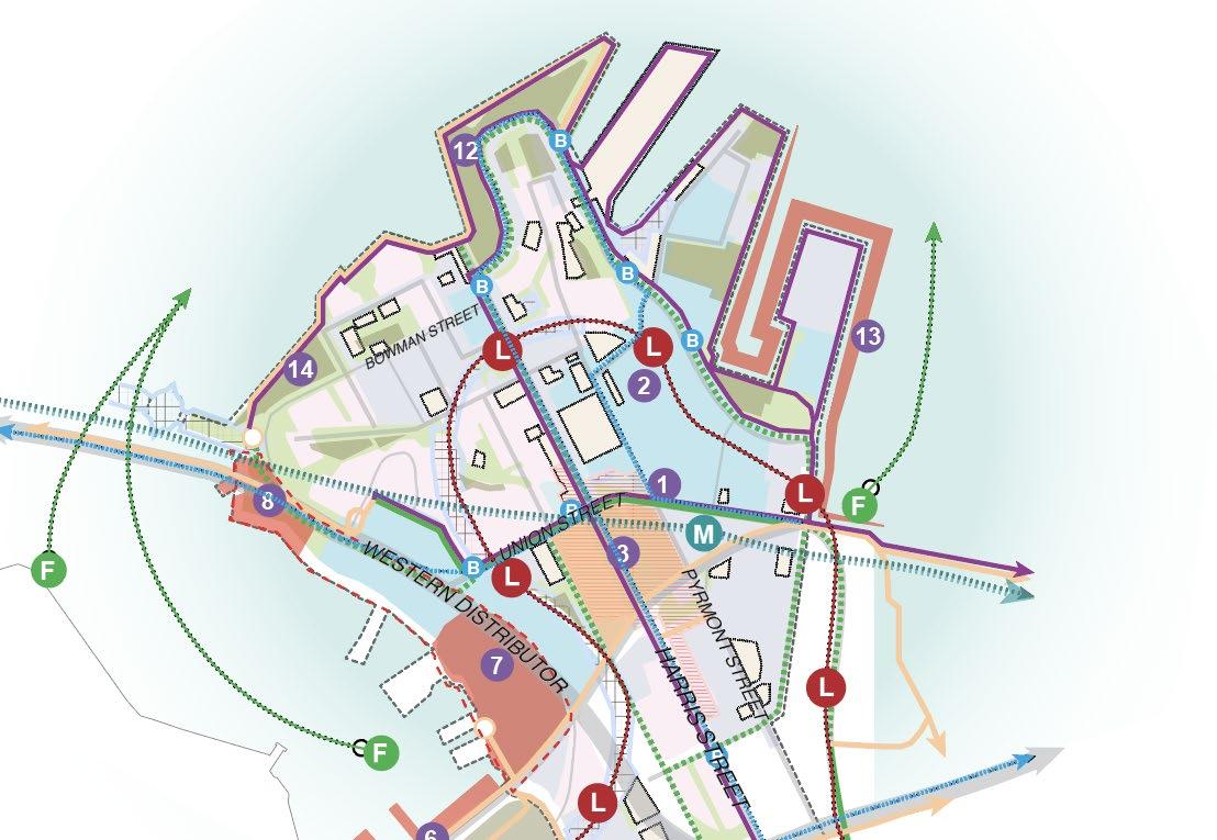
Artefact 2019, The Bays Market Precinct Rezoning: Aboriginal Cultural Heritage Assessment Report (ACHAR), https:// majorprojects.planningportal.nsw.gov.au/prweb/PRRestService/mp/01/ getContent?AttachRef=SSD-8924%2120191004T054308.235%20GMT
Cred Consulting 2020, Pyrmont Peninsula Demographic Profile, https:// www.planning.nsw.gov.au/-/media/Files/DPE/Strategy-documents/ Plans-for-your-area/Planning-for-local-communities/Pyrmont-Peninsula/ Demographic-Profile-2020-12-09.pdf?la=en
NSW Department of Planning, Industry and Environment 2020, Pyrmont Peninsula Place Strategy, https://www.planning.nsw.gov.au/-/ media/Files/DPE/Strategy-documents/Plans-for-your-area/Planningfor-local-communities/Pyrmont-Peninsula/Pyrmont-Peninsula-PlaceStrategy-2020-12-11.pdf?la=en
Artefact 2021, Sydney Fish Markets Redevelopment: Aboriginal Heritage Interpretation Plan, https://www.infrastructure.nsw.gov.au/ media/2906/aboriginal-heritage-interpretation-plan.pdf
Aspect Studios 2015, The Goods Line, https://www.aspect-studios. com/au/projects/the-goods-line-2
Greater Sydney Commission 2018, Greater Sydney Region Plan: A Metropolis of Three Cities, https://www.greatercities.au/metropolis-ofthree-cities
Greater Sydney Commission 2018, Our Greater Sydney 2056: Eastern City District Plan, https://www.greatercities.au/eastern-city-districtplan
Oculus 2017, Barangaroo South Public Domain, https://www. oculus.info/projects/barangaroo-south-public-domain
Pikora, T, Giles-Corti, B & Donovan, R 2001, ‘How Far Will People Walk to Facilities in Their Local Neighbourhoods?’, in Australia: Walking the 21st Century - 20th to 22nd February 2001, Trans- port Western Australia, Western Australia, Vol. 1, pp. 26-31
Aspect Studios 2017, Barangaroo South Public Domain, https:// www.aspect-studios.com/au/projects/barangaroo-south-public-domain
Aspect Studios 2021, Quay Quarter Lanes, https://www.aspectstudios.com/au/projects/quay-quarter-loftus-lanes
Australian Bureau of Statistics 2021, Pyrmont: 2021 Census All Persons QuickStats, ABS, Canberra
Hassell 2018, Darling Harbour Sydney Public Realm, https://www. hassellstudio.com/project/darling-harbour-sydney-public-realm
Infrastructure NSW 2020, Revitalising Blackwattle Bay, https:// www.infrastructure.nsw.gov.au/media/2527/bays001-blackwattle-bayconsultation-a4-brochure-may2020_fa2_lr.pdf
SmartCities n.d., Case Study: The Boston Waterfront Innovation District, smartcitiesdive.com/ex/sustainablecitiescollective/case-studyboston-waterfront-innovation-district/27649/
UrbanGrowth NSW 2015, Transformation Plan: The Bays Precinct Sydney, https://www.infrastructure.nsw.gov.au/media/2197/2015transformation-plan.pdf
Australian Bureau of Statistics 2016, Pyrmont: 2016 Census All Persons QuickStats, ABS, Canberra
Infrastructure NSW 2021, Blackwattle Bay: State Significant Precinct Study, https://shared-drupal-s3fs.s3.ap-southeast-2.amazonaws. com/master-test/fapub_pdf/Blackwattle+Bay+Redevelopment/ Blackwattle+Bay+SSP+Study.PDF
Bangawarra 2021, Attachment 28: Connecting with Country Framework for Tjerruing Blackwattle Bay, https://shareddrupal-s3fs.s3.ap-southeast-2.amazonaws.com/master-test/ fapub_pdf/Blackwattle+Bay+Redevelopment/Attachment+28_ Connecting+with+Country+Framework+for+Tjerruing+Blackwattle+Bay_ FINAL(2).PDF
KPF n.d., Seaport Square Innovation District, https://www.kpf.com/ project/seaport-square
Yerrabingin 2019, Indigenous Cultural Landscape Garden, https:// www.yerrabingin.com.au/projects/landscape-garden
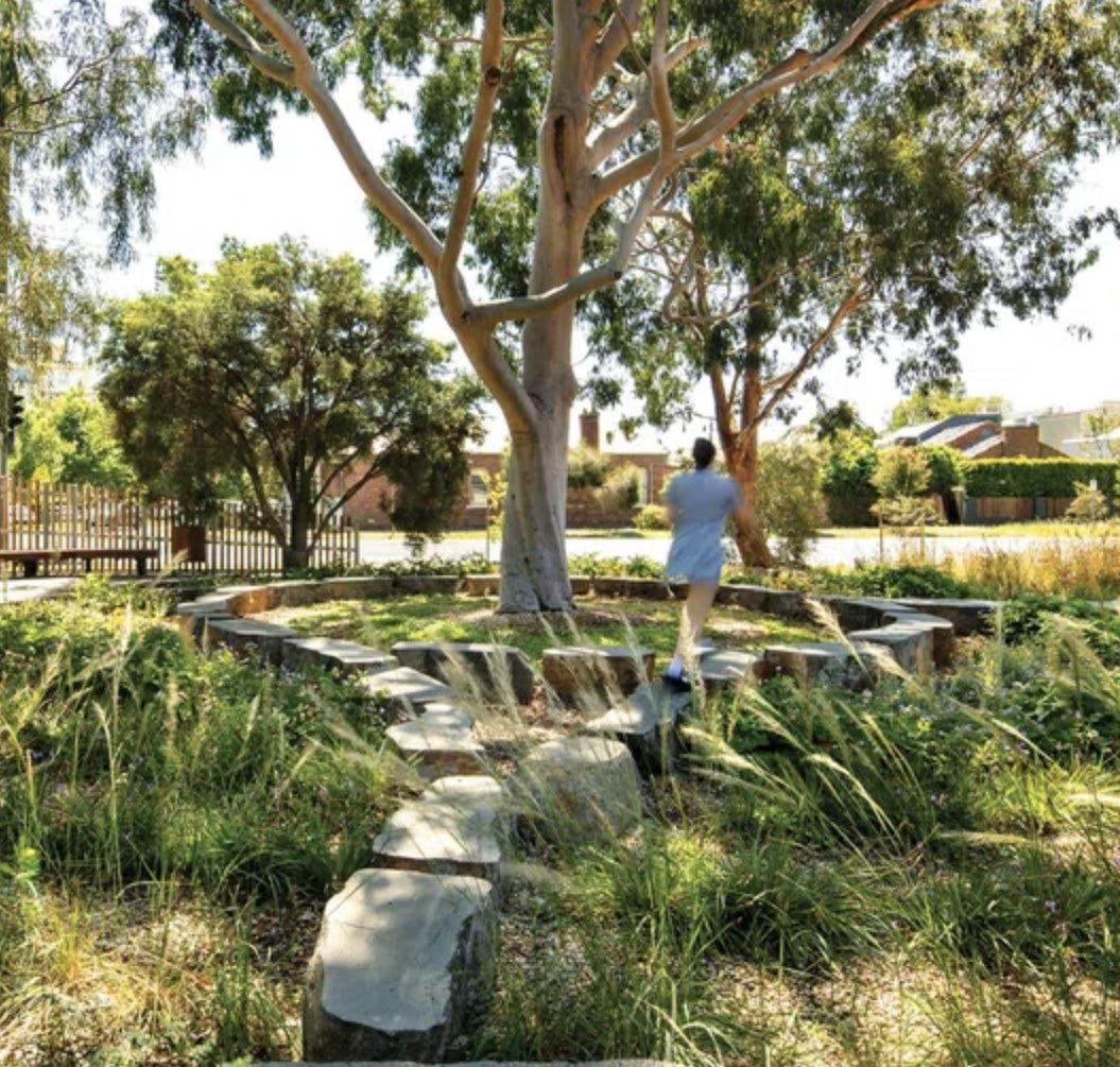
City of Sydney 2020, City Plan 2036: Local Strategic Planning Statement, https://www.cityofsydney.nsw.gov.au/strategic-land-use-plans/ city-plan-2036
Lendlease n.d., Barangaroo South, https://www.barangaroosouth. com.au/about/
NSW Innovation and Productivity Council 2018, NSW Innovation Precincts: Lessons from international experiences, https://www. investment.nsw.gov.au/assets/Uploads/files/IPC/Full-Report-IPC-NSWInnovation-Precincts-2018.pdf
City of Sydney 2022, Community Strategic Plan: Delivering Sustainable Sydney 2030-2050, https://www.cityofsydney.nsw.gov.au/ strategies-action-plans/community-strategic-plan
City Plan 2021, European Heritage Assessment and Impact Statement: A report to support Blackwattle Bay State Significant Precinct Study, https://shared-drupal-s3fs.s3.ap-southeast-2.amazonaws.com/ master-test/fapub_pdf/Blackwattle+Bay+Redevelopment/Attachment+24_ European+Heritage+Assessment+and+Impact+Statement_FINAL(2).PDF
Cola Studio n.d., South Eveleigh Cultural Garden, https://www colastudio.com.au/projects
NSW Department of Planning and Environment, n.d., Evaluation Tool for Public Space and Public Life, https://www.dpie.nsw.gov.au/__ data/assets/pdf_file/0007/357505/final-evaluation-tool-digital-englishmarch-2021.pdf
NSW Department of Planning and Environment 2019, Local Character and Place Guideline, https://www.planning.nsw.gov.au/-/media/ Files/DPE/Guidelines/Local-character-and-place-guideline-2019-05-21.pdf
93
Tjerruing/Blackwattle Bay Revitalisation
Kahlia Rae BAEN3002 Capstone 2022 - Urbanism Stream
