1.0 Introduction
Cities are highly modified urban ecosystems under constant pressure from external stressors such as climate change and rapid urbanisation. Such stressors have amplified demands for ecosystem services, particularly demand for water. In the planning and design of urban places greater priority needs to be given to integrating urban water management services such as water capture, treatment, storage , and reuse to ensure supply meets demand and to prevent polluted waterways.
Water has several roles in Sydney, including keeping the city cool, resilient, green, and productive (Davies et al., 2017). The need to protect the city’s waterways for current and future generations is crucial to urban design, and therefore this design proposal seeks to enhance the urban ecology of the University of Sydney campus through sustainable, site-responsive water management.
This report will firstly define and describe the site conditions including built features, heritage values, existing stormwater infrastructure, and ecological values. This information will be analysed and classified into potential opportunities and threats in the SWOT analysis. Strategic planning and design frameworks will inform the projects objectives whilst precedents will inform the design and detailing of the systems recommended for the site. Lastly, several sketches have been generated to highlight where and how the selected systems could operate on the site
2.0 Site Analysis
2.1 Defining the Site
The University of Sydney Camperdown/Darlington campus is located within the City of Sydney LGA and is approximately 4 kilometres from the Sydney CBD. The chosen development site is located on the Darlington side of campus and is indicated by the dashed red boundary line shown i n Figure 1. The 400 square metre site faces north and rece ives largely uninterrupted solar access due to its orientation and the size and location of surrounding buildings.
Figure 1: Location plan showing site boundary adapted from USYD Campus Maps (Google Images adapted)

2.2 Built Features (Existing)
The Cadigal Green site is a relatively newly development situated amongst several university owned buildings (Figure 2). Of particular significance to this design proposal, is the Old Darlington School (Figure 4) which is a heritage listed item and therefore must be retained in the development Existing community gardens and a greenhouse (Figure 3) contribute to the site’s urban ecology, attracting flora and fauna species as well as allowing social connectivity within the university and neighbouring community

Cadigal Green is a highly accessible, green open space which services a number of buildings and is part of the main university thoroughfare utilised by up to 20 000 students arriving from Redfern Train Station daily (TCL, 2009). In addition to high foot traffic on circulation paths and moderate vehicular traffic on non arterial roads, the site is often used by cyclists on both pedestrian footpaths and roads. The existing footpath reflects upon the Indigenous history of the site, which was once used as a hunting ground (TCL, 2009) This synergy with Indigenous heritage should be continued throughout the development proposal.
Adjacent to the Old Darlington School is a constructed wetland which was once thriving, however mismanagement has led to its dilapidation rendering it inoperative (Figure 7) Figure 6 shows an unknown type of drainage pipe connected to the wetland area, although it is most probably stormwater drainage based on pipelines described in Figure 11. This feature offers opportunities for revitalisation in the site without the environmentally taxing process of excavation and construction
(Urbis, 2017)
Figure
Figure 6: Existing water harvesting wetland (2017) (Urbis, 2017)

Figure 7: Existing water harvesting wetland (2021) (Google, 2021)
2. 3 Heritage Regulatory
Figure 8: Paving pattern reflecting Indigenous heritage (TCL, 2009)

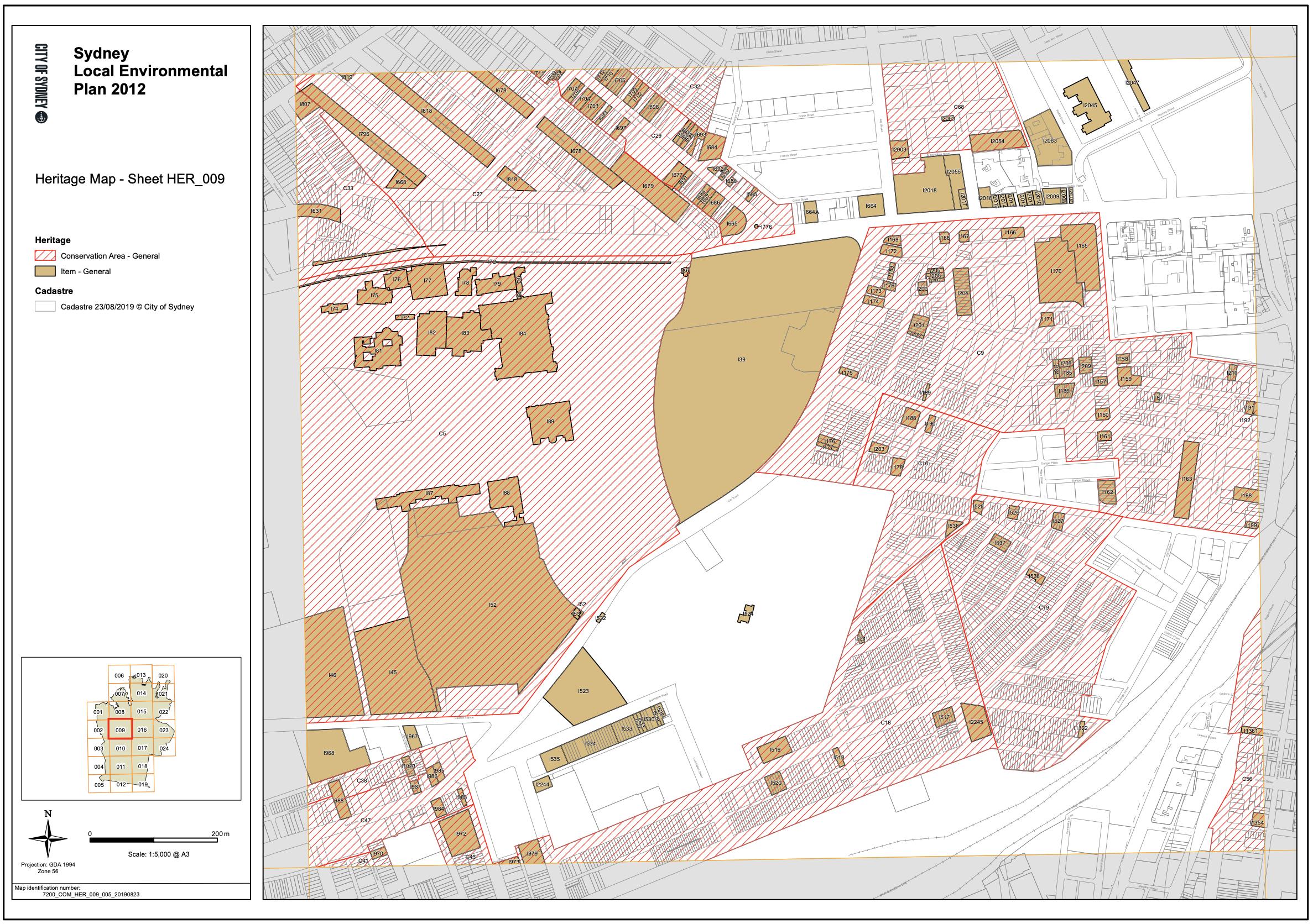
The University of Sydney campus is not listed on the State Heritage Register (SHR), although the Camperdown side of campus is considered a general conservation area under the Sydney Local Environmental Plan 2012 (Appendix A). The Old Darlington School appears as a heritage item on the SHR and is the only item of such status within the vicinity of the site.


2. 4 Aboriginal Heritage – Contextual
Prior to clearing for urban development in the early nineteenth century the site was covered in an extensive woodland forest dominated by Ironbark Eucalypts, Sydney Blue Gums, Blackbutt, and Grey Box trees Many terrestrial fauna species which once existed in the environment included kangaroos, flying foxes, echidnas, possums, and quolls. Such fauna species formed part of the diets of local Indigenous tribes and were important in traditions and spiritual ceremonies (Hobbs, Blake & Williams, 2016) Whilst most of these species are no longer found on site due to extensive urbanisation and modification, they are still present on the Cumberland Plain (Mein & Vinton, 2013)
The Blackwattle Creek system was a tidal watercourse which flowed through the University of Sydney campus to Blackwattle Swamp and would have been a source of fresh water and a fishing spot for Sydney’s Aboriginal people the Cadigal people (Figure 10) Aquatic plants likely to have been found in the area included sedges from the Epacridaceae and Cyperaceae families and bulrushes (Mein & Vinton, 2013).
Dispossession of Aboriginal land and the associated colonisation of Sydney led to significant environmental disturbance, ultimately changing the landscape irreversibly and depleting natural assets. There are , however, opportunities to rectify these impacts through creating new spaces which reflect the sites Indigenous history.
2. 5 Stormwater Existing Pipelines and Receiving Catchment
The Cadigal Green site features existing stormwater pipes most of which are owned by Sydney Water and drain to Blackwattle Bay (Figure 10). The site’s existing wetland is utilised as flood storage in a 5 year ARI event with the immediate surrounds constituting flood fringe grounds. Therefore, this feature must be retained and not filled in for the purpose of this development Reuse tanks and stormwater infrastructure associated with the site’s constructed wetland system will be retained to minimise environmental harm
Figure 9: Site plan showing existing mature tree vegetation and site contours (Gray et al, 2015)
The site’s former creek lines offer an opportunity to reflect the Indigenous history of the University’s campus grounds in the design proposal despite the waterway being destroyed through development. The site’s gentle south easterly slope would allow water to run towards the existing catchment (Figure 9)

Figure 10: Stormwater pipelines, flood mitigation, and former creek lines in the Cadigal Green site (Gray et al, 2015)

2. 6 Local Flora and Fauna
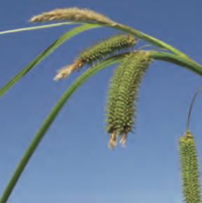
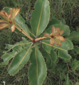
The subject site has undergone extensive land clearing since European settlement and therefore no longer resembles the original landscape. Few flora species found on the Cumberland Plain prior to settlement have been retained although some which have prevailed include spotted gum, swamp oak, old man banksia (AMC, 2013). Species diversity, particularly of native plants, is low with vegetation limited to grassed lawns, tree plantings, and garden beds largely containing introduced species (AMC, 2013; Strudwick & Chee, 2014). Consequently, habitat for native fauna is lacking. Gardens bed found on campus typically lack the structural complexity to host small avian species and open spaces tend to lack habitat features such as logs and rocks to attract reptile species (AMC, 2013). Within five kilometres of the subject site, fourteen threatened plant and forty two threatened animal species have been recorded, with three fauna species likely to occur on campus including the Greyheaded Flying Fox, eastern Bentwing Bat, large eared Pied Bat. Other priority species which are uncommon in urban areas and occurred in small numbers at few sites include frogs (Green and Golden Bell, Dwarf Tree), wetland birds (Australian Reedwarbler, Royal Spoonbill), and reptiles (Eastern Bluetongue) (COS, 2014)
2. 7 SWOT Analysis
Strengths
Existing slope: eliminates need to excavate landscaped area to create slope for stormwater run off Existing wetland construction: reduce environmental harm by using existing construction retrofit to enhance design and replant with more appropriate and more tolerant species Urban connectivity + access: highly trafficked area which is easily accessed through several modes
Opportunities
Reintroduce native wetland species: to host native fauna species, ensure resilience, reconnect with Indigenous heritage Connect with Indigenous heritage: opportunity to utilise former creek lines collaborate with local elders, capitalise on existing subsoils and groundwater Fauna-friendly water features: introduce rocks and logs into WSUD to facilitate reptile and small mammal migration Education: potential to engage and educate community through signage explaining design and native species
Weaknesses
Heritage: affects where development can occur need to design around Old Darlington School Scale: limited to a very small site Poor understorey habitat connectivity: currently preventing wildlife corridors which would enable safe migration Low genetic diversity/structural complexity: inhibits attraction of native fauna and reduces ecosystem resilience
Threats
Mismanagement: proposal requires management and upkeep to ensure optimal performance done within existing budget Lacking capital: development decision making is driven by significant upfront costs rather than long term benefits
3.0 Strategic Planning Framework and Precedent Studies
This section outline the relevant strategic planning framew ork and design principles. The objectives of each plan/framework are tabulated under each heading for simplicity purposes.
3 1 Greater Sydney Regional Plan
The GSRP describes the long term vision to manage growth and changes to Greater Sydney ’s social, economic, and environmental context The Plan establishes five principles which consist of a total of 40 objectives intended to guide transport, land use, and infrastructure planning and decision making (GSC, 2018). Several objectives from the Pl an are applicable to this design proposal, though the most relevant are summarised below.
Figure 11: Elements of green infrastructure (GSC, 2018)

SECTION RELEVANT OBJECTIVE/TARGET/PRINCIPLE
OBJECTIVE 25 Protecting and enhancing waterways through conserving sensitive aquatic ecosystems and reinstating natural conditions in modified urban waterways
OBJECTIVE 27 Support and enhance biodiversity through landscape scale conservation and managing remnant vegetation as green infrastructure
OBJECTIVE 31/32
Providing green infrastructure (Figure 11) which is accessible, protected and connected to the Greater Sydney Green Grid
OBJECTIVE 34 Capture and reuse water flows through precinct scale initiatives
3. 2 Sydney Green Grid
The SGG (Central District) report maps the hydrological, recreational, and ecological features of Sydney to propose a connected and integrated green infrastructure network for Greater Sydney. The purpose underpinning the Green Grid concept is to support healthy urban growth in Sydney through several precinct and site scale actions and by highlighting project opportunities
SECTION RELEVANT OBJECTIVE/TARGET/PRINCIPLE
ACTION 1.1 Landscape character influenced by existing topography and natural features
ACTION 1.4/1.5 Increase open space access and provide opportunities for walking and cycling to create highly liveable environments which produce health and wellbeing benefits for people
3 3 Sustainable Sydney 2030
The Sustainable Sydney 2030 plan outlines the City of Sydney’s commitment to sustainable development through the developme nt of a green, global, and connected city (COS, 2017). The plan is guided by the United Nations’ Sustainable Development Goals and establishes ten strategic directions with associated objective.
SECTION RELEVANT OBJECTIVE/TARGET/PRINCIPLE
TARGET 2 Zero increase in potable water use through better stormwater management and water recycling
OBJECTIVE 2.3 Incorporate stormwater management into streets and parks to improve the quality of water entering waterways, to improve wellbeing, and to reduce urban heat
OBJECTIVE 2.6 Streets and parks are enriched with WSUD features including rain gardens, swales, and constructed wetlands that work to also increase the prosperity of native flora and fauna
3. 4 Urban Ecology Strategic Action Plan
The City of Sydney’s UESAP aims to achieve the ‘living green’ target of the Sustainable Sydney 2030 vision by establishing a framework to protect and restore urban ecosystems (COS, 2014) The strategy outlines numerous actions aimed at increasing the resilience of remnant and novel vegetation plantings and protecting both threatened and non threatened fauna species. This is especially important for the Cadigal Green site due to its classification as a ‘supporting site’ and its proximity to potential habitat linkages (Appendix B).
SECTION RELEVANT OBJECTIVE/TARGET/PRINCIPLE
ACTION F.12 Develop biodiversity themed informative signage and guides about wetland species
ACTION F.2/M.1 Increase understorey diversity and structural complexity and consolidate existing indigenous planting patches
ACTION I.6 Investigate potential for new ponds and enhance habitat of existing wetlands
ACTION I.7 For frogs: construct freshwater wetlands/ aquatic habitats in WSUD
ACTION O.1/O.2 For reptiles: incorporate rock features hollowed logs into landscape
ACTION P.5/P.2 For wetland birds: establish dense reed beds, install roost sites
3 5 Blueprint for Living Cities
Blueprint for Living Cities supports the implementation of urban ecology in decision making by establishing best practice principles for the management of resilient and liveable cities (Davies et al., 2017). The blueprint proposes an urban ecology framework (Figure 12), with this design proposal primarily addressing the enhancing and creating priorities due to the highly disturbed nature of the site.
SECTION RELEVANT OBJECTIVE/TARGET/PRINCIPLE
STRATEGY 3 Connecting biodiversity through the green and blue infrastructure grid particularly focusing on integrating terrestrial and aquatic ecosystems at precinct and site scale

STRATEGY 4 Design and deliver new green and blue links in areas and existing habitats that provide ecosystem services
OBJECTIVE 2.6 Streets and parks are enriched with WSUD features including rain gardens, swales, and constructed wetlands that work to also increase the prosperity of native flora and fauna
CRUCIAL PRINCIPLE
Figure 12: Hierarchy of urban ecology priorities (Davies et al., 2017)
3. 6 Vision and Transition Strategy for a Water Sensitive Greater Sydney
The Vision and Transition strategy establishes a 50-year vision for Greater Sydney proposing numerous goals (Figure 13) to ensure a city which is resilient and is characterised by healthy urban ecosystems The strategy prioritises active water stewardship as a means of achieving its vision which can be achieved through management, design, and implementation strategies detailed in the report. Additionally, the strategy assessed Sydney’s current water management performance and found significant underperformances in water sensitivity ratings, underlining a potential area for improvement in the design proposal (Hammer et al., 2018)
Figure 13: Vision outcomes for Sydney as a Water Sensitive City (Hammer et al, 2018)

3 7 USYD Sustainability Strategy 2020
The University’s Sustainability Strategy establishes a commitment to long term sustainability through research and education, enabling environmental resilience, and effective governance (USYD, 2020) The most relevant action is strategy 9 which promotes the sustainable management and development of natural and built features on campus. This strategy involves drawing on Indigenous knowledge about whole-oflandscape water, land, and biodiversity management as well as recognising the importance of integrating native fauna into the landscape to attract flora and achieve sustainability targets.
3 8 Design Approaches for Sustainable Water Management: Water Sensitive Urban Design (WSUD)
Blueprint for Living Cities identifies WSUD as a key design approach for managing stormwater and defines it as any design intervention which enhances the health of urban waterways and their ecological communities, specifically those that capture water for local reuse (Davies et al., 2017 ) WSUD strategies that involve the retention and subsequent reuse of stormwater can reduce potable water demands, minimise stormwater pollution, mitigate the urban heat island effect, replenish groundwater, and provide water to vegetation (JSCWSC, 2009).
A plethora of WSUD strategies exist, although given the small scale of the site, its slight south easterly slope, existing mismanaged wetland, and the location of stormwater pipelines, bioretention basins and a retrofitted cons tructed wetland have been selected as the most site appropriate stormwater management techniques.
3. 8. 1 Constructed Wetlands: Sydney Park
Constructed wetlands are appropriate in open spaces with insignificant gradient changes and where a water feature is desired (JSCWSC, 2009). They are shallow, heavily vegetated water bodies that detain and filtrate stormwater and must be sized at 3 10% of the contributing catchment area, hence the need to extend the existing wetland (JSCWSC, 2009; Sydney Water, 2020).
Wetlands consist o f an inlet zone, a macrophyte (aquatic plant) zone, and a high flow bypass channel (JSCWSC, 2009). Stormwater is directed to the wetland from stormwater inlets where specialist aquatic plant species remove pollutants and the treated water is then channelled to collection pipes to be stored/reused (Sydney Water, 2020). Figure 14 illustrates the technical details of a constructed wetland system and will be utilised to inform the design proposal.
Benefits of constructed wetland systems are well documented and include flood protection, i mproved water quality through stormwater treatment, provide green spaces for recreation, reduce urban heat, and create wetland habitats to support biodiversity (Kandasamy & Vigneswaran, 2008). Sydney Park ’s constructed wetland (Figure 15) is an exceptional case study site due to its capacity to capture around 850 litres of stormwater per year whilst maintaining sustainable development principles (COS, n.d.) Since its completion in 2015, the wetlands have functioned to attract threatened native species including bell frogs, two sp ecies of threatened microbats,
and two water bird species (Kandasamy & Vigneswaran, 2008). Crucial design features from this precedent which can be implemented in the Cadigal Green proposal include:
• Diverting stormwater underground and increasing storage to allow reuse

• Using pollutant traps (plants) to filter stormwater
• Providing information to visitors about the wetland system and its ecological functions
Figure 14: Cross section of vegetated wetland edge (Melbourne Water, 2020)

3. 8. 2 Bioretention Systems/Rain Gardens: Walkers Road Rain Gardens
Bioretention systems regulate water flow during rainfall and flood events and treat stormwater to enable reuse The system consists of a detention zone which captures rainwater which is then filtered through a growing media and a drainage layer before being channelled into outlet pipelines (Sydney Water, 2020) (Figure 16).
The systems are versatile in terms of size and shape and are therefore appropriate for small scale developments Several field studies ha ve measured the volumetric losses in bioretention systems, with an average 50% reduction in surface run off (JSCWSC, 2009). Evidently, rain gardens effectively regulate water flows from run off, making areas surrounding impervious surfaces suitable locations for such systems.
The Walkers Road rain garden project (Figure 17) in South Australia features two raingardens either side of a non arterial road The project utilises specific vegetation species to assist in the removal of nitrogen from stormwater including bare twi g-rush, sea rush, and common tussock grass. As well as performing environmental functions crucial to enhancing urban ecology, the project delivers on social sustainability objectives through the provision of public amenity and educational signage (Figure 18) informing residents of its function (WSSA, 2017).
3 9 Planting Guidance Creating Habitat for Urban Wildlife: City of Sydney


A planting guide developed by the City of Sydney will be utilised to determine the most suitable flora species to incorporate into the design approach. This guide focuses on flora species which are conduc ive to the reintroduction of native fauna found in the area and are highlights those that are likely to thrive in the City of Sydney LGA. A table of suitable flora species adapted from this document is provided in Appendix C/D.

4.0 Design Proposal

The final design proposal integr ates urban water management strategies into the existing Cadigal Green site in a manner that addresses the interrelatedness of urban ecosystems and the benefits gained from resilient, healthy ecosystems. Three raingardens have been designed into areas where slightly raised grassed areas which were highlighted in the SWOT analysis as lacking the structural complexity to support biodiversity. The second part of the proposal involves the extension and remediation of the existing wetland ecosystem to allow greater volumes of treated water to be reused on the university grounds, and to support a greater divers ity of native wildlife including threatened species such as the Golden Bell frog. This objective was one which was common across the relevant strategic planning frameworks. Educational signage would be scattered throughout the site alongside the design interventions to inform the public of the importance of the ecosystems and species being protected, which would hopefully deter destructive human behaviour
4. 1 Constructed Wetland
The sketch below demonstrates how the constructed wetland system would operate on the site. Construction of the wetland system is based on best practice case studies and design manuals, with the three main components (inlet zone, macrophyte zone, wetland zone) each performing a different role in treating stormwater for reuse, and in creating a structurally complex vegetation community to support native wildlife.
The proposed design responds to the disturbed nature of the site and the Blueprint for Living Cities Framework by enhancing what is left of the existing ecosystem Furthermore, specific features in the design respond to the COS’ urban ecology plan including the enhancement of aquatic habitat to support frog species, rock s and hollow logs to attract reptiles, and dense reed beds to support wetland birds The proposed wetland extension follows former creek lines, paying homage to the Indigenous owners of the land Targets of potable water use reductions and improved water quality are targeted through the incorporation of stormwater treatment and storage which allows for reuse.

More generally, the design proposal, inspired by Sydney Park’s highly regarded wetland system, addresses the interrelatedness between the environmental and social amenity that landscapes provide by creating a highly liveable and attractive destination place. In line with the GSRP and the Green Grid framework, the project provides open spaces and opportunities for active transport to produce health and wellbeing benefits.
4 2 Rain Garden
The second element of the proposal collects rainwater in gardens containing a series of layers acting as a filter to treat the water. The foundation of this strategy is based upon the existing newly planted trees on the site which needed greater understorey complexity to adequately support faunal biodiversity Once treated, the collected water is channelled through collection pipes to the Sydney Water stormwater network.
The selection of native flora for use in the gardens aligns with the university’s sustainability strategy and SOC urban ecology strategic plans, and reflects real world practice, as evidenced by the Walkers Road project. The sketch below demonstrates the integration of diverse vegetation into the existing plant patch, resulting in a more complex ecosystem which offers a broader range of ecosystem services.
4. 3 Interrelatedness
This drawing further emphasi ses the notion that urban ecosystems are not merely concerned with improving ecological outcomes opportunities for passive and active recreation, community interaction, and urban heat reduction, for example, are related to and reliant on green and blue infrastructure. Healthy urban ecosystems are capable of attracting both wildlife and humans.

T
of rain gardens into the existing grassed areas where infant trees exist, and the extension and remediation of of such interventions is existing strategic planning frameworks. construction would greatly benefit the sites water capture and reuse capac omoting the return of threaten conjunction with e supporting health and wellbeing.
It is important to understand that this is a localised design approach and greater improvement in connections between green and blue grids throughout Sydney remain necessary to allow migration and dispersion of threatened species. Threats identified in the SWOT analysis including mismanagement and funding concerns remain pertinent to the success of the proposal However, if the university looks beyond initial upfront costs and considers the longer term benefits the design could provide, then this proposal has the potential to effectively manage urban water in a manner that considers biodiversity, urban heat reduction, and recreational needs. 6.0 References

Australian Museum Consulting, 2013. Preliminary Ecological Assessment for the U niversity of Sydney Campus Improvement Program.
City of Sydney, 2014. Urban Ecology Strategic Action Pl an. Viewed 29 October 2021, https://www.cityofsydney.nsw.gov.au/strategies action plans/urban ecology strategic action plan
City of Sydney, 2017. Sustainable Sydney 2030. Viewed 29 October 2021, https://www.cityofsydney.nsw.gov.au/sustainable sydney 2030
City of Sydney, 2019. Urban Habitat Creation Guide. Viewed 29 October 2021, https://www.cityofsydney.nsw.gov.au/guides/urban habitat creation guide
Davies, S , Gurr, L , King, T , Maclean, H., 2017. Historical Archaeological Assessment, University of Sydney Electrical E ngineering Building
Davies, P, Corkery, L, Nipperess, D, Barnett, G, Bishop, M, Hochuli, D, Hose, G, Joei, C, Lin, B, Keane, A, Osmond, P, Pelleri, N, Staas, L, Threlfall, C, Berg, F, Wilkinson, S 2017. Blueprint for Living Cities: Policy to Practice. National Green Infrastructure Network.
Greater Sydney Commission, 2018. Greater Sydney Regional Plan: A Metropolis of Three Cities. Sydney, Australia: GSC .
Hammer, K., Rogers, B.C., Chesterfield, C., Church, E., and Gunn, A., 2018 Vision and Transition Strategy for a Water Sensitive Greater Sydney. Melbourne, Australia: Cooperative Research Centre for Water Sensitive Cities.
Hobbs, A., Blake, N., Williams, A., 2016. Aboriginal Heritage Impact Assessment Report, Archaeological and Heritage Management Solutions
Joint Steering Committee for Water Sens itive Cities , 2009 Evaluating Options for Water Sensitive Urban Design A National Guide. Viewed 29 October 2021, http://observatoriaigua.uib.es/repositori/suds_australia_options.pdf
Kandasamy, J & Vigneswaran, S 2008, Constructed Wetlands, Nova Science Publishers, Incorporated, Hauppauge.
Mein, E., Vinton, N ., 2013. University of Sydney Campus Improvement Program Aboriginal Heritage Due Diligence Report
Strudwick, P., Chee, A., 2014. Campus Improvement Program (SSD 13_6123): Environmental Impact Statement
Sydney Water, 2020. Western Parkland City: Urban Typologies and Stormwater Solutions. Viewed 29 October 2021, https://www.sydneywater.com.au/content/dam/sydneywater/documents/urban typologies and stormwater management part 2.pdf
TCL, 2009. University of Sydney Cadigal Green. Viewed 24 October 2021, retrieved from https://tcl.net.au/projects item/university of sydney/
Tyrell, M, 2017. Sydney Green Grid: Spatial Framework and Project Opportuniti es. Sydney, Australia: Office of the Government Architect. Viewed 29 October 2021, https://www.governmentarchitect.nsw.gov.au/projects/sydney green grid
University of Sydney, 2020. Sustainability Strategy 2020. Viewed 29 October 2021, https://www.sydney.edu.au/content/dam/corporate/documents/about us/values-and-visions/sustainability/sustainability_strategy_2020.pdf
Water Sensitive SA, 2017. Case study Walkers Road rain gardens (Sommerton Park). Viewed 29 October 2021 , https://www.watersensitivesa.com/sydney water nsw urban typologies and stormwater management guidelines/
7.0 List of Figures
1. Image adapted from Google Earth 2021
2. Image adapted from Google Earth 2021
3. Urbis, 2017, Glasshouse sited west of subject site (Figure 11), Historical Archaeological Assessment Report, viewed 29 October 2021
4. Urbis, 2017, Old Darlington School a nd Water Feature (Figure 13), Historical Archaeological Assessment Report, viewed 29 October 2021
5. Google Earth 2021
6. Urbis, 2017, Cadigal Green and Water Feature (Figure 14), Historical Archaeological Assessment Report, viewed 29 October 2021
7. Google Earth 2021
8. TCL, 2009, University of Sydney Cadigal Green, viewed 29 October 2021, https://tcl.net.au/projects item/university of sydney/
9. Map information adapted from multiple sources: Gray, S., Cheah, C., Richards, Z., 2015. Blackwattle Bay Catchment Flood Study, City of Sydney and Hobbs, A., Blake, N., Williams, A., 2016. Aboriginal Heritage Impact Assessment Report, Archaeological and Heritage Management Solutions
10. Image data adapted from source: Gray, S., Cheah, C., Richards, Z., 2015. Blackwattle Bay Catchment Flood Study, City of Sydney and Hobbs, A., Blake, N., Williams, A., 2016. Aboriginal Heritage Impact Assessment Report, Archaeological and Heritage Management Solutions
11. GSC, 2018, Elements of Green Infrastructure (Figure 46), Greater Sydney Regional Plan, viewed 29 October 2021
12. Davies et al., 2017, Urban Ecology Hierarchy (p. 13), Blueprint for Living Cities, viewed 29 October 2021
13. Hammer et al., 2018, Sydney as a Water Sensitive City: Vision (p. 3), Vision and Transition Strategy for a Water Sensitive Greater Sydney, viewed 29 October 2021
14. Melbourne Water, 2020, Indicative Cross Section of vegetated Wetland (Figure 6), Wetland Design Manual Part A2: Deemed to Comply Design Criteria Manual, viewed 29 October 2021
15. SBS, 2016, Wetlands at Sydney Park, Sydney Park Wetlands gets Named in Gadigal Language, viewed 29 October 2021
16. Sydney Water, 2020, Cross sectional diagram of a typical bioretention system (Figure 14), Western Parkland City: Urban Typologies and Stormwater Solutions, viewed 29 October 2021
17. Water Sensitive SA, 2017, Image A, Case study Walkers Road rain gardens (Sommerton Park), viewed 29 October 2021
18. Water Sensitive SA, 2017, Image G, Case study Walkers Road rain gardens (Sommerton Park), viewed 29 October 2021
Map of potential habitat linkages and supporting sites with the University campus centred on the map in a bright green hatch (COS, 2014)

Species list for plantings in the constructed wetland and rain gardens (COS, 2019)
Name Type of Vegetation Height (m) Habitat Value Soil Type WSUD strategy 1 Tussock Grass Grasses 1 Birds Sand Wetland
Species catalogue for plantings in the constructed wetland and rain gardens (COS, 2019)