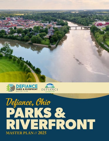
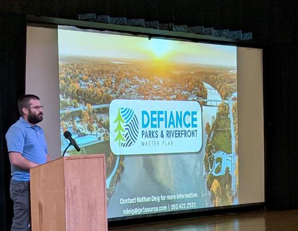
PARKS & RIVERFRONT Defiance, Ohio
ACKNOWLEDGMENTS
CITY OF DEFIANCE:
631 Perry Street, Defiance, OH 43512 (419) 784-2101
Mayor - Mike McCann
Melinda Sprow, City Engineer
Niki Warncke, City Planner
Rob Cereghin, Parks & Cemetery Director
COUNCIL MEMBERS:
David McMaster, Council President
Steve Corbitt, First Ward Councilman
John Hancock, Second Ward Councilman
Josh Mast, Third Ward Councilman
Chris Engel, Fourth Ward Councilman
Joe Eureste, At-Large Councilman
Jill Krutsch, At-Large Councilman
Steve Waxler, At-Large Councilman
STEERING COMMITTEE:
Abbie Wolfrum, Defiance County United Way
PARK BOARD:
Mike Adams, Chair
Abby Bowers
Matt Carr
Ann Rivers
Lou Rivera
Jan Cannon
Devon Pearson
Michael Weisenburger
Elizabeth Frankart
Cara Boehm, Defiance County Metropolitan Parks District
Erika Willitzer, Defiance County Economic Development
Jamie Gerken, Defiance County Health Department
Jenna Peper, Defiance County Board of DD
Jennifer English, MS4 Coordinator
Julie Houck, Defiance City Schools
Kelly Grube, Downtown Business Owner
Kirstie Mack, Defiance Main Street & Visitors Bureau
Rob Lawson, Downtown Business Owner
Ryan Mack, City Administrator
Scott Stambaugh, Downtown Business Owner
Staci Kaufman, City of Defiance Planning Commission
Steve Corbitt, Defiance City Councilman
PREPARED BY:

111 W. Berry Street Fort Wayne, IN 46802 (260) 422-2522

6471 County Road 29 Auburn, IN 46706 (260) 908-4508

FIGURES & TABLES
EXECUTIVE SUMMARY
Defiance, Ohio, is a charming city situated at the confluence of the Maumee and Auglaize Rivers, with the Tiffin River flowing nearby. With a rich history dating back to its establishment as a fort in the late 18th century, Defiance has grown into a vibrant community that values its natural beauty and recreational spaces. The City's parks and riverfronts play a crucial role in the lives of its residents, providing spaces for relaxation, exercise, and social gatherings. These green spaces are not only essential for the well-being of the community but also serve as a testament to Defiance's commitment to preserving its natural environment and enhancing the quality of life for its citizens.
In recent years, there has been a concerted effort to further develop and improve Defiance's parks and riverfronts. Upon unifying the passions of residents and stakeholders to promote Defiance’s quality of life in the 2023 Comprehensive Community Action Plan, the City
further develop the City’s riverfronts and extend the improvements to include all of Defiance’s City Parks. This plan builds on that foundation and addresses the existing barriers to achieving these efforts.
The master planning process consisted of three phases. Phase 1 included a robust community engagement approach alongside a thorough review of current conditions. Phase 2 included diagrammatic plans for improvements in three of Defiance’s riverfront parks, as well as implementation strategies for each. Phase 3 included a Final Master Plan Report, funding and financing needs assessment, partnering framework, and a detailed Action Plan to bring what’s on paper to reality.
This process will create a community-led plan that enhances public health, promotes social justice, restores environmental quality, mitigates flood risks, and establishes vibrant, dynamic spaces along the river
INTRODUCTION: Plan Purpose, the Community, & Our Process
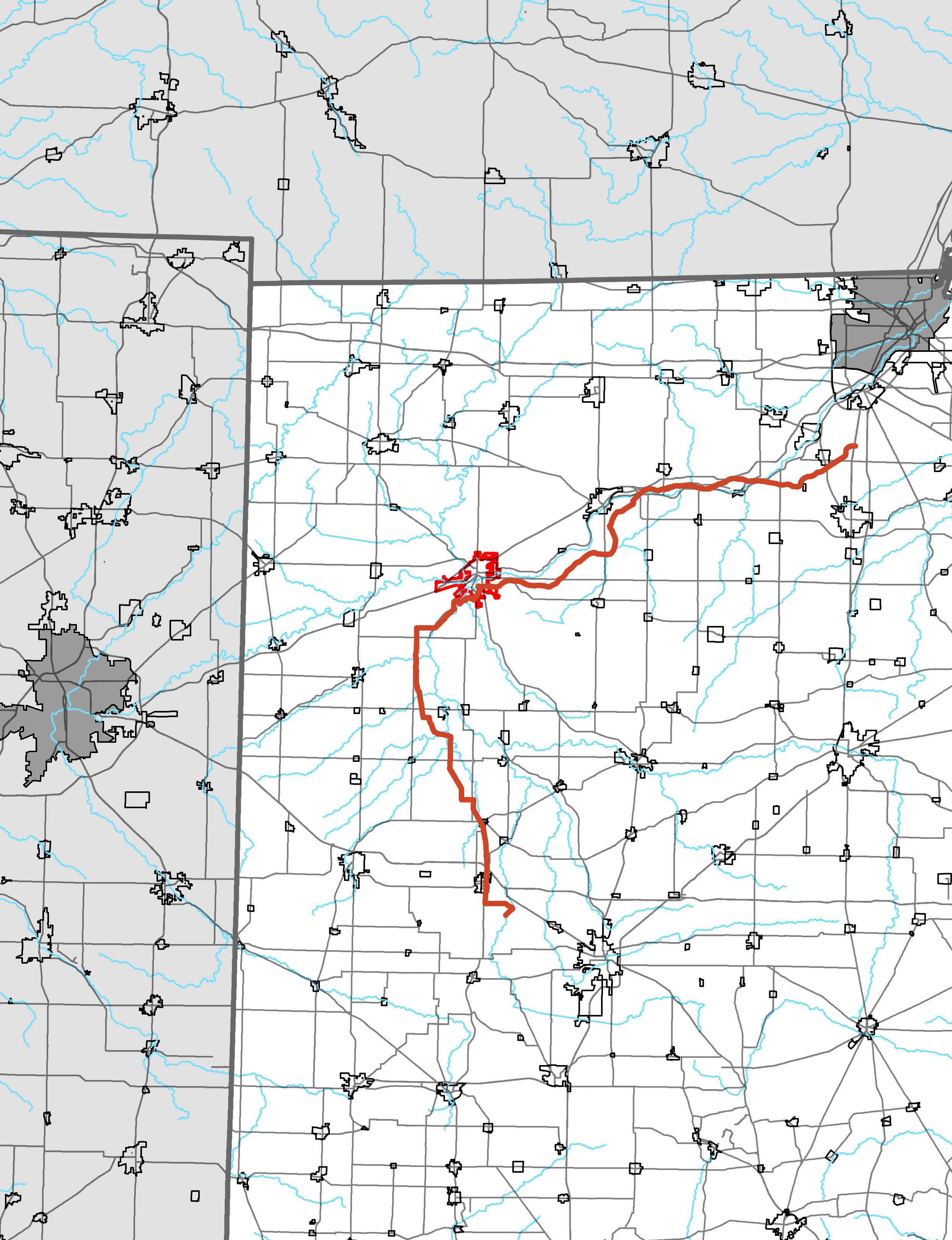
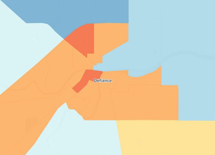
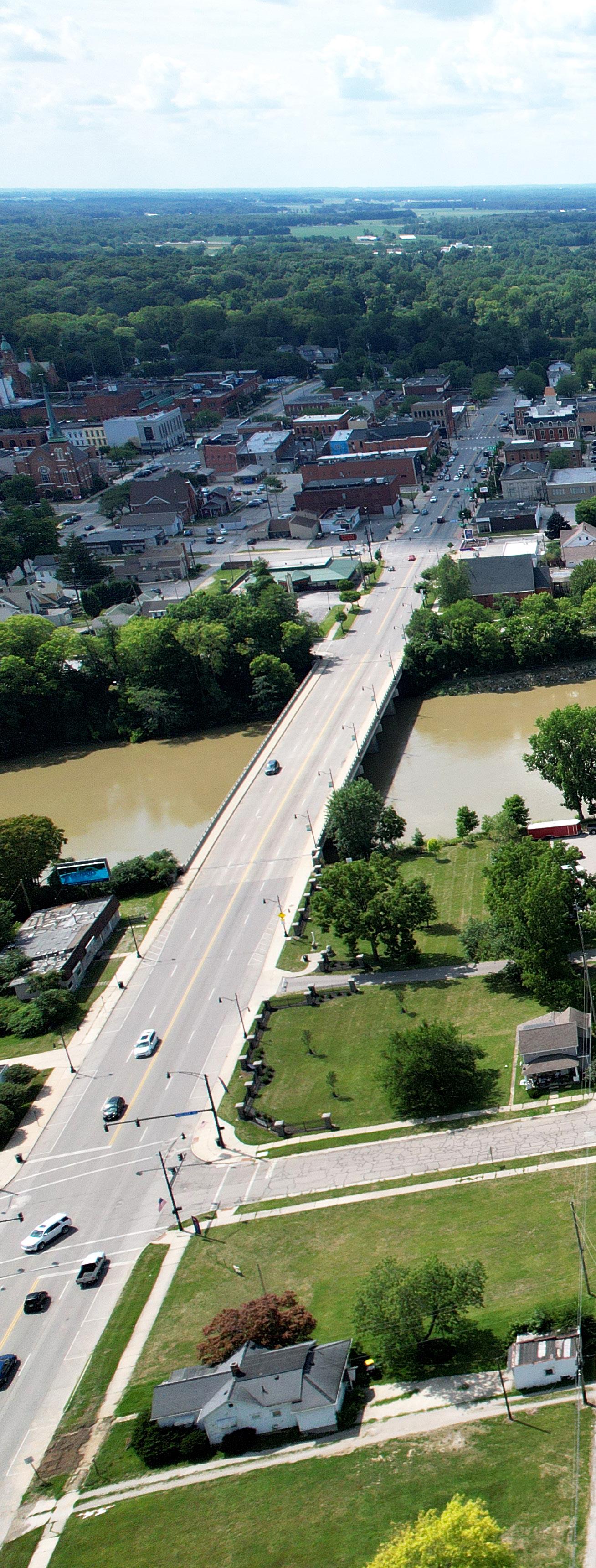
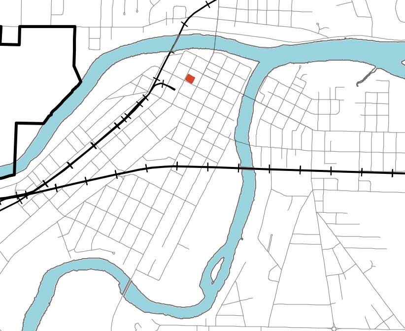
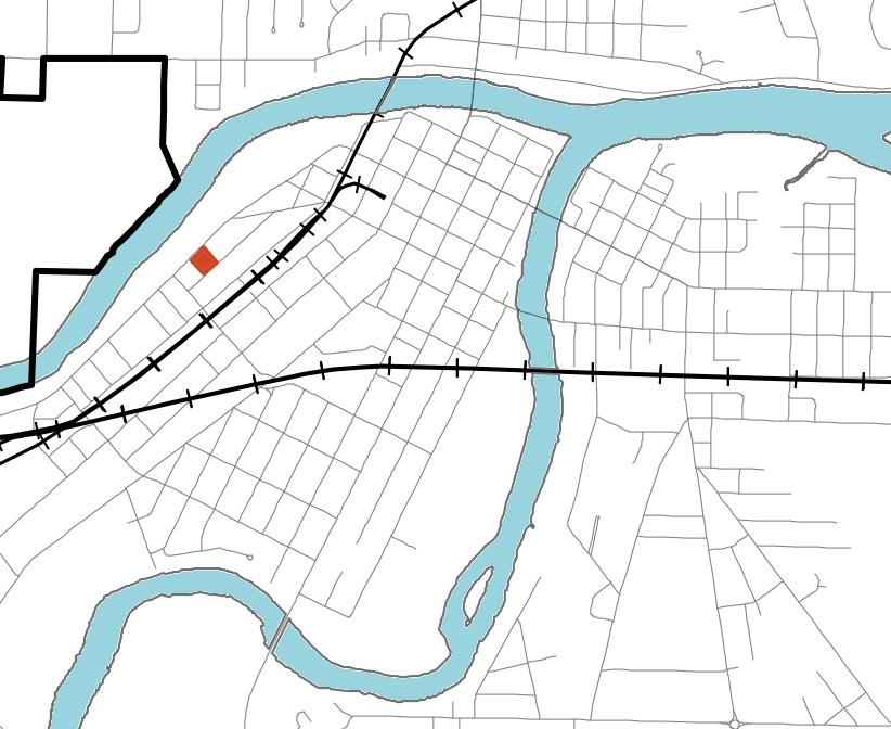
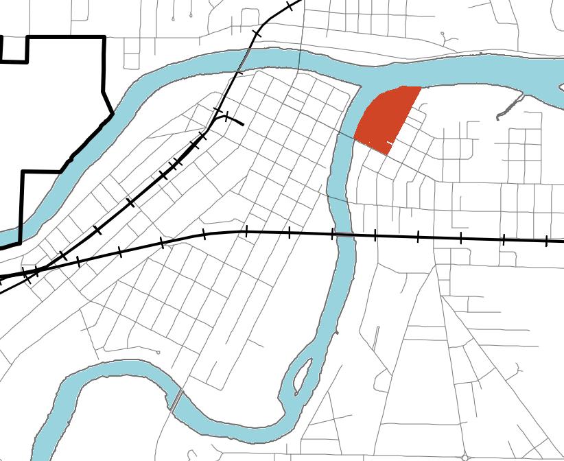
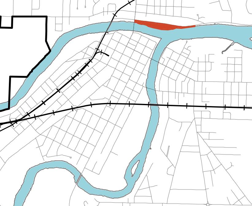
DEFIANCE PARKS & RIVERFRONT MASTER PLANNING AREA
A Comprehensive Overview of the Jurisdictional and Service Boundaries for Community Recreation and Riverfront Facilities
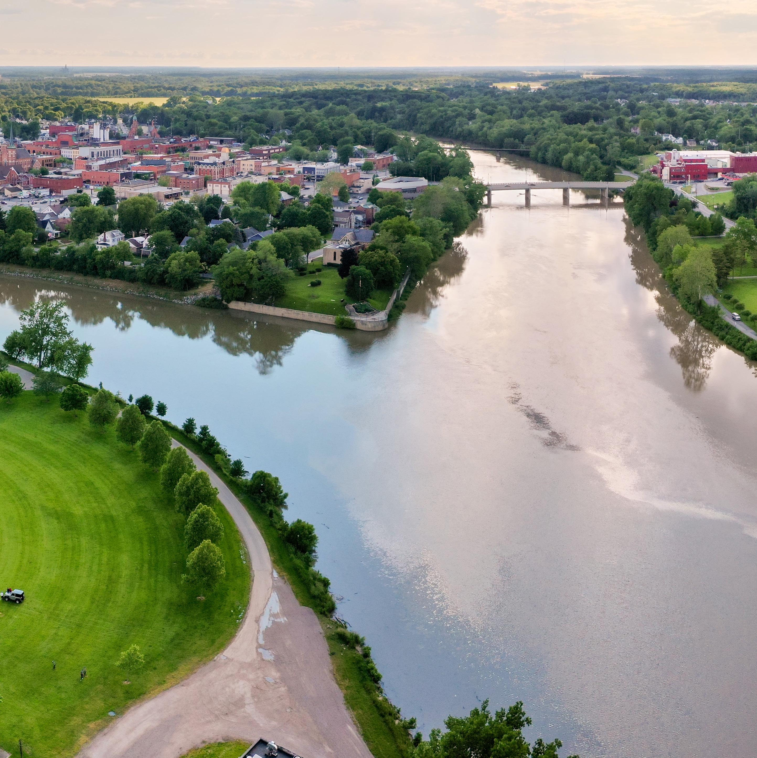
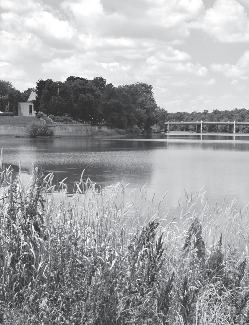
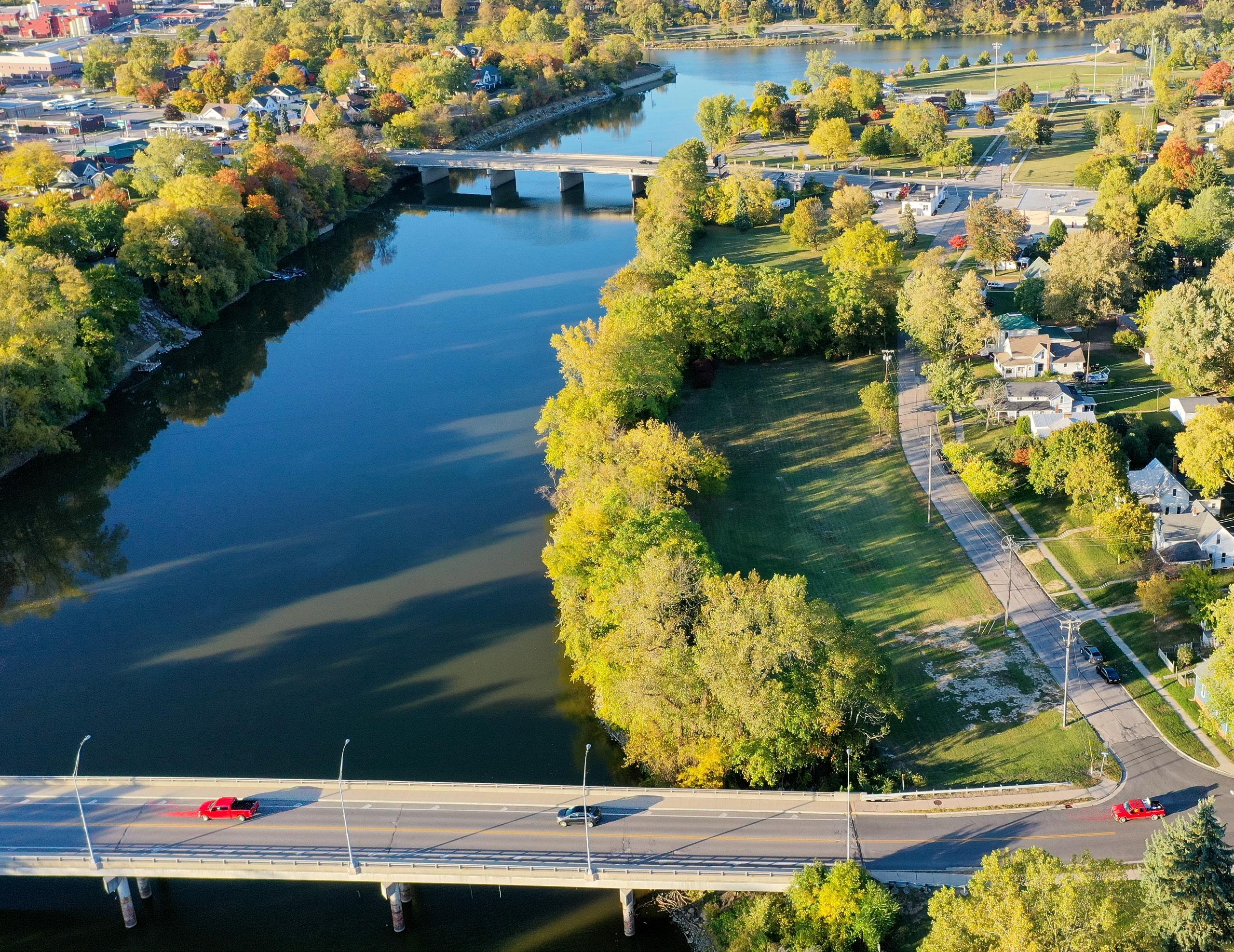
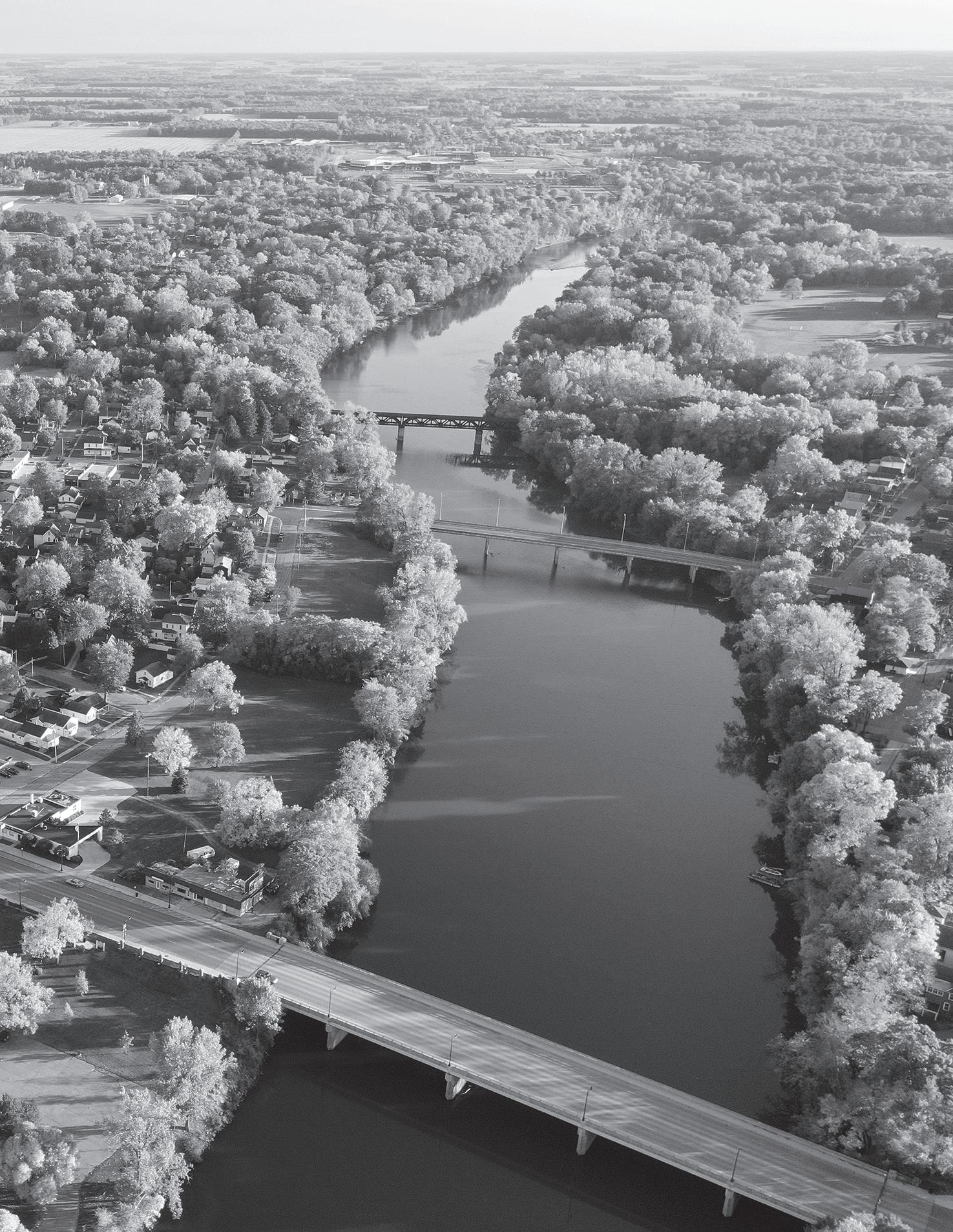
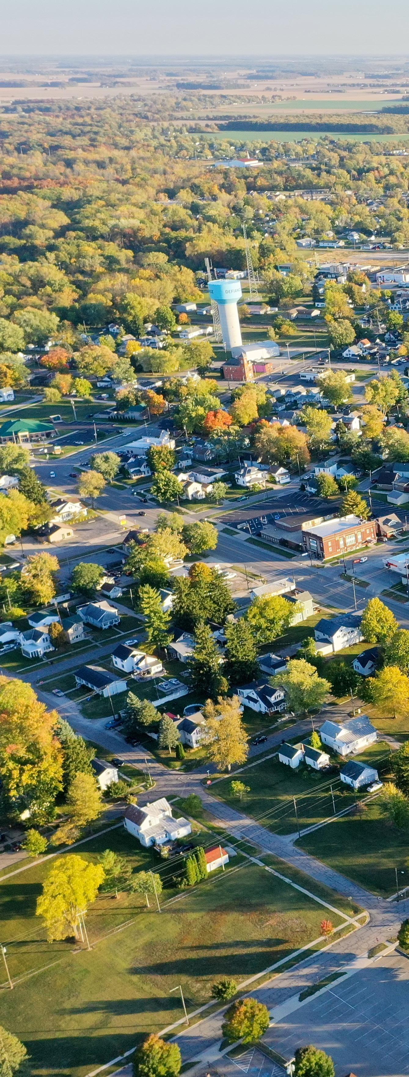
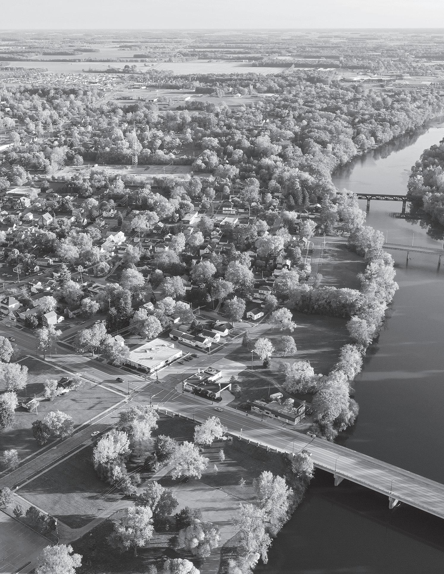
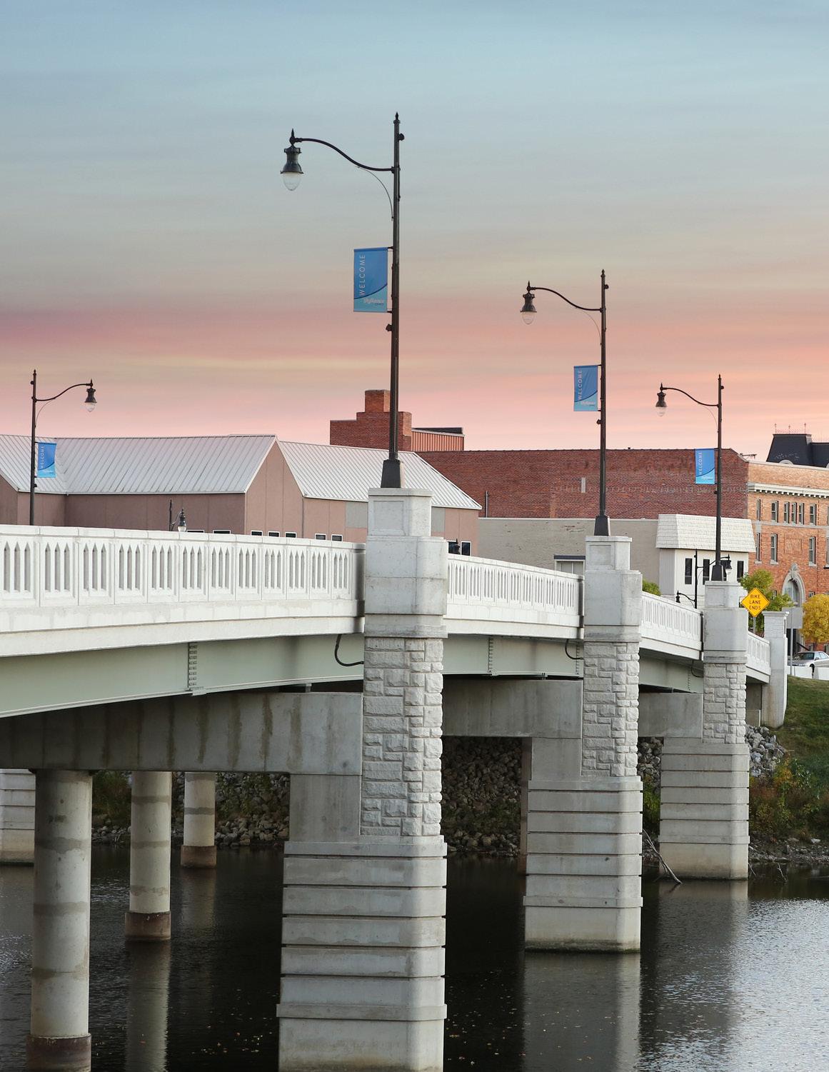
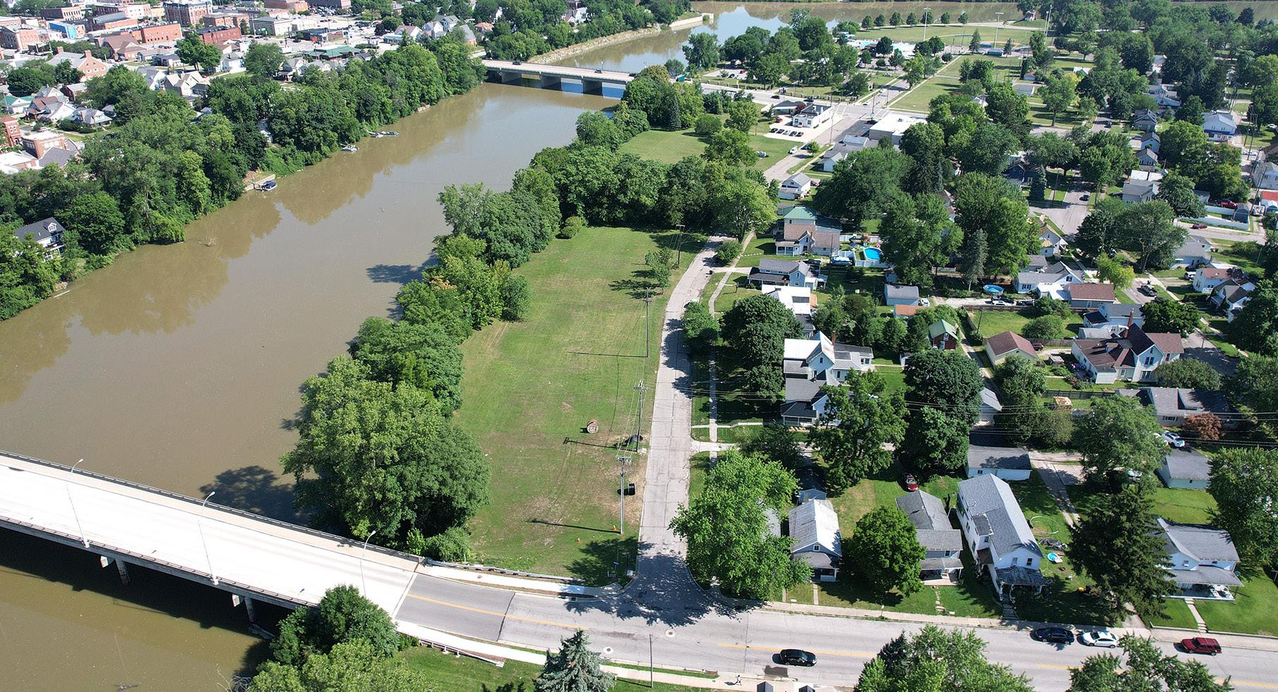
Located at the confluence of the Maumee and Auglaize Rivers, the City of Defiance encompasses three rivers and boasts twenty existing and planned parks. The riverfront areas are particularly noteworthy, as they highlight the City's unique geographical location and offer numerous recreational opportunities. The Maumee, Auglaize, and Tiffin Rivers not only provide stunning natural backdrops but also support a variety of water-based activities such as boating, kayaking, and fishing. Its extensive parks system, which includes both developed and natural spaces, provides ample opportunities for outdoor activities, from leisurely strolls along a trail to more adventurous pursuits in its green spaces.
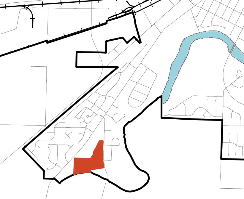
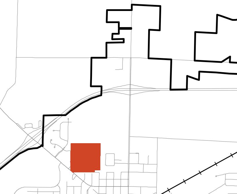
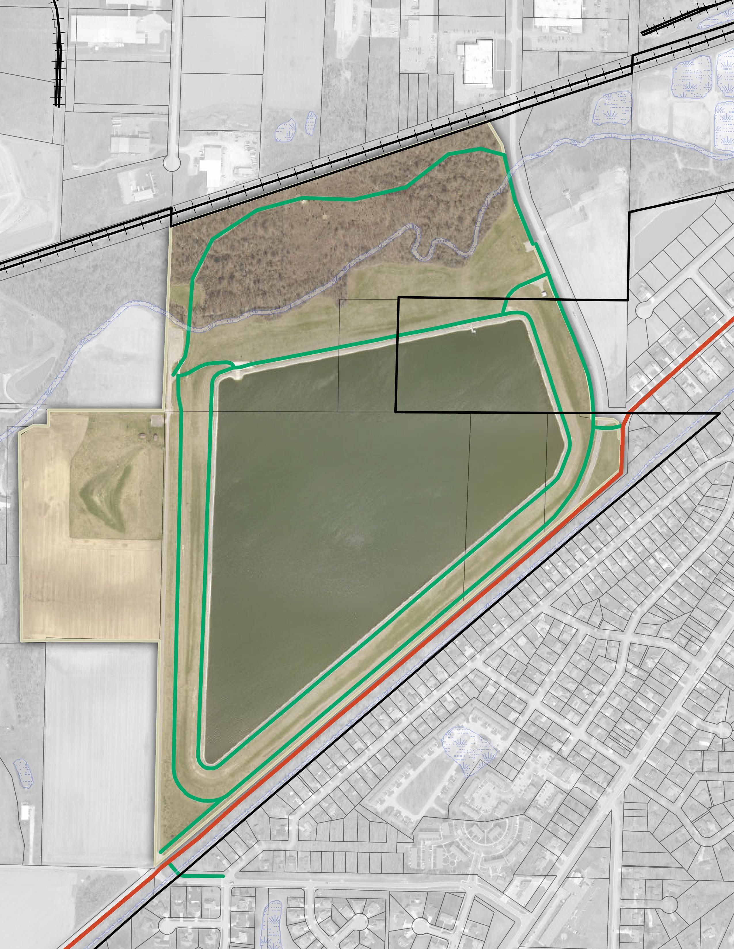
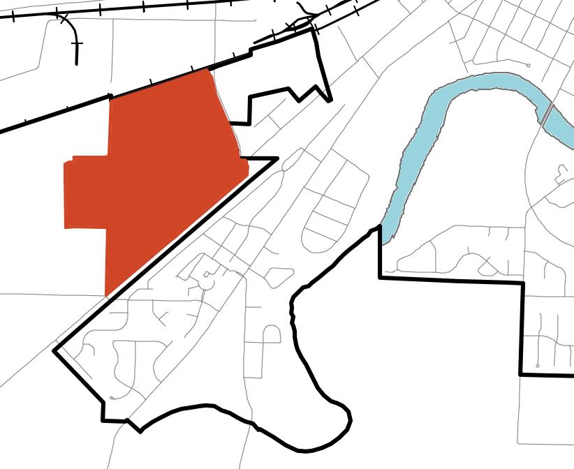
The designated planning area for the City of Defiance Parks and Riverfront Master Plan closely mirrors the City's planning jurisdiction. This jurisdiction includes not only the City's established boundaries but also extends to Reservoir Park and Bark and Run Dog Park, situated on the southwest side just outside the city limits.
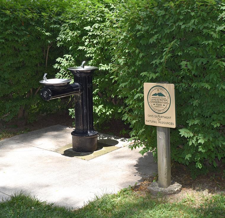
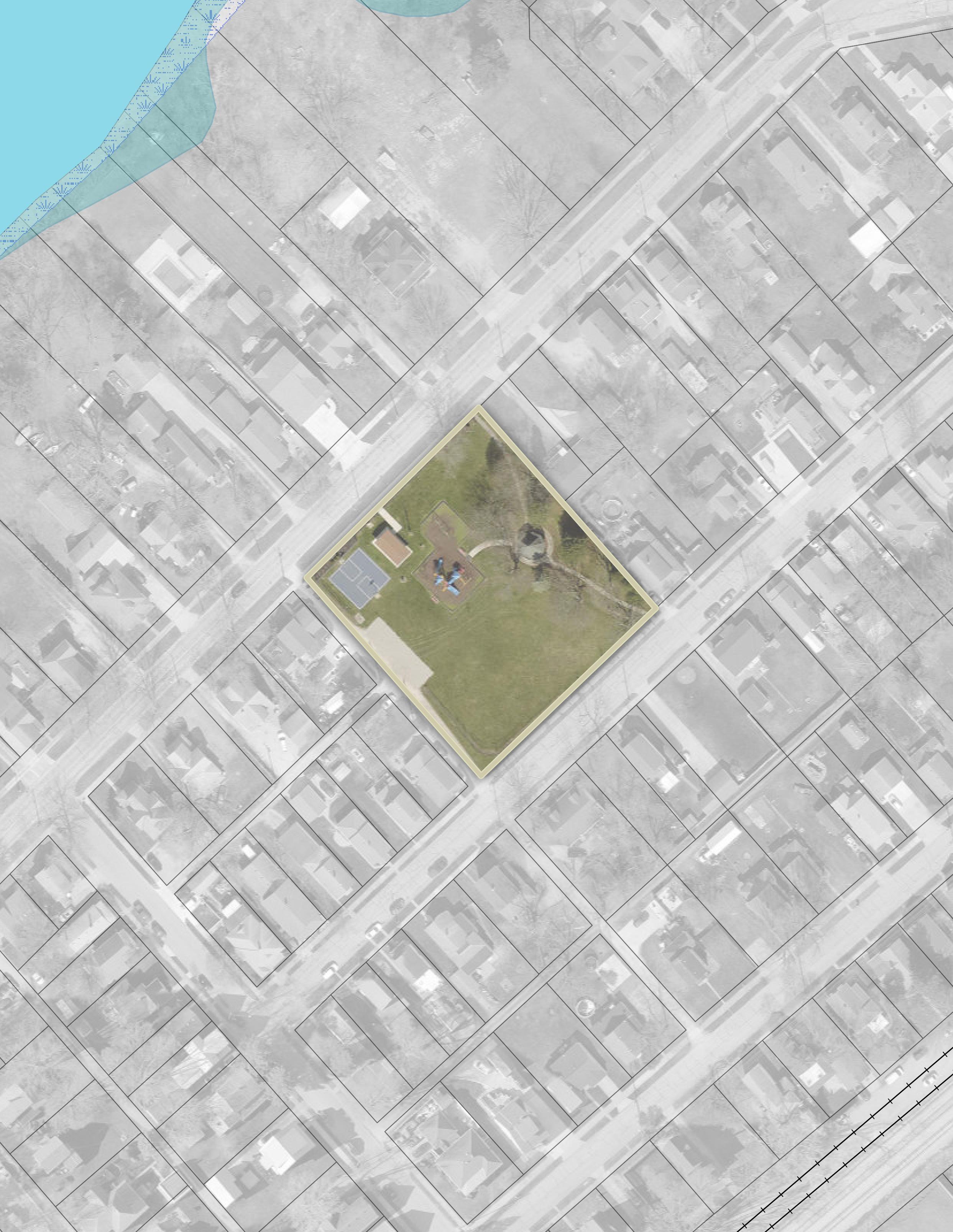
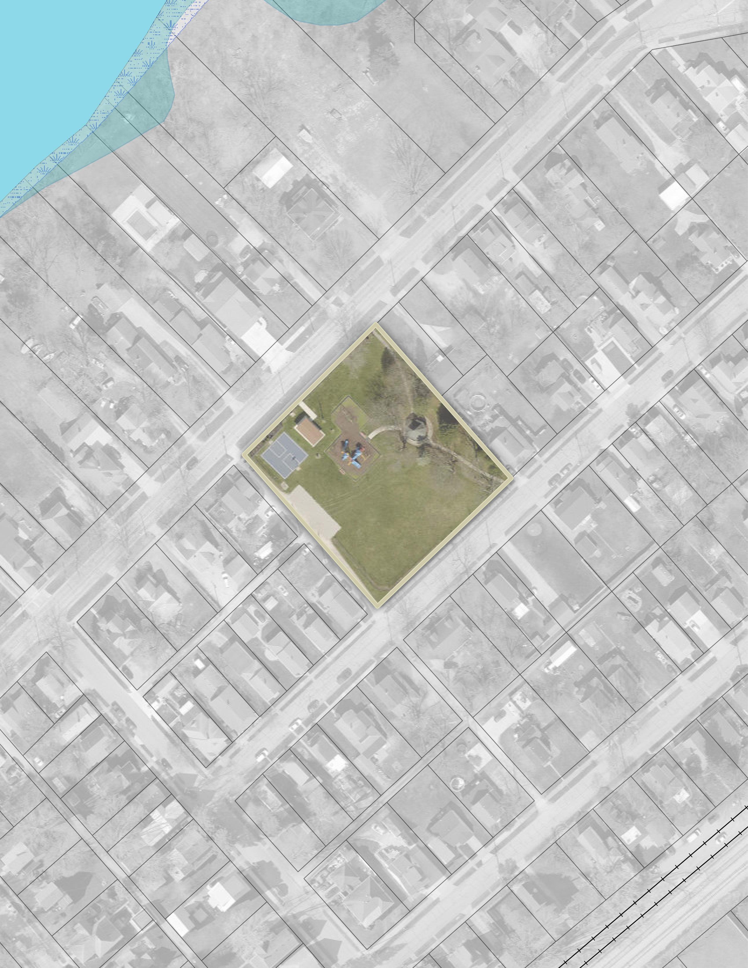
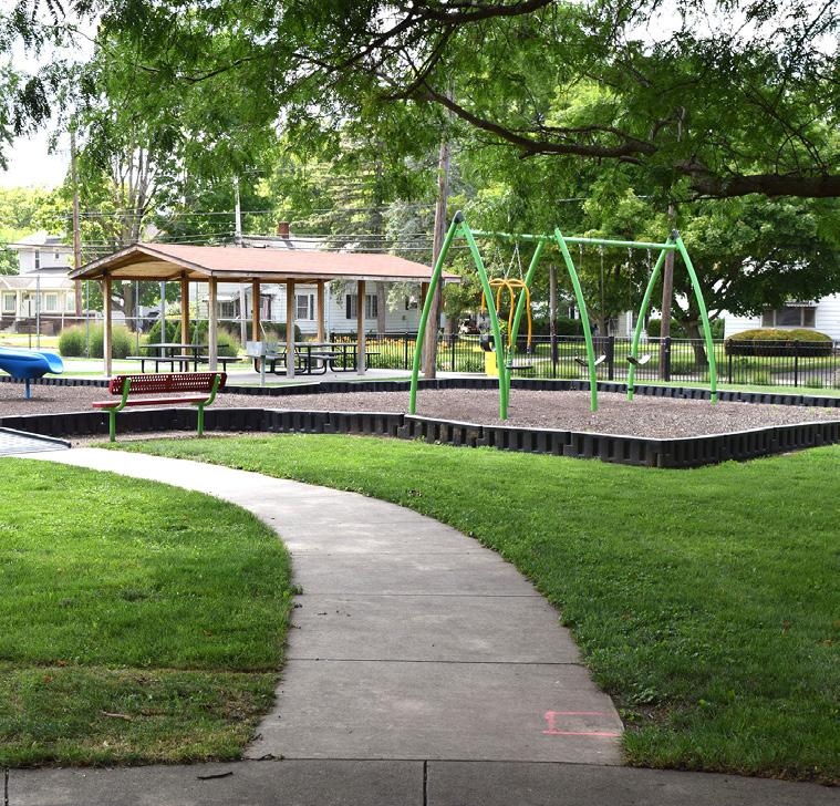
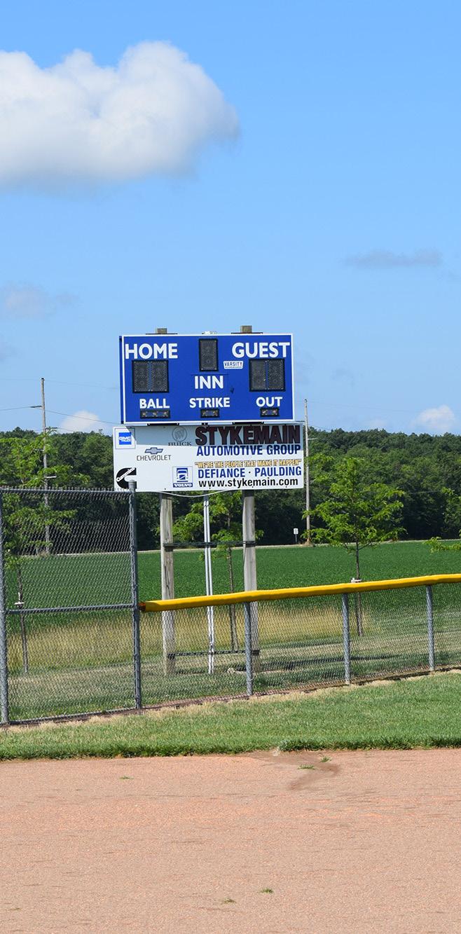
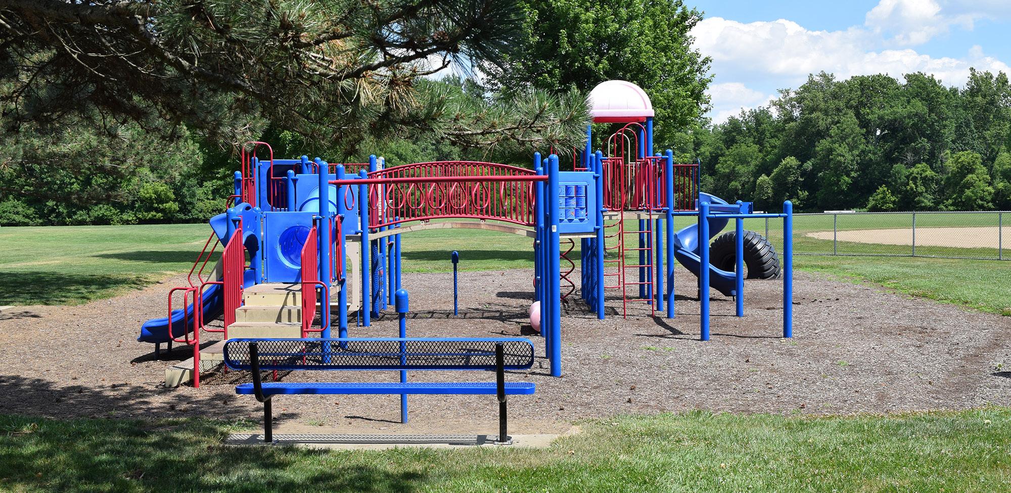
DIEHL PARK
PONTIAC PARK
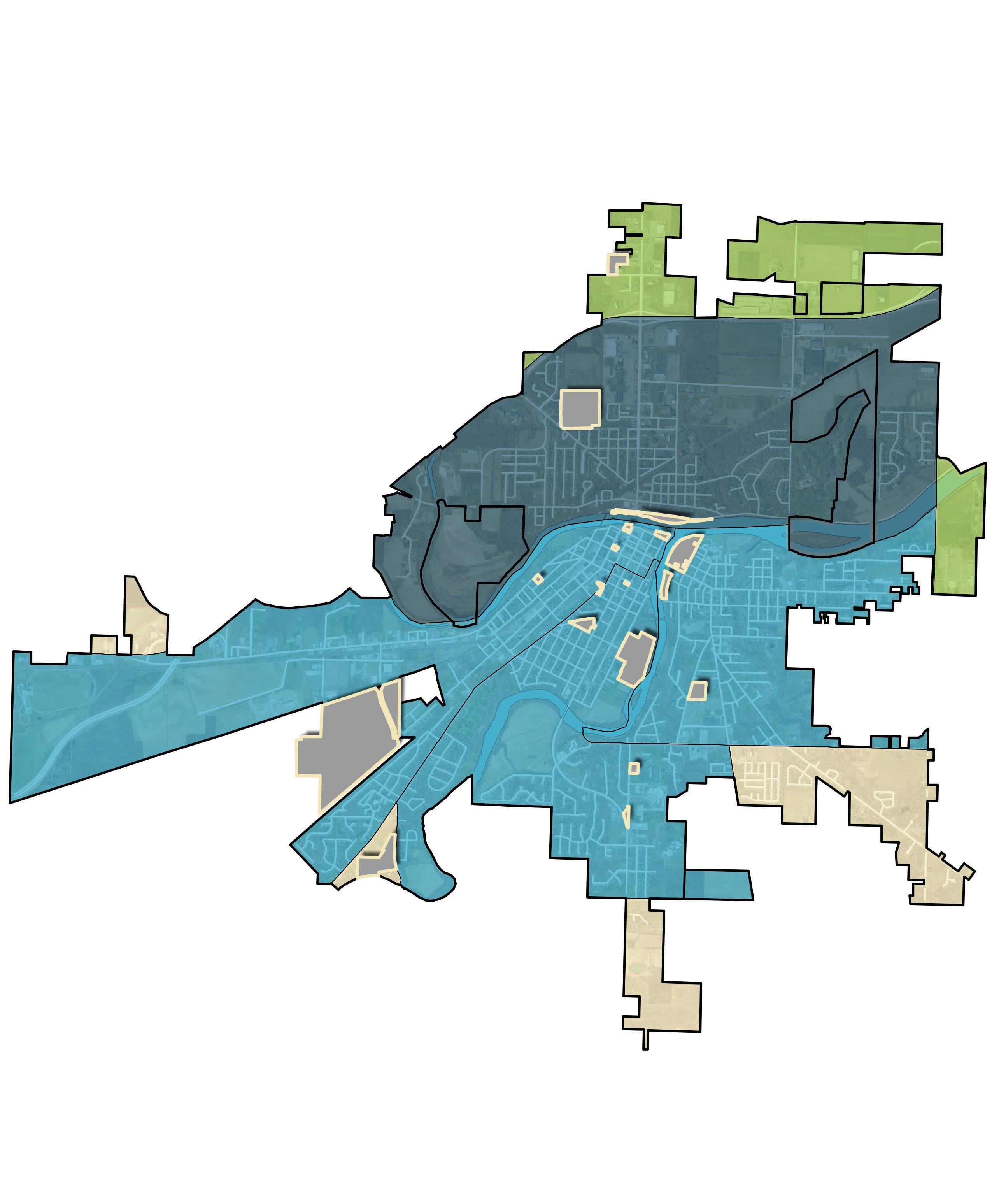
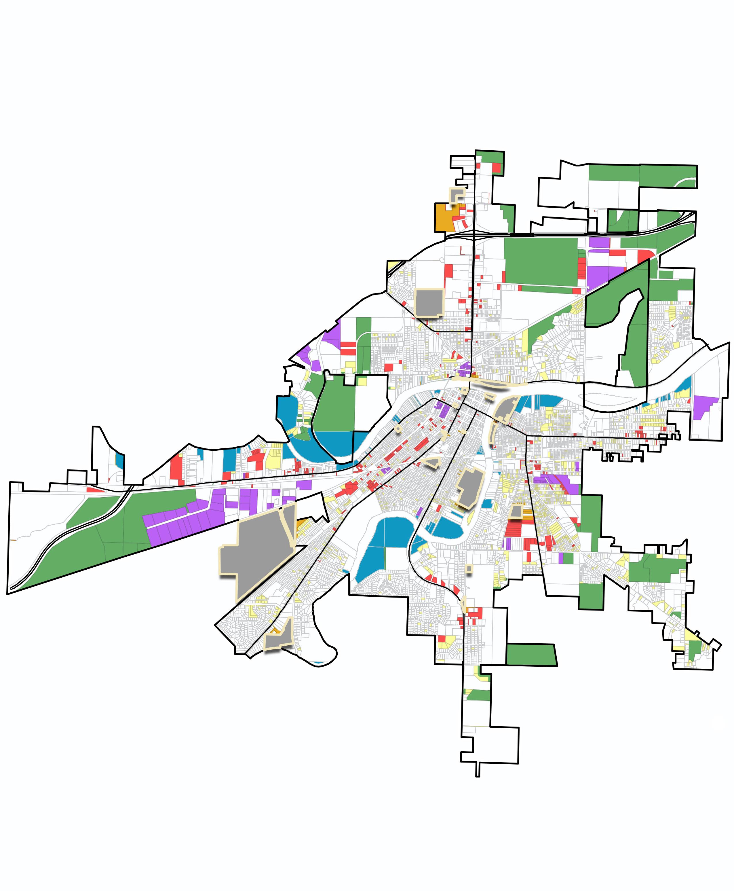
FIGURE 1: Park Inventory Map
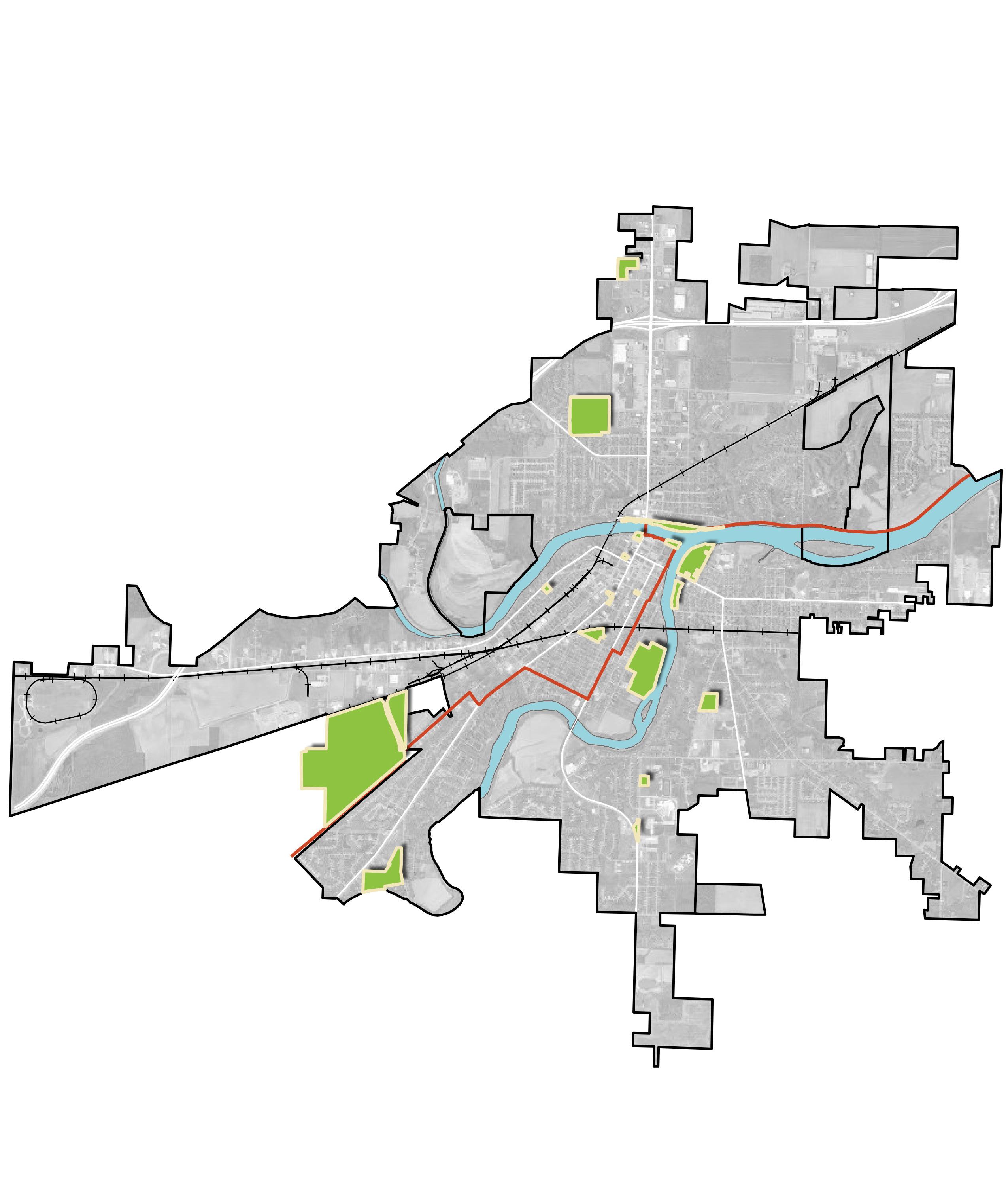
This map illustrates the location of all twenty parks included within this Master Plan. Many of the parks are situated in or near downtown Defiance near the confluence of the Auglaize and Maumee Rivers. Reservoir Park and Bark & Run Dog Park both fall outside city limits, but are still owned and managed by the City.
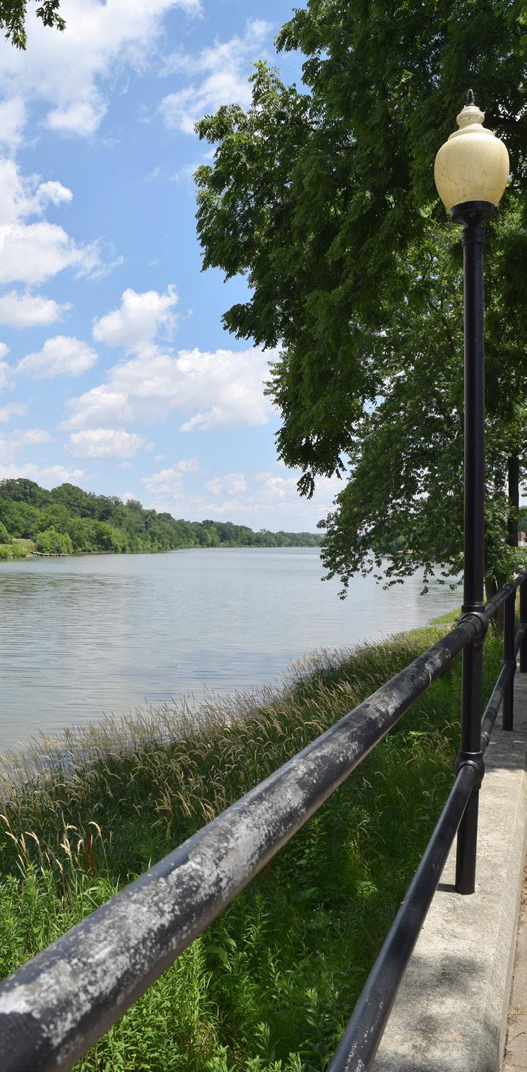
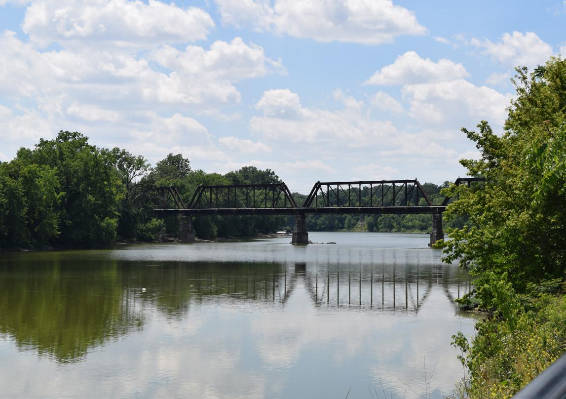
MAUMEE RIVER
TIFFIN
THE CITY OF DEFIANCE PARKS & RIVERFRONT MASTER PLAN
The goal of the Parks and Riverfront Master Plan is to create a community-driven roadmap that will improve overall public health and safety, advance social justice, restore environmental quality, reduce flood risks, and develop vibrant, activated places along the river corridors.
Defiance, Ohio, offers a rich tapestry of natural beauty, historic significance, and a strong sense of community. The parks and riverfront areas are integral to the City’s identity, providing residents and visitors with spaces for recreation, relaxation, and connection with nature. Recognizing the importance of these assets, the City of Defiance has embarked on a comprehensive planning process to envision their future.
This Master Plan is rooted in the City of Defiance's current conditions and projected growth. It sets forth a realistic vision for the future of the park system and riverfront areas, along with a practical roadmap for achieving that vision. A comprehensive community engagement approach and a detailed assessment of current conditions were used to ensure a community-driven vision for the future of Defiance parks and riverfronts.
Encompassing three rivers and twenty existing and planned parks, the Plan seeks to enhance and expand the existing open space system, providing recreational opportunities for all Defiance residents and ensuring they remain accessible and enjoyable for future generations.
Project Vision:
Develop a community-supported Parks and Riverfront Master Plan that can be successfully implemented through capital projects, programmatic strategies, and operations.
Project Goals:
Promote public health, safety, and social justice
Improve environmental quality and reducing flood risk
Develop vibrancy and placemaking along the river corridors
Improve connectivity to and between parks
Project Objectives:
Develop Gateway Park with Maumee River boat/canoe/kayak access (DR-5)*
Develop canoe/kayak activation nodes (CC-5)*
Explore plan to implement shared use path connections at the confluence of the Maumee and Auglaize Rivers (CC-9)*
Riverfront revitalization and shared use path connectivity trail system (Peddle & Paddle Plan) (CC-10)*
Pursue the feasibility of developing a Preston Run Trail system (CC-14)*
Riverside Park connectivity for pedestrians and bicyclists (CC-17)*
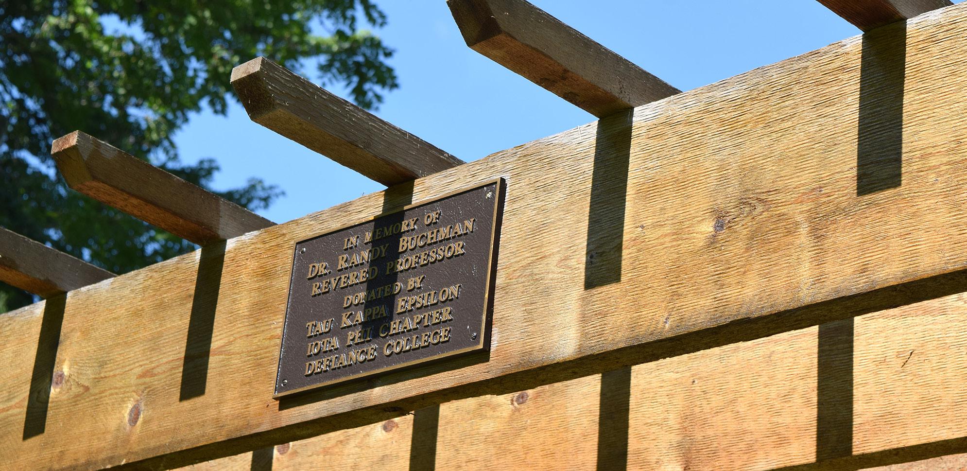
Development and funding of Buchman Park on the Glaize as a natural passive tribute park to the Native Americans who have resided in the Defiance Area
Promote access to parks through programming and communication efforts, while also improving parks to incorporate inclusive park amenities
Identify potential implementation strategies to improve park engagement for all by incorporating inclusive amenities
Community Profile: A SNAPSHOT OF OUR CITY
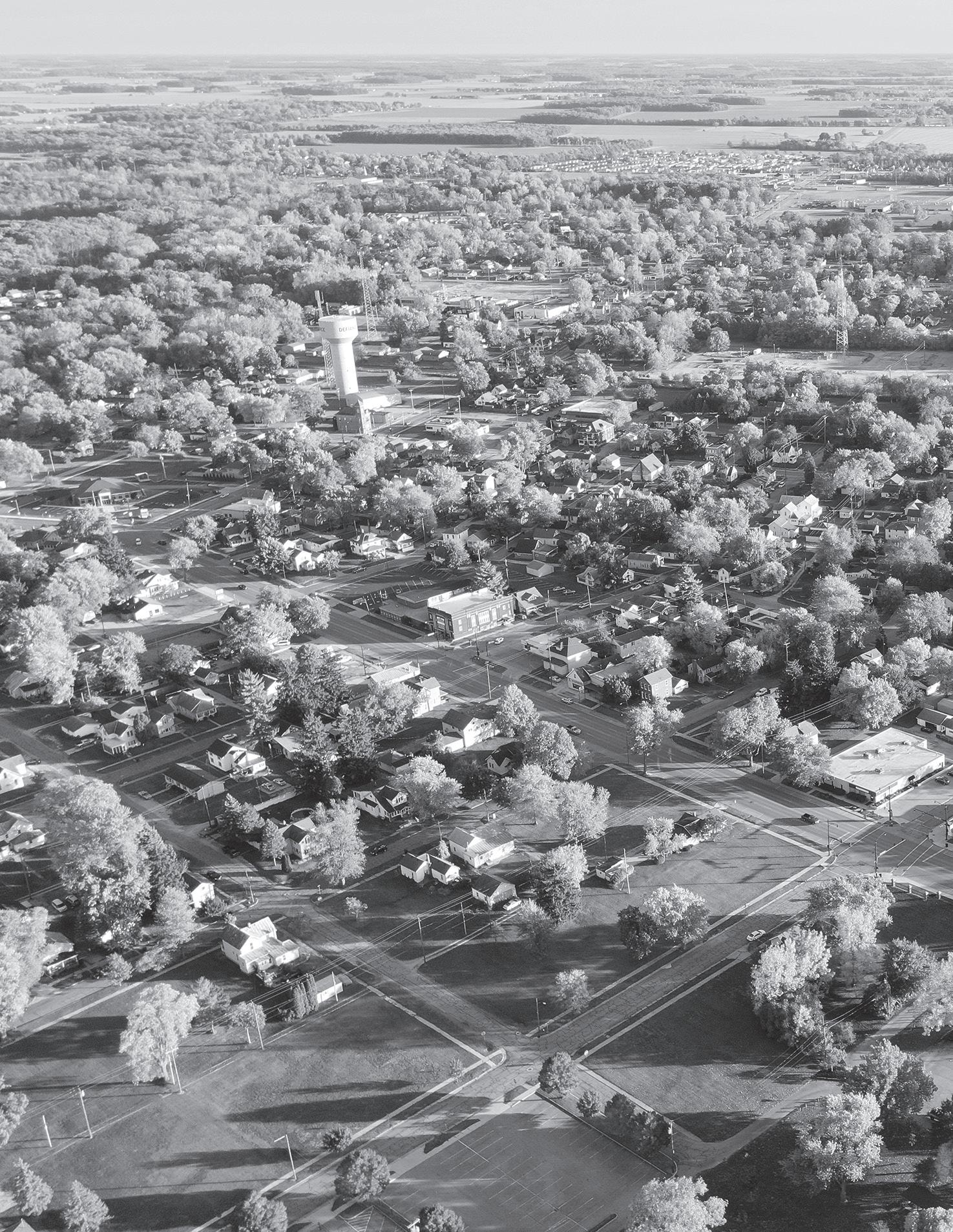
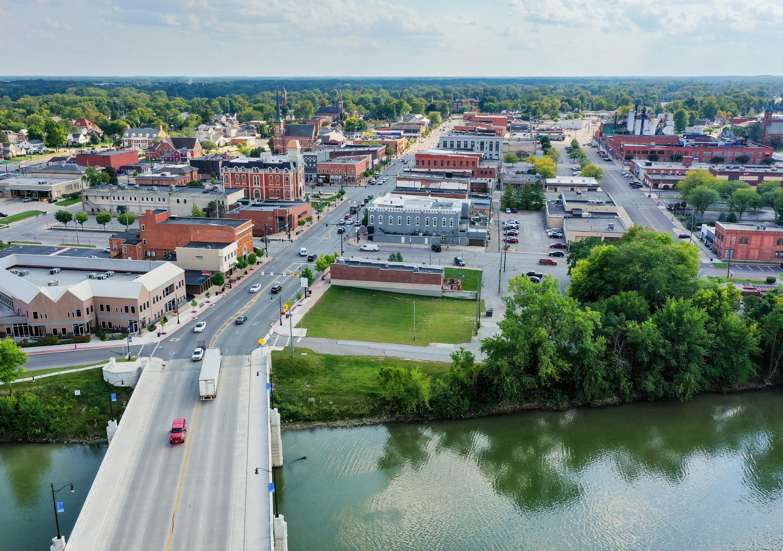
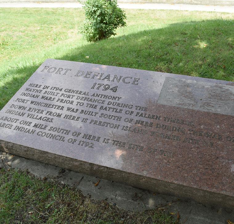
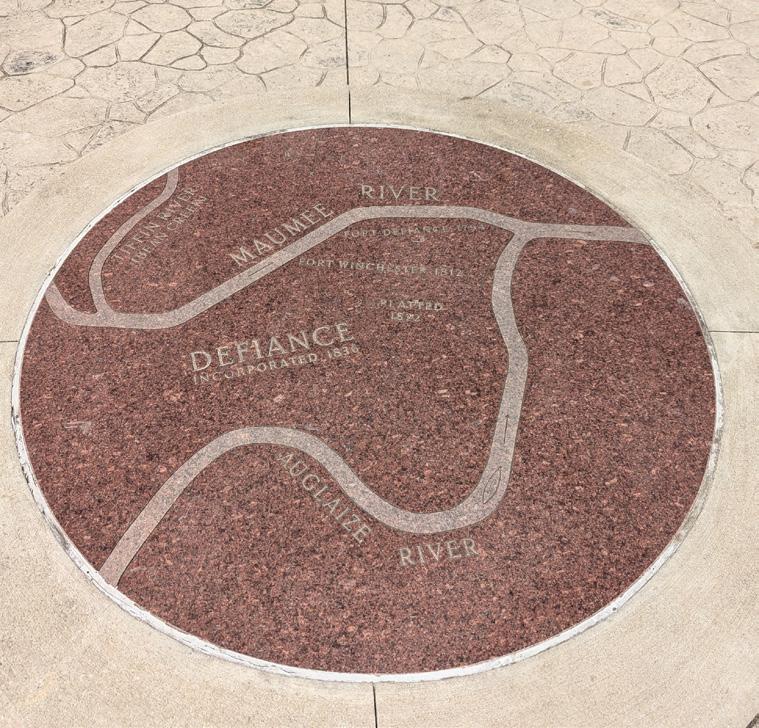
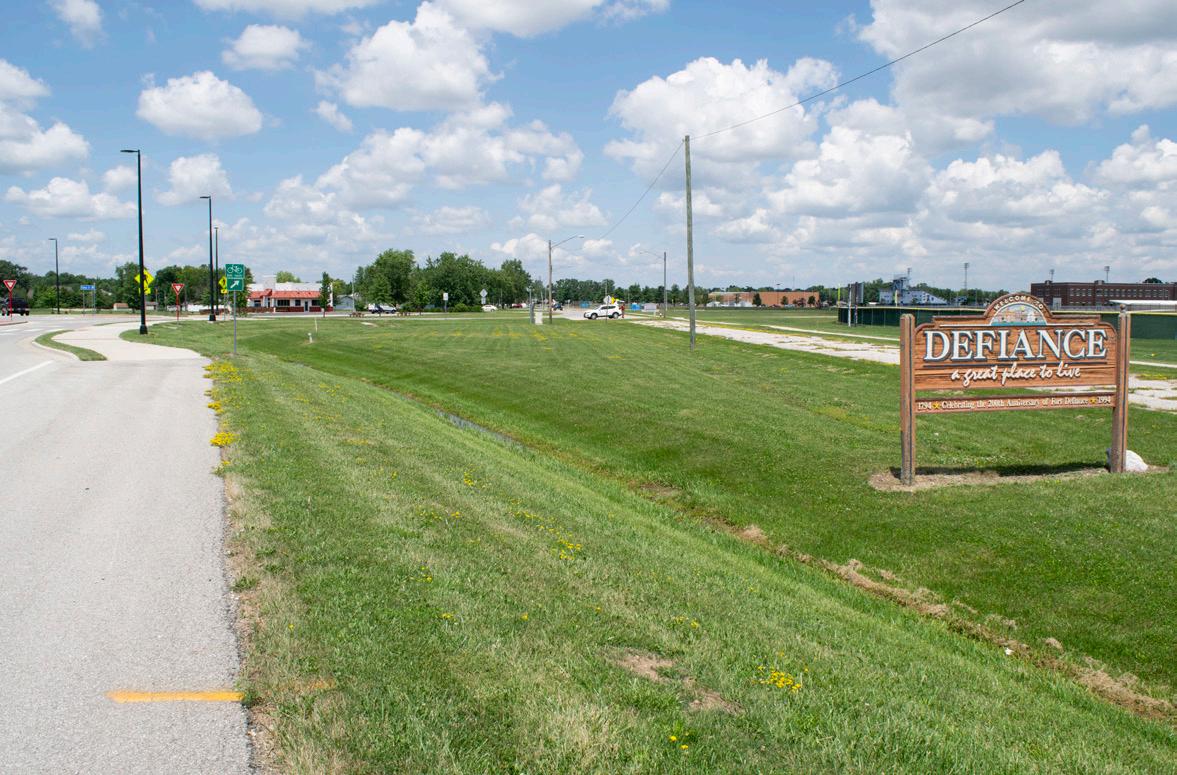
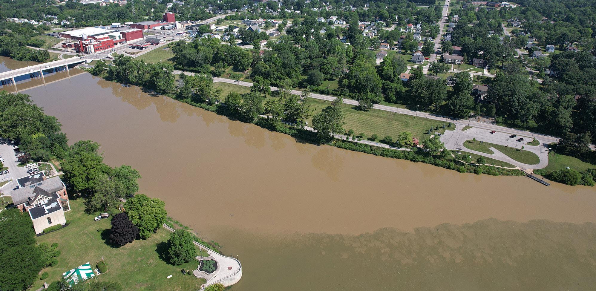
Defiance, Ohio, is the largest city and county seat of Defiance County. Nestled in the northwestern corner of the state, it is located 58 miles southwest of Toledo, Ohio, and 47 miles northeast of Fort Wayne, Indiana. Situated at the confluence of the Auglaize and Maumee Rivers, Defiance boasts a picturesque setting that has played a significant role in shaping its identity. While the confluence creates an intriguing backdrop for the City, many culturally important events have occurred at this landmark; the largest council of Native American tribes at its time took place at this monument, Johnny Appleseed settled on these shores for the greater part of fifteen years, and all land north to Canada is surveyed from a point at the confluence. The City's history is deeply intertwined with its strategic location. Historically noted for its prime military and trading posts, Defiance once held the westernmost settlement of Fort Defiance in the late 1700s. During the War of 1812, General William Henry Harrison constructed Fort Winchester just south of Fort Defiance along the Auglaize River. The streets and properties of downtown Defiance follow the footprint of Fort Winchester to this day.
Founded in the early 19th century, Defiance has evolved from a small settlement into a vibrant community with a diverse range of amenities and services. In the 1850s, Defiance resident William Holgate famously rode to Columbus and successfully declared the City as the seat of the newfound Defiance County, a task that many others fought to achieve. The Holgate name continues to hold significance in the area with a dedicated park and preservation of the historic Holgate residence.
Today, Defiance is recognized for its strong sense of community, evident in its active local organizations, annual events, and commitment to preserving its historical legacy. In addition to its historical and recreational offerings, Defiance is known for its strong local economy, driven by a mix of manufacturing, agriculture, and small businesses.
Understanding Defiance's demographics, growth patterns, and recreation trends can guide recommendations on the types and distribution of park and riverfront amenities needed by the community, as well as help forecast future needs.
MICHIGAN
INDIANA OHIO
FIGURE 2: Vicinity Map
This map illustrates the general location of Defiance in relation to its greater surroundings.
BOWLING GREEN
OTTAWA
FINDLEY
VAN WERT
AUGLAIZE RIVER
BUCKEYE TRAIL
POPULATION
Since its incorporation as a town in 1823 and its designation as a city in 1881, Defiance has experienced steady population growth. Most census data reflects population increases each decade, ranging from 0.2% to as much as 114%. Even during periods of decline, the population decrease has never exceeded 2%.
The current snapshot of Defiance shows the 2022 population at 16,852 residents, reflecting a 0.71% increase over the past decade from 16,733. This aligns with the overall United States growth rate and stands out compared to Defiance County, which saw a 1.73% population decline. According to Aterio Datasets, Defiance is projected to grow to a population of 17,441 residents by 2030, representing a 3.5% increase.
The City of Defiance is home to 7,219 households. Of these, 44.3% (3,199 households) are married couples, 46.6% (3,371 households) are single-parent households, and 9% (649 households) are cohabitating couples.
At 2.26 persons, the average household size in the City is lower compared to both Defiance County (2.47 persons) and the State of Ohio (2.34 persons). While the average household size is 2.26 persons, the average family size is 2.78 members.
16,852
TOTAL POPULATION OF DEFIANCE, 2022
11.8 MILLION
TOTAL POPULATION OF OHIO, 2022
0.71 PERCENT
INCREASE IN CITY POPULATION, 2012-2022
FIGURE
Female householder, no spouse/partner Cohabiting couple household
FIGURE 3: HOUSEHOLDS BY TYPE
6: Population Density Map
This map, segmented into U.S. Census Bureau tracts, visually represents the distribution of people per square mile across the City of Defiance. Higher population densities are found in the downtown area and in the southern and western parts of Defiance, south of the Maumee River.
Located Outside Municipal Jurisdiction
*Per the 2022 U.S. Census Tract Data. Population density is shown as people per square mile within the entire census track which may extend beyond City limits.
FIGURE
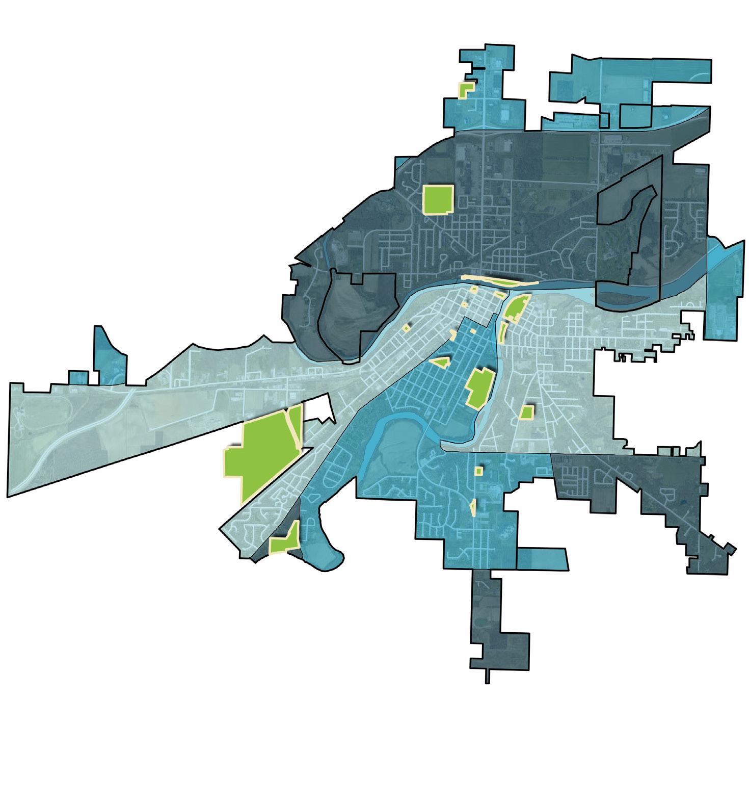
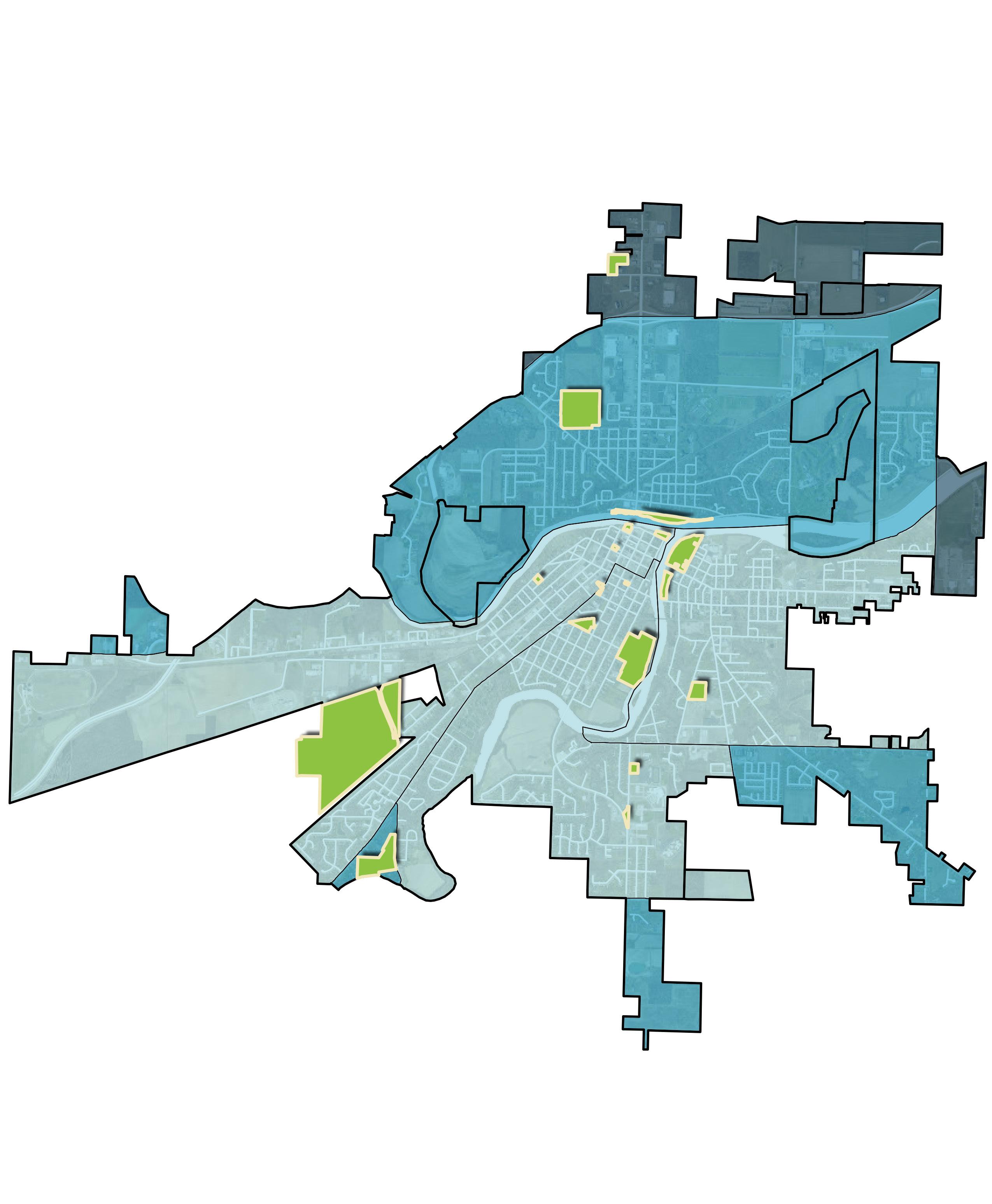
AGE & GENDER
The median age in the City of Defiance is 40.9 years, which is consistent with Defiance County, Ohio, and the United States. While Defiance technically has the highest median age, the difference is minimal.
Looking more closely at age distribution, several age groups account for more than 6% of the population: under 5 years old, 15 to 34 years, 40 to 44 years, and 60 to 69 years. These groups suggest a generational pattern, largely in line with Census population trends. Over 40% of the population is considered age-dependent, with 20.3% under 18 years old and 20.7% aged 65 and older.
The population breakdown by gender is relatively consistent, with 48.6% of the population as male and 51.4% as female, according to the American Community Survey.
MEDIAN AGE 40.9
23.2 PERCENT
YOUTH POPULATION, AGES 0-19
20.7 PERCENT
SENIOR POPULATION, AGES 65+
AGES 0-19
LEGEND: Ages 0-19
30-34% of Population
15-29% of Population
6-14% of Population
City Parks
Census Tract Boundary
City Limits
Located Outside Municipal Jurisdiction
*Per the 2022 U.S. Census Tract Data. Data shown represents the entire census tract which may extend beyond City limits.
FIGURE 9: Age Breakdown Maps
LEGEND: Ages 60-79
25-30% of Population
18-24% of Population
11-17% of Population
City Parks
Census Tract Boundary
City Limits
Located Outside Municipal Jurisdiction
*Per the 2022 U.S. Census Tract
Data. Data shown represents the entire census tract which may extend beyond City limits.
These maps, divided into U.S. Census Bureau tracts, represent the distribution of age groups across the City of Defiance. Broken into two age ranges, the maps show that the younger population are more prevalent south of downtown in central Defiance, while the older population can be found in both the northern and southern areas.
INCOME, POVERTY & EMPLOYMENT
The City of Defiance has a median household income of $65,410, which is lower than that of Defiance County, Ohio, and the United States. The City’s poverty rate (16.3%) and unemployment rate (3.5%) are also higher than regional and national trends.
The occupational breakdown for employed residents aged 16 and over is shown below. It highlights that the largest sectors are management, business, science, and arts occupations (31.4%), followed by production, transportation, and material moving occupations (27.3%). A majority of residents (56.1%) both live and work in the City of Defiance, with an average commute time of 19.6 minutes. Among the employed, 85.4% drove alone, 6% carpooled, 4.2% worked from home, 3.3% walked to work, and 1.1% traveled to work by others means.
*Source: Regional Growth Partnership in Northwest Ohio, 2024
Park Equity & Access
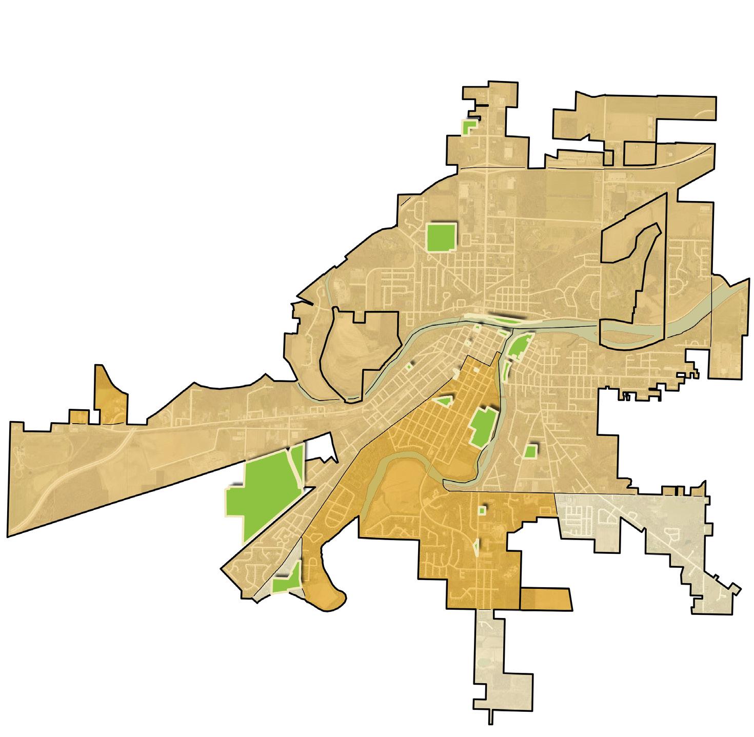
The data indicates that the central part of Defiance, south of the Maumee River, has lower income levels compared to the rest of the city. Notably, the majority of the City's parks, 18 out of 20, are situated within or adjacent to this income zone. Additionally, the river confluence is located within this area.
FIGURE 11: INCOME COMPARISONS
FIGURE 10: OCCUPATION FOR EMPLOYED POPULATION, AGES 16+
FIGURE 12: Household Income Map
This map, divided into U.S. Census Bureau tracts, illustrates the distribution of income levels across the City of Defiance. The central and southern sections, including the downtown area and many city parks, are identified as having lower household income levels.
$90,000 + $70,000 - $90,000
Less than $70,000
City Parks
Census Tract Boundary
City Limits
Located Outside Municipal Jurisdiction
*Per the 2022 U.S. Census Tract Data. Data shown represents the entire census tract which may extend beyond City limits.
EDUCATION, HOUSING & SOCIAL VULNERABILITY
Over 90% of Defiance residents aged 25 and older have a formal education, with more than 50% having at least some post-secondary education experience, and nearly 30% holding a secondary education degree. However, the City of Defiance has a lower percentage of residents with post-secondary education compared to state and national trends.
Most homes in Defiance are owner-occupied, making up 67.7% of the housing stock (4,887 homes), while the remaining 2,332 units are renter-occupied. The median home value for owner-occupied housing is $134,200, which is lower than county, state, and national averages. This is not unexpected, and reflects regional trends and the housing market in rural Midwestern areas. The median monthly housing cost for owneroccupied units is $1,104, also below average. The median rent is $626, consistent with Defiance County and lower than state and national trends.
MEDIAN HOUSE VALUE
$134K OWNER-OCCUPIED HOUSING UNITS
67.7 PERCENT HAVE SECONDARY EDUCATION DEGREES
29.4 PERCENT
FIGURE 14: HOUSING COSTS
Source: Neighborhood Atlas Least Disadvantaged Block Groups to Most Disadvantaged Block Groups

FIGURE 15: Area Deprivation Index
Based on factors such as income, education, employment, and housing quality, the City of Defiance falls primarily within the 6th and 8th deciles on the Area Deprivation Index. This positioning suggests that the City faces moderate-to-high levels of deprivation relative to other areas within the state.
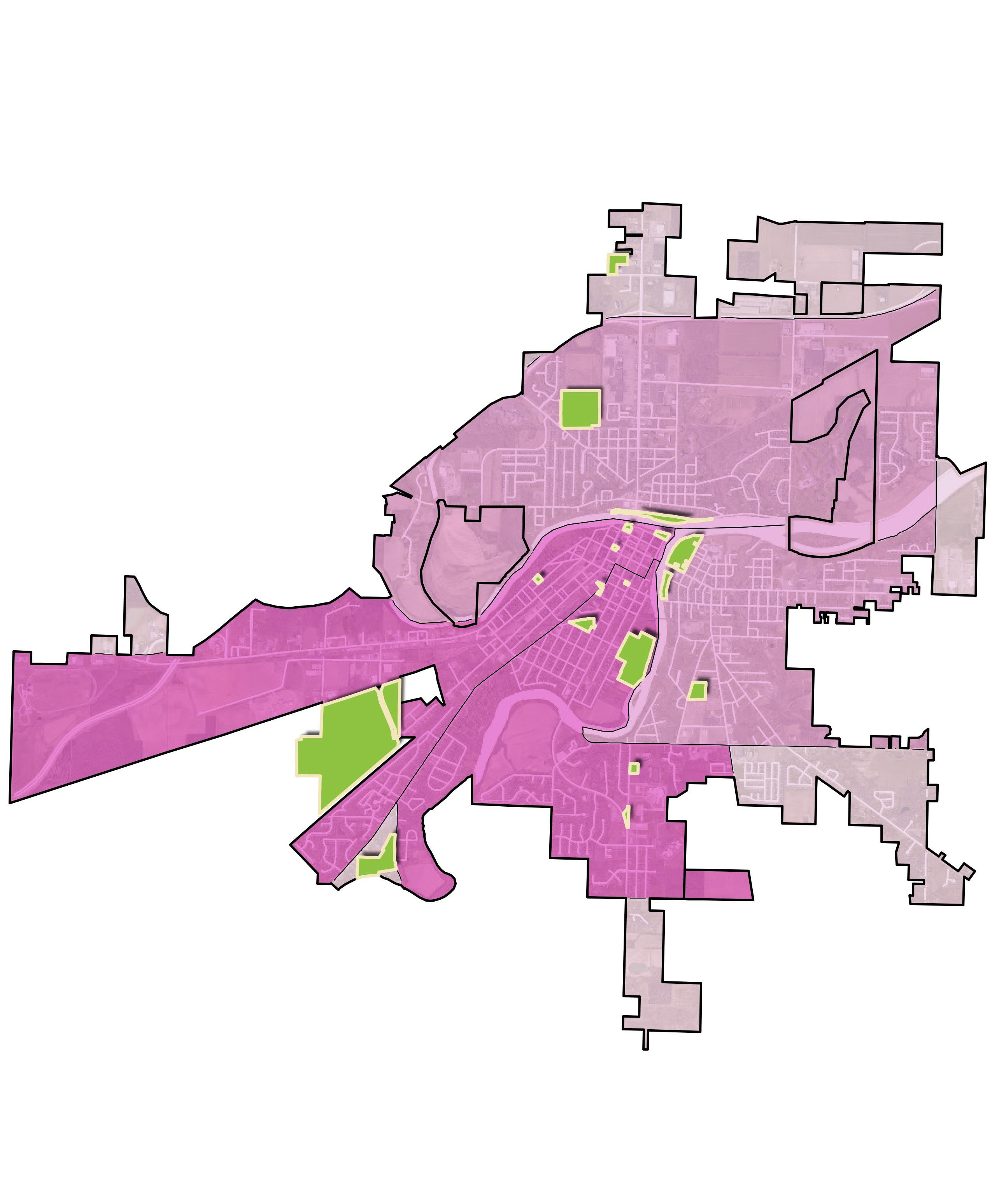
FIGURE 16: Vulnerability Index Map
Divided into U.S. Census Bureau tracts, this map identifies the areas of social vulnerability within the City of Defiance. It uses sixteen census-derived factors - such as economic status, education, family characteristics, and vehicle access - to assess the level of social vulnerability to disasters. The majority of the City falls into high and medium-high vulnerability zones, indicating a greater risk in terms of the community's ability to prepare for and respond to the stress of hazardous events, including both natural disasters and human-caused threats.
LEGEND
High Vulnerability
Medium-High Vulnerability
Medium-Low Vulnerability
Low Vulnerability
City Parks
Census Tract Boundary
City Limits
Located Outside Municipal Jurisdiction
*Per the 2022 U.S. Census Tract Data. Data shown represents the entire census tract which may extend beyond City limits.
Key Insights: A SUMMARY OF PREVIOUS REPORTS
A multitude of plans have been previously completed in and around the City of Defiance, Ohio. These existing documents were utilized to help the design team understand past planning efforts and their potential interactions with the Parks and Riverfront Master Plan. The summaries below provide a brief overview of the plans that directly or indirectly influence the current planning process.
The following plans have been reviewed:
1. Defiance Planning & Zoning Code Update
2. Community Health Improvement Plan
3. Comprehensive Community Action Plan
4. Projected Street Improvement Map
5. Capital Improvement Plan Map (2023-2033)
6. Downtown Redevelopment District / ED Plan
7. Destination Downtown Defiance
DEFIANCE PLANNING & ZONING CODE UPDATE
Published: 2024
Overview & Importance
8. Defiance County Active Transportation Plan
9. Housing Opportunities Analysis
10. Community Strategic Plan
11. 1918 Market Study & UC Plan
12. Defiance Riverfront Master Plan
13. City of Defiance Strategic Plan & 2030 Land Use Plan
14. Access Management Plan
This shows zoning within the City of Defiance. A Zoning Map is also included as a separate document.
COMMUNITY HEALTH IMPROVEMENT PLAN (2022-2024)
Published: 2024
Overview This County-wide plan addressed issues raised in the most recent Community Health Assessment (CHA), including how hospitals, health departments, and other community stakeholders will work to improve the health of the county.
Importance
Relevant recommendations to improve community health factors included community gardens, greater development and utilization of green spaces, development of complete streets, public transportation, and educational programs.
COMPREHENSIVE COMMUNITY ACTION PLAN
Published: 2023
Overview & Importance Briefly describes themes and strategies for downtown renewal, preservation and prosperity, utilities, and connected community. Covers the following:
• Brief history and past planning efforts
• Ideas from over 2000 survey respondents (residents and students) with demographic information and community comparison
• Existing Land Use Conditions Map (pg 27)
• Economic Development Incentive Map (pg 29)
• Pedestrian Connectivity Network Map (pg 34)
• Parks & Rec overview with community generalization from survey (pg 35)
• Water Systems Maps (pg 41-44)
• Planning Areas Map with information on each (pg 45+)
• Potential River Activation Points, Community Assets, and Parks/Open Space Map (pg 95)
• Plan implementation with strategy, collaborating entity, and time frame (100+)
PROJECTED STREET IMPROVEMENT MAP
Published: 2023
Overview & Importance Provides a map of street improvements, along with improvement types and the year each is slated for.
CAPITAL IMPROVEMENT PLAN MAP (2023-2033)
Last Updated: March 2023
Overview & Importance Lists type of improvement, broken down by anticipated year; shows locations of future improvements.
DOWNTOWN REDEVELOPMENT DISTRICT / ED PLAN
Published: 2022
Overview Ohio's DRD program allows municipalities to redirect up to 70% of future property tax growth in a 10-acre district with historic structures, for grants, loans, public infrastructure, and economic development operations. Defiance created 11 DRDs in 2022 to enhance economic development, catalyze reinvestment, create jobs, and improve the quality of life downtown.
Importance Historical properties are referenced, as are the DRD locations. An Economic Market Analysis was done and described. GDP, personal income, and unemployment rate comparisons were also done.
DESTINATION DOWNTOWN DEFIANCE
Published: 2020
Overview & Importance This consists of slides regarding the downtown vision and what has been completed toward that vision. It also provides information on the Clinton Street Road Diet project, including statistics on pedestrian and bicycle crashes from 2009 to 2018. Additionally, it illustrates what’s next in terms of downtown development and improvements.
DEFIANCE COUNTY ACTIVE TRANSPORTATION PLAN (2020-2030)
Published: 2019
Overview
Importance
This plan outlines the vision, goals, and strategies needed to support increased modes of active transportation in Defiance County. It also documents the public involvement efforts that occurred during the planning process, provides information about existing conditions, analyzes where gaps, outlines plan recommendations and focus areas, and provides next steps in the form of implementation and evaluation items.
The plan provides survey analysis and results on safety, parks, trails, water recreation, and ideal transportation systems, along with 2017 demographic information, 20142018 crash statistics, and historic places. It also provides a Safe Routes to School travel plan, funding programs chart, and accessibility strategies.
HOUSING OPPORTUNITIES ANALYSIS
Published: 2019
Overview It identifies housing opportunities within Defiance and strategies to facilitate housing development.
Importance
A survey (700+ people) indicated Clinton Street and downtown are the most popular places for renters to relocate. It provides information about downtown Defiance commercial environment, near and long-term downtown redevelopment opportunities, and the potential for a north and south downtown gateway. It also provides the breakdown of a market study.
COMMUNITY STRATEGIC PLAN (2018-2023)
Published: 2017
Overview
This plan specifies the community goals and strategies, broken into:
• Connectivity
• Economic Development
• Housing, and Perception
• Culture & Education
• Health & Wellness
Importance Along with bullet points of their goals and strategies, it lists guiding principles of the community, as well as their vision, mission, and pillars.
1918 MARKET STUDY & UC PLAN
Published: 2018
Overview This study offers conceptual design/master planning for 629 Arabella Street to create a unified mixed-use campus as an anchor to the existing City Center Business District. The site is comprised of the old Defiance Jr. High School, built in 1918/1928 and on the Ohio Endangered Historic Site list.
Importance
The site is located downtown, north of Veterans Memorial Park. It recommends opportunities for added housing units, a hotel, event space, entertainment/ restaurants, and community programming.
DEFIANCE RIVERFRONT MASTER PLAN
Published: 2015
Overview & Importance It provides a graphic master plan with callouts at the confluence of the Maumee and Auglaize Rivers.
CITY OF DEFIANCE STRATEGIC PLAN & 2030 LAND USE PLAN
Published: 2011
Overview This plan provides recommendations and implementation steps for the revitalization of the Downtown District broken into key planning elements: image and theme, parking, streetscaping, focal points, traffic circulation, gateways, signage, land uses, buildings and historic resources, management and organization, marketing and promotion, technical and financing assistance. Note, this was developed at “what is probably the worst economic downturn that the City, State, and Country have experienced in several decades”.
Importance It calls out potential amenities and locations to capitalize on along the rivers, with pros and cons. Note, the Downtown District is defined as the area between the rivers to approximately Deatrick Street on the south and the railroad tracks north of the river.
ACCESS MANAGEMENT PLAN
Published: 2009
Overview
It defines the principles and policies for access management on all roads maintained by the City of Defiance. It also provides guidelines to ensure that any new access onto a City street meets all safety and capacity requirements.
Importance It provides information/processes/specifics on Access Permits, roadway planning, traffic impact studies, and design standards. It also provides maps of City roadway types and truck routes, along with charts/specs on road classifications. Access Permit and Appeal/Variance forms are included.
Planning Process: GUIDING THE WAY FORWARD
The City of Defiance Parks & Riverfront Master Plan will serve as a roadmap, shaping the future of the City's parks and riverfronts. Developed with public input and grounded in best practices, the Plan reflects the community's goals, concerns, and vision for what's ahead.
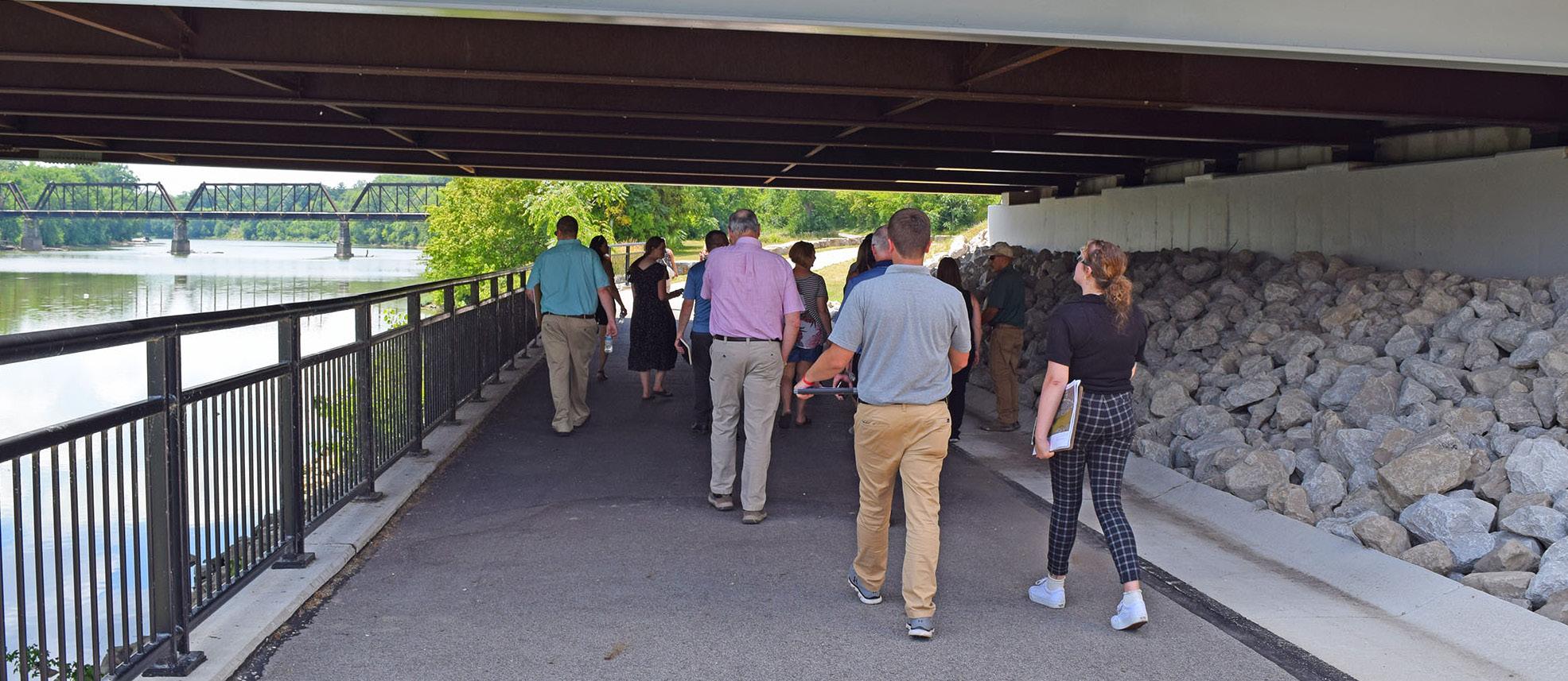
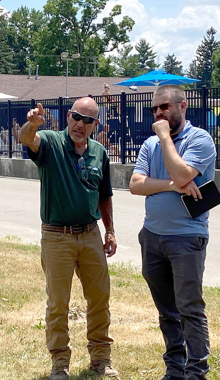
The planning process began with a kick-off meeting that brought together the City, steering committee, and design team. This initial meeting provided an opportunity for the team to collect in-depth information about the parks, riverfronts, and any relevant past or future plans that could influence the project. To ensure broad support and gather valuable insights, a comprehensive community engagement strategy was implemented. This strategy included conducting an online survey to reach a wider audience, interviewing key stakeholders to understand specific needs and concerns, hosting community workshops to foster dialogue, and other outreach efforts aimed at involving residents in shaping the future of their parks and riverfronts. These activities were designed to capture a diverse range of voices, ensuring that the plan reflects the community's aspirations and priorities.
In close collaboration with the Parks and Cemetery Director, a detailed inventory of each park was compiled. Additional research was also conducted, including valuable information obtained from the Ohio Department of Natural Resources (ODNR) and the Andrew L. Tuttle Memorial Museum. These efforts helped lay the groundwork for site analysis and supported the steering committee in refining the project's goals and objectives.
Using this comprehensive data, the design team then identified opportunities for park improvements, focusing on those that met the community's needs and aligned with the overall vision for the future. The team shared these concepts with the steering committee and community members for further input, which helped refine them.
All efforts culminated into the final Master Plan, which not only outlined the proposed enhancements but also provided high-level cost estimates and a roadmap for implementing them over the coming years.
LOGO DEVELOPMENT & USE
The green tree, forming the left side of the "D", represents the 20 City parks and the Defiance Parks & Recreation Department.
The font was chosen because of its clean and bold style. The colors parallel the City logo, representing each of the three rivers.

Forming the right side of the "D", the three blue sections represent the rivers that flow through the City: the Maumee, Auglaize, and Tiffin Rivers.
This logo was developed to highlight the connection between the City's park system and riverfront. It provided a distinct identity for the Master Plan, helping to generate community interest and unify communication. The logo was used across a variety of mediums, both digital and print, including flyers, stickers, social media, and more. It was even featured on printed cookies.
PROJECT SCHEDULE
May through October 2024
PHASE 1: BASE INVENTORY & PROJECT ANALYSIS
This phase included the Opportunity Analysis Report, identifying and evaluating potential opportunities for growth. It consisted of:
• Summary and project background
• Resource profiles
• Preliminary Summary of Funding Options
• Community and stakeholder input
November 2024 through April 2025
PHASE 2: PRELIMINARY PLANNING & DESIGN
Based on community and stakeholder input and achieving consensus on an overall strategy, Phase 2 identified the most promising locations for improvements and preliminary implementation recommendations. This was done through two steps:
1. Implementation Strategies and Diagrammatic Plan Improvements - Identifies a unified approach to aligning project goals and objectives by creating diagrammatic plans that outline proposed implementation strategies for improvements in the parks, riverfront, and connectivity corridors.
2. Master Plan Renderings - Refines and advances the selected diagrammatic plan improvements to a Master Plan rendering level, showcasing the proposed implementation strategies with accurate scale and location details.
Spring 2025
PHASE 3: FINAL MASTER PLAN & DOCUMENTATION
This phase documented and secured approval for the finalized recommendations, along with detailed, step-by-step short-term implementation actions. This was done by refining the Master Plan renderings and perspectives. It also included:
• Final Master Plan Report
• Partnering Framework and Implementation Plan
• Public communication tools
TAKING INVENTORY: Existing Resources & Implications
UNDERSTANDING DEFIANCE’S RESOURCES & IMPLICATIONS
This section explores the unique assets and challenges within the Defiance community. It delves into the city's physical, economic, and social resources, examining how they interact and influence development opportunities. By analyzing these factors, we can better understand Defiance’s potential for growth, revitalization, and sustainable development, providing a comprehensive foundation for future planning and decision-making.
Zoning
“Public and Government Buildings or Uses” are permitted by right and without additional requirements in all zoning districts in the City of Defiance except in Floodplain (F-P) and Industrial Districts where they are conditional uses. The Zoning Code goes further to define a public use as “Public parks, schools and administrative, libraries, cultural and service buildings.”
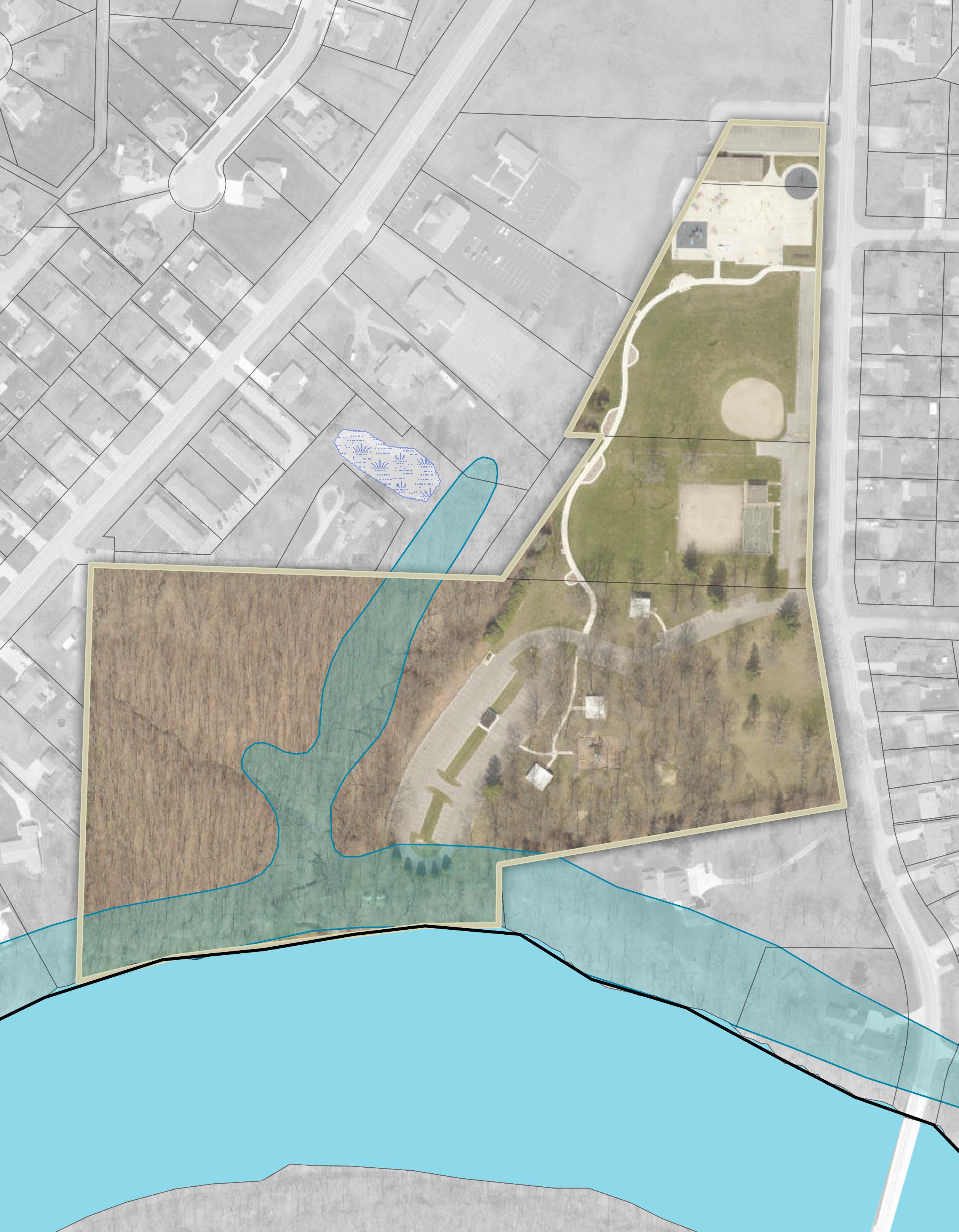
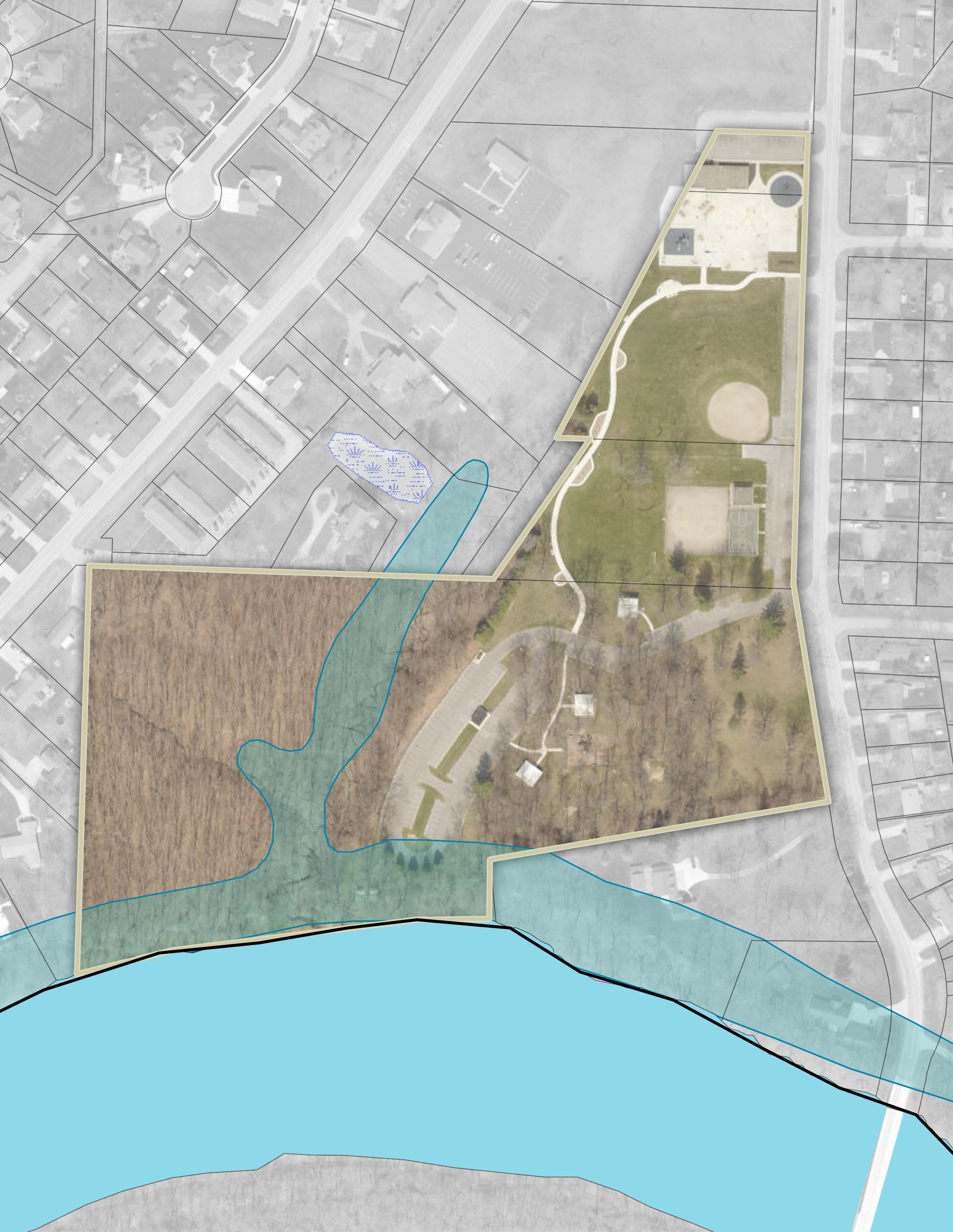
Defiance’s parks along the rivers are understandably zoned Floodplain (F-P). Those parks include Buchman on the Glaize, a portion of Fort Grounds, Gateway Park, Kingsbury Park, Pontiac Park, and Riverside Park. These parks provide the greatest potential for activating the riverfront, but they are also the most susceptible to flooding.
Most of Defiance's larger parks that are not located along the riverfront are classified under the Special District (S-1) zoning. This District is for “large public or semi-public land holdings, land suitable for non-commercial recreation … or land to be kept open to protect the source water supply.”
Defiance parks zoned Special District (S-1) include Bronson Park, half of Diehl Park, a portion of Fort Grounds, Palmer Park, and Veteran’s Memorial Park at Latty's Grove.
The smaller parks within the Defiance municipal boundary have zoning that aligns with the primary zoning of the adjacent areas. For example, Canal Park, Hometown Heroes Park, and Memory Park are located near downtown Defiance, and like the surrounding area, they are zoned Central Business (B-2).
Reservoir Park and Bark & Run Dog Park are both outside of Defiance City Limits, thus assigned "Government" zoning by Defiance County.
Land Use
Both natural and man-made features have been determining factors in the locations of certain land uses in the City of Defiance. Historically, development was centered around the confluence of the rivers and the convergence of railroads. While the railroads are less prominent features today than what they were decades ago, one could say Defiance was built around "R and R" – rivers and railroads.
The community’s core is primarily a grid-iron pattern of commercial development (downtown) with some remaining industrial development in key areas along the rivers and railroads. Small lots created dense residential neighborhoods near the core, which still exist today. Further from the core, residential lots grew larger and neighborhoods less dense.
Commercial and industrial growth has developed in strategic areas along major corridors like US 24, State Road 424, State Road 18, and State Road 15. Notable land uses include Defiance College north of the river confluence; two hospitals; and a thriving, historic downtown.
Parcel Ownership Summary
Most of Defiance's parks are located within residential zones, which is significant as it offers accessible recreational opportunities and enhances neighborhood aesthetics and community engagement. The abundance of parks can also boost property values, stimulate economic development, and help protect the City from adverse environmental effects. The concentration of parks in the downtown and river confluence areas is particularly important, as they attract visitors to the downtown, creating positive economic impacts for local businesses.
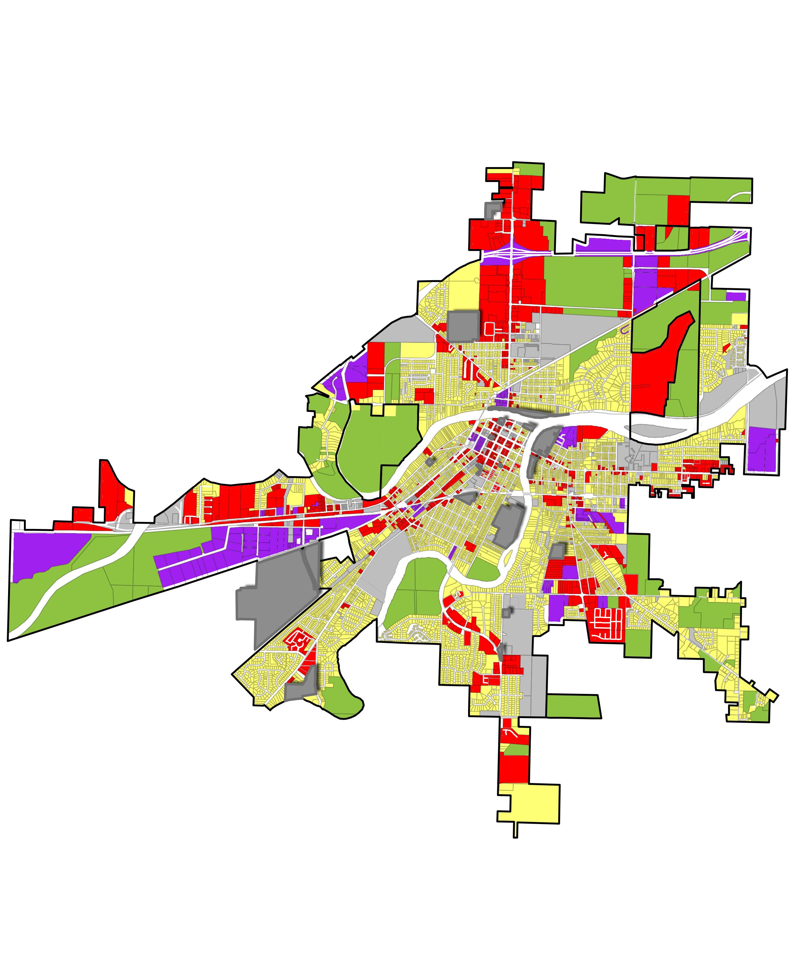
FIGURE 17: Land Use Map
This map visually represents the allocation and utilization of land within the Defiance city limits. The outskirts of the city are primarily zoned for agricultural, commercial, and industrial uses, while downtown Defiance features a mix of residential, municipal, and commercial areas.
Vacant & Undeveloped Parcels
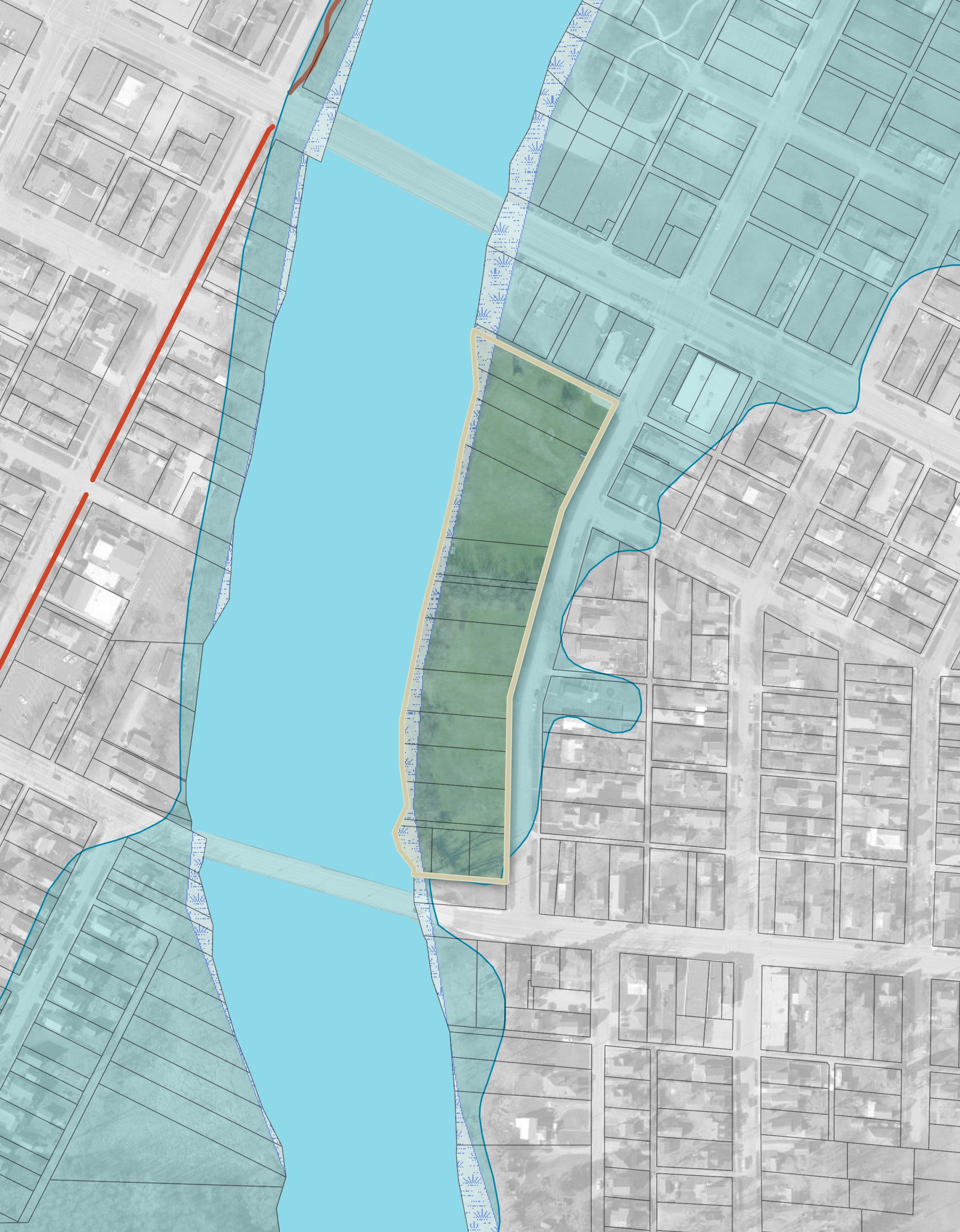
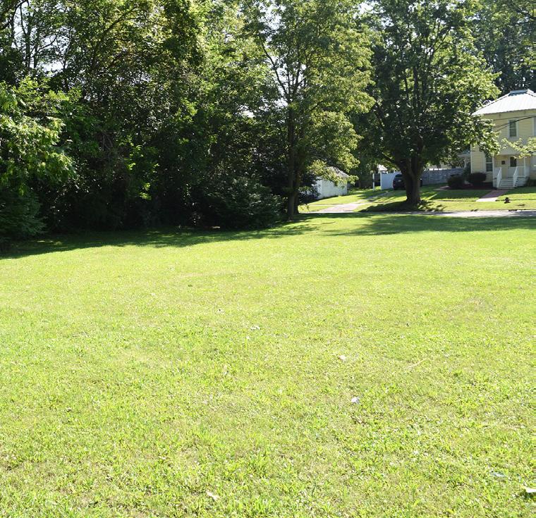
Like many communities, Defiance has a variety of vacant parcels scattered throughout the City. Some of these parcels have been cleared and are open land, while others still contain buildings in either functional or deteriorating condition. These vacant parcels represent significant opportunities for the City to be proactive in shaping its future. Whether through repurposing these spaces for new parks, community uses, or even expanding existing parks, Defiance has the potential to enhance the quality of life for its residents. Vacant parcels offer the flexibility to meet community needs — whether that’s by introducing more recreational areas, addressing gaps in park accessibility, or creating spaces for public gatherings and events.
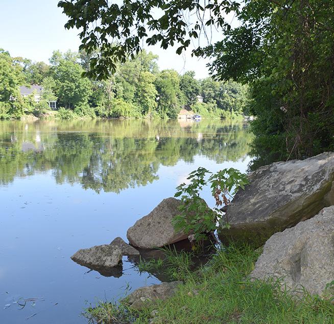
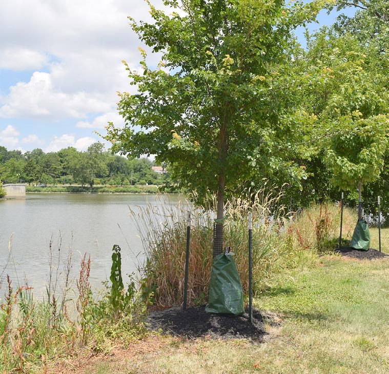
One notable area of opportunity lies along the rivers, where many historically flood-prone properties have been converted into parks and green spaces. The City has played an active role in acquiring flood-prone properties with the goal of mitigating environmental impacts and creating valuable open spaces for the community. Not all acquired properties need to be programmed with amenities; even leaving these areas as green space, covered with native vegetation, can contribute to environmental health by supporting the river’s ecosystem, providing floodwater retention zones, and expanding the City’s natural landscapes.
Beyond the rivers, there are additional vacant properties throughout Defiance, highlighted in Figure 18, that present similar opportunities. These properties can be transformed into new green spaces, community gathering spots, or expanded park areas, based on the preferences and priorities of residents. As part of this master planning process, identifying and evaluating these potential sites is crucial. The goal is not just to catalog available land but to engage the City and the community in a dialogue about what they want these spaces to become. Whether it’s creating playgrounds, sports fields, natural preserves, or simply open green areas, the possibilities are diverse and, with careful planning, can significantly contribute to the City’s livability, economic vitality, and environmental health.
A key objective of this Master Plan is to identify these potential opportunities, and gauge the City and community on their needs and aspirations.
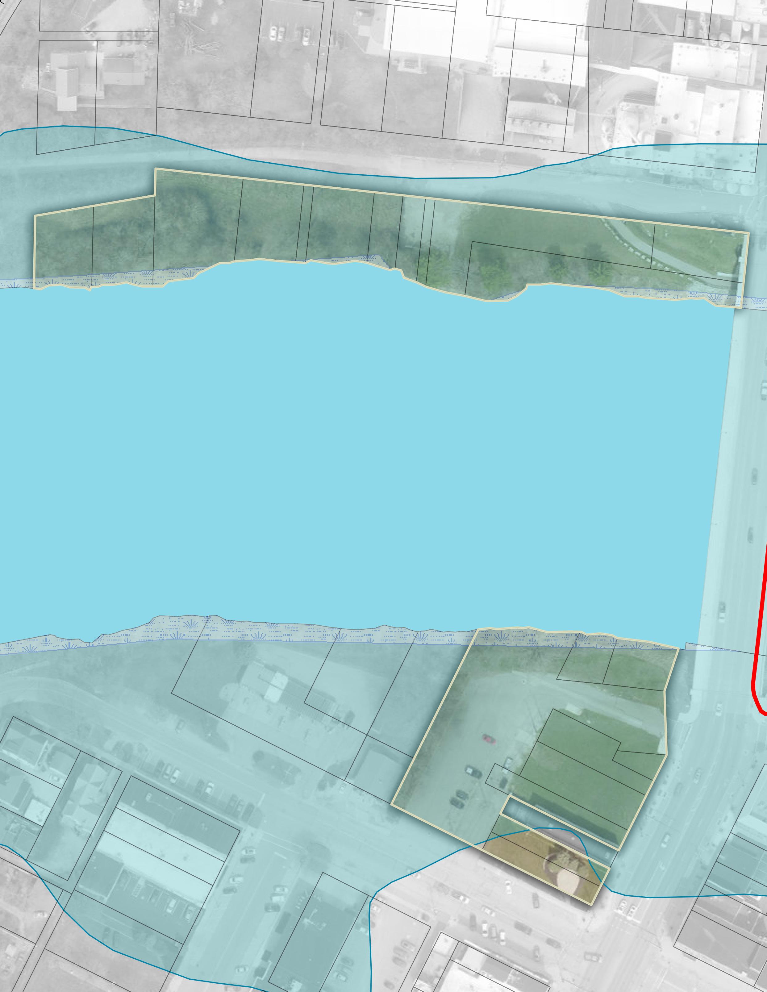
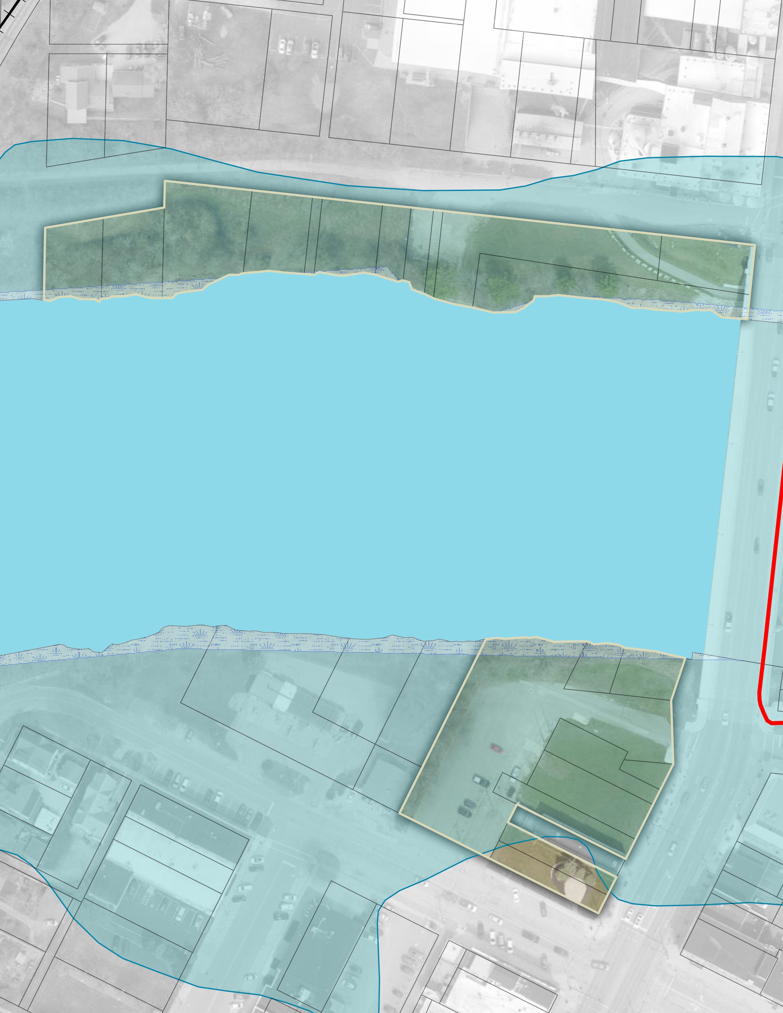
FIGURE 18: River Vacancy & Undeveloped Parcel Map
This map identifies the vacant parcels of land in the City of Defiance that share a property line with the river boundary. These parcels represent potential areas for riverfront development, to be utilized for dining, recreational, or other future projects.
LEGEND
Vacant Parcels Adjacent to Rivers
Vacant Residential
Vacant Commercial
Vacant Commercial Adjacent to Parks
Vacant Agricultural
Vacant Industrial
City Parks
Major Roadways
City Limits
Outside
AUGLAIZE RIVER
TIFFIN RIVER
MAUMEE RIVER
PARK INVENTORY & ANALYSIS
The following pages offer a detailed breakdown of each park within the Master Plan. For every park, you'll find an overview that highlights its amenities, location, and unique features. Additionally, each park profile includes a comprehensive assessment of its perceived strengths and liabilities. This analysis is designed to provide a clear understanding of what the park offers, while also identifying areas for potential improvement to better serve the community's needs.
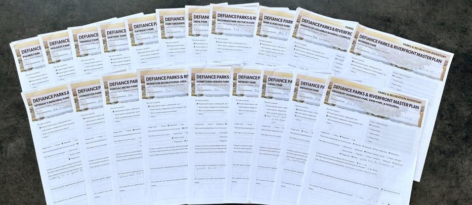
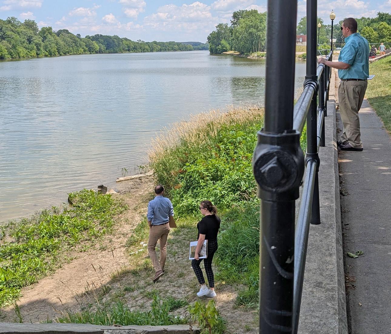
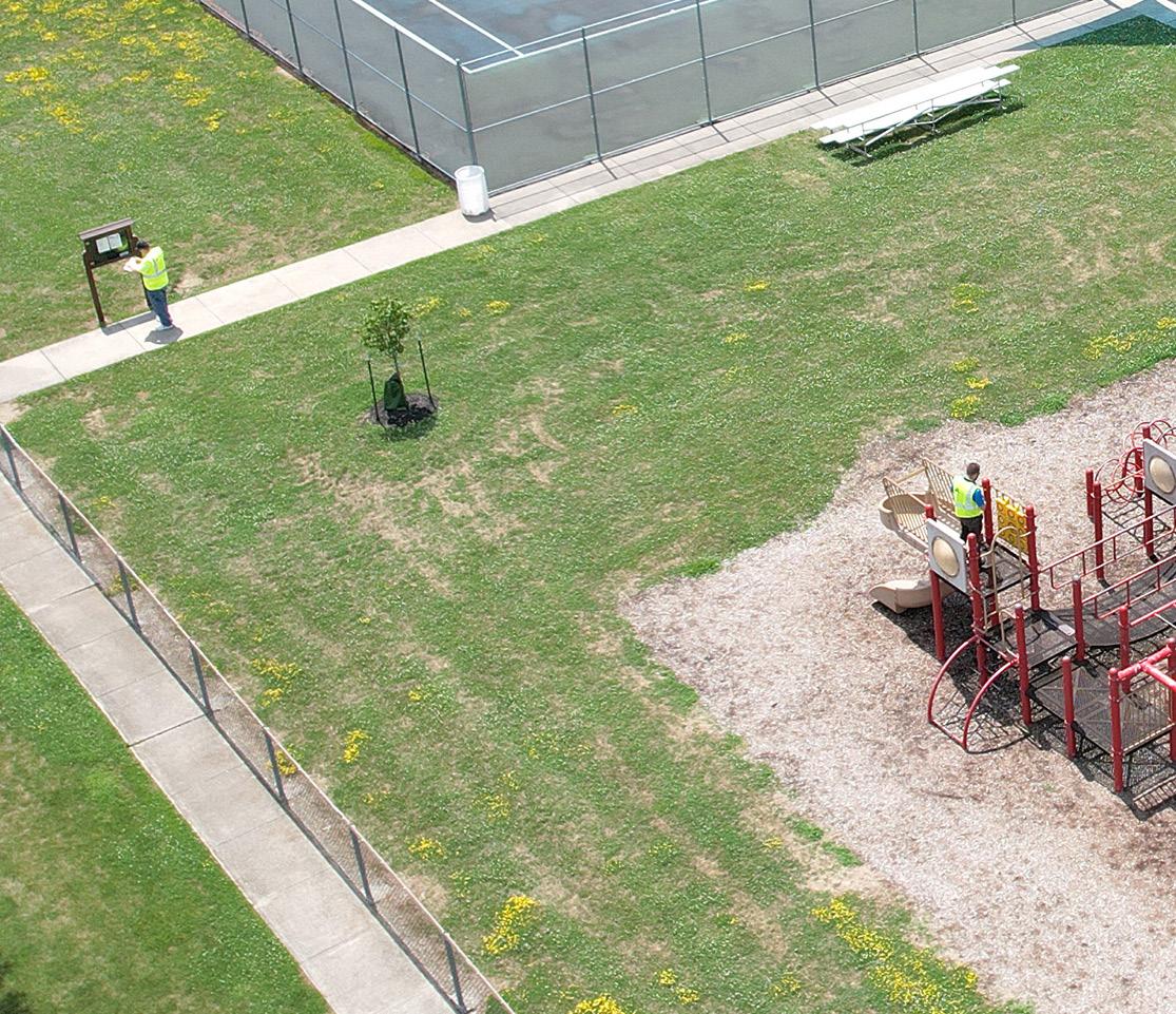
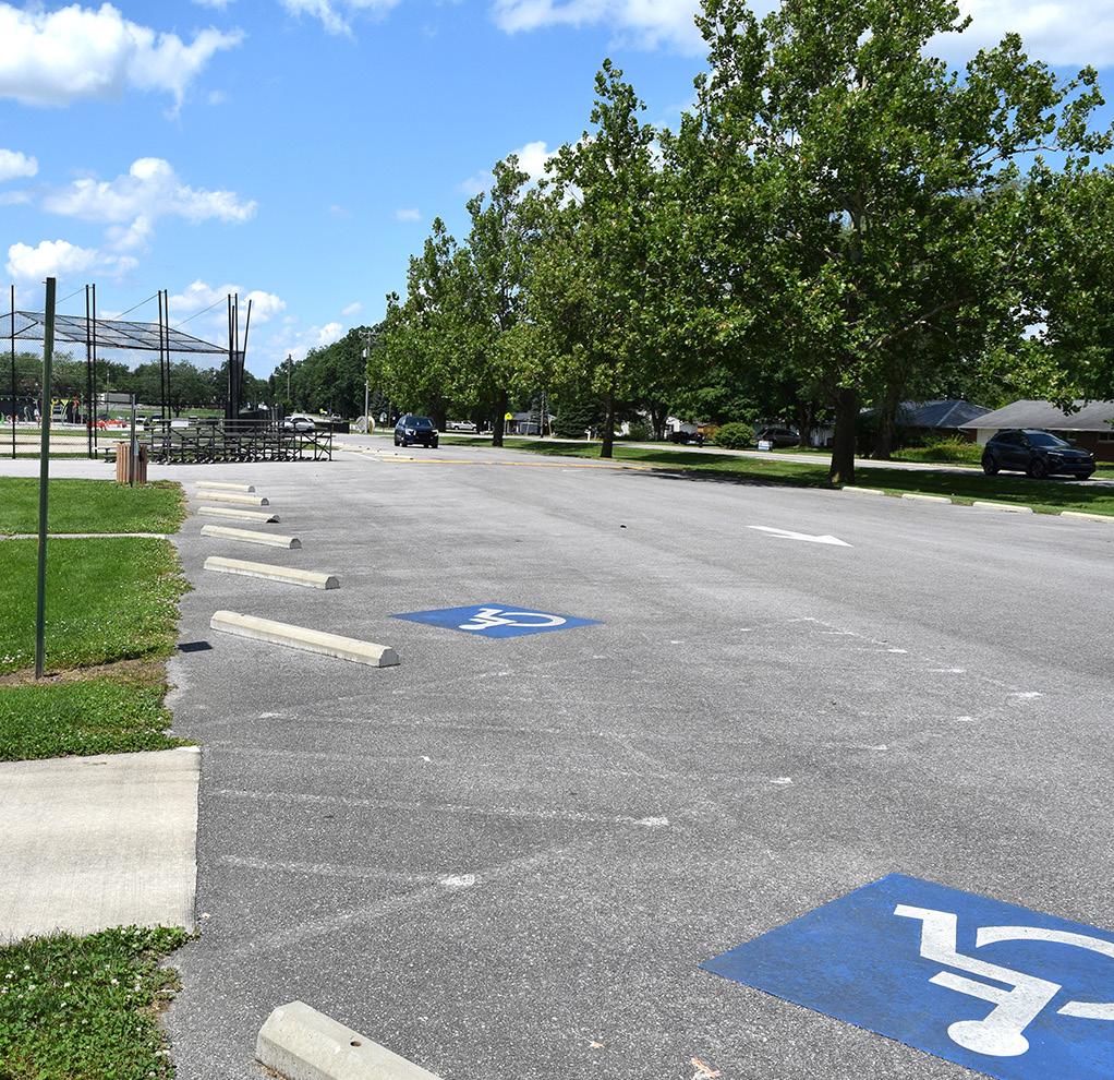
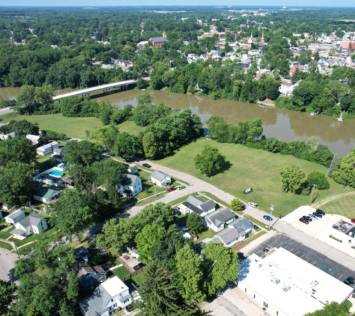
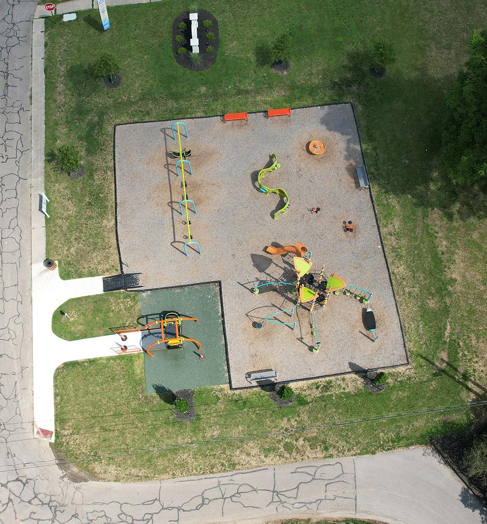
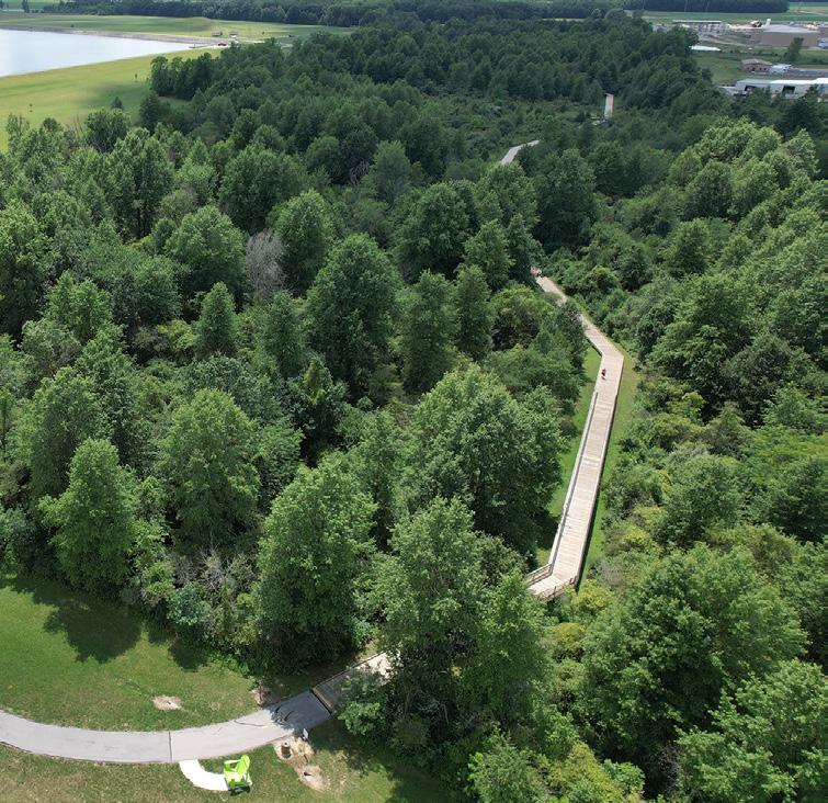
The park inventory was completed using a comprehensive approach, drawing on various sources of information. This effort was carried out in close collaboration with the Parks and Cemetery Director, who provided a detailed inventory of each park's existing features and amenities. In addition to this, the design team conducted on-site visits to each park to observe firsthand the unique opportunities and constraints present in the landscape. During these visits, the team documented the sites through drone photography, capturing valuable aerial perspectives. Furthermore, the team reviewed all existing and proposed projects, as well as any future plans for each park, to ensure a thorough understanding of both the current conditions and long-term vision for the park system's development. This multifaceted approach allowed for a well-rounded and informed evaluation of the entire park network.
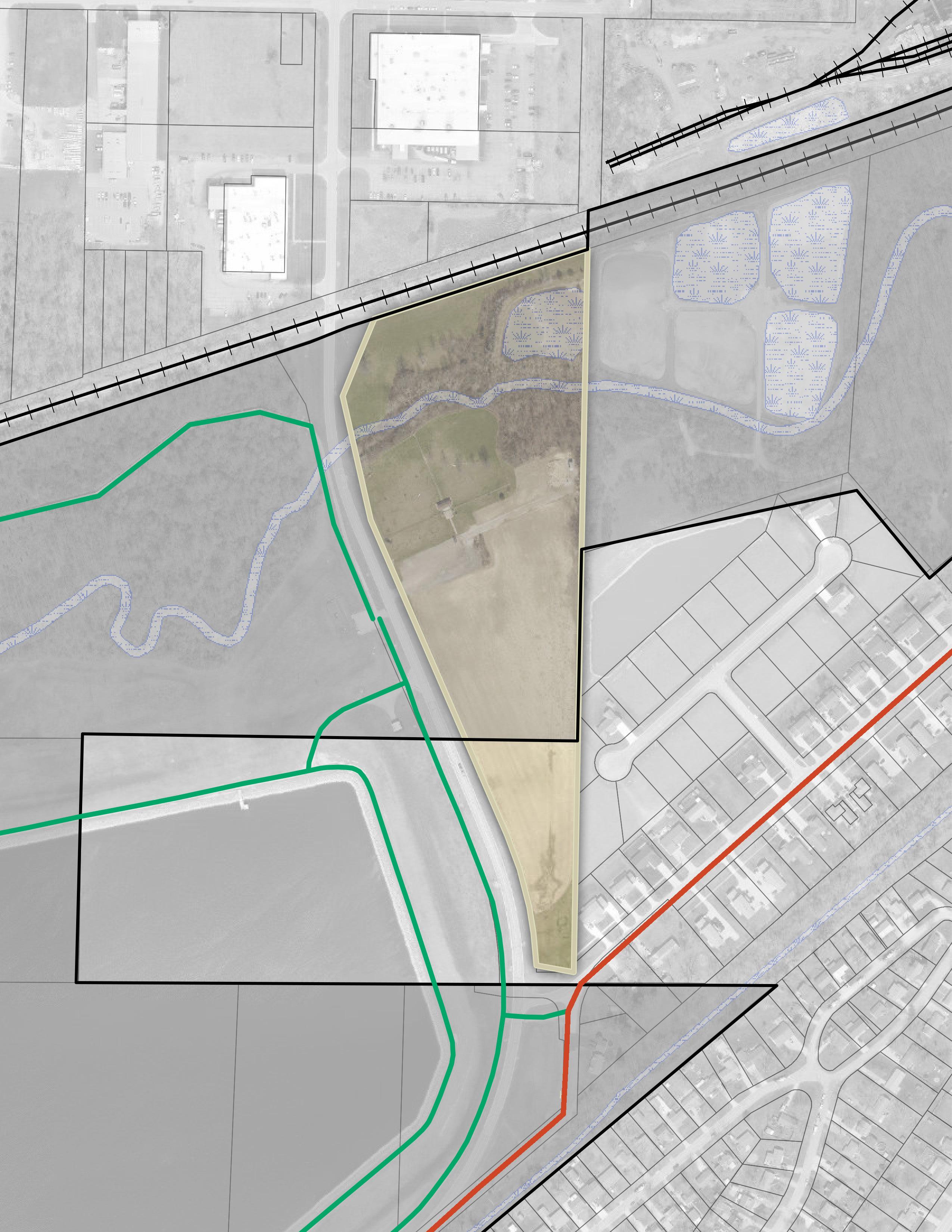
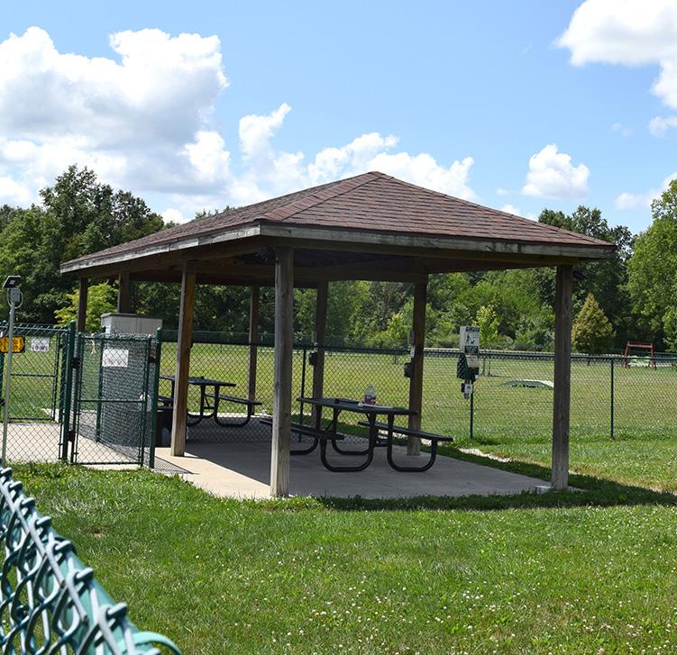
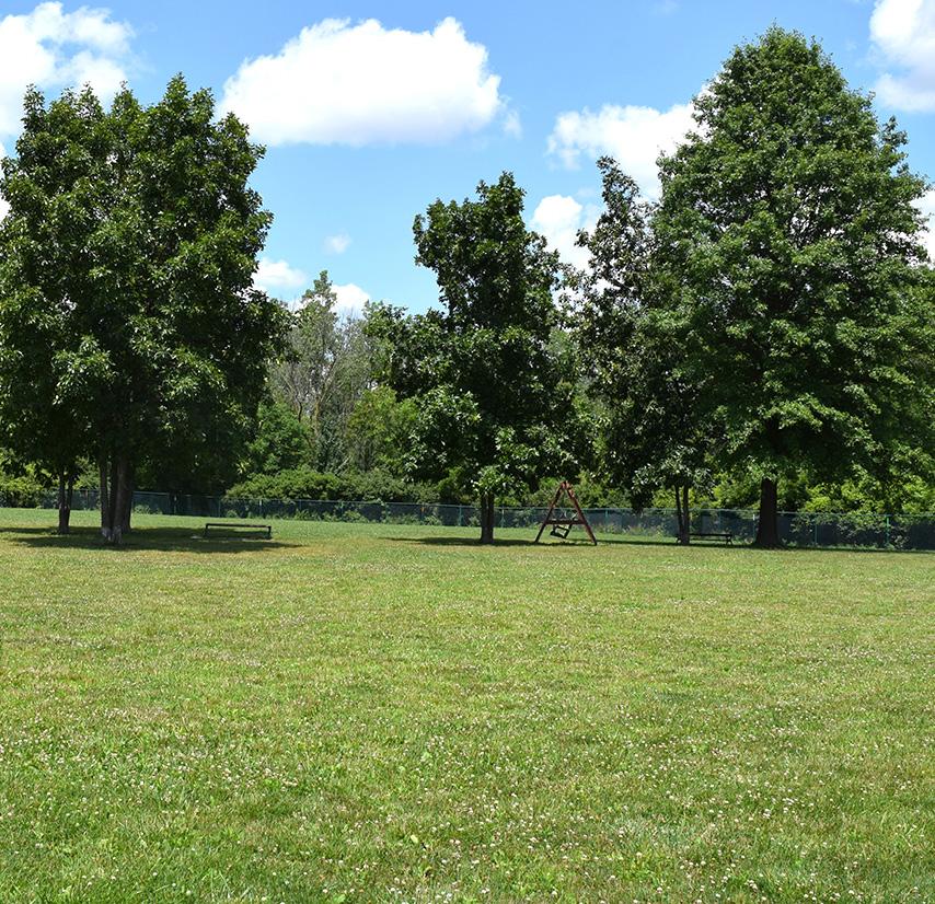
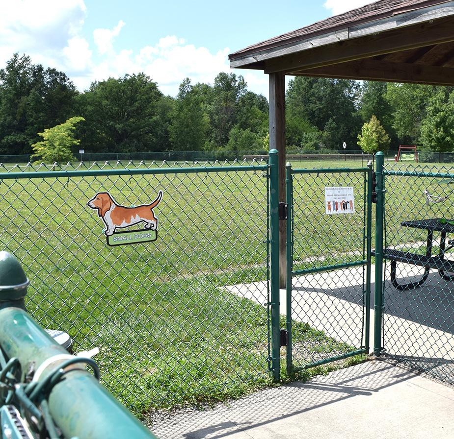
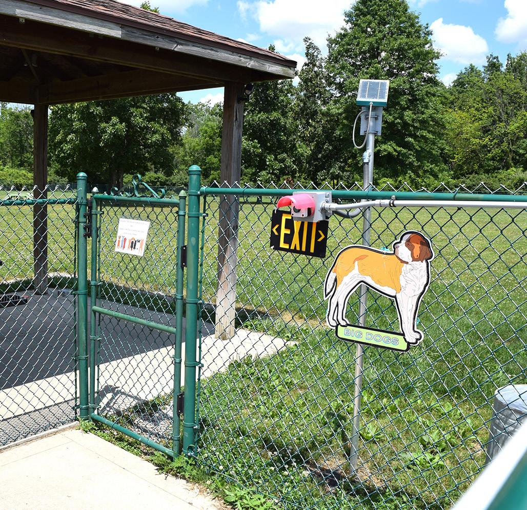
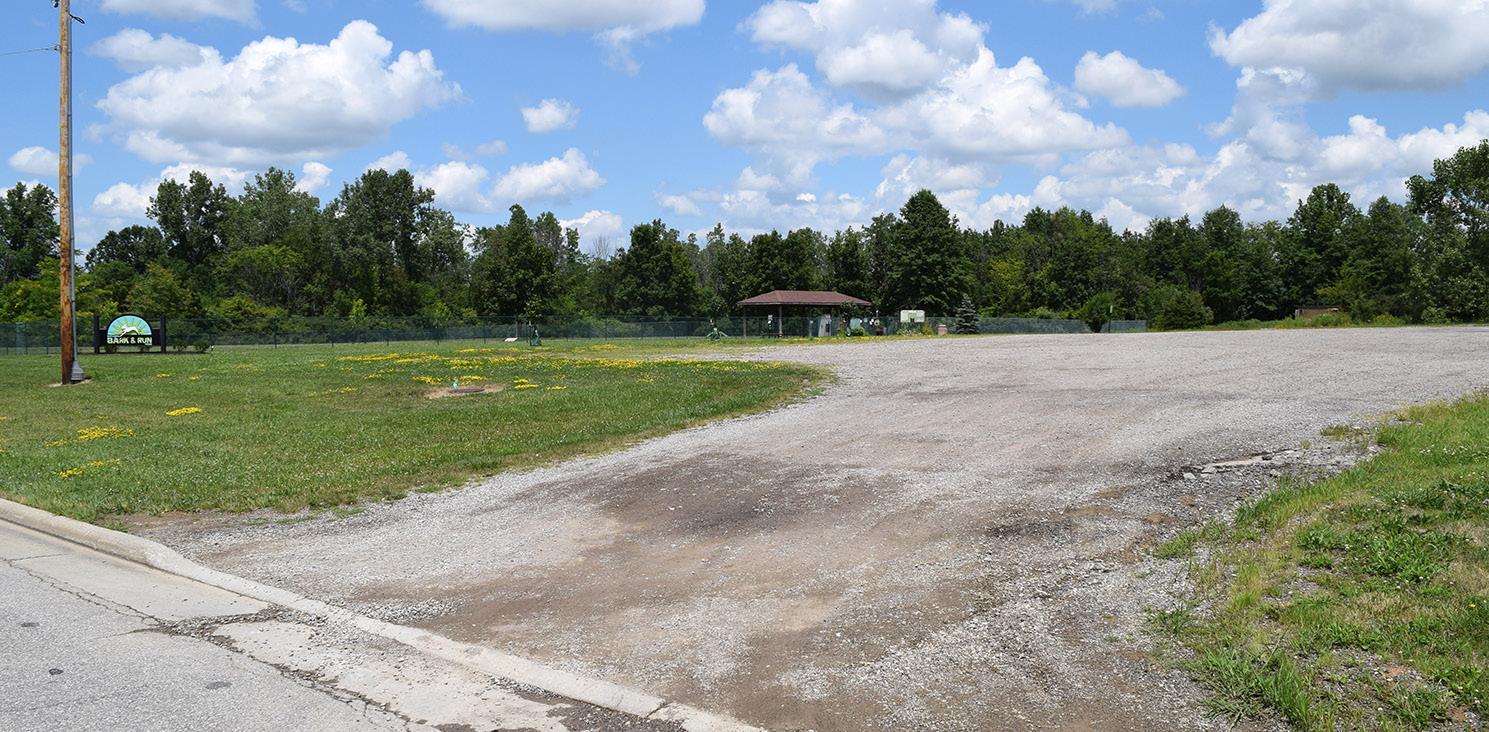
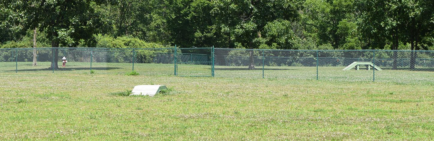
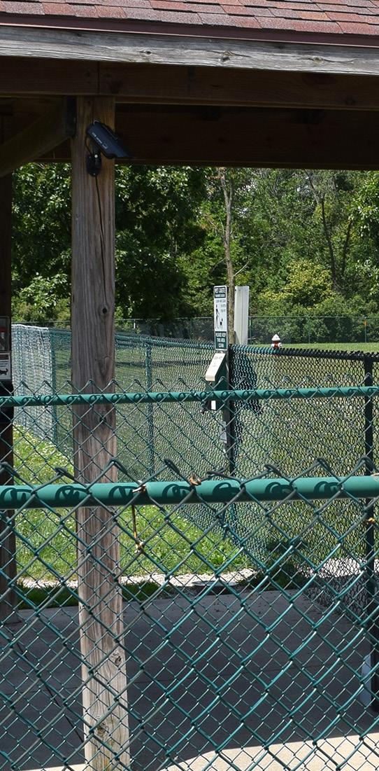
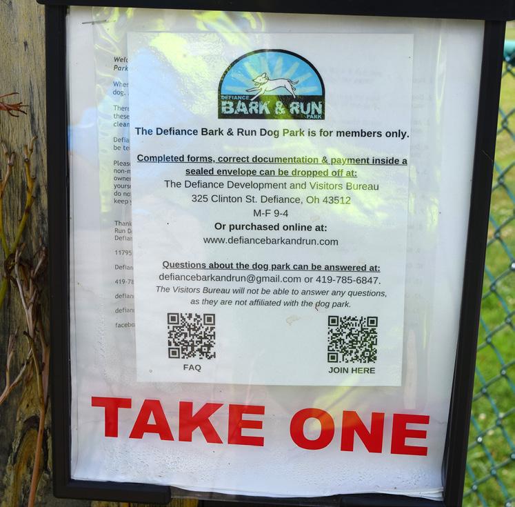
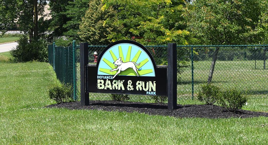
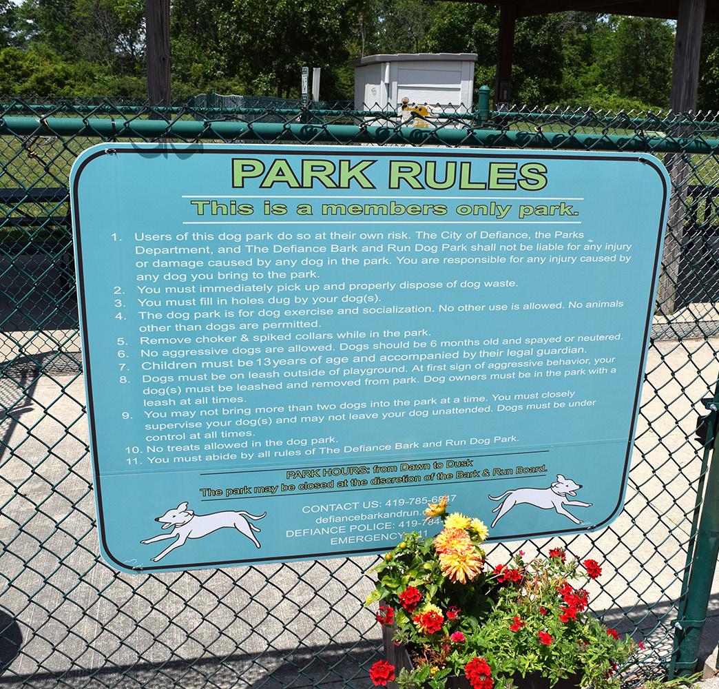
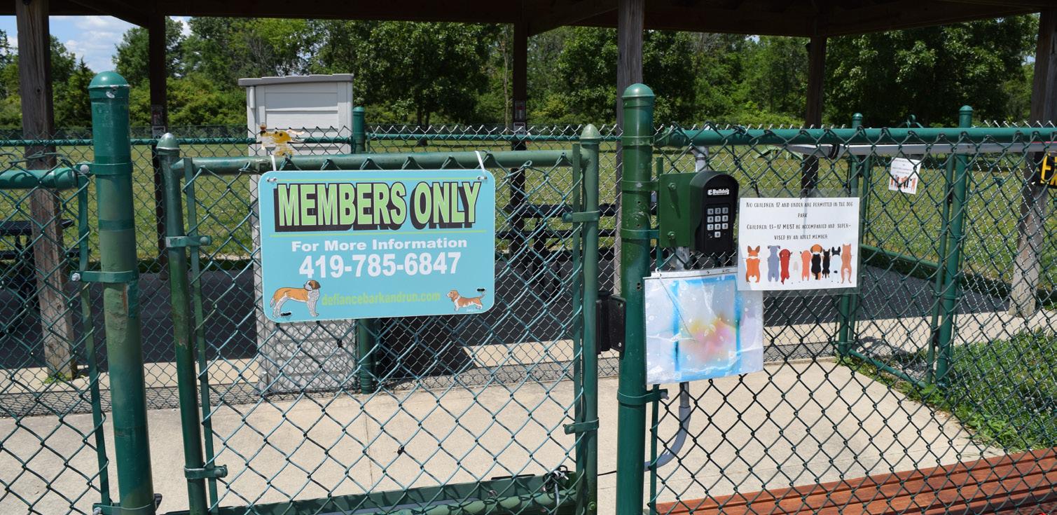
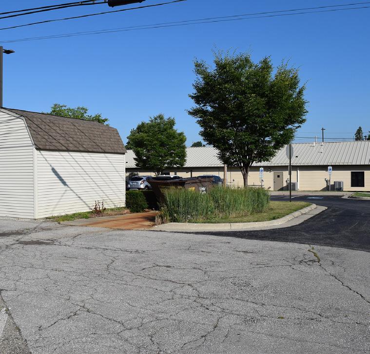
BARK & RUN DOG PARK
Passive / Dog Park Moderate Community Park Good Limited Accessibility
STRENGTHS
• Accessible routes from parking lot to park
• Separated areas for designated play zones
• Agility equipment / obstacle courses for dogs
• Shaded shelter house with seating
• Private membership provides revenue and self monitoring of site
Located south of the City and considered a part of the Reservoir Recreational Area, Bark & Run Dog Park is a membership-driven recreational facility tailored specifically for dogs and their owners. Developed and maintained by a group of local veterinarians, the park features separate fenced areas for large and small dogs, ensuring a safe and enjoyable environment for pets of all sizes. Each fenced area is one-acre, providing plenty of room for dogs and owners to play ball. With ample space for running, playing, and exercising, the park includes various amenities such as agility equipment, shaded pavilion areas, benches for pet owners, and water stations to keep dogs hydrated.
The open layout and agility features provide valuable opportunities for dogs to socialize and engage in physical activity, contributing to their overall health and wellbeing.
LIABILITIES
• No water supply available
• No restroom
• Aggregate lot / unfinished parking lot
• Entry sign is not consistent with other City parks
• Not open to anyone without membership

LEEANNAVE
SJACKSONAVE
GRAVEL
"My big dogs like to run and they get socialized [at Bark & Run Dog Park]."
SHELTER HOUSE
AREA FOR SMALL DOGS
AREA FOR LARGE DOGS
Bark & Run Dog Park was chosen as this person's favorite park because:
" I am able to take my dog somewhere in a well maintained area with only people who pay for the park."
Natural & Structural Resources: BRONSON PARK
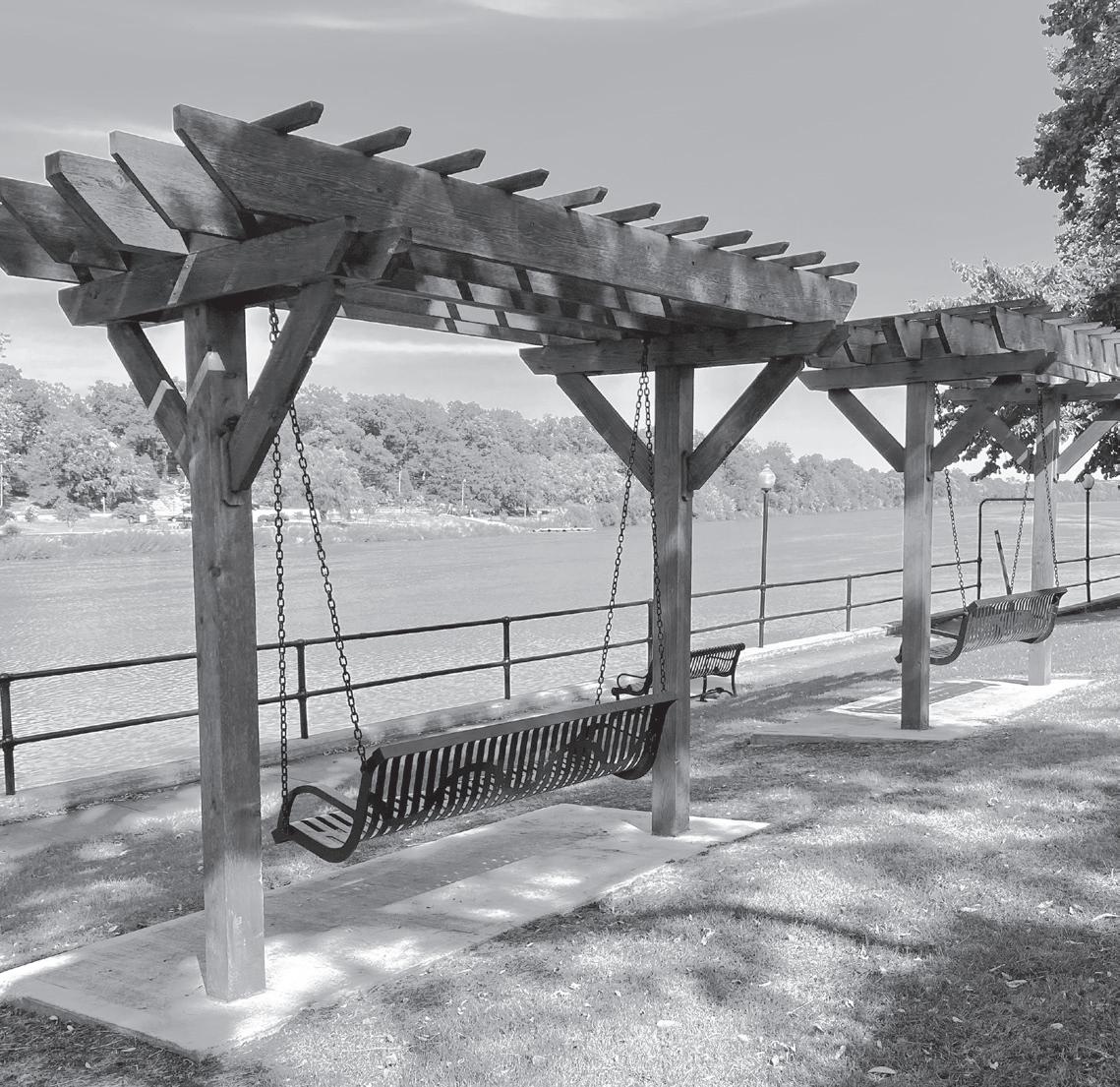
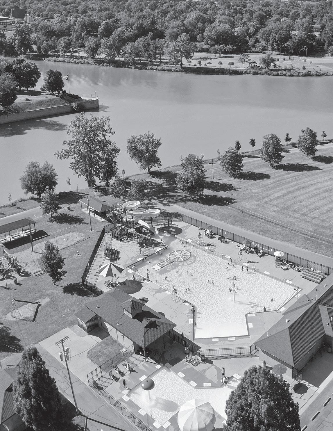
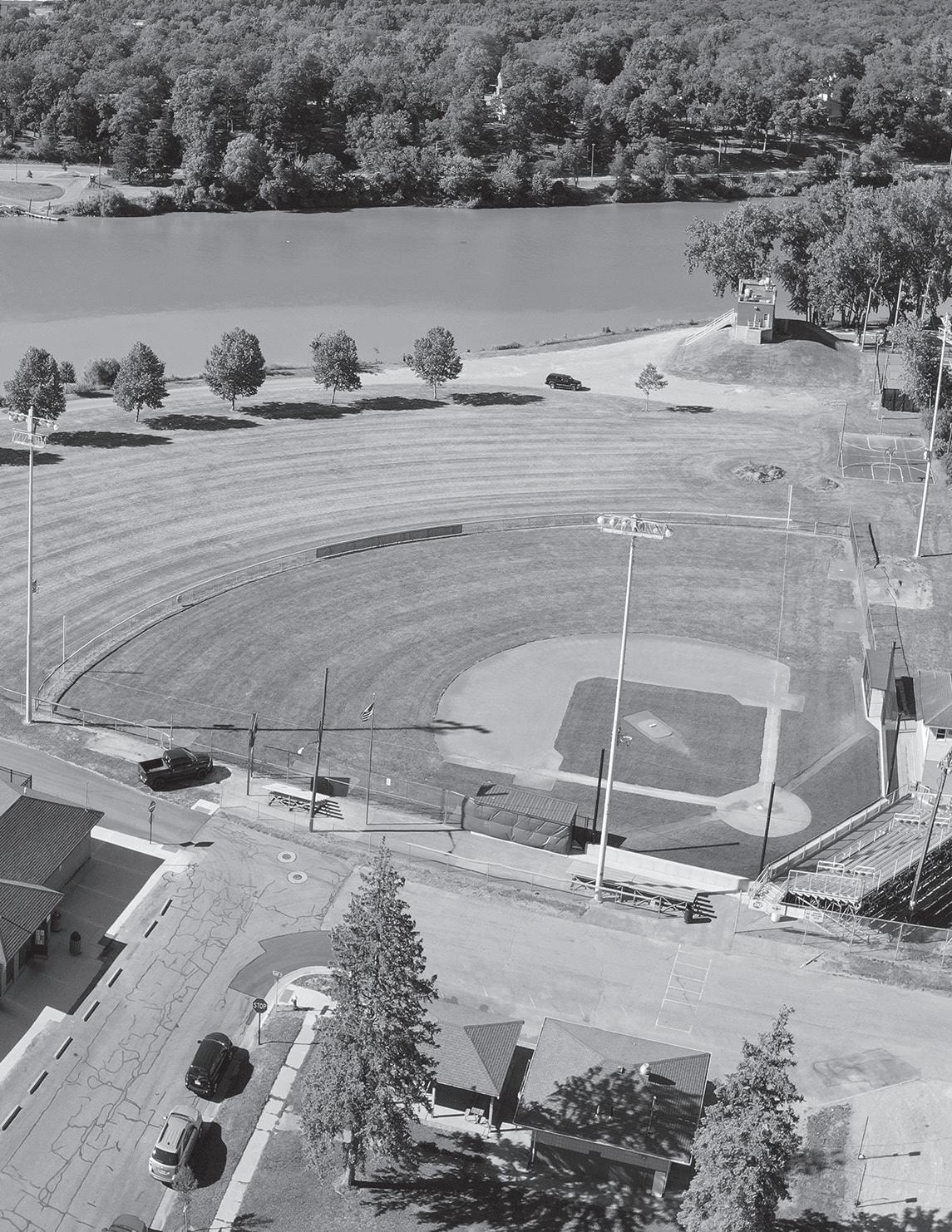
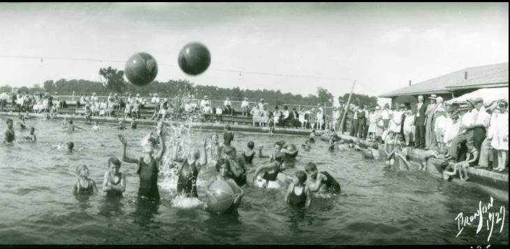
Bronson Park, located south of the City along the Auglaize River, was named after Edward S. Bronson who served as the Mayor of Defiance for four-terms (19161917, 1928-1929, 1946-1947, and 1948-1949). Bronson left a lasting impact on the City by modernizing its railways, schools, fire and police departments, and public water purification systems, among other things. The park was named after him in 1964.
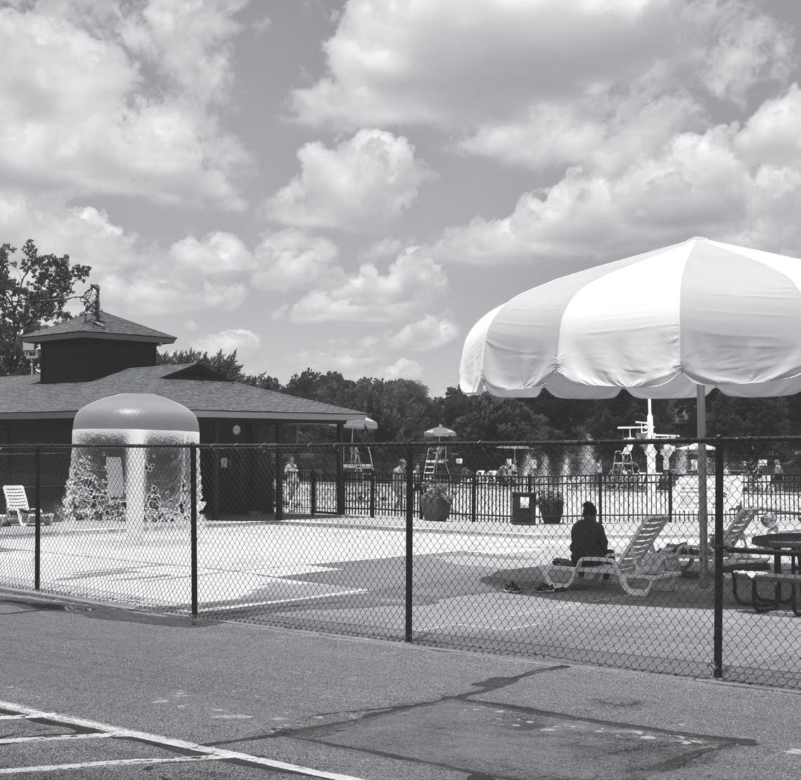
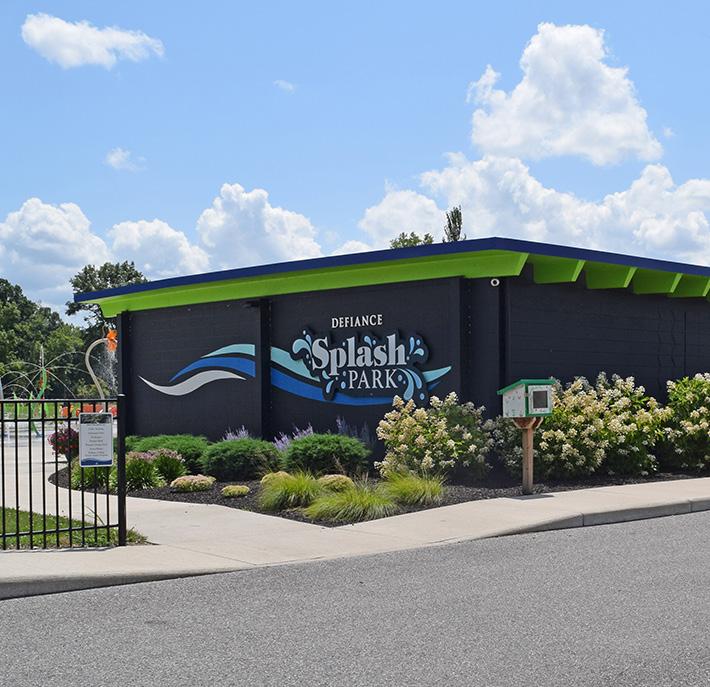
This park was once home to the Bronson Pool, which hosted swim lessons and served as the base for the Defiance Blue Dolphin swim team. The outdoor facility, located at the northern edge of the park, was demolished in 2016 with the hope of a future splash pad being developed in its place. Two years later, the Defiance Splash Park opened to the public. By repurposing the Bronson
STRENGTHS
• Accessible by vehicles, sidewalks, waterways, and pedestrian / bicycle trails
• Accessible multi-use route from Bronson Park to the Defiance Splash Park
• Potential for a canoe/kayak activation node
• Shelter house rentals
• Security lights are located on all buildings
• Electricity and water are available on site
PARK AMENITIES/FACILITIES
pool facility, the site was reinvented - offering an ADA compliant and free water amenity to the community.
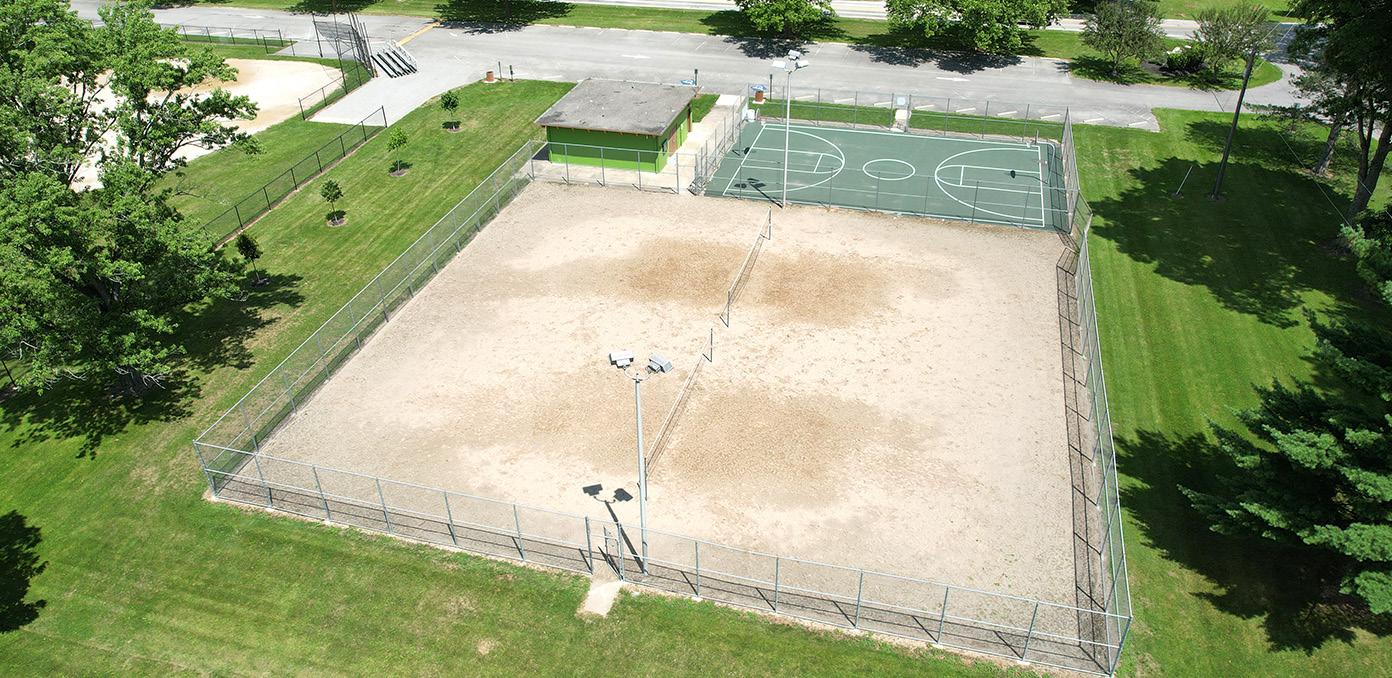
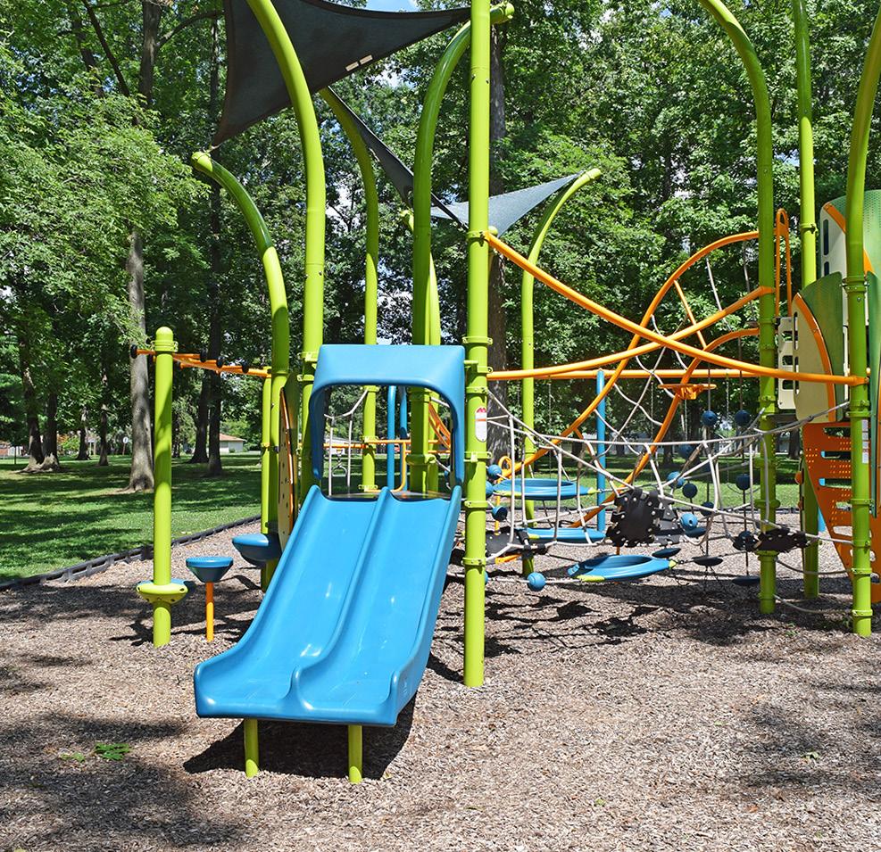
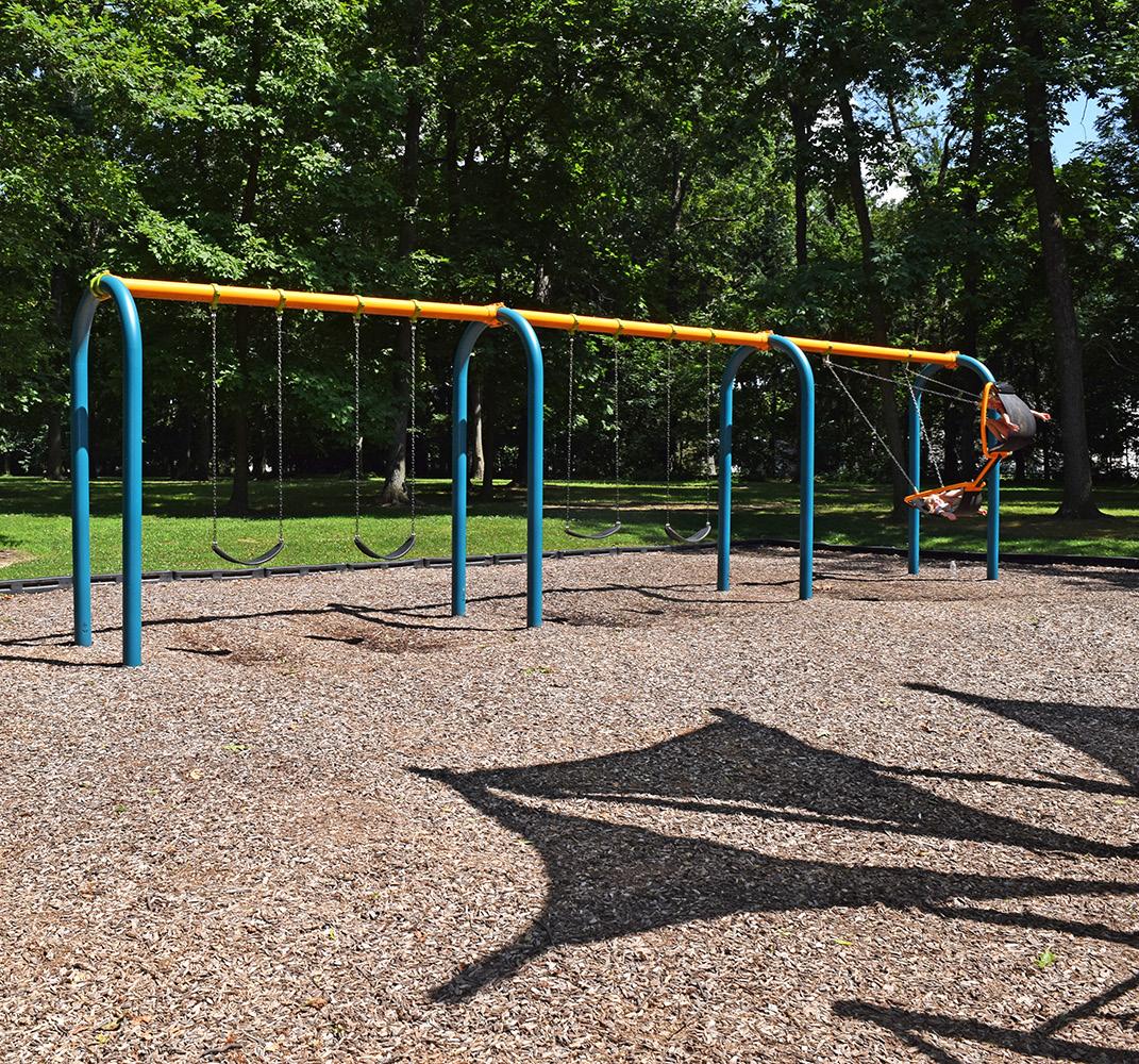
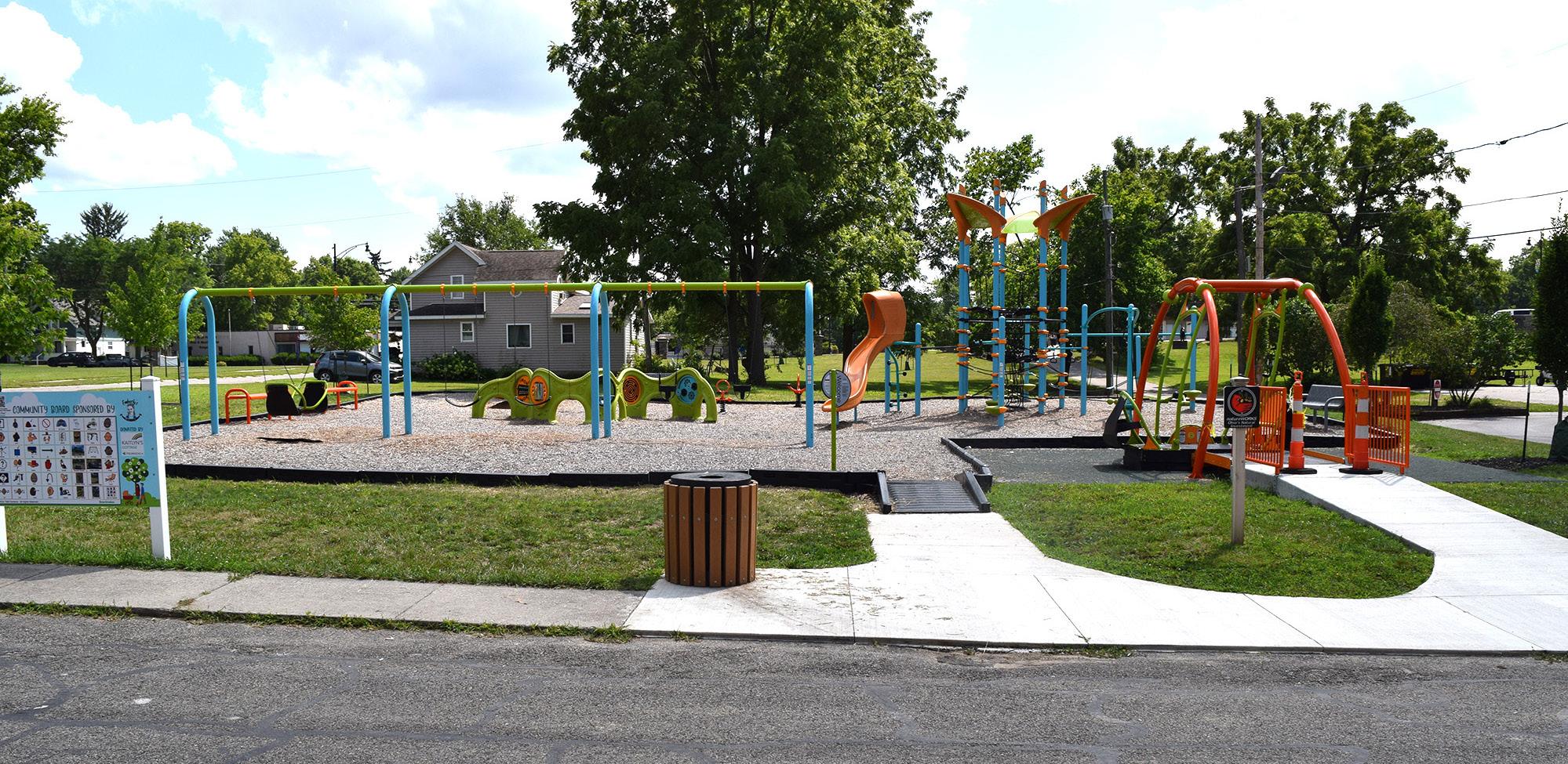
In 2021, additional improvements were made including upgrades to the shelter houses and swing benches, new playground equipment, and an ADA compliant sidewalk connecting the parking lot to the shelter houses. Today, the park also features two sand volleyball courts, two ball fields, and a basketball court.
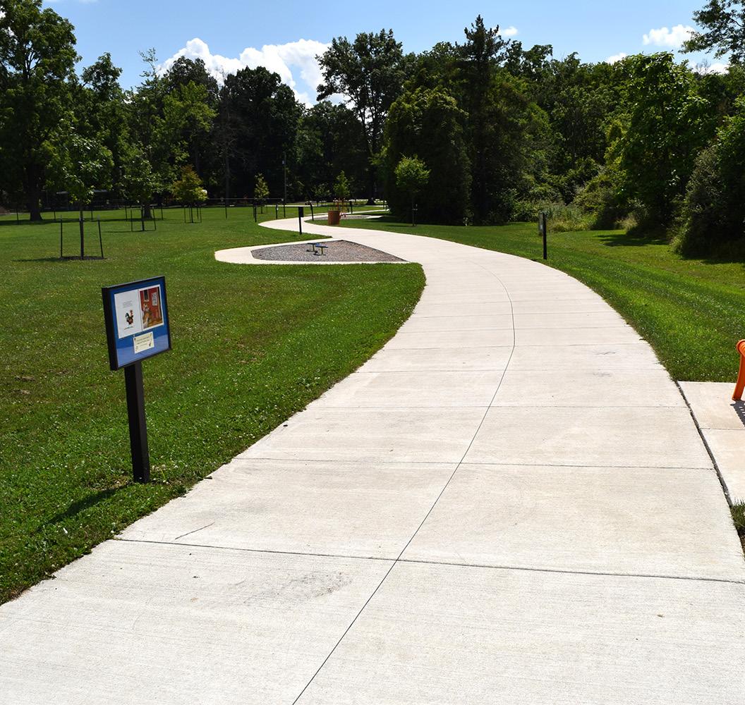
A multi-use walkway connecting Bronson Park with the Defiance Splash Park was also installed, funded through State Capital Appropriations. Not only does this walkway contain pockets of play along the route, it also doubles as a StoryWalk® and provides an interactive way for families to read an entire picture book as they travel along the path.
LIABILITIES
• Potential for flooding events
• Ball fields need improved
• Most users don't realize this park is located on the river
"
It’s versatile. It’s close to home. We can walk the dogs. Since the shelter houses and play equipment have been updated we can now take grandchildren and have family gatherings."
SHADED SEATING
CLIMBING EQUIPMENT PLAYGROUND
BALL FIELD
RESTROOM / CHANGING FACILITY
DONOR WALL
"
The gorgeous trees providing shaded areas are much appreciated. The sand volleyball courts, playground equipment, and entertaining walkway to the splash pad gives everyone something to do."
"Lots of great equipment for the kids. Very shaded. Great place to gather."
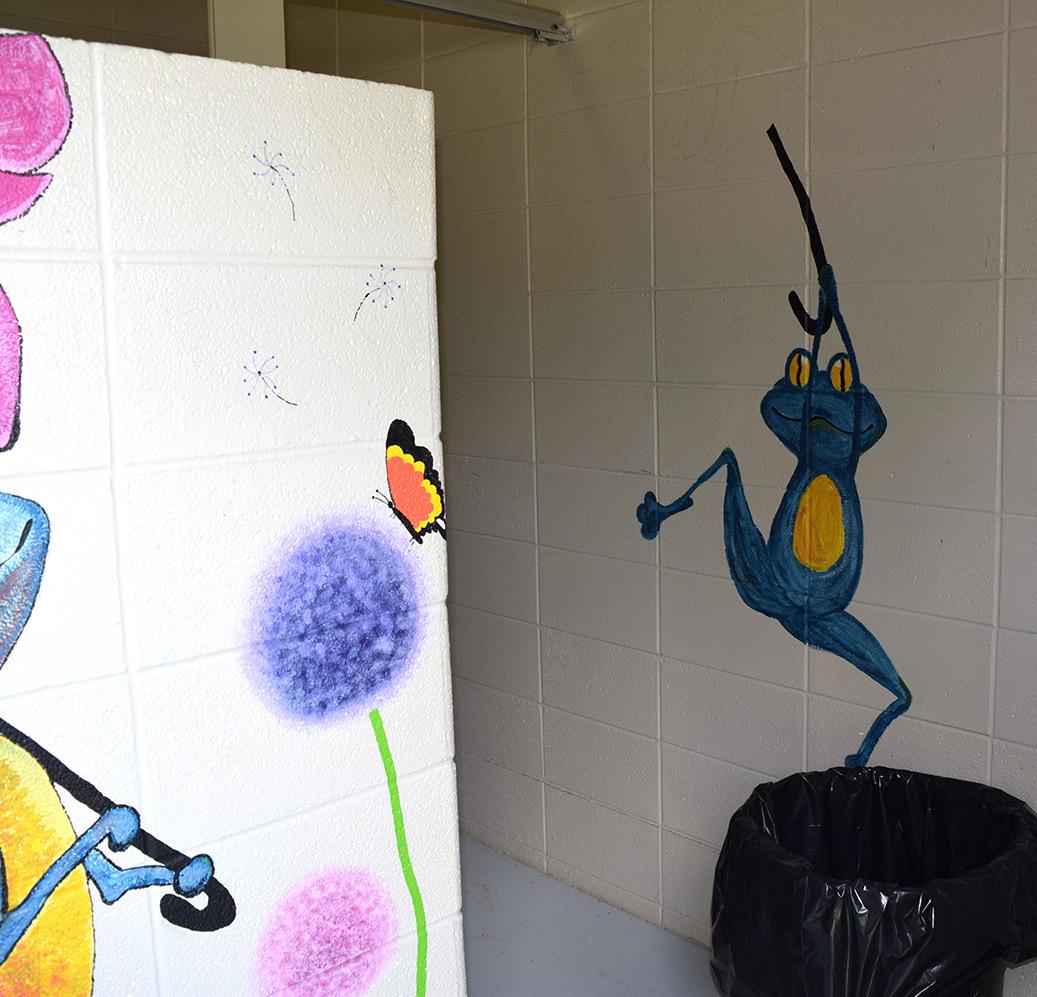
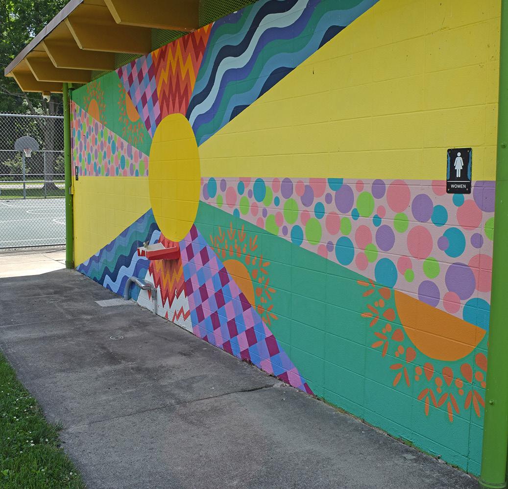
RESTROOM MURAL
WATER FOUNTAIN & MURAL
SAND VOLLEYBALL & BASKETBALL COURTS
SHELTER HOUSE
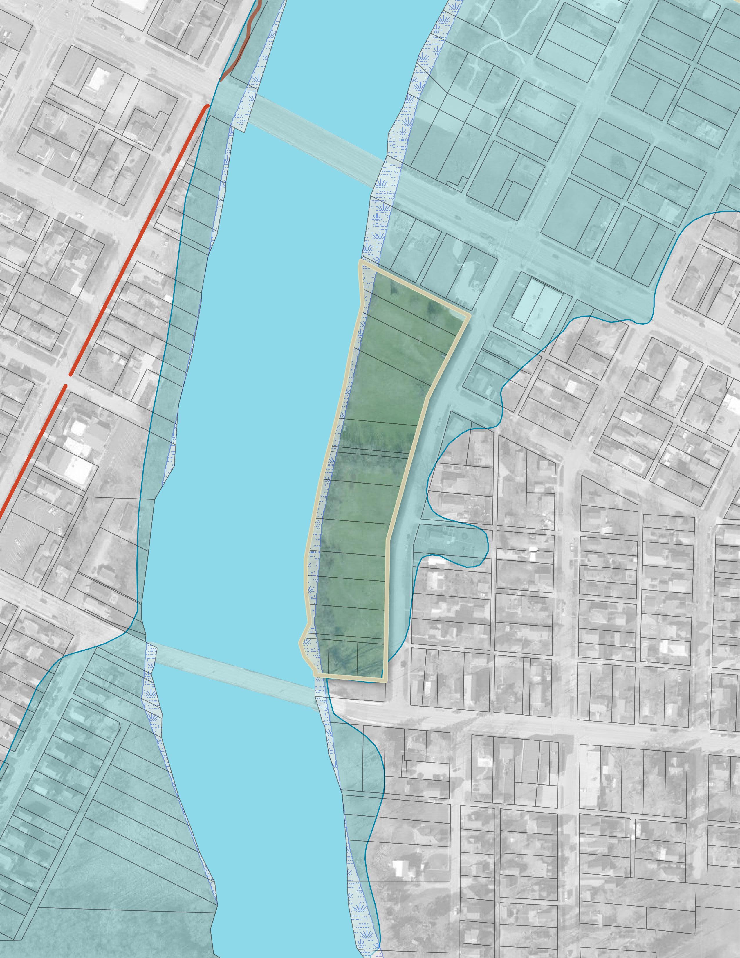
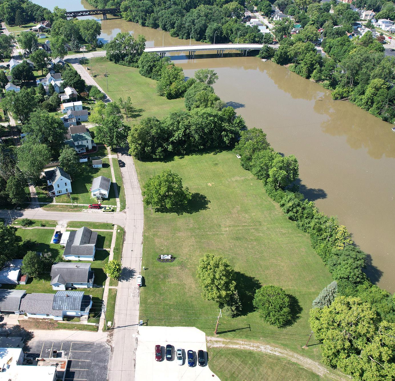
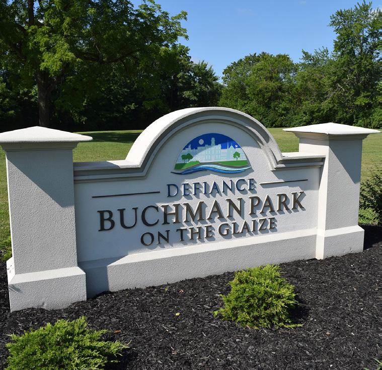
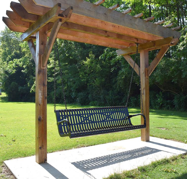
BUCHMAN PARK ON THE GLAIZE
STRENGTHS
• Riverfront access
• Strong historical design intent due to its namesake
• Proximity to neighborhoods
Buchman Park on the Auglaize is a natural park situated along the east bank of the Auglaize River, located on Auglaize Street between the Second Street and Hopkins Street bridges.
The park is named after Randy Buchman, a long-time Defiance history expert, and is intended to honor his life's work and the native populations that used to reside in and around the City. While many groups frequented the Defiance area, the Shawnee were the most significant.
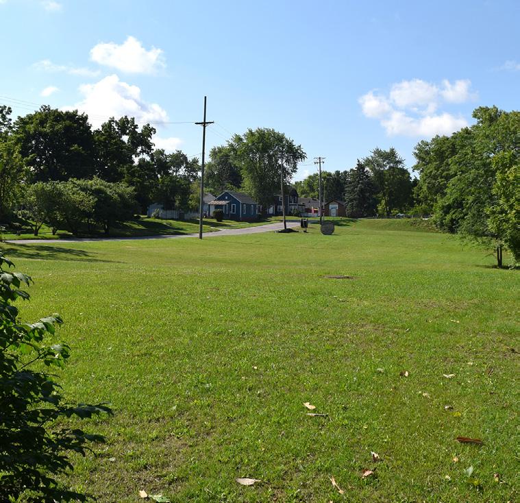
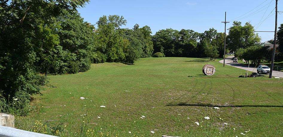
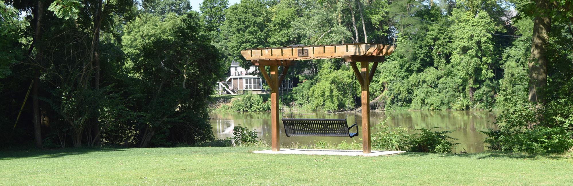
Currently, the park offers ample greenspace and a swing bench overlooking the Auglaize River, as well as access to the riverbanks. Historical markers are also present. This park is meant to be a passive and reflective space.
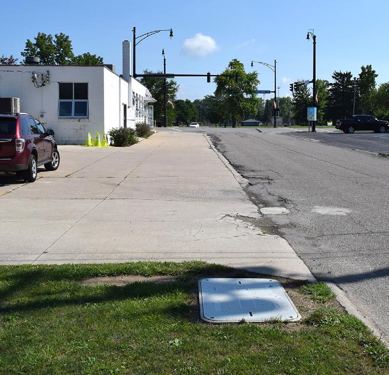
LIABILITIES
• No existing sidewalks
• Potential for flooding events
• No on-site or roadside parking
• Park includes multiple CSO outfalls
AUGLAIZE RIVER
" I would like to see Buchman Park developed into a respectful tribute to the Native Americans that [played] a significant part of Defiance's history."
LOOKING SOUTH ACROSS THE PARK
VIEW NORTH TOWARDS 2ND ST. & AUGLAIZE ST. INTERSECTION
BENCH SWING OVERLOOKING THE RIVER
PARK SIGN
OPEN LAWN FIELD
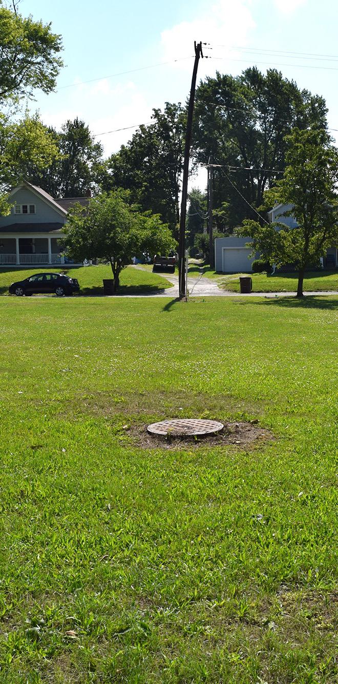
EXISTING MANHOLE WITHIN THE LAWN SPACE
OPEN GREENSPACE
LOOKING NORTH ACROSS THE PARK
BENCH SWING
RIVER ACCESS
MEMORIAL PLAQUE
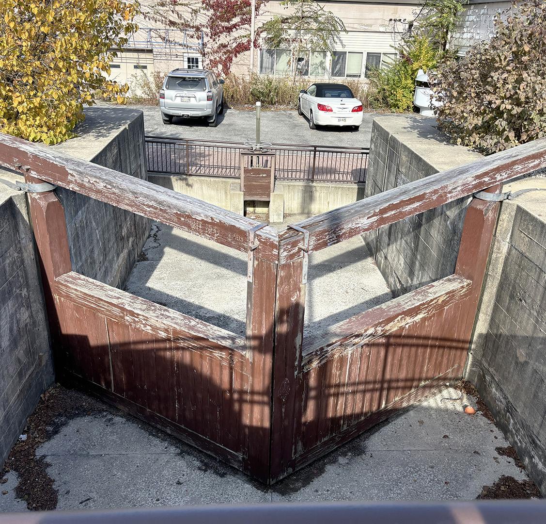
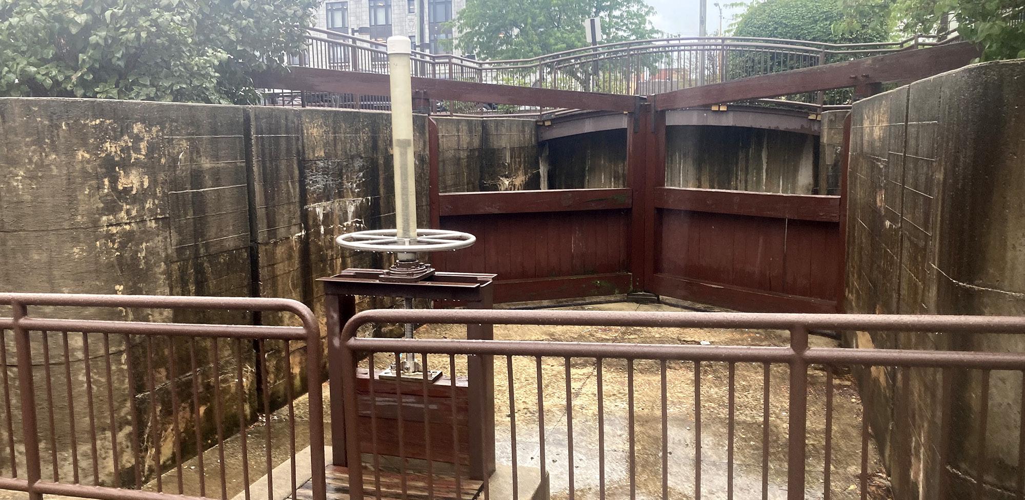
CANAL PARK
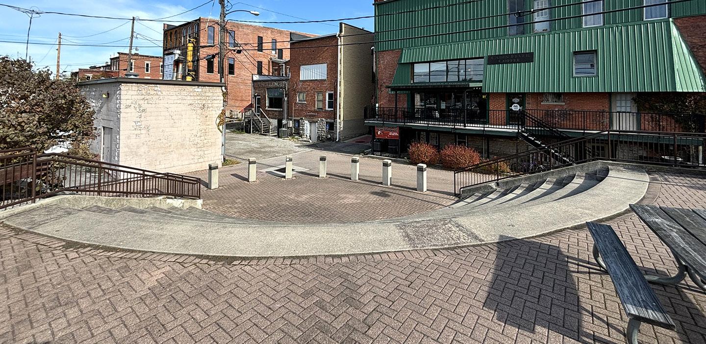
The floods of 1913 caused significant damage in Defiance, notably impacting the Miami and Erie Canal Lock No. 37. By 1917, most of the bridges crossing the canal in the downtown area had been removed, and the canal was gradually filled and drained. The remnants of Miami and Erie Canal Lock No. 37 remained exposed for decades until they were partially renovated in 1997. Today, this historical site has been transformed into Canal Park. Located downtown, it features an amphitheater that celebrates the area's heritage and offers a vibrant space for community events.
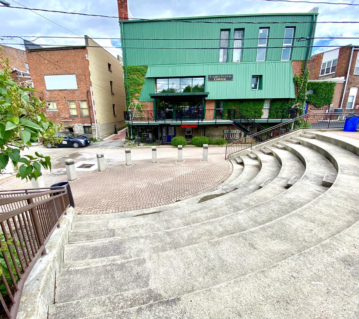
STRENGTHS
• Strong historical significance
• Electricity and water are available on site
• Located within downtown
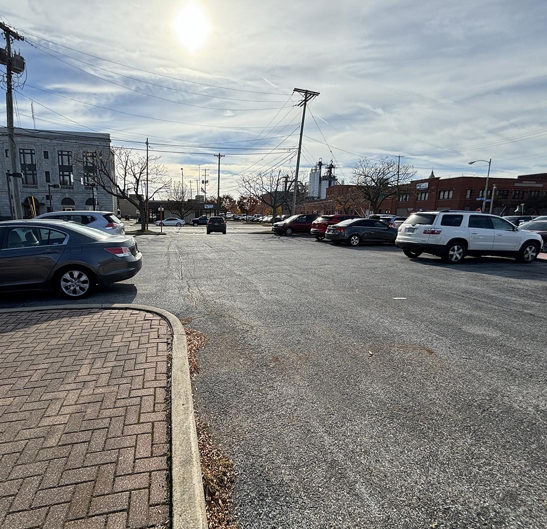
• Adjacent parking
LIABILITIES
• Small site with limited greenspace
• No shade components
• Needs additional seating, such as benches or new table seating
• Needs identification signage
• Needs additional ADA seating opportunities
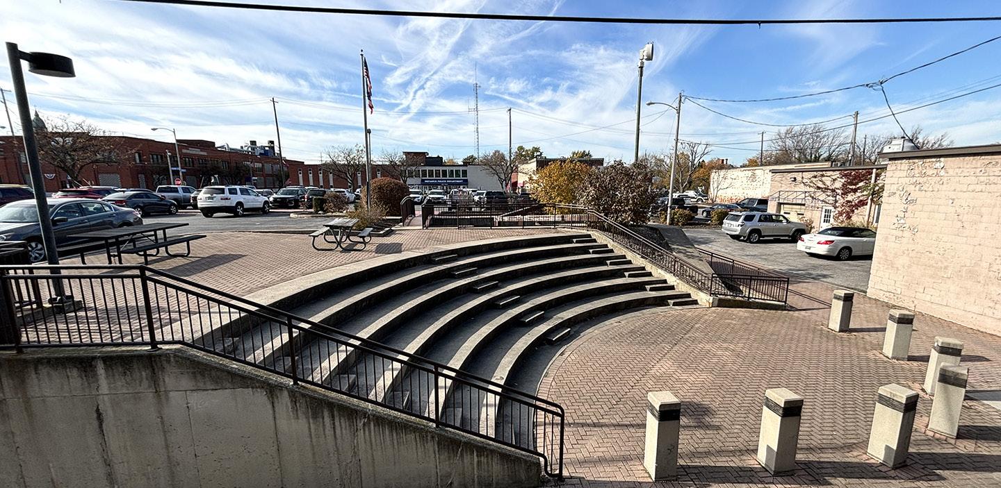
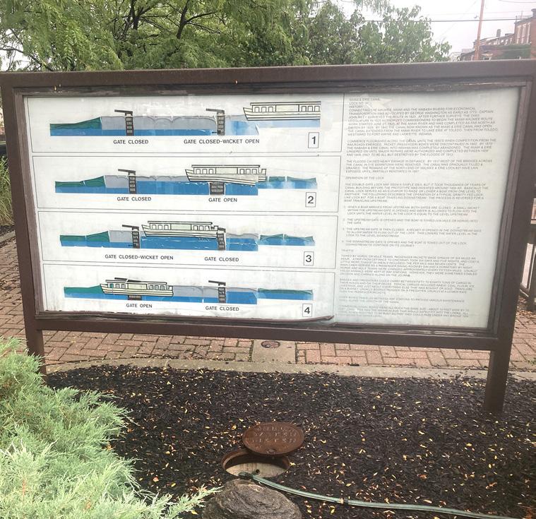
PEDESTRIAN LIGHTING
EDUCATIONAL SIGNAGE
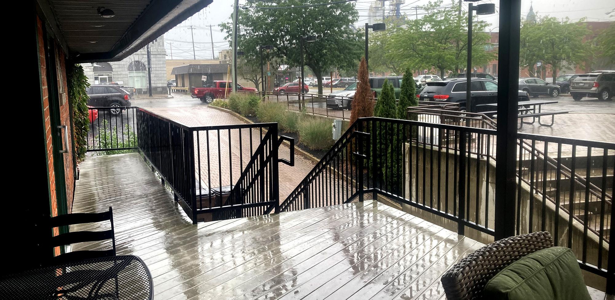
VIEW FROM NEIGHBORING BUSINESS
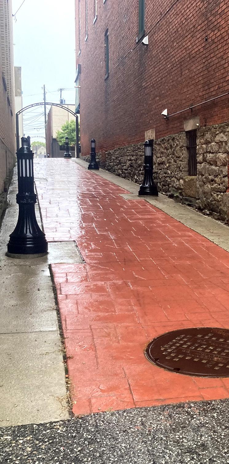
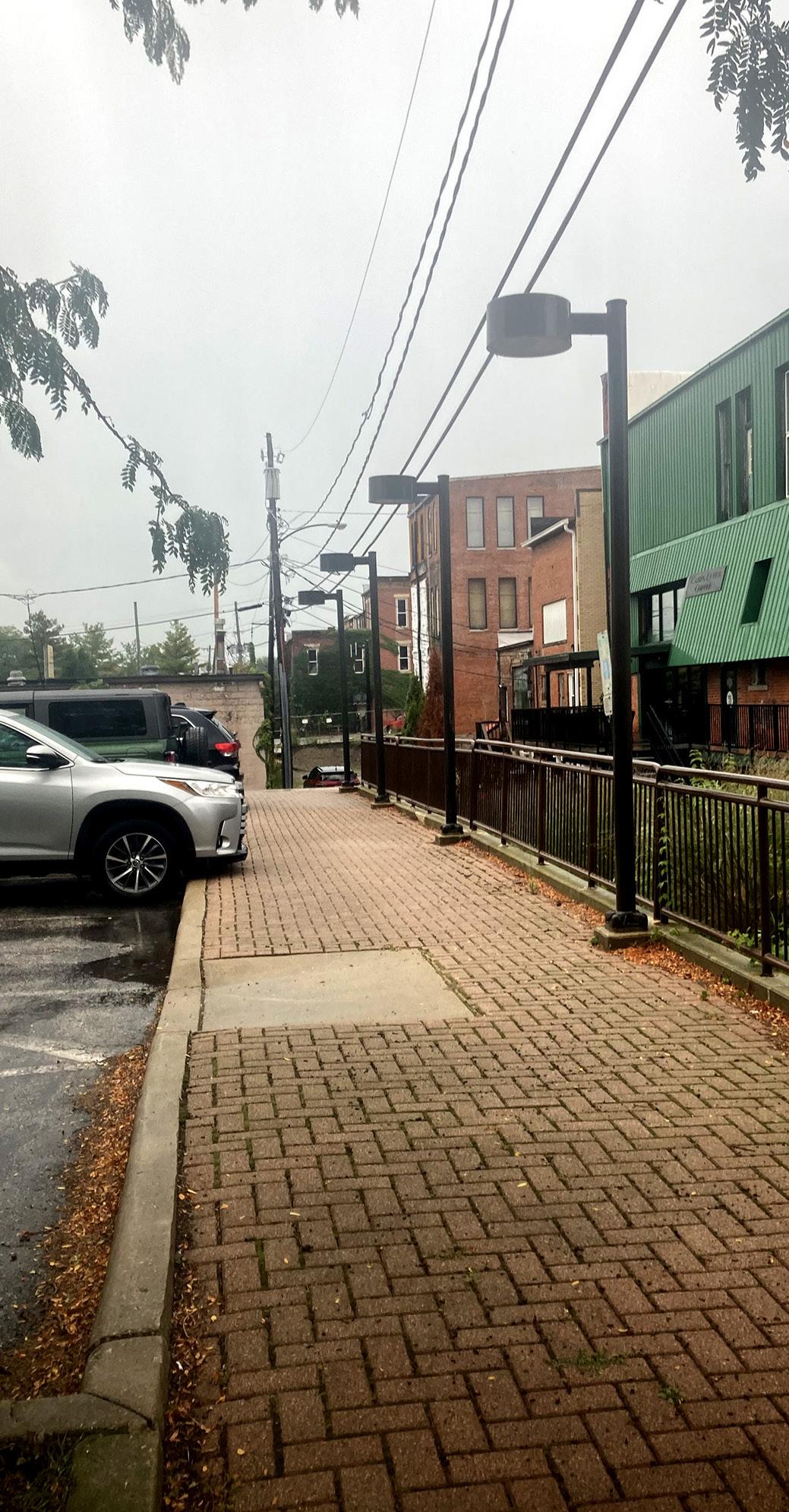
PEDESTRIAN ALLEYWAY
CANAL LOCK
WALKWAY TO CANAL LOCK
PARKING SIGNAGE
PARKING
LANDSCAPING & SIGNAGE
SEATING
CANAL LOCK
Natural & Structural Resources:
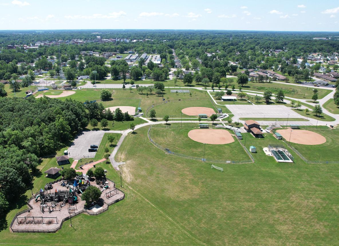
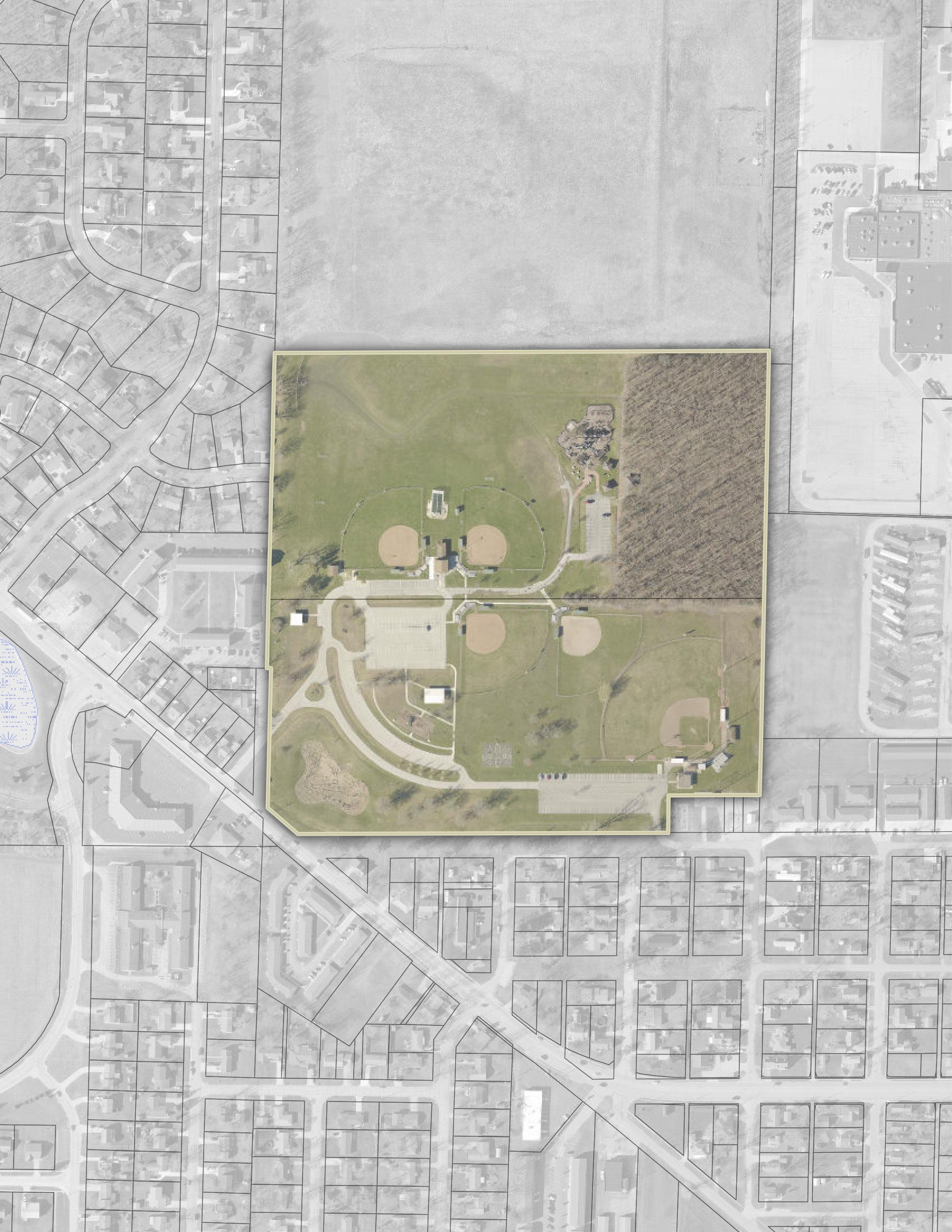
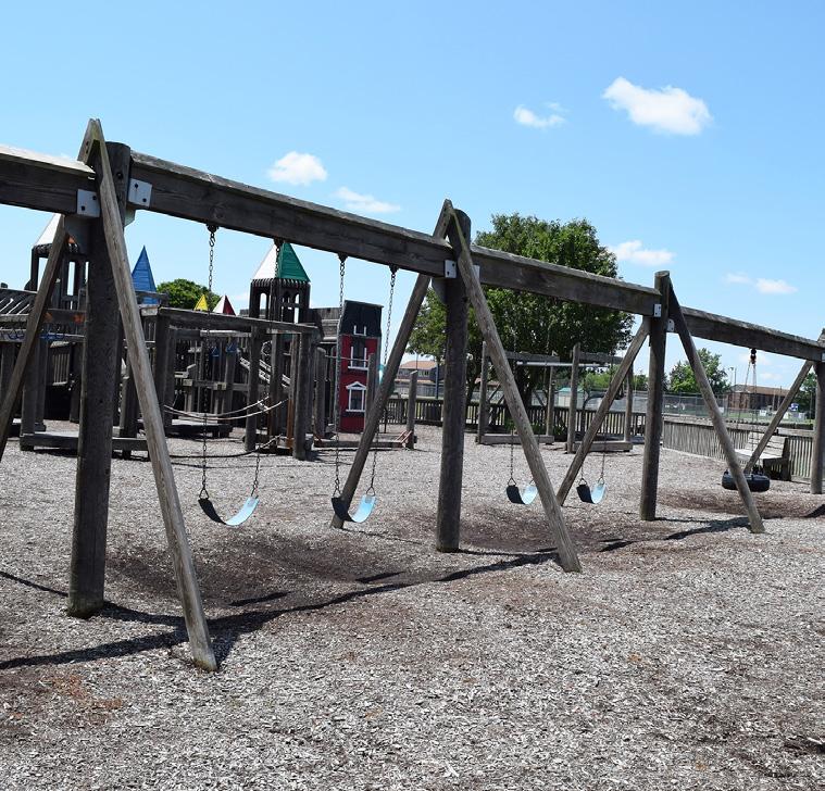
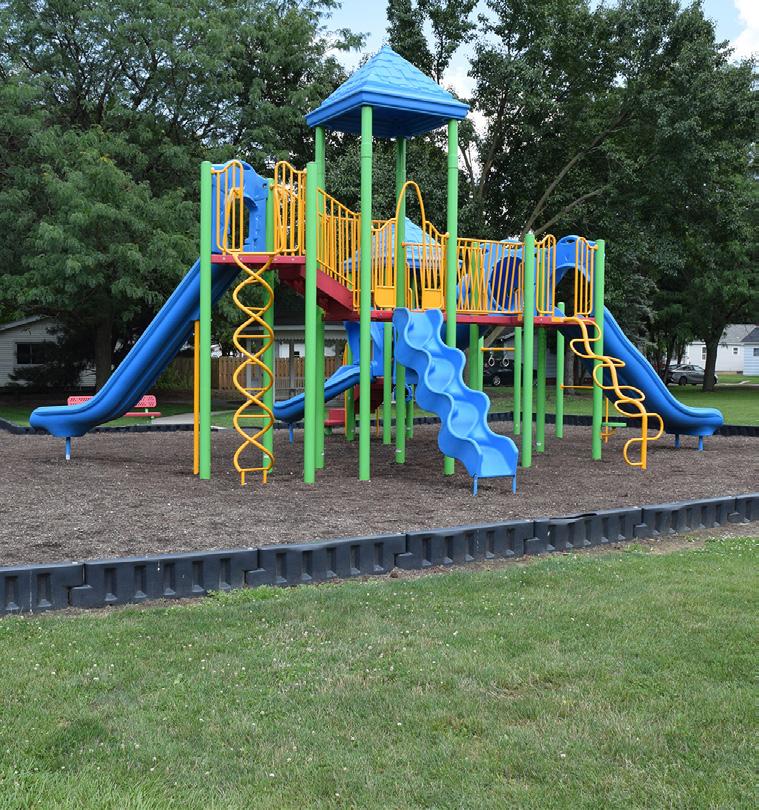
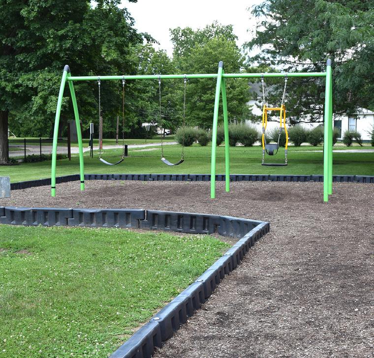
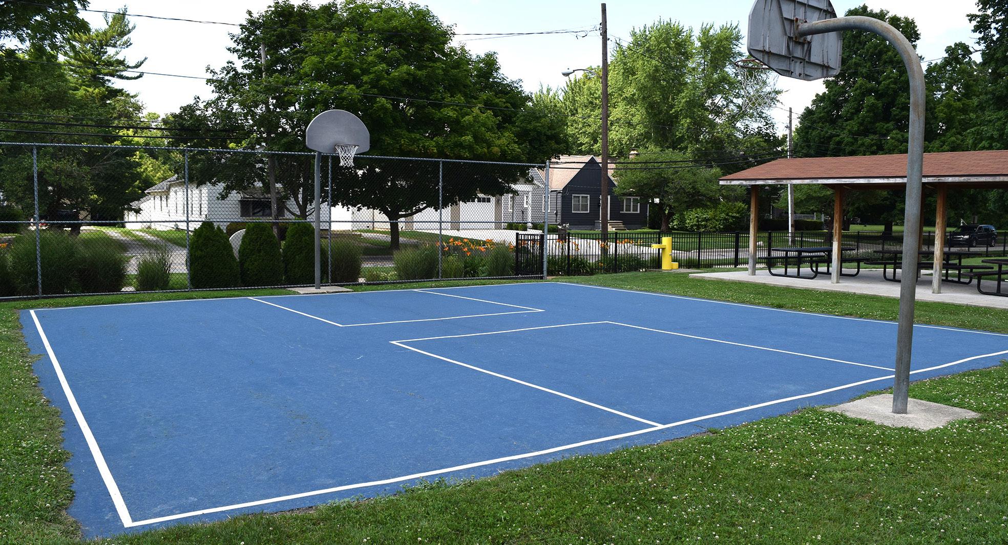
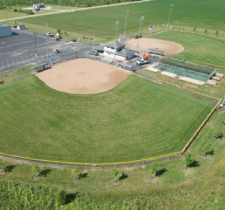
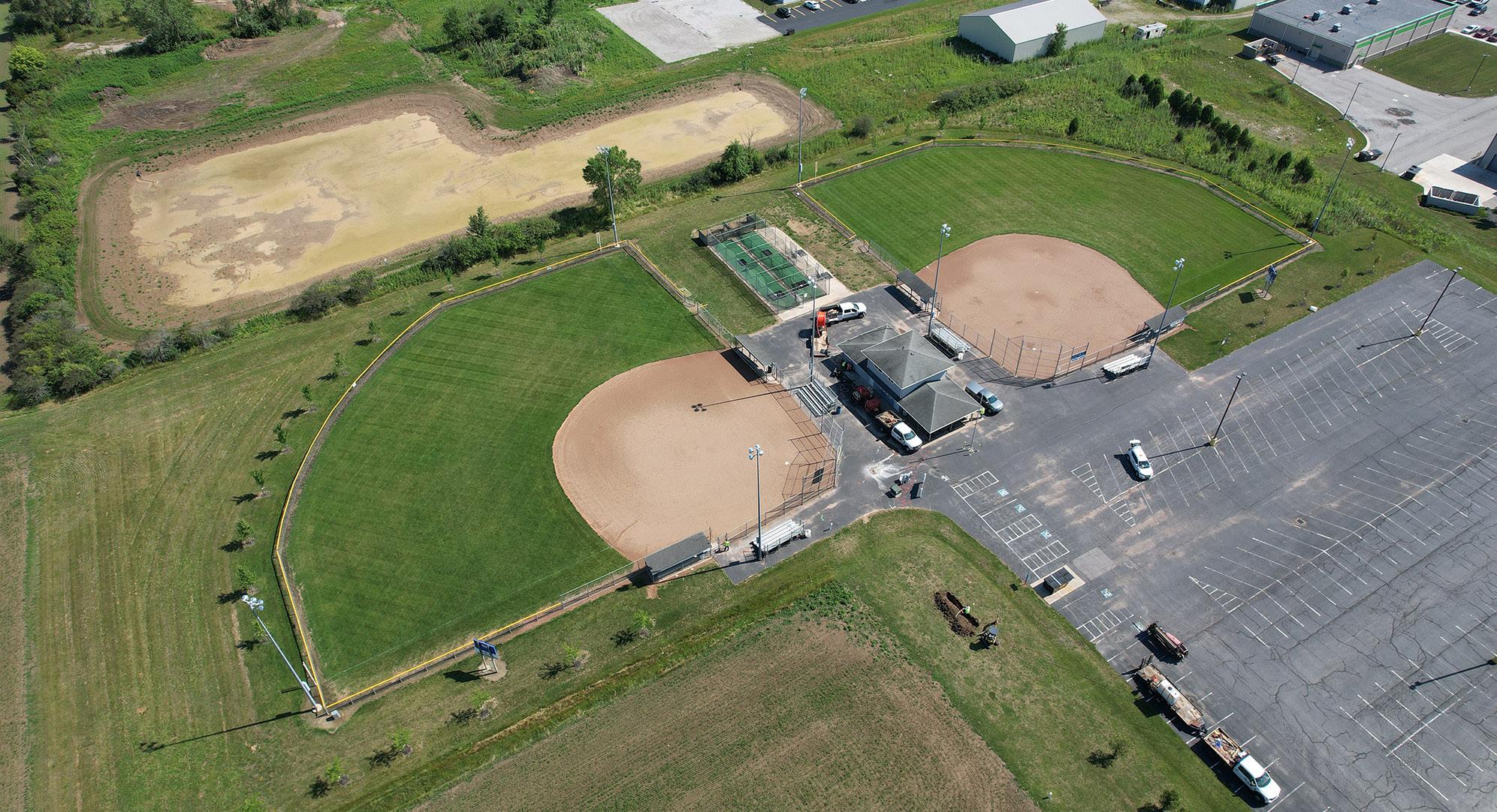
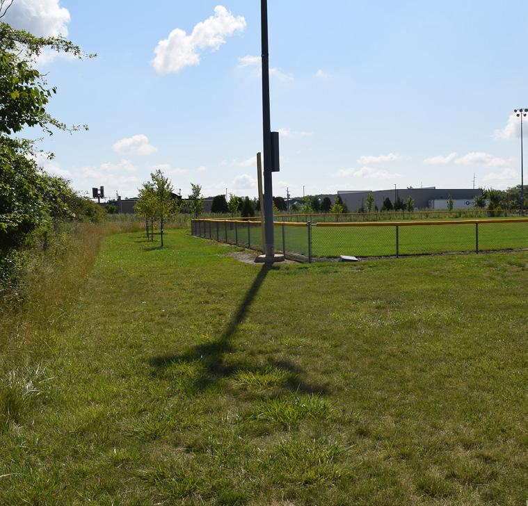
DIEHL
PARK
Passive / Active Moderate Community Park Good Somewhat Accessible
STRENGTHS
• Shelter house rentals
• Illuminated by field lights and security lights
• Electricity and water are available on site
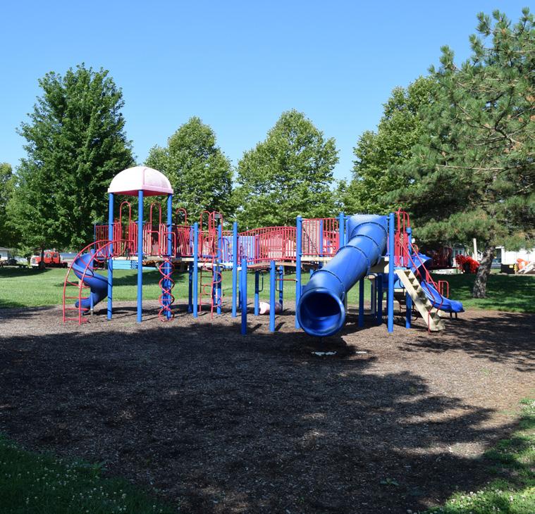
• Multiple playgrounds
• Prominent park north of the Maumee River
• Two fields have irrigation
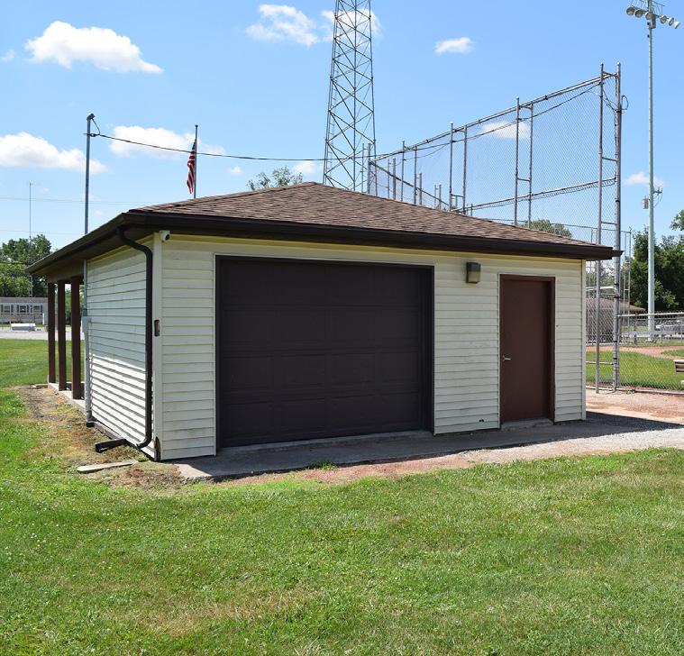
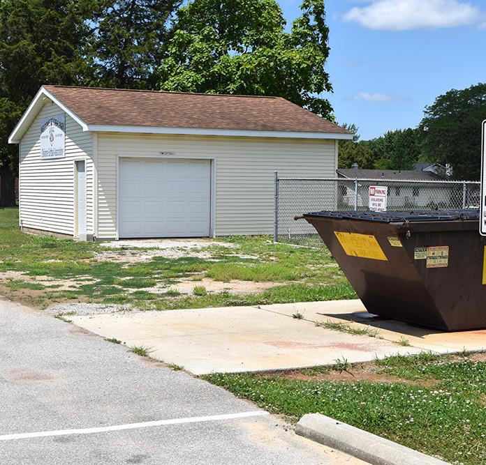
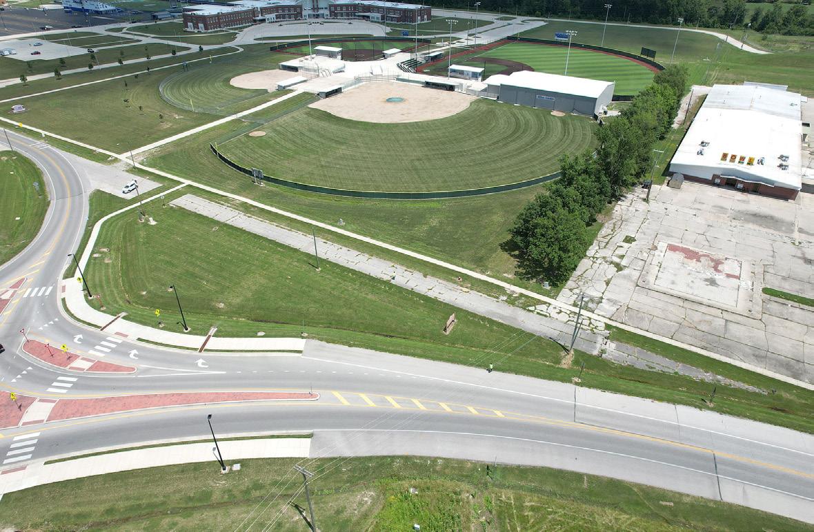
Located on the City's northwest side, the park features two large covered shelter houses, a basketball court, four softball fields, a baseball diamond, and a playground. Soccer can also be played at this park. Additionally, Defiance Softball and the Defiance Baseball Association's 15U team consider this park their home, hosting three tournaments each summer. They have also partnered with the Special Olympics to host t-ball games.
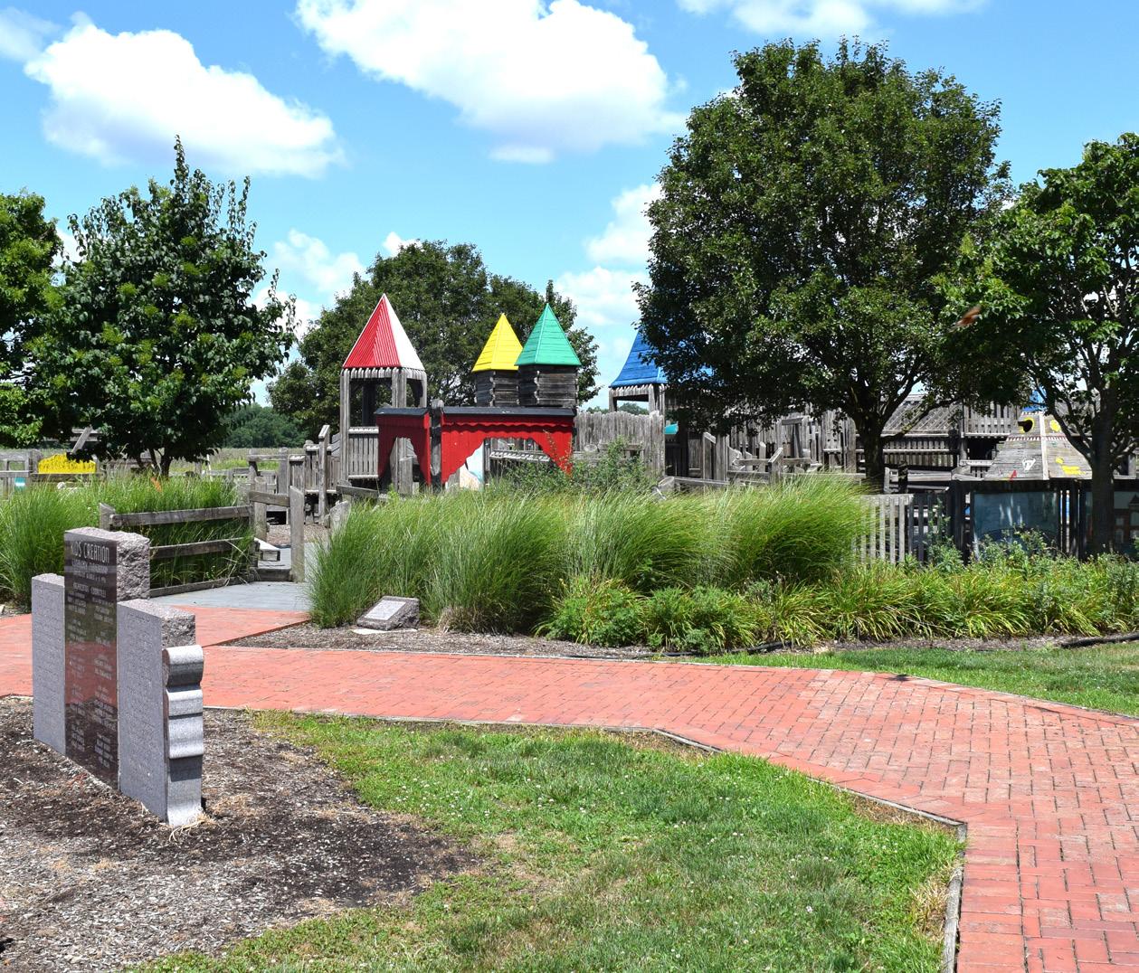
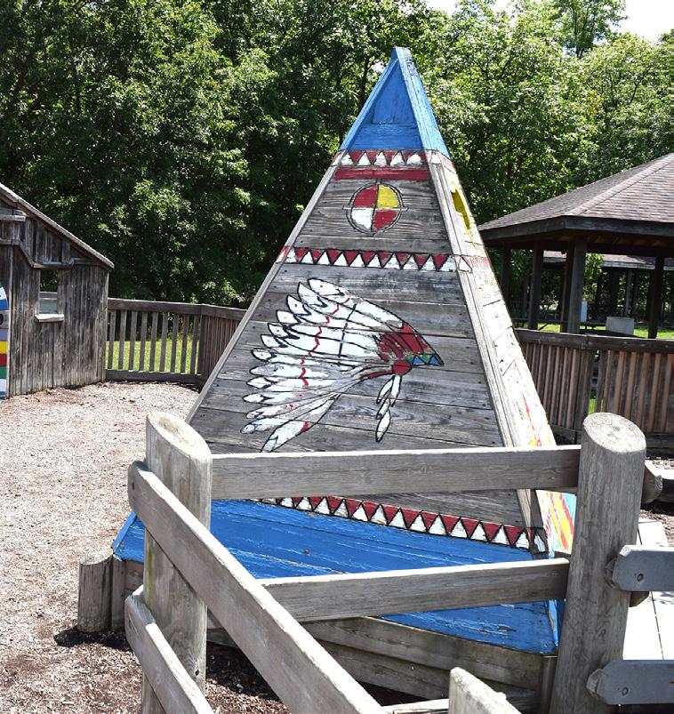
One of the biggest attractions is the Kid's Creation Playground which provides kids with an opportunity to use their imagination as they run through the fort or sit in the Native American teepee.
LIABILITIES
• No accessible path to the fountain or shelter houses, or to the surrounding neighborhoods
• Playground does not include an accessible safety surfacing
• No accessible bathrooms
• Not enough parking during baseball / softball season
• Lack of shade
PARK AMENITIES/FACILITIES
ANTHONYWAYNEBLVD WEMORAVE
SHELTER HOUSE #2
SHELTER HOUSE #1
SHELTER HOUSE #2
SHELTER HOUSE #1
BASEBALL
"[My son] loves having the freedom to run and climb and play and it's easy to use his imagination there. We like that it's open, yet enclosed, and not near a lot of traffic."
"I enjoyed going to the Hot Air Balloon Festival when it was at Diehl Park."
"Kids Creation is huge and can keep kids occupied for hours."
KIDS CREATION - SWINGS
BASKETBALL COURTS
KIDS CREATION - SEATING
WALKWAY
KIDS CREATION - PLAY AREA PLAYGROUND
KIDS CREATION - BASKETBALL
BATTING CAGE
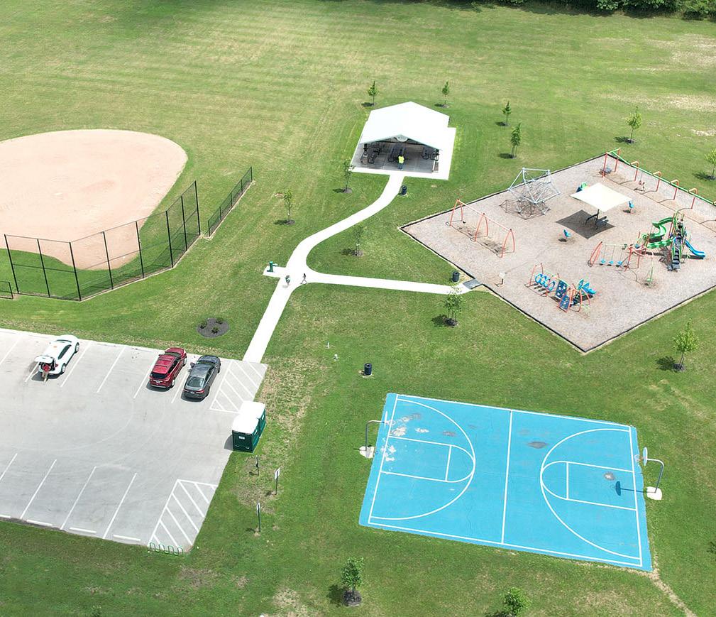
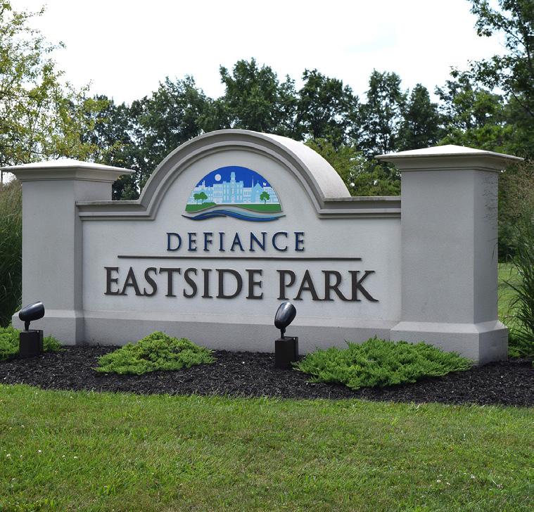
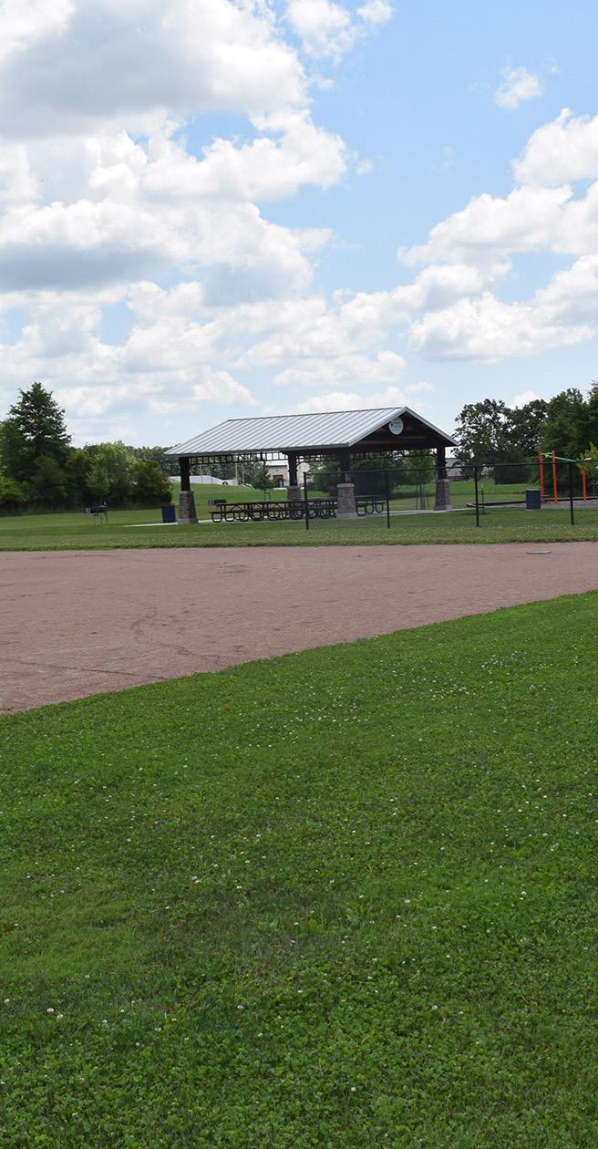
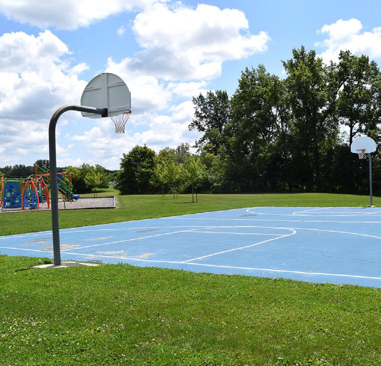
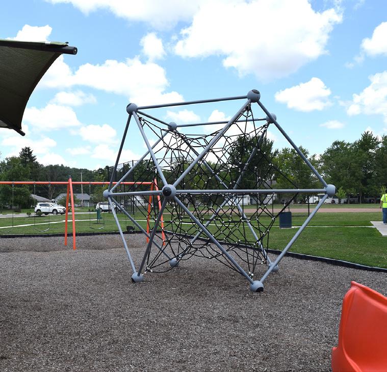
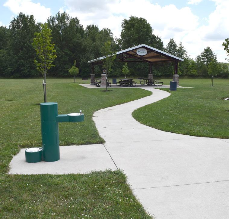
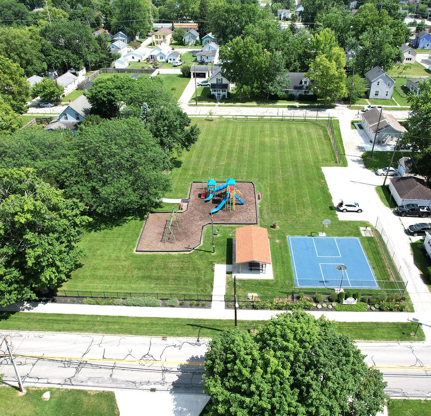
Natural & Structural Resources: EASTSIDE PARK
Passive / Active Moderate Community Park Excellent Mostly Accessible
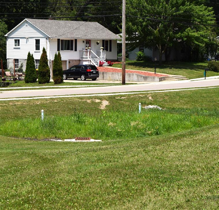
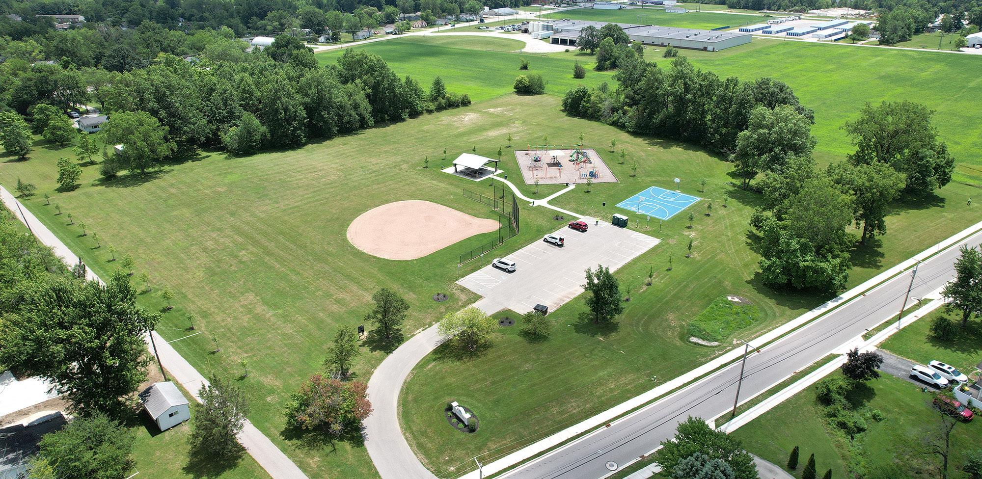
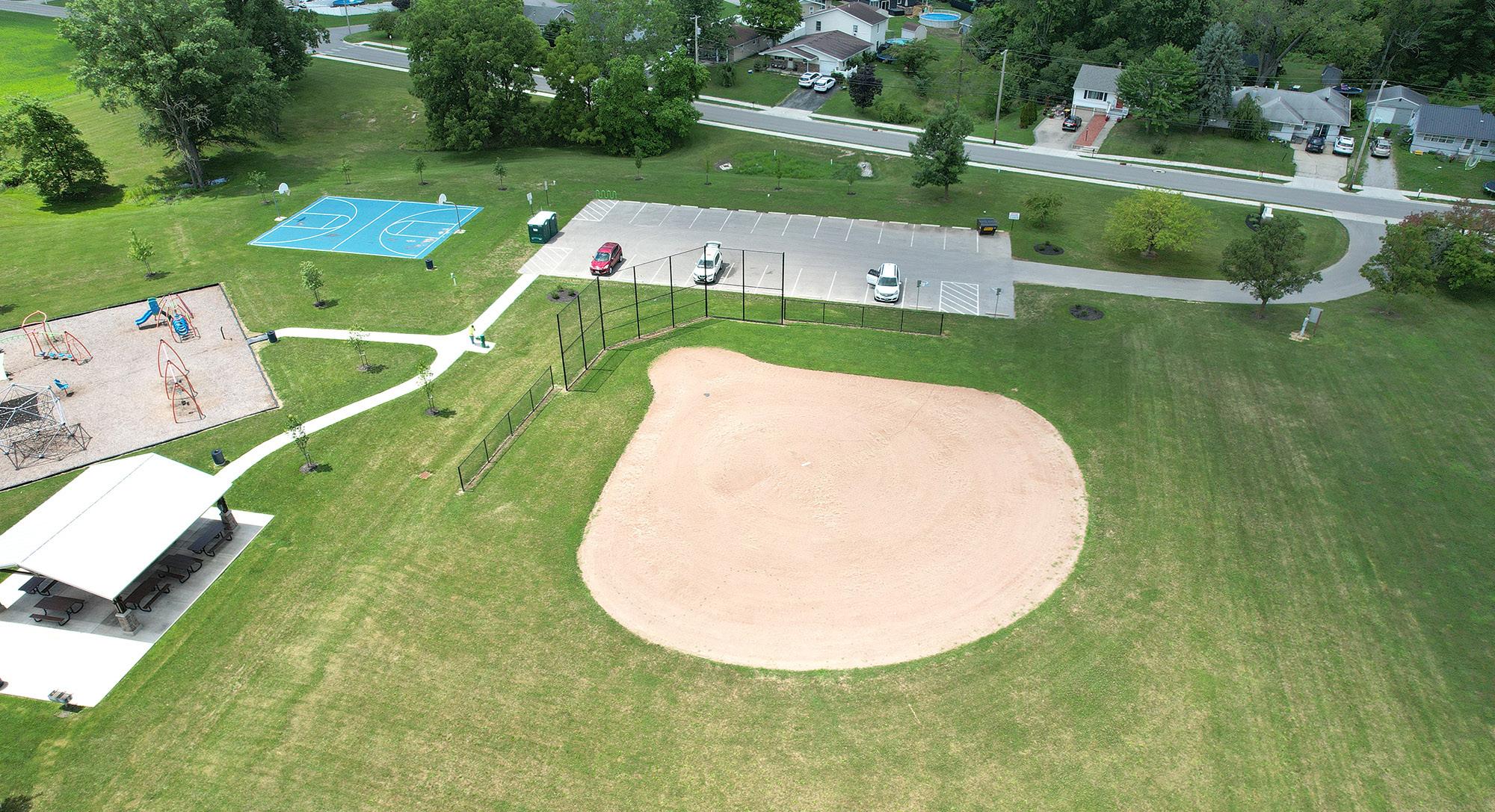
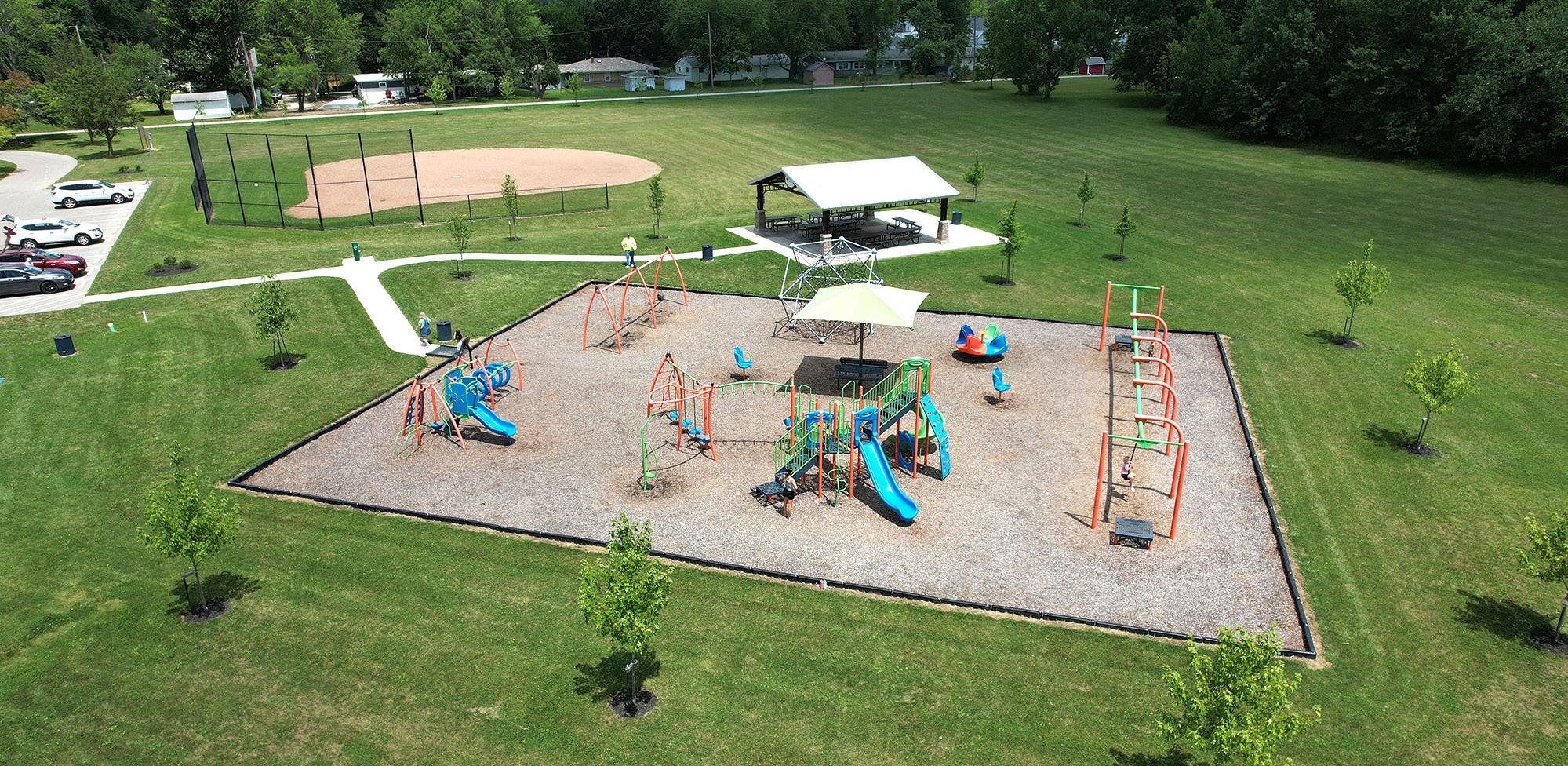
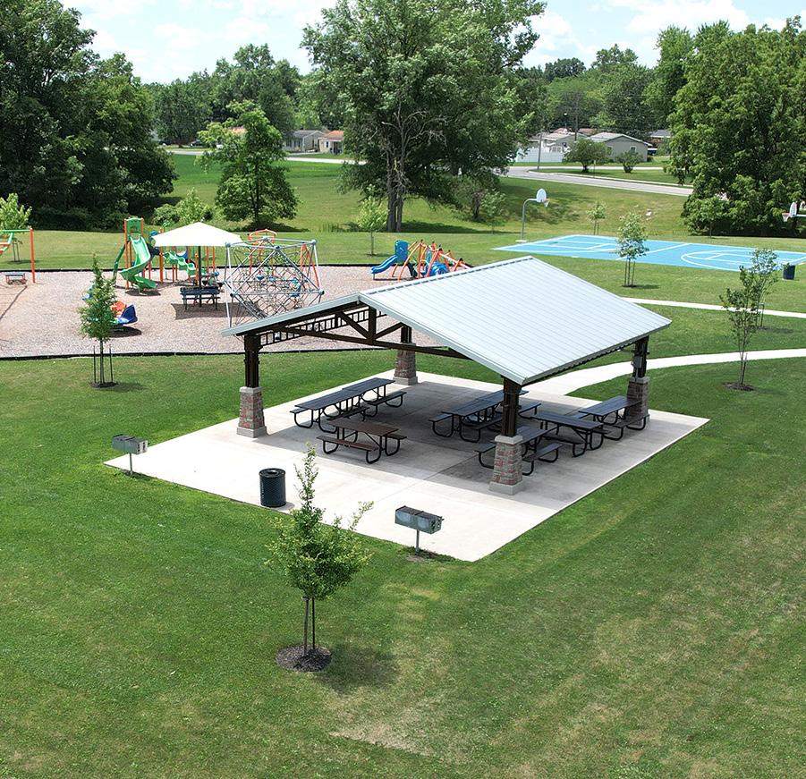
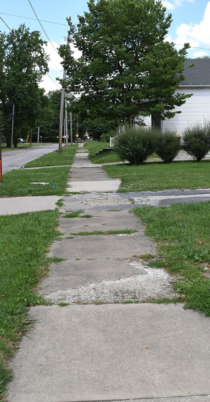
Formerly known as Compo Park, Eastside Park is located southeast of downtown Defiance and nestled in a residential area. It features a blend of open green spaces and recreational facilities. Its quiet, shaded areas and walking paths offer a serene setting for a leisurely stroll or moment of reflection. A swale is also located south of the play areas.
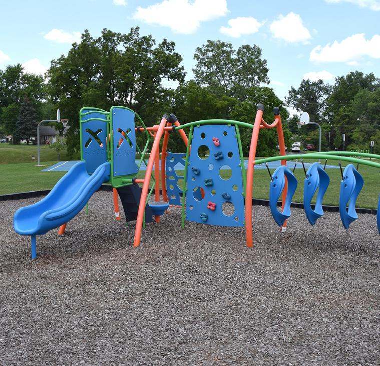
Over the last five years, as part of the Eastside Neighborhood Revitalization Project, the park has been re-energized with new playground equipment, a basketball court, ball diamond, and shelter house. Playground structures are included for both 2-5 and 5-12 age ranges. The park has also been connected to neighborhoods on the east side of Ottawa Avenue through the construction of a multi-use path.
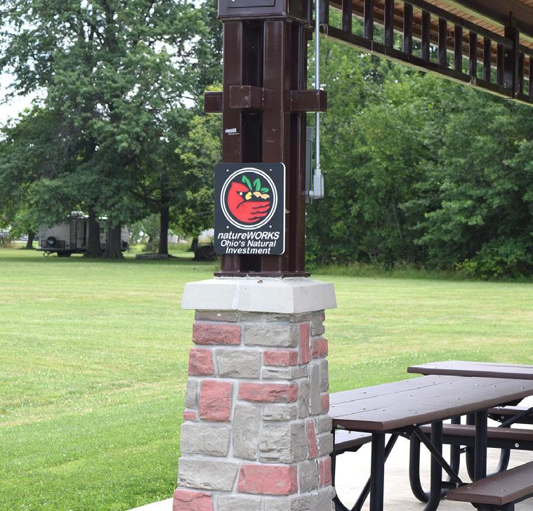
An Ohio NatureWorks Grant was secured and paired with Community Development Block Grant (CDBG) monies
STRENGTHS
• Accessible by vehicles, sidewalks, and pedestrian / bicycle trails
• Shelter house rentals
• Electricity and water are available on site
• Adjacent to residential trail
• Open space available
PARK AMENITIES/FACILITIES
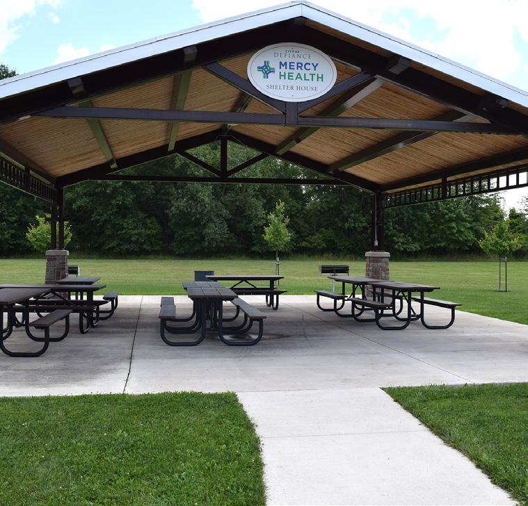
and State Capital Appropriations along with donations from Mercy Health to help fund recent improvements within this park.
LIABILITIES
• Playground does not include an accessible safety surfacing
• Does not have a permanent restroom facility
BASEBALL
OTTAWA AVE
" We love Eastside Park and the updates. We have kids from young to older, so the basketball courts at both Eastside and Bronson help."

PARK SIGN
RAIN GARDEN
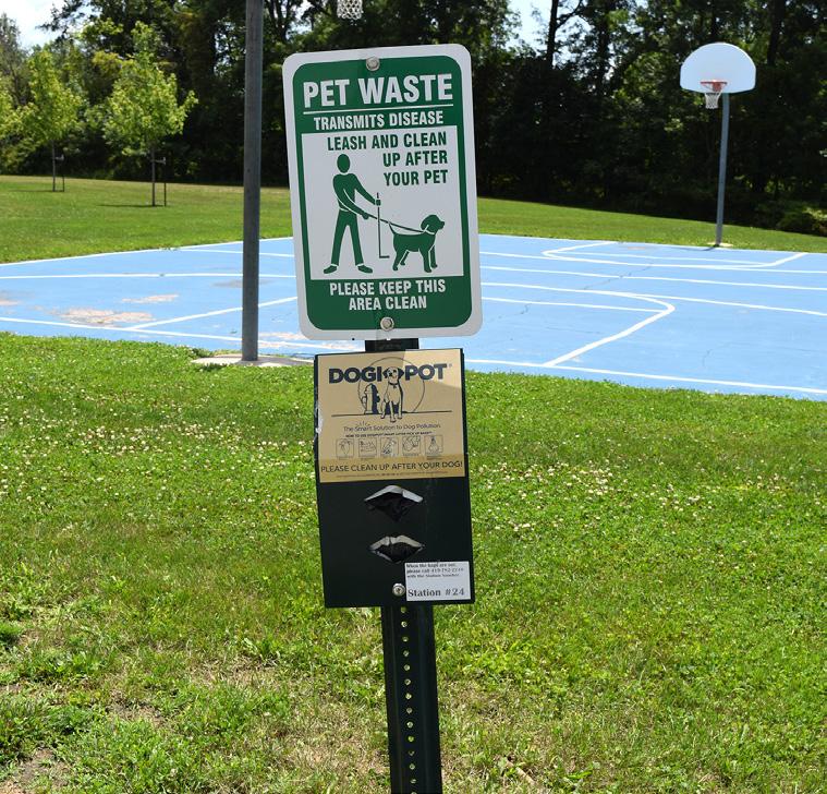
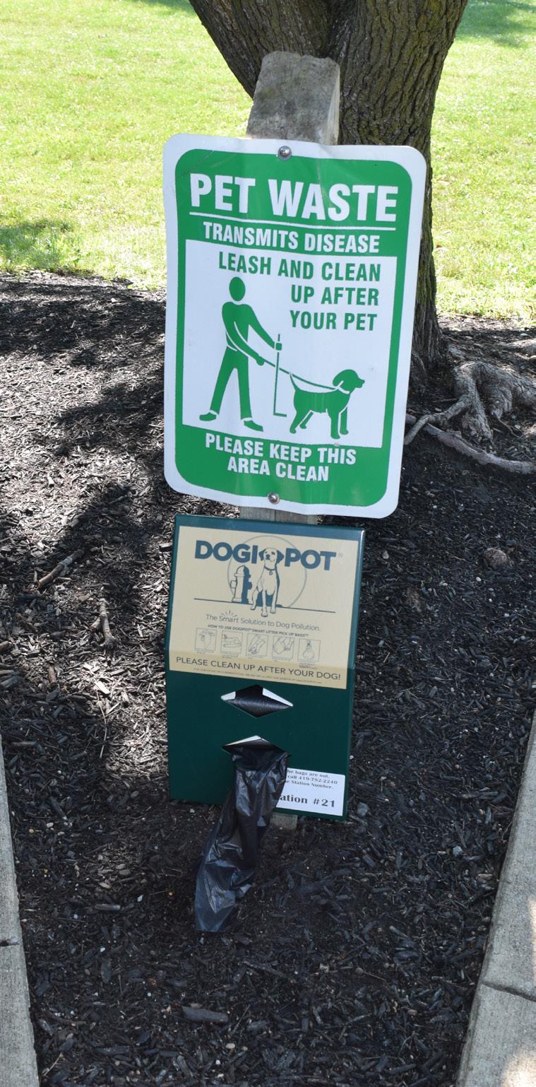
DOG WASTE STATION
"[Eastside Park] is a great park and has adequate shade for kids."
SHELTER HOUSE
NATUREWORKS PLAQUE
AERIAL VIEW OF PLAYGROUND
AERIAL VIEW OF SHELTER HOUSE
UNDEVELOPED ENTRY DRIVE
BASEBALL / SOFTBALL FIELD
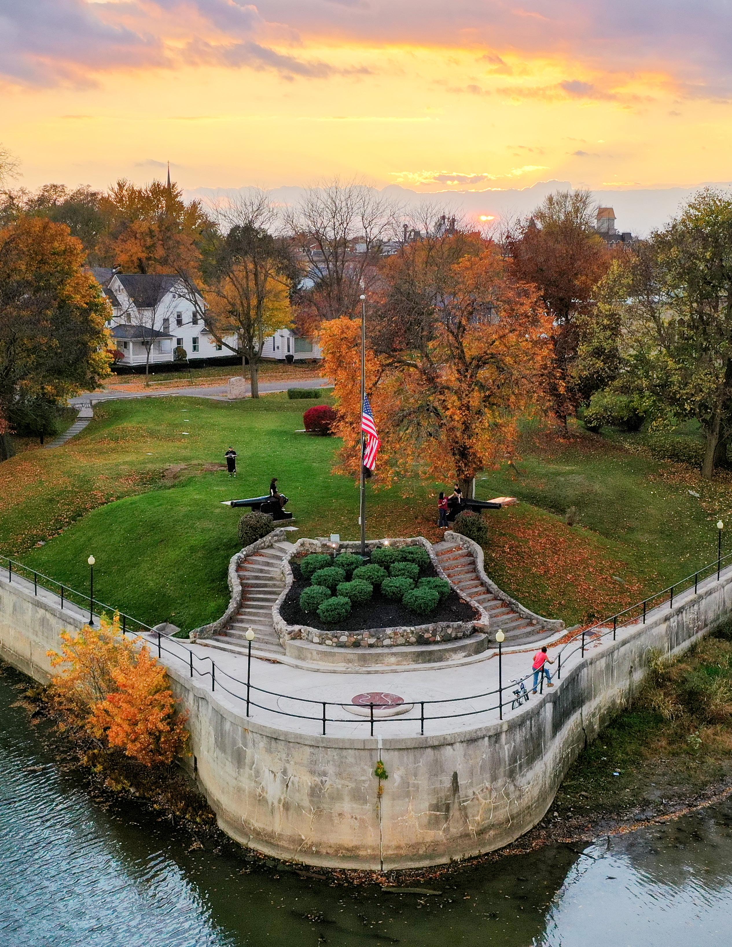
Natural & Structural Resources: FORT GROUNDS
Passive Moderate Community Park Good Mostly Accessible
Fort Grounds is a historically significant site that commemorates the City's rich heritage. Located at the confluence of the Maumee and Auglaize Rivers, this area was once home to Fort Defiance, a key military outpost during the Northwest Indian War. Today, Fort Grounds serves as a public park and a reminder of the region's strategic importance in American history.
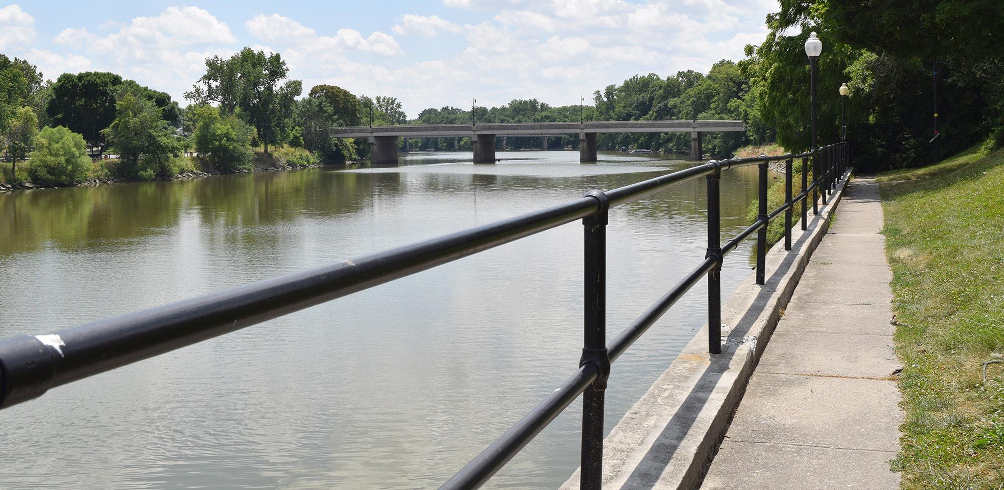
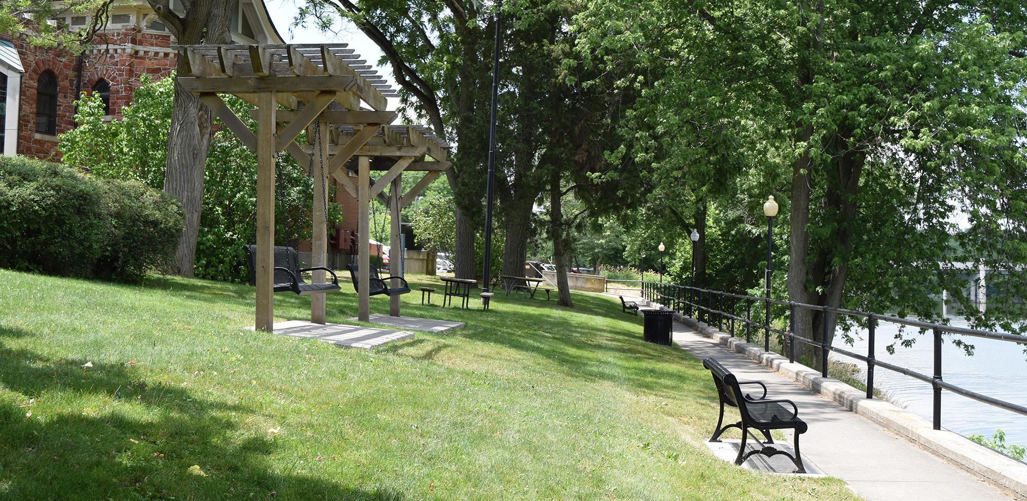
The park features well-preserved remnants of the original fort, along with informative plaques and markers that educate visitors about the area's history. The serene environment, with its mature trees and scenic river views, provides a peaceful setting for reflection and exploration. Walking paths wind through the grounds, allowing visitors to take in the historical significance while enjoying the natural beauty of the location.
Among the historical markers is the grave of Johnny Logan, a Native American boy that joined American forces during
STRENGTHS
• Has electricity and water on-site
• Part of Ohio's Buckeye Trail and the North Country Trail
• Direct access to the Maumee River
• City property available to the south and west
• Strong historical significance
• Adjacent to library
• Property provides fantastic views of confluence
the War of 1812. He is the first Native American buried with full military honors in Ohio.
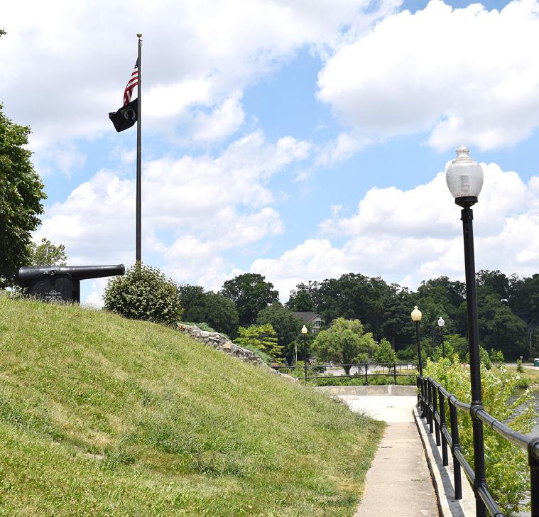
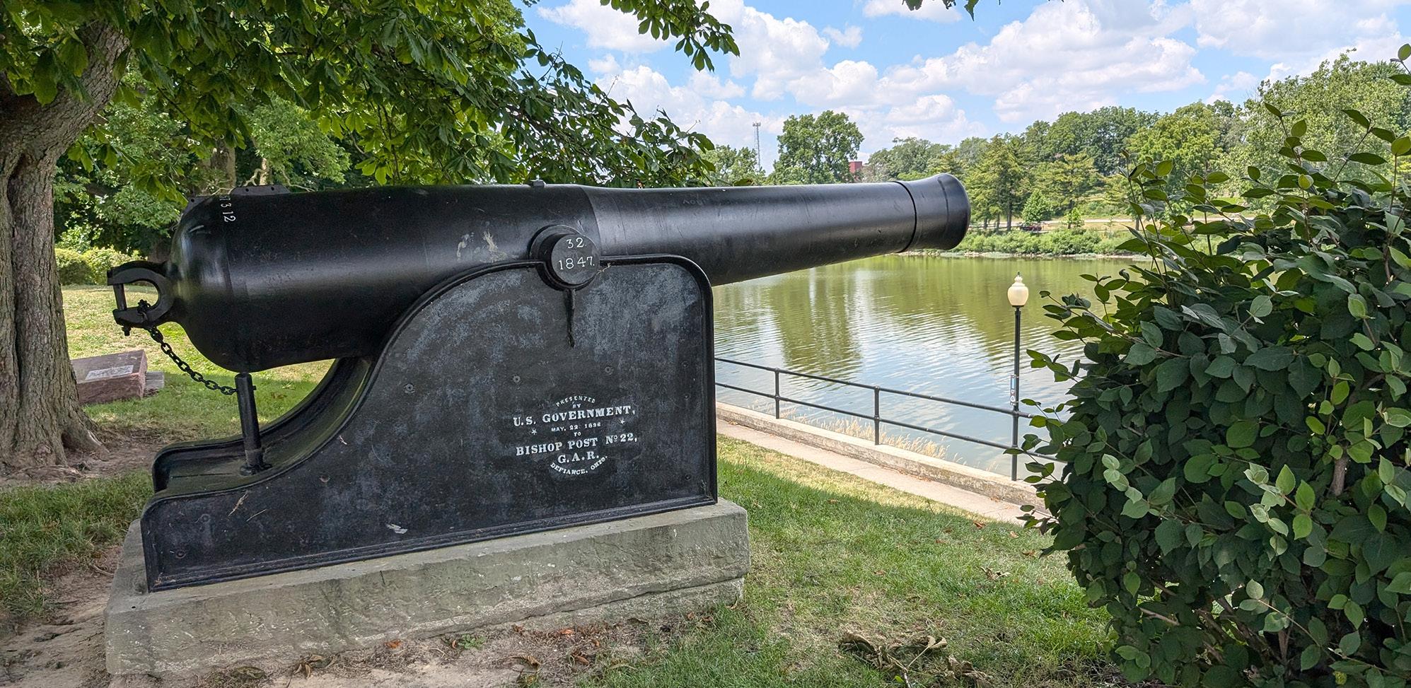
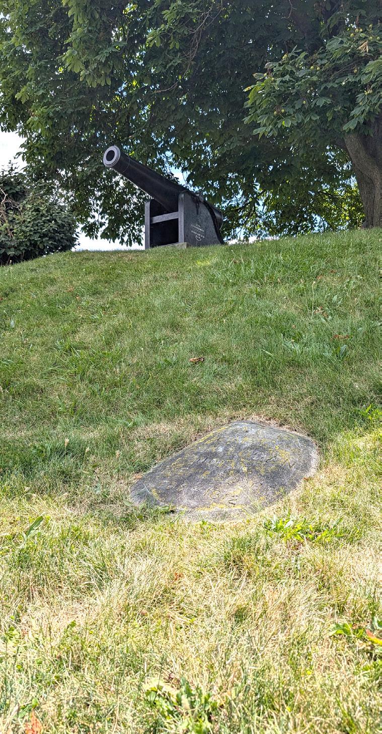
The Union sieged the canons from Confederate North Carolina and the US Government bequeathed them to Defiance in 1896. The original home of the canons was in Triangle Park with the Grand Army of the Republic statue, but they were moved to Fort Grounds in 1936.
A flood pole is located at the park, marking the 1913 flood that devastated Ohio. It also records significant floods that have occurred since. Additionally, the survey for all land north to Canada begins at the flagstaff marker within this park.
The Defiance Public Library, a Carnegie Library, is also located on the Fort Grounds, where it hosts the annual "Art in the Park" event every year.
LIABILITIES
• Potential for flooding events
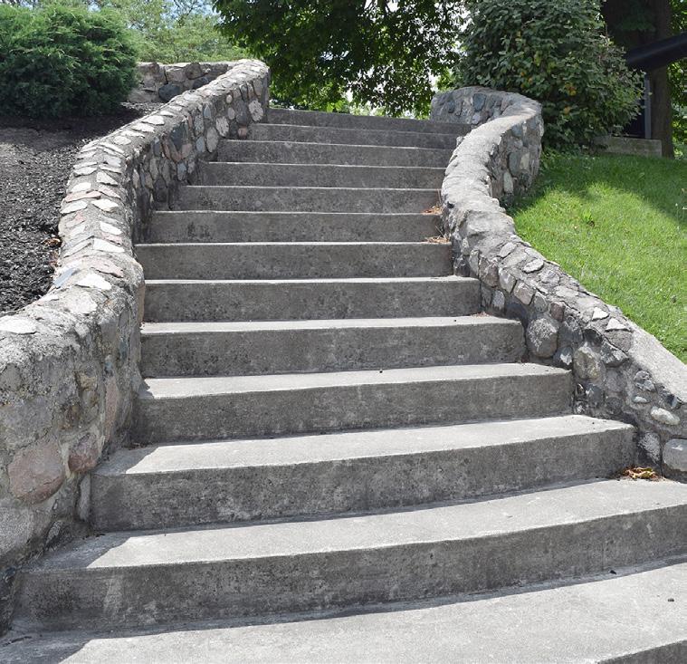
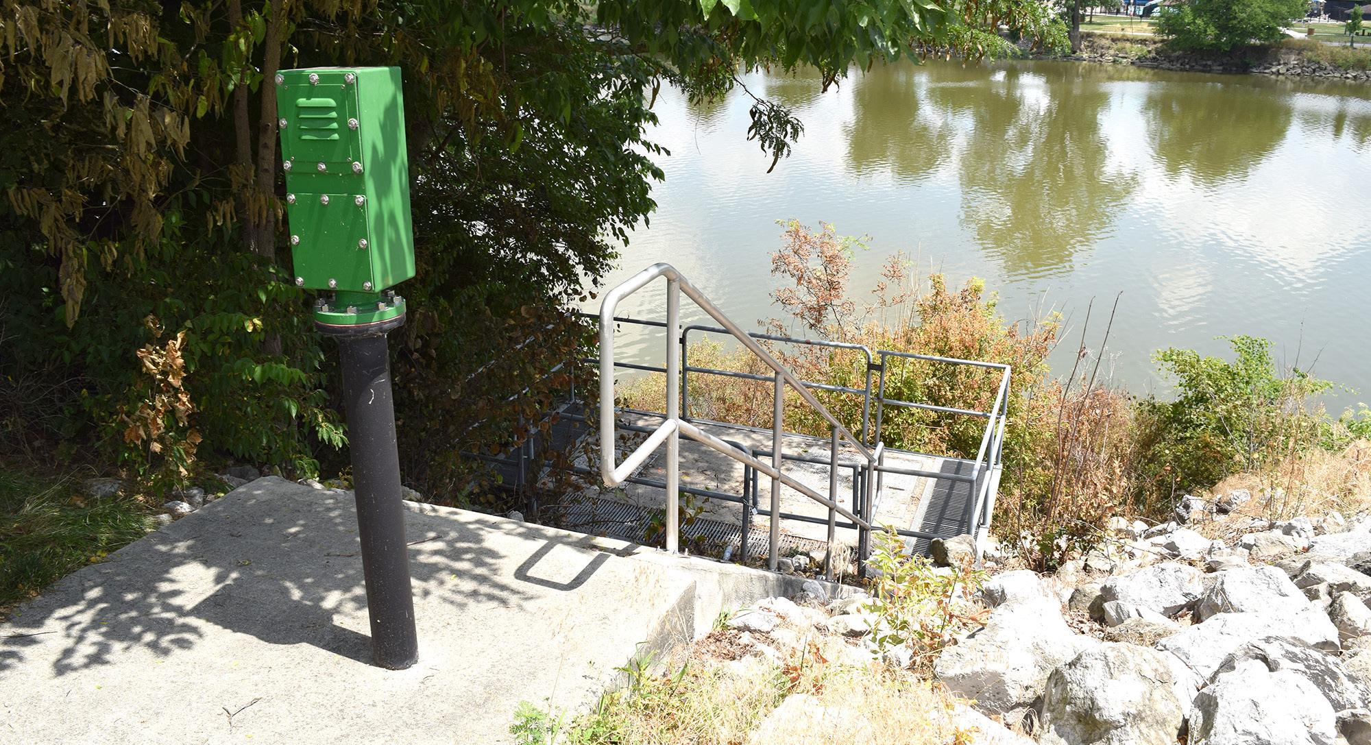
• Deteriorating stairs leading to the river
• Lack of accessible river access
• Lack of accessible routes to monument
• Historic archaeological limitations
• Retaining wall
MAUMEE RIVER

"The area around the library is beautiful. I love all the swings and peaceful areas to just sit."
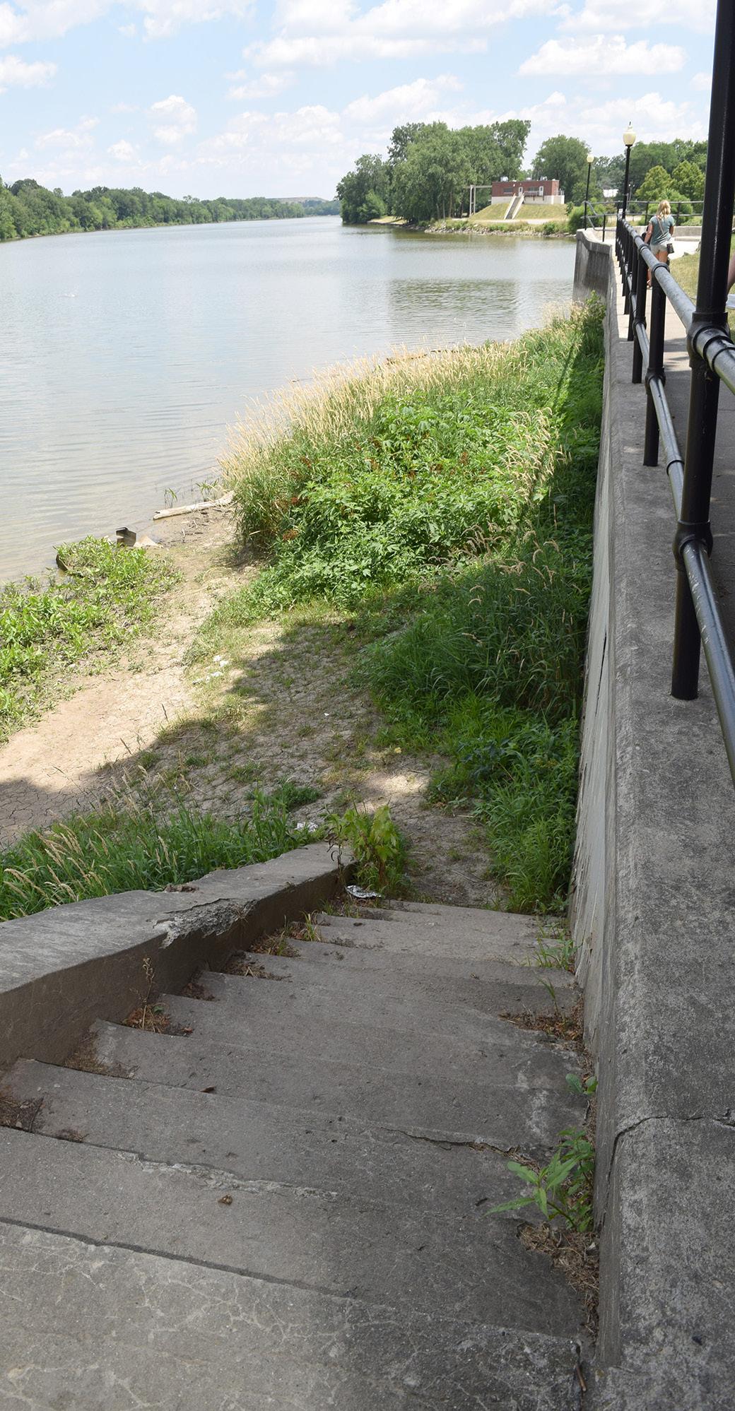
WALKWAY ALONG RIVER
WALKWAY ALONG RIVER
STAIRS TO RIVER ACCESS
"My wife and I walk in the morning. The promenade around the Fort Grounds provide stunning views of the rivers, the shore lines, and sun rises. Beautiful and inspiring"
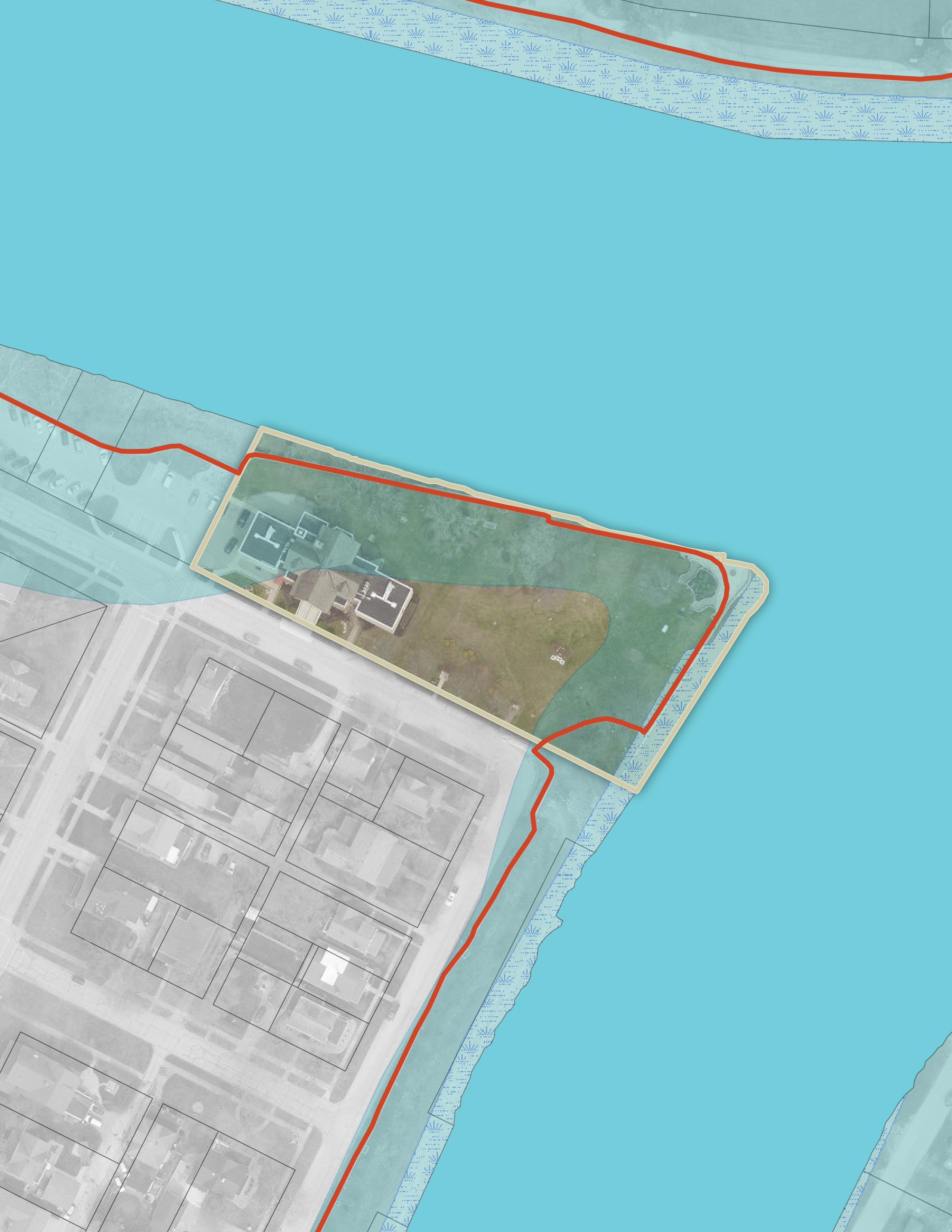
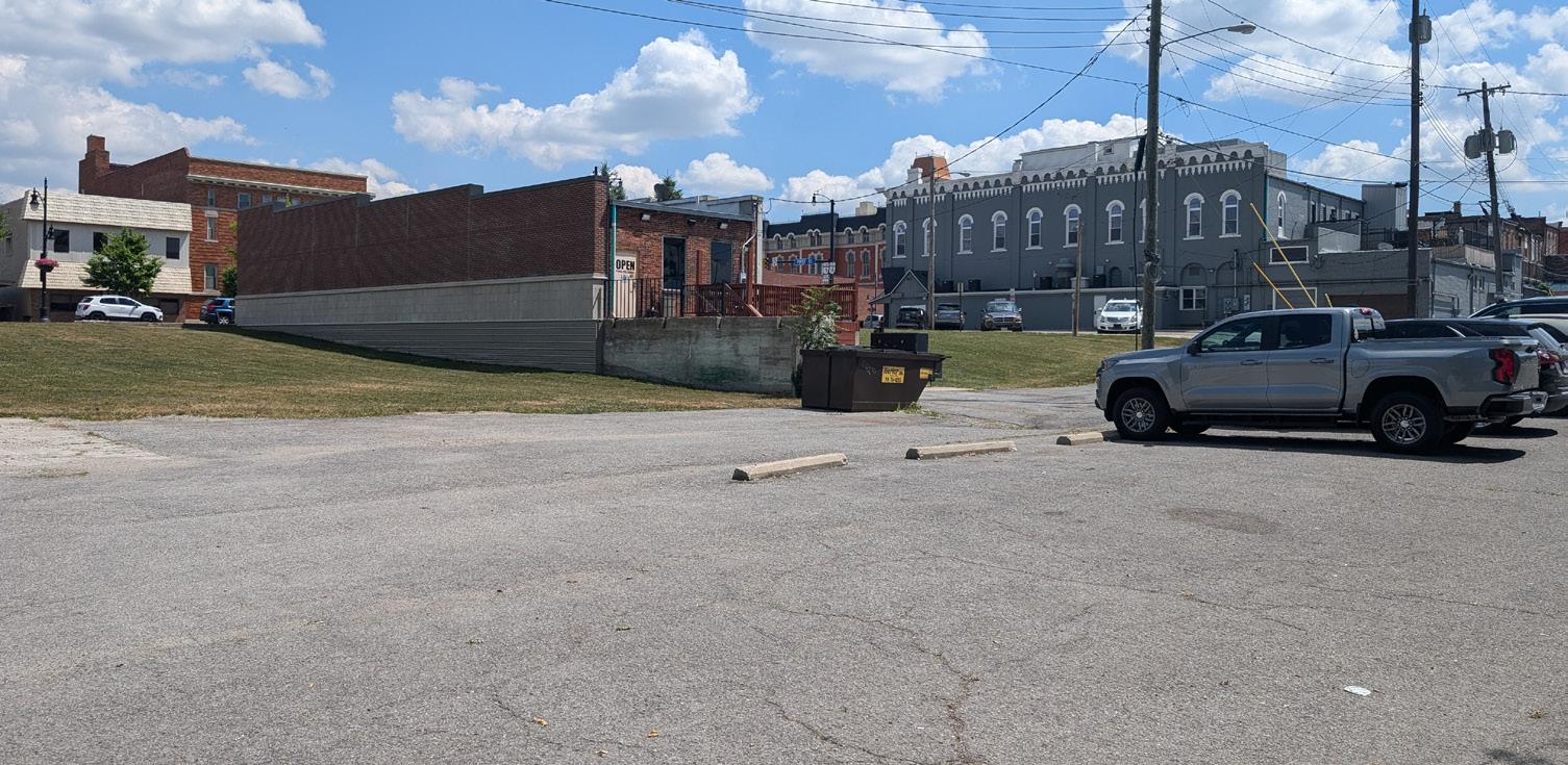
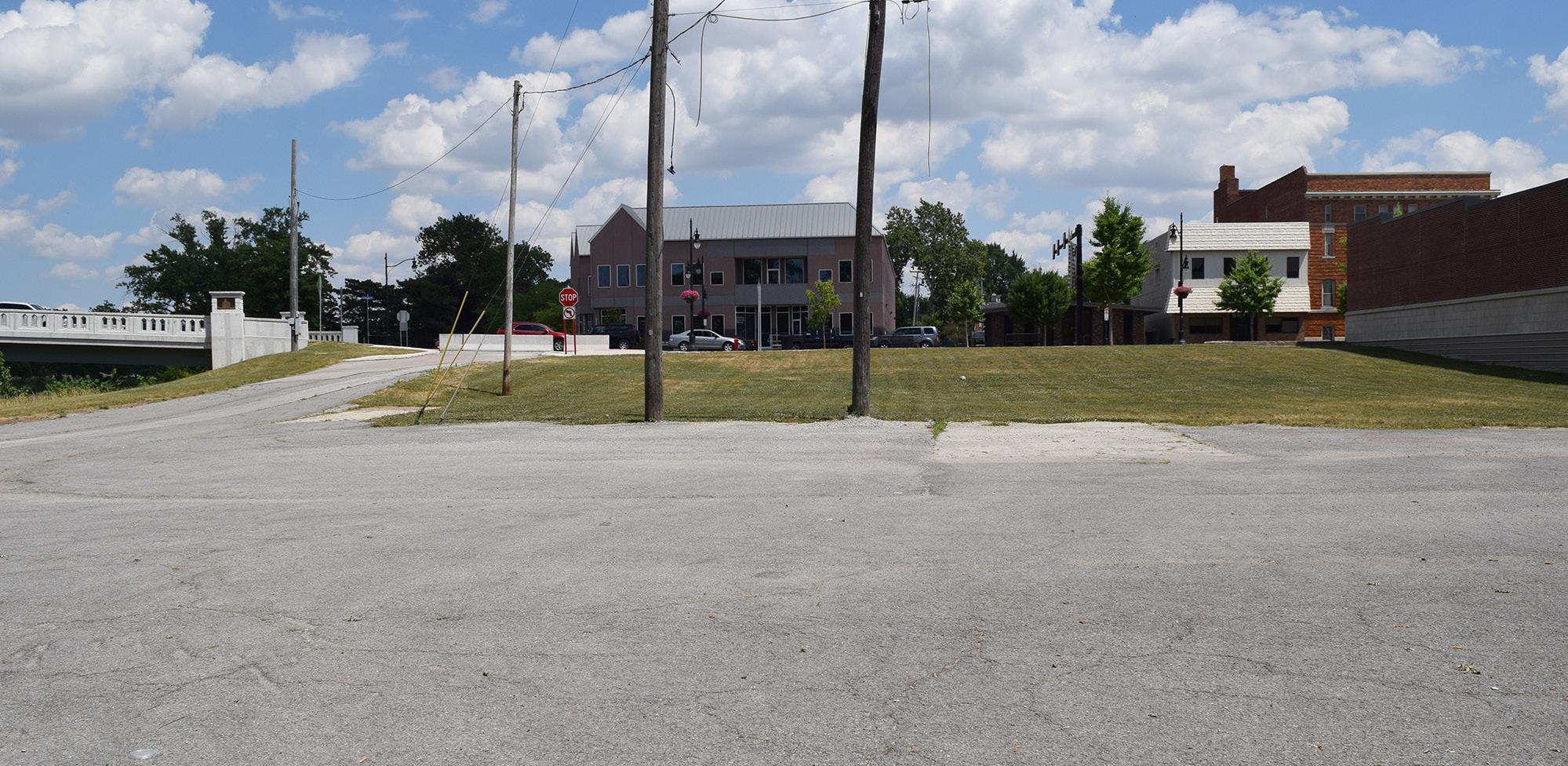
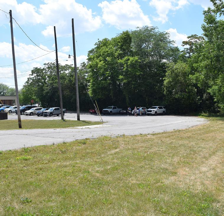
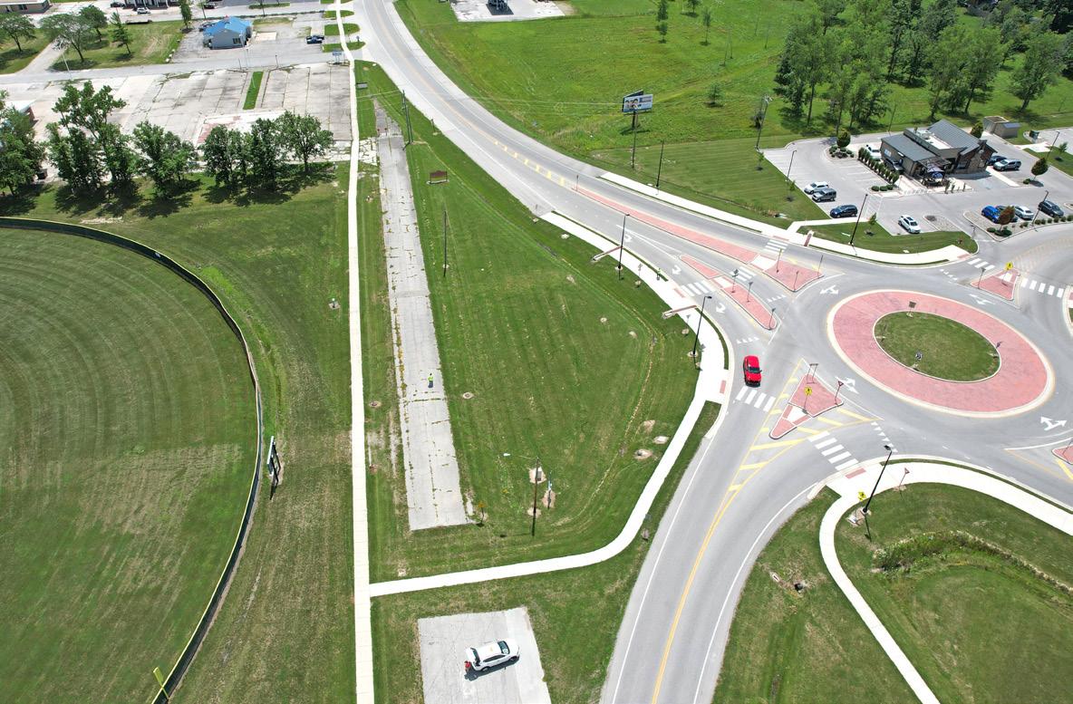
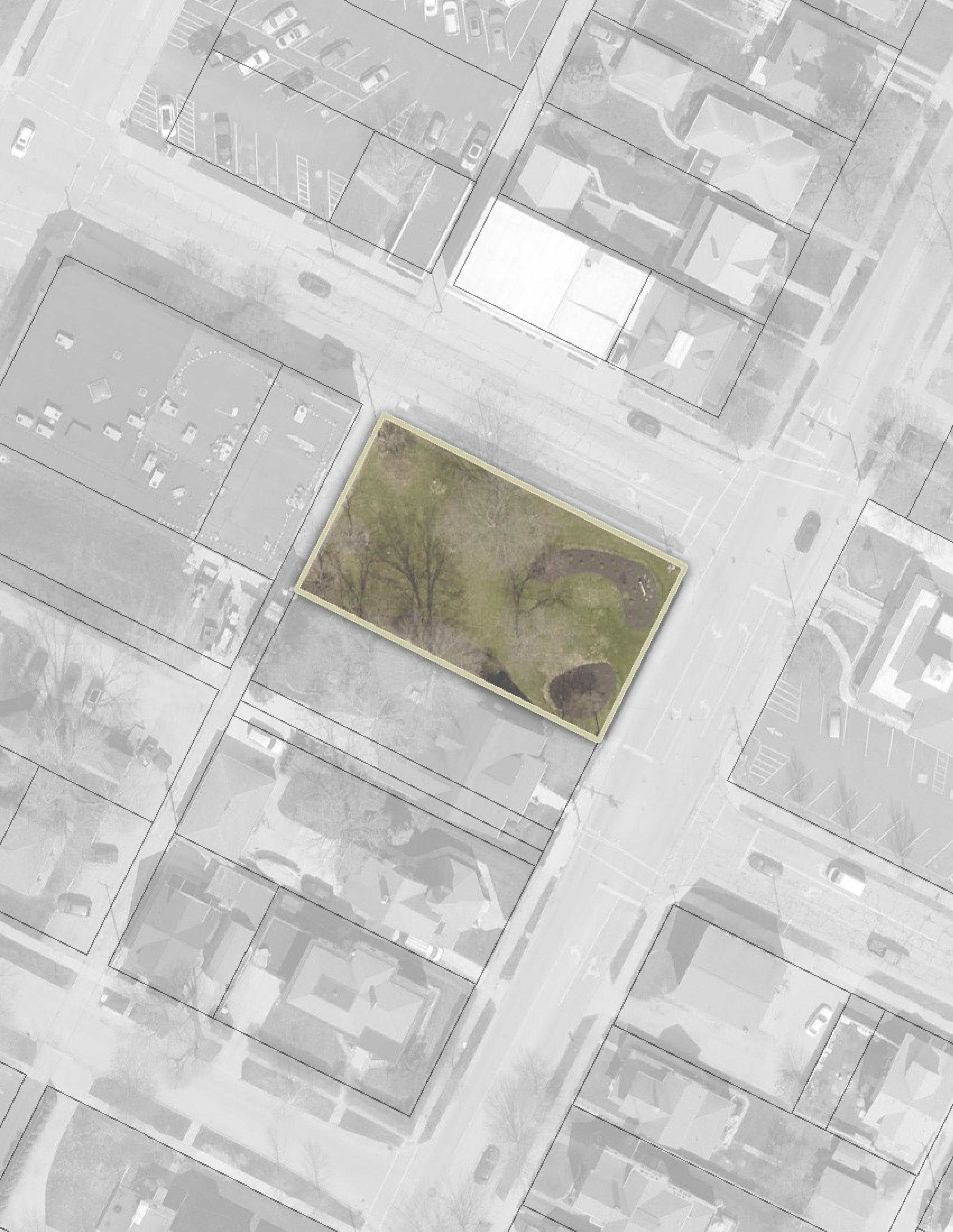
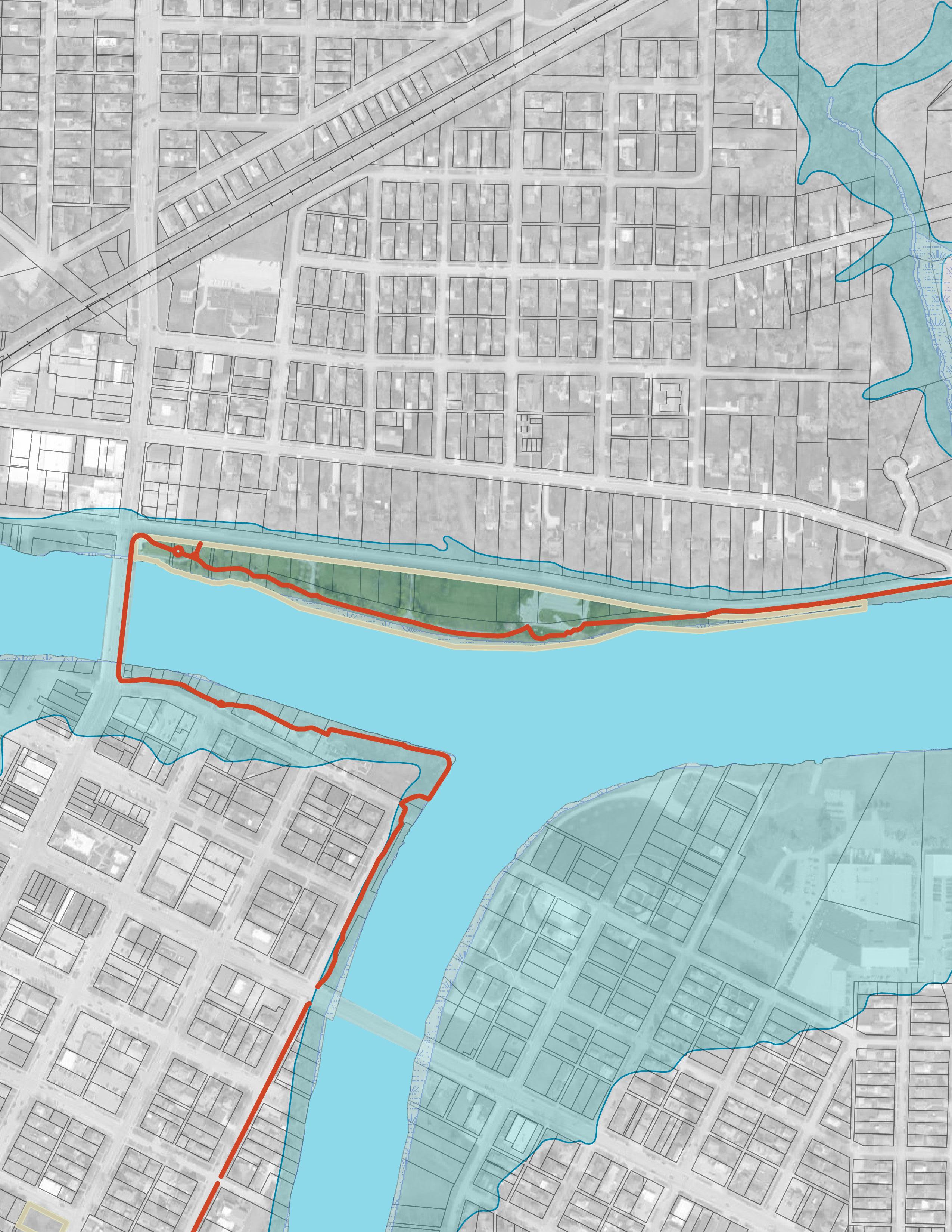
Natural & Structural Resources: GATEWAY PARK
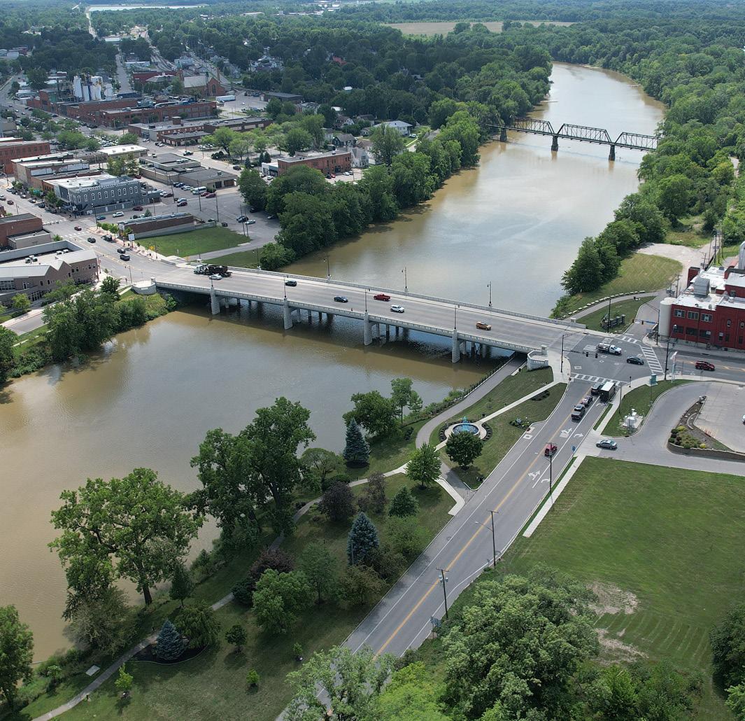
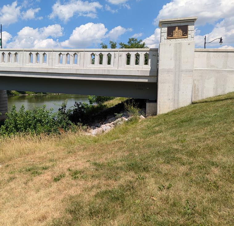
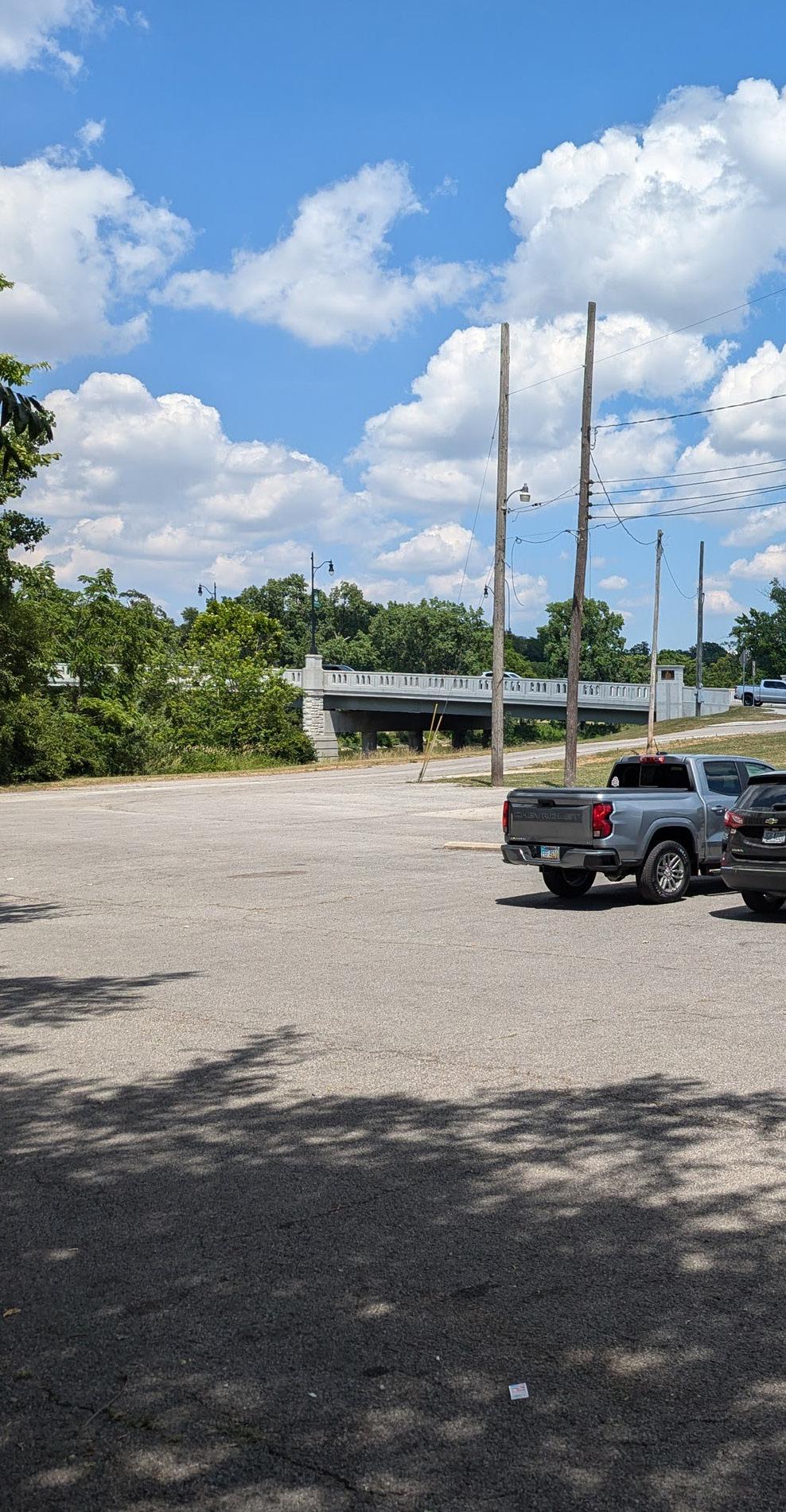
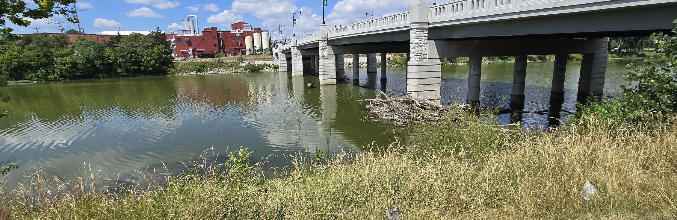
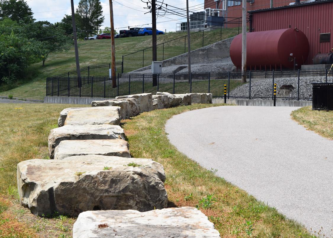
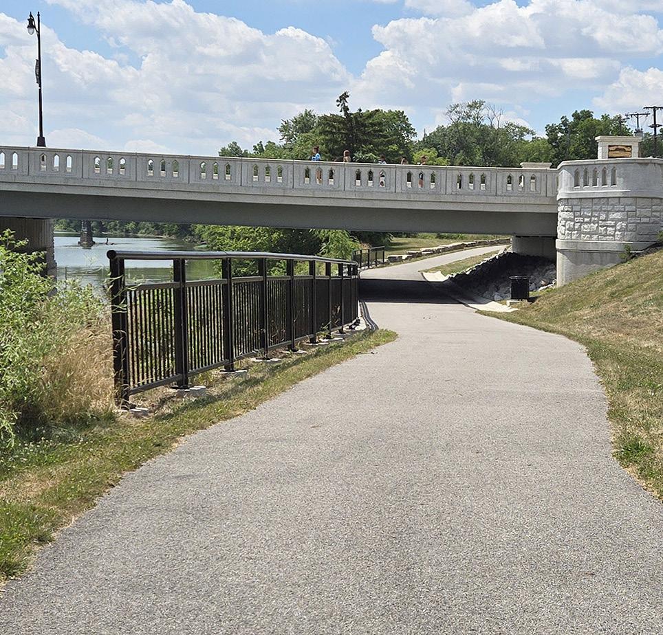
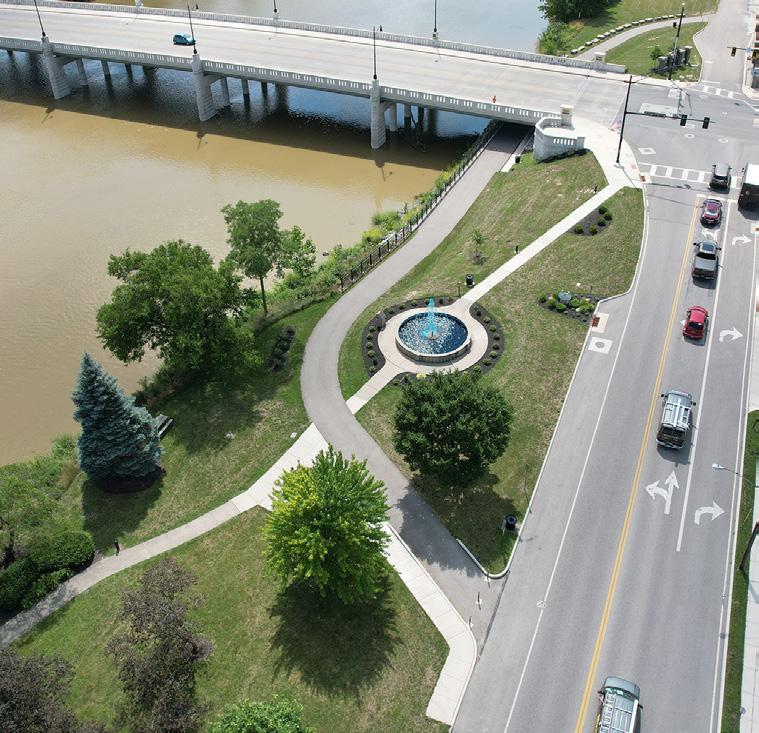
Located just west of the Purple Heart Bridge in downtown Defiance, Gateway Park is an undeveloped piece of land along the Maumee River. Due to its prime location along the river and close proximity to Fort Grounds and Pontiac Park, Gateway Park has the potential to become a significant space as you enter downtown Defiance.
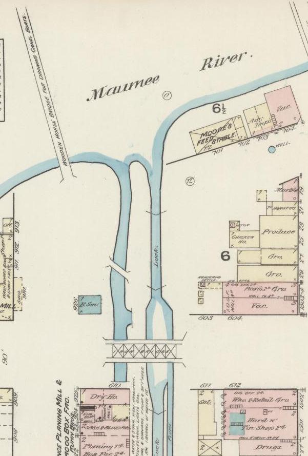
Historically, this was the location that the Miami and Erie Canal entered downtown. There are remnants of Canal Guard Lock 39 and the old mule bridge underneath the asphalt.
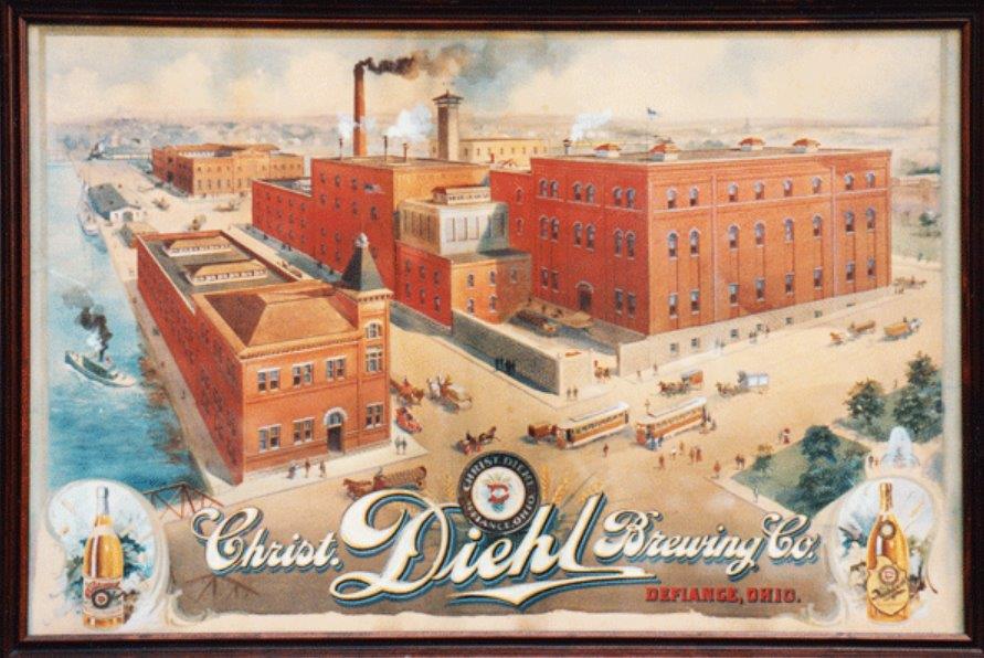
The Diehl Brewing Company historically sat on the north side of the Maumee River. Christian Diehl moved to Defiance in 1870 after gaining experience as a brewmaster throughout the United States and Germany. Within one year of employment, Diehl acquired enough shares in the company to achieve part ownership and eventually purchased the establishment in 1885.
STRENGTHS
• Has the potential to be a true gateway into downtown
• Accessible by vehicles, sidewalks, and waterways
• Lot has electrical access at 1st and Clinton Streets
• Riverfront access
• Sidewalk connections into downtown
The most popular beer distributed by the brewery was the Centennial Beer, specifically created to celebrate the 100th anniversary of Fort Defiance. The bottle featured artwork of General Wayne at the Battle of Fallen Timbers. With the onset of Prohibition, the Diehl family strategically switched from the production of beer to condensed milk. The condensed milk factory remains a staple of Defiance's industrial portfolio.
LIABILITIES
• Potential for flooding events
• Log jam forming at bridge
• Vehicular circulation challenges as Clinton Street is a prominent roadway
DR
MAUMEE RIVER
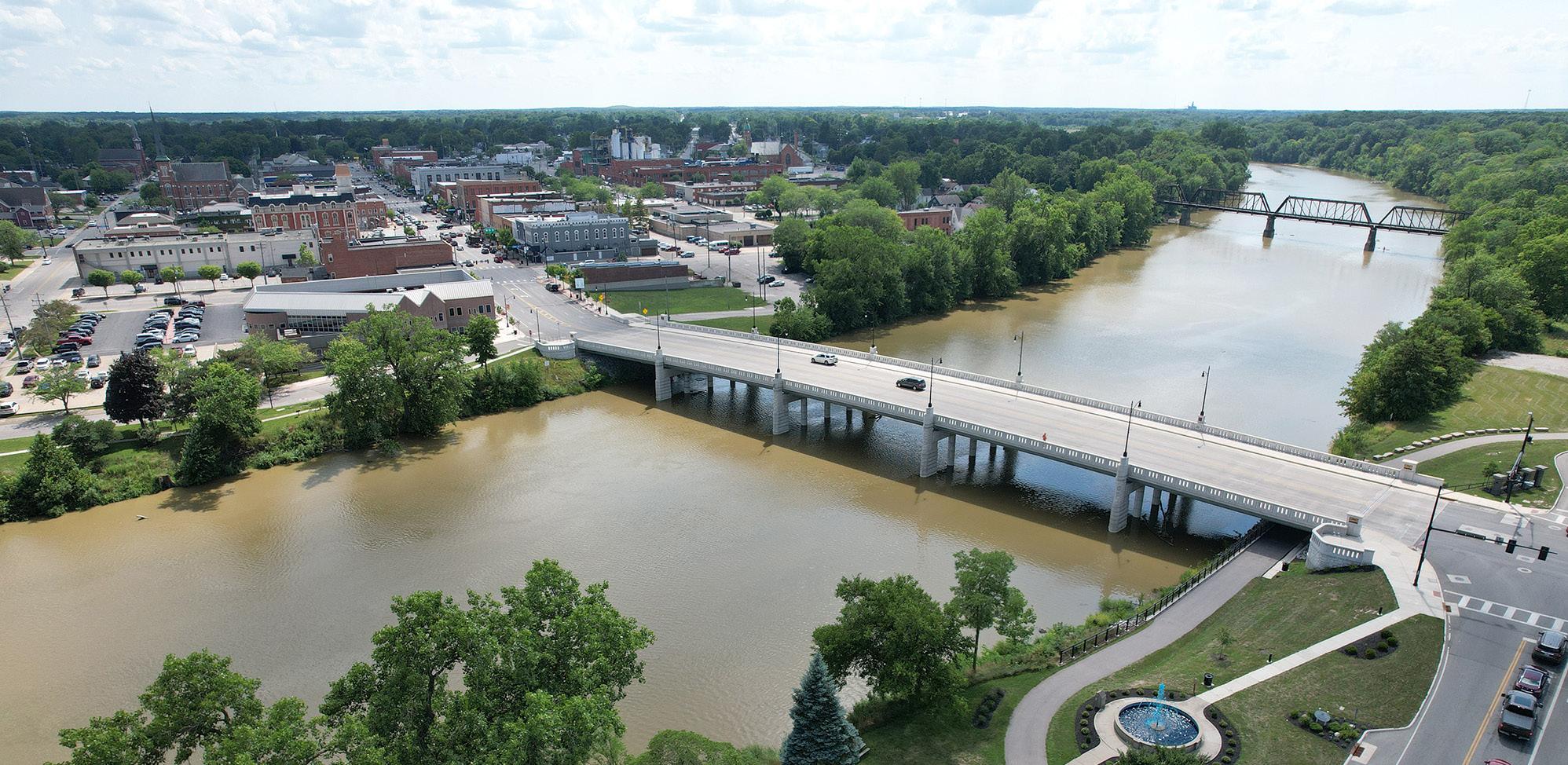
AERIAL VIEW
RIVER ACCESS
NORTHEAST VIEW
AERIAL VIEW
BRIDGE / RIVER ACCESS
"I would like to think of the downtown space near Clinton Street bridge as an area of outdoor concerts / music events with food vendors and boat parking on the river."
LOOKING EAST ACROSS PARKING LOT
VIEW WEST FROM NORTHERN PARK
NORTHERN TRAIL
NORTHERN TRAIL UNDERPASS AT CLINTON ST
PARKING LOT
VIEW LOOKING SOUTH
SOUTHWEST VIEW
Natural & Structural Resources:
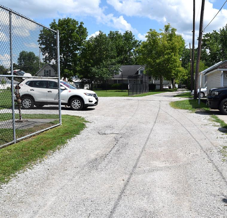
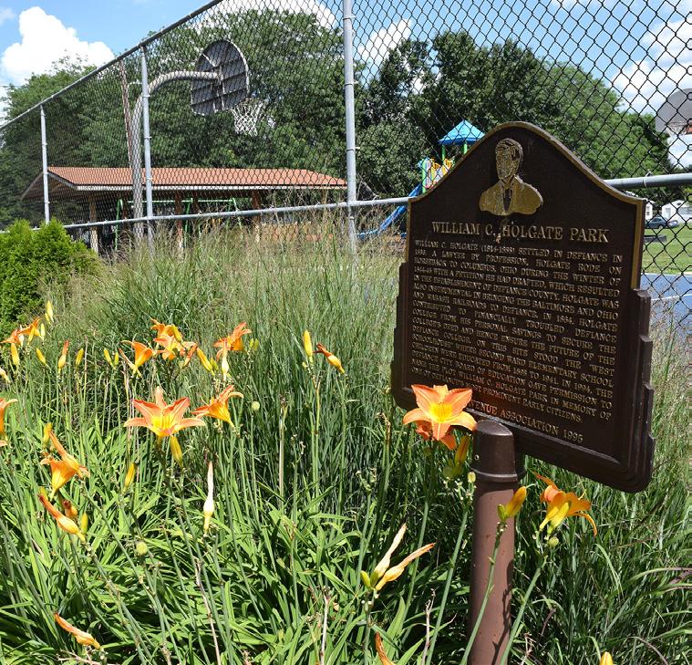
HOLGATE PARK
Passive / Active Moderate Community & Neighborhood Park Fair Limited Accessibility
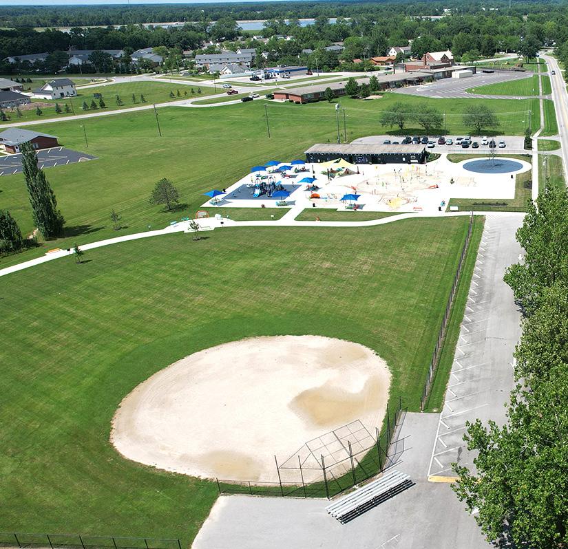
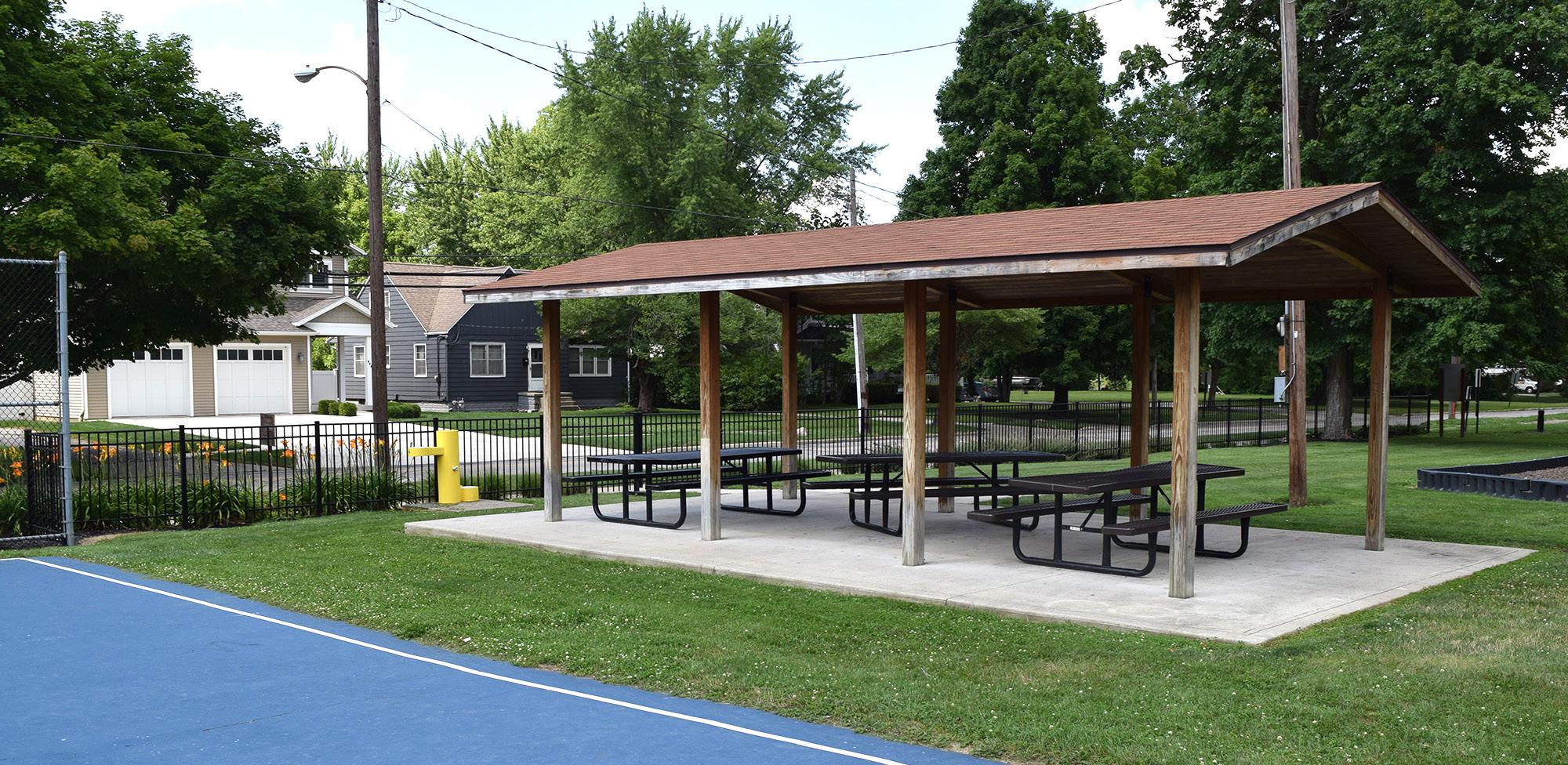
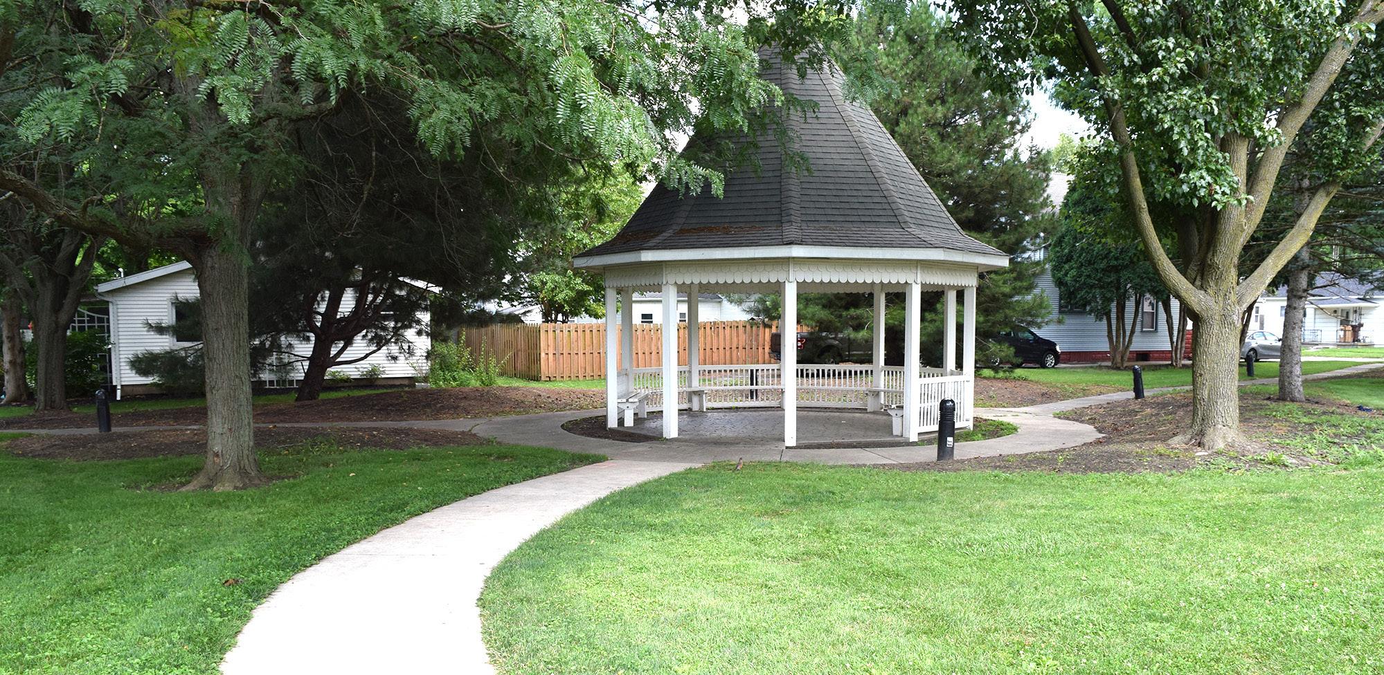
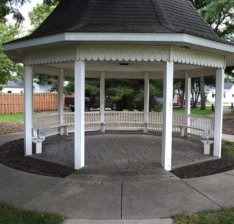
Holgate Park, located just west of downtown Defiance, is a neighborhood park enjoyed by families of all ages. The park occupies the former site of the Second Ward School, which was demolished in the 1940s. In 1994, the Defiance City Board of Education gave permission to name the plot William C. Holgate Park, in memory of one of Defiance's most prominent early citizens who was instrumental in the establishment of Defiance County. The park includes a recently renovated basketball court, along with new playground equipment, landscaping, and a shelter house installed in 2019. Fencing for a baseball diamond exists, but the ball field itself needs to be redone.
STRENGTHS
• Shelter house rentals
• Open space available
• Quality basketball court
• Proximity to neighborhoods with sidewalk connections
Adjacent to the playground is a gazebo with interior lighting, perimeter seating, and stamped concrete floors. Nestled among mature trees and connected by pathways to the playground and nearby sidewalks, lighted bollards illuminate the pathways to and from the gazebo and memorial blocks are embedded into the concrete walkway.
The site is accessible by both vehicles and sidewalks, and historical signage is located along Holgate Avenue.
LIABILITIES
• Parking lot needs paved
• Does not have a restroom facility
• Needs additional routes to play structures
• Ball field needs redone
• Gazebo needs renovated
• Need shade structure for playground area
• Playground does not include an accessible safety surfacing
PARK AMENITIES/FACILITIES
MAUMEERIVER
LEGEND
Wetlands 100 Year Flood Plain Park Limits
KENTNERST
PLAYGROUND
BASEBALL / SOFTBALL
SHELTER HOUSE #1
BASKETBALL COURT
PARKING
GAZEBO
HOLGATEAVE
HARRISONAVE
DAVIDSONST
"Holgate [Park] is fenced behind the basketball rim, and surrounded by friendly neighbors that makes it feel safe for my kids to go to."
AERIAL VIEW
PARKING AREA
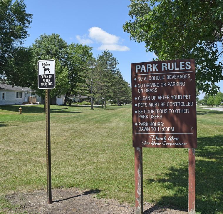
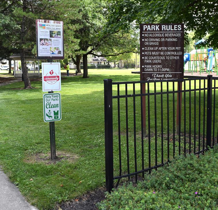
PARK RULES
WALKWAY
SIGNAGE & LANDSCAPING
SHELTER HOUSE
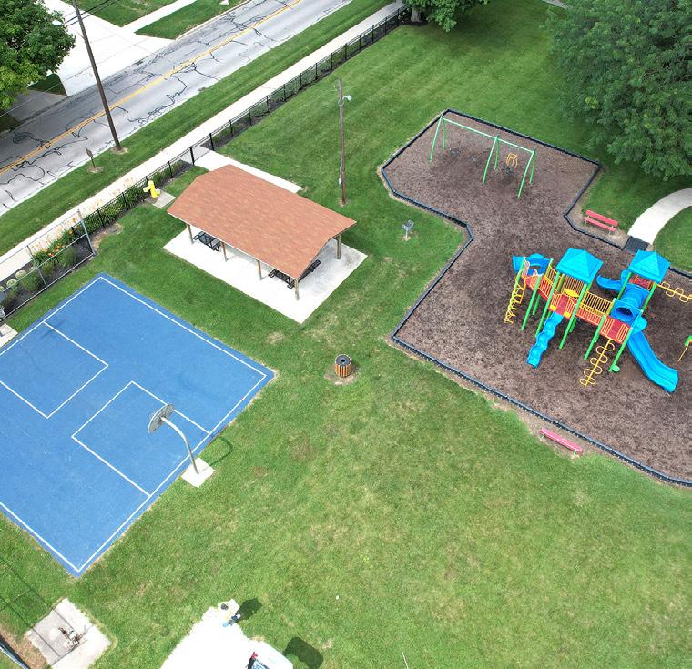
"Holgate Park, is the closest to me. I walk my dog there a few times a week."
GAZEBO
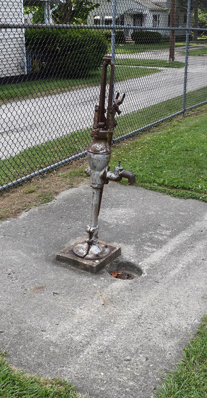
PUMP
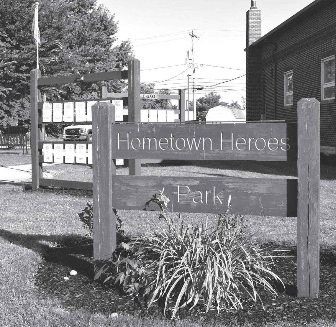
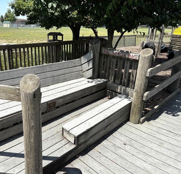
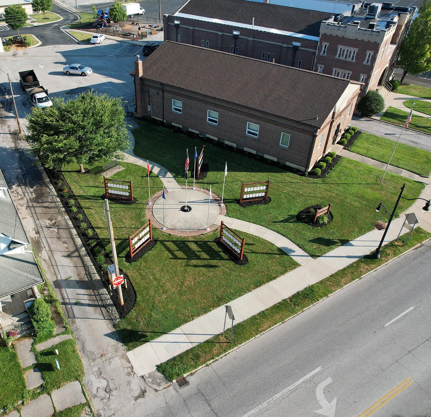
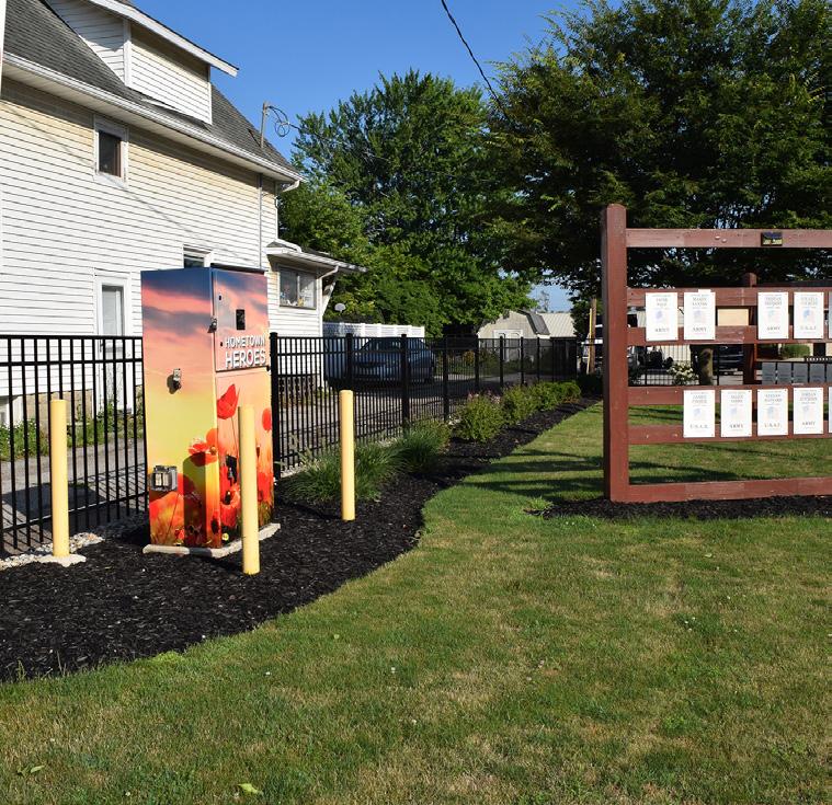
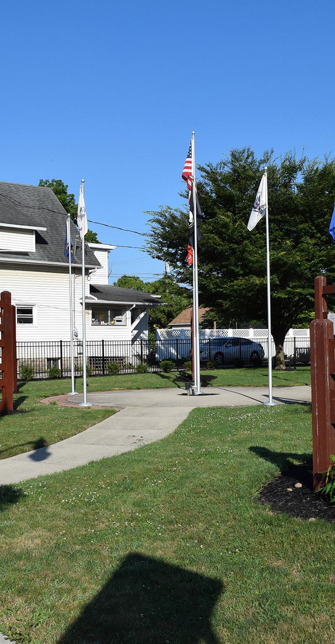
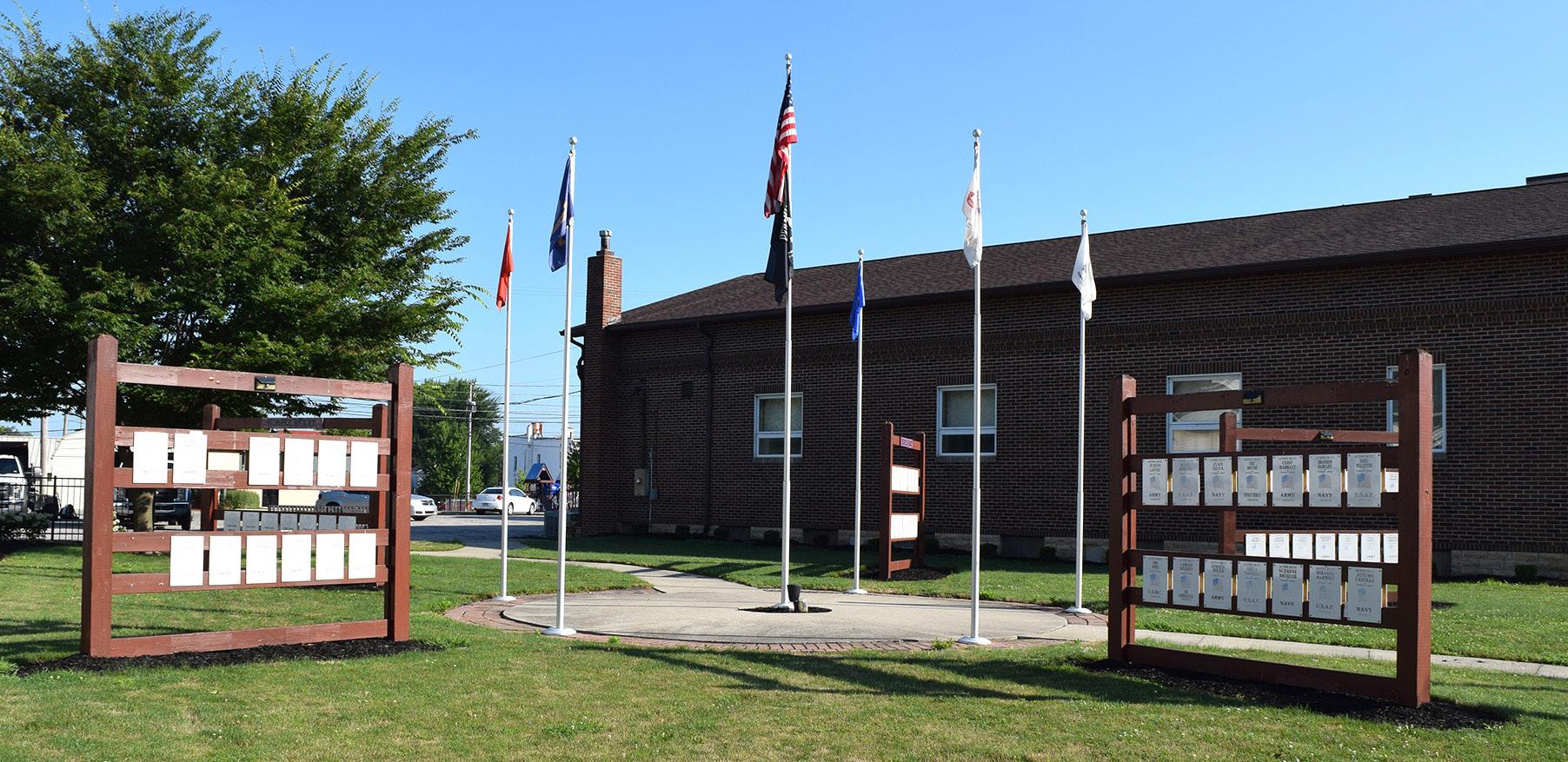
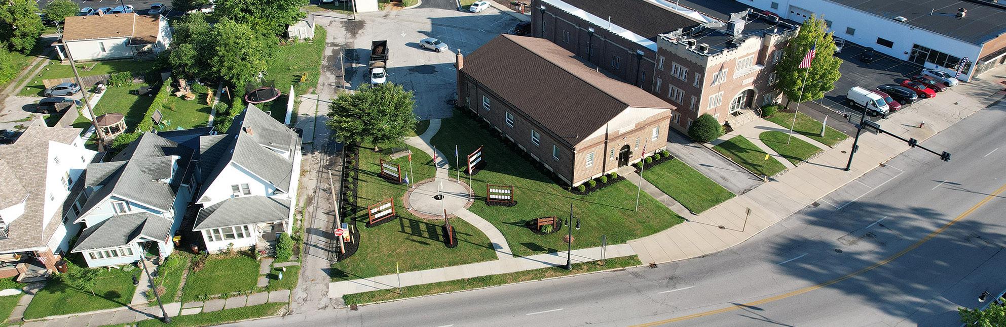
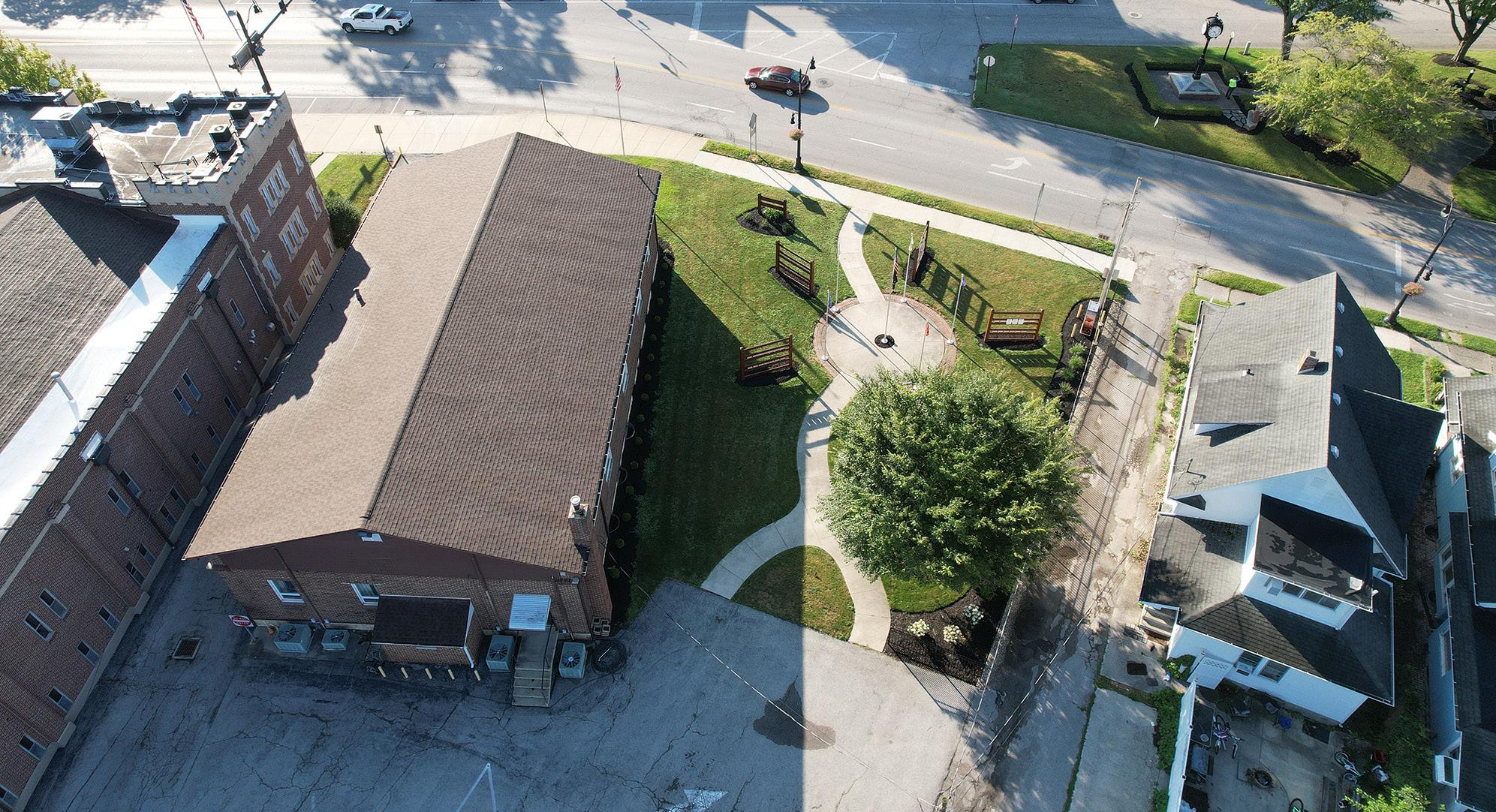
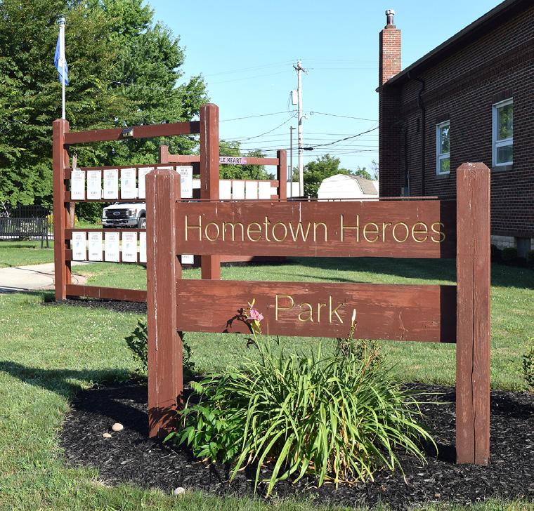
HOMETOWN HEROES PARK
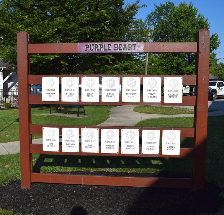
Established in 2013 as a tribute to local veterans and community heroes, Hometown Heroes Park provides both a place of honor and a recreational space for the community. Designed to celebrate those currently serving our country, the park features identification boards that pay homage to local military personnel. With its serene environment and well-maintained green spaces, it offers a peaceful setting for reflection.
STRENGTHS
• Conveniently located near downtown
• Close proximity to Triangle Park
• City's primary park honoring active military personnel
LIABILITIES
• Not all identification boards are illuminated
• No drinking fountain
• Seating is limited and not accessible
• There are no ADA compliant parking spots or accessible paths to benches or identification boards
Benches / Seating Landscaping Honor Board Pedestrian Connectivity On-Site Parking
HONOR / ID BOARDS
CLINTONST
SCALE: 1" = 50'
TRIANGLE PARK
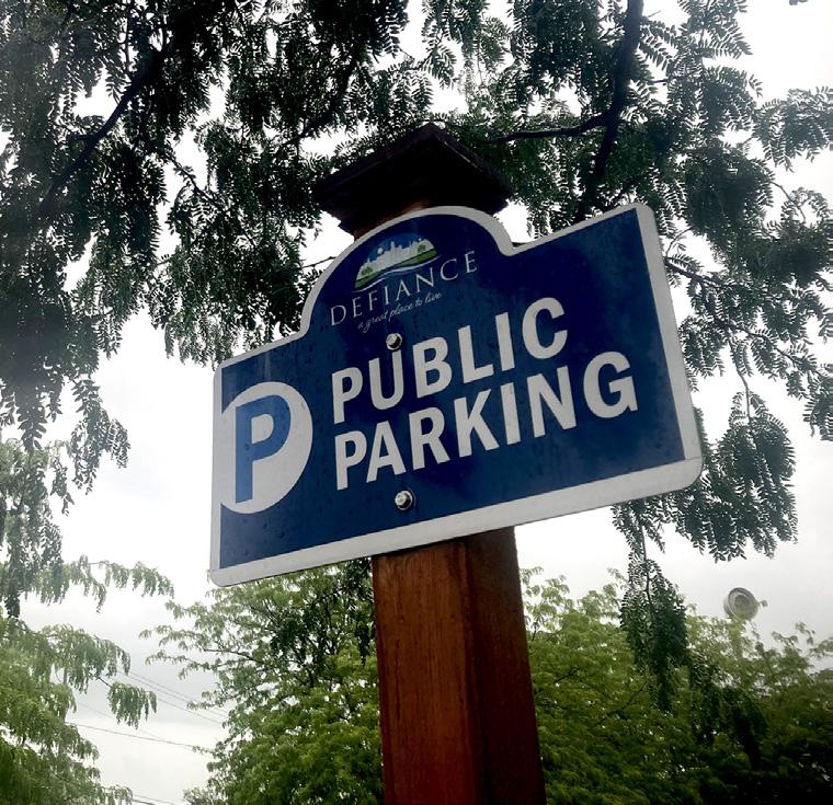
PUBLIC PARKING
AERIAL VIEW
AERIAL VIEW
ILLUMINATED FLAGS
NORTH VIEW
SOUTH EDGE OF PARK
AERIAL VIEW
PARK SIGN
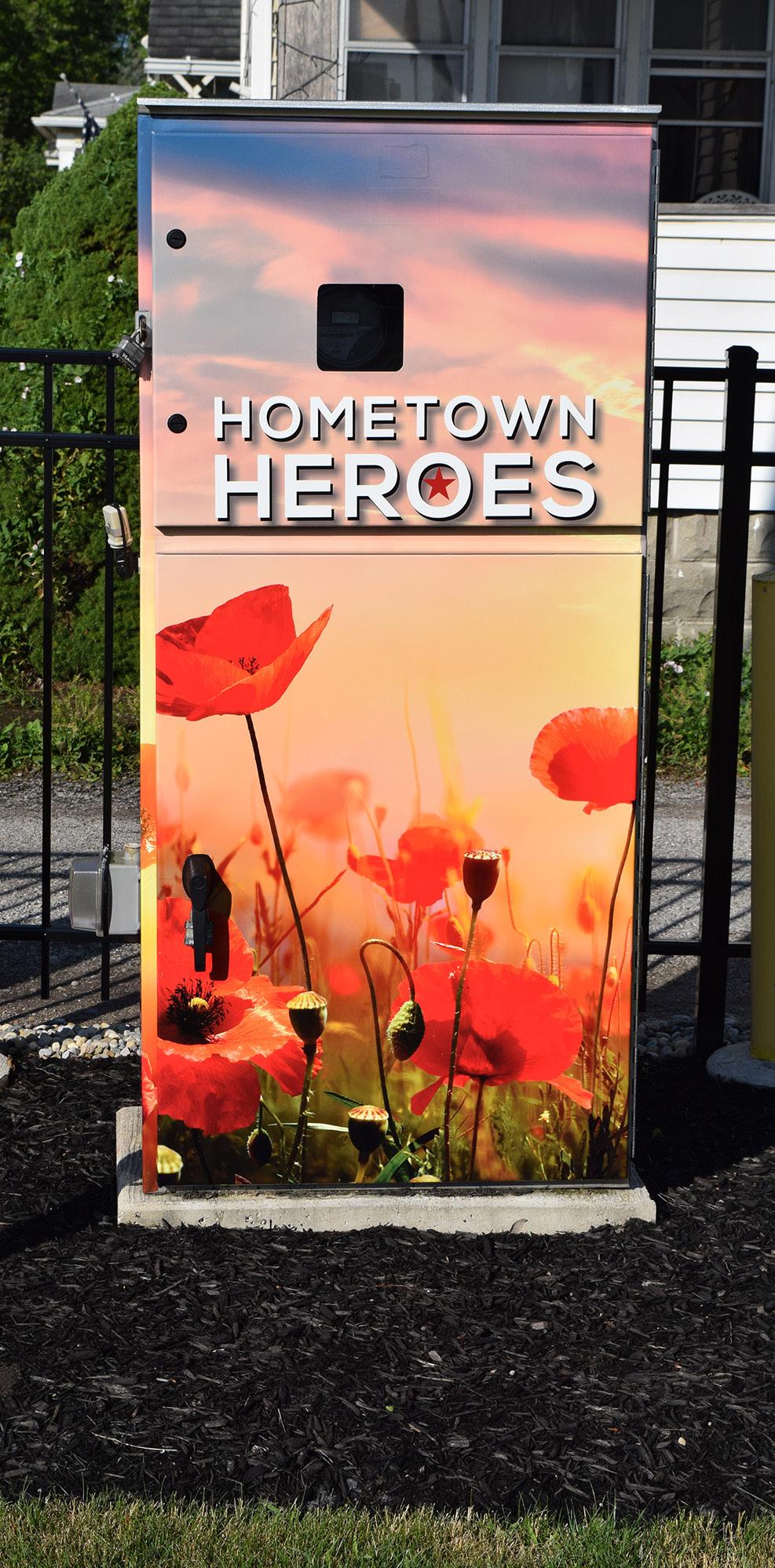
PAINTED ELECTRICAL CABINET
MEMORIAL HALL
IDENTIFICATION BOARD
BACK PARKING LOT / ENTRY
WALKWAY THROUGH PARK
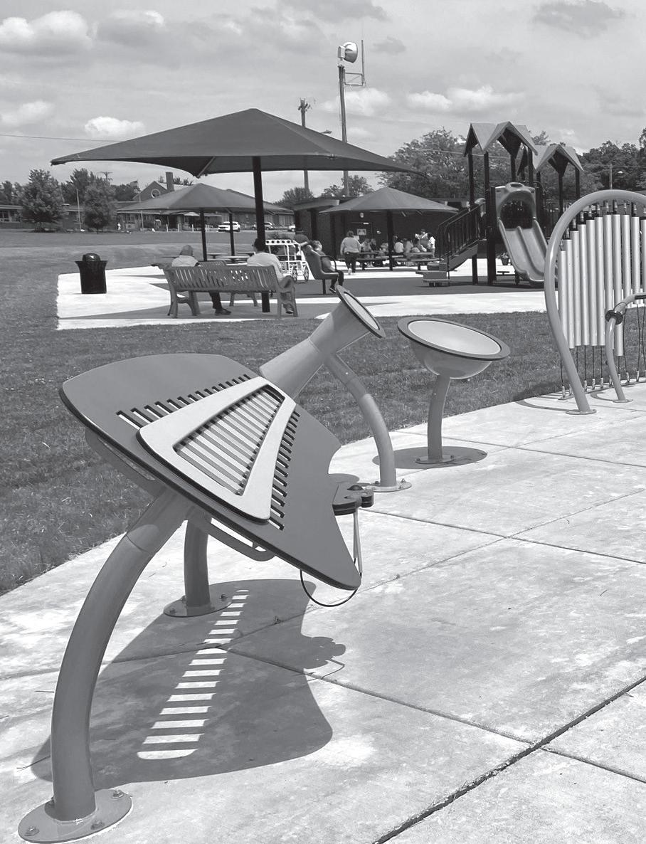
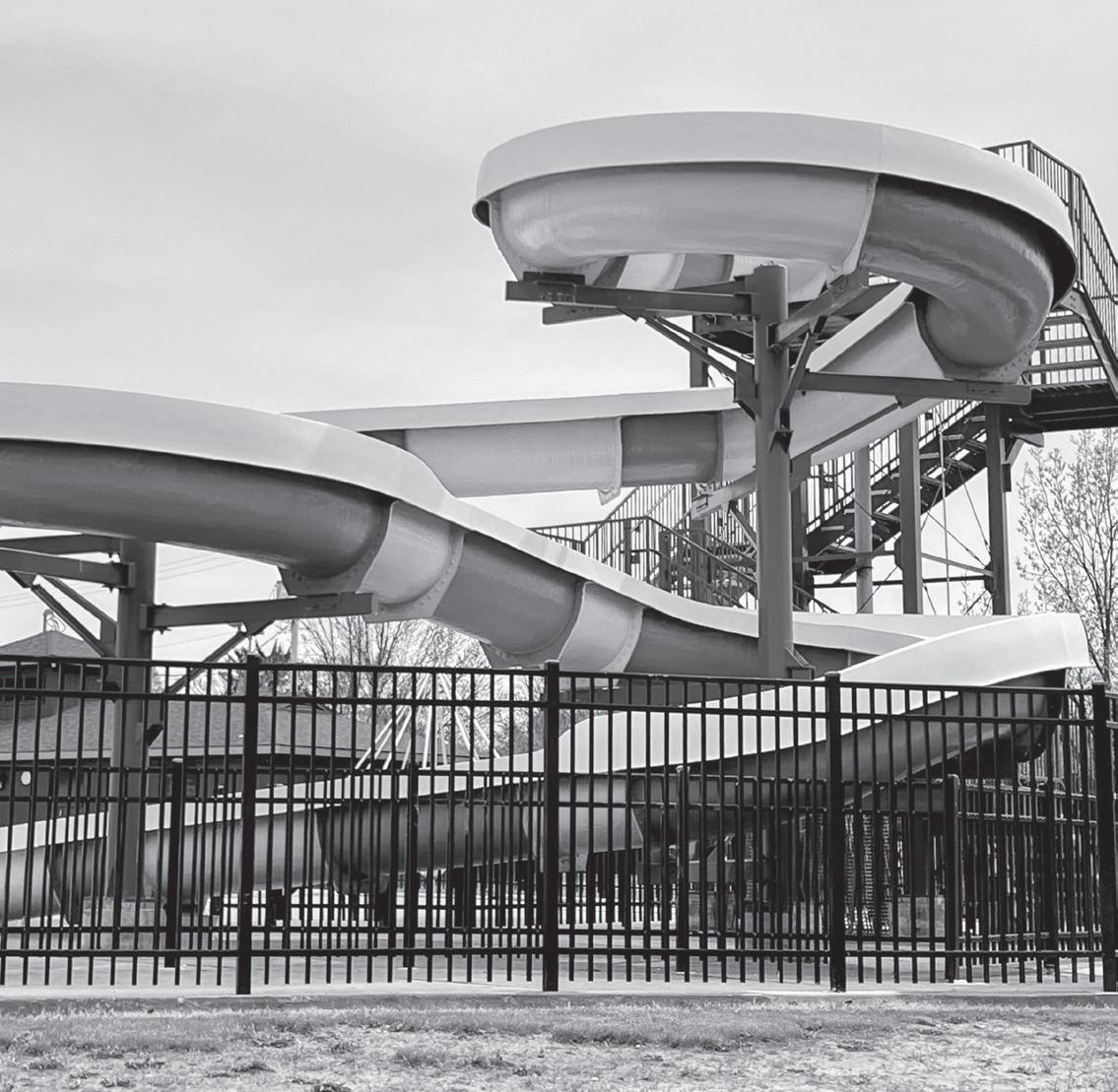
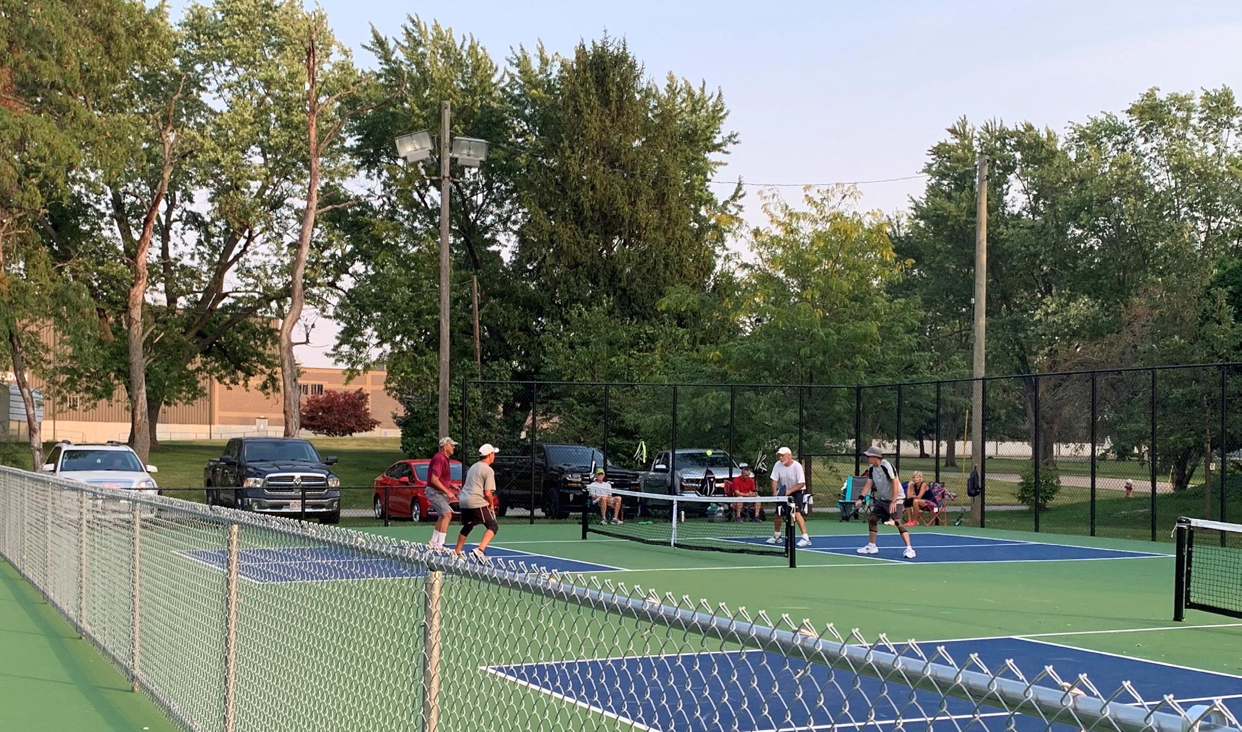
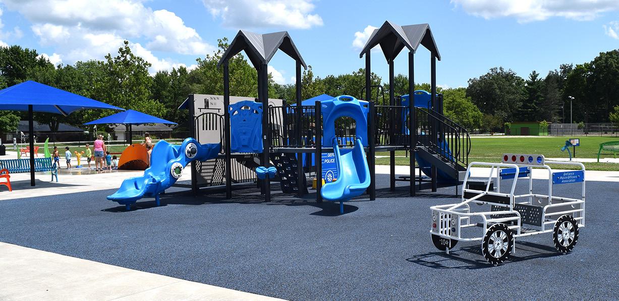
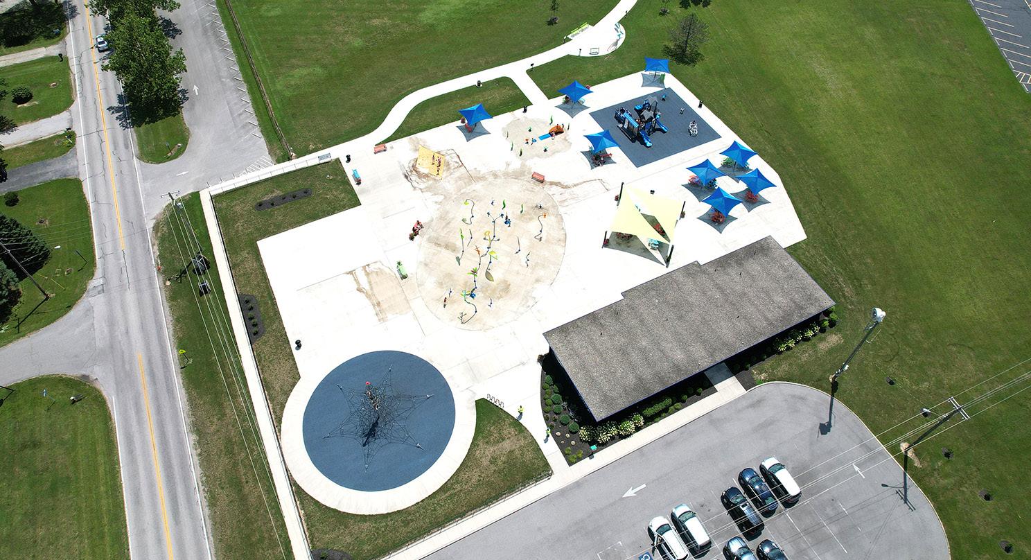
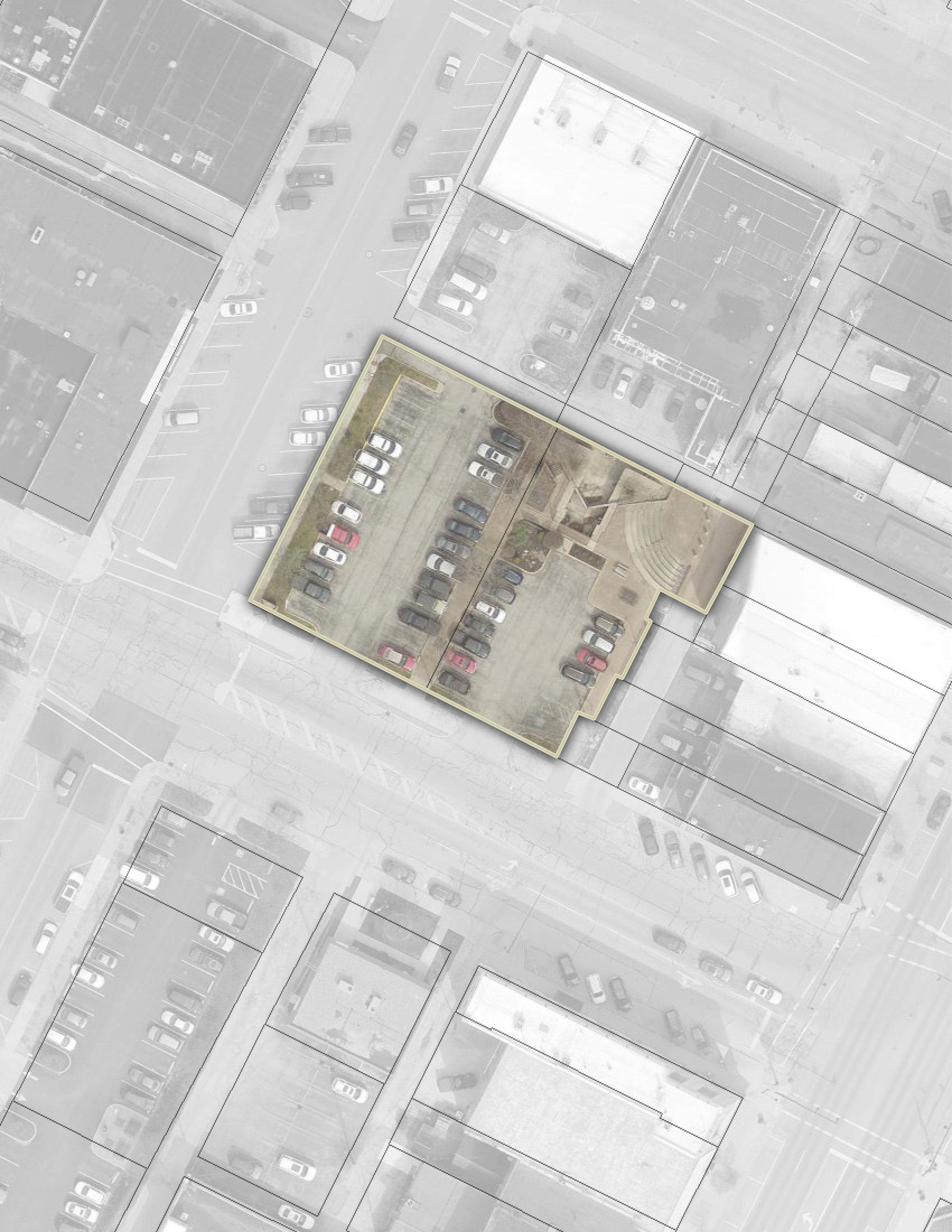
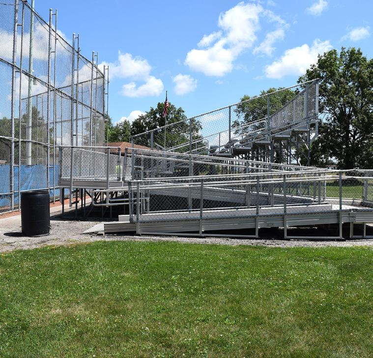
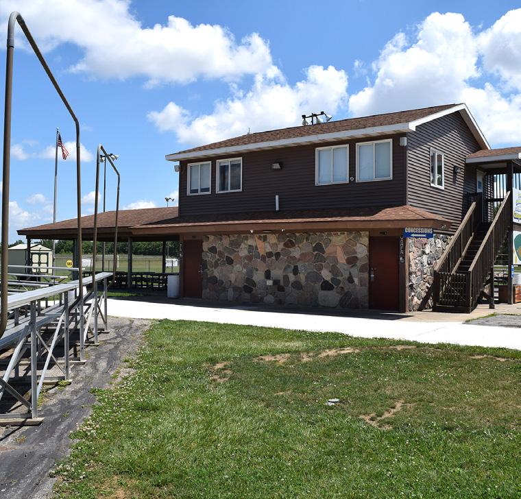
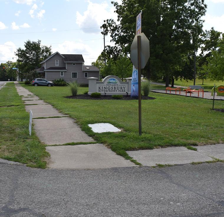
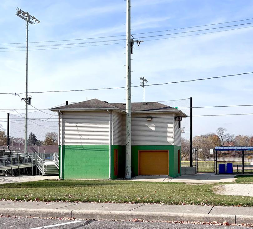
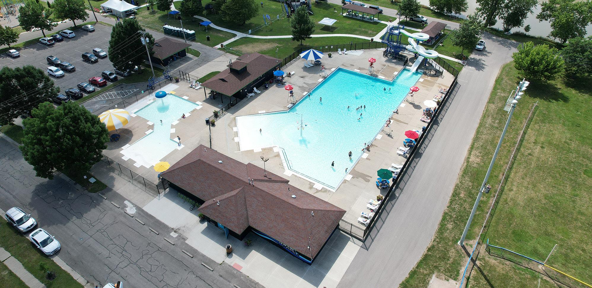
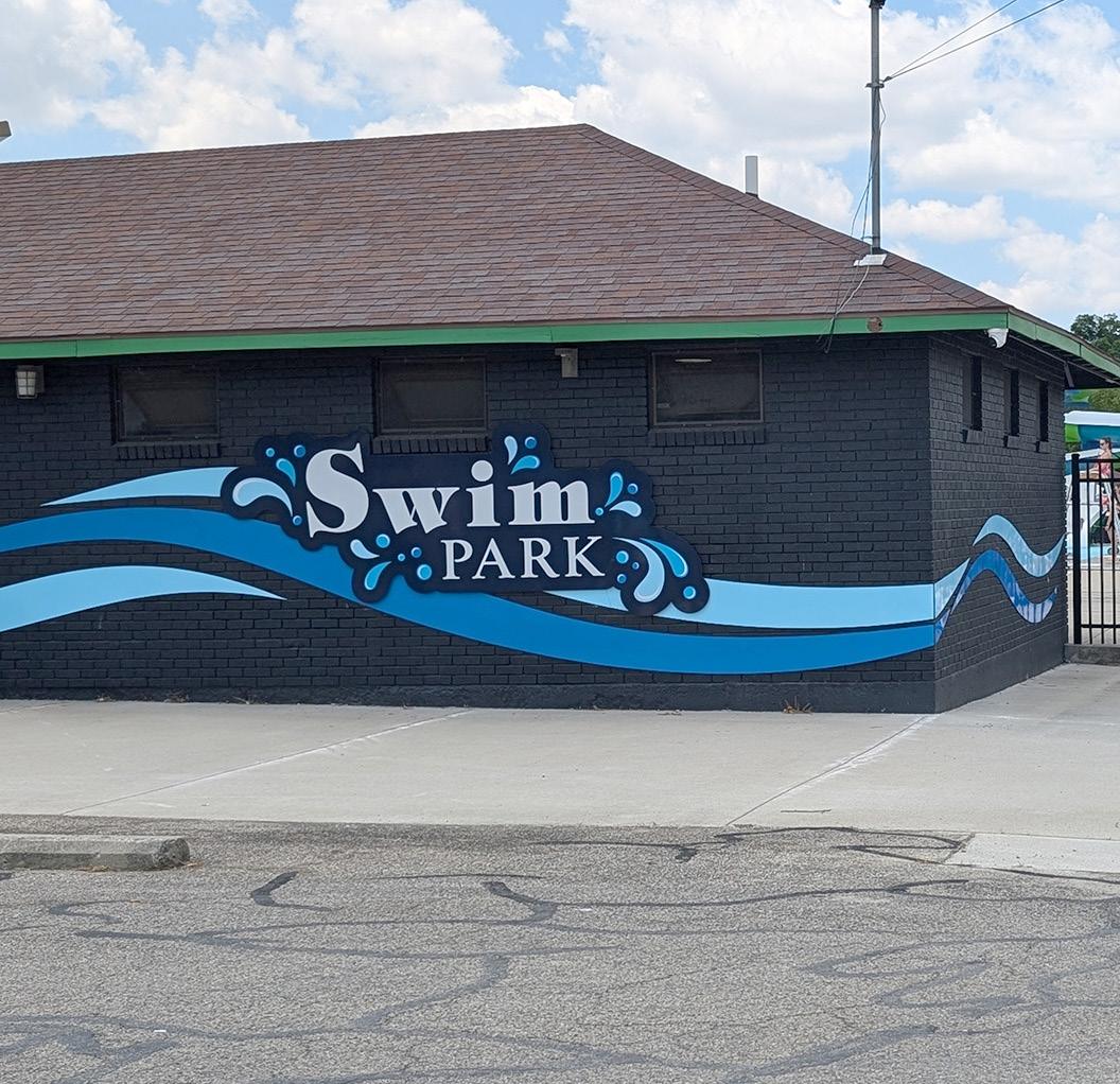
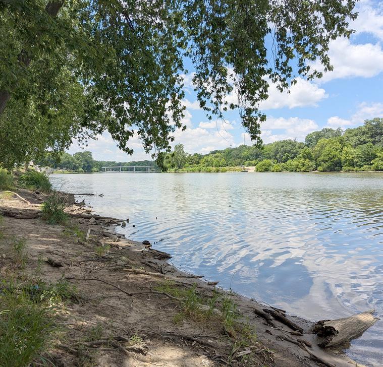
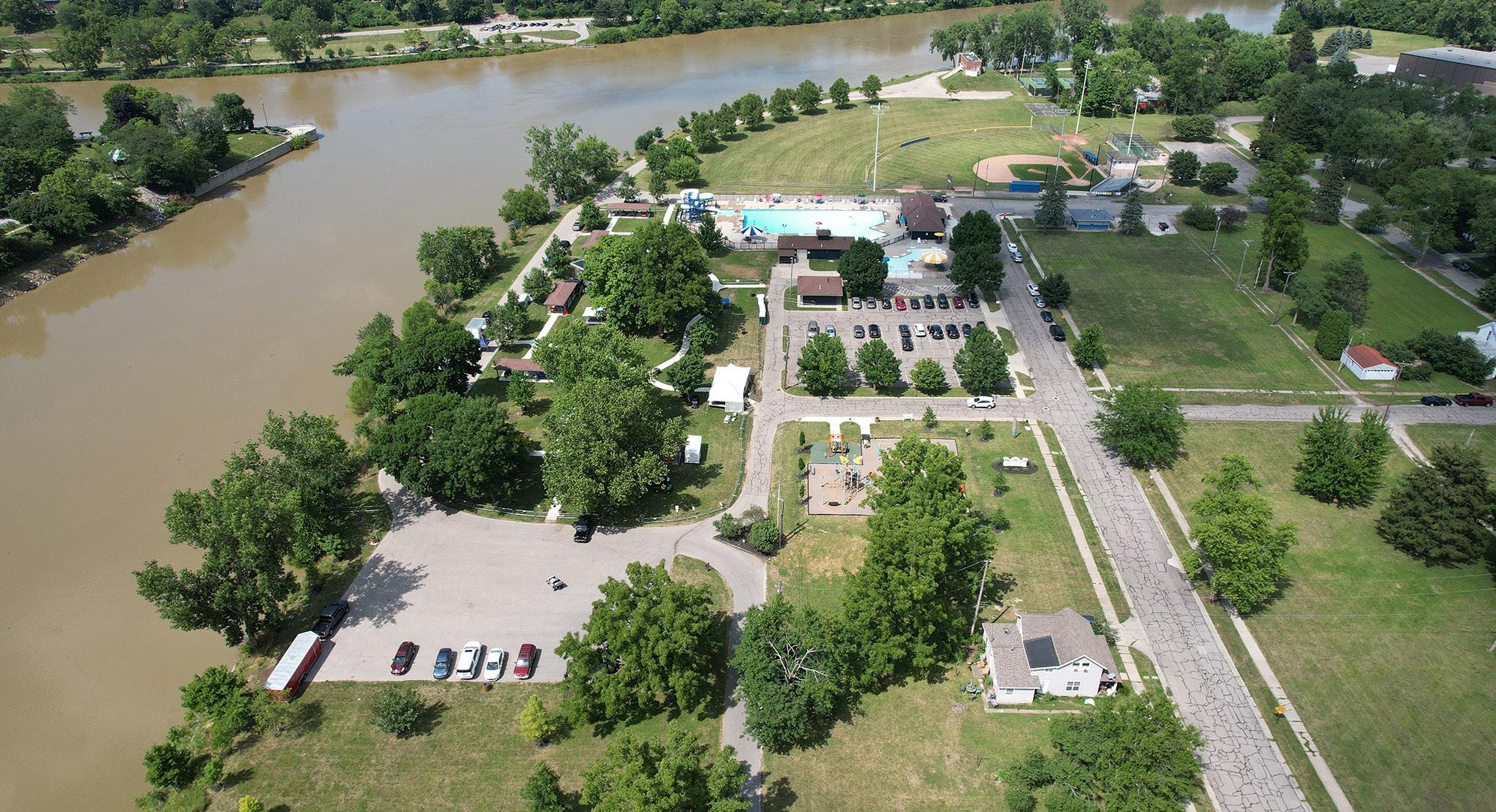
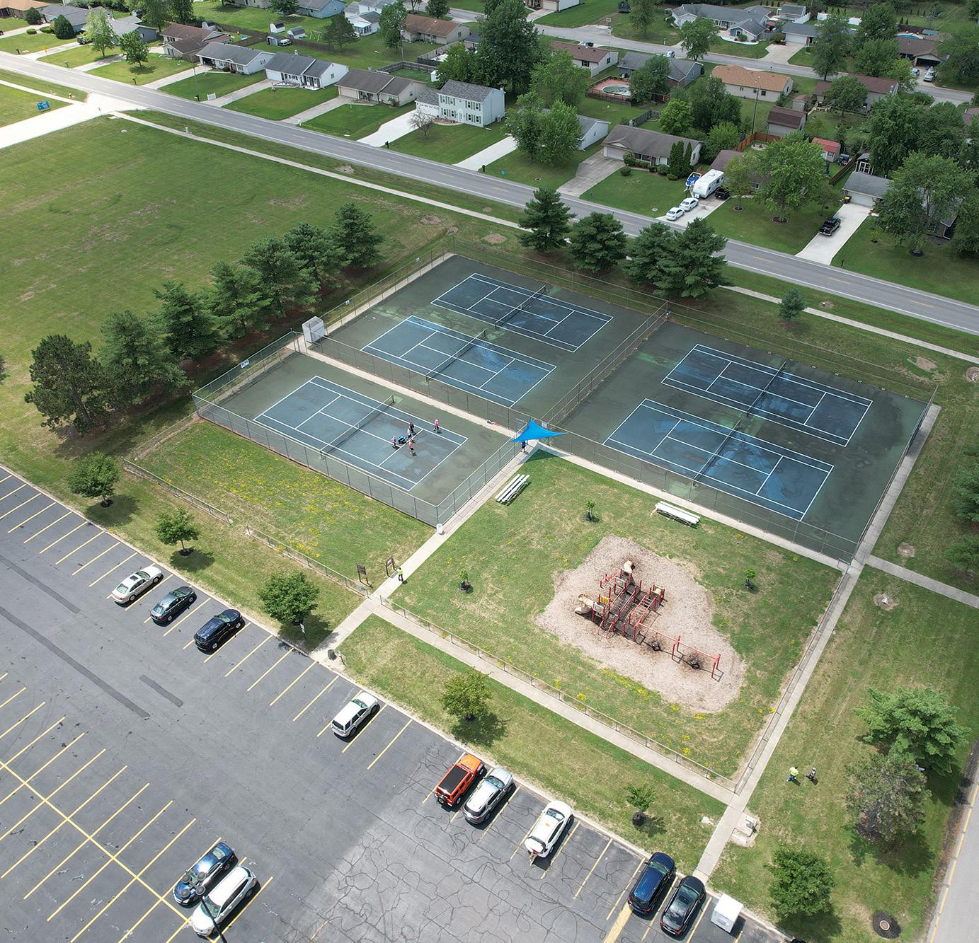
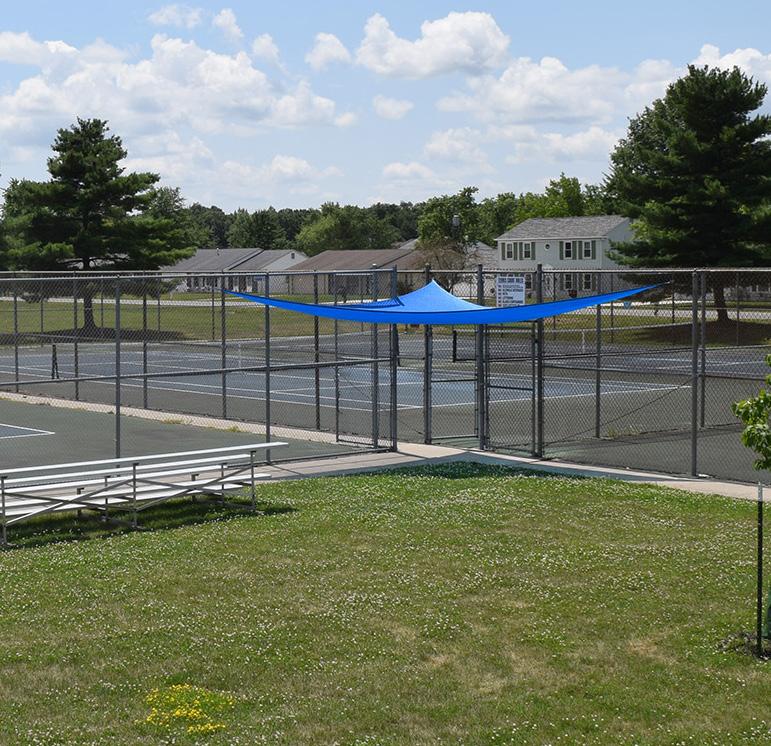
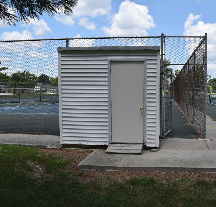
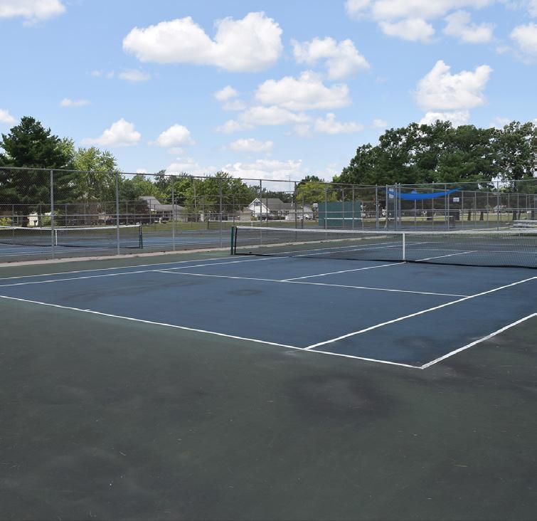
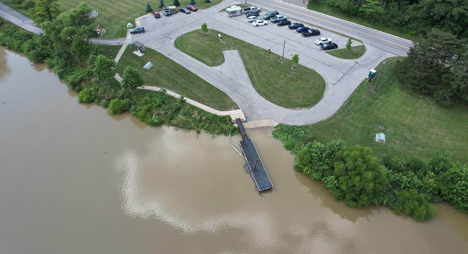
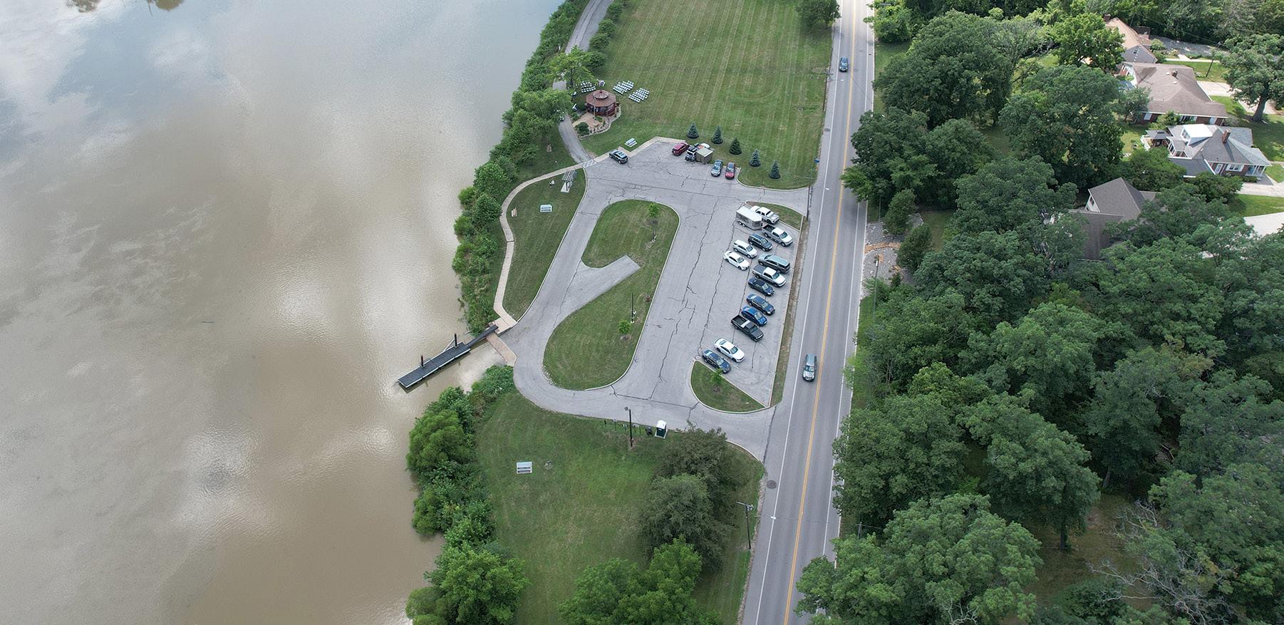
KINGSBURY RIVERFRONT PARK, SWIM PARK & PICKLEBALL
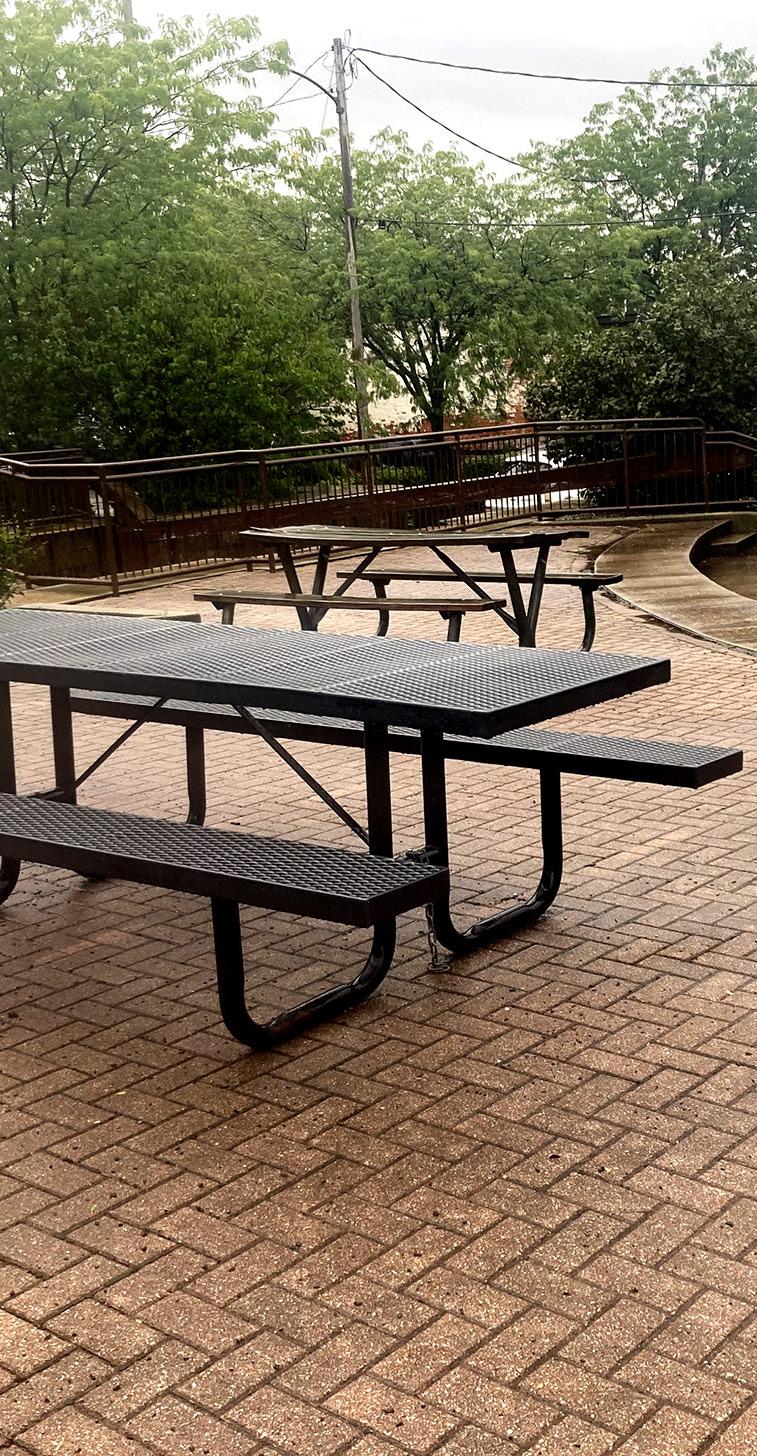
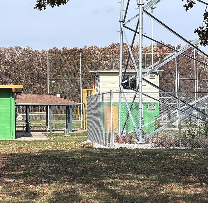
Centrally located on the east side of the City, along the banks of the Maumee and Auglaize Rivers, this scenic park offers a blend of natural beauty and recreational amenities, making it a popular spot for both passive and active outdoor activities. The land was donated to the City under the condition that it be named after Defiance lawyer B. B. Kingsbury.
Situated in a floodplain, the park is a popular spot for residents to fish along the banks of the Auglaize River. The park also features a flood pole, marking the 1913 flood that devastated Ohio and recording significant floods that have occurred since.
The park includes a ball field, six remodeled shelter houses, six pickleball courts, a newly renovated basketball
STRENGTHS
• Accessible by vehicles, sidewalks, waterways, and pedestrian / bicycle trails
• Has an accessible play equipment
• Shelter house rentals
• Potential for a canoe/kayak activation node
• Electricity and water are available on site
• Community's favorite park
• Park provides excellent view of confluence
• Home to City's only community swimming pool
• Park frequently hosts large community events
court (September 2024), and a playground area. The playground features a play structure for a 5-12 age range, along with swings, rocking equipment, sensory play panels, and more. It also features a swim park with a water slide and wading pool. To help fund recent improvements, an Ohio NatureWorks Grant was secured and paired with Community Development Block Grant (CDBG) monies, State Capital Appropriations, and donations from the Defiance Area Foundation.
The ball field, home to many of the Defiance Baseball Association teams, hosts tournaments throughout the season. Additionally, the park features a variety of events during the summer and fall including "Music in the Park" and the annual "Jazz Fest".
LIABILITIES
• Potential for flooding events
• Playground does not include an accessible safety surfacing
• Sidewalk needs improvement near playground
• Parking lot near pickleball courts is not paved
• Park includes multiple CSO outfalls
• No racing lanes at the pool for swim teams
SHELTER HOUSE #5
SHELTER HOUSE #4
MAUMEE RIVER

Inventory Photos: Kingsbury Riverfront Park, Swim Park &
"I love Kingsbury Park! The pool is beautiful and the ballfield is great for the boys games. It is so nice for the grandkids! "

LANDSCAPE ALONG RIVER
SHELTER
SWIM PARK
"I
love the confluence of the rivers [at Kingsbury Park]. The pool is great. The shelter houses are nice. I use it in the early morning hours with other men for a workout space. "
"[My favorite memory] is the fireworks at Kingsbury Park and
baseball there."
PICKLEBALL COURTS
BASKETBALL COURT
PLAYGROUND
SANITATION BUILDING
SOUTHEAST CORNER OF PICKLEBALL COURTS
PLAYGROUND
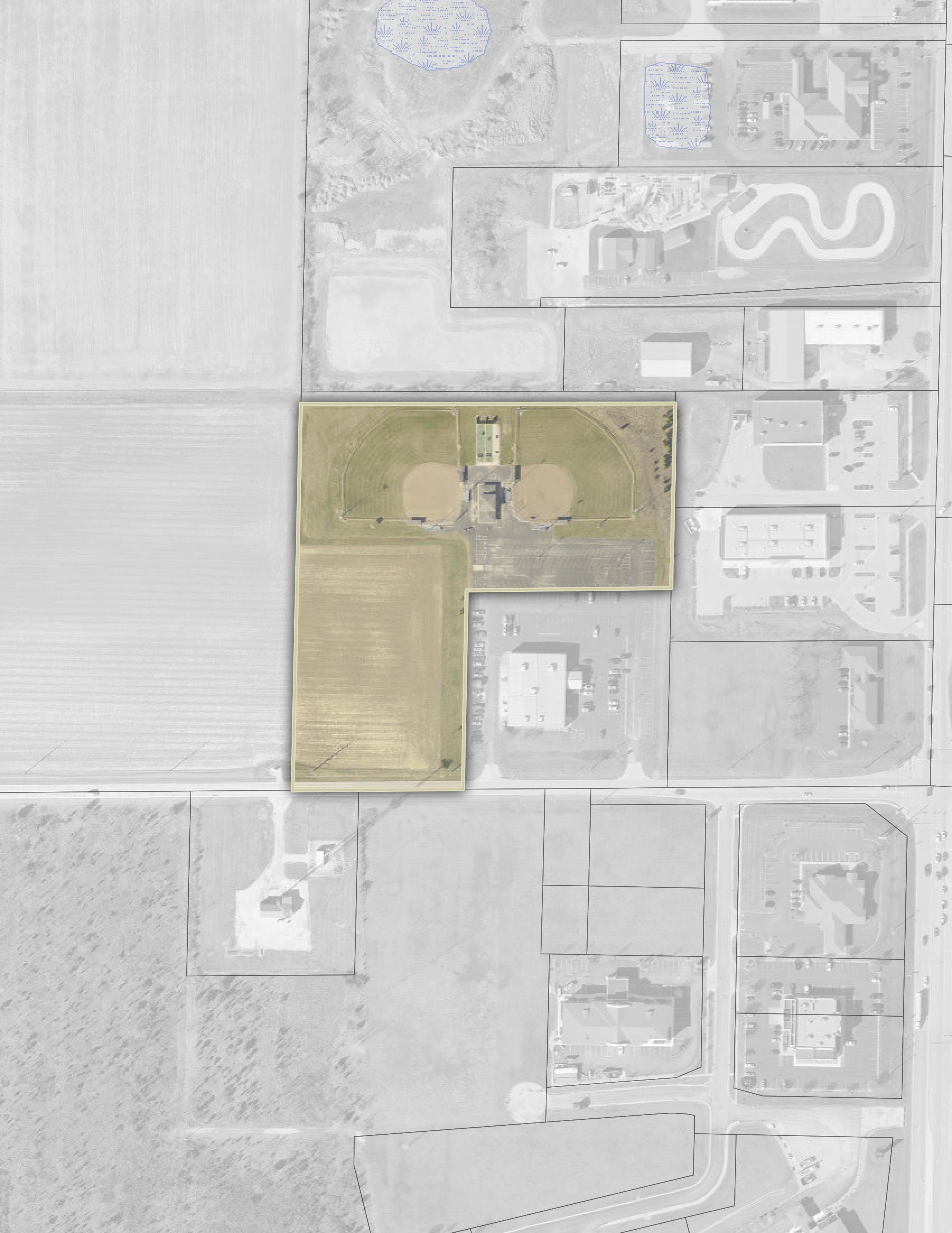
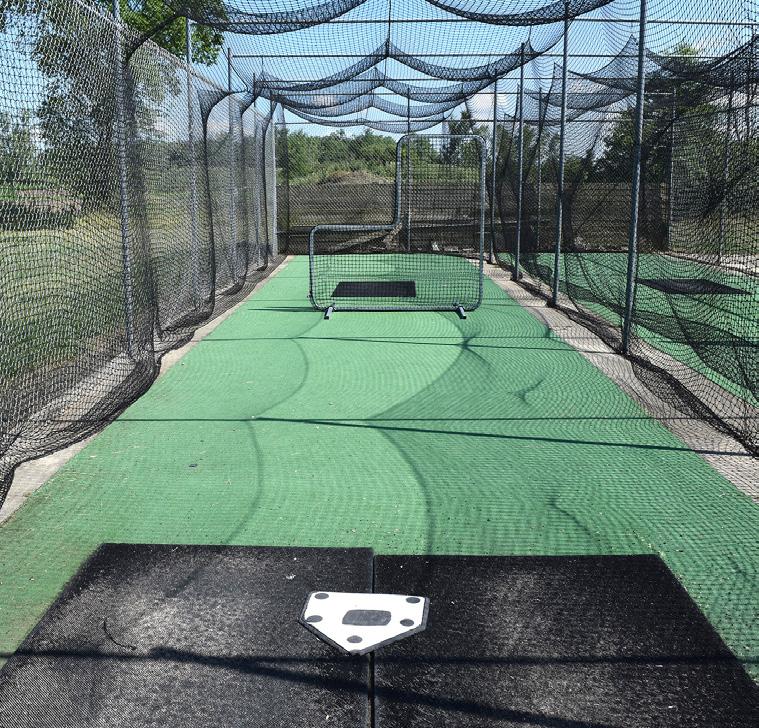
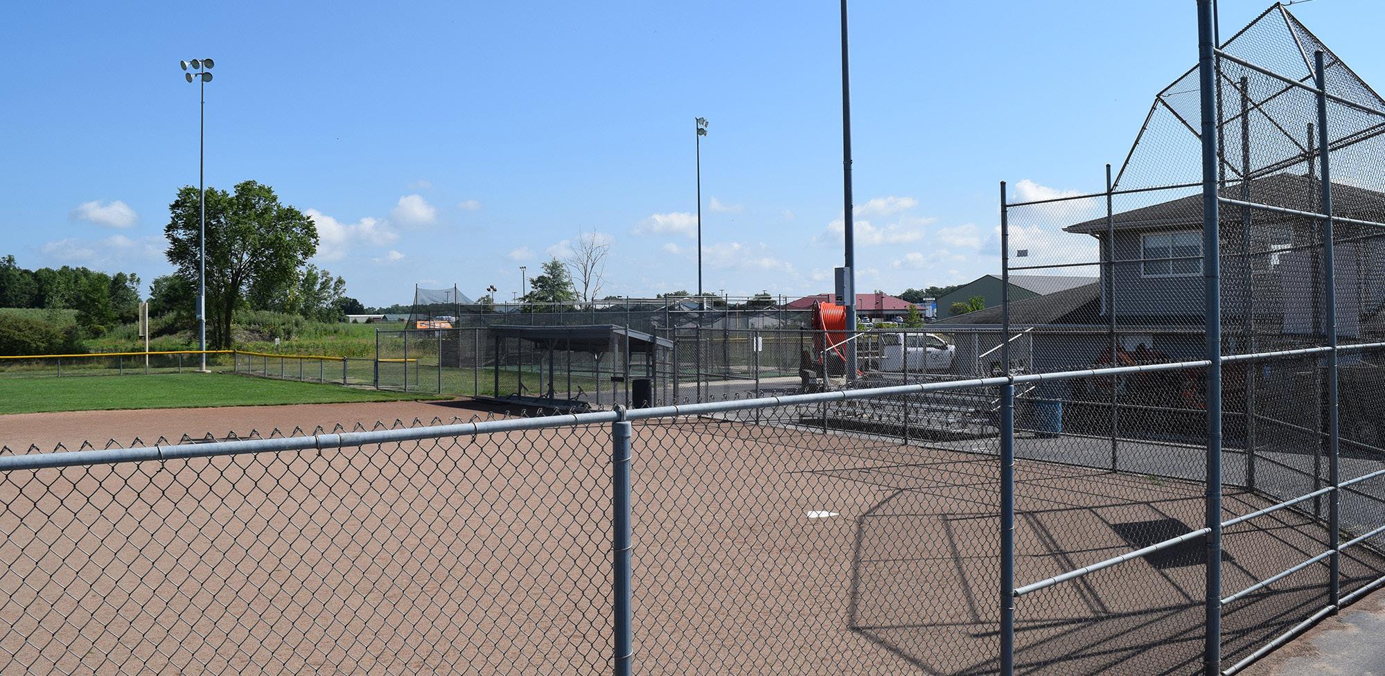
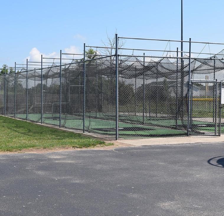
KNIGHTS OF COLUMBUS BASEBALL COMPLEX
Located at the north end of the City, the Knights of Columbus Baseball Complex features two lighted ball fields and four sets of bleachers, along with batting cages and pitching mounds for practice. Sheltered, open air seating is located on either side of a centrally-located concession and restroom facility.
Parking for this facility is provided via a shared parking lot with the adjacent Knights of Columbus building.
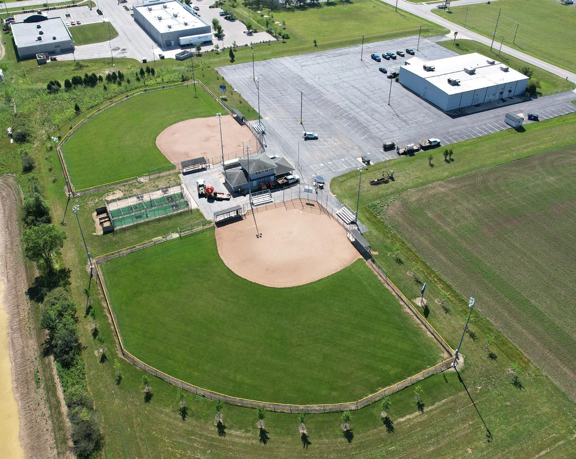
STRENGTHS
• Fields are illuminated
• Plenty of parking for both fields
• Dedicated league users and volunteers aid with park maintenance
LIABILITIES
• No drinking fountain
• No shade components
• Designated ADA walkway from parking lot is needed
• Lack of additional family play opportunities
• City does not own the property
ELLIOTT
BASEBALL FIELD
Inventory
Photos: Knights of Columbus Baseball Complex
AERIAL VIEW
LOOKING EAST ACROSS FIELD
NORTH SIDE OF BATTING CAGES
BLEACHERS
DUGOUT
SCOREBOARD
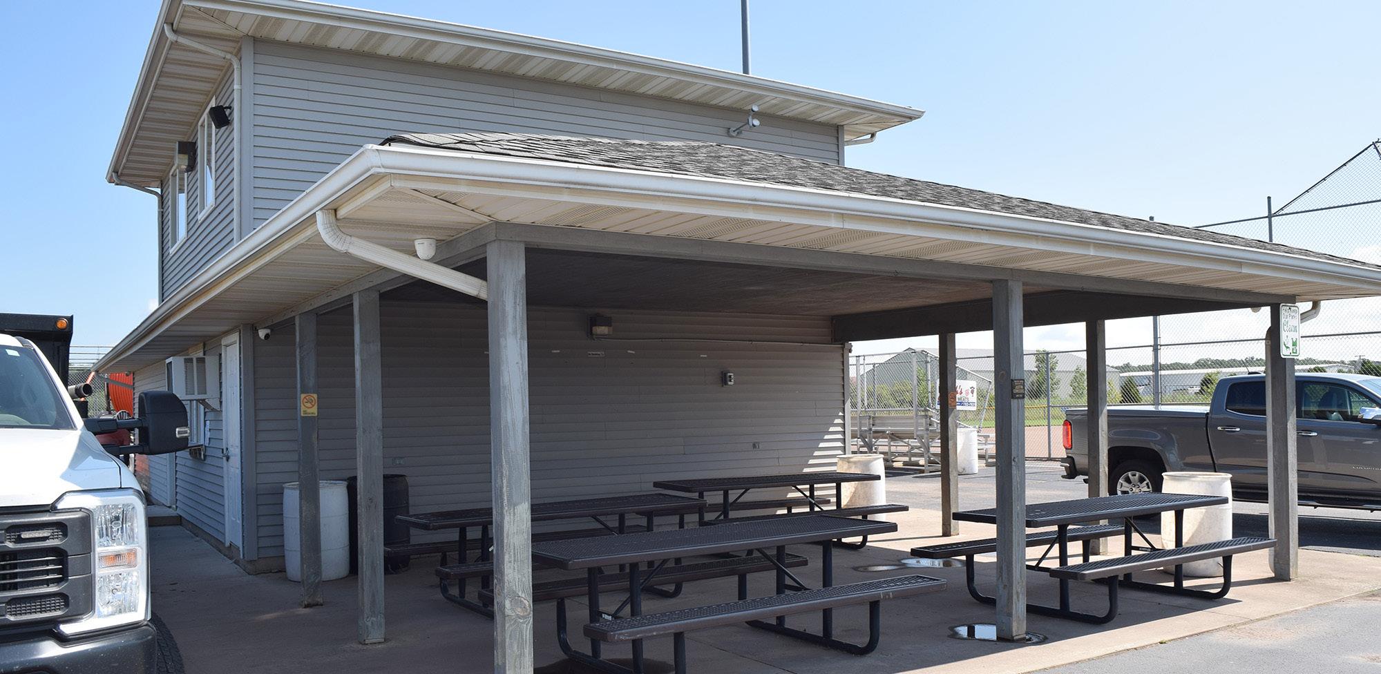
SHELTERED SEATING / CONCESSIONS
AERIAL VIEW
EDGE OF FIELD
INSIDE BATTING CAGE
AERIAL VIEW
BATTING CAGES
BASEBALL / SOFTBALL FIELD
Natural & Structural Resources: LIVINGSTON PARK
STRENGTHS
• Potential for natural stormwater management and gateway plantings
• Potential for utilizing adjacent vacant or inactive parcels for partnerships or shared parking opportunities
• Proximity to Defiance High School and the YMCA
Located in southern Defiance, Livingston Park is an undeveloped piece of land at the corner of Palmer Drive and Jefferson Avenue - adjacent to the Defiance High School campus and south of Palmer Park.
The park is named in honor of Defiance resident Major General Lawrence Livingston, USMC.
LIABILITIES
• Sidewalks are needed
• Signage is needed for identification
• Existing drive needs improvement
JEFFERSONAVE
PALMER DR
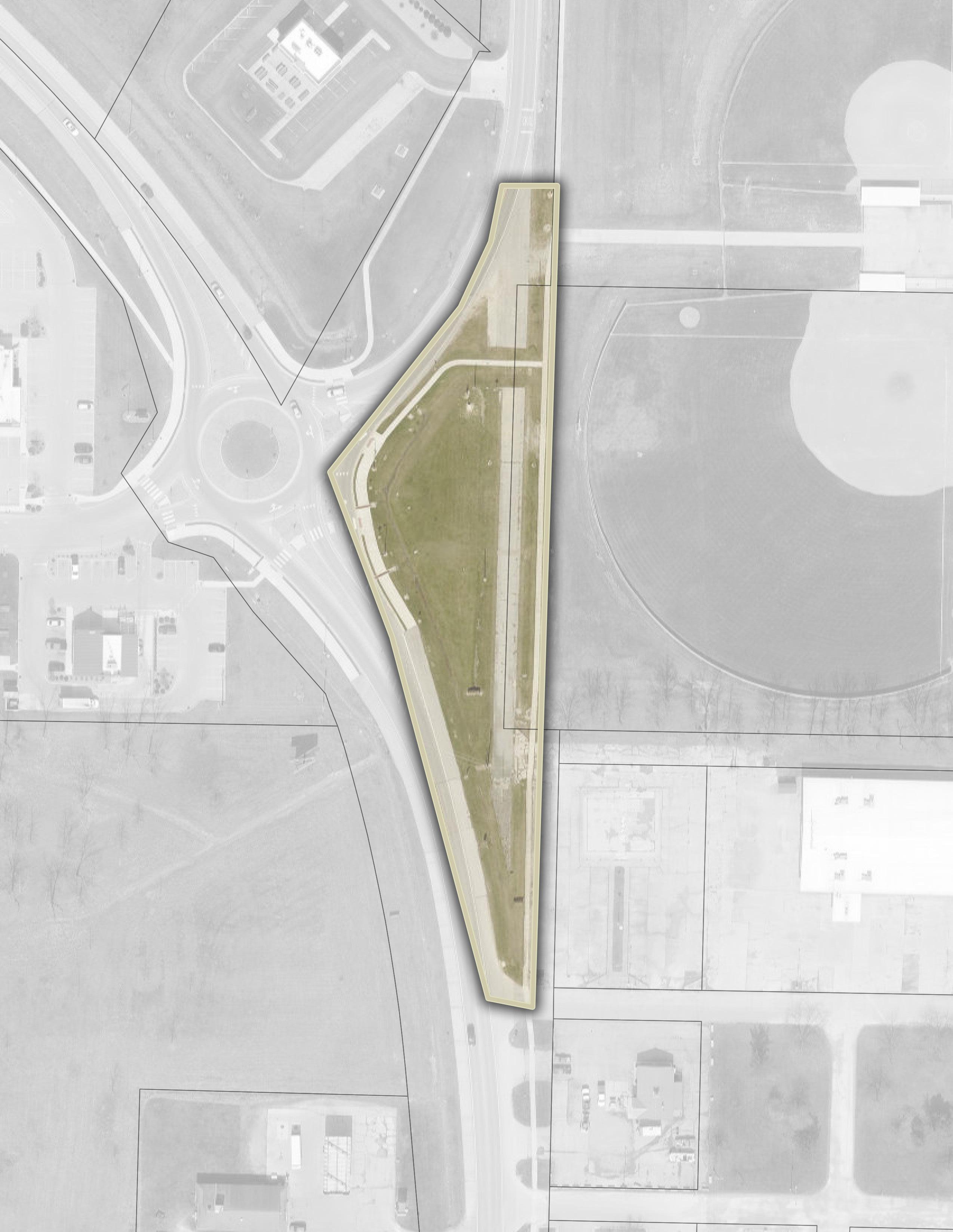
MEMORY PARK
Memory Park is located in downtown Defiance, just west of the Auglaize River, at the corner of 5th Street and Jefferson Avenue. With mature trees and clear signage, the park offers a serene, green space. Positioned next to the funeral home, it is designed to provide a peaceful, reflective environment for those mourning the loss of loved ones.
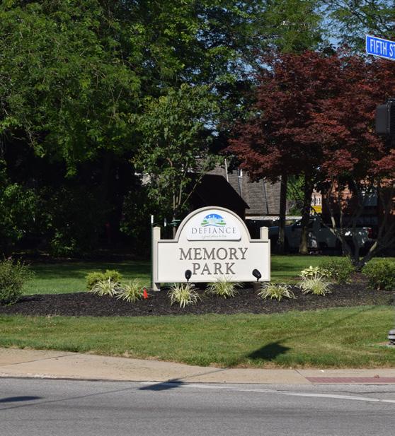
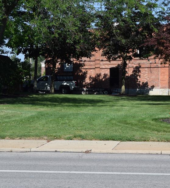
STRENGTHS
• Opportunities to incorporate seating and pathways
• Conveniently located near downtown
• Proximity of accessible walkways leading to downtown, neighborhoods, and adjacent funeral home
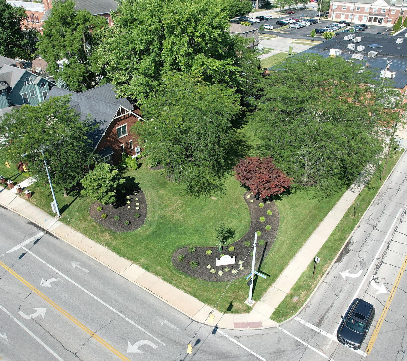
LIABILITIES
• Lighting is needed
• Parking is limited
• No walkways into the interior of the park
• No seating opportunities

5THST 5THST
JEFFERSONAVE
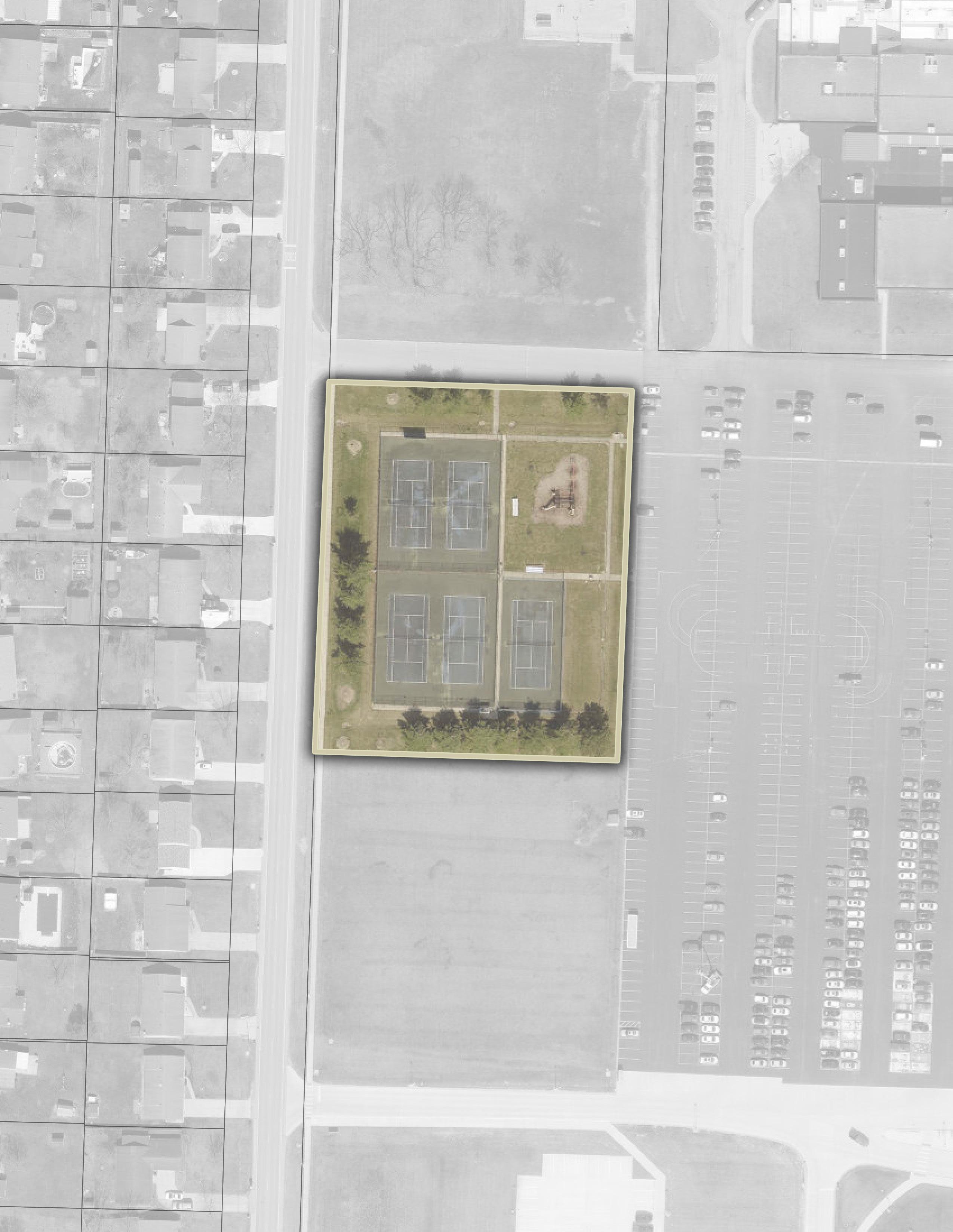
PALMER PARK
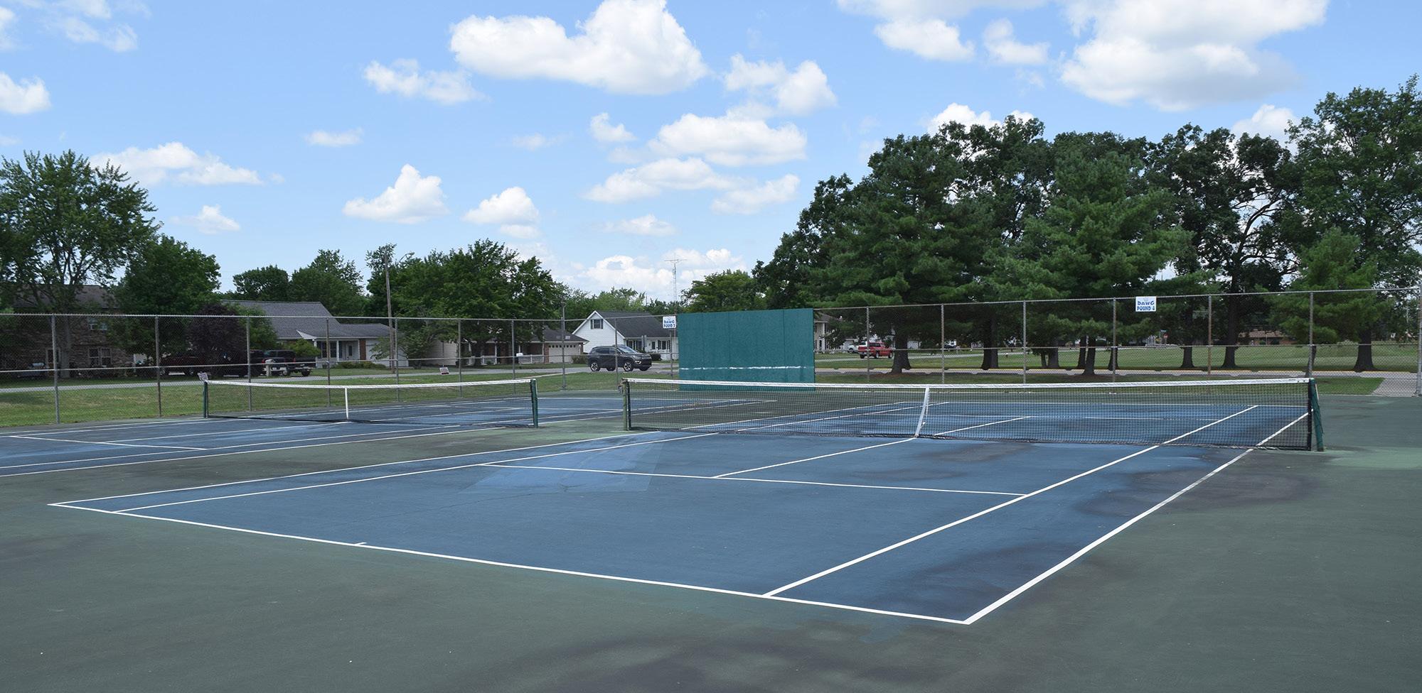
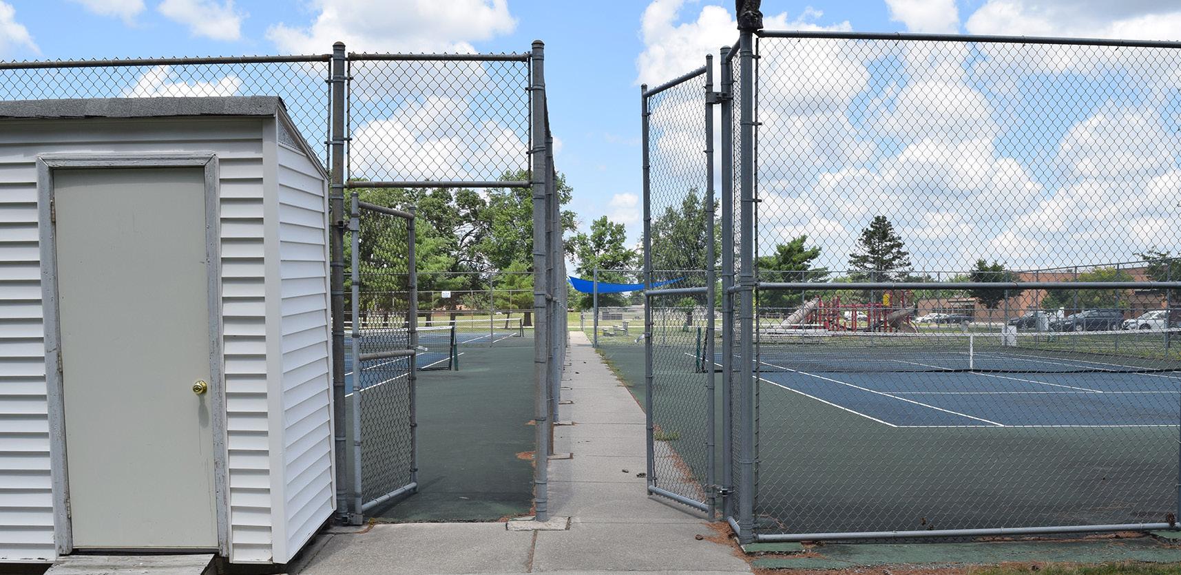
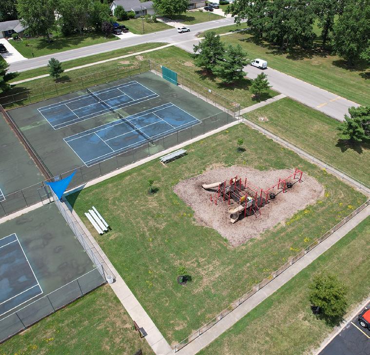
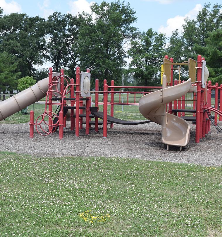
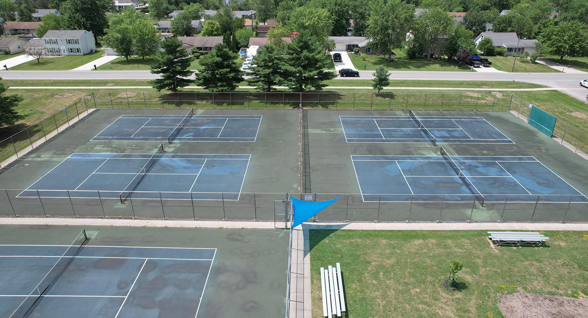
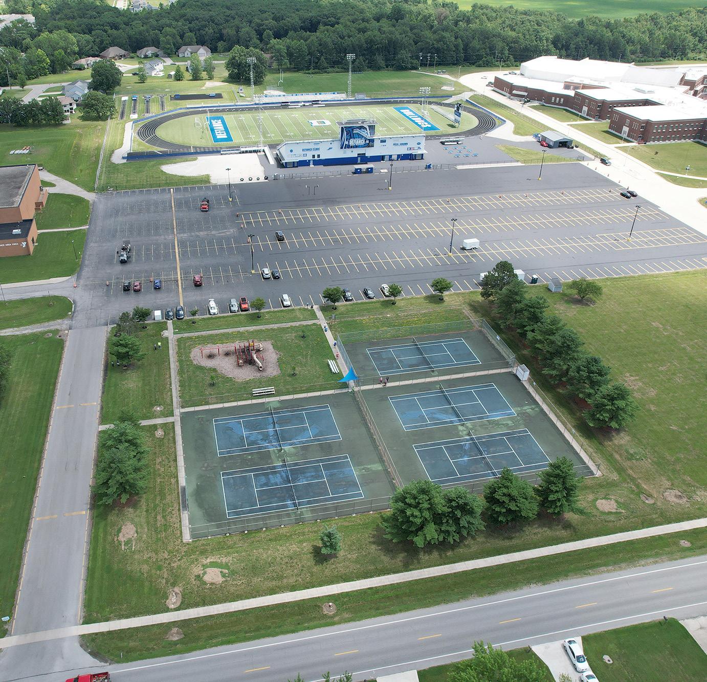
Active Moderate Community Park Good Mostly Accessible
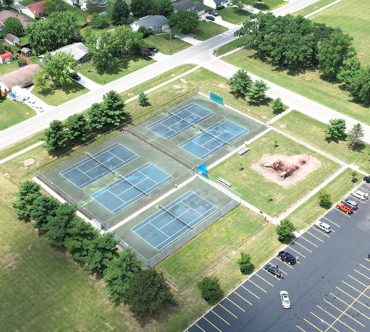
STRENGTHS
• Close proximity to Defiance High School and the YMCA
• Accessible pathway around the tennis courts
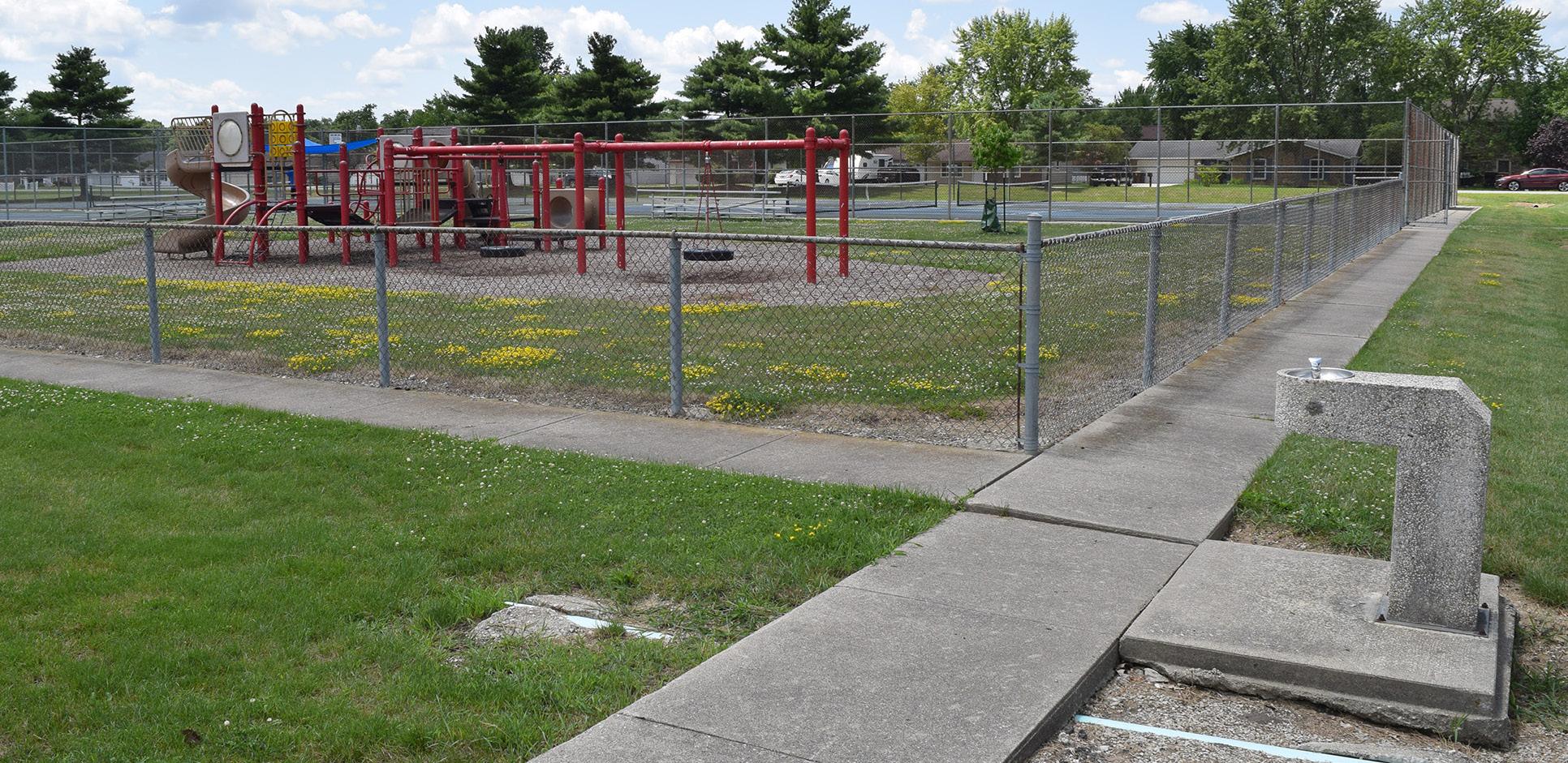
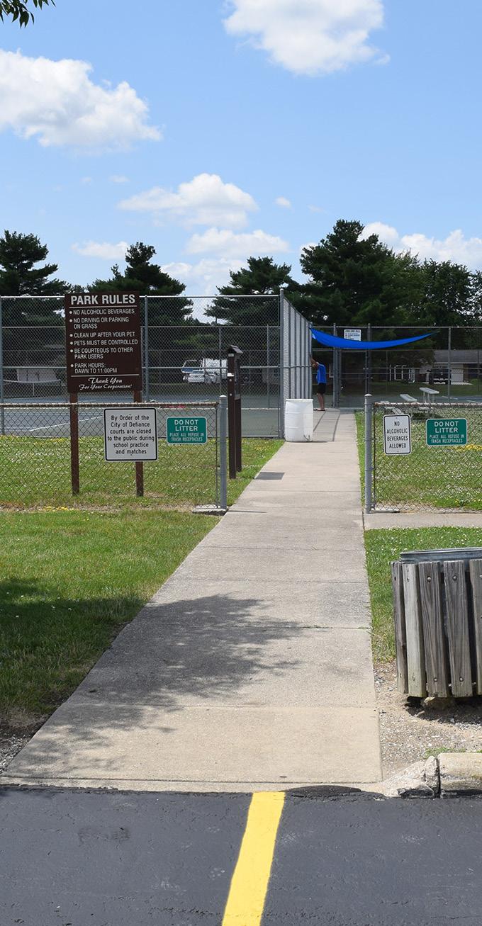
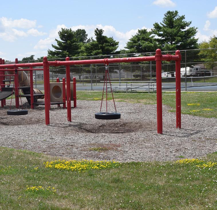
Palmer Park is located just west of the Fred J. Brown Stadium, adjacent to Defiance High School. It features five tennis courts with two sets of bleachers, and a playground. This facility is often used for high school tennis activities.
LIABILITIES
• Shade components are needed
• Benches are needed along tennis courts and within playground area
• Lighting is needed for tennis courts
• ADA compliant parking spaces are needed
• No accessible pathway to playground or connections to neighborhoods
• City does not own the property
Drinking Fountain Dog Waste Station
Slides
LEGEND Park Limits
DEFIANCE AREA YMCA
SCHOOL ACCESS RD
PLAYGROUND
SHADE STRUCTURE
DEFIANCE HIGH SCHOOL PARKING LOT
PALMER DR
SCALE:
TENNIS COURTS
SMALL STORAGE BUILDING
Inventory Photos: Palmer Park
AERIAL VIEW
STORAGE SHED
ENTRANCE TO TENNIS COURTS
TENNIS COURTS
AERIAL VIEW
TENNIS COURTS SHADE SCREEN
PLAYGROUND
DRINKING FOUNTAIN
TIRE SWING
AERIAL VIEW
METRO PARK
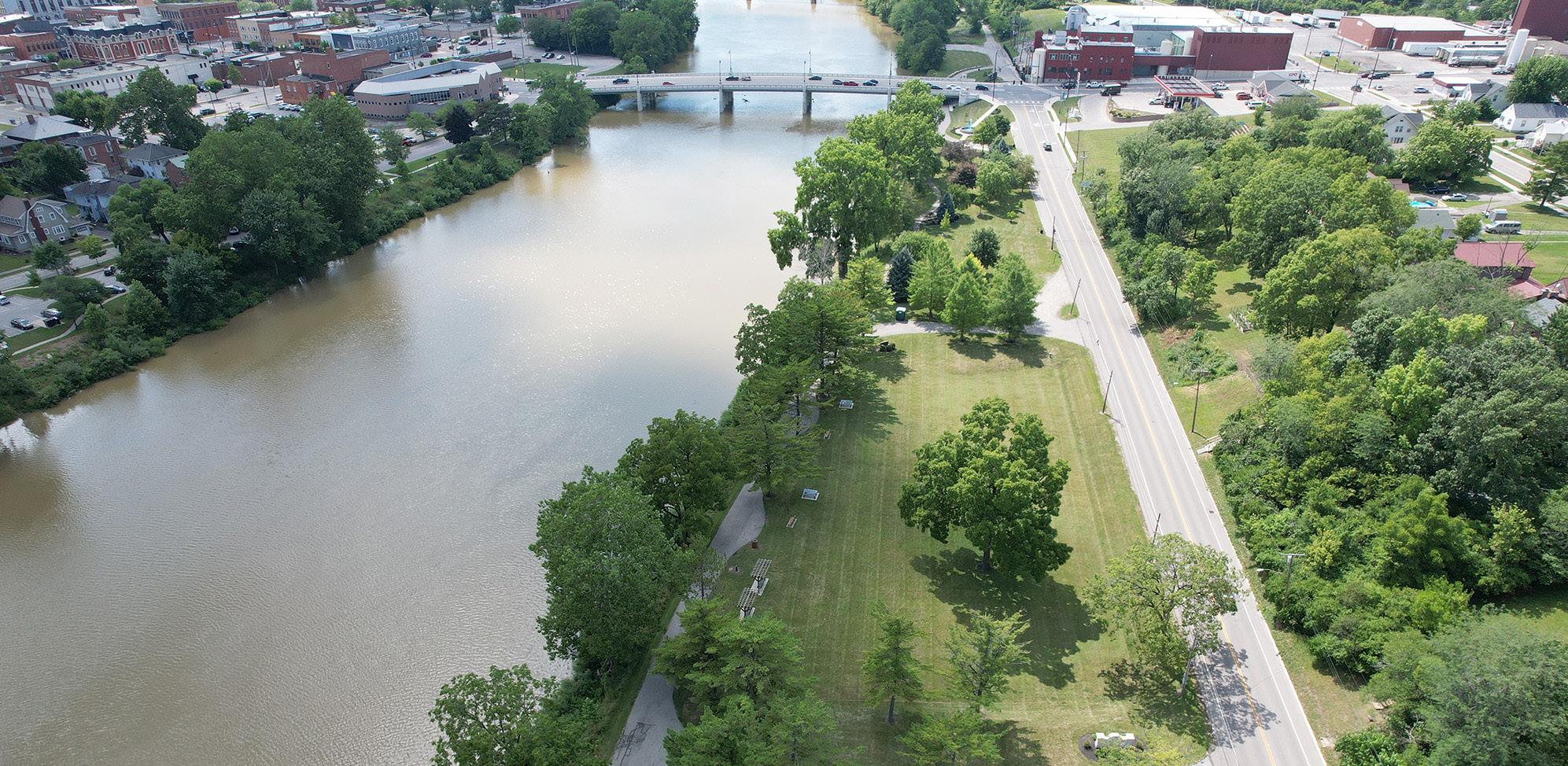
Positioned north of downtown along the Maumee River, this County-owned park is named after Ottawa Indian Chief Pontiac, who is believed to have been born at this location in 1712.
Between the years of 1811 and 1828, Johnny Appleseed established a nursery on the north side of the Maumee River, what is now Pontiac Metro Park. During this time, Defiance served as his primary residence.
Pontiac Metro Park provides downtown river access, with a boat launch and ample parking. Scenic views of the confluence, along with river-oriented seating and updated landscaping provide a peaceful environment that is perfect for relaxing.
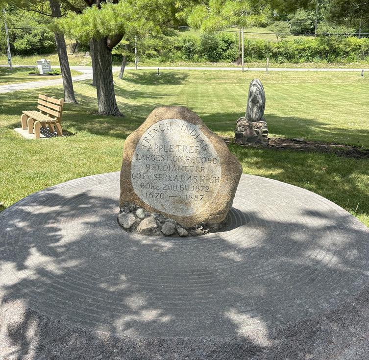
The park features a meandering walkway (which is also part of Ohio's Buckeye Trail), the Zonta Fountain, three swing benches, a large gazebo, and ten picnic tables. It is also home to the Old French Indian Apple Tree
STRENGTHS
• Accessible by vehicles, sidewalks, waterways, and pedestrian / bicycle trails
• Ample parking
• New bollard lighting
• Gazebo rentals
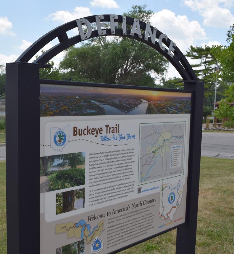
• Part of Ohio's Buckeye Trail and the North Country Trail
• Park frequently hosts larger community events
• Park is a collaboration with Metro Parks
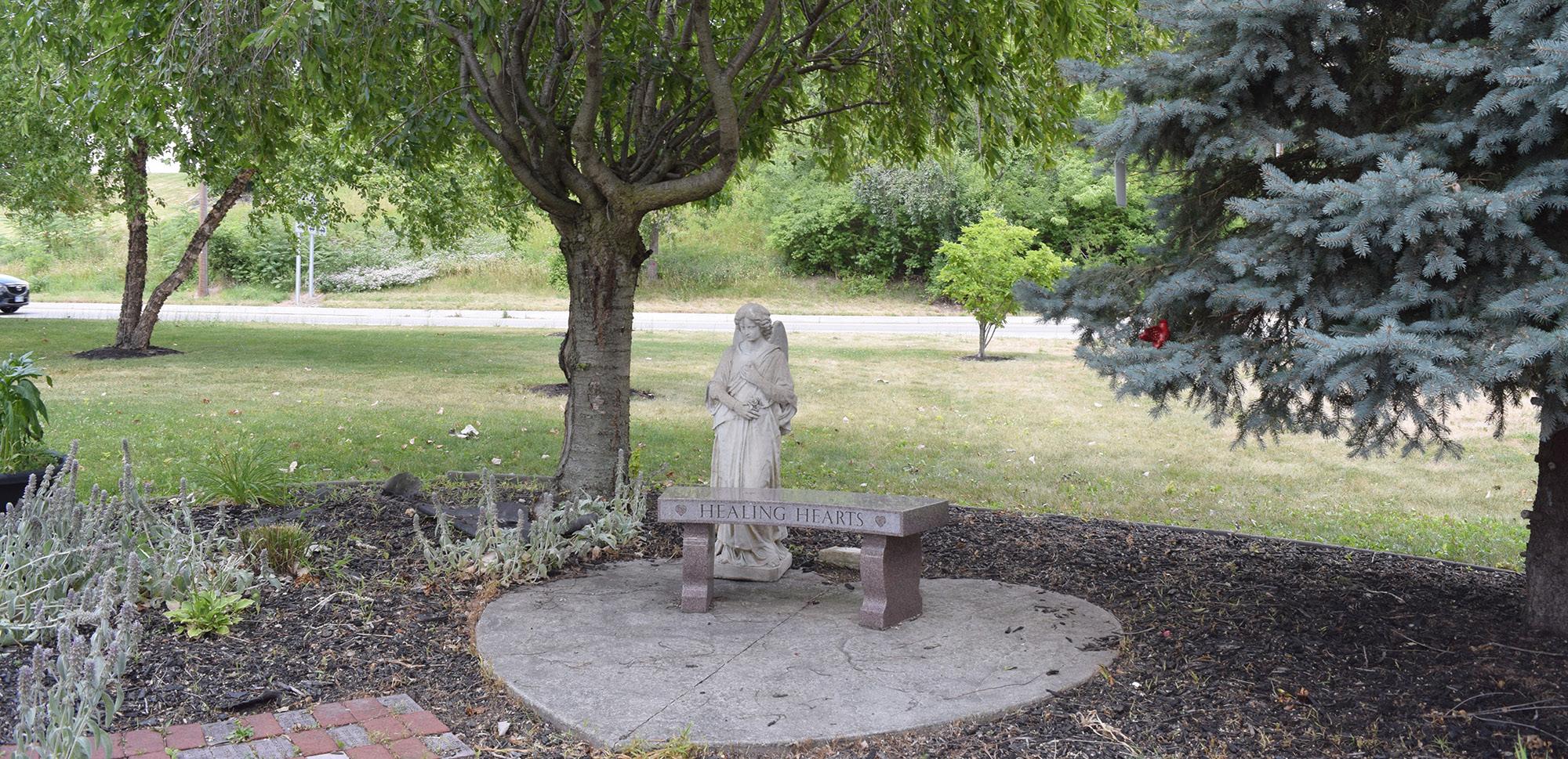
marker, a historic maker for the Bark Cabin Home of Cooh-coo-chee, the "Healing Hearts" memorial bench, and a monument for local Sam Hornish, Jr. who won the Indianapolis 500 in 2006.
Residents meet at Pontiac Metro Park for the City's annual fireworks display and Christmas light display, along with car shows, boat shows, war re-enactments, and special events such as weddings. It is also an area that is heavily fished, and many area professionals eat lunch at the park throughout the week.
Located in a floodplain, the park is host to a flood pole which marks the 1913 flood that devastated Ohio. It also marks significant floods that have occurred since.
Pontiac Metro Park is owned by Metro Parks, but it lies within the City boundaries and is commonly maintained by City parks staff.
LIABILITIES
• Potential for flooding events
• Historical markers have an inconsistent look
• Boat dock needs improvements
• Riverside roadway needs improvements
• Park includes multiple CSO outfalls
• Riverside roadway is located in close proximity to the riverbank, making it vulnerable to erosion
MAUMEE RIVER

"I love the vicinity to the river, the ease of getting in and out, the landscaping, and available seating."
BOAT DOCK / RIVER ACCESS
MILE MARKER
AERIAL VIEW
HISTORICAL SIGNAGE
GAZEBO
HEALING HEARTS
FLOOD POLE
"For 30 years we have enjoyed the improvements and upkeep at the park. Fireworks ... walking through the park with my dog or grandchildren, watching the river during all of the seasons, seeing the bridge replacement, and reading the history of the area are what I enjoy about the park."
"I can park my car and enjoy the view while I read, study, meditate, and pray."
WALKWAY
WALKWAY
SIGNAGE
AERIAL VIEW
AERIAL VIEW
SIGNAGE AT FOUNTAIN
SWING BENCHES
RECREATIONAL AREA
Passive / Active Moderate
Community Park Good Mostly Accessible
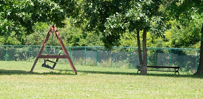
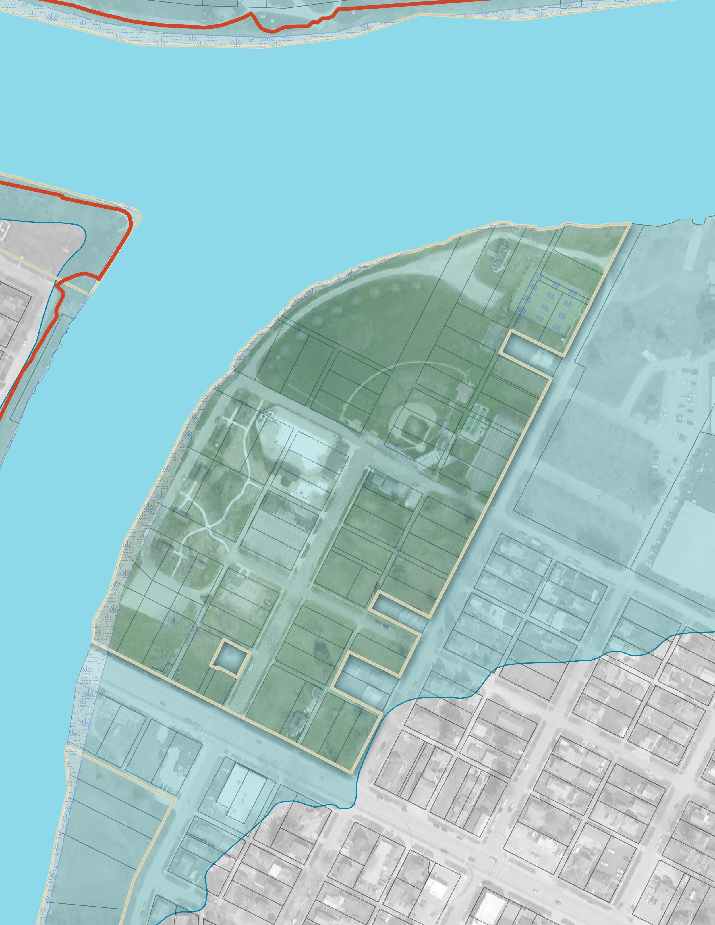
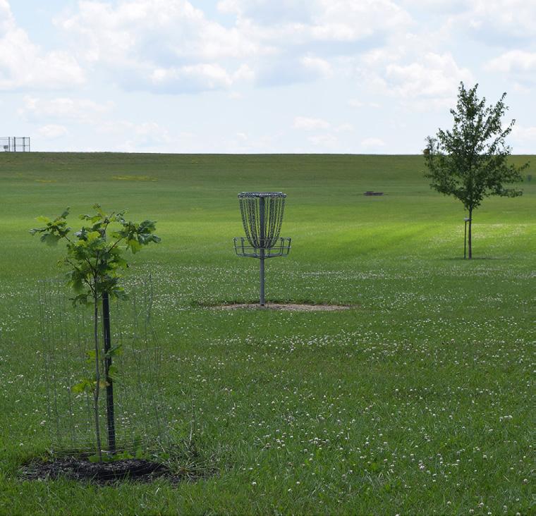
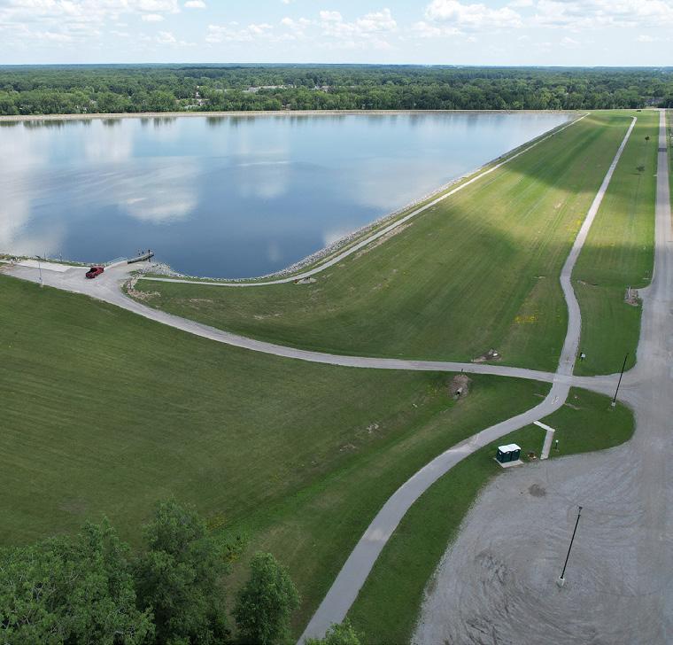
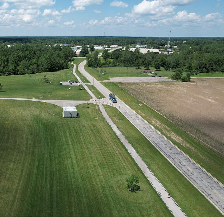
Reservoir Recreational Area is located southwest of Defiance, just outside City limits. It features an area for fishing and boating, disc golf, and nature trails. Residents also visit the park in winter months for sledding.
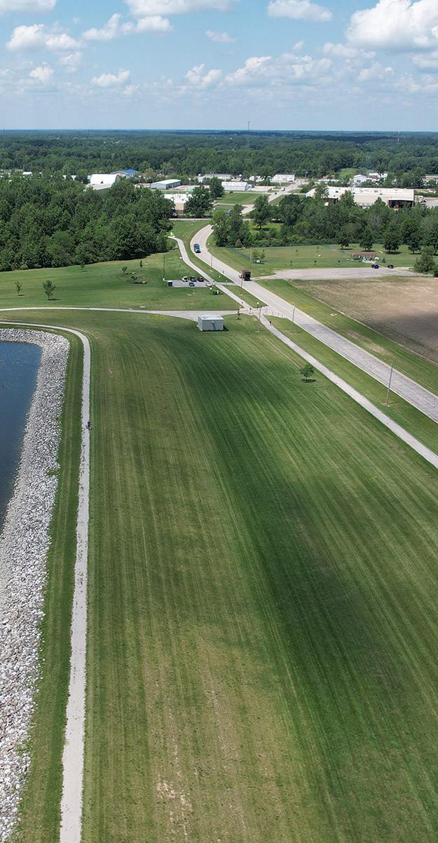
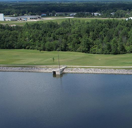
Holding approximately 350-million-gallons of water, the reservoir was built in 2008 to function as a pre-treatment basin. In the past, serving as the sole water supply for the City of Defiance, water from the Maumee River was pumped directly to the treatment plant. However, nutrient levels in the river fluctuate dramatically and can cause treatment challenges. The creation of the reservoir ensured the availability of more consistent water for the City's treatment plant when the Maumee River's water quality falls below optimal levels. The ODNR's Division of Water Resources classifies the reservoir's dam as a Class II Dam.
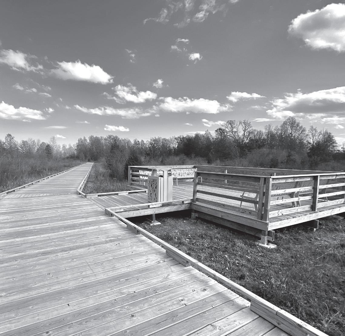
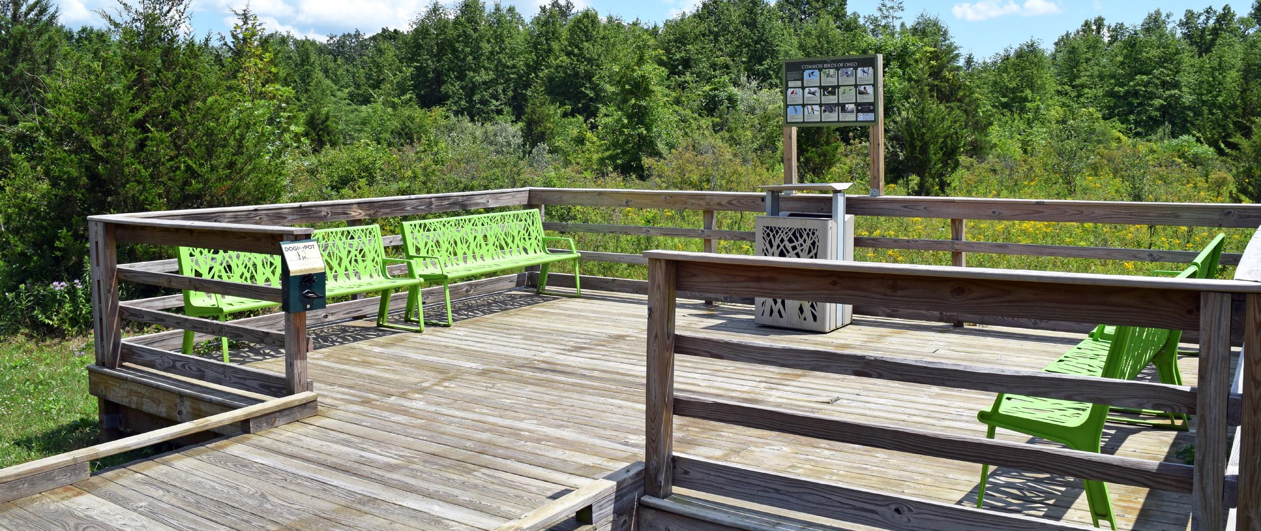
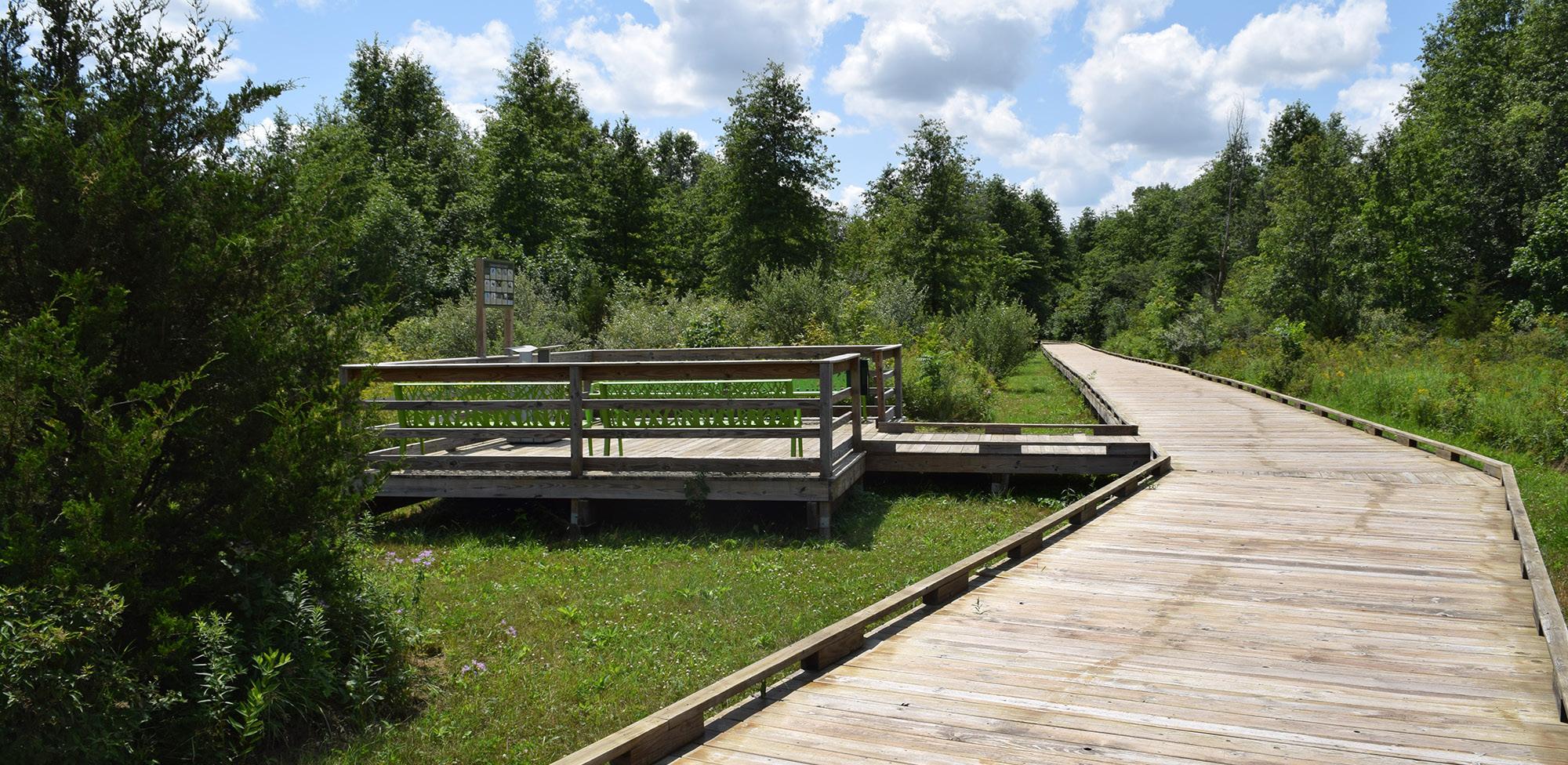
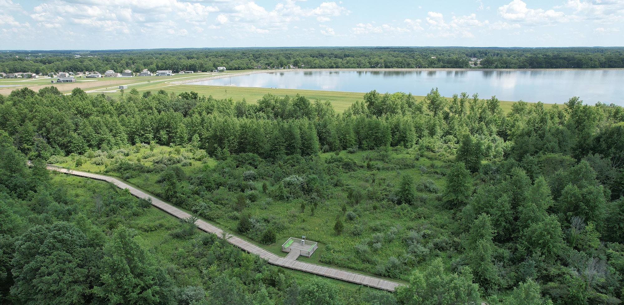
Approximately 1.25 miles of trail runs along the perimeter of the reservoir's upper bank, offering unobstructed
STRENGTHS
• Accessible by vehicles, sidewalks, and pedestrian / bicycle trails
• Part of Ohio's Buckeye Trail and the North Country Trail
• Park is heavily frequented by the community's trail users
• Contains the City's largest boardwalk with interpretive components included throughout
• Adjacent to Bark & Run Dog Park
• Park contains one of the few winter-specific amenities within the City's parks system
views. Benches are spaced along the stone walkway, with handicapped parking conveniently located near the boat ramp. Additionally, an 8-foot-wide nature trail, which transitions into a boardwalk, extends from the parking lot through approximately 2,500 feet of natural wooded area before connecting to the 'lower' pathway around the reservoir. These trails incorporate a section of the historic Miami and Erie Canal along Canal Road and link to Ohio's Buckeye Trail.
The ODNR stocks the reservoir with a variety of fish including bluegill, channel catfish, largemouth bass, saugeye, walleye, and yellow perch. A boat ramp provides access to the water for fishing, but gasoline motors are not permitted.
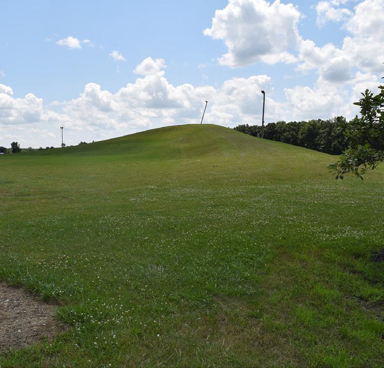
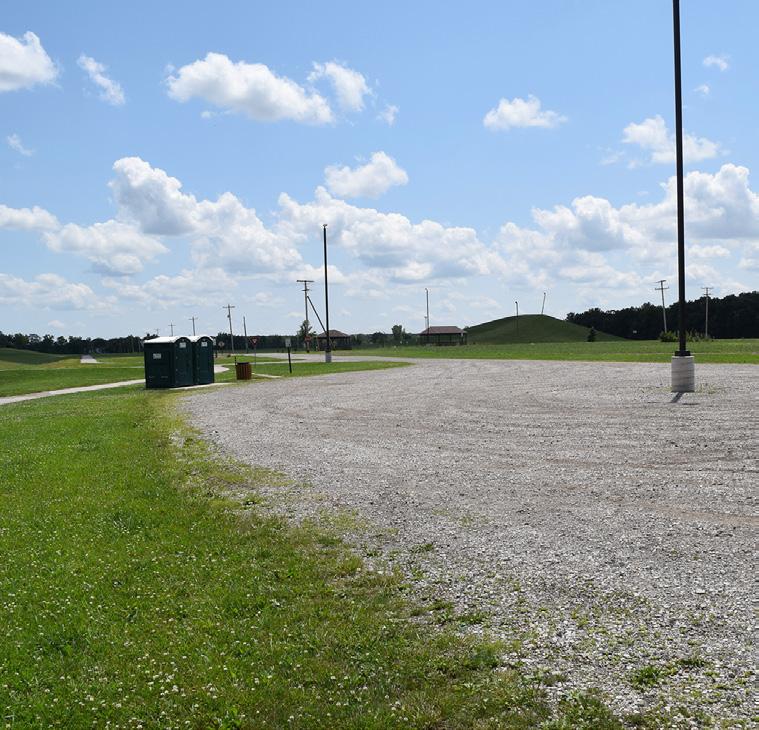
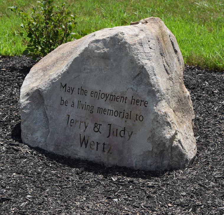
Additionally, this site also includes Wertz Park, located southwest of the Reservoir. The park includes three small pavilions, a gravel parking lot, and a sledding mound, all equipped with some security lighting.
LIABILITIES
• Does not have a permanent restroom facility
• There is no lighting along the trails
• Lack of close parking
BARK
"[My favorite park is the] Reservoir Recreational Area because our whole family can walk the boardwalk, including my husband who uses a wheelchair and scooter. "
"It is safe [with] no vehicle traffic to contend with. Love the boardwalk thru the woods - always love seeing the wildlife and wildflowers, and I love the distance I can put in as a runner with the top and bottom loops."
"The
boardwalk is easy to walk on, and has shade as well as sunny areas."
BOARDWALK FOUNDATION
SLEDDING HILL
EDUCATIONAL SIGNAGE
OPEN AREA
GRAVEL PARKING LOT
AERIAL VIEW
SHELTER HOUSE
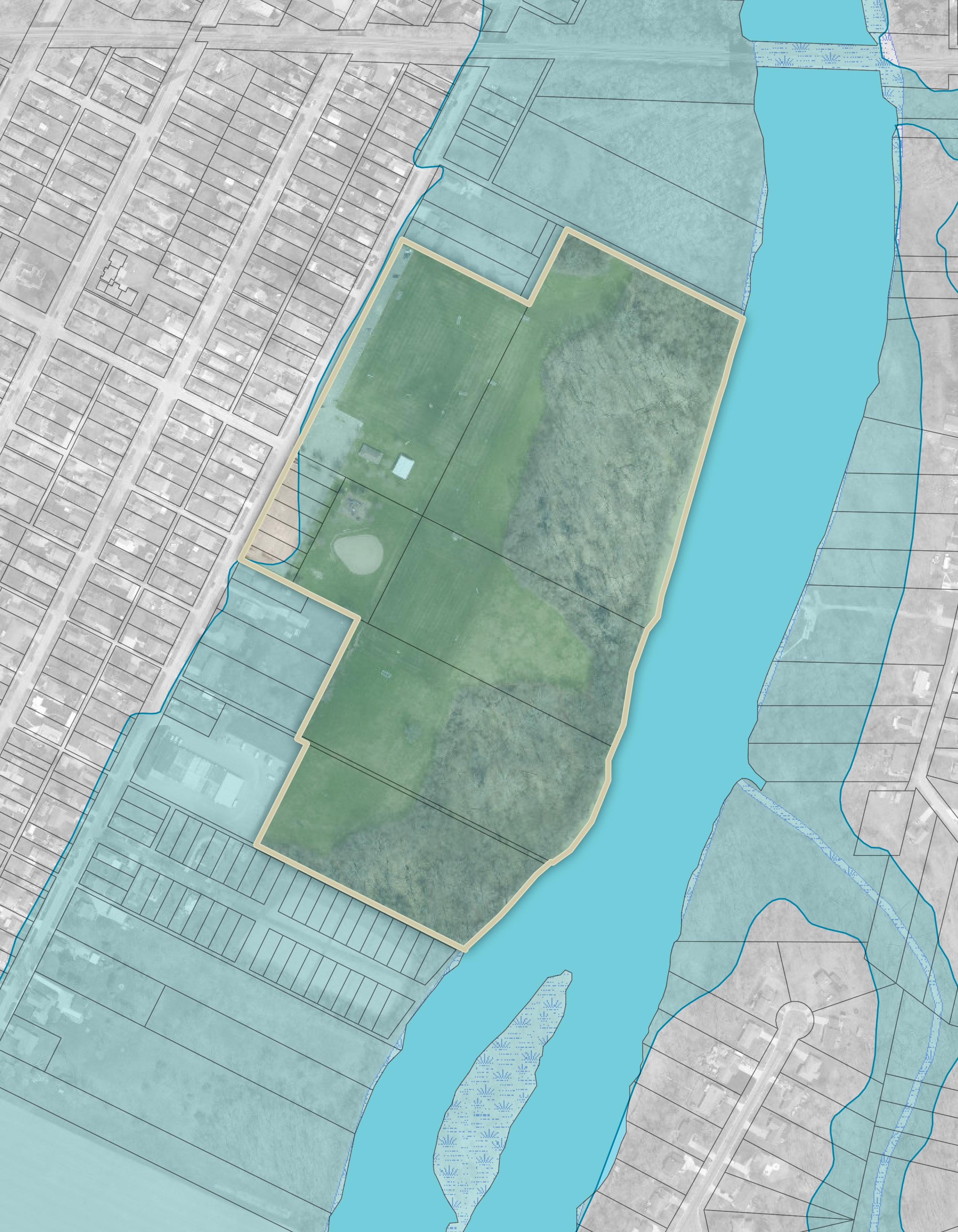
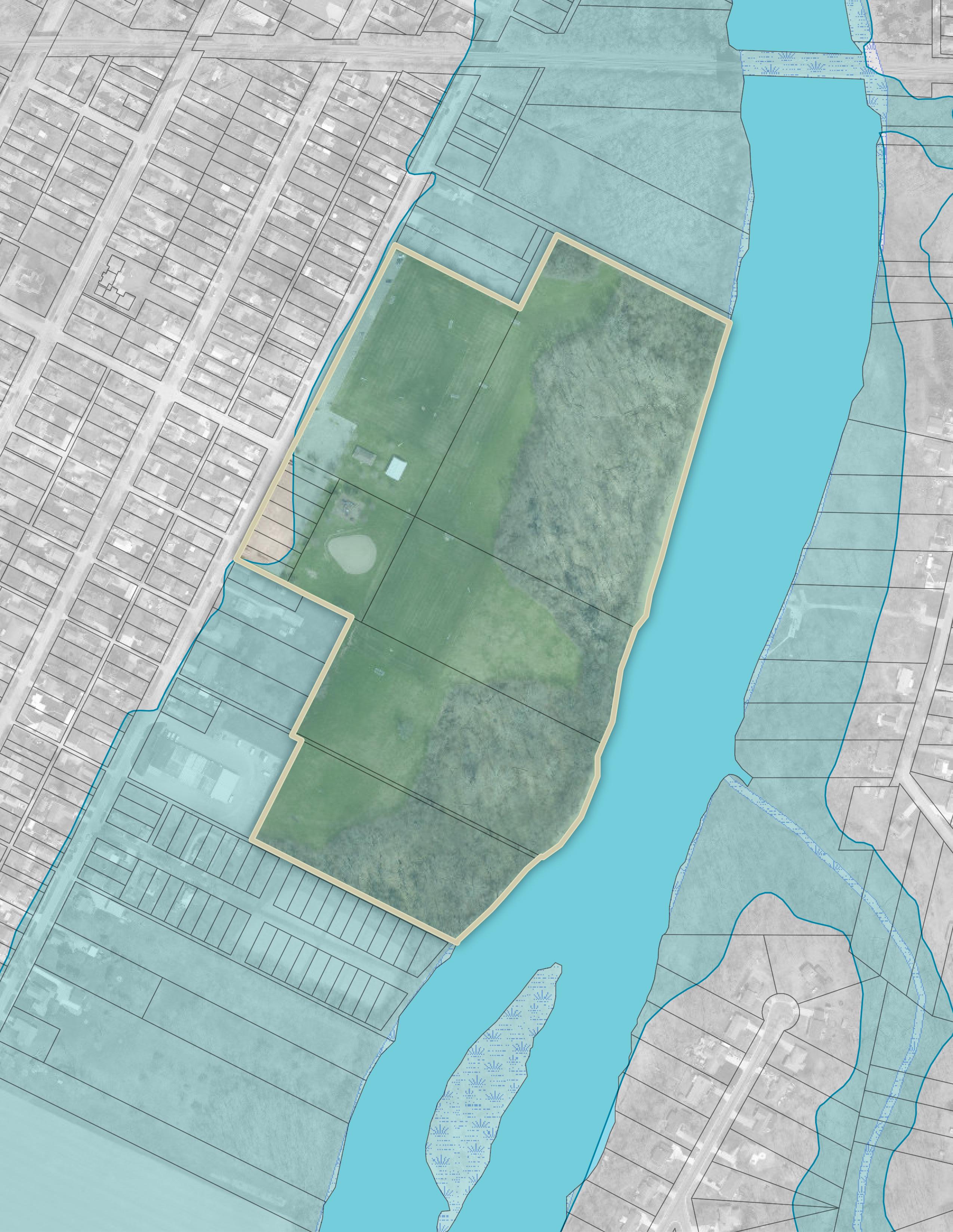
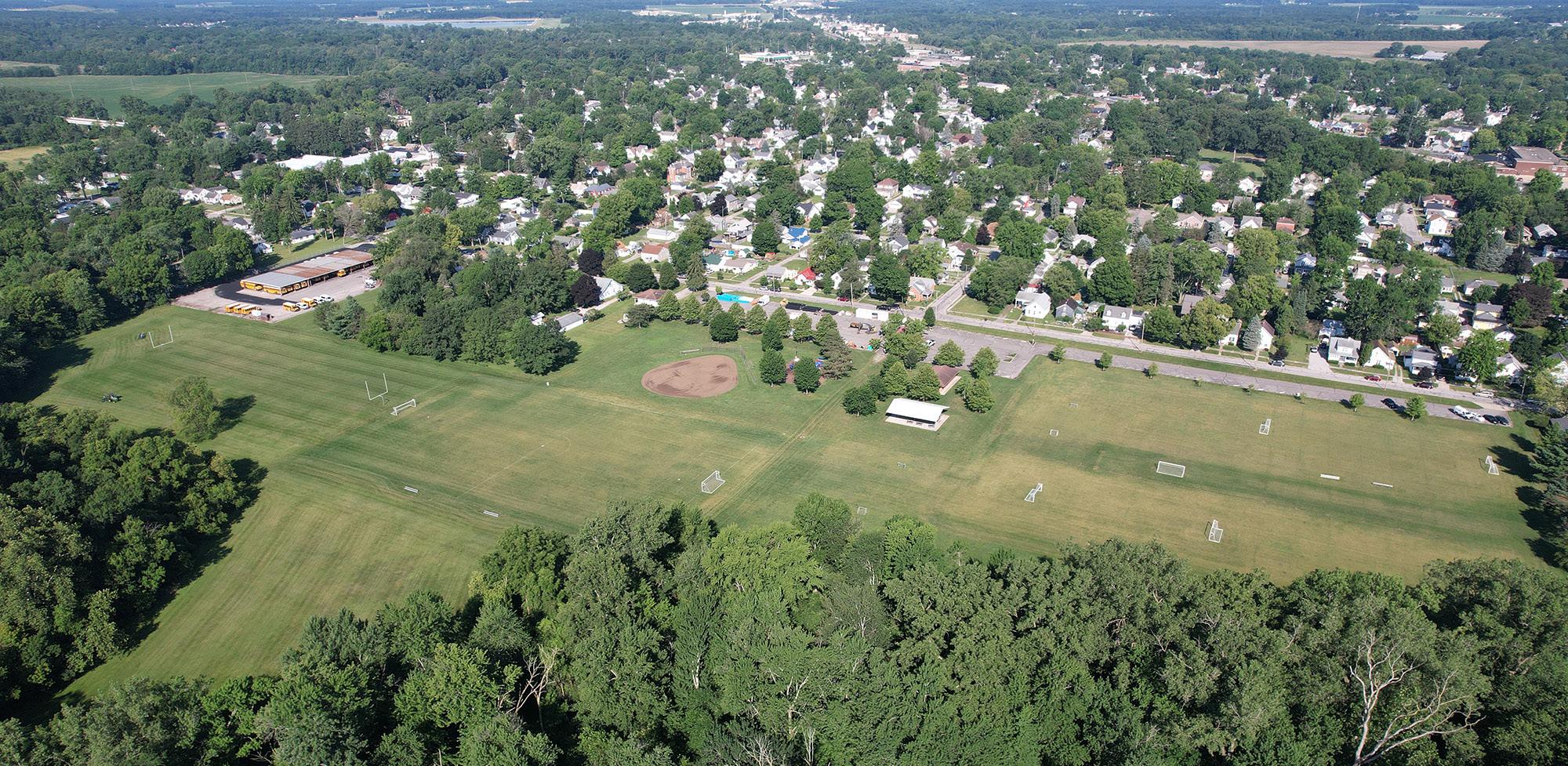
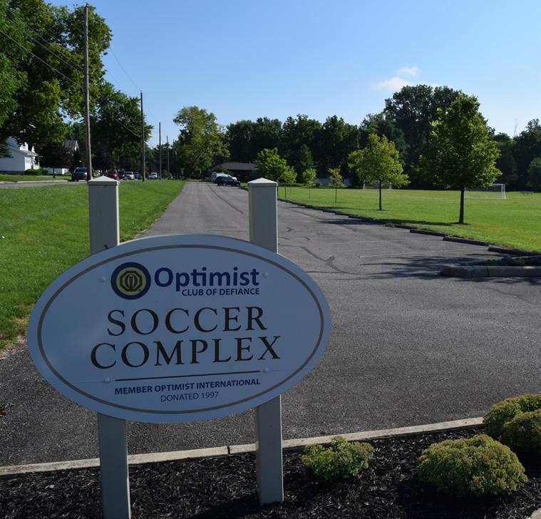
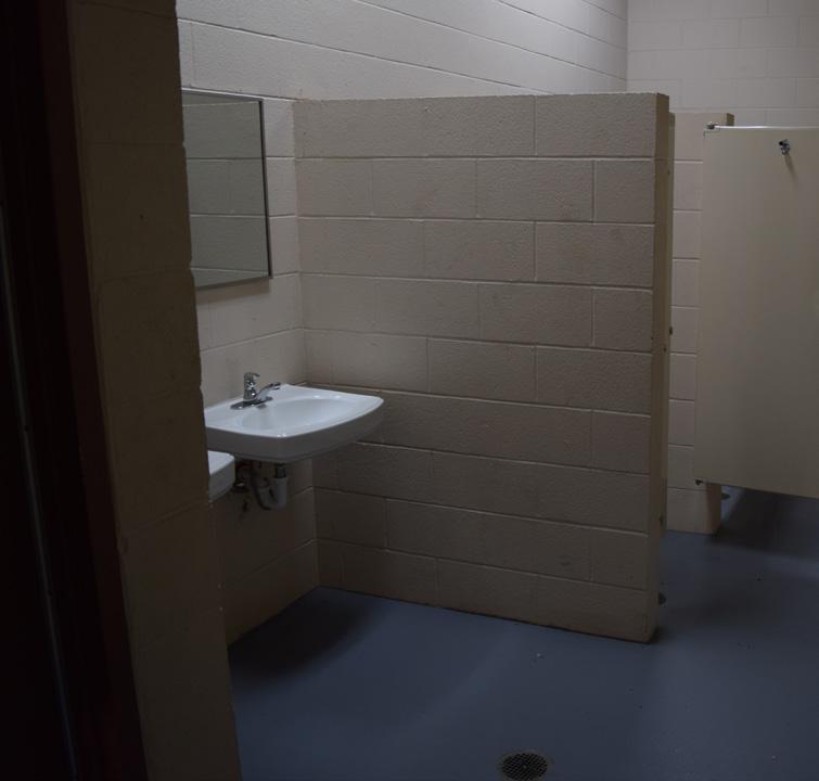
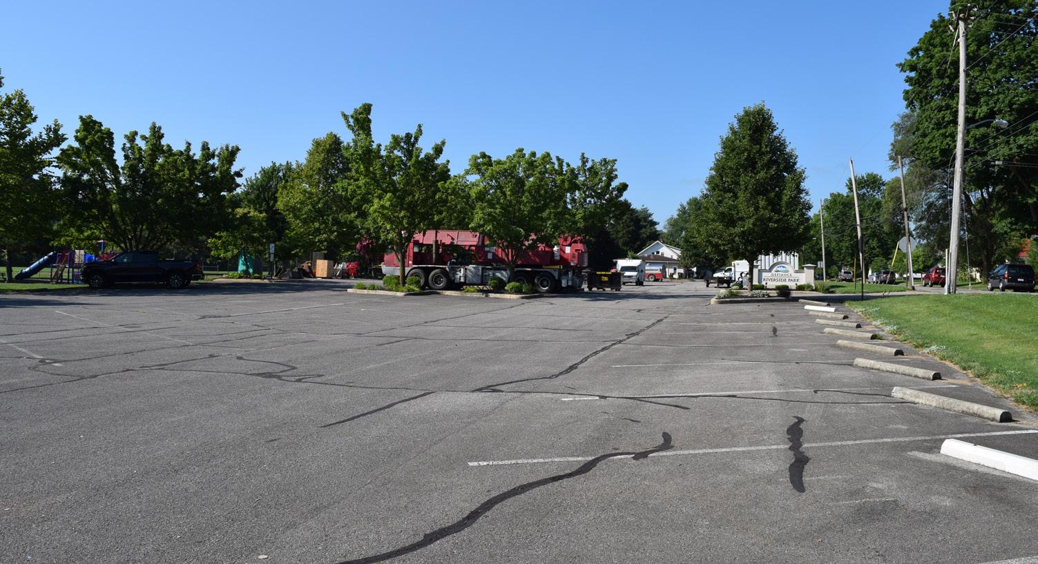
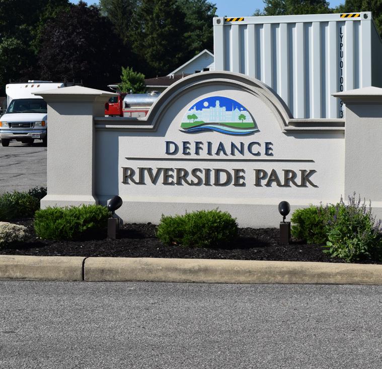
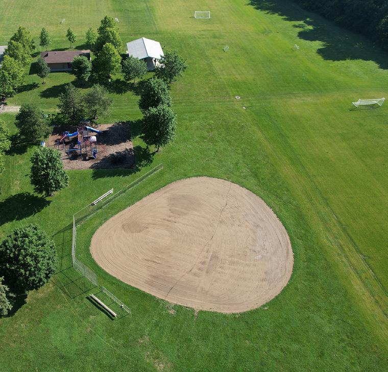
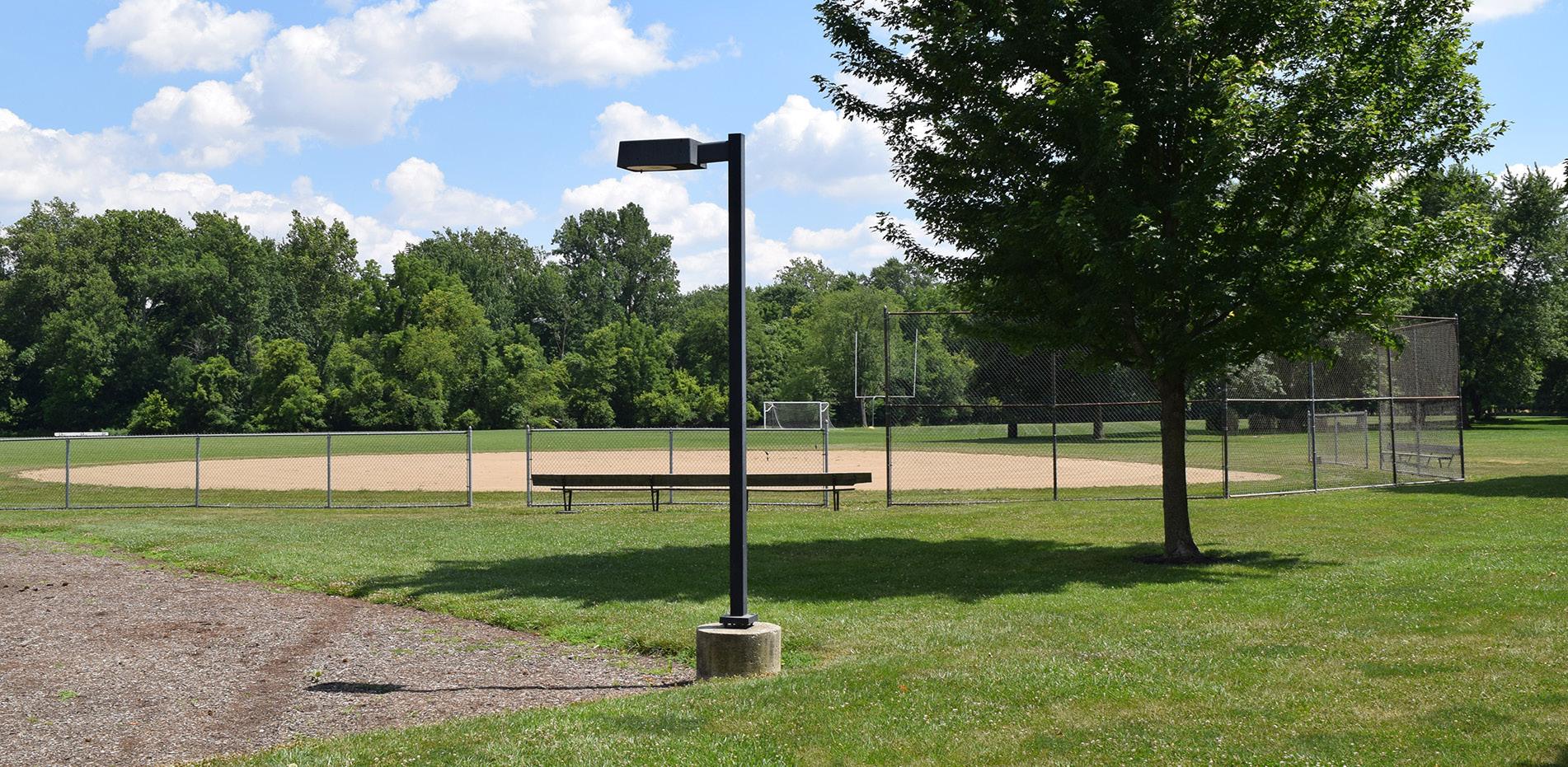
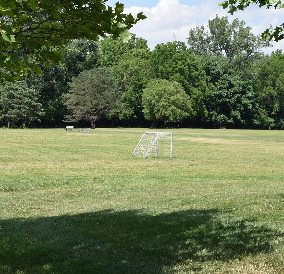
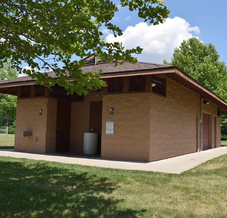
RIVERSIDE PARK
Passive / Active Moderate
Situated on the west banks of the Auglaize River, just south of downtown, Riverside Park offers five soccer fields, including three tot fields and two full-size fields—one of which doubles as a football field with goal posts. The park also includes a ball field, shelter house, playground equipment, and a recently updated restroom facility. The park is utilized by Defiance soccer leagues and groups from the local YMCA.
STRENGTHS
• Shelter house rentals
• Handicap parking spaces are available
• Electricity and water are available on site
• Natural woodlands
• Adjacent to river
• Potential for riverfront access
• Presence of wildlife
PARK AMENITIES/FACILITIES
LIABILITIES
• Does not have ADA accessible routes from the parking lot to key site amenities
• Ball field needs updated
• Need playground shade components
• Potential for flooding events
• Most users don't realize this park is located on the river
Benches
WASHINGTON AVE WILLIAMSST JEFFERSONAVE
RIVERSIDE AVE
PLAYGROUND
BASEBALL / SOFTBALL
RESTROOMS
SHELTER HOUSE #1
SOCCER FIELDS
SOCCER
AUGLAIZE RIVER
"Riverside Park is the most scenic out of [all] the parks."
SHELTER HOUSE
SOCCER SIGNAGE
AERIAL VIEW
FOOTBALL FIELD
WOODLAND TRAIL
"Riverside [is my favorite park] because of the wide open area. I can walk my dogs and also see wildlife in the early AM."
PARKING LOT
PARK SIGN
SPORTS FIELDS RESTROOMS
SOCCER FIELDS
WOODLAND TRAIL
PLAYGROUND LIGHTING
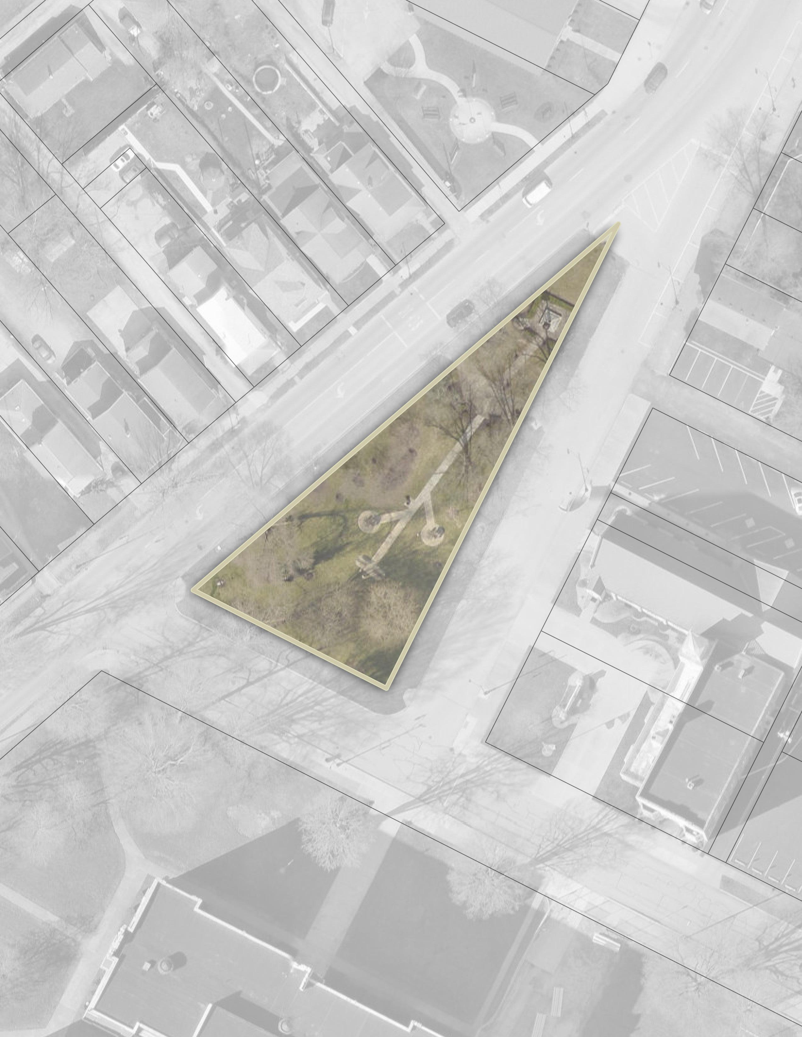
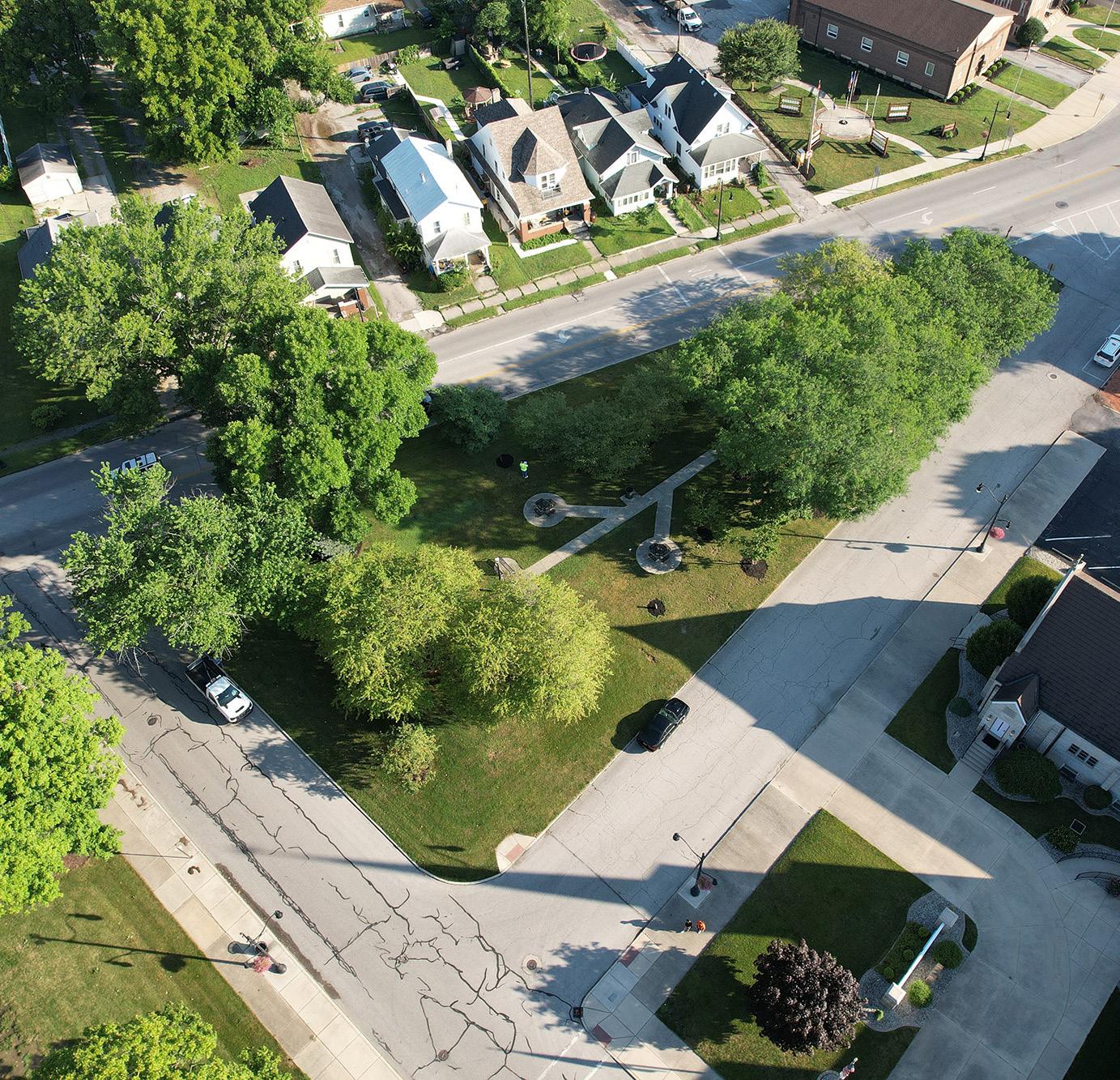
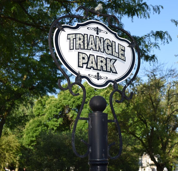
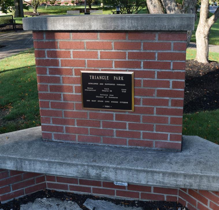
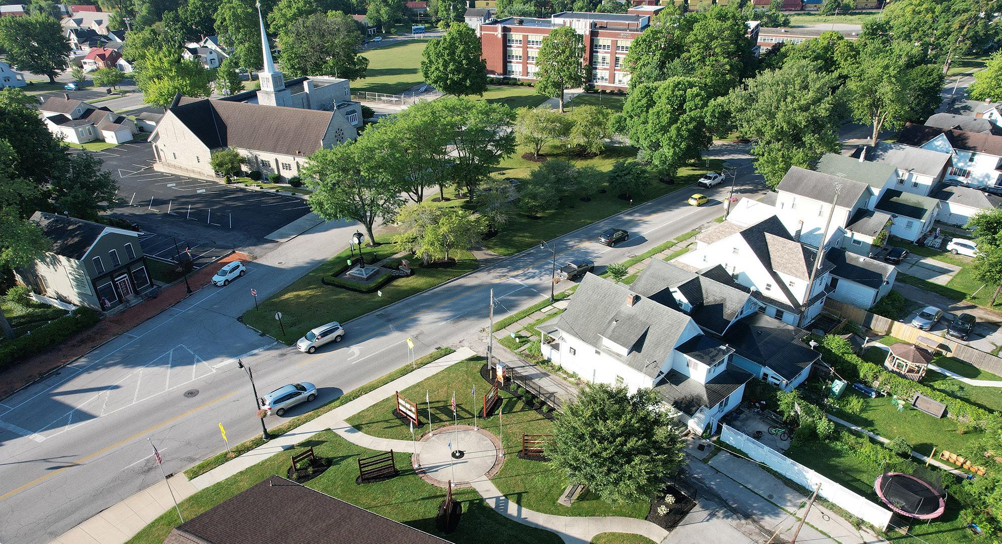
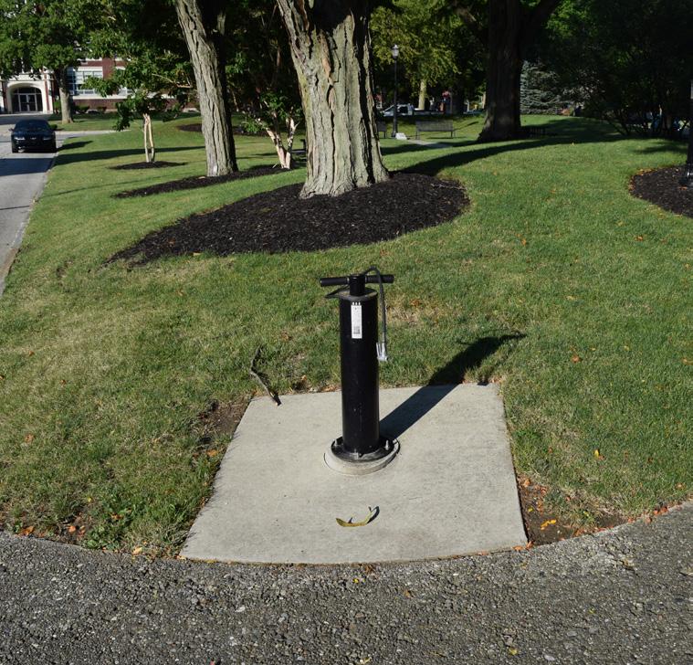
TRIANGLE PARK
Passive / Active Moderate Community Park Good Mostly Accessible
STRENGTHS
• Conveniently located near downtown
• Accessible by vehicles, sidewalks, and pedestrian / bicycle trails
• Area is well-lit
• Located adjacent to Hometown Heroes Park
• Contains a dynamic viewshed of the downtown streetscape looking northward
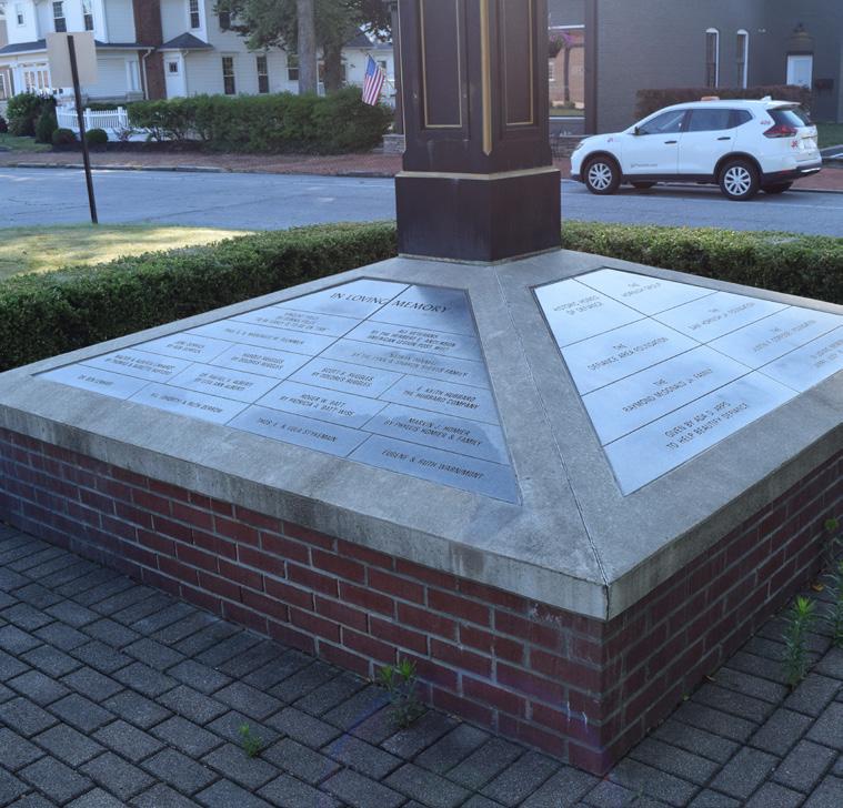
Triangle Park, originally part of Defiance City Schools property donated by the Latty and Holgate families in the 1860s, has long been a downtown focal point and popular gathering spot. Formerly known as Monumental Park, it has historically served as a central gathering space for Defiance residents. The park once housed WWII cannons (now located at Fort Defiance) and the Grand Army of the Republic statue (now located in Riverside Cemetery).
In 2014, a community effort led by Historic Homes of Defiance resulted in the addition of a town clock, and in 2015, an air pump for bicyclists was installed by Historic Homes of Defiance and the Defiance Development and Visitor's Bureau.
Today, Triangle Park hosts concerts and "Music in the Park" events, picnics, and serves as a popular meetup for cyclists. It also hosts Santa's House during the Christmas season where the community can visit with Santa.
LIABILITIES
• Exposed aggregate walkway with cracking
• Slopes greatly exceed ADA maximums
• Safer pedestrian crossings are needed between Triangle Park and Hometown Heroes Park
• Lack of parking opportunities adjacent to the park
• Lacking accessible connections and walkways to adjacent neighborhoods

CLINTONST ARABELLAST
HOMETOWN HEROES PARK
"I like the walkability to Downtown and the charm with the benches and trees. "
AERIAL VIEW
PARK SIGNAGE
LOOKING NORTH INTO DOWNTOWN
LOOKING WEST ON ARABELLA ST CLOCK MONUMENT
"Triangle Park represents the culture and appreciation of our downtown. [It's] also a great place for a small venue. The clock is awesome. "
"Triangle Park is the heart of Defiance."
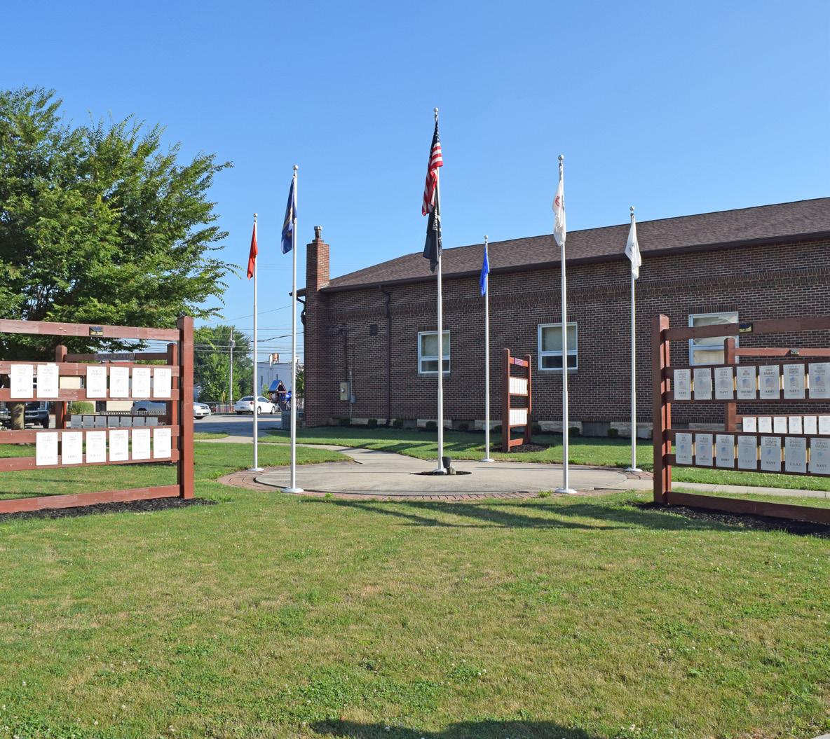
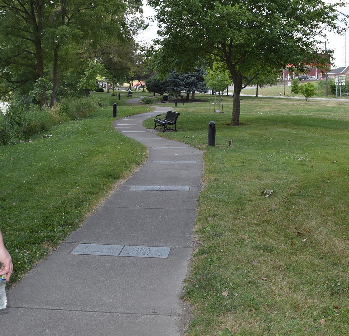
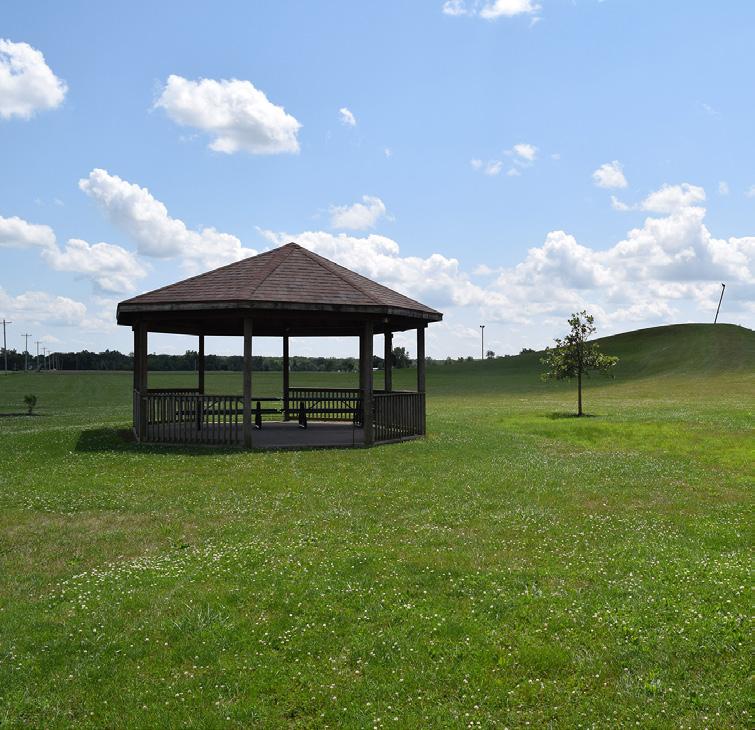
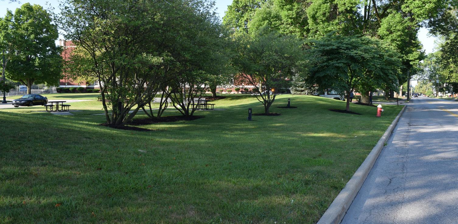
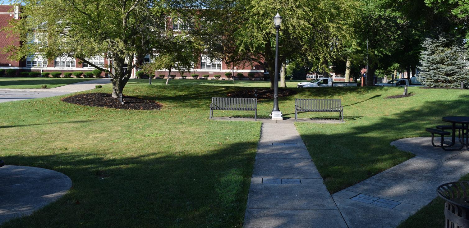
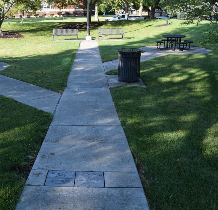
VETERAN'S MEMORIAL PARK
AT LATTY'S GROVE
Veteran's Memorial Park at Latty's Grove was established in 1947 and is situated on the south side of downtown Defiance. It was dedicated as a "living memorial," serving as a call for a strong national defense to uphold the ideals for which soldiers of all wars have fought and sacrificed. A memorial grove of trees was dedicated after WWII to honor the 148th Regiment, a famed unit of the 37th Infantry Division that spearheaded Pacific campaigns under the command of a Defiance leader. Throughout Defiance's history, soldiers have frequented this land, from Native American councils to the War of 1812. Organized by Mayor Bronson, the park serves to honor all of Defiance's heroes.
STRENGTHS
• Handicap parking spaces are available
• Tennis courts and shelter houses are illuminated
• Shelter house rentals
• Accessible route to restroom facility
• Located directly within neighborhoods
• On-street parking is available along nearly the entire southern edge of the park
PARK AMENITIES/FACILITIES
Today, the park features two shelter houses, a playground (for ages 5 to 12), and public restrooms, along with a ball field, basketball court, and tennis court. Additionally, a bocce ball court was installed in 2024, funded through a grant received by the Defiance County Board of Developmental Disabilities to promote diverse initiatives and projects.
Plans are also in place for upgrades to the walkways and shelter houses in 2025 which will be funded through an Ohio NatureWorks Grant and State Capital Appropriations, paired with donations from the local AmVets organization.
The park hosts special events throughout the year, including Northwestern Ohio Community Action Commission's Summer Food Service Program.
LIABILITIES
• All sports facilities need renovated
• Shelter houses need improvements
• Playground needs shade components
• Aged equipment with no accessible routes to access playground
• No accessible routes or walkways are provided to the adjacent neighborhoods
• Noise from trains
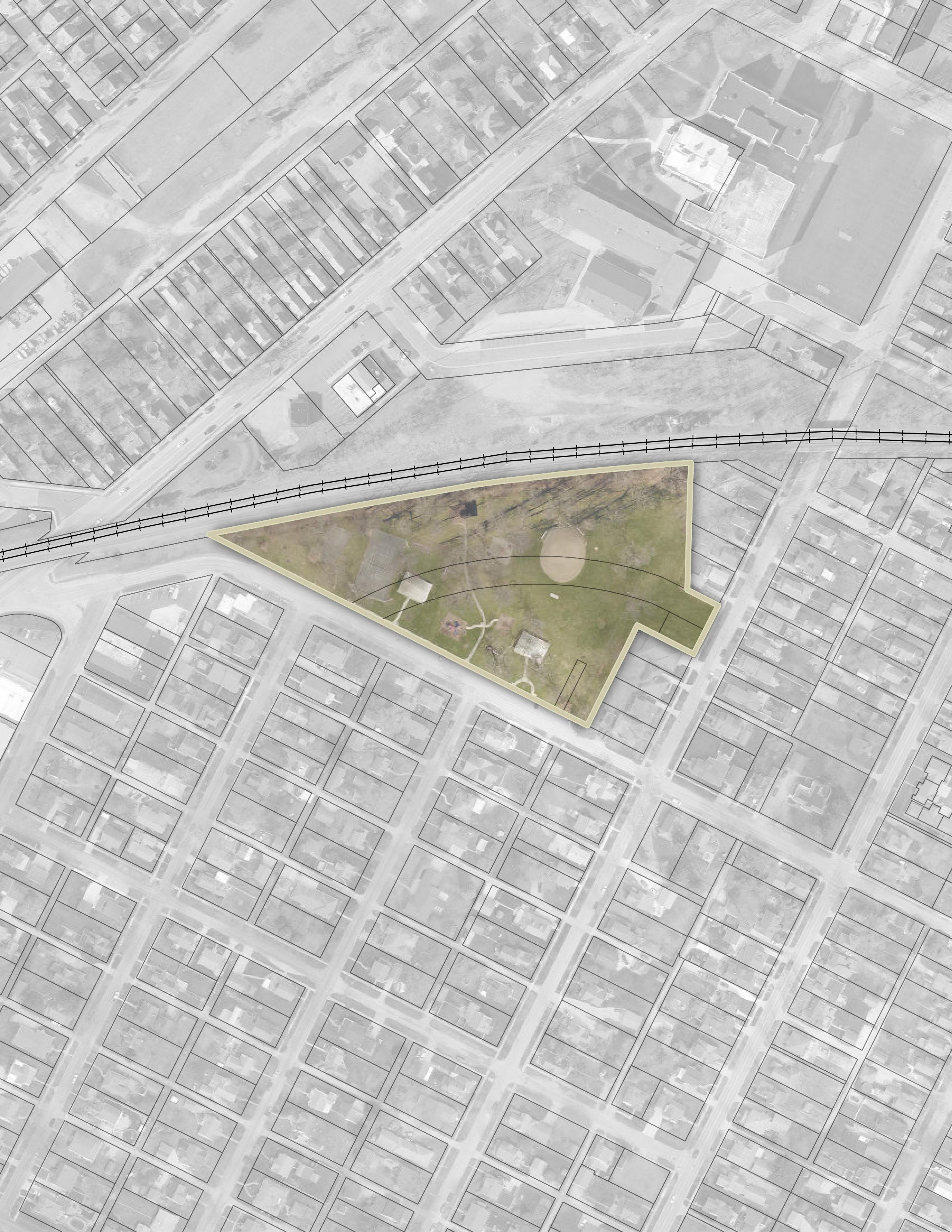
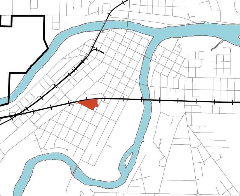
JEFFERSONAVE
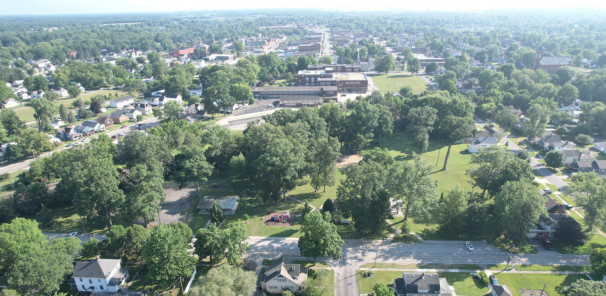
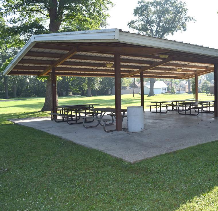
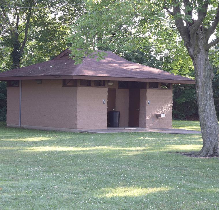
"It has plenty of parking, huge shady trees, and I like to watch the trains go by."
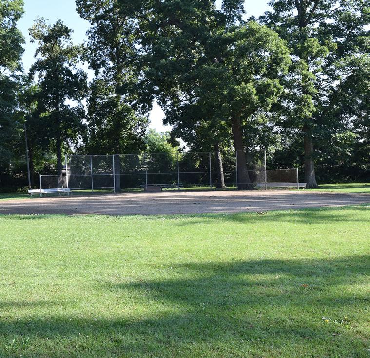
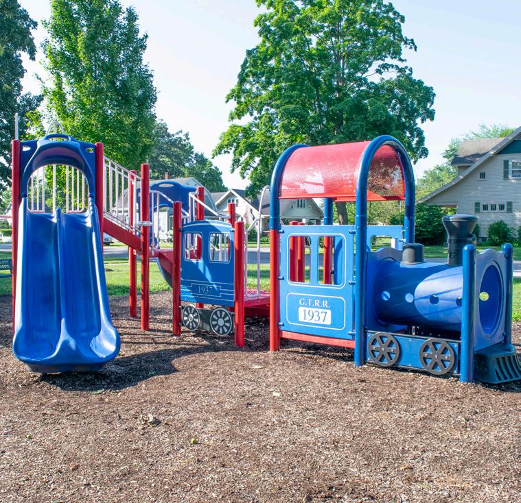
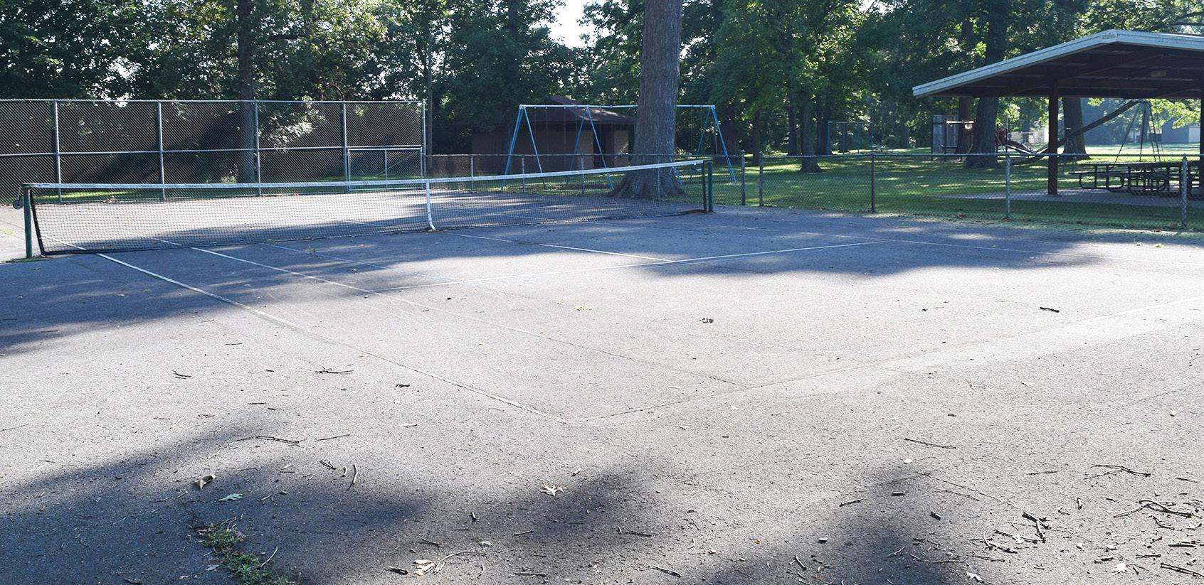
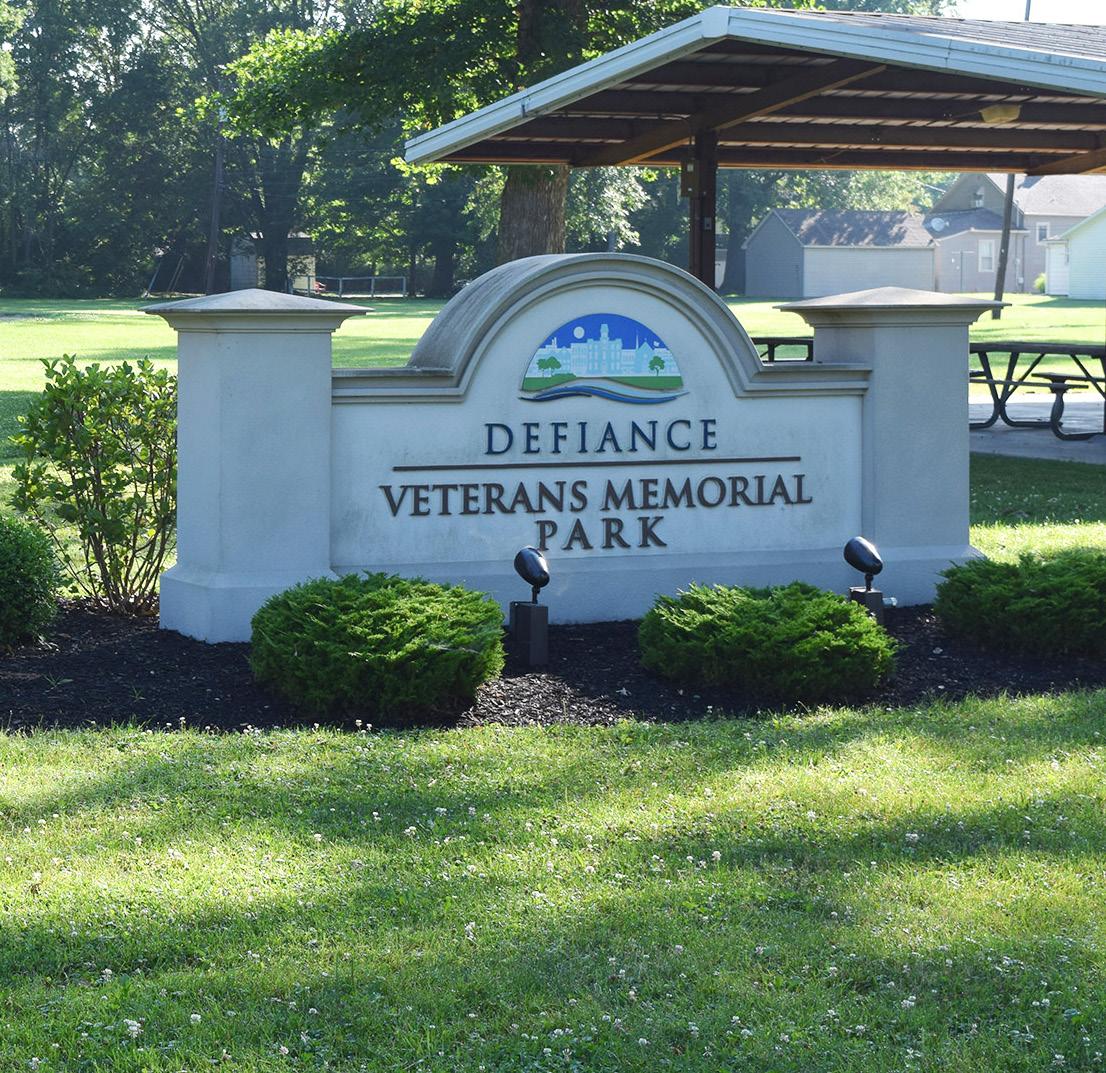
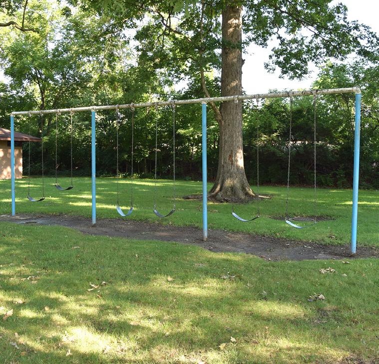
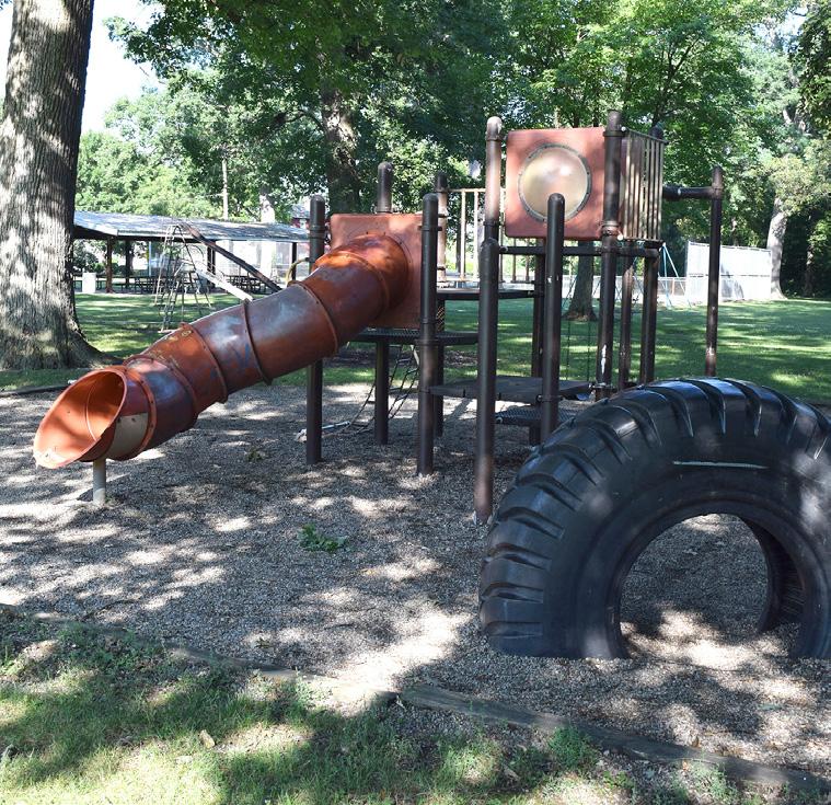
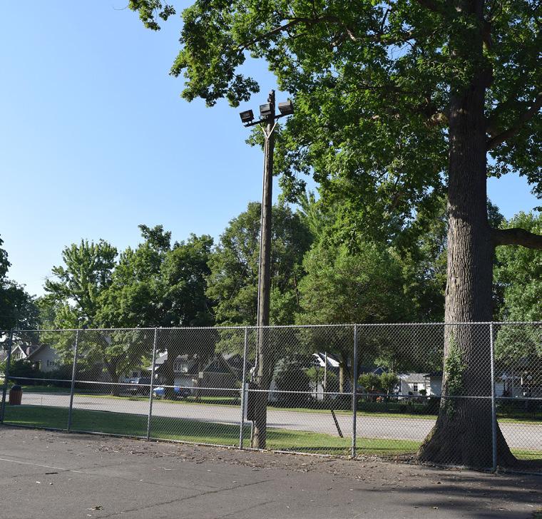
TENNIS COURT
SHELTER HOUSE
AERIAL VIEW
SIGN
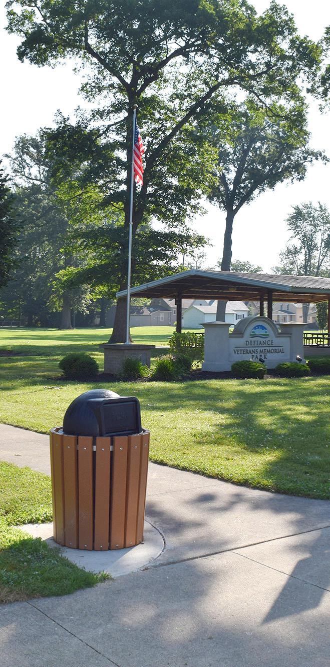
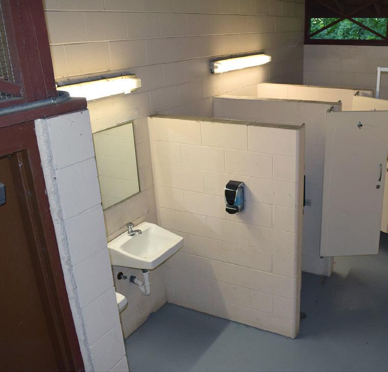
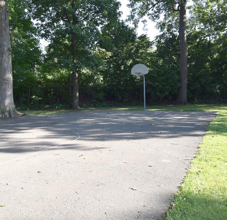
"
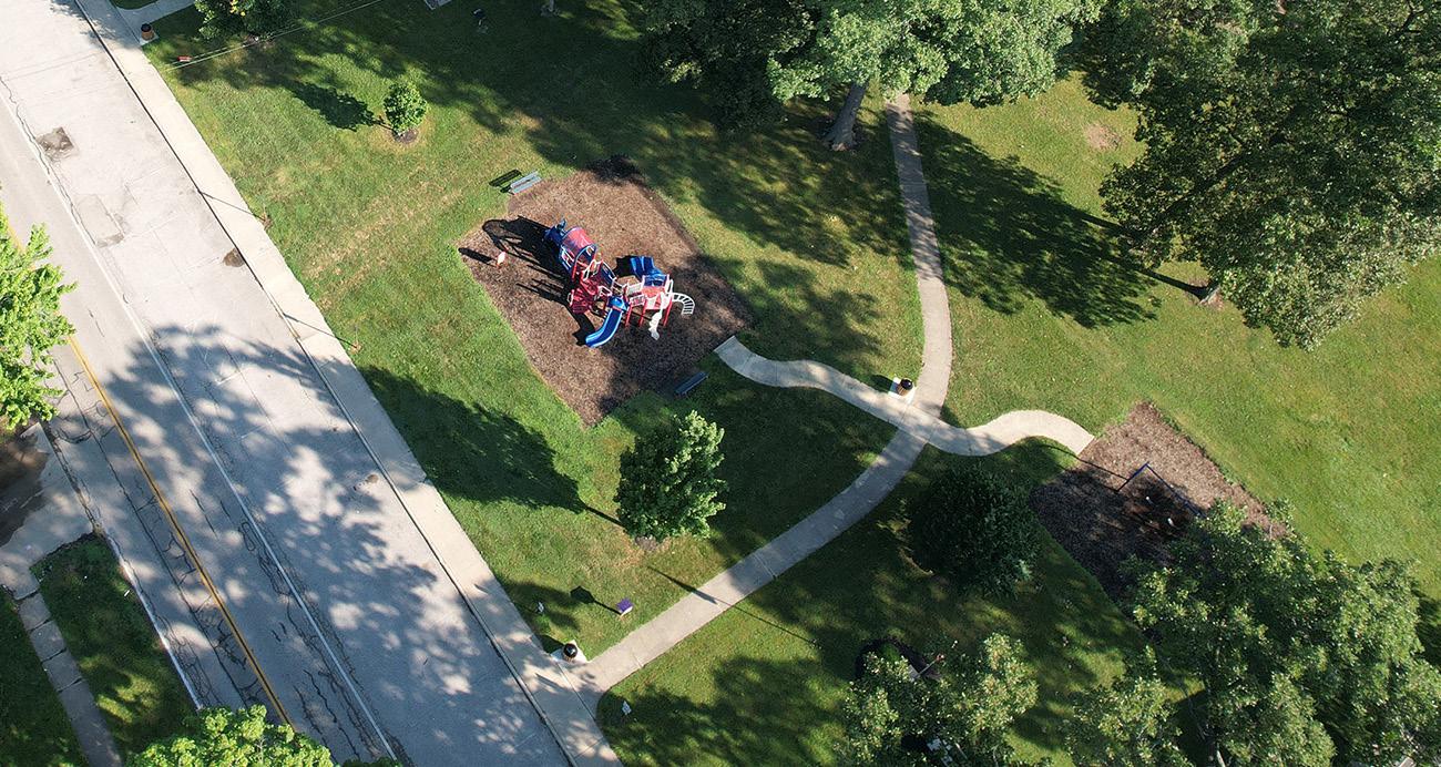
Veterans Memorial is my favorite because I have been going to that park since I was young. I have had many family birthdays, anniversaries, and lots of picnics there. Now I am older and take my grandkids there...they call it the choo choo train park."
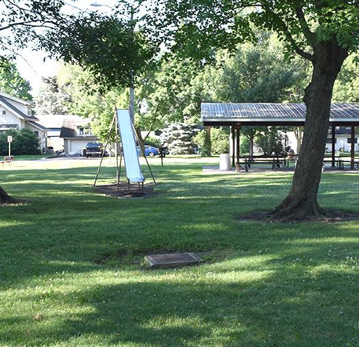
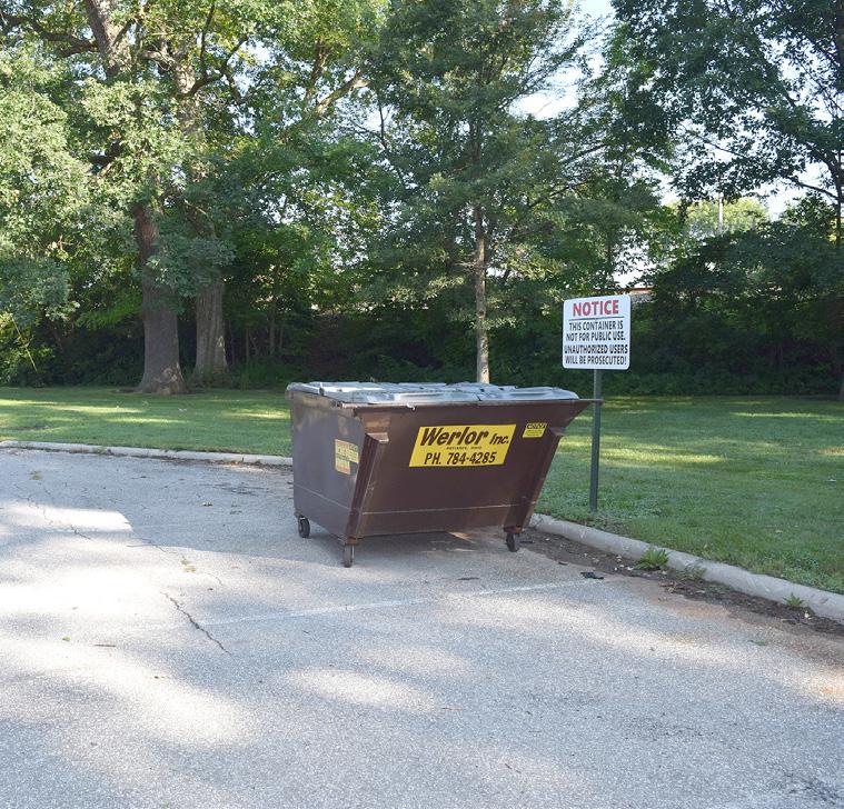
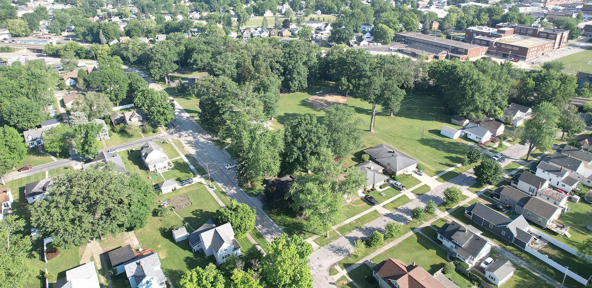
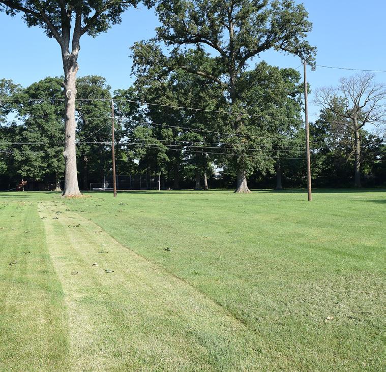
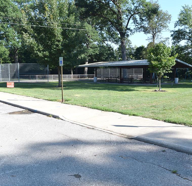
BASKETBALL COURT
SLIDE PARK ENTRY
DUMPSTER
RESTROOM
SPECIES OF INTEREST
The ODNR highlighted several species that range from federally endangered to state species of concern. The table below and the map to the right show where specific species have been found in the past.
FIGURE 19: Species of Interest in Defiance Parks. The chart identifies the areas within the scope of work that endangered or special interest species have been identified by the Ohio Department of Natural Resources (ODNR).
KEY: State Threatened State Potentially Threatened
State Endangered
State Species of Concern
State Endangered & Federally Threatened CREAM VETCHLING LATHYRUS OCHROELEUCUS NORTHERN HARRIER CIRCUS HUSONIUS COPPERBELLY WATER SNAKE NERODIA ERYTHROGASTER NEGLECTA GREATER REDHORSE MOXOSTOMA VALENCIENNESI PLAINS CLUBTAIL GOMPHUS EXTERNUS LARGE BLAZING STAR LIATRIS SCARIOSA INLAND RUSH JUNCUS INTERIOR GROVE SANDWORT MOEHRINGIA LATERIFLORA BLACK SANDSHELL LIGUMIA RECTA ROUND PIGTOE PLEUROBEMA SINTOXIA
BARK & RUN DOG PARK
BRONSON PARK
BUCHMAN PARK ON THE GLAIZE
CANAL PARK
DIEHL PARK
EASTSIDE PARK
FORT GROUNDS
GATEWAY PARK
HOLGATE PARK
HOMETOWN HEROES PARK
KINGSBURY PARK
K O C BASEBALL COMPLEX
LIVINGSTON PARK
MEMORY PARK
PALMER PARK
PONTIAC METRO PARK
RESERVOIR RECREATIONAL AREA
RIVERSIDE PARK
TRIANGLE PARK
VETERAN'S MEMORIAL PARK AT LATTY'S GROVE
TRUNCILLA TRUNCATA
NOTE: The ODNR provided GIS data for a limited amount of the species of interest (documented on the map below). Refer to the chart on the left for a full list of species documented within one mile of the project scope. Species identified on the map include:
• Grove Sandwort
• Cream Vetchling
• Deertoe
LEGEND
State Threatened
State Potentially Threatened
State Species of Concern
1-Mile Buffer of all Identified Zones
City Parks within 1-Mile Buffer
• Large Blazing Star
• Purple Wartyback
• Round Pigtoe
• Elktoe
• Black Sandshell
• Creek Heelsplitter
City Parks Outside of 1-Mile Buffer
Rivers
Railroad
City Limits
Located Outside
Municipal Jurisdiction
FIGURE 20: Species of Interest Map
This map identifies the areas within the scope of work that endangered or special interest species have been identified by the ODNR.
2 4 6 8 0
FEET IN THOUSANDS
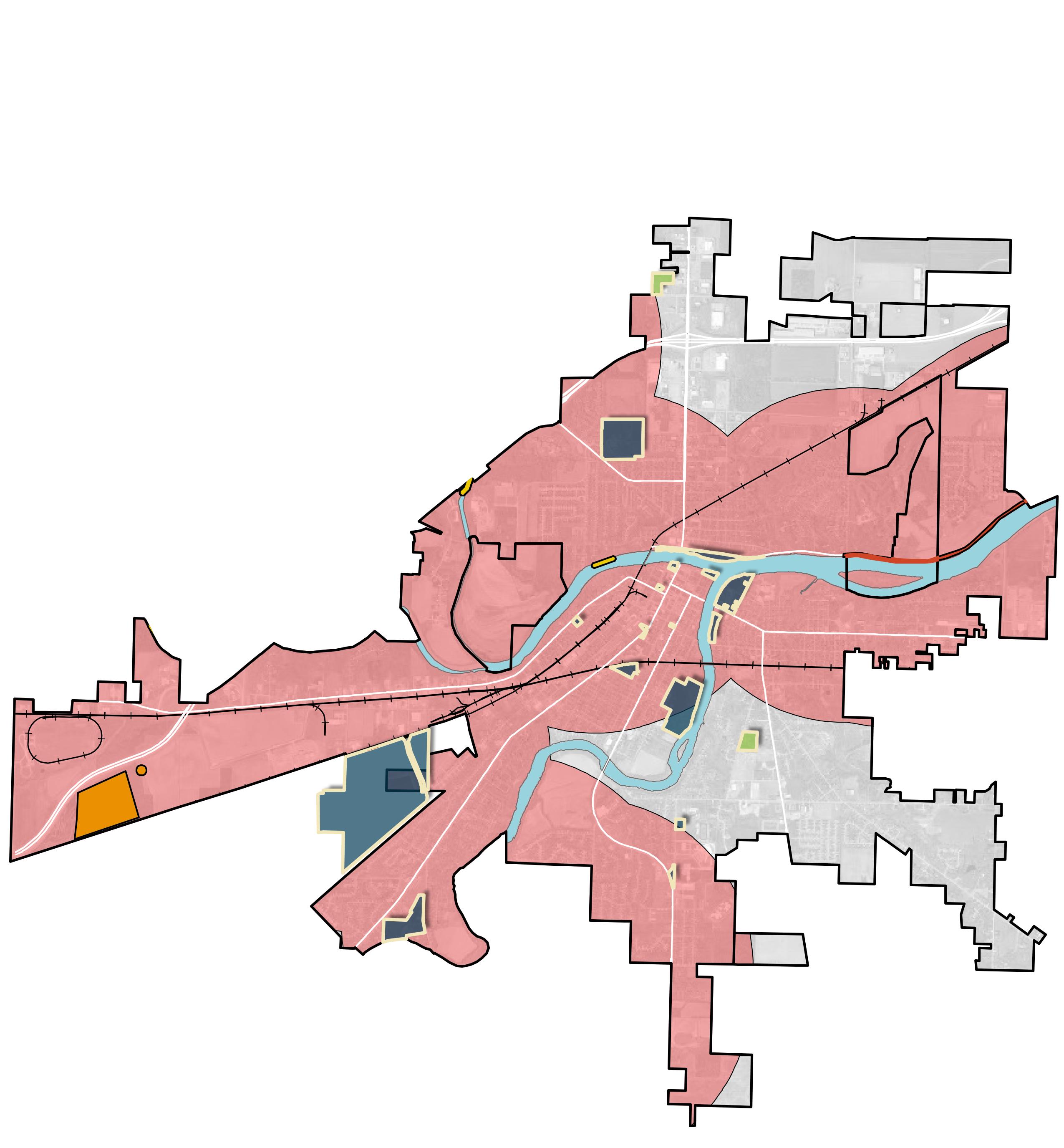
• Plains Clubtail
• Inland Rush
Entire study area has the potential of critical habitat for:
• Indiana Bat (Myotis sodalis) - State and Federally Endangered Species
• Little Brown Bat (Myotis lucifugus) - State Endangered Species
• Tricolored Bat (Perimyotis subflavus) - State Endangered Species
• Clubshell (Pleurobema clava) - Federally Endangered Species
• Northern Long-Eared Bat (Myotis septentrionalis) - State and Federally Endangered Species
• Rayed Bean (Villosa fabalis) - Federally Endangered Species
• Northern Riffleshell (Epioblasma torulosa rangiana) - Federally Endangered Species
• White Catspaw (Epioblasma obliquata perobliqua) - Federally Endangered Species
• Rabbitsfoot (Quadrula cylindrica cylindrica) - Federally Threatened Species
Special care should be taken to ensure that development does not impact habitat for the above species. Further research may be required for each project to determine if improvements interrupt ecological functions.
RIVER RESOURCES
The Maumee, Auglaize, and Tiffin Rivers converge in and around the City of Defiance, creating a network of waterways that have been central to the region’s development. These rivers not only provide critical ecological habitats and support local biodiversity but also offer numerous recreational opportunities for residents and visitors alike.
Maumee River
The Maumee River, flowing through the heart of Defiance, Ohio, is a vital waterway that plays a significant role in the region's geography, history, and ecology. Originating from the confluence of the St. Joseph and St. Marys rivers in Fort Wayne, Indiana, the Maumee River traverses approximately 137 miles northeast before emptying into Lake Erie at Toledo. In Defiance, the river is further enhanced by the confluence with the Auglaize River, marking a key juncture in its journey. The Maumee River’s expansive watershed, the largest in the Great Lakes system, spans over 6,300 square miles across Indiana, Ohio, and Michigan, making it a critical component of the hydrology in the western Lake Erie basin.
Historically, the Maumee River has been a crucial artery for transportation, trade, and military strategy. The river was a lifeline for Native American tribes and early European settlers, serving as a key route for movement and commerce. The establishment of Fort Defiance at the confluence of the Maumee and Auglaize rivers in 1794 by General Anthony Wayne underscores the river’s strategic importance during the Northwest Indian War and the War of 1812. The river’s name, derived from the Miami tribe, reflects its deep cultural and historical roots in the region.
Ecologically, the Maumee River is a haven for biodiversity, supporting a wide range of aquatic and terrestrial species. Its waters are home to fish like walleye, smallmouth bass, and catfish, making it a popular destination for anglers. The river’s floodplains and wetlands provide crucial habitats for migratory birds, amphibians, and other wildlife, while also playing a key role in the health of the western Lake
STRENGTHS
• River runs adjacent to several parks
• Has an access point within Pontiac Metro Park
• Considered a scenic waterway and water trail
• Recreational opportunities including kayaking, boating, fishing, wildlife observation, overlook platforms, riverside trails, etc.
Erie basin. However, the Maumee River faces significant environmental challenges, particularly from nutrient runoff that contributes to harmful algal blooms in Lake Erie.
The Maumee River is a cornerstone of recreational life in Defiance. The river is known for its fishing opportunities, especially during the annual walleye run. Boating, canoing, and kayaking are also popular activities. Defiance has developed numerous parks and green spaces along the Maumee River, offering scenic trails, picnic areas, and scenic views of the water, further enhancing the river’s role as a natural and recreational asset to the community.
ODNR NOTES:
• Considered a Scenic and Recreational River within the Defiance area
• Due to its location in Northwest Ohio and its ties to the Great Lakes watershed, the Maumee River is a significant concern for ODNR regarding conservation and restoration
• Low-impact development is recommended to limit impacts on the ecological system
• Best management practices should be implemented and stormwater properly addressed with new development near the river
• The Maumee River contains portions of the state historic canal system, which will need to remain protected
LIABILITIES
• River has several Combined Sewer Overflows (CSOs) which release directly into it
• Earthwork and vegetation removal should be limited along the river
• Impervious improvements should be limited as much as possible
Endangered Species in the Maumee River
FEDERALLY ENDANGERED
FEDERALLY & STATE ENDANGERED

STATE ENDANGERED


STATE ENDANGERED & FEDERALLY THREATENED


STATE THREATENED
STATE POTENTIALLY THREATENED
STATE SPECIES OF CONCERN
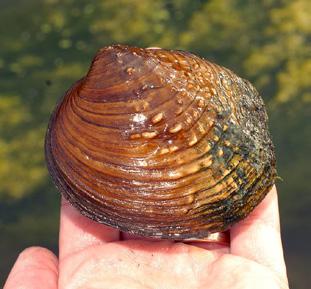
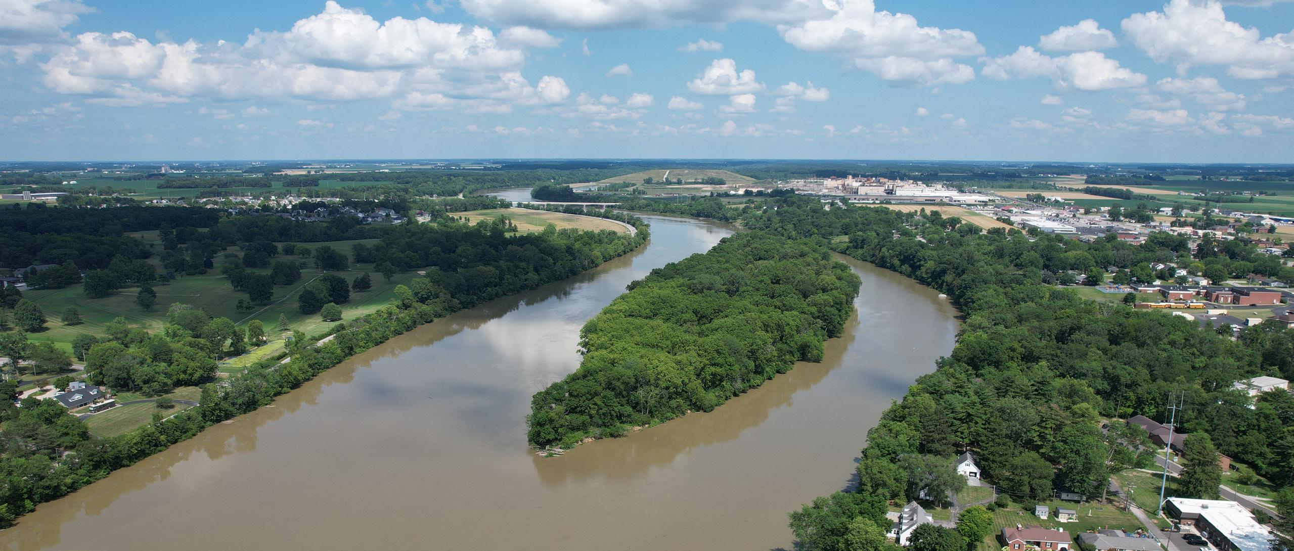
Indiana Bat Myotis sodalis
Northern Long-Eared Bat Myotis septentrionalis
Tricolored Bat Perimyotis subflavus Little Brown Bat Myotis lucifugus
Northern Harrier Circus hudsonius
Inland Rush Juncus interior
Grove Sandwort Moehringia lateriflora
Rabbitsfoot Quadrula cylindrica cylindrica
Greater Redhorse Moxostoma valenciennesi
Plains Clubtail Gomphus externus
Large Blazing-star Liatris scariosa
Copperbelly Water Snake Nerodia erythrogaster neglecta sodalis
Black Sandshell Ligumia recta
Deertoe Truncilla truncata
Round Pigtoe Pleurobema sintoxia
Elktoe Alasmidonta marginata
Purple Wartyback Cyclonaias tuberculata
Northern Riffleshell Epioblasma torulosa rangiana White Catspaw Epioblasma obliquata perobliqua
Clubshell Pleurobema clava
Rayed Bean Villosa fabalis
Endangered Species in the Auglaize River
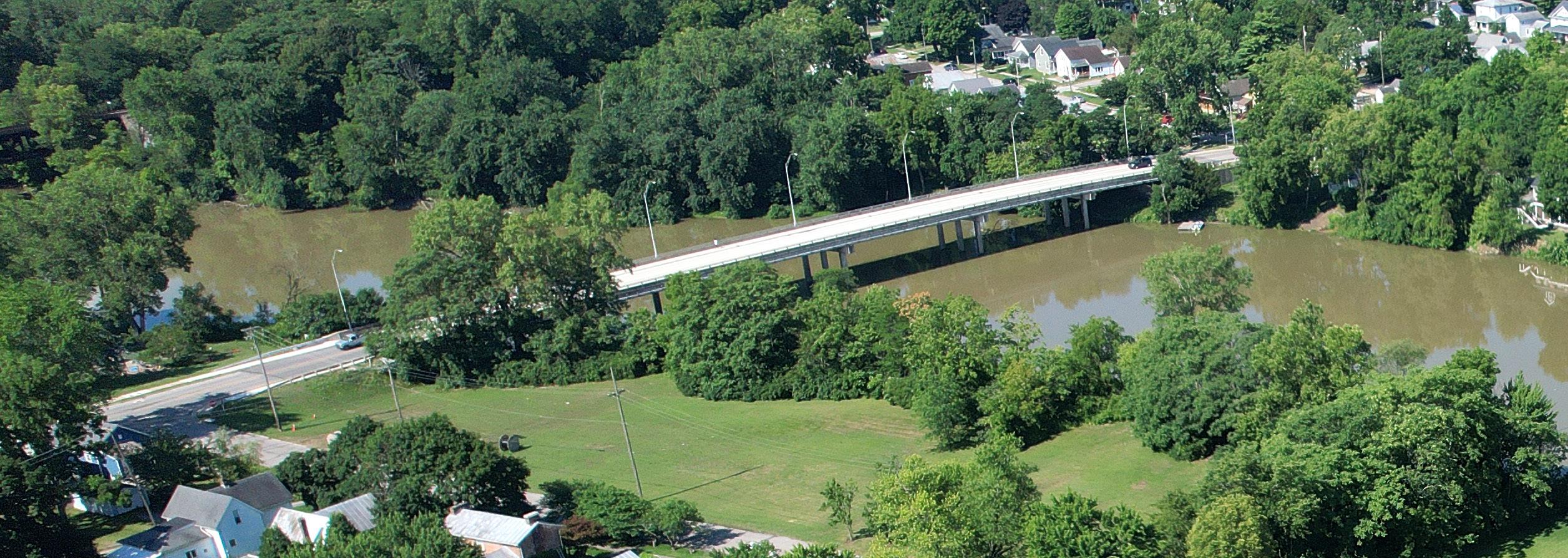
Indiana Bat Myotis sodalis
Northern Long-Eared Bat Myotis septentrionalis
Tricolored Bat Perimyotis subflavus Little Brown Bat Myotis lucifugus
Cream Vetchling Lathyrus ochroleucus
Rabbitsfoot Quadrula cylindrica cylindrica
Greater Redhorse Moxostoma valenciennesi
Plains Clubtail Gomphus externus
Large Blazing-star Liatris scariosa
Copperbelly Water Snake Nerodia erythrogaster neglecta sodalis
Northern Riffleshell Epioblasma torulosa rangiana White Catspaw Epioblasma obliquata perobliqua
Clubshell Pleurobema clava
Rayed Bean Villosa fabalis
Auglaize River
Originating near Harrod in Allen County, the river travels approximately 113 miles northwest before merging with the Maumee River in downtown Defiance. As a key tributary to the Maumee, the Auglaize River contributes to the broader watershed that ultimately drains into Lake Erie, playing a vital role in the region's hydrology. The river meanders through several Ohio counties, where it serves as a crucial natural resource.
Historically, the Auglaize River holds deep cultural significance, particularly for Native American tribes who inhabited the region long before European settlers arrived. The name "Auglaize" likely stems from a French interpretation of a Native American word meaning "fallen timber," reflecting the river's historical landscape. The river was central to transportation, trade, and settlement patterns among Native American communities. During the Northwest Indian War, the river's strategic importance was highlighted when General Anthony Wayne established Fort Defiance at the confluence of the Auglaize and Maumee rivers in 1794, marking the site as a critical military post.
Ecologically, the Auglaize River is a vital habitat for a variety of wildlife, particularly fish species like smallmouth bass, walleye, and northern pike. Its floodplain and riparian zones provide essential ecosystems for birds and other wildlife, contributing to the region’s biodiversity.
Similar to the Maumee, the Auglaize River offers a wealth of recreational opportunities. Anglers are
STRENGTHS
• River runs adjacent to several parks
• Navigable from the Maumee River confluence to Wapakoneta, OH
drawn to the river for its diverse fish populations, while canoing and kayaking enthusiasts appreciate its scenic and tranquil waters. Due to its slower current, residents and visitors are able to swim in the river as well. Several parks along the river in Defiance provide residents and visitors with access to green spaces, walking trails, and picturesque river views.
Despite its beauty, the Auglaize River faces environmental challenges, such as nutrient runoff from surrounding agricultural lands and the threat of flooding during heavy rains or snowmelt. Nevertheless, the Auglaize River remains a cherished natural asset in Defiance, embodying the area’s rich history, ecological diversity, and recreational appeal.
ODNR NOTES:
• Low impact development is recommended to limit impacts to the ecological system
• Best management practices should be implemented and stormwater properly addressed with new development near the river
• Pay special attention to endangered and threatened species habitat. Limit any impacts to critical ecological areas
LIABILITIES
• No river access within the City (nearest access point is at Five Mile Creek)
• Earthwork and vegetation removal should be limited along the water's edge
• Impervious improvements should be limited as much as possible
Tiffin River
The Tiffin River is an essential natural feature in Northwest Ohio, particularly within the Defiance area. The Tiffin River begins near Hudson, Michigan, and flows southwest for approximately 54 miles before joining the Maumee River near Defiance.
The Tiffin River has a rich history, with its surrounding areas once home to Native American settlements and later to early European pioneers. The river’s name honors Edward Tiffin, Ohio's first governor, and reflects its importance to the state. While the river was originally known as Bean Creek in Michigan, its name change to Tiffin River underscores its significance as it enters Ohio, where it has long served as a vital resource for agriculture, transportation, and community development.
Ecologically, the Tiffin River supports a diverse array of plant and animal species, thanks to its relatively undisturbed natural state. The river's floodplains and wetlands provide crucial habitats for birds, fish, and other wildlife, contributing to the region's biodiversity. Unlike many other rivers in the area, the Tiffin River has fewer dams, which helps preserve its ecological integrity and supports a healthy environment for aquatic life.
STRENGTHS
• Has an access point at the Dey Bridge Launch
• Ideal for canoing and kayaking
The Tiffin River is also a cherished recreational resource in Defiance and the surrounding areas. Its calm waters and picturesque surroundings make it a popular spot for fishing, canoing, kayaking, and bird watching.
A river access point is located at Dey Bridge Launch, along the east side of the river. This access point is steep, approximately 100-feet down to the river, and is located approximately three-quarters of a mile north of the Maumee River.
ODNR NOTES:
• Low impact development is recommended to limit impacts to the ecological system
• Best management practices should be implemented and stormwater properly addressed with new development near the river
• Pay special attention to endangered and threatened species habitat. Limit any impacts to critical ecological areas
LIABILITIES
• Access point is a steep 100-foot climb
• Earthwork and vegetation removal should be limited along the water's edge
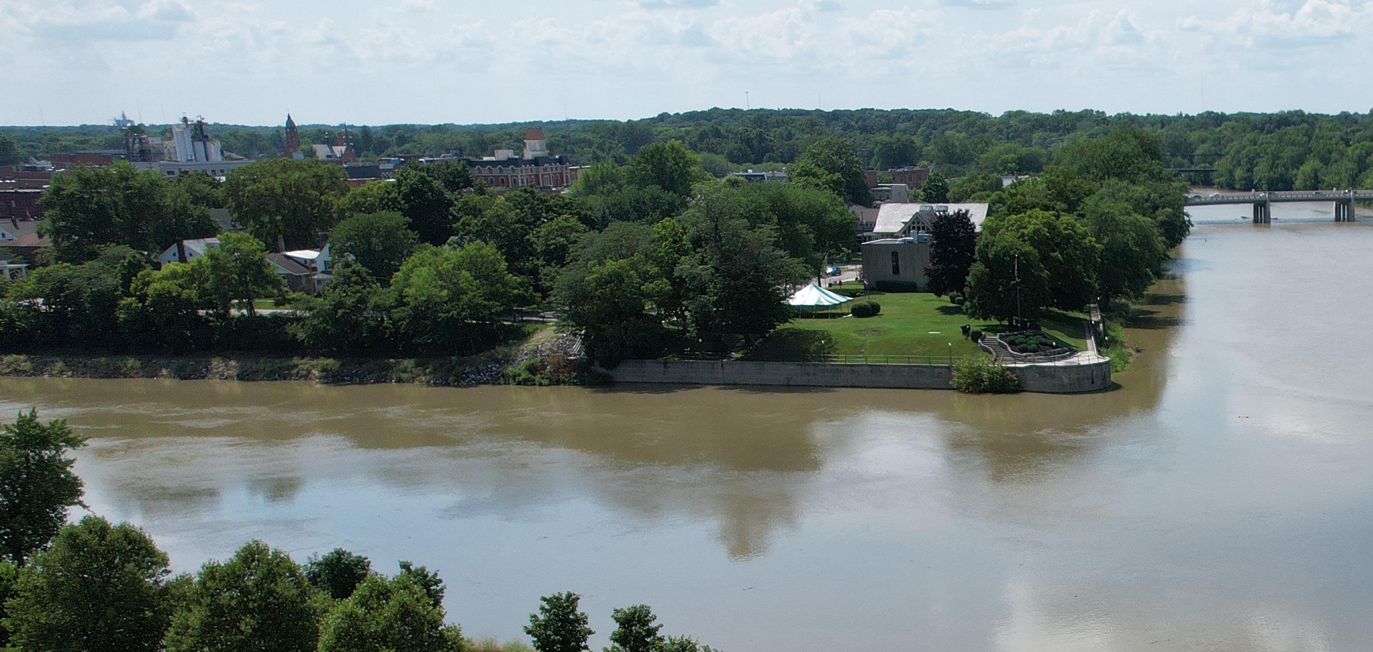
Endangered Species in the Tiffin River
FEDERALLY ENDANGERED
STATE ENDANGERED
STATE THREATENED
FEDERALLY THREATENED
STATE SPECIES OF CONCERN
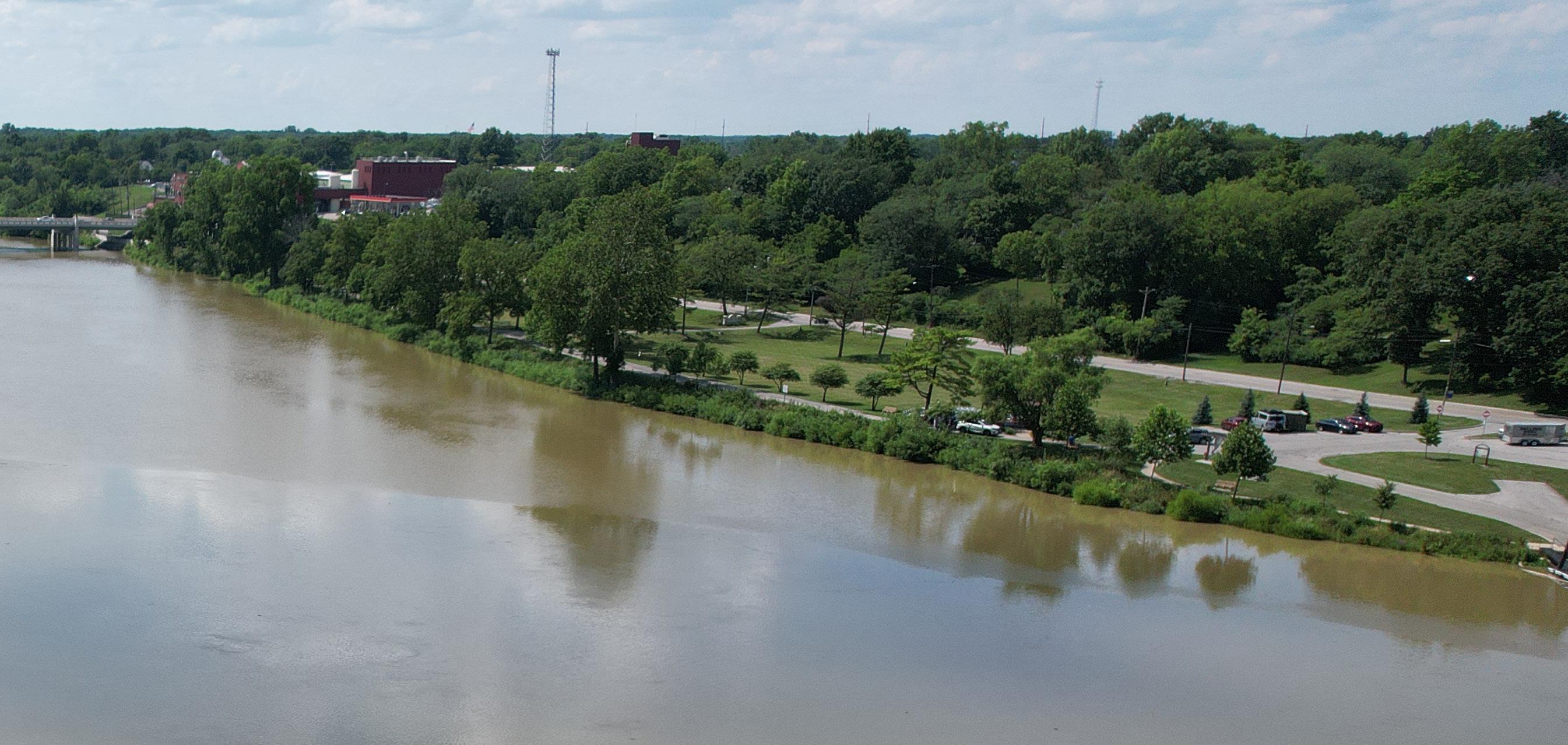
Indiana Bat Myotis sodalis
Northern Long-Eared Bat Myotis septentrionalis
Tricolored Bat Perimyotis subflavus Little Brown Bat Myotis lucifugus
Northern Harrier Circus hudsonius
Rabbitsfoot Quadrula cylindrica cylindrica
Greater Redhorse Moxostoma valenciennesi
Large Blazing-star Liatris scariosa
Black Sandshell Ligumia recta
Deertoe Truncilla truncata
Round Pigtoe Pleurobema sintoxia
Creek Heelsplitter Lasmigona compressa
Elktoe Alasmidonta marginata
Purple Wartyback Cyclonaias tuberculata
Northern Riffleshell Epioblasma torulosa rangiana White Catspaw Epioblasma obliquata perobliqua
Clubshell Pleurobema clava
Rayed Bean Villosa fabalis
Existing Floodplains & Floodways: PERMITTING
& ODNR COORDINATION
Having three rivers at the heart of a city is a unique asset, but it also comes with significant responsibility. When making improvements along the river corridors, it’s essential to consider the potential impacts on both upstream and downstream communities. To address this, regulations at the local, state, and federal levels have been established to protect these vital resources.
Locally, Chapter 1333 of the Defiance Flood Plain Code and Standards outlines the key components reviewed at the municipal level. The process begins by ensuring that proposed improvements conform to the zoning district’s use requirements or by obtaining a special exception. From there, the improvements are reviewed across three key categories:
1. PROPOSED IMPROVEMENT IS IN THE FLOODPLAIN AND IS LESS THAN 5 ACRES
Professionally certified plans must be developed with the following summary:
· Structure finished floor elevation (FFE) must be 1-foot above base flood elevation or provide floodproofing
· If the base flood elevation is not established, the FFE shall be 2-feet above the highest adjacent natural grade
· Existing survey and contours
· Proposed fill
· Proposed FFE, contours, and elevations
· Water and wastewater designed to minimize infiltration of floodwaters into the system
2. PROPOSED IMPROVEMENT IS LOCATED IN ZONE A (FLOODPLAIN WITHOUT A BASE ELEVATION) AND ENCOMPASSES 5 OR MORE ACRES
In addition to the requirements from item 1 above, a hydrologic and hydraulic study must be completed, providing the base flood elevation.
3. PROPOSED IMPROVEMENT IS IN THE FLOODWAY OR ALTERS A WATERCOURSE
In addition to the requirements from items 1 and 2 above, the following items are necessary:
· A hydrologic and hydraulic study must be completed demonstrating that the proposed development will not increase water surface elevation during the occurrence of the base flood and that there will not be a reduction in the flood-carrying capacity
· All state and federal permits (Army Corps of Engineers Section 10 and Clean Water Act Section 404)
The Ohio Department of Natural Resources (ODNR) reviewed the project scope and will require further coordination with their programs prior to design and development of the parks and riverfront areas.
• ODNR Scenic Rivers Program
Because the Maumee River is considered part of the ODNR Scenic Rivers Program, coordination will be required with the regional contacts to ensure the ecological integrity is maintained. This program has jurisdiction over land within 1,000 feet of the river that is not municipally owned. While much of the property within this Master Plan is owned by the City, the Scenic Rivers Program provides guidance for best design practices adjacent to the Maumee River and its tributaries. This includes, but is not limited to, maintaining or improving riparian corridors, encouragement of low impact development, design suggestions for trail and recreational improvements, ideal stormwater practices, and preferred erosion control methods.
• ODNR Office of Real Estate and Land Management
Portions of the Maumee River overlap with the state historic canal system. Coordination with the Office of Real Estate and Land Management will be required to ensure there are no impacts to this infrastructure.
• ODNR Department of Wildlife (DOW)
There are several species of endangered and threatened mussels, bats, and other wildlife within the project area. The DOW recommends the use of Best Management Principles and stresses that development limits impact to streams, wetlands, and other water resources. Habitat surveys may be required in certain areas of improvement to verify that development will not negatively impact critical zones for these identified species.
In addition to state regulations, the Ohio Department of Natural Resources (ODNR) Division of Water holds jurisdiction over the three rivers. Floodway permitting in Ohio may require various components, depending on specific factors. These requirements could include:
• Floodplain Permit
• Development
• No-rise Certificate
LEGEND
Floodway
100 Year Floodplain
Regulatory Floodway
Parcels Within Floodway
CSO Locations
City Parks
City Limits
Located Outside Municipal Jurisdiction
FIGURE 21: Hydrology Map
This map identifies the floodplain and floodways within the City of Defiance, along with other pertinent information for water resource management and future infrastructure development. 2 4
• Letter of Map Revision (LOMAR)
• Conditional Letter of Map Revision (CLOMAR)
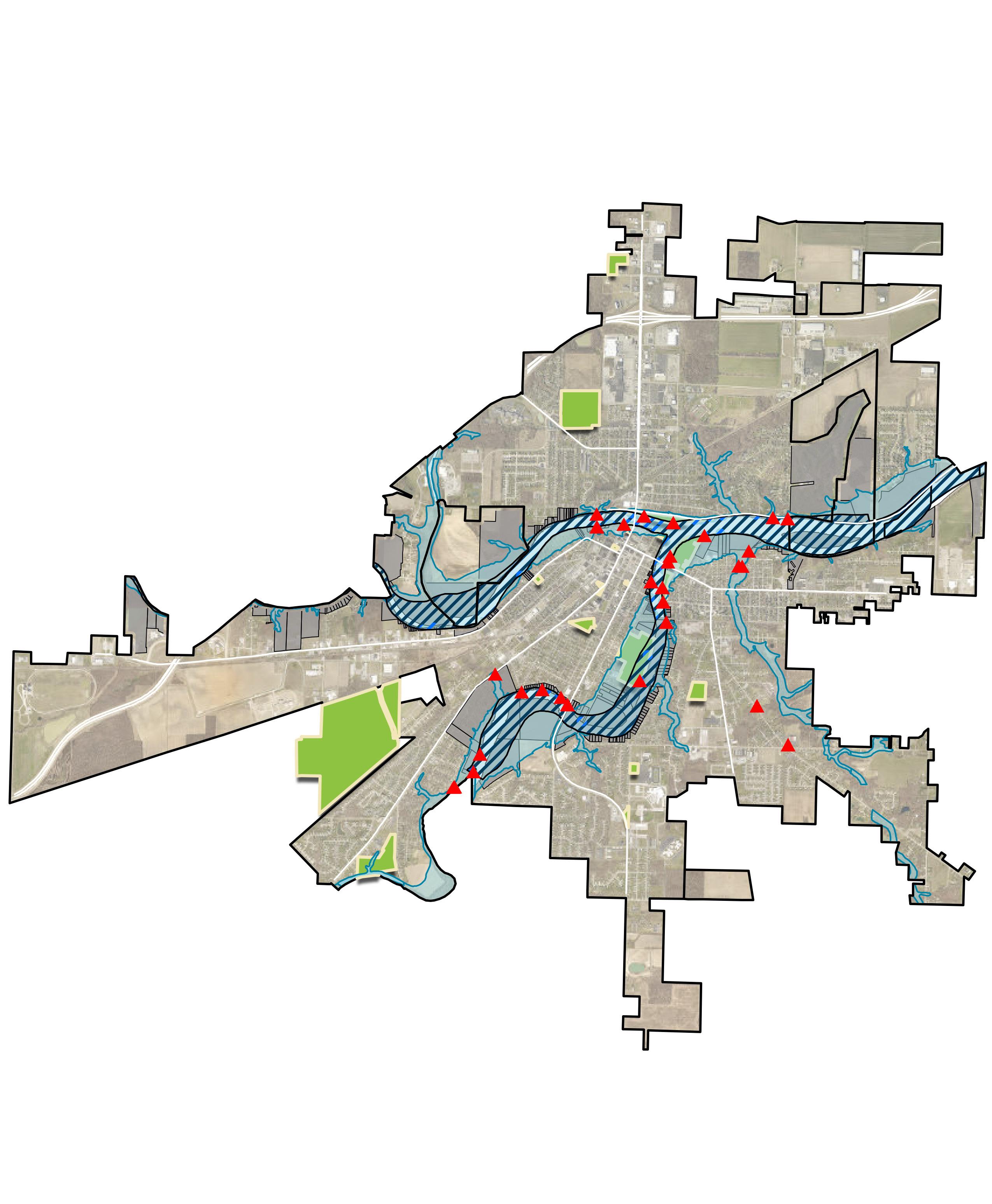
TIFFIN
MAUMEE
Existing Connectivity: EVALUATING PEDESTRIAN NETWORKS
A recurring theme identified through community engagement was the need for more connections to parks and trails. As shown in Figure 22, the team assessed park accessibility based primarily on a walking distance of 1/8 to 1/4 mile, which is roughly a 10-15 minute walk. The evaluation reveals a high density of parks in the downtown area, while some perimeter parks provide limited access to neighborhoods on the outskirts.
For residents living beyond the 10-15 minute walking range, parks are still accessible, but reaching them is less convenient. One common solution communities use to advance connectivity is the implementation of trails or walkway improvements. These pedestrian pathways enhance safe access to parks and other community amenities by allowing people to move more easily through neighborhoods. As depicted in Figure 1, the Buckeye Trail runs prominently through Defiance, linking people to the river and downtown. The Buckeye Trail is also part of the larger, multi-state North Country Trail system. While gathering community input, residents expressed the need for additional access points to the Buckeye Trail, making it easier for more people to use the trail and connect with the broader community. Concerns were also raised about road and railroad crossings, highlighting the importance of ensuring safe passage for residents as they move throughout the City. Although plans for future trails aim to further improve the flow of pedestrian traffic, it's important to note that many of the existing sidewalks outside the core of downtown are only on one side of the street. While this doesn't severely limit mobility, it does reduce safe and convenient access for some residents.
The analysis of existing walkways and trails indicates a need for more routes to better connect the community—not just to parks, but also to downtown and the river confluence. These enhancements won’t just improve pedestrian flow and connectivity, they will also stimulate the local economy by encouraging foot traffic and increasing activity in the downtown area.
WALKABILITY
* TAKEN FROM FORT GROUNDS
BIKEABILITY
* TAKEN FROM FORT GROUNDS
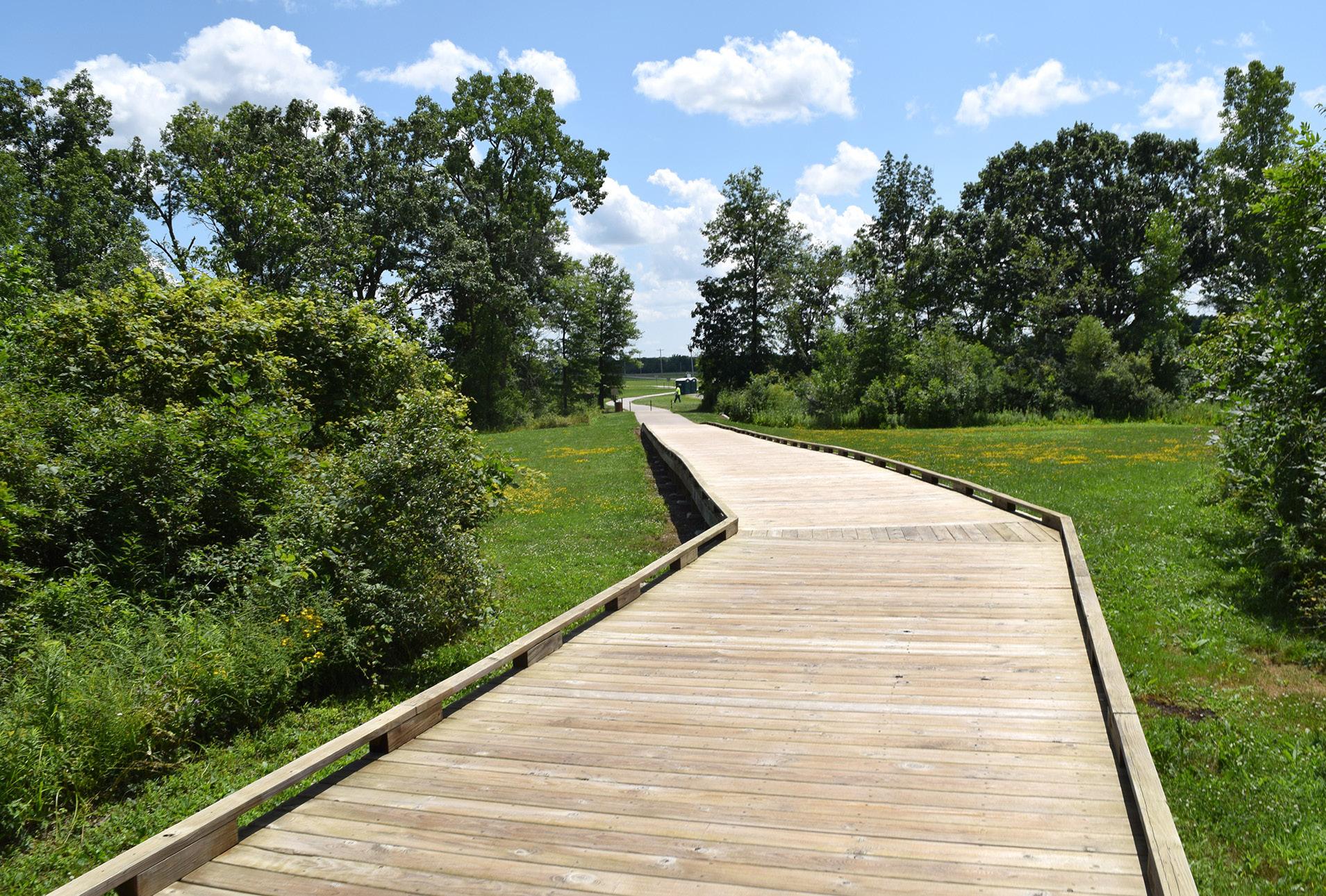
DEFIANCE PARKS
Bark & Run Dog Park
Bronson Park
Buchman Park on the Glaize
Canal Park
Diehl Park
Eastside Park
Fort Grounds
Gateway Park
Holgate Park
Hometown Heroes Park
Kingsbury Riverfront Park, Swim Park, & Pickleball
FIGURE 22: Walkability & Accessibility Map
This map visually represents the ease with which residents and visitors can navigate the City of Defiance on foot and access parks and amenities. Parks within downtown Defiance are connected, however the parks located in norther and
Cultural & Historic Resources: EXPLORING DEFIANCE'S HERITAGE
The Great Black Swamp, also known as the Black Swamp, was a vast wetland that once covered much of Northwest Ohio and Northeast Indiana, including the area that is now Defiance, Ohio. This swamp, formed thousands of years ago after the last Ice Age, resulted from melting glaciers that left behind water, clay, and dense forests. The decomposing leaves and plant material that accumulated in the water turned it black, giving the swamp its name. Spanning approximately 100 miles in length and 25 miles in width, the Great Black Swamp covered an estimated 1,500 square miles.
Native Americans took advantage of the confluence and resided in the area that is now Defiance. Many historians believe that Odawa Chief Pontiac was born near Defiance in 1712. He assumed power in the area at a critical point in history and assembled a large group of Native American Nations in opposition of European settlers, including the Shawnee, Delaware, Chippewa, and other Great Lakes Tribes. He led the charge against the British in what is now considered "Pontiac's War" from 1763-1764, during which many of the British outposts were eliminated west of the Appalachian Mountains. Chief Pontiac traveled to New York in 1766 to negotiate a peace treaty as neither side was approaching a concrete victory, and was assassinated shortly after by a member of the Peoria Tribe in Illinois. Chief Pontiac's legacy lives on in the community with historical markers in Pontiac Metro Park. Native American Nations continued to reside in the area through the 1800s, with one of the largest councils held at the confluence in 1792. The Delaware, Miami, Ottawa, Potawatomi, Seneca, Shawnee, and Wyandot are among the recorded Nations that frequented Defiance in the 1700s to mid 1800s.
General "Mad" Anthony Wayne built Fort Defiance in 1794 as the westernmost outpost at the time. The fort housed around 200 soldiers during the Indian Wars. After his victory at the Battle of Fallen Timbers, General Wayne enhanced Fort Defiance to withstand canon fire for fear of retaliation. Fort Defiance never saw battle and was abandoned in 1796.
Just south of Fort Defiance on the Auglaize River, William Henry Harrison built Fort Winchester for use during the War of 1812 and was the first line of defense until the construction of Fort Meigs. Fort Winchester hosted many decorated soldiers during the war and was abandoned in 1815. Settlers then developed the space and the streets of Defiance follow the footprint of Fort Winchester to this day.
Captain Benjamin Logan captured a young Shawnee boy in 1786 and subsequently adopted him as Johnny Logan until a treaty returned the boy to his people. In 1812, Johnny Logan enlisted to join the American troops against the English. While under the command of General William Henry Harrison, he was accused of disloyalty and attempted to escape. Logan was captured by British sympathizers and died shortly after this encounter. His body was carried back to Fort Defiance and buried with full military honors, making Johnny Logan the only Native American to receive this ceremony in the state. A historical marker at Fort Grounds Park highlights his legacy and burial place.
The Village of Defiance was incorporated in 1836 and its first mayor, John Lewis, was elected. Shortly after, in 1842-1845, the Miami and Erie Canal opened and connected Defiance to Toledo and Cincinnati. The Miami and Erie Canal also connected to the Wabash and Erie Canal, allowing access west to Fort Wayne and beyond. The canals provided an essential transit system until the railroads emerged in the 1850s. The infrastructure has largely been removed throughout present day Defiance.
In 1845, Defiance resident William Holgate famously rode to Columbus and successfully declared the City as the seat of the newfound Defiance County. When he returned, Defiance residents celebrated this feat at Fort Grounds.
As the railroads rose in popularity and the canals retired, trustees sold canal lands to the north of downtown Defiance to build the Defiance Female Seminary in 1850. The institution was founded by the United Church of Christ to educate young women. In 1903, the school officially became Defiance College and continued to grow in the following decades.
Between the mid 1800s and early 1900s, the Old Defiance Junior High School, Defiance County Courthouse, and Defiance Public Library became landmarks in downtown Defiance. The old high school remains prominent at the end of Clinton Street before it veers west and offers a great opportunity for revitalization. The library, funded by an Andrew Carnegie Grant, continues to serve the community and programs several events throughout the year.
The City of Defiance, carved from the heart of the Great Black Swamp, has since grown into a hub of industry, commerce, and tourism for the Northwest Region.
W hat we've learned
Overall, Defiance is fortunate to have a strong foundation in its parks system, with a wide range of properties, resources, and amenities. This success is driven by passionate staff and leadership who are dedicated to the community’s well-being and consistently go the extra mile. The community itself also plays a crucial role, showing their support in many meaningful ways. Based on what we've learned, below are several additional insights and possible opportunities to build on the strong foundation and address current challenges.
1
2 3 5 4
A key to the continued success of the parks in Defiance is implementing a succession plan for when current leadership retires. Strong leadership and dedication have been instrumental, so preparing for a future transition is essential to maintain the momentum and progress achieved so far.
Staffing limitations present a challenge that needs to be addressed. The current team is proactive and efficient, but strategies like allowing some lawn areas to naturalize or mowing less frequently could free up time and resources for other important projects. Prioritizing quick, impactful projects that can be completed in-house aligns well with the Master Plan’s goals. However, more full-time employees are needed to meet ongoing demands, especially with future improvements requiring maintenance. Currently, much of the staff consists of seasonal workers focused on the pool, park mowing, and cemetery upkeep.
The community appears eager to contribute their time and effort to support the parks system. Establishing an organized volunteer schedule would provide opportunities for residents to get involved and participate in maintaining and enhancing these spaces.
Discussions about the best practices of inclusivity and accessibility often arose during community outreach. The conversations focused on different components ranging from lack of accessible pathways and playground components to the overall lack of pedestrian connections to the parks and riverfront. Promoting inclusive design with proposed development would improve park engagement for all users.
Community feedback highlighted that programming within the parks is limited and varies from park to park. Active parks have strategic partnerships with youth and adult sports leagues, such as the Defiance Baseball Association and local pickleball and tennis groups. The library also hosts specific programs in the parks, and larger festivals and events are held within the park system. While these events bring life to the parks, the community expressed a desire for more frequent programming that is well-publicized and easily accessible.
FUNDING PATHWAYS: Exploring Our Options 3
UNDERSTANDING DEFIANCE’S FUNDING RESOURCES & IMPLICATIONS
Securing funding for park, recreation, and riverfront projects is a multifaceted challenge, involving diverse sources and strategies to ensure the sustainability and growth of community spaces. This chapter delves into various funding pathways available to municipalities like Defiance, highlighting both public and private financing options, and providing practical examples and strategies to maximize funding potential. By understanding and leveraging these funding opportunities, communities can create vibrant, well-maintained parks and recreational facilities that serve the public for years to come.
Local-Public Funding
Most communities, Defiance included, allocate funds for park and recreation expenditures in their annual budget. In addition to including expenditures in the annual budget, some communities include larger expenditures in the City’s Capital Improvement Plan (CIP). Defiance’s current CIP includes park associated improvements, as well. Some communities create a Park and Recreation Fund account. This is created under the premise that the funds were originally approved for parks and recreation; and the funds should remain for that purpose after the budget year. Funds should not be depended on for annual expenses, but rather for large capital expenditures. At the end of the budget year, any annual budget funds that were not spent throughout the year are transferred to the Park and Recreation Fund account. These funds should not be used for annual expenses, but rather for large capital expenditures. If the funds are used for regular (or annual) operating expenses or general maintenance, the fund does not add any value. One great thing about a Park and Recreation Fund is it changes the “use it or lose it” mindset that often comes with the annual budget process.
Defiance City Ordinance 7675 (1167.13 Public Sites, Open Space, and Natural Features) establishes a park and playground fee requirement for all new subdivisions within the City of Defiance. This fee, at $100 per lot being created, ensures that any increase in dwelling units contributes financially to public recreation spaces. A “Land Dedication in Lieu of Fees” clause is also applicable, allowing the dedication of the open space for public park and playground use in lieu of the fee. The value of the dedicated land must equal or exceed the park and playground fee otherwise payable. While most developers prefer land dedication, implementing the fee requirement will help the City secure the funds and resources needed for ongoing maintenance of the specific neighborhood park or for larger capital projects through a Park and Recreation Fund.
Coordination with the Defiance County / Metro Parks Board offers additional opportunities to assist in funding projects within Defiance City Parks, particularly Pontiac Metro Park. Pontiac Metro Park is a Defiance County Park funded, in part, by the Defiance County / Metro Parks Board. In addition to the annual budget appropriations from Defiance County, the Metro Parks Board can create a Park and Recreation Fund account for the same reason as above. Coordination with the County / Metro Parks Board will be key to funding improvements at Pontiac Metro Park. General Obligation (GO) Bonds are another financing mechanism available to local governments for larger capital projects. GO Bonds are commonly used by Ohio’s local municipal governments and offer long-term, fixed rate financing. These bonds are backed by the general revenue of a local government.
Finally, a local government or park owner may institute user fees for parks and/or recreational programs. The admission fee for the Kingsbury Pool is one example of a user fee. A fee to sign up for a park program is another example.
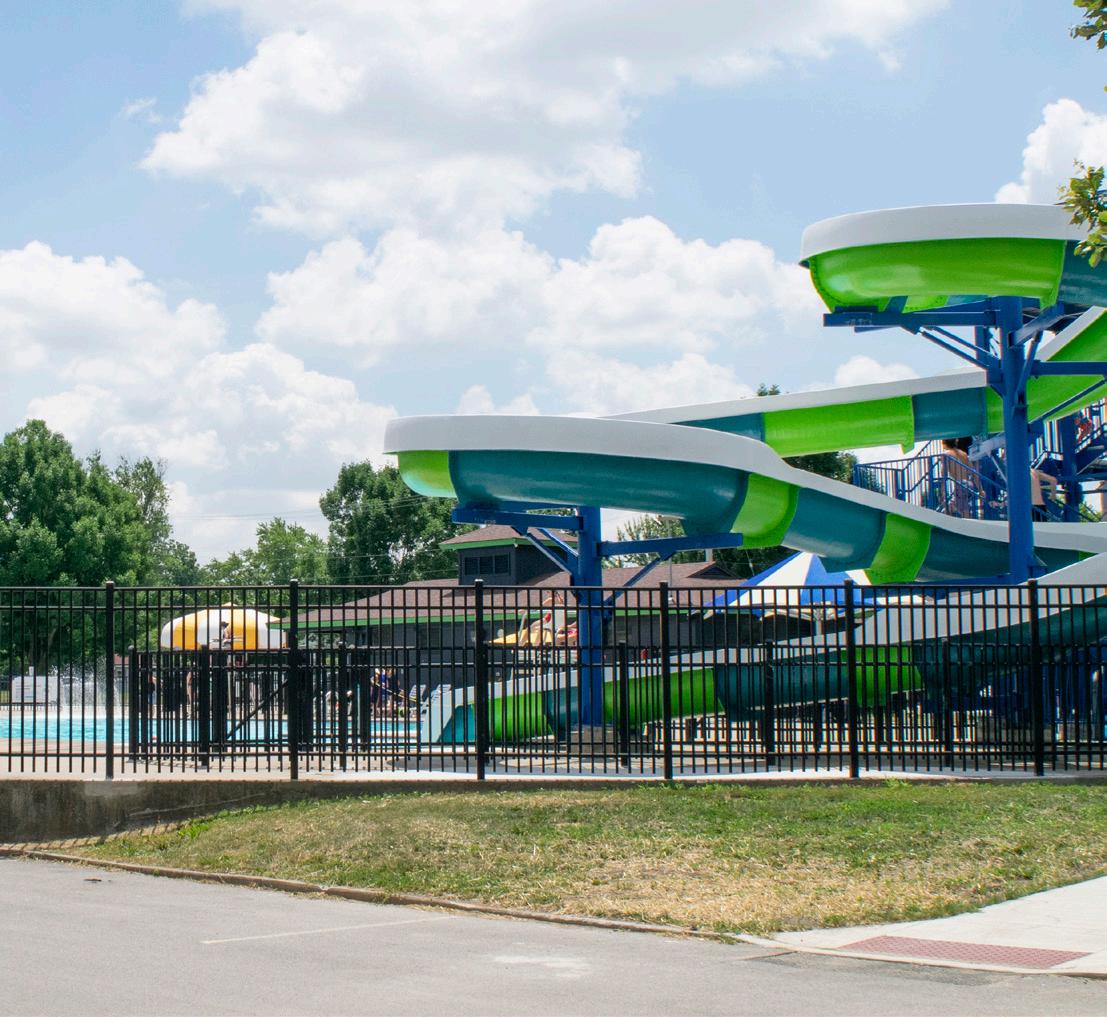
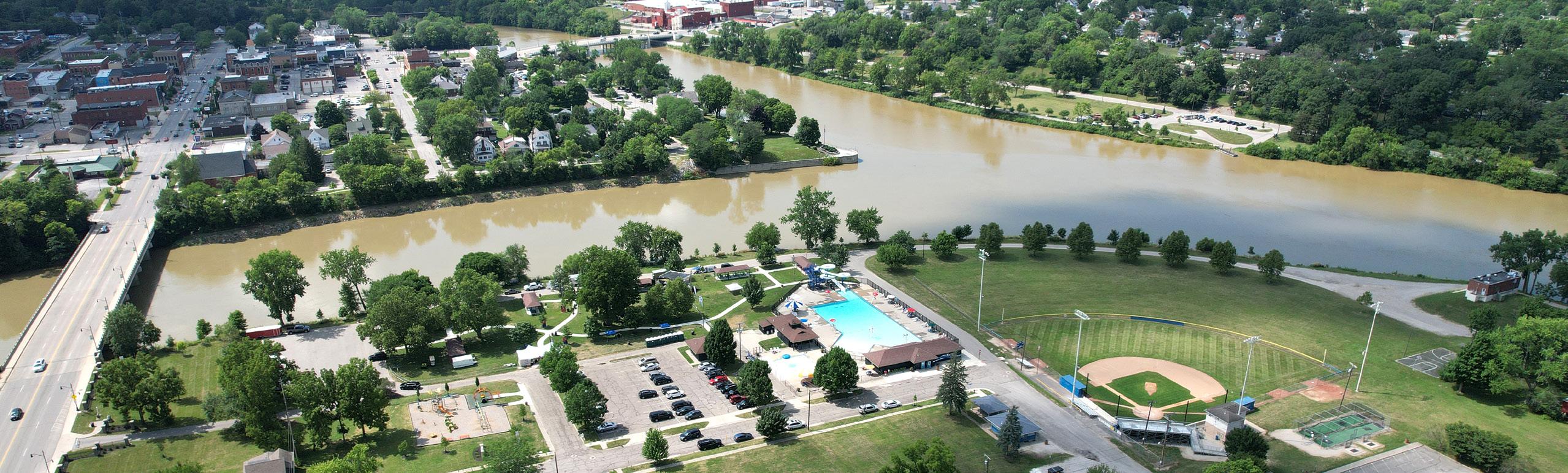
Local-Private Funding
Engaging the community and publicizing capital parks projects can open a host of private, local funding opportunities.
The Defiance Area Foundation currently has a “Sherwood Memorial Park” fund, but no other funds directly support Defiance City Parks. Establishing park-specific and/or project-specific funds at the Defiance Area Foundation offers community members an easy way to contribute to parks and projects to show support and receive the tax deduction benefit. These contributions can come in the form of memorial gifts, bequests, or trusts.
The Coressel Charitable Trust is a local charitable organization that has supported Defiance Park Projects in the past. The City should maintain and nurture these interactions into long-term, mutually beneficial partnerships.
Offering sponsorship opportunities and/or naming rights for park projects is another avenue to obtain private, local funding. Sponsorship opportunities can offer buyin at many different levels allowing any size business to support a project. For example, a “sponsor a piece of the playground” fundraiser assigns different dollar values to various components of a playground: a curly slide for $5,000 or a swing for $250 would allow large businesses and organizations to participate without excluding the smaller businesses that often want to be part of local projects. Recognition of these opportunities is then made in the form of a single plaque or a sign that lists those who sponsored the project. Of course, offering naming rights to a funder that covers the entire cost of a project is another option.
Smaller grassroots fundraising should not be overlooked. The funds brought in through these smaller efforts might not be as significant as other fundraising, but the real value in grassroots fundraising is the momentum and involvement of the community. It’s a great way to get
youth, younger populations, and recreational clubs involved. This is the concept that $1 from 100 people is worth more than $100 from one person because of the involvement of the community. Grassroots fundraising can be a game-changer for projects. Once the community is involved, larger players will get on board as well.
Grassroots efforts can encompass a wide range of activities, from online crowdfunding campaigns like GoFundMe to t-shirt sales, donation jars at local businesses, and food sales. They can also include annual fundraising events such as a 5K family fun run, a "party in the park," dog-days at the pool (after the season ends), or a pickleball tournament, with proceeds benefiting a specific park facility or program. Additionally, event sponsors can help offset hosting costs, thereby increasing the funds dedicated to the park or project.
The mindset of the fund-raisers is critical. People often dread the thought of asking for money. Challenge those doing the “asking” to think of it as offering an opportunity to be part of something big and something that will serve the community for decades. Go in with the attitude that your funder will want to be part of the project, and remember that often, a “no” answer reveals information that may result in success later.
Local fundraising efforts – whether through sponsorships, naming rights, or grassroots initiatives – result in an opportunity to cultivate long-term partnerships. These partnerships can be invaluable when the park or project has unforeseen needs, such as unexpected maintenance or a special cleanup. Companies, clubs, and organizations that helped fundraise or contributed to a project will be vested in it long-term and are more likely to pitch in and help when needed.
Local governments are also exploring the concept of Build-Operate-Transfer (BOT) for larger municipal projects. The most successful BOTs create a public-private partnership that involves a private developer constructing and owning a facility that is leased to a local government
of Defiance, Ohio | 125
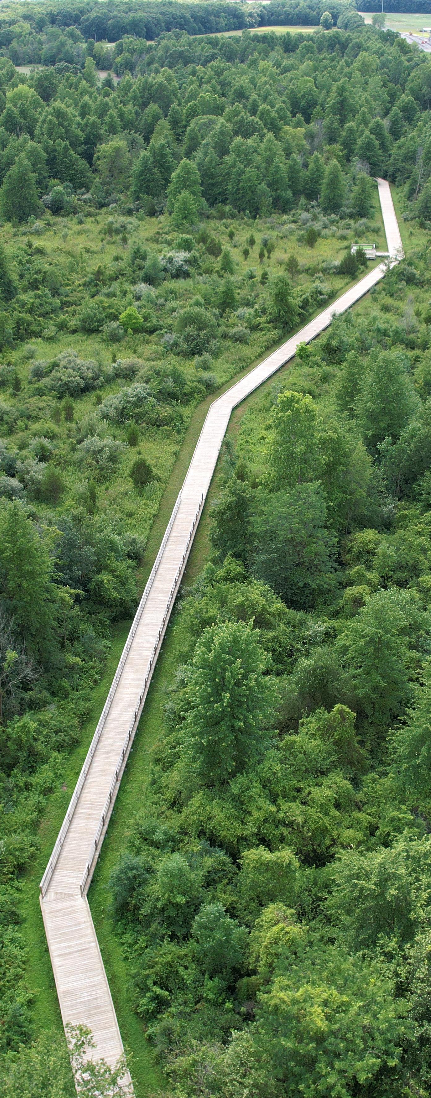
for a certain period of time. At the end of that term, the facility’s ownership is transferred to the local government. From a park perspective, this is most applicable to a community center, recreation center, or some other built structure, as opposed to a playground or trail.
State & National Funding
The State of Ohio and Federal Government offer multiple grants and funding opportunities for park and recreational land acquisition and development to local governments. While most of the programs are administered through the Ohio Department of Natural Resources (ODNR), there are additional opportunities from state and national budget allocations. The convergence of three rivers is a unique asset that has attracted attention from the Army Corps of Engineers, Ohio State Representatives, and US Congress Representatives.
Through the Ohio Development Department, Defiance has made use of its Community Development Block Grant (CDBG) funds of $150,000 approximately every other year. These funds can be used for public park projects if the parks are in qualifying areas of the City or if the project serves a targeted population.
The Clean Ohio Trail Fund finances trails to improve outdoor recreation opportunities in the State of Ohio by funding land acquisition, trail development, and sometimes the costs of engineering and design. The maximum grant award is $500,000 with a required 25% match. Projects awarded a Clean Ohio Trail Grant must be completed within 15-months.
Cooperative Boating Facility Grant is a grant program through the ODNR Division of Parks and Watercraft offering 100% reimbursement for projects that improve or develop recreational boating access for motorized watercraft at public facilities. Eligible projects include ramps and docks, as well as access roads, lighting, parking, and restrooms that support these facilities.
GLRI Forest Restoration Program is a grant provided by the U.S. Forest Service, offering funding ranging from $50,000 to $300,000 to support projects in the Great Lakes basin. These projects aim to address invasive species, design nature-based infrastructure for stormwater management, or restore and connect coastal and riparian forest habitats.
Land and Water Conservation Funds (LWCF) are federal funds administered by the National Park Service. The funds are provided to the State of Ohio and distributed to local governments for the acquisition, development, and redevelopment of recreational facilities. To be
eligible for LWCF, a project must be in accord with Ohio’s Statewide Comprehensive Outdoor Recreation Plan (SCORP). The maximum grant award is $500,000, and the funds can be used for up to 50% of the project cost.
Ohio NatureWorks is funded through a long-standing State of Ohio bond issue. It is a 75% reimbursement grant up to $150,000 per county for the acquisition, development, and redevelopment of recreational facilities. The City of Defiance has used Ohio NatureWorks as a funding source in the past, but typically does not apply every year in an effort to share funds with Defiance County and other municipalities within Defiance County.
The Paddling Enhancement Grant is similar to the Boating Facility Grant but geared toward hand-powered watercraft. Neither program is accepting applications at this time, but would be excellent fits for Defiance riverfront activation.
The Pool Safely Grant Program (PSGP) is offered by the U.S. Consumer Product Safety Commission (CPSP) and provides funding and resources to assist in implementing enforcement and education programs. CPSP will award up to a total of $3 million in two-year grants to assist in reducing deaths and injuries from drowning and drain entrapment incidents in pools and spas. The Kingsbury Splash Park might be able to benefit from this program.
Recreational Trails Grants are Federal Highway Administration funds that cover the cost of land acquisition and development of trails. The maximum grant award is $150,000 with a required 20% match
Recreational Trails Program, Storybook Trail Grant is provided annually through ODNR. This reimbursement grant program provides up to 80% of the project funding with a minimum request of $5,000 and a maximum of $10,000. A variety of project types are eligible, including new recreational trail construction, trail maintenance and restoration, trailside and trailhead facilities, purchase / lease of recreational trail equipment, acquisition of easements and property for trail corridors, and educational programs promoting trail safety and environmental protection.
Depending on the project, government grant funds targeting specific issues may also be available to help fund park projects.
• Public Health and Mental Health: The impact parks, recreation, and natural environments have on public
and mental health creates an additional funding opportunity for projects that enhance these amenities.
• Placemaking: The movement towards intentional placemaking may provide additional grant opportunities.
• Historic Preservation Funds through the National Park Service: Supports projects that preserve, maintain, or enhance historic or cultural resources.
• The National Endowment for the Arts: Funds projects that integrate the arts in various forms. This can include performing arts, such as concert series held in parks, as well as physical features like sculptures or murals incorporated into park settings.
• Environmental: Grants targeting environmental conservation may support park projects that incorporate eco-friendly practices and enhance natural habitats.
• Energy Conservation: Funding opportunities for energy conservation may be available for park projects that include energy-efficient technologies and sustainable infrastructure.
Many private foundations give across the nation, specifically in locations where they maintain stores or facilities. These foundations typically participate in improving the local community in a way that supports the foundation’s philosophy. The key is to understand the foundation’s philosophy and to tie a park and/or recreation project to that philosophy and the foundation’s desired outcomes. A few examples of large private foundations include:
• Lowe’s Hometowns provides grants to restore and revitalize community spaces.
• The Wal-Mart Foundation offers grants that strengthen local communities.
• The American Cancer Society funds sunshades.
• T-Mobile Hometown Grant supports small towns each year by awarding grants towards projects desired by a community.
As with any project, securing funding and financing can be challenging and often involves unexpected issues. However, it's important to view fundraising as a chance to build connections and relationships that will extend beyond the project's completion.
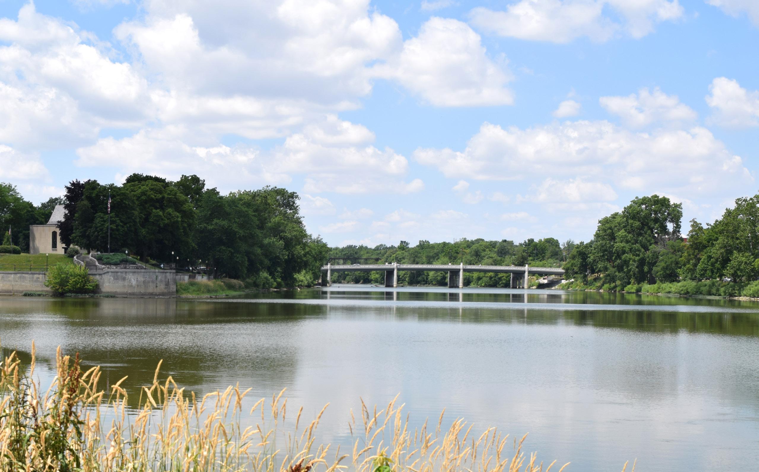
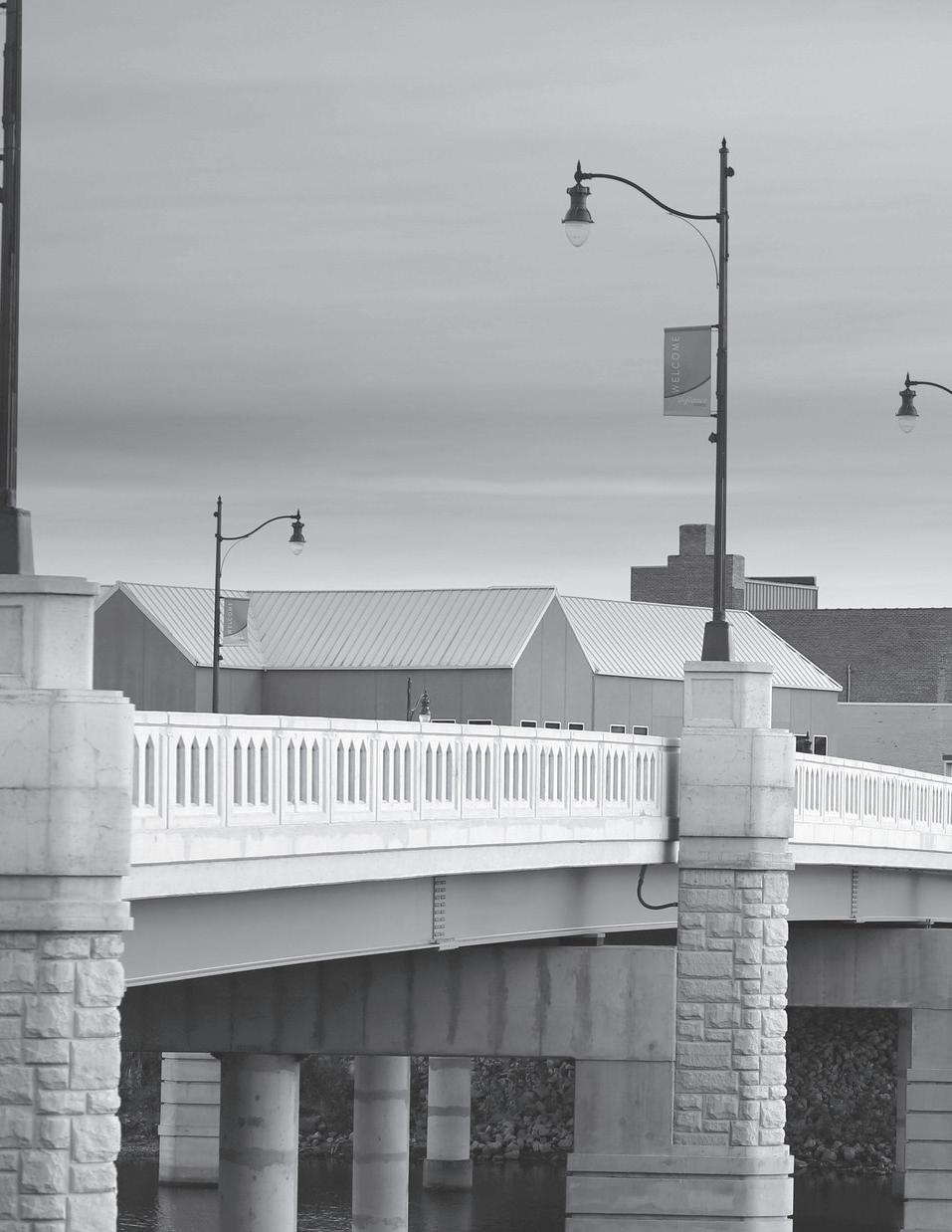
YOUR VOICE MATTERS: Community Engagement
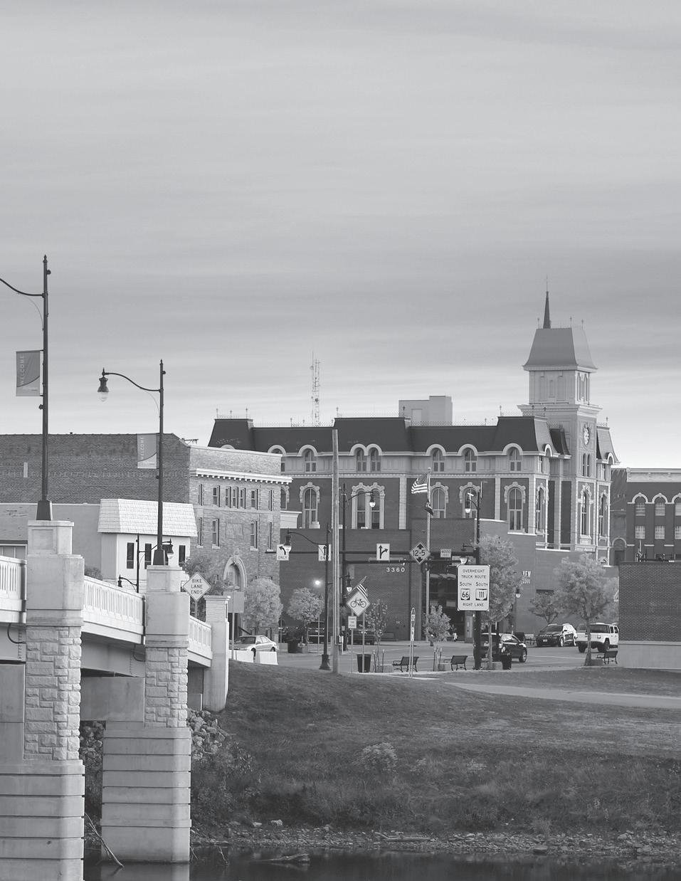
OUTREACH METHODS & COMMUNICATION TOOLS
Community engagement is a cornerstone for successful urban planning, ensuring that the voices of residents, stakeholders, and local organizations are heard and integrated into the development process. This section outlines a variety of strategies designed to foster meaningful participation in the City of Defiance Parks & Riverfront Master Plan.
Overview
The Master Plan outlines a long-term vision for the City’s recreational amenities, encompassing local parks, playgrounds, sports fields, rivers, trails, and open spaces. Shaped by public discussions regarding the importance of parks and river recreation in Defiance, the result is a community-driven, data-informed, and actionable vision. Overall, the process gathered input from approximately 2,446 people. The Steering Committee, including City staff, consisting of 18 individuals from diverse backgrounds, offered invaluable guidance and leadership throughout the process.
Outreach Methods
Extensive input from the community, stakeholders, and Steering Committee members was gathered to ensure the community's needs were understood.
Engagement opportunities included stakeholder focus groups, participation in one community event, three community workshops, three Steering Committee meetings, and five online surveys.
Communication Tools
Multiple methods of engagement were utilized to encourage all community members to participate in the process. Engagement was advertised through press releases to local media, flyers, social media, the City of Defiance website, project advocates through the Steering Committee, and by word of mouth.
Statistics gathered between 07.29.24 and 09.23.25
• Follows: When someone "follows" a page, they want to see its updates and posts in their news feed. Followers are usually a good indicator of who's actually interested in the content.
• Views: The number of times the content was displayed or played.
• Reach: This number refers to how many individual users saw the content.
• Interactions: The number of reactions, saves, comments, shares, and replies to the content.
FIGURE 24: FACEBOOK STATISTICS*
W hat we heard
1 2 3 4
The community expressed that many were unaware of some parks, or the amenities and programming they offer. A more strategic approach to promoting the parks through enhanced communication and collaboration with community partners should be prioritized to increase park usage and awareness.
While improving awareness can help make parks feel more welcoming, some community members find that the parks are not designed with their needs in mind. Prioritizing inclusivity in park improvements is essential. For instance, none of the playgrounds in the park system currently offer fully accessible play surfaces.
There is a strong desire within the community to see Defiance's environmental, historical, and cultural attributes reflected in the parks, whether through physical improvements or programming.
The community overwhelmingly expressed a desire to engage with the rivers. Some prefer active use, such as kayaking or boating, while others prefer passive enjoyment through scenic views from a walking trail or a
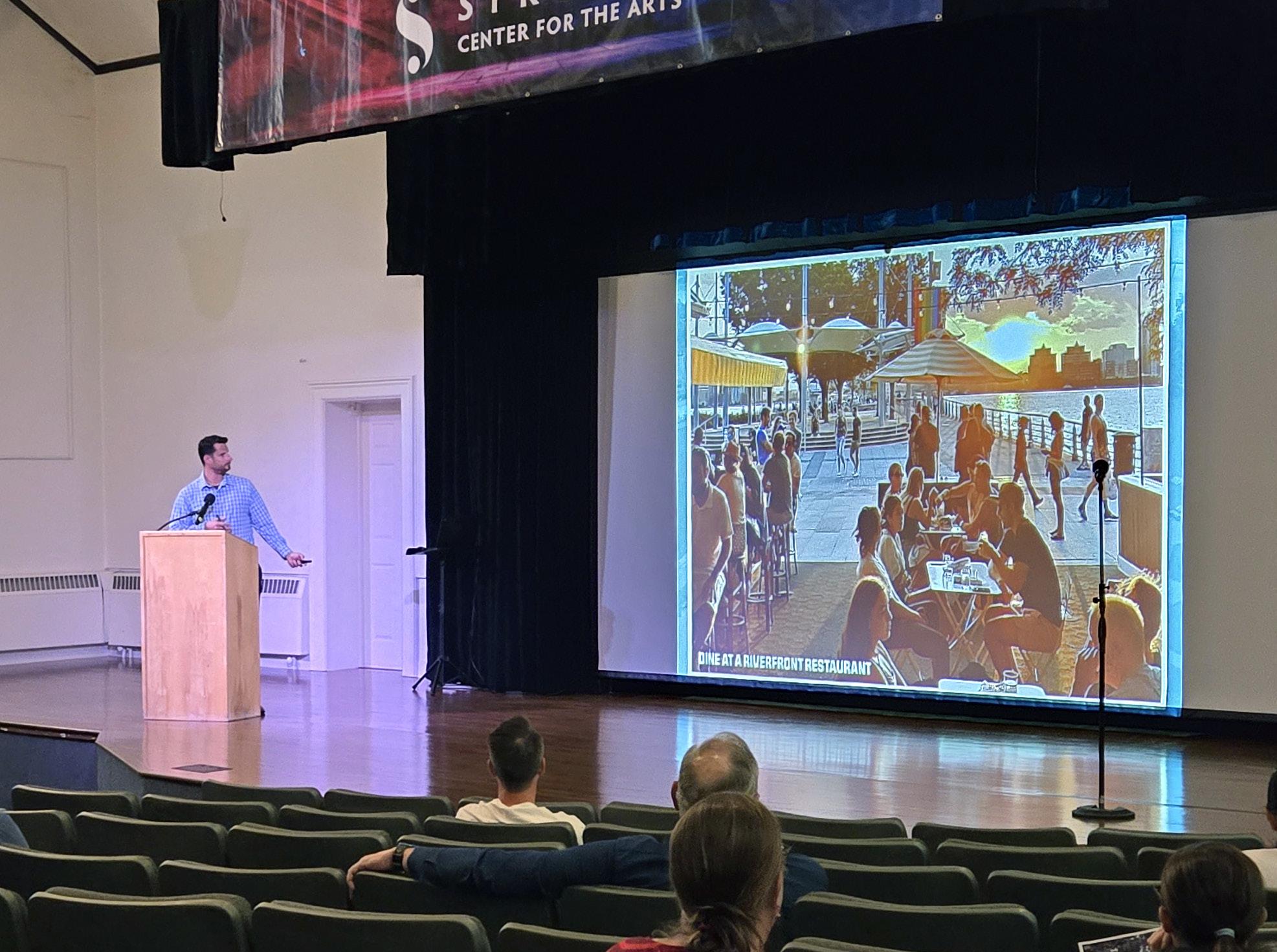
Community Engagement: FAMILY FUN FRIDAY EVENT
On August 2, 2024, the design team attended a City of Defiance Family Fun Friday event to talk with the community, obtaining their thoughts and ideas on the City parks and riverfronts and answering any questions they had.
The theme for the August Family Fun Friday event, was a scavenger hunt based on the book "We're Going on a Bear Hunt." The design team's booth was located at the "crossing of the river" in front of Defiance Karate LLC, on Clinton Street.
During the event, the team spoke to approximately 45 families, and used interactive boards to gain community input from both adults and children. Results from the interactive boards can be found in the Appendix document.
A flyer was also handed out including information about the community on-line survey and the Master Plan's social media page.
During the event, the design team derived a variety of insights ranging from communication to popular existing features. After speaking to community members, it became evident that the community is not fully aware of the existing amenities and features of the parks. Enhancing communication strategies and possibly adding a staff member focused on communication and programming could bridge this gap, bringing more people into the parks and introducing them to lesser-known locations.
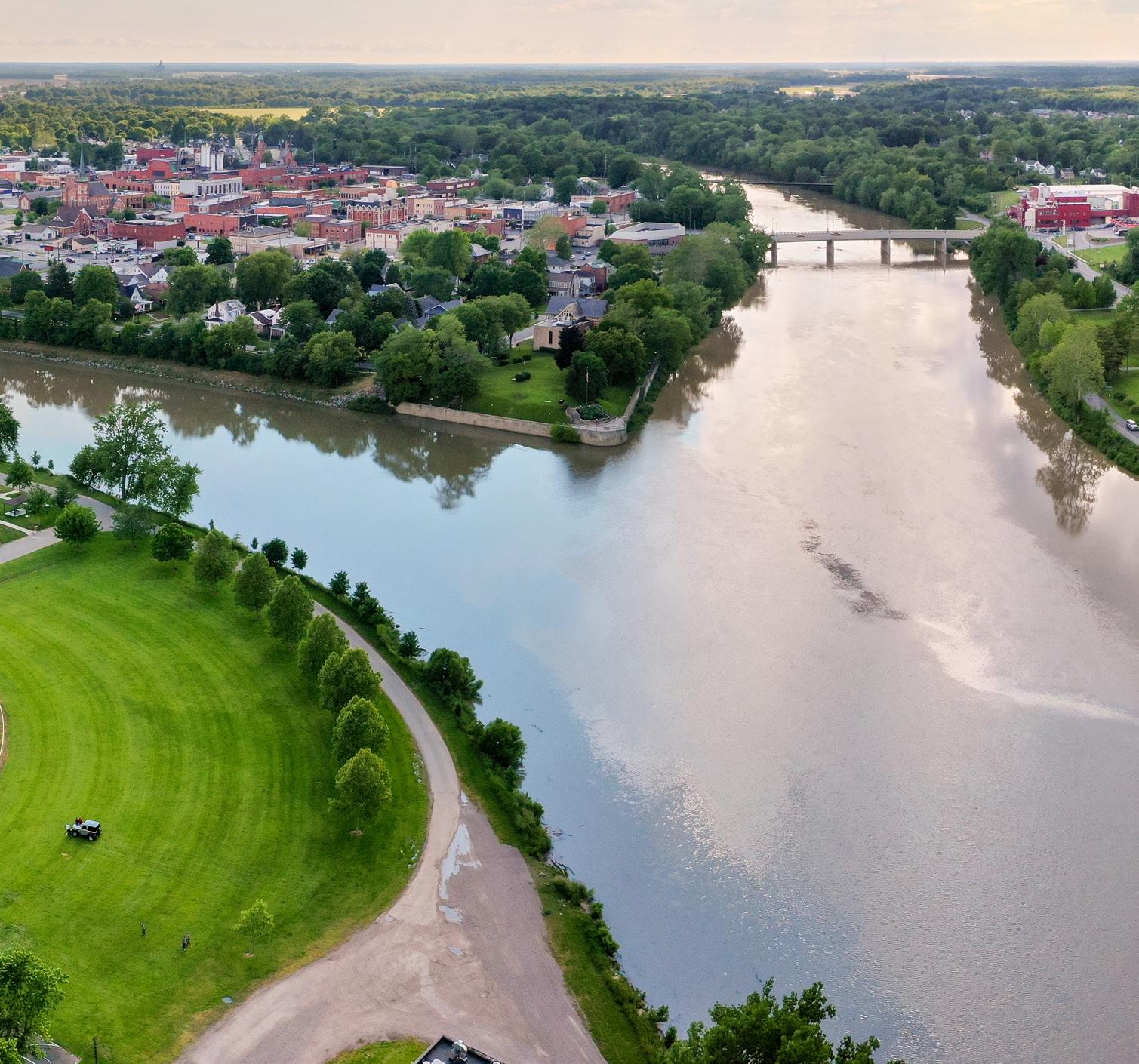
Share your thoughts on the City of Defiance parks and rivers! Your input will help shape the Defiance Parks & Riverfront M aster Plan, ensuring it aligns with the needs of our community The survey is open now through September 1, 2024.
Don’t forget to like us on F acebook for project updates and more opportunities for input!

Access the survey here! www.surveymonkey.com/r/Defiance24
Half-page flyer handouts were provided to visitors of the Family Fun Friday booth. A full page flyer with the same style and verbiage was hung throughout Defiance by City staff and business owners.
Public feedback indicates that the current outreach plan is effective, as many community members were already aware of or had participated in the survey. The feedback also highlights a strong desire for more trails and facilities that cater to both adults and children, such as activities for adults adjacent to kid activities, ensuring that everyone has something to engage with. Specific requests include a splash pad on the north side of town, a small playground for young children at the Knights of Columbus Baseball Complex with protective netting if necessary, and a pavilion with winter skating capabilities. The popularity of existing features in the eyes of the children, like the splash pad, pool, playgrounds, and musical play items, further reinforce the community’s engagement with the parks. WE WA NT TO HEA R F R O M YO U !
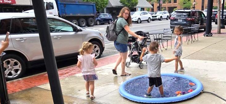
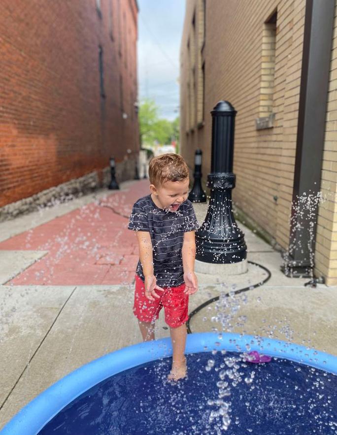
Key Takeaways:
1. Kids most enjoy the splash pad and pool, playgrounds, and musical play items.
2. Adults want to see more trails, a splash pad on the north side of the City, a small playground at K of C, and a pavilion with winter skating capabilities.
3. There is a desire to have adult activities adjacent to kid activities so adults can do something while their kids play.
4. The community isn't fully aware of what the City offers in terms of existing parks and amenities.
Community Engagement: PUBLIC SURVEY #1 SUMMARY
A statistically valid online survey was conducted, providing valuable insights into the community's thoughts and needs regarding both the parks system and riverfronts within the City of Defiance. Below is a summary of responses, with a full list of questions and answers available in the Appendix document. The survey was open from July 27 through September 12, 2024.
543 responses were received
CITY OF DEFIANCE DEMOGRAPHICS:
79.8%
OF RESPONDENTS LIVE OR WORK WITHIN THE CITY OF DEFIANCE. AN ADDITIONAL, 17.6% LIVE WITHIN DEFIANCE COUNTY.
IF YOU DO NOT VISIT DEFIANCE PARKS, WHAT KEEPS YOU FROM DOING
Check all that apply.
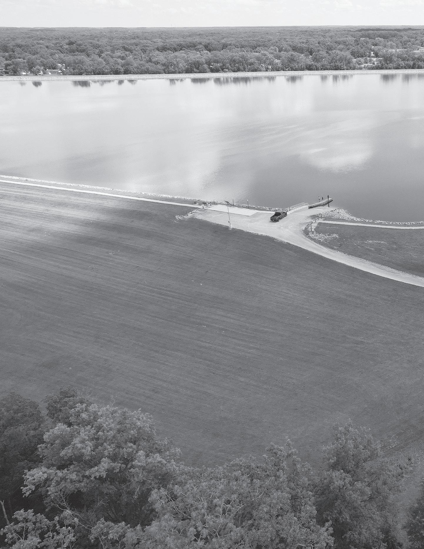
WHEN ARE YOU MOST LIKELY TO VISIT DEFIANCE PARKS?
THE FOLLOWING METHODS ARE USED FOR TRAVEL TO AND FROM
DO ANY OF THE FOLLOWING PHYSICAL BARRIERS RESTRICT OR PREVENT YOU FROM USING DEFIANCE PARKS? Check all that apply.
WOULD THE AVAILABILITY OF AMENITIES ON OR NEAR THE WATER SUCH AS DINING, ICE CREAM, SHOPPING, WATERCRAFT RENTAL, AND OTHERS ENCOURAGE YOU TO USE THE WATERWAYS MORE OFTEN?
SAID YES 74.2%
IF THERE WAS BETTER CONNECTIVITY AND SAFER PEDESTRIAN ROUTES TO AND FROM THE PARKS IN DEFIANCE, WOULD THAT ENCOURAGE YOU TO VISIT MORE OFTEN? 61.8% SAID YES 11.6% SAID NO
HOW IMPORTANT IS IT FOR THE CITY OF DEFIANCE TO INVEST MORE MONEY IN DEFIANCE PARKS?
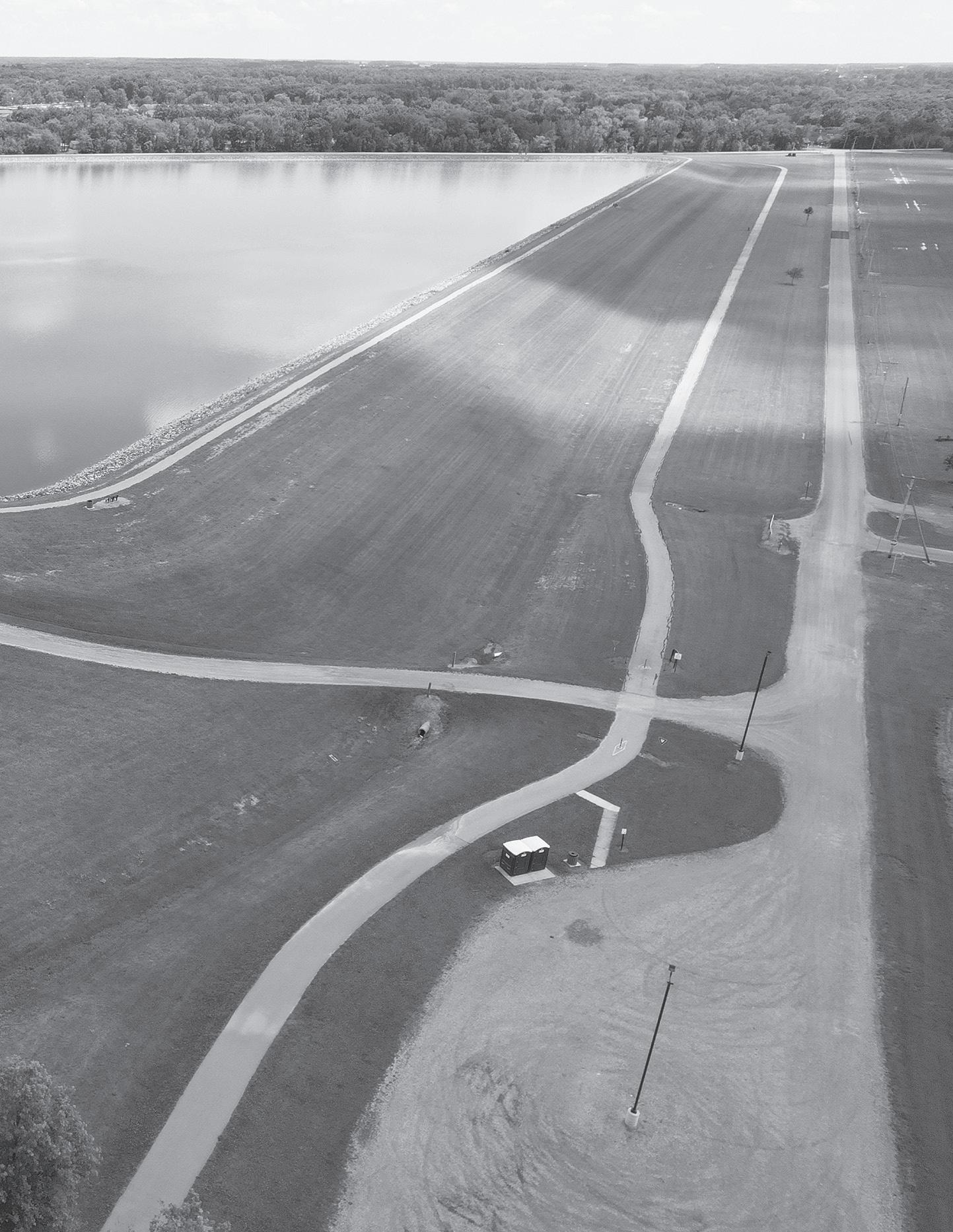
RENTAL, AND OTHERS ENCOURAGE YOU TO
94.6% OF RESPONDENTS SAY THEY ARE RESIDENTS OF OR WORK WITHIN THE CITY OF DEFIANCE. AN ADDITIONAL 17.6% LIVE WITHIN DEFIANCE COUNTY. 79.8%
OF RESPONDENTS AGREE, OR STRONGLY AGREE, THAT DEFIANCE PARKS ARE AN ESSENTIAL SERVICE IN THE COMMUNITY.
WHAT SPECIFIC ACTIVITIES DO YOU AND YOUR FAMILY ENGAGE IN WHEN VISITING DEFIANCE PARKS? Check all that apply.
DO YOU USE LOCAL RIVERS FOR WATER SPORTS OR BOATING, INCLUDING NON-MOTORIZED ACTIVITIES? IF NO, WHY NOT? Check all that apply. SAID YES OR THAT THEY WOULD LIKE TO SAID YES 54.4% 74.2% I
WHERE DO YOU GET YOUR INFORMATION ABOUT PARK EVENTS AND PROGRAMS?
TOP 5 ANSWERS
2 3 4 5 1
WHAT ARE THE 5 MOST IMPORTANT PARK PROGRAMS THAT YOU FEEL THE PARK DEPARTMENT SHOULD PROVIDE?
TOP 5 ANSWERS
WHAT PROGRAMS AND ACTIVITIES WOULD YOU LIKE THE CITY OF DEFIANCE TO ENHANCE OR ADD?
Choose your top 5 priorities.
TOP 9 ANSWERS
OUTDOOR PERFORMANCES / CONCERTS
PROGRAMS FOR CHILDREN
PROGRAMS FOR TEENS
WATER ACTIVITIES ON THE RIVERS
ADVENTURE ACTIVITIES (I.E., ZIPLINING, ROPES COURSES, ETC.)
PROGRAMS FOR ADULTS
OUTDOOR FITNESS PROGRAMS
PROGRAMS FOR SENIORS
IDENTIFY THE TOP 5 PARK ACTIVITIES YOU AND YOUR FAMILY WOULD BE MOST LIKELY TO PARTICIPATE IN, IF AVAILABLE.
NATURE CENTER / OUTDOOR EDUC.
2 2 3 3 4 4 5 5 6 7 8 9 1 1 TOP 5 ANSWERS
NATURE EDUCATIONAL PROGRAMS
WHEN YOU IMAGINE WHAT THE DEFIANCE PARK SYSTEM COULD LOOK LIKE IN 25 YEARS, WHAT ARE THE MOST IMPORTANT COMMUNITY BENEFITS YOU HOPE BECOME PART OF THE VISION AND ROADMAP PROVIDED BY THIS MASTER PLAN? Check all that apply.
PARKS THAT IMPROVE RESIDENTS’ HEALTH & WELLNESS
CONNECTED SYSTEMS OF
BIKE TRAILS / BMX
SLEDDING
ICE SKATING ORGANIZED PROGRAMS
CAMPING
ROLLER SKATING
EUCHRE / CARDS
ARCHERY
SKATE PARK ULTIMATE FRISBEE SKIING
SKATEBOARDING
TO ENSURE THE MASTER PLAN PROMOTES AN EQUITABLE PARKS AND RIVERFRONT SYSTEM, WHAT COMMUNITIES DO YOU THINK SHOULD RECEIVE PARTICULAR FOCUS DURING THE PLANNING PROCESS AND IN THE FINAL PLAN? Choose your top 3 priorities.
WATERWAYS (MAUMEE, AUGLAIZE, & TIFFIN RIVERS
THOSE LOCATED ALONG THE RIVERS
THOSE WITH THE GREATEST NEED FOR THE BENEFITS PROVIDED BY PARKS & OPEN SPACES
THOSE WITH THE GREATEST NEED FOR THE HEALTH & WELLNESS BENEFITS OF PARKS
THOSE WITH A HISTORY OF DETERIORATING PARKS & OTHER PUBLIC FACILITIES/SERVICES
WHAT ARE THE FIRST 3 WORDS THAT COME TO MIND WHEN YOU THINK OF DEFIANCE PARKS OR RIVERS?
PARKS THAT PROTECT ENVIRONMENTAL HEALTH AND
RESOURCES
PARKS THAT MEET THE DAILY AND YEAR-ROUND NEEDS OF NEARBY RESIDENTS
PARKS THAT PROMOTE SOCIAL CONNECTIONS
PARK-BASED ACTIVITIES AND PROGRAMS THAT ENLIVEN COMMUNITIES
WHAT FACILITIES SHOULD THE CITY OF DEFIANCE FOCUS ON?
Choose your top 5.
TOP 5 ANSWERS
1. IMPROVING EXISTING PARK SITES
2.PAVED PEDESTRIAN & BICYCLE TRAILS
3.RESTROOM
Your ideas for the future of the parks:
“...Ensure small parks in the low income areas are built and maintained well. Maybe a fitness park with free heavy duty outdoor exercise equipment.”
“I would love an indoor park for year-round access. More accessibility at all parks.”
“Pontiac would be good for both a public, free dog park, and a skating rink, as both could handle a flood with proper construction.”
“We need more things for the kids and teens. Something that keeps them out of trouble, connects them to the community and nature.”
“There is an old rail line that runs behind defiance reservoir that seems to be used only for storing train cars not in use. It would be so great to see that rail line paved as a multi-use walking/biking trail.”
“Defiance really needs a fully enclosed inclusive playground...”
“Availability of drinking water throughout, shaded walking trails, fun and educational plaques/markers...whatever gets people out walking and appreciating nature.”
“More trail/sidewalks to run safely on!!”
“I would love to see one of the parks feature winter activities. I know the sledding hill at the reservoir was an asset but an ice rink would be beneficial and maybe a place that focused on winter activities. I also wish we had a skate park. That focused on space to skate as a family and for skateboard and biking tricks.”
“Amphitheater for more live music to promote local music scene/talent. Look at Toledo’s new Glass City Park for examples for kayak rentals, walking trails and community area. Great area to do so many things.”
Your ideas for the future of the riverfronts:
“I think if Defiance had boat docks/launches located on the Maumee near the downtown area, plus opportunities for eating, drinking, shopping, and relaxing, it could be a wonderful attraction for residents and out-of-towners. A band shell, ice cream, food, drink, picnic tables and shelter houses on the river would be a nice draw...”
“It would be awesome to open a spot or several spots that allow people to enjoy our rivers; like free swimming in the river...”
“Develop riverside commercial zones. Focus obtaining land and NEW develop almost solely along the riverside...”
“Installation of canoe/kayak ramps with rental availability. Ideally, have two locations (one along the Maumee and another on the Auglaize) so that people may travel between these two points via water.”
“Dockage accessibility for downtown. Promoting shared history via education and monumental/historical markers. Renovate boat launch and street parking at Pontiac.”
“...Getting some sort of conference/event center that overlooks the water along the riverfront would be great.”
“Riverside parks that were fully enclosed with public docking would be fantastic. My son who happens to have autism loves going for pontoon rides, if docks were available to access an inclusive park my dream would come true!”
“I feel if there were restaurants/bars/shops along the riverfront with outdoor seating, it would encourage people to enjoy the space. Because of flooding, a nice food truck alley could be a good alternative to permanent structures. A nice well-kept public restroom would be a must.”
“Nightlife for the river. More non-fast food restaurants on the river!”
Community Engagement: COMMUNITY WORKSHOP #1
The community workshop opened with a statement from Mayor McCann and a presentation of the project to date. The design team explained the overall project scope and the results of the public survey. The end of the presentation featured a separate survey for the attendees to vote on amenities they would like to have in the Defiance park system. After the presentation, the group moved to the interactive boards where the community was able to express their ideas.
09.23.24 - The handout on the right was advertised to the public in the beginning of August up until the workshop on September 23rd. It was posted on the City's website, the Facebook page (Defiance Parks & Rivers) for this master planning project, and in the windows of many downtown businesses. It was also handed out during the Family Fun Friday event on August 2nd. The goal of the workshop was to engage members of the community and offer a platform to voice their opinions and provide input to aid in developing the programming for the parks and riverfronts. A handout with a map of the project area and an explanation of the project schedule was also available at the sign-in area.
The community workshop captured a wide range of the local population, including families of all ages and residents that had not yet participated in one of the public events. Many are passionate about the Defiance area and were able to express their thoughts and ideas for improvements. Most of the 60 attendees stayed after the presentation to engage with the idea boards and provide further input at this critical stage of opportunity and analysis. The final boards with feedback can be found in the Appendix document with further explanations of the received input.
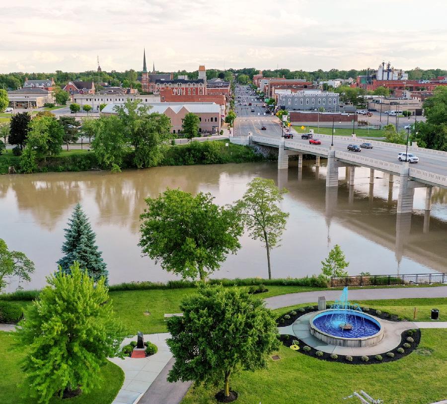
The City of Defiance invites you to share your views and ideas as we discuss possible improvements to our parks and riverfronts.
WHEN: September 23, 2024 | 6pm - 8pm WHERE: Stroede Center for the Arts
Wayne Avenue, Defiance, OH
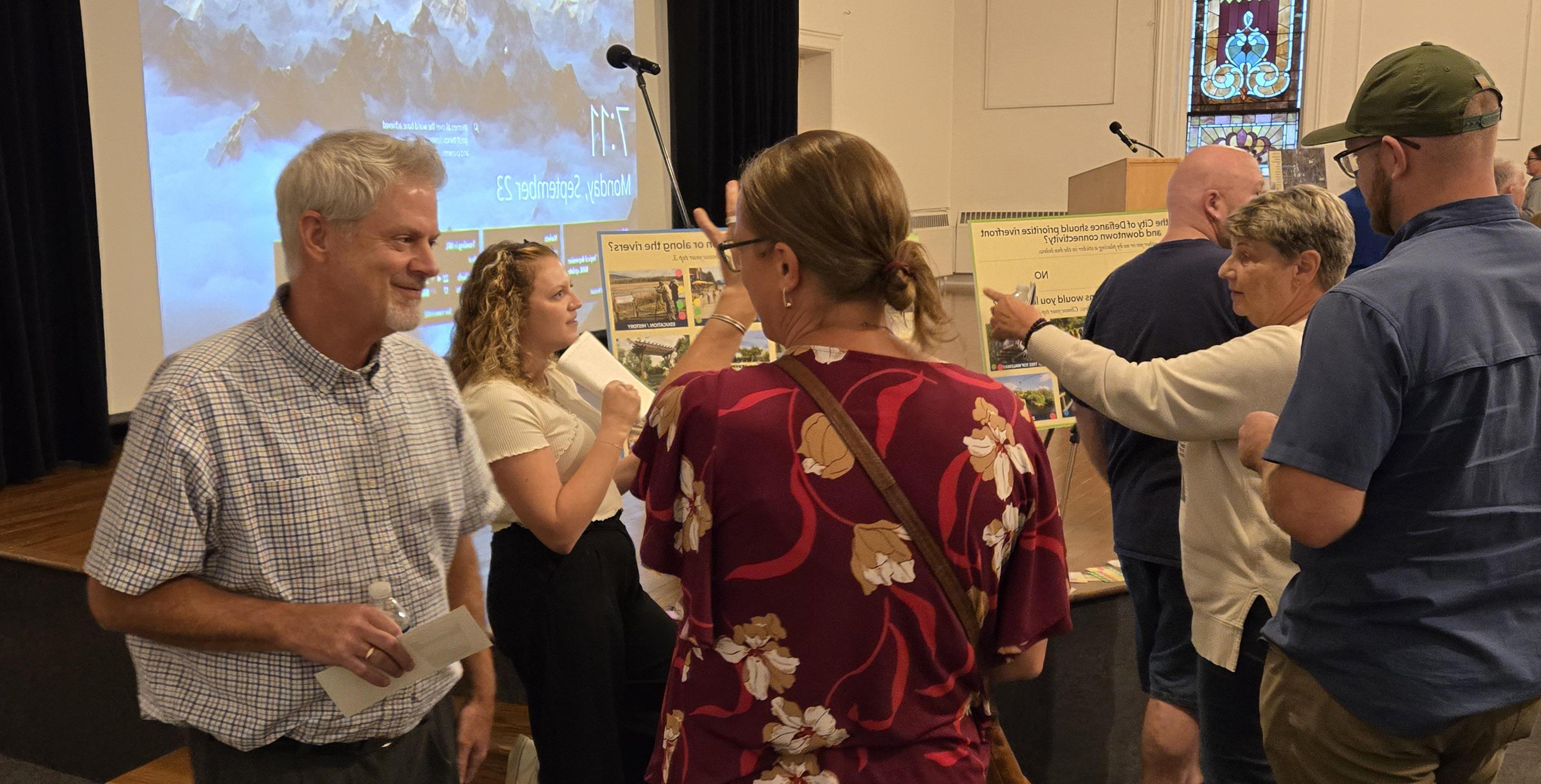
PUBLIC SURVEY #2 SUMMARY
A 21-question survey was given at the end of the community workshop to gain insight on specific amenities. The survey was then posted to Facebook the following day. Below is a summary of responses, with a full list of questions and responses available in the Appendix. The survey was open from September 23 through September 26, 2024. A total of 63 responses were gained, 49 from the workshop and 14 from social media.
OF RESPONDENTS SAY THEY ARE INTERESTED IN AN OUTDOOR EVENT VENUE
OF RESPONDENTS SAY THEY ARE NOT INTERESTED OR HAVE NO OPINION ON A SKATE PARK
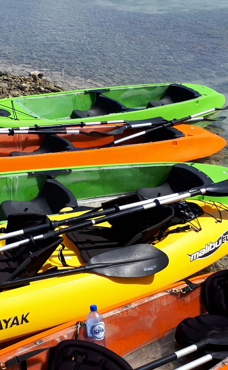
97% 98% 83% 65% 100% 87%
OF RESPONDENTS SAY THEY ARE INTERESTED IN RIVERFRONT RESTAURANTS AND/OR DINING
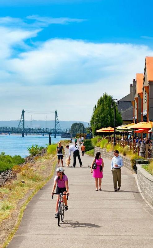
OF RESPONDENTS SAY THEY ARE INTERESTED IN RIVERFRONT TRAILS
OF RESPONDENTS SAY THEY ARE INTERESTED IN KAYAK RENTAL OPPORTUNITIES
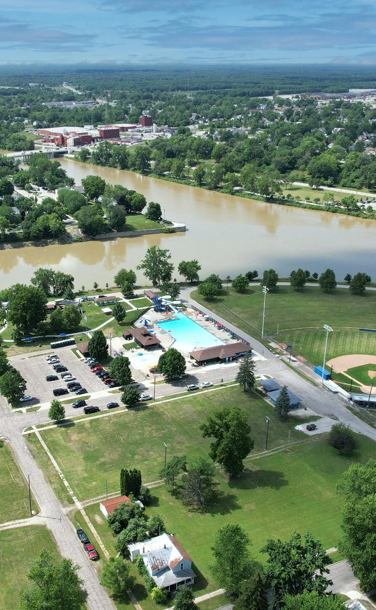
OF RESPONDENTS BELIEVE LOCAL CULTURE OR HISTORY SHOULD PLAY A KEY ROLE IN DEFIANCE PARKS
Community Engagement: STAKEHOLDER INTERVIEW GROUPS
Real Estate
• Increase trail connectivity
• Opportunities for development
• Empty lot next to Circle K has potential for mixed use / housing development
• Great need for more housing, especially apartment-style
• "I would love for Defiance to be a destination..." Bring amenities to Defiance that draw surrounding communities to the area
• Engage with riverfront and provide spots for boats to dock and spend the day
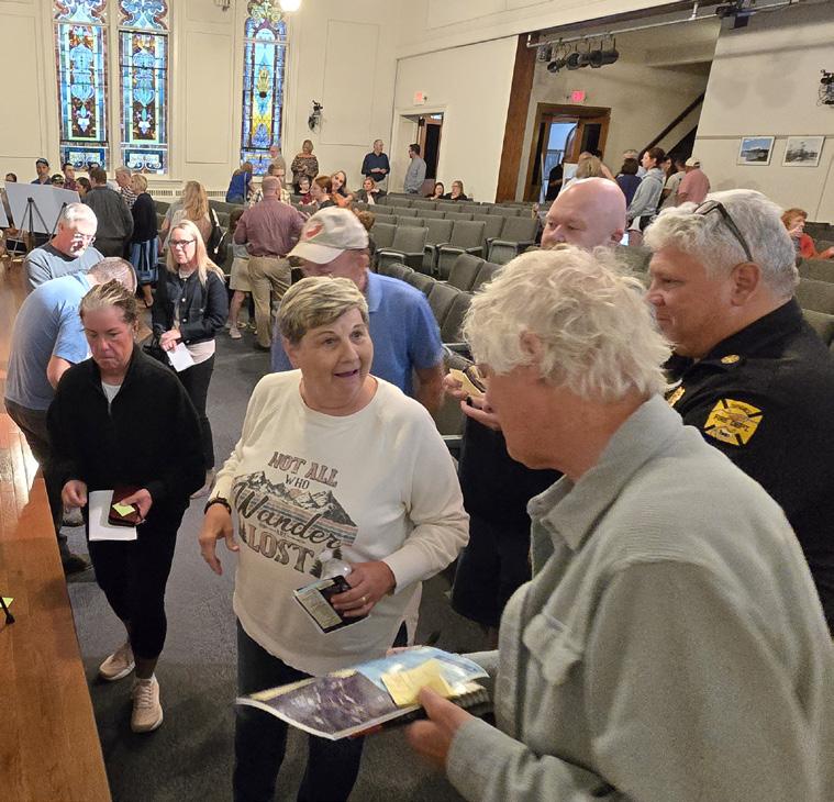
Youth Leagues
• Defiance does not have a large, indoor sports facility to allow for winter time practice or tournament hosting
• Provide programming that engages the teenage population
• Defiance sports programs are engaging with the Special Olympics and would benefit from accessible sport facilities
Health & Wellness
• The City population has a shorter life expectancy that directly correlates to exercise; provide outdoor recreation, especially to the east side and other lower income areas
• Need to change the stigma that the rivers are "dirty" because they are an amazing asset to the City
"We need a commemorative space for Native Americans - this story hasn't been told yet."
- Downtown / Arts / Culture & Tourism
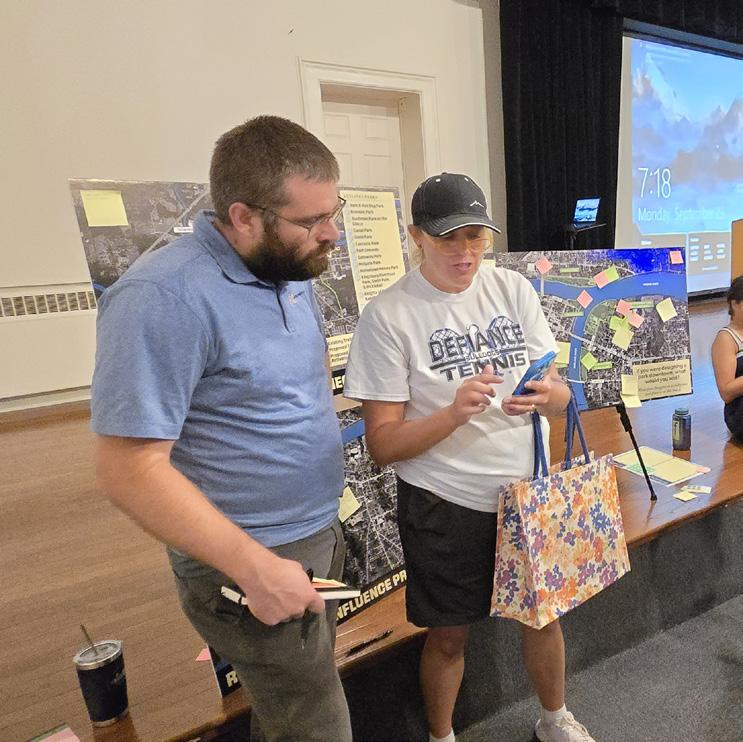
"The parks look the best they ever have with the recent improvements."
- Real Estate
Park-Centric
• Requests for bike trails that accommodate families
• Metro Park board is working to institute self-serviced kiosks for canoes and kayaks
• Hopkins Street to 2nd Street does not flood - potential for riverfront access without fears of flooding
• Emphasized importance of beautification for existing parks and development along the rivers, from a DORA District to marinas
Downtown / Arts / Culture / Tourism
• Expressed importance of Native American recognition in the development of Buchman Park and provided resources on the history
• Implement new recreational activities, including kayak access, ice skating, camping opportunities, and pontoon rentals
• Need a permanent, outdoor amphitheater as rentals are expensive
• Emphasized importance of partnering with nearby organizations, such as youth and sport groups
Financial Institutions
• Sand volleyball is popular for teenagers, but could use improvement
• Expressed that public may use rivers if they were cleaner - poor reputation
• Need for destination dining and amphitheater space
Adult Athletic Clubs & Avid Fitness
• Need for winter activities; ice rink, cross country skiing, etc.
• Add outdoor exercise equipment within existing parks
• Need to ensure improvements will be maintained after construction
• Great support for levies - the community sees the impact through the parks as a result
Educational Resources
• Library hopes to expand children services and provide free events
• Pursue more H2Ohio funds to provide more wetlands
• Implement an educational corridor along the rivers, including the library, proposed annex, and 102 Washington Avenue
• Provide free community spaces and partner with local organizations for programming
• Defiance is on the pathway for migratory birds - provide bird watching spaces
• Explore and recognize other historically significant aspects of Defiance beyond Fort Grounds and Buchman Park
Accessibility & Seniors
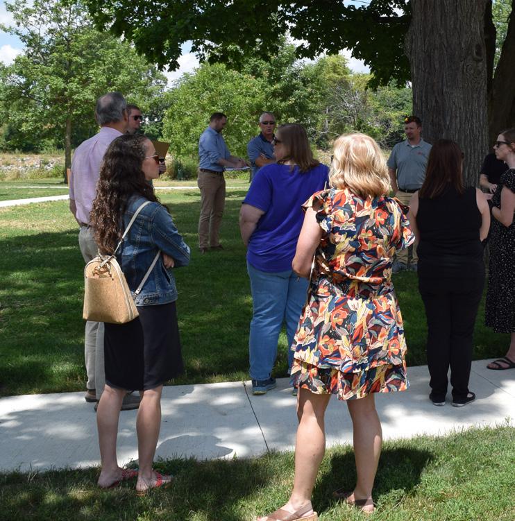
"This area has so much history that hasn't been shared or given equal weight."
- Educational Resources
Water Recreation
Large Local Industries
• Improve pedestrian access across the rivers - there are safety concerns over sidewalks on existing bridges
• Need more housing available in the area - no rental opportunities or affordable housing
• Provide amenities and activities for young professionals, nothing to draw them to Defiance today
• Overall connectivity has improved over the years but there are limits as sidewalks and paths end; provide loops or continuous trail opportunities
• Shade determines how long people stay at a park
• Continue providing programs to engage children in the summer
• Top concerns: improve overall connectivity, provide pedestrian access across rivers, and provide public restrooms throughout
• Implement better outreach methods to inform the community
• Highlight existing trails, provide QR codes or handouts with park amenities and programs
• Need to provide accessible and inclusive playgrounds, including adult changing tables in restroom facilities
• Seating areas should provide more shade, be near restrooms, and have accessible pathways
• Improve overall crosswalks, curb ramps, and street crossings as many are not safe for people of all abilities
• A free nature center would be a great amenity for the senior community, with animal education, bird watching, etc.
• Parking areas available at parks need to allow for bus parking and unloading, many existing parks do not have enough space
• Consider providing elevators for access to elevated viewing areas
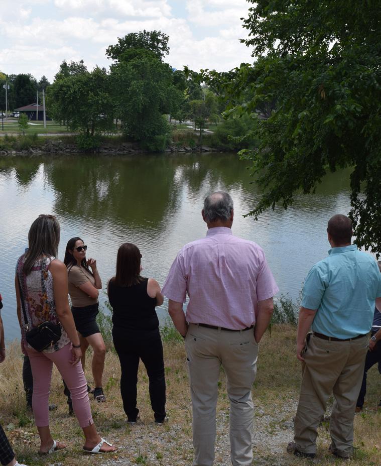
"Positive improvements at Reservoir - would love to see that energy put into downtown parks."
- Large Local Industries
Community Engagement: PUBLIC SURVEY #3 SUMMARY
A statistically valid online survey was conducted, inviting the community to select their favorite concept for each park and share additional feedback. Riverfront parks were presented as a group, as was citywide pedestrian connectivity. The concepts can be found in Section 5: Shaping the Future. Below is a summary of the responses, with a complete list of questions and answers provided in the Appendix document. The survey was open from November 14 through December 3, 2024.
599 responses were received.
Riverfront Parks (Gateway, Pontiac, Fort Grounds, Kingsbury, and Buchman on the Glaize)
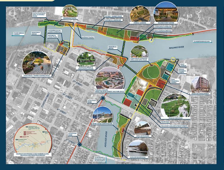
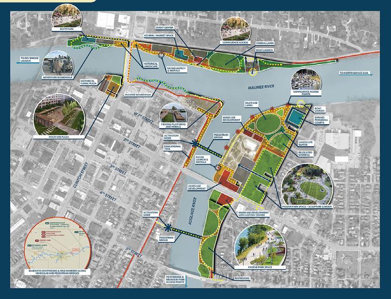
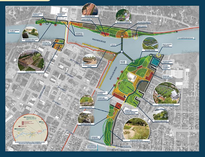
• Removal of ball field to allow for mixed-use development and open lawn with stage
• Pedestrian bridges connected to Fort Grounds
• Boardwalks along the Auglaize
• Maumee Event Center
Connectivity
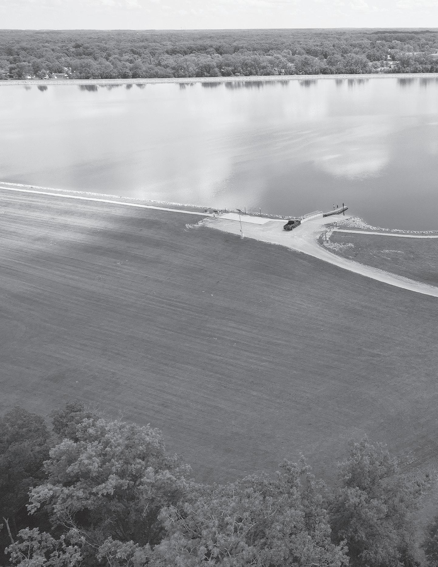
• Ball field relocated to allow for expanded multi-use lawn
• Pedestrian bridges located north and south of the 2nd Street Bridge
• Boardwalks along the Maumee
• Educational walk near the library
• Smaller event center

• No change to the ball field
• Event lawn with stage and multi-use development
• Tridge
• Maumee Marsh and Education Center
• Event center with overlook deck
Top Choice CONCEPT 2: 57%
The proposed connectivity forms a loop, linking multiple parks and including a pedestrian bridge parallel to the existing railway bridge across the Auglaize River.
"The more accessible the trails are (i.e. having more trails and greater access points), the more people will be able and willing to walk them."
- Survey Response
Bronson Park
1st Choice CONCEPT 3: 45%
• Splash pad shelter house (converts into ice rink)
• Santa’s village / winter light route
• (2) new lighted volleyball courts
• Riverfront boardwalk
• Nature shelter house
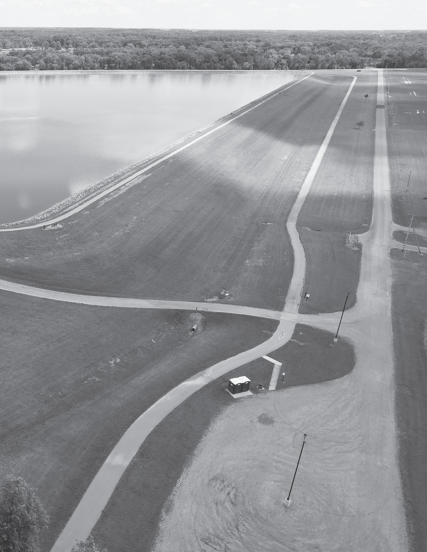
2nd Choice CONCEPT 1: 34%
• Splash pad shelter house
• Large pollinator habitat
• (1) new lighted volleyball court
• Multiple new shelter houses
• Large event center with parking
• Adventure courses
Eastside Park
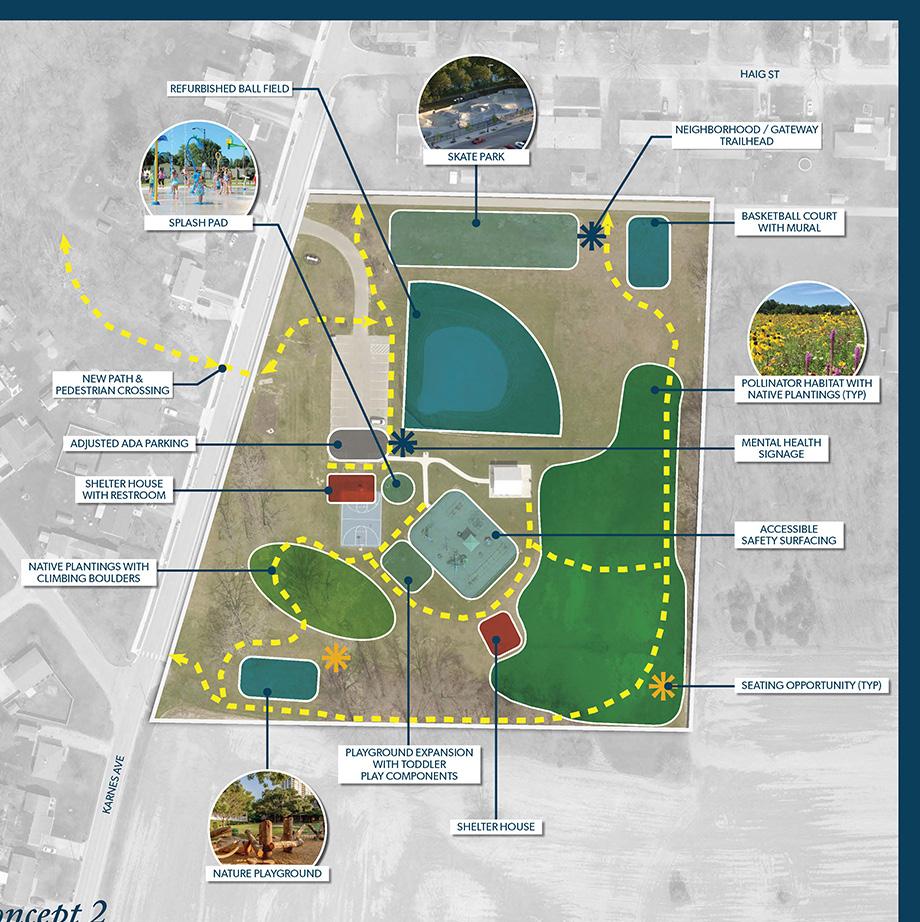
• Refurbished ball field
• Skate park
• Nature playground and splash pad
• Shelter house with restrooms
• Pollinator habitat with seating
• Playground extension with toddler components
• Adjusted ADA parking
• New walking path with pedestrian crossing Top Choice CONCEPT 2: 67%
Is there anything missing from the concepts?
“Put an Ice Skate Complex in the city, get Defiance High School a HOCKEY TEAM!! I go to Walleye games, we should do that in our town.”
“More swings like in Pontiac park.”
“More trash receptacles, river overlooks, and shade over playground equipment.”
“Maybe a mountain bike or BMX trail?”
“A much bigger area for concerts...”
“Ensure playground equipment is inclusive. I have 2 special needs toddlers that cannot use some of the parks as there is no equipment they can use. The equipment should be available for all ages of children also.”
“More water features and more committed dog areas within the parks.”
“Fishing pier at the reservoir.”
“Play structures that are all-weather, indoors so kids can play during extreme temperatures/weather.”
“I think outdoor grill stations with food prep areas would be awesome!”
“Please keep ADA in mind.”
“Bathrooms need to be at almost all these parks!”
“Maybe a zipline in the tree top adventure if there isn’t one planned.”
“Small turf soccer fields for 7 on 7 games.”
“WIDE & ACCESSIBLE SIDEWALKS leading to all parks.”
“I think it would be nice to have signs that show historical views of what the current view around the river looked like.”
What excites you the most about these concepts?
“Accessibility for my kids going to and from new and improved beautiful parks!”
“Gathering places, markets, murals, sculptures.”
“Kayak launches.”
“The opportunity! Plazas and event centers and the good mix of natural green space with these other big changes. Also restrooms with changing tables!”
“Community event centers/ amphitheaters, more playgrounds, walking/nature trails.”
“Biking and walking opportunities.”
“More access to public restrooms, and better lighting for a better nighttime walking experience.”
“Making our parks more worth visiting with different opportunities. Utilizing the rivers. Adding more components and upgrades.”
“The skateboarding areas, the inclusivity, and especially the pollinator sanctuaries.”
“The opportunity to finally capitalize on our riverfront area, and highlight the natural uses of our community with the trail activations through the wooded areas.”
“The potential for an ice rink is the most exciting part to me. The community gardens and orchards are exciting too.”
“River access, activation mode, and connectivity.”
“So many activities with these park renovations. Feels like we don’t need to go out of town to find entertainment for the kids.”
“Pedestrian bridges connecting Kingsbury, the Library, and Pontiac Park.”
“Potential to attract more people to stay in Defiance and move to Defiance.”
Veteran’s Memorial Park at Latty's Grove
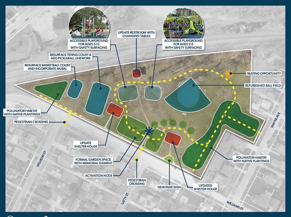
• Resurfaced courts (adding a mural and pickleball linework); refurbished ball field
• Accessible playgrounds with safety surfacing
• Seating opportunities
• Updated shelter houses
• Pollinator habitat with native plantings
• Formal garden space with memorial element
• Activation node and new park sign
• Pedestrian crossings at Williams Street
K of C Baseball Complex
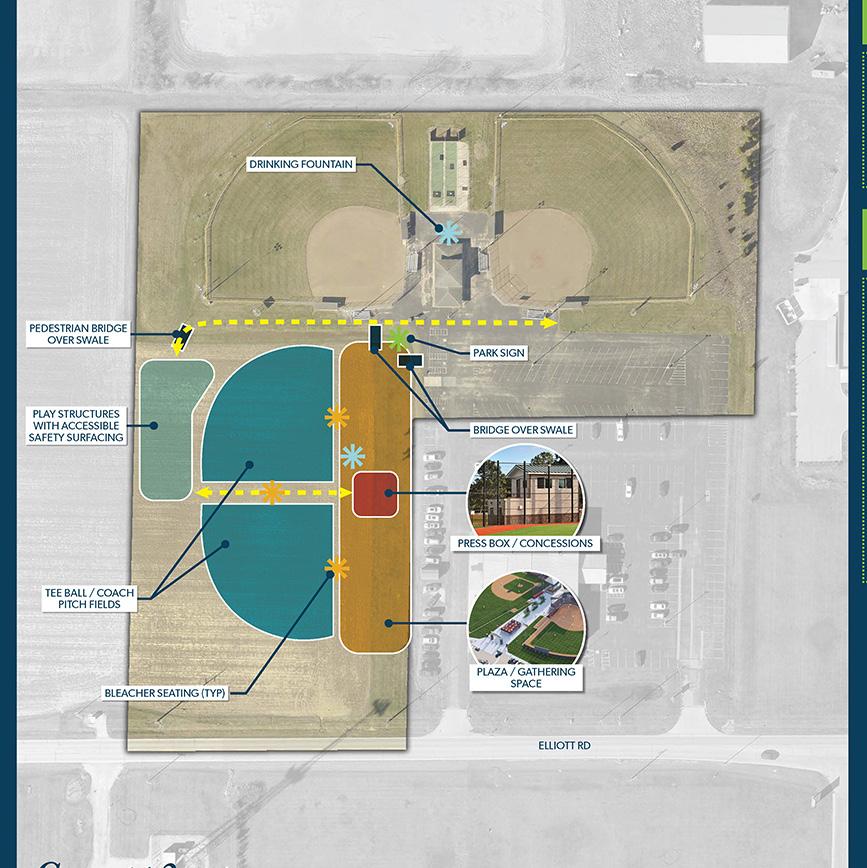
Top Choice CONCEPT 2: 70%
• Plaza and gathering space
• Press box and concessions
• Tee ball / coach pitch fields
• Play structures with accessible safety surfacing
• Drinking fountains
• Park sign
Top Choice CONCEPT 2: 69%
Reservoir Recreational Area
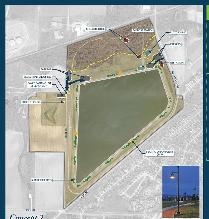
Top Choice CONCEPT 2: 69%
• Additional parking with nearby restroom, exercise stations, and playground off Precision Way
• Additional parking and pedestrian crossing along Kibble Road
• Shelter house along boardwalk trail
• Shade and seating along reservoir trail
Diehl Park
Bark & Run Dog Park
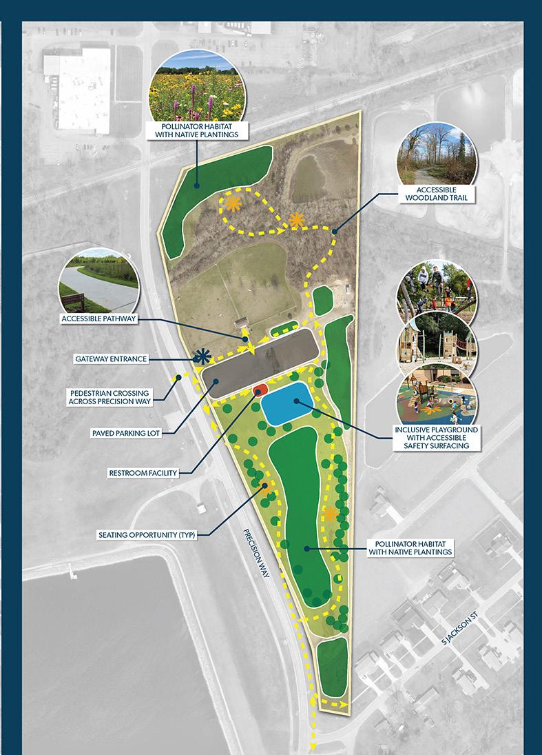
Top Choice CONCEPT 2: 82%
• Accessible woodland trail with seating
• Pollinator habitats
• Pedestrian crossing at roadway
• Paved parking lot with nearby restroom
• Inclusive playground
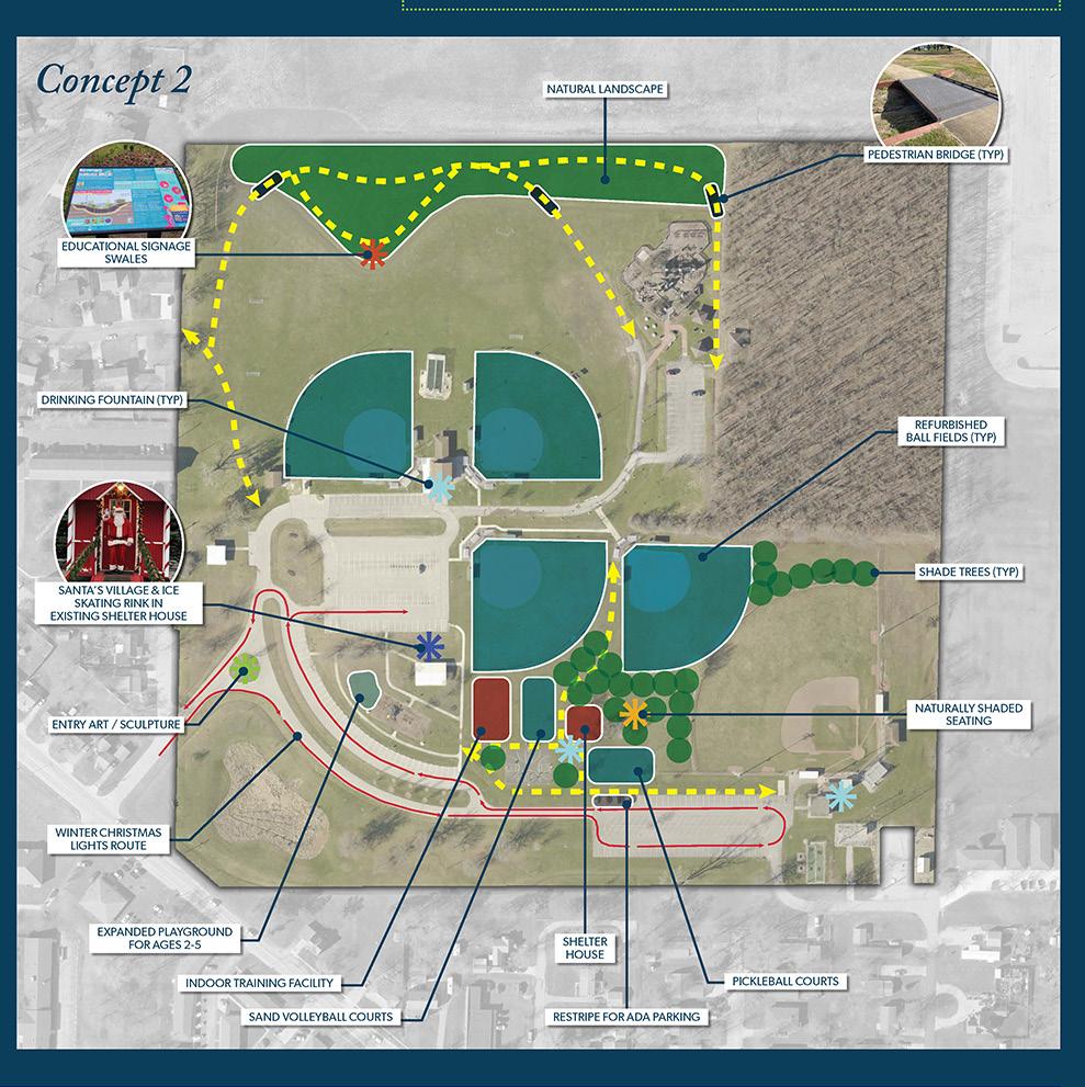
Choice CONCEPT 2: 74%
• Refurbished ball fields
• Indoor training facility
• Sand volleyball and pickleball courts
• Shaded seating
• Playground for children ages 2-5
• Natural landscape with trail
Canal Park
Concept 1 was rated as the top choice, with 75% of the vote.
Diehl Park
Listed as the #1 park survey participants want to see further developed, with the Reservoir Recreational Area coming in a close 2nd.
Holgate Park
Both concepts were rated nearly even, with concept 1 receiving one additional vote.
Palmer Park
Both concepts were rated within 5% of each other. Concept 1 received 24 more votes than Concept 2.
Riverside Park
Both concepts were rated relatively close, with Concept 2 receiving 56% of the vote.
Triangle Park
Both concepts were rated relatively close, with Concept 2 receiving 58% of the vote.
Community Engagement: STEERING COMMITTEE MEETING #1
Throughout the master planning process, the team met with members of the Steering Committee to discuss the project as a whole, gather insights about the area, and garner their overarching ideas. During Phase 2, the group met to discuss the initial design concepts for each park. The design concepts can be found in Section 5 of this document. Below is a summary of the small group discussions from that meeting.
11.12.24 - Throughout the meeting, the group discussed several key improvements and projects to enhance parks, trails, and public spaces within the City of Defiance.
Several park-specific improvements were addressed. Pontiac Metro Park needs a permanent restroom and could benefit from a flood-resistant formal garden, an event center, or even an ice rink if designed for multiseason use. Encouraging college students to use the parks and downtown was also suggested, with ideas such as adding sand volleyball courts. Gateway Park requires consideration for truck and delivery circulation and could feature a pedestrian connection under the Clinton Street Bridge. The committee also discussed addressing the sulfur spring, with options ranging from capping it to marketing it as a historic feature. Kingsbury Park was noted for its potential further development along the river while ensuring plans accommodate the existing pump station. Additionally, the baseball field needs to remain in its current location due to its historical significance and community investment. Relocating the pool is considered a more acceptable option, if needed.
Infrastructure and accessibility improvements were a key focus. The Defiance section of the Buckeye Trail, currently one of the least safe portions, needs enhancements, especially along Washington Street. Boardwalks along the river were seen as a cost-effective improvement that would provide fishing access and a sense of connectivity. Enhancing boat launches was also discussed, with the goal of providing more rental locations and establishing
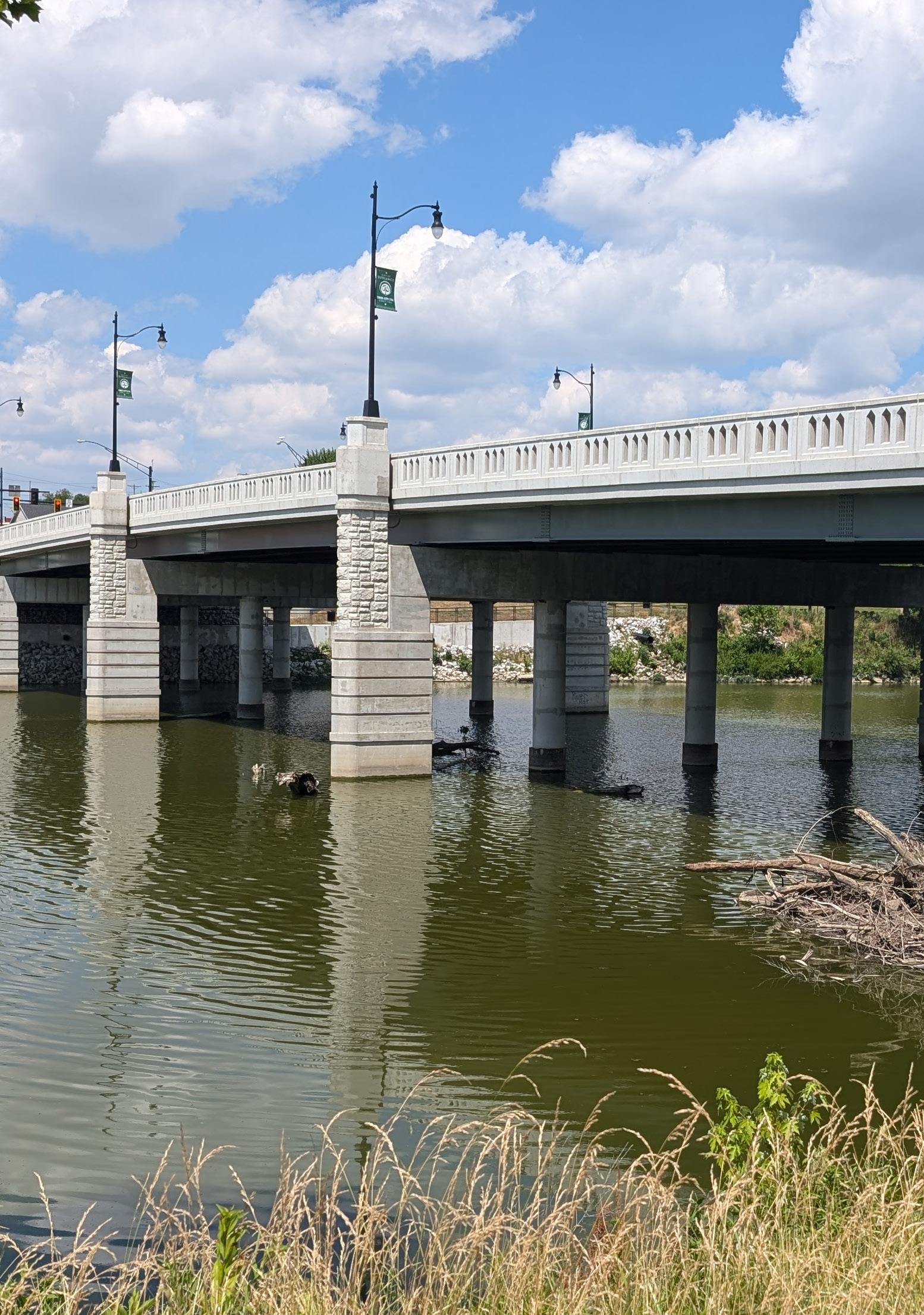
one on the south side of the Maumee River for better downtown access. The committee weighed the benefits of boardwalks versus pedestrian bridges, with a tridge (three-way bridge) being a potential game-changer, though it could pose navigation challenges for boats.
Trail connections were emphasized, with a preference for closed-loop designs and extending routes east past the hospital along 2nd Street, as well as north along Clinton Street to link the university and northern parks to the river and downtown. Additional trailheads and parking opportunities in the downtown area were also considered, and it was noted that a mental health and wellness trail is in progress near Mercy Health, east of the proposed Preston Way Trail. Expanding river access with multiple kayak launch points was strongly supported, including a potential launch site on the south side of the Maumee River between Fort Grounds and the Clinton Street Bridge.
Closing the interior roads and realigning Front and Auglaize Streets were proposed to improve safety. Additionally, reconstructing the historic mule bridge was considered, with grant funding as a potential option, and sketches from Randy Buchman were shared to support historical signage efforts.
The committee aimed to prioritize making the "healthiest choice the easiest choice" while enhancing public spaces to support recreation, accessibility, and historical preservation.
Key Takeaways
1 Preservation and Enhancement of Kingsbury & Pontiac Parks: The baseball field in Kingsbury is historically significant and will not be relocated, but there is openness to relocating the pool. Pontiac Park improvements include a permanent restroom, potential event center, and flood-resistant formal gardens.
2
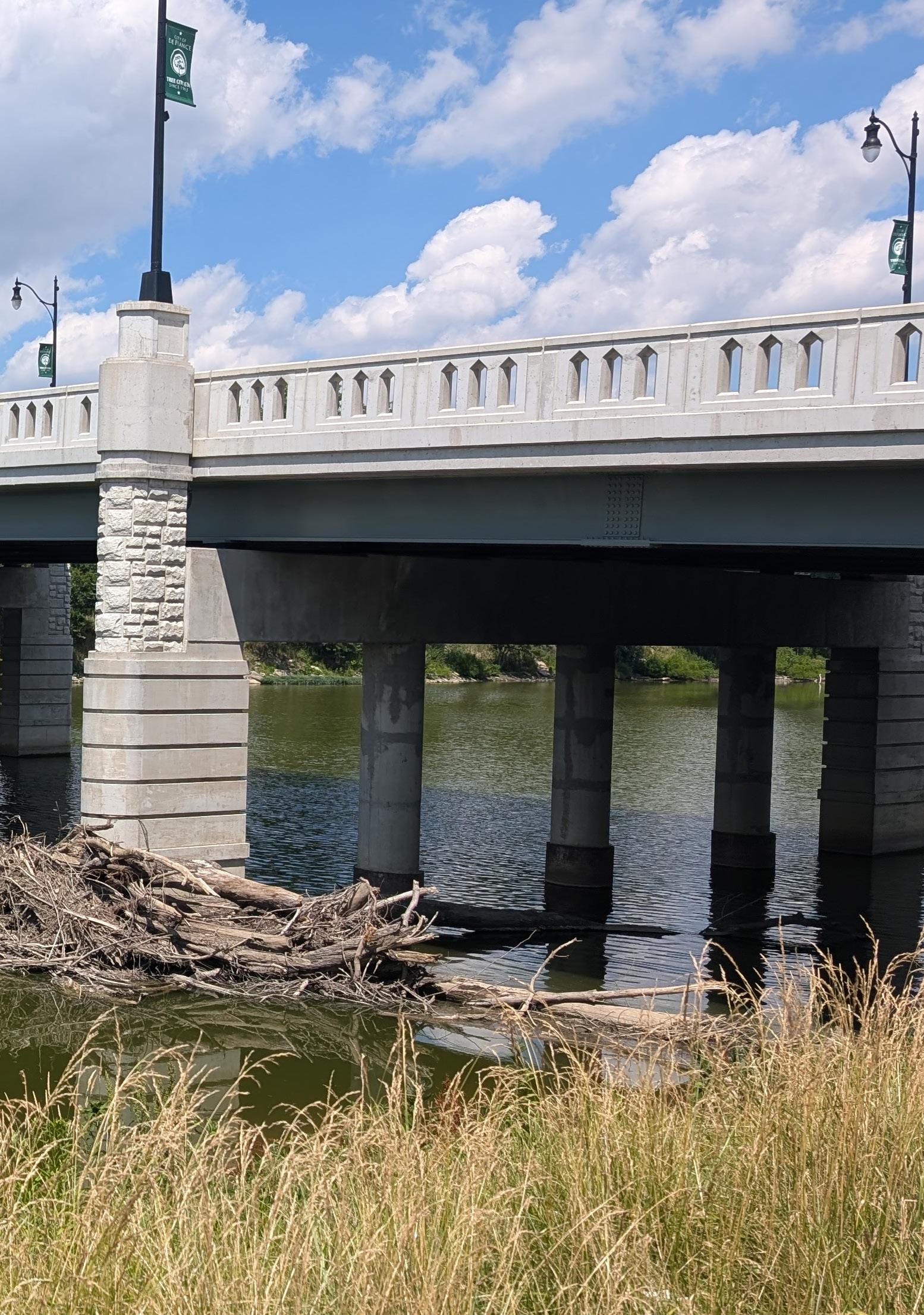
3
Trail and Connectivity Improvements: The mental health and wellness trail near Mercy Health is progressing, and there is strong interest in enhancing the Defiance section of the Buckeye Trail, which is currently one of the least safe sections. Improved trail connections to downtown, the university, and northern parks are a priority.
Riverfront and Recreational Enhancements: Boardwalks along the river are highly favored for their accessibility and scenic value. Multiple kayak launch points, especially on the south side of the Maumee River, would improve downtown river access.
Gateway Park and Infrastructure
4
5
Considerations: The sulfur spring in Gateway Park needs to be addressed, whether by capping it, hiding it, or marketing it as a historic feature. There is also interest in reconstructing the historic mule bridge if funding is available.
Public Safety and Information Accessibility: Enhancing CSO signage with QR codes or active indicators would better inform residents. Closing roads in Kingsbury and realigning Front and Auglaize Streets are seen as beneficial for safety.
Community Engagement: STEERING COMMITTEE MEETING #2
At the end of Phase 2, the group met again to discuss the refined design concepts of three specific parks (Bronson, Diehl, and the Reservoir Recreational Area) and the parks located along the riverfront (Buchman on the Glaize, Canal, Gateway, Fort Grounds, Kingsbury, Pontiac, and Riverside). The design concepts can be found in Section 5 of this document. Below is a summary of the small group discussions from that meeting.
03.06.25 - The Steering Committee meeting covered a wide range of topics, with active discussion and thoughtful feedback shared across several focus areas. It emphasized a balance between preservation, accessibility, and activating public spaces for community use. Broad support was voiced for green infrastructure, flexible event spaces, river access, and establishing cultural and recreational hubs across the project area. In the parks, there was strong enthusiasm for improving pedestrian safety and experience. Committee members supported the idea of removing interior roads in Diehl and Kingsbury Parks to prioritize walkability, while pushing vehicular traffic to the perimeter. This reflects a broader desire to create safer and more accessible community spaces.
Downtown parking sparked a larger conversation. With a proposed pedestrian corridor from Gateway Park to Canal Park potentially eliminating some parking spaces, participants debated whether parking availability is currently sufficient. While some supported replacing parking with green space if demand allows, many expressed concern over existing shortages – particularly regarding ADA-accessible spaces. A parking study was proposed to better understand current needs and future solutions.
Key Takeaways
1
Improving Accessibility and Connectivity
Is a Priority: There was a clear emphasis on making spaces more walkable, inclusive, and connected. This includes removing internal roads from parks, enhancing ADAcompliant parking, and creating accessible pathways.
Boat access received mixed feedback, largely because most committee members were not boaters themselves. However, there was general support for the addition of new docks, especially with the idea that more could be added later if the initial ones are successful. When comparing launch sites, the feasibility of Riverside Park versus Pontiac Park was examined. Riverside raised concerns due to narrow, residential streets and the complexity of routing a launch through Arabella Street and under the railroad. Pontiac’s boat launch needs full replacement, making cost comparisons relatively even. There were also discussions about other potential sites, such as the east side of Kingsbury Park, areas near Mercy West, and properties near the Water Treatment Plant. Kayak launches were seen as especially promising for certain locations. Ultimately, the group emphasized the need for more public input on both boat launch and dock locations.
The proposed ice ribbon drew no strong preference between Pontiac and Kingsbury. Kingsbury may be better sheltered from the weather and is already a summer hotspot, while Pontiac has potential for programming that could activate the rink year-round. Kingsbury’s parking lot was discussed as a potential location for the existing seasonal ice rink, although grading challenges were noted. Bronson Park emerged
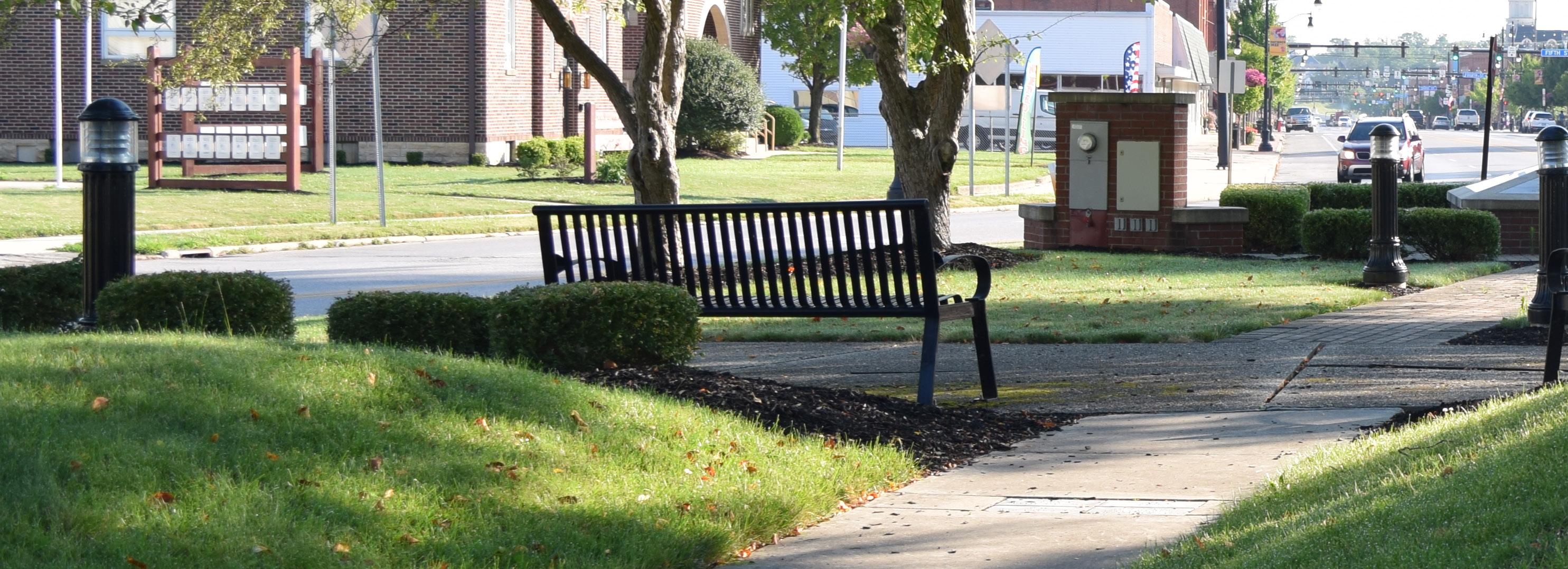
2
There’s Broad Support for Flexible, Community-Oriented Space: Enthusiasm was expressed for multi-use spaces that can host events, support vendors, and adapt throughout the seasons. This includes interest in an indoor sports facility, small event venues, an ice ribbon, and expanded river access with docks and overlooks.
as a short-term favorite due to its low cost and existing infrastructure, offering a quick win that demonstrates the City’s commitment to making use of current assets.
Pontiac Park generated excitement around opportunities for community gathering spaces. There was interest in providing dedicated areas for food vendors rather than utilizing on-street parking. For Riverfest, participants proposed shutting down East River Drive and using angled parking, though concerns were raised about safety and maneuverability. Members expressed a strong desire to preserve the historic fountain near the Clinton Street Bridge and supported adding a small event space that could host 75-to-150person gatherings such as graduation parties, bridal showers, and similar events.
Kingsbury Park discussions centered on removing through-traffic and shifting to perimeter drives with internal pathways. Committee members appreciated the existing bleacher placement behind home plate, noting the excellent view of the confluence. There was significant enthusiasm for the boardwalks along the Auglaize River, although some cautioned that a potential marsh could present maintenance challenges over time.
In terms of cultural and historical spaces, members generally favored minimal but meaningful enhancements to Fort Grounds. Any improvements should focus on accessibility and inclusivity, such as walkways connecting to monuments. The site has historical importance, with archaeological digs having taken place in the 1980s. Tent space on the library lawn already provides seasonal programming, and the existing riverside walk is well-liked and has potential for additional river engagement points. Some concern was expressed that treetop or river’s edge walkways might obstruct the library’s views.
The concept of a tridge was discussed at length. Members feared that a full tridge could allow visitors to bypass Fort Grounds entirely, reducing foot traffic there. A modified tridge, as shown in Concept 1 (see Section 5, Riverfront Parks), was preferred as it encourages movement across the site without compromising visibility or access to key cultural landmarks. A landing point on the lower riverwalk level was proposed as an alternative that maintains flow while preserving key views.
At Riverside Park, the committee preferred river overlooks and interactive access points. More trees were requested, and there was little interest in preserving the existing ballfield. Participants also appreciated the existing BMX track in the woods and supported creating a more formal park entrance.
Gateway North was well-received, particularly the inclusion of a skate park. For the canal pedestrian corridor and Gateway South, both design options were liked, but the option that retains parking was viewed as more feasible. Even so, Concept 1 (see Section 5, Riverfront Parks) was seen as more active and engaging in its layout. Across all these areas, the committee stressed the importance of preserving existing strengths while enhancing connectivity, accessibility, and community programming.
Additional discussions included the future of the 1918 High School Building. The City has extended its RFP through the end of 2025 and is actively seeking investors or developers, with the exception of charter schools. The auditorium has already been revitalized, complete with upgraded lighting and utilities, and remains under the high school’s ownership. Arts and cultural programming are expanding in other parts of Defiance as well, and there is growing interest in developing an arts district that would connect the 1918 Building, Triangle Park, Arabella Street, and the Legion.
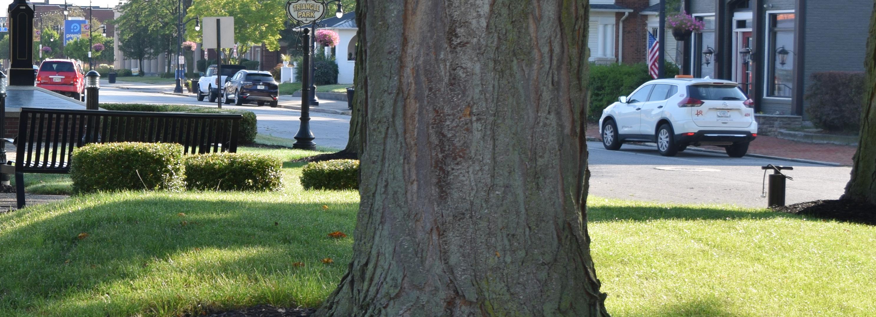
3
Parking and River Access Require Further Study and Community Input: While there were differing perspectives on downtown parking availability and the best locations for boat access, the committee recognized these as valuable opportunities to engage the broader community. Additional input from the community was recommended.
4
Balancing Preservation with Activation Is Essential: There is a need to preserve valued elements, like the fountain at Pontiac and the view from the Library, while also supporting new features like boardwalks. The goal is to enhance what already works without disrupting the character or history of each space.
Community Engagement: COMMUNITY WORKSHOP #2
At the end of Phase 2, a community workshop was held. The design team provided an overview of the project to date, went over prior survey results, and discussed the riverfront parks concepts. After the presentation, the group moved to the interactive boards, where community members shared their feedback on the refined concepts for the riverfront parks as well as Bronson, Diehl, and the Reservoir Recreational Area. Attendees were also asked to participate in Public Survey #4, to choose their favorite riverfront concept and rate the others.
03.19.25 - The goal of the gathering was to engage community members, provide project updates, and offer a platform for sharing opinions and input to support the development of the refined concepts.
Improving pedestrian connectivity was a major theme, with better access across the 2nd Street Bridge identified as a top priority. The Canal Corridor is also valued, though Canal Park needs upgrades to become a stronger destination. Other bridge crossings like the Clinton Street Bridge were flagged as uncomfortable due to heavy traffic and narrow sidewalks, while the Hopkins Street Bridge and a proposed connection along Arabella Street to Triangle Park were mentioned as beneficial but less urgent.
The community favors expanding kayak access along Riverside Park for its calm, scenic waters. Pontiac Metro Park was also supported, though concerns about congestion at the confluence were noted. Other lowerpriority sites included Fort Grounds, Kingsbury, Buchman, and Gateway Parks.
The existing launch at Pontiac is appreciated, with suggestions to add docks at Fort Grounds for downtown access. Other proposed docking points, such as Gateway Kingsbury, were mentioned with lower priority, indicating interest in expanding access while maintaining strategic focus on high-use areas.
Additional key takeaways include:
• The Stroede Center is enthusiastic about continuing to manage entertainment in the parks, especially with potential new venues in Kingsbury Park.
• The community is showing interest in supporting community development initiatives.
• Participants recommended reducing the natural landscape at Veterans Memorial Park at Latty's Grove to accommodate additional sports courts, particularly pickleball and tennis, to encourage more activity. The tee-ball field was noted as underutilized and potentially unnecessary, and fencing was suggested for the sports fields or possibly the entire park.
• The addition of a fieldhouse at Diehl Park is supported.
• Accessibility improvements are needed, especially within the Fort Grounds area.
• Bottle fillers were requested throughout all parks. The social media graphics advertising the event, along with the interactive boards, can be found in the Appendix document.
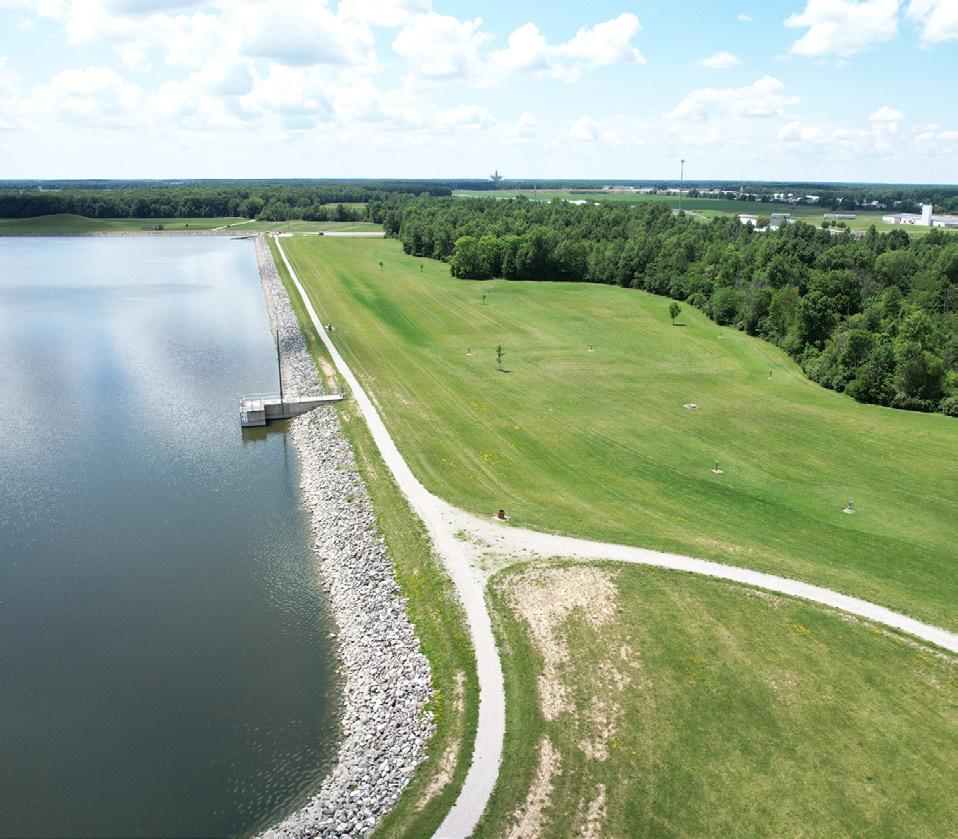
JOIN US FOR A COMMUNITY WORKSHOP
The City of Defiance invites you to view the latest park concepts and share your thoughts as we discuss possible improvements to our parks and riverfronts.
WHEN: March 19, 2025 | 6pm - 8pm
WHERE: Stroede Center for the Arts 319 Wayne Avenue, Defiance, OH *Light
PUBLIC SURVEY #4 SUMMARY
A short survey was given at the end of both the Steering Committee meeting and community workshop to gain insight on the refined concepts. The survey was then posted to Facebook on March 20. Below is a summary of responses, with a full list of questions and responses available in the Appendix. The survey was open to the public from March 19 through April 6, 2025. A total of 502 responses were gained.
Riverfront Parks
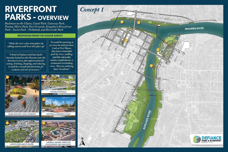
Top Choice CONCEPT 1: 60%
On
“Riverside kayak launch area would be very useful.”
“My only concern with concept 1 with the amphitheater is parking. I love that public pool is staying undertouched, and there is the thought for winter festivals/ activities as well.”
“Better fishing access from shore all around the conjunction would be nice.”
"I like the idea of the open green space on Turnbull Meadow and the event center."
"Board walk on the river would be AWESOME!! Think about it!!"
"The mixed use and event space is crucial."
"The boat launch needs to stay at Pontiac, and I like the ice skating at Kingsbury. I like the simplified tridge better in Concept 1."
a scale of 1 to 5 stars, how would you rate the proposed
Bronson Park
Diehl Park
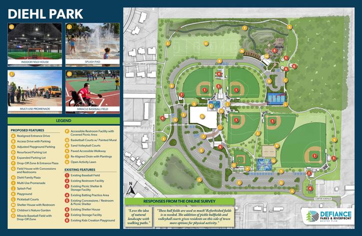
concepts?
Reservoir Recreational Area
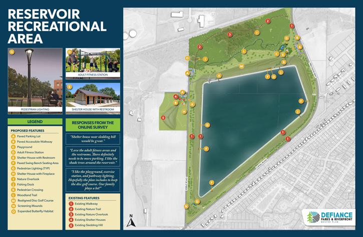
“The use of the wooded area for trails would be great for the community!”
“I strongly appreciate the utilization of our natural waterways, as well as the nature center and river walk ideas ...”
“I'm excited to have more activities for people of all ages.”
“Indoor field house is a great idea!!” “The adult fitness seems neat, like a playground for adults.”
"I love the idea of a miracle baseball field! Maybe this park could be the place for a fully inclusive playground."
“I like the idea of another splash pad with a nice park next to it! Also, all the sports stuff sounds great!”
“Just try to keep it as natural as possible and attract people but not overdo the commercial aspect.”
“I think restrooms and shelter houses would be a great add, as would pedestrian lighting. Paving the lots are nice enhancements as well.”
Community Engagement: PARKS BOARD & PLANNING COMMISSIONS MEETING #1
As part of the continued community engagement process for the Defiance Parks & Riverfront Master Plan, a joint meeting was held with the Defiance Park Board and the Plan Commission to review key plan concepts and provide feedback on proposed improvements. This collaborative session brought together local leadership perspectives on critical topics such as environmental stewardship, riverfront accessibility, and community-oriented amenities.
04.03.25 - The discussion focused on refining specific elements of the draft plan, including boat access and launch strategies, pedestrian connectivity, amphitheater placement, and the potential transformation of the Canal Corridor. Participants emphasized the importance of enhancing the user experience while balancing long-term sustainability, flood resilience, and public access.
Discussion around boat access focused heavily on maintaining and enhancing current facilities rather than removing or relocating them. Participants felt strongly that the existing boat dock in Pontiac Metro Park should remain in place, as it offers easy access via River Road and avoids congestion. While there is support for adding a secondary dock, particularly one downtown to encourage access to local businesses, there was clear opposition to eliminating the existing structure.
There were also calls to add a kayak launch, either at the current site or as part of a new location. Parking capacity at the existing launch was noted as insufficient to serve as the only access point, prompting suggestions to identify future launch locations.
Discussion about pedestrian bridges centered on accessibility, functionality, and visual impact. Participants raised concerns about whether boats could pass beneath the proposed bridges and emphasized the importance of ADA accessibility. There were comparisons between the bridge designs in Concept 1 and 2, particularly regarding the popular viewpoint at Fort Grounds. Some felt that the proposed tridge structure in Concept 2 might obstruct scenic views, while the bridge design in Concept 1 seemed less visually intrusive and enhanced the overall ease of access and enjoyment of the riverfront experience. (Concepts can be found in the refined park concepts in Section 5.)
Regarding event spaces, the orientation of the Kingsbury Riverfront Park stage and amphitheater in Concept 1 was preferred for its larger capacity and clear views of the confluence.
There was strong support for revitalizing the Canal Corridor to draw people downtown, improve aesthetics, and accommodate a farmers market and kayak access. Concerns were raised about ensuring adequate space and functionality for vendors and events.
Finally, concerns about potential environmental impacts were also discussed, particularly on invasive species, insects, and trees, highlighting a shared commitment to ecological preservation throughout future development.
Key Takeaways
1 Retain and enhance existing water access infrastructure
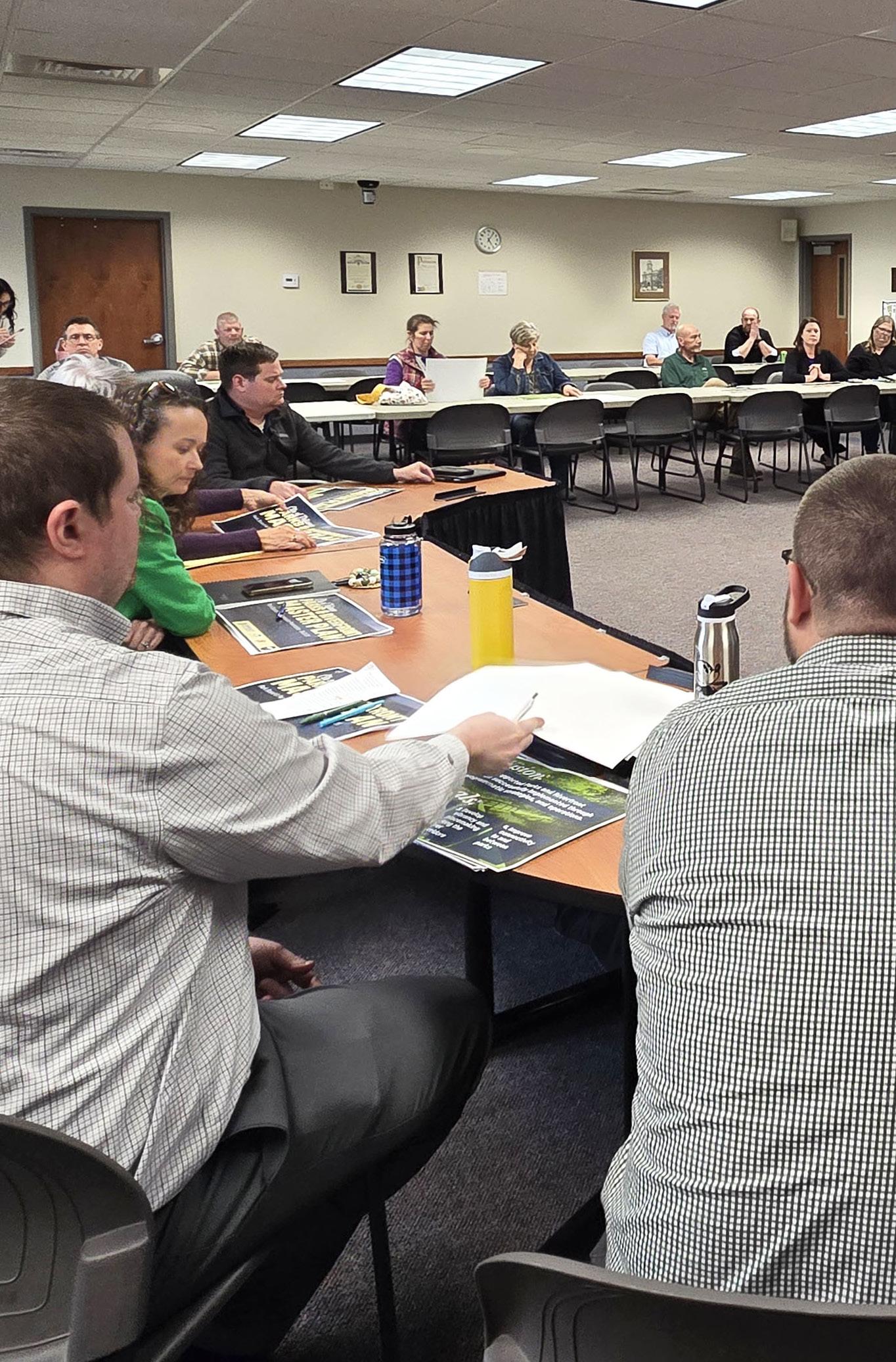
2 Balance recreational development with environmental sensitivity
3 Improve accessibility and inclusivity (ADA compliance)
4 Maximize views and aesthetic integration of new structures
5
Revitalize underutilized areas like the Canal Corridor with vibrant, people-oriented programming
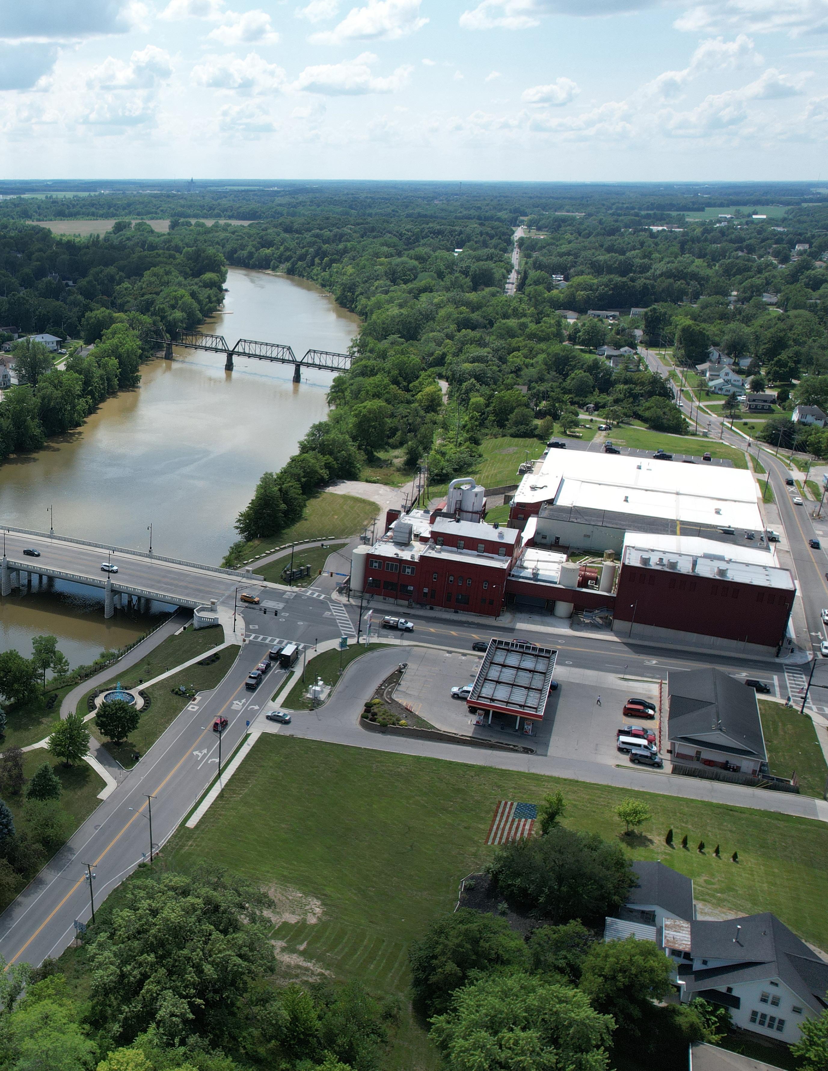
Community Engagement: CITY COUNCIL
MEETING
04.08.25 - The design team met with the Defiance City Council to present and discuss Phase 2 of the Parks & Riverfront Master Plan. During this meeting, the team shared refined design concepts for key focus areas including the Riverfront Parks, Bronson Park, Diehl Park, and the Reservoir Recreational Area. While feedback was limited, the discussion touched on important considerations such as longterm maintenance needs and the financial implications of the proposed improvements. This engagement helped ensure that the City Council remained informed and involved in shaping the direction of the plan.
Community Engagement: STEERING COMMITTEE MEETING #3
At the end of Phase 3, the group met one final time to discuss the design concepts for the parks along the riverfront—Buchman, Canal/Canal Corridor, Gateway, Fort Grounds, Kingsbury, Pontiac, and Riverside. These concepts are detailed in Section 5. During the meeting, participants were also asked to prioritize projects for implementation from a provided list, with the option to write in their own top priorities. Below is a summary of the small group discussions that took place during this meeting.
07.15.25 - The meeting was structured as an open discussion, with the team presenting the final design components for each riverfront park and inviting the steering committee to share suggestions for refinement. Committee members provided valuable feedback, including relocating the kayak launch at Gateway Park to reduce debris collection and clarifying the boat launch design at Pontiac Park to improve transitions from boat to dock.
For the first time, the team shared 3D renderings of the parks, which were well received for their ability to clearly illustrate the impact of the proposed improvements. The implementation matrix (Section 6) was also introduced, with the team explaining how to use the tables to identify next steps for each project.
Discussion Highlights
Following the presentation, the steering committee divided into two groups to prioritize park improvements. Using project cards categorized by scale – quick wins, simple but requires funding, and major capital projects – the groups discussed which initiatives should be highlighted in the final plan. Some cards featured specific projects, while blank cards allowed participants to suggest additional ideas. During the activity, it was also noted that several projects had already been completed and could be marked as such in the final matrix.
This exercise provided the design team with essential insights to ensure the final report reflects community priorities and establishes clear, actionable next steps for implementation.
Identified top priority projects • Discussed final rendering refinements • Received approval of 3D renderings • Learned of additional completed tasks • Introduced implementation matrix specifics
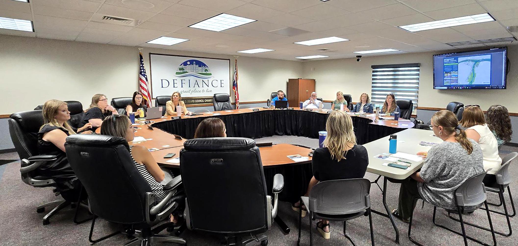
Community Engagement: COMMUNITY WORKSHOP #3
A community workshop was held near the end of Phase 3. The design team provided an overview of the project to date, went over prior survey results, and discussed the final concepts for the riverfront parks. After the presentation, the group moved to the interactive boards, where community members shared their feedback on the final concepts for the riverfront parks. Attendees were also encouraged to participate in Public Survey #5, to rate the final concepts and provide any additional feedback they have.
07.29.25 - At a recent community workshop, participants raised several overarching concerns regarding accessibility in local parks. Attendees emphasized the importance of making parks more inclusive, particularly for children with disabilities, noting that current facilities fall short in meeting their needs. There was also a call to consider the aging population by improving access to water features, with Toledo’s parks highlighted as a positive example of accessible design. Additionally, questions were raised about how project priorities were determined, and a suggestion was made to hold a study session with City Council to better understand and align on those priorities.
During breakout sessions, community members offered more specific feedback. Some participants were curious about the cost and long-term value of the proposed bridge, expressing general support for the concept while encouraging careful consideration of investment. Others emphasized the need for environmental improvements, particularly cleaning up the river by addressing issues like sulfur springs, unpleasant odors, and combined sewer overflows (CSOs). Attendees were excited about the plans for Buchman Park, but encouraged a greater representation of Native American culture in the plans. There was also a healthy dialogue around mixeduse development and its impact on park activities, particularly in the rear areas. A former engineer cautioned that riverfront developments must carefully consider coordination with ODOT and account for floodplain and floodway regulations. Lastly, while some questioned the scale of boating infrastructure, the feedback reflected a desire to ensure that recreational offerings align with broad community interests.
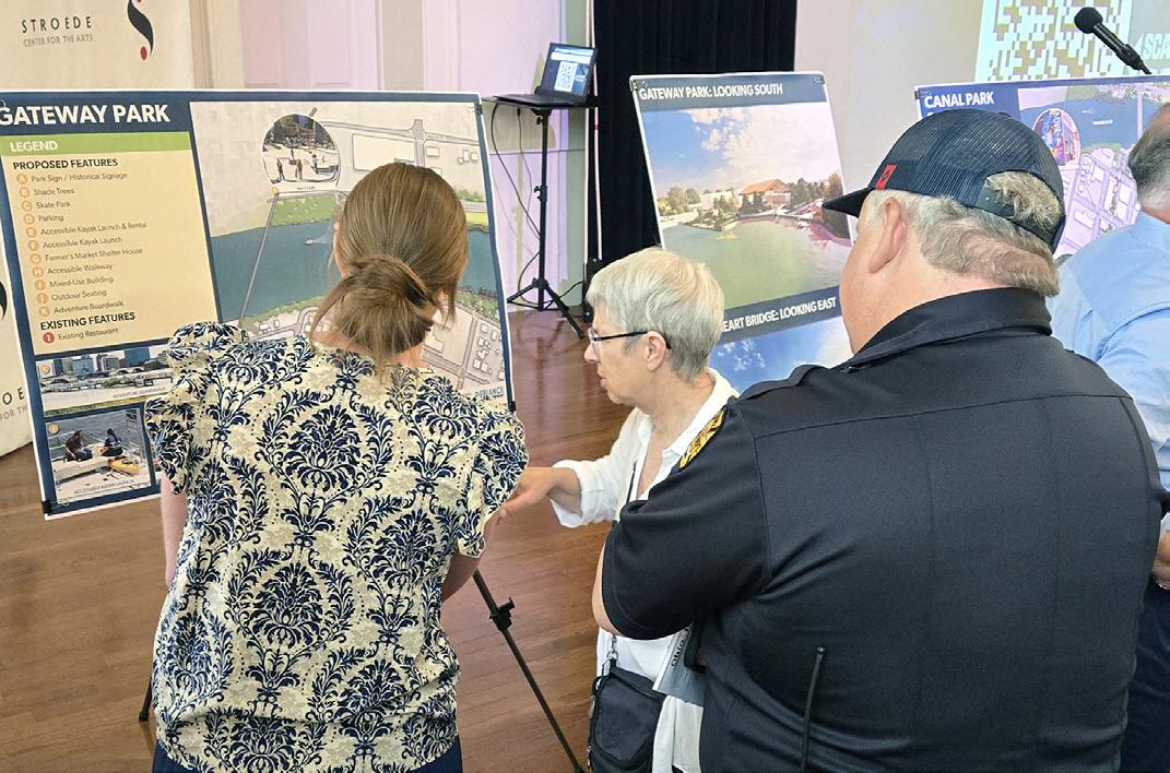
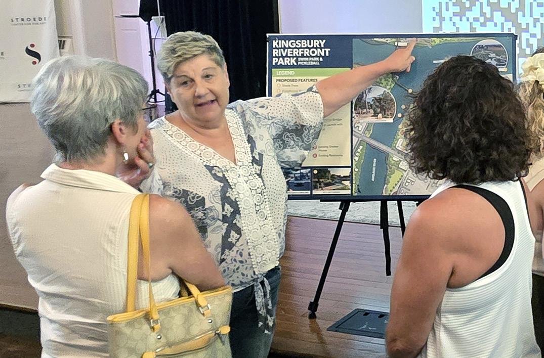
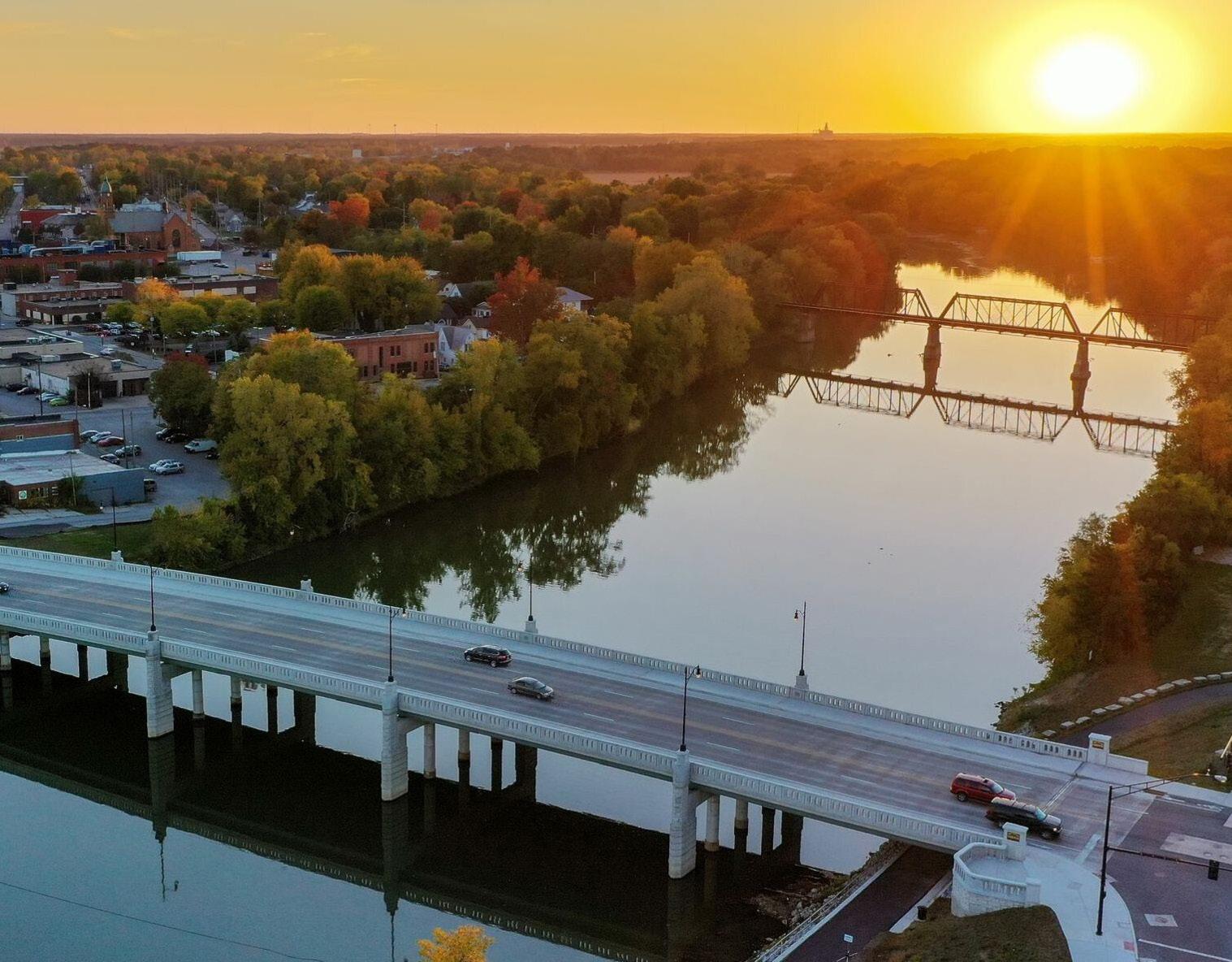
JOIN US FOR AN OPEN HOUSE YOUR VOICE. YOUR CITY.
The City of Defiance invites you to view the latest park concepts, share your thoughts, and talk about the future as we finalize the Parks & Riverfront Master Plan.
WHEN: July 29, 2025 | 6pm - 8pm
WHERE: Stroede Center for the Arts, 319 Wayne Ave., Defiance, OH
The flyer above was released to the public in early July, and the event was promoted on social media starting two weeks prior to the event – where it gained over 5,800 views.
Community Engagement: PUBLIC SURVEY #5 SUMMARY
An online survey was conducted to gather community input on the final concepts for the riverfront parks. Participants were invited to rate the proposed concepts, share additional feedback, and indicate which park they believe should be prioritized for improvements. The concepts are available in Section 5: Shaping the Future. Below is a summary of the survey responses; a complete list of questions and answers is included in the Appendix. The survey was open from July 29 through August 18, 2025.
398 responses were received.
Gateway Park
Average Rating
Pontiac Metro Park
What proposed improvements would you like to see completed first?
"Event amphitheater and boat docks."
"I’d like to see the bridges connecting the library with both parks."
"Anything that includes walkways."
"Farmer’s Market building."
"Inclusive playground."
"The areas in and around the south end of the Clinton St. Bridge."
"Shelter house with restroom."
"The walkway to connect the parks at the confluence."
"I would like to see the native plantings, restrooms and parking, interpretive center and a respectful tribute to the indigenous peoples who were here before us."
"Skate park skate park skate park."
"I would love to see the iceskating rink come to life and be completed before the holidays next year."
"The farmer's market pavillion and the steps down to the water for the kayak launch/sitting area."
"River access."
"Pedestrian bridge, botanical gardens, and the theater."
"Nature walk area and event center."
What aspects of the Master Plan are you most excited to see come to life?
"I’m excited to see all the parks connected, more play spaces for kids, and increased venue opportunities for the arts!"
"Pedestrian bridge, event and entertainment space, boardwalks along the river."
"More walking paths and kayak rentals!"
"The use and promotion of our confluence and outdoor beauty."
"I'm excited to see the parks improve and feel more like a city. That pedestrian bridge would be so helpful."
"All of it! I just enjoy being outdoors and having areas to take my children."
"Access to the water."
"The focus on the riverfront. Getting people on the river and enjoying its banks will change the dynamics of the town."
"Food trucks, more activity downtown."
"Skatepark and ice ribbon."
"The River Walks. Right now we walk the boardwalk through the woods at the reservoir. We would come into town and do all of these river walks."
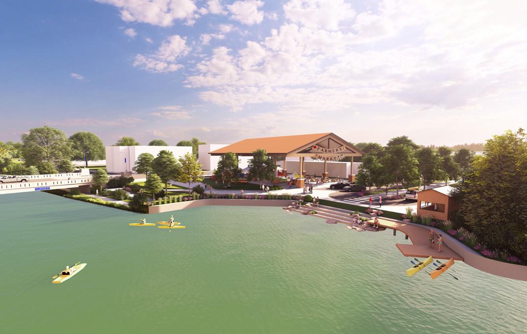
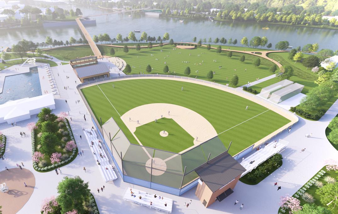

OF RESPONDENTS SAY THEY ARE LIKELY TO VISIT GATEWAY PARK BASED ON THE ILLUSTRATION ABOVE
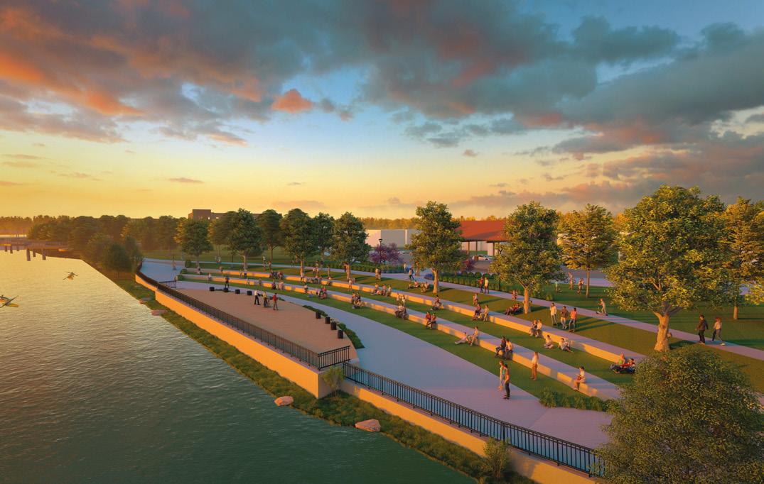
OF RESPONDENTS SAY THEY ARE LIKELY TO VISIT THE CONFLUENCE BASED ON THE ILLUSTRATION ABOVE 81% 25% 15% 79% 81% 82% PARKS THAT SHOULD BE PRIORITIZED FOR IMPROVEMENTS (TOP 3):
OF RESPONDENTS SAY THEY ARE LIKELY TO VISIT KINGSBURY RIVERFRONT PARK BASED ON THE ILLUSTRATION ABOVE
OF RESPONDENTS SAY THEY ARE LIKELY TO VISIT BUCHMAN PARK BASED ON THE ILLUSTRATION ABOVE
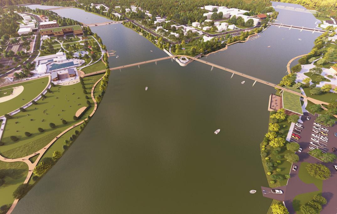
Community Engagement: PARKS BOARD & PLANNING COMMISSION MEETING #2
The team met with the Parks Board and Planning Commission one final time before the City Council presentation. The presentation walked through the final riverfront park concepts and introduced the implementation matrix. Like the Steering Committee meeting, the group was asked to help prioritize the next projects in the Master Plan for community implementation.
08.18.25 - The presentation with the Parks Board and Planning Commission was structured as an open discussion, during which the design team introduced the final plans and implementation matrix. The team reviewed the results from Public Survey #4, noting how community preferences from both concept one and concept two were incorporated into the final riverfront renderings. The group also examined approval ratings for Bronson, Diehl, and Reservoir Parks and discussed the reasoning behind the community’s rankings.
As Public Survey #5 neared completion, the presentation included the latest approval ratings for each park concept within the riverfront focus area and data on the percentage of respondents likely to visit the parks shown in the 3D renderings. The final concepts and renderings were well received, though the group asked for clarification on flooding concerns in Pontiac and Kingsbury. A suggestion was made to relocate the event center to Buchman Park on the Glaize, but the design team explained it would be possible to successfully maintain its location in Pontiac Park with detailed engineering design that would need to be further evaluated and developed as that specific project continues.
The team also walked the group through the Implementation Matrix (Section 6), demonstrating how to use the charts and tables with practical examples. One member asked whether opportunities for interaction in the surveys could be increased, but both the design team and City staff emphasized that the strong level of participation already represents a success.
Finally, the group was tasked with prioritizing the next projects for each riverfront park. This activity provided valuable insight for shaping the final booklet and ensuring the plan reflects community priorities.
Discussion Highlights
1
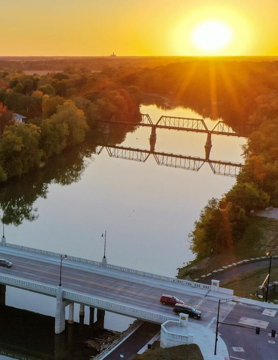
Explored results from Survey #4 and how they related to the final Master Plan
2
Introduced the Implementation Matrix (Section 6)
3 Received input on the priority level of park projects for the Implementation Matrix
4
Provided reassurance to the Parks Board and Plan Commission regarding the level of public involvement received throughout the project
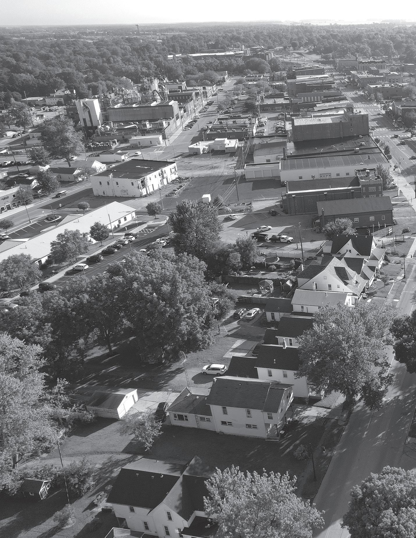
SHAPING THE FUTURE: Concepts for Community & Connection
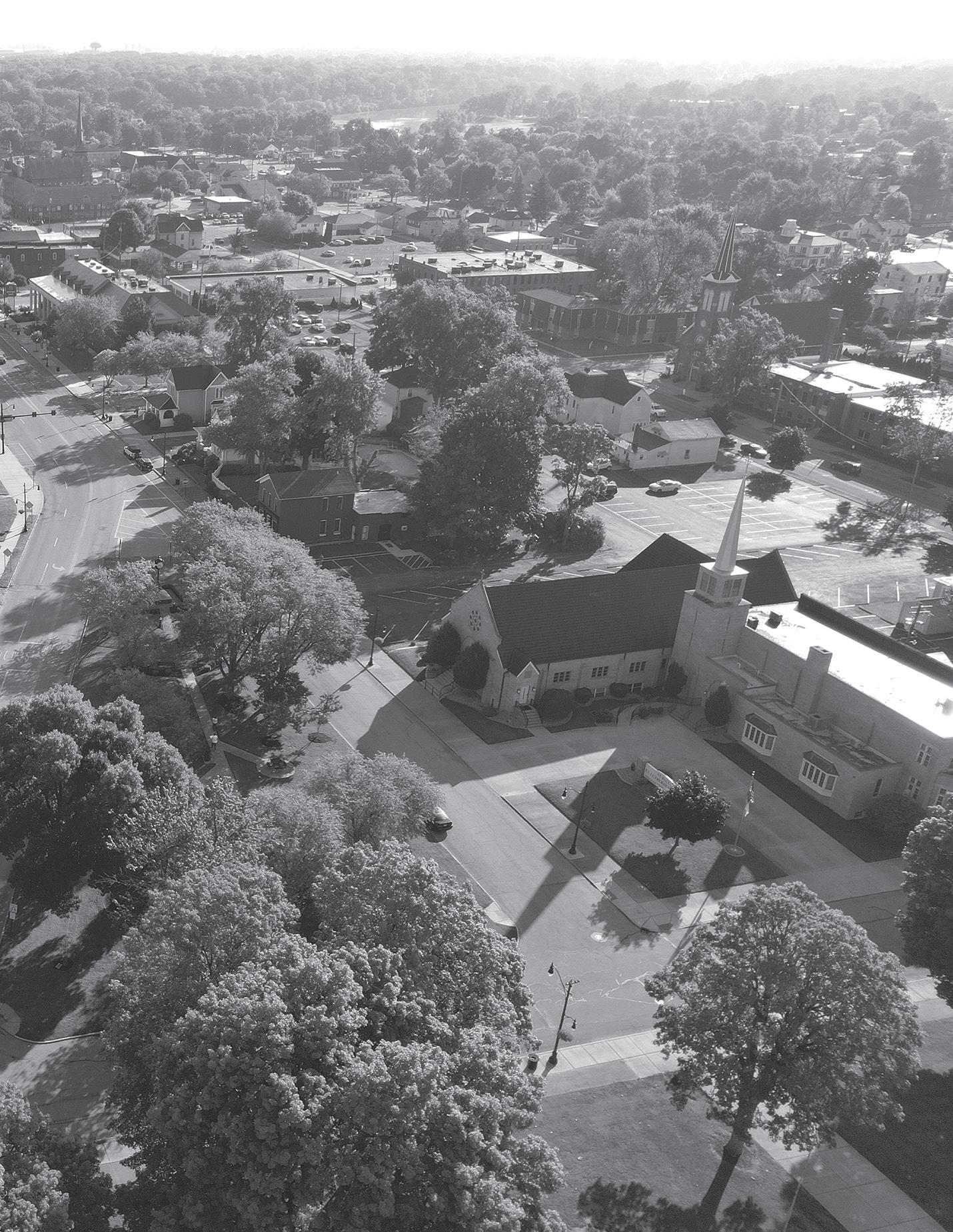
CREATING PARK CONCEPTS
The creation of park concepts for the Defiance Park System followed a deliberate, multi-phase process shaped by community input, on-site analysis, and close coordination with City leadership. Beginning with initial concepts, then advancing select sites into refined and ultimately final concepts, this approach ensured that the Master Plan is both aspirational in vision and firmly rooted in local priorities.
INITIAL CONCEPTS: The first stage of design focused on building a strong foundation of understanding. The design team conducted site visits at all 20 parks, documenting existing conditions with photography, drone imagery, and on-site observations. These visits, paired with detailed inventory sheets prepared by the Parks and Cemetery Director, provided essential insight into current assets, infrastructure, and programming.
Equally important was input from the community. The team engaged residents at a Family Fun Friday event, facilitated stakeholder meetings and a public workshop, and analyzed feedback from two surveys. This outreach gave voice to families, seniors, youth, and recreational users – ensuring that the initial concepts reflected a broad cross-section of perspectives.
With this information, the team created preliminary “bubble-diagram concepts” for each park, as well as three for the Maumee and Auglaize riverfront parks. Two additional concepts explored opportunities for pedestrian connectivity between parks and neighborhoods. These simple diagrams were not final designs, but rather functional representations of what could be possible. They helped stakeholders visualize spatial organization, evaluate trade-offs, and begin to imagine the future of the park system.
REFINED CONCEPTS: After presenting the initial ideas, the process moved into refinement. This next phase was guided by community input, the Steering Committee, and City leadership to ensure that proposed improvements were both inspiring and achievable. A third round of engagement – a focused online survey –invited residents to vote on their preferred concepts and provide feedback on strengths, gaps, and opportunities.
Not all parks advanced to refinement; instead, a select group was prioritized. These included:
• Seven riverfront parks (Buchman Park on the Glaize, Gateway Park, Fort Grounds, Kingsbury Park, Pontiac Metro Park, Canal Park, and Riverside Park)
• Bronson Park
• Diehl Park
• Reservoir Recreational Area
The seven riverfront parks were combined into two comprehensive concepts exploring different approaches to activating and connecting these critical waterfront spaces. Meanwhile, Bronson Park, Diehl Park, and the Reservoir Recreational Area were each refined into a single concept, identified by the public as high priorities due to their popularity and potential.
These refined concepts went beyond bubble diagrams to present more realistic renderings. They illustrated layouts, design features, and amenities in greater detail – allowing the City and community to better envision how the parks might feel and function in the future.
FINAL CONCEPTS:
Building on the refined stage, the riverfront parks were taken one step further into final proposed concepts. These final designs represent the culmination of the iterative planning process, incorporating an additional round of community engagement focused exclusively on the waterfront.
The refined riverfront parks were shared back with the public through targeted outreach, where residents were able to rate the parks and provide feedback on their top priorities. This final step allowed the design team to further explore strategies for riverfront connectivity, access, and programming – ensuring that the proposed designs not only reflect community vision but also deliver cohesive, achievable, and transformational improvements.
The final concepts synthesize all prior input into a single proposed plan for the riverfront parks, representing a balance of community desires and long-term resilience.
Together, the initial, refined, and final concepts embody a community-driven process of exploration, dialogue, and refinement. They transform resident input and site analysis into visual plans that will guide investment, foster connectivity, and celebrate the unique identity of Defiance’s parks and riverfronts. By moving from broad visioning toward more detailed and strategic refinement, the Master Plan ensures that future park development will grow with and for the people of Defiance.
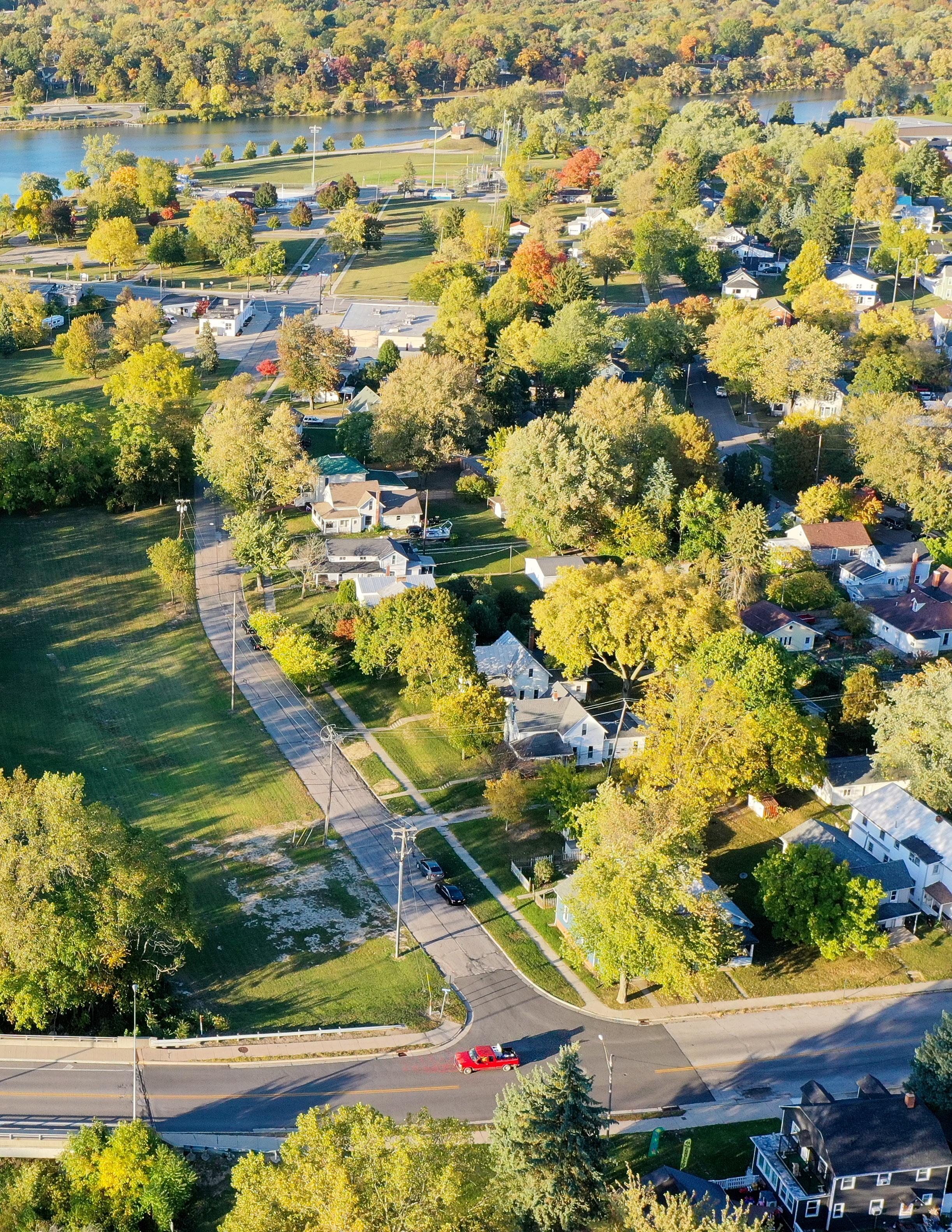
HOW TO READ THE CONCEPTS
Each concept is presented as a visual guide to illustrate ideas for the future of Defiance’s parks. Site maps are paired with written descriptions, callouts, and example images, while a legend explains how different spaces and amenities are represented.
In the initial concepts, colors distinguish land uses – such as light green for play areas, dark green for natural landscapes, rust for buildings, orange for plazas, and gray for parking.
In the refined and final concepts, the legend expands with letters and numbers that link directly to existing and proposed amenities shown on the maps.
Initial Concepts: BARK & RUN DOG PARK
CONCEPT 1: This concept enhances the existing dog park by adding a paved parking lot, a restroom shelter, and accessible pathways. Additionally, a nature path is planned for the north side of the site, utilizing the existing woodland area. To the south, a new pathway is proposed to transform the existing field into a natural planted setting, complete with additional seating areas.
CONCEPT 2: Similar to Concept 1, this concept includes a paved parking lot and accessible walkways. However, the proposed restroom is expanded to incorporate seating areas and is located south of the parking lot. Enhancing the southern portion of the site, a new playground and additional walking trails are proposed. Furthermore, trails are planned to extend into the northern woodland area of the site.
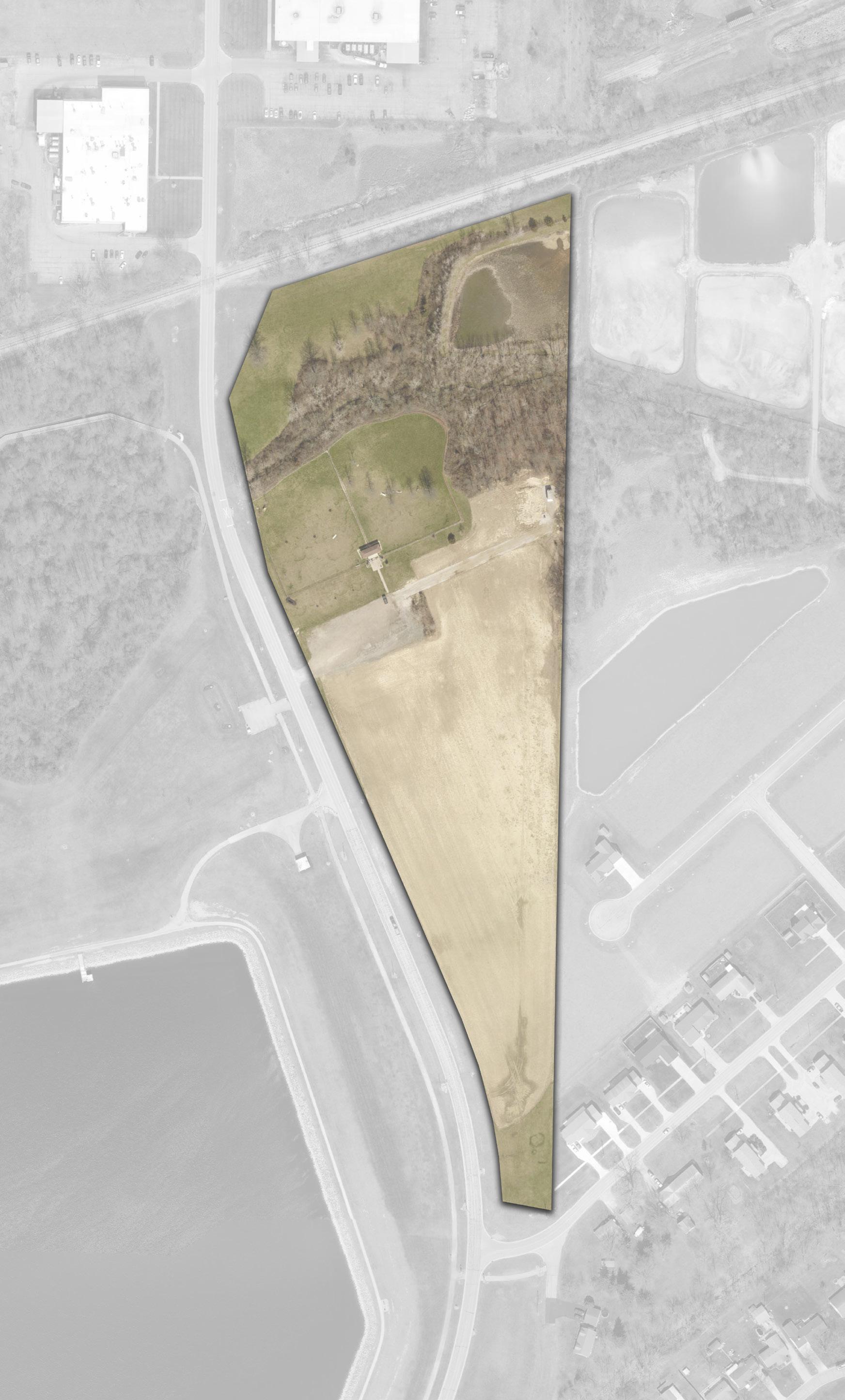
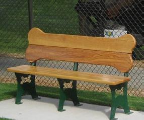
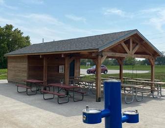
PEDESTRIAN
82.2% of survey respondents chose this concept
LEGEND
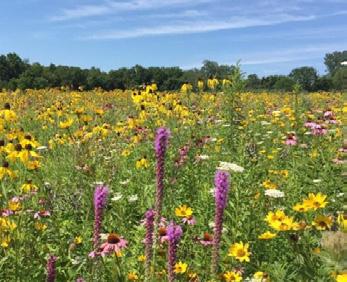
POLLINATOR HABITAT WITH NATIVE PLANTINGS
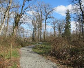
ACCESSIBLE WOODLAND TRAIL
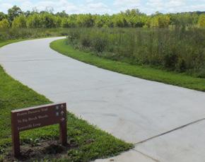
ACCESSIBLE PATHWAY
GATEWAY ENTRANCE
PEDESTRIAN CROSSING
ACROSS PRECISION WAY
PAVED PARKING LOT
RESTROOM FACILITY
SEATING OPPORTUNITY (TYP)
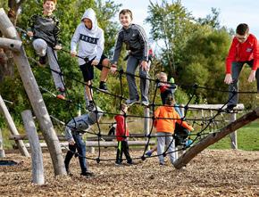

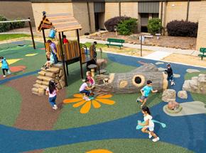
INCLUSIVE PLAYGROUND WITH ACCESSIBLE SAFETY SURFACING
POLLINATOR HABITAT WITH NATIVE PLANTINGS
Programmed Landscape
Natural Landscape
Play Programming
Parking Lot
Building / Structure
Bridge / Overlook
Pedestrian Circulation
Seating Opportunity
Activation Node / Gateway Signage
Shade Trees
“A dog park with a playground near [is needed] so my kids and dogs can play at the same time!”
- Survey Response
Initial Concepts: BRONSON PARK
CONCEPT 1: This concept enhances the splash pad area by introducing additional shade sails and expanding the seating options to accommodate its popularity. The StoryWalk® path is further enriched with native plantings, reducing lawn maintenance and creating a more immersive walking experience. To activate the central part of the park, the concept includes the addition of a lighted sand volleyball court, as well as resurfacing the basketball court with a vibrant mural.
A reception venue is proposed at the southern end of the site, offering celebratory views of the river and a pathway leading directly to the riverbank. The existing woodland area would be activated with pathways and the addition of ground-level and tree canopy obstacle courses. To improve accessibility, a new parking lot is proposed in the woodland's western corner, providing an additional access point to the park.
CONCEPT 2: This concept proposes additional shade structures and seating areas around the splash pad, along with a new playground designed for children aged 5–12. The StoryWalk® path would feature more modest native plantings but could be extended into the woodland area, with storybook stations accompanied by small-scale play spaces to enhance the experience.
While a woodland trail remains part of this concept, an open-air riverside shelter house is also proposed, with pathways leading down to the river’s edge. Vehicular access is expanded in this design, with multiple parking areas and a drive lane connecting the western woodland edge to the main park site.
The existing volleyball court would be reimagined with space for a new volleyball court, bleachers, additional seating, and a new shelter house. A teen and young adult play area featuring cornhole and ping pong is also proposed. Additionally, a holiday-themed lighted path is envisioned to begin at the ball field and wind through the woods, culminating in a festive Christmas village located on the east side of the parking lot at the southern end of the site.
CONCEPT 3: Concept 3 envisions a larger open-air shelter house near the splash pad, complementing the additional shade structures. This shelter house would serve as a shaded seating and viewing area during the summer and could be transformed into a covered ice-skating rink in the winter.
The volleyball area is proposed to double in size, featuring two additional courts and a dedicated shelter house. Pathways would continue to provide access to a nature experience in the woodland area, including a riverside shelter house. Unlike other concepts, vehicular traffic would not be routed through the woods, preserving the natural setting.
“Having the sports courts in addition to [everything else] is outside entertainment for our youth to keep them occupied in a wonderful way as well as many adults. Bronson also offers much more space to expand or broaden activities or added benches in and around the park to entice even more visitors.”
- Survey Response
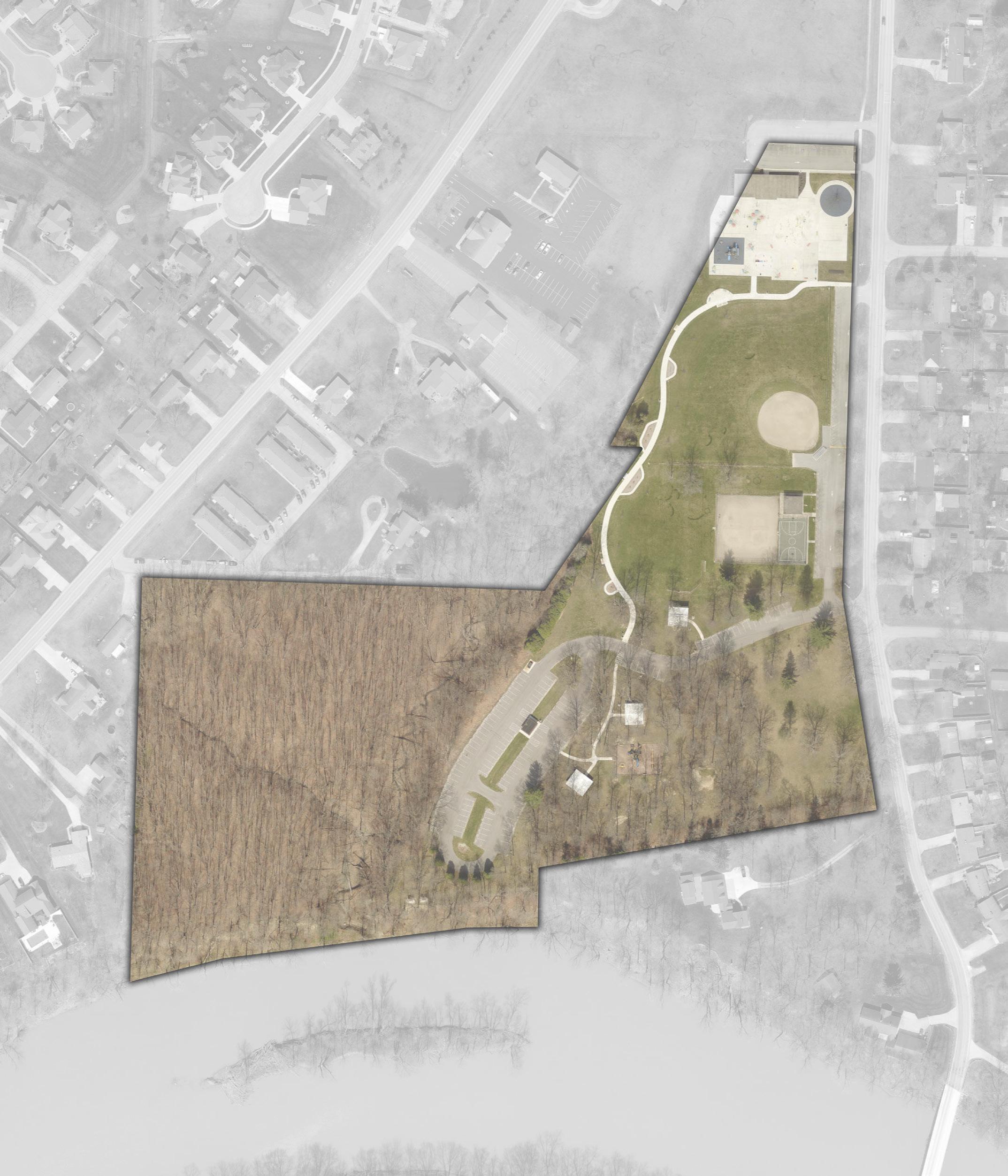
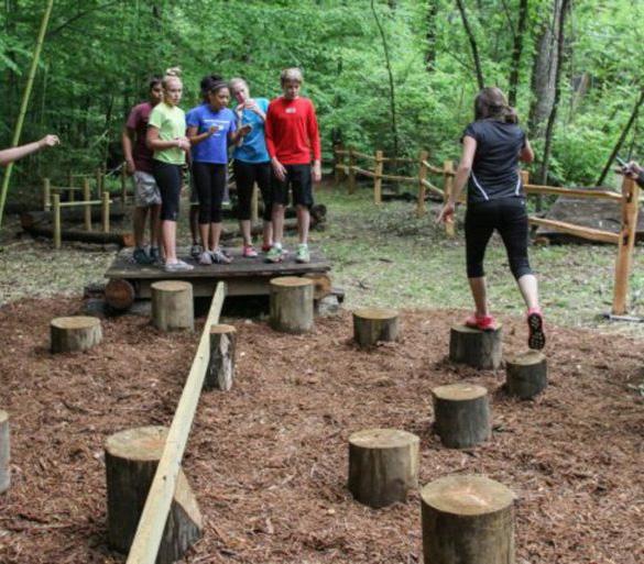
Initial Concepts: BRONSON PARK
EXPANDED SEATING
POLLINATOR HABITAT WITH NATIVE PLANTINGS (TYP)
SHADE COMPONENTS
5-12 YEAR OLD PLAY STRUCTURE
FOOTPATH TRAIL INTO THE RAVINE
STORYBOOK PLAY AREA (TYP)
PARKING
SHELTER HOUSE
SHELTER HOUSE
VOLLEYBALL COURT WITH LIGHTING
PEDESTRIAN CROSSING (TYP)
VEHICULAR & PEDESTRIAN BRIDGE
REFURBISHED BALL FIELD
CORNHOLE & PING PONG
BASKETBALL COURT MURAL
SPECTATOR VIEWING AREA
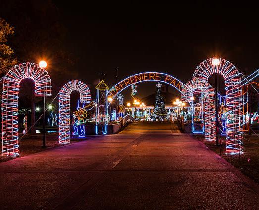
ACCESSIBLE SAFETY SURFACING
WINTER CHRISTMAS LIGHTS ROUTE
SANTA'S VILLAGE
PARKING
VEHICULAR & PEDESTRIAN BRIDGE
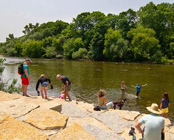
ENHANCED SEATING WITH SHADE
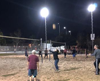
POLLINATOR HABITAT WITH NATIVE PLANTINGS (TYP) (2) VOLLEYBALL COURT WITH LIGHTING
PEDESTRIAN CROSSING (TYP)
SHELTER HOUSE THAT CONVERTS INTO ICE RINK
SHADE COMPONENTS
PATH TO RIVER
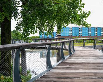
REFURBISHED BALL FIELD
SHELTER HOUSE
BASKETBALL COURT MURAL
SANTA’S VILLAGE
WINTER CHRISTMAS LIGHTS ROUTE NATURE SHELTER HOUSE
KAYAK ACCESS POINT
RIVERFRONT BOARDWALK
Refined / Final Concept: BRONSON PARK
Following public feedback, Initial Concepts 1 and 3 emerged as the preferred options for Bronson Park. The final proposed concept blends the most popular features from both.
Key highlights include an enhanced splash pad area featuring expanded seating, new shade structures, and a covered open-air shelter house. This flexible space is designed for year-round use and could transform into a protected ice-skating rink during the winter months.
Consistent with earlier concepts, the plan includes upgrades to the baseball fields and a vibrant mural on the existing basketball court. The sand volleyball area will be expanded with two additional courts, complemented by a second open-air shelter house and nearby seating. The park will also offer new recreational amenities such as ping pong tables and gaga pits to encourage active play.
Improved walkways along Harding Road will create interconnected walking loops that link parking areas, shelter houses, and play zones. Additional trails will wind through the existing woodlands, including a natural pathway descending into the ravine and leading to the shores of the Auglaize River.
At the water’s edge, a new elevated riverwalk will stretch from the current swing area to a proposed nature center. The riverwalk will include access to kayak docks and scenic boulder outcroppings along the shoreline
Nestled in the wooded area, the nature center is envisioned as a cozy gathering space with access to a tree-level obstacle course. This adventure feature will include both small and large loop options, with the larger loop spanning the ravine for stunning views.
A new access drive and parking area will serve the nature center, trails, and obstacle course.
LEGEND
PROPOSED FEATURES
A Shelter House
B Additional Shade Structures
C Expanded Seating w/ Shade Structures
D Refurbished Baseball Field
E Paved Accessible Walkway
F Shelter House w/ Outdoor Ping Pong Tables & Gaga Pits
G (2) Sand Volleyball Courts
H Safety Surfacing for Playground
I Native Perennial Plantings
J Tree Top River Walk
K Accessible Kayak Dock
L Boulder Outcropping River Access
M Nature Center w/ Community Space
N Nature Center Parking
O Access Drive
P Woodland Shelter House
Q Woodland Shelter House Parking
R Tree Canopy Obstacle Course
S Upper Woodland Trail (Paved)
T Woodland Toe Path (Natural)
U Painted Mural on Existing Basketball Court
V Adult Swing Bench
“The tree canopy course would be amazing to get kids into our parks! We definitely need a fun, safe place that’s cost friendly to families. Sand volleyball is also loved. I can see people from surrounding towns coming out to play and provide an opportunity for community tournaments."
- Survey Response
W Improved Restroom Accessibility
EXISTING FEATURES
1 Existing Playground
2 Existing Splash Pad/Restroom Facility
3 Existing Splash Pad
4 Existing Storybook Trail
5 Existing Parking
6 (2) Existing Sand Volleyball Courts
7 Existing Shelter House
8 Existing Adult Swing Benches
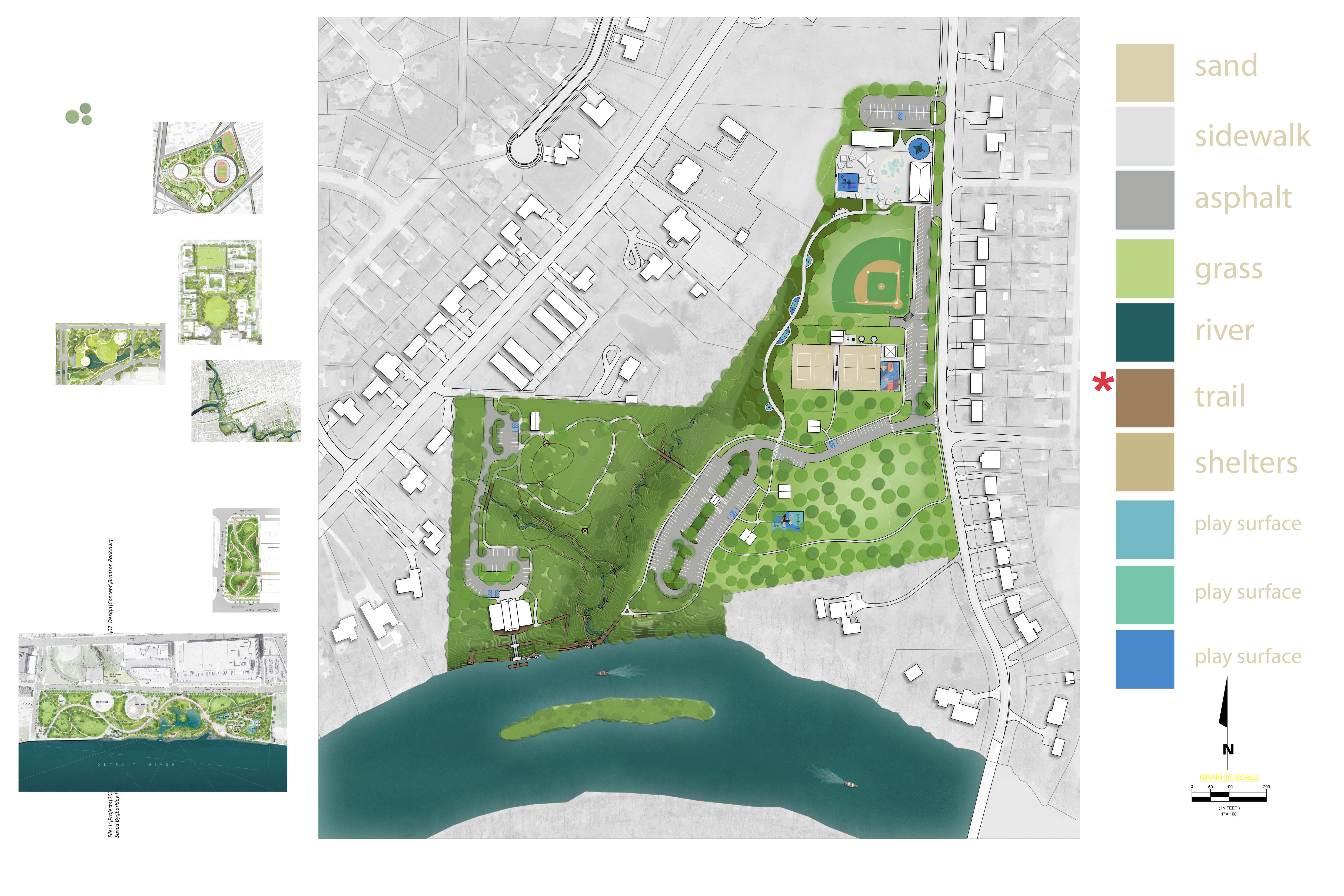
SCLINTONST
Initial Concepts: CANAL PARK
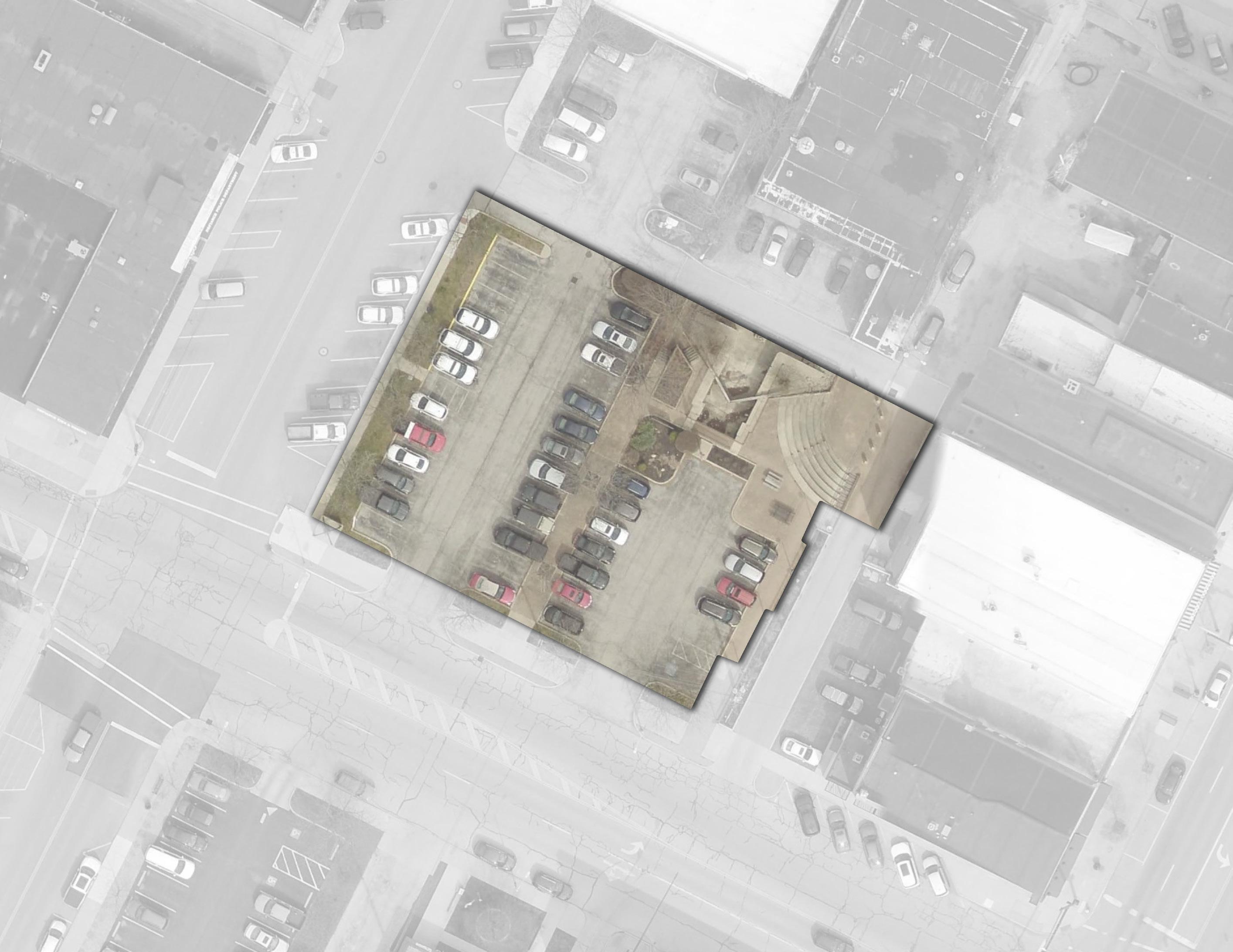
of survey respondents chose this concept Concept 1
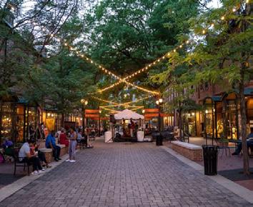
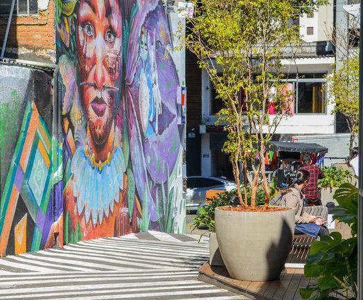
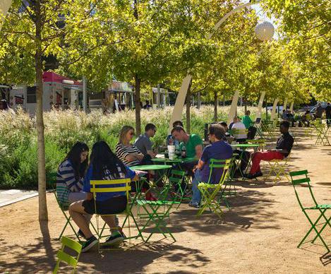
CONCEPT 1: This concept enhances the site with an area allocated for markets and food trucks, alongside ample plaza space with seating. Educational signage and art opportunities are also proposed, along with both ADA ramps and stairs for easy access to the existing amphitheater.
CONCEPT 2: Similar to the first concept, a designated area for markets and food trucks is proposed. It includes educational signage and a planting and seating area located along the main walkway. The existing amphitheater and space around it will remain as is.
PLAZA
PLAZA WITH
Concept 2
25.4% of survey respondents chose this concept
FOOD TRUCK / MARKET AREA
W3RDST
Canal Park was later included as part of the
Canal Park was later included as part of the overall Riverfront Parks design. See page 216 for the final version.
Riverside Park was later included as part of the overall Riverfront Parks design. Refer to the refined riverfront parks concepts, starting on page 206.

LEGEND
Programmed Landscape
Food Truck / Market Area
Education Signage PERRYST
Plaza / Hardscape
Pedestrian Circulation
EDUCATIONAL SIGNAGE
PLANTING AND SEATING AREA
Art Opportunity
"Food trucks with seating is the best idea for Defiance. A pet friendly environment would be clutch." - Survey Response
Initial Concepts: DIEHL PARK
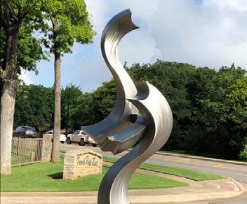
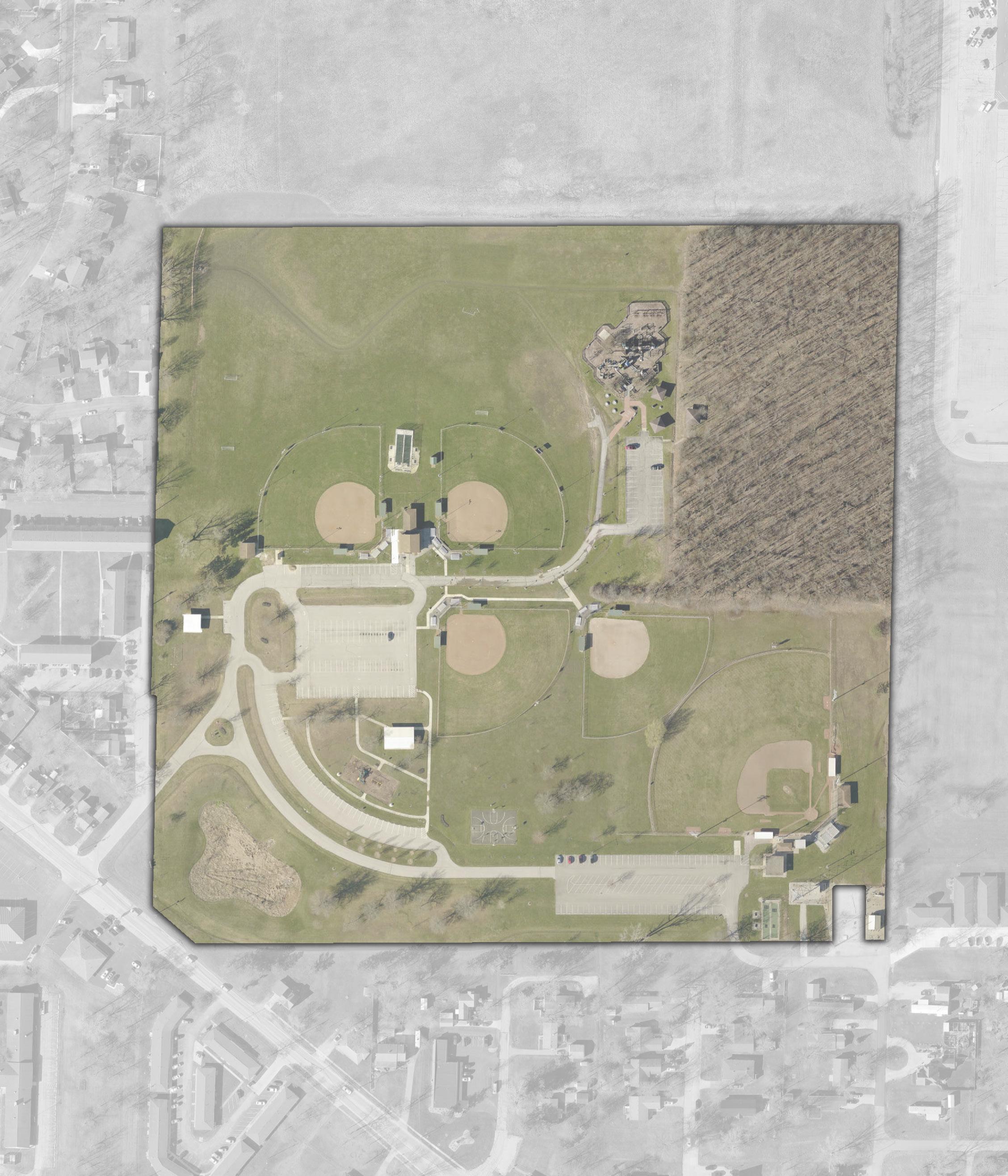
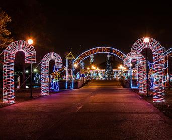
park’s perimeter and upgrading the entry to the wooded trails. Accessible paths will also be added to Kids Creation. Proposed improvements include a new shelter house, sand volleyball courts, and a community garden. Seasonal features such as an ice rink with skate rentals, a winter Christmas lights route, and Santa’s Village will create a vibrant, year-round destination.
north, and additional shade trees to the south. Proposed improvements include a new shelter house, refurbished ball fields, sand volleyball and pickleball courts, an indoor training facility, an expanded playground for ages 2-5, and drinking fountains. The parking lot will be restriped for ADA parking. Santa's Village and an ice skating rink will be incorporated into an existing shelter house, complemented by a festive winter lights route.
SHELTER HOUSE
SANTA'S VILLAGE
Concept 2
73.7% of survey respondents chose this concept
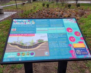
EDUCATIONAL SIGNAGE SWALES
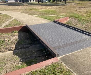
REFURBISHED BALL FIELDS (TYP)
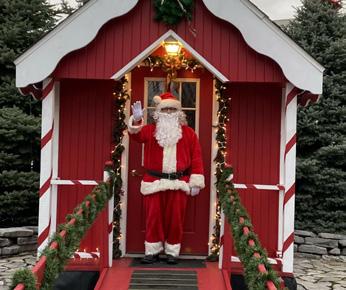
SANTA’S VILLAGE & ICE
SKATING RINK IN EXISTING SHELTER HOUSE
SHADE TREES (TYP)
ENTRY ART / SCULPTURE WEMORAVE
NATURALLY SHADED SEATING
RALSTONAVE
WINTER CHRISTMAS LIGHTS ROUTE
EXPANDED PLAYGROUND FOR AGES 2-5
INDOOR TRAINING FACILITY
SAND VOLLEYBALL COURTS
LEGEND
Programmed Landscape
Natural Landscape
Sports Programming
Play Programming
Parking Lot
PICKLEBALL COURTS
FOR ADA PARKING
Building / Structure
Pedestrian Circulation
Vehicular Circulation
Bridge / Overlook
Drinking Fountain
Seating Opportunity
Entry Art / Sculpture
Education Signage
Santa's Village
Winter Christmas Lights Route
DRINKING FOUNTAIN (TYP)
NATURAL LANDSCAPE
SHELTER HOUSE
RESTRIPE
PEDESTRIAN BRIDGE (TYP)
Refined / Final Concept: DIEHL PARK
Through the public engagement process, Initial Concept 2 emerged as the community’s preferred direction for Diehl Park. Further evaluation of community feedback highlighted a key challenge: improving vehicle and pedestrian circulation throughout the site.
To address this, the proposed plan relocates vehicle access and parking to the perimeter, creating a safer, more pedestrian-friendly park core. At the heart of the site, a new indoor athletic facility is proposed, envisioned to include indoor batting cages, multi-purpose field space, concessions, and restrooms – making it a year-round community hub.
On the south side of the park, an accessible Miracle Field becomes a standout feature, supported by nearby seating, restrooms, and convenient accessible parking. Adjacent to it are two full-size basketball courts with vibrant murals, along with two sand volleyball courts for added recreational opportunities.
A wide central pedestrian pathway runs through the park, designed not only for connectivity but also as a flexible space for food trucks, pop-up vendors, and event seating.
Behind the fieldhouse, a “Home Plate Plaza” serves as a vibrant gathering space featuring seating areas, a playground, and a splash pad for family-friendly fun.
To complement the existing nature-themed playground in the northern section of the park, the plan includes a new shelter house with restrooms and a nature play garden. Walking trails will loop throughout the park, improving circulation and offering scenic routes for leisure walks and fitness.
LEGEND
PROPOSED FEATURES
A Realigned Entrance Drive
B Access Drive with Parking
C Adjusted Playground Parking
D Resurfaced Parking Lot
E Expanded Parking Lot
F Drop-Off Zone & Entrance Plaza
G Field House with Concessions & Restrooms
H Diehl Family Plaza
I Multi-Use Promenade
J Splash Pad
K Playground
L Pickleball Courts
M Shelter House with Restroom
N Children’s Nature Garden
O Miracle Baseball Field with Drop-Off Zone
P Accessible Restroom Facility with Covered Picnic Area
Q Basketball Courts w/ Painted Mural
R Sand Volleyball Courts
S Paved Accessible Walkway
“I only think of this park as the "softball park". These improvements make this park a true gem for the only park on the north side of the Maumee River (well, other than KofC, but you know what I mean). I love how the area around Kids Creation is activated and not left to be a "scary" place for kids to go. These amenities will be wonderful additions for the existing and future neighborhoods in this area. The trails are fantastic!"
- Survey Response
T Re-Aligned Drain with Plantings
U Open Activity Lawn
EXISTING FEATURES
1 Existing Ballfield 2 Existing Restroom Facility
Existing Picnic Shelter & Storage Facility 4 Existing Batting Practice Area
5 Existing Concessions / Restroom & Picnic Shelter
6 Existing Shelter House
7 Existing Storage Room
8 Existing Kids Creation Playground
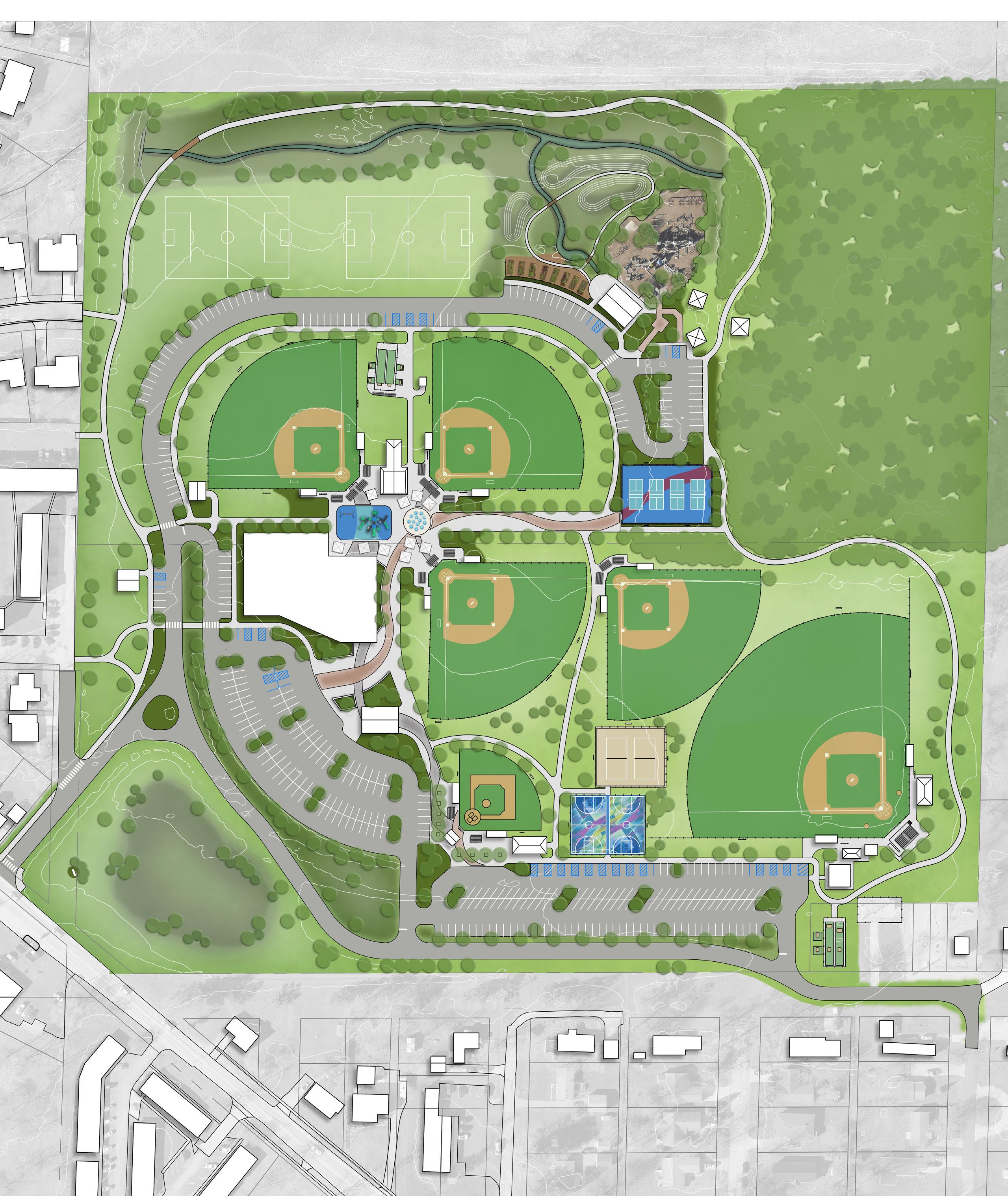
Initial Concepts: EASTSIDE PARK
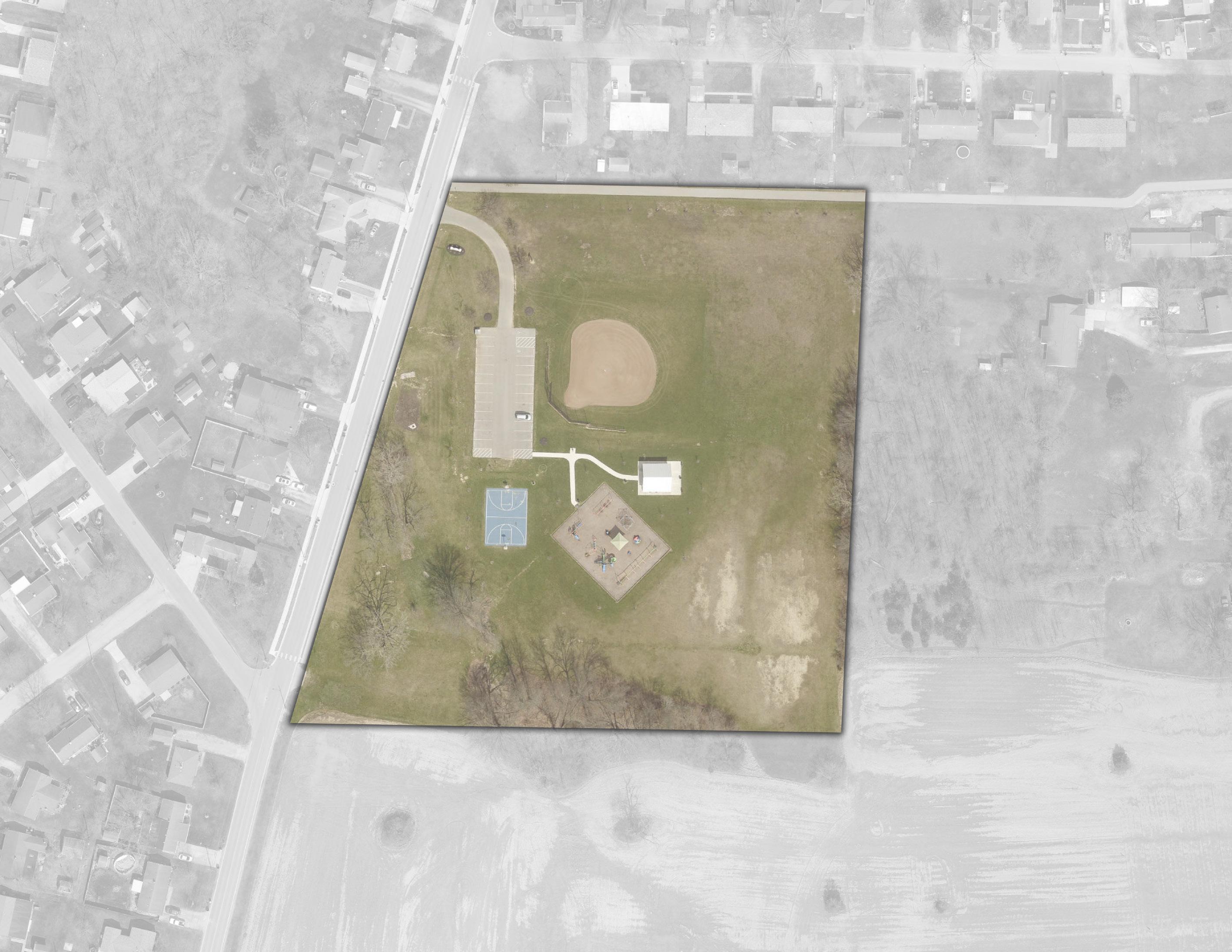
NEIGHBORHOOD / GATEWAY TRAILHEAD
PEDESTRIAN CROSSING
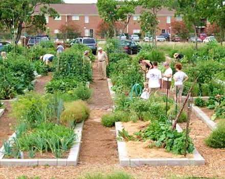
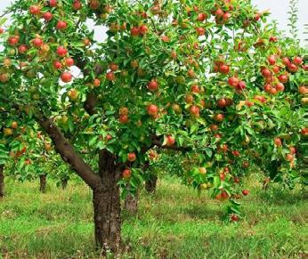
ADJUSTED ADA PARKING SEATING OPPORTUNITY (TYP)
RESTROOMS
BASKETBALL COURT MURAL
NATIVE PLANTINGS WITH CLIMBING BOULDERS
SKATE PARK
POLLINATOR HABITAT WITH NATIVE PLANTINGS (TYP)
ACCESSIBLE SAFETY SURFACING
CONCEPT 1: This concept features additional walkways forming a closed-loop path, a centrally located restroom, and new shelter houses distributed throughout the site. A skate park is planned for the southwest corner, while community gardens are planned along the northern trail. Nature play areas enhance the topography with climbing boulders and native plantings. Furthermore, the ball field will be refurbished, and the playground upgraded with safety surfacing.
CONCEPT 2: A play space with climbing boulders and native plantings is featured, and a new nature playground is proposed for the southwest corner of the site. On the northern edge along the trail, a skate park and basketball court are planned. Additionally, a new splash pad and restroom facility are proposed for the center of the site, replacing the current basketball court. Further enhancements to the playground area include new play equipment and safety surfacing for improved functionality and safety.
SHELTER HOUSE
SHELTER HOUSE
REFURBISHED BALL FIELD
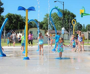
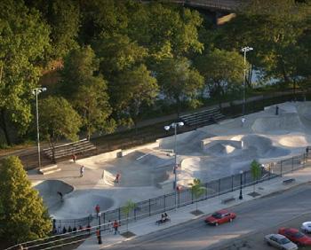
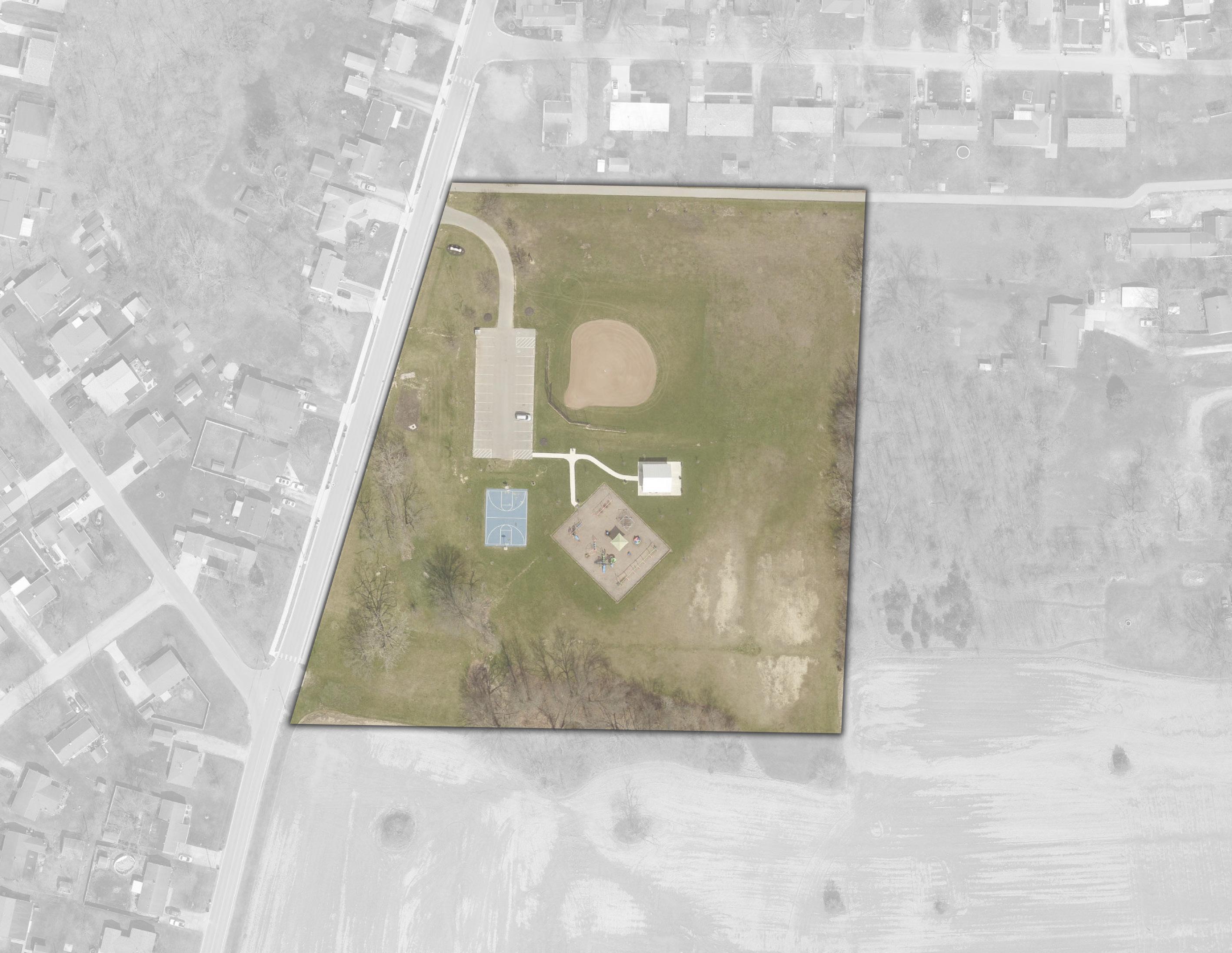
NEW PATH & PEDESTRIAN CROSSING
ADJUSTED ADA PARKING
SHELTER HOUSE WITH RESTROOM
NATIVE PLANTINGS WITH CLIMBING BOULDERS
NEIGHBORHOOD / GATEWAY TRAILHEAD
BASKETBALL COURT WITH MURAL
POLLINATOR HABITAT WITH NATIVE PLANTINGS (TYP) LEGEND
Natural Landscape
PLAYGROUND EXPANSION WITH TODDLER PLAY COMPONENTS
ACCESSIBLE SAFETY SURFACING MENTAL HEALTH SIGNAGE SHELTER
SEATING OPPORTUNITY (TYP)
Seating Opportunity Gateway / Trailhead / Signage
"The skate park idea is awesome, there is so much
Initial Concepts: HOLGATE PARK
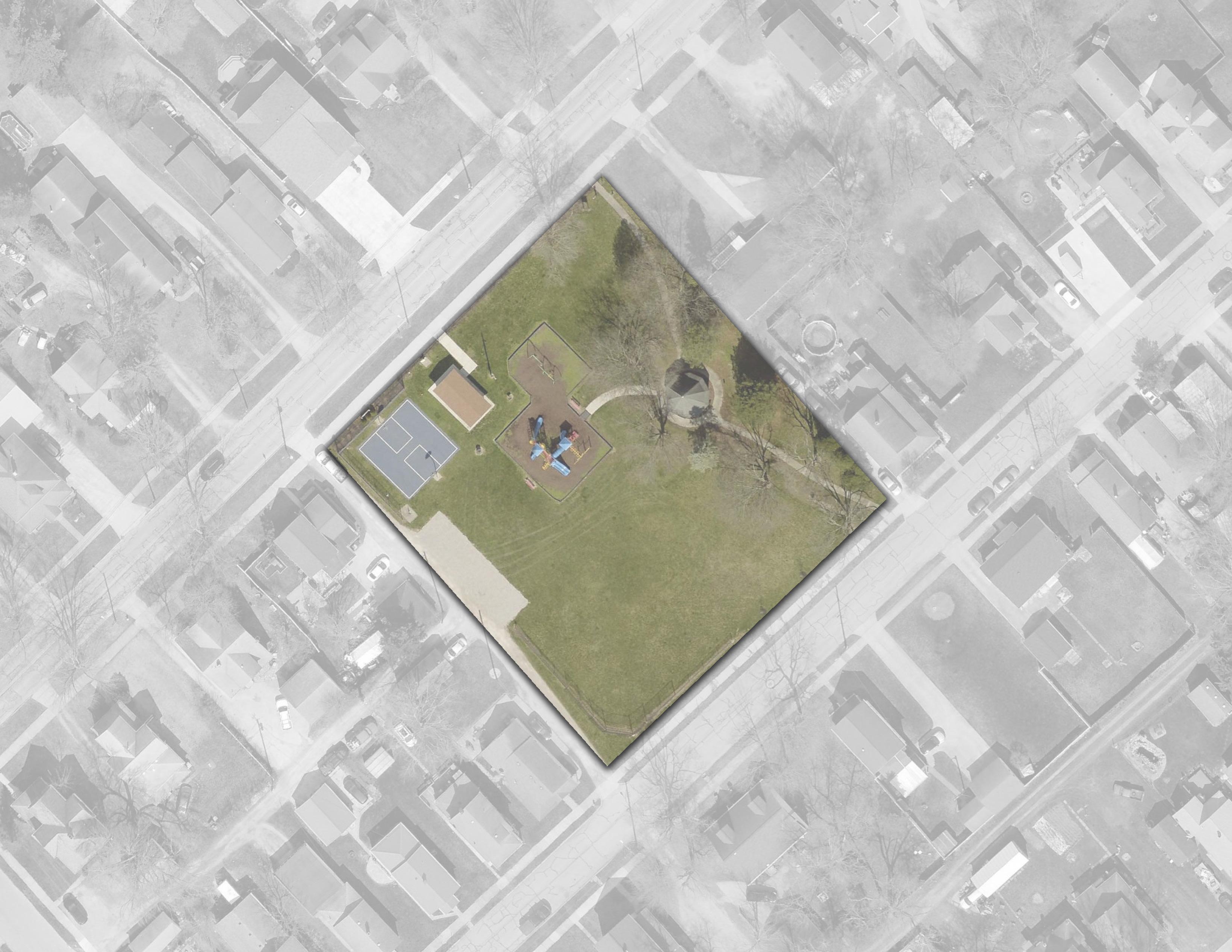
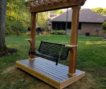
landscaping, and improved playground safety surfacing. A new shelter house with restrooms provides a rentable space, while a play court with pickleball replaces the old ball field. To enhance overall accessibility, the sidewalk along Kentner Street is set for replacement, and the access drive from Kentner Street to Holgate Avenue will be upgraded with a paved drive and parking lot.
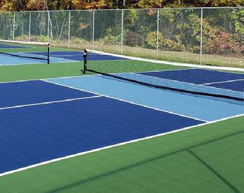
shade trees. A community garden on the south side further strengthens the neighborhood atmosphere. This concept also includes a shelter house with restrooms and a paved plaza for community gatherings. The playground is expanded with additional play space and safety surfacing, while accessibility improvements include a new walkway along Kentner Street, upgraded drive entrances, and parking lot enhancements.
NEW PARK SIGN SEATING OPPORTUNITY (TYP)
NEW SIDEWALK ALONG KENTNER ST
(LAWN) NATURAL LANDSCAPE
GAZEBO EXPAND PARKING LOT & PAVE DRIVE / PARKING
SHELTER HOUSE WITH RESTROOMS
SHADE TREES (TYP)
SAFETY SURFACING
(3) PICKLEBALL COURTS
SWING BENCH
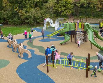
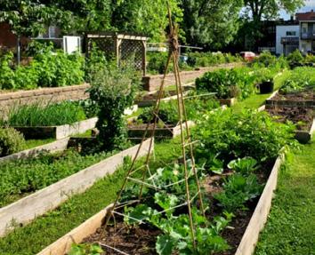
"I like the swings but also the
Initial Concepts: HOMETOWN HEROES PARK
37.9% of survey respondents chose this concept Concept 1
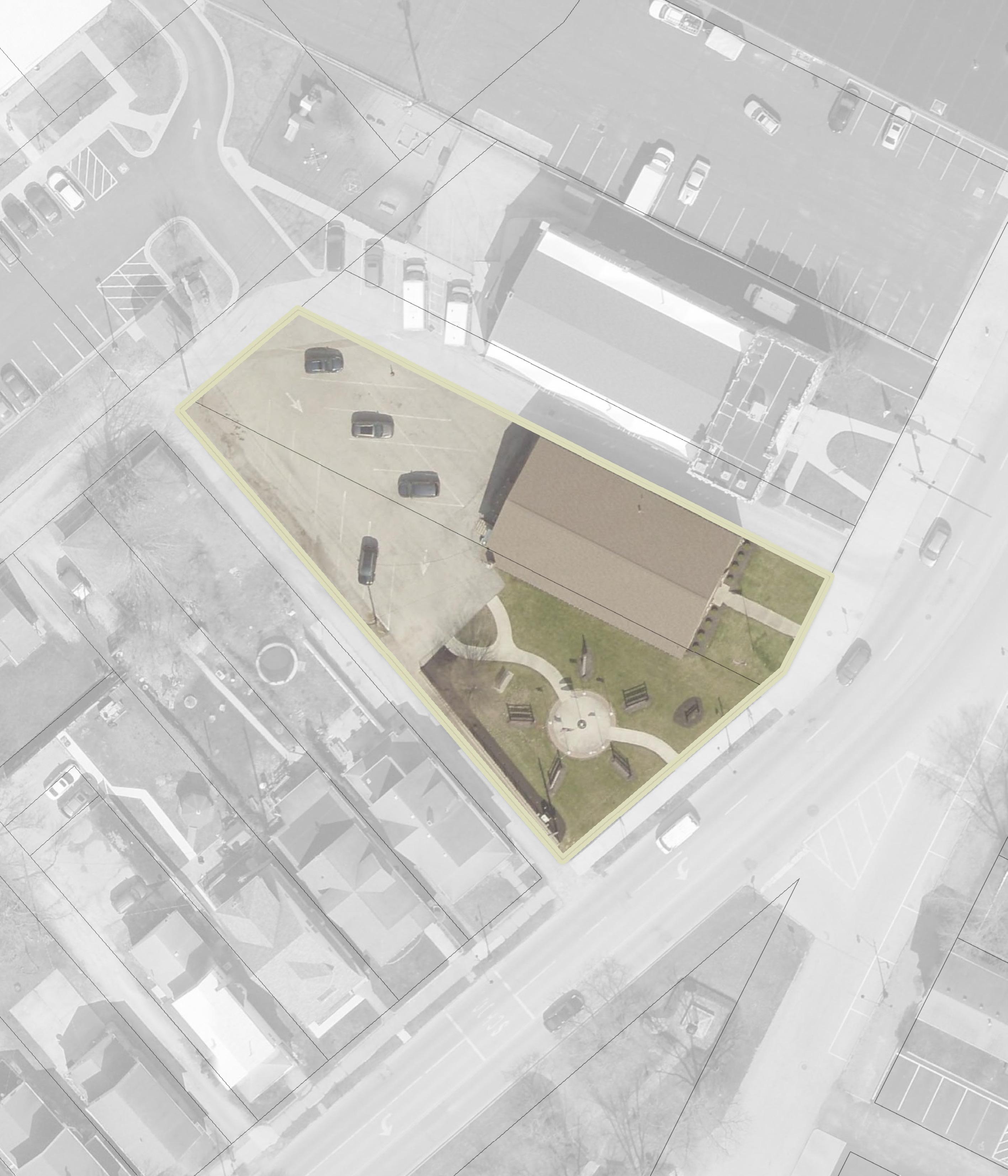
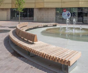
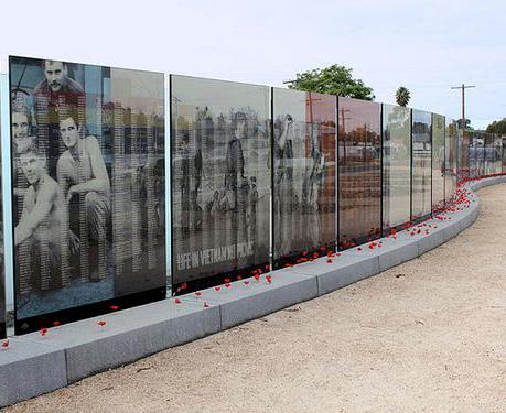
entrance is improved with new signage and landscaping, reinforcing its identity as a meaningful place of reflection.
elevating the park’s role as a place of honor and reflection.
NEW PARK SIGN
NEW LANDSCAPE PLANTING WITH SHADE TREES
CLINTONST
62.1% of survey respondents chose this concept Concept 2
Natural Landscape
Memorial Panels
Plaza / Hardscape
Pedestrian Circulation
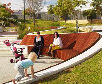
LANDSCAPE PLANTING WITH SHADE TREES
Seating Opportunities
Memorial Sculpture Park Sign Memorial Wall
"I think sculptures are better than just having panels. Panels are common and easily overlooked."
- Survey Response
NEW PARK
TRIBUTE WALL
CLINTONST
Initial Concepts: K OF C BASEBALL COMPLEX
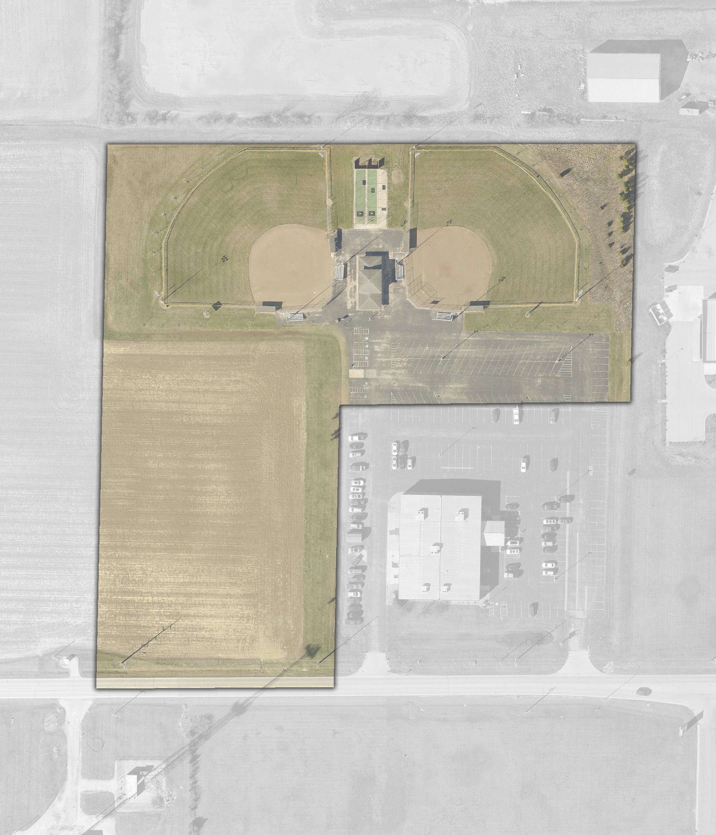
Concept 1
30.0% of survey respondents chose this concept
SEATING OPPORTUNITY
PLAYGROUND FOR AGES 5-12 WITH ACCESSIBLE SAFETY SURFACING
AGRICULTURE FIELD TO REMAIN
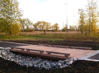
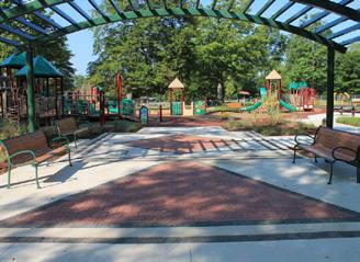
trail loops around the ballfields, allowing spectators to stay engaged with the games while strolling the site. Near the concession stand, a new drinking fountain and additional batting cage are proposed, and the site expands southwest to include a family playground with nearby seating.
spectator seating, a playground on the far west side, and new pedestrian pathways to improve access between fields – reducing the need for visitors to walk through the parking lot. These additions aim to create a more cohesive and enjoyable experience.
DRINKING FOUNTAIN
PARK SIGN
ADDITIONAL BATTING CAGE
ENTRY PLAZA WITH DECORATIVE PAVERS
PEDESTRIAN BRIDGE OVER SWALE
ELLIOTT RD
Concept 2
70.0% of survey respondents chose this concept
DRINKING FOUNTAIN
PEDESTRIAN BRIDGE OVER SWALE
PLAY STRUCTURES WITH ACCESSIBLE SAFETY SURFACING
TEE BALL / COACH PITCH FIELDS
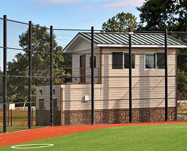
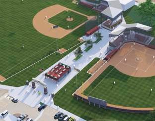
BLEACHER SEATING (TYP)
LEGEND
Sports Programming
Play Programming
Plaza / Hardscape
Building / Structure
Pedestrian Circulation
Vehicular Circulation
Bridge / Overlook
Seating Opportunity
Drinking Fountain Park Sign
"When
my son played ball, field time was monopolized by a lack of fields/available practice areas. I think Concept 2 would help with this issue and provide other amenities for families in this area."
- Survey Response
PARK SIGN
BRIDGE OVER SWALE
PRESS BOX / CONCESSIONS
PLAZA / GATHERING SPACE
ELLIOTT RD
Initial Concepts: LIVINGSTON PARK
CONCEPT 1: Both concepts reimagine the current open lawn space with more defined features. Concept 1 formalizes the existing paved area on the east side with a public art mural, while walkways weave through the center of the site and connect to the existing path on the west. The remaining space is enhanced with landscaping to create a more inviting and engaging environment.
CONCEPT 2: Similar to Concept 1, Concept 2 features meandering walkways and introduces a gateway art piece at the entrance. It celebrates local history through educational signage along the paths and includes a formal plaza at the center with a sculpture monument. The site is further enriched with natural perennial plantings, creating a space that blends art, education, and nature.
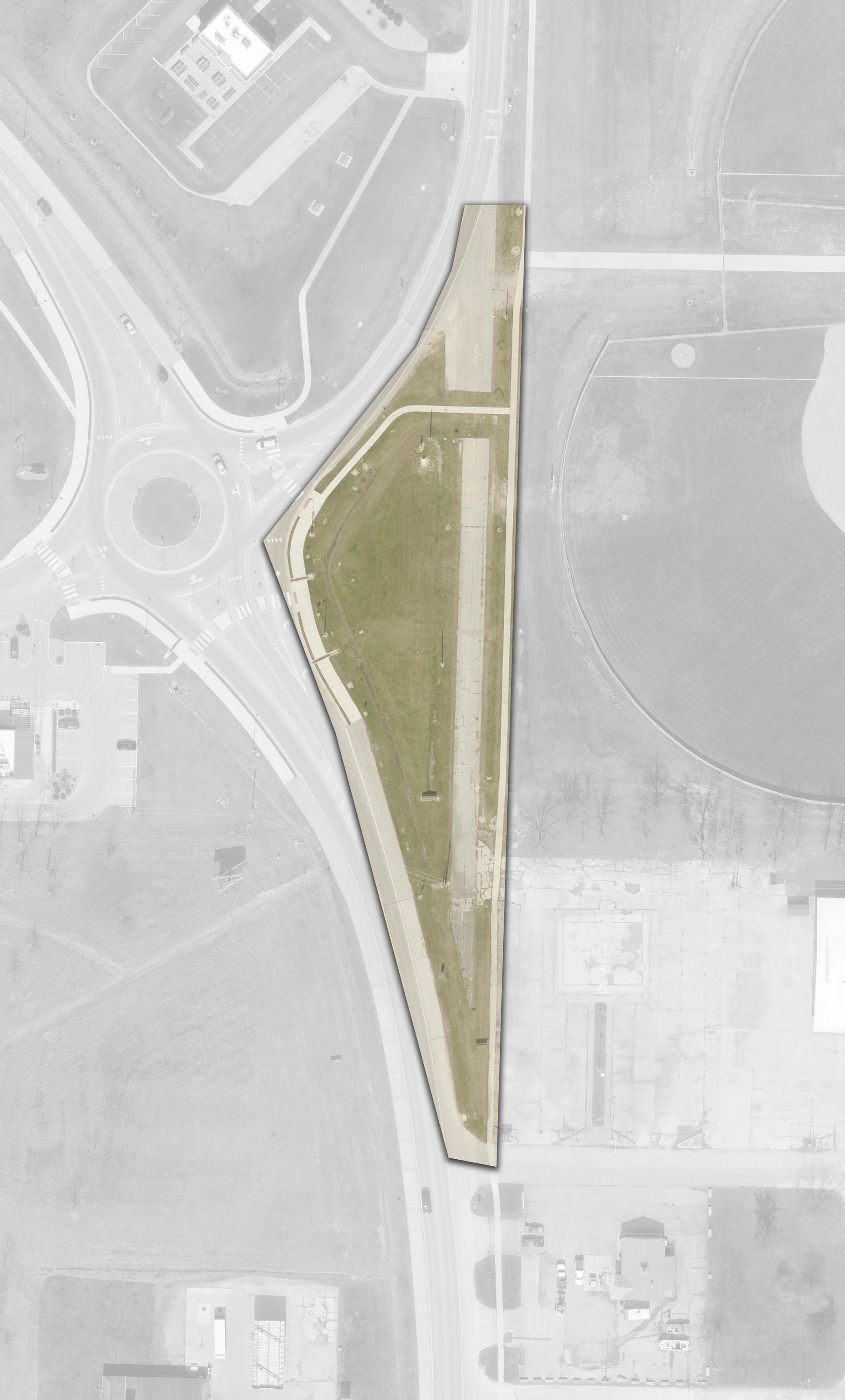
NATURAL LANDSCAPE BUFFER
BIOSWALE PLANTING AREA
GATEWAY SIGNAGE (TYP)
PUBLIC ART MURAL
PEDESTRIAN BRIDGE
FORMAL LANDSCAPE GARDEN
Concept 2
42.5% of survey respondents chose this concept
LEGEND
Programmed Landscape
Natural Landscape
Plaza / Hardscape
Bridge / Overlook
PEDESTRIAN BRIDGE
PROGRAMMED LANDSCAPE
PROGRAMMED LANDSCAPE
BIOSWALE PLANTING AREA
SCULPTURE OR MONUMENT
DEFIANCE EDUCATIONAL TIMELINE STATIONS (TYP)
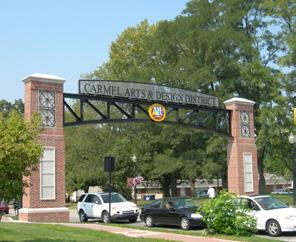
Pedestrian Circulation
Gateway Signage
Activation Node
Sculpture / Monument
Educational Stations
Shade Trees JEFFERSON
“I like the idea of having more places around town for photos and I think a mural or a landscape garden would be great there!"
- Survey Response
GATEWAY SIGNAGE
Initial Concepts: MEMORY PARK
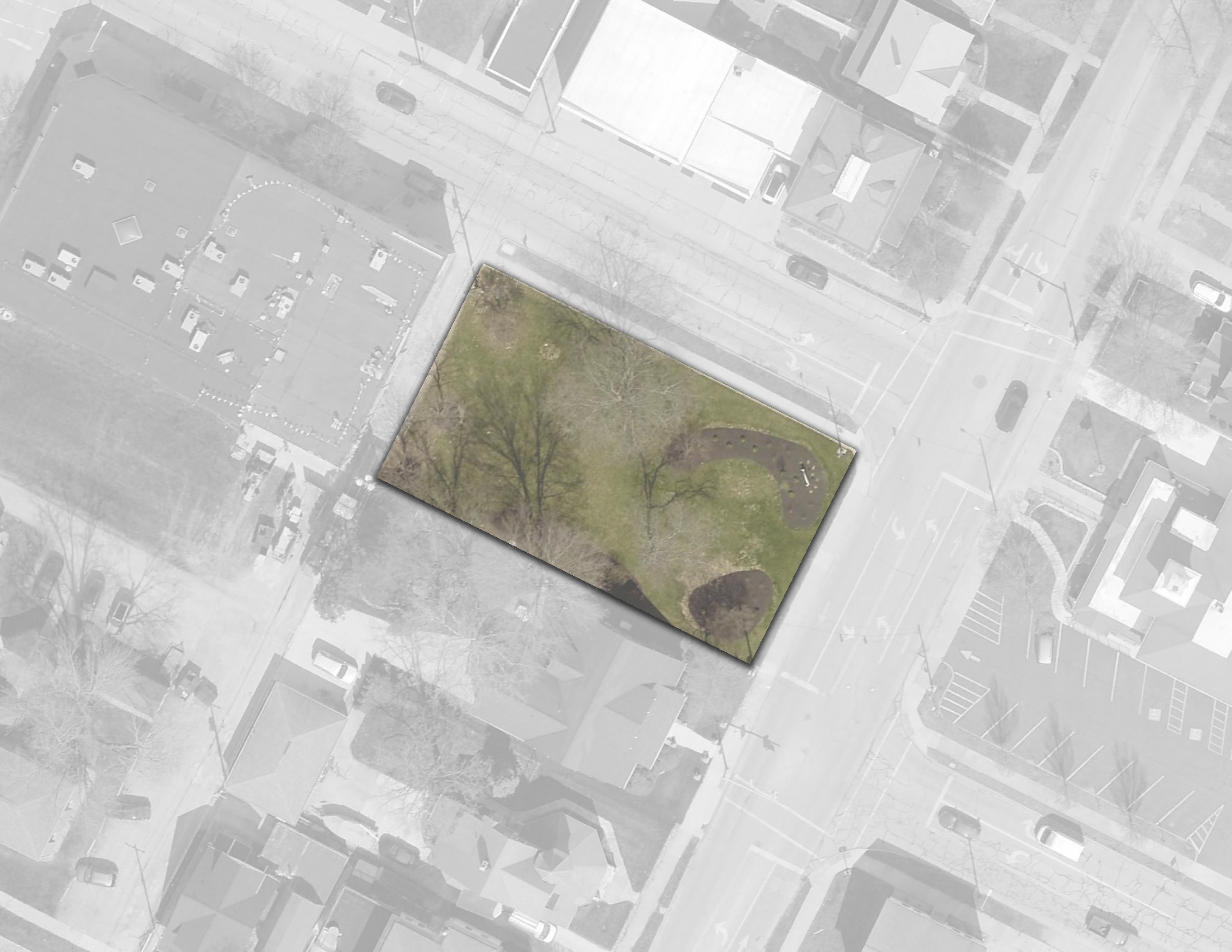
OPPORTUNITY (TYP)
site. Both loops and the plaza are designed with seating areas and vegetation to enhance the park's formal atmosphere.
additional lawn areas, vegetation, and seating to further emphasize the park's formal character.
"It’s nice to have a place to go while at a funeral. It might be nice to have a nice cross walk to get across."
GAZEBO
WATER
Initial Concepts: PALMER PARK
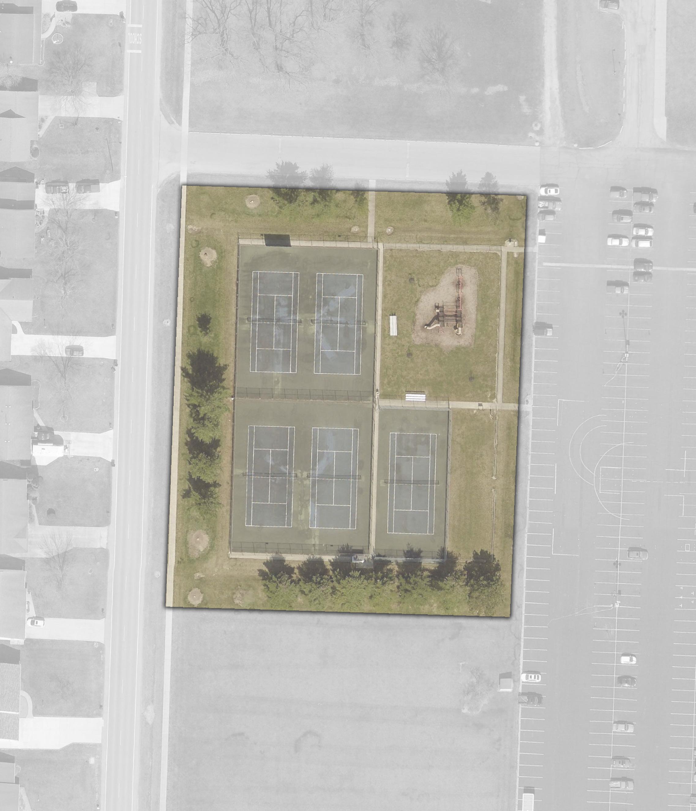
Concept 1
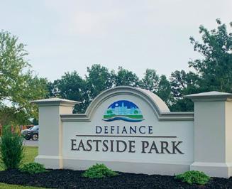
RESURFACED TENNIS COURTS
trees. A new park sign is also included along Palmer Drive to clearly identify the site from the street.
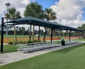
with safety surfacing and enhanced with additional shade trees. A new park sign is proposed at the east entrance, near newly designated ADA parking stalls, improving visibility and accessibility.
COURT LIGHTS (TYP)
PARK SIGN
SHADED BLEACHER SEATING
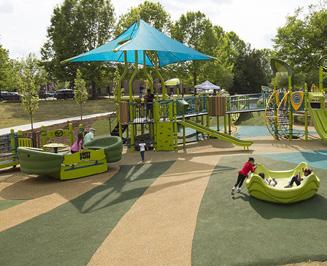
SIDEWALK EXTENDED TO LOOP AROUND ALL COURTS
RESURFACED TENNIS COURTS
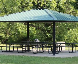
"These courts definitely need resurfaced and adding lights would be great!"
PALMER DR
Initial Concepts: RESERVOIR RECREATIONAL AREA
seating areas, Concept 1 also includes workout stations along the pathway. A restroom shelter house and paved parking are proposed on the northeast side of the site, while additional paved parking is also proposed in the northwest corner of the site and at Wertz Park.
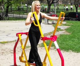
picnic shelter houses, and a playground. It also features a centrally located workout zone. Additional parking is planned near the reservoir, in the northwest corner of the site, and at Wertz Park, where a new picnic shelter house is also proposed. The existing boardwalk on the north side of the site would be enhanced with a shelter house, offering a rest spot within the woodlands.
69.2% of survey respondents chose this concept Concept 2
SHELTER HOUSE
EXERCISE STATION
PLAYGROUND
PARKING
RESTROOMS
PARKING
PEDESTRIAN CROSSING
PAVED PARKING LOT & EXPANSION
SHADE TREE (TYP)
SEATING OPPORTUNITY (TYP)
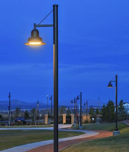
PATHWAY LIGHTING*
LEGEND
Play Programming
Parking Lot
Building / Structure
Pedestrian Circulation
Vehicular Circulation
Seating Opportunity Shade
*Pathway lighting included in both concepts
"Lighting would be great for night walking."
SHELTER HOUSE
Refined / Final Concept: RESERVOIR RECREATIONAL AREA
Public feedback identified Initial Concept 2 as the preferred vision for Reservoir Park. The proposed plan builds on that input to enhance accessibility, recreation, and the natural setting.
New and expanded paved parking areas are planned throughout Reservoir Park and nearby Wertz Park to improve access. A network of new pathways will guide visitors to the upper reservoir level and along the scenic woodland edge, offering an immersive experience in nature.
Tucked along the edge of the woods, a new children’s playground will be complemented by an adult fitness station and a combined shelter house and restroom facility. On the upper reservoir walkway, visitors will find additional shaded seating areas, pedestrian lighting, and a smaller workout station to encourage movement and relaxation with a view.
The plan also includes two new fishing piers, giving anglers more opportunities to enjoy the water. Down below, the lower reservoir trail will be enhanced with more shade trees and another adult workout station, serving as a scenic rest stop along the path.
In Wertz Park, improvements include additional walkways and a new shelter house featuring a cozy fireplace – perfect for small gatherings and year-round use.
“Most definitely my favorite of the developments. I think restrooms and shelter houses would be a great add, as would pedestrian lighting. Paving the lots are nice enhancements as well. This is awesome."
- Survey Response
“This park is already such a special place, but is definitely in need of additional amenities. There are houses being built adjacent to this area soon and to have these amenities will be wonderful for all users. I'm curious to see costs for this one....it might be one we should target soon as "low hanging fruit."
- Survey Response
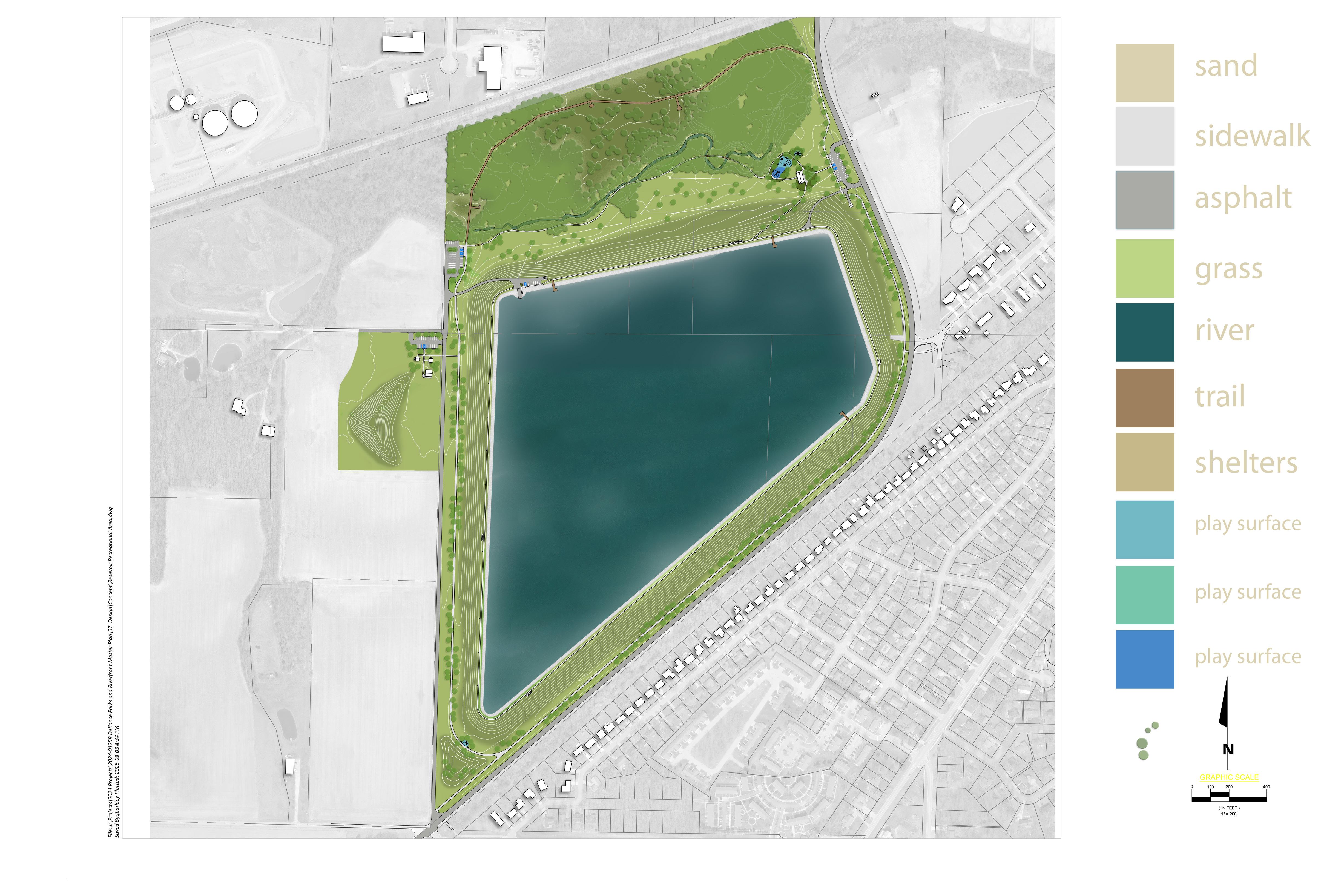
Initial Concepts: RIVERSIDE PARK
CONCEPT 1: This concept upgrades the playground with safety surfacing, refurbishes the ball field, and repaints the restroom. New walking paths create closed loops and improve accessibility. A shelter house is proposed near the central soccer field, with pathways leading to the river, providing seating, overlooks, and physical activity spaces along the water’s edge. Both concepts include a northern drive lane with parking leading to a boat launch and a pedestrian connection that links to the Buckeye Trail.
CONCEPT 2: Concept 2 transforms the playground by adding a pavilion and replacing the ball field with new play courts. Similar to Concept 1, walking paths loop around the site and connect to the river, offering access and viewing opportunities. This concept includes two shelter houses positioned to create a natural setting along the woodland, enhancing the park's connection to the surrounding environment.
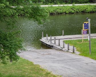
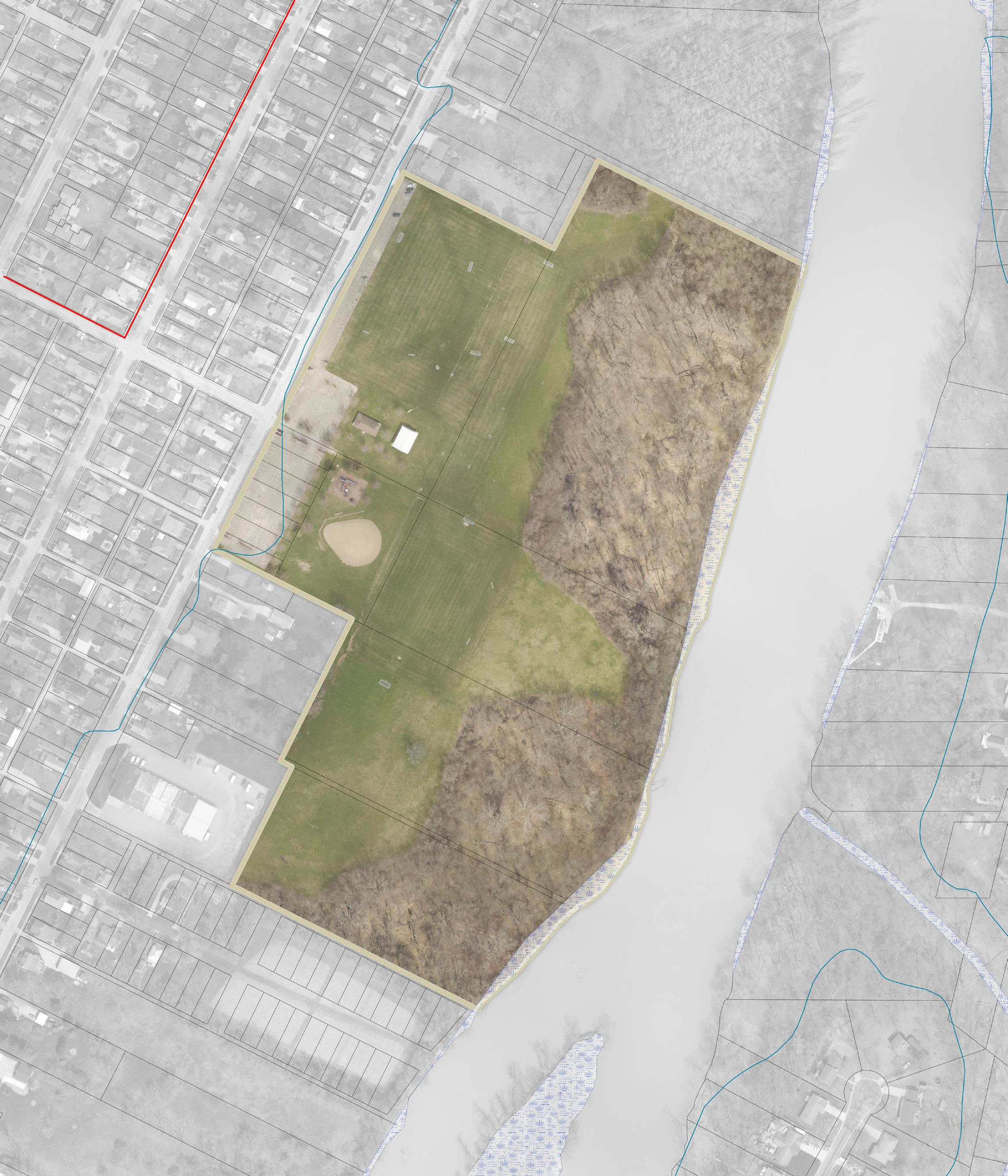
PEDESTRIAN CROSSING
PAINT EXISTING STRUCTURE SEATING OPPORTUNITY (TYP)
PEDESTRIAN CROSSING
ADULT WORKOUT AREA
SAFETY SURFACING
REFURBISHED BALL FIELD
PATHWAY CONNECTION
SHELTER HOUSE
PEDESTRIAN CROSSING
PLAYGROUND, AGES 5-12 WITH SAFETY SURFACING PAINT EXISTING STRUCTURE
PLAYGROUND, AGES 2-5 WITH SAFETY SURFACING
SHELTER HOUSE
WALKWAY LOOP WITH DISTANCE MARKER SIGNS
Riverside Park was later included as part of the overall Riverfront Parks design. Refer to the refined riverfront parks concepts, starting on page 206.
LEGEND
LOW CHALLENGE ELEMENTS
SHELTER HOUSE ACCESSIBLE KAYAK & BOAT LAUNCH
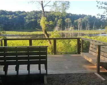
Sports Programming
Play Programming
Parking Lot Building / Structure
Pedestrian Circulation
Vehicular Circulation
Bridge / Overlook
Seating Opportunity
Water Engagement
Activation Node
“I would be really excited to see improvements at Riverside, especially features in the woods and opening up the view/riverfront in some places, while keeping native species."
- Survey Response
WOODLAND TRAIL
Initial Concepts: TRIANGLE PARK
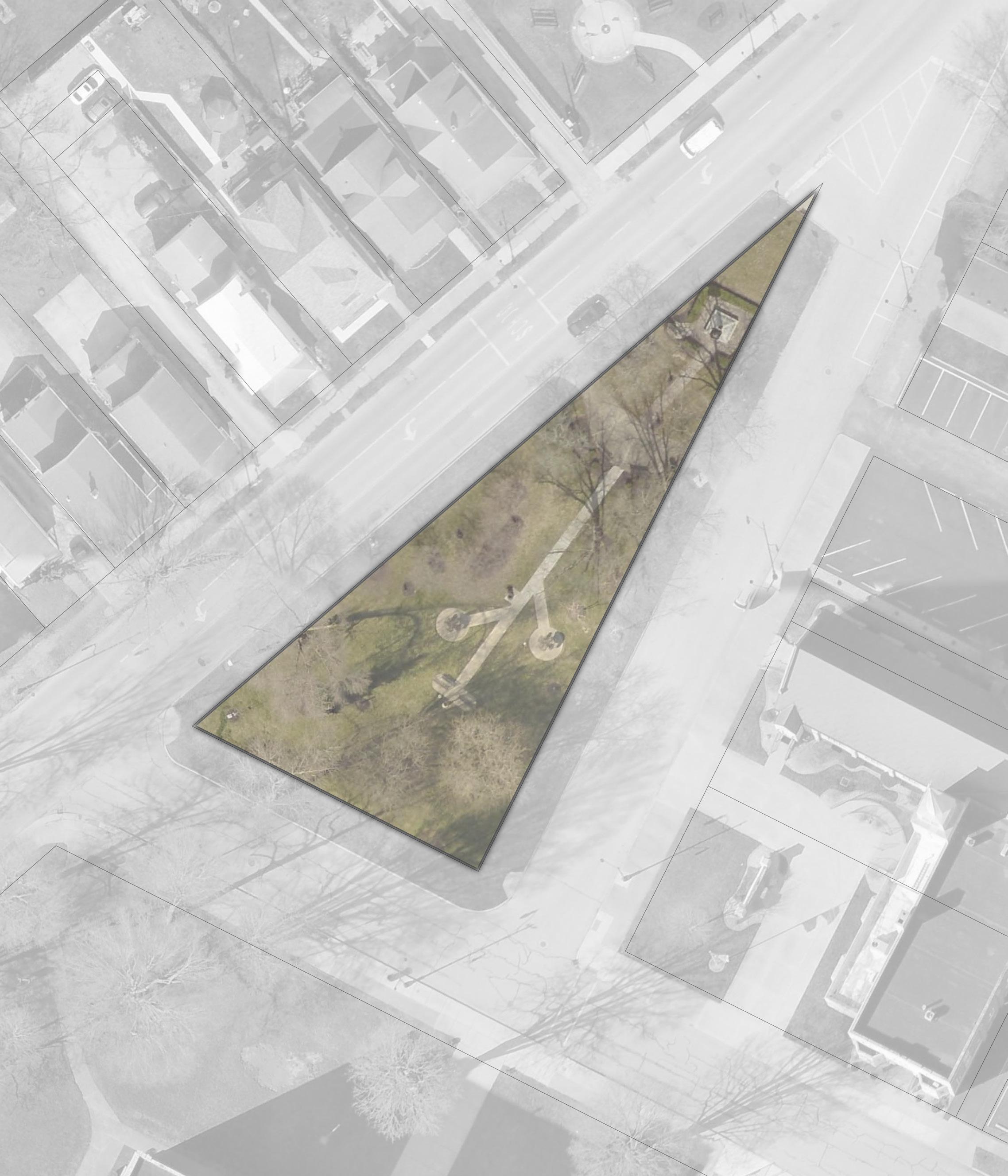
42.3% of survey respondents chose this concept Concept 1
CONNECTIONS TO EXISTING RAMPS
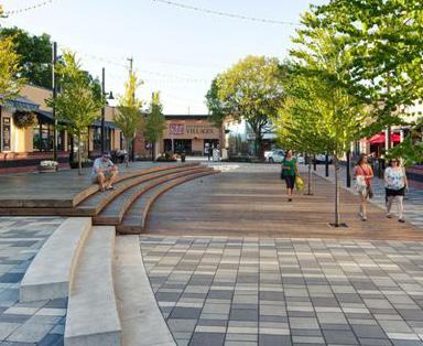
central plaza featuring a water fountain as a focal point. Additional pathways with seating areas are proposed around the park’s perimeter, improving circulation and encouraging exploration. On the eastern edge, a staged plaza offers space for seasonal events and casual seating. and south ends – expanding access to memorials in the north and adding a circular plaza with a historic feature in the south. Arabella Street is reimagined with decorative pavers, allowing the street to be temporarily closed to traffic during events, extending the park’s space for community programming.
FOUNTAIN & SEATING AREA
STAGE / PLAZA SPACE
CLINTONST
ARABELLAST
CONNECTIONS TO EXISTING RAMPS
PEDESTRIAN CROSSING
LEGEND
Natural Landscape
Plaza / Hardscape
Vehicular Plaza
Survey Response 57.7% of survey respondents chose this concept Concept 2
Pedestrian Circulation
Vehicular Circulation
Pedestrian Crossing
Seating Opportunity
Seat Wall
Sculpture / Fountain
IMPROVED LANDSCAPE & SAVE EXISTING TREES PAVERS ON ARABELLA ST WITH OPTION TO TEMPORARILY CLOSE STREET
HISTORICAL CENTRAL PLAZA
Initial Concepts: VETERAN'S MEMORIAL PARK
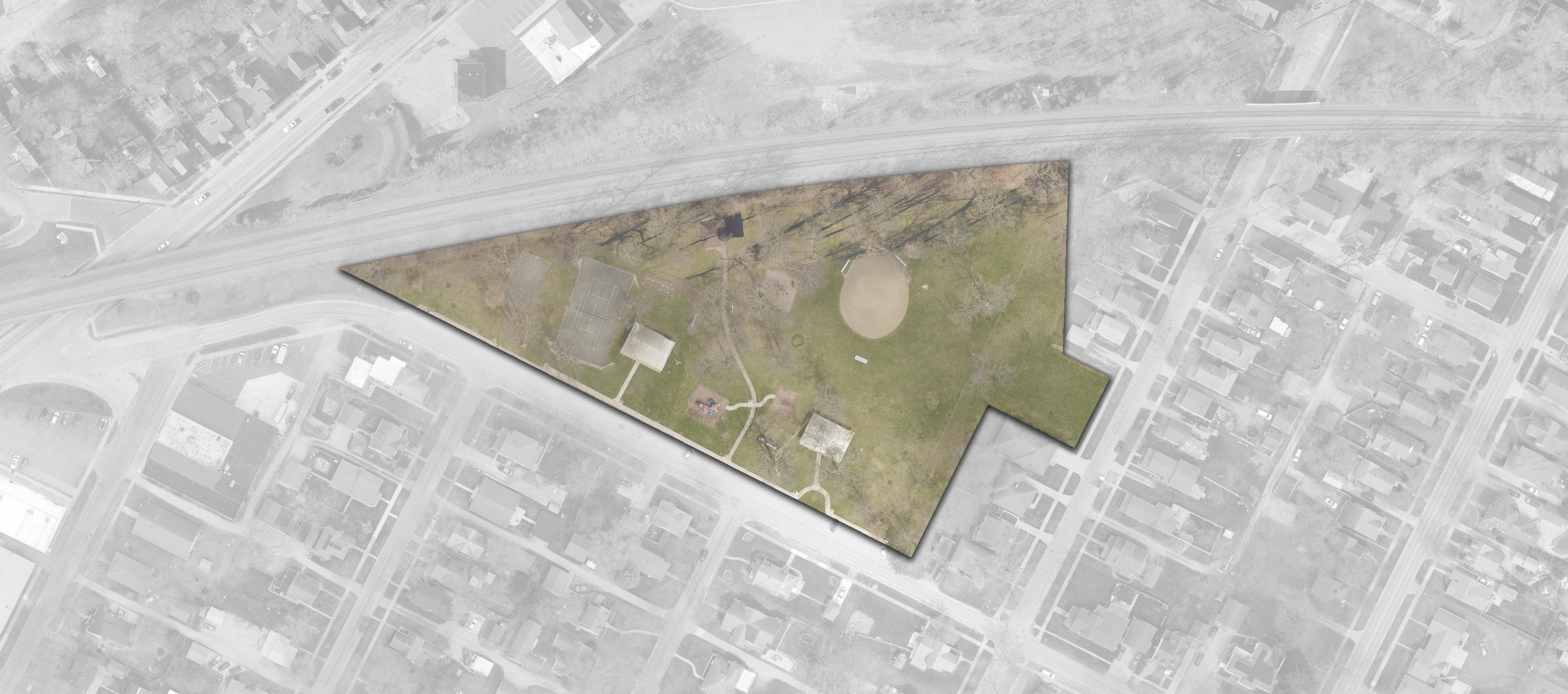
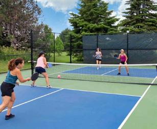
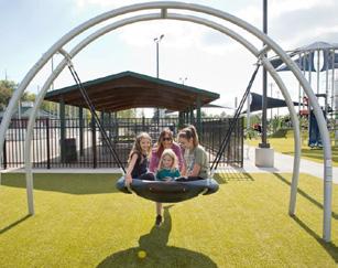
CONCEPT 1: This concept focuses on enhancing amenities while expanding recreational opportunities. Existing shelter houses are proposed for upgrades, with the addition of a new central shelter to better serve park visitors. To make the park more family-friendly, the existing restrooms will be updated to include changing tables.
The current playground at the front of the park will be replaced with two new, safety-surfaced playgrounds located more centrally. The existing ball diamond is slated for refurbishment, and a new walking path is introduced, creating a closed loop around the park with access points to both Wayne Street and Williams Street.
On the western edge of the park, a new skate park and four pickleball courts are introduced to diversify the recreation offerings. Select parking spaces will also be converted into landscaped green areas with shade trees to improve comfort and reduce heat.
CONCEPT 2: Like Concept 1, this concept emphasizes walkability with a continuous looping trail around the park, including access to Wayne and Williams Streets. Seating areas will be placed along the path to invite rest and relaxation. Shelter houses and restrooms will be improved, including the addition of changing tables for families.
A key change in this concept is replacing the existing playground with a peaceful memorial garden, creating a space for reflection and remembrance. Sustainable landscaping is also incorporated by reducing turf areas in favor of native plantings. The existing basketball court will be enhanced with a colorful mural, and the tennis court will be resurfaced and marked for both tennis and pickleball.
Two new playgrounds will be located in the center of the park, and a bocce ball court will be added to the eastern side, bringing even more diverse recreation options to the space.
Concept 2
68.9% of survey respondents chose this concept
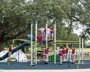
ACCESSIBLE PLAYGROUND FOR AGES 5-12 WITH SAFETY SURFACING
RESURFACE TENNIS COURT & ADD PICKLEBALL LINEWORK
RESURFACE BASKETBALL COURT AND INCORPORATE MURAL
POLLINATOR HABITAT WITH NATIVE PLANTINGS
PEDESTRIAN CROSSING
LEGEND
Natural Landscape
Sports Programming
Play Programming
UPDATED SHELTER HOUSE
FORMAL GARDEN SPACE WITH MEMORIAL ELEMENT
ACTIVATION NODE
UPDATE RESTROOM WITH CHANGING TABLES
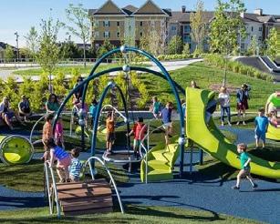
ACCESSIBLE PLAYGROUND FOR AGES 2-5 WITH SAFETY SURFACING
SEATING OPPORTUNITY (TYP)
PEDESTRIAN CROSSING
NEW PARK SIGN
POLLINATOR HABITAT WITH NATIVE PLANTINGS
BOCCE BALL COURT
UPDATED SHELTER HOUSE
Parking Lot
Building / Structure
Pedestrian Circulation
Seating Opportunity
Gateway / Trailhead / Signage
"Thank you for taking the changing tables into consideration! I would encourage thoughts for other parks to have them as well."
- Survey Response
WAYNE
Initial Concepts: RIVERFRONT PARKS
RIVERFRONT PARKS: Buchman Park on the Glaize; Fort Grounds; Gateway Park; Kingsbury Riverfront Park, Swim Park, & Pickleball; Pontiac Metro Park
CONCEPT 1: This concept strengthens pedestrian circulation with integrated walkways, boardwalks, and bridges that connect the riverfront parks. At the confluence, two pedestrian legs create a central connection point between Pontiac, Fort Grounds, and Kingsbury, offering separated routes to each park. Gateway Park highlights naturalized walking paths with educational features that showcase the historical significance of the north Maumee River shoreline and the Miami & Erie Canal footprint to the south. A supplemental pedestrian bridge to the west enhances connections across the river. Pontiac Metro Park features active, programmed landscapes, including an ice rink, market space, and formal gardens, all culminating at the Maumee Event Center with views over the confluence. A relocated boat launch is provided just west of its existing location. Fort Grounds capitalizes on its educational role with dedicated outdoor learning spaces linked by ADA-accessible paths. Kingsbury Riverfront Park becomes a social hub through the Confluence Commons and Turnbull Square, with permanent space for summer events integrated into a network of mixed-use plazas and buildings. The realignment of the ring road enhances pedestrian focus, creating new walkways that connect parkland, recreational areas, and dedicated parking. Buchman Park on the Glaize showcases a River’s Edge Amphitheater and open-air pavilion, with meandering paths through naturalized landscapes. New bridge connections provide safe crossings over the Auglaize, extending accessibility and riverfront experiences.
CONCEPT 2: Unlike the central pedestrian bridge of Concept 1, Concept 2 strengthens connectivity through two separate pedestrian crossings over the Auglaize River, located in Buchman and Kingsbury Parks. Gateway Park emphasizes active programming, with a skate park and adventure boardwalk on the north side and a hardscape plaza for markets on the south. At the heart of downtown, the Clinton Street Bridge is framed by Centennial Plaza on both sides, creating a central home for Defiance’s historical narrative. In Pontiac Metro Park, a formal lawn and event space occupy the prime location with views over the confluence. An indoor event center, supported by additional parking, is situated just to the west. The updated boat launch remains in its current location and connects to a naturalized walking path to the east. Kingsbury Riverfront Park becomes predominantly pedestrian-focused, with a central parking lot bordered by passive parkland, mixed-use development, and multiple river access points. Confluence Commons – a large event lawn and stage – anchors the Maumee River edge, while the ball field is shifted slightly southeast. The park’s northeast corner introduces a second boat launch with a shared parking lot, designed to support expanded pickleball courts. Buchman Park on the Glaize is anchored by a mixed-use building and history center on its northeast corner, reinforcing the park’s historic identity. The remainder of the park includes programmed walkways through passive green space and a restroom building near the Hopkins Street Bridge.
CONCEPT 3: The final concept showcases the full tridge: three pedestrian bridges extending from Pontiac, Fort Grounds, and Kingsbury to a central node at the confluence. Gateway Park’s north side is heavily naturalized with walkways and river access points, while the south side features a large plaza for markets and highlights the historic canal location. Pontiac Metro Park takes on a more linear design, with a naturalized shoreline path leading to the event center and a botanical garden on its northern half. The tridge entrance is framed by an ice-skating ribbon and plaza space. The boat launch remains in its current location with updates. Fort Grounds is defined by riverbank walking paths along all shoreline frontage, connecting the Maumee and Auglaize River edges. Kingsbury Riverfront Park receives the most significant redesign. A large mixed-use development shapes the 2nd Street boundary, opening into Turnbull Meadow –an expansive event lawn with a permanent stage. Naturalized shorelines and marsh areas are woven with boardwalks that link the nature center, tridge connection, and a new kayak launch. An additional boat launch is introduced in the northeast corner near the expanded pickleball courts. A centralized parking lot is located on the east side of the park, serving both passive green space and adjacent mixed-use development. Buchman Park on the Glaize is heavily programmed on its northern half with a mixed-use development, history center, memorial lawn, and overlook deck. These elements transition into passive green space featuring boardwalks and meandering pathways.
HISTORICAL
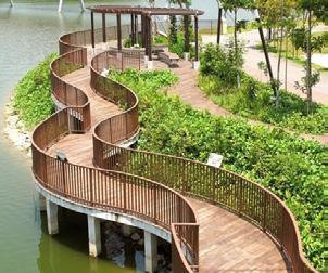
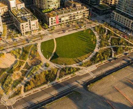

42.5% of
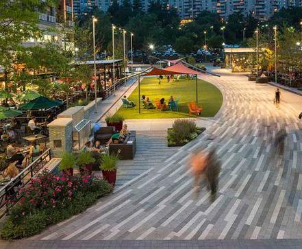
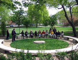
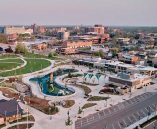
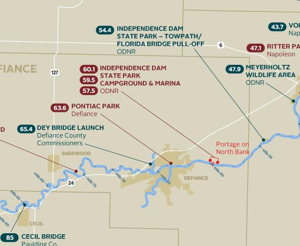
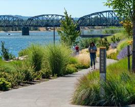
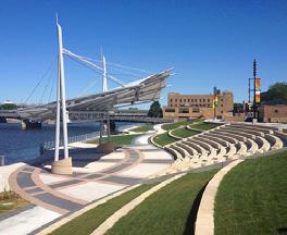
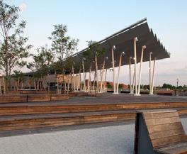
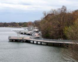
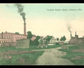
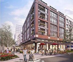
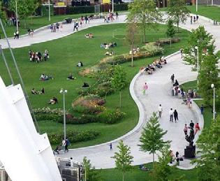
LEGEND
Programmed Landscape
Natural Landscape
Sports Programming
Play Programming
Parking Lot
Plaza / Hardscape
Building / Structure
Pedestrian Circulation
Vehicular Circulation
Bridge / Overlook
Boardwalk Buckeye Trail
Activation Node
Accessible Kayak & Boat Launch
HOPKINS
Initial Concepts: Overview RIVERFRONT PARKS

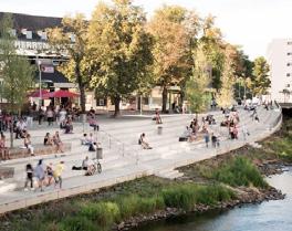
18.6%
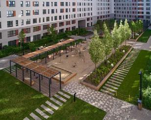
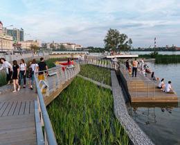
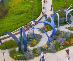
LEGEND
Programmed Landscape
Natural Landscape
Sports Programming
Parking Lot
Plaza / Hardscape
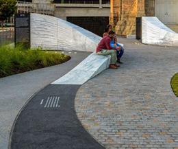
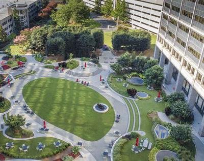
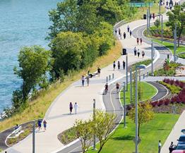
Building / Structure
Pedestrian Circulation
Vehicular Circulation
Activation
Accessible
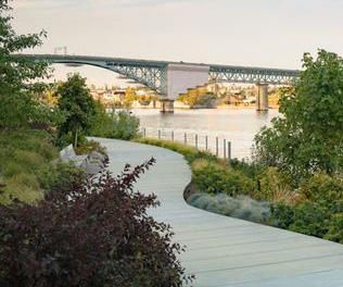
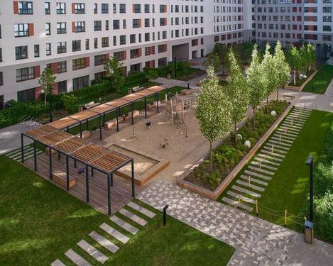
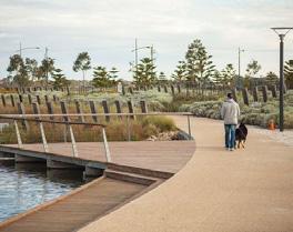
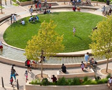
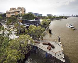
Pedestrian Circulation
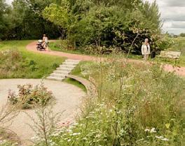
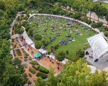
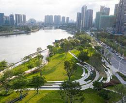
Boardwalk
MAUMEE
Refined Concepts: Overview
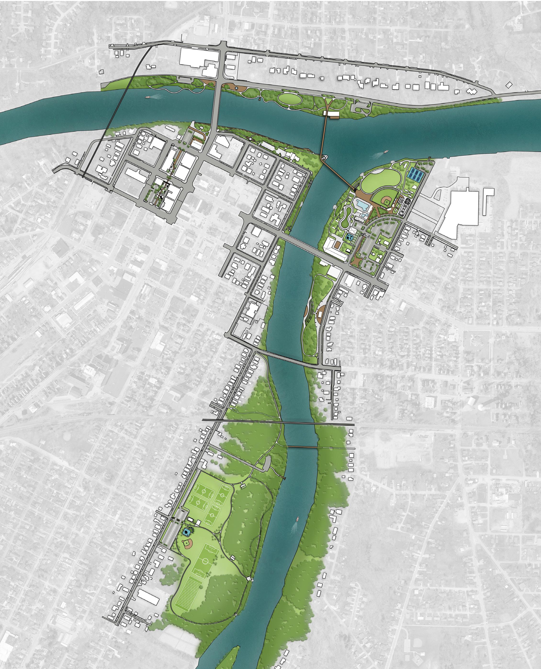
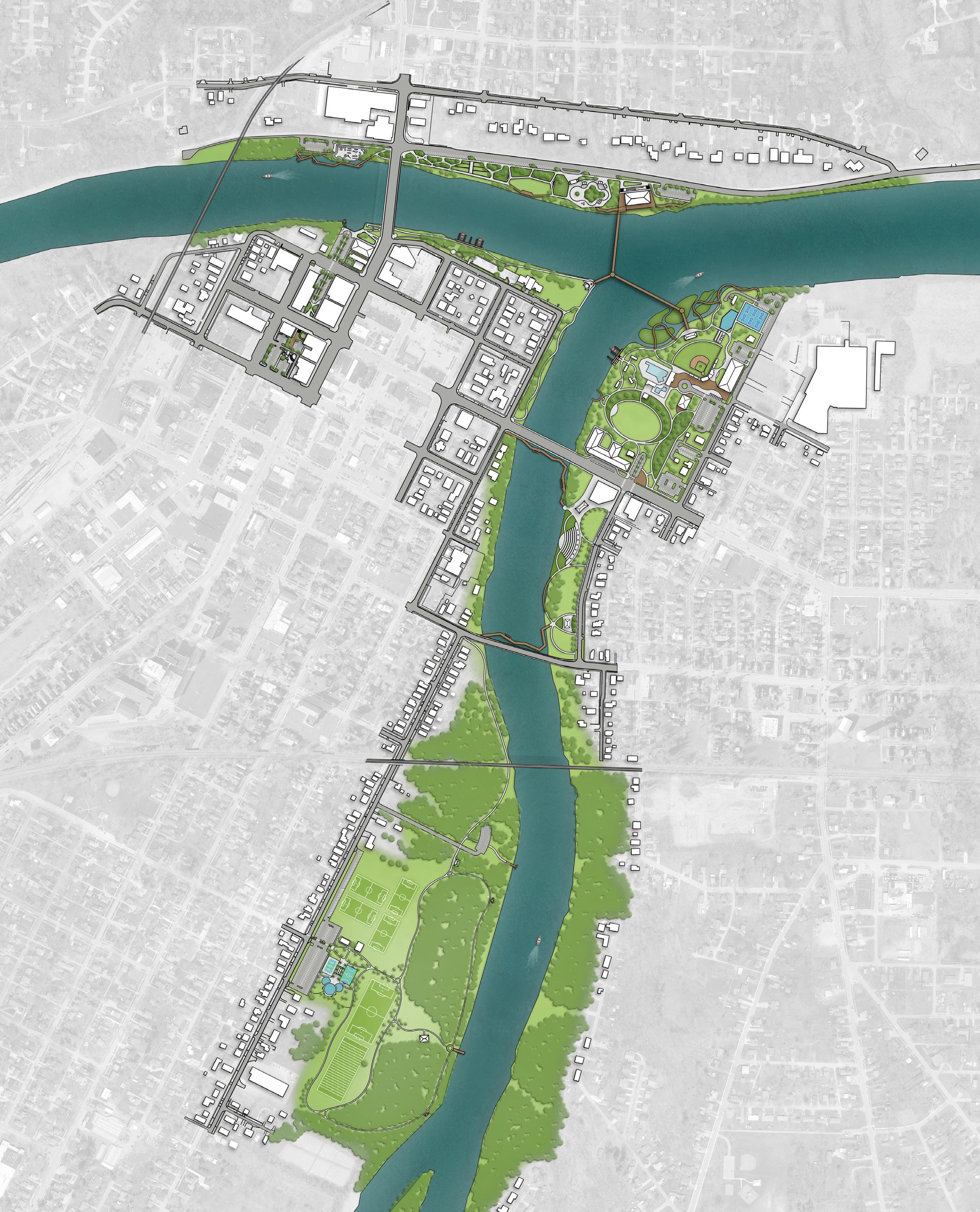
Refined Concepts: Concept 1
RIVERFRONT PARKS
RIVERFRONT PARKS: Buchman Park on the Glaize; Canal Park / Miami & Erie Canal Corridor; Fort Grounds; Gateway Park; Kingsbury Riverfront Park, Swim Park, & Pickleball; Pontiac Metro Park; Riverside Park
Following public input, two revised riverfront park concepts were presented with refined elements that continue the vision of an enhanced and connected riverfront experience. At this stage in the design process, Canal Park / Miami & Erie Canal Corridor and Riverside Park were added to the project scope.
Concept 1 Overview: Concept 1 features a bilateral pedestrian bridge across the confluence, connecting Pontiac, Fort Grounds, and Kingsbury Parks. It also includes the smaller of the two proposed event centers in Pontiac Park and emphasizes more active recreational programming throughout Kingsbury Riverfront Park.
Gateway Park provides a naturalized northern shoreline with walking paths and boardwalks leading into Centennial Plaza, which frames the Clinton Street Bridge and serves as a gateway into downtown. The southern portion includes a river overlook and shelter house connected to a market plaza and outdoor dining space. A proposed commercial building anchors the southeast corner, supported by an adjacent parking lot.
The Miami & Erie Canal Corridor begins in Gateway Park and continues as a pedestrian route between Perry and Clinton Streets, following the historic canal footprint. The corridor features shaded seating, string lighting, and maintains access to public parking. It culminates in a renovated Canal Park, complete with food truck provisions and updated historical signage.
Pontiac Metro Park opens with a historical plaza at the Clinton Street Bridge and transitions into a naturalized landscape with winding paths leading to a kayak launch, botanical garden, and formal lawn. The event center sits along the shoreline with overlook views of the confluence. From here, a pedestrian bridge connection begins at the event center’s green roof and spans across the Maumee River into Fort Grounds. The existing boat launch remains in place with upgrades and a new parking lot, supplemented by angled parking along East River Drive.
Fort Grounds features an accessible pathway under the south side of the Clinton Street Bridge, linking into south Gateway Park. Within the park, an expanded network of shoreline and treetop boardwalks follows the Maumee River. On the east side, a proposed educational trail connects to Auglaize River access points and supports library programming.
Continued on the next page.
LEGEND
PROPOSED FEATURES
A Accessible Kayak Launch
B Accessible Kayak Launch & Rental Kiosk
C Boat Launch
D Accessible Riverfront Boardwalk
E Paved Parking
F Pollinator Garden
G Botanical Garden with Seating Nodes
H Formal Event/Activity Lawn
I Boulder Outcropping River Access Point
J Modified Tridge Pedestrian Connection
K Accessible Connection Under Bridge
L Accessible Adventure Boardwalk
M Riverfront Overlook
N Commercial or Mixed-Use Building
O Mixed-Use Building
P Mixed-Use Building with History Center
Q Shelter House
R Accessible Educational Trail
S Confluence Event Lawn with Stage
T Safety Surfacing for Existing Playground
U Gateway Plaza and Multi-Use Space
V Concession Stand
W Batting Practice Area
EXISTING FEATURES
1 Existing Pickleball
2 Existing Pool
3 Existing Ball Field
4 Existing Shelter Houses
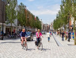
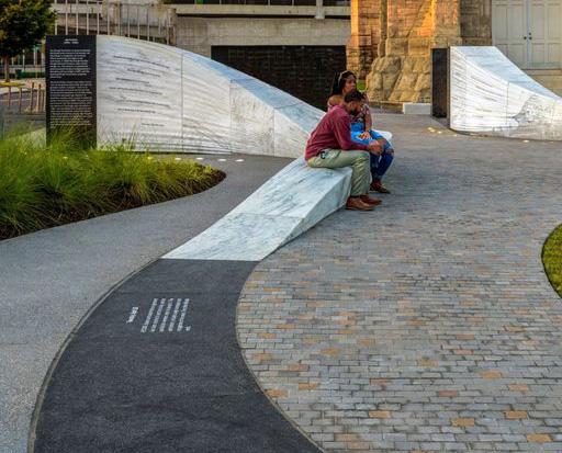
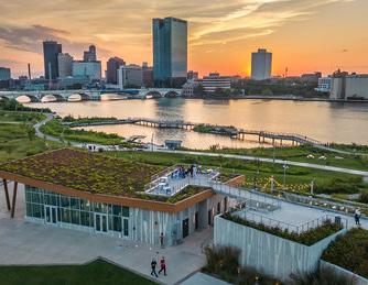
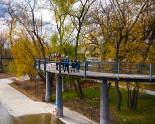
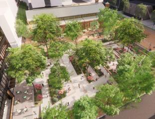
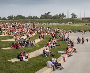
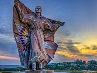
59.3% of
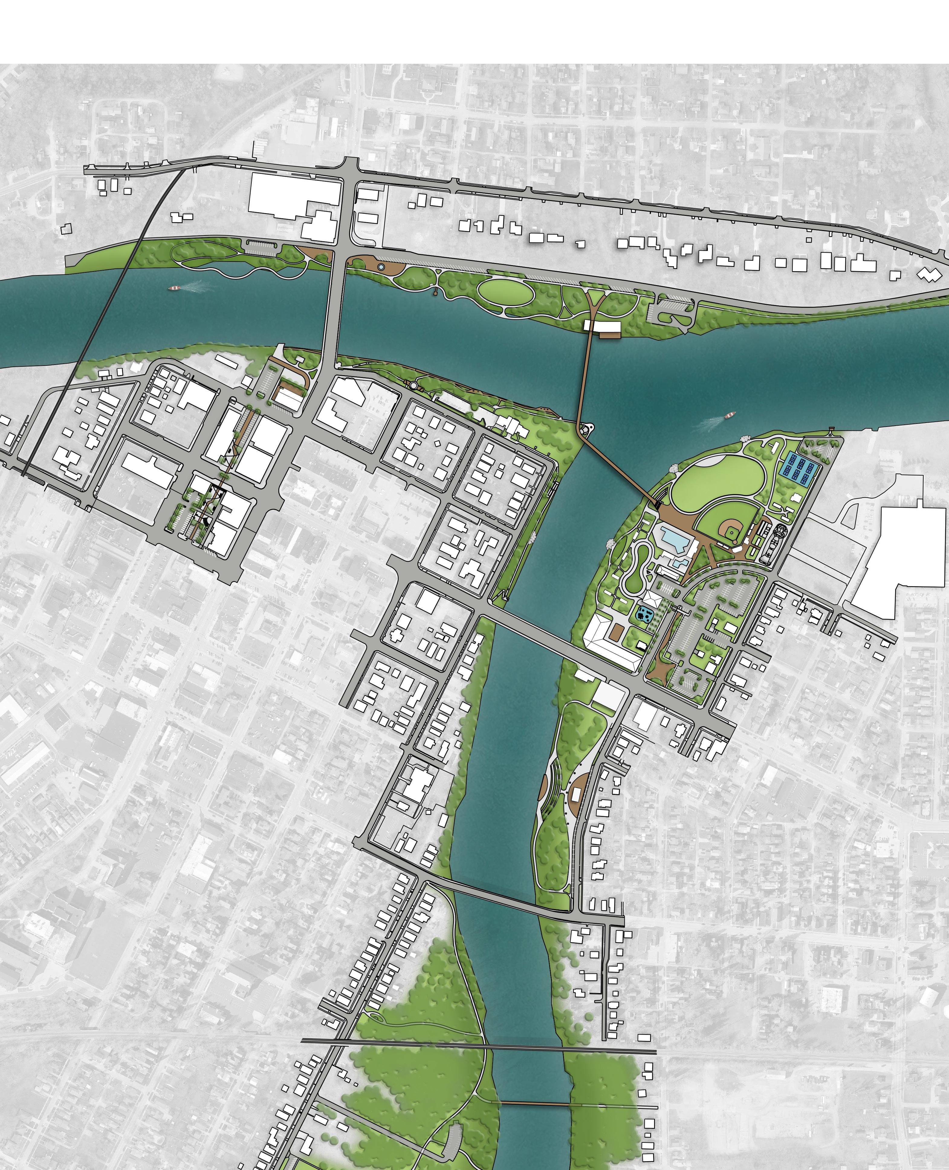
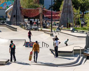
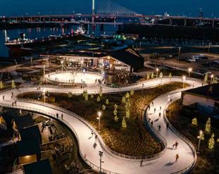
Refined Concepts: Concept 1, con't RIVERFRONT PARKS
Auglaize Street is rerouted through Kingsbury Riverfront Park as the main thoroughfare. Permeable parking lots and a welcome plaza are introduced to the east, capitalizing on FEMA property restrictions. Along the 2nd Street edge, a large mixed-use development anchors the boundary and leads into a network of walkways connecting shelter houses, a permanent ice-skating ribbon, and the upgraded playground. Three boulder outcroppings along the shoreline encourage hands-on interaction with the rivers.
At the pedestrian bridge entry point, visitors arrive in a central plaza framed by Confluence Commons (event lawn and stage), the existing ball field, and the pool. The plaza extends south along Auglaize Street, with a drop-off area at key entrances. Pickleball courts remain in their current location but gain additional parking and a kayak launch in the northeast corner. A skate park is also proposed just east of the ball field, keeping active uses clustered.
Buchman Park on the Glaize is anchored at 2nd and Auglaize Streets by a mixed-use building with a history center honoring local heritage and the park’s namesake. The River’s Edge Amphitheater is located mid-park along the shoreline, adjacent to a large pavilion and restroom building. Seven memorials representing the native tribes of the area frame these facilities. The remainder of the park features passive walking paths through naturalized landscapes.
New sidewalks are proposed on the west side of the Auglaize River, linking Hopkins Street Bridge to Riverside Park. These paths connect west to Arabella Street and south to a new pedestrian bridge spanning the Auglaize. A new drive off Riverside Avenue leads to a parking area, kayak launch, and pavilion with restrooms.
Within Riverside Park, wooded areas, scenic seating, and overlook points enhance the visitor experience. A central river education area anchors the nature trails and links to the park’s formal trail system. Additional access is provided from Riverside Avenue, with planned crosswalk improvements for safety. Inside the park, new looped walking paths guide visitors around sports fields and through woodland areas. The existing playground on the west side is reimagined with updated equipment and safety surfacing, complemented by a new adult fitness station for multi-generational recreation.
LEGEND
PROPOSED FEATURES
A Accessible Kayak Launch & Rental Kiosk
B Boat Launch
C Shelter House
D River Educational Signage & Wayfinding
E Boat and Car Parking
F Paved Accessible Walkway
G Inclusive Playground & Adult Fitness Equipment
H Refurbished Baseball Field
I Pedestrian Bridge Across River
J Pocket Park
K Pedestrian Corridor to Triangle Park
L Boulder Outcropping River Access
EXISTING FEATURES
1 Existing Sports Field
2 Existing Shelter House
3 Existing Restroom Facility
4 Existing Parking
“... Riverwalk is a great way to admire nature. I can definitely picture people going for a stroll but I would hope there are trash cans/recycling bins/doggy bags available on the path ... An event center sounds nice. Provides a nice place for people to make arrangements for events. Flowers are wonderful and provides a nice scenic place for photos. Great way to support Ohio pollinators ..."
- Survey Response
59.3% of survey respondents chose this concept
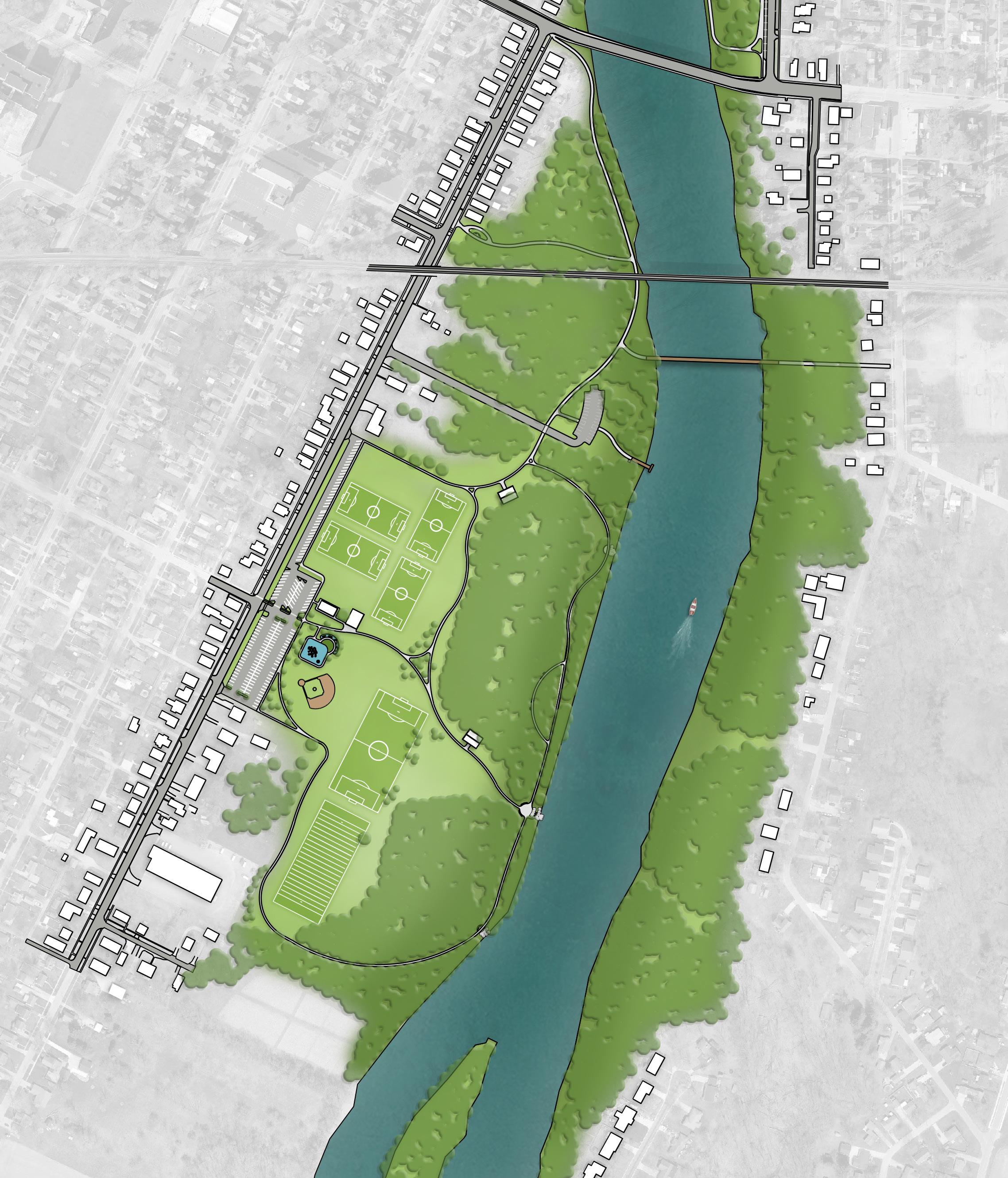
Refined Concepts: Concept 2
RIVERFRONT PARKS
RIVERFRONT PARKS: Buchman Park on the Glaize; Canal Park / Miami & Erie Canal Corridor; Fort Grounds; Gateway Park; Kingsbury Riverfront Park, Swim Park, & Pickleball; Pontiac Metro Park; Riverside Park
Concept 2 Overview: Following public input, Concept 2 was developed with several key distinctions: the full tridge spanning the confluence, the larger of the two proposed event centers in Pontiac Park, and the naturalization of Kingsbury’s shoreline.
The northern portion of Gateway Park is activated with a skate park and an adventure boardwalk extending over the Maumee River, while the western side remains naturalized and preserves the walkway under the north side of the Clinton Street Bridge. South Gateway Park features a large pavilion for farmers markets and events, as well as outdoor dining space for the restaurant. A shoreline cove along the Maumee houses a kayak launch and creates direct interaction with the rivers.
The Miami & Erie Canal Corridor begins with a pedestrian path through South Gateway Park’s parking lot and continues through the alley between Perry and Clinton Streets. This concept maintains shaded seating, lighting, and pedestrian space, but preserves more utilitarian parking areas. The corridor ends at the revised Canal Park, which introduces additional plantings and new historical signage.
Pontiac Metro Park opens with a terraced formal garden at the Clinton Street Bridge, marked by historical signage and pathways. A smaller event lawn with pergola provides space for seasonal reenactments. Angled parking is shown along East River Drive to support events.
In the park’s center, a permanent ice-skating ribbon is introduced, complete with a rental building, warming huts, and seating. The larger of the two proposed event centers anchors the shoreline at the confluence, with a major overlook deck and direct connection to the tridge. In this concept, the existing boat launch is removed and replaced by a parking lot serving event center visitors.
Fort Grounds features river’s edge trails along its shoreline, connecting under the south side of the Clinton Street Bridge to proposed boat docks. Unlike Concept 1, treetop boardwalks and Auglaize River access points are not included.
Where the tridge meets Kingsbury Riverfront Park, the shoreline is naturalized into marsh and wetlands with weaving boardwalks and viewing platforms that connect to the Confluence Nature Center. A new nature-themed playground sits between the existing ball field and pickleball courts, with expanded parking in the northeast corner.
Continued on the next page.
LEGEND
PROPOSED FEATURES
A River Overlook with Terraced Steps
B Accessible Kayak Launch & Rental Kiosk & Boat Parking
C Boat Docks
D Farmer’s Market Shelter House & Event Space
E Paved Parking Lot
F Ice Ribbon & Building with Seating & Warming Huts
G Confluence Nature Center
H Formal Gardens with Pergolas
I Batting Practice Area
J Tridge Pedestrian Connection
K Concession Stand
L Adventure Boardwalk
M Auglaize Boardwalk
N Commercial or Mixed-Use Building
O Mixed-Use Building
P Mixed-Use Building with History Center
Q Shelter House
R Restroom Building
S Turnbull Meadow: Event Lawn and Stage
T Inclusive Playground with Accessible Safety Surfacing
U Entrance Plaza
V River’s Edge Amphitheater
EXISTING FEATURES
1 Existing Pickleball
2 Existing Pool
3 Existing Ball Field
4 Existing Shelter Houses
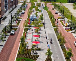
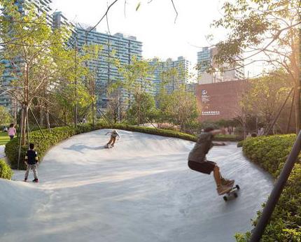
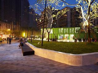
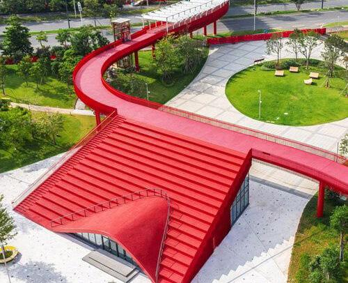
40.7% of
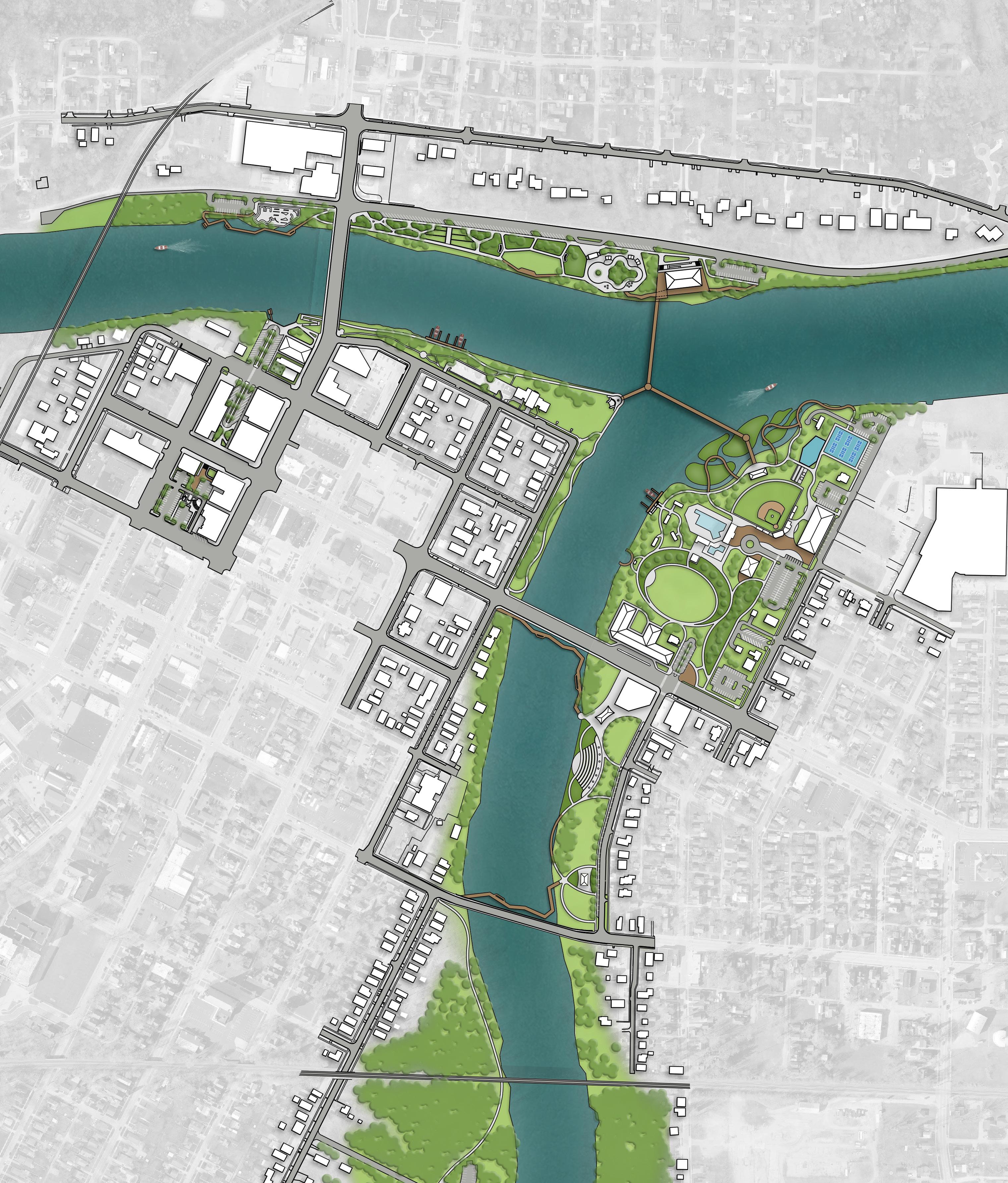
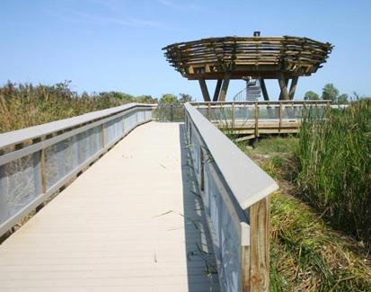
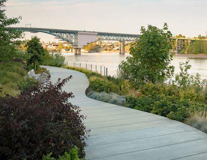
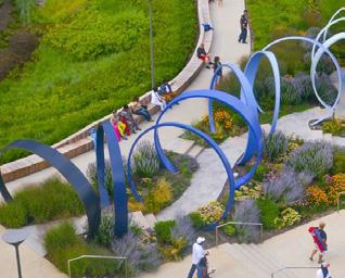
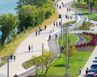
Refined Concepts: Concept 2
RIVERFRONT PARKS
A mixed-use building on the eastern edge of the park leads into a central plaza and drop-off area serving the pool and baseball field. Concept 2 eliminates internal roadways, instead placing parking and drop-off areas along the edges of the park to emphasize a pedestrian-focused environment. Pathways accommodate maintenance and event vehicles as needed.
Turnbull Meadow, between the pool and the 2nd Street mixed-use development, is envisioned as a large event lawn with a permanent stage. The central portion of Kingsbury is naturalized open space, threaded with trails connecting to the kayak launch, boat docks, and shelter houses along the river.
Buchman Park on the Glaize is formalized with a larger amphitheater and a plaza around the pavilion. A mixed-use building at 2nd and Auglaize Streets anchors the northeast corner, with parallel parking along the eastern edge. Looping pathways cross the lawn and connect to boardwalks over both the 2nd and Hopkins Street bridges. A small restroom facility supports events in the southern half of the park.
Boardwalks continue through Buchman and cross the Hopkins Street Bridge, linking south along the Auglaize River toward Riverside Park At its entrance, a kayak launch and rental station provide new access for paddlers, paired with a shelter house for trail users.
Within Riverside Park, visitors can head west into athletic fields or south into woodland trails with scenic seating and overlook points. Crosswalk improvements along Riverside Avenue enhance safety, while new looped walking paths guide visitors through the park’s sports areas and natural spaces.
The west end of Riverside Park is reimagined as a primary entrance, anchored by a formal lawn framed with sidewalks. This area features a futsal court, basketball court, central shelter house, and new playground designed for children of all ages.
By blending recreation, ecological restoration, and urban connectivity, Concept 2 envisions the riverfront parks as vibrant, multi-faceted destinations that serve the community year-round.
LEGEND
PROPOSED FEATURES
A Accessible Kayak Launch & Rental Kiosk
B Boat Launch
C Shelter House with Restrooms
D River Educational Signage and Wayfinding
E Boat and Car Parking
F Walking Path
G Auglaize River Overlook Deck
H Inclusive Playground with Accessible Safety Surfacing
I Basketball Court with Painted Mural
J Futsal Court EXISTING FEATURES
“I like concept 2 because it gives a lot of space for people to go for a run or bike ride. I only feel that there needs to be a way where there can be a path that runs along the river on the side of the Pontiac park side of the river that will connect Pontiac park and the reservoir. Great concepts though. This city is in much need of bike/running paths that keeps everyone safe ... Make Defiance a place people will want to visit and explore. The more the river space is utilized the more downtown businesses will start prospering."
- Survey Response
40.7% of survey respondents chose this concept
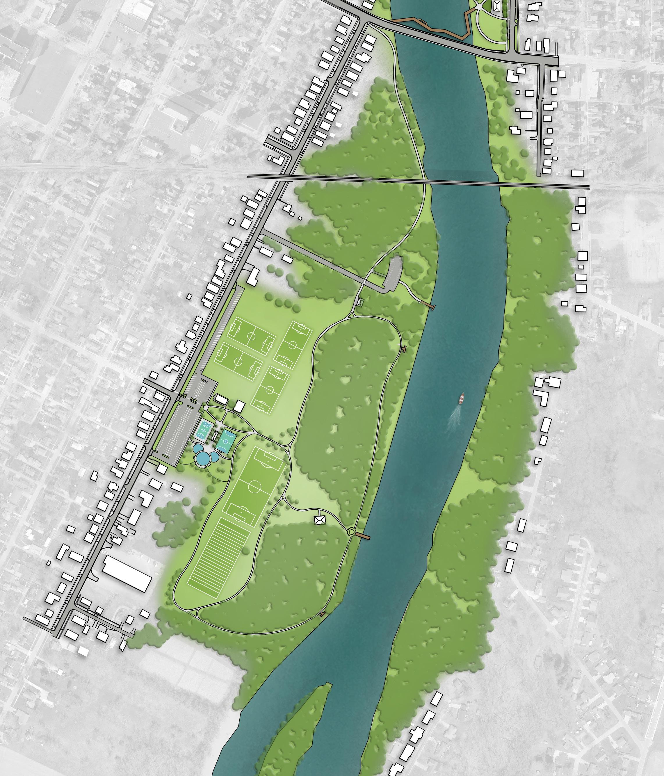
HOPKINS
Final Concept: Overview RIVERFRONT PARKS
RIVERFRONT PARKS: Buchman Park on the Glaize; Canal Park / Miami & Erie Canal Corridor; Fort Grounds; Gateway Park; Kingsbury Riverfront Park, Swim Park, & Pickleball; Pontiac Metro Park; Riverside Park
The Final Riverfront Parks Concept combines the most valued elements of both previous concepts into a single, cohesive vision that balances active recreation, ecological restoration, and enhanced community access. Together, these improvements create a continuous and connected riverfront experience that celebrates Defiance’s unique setting at the confluence of the Maumee and Auglaize Rivers. By blending new amenities with restored natural landscapes, the final concept creates a riverfront that is both a civic centerpiece and a celebrated natural asset.
A defining feature of the final concept is the network of boardwalks that weave through Gateway, Pontiac, and Buchman Parks, creating opportunities for strolling, gathering, and experiencing the water up close. Enhanced river access is prioritized through new docks along both rivers, a renovated boat launch in Pontiac Metro Park, and strategically placed kayak launches. A proposed event center and overlook deck in Pontiac establish a prominent gathering space with striking views, while adjacent docking facilities and pedestrian bridges expand opportunities for boating and recreation. Gateway Park will serve as an anchor, with plaza spaces for flexible programming and a connection into the Miami & Erie Canal Corridor, directly linking downtown Defiance to the riverfront and celebrating the historic canal footprint. Ecological restoration is also a core component, highlighted by wetland gardens and marshland areas in Kingsbury Riverfront Park that serve as both habitat and outdoor classrooms. Visitors can explore these landscapes through immersive boardwalks and interpretive experiences, reinforcing the riverfront as a space for learning, wellness, and environmental stewardship.
Further south, Buchman Park on the Glaize features a riverside amphitheater with sweeping views, paired with memorials honoring the seven Native American Tribes that once inhabited the region. Additionally, Riverside Park builds on its woodland character with scenic walkways, overlook points, and looped trails that guide visitors between athletic fields, natural areas, and a reimagined playground with multi-generational amenities.
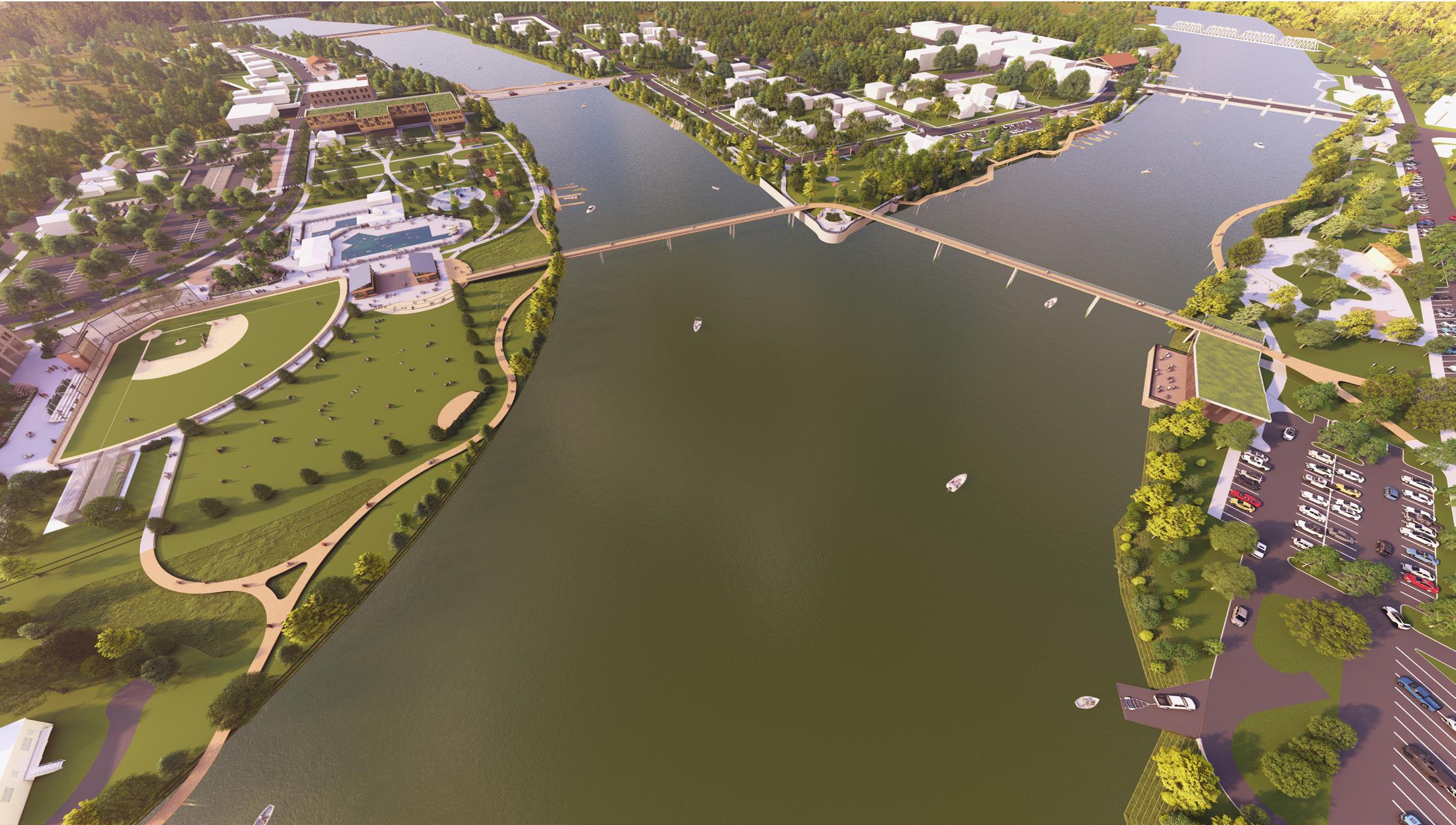
82% of survey respondents say they are likely to visit the confluence, based on this rendering
View
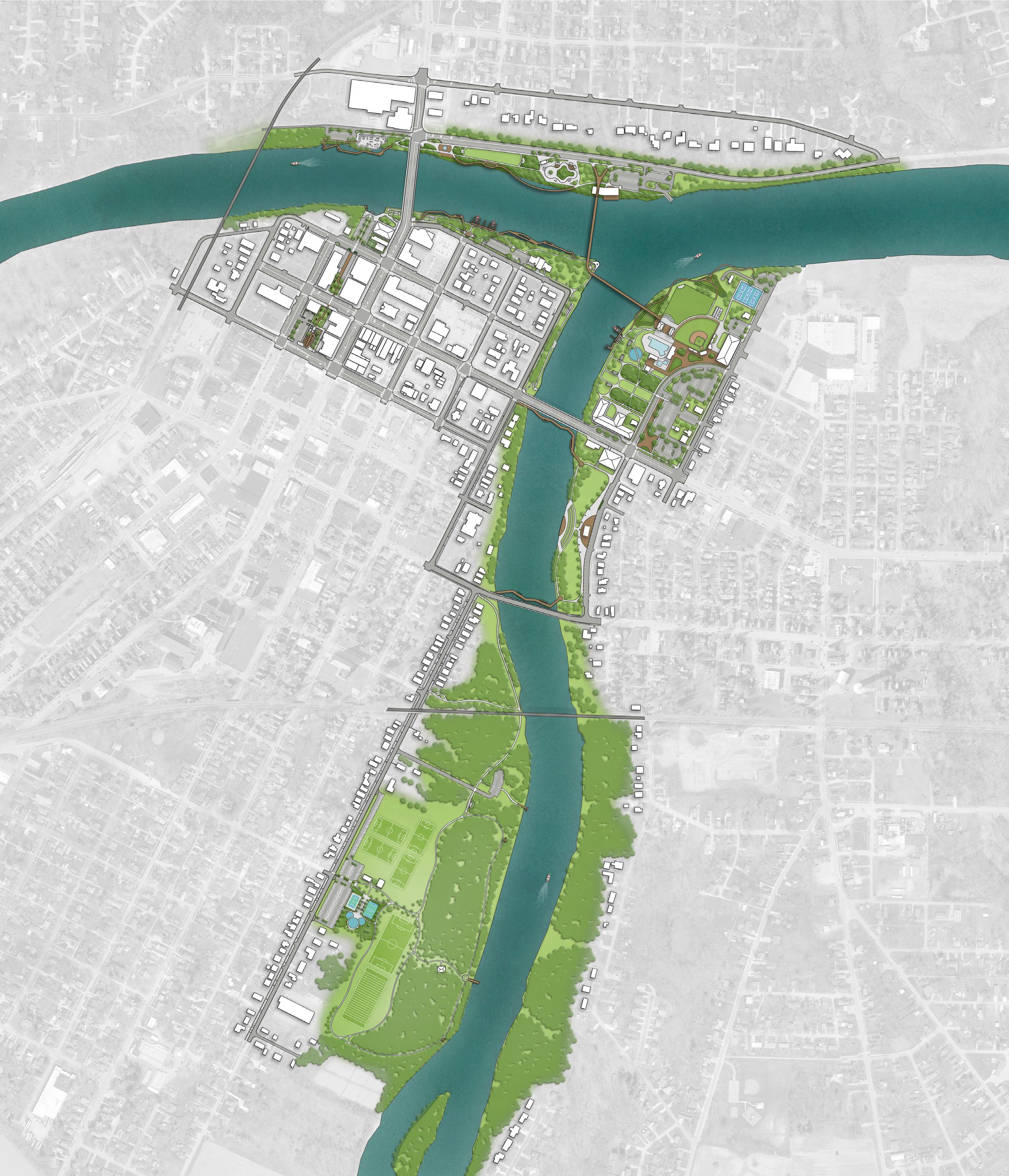
Final Concept: Riverfront Parks
BUCHMAN PARK ON THE GLAIZE
Buchman Park on the Glaize is reimagined as both a cultural landmark and a riverfront gathering space. Anchored by an amphitheater overlooking the Auglaize River, the park becomes a destination for performances, ceremonies, and community events with sweeping river views. Nearby, a plaza with sculptural elements honoring the seven Native American Tribes highlights the site’s cultural significance and provides a space for reflection and education.
Access and amenities are improved throughout. Shade trees, native plantings, and new concrete walkways create a welcoming landscape that is both beautiful and low-maintenance, while parallel on-street parking along Auglaize Street supports visitors. An open-air shelter house with accessible restrooms provides comfort and flexibility for daily use and events.
Connectivity is strengthened through pedestrian river-crossings along the 2nd Street and Hopkins Street bridges, allowing visitors to seamlessly link Buchman Park with the broader riverfront system. At the northwest corner of the park, a proposed mixed-use building with a history center integrates development into the site while creating new opportunities for interpretation, gathering, and downtown synergy.
Together, these improvements position Buchman Park as a vibrant riverfront destination – blending cultural heritage, community gathering, and ecological beauty along the Auglaize.
LEGEND
PROPOSED FEATURES
A Shade Trees
B Native Plantings
C Concrete Walkways
D On-Street Parallel Parking
E Shelter House with Restroom
F River's Edge Amphitheater
G Plaza with Sculptural Elements
H Mixed-Use Building with History Center
I Pedestrian Crossings / Boardwalk
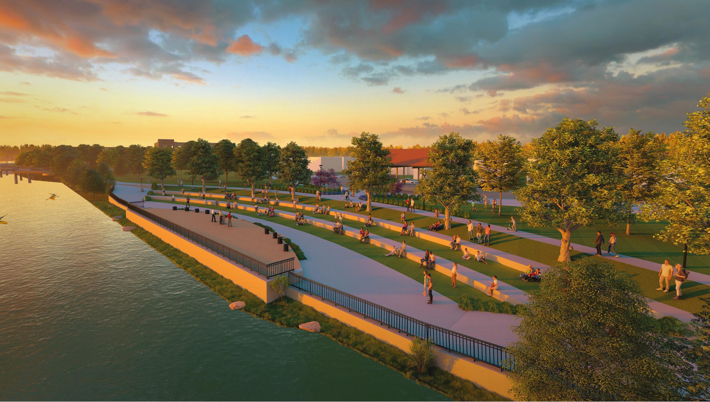
79% of survey respondents say they are likely to visit Buchman on the Glaize, based on this rendering
View of the River's Edge Amphitheater
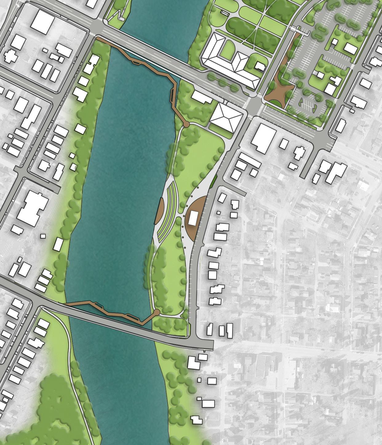
HOPKINS
Final Concept: Riverfront Parks
CANAL PARK / MIAMI & ERIE
The final concept for Canal Park and the Miami & Erie Canal Corridor reimagines this historic space as a lively pedestrian link between downtown and the riverfront, celebrating Defiance’s canal heritage while introducing new amenities that support community life.
A linear pedestrian corridor following the historic location of the canal will extend from 1st Street to 2nd Street, featuring shade trees, plantings, pedestrian lighting, and site furnishings that make the space welcoming and comfortable. Two lighted mid-block crossings improve accessibility and safety, ensuring strong connections between the corridor, downtown businesses, and the waterfront.
Within the formal Canal Park space, ADA-accessible ramps, new plantings, and food truck infrastructure will support flexible community programming and events. A new retaining wall with integrated public art near the historic lock will highlight the site’s heritage while creating a visually engaging focal point. These improvements are designed to integrate seamlessly with the proposed private development at 300 / 302 Clinton Street, where collaboration with the developer will ensure a unified and vibrant public realm.
Supporting amenities include park signage and historical interpretation, a drinking fountain, and strategically placed seating that can be adapted with future improvements. A parking study will further guide how the downtown area can balance event demand, visitor needs, and accessible parking priorities.
Altogether, the Canal Park / Miami & Erie Canal Corridor concept transforms a historic downtown space into an active, walkable, and memorable destination – blending heritage, community gathering, and modern amenities to strengthen the connection between downtown Defiance and the riverfront.
“Activating the existing amphitheater is much needed. Adding shade to this facility will make it usable for small functions for the public. This area should be developed in coordination with the private developer currently renovating the 300 Clinton building as well as the former Deluxe Cleaner site. It could be a great addition to the downtown."
- Survey Response
“I like the functionality of the spaces and finishing this area off properly to encourage more people to spend more time in a great family friendly downtown."
- Survey Response
LEGEND
PROPOSED FEATURES
A Park Sign / Historical Signage
B Shade Trees
C Linear Pedestrian Corridor
D Seating Opportunities
E Parking
F Food Truck Plaza
G Art Installation
EXISTING FEATURES
1 Existing Restaurant
2 Existing Parking
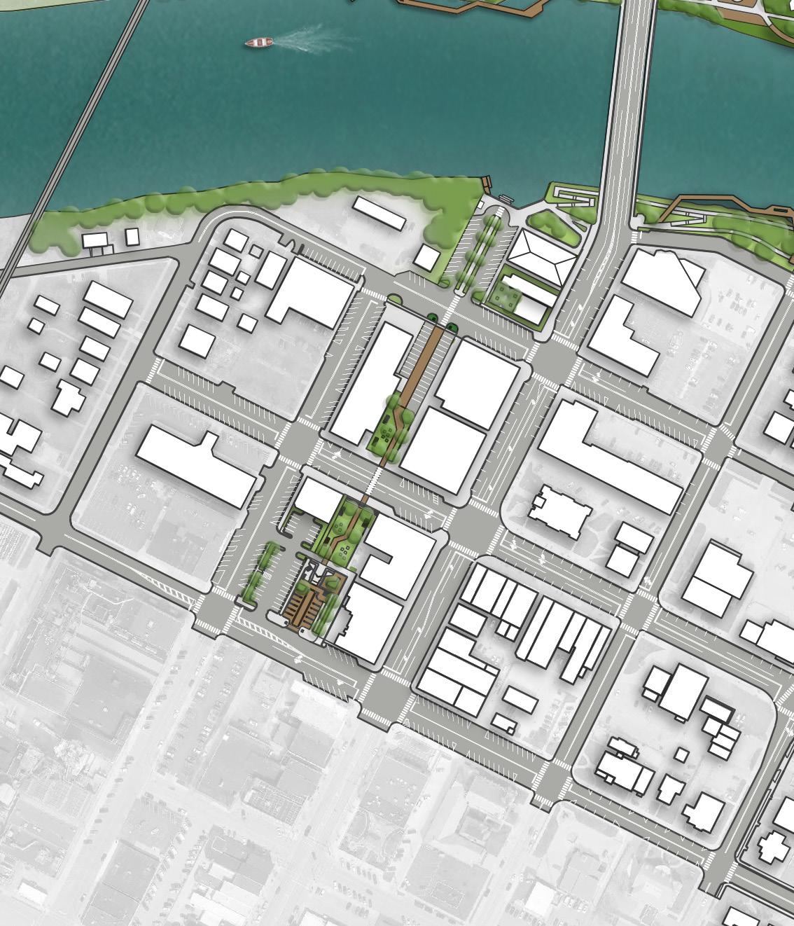
Final Concept: Riverfront Parks FORT GROUNDS
The final concept for Fort Grounds strengthens the site’s role as both a historic landmark and a vibrant riverfront destination, blending education, recreation, and ecological enhancements. A cohesive signage and wayfinding system organizes and interprets the many historical markers throughout the grounds, while new educational trails along the Auglaize River feature interpretive signage that tells the story of Defiance’s cultural and natural heritage.
The park’s riverfront is transformed into an immersive experience with an elevated boardwalk and overlook areas, complemented by a boulder outcropping overlook that offers sweeping views of the confluence. To further activate the river, new boat docks provide direct water access. A new pedestrian bridge strengthens connections between Fort Grounds, Pontiac Metro Park, and Kingsbury Riverfront Park, while a separate walkway under the Clinton Street Bridge links the site westward into Gateway Park.
Infrastructure improvements anchor these enhancements. The replacement of the flood wall integrates design and storytelling, incorporating etched, painted, or attached historical and wayfinding language to connect visitors with Defiance’s layered past while providing necessary improvements to anchor the river's edge for years to come.
Native plantings and shade trees are woven throughout the site, stabilizing the shoreline, creating habitat, and offering comfort for visitors. Accessibility is also prioritized through new ADA walkways along Fort Street, Washington Avenue, and the shoreline of the Maumee River, ensuring inclusive access for all. These trails and plantings define spaces, beautify the park, and ease long-term maintenance.
Together, these improvements will position Fort Grounds as a living landmark – honoring Defiance’s history while creating a connected, welcoming, and engaging space along the riverfront.
“I love the idea of connecting all our parks with pedestrian friendly paths and corridors. I walk downtown almost everyday these are probably some of my favorite proposed ideas."
- Survey Response
“I like the boat docks and hope to see more food options for people to dock and enjoy."
- Survey Response
LEGEND
PROPOSED FEATURES
A Pedestrian Bridge
B Accessible Connection Under Bridge
C Accessible Riverfront Boardwalk
D Boulder Outcropping River Access Point
E Accessible Educational Trail
F Shade Trees
G Boat Docks
H Updated Memorial Signage
EXISTING FEATURES
1 Existing Parking
2 Existing Historical Monuments
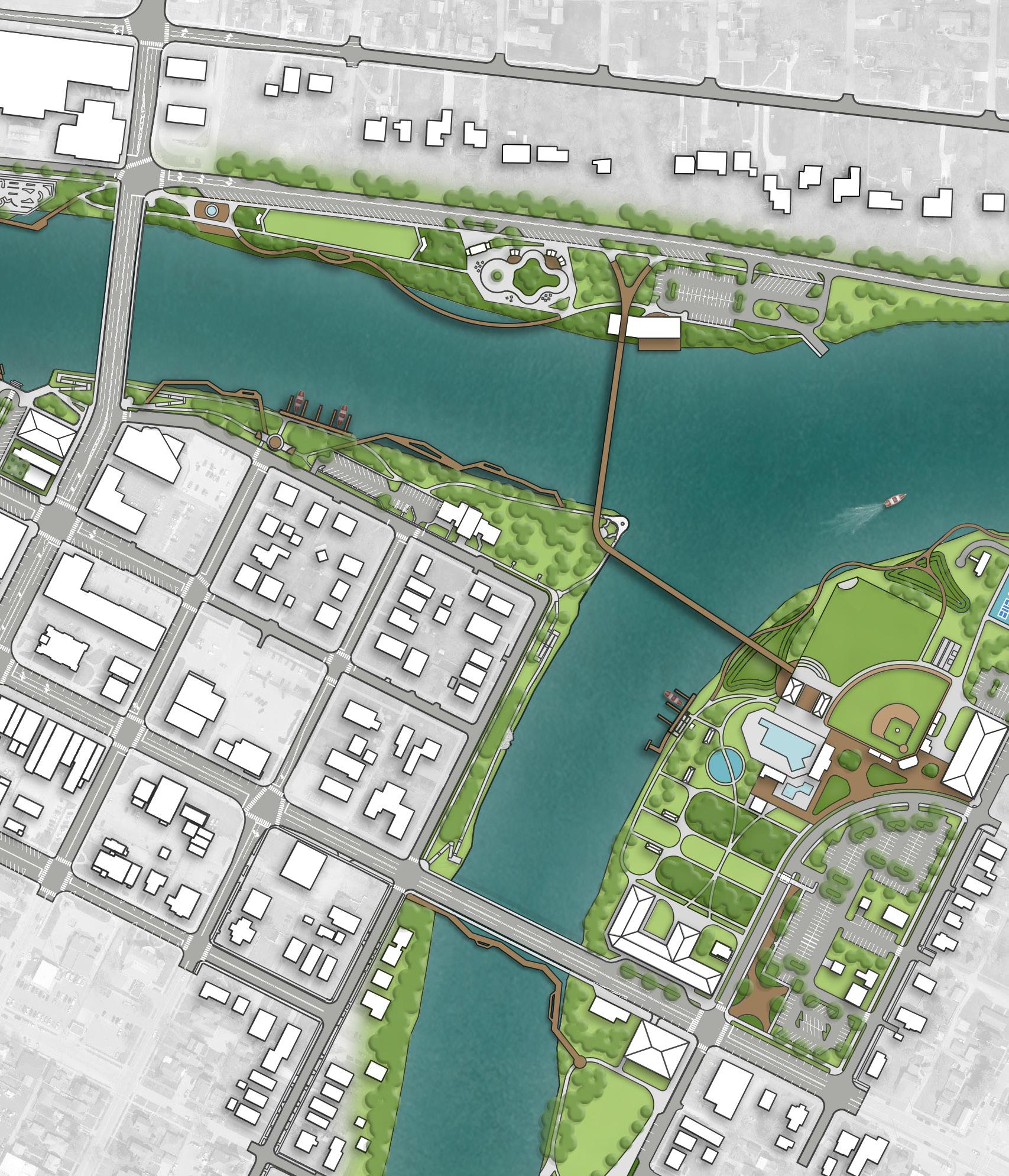
Final Concept: Riverfront Parks
GATEWAY PARK
The final concept establishes Gateway Park as a vibrant riverfront hub that blends recreation, community gathering, and access to the Maumee River. A new skate park, complete with associated parking and accessible walkways, provides an active recreation anchor, drawing youth and families into the park. Along the river’s edge, two new accessible kayak launches, one on the southern bank paired with a rental kiosk and another integrated with an adventure walkway and boardwalk along the northern bank, expand opportunities for paddling and immersive river experiences. The design also introduces a cove with stepped river access on the south side of the Maumee, offering a safe and inviting space for people to engage directly with the water. The park will also serve as a destination for markets and events. A new farmer’s market shelter house and event space, linked with accessible concrete walkways, creates a flexible venue for community programming throughout the year. Complementing this, a proposed mixed-use building with outdoor seating at the corner of Clinton Street and 1st Street strengthens the connection between downtown and the riverfront, adding amenities for residents, visitors, and event-goers. The concept further enhances comfort and identity through new shade trees, gateway signage, and historical interpretation that highlight Defiance’s rich cultural and ecological heritage. Connectivity is reinforced with a pedestrian walkway under the Clinton Street Bridge, seamlessly linking Gateway Park to Fort Grounds and extending the riverfront trail network.
LEGEND
PROPOSED FEATURES
A Park Sign / Historical Signage
B Shade Trees
C Skate Park
D Parking
E Accessible Kayak Launch & Rental
F Accessible Kayak Launch
G Farmer’s Market Shelter House
H Accessible Walkway
I Mixed-Use Building
J Outdoor Seating
K Adventure Boardwalk
EXISTING FEATURES
1 Existing Restaurant
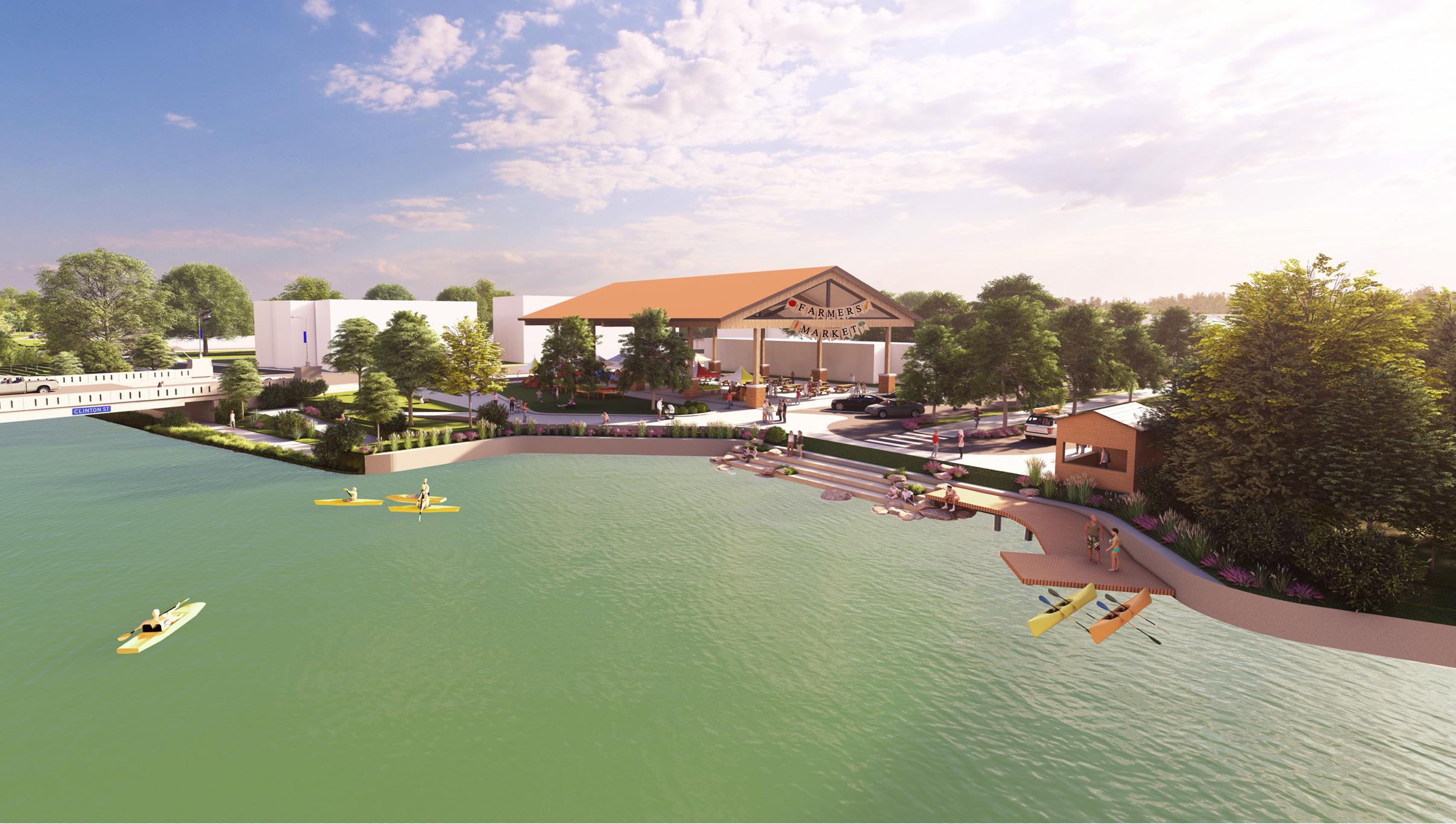
81% of survey respondents say they are likely to visit Gateway Park, based on this rendering
View of Gateway Park along the south shore
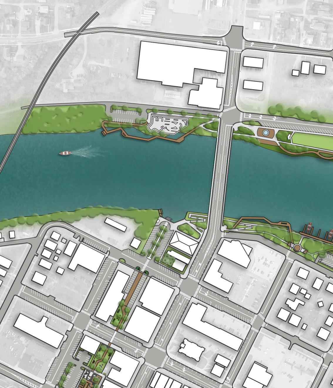
Final Concept: Riverfront Parks
KINGSBURY RIVERFRONT PARK
The final concept for Kingsbury Riverfront Park establishes it as the centerpiece of Defiance’s riverfront, blending recreation, gathering, and ecology. A new event lawn and stage, openair shelters, river boardwalk, wetland gardens, and a nature education center provide opportunities for both leisure and learning, highlighting the park’s role as a year-round destination. The baseball field is preserved, with upgraded bleachers, concession facilities, and relocated batting cages, while the pool area receives improved access. Shade trees are also added throughout the site to increase comfort and character.
Central Kingsbury will become a vibrant family hub with a new accessible playground, activity lawns, botanical gardens, and improved walkways. Additionally, parking and roadway updates will improve access and circulation. Along the Auglaize River, boat docks and a kayak launch expand water recreation, while new pedestrian bridges connect Kingsbury with Fort Grounds and Pontiac Metro Park.
Finally, Kingsbury is envisioned as a driver of downtown vibrancy. The plan supports the development of mixed-use spaces along Auglaize Street and 2nd Street, complete with plazas and drop-off zones that link the pool, ball field, and event spaces to the broader urban fabric. Northwest view, looking across the northern section of the park
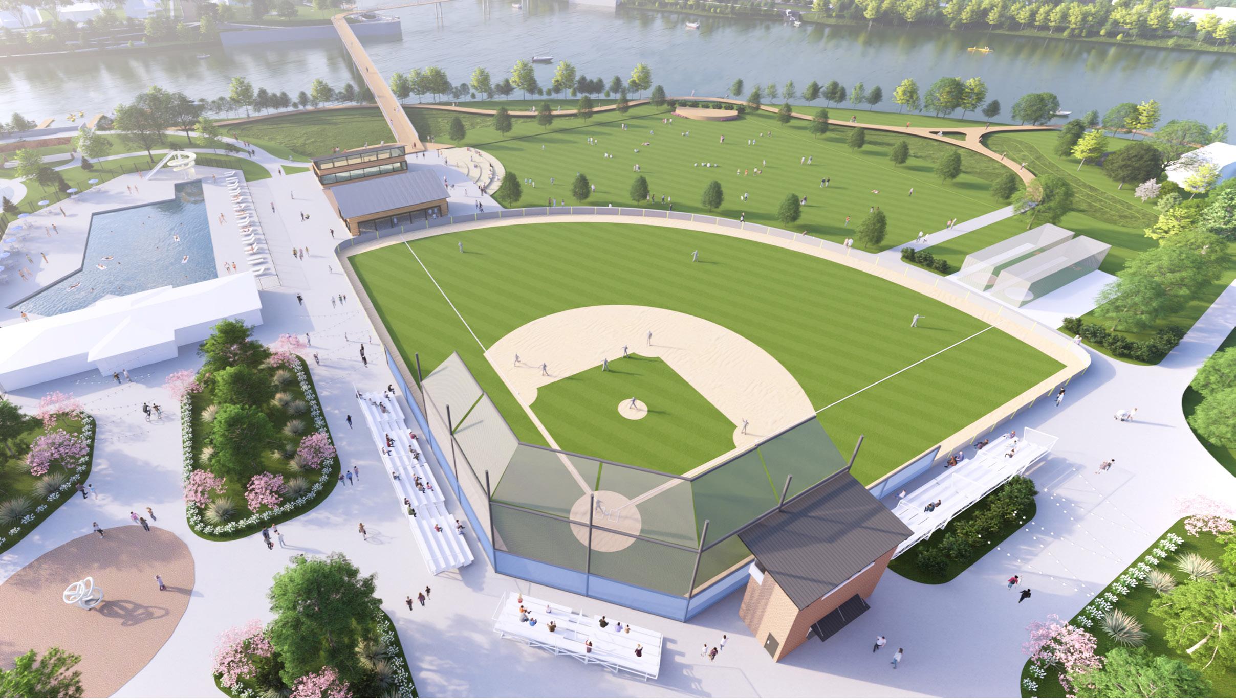
81% of survey respondents say they are likely to visit Kingsbury Riverfront Park, based on this rendering
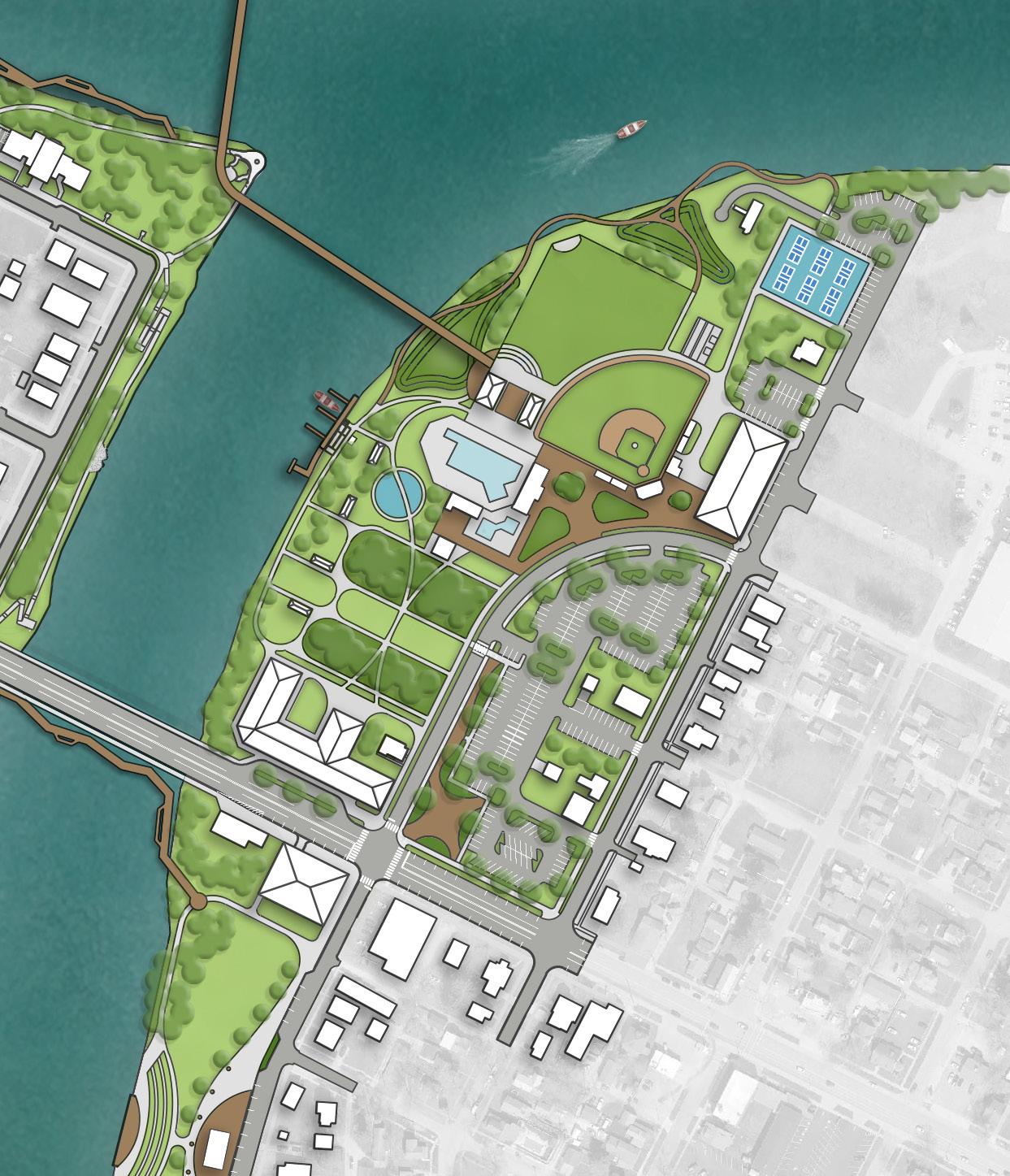
Final Concept: Riverfront Parks
PONTIAC METRO PARK
The final concept for Pontiac Metro Park positions the site as a dynamic recreational and community gathering destination along the Maumee River. At its heart, a new event center with a riverfront overlook deck anchors the park, creating a year-round space for gatherings, celebrations, and civic events. Adjacent to the event center, a multiuse lawn framed by pergolas and seating provides a flexible venue for festivals, performances, and everyday recreation.
Active, family-friendly amenities define much of the park experience. A seasonal ice skating ribbon, supported by a check-in and storage building, warming huts, and seating areas, offers a unique winter attraction and ensures year-round vibrancy. Complementing this, a river boardwalk provides immersive access to the Maumee and connects seamlessly with a proposed pedestrian bridge, linking Pontiac to Kingsbury Riverfront Park and Fort Grounds.
The park also emphasizes accessibility and inclusivity. A kayak rental station with support facilities creates new opportunities for water-based recreation, while the upgraded boat dock and ramp ensure that boating access is maintained and enhanced. Additional concrete walkways along East River Drive, paired with expanded parking and angled on-street spaces, strengthen circulation and accommodate future demand.
Landscape improvements further enrich the site. Shade trees and native plantings define gathering areas, improve aesthetics, reduce maintenance needs, and stabilize the shoreline. A memorial plaza, featuring relocated historic markers, the existing fountain, and a new river overlook, provides a contemplative and educational space that honors the City’s history.
Together, these improvements make Pontiac Metro Park a centerpiece of the riverfront – balancing active recreation, cultural expression, and waterfront access to create a destination that serves Defiance residents and visitors year-round.
“I love the grassy area is maintained for the reenacting events that take place and I love the addition of parking [and] the skate ribbon. It’s a great way to get the community active. The bridge is awesome! So many events use all the parks and it makes it more accessible to get to all of them."
- Survey Response
LEGEND
PROPOSED FEATURES
A Shade Trees
B Concrete Walkways
C On-Street Parking
D Expanded Parking Lot
E Historical Plaza
F Event Center with Overlook Deck
G Pedestrian Bridge
H Updated Boat Launch
I Ice Skating Ribbon
J Boardwalk
K Open Lawn
EXISTING FEATURES
1 Existing Parking Lot
2 Existing Fountain
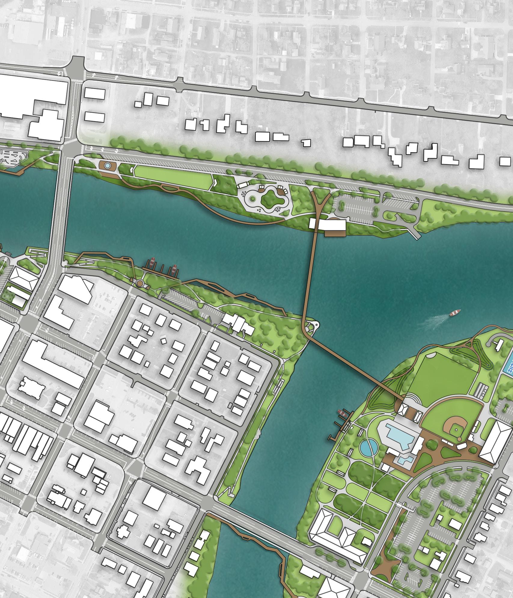
Final Concept: Riverfront Parks
RIVERSIDE
PARK
The final concept for Riverside Park enhances the site as both a recreational hub and a natural retreat, offering activities for all ages while celebrating the wooded setting along the Auglaize River. At the heart of the park, a new inclusive playground provides distinct play zones for younger and older children, as well as swings and accessible poured-inplace surfacing, with shaded seating for parents and guardians. Nearby, new basketball and futsal courts feature painted murals inspired by the park and surrounding neighborhoods, adding a creative and cultural touch to the recreation experience.
An accessible kayak launch with a rental kiosk brings new opportunities for river recreation, supported by a dedicated driveway and parking. The existing restroom facility is upgraded with ADA-compliant features to improve comfort and accessibility for all visitors. Community gathering is enhanced through three new open-air shelter houses—one near the courts and plaza seating, another beside the kayak launch, and a third along the woodland edge.
Connectivity and exploration are also central to the design. New walkways link the parking lot with athletic fields, weave through the woodlands, and connect to overlooks along the Auglaize River. An ADA crossing and pathway from Riverside Avenue ensures safe and inclusive access into the park, while a new riverfront trail extension north to 5th Street with a link to Arabella Street (and Triangle Park) expands the citywide trail system. Throughout the site, shade trees, native plantings, and additional seating areas beautify the park, stabilize natural areas, and offer places for rest and reflection. Educational and interpretive signage highlights the park’s history, ecology, and community role.
Together, these improvements transform Riverside Park into a multigenerational destination that balances play, fitness, river access, and woodland exploration – creating a vibrant space where nature, culture, and community come together.
LEGEND
PROPOSED FEATURES
A Accessible Kayak Launch & Rental Kiosk
B Shelter House
C Shelter House with Restroom
D Educational & Interpretive Signage
E Parking
F Walking Path
G Auglaize River Overlook Deck
H Inclusive Playground with Safety Surfacing
I Basketball Court with Painted Mural
J Futsal Court with Painted Mural
K ADA Crossing
EXISTING FEATURES
1 Existing Sports Fields
2 Existing Shelter House
3 Existing Restroom Facility
4 Existing Parking
“I’m glad to see another accessible park! The basketball court will be a nice addition and making it with a mural will be so beautiful. The walking path will increase trail walkers and actually highlight that there are trails in the woods"
- Survey Response
ARABELLAST
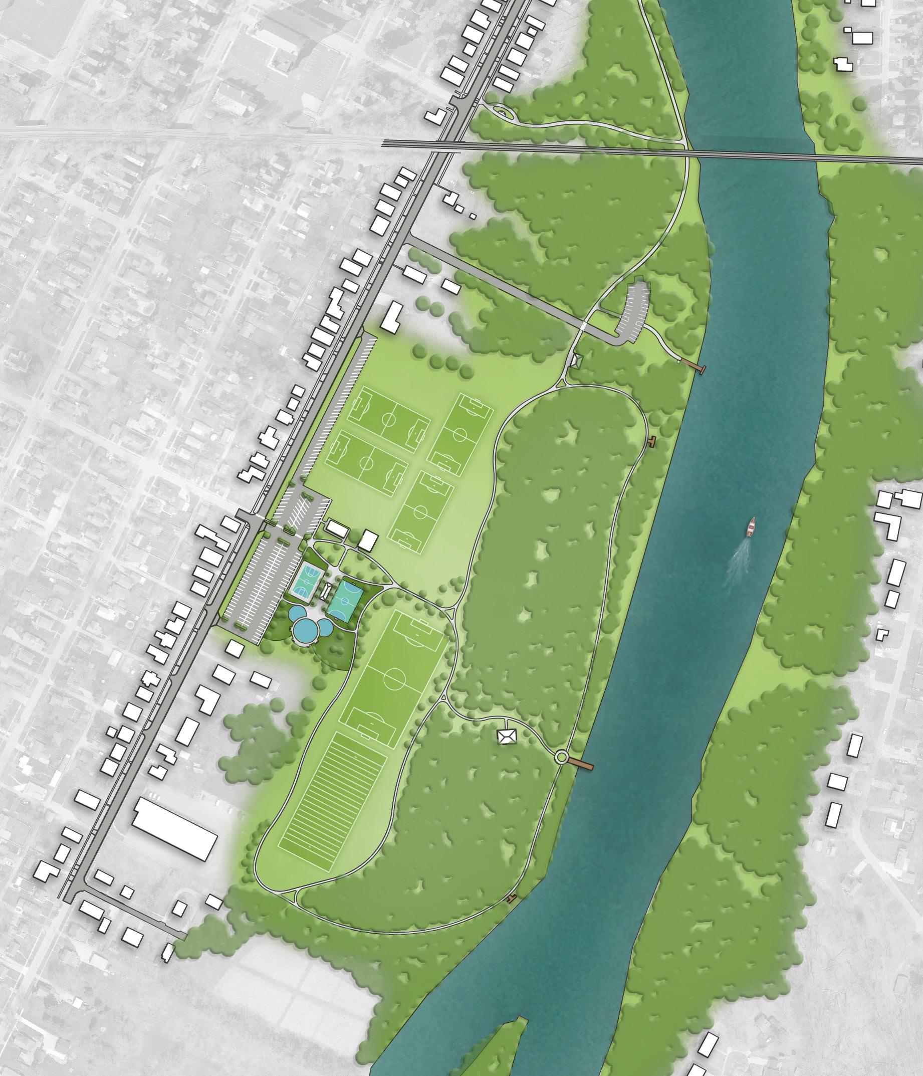
Initial Concepts: CONNECTIVITY IMPROVEMENTS
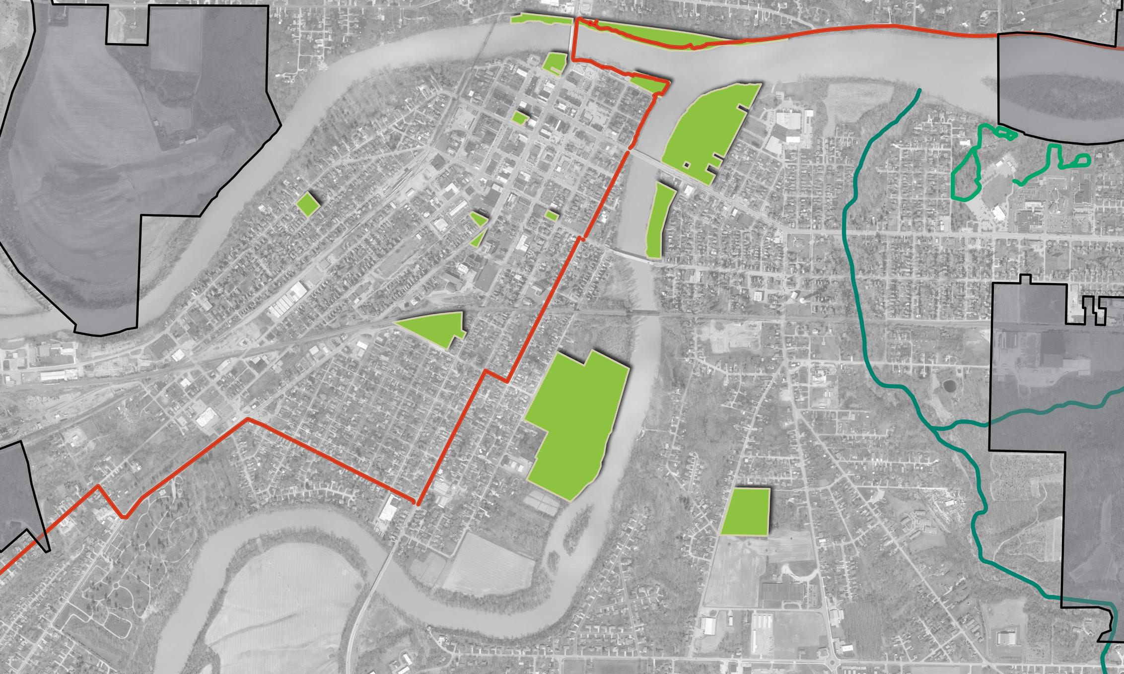
CONCEPT 1: This concept introduces the Preston Run Trail, stretching from the Maumee River to Cleveland Avenue. This primary trail is designed to create strong north-south connections: to the north, it links with Kingsbury Park along the Maumee River; to the south, it connects to existing walkways along Cleveland Avenue through a network of new paths. Additional neighborhood access points are provided via connections from nearby residential streets.
The existing Ohio Buckeye Trail is maintained in its current alignment but enhanced with spur trails that connect into Buchman Park on the Glaize, Riverside Park, and Veterans Memorial Park. Sidewalks between Preston Run and the Buckeye Trail are also utilized to strengthen cross-park connectivity.
To make the system more intuitive and accessible, existing walkways will be upgraded with signage highlighting smaller walking loops. These loops will help users explore local destinations such as Memory, Hometown Heroes, and Holgate Parks. Future plans also envision waterway connections along both the Auglaize and Maumee Rivers, expanding opportunities for riverfront access and exploration.
CONCEPT 2: This concept presents a more compact version of the Preston Run Trail, starting at Second Street and ending before Cleveland Avenue, with a key connection made along Ayersville Avenue. This route makes the most of existing and proposed walkways to establish links from Second Street to Kingsbury Park and from Ayersville Avenue to Eastside Park. New walkways and enhancements are proposed to form a closed-loop trail system between Eastside and Buchman Parks, creating a continuous circuit west of the Auglaize River.
As in Concept 1, the Ohio Buckeye Trail remains in place but is expanded with additional trail spurs into Buchman Park on the Glaize, Riverside Park, and Veterans Memorial Park. These extensions also help connect users to the broader walking network east of the Auglaize River.
Signage upgrades along existing walkways will support the creation of smaller, intuitive walking loops that guide users to nearby neighborhood parks such as Memory and Holgate. Concept 2 also envisions expanded riverfront connectivity along the Auglaize and Maumee Rivers for recreational and scenic opportunities.
PEDESTRIAN BRIDGE (TYP)
RAILROAD CROSSING
RAILROAD CROSSING
RAILROAD CROSSING
EXISTING SIDEWALK
Concept 2
56.8%
survey respondents chose this concept

RAILROAD CROSSING
PROPOSED SIDEWALK & CONNECTION TO VETERAN'S MEMORIAL AT LATTY’S GROVE PARK
RIVERSIDE PARK CONNECTION
WIDENED WALKWAY IMPROVEMENTS & KINGSBURY PARK CONNECTION
BUCHMAN PARK CONNECTION
PROPOSED SIDEWALK
POTENTIAL REROUTE OF BUCKEYE TRAIL
AUGLAIZE RIVER
CROSSING
ACTIVATION NODE (TYP)
EXISTING SIDEWALK
LEGEND
Parks
Pedestrian Circulation
Vehicular Circulation
Waterway Circulation
Bridge / Overlook
Existing Sidewalk
Trail Connections with Existing Sidewalk
Buckeye Trail
Water Engagement
Activation Node
Accessible Kayak & Boat Launch
River Access
"Both rely on the existing Clinton, 2nd, and Hopkins Street Bridges. That’s the practical approach!"
- Survey Response
RAILROAD
Refined Concepts: CONNECTIVITY IMPROVEMENTS
Concept 1
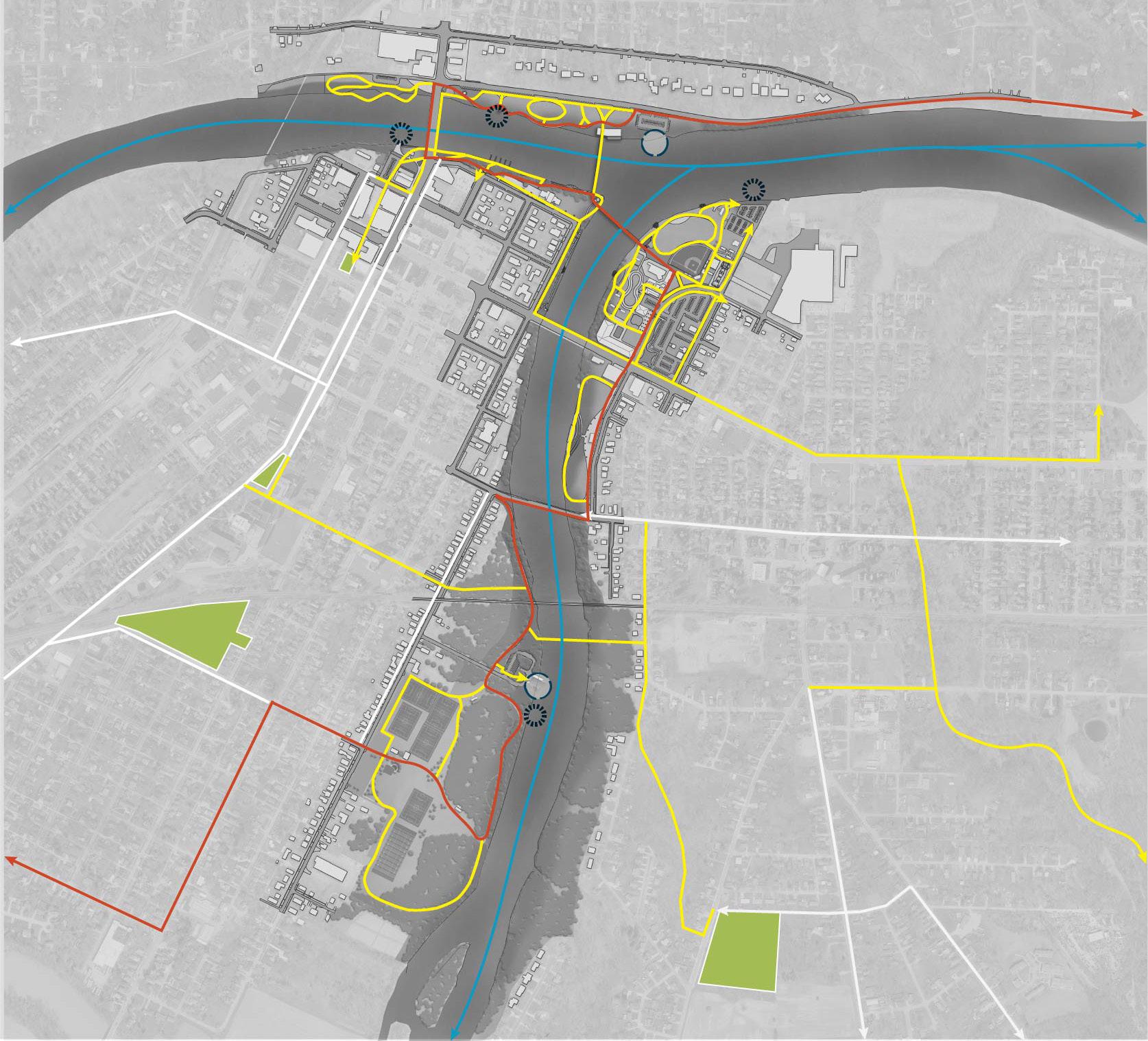
CONCEPT 1: This concept aims to integrate the parks and their internal pathways into a broader circulation network. It emphasizes a looped trail system on the east side of the Auglaize River, linking Preston Run to Eastside Park, with added connections to Bronson and Riverside Parks. The Buckeye Trail is rerouted across the river to connect Kingsbury Riverfront Park and Buchman Park on the Glaize, eventually weaving into Riverside Park. This concept also introduces a strategic connection along Arabella Street, linking Triangle Park and downtown to the trail system along the Auglaize River, enhancing overall connectivity.
CONCEPT 2: Also designed to connect the park system into a larger trail network, this concept follows a similar Buckeye Trail alignment while adding a direct connection to Veterans Memorial Park at Latty's Grove. It introduces a looped path along the Maumee River and strengthens links between Kingsbury Riverfront Park and Preston Run trail via a riverfront trail connection.
Both concepts also emphasize the creation of a dynamic pedestrian corridor – the Miami & Erie Canal Corridor – along the historic canal route, serving as a vital link between Canal Park and downtown, and connecting to Gateway Park and the Maumee River trail system.
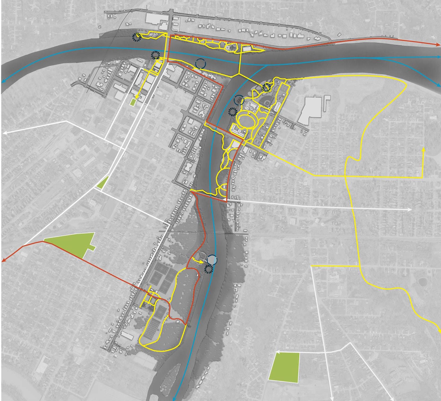
LEGEND
Pedestrian Circulation
Waterway Circulation
Existing Sidewalk
Buckeye Trail
Boat Launch / Docking
Accessible Kayak Launch
Final Concept: CONNECTIVITY IMPROVEMENTS
The connectivity strategy strengthens Defiance’s park system by linking neighborhoods, downtown, and the riverfront through clear wayfinding and safe, accessible routes. Pedestrian signage will be incorporated along walkways, waterways, and within parks to highlight key destinations, trails, and connections across the system. New links expand access across the community. Arabella Street will serve as a corridor between Riverside Park, Triangle Park, and downtown, while connections from Eastside Park to Hopkins Street and across the Auglaize River open up new routes to the riverfront. A strengthened corridor from the Clinton Street Bridge and East River Drive to Diehl Park and the Knights of Columbus Baseball Complex enhances circulation in another key recreation hub.
Major corridor improvements ensure safe, multi-modal access. A widened multi-use path along 2nd Street will connect downtown to the Mercy Health Medical Complex, while the Preston Run Trail system will extend between 2nd Street and Cleveland Avenue, with pathways along Columbus Avenue linking to Ottawa Avenue. These projects provide new east–west connections and strengthen the citywide trail network.
Regional coordination is also a priority. In partnership with ODNR, the Buckeye Trail will be realigned from 2nd Street to Williams Street, crossing the new pedestrian bridge at Fort Grounds into Kingsbury Riverfront Park before continuing south through Riverside Park and reconnecting at Williams Street. Finally, policy tools like a Complete Streets Ordinance and a Transportation Master Plan will guide investment, ensure equitable access for all modes of travel, and position Defiance for future funding opportunities.
Together, these improvements establish a connected park and trail system that ties the community to its riverfront, strengthens recreation access, and supports Defiance’s long-term vision for mobility and enhanced quality of life.
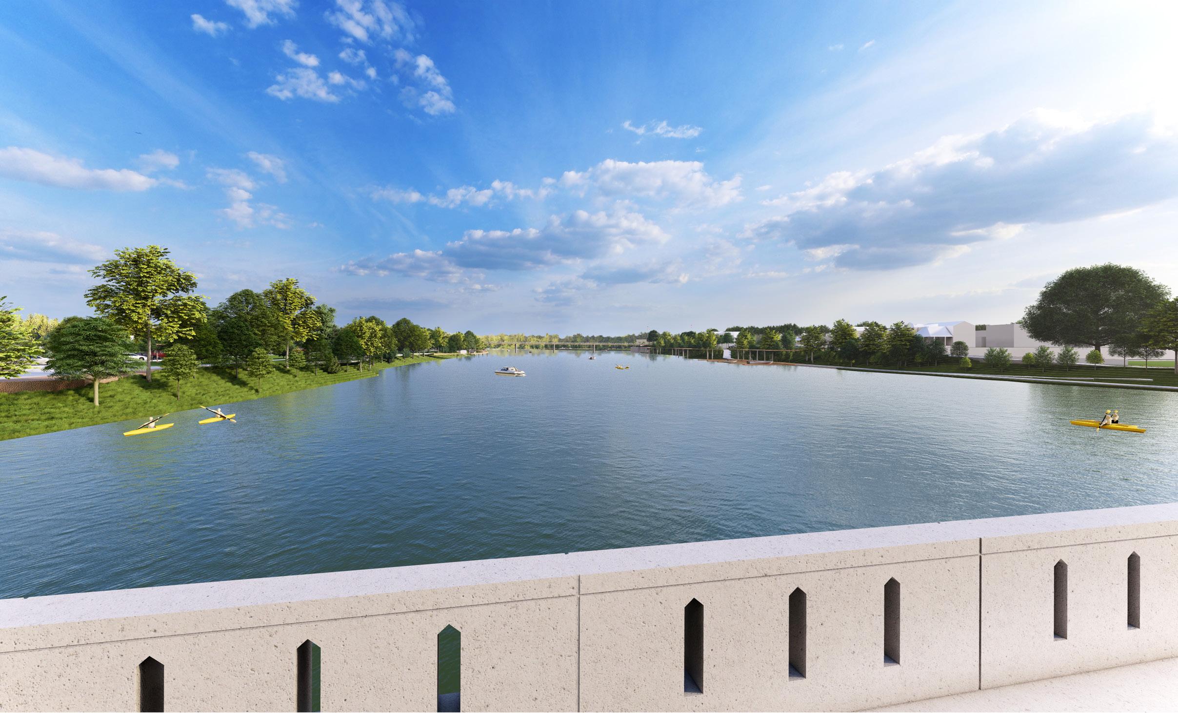
View looking east from the Clinton Street Bridge
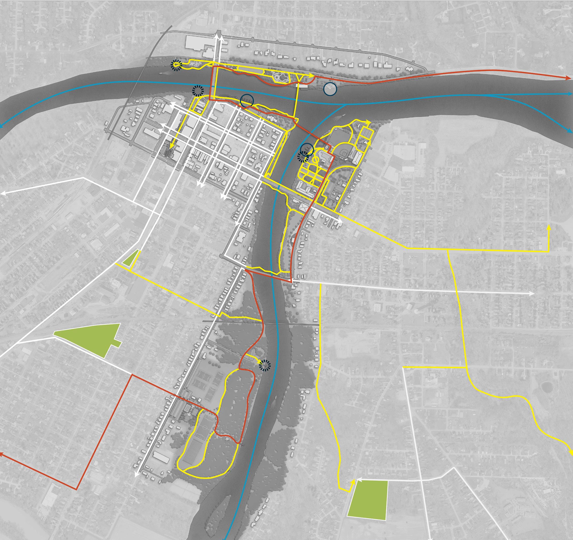
LEGEND
Parks
Pedestrian Circulation
Waterway Circulation
Existing Sidewalk
Buckeye Trail Boat Launch / Docking
Accessible Kayak Launch
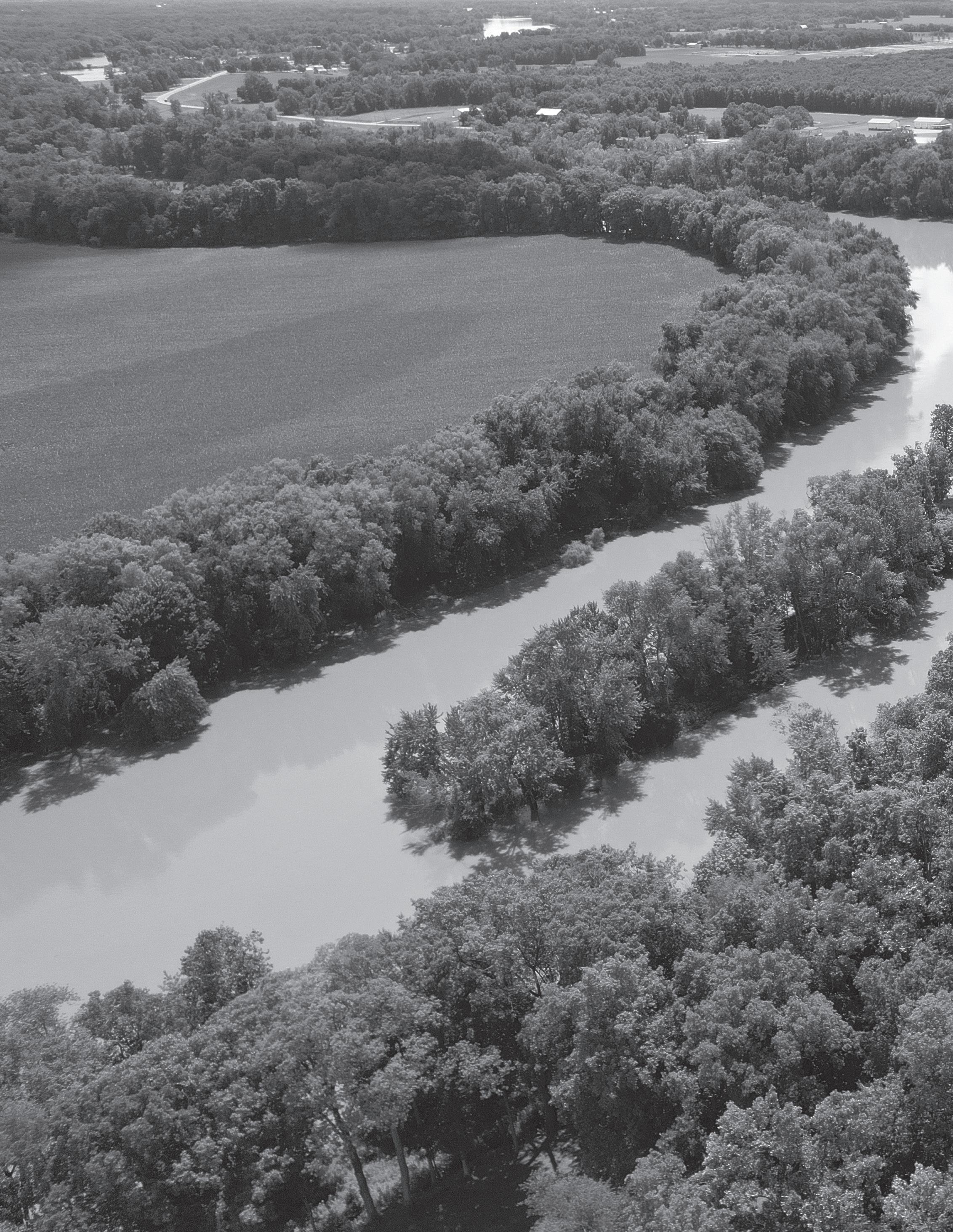
ADVANCING THE PLANS: Strategies for Implementation
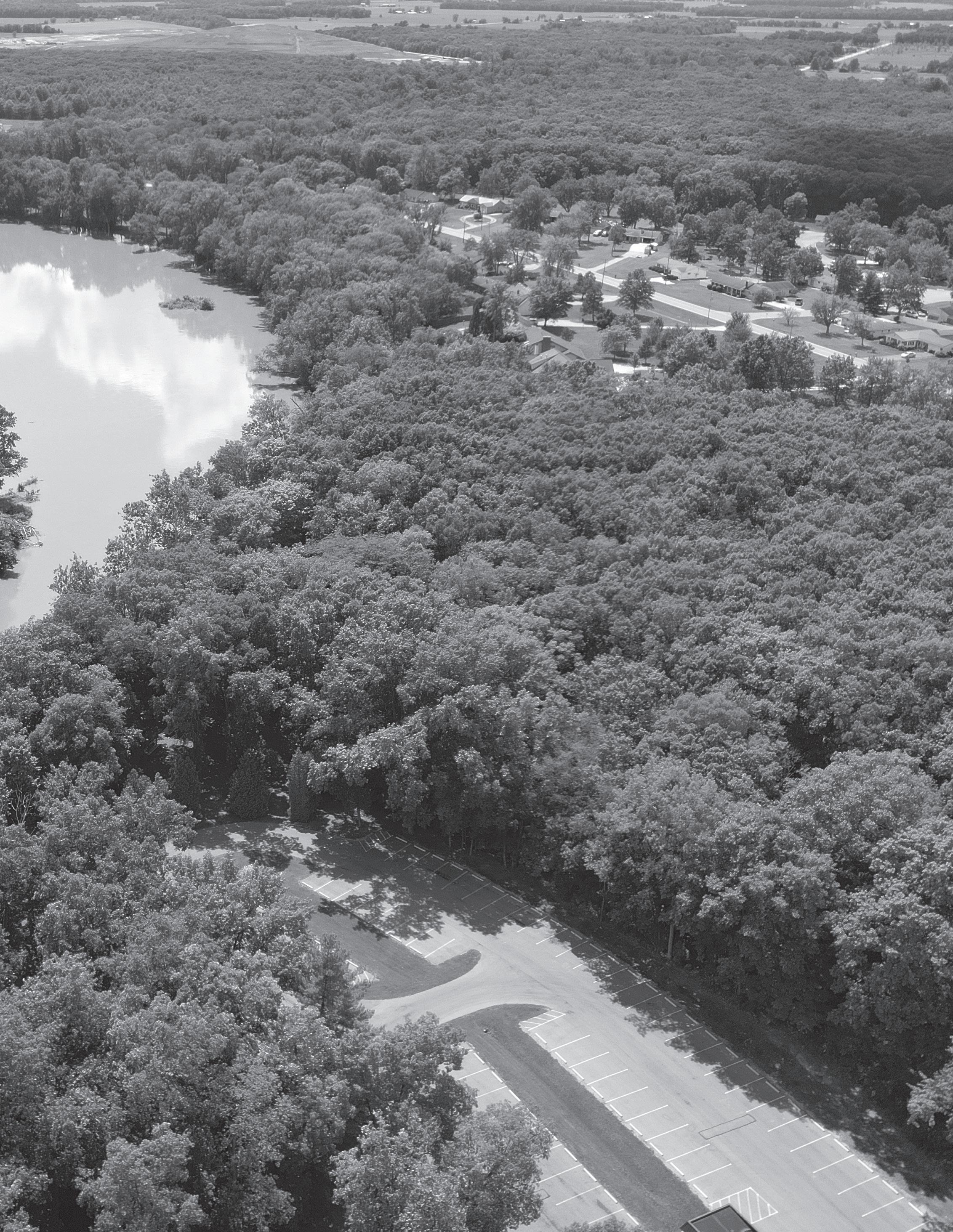
Implementation: OVERVIEW
This section outlines a park-by-park Action Plan that identifies specific improvements, who is responsible for implementation, potential funding sources and partners, estimated costs, timeline, and next steps –providing a clear roadmap to bring the Master Plan vision to life.
The Parks and Riverfront Master Plan outlines a coordinated approach to revitalizing and enhancing parks throughout the City of Defiance, with a strong emphasis on community well-being, environmental stewardship, and creating vibrant, connected public spaces. The proposed improvements and action items across the park system are designed to deliver long-term benefits by aligning with four core goals:
1. Promoting public health, safety, and social justice
2. Improving environmental quality and reducing flood risk
3. Developing vibrancy and placemaking along the river corridors
4. Strengthening connectivity between parks and neighborhoods.
Each improvement – whether a new playground, trail extension, restroom facility, or natural landscape feature – has been thoughtfully selected to support inclusive access, encourage outdoor activity, and create spaces where all residents feel welcome. Investments in green infrastructure, shade trees, and native plantings will improve environmental health and climate resilience, while trail networks and signage will enhance wayfinding and ensure seamless movement between destinations.
Through phased implementation and strategic prioritization, the City of Defiance will work collaboratively with community partners, local organizations, and other stakeholders to bring these improvements to life. Together, these actions will not only modernize park amenities but also strengthen the social, environmental, and cultural fabric of Defiance – making its parks and riverfronts a source of pride, connection, and opportunity for generations to come.
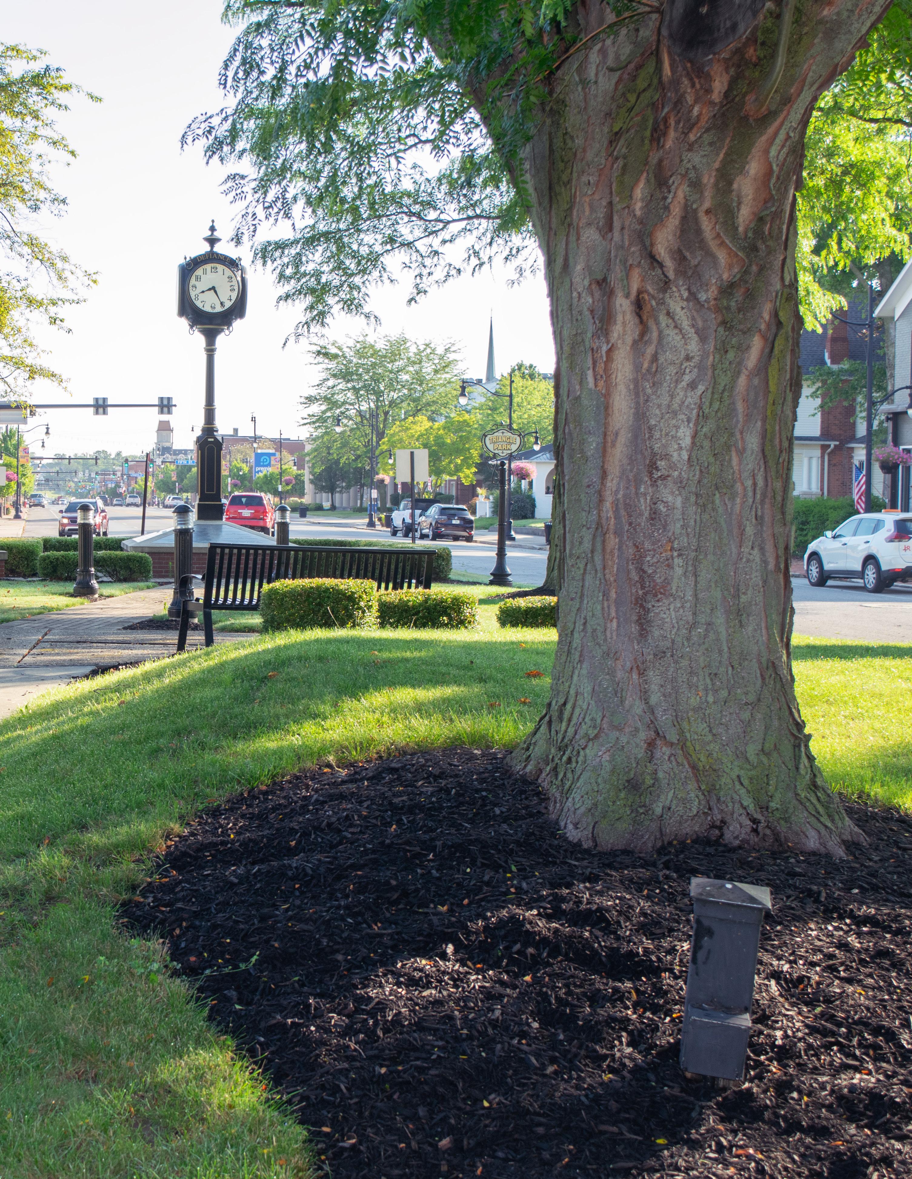
How to Read the Action Plan
The following pages present a detailed Action Plan for each individual park included in the Defiance Parks and Riverfront Master Plan. Each plan outlines a series of proposed improvements and action items tailored to that specific site. For every item, the Action Plan clearly identifies how it supports the overarching project goals, the responsible agency or division tasked with implementation, and potential funding sources and partners (detailed on the next page) that can assist in bringing the project to life. It also includes a range of strategic details such as estimated investment, anticipated operational budget impacts, and a recommended implementation timeframe –categorized as near-term (within 2 years), mid-term (within 5 years), long-term (within 10+ years), or ongoing.
To assist in prioritization and planning, each improvement is also classified into one of four implementation tiers:
1. In Progress – Projects that are either in progress or completed.
2. Quick Wins – Improvements that are low-cost, high-impact, and relatively easy to implement in the short term.
3. Simple but Requires Funding – Projects that are feasible and straightforward but will require dedicated financial resources to move forward.
4. Major Capital Projects – Larger, more complex initiatives that involve significant investment, coordination, and long-range planning.
This structure is designed to guide City staff, stakeholders, and community partners through the steps needed to move each idea from concept to reality. It provides a flexible yet actionable roadmap that supports transparent decision-making, encourages collaboration, and ensures alignment with the longterm vision for parks and public spaces across Defiance.
Implementation: POTENTIAL FUNDING SOURCES & PARTNERS
A variety of potential partners and funding sources can support implementation of the Defiance Park and Riverfront Master Plan. These entities are listed in the Implementation Matrix under the “Potential Funding Sources & Partners” column. The following categories outline a broad range of potential collaborators and supporters.
Adjacent Property Owners: Adjacent property owners, including neighborhood residents, nearby businesses, and institutions such as churches, can play an active role in shaping the future of the parks through input, volunteer labor, and grassroots fundraising. Their proximity often creates a natural connection to the space, and their involvement can foster a strong sense of ownership and stewardship over time.
City Budget: The City Budget is a key source of support and may include annual allocations through the Parks Division, as well as contributions from related Divisions such as Streets, Engineering, or the Redevelopment Commission. In some cases, special funds or capital project appropriations – such as those related to stormwater, infrastructure, or federal recovery funds – may also be available to support park improvements.
Corporate Support: Corporate support can be broad in scope, encompassing financial sponsorships, volunteer labor, and in-kind services. Businesses from all sectors –industrial, agricultural, retail, financial, and professional – can contribute in a variety of ways. This includes construction-related firms such as concrete, fencing, and landscaping companies, as well as large local employers who may see value in parks as quality-of-life investments for their workforce and the broader community.
Foundations: Philanthropic foundations, whether local, regional, or national in scope, often support park-related efforts. These may include place-based foundations like the Defiance Area Foundation or the Coressel Charitable Trust, or mission-specific ones such as the Arbor Day Foundation, USTA Foundation, or others focused on accessibility, youth development, or community health.
Educational Institutions: Educational institutions offer a wealth of volunteer capacity and creative ideas, often driven by a spirit of civic engagement. Defiance College, local schools, and groups associated with them – such as the National Honor Society, athletic teams, or early childhood programs – can all be involved in service projects, learning-based initiatives, and even program delivery. There may also be funding opportunities related to early childhood development and outdoor learning environments that can support preschool engagement in park spaces.
Grassroots Fundraising: Grassroots fundraising is a valuable tool, not only for the dollars raised but for the community engagement it fosters. Crowdfunding campaigns, donation drives, and community events that support parks send a strong sign of local commitment. Even modest contributions, especially when given by many, can be used to leverage larger sources of funding or justify broader support.
Local Civic Organizations: Local civic organizations in Defiance represent a tremendous resource for park planning and implementation. Groups such as Main Street Defiance, the Chamber of Commerce, American Legion, AmVets, Eagles, Elks, and Knights of Columbus, as well as service clubs like Rotary, Kiwanis, Lions, Zonta, and Optimists, can provide volunteer labor, funding, and promotional support. Youth-serving organizations such as the Boy Scouts and Girl Scouts, particularly Eagle Scout candidates, often seek opportunities for meaningful, hands-on projects.
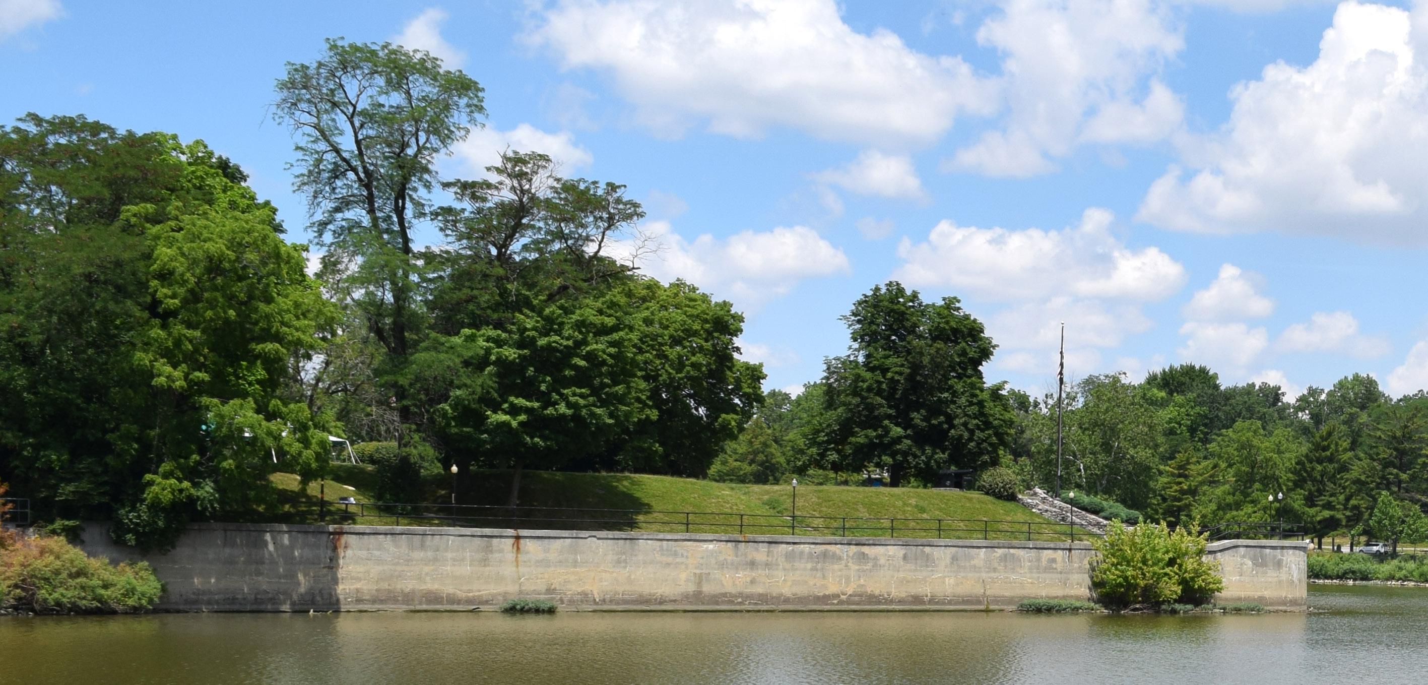
Healthcare Networks: Local healthcare networks are increasingly active in supporting projects that align with health and wellness goals. Hospitals, clinics, and mental health providers may have access to grant programs or community benefit funds intended to promote physical activity, outdoor engagement, or mental health improvement. Their support may include walking trail sponsorships, fitness equipment, or programming partnerships.
Utility Funds: Utility funds may be available in situations where park projects are tied to infrastructure. This may include improvements related to stormwater management, energy-efficient lighting, or upgrades to existing utility buildings such as those at Kingsbury Riverfront Park. Coordination with utility departments may uncover synergies that benefit both park users and utility infrastructure goals.
Ohio
Department
of Natural Resources (ODNR):
The ODNR offers an evolving slate of grant opportunities for parks and public lands, many of which align directly with riverfront or recreation initiatives. These include NatureWorks, the Clean Ohio Trails Fund, Paddling Enhancement Grants, Storybook Trails, and the Recreational Trails Program. Because program criteria and availability change regularly, ongoing monitoring is recommended to take advantage of appropriate funding cycles. This ODNR category also includes other state agencies like the Ohio Development Department.
Municipal Bonds: For larger capital investments, municipal bonds may be considered to finance new facilities or major renovations. These would most likely take the form of general obligation bonds, backed by local tax revenues and voter approval, but might include revenue bonds tied to specific park-generated income.
State and Federal Appropriations: State and federal appropriations, often included in larger budget bills, can be secured through advocacy efforts at the legislative level. These one-time investments are typically reserved for capital projects with regional significance or broad public benefit and may require public and political support to obtain.
Trail Grants and Organizations: Trail development often qualifies for specialized funding sources. These include the Ohio Clean Ohio Trail Fund, the Land and Water Conservation Fund (LWCF), and federal Recreational Trails Program grants. Additionally, trail advocacy organizations such as Rails-to-Trails Conservancy may provide technical assistance or help in securing resources for planning and construction.
Special Interest Organizations: Special interest organizations often bring expertise and financial support to targeted park initiatives. These groups may focus on conservation, accessibility, active lifestyles, or environmental stewardship. Examples include Main Street Defiance, American Cancer Society, Arbor Day Foundation, Ducks Unlimited, the Soil and Water Conservation District, native plant and pollinator advocates, disability inclusion groups, and recreationspecific organizations tied to sports or outdoor pursuits.
Park Users and Enthusiasts: Park users themselves are among the most powerful partners in implementation. Their insights, enthusiasm, and networks can drive both volunteerism and fundraising. Groups such as baseball and softball leagues, pickleball clubs, tennis associations, cycling and BMX communities, dog park users, disc golf enthusiasts, skateboarding advocates, running and walking clubs, and seniors involved with wellness programs like Silver Sneakers all offer opportunities for partnership. Engaging users not only improves the relevance and functionality of park improvements but ensures that spaces are embraced, activated, and sustained by the people who use them.
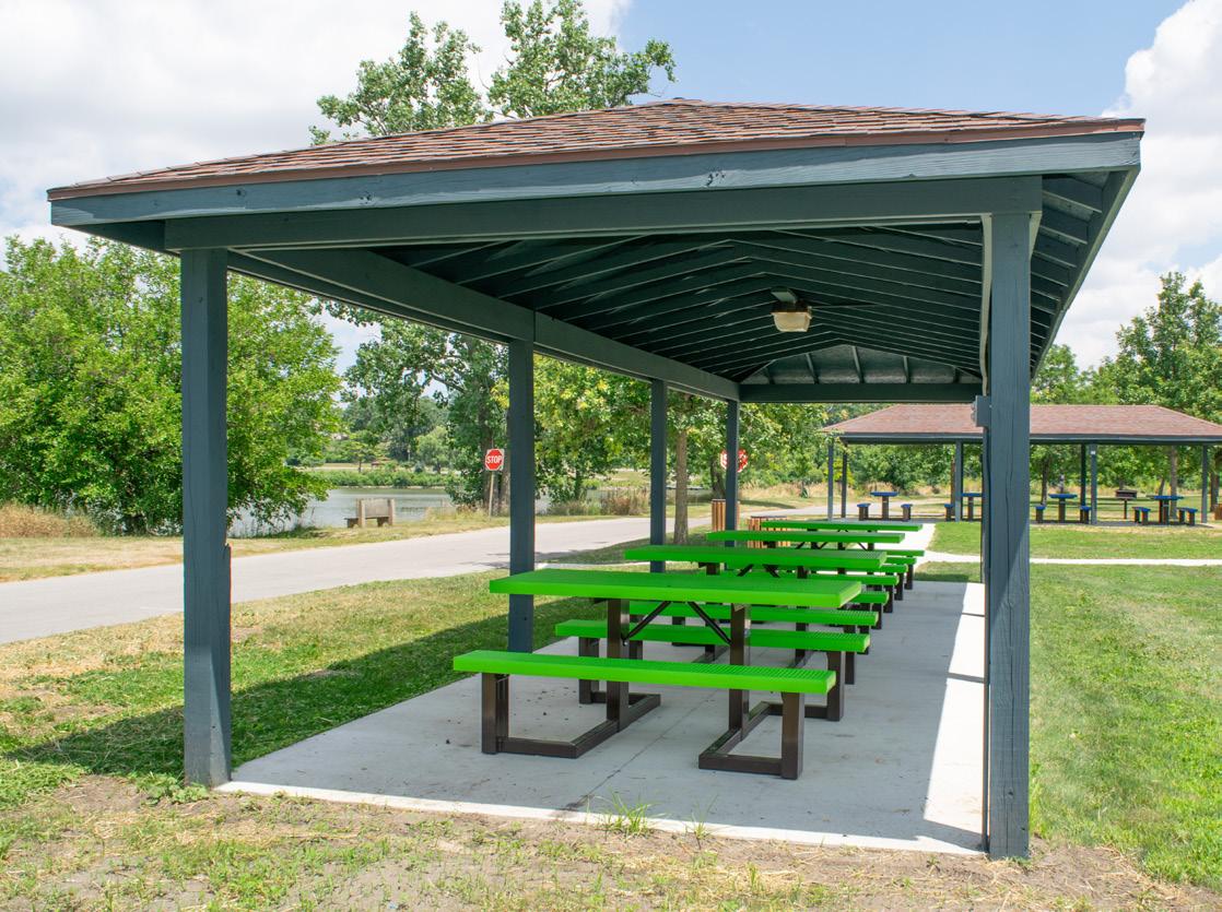
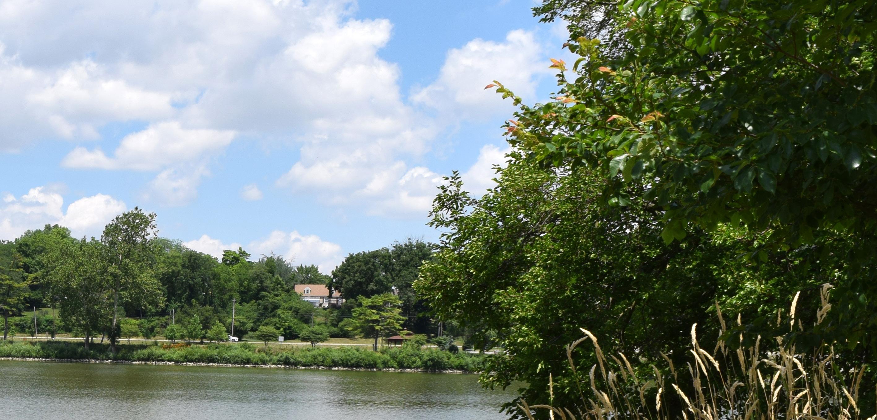
BARK & RUN DOG PARK
Goal #1: Health & Social Justice
The improvements at Bark & Run Dog Park actively support public health and safety by providing accessible infrastructure such as paved walkways and a formalized parking lot. The installation of a restroom building with a drinking fountain ensures comfort and hydration, while the new playground creates a safe and engaging space for children of all abilities. By offering well-shaded seating and inclusive trails that reach into the surrounding woodland, the park encourages physical activity and relaxation across age groups and demographics, creating a more equitable and welcoming space for all members of the community.
Goal #2: Environmental Quality / Flood Risk
Natural landscape plantings and tree installations throughout the park will enhance environmental resilience by increasing shade, improving air quality, and supporting stormwater absorption. These green infrastructure elements help reduce runoff and mitigate erosion, particularly important in a site that spans both developed and woodland areas.
Goal #3: Vibrancy & Placemaking
Though not directly adjacent to the river, the Bark & Run Dog Park contributes to the broader placemaking goals by serving as a vibrant community anchor that complements the riverfront network. The addition of gateway signage, curated landscape design, and comfortable gathering areas fosters a sense of arrival and identity. The new playground and trail network offer year-round activation, helping to draw diverse groups of users and build a sense of shared community ownership over the space.
Goal #4: Improve Connectivity
The new trail network – including its expansion into the northern woodland – strengthens internal circulation and links visitors to different zones of the park. This connectivity, combined with enhanced signage and wayfinding, encourages multi-modal access and supports broader goals of unifying park spaces across Defiance with safe, navigable routes.
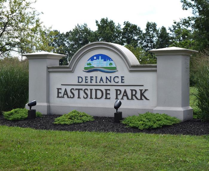
Develop a sign and obtain a quote from a local sign manufacturer for a design that matches the City's standard signage specifications
LEGEND
POLLINATOR HABITAT WITH NATIVE PLANTINGS
ACCESSIBLE WOODLAND TRAIL
ACCESSIBLE PATHWAY
GATEWAY ENTRANCE
PEDESTRIAN CROSSING ACROSS PRECISION WAY
PAVED PARKING LOT
RESTROOM FACILITY
SEATING OPPORTUNITY (TYP)
INCLUSIVE PLAYGROUND WITH ACCESSIBLE SAFETY SURFACING
POLLINATOR HABITAT WITH NATIVE PLANTINGS
Favored by the community. Overview of concepts can be found in Section 5.
Programmed Landscape
Natural Landscape
Play Programming
Parking Lot
Building / Structure
Bridge / Overlook
Pedestrian Circulation
Seating Opportunity
Activation Node / Gateway Signage
Shade Trees
PRECISION WAY
SJACKSONST
Action Plan,
BARK & RUN DOG PARK
Color Key
OPERATIONAL BUDGET IMPACTS
- Cost Savings or No Increase
- Minor Increase - Major Increase
Install gateway signage / entrance sign (Comprehensive Plan, DR 3)
Install shade trees
Pave gravel parking lot
Install asphalt pathways around the site with seating opportunities (Comprehensive Plan, CC 10)
Incorporate native plantings in strategic locations throughout the site to define spaces, beautify the park, and ease mowing maintenance
Install accessible restroom building with accessible drinking fountain
Install an inclusive playground with play components for ages 2–5 and 5–12 with poured-in-place safety surfacing, plus connecting walkways and seating for guardians
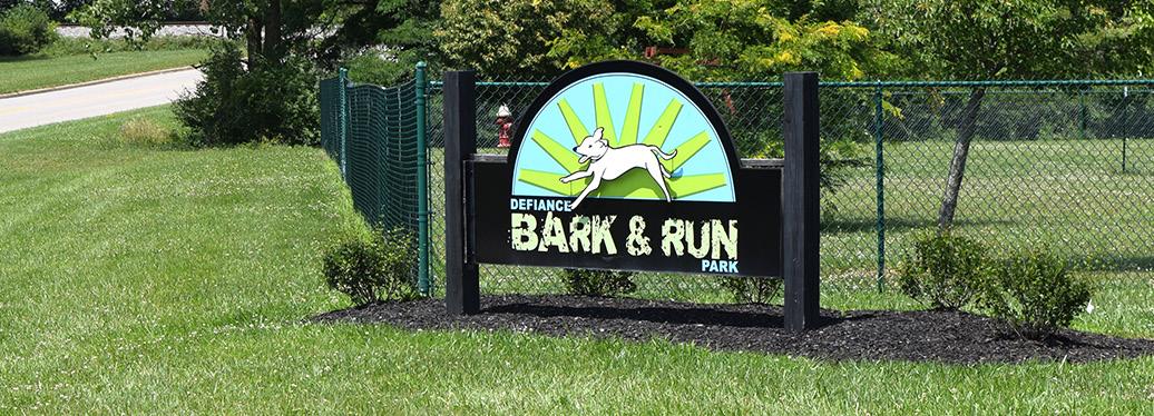
Parks Division, Engineering Division
Parks Division, Engineering Division
Parks Division, Engineering Division
Parks Division, Engineering Division
Parks Division, Engineering Division
Parks Division, Engineering Division
Parks Division, Engineering Division
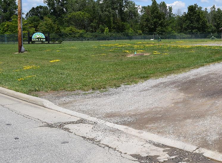
Simple But Requires Funding: $1,050,000
Major Capital Projects: $1,000,000
Park Total: $2,105,000
City Budget, Corporate, Local Civic Organizations, Park Users
Develop a sign and obtain a quote from a local sign manufacturer for a design that matches the City's standard signage specifications City Budget, Local Civic Organizations, Park Users, Special Interest Organizations
Determine desired locations for trees City
Secure funding and develop engineered plans for parking lot City Budget, Corporate, ODNR
Secure funding and develop engineered plans for the layout of walkways; identify type of seating and vendor City Budget, Corporate, Local Civic Organizations, Special Interest Organizations
City Budget, Foundations, Local Civic Organizations, ODNR Grants, Special Interest Organizations
City Budget, Corporate, Grassroots Fundraising, Local Civic Organizations, ODNR, Special Interest Organizations
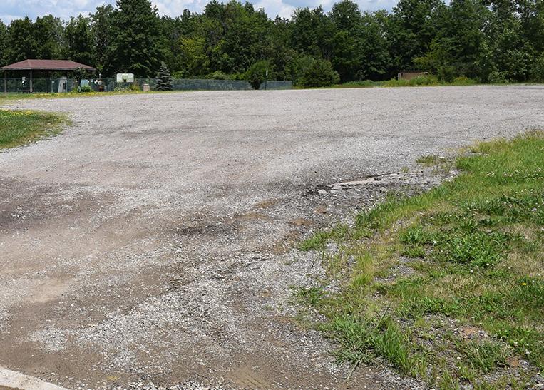
Determine planting layout and scope
and develop architectural designs
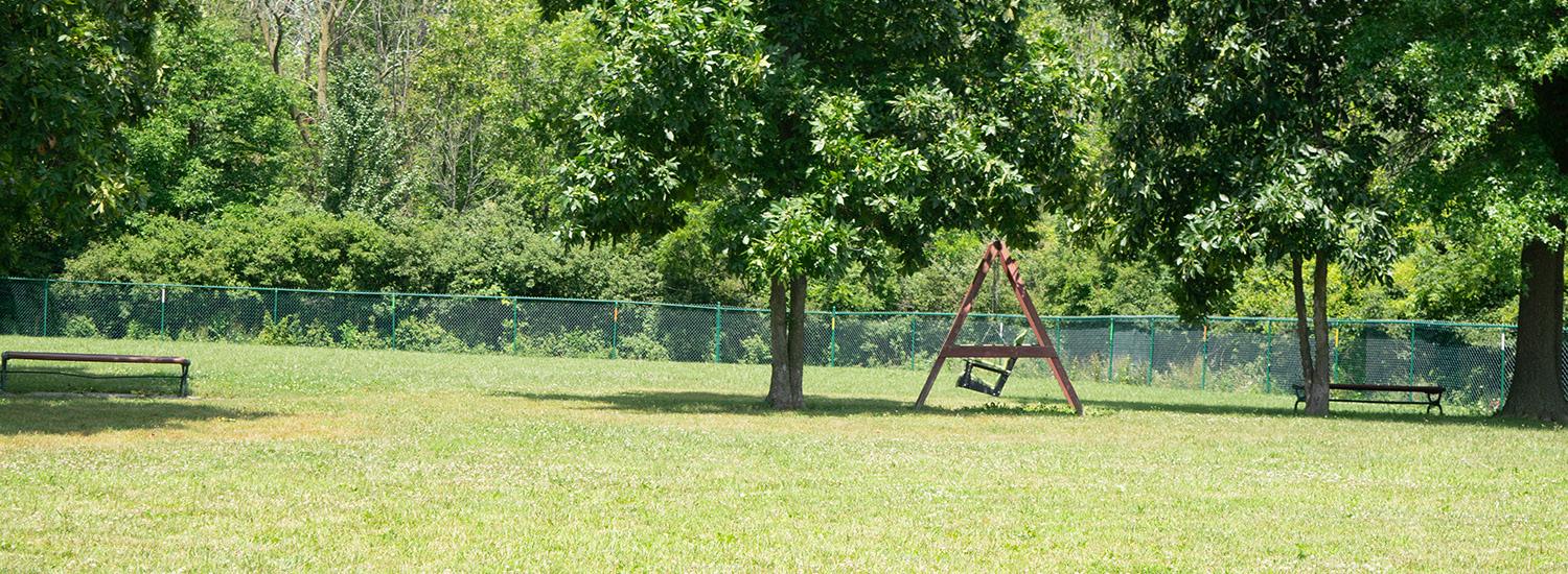
BRONSON PARK
Goal #1: Health & Social Justice
Health, safety, and inclusivity are supported by expanding access to high-quality, ADA-compliant recreational amenities for all ages and abilities. Upgrades to restrooms, playground surfaces, and pathways enhance accessibility across the park, ensuring that families, seniors, and individuals with mobility challenges can safely enjoy the space. The nature-based StoryWalk and the addition of shaded seating areas promote wellness and literacy through outdoor engagement. New amenities such as ping pong tables, gaga pits, and the high / low ropes course encourage physical activity and play while supporting mental health through interaction with nature. By offering a diverse range of free and accessible experiences, Bronson Park becomes a more equitable and welcoming destination for the entire Defiance community.
Goal #2: Environmental Quality / Flood Risk
The park’s enhancements emphasize sustainability and environmental stewardship through the use of native plantings that reduce mowing, support pollinators, and improve soil health. New natural surface trails and boulder outcroppings along the riverbank not only increase access to nature but also help manage erosion and preserve the site's ecological integrity. The nature center and StoryWalk’s environmental themes also support ecological education and stewardship. Furthermore, the installation of a kayak access point promotes non-motorized recreation on the Auglaize River, helping to foster a stronger connection between residents and their natural environment.
Goal #3: Vibrancy & Placemaking
The transformation of Bronson Park into a year-round destination directly advances placemaking goals. The splash pad with new seating and shade structures, flexible shelter houses, and mural-painted basketball court infuse the park with character, color, and energy. The nature center, elevated riverwalk, tree-level obstacle course, and kayak access brings unique, riverfront-focused experiences that make Bronson Park a standout destination.
Goal #4: Improve Connectivity
New walkways and woodland trails link key features across the park. These paths form looped routes that encourage walking and exploration while promoting safe movement between key amenities. The addition of a new access drive and parking area in the northwest corner enhances multi-modal access to the nature center, trails, and obstacle course. These enhancements encourage exploration and active transportation.
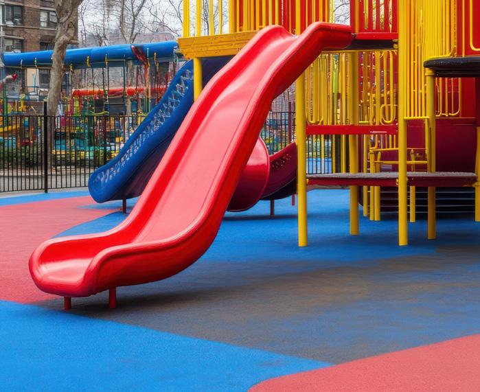
Replace existing shredded hardwood mulch playground surface at the southern playground with accessible poured-in-place safety surfacing
AUGLAIZE RIVER
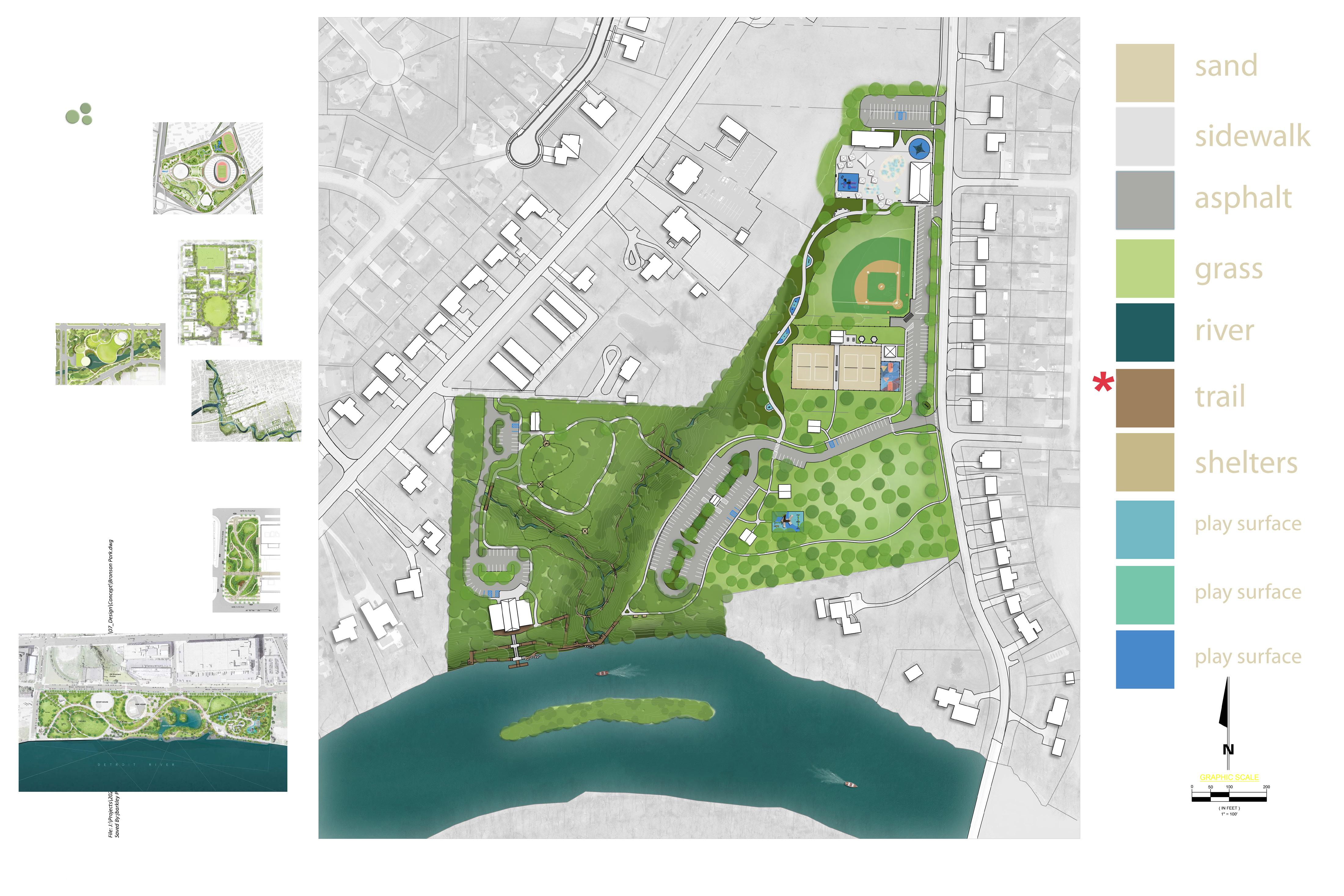
REFINED CONCEPT: Overview of concepts can be found in Section 5.
J Tree Top River Walk
PROPOSED FEATURES
A Shelter House
B Additional Shade Structures
C Expanded Seating with Shade Structures
D Refurbished Baseball Field
E Paved Accessible Walkway
F Shelter House w/ Outdoor Ping Pong Tables & Gaga Pits
G (2) Sand Volleyball Courts
H Safety Surfacing for Playground
I Native Perennial Plantings
K Accessible Kayak Dock
L Boulder Outcropping River Access
M Nature Center with Community Space
N Nature Center Parking
O Access Drive
P Woodland Shelter House
Q Woodland Shelter House Parking
R Tree Canopy Obstacle Course
S Upper Woodland Trail (Paved)
T Woodland Toe Path (Natural)
U Painted Mural on Existing Basketball Court
V Adult Swing Bench
W Improved Restroom Accessibility
EXISTING FEATURES
1 Existing Playground
2 Existing Splash Pad/Restroom Facility
3 Existing Splash Pad
4 Existing Storybook Trail
5 Existing Parking
6 (2) Existing Sand Volleyball Courts
7 Existing Shelter House
8 Existing Adult Swing Benches
Action Plan, continued: BRONSON PARK
Color Key
OPERATIONAL BUDGET IMPACTS
- Cost Savings or No Increase
- Minor Increase
- Major Increase
Relocate ice rink to area just east of the splash pad and make small adjustments as required; implement new key fob system for existing buildings (Comprehensive Plan, DR 3)
Work with Storybook Trails through the ODNR to get the existing StoryWalk added to their interactive map
Continue to maintain and enhance the existing StoryWalk while also incorporating rotational books with a focus on rivers or environmental topics
Install additional concrete walkways within the eastern portion of the park to encourage connectivity to existing and future amenities (Comprehensive Plan, CC 10)
Incorporate native plantings in strategic locations throughout the site to define spaces, beautify the park, and ease mowing maintenance
Incorporate natural surface or shredded hardwood mulch trails within the western wooded portion of the property
Install two additional sand volleyball courts with lighting
Replace existing shredded hardwood mulch playground surface at the southern playground with accessible poured-in-place safety surfacing
Replace existing shredded hardwood mulch play surfaces along the StoryWalk trail with accessible poured-in-place safety surfacing
Activate the existing basketball court with a painted mural inspired by the park, a historical component, or adjacent neighborhoods (Comprehensive Plan, DR 3)
Parks Division, Engineering Division Planning Division
Planning Division
Planning Division, Defiance Public Library
Parks Division, Engineering Division
Parks Division, Engineering Division
Parks Division
Parks Division, Engineering Division
Parks Division, Engineering Division
Parks Division, Engineering Division
Planning Division
ESTIMATED INVESTMENT SUMMARY
Quick Wins: $490,000
Simple But Requires Funding: $1,465,000
Major Capital Projects: $12,275,000
Park Total: $14,230,000
POTENTIAL FUNDING SOURCES & PARTNERS
City Budget, Educational Resources, Grassroots Fundraising, Local Civic Organizations, ODNR
City Budget, Corporate, ODNR
City Budget, Corporate, Local Civic Organizations, Special Interest Organizations
City Budget, Corporate, Local Civic Organizations, Special Interest Organizations
City Budget, Corporate, Educational Resources, Grassroots Fundraising, Local Civic Organizations, Park Users, ODNR
City Budget, Corporate, Local Civic Organizations, ODNR, Special Interest Organizations
City Budget, Corporate, Foundations, Local Civic Organizations, ODNR, Special Interest Organizations
IN PROGRESS (ice rink) COMPLETED (key fob system) COMPLETED
Coordinate with the Library
Develop plan highlighting the priority walkway connections
Develop plan for priority planting areas
Develop layout of proposed trail(s) within wooded area
Secure funding and develop engineered drawings
and select surfacing vendor
and select surfacing vendor Arts Organizations, City Budget, Corporate, Educational Resources
Develop an RFQ / RFP to select an artist to paint mural; consider grouping court murals in various parks together in a single RFQ / RFP
Continued on next page.
Action Plan,
BRONSON PARK
Color Key
OPERATIONAL BUDGET IMPACTS
- Cost Savings or No Increase
- Minor Increase
- Major Increase
Install additional shade structures with tables throughout the existing splash pad seating and play areas
Refurbish existing ball field
Upgrade existing restroom near sand volleyball and basketball courts to be accessible
Upgrade existing restroom near playground to be accessible
Install open air shelter houses on the east side of the splash pad
Incorporate boulder outcroppings along the river's edge to promote access to the river from at-grade trails within the woods
Install kayak access point along the western portion of the property (Comprehensive Plan, CC 5)
Install woodland shelter house and associated parking and access drive near the northwest corner of the property
Install open air shelter house with additional activities like gaga ball pit, outdoor ping pong tables, etc.
Develop western portion of the park to include nature center and community space, parking with access drive and culvert or bridge crossing, elevated riverwalk, and trails
Install high / low ropes course
Parks Division, Engineering Division
Parks Division, Engineering Division
Parks Division, Engineering Division
Parks Division, Engineering Division
Parks Division, Engineering Division
Parks Division, Engineering Division
Parks Division, Engineering Division
Parks Division, Engineering Division
Parks Division, Engineering Division
Planning Division, Engineering Division
Planning Division, Engineering Division, Economic Development
ESTIMATED INVESTMENT SUMMARY
Quick Wins: $490,000
Simple But Requires Funding: $1,465,000
Major Capital Projects: $12,275,000
Park Total: $14,230,000
POTENTIAL FUNDING SOURCES & PARTNERS
City Budget, Corporate, Local Healthcare Networks, Special Interest Organizations
$100,000 $
Corporate, Local Healthcare Networks, Park Users $750,000 $
City Budget, Local Civic Organizations, ODNR, Special Interest Organizations $450,000 $
City Budget, Local Civic Organizations, ODNR, Special Interest Organizations $300,000 $
City Budget, Corporate, Foundations, Local Civic Organizations, ODNR
$900,000 $
City Budget, Corporate, Foundations, Local Civic Organizations, ODNR $75,000 $
City Budget, Corporate, Foundations, Local Civic Organizations, ODNR, Special Interest Organizations $50,000 $
City Budget, Corporate, Foundations, Local Civic Organizations, Municipal Bonds, ODNR $250,000 $$
City Budget, Corporate, Foundations, Local Civic Organizations, ODNR
City Budget, Corporate, Foundations, Municipal Bonds, ODNR, State & Federal Appropriations
$250,000 $
$10,000,000 $$$
City Budget, Corporate, Foundations, Municipal Bonds, ODNR, State & Federal Appropriations N/A $$
Secure funding and determine appropriate locations for shade structure footings to avoid splash pad utilities
Determine exact scope of project
Conduct ADA audit field report for restroom building to determine its exact shortfalls
Conduct ADA audit field report for restroom building to determine its exact shortfalls
Secure funding and/or develop engineered drawings
Install trail(s) to river's edge to provide access to water
Install trail(s) to river's edge to provide access to water
Secure funding and/or develop engineered drawings
Secure funding and/or develop engineered drawings. Begin with implementing the additional activity items the are more economical
Conduct feasibility study for bridge crossing
Conduct conversations with prospective business ventures in this field of expertise and/or conduct a market study to determine the market needs
BUCHMAN PARK ON THE GLAIZE
Goal #1: Health & Social Justice
Buchman Park’s improvements enhance public access and inclusivity by adding walkways and crossings that connect visitors to key features like the shelter house, amphitheater, and riverfront. ADA-compliant routes and restrooms ensure equitable access for all. The addition of shade trees, seating, and passive gathering spaces creates a peaceful, restorative environment for community members to reflect, learn, and connect – regardless of age or ability.
Goal #2: Environmental Quality / Flood Risk
Native plantings and strategically placed trees improve biodiversity, reduce mowing requirements, and enhance stormwater management while preserving the park’s natural beauty. These sustainable landscape features reinforce the park’s ecological role along the riverbank, helping to filter runoff, prevent erosion, and support pollinator habitats.
Goal #3: Vibrancy & Placemaking
The new amphitheater with sculptural elements honoring the seven Native American tribes adds powerful cultural and educational value, anchoring the park as a riverfront destination with a strong historical identity. A future history center at the corner of 2nd and Auglaize Streets will further enrich the area’s character and significance, transforming the park into a meaningful civic and cultural asset along the river corridor.
Goal #4: Improve Connectivity
Concrete walkways and pedestrian crossings on both the 2nd Street and Hopkins Street bridges strengthen access from

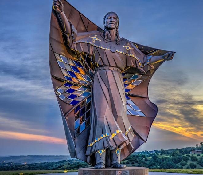
Install open-air shelter house with accessible restrooms adjacent to the parallel parking along Auglaize Street; install plaza with sculptural elements symbolizing the seven Native American tribes; install pedestrian crossings along the 2nd Street and Hopkins Street bridges
Secure funding and/or develop engineered drawings
ST

REFINED CONCEPT: Overview of concepts can be found in Section 5.
LEGEND
PROPOSED FEATURES
A Shade Trees
B Native Plantings
C Concrete Walkways
D On-Street Parallel Parking
E Shelter House with Restroom
F River's Edge Amphitheater
G Plaza with Sculptural Elements
H Mixed-Use Building with History Center
I Pedestrian Crossings / Boardwalk
HOPKINS
Action Plan,
BUCHMAN PARK ON THE GLAIZE
Install shade trees (Comprehensive Plan, U 11)
Incorporate native plantings in strategic locations throughout the site to define spaces, beautify the park, and ease mowing maintenance (Comprehensive Plan, U 11)
Install additional concrete walkways throughout the park to encourage connectivity to existing and future amenities (Comprehensive Plan, CC 10)
Install paved on-street parallel parking along Auglaize Street to support current and future needs of the park (Comprehensive Plan, CC 4)
Install open-air shelter house with accessible restrooms adjacent to the parallel parking along Auglaize Street; install plaza with sculptural elements symbolizing the seven Native American tribes (Comprehensive Plan, DR 8)
Install amphitheater along the Auglaize River
Facilitate development of a mixed-use building at the corner of 2nd and Auglaize Streets that would include a history center (Comprehensive Plan, DR 10)
Install pedestrian crossings along the 2nd Street and Hopkins Street bridges (Comprehensive Plan, CC 4)
Parks Division, Arbor Day Event
Parks Division, Engineering Division
Parks Division, Engineering Division
Parks Division, Engineering Division
Parks Division, Engineering Division
Parks Division, Engineering Division
Parks Division, Engineering Division
Parks Division, Engineering Division
ESTIMATED INVESTMENT SUMMARY
Quick Wins: $325,000
Simple But Requires Funding: $250,000
Major Capital Projects: $19,000,000
Park Total: $19,575,000
FUNDING SOURCES & PARTNERS
City Budget, Local Civic Organizations, Park Users, Special Interest Organizations
City Budget, Corporate, Local Civic Organizations, Special Interest Organizations
City Budget, Corporate, ODNR, Foundations
City Budget, Transportation Funding
City Budget, Corporate, Local Civic Organizations, ODNR, Special Interest Organizations, Arts Organizations, Foundations, Municipal Bonds, Local Healthcare Networks, Trail Organizations & Grants, Transportation Funding
City Budget, Corporate, Foundations, Municipal Bonds, ODNR, Special Interest Organizations
City Budget, Corporate, Private Developer
City Budget, Local Healthcare Networks, ODNR, Trail Organizations & Grants, Transportation Funding
$1,000,000
Determine desired locations for trees
Develop plan for priority planting area
Develop plan highlighting the priority walkway connections
Secure funding and/or develop engineered drawings
Secure funding and develop RFQ / RFP to select consultant for design work; develop concepts and select artisans for Native American Tribe memorials
Secure funding and develop RFQ / RFP to select consultant for project
Secure property and begin developing RFQ / RFP to select developer for project
Conduct feasibility study for bridge crossing
CANAL PARK / MIAMI & ERIE
Goal #1: Health & Social Justice
By improving pedestrian corridors and adding a lighted mid-block crossing, the park becomes safer and more accessible for all users, particularly those with mobility challenges. A downtown parking study focused on accessible spaces supports equitable access, while site furnishings, shade, and a drinking fountain ensure the park remains comfortable and usable for everyone during community events and everyday visits.
Goal #2: Environmental Quality / Flood Risk
The addition of shade trees enhances urban cooling, improves air quality, and contributes to stormwater absorption. These natural elements soften the downtown environment and promote ecological health within a historically dense area, supporting both environmental and aesthetic goals for the park.
Goal #3: Vibrancy & Placemaking
Canal Park already serves as a cultural node downtown, and further improvements – like enhanced signage, amphitheater connections, and site upgrades – will deepen its role as a place of celebration and historical reflection. Coordination with adjacent development will activate surrounding spaces, drawing more people downtown and reinforcing the park’s identity as a meaningful community gathering place rooted in local heritage.
Goal #4: Improve Connectivity
Linear pedestrian improvements between 1st and 2nd Streets strengthen downtown walkability and link Canal Park with adjacent blocks and future development. These enhancements promote safer, more seamless connections
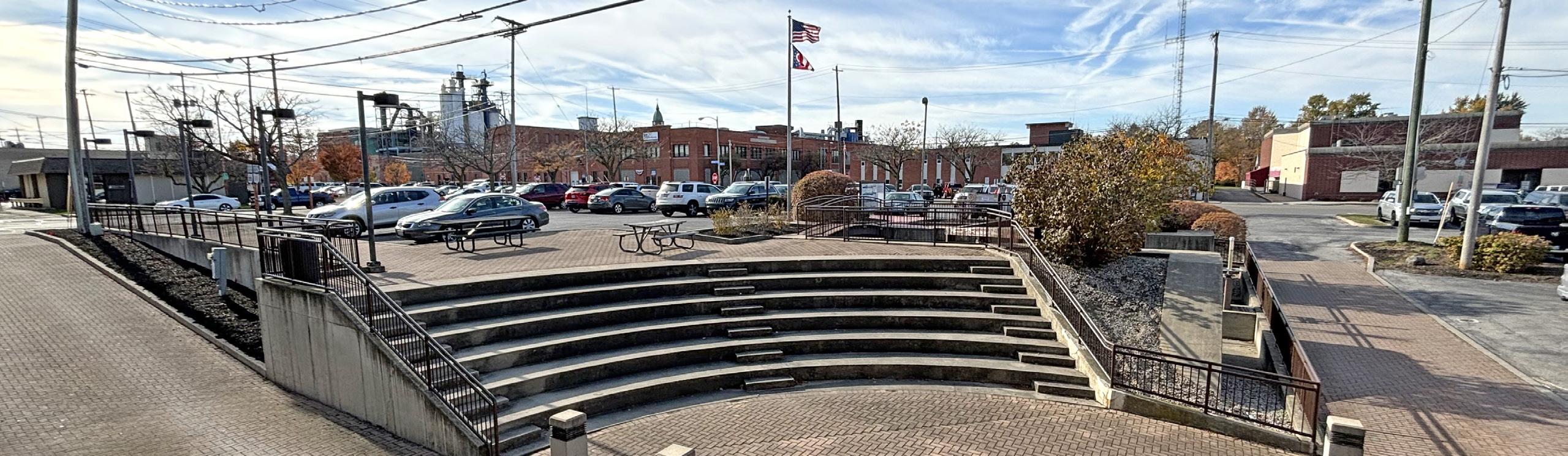
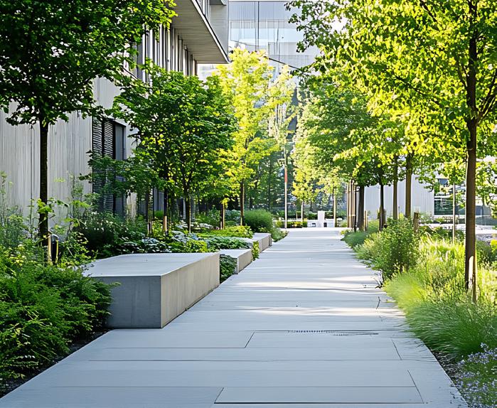
Install linear pedestrian corridor improvements from 1st Street to 2nd Street, including two lighted mid-block crossings
Secure funding and select vendors
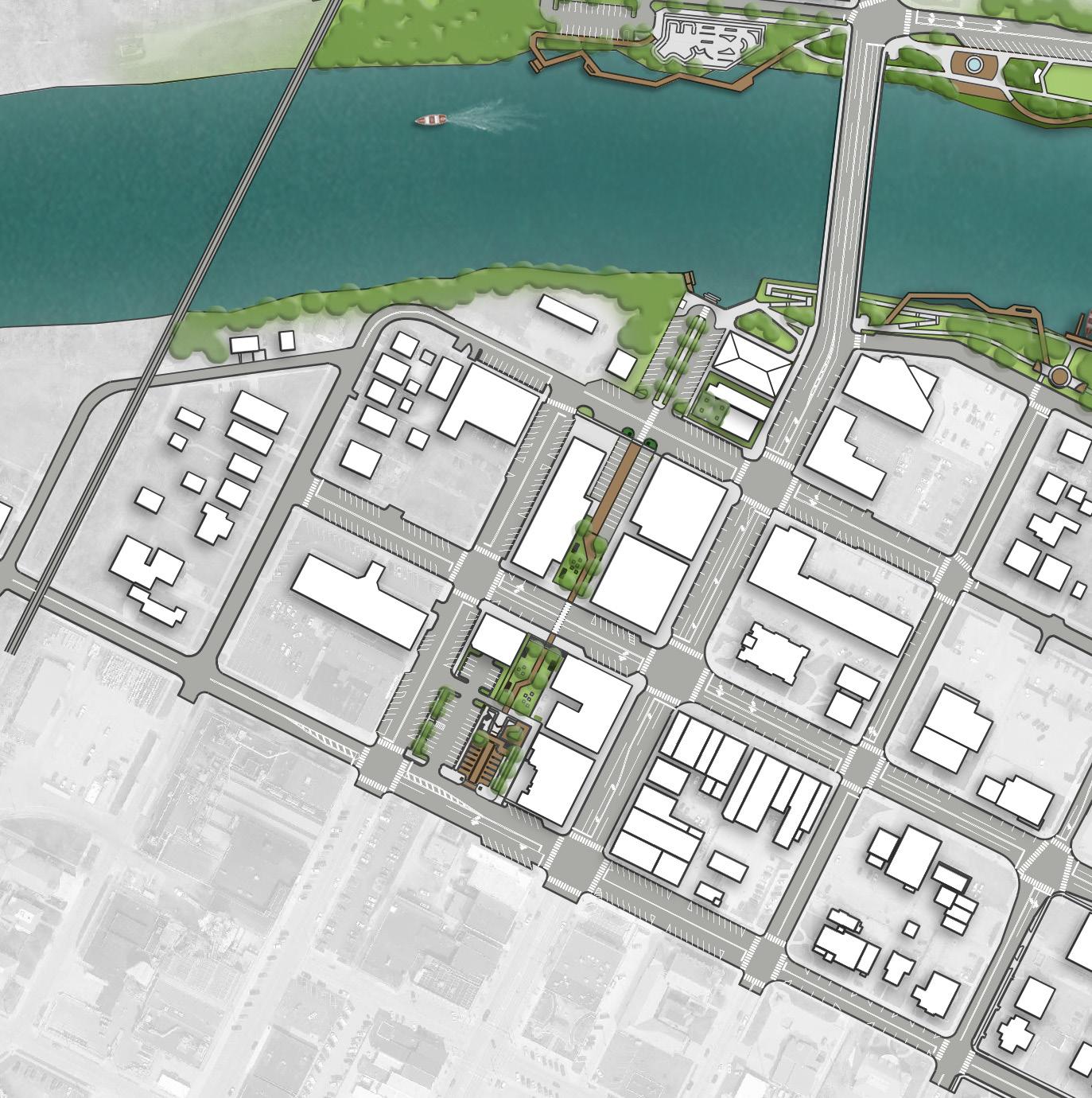
REFINED CONCEPT: Overview of concepts can be found in Section 5.
PROPOSED FEATURES
A Park Signage / Historical Signage
B Shade Trees
C Linear Pedestrian Corridor
D Seating Opportunities
E Parking
Action Plan,
CANAL PARK / MIAMI & ERIE CANAL CORRIDOR
- Cost Savings or No Increase - Minor Increase - Major Increase
Coordinate with the developer on installations occurring behind 300 / 302 Clinton Street
Perform parking study for the downtown area to analyze parking needs and existing capacities with specific focus on accessible parking (Comprehensive Plan, DR 4)
Install shade trees (Comprehensive Plan, U 11)
Install park signage / historical signage (Comprehensive Plan, DR 3)
Install site furnishings, plantings, pedestrian lighting, and a drinking fountain that can still be utilized with future improvements
Install linear pedestrian corridor improvements from 1st Street to 2nd Street, including two lighted mid-block crossings (Comprehensive Plan, CC 4 and DR 8)
Incorporate food truck infrastructure and a new retaining wall adjacent to the lock with a public art component, along with new ADA ramps in the formal Canal Park space; all park improvements shall connect to the proposed development at 300 / 302 Clinton Street
Engineering Division, Planning Division
Engineering Division, Planning Division
Parks Division, Engineering Division
Parks Division, Engineering Division, Planning Division
Parks Division, Engineering Division, Planning Division
Parks Division, Engineering Division, Planning Division
Parks Division, Engineering Division, Planning Division
ESTIMATED INVESTMENT SUMMARY
Quick Wins: $40,000
Simple But Requires Funding: $50,000
Major Capital Projects: $2,100,000
Park Total: $2,190,000
POTENTIAL FUNDING SOURCES & PARTNERS
City Budget, Special Interest Organizations
City Budget, Local Civic Organizations, Park Users, Special Interest Organizations
Arts Organizations, City Budget, Corporate, Local Civic Organizations
City Budget, Educational Resources, Local Civic Organizations, Special Interest Organizations
City Budget, ODNR, Private Developer, Special Interest Organizations, Trail Organizations & Grants, Transportation Funding
Arts Organizations, City Budget, Corporate, Grassroots Fundraising, Local Civic Organizations, Special Interest Organizations
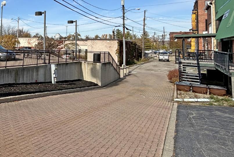
Develop RFQ / RFP to select consultant for parking study
Determine desired locations for trees
Identify partners to help with the signage design
funding and select vendors
Develop an RFQ / RFP for consultant led designs or develop designs internally
Develop an RFQ / RFP for consultant led designs or develop designs internally
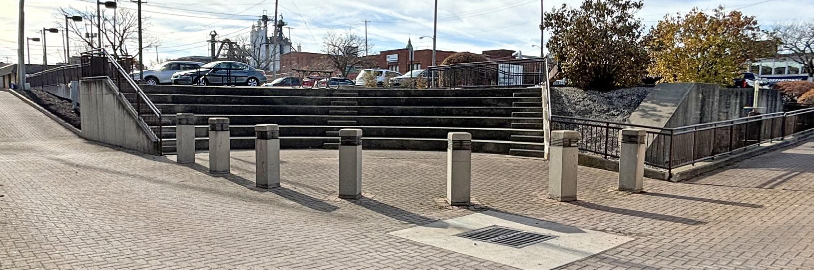
Action Plan
DIEHL PARK
Goal #1: Health & Social Justice
The improvements to this park significantly enhance access and equity with features like an inclusive playground, accessible restrooms, a Miracle Field, and connected walkways to serve people of all ages and abilities. New seating opportunities, guardian tables, and shade trees improve comfort and usability for spectators and families. The collaboration with Special Olympics underscores the park’s commitment to social inclusion and creating a welcoming space for all community members.
Goal #2: Environmental Quality / Flood Risk
Native plantings and the realignment of the north ditch contribute to stormwater management, reduce maintenance needs, and enhance the site’s ecological function. Strategic landscaping, including a community garden and exploratory pathways, supports pollinators, improves soil health, and adds beauty while reinforcing the park’s natural identity.
Goal #3: Vibrancy & Placemaking
While not adjacent to the river, this park becomes a vibrant hub for northwest Defiance through new destination features like the splash pad, community garden, Miracle Field, and pickleball courts. Artistic basketball murals and thoughtfully designed amenities like shelter houses, concessions, and color-enhanced pathways create a playful, welcoming atmosphere that reflects the community’s culture and character.
Goal #4: Improve Connectivity
A new network of pathways – including a central, color-enhanced spine connecting major amenities – improves circulation and unifies the site. Expanded parking, a perimeter drive, and new entry points ensure safe and efficient access for high-volume events while supporting everyday park use. These improvements help integrate the park more seamlessly into Defiance’s broader recreational system.
Install pathways around the site with seating opportunities to provide increased connectivity Develop plan highlighting the priority connections
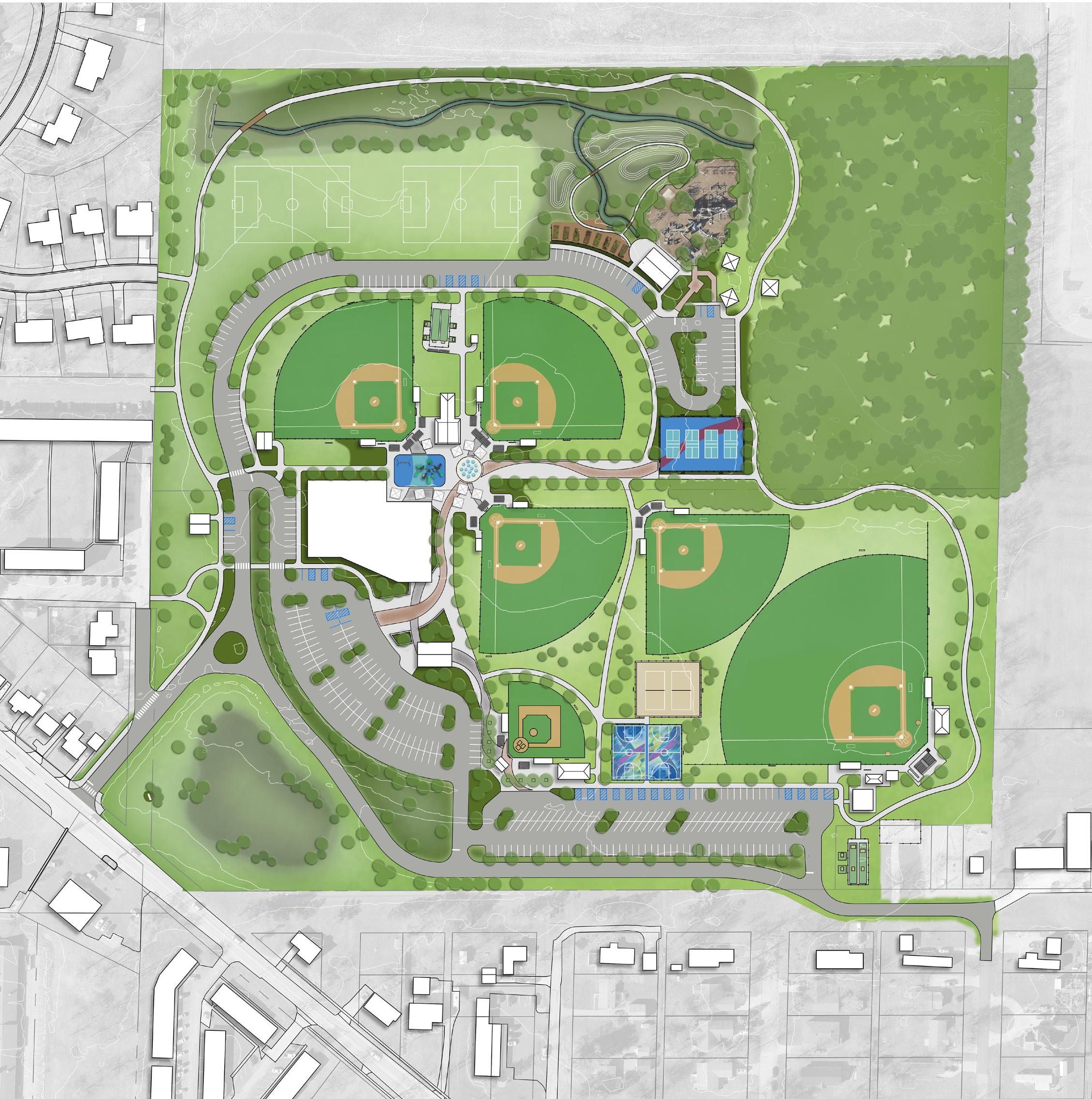
Action Plan, continued: DIEHL PARK
Color Key
- Cost Savings or No Increase
- Minor Increase - Major Increase
Paint restroom building #1 and install new epoxy flooring and mirrors;
Implement new key fob system for existing buildings
Install shade trees
Install pathways around the site with seating opportunities to provide increased connectivity (Comprehensive Plan, CC 10)
Incorporate native plantings in strategic locations throughout the site to define spaces, beautify the park, and ease mowing maintenance
Install community garden with an exploratory pathway and native plantings (Comprehensive Plan, DR 3)
Realign the north ditch and reseed playing fields
Install basketball courts with painted murals inspired by the park, a historical component, or adjacent neighborhoods (Comprehensive Plan, DR 3)
Install sand volleyball courts
Install pickleball courts
Division
Division
Division
Division, Engineering Division
Division
Division, Engineering Division
ESTIMATED INVESTMENT SUMMARY
Quick Wins: $1,485,000
Simple But Requires Funding: $2,745,000
Major Capital Projects: $15,850,000
Park Total: $20,080,000
POTENTIAL FUNDING SOURCES & PARTNERS
City Budget, Local Civic Organizations, Park Users, Special Interest Organizations
City Budget, Corporate, ODNR
City Budget, Corporate, Local Civic Organizations, Special Interest Organizations
City Budget, Corporate, Grassroots Fundraising, Local Civic Organizations, Local Healthcare Networks, Special Interest Organizations
City Budget, Local Civic Organizations
Arts Organizations, City Budget, Corporate, Local Civic Organizations, ODNR, Park Users, Special Interest Organizations
City Budget, Corporate, Educational Resources, Foundations, Grassroots, Local Civic Organizations, ODNR, Park Users, Special Interest Organizations
City Budget, Corporate, Local Civic Organizations, ODNR, Park Users, Special Interest Organizations
Determine desired locations for trees
Develop plan highlighting the priority connections to focus on
Develop plan for priority planting areas
Identify community organizations to help maintain the garden and raise funds
Develop engineered drawings for ditch; coordinate with ODNR on ditch realignment
Secure funding; develop RFQ / RFP to select an artist to paint mural; consider grouping court murals in various parks together in a single RFQ / RFP
Secure funding and develop RFQ / RFP to select consultant for project or develop designs / plans internally
Secure funding and develop RFQ / RFP to select consultant for project or develop designs / plans internally
Continued on next page.
Action Plan,
DIEHL PARK
BUDGET IMPACTS - Cost Savings or No Increase - Minor Increase - Major Increase
Expand the southern parking lot
Develop a perimeter drive with parking
Install splash pad with guardian tables and seating
Install inclusive playground with accessible poured-in-place safety surfacing and guardian tables and seating
Install Miracle Field with concession building and accessible restrooms
Install Kids Creation shelter house with accessible restrooms
Install field house with concessions and restroom; expand the curvilinear parking lot
Install a central pathway with enhanced pavement colors to connect the Miracle Field to the field house, and the field house to the pickleball courts (Comprehensive Plan, DR 3)
Parks Division, Engineering Division
Parks Division, Engineering Division
Parks Division, Engineering Division
Parks Division, Engineering Division
Parks Division, Engineering Division, City Planning
Parks Division, Engineering Division, City Planning
Parks Division, Engineering Division, City Planning
Parks Division, Engineering Division, City Planning
ESTIMATED INVESTMENT SUMMARY
Quick Wins: $1,485,000
Simple But Requires Funding: $2,745,000
Major Capital Projects: $15,850,000
Park Total: $20,080,000
FUNDING SOURCES & PARTNERS
City Budget, Corporate
City Budget, Corporate
City Budget, Corporate, Foundations, Local Civic Organizations, ODNR, Park Users, Special Interest Organizations
City Budget, Corporate, Foundations, Local Civic Organizations, ODNR, Special Interest Organizations
City Budget, Corporate, Foundations, Municipal Bonds, ODNR, Special Interest Organizations, State & Federal Appropriations $1,500,000
City Budget, Corporate, Foundations, Municipal Bonds, ODNR, Special Interest Organizations, State & Federal Appropriations
City Budget, Corporate, Foundations, Municipal Bonds, ODNR, Special Interest Organizations, State & Federal Appropriations $12,500,000
City Budget, Corporate, Foundations, Municipal Bonds, ODNR
Secure funding and develop RFQ / RFP to select consultant for project or develop designs / plans internally
Secure funding and develop RFQ / RFP to select consultant for project or develop designs / plans internally
Secure funding and develop RFQ / RFP to select consultant for project or develop designs / plans internally
Secure funding and select surfacing vendor
Secure funding and develop RFQ / RFP to select consultant for design
Secure funding and develop RFQ / RFP to select consultant for design
Perform feasibility study to determine appropriate scale and demand for a field house in Defiance
Secure funding and develop RFQ / RFP to select consultant for design
Action Plan
EASTSIDE PARK
Goal #1: Health & Social Justice
Eastside Park improvements foster inclusive recreation and wellness through upgraded, accessible playground surfaces and the addition of age-specific play equipment. Mental health signage, swing benches, and shaded seating areas promote emotional well-being and relaxation. Relocated accessible parking and expanded pathways improve mobility and access for all visitors, ensuring the park serves a diverse community.
Goal #2: Environmental Quality / Flood Risk
Native plantings, pollinator habitats, and boulder-lined swales enhance the park's natural systems, support biodiversity, and reduce maintenance needs. These features help manage stormwater runoff while providing opportunities for nature-based play and environmental education, creating a more sustainable and resilient space.
Goal #3: Vibrancy & Placemaking
Although not directly on the river, Eastside Park contributes to citywide vibrancy through unique, high-energy features like a mural-adorned basketball court, nature playground, and a new skate park. A splash pad and neighborhood trailhead enhance the sense of place, while shelter houses and gathering spaces support community events and day-to-day social connection.
Goal #4: Improve Connectivity
New sidewalks, trails, and strategic access points – including a trailhead on the north side – create stronger internal circulation and link Eastside Park to surrounding neighborhoods and the broader trail system. These improvements make it easier for people of all ages and abilities to reach and enjoy the park safely.
HIGHEST PRIORITY: NEXT STEPS:
Replace existing shredded hardwood mulch playground surface with accessible pouredin-place safety surfacing
Secure funding and surfacing vendor for installation
REFURBISHED BALL FIELD
SPLASH PAD
NEW PATH & PEDESTRIAN CROSSING
ADJUSTED ADA PARKING
SHELTER HOUSE WITH RESTROOM
NATIVE PLANTINGS WITH CLIMBING BOULDERS
SKATE PARK
CONCEPT 2: Favored by the community. Overview of concepts can be found in Section 5.
PLAYGROUND EXPANSION WITH TODDLER PLAY COMPONENTS
LEGEND
Natural Landscape
Sports Programming
Play Programming
Parking Lot
Building / Structure
NEIGHBORHOOD / GATEWAY TRAILHEAD
BASKETBALL COURT WITH MURAL
POLLINATOR HABITAT WITH NATIVE PLANTINGS (TYP)
ACCESSIBLE SAFETY SURFACING MENTAL HEALTH SIGNAGE
SEATING OPPORTUNITY (TYP)
Pedestrian Circulation
Seating Opportunity
Gateway / Trailhead / Signage
SHELTER HOUSE
HAIG ST KARNES
Action Plan, continued: EASTSIDE PARK
- Cost Savings or No Increase
- Minor Increase
- Major Increase
Relocate accessible parking spaces to the south side of the parking lot
Install additional trees throughout the site to provide shade for the future nature playground
Incorporate mental health signage throughout park (Comprehensive Plan, DR 3)
Incorporate additional seating and swing bench opportunities along proposed trail / sidewalk connections
Replace existing shredded hardwood mulch playground surface with accessible poured-in-place safety surfacing
Expand upon the existing playground to include play equipment specifically catered to the 2-5-year-old age range
Incorporate a nature playground in the southwest corner of the property
Incorporate native plantings and boulders along the swale running through the site (Comprehensive Plan, U 11)
Incorporate additional pathways throughout the site to provide further accessible connectivity to current and future park amenities (Comprehensive Plan, CC 10)
Parks Division, Engineering Division
Parks Division, Arbor Day Event
Parks Division, Engineering Division, Planning Division
Division
Parks Division, Engineering Division
Parks Division, Engineering Division
Parks, Planning, and Engineering Divisions
Parks and Engineering Division, Local MS4
Parks, Planning, and Engineering Divisions
Quick Wins: $90,000
Simple But Requires Funding: $1,535,000
Major Capital Projects: $2,300,000
Park Total: $3,925,000
FUNDING SOURCES & PARTNERS
Budget
City Budget, Local Civic Organizations, Park Users, Special Interest Organizations
City Budget, Corporate, Educational Resources, Local Civic Organizations, Local Healthcare Networks, Park Users
City Budget, Corporate, Educational Resources, Local Civic Organizations
City Budget, Corporate, Educational Resources, Foundations, Grassroots Fundraising, Local Civic Organizations, ODNR
City Budget, Corporate, Educational Resources, Foundations, Fundraising, Local Civic Organizations, ODNR
Confirm accessible slopes exist at southern end of parking lot
Determine desired locations for trees
Discuss partnership opportunities with local health networks
Determine best locations City Budget, Corporate, ODNR, Special Interest Organizations
Secure funding and surfacing vendor for installation
Secure funding and vendor for installation
Begin collaboration with local MS4 to develop collaborative funding strategy
Determine desired size and scope and submit for funding opportunities City Budget, Corporate, Local Civic Organizations, Special Interest Organizations
Budget, Corporate, ODNR
Develop priority list for current connectivity improvements and develop pathways with future development in park. ESTIMATED INVESTMENT SUMMARY
Continued on next page.
Action Plan, continued: EASTSIDE PARK
Color Key OPERATIONAL BUDGET IMPACTS
- Cost Savings or No Increase
- Minor Increase
- Major Increase
Incorporate a pollinator habitat with native plantings in the southeast corner of the property that includes pathway connections and seating opportunities to view wildlife
Add a basketball court with a painted mural inspired by the park, a historical component, or adjacent neighborhoods (Comprehensive Plan, DR 3)
Incorporate a neighborhood gateway and trailhead along the trail on the northern edge of the property (Comprehensive Plan, DR 3)
Refurbish existing ball field
Install an open air shelter house with accessible restrooms near the southern end of the existing parking lot
Incorporate an open air shelter house on the southeast side of the playground
Incorporate a small splash pad feature between the existing parking lot and existing playground
Incorporate a skate park along the northern edge of the property with connectivity to the trail and parking lot
Parks, Planning, and Engineering Divisions
Planning Division, Engineering Division
Planning Division, Engineering Division
Parks Division, Engineering Division
Parks, Planning, and Engineering Divisions
Parks, Planning, and Engineering Divisions
Planning Division, Engineering Division
Planning and Engineering Divisions, Skate Park Focus Group
ESTIMATED INVESTMENT SUMMARY
Quick Wins: $90,000
Simple But Requires Funding: $1,535,000
Major Capital Projects: $2,300,000
Park Total: $3,925,000
POTENTIAL FUNDING SOURCES & PARTNERS
City Budget, Corporate, Local Civic Organizations, Special Interest Organizations
$175,000 $
Arts Organizations, City Budget, Corporate, Foundations, Local Civic Organizations, ODNR, Park Users, Special Interest Organizations $70,000 $
Adjacent Owners, City Budget, Corporate, ODNR, Trail Organizations & Grants $15,000 $
City Budget, Corporate, Park Users $150,000 $
City Budget, Corporate, Foundations, Local Civic Organizations, Municipal Bonds, ODNR, Special Interest Organizations
$1,000,000 $
City Budget, Corporate, Local Civic Organizations, ODNR, Special Interest Organizations $300,000 $
City Budget, Corporate, Foundations, Grassroots Fundraising, Local Civic Organizations, Municipal Bonds, ODNR $500,000 $$
City Budget, Corporate, Foundations, Grassroots Fundraising, Local Civic Organizations, Municipal Bonds, Park Users $500,000 $$
Determine desired scope and secure funding
Develop an RFQ / RFP for muralists once funding is secured; consider grouping court murals together in a single RFQ / RFP
Develop designs for the gateway / trailhead
Determine the exact scope of project and develop designs to secure pricing from prospective contractors
Utilities are already in place, so develop an RFQ / RFP for consultant led design or develop designs internally
Develop an RFQ / RFP for consultant led design or develop designs internally
Develop a focus group to lead design from a local user level and develop RFQ / RFP for consultant led design and permitting
Determine the most desired location within the overall park system for a skate park and begin discussions with a skate park focus group
Action Plan FORT GROUNDS
Goal #1: Health & Social Justice
Improvements like accessible walkways, an under-bridge connection to Gateway Park, and the proposed pedestrian bridges connecting Fort Grounds to both Pontiac and Kingsbury parks enhance safety and ensure all visitors can navigate and enjoy the site regardless of ability. The educational trail and informative stations foster inclusive learning experiences that highlight the site's cultural and historical significance, broadening its reach to diverse users and generations.
Goal #2: Environmental Quality / Flood Risk
The addition of native plantings and shade trees enhances the park’s environmental health by supporting pollinators, reducing stormwater runoff, improving air quality, and decreasing maintenance demands. These sustainable features complement the park’s riverfront location, making it both ecologically resilient and visually engaging.
Goal #3: Vibrancy & Placemaking
New elements such as the riverfront overlook, boat docks, and the pedestrian bridge connections transform Fort Grounds into a dynamic destination along the Maumee and Auglaize Rivers. These features elevate the visitor experience by blending natural beauty, recreation, and historical storytelling – reinforcing the park’s identity as a vibrant civic and cultural anchor in the heart of Defiance.
Install a consolidated and cohesive signage package for all historical markers and the overall plan
Identify partners to help with the signage design
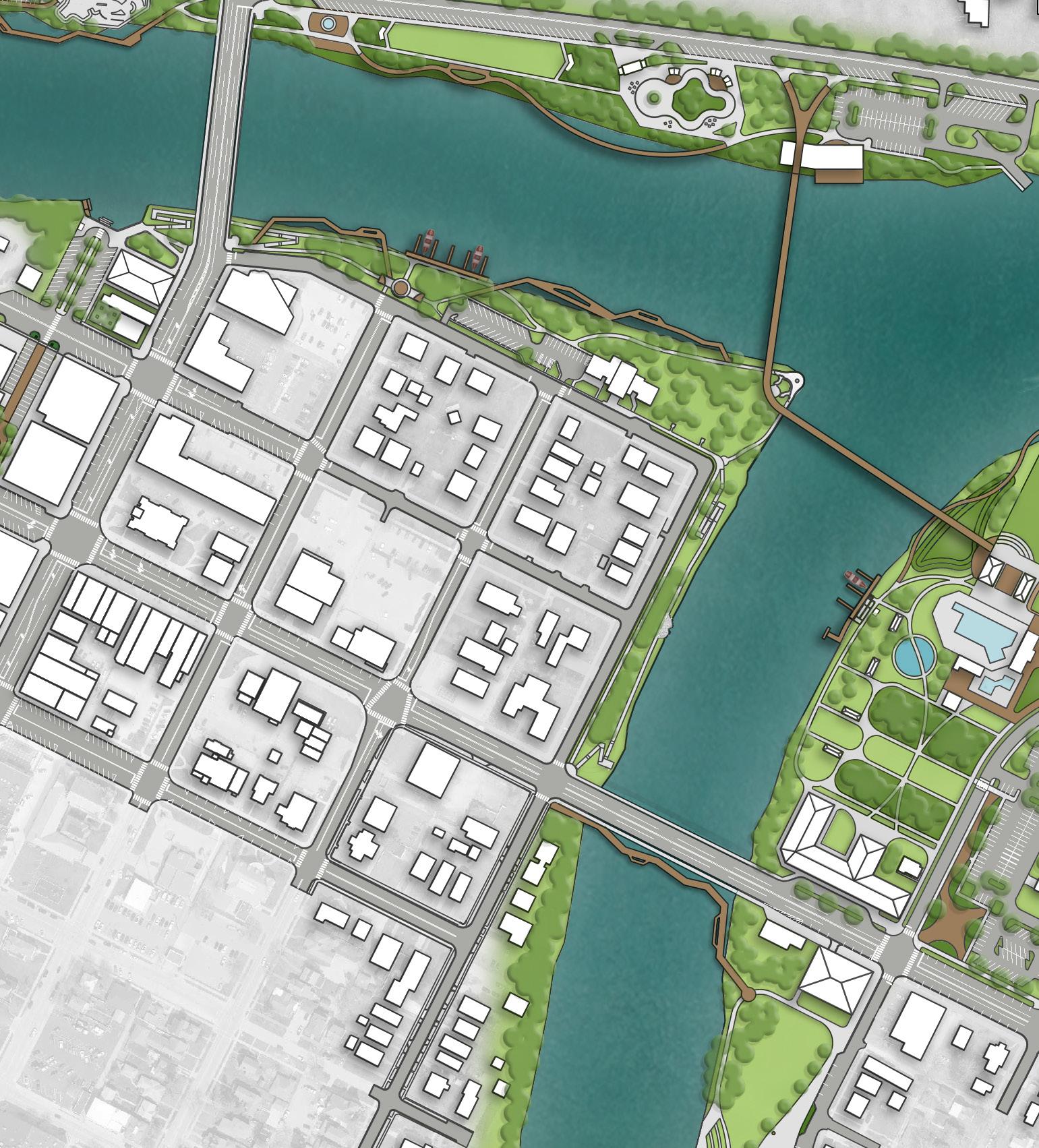
REFINED CONCEPT: Overview of concepts can be found in Section 5.
PROPOSED FEATURES
A Pedestrian Bridge
B Accessible Connection Under Bridge
C Accessible Riverfront Boardwalk
D Boulder Outcropping River Access Point
E Accessible Educational Trail
F Shade Trees
Action Plan, continued: FORT GROUNDS
Color Key OPERATIONAL BUDGET IMPACTS
- Cost Savings or No Increase
- Minor Increase
- Major Increase
Install a consolidated and cohesive signage package for all historical markers and the overall plan (Comprehensive Plan, DR 3)
Install trees throughout for additional shade (Comprehensive Plan, U 11)
Incorporate native plantings in strategic locations throughout the site to define spaces, beautify the park, and ease mowing maintenance (Comprehensive Plan, U 11)
Install walkways along Fort Street, Washington Avenue, and the Maumee River with ADA access (Comprehensive Plan, D 8)
Install an educational trail along the Auglaize River with educational signage (Comprehensive Plan, DR 3)
Install boat docks along the waterfront (Comprehensive Plan, CC 10)
Install river overlook with boulder outcropping (Comprehensive Plan, CC 10)
Incorporate historical / wayfinding language etched, painted on, or attached to new flood wall (Comprehensive Plan, DR 3)
Parks Division, Engineering Division, Planning Division
Parks Division, Arbor Day Event
Parks Division, Engineering Division
Parks Division, Engineering Division
Parks Division, Engineering Division
Parks Division, Engineering Division
Parks Division, Engineering Division
Parks Division, Engineering Division
ESTIMATED INVESTMENT SUMMARY
Quick Wins: $630,000
Simple But Requires Funding: $150,000
Major Capital Projects: $11,750,000
Park Total: $12,530,000
FUNDING SOURCES & PARTNERS
Art Organizations, City Budget, Corporate, Educational Resources, Foundations, Special Interest Organizations
City Budget, Local Civic Organizations, Park Users, Special Interest Organizations
City Budget, Corporate, Local Civic Organizations, Special Interest Organizations
City Budget, Corporate, Educational Resources, Foundations, Local Civic Organizations, Special Interest Organizations
City Budget, Corporate, Educational Resources, Foundations, Local Civic Organizations, Special Interest Organizations
City Budget, Corporate, Foundations, Municipal Bonds, ODNR, Special Interest Organizations
City Budget, Corporate, Foundations, Local Civic Organizations, Municipal Bonds, ODNR, Special Interest Organizations
Art Organizations, City Budget, Corporate, Educational Resources, Foundations, ODNR, Special Interest Organizations
Coordinate with library and historical society
Secure trees and organize a tree planting day
Develop plan for priority planting areas
Secure funding and develop RFQ / RFP to select consultant for project and coordinate with appropriate historical entities
Identify partners for project and determine the educational story to be told
Conduct study or analysis for overall need of additional docking opportunities along river
Secure funding and develop RFQ / RFP to select consultant for project
Secure funding and develop RFQ / RFP to select consultant for project
Continued on next page.
FORT GROUNDS
- Cost Savings or No Increase
- Minor Increase
- Major Increase
Install river boardwalk with overlook areas (Comprehensive Plan, CC 10)
Install walkway underneath the south side of the Clinton Street bridge into South Gateway Park (Comprehensive Plan, CC 10)
Replace flood wall
Planning Division, Engineering Division, Planning Division
Planning Division, Engineering Division, Planning Division
Planning Division, Engineering Division
Install a pedestrian bridge (Comprehensive Plan, CC 9)
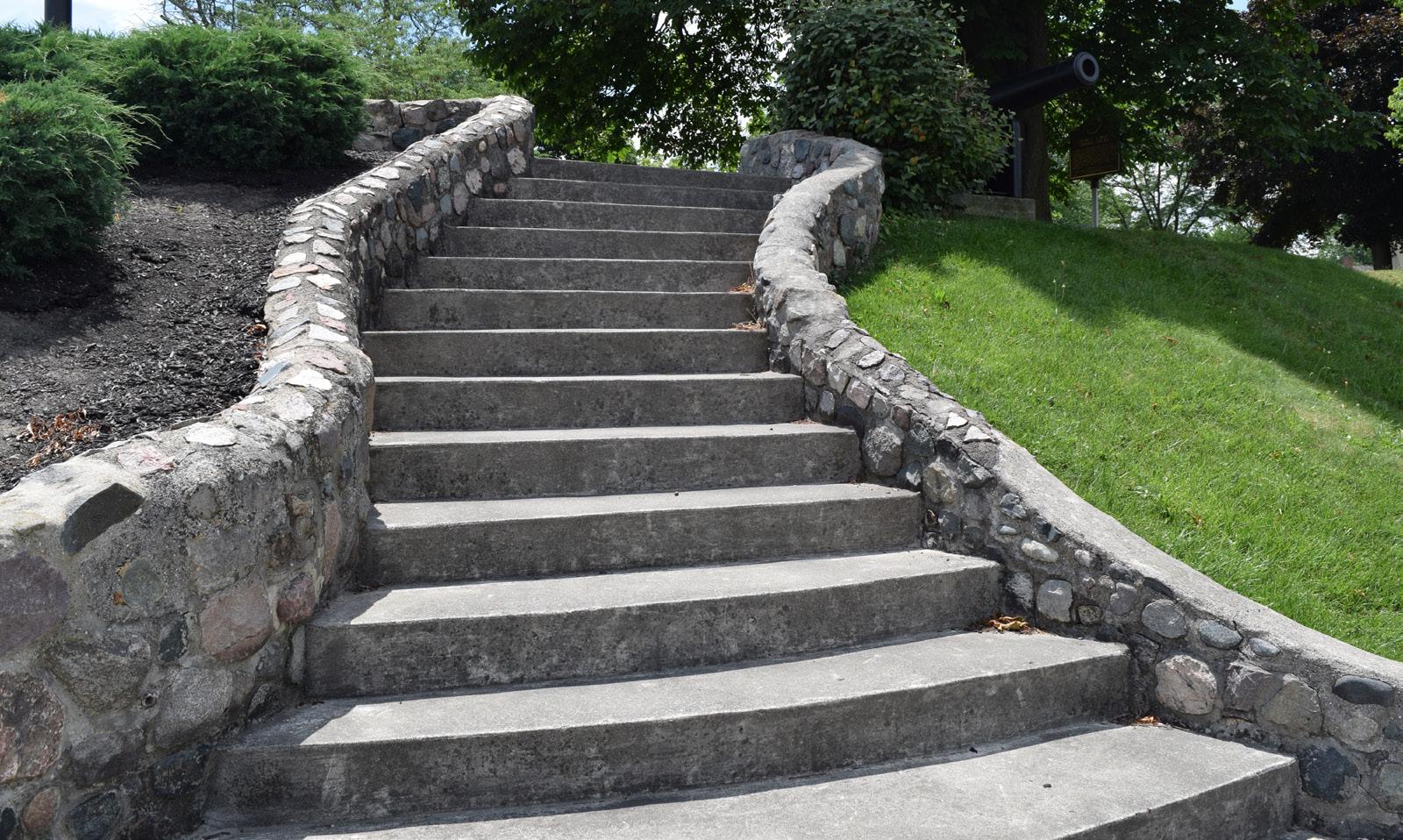
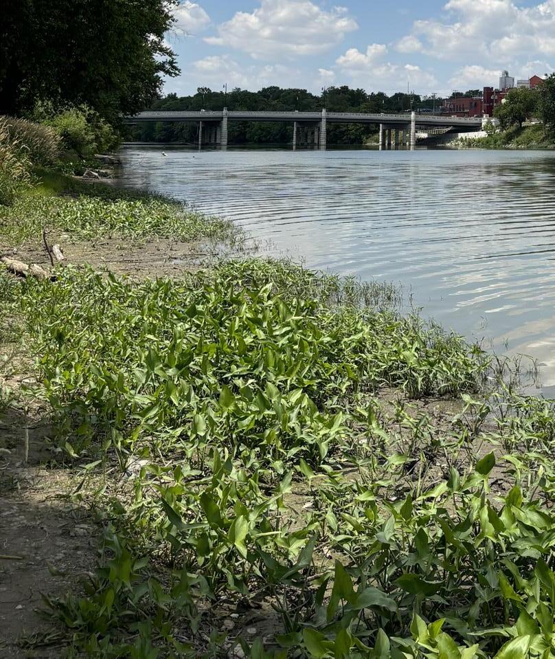
ESTIMATED INVESTMENT SUMMARY
Quick Wins: $630,000
Simple But Requires Funding: $150,000
Major Capital Projects: $11,750,000
Park Total: $12,530,000
POTENTIAL FUNDING SOURCES & PARTNERS
City Budget, Corporate, Foundations, Local Civic Organizations, Municipal Bonds, ODNR, Special Interest Organizations, State and Federal Appropriations
City Budget, Corporate, ODNR
City Budget, Corporate, Foundations, Municipal Bonds, ODNR, State & Federal Appropriations
$5,000,000 $$$
Secure funding and develop RFQ / RFP to select consultant for project
$1,250,000 $$$
$5,500,000 $$$
Conduct feasibility study for under bridge crossing
Secure funding and develop RFQ / RFP to select consultant for project and coordinate with appropriate historical entities for preliminary requirements
See "install pedestrian bridge" action item in Kingsbury Riverfront Park, Swim Park, & Pickleball on page 274 for details.
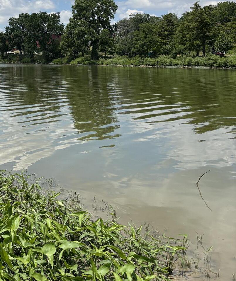
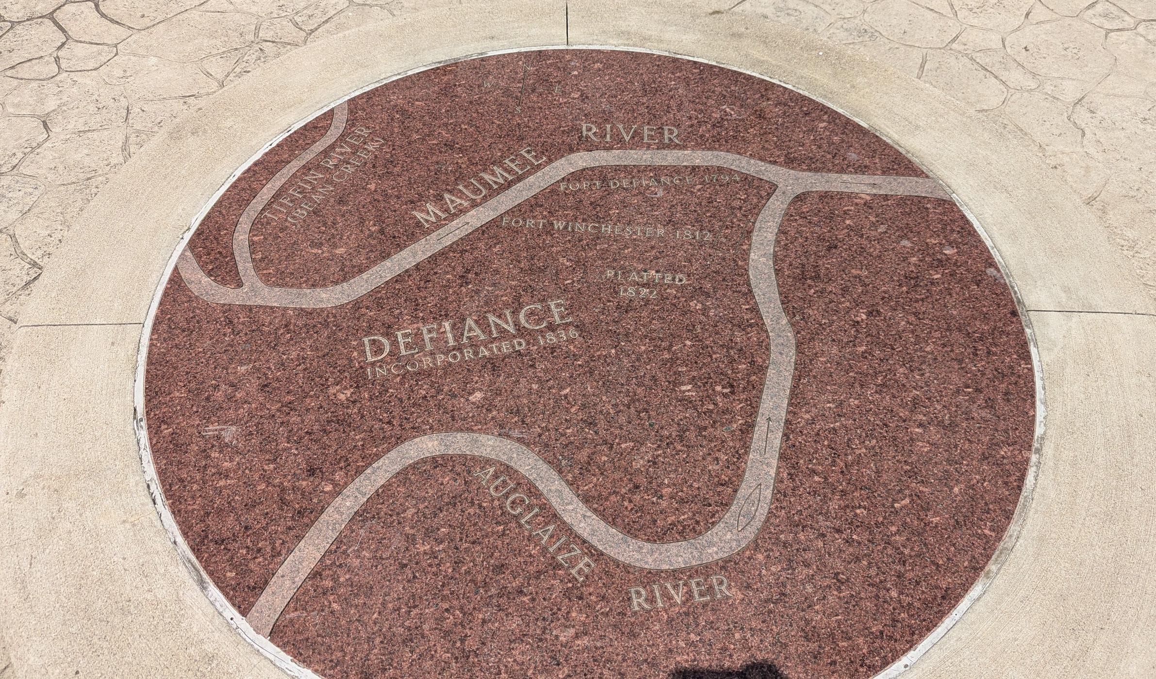
Action Plan
GATEWAY PARK
Goal #1: Health & Social Justice
Improvements to Gateway Park will make the site more accessible and welcoming to all users. Features like accessible walkways, an accessible kayak launch, and on-site parking ensure that everyone – regardless of ability – can enjoy active recreation and riverfront access. The inclusion of a skate park and farmer’s market shelter provides opportunities for physical activity, fresh food access, and social connection, creating a space that supports public wellness and community equity.
Goal #2: Environmental Quality / Flood Risk
New shade trees and green infrastructure – like native landscaping around pathways and parking areas – support improved air quality, stormwater absorption, and heat reduction. The adventure boardwalk along the riverbank is a low-impact intervention that preserves the natural shoreline while offering immersive nature experiences and environmental education.
Goal #3: Vibrancy & Placemaking
With a prominent location along the Maumee River and at the entry to downtown Defiance, Gateway Park is positioned to become a signature public space. Historic signage honoring the site’s canal and brewing history, combined with modern amenities like an event space and shelter house, skate park, and outdoor seating near a proposed mixed-use building, create a dynamic destination that blends culture, commerce, and community.
Goal #4: Improve Connectivity
Strategically located adjacent to Fort Grounds and Pontiac Park, Gateway Park enhances the continuity of the riverfront park system. Accessible walkways, boardwalks, and boat launches improve both pedestrian and water-based connectivity. The planned mixed-use development and event infrastructure strengthen the park’s role as a connecting point between downtown and the river corridor.
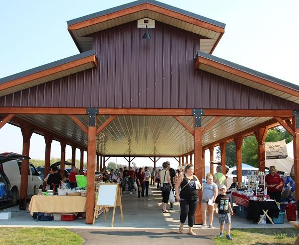
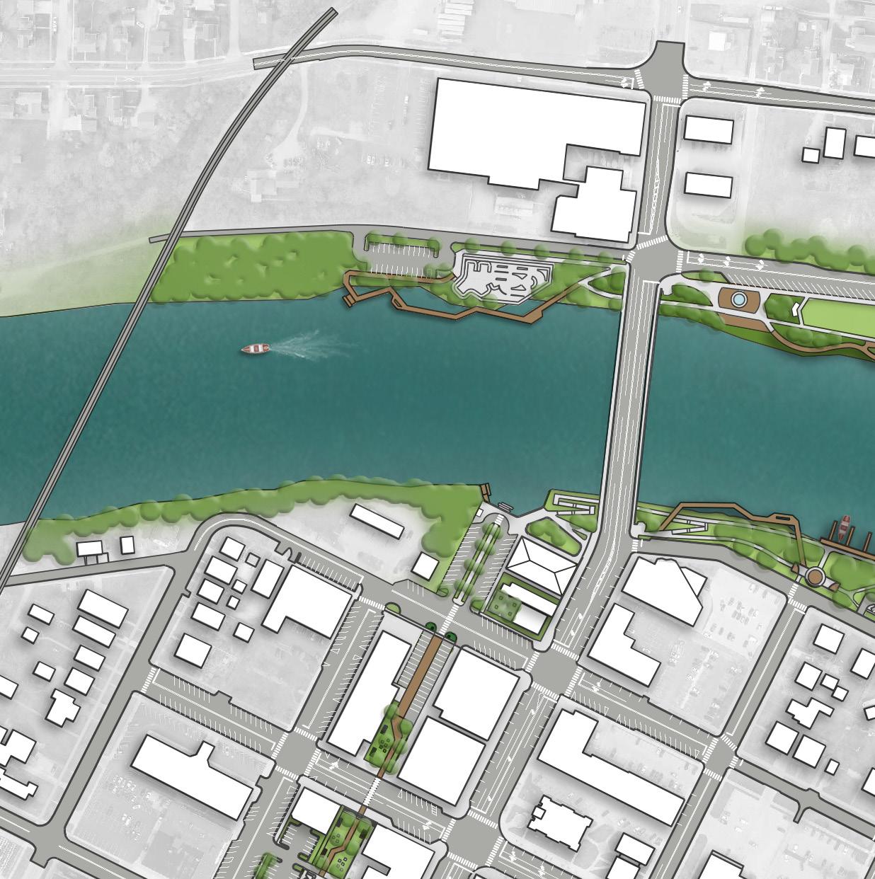
REFINED CONCEPT: Overview of concepts can be found in Section 5.
LEGEND
PROPOSED FEATURES
A Park Sign / Historical Signage
B Shade Trees
C Skate Park
D Parking
E Accessible Kayak Launch & Rental
F Accessible Kayak Launch
G Farmer's Market Shelter House
H Accessible Walkway
I Mixed-Use Building
J Outdoor Seating
K Adventure Boardwalk
EXISTING FEATURES
1 Existing Restaurant
Action Plan, continued: GATEWAY PARK
- Cost Savings or No Increase - Minor Increase - Major Increase
Install park signage / historical signage
Install shade trees (Comprehensive Plan, U 11)
FUNDING
Install skate park with associated parking and accessible walkways
Install accessible kayak launch and rental kiosk along the southern bank of the Maumee River, along with parking (Comprehensive Plan, CC 5 and CC 10)
Install a farmer's market shelter house and event space with associated accessible concrete walkways
Facilitate the development of a mixed-use building and outdoor seating area at the corner of Clinton Street and 1st Street (Comprehensive Plan, PP 9 and DR 10)
Install an adventure walkway / boardwalk along the northern bank of the Maumee River, along with an accessible kayak launch (Comprehensive Plan, DR 5 and CC 10)
Incorporate cove along south side of the Maumee River with step access to the river (Comprehensive Plan, CC 10)
Install walkway underneath the south side of the Clinton Street bridge into Fort Grounds (Comprehensive Plan, CR 4 and CC 10) Color Key OPERATIONAL BUDGET IMPACTS
Parks Division, Engineering Division, Planning Division
Parks Division, Engineering Division
Parks Division, Engineering Division, Planning Division
Parks Division, Engineering Division
Parks Division, Engineering Division, Planning Division
Parks Division, Engineering Division
Parks Division, Engineering Division
Parks Division, Engineering Division
ESTIMATED INVESTMENT SUMMARY
Quick Wins: $50,000
Simple But Requires Funding: $750,000
Major Capital Projects: $11,400,000
Park Total: $12,200,000
FUNDING SOURCES & PARTNERS
Arts Organizations, City Budget, Corporate, Local Civic Organizations
City Budget, Local Civic Organizations, Park Users, Special Interest Organizations
City Budget, Corporate, Foundations, Grassroots Fundraising, Local Civic Organizations, Municipal Bonds, Park Users
City Budget, Corporate, Foundations, Local Civic Organizations, ODNR, Special Interest Organizations
City Budget, Corporate, Foundations, Local Civic Organizations, Local Health Networks, ODNR, Special Interest Organizations
City Budget, Private Developer
City Budget, Corporate, Foundations, Municipal Bonds, ODNR, State & Federal Appropriations
City Budget, Corporate, Foundations, Local Civic Organizations, Local Healthcare Networks, Municipal Bonds, ODNR, Special Interest Organizations
Identify partners to help with the signage design
Determine desired locations for trees
Secure funding or develop engineered drawings (the project is anticipated to be located within the floodway)
Secure funding or develop engineered drawings (the project is anticipated to be located within the floodway)
Secure funding or develop engineered drawings
Develop an RFQ / RFP for prospective developers
Secure funding or develop engineered drawings (the project is anticipated to be located within the floodway)
Secure funding and develop RFQ / RFP to select consultant for project
See "install walkway" action item in Fort Grounds on page 256 for details.
HOLGATE PARK
Goal #1: Health & Social Justice
Safety surfacing in the playground area, walkways throughout the site, and upgraded drives and parking enhance access and usability for individuals of all ages and abilities. New seating areas, including swing benches, provide comfortable gathering spots for families and seniors, while the addition of pickleball courts supports physical activity and multi-generational engagement. The new shelter house and restrooms also offer a functional space for neighborhood events and social connection.
Goal #2: Environmental Quality / Flood Risk
Shade trees and native plantings around the gazebo help improve air quality, reduce stormwater runoff, and define landscaped areas with low-maintenance vegetation. These green features enhance the environmental function of the park while contributing to its peaceful, neighborhood-oriented aesthetic.
Goal #3: Vibrancy & Placemaking
This park enhances citywide placemaking by creating a beautiful, intimate space with a strong neighborhood identity. The refurbished gazebo, swing benches, and native plantings cultivate charm and community pride. A new park sign along Kentner Street strengthens the park’s presence and visibility, while the shelter house fosters opportunities for gatherings and celebrations.
Goal #4: Improve Connectivity
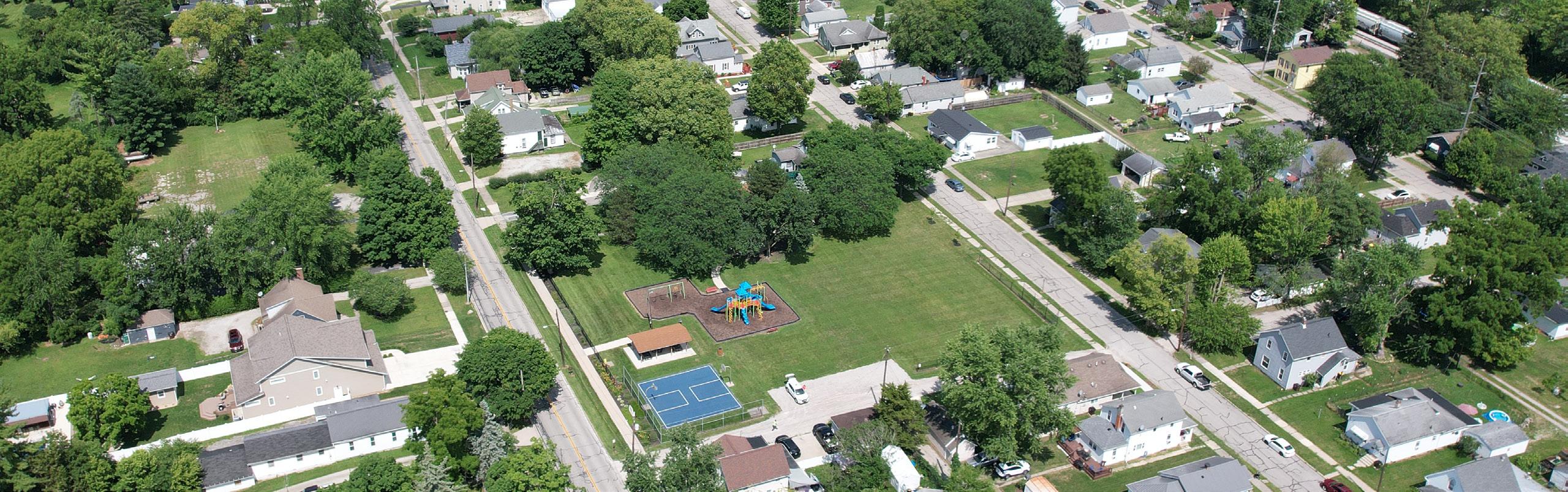
Repave access drives and pave / expand parking lot
Release RFQ for pricing or coordinate with contractor for paving price
ACCESSIBLE SAFETY SURFACING
EXPAND PARKING LOT & PAVE DRIVE / PARKING
SHELTER HOUSE WITH RESTROOMS
HOLGATEAVE
SHADE TREES (TYP)
UPDATE GAZEBO
NATURAL LANDSCAPE
CONCEPT 1: Favored by the community. Overview of concepts can be found in Section 5.
PROGRAMMED LANDSCAPE
SEATING OPPORTUNITY (TYP)
LEGEND
Natural Landscape
Sports Programming
Play Programming
Parking Lot
Building / Structure
Pedestrian Circulation
Seating Opportunity
Gateway / Trailhead / Signage
NEW PARK SIGN
NEW SIDEWALK ALONG KENTNER ST
(LAWN)
(3) PICKLEBALL COURTS
SWING BENCH
Action Plan, continued: HOLGATE PARK
OPERATIONAL BUDGET IMPACTS
- Cost Savings or No Increase
- Minor Increase
- Major Increase
Install new lighted bollards
Install shade trees
Install swing benches
Incorporate native plantings around gazebo
Install new park sign on the south side of the park along Kentner Street (Comprehensive Plan, DR 3)
Install pickleball courts
Replace existing shredded hardwood mulch playground surface with accessible poured-in-place safety surfacing
Install walkways from the parking lot throughout and around the site with seating opportunities
Refurbish existing gazebo
Repave access drives and pave / expand parking lot (Comprehensive Plan, CC 4)
Replace the southern walkway along Kentner Street (Comprehensive Plan, CC 4)
Install shelter house with restrooms
PROJECT GOAL
Parks Division, Engineering Division
Parks Division, Engineering Division
Parks Division
Parks Division, Engineering Division
Parks Division, Engineering Division
Parks Division, Engineering Division
Parks Division, Engineering Division Planning Division
Parks Division, Engineering Division
Parks Division, Engineering Division
Parks Division, Engineering Division
Parks Division, Engineering Division
Parks Division, Engineering Division Color Key
ESTIMATED INVESTMENT SUMMARY
Quick Wins: $260,000
Simple But Requires Funding: $475,000
Major Capital Projects: $450,000
Park Total: $1,185,000
City Budget, Corporate, Local Civic Organizations, Park Users
City Budget, Local Civic Organizations, Special Interest Organizations
City Budget, Corporate, Local Civic Organizations, Special Interest Organizations
City Budget, Local Civic Organizations, Park Users
Budget, Corporate, ODNR, Special Interest Organizations
Determine desired locations for trees
Identify locations for swings
Develop planting plan
Coordinate with graphic sign company for installation or develop sign package for multiple parks
Secure funding and develop RFQ / RFP to select consultant for project or develop designs / plans internally City Budget, Corporate, ODNR
Secure funding and surfacing vendor for installation
City Budget, Educational Resources, Local Civic Organizations
Create a priority list for current connectivity improvements and develop pathways for future development in park
Release RFQ for pricing or coordinate with contractor for paving
City Budget, Corporate, Local Civic Organizations, ODNR, Park Users, Special Interest Organizations
Secure funding and develop RFQ / RFP to select consultant for project or develop designs / plans internally City Budget, Corporate, Local Civic Organizations, ODNR
Secure funding and develop RFQ / RFP to select consultant for design work
Action Plan
HOMETOWN HEROES PARK
Goal #1: Health & Social Justice
By reconfiguring walkways and adding accessible seating through planter seat walls, the park becomes more inclusive and navigable for all visitors. The thoughtful layout encourages quiet reflection and community gathering, creating a
safe and welcoming environment that honors service while being accessible to everyone, regardless of age or ability.
Goal #2: Environmental Quality / Flood Risk
The addition of shade trees and formal landscaping enhances the site's ecological value and contributes to improved air quality and stormwater absorption. These sustainable landscape choices not only beautify the space but also support long-term environmental health with low-maintenance planting strategies.
Goal #3: Vibrancy & Placemaking
While not a riverfront park, Hometown Heroes Park plays a vital role in citywide placemaking. The redesigned memorial nodes, tribute wall, and updated signage create a dignified and memorable public space that reflects local identity and shared history. The improvements transform the park into a meaningful destination that contributes to the overall vibrancy of Defiance.
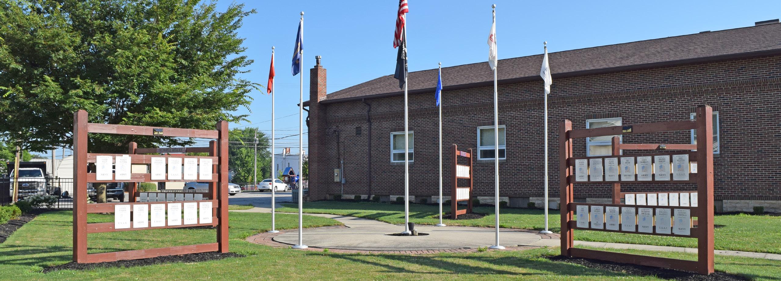
Incorporate a new park sign
Develop focus group and determine design for sign; once design is chosen secure quote from local sign manufacturer
LANDSCAPE PLANTING WITH SHADE TREES
CONCEPT 2: Favored by the community. Overview of concepts can be found in Section 5.
LEGEND
Natural Landscape
Memorial Panels
Plaza / Hardscape
Pedestrian Circulation
Seating Opportunities
Memorial Sculpture
Park Sign
Memorial Wall
MEMORIAL SCULPTURE
PLANTER SEAT WALL
NEW PARK SIGN
MEMORIAL WALL
CLINTONST
Action Plan,
HOMETOWN HEROES PARK
Color Key
BUDGET IMPACTS
- Cost Savings or No Increase
- Minor Increase
- Major Increase
Incorporate a new park sign (Comprehensive Plan, DR 3)
Incorporate additional landscaping and trees to provide shade
Install new, larger memorial feature incorporating new walkways, planter seat walls and other seating options, drinking fountain, memorial walls, and sculptures (Comprehensive Plan, DR 3)

Division, Planning Division
Division,
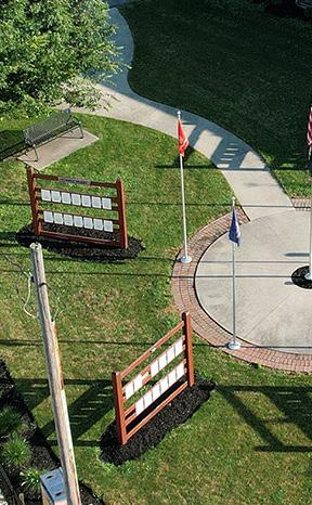
Quick Wins: $40,000
Simple But Requires Funding: $0
Major Capital Projects: $500,000
Park Total: $540,000
FUNDING SOURCES & PARTNERS
City Budget, Corporate, Local Civic Organizations
City Budget, Local Civic Organizations, Park Users, Special Interest Organizations
Develop steering committee for design ESTIMATED INVESTMENT SUMMARY
City Budget, Corporate, Foundations, Local Civic Organizations
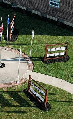
Develop focus group and determine design for sign; once design is chosen secure quote from local sign manufacturer
Develop overall planting plan that accounts for potential future improvements
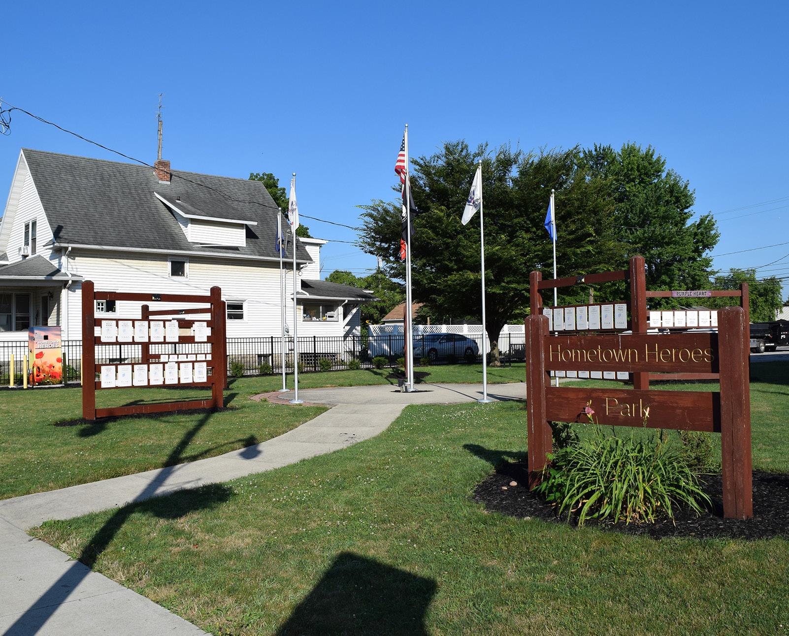
Action Plan
KINGSBURY RIVERFRONT PARK SWIM PARK & PICKLEBALL
Goal #1: Health & Social Justice
The park upgrades significantly enhance accessibility, inclusivity, and public well-being. Replacing mulch with accessible poured-in-place playground surfacing and adding walkways ensures that children and caregivers of all abilities can safely enjoy play spaces. Expanded pathways, activity lawns, and new shelter houses create more opportunities for physical activity, relaxation, and social gathering. The addition of a pedestrian bridge linking to Fort Grounds further removes barriers and connects more residents to recreational opportunities.
Goal #2: Environmental Quality / Flood Risk
Native plantings, wetland gardens, and shade trees throughout the site improve stormwater management and biodiversity, especially important in this floodplain location. Redeveloping central greenspaces with sustainable landscaping reduces maintenance demands and contributes to long-term environmental resilience. The river boardwalk and educational elements also provide opportunities for ecological learning and stewardship.
Goal #3: Vibrancy & Placemaking
With its central location along the Maumee and Auglaize Rivers, Kingsbury Riverfront Park is a cornerstone of downtown riverfront vibrancy. New features like a nature education center, event lawn and stage, boat docks, and a mural on the pumphouse enrich the park's cultural appeal and expand its role as a gathering place for concerts, festivals, and everyday riverfront enjoyment. Planned mixed-use developments along Auglaize and 2nd Streets will further activate the area with new energy and foot traffic.
Goal #4: Improve Connectivity
The park's transformation emphasizes seamless connections – both internal and external. New walkways and parking areas improve circulation within the park, while new pedestrian bridges to Fort Grounds and Pontiac Metro Park will tie together major riverfront destinations. These improvements reinforce Kingsbury as a vital hub in the citywide park and trail system. The reduction of vehicular roads within the site streamlines vehicular wayfinding and allows for protected pedestrian corridors. Maintenance and event traffic will still have access to priority areas with strategic multi-use paths.
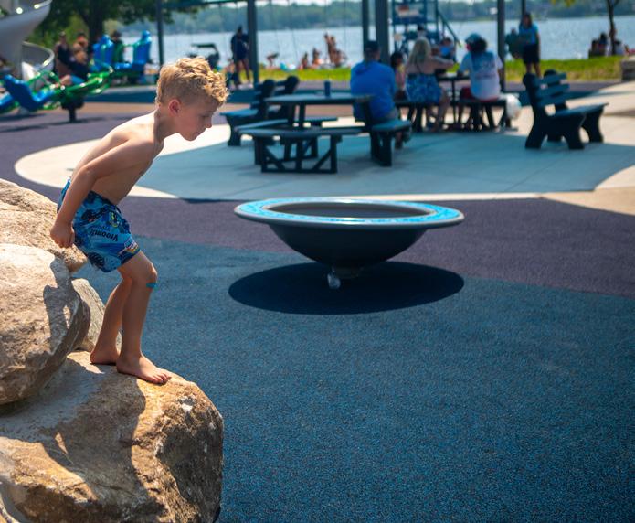
While waiting on the overall redevelopment of Kingsbury, replace the existing shredded hardwood mulch playground surface with accessible poured-inplace safety surfacing
Secure funding and surfacing vendor for installation
RIVER
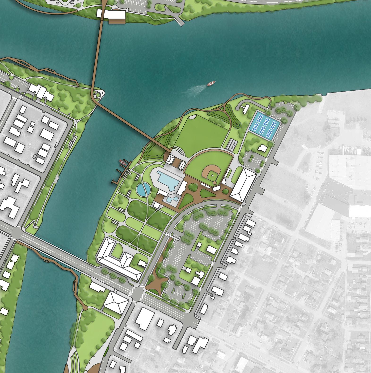
REFINED CONCEPT: Overview of concepts can be found in Section 5.
PROPOSED FEATURES
A Shade Trees
B Pumphouse Mural
C Walkways
D Paved Parking
E Playground with Safety Surfacing
F Botanical Gardens
G Boat Docks
H Mixed-Use Building
I Relocated Batting Cages
J Event Lawn and Stage
K Shelter Houses
L River Boardwalk
M Wetland Gardens
N Nature Education Center
O Plaza
P Pedestrian Bridge
Q Kayak Launch with Kiosk
MAUMEE RIVER
EXISTING FEATURES
1 Existing Pickleball Courts
2 Existing Ball Field
3 Existing Swimming Pool
4 Existing Shelter House
5 Existing Restrooms
Action Plan, continued: KINGSBURY RIVERFRONT PARK
SWIM PARK & PICKLEBALL
BUDGET IMPACTS
- Cost Savings or No Increase
- Minor Increase
- Major Increase
Paint concession stand and restroom, install new epoxy flooring in both buildings and new mirrors in restroom; implement new key fob system for existing buildings
Division
Repaint pool slide Parks Division
Install new park sign with lighting (Comprehensive Plan, DR 3) Parks Division, Engineering Division
Install new epoxy flooring in filter building
Install shade trees (Comprehensive Plan, U 11)
Install pumphouse mural (Comprehensive Plan, DR 3)
Install pickleball area walkways and parking at north end of Auglaize Street
Redevelop central Kingsbury by constructing a new playground with accessible poured-in-place safety surfacing, and by installing walkways, activity lawns, and botanical gardens
While waiting on the overall redevelopment of Kingsbury, replace the existing shredded hardwood mulch playground surface with accessible poured-inplace safety surfacing
Install boat docks and a kayak launch along the Auglaize River (Comprehensive Plan, CC 10)
Division
Division
Parks Division, Planning Division
Parks Division, Engineering Division
Parks Division, Engineering Division
Parks Division, Engineering Division, Planning Division
Parks Division, Engineering Division
ESTIMATED INVESTMENT SUMMARY
Quick Wins: $505,000
Simple But Requires Funding: $5,725,000
Major Capital Projects: $54,500,000
Park Total: $60,730,000
POTENTIAL FUNDING SOURCES & PARTNERS
City Budget, Local Civic Organizations, Park Users, Special Interest Organizations
Arts Organizations, City Budget, Corporate, Educational Resources, Local Civic Organizations
City Budget, Corporate, ODNR
City Budget, Corporate, Foundations, Local Civic Organizations, Local Health Networks, ODNR, Special Interest Organizations
City Budget, Corporate, ODNR
City Budget, Corporate, Foundations, Local Civic Organizations, ODNR, Special Interest Organizations
Determine desired location for trees
Develop RFP / RFQ to select artist
Secure funding and develop layout plans and engineered drawings
Create a prioritized list of connectivity improvements and design pathways that align with future development in park
Secure funding and surfacing vendor for installation
Secure funding and/or develop engineered drawings
Continued on next page.
Action Plan, continued: KINGSBURY RIVERFRONT PARK
Color Key
OPERATIONAL BUDGET IMPACTS
- Cost Savings or No Increase
- Minor Increase
- Major Increase
Install parking lots, roadway improvements, enhanced walkways, and entry plaza space off of 2nd Street and Auglaize Street (Comprehensive Plan, DR 8)
Relocate batting cage equipment; install new concession stand and bleachers
Facilitate creation of the Auglaize Street mixed-use development and new central plaza with drop-off space for the pool, ball field, and event space (Comprehensive Plan, PP 9 and DR 10)
Facilitate creation of the 2nd Street mixed-use development (Comprehensive Plan, PP 9 and DR 10)
Develop the north part of Kingsbury Park with new event lawn and stage, open air shelter houses, river boardwalk, native plantings and wetland gardens, and nature education center with plaza (Comprehensive Plan, U 11 and CC 10)
Install pedestrian bridges connecting Kingsbury with Fort Grounds and Fort Grounds with Pontiac Metro Park (Comprehensive Plan, CC 9)
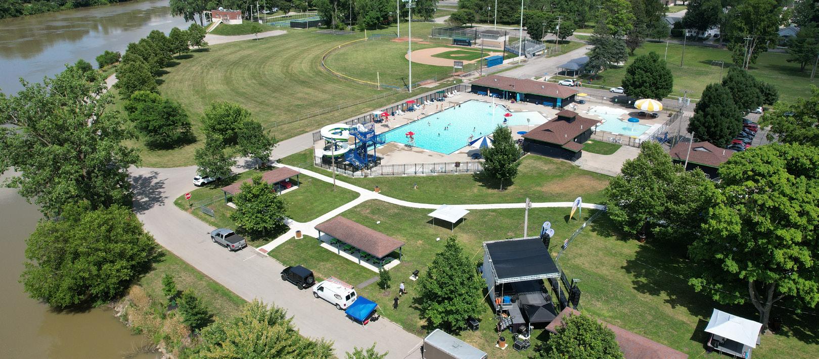
SWIM PARK & PICKLEBALL
Parks Division, Engineering Division
Parks Division, Engineering Division
Parks Division, Engineering Division, Planning Division
Parks Division, Engineering Division, Planning Division
Parks Division, Engineering Division, Planning Division
Parks Division, Engineering Division, Planning Division
Quick Wins: $505,000
Simple But Requires Funding: $5,725,000
Major Capital Projects: $54,500,000
Park Total: $60,730,000
City Budget, Corporate, ODNR
City Budget, Corporate, Foundations, Local Civic Organizations, Local Healthcare Networks, ODNR, Park Users, Special Interest Organizations
Secure funding and develop RFQ / RFP to select consultant for design
Secure private developer (see next page) that would require relocation of batting cages City Budget, Private Developer
Conduct market analysis to determine demand or develop RFQ / RFP to select developer City Budget, Private Developer
City Budget, Corporate, Foundations, Municipal Bonds, ODNR, Special Interest Organizations, State & Federal Appropriations
Conduct feasibility study for bridge crossings ESTIMATED INVESTMENT SUMMARY
City Budget, Corporate, Foundations, Municipal Bonds, ODNR, Special Interest Organizations, State & Federal Appropriations
Conduct market analysis to determine demand or develop RFQ / RFP to select developer
Secure funding and create RFQ / RFP to select consultant for project or develop designs / plans internally
Action Plan KNIGHTS OF COLUMBUS BASEBALL COMPLEX
Goal #1: Health & Social Justice
The addition of a playground and accessible seating ensures the complex serves a broader range of users beyond athletes, creating a more inclusive and family-friendly environment. A drinking fountain with a bottle filler also promotes hydration and healthy recreation.
Goal #2: Environmental Quality / Flood Risk
While the focus here is primarily recreational, resurfacing the parking lot in partnership with adjacent property owners presents an opportunity to explore environmentally friendly paving solutions that manage runoff and improve water quality. Additional trees and landscaping within the plaza area could further support environmental benefits.
Goal #3: Vibrancy & Placemaking
The addition of a plaza, entrance gateway, and improved signage enhances the identity and sense of arrival at the complex. These features create a more cohesive and welcoming space, elevating it from a purely functional athletic site to a lively community destination where spectators, families, and players can gather.
Goal #4: Improve Connectivity
New walkways within the complex improve internal connectivity and visitor experience by making navigation between
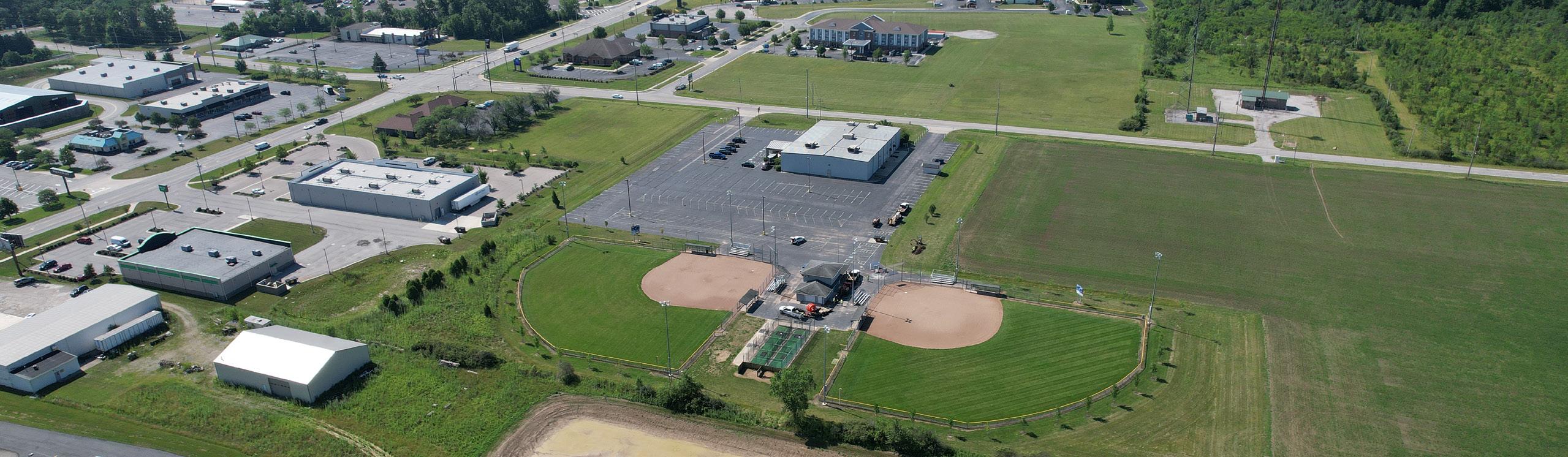
Install drinking fountain with a bottle filler on or near the existing concessions stand building
Secure funding and finalize desired location
PEDESTRIAN BRIDGE OVER SWALE
DRINKING FOUNTAIN
PLAY STRUCTURES WITH ACCESSIBLE SAFETY SURFACING
TEE BALL / COACH PITCH FIELDS
BLEACHER SEATING (TYP)
CONCEPT 2: Favored by the community. Overview of concepts can be found in Section 5.
PLAZA / GATHERING SPACE
RD
LEGEND
Sports Programming
Play Programming
Plaza / Hardscape
Building / Structure
Pedestrian Circulation
Vehicular Circulation
Bridge / Overlook
Seating Opportunity
Drinking Fountain Park Sign
PARK SIGN
BRIDGE OVER SWALE
PRESS BOX / CONCESSIONS
ELLIOTT
Action Plan,
K of C BASEBALL COMPLEX
BUDGET IMPACTS
- Cost Savings or No Increase - Minor Increase
- Major Increase
Repaint pressbox and restroom building, install new epoxy flooring in both buildings and new mirrors in restroom; implement new key fob system for existing buildings
Install new park sign with lighting (Comprehensive Plan, DR 3)
Partner with adjacent property owners to resurface parking lot
Division
Division Engineering Division
WINS
Install drinking fountain with a bottle filler on or near the existing concessions stand building
Develop the existing agricultural field to include two additional fields, press box / concessions stand, a plaza gathering space, pedestrian bridges to gap existing swales, seating opportunities, and an accessible playground (Comprehensive Plan, DR 3)
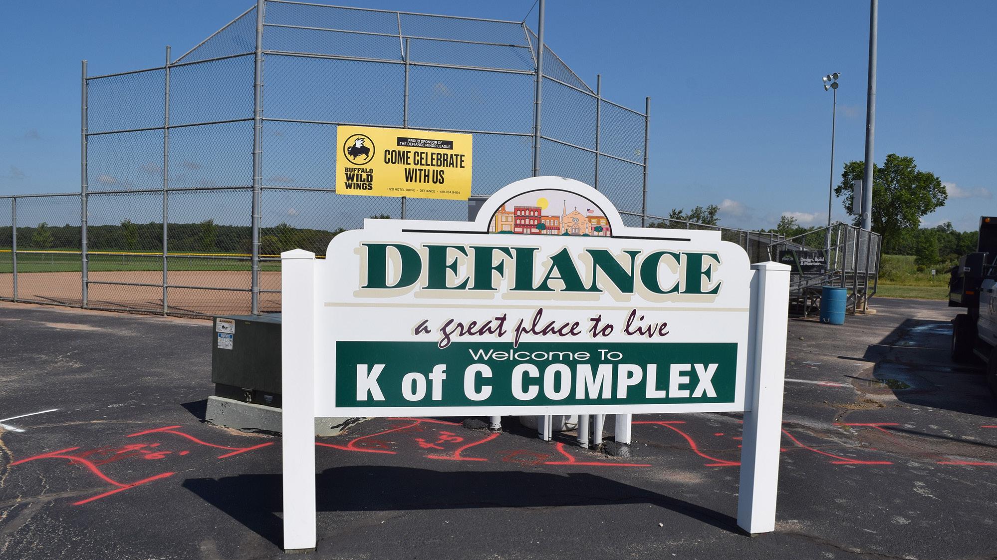
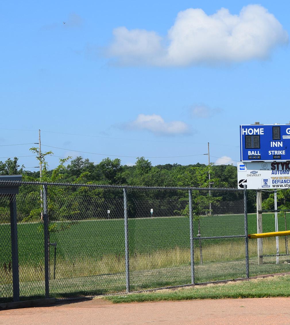
ESTIMATED INVESTMENT SUMMARY
Quick Wins: $20,000
Simple But Requires Funding: $0
Major Capital Projects: $2,500,000
Park Total: $2,520,000
POTENTIAL FUNDING SOURCES & PARTNERS
City Budget, Educational Resources, Grassroots Fundraising, Local Civic Organizations
City Budget, Corporate, Foundations, Local Civic Organizations, Municipal Bonds, ODNR, Park Users, Special Interest Organizations
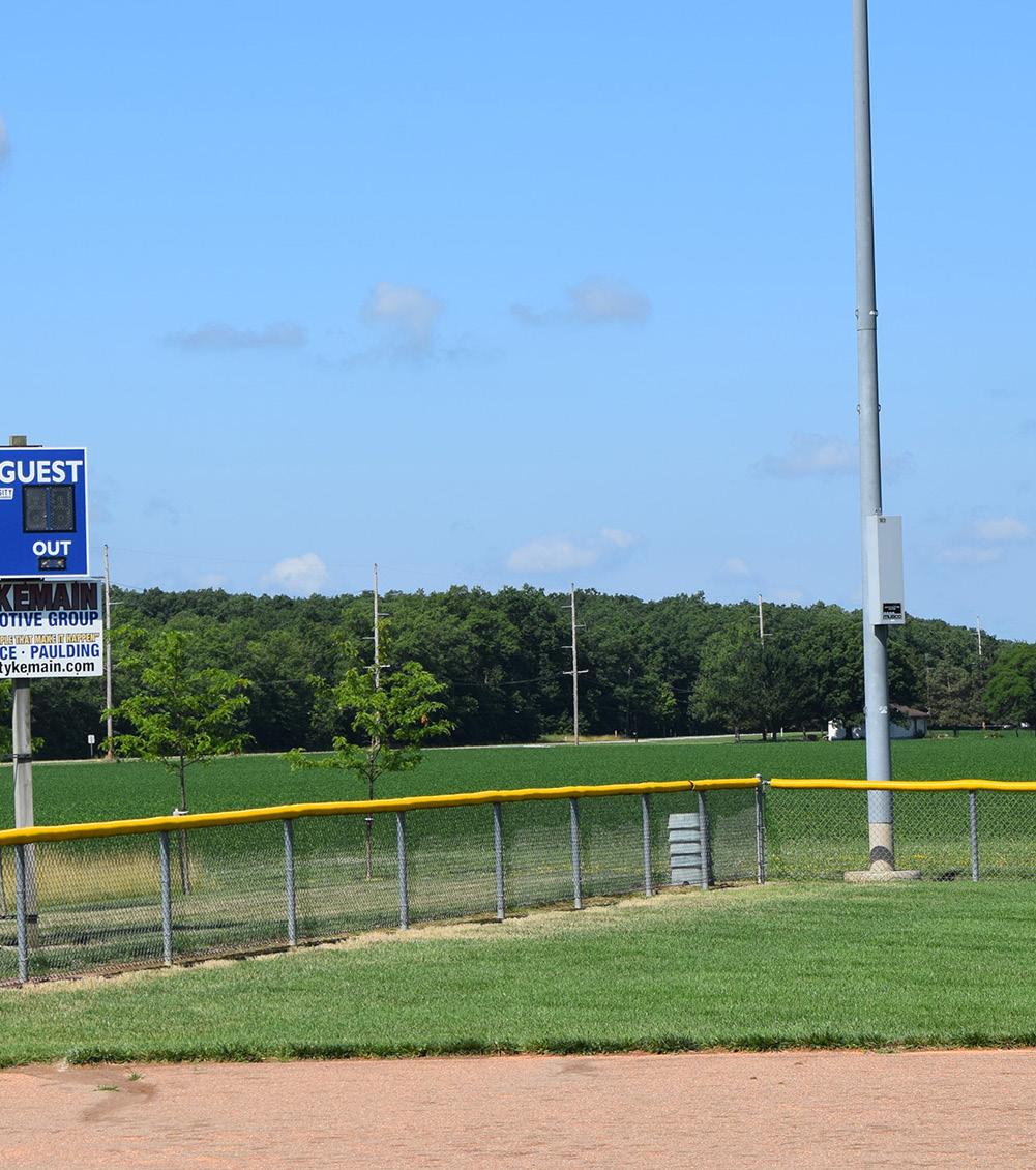
COMPLETED
COMPLETED
COMPLETED
Secure funding; finalize selection of vendor and desired location
Develop a concept master plan for new proposed improvements and coordinate with adjacent property owners
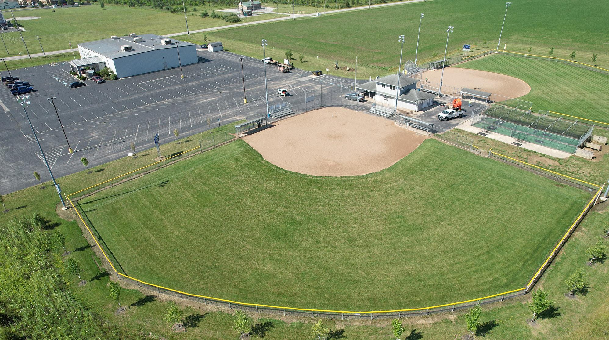
Action Plan
LIVINGSTON PARK
Goal #1: Health & Social Justice
The addition of accessible pathways ensures equitable access to all areas of the park, particularly the activated art corridor. By inviting high school students to contribute to the murals annually, the park becomes a platform for youth expression and community pride. These inclusive and interactive features promote mental wellness, creativity, and a sense of belonging.
Goal #2: Environmental Quality / Flood Risk
Enhancing the existing stormwater swale with native plantings to form a bioswale supports natural water filtration, improves stormwater management, and adds ecological value. The introduction of additional trees and landscape plantings helps cool the space, reduce erosion, and support pollinators, all while contributing to a more sustainable and resilient park environment.
Goal #3: Vibrancy & Placemaking
Though not on the river, Livingston Park enhances citywide vibrancy by transforming underused space into an inviting cultural and recreational node. The formal garden area, public art, and activation nodes help define a strong sense of place. Seasonal art installations and a thoughtfully designed landscape make this a unique destination within the local park system.
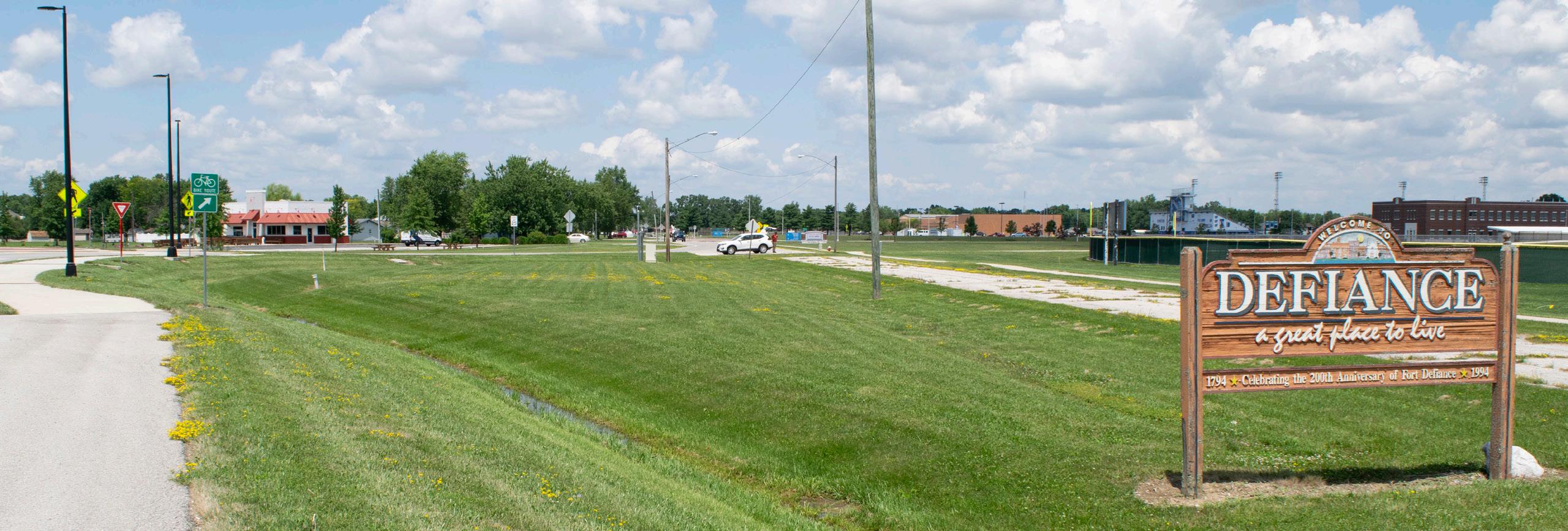
Activate the old roadway corridor on the east side of the property by having senior high school students incorporate murals or by incorporating a professional art mural
Observe success of high school murals, release RFQ / RFP for muralist
PEDESTRIAN BRIDGE
NATURAL LANDSCAPE BUFFER
PALMERDR
ACTIVATION NODE
BIOSWALE PLANTING AREA
PUBLIC ART MURAL
GATEWAY SIGNAGE (TYP)
LEGEND
Programmed Landscape
Natural Landscape
Plaza / Hardscape
Bridge / Overlook
Pedestrian Circulation
Gateway Signage
Activation Node
Sculpture / Monument
Educational Stations
Shade Trees
FORMAL LANDSCAPE GARDEN
JEFFERSON AVE
Action Plan, continued: LIVINGSTON PARK
- Cost Savings or No Increase - Minor Increase
Incorporate landscape plantings and trees to soften park space
Incorporate accessible pathways to old roadway corridor on the east side of the park (Comprehensive Plan, CC 10)
Activate the old roadway corridor on the east side of the property by having senior high school students incorporate murals or by incorporating a professional art mural (Comprehensive Plan, DR 3)
Enhance the existing stormwater swale to include native plants as a bioswale (Comprehensive Plan, U 11)
Develop design for the formal garden area and activation node at the heart of the park (Comprehensive Plan, DR 3)
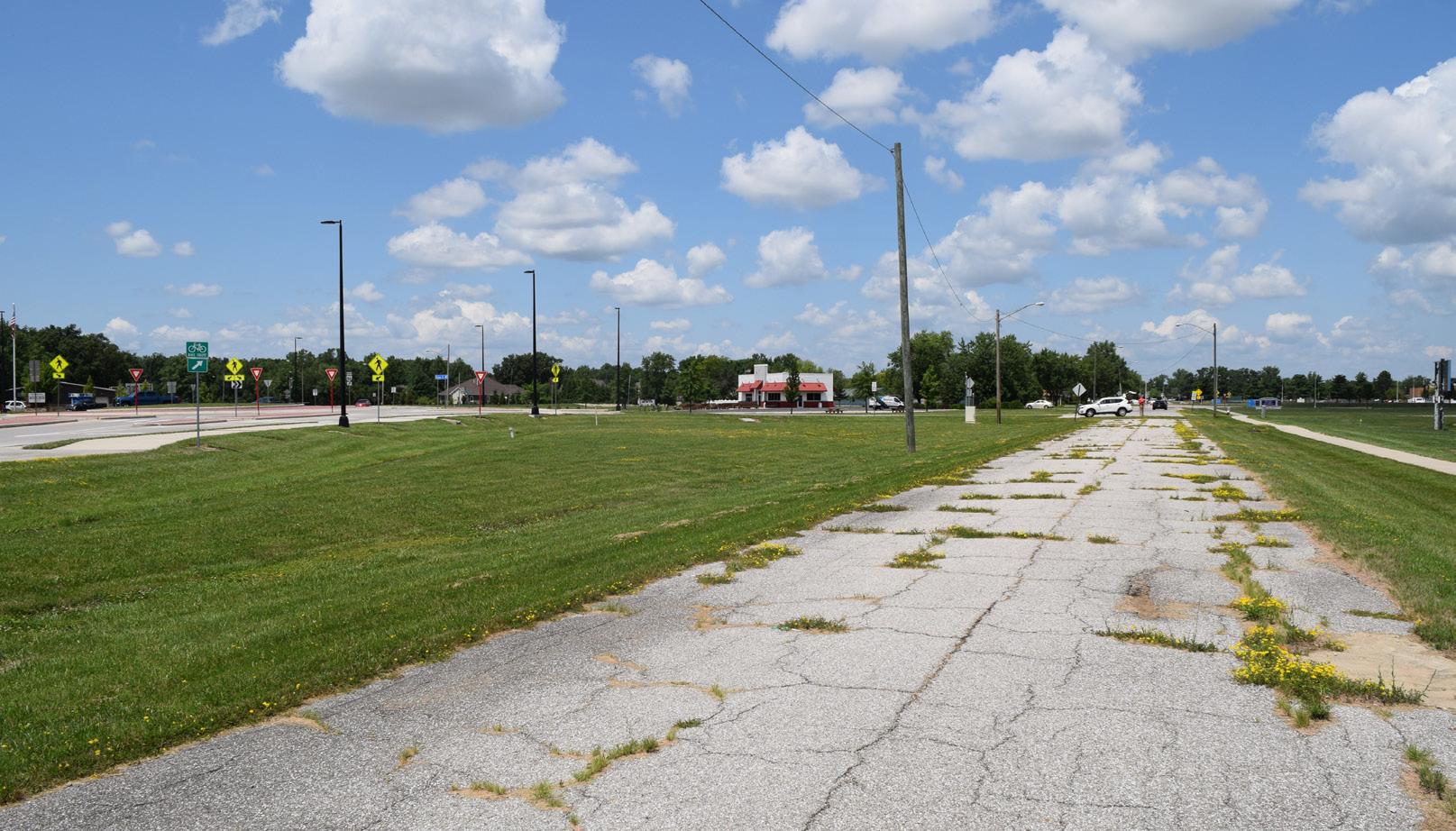
Division,
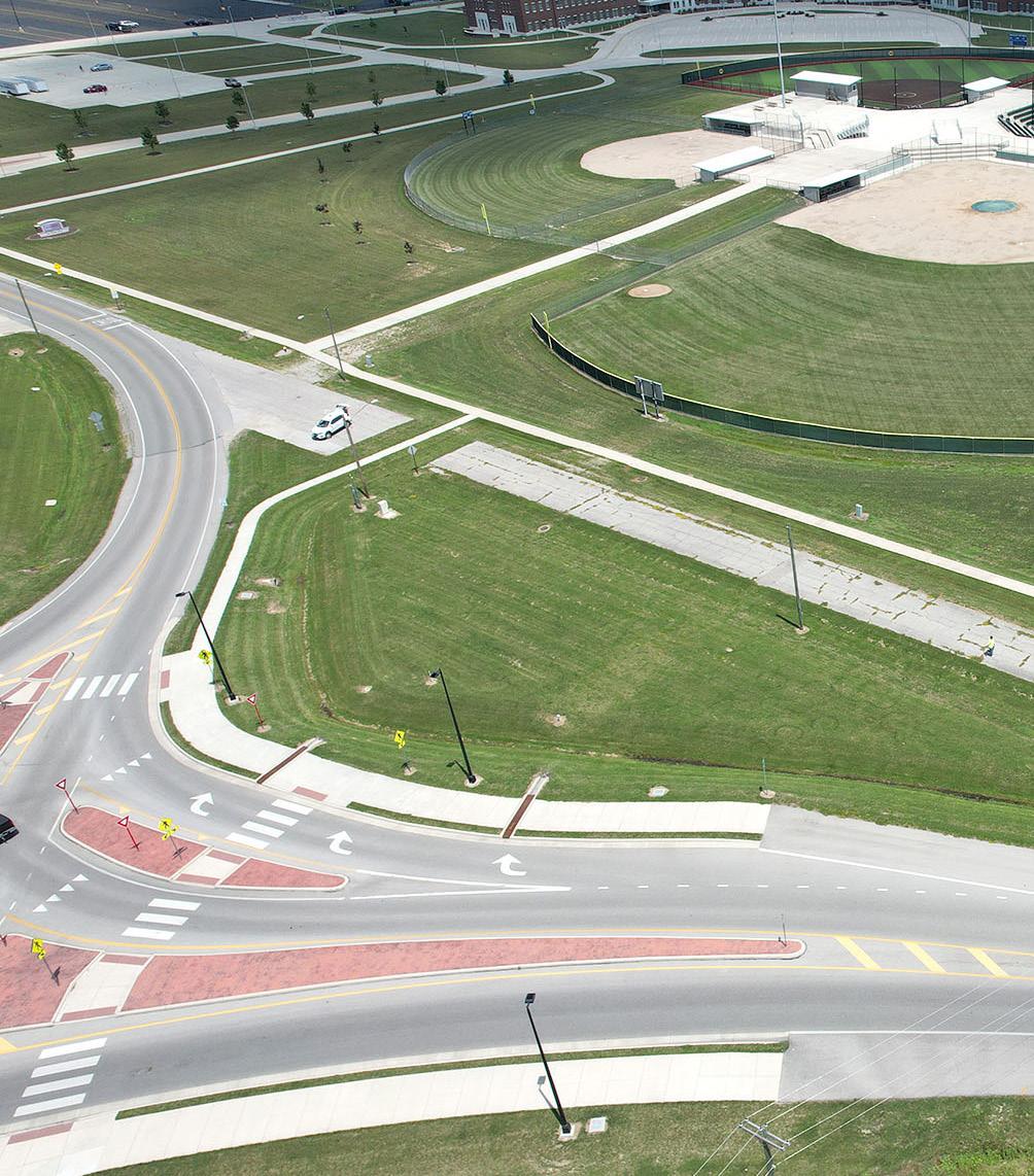
Develop designs and select desired locations
Determine desired final routes of pathways
Partner with high school to facilitate design competition for high school students
Secure funding and develop RFQ / RFP to select consultant for project or develop designs / plans internally
Develop steering committee for design
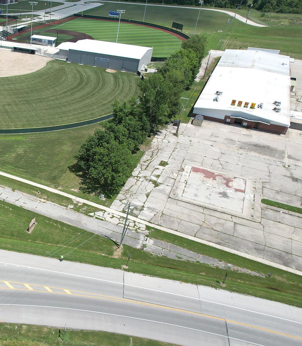
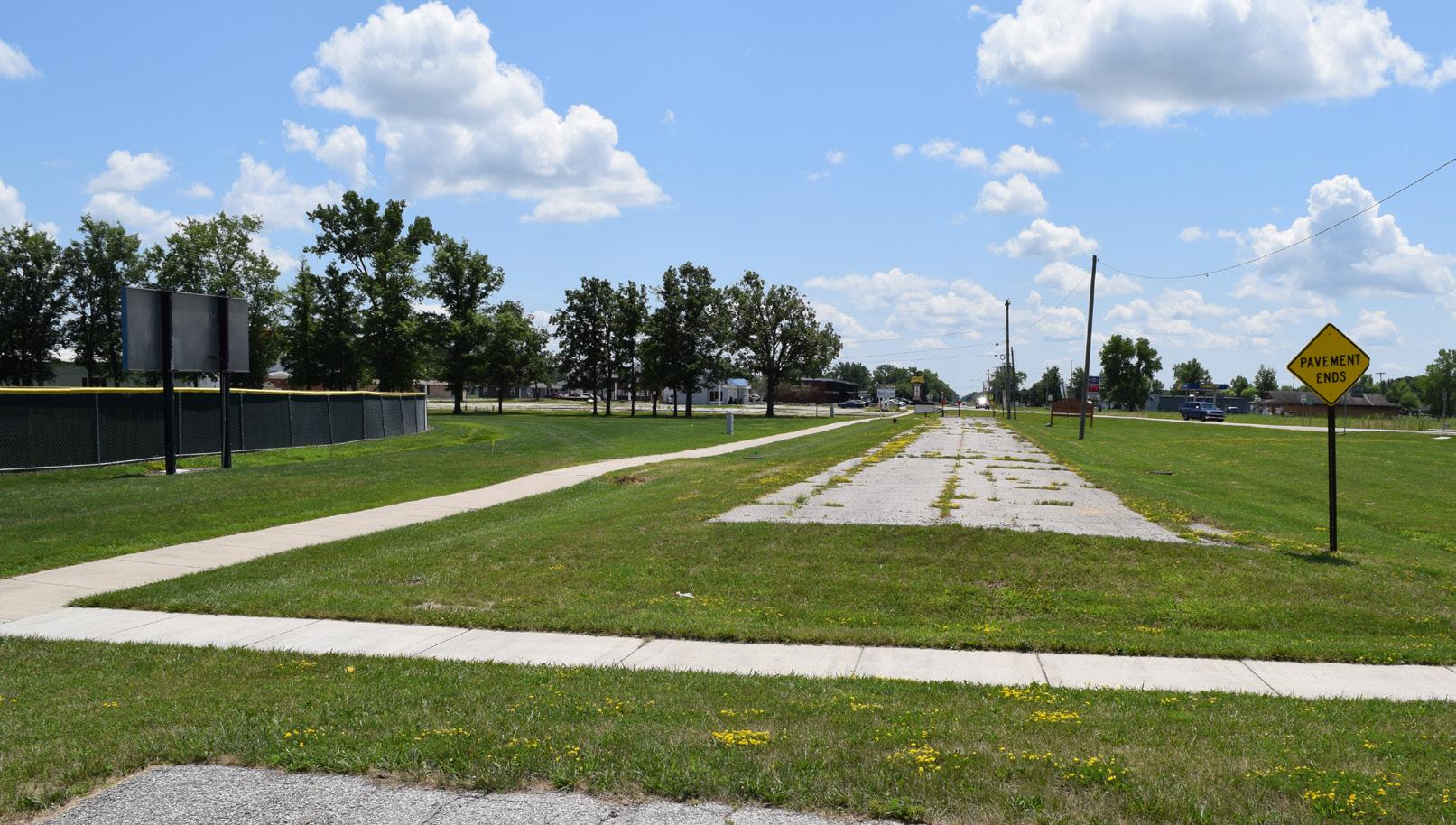
Action Plan
MEMORY PARK
Goal #1: Health & Social Justice
The addition of walking loops, seating areas, and lighting enhances accessibility, safety, and comfort for all users, including seniors and individuals with limited mobility. The calm, formal setting offers a space for reflection, low-impact physical activity, and mental wellness, supporting a more inclusive park experience.
Goal #2: Environmental Quality / Flood Risk
Formal plantings and landscape buffers soften the edge of the park and help filter pollutants from runoff, contributing to stormwater management and cleaner air. The proposed water features provide both aesthetic and functional benefits, including sound dampening from nearby traffic and supporting small-scale habitat and cooling effects.
Goal #3: Vibrancy & Placemaking
Memory Park, though not located along the river, plays a key role in downtown placemaking by offering a refined, peaceful public space in a highly visible location. The gateway feature and entrance plaza along 5th Street create a strong sense of identity and arrival, while the water elements add sensory interest and draw visitors in.
Goal #4: Improve Connectivity
The new walkways improve internal movement and links key elements within the small park, enhancing walkability and encouraging everyday use. The clear entrance along 5th Street also strengthens visibility and access, helping integrate
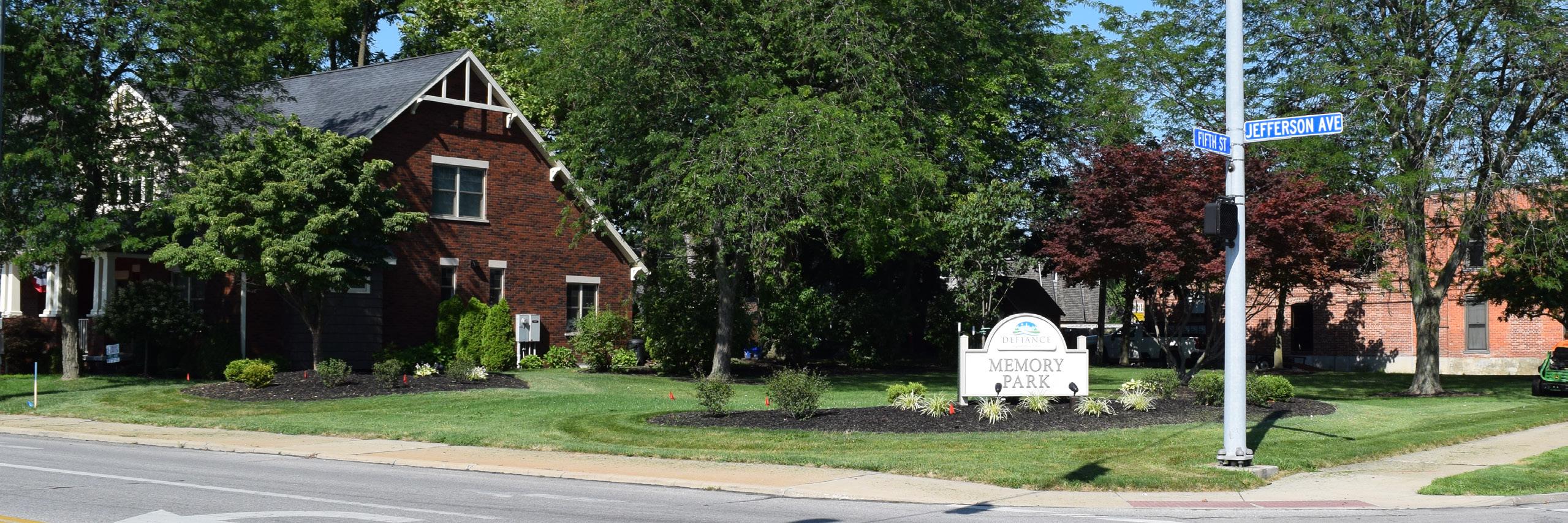
Incorporate additional pathways throughout the park with seating opportunities
Determine the final design layout
5THST
PATHWAYS
GATEWAY FEATURE
PLAZA SPACE
FEATURE
PLANTING SPACE
SEATING OPPORTUNITY (TYP)
OPEN LAWN SPACE
CONCEPT 1: Favored by the community. Overview of concepts can be found in Section 5.
LEGEND
Water Features
Plaza / Hardscape
Building / Structure
Pedestrian Circulation
Seating Opportunity
Gateway Signage
LIGHTED
WATER
JEFFERSONAVE
Action Plan, continued: MEMORY PARK
BUDGET IMPACTS
- Cost Savings or No Increase - Minor Increase - Major Increase
Incorporate additional pathways throughout the park with seating opportunities (Comprehensive Plan, DR 3)
Incorporate lighting along the proposed pathways and seating nodes (Comprehensive Plan, DR 3)
Incorporate formal planting spaces to develop a buffer from the adjacent roadways
Install gateway feature and entrance plaza along 5th Street that connects to pathways and incorporates water features for sound dampening and calming qualities (Comprehensive Plan, DR 3)
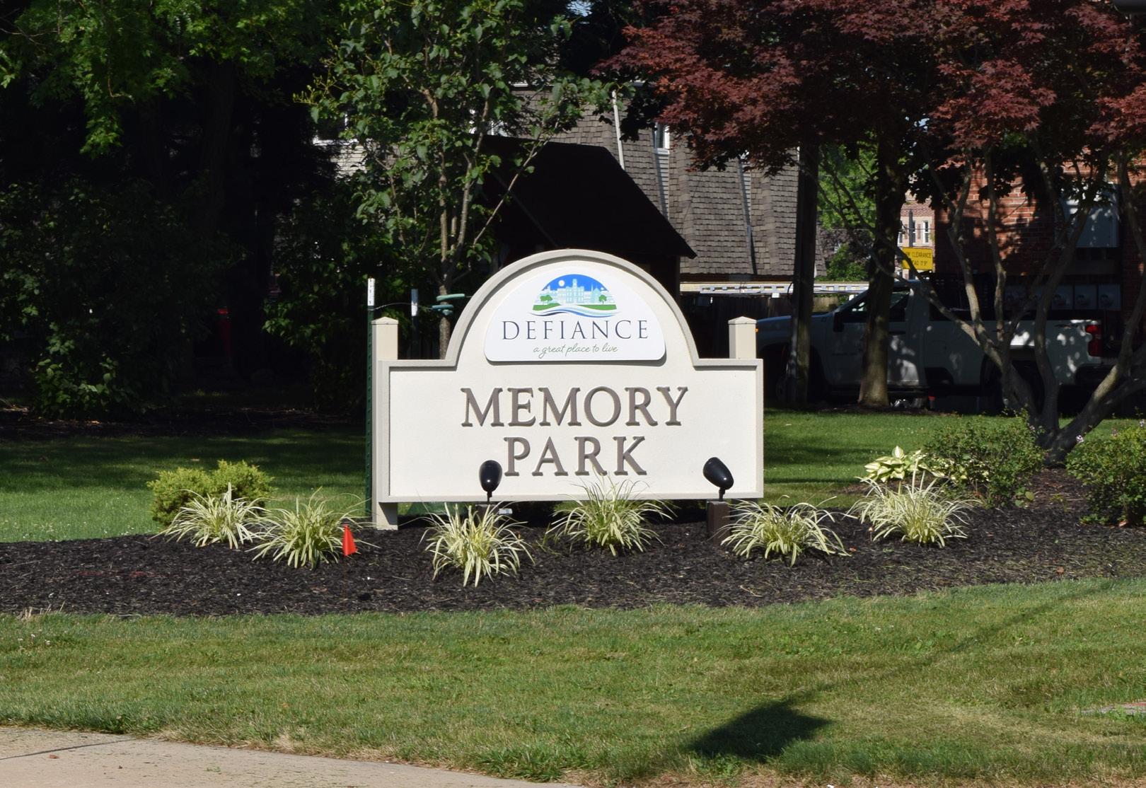
Parks Division, Engineering Division, Planning Division
Division
Parks Division, Engineering Division
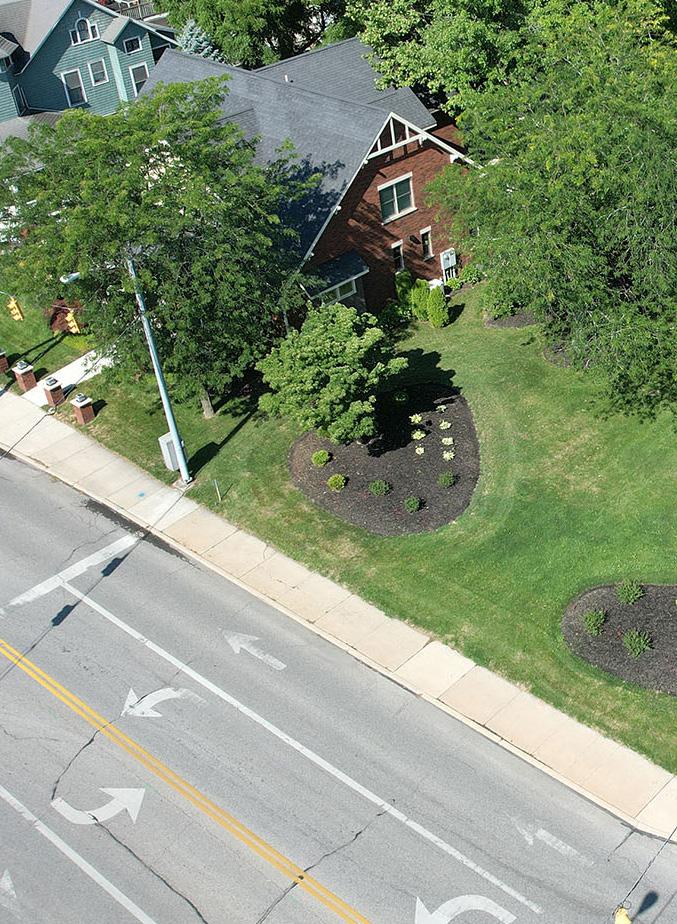
ESTIMATED INVESTMENT SUMMARY
Quick Wins: $50,000
Simple But Requires Funding: $100,000
Major Capital Projects: $750,000
Park Total: $900,000
POTENTIAL FUNDING SOURCES & PARTNERS
City Budget, Corporate, ODNR
$
City Budget, Corporate, Local Civic Organizations $50,000 $
City Budget, Corporate, Educational Resources, Local Civic Organizations, Special Interest Organizations
$$
Arts Organizations, City Budget, Corporate, Educational Resources, Local Civic Organizations, Municipal Bond, Special Interest Organizations $750,000 $$$
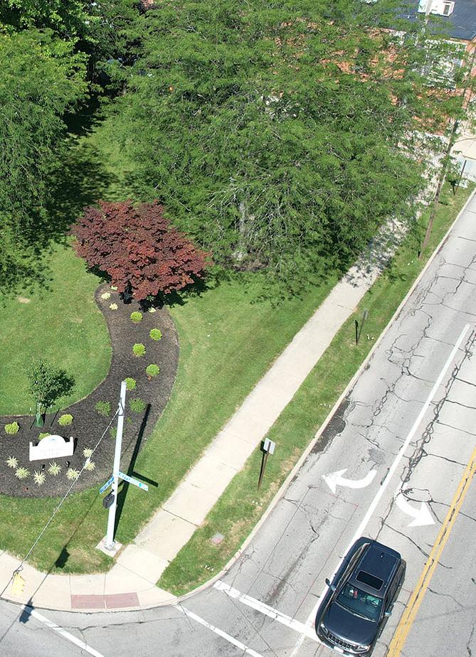
Secure funding and develop RFQ / RFP to select consultant for project or develop designs / plans internally
Incorporate lighting with the sidewalk installation noted above or determine light levels and areas desired to be lit
Determine areas desired for buffer and coordinate with adjacent property owners
Develop steering committee for design (could include adjacent business owners and park users)
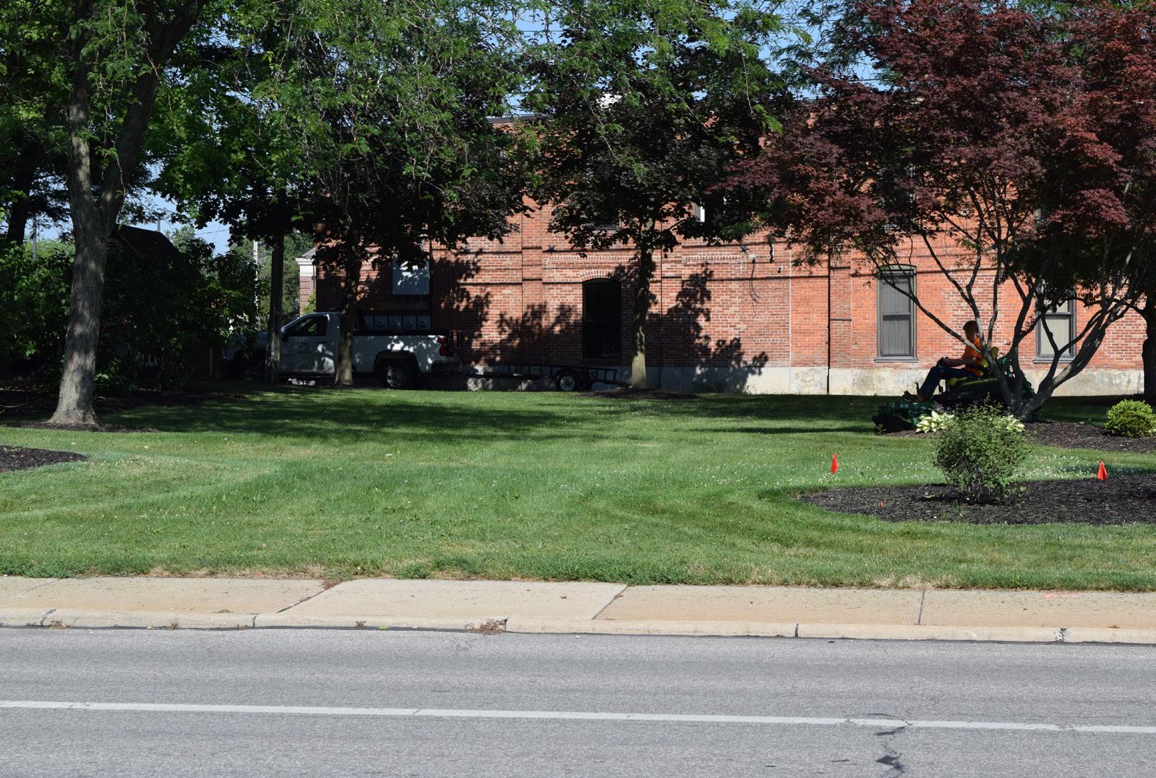
Action Plan
PALMER PARK
Goal #1: Health & Social Justice
Palmer Park’s updates promote inclusive, active recreation through the installation of new playground equipment with accessible surfacing and shaded seating. Upgraded tennis courts with lighting extend playable hours and improve safety, while shaded viewing areas and sidewalk extensions ensure the park is welcoming and accessible for all ages and abilities.
Goal #2: Environmental Quality / Flood Risk
The addition of shade trees along the eastern border contributes to cooling, improved air quality, and stormwater absorption. These enhancements help soften the park's edge and reduce the environmental impact of hard surfaces while improving aesthetics and comfort.
Goal #3: Vibrancy & Placemaking
Although not adjacent to the river, Palmer Park adds to the vibrancy of the City’s park network. A new park sign increases visibility and identity, while a mural on the resurfaced tennis courts brings color, culture, and a unique local touch – making the park a more engaging and inviting community space.
Goal #4: Improve Connectivity
The sidewalk extension along Palmer Drive improves pedestrian access and safety for neighbors and visitors alike. Combined with improved internal seating and circulation between amenities, these changes support a more
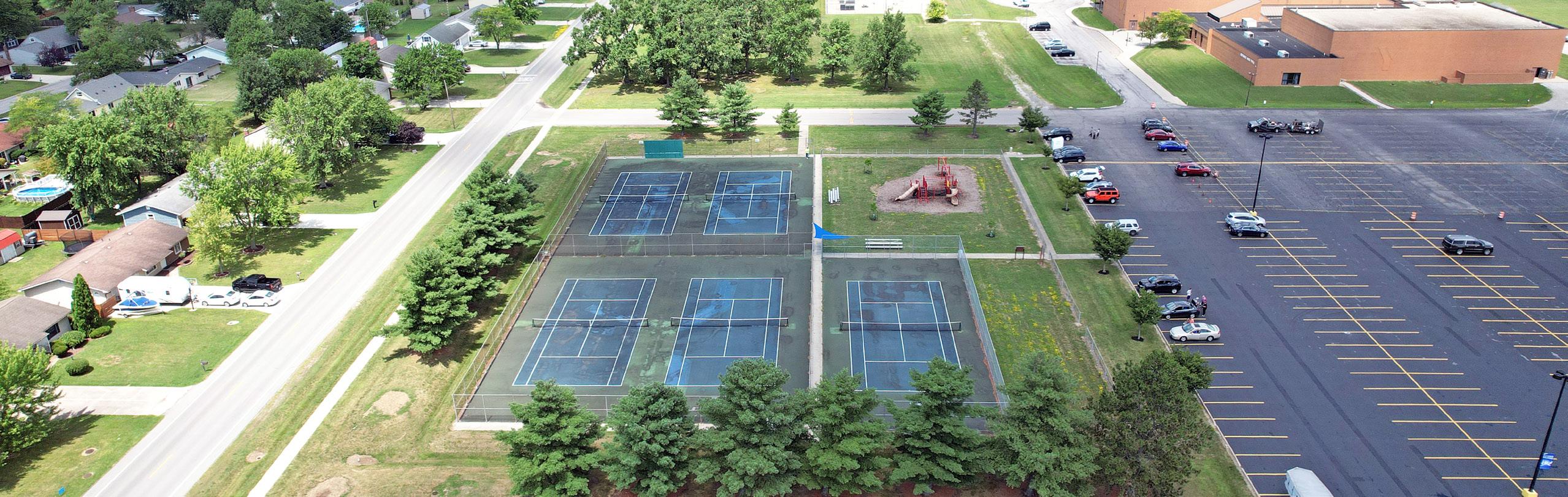
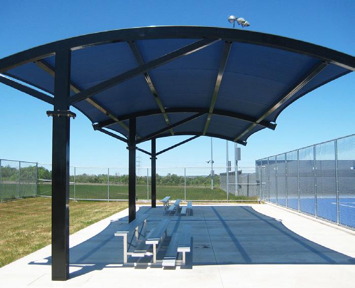
Incorporate shaded seating areas with trash and recycling receptacles between the existing tennis courts and playground for viewing into both spaces
Secure funding and develop RFQ / RFP to select consultant for project or develop designs / plans internally
PARK SIGN
COURT LIGHTS (TYP)
SHADED BLEACHER SEATING
NEW PLAY EQUIPMENT (TYP)
ACCESSIBLE SAFETY SURFACING
SHADED SEATING OPPORTUNITY
RECONSTRUCTION OF TENNIS COURTS
CONCEPT 1: Favored by the community. Overview of concepts can be found in Section 5.
LEGEND
Sports Programming
Play Programming
Parking Lot
Building / Structure
SHADE TREES
ADA PARKING
Pedestrian Circulation
Seating Opportunity
Court Lights
Shade Trees
Action Plan, continued: PALMER PARK
BUDGET IMPACTS
- Cost Savings or No Increase - Minor Increase - Major Increase
Install new parking sign with lighting (Comprehensive Plan, DR 3)
Install shade trees along the eastern border of property
Incorporate sidewalk extension to the existing sidewalk along Palmer Drive
Perform full reconstruction of tennis courts and incorporate at least one painted mural inspired by the park, a historical component, or adjacent neighborhoods
Incorporate court lighting on the tennis courts
Install new equipment in the playground with accessible poured-in-place surfacing
Parks Division, Planning Division
Parks Division, Engineering Division
Parks Division, Engineering Division
Parks, Planning, and Engineering Divisions
Parks Division, Engineering Division
Parks Division, Planning Division
Incorporate shaded seating areas with trash and recycling receptacles between the existing tennis courts and playground for viewing into both spaces Engineering Division Color Key
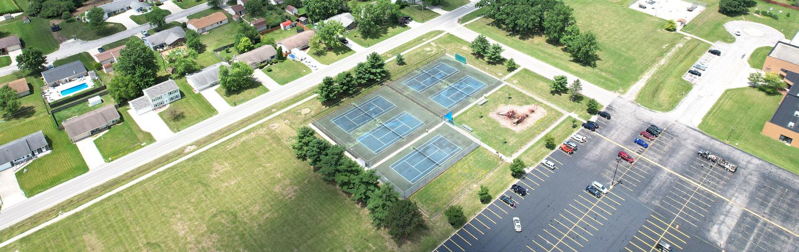
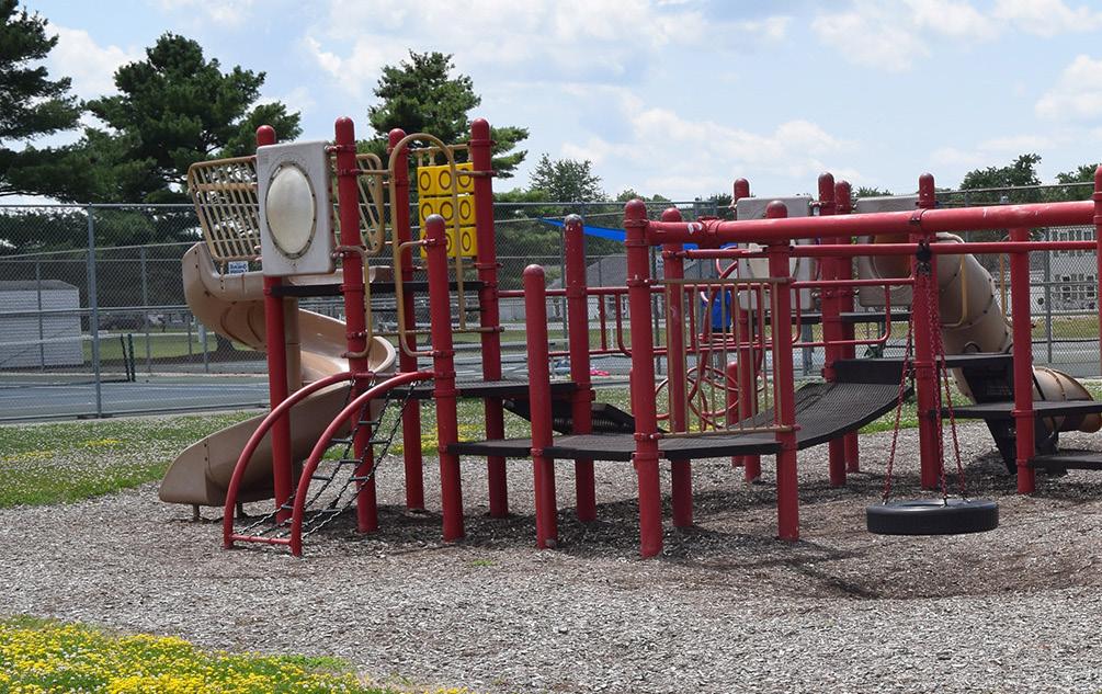
ESTIMATED INVESTMENT SUMMARY
Quick Wins: $50,000
Simple But Requires Funding: $1,250,000
Major Capital Projects: $200,000
Park Total: $1,500,000
FUNDING SOURCES & PARTNERS
City Budget, Educational Resources, Local Civic Organizations, Park Users, Special Interest Organizations
City Budget, Corporate
Arts Organizations, City Budget, Corporate, Local Civic Organizations, Park Users
City Budget, Corporate
Adjacent Owners, City Budget, Corporate, Foundations, Local Civic Organizations, Local Health Networks, ODNR, Special Interest Organizations
City Budget, Corporate, Foundations, Local Civic Organizations, Local Health Networks, ODNR, Special Interest Organizations
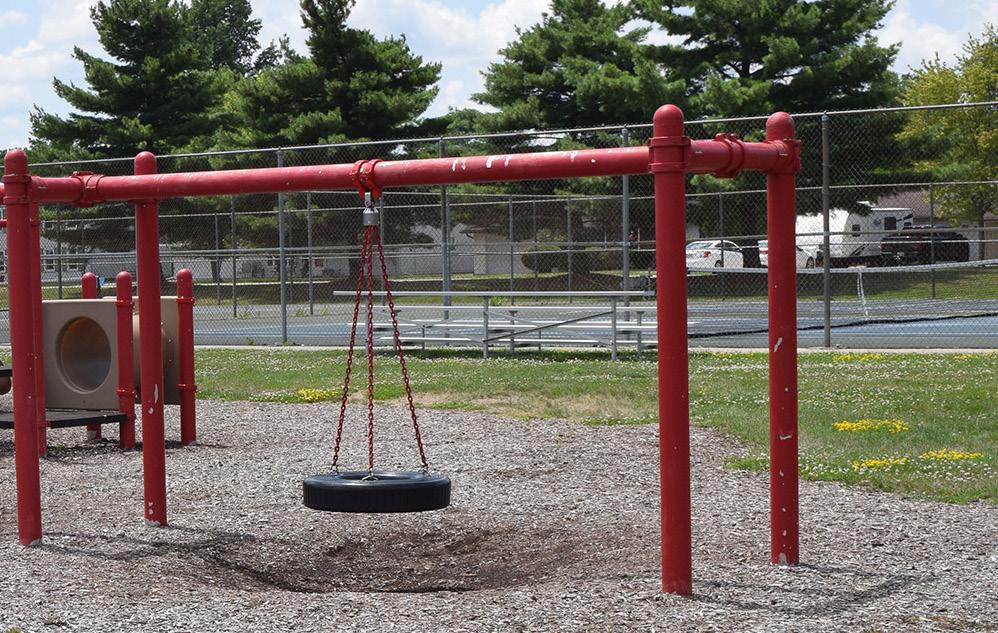
Determine desired locations for trees
Coordinate with City-wide plans to encompass within another project or pour sidewalk internally after securing necessary permits / approvals
Secure funding and select contractor while also developing potential RFQ / RFP for artist to install mural on new surface; consider grouping court murals together in a single RFQ / RFP
Confirm existing power capacity is available on site and secure electrical consultant to develop designs and select appropriate light fixtures
Coordinate with local neighborhood and/or playground user group to determine current needs or missing play components
Secure funding and develop RFQ / RFP to select consultant for project or develop designs / plans internally
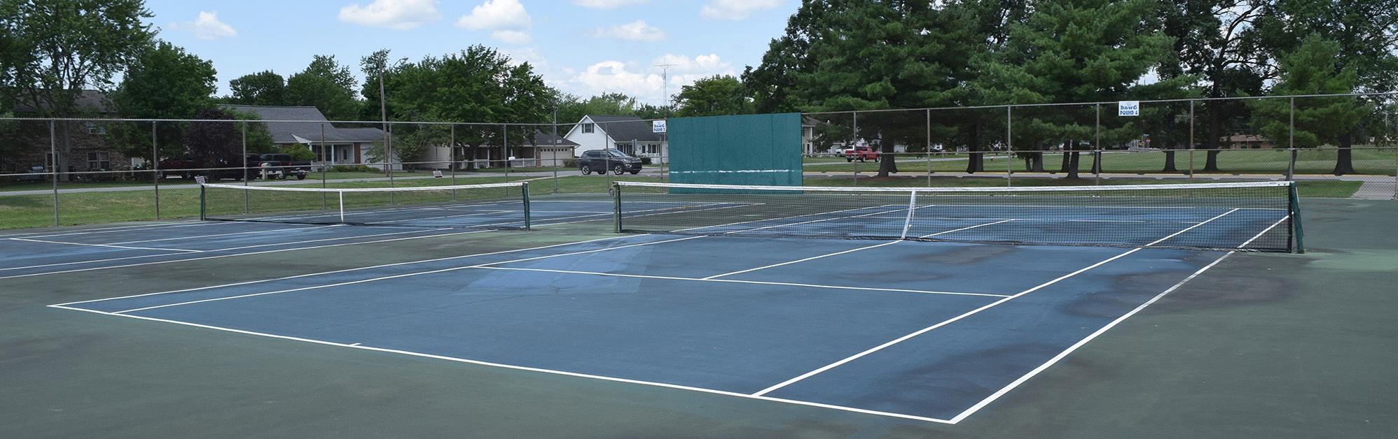
PONTIAC METRO PARK
Goal #1: Health & Social Justice
The addition of shade trees, upgraded walkways, and improved parking facilities increases comfort and accessibility for all users—including families, seniors, and those with mobility needs. A redesigned memorial plaza and a future riverfront event center will further support inclusive community gathering and programming, reinforcing the park’s role as a space for shared celebration, remembrance, and reflection.
Goal #2: Environmental Quality / Flood Risk
Native plantings throughout the park will beautify the space while enhancing stormwater management, reducing maintenance, and stabilizing the shoreline to prevent erosion along the riverbank. These improvements, combined with shade trees and sustainable landscape design, support ecological health in a flood-prone area while maintaining the natural character of this riverfront park.
Goal #3: Vibrancy & Placemaking
Pontiac Metro Park is a vital civic space along the Maumee River, and proposed updates like the memorial plaza redesign, event center, and reconstructed boat launch will elevate its role as a community landmark. These enhancements celebrate local history and heritage – from Chief Pontiac to Johnny Appleseed – while creating a flexible, welcoming environment for events, recreation, and cultural programming.
Goal #4: Improve Connectivity
New walkways along East River Drive and expanded, accessible parking improve circulation to and within the park.
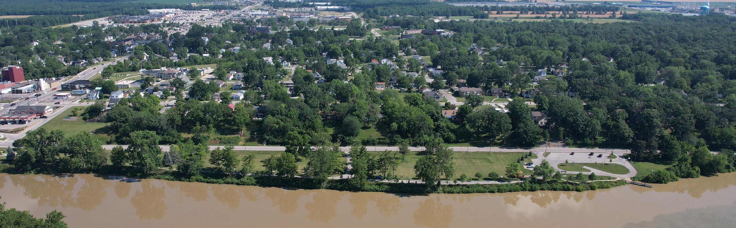
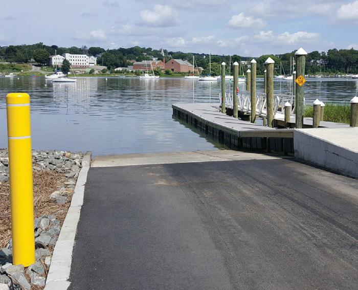
Reconstruct existing boat launch and install parking lot expansion and repave the existing parking lot along East River Drive
Secure funding and/or develop architectural and engineered drawings; contact ODNR for permitting
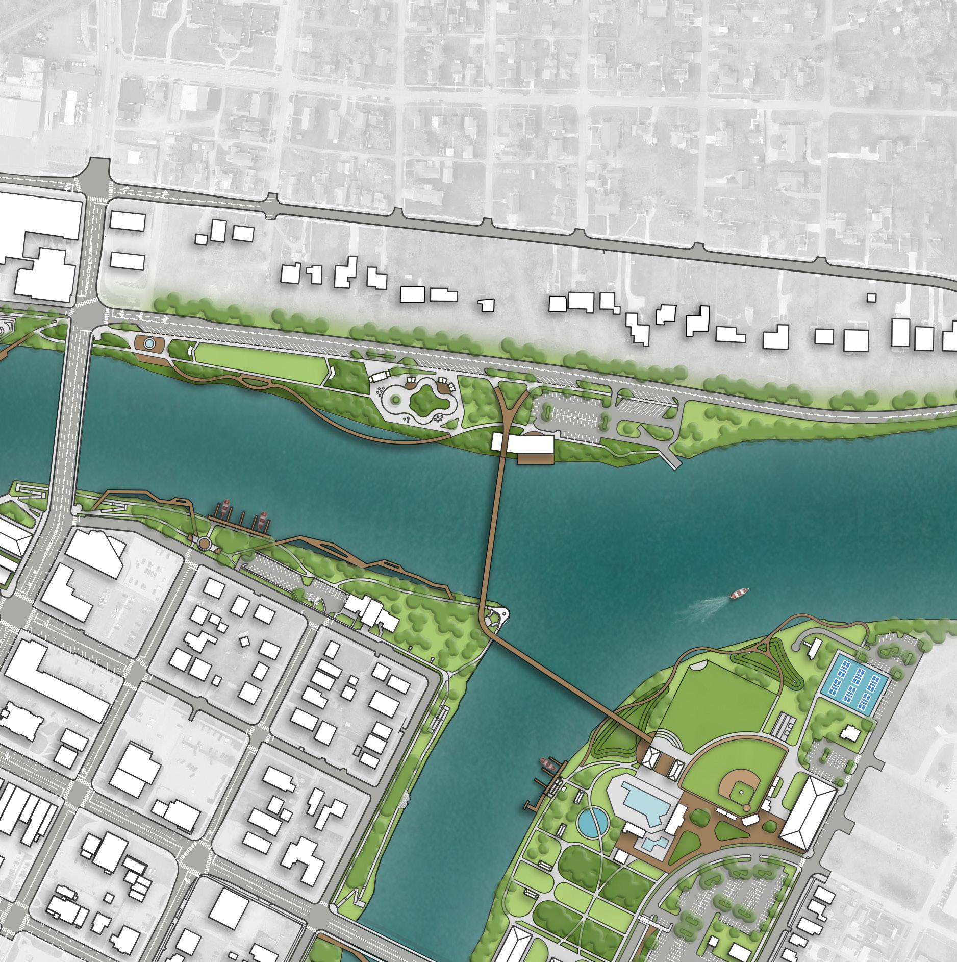
REFINED CONCEPT: Overview of concepts can be found in Section 5.
PROPOSED FEATURES
A Shade Trees
B Concrete Walkways
C On-Street Parking
D Expanded Parking Lot
E Historical Plaza
F Event Center with Overlook Deck
G Pedestrian Bridge
H Updated Boat Launch
I Ice Skating Ribbon
J Boardwalk
K Open Lawn
EXISTING FEATURES
1 Existing Parking Lot
2 Existing Fountain
Action Plan,
PONTIAC METRO PARK
Color Key OPERATIONAL BUDGET IMPACTS
- Cost Savings or No Increase
- Minor Increase - Major Increase
Install kayak rental station and support facilities (Comprehensive Plan, CC 5)
Install shade trees (Comprehensive Plan, U 11)
Incorporate native plantings in strategic locations throughout the site to define spaces, beautify the park, ease mowing maintenance, and promote shoreline stabilization (Comprehensive Plan, U 11)
Install additional concrete walkways adjacent to East River Drive (Comprehensive Plan, CC 4 and CC 10)
Install multi-use lawn with two pergolas and seating (Comprehensive Plan, U 11)
Install paved and angled on-street parking along East River Drive to support current and future needs of the park (Comprehensive Plan, DR 8 and CC 4)
Relocate historical markers to new memorial plaza (as applicable), incorporating the existing fountain and associated walkways; install river overlook south of the fountain
Facilitate development of a new event center with a deck overlooking the river
Install parking lot expansion and repave the existing parking lot along East River Drive
Parks Division, County Parks Division, Engineering Division, Planning Division
Parks Division, Arbor Day Event
Parks Division, Engineering Division
Parks Division, Engineering Division
Parks Division, Engineering Division
Parks Division, County Parks Division, Engineering Division
Parks Division, County Parks Division, Engineering Division, Planning Division
Parks Division, County Parks Division, Engineering Division, Planning Division
Parks Division, County Parks Division, Engineering Division, Planning Division
ESTIMATED INVESTMENT SUMMARY
Quick Wins: $2,975,000
Simple But Requires Funding: $1,000,000
Major Capital Projects: $18,900,000
Park Total: $22,875,000
City Budget, Local Civic Organizations, Metro Parks, Park Users, Special Interest Organizations
City Budget, Corporate, Local Civic Organizations, Metro Parks, Special Interest Organizations
City Budget, Corporate, Metro Parks, ODNR
City Budget, Corporate, Foundations, Local Civic Organizations, Metro Parks, Park Users, Special Interest Organizations
City Budget, Transportation Funding
City Budget, Corporate, Local Civic Organizations, Metro Parks, Park Users, Special Interest Organizations
City Budget, Corporate, Foundations, Metro Parks, Municipal Bonds, ODNR, Special Interest Organizations, State & Federal Appropriations
City Budget, Corporate, Foundations, Metro Parks, Municipal Bonds, ODNR, Special Interest Organizations
IN PROGRESS
Secure trees and organize tree planting day
Develop plan for priority planting areas
Develop plan highlighting the priority walkway connections
Secure funding and develop RFQ / RFP to select consultant for project or develop designs / plans internally
Secure funding and/or develop engineered drawings
Secure funding and/or develop engineered drawings
Secure funding and/or develop architectural and engineered drawings; contact ODNR for permitting
Secure funding and/or develop architectural and engineered drawings; contact ODNR for permitting
Continued on next page.
Action Plan,
PONTIAC METRO PARK
Color Key OPERATIONAL BUDGET IMPACTS
- Cost Savings or No Increase - Minor Increase - Major Increase
Upgrade existing boat dock and ramp
Install ice skating ribbon with building for check-in and storage, warming huts, and seating
Install river boardwalk (Comprehensive Plan, CC 10)
Parks Division, County Parks Division, Engineering Division, Planning Division
Parks Division, County Parks Division, Engineering Division
Parks Division, County Parks Division, Engineering Division
Install a pedestrian bridge (Comprehensive Plan, CC 9)
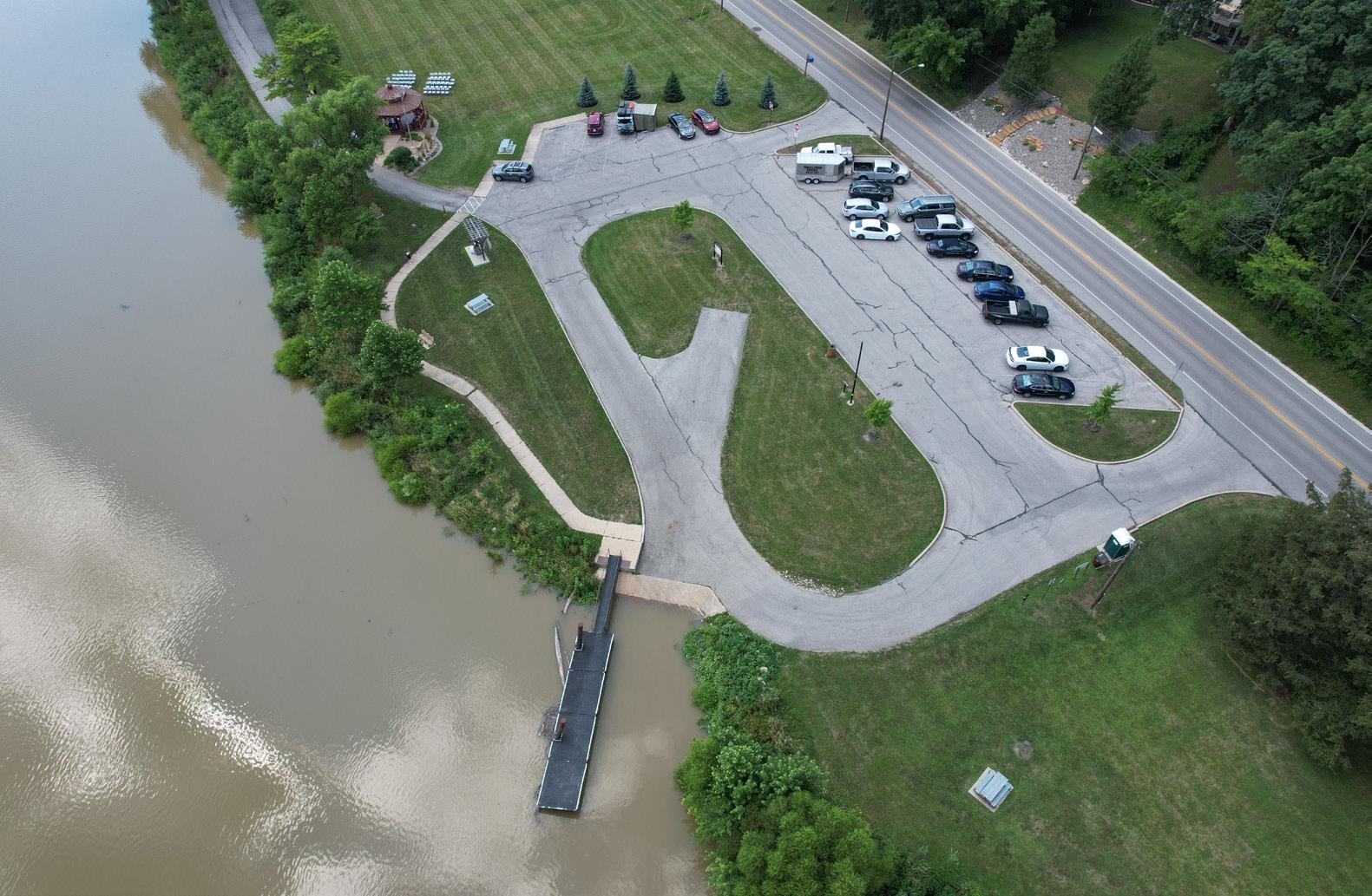
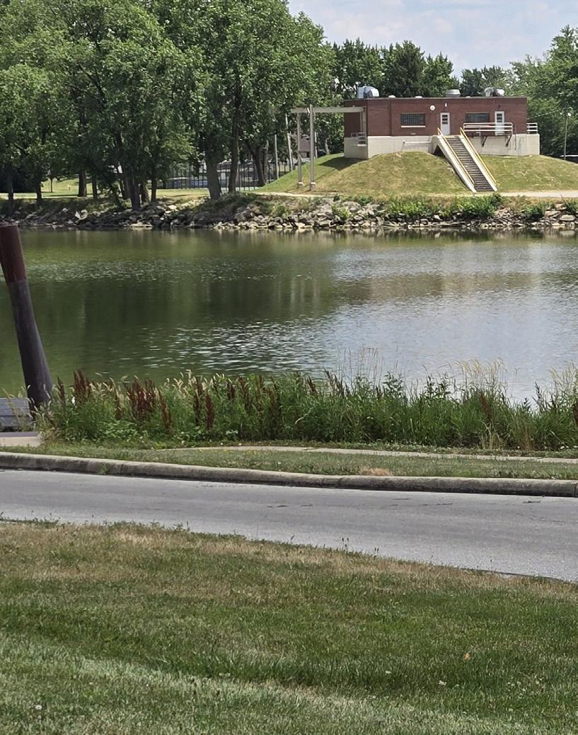
ESTIMATED INVESTMENT SUMMARY
Quick Wins: $2,975,000
Simple But Requires Funding: $1,000,000
Major Capital Projects: $18,900,000
Park Total: $22,875,000
POTENTIAL FUNDING SOURCES & PARTNERS
City Budget, Corporate, Foundations, Metro Parks, Municipal Bonds, ODNR, Special Interest Organizations
City Budget, Corporate, Foundations, Metro Parks, Municipal Bonds, ODNR, Special Interest Organizations
City Budget, Corporate, Foundations, Metro Parks, Municipal Bonds, ODNR, Special Interest Organizations, State & Federal Appropriations, Trail Organizations & Grants
$500,000 $$
$10,000,000 $$$
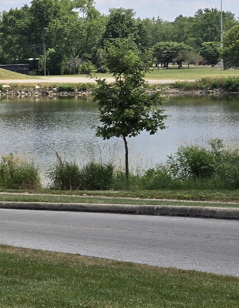
$2,000,000 $$
Secure funding and/or develop architectural and engineered drawings; contact ODNR for permitting
Perform feasibility study to determine need and demand for skating ribbon within Defiance
Secure funding and develop RFQ / RFP to select consultant for project or develop designs / plans internally
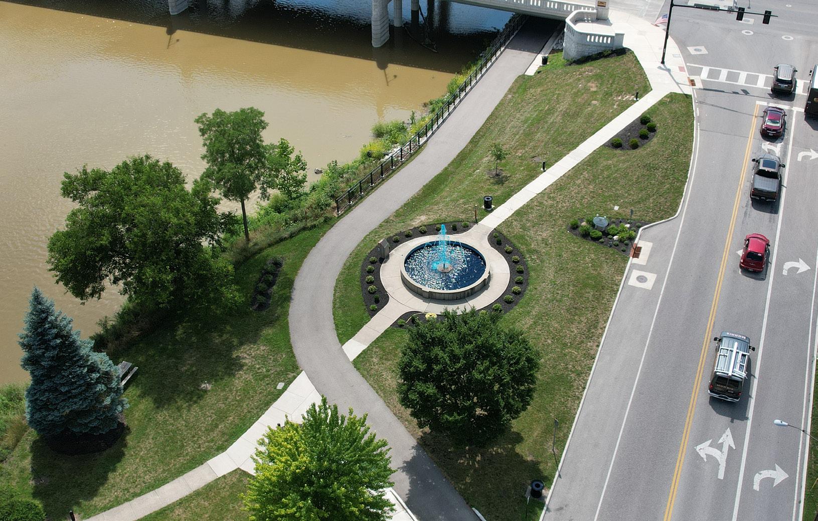
Action Plan
RESERVOIR RECREATIONAL AREA
Goal #1: Health & Social Justice
The improvements significantly enhance inclusive recreation and wellness opportunities. Accessible trails, playgrounds, shelter houses, restrooms, and fitness stations ensure the recreational area serves people of all ages and abilities. The addition of shaded seating, a StoryWalk trail, and swing benches offer mental and physical health benefits, while creating spaces for families and individuals to connect with nature and each other in a safe, welcoming environment.
Goal #2: Environmental Quality / Flood Risk
New tree plantings throughout the recreational area help manage stormwater, reduce erosion, and provide valuable shade and habitat. The woodland trail and nature overlook encourage stewardship of the environment while minimizing ecological impact through careful design.
Goal #3: Vibrancy & Placemaking
The scenic setting around the reservoir is further elevated with thoughtful additions like fishing piers, overlook extensions, and seating along trails – all of which make the reservoir a true destination. The integration of a StoryWalk trail, fireplaces, and exercise nodes blends passive and active uses, creating a year-round community gathering space that draws people in for both recreation and relaxation.
Goal #4: Improve Connectivity
Expanded and newly paved parking areas, accessible trails, and new walkways throughout the recreational area improve circulation and access across the site. A new east-west woodland trail and pedestrian crossings link visitors to shelter houses, fitness zones, and scenic areas more safely and intuitively. These improvements also connect the Reservoir Recreational Area more effectively with adjacent areas like Wertz Park, strengthening the overall park system’s connectivity.
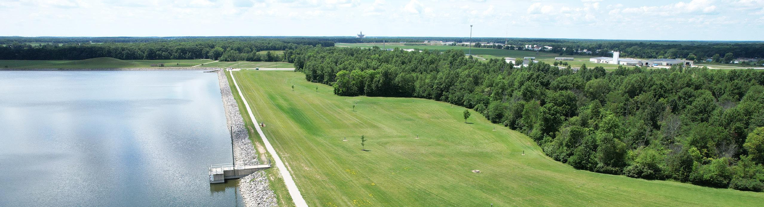
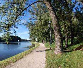
Install walkway lighting throughout the "lower" trail
Secure funding and develop RFQ / RFP to select consultant for project or develop designs / plans internally

REFINED CONCEPT: Overview of concepts can be found in Section 5.
PROPOSED FEATURES
A Paved Parking Lot
B Paved Accessible Walkway
C Playground
D Adult Fitness Station
E Shelter House with Restroom
F Paved Swing Bench Seating Area
G Pedestrian Lighting (TYP)
H Shelter House with Fireplace
I Nature Overlook
J Fishing Dock
K Pedestrian Crossing
L Woodland Trail
M Realigned Disc Golf Course
N Screening Mounds
O Expanded Butterfly Habitat
EXISTING FEATURES
1 Existing Walkway
2 Existing Nature Trail
3 Existing Nature Overlook
4 Existing Shelter Houses
5 Existing Sledding Hill
Action Plan,
RESERVOIR RECREATIONAL AREA
Color Key OPERATIONAL BUDGET IMPACTS
- Cost Savings or No Increase
- Minor Increase
- Major Increase
Install additional trees along the walkway surrounding the reservoir to provide shade, and within the disc golf course to provide both shade and additional obstacles to increase challenge of the course Parks Division
Install walkway lighting throughout the "lower" trail
Install concrete pathways in Wertz Park to connect to shelter houses
Install woodland StoryWalk trail along the southern edge of the woods (Comprehensive Plan, CC 10)
Install concrete throwing pads for the disc golf course
Parks Division, Engineering Division
Parks Division, Engineering Division
Parks Division, Engineering Division
Parks Division, Engineering Division
Install swing benches along the trail circling the "upper" 1.25-mile trail Parks Division
Install paved parking lot expansion along Precision Way, along with walkways from the parking lot to the upper reservoir and associated security lighting
Convert both existing gravel parking lots along Kibble Road to paved
Install adult fitness stations along the trail circling the "upper" and "lower" trails of the reservoir
Parks Division, Engineering Division
Parks Division, Engineering Division
Parks Division, Engineering Division
Quick Wins: $1,015,000
Simple But Requires Funding: $2,000,000
Major Capital Projects: $2,100,000
Park Total: $5,115,000
FUNDING SOURCES & PARTNERS
City Budget, Corporate
City Budget, Corporate, ODNR
City Budget, Corporate, Educational Resources, Local Civic Organizations, ODNR
City Budget, Local Civic Organizations, Park Users, Special Interest Organizations, Utility Funds
City Budget, Educational Resources, Local Civic Organizations
IN PROGRESS
Secure funding and develop RFQ / RFP to select consultant for project or develop designs / plans internally
Develop plan highlighting the priority connections
Coordinate with ODNR on funding opportunities and facilitate a partner to spearhead maintenance and ongoing updating of StoryWalk books
Secure funding and develop RFQ / RFP to select consultant for project or develop designs / plans internally
Secure funding and develop RFQ / RFP to select consultant for project or develop designs / plans internally City Budget, Corporate, ODNR, Utility Funds
Secure funding and develop RFQ / RFP to select consultant for project or develop designs / plans internally
Secure funding and select vendor for equipment ESTIMATED INVESTMENT SUMMARY
Secure funding and develop RFQ / RFP to select consultant for project or develop designs / plans internally City Budget, Local Health Networks, Local Civic Organizations, ODNR
Continued on next page.
Continued on next page.
RESERVOIR RECREATIONAL AREA
Color Key
OPERATIONAL BUDGET IMPACTS
- Cost Savings or No Increase
- Minor Increase
- Major Increase
Install additional fishing pier(s) on the reservoir to promote interaction with water
Install additional nature overlook extension off the existing boardwalk trail
Install walkway lighting throughout the "upper" trail and extended from parking lots
Install shelter house with restrooms, accessible playground with poured-inplace safety surfacing, and adult fitness equipment with nearby seating areas, pollinator habitats, and connector walkways; make adjustments to the disc golf course as required
Install a shelter house with a fireplace near the sledding hill at Wertz Park
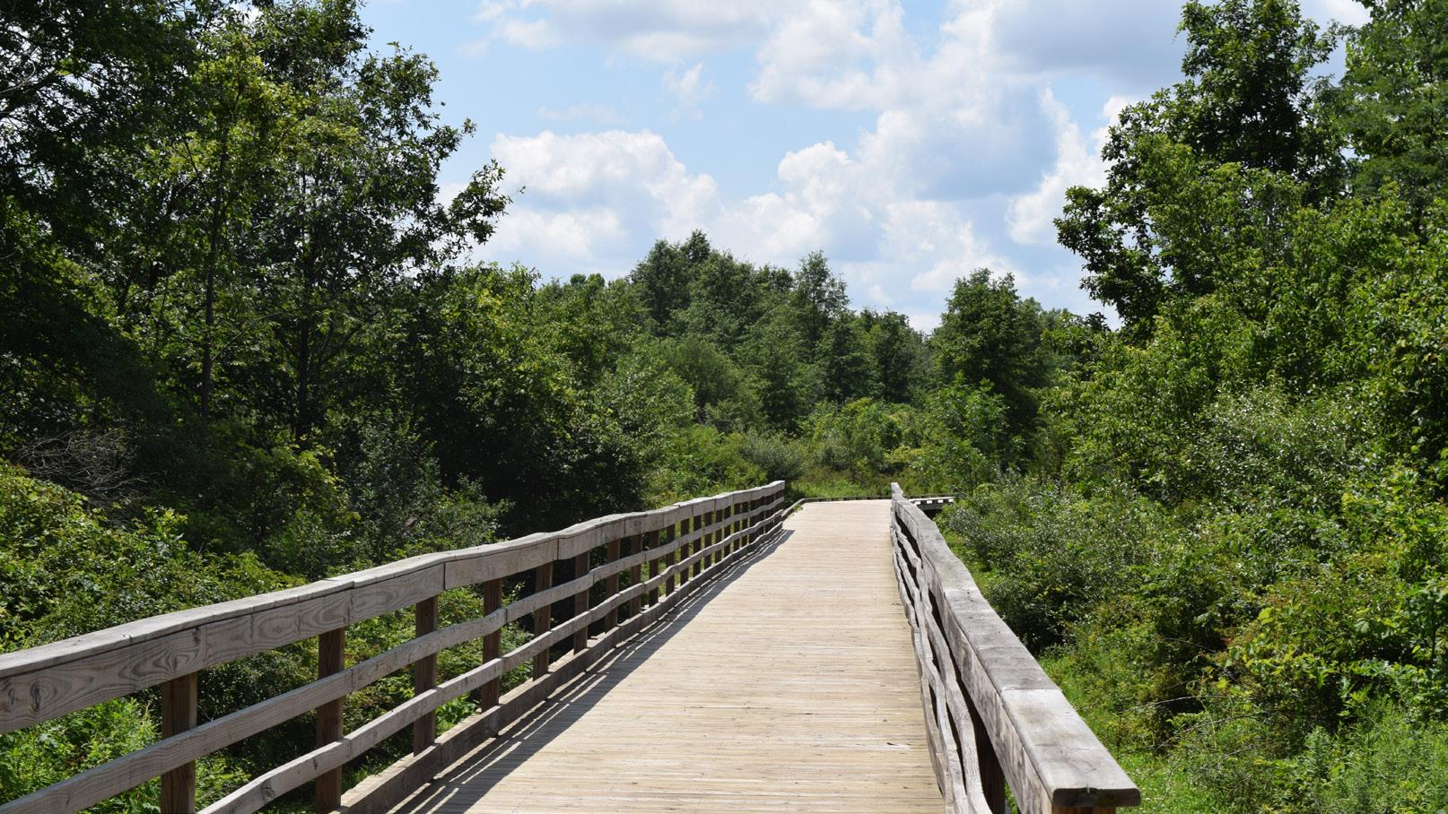
Parks Division, Engineering Division
Parks Division, Engineering Division
Parks Division, Engineering Division
Parks Division, Engineering Division
Parks Division, Engineering Division
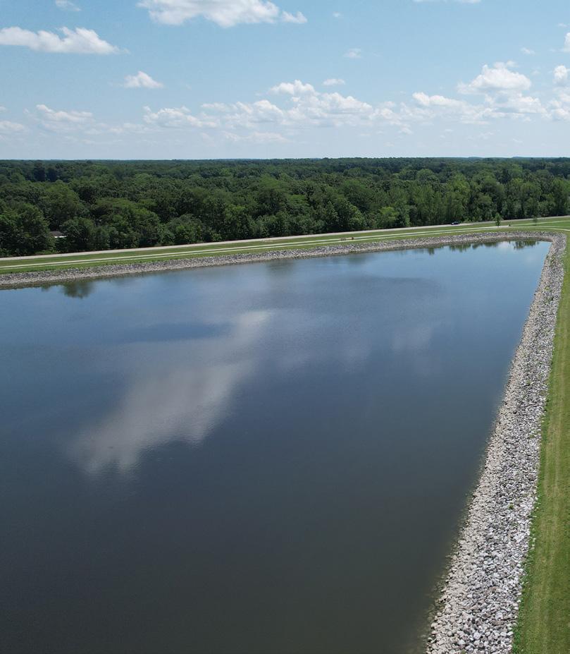
ESTIMATED INVESTMENT SUMMARY
Quick Wins: $1,015,000
Simple But Requires Funding: $2,000,000
Major Capital Projects: $2,100,000
Park Total: $5,115,000
City Budget, Corporate, Local Civic Organizations, ODNR, Special Interest Organizations $150,000
City Budget, Corporate, Local Civic Organizations, ODNR
City Budget, Corporate
City Budget, Corporate, Foundations, Local Civic Organizations, Local Health Networks, Municipal Bonds, ODNR
City Budget, Corporate, Foundations, Local Civic Organizations, Networks, Municipal Bonds, ODNR
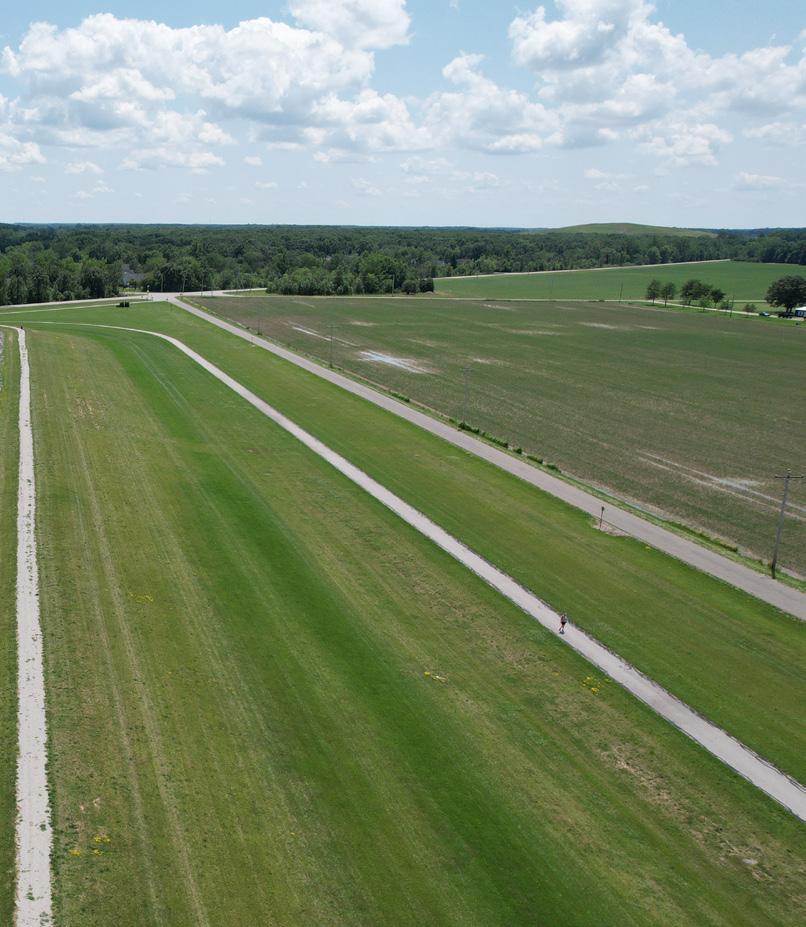
Secure funding and develop RFQ / RFP to select consultant for project or develop designs / plans internally
Secure funding and develop RFQ / RFP to select consultant for project or develop designs / plans internally
Secure funding and develop RFQ / RFP to select consultant for project or develop designs / plans internally
Secure funding and develop RFQ / RFP to select consultant for project or develop designs / plans internally
Secure funding and develop RFQ / RFP to select consultant for project or develop designs / plans internally
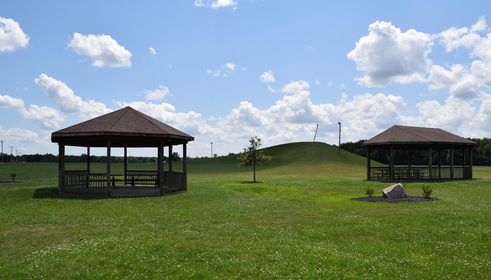
RIVERSIDE PARK
Goal #1: Health & Social Justice
Riverside Park’s enhancements greatly improve access and inclusivity. The addition of an ADA crossing, upgraded restrooms, and inclusive playground zones ensure that people of all ages and abilities can safely enjoy the park. New courts for basketball and futsal, shaded seating, and kayak access provide a range of active and passive recreation options, encouraging physical health and social interaction across different user groups, including league players, families, and local youth.
Goal #2: Environmental Quality / Flood Risk
Strategic native plantings and the addition of shade trees improve the park’s ecological health by supporting biodiversity, reducing runoff, and minimizing maintenance. Walkways through woodlands and river overlooks are designed to balance recreation with environmental stewardship, preserving the river’s edge while allowing visitors to engage with nature responsibly.
Goal #3: Vibrancy & Placemaking
Located along the Auglaize River and close to downtown, Riverside Park becomes a key riverfront destination through the addition of river overlooks, courts with vibrant murals, and an accessible kayak launch. Educational signage, plaza seating, and well-placed shelter houses foster a welcoming, active environment that honors the site’s recreational and cultural context while offering unique community gathering spaces.
Goal #4: Improve Connectivity
New trail connections – including a riverside trail linking north to 5th Street and Arabella Street – improve regional walkability and tie Riverside Park into the broader greenway system. Internal walkways and ADA connections enhance navigation throughout the site, linking parking areas, athletic fields, the riverfront, and woodland shelters into a unified
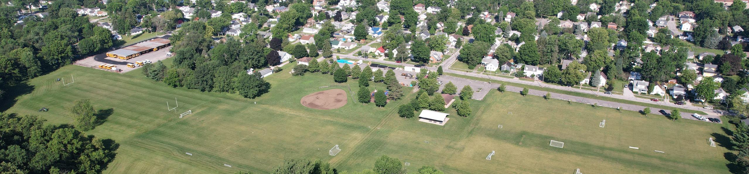
Install an ADA crossing and pathway from the west side of Riverside Avenue, through the parking lot, and into the park
Develop plan for pedestrian crossing and parking lot improvements
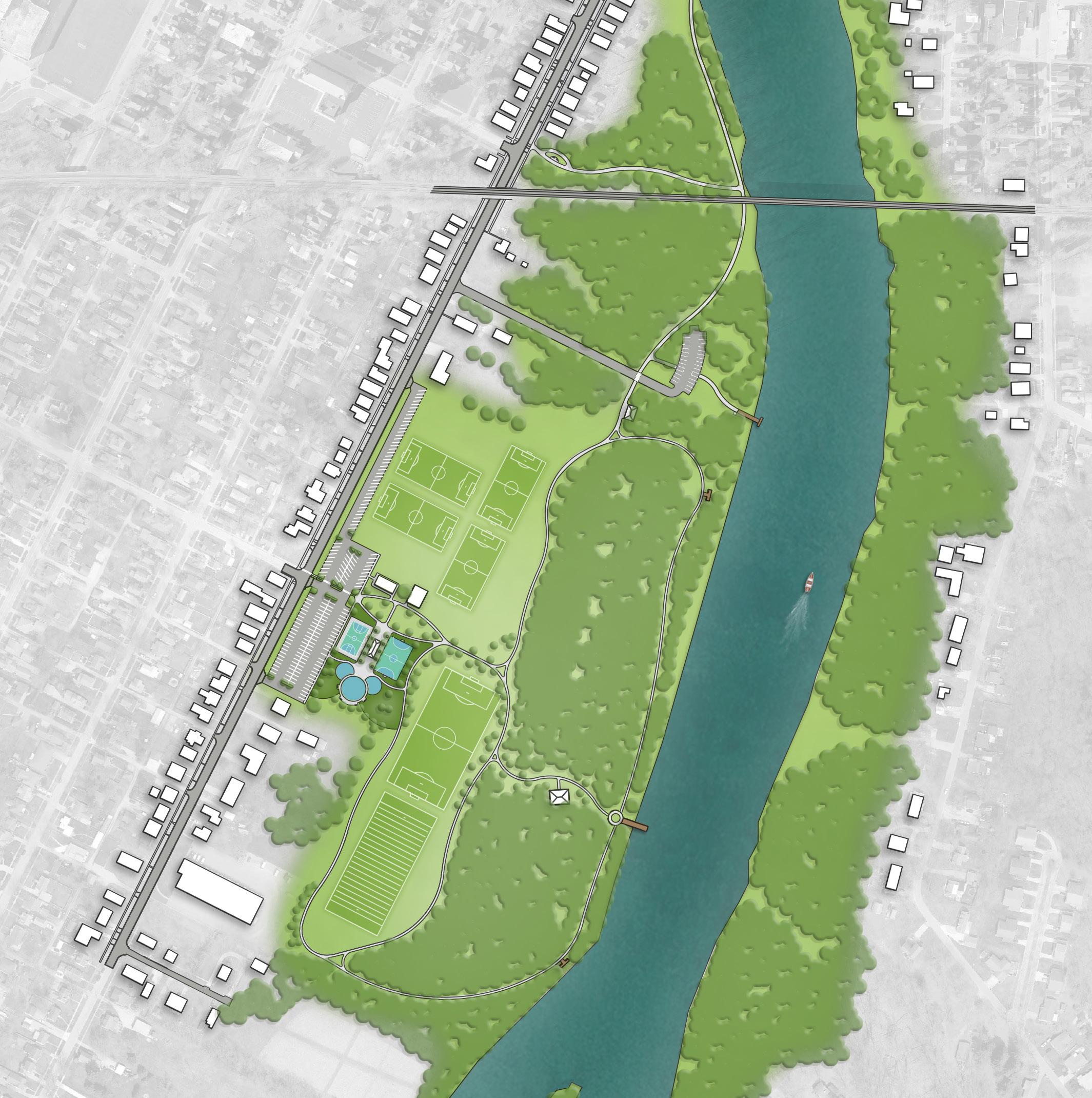
REFINED CONCEPT: Overview of concepts can be found in Section 5.
PROPOSED FEATURES
A Accessible Kayak Launch & Rental Kiosk
B Shade Trees
C Shelter House with Restroom
D Educational & Interpretive Signage
E Parking
F Walking Path
G Auglaize River Overlook Deck
H Inclusive Playground with Safety Surfacing
I Basketball Court with Painted Mural
J Futsal Court
K ADA Crossing
Action Plan,
RIVERSIDE PARK
BUDGET IMPACTS - Cost Savings or No Increase - Minor Increase
Major Increase
PROPOSED IMPROVEMENT / ACTION ITEM
Implement new key fob system for existing buildings
Paint existing restroom
Install shade trees
Incorporate native plantings in strategic locations throughout the site to define spaces, beautify the park, and ease mowing maintenance
Install an ADA crossing and pathway from the west side of Riverside Avenue, through the parking lot, and into the park (Comprehensive Plan, CC 10)
Install educational and interpretive signage (Comprehensive Plan, DR 3)
Incorporate additional seating opportunities along the proposed trail / sidewalk connection
Install futsal court with a painted mural inspired by the park, a historical component, or an adjacent neighborhood; also include associated perimeter fencing
Install a basketball court with a painted mural inspired by the park, a historical component, or an adjacent neighborhood; also include associated perimeter fencing
Install an inclusive playground with separate zones for ages 2–5, ages 5–12, and swings, all with accessible poured-in-place safety surfacing, plus connecting walkways and seating for guardians
PROJECT GOAL
Parks Division
Parks Division, Engineering Division
Parks Division, Engineering Division
Parks Division, Engineering Division
Parks Division, Engineering Division, Planning Division
Parks Division, Engineering Division, Planning Division
Parks Division
Parks Division, Engineering Division
Parks Division, Engineering Division
Parks Division, Engineering Division, Planning Division
ESTIMATED INVESTMENT SUMMARY
Quick Wins: $185,000
Simple But Requires Funding: $1,825,000
Major Capital Projects: $3,650,000
Park Total: $5,660,000
POTENTIAL FUNDING SOURCES & PARTNERS
City Budget, Local Civic Organizations, Park Users, Special Interest Organizations
City Budget, Corporate, Local Civic Organizations, Special Interest Organizations
City Budget, Corporate, ODNR
Arts Organizations, City Budget, Local Civic Organizations, Special Interest Organizations
City Budget, Corporate, Educational Resources, Local Civic Organizations, Park Users
Arts Organizations, City Budget, Corporate, Local Civic Organizations, Municipal Bonds, ODNR, Park Users, Special Interest Organizations
Arts Organizations, City Budget, Corporate, Local Civic Organizations, ODNR, Park Users, Special Interest Organizations
City Budget, Corporate, Educational Resources, Local Civic Organizations, Municipal Bonds, ODNR, Park Users, Special Interest Organizations
Determine desired locations for trees
Develop plan for priority planting areas
Develop plan for pedestrian crossing and parking lot improvements
Identify local partners to help with signage design
Determine best locations
Develop an RFQ / RFP for consultant led designs or develop designs internally
Develop an RFQ / RFP for a muralist once funding is secured
Determine the desired size and scope and submit for funding opportunities
Continued on next page.
Action Plan, continued: RIVERSIDE PARK
Color Key OPERATIONAL BUDGET IMPACTS
- Cost Savings or No Increase
- Minor Increase
- Major Increase
Install walkways from the parking lot throughout, and around, the athletic fields (Comprehensive Plan, CC 10 and CC 17)
Install walkways connecting the park to and through the woodlands (Comprehensive Plan, CC 10 and CC 17)
Install overlooks along the Auglaize River
Upgrade the existing restroom facility with accessible features
Install an open air shelter house near the basketball and futsal courts with plaza seating space and site furnishings
Install an accessible kayak launch and rental kiosk, along with associated driveway and parking (Comprehensive Plan, CC 5)
Install a trail along the river heading north to 5th Street with a connection to Arabella Street (Comprehensive Plan, CC 10 and CC 17)
Install an open air shelter house along the edge of the woods
Install an open air shelter house near the kayak launch
Parks Division, Engineering Division
Parks Division, Engineering Division
Parks Division, Engineering Division
Parks Division, Engineering Division
Parks Division, Engineering Division
Parks Division, Engineering Division
Parks Division, Engineering Division, Planning Division
Parks Division, Engineering Division
Parks Division, Engineering Division
ESTIMATED INVESTMENT SUMMARY
Quick Wins: $185,000
Simple But Requires Funding: $1,825,000
Major Capital Projects: $3,650,000
Park Total: $5,660,000
POTENTIAL FUNDING SOURCES & PARTNERS
City Budget, Corporate, ODNR $350,000 $
City Budget, Corporate, Local Civic Organizations, Municipal Bonds, ODNR $200,000 $$
City Budget, Corporate, Local Civic Organizations, Municipal Bonds, ODNR $500,000 $$
City Budget, Corporate $600,000 $
City Budget, Corporate, Foundations, Local Civic Organizations, Municipal Bonds, ODNR, Special Interest Organizations $250,000 $$
City Budget, Corporate, Foundations, Local Civic Organizations, Municipal Bonds, ODNR, Special Interest Organizations $1,500,000 $$
City Budget, Corporate, Foundations, Local Civic Organizations, Municipal Bonds, ODNR, Special Interest Organizations, Trail Organizations & Grants
City Budget, Corporate, Foundations, Local Civic Organizations, Municipal Bonds, ODNR, Special Interest Organizations
City Budget, Corporate, Foundations, Local Civic Organizations, Municipal Bonds, ODNR, Special Interest Organizations
Develop a priority list for current connectivity improvements and develop pathways with future park development in mind
Develop a priority list for current connectivity improvements and develop pathways with future park development in mind
Develop an RFQ / RFP for consultant led designs or develop designs internally; coordinate with the ODNR
Conduct accessibility review to determine exact scope of project
Develop an RFQ / RFP for consultant led designs or develop designs internally
Secure funding and develop RFQ / RFP to select consultant for project
Develop an RFQ / RFP for consultant led designs or develop designs internally
Develop an RFQ / RFP for consultant led designs or develop designs internally
Develop an RFQ / RFP for consultant led designs or develop designs internally
Action Plan
TRIANGLE PARK
Goal #1: Health & Social Justice
Improved sidewalks, ADA ramps, and crosswalk enhancements make Triangle Park safer and more accessible for all users, including those with mobility challenges. Expanded gathering spaces and accessible routes to memorials and the clock tower ensure that the park remains an inclusive and respectful space for reflection and community engagement.
Goal #2: Environmental Quality / Flood Risk
Revitalized landscaping with new plantings helps refresh aging vegetation, contributing to better air quality, shade, and stormwater absorption. These upgrades enhance both the park’s ecological function and its aesthetic appeal, supporting long-term sustainability in a compact urban setting.
Goal #3: Vibrancy & Placemaking
While not on the river, Triangle Park plays a key role in downtown vibrancy. The addition of a central plaza with historic features, event-ready seat walls, and decorative paving on Arabella Street transforms the space into a flexible hub for gatherings, performances, and community events – strengthening the park’s identity as a civic landmark.
Goal #4: Improve Connectivity
New pathways throughout the park improve internal movement and connect directly to existing curb ramps and
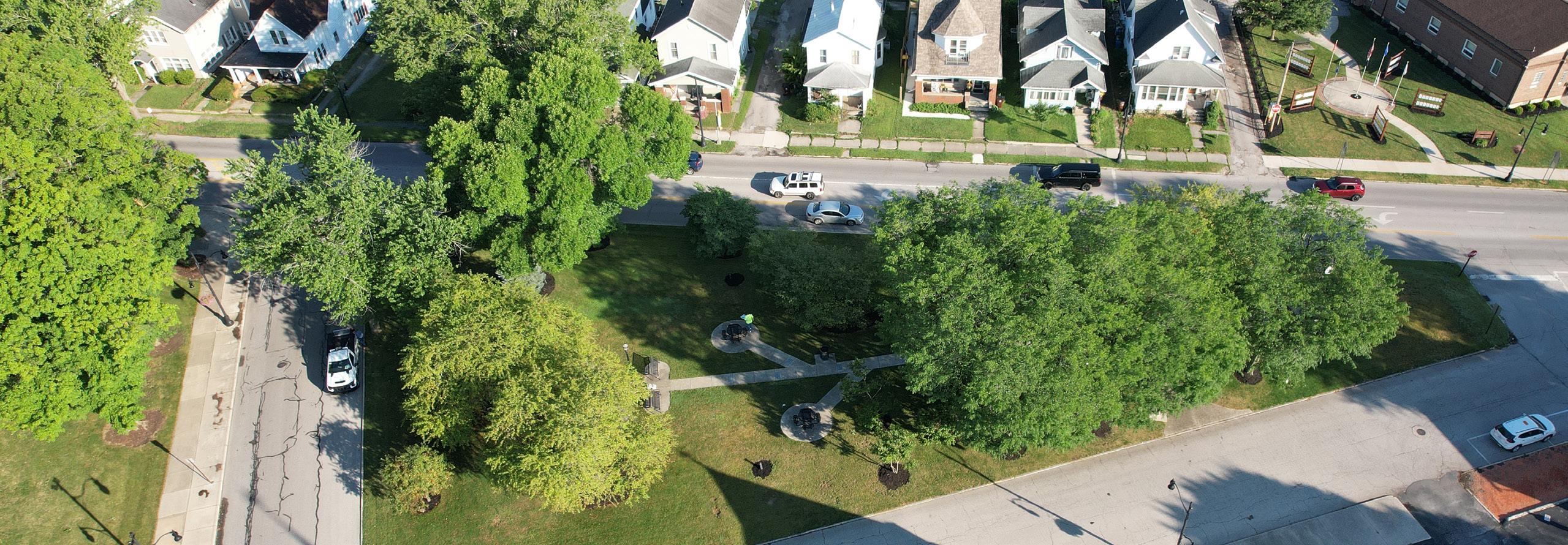
Incorporate a historical central plaza with seat walls that can also function as gathering spaces to host large events; replace existing concrete surrounding the clock to match paver materials in the plaza
Develop RFQ / RFP for design consultant to develop plans for future park with a selected steering committee providing feedback on design
CONNECTIONS TO EXISTING RAMPS
PEDESTRIAN CROSSING BUTTON
IMPROVED LANDSCAPE & SAVE EXISTING TREES
CONCEPT 2: Favored by the community.
Overview of concepts can be found in Section 5.
INCREASE ACCESSIBILITY TO MEMORIALS
HISTORICAL CENTRAL PLAZA
PAVERS ON ARABELLA ST WITH OPTION TO TEMPORARILY CLOSE STREET
ARABELLAST
LEGEND
Natural Landscape
Plaza / Hardscape
Vehicular Plaza
Pedestrian Circulation
Vehicular Circulation
Pedestrian Crossing
Seating Opportunity
Seat Wall
Sculpture / Fountain
Action Plan,
TRIANGLE PARK
Install additional landscaping to revitalize mature landscape of park
Incorporate a historical central plaza with seat walls that can also function as gathering spaces to host large events; replace existing concrete surrounding the clock to match paver materials in the plaza (Comprehensive Plan, DR 3)
Install paver plaza with seat walls, tables, and central water feature; additional concrete walkways expand out connecting the plaza to the rest of the site (Comprehensive Plan, DR 3)
Install a pedestrian crossing button with crosswalk and ADA ramp improvements to promote a safer environment for pedestrians to cross Clinton Street (Comprehensive Plan, CC 4)
Install Arabella Street enhancements with pavers (Comprehensive Plan, CC 4)
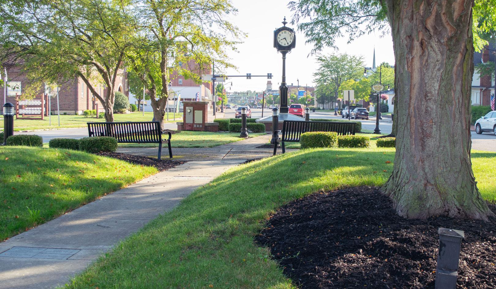
Engineering Division, Planning Division
Engineering Division, Planning Division
Engineering Division, Planning Division
Engineering Division, Planning Division
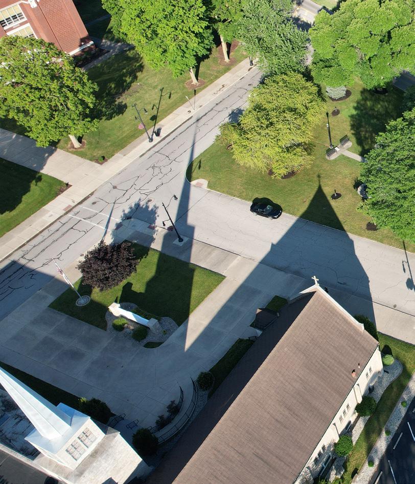
ESTIMATED INVESTMENT SUMMARY
Quick Wins: $50,000
Simple But Requires Funding: $0
Major Capital Projects: $1,475,000 Park Total: $1,525,000
City Budget, Local Civic Organizations, Park Users, Special Interest Organizations
City Budget, Corporate, Foundations, Local Civic Organizations, Special Interest Organizations
Analyze existing plant material for health and coordinate with landscape architect to develop proposed planting designs
Develop RFQ / RFP for design consultant to develop plans for future park with a selected steering committee providing feedback on design
Develop RFQ / RFP for design consultant to develop plans for roadway and/or coordinate with potential adjacent private development
Secure funding and work with design consultant to develop designs for proposed improvements
Secure funding and develop RFQ / RFP to select consultant for project or develop designs / plans internally
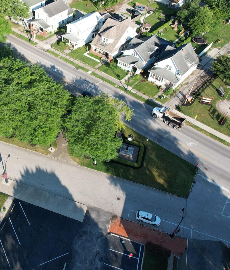
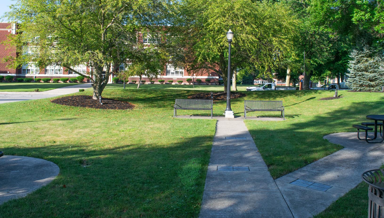
VETERAN'S MEMORIAL PARK AT LATTY'S GROVE
Goal #1: Health & Social Justice
This plan enhances safety and accessibility through new sidewalks, pedestrian crossings, and bumpouts that improve connections to surrounding neighborhoods. Accessible playgrounds, changing tables, and walking trails ensure the park is welcoming to all users, including families and individuals with mobility challenges. Diverse recreation options like pickleball, bocce ball, and shaded seating areas support physical activity and inclusive community use.
Goal #2: Environmental Quality / Flood Risk
Native plantings and pollinator habitats reduce turf maintenance, support biodiversity, and enhance the park's resilience to stormwater runoff. Added trees increase shade and comfort while contributing to air quality and longterm ecological health. These sustainable landscaping practices make the park both beautiful and environmentally responsible.
Goal #3: Vibrancy & Placemaking
While not directly adjacent to the river, this park contributes to the City’s overall vibrancy through thoughtful placemaking. The addition of a memorial garden and mural-enhanced courts provides meaningful visual and cultural elements that reflect the park’s identity and local history. Shelter upgrades and a formal garden entrance create inviting spaces for both reflection and community gatherings.
Goal #4: Improve Connectivity
New sidewalks and improved crossings at key streets connect the park to nearby neighborhoods and enhance pedestrian safety. A looping trail within the park and accessible walking paths to the east and west improve internal navigation and create a more unified experience—helping tie Veteran's Memorial Park at Latty's Grove more closely into the broader parks and trails network.
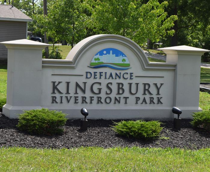
Secure quote from local sign manufacturer for a sign that matches the City's standard design with
park name
ACCESSIBLE PLAYGROUND FOR AGES 5-12 WITH SAFETY SURFACING
RESURFACE TENNIS COURT & ADD PICKLEBALL LINEWORK
UPDATE RESTROOM WITH CHANGING TABLES
ACCESSIBLE PLAYGROUND FOR AGES 2-5 WITH SAFETY SURFACING
RESURFACE BASKETBALL COURT AND INCORPORATE MURAL REFURBISHED
SEATING OPPORTUNITY
POLLINATOR HABITAT WITH NATIVE PLANTINGS
PEDESTRIAN CROSSING
UPDATE SHELTER HOUSE
FORMAL GARDEN SPACE WITH MEMORIAL ELEMENT
ACTIVATION NODE
PEDESTRIAN CROSSING
CONCEPT 2: Favored by the community. Overview of concepts can be found in Section 5.
POLLINATOR HABITAT WITH NATIVE PLANTINGS
UPDATED SHELTER HOUSE
NEW PARK SIGN
LEGEND
Natural Landscape
Sports Programming
Play Programming
Parking Lot
Building / Structure
Pedestrian Circulation
Seating Opportunity
Gateway / Trailhead / Signage
WAYNE
Action Plan,
VETERAN'S MEMORIAL PARK AT
LATTY'S GROVE
BUDGET IMPACTS - Cost Savings or No Increase
Minor Increase
Major Increase
Paint shelter houses and install new concrete floors
Install new walking paths throughout park (Comprehensive Plan, CC 10)
Install sidewalk along the north side of Williams Street to provide an accessible connection from the park to Wayne Avenue and the neighborhoods to the east (Comprehensive Plan, CC 10)
Install a new park sign with the updated park name (Comprehensive Plan, DR 3)
Install accessible pedestrian crossings at Latty Street and Wilhelm Street to provide a safer connection across Williams Street and to provide connectivity to neighborhoods to the south; consider the inclusion of bumpouts with trees at these locations to shorten the wide distance across Williams Street and the on-street parking (Comprehensive Plan, CC 10)
Install a pollinator habitat with native plantings in the far western point of the property and extend the nearby sidewalk westward
Install pollinator habitats with native plantings on the eastern edge of the property to provide an additional buffer between residential properties; incorporate accessible walking trails with designated seating areas that connect to Wayne Avenue
Install changing tables in both restrooms
Install additional trees throughout the park
Parks Division, Engineering Division
Parks Division, Engineering Division
Parks Division, Engineering Division, Planning Division
Parks Division, Engineering Division, Planning Division
Parks Division, Engineering Division, Planning Division
Parks Division, Engineering Division
Parks Division, Engineering Division
Parks Division, Engineering Division
Parks Division, Engineering Division
Quick Wins: $178,000
Simple But Requires Funding: $1,180,000
Major Capital Projects: $250,000
Park Total: $1,608,000
FUNDING SOURCES & PARTNERS
Coordinate with City-wide plans to encompass within another project or pour sidewalk internally after securing necessary permits / approvals
Secure quote from local sign manufacturer for a sign that matches the City's standard design with updated park name City Budget, Corporate, Transportation
Conduct ADA audit field report for walkways and potential access points to adjacent neighborhoods determine the exact shortfalls in accessibility City Budget, Corporate, Local Civic Organizations, Special Interest Organizations
Secure funding and develop RFQ / RFP to select consultant for project or develop designs / plans internally City Budget, Corporate, Local Civic Organizations,
Secure trees and organize tree planting day ESTIMATED INVESTMENT SUMMARY
Secure funding and develop RFQ / RFP to select consultant for project or develop designs / plans internally
Determine exact proposed location for changing table in restroom and secure funding to purchase changing tables
Continued on next page.
Action Plan,
Color Key
MEMORIAL PARK
Refurbish the existing ball field with new dirt and reseed the outfield
Activate the existing basketball court by resurfacing it and adding a painted mural inspired by the park, a historical component, or adjacent neighborhoods (Comprehensive Plan, DR 3)
Activate the existing tennis court by resurfacing it and adding pickleball courts with a painted mural inspired by the park, a historical component, or adjacent neighborhoods
Update both shelter houses
Install accessible playgrounds for children ages 2 - 12 with poured-in-place safety surfacing near the existing restroom
Install a formal garden space with a memorial and activation node as new entrance into the park (Comprehensive Plan, DR 3)
Parks Division, Engineering Division
Parks Division, Engineering Division, Planning Division
Parks Division, Engineering Division, Planning Division
Parks Division, Engineering Division
Parks Division, Engineering Division, Planning Division
Parks Division, Engineering Division, Planning Division
ESTIMATED INVESTMENT SUMMARY
Quick Wins: $173,000
Simple But Requires Funding: $1,180,000
Major Capital Projects: $250,000
Park Total: $1,603,000
FUNDING SOURCES & PARTNERS
City Budget, Corporate, Local Civic Organizations, Park Users
Arts Organizations, City Budget, Corporate, Educational Resources, Local Civic Organizations, ODNR, Special Interest Organizations
Arts Organizations, City Budget, Corporate, Educational Resources, Local Civic Organizations, ODNR, Park Users
City Budget, Corporate, Educational Resources, Local Civic Organizations
City Budget, Corporate, Foundations, Grassroots Fundraising, Local Civic Organizations, Municipal Bonds, ODNR, Special Interest Organizations
City Budget, Corporate, Local Civic Organizations, ODNR, Special Interest Organizations
Determine exact scope of project and develop designs to securing pricing from prospective contractors
Develop RFQ / RFP to select an artist to paint mural; consider grouping court murals together in a single RFQ / RFP
Develop RFQ / RFP to select an artist to paint mural; consider grouping court murals together in a single RFQ / RFP
Determine exact scope of proposed updates needed at both shelter houses
Secure funding and surfacing vendor for installation
Develop designs for new formal garden space and develop memorial design with aid of focus group
Action Plan
CONNECTIVITY
Goal #1: Health & Social Justice
The expansion of pedestrian and multi-use trails across Defiance – especially those linking parks, neighborhoods, and public amenities – encourages healthy, active lifestyles and equitable access to green spaces. Improved connectivity between Eastside Park, Hopkins Street, and across the Auglaize River helps bridge historically divided areas and provides safe, car-free options for all users. Upgraded routes along 2nd Street and connections to the Mercy Health Medical Complex ensure that parks are integrated into everyday mobility, supporting both recreation and wellness.
Goal #2: Environmental Quality / Flood Risk
By enhancing trail infrastructure along waterways and natural corridors, these improvements promote low-impact transportation and reduce reliance on vehicles, thereby lowering carbon emissions. Strategic trail alignments along the river and within parks (such as Preston Run and the Buckeye Trail) also serve as buffers that protect natural systems and allow for sustainable development in flood-prone areas, while encouraging residents to value and engage with their environment.
Goal #3: Vibrancy & Placemaking
The introduction of the Miami & Erie Canal Corridor, realignment of the Buckeye Trail, and the looped eastside trail system create memorable experiences rooted in Defiance’s historical and cultural identity. By highlighting local parks, roads, and waterways with wayfinding signage, the City will create a unified and visually cohesive trail network that invites exploration and deepens community pride. These corridors are not only connectors – they become destinations in their own right.
Goal #4: Improve Connectivity
These improvements directly support the goal of creating a seamless, citywide park and trail system. Key projects like the Preston Run Trail, connections to Ottawa Avenue, and rerouted links between Kingsbury, Buchman on the Glaize, and Riverside Park ensure that each park is part of a larger whole. Enhanced wayfinding in and around parks – especially along East River Drive, Clinton Street Bridge, and within neighborhoods – will help users navigate the system easily and confidently, promoting daily use and long-term community engagement.
Incorporate pedestrian wayfinding signage along waterways, highlighting roads and parks
Develop a signage strategy and obtain a quote from a local sign manufacturer for a design that matches the City standard signage specifications
REFINED CONCEPT: Overview of concepts can be found in Section 5.
Pedestrian Circulation
Waterway Circulation
Existing Sidewalk
Buckeye Trail
Boat Launch / Docking
Accessible Kayak Launch
Action Plan, continued: CONNECTIVITY
PROPOSED IMPROVEMENT / ACTION ITEM
Incorporate pedestrian wayfinding signage along existing walkways, highlighting local parks (Comprehensive Plan, DR 3)
Incorporate pedestrian wayfinding signage along waterways, highlighting roads and parks (Comprehensive Plan, DR 3)
Incorporate pedestrian wayfinding signage in parks (Comprehensive Plan, DR 3)
Provide connectivity along Arabella Street from Riverside Park to Triangle Park and downtown (Comprehensive Plan, CC 4 and CC 17)
Provide connectivity from Eastside Park to Hopkins Street, and across the Auglaize River (Comprehensive Plan, CC 10)
Improve connectivity from East River Drive / Clinton Street Bridge to Diehl Park and the Knights of Columbus Baseball Complex (Comprehensive Plan, CC 4 and CC 20)
Develop a widened pedestrian multi-use path along 2nd Street, from downtown to the Mercy Health Medical Complex (Comprehensive Plan, CC4 and CC12)
Develop the Preston Run Trail system between 2nd Street and Cleveland Avenue (Comprehensive Plan, CC 12)
Develop a Complete Streets Policy Ordinance to aid with funding applications (Comprehensive Plan, CC 6)
Develop a Transportation Master Plan that focuses on various modes of transportation needs for a 20-year horizon (Comprehensive Plan, CC 7)
Coordinate with ODNR to realign the Buckeye Trail from 2nd Street to Williams Street, routing it across the pedestrian bridge at Fort Grounds into Kingsbury Park, then continuing south into Riverside Park before reconnecting to Williams Street
Install pathways from the purposed Preston Run Trail along Columbus Avenue to connect with Ottawa Avenue (Comprehensive Plan, CC 4 and CC 20)
Parks Division, Engineering Division, Planning Division
Parks Division, Engineering Division, Planning Division
Parks Division, Engineering Division, Planning Division
Engineering Division, Planning Division
Engineering Division, Planning Division
Engineering Division, Planning Division
Engineering Division, Planning Division
Parks Division, Engineering Division, Planning Division
Engineering Division, Planning Division, Law Director
Parks Division, Engineering Division, Planning Division, Police & Fire
Parks Division, Engineering Division, Planning Division
Engineering Division, Planning Division
POTENTIAL FUNDING SOURCES & PARTNERS
City Budget, Grassroots Fundraising, Local Civic Organizations, Park Users
City Budget, Grassroots Fundraising, Local Civic Organizations, Park Users Special Interest Organizations
City Budget, Grassroots Fundraising, Local Civic Organizations, Park Users
Local Civic Organizations, Adjacent Property Owners, City Budget, Corporate, Foundations, Grassroots Fundraising, Healthcare Networks, ODNR, Trail Organizations and Grants, Special Interest Organizations
Local Civic Organizations, Adjacent Property Owners, City Budget, Corporate, Foundations, Grassroots Fundraising, Healthcare Networks, ODNR, Trail Organizations and Grants, Special Interest Organizations
Local Civic Organizations, Adjacent Property Owners, City Budget, Corporate, Educational Institutions, Foundations, Grassroots Fundraising, Healthcare Networks, ODNR, Trail Organizations and Grants, Special Interest Organizations
Local Civic Organizations, Adjacent Property Owners, City Budget, Corporate, Foundations, Grassroots Fundraising, Healthcare Networks, ODNR, Trail Organizations and Grants, Special Interest Organizations
Local Civic Organizations, Adjacent Property Owners, City Budget, Corporate, Foundations, Grassroots Fundraising, Healthcare Networks, Municipal Bonds, ODNR, Trail Organizations and Grants, Special Interest Organizations
Local Civic Organizations, City Budget, Special Interest Organizations
Local Civic Organizations, City Budget, Special Interest Organizations Educational Institutions, Healthcare Networks, Corporate, Municipal Bonds
Adjacent Property Owners, City Budget, Corporate, Foundations, Healthcare Networks, ODNR, Trail Organizations and Grants, Special Interest Organizations
Local Civic Organizations, Adjacent Property Owners, City Budget, Corporate, Foundations, Grassroots Fundraising, Trail Organizations and Grants, Special Interest Organizations
Develop a signage strategy and obtain a quote from a local sign manufacturer for a design that matches the City standard signage specifications
Develop a signage strategy and obtain a quote from a local sign manufacturer for a design that matches the City standard signage specifications
Develop a signage strategy and obtain a quote from a local sign manufacturer for a design that matches the City standard signage specifications
Develop RFP / RFQ to select consultant for design services
Develop an RFP / RFQ to select consultant for design work on the pathways and bridge; begin coordination with potential property owners for property acquisition
Develop an RFP / RFQ to select consultant for design services
Develop an RFP / RFQ to select consultant for design services; begin coordination with Mercy Health on making a connection with their facility
Develop an RFP / RFQ to select consultant for design services; begin coordination with affected property owners on property acquisition
Develop steering committee to oversee the development of this plan and then develop an RFP / RFQ to select consultant for master plan services
Develop steering committee to oversee the development of this plan and then develop an RFP / RFQ to select consultant for master plan services
Once new alignment paths have been addressed for implementation, contact the ODNR to formally address the realignment of the Buckeye Trail
Develop an RFP / RFQ to select consultant for design services
Action Plan,
continued:
ADDITIONAL ITEMS
Maintain and build on the success of the swimming lessons each year
Pursue the feasibility of creating additional positions (maintenance, events, programming, etc.) within the Parks Division to account for future improvements
Begin developing a Succession Plan for the Parks and Cemetery Director
Pursue the feasibility of creating a Public Information Officer (PIO) position for education and outreach (Comprehensive Plan, PP 14)
Continue assessing and updating the downtown water and sewer systems to ensure long-term service, reliability, and eventual removal of sewer system from park (Comprehensive Plan, DR 7)
Goal #1: Health & Social Justice
Engineering Division, Planning Division, Parks Division
Engineering Division, Planning Division, Board of Control
Parks Division, Engineering Division, Planning Division Board of Control
Engineering Division, Planning Division, Board of Control
Engineering Division, Planning Division, Water Distribution, Water Pollution Control
Expanding swimming lessons supports water safety and equity, while added staff for programming and events ensures inclusive access to healthy, engaging activities for all ages.
Goal #2: Environmental Quality / Flood Risk
Upgrading water and sewer systems — especially removing sewer infrastructure from parks — helps protect the environment and ensure sustainable, long-term park use.
Goal #3: Vibrancy & Placemaking
A Public Information Officer and succession planning will strengthen outreach, events, and leadership — ensuring the parks remain lively, welcoming, and well-managed spaces.
Goal #4: Improve Connectivity
A well-supported parks team ensures consistent maintenance and programming across all parks and trails, helping unify the system and promote citywide access.
FUNDING SOURCES & PARTNERS
City Budget
City Budget
City Budget
City Budget, Municipal Bonds, State & Federal Appropriations
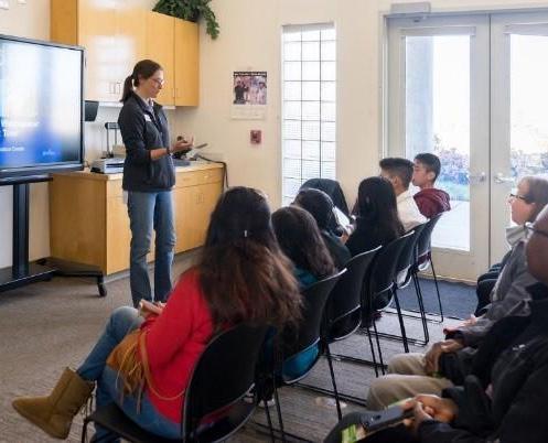
Pursue the feasibility of creating a Public Information Officer (PIO) position for education and outreach
/ ONGOING
Determine feasibility of adding a position and where needs would be
Evaluate timeline and potential internal candidates
Determine the feasibility of adding the position and where funding would come from
Continue accomplishing items in the long-term control plan
Determine the feasibility of adding the position and where funding would come from
Implementation: ESTIMATED INVESTMENT SUMMARY
This section provides a comprehensive summary of the estimated costs associated with implementing the Defiance Parks & Riverfront Master Plan. Drawing from the total estimated budget for each individual park, the summary organizes these costs in several different ways to support effective planning and decision-making.
funded by the City.
*Does not include proposed private development. These projects are identified on the introduction page corresponding to each park.
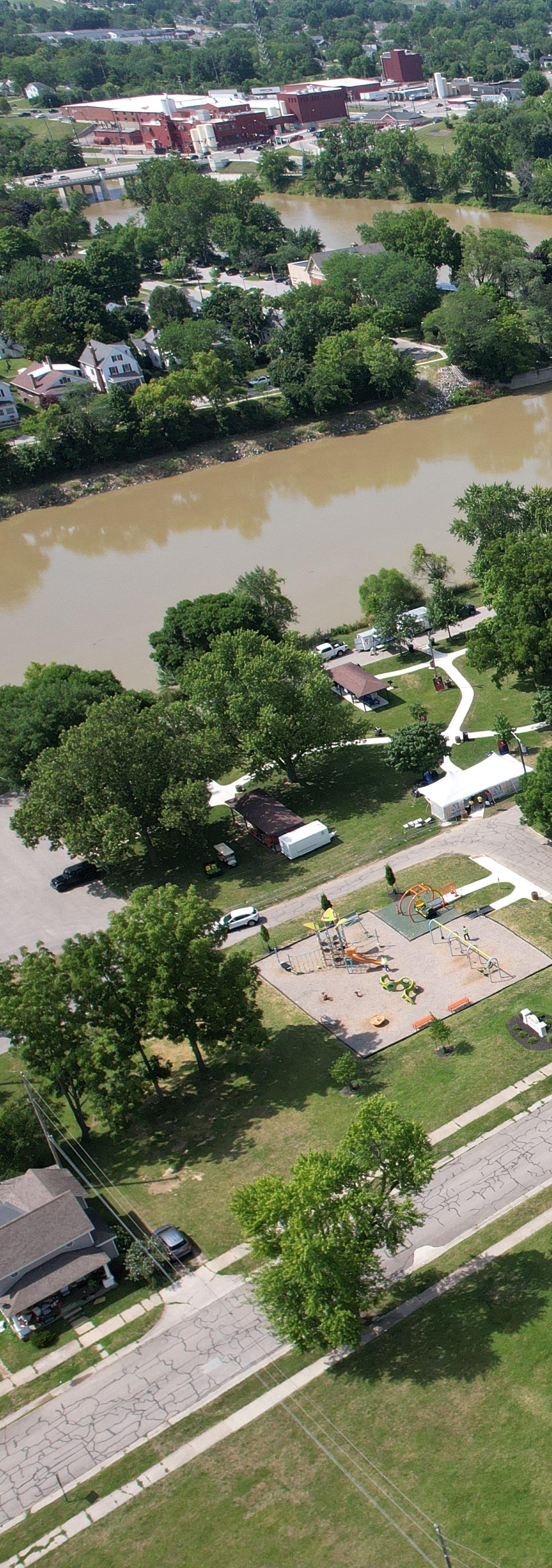
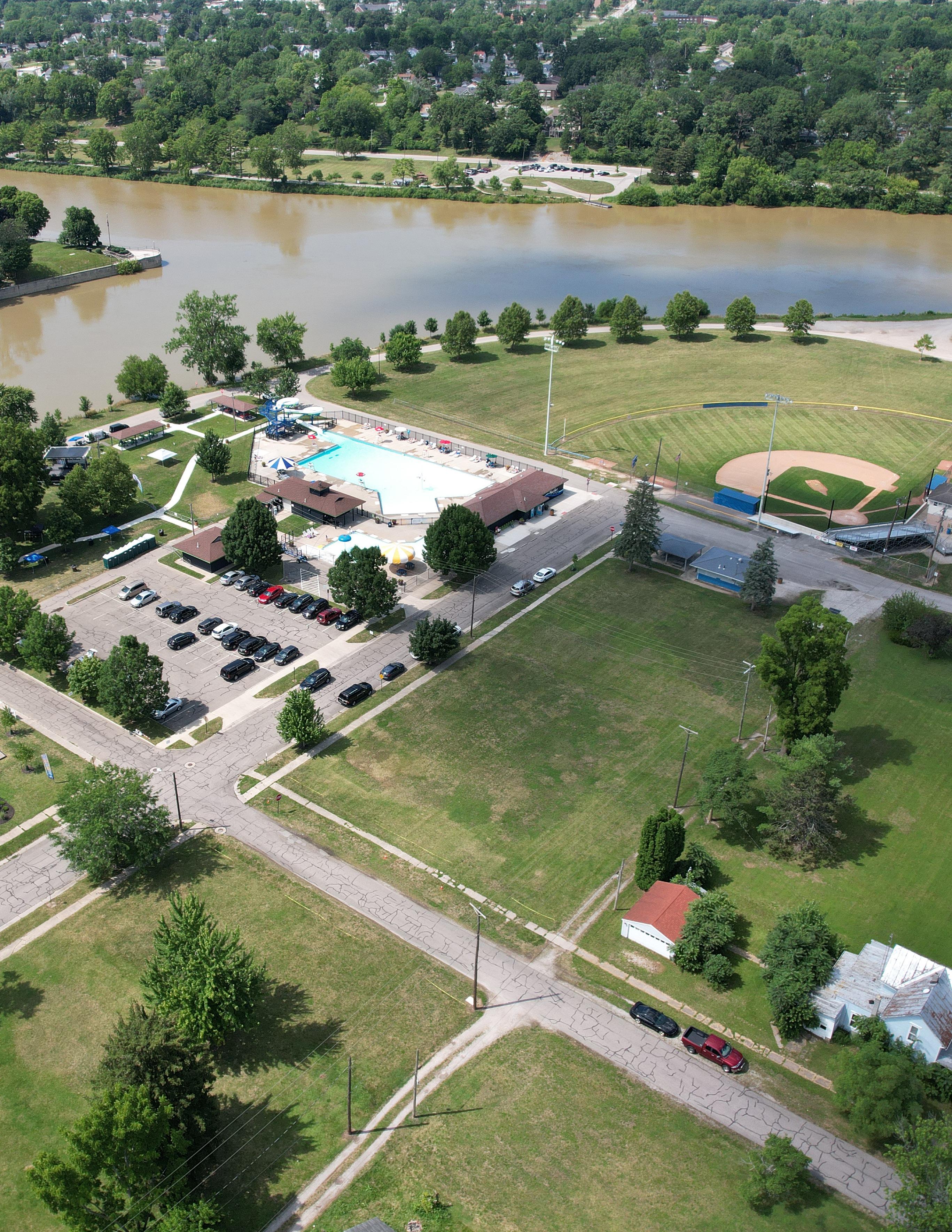
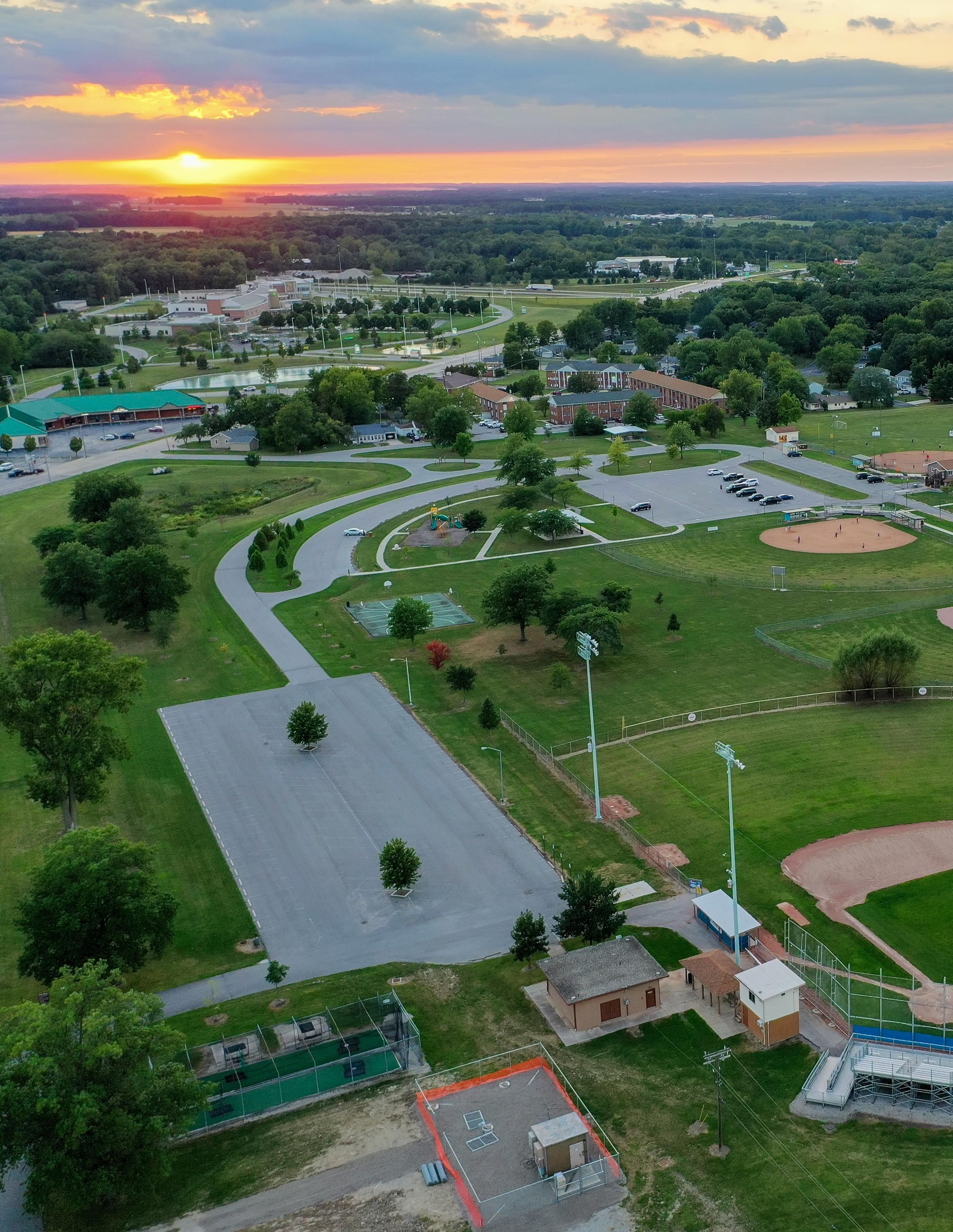
PARKS & RIVERFRONT MASTER PLAN // 2025