JACOB ESSINK
Landscape Architecture Portfolio

Landscape Architecture Portfolio
A landscape architecture student who has a passion for the outdoors and the sense of wonder it provides people. With experience in a broad scope of projects including adaptive reuse, urban design schemes, and concept and detailing, he has developed a knowledgeable foundation that will support the work of any landscape project. Combining abstract thinking with technical proficiency allows him to push projects further while focusing on the equitable and sustainable design aspects that benefit people and the environment.

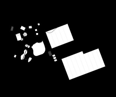
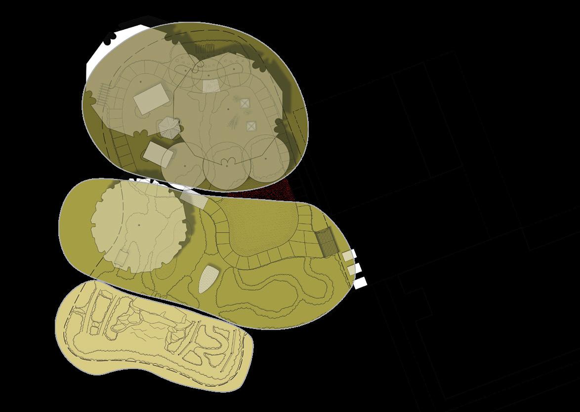
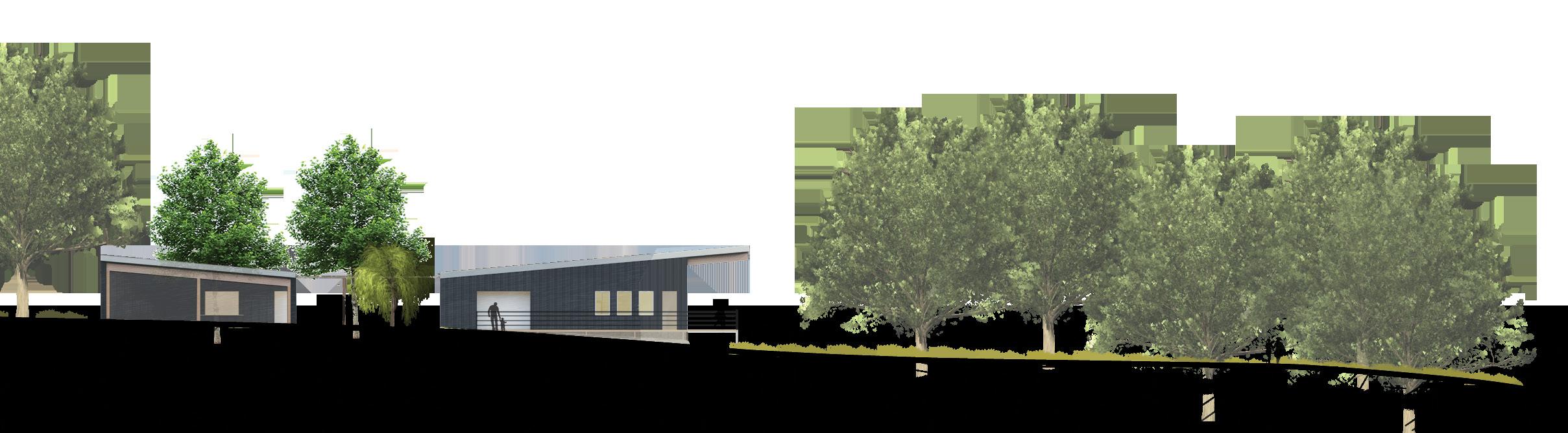
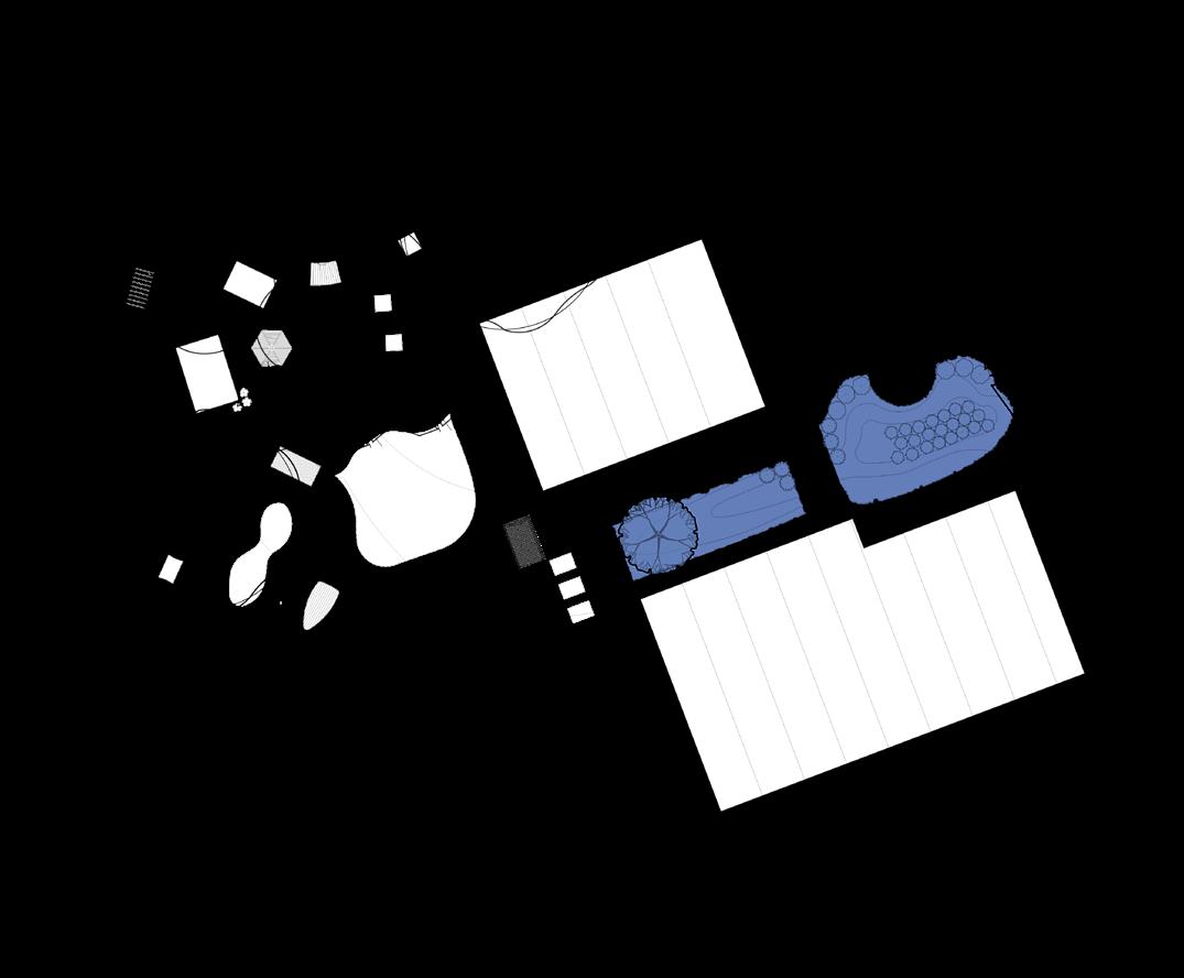
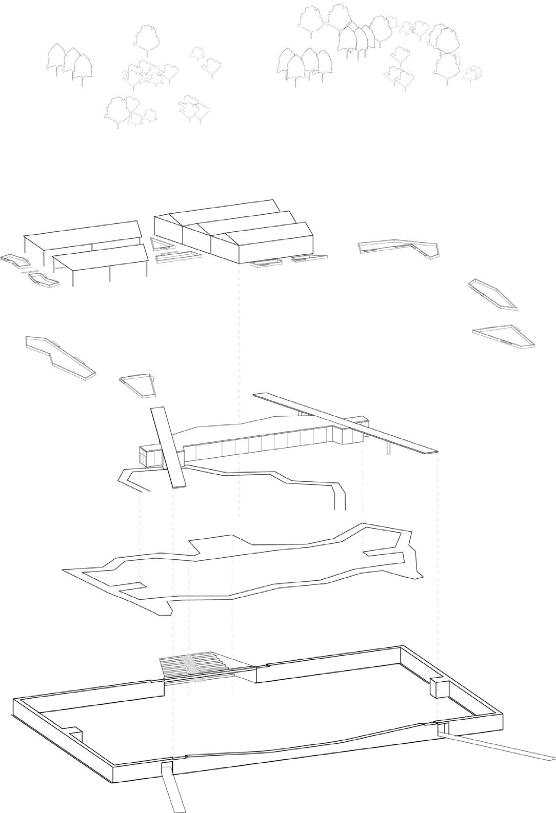
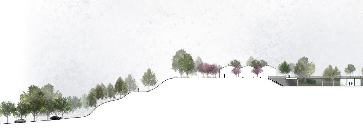
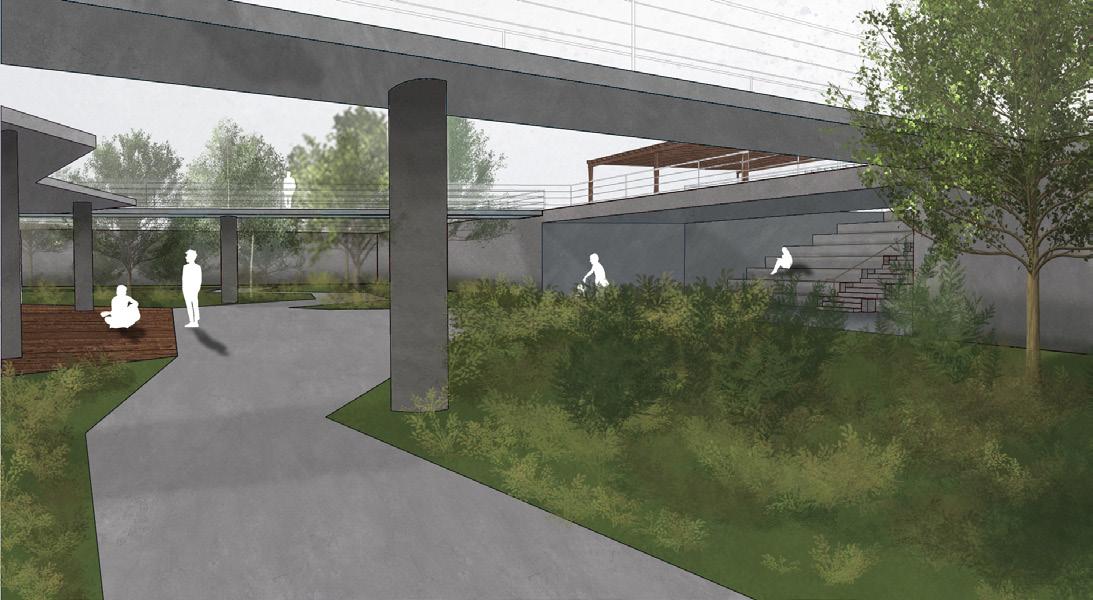
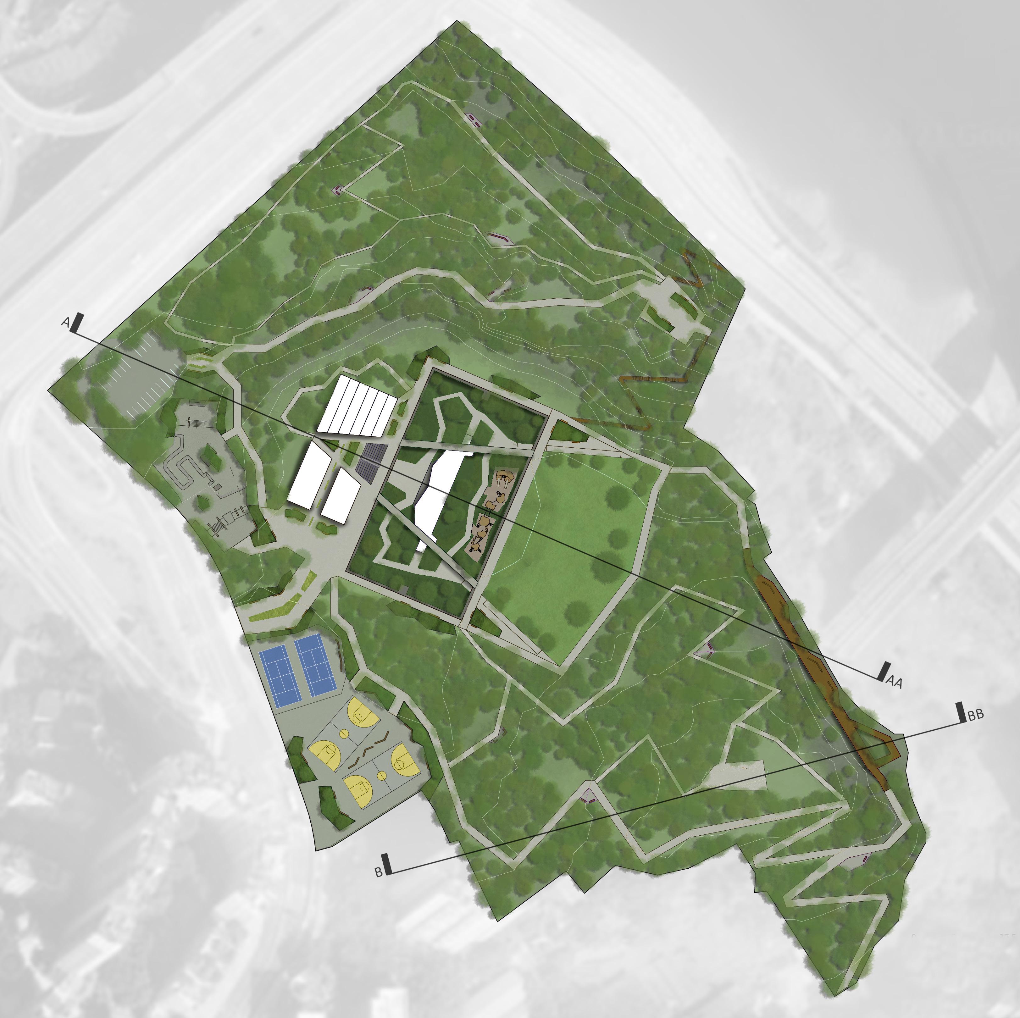
Collaborating with Nebraska State Parks and Indian Cave State Park employees, this project envisions a new visitor center building fully integrated into a new site design. Elements of the newly designed landscape include a new entry plaza, a natural playscape, interpretive trails, and scenic overlooks. The goals of this project are to reimagine the user experience upon entering the park, and connect users through interpretive elements which celebrate the unique ecologic makeup and paleolithic history of the area. The design takes input from state and local agencies and utilizes cost effective and sustainable design approaches in it’s building and landscape applications.
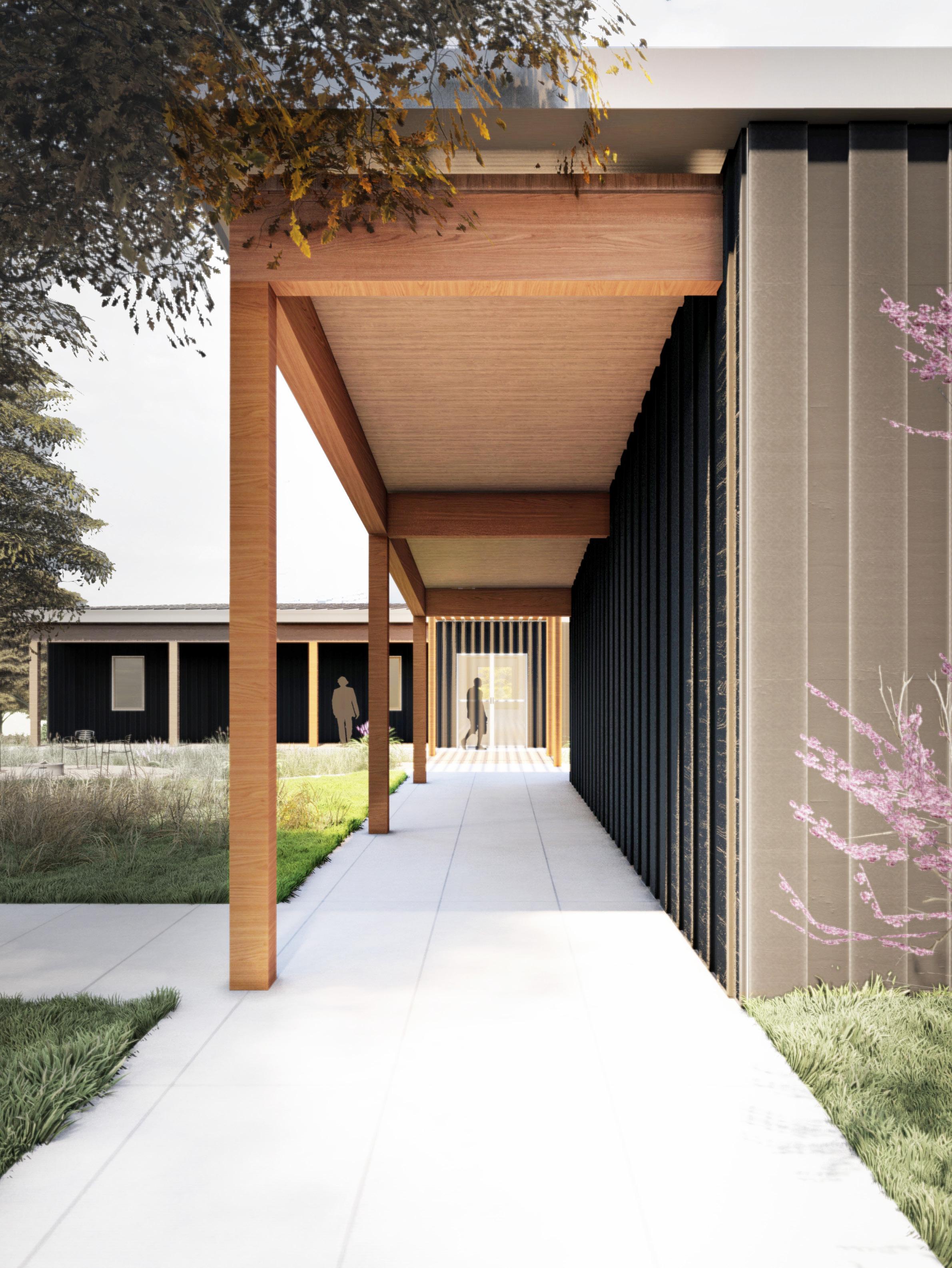
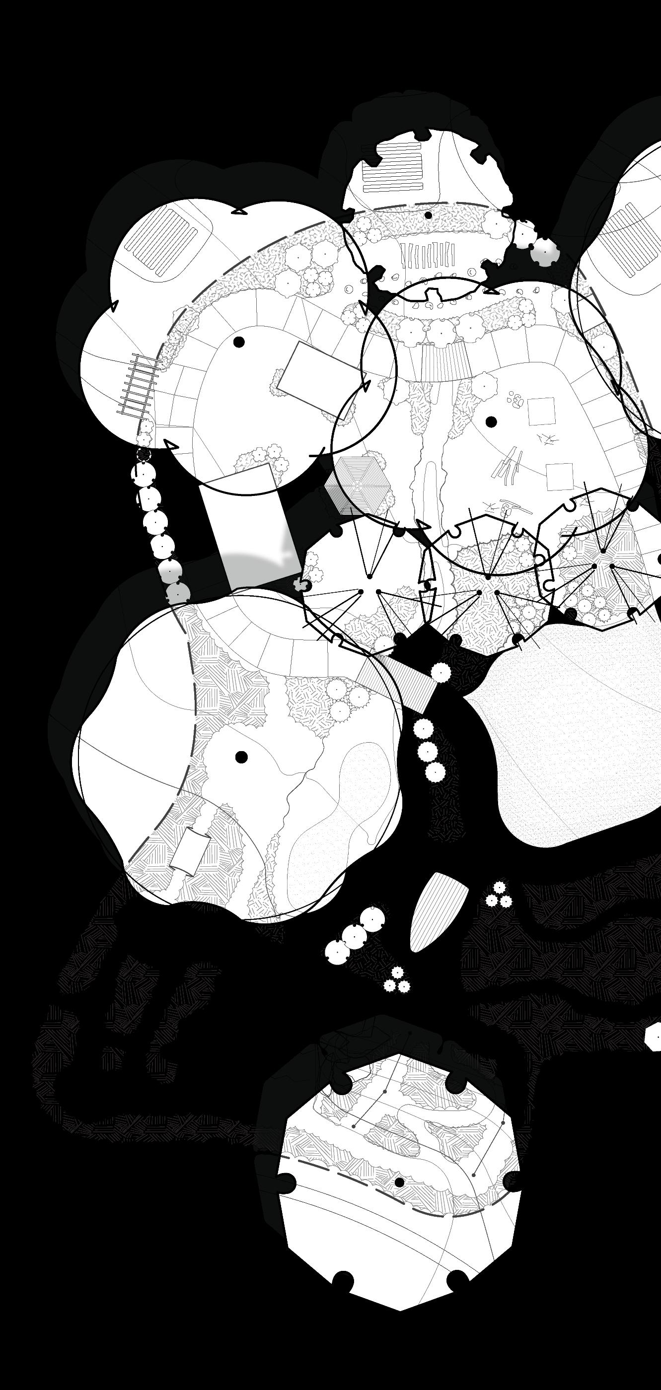
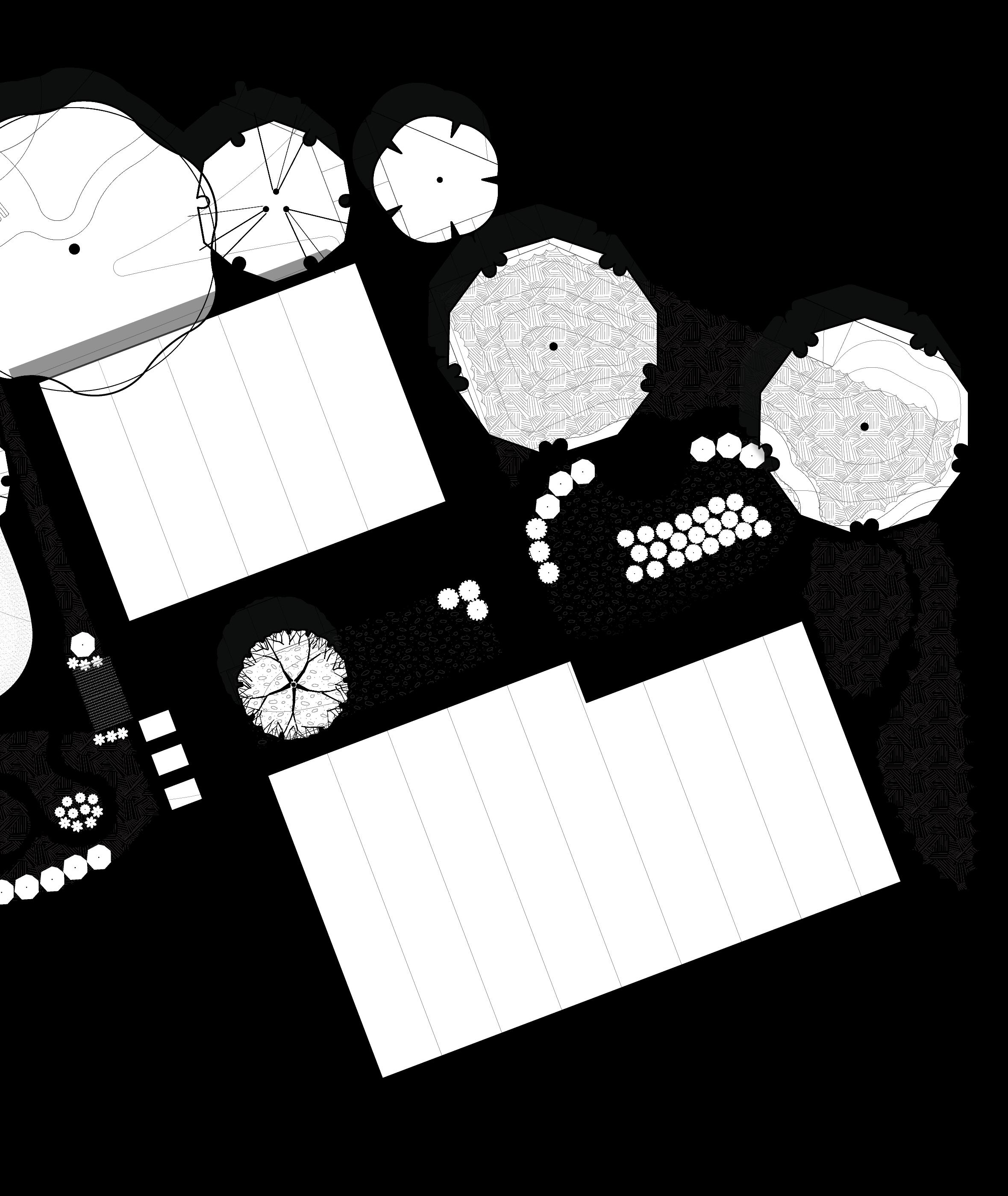
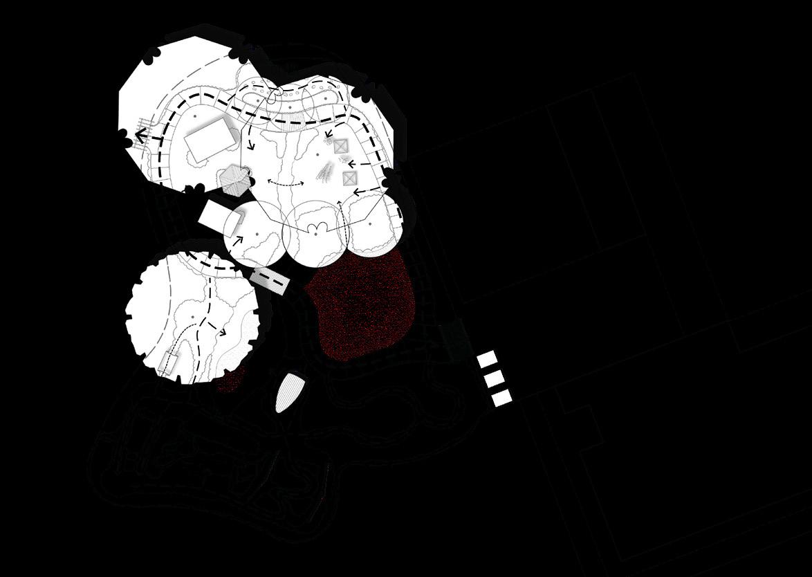
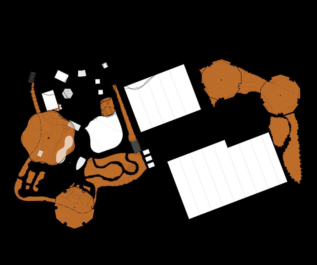
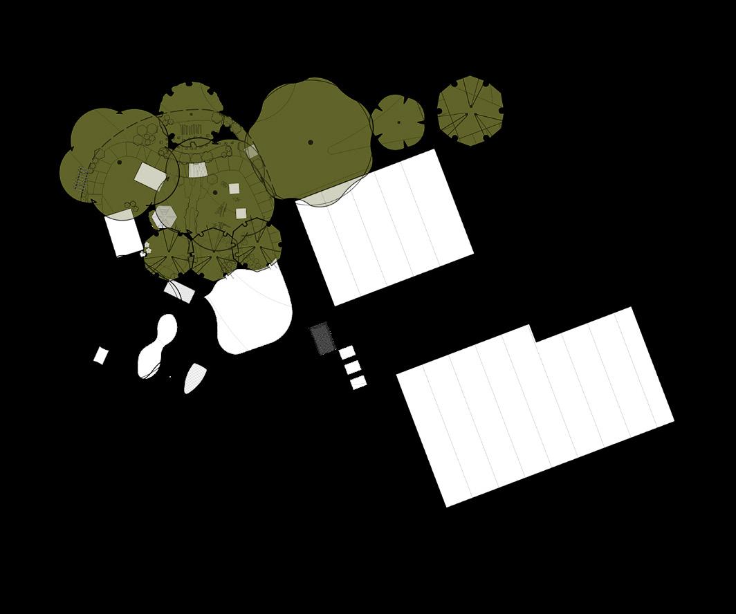
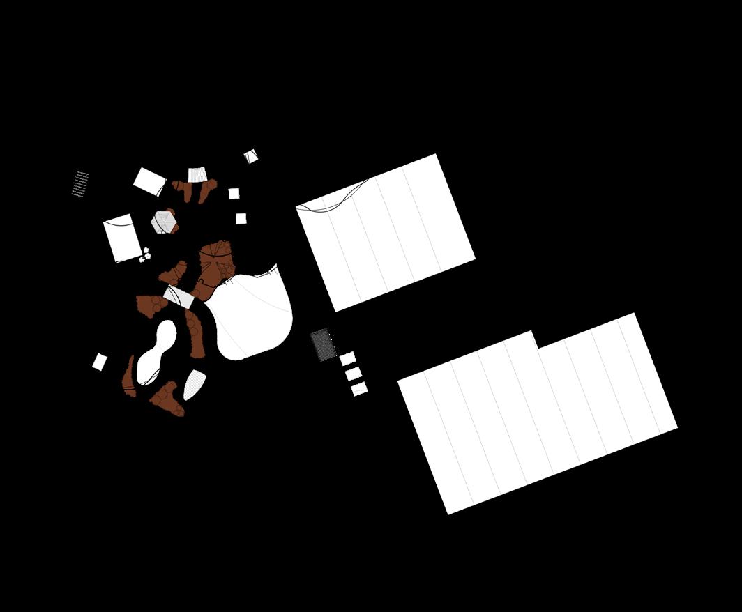
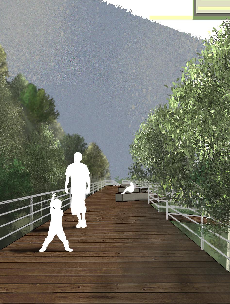
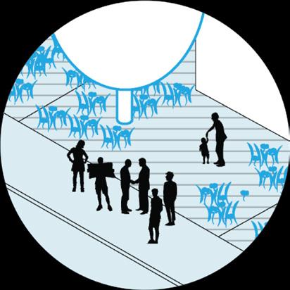
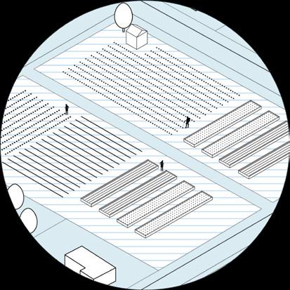
The primary components of the design are in the entry plaza and the natural playscape. The design is founded upon a strong axial relationship, which leads users into the plaza and through the visitor center towards expansive views of the site, and the secondary axis runs parallel between the two structures and into the natural playscape. The entry plaza contains a native wetland ecological system which acts as a stormwater management tactic. The playscape is organized around a primary loop pathway which connects to a variety of secondary and tertiary routes and activity settings. The activity settings offer a variety of affordances for playing and learning.
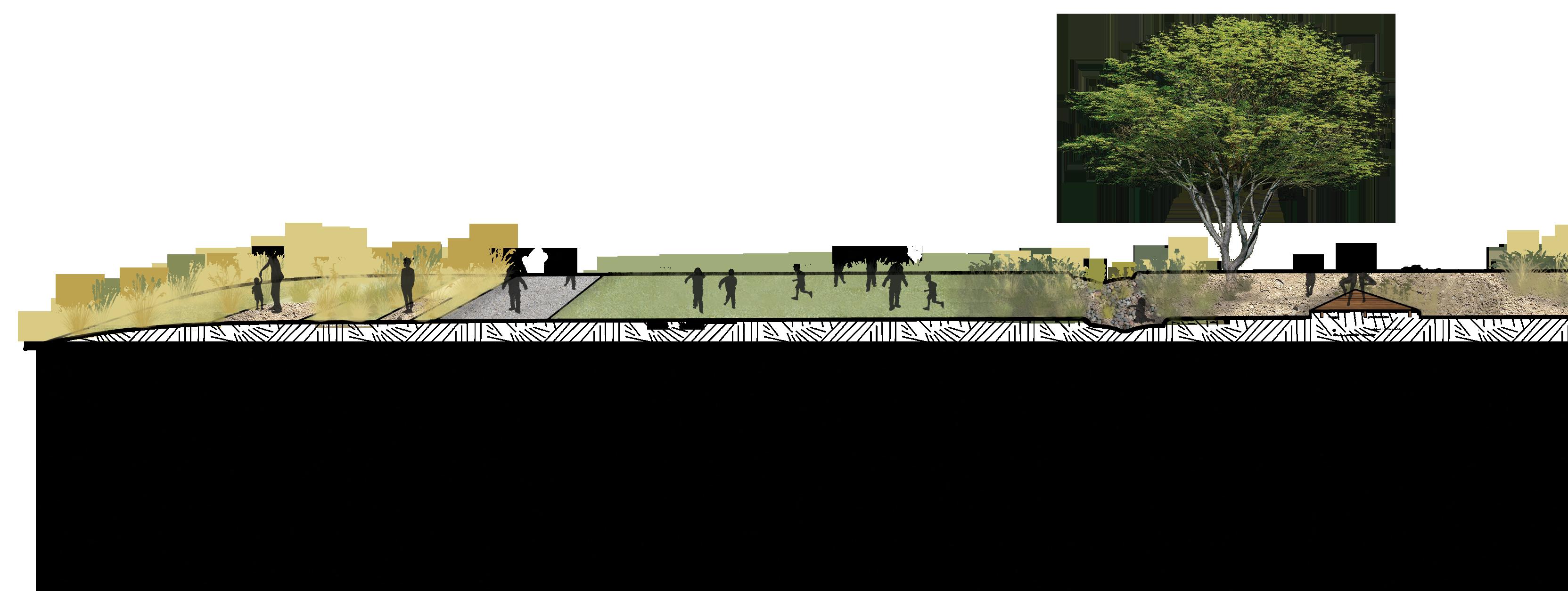
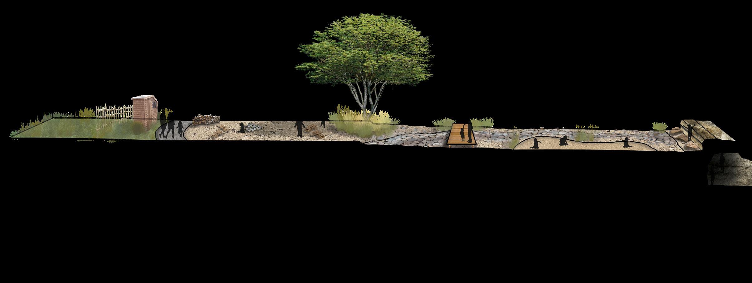
Playscape Sections
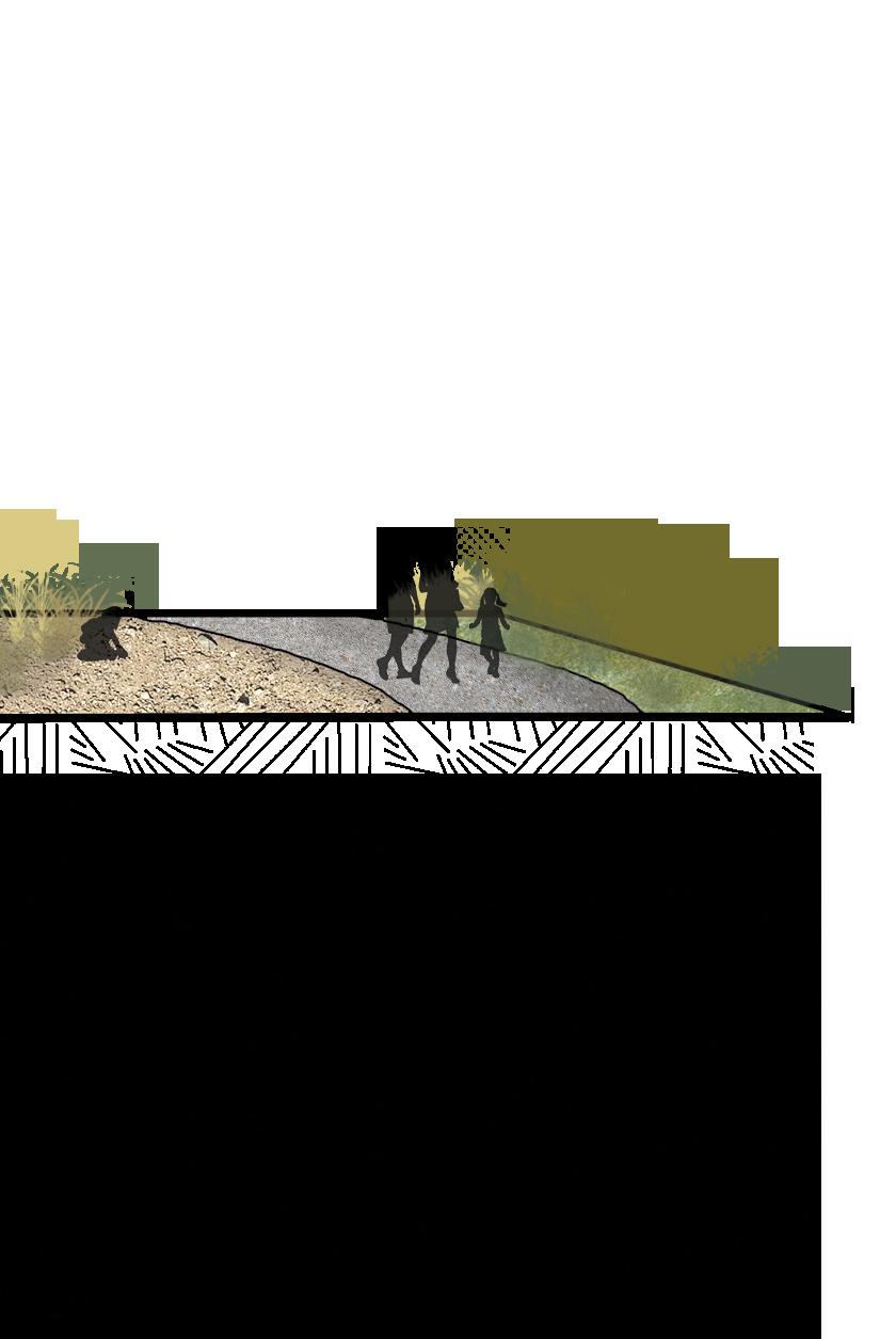
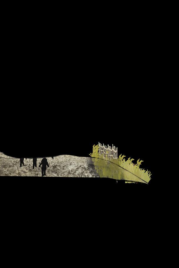
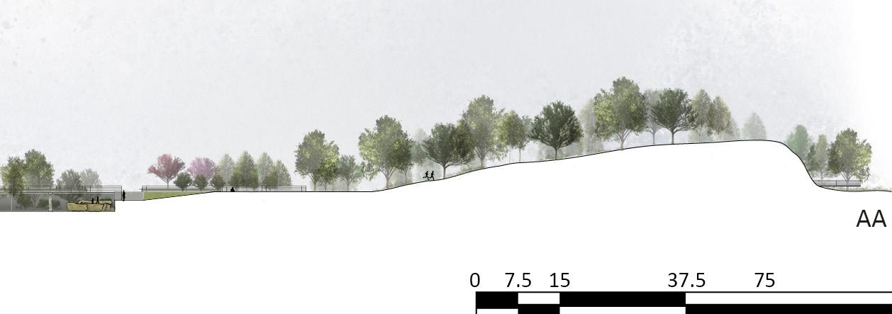
 Site Section
Primary Loop Pathway
Primary Loop Pathway
Loose Parts Play Area
Dry Creekbed
Savanna Maze
Open Lawn
“Sandbar”
Dry Creekbed
Stage and Outdoor Classroom Area
Site Section
Primary Loop Pathway
Primary Loop Pathway
Loose Parts Play Area
Dry Creekbed
Savanna Maze
Open Lawn
“Sandbar”
Dry Creekbed
Stage and Outdoor Classroom Area
The design of the playscape was heavily inspired by the different ecological zones of the region. The three ecological zones that were incorporated into the playscape were the oak forest, the oak savanna, and the bluffs. The 3 of these were expressed as separate biotopes within the playscape, with each expressing the unique planting typologies they possess. The playscape activity settings also relate to the biotopes that they reside in, with the affordances revolving around the characteristics of each biotope.

Oak Forest Oak Savanna
Quercus macrocarpa - burr oak
Tilia americana - American linden
Ostrya virginiana - ironwood


Cercis canadensis - eastern redbud
Quercus macrocarpa - burr oak
Carya ovata - shagbark hickory
Carya cordiformis - bitternut hickory
Prunus americana - wild plum
Asimina triloba - pawpaw
Staphylea trifolia - American bladdernut
Cornus asperifolia - roughleaf dogwood
Symphoricarpos orbiculatus - coralberry
Rhus glabara - smooth sumac
Amorpha canescens - leadplant
Rosa arkansana - prairie rose
Symphoricarpos orbiculatus- coralberry
Fragria virginiana - wild strawberry
ground cover - wood sedge, wildrye, snakeroot, sunflowers, lilys, and perennial herbs, understory grasses
Ceanothus americanus - New Jersey tea
ground cover - big bluestem, little bluestem, indian grass, prairie dropseed, goldenrod, asters
Moris alba ‘Pendula’- weeping mulberry Salix interior - sandbar willow

Prunus americana - wild plum
Rhus glabara - smooth sumac
Cornus sericia - redosier dogwood


Symphoricarpos orbiculatus- coralberry
Typha latifolia - broad leaved cattail
ground cover - prairie cordgrass, big bluestem, indiangrass, woolly sedge, arrowheads
Ceanothus americanus - New Jersey tea
Amorpha canescens - leadplant
ground cover - prairie cordgrass, sedges, goldenrod, asters, snakeroot, nodding fescue
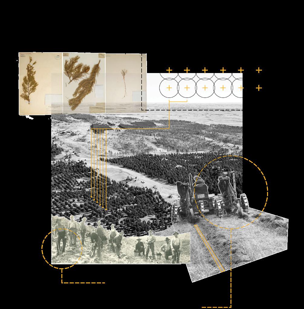
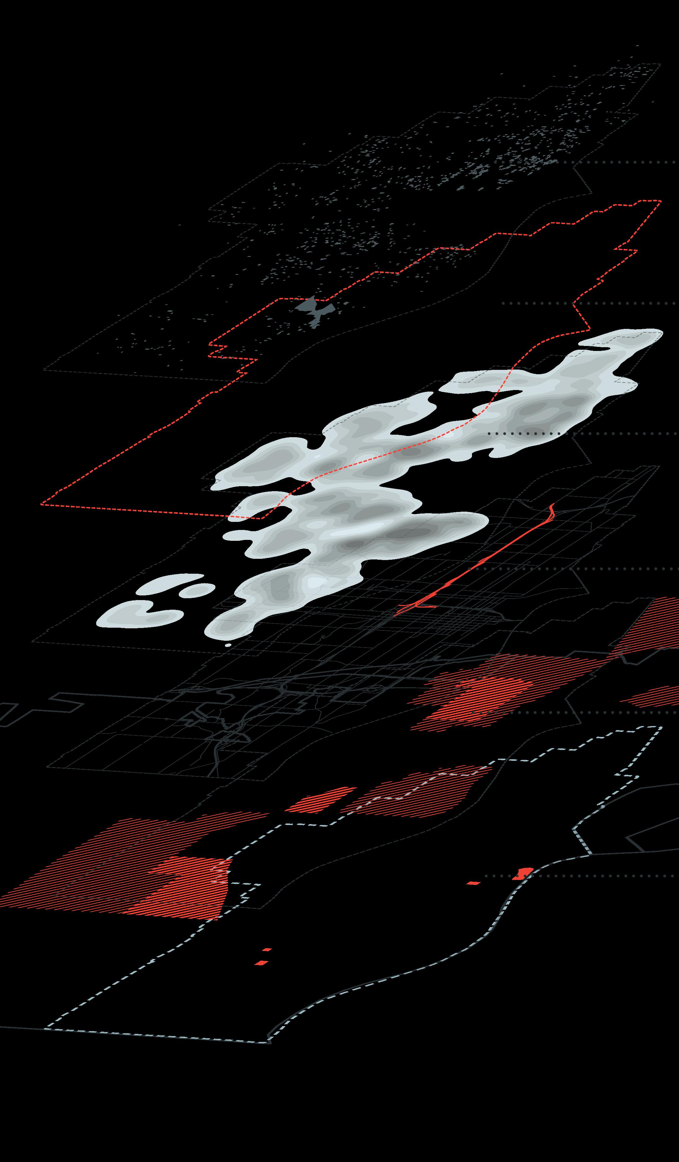
The adaptive reuse of abandoned or deteriorated landscapes provides the perfect scope for landscape architects to implement design interventions. These projects allow the ability to improve the urban and natural ecologies of an area. Forest Basin Park is a conceptual design for a public park located in an abandoned water treatment facility in Chongqing, China. The erratic topography of the site provides a unique challenge while simultaneously presenting design opportunity for recreation and viewing. The design narrative centers around the reforestation efforts happening in China at the time, and utilizes forest restoration tactics and native trees as a remediation tactic within and around the facility.
LARC 211 - Landscape Architecture Site Design
Jacob Essink
Native trees and shrubs
Park structures and planter areas
Basin Supportive structure
The park contains a trail system and sport court area that provides users with expansive recreation opportunities. There are also two primary nodes in the park, the active node being the repurposed infrastructure containing an education center and native habitat, and the passive node which consists of the boardwalk overlooking the Jialing River, where users can walk amongst the tree canopy while moving along the trail.
 Education structure inside basin
Primary pathway inside basin
Education structure inside basin
Primary pathway inside basin
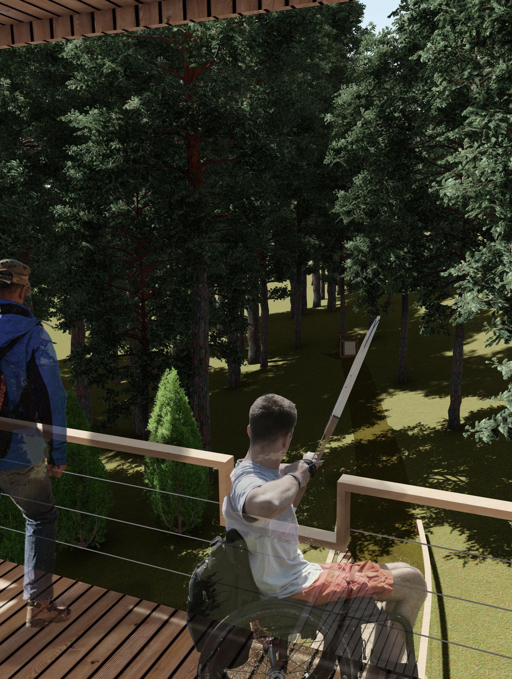
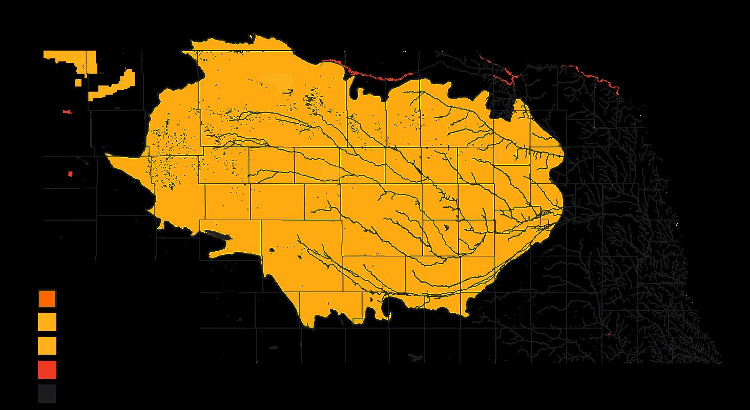
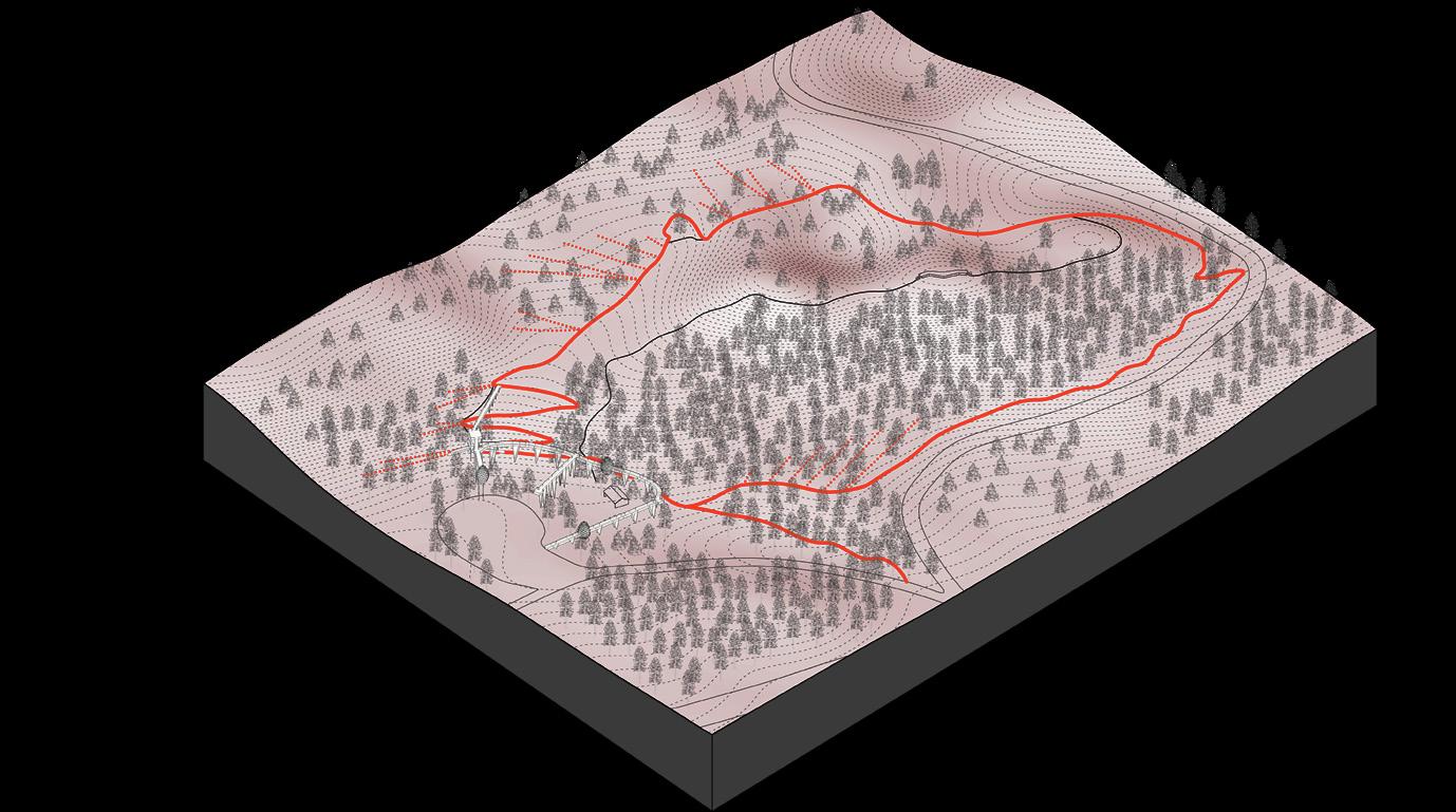
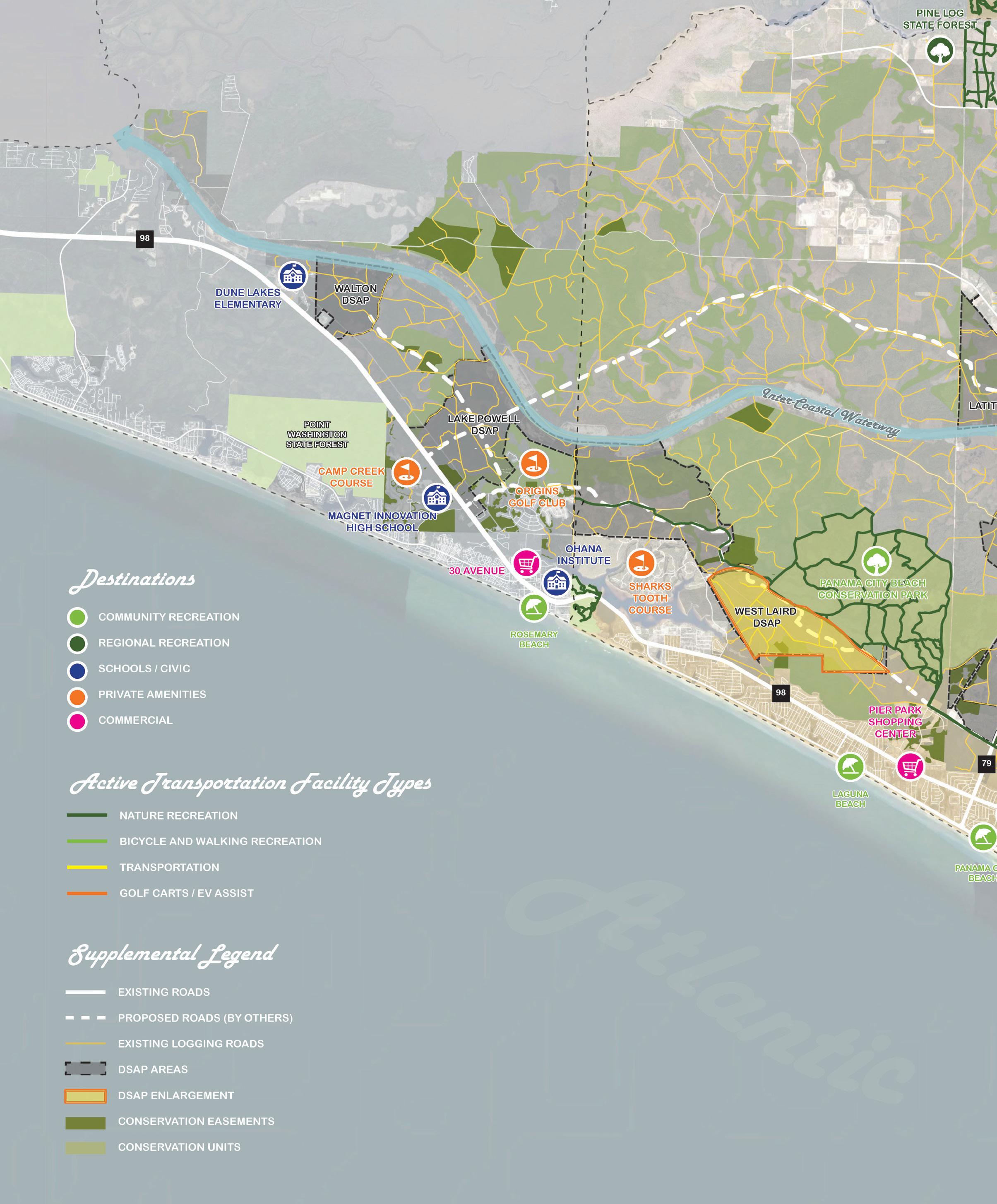
This project was done in collaboration with employees of the Forest Service and the Nebraska National Forest: Bessey Ranger District. Through the implementation of a trail master plan, this project aims to unravel the entangled cultural and environmental legacy of the Nebraska National Forest by situating a network of trail alignments, narratives, and experiences throughout this extraordinary landscape. The Forest sits in the center of the Nebraska Sandhills, the largest contiguous temperate grassland in the world. The Bessey Archery Range is one of the trails that was designed for the overall trail masterplan.
Nebraska National Forest: Bessey Ranger District Halsey, Nebraska
LARC 311 - Ecological and Cultural Landscape Systems
Jacob Essink, Jace Armstrong, Olivia Berck, Sean Kelly, Josiah Nolting, Dennis States, Stella Lepkowski, Alyssa Winkelman, Wijdan Almamari, Andrew Otting-Crandall
This project began with a comprehensive study of different management practices carried out by Forest Service staff at the Bessey Ranger District. These individuals understand the essential management practices that must be carried out for this forest specifically in order to ensure it remains a healthy ecosystem that will continue to support wildlife as well as provide a place of serenity for recreationalists who visit it. The management practices are visualized through a series of maps and collages depicting the management practice.

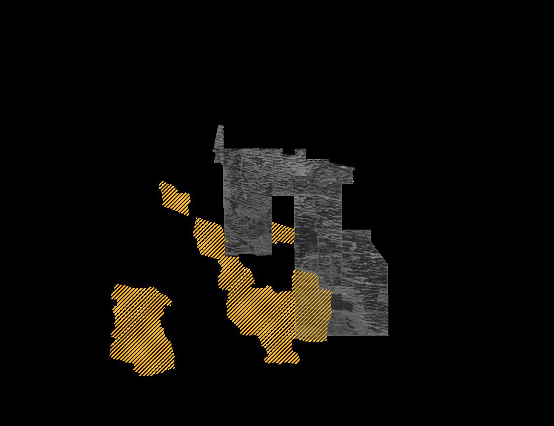
Active thinning areas
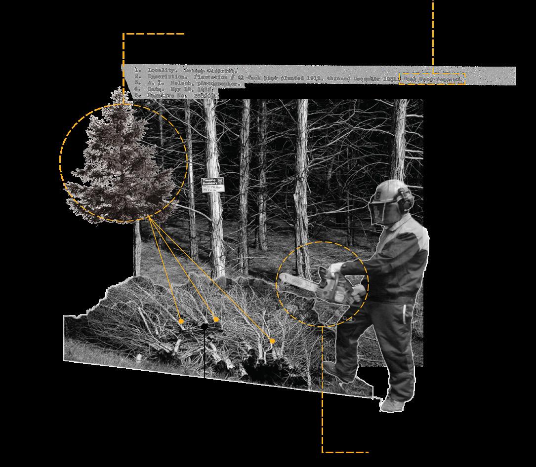
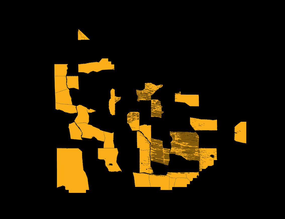
Active grazing plots
Brush piles
Controlled herd sizes
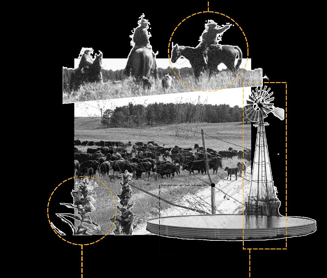
Eastern red cedar
Controlled burn sites

Native/Endangered plants
Ranchers
Chainsaws as a tool
Fire towers
Barbed wire fence Windmills
Controlled burns
Drip torch as a tool

Trail alignment masterplan

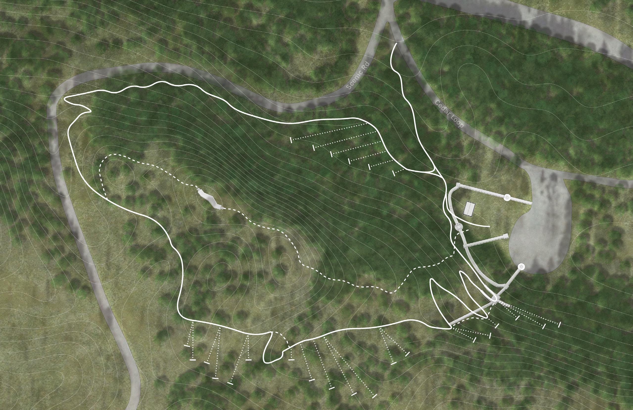
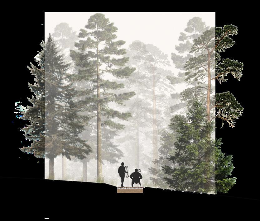
The Bessey Archery Range is a .47 mile loop trail that incorporates 25 archery targets at a variety of ranges to provide bow shooters with a unique and versatile shooting experience. The targets are situated at a variety of ranges and there are three different types of shots, which are categorized by their difficulty in the matrix shown below. The range also incorporates a shooting tower to provide archers with an opportunity for elevated shots.
The slope of the land can exceed 20% and requires switchbacks that move back and fourth across the steep grade in some locations to maintain FSTAG guidelines.
The shooting deck can maintain accessible ramp slopes by beginning the ramps at higher points along the hill, and stay at a lower incline as the ground slopes down.
This trail proposes the approach of stabilized engineered wood fiber (SEWF), which creates a firm and stable surface while maintaining a natural feeling.
Bench trails are cut flat from the existing grade to create a flat trail. The backslope must match the existing slope as close as possible.
Cross slope of the trail does not exceed 5%, and maintains an average of 2% to maintain accessibility.
Steep slopes require switchbacks in some areas, using these maintains an accessible slope of 8.33% along the steepest slopes.
Multiple ramps provide access to all stories of the shooting tower.
Small cutouts are made in the railing of the backside of the shooting tower to allow for shorter shooters use the tower.
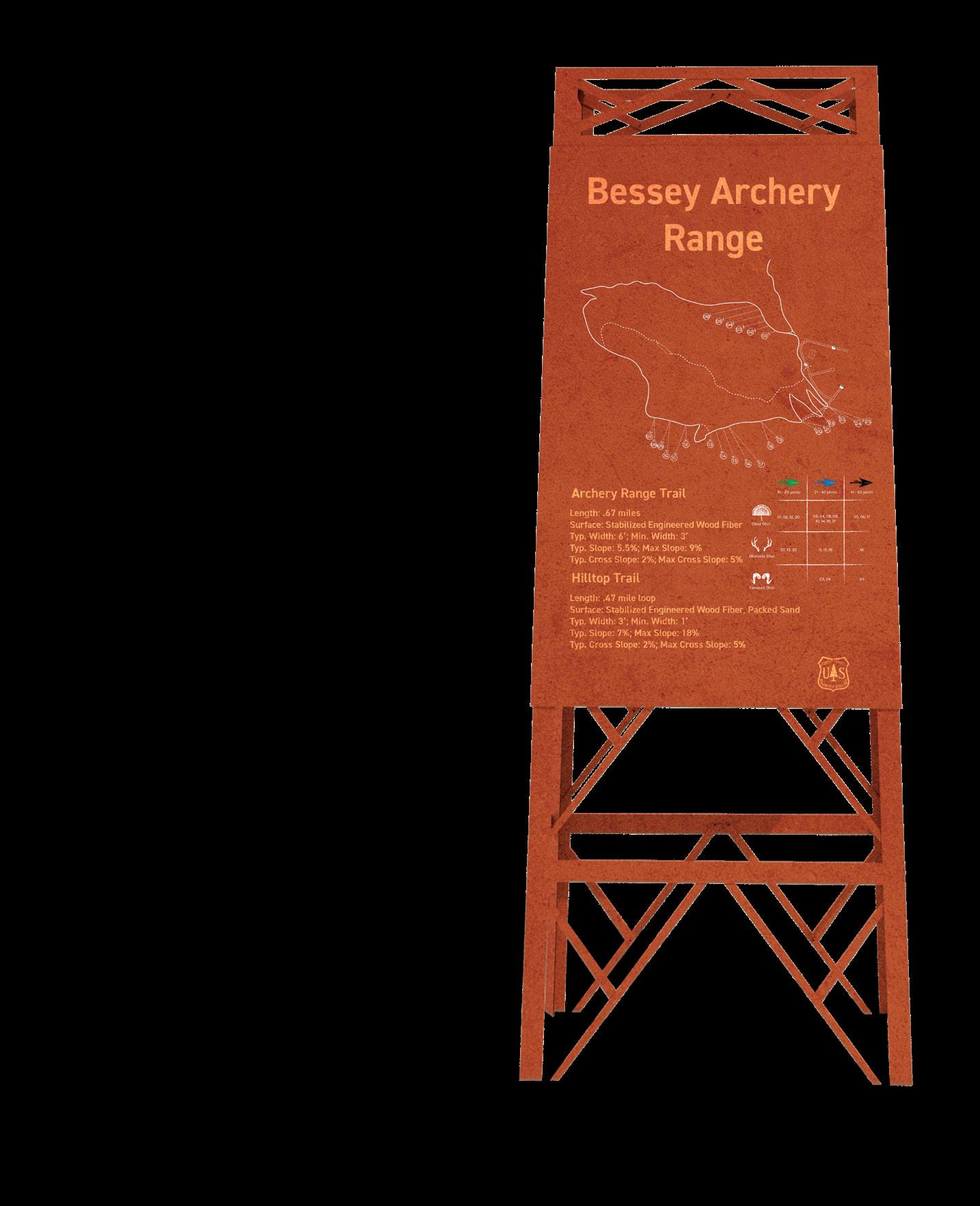
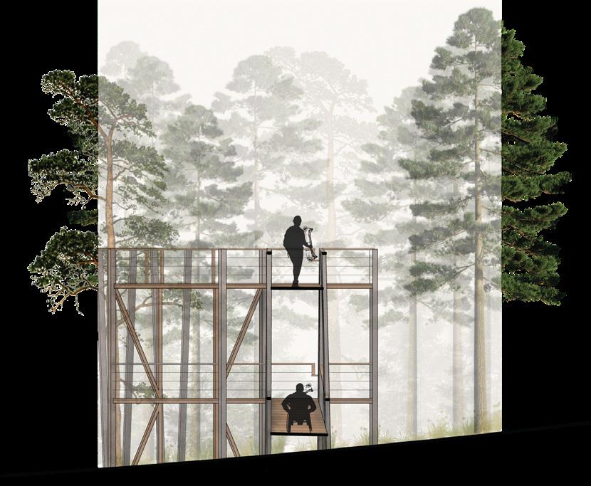
Access ramps maintain an 8.33% slope or less in order to accommodate wheelchair accessibility.
Stabilized engineered wood fiber (SEWF) provides required firmness and maintains a natural aesthetic.
Required construction of trail surface is: 2” thick SEWF with binder, a geotextile fabric layer, 2” thick gravel, a geotextile fabric layer, subgrade.
Average trail width of 6’ allows for two way traffic, trail never becomes skinnier than 3’.
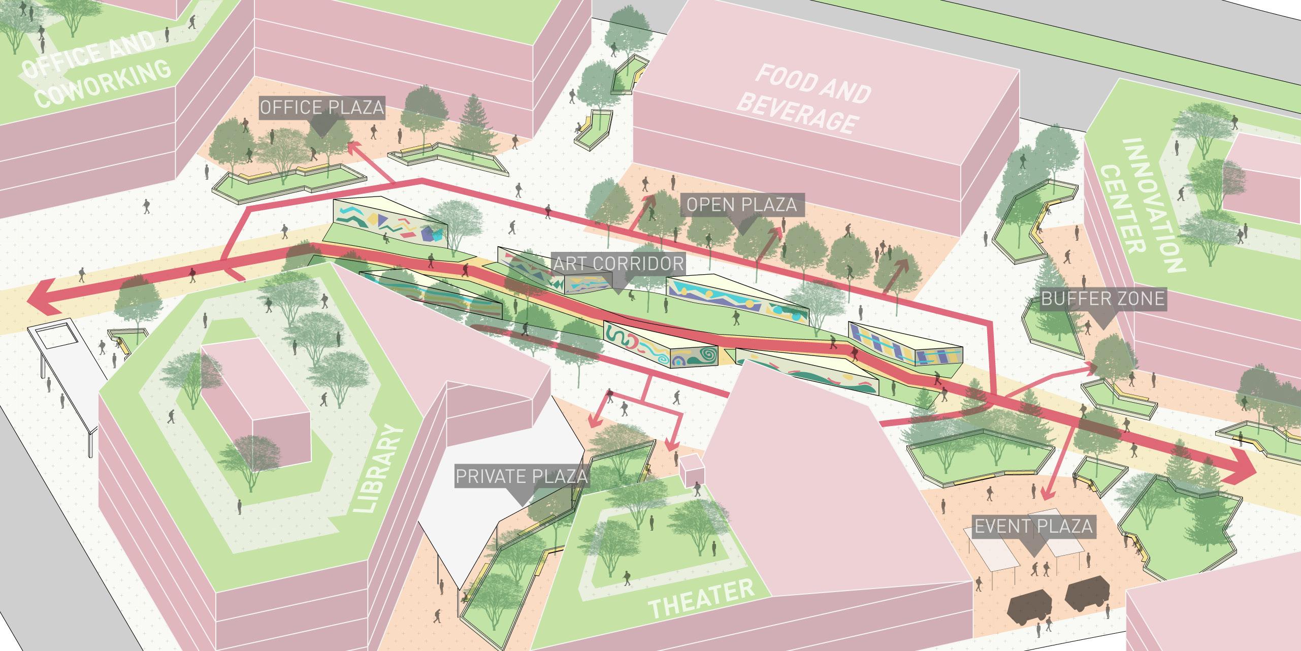
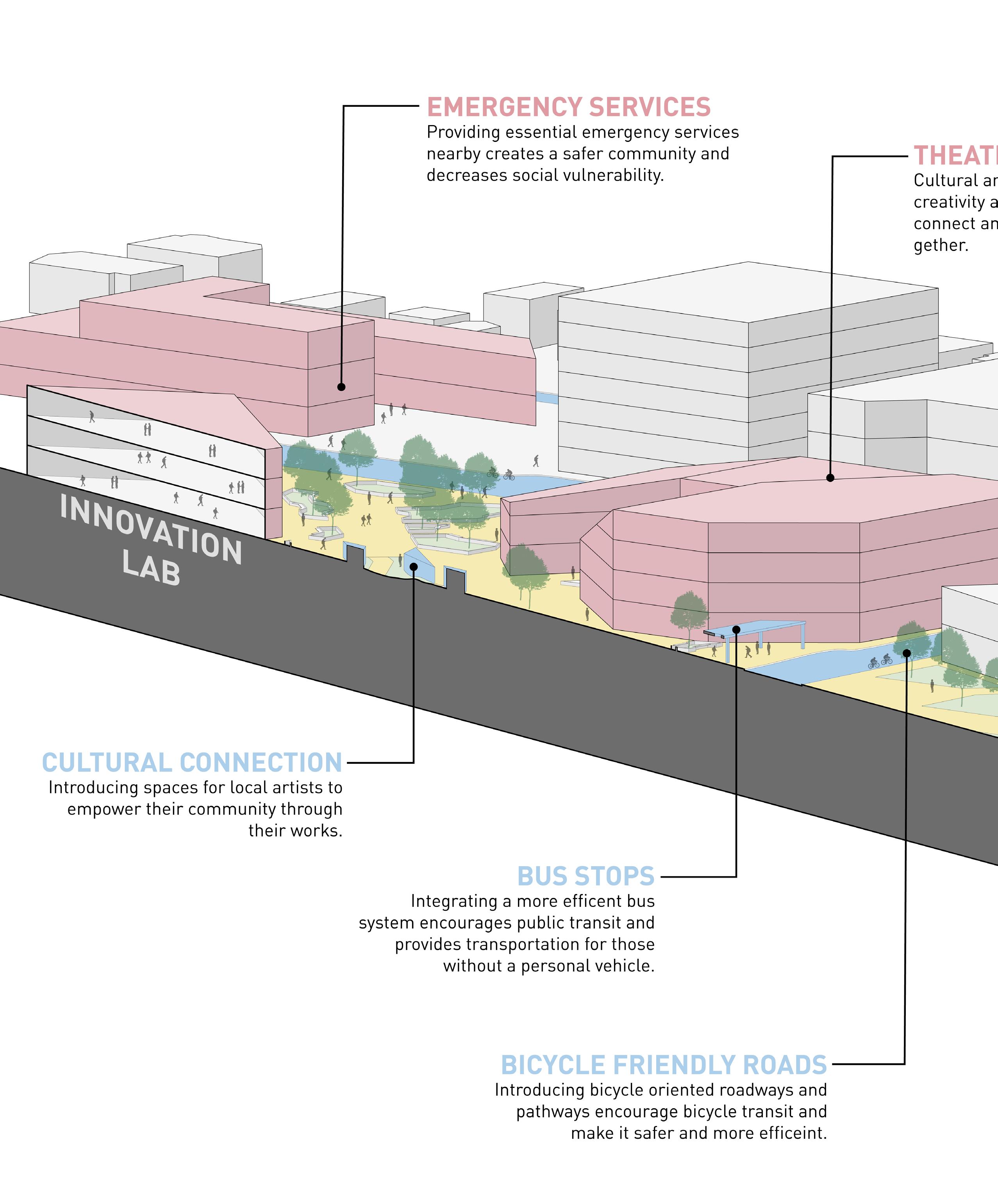
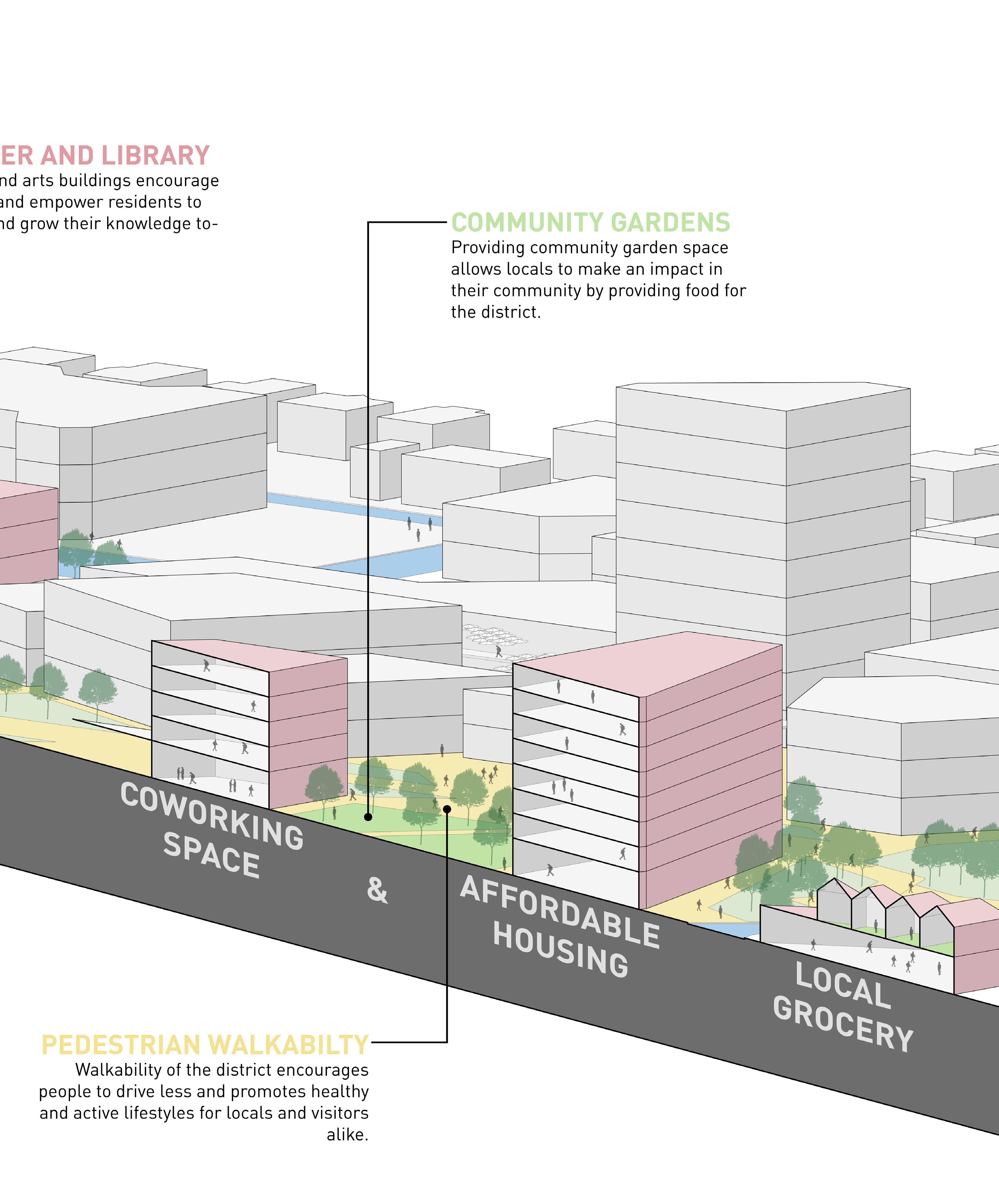
The Historic Benson District is a famous historic arts area which features a multitude of shops, restaurants, and local businesses. However, time has taken a toll on this area, as corroding infrastructure and automotive dominance make this area difficult to explore and limits its full potential. This project reimagined the Historic Benson District within a 40-year future framework, which focused on creating a walkable, livable, and explorable district, capturing the essence of what makes this area special.
Benson, Nebraska
LARC 310 - Advanced Landscape Architecture Site Design
Jacob Essink, Jace Armstrong, Olivia Berck
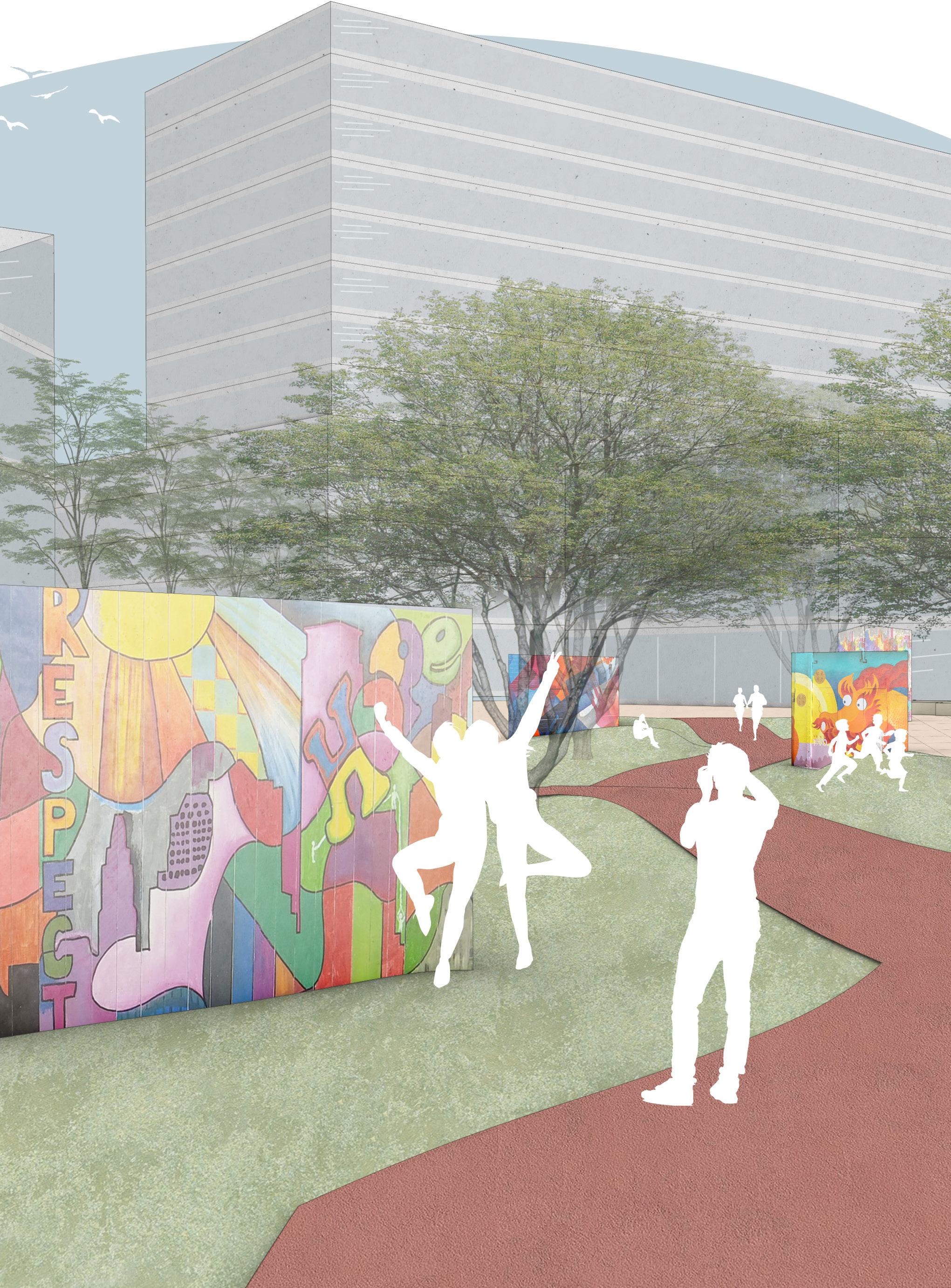
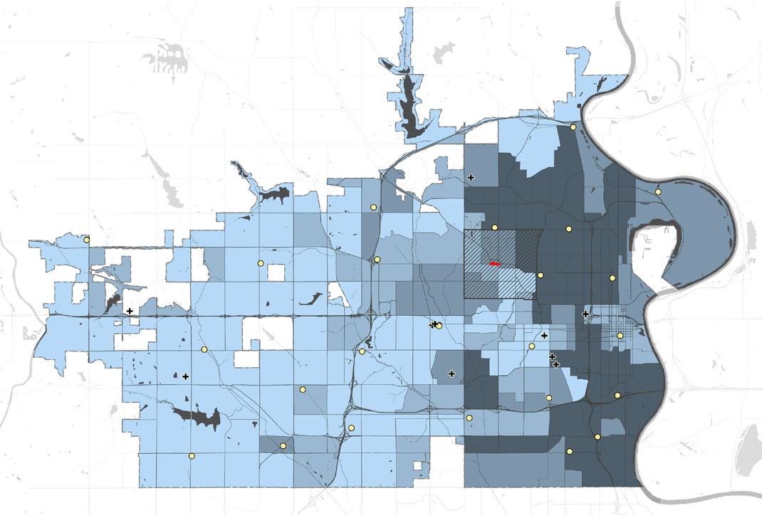
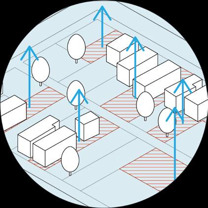
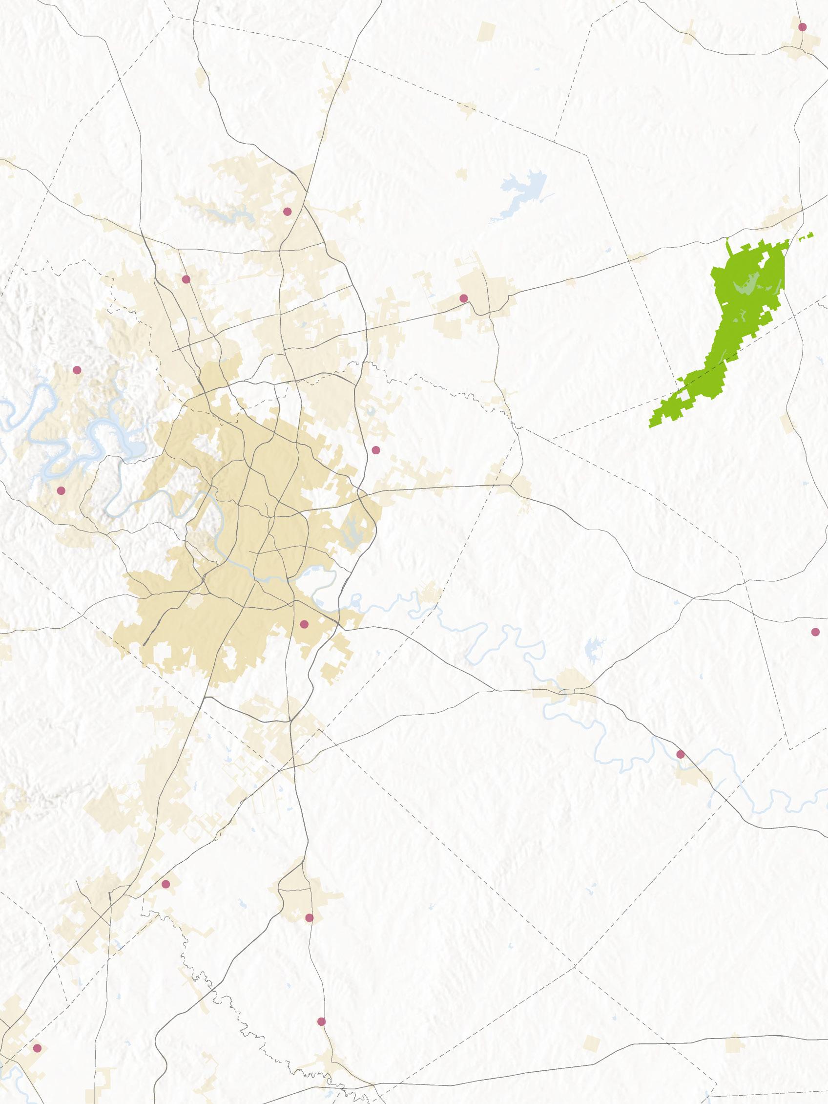
The project began with a spatial equity investigation. This process was done in order to uncover what may be causing spatial injustice in the Benson District. The investigation began with a mapping analysis of the city of Omaha, to understand the broader context of the region. A series of maps were produced in order to help describe the relationships of spatial conditions in Omaha that could be influencing Benson. Following the mapping investigation, a series of spatial intervention studies were conducted in order to help identify some areas within the Benson district that could be improved upon to improve spatial equity. The series of axonometric drawings below shows some of these proposed interventions within the Benson district.
Coworking and housing units
Omaha Historical Districts
Omaha Social Vulnerability Index
Bike lane with bio-buffer Pocket Parks
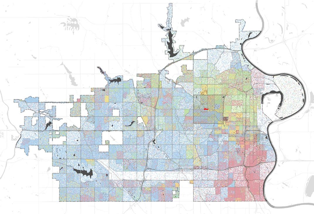
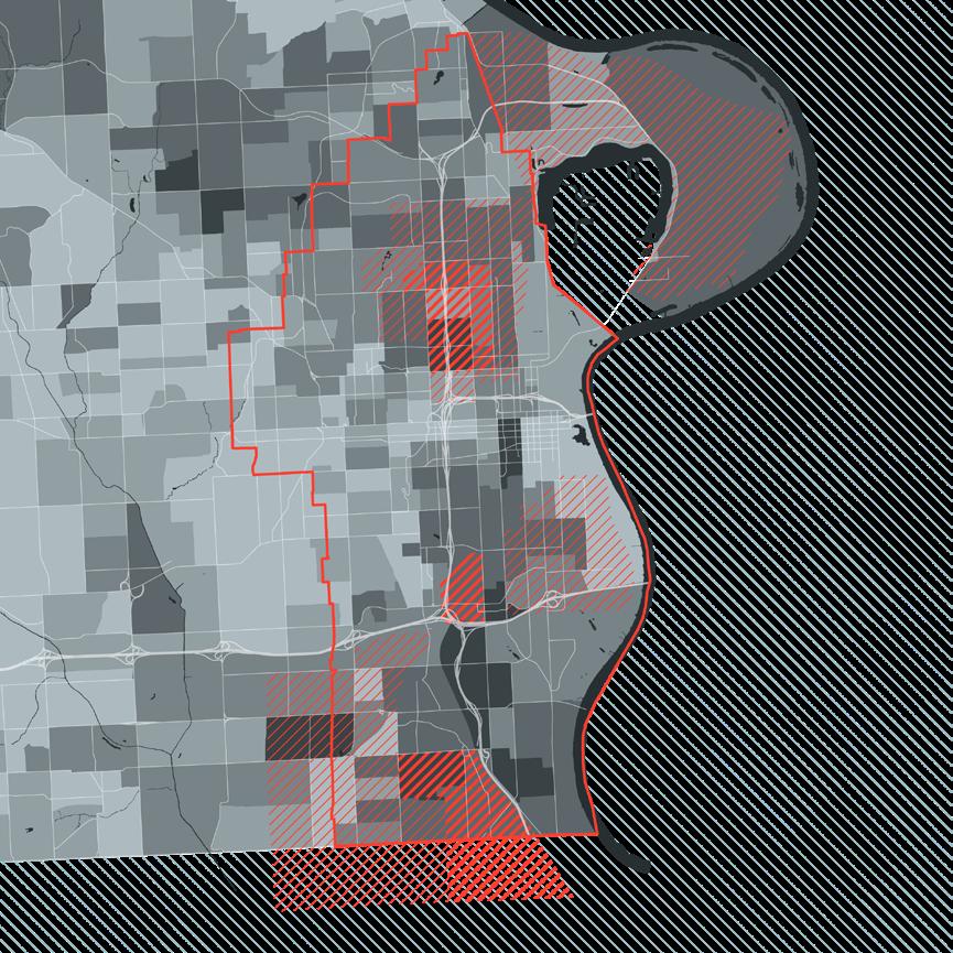
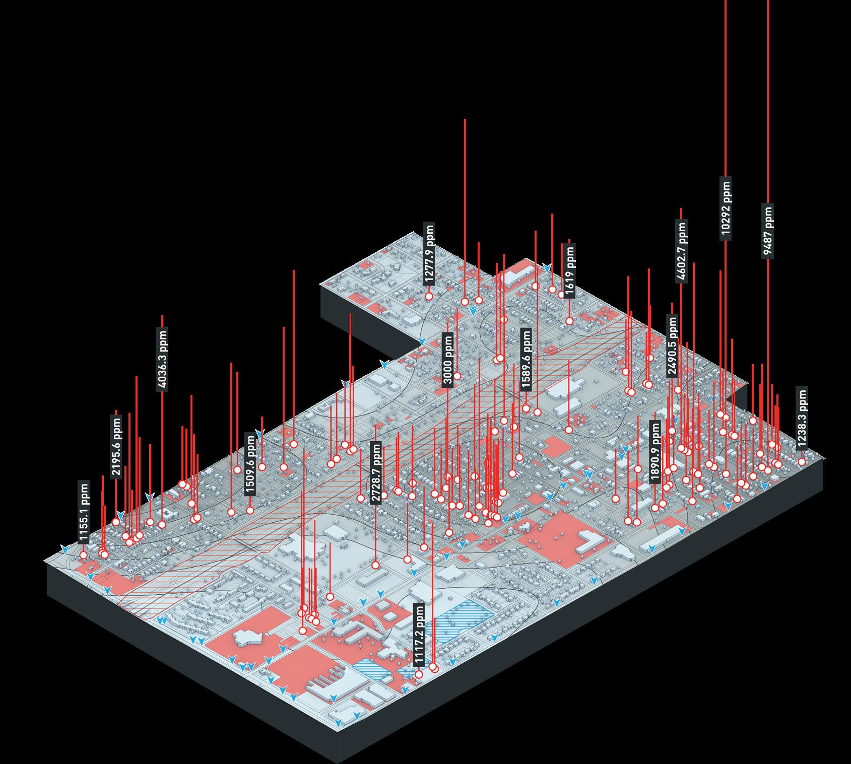
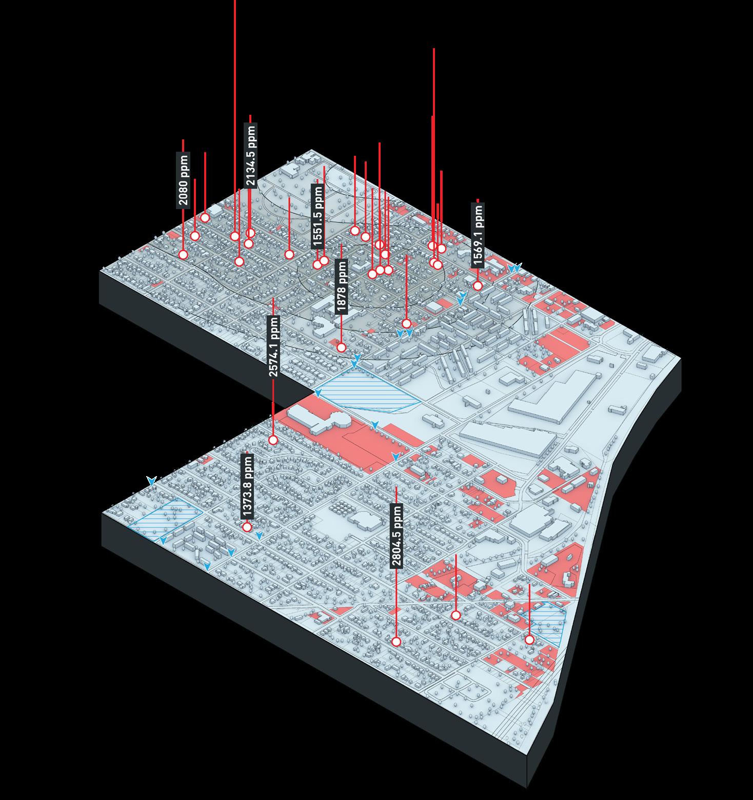
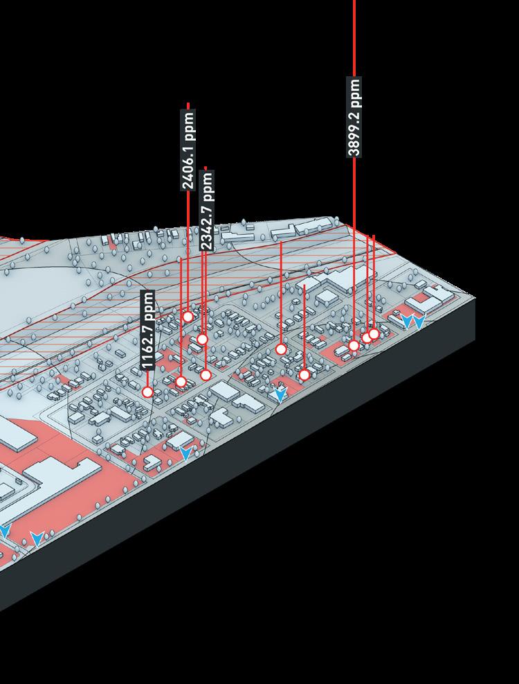
This project was done in collaboration with Assistant Professor of Landscape Architecture at UNL, Salvador Lindquist. This research studies the effect of lead pollution in Omaha, NE through a comparative study of similar Superfund sites in the United States and proposes an alternative framework that moves beyond simply restorative methods of remediation by providing proactive solutions to improving these conditions of significantly impacted urban areas. By doing so, this project closely investigates the relationships between Superfund sites, impacted communities, and affected infrastructures.
Omaha, Nebraska
Undergraduate Creative Activities and Research Education (UCARE) Program
Jacob Essink, Salvador Lindquist
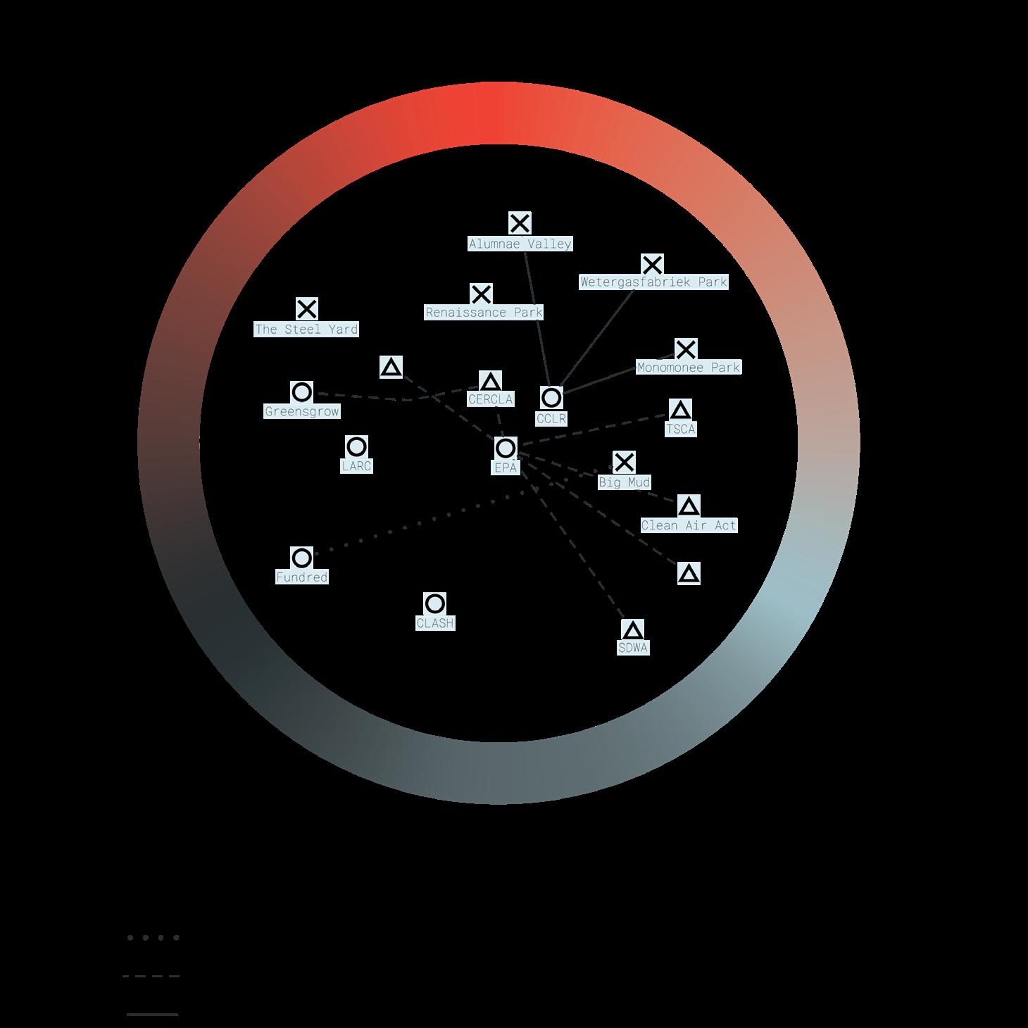
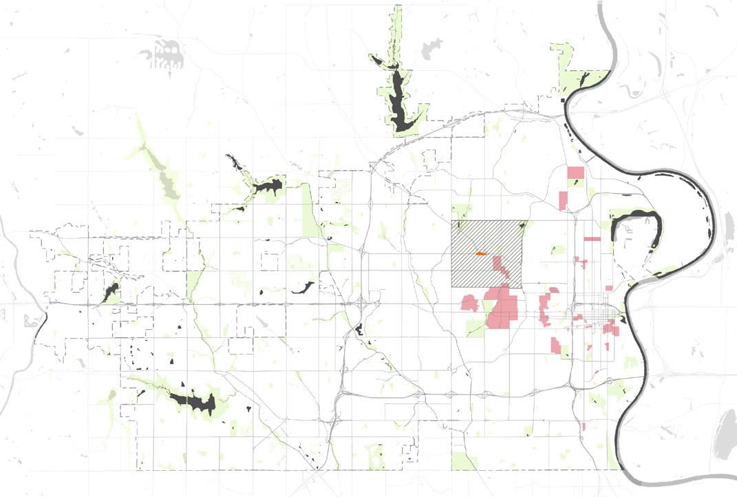
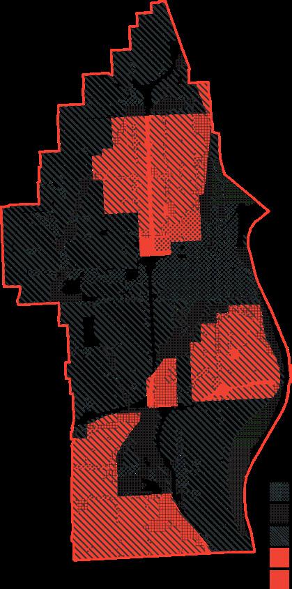
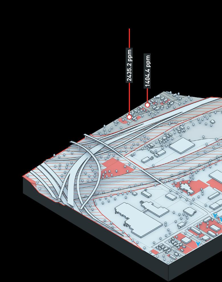
The research for this project began with using GIS to analyze the spatial relationship between significant lead pollution, demographics, historic redlining, and proximity to residential land use in a selected series of Superfund sites. An example of one of these mapping analyses is shown below as the Omaha Injustice Mapping. To better help frame the objectives of the research, an aggregation of resources, approaches, and institutions that currently exist to assess potentials for remediation was collected. Building off of Hyejung Chang’s conceptions of justice — distributive, procedural, and restorative (Chang, 2018), these resources were broken down into projects, policies, and foundations and collated by their relationship to each justice typology as well as to each other. These relationships are shown in the hermeneutic diagram to the right. The axonometrics shown on the following page help to expose the vulnerability that certain populations are facing in Omaha, and examines the lead pollution levels of particular locations within the Omaha Lead Superfund Site. The research then proposes a series of proactive solutions to improving unjust conditions caused by environmental injustices in Omaha, which are also shown on the following page. The solutions relate to specific sites on the axonometric drawings.
Commercial Land Use
Industrial Land Use
Residential Land Use
“Hazardous” Redline Zone
“Declining” Redline Zone
 Omaha Lead Omaha, NE
The percent of residential land use over the entire Omaha Lead site
The percent of the Omaha Lead site that has been classified as “Hazardous” from historic redlining.
The percent of the Omaha Lead site that has been classified as “Declining” from historic redlining.
42% 8.3% 23.2%
50%
Omaha Lead Omaha, NE
The percent of residential land use over the entire Omaha Lead site
The percent of the Omaha Lead site that has been classified as “Hazardous” from historic redlining.
The percent of the Omaha Lead site that has been classified as “Declining” from historic redlining.
42% 8.3% 23.2%
50%
To date, EPA completed cleanup of 13,090 residential properties, and has passed cleanup duties onto the city of Omaha.
Omaha Lead Superfund site listed on the National Priority List (NPL)
EPA collected soil samples from 42,047 residential properties, 14,019 properties qualified for cleanup.
North Omaha freeway is constructed.
Omaha Homeowner Loan Corporation creates redlined map of areas based on the level of home loan “risk.”
Fifteen companies merge to form the American Smelting and Refining Company (later ASARCO).
Reframed Remediation Solutions for Omaha
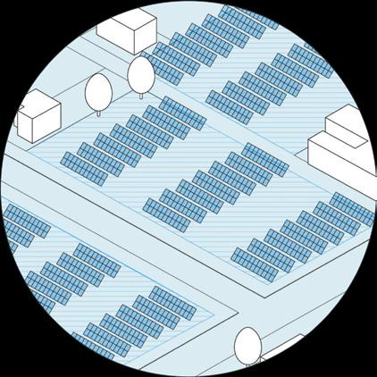
Utilize empty polluted parcels for solar arrays, while planting phytoremediating flora throughout to clean the soil while harnessing energy for nearby homes.
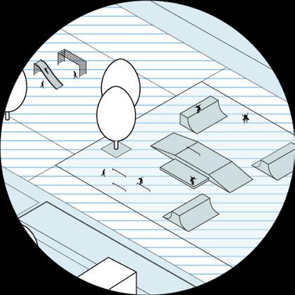
Provide play space for nearby communities while hardscape simultaneously acts as a form of soil capping to seal off lead pollution from users.
Buyers will receive government provided grants to cover costs of cleanup when purchasing lots contaminated with lead, and stipends for improving the property.

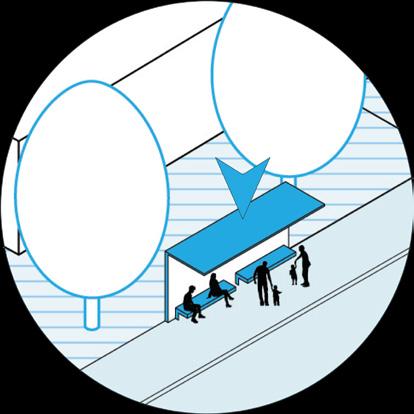
City health mandate ensures properties near public transit stops are remediated to protect community members who use public transportation.
Remove stipulations from HOA regulations specifying turf plants and expanding plant specifications to include phytoremediating species.
Environmental organizations hosting seed drives at local schools promotes biodiversity and informs the community about the dangers of lead pollution.
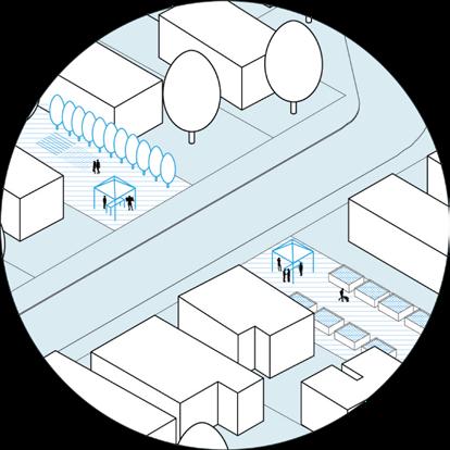
Funding from an environmental organization to provide a material depot gives locals access to clean soil and different species of plants to remediate communities.
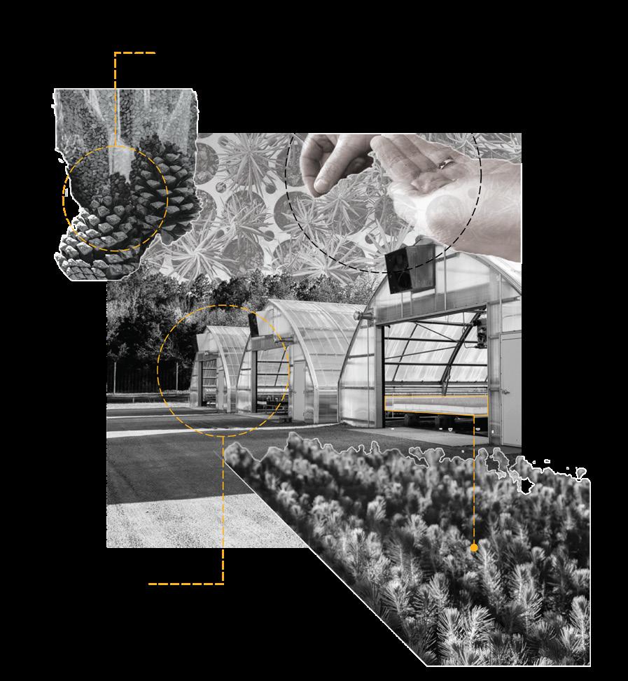
This section is a collection of images from projects I worked on during my internship in the summer between my third and fourth years of my undergraduate. I worked on a variety of projects which included assisting with the creation of maps and graphics for large scale planning projects, streetscapes, and community parks. I also assisted with the development of construction documentation during my internship. The collaboration with professionals from a variety of disciplines including landscape architects, engineers, planners, and horticulturalists helped me grow my technical and creative skills as a landscape designer.
Charlotte, North Carolina
LandDesign
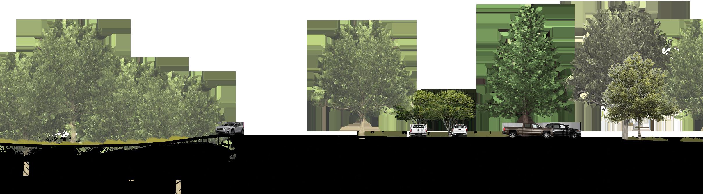
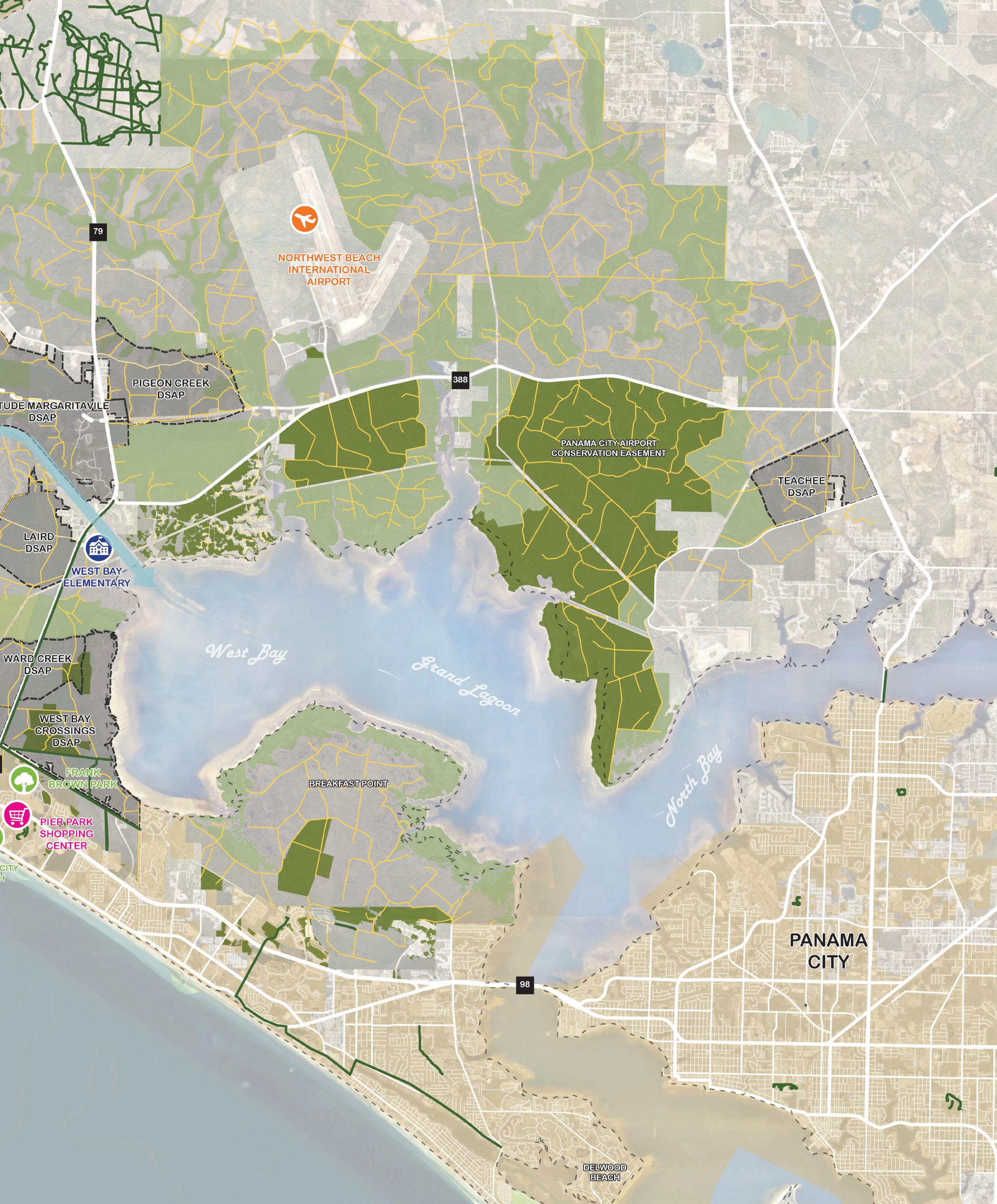
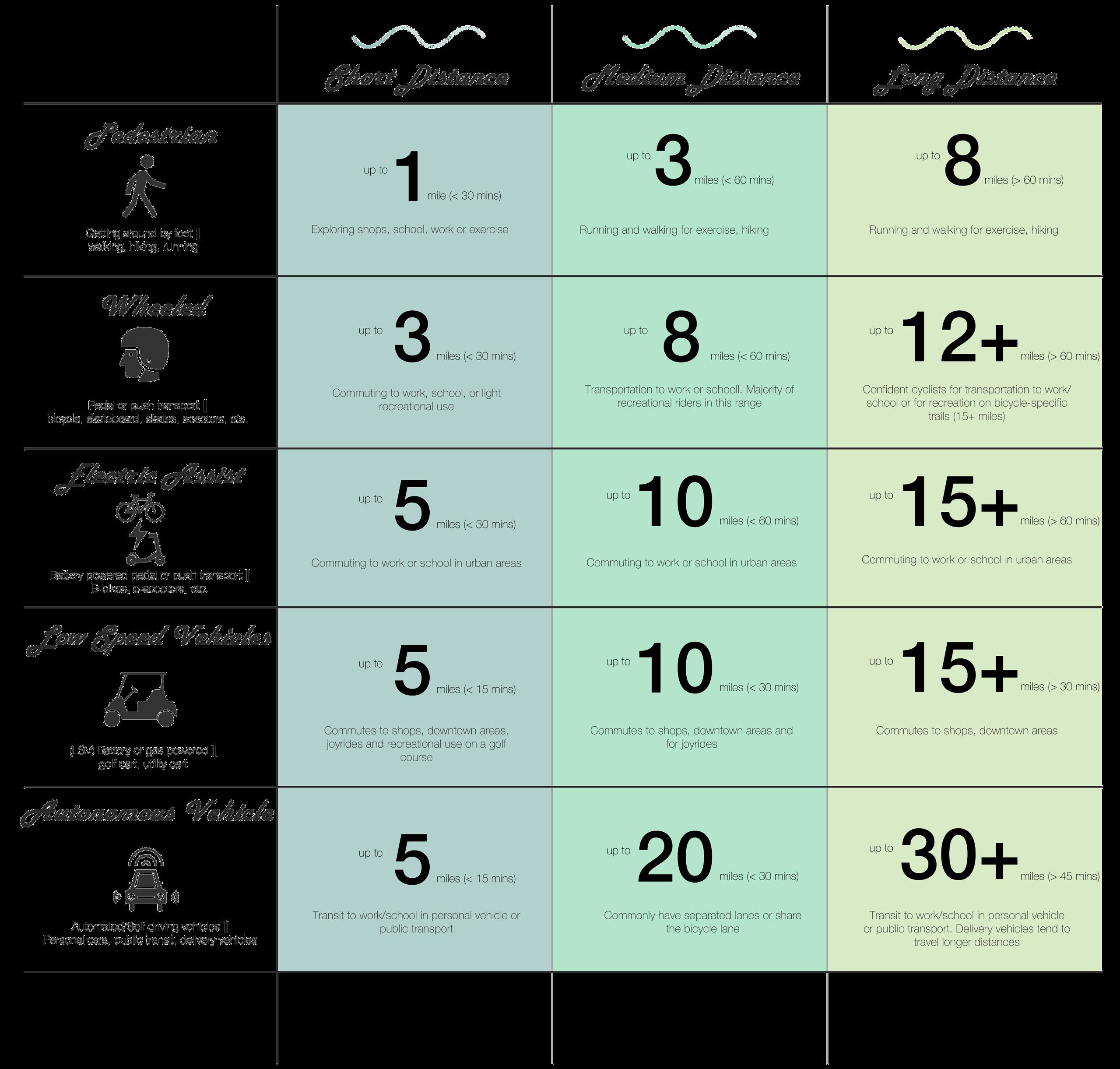
This project was done in collaboration with professionals within the studio I was a part of at LandDesign. My role in the project was to assist in creating the basemap for the analysis plan shown here. This examined some of the existing site conditions and shows some proposed networks across the site. The matrix to the right showcases the primary modes of transportation for people living in this region and distances typically traveled. This helps to inform the foundation of the trail network.
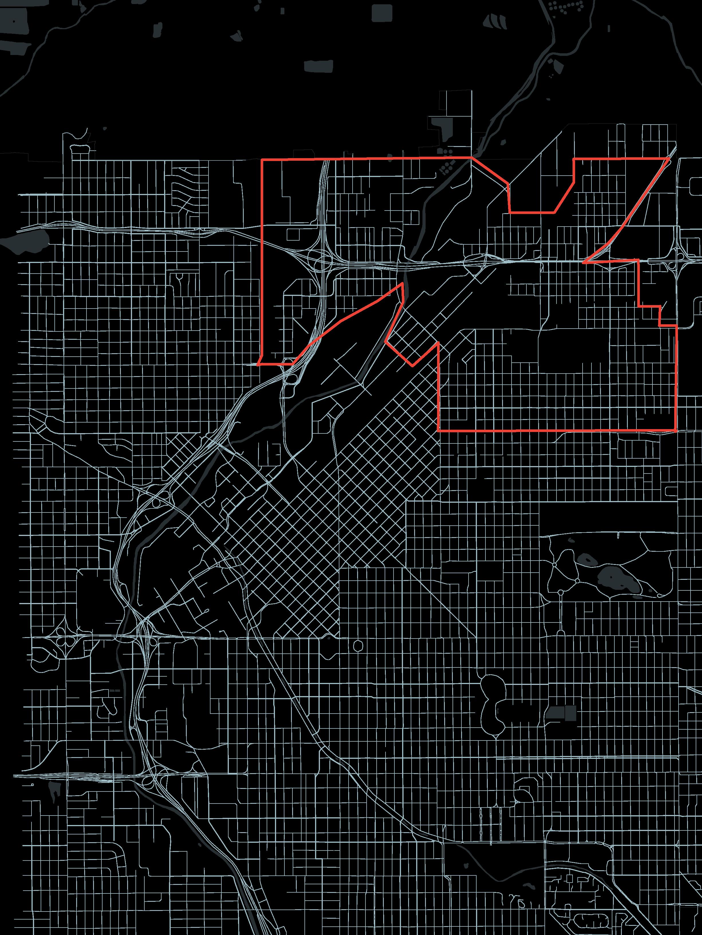
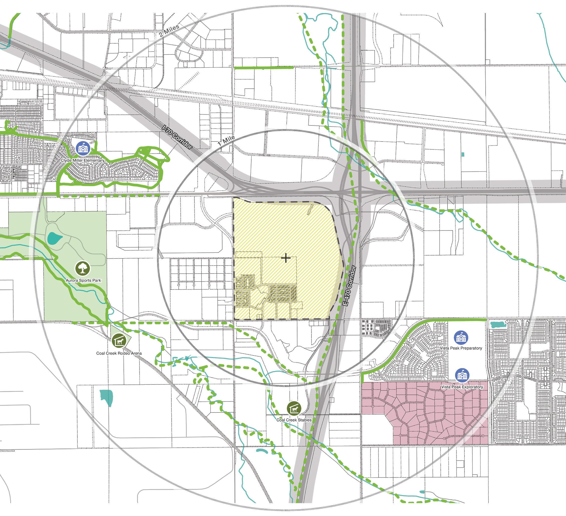
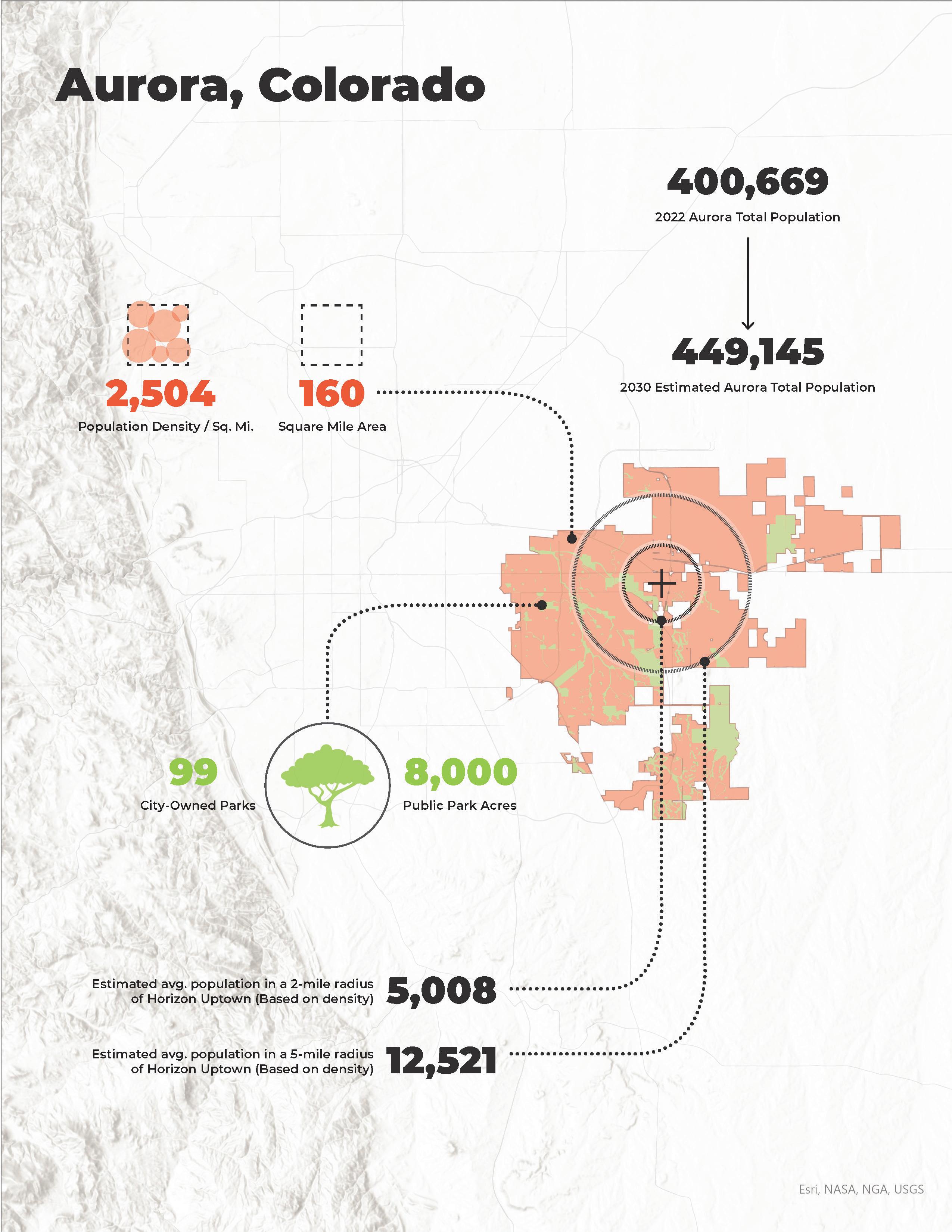
This project was done in collaboration with professionals within the studio I was a part of at LandDesign. The project involved community planning for a residential community in Aurora, Colorado. I was responsible for creating a map of surrounding conditions from the site. I also developed the diagram show to help give more context.
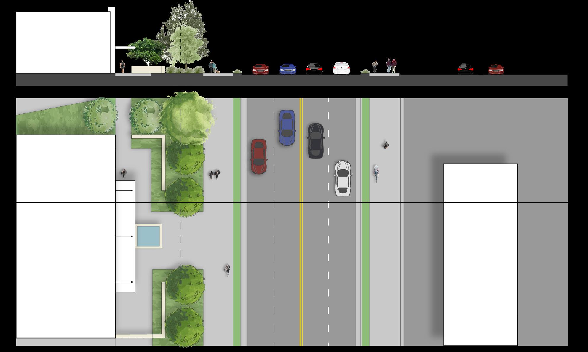
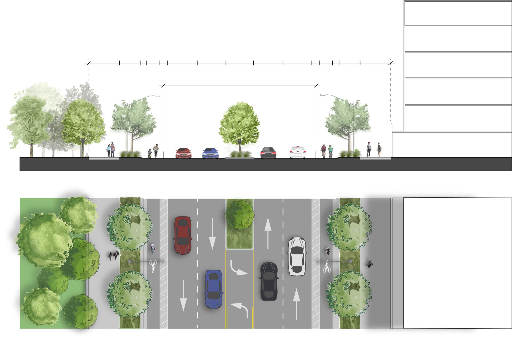
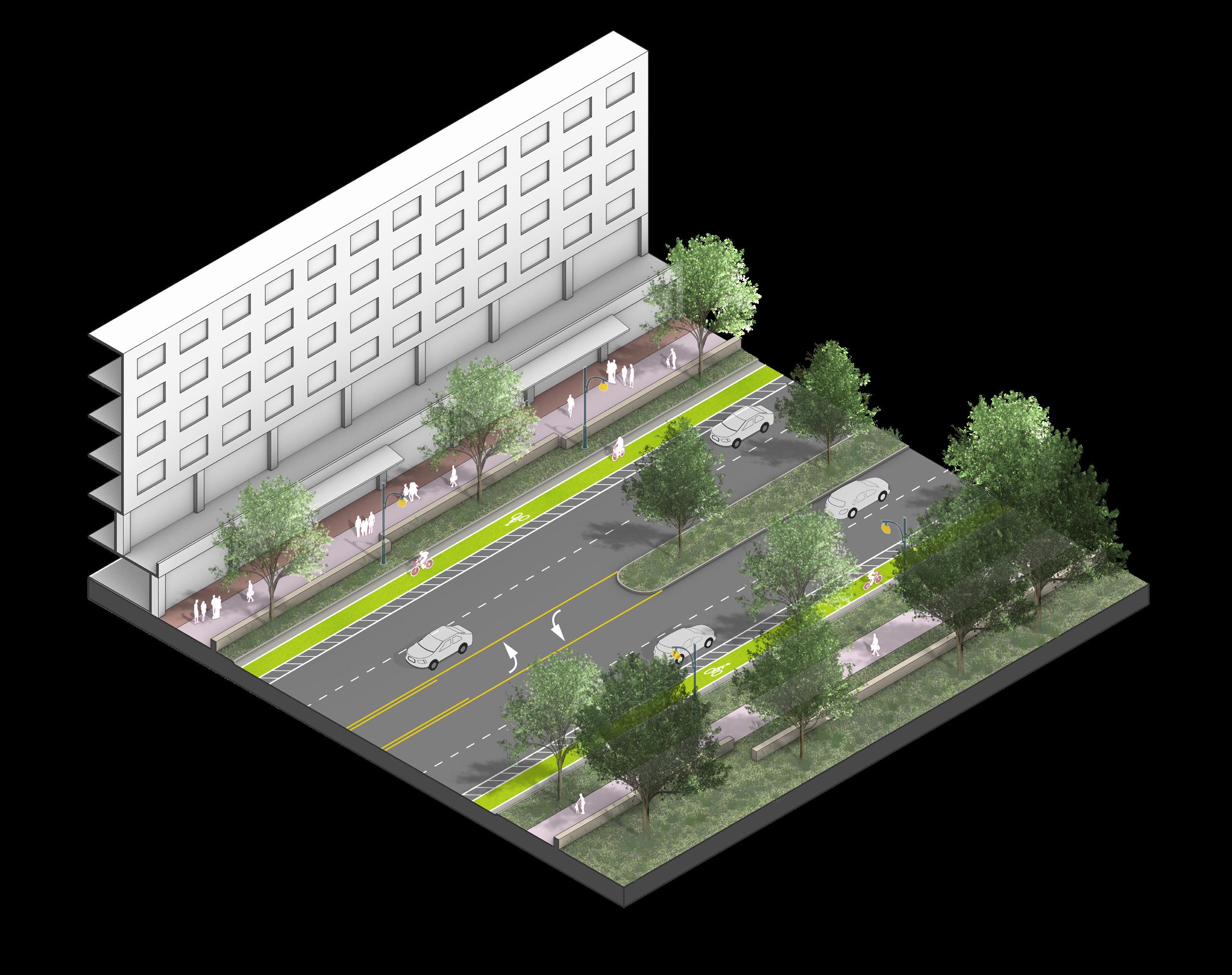
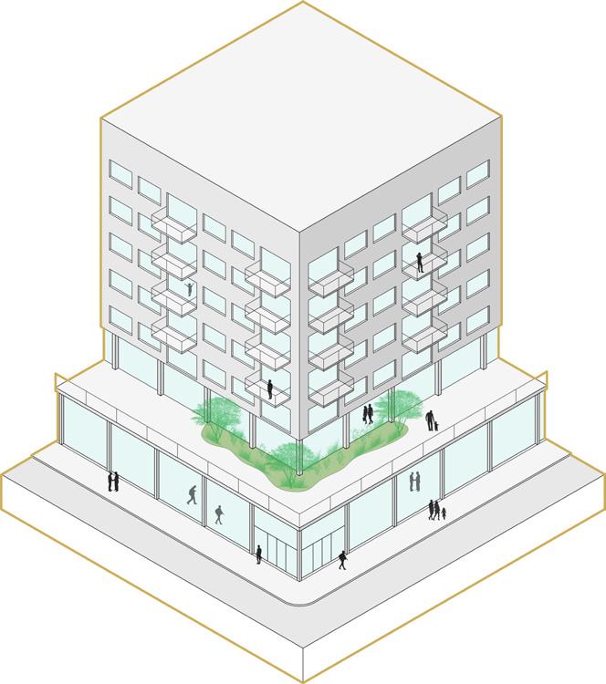
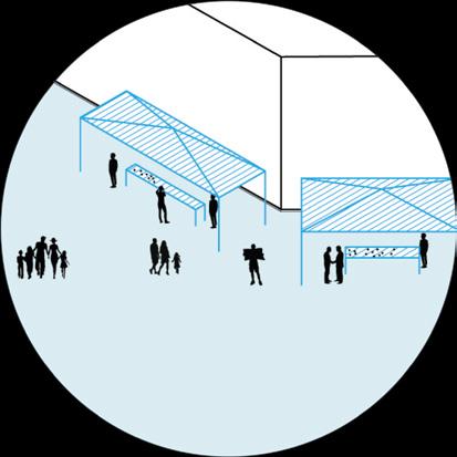
This project was done in collaboration with professionals within the studio I was a part of at LandDesign. My role for this project was to create streetscape section iterations, as well as an axonometric for better visualization understanding.