1 minute read
MAPPING INJUSTICE


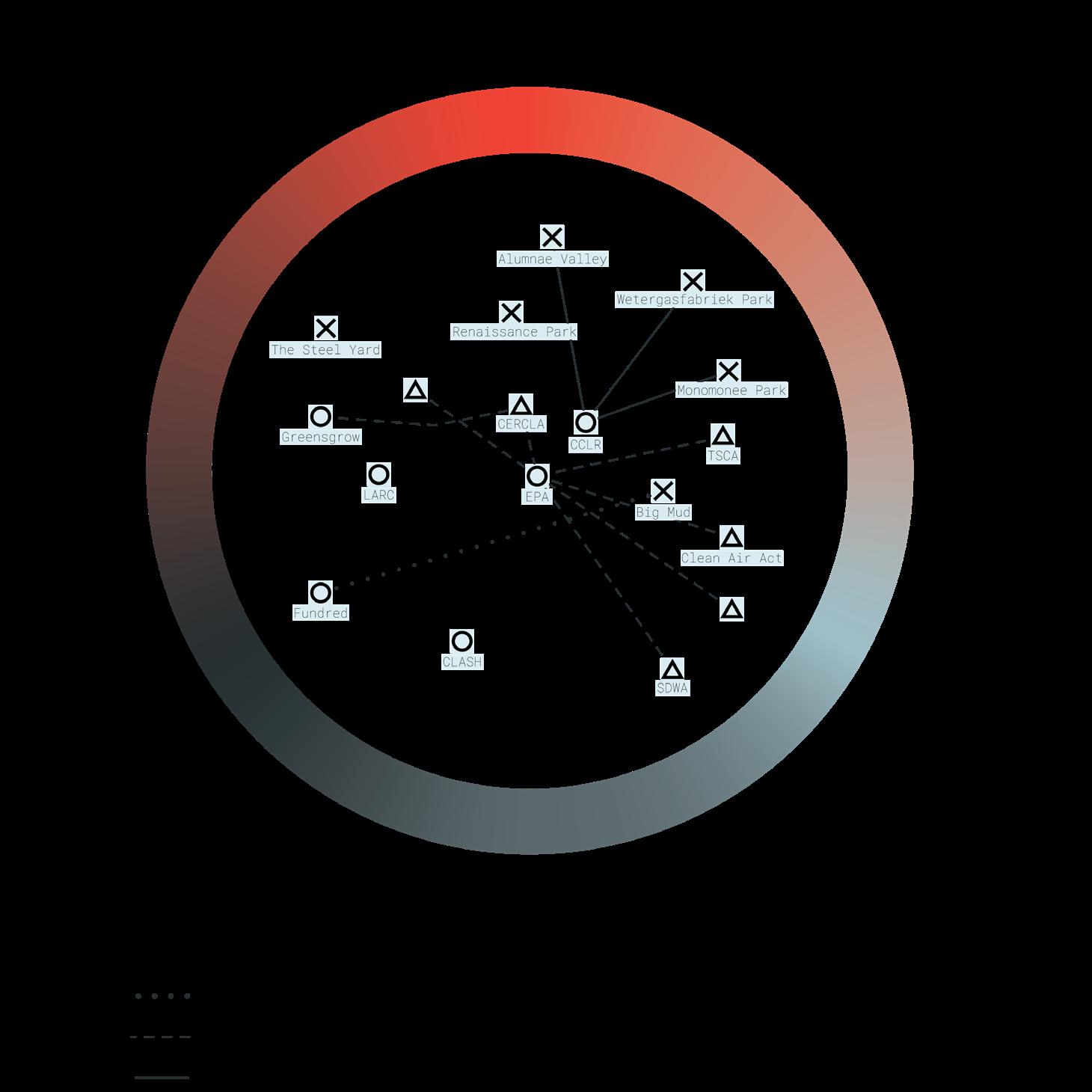
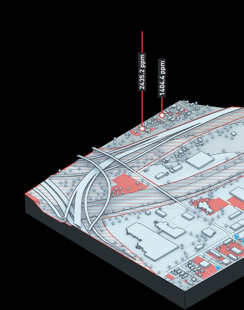
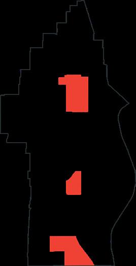
The research for this project began with using GIS to analyze the spatial relationship between significant lead pollution, demographics, historic redlining, and proximity to residential land use in a selected series of Superfund sites. An example of one of these mapping analyses is shown below as the Omaha Injustice Mapping. To better help frame the objectives of the research, an aggregation of resources, approaches, and institutions that currently exist to assess potentials for remediation was collected. Building off of Hyejung Chang’s conceptions of justice — distributive, procedural, and restorative (Chang, 2018), these resources were broken down into projects, policies, and foundations and collated by their relationship to each justice typology as well as to each other. These relationships are shown in the hermeneutic diagram to the right. The axonometrics shown on the following page help to expose the vulnerability that certain populations are facing in Omaha, and examines the lead pollution levels of particular locations within the Omaha Lead Superfund Site. The research then proposes a series of proactive solutions to improving unjust conditions caused by environmental injustices in Omaha, which are also shown on the following page. The solutions relate to specific sites on the axonometric drawings.

Advertisement

Commercial Land Use
Industrial Land Use
Residential Land Use
“Hazardous” Redline Zone
“Declining” Redline Zone

2015
To date, EPA completed cleanup of 13,090 residential properties, and has passed cleanup duties onto the city of Omaha.
2003
Omaha Lead Superfund site listed on the National Priority List (NPL)
1998
EPA collected soil samples from 42,047 residential properties, 14,019 properties qualified for cleanup.
1970’s
North Omaha freeway is constructed.
1935
Omaha Homeowner Loan Corporation creates redlined map of areas based on the level of home loan “risk.”
1899
Fifteen companies merge to form the American Smelting and Refining Company (later ASARCO).
Omaha Injustice Axonometrics

Reframed Remediation Solutions for Omaha

01 Energy Mill
Utilize empty polluted parcels for solar arrays, while planting phytoremediating flora throughout to clean the soil while harnessing energy for nearby homes.

03 Stay and Play
Provide play space for nearby communities while hardscape simultaneously acts as a form of soil capping to seal off lead pollution from users.
02 Cleanup Incentives

Buyers will receive government provided grants to cover costs of cleanup when purchasing lots contaminated with lead, and stipends for improving the property.
04 Nontoxic Transit

City health mandate ensures properties near public transit stops are remediated to protect community members who use public transportation.

Remove stipulations from HOA regulations specifying turf plants and expanding plant specifications to include phytoremediating species.

Environmental organizations hosting seed drives at local schools promotes biodiversity and informs the community about the dangers of lead pollution.
Funding from an environmental organization to provide a material depot gives locals access to clean soil and different species of plants to remediate communities.