1 minute read
MAPPING AND SPATIAL STUDIES


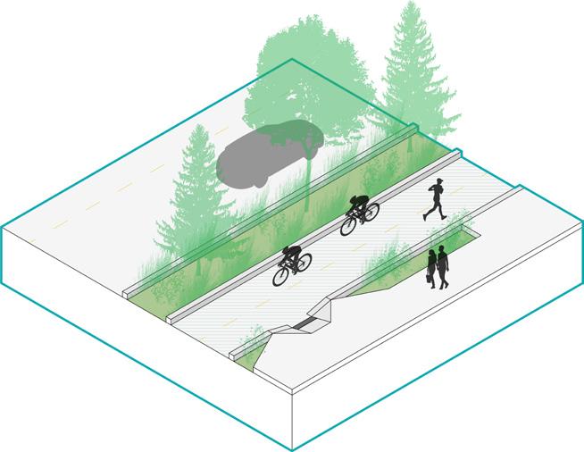
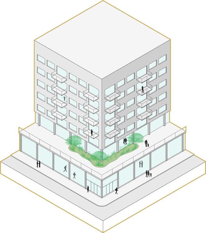
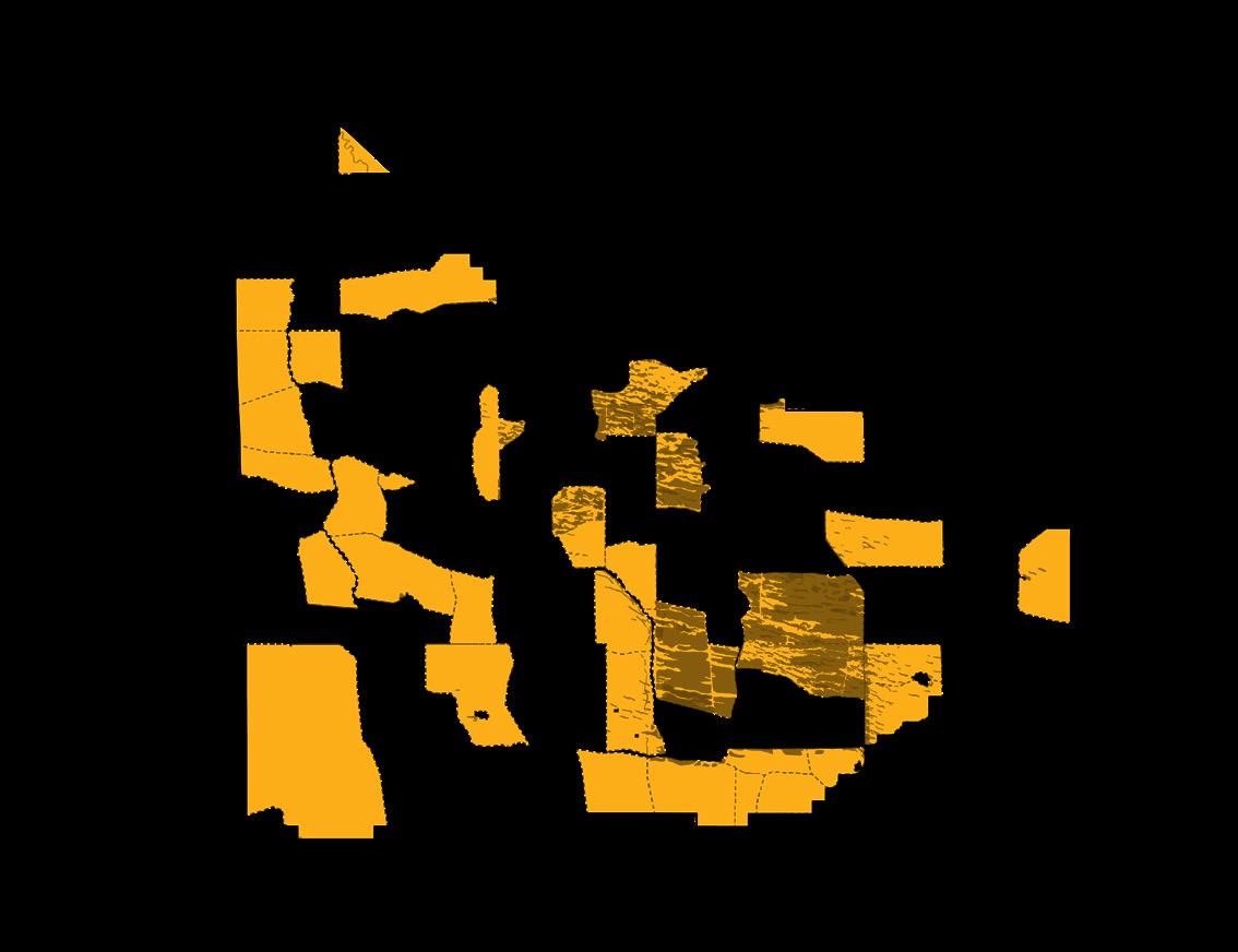
The project began with a spatial equity investigation. This process was done in order to uncover what may be causing spatial injustice in the Benson District. The investigation began with a mapping analysis of the city of Omaha, to understand the broader context of the region. A series of maps were produced in order to help describe the relationships of spatial conditions in Omaha that could be influencing Benson. Following the mapping investigation, a series of spatial intervention studies were conducted in order to help identify some areas within the Benson district that could be improved upon to improve spatial equity. The series of axonometric drawings below shows some of these proposed interventions within the Benson district.
Spatial Intervention Studies
Advertisement
Coworking and housing units

Omaha Historical Districts
Omaha Social Vulnerability Index
Bessey Archery Range
Project Description
This project was done in collaboration with employees of the Forest Service and the Nebraska National Forest: Bessey Ranger District. Through the implementation of a trail master plan, this project aims to unravel the entangled cultural and environmental legacy of the Nebraska National Forest by situating a network of trail alignments, narratives, and experiences throughout this extraordinary landscape. The Forest sits in the center of the Nebraska Sandhills, the largest contiguous temperate grassland in the world. The Bessey Archery Range is one of the trails that was designed for the overall trail masterplan.
Location
Nebraska National Forest: Bessey Ranger District Halsey, Nebraska
Course Team
LARC 311 - Ecological and Cultural Landscape Systems
Jacob Essink, Jace Armstrong, Olivia Berck, Sean Kelly, Josiah Nolting, Dennis States, Stella Lepkowski, Alyssa Winkelman, Wijdan Almamari, Andrew Otting-Crandall

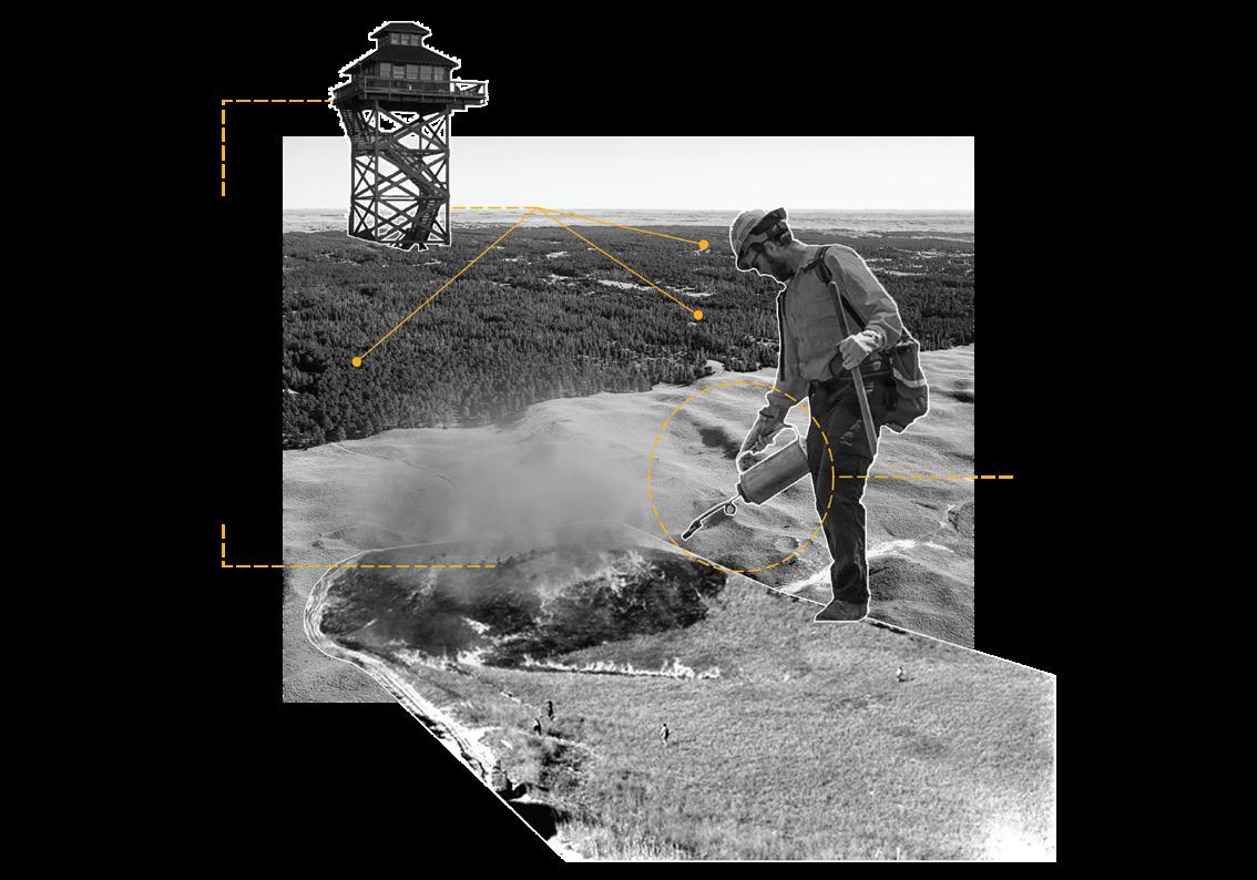
Forest Management


This project began with a comprehensive study of different management practices carried out by Forest Service staff at the Bessey Ranger District. These individuals understand the essential management practices that must be carried out for this forest specifically in order to ensure it remains a healthy ecosystem that will continue to support wildlife as well as provide a place of serenity for recreationalists who visit it. The management practices are visualized through a series of maps and collages depicting the management practice.

Five Management Strategies

Sowing

Thinning

Active thinning areas

Grazing
Active grazing plots
Brush piles
Controlled herd sizes

Eastern red cedar
Burning
Controlled burn sites
Native/Endangered plants
Fire towers
Ranchers
Chainsaws as a tool
Controlled burns
Barbed wire fence Windmills
Drip torch as a tool