gems hidden
Chapter 1- Introduction to Courtyards
Why I chose the topic of courtyards- an introduction to the topic. The formatting and thought process of the thesis
Chapter 2- Abstracting Courtyards
Individual case studies and drawing out qualities
Chapter 3- Defining the Ground
Diagram and explanation of the ground vs object, focusing on permeability and porosity
Chapter 4- A Curious History
Chapter 5- An introduction to the site
Introduction to the site- why the site, historical points, site pictures, and maps.
Chapter 6- What’s happening around? Projects, buildings, and spaces around the site that are influential or inspiring
Chapter 7- Analysis and Forming
Concept, diagrams and method. Rela-
tion to previous chapters- new abstractions, ground level, and public-private relations.
Chapter 8- Concept and proposal
Design implementation, site map relationship, flow of movement, inner yard connectivity
Chapter 9- Details and moments
Details and moments, courtyard visualizations and organization, illustrative details of the proposal and materials.
Chapter 10- Implications on the future
The importance and future development of courtyards
ChAPTeR 1
introd uction tocour tyards
“In the tapestry of urban design, courtyards are the intricate knots that bind functionality with beauty. Architecture is the skilled weaver, crafting spaces that resonate with both purpose and grace.”
- Charles Correa
INTRODUCTION TO COURTYARDS 1.0
As a first experience of Prague, the medieval street patterns and preserved architecture stand above other new encounters. It is the closeness experienced as you walk through a passageway and then are met by a new street or business. There is an intimacy in how tall the buildings are compared to the typical human height- where it is possible to interact with strangers just a few levels above you. Wandering around the old town creates this new experience of gem finding; that as you meander through the streets and cut across passageways, you stumble upon unique places. Gems that are the cafes hidden at the corner of the courtyard, galleries that are in the passageway walls, or small designer stores nestled in the archways after you turn out of the street.
These gems via passageway are typical of a medieval meandering streetscape and took formwhether as unplanned urbanism or intentional- in other architectural periods as well. Let’s say that they could be seen as a norm in the past as a shortcut, meeting place, new architecture, etc., which was interwoven into the buildings and urban fabric of the city. There was a relationship between the courtyards, passageways, street, and buildings that looks different in Prague today. Instead, there are fewer meandering paths and passages and have replaced the old, curved streets with a gridblock form. Courtyards are now cut off from the wanderer and restricted to a building-to-building relationship that is usually just for the tenants.
Looking deeper into the old town, each of these courtyards and gems had characteristics that set them apart from one another. These differences initially had to do with building design and city planning. In different periods city planners and architectural design varied from the original DNA of the old town. Garden city design, block structures, post-modern patterns of settlements, clusters, circular village design, and so on were formed; each of them addressing or not addressing what the courtyards were: a pause between the buildings and an opening for community space.
Sticking with my core interest in the courtyards and their original tracks I was able to find faint modified traces of it in the typical building pattern of Prague. In today’s GMOd DNA of Prague we find the block pattern of building, where blocks of apartment buildings build a periphery around sacred spaces accessible only to the residents. The traces of the old town were maintained in outliers- some form of a passageway that cut through the buildings or something that was happening at the inner yard, creating a gem. These outlying cases of interconnectivity within the block itself is a lost form from the medieval pattern of building.
Unfortunately, these courtyard spaces today are underutilized and inefficiently managed. The residents often stare out and see other buildings with nothing, but a few trash cans and cars parked at the base of their building. If they are lucky, their building’s personal courtyard has a bench and a tree, something to at least let people chat comfortably with each other when they meet while throwing away their trash. However, in the majority of cases the back end of the building isn’t often cared for, it is cut off from the neighboring buildings, or- at its worst, it is inaccessible to its residents.
In a city which is known for its beautifully preserved architecture- so much for its residents is inaccessible and lacks the creativity to connect. Due to the conservative approach with most architectural designs, it would be difficult to propose a serious solution that would convince the general population to take a ‘wild card’ of a design and run with it. But it doesn’t have to be so; the window of opportunity between comfort and solution is written in history books, it’s seen in the DNA of the old town. What if by projecting original qualities and characteristics- the passageways, the interconnectivity, the gems and business flitted between routes- could upgrade or adapt the typical block typology today?
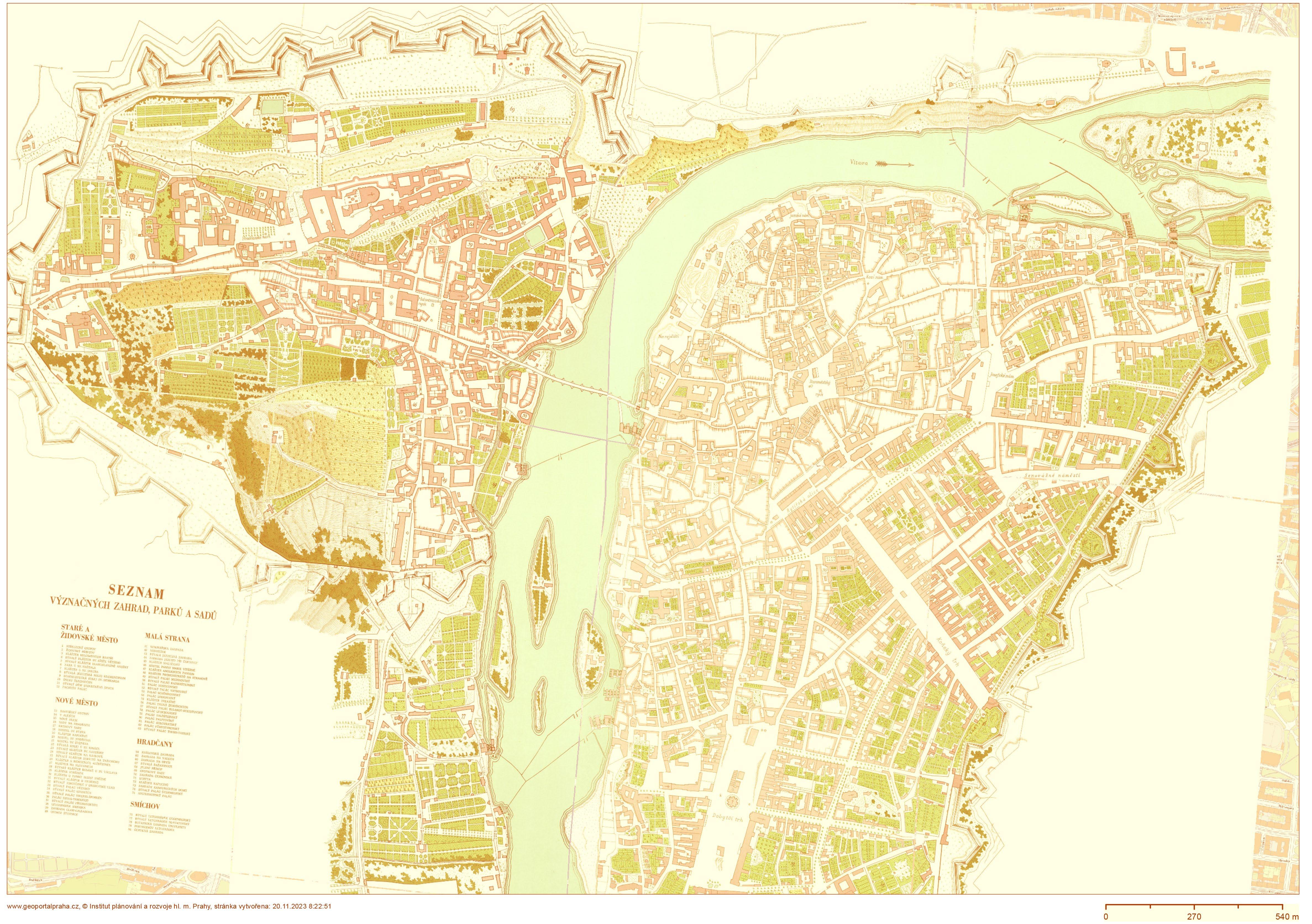


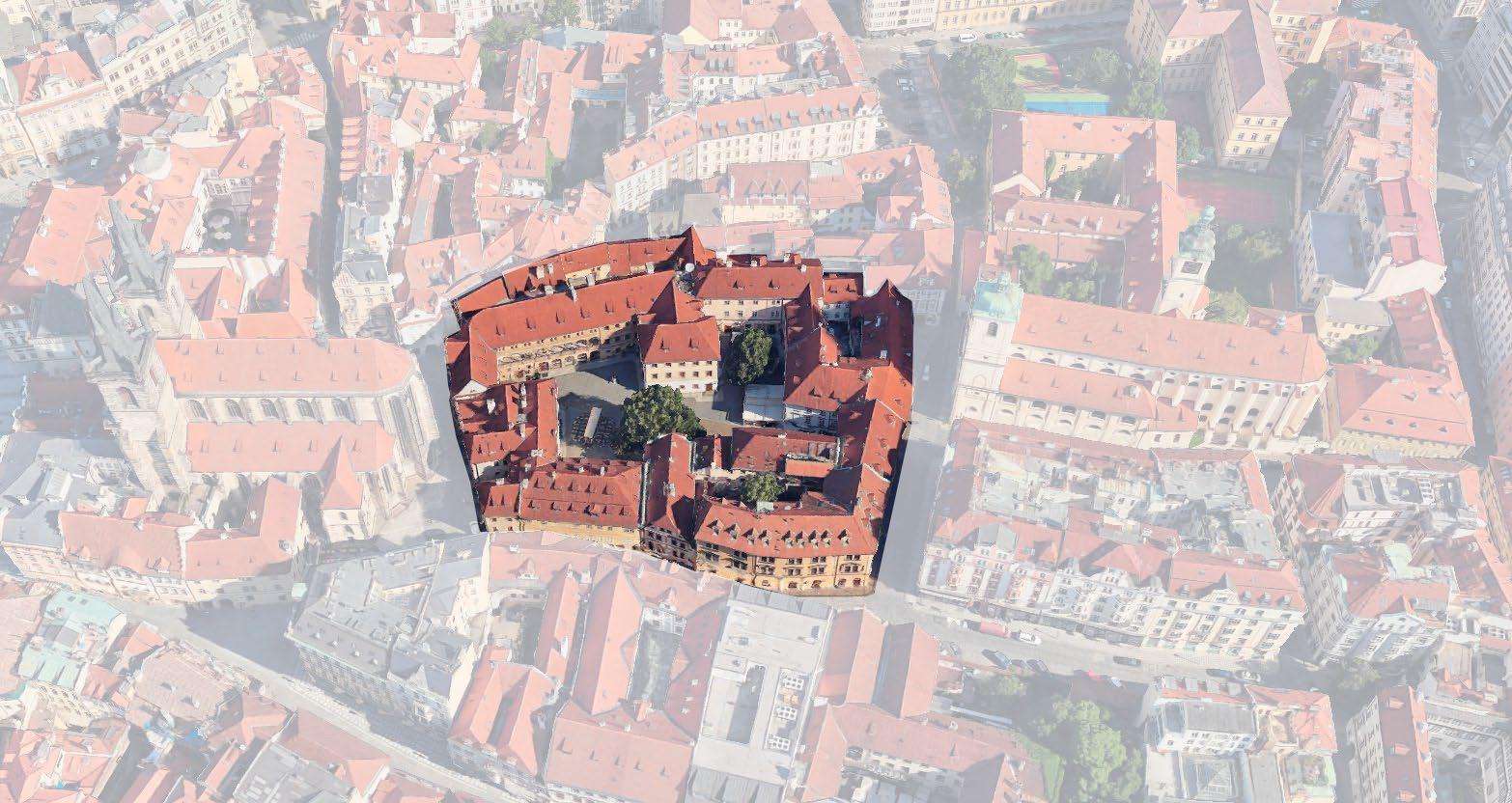
PALAC UNGELT 2.1
Palace Ungelt | 11th Century | Týnská
ulička Prague 1

Palace Ungelt was first mentioned around the 10th and 11th century and initially associated with the Granovska Palac and its arcaded loggia. At the time it was used as a merchant’s yard, which due to its enclosed qualities, was a good location for exchanges.
In the 14th century the word ‘Ungelt’ came from the German word which mean customs. Then it was used as a customs port to control and manage goods and taxes as well as to exchange news from abroad.
Later in the 20th century the palác was partially ruined and poorer groups of people moved into the area with a mixture of businesses and shops. The last time the area was renovated was in 1996.(3)
The earliest map in 1971 shows a cluster of buildings and the walkway of the slow meandering streets that people used. The second half of the block was filled within the next year where the medieval street patterns contributed to the perimeter form and permeability of the buildings.
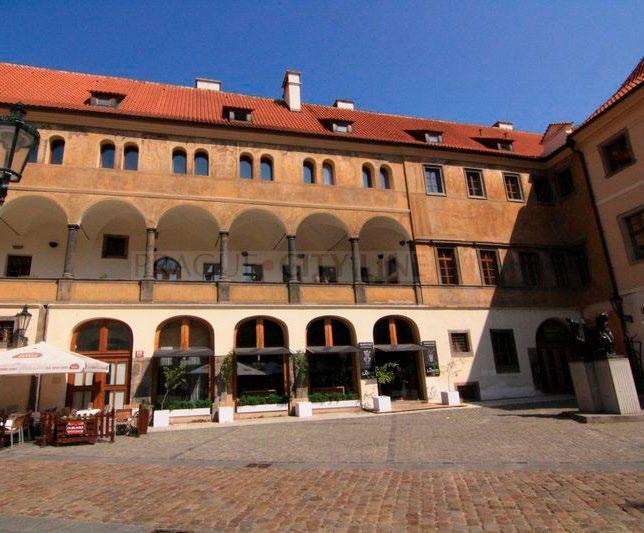
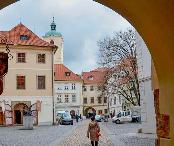
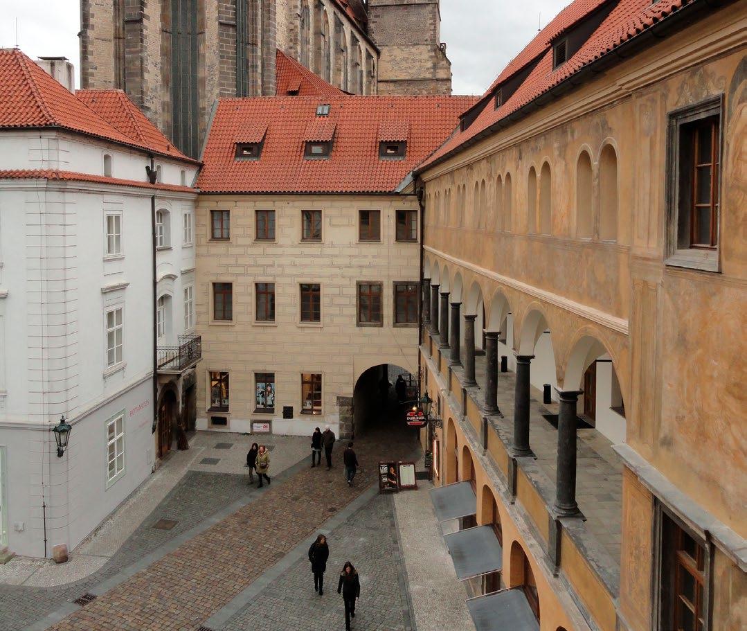
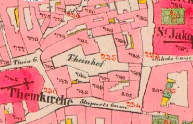
Due to its historical functions, the buildings are more permeable on the ground level where users can pass through the shops and the main passageway.
Although it is not shown in the plan, the ground level shops today are permeable from the inner yard to the outside at the marked black dashed lines. The large square-like courtyard is well known and passed through today because of the Granovska Palac and its proximity to the Church of Our Lady before Týn immediately after the west passage exit. Looking at the area from a distance, it is a larger courtyard with one main axis that cuts it in half with a walkway and arched entrances at the east and west ends. It comprises 12 buildings (ranging from 6-13m, starting from the ground to the beginning of the roof) surrounding the larger courtyard and a cluster of 8 more buildings on the northern edge. Today it is possible to pass through some of the businesses (as noted in the drawings) and those passages through the southern businesses encounter a terrain change where the businesses have a few very steep steps.
If just the abstraction of all the permeable and publicly accessible walking spaces was made it would look like the diagram above. What makes this passageway so enjoyable is not just the historical context from which

These qualities are the multiple layers of what makes the space pleasant for users to continually enjoy. Particularly with this example, the central axis way and the materiality change on the ground is a helpful method that could be applied to other courtyards for division of space in a non-invasive (or wall/fence-like) way.
The historical open courtyard has always been a means of people passing through; the only new additions are the buildings that fill the surrounding plots. The four different sides of the building are accessible by different entrances. The various sides of the building are nestled into the terrain from the south side sloping towards the north side of the area. Overall the building heights on average are between 11-16m.
Pros
• There is a large courtyard space
• Space for storefronts to have their own functions plus a common walkway.
• Comfortable ratio of buildings height to people
• The outer buildings are semi-permeable.
• Two of the four entrances are not accessible 24/7, they are only permeable via a commercial unit.
• Everyone in the courtyard can hear what’s happening in the open space (Ex: large spaces could create larger parties which could result in more noise). Cons it has come but also the qualities built about it. The permeability on the ground floor makes it interesting and accessible for the users. The main axis that the passageway acts on is accessible for cars which helps with the delivery of goods and makes for an easily readable axis for orientation- the materiality of the cobblestones notes this main axis way. When walking through the space it feels expansive yet intimate and this is due to the height ratios of a maximum of 13m.
ChAPTeR 3
defin ingth egro ungd
‘-The ground upon which architecture stands is not a neutral plane but a charged site of contestation, where the historical, social, and political forces converge. Architecture, thus, becomes a mediator between the physicality of the ground and the ideological forces shaping the urban landscape.’
Manfredo Tafuri
DEFINING THE GROUND 3.0
After seeing the movement between the inside and the outside of courtyards through abstractions, another layer appears which is the relationship that people have to the ground- how they further move through the space. For example, in the Štěpánská passage, there was an overall change in terrain of around four
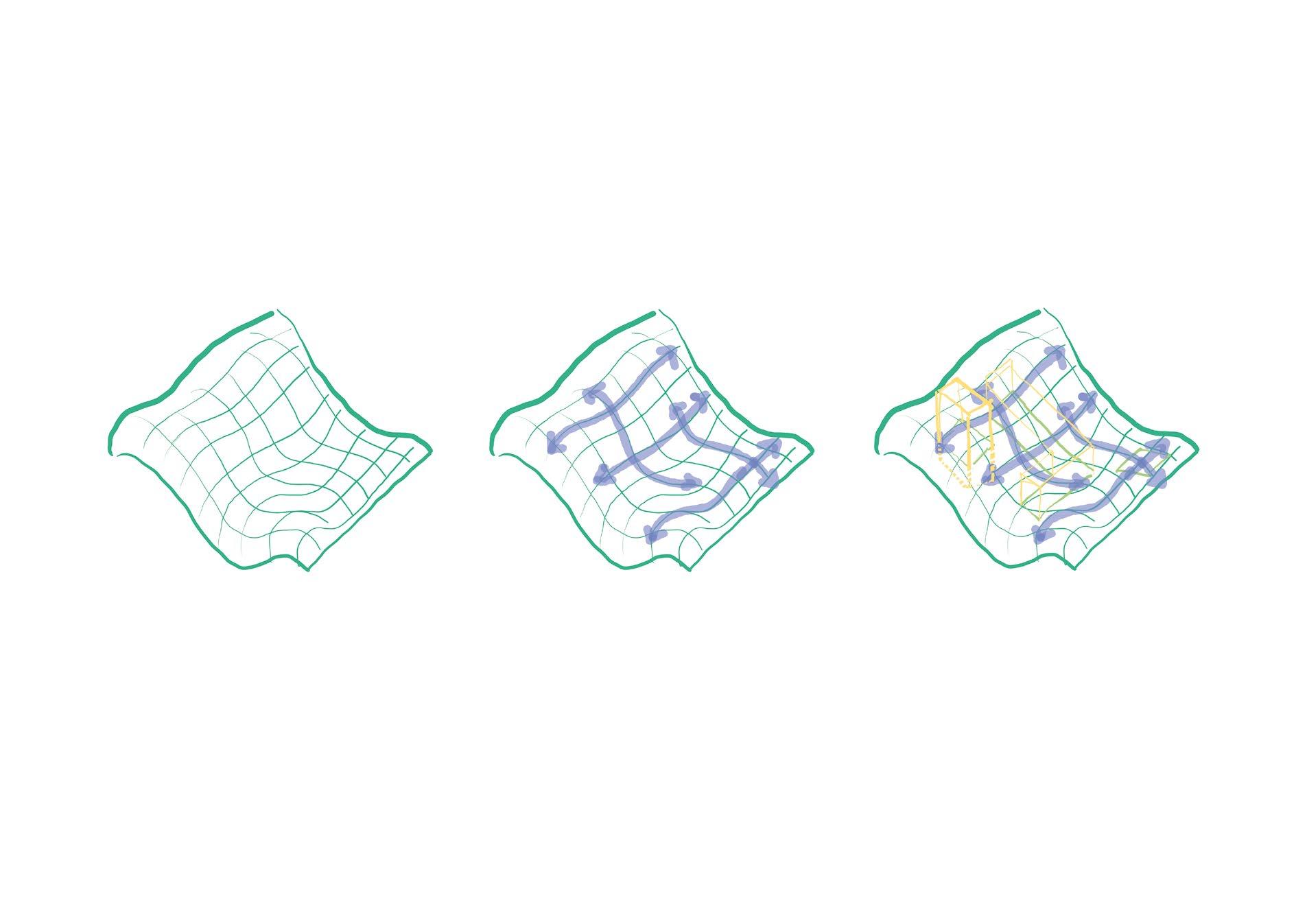
flows with (and as) the terrain. The continuous object goes up the hill, it goes around the trees, and it looks as though it envelops its surroundings. Like rolling pastures, they are unbroken until new objects are placed in the field.
The newly built objects are inserted into this plane by being projected onto the ground and then cutting out a place for themselves. The space they now have stamped into the ground fragments the uninterrupted plane it is now experienced as a series of connec-
tions. These new fragments that envelop the buildings shift the focus on the buildings and create the experience of the ground as something that wraps around them. Both the ground plane and the buildings have people as their common meeting point.
Individually people experience the fluidity of the ground as a plane with or without the buildings. People use the ground as more than just the terrain because it is whatever helps them to move through the space that is the created singular plane. Sticking with the same example of the Stepanska passage the ground plane is cut up but still continuous. The user goes through the passageway up the stairs, onto another platform, then up more stairs, and down the corridor. Despite the switch between the forms of movement, there was one journey created which is the formed ground plane. The ground having a new form, is now the movement snakes through the building as a destination point along the way.
The relationship between these three elements brings to question how to design the experience of one plane moving throughout various spaces with minimal cutting. How to design the planes so that the primary focus is not on the buildings but the user experience of the ground plane as a re-instilled continuous object.
The planes that we can create for people can flow and change levels all while maintaining the same ‘ground’. The second diagram shows, despite the changes of moving up and down on the hill- entering buildings at one passageway and coming out another- it is all interpreted as one ground to people. This continuous plane that changes levels could be designed as one object in projects to address the rela-

tionship that people have to the ground in contrast to how the buildings are interacting with the ground. Since the plane can cut through built forms and move up one level or down one level, it allows for multiple experiences on the same terrain, yet at the same time is one object, one plane.
In the diagram, this visual representation shows how our ground level as humans is constantly changing. This gives us the opportunity to address what the ground is for us and how can we adapt the ‘human ground’ perception onto that of the building’s ‘ground’. This could result in new passageways, bridges, and connectivity that break through the solid forms of the built environment around it and create its own experience for the users. Instead of the users interacting with the built forms and the street grids that form the environment, the new ‘ground’

plane can stitch together a variety of environments which create a different experience for the buildings that it interacts with. This overall reversal of prioritizing the relationship that users have with the ground and their experience can change the atmosphere of the built environment.
Creating one uninterrupted plane to be experienced by the users allows for an interesting and smooth walk from one location to another. If this could be recreated in spaces today, there would be walkways or areas that are unified as a plane of movement- like the passages that meandered in the old town with the terrain. As a design tool, this would bring ease of direction and movement for pedestrians using the plane as a source of guidance and path delineation.
PRAGUE 7 5.1
HISTORICAL MAPS OF
What is now one district used to be many distant villages and settlements. These settlements (moving from the easternmost side to the west) were Holešovice, Štvanice, Holešovice-Bubny, Letná, Bubeneč- Troja, and Bubny. Holešovice was a farming hamlet, mostly as an agricultural settlement, which never grew or expanded in any large way and eventually it turned into a city suburb.
Štvanice is the island between the northeast of the city center and the south of Letná and Holešovice. It was connected by a bridge that led from then the State station (which today is Masarykovo Station/ Nádraží) towards the Bubny station in the 1900s. It used to be known as Great Venice (Velké Benátky) but eventually became known as Štvanice which means, ‘the chase, at the end of the 16th century. The name came from cruel games that were frequently played on the island of baiting and chasing beasts in an arena for the entertainment of the people. Although the island’s games were later banned, it continued to offer various attractions to the locals such as the first artificial ice-skating rink in 1932.
Letná has a different history compared to the other former settlements in the area. The area used to belong to the Czech princes and eventually was donated by the king as a part of the castle extension. The large hill was used as a vineyard which was off and on abandoned and then revived. Due to its strategic positioning, it was later used for military purposes leading to fortifications built there, but eventually, the military area was torn down and turned into the Letná Gardens by the municipality.
Bubeneč- Troja used to be known as Ovenec which means sheep because the area was used for herding. The area had a lot of forest which former kings used for hunting game and this even became known as the imperial (Císařský) Island. Eventually, this area was added to the Stromovka park which spans the northern stretch of Holešovice and Bubny.
At the far western edge was Bubny- a small fishing village that competed with the old town for business. Due to its position- across from the river on the path towards the Prague castle- the area was prone to the consequences of military conflicts.
Holešovice and Bubny were merged together in 1850 to create an urban district, however they still developed separately from each other. Bubny as a district developed and focused more on building residential apartment blocks whereas Holešovice turned more into an industrial area. In 1857, after almost 15 years of being incorporated into the city of Prague, there were around 110 houses and 1,200 residents. This number grew rapidly to become 30,000 residents and 780 houses. On the Holešovice side by 1881 there were 32 factories which took beneficial development when the Karlin Rail Viaduct was finished at the same time as the district’s forming.
Upper and Lower Prague 7
There is a very clear divide in Prague 7 where you can see the planning differs in form and the way that the blocks are filled in.
In the lower part of Prague 7 (Holesovice the East part of the district), the blocks are more fragmented where the internal parts aspects are filled with small entities. However, in the Letna area (the West part of the district) the block forms are already complete.
The upper side of Prague seven has a greater variation in terrain compared to the lower side where it is mostly flat. As seen in the map and the Schwarz map of the two contrasting areas, the blocks are also much longer and keep a more orthogonal grid.


This combination of incomplete forms, larger blocks, and flat terrain allows for a greater opportunity to propose a design that incorporates the previous chapter layers.
1. What is your relationship with the inner block?
BIENO VNITROBLOKY STUDY
I only have access toa small part of the courtyard
2. What is your way of using the inner block?
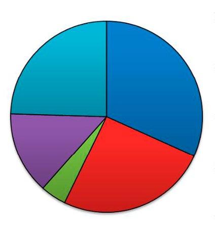
I use the inner block for more utliltarian purposes (hanging luandy, putting awaywaste containers, etc.)
3. In what way should the inner block be organized?
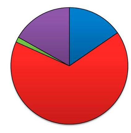
The block should be open to the public and become a public space
I don’t use the internal block in any way I use the inner block to park my car other
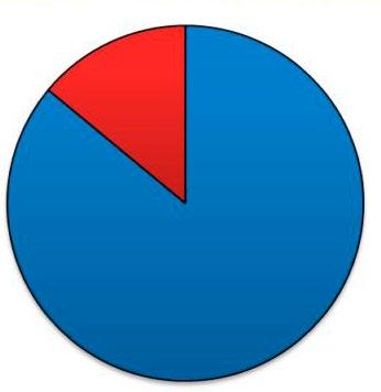
I don’t have acces to the inner block I have access to the entire inner block other no yes
I use the inner block more for recreational purposes, rest and meetings
the plots shouldbe integreated and inner block function as one unit used by the blocks’residents other
According to the existinging subdivision, when each owner can dispose of his parcel according to his ideas
4. Is the condition of your inner yard as you imagined?
5. Is the condition of your inner yard as you imagined?

For recreational use, it should serve mainly for relaxation and rest
For public greenery and children’s playgrounds
Primarily useful functions (hanging laundry, removing waste containers, etc.).
Always according to the individual wishes of the owners of individual parcels without any limits other
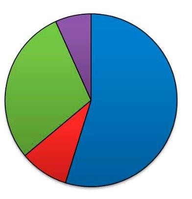
Part of the interconnectivity was brought up as something that the residents noted in a study done by Bieno Vnitro Bloky. Bieno Vnitro Bloky is a group that focuses on courtyards and interventions. The organization is encouraging tenants to revamp their courtyards and find ways to make it more pleasurable for the neighbors. This was done as a part of the study and also has aspects where it is not just about mapping, but also about exploring, noting, and new ideas/ways the courtyard spaces are being used.
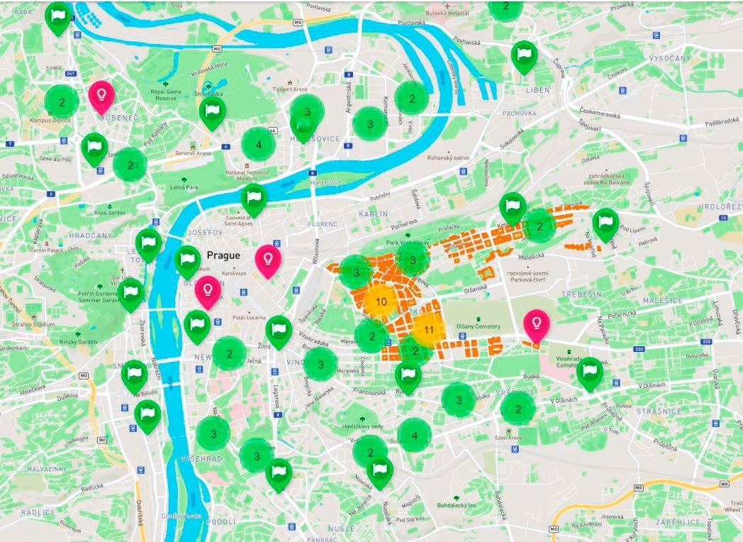

People today want to use their courtyards and have them be something more than just a parking spot or garbage disposal area. Bieno’s study was taken in Prague 7 and showed that an increasing number of residents desired something more for their courtyards. This information shows the opportunity that the residents are waiting to be fulfilled- in finding a way to improve their courtyard spaces to greater benefit the tenants.
RETAIL/ TEXTILE
OFFICES/ BUSINESSES
GOVT/BANK
CULTURAL
RESTAURANT GROCERY/ SHOP
HOTEL/ INDUSTRIAL PARK
FLORAL/ GARDENING
SALON/ COSMETICS
EDUCATION MEDICAL
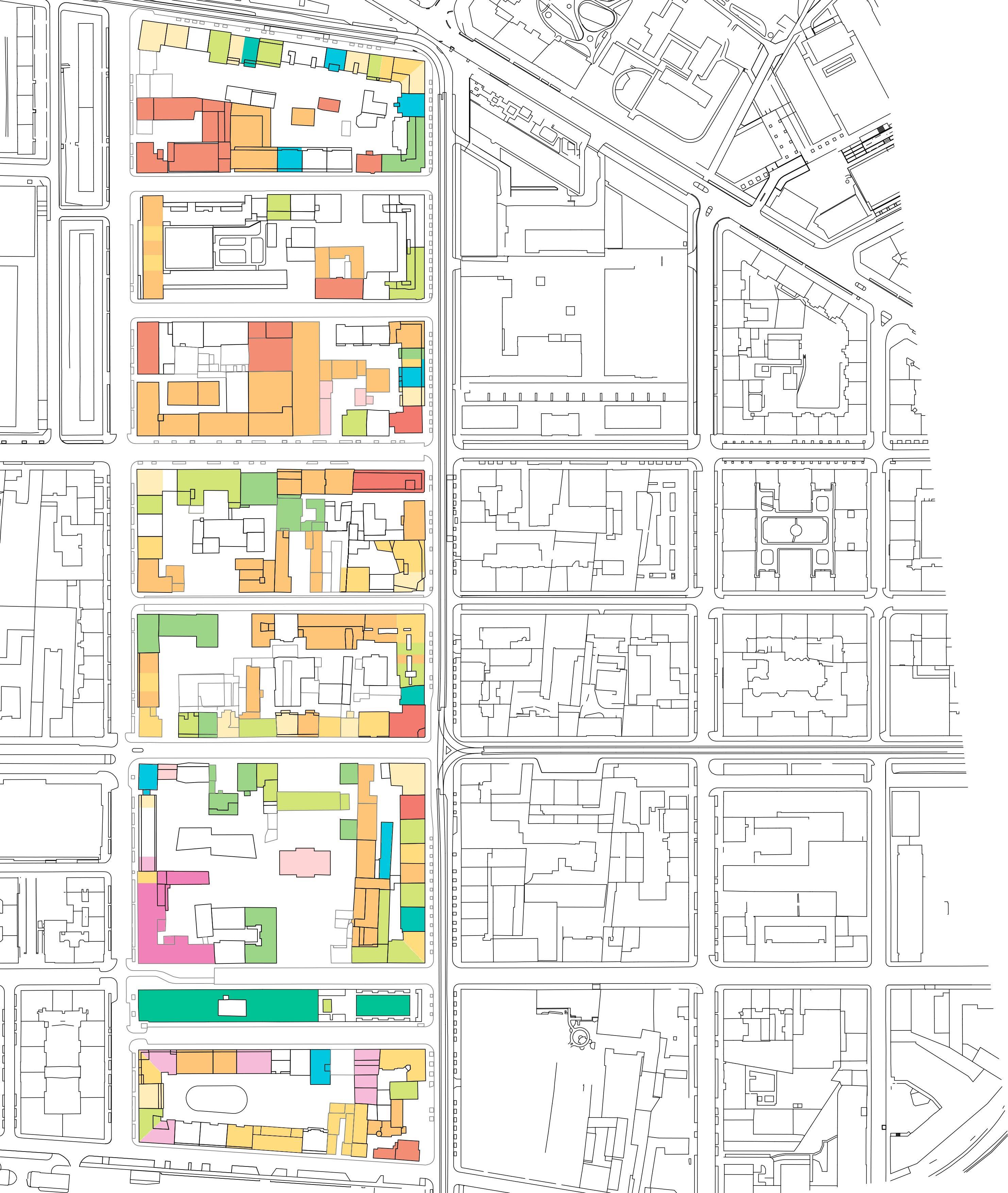
Functions Map
Looking at the functions, the site is mostly residential with some public facilities, gardens, and retail functions. On many of the ground floors there are commercial and restaurant spaces.
Some of the buildings lead into the inner yard allowing it to be semi-public. However, despite some of the functions being right next to each other, sometimes only one of the functions had the back lot open to the customers/users.
Once noting the various ground floor functions, the mapping revealed how there were ‘openings’ in the form of a closed entrance.
Openings and paths
NO FUNCTION ON GROUND FLOOR
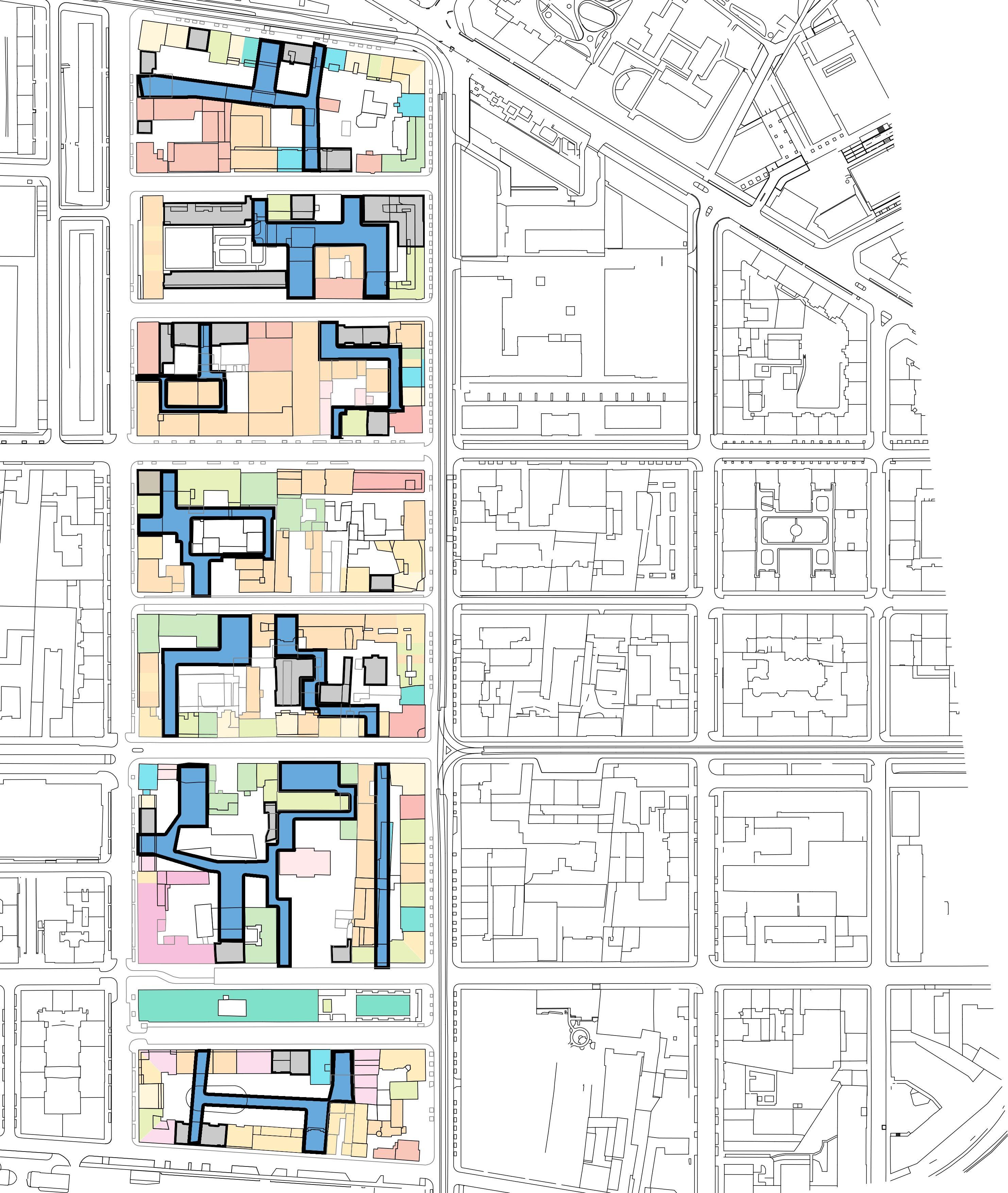
POTENTIAL CONNECTIONS
Where there was no function there would sometimes be openings for cars to enter into the inner yard. This continued the previous thought from the figure-ground map.
These entrances were then connected with the courtyard spaces which revealed the potential for connecting the inner yards from one side of the block to the other.
The combination of empty ground floor plots, where there was no function could allow the creating of more functions on the ground floor resulting in a fill-in-the-blank.
However, because of the public-private disputes in the past, it was important to look at who owned the spaces.
GOVT/CITY/ MUNICIPALITY
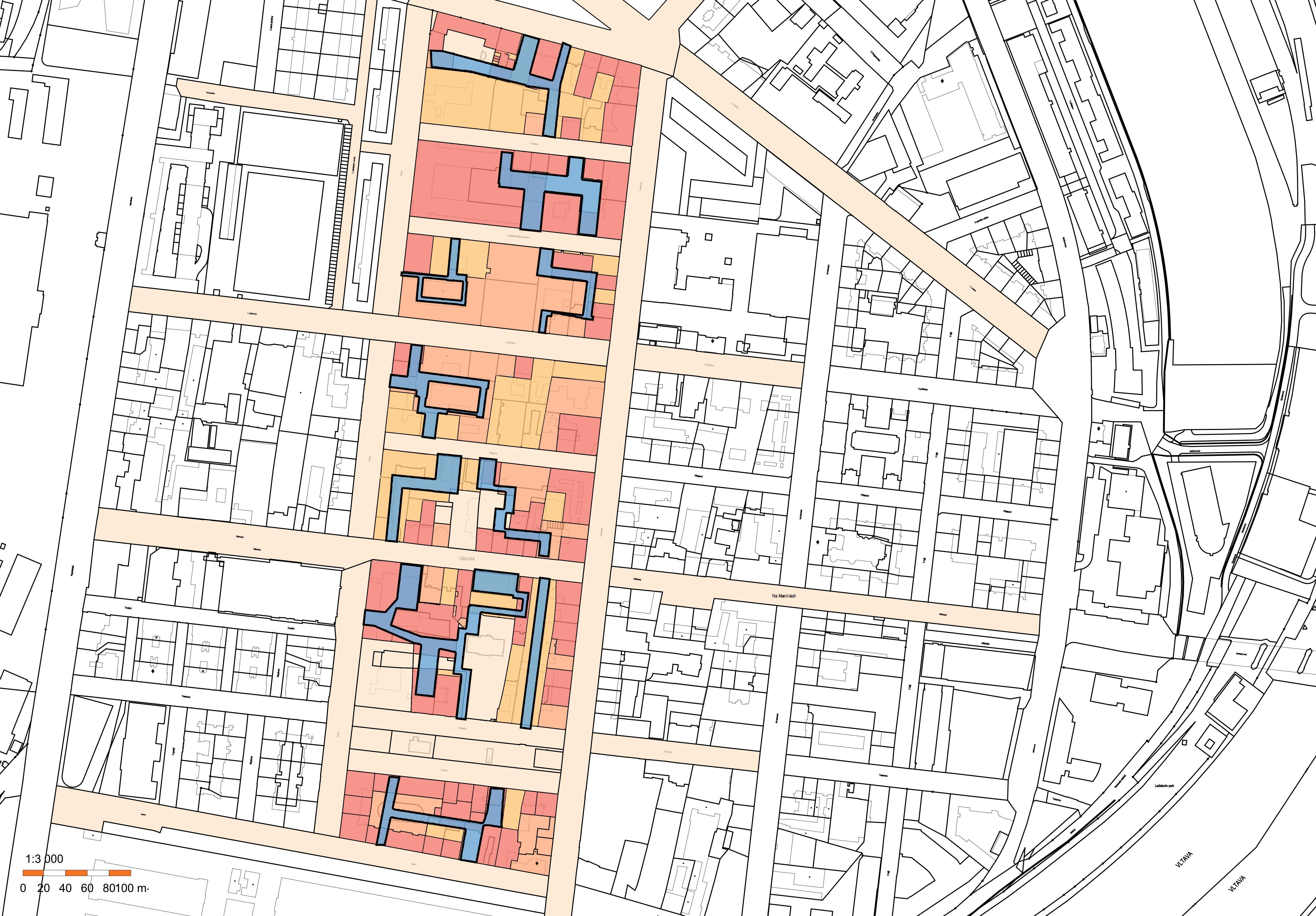
PRIVATESINGLE
OWNER COMMERCIAL/ COMPANY
PRIVATEMULTIOWNERSHIP
POTENTIAL CONNECTIONS
When you take the fact that the block structures are not completed, some functions take place in the courtyards and the possible connectivity from the red-lined map, you start to get a hold of something interesting- you start to see traces of the original DNA.
These blocks are so close to being interconnected in the way that the medieval settlement patterns were connected. However, with the more modern 19th-century block forms that are now the new normal, this interconnectivity between plots and courtyards is adapted. With the initial thought of connecting the inner yards by projecting some of the medieval meandering patterns, the map analysis revealed that today’s normal DNA still holds the traces of the past. In the readings themselves, the interconnectivity of the inner yards is only being held back by the people’s past- their hurt from the communist regime.
If this hurt is already on the mend with examples in the area like the DOX art gallery and Vnitro block, there is growing hope in the opportunity to design now. To redesign the paths between plots which could be a tool for healing the past and reintroducing what inter-block relations look like.
Of all districts to implement this proposal, this area is the best suited for it. It is not only suited because of the blocks and now for the chance to readapt the built environment of the past, but also for the other layers. The flatness of the area holds the potential to bridge different spaces between buildings through a new ground plane and out of the interconnectivity and variety of building types there are new abstractions of experience that can be drawn out from the blocks.
The overall reveals the beckoning opportunity to connect the inner yards. An opportunity that outweighs the divided plots of ownership for the backyards of the buildings and hold the space improves the qualities and makes it more beneficial to the tenants of the block as a whole.
ChAPTeR 7
analy sisan ndfo rming
“Architecture is a visual art, and the buildings speak for themselves. Within their walls, courtyards become canvases where life unfolds in brushstrokes of light and shadow.”
- Unknown
ABSTRACTIONS AND FORMS
Looking at the basic building block- the comfortable building style of Prague, it has (generally) shifted from the medieval meandering paths to the grided block typology. Where the alleyways and shorter buildings have now changed to more efficient straight streetways and taller buildings surrounding courtyard spaces. The relationship that people have to the ground, and their experience of the city has shifted. The way that people now own the space, and the density has also changed. It is no longer that people own entire buildings but instead, they own fragments of the building. Or that the courtyard spaces which might have belonged to the street and passageways now belong to individual building plots, where you can see everything is getting tighter. Tight in the sense that things are much more rigid with regulations and ownership causing a spiral of legalities, which makes it difficult to build in that environment.
By linking these different layers, architects, and urbanists can design cities where the intentions are translated in a user-friendly design. A user-friendly design that challenges the public-private relationship that exists between the owner and users with a joined space for community conviviality to grow.
Since the site has a typical block typology, and in some ways could be seen as a futuristic block because of its length, its largeness pushes for a greater need for porosity throughout the block. With mixed businesses on the ground floor and some occasionally in the courtyards, there is the opportunity to permeate the block and allow for not only a more efficient use of space but also a revived and refined public-private space.
If the former analyzed layers are projected onto the typical building blocks, there is a morphing that takes place between old and new. The old attributes of permeability, passageways, and gems in courtyards penetrate the blocks and allow for users to have a pedestrian zone and an improved relationship between the ground and the buildings.
To morph the existing qualities with elements of the original DNA of the medieval city center, the analysis needs to take to look at the initial layers discussed the beginning chapters- the abstractions of the current courtyards, the relationship to the ground, the public-private relationship. Adding the layers such as the existing openings and flow of the site, the influence of surrounding functions, and the larger-scale connectivity between the blocks then there will be the space and ability to transform the blocks’ permeability.
Overall, the site fits very well with the initial layers and precedents that were looked at in the first part of the thesis. The blocks’ average of 190 m by 80 m allows for a necessary intervention to readapt the internal spaces of the courtyards. The minimal changes in terrain give the opportunity to create new Ground in tandem with openings in the block. Seeing that the surrounding examples of the area have similar aspects to precedent studies, it makes the possible implementation of this project easier to navigate with the locals.
The initial precedents set up different targets that would allow users to have the best experience and use of the site. Starting with the ground, it creates the base for which you penetrate through the buildings- it should be synchronous and intuitive for the users to walk on and connect to.
With the surroundings largely being residential and offices, the program of the site will be adding to that with more mixed-use spaces. The overall implementation will focus on the public spaces and user experience. Parts of the spaces will include a mix of functions such as retail, cafes and restaurants, offices/businesses, parks and greenery, educational facilities, and grocery stores. The new functions on the site will replace or enhance the existing elements on the site.


COMPLETING THE BLOCKS 7.1
Altering some of the existing buildings by tidying up the courtyards allowed for a greater possibility to renovate and make them more accessible. Although there are small passages existing, the majority of the courtyards are only accessible to the residents with limited permeability between the blocks if you don’t have a key.
The current state of the inner yards is cluttered and disconnected from its counterplots, often with small sheds and businesses which have sprung up over the years. By completing some of the blocks with new buildings and repurposing others different forms could be abstracted.

The overall proposal of the site focuses on one of the blocks in more detail to show how the concept of interconnecting the blocks could work at the scale of just 1. This island effect block was the chosen block to show the proposal in more detail.
The design implementation shows a colorful number of new spaces and elements to the block. Starting with the passageways, there are seven passageways to enter into the courtyard. These entrances are noted with colorful tiles that extend the span of the sidewalk to invite pedestrians inside. Two of the passageways are new while the others were renovated and remade with the same material as the others.
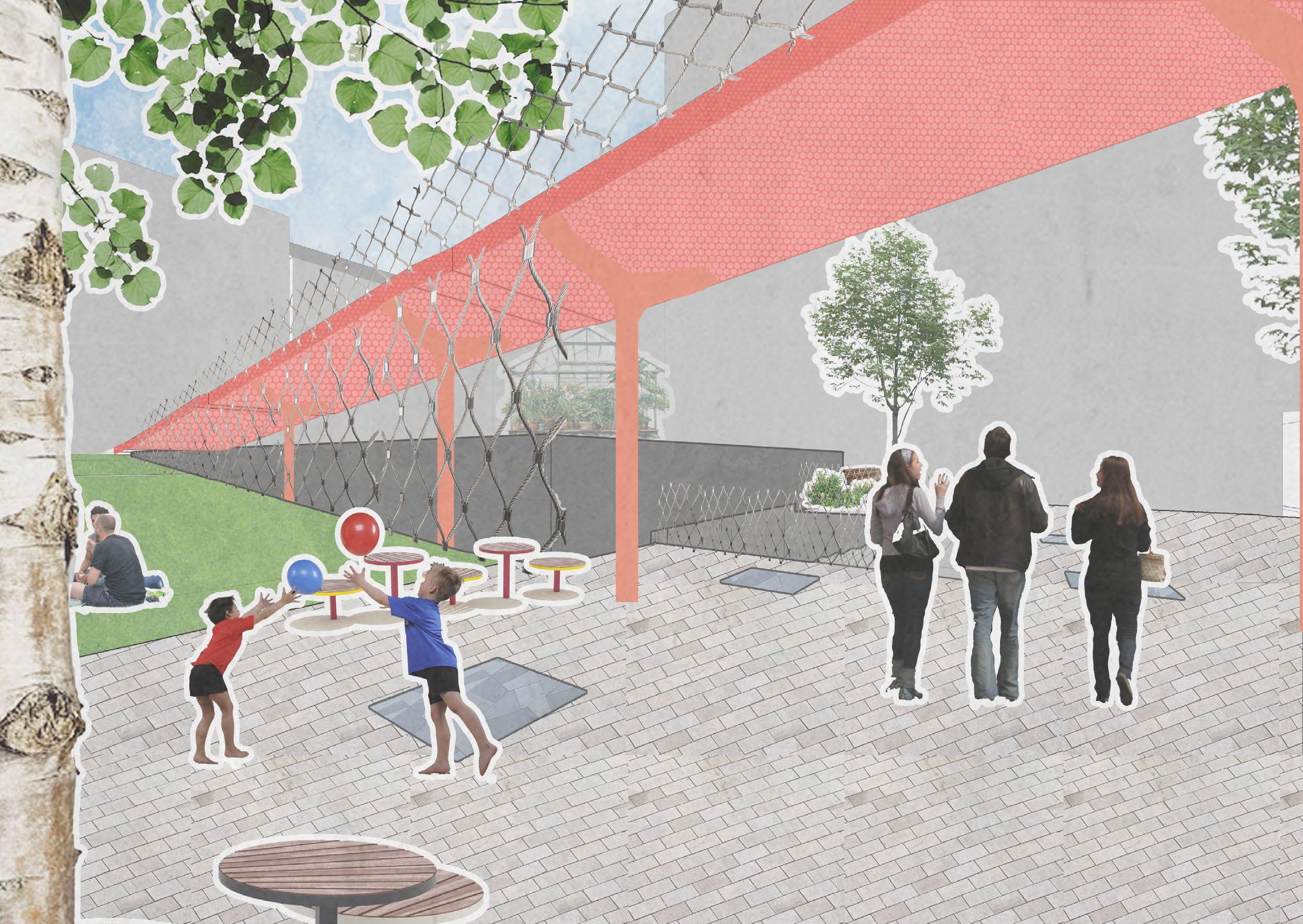
Once the user enters through one of the passages they are met with the few island-buildings that are businesses and office spaces in the courtyard. As well as a raised red platform.
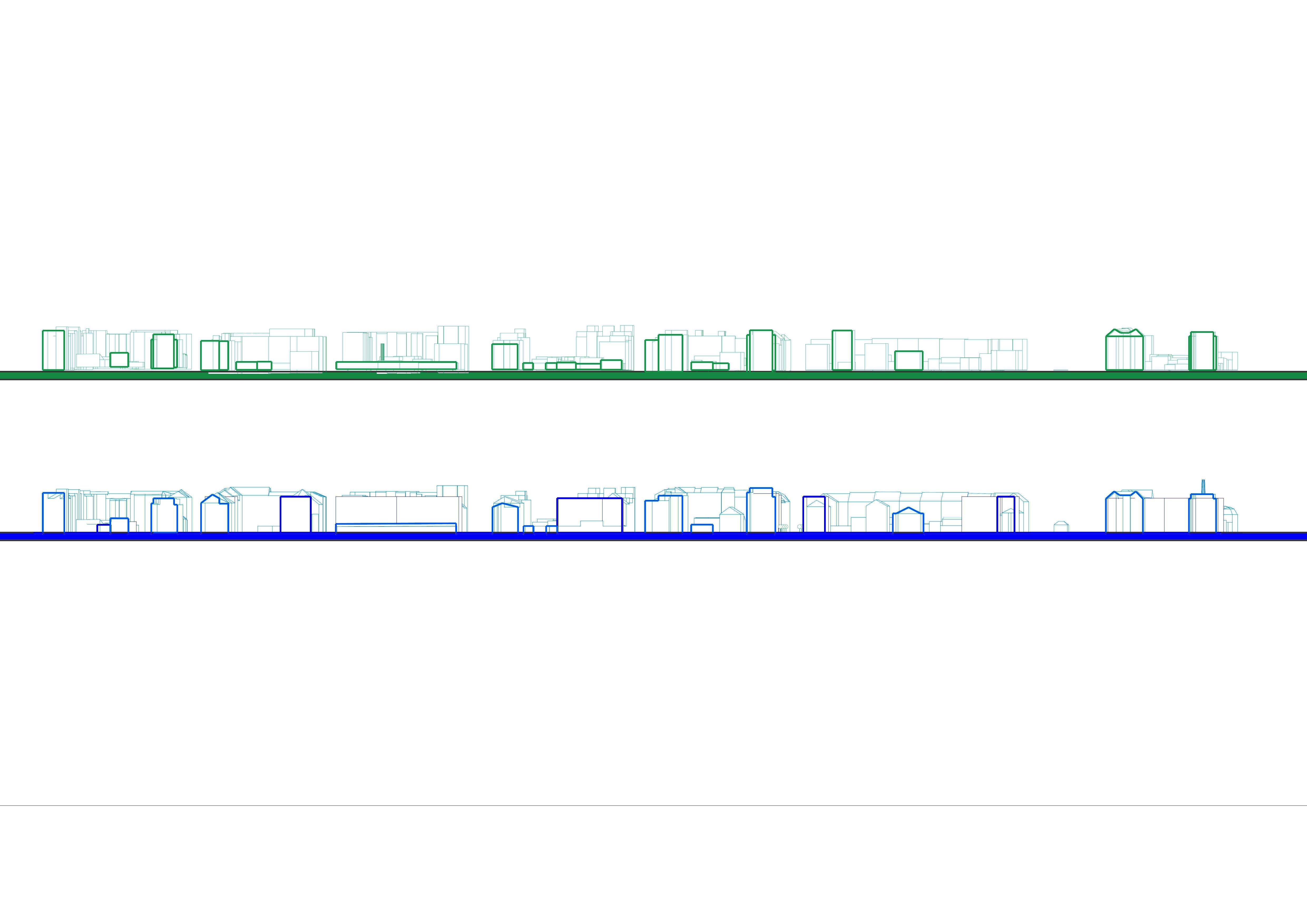

GROUND FLOOR
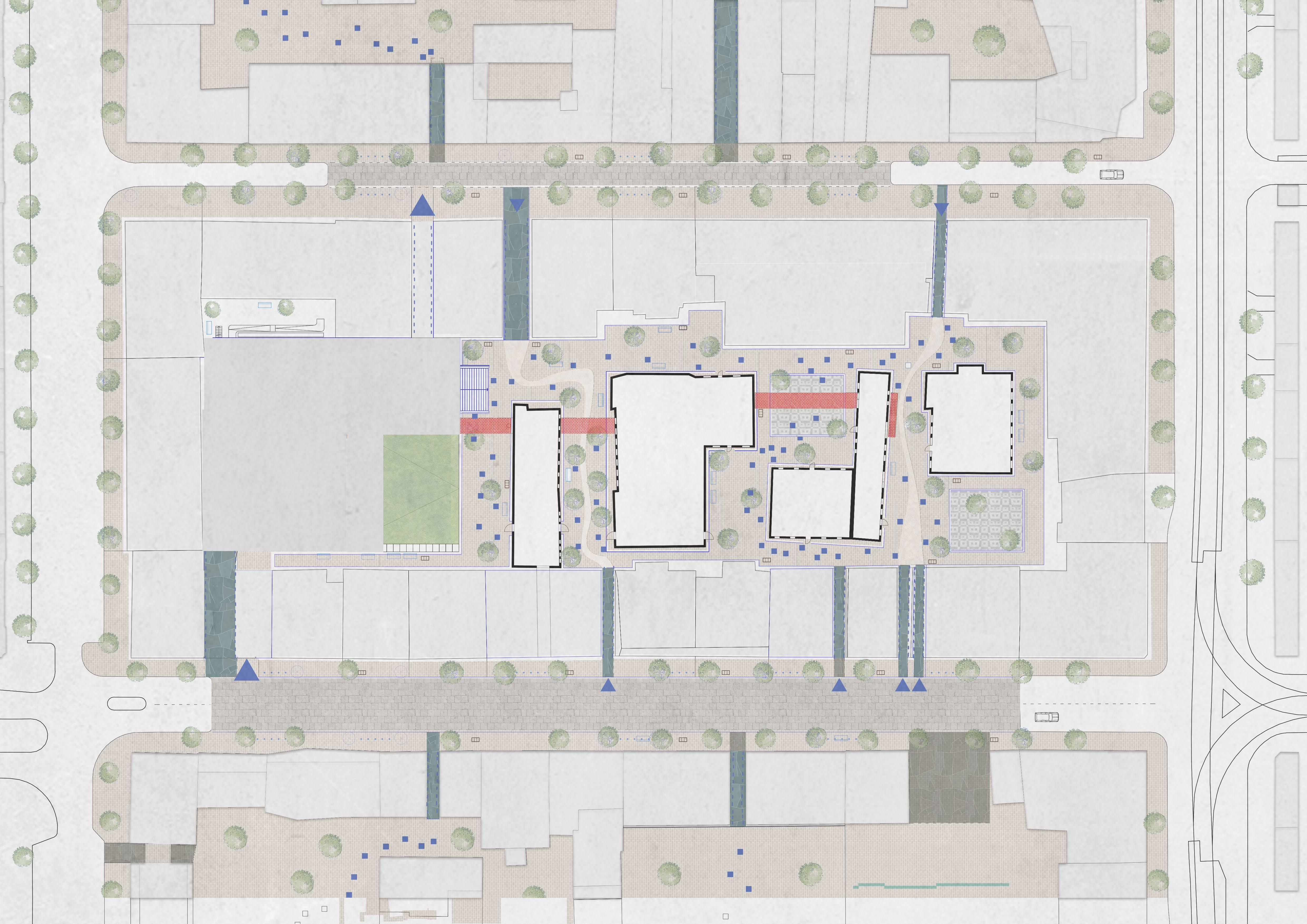
The users have new public functions such as benches, trees, lighting, plants and flowers, a community garden, a life-size chessboard, a small square, a green terrace, and a playground, parking, and an underground pavilion.
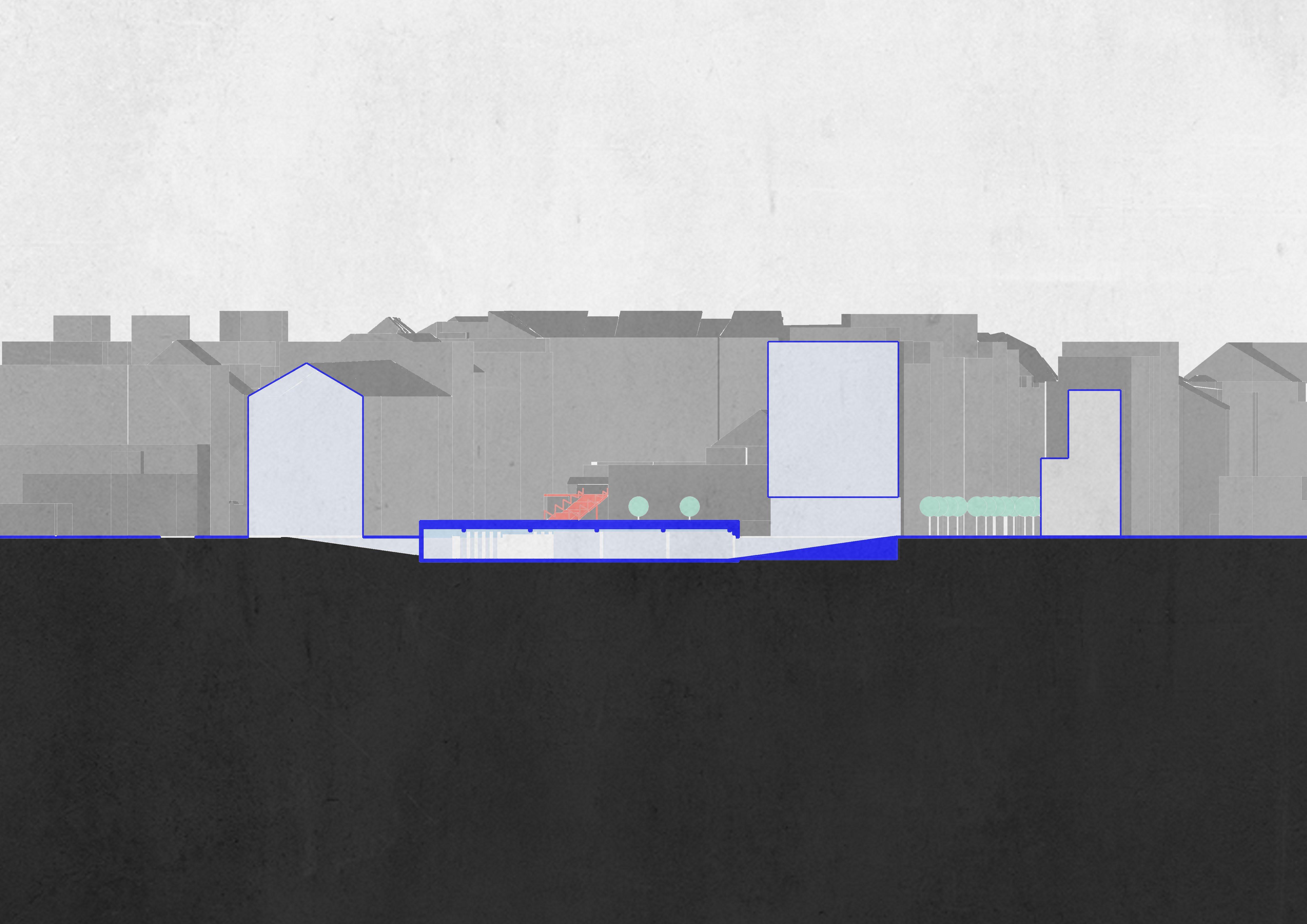
Underneath the community garden and play area one level below is a parking for the residents of the block. Previously the plot was used for parking and small businesses with some garden spaces. The parking, now underground, can be accessed in
a one-way route from the south west ramp. There are 49 parking spots which replaces the previous parking spots in that area.
SECTION CC

The variety of spaces within the courtyard are intended for public use- where most of the passage ways are open during the normal hours of the day and close between 10pm and 6am.
This will allow quiet hours for the residents and time where the inneryard could still be accessed by the surrounding buildings’ tenants.
The surrounding spaces could be filled with The functions in the courtyard could be a coffee shop, design studio, event company, and casting agency. The improved public spaces benefit not only the public but also the residents of the building. In order to maintain the courtyard spaces a buildings owners associaction would be organized to manage the inneryard.
The cost of renting the courtyard spaces- such as the island businesses, events that happen in the underground pavillion, etc.- would contribute towards the upkeep of the public spaces.

TALKING A WALK- MAP

These are the moments on the map, taking a journey through the newly opened courtyard.
Following the blue-tile road
Ontop of the world
Following the stone tiles
Quaint promenade between buildings
Another passage entrance
The meandering path
10. Red line entrance
11. Walking the line
12. Roof top rest stop
13. Walking above and across 14. A green terrace 15. Towards the community garden
car,movie, or market
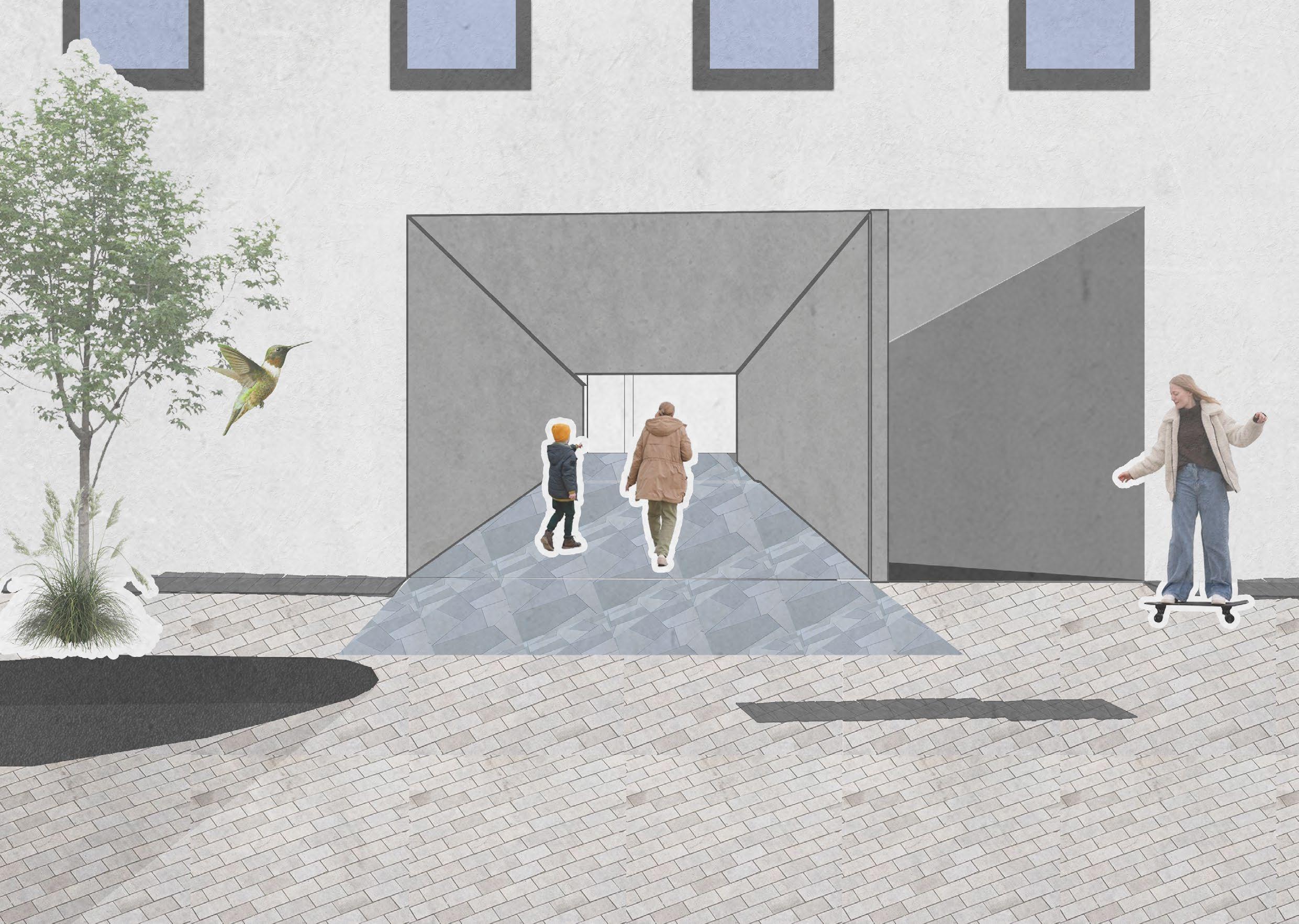
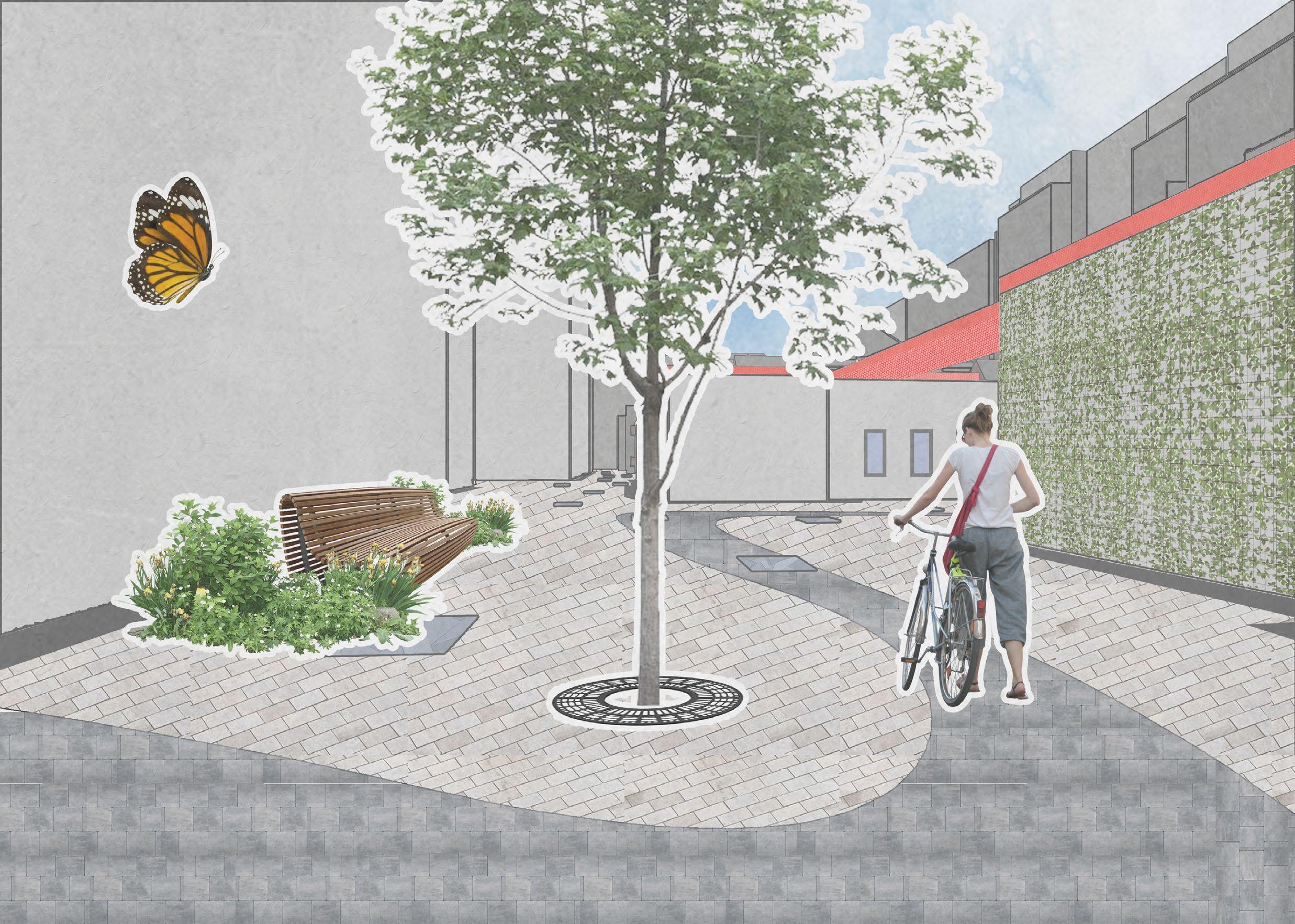
Took a walk with mom to the courtyard today! We passed a cool skater girl and the parking was pretty empty this weekend, but maybe next week there will be a market happenning.
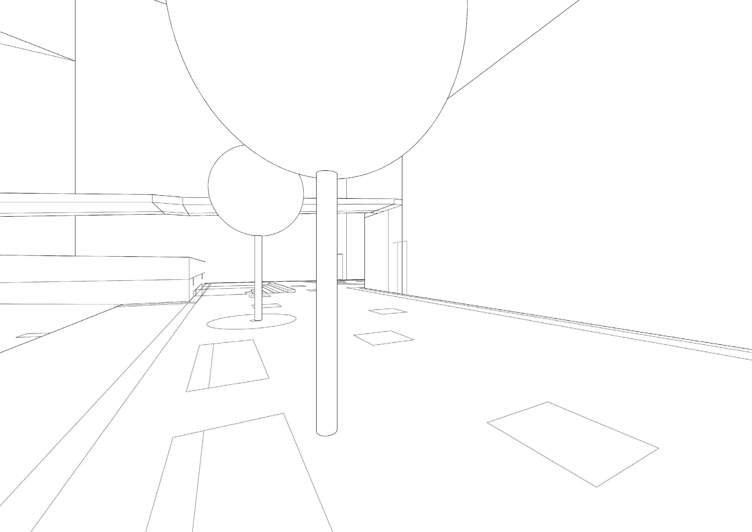
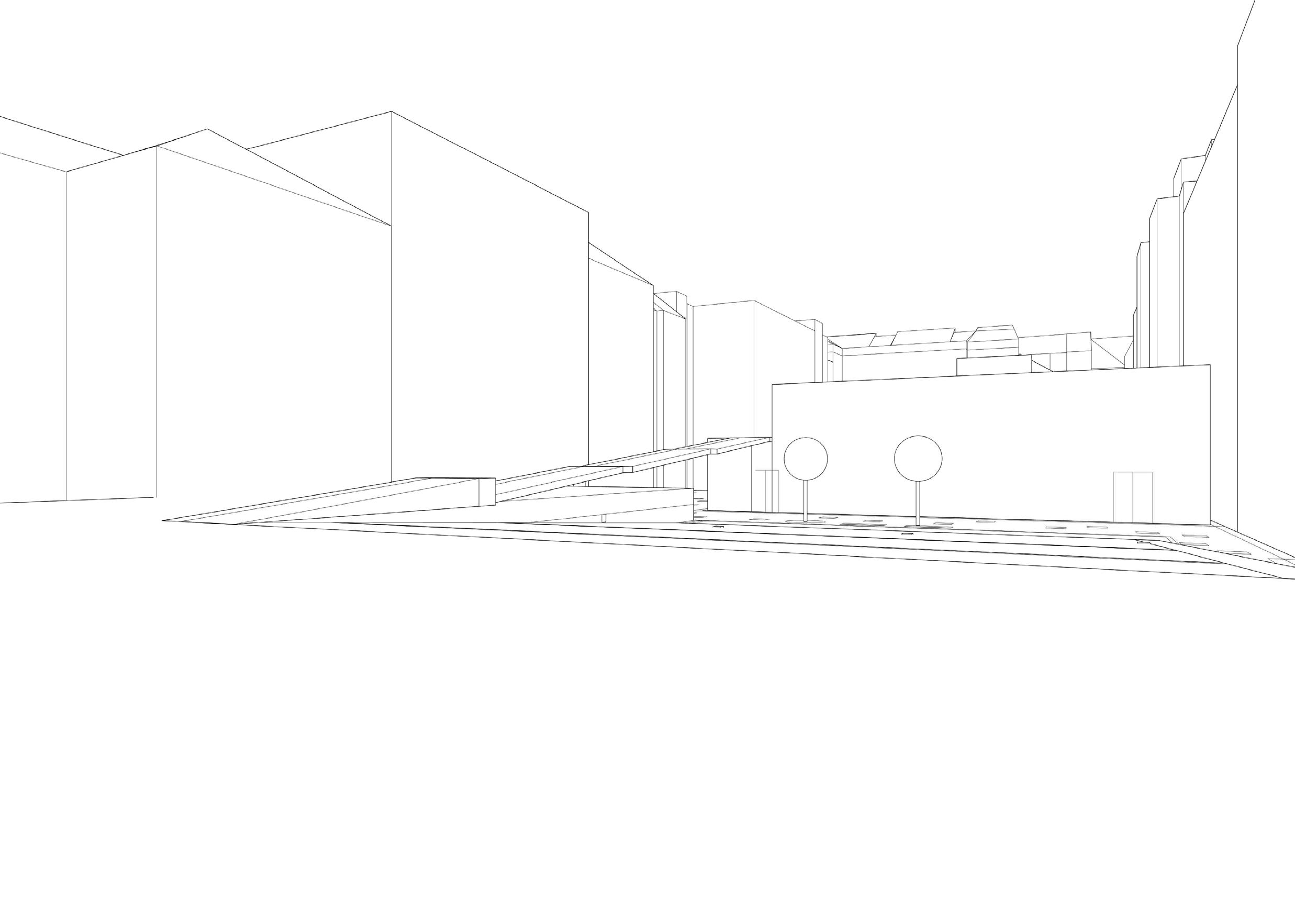
Seeing the different paths I can take makes passing through the courtyard that much more enjoyable and explroable.
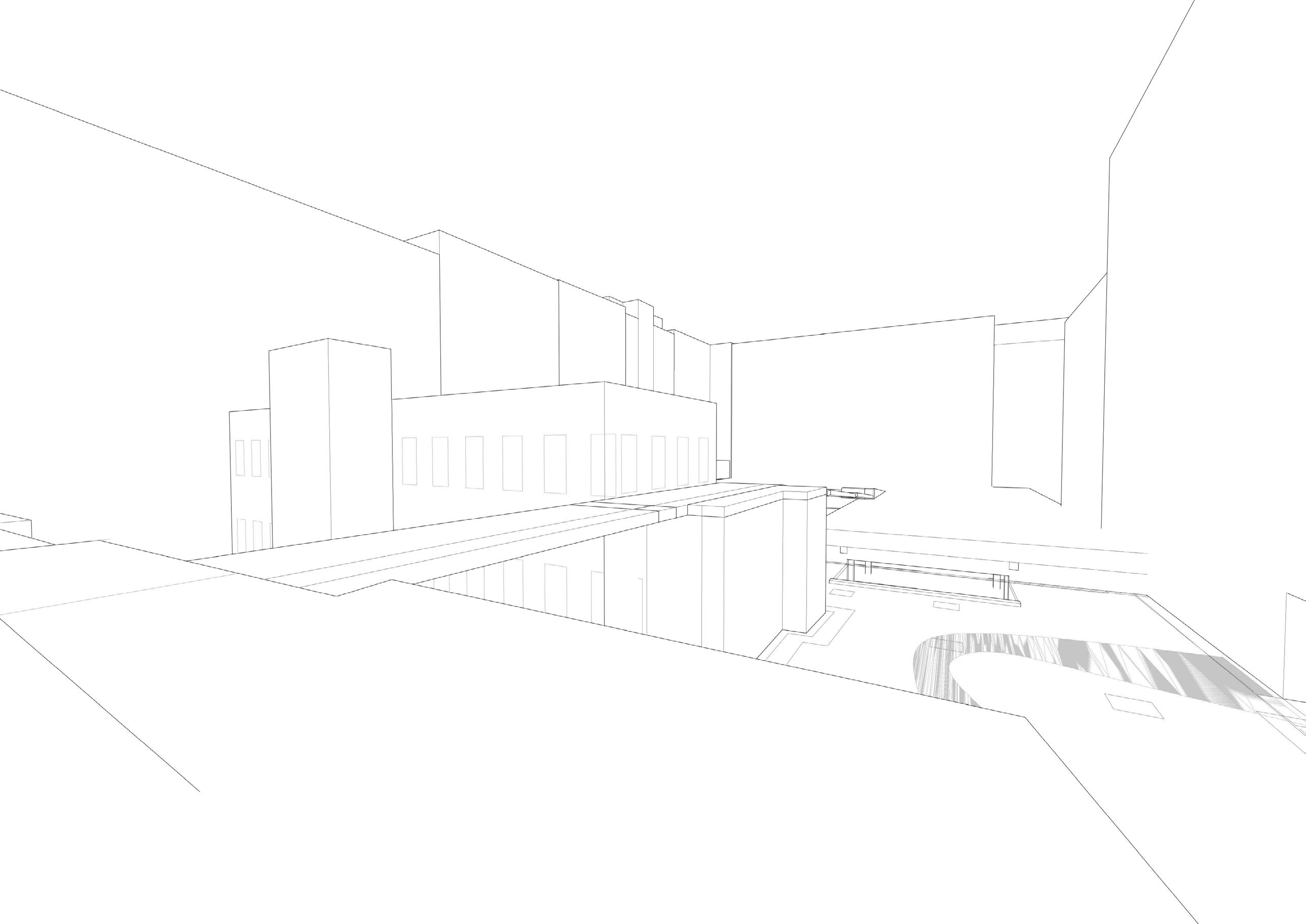
It’s so interesting how that building is cut. I know that the facade wasn’t used because there used to be a building there. At least the users get more light now.
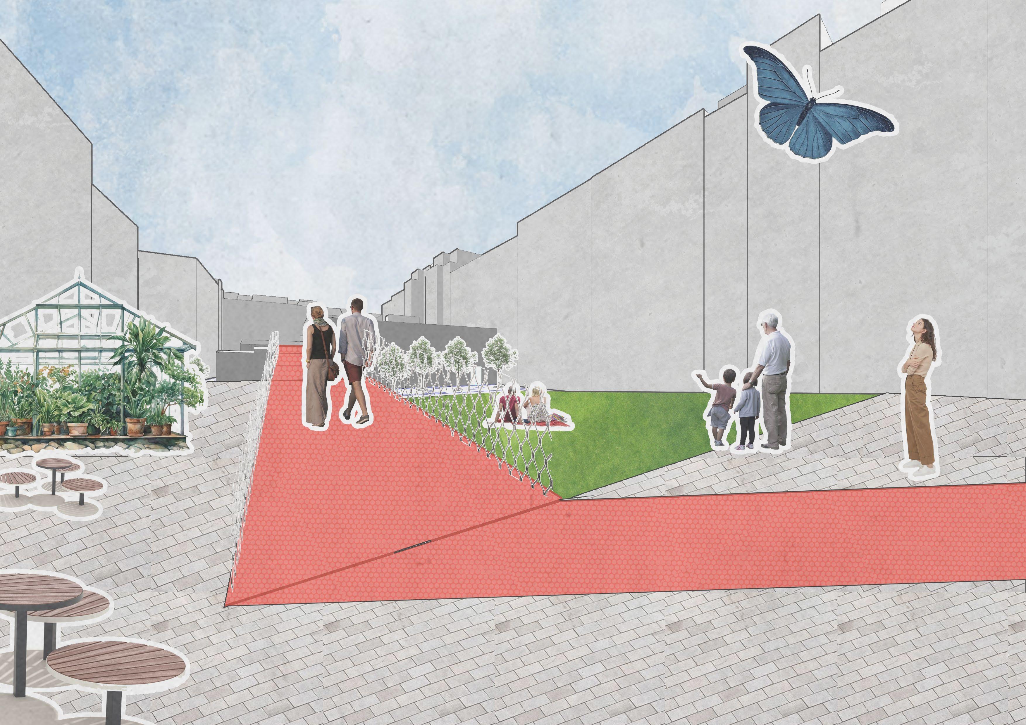
I’m glad there is now a little community garden. I can share all my plant babies with others!
MATERIAL & VEGETATION
CATALOGUE
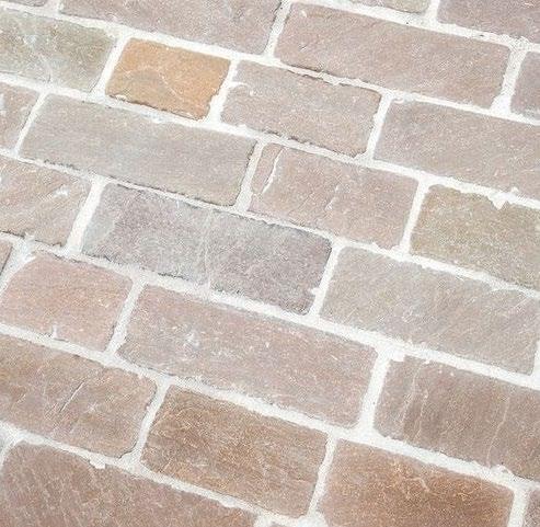
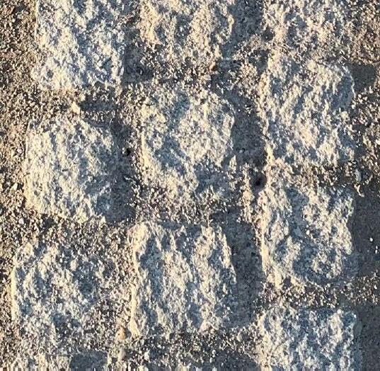
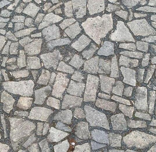
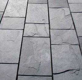

Paving 1- Stone main path type 1
This paving materials will be on the inner yards as the main texture for users.
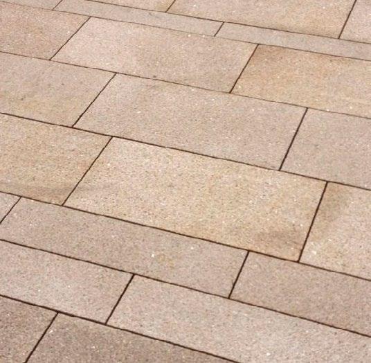
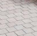
Paving 6- Street stones
Paving 2- Cobble stone side path linin- type 2
This frames the passageways going through the buildings.
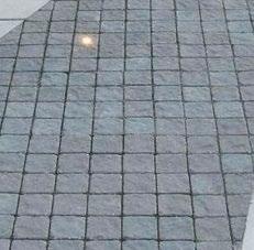
Paving 7- Terracing material tiles
Paving 3- Sidewalk Cobble stone

Paving 8- Terrace Material grass
Paving 4- Stone Slate
Driainage cover and building outlines.
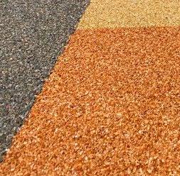
Paving 9- Terrace Material- play area
Paving 5- dirt path

Paving 10-Tree Type 2Silver Linden


Vegetation 11- Tree type-
1 SIlver birch tree
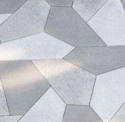
Paving 16- Outdoor tile type 5
Vegetation 12- Tree type
1 SIlver birch tree

Paving 17- Drainage line- Zinc coated steel
Paving 13-Outdoor tile type 1
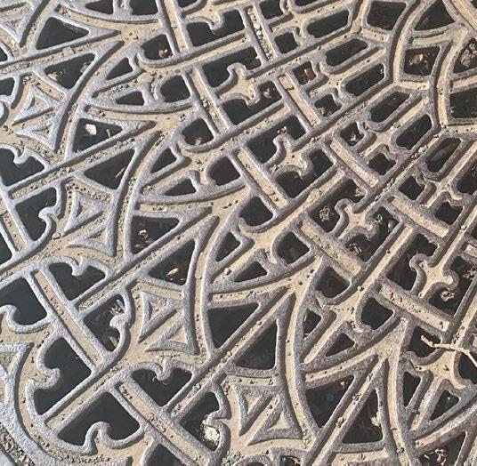
Paving 18- Metal gratetree covering

Paving 14-Outdoor tile type 2

Paving 15- Outdoor tile type 3
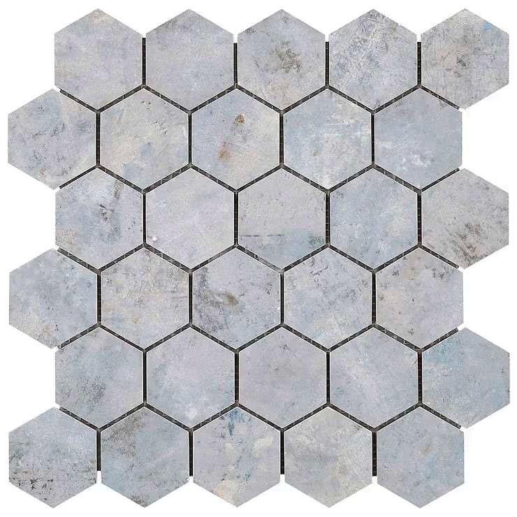
Paving 16- Outdoor tile type 4

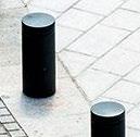
Paving 18- Gravel- Type 1
Paving 19-Bollard mmcite
Paving 20-
ILLUSTRATIVE DETAILS
To understand the significance of how the materials interact with each other there are a series of illustrative details showing how the materials work together. Each material has its role in the project, however the paving types are the most important.
The paving is experienced in texture, walking environment, design, and as one plane. In the details it is drawing how the paving is at one level and the streets for the cars slope up at different points to meet the walking plane that interconnects the blocks.
