International Research Journal of Engineering and Technology (IRJET)
e-ISSN: 2395-0056
Volume: 08 Issue: 09 | Sep 2021
p-ISSN: 2395-0072
www.irjet.net
Slope Stabilization for Malshej Ghat Milind Vaman Kulkarni1, Dhananjay S. Patil2 1Student
of S. Y., M. Tech (Civil-Construction Management), K.E. Society’s Rajarambapu Institute of Technology, Rajaramnagar, Sangli, Maharashtra, India 2Professor, Civil Engineering Dept., K.E. Society’s Rajarambapu Institute of Technology, Rajaramnagar, Sangli, Maharashtra, India. ---------------------------------------------------------------------***----------------------------------------------------------------------
Abstract - Highway side hill slopes are exposed to
due northeast of Pune Although this road was earlier classified under "State Highway" category, recently its status has been upgraded to National Highway (NH No. 222) as shown in figure 1. Besides serving as an important part of the NH 222, the Malshej Ghat area also attracts large number of tourists in the monsoon period as it offers one of the most picturesque view of the Western Ghat escarpment and the neighboring "Inner Konkan plain The Maharashtra Tourism Development Corporation (MTDC) run tourist bungalow, located at the plate edge of the Western Ghat plateau looking over scenic Inner Konkan plain is an important landmark of the area. During monsoon, this road section experiences minor and major incidences of landslides at number of places. They not only cause traffic disruption but also act as a constant threat to the commuters. Over the years, a few fatal accidents causing either deaths or serious injuries due to landslides (mainly rock fall) were reported in last few years.
environmental and atmospheric condition, like deforestation, cycles of freezing and thawing weather, heavy storms etc. Over time, these weather conditions can influence slope stability together with other factors like geological formations, slope angle and groundwater conditions. These factors contribute towards causing slope failures that are hazards to highway structures and therefore the traveling public. There are various types of slope failures. Key Words: Deforestation; Freezing and thawing weather; Geological Formation; Slope failures; Slope stability. 1. INTRODUCTION The Malshej Ghat is the key link to connect Konkan Area of Thane, Kalyan to upper plateau of Deccan in Pune district. Owing to its importance as a popular tourist destination and part of NH 222, it has tremendous traffic load and is vulnerable to landslide hazard pose serious problems during rainy seasons. In 2013, this area experienced huge rock fall and blocked the road for few days with loss of life and damage to the properties. Landslides are short-lived phenomenon, which may cause extraordinary landscape changes and destruction of life and property. Landslides within the strict sense denote the rapid movement of sliding earth material, separated from the underlying stationary a part of the slope by a precise plane of separation to slope failure, under the influence of gravity. Varnes (1981) estimated that in the period from 1971 to 1974, nearly 600 people per annum were killed worldwide by slope failures. In last three decades, many researchers have worked on landslide hazard and risk zoning employing a style of approaches. Keeping national highway operational, minimizing the economic loss to the exchequer and safeguarding the general public interests, adoption of slope stabilization techniques rather becomes an important tool. A correct planning for demarcating landslide prone areas/segments within the entire route, delineating the grounds of slopes failure and adoption of speedy mitigation and mitigation measures along the route become paramount.
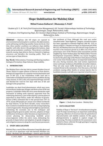
Figure -1: Study Area Location - Malshej Ghat 3. DATA COLLECTION Stability of Slope is “the heart” of embankment along the road. Pit slope monitoring is an important undertaking requiring collection of structural data for geotechnical characterization and stability analysis. In this paper, photogrammetry is applied to capture images for processing. The data available for the assessment were limited to those collected through geological mapping and field observations.
2. STUDY AREA LOCATION Malshej Ghat, a nearly fifteen kilometers long lofty ghat road is a part of an important road link between Mumbai (via Kalyan- Murbad) and Ahmednagar a district place located © 2021, IRJET
|
Impact Factor value: 7.529
|
ISO 9001:2008 Certified Journal
|
Page 894