International Research Journal of Engineering and Technology (IRJET)
e-ISSN: 2395-0056
Volume: 08 Issue: 06 | June 2021
p-ISSN: 2395-0072
www.irjet.net
DELINEATION OF GROUNDWATER POTENTIAL ZONES IN KOLAR DISTRICT USING REMOTE SENSING AND GIS TECHNOLOGY Vatsala P M1, Dr. Ramakrishnaiah C R2 1M.
Tech Student, Environmental Engineering, BMS College of Engineering, Karnataka India 2Professor, Dept. of Civil Engineering, BMS, College of Engineering, Karnataka, India ---------------------------------------------------------------------***----------------------------------------------------------------------
Abstract - Water is elixir of life and all developmental
extract, and it remains well protected from the hazards of pollution that the surface water has to put up with. However, situations wherein we have encountered overexploitation of groundwater resources are not uncommon. Insufficient knowledge regarding the basics of groundwater is the primary reason why we have not been able to use groundwater resources to their full extent. Thus, there is a growing emphasis on groundwater management.
activities enhance the demand of water, whether it is agriculture or industry. The water resources are available either as surface water or groundwater and the principal source for both the resources is precipitation. Growing water scarcity is being recognized as an important problem facing India. Groundwater is an important natural resource to meet the water requirements of our country. RS and GIS techniques are cost-effective and instantaneous process. Satellite pictures are widely being used for groundwater studies because of its ability to identify various ground features, which may serve as an indicator of groundwater. In this study, satellite images were used for preparing various thematic maps viz. geomorphology, lineament density, lithology, geology, slope, soil, land use/ land cover and drainage density. Ranks and weightages are allocated to each thematic map and their attributes based on their significance. Further overlay analysis of all maps was carried out which yielded various groundwater potential zones. The groundwater potential zones in Kolar district was divided into five different classes (i.e., Very Good, Good, Moderate, Low, Very Low) based on overall weightages.
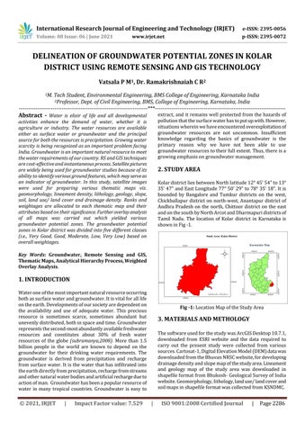
2. STUDY AREA Kolar district lies between North latitude 12° 45’ 54” to 13° 35’ 47” and East Longitude 77° 50’ 29” to 78° 35’ 18”. It is bounded by Bangalore and Tumkur districts on the west, Chickballapur district on north-west, Anantapur district of Andhra Pradesh on the north, Chittoor district on the east and on the south by North Arcot and Dharmapuri districts of Tamil Nadu. The location of Kolar district in Karnataka is shown in Fig -1.
Key Words: Groundwater, Remote Sensing and GIS, Thematic Maps, Analytical Hierarchy Process, Weighted Overlay Analysis.
1. INTRODUCTION Water one of the most important natural resource occurring both as surface water and groundwater. It is vital for all life on the earth. Developments of our society are dependent on the availability and use of adequate water. This precious resource is sometimes scarce, sometimes abundant but unevenly distributed, both in space and time. Groundwater represents the second-most abundantly available freshwater resources and constitutes about 30% of fresh water resources of the globe (subramanya,2008). More than 1.5 billion people in the world are known to depend on the groundwater for their drinking water requirements. The groundwater is derived from precipitation and recharge from surface water. It is the water that has infiltrated into the earth directly from precipitation, recharge from streams and other natural water bodies and artificial recharge due to action of man. Groundwater has been a popular resource of water in many tropical countries. Groundwater is easy to
© 2021, IRJET
|
Impact Factor value: 7.529
Fig -1: Location Map of the Study Area
3. MATERIALS AND METHOLOGY The software used for the study was ArcGIS Desktop 10.7.1, downloaded from ESRI website and the data required to carry out the present study were collected from various sources. Cartosat-1, Digital Elevation Model (DEM) data was downloaded from the Bhuvan NRSC website, for developing drainage density and slope map of the study area. Lineament and geology map of the study area was downloaded in shapefile format from Bhukosh- Geological Survey of India website. Geomorphology, lithology, land use/ land cover and soil maps in shapefile format was collected from KSNDMC.
|
ISO 9001:2008 Certified Journal
|
Page 2286