International Research Journal of Engineering and Technology (IRJET)
e-ISSN: 2395-0056
Volume: 07 Issue: 09 | Sep 2020
p-ISSN: 2395-0072
www.irjet.net
Groundwater Quality Mapping of Mulanthuruthy Panchayat Using GIS Anooja Mariya Jose1, Adithya Menon2, Asst.Prof. Mary Dhanya3 1,2Under
Graduate Students, TocH Institute of Science & Technology, Arakkunnam, Kerala, India Professor, Dept. of Civil Engineering, TocH Institute of Science & Technology, Arakkunnam, Kerala, India ---------------------------------------------------------------------***---------------------------------------------------------------------3Assistant
Abstract - Geographical Information System (GIS) based
ground water quality. Thereafter spatial variation maps of these ground water quality parameters were generated. The project assessed and mapped the groundwater quality in Mulanthuruthy Gram panchayat using an integrated approach of Geographic Information System (GIS).
groundwater quality mapping has been carried out in Mulanthuruthy Gram panchayat, Ernakulam. Groundwater quality for drinking water purposes was analyzed by considering the IS 10500: 2012. A total of 38 samples were collected from 10 wards of the study area. The groundwater samples were analyzed for the major parameters viz. pH, Nitrate, Nitrite, Ammonia, Chloride, Fluoride and Total hardness. The ArcGIS 10.4 was used for generation of various thematic maps and final map based on WQI. An interpolation technique called Inverse Distance Weighted method was used to obtain the spatial distribution of groundwater quality parameters. Seven thematic maps with parameters such as pH, Nitrate, Nitrite, Ammonia, Chloride, Fluoride and Total hardness having desirable and undesirable classes were integrated and the final groundwater quality map for drinking purposes has been prepared based on the WQI.
Ground water samples were collected from several points randomly distributed in Mulanthuruthy Gram Panchayat. The major water quality parameters such as pH, chloride, fluoride, nitrite, nitrate, ammonia, and total hardness have been estimated for all the sampling locations. The visual presentation of results of water quality monitoring helps us to give a clear picture of quality of water at a glance. This can be achieved by using Geographic Information System (GIS). The complex relationship between the various parameters can be easily studied if the water quality results are presented in a visually appealing manner as a map rather than a set of rows and columns of figures. The spatial distribution of water contaminants and other water quality parameters can be displayed in an effective manner using GIS. This helps authorities in taking effective measures to check water pollution and thereby to restore water quality.
Key Words: ArcGIS, Thematic maps, Interpolation technique, Inverse Distance Weighted, WQI.
1. INTRODUCTION Water is the basic requirement of life on earth. It is essential in the life of all living organisms (from the simplest plant and microorganisms to the most complex living system such as of human body). Ground water is an essential renewable resource which we rely on since centuries, without estimating its fate in terms of quality and quantity. It is profoundly utilized in irrigation, industries and for domestic purposes. Therefore, the quality of ground water is equally important as its quantity. Polluted groundwater can cause negative impacts in plants, animals, and humans. Kidney, liver and nerve damages, cancer etc. are some of the health effects of polluted water in human beings. Hence, it is desirable to control the intake of these potentially toxic chemicals from drinking water. Therefore, finding the potential areas, monitoring, and conserving ground water have become extremely important now.
2. STUDY AREA
Chemical composition of water is one of the prime factors which determines its suitability for domestic, industrial or agriculture purposes. Acceptable ground water quality shows that the ground water should be safe in terms of its physical, chemical, and bacteriological parameters. International and local agencies have established parameters to determine biological and physio - chemical quality of ground water. Keeping this in view, we made use of geospatial technology for mapping the spatial variability of
Š 2020, IRJET
|
Impact Factor value: 7.529
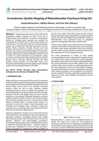
Fig- 1: Study area map Mulanthuruthy is a small town in Ernakulam district of Kerala. The study area is about 21 km southeast of Ernakulam and 8 km east of Tripunithura. Mulanthuruthy also hold the gram panchayat and the block panchayat with same name. Location of Mulanthuruthy panchayat as per the
|
ISO 9001:2008 Certified Journal
|
Page 3652