International Research Journal of Engineering and Technology (IRJET)
e-ISSN: 2395 -0056
Volume: 04 Issue: 06 | June -2017
p-ISSN: 2395-0072
www.irjet.net
WATER QUALITY ASSESSMENT IN TERMS OF WATER QUALITY INDEX USING REMOTE SENSING AND GIS P ANIL KUMAR1, Dr GK VISWANADH2 Head Of The Department, Civil Engg., KN Polytechnic Hyderabad, Telangana, INDIA Professor in Civil Engineering and OSD to VC, JNTUH, Hyderabad, Telangana, INDIA ---------------------------------------------------------------------***--------------------------------------------------------------------1
2
Abstract - In the present study, anlaysis of Physio-chemical analysis & Water Quality Index of Water in Hyderabad, India. The samples of ground water were collected at various locations and analysis was done for Physio-chemical parameters for attribute data base generation. Then WQI of Water is found from the values of pH, hardness of Magnesium and Calcium, TDS, Chlorides, Sulphates, Nitrates, Carbonates, Bi-carbonates, TH. For six years Spatial Distribution Maps are generated for WQI for both pre and post monsoon periods from 2006 to 2011. The analysis of the physio-chemical properties and the WQI are helpful in the grouping of potable water samples into excellent, good, poor, very poor and unfit. The generated spatial distribution for WQI in the present study is useful for monitoring water resources.
Key Words:
Physio-chemical parameters, Water Quality Index, Spatial distribution maps, Pre & Post Monsoon periods, Potable Water.
1.INTRODUCTION Water is the primary natural resources, which is necessary for different objectives such as Forestry, Agriculture, Urbanization and other day to day demands as required for human needs. The problem of water quality in and around urban areas is drawing interest for several years. The unscientific and unplanned urbanization and industrialization practices are getting a numerous problems which include the potable water quality. Hence there is a need for the analysis of water quality problem in urban areas. Since the changes in the climatic conditions, the annual rainfall is continuously reducing every year and also increasing runoff due to urbanization and industrialization. Such human activities may continuously result in the reduction of water bodies, adulterating the quality of ground water, contamination of potable water and different health hazards. The main goal of WQI is to transform complicated water quality data in an informative way which is easy to understand and commonly used by the people. Basing on several factors, WQI can give a simple note on water quality. By this a particular idea is generated in public regarding the issues of water quality in a specific region. The Water Quality © 2017, IRJET
|
Impact Factor value: 5.181
|
indices are the most effective ways to convey the information regarding quality of water to public/policy makers. It is also defined as an evaluation exhibiting the composite influence of different water quality factors over quality of water. Based on various water quality factors, WQI gives a single number (grading) to know complete water quality in a location at a point of time.
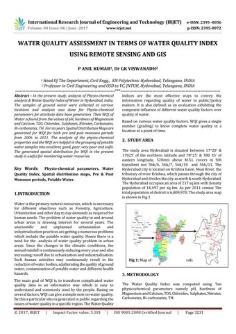
2. STUDY AREA The study area Hyderabad is situated between 1720’ & 17025’ of the northern latitude and 7825' & 780 35’ of eastern longitude, 520mts above M.S.L covers in SOI toposheet nos 56k/6, 56k/7, 56k/10 and 56k/11. The Hyderabad city is located on Krishna basin. Musi River, the tributary of river Krishna, which passes through the city of Hyderabad and divides the city as north & south Hyderabad. The Hyderabad occupies an area of 217 sq km with density population of 14,497 per sq km. As per 2011 census The total population of district is 6,809,970. The study area map is shown in Fig 1
Fig 1: Map of the Study area Hyderabad
3. METHODOLOGY The Water Quality Index was computed using Ten physicochemical parameters namely pH, hardness of Magnesium and Calcium, TDS, Chlorides, Sulphates, Nitrates, Carbonates, Bi-carbonates, TH. ISO 9001:2008 Certified Journal
|
Page 3231