

IOP CMP 2023
Table of Contents
Introduction
Mission, goals and history of Indo Ocean Project and our regions of study
Current Projects
Individual research projects, their methodologies and uses
Locations
Nusa Penida (Bali), Tanjung Bira (Southern Sulawesi), and Raja Ampat (West Papua)
References
Sources used and cited
Acknowledgements
Special thanks to all our interns and partners
4 12 34 48 50
ABOUT US
Conserving the marine environment through research and education
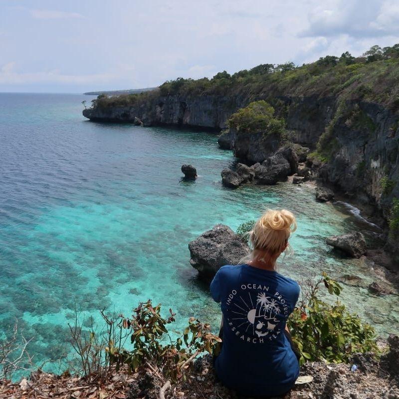
Founded in 2017, Indo Ocean Project is a social enterprise and non government organisation registered in Indonesia. We have developed a unique marine research and conservation program in the heart of the coral triangle, training the next generation of dive professionals through our conservation divemaster internship program.
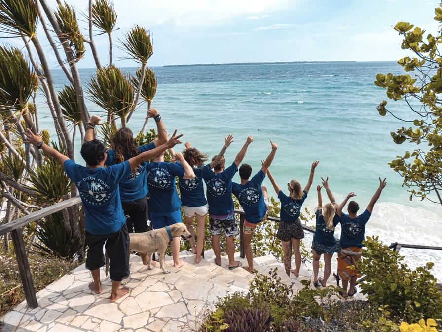
Our field expeditions in Indonesia hosts international and local research projects. We conduct ecological monitoring across three distinct regions of study. Our research is focused on vulnerable and targeted stock assessment fisheries, coral reef health assessment and restoration, mangrove reforestation, marine park management strategy and policy, and supporting individual research projects in collaboration with university institutions in Indonesia and abroad.
You do not need to be a scientist or a diver to join our project. Diversity makes us strong and we are constantly seeking hard-working and passionate interns to take part in our comprehensive and awardwinning program.
4 indo Ocean Project
MISSION & GOALS
Divemaster and Research Diver Training
MISSION
Conserving Indonesia’s marine environment through research, education, and knowledge sharing. Training the highest quality dive professionals through our unique divemaster and research diver internship program.
OUR VISION
At Indo Ocean Project we envision a healthy and profitable marine ecosystem throughout the Republic of Indonesia to benefit the growing tourism industry and help protect the livelihoods of local coastal communities for generations.
With the help of our free open access database we contribute to local legislation, supporting data driven marine policy. The laws in place to protect our reefs are based on scientific truths and are respected and enforced
We see more fishing communities across South East Asia turning to eco tourism business models and sustainable fishing practices. All local fishing practices adhere to Indonesian law and international policy.
There will be an increase of coral reef and mangrove populations along Indonesia’s vast coastline and contribute to a carbon negative community in our areas of study
HOW WE ACHIEVE OUR GOALS
Non-invasive and sustainable methodology on all research projects conducted.
Training the next generation of ocean advocates, eco conscious dive professionals, and marine biologists.
Education of the local community and tourists alike on current conservation issues facing our oceans and what we can do to help.
Hosting international research projects and being an outlet for scientists to develop individual research projects
Collaborating with universities, institutions, NGO's and communities.
Facilitating a channel for publication of our research in peer reviewed scientific journals. Restoring Indonesia's mangrove forests and coral reefs with cultivation, transplantation, and restoration assessments.
Sharing our knowledge in regular reporting to help enact science driven marine policy and conservation strategies.
And of course, exploring and going on AWESOME dives!
1. 2
Conservation management plan 2023 5
PROJECT STAGES
our goals in 3 stages....
Foundation and data set building
From 2017 - 2022, Indo Ocean Project established an excellent foundation in research and created the standardised training program. The COVID-19 pandemic put a pause to the internship program from March 2020 - February 2021 but the ground team never stopped developing and improving. We dedicated this time improving our internship program to provide the best training in both professional SCUBA diving and research diving techniques
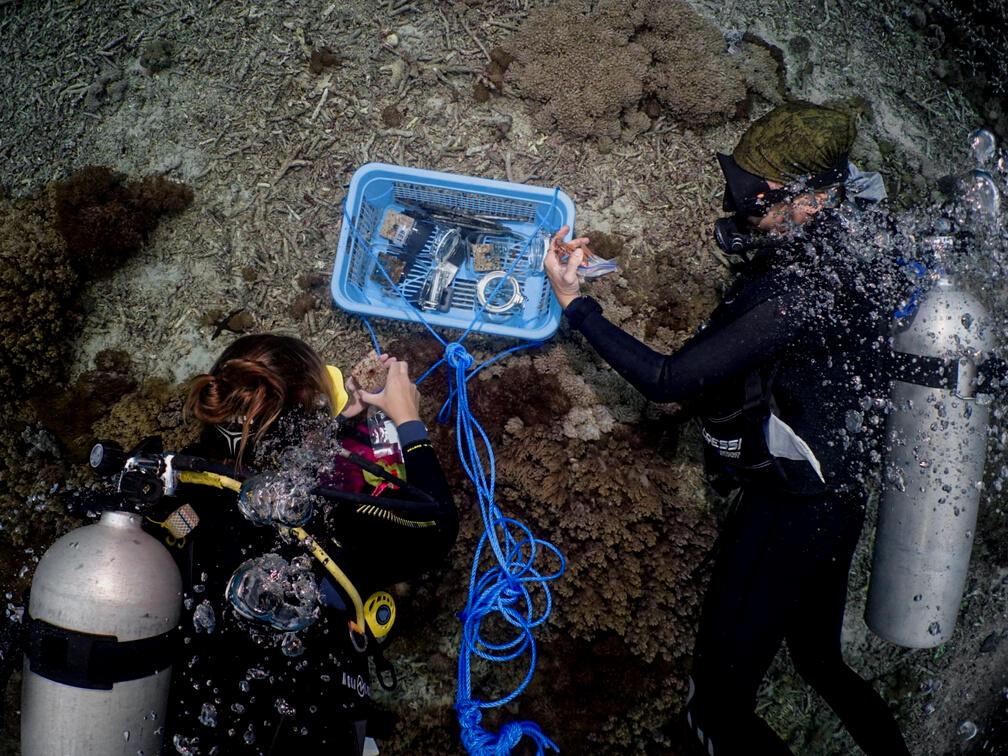
We developed our research and brought on several ongoing projects to round out our baseline data portfolio for a comprehensive assessment of our regions of study.
We designed our program to create a quantifiable skill level among our field researchers, narrowing the scale of deviation in the peer review process.
We developed collaborations with local and foreign universities, NGO's, government agencies, and local stakeholders. We obtained the correct permits and licenses to conduct our work legally and ethically in Indonesia.
01
6 indo Ocean Project
Review and publication
Starting in 2022, we switched our focus to scientific development and publishing our research in scientific journals to share the results of the last 5 years. We will facilitate more international and Indonesian scientists with their thesis and independent research and launch of our Marine Research Fellowship Program.
In 2022 we established the foundations of a Scientific Department. Managed by our Lead Marine Biologist, we have created a new paid position at Indo Ocean Project for Data Analyst and two more junior marine biologist and field researcher positions. Expanding our team of paid researchers dedicated to developing and conducting the field studies to the level expected through stage 1.
We have 3 independent research papers under review set to be published in early 2023 with 5 more graduate students joining the project over that year
We aim to publish 5 papers per year on varying topics which support our overarching research mission and goals to assess our regions of study and identify key habitats.
Management strategy and policy enactment
After 3-5 years of successful publications we will use these papers to help create management strategies and inform policy makers
Using data driven strategies for positive changes to existing marine park zoning and assisting in the implementation and overseeing of these changes within our communities.
With our collaborations with Indonesian Universities, NGO's and government organisations we hope to establish a marine park at our Bira location with scientifically and culturally generated multipurpose zones to best serve the local community and growing tourism demands while protecting critical habitats.
We will continue to accumulate our baseline data, welcome international and Indonesian graduate students, and contribute to the scientific community through publication in peer reviewed journals.
02
03
Conservation management plan 2023 7
BACKGROUND INFORMATION
A brief history on marine conservation efforts in the Republic of Indonesia
The Republic of Indonesia is an archipelagic state located mainly in Southeast Asia with some territories in Oceania. It is situated between the Indian and Pacific oceans. It is the world's largest island nation with more than 17,000 islands. Indonesia is the world's 4th most populated country with an estimated population of 260 million Because of its topography, the sea is, and has always been, an important source of food and income across the country. In modern days, it has additionally been a growing attraction for tourism, which in turn contributes to an increasingly larger portion of the Indonesian economy.
Coastal communities are massively dependent on marine resources for livelihoods, food, transportation and tourism. It is reported that coral reef fisheries in Indonesia are worth 1.5 Billion USD annually; whilst the intangible values such as coastal protection by coral reefs have been estimated to be around 387 million USD annually (Burke et al. 2012).
Alongside reef-building corals, mangrove forests provide a natural barrier for protecting the coastline against erosion, sea level changes, storm surges and tsunamis. These key ecosystems also help to support the adjacent coral reef systems by providing nutrients and, most importantly, being a nursery ground for numerous marine species such as sharks, fish and crustaceans. Therefore, the protection and sustainable use of these vulnerable ecosystems will improve the livelihoods of local communities, protect biodiversity and secure long-term ecotourism.
With the growth of the population to be predicted at 240% by 2060 (Neumann et al. 2015), coastal development, and marine tourism, the marine ecosystems and resources are at high risk of collapse (Yeung 2001).
Approximately, 95% of marine ecosystems in Indonesia are threatened by unsustainable fishing practices, urban pollution and coastal development. The destruction is also accelerated by the global issue of climate change (Burke et al. 2012). These issues highlight the need for imperative efforts to protect biodiversity and ecosystems which will sustain the economy, society and culture of many of Indonesia’s coastal communities.
8 indo Ocean Project
Marine Protected Areas (MPA) in Indonesia have existed for centuries with a non-governance social-cultural implementation to protect an area to benefit biodiversity and food sustainability. Although marine conservation practices were introduced to the region during the period of the Dutch East Indies colonisation and, the first official MPA was established in Banda Sea in 1977 Since then MPAs have become an important instrument to protect Indonesia’s coastal and marine resources and biodiversity (Kementrian Kelautan dan Perikanan, 2020).
Recognising the value of MPAs, the government of the Republic of Indonesia have committed to increasing their size and the quality of their management. This commitment was undertaken to support Sustainable Development Goal (SDG) 14: Life Below Water - Conserve and sustainably use the oceans, seas and marine

Conservation management plan 2023 9
THREATS
The dominating concerns surrounding the major marine conservation issues in Indonesia
Despite Marine Protected Areas (MPA) in Indonesia growing in size and number over the last decade there continues to be many obstacles that face officials in the ultimate success of establishing and maintaining them. Mismanagement and lack of resources for enforcement and biological assessment are leading factors that give rise to inefficient MPAs. Coupled with additional human pressures such as unsustainable fishing, exploitive tourism, and pollution, it is not surprising that some established MPAs are not attaining the positive results they were projected to have.
Illegal, Unreported and Unregulated (IUU) / Over Fishing Practices
Fisheries resources in Indonesia are highly exploited due to rapid population growth, economic development, and technological advancement within fisheries As the result, an area becomes less productive and conflict between users increases, pushing the fishermen to venture to new areas such as the eastern part of Indonesia and inside MPAs – yielding a new problem among newcomers and the local community (Muawanah et al 2012).
Unsustainable fishing practices persist within Indonesia despite increased protected areas and new fisheries management policies put in place The use of potassium cyanide, blast fishing, compressor diving, bottom trawls and drift nets are common in traditional fishing in rural areas (Nurdin & Grydehøj 2014). These harmful practices threaten the coral reef existence which is a critical habitat and nursery ground for many species. With a lack of policy enforcement this issue could disturb the ecosystem balance, resulting in a devastating crash in fish stocks.
Marine Debris
Plastic accumulating in our oceans and coast lines has become a global crisis. Approximately 12.7 million megatons (Mt) of plastic ended up in the oceans in 2010 (Jambeck et al 2015) Plastic pollution has a direct and deadly effect on wildlife and humans. Thousands of seabirds, sea turtles, seals and other marine mammals are killed each year as a result of human waste, either from ingesting or entanglement. Microplastics are brokendown plastic waste, synthetic fibres, and beads found in personal hygiene products. These microplastics are possibly the leading issue facing marine conservationists today While China produces the most marine debris, Indonesia is ranked second, closely followed by the Philippines, Vietnam, and Sri Lanka (Purba et al. 2019).
10 indo Ocean Project
Elasmobranch Decline
Sharks have been roaming the oceans for the past 400 million years, surviving multiple major extinctions, but in less than a century humanity has pushed their population sizes to a critical point. "Sharks are more vulnerable today than ever before", said Boris Worm, a professor of biology at Canada's Dalhousie University. An estimated 73 million sharks are killed annually, working out as more than 10,000 sharks per hour. The most significant threats are overfishing, habitat loss and pollution. The roles of sharks are varied but they are well documented as key species in the ecosystems they inhabit. As predators, sharks maintain the balance between the trophic levels of the food chain. Through a cascade effect, a decline in sharks can result in an increase in primary producers (algae) This imbalance has a negative effect on reefs, and ultimately on the livelihoods of local communities. Indonesia’s marine resources are among the richest on Earth. With a lack of species specific protection, it has become the largest shark and ray landing and exporter in the world (Prasetyo et al. 2021) and has been ranked as the number one shark fishing nation for the last 2 decades (Jaiteh et al. 2017).
Coral Reef Health
Coral reefs only take up 0.1% of the area of the ocean but support 25% of all marine species on the planet, rivalling the species richness of tropical rain forests of the Amazon or New Guinea. Hundreds of millions of people rely on coral reefs for essential nutrition, livelihoods, and natural protection from storms and natural disasters. They are also crucial to tourism and economic opportunity. Around half of the world's shallow water reefs are already gone. Without immediate action to address climate change, pollution, overfishing, irresponsible tourism, and destructive coastal development these crucial, life-sustaining natural wonders could disappear in our lifetime. It is known that under anthropogenic pressure, coral reefs around the world degrade over time (Bellwood et al 2004). Specifically, in one of our regions of study, Nusa Penida MPA, there is scientific evidence of coral reef degradation in both the northern and southern areas (Tito & Ampou 2020). The general survey of Indonesian coral reef health was last conducted in 2019, which highlighted the importance of intense monitoring to better understand the coral reef health and restoration efforts across the country (Lembaga Ilmu Pengetahuan Indonesia 2020).
Mangrove Deforestation
Mangrove forests provide important nurseries and feeding grounds for commercially valuable species of bony fish, crustaceans and elasmobranchs. These critical coastal habitats are known to have a large capacity to sequester carbon, are important in mitigating climate change and protect the shoreline from abrasion and high waves (Arifanti 2020). Despite their value in ecosystem services, mangroves in Indonesia are being destroyed for their commercial value and to make way for coastal development, aquaculture and agriculture. The total mangrove area in the world is estimated at 136,000 km2 and it is distributed in 118 countries (Spalding & Leal 2021) Indonesia, having the highest mangrove coverage worldwide (3 31 million ha [Kementrian Kehutanan dan Lingkungan Hidup, 2019]), has lost approximately 30% of its mangroves between 1980 to 2005, with a deforestation rate of 52,000 ha annually (FAO 2007)
Conservation management plan 2023 11
Indonesia is on the front line for some of the leading marine conservation issues facing our modern world.
There is a thirst for knowledge and a commitment to do better in Indonesia.
Through our research we strive to bridge the knowledge gap by providing standardised, high level open-sourced data sets in our regions of study. We focus on three main strategy categories:

1 2 3
Ecological Monitoring
Direct Conservation
Education & Outreach
Combined, these strategies help to enact positive data driven policy changes in Indonesia.


Roving Survey Coral Reef Assessment Coral Reef Restoration Mangrove Restoration Baited Remote underwater video 14 16 18 20 22 Citizen Science 24 Marine debris assessment 26 Ocean water quality testing 28 Community outreach 30 Education program 32 33 photographic identification Conservation management plan 2023 13
BRUV
Baited Remote Underwater Video
Ecological survey strategy
INTRODUCTION
Due to the difficulties of studying elasmobranch abundance in the wild, different techniques had to be invented in order to address different ecological questions.
One of these techniques is the Baited Remote Underwater Video (BRUV). This elasmobranch and predatory fish study method has been used in numerous studies around the world and has demonstrated great success
Ample data can be taken from these video assessments including population dynamics, diversity, abundance and behaviour
BRUVs offer a low environmental impact strategy to help understand changes in reef fish diversity over time.
OBJECTIVES
The BRUV project is part of our in house baseline data and ecological monitoring research to estimate and compare the relative abundance of predatory fish species, including sharks and rays, inside and outside of marine protected areas (MPA).
These species are also the most commercially valuable and play an important role in the ecosystem and in developing successful marine park management strategies
This project is standardised across our project locations to help create a comparative study from 3 variable survey locations and assisting in the establishment / improvement of MPA zoning requirements.
Pg 16 14 indo Ocean Project
METHODOLOGY
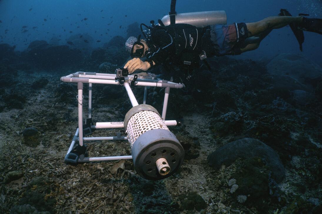
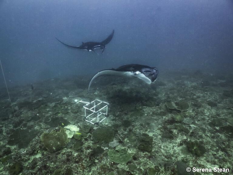
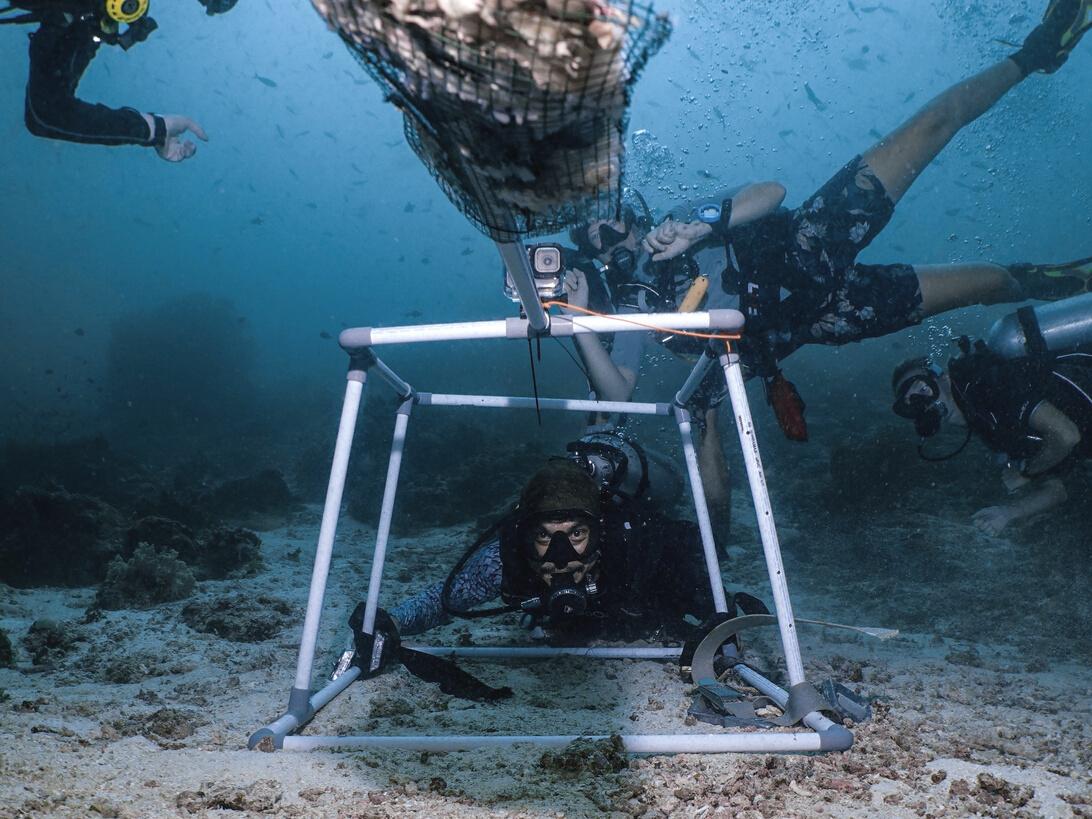
Baited Remote Underwater Videos consist of a GoPro camera that is mounted on a weighted submersible frame. 1 kilogram of standardised bait is placed in a cage mounted on a pole in the camera’s field of view. BRUV sampling is conducted throughout the study areas and are deployed at predetermined locations depending on weather and ocean conditions, placed in daylight hours.
The deployments are done in an area between 4m and 40m of depth, with a flat bottom to maximise line of sight. BRUV’s are deployed using SCUBA gear and lift bags to guide it away from live coral and to orient the BRUV facing down current. The BRUV is in the water, uninterrupted by divers, for over 60 minutes and other activities (e.g training dives or survey dives) are simultaneously conducted during the filming.

A team of 4 research divers work together to deploy and retrieve the BRUV. At both the start and the end of each deployment environmental variables are measured including, water current strength, salinity, bottom depth, turbidity, water quality and water temperature.
Each video is viewed twice by two trained interns and data is recorded. Every elasmobranch or commercially valuable fish species present in the frame is counted and documented
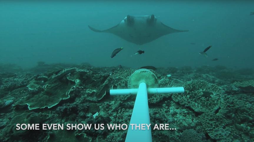
VIDEOS
Check out our YouTube channel for more Best Of BRUV videos throughout the years...


Sharks
Rays
Best of the BRUV 2022
of the BRUV
of the BRUV
Conservation management plan 2023 15
INTRODUCTION
Being able to conduct rapid species assessments is becoming increasingly more important as a conservation research tool Our research team uses the ‘Roving Divers Survey Technique”, an underwater visual census method designed specifically for actively seeking out and positively identifying indicator species.
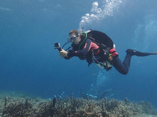
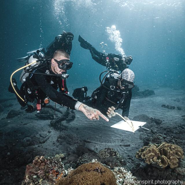
Data on species diversity, sighting frequency, size and abundance of all our targeted indicator species are collected and documented in our database using this surveying method.
ROVING SURVEYS
Sighting frequency surveys
Ecological monitoring strategy
OBJECTIVES
This data is stored in our in house database and available for open access on request. It has been used for publications and as supportive data for research interns in their independent thesis projects.
Partnered with the Baited Remote Underwater Video project we use the collective data and results to put forward policy changes to create a more effective local marine management strategy Regulating nonfishing zones and limiting tourist access to critical habitats.
16 indo Ocean Project
METHODOLOGY
Before researchers qualify to be an active surveyor they must first complete Level 1, 2 and 3 of Indo Ocean Project's species identification courses, passing the species ID exam with a minimum pass rate of 95% All surveyors must complete an inwater sizing workshop and pass the exam achieving a minimum of 95% to limit bias in the data collection. This high level of expectation allows us to standardise and quantify the level of knowledge of the surveyors.
The survey team consists of 3-8 research divers and 1 lead research diver. The research team records all correctly identified indicator species over 20cm for the duration of 30 minutes. The size is confirmed using our sizing workshop assessment and data is recorded on slates including species name, number of individuals sighted, size, sex, time and depth of sighting
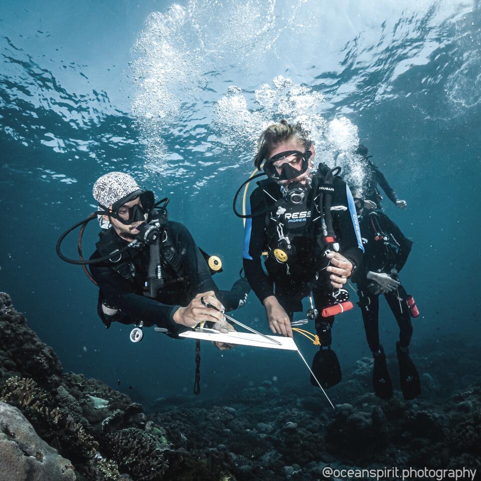
Once on the surface the group’s data is compared and combined into one set of data per survey dive and is inputted into the databases following completion on the day of the dive.
Each research assistant is provided with species identification pre-arrival study guides. They also undergo a thorough training upon arrival including methodology and fish identification training before their results contribute to our databases.
Conservation management plan 2023 17
CORAL REEF ASSESSMENT
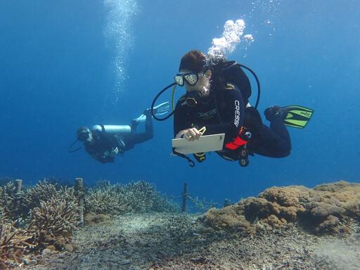
Nursery site and biodiversity assessment
INTRODUCTION OBJECTIVES
Indonesia's coral reefs are the most biodiverse marine ecosystem on the planet and human dependance on their services is high However coral reefs are under relentless stress from a myriad of direct and indirect anthropogenic pressures. Coral Reefs are also a sensitive indicator of coral reef health, climate change, and rising ocean acidification. 50% of our reefs have collapsed, with 14% in the last decade. It is projected that coral reefs could disappear within in the next 30 years (Obura et al. 2019)
Monitoring coral reefs status and trends over time is essential to track ecological changes in the ocean and to inform management strategies and policy.
By combining standardized ecological monitoring programs we are able to build a comprehensive understanding of ecosystem functions and capacity over time.
Through our assessment we are monitoring coral coverage and composition, macroalgae canopy cover, disease and bleaching events. Combined with our roving survey data we can quantify fish diversity and abundance with tangible steps to track capacity building.
This data is used in our in-house data analysis and publication and as supportive metadata for independent research projects.
18 indo Ocean Project
METHODOLOGY
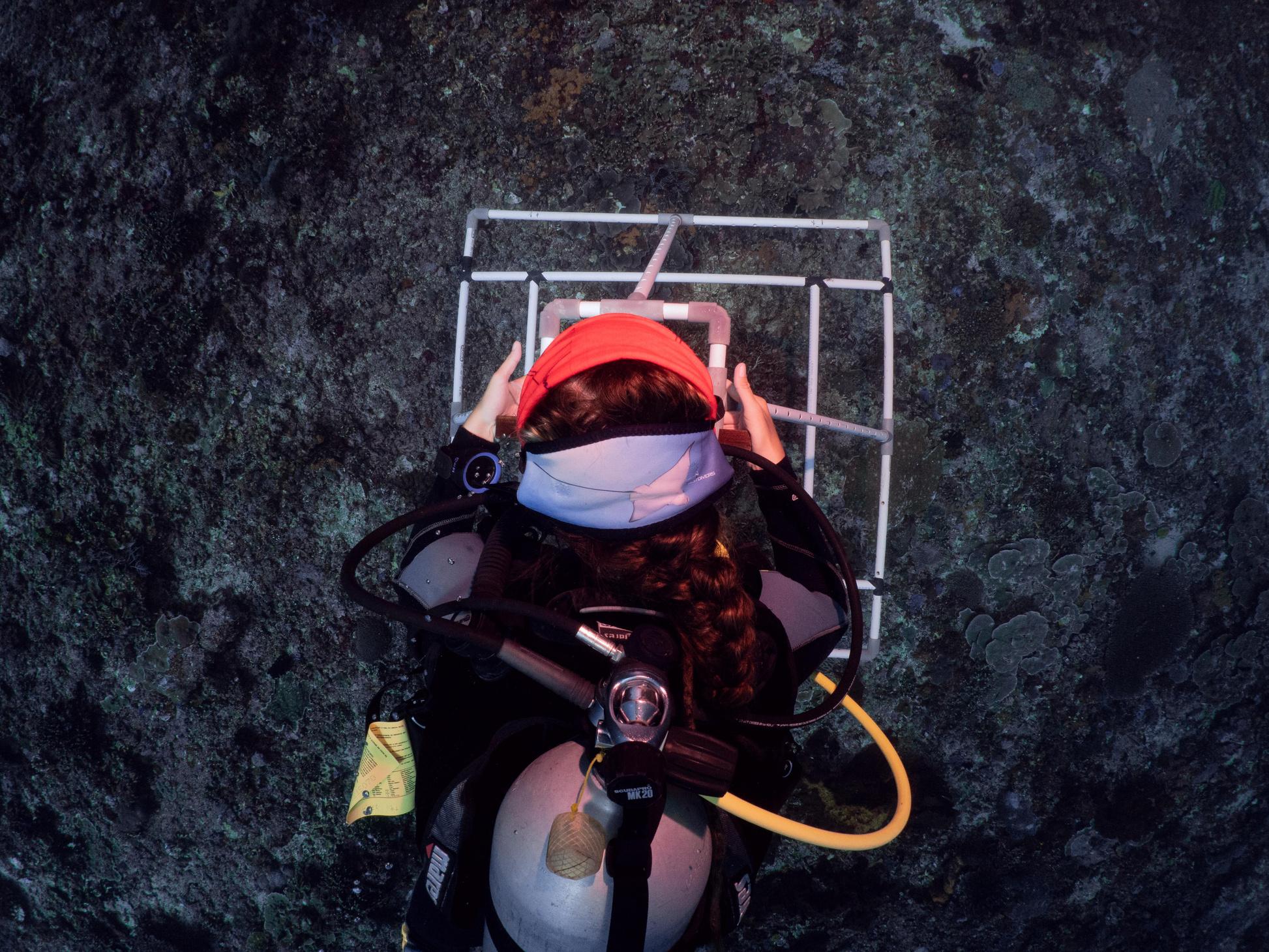
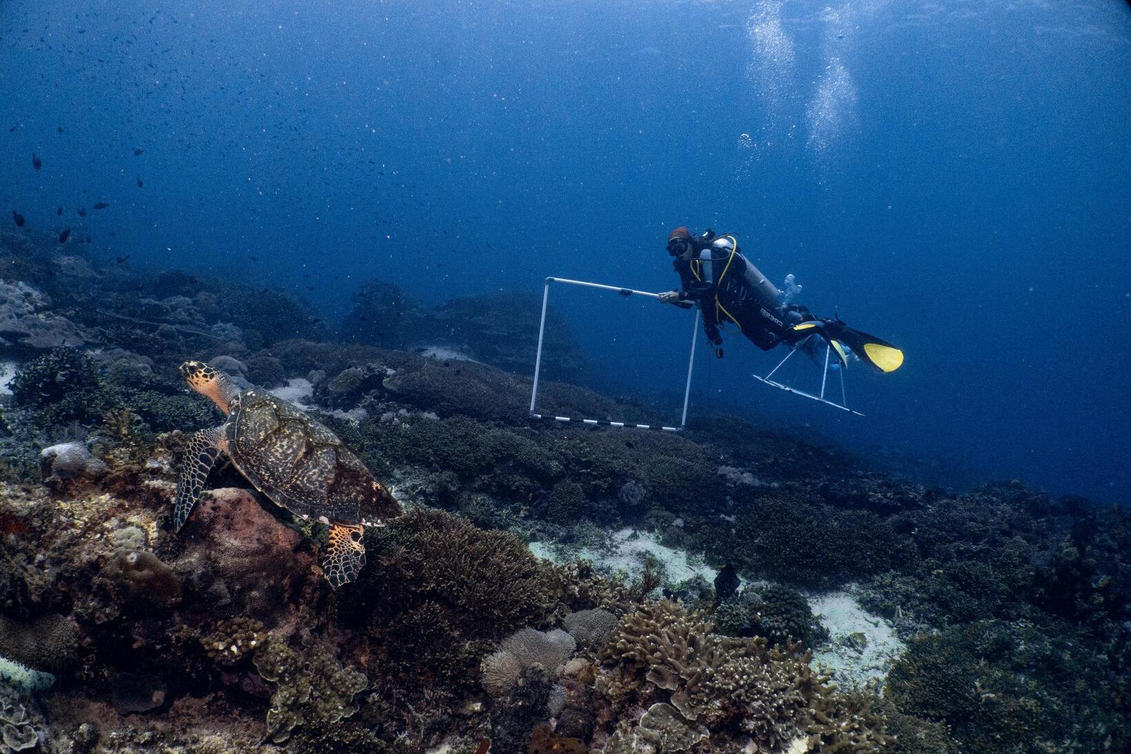
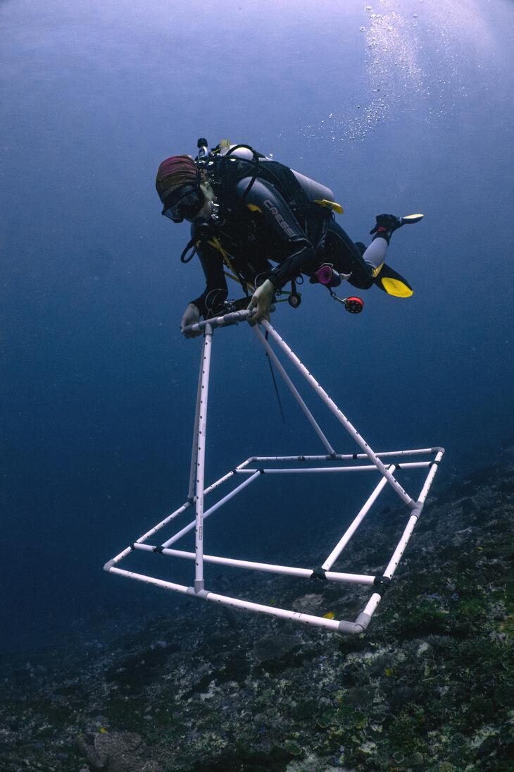
Led by trained research divers, a minimum group of 2 interns conduct survey dives in a predetermined area on established dive sites within and outside marine protected areas. 1 diver manages the structure and the other tracks time and navigation
Equipped with a camera mounted on a 50x50cm quadrat, the structure is swam no more than 1 metre above the ocean floor capturing high resolution time lapse photos every 2 seconds. Due to complications with strong current, data is recorded based on time swimming and not on distance. Swimming is constant through the survey with a swimming to pause ratio timed by the buddy diver. One survey takes 11 minutes to complete.
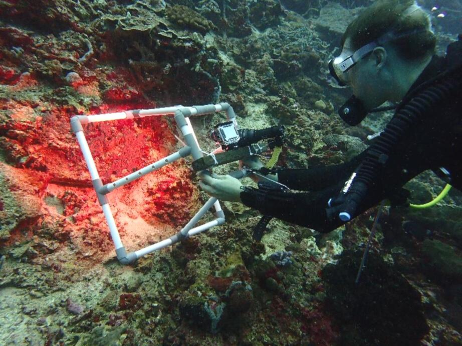
The survey is replicated at a depth of 20m, 15m, and 10m and conducted twice annually at each recorded dive site in the region.
Once back on shore the photos are filed and put through a software that analyzes benthic type and coverage using a randomized dot method. The results are recorded in the Indo Ocean Project internal database. The photos are stitched together to generate a high resolution map of sections of reef and are compared over time.
Conservation management plan 2023 19
CORAL REEF RESTORATION
Restoring damaged reefs
Di t C ti St t
INTRODUCTION OBJECTIVES
Coral reef destruction, resulting from both natural stressors and human impact, is widespread in Indonesia and worldwide As a primary producer, presence of healthy coral is imperative in preventing trophic cascades.
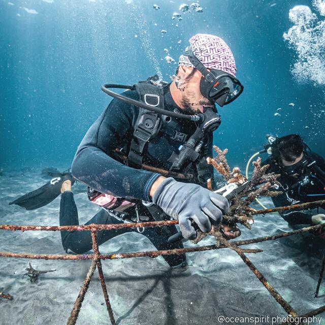
Coral restoration efforts are a crucial asset in reestablishing healthy coral populations on reefs which may have suffered degradation.
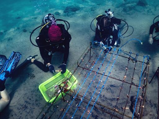
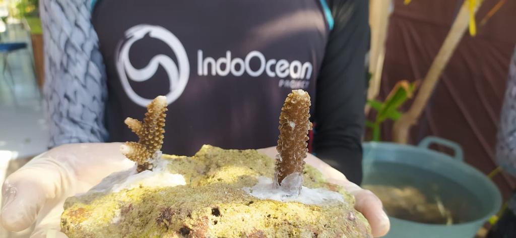
Under the instructive methods of Ocean Gardener, we propagate coral colonies in our coral nurseries and restoration sites to promote healthy and rapid coral growth We monitor health over time and evaluate water quality at the sites, recorded in our databases to evaluate success and motivate future restoration efforts.
Our coral restoration project puts focus on promoting new coral growth on damaged reefs, allowing the entire ecosystem, from primary producers to high level predators, to thrive. The primary aim of this methodology is to bridge healthy ecosystems and restore damaged reefs.
By measuring colony growth, health and survival over time within our restoration sites, we are producing quantifiable data on the success of coral restoration at various reef locations and under various environmental conditions. Evaluating the effect of our restoration efforts on the surrounding benthic ecosystems provides data that allows us to undergo scientific analysis, monitor success, adapt our methods and contribute to publications and sharing of knowledge on coral recruitment and ecosystem health with our peers.
20 indo Ocean Project
METHODOLOGY
All interns complete a 3 day intensive coral ecology and identification course designed by our partners Ocean Gardener. The course is broken into three sections; coral identification, ecology, and restoration techniques
The first two dives of the course focuses on coral identification. Led by a certified Ocean Gardener instructor and equipped with Ocean Gardener slates, buddy teams head out to our restoration site to positively identify coral species in the area.

The final day of the course starts with a theoretical workshop on restoration techniques, followed by a "dry run", a land practice sessions to review the proper methods for planting corals In the afternoon the team heads out to the restoration site with the necessary equipment to expand the nursery site, relocate existing corals, and conduct general maintenance. An assessment is conducted to analyze growth rates, health, and recruitment strategy.
This program is conducted monthly with regular maintenance and check dives as required. Data is stored in our internal database and available for independent research requirements.
After completing the course interns are certified as Coral Gardeners with Ocean Gardener.
Conservation management plan 2023 21
INTRODUCTION OBJECTIVES
Mangroves are arguably the most diverse and important habitats on the planet. They are a nursery ground for most reef fish, creatures, and corals, and provide essential support to other nearby marine ecosystems. They are also one of the best ‘Carbon Sinks’! In essence, mangroves are natures answer to climate change and contribute towards the global reduction of greenhouse gas emissions.
1/5th of the world’s mangrove population disappeared over the last two decades. The primary threats to mangrove destruction are coastal development and overexploitation
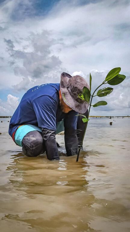
Protecting these vital ecosystems has become more important than ever.
The transplanted mangrove seedlings thrive in the restoration areas aiding in the continued growth of this vital ecosystem and can benefit the local eco tour operators. By conducting research on optimal growth conditions across different regions of study and using different species of mangroves we are able to contribute our findings to benefit other mangrove restoration agencies.
At our three locations we are engaging with local communities:
Nusa Penida - Reforestation in Semaya.
Bira - Collaboration with Luppung Mangrove Foundation to restore and support the existing mangrove habitat.
Raja Ampat - Carbon assessments and support for the thriving mangrove forests of Waigeo.

22 indo Ocean Project
MOur interns regularly go out to collect mangrove propagules (seeds) along the coastline and in existing mangrove forests in our areas of study. These seedlings are brought back to headquarters, cleaned, and planted in a salted soil compost mixture and kept in our mangrove nursery for optimal growth tracking
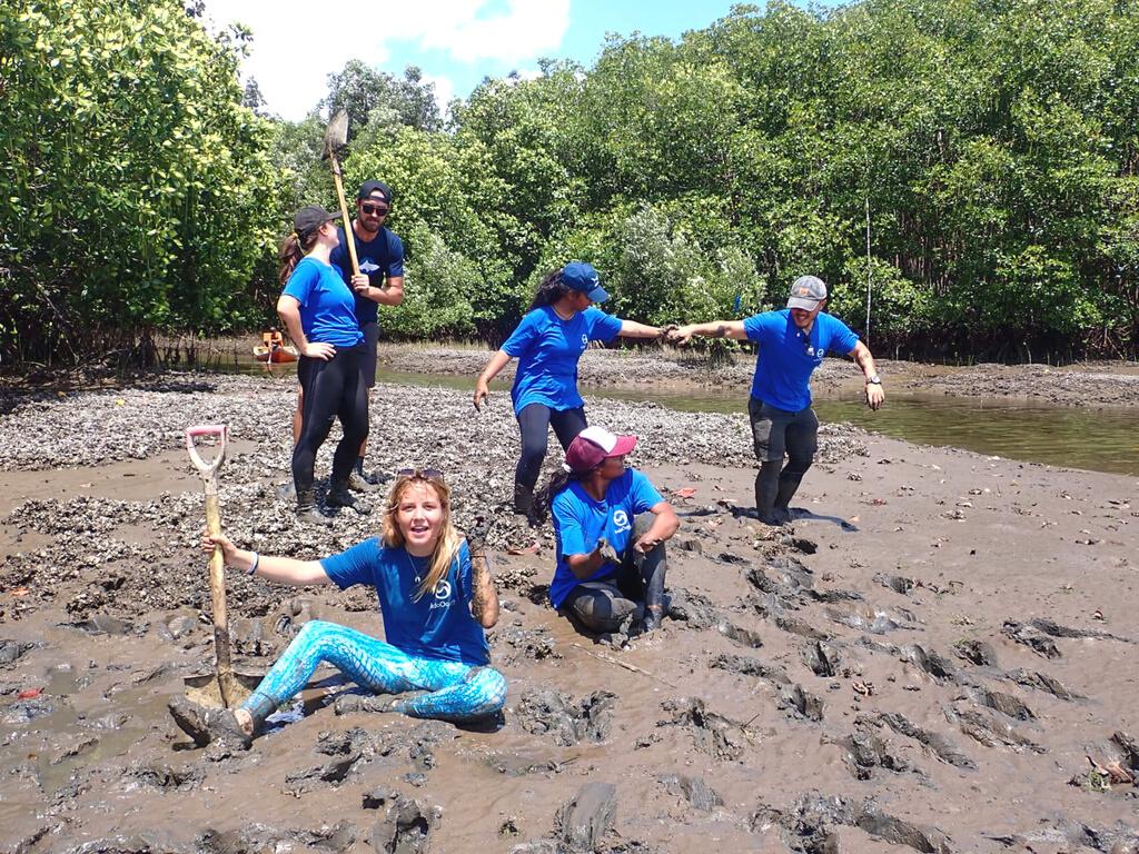
We have customized our mangrove nursery and propagation technique to allow for optimal success rates after planting. During the nursery phase the propagules are watered regularly with a gradual introduction to salt water initiated 1 month prior to a planting event. Once propagules reach a set height with a minimum of 4 leaves growing they are categoriezed as ready for transplanting.
Once the cohort of propagules are ready for planting the conditions are assessed for optimal survival potential and access depending on the restoration site. Planting map and data is collected and reviewed during every planting event.
Further micro adjustments can be made to optimize the growth potential based on the results of our ongoing assessments.

Conservation management plan 2023 23
PHOTO ID
Population dynamics & habitat use through photographic identification
Ecological Monitoring Strategy
INTRODUCTION
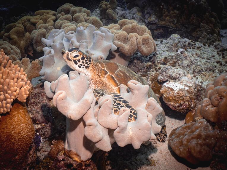
Effective marine conservation and management practices for threatened species rely heavily on an indepth knowledge of population dynamics. This includes abundance and distribution, habitat use, and life history parameters In the past, this information has been collected using a capture-markrecapture technique. However with the advancement of photographic and identification technology we are now able to collect this information for specific species using a non-invasive method.
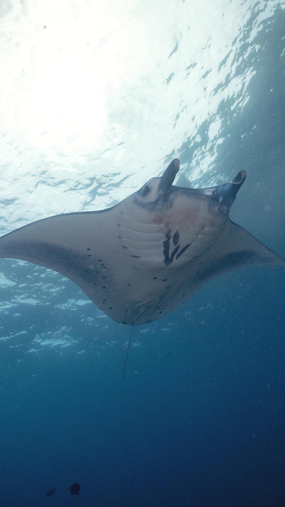
Photographic identification is the method of using photographs of an animal’s natural markings for individual identification. This has recently been used increasingly as a reliable tool to track individuals over time. The use of photo-ID offers many advantages over the conventional tagging methods, as it is non-invasive, low cost, and has proved to be reliable over long periods of time However identifying individuals using photo-ID may become time consuming as the number of photographs in the database increases. Additionally, intensive training is required to become familiar with the characteristics and the population features in order to obtain correct matching.
24 indo Ocean Project
METHODOLOGY
Profile pictures are taken and selected during Survey Dives or collected from citizen science submissions from other divers in the area. Confirmed ID photos will be logged and submitted to online databases as well as the Indo Ocean Project database.
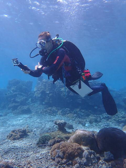
A non-subjective computer assisted process using coding of the facial profiles of turtles, specific areas of shark species, and the spot patterns on the bellies of manta rays are used to identify individual animals using "fingerprints"
Additional analysis and database management is given to engaged interns who volunteer to help manage this data by our onsite marine biologists.
PARTNERSHIPS
Marine Megafauna Foundation - All manta ray and turtle ID shots into our shared database.
The Manta Trust - All manta ray ID shots into the ID The Manta database.
MatchMyMola - All Mola alexandrini ID shots shared directly with Dr. Marianne Nyegaard.
OBJECTIVES
The identification of individuals within a population and the collection of reliable information on distribution, habitat use, and life history traits are the minimum requirement for behavioural and ecological studies of a species Therefore, this project is designed to provide valuable information to our in-house research and to marine biologists around the world to help create better management strategies and educational outlets on the marine megafauna in Indonesia's top diving destinations.
For example, regular and seasonal sightings of reef (Mobula alfredi) and oceanic (Mobula birostris) manta rays makes this a desirable region for dive tourism and research. These large marine fish have been classified as "Vulnerable" and "Endangered" on the IUCN Red List and have been included on the CITES Appendix II list calling for their protection. Further research is required to track and monitor these species in Indonesia which will give way to us helping track migratory patterns and identify vital feeding, cleaning and nursery habitats of our manta ray populations.
Conservation management plan 2023 25
CITIZEN SCIENCE
Collaboration with NGO's to ib l b l d b
INTRODUCTION OBJECTIVES
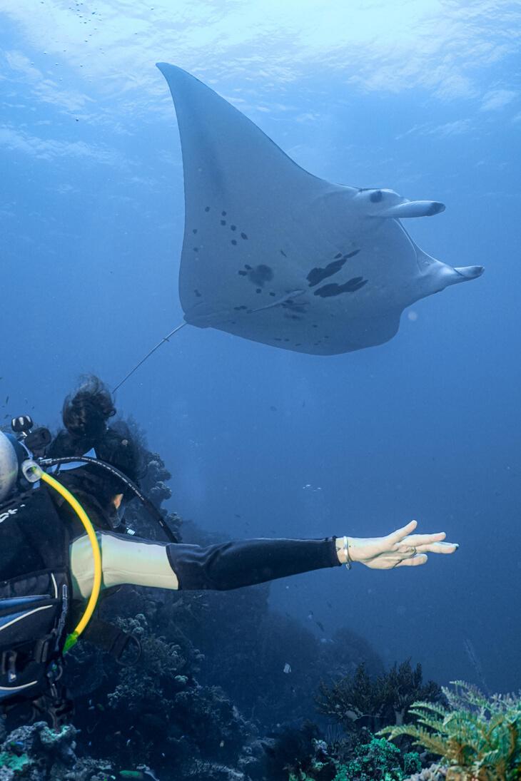
Over the last 30 years there have been thousands of marine citizen science projects created, engaging millions of ocean enthusiasts in the collecting and analysing of data. Marine citizen science presents a promising avenue for educating the community on marine conservation issues while at the same time utilising their resources to collect critical data that in the past was inaccessible due to budget and time commitments.
With the advancement in communication and technology, ecologists are able to access these data sets as supportive factors in their research.
To engage Indo Ocean Project community and local stakeholders in worthwhile citizen science data sets which benefit the scientific community.

By teaching Indo Ocean Project interns about various marine citizen science platforms we are allowing them to individually contribute to global data sets and continue to support these projects long after their graduation.
These programs can be continued throughout their diving career and to create citizen science advocates who can share their knowledge and support more divers to participate in the future. As an increasing number of future positions asks for this experience, it provides a valuable CV builder.
26 indo Ocean Project
METHODOLOGY
There are several citizen science strategies implemented throughout our program on a daily basis Some dives are scheduled specifically as citizen science dives to help contribute to over 10 of our global platform partners. This includes any species of interest from the largest megafauna to the smallest reef critters. Once the data is collected the information is uploaded and shared across several digital platforms and logged into Indo Ocean Project's database for future analysis and species cataloguing
Methodologies typically include sighting frequency, health monitoring, individual ID projects, reporting findings and correct identification of species of interest. The data collected during these sightings varies depending on the requirements of our data partners.
Conservation management plan 2023 27
MARINE DEBRIS
Ocean plastic and debris assessment
Ecological Monitoring and Education Strategy
OBJECTIVES INTRODUCTION
Marine plastic pollution is a global problem with local solutions. Studies have established that 80% of the plastic in the ocean comes from landbased sources. Due to improper waste disposal or management on land and through transportation by winds and rain, trash finds its way to the ocean through rivers and water streams. Such pollution has a devastating impact on marine ecosystems and marine life, as well as on human health
PADI AWARE's flagship citizen-science program, Dive Against Debris, empowers SCUBA divers to remove marine debris from the ocean and report data on the types, qualities and locations of materials collected.
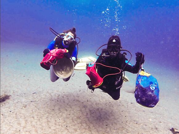

The marine debris project aims to provide expertise and accurate data on the type and levels of marine plastic pollution to local government By assessing the local situation, we can provide policy recommendations and easy to implement actions to reduce marine plastic pollution.
Data is also shared to global data sets using AWARE's Dive Against Debris surveys. By conducting regular and standardised dive against debris, beach and community clean ups we are engaging the local community while contributing to our in-house and global data sets.
28 indo Ocean Project
METHODOLOGY
We are conducting beach front, community, and at depth marine debris surveys to provide data from a spectrum of clean up hot spots.
Beach surveys are performed on the same 500m beach for one hour. Then the collected debris are separated, weighted and data is recorded Environmental variables are recorded such as weather condition and tidal movements.
Dives against debris are performed regularly. The debris collected are separated, counted and weighed. Additional data is recorded for depth of the debris, dive time, dive site and number of clean up divers This data is submitted to AWARE's Dive Against Debris. We have "adopted" our house reef sites in each location - Crystal Bay (Nusa Penida), Blue Planet House Reef (Bira) and Scuba Republic House Reef (Raja Ampat). We are also on standby for reports of debris reported locally we can send a team to help with with larger removals.
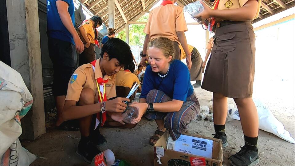
Community clean ups are planned away from the coastal areas and assess the potential for run off marine debris It also engages the local community to take action while contributing to our ongoing data sets. All trash is sorted, weighed and inputted into our logs.

Conservation management plan 2023 29
WATER QUALITY
INTRODUCTION
Covering over 70% of the Earth's surface, our oceans have a two-way relationship with weather and climate. Oceans influence weathers both locally and globally, while climate change has a direct impact on our oceans. When this carefully constructed process changes it has lasting effects on both the marine and terrestrial environments and are disproportionally effecting marginalised groups. For example, ocean temperatures rising can create stronger storms in the tropical regions, these regions of the world are predominantly lower economic countries.
Although oceans help to reduce climate change by storing large amounts of carbon dioxide, too much dissolved carbon is changing the chemistry of seawater and increasing the oceans acidity These changes are effecting certain organisms, such as corals and crustaceans skeletal structures, which in turn effects the sustainability of the ecosystem.
These changes occur over a long period of time, and can take decades if not centuries for the ecosystem to correct this chemical change and restore balance between ocean, climate and weather.

30 indo Ocean Project
OBJECTIVES
By using a standardised ocean water quality testing procedures we are able to track changes in the oceans chemistry variables over time. This contributes to the global tracking of ocean acidification to contribute to climate change research and the effects of land based pollution and run off.
This data is also used in the analysis of our BRUV and survey data as abiotic factors which could effect fish population sizes, coral density, and environmental events such as bleaching.
METHODOLOGY
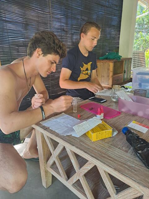
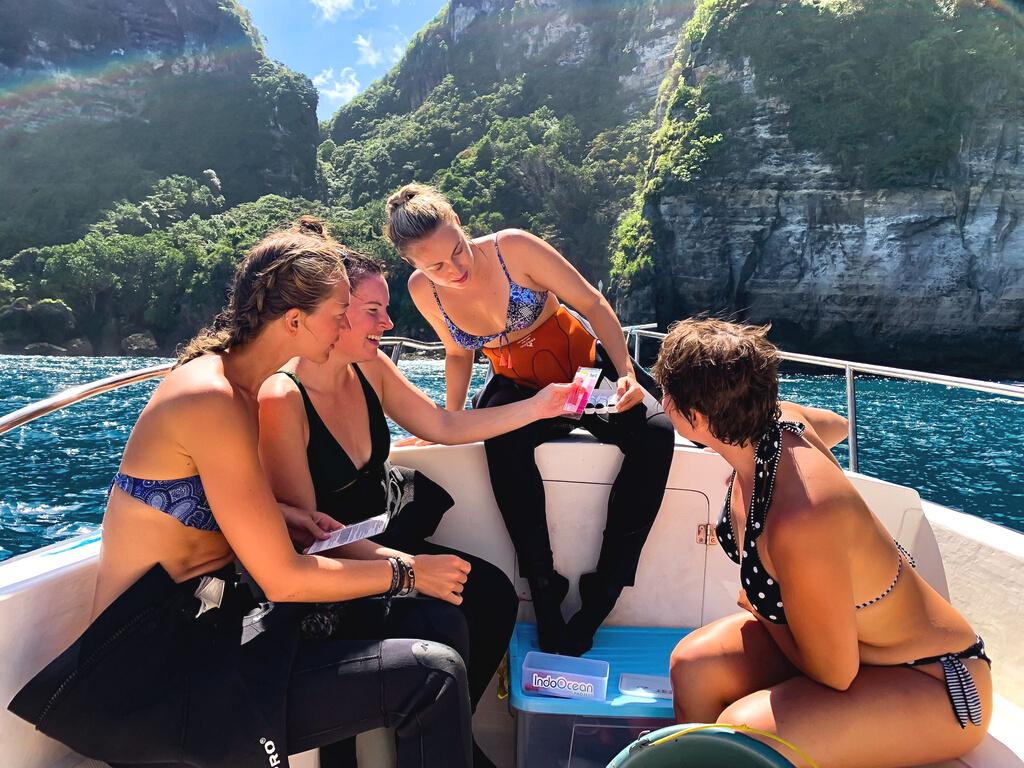
During a survey or BRUV deployment, the research team collect ocean water samples using a covered bottle at depth. The full sample is divided into smaller samples to conduct each test individually by adding the reagent and recording the results.
Different parameters are tested and recorded. O2 test is conducted directly after sampling on the boat using an O2 sensor probe, while Ph, salinity, NO#, PO4, and K tests are conducted using testing kits back at the facility. Temperature and current conditions are recorded at the survey site.
Conservation management plan 2023 31
COMMUNITY OUTREACH
Cultural immersion and engaging the local community Education Strategy
INTRODUCTION OBJECTIVES
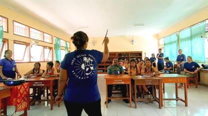
It is known that public involvement is fundamental in the success of any marine conservation strategy The community is an integral part of the effective development or management of a marine protected area, and ensuring its longevity.
METHODOLOGY
We engage with the community in several of our projects including community clean ups, mangrove planting, education programs, presentations, and partnerships with local government officials and institutions We run and contribute community aid when required including clothes and food drives, and disaster relief funds management.
Ensuring the success of any marine protected area requires a combination of science driven decisions and community needs By teaching the community about our research, conducting perception surveys, and employing local staff we can better understand the social requirements when enacting policy locally that will positively impact both the environment the the community.
Through regular outreach programs we create collaborations and alliances with those who's livelihoods depend on a thriving marine ecosystem, engaging politicians and residents in marine conservation dialogue and to take action on issues that threaten their community. To succeed in enacting science driven changes we need the support of the community.
32 indo Ocean Project
EDUCATION PROGRAM
Cultural immersion and ocean curriculum development Education Strategy
INTRODUCTION OBJECTIVES
Children are the future of our oceans and engaging the youth of Indonesia in conservation and marine science can alter the course of their lives and create lifetime ocean advocates.
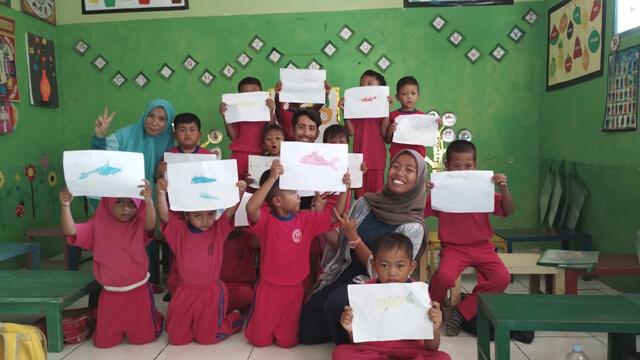
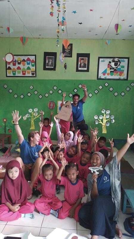
We have been welcomed into schools and villages in our areas of study to assist the students in learning english, staying active, and take part in ocean themed education curriculum developed by Indo Ocean Project
It is an incubator for young conservationists and provides youth of Indonesia with entry level training in marine science and conservation efforts in their region.
Through engagement with the community schools we are providing a foundation for Indonesia's youth to take part in marine science and conservation at an early age. It also provides a cultural immersion experience for both Indo Ocean Project interns and the students, breaking down cultural barriers and developing cross border relationships.
By introducing an ocean themed curriculum we help to foster respect and passion in coastal communities across Indonesia in the hopes that these children will grow up with a more sustainable lifestyle. Creating a space to share knowledge and discuss conservation issues in schools and establishing a local 'think tank' to create local solutions for global problems.
Conservation management plan 2023 33
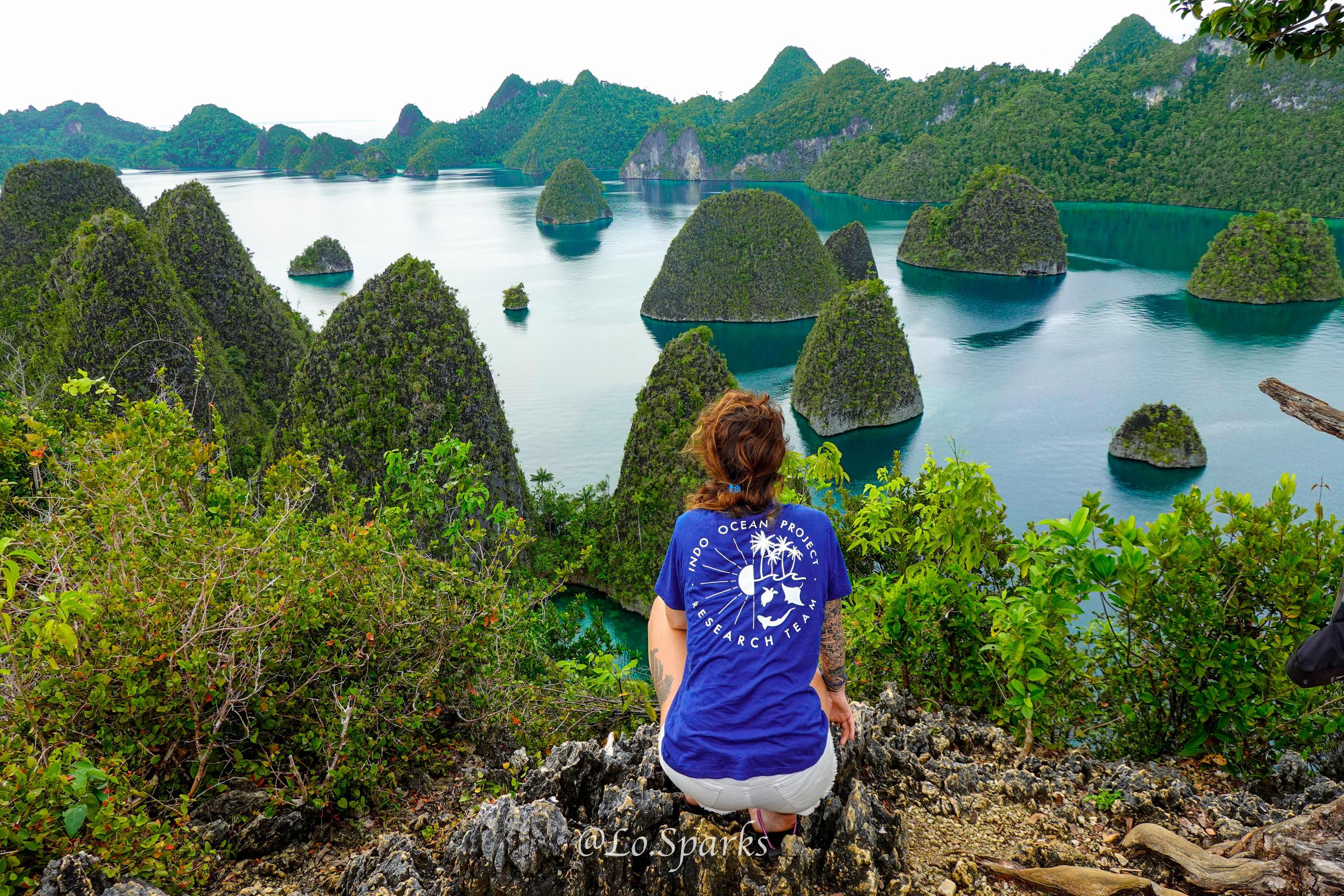
Become a Research Diver and Divemaster at one of our three projects in Indonesia.
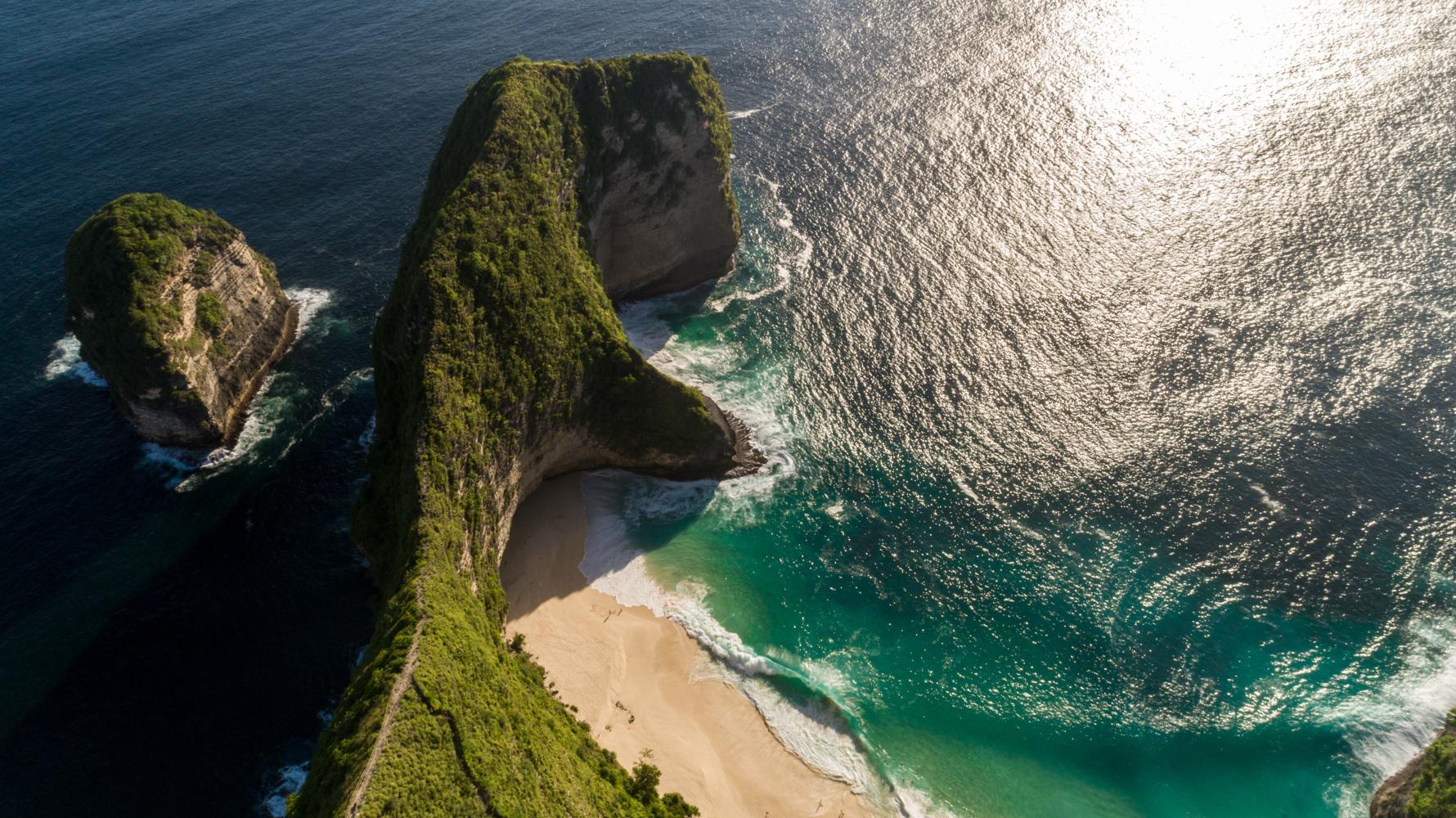
Nusa Penida Bali
Raja Ampat West Papua
Bira Southern Sulawesi
Although the foundation of our training program is the same across our different locations each project has something special!
Locations were chosen based on varying degrees of MPA status, from no marine park in Bira to well established and managed marine park in Raja Ampat.
01 02 03
Penida Project
Nusa Penida, Bali
Reeflex Dive Resort
Opened 2017
Bira Project
Tanjung Bira, Southern Sulawesi
Blue Planet Dive Resort
Opened 2019

Raja Ampat Project
Waigeo, West Papua
Scuba Republic - Basecamp Raja Ampat
Opened 2022
Location: Jln Sakti, Nusa Penida, Klungkung, Bali
Dive Partner: Reeflex Divers
Established July 2017


Number of interns: 12
Number of staff: 4
Key highlights: Manta rays, mola mola (sunfish), currents and corals reef
PROJECT MISSION
The head office and 'hub' of Indo Ocean Project. A space to develop new projects and manage the implementation of updates to our other locations.
To collaborate with local NGO's and government organisations in monitoring the effectiveness of the local MPA and provide data driven solutions and management strategies.
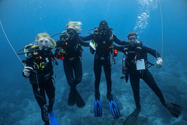
HOW WE ACHIEVE OUR GOALS
Nusa Penida's marine park was first established by the local community in 2010 with the help of the Coral Triangle Centre and recognised as a Mission Blue Hope Spot in 2020 Since its creation the management of the marine park moved from local to provincial government and clear enforcement of its zoning laws has yet to be implemented. The Penida Project assists in providing regular ecological monitoring and strategy reports to the marine park officials and NGO's to track decline and identify areas of risk. Providing science and sociological solutions to update practical zoning solutions. It is also an excellent region to facilitate research, collaboration and publication.
BRUV's and Roving Survey Dives are used in monitoring the existing MPA zones and their efficiency This ongoing projects helps to provide feedback on ecological changes in the MPA, highlighting zones which require policy updates. It also tracks population dynamics and habitat use of the resident elasmobranchs and fisheries targeted species in the region and identify key habitats and endangered species in the region
Penida is home to our oldest coral restoration nurseries with multiple locations around the island and over 20,000 corals planted. Nusa Penida has the highest level of tourism compared to our other locations, and the damage created by both human and environmental impact has left large areas of reef destroyed. Our nursery sites are bridging healthy ecosystems and securing coral rubble areas to provide a foundation for a healthy ecosystem to regrow. It is also the area for our most advanced research in benthic survey and monitoring the effectiveness of our coral nurseries and its impact on the surrounding ecosystems.
Conservation management plan 2023 37
Roving Benthic Surveys are conducted across all Nusa Penida dive sites to track live coral coverage. It is also assisting in monitoring the impact of a high tourism area on sessile creatures and reef growth over time, and identifying high risk areas and reef decline from the bottom up.
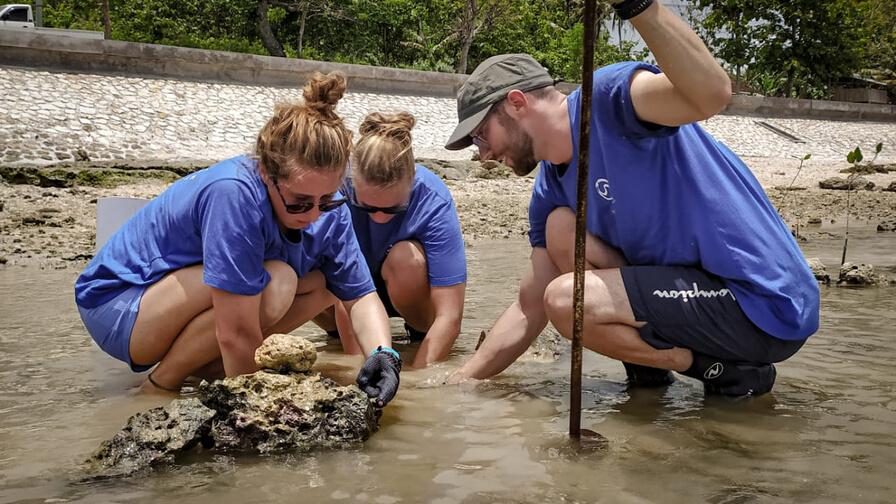
Our Mangrove Restoration program is implemented in partnership with the coastal community of Semaya Together, we are working to reestablish a green belt on the North East coast of Nusa Penida Mangrove nurseries are located at Reeflex Dive Resort with the plan to expand the nursery sites to local stakeholders and schools to further engage the community. We are also conducting optimal growth and success rate studies and compare our strategy with other mangrove NGO's in the region.
Regular marine debris assessments are conducted across three areas, 1) underwater clean ups, 2) beach and coastal clean ups 3) community/in land clean ups. This project has a direct impact on the marine environment and the community of Sakti All debris is sorted, weighted and submitted to global databases.
Indo Ocean Project's internal citizen science project (UNITE Penida) is being rolled out exclusively in Nusa Penida in 2023 The development of an online course and standardised testing engages ocean industry workers in Nusa Penida to take an active role in our research. After completing the online training and in house workshop, marine industry workers are certified to collect and input their data to Indo Ocean Project. This engages the local community and their guests in citizen science while deepening local stakeholders understanding and involvement in our research process. Subsequently, we create a local network of ocean allies when working to enact policy change while contributing more sightings to our abundance data logs. This data is managed and analysed in house by Indo Ocean Project interns under the direction the the the science team
Ocean Water Quality Testing is conducted across all of our regions of study. In Nusa Penida we are tracking ocean acidification in respect to the impact of high levels of human interaction and tourism. Coastal development in Nusa Penida has left areas of the island vulnerable to flooding and high levels of unfiltered run off. Using our testing parameters we are able to track this run off's effect on the ocean chemistry.
Photo Identification project is utilised to correctly identify individual turtle, manta rays, and ocean sunfish sightings in the Nusa Penida MPA. These photos are collected by researchers during all dives and submitted by the community. These photos are added to our internal data base and shared with researchers at Marine Megafauna Foundation to assist in the understanding of megafauna dynamics within the marine park.
38 indo Ocean Project
CHALLENGES
The most pressing challenge facing positive change in Nusa Penida is rapid growth of unsustainable tourism and human impact combined with a lack of proper enforcement and funding. Until an effective strategy is developed by the government officials and agreed to by the local stakeholders we will continue to witness an overall decline to Penida's marine ecosystem Outdated zoning and marine park regulations are also a concern. The zones put in place in 2010 are no longer accurate or effective with the overall use of the park. Using our survey and BRUV data we will be able to provide a science-based solution to recommend to marine park officials.
There is a lack of government funding to conduct regular ecological assessments in Indonesia. Indo Ocean Project funds its own non-biased research to fill this information gap. After a preliminary perception survey conducted by Indo Ocean Project in 2019 where 10 local fishermen were asked questions to determine their level of knowledge on the MPA regulations, 80% agreed that there is great value for fisheries to have an effective marine protected area, however 90% of the individuals surveyed were not aware that Nusa Penida had MPA status. The clear knowledge gap between the regulations and the community is an area we will be focusing on in the coming year Conducting further perception surveys of both local fisherman and tourism operators will be implemented in 2023.
Conservation management plan 2023 39
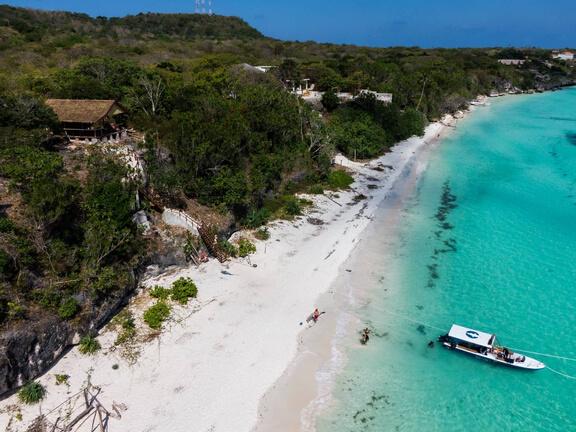
Location: Jl Poros, Tanjung Bira
Bulukumba, South Sulawesi
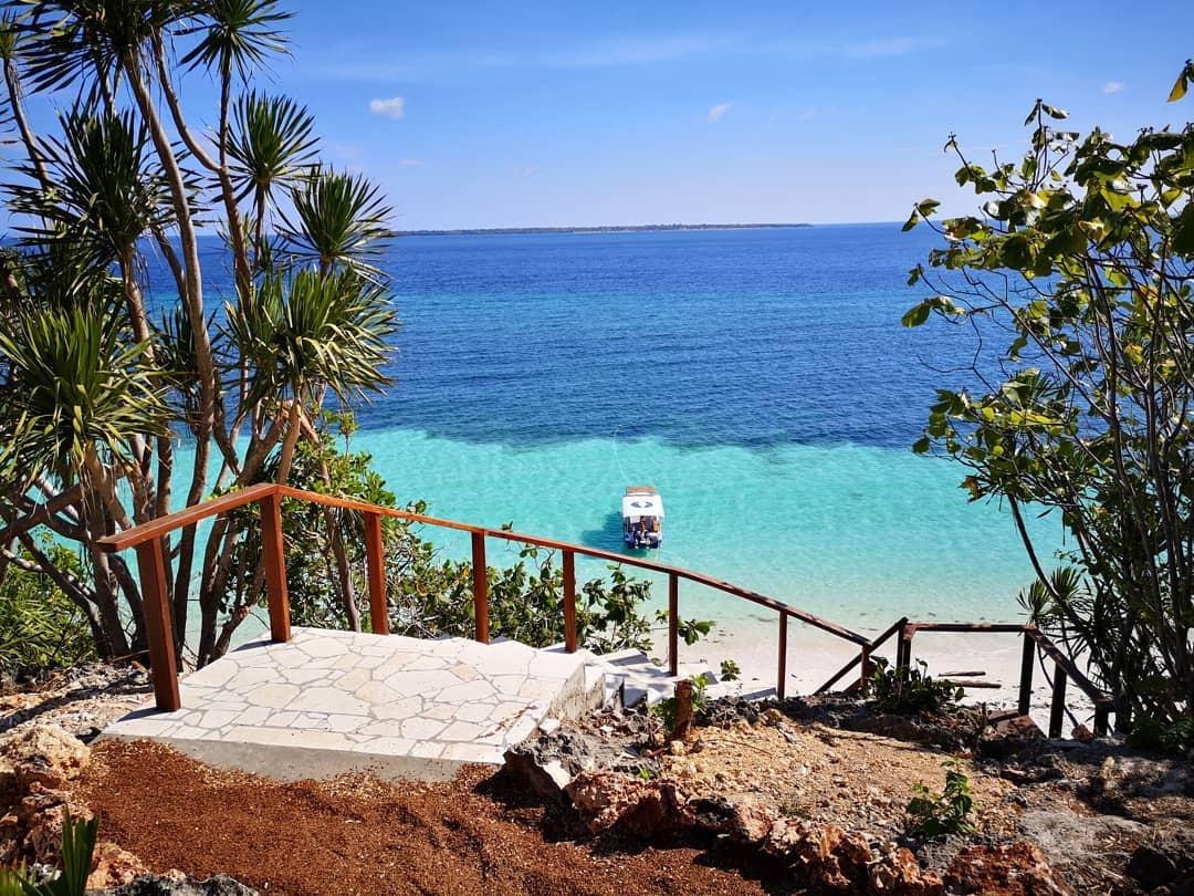
Dive Partner: Blue Planet Dive Resort
Established September 2019

Number of interns: 8-10
Number of staff: 3
Key highlights:
Sharks, marine park establishment, wall dives, large pelagics
PROJECT MISSION
To establish a data-driven marine protected area and shark sanctuary to develop a sustainable shark dive tourism hub in Indonesia.
Monitor and evaluate coral reef and mangrove forest health. Implement restoration where necessary to support local marine ecosystems.
Educate the local community and inspire motivation for marine conservation.
HOW WE ACHIEVE OUR GOALS
Implementation of BRUV and Roving Survey methods can be used to achieve multiple key goals. Data collected allows us to locate key habitat regions through determining abundance and diversity of indicator species, valuable in zoning the future MPA around Kambing Island. Identification of potential areas which would benefit from MPA full protection no-take zones, commercial fishing zones and tourism zones is essential in our voice to establish such a marine mark. These survey methods also allow us to track the population dynamics and habitat use of elasmobranchs in the region, as well as monitoring endangered species present, demonstrating the value of the marine ecosystem in Bira.
Being active within citizen science allows us to include the local community and stakeholders in contributions to the data collection in the region for the future establishment of the MPA. The inclusivity of citizen science allows for direct education and empowerment of the local community, and works in gaining their support and understanding when the MPA is in place. This will cultivate a dedicated community within Bira who will contribute to the sustainability, policing, and operational needs once the MPA is functioning.
Unsustainable and damaging fishing practices have resulted in destruction of coral coverage in the region. Application of the Ocean Gardener coral restoration methods aids the rehabilitation of the fragile reefs and bridges healthy ecosystems. This supports the thriving shark and pelagic mesopredator populations through re-establishing a strong base to the ecosystem, mitigating its susceptibility to bottom-up trophic cascades. Conducting success rate censuses and reef health monitoring allows us to study our coral nurseries and restoration sites, determining their effects on the surrounding ecosystem.
Conservation management plan 2023 41
Conducting Roving Benthic Surveys allows us to track coral coverage of the reefs in the region over time This provides data on the distribution and extent of live coral coverage, an essential indicator in the health of the reef and surrounding ecosystems.
Through our Unite Bira Project we are gathering more abundant and frequent data on the region's rich elasmobranch, turtle and cetacean populations Using this database, we are able to demonstrate the biodiversity in the region, and importance of the area as a habitat for marine megafauna. This engages local stakeholders to empower ownership of the future MPA, inspiring willingness to strive for local policy changes and help police the region going forward.
Monitoring the water quality in the region provides valuable insight as to how the conditions in the area compare to the optimal environment for a healthy reef. We assess the phosphate and nitrate levels in the water, indicating pollution levels due to the regions agricultural run off Tracking the oxygen, calcium, pH and salinity provides a suggestion as to the impact climate change is having in the area. Potassium (K) testing indicates the long term effects of destructive bomb fishing in the region.
Undertaking regular marine debris surveys allows us to actively protect the marine environment through direct beach and underwater clean ups. This also provides us with great opportunities for community engagement and education on the problems surrounding marine debris and plastic pollution. Performing marine debris assessments allows us to determine the source and leading contributors to marine debris in the region and relay the data to global databases.
In collaboration with Luppung Mangrove Foundation and the local Youth Community, our mangrove restoration efforts involve cultivating mangroves from propagule stage in the nursery we have established at our headquarters. Following the development of healthy saplings, we transplant them back to the coastal mangrove forest located 30 minutes from the project headquarters. This contributes the restoration and health of the mangrove forest, ensuring longevity of valuable mangroves within the region, so that marine ecosystems and coastal communities can reap their benefits now and in the future.
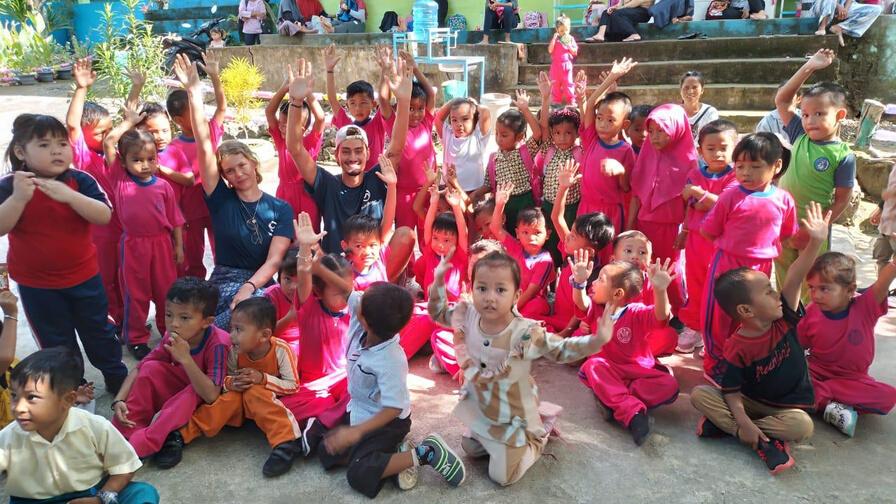
Engagement at the grassroots level is essential for inspiring the next generation's passion for marine conservation. Our education program involves interacting with the youth of the community, creating new marine advocates and ocean guardians. Visiting local schools shares our message with this essential part of the community, who represent the future. This interaction stimulates excitement for protecting the ocean by incorporating the cultural values associated with establishing an MPA that will benefit their needs.
42 indo Ocean Project
CHALLENGES
Challenges are always faced when implementing field research and striving for policy changes in remote locations. Accessing many survey sites, including Kambing island, is only possible via boat, thus limited resources and tidal constraints present as challenges. Additionally, weather conditions such as monsoon season means certain survey sites must be omitted from our data set for 6 weeks from mid December to the end of January. These factors affect the consistency in the data we obtain across our full range of study throughout the year, however the trends we observe are still evident within the data it is possible to collect.
Spreading environmental awareness among isolated communities with little access to conservation education is not an easy feat. We are tasked with engaging the community in a positive way, inspiring motivation for environmental awareness and marine conservation. Finding the right avenue of communication impacts local government and community perception on the uses and value of establishing an MPA. We must clarify that developing a marine park is beneficial and useable by the local community and environmentally sustainable, encompassing fishing zones, tourism zones, and no take zones
Conservation management plan 2023 43
Location: HQ53+68V, Waisai, Waigeo, Raja Ampat, West Papua

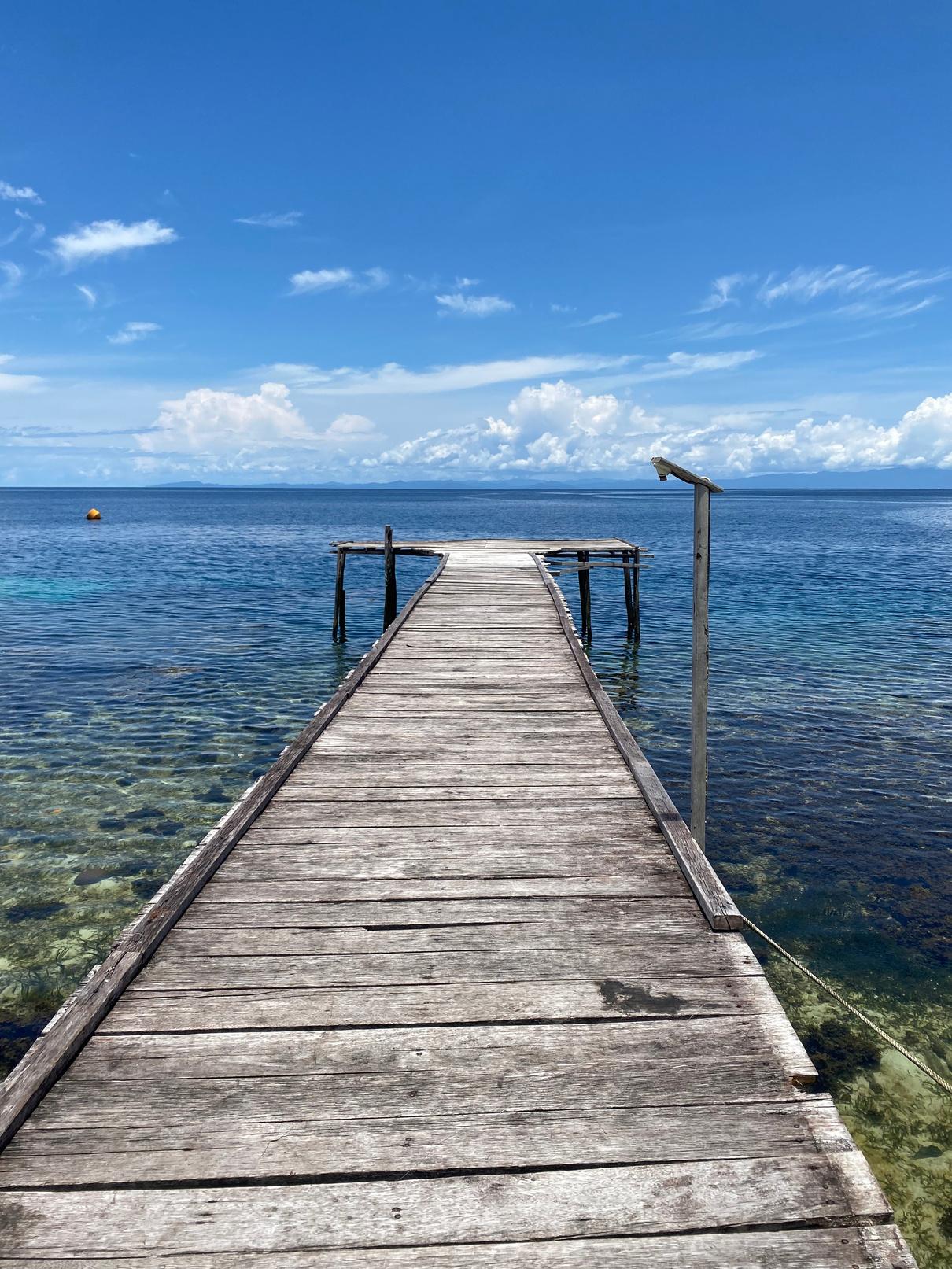
Dive Partner: Scuba Republic
Established November 2022

Number of interns: 10
Number of staff: 4
Key highlights: Thriving reefs, protected marine park, manta rays, sharks, marine mammals
PROJECT MISSION
To contribute to the network of conservation and research efforts within and around the Raja Ampat Marine Protected Area.
To establish Indo Ocean Project and the research we do within the existing scientific community and facilitate international and Indonesian graduate level studies.
Protecting the worlds "Last Paradise" in anticipation for increased tourism activity
Monitoring an established and well-enforced marine park in comparison to our other locations and gathering knowledge to help create successful marine parks in Indonesia.
HOW WE ACHIEVE OUR GOALS
Raja Ampat's MPA is world famous and is a success story for other marine reserves in Asia. Using BRUV and Roving Surveys to contribute to our existing portfolio of ecological monitoring and research we are able to compare three different protection status, from no marine park, non policed marine park, and a well policed marine park. Comparing this data with the Penida Project's will assist in management strategies and zoning formulas in the establishment of the Bira MPA.
West Papua is quickly developing as an eco tourist destination. This influx of tourism operators has effected both the local community and the marine environment. For the success and longevity of our project we will engage both sides of the community.
The tourism operators is an untouched source for citizen science. By utilizing Indo Ocean Project's UNITE program we can engage local stakeholders to expand the region of study and collect more abundance, sighting frequency, and photographic identification of marine megafauna in the outer reaches of this network of 5 marine reserves. This expands our network of ocean advocates to contribute to ongoing research and take responsibility for the oceans. This data is used to compare across different regions of study and shared with other researchers as supportive data in future publications.
Conservation management plan 2023 45
Our adapted Education Program is located in the neighbouring village of Saproken Implementing ocean themed activities and english dialogue within the local schools is a two way learning dynamic. The local children will be exposed to more English and other cultures while the Indo Ocean Project team will learn more about the local culture and customs and how best to fill the knowledge gap when it comes to ocean policy in the future As an archipelago, Papuan culture have deep roots to the ocean and dedication to its preservation, it is our job to find out how best to facilitate and celebrate this mentality.
In partnership with Ocean Gardener, a new coral restoration site has been established at the house reef at Scuba Republic. Several areas have been identified as damaged due to both human and natural stressors. We are in the early planning stages of hosting a Coral Forum in 2024 at the Raja Ampat Project, welcoming coral experts and sharing coral gardening ideas and practices in the world's Coral Diversity Hotspot
Marine Debris Surveys will be conducted underwater and along the coast to contribute to AWARE's Dive Against Debris database. This will engage the local community at Saproken and is part of our direct conservation efforts Assessments will help to determine the source and leading contributors to marine plastic over time.
Raja Ampat is subject to large amounts of run off and year round rain fall. Water Quality Assessments will be conducted on surveys and BRUV deployments to help track the effects of run off, climate change, and long term effects of bomb fishing to the chemistry of the ocean.
PROJECT DEVELOPMENT GOALS
The Raja Ampat Project launched in November 2022 and the above mentioned projects have been successfully started. 2023 we will be developing 2 additional ongoing research projects.
Roving Benthic Survey have completed its beta testing at the Penida Project and is being introduced to the Raja Ampat Project in March 2023 This project will be conducted once a month and will assist in tracking live coral coverage over time targeting our coral nursery sites and adjacent areas. It will help to monitor our coral restoration sites and compare to other regions as an emblem of conservation success.
In the intertidal zone adjacent to our house reef there is thriving sea grass ecosystem. Sea Grass Bed Assessments will help to track the health of the beds over time, it is a critical ecosystem which acts as a nursery group for reef fish and corals and a home to intertidal invertebrates. This project will be developed at the Raja Ampat project later in 2023 and rolled out as an ongoing ecological assessment and foundation for future independent research topics.
46 indo Ocean Project
CHALLENGES
The most obvious challenge facing the longevity and success of this project is its extreme remote conditions and accessibility. Raja Ampat is known as the "Last Paradise" and travelling to and from can be difficult, it is also much more costly to bring out equipment and perform basic maintenance. We have lovingly dubbed the work here "jungle science" as it takes extra creativity to conduct standardised research in these conditions. These adaptations to our projects may create unforeseen variables.

Working within the Papuan culture is an exciting challenge, and a rewarding one. This culture has a rich history and it will be a sociological challenge to best conduct our research and conservation activities that will benefit the community and solve their needs while preserving the ocean diversity. It will be a new challenge for us to navigate the political scene in West Papua for the betterment of the ecosystem.
The area of study covers 4.6 million hectors of ocean and includes 1411 small islands, cayes and shoals. It will not be possible to conduct our research across the entire area with our current resources. Raja Ampat is a highly desirable place for marine and terrestrial biologists. Its biodiversity attracts the world's leading scientists and dozens of projects are being carried out yearly It is our aim to avoid parachute science, collaborate with local and foreign researchers and build on existing work to create authentic and worthwhile research topics.
Conservation management plan 2023 47
REFERENCES
Burke, L., Reytar, K., Spalding, M., & Perry, A. (2012). Reefs at risk revisited in the Coral Triangle.
Jaiteh, V. F., Hordyk, A. R., Braccini, M., Warren, C., & Loneragan, N. R. (2017). Shark finning in eastern Indonesia: assessing the sustainability of a data-poor fishery ICES Journal of Marine Science, 74(1), 242253.
Kementerian Kelautan dan Perikanan (Ed.). (2020). Management of Marine Protected Areas in Indonesia: Status and Challenges (pp. 1–342). Kementerian Kelautan dan Perikanan and Yayasan WWF Indonesia. Jakarta, Indonesia.
Neumann, B , Vafeidis, A T , Zimmermann, J , & Nicholls, R J (2015) Future coastal population growth and exposure to sea-level rise and coastal flooding-a global assessment. PloS one, 10(3), e0118571.
Yeung, Y.-M. (2001). Coastal mega-cities in Asia: transformation, sustainability and management. Ocean & Coastal Management, 44, 319–333
Arifanti, V. B. (2020). Mangrove management and climate change: a review in Indonesia. In IOP conference series: earth and environmental science (Vol. 487, No. 1, p. 012022). IOP Publishing.
Bellwood, D. R., Hughes, T. P., Folke, C., & Nyström, M. (2004). Confronting the coral reef crisis. Nature, 429(6994), 827-833.
DG of Watershed Management and Protected Forest, Ministry of Environment and Forestry. 2019. Rehabilitasi Mangrove dalam Rangka Pengelolaan Ekosistem Lestari. Workshop
Pengelolaan Mangrove Berkelanjutan Dengan Pendekatan Berbasis Ekosistem :Potret Upaya Konservasi Dan Rehabilitasi Di Indonesia. Purwokerto, 19 Agustus 2019.
FAO. (2007). The world’s mangroves 1980-2005. FAO Forestry Paper (Vol. 153).
Giri, C., Ochieng, E., Tieszen, L. L., Zhu, Z., Singh, A., Loveland, T., ... & Duke, N. (2011). Status and distribution of mangrove forests of the world using earth observation satellite data. Global Ecology and Biogeography, 20(1), 154-159
48 indo Ocean Project
REFERENCES
Giri, C., Ochieng, E., Tieszen, L. L., Zhu, Z., Singh, A., Loveland, T., ... & Duke, N. (2011). Status and distribution of mangrove forests of the world using earth observation satellite data. Global Ecology and Biogeography, 20(1), 154-159.
Jambeck, J.R., Geyer, R., Wilcox, C., Siegler, T.R., Perryman, M., Andrady, A., Narayan, R., Law, K.L., 2015. Plastic waste inputs from land into the ocean. Science 347 (6223), 768–771.
Lembaga Ilmu Pengetahuan Indonesia (2020). The Status of Indonesian Coral Reef 2019. Research Center of Oceanography: Jakarta
Muawanah, U , Pomeroy, R S , & Marlessy, C (2012) Revisiting fish wars: conflict and collaboration over fisheries in Indonesia. Coastal Management, 40(3), 279-288.
Nurdin, N., & Grydehøj, A. (2014). Informal governance through patron–client relationships and destructive fishing in Spermonde Archipelago, Indonesia. Journal of Marine and Island Cultures, 3(2), 5459.
Prasetyo, A.P., McDevitt, A.D., Murray, J.M., Barry, J., Agung, F., Muttaqin, E. and Mariani, S., 2021. Shark and ray trade in and out of Indonesia: Addressing knowledge gaps on the path to sustainability. Marine Policy, 133, p.104714.
Purba, N P , Handyman, D I , Pribadi, T D , Syakti, A D , Pranowo, W S , Harvey, A , & Ihsan, Y N (2019) Marine debris in Indonesia: A review of research and status. Marine pollution bulletin, 146, 134-144.
Tito, C. K., & Ampou, E. E. (2020). Coral reefs ecosystem degradation at Nusa Penida, Bali. In IOP Conference Series: Earth and Environmental Science (Vol. 429, No. 1, p. 012053). IOP Publishing.
Spalding, M. D & Leal, M, 2021 The State of the World’s Mangroves 2021. Global Mangrove Alliance.
Conservation management plan 2023 49
ACKNLOWEDGEMENTS
This document was authored by Lauren Sparks (Founding Director), Pascal Sebastian (Chief Scientific Director and Lead Marine Biologist) and Serena Stean (Program Director) of Indo Ocean Project and Our Ocean Group.
Special thanks to:
ZuBlu, our trusted dive travel partner and conservation supporter for their use of graphics.
To our dive partners:
Reeflex Divers (Nusa Penida)
Blue Planet Dive Resort (Bira)
Scuba Republic (Raja Ampat)
Living Colours (Bunaken)
And of course, thanks to our community of interns and ocean warriors from around the world who have continued their support of our program over the last 5 years. We couldn't do it without their dedication to marine science and conservation. Their contribution is invaluable.
All photos used in this manual are property of Indo Ocean Project or given permission to use from staff and interns. All images were taken on site at our locations since 2017.
Conservation Management Plan 2023
Copyright © 2023 Indo Ocean Project
All Intellectual Property rights reserved
This manual is not endorsed or sponsored by any third-party sites. It is designed as a reference for Indo Ocean Project community of ocean professionals to better understand the development and strategies behind Indo Ocean Project's conservation and research efforts.
It is not meant to be used as a guide for conservation or research projects in other areas as there are different logistical and legal concerns outside our regions of study which may alter the effectiveness of our ecological monitoring strategy.
50 indo Ocean Project


