1 minute read
UNIT 1: Map skills

LEARNING AIMS
After you have completed this unit, you must be able to do the following: • Use grid references to locate places on a street map. • Use a street map and compass directions to describe a specific route. • Sketch a map of a local area. • Use and define scale, differentiate between linear and statement scale, compare different types of scales and use those scales to calculate distance. • Know the main lines of latitude and longitude and use them to locate where events happened on a world map. • Stay abreast of current affairs and analyse certain events to ascertain certain information about those events, such as where, when, why and how an event occurred and what the effects of the event in question were.
INTRODUCTION
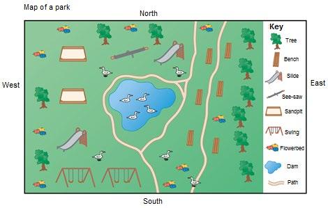
The focus of this unit is to develop your ability to read and work with maps. You will investigate different types of maps including physical, political, sketch and road maps. You will also learn of the different elements of each of these maps and how to apply this knowledge in a practical sense. This unit will also teach you how to use different geographical skills and elements which will help you apply your knowledge, including a compass, linear and statement scale, grid references and lines of latitude and longitude.
The following definitions will help you to better understand the maps discussed in lesson 1. Ensure that you now the definitions before starting with lesson 1.
DEFINE
Map A picture or representation of the earth's surface, showing how things are related to each other by distance, direction, and size.
Maps can also be defined by type, e.g., political, physical, topographic, climate, economic or resource, or road and street maps.
Altitude The height of a place above sea level, usually measured in meters.
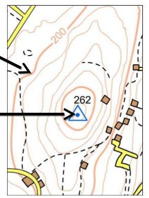
Contour lines Lines used on a map, placed at intervals to indicate altitude and slope.
Precipitation Rain, snow, sleet, or hail that falls to or condenses on the ground.
Diagram A sketch or picture used to explain something.

The top of the peak is 840 m above sea level.

Contour lines
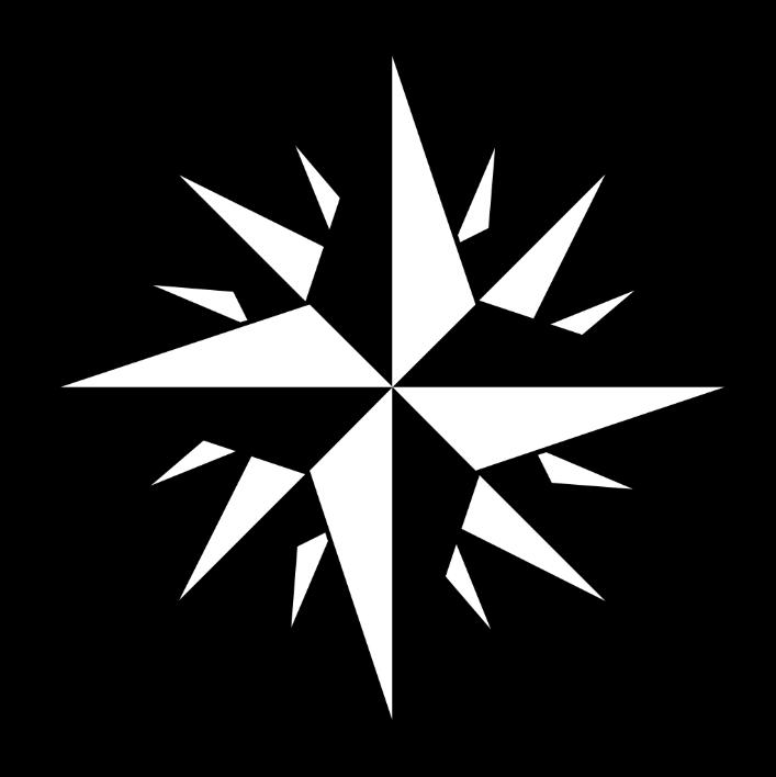
Cardinal The main directions (N, E, S, W).