3 minute read
Activity 3


ACTIVITY 3
Use the map on the previous page to answer the following questions.
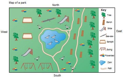
1. Give the grid references of the following. Make sure you name ALL the blocks in which the object appears. (5) 1.1 The tractor 1.2 The cow 1.3 The horse 1.4 The pig 1.5 The bridge
2. What will you find at the following spots on the map? 2.1 K13 2.2 E10 2.3 B6 2.4 F5 2.5 G2 (5)
[10]
Reference books and guides generally have an index at the back, which sorts the contents alphabetically. This makes it far easier to find specific information. Map books are no different. There is an index of road names and important buildings which gives the grid reference and page number of each name.
On the other hand, a contents page, or table of contents, is in front of the books, and provides the content in which it appears in the book, usually with page numbers.
1.4 How to find places and explain routes using a street map
The following definitions will help you to find places and explain routes using a street map.
DEFINE
Departure point The starting point of a journey.
Destination The place where someone or something will end up.
Profusely When something is occurs or appears in large amounts, e.g., trees or rivers.
Superficial Something which is not serious, it can also be shallow or near the surface of something.
Spot height Exact spot on a map indicating the height of a mountain or hill.
Use the following steps to describe a route using a street map: 1. Find both the departure and destination points on the map. 2. Scan the map for the quickest route between the departure and destination points. 3. Use words to describe this route, such as ‘turn left’, ‘go straight’ or ‘cross over’. 4. Mention any important landmarks or physical elements such as buildings, parks, trees, shopping centres or other relevant information.
Study the following example:
Mandy wants to take her dog for a walk in the park, and she asks Lucy to come with her. Lucy doesn’t know where the park is, so Mandy must give her directions.
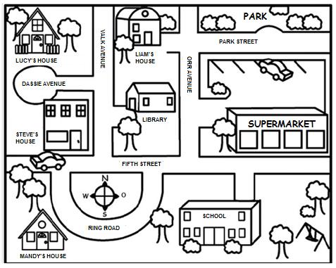
Directions
Departure point: Lucy’s house
1. In Dassie Avenue, move east until you reach the T-junction. 2. Turn right in Valk Avenue. Carry on straight. 3. The library will be on your left; carry on until you reach the T-junction. 4. Turn left in Fifth Street, then immediately left again in Orr Avenue. 5. Go past the supermarket on your right until you reach Park Street. 6. Turn right in Park Street. The park will be on your left.
Destination: Park
Example of what the route would look like:
Here is another example:
Use map A of Kimberley on the following page and the legend provided to give your friend directions. He wants to drive from the City Clinic in G2, where he visited his sick grandmother, to the McHardy Memorial Fountain in C3.
TIP
Try to determine the route yourself before looking at the directions.
Directions
Departure point: City Clinic 1. When you leave the hospital, turn north into Holland Road. 2. At the T-junction, turn east into Lennox Street. 3. Continue straight along this road until you reach the cross roads of Quinn Road and Lennox Street, you will see the Rhodes Statue in front of you. 4. Turn north into Quinn Street and continue straight until you cross over Old De Beers Road. 5. Take the first right, east into Florence Street, which is a one way. 6. Continue to the end of the street and the D. McHardy Memorial Fountain will be on your left-hand side.
Destination: D. McHardy Memorial Fountain