

ydro V isions
HISSN 2837-5696
HYDROVISIONS is the official publication of the Groundwater Resources Association of California (GRA). GRA’s mailing address is 808 R Street. Suite 209, Sacramento, CA 95811. Any questions or comments concerning this publication should be directed to the newsletter editor at hydrovisions@grac.org
The Groundwater Resources Association of California is dedicated to resource management that protects and improves groundwater supply and quality through education and technical leadership.
EDITOR
Rodney Fricke hydrovisions@grac.org
EDITORIAL LAYOUT
Smith Moore & Associates
EXECUTIVE OFFICERS
PRESIDENT
Christy Kennedy
Woodard & Curran
Tel: 925-627-4122
VICE PRESIDENT
Erik Cadaret
Yolo County Flood Control & Water Conservation District
Tel: 530-756-5905
SECRETARY
Abhishek Singh
INTERA
Tel: 217-721-0301
TREASURER
Rodney Fricke
GEI Consultants
Tel: 916-407-8539
DIVERSITY, EQUITY AND INCLUSION OFFICER
Annalisa Kihara
State Water Resources Control Board
IMMEDIATE PAST PRESIDENT
R.T. Van Valer
ADMINISTRATIVE DIRECTOR
Amanda Rae Smith
Groundwater Resources Association of California asmith@grac.org
To contact any GRA Officer or Director by email, go to www.grac.org/board-of-directors
DIRECTORS
Jena Acos
Brownstein Hyatt Farber Schreck
Tel: 805-882-1427
Christopher Baker
DWR
Tel: 562-331-4507
Matthew Becker
California State Univ. Long Beach Tel: 562-985-8983
Trelawney Bullis
AC Foods, Central Valley
Tel: 530-205-8387
Dave Ceppos
Public Policy Mediation and Facilitaion
Tel: 916-539-0350
Elie Haddad
Haley & Aldrich Tel: 408-529-9048
Dr. Hiroko Hort
GSI Environmental, Inc
Marina Deligiannis Stantec
Tel: 916-418-8242
Clayton Sorensen
West Yost Associates
Tel: 925.949.5817
Melissa Turner
MLJ Environmental Tel: 530-756-5200
Savannah Tjaden
Environmental Science Associates
Tel: 208-350-3566
Roohi Toosi
APEX Environmental & Water Resources
Tel: 949-491-3049
John Xiong
Haley & Aldrich, Inc.
Tel: 714-371-1800
The statements and opinions expressed in GRA’s HydroVisions and other publications are those of the authors and/or contributors, and are not necessarily those of the GRA, its Board of Directors, or its members. Further, GRA makes no claims, promises, or guarantees about the absolute accuracy, completeness, or adequacy of the contents of this publication and expressly disclaims liability for errors and omissions in the contents. No warranty of any kind, implied or expressed, or statutory, is given with respect to the contents of this publication or its references to other resources. Reference in this publication to any specific commercial products, processes, or services, or the use of any trade, firm, or corporation name is for the information and convenience of the public, and does not constitute endorsement, recommendation, or favoring by the GRA, its Board of Directors, or its members.
President’s MessaGe
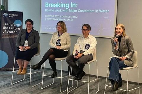
Spring has sprung and Climate Week has blossomed! I recently sat on a panel for the ImagineH2O Water Innovation Summit in San Francisco during Climate Week. Let me tell you—it was like watching worlds collide in the best possible way! This gathering of water industry disruptors, investors, and experts highlighted a significant shift: groundwater management is getting the attention of tech innovators, and it’s creating unprecedented opportunities for our industry.
Breaking Out of the Confined
Zone
Historically, the groundwater industry has operated as something of a closed ecosystem. Our specialized knowledge, regulatory frameworks, and established relationships with public agencies created a high barrier to entry for outsiders. It can feel like an echo chamber at times, but the landscape is changing rapidly. At the Sustainable Water Investment Summit in February, I heard from a couple large water funds also eyeing innovation in the groundwater space. At the Summit, I witnessed several promising startups in the 2025 Accelerator cohort targeting groundwater challenges. Companies are developing technologies to help Groundwater Sustainability Agencies (GSAs) achieve compliance and address the critical need for groundwater recharge opportunities.
Why the Sudden Interest in Our Subsurface Sandbox?
You might be wondering why tech folks are suddenly interested in what’s happening beneath our feet. Well, turns out when half your state is sinking due to overdraft and water becomes more precious than Selling Sunset real estate, people start paying attention! The reality is that groundwater has been the reliable but quiet, awkward, bookish cousin in the water family that flies under the radar. Surface water gets all the glamour shots with its sparkling reservoirs and dramatic wild and scenic stretches. But now, with GSAs scrambling for compliance solutions and recharge becoming the hottest water management strategy since drip irrigation, groundwater is having its moment in the spotlight.
So how do we - the guardians of all things groundwater - adapt to this brave new world? First, we need to admit that we could use some fresh ideas. Sure, we’ve gotten pretty good at drilling holes and mapping plumes, but there might just be some new ways of thinking that could help us visualize that cone of depression in ways that would make our hydrogeology professors weep with joy. Here’s my advice for embracing our inner innovators:
1. Get out of the monitoring well: Attend tech events like Imagine H2O showcases. Yes, there will be kombucha on tap and possibly bean bag chairs, but I promise the networking is worth it.
2. Speak human: When a startup founder asks what you do, resist the urge to launch into a 20-minute dissertation on specific yield. Try “I help make sure we have water underground for the future” instead.
3. Share your headaches: Those data management nightmares keeping you up at night? The startup world lives for those problems.
4. Be a testing ground: Offer your projects as pilot opportunities. Better to test new approaches in controlled environments than wait until they’re mandated by regulators who’ve never seen a slug test.
The Future Is Bright
The truth is, we need these partnerships now more than ever. Between climate change throwing historical hydrology out the window and regulations that require more monitoring than a helicopter parent, the old ways just won’t cut it anymore. Let’s not just welcome but seek out our tech friends and see what we can cook up together. With our practical knowledge and their innovation muscle, we might just solve some of groundwater’s most challenging problems.
Sincerely,

Christy Kennedy President, Groundwater Resources Association

Groundwater Modeling
Managed Aquifer Recharge
Hydrogeologic Investigations
Subsidence Evaluation and Mitigation
Seawater Intrusion Analysis
Municipal Well Design
Regulatory Compliance
Water Accounting Frameworks


HydroVisions
basin cHaracterization in california –
How dwr is suPPortinG tHe state to iMProVe our understandinG of Groundwater
by
Katherine Dlubac1, Steven Springhorn1, Ben Brezing1, Craig Altare1, Mesut Cayar2, and Saquib Najmus2
This article is the first in a series of four HydroVisons articles that provides an overview of DWR’s Basin Characterization Program, a newly launched program that will support local and regional efforts to improve the understanding of our aquifer systems in California.
This first article provides an introduction to DWR’s Basin Characterization Program and connects the reader to more detailed information online. Subsequent articles include:
• DWR’s Basin Characterization ProgramData Collection and Access (Summer 2025)
• DWR’s Basin Characterization ProgramAnalysis Tools and Process Documents (Fall 2025)
• DWR’s Basin Characterization ProgramLocal and Regional Investigations (Winter 2025)
DWR’s Basin Characterization Program Overview
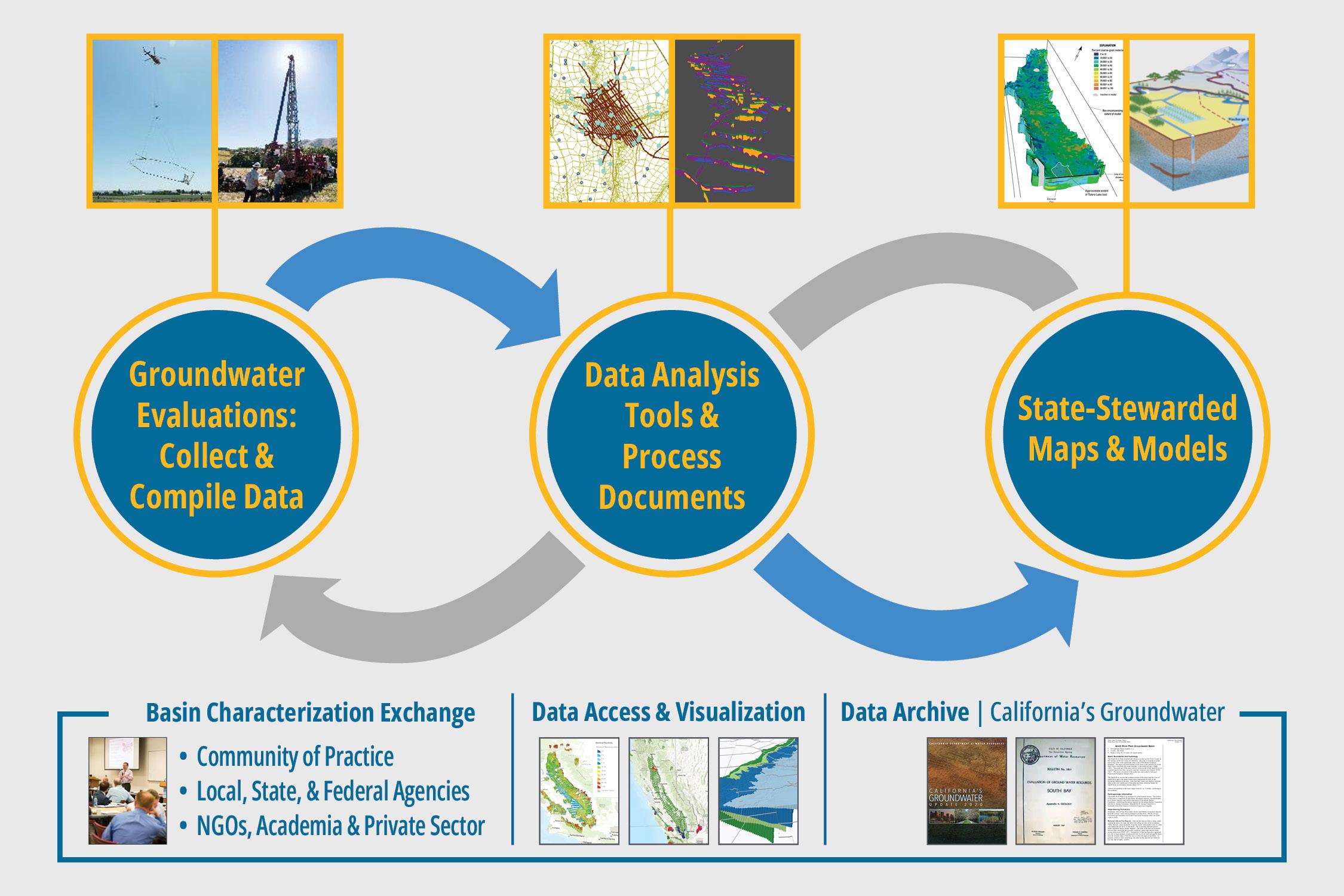
The DWR has a long history of characterizing California’s groundwater basins as a part of California’s Groundwater (Bulletin 118). DWR’s Groundwater Basin Characterization Program (Figure 1) builds off of DWR’s historical role in characterizing groundwater basins and provides the latest data and information about California’s groundwater basins to help local communities better understand and manage their aquifer systems. The objective of the Basin Characterization Program is to support implementation of the Sustainable Groundwater Management Act (SGMA) and a broad range of local and state groundwater actions. These include initiatives
outlined in the Governor’s Water Supply Strategy, the Water Resilience Portfolio, the California Water Plan, and flood and drought response plans. The Program also aims to increase local, state, and federal coordination on various groundwater-related projects, such as groundwater recharge, modeling, watershed studies, water conveyance, and habitat rehabilitation - through proactive communication. Under the Program, DWR will conduct a series of statewide, regional, and local groundwater evaluations to improve the understanding of groundwater aquifer systems and create maps and models in various parts of the state. DWR completed the Statewide Airborne Electromagnetic (AEM) Survey Project that provided an advanced geophysical dataset across the state’s priority basins to improve the understanding of large-scale aquifer structure and characteristics. At the local and regional scale, investigations may include the collection and digitization of new and existing data (AEM, lithology logs, geophysical logs, aquifer tests, well construction information, etc.), which will be integrated and analyzed together to create state-stewarded maps and models. These maps and models will describe the distribution of aquifer materials, aquifer structure and important aquifer units, and recharge pathways and will be updated and maintained by DWR. New tools and guidance will be created to integrate and analyze a wide range of data, including geologic, geophysical, and hydrogeologic information.
To support data access and data equity, all Program datasets, tools, and maps and models will be published on the California Natural Resources Agency Open Data Portal.
isions

State-Stewarded Maps and Models
Additionally, the Program will continue to develop new online, GIS-based, visualization tools to serve as a central hub for accessing and exploring groundwater related data in California. These visualization tools will enable both the public and technical users to interact with the data in a three-dimensional space, providing a more immersive and informative experience.
Maps and models that describe the physical properties and hydrogeologic conceptual models of California’s aquifers are a critical part of managing our aquifer systems in the most effective manner. They help groundwater managers understand how groundwater is stored and moves within the aquifer. Several of these maps and models were initially developed in the 1970s or more recently, but they do not
article continues on next page
Figure 1: DWR’s Basin Characterization Program – Overview
data to update or develop these maps and models. The maps and models will be state-stewarded, meaning that they will be regularly updated as new data becomes available, ensuring that groundwater management activities are informed by the most up-to-date information. A list of the maps and models that will be developed and stewarded under the Basin Characterization Program is provided below:
• Groundwater Basin Hydrostratigraphic Models
• Texture Models
• Basin Storage Capacity Models
• Base of Freshwater Maps
• Bottom of Basin Maps
• Aquifer Recharge Potential Maps
The development of these maps and models will initially focus on the Central Valley before expanding to other areas of the state. The first iterations will be published as they are developed, with completion expected between 2025 and 2027.
Data Collection & Digitization
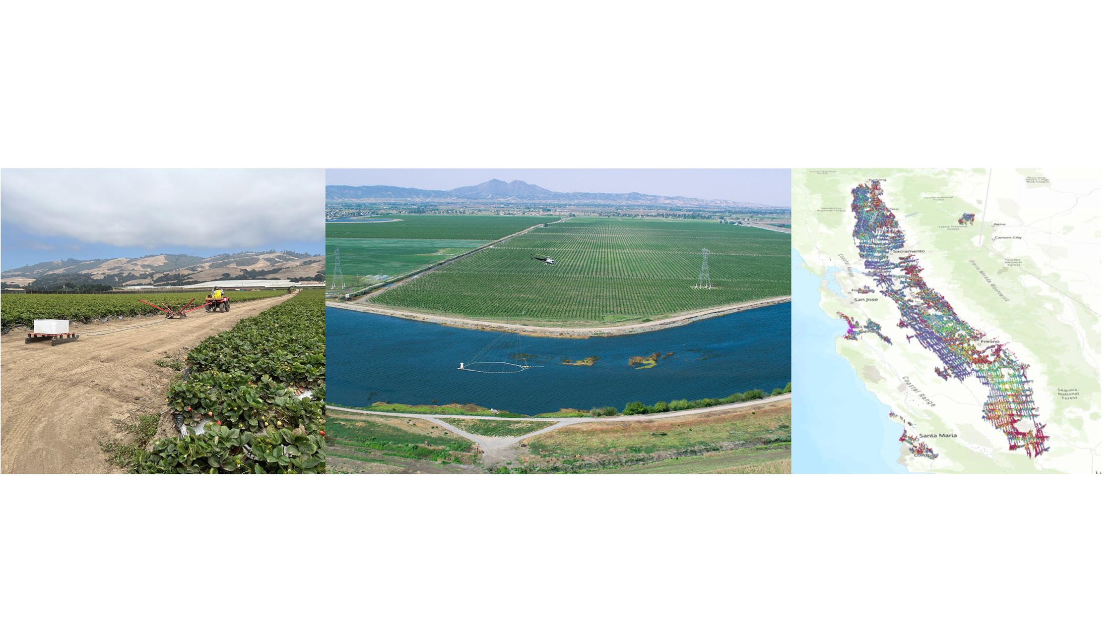
As a part of the Basin Characterization Program, DWR has expanded their historical data collection efforts to include the collection or digitization of advanced geologic, hydrogeologic, and geophysical data (Figure 2). The Program’s most notable data collection and digitization effort to date has been the Statewide Airborne Electromagnetic (AEM) Surveys.
Statewide AEM Surveys
In 2021, DWR’s Basin Characterization data collection effort kicked off the collection of advanced geophysical data through the launching of the Statewide AEM Survey Project. The goal of the Project was to improve the understanding of large-scale aquifer structures across the state’s groundwater basins to support the implementation of SGMA.
The Project data collection effort was completed in 2023 and resulted in the collection of 16,000 miles of AEM data across 95 groundwater basins. To support data accessibility, all Project data are published and DWR developed data visualization tools to allow the public to view the data online.
implementation initiatives and fill data gaps. The groundwater investigations will include the collection of additional data based on review of the reconnaissance AEM data and local SGMA implementation initiatives, like groundwater recharge, surface water groundwater interaction, subsidence, vulnerable domestic wells, disadvantaged communities, seawater intrusion, base of fresh water, etc. Additional data collection methods may include infill AEM, surface-based geophysics (i.e. towed EM methods [tTEM] or surface water EM methods [floaTEM]), advanced geophysical logging (i.e. nuclear magnetic resonance (NMR) logging or e-logging), installing new wells or reactivating existing wells, etc.
By conducting these groundwater basin investigations, the Program aims to develop guidance documents that help local communities evaluate groundwater resources to answer their groundwater-related questions efficiently and effectively.
Data Digitization
The Program will continue and expand upon efforts to digitize existing lithology and geophysical logging data. All data to be digitized will go through a thorough quality control process to determine (1) location accuracy and (2) description quality. All digitized lithology and geophysical logging data will be made publicly available and will be imported back into the original database (e.g. the Online System for Well Completion Reports).
Analysis Tools and Process Documents
To support the development of the state-stewarded maps and models, new tools will be created to integrate and analyze a wide range of data, including geologic, geophysical, and hydrogeologic information. By combining and assessing various datasets, these tools will help create a more complete picture of California’s groundwater basins. All tools, along with guidance documents, will be made publicly available for local groundwater managers to use to support the development of maps and models at a local scale. The tools are expected to become publicly available by early 2025 and will be made available through the CNRA Basin Characterization, Data Analysis Tools and Process Documents landing page.
Figure 2: DWR’s Basin Characterization Program broadens historic data collection efforts to include advanced hydrogeologic, geologic, and geophysical datasets
Æ
Æ
Æ
Æ
Basin Characterization Exchange
The Basin Characterization Program launched the Basin Characterization Exchange (BCX) in early 2025 as a public meeting series and network platform for the basin characterization community to exchange ideas, share lessons learned, define needed guidance, and highlight research topics. The BCX also plays a pivotal role in advancing the activities and goals of the Basin Characterization Program. BCX meetings will include regular program updates, and participants will have early opportunities to test data analysis tools and submit comments on draft documents. The BCX is open to local, state, and federal agencies, consultants, NGOs, academia, and interested parties who participate in basin characterization efforts. Interested parties can email their contact information to Basin.Characterization@water.
ca.gov to attend BCX meetings and join the BCX listserv. Summary
The passage of SGMA has created a growing need to enhance the understanding and characterization of California’s groundwater basins. DWR’s Basin Characterization Program is designed to equip local GSAs with essential datasets, tools, and analyses to support informed groundwater management and prevent undesirable outcomes. Additionally, the program will develop and maintain state-managed maps and models, helping local communities gain deeper insights into their aquifer systems while supporting both local and statewide groundwater management efforts.
2
1 California Department of Water Resources (DWR)
Woodard & Curran

HydroVisions
ProtectinG your Groundwater riGHts
wHile reducinG PuMPinG, Part 1
by Roger K. Masuda, Attorney, and M. Josef Polk, Attorney; Griffith, Masuda & Hobbs
Introduction
To Pumpers, especially Farmers: The State, your Groundwater Sustainability Agency (GSA), and others are telling you to reduce your groundwater pumping or else you could lose your groundwater rights. Yet, you are not getting any groundwater right protection for reducing your pumping.
To GSAs: How does a GSA show its pumpers that it is in everyone’s best interests to measure, record, and report their pumping data?
Many groundwater pumpers outside of Southern California might be surprised to learn that since 1977, they could officially report annually any cessation or reduction in their groundwater pumping to the State Water Resources Control Board (“SWRCB”) for groundwater right protection.
As the SWRCB itself states on its website (www.waterboards. ca.gov or www.waterboards.ca.gov/publications_forms/ publications/general/docs/l503) for the “First Statement Cessation Or Reduction In Groundwater Extraction,”
State law provides a means for owners of rights to pump groundwater to protect these rights when they conserve water or substitute water from an alternate nontributary source for water previously appropriated or for pumped groundwater. Before the passage of the statute, many groundwater pumpers in overdrawn and depleted basins were reluctant to reduce their water use or reduce pumping and substitute other water for fear of losing their appropriative right or rights to the groundwater.
[Emphasis added.]
The Evolving Nature of Overlying Groundwater Rights
An overlying groundwater right is the right to pump groundwater from underneath your land for use on the land. The right is based on your ownership of land and is appurtenant (connected) to your land. As between overlying right holders, the rights are correlative (like with riparian surface water right holders), which means that each overlying pumper has a common right to take all that the pumper can reasonably and beneficially use on the pumper’s land if the quantity is sufficient. If the quantity is insufficient (e.g., overdrafted basin or during severe drought), each pumper is limited to the pumper’s proportionate fair share of the total amount available based upon the pumper’s reasonable and beneficial needs.
Historically, an overlying pumper’s proportionate fair share was not based upon the pumper’s past use over a specific period of time or the date when pumping began. Rather, it was based solely on the pumper’s current reasonable and beneficial need for water. Tehachapi-Cummings County Water District v. Armstrong (1975) 49 Cal.App.3d 992, 1001.
However, the law continues to evolve, as demonstrated in the Antelope Valley Groundwater Cases (2021, 63 Cal.App.5th 17),. There, the Court referenced historical use as a significant factor when determining groundwater allocations among overlying pumpers in critically overdrafted basins. The Court recognized equitable apportionment principles to balance existing groundwater demands with basin sustainability. It also noted that although correlative rights among overlying users maintain equal priority, factors such as historical use, present and future beneficial needs, existing reliance interests, and basin sustainability may be considered when determining how to allocate water among competing claimants with
isions

equivalent priorities as a part of a physical solution. The Antelope Valley decision also illustrates that an overlyer whose pumping rights remain dormant (or unexercised) can be subordinated in priority to active, reasonable, beneficial uses by other overlying right holders.
California’s Sustainable Groundwater Management Act (SGMA) (Water Code §§10720, et seq.) effective since 2015, reinforces these developments. SGMA requires GSAs to implement Groundwater Sustainability Plans (GSP) by carrying out measures to reduce pumping and influence allocation decisions based in part on historical groundwater usage.
Protecting Your Groundwater Rights via Statute: Water Code §§ 1005.1, 1005.2, and 1005.4
Water Code §§ 1005.1 and 1005.2 were enacted in 1951 to encourage pumpers within nine named Southern California Counties (San Luis Obispo, Santa Barbara, Ventura, Los Angeles, Orange, San Diego, Imperial, Riverside, and San Bernardino) to take State Water Project water in lieu of pumping groundwater. Water Code § 1005.3 was enacted in 1967 to apply during the pendency of a groundwater adjudication situated within the Tehachapi-Cummings County Water District in Kern County; the same water district involved in the 1975 case cited above.
Water Code § 1005.4, set forth below, became effective in 1977 to apply to all counties in the State other than the nine Southern California counties. The following table summarizes the key elements of §1005.4 versus §§1005.1 and 1005.2.
Key Element
Enacted
Counties covered
Groundwater saved through use of “nontributary source”
Water Year for reporting purposes
Annual Statement filing deadline
Consequence if Annual Statement is not filed
[Note Significant difference for 1005.4 statements.]
Water Code § 1005.4
1976, amended 1977 effective March 21, 1977
All counties other than the 9 Southern California counties
Definition of “nontributary source” same in all 3 sections.
October 1st to September 30th
December 31st
“failure to file such a statement shall in no way affect the right of a user to claim the benefit of this section.”
§§ 1005.1 and 1005.2
1951, effective July 9, 1951
San Luis Obispo, Santa Barbara, Ventura, Los Angeles, Orange, San Diego, Imperial, Riverside, and San Bernardino
Definition of “nontributary source” same in all 3 sections.
November 1st to October 31st
December 31st
“user cannot claim the benefit of this section for any water year for which such statement is not filed.”
article continues on next page
The premise and focus of all three Water Code sections is the “reduction in the extraction of ground water as the result of water from said alternate source having been so applied to reasonable use . . . to permit the replenishment of such ground water,” commonly known as “in-lieu groundwater recharge.” In other words, by reducing pumping by using alternative source water or by conservation, pumpers allow groundwater aquifers to recharge.
Understanding “Nontributary Sources” and Other Key Terms
KEY CONCEPT of All Three Statutes:
You are reducing your pumping and thereby permitting the groundwater to replenish by
(a) substituting a qualifying non-groundwater water supply (a “nontributary source”) and/or
(b) implementing water conservation measure(s) (also defined as a “nontributary source”).
All three sections contain the same definition of “nontributary source,” which is a key definition of the statute, and which can be broken down into four different types when resulting in reduced pumping:
Type 1: “water imported from another watershed, or
Type 2: “water conserved and saved in the watershed by a water conservation plan or
Type 3: “works without which such water of the same watershed would have wasted, or
using “water of the same watershed” resulting from the construction of works that prevent such water from being wasted. An example is the increasing use of recycled water in lieu of pumping groundwater to irrigate crops and golf courses.
Under Type 4, if a water district within a river watershed constructs a river diversion and canals that bring river water to locations within that watershed that the river water would not normally reach, then that canal water when used in substitution of groundwater qualifies as a nontributary source.
Conclusion
Filing your “First Statement Cessation Or Reduction in Groundwater Extraction” with the SWRCB is your first official step to establishing your reductions in groundwater pumping with the State of California. Yes, the information you file is public, but as the SWRCB itself states, this filing is the “means for owners of rights to pump groundwater to protect these rights when they conserve water or substitute water from an alternate nontributary source for pumped groundwater.”
Upcoming in Part 2:
Part 2 in this series will discuss methods of quantifying your extractions, assembling your data, and completing and filing your “First Statement.” To prepare, we recommend that you begin organizing your historical pumping data now. Specifically, compile what data you have for the last prior ten (10) water years (October through September) of pumping per well and the amount by which your pumping was reduced

HydroVisions
offsHore Groundwater –
froM Potential to oPPortunity?
by Todd Jarvis and Abhishek Singh
Seawater intrusion associated with inland pumping, coupled with increases in demand for water supplies for coastal cities, has “blurred the boundaries” between the traditionally “siloed” terrestrial and marine environments. Increasing saltwater intrusion in the West Coastal Basin of Southern California served as the impetus of Common Pool Resources theory and application developed by Elinor Ostroms in her 1964 PhD dissertation from the University of California, Los Angeles. The theory states that humans are capable of self-organizing to sustainably manage scarce, common pool resources such as freshwater that are both privately and publicly owned. The general lack of knowledge of coastal
groundwater (both nearshore and offshore) including freshwater resources, as well as the interaction of discharging terrestrial groundwater with offshore environments, is relatively new territory for the marine studies research enterprise worldwide.
Ground Zero Groundwater
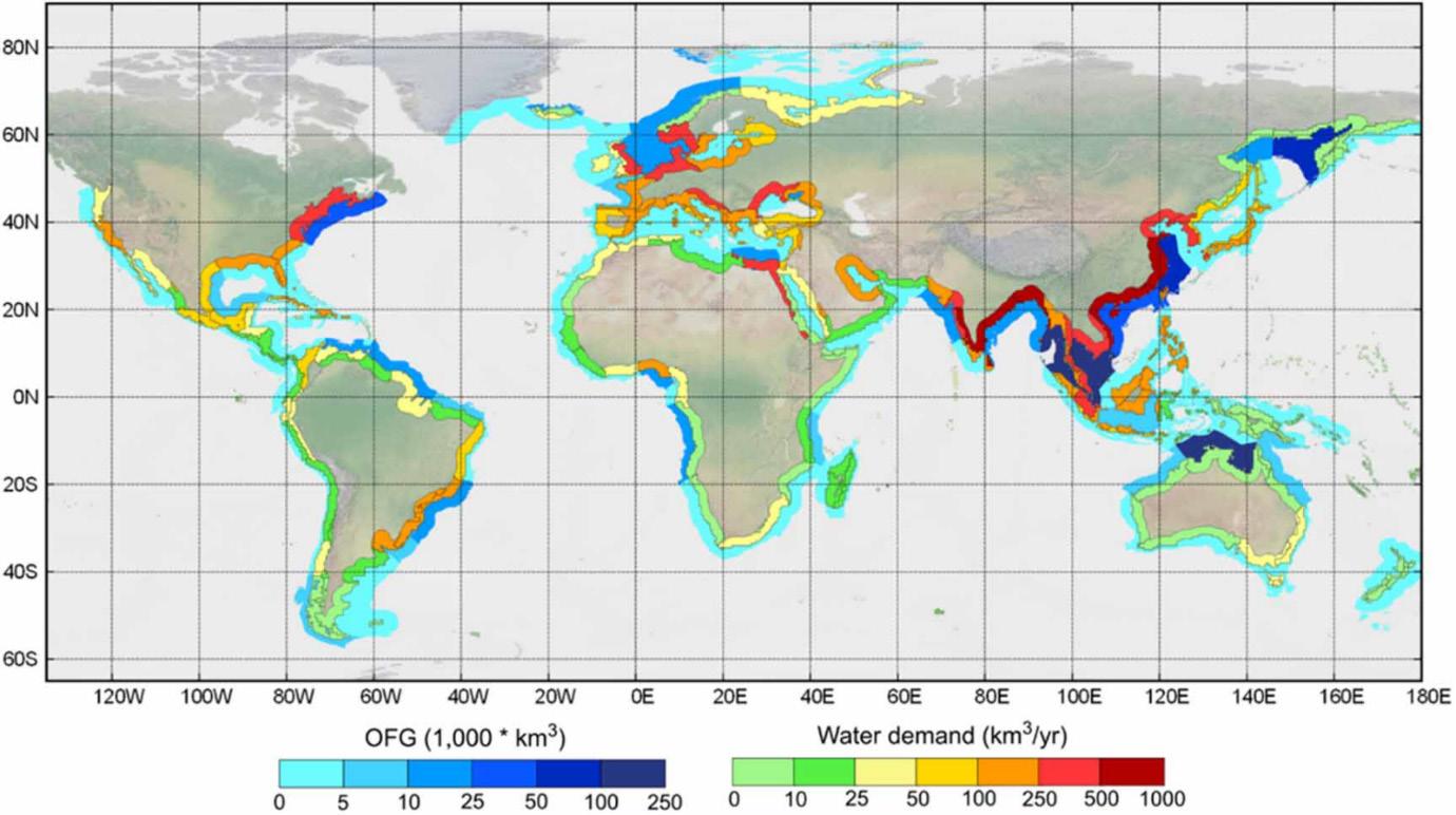
What was historically considered a nuisance for groundwater users in Southern California is quickly becoming an asset for meeting future water supply needs. Fresh offshore groundwater exploration and development may enable alternatives to meet the water needs of coastal communities worldwide. Although region‐specific information on the occurrence and volume of offshore fresh groundwater (OFG)
isions

remains limited, growing evidence suggests that OFG exists on a global scale in quantities large enough to supplement long‐term coastal water supplies. In a 2013 review article in Nature, researchers posited that 500,000 cubic kilometers (405 billion acre-feet) of freshened water are stored in subsea aquifers on continental shelves around the world. This volume of offshore groundwater is 100 times greater than what has been extracted from the Earth’s subsurface since the start of the 20th century. Freshened groundwater is defined as having “minimum concentration of total dissolved solids (TDS) less than 10 g l−1 [10,000 milligrams per liter], which is about one-third of the salinity of sea water” ...and... “it coincides with the upper limit of the salinity range used for the definition of brackish water in the area of water desalination.”
What Lies Beneath the Left Coast?
As of 2020, over 300 locations of offshore freshened groundwater have been identified worldwide. The majority of the sites in the US are located along the east coast; one site is located in Monterey Bay of California. More recently, the USGS used an electromagnetic survey to identify a potential freshwater resource off the coast of San Diego. Electromagnetic surveying techniques have led researchers to discover four additional aquifers off the coasts of New Zealand, Malta, Israel, and Hawaii.
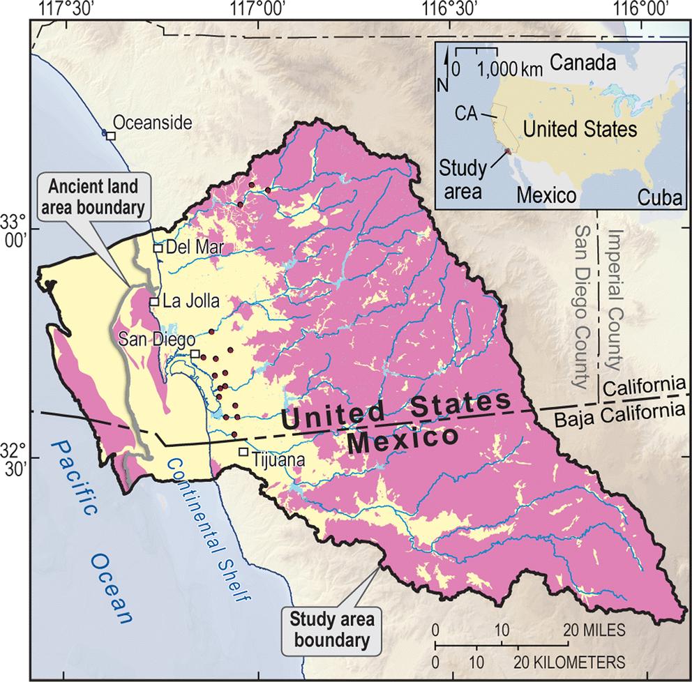
While not identified in the global database, basalts serving as the principal aquifers for inland water supplies and managed aquifer recharge are also found offshore Oregon, based on several oil and gas exploration wells drilled to depths approaching 10,000 feet beneath the seafloor in the 1960s. “Pythias Oasis” is low-salinity, high-temperature, mineralrich water flowing approximately 10 gallons per minute from depths over 10,000 feet beneath the seafloor at a location of about 50 miles west of the coast of Oregon.
Engineering & Socio-Economic Considerations
The first-ever hydrogeologically-oriented offshore drilling campaign secured $21 million from the European Consortium for Ocean Research Drilling—a marine research collaboration run by the International Ocean Discovery Program, to take place in summer 2025 off the east coast of the US. Scaling up to production wells, if one considers that the “price” of a typical offshore drilling project approaches $100M, the costs are competitive with the proposed $300M desalination and associated groundwater replenishment project currently under consideration in Monterey, California.
Groundwater from an offshore well could be transported to land via a floating pipeline suspended below the surface of the water. In 2015, Turkey completed the Peace Water project, an 80-kilometer-long sea pipeline hanging 250 meters below the surface transporting approximately 54 MGD to the island of Cyprus. The floating pipeline technology will likely need to be downscaled for an offshore wellfield location. Floating pipelines are obviously more resistant to earthquakes than a rigid pipeline, an important consideration given the high likelihood of future earthquakes along active plate margins.
The public policy and legal arguments for who has access and ownership for sub-seabed water are not crystal clear, prompting questions such as: (1) US states have jurisdiction over the region extending up to three nautical miles offshore, but where does groundwater fit into the ownership and permitting for offshore exploration and development; (2) How does “groundwater” impact the UN Commission on the Law of the Sea where countries can claim ownership to an Exclusive Economic Zone that extends 370 km offshore from its coastal baseline?; (3) Is it possible that a variant such as the Law of the Hidden Sea might apply to deep groundwater that is hydraulically connected to the sea?; (4) Should water stored in “fossil aquifers” such as offshore aquifers be viewed as part of the common(s) heritage of humans?; Or, (5) Should governments step aside and let business into the world of groundwater governance much like how the US and Mexico are dealing with subsea hydrocarbons in the Gulf of Mexico by “unitizing” maritime transboundary reservoirs?
Regardless of geographic location, offshore groundwater law expert Renee Martin-Nagle indicates the governance of offshore freshwater resources, as well as the subsea pore space for storage of water or carbon, will more than likely fall under at least three different bodies of law: “the UN Convention on the Law of the Sea, the customary international law for land-
based freshwater, and the customary practices for offshore hydrocarbon development.”
Need for Contextual Engineering
Existing knowledge suggests that tapping offshore fresh groundwater reserves and subsea storage are technically viable, but further research on contextual engineering is necessary to implement such an effort in specific regions. The historic perceptions that the offshore environments are pristine and fragile influence decision-makers as offshore wind and wave energy projects are proposed, and the offshore groundwater development proposals will be no different. Samuel Coleridge, English poet of The Rime of the Ancient Mariner, once said “Common sense in an uncommon degree is what the world calls wisdom.” While sea level rise may be the “albatross around one’s neck” for coastal communities, the “commons” sense research and multipurpose use of near shore and offshore aquifers may ultimately lead to more cooperation, wiser use of onshore water resources, and entrepreneurial opportunities for carbon management.
Potential for Multipurpose Use
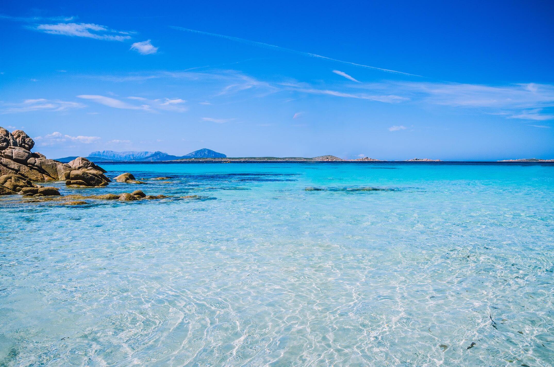
West coast offshore aquifers are also slated for multipurpose use. Volcanic rocks found along the Oregon Coast are also used for subsurface storage of natural gas. Offshore basalt aquifers are also uniquely suited for use in geologic CO2 sequestration, which is considered an essential component of plans to achieve the “2‐degree scenario” (2DS) of greenhouse gas emission reductions. The subsea basalts off the coast of Washington are identified as reservoir rocks for potential carbon sequestration, including the CarbonSAFE site located offshore Washington State and British Columbia.
HydroVisions water industry careers worksHoP

by Moises Santillan, MPA, PG
The Water Replenishment District (WRD) and GRA’s Southern California Branch hosted the 2nd Annual Water Industry Careers Workshop on March 8, 2025, at WRD’s Albert Robles Center for Water Recycling and Environmental Learning (ARC) in Pico Rivera, CA.
The workshop featured a Q&A panel, resume reviews, mock interviews, and networking opportunities with industry professionals and prospective employers from diverse technical backgrounds. The goal of the Workshop was to make a positive impact on students by informing them about rewarding opportunities in the water industry and connecting them with working professionals and potential employers.
Over 120 students (over twice the anticipated number of signups!) from over a dozen educational institutions throughout the state attended the Workshop. Student educational backgrounds and interests included engineering, hydrogeology, environmental geology, and water treatment operations. Twelve sponsors attended and pitched their organizations to students at the Workshop. GRA leaders were well represented at the event and served in various volunteer capacities.
GRA would like to thank and acknowledge Monica Sijder (Workshop Lead; WRD Senior Public Affairs Representative) and the dozens of event volunteers for all their hard work and dedication to making this Workshop a tremendous success. In addition, GRA would like to thank WRD for their partnership, and all the event sponsors for their help in funding the event and investing in the next generation of water professionals.
GRA’s Southern California Branch is thrilled to have led such a successful event with WRD and looks forward to planning similar Workshops in the future!

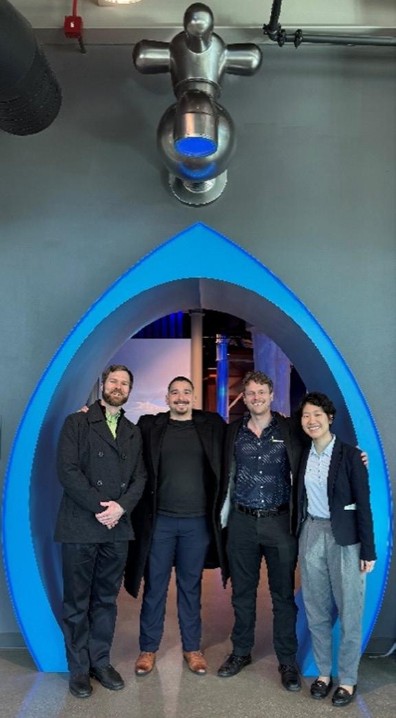
GRA Southern California Branch Officers pose at the entrance of WRD’s ARC Learning Center. (from left to right) Trevor Pontifex (Branch VP), Moises Santillan (Branch Advisor), Patrick Wickham (Branch President), Hiroko Hort (Branch Treasurer).
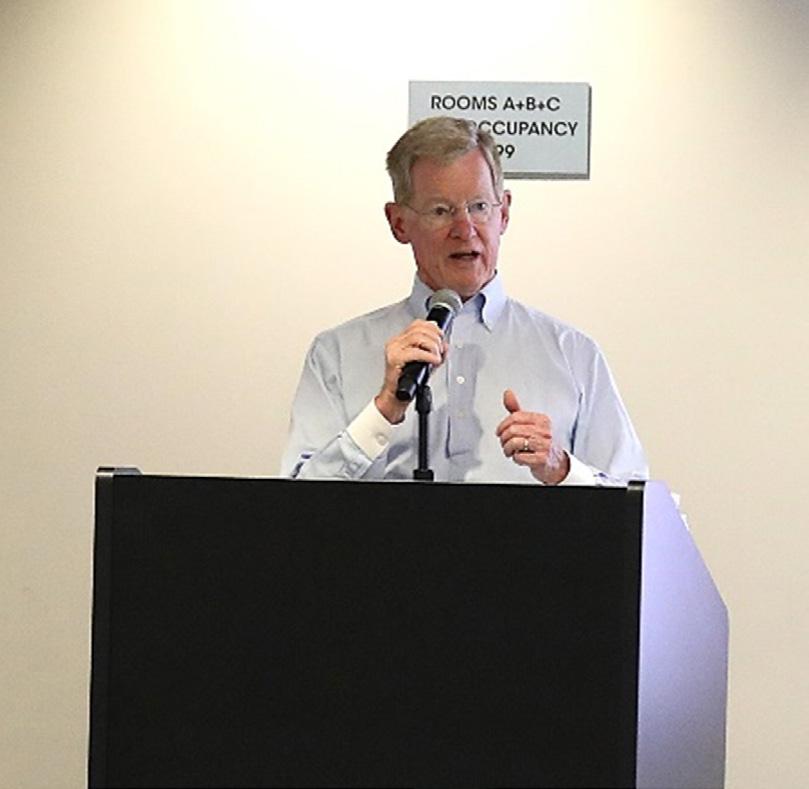
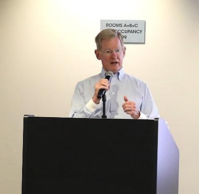
WRD Director, John D. S. Allen, welcomes students to the Water Industry Careers Workshop.
isions


WRD Manager of Administration and Human Resources, Dina Hidalgo, kicks off the Workshop with an opening presentation on the “dos and don’ts” of securing / maintaining a rewarding career in Water.
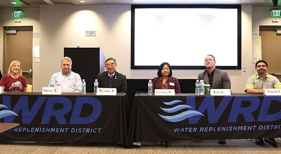
The Workshop’s Q&A panel answers questions from the student audience. (from left to right) Christine Bucklin (DTSC), Steve Tedesco (Tetra Tech), Dr. Weixing Tong (LARWQCB), Phuong Watson (WRD), Jon Swope (GSI Environmental Inc.), Aaron Leos (PERC Water).

Event Sponsors



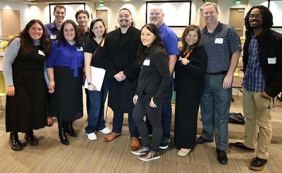
WRD staff / volunteers pose following the mock interview / resume review session.
EKI Environment & Water, Inc.
Hazen and Sawyer
Montgomery & Associates, Inc.
Tetra Tech, Inc.
Los Angeles County Public Works West Yost Associates
PERC Water Corporation
HydroVisions
GeoH2oMysteryPix
by Chris Bonds - DWR, Sacramento Branch Member at Large
GeoH2OMysteryPix is a fun addition to HydroVisions that started in Fall 2022. The idea is simple; I share some questions, some cool supporting geology and/or water resources photo(s) along with a hint, and readers email in their guesses.

In a future issue of HydroVisions, I will share the answer(s) along with some brief background/historical information about the photos and acknowledge the first person(s) to email me the correct answer(s).
GRA looks forward to your enthusiastic participation in GeoH2OMysteryPix.
FALL 2024 ANSWERS
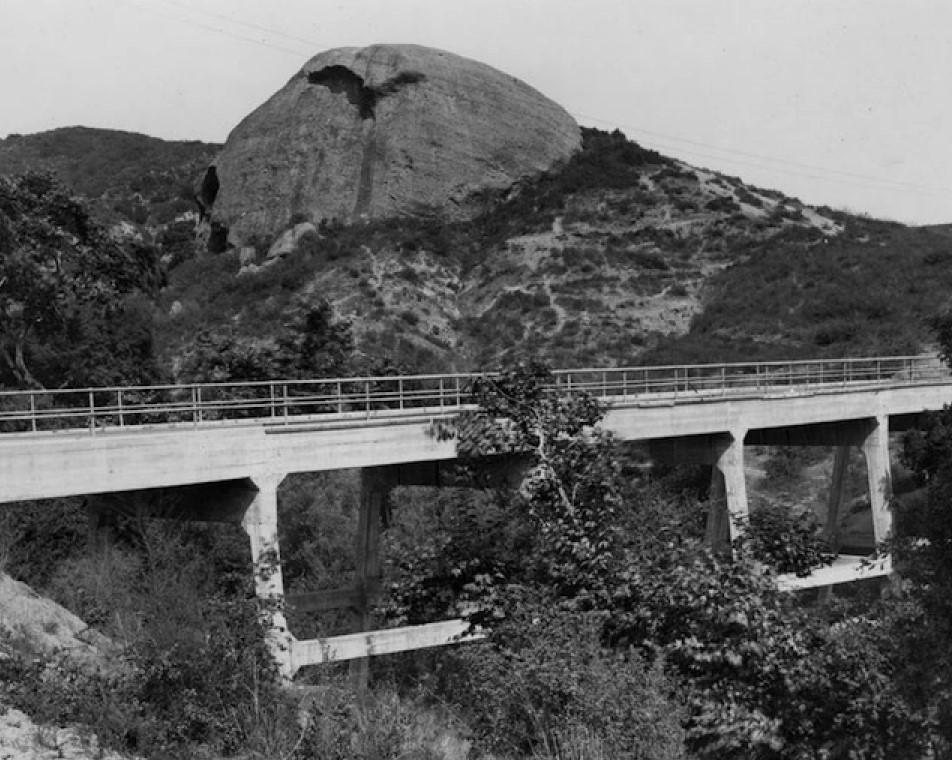
What is this? Where is it Located?
Hint: A historic California landmark.
Congratulations to Trevor Pontifex, Hydrogeologist, Montgomery & Associates for providing the following correct response to the Fall 2024 GeoH2OMysteryPix questions:
“The fall 2024 photo looks like the outcrop between Eagle Rock and Pasadena. The road that runs by it now is California Highway 134.”
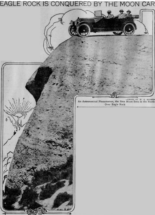
Background/History: Eagle Rock is a prominent conglomerate outcrop, located to the north of SR-134 and south of the Eagle Rock Fault. The conglomerate is found within the Miocene-age Topanga Formation (Ttqdc) (TW Dibblee 1989), and locally is described as a gray to brown, crudely bedded conglomerate and breccia, all composed of biotite hornblende quartz diorite in a semi-friable sandstone matrix.
The conglomerate bedding displays a northerly strike and a 25-degree easterly dip.
Remarkably, when the sun is overhead, an overhang on the southern side of the rock casts a shadow that looks a lot like an eagle (or any large bird of prey, really, but back in the day people went with eagle, and it stuck) flying right out of the rock. And from a certain angle, the rock also resembles the head of an eagle in repose (LAEG 2022).
The City of Eagle Rock was incorporated in 1911 and, in 1914, became the home to Occidental College.
isions


References:
Eagle Rock Valley Historical Society. https://www.eaglerockhistory.org/
JT Reilly 1932. A Report on the Geology of a portion of Los Angeles County located west of the City of Pasadena, California. Bachelor’s Thesis. California Institute of Technology. https://thesis. library.caltech.edu/view/degree/bachelors/1932.html
LAEG 2022. The Eagle Rock. Los Angeles Explorers Guild. March 25. https:// losangelesexplorersguild.com/2022/03/25/the-eagle-rock/
TW Dibblee 1989. Geologic Map of the Pasadena Quadrangle DF-23. Santa Barbara Museum of Natural History. www.sbnature.org
SPRING 2025 QUESTIONS
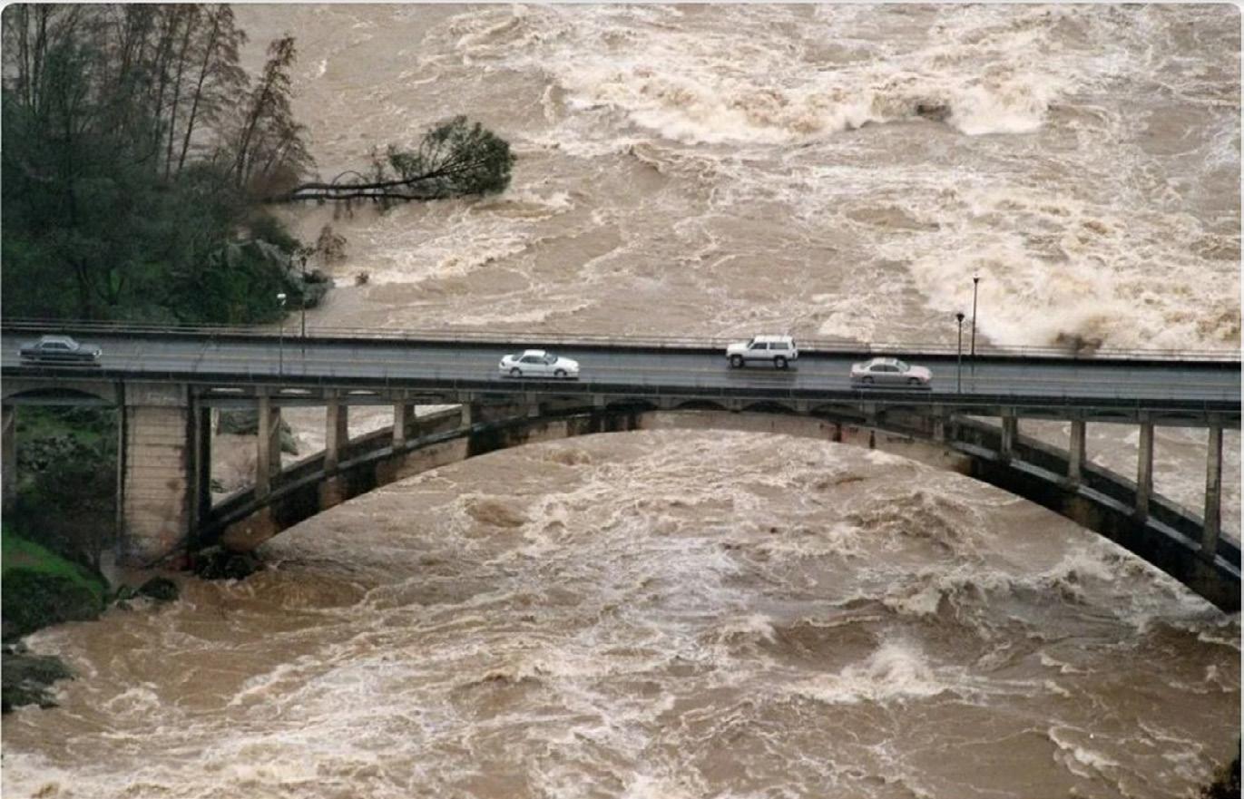
What is this? Where is it Located?
Hint: A significant event during Water Year 1997 in northern California
Think you know What this is and Where it is Located? Email your guesses to Chris Bonds at goldbondwater@gmail.com
Geologic Map Excerpt of the Eagle Rock Area; red star denotes the rock outcrop (TW Dibblee 1989). Tilted bedding can be observed in this close-up northerly view of Eagle Rock. EagleRockHistory.org
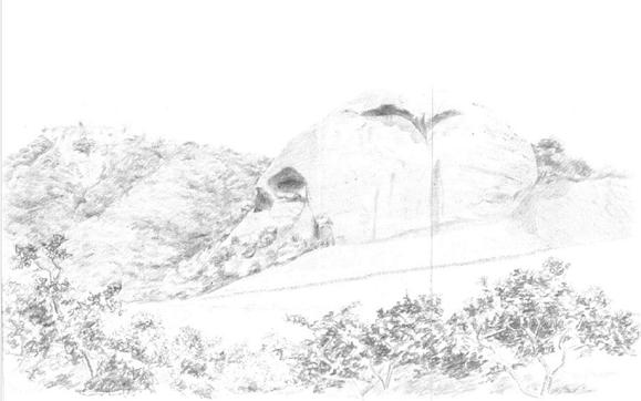
Neat Sketch of Eagle Rock in JT Reilly’s 1932 Bachelor’s Thesis Report; E-NE view.
HydroVisions

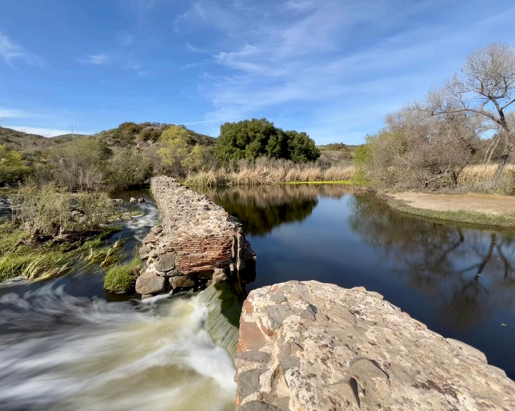
Diego de Alcalá. This first mission in Alta California was founded in 1769 by Father Serra. The masonry dam was about 220 feet wide, 13 feet thick at the bottom, and 12 feet or more high. Native stone and locally produced cement were used to construct the dam, flume, and aqueduct. The flume was approximately 2-feet wide and 1-foot deep and delivered water to the mission gardens, orchards, and vineyards.
By the mid-1860s, after California had already become a state, the structures were reportedly in ruins but were repaired and reused again about a decade later. The remains of the dam, still impressive today, impound a small amount of water. No substantial remains of the flume or aqueduct are visible. San Diego Mission has been largely reconstructed since 1931 and is an active parish for the Catholic community.
Photographed by John A. Karachewski, PhD, on March 10, 2025. The approximate GPS coordinates of the photograph are 32.83954° and -117.04317°. Additional visitor information is available at Mission Trails Regional Park. Dr. Patrick Abbott, professor emeritus at San Diego State University, has also published a book about the Geology of Mission Trails Park2nd Edition
isions


compliance with smart solutions that adapt to the


YOUR PARTNER IN WATER TRADING
evolving groundwater management landscape.

AGILE WELL REGISTRATION


TRANSPARENT WATER ACCOUNTING
SHAREABLE WATER ACCOUNT ACCESS
ADMINISTRATIVE TOOLS


t H ank y ou to o ur c ontributors
Craig Altare, PG, is a Supervising Engineering Geologist in the California Department of Water Resources’ Sustainable Groundwater Management Office. He leads the Modeling and Tools Support Section, which develops and maintains the fine-grid version of the California Central Valley Groundwater-Surface Water Simulation Model (C2VSimFG) and supports implementation of the Sustainable Groundwater Management Act through the development of technical guidance for Groundwater Sustainability Agencies. Craig holds degrees in geology from Virginia Tech and hydrology from New Mexico Tech.
Ben Brezing, PE, is a Supervising Water Resources Engineer in the Sustainable Groundwater Management Office (SGMO) at the California Department of Water Resources (DWR) where he leads the Data Support Section that maintains that the Online System for Well Completion Reports (OSWCR), the California Statewide Groundwater Elevation Monitoring (CASGEM) application, the SGMA Monitoring Network Module, SGMA Data Viewer, California's Groundwater Live, and SGMO’s datasets on California Natural Resources Agency’s Open Data Portal. Ben holds a master’s degree in Geophysics from the University of Hamburg, Germany.
Chris Bonds is a Senior Engineering Geologist (Specialist) with the California Department of Water Resources (DWR) in Sacramento. Since 2001, he has been involved in a variety of statewide projects including groundwater exploration, management, monitoring, modeling, policy, research, and water transfers. Chris has over 31 years of professional work experience in the private and public sectors in California, Hawaii, and Alaska and is a Professional Geologist and Certified Hydrogeologist. He received two Geology degrees from California State Universities. Chris has been a member of GRAC since 2010, a Sacramento Branch Officer since 2017, and has presented at numerous GRAC events since 2004.
Dr. Mesut Cayar, PE, is a Senior Water Resources Engineer and Principal at Woodard & Curran. Mesut has 20 years of experience specializing in programming, numerical analysis, and the development of computer applications for groundwater, hydrology and water resources planning. He has extensive experience in water resources, hydrologic, and hydrogeologic investigations for integrated water management programs and sustainable groundwater management. Mesut is committed to developing innovative, sustainable, and unique solutions to complex water resource challenges, integrating advanced modeling, data-driven analysis, and interdisciplinary approaches to enhance water management, conservation, and resiliency.
Dr. Katherine Dlubac, PG, is a Senior Engineering Geologist in the Sustainable Groundwater Management Office at the California Department of Water Resources (DWR) where she is the Project Manager for the Statewide Airborne Electromagnetic (AEM) Surveys and the Basin Characterization Program. In this role, Katherine defines project tasks and oversees all project work, including data collection and analyses, and the development of tools, maps, and models. Katherine engages in coordination with local, state, and federal agencies and ensures timely data publication and visualization. Katherine supports the implementation of the SGMA and contributes to DWR’s California Water Plan and California’s Groundwater Bulletin 118 publications. Katherine holds degrees in Geophysics from Stanford University with a focus on using geophysical data to characterize groundwater aquifers.
Todd Jarvis, PhD, is the Director of the Institute for Water and Watersheds, Oregon State University, Corvallis. Todd has 30 years of experience as a hydrogeologist specializing in groundwater development and source water protection with emphasis in fractured rock and karst terranes. With professional licenses as a Certified Engineering Geologist, Certified Water Right Examiner, and Certified Mediator, his interests include transboundary aquifers, environmental conflict resolution, and education in water science and policy.
John Karachewski, PhD, retired recently from the California-EPA in Berkeley after serving as geologist for many years in the Geological Support Branch of the Permitting & Corrective Action Division for Hazardous Waste Management. John has conducted geology and environmental projects from Colorado to Alaska to Midway Island and throughout California. He leads numerous geology field trips for the Field Institute and also enjoys teaching at Diablo Valley College. John enjoys photographing landscapes during the magic light of sunrise and sunset. Since 2009, John has written quarterly photo essays for Hydrovisions.
Christy Swindling Kennedy, PE, PG, CHG, is a hydrogeologist, water resources engineer, and strategy lead for Woodard & Curran. She has served in numerous roles such as engineering, operations, people leadership, and was the CMO for RMC Water & Environment. She has over 20 years in the consulting engineering business focused on water management and resiliency. With her technical background in hydrogeology and water resources engineering coupled with her business development expertise, she serves as an advisor to a water industryfocused accelerator and two venture funds.
Roger K. Masuda, Attorney, Griffith, Masuda & Hobbs, is a long-time member of the Legal Affairs Committee of the Association of California Water Agencies. He has advised public agencies on the full gamut of public law issues and he has negotiated and drafted complex settlement and transactional documents for public agencies.
Dr. Saquib Najmus, PE, is a Senior Principal and Senior Technical Leader at Woodard & Curran. Saquib has been actively engaged in California integrated water resources modeling and planning for over 35 years, contributing as a coauthor of the Integrated Groundwater Surface Model (IGSM) and the developer of CVGSM. He earned his Ph.D. in civil engineering from UC Davis. He received the Hugo B. Fischer Award from CWEMF in 2018 for his contributions to the field.
M. Josef Polk, Attorney, Griffith, Masuda & Hobbs, emphasis in water and public agency law, real property, estate planning, probate, business law, and civil litigation. Mr. Polk is also deeply involved in the equine industry.
Moises Santillan, MPA, PG, is a Hydrogeologist at the Water Replenishment District (WRD), the largest groundwater agency by population in California. He works on projects that involve groundwater management, water well construction and rehabilitation, groundwater monitoring, asset management, data analysis, and data management. Prior to his time with WRD, he began his career as a consulting geologist in the environmental sector working on soil and groundwater remediation projects. He received a Bachelor of Science degree in Geology and Master of Public Administration degree, with a specialization in Public Works Management, from California State University, Long Beach. He is also a registered Professional Geologist in the state of California.
Dr. Abhishek Singh is a Principal Engineer with more than 20 years of experience and is President of INTERA’s Water Resources & Supply Line of Business, where he leads and manages operations, business development, strategic planning for the lob across the United States. He has authored several technical publications and journal articles on groundwater modeling and calibration, stochastic optimization techniques, uncertainty and risk analysis, climate change, and emerging contaminants. Dr. Singh is also the chair of the GRA technical committee and serves on the GRA board of directors.
Steven Springhorn, PG, is a Supervising Engineering Geologist and leads the Technical Assistance Section in the Sustainable Groundwater Management Office at the California Department of Water Resources (DWR). With nearly two decades of experience at DWR, Steven leads technical assistance and aquifer characterization efforts to support the implementation of California’s Sustainable Groundwater Management Act (SGMA) and oversees activities related to California’s Groundwater Bulletin 118, the state’s official compendium of groundwater information. His expertise spans groundwater monitoring, management, and data publication, with a strong focus on integrating technical and policy solutions for long-term water sustainability. Throughout his career, Steven has worked across multiple DWR offices, contributing to strategic planning, oversight, and assistance programs that advance sustainable groundwater management.

CORPORATE SPONSORS EVENT SPONSORS


Roscoe Moss Company

