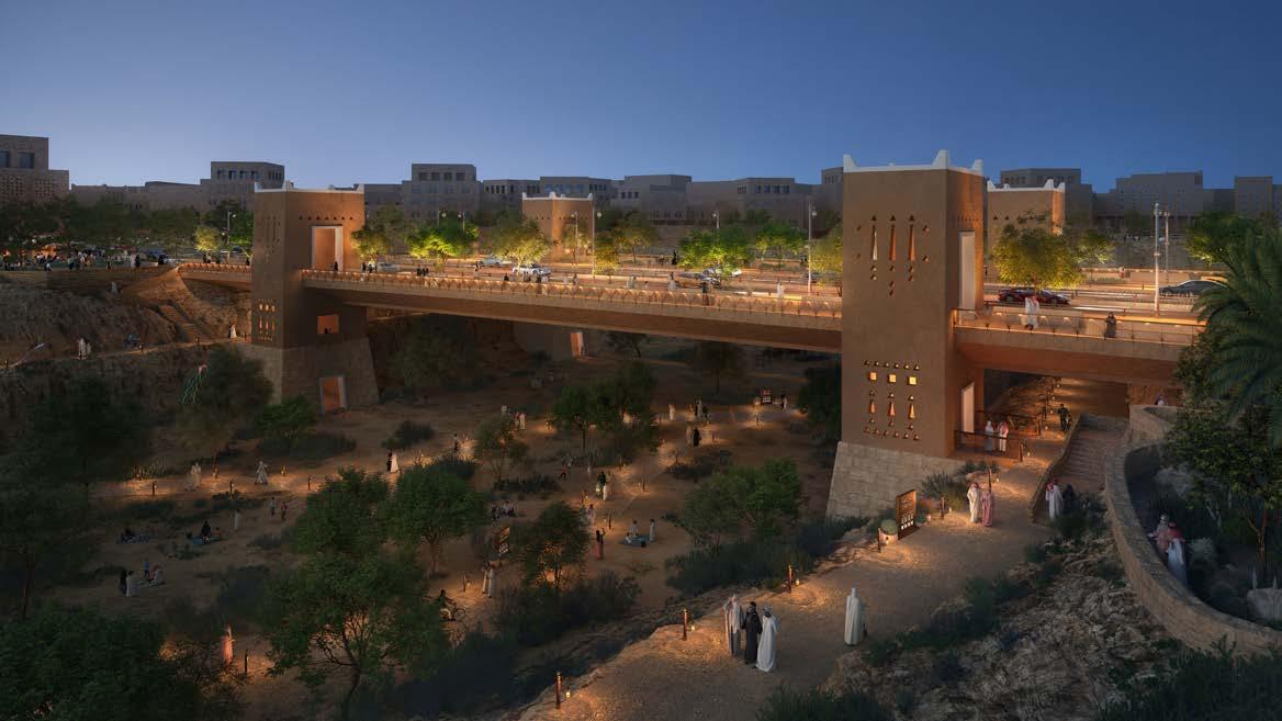
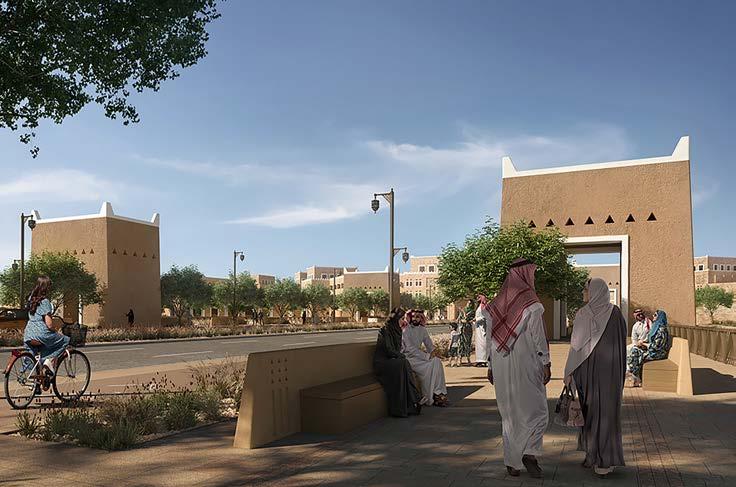
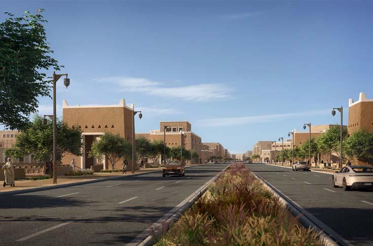
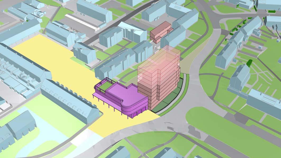
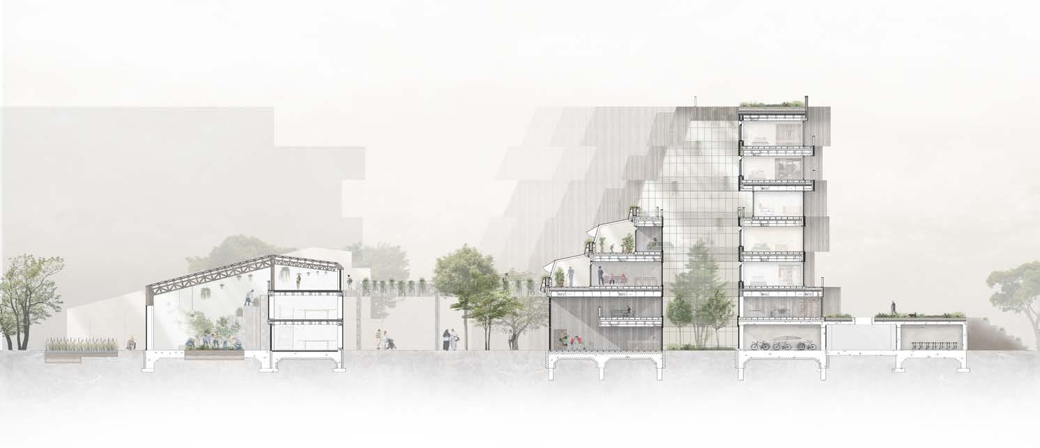
DG II East Wadi Bridge
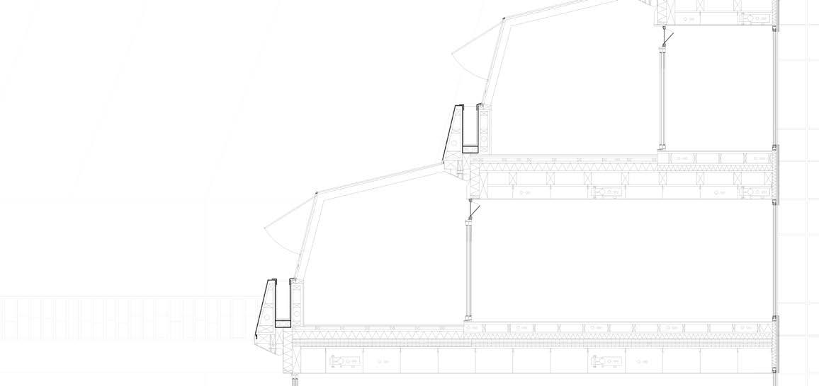
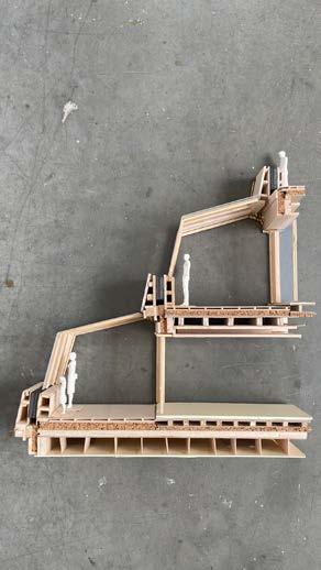
The East Wadi Bridge will carry the six-lane arterial road, along with cycleway and pedestrian footpath, across the sensitive East Wadi, close to the planned Grand Mosque and civic spaces at the head of the wadi. The current Detailed Design proposals are based on the selected Concept design and Preliminary Design. These established the principles and form of the bridge: with structural supports at the edge of the wadi escarpment enlarged to form four towers which provide public stair and lift connection between the bridge and wadi levels below and are extended up to create four portals marking the wadi crossing.
The principles for the bridge design are based on the DGII masterplan vision and dialogue with the client:
> Visual impact: the bridge is distinctive but restrained to respect the sensitive context of the wadi, the Grand Mosque and planned civic spaces nearby. The towers, at the edge of the wadi escarpment slopes, frame views up and down the wadi. The thin edge profile of the bridge deck minimises the span’s visual impact.
> Impact on wadi: minimising impact on the sensitive natural landscape, with interventions limited to the wadi edge escarpments. The supports are positioned where much of the natural escarpment has previously been lost and the tower bases are carefully integrated into the reconstructed rock slope.
> Cultural identity: to reflect the distinctive Najdi heritage and tradition. The massing, modulation and materials of the towers are closely based on Najdi and local building traditions. These aspects are discussed in more detail in the following section.
> User experience: to enhance enjoyment and well-being for the widest range of people using or viewing the bridge, creating a series of memorable experiences. People using the bridge benefit from seats and planting on the bridge footpath, shaded by mature trees, and with open views across the wadi. The towers provide accessible public vertical connection between bridge, escarpment promenade paths and the wadi floor, as well as providing shaded places for people to sit and rest at each level.
> Place making: more than just a bridge, this is an integrated civic space connecting the city above and wadi below. The bridge is integrated with the new street scape, continuing the highway, cycleway and footpaths as well as street trees and lighting. The four portal towers create distinctive moments to mark the crossing of the wadi. The towers will be integrated with the network of pathways along the escarpment and in the wadi floor and connect the three levels.
Status: Stage 4 / Detailed design
Software Used: Rhino, Grasshopper & Photoshop
Involvement: Direct in collaboration with Jacobs
Key Responsibilities:
> Preparation for workshops & producing meeting material
> Produce 3D models
> Site modelling
> Submit models and drawings to engineers
> Attending design workshops, internal design meetings and client meetings
> Collaborating with Jacobs & the visualisation team
> Researching
> Creating walk-through videos for client online meetings
> Creating technical drawings for preliminary design and detailed design stages.


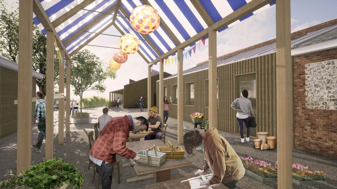
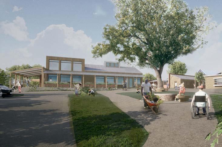
The Grange Outdoor Learning & Community Centre
A series of new and refurbished buildings provide a range of new learning facilities for The Grange Centre for People with Disabilities. These include flexible learning spaces and workshops for horticulture, woodworking and pottery activities, as well as a shop selling their produce, a cafe with training kitchen, community spaces, a new public ‘Changing Places’ toilet and covered outdoor activity areas.
The charity provides housing, care, training and social opportunities for adults with a wide range of learning disabilities. The new outdoor learning facilities will improve the ‘Skills For Life’ training they offer to residents and to people they support in the local community, including vital work experience and opportunities to interact with the public. The new facilities support the popular cultivation activities in the adjacent historic Walled Garden.
The Grange, set in a former country house and grounds, is within the Green Belt and the Little Bookham Conservation Area. The design was developed through a close collaborative engagement process with staff and the people they support.
The multiple new buildings are inserted around existing refurbished buildings and linked by covered outdoor spaces to create an informal new centre for the wide range of activities.
Status: Stage 4 / Ongoing
Software Used: Rhino, Vectorworks & Twinmotion Involvement: Assisting
Key Responsibilities:
> Assist in producing technical drawings
> Assist in preparation of documentation for planning application
> Producing visualisations
> 3D Modelling

Central Farley Hill
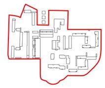
Development Framework and stage 2 concept design for the regeneration of council-owned land at the centre of a postwar housing estate in Luton. The neighbourhood centre site includes a parade of shops and a poor quality Community Centre as well as over 200 flats, which are all retained in the regeneration proposals. Existing public realm and shared spaces are currently of low quality.
The proposals maximise provision of new infill housing, provide better located and more flexible community facilities, new multiuse workspaces, and improved spaces and connections around buildings.
The study explores the existing context and analyses existing uses, public/private spaces, vehicle movement and parking. It sets out design principles; identifies sites for new building; proposes a range of typologies for new dwellings and community facilities; a strategy for people-centred street connections and public spaces; improved parking; and landscaped communal and private spaces.
The Development Framework proposes a range of options across the site, with illustrative schemes providing between 80-160 new dwellings along with the new Community Hub.
Status: Stage 2a / Ongoing
Software Used: Rhino, Illustrator, Photoshop & Sketch
Involvement: Direct in collaboration with BPTW
Key Responsibilities:
> Concept sketches
> Meeting material
> Community centre conceptual design and modelling
> Residential conceptual design and modelling
> Public realm concept and research
> Attending client meetings
> Precedent research and analyses
> Assist in producing material for feasibility document submission
> Site visit
> 3D Site modelling
> Development of illustrative drawings
> Reviewing survey documents and information
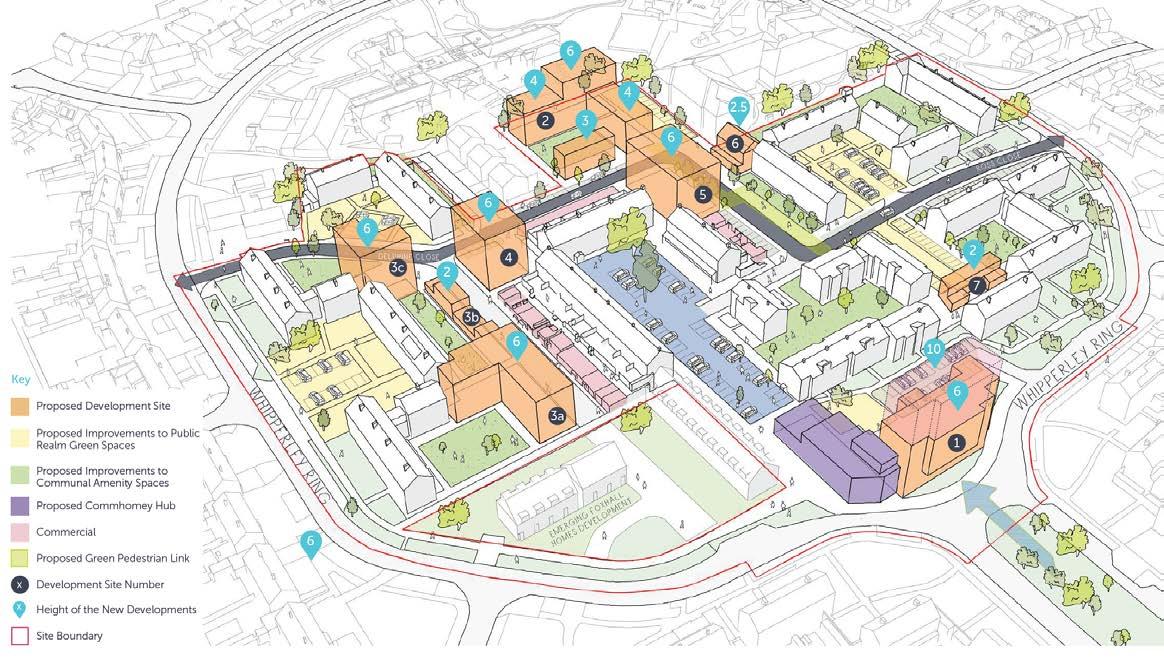
Site 1 is created by the removal of the roundabout and re-alignment of the highway, following the principle of Medical Centre previously planned for the site and consented in 2018.
Relocating the new Community Hub to this prominent location increases its public presence for the wider community and allows the Hub to be constructed while the existing community centre is still in use.
It also creates opportunity for significant a new residential building adjacent fronting the large public space to the south on the Whipperley Way axis.
Two options are illustrated for the height of the residential building: a 6-storey block (below the threshold for a Higher Risk Building), and an alternative 10-storey option.
New Community Hub
> Building acts as prominent beacon for the wider community, fronting primary road
> Extends Market Square public functions and presence of to Whipperley Ring, with active public frontages and colonnade leading to Market Square
> Limited height to reduce impact on nearby residents
> Multiple uses to create flexible ‘Community Hub’ rather than an institutional Community Centre
> Parking for Hub in extended Market Square
New Residential block - Option A (6-storey)
> Prominent building fronting the primary axial space of Whipperley Way
> Maisonettes provide active frontages to street
> New entrance court to north shared with existing blocks
> Massing has minimal effect on existing residents’ daylight
New Residential block - Option B (10-storey)
> Taller building visible from distance at centre of Farley Hill
> Provides more new homes
> More impact on townscape and existing residents’ daylight
> Higher Risk Building (over 6 storeys), requiring two separate circulation cores
WHIPPERLEYRING
WHIPPERLEYRING
WHIPPERLEYRING
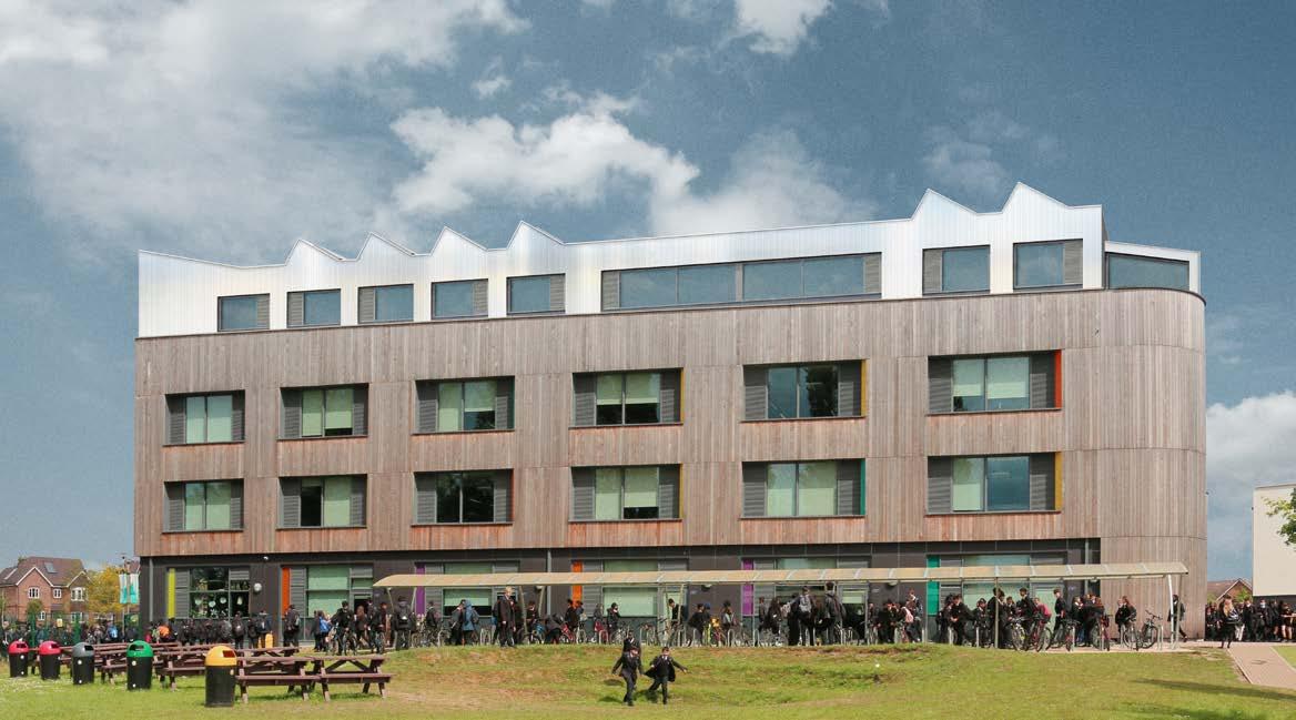
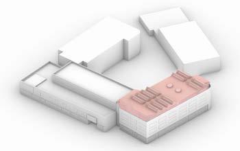
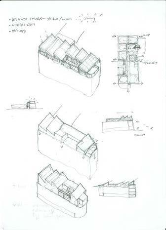
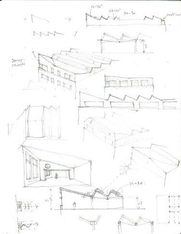
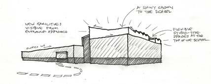
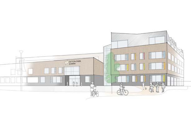
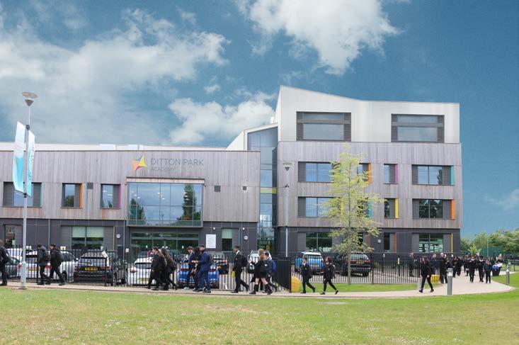
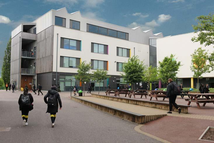
Ditton Park Academy Sixth Form Centre
Rooftop extension to Ditton Park Academy to provide a new Sixth Form centre for the existing school. The extension provides expanded and improved facilities in a single location, with a range of flexible teaching and social spaces.
Classrooms can be combined to create a larger space for performances and events, which can also be used by the local community. The new centre also releases the existing small sixth form facilities for other school uses.
Stainless steel cladding and a distinctive roof profile create a new crowning element to complement the existing timber-clad buildings. The saw-tooth roofs provide excellent levels of daylight across the deep plan and good natural ventilation.
Lightweight construction with laminated timber structural frame and prefabricated engineered timber panels minimises impact on the existing structure below and disruption during construction.
The highly sustainable design is based on passive design principles to minimise energy use and carbon impacts. Extensive PV solar panel arrays are provided on the new extension roof as well as on existing roofs of two other buildings. These provide significant onsite renewable energy generation to reduce energy costs and help make the extension effectively carbon neutral.
Status: Stage 4 / Ongoing
Software Used: Rhino, Vectorworks, Illustrator, Photoshop & Sketch
Involvement: Assisting
Key Responsibilities:
> Concept sketches
> Meeting material
> Pre app document and drawing prep
> Producing material for public consultation
> Precedent research and analyses
> Assist in producing technical drawings
> Producing visuals
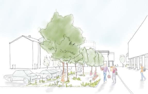
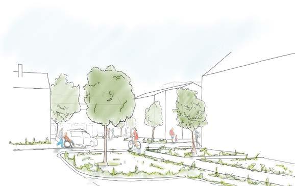
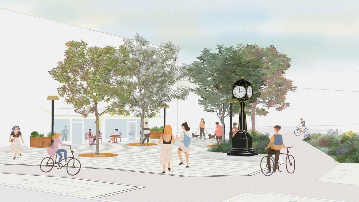
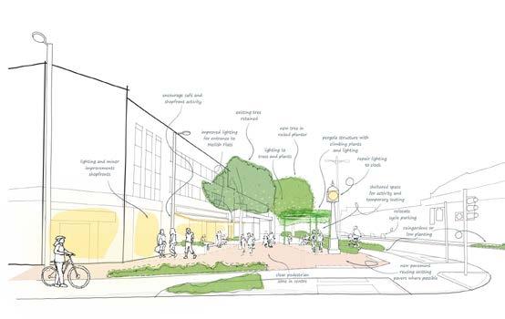
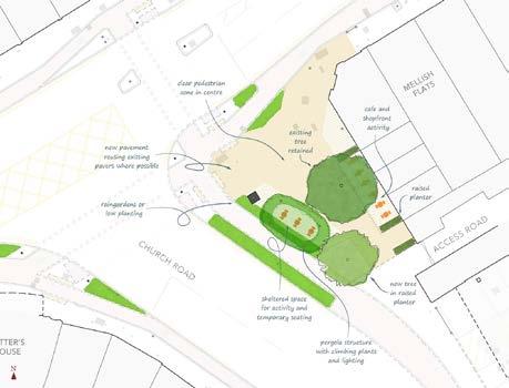
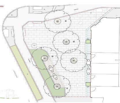
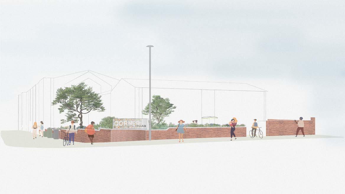
Markhouse Corner
Design strategy, concept design options and technical designs to improve the public realm at the currently congested and unpleasant ‘Markhouse Corner’ junction of the Lea Bridge Road high-street. The project is part of Waltham Forest’s wider Lea Bridge Area Framework.
The design proposals take a holistic approach to public realm, integrating landscape and lighting design and proposing a range of small-scale interventions to transform the area into a safer, more welcoming and greener place for residents and visitors whilst supporting local businesses.
The proposals concentrate improvements at three key locations, creating a more pedestrian friendly space around the existing Clock, a more generous and better-screened area in front of the residential building and biodiverse rain garden beside the locally listed Potter’s House. Public art interventions and shop front improvements are also proposed to reinforce the distinctive corner buildings and strengthen the identity of the junction.
Underpinning the project, a series of consultation events were undertaken to engage the public, residents and the wide range of local stakeholders on the design options for key areas within the site. The extensive discussions informed the choice of preferred options, which formed the basis for the technical design development.
Status: Stage 2-5 / Ongoing
Software Used: Rhino, Vectorworks, Illustrator, Photoshop & Sketch
Involvement: Direct
Key Responsibilities:
> Concept sketches
> Meeting material
> Pre app document and drawing prep
> Attending client meetings & public consultation events
> Producing material for public consultation
> Precedent research and analyses
> Assist in producing technical drawings
> Site visit
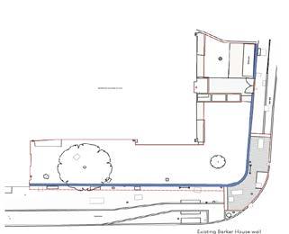
Markhouse Corner
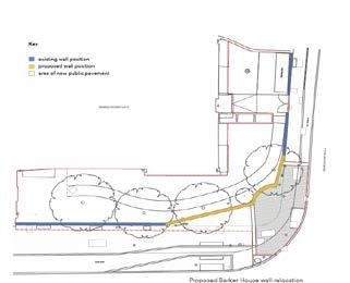
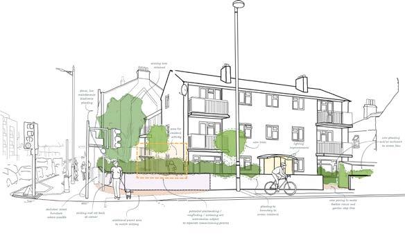
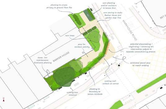
During Phase 1, we proposed that the public footpath at Barker House corner would benefit from more space by rebuilding a section of the existing Barker House boundary wall.
We’ve advanced this thinking by proposing to reuse but invert the existing curved corner, which provides the necessary space to the pavement whilst also offering an opportunity for urban placemaking. In order to unify the rebuilt and existing wall, we also propose adding a new coping along the whole length of the wall, that is either faceted or round in shape to prevent litter being left on it. This will increase the height of the wall by approximately 200mm, which allows for slightly more privacy to the Barker House residents but maintains a sight-line over the wall for security.
During the initial phase, it was suggested to disguise the large residential bin store from both public view and from the resident’s window it directly faces. We proposed to do this by moving the bins forward and planting in front and behind it. However, given constraints related to fire safety and concerns about littering, we are now proposing to leave the bins in its place and increase the height of the wall in-front of it so that it is the same height as the adjacent wall.
The proposed screen will have a dual function by offering a much needed buffer to the public realm for Barker House residents, whilst also creating a clear placemaking element at the ‘Markhouse corner’. The nature of the artwork will also have a dual nature by displaying two different wayfinding artwork dependant on the direction it is approached. The artwork will either direct passers-by towards Markhouse Road or Lea Bridge Road, two important roads that converge on this corner.
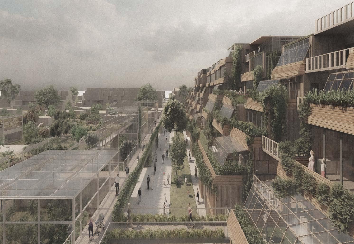
Kidbrooke - A New Way of Living, Together
This project rethinks how we share our neighbourhoods, future homes and urban fabric. The schemes main focus is breaking down the traditional internalised co-living system and bring those communal spaces, out into the public realm. Allowing the harsh boundaries we see in modern housing and the built urban form to be blurred. This allows a sense of community, a sense of togetherness.
The second aspect is regarding the housing crisis we currently experience and providing families with lower income a sense of security and a home.. The housing principles that governs the co-living aspect is the Community Land Trust. CLT allows for the profits to be allocated directly to the community. The idea that everybody has the basic right to a home and under the CLT system, nobody is priced out of finding a home.
The third aspect of the scheme is urban agriculture and environmental aspect, with the current allotments taking centre pride on the scheme. We are now beginning to ask how we can help achieve an efficient way of living with a goal towards total sustainability. Growing food to be shared amongst the community is a approach many are starting to implement.
The forth and final aspect is the sense of flexibility with how we live. The ability to expand our homes or even downgrade when certain circumstances arise. The ability to co-build will create a stronger community and allow lower income families with a sense of security and not having to worry about being forced out.
Course: MArch Architecture Part 2
University: University of East London
Software Used: Revit, Rhino, Illustrator, Photoshop & Sketch, Digital sketch, Modelling making, Type: Masterplan, Urban regeneration Year: 2021-2022
Nominations: RIBA MArch Sustainability Prize Nominee
Planter system.
The planter is constructed from a timber frame system with plywood, a waterproof membrane and exterior finish of timber work which are removable and replaceable.
Substrate.
Pull down curtain blind system to provide residents shade from direct sunlight. Removable for cleaning or maintenance.
Waterproof membrane layer and filter system to reduce debris build up in drainage.
Drainage system. Rainwater collected and is recycled for irrigation purposes on the allotment or greenhouse. The design of the winter garden allows for water to run down and be collected more efficiently.
Secondary drainage system to allow a separation of water collection.
Single glazing sliding window to allow users ease of access to their plants but to also allow ventilation in and out of the unit.
Timber frame supporting the single glazed winter garden,
Single glazed opening outwards to allow ventilation and even act as shading
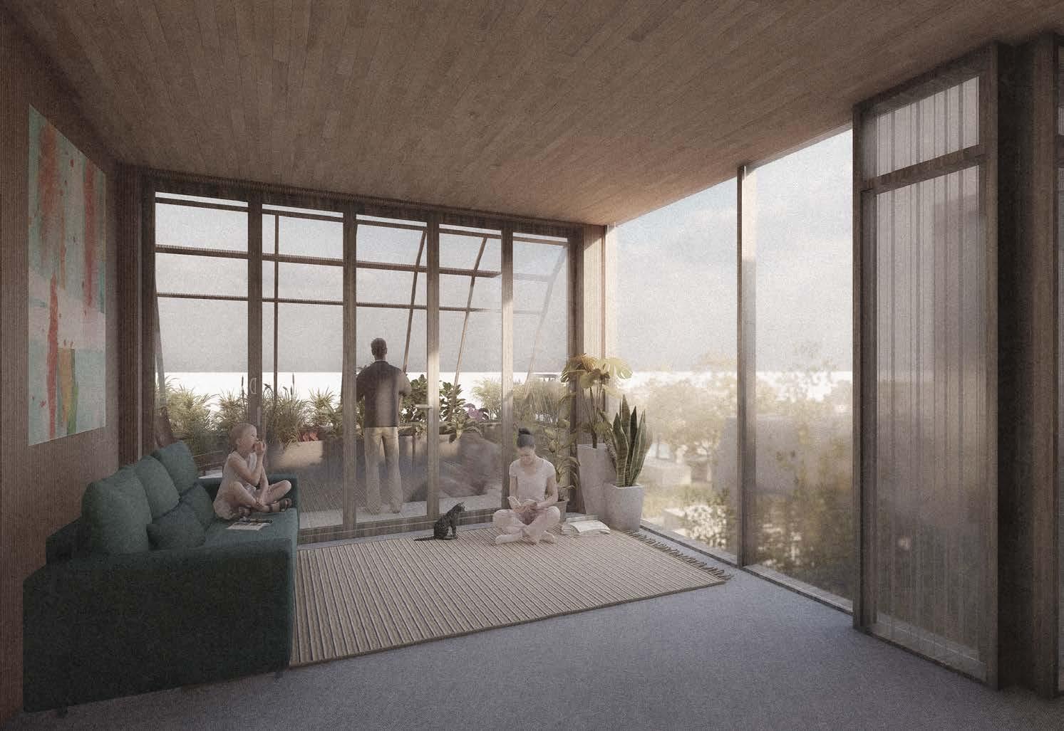
Winter garden is completely removable based on the requirements of the user. The winter garden is more than just for growling plants but also plays a role with how the building operates environmentally so the flexibility of installation and allowing it to be removed and added is paramount.
Decking floor system with drainage to allow water to run of and be collected when plants are watered.
The winter garden is flexible is it’s use and a system is in place to allow the ease of removing the garden while also allow it to be reinstalled. The garden slots out of it’s holding cell where it can be taken away, stored or even worked on for maintenance.

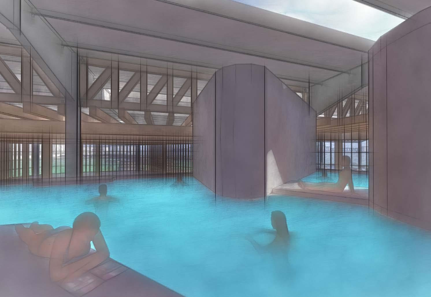
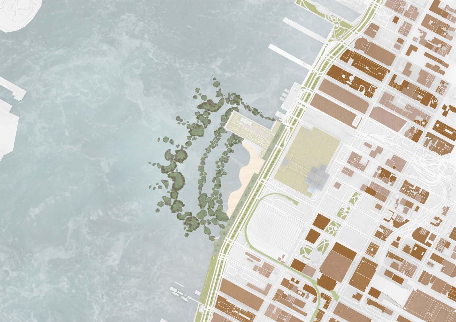
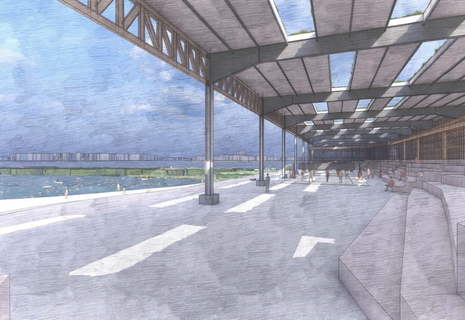
This project converted an old industrial pier / warehouse and transformed it into a thermal bath house with swimming and health care facilities. Alongside the regeneration of the pier, the project will expand the Hudson River Park including the formation of a beach, that is part of a large biodiverse environment, where a series of islands, that over time allow biodiversity to flourish & to protect the area from flooding.
Course: MArch Architecture Part 2
University: University of East London
Software Used: Revit, Rhino, Illustrator, Photoshop & Sketch, Digital sketch, Modelling making, Type Public building, Healthcare, Fitness.
Year: 2020-2021
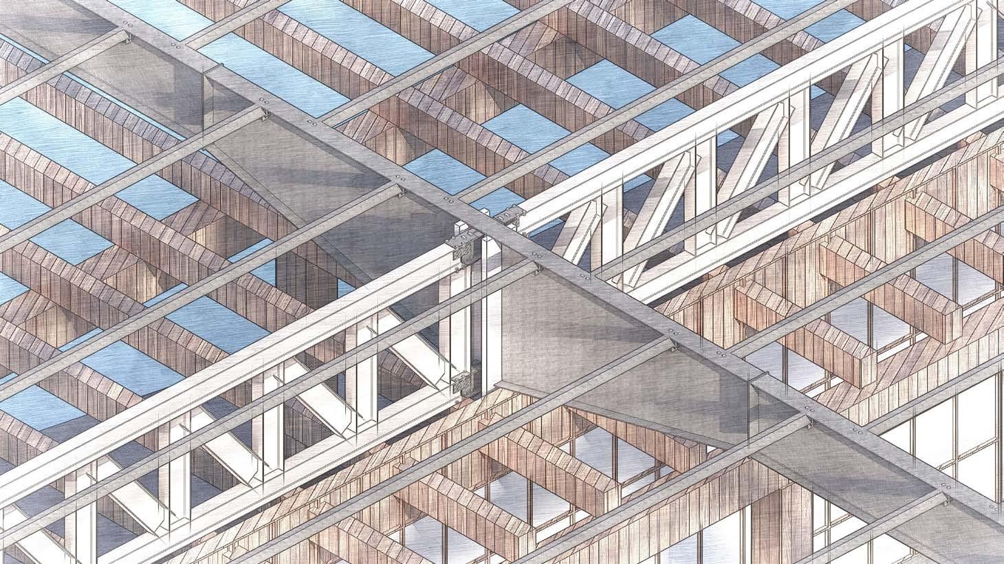
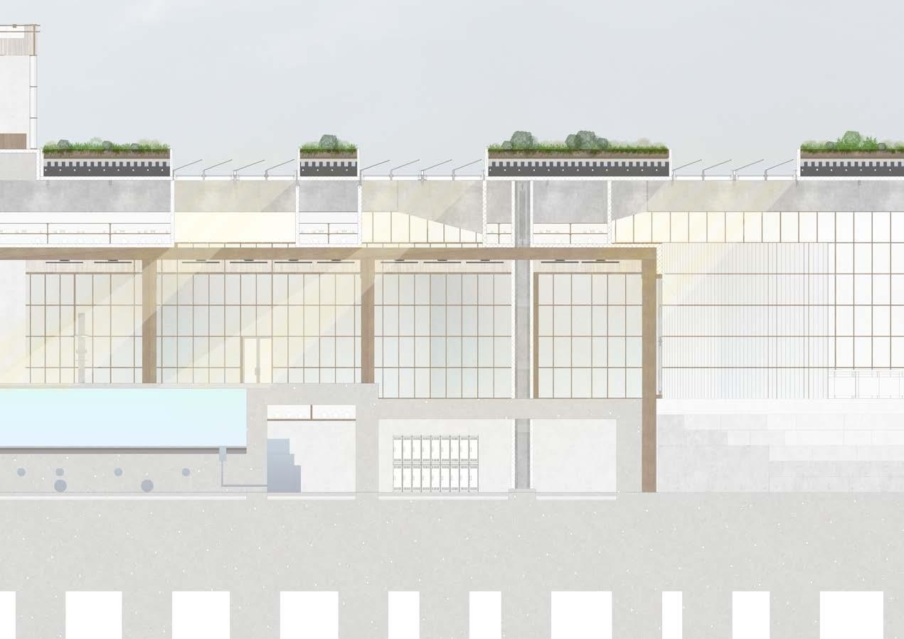
Structure - Existing Pier Steel frame structure.
Structure - Timber framing, supporting existing structure at the junction of the knee frame and truss.
Environmental - Skylight openings in the existing Pier roof structure. Skylights are climate controlled which open and closed based on the temperature of the pool and thermal programmes. During the winter, a minimal amount of skylights operate with the majority in operation during closing hours to cool the building.
Environmental - Extensive roof to reduce the thermal build up of the building from the constant sunlight.
Environmental - Water harvesting and recycling, with overflow water begin drained and used as grey water for public toilets.
Environmental - South to North natural cross ventilation provided by the removal of the southern facade and open beach-front.
Environmental - A mix of both polycarbonate and glass panels. The glass is utilised for creating vistas and allowing a greater range of natural light. Polycarbonate panels are diffuse the amount of light entering the building thus maintaining a lower operating temperature.
Infrastructure - Filtered swimming water.
Infrastructure - Services containing cabling and pipe work.
Infrastructure - Water pumps and water testing quality control apparatus.
Environmental - Open South facade allowing Natural cross ventilation.
Environmental - The building operates at varies artificial lighting settings based on how much natural sunlight and the time of year.