selected academic and professional works
ARCHITECTURE PORTFOLIO HARDIK JAIN
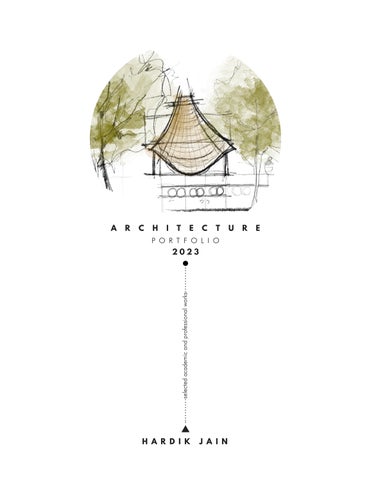
selected academic and professional works

Brauereistraße, 9G, 007, Dessau Roßlau 06846
jainhardik@hotmail.com
+49-15758489508
I am a curious person, particularly in the world of design, and throughout my career I have focused on creating spaces that are both functional and meaningful. I have honed my skills in research, design, planning and visualization learning about multiple facets of Architecture.
I believe that the easiest way to solve a problem is to thoroughly understand it and break it down into doable bits. I take immense interest in digital fabrication technologies and plant based materials. My diverse professional and educational experiences have broadened my understanding of architecture and its impact on our lives.
- Hochschule Anhalt, DIA, Dessau, Germany
M.A. Architecture 1.4 GPA | Class of 2023
- School of Planning and Architecture, Delhi
B.Arch 64.85 % | Class of 2015
- Jagruti Higher Secondary School, Indore, India
Class XII, 84.2% | Class of 2010
- Intern
Amelie Rost Architects| 12/2022 to 02/2023
FFFW Architekten| 03/2022 to 05/2023
- Architect+Project Manager
HD Infrastructure| 08/2020 to 09/2021
English
Hindi
German
Problem Solving
Effective Communication
Organisation and Coordination
Time Management
Effort Allocation
Leadership
BIM
3D Modeling
Drafting
Rendering
Graphics
Documentation
- Architect - Architect
Sconce Global | 10/2017 to 03/2020
Revit Rhino+Gh/ AutoCAD
Vray/ Enscape/ Lumion
Illustrator/ Photoshop
MS Office/ InDesign
Space Matters | 07/2016 to 07/2017
Generative Design
Physical Models
Circular Economy
Disruptive Technologies
Mountaineering
Cooking
- Site Architect
Nav Foundation(NGO) | 08/2017 to 12/2017
- Researcher and Trainer
Uttarakhand Hemp Association (NGO) | 08/2018 to present
\ACHIEVEMENTS
Robert Oxman Prize for Best Master Thesis 2023
Finalist team: Rethinking Bismarck, Hamburg 2023
Finalist team: Global Housing Technology
Challenge, India 2019
Listed here are some of the works I have done as part of my academic and professional journey as an Architect.

BHANPURA FARMS
VOCATIONAL TRAINING CENTER
Kutupalong Refugee Camp, Bangladesh
Project
Presentation Video
Academic- M.Arch Thesis
Typology
Humanitarian/ Emergency
Area

28000 sqm
Theme Days after Disaster
Softwares
Rhino | Autocad | Illustrator | Twinmotion
Learning
Master planning in flood areas and resilient vernacular Architecture

Disasters, by nature are bound to leave impacts. Some are small, some are large, some are recovered from in short time, some take long. One such disaster took birth in mid 20th century where a minority group of Rohingyas fled their homeland of Myanmar and set foot in Bangladesh. Little they knew that the seemingly temporary feud will become one of the biggest humanitarian crises of 21st century.
The Rohingya people are a stateless ethnic group who predominantly follow Islam and reside in Rakhine state, Myanmar. They are recognized separately, speak different dialect, and in minority than other natives Muslims. Today, around 1.1 million Rohingya refugees live in the Kutupalong Camp located in Ukhiya Upazilla of Cox Bazaar district in Bangladesh.
This thesis aimed to investigate the impact of Ethnic Violence on Rohingyas and the traumas they endured throughout this period of suppression. It deals with their understanding their living situations in the aftermath of this disaster and attempts to provide design solution for improving those situations in the camp.
Before 2017 17634 people

After 2017 630089 people
23+ sites

people/ sq.km below UNHCR standards person in some areas

120 hectares(13%) of landslide prone areas 23,000 people affected/ year
400 hectares of camp flood prone 80,000 people affected/year 0.05-1.5 m flood water rise

Approx 80% of forest cover is encroached in from 2015-21


To find a safe site where a resilient neighbourhood can be planned, 14 empty zones are identified and then analysed on the geographical layers such as green cover, landslide, slope, elevation, topography, flood pattern and settlement presence. The top most priority for selection is non- green areas so that no further green land is consumed.


the sites with greens are avoided to prioritize conservation of vegetation.
Landslide zones are avoided due to unsafe Soil conditions
Slopes are riskier to build on given the weak soil conditions


Safe to build on lower elevation than higher. May protect from storm winds

Flat topography is preferred than slopey
Can be addressed through design compared to other hazards
Sites with less settlements is chosen to avoid design clashes with existing shelters
Floating Gardens in Low Elevation Zone

Existing street junctions are joined through bridges
Bamboo plantation in Landslide prone Areas
Forest Plantation in Barren Land zones
Stilted Settlement in flood prone areas

ZONING STRATEGIES
SERVICES
FLOATING GARDENS
SITE PLAN


WORKSHOP
KIDS HALL
FLOATING GARDENS
FARMS
SCHOOL STORAGES
MYCO FARM
COMMUNITY KITCHEN
MULTIPURPOSE HALL
SHELTERS


STILTED SHELTER PHASING PROJECTED DEVELOPMENT STAGES

Demarcating Site Bounds and Site preparation.
Plantation in the landslide and barren land zones
Floating Gardens and bridge connectivity

Public Buildings to attract workforce
Full grown Settlement housing 550 people.


The massing is based on the figure ground study of the existing camp settlement in the radius of 500-1000m from the site. The building footprints are derived from this study to allocate areas for the new shelters and the public buildings. The areas to be kept in the range of 3 sqm to 160 sqm.


roof adjustment

7 persons
Hinged Openable Roof


Kehl- Stransbourg Junction, Germany
Project
Academic- M.arch Semester 2 Studio
Typology
Mixed Use
Area
20000 sqm
Responsibilities
Site Analysis | Need Identification | Concept | Case Studies | Design Development | Drawings | Presentation
Softwares
Revit | Rhino | Autocad | Illustrator
Learning
Design and planning of large scale multi-use public space symbolising a gateway to Germany from France

Borderless- To deconstruct the notion of physical border and reimagine it as a culmination of shared values. The project is located on the bank of River Rhine which has France to the east and Germany to the west.
The design of the complex is focused on creating a traction for people of both Kehl and Strasbourg. The programming is derived from the most active street of Kehl to bring in more and more people to our development. From the site visit, it was evident that locals prefer outdoor activities in the parks by the river on either side. To retain the integrity of those activities and to provide free movement from southern parks, the front area of the development is kept as an open public plaza accomodating public recreational and leisure activities.
Figure Ground
The mixed use public development is a new nodal point attracting German as well as French population from across the river. The shift of nuclei functions of the city centre on the city edge is a representation of sharing across the borders.


1. Potential builtup area


2.Creating streets from bahnhof plaza
3.Breaking blocks to create cross access


4. Arranged volumes maximizing riverfront plaza


5. Staggering blocks to create terraces and builtups

The street is envisioned as an attractor axis from bahnhof to riverfront. It is inspired by the active character of the most populated street - Hauptstrase which houses shopping, eating and recreational functions.

 VIEW STREET ACCESS FROM BAHNHOF
The riverfront is a celebratory space filled with existing trees and safe water zone for kids. It is derived from the existing River Gardens which are an active hotspot for lesiure activities.

 VIEW RIVERFRONT
Espoo, Finland
Project
Competition- Amelie Rost Studio, Berlin

Typology
Urban Design Area
100000 SQM
Role Werkstudent
Softwares
Revit | Rhino | Autocad | Lumion | Photoshop
Learning
Urban Design in Finland | City Planning Studies | Master Plan development in the City Center
Movement*
Design of the net of paths, alleys and connections.
Rest*
Placement to define
Igot this opportunity to work alongside my Professor Amelie Rost on a Competition to plan the development of City Center in Espoo, Finland. The project started by developing and understanding of the context in terms of its usage, demographics and further opportunities to enhance characteristics of Leppävaara Area.
The objectives of the design are a resource-saving use of the existing structure and the development of a resilient urban structure that can also adapt to changing conditions and requirements. The network provides a stable foundation. It is strong enough to connect the different typologies and uses and flexible enough to adapt to changing conditions. A network of public spaces with different uses and different urban qualities is designed. The architecture and the urban space develop in dialogue.
The focus is on the public space.
*Graphic created by Amelie Rost
2 Principles* Houses in the green Definition of squares
Concept: Weave the City - Weave Roots and Wings
A network of squares and paths with different focal points of use connects and enriches the existing city. The red lines are the metaphorical “wings“. They stand for the future and dynamics. The green lines are the metaphorical “roots“. They stand for grounding and arrival.


 SITE PLAN 1:3000


Architecturally, the building blocks are conceived as a wooden construction on a solid base. The roofs are intended as green roofs and are part of the rainwater management concept. They absorb water during heavy rainfall and release it into the sewage system at a slower rate.
Central street and cross pathways.
Functions enriching the existing usage with culture, startup and public buildings.

From east to west, the network develops according to use. From south to north, the network is influenced by different speeds. After the railway line and Turuntie, the next speed stage is that of cycling, and after the new and after the noiseprotecting buildings north of Turuntie, the speed slows down and allows for walking and exploring by the pedestrian.
Wherever there are views across streets from north to south, buildings with an „air floor“ create a metaphorical „window“ to the city.


Project Academic- M.arch Semester 1 Studio (Team of 2)
Typology
Artists Startup Hub


Area 2000 sqm
Responsibilities
Site Analysis | Need Identification | Concept | Case Studies | Design Development | Drawings | Presentation


Softwares

Revit | Rhino | Autocad | Photoshop


Learning
Masterplanning of startup hub and redefining spaces for art, coworking and living in a deindustrialised city
The project is aimed at creating a coworking and living hub in the city of Zeitz in Saxony Anhalt state of Germany. The site has a gradual slope of about 4 meters and is surrounded by main street and walkway. The program is developed to attract young population in Zeitz by creating career opportunities and living faciltieis. The design is developed by segregating the floors for working and living. The program is a part of a larger master plan which includes all kinds of working, recreational and living spaces. The building is imagined to be organic, like a growing structure adapting to the needs of its users, which is why a basic cubic geometry is adapted which would allow replication of modules in the future as the occupants grow and realise their needs.
The built mass is centralised leaving public movement and plaza spaces all around to welcome all the people from the nearby context. As one moves up to upper floors, the variety of living modules are arranged in a manner which produces green terraces and communal spaces on both inner and outer edges of the development.
Zeitz, Germany


Advancing the existing access points on all sides.


Central street and cross pathways.
Block Formation
Block formation using defined zones as per pathways.
Massing-Phase 1
Massing blocks for all zones
Massing Phase 2 Phase 2 addition


Shared Unit

4 Modules - Living / Kitchen+ Toilet / 2 Bedrooms


Duplex Unit

6 Modules - Living / Dining / Kitchen +Toilet / Office / Bedroom / Closet

Studio Unit
2 Modules - Living +Bed / Kitchen+ Toilet
Single Bedroom Unit
3 Modules - Living / Kitchen + Toilet / Bedroom
First Floor REVIT/ PHOTOSHOPFloor Junctions
2 Different floor junctions are designed within modular units to accomodate wet and dry spaces


Bhanpura, India
Project
Office Project- Space Matters, India
Typology
Mixed Use
Area
900 sqm
Role
Project Architect

Softwares
Rhino | Vray | Autocad | Photoshop

Learning
Farmhouse design in Rammed Earth Construction
The project was to design a farmhouse on a site located on a cliff facing the beautiful Mahi river. Design was conceptualised around the lifestyle and requirements of the client which was a family of 6 members with two kids and grandparents. Hiding in the woods, it would have been a surprise for its visitors with a subtle transition of spaces from forest side to a cliff. The concept was to have a house which feels like a comfortable but raw enclosure in the surrounding environment.The materials chosen were rammed earth and concrete and stone.The slitted walls created a porous boundary between the house and the courtyard provided a play area for the kids. The house was designed along the topography, in three levels, providing spaces facing the river.


RAMMED EARTH WALL CASTING PROCESS
TYPICAL RAMMED EARTH WALL CONSTRUCTION DETAIL; SCALE UNSPECIFIED


SECTION NOT TO SCALE
Barmer, Rajasthan
Project Office Project- Space Matters, India
Typology
Rural Training
Area
3500 sqm
Role
Project Architect
Softwares
Rhino | Vray | Autocad | Photoshop
Learning
Institutional design in Local Stone Construction
The project aimed at creating a training center for local women and men from the nearby villages of Barmer, Rajasthan. The training involves knowledge of knitting, sewing, pottery, computers and leadership to impart skills and catalyse development in the rural areas of Rajasthan.
The center is located in desert area where local stone construction is prevalent and to promote local materials and artisans, Random rubble masonry is chosed for the construction of this center. The massing of the campus was done to give a sense of homely workplace for the incoming learners with carved out courtyard in the center and a covered corridor on all sides. The courtyard was also a congregation space for the trainers and trainees to engage together in an eventful environment. My responsibilities included creating design drawings, 3d massing, visualisations and client presentations in the first phase. Once the project was commissioned to construct, I produced construction drawings, coordinated with the structure and MEP consultants along with quanitity and cost estimates..


I hereby confirm that all the contents of this portfolio are from my own work experience with owners/ credits mentioned as applicable.
jainhardik@hotmail.com


