3 minute read
Rhein Feiern

from PORTFOLIO 2023
by Hardik Jain

Kehl- Stransbourg Junction, Germany
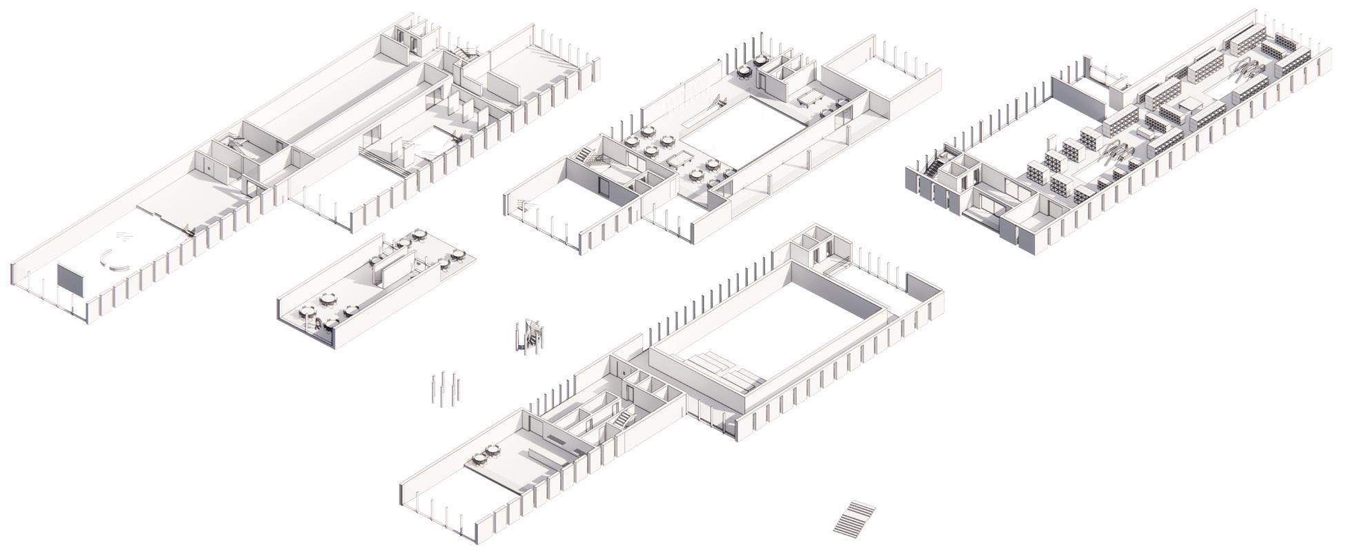
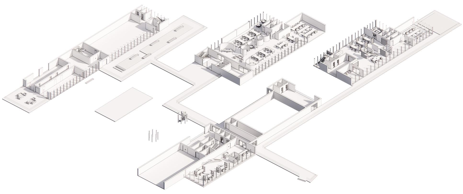
Project
Advertisement
Academic- M.arch Semester 2 Studio
Typology
Mixed Use
Area
20000 sqm
Responsibilities
Site Analysis | Need Identification | Concept | Case Studies | Design Development | Drawings | Presentation
Softwares
Revit | Rhino | Autocad | Illustrator
Learning
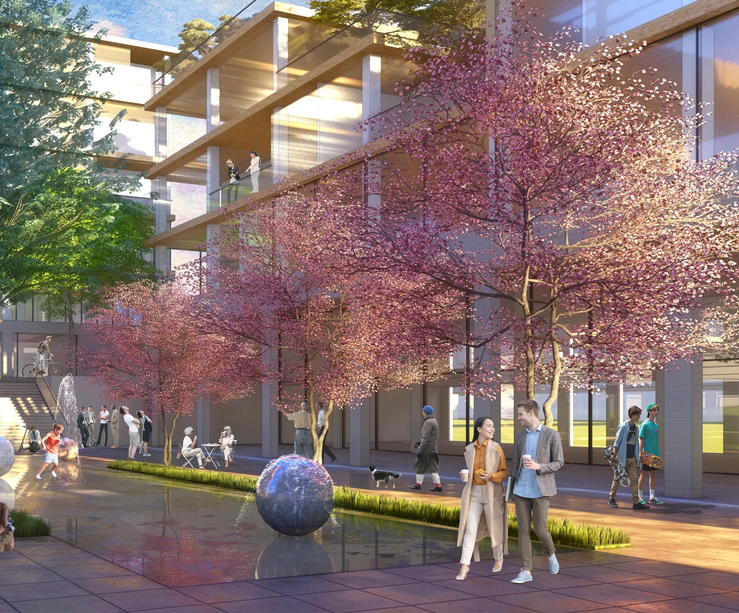
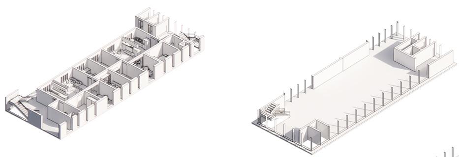
Design and planning of large scale multi-use public space symbolising a gateway to Germany from France
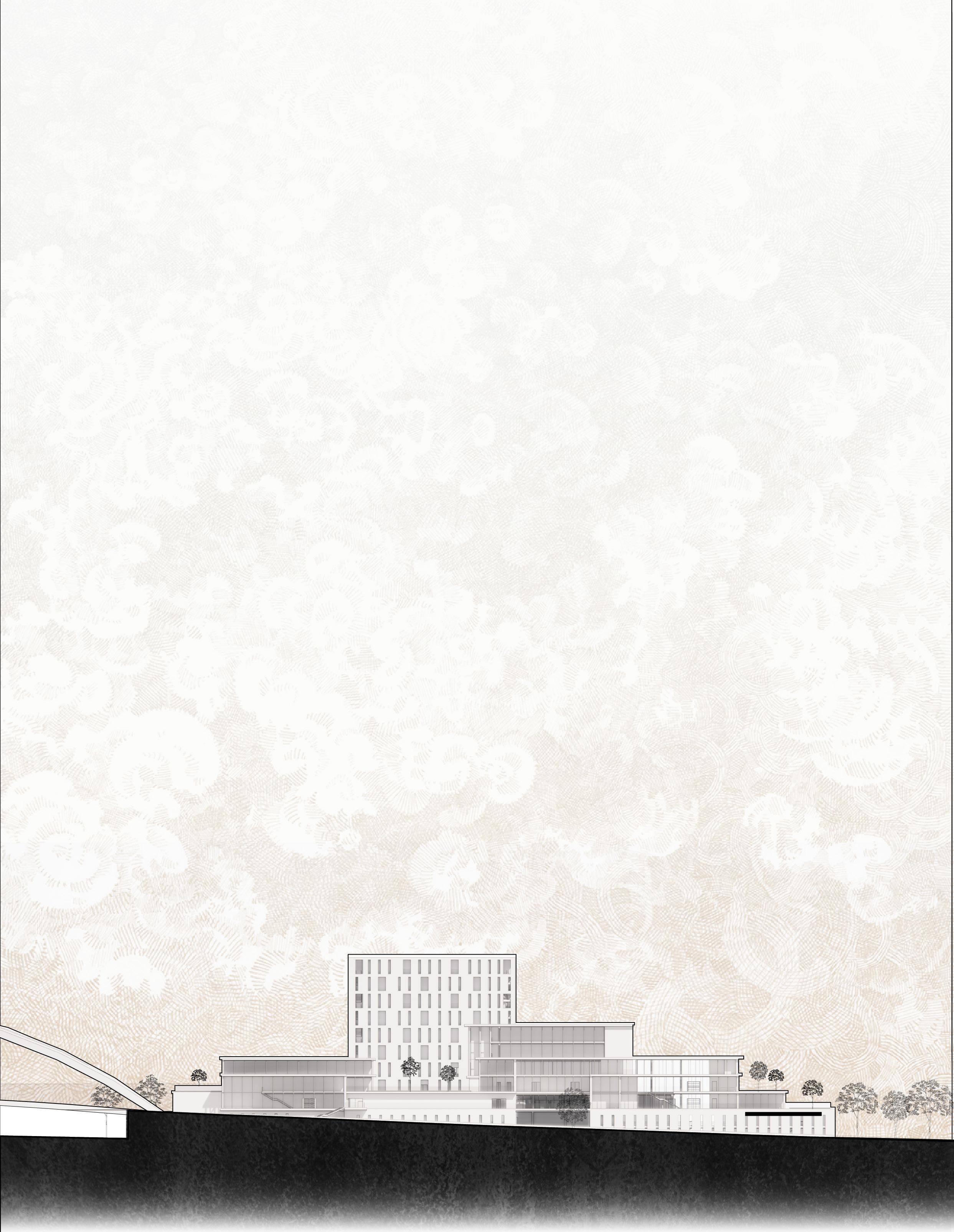
Borderless- To deconstruct the notion of physical border and reimagine it as a culmination of shared values. The project is located on the bank of River Rhine which has France to the east and Germany to the west.
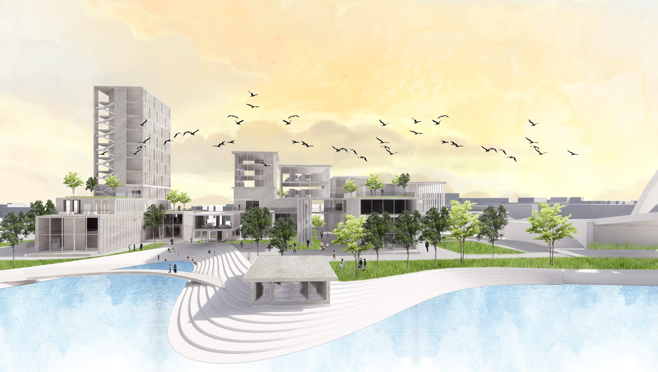
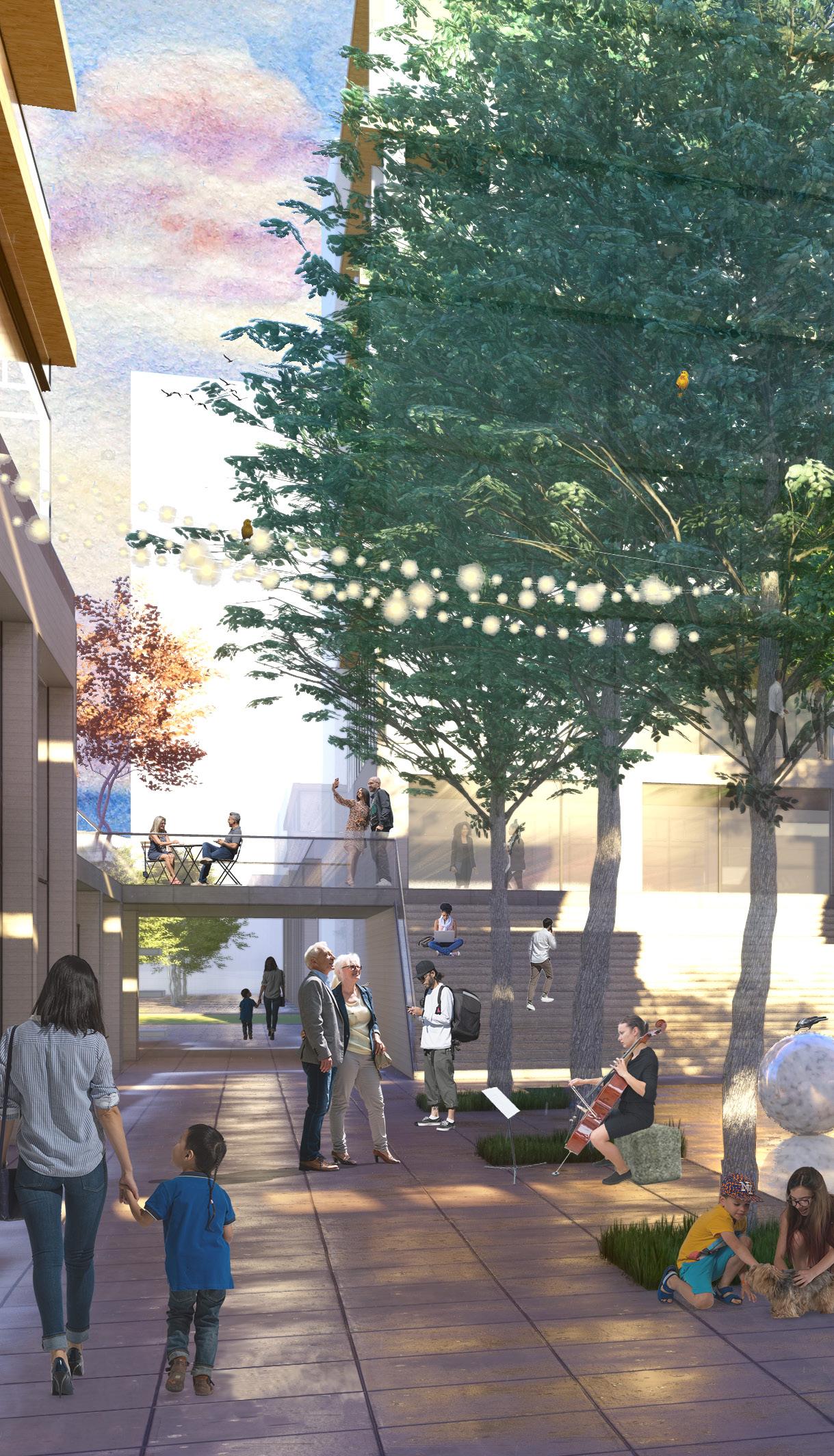
The design of the complex is focused on creating a traction for people of both Kehl and Strasbourg. The programming is derived from the most active street of Kehl to bring in more and more people to our development. From the site visit, it was evident that locals prefer outdoor activities in the parks by the river on either side. To retain the integrity of those activities and to provide free movement from southern parks, the front area of the development is kept as an open public plaza accomodating public recreational and leisure activities.
ISOMETRIC RHINO/ ILLUSTRATOR
The mixed use public development is a new nodal point attracting German as well as French population from across the river. The shift of nuclei functions of the city centre on the city edge is a representation of sharing across the borders.


1. Potential builtup area
2.Creating streets from bahnhof plaza
3.Breaking blocks to create cross access


4. Arranged volumes maximizing riverfront plaza

5. Staggering blocks to create terraces and builtups
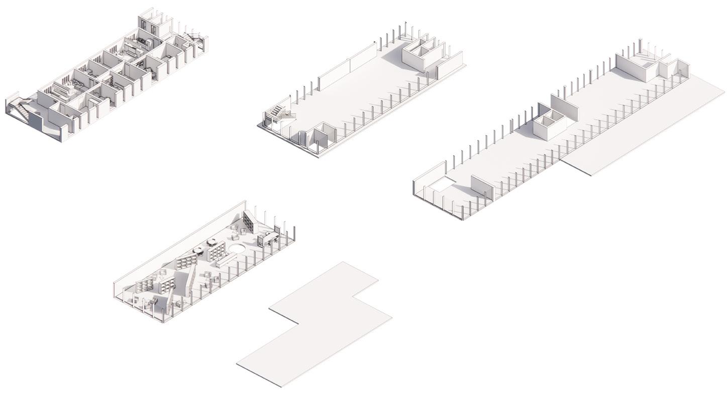
The street is envisioned as an attractor axis from bahnhof to riverfront. It is inspired by the active character of the most populated street - Hauptstrase which houses shopping, eating and recreational functions.

The riverfront is a celebratory space filled with existing trees and safe water zone for kids. It is derived from the existing River Gardens which are an active hotspot for lesiure activities.

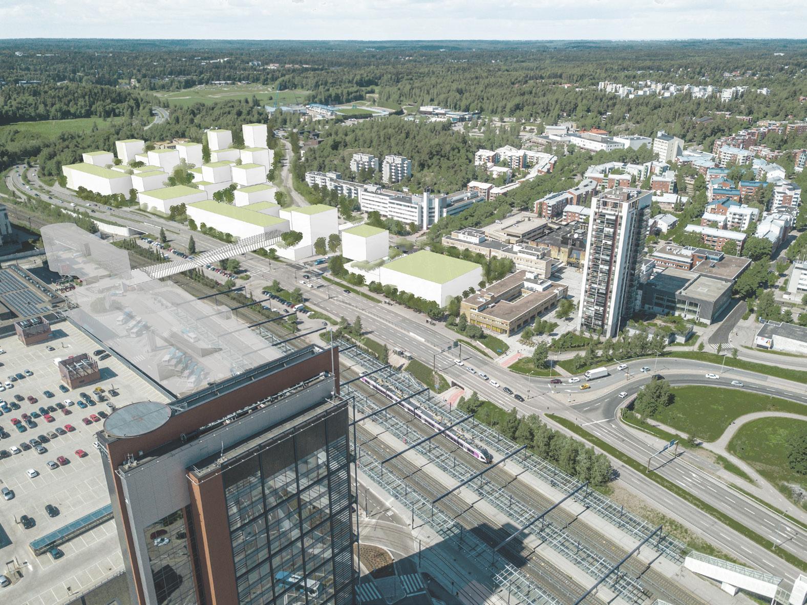
Lepuski 2.0
Espoo, Finland
Project
Competition- Amelie Rost Studio, Berlin

Typology
Urban Design Area
100000 SQM
Role Werkstudent
Softwares
Revit | Rhino | Autocad | Lumion | Photoshop
Learning
Urban Design in Finland | City Planning Studies | Master Plan development in the City Center
Movement*
Design of the net of paths, alleys and connections.
Rest*
Placement to define
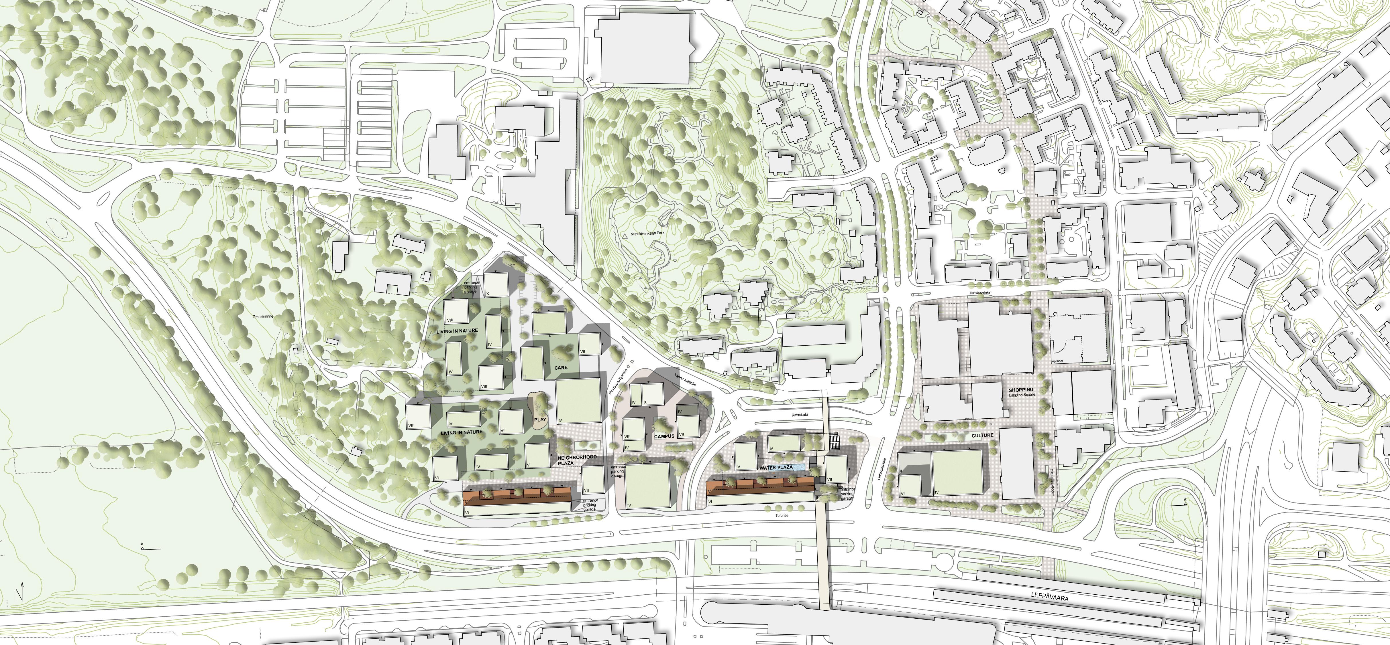
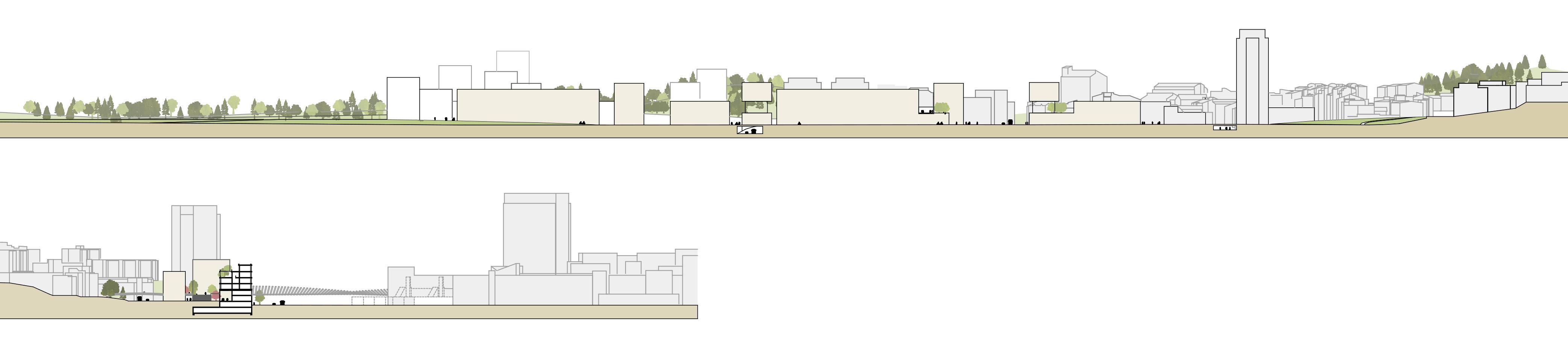
Igot this opportunity to work alongside my Professor Amelie Rost on a Competition to plan the development of City Center in Espoo, Finland. The project started by developing and understanding of the context in terms of its usage, demographics and further opportunities to enhance characteristics of Leppävaara Area.
The objectives of the design are a resource-saving use of the existing structure and the development of a resilient urban structure that can also adapt to changing conditions and requirements. The network provides a stable foundation. It is strong enough to connect the different typologies and uses and flexible enough to adapt to changing conditions. A network of public spaces with different uses and different urban qualities is designed. The architecture and the urban space develop in dialogue.
The focus is on the public space.
*Graphic created by Amelie Rost
2 Principles* Houses in the green Definition of squares
Concept: Weave the City - Weave Roots and Wings
A network of squares and paths with different focal points of use connects and enriches the existing city. The red lines are the metaphorical “wings“. They stand for the future and dynamics. The green lines are the metaphorical “roots“. They stand for grounding and arrival.


Stones + Wood + Green + Water *
Architecturally, the building blocks are conceived as a wooden construction on a solid base. The roofs are intended as green roofs and are part of the rainwater management concept. They absorb water during heavy rainfall and release it into the sewage system at a slower rate.
Connectivity
Central street and cross pathways.
3 Zones
Multi Use
Functions enriching the existing usage with culture, startup and public buildings.
From east to west, the network develops according to use. From south to north, the network is influenced by different speeds. After the railway line and Turuntie, the next speed stage is that of cycling, and after the new and after the noiseprotecting buildings north of Turuntie, the speed slows down and allows for walking and exploring by the pedestrian.
City windows
Wherever there are views across streets from north to south, buildings with an „air floor“ create a metaphorical „window“ to the city.