pt 1 - EXTRACTIVE LANDSCAPES : THE MINING PLATEAU / PUBLIC SPACES
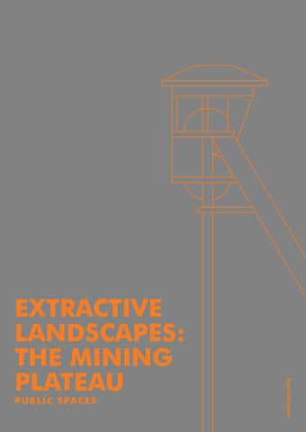
EXTRACTIVE LANDSCAPES: THE MINING PLATEAU
tutor: Agnieszka
Engagement: Craftsmanship studio: Extractive Landscapes - On Being Resourceful academic year: WS 2024-2025
*individual work was preceded by group research summarized in separate booklet
autor: Hana Rafajová
Batkiewicz
THE SPARK.
DESIGN FOCUS.
WHY SO EMPTY?
ARE THESE TOWERS NOT A HEART OF HOUTHALEN?
You can already see them from a distance. They are the symbol, the landmark, the history of Houthalen-Helchteren. You can see from a distance that there are some interesting stories hidden inside of those towers. You have these thoughts, feelings of something mysterious...
You want to find more, to reach them. But is this the right way? Am I even supposed to be here? Is it allowed to come close to those shaft towers? Is it not private land? Wandering between production halls of private companies. No direction indicators. You feel like you are not invited here. The towers run around with fencing, the small paved area overgrown with wild grass and plants. And why so? Are they not a monument? The fragments of past giving the municipality its form? Why not care for them as a memory of history?
The place is quiet - except for the noise from Grote Baan. There is not a person to be seen. Is this place not the heart of Houthalen? Why is it so empty?
This made me wonder... in history, this place really carried the meaning of heart of Houthalen. It was the center of movement, workers and machinery. It was place where the whole municipality meets, because mostly workers were the population of Houthalen. There laid the main building of Houthalen coal mines.
They present that the mining plateau preserved its function. It still serves as a source of work. But it lacks life. The area is like a ghost town.
That is what these drawings represent. The time layers captured in time and speculations about how the life in this place used to be while mines were still alive.
*present days
*ghosts of history
*present days
WHAT ABOUT FUTURE?
THE MISSION : PUBLIC SPACE.
To bring life into the monofunctional industrial area with rich history and nature, the plateau of former coal mine in Houthalen-Helchteren, needed spaces to attract visitors and locals to fullfil the potentitional it holds. The idea was to create public spaces all around the mining plateau, but as an end result the concept developed into designing small elements in public space that will transform proposed visiting loops into one complex connected space, navigating and attracting visitors throughout the mining plateau.
*future vision
SWOT ANALYSIS
STRENGTHS
rooted history preserved remains of the history the most iconic towers of Houthalen-Helchteren position near town hall and Grote Bahn position close to the residential area of Houthalen-Helchteren position close to the anemities large area
WEAKNESSES
not controled urban development of industrial area already build up production halls not in the center of residential area not attractive place for the community place defined by borders of private properties not enough nature and greenery neglected and destroyed remains of the history no focus on discovering and informing abou history of Houthalen-Helchteren
OPPORTUNITIES
open-minded locals rooting for a change reviving the history of place creating a center of Houthalen-Helchteren bringing tourism to the municipality transforming mining square into the fully funtional public space transforming the mining plateau with inplanting the residential function bringing a life into the mining plateau revive the green space mixing functions
THREATS
private lands quick development public space enclosed with large private buildings not enough anemities for people living in residential buildings heat islands
ATTRACTIVE FUNCTIONS
community
community meetings/activities sharing trying new things education fun for kids
courses music festivals sport - activities for youngsters/young adults nice place for having a drink/meal
beacuse of area being distatnt from main residential districts the function for this place must be super attractice for community
historical layer activities nature tourists
MUNICIPALITY HALL
SHAFT TOWERS
MAP OF MINING PLATEAU.
MUNICIPALITY HALL
MAIN BUILDING
SHAFT TOWERS PUMP
MUNICIPALITY
HALL
FUTURE
MAP OF ROUTES.
MUNICIPALITY
REFERENCES
Temporary structures
Campus de Belval / Inessa Hansch Architecte
Campus de Belval / Inessa Hansch Architecte
Small interventions in public space
The Opposite Shore / DOGMA
The Opposite Shore / DOGMA
MAP OF INTERVENTIONS.
CATALOGUE.
SELECTION OF SMALL INTERVENTIONS.
While not creating the single defined public space, the design of the interventions becomes less dependent on the specific context. In which way the interventions can, to some extend, be standardized. Therefore, the catalogue of public space elements has been created as a flexible guide for implementing cohesive and adaptable urban interventions.
DESIGN LANGUAGE
The idea behind the common design language originates in need to create understandable connection between places all around the mining plateau. The specific characteristics same for each element are colour and materiality.
The design language was inspired by history, aiming to connect the atmosphere of the former coal mine with a contemporary concept. During the coal mine era, steel and bricks were the most used materials alongside coal and waste assosiated with it. Steel, as the most iconic artificial element of the industrial age, remains preserved in the shaft towers—landmarks of the mining plateau. For this reason, steel plays a central role in the chosen design language, representing the man-made elements of the site.To emphasize the contrast between past and present, contemporary elements were created using steel highlighted with a bright orange color. This vibrant colour is expressing something
new to connect all the small interventions into a one project. In contrast with these contenporarry structures is their natural surrounding. The properties of the steel are also ideal for creating temporary structures, that can be easily removed and disassambled without having an impact on the environment they are placed in. For blending in the nature the natural material has been chosen. Schists, a byproduct of coal mining, play a significant role in the soil composition of the plateau. Those are creating the characteristic black gravel-like look and offer a smoother and more compact alternative to conventional paving gravel.
TYPES OF SPACES
The concept of spaces consists of two types: spacial and linear. Spacial spaces are represented as “stop“ places: spaces where people stay for longer period of time. For example spaces with specific function as sports, playgrounds, grill spot or stage for performence. Linear spaces are represented by movement. These places are mostly used while passing through and people usualy spend just a short time there on their route. For example small linear playground elements, skateboard obstacle,benches or information panels.
IDEAS BEHIND THE DESIGN
small interventions
instread of focusing on creating few complex public spaces the idea behind the design is to connect the mining platau with many small elements
temporary structures
temporary structures are quick to install and easy to remove or relocate in time of change leaving the environment untouched
reducing impact on environment
impact on enviroment is reduced by minimizing interference to the topography, soil or flora by creating solutions like lifting structures above the ground
mountable structures
these structures are quick to assambe and disassambe, easy to transport and after the use their parts can be reused in other structures
leading
small elements in a whole area possess common design characteristics that, as magnets, force visitor to follow them
connecting with history using materials to connect history and present. Chosen steel is the most recognazible artifitial material of industrial era and can be easily recycled
ROAD.
One of the most crucial part of the area is the road that connects Grote Baan, the western part of Houthalen and the mining plateau/Centrum Zuid. Accessible by foot, bus, car, or bicycle, this road crosses through the heart of the plateau, dividing it into two sections: the northern part, where the old coal mine once stood, and the southern part, where the mining hill has been flattened. This road serves as the primary transport and connection hub, not only for the area itself but also for the planned visitor loops. Given its significance, the road has become a central focus for the design of the area’s elements.
NAVIGATION COLUMN.
The planned routes for visitors are easily recognizable in map, but it is not always easy for people to navigate in actual space itself just based on map. Based on this manner the idea of navigation column came up. Matching the other elements on route, a series of minimalistic navigation pillars are placed at regular intervals of aproximately 100 meters within a public space. These pillars are intended to guide people along a designated route, ensuring that the next pillar is always visible in the distance, providing clear directional cues and a sense of orientation.
flowerbed grass area asphalt walkway asphalt road
cruciform
LINEAR PLAYGROUND.
Some public spaces serve primarily as transit areas, such as loops or roads. These places are used for movement, with people simply passing through to reach their destination. Even thought they are often not seen as attractive or inviting enough to become the final destination for people to stop and spend time in that does not mean they can not be enjoyable in other ways.
The linear playground is designed as a space where children may spend only a few seconds, but even a brief moment of fun can make the journey more enjoyable and feel psychologically shorter.
ø180 mm variant 1 step plain
concrete fundation
cruciform steel column
height 400m
width 200mm
depth 200mm
thickness 10mm
variant 2
ø100 mm step plain
concrete fundation
cruciform steel column
height 400m
width 200mm
depth 200mm
thickness 10mm
ø60 mm step plain variant 3
concrete fundation
cruciform steel column
height 400m
width 200mm
depth 200mm
thickness 10mm
flowerbed
black cloured shists gravel asphalt pathway
SPOT PLAYGROUND.
The spot playground follows the same concept as the linear playground but is designed to provide enjoyment for a longer period of time. Unlike the linear playground, which offers brief moments of fun, the spot playground is considered as a “soft stop” — a place located within transit public spaces that encourages people, especially children, to pause and engage.
Children are expected to stop on their way to a final destination and spend several minutes playing. This design allows the spot playground to be combined with other features aimed at adults, such as informational boards or maps, giving parents an opportunity to engage with the space in a different way than their children.
flowerbed grass area aphalt road aphalt walkway
concrete fundation
cruciform steel column
height 400m width 200mm
depth 200mm thickness 10mm
BENCH.
Benches are an essential element of public spaces, especially in areas of transit. They are not only places to rest or observe but also serve as navigation points or landmarks. Ideally, benches should be integrated with other elements, allowing people to rest while also engaging with their surroundings — whether by watching children play or learning from an informational board. Or who knows? Maybe they can be also used other creative ways... like skateboard obstacle?
1700 mm sitting board
cruciform steel column
height 700m width 200mm
depth 200mm thickness 10mm
concrete fundation
grass area
road asphalt pathway flowerbed
black cloured shists gravel
INFORMATION BOARD.
Information boards are a vital part of nature trails, offering more than just directions or facts. They invite visitors to pause, learn, and connect with their surroundings. Placed thoughtfully, these boards can enhance the trail experience by highlighting unique features, sharing stories of the local environment, or simply serving as a moment of rest and reflection. Whether it’s studying a map, discovering fascinating details about local wildlife, or sparking curiosity in a young explorer, an information board can transform a simple walk into a deeper journey of discovery.
grass area road flowerbed black cloured shists gravel asphalt pathway 4 5 bushes