CRATERS COAST TO
LANDSCAPE ACTION PLAN

Acknowledgement of Country
Aboriginal people have a long-held and enduring connection to the land and waters of the area now known as the Heytesbury region. We respectfully acknowledge the Kirrae Whurrong People of the Maar Nation as the Traditional Owners of the Craters to Coast area outlined in this document including the Curdies River and its catchment, and east to Gellibrand River. We pay our respects to Elders past and present.
Eastern Maar Aboriginal Corporation is the Registered Aboriginal Party that represents the cultural obligations, rights and assertions of the Eastern Maar. We acknowledge the vision of Traditional Owners for Country as outlined in the Eastern Maar Nation Statement Water is Life Roadmap and Eastern Maar Country Plan Meerreengeeye ngakeepoorryeeyt. We commit to ongoing learning about Traditional Owner cultural and ecological knowledge and supporting a shared vision for the care of Country.
Craters to Coast Landscape Action Plan
The Heytesbury region is a predominantly rural landscape extending from volcanic plains and crater lakes to temperate forests, limestone cliffs and coastal wetlands. This diverse environment underpins productive agriculture, thriving communities and significant natural assets.
However, the region is increasingly exposed to climate pressures—altered rainfall, rising temperatures, declining water quality and shifting ecological function— that require coordinated, long-term action. With farmers managing more than 80% of the land, the scale of the challenge calls for shared investment, innovation and partnership.
The Craters to Coast Landscape Action Plan (the Plan) provides a clear roadmap to build climate resilience, strengthen natural capital and deliver measurable environmental outcomes that support profitable, future-ready farm businesses. It outlines priority landscapes, key risks and opportunities, and the actions needed to secure environmental and economic benefits for the region.
Collaboration between farmers, industry, government, business and supply chains is central to the Plan. Investments in nature are increasingly recognised as essential to secure supply, reduce climate and market risk, and meet Environmental Sustainability Goals under Greenhouse Gas Protocols Scope 3 and sustainability commitments. The Plan translates this global momentum into tangible, on-ground pathways backed by science, local knowledge and strong landholder demand. Heytesbury District Landcare Network (Heytesbury Landcare) will work with partners across the region to accelerate adoption of best-practice, climateadapted land management and emerging technologies.
INVESTMENT IN NATURE
The Plan identifies clear pathways for private, public and philanthropic investment in biodiversity enhancement, carbon sequestration, natural asset restoration and resilient agricultural systems. Investors gain value through improved natural capital, stronger supply chains, climate-ready production, transparent reporting and reputational benefits associated with credible, co-designed and scalable environmental projects.
PRIORITY ACTIONS
The Plan focuses on practical, high-impact interventions:
• Riparian restoration to protect land–water interfaces, reduce erosion, improve water quality and maintain wildlife corridors.
• Native vegetation and habitat enhancement to boost biodiversity and reduce climate risk across farms.
• Enhanced farm dams through stock exclusion, revegetation and habitat creation to improve water quality, productivity and ecological function.
• Adaptive farm management supported by science, monitoring and continual learning.
EXPECTED OUTCOMES
Scaling up climate-adapted practices and restoring natural assets will deliver:
• Measurable improvements in water, soil, biodiversity and habitat connectivity.
• Profitable, resilient farm businesses equipped to adapt to future climate conditions.
• Stronger community engagement and stewardship of natural capital.
• Diversified investment pathways that attract private, public and philanthropic partners.
About the Plan
The Craters to Coast Landscape Action Plan has been developed by Heytesbury Landcare with generous support from The Ian Potter Foundation and the Natural Resources Conservation Trust through Landcare Victoria’s New Futures for Victorian Landcare project.
Heytesbury Landcare was one of two Landcare regions funded in 2025 to undertake this work, delivered in partnership with Landcare Victoria Inc., Regen Farmers Mutual, ANU’s Sustainable Farms, and the Landscape Finance Lab.
Ten farm businesses—nine dairy and one beef—collectively known as the Pilot 10, were selected at the outset and played a central role in shaping the Plan. Through a structured co-design process, these landholders contributed their insights alongside key local stakeholders, including the Corangamite Catchment Management Authority, Glenelg Hopkins Catchment Management Authority and Corangamite Shire.
We gratefully acknowledge the contributions of our partners, the Pilot 10, and all stakeholders involved in developing this shared vision and roadmap. The Plan reflects qualitative input gathered across multiple workshops and meetings during the second half of 2025, which was refined by the Craters to Coast Working Group into this final document.
This Plan is intended as a catalyst—providing a framework to foster multi stakeholder and community collaboration, enable coordinated, landscapescale action, and seek new investment. Its purpose is to help protect and enhance our ecologically and culturally significant environment while supporting the region’s capacity to continue producing high-quality food and fibre.
Craters to Coast Landscape Action Plan
Strategic objectives
SHORT VERSION:
Thriving farms, biodiverse landscapes, connected communities
FULL VERSION:
From the Craters to the Coast - a thriving and resilient region, sustained by agriculturally productive and biodiverse landscapes, and connected communities
Guiding principles
Water and Catchment Health
Healthy waterways and catchments sustain biodiversity, agriculture, and community wellbeing.
Biodiversity and natural capital
Restore and connect habitats, enhance ecosystem function, and embed biodiversity as a driver of regional prosperity.
Sustainable and productive agriculture
Strengthen the productivity, resilience, and sustainability of the region’s farming systems.
Community and learning
Build knowledge, participation, and shared custodianship through learning and connection.
Resilient Landscapes – Natural systems are valued for their intrinsic worth and managed to sustain biodiversity, healthy waterways, productivity, and community wellbeing in a changing climate.
Healing Country – Recognise, respect and learn from the enduring cultural connection between people and Country. Support actions that protect and restore land and water systems as living, connected landscapes that provide for both nature and community.
Stacked Benefits – Encourage actions that maximise gains for landholders, the environment, and the community. Align planning and investment to achieve shared value and long-term landscape resilience benefits.
Collaborative Stewardship – Foster strong landholder, community, stakeholder and Traditional Owner connections and work collaboratively to identify and deliver shared outcomes. Align efforts, avoid duplication, and build on existing programs to accelerate positive environmental, agricultural and community results across the landscape.
Innovation and Learning – Integrate local knowledge and evidence-based science to guide adaptive management and continually improve decisions, performance, and outcomes.
Community Connection – Strengthen community connection and participation by empowering people to work together in caring for and enjoying the region’s natural landscapes.
By 2050 …
Long-term outcomes
Water and Catchment Health
Waterways are healthy, resilient, and valued as living assets, supporting aquatic habitats, agriculture and cultural values.
60 landholders with stream frontage undertake riparian rehabilitation:
• planting 325,000 native species
• protecting 90kms of waterways
By 2035 …
Medium-term outcomes
Inspired communities support plantings and monitor biodiversity, species and water quality outcomes.
Sightings of platypus in the Curdies River are regularly recorded.
The prevalence and intensity of blue-green algal outbreaks in the Curdies declines.
Biodiversity and natural capital
Nature-positive land stewardship by communities, farmers and investors is regenerating biodiversity and ecosystem function for future generations.
270 landholders create biolinks:
• planting 337,500 native species
• building 90kms of vegetated corridors
Engaged communities actively support establishment of wildlife corridors and seed propagation.
Supply chains reward farmers for biodiversity interventions and reducing carbon emissions intensity.
Sustainable and productive agriculture Community and learning
Empowered, resilient farmers adopt modern farming practices to manage climate variability and meet societal expectations for land stewardship and food production.
50% of farmers have effective drought management plans in place for management plans in place for water quality and security, and climate resilience.
30% of farmers exclude livestock from streams, farm dams and wetlands and create native plant buffers.
Drought adaptation supports a diverse and resilient food production system across the landscape.
Knowledgeable, cohesive communities are strongly connected to nature through shared learning and participation in environmental projects.
Traditional Owners are valued project partnerstheir cultural and ecological knowledge is incorporated into land and water restoration activities across the landscape.
Heytesbury Landcare facilitates ongoing learning and engagement opportunities through a range of field days, public forums, communication material and digital platforms.
Knowledgeable and supported communities regularly participate in landscape restoration activities, and environmental and species monitoring projects.
By 2030 … Short-term outcomes
• Implementation of the Craters to Coast Landscape Action Plan is underway, supported and promoted by paid coordination
• A Biolinks Strategy is developed and areas are prioritised for environmental, riparian and shelterbelt plantings
• Landholders are supported to undertake revegetation programs for remnant, riparian and wetland habitats, farm dam enhancement, and shelterbelts
• An additional 50kms of the Curdies River is protected through livestock exclusion and riparian rehabilitation
• Pilot wetland restoration projects commence to improve water and nutrient retention in sensitive areas
• Landholders use Whole Farm Planning tools to protect and enhance natural capital
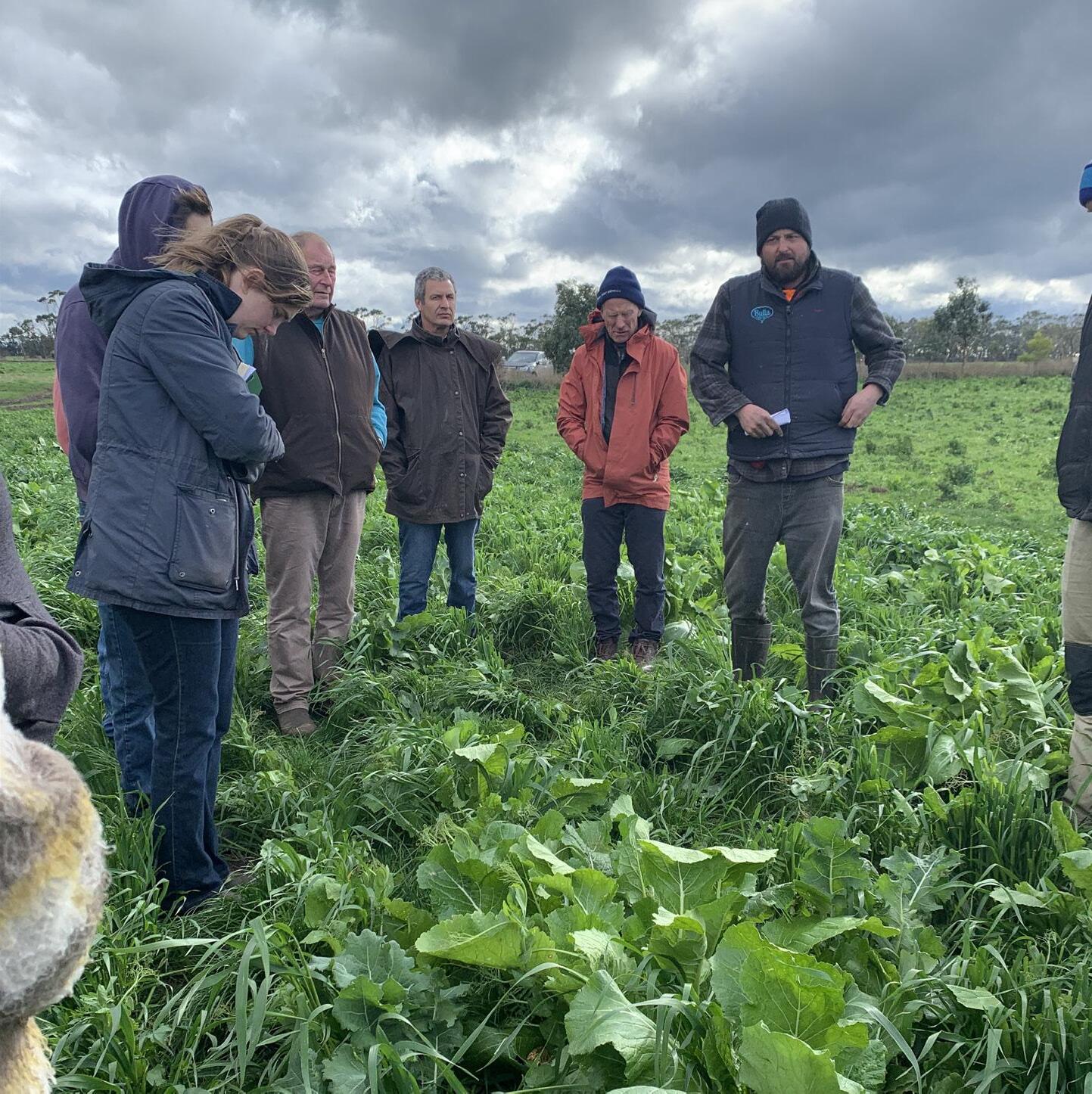
• A demonstration farm program and discussion group is established with focus on sustainable practices, innovations and technologies
• Food and fibre producers understand their role in lowering greenhouse gas emissions and sequestering carbon
• Farmers participate in existing industry programs to optimise soil health, grow and manage a feed base, and effectively manage their water and nutrient resources
• Landholder aggregations work with supply chains and new and emerging markets to incentivise restoration interventions
• Knowledgeable and supported communities participate in landscape restoration activities, and citizen science species and environmental monitoring projects
Why it’s important to invest at landscape scale
The challenges we face—climate change, biodiversity loss, declining soil and water health—do not follow fence lines. They are ecological, economic and social issues that operate across whole catchments, regions and ecosystems. Tackling them effectively and collectively requires landscape scale approaches and solutions to deliver co-benefits.
This program applied the 4 Returns Framework1 for Landscape Restoration¹ to guide the Plan’s development and shape the landscape action priorities. The framework provides a practical, whole-of-landscape approach— owned and informed by all sectors—to generate:
RETURN OF INSPIRATION
A shared, region-wide vision builds confidence and motivation. Landscape-scale action inspires communities, partners and investors by showing that collective effort can deliver meaningful, lasting change.
RETURN OF SOCIAL CAPITAL
Coordinated action strengthens relationships between landholders, Traditional Owners, agencies and communities. It supports collaboration, knowledge-sharing and capacity-building that cannot be achieved through isolated projects.
RETURN OF NATURAL CAPITAL
Ecosystems function across whole landscapes. Investing at scale restores habitat connectivity, improves hydrology, regenerates soils and rebuilds biodiversity in ways that are ecologically significant, resilient and measurable.
RETURN OF FINANCIAL CAPITAL
A regenerated landscape boosts agricultural productivity, diversifies revenue streams, reduces climate and market risks, and creates stronger, more investable environmental outcomes. Financial returns are more durable when generated across an interconnected region.
1. The
4 Returns Framework for Landscape Restoration, Dudley et al. 2021.
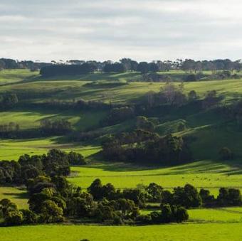
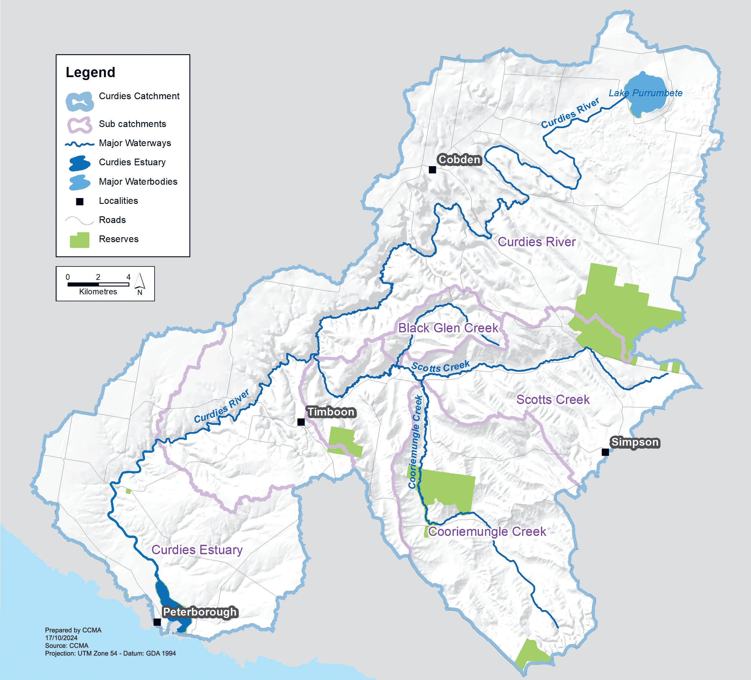
Our landscape
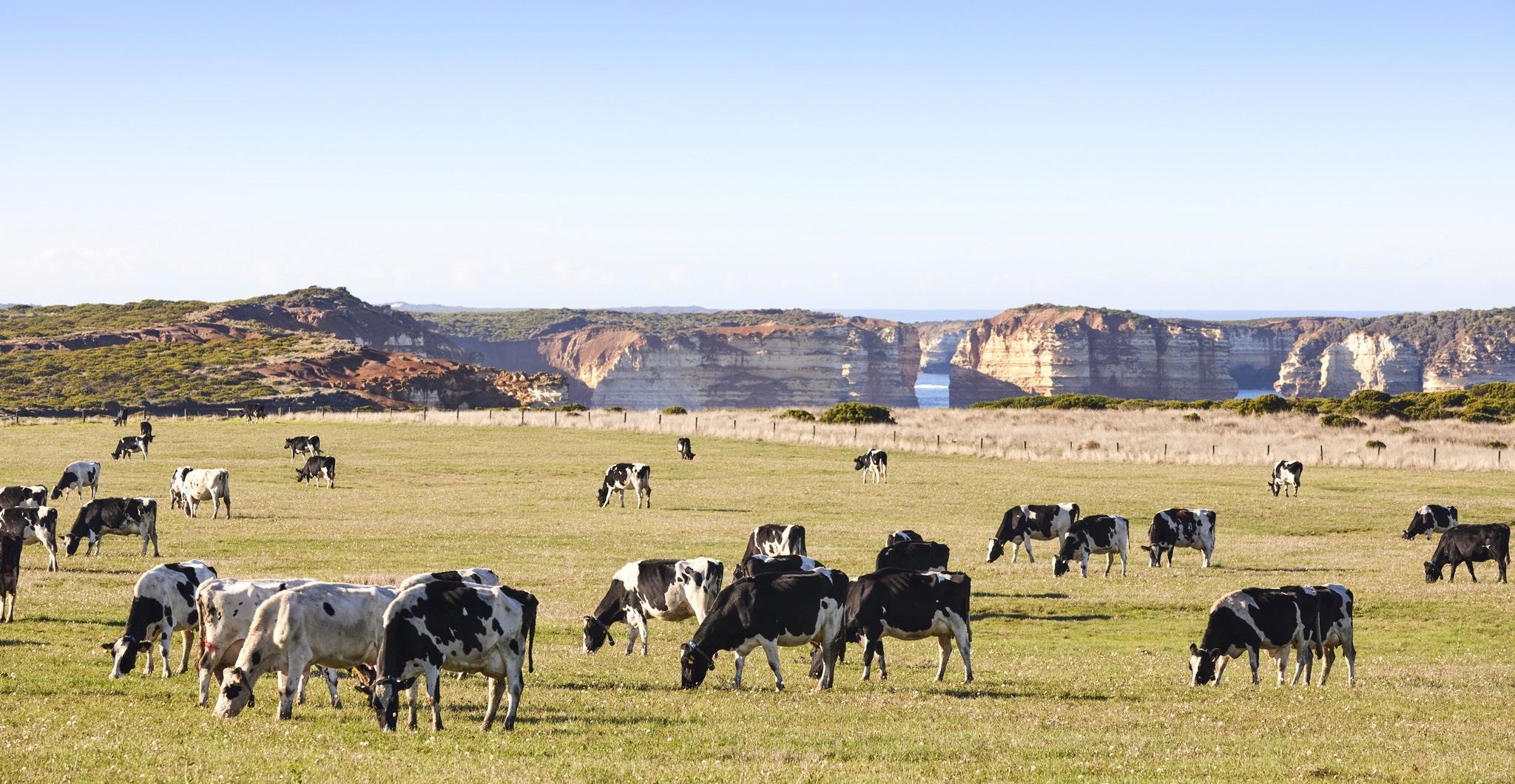
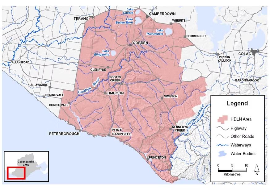
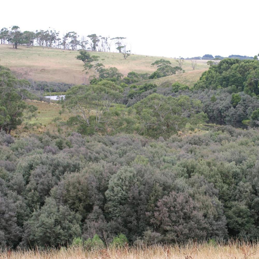
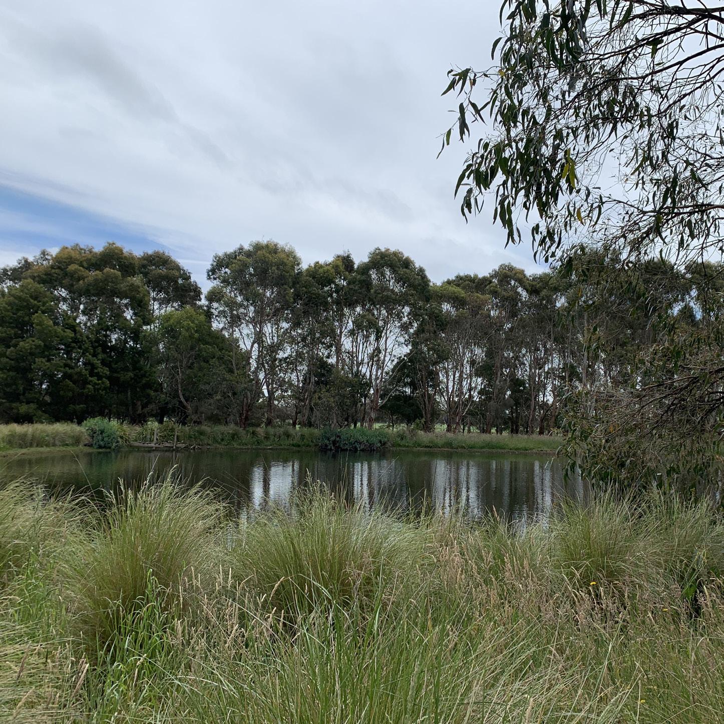
Heytesbury Landcare works across 200,000-hectares of predominantly rural landscape stretching from the volcanic plains, mountains, and crater lakes in the north, through temperate forests and wet gullies, to the rugged limestone cliffs and coastal wetlands of the south.
The landscape lies mostly within the southwest region of the Corangamite Catchment Management Authority, extending into the Glenelg Hopkins Catchment Management Authority boundaries in the west. It covers the southern half of Corangamite Shire and incorporates the towns of Camperdown, Cobden, Timboon, Peterborough, Port Campbell, Princetown and Simpson. For millennia, this Country has been cared for by the Traditional Owners including the Kirrae Whurrong People of the Maar Nation1
The landscape features internationally renowned limestone formations—including the Twelve Apostles and other iconic coastal stacks along the well-travelled Great Ocean Road—set within an area of high ecological and agricultural value. The Curdies River Valley boasts highly productive soils, while its protected salt-wedge estuary supports biodiversity of national significance.
Across the district, national parks, state reserves and farmland support scattered remnants of native vegetation including rare Ecological Vegetation Classes. These diverse habitats habitats such as eucalypt woodlands, wet heathlands, estuarine wetlands and volcanic stony rises2 provide for many threatened plant and animal species. To the east, the landscape connects with the Gellibrand River, the nationally important Princetown wetlands, and the Otway Range, a key regional biodiversity hotspot3
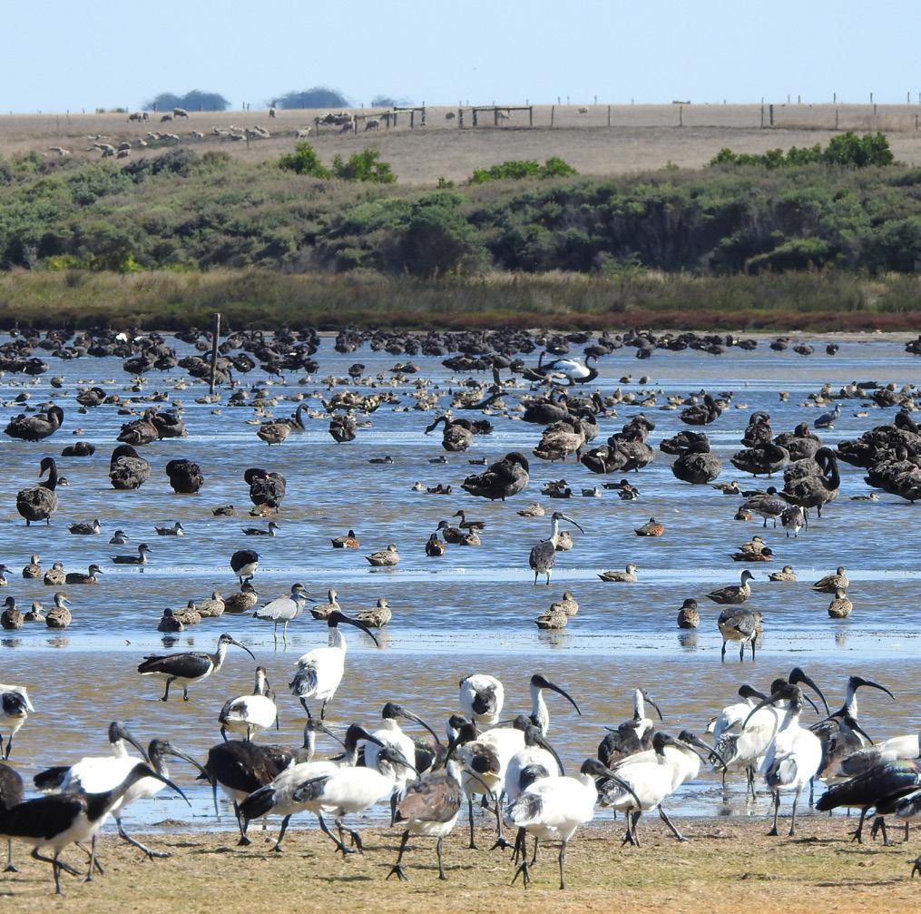
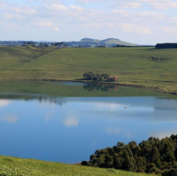
Image courtesy Kerry Vickers
A LANDSCAPE SHAPED BY CHANGE
Prior to European settlement, the expansive Heytesbury Forest characterised by eucalypts and stringybark trees covered much of the landscape. Ecologically diverse habitats included wet eucalypt forests, swamp and riparian communities, heathy woodlands, damp heath scrub, and coastal saltmarsh. The arrival of the Camperdown–Timboon railway in the 1890s accelerated the expansion of the timber and dairy industries4. Largescale clearing through soldier settlement schemes in the 1920s and 1950s further transformed the landscape and laid the foundation for the modern dairy industry5
These changes have created a productive but highly modified landscape. Today, native vegetation covers only 10% of the Heytesbury area, while non-native pastures for grazing occupy around 81%. Other land uses include hardwood plantations, irrigated horticulture and exotic woody vegetation3. Most remaining native vegetation is classified as rare or vulnerable, with some communities—such as Swamp Scrub—listed as endangered.
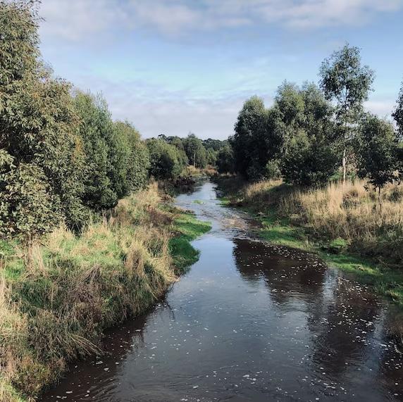
WATERWAYS AND HYDROLOGY
The region’s waterways flow to two intermittently open salt-wedge estuaries—the Curdies and the Gellibrand— which underpin local agriculture, tourism, environmental values and community wellbeing.
• Curdies River and tributaries (Scotts Creek and Cooriemungle Creek) flow to the Southern Ocean at Peterborough. The estuary is nationally significant, although the mid and lower reaches experience highly modified flows due to farm dams and diversions.
• Gellibrand River, fed by the Otway Ranges, provides high-quality water supporting important aquatic and riparian ecosystems. The river is a key water source for domestic supply, providing two-thirds of Wannon Water’s demand for towns including Warrnambool, Koroit, Terang and Cobden6
Other waterways—including Port Campbell Creek and Sherbrook River—contribute to the region’s coastal and freshwater ecosystems.
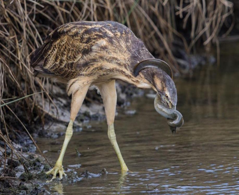
SIGNIFICANT SPECIES AND HABITATS
Despite fragmentation, the remaining natural habitats including about 5,000 hectares managed for conservation purposes3, support a rich array of significant species.
• The Curdies Estuary and associated wetlands support around 40 rare or threatened bird species, including the Australasian Bittern, Orange-bellied Parrot and Latham’s Snipe.
• The Gellibrand Estuary and Princetown wetlands provide habitat for at least 88 recorded native bird species, such as the Eastern Great Egret, Royal Spoonbill, Powerful Owl and Rufous Bristlebird7
• Coastal rivers and streams support migratory and freshwater fish, including the vulnerable Yarra Pygmy Perch and Australian Grayling, and blackfish in some systems.
• Wetlands, streams and farm dams provide habitat for the threatened Growling Grass Frog.
• The Platypus occurs in the Gellibrand River and in late 2025 a platypus was captured on video in the Curdies River - the first verfied sighting in over 20 years. The Australian Platypus Conservancy confirmed the sighting of the platypus which was throught to be locally extinct in the Curdies River!8
Vegetation communities such as eucalypt woodlands, riparian forests, swamp scrub and wet heathlands support threatened mammals, including the Yellowbellied Glider, Swamp Antechinus and Southern Brown Bandicoot.
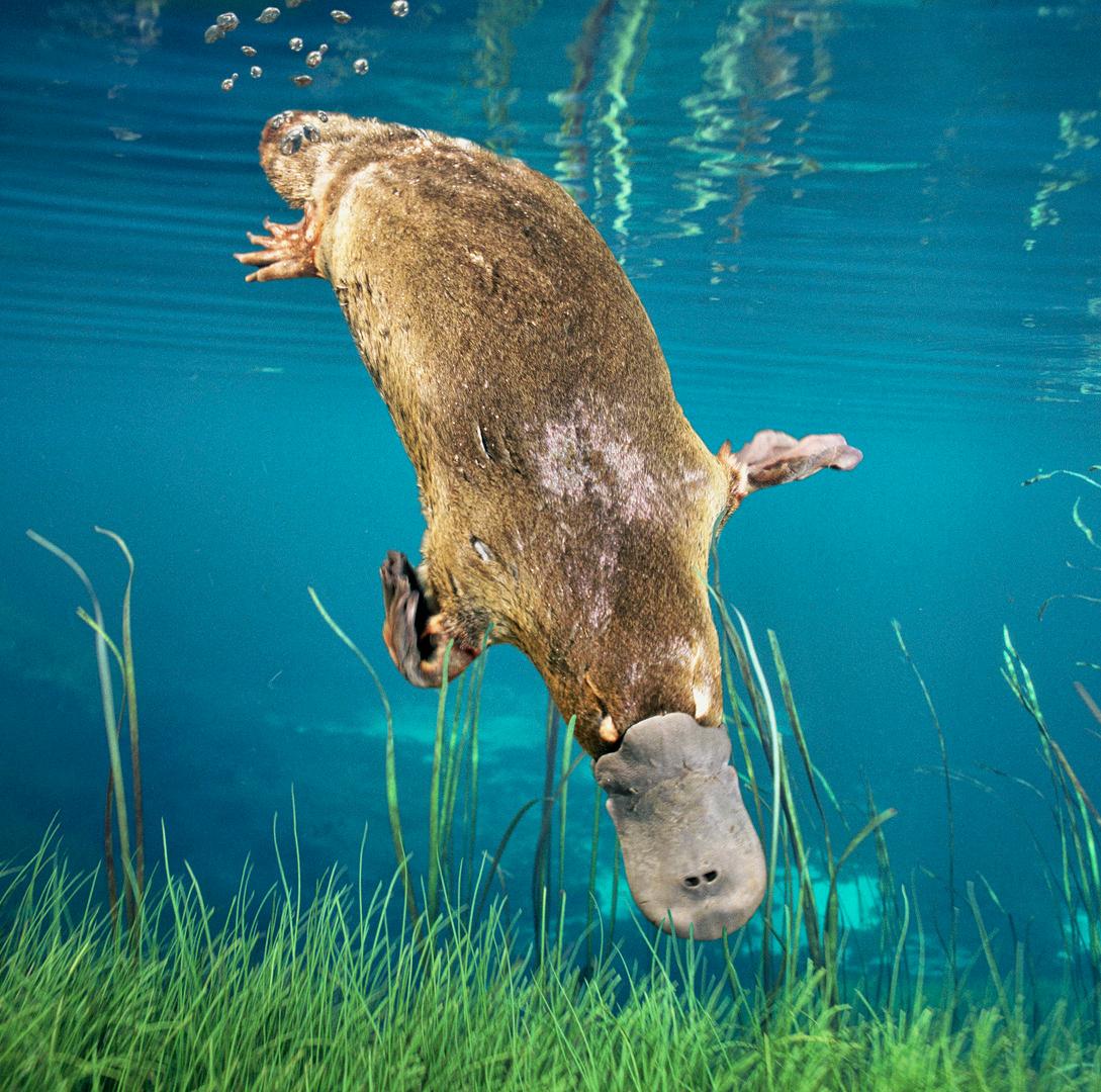
Image courtesy
Dave Watts
OUR ECONOMY
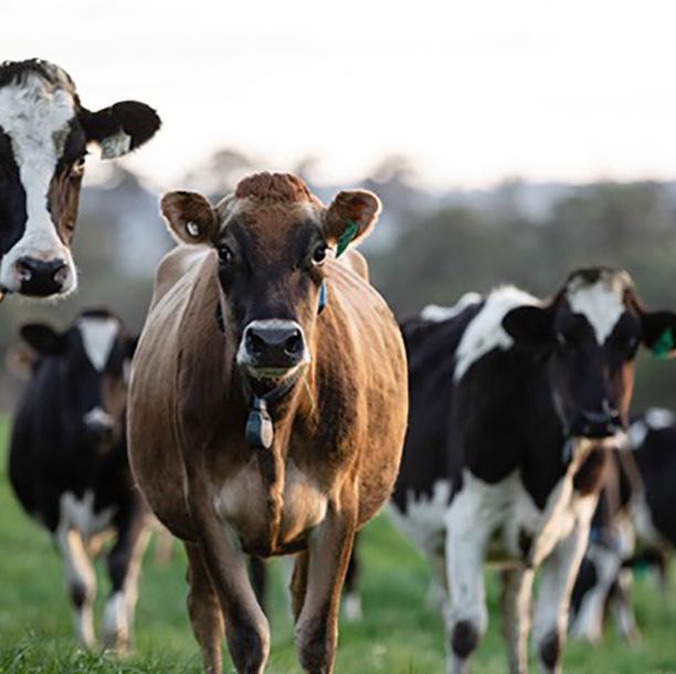
Agriculture is the economic backbone of the region. Together with forestry and fishing, it contributes $745 million annually employing around 1,400 people8 Farm businesses account for more than 80% of land use. The Heytesbury district is one of Australia’s highestproducing dairy regions due to its fertile soils and reliable rainfall. This industry underpins the prosperity of local towns such as Cobden and Timboon, supported by beef production, sheep grazing and an expanding plantation forestry sector.
Tourism is an important industry—particularly in coastal communities—where natural assets, national parks and world-class scenic landscapes attract millions of visitors each year. Investment in environmental restoration, trail networks, estuary health and nature-based experiences directly supports local businesses and strengthens the regional economy.
The area also comprises a significant fossil gas industry around Port Campbell which produces, stores and supplies gas to the East Coast market.
OUR COMMUNITY
The region is home to four public primary and secondary schools and a network of rural townships with deep community ties and a strong volunteer culture. Representatives from our farming, health, environmental, tourism, and emergency services sectors regularly support community programs and school events. This includes the highly-commended Timboon Agriculture Project (TAP) - a partnership with the school, industries and community to support curriculum and applied learning.
Numerous environmentally focussed groups —including Timboon Field Naturalists, Port Campbell Biolinks, Landcare groups and citizen scientists involved in
EstuaryWatch, Waterwatch and bird monitoring— play a vital role in understanding and strengthening ecosystem health, restoring habitat and advancing community stewardship. This active participation builds local knowledge, enhances resilience and helps drive on-ground changes in the landscape.
ABOUT US
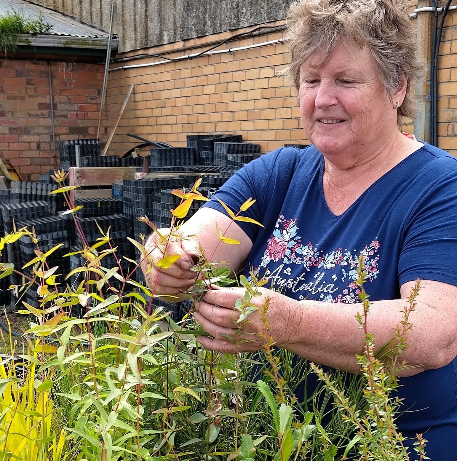
Heytesbury Landcare brings together a strong coalition of Landcare and community groups working to protect and restore one of southwest Victoria’s most productive and iconic landscapes. Since 1996, we’ve supported local groups across the Heytesbury region—linking community effort, practical action and regional priorities. Our work includes:
• Restoring habitat and creating native vegetation corridors.
• Operating a local native seedling nursery to supply restoration projects and community gardeners.
• Protecting waterways, remnant bush and priority ecosystems.
• Tackling weeds and invasive pest animals.
• Supporting sustainable, profitable farming practices.
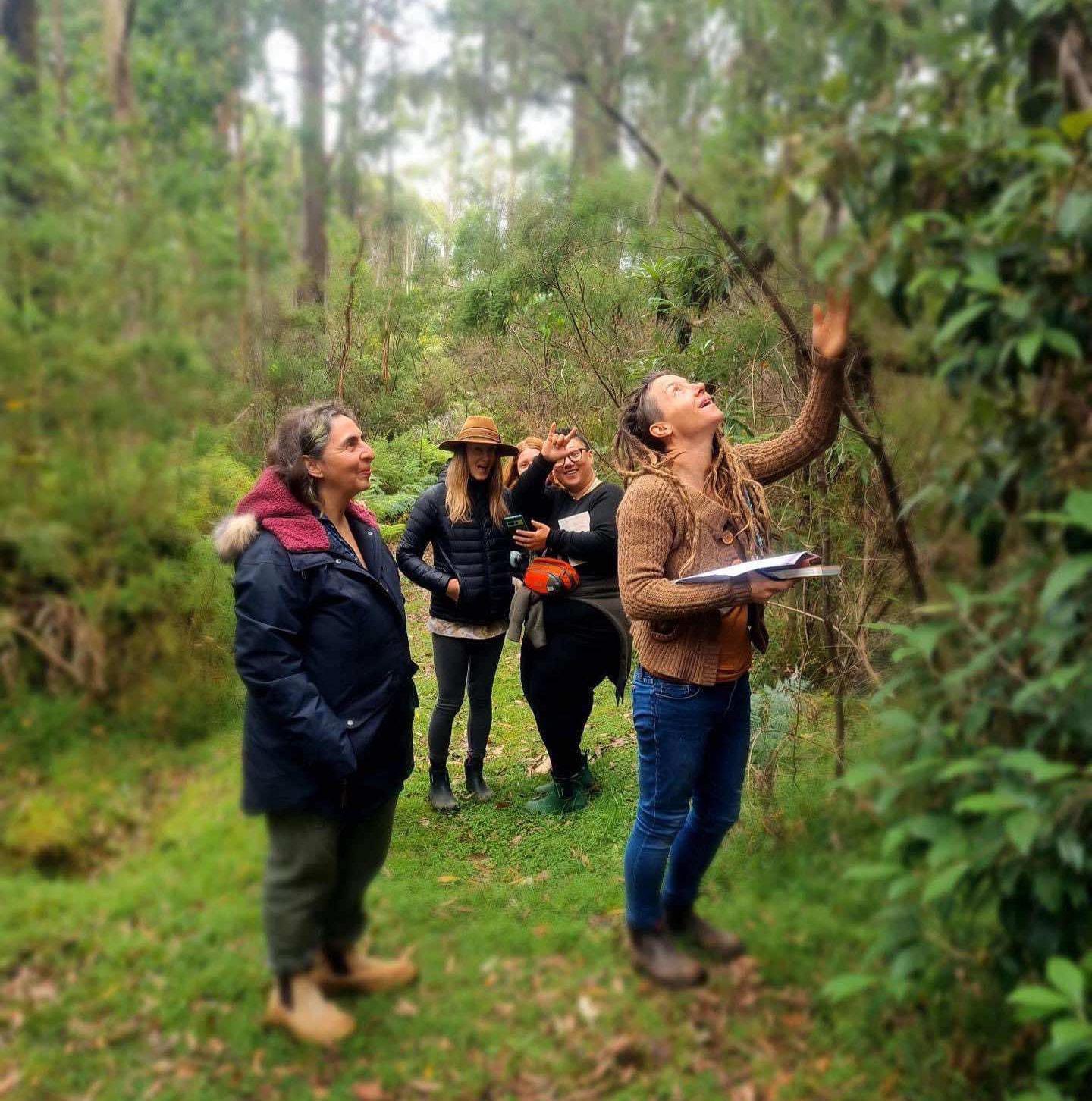
• Engaging communities through education, field days and citizen science.
With deep local knowledge and strong community partnerships, Heytesbury Landcare drives practical, collaborative action that keeps the local landscape healthy, productive and resilient.
1. Eastern Maar Aboriginal Corporation, Meerreengeeye ngakeepoorryeeyt (Eastern Maar Country Plan), 2015
2. Department of Energy, Environment and Climate Action, Bioregions and EVC benchmarks, 2004
3. Corangamite Catchment Management Authority, Corangamite Regional Catchment Strategy, 2024
4. Victorian Places, The Missing Forest – Volume 2 (Heytesbury Forest), 2023
5. Duruz, R., Death of a forest: A story of the Heytesbury Shire, 1974
6. Wannon Water, Otway Supply System, 2025
7. Hansen, B., Bird survey and reports for selected Corangamite estuaries, Arthur Rylah Institute for Environmental Research Technical Report Series No. 211, 2010
8. Remplan Economic Profile, Corangamite Shire website, Business/Economic Development & Investment, 2025
In developing the Plan, the region was divided into discrete landscape management units, each with current or potential interventions on public and private land. These interventions formed the basis of the Plan’s proposed actions.
LAND MANAGEMENT UNITS
Remnant vegetation (threatened EVCs)
INTERVENTIONS TO PROTECT LAND MANAGEMENT UNITS
• Fence and exclude stock
• Revegetate/assist regeneration for habitat complexity
• Increase protection e.g. weed and pest species control
• Remove causes of degradation
• Monitor species and richness
• Collect seed and propagate native species
Shelter belts
Wetlands
Waterways and riparian zones (including volcanic lakes)
Pasture/Grazing paddocks
Dams
Effluent ponds
Peat areas
Coastal waters
• Fence and exclude stock
• Establish native vegetation (trees, shrubs, grasses)
• Ongoing protection e.g. weed and pest species control
• Connect with other habitats e.g. riparian, remnant
• Hydrological restoration – re-establish natural water regimes for wetland process and landscape rehydration
• Fence and exclude stock
• Revegetate/assist natural regeneration using plants
• Control weeds and pest animals
• Stabilize acid sulphate soils
• Monitor species and richness
• Fence and exclude stock
• Revegetate/assist regeneration for habitat complexity (terrestrial and instream)
• Ongoing protection e.g. weed and pest species control
• Education and management to prevent nutrient inputs from farm paddocks
• Manage water flow, drainage and water infiltration
• Optimise grazing regimes to protect soil structure and support fodder production across seasons
• Nutrient management to optimise plant production and prevent nutrient losses
• Monitor soil health and moisture
• Optimise water use efficiency for irrigated systems
• Support farm trials and discussion groups with a sustainable agriculture focus
• Enhance farm dams
• Fence and exclude or limit stock access
• Plant vegetative buffers and trees to filter sediments and nutrients and reduce evaporative loss
• Provide off-dam water sites for livestock or hard surface access points
• Fence effluent ponds and plant vegetative buffers where possible
• Measure nutrient values of effluent
• Apply collection, storage and re-use best practice
• Stabilise and preserve
• Fence and exclude livestock
• Marine protected zones
• Improve water quality in streams and estuaries
Threats and strengths
Our region is home to diverse habitats, iconic natural features, cohesive communities, and a strong food, fibre, tourism and energy economy. However, several interconnected challenges threaten our ambitions for landscape-scale restoration, sustainable agriculture, and empowered communities.
CLIMATE CHANGE
Climate change is a defining challenge for our landscapes, economies and communities, and must be central to all planning. Average temperatures are expected to rise across all seasons, resulting in more hot days and warm spells, fewer frosts, declining winter–spring rainfall, and more intense extreme rainfall events.
ECONOMIC UNCERTAINTY AND RISING COSTS
Cost pressures and market uncertainty limit farmers’ capacity to invest in vegetation, soil, biodiversity and carbon initiatives. Supply chains offer few incentives or premiums for nature positive outcomes, while existing environmental markets remain costly, complex, and poorly suited to the region’s intensive agricultural systems.
CULTURAL VALUES AND CONNECTIONS
Descendants of the Maar Nation clans maintain a deep and enduring connection to Country despite a history of dispossession. Without meaningful engagement and recognition of their cultural values and priorities, Traditional Owners are marginalised, and opportunities for shared learning, co-design, and culturally grounded conservation outcomes may be lost.
SOIL AND LAND DEGRADATION
Legacy land clearing and intensive livestock grazing have contributed to pugging, compaction, erosion and soil acidification. Increasing climate variability will exacerbate these pressures as landholders navigate grazing regimes and fodder production under shifting seasons and more frequent extreme events.
BIODIVERSITY LOSS AND FRAGMENTED HABITATS
Native vegetation now covers just 10% of the region, largely as isolated remnants within an 81% grazed landscape. This fragmentation undermines ecological function—impacting water quality, pollination, soil health, agricultural productivity and community wellbeing. Climate change, limited investment, and challenges controlling pests and weeds further exacerbates biodiversity loss.
WATER QUALITY AND FLOWS
Highly modified waterways and wetlands, and degraded riparian zones affect water quality, flows and ecological resilience. Excess nutrients, erosion, sedimentation, algal blooms and drainage impacts present ongoing challenges for landholders and the wider community.
COMMUNITY DYNAMICS AND PARTICIPATION
A strong economy supports a stable population and vibrant volunteer culture. However, limited community awareness or acceptance of our vision—combined with increasing volunteer fatigue—may constrain our capacity to deliver positive, landscape-scale change.
THREATS TO OUR LANDSCAPE AND COMMUNITY VISION
STRENGTHS OF OUR LANDSCAPE AND ITS PEOPLE
ENVIRONMENTAL STRENGTHS
Our region comprises a diverse suite of natural assets—such as volcanic lakes and craters, stony rises, rivers, estuaries, coastal systems, the Great Southern Reef, aquifers, and high-rainfall zones. It offers significant biodiversity and remnant habitat – including national parks – that support productivity and nature-based tourism. Environmental stewardship is strong, with active participation from Landcare groups, citizen scientists, and school programs.
ECONOMIC STRENGTHS
The region’s economic strengths and agricultural base centre on a robust dairy industry – a national leader for production output – along with beef, sheep, horticulture and forestry. High natural capital—fertile soils, valuable ecosystem services, and strong carbon sequestration potential— supports long-term productivity. Efficient supply chains benefit from close links to farms, processors, and markets, while low unemployment and growth opportunities in the energy sector contribute to a resilient regional economy.
CULTURAL AND SOCIAL STRENGTHS
The region benefits from strong, interconnected communities supported by farming networks, sporting clubs, and active volunteer groups. Recreational and lifestyle assets—including beaches, bike trails, fishing areas, hospitality venues, and tourism facilities—enhance both community wellbeing and the local economy. Growing cultural diversity is strengthening inclusivity and building new connections, while community events, education, and regional health services reinforce social cohesion. These social strengths sit alongside deep Traditional Owner connections to Country, with cultural knowledge increasingly integrated into contemporary land and water management, supporting more holistic and inclusive stewardship.
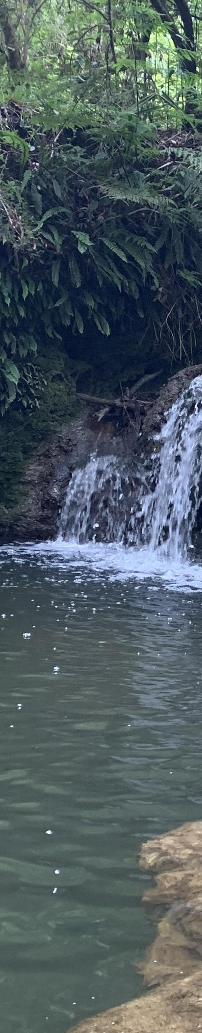
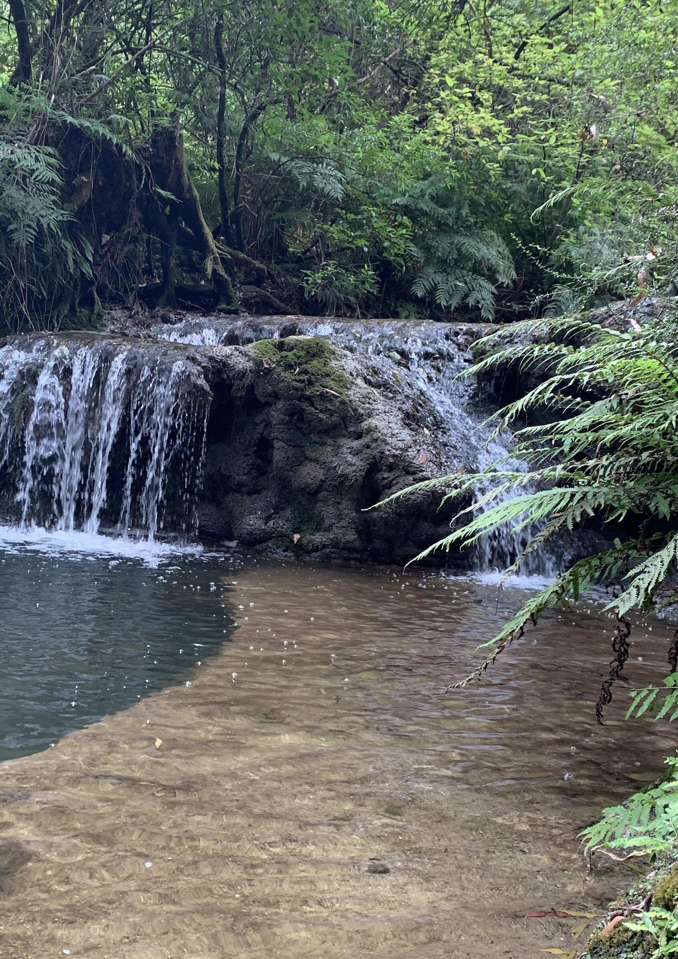
Riparian renewal: Protecting and connecting nature’s lifelines
Riparian zones are vital land–water interfaces that support farm productivity, biodiversity and community wellbeing. Healthy, vegetated corridors filter nutrients, reduce erosion, regulate flows, improve water quality and provide shade and shelter for livestock.
Climate change is placing these functions at risk through altered flows, rising water temperatures, and shifting sediment dynamics1 Restoring riparian buffers and excluding stock are essential actions to protect waterways, strengthen ecosystems and build climate resilience.
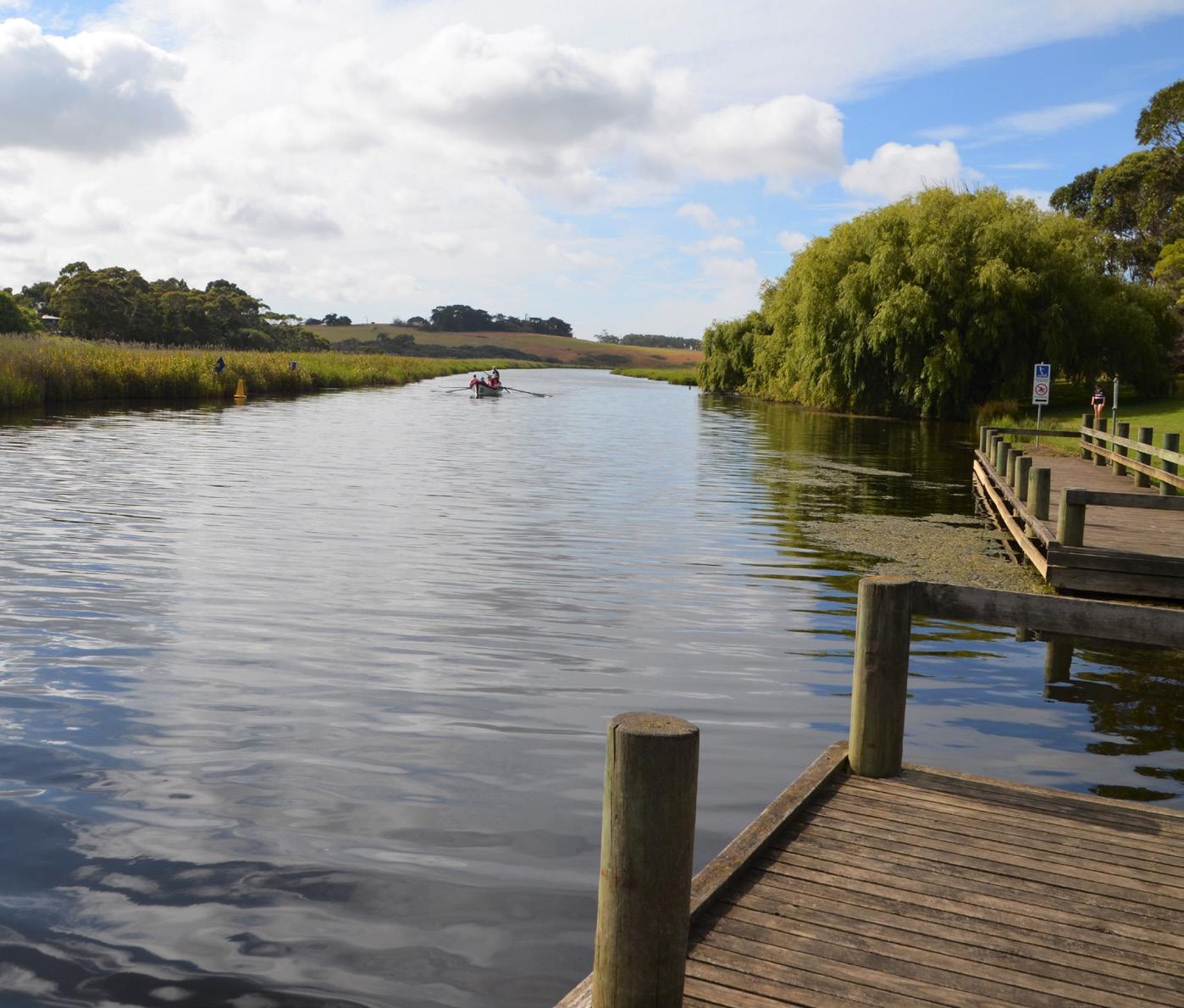
The Curdies River system—from Lake Purrumbete to the Curdies Inlet estuary—spans more than 104,000 hectares and 329km of named waterways including tributaries. This landscape underpins a major agricultural district, with more than 80% of the catchment used for farming and some 650 enterprises—mainly dairyrelying on its natural assets.
The upper and lower reaches of the Curdies River are in poor ecological condition, with a long history of elevated nutrient and sediment inputs, and recurring blue-green algal blooms2. The lower section of the Gellibrand River has been heavily cleared for grazing and also experiences high inputs of nutrients3. Despite these challenges, the region has a strong foundation for scaled impact. Since 2002, landholders, with the support of Corangamite CMA and Heytesbury Landcare have protected approximately 115kms of waterway through fencing and revegetation — demonstrating delivery capability and landholder willingness to participate.
Addressing the ongoing threats to the Curdies system with targeted support presents a major opportunity. Excluding livestock and creating vegetative buffers can unlock benefits for on-farm productivity, aquatic ecosystems, cultural values, community wellbeing, recreation, and tourism.
1. Vagheei H. et al., (2025) Freshwater riparian zones in a changing climate: A comprehensive review, Ecological Indicators, Volume 176
2. Cunningham, G.D. et al., (2022) Investigating sources of nutrients in the Curdies River. Report for the Corangamite Catchment Management Authority prepared by Deakin University
3. Dwyer G.K. et al., (2021) Gellibrand River Catchment: State of Knowledge Review. Report for the Corangamite Catchment Management Authority
Project description and objectives
Heytesbury Landcare will work with landholders, the community and key stakeholders to undertake a collaborative, long-term land stewardship program with a focus on riparian rehabilitation for resilient, healthy and diverse ecosystems.
OBJECTIVES
• Strengthen collaboration and participation among landholders and stakeholders to rehabilitate riparian areas
• Increase awareness of the role that riparian areas and their ecosystems play in connecting land and waterways, supporting biodiversity and ecosystem function, and strengthening landscape resilience
• Improve water quality (reduce excess nutrients and contaminant inputs to waterways)
• Create bank stability and reduce erosion
• Increase shading and moderate water temperature in a warming climate
• Increase connectivity of essential habitats for aquatic species, birds and other wildlife
• Support animal welfare, farm productivity and climate change resilience.
ACTIONS
• Develop communication materials as part of a landholder and community focussed engagement plan to increase awareness of the function and value of riparian areas
• Identify, map and prioritise areas for riparian restoration
• Support a coordinated landscape-scale project to redress threats and improve outcomes for riparian areas
• Collect seed and propagate native species
• Fence riparian areas to exclude stock
• Plant diverse native vegetation buffers along stream banks
• Control weeds and pest species including willows, blackberries, rabbits, deer and foxes
• Connect landholders with supply chains and funding partners interested in large-scale water, biodiversity and climate resilience outcomes
• Support the collection of biodiversity and carbon data and citizen science programs to monitor species.
TARGETS & COSTS
2035 TARGETS
• 60 landholders with stream frontage undertake stock exclusion and revegetation projects
• A further 90 kms of waterway is rehabilitated
• 325,000 plants in the ground
2050 TARGETS
• 90% of the Curdies River system riparian zone is rehabilitated and stock excluded
PROJECT COST - 2026-2035
• Seedlings and fencing - $1,170,000 (or $130,000 pa) for 90km of waterway rehabilitation.
ASSUMPTIONS
Corridors are created with 15m widths; new fencing is one-sided (connecting to existing boundaries); planting density is 2,500 per hectare using Hiko seedlings
FLAGSHIP SPECIES
Platypus – representing connected streams with water flows, vegetated banks and healthy aquatic habitats
Connecting country: Protecting remnants and building biolinks
Fragmented remnants of native plant communities remain on private and public land across the Craters to Coast landscape today. This includes about 5,000 hectares of native vegetation managed for conservation purposes. Most of this vegetation is classed as rare, vulnerable or endangered.
Restoration and connection of these habitats is vital to protect threatened species and maintain soil, water and air quality, and drive the ecosystem processes that keep landscapes productive. This will also bring numerous benefits for our agricultural sector; shelter and shade, resources for beneficial insects, and ecosystem services such as food production, water flow regulation and stable soils.
Source: swift.net.au
Project description and objectives
Heytesbury Landcare will partner with landholders, community groups and key stakeholders to protect and regenerate remnant native vegetation, while creating new corridors (biolinks) that reconnect fragmented habitats, strengthen landscape resilience and outcomes for threatened species.
OBJECTIVES
• Increase awareness of the role that remnant vegetation and habitat connectivity play in landscape resilience
• Strengthen collaboration and participation among landholders and stakeholders to reconnect fragmented habitats
• Deliver a net increase in the area, quality and connectedness of remnant natural habitats
• Protect plant communities and species with significant ecological and cultural values
• Support biodiversity; provide beneficial habitat and resources for a range of species including invertebrates, birds and other fauna
• Increase shade and shelter for livestock; support farm productivity.
ACTIONS
Develop a landholder and community focussed communication and engagement plan to increase awareness of the value in protecting, restoring and linking remnant vegetation, and the threats to these habitats
• Identify, map and prioritise the opportunities to improve ecological connectivity through biolinks corridors
• Support a coordinated landscape-scale approach to deliver habitat outcomes
• Communicate the mechanisms, incentives and support for private landholders to undertake biolinks projects for connectivity and biodiversity enhancement
• Collect seed and propagate native species
• Fence remnant areas to exclude stock
• Fence and create wildlife corridors (via seedlings or direct seed) adjacent to remnant habitats
• Control weeds and pest species like rabbits, deer and foxes
• Support the collection of biodiversity and carbon data and citizen science programs to monitor species.
TARGETS & COSTS
2035 TARGETS
• 270 landholders undertake biolinks projects
• 135ha new biolinks projects fenced and planted
• 95kms of new native vegetation corridors are established
• 337,500 plants in the ground
2050 TARGETS
• 95% of remnant native habitat on private land is protected
• 240kms of new native vegetation corridors are established
PROJECT COST - 2026-2035
• Seedlings and fencing - $1,215,000 (or $135,000 pa) for 95km of new plant corridors
• Direct seed and fencing - $823,500 (or $91,500 pa) for 95km of new plant corridors
ASSUMPTIONS
Corridors are created with 15m widths; new fencing is one-sided (connecting to existing boundaries); planting density is 2,500 per hectare using Hiko seedlings; direct seed costs include seed, preparation and sowing.
FLAGSHIP SPECIES
Powerful Owl – symbolising protection of territories and complex ecosystems, like remnant woodlands and sheltered wet gullies to benefit both wildlife and people.
Farm dams reimagined: Small changes, big landscape gains
Farm dams are essential across the Heytesbury landscape, supplying critical stock and domestic water—particularly where groundwater is unreliable. However, the core function of farm dams is increasingly under pressure with a warmer, drier climate expected across the region. Enhancing farm dams can support water quality and minimise evaporative losses while safeguarding downstream flows.
An enhanced farm dam is one where livestock access is restricted and vegetated buffers are established to protect water quality and surrounding vegetation1 These improvements help filter nutrients and sediments, improve water quality, maintain storage capacity, reduce evaporation, provide shade and shelter, support beneficial insects and pollinators, increase farm productivity, and reduce methane emissions2. Enhanced farm dams also create wetland-like habitat for waterbugs, frogs, birds and other wildlife—while offering attractive spaces for landholders to enjoy.
Research shows many farmers are motivated to enhance their dams for environmental and economic reasons. Incentives, collective action, and property-scale aggregation could help to reduce costs and accelerate uptake3
1. D.B. et al., (2022). Natural asset farming: Creating productive and biodiverse farms. CSIRO Publishing.
2. Malerba, M. E. et al., (2022). Fencing farm dams to exclude livestock halves methane emissions and improves water quality. Global Change Biology, 28, 4701–4712.
3. Elizabeth Galanis, et al., (2025), Incentivising farm dam Enhancement: Barriers, motivations, and market potential in Australian grazing systems, Journal of Environmental Management, Volume 394.
Project description and objectives
Heytesbury Landcare will partner with landholders and stakeholders to enhance farm dams region-wide, advancing water stewardship, strengthening climate resilience, and delivering measurable environmental and productivity benefits.
OBJECTIVES
• Engage landholders to promote stronger land and water stewardship through improved farm dam management
• Support climate resilience by improving on-farm water quality and security
• Enhance the function and longevity of farm dams with downstream impacts in mind
• Reduce greenhouse gas emissions
• Restore wetland-like habitats that support biodiversity, including beneficial insects, pollinators, frogs, birds and other wildlife
• Improve nutrient management for property-level and landscape-scale benefits
• Create healthier farm environments that support animal welfare, productivity and the well-being of landholders
• Reduce greenhouse gas emissions.
ACTIONS
• Develop a landholder focussed communication and engagement plan to build awareness of enhanced farm dams and their environmental and economic benefits
• Work with landholders, stakeholders and potential investors to facilitate coordinated, landscape-scale farm dam enhancement
• Support the design, planning and planting of effective farm dam buffers using native grasses, shrubs and trees
• Fence to exclude or limit access to livestock
• Assist landholders to secure alternative watering solutions (e.g. trough systems, hardened access points) to minimise pugging and nutrient inputs
• Collect seed and propagate appropriate native species
• Control weeds and pest animals like blackberry, rabbits, deer and foxes
• Connect landholders with supply chains and funding partners interested in large-scale water, biodiversity and climate resilience outcomes
• Support the collection of biodiversity and carbon data and citizen science programs to monitor species e.g. wetland birds.
TARGETS & COSTS
2035 TARGETS
• 100 landholders supported to exclude/control livestock access and establish vegetative buffers around farm dams
• 250,000 native plants established
2050 TARGETS
• 80% of landholders in the Heytesbury area who rely on farm dams have implemented enhanced farm dam management
PROJECT COST - 2026-2035
• Seedlings and fencing - $900,000
ASSUMPTIONS
1ha of farm dam area is enhanced per property; planting density is 2,500 per hectare using Hiko seedlings.
FLAGSHIP SPECIES
Dragonflies – the farmer’s fiercest little allies. Beautiful yet voracious hunters that help to keep insect populations balanced, and symbolise thriving waterbodies.
Partnerships: Future-ready farming
Food and fibre production is the dominant land use, employer and economic driver in the Corangamite Shire.
In the southern half of the Shire—including the Heytesbury area—the agriculture, forestry and fishing sectors contribute approximately $745 million annually and employ around 1,400 people1, with agriculture alone accounting for more than 80% of land use. This dependence on natural resources has shaped the landscape, creating both productivity and environmental pressures.
Farmers increasingly recognise the need to adopt evidence-based, bestpractice management and emissionsreducing innovations to protect their land, businesses and communities in the face of economic pressures, climate change and a commitment to responsible land stewardship. Healthy soils, water, vegetation, pollinators and beneficial insects underpin sustainable food and fibre production—making natural asset management central to industry resilience.
1. Corangamite Shire, Business/Economic Development & Investment page, Corangamite Economy, Jobs, and Business Insights | Summary | REMPLAN
Project description and objectives
Heytesbury Landcare will partner with farmers and key stakeholders—including industry bodies, land and water managers, agencies, researchers, service providers and supply chains—to accelerate the adoption of best-practice, climateadapted land management and emerging technologies. Our goal is to deliver measurable environmental improvements while supporting strong, profitable and climate-resilient farm businesses.
OBJECTIVES
• Build collaborative land stewardship through strong partnerships with landholders, stakeholders and industry
• Increase landholder awareness of climate risks; support informed practice change by providing the tools, knowledge and confidence needed for nature-positive and climateresilient farming
• Help landholders understand and respond to emerging market drivers for sustainable and environmentally responsible production
• Protect and enhance soils, water, vegetation and biodiversity across the landscape
• Prevent nutrient loss from farms and improve water quality in waterways and wetlands
• Increase shade, shelter and water quality to support animal welfare and native species.
ACTIONS
• Support farmers to understand emerging carbon and environmental markets, climate impacts on farming systems and to use decision-making tools to measure emissions and evaluate management options
• Encourage participation in industry programs that optimise soil health, pasture and crop production, grazing management, nutrient and effluent management, water use efficiency and climate risk planning
• Promote Whole Farm Planning (WFP) to protect natural capital, guide infrastructure investment and support practice change
• Support exclusion of livestock from sensitive areas—including streams, wetlands and dams— to reduce erosion, pugging and wetland loss, and prevent excess nutrients entering waterways
• Increase awareness of the benefits of environmental plantings and connecting remnant vegetation and riparian systems
• Support farmers to build on-farm carbon and understand the environmental, economic and social co-benefits provided
• Support farmers to understand emerging carbon and environmental markets
• Assist landholders to plan and invest in ‘stacked benefits’ actions that deliver outcomes for farm businesses, the environment and communities while strengthening landscape-scale resilience
• Encourage a demonstration farm and discussion group model with a focus on sustainable practices, technologies and innovations that support productivity and biodiversity, while reducing emissions.
TARGETS & COSTS
2035 TARGETS
• A diverse and climate-adapted food production system across the landscape
• 50% of farmers have drought management plans to address water quality and security
• 50% of farmers know and monitor their greenhouse gas emissions to inform decisions and contribute to regional emissions reduction
• 30% of farmers exclude livestock from streams, wetlands and farm dams, and establish vegetative buffers around these sensitive areas
2050 TARGETS
• Resilient, empowered farmers using modern, sustainable practices to manage climate variability and meet community expectations for land stewardship and food production
• Landholder aggregations working with supply chains and emerging markets to incentivise interventions that protect natural assets
PROJECT COST - 2026-2035
• $44,000 per annum
ASSUMPTIONS
Landscape coordinator position (0.4 FTE) established to support delivery of actions.
FLAGSHIP SPECIES
Southern Brown Bandicoot –representing nutrient cycling and healthy soils, balanced ecosystems, and sustainable land management.
The frog chorus: Learning and connection across the landscape
Community engagement and learning is a core pillar of the Craters to Coast Landscape Action Plan to help achieve active participation and landscape-scale. Investment in strong networks, foundational awareness and capacity-building is as critical as fencing, revegetation or habitat restoration.

Project description and objectives
This project will strengthen Landcare, community and stakeholder connections and share resources that build knowledge, capacity and custodianship through participation and learning.
OBJECTIVES
• Build community knowledge; create a culture of shared learning, innovation and continual improvement
• Foster a connected, confident and collaborative community of landcarers
• Improve grassroots capability and skills in land and water management
• Strengthen relationships with Traditional Owners and knowledge of cultural and ecological values
• Engage schools and young people in meaningful local landscape learning and stewardship.
ACTIONS
• Connect and foster learning opportunities with farmers, volunteers, researchers, schools, citizen scientists, interest groups, and environmental and industry bodies
• Collate, create and share accessible educational resources— maps, fact sheets, web tools and links, local stories and digital citizen science platforms
• Deliver information through workshops, field events, forums and expert demonstrations
• Support community and industry-led initiatives that share learnings around soils, biodiversity, water and climate
• Provide case studies demonstrating practical, local solutions and nature positive outcomes
• Work with schools to increase knowledge of local geology, biodiversity and production systems; develop curriculumaligned materials that inspire young landcarers
• Encourage student participation in citizen science and hands-on learning opportunities
• Build connections with Traditional Owners to learn from their cultural and ecological knowledge.
TARGETS & COSTS
2035 TARGETS
• The Craters to Coast Environmental Learning Hub is established as a regional online resource
• An annual, local state-of-knowledge forum showcasing projects and research in the landscape commences
• Communities are knowledgeable and actively participating in landscape restoration, monitoring and citizen science
• Local schools are engaged in Landcare education, storytelling and practical learning
2050 TARGETS
• A connected, informed community actively participates in landscape restoration
• Local and Traditional Owner knowledge is understood by the community and embedded in landscape projects
• The Craters to Coast landscape recognised as a model for collaborative, community-led learning and stewardship
PROJECT COST - 2026-2035
• $22,000 per annum
ASSUMPTIONS
Landscape coordinator/ communications position (0.2 FTE) established to support delivery of actions.
FLAGSHIP SPECIES
Growling Grass Frog – symbolising community connection, storytelling and shared custodianship.
Investment strategy and target investors
The Heytesbury region’s farmers offer a significant opportunity to restore biodiversity, strengthen climate resilience, and protect natural assets at scale. Committed landholders cannot deliver this transition alone. Near-term investment is best directed through government, philanthropy, strategic supply-chain partnerships, and the local economy, as current carbon and biodiversity markets are not yet well aligned with local farming systems.
Demand for verified sustainability performance is increasing across lenders, consumers, and food and fibre supply chains. This creates a growing need for credible, on-farm data and demonstrable natural capital outcomes. Although price premiums for nature-positive products are still limited, businesses with strong environmental performance are already benefiting from improved lending conditions and reduced climate-risk exposure.
Early-stage capital is essential to build regional coordination, deliver targeted on-ground projects, and prepare landholders for emerging environmental markets. Investment in the Heytesbury landscape enables:
• Tangible improvements in biodiversity, water quality, soil health, and farm resilience
• Scalable interventions across multiple properties
• Economic opportunities for local service providers, producers, and allied industries
• A coordinated regional model that aligns environmental outcomes with long-term agricultural productivity.
The region is investment-ready, communitybacked, and strategically positioned to deliver measurable, landscape-scale outcomes. Partnerships across farming, industry, government, philanthropy and supply chains will unlock the full potential of this Plan and build a resilient Craters to Coast landscape for decades to come.
GOVERNMENT GRANTS AND PHILANTHROPY
Heytesbury Landcare will continue to engage government and philanthropic partners who have been foundational to our work. Key investment opportunities include:
1. On-ground stewardship programs:
Small-scale, high-impact works such as fencing, revegetation, and pest control to protect and connect riparian zones, remnant vegetation, wetlands, and other sensitive habitats.
2. Capacity building, coordination and engagement: 2026-2028 - Funding a dedicated Landscape Coordinator to lead collaboration, planning, delivery, and investment readiness across multiple properties and stakeholders, enabling the region and community to progress toward landscape-scale interventions.
Project cost: $110,000pa (1 FTE incl. overheads).
SUPPLY CHAIN INVESTMENT
Farmers are embedded in supply chains using Environmental, Social and Governance (ESG) frameworks to manage risks and assist sustainability reporting requirements. Companies must be able to verify their ESG claims, driving demand for credible, on-farm data. Early incentives are expected to reward lower emissions intensity and improved natural capital outcomes, with low compliance risk but modest financial return in the voluntary market. These partnerships can lay the foundation for stronger commercial arrangements as standards and markets mature.
LOCAL ECONOMY
ENVIRONMENTAL MARKETS
The local economy will both benefit from and contribute to landscape restoration. New business opportunities may emerge for example for:
• Seed collection, propagation and native plant supply
• Contract fencing, revegetation and land restoration services
• Advisory, monitoring and natural capital accounting
• Local food and fibre producers aligning their products and brand with consumer expectations
• Diversified market models such as direct-toconsumer sales or cooperatives
• Increased visitation.
These opportunities strengthen regional livelihoods while reinforcing investment in natural capital.
Current carbon market mechanisms are poorly suited to intensive farming systems in the region due to high land requirements and significant establishment, compliance, and maintenance costs. However, emerging environmental markets may offer future pathways for investment in:
• Carbon sequestration and emissions reduction
• Improved water quality
• Enhanced soil health
• Native vegetation and habitat connectivity
• Shelter for livestock and wildlife.
Further analysis is needed to understand the viability of collective, landscape-scale interventions—such as wetland restoration, enhanced farm dams, remnant protection, and habitat corridors—particularly as opportunities arise in teal-carbon, biodiversity and water-quality markets.
GOVERNMENT GRANTS AND PHILANTHROPIC
SUPPLY CHAIN PARTNERSHIPS
LOCAL ECONOMY
ENVIRONMENTAL MARKETS
GOVERNMENT GRANTS AND PHILANTHROPIC
LANDSCAPE PLAN
SUPPLY CHAIN PARTNERSHIPS
LOCAL ECONOMY
ENVIRONMENTAL MARKETS
(carbon, biodiversity, water, emerging)
• Demonstrable environmental and community impact
• Strengthening regional resilience to climate and economic shocks
• Scalable, evidence-based investment with measurable outcomes
• High return on public value through biodiversity, soil, and water improvements
• Supports long-term stewardship and capacity building across a priority landscape
• Reduced ESG reporting risk and cost
• Access to verified natural capital and emissions data
• Strengthened brand integrity and consumer trust
• Supply assurance through resilient, productive farming systems
• Ability to demonstrate leadership in regenerative or nature-positive production
• Business growth and diversification opportunities
• Expanded service sectors (revegetation, monitoring, seed supply, carbon/biodiversity advisory)
• Strengthening local food, fibre and tourism identity
• Increased regional employment and capacity
• Opportunities for cooperative or value-added product development
• Verified environmental outcomes supporting compliance and ESG goals
• Portfolio diversification with nature-based assets
• Access to emerging markets such as teal carbon, biodiversity credits, water quality improvements
• Opportunity to invest early in a developing market with long-term value potential
• Social licence to operate and climate-risk mitigation
• Grants
• Co-investment partnerships
• Multi-year program funding
• Supplier incentive programs (e.g., emissions intensity payments)
• Supply shed sustainability frameworks
• Data-sharing partnerships with producers
• Direct-to-consumer models
• Farmer cooperatives
• Tourism and experience-based enterprises
• Renewables and circular economy infrastructure
• Compliance offset credits (e.g., ACCUs)
• Voluntary offset credits (biodiversity, carbon, water stewardship)
• Aggregated or landscape-scale project participation
The Doolan family –a future-focussed dairy business
OVERVIEW
Third-generation dairy farmers Peter and Sam Doolan—together with their partners, Bonnie and Belinda, and parents, Sam Senior and Carol—are reshaping their business around climate resilience, soil health and long-term profitability. For the Doolan families, including six school-aged children, sustainability isn’t a buzzword; it’s a practical pathway to long-term viability and farm legacy.
KEY ACTIONS
The business has significantly reduced its reliance on synthetic fertilisers, including nitrogen, by using compost, biological foliar sprays and effluent to support on-farm nutrient cycling. A transition to multi-species fodder crops aims to strengthen soil structure, boost biological activity and improve water-use efficiency and infiltration.
On-farm water storage has been upgraded to buffer against reduced rainfall and runoff. Combined with pasture diversity - including deeprooted annual and perennial species— and effluent management, this approach aims to maintain growth during dry periods and throughout the seasons.
Riparian zones have been fenced to exclude stock. Ongoing planting and maintenance of native shelterbelts help reduce wind impacts, support animal health and production, improve pasture and crop performance, and enhance biodiversity.
An early adopter of renewable energy, real-time monitoring and innovative milk-cooling upgrades, the business has substantially reduced the dairy’s energy use and operating costs, slashing energy emissions by 41 per cent.
FUTURE VISION
When Peter looks twenty years ahead, he sees a climateresilient business with minimal external inputs, good water retention and soil infiltration, and livestock grazing pastures across all seasons.
“I hope we will be profitable, resilient and biodiverse, with pastures that include deep-rooted plant species that grow through summer and support our feed systems year-round,” he says.
BUSINESS MINDSET: PROACTIVE, NOT REACTIVE
“We’re very conscious of Australia’s changing climate –we’ve just come out of a year-long drought - and want to build a more resilient business,” says Peter innovative ways to invest back into our farm to ensure it is well maintained, in-line with industry regulations and keeping up with the ever-evolving technology and management of the agriculture sector.”
LOCATION
Ecklin South, Victoria
FARM SIZE
250ha dairy platform; total 630ha area under management
HERD
675 milking cows
ENTERPRISE
Family-owned dairy farm, Doolan Pastoral
CASE STUDY
The Curdies River – A catchment under stress
OVERVIEW
The Curdies River and its major tributaries, Scotts Creek and Cooriemungle Creek, drain a 1,035 km² catchment before entering the sea at Peterborough via one of the region’s largest salt-wedge estuaries. The estuary includes the Curdies Inlet - a shallow, coastal lagoon supporting important fish nurseries, significant wetland vegetation, and habitat for rare and threatened bird species. The river system also underpins local dairy, beef and tourism industries and holds strong recreational and community value. However, the Curdies River and its ecological function is under considerable stress fuelled by excess nutrient loads and a changing climate.
THE CHALLENGE
Since European settlement, extensive vegetation clearing, grazing land drainage, loss of riparian buffers and wastewater discharge have significantly altered the Curdies system. Sedimentation and nutrient runoff during high flows have further driven ecological decline.
Waterway assessments rate the upper and lower Curdies in poor condition and the mid-reaches only moderate, with phosphorus and nitrogen levels in the upper catchment regularly exceeding Environmental Reference Standards. Nutrient spikes closely align with turbidity, indicating runoff and erosion as major sources of nutrient inputs1. While riparian works since 2005 have likely reduced some new phosphorus inputs during low flows, both phosphorus and nitrogen remain elevated in high-flow events.
LOCATION
Starting at Lake Purrumbete, south of the township of Camperdown and flows through the Heytesbury farming district
LENGTH
66 kilometers
The estuary has experienced toxic cyanobacterial (blue-green algae) blooms in 2019, 2021 and 2022, with the 2022 bloom lasting weeks and causing fish kills. Warmer temperatures, reduced baseflows and intense rainfall events expected under climate change, could increase the frequency and severity of future blooms.
COMMUNITY, LANDHOLDER AND LANDCARE EFFORTS
In the past two decades, Heytesbury Landcare and the Corangamite CMA have worked with landholders along the Curdies system to fence and revegetate riparian corridors, stabilise erosion hotspots and reduce sediment and nutrient inputs across the catchment. Despite these gains, large sections of the river still require rehabilitation, and legacy nutrients stored in sediments will continue to influence water quality for years. A wholeof-catchment approach to revegetation, land management and nutrient reduction is essential.
Following the 2022 bloom, a community, industry and multi-agency response formed the Curdies River Coordinating Committee to share information, coordinate action and commission targeted studies.
Image courtesy Imogen Warren
A 2022 study (Cunningham et al., 2022) identified key nutrient sources and recommended priorities for recovery. These included:
1. Reduce nutrient loads
– Riparian fencing and revegetation
– Constructed wetlands at key sites
– Target major nutrient pathways, especially in the steep Scotts Creek sub-catchment.
2. Strengthen monitoring
– Improve baseline and ongoing monitoring to quantify loads and evaluate intervention success.
3. Build land manager understanding
– Provide clear targets and communication on river health and required actions.
4. Tailored extension programs
– Support landholders with updated nutrient management advice highlighting environmental and economic benefits.
CONCLUSION
The Curdies River is a critical ecological and economic asset but increasingly vulnerable to nutrient pollution, sedimentation and climate pressures. Continued investment in nutrient reduction, monitoring and coordinated community action is essential to protect the estuary and restore the health of this important waterway.
1. Cunningham, G.D. et al., (2022) Investigating sources of nutrients in the Curdies River. Report for the Corangamite Catchment Management Authority prepared by Deakin University.
www.heytesburylandcare.org.au