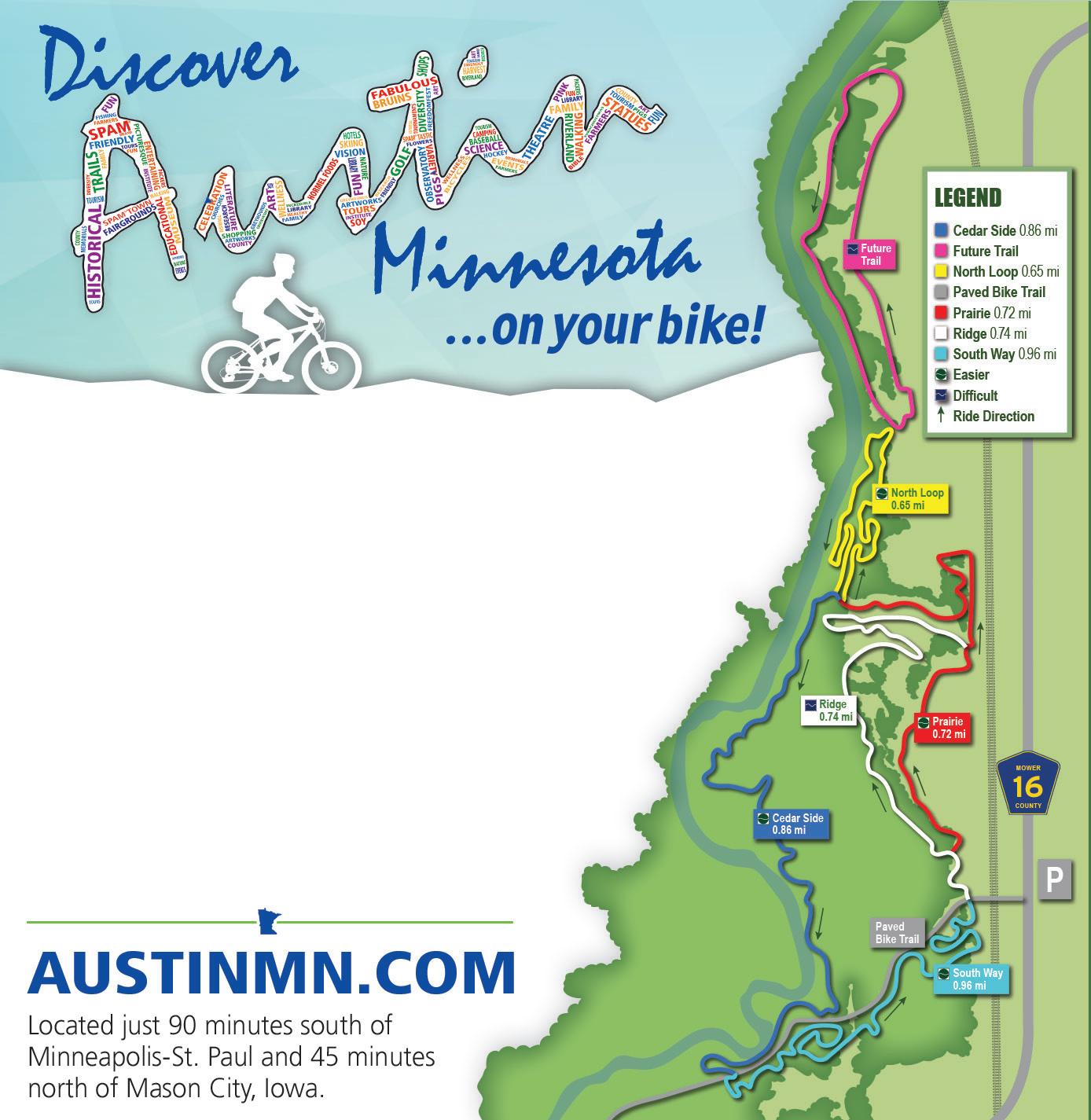
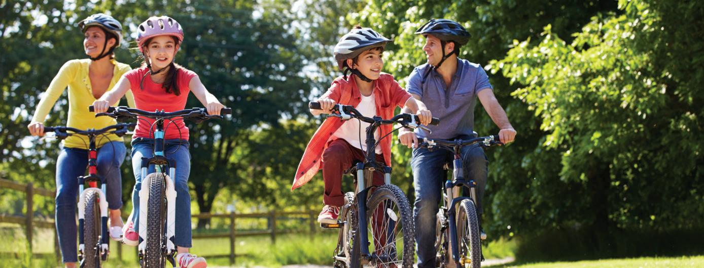
Bike Minnesota
2023 RIDE GUIDE Trails, Tips, and Basics for Bicycling All Around the State


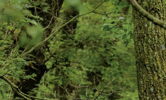


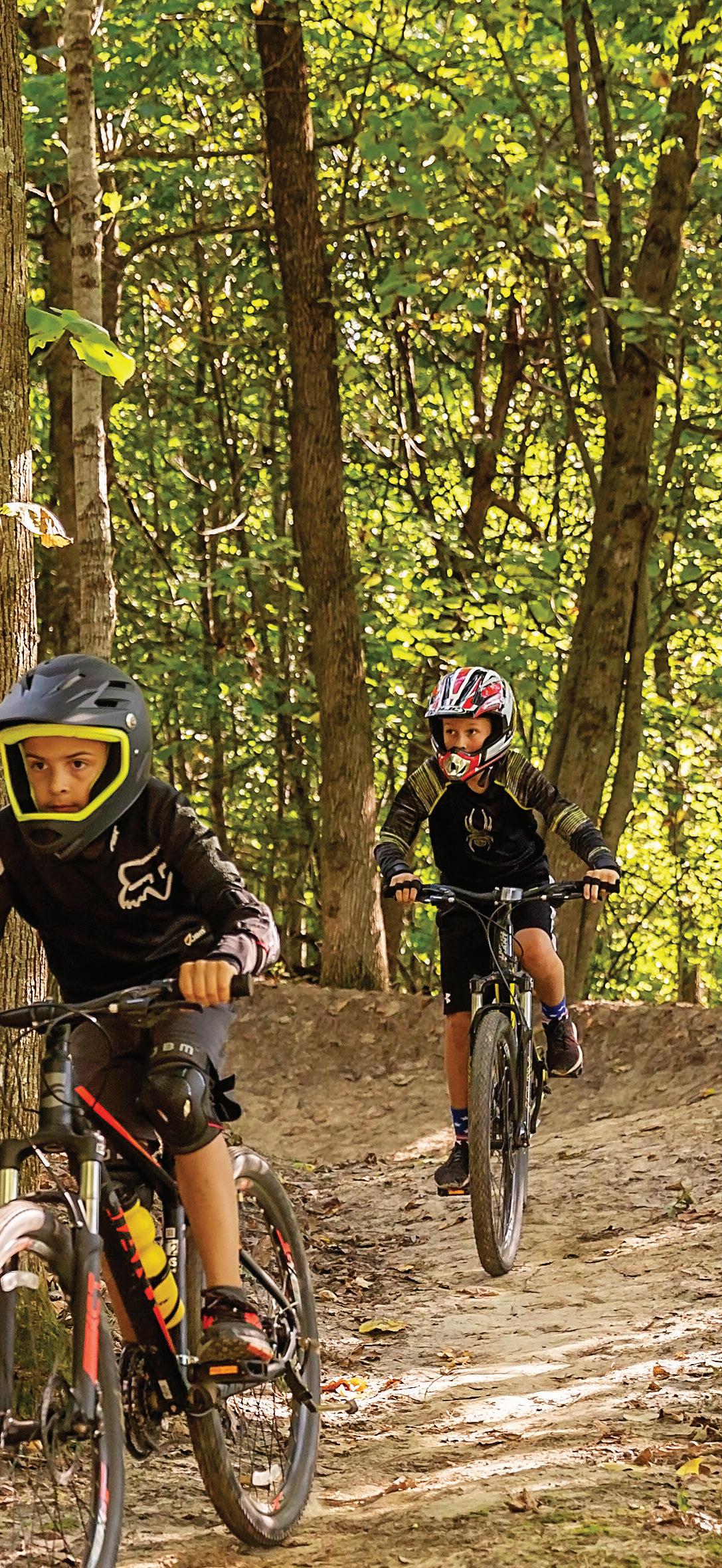
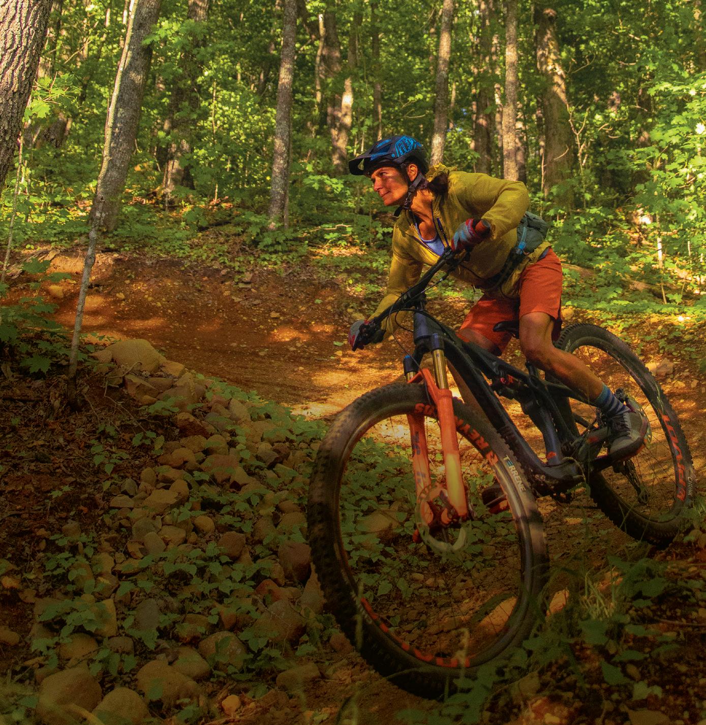
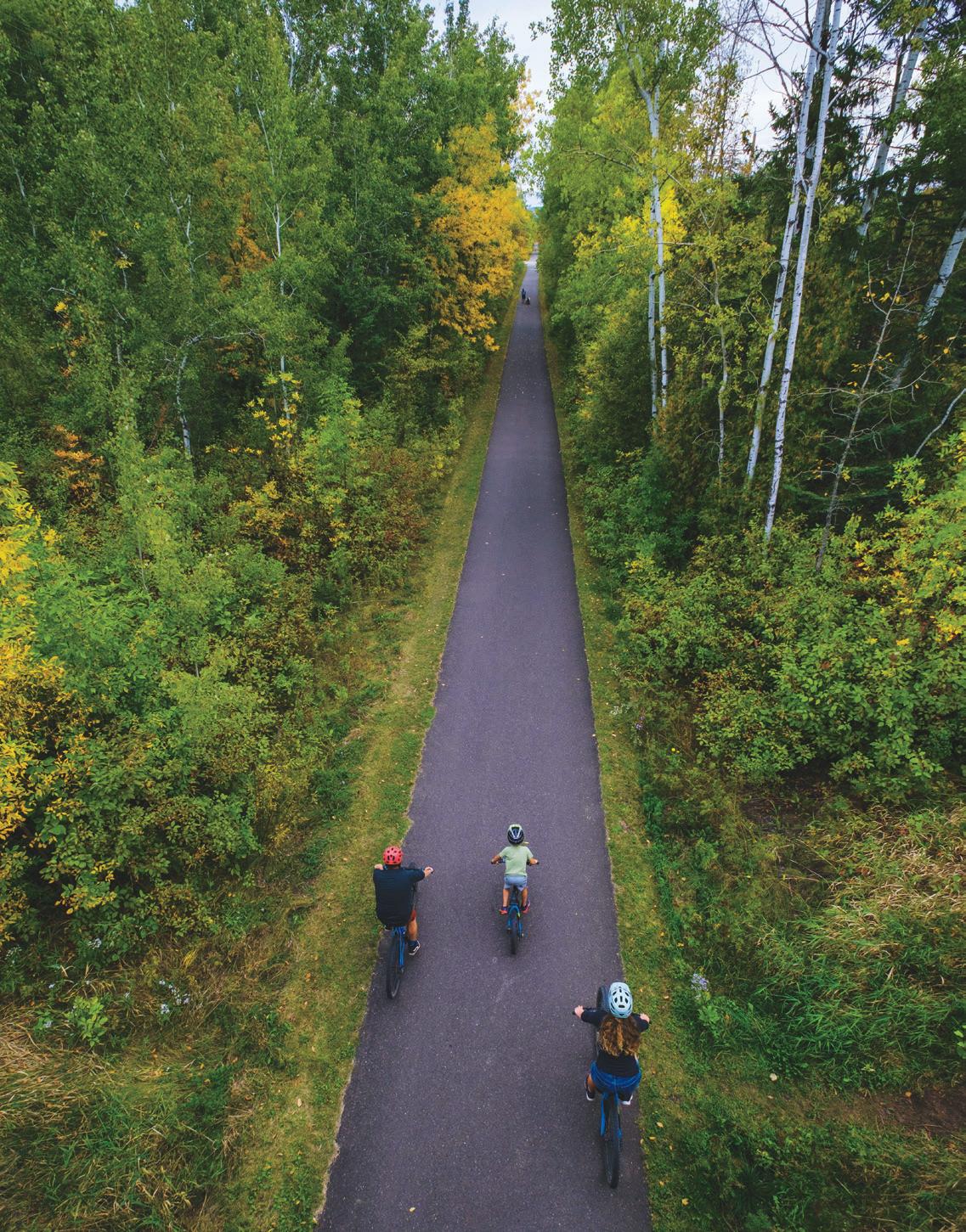
RIDE Cuyuna Lake’s
Run trail
WILD
Bison


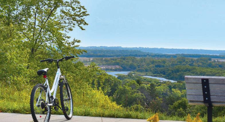
Hit the trails in the Alexandria Lakes Area Pedal the 55-mile Central Lakes Trail or go off-road at one of several area parks ExploreAlex.com Explore our thriving downtown, 2400+ acres of parks, 300+ lakes, museums, wineries, breweries, golf courses & wide variety of lodging options


Proctor’s Amazing Trails VisitProctor.com Willard Munge r - S pirit Mountain - Jay Cooke
Photo by Hansi Johnson
IN EVERY ISSUE
4 PUBLISHER’S NOTE
FEATURES
06

RAIL-TO-TRAIL ITINERARIES
Five easy-to-ride, fun-toexplore bike trails around the state with places to eat, stay, and play along the way.
14
GEAR UP FOR WINTER BIKING
Here’s what you need to know before you hit the snow for some fat biking.
BIKE TRAIL LISTINGS
30 TRAILS ACROSS THE STATE
18
TRICK OUT YOUR RIDE
Lugging your gear just got better with merchandisefrom these six Minnesota makers.
26
E-BIKE EVOLUTION
Electronic bikes are on the rise and accessible across many ages and abilities.
From the Blazing Star State Trail in Albert Lea to Willard Munger State Trail between Hinckley and Duluth, Minnesota has hundreds of miles of trails to explore. Get GPS coordinates, descriptions, and parking details in these listings.
2 | BIKE MINNESOTA 2023 | MINNESOTAMONTHLY.COM PHOTO MINNESOTA DISCOVERY CENTER
BIKING
GO TO MINNESOTAMONTHLY.COM
FOR MORE GREAT
IDEAS,
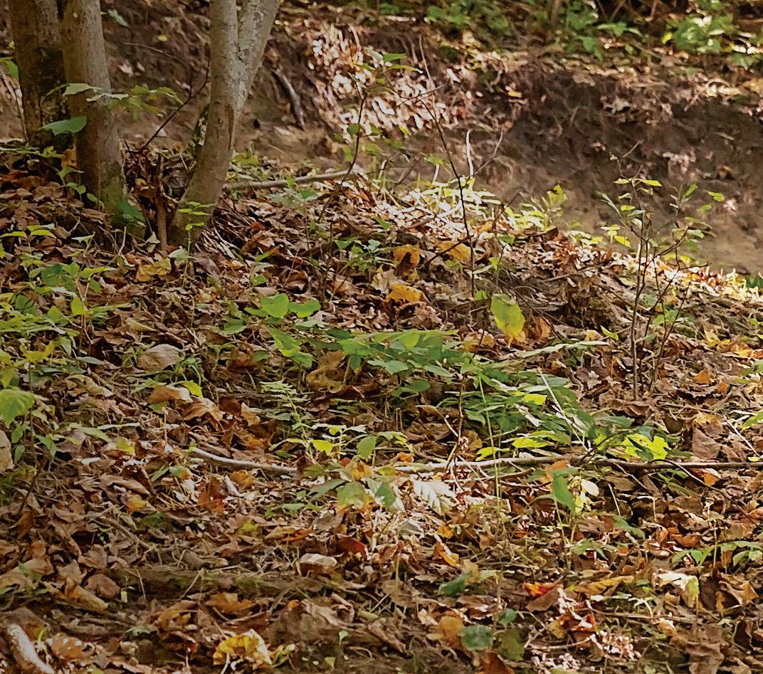
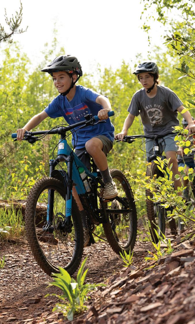
ON THE COVER
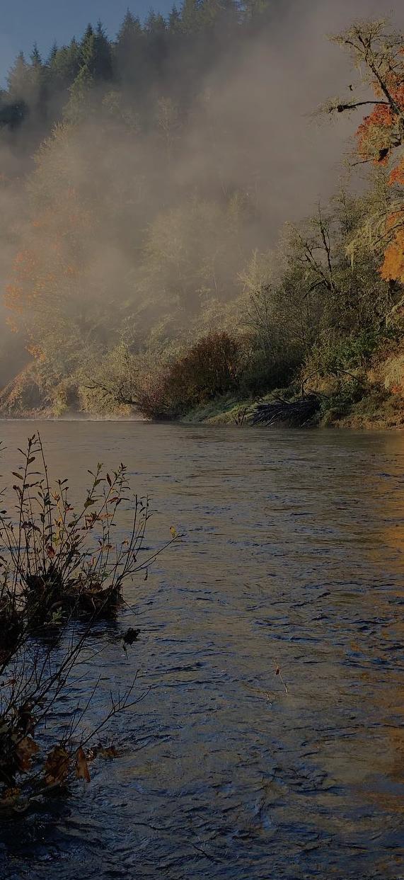
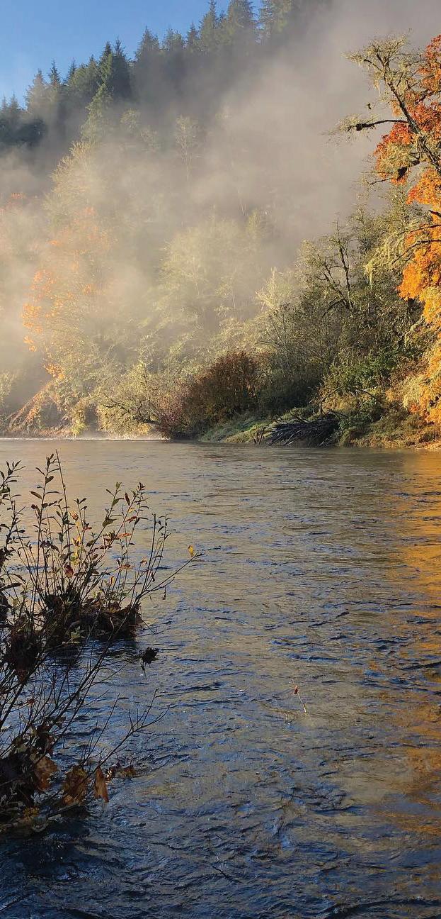
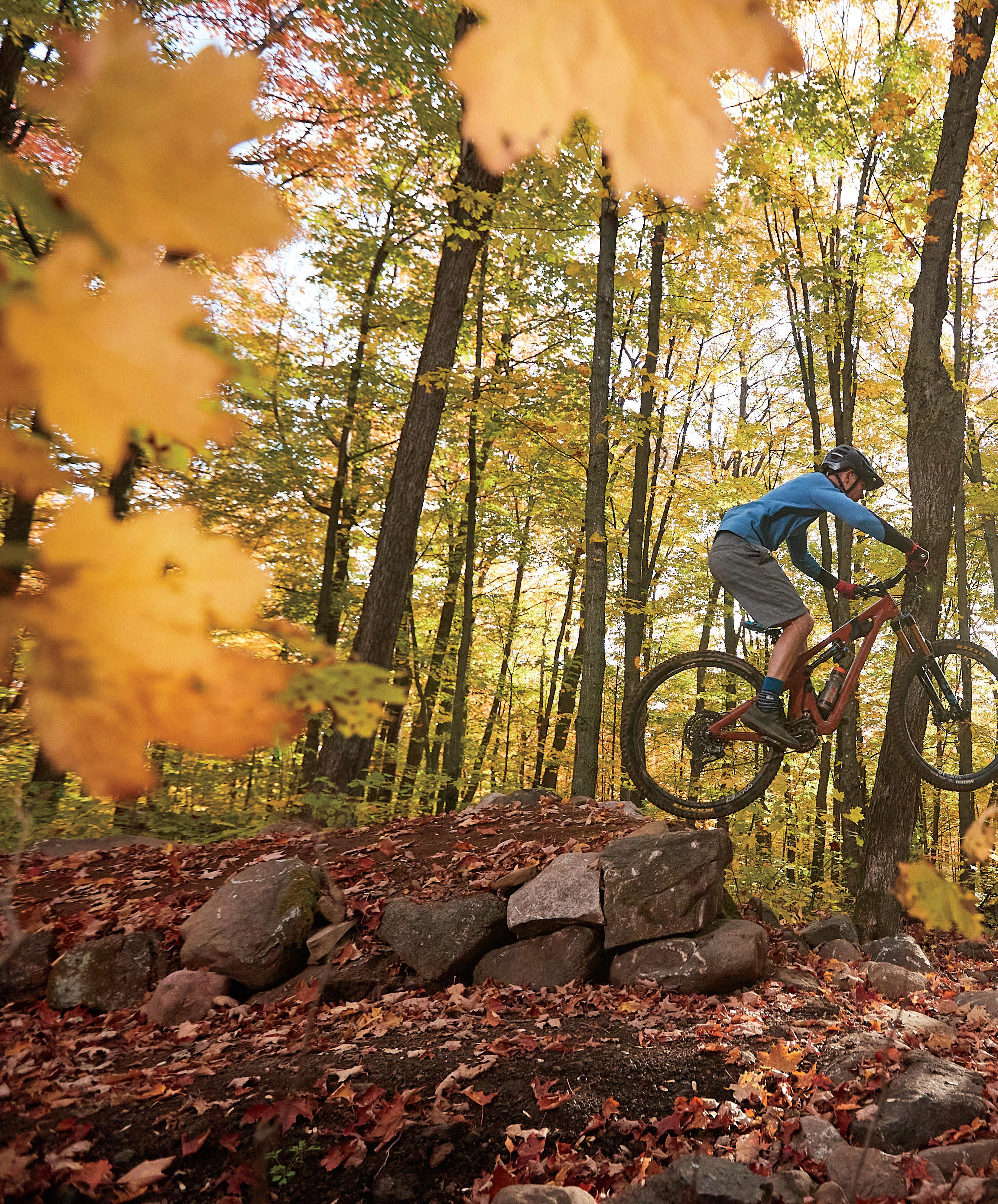
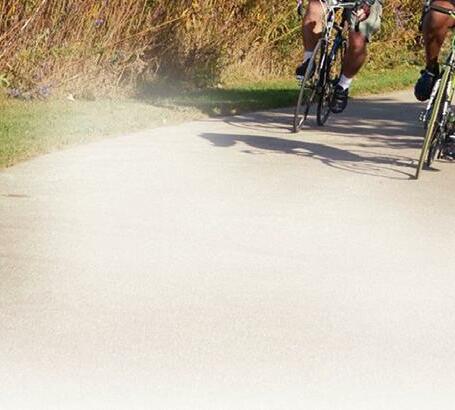
The Bison Run mountain bike trail at Cuyuna Lakes traverses two hills for a heart-pumping ride.
PHOTO BY Cuyuna.com
REDHEAD MOUNTAIN BIKING TRAIL
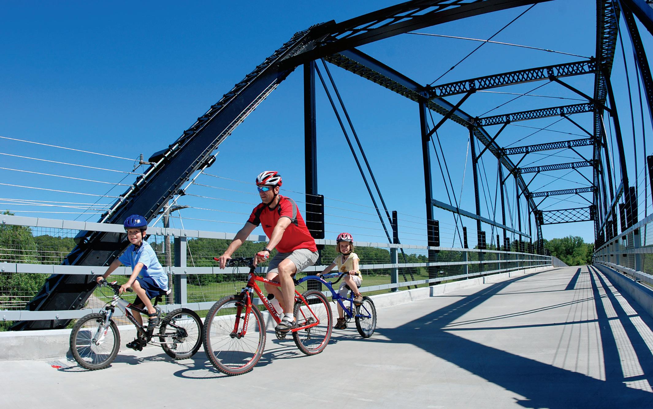
Le : What be er place than to ride one of the many paved lakeside paths throughout our great state? I’m flanked by my much younger son and cousin here as we logged 25-plus miles. Right: One of my favorite places to ride is the Mississippi River Trail from Spring Lake Park through the lock and dam in Hastings and over through Presco in Wisconsin. It’s perfect for my Sirrus X 5.0 and equally suited for my 81-year-old mom’s Aventon Pace 500 e-bike.
Ride On

it was the summer of 1974, a full-on scorcher in Miami, Florida. To this day, I don’t know what propelled me to do it, but I decided it was time to remove the training wheels from my Schwinn Sting-Ray. Actually, I had just talked my friend’s dad into doing it for me, assuring him that my parents said it was fine (they hadn’t, of course).
I waited until he disappeared into his garage before I mounted my Kool Lemon (great frame color name) and confidently, yet a bit wobbly, took o Fast-forward to 2023, and I’m the proud owner of two bikes that keep me grounded from the onslaught of anxiety that only life can dole out. My trusty steed for winter commuting and summertime Minnesota River Bottoms romping is a Salsa Beargrease Eagle, and my near-year-round commuting and joyriding hybrid companion is a Specialized Sirrus X 5.0.
I’m an unabashed Strava user, who finds sheer delight in seeing my annual recaps— over 3,000 miles in 2022, 60,000-feet-plus elevation gain, and rode 60% of the days in the year. Admittedly not the greatest of the pack, but not too shabby for a mid-50year-old who decided to wait until just two years ago to begin commuting to work. In Minnesota. In winter.


Naturally, then, you can understand this latest labor of love of ours that you now hold in your hands. We wanted to share the wonders of biking with our outdoors-loving readers. Why? Because we so believe in the benefits of biking—physical, mental, and emotional—and how this amazing activity can connect you with literally every corner of our great state.
There is a reason why Minnesota is perennially ranked among the greatest in the country for biking, and we hope that this edition of Bike Minnesota will help you get out and enjoy all it has to o er.
See you there!
Tammy Galvin, Publisher tgalvin@greenspring.com


4 | BIKE MINNESOTA 2023 | MINNESOTAMONTHLY.COM PHOTOS PROVIDED
PUBLISHER’S NOTE
PUBLISHER Tammy Galvin
EDITORIAL
EDITORIAL DIRECTOR Alesha Taylor
EDITOR Amy Nelson
MANAGING EDITOR Erik Tormoen
CUSTOM PUBLICATIONS SENIOR EDITOR Mary Subialka
CUSTOM PUBLICATIONS ASSOCIATE EDITORS
Samantha Johnson, Katherine Lawless
PROOFREADER Anna Buchholz Bagiackas
EDITORIAL INTERNS Eliana Kinzer, Kate Linggi, Kyrin Sturdivant
ART
CREATIVE DIRECTOR Tonya Sutfin
PRODUCTION
PRODUCTION DIRECTOR Ly Nguyen
DIGITAL PRODUCTION DIRECTOR Deidra Anderson
ADVERTISING COORDINATOR Mikayla Snyder
INTEGRATED MARKETING
ASSOCIATE PUBLISHER + DIRECTOR OF MARKETING,
EVENTS & PARTNERSHIPS Arthur Morrissey
EVENT OPERATIONS MANAGER Rick Krueger
COMMUNICATIONS SPECIALIST Teghan Murphy
MARKETING + EVENTS COORDINATOR Emma Enebak
SOCIAL MEDIA INTERN Laura Simonson
SALES
SENIOR ACCOUNT EXECUTIVE Kristin Gantman
ACCOUNT EXECUTIVES Sue Fuller, Lori Herz, Lori Miller
EVENT ACCOUNT EXECUTIVE Scott Rorvig
SALES + MARKETING SPECIALISTS
Madeline Braverman, Kirsten Heiland
BUSINESS
DIRECTOR OF BUSINESS OPERATIONS Kathie Gorecki
ACCOUNTING ASSOCIATE Austin Schmelzle
CIRCULATION
AUDIENCE DEVELOPMENT DIRECTOR Geri Wilson
CIRCULATION MANAGER Riley Meyers
CIRCULATION ASSISTANT Cathy Krajenke
EDITORIAL & BUSINESS OFFICE
GREENSPRING MEDIA 9401 James Ave. S., Suite 152 Bloomington, MN 55431 612-371-5800 FAX 612-371-5801

HOUR MEDIA CEO Stefan Wanczyk
PRESIDENT John Balardo
SUBSCRIPTIONS & BACK ISSUES
A subscription to Minnesota Monthly is $14.95 per year (U.S. only). For subscriptions, call 866-660-6247. Back issues are $4.99 + shipping, prepaid. Change of address: Enclose address label, send to Hour Media LLC, 5750 New King Drive, Suite 100, Troy, MI 48098, and allow 30 days.
EDITORIAL To contact the editorial department with feedback, freelance submissions, or story suggestions, go to minnesotamonthly.com/contact.
ADVERTISING Information about advertising is available at minnesotamonthly.com/advertise or by calling 612-371-5800.
MINNESOTAMONTHLY.COM | BIKE MINNESOTA 2023 | 5 Find Unique A ractions
fficial Rhubarb Capitol of Minnesota
lacc.mn/shop lacc.mn/play One of Top 20 Most Beautiful Towns in the US The pages between the covers of this magazine (except for any inserted material) are made from wood fiber that was procured from forests that are sustainably managed to remain healthy, productive, and biologically diverse.
O
lacc.mn/eat
RAIL-TO-TRAIL MINNESOTA
Bike Itineraries


THESE EASY ROUTES INCLUDE PLACES TO STOP FOR FOOD AND MORE FUN
 by KATHY BERDAN


6 | BIKE MINNESOTA 2023 | MINNESOTAMONTHLY.COM
5 PHOTO VISIT DULUTH WILLARD MUNGER STATE TRAIL
No rough terrain, no mountain biking, and no heart-pumping, sweaty scrambles.
These bicycle trail suggestions are for cyclists who ride on the recreational side. Preferably on a trail that’s shady, where families are welcome. My plans for rides with friends always include, “Where will we have lunch?”
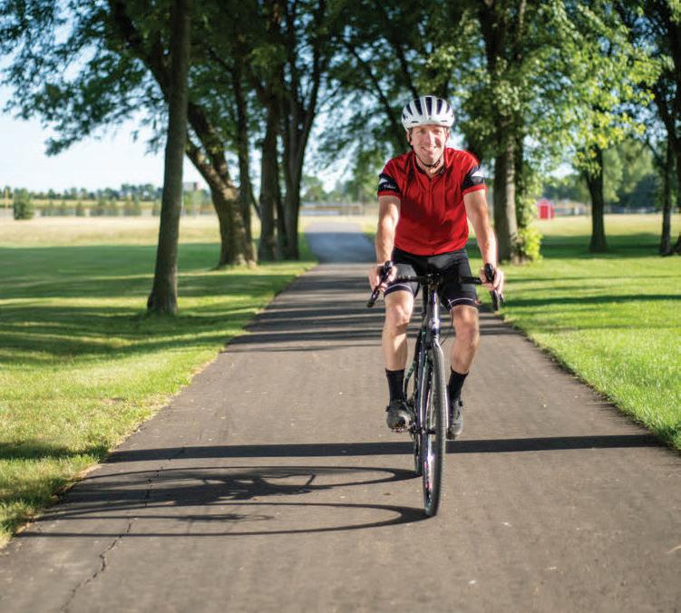
Here’s a closer look at five non-metro Minnesota bike trails. They are all rail-to-trail routes—meaning they’re not steep. Built on old railroad routes, the pathways don’t have hills that a locomotive couldn’t handle while pulling cars. There are more than 4,000 miles of paved trails in Minnesota, according to Explore Minnesota. These are my kind of trails and trips I’ve taken myself.
Here are tips for a day on each trail, assuming you don’t have a vehicle to pick you up at one end, including where to park, what to eat, and unique sights.
MINNESOTAMONTHLY.COM | BIKE MINNESOTA 2023 | 7
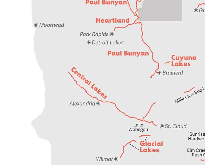
HEARTLAND STATE TRAIL
Park Rapids to Walker
STATS: The 27-mile segment between Park Rapids and Walker has a paved surface and meets the Paul Bunyan State Trail near Walker for another 100-plus miles of paved trail.
FEATURES: Most of the trail is shaded, with towns every 6 to 10 miles along the route. The trail takes you past lakes, woods, farm fields, and deep ravines.
DAYTRIP: Park in Nevis (either on Main Street or in the large lot on the east end of town). Head west on the trail through Dorset to Park Rapids for your lunch stop. A friend who summers in the area recommends the Good Life Cafe in Park Rapids, and I’ve always loved the burgers at Royal Bar. If you’re not in a hurry, Park Rapids has loads of shopping spots to browse and a lovely park on the trail with nice bathrooms. Save room for ice cream at the Dorset House on your way back. If you’re making a shorter day of it, have a margarita at Compañeros in Dorset.
Head back to Nevis and explore as much of the trail to the east as you want— on to Akeley and Walker. Back at your car in Nevis, the Iron Horse Bar & Grill has a great outdoor patio.
HIGHLIGHTS: Take selfies at the giant tiger muskie statue in Nevis and the unusual Paul Bunyan who is down on one knee in Akeley. You may find kids having fun in the water near the bridge at Lake Belle Taine between Dorset and Nevis.
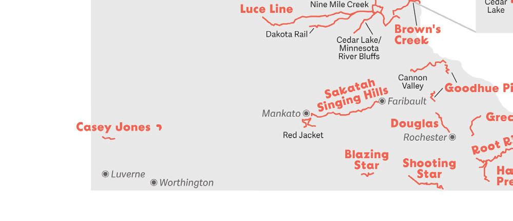
CANNON VALLEY TRAIL
Red Wing to Cannon Falls
STATS: Nearly 20 miles of paved trail between Red Wing and Cannon Falls, it runs parallel to the Cannon River. A $5 wheel pass is required for a daytrip or buy a $25 season pass.
FEATURES: Along stretches of the trail that run close to the river, you can look down to see clusters of folks tubing on the river. In some places, the rock cli s run right up from the trail. There are views of the prairies and farmland, and the path goes
through a turtle sanctuary 12.3 miles from Cannon Falls and a couple of archeological sites. (“Cannon Valley Trail Interpretive Guidebook” is a good resource.)
DAYTRIP: Since it’s a gradual uphill from Red Wing to Cannon Falls, start in Red Wing so your trip back to the car is a little easier. There’s parking, water, and trail passes at the Lower A.P. Anderson Park just o Highway 61 in Red Wing.
You might want to fuel up before your ride with an awesome treat from Hanisch Bakery & Coffee Shop in Red Wing or breakfast at Liberty’s Restaurant & Lounge. The Welch Station rest stop is about halfway between Red Wing and Cannon Falls. It’s a good bathroom and water stop, and on the Saturday we were there last summer, there was a small community band playing.
At the end of the trail turnaround, Cannon River Winery in downtown Cannon Falls has a nice patio, and there are some tasty cold fillings for cups and cones at CannonBelles Co ee & Ice Cream. The
8 | BIKE MINNESOTA 2023 | MINNESOTAMONTHLY.COM HEARTLAND DAVID SCHOTZKO CANNON VALLEY
PROVIDED
HEARTLAND STATE TRAIL
downhill return to Red Wing (which drops 115 feet on the way toward the Mississippi River) seems to fl y right by. A couple of casual restaurants along the river in Red Wing, Kelly’s Tap House Bar and Grill and Bayside Tap & Steakhouse, are good for celebratory beer and eats.
HIGHLIGHTS: The trail is never far from the Cannon River, with blu s that climb up along the trail on one side and drop down to the river with views of the valley on the other. There are lots of wildlife and panoramic views, all nestled under a shaded canopy of trees.
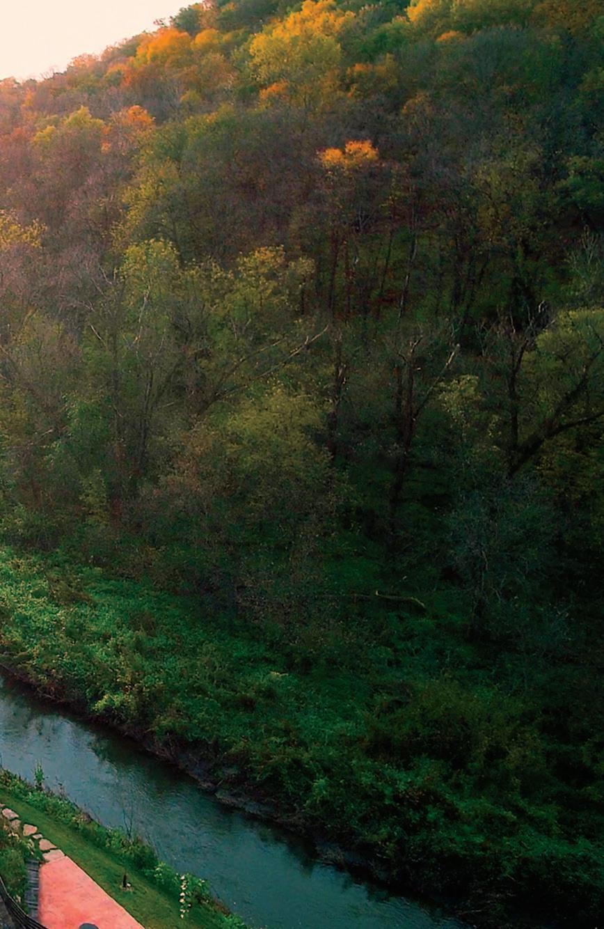
WILLARD MUNGER STATE TRAIL
Duluth to Hinckley
STATS: 70 miles of paved trail
FEATURES: Views of Duluth and Lake Superior on the north end, farm fields and small towns as you head south. A portion of the trail goes through Jay Cooke State Park, with a terrific view of the St. Louis River from a high railroad trestle.
Tips for Twin Cities Trails
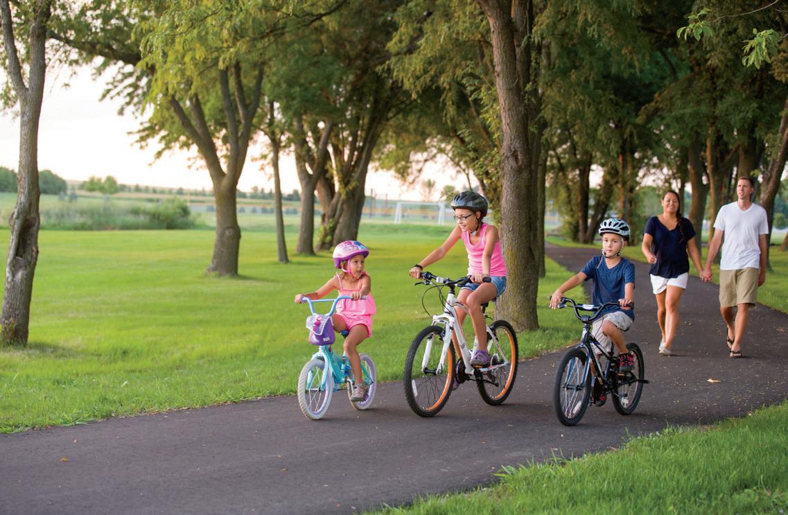
There are loads of bike trails, links, and connections in the Twin Cities.
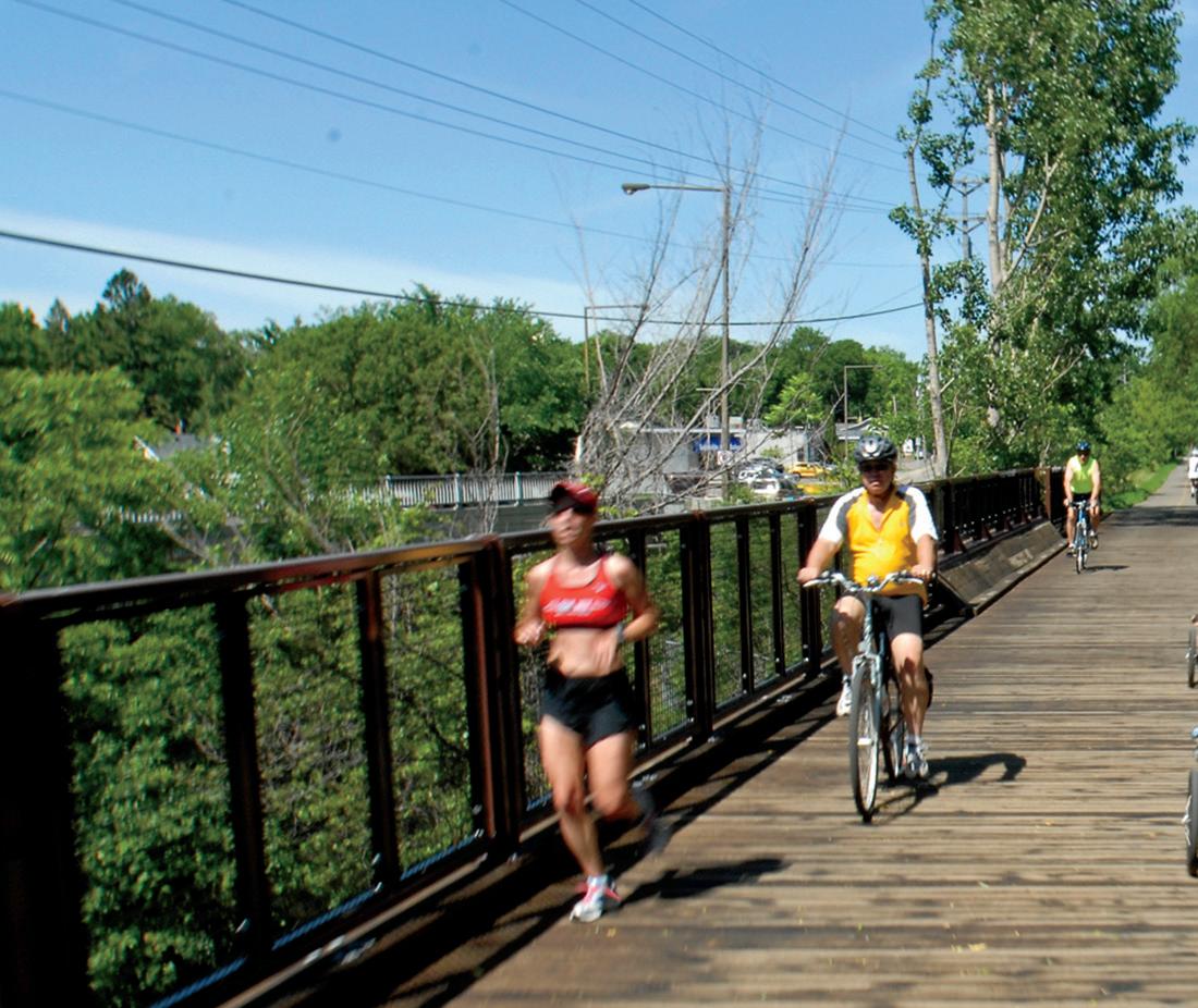
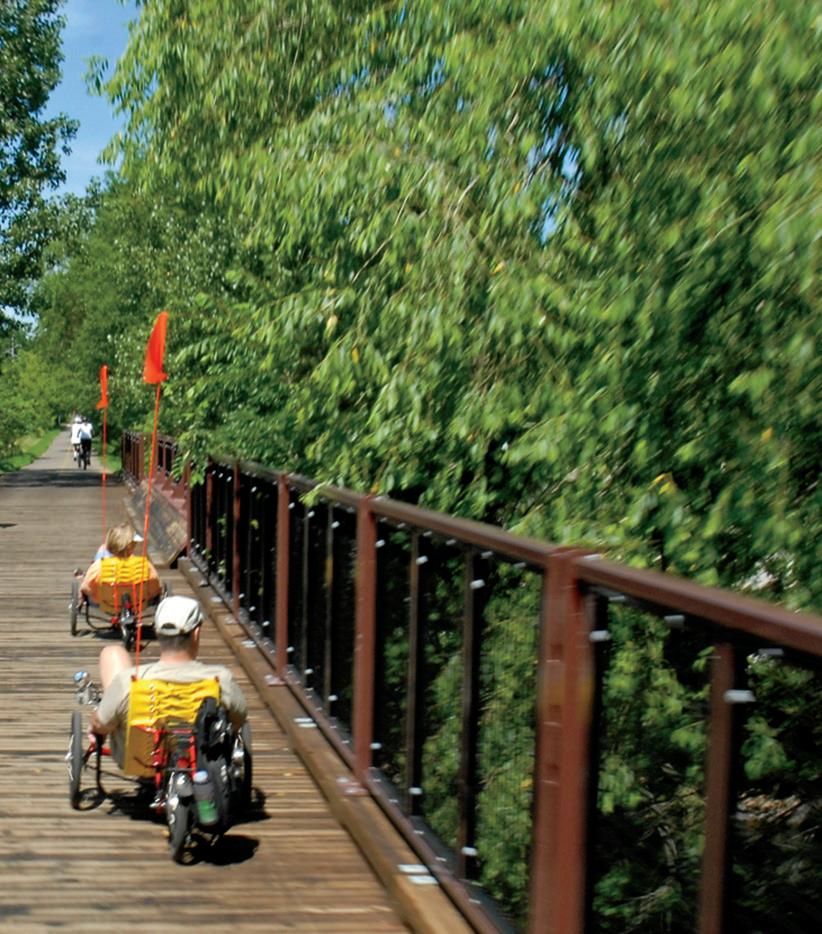
With bike trails, bike lanes, and entire streets marked to share with bicyclists, the Twin Cities is webbed with options for two-wheel travel. There are maps on your phone, books, and websites devoted to the best places to ride in Minneapolis, St. Paul, and surrounding suburbs.
Bike trails intersect, branch off, and seem to change names when you change direction. Trails along the Mississippi River get be er and longer every year. Greenways go through the heart of the city, and the number of offstreet bike lanes is increasing.
It can be overwhelming.
Where do you start when you’re ready to venture beyond your neighborhood? Three Twin Cities cyclists offer a few ideas.
Richard Arey, founder of the Saint Paul Classic Bike Tour and author of the 2003 guidebook “Twin Cities Bicycling,” likes loops.
“People are familiar with a loop around a lake,” Arey says. He suggests a loop on either side of the Mississippi River. “You can make it as long as you like.”
There are bike trails along the Mississippi, and you can park almost anywhere to hop on, Arey says.
For one loop, park near the river on Summit Avenue in St. Paul, and follow the trail to the Ford Parkway bridge.
Cross the bridge and come back on the Minneapolis side, then take the Lake Street/Marshall Avenue bridge back across the Mississippi River and
along the river back to Summit. Arey figures it’s about an 8-mile loop.
Or, a er crossing the Ford bridge, wind your way to Minnehaha Falls.
Loops can also be created around the Stone Arch Bridge in Minneapolis, Arey says. Or start at Harriet Island in St. Paul and bike through Lilydale Regional Park.
For long-distance cyclists Dan and Lisa Gjelten, Twin Cities bike trails are o en a way out of town, as their journeys start in the alley behind their St. Paul home. They have biked from St. Paul to New Orleans (about 1,500 miles) and St. Paul to Washington, D.C. (about 1,400 miles). The pair, who document their cycling adventures at confluence.blog, have biked more than 12,000 miles since 2017.
They’re not your typical leisure cyclists, but they do have some favorite routes inside the greater metro area.
Dan Gjelten likes the Mississippi River Greenway, which can be accessed from the Kaposia Landing Trailhead in South St. Paul and several other locations. The trail has a segment that is not yet complete, but eventually will stretch 27 miles from St. Paul to Hastings.
Gjelten likes to follow the river on his rides. He also suggests starting at Fort Snelling, which could include a stop at the state park’s new visitor center.
Though Arey’s book was published in 2003, he says it’s still about 95% accurate and can be found at used bookstores or online. He also suggests that organized rides (like the Saint Paul Bike Classic) can be a good way to get acquainted with trails.
PHOTO KRIVIT PHOTOGRAPHY/MEET MINNEAPOLIS
CANNON VALLEY TRAIL
MINNESOTAMONTHLY.COM | BIKE MINNESOTA 2023 | 9
LAKE HARRIET
DAYTRIP: Since 70 miles makes for a formidable daytrip for most recreational cyclists, consider an out-and-back from Duluth, where you can set your own distance. We picked up the trail on the edge of the city on Pulaski Street. The first part of the ride was a bit of a push climbing out of the Lake Superior basin, but it’s not too strenuous. If you’re not doing the whole trail, at least go beyond Carlton (15 miles) to take in the rugged forests of Jay Cooke State Park. If you go as far as Moose Lake, the Lazy Moose Grille is a good lunch stop. The views of Duluth and the lake on your return are amazing. And your options for eats in Duluth are vast. Grandma’s Saloon & Grill in Canal Park is popular, as is Fitger’s Inn just outside downtown. Duluth cyclist and journalist Jay Gabler suggests takeout from Northern Waters Smokehaus, where you can eat by the lake. Another option, he says, is Sir Benedict’s, which has a nice patio—and a bike rack. HIGHLIGHTS: See Jay Cooke’s trestle bridge, the views of Duluth, and rugged rocks.
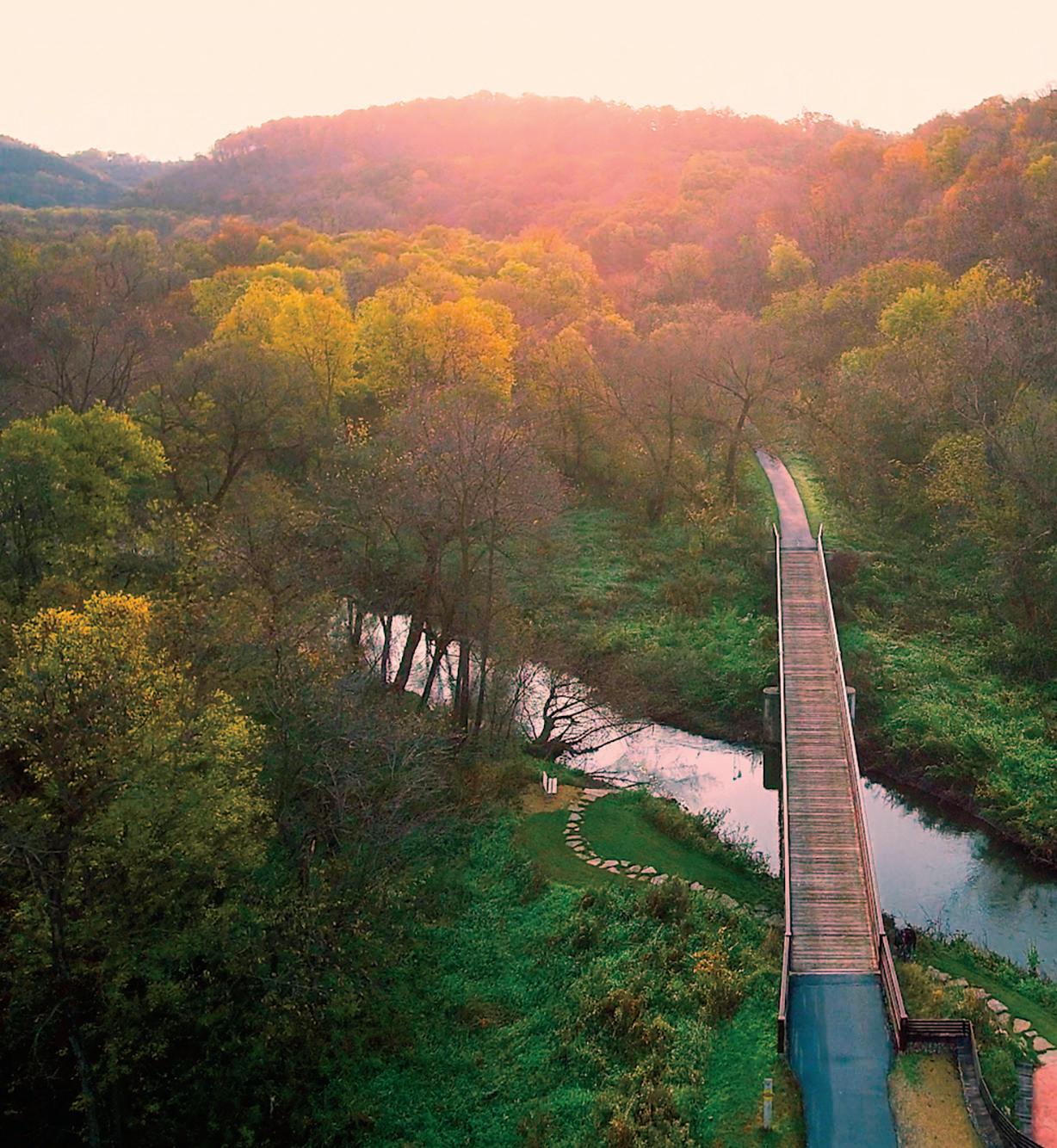
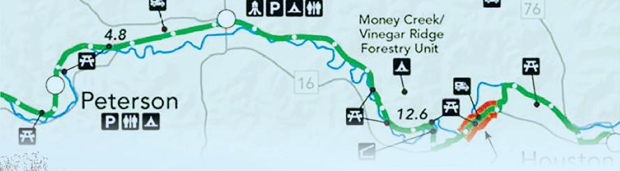
ROOT RIVER STATE TRAIL
Fountain to Houston
STATS: The 42 paved miles along the Root River go from Fountain through Lanesboro, Whalan, Peterson, Rushford, and Houston. There’s also a branch between Lanesboro and Fountain that goes south to Harmony.
FEATURES: The meandering trail is mostly flat, but there’s a “challenging” segment near Houston and another on the branch trail near Harmony.
DAYTRIP: Lanesboro feels like the heart of the Root River Trail, and a great place to start and end, with plenty of parking, shops, and restaurants in the charming town. It has been ranked in lists of “most stunning small towns,” “best small towns to visit,” and is on Oprah’s list of charming towns.
Start your daytrip early enough to bike the 4.6 miles from Lanesboro to Whalan and get there as close to 10 a.m. as you can, when Aroma Pie Shoppe starts serving the amazing pies it bakes daily
from scratch during the warm-weather months. Pie for breakfast? But, of course.
Further down the trail, consider a stop at the 1877 Peterson Station Museum and Visitor Center, just off the trail in downtown Peterson. The old depot part of the museum is packed with pieces of the small town’s past, with a newer addition loaded with band and military uniforms and school memorabilia.
We had a fine lunch at the friendly Stumpy’s Restaurant & Bar in Rushford before heading back toward Lanesboro. (By the time we passed the pie shop in Whalan at about 2 p.m., the pies were sold out.) For a longer ride after returning to Lanesboro, tack on the 11 miles to Fountain. Beaver Bottoms Saloon in Fountain is a dandy refreshment stop, and the return to Lanesboro is mostly downhill.
If you’re making a weekend out of it, there are hotels, inns, and nearby B&B options (it has been called Minnesota’s B&B capital), but book early. We had a fun stay at the Stone Mill Hotel & Suites a couple years ago. And Commonweal Theatre Co. is known for its high-quality stage productions.
HIGHLIGHTS: Check out charming Lanesboro, amazing pie in Whalan, and the rock walls on stretches that give a feel for what it was like when this was a railroad track.
MUNGER VISIT DULUTH ROOT RIVER LINDEN ANDERSON/DNR
WILLARD MUNGER STATE TRAIL
10 | BIKE MINNESOTA 2023 | MINNESOTAMONTHLY.COM
ROOT RIVER STATE TRAIL


tcgateway.com 10 Communities for 10X the Fun: Anoka • Arden Hills • Blaine • Coon Rapids • Fridley • Ham Lake Lino Lakes • Mounds View • New Brighton • Shoreview Let the Good Times
tcgateway.com 10 Communities for 10X the Fun: Anoka • Arden Hills • Blaine • Coon Rapids • Fridley • Ham Lake Lino Lakes • Mounds View • New Brighton • Shoreview
Roll
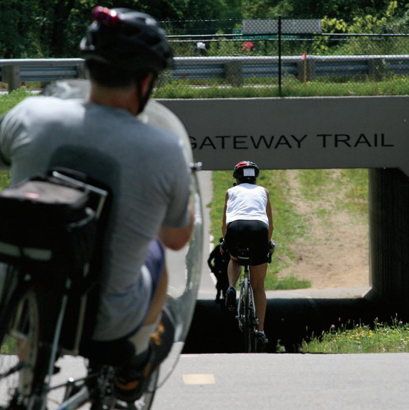
GATEWAY STATE TRAIL
St. Paul to Pine Point Regional Park with a turno on the Brown’s Creek State Trail to Stillwater
STATS: Although it could be argued that the Gateway isn’t entirely a non-metro trail, it can start to feel far away from buildings and busy streets after just a few miles on the paved path. Technically, the Gateway is 18 miles, starting on Cayuga Street in St. Paul and going to Pine Point. A rest stop turno at Grant veers o on the 6-mile Brown’s Creek Trail.
FEATURES: Mostly wooded and shaded, the Gateway offers views of backyards, marshes, ravines, industrial areas, businesses, the outskirts of North St. Paul (and the giant snowman), golf courses, cemeteries, and trees, trees, trees. Along the eastern 10 miles of the Gateway from I-694 to Pine Point Park, there’s an adjacent unpaved trail for horseback riding.
DAYTRIP: There are plenty of places to catch the trail in St. Paul, including a link from the Bruce Vento Trail near
Lake Phalen. A good parking or meetup spot is at the Maplewood YMCA Community Center. It’s about a 13-mile trip to Pine Point from there. As you enter North St. Paul, there’s a rest area with good bathrooms.
A mile or two past the Brown’s Creek turno to Stillwater, look for the Gateway Trailside food truck stop. Open during the warm-weather months, it features a lovely outdoor eating area with amazing BLTs and unique drinks. At the top of the trail, Pine Point has water, picnic tables, and good bathrooms. If you’re looking for a stop on your return trip, turn o the trail at North St. Paul and check out the live bullfrog in the window of Neumann’s Bar & Grill on the main street. Good burgers and beer can be found at this gathering spot for bikers (the motorized kind, but bicyclists are welcome).
If you take the Brown’s Creek State Trail into Stillwater, it’s a grand downhill ride that ends up along the St. Croix River in the historic river town, with lots of

options for rest and refreshments. And the uphill trip back isn’t awful. The trail can be crowded on weekends.
HIGHLIGHTS: The Gateway Trail is close, but it feels like a getaway. Stop for a selfie at the North St. Paul giant snowman. And even if it’s crowded, the downhill into Stillwater on the Brown’s Creek State Trail is a bicycle coasting joy.
12 | BIKE MINNESOTA 2023 | MINNESOTAMONTHLY.COM PHOTOS DNR
GATEWAY STATE TRAIL
BROWN'S CREEK STATE TRAIL


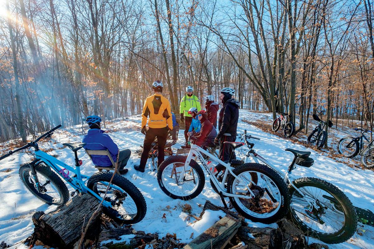
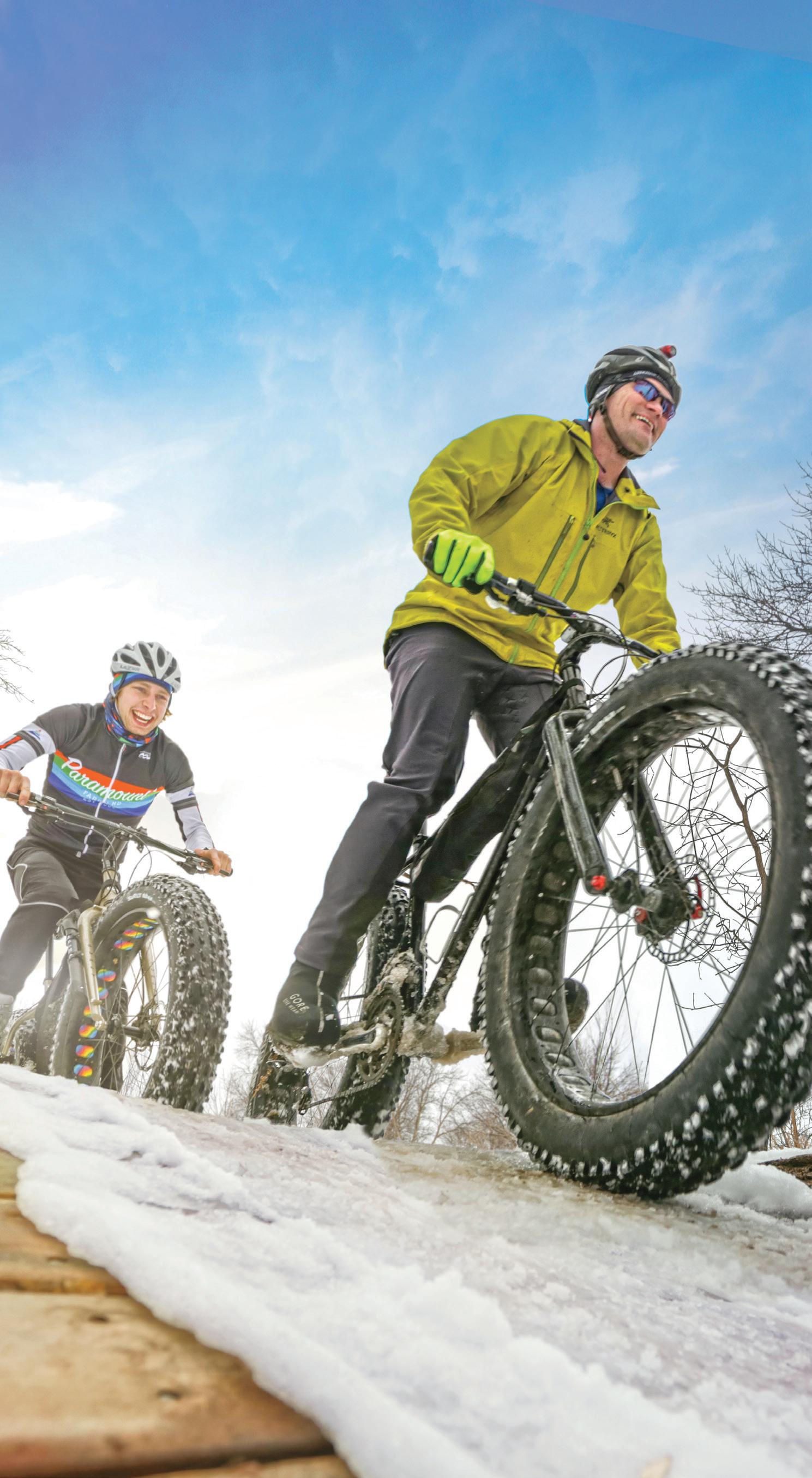
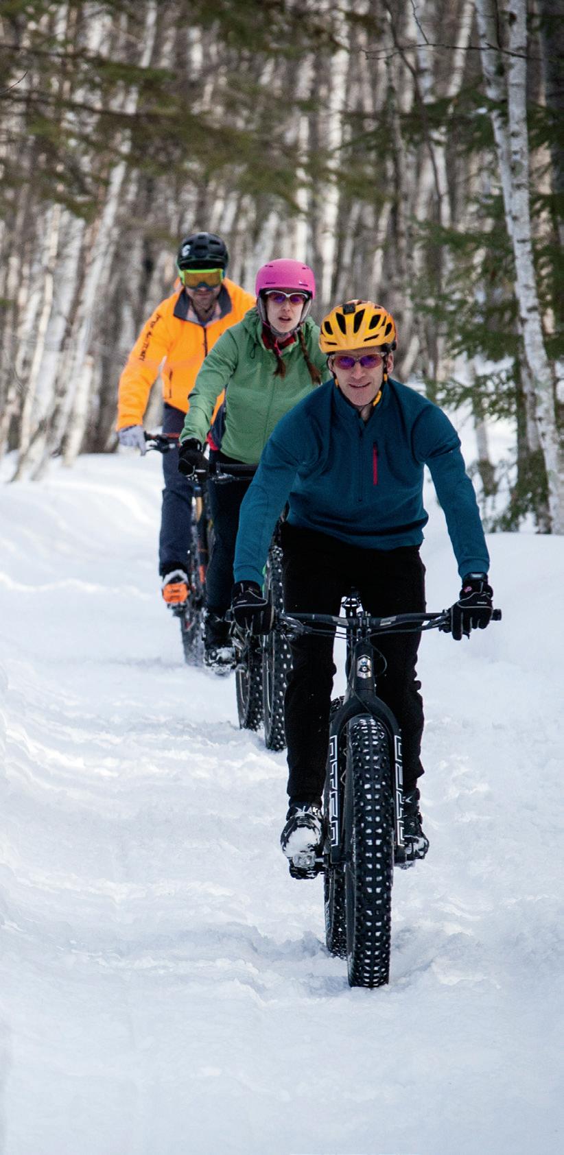
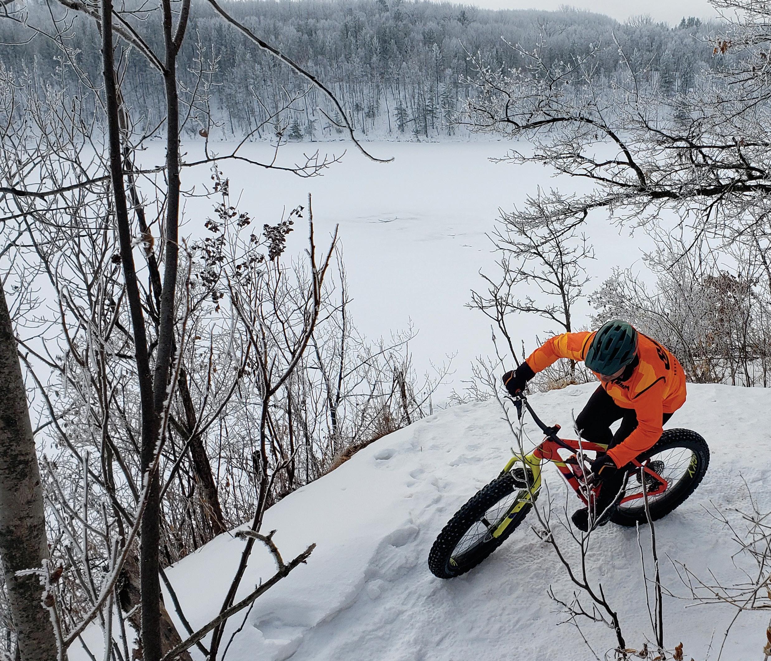
Gear Up for Winter Biking
WHAT TO KNOW BEFORE YOU HIT THE SNOW - COVERED TRAILS
 by SAMANTHA JOHNSON
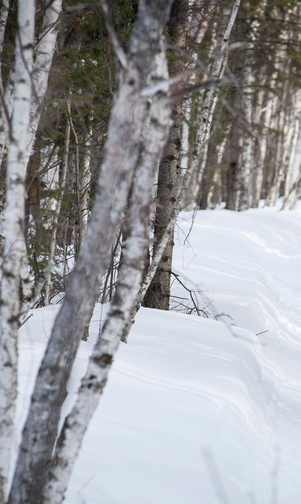
Just because there ’ s snow on the ground doesn’t mean you need to put your bike away for the season. With a little extra planning, some more layers, and adequate attention to trail conditions, a winter bike ride can be the perfect outdoor activity.
What is Fat Biking?
While any bike designed for both pavement and dirt is a fine option for the cooler months, the most popular form of winter biking is—without a doubt—fat biking. Fat bikes, also known as “fatties” or “fat-tire bikes,” are made for varying types of terrain, including snow, sand, and downhill. The tires fitted to these bikes are typically 3.5 to 5 inches wide and provide a well-balanced ride. Unlike most tires, fat tires have a low pound-per-square-inch (PSI) ratio. While there’s no set range, experiment with what works for you while keeping in mind that most experts
14 | BIKE MINNESOTA 2023 | MINNESOTAMONTHLY.COM MOORHEAD
VISIT FARGO MOORHEAD GRAND RAPIDS JOHN CONNELLY
MOORHEAD
suggest staying between 1-4 PSI for fresh snow and 5-8 PSI for hard snow. Fat bikes have more distance between the pedal attachment and the bike's crank arms to provide room for winter footwear and bigger rims to support the large tires. Studded tires help in icy conditions too.


Attire and Gear
When biking in the winter, try to dress as you would if you were going skiing. It doesn’t hurt to have an extra pair of gloves, winter cycling shoes or booties over your cycling shoes, a helmet, and goggles, as well as ear and neck protection (and even face protection if it’s a windy day). If you’d like to keep your hands warm but want more grip than gloves a ord, pogies are a popular option among fat bikers. Pogies are handlebar covers that you slide your hands into to keep your grip and the feeling in your fingers.
e Mesabi Trail.


MINNESOTAMONTHLY.COM | BIKE MINNESOTA 2023 | 15
DISCOVER DISCOVER THE plan your trip now > mesabitrail.com | visitgrandrapids.com | ironrange.org
vast wilderness, pedal quiet town roads,
traverse Minnesota’s historic
the
Explore
and
Iron Range. Ride
Mesabi Trail.
GRAND RAPIDS
You’ll want a helmet and proper athletic attire to soak up the sweat from your workout, too. A backpack with extra layers—or a place to store any clothing that becomes too warm—is a good idea. The sun goes down early in the winter months, and it’s important to remember that not all trails or roads have lights. A front light on the handlebar, a light on your arm or helmet, and a flashing safety light on the back of your bike are all recommended for a winter ride.
Finally, a tire pressure gauge is a must for your winter biking pack. If your PSI gets too low, it can degrade the inner
surface of the tire or tubes over time, leading to cracks and a reduced life span for your bike. Keeping the correct PSI will ensure that your ride doesn’t get too bumpy or cut short.

Know Before You Go
One of the biggest things to be aware of is that winter biking isn’t allowed on all trails. Be sure to check the rules of the path you’ve chosen before you go. For example, snowmobile trails may look enticing, but they are not open to any other uses out of safety concerns and respect for the grooming costs that users pay. Also, avoid
groomed and tracked cross-country ski trails and any trail that is not specifically indicated as open to bicyclists (meaning snowshoe trails, hiking trails, etc.). If there is a cross-country ski trail open to you, do your best to stay to the side of the trail in order to avoid destroying the track. Another consideration is to avoid leaving a deep rut because they can be dangerous to other users on the trail.
The best piece of advice for those who are new to winter biking is to take your time. There is a stark difference between riding in warmer weather and cold weather. Start with shorter rides
16 | BIKE MINNESOTA 2023 | MINNESOTAMONTHLY.COM
PHOTO JOHN SCHAUBACH
CUYUNA COUNTRY STATE RECREATION AREA'S SWITCH BACK TRAIL
to get acclimated to the thicker gear and the feel of riding on snow. Also, remember that trail etiquette applies to winter biking just as much as it does in the other seasons.
If you are interested in getting started or want to join other experienced riders, many spots around the metro have begun to host fat biking events, including the Northland Fat Bike Rally in Bemidji and the SnowWay But Round Fat Bike Race at Detroit Mountain. Well-known outdoor retailers like REI also o er classes on the basics of the sport.
SCHINDLER’S WAY MOUNTAIN BIKE TRAIL


A 3-mile off-road mountain-bike trail/loop that winds its way along the banks of Wolf Creek and the Cedar River.
SHOOTING STAR TRAIL
An asphalt trail laid mostly on top of abandoned railway from Austin city trails to Rose Creek - Adams - Taopi - LeRoy for a total of over 40 miles. Bike-friendly for all ages and abilities. Join us for the Annual Shooting Star Bike Ride held in June. Learn more www.shootingstartrail.org
RYDJOR BIKE SHOP

Over 80 vintage bikes on display. View the evolution of bikes from the 1868 Boneshaker to most current styles.
Ride all year long on 2,000+ miles of trails. Plan your next biking adventure at VisitCookCounty.com/bike
MINNESOTAMONTHLY.COM | BIKE MINNESOTA 2023 | 17
READY. SET. RIDE. Cook County, MN
GET YOUR BIKE BAGS FROM
Minnesota Makers
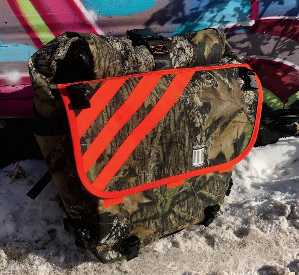
SIX LOCAL GEAR BRANDS TO HELP HAUL YOUR STUFF AROUND ON TWO WHEELS
 by EM CASSEL
Backpack? Hip pouch? Handlebar bag? Seat pack? There are so many ways to lug your stuff around on a bike, and lots of local makers sew the bags to help you do that lugging. We caught up with six of them to learn a little more about what goes into making fun, functional, delightful, and durable cycling gear.
18 | BIKE MINNESOTA 2023 | MINNESOTAMONTHLY.COM PHOTO EM CASSEL
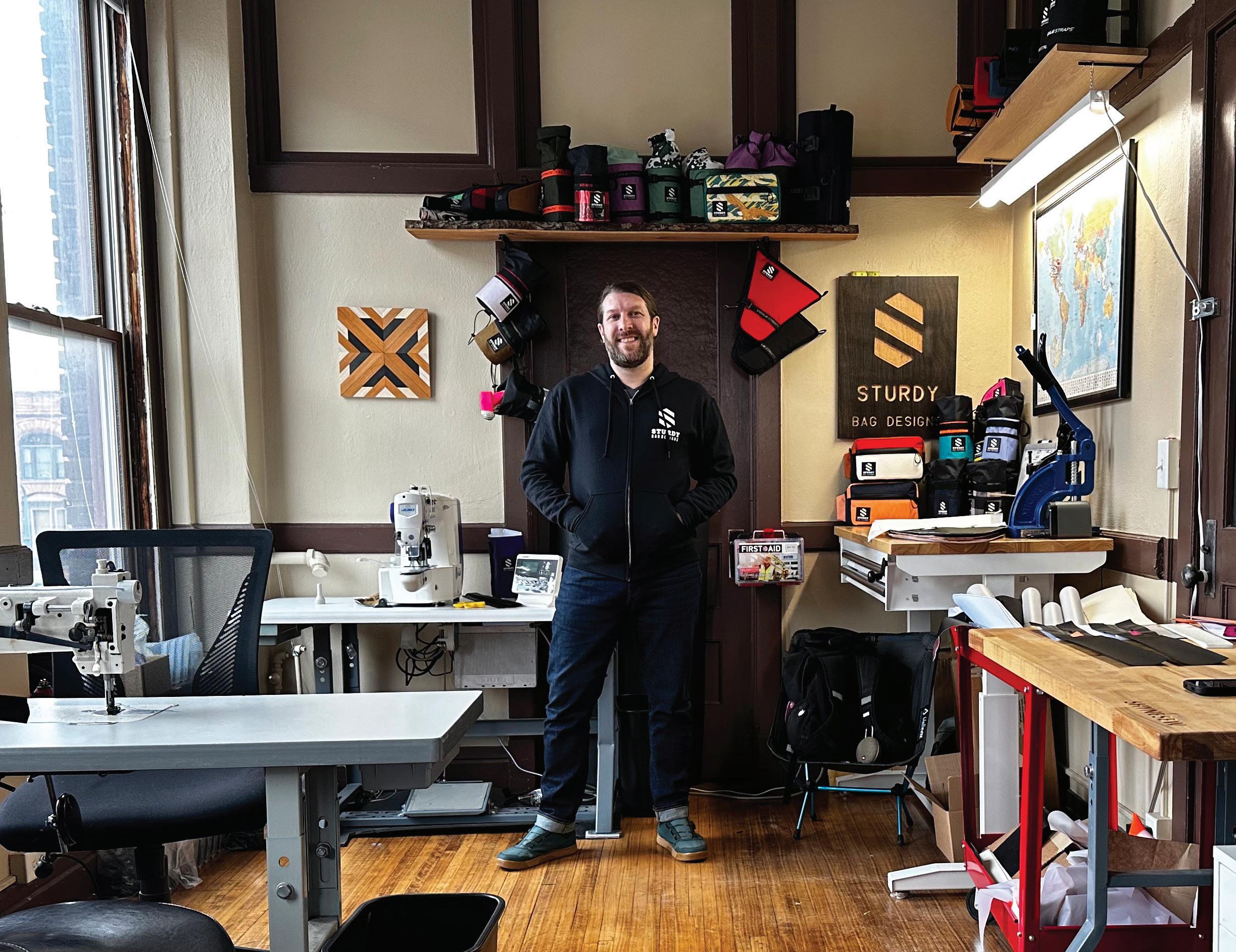
STURDY'S JOE MAUNTLER
Sturdy Bag Designs
sturdybagdesigns.com | @sturdybag_designs

For Sturdy’s Joe Mauntler, the road to bike bags started with cycling caps, which he’d stitch on a small home sewing machine for friends and other bike messengers in Milwaukee. Thanks to a job at an upholstery shop, he honed his skills, working on everything from couches and chairs to car interiors and boat seats. “I literally forced the guy to hire me,” Mauntler laughs. “I went there and was like, ‘Can I have a job?’ And I went there a week later and was like, ‘Can I have a job?’”
The upholstery shop gig involved a fair amount of contract sewing work—people would come in with an idea, and Mauntler had to figure out how to pa ern, cut, and sew it. Bike bags present similar challenges: “It’s a lot of problem solving,” he says. Now based in Minneapolis, Sturdy’s line has grown to include tool rolls, feed bags, handlebar bags, hip packs, and custom frame bags made to the specific measurements of a client’s bike. He has go en creative when it comes to helping folks carry their stuff as comfortably and effectively as possible.
“I feel like with sewing, you can always fix things,” Mauntler says. “That’s what I love about doing it: Nothing is over. You can mend everything … and I think that’s why this is so fun.”
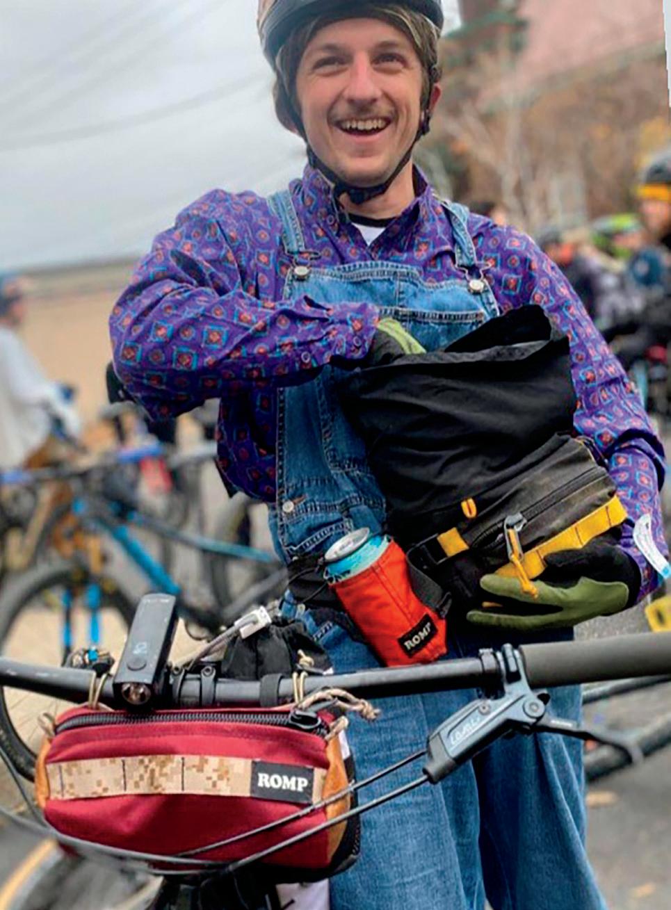
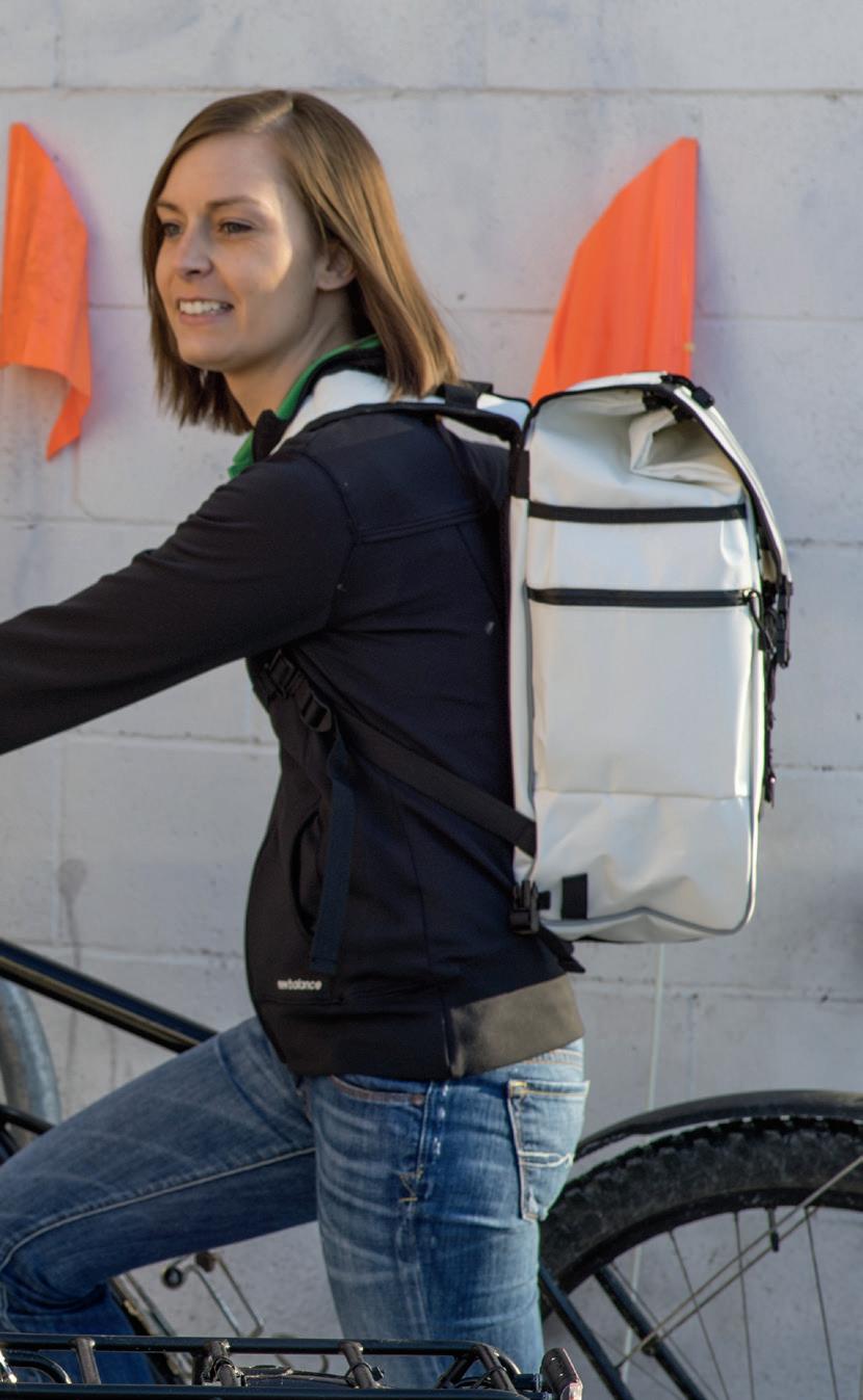
ROMP Bags
rompbags.com | @rompbags
“Once upon a time you could go dumpster diving around Duluth for fabric,” says ROMP Bags founder Zach Sullivan. “You could find waxed canvas, leather, nylon—and a lot of it. Nothing will get my creative juices flowing like a dumpster of free inspiration.”
For a long time, Sullivan hand-stitched bike bags for himself and friends with found fabric: a frame bag, a basket bag, some bar bags, panniers—you name it. His industrial sewing machine was a similarly serendipitous roadside score, and a er some light repairs, he rented a small studio in Duluth’s Back Alley coffee/surf shop, just a short bike ride from his house. That’s where ROMP, or Rad Outdoor Multi Purpose Bags, came to life.
These days, ROMP is Sullivan’s full-time gig. He has burned through all of his dumpster fabric and has to order it now, as his bags—including his favorite, the original roll-top fanny pack—are sold in more than 10 retailers. He even stitches white label products for other brands. And more bags are on the way: Keep your eyes out for a site drop, with new designs and colors.
MINNESOTAMONTHLY.COM | BIKE MINNESOTA 2023 | 19
PHOTOS EM CASSEL
Thimbleweed Custom Bike Bags
thimbleweedbikebags.com | @thimbleweedbikebags


Thimbleweed’s Jessica Swanson is a lifelong cyclist who has been bike commuting since she was a high school student in Minneapolis, but it wasn’t until the pandemic that she started bikepacking. And not long a er, she realized there might be a way for her to put her past experience in costuming for theater and dance productions to work: “When I was looking for a bag, I thought, ‘Oh, hey, I should try making my own!’” she chuckles.
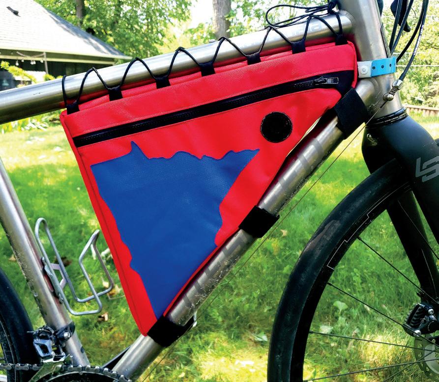
There are lots of canvas bags on the market, but few are as whimsical or as artfully designed as Thimbleweed’s. “A lot of my designs are inspired by nature and by my bike rides,” Swanson says.
That means you might see a frame bag decorated with a splashy, bright blue cutout of Minnesota or a forest illuminated by a glowing red and orange sunset. Her work is super customizable and colorful, and all of her bags are made to order—so yes, the leopard-print bag set of your dreams is just an email away.
20 | BIKE MINNESOTA 2023 | MINNESOTAMONTHLY.COM
PHOTOS PROVIDED
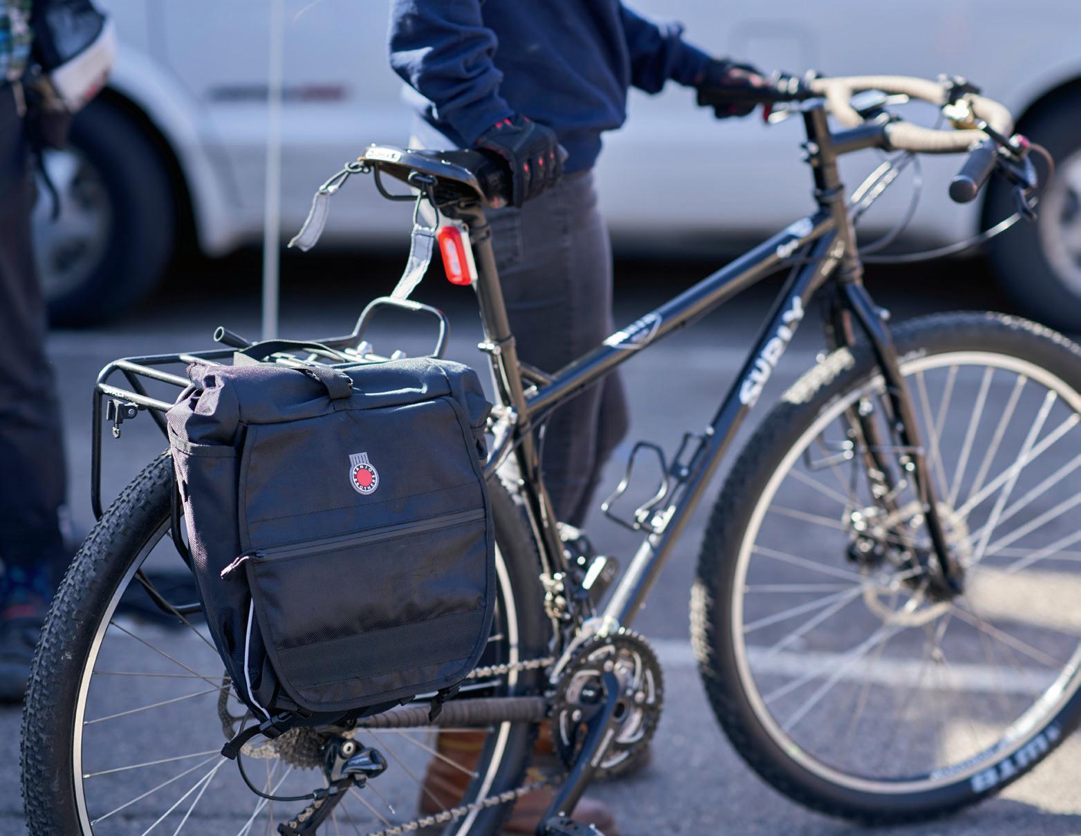
Trash Messenger Bags
trashmessengerbags.com @trashmessengerbags
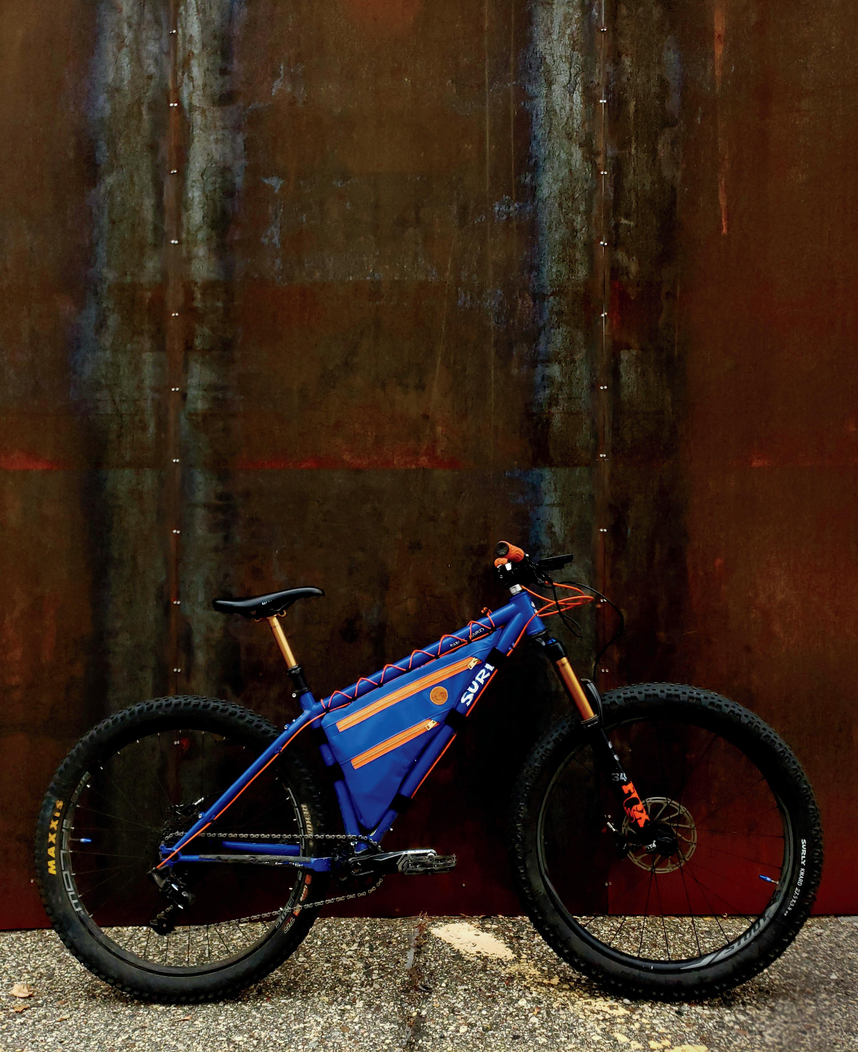
If you need to lug a lot of stuff around, Trash Messenger Bags are a really good bet. Leave it to a longtime bike messenger to stitch some of the biggest, most durable bags out there. “Like a lot of messengers, you realize that you probably can’t keep doing that forever,” says Andy Larson, who started the Minneapolis brand in 2008. “I thought maybe I’d try making some bags.”
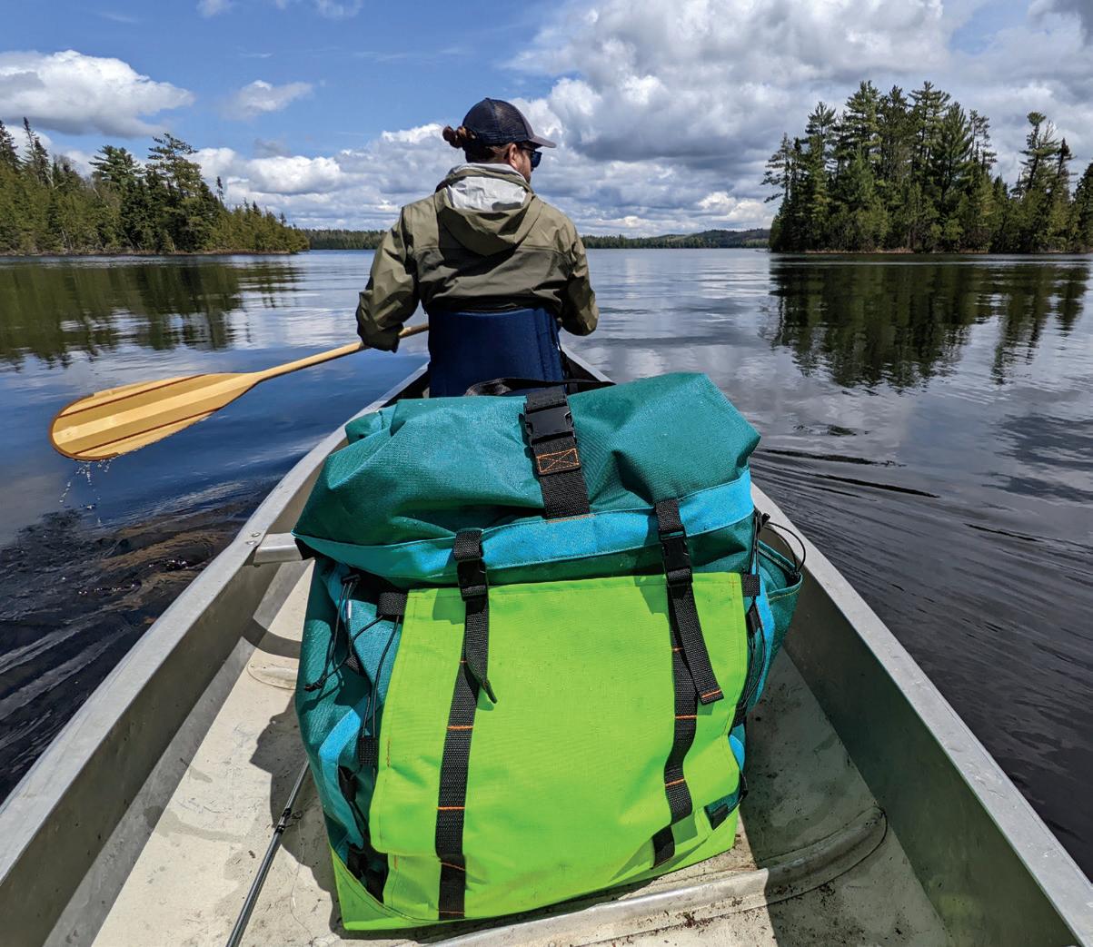
Larson didn’t know how to sew at the time but is “pre y stubborn and determined” when it comes to learning new skills. Fi een years later, the Trash Bags line of messenger bags (like the Trash Can and the Landfill) has grown to include hip packs (the Wastebasket), some of the warmest winter mi s on the market (Garbage Pickers), and a new Portage Pack for canoe journeys. In other words, stuff that might not be necessary for bike messengers but work great for many other Minnesotans.
“If you make something that works for big pieces of cargo, or heavy objects, and helps people carry them comfortably, then everyday bike commuters have a bag that can handle anything,” Larson says.

MINNESOTAMONTHLY.COM | BIKE MINNESOTA 2023 | 21 PHOTOS PROVIDED
Banjo Brothers
banjobrothers.com | @banjobrothers
Today, thanks in part to independent makers and brands like the ones on this very list, cyclists can get all kinds of innovative backpacks and bags that are durable, dependable, and made with style. When Banjo Brothers got its start two decades ago, that was not the case.
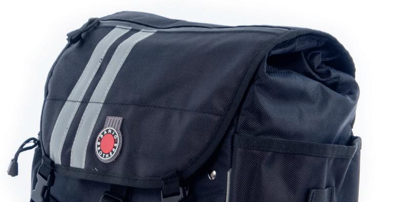
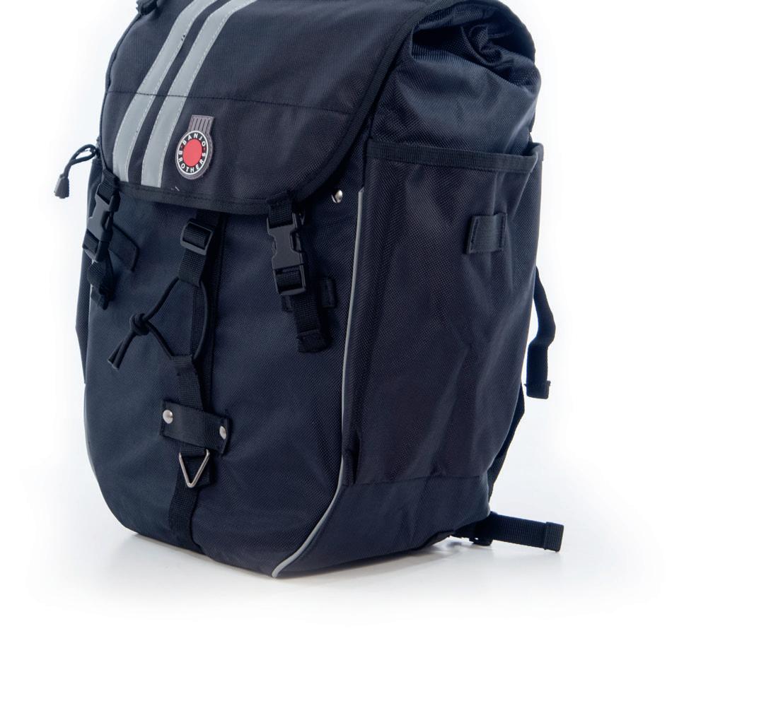
The Banjo Brothers (who are not brothers) are Eric Leugers and Mike Vanderscheuren, Minneapolis cyclists who were bummed out back in ’03 about the number of bike bags that were low in features yet high in cost. The duo set out to offer something different, and a er launching in just seven Twin Cities bike shops, their cycling backpacks, grocery bag panniers, and more are now available at hundreds of bike shops.
“The things that we thought about in the very beginning about who we wanted to be—we’ve kind of stayed true to that, and I think it has helped us build the brand,” says Vanderscheuren. Banjo Brothers bags aren’t made in Minneapolis— they work with manufacturers overseas—but that lets Leugers and Vanderscheuren offer bags that last practically forever at a more accessible price point. It hasn’t always been easy, but it has been rewarding, especially because it has let these “brothers” nurture and support the local cycling community for 20 years.
“Biking should be fun, right? Above everything,” Vanderscheuren says. “It’s hard to replicate that joy.”
22 | BIKE MINNESOTA 2023 | MINNESOTAMONTHLY.COM PHOTOS PROVIDED
ERIC LEUGERS, LEFT, AND MIKE VANDERSCHEUREN


MINNESOTAMONTHLY.COM | BIKE MINNESOTA 2023 | 23 THAT FEELING WHEN ADVENTURE CALLS With more than 15 bike trails, Greater St. Cloud is the perfect place to PLAN YOUR NEXT RIDE VISITSTCLOUD.COM IN GREATER ST. CLOUD St. Louis Par k Golden Valley St. Louis Park and Golden Valley are loaded with small-town charm, big city attractions and miles of paved and o -road trails — all just minutes away from Minneapolis! We’re the perfect spot for a sweet outdoor adventure. Miles of bike trails. SWEET ! discoverstlouispark.com
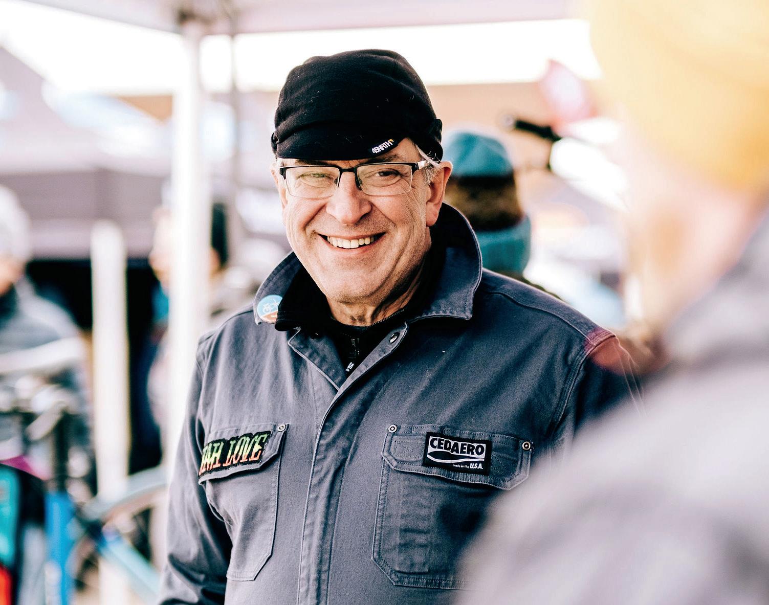
Cedaero
cedaero.com | @cedaero
Nestled in a cedar grove in scenic Two Harbors, you’ll find a real one-stop shop: Cedar Coffee Co., the Spokengear Cyclery & Outdoor shop, and the bike bag brand Cedaero, all situated cozily under one roof.
Cedaero bills itself as “the most fun bikepacking company in the galaxy,” and founder Dan Cruikshank (who’s also the mastermind behind Cedar Coffee Co. and Spokengear) has loved biking since he was a kid. “Ever since I got my first Schwinn Sting-Ray, it always provided a sense of freedom and joy in my life,” he says. As a co-founder of the backpacking brand Granite Gear, which he started with a friend in the ’80s and sold in 2014, he also knew a lot about making bags. Specifically, he knew about doing so in the United States with 100% U.S.-made materials—a point of pride that’s still true for all of Cedaero’s bags.
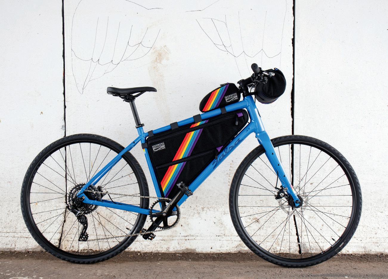
Two Harbors didn’t have a bike shop until Spokengear opened its doors in 2017, and most of the town’s businesses are located either downtown or right along Highway 61. “A lot of people thought I was crazy,” Cruikshank says. But the bike bag biz is thriving—they’re working with 60 dealers across the country, and a few in Japan and Canada and the U.K.—and the coffee shop is one of the top 100 in the country, according to Yelp. “We’ve got something special going on here.”

24 | BIKE MINNESOTA 2023 | MINNESOTAMONTHLY.COM
CRUIKSHANK JOSH KOWALESKI BOTTOM PEYTON STASIAK PHOTOS PROVIDED
DAN CRUIKSHANK


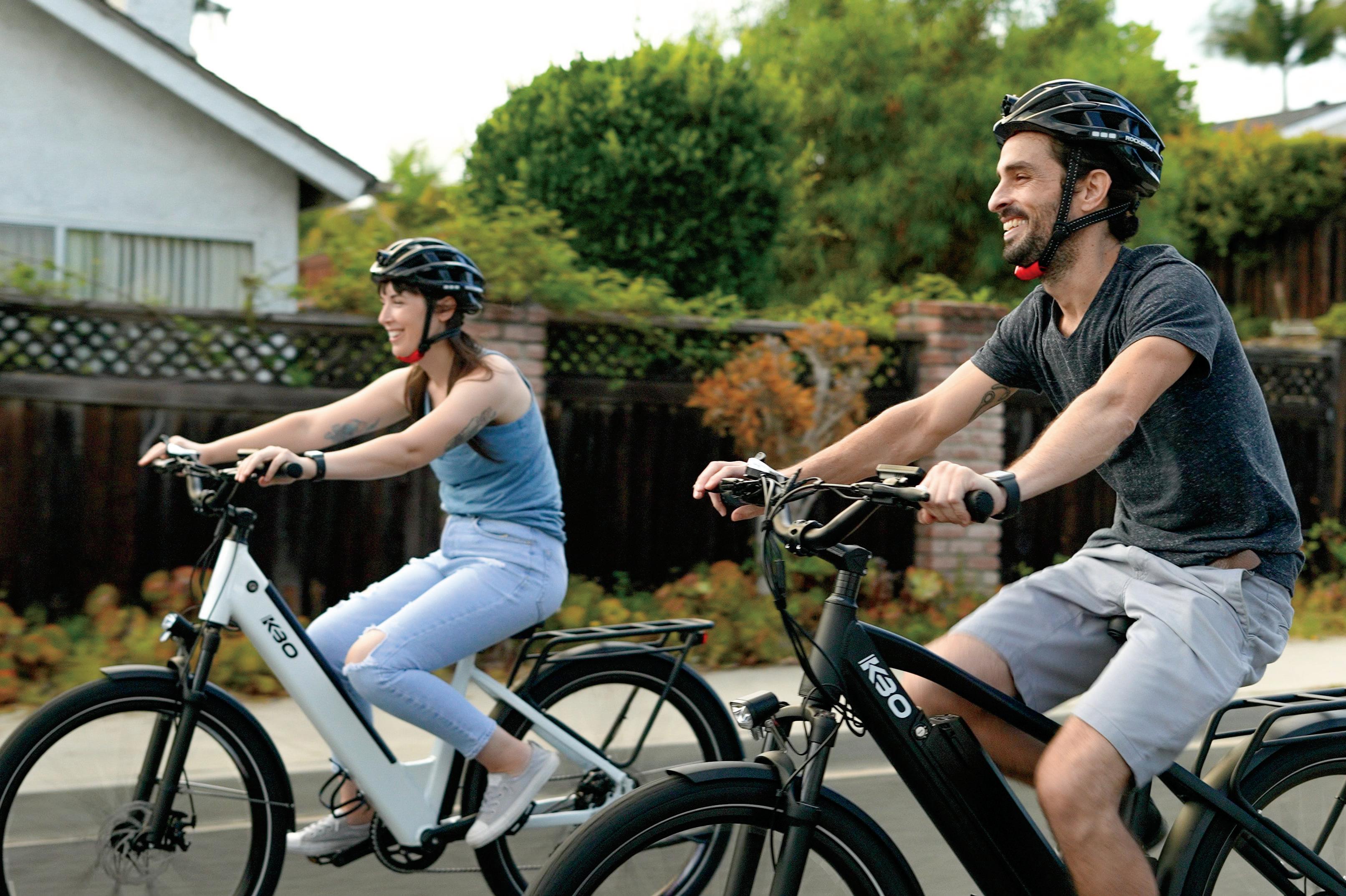
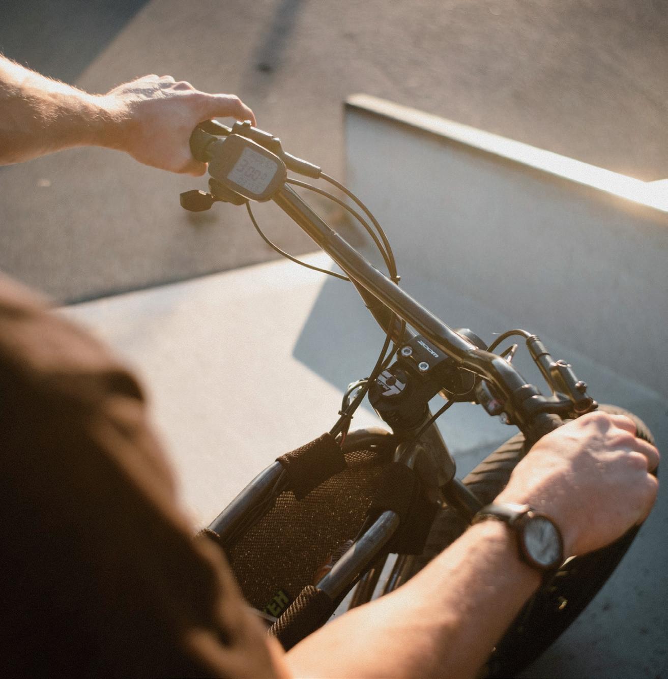
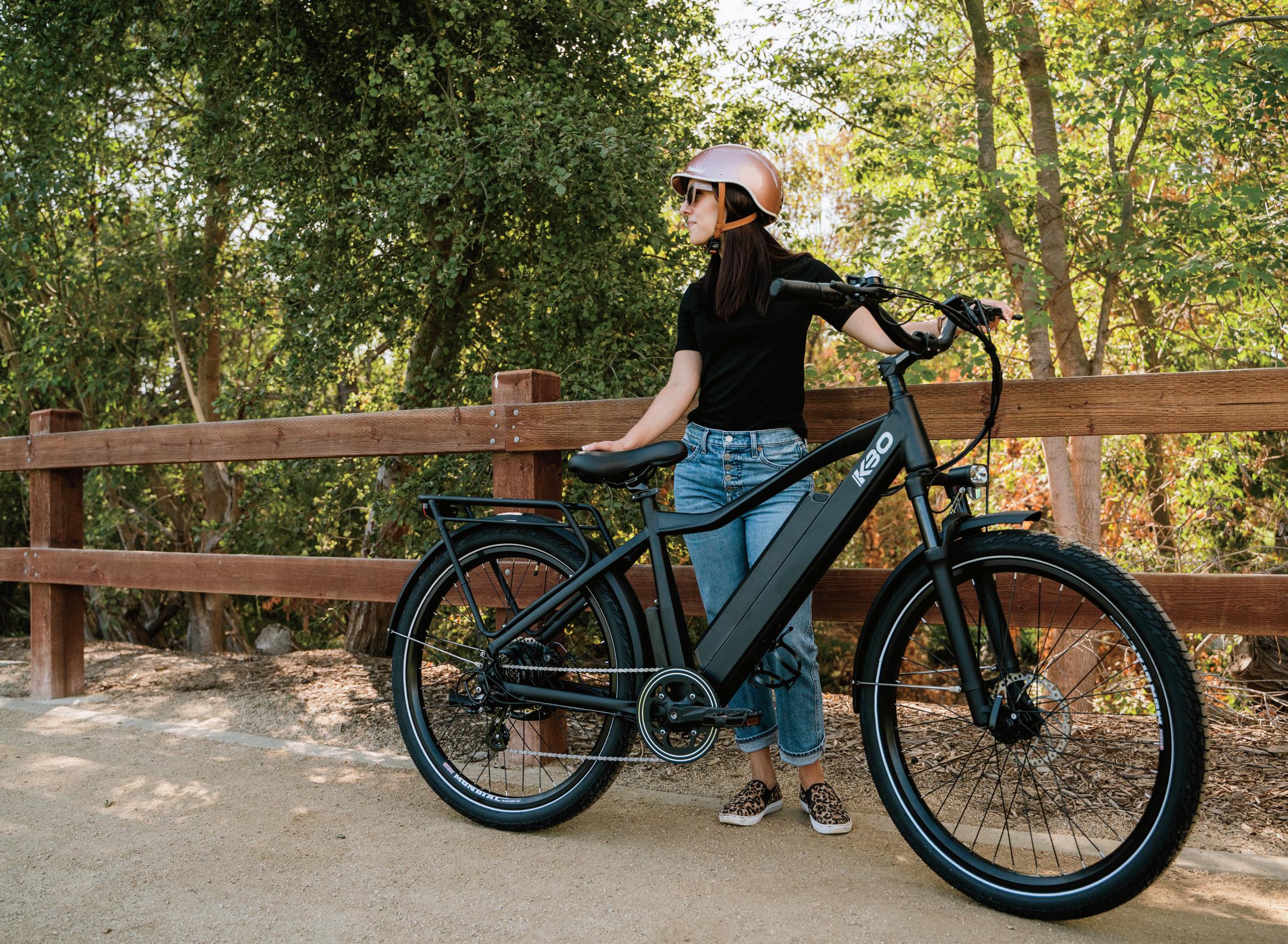
E-volution: A MINNESOTA GUIDE TO ELECTRIC BICYCLES
by KATHERINE LAWLESS
Welcome to the future of biking and maybe commuting. Electric bicycles, or e-bikes, have been rising in popularity since the beginning of the pandemic. According to a 2021 report by the North American Bikeshare & Scootershare Association (NABSA), 50% of North American cities with shared scooter and bikeshare systems o ered e-bikes, and the number of people using these bikeshare systems is rising annually. Included in this trend: the Twin Cities and greater Minnesota, with their extensive bike trails.
E-bikes are di erent from traditional bicycles because of their electric motors, which propel the bike and o er pedal assistance, allowing the rider to decide if, when, and how the bike ride becomes physically strenuous. With e-bikes’ powerful batteries, riders can go between 20 and 100 miles on a single charge. For those who want to travel sustainably, spend more time outdoors, and find a balance between leisure and exercise, the e-bike is a perfect fit.
One of the perks is how accessible e-bikes are across ages and abilities. The pedal assist technology makes riding long distances and getting outdoors more feasible for people with chronic pain or low mobility.
Safety First
As with other motorized vehicles, Minnesota has rules and regulations to ensure a safe ride. Across the state, e-bikes are generally required to have operational
pedals and an electric motor with a power output that doesn’t exceed 750 watts. E-bikes can’t exceed 20 miles per hour, so riders can remain in control of the motorized bicycle. While e-bike riders don’t need a license, persons younger than 15 cannot legally operate one.
There are three classes of e-bikes: Class 1, Class 2, and Class 3. Class 1 refers to an electric bike in which the electric motor only provides assistance when the user is pedaling or when the speed does not exceed 20 mph. Class 2 e-bike motors propel the bike forward without the rider needing to pedal, and Class 3 e-bike motors don’t provide assistance past the threshold speed of 28 mph.
The rules on where to ride e-bikes are similar to those regarding nonmotorized
26 | BIKE MINNESOTA 2023 | MINNESOTAMONTHLY.COM PHOTO KBO BIKE/UNSPLASH


MINNESOTAMONTHLY.COM | BIKE MINNESOTA 2023 | 27 Gear up for endless fun in the outdoors. From roughing it on dirt trails in the Minnesota River Bottoms to taking it slow on paved paths in scenic parks, Bloomington’s miles of bike trails and exciting terrains welcome you to enjoy the ride, all just minutes from Mall of America®. Find itineraries, hotel suggestions and more at BloomingtonMN.org/Bike @extrapalemale HOME OF MALL OF AMERICA® DISCOVER THE IronRange.org Discover world-class trail systems. Redhead | Mesabi Trail | Giants Ridge
bicycles. Bikers must ride with tra c, not against it, and shouldn’t ride on sidewalks. E-biking is permitted on all Minnesota state trails, but anyone riding when it’s dark outside should use a light to identify themselves to other riders and drivers. Helmets are legally optional but encouraged.
How to E-Bike
One of the biggest di erences between a traditional bike and an e-bike is that the latter needs to be charged by connecting the battery pack to a power source. Most e-bikes only need to charge for a
28 | BIKE MINNESOTA 2023 | MINNESOTAMONTHLY.COM TOP KILIAN SEILER/UNSPLASH BOTTOM KBO BIKE/UNSPLASH
few hours, and those charges should last several long bike rides.

For those using an e-bike for the fi rst time, the sensation may be a bit di erent than riding a traditional bike. Depending on the class of e-bike, begin either by pedaling or pushing forward to allow the electric motor to start propelling. Start slow and increase speed to build confidence.
Nice Ride
Many local bike stores sell e-bikes, with the average commuter bike ranging from $1,000 to $4,000. For those who are not ready to make that financial investment or want to first try out the experience of riding an e-bike, consider a community-shared e-bike. In Minneapolis and surrounding areas, the Nice Ride app allows users to purchase an annual membership or a short-term pass to the green bikes parked around the city. Use the app to sign up and find a map that notes the location of all nearby and available Nice Ride bikes, perfect for biking around the Chain of Lakes or navigating downtown.
E-bikes truly are for everyone, so you can also take an e-bike out for a spin using Nice Ride for All, Nice Ride’s equity program that lowers costs for individuals over the age of 18 who qualify for certain state and federal assistance programs.

Hit the Trails
Minnesota is full of bike-friendly trails that will take you around its 10,000 lakes and through bustling downtowns. If you’re in the Twin Cities area, bike along the Chain of Lakes, the Stone Arch Bridge, or down to Minnehaha Falls. If you’re a bit farther north, bike under a canopy of fall foliage on the Mesabi Trail or take in scenic views of Lake Superior on the Gitchi-Gami State Trail. And Root River State Trail allows you to bike along the beautiful blu s of southeastern Minnesota.
MINNESOTAMONTHLY.COM | BIKE MINNESOTA 2023 | 29 320-235-3552 www.willmarlakesarea.com
Call Today for Vacancies!
Bike Trails

 by KATE LINGGI
FIVE REGIONS HAVE MANY MILES OF PAVED AND MOUNTAIN BIKE TRAILS TO EXPLORE
MINNESOTA'S
30 | BIKE MINNESOTA 2023 | MINNESOTAMONTHLY.COM
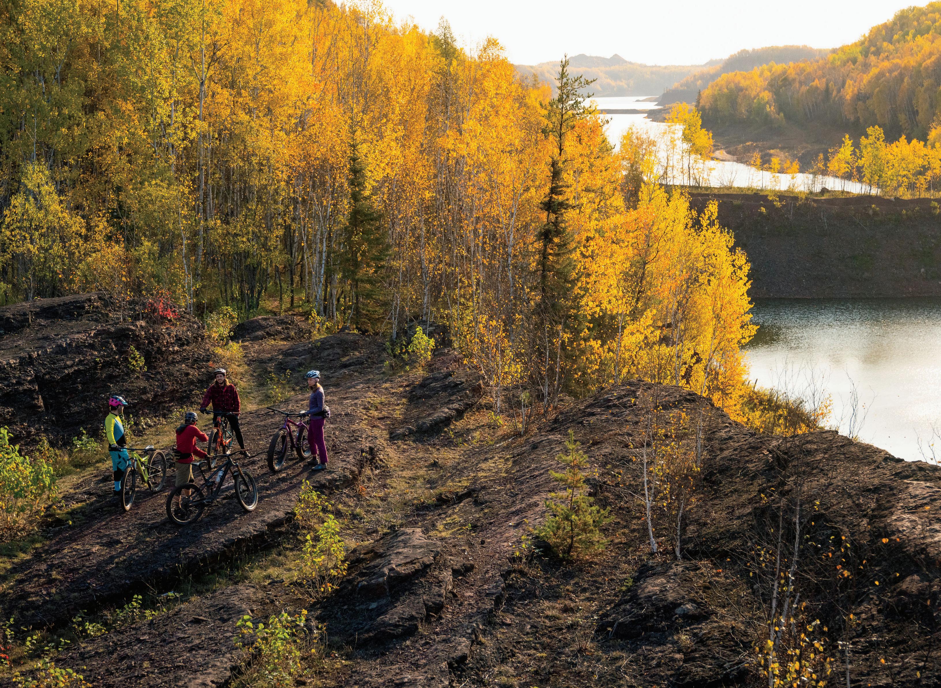
SPLIT ROCK WILDS IN LAKE COUNTY ALONG THE NORTH SHORE
Southern Minnesota
BLAZING STAR STATE TRAIL
LOCATION: Albert Lea, 43.642570657540055, -93.32250720864288
TYPE: Paved
DISTANCE: 6 miles
DESCRIPTION: A paved trail that connects Albert Lea Lake and Myre-Big Island State Park, this trail features a diverse landscape of wetlands, prairie, and oak savanna, as well as great birding spots in the spring and fall.
PARKING: One lot available next to Frank Hall Park at the intersection of Frank and James avenues; parking also available in Myre-Big Island State Park.
LEVEL: Moderate
COST: Free
INFO: 507-414-6193; mndnr.gov/trails
CANNON VALLEY TRAIL
LOCATION: Cannon Falls, 44.5582494768784, -92.7215914
TYPE: Paved
DISTANCE: 19.7 miles
DESCRIPTION: This paved trail traces the Cannon River and features many miles of sightseeing, from the Cannon River Turtle Preserve to an abandoned river channel.
PARKING: Parking available on North Service Drive.
LEVEL: Easy
COST: $5 daily wheel pass for 18 and older; $25 per season
INFO: 507-263-0508; cannonvalleytrail.com
MINNESOTAMONTHLY.COM | BIKE MINNESOTA 2023 | 31 DO YOU HAVE A FAVORITE BIKE TRAIL TO INCLUDE IN THIS LIST? Email anelson@greenspring.com to possibly be featured online and in future issues.
CANNON VALLEY TRAIL PHOTOS PROVIDED
DIRECTORY bike trails
CASEY JONES STATE TRAIL
LOCATION: Currie and Pipestone, 44.07673831807797, -95.67169985998149
TYPE: Both paved and unpaved
DISTANCE: 10.6 miles
DESCRIPTION: Connecting Pipestone, Woodstock, Lake Wilson, and Currie, this trail boasts Lake Shetek and rolling prairie. Named a er railroad engineer Casey Jones, it was one of the first trails to be authorized by the state of Minnesota.
PARKING: Pipestone: available off Highway 23; Woodstock and Lake Wilson: available at the community park; Currie: available at the End-O-Line Railroad Park and Museum.
LEVEL: Moderate to challenging
COST: Free
INFO: 507-832-6031; mndnr.gov/trails
CEDAR CREEK PARK
LOCATION: Fairmont, 45.11088770585724, -94.55472441531124
DISTANCE: 1.8 miles
TYPE: Paved
DESCRIPTION: This compact-yet-scenic trail is lush with trees and nearby mowed nature trails to explore. There are also two 18-hole disc golf courses within the park.
PARKING: From I-90: exit on Highway 39 and drive south for 5.5 miles, take a le on 80th Street (Lake Aires Road), take the next le on Cedar Creek Road. Lot is available at end of the road. From Highway 15: go west on 80th Street and take a right on Cedar Creek Road. Lot is available at the end of the road.
LEVEL: Easy
COST: Free
INFO: fairmont.org
DOUGLAS STATE TRAIL
LOCATION: Between Rochester and Pine Island, 44.0837317762188, -92.54636590230987
TYPE: Paved
DISTANCE: 12.5 miles
DESCRIPTION: Pass through some rich agricultural land and see geese and pheasant on this bike trail built off an abandoned railroad grade.
PARKING: Rochester: available south on CSAH 22, 2 miles to Olmstead County Road, then 0.3 miles east to Rochester trailhead; Douglas: west on Olmstead Country Road 14, 3 miles to the Douglas trailhead; Pine Island: Goodhue County Road 11 for 0.5 miles to Pine Island City Park trailhead.
LEVEL: Easy
COST: Free
INFO: 507-206-2847; mndnr.gov/trails
GOODHUE PIONEER STATE TRAIL
LOCATION: Red Wing, 44.54331291260561, -92.56974800229244
TYPE: Paved
DISTANCE: 47 miles when complete
DESCRIPTION: This trail allows one to pass through grass prairies, oak savanna, and maple forests while keeping an eye out for creatures like deer, wild turkeys, and bald eagles.
PARKING: Available in the city of Red Wing, in the Hay Creek unit of the Richard J. Dorer State Forest, and the southern portion of the Covered Bridge Park in Zumbrota.
LEVEL: Easy
COST: Free
INFO: 507-206-2847; mndnr.gov/trails
GREAT RIVER RIDGE STATE TRAIL
LOCATION: Between Plainview and near Eyota, northeast of Rochester, 44.02113956303226, -92.25532408696955

TYPE: Paved
DISTANCE: 15 miles when complete
DESCRIPTION: Made up of a largely agricultural landscape, this trail features miles of quiet farmland and a few creek crossings.
PARKING: Plainview: at trailhead on Third Street SW; Elgin: in town; Eyota: on County Road 9.
LEVEL: Easy
COST: Free
INFO: 507-206-2847; mndnr.gov/trails
PHOTO PROVIDED
32 | BIKE MINNESOTA 2023 | MINNESOTAMONTHLY.COM
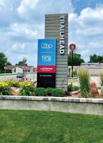
LUVERNE TRAILS
HARMONY-PRESTON VALLEY STATE TRAIL
LOCATION: Between Harmony and Preston, southeast of Rochester, 43.67297840203906, -92.07252436184632
TYPE: Paved
DISTANCE: 18 miles
DESCRIPTION: The northern two-thirds of the trail is constructed from a former railroad and continues to pass through farmland as well as wooded areas. There is much wildlife to see as well, such as deer, hawks, and wild turkey.
PARKING: Harmony: take Fourth Street NW for 0.5 miles to parking lot; Preston: take Fillmore Street (County Road 12) 0.5 miles to parking lot.
LEVEL: Easy
COST: Free
INFO: 507-206-2847; mndnr.gov/trails
LUVERNE TRAILS
LOCATION: Luverne
43.6662019035895, -96.20307627305257

DISTANCE: about 15 miles total
TYPE: Paved
DESCRIPTION: Including the Luverne Loop, Ashby Trail, and Blue Mounds Trail, the trails of Luverne take bicyclists through city sights, lakes, agricultural fields, and views of the Blue Mound cliffline.
PARKING: Luverne Loop: public parking available along the route; Blue Mounds: available at intersection of Main Street and Mound Avenue; at Blue Mounds State Park; and at Cliffline Area along County Highway 8 (parking pass needed).
LEVEL: Easy
COST: Free
INFO: cityofluverne.org/trails
RED JACKET TRAIL
LOCATION: Between Mankato and Rapidan, 44.11812558615121, -94.04924536948536
TYPE: Paved
DISTANCE: 6 miles
DESCRIPTION: Named a er a Seneca Indian chief, the Red Jacket Trail employs three railroad trestles. The impressive Red Jacket Trestle spans the length of the Le Sueur River and Highway 66. This trail also includes Red Jacket Trail Park, which has stunning views of the trestle.
PARKING: Mankato: take Riverfront Drive exit off U.S. 14, turn le onto Riverfront Drive, then turn right on Stoltzman Road for parking. Weagel Park: from Sibley Street, turn right onto W. Seventh Street, turn le
Paved Trails
onto Highway 66, turn le onto Indian Lake Road for parking. Red Jacket Trail Park: from Highway 22, turn right onto County Road 90, turn le onto Highway 66 and turn le for parking available on the right.
LEVEL: Easy
COST: Free
INFO: 507-304-4025; blueearthcountymn.gov
ROOT RIVER STATE TRAIL
LOCATION: Between Fountain and Houston, 43.767994056762554, -91.8739631309798
TYPE: Paved
DISTANCE: 42 miles
DESCRIPTION: Root River State Trail presents splendid views of the limestone bluffs of the Root River Valley, as well as historical buildings and rural communities in passing trail towns. There is much wildlife to see, such as wild turkey, deer, and even ra lesnakes, which are a state protected species.
PARKING: Fountain: from Highway 52, take County Road 8 a mile to available parking. Lanesboro: from County Road 8, turn right onto Parkway Avenue S.
well
MINNESOTAMONTHLY.COM | BIKE MINNESOTA 2023 | 33
DIRECTORY bike trails
Parking is available on the street and next to Sylvan Park, which will be on the le . Peterson: from County Road 25, continue straight before turning right onto Park Street, and turn right again on Fillmore Street for parking.
LEVEL: Moderately challenging
COST: Free
INFO: 507-206-2847; mndnr.gov/trails
SAKATAH SINGING HILLS STATE TRAIL
LOCATION: Between Faribault and Mankato, 44.20289183408095, -93.62574380027883
TYPE: Paved
DISTANCE: 39 miles
DESCRIPTION: Developed on an abandoned railroad grade, Sakatah Singing Hills State Trail passes through Sakatah Lake State Park and provides access to a few other lakes and parks within the route. Sakatah is the Dakota word for “singing hills.”
PARKING: Mankato: on U.S. 14, go 8 miles to Riverfront Drive exit, then turn right onto N. Riverfront Drive. In 0.6 mile, turn le onto Lime Valley Road, where parking will be available; Faribault: take Exit 59 on I-35 and turn right onto Highway 21 to White Sands Park.
LEVEL: Easy
COST: Free
INFO: 507-698-7852; mndnr.gov/trails
SHOOTING STAR STATE TRAIL
LOCATION: Between LeRoy and Austin, 43.58312814261466, -92.78426342228396
TYPE: Paved
DISTANCE: 29 miles
DESCRIPTION: Built off an unused railroad bed, this trail follows meadows and hardwood groves to agricultural fields. There is a Norwegian church that serves as a rest stop as well as a memorial for Margie Meier, a supporter of the trail.
PARKING: LeRoy: on Lowell Street, east of County Road 14; Rowe Pit: off County Road 14, north of LeRoy; Lake Louise State Park: parking available with vehicle permit; Taopi: between Maple and Main streets on the south side of Highway 56; Adams: parking available on the south side of West Main Street (Highway 56). Rose Creek: parking available off Highway 56 or Fourth Street; J.C. Hormel Nature Center: off 21st Street.
LEVEL: Easy
COST: $7 daily vehicle pass; $35 year round
INFO: 507-414-6193; mndnr.gov/trails
Central Minnesota
CENTRAL LAKES STATE TRAIL
LOCATION: Between Fergus Falls and Osakis, 46.019977109347366, -95.69989050871006
TYPE: Paved

DISTANCE: 55 miles
DESCRIPTION: This region notably features the Kensington Runestone, an artifact allegedly found near a small town southwest of Alexandria that supposedly dates to 1362. The trail’s Seven Sister Prairie on the north side of Lake Christina is an impressive group of seven glacially produced knolls. The landscaping on this trail is varied, including dense forest as well as farmland and rolling hills.
PARKING: Fergus Falls: parking available at Central Lakes State Trail Trailhead off Highway 210 and in DeLagoon City Park; Alexandria: in Big Ole Park; Osakis: by Osakis Information Center; Dalton, Ashby, Evansville, Brandon, and Garfield: parking available in dedicated lots or city streets.
LEVEL: Easy
COST: Free
INFO: 218-739-7576; mndnr.gov/trails
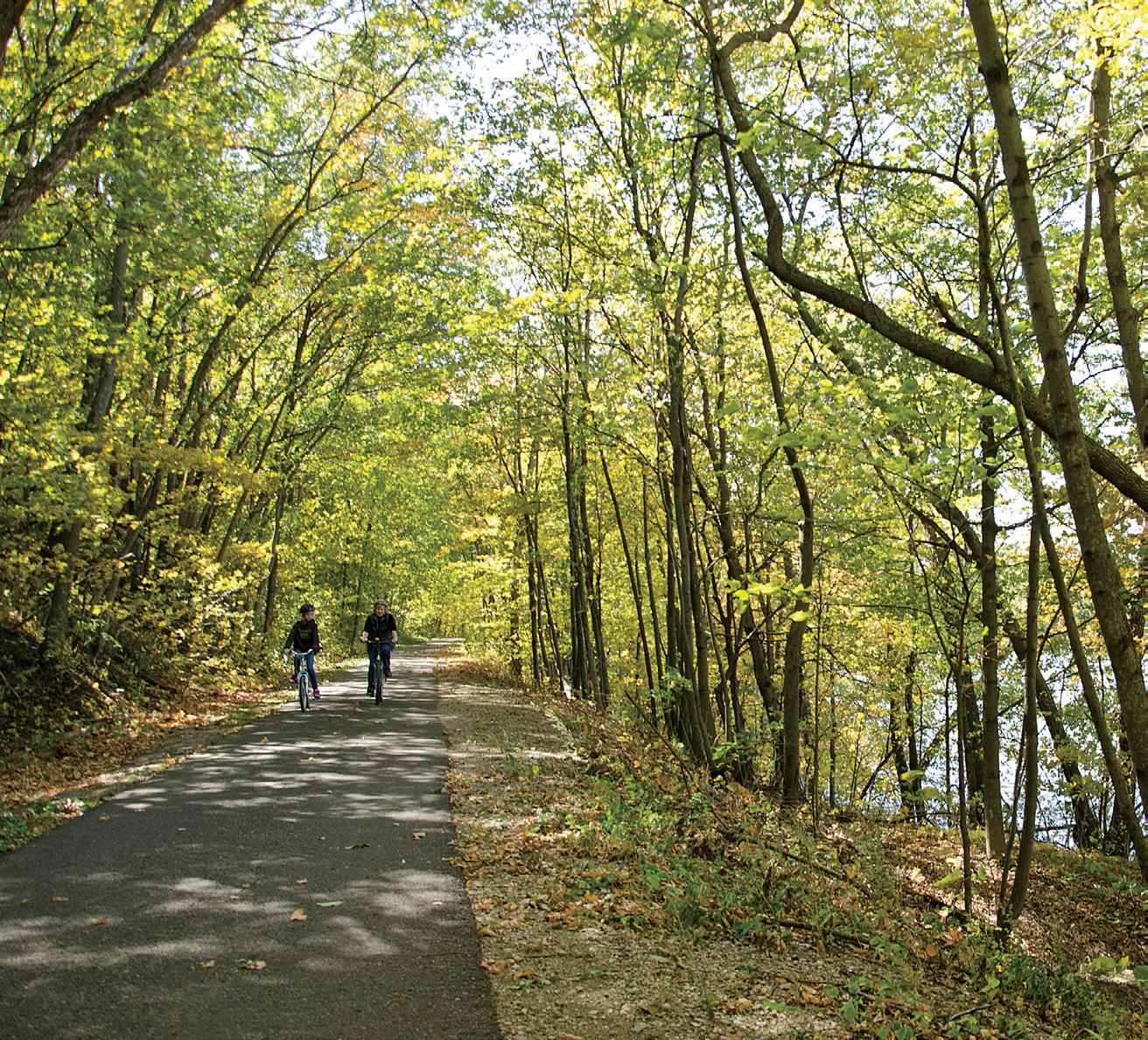
PHOTO DNR
34 | BIKE MINNESOTA 2023 | MINNESOTAMONTHLY.COM
SAKATAH SINGING HILLS STATE TRAIL


MINNESOTAMONTHLY.COM | BIKE MINNESOTA 2023 | 35 it’s all so close! Kato Bike Walk Month – May Blu Riders Charge - July River Valley 100 – August River Ramble – October Group Rides - All Year Round VISITMANKATOMN.COM/WAYFINDING WELCOME TO THE CUYUNA LAKES Maximize your outdoor adventure by visiting cuyunalakes.com where you can fnd all information on how to “Shred the Red ” 21236 Archibald Rd Deerwood, MN 56444
CUYUNA LAKES STATE TRAIL
LOCATION: Between Crosby and Riverton, 46.48204720773413, -93.89956430856324
TYPE: Paved
DISTANCE: 8 miles
DESCRIPTION: Inside the Cuyuna Country State Recreation Area, this trail features six natural lakes and 25 miles of undeveloped shoreline with a variety of fish species, including trout, bass, sunfish, and walleye.
PARKING: Crosby: take Highway 210/6 and follow the signs to the Cro Mine Historical Park. Parking is also available on the west side of Highway 6; Riverton trail head: from Highway 210, go north to County Road 128. Take a right to the intersection of Rowe Road. Turn le , and parking is available on the right of Rowe Road.
LEVEL: Easy
COST: $7 daily vehicle pass; $35 year round
INFO: 218-203-4442; mndnr.gov/trails
GLACIAL LAKES STATE TRAIL
LOCATION: Between Willmar and Paynesville, and Roscoe and Cold Spring, 45.258949875652604, -94.94604522871388
TYPE: Paved
DISTANCE: 29 miles
DESCRIPTION: This trail bisects western tallgrass prairie and deciduous forest terrain, where one can view reptiles, small mammals, and bu erflies. As the name implies, the lakes surrounding the area make this trail scenic.
PARKING: Willmar: on Highway 12 east to County Road 89, turn le for parking available at the Civic Center; Spicer: go west at the junction of Highway 23 and County Road 10; New London: go 1 mile northeast of Main Street on County Road 31. Parking is available at the intersection of River View Lane. Hawick: parking is available at the intersection of Highway 23 and County Road 2; Richmond: on Highway 23, go north one block on Central Avenue S.
LEVEL: Easy
COST: Free
INFO: 320-796-2161; mndnr.gov/trails
LAKE WOBEGON TRAIL
LOCATION: Between St. Joseph and Osakis, with a spur north from Albany to Holdingford, 45.66974843864027, -94.73500939739333
TYPE: Paved
DISTANCE: 65.5 miles
DESCRIPTION: This trail is named a er the fictional town of Lake Wobegon, coined by Minnesota radio
personality Garrison Keillor. The small towns along the trail, such as Holdingford, gave Keillor inspiration for this fantastical place. The lengthy trail features lakes, woodland, and open farmland.
PARKING Available at the following trailheads: Waite Park, St. Joseph, Avon, Albany, Freeport, Melrose, Sauk Centre, West Union, Holdingford, and Bowlus.
LEVEL: Easy
COST: Free
INFO: 800-264-2940; lakewobegontrail.com
MILLE LACS SOO LINE TRAIL
LOCATION: Between Onamia and Isle, south of Mille Lacs Lake, 46.073303151105655, -93.66768878255682
DISTANCE: 11 miles
TYPE: Paved and gravel (multiple-use trails)
DESCRIPTION: This trail features scenic forest and countryside, plus a beach and swimming area, in Father Hennepin State Park. Keep an eye out for the rare albino whitetail deer dwelling in the area nearby.
PARKING: Onamia: available at the Library/Depot on Roosevelt Road; Isle: on Fi h Avenue, one block south of Main Street.
LEVEL: Easy
COST: Free
INFO: 888-350-2692; millelacs.com
Northwest Minnesota
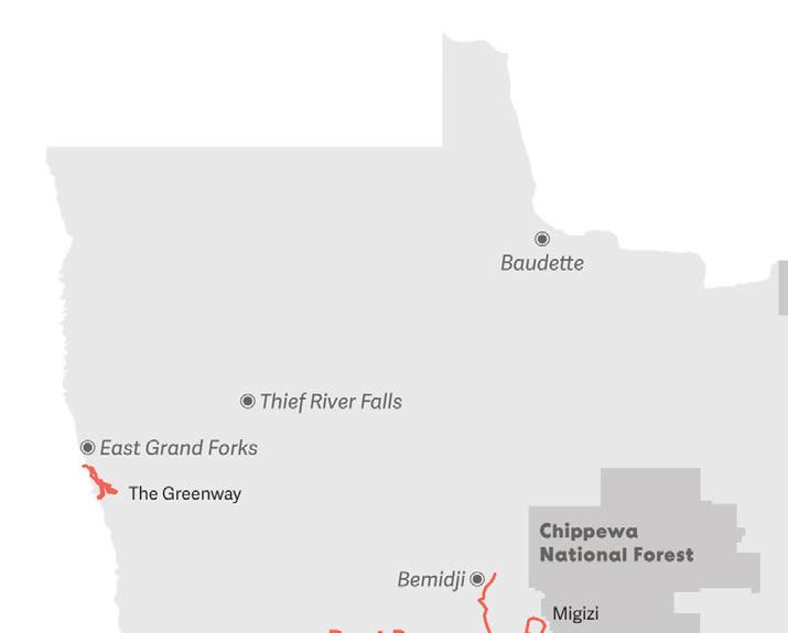
GREATER GRAND FORKS GREENWAY
LOCATION: East Grand Forks and Polk, 47.9223034634545, -97.016854137529
DISTANCE: 10 miles (in Minnesota)
TYPE: Paved
DESCRIPTION: This trail connects the border of Grand Forks, North Dakota, and East Grand Forks, Minnesota along the Red River and Red Lake River. There are a multitude of campgrounds, fishing sites, and playgrounds to enjoy, as well as golf courses and iceskating and hockey rinks.
PARKING: River Heights Park: go east on Gateway Drive from North Dakota and go 2.7 miles to enter Minnesota. Take the East Grand Forks exit, and turn le onto Fourth Street. Parking will be available on the right; Confluence of Red River and Red Lake River: go east on Demers Avenue. Take the Fourth Avenue S. exit, and then turn le onto Minnesota Avenue. Turn le , and parking is available before the Third Avenue Bridge.
LEVEL: Easy
COST: Free
INFO: 701-746-2750; greenwayggf.com
DIRECTORY bike trails 36 | BIKE MINNESOTA 2023 | MINNESOTAMONTHLY.COM


MINNESOTAMONTHLY.COM | BIKE MINNESOTA 2023 | 37 Discover Harmony ExploreHarmony com 877.886.2469 Come for the biking. Stay to discover Harmony. Discover Harmony ExploreHarmony.com 877.886.2469 Come for the biking. Stay to discover Harmony. Subscribe to our Preferred Reader’s Club to get exclusive deals, ticket offers & giveaways! Subscribe online at MinnesotaMonthly.com/PRC S P I R I T M O U N T A I N - D U L U T H , M N B I K E D U L U T H F E S T I V A L C O M BIKE DULUTH FESTIVAL JULY 7-9, 2023 M I N N E S O T A ' S P R E M I E R E M T N B I K I N G E V E N T G R A V I T Y A N D X C R A C E S F U N F O R T H E W H O L E F A M I L Y FIND BIKE TRAILS HERE! Over 17 miles of trails VISITOWATONNA.ORG
DIRECTORY bike trails
HEARTLAND STATE TRAIL
LOCATION: Between Park Rapids and Cass Lake, 47.15239558501804, -94.6402347711641
DISTANCE: 49 miles
TYPE: Paved
DESCRIPTION: One of the first railroads that was converted to a bike trail, Heartland State trail features views of lakes, rivers, streams, and wildlife such as bald eagles, bobcats, and coyotes. This trail also connects to the Paul Bunyan State Trail.
PARKING: Park Rapids: from Highway 34, go north 0.25 miles on Mill Street for parking in Heartland County Park; Dorset: go north 1.4 miles on Highway 225 from Highway 34 for parking; Nevis: parking available off Highway 34 at the intersection of County Road 18 and Village Road; Akeley: go north from Highway 34. Go for 0.1 miles on Hillside Avenue for parking; Walker: go south on County Road 12, proceed 0.25 miles from Highway 371 to Lake May Drive and Heartland Place; Erickson’s Landing: parking available 2 miles north of Walker on Highway 371; Steamboat Landing: go west off Highway 371. A er 0.3 miles, parking is available on 130th Street NW; Cass Lake: Parking available on the north side of Highway 2.
LEVEL: Easy to moderate
COST: Free
INFO: 218-308-2372; mndnr.gov/trails
MIGIZI
TRAIL
LOCATION: Cass Lake, 47.33475588209354, -94.56299046803375
DISTANCE: 19 miles
TYPE: Paved
DESCRIPTION: This scenic trail features deciduous forest and red and white pines, as a large part of it traverses through the Chippewa National Forest. Migizi, the Ojibwe word for “bald eagle,” is the namesake of this trail. The eastern 2.8 miles of this trail connect with the Heartland State Trail.
PARKING: Available at the Cass Lake Wayside Rest on Highway 2 and the South Pike Bay Picnic Area.
LEVEL: Easy
COST: Free
INFO: 218-335-8600; fs.usda.gov/chippewa
PAUL BUNYAN STATE TRAIL
LOCATION: From Crow Wing State Park (Brainerd Lakes Area) to Lake Bemidji State Park, 47.58041820986701, -94.82077033900367
DISTANCE: 115 miles (not including short on-road connections through Baxter and Bemidji)
TYPE: Paved
DESCRIPTION: Boasting the title of Minnesota’s longest state trail and the longest continuously paved rail-trail in the United States, the Paul Bunyan State Trail also hosts oak savannas and prairies with bountiful wildlife.
PARKING: Available in the following locations: Akeley, Backus, Baxter, Bemidji, Brainerd, Chippewa National Forest, Crow Wing State Park, Guthrie, Hackensack, Jenkins, La Porte, Lake Bemidji State Park, Lavinia, Merrifield, Nary, Nisswa, North County Trail, Pequot Lakes, and Walker.
LEVEL: Easy to moderate
COST: $7 daily vehicle pass; $35 year round
INFO: 218-308-2372; mndnr.gov/trails
Northeast Minnesota
GITCHI-GAMI STATE TRAIL
LOCATION: Along the North Shore of Lake Superior, 47.197014020035446, -91.38489784445896
DISTANCE: Over 33 miles (will be 86 miles when complete)
TYPE: Paved

DESCRIPTION: This trail has been slowly under construction for two decades but allows bicyclists to ride along the North Shore of Lake Superior while enjoying birch and aspen forests, lakeside beaches, and waterfalls. This trail, when completed, will connect five state parks.
PARKING: Silver Creek Cliff: go to the east side of the Silver Creek Cliff tunnel. Parking is available at the Silver Creek Cliff wayside; Grand Marais: available at the Grand Marais public water access; Schroeder to To e: available at the MNDOT wayside, Temperance River State Park, and To e town park off Sawbill Trail; Gooseberry Falls State Park to Silver Bay: available at Twin Points public water access, Iona’s Beach Scientific
PHOTO PROVIDED
38 | BIKE MINNESOTA 2023 | MINNESOTAMONTHLY.COM
GITCHI - GAMI STATE TRAIL
and Natural Area, Split Rock Lighthouse State Park trail center, Silver Bay hockey arena, rest area near the Beaver River, and Gooseberry Falls State Park.
LEVEL: Easy

COST: $7 daily vehicle pass; $35 year round
INFO: 218-834-1430; mndnr.gov/trails
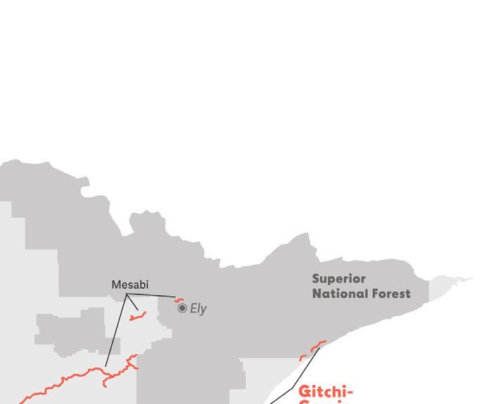
MESABI TRAIL


LOCATION: Between Grand Rapids and Ely, 47.46367808831124, -92.52076305809695
DISTANCE: Over 150 miles (over 165 miles when completed)


TYPE: Paved


DESCRIPTION: Pass through 28 communities and pass by lakes, creeks, and ponds on this premier biking trail that spans from the Mississippi River to Minnesota’s Boundary Waters.

PARKING: Available at the following access points: Kinney, Tower, Calumet, Giants Ridge, Aurora, Embarrass, McKinley, Gilbert, Bovey, Virginia, Taconite, Chisholm, Buhl, Biwabik, Grand Rapids, Fayal Township, Mountain Iron, Coleraine, Eagles Nest, Eveleth (Fayal Pond), Pengilly, Hibbing, Keewatin, Marble, Eveleth (Mesabi Station), Ely, Biwabik (Embarrass Lake), and Nashwauk.
LEVEL: Moderate
COST: Wheel pass is required for riders 18 and older; $5 for a three-day pass or $15 for the season
INFO: 877-637-2241; mesabitrail.com
FIND US ON THE


Root River Bike Trail
For a full business directory and things to do, visit www.rushfordpetersonvalley.com


PLACES TO STAY Inns, campgrounds and vacation rentals

PLACES TO EAT
Many local favorites
PLACES TO SHOP
From basic necessities to products unique to the valley
MINNESOTAMONTHLY.COM | BIKE MINNESOTA 2023 | 39
Rushford
Peterson
Houston
leech-lake.com | 218-547-1313
Walker, MN is connected to more than 150 miles of paved trails!
Photo Credit: Explore MN
DIRECTORY bike trails
Greater Twin Cities
BROWN’S CREEK STATE TRAIL
LOCATION: Grant to Stillwater, 45.07114359636236, -92.83703667336673
DISTANCE: 5.9 miles
TYPE: Paved
DESCRIPTION: This trail follows Brown’s Creek, a trout stream with a dense canopy that provides ample shade for trail users. One may also see views of the St. Croix River and the National Scenic Riverway, Minnesota’s only river in the federal Wild and Scenic Rivers system.

PARKING: Downtown Stillwater: available at the eastern end of the trail on Laurel Street; East Brown’s Creek Nature Preserve: go south of the intersection of McKusick Road and Neal Avenue; Grant: available under the Gateway State Trail bridge.
LEVEL: Easy
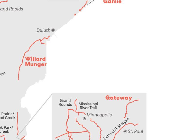
WILLARD MUNGER STATE TRAIL
LOCATION: Between Hinckley and Duluth, 46.45338162213786, -92.76890421120025
DISTANCE: 70 miles
TYPE: Paved
DESCRIPTION: The Duluth segment of this trail takes bikers through the stunning scenery of Jay Cooke State Park, while the northeast part features views of the St. Louis River and the twin ports of Superior and Duluth. Watch for wolves, coyotes, and even black bears along the way.
PARKING: Carlton: go one block south of Highway 210 on County Road 1; Duluth: parking available at the northern trailhead on Grand Avenue (Highway 23) and 75th Avenue; West Hinckley: go one block north of the Hinckley Fire Museum (the intersection of Highway 61 and County Road 18); Jay Cooke State Park and Moose Lake State Park: parking available with vehicle permit.
LEVEL: Easy
COST: $7 daily vehicle pass; $35 year round
INFO: 218-460-7021; mndnr.gov/trails
COST: Free
INFO: 651-259-5841; mndnr.gov/trails
CEDAR LAKE LRT REGIONAL TRAIL + MINNESOTA RIVER BLUFFS LRT REGIONAL TRAIL
LOCATION: Between Hopkins and Minneapolis, 44.9448662350375, -93.3360918310428
DISTANCE: 19.9 miles
TYPE: Paved and crushed stone
DESCRIPTION: This is an aggregate trail that is built off of a former railroad that goes from Hopkins to Chaska. Bicyclists can view Shady Oak Lake, Riley Lake Park, and the Minnesota River Valley.
PARKING: Hopkins: available at Depot Coffee House between Excelsior Boulevard and Milwaukee Road; Eden Prairie: go west of Eden Prairie Road to Miller Park on Highway 212; Chaska: parking available where the trail meets Bluff Creek Drive.
LEVEL: Easy
COST: Free
INFO: threeriversparks.org

PHOTO VISIT DULUTH DAKOTA THREE RIVERS PARK DISTRICT
40 | BIKE MINNESOTA 2023 | MINNESOTAMONTHLY.COM
WILLARD MUNGER STATE TRAIL
DAKOTA RAIL REGIONAL TRAIL
DAKOTA RAIL
REGIONAL TRAIL
LOCATION: Between Wayzata and New Germany, 44.90557485411182, -93.73812083751056
DISTANCE: 26 miles
TYPE: Paved
DESCRIPTION: Passing through Lake Minnetonka and Waconia, this trail follows the former Dakota Rail Corridor that ended in 2001.
PARKING: Wayzata: available at Shaver Park; Mound: available at the downtown transit center at the intersection of Lynwood and Commerce boulevards; St. Bonifacius: available at Don Logelin Memorial Lions Park; New Germany: available on Broadway Street.
LEVEL: Easy
COST: Free
INFO: co.carver.mn.us/parks (western portion); threeriversparks.org (eastern portion)
ELM CREEK PARK RESERVE/ RUSH
CREEK REGIONAL TRAIL
LOCATION: Champlin, Dayton, and Maple Grove, 45.13848231014937, -93.43794067983092
DISTANCE: 30 miles
TYPE: Paved

DESCRIPTION: Throughout Elm Creek Park Reserve, there are 20 miles of paved trails that eventually connect to the Rush Creek Regional Trail.


PARKING: Available at Coon Rapids Dam Park and Elm Creek Park Reserve.
LEVEL: Easy
COST: Free
INFO: 763-694-7894; threeriversparks.org
MINNESOTAMONTHLY.COM | BIKE MINNESOTA 2023 | 41 @MNMOMAG /MINNESOTAMONTHLY @MNMOMAG /MNMOMAG
GATEWAY
STATE TRAIL
LOCATION: Between St. Paul and Pine Point Park, northwest of Stillwater, 45.03434111747131, -92.94844903074005
DISTANCE: 18 miles
TYPE: Paved
DESCRIPTION: Built off the former Soo Line Railroad grade, this trail has a surprising number of rural areas considering its proximity to the city. This trail features wetlands, parks, and lakes to view along the way.
PARKING: Available at the following trail accesses: North Saint Paul Trailhead, Flicek Park, Maplewood Community Center, Highway 36 and Second Street (North St. Paul), Arlington Avenue, 55th Street (southwest of Highway 36 and I-694), Mahtomedi Athletic Fields-Green Lot, Jamaica Avenue, under Gateway State Trail Bridge near Lake Masterman, Pine Point Regional Park (fee required), and along city streets.
LEVEL: Moderate
COST: Free
INFO: 651-259-5841; mndnr.gov/trails
GRAND ROUNDS BIKE TRAILS
LOCATION: Minneapolis, 45.027781031026116, -93.26011313104526
DISTANCE: 51 miles
TYPE: Paved


DESCRIPTION: The Grand Rounds Scenic Byway System is one of the United States’ longest continuous systems of urban parkways. This system weaves lakes, wetlands, lagoons, and woodlands and runs along parkways such as St. Anthony Parkway, Victory Memorial Drive, and Theodore Wirth Parkway.
PARKING: North: take I-35W south into Minneapolis and exit on Stinson Boulevard. Take a right on Stinson Boulevard heading north, then turn le onto St. Anthony Parkway; South: Take I-35W north into Minneapolis and exit at 46th Street. Take a le on 46th Street to East Lake Harriet Parkway; West: Take I-394 east into Minneapolis and exit at Penn Avenue. Make a le on Penn to Glenwood avenues to Theodore Wirth Parkway; Downtown Minneapolis: take East Hennepin Avenue to West River Parkway.
LEVEL: Moderate
COST: Free
INFO: 612-230-6400; minneapolisparks.org.
LUCE LINE STATE TRAIL
LOCATION: Plymouth though Watertown, Winsted, and Silver Lake to Hutchinson, 44.955466487588176, -94.0351518733759
DISTANCE: 63 miles
TYPE: Limestone from Plymouth to Winsted, paved from the McLeod and Carver County line to Hutchinson, crushed rock from Hutchinson to Cedar Mills, and natural (mowed grass) from Cedar Mills to Cosmos.
DESCRIPTION: The Luce Line is a preserved countryside, featuring woodlands, prairie, and nearby lakes with ducks and geese. Bicyclists can enjoy the differing landscapes of both metropolitan and rural Minnesota.
PARKING: Carver County Road 127: available south of County Road 20; Cedar Mills: available on the south side of Highway 7; Cosmos: available at Thompson Park and 252nd Avenue; Hutchinson: off Highway 7 on each end of town; Independence: east side of County Road 110 and south of County Road 6; Lyndale: off County Road 92; Long Lake: head south on Old Crystal Bay Road to Watertown Road. Go west to Stubbs Bay Road. Then, go south 0.25 miles for
GATEWAY DNR MIDTOWN HENNEPIN COUNTY/MEET MINNEAPOLIS
42 | BIKE MINNESOTA 2023 | MINNESOTAMONTHLY.COM
DIRECTORY bike trails
GATEWAY STATE TRAIL
MIDTOWN GREENWAY
parking; Plymouth: off 10th Avenue N. and Vicksburg Lane; Silver Lake: north side of Highway 7 at Park Avenue; Watertown: off Vega Avenue; Winsted: available at Babcock Avenue/ County Road 1 and Kingsley Street/ County Road 9.
LEVEL: Easy
COST: Free
INFO: 651-259-5841; mndnr.gov/trails; threeriversparks.org
MIDTOWN GREENWAY

LOCATION: Minneapolis, 44.95055188634809, -93.2689895020445


DISTANCE: 5.5 miles
TYPE: Paved


DESCRIPTION: The Midtown Greenway, following the path of an abandoned railroad, makes commuting through the city efficient. Since the path is separated from the street grid, the Greenway makes for quick and seamless traveling, also connecting to the Minneapolis Chain of Lakes and paths along the Mississippi River.
PARKING: Bracke Field Park: take I-94 to Exit 235A toward Riverside Avenue. Merge onto Ninth Street, then turn right onto 26th Aveue. Turn le onto E. 25th Street, then turn right onto 36th Avenue S. Go 0.4 miles to E. 28th Street, and then turn le onto S. 39th Avenue for available parking.
LEVEL: Easy
COST: Free
INFO: 612-879-0105; midtowngreenway.org
MINNESOTAMONTHLY.COM | BIKE MINNESOTA 2023 | 43 THE NEWSLETTER YOU’VE BEEN MISSING Stories exploring the Spirit of Minnesota, straight to your inbox. DAILY MINNESOTAMONTHLY.COM/NEWSLETTER-SIGNUP
Mountain Trails
NINE MILE CREEK REGIONAL TRAIL
LOCATION: Richfield, 44.904353893892626, -93.40298226923774
TYPE: Paved
DISTANCE: 15.3 miles
DESCRIPTION: Connecting to the trail systems of the Minnesota River Bluffs Regional trail, Cedar Lake Regional Trail, and Nokomis-Minnesota River Regional Trail, Nine Mile Creek provides bikers with a variety of sights in Hennepin County, including the wetlands and woodlands of the Edina area and Lake Nokomis up north.
PARKING: Available at Hopkins Depot, Hopkins Valley Park, Walnut Ridge Park, Bredesen Park, Fred Richards Park, Adams Hills Park, and Roosevelt Park.

LEVEL: Easy to moderate
COST: Free
INFO: threeriversparks.org
SAM MORGAN REGIONAL TRAIL
LOCATION: St. Paul, 44.92741997048706, -93.11997721551134
DISTANCE: 9 miles
TYPE: Paved
DESCRIPTION: Take in the cityscape of St. Paul and views of the Mississippi River on this 9-mile ride that leads bicyclists through Shepard Road, Upper Landing Park, and Indian Mounds Park.
PARKING: Available at Ba le Creek Regional Park, Lower Landing Park, Upper Landing Park, the end of Randolph Avenue, and Crosby Farm Regional Park.
LEVEL: Easy
COST: Free
INFO: stpaul.gov/parks
SUNRISE PRAIRIE REGIONAL TRAIL/ HARDWOOD CREEK REGIONAL TRAIL
LOCATION: Between North Branch and Hugo, 45.16187311112033, -92.99321080201005
DISTANCE: 26 miles
TYPE: Paved
DESCRIPTION: As their names imply, these connecting trails pass through both farmland and hardwood forests, plus a number of wetland areas. A er traversing both the west and south branches of the Sunrise River, Sunrise Prairie Regional Trail changes into the Hardwood Creek Regional Trail in Forest Lake.
PARKING: North Branch: take I-35 to Exit 147, then go 0.6 miles east on Highway 95 to Forest Boulevard. Turn right to go south, then turn right again onto Maple Street for available parking.; Stacy: take I-35 to Exit 139, then go 0.3 miles east on Stacy Trail for available parking; Wyoming: take I-35 to Exit 135 for Chisago County Road 22. Go east for 0.2 miles on E. Viking Boulevard. Turn le onto Forest Boulevard; Forest Lake: take I-35 to Exit 131, then go east for 0.8 miles on W. Broadway Avenue.
LEVEL: Easy
COST: Free
INFO: 651-257-1300; chisagocounty.us or 651-430-8370; co.washington.mn.us
DIRECTORY bike trails 44 | BIKE MINNESOTA 2023 | MINNESOTAMONTHLY.COM
Northern and Central Minnesota (Mountain Biking)
CHIPPEWA NATIONAL FOREST
LOCATION: Around Deer River, Grand Rapids, Walker, and Cass Lake, 47.48629075889229, -94.03690983076658
DISTANCE: Varies
TYPE: Paved and unpaved

DESCRIPTION: Within this 1.6 million-acre national forest, there are a variety of mountain and non-mountain biking trails to explore, including the scenic 630-mile Mississippi River Trail, plus the Cass Lake, Deer River, and Marcell areas. Encounter abundant plants and wildlife, as well, since the Chippewa National Forest is home to more than 250 wildlife species.

PARKING: Available on the north and south ends of the forest.
LEVEL: Moderate to challenging
COST: Free
INFO: 218-335-8600; fs.usda.gov/chippewa
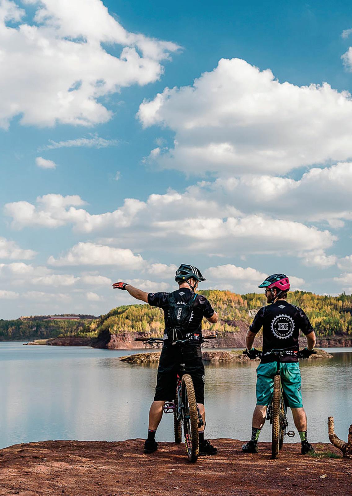
CUYUNA COUNTRY STATE RECREATION AREA
LOCATION: Crosby-Ironton area, 46.49038744987329, -94.00048692411492
DISTANCE: Over 50 miles
TYPE: Unpaved
DESCRIPTION: Experience world-class mountain biking with Cuyuna’s singletrack trails, spread out over 800 acres of vegetation and lakes. The trail difficulty is denoted by color, as Cuyuna is accessible to the most novice and the most seasoned of mountain bicyclists.

PARKING: Ironton: available at Third Street between Irene and Winona avenues, or Curtis Avenue between Highway 210 and Second Street.
LEVEL: Trails vary from easy to extremely difficult
COST: $7 daily vehicle pass; $35 year round
INFO: 218-546-5926; cuyuna.com

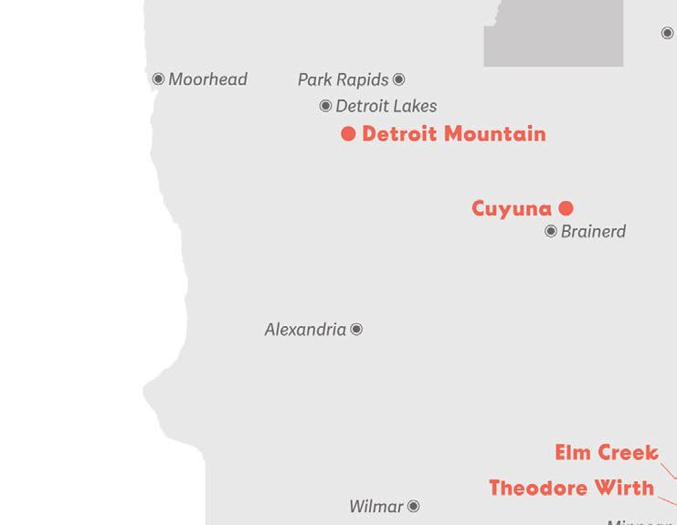
DETROIT MOUNTAIN RECREATION AREA
LOCATION: Detroit Lakes, 46.813250587547365, -95.78332125293907
DISTANCE: Varies
TYPE: Unpaved/dirt

DESCRIPTION: In the summer months, Detroit Mountain provides premier mountain biking for all levels and ages, including cross-country contour flow trails, a skills park, and downhill gravity trails.
PARKING: Lot available.
LEVEL: Trails vary from easy to extremely difficult

COST: Pricing varies by season, see online (season passes available)
INFO: 218-844-7669; detroitmountain.com

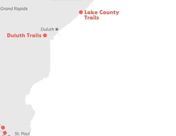
DULUTH TRAILS
LOCATION: Around Duluth, 46.718500078229624, -92.21673113760153
DISTANCE: Varies

TYPE: Unpaved
DESCRIPTION: From Mission Creek to Spirit Mountain, the scenic backdrop of Lake Superior makes for exceptional mountain biking. Hilly terrain and wooded hillsides weave through the city’s rocky terrain, totaling over 90 miles.


PARKING: Lots and street parking available.
LEVEL: Trails vary from easy to extremely difficult COST: Spirit Mountain summer adult all-day pass, $35; winter fat biking all-day li pass, $65. Prices subject to change.
INFO: coggs.com
MINNESOTAMONTHLY.COM | BIKE MINNESOTA 2023 | 45 BIKE • HIKE • EXPLORE 15+ MILES OF PAVED TRAILS luvernechamber.com | 507-283-4061 601 East Main Street Luverne, MN 56156
READ THE DIGITAL EDITION
DIRECTORY bike trails
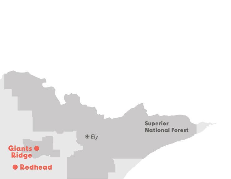
GIANTS RIDGE
LOCATION: Biwabik, east of Virginia, 47.578831869614845, -92.3031907961994
DISTANCE: 37 miles of road and mountain biking trails; connects to the paved Mesabi Trail
TYPE: Paved and unpaved

DESCRIPTION: Giants Ridge is a favorite getaway for skiing and golfing, and also the largest li -served mountain bike park in the Midwest. It offers 10 gravity trails that cover a variety of terrains that are suitable for beginner to expert riders. There are also 9 miles of cross-country trails within the Superior National Forest.
PARKING: Lot available.
LEVEL: Easy to extremely difficult
COST: Adult all-day pass, $30; youth all-day pass, $25. Prices subject to change.
INFO: 800-688-7669; giantsridge.com
LAKE COUNTY MOUNTAIN BIKE TRAILS
LOCATION: Demonstration Forest, Two Harbors, 47.10857093529782, -91.74904554603354 and Split Rock Wilds, Beaver Bay, 47.252825013355746, -91.32108177301674 and
DISTANCE: 10 miles; 22 miles
TYPE: Unpaved
DESCRIPTION: Four singletrack trails with scenic views great for beginners; new trail system for advanced riders with technical terrains.
PARKING: Demonstration Forest: from Two Harbors, go about 8 miles northwest to Drummond Grade, parking at the forest entrance; Split Rock: take Highway 61 to Superior Hiking Trail.
LEVEL: Easy to difficult
COST: Free
INFO: facebook.com/lakecountymbt
MILACA TRAILS
LOCATION: Milaca, 45.754258655260315, -93.66216658686747
TYPE: Unpaved
DISTANCE: 12 miles
DESCRIPTION: The Milaca Trails have less strenuous, relaxing rides on trails such as the Meadow and River Run, or more high-intensity rides on the Sky Hill Trails. This doubletrack trail system is also decorated with scenic views of the Rum River.
PARKING: Available in Recreation Park, near the entrance to Forest Hill Cemetery, and west off County Road 112.
LEVEL: Easy to difficult
COST: Free
INFO: 320-983-3141; cityofmilaca.org
PILLSBURY STATE FOREST TRAIL SYSTEM
LOCATION: Nisswa, 46.430528204196406, -94.43583746547684
DISTANCE: Over 30 miles
TYPE: Unpaved
DESCRIPTION: Venture through deciduous and coniferous trees as well as small lakes and ponds in Minnesota’s first state forest. Hilly topography (due to glacial activity) makes for thrilling mountain biking.
PARKING: Available off Beauty Lake Forest Road and Pillsbury Forest Road.
LEVEL: Moderate
COST: Free
INFO: dnr.state.mn.us/state_forests
REDHEAD MOUNTAIN BIKE PARK
LOCATION: Chisholm, 47.47739423343047, -92.89380284421588
DISTANCE: 25 miles (still incomplete)
TYPE: Paved
DESCRIPTION: Established in 2020 from an abandoned iron mine, with miles of towering cliff faces, lakes, and overlooks, this park is planned to add an additional 14 miles of trails and backcountry.
PARKING: At the Minnesota Discovery Center
LEVEL: Easy to difficult
COST: Free
INFO: goredhead.com
PHOTO MINNESOTA DISCOVERY CENTER
46 | BIKE MINNESOTA 2023 | MINNESOTAMONTHLY.COM
REDHEAD MOUNTAIN BIKE PARK
RED WING MEMORIAL PARK
LOCATION: Red Wing, 44.56151190773725, -92.52103110226072
DISTANCE: Varies
TYPE: Unpaved
DESCRIPTION: With 31 available mountain biking trails that wind through scenic, elevated terrain, there is something for all skill levels.
PARKING: Take Highway 61 to Plum Street to E. Seventh Street to Skyline Drive.
LEVEL: Easy to difficult
COST: Free
INFO: red-wing.org/407/trails
SUPERIOR NATIONAL FOREST
LOCATION: Around Ely, To e, and Grand Marais, 47.866510712173636, -91.48020017303766
DISTANCE: Varies
TYPE: Unpaved (gravel and dirt)
DESCRIPTION: Explore the spectacular boreal forest along the numerous single-lane gravel roads. Pincushion, Big Aspen Trail, and Bri on Peak Trailhead are just some of the mountain biking trails available.
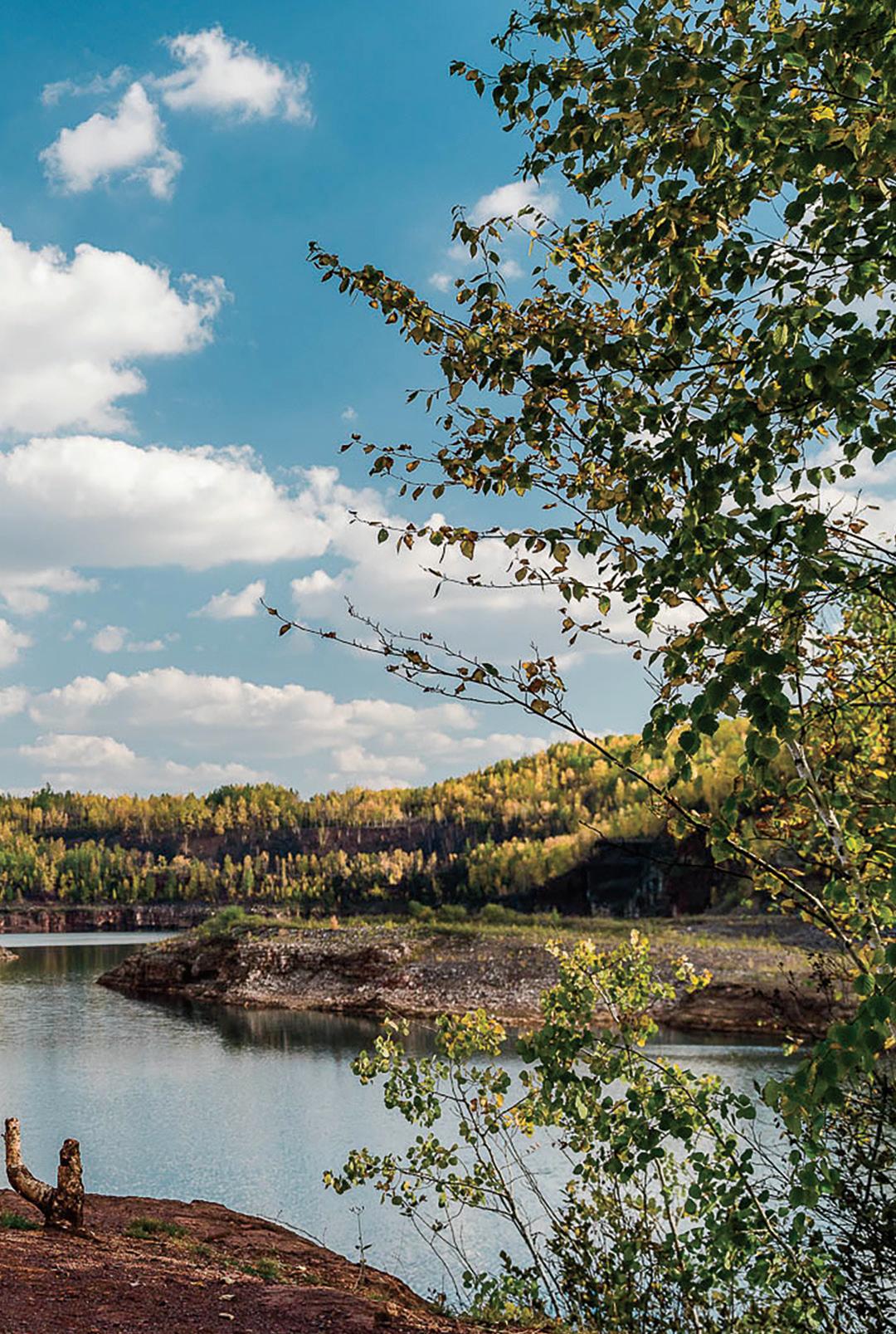
PARKING: Lots and street parking available.
LEVEL: Easy to extremely difficult
COST: Free to bike
INFO: 218-626-4300; fs.usda.gov/superior
TIOGA RECREATION AREA
LOCATION: Cohasset, 47.22319574272827, -93.61224457306038
DISTANCE: 25 miles
TYPE: Unpaved
DESCRIPTION: Located on 500 wooded acres, the area has turned former mining ores into twisty, sloping, thrilling mountain biking trails.
PARKING: Available at Tioga Beach and trailhead parking lot off Tioga Beach Road.
LEVEL: Easy to extremely difficult
COST: Free
INFO: tiogarecreation.com
Greater Twin Cities and Southern Minnesota (Mountain Biking)
BATTLE CREEK REGIONAL PARK
LOCATION: Eastern part of St. Paul, 44.93859455583189, -93.01400074827198
DISTANCE: 9.5 miles of trails
TYPE: Paved and unpaved
DESCRIPTION: With trails varying in difficulty, plus views of the Mississippi River, Ba le Creek Regional Park provides accessible mountain and road cycling for nature enthusiasts and steadfast bicyclists alike.
PARKING: Available at Ba le Creek Recreation Center and on Upper A on Road.
LEVEL: Easy
COST: Free
INFO: 651-748-2500; ramseycounty.us
LEBANON HILLS REGIONAL PARK
LOCATION: Eagan, 44.79311481376406, -93.12845731748752
DISTANCE: 12 miles
TYPE: Unpaved
DESCRIPTION: Containing almost 2,000 acres, Lebanon Hills Regional Park is the largest park in the Dakota County Park System. The trail system provides picturesque views of lakes and wooded areas, and the West Trailhead is suitable for mountain biking.
PARKING: Available on Johnny Cake Ridge Road or on Galaxie Avenue on the west side of the park.
LEVEL: Moderate to difficult
COST: Free
INFO: 952-891-7000; dakotacounty.us/parks
MINNESOTAMONTHLY.COM | BIKE MINNESOTA 2023 | 47
DIRECTORY bike trails
MURPHY-HANREHAN PARK RESERVE
LOCATION: Near Savage, 44.724149839699734, -93.34821522409575
DISTANCE: Over 10 miles
TYPE: Unpaved
DESCRIPTION: This singletrack mountain bike course consists of three one-way loops of varying difficulty. The easy loop traverses an open, rolling prairie. The intermediate loop is more than 2 miles long, weaving through the woods and over a wetland boardwalk. The advanced is more than 5 miles long and goes over high and narrow ladder bridges.
PARKING: From I-35W, take County Road 42 west to County Road 27. Turn south then east on 154th Street. Go south on County Road 75 to the park entrance.
LEVEL: Easy to difficult
COST: Free
INFO: 763-694-7777; threeriversparks.org
THEODORE WIRTH PARK
MINNESOTA VALLEY STATE RECREATION AREA
LOCATION: Between Shakopee and Belle Plaine, 44.65130663231192, -93.71618683506946
DISTANCE: 35 miles
TYPE: Unpaved and paved
DESCRIPTION: This state recreation area preserves part of the Minnesota River Valley, which contains wetlands, oak savanna, and floodplain forest. Enjoy a ride with a view of the Minnesota River or Horseshoe Lake. The trail is natural-surface from Belle Plaine to Chaska, then paved from Chaska to Shakopee.
PARKING: Available on site.
LEVEL: Easy
COST: $35 annual; $7 daily
INFO: 651-259-5774; or the DNR at 651-296-6157; mndnr.gov/parks
MOUNT KATO
LOCATION: Mankato, 44.13335298833132, -94.03330907158977
DISTANCE: Over 7 miles
TYPE: Unpaved
DESCRIPTION: Open from early May through October, Mount Kato’s mountain biking trails are 80% wooded singletrack and take bicyclists around ponds and ski trails. They even offer a view of the Minnesota River at the top of the hill.
PARKING: Available on site.
LEVEL: Moderate to difficult
COST: $130 seasonal; $5 daily. Prices subject to change.
INFO: 507-625-3363; mountkato.com
LOCATION: Minneapolis, 44.99248144706423, -93.32649070985082
DISTANCE: Over 12 miles
TYPE: Paved and unpaved
DESCRIPTION: Theodore Wirth Park is the largest park in the Minneapolis Park system. The trails are a mix of easy, moderate, and challenging, and take bicyclists through open parkland and woods.

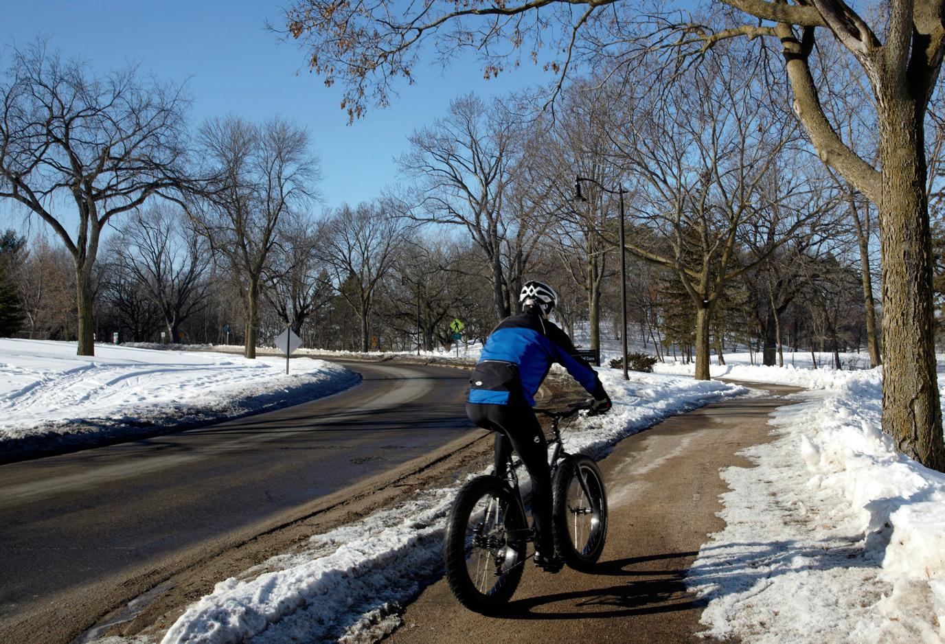
PARKING: Available in trailhead lots and in the nearby neighborhoods.
LEVEL: Easy to difficult
COST: Free
INFO: minneapolisparks.org
WINONA AREA
LOCATION: Holzinger Trail System and Cherry Hill, 44.0410900933339, -91.66255080212011 and 44.059776620726886, -91.73056506656435
DISTANCE: 9 miles (Holzinger), 6 miles (Cherry Hill)
TYPE: Unpaved
DESCRIPTION: The Holzinger Trail and Cherry Hill Trail systems offer some of the Midwest’s most challenging mountain biking. The Holzinger Trail system in Bluffside Park is a combination of doubletrack rollers and technical singletrack. Cherry Hill offers one doubletrack and two singletrack sections.
PARKING: Holzinger: available in Holzinger Lodge parking lot; Cherry Hill: lot available at the end of Brook Drive off County Road 23.
LEVEL: Moderate to difficult
COST: Free
INFO: visitwinona.com
PHOTO TODD BUCHANAN
48 | BIKE MINNESOTA 2023 | MINNESOTAMONTHLY.COM
THEODORE WIRTH PARK
Pack a bag,


a along the east side of the Cannon River from Bollenbacher Court in Northfield to Everett Street in Dundas. The paved trail features observation areas that showcase wooded and wetland areas.
T The Mill Towns Trail features varied terrain and scenery. The trail winds through historic downtown and around the serene Sechler Park, offering views of the Cannon River and the railroad. Northfield also features occasional criterion and road races for both novice and advanced bikers.


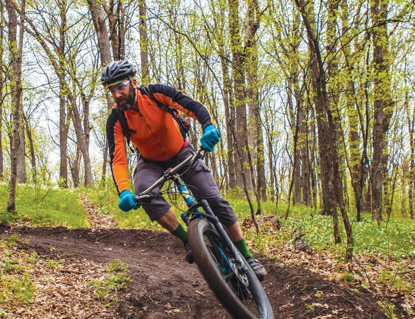
T The Sechler Park Mountain Bike Trail is a two-way trail that extends along the northwest side of the Cannon River, from the Pedestrian Bridge (near the intersection of Highways 3 and 19) to Heath Creek (near Armstrong Road). For more information on Cannon River Off-road Cycling and Trails (CROCT) visit, croct. org. For additional bike route information visit go.northfield.org and milltownstrail.org.
C Cowling A rboretum at Carleton College is open to the public yearround. It is the ideal place to bike, hike, run, ski, fish or simply enjoy being outdoors. The upland and lowland forests along with the 150acre prairie restoration provide excellent bird and wildlife watching. The extensive 15-mile trail system has been ranked by Runner’s Magazine as the top place to run in Minnesota and one of the top 10 in the country. In winter, the trails are groomed for both classic and skate skiing. For more information visit apps.carleton.edu/campus/arb.
# t h i s i s n o r t h f i e l d Find Nor thf ie ld on MINNESOTA MINNESOTA AT I TS BEST AT I TS BEST experience
best N o r t h f i e l d B i k e S h o p s · Farmstead Bikes (bike rentals available) 422 Division St South Northfield, MN 55057 507-366-2006 · Downtown Bicycles 321 Division St South Northfield, MN 55057 507-786-9191 · Heath Creek Cycles 313 ½ Division St South Suite 204 Northfield, MN 55057 507-301-3838
Outdoors at its
N o r t h f i e l d and head to
v i s i t n o r t h f i e l d . c o m
tie down the bike