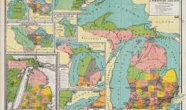
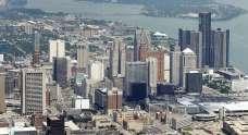
A PLACE WITH NO NAME
ESTABLISHING AN URBAN IDENTITY


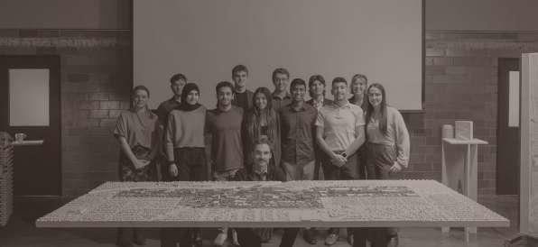
UNIVERSITY OF DETROIT MERCY | ARCH 2100
SCHOOL OF ARCHITECTURE + COMMUNITY DEVELOPMENT

ESTABLISHING AN URBAN IDENTITY
UNIVERSITY OF DETROIT MERCY | ARCH 2100
SCHOOL OF ARCHITECTURE + COMMUNITY DEVELOPMENT
SOME MIGHT SAY THAT A PLACE IS DEFINED BY ITS CHARACTERISTICS, SUCH AS ITS LOCATION OR THE NATURAL FEATURES OF ITS LANDSCAPE. OTHERS MIGHT SAY THAT A PLACE IS DEFINED BY ITS HISTORY, OR THE CULTURE AND TRADITIONS OF ITS INHABITANTS.
University of Detroit Mercy | School of Architecture
Arch 2100 Section 03
Special Topics Studio - Urban Design
Fall 2022 Semester
Professor Mikolaj Gomolka
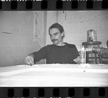
Dani Bogdanovic
Sofia D’Arienzo
Mahmmoud Eljammali
Bushra Fawaz
Andrew Gainariu
Sidny Hessem
Spencer Jovanovski
Vishmith Kumarasinghe
Jake Lampi
Ryan Lemke
Kayla Moser
Giovanni Zora
As architects, we have not only an honor, but also a duty to shape space in a way that is responsible and aimed at improving people’s quality of life. However, simple pragmatism often leads to the perpetuation of the status quo or minor changes. It is our duty to dream. To dream of better solutions, beyond the limits of what we know and are accustomed to. Detroit was founded built on people’s dreams. Unfortunately, as a result of a number of processes, the city went through a difficult time for itself, which took its toll on the quality of the space. However, the spirit of the city has never been broken, and thanks to the ingenuity and creativity of residents, many spaces have been developed in innovative ways, blazing a trail for other metropolises. Recent years have seen major investments, at least
some of which are set to redefine the concept of public space. Together with students, we considered how one of the most important, the Joe Louis Greenway, could serve as an activating factor for its entire neighborhood. The work is a collective vision of 12 students, developed in detail by smaller teams. Using the potential of both grassroots initiatives and major public investments, we decided to start dreaming again. The project we are honored to present to you is the realization of our shared dream of a city centered on its residents, where everyone has the right to feel at home and everyone can co-create the community through participation in the use of public space. We invite you to read on and to dream together not only for a better future, but also for a better present.
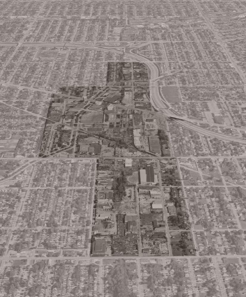
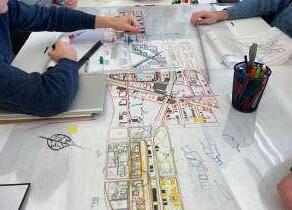
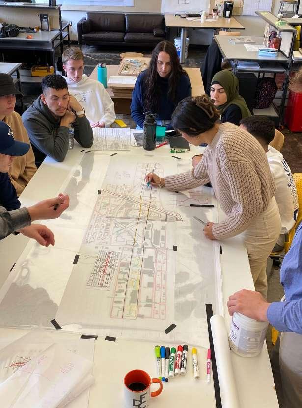
The students of studio 202 collectivity came together under the supervision of professor Mikolaj Gomólka to create an urban design revamp of a site northwest of downtown Detroit. Before beginning our endeavors to redesign this desolate area, we spent weeks researching the given region and demographics via maps, newspapers, satellite views, articles, personal accounts, and multiple site visits. Once we felt comfortable enough with the site and the context around it, we then configured as a group to
discuss the purpose of our design implementations. The creation of these newly proposed and developed space and buildings will bring a sense of community that the residents have so longed-for. After countless hours of collaborative efforts our book’s genesis sought out to shed light upon a promising neighborhood revitalization. This book documents our process and highlights the changes we have made in order to make a better community for the people within the vicinity of the affected developments.
background information and context
Page 16
Joe Louis Greenway Literature
Page 22
Site Overview
Page 24
History
current site conditions
Page 32
Transportation Map
Page 34
Services Map
Page 36
Vegetation Map
Page 38
Vacancy Map
Page 40
Zoning Map
Page 42
Urban Composition
Page 44
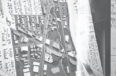
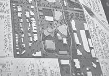
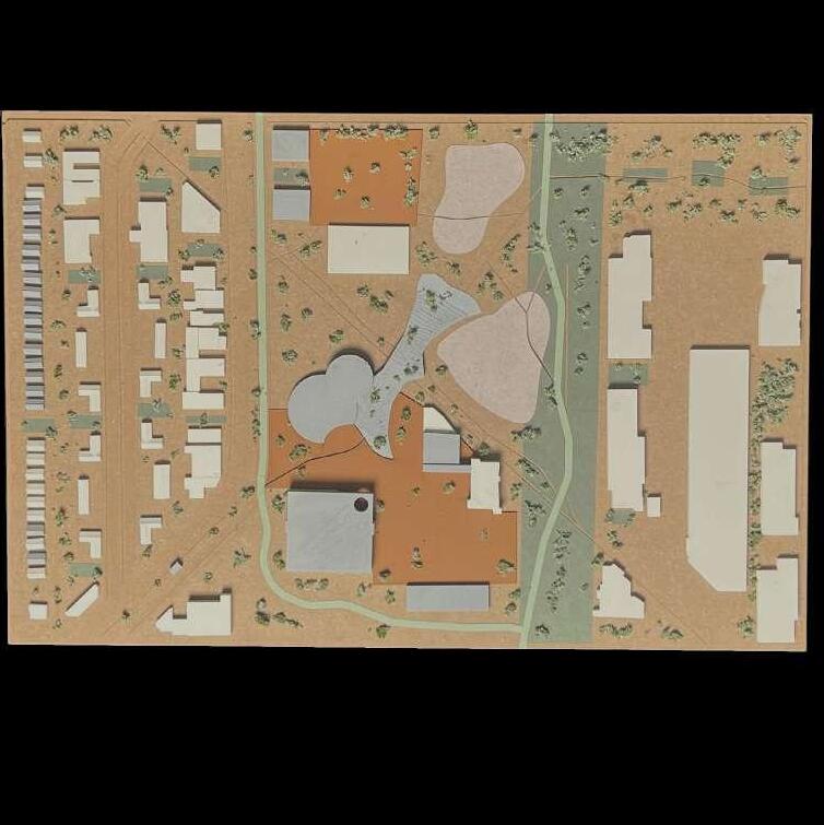
Existing Site Plan
changes made to the original site
Page 48
Project Goals and Concepts
Page 50
Transportation Map
Page 52
Green and Public Spaces
Page 54
Zoning Map
Page 56
Urban Composition
Page 58
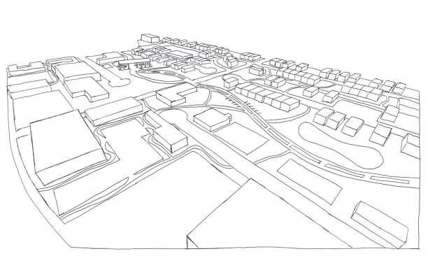
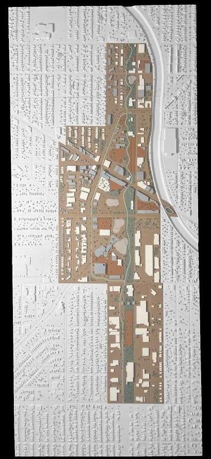
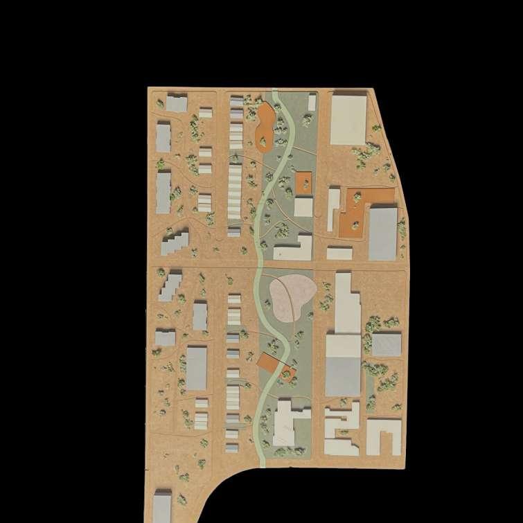
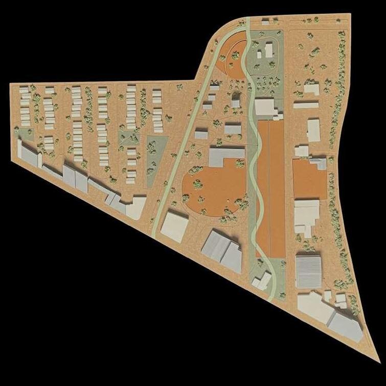
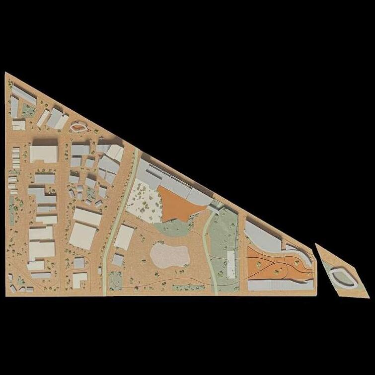
Master Plan
photography and notes
collaborative work done by partners of two or four
Page 162
Physical Model
Page 174
Plenary Sessions
Page 184
Presentation Day
Page 62
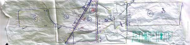
Plot I
Page 80 Plot II
Page 98 Plot III
Page 122 Plot IV
Page 142 Plot V
Page 158
Master Plan
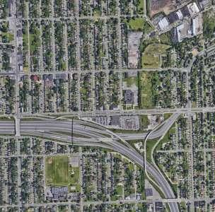
GREENWAY LITERATURE SITE OVERVIEW HISTORY
A greenway is a strip of undeveloped land near an urban area, set aside for recreational use or environmental protection. This definition describes what the city of Detroit plans on doing with their 27.5 mile long undeveloped strip of land. Formally known as the Joe Louis Greenway, this recreational pathway is determined to unify Detroit’s neighborhoods, people, and parks. The greenway is named after the late boxer, Joe Louis who got his start in Detroit in the 1930s and later became world heavyweight champion whilst breaking color barriers and bringing people together. It is an appropriate honor as that is what the Greenway will aim to do as well. The city of Detroit strives to honor Joe Louis by providing equitable spaces through arts, programming, and economic opportunities for all demographics. Being over just a marathon distance long, the greenway will have plenty of opportunities to connect parks and neighborhoods across the city, thus allowing residents to travel safely and comfortably from McNichols to the riverfront through a combination of new trails, on-street protected bike lanes, and various links to existing trails like the Dequindre Cut and the RiverWalk. The ability of the greenway to include cities such as Dearborn, Hamtramck, and Highland Park and link them to larger trail systems
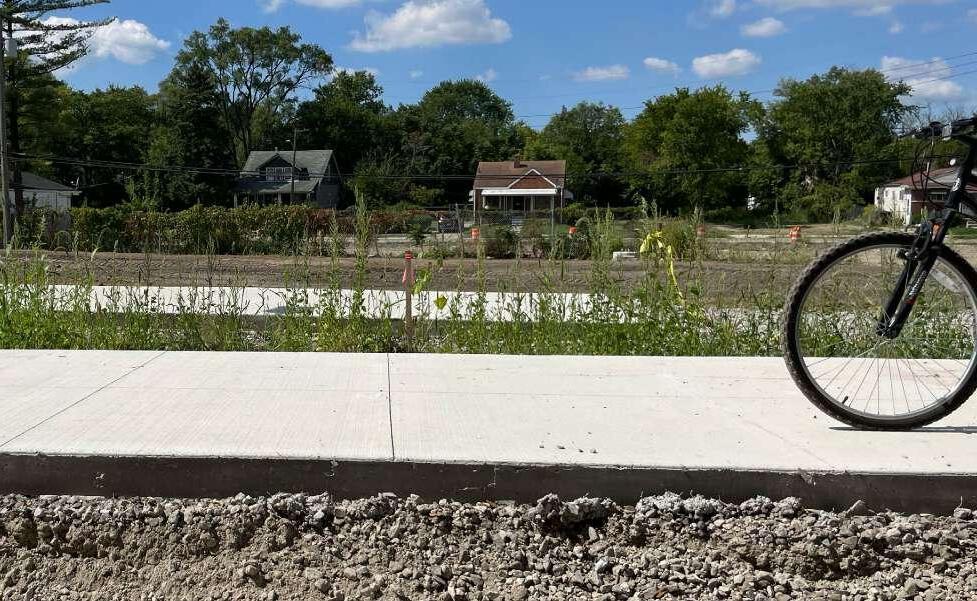
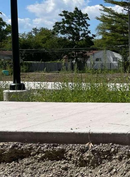
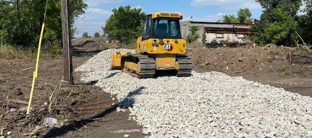
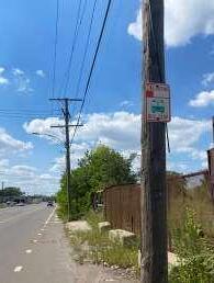
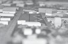
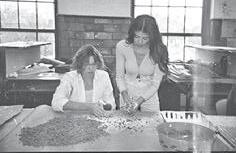
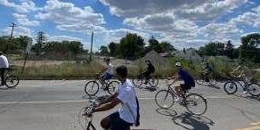
the beginning construction of the joe louis greenway just off of joy road | photo: kayla moser that crisscross the entire state as well as pass-through five council districts makes the greenway special. According to the official Joe Louis Greenway website, detroitgreenways.org, Mayor Mike Duggan has committed $20 million to build the first phase of the greenway, which spans 2.8 miles from
Warren Street to Fullerton Avenue, and is currently being constructed as seen in the image above. The schedule for this phase is to be completed in the early to mid 2023. An additional $40 million has been pledged by the Wilson Foundation for regional trail construction, which includes the Joe Louis Greenway.
The Joe Louis
is collective journey towards a better tomorrow
“Detroit’s neighborhoods are the heart of our City.” - Mayor Mike Duggan
A trail, separated from traffic, suitable for walking, jogging, biking, and even skating, winding through various Detroit neighborhoods forming a nearly 30 mile long ring interlock communities with each other. Imagine infants in parks with their parents, groups of children playing together, the elderly taking a stroll just outside their home on a beautifully executed greenway—this is what planners of the Joe Louis Greenway invision. A vision that dates all the way back to 2007 the greenway is officially coming to fruition thanks to the initial lump sum by the Ralph C. Wilson Jr. Foundation that awarded $2 million to the City of Detroit to develop a framework plan and construction drawings for the project in 2017. However, the concept of the greenway began with the Friends of the Inner Circle Greenway in 2007 and became part of the Detroit Greenway
coalition Network Vision in 2009. Using other existing trails and plans, the Coalition modified the routing, advocated for its development, and worked closely with the city of Detroit. In 2017, Mayor Mike Duggan announced plans to rename the Inner Circle Greenway after legendary boxer and Detroiter, Joseph Louis Barrow, also known as Joe Louis. The City of Detroit announced in March of 2019 that the SmithGroup team was selected for the project. An advisory council has also been created, comprised of community members from each Detroit City Council Districts impacted by the route. It still remains under construction in certain areas while the city of Detroit is planning to finalize all design changes with the help of influence from the community by the end of 2022, but may get pushed back a few months further. As stated, community input was an
important factor when the City of Detroit put together a framework plan for the process. A quote via Detroit Greenways Coalition states, “the greenway must reflect the needs and desires of the local communities through which it passes.” The intent behind starting at this location for phase one is to combat the high vacancy neighborhoods and illegal dumping that occurs throughout the site. The objective is to provide businesses, development opportunities, build on strong community partnerships, and clean up these blight, contaminated areas. City planners see this as an opportunity to bring additional investment and attention to the neighborhoods in need. Based on the State of Michigan’s
website, michigan.gov, the City of Detroit is acquiring 7.5 miles of abandoned Conrail railroad property using grants from Michigan Michigan’s Natural Resources Trust Fund and MDOT. This railroad property, formerly the Detroit Terminal Railroad will become the northern and western part of the Joe Louis Greenway loop, making this similar to the Dequindre Cut loop because of these 7.5 miles becoming a nonmotorized greenway. Not only is the goal to provide entertainment and amenities to all age ranges, but it also adds affordable mobility options to get to jobs, education, and transit. The Joe Louis Greenway will also help support neighborhood development and re-purpose vacant land, which this area so desperately needs.
The average cost per mile is expected to just under $8 million
Although the overall construction of the entire greenway is stated to be completed in the next 5 to 10 years, the anticipation for the whole of the greenway to be complete and usable is higher than ever. Not only are residents of Detroit and nearby neighborhoods looking forward to freely using the recreational
pathway, but the greater part of Metro Detroiters are just as excited to take a trip down to Detroit and take a joy ride while using the vast amenities provided along the greenway. When finished, the greenway will provide a place for people of all abilities to safely walk, bike, play, and run while connecting neighborhoods,
parks, schools, jobs, historic sites, commercial corridors, and public transit. With community members playing a huge role in providing input on the goals of the greenway they identified six themes that would guide the vision of the Joe Louis Greenway. These themes include environmental sustainability, equitable growth, historical
and cultural significance, bike and pedestrian infrastructure safety, health and fitness, and connectivity combined with accessibility. The greenway has tremendous potential to enhance the urban environment, improving the accessibility in the City of Detroit making it more beautiful and enjoyable altogether.
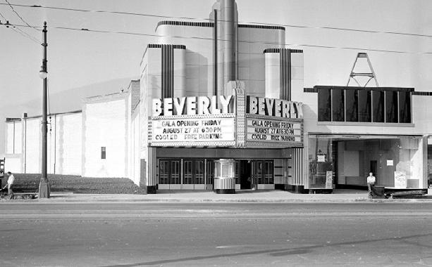
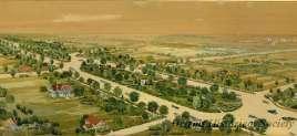
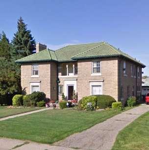
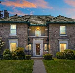
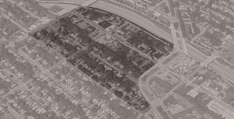
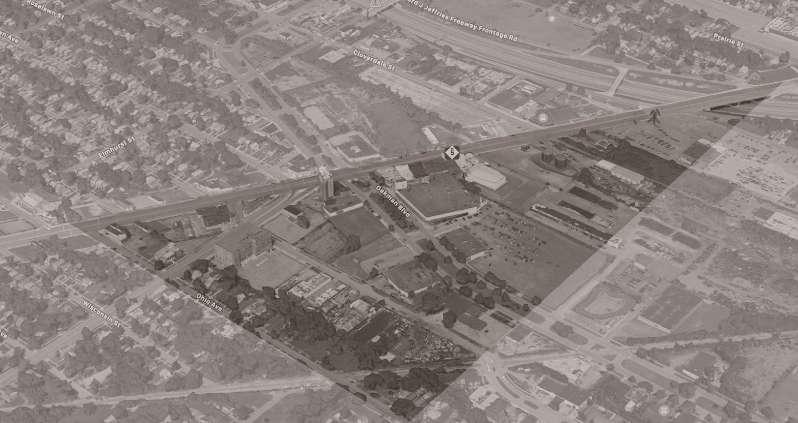
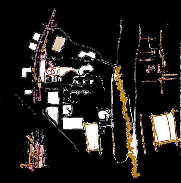
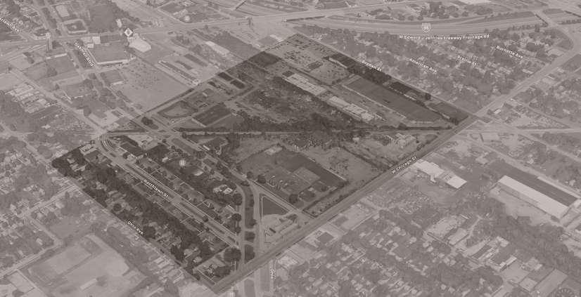
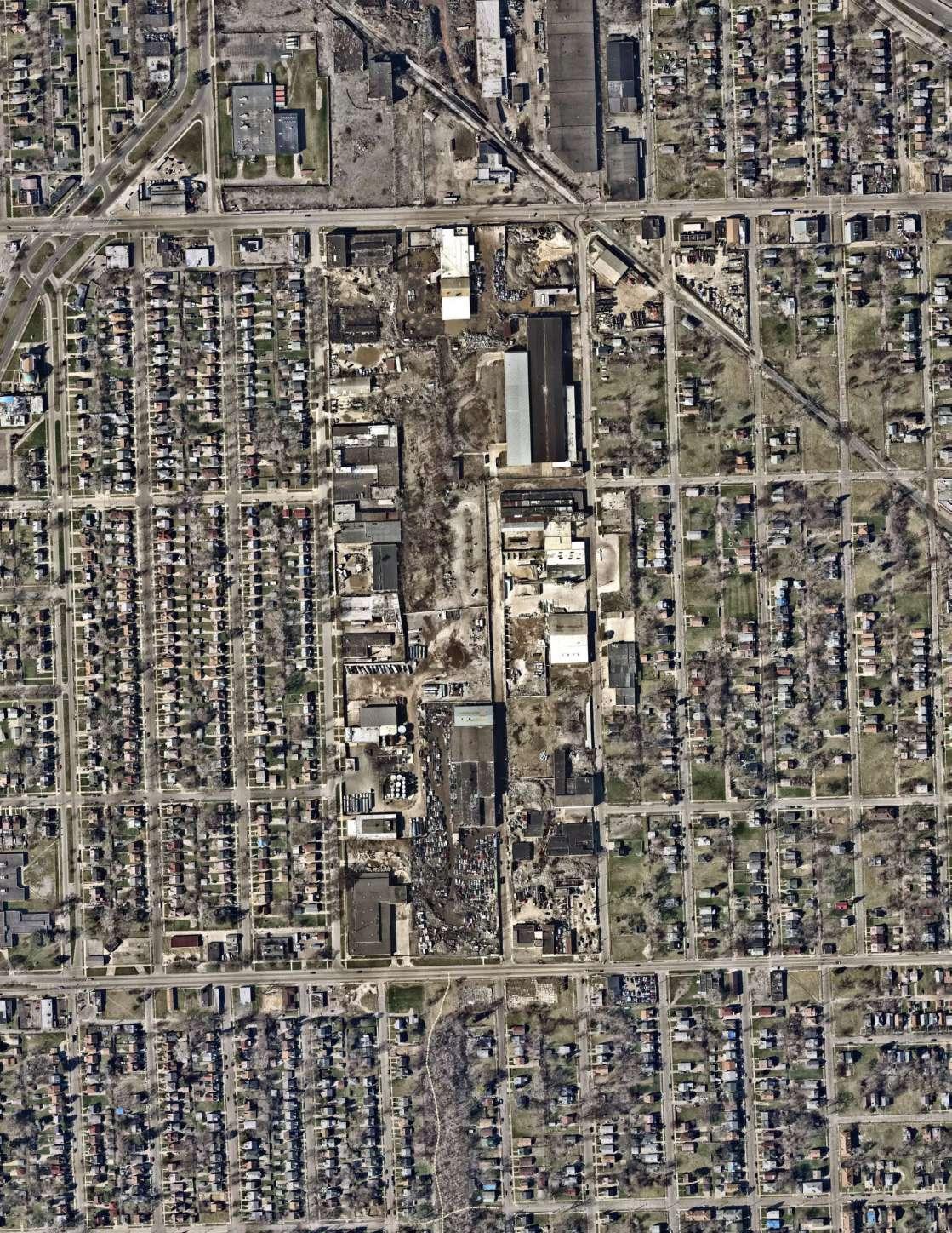
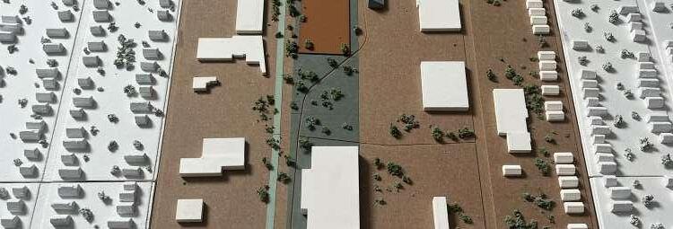
The project title: A Place with No Name, gets its origin from being in-between six different communities and not having its own defined borders. The six communities it is composed of, include Barton-McFarland, Grand River I-96, Littlefield, Oakman Boulevard, Nardin Park, and the Midwest-Tireman Community. Each with their own background and little niches, this gives our site a unique perspective on the services and opportunities provided. Starting with the community that consumes the largest portion of our site; the Midwest community is comprised of low-density neighborhoods. It faces challenges of the potential opportunities in future development because of its location, and past industrial assemblage. The BartonMcFarland area is the second largest community around our site. This community is a close-knit community with a focus on neighbor support and camaraderie. The majority of residents are property owners, which makes a difference in the stability of the neighborhood. Mackenzie
Elementary-Middle School and Drew Transition Center are notable schools in the neighborhood and are two of the only educational institutions in their vicinity. The implementation of the Greenway will connect the schools to the site giving students amenities they currently lack and allowing students to feel more engaged with other communities by creating a strong urban identity. The site that consumes the top portion of our site north of Grand River Avenue is the Oakman Boulevard Community. The area gets its name from master land developer and Realtor Robert Oakman. As the automobile industry grew, there weren’t many roads for the vehicles to travel safely, so Oakman proposed a road that was similar to Grand Boulevard, hence where the name Oakman Boulevard originates from. Mr. Oakman envisioned a road that would travel in a circle so drivers—and now bikers—could enjoy views of the city and beautiful homes. Overall each site plays an integral role in the revitalization of a central urban identity that will unite the six communities.
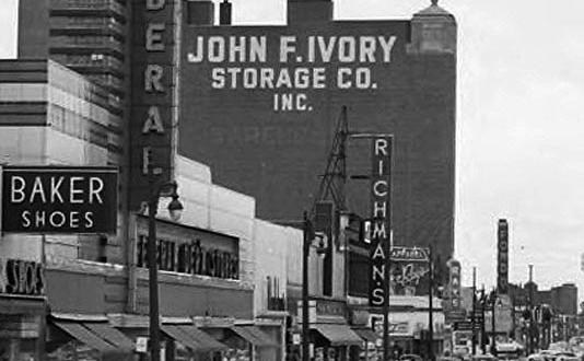
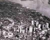
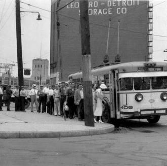
The site is situated around multiple communities with rich history. The neighborhoods within these communities once flourished with a vast shopping district centered at Grand River Avenue and Oakman Boulevard. As a result of racial tensions that cumulated in violent riots, industrial restructuring, the loss of thousands of jobs in the automobile industry, and rapid suburbanization in the middle of the 20th century, Detroit began to rapidly contract. The city’s population peaked at 1.85 million in 1950 and by 1970, it had dropped to 1.51 million. In this chapter you learn about the historical context of Detroit in sequential order,
and will notice major changes that highlight the deterioration that takes place in the infrastructure.
Detroit./
1701./ 1805./
The founding of Detroit Territory of Michigan is Created
On July 24, Antoine De La Month Cadillac establishes settlement in Detroit
A bill is passed in Washington D.C. that creates the Michigan territory, with Detroit as its capital. A few months later Detroit is completely destroyed by fire
The Rebuilding of Detroit Occurs 1807./
Shortly after the fire, Michigan’s first chief justice, Judge Woodward was designated as the central figure involved with the reestablishment of the city. After careful consideration, Woodward chose to adopt a hub-and-spoke design in order to totally reconstruct the city of Detroit with the help of architect and civil engineer, Pierre Charles L’Enfant who was a major planner in the Washington D.C. plan
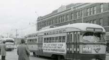
Boom in the Ford Motor Company Last Scheduled Streetcars 1909./ 1956./
Detroiters demanded better roads due to cars becoming more prevalent the Wayne County Road Commission answered the city’s demands and laid the first stretch of concrete high way in the nation. This monumental road, still apart of present-day Detroit, is located on Woodward Ave between 6 and 7 Mile road. A couple years later Detroit is considered the automobile capital of the world.
The last regularly scheduled streetcar operated its final run in Detroit, appropriately on Woodward Avenue. The Woodward line dated back to 1863.
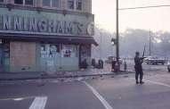
12th Street Detroit Riot 1967./
What started as a police raid on illegal after hours at a drinking club soon escalated into a full scale riot. To stop the violence, over 9,000 members of the U.S. National Guard were deployed to Michigan.
1833./
1837./
Michigan’s First Railroad Michigan is Admitted to the Union
The first railroad was the horse-drawn Erie and Kalamazoo. As business continued to prosper from the use of railroads, Ford Motor Company was created.
The state constitution forebode slavery and Detroit became an important stop on the underground railroad which helped slaves escape slavery from the south

1989./ 2013./
Oakman Boulevard Community Detroit Files for Bankruptcy
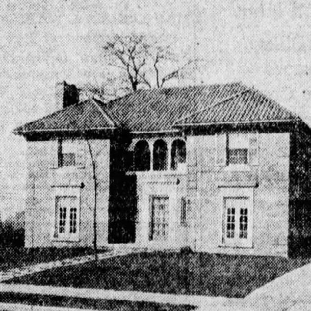
The neighborhood earned a spot on the Detroit Local Historic District list. The Oakman Blvd. community takes its name from master land developer and realtor Robert Oakman. As the automobile industry grew, there weren’t many roads for the vehicles to travel safely, so Mr. Oakman proposed a road that was similar to Grand Boulevard.
Detroit filed for the largest municipal bankruptcy in U.S. history. The city’s debt hovered around $18 billion. Detroit and its citizens were plunged into an intense debate about how to help the city recover.
Population Growth
1870./ Michigan’s population is 1,054,670 at this time and Detroit’s population grows to 79,577.
2022./
Revitalization of Detroit
Detroit Invested $200 million on the Joe Louis Greenway project, a sprawling pedestrian and bike path loop that will circle the city when it’s complete. The Greenway’s framework plan lays out a vision to provide connected, equitable, and engaging spaces throughout Detroit and the region - where people and neighborhoods will find opportunities for empowerment, unification, and healing.
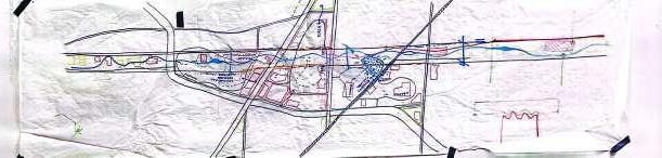
TRANSPORTATION MAP
SERVICES MAP
VEGETATION MAP
VACANCY MAP
ZONING MAP
URBAN COMPOSITION
EXISTING SITE PLAN
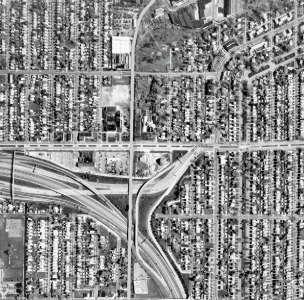
The existing transportation on the site is primarily consisted of vehicle traffic. There are three bus existing bus routes: one that comes from downtown Detroit along Grand River, one that runs along Oakman, and one that runs along Plymouth then transitions to Elmhurst. The bus routes are unreliable and lack bus stop
infrastructure. The site completely lacks walkability, particularly in the industrial zones that are not meant to be entered. Adequate sidewalks and bike lanes are simply not present. The Joe Louis Greenway will be the primary mode of pedestrian travel through the site, but still lacks connection to the surrounding context.
The only services on the site are businesses or religious institution. In the surrounding context medical, leisure, food and markets, and offices lack. Educational opportunities hold a moderate presence. The site itself is in dire need of many new services in order for it to become a functioning community, and also holds potential to propose
services that can serve a much great context than just the site itself. With the ample industrial land, retail, leisure, and civic opportunities can help create a stronger sense of completeness for the surrounding communities. Additional medical, food, and government services will be placed throughout to better serve the site and its context.
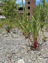
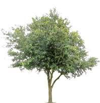
Vegetation on the site is scarce due to its industrial nature. The majority of the vegetation is located in the back of residential lots, and is typically overgrown. Any vegetation in the industrial area is most likely a result of nature reclaiming its presence in abandoned buildings and parking lots. Intentional green spaces on the site are nearly non existent,
except near schools. There is lots of opportunity for vegetation to be included in the site, and many areas where letting nature take its course is likely the best practice to promote greenery. There is also quite a bit of room to develop green spaces, and specifically a connective network of green spaces due to the amount of vacant lots.


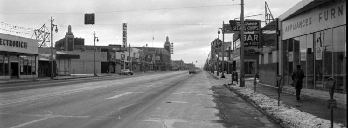
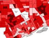
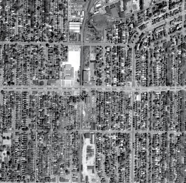
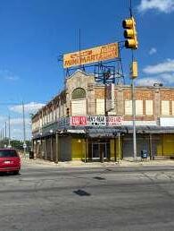
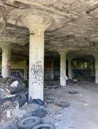
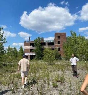
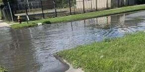
As a whole, Detroit experiences enormous amounts of vacancy. Our site proves no different, with nearly 75% of the site being vacant. Industry, businesses, and residences are all affected by this vacancy, and quite a few buildings are in need of demolition. Of the existing buildings, the predominant occupancy is industrial. A critical issue
will be preserving the occupied industry throughout a site that borders commercial and residential areas. Employing adaptive reuse of vacant buildings that do not need to be demolished will also be an important task to consider during. With the large amount of vacancy, there does prove many flexible opportunities for improvement.
The zoning for the site is almost all industrial, with a mix from light to heavy industrial buildings incorporated throughout. The site borders residential zoning, creating an unpleasant community for residents. A fine line is created as industry must remain in the area due
to its strong history, presence, and identity , but it should not negatively affect the lives of those in the surrounding context. Strategically reorganizing to create more diverse more considerate zoning is an important step forward for long term success of the site.
R1 single-family residential district
B4 general business district
M3 general industrial district
P2 institutional

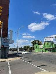
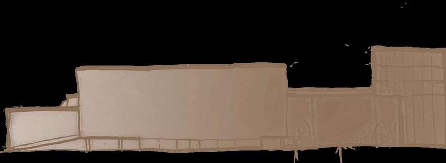
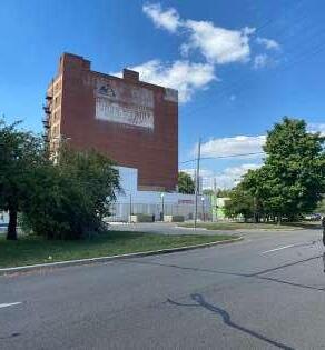
The urban composition of the site is largely centered on the node created by the intersection of Grand River and Oakman. The site’s landmark at 10911 Grand River is located at the heart of the node and is visibly the tallest building at only 108 feet. The major edges of the site are the
barriers created by the I96 Highway, the business facades along Oakman, and the railway dividing the site. Multiple districts intersect the site as well, creating a diverse neighborhood. The major paths of Grand River, Oakman, and I96 play important roles in shaping the sites composition.
nodes edges paths landmark districts
The existing contextual map proves how poorly planned this space is. The once high intensity industrial area, is now scarce of the former industry, thus making the zoning outdated. The vacancy of the area is also very high which gives a leaves residents with a rundown feel to the entire site.
The greenery goes hand in hand with poor zoning and abundant vacancy. There is little to no vegetation in the heart of the site. The few amounts of green spaces that exist are more likely than not to be overgrown and unkempt. All of these categories plead for a refresh.
R1 single-family residential district
B4 general business district
M3 general industrial district
P2 institutional
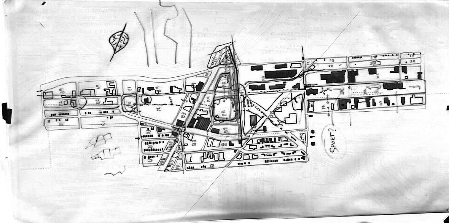
PROJECT GOALS AND CONCEPTS
TRANSPORTATION MAP
GREEN AND PUBLIC SPACE
ZONING MAP
URBAN COMPOSITION
MASTER PLAN
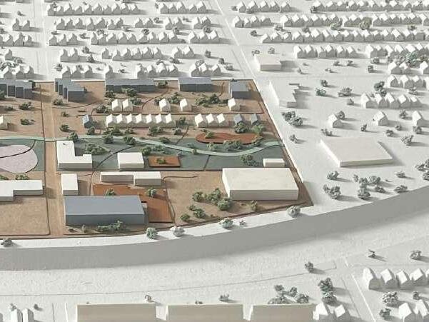
After becoming familiar with the site and its space, it was clear it lacked a sense of place and was in need of creative redevelopment due to its many obstacles and potentials. Our project goals aim to work toward an establishment of a place throughout the entirety of the site and the context beyond. Our first goal, revolving around the Joe Louis Greenway, is to increase the walkability and pedestrian accessibility of the site. A linear green park builds off of the Greenway and runs throughout the site from North to South. A strategic network of linear parks accompanies the Greenway and creates its transverse axis. In addition, vehicle roads will be redesigned in a variety of ways to promote walkability. Both Oakman and Grand River will be redesigned to integrate more bike lanes and slow down vehicle traffic. A number of roads will become pedestrian roads with emergency axis only. Paths will be integrated throughout the entire site to further develop its entirety. Our next major goal was preservation the site, specifically with
the existing buildings. A large number of industrial buildings are planned to remain and become part of a diverse landscape while maintaining identity. Many residential areas on the sight have an abundance of uninhabitable single-family residences that will be replaced with more equitable opportunities. Affordable housing projects and live work incentives intend to build on a variety of housing types to attract all types of demographics. As a combination of all goals, a greater underlying issue lies in providing identity to the site. Currently, the site lacks an identity and strong community. We hope reinvigorating the site’s retail history and providing adequate resources to the surrounding community will work to help foster this missing sense of identity. Thus, identity becomes our determining factor in transforming a space into a place. By designing spaces for the community to gather while respecting the current use, we intend to let the residents of the area to begin to define their own identity and inspire a place.
The proposed transportation brings more mass transport infrastructure and a large surplus of pedestrian walkways. The bus routes are slightly rearranged to feed into a larger bus terminal at the intersection of Oakman and Grand River, promoting the node and creating an intentional public space. Bus stops along Oakman have been updated to
shelters that feed directly to the adjacent greenway. Multiple roads throughout the site have been re-purposed to large pedestrian walkways that still maintain emergency access. Larger transverse pedestrian walkways provide connection throughout the site, and feed into the Greenway while being supported by many paths.
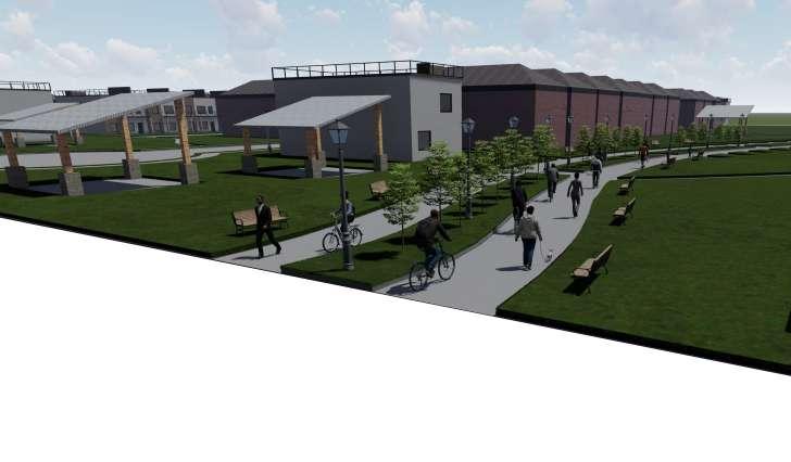
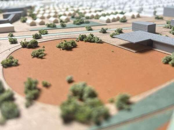
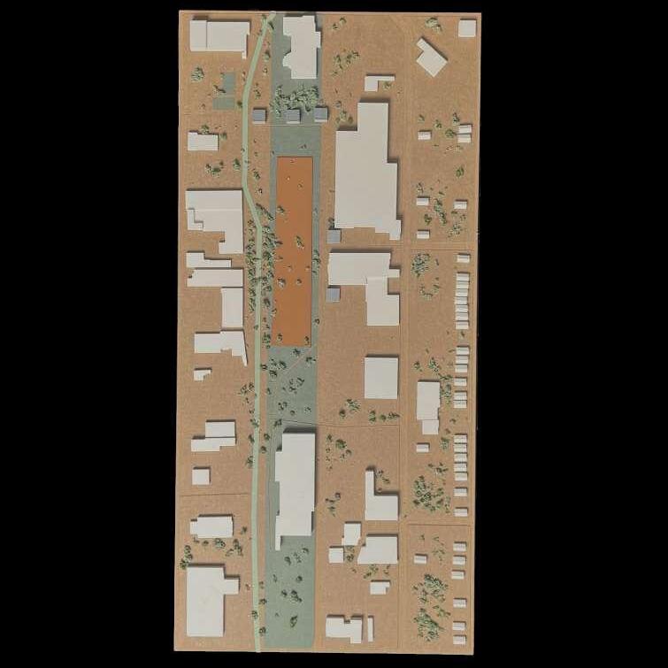
The green space throughout the site is commanded by the 200 foot wide Greenbelt that runs throughout the site. A supportive series of additional green spaces and a connective network of parks integrates the Greenbelt with the surrounding context and provides attainability. Intentional public spaces follow the Greenbelt and Greenway and are
also very attainable. Key green and public spaces include a market, a gateway park on a proposed highway overpass, and a large civic plaza. The Greenbelt includes a network of bio-swales that provide rainwater retention for the entire site and support the public space by adding more natural features that are currently lacking in the landscape.
The proposed zoning restructures the site to create a larger diversity of building typologies and equitable access throughout. Rather than creating large block zoning, the zoning has been tailored to allow for commercial and residential to blend within the
industrial context. The largest change includes adding public center and parks and recreation districts throughout. The newly created special development district allows for maximum flexibility between business and residential opportunity.
R1 single-family residential district
B3 shopping district
B4 general business district
M3 general industrial district
P1 open parking district
PC public center district
PR parks and recreation district
SD2 special development district
P2 institutional
The urban composition is made up of various elements that create interesting nodes. A major one for example is the intersection at Oakman and Grand River. It has been reinvigorated with retail shops, civic buildings, and housing. The framework of the area is based around dilapidated neighborhoods that have been
reintegrated with the site to create a sense of community. Some edges of the site are constrained with challenging barriers such as the freeway of I-96 and the overpowering industrial district pushing against neighborhoods. The newly zoned areas and added vegetation combat this and enhances the living condition.
The final master plan denotes a cohesive design of the various plots that unifies an overall essence of togetherness and integrates all neighborhoods with each other. Re-zoning played a large factor in this because of the complex nature in the previous zoning ordnance. In addition, a greenbelt
was implemented in the design to aid in the increase of bikers and decrease the use of vehicles. The accommodation of the residents was also essential to our master plan in order to give them a sense of community that they so deserve. This refresh will be the next step toward becoming a place.
R1 single-family residential district
B3 shopping district
B4 general business district
M3 general industrial district
P1 open parking district
PC public center district
PR parks and recreation district
P2 institutional
SD2 special development district
route
SPENCER JOVANOVSKI & VISHMITH KUMARASINGHE
Upon dividing the site into plots with the project team, our group decided that we wished to redesign plot 1. This plot is located at the northern most section of the project site and more specifically lies north of Oakman Blvd. and south of Fullerton Ave. When analyzing plot 1, our group found that it could be divided into three clear zones which include residential to the west, commercial to the east, and large-scale retail/wholesale business in this middle. The condition and vacancy in these three zones varied and we immediately saw the issues with this plot. First, there was an aging residential area, bad condition housing and a scattered occupancy. Our goal for this area was to create a complex feel, adding different types of housing rather than simple filling the empty lots with more single-family houses. Second, in the retail/business as well as the commercial zone, most of the buildings were vacant but needed renovations to be brought to the level of a functional purpose.Our two overall goals for the redesign of this plot were preservation and community. We wanted to preserve and renovate what was possible. while also adding a few
new structures which we believe is the key to creating a positive environment throughout our plot. As a team, the occupied residential housing was kept and refurbished while the houses in poor condition were demolished. These were replaced with various types of new housing designs and small parks that connected the residential complex. In the middle of the plot is also where the path of the greenway ran through. This zone was repurposed to become a parks and recreation area which connected other adjacent project plots to become a greenbelt. This parks and recreation area gives the plot a sense of community and one large space rather than three separate ones, which was another one of our project goals; to unify the entirety of plot 1. The existing buildings were repurposed to fit the needs of the greenway and created a community sense with the neighboring zones. In the commercial area the buildings were preserved and new buildings were created which were surrounded by courtyards and public spaces. Lastly, our design focus was to improve the quality of life and create a space where anyone can enjoy their experience whether its live, work or play in our plot of the greenway.
existing axon: mixed use area consisting of residential, business, and commercial areas


site axon: developed mixed use area consisting of a semi-public housing complex, parks and recreational greenbelt, and revived commercial spaces
figure ground: proposed buildings were placed sporadically throughout the plot which replaced buildings that were demolished due to their poor condition or vacancy
In the retail/business as well as the commercial zone, most of the buildings were vacant but needed renovations to be brought to the level of a functional purpose. Our two overall goals for the redesign of this plot were preservation and community. We wanted to preserve and renovate
what was possible. While also adding a few new structures which we believe is the key to creating a positive environment throughout our plot. In the commercial area the buildings were preserved and new buildings were created which were surrounded by courtyards and public spaces.
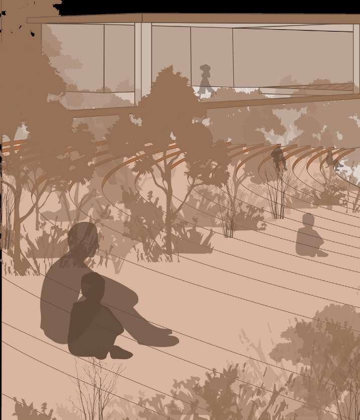
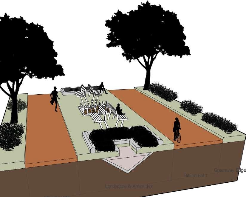
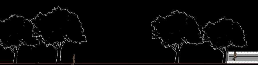
Green and public spaces were important to the plot’s concept. Pocket parks were placed between housing in residential areas allowing paths to run through them connecting the homes to the greenbelt and commercial area.
Smaller areas of green space allow for people to come together as a community more often. Playgrounds and larger parks were considered as public space since many people can gather here for various types of activities.

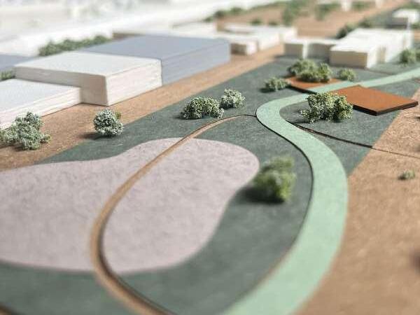
The event space located on the greenbelt is a preserved paved area where pop up events can occur weekly or biweekly for the community to engage in local entertain or exchange of merchandise.
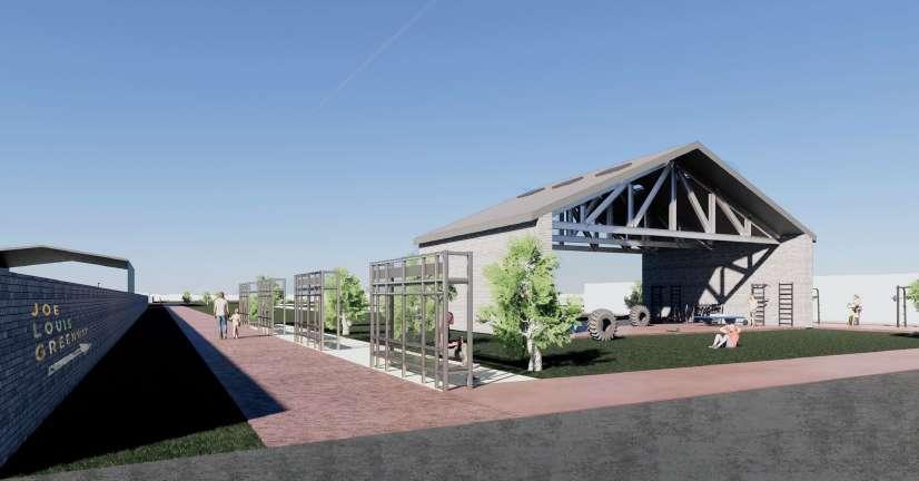
The pavilion also located on the greenbelt is a large public area which includes seating that provides shade and is a great place to rest. It is a prominent structure that the greenway runs through.

Site
Commercial Residential
functions diagram
green way perspective section: the greenway can be used by all people whether they prefer to go at a slow or fast pace, it is divided into walking and biking lanes on either side with a median running through the middle
housing floor plan
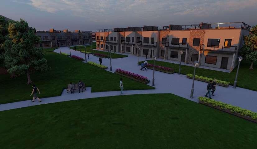
The proposed housing that we developed in the residential area followed the goal to design a complex style block that featured single family houses, townhouses and an apartment building. These work together to bring a community environment to a residential block that previously featured the
common single-family subdivision feel The design of the ground floor of the townhouses contained a simple plan that included a kitchen, living, dining room combo with a half bath and office space as well. This design was repeated throughout all town homes in the complex to keep the layout consistent.
Green Space
Proposed Paths
Green Space
Proposed Paths
Proposed Buildings
Existing Buildings
Proposed Recreation
Greenway Path
Restricted Roads
Pedestrian Roadway
Proposed Parking
Proposed Buildings
Existing Buildings
Proposed Recreation
Greenway Path


Preserved Areas
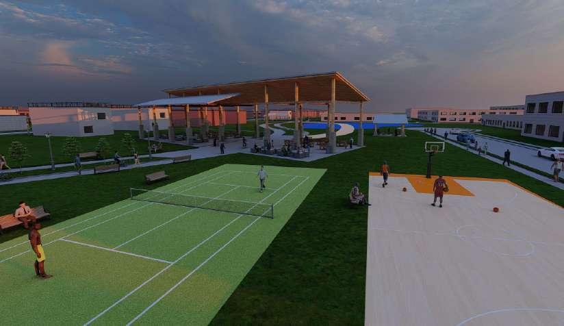
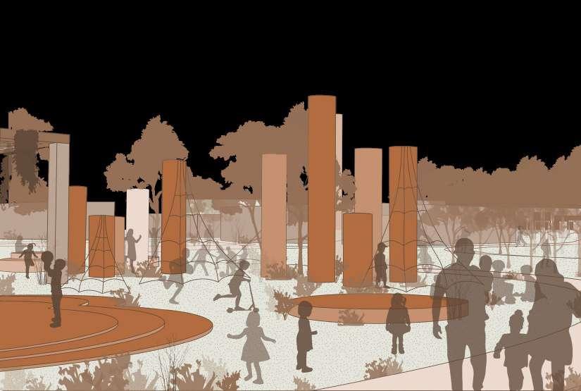
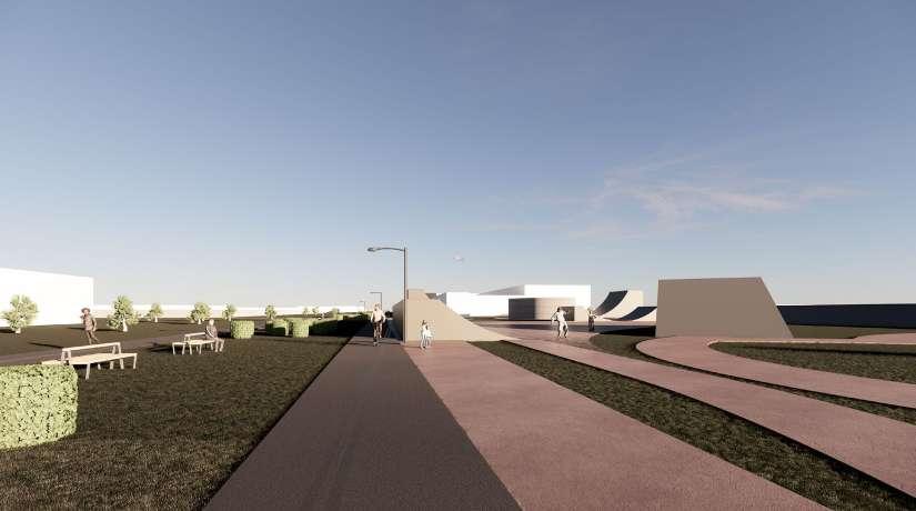
perspective: showing recreation activities
Overall, the goals of the greenway were met through implementing preservation, community, and recreation. Our design focus was to improve the quality of life and create a space where anyone can enjoy their experience whether its live, work or play in our plot of the greenway.
DANI BOGDANOVIC AND BUSHRA FAWAZ
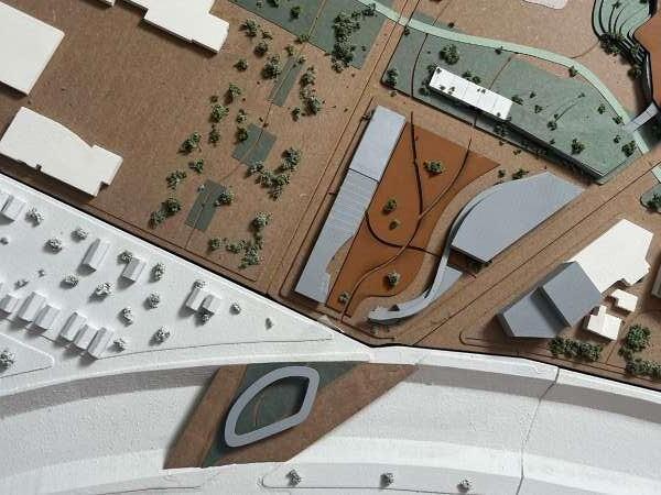
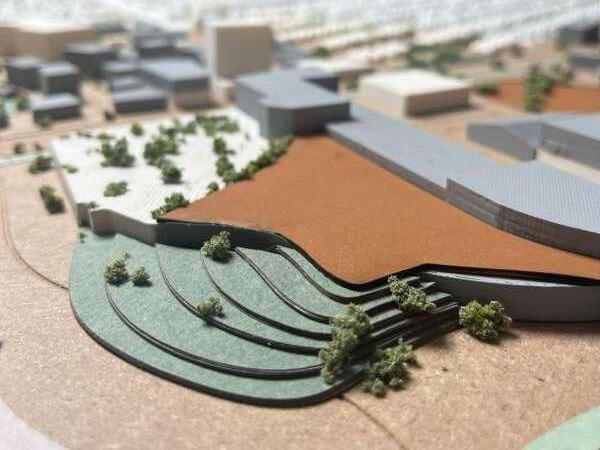
The urban composition of Plot two is composed of connective neighborhoods through an organic vegetated area integrating cultural and recreational structures. The park within the plot will offer play areas, walking paths, all connected by the Joe Louis greenway that runs along Oakman Blvd. and through the center of the site connecting to paths that lead to the neighborhoods and communities. The screens along the path act as a buffer from Jeffrey’s Road from plot two all the way to plot one, each spaced 6 ft from each other. The area offers a unique environment with an event space and seating, a tree canopy, public market, and a place for children to play. The organic
greenery and vegetation in the site creates comfort and stays true to the origin of the area, as it is a highly overgrown and industrial area. This vegetation wraps the event space that leads the visitors ’14 feet deep into the site creating access to the ground floor of the building above. This space creates opportunities for activities year-round, and it will be the perfect place to watch events that would take place while submersing yourselves in the vegetated steps that lead you to the space. Plot two’s focus on culture promotes activity and interaction within our site. Highlighting the identity of this plot while keeping a connection to the Greenway allows it to cater to a wide range of people and all can enjoy the opportunities it provides.

existing axon: image of existing conditions of plot 2
site axon: showing public spaces
MARKET SPACE
EVENT SPACE
function diagram
The screens act as a visual and noise buffer from Jeffrey’s Street and the I-96 with vegetation on the other side. It allows people to safely bike or walk along the street and still have access to cross with the 6 ft breaks between each screen.
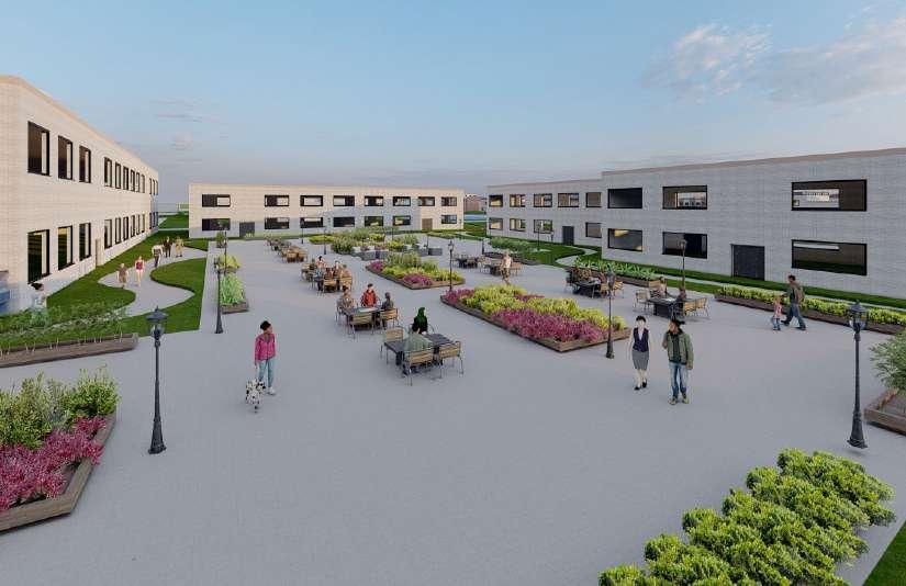
The event space accommodates a variety of functions such as acting as a venue for a wedding or a theater. It could even be used for leisure on the days it is not occupied, and people can access the ground level of businesses that connect to the upper level.
people occupying the vegetated steps as they are getting ready for a performance, while others are enjoying the businesses that connect to the floor above.
The focus of the plot was towards pedestrians and bikers with access to cars where it is needed. Closing off car access from Grand River aside from parking spots continues the edge effect of the street as welas allowing the connection parks to exist throughout the neighborhoods that connects them to the greenway.


Allowing fourth nature to take over in certain areas like the market and including organic vegetation across our plot links back to the identity of our site Many areas have been abandoned with nature beginning to take its course.

greenery diagram

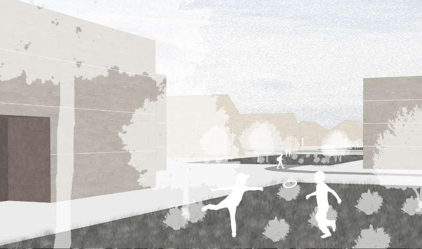
The children’s park near the neighborhood encourages outdoor play and social interaction with other children. The vegetation surrounding the children’s park keeps them connected to the nature of the site. The Children’s Play Area features a playground with innovative recreational equipment for children of all ages. The intended
design of the play area celebrates the natural environment of the site, with elevation changes that stir imaginations and encourages exploration. It will offer four seasons of play with plenty of seating and shade for parents and adults. A small barrier exists along the Oakman Blvd. edge to assure children’s safety when participating in recreational activities.
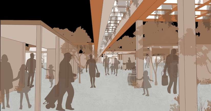
An active day at the market where the local artisans and farmers are selling their products to the neighborhood. Aside from the services it offers, it allows for the community to create relationship with one another. The market area will feature 10’ by 10’ huts for local vendors from the neighborhood and other areas of Detroit to sell their products and goods on the weekend. It provides a space for small gatherings, or simply as a spot to stop and enjoy the park under the square pavilions.The market is adjacent to the food hall located on Cloverdale St. and old Burlingame St providing a location for vendors in the
winter months. The programming of the market is arranged in a way that all the huts can accommodate different street market typologies such as local food sales as well as cafes. The modular design allows for the plugged-in huts to adapt to specific hours within the day, much like how the local street markets function according to the density of activity within the area during the day. The location for the market was determined by the whereabouts of a concrete slab that was previously put in the site many years prior to site. The base concrete allows vegetation to grow through the cracked stone creating a space for water to drain in the site.
Rather than erasing what is there, structures that are in good condition will be preserved. Plot two builds on the existing structures that have been abandoned and expanding on some buildings that are in use to work towards adaptive reuse of the site.

buffer diagram


Providing a space where culture and businesses can develop together. Allows people to enjoy their space and build new relationships and connections within their community as well as giving the plot a place to establish its own story in its own area.
SOFIA D’ARIENZO & SIDNY HESSEM
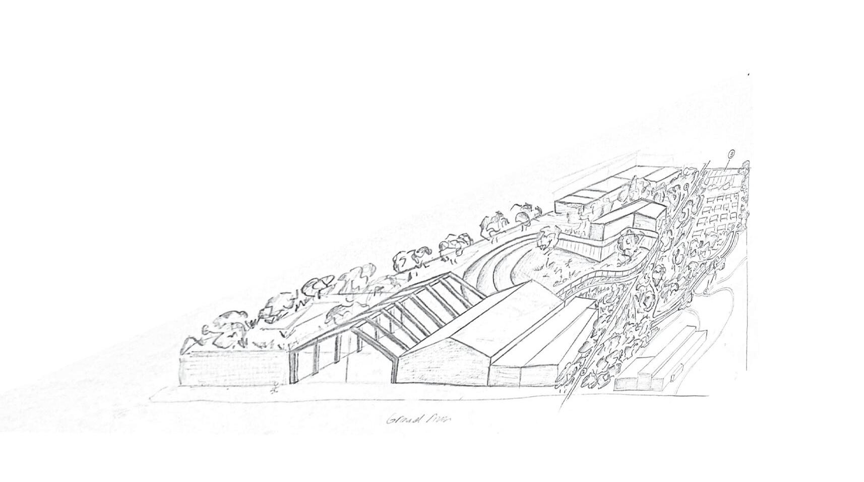
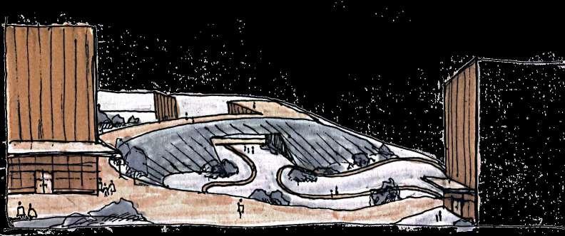
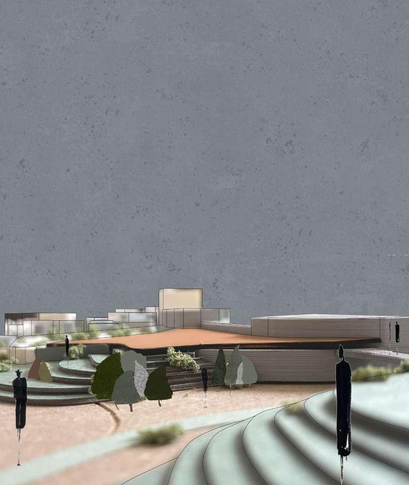
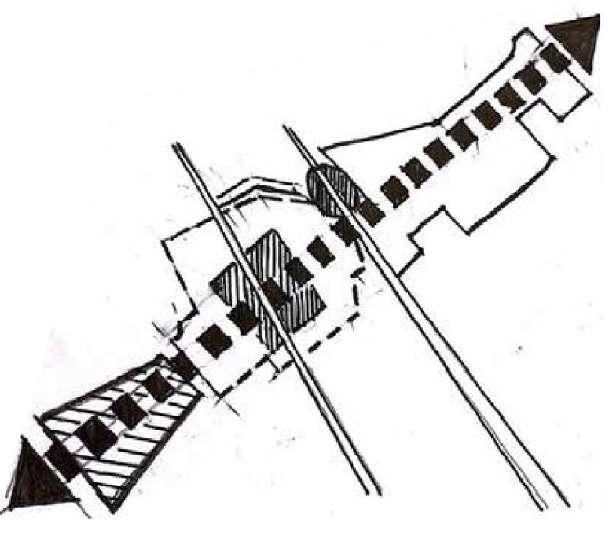
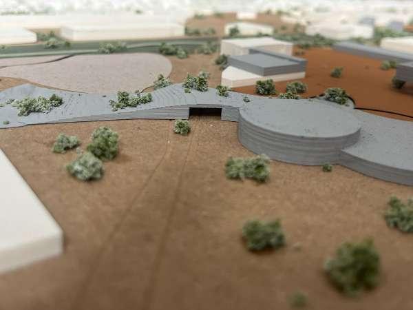
The gateway to the new up-andcoming Joe Louis Green way starts on Grand River Ave. The symbolic and literal division creates a strong transverse axis through the site. To allow for a comparative feeling on both east and west sides of Grand River, the architecture is built upwards to bring a sense of boundedness from the site to the incoming user. A parallel axis is proposed, spanning from the opposing side of Jefferies Highway to the west end of Beechdale Ave. Creating a special sort of entrance from the easternmost side of the site. A bridge, that doubles as a park and entryway is created for the most welcoming first experience and impression of the site. These two axis points become the boundaries of the plot, defining the line between the functions of the plots both north and south. The attributes of these plots to the north and south are very opposing in their urban features. To create a dense urban storefront downtown feel on one end yet an entrance to a more leisurely campus-like feel, just a couple hundred feet away. This space in between has a duty to uphold a walkable park network. This was made possible through the act of “puzzle piecing” new buildings into the current ones to create a level and unified
place for the public to use. As local community member roam into these spaces they are greeted with an overwhelming sense of pride and establishment for their community that shall inspire them to form an alliance amongst their neighbors. Allowing them to create their identity, rather than feeling as though they were forced into a gentrification project. This topography also allows for a gentle yet quite literal slope away from the site’s hotspot, Grand River. The idea is that the back side of these buildings is either covered with hills or used as elevated patio spaces to allow the user not to feel excluded from either side, yet quite the opposite. They are granted the experience of both qualities of urban and more rural. This key transverse axis has been made to allow circulation between its connecting communities as connections to local living and business accommodations. The newly zoned SD2 district has been expanded on to ensure that the members of the community have access to the most basic and convenient amenities, such as a barber shop, pet store, or optometrist. The plaza that is happening directly west of this zone is abundant in local cafes and seating to allow one to build a sense of home or identity there. The history of the site accommodates the circulation that the plot naturally creates.
existing axon: image of existing conditions of plot 3


site axon: plot showing proposed buildings as well as public and green spaces

concept diagram
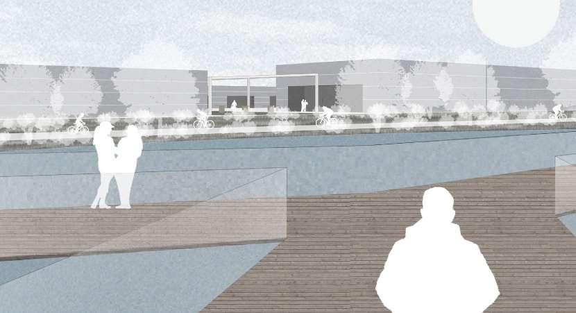
As the middle plot in a 5 plot site, we took very much consideration the context of our surrounding plots. With one side desperately needed an urban uplift, the other side introduces a much more vast and rural type campus park. On the east and west ends the plot is surrounded by neighborhoods. Between the linear park and a major transverse axis that runs parallel to our site, we have made it very easy and possible to access anything you may need as a resident and/or visitor. With figurative gateways on either end, there is definitely a sense of welcome as you approach the site. The circulation on Grand River has been revamped to include a two way tram system, which limits each side of traffic to one lane plus a widened sidewalk and bike path.
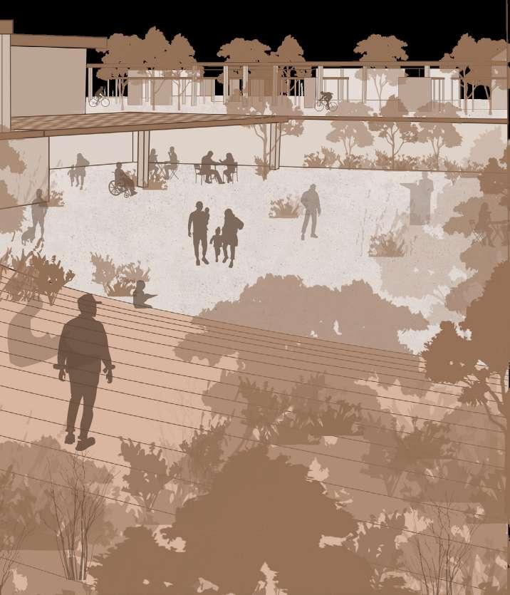
The section cut though the plaza helps show the bridge park and its relationship to the highway directly below it. A pavilion that circulates the park allows for a universal and directional experience as you exit a tram from Grand River and find your way deeper

into the site though to the plaza. The plaza is being represented as a very open area that has boundaries that are beyond the human eye. The user is allowed to pass through under a building without having to cross a physical boundary that is happening above their head.
There is also a shading device that spans the plaza to draw into further into the site This space acts as a gateway to the entire site as it definitive boundary is a major highway. This bridge questions the identity of boundary
and figuratively and literally crosses the line to welcome neighboring communities. The plaza area also starts to taper upwards as you enter form the bridge to create a more figurative gateway implicates less of the boundary and more of a directional experience.


process diagram: showing how the plaza creates an infinitive boundary


perspective plaza: showing bridge park from the angle of leisure park
LEVELING PROPOSED TO EXISTING
EXISTING WITH ADDED GREEN ROOF
GRADUAL SLOP FROM URBAN TO LEISURE PARK


design process diagram: puzzle piece
design intent of persevering buildings within plaza

leisure park perspective from public patio deck


perspective diagram showing how rainwater is retained by bio-swales and outsourced to the community
A perspective section of the newly designed Oakman Blvd. shows how the site can be more integrated within each other and allow for easy access to all areas of the site. This new design includes two way street parking as well as expanding the width of the pedestrian traffic as
the green way now runs down Oakman on this path. A new bus stop has been located in this area and a new road is also being proposed entering the SD2 site as a bus only road. This new road would be brick paved and used as pedestrian traffic when the bus is not running through it.


design process diagram: second level addition

figure ground: highlighting zoning


transportation diagram: bus and tram route tram stops bus stops

process sketch of integrating plots 3 and 4
arithmetic building heights in plots 2 and 3 along grand river


circulation diagram: foot traffic density
This plot consists of 4 main sections that are all very different yet compliment each other. As the plot widens so does the use and density. However, this diffusion allows for a gentle bleed to adjacent neighborhoods. Although this plots portion
of the green way appears to be smaller compared to its neighboring sites, the idea is influence people to stop and take a break here. As this is the center of the site, the raised topography allows for the best views of the surrounding context.
MAHMMOUD ELJAMMALI, JAKE LAMPI, RYAN LEMKE, AND GIOVANNI ZORA
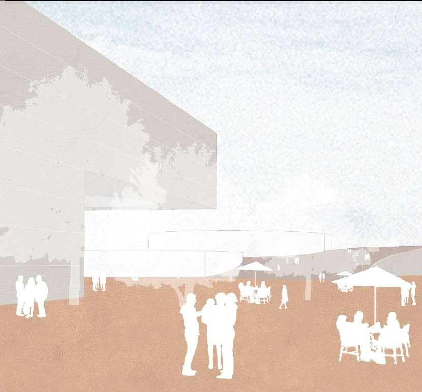
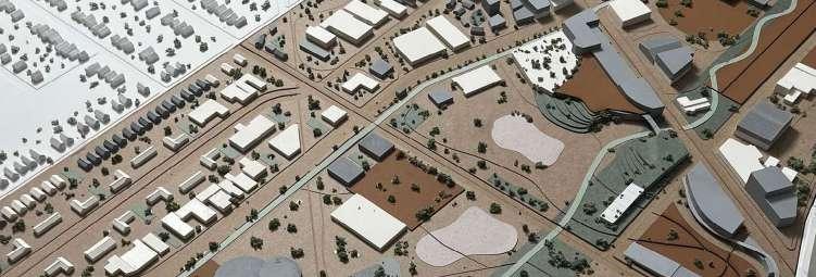
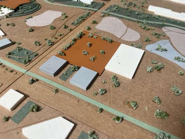
The goal for our site development was the transformation of a post-industrial wasteland to a tranquil landscape within the city. It is intended to be a space where residents, workers, and travelers are all welcome to spend their day within nature alongside community members. Whether spending time at local attractions or passing through on the Joe Louis Greenway, this space is intended to provide connections to neighboring residential and business districts. The site also holds a vision of creating equitable space, in accordance with the vision of Joe Louis, that is easily accessible and fits to its context. In addition, the space considers civic and cultural needs for the present and future. Various services within the site are organized throughout a large civic campus that is easily accessible by multiple pedestrian modes of transit, including the Joe Louis Greenway. The site includes a community center for indoor and outdoor recreation activities, a public library and cultural center, and a civic plaza that promotes the safety and well-being of the neighborhood. An assisted living facility on the campus combines with the nearby live work district and large number of single-family residences in the surrounding context to create equitable housing opportunities. The site preserves existing business, residential, and industrial zones and makes use of salvageable vacant buildings. A series of connective parks integrates the campus and context, promoting our goals of belonging and connection, and provides pleasant visibility from neighboring areas into the campus and landscape.
existing axon: image of existing conditions of plot 3
site axon: of plot showing proposed buildings as well as public and green spaces
concept diagram
Our Civic Campus employs a few key buildings to create a contrast in scale with the surrounding context. The buildings promote visibility and highlight the Cultural Center, which stands alone as an integrative icon for the Campus. The surrounding public spaces forms a network of gathering spaces framed by the Joe Louis Greenway and Greenbelt. Transverse connective parks wind through the surrounding districts to provide equitable access. The buildings and parks incorporate the site’s industrial history by preserving buildings and infrastructure throughout.


west context


live/work district
civic campus
preserved industry

east context


Explains the density of the belt, the preservation, and the water management.


west context

live/work district
civic campus
preserved industry
east context


Explains the restructuring of Oakman Boulevard to promote mass transport and walk-ability.


public space perspective: illustrates the connection of the proposed building to public spaces
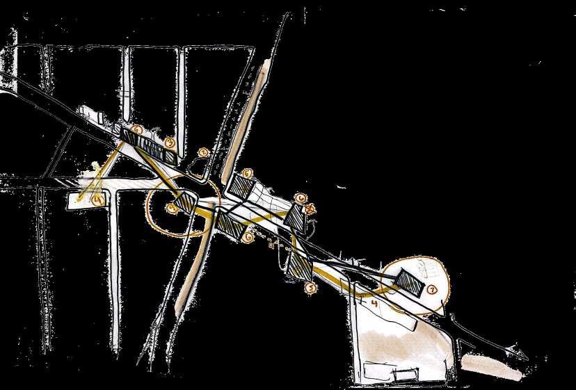
7 Industrial: Preserved all occupied industrial buildings
8. Library: Preserved two buildings connected with a proposed bridge
circulation: explains integration of mass transport and key pedestrian paths.
“Restructuring urban design towards strategies that will instill sustainable growth lies in the hands of the urban designer.”
geenbelt perspective: illustrates the cohesiveness between the tranquil campus, bustling greenway, and preserved industry.


Our site plan achieves the goals of visibility, approachability, and belonging while creating a wholesome civic place that does not impose on the context. Well informed public spaces, prescriptive new buildings, equitable development, and an ample network of green spaces further develop the master plan concepts of the linear park, preservation and walkability.
ANDREW GAINARIU AND KAYLA MOSER
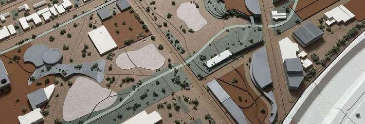
We gave our section of the site the name Reclamation Recreation and our main goals for it is to revitalize the unused space in the center, that has slowly been lost by time and discarded scrape over. Another goal is to transform it into a large public recreation area for our community and others. The challenge was to preserve the neighboring businesses and industries, rather than bulldozing them away. Having both entities
share the space harmoniously and serve the current and future needs of greenway inhabitants and the community. The way we linked all five individual portions of our site is through a Linear Park, designated green space that stretches out from the top to bottom of our site, to reinforce the idea of connection. With other sections having different defining features, what defines Reclamation Recreation is its ability to be a focal gathering point.
The existing site contains industrial and commercial active businesses.
The goal of our design is to celebrate the existing industry but also intervene by providing public spaces. A lot of the land has been used for scrap
and our goal was to take some of the land back for public use. and make it an area that is more enjoyable. Where possible, we incorporated outdoor spaces for sports and other physical activity.
The larger areas of the land were used as fields or arenas to be a place where people can gather. We chose to use existing structures and transform them into usable spaces where people can be productive at learning and working. Building a greenway around industrial
spaces offered a unique opportunity to bring life back to a previously unoccupied area in Detroit. where people can be productive at learning and working. Building a greenway around industrial spaces offered a unique opportunity to bring life back to a previously unoccupied area in Detroit
functions diagram
The negative space in between areas used for industry or commercial businesses were previously ignored, leaving a large amount of greenspace for different sports programs. The sports fields are laid out from the North side of the site near W. Chicago to the South of the site at Joy Road. Passing pedestrians can view the sports activity or join in or take a break and enjoy viewing the sports. We wanted to
promote use of this area by providing a variety of fitness activities to encourage neighbors and other members of the community to participate in team building sports and bring people closer together. The site had a lot of fencing and one main goal was to open the space in between buildings for pedestrians. By providing several openings on each side, the greenway serves as a connector between different residential streets.
The greenway runs parallel to the sports and fitness areas. The paths are used to create a seamless transition to the sports from the greenway. There are also many resting locations where by passers can relax.
Due to the scale of the industry nearby, visual barriers were used as a separation between the work and leisure areas. Our nearby businesses also benefit from this design by having a park to enjoy during down time.
The greenery in between heavy industry and the greenway acts as a buffer to provide an experience that is allows users to feel like they are deeply immersed in nature vs. a post industrial area. We wanted to balance the land use to
make it suitable for different uses, instead of how it was previously used. Giving more land to public space allows for nature and aesthetic design to take over. Cleaning up the land will make it more viable for new development opportunities moving forward.
The greenway can also serve ecological purposes by re-directing rainwater from nearby structures to a retention pond, lessening the impact of local flooding.
entrance greenway
walking path

This section of the greenway can be utilized by people of all ages and fitness backgrounds. At the Central Ave. Entrance is a vacant warehouse turned indoor and outdoor gym. At each outdoor activity space is a sheltered pavilion to provide protection from undesirable weather conditions. The
section below illustrates one of the bigger fields, the football field. There is a difference in elevation from the sports arenas and greenway, conveying different programs. This also gives non sports users to spectate without interfering with the game, showing separation between activity outside of the fields.
Early in the design process, we decided to have a series of parks alongside the greenway. this helps to connect circulation to gathering and the different activities in the parks.
The different modes of transportation merge at the greenway, creating opportunities for all too recreate and enjoy the city in communal way.
The final master plan denotes a cohesive design of the various plots that unifies an overall essence of togetherness and integrates all neighborhoods with each other. Re-zoning played a large factor in this because of the complex nature in the previous zoning ordnance. In addition, a greenbelt
was implemented in the design to aid in the increase of bikers and decrease the use of vehicles. The accommodation of the residents was also essential to our master plan in order to give them a sense of community that they so deserve. This refresh will be the next step toward becoming a place.
R1 single-family residential district
B4 general business district
M3 general industrial district
P2 institutional
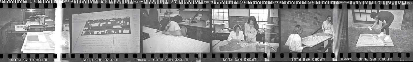
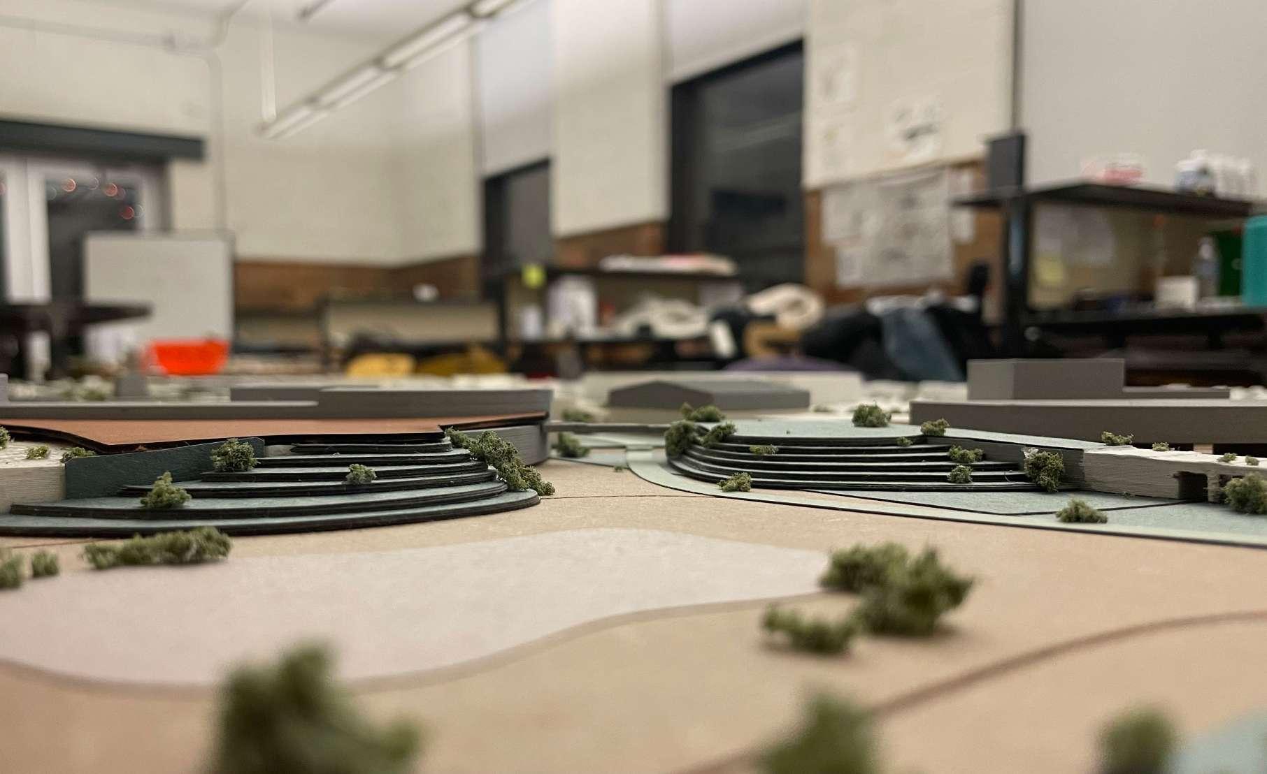
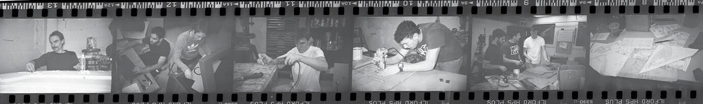
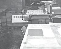
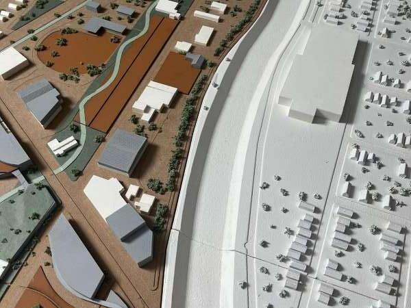
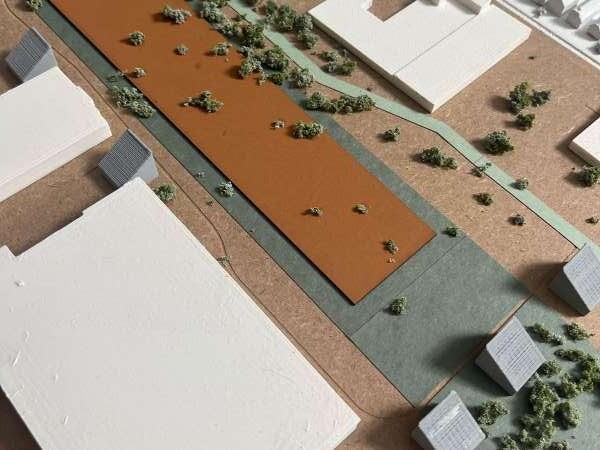
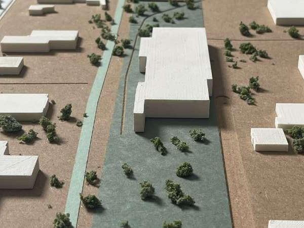
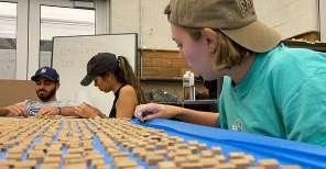
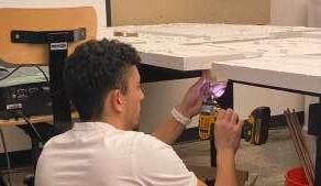
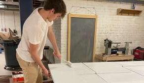
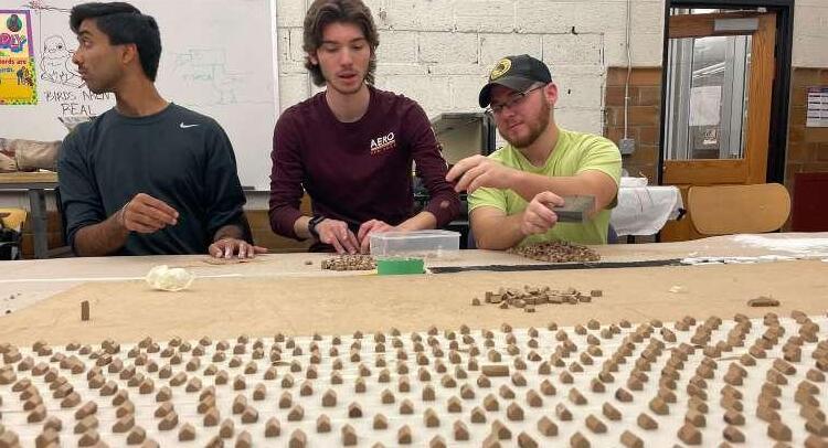
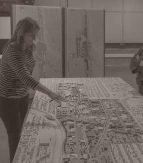
The 4’ x 10’ site model of the urban design project in Detroit is made up of various materials and a range of fabrication methods. In order to complete the reproduction of the site and the context around it a scale of 1:1000 was determined from the beginning. Later materials were chosen as a group. Existing context and buildings are medium density fiberboards painted white, and the site limits being medium density fiberboard as well, but unpainted. The procedure to fabricate the previous portion was done in autocad and taken to a CNC machine to make precise incisions and align everything perfectly. Grey proposed buildings were 3-D printed after being modeled in Rhino3d via each group for their respective plot. Orange public space areas were laser cut and aligned in autocad along with the greenbelt and greenway.
09.07.2022
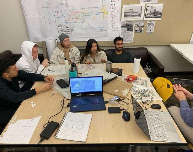
SITE VISIT ANALYSIS
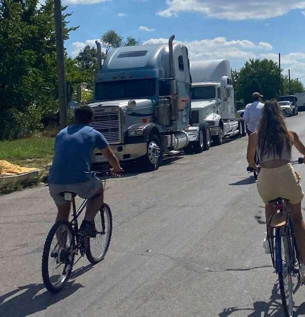
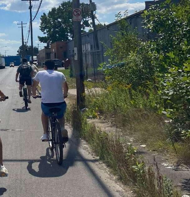
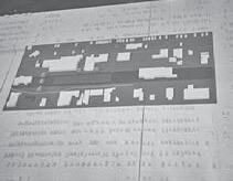
In order to begin our intensive research of establishing an urban identity we first had to familiarize ourselves with the site, hence why our professor accommodated a class subjected to exploring the industrial and barren site via bikes. On the first few class sessions we were briefed by our professor about the site and how the proposed greenway would run through the site. In order to get the full immersive experience we biked along the proposed trail and had plenty of feedback to discuss when we reconvened the next class period. Overall the site visit was a successes because as a class we tested the limits of the site and greenway by traveling as a group and exploring each crevice of the site. We first gave our initial thoughts on a median at Oakman Boulevard. The conversation was as expected. We were not overly excited with when biking the path due to a plethora of reasons. Once we came together again we talked about the pros and cons of the site. A major problem we noticed was that the proposed greenway felt out of place running close to the road and made us feel
uncomfortable and unsafe when we were next to the cars. We thought a better alternative route would be needed to create a separate path strictly for biking and walking use. With this new finding we brainstormed potential amenities that would go on a separate bike trail. Features that would be along this new path would be bike rental stations, tire refill stations, bike racks, and we were thinking even some sporting fields. Overall, we wanted this new path to be efficient, but provide a heightened experience than simply biking next to a busy road. We wanted this path to connect to the major parts of the site as well as the bus route allowing it to be accessible to everyone. When
analyzing the residential areas in and around the site, we discovered that many of the houses were either abandoned or in terrible condition as well as many empty lots on all streets. There was also a large amount of vacant commercial buildings in rough condition. Some of these could be demolished for better opportunities or renovated for a better purpose is the logical thing we decided. We also had an idea of using post-industrial structures and abandoned housing materials to create something functional on our site. Although many of these industrial buildings are vacant, some were still in use and so we understood that we would have to be mindful these
businesses when creating our design. When looking into the function of the buildings on the site, we saw a similar function of auto body/car shops, local shops and churches to be common. We decided that we would bring new functions that were needed to the area and create a better diversity of building use. Responding to the empty lots across the site, our team thought that we could use these spaces for numerous new purposes such as entertainment or community areas to bring people together. Lastly, in areas where housing is limited due to condition or vacancy, new housing could populate the area and bring an identity and spark new life within the area.
09.23.2022
CONCEPTUAL DESIGN OF GREENWAY
When we studied the greenway path, we wanted to integrate it within the site and push it farther from the road in some cases to provide a heightened experience. We also focused on car traffic and brainstormed ideas to connect main axes and propose transverse axes. We looked at the possibility of one and two-way streets as well as strictly pedestrian walking and biking roadways. Another idea we looked at was creating a second path, alternate to the greenway for users who wish for a leisure experience rather than simply using the greenway for immediate travel. This would run through our proposed design idea and would allow for users to get off their bikes and experience our new proposals. We then shifted our focus to public spaces and thought that pavilions, forests and market squares placed throughout our site would be a beneficial element to bring the community and travelers together. These designs would be accessible by someone of any age and ability. We then transitioned into thinking about what services we should provide
and what industry should be preserved. Lastly, we discussed how we would ensure that the entire site would be walkable and create a welcoming atmosphere. At this stage we began to brainstorm design ideas for the entirety of the site which was a challenge due to its scale. We had questions on what to do with the current housing that was mostly in horrible condition. empty lots came up. The team decided that we wanted to respect what was being used by residents and come up with solutions to fix the vacancy issue. We also decided that the plot of land located between West Chicago and Grand River would be the best for the community gathering space, with smaller recreation on the north and south of that area. The team also discussed barriers to hide what was needed but also to show what was beneficial to the site. We discussed adding and removing roads from the site or changing their usage from car traffic to foot traffic for example. We then realized that the plot of land that was mentioned above (where we would put the majority of the community elements had a
railroad running through it and so we had to brainstorm ideas with what to do with that and research the usage of it and how often. We discussed using intriguing design elements and site features to slow the commuters down. It
would be a good idea to bring our site activity and use. Another aspect we discussed was where we were going to implement retail and commercial buildings as we began to plan a proposed zoning structure for the site.
10.05.2022
ZONING AND PRECEDENTS
After listening to guest speakers, Idres and Michelle we moved onto the master plan designs. Idres advised the group to focus on the greenway and the design of it as well as to research existing infrastructure and the railroad and what precedents could help our design ideas. Michelle advised the group to research neighborhood planning and the difference between single and multi-family housing. She also mentioned creating a unified vision for economic development. After that our class meeting began with discussions about preservation and to make sure that each member of the team knew that our goal was to preserve anything possible so that the site could have a historical identity. We then transitioned into designing the greenway and decided that we wanted to deviate from a flat, linear path and to introduce inclines and elevations as well as a curving aspect to it. Discussion about road usage was sparked again and we decided that we wanted to control the flow of semi-trucks on the site which
was a problem due to the close proximity to the I-96 highway. We know there are still many active industrial businesses occurring in and around our site and so we designed for the semi-trucks to be pushed to the border or the site to allow for the least amount of disruption to the pleasant, recreational area we were trying to produce. At this point in the semester, we started to dive deeper into the individual areas and nodes of our site and so we realized that the busiest area was the Oakman, Grand River intersection which we could turn into a downtown area for our site. Lastly, we wanted the site to be very walkable not just on the main greenway path but throughout so smaller paths branching off of the greenway was an idea we would develop further.
DESIGN IDEAS AND FOCUS
ecology and improve mental health. When looking at roads that were discontinued due to the industry or other purposes, we wanted to re-connect some of them. We looked into setting a proposed zoning map for the site. Northern area would be focused on residential because that area contained a high amount of vacancy. Mixed use buildings were to be placed on the Grand River downtown area. The Southern area would be 10.14.2022
The team discussed and came up with a few precedents for the project design which included the Atlanta Beltline, MOMA Waterfront, St. Louis Chouteau, and the Switzerland Novarti Campus. We also focused on pocket parks with paths running through them to connect spaces to the greenway. We also wanted to focus on safety with public transportation as well as walking and biking. With public space we wanted to benefit
used for smaller recreation, due to the size of land available to the design team. We wanted to be mindful of parking and its impact on the site. We agreed that there should be some parking but not a large amount of it because we want our site to be walkable and used without a vehicle. When looking at roads we started brainstorming new service roads to keep vehicle traffic to a minimum in important public/ recreational areas of the site,
integrating the into the business districts as well as the industrial areas. We assigned every block of the site to the current Detroit zoning categories and assigned a color to distinguish them from one another.
10.18.2022
UNIFYING THE OVERALL SITE, PHYSICAL MODEL, AND BOOK
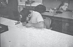
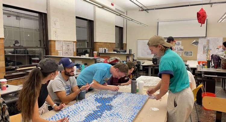
Gearing towards the end of the semester we came together once more to discuss finalization of the overall site before we moved onto our individual plots and group/partner designs. We met to discuss the unification of the site and made sure each plot related to one another. This was so that a resident living in the northern area, southern area and everywhere in between could experience our site in a positive manner and to allow residents just outside the site to experience the same qualities. Additionally, during this discussion the team re-evaluated where we wanted the recreational spaces and decided that we should incorporate them throughout the site, rather than just in the center. We also decided to talk about the water throughout the site and tried to implement it in other plots to combat the storm problems in our site. As one of our last concepts we collectively agreed to add a park over I-96 that would allow traffic to flow into our site from the surrounding neighborhoods. This was also a studio work day where we divided and conquered
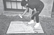
to work on the physical site model. The painting team painted the table with a white finish and painted the vegetation white as well to showcase them as existing context. There was also a team dedicated to cutting, sanding, and painting surrounded homes, due to the large amount of context. Lastly we added finishing touches to the model by making it easy to be moved from one room to another. As for the book portion we finalized color scheme and our layout team for the book looked at precedents to find a layout that would be most ideal for our work.
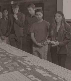
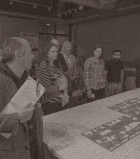
12.07.2022
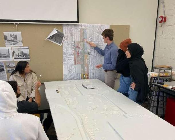
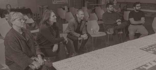
FINAL PRESENTATION DAY FINAL
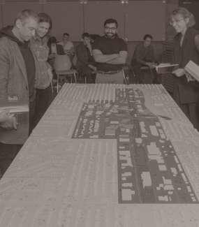
Our final presentation day consisted of seven jurors from the University of Detroit Mercy School of Architecture + Community Development and members from the Board for the Joe Louis Greenway Planning Team. Those critics included: Dan Pitera, Enrique Ledesma, Erika Lindsay, Virginia Stanard, Toni Henry, Michele Flournoy, and Idrees Mutahr. We started our presentation by going up to the podium as a class introducing ourselves then introducing the project as a whole. Aftwards we each went up to our respective maps we individually created. Once again, we went up as a group or partners and presented our plots in south to north order
and recieved critiques from the faculty and professionals alike. Our removable physical model was used to display each plot at a specific time for each group to present their work. The critics appreciated our diligence in researching the area to create the maps and understand the context. Additionally the critics gave thoughtful feedback for the class in general along with providing us with insight and comments on our plots as a separate piece from the whole puzzle. Overall our final presentation day was a great experience to present in this manner and give a farewell to our foreign teacher from Poland, Mikolaj Gomolka, who came to the University of this one semester.
Barren land accompanied by abandoned buildings has left this community with little to no hope of seeing improvements. Having been stripped of most amenities, such as, schools, parks, housing, retail stores, and a downtown district, has put a dejected feeling on the future. Residents of this place with no name have been yearning for a revitalization of their once thriving community with a strong history. The establishment of the Joe Louis Greenway is promised to resolve these issues. This recreational pathway will unify this area of Detroit to its other surrounding neighborhoods by way of equitable space. The importance with the redevelopment of this once neglected region is to be shared equally via all demographics. Paving the way for new opportunities is essential for growth and allows local residents to establish their own story.