YOUR O T GUIDE EO INTERG
PREVIEW
DISY Disy Informationssysteme, leading provider of GIS and reporting solutions in Germany, will be showing its latest range of GIS solutions at Intergeo. One of the highlights presented will be the new version of GIS 2go for offline editing, redlining and viewing. The new version of the software includes support for smartphones (iPhones, Android), tablets (iPad, Android) and a new add-in for ArcGIS Desktop to create offline maps. www.gis2go.com Stand no. F6.015
Offline maps for smartphones available with the new GIS 2go release.
that enables its customers to easily collect and analyse aerial data. The early successes of the company have come from solving a range of problems in the commercial agriculture, mining and construction industries. The DroneDeploy platform is built to be simple, safe and powerful – controlling multiple drones from anywhere, on any device. At Intergeo, DroneDeploy will be providing live demos of the fastest map processing times in the industry at its stand in the InterAerial Solutions Zone. www.dronedeploy.com Stand no. F8.075
supply and demand for drone projects. Implemented special features like mapping tools facilitate the user’s job management and flight planning. In addition, standardised forms help clients to create new UAV job descriptions easily, and drone service providers will acquire more projects with less effort. The bottom line is: DroneSquare creates added value and a win-win-situation for both sides. www.dronesquare.de Stand no. C8.085
easily, in real time and all in one device. EyesMap can be used both outdoors and indoors, using different technologies like photogrammetry, an infrared depth sensor, GPS and IMU movement sensor, while achieving survey-grade accuracy (up to mm). The result is a dense and accurate point cloud and 3D model. Distances, coordinates and areas can be calculated right in the field. It is especially convenient for unreachable spots. www.ecapture.es Stand no. F8.018
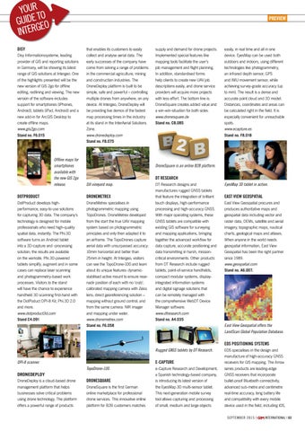
DroneSquare is an online B2B platform.
DT RESEARCH DJI vineyard map.
DOTPRODUCT
DRONEMETREX
DotProduct develops highperformance, easy-to-use solutions for capturing 3D data. The company’s technology is designed for mobile professionals who need high-quality spatial data, instantly. The Phi.3D software turns an Android tablet into a 3D-capture and -processing solution; the results are available on the worksite. Phi.3D-powered tablets simplify, augment and in some cases can replace laser scanning and photogrammetry-based work processes. Visitors to the stand will have the chance to experience handheld 3D scanning first-hand with the DotPoduct DPI-8 Kit, Phi.3D 2.0 and more. www.dotproduct3d.com Stand C4.091
DroneMetrex specialises in photogrammetric mapping using TopoDrones. DroneMetrex developed from the start the true UAV mapping system based on photogrammetric principles and only then adapted it to an airframe. The TopoDrones capture aerial data with unsurpassed accuracy: 10mm horizontal and better than 25mm in height. At Intergeo, visitors can see the TopoDrone-100 and learn about its unique features: dynamicstabilised active mount to ensure nearnadir position of each with no ‘crab’; calibrated mapping camera with Zeiss lens; direct georeferencing solution – mapping without ground control; and from the same camera: NIR imager and mapping under water. www.dronemetrex.com Stand no. F6.058
DT Research designs and manufactures rugged GNSS tablets that feature the integration of brilliant touch displays, high-performance processing and high-accuracy GNSS. With major operating systems, these GNSS tablets are compatible with existing GIS software for surveying and mapping applications, bringing together the advanced workflow for data capture, accurate positioning and data transmitting in harsh, missioncritical environments. Other products from DT Research include rugged tablets, point-of-service handhelds, compact modular systems, displayintegrated information systems and digital signage solutions that can be remotely managed with the comprehensive WebDT Device Manager software. www.dtresearch.com Stand no. A4.035
EyesMap 3D tablet in action.
EAST VIEW GEOSPATIAL East View Geospatial procures and produces authoritative maps and geospatial data including vector and raster data, DEMs, satellite and aerial imagery, topographic maps, nautical charts, geological maps and atlases. When anyone in the world needs geospatial information, East View Geospatial has been the right partner since 1989. www.geospatial.com Stand no. A6.007.
East View Geospatial offers the LandScan Global Population Database.
EOS POSITIONING SYSTEMS Rugged GNSS tablets by DT Research.
E-CAPTURE
DPI-8 scanner. TopoDrone-100.
DRONEDEPLOY DroneDeploy is a cloud-based drone management platform that helps businesses solve critical problems using drone technology. The platform offers a powerful range of products
DRONESQUARE DroneSquare is the first German online marketplace for professional drone services. This innovative online platform for B2B customers matches
e-Capture Research and Development, a Spanish technology-based company, is introducing its latest version of the EyesMap 3D multi-sensor tablet. This next-generation mobile survey tool allows capturing and processing of small, medium and large objects
EOS specialises in the design and manufacture of high-accuracy GNSS receivers for GIS mapping. The Arrow series products are leading-edge GNSS receivers that incorporate bullet-proof Bluetooth connectivity, advanced sub-metre and centimetre real-time accuracy, long battery life and compatibility with every mobile device used in the field, including iOS, SEPTEMBER 2015 |
INTERNATIONAL | 63