


Insights from our annual industry survey
Mapping the mood of the geospatial community
Contributions to resilient and impactful surveying
Strategic solutions for navigating the talent crunch
New UN organization to highlight the value of geodesy
Empowering the geospatial community www.gim-international.com
Issue 1 2024 | Volume 38
BUSINESS GUIDE 2024
Director Strategy & Business Development
Durk Haarsma
Financial director Meine van der Bijl
Technical director Huibert-Jan Lekkerkerk
Contributing Editors Dr Rohan Bennett, Frédérique Coumans
Head of Content Wim van Wegen
Copy-editor Lynn Radford, Englishproof.nl
Marketing Advisors Myrthe van der Schuit, Peter Tapken
Circulation Manager Adrian Holland Design ZeeDesign, Witmarsum, www.zeedesign.nl
GIM International, one of the worldwide leading magazines in the geospatial industry, is published five times per year by Geomares. The magazine and related website and newsletter provide topical overviews and reports on the latest news, trends and developments in geomatics all around the world. GIM International is orientated towards a professional and managerial readership, those leading decision making, and has a worldwide circulation.
Subscriptions
GIM International is available five times per year on a subscription basis. Geospatial professionals can subscribe at any time via https://www.gim-international.com/subscribe/ print. Subscriptions will be automatically renewed upon expiry, unless Geomares receives written notification of cancellation at least 60 days before expiry date.
Advertisements
Information about advertising and deadlines are available in the Media Kit. For more information please contact our marketing advisor: myrthe.van.der.schuit@geomares.nl.
Editorial Contributions
All material submitted to Geomares and relating to GIM International will be treated as unconditionally assigned for publication under copyright subject to the editor’s unrestricted right to edit and offer editorial comment. Geomares assumes no responsibility for unsolicited material or for the accuracy of information thus received. Geomares assumes, in addition, no obligation to return material if not explicitly requested. Contributions must be sent for the attention of the head of content: wim.van.wegen@geomares.nl.

Industry survey 2024
Our annual industry survey is about ‘taking the temperature’ of the geospatial industry once a year and exploring the prevailing attitudes among land surveyors around the world. Notable findings this year include renewed interest in drones, remote sensing technologies being embraced by smaller survey companies and concerns about the growth of new professionals.


Natural capital accounting
When gauging living standards, there is a strong case to be made for natural capital accounting to complement GDP. So what is natural capital, and how can geospatial professionals play a role? As illustrated by case studies, timely geospatial information is crucial.


The Earth observation industry
The Earth observation industry seems to be on a slow burn – but why? Brace yourself for a ‘rollercoaster ride’ through Earth observation as this article unravels the mysteries behind the muted growth: from startup struggles to market nuances.


An introduction to UN-GGCE
The brand-new United Nations Global Geodetic Centre of Excellence (UN-GGCE) is now operational at the United Nations campus in Bonn, Germany. Nicholas Brown, head of office of the UN-GGCE, is dedicated to realizing a world where strong political support for geodesy is the new normal.


Resilient and impactful surveying
How can surveying become more resilient as a profession and an industry? To answer this question, FIG established a task force focused on international trends and the future geospatial information ecosystem. The association is committed to ensuring that surveying remains relevant, productive, collaborative and viable.
Geomares
P.O. Box 112, 8530 AC Lemmer, The Netherlands
T: +31 (0) 514-56 18 54 F: +31 (0) 514-56 38 98 gim-international@geomares.nl www.gim-international.com
No material may be reproduced in whole or in part without written permission of Geomares.
Copyright © 2024, Geomares, The Netherlands All rights reserved. ISSN 1566-9076


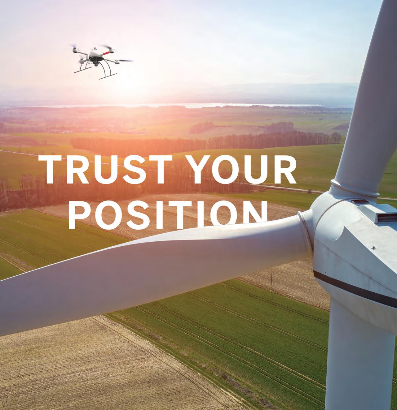
Cover story


Tackling the geospatial talent crunch
The lack of new talent has been an issue in the geospatial industry for some time, noticeable not only within companies and organizations, but also in the pipeline expected to supply future mapping and surveying professionals: educational institutions.

Monitoring climate change
In the ever-evolving landscape of climate change, geospatial science emerges as a key player in navigating the complexities of our transforming world. The European Association of Aerial Surveying Industries (EAASI) propels aerial surveying into the spotlight, shedding light on its fundamental role in climate change monitoring.

3D geospatial visualization
3D visualization is at the heart of many geospatial data applications. Progress has drastically reduced barriers to entry for new products based on large datasets, thanks to improved hardware and software. This article summarizes progress in visualizing large 3D datasets for geospatial and reality capture applications.
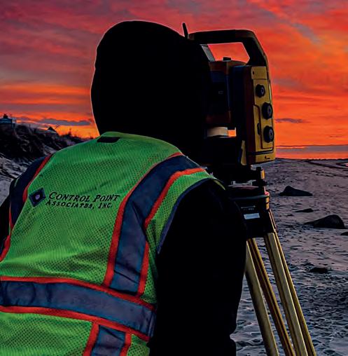
Control Point Associates is a land surveying company based on the USA’s Atlantic coast. The company takes pride in using the most advanced surveying tools and technology possible. The team of seasoned experts has been providing clients with innovative solutions for over 30 years. In order to continue to do this in the coming three decades and beyond, the company will require a steady influx of new talent. The USA is not the only country where companies are struggling to recruit sufficient young professionals to safeguard their future. The industry as a whole could benefit from strategic collaboration to redefine the surveying profession’s image and promote the attractive career prospects in the geospatial sector. Pictured here is one of the surveyors at Control Point Associates at the start of a new working day. (IMAGE COURTESY: CONTROL POINT ASSOCIATES)
3 Contents Issue 1 2024
5 Editorial 6 Gold Premium Members 19 Silver Premium Members 42 Perspectives 45 Hydrographic Industry Survey 53 Bronze Premium Members 61 Column
08 33 14 36 23 48 28 56 Strategic solutions for navigating the talent crunch Insights from our annual industry survey Mapping the mood of the geospatial community New UN organization to highlight the value of geodesy resilient and impactful surveying www.gim-international.com BUSINESS GUIDE 2024 To subscribe to GIM International go to www.gim-international.com/subscribe


Enhancing engagement, nurturing networks
As a leading media company in the geospatial industry, at GIM International we are committed to keeping our worldwide audience of readers and website visitors informed about what is going on in the sector. At the same time, we provide an excellent backdrop against which companies can promote the benefits of their solutions –total stations, laser scanners, digital aerial cameras, handheld mappers, GNSS receivers, drone-based services, software packages and more – to our audience. Therefore, we consider ourselves a pivotal part of the sector: a crucial piece in the ‘geospatial business puzzle’.
Besides this, however, I see another – equally important – role for GIMInternational: to enhance engagement and nurture networks. We facilitate knowledge exchange by enabling surveying & mapping professionals and geospatial engineers from all kinds of companies and organizations to share their stories and inspire and connect with others –both in the geospatial community and, increasingly, from adjacent fields.
In that sense, you could say that we are like an ‘anywhere, anytime’ trade event; we span the globe and are open all year round. Trade publications have a synergistic effect with trade fairs, conferences and symposiums; they are all great ways to see the sector’s latest innovations and technological advancements, and useful opportunities in which to showcase your company.
The unique advantage of an industry event is that it facilitates personal contact with customers and peers. Especially in today’s era, when so many commercial activities
occur online, meeting people in person rather than solely interacting on a screen adds an enjoyable extra dimension to the whole experience. That’s why the GIMInternational team attend so many events throughout the year: from Geo Week in Denver and the FIG Working Week in Accra, to Trimble Dimensions in Las Vegas and Geo Business in London, plus numerous smaller events and company visits. And needless to say, our team is always out in force at Intergeo, which this year is being held in Frankfurt.
So I’m sure we’ll have the chance to meet again this year. There is also a good chance that you will physically encounter GIM International, since this annual Business Guide edition will be distributed at several events in 2024. Personally, I regard the Business Guide as our ‘corporate brochure’. It has a slightly different editorial approach than the other editions we publish, giving it even longer-lasting appeal and relevance. One traditional highlight is the article analysing the findings from our annual Industry Survey, based on the input of hundreds of geospatial professionals from all around the world. We are very grateful for everyone’s contributions, and are happy to share the valuable insights through our various channels.
Hopefully you will appreciate these and other insights once again this year. And if you have any ideas or suggestions for topics that deserve our attention, or if you would like to write an article yourself, I encourage you to contact us. Send me an email or – better still –let’s meet up in person at a future trade event!
Wim van Wegen Head of content, GIM International wim.van.wegen@geomares.nl
Issue 1 2024 5 Editorial
Amuse Oneself Inc
Amuse oneself Inc., established in 2011, develops hardware and software for 3D measurements required for ICRT technology (Information, Communication and Robot Technology). Since our successful commercialization of the world’s first Lidar scanner system optimized for drones in 2013, we have continued to improve the accuracy of ICT construction and provide cloud solution services that immediately enable on-site surveying. We are engaged in a wide range of research and development related to the use of industrial drones, in recent years also focusing on establishing technology for safe drone operation and accident prevention, from both the hardware design and education aspects.

Blue Marble Geographics
Blue Marble Geographics® is a US-based software company offering geospatial technology tools with a particular focus on coordinate conversion and management, Lidar and photogrammetric point cloud processing, and user-driven product development.

Blue Marble’s products include Geographic Calculator®, the industry standard for precise spatial data conversion and advanced coordinate system management; Global Mapper®, an all-in-one GIS application with a comprehensive array of data processing and analysis tools; and Global Mapper Pro®, a suite of advanced tools for optimizing workflow efficiency and processing Lidar and photogrammetric point clouds from drone-captured images. All these desktop tools are also available as software developer toolkits and libraries.
For more than three decades, Blue Marble’s products have been used and trusted by organizations around the globe – including government agencies, universities and Fortune 500 companies.
0207
EvoLogics
EvoLogics, based in Berlin, Germany and with a US office in Yorktown, was founded in 2000 by scientists and R&D experts focusing on pioneering technologies for maritime industries. Specializing in underwater smart robotics, sensor systems, acoustic communication and positioning networks, EvoLogics integrates cutting-edge engineering with bionic principles.

NV5
Research and innovation are the cornerstones of EvoLogics, and an underwater IoT that enables intelligent cooperation between various vehicles and sensors is the main vector of its development strategy. Smart underwater networks build on EvoLogics’ S2C spread-spectrum communication technology that combines underwater acoustic data networks with integrated real-time positioning. Together with advanced sensor systems, AI-based object recognition and analytics, as well as autonomous underwater and surface vehicles for survey and support operations, they create highly capable underwater solutions for complex mission scenarios.

NV5 is a global leader providing geospatial solutions, services and software to solve mission-critical challenges. From data acquisition to analytics to enterprise GIS solutions and software development, NV5 applies geospatial science to deliver end-to-end solutions and insights to mitigate risk, plan for growth, better manage resources and advance scientific understanding. We leverage the widest array of advanced remote sensing technologies and apply today’s most sophisticated analytic AI frameworks, including proprietary deep learning, computer vision and predictive analytic models tailored to our clients’ needs. Through off-the-shelf and fully customized solutions, we empower our clients to enact meaningful change across enterprises, communities and the world.
Issue 1 2024 6
Geographics bluemarblegeo.com
info@bluemarblegeo.com EvoLogics evologics.de +49 30 4679 8620 sales@evologics.com NV5 nv5geospatialsoftware.com +1 303 786 9900 geospatialinfo@nv5.com
oneself Inc amuse-oneself.com/en/
Blue
Marble
+1 207 622 4622
Amuse
+81 6 6341
info.en@amuse-oneself.com
Planet RIEGL – Ultimate Lidar TechnologyTM
Planet was founded with the mission to image the Earth every day and make change visible, accessible and actionable. Over the past decade and together with our customers, Planet has revolutionized the Earth observation industry, democratizing access to satellite data beyond the traditional agriculture and defence sectors.

To that end, Planet provides the leading web-geo platform with the highest frequency satellite data available and foundational analytics. Businesses, governments and research institutions leverage this living dataset to scale their operations, increase efficiency and mitigate risk, and develop novel solutions to address their most pressing challenges. This allows these organizations to stay ahead in ever-changing global contexts and ultimately capture unforeseen windows of opportunity.
Reach out to see how Planet can help you anticipate what’s next.
RIEGL is a leading international provider of cutting-edge airborne, mobile, terrestrial, bathymetric and UAV-based laser scanning technology for a wide range of surveying applications.

In addition to its headquarters in Horn, Austria –where both research & development and production are located – RIEGL provides sales, support and service through the RIEGL US headquarters in Winter Garden, Florida, subsidiaries in Japan, China, Australia, Canada, the UK and South America, and its worldwide network of distribution partners. RIEGL has been producing Lidar systems commercially for over 40 years and focuses on pulsed time-of-flight laser radar technology in multiple wavelengths.
RIEGL has always been committed to delivering the highest performance, quality, reliability and longevity of all its products and services, and strict adherence to applicable international standards is a priority – all this to perfectly fulfil measurement tasks and fully satisfy the customers’ expectations.
South

Trimble Applanix

southinstrument.com
+86 20 23380888 mail@southsurvey.com
South is a committed world-class survey equipment manufacturer and geoinformation solution provider. Over the past 30 years, South has continued to expand in the field of solutions while maintaining stability and innovation in conventional instruments. The robot total station has achieved a breakthrough in measurement accuracy of 0.5” with a strong motor, advanced intelligent system and measurement software, and outstanding measurement performance. After more than ten years of Lidar exploration, South has also launched a number of airborne and ground Lidar systems, and has provided over 1,000 integrated software and hardware Lidar measurement solutions in the fields of transportation, power, forestry, land, cultural security and other industries. In the area of monitoring, South’s deformation monitoring solutions based on the BeiDou Navigation Satellite System are characterized by high-intensity encryption, safety and reliability, higher precision and stronger signals. Meanwhile, the SMOS system, independently developed by South, is widely used in the structural health monitoring of reservoirs, dams, bridges, slopes, geological disasters and other scenarios.
We live in a complex and dynamic world. As your business evolves, you need a partner who can adapt with you and help orient your business for success.
Our systems, software and solutions are designed for pinpoint accuracy, efficiency and ease of use, supporting applications for mobile mapping, surveying and autonomous vehicles. Like our solutions, we work for you in all environments, applying our deep expertise and passion to customize practical solutions that meet your complex needs, whether on the ground, in the air or on water.
In a dynamic world, trust your position with Applanix.
Issue 1 2024 7 Gold Premium Members
Trimble Applanix
Applanix.com +1 289 695 6000
RIEGL riegl.com +43 2982 4211 office@riegl.com Planet planet.com gis-inquiry@planet.com
Insights from our annual industry survey
Mapping the mood of the geospatial community
By Wim van Wegen, head of content, GIM International
The GIM International annual industry survey is about ‘taking the temperature’ of the geospatial industry once a year and exploring the prevailing attitudes among land surveyors around the world. Notable findings this year include renewed interest in drones, remote sensing technologies being embraced by smaller survey companies, concerns about the growth of new geoprofessionals, and uncertainty about the economic and geopolitical situation. Needless to say, we gauged our readers’ opinions on AI: what do they expect from artificial intelligence, and how can it evolve from a buzzword into practical applications? Read on for your peers’ insights into these and many other topics!
supply chains are currently threatened by a host of factors, including inflation, geopolitical tensions and conflicts, rising
contributing to a shortage of skilled surveying engineers. This emphasizes the importance of exciting scholars and students about our field. (Image courtesy: Technische Hochschule Georg Agricola)
Issue 1 2024 8
These times of technological innovations, social developments, ecological crises and economic uncertainties create challenging circumstances for companies across various sectors and regions. Additionally, the geopolitical situation is far from stable; in 2024,
Portable mapping systems are identified as a key focus of anticipated investments in new survey equipment. (Image courtesy: Exyn Technologies)
hindered by the low student enrollment in engineering.”
Keeping up with technology
Top technological priorities for investment according to this year’s industry survey. These are a valuable indicator of perceived growth and development opportunities.
forms the context for the activities within the mapping and surveying sector. More importantly, members of the geospatial industry are aware of their critical role in helping society to face all these issues together.
Reasons for concern
So how are all the abovementioned factors shaping the dynamics in our specific sector? Let’s just say, the mood has been better. The individual elements impact on different geospatial professionals in different ways, but they are definitely leaving a mark on daily business operations and defining the atmosphere in the industry.
Skilled personnel
Finding skilled personnel remains a significant challenge in today’s geospatial industry. This challenge has persisted for several years, leading to a shortage of skilled surveying engineers and a general lack of basic knowledge among professionals. Consequently, organizations have smaller teams, making it difficult to deliver relevant knowledge and skills, or to build internal processes and attract new leads through marketing efforts. Our survey shows that more and more companies appear to be getting caught up in this vicious circle.
Now that the long-awaited democratization of geospatial technology is increasingly taking shape, the struggle to recruit competent new employees to strengthen one’s company or organization is becoming even more apparent – especially in certain parts of the world. One survey participant summarizes it as follows: “Too many non- qualifi ed people are getting their hands on GPS, drones and scanners for survey location and topography without knowledge of survey practices. The surveyors know and use cross-checking, ground-truthing and verifi cation-redundant measurements to certify accuracy. Other nontrained surveyors are capturing data that looks like survey data and is being used without any professional checks. This is going to produce a lot of junk information that will be used.” Another response sums up the situation of many: “Our growth ambitions are being
The pace of innovation in the fi eld of geospatial data collection in recent years has been impressively fast-paced. Consider for example the dramatic evolution in reality capture, which once used to be based on a handful of points and dimensions. Now, the domain of possibility extends to generating highly precise 3D point clouds, revolutionizing our perception of spatial data capture. It is sometimes overwhelming to see how realistic the data is that comes from the latest 3D laser scanners and mobile mapping equipment. Yet advanced technology is not necessarily a blessing for everyone. This year’s survey shows that keeping up with technological changes can be quite a challenge, especially for smaller companies that provide surveying services. As one respondent describes it: “[…] that is perhaps because of the speed surveying technology develops. If you want to be up to date on the latest features, this is a costly aff air. Also training to invest in personnel to stay up to date.” Another participant comments: “The changing technology has impacted the usual approach to work. Over the years, this has been met by recruiting new graduates and briefl y training staff members to adapt and be able to be present with the changing technology trend.”
Geopolitics
When it comes to the geopolitical landscape, the number of comments that were submitted by survey participants speaks for itself. Running a business in 2024 is
Issue 1 2024 9 Feature
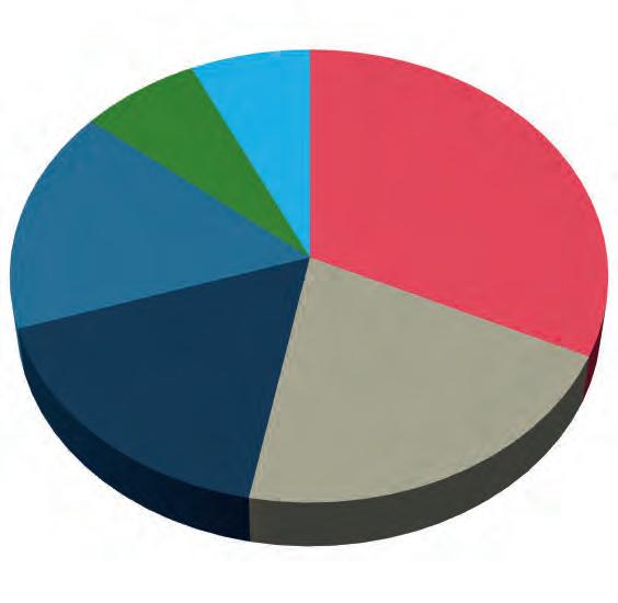
USVs (unmanned surface vehicles) 11% 17% 22% 49% GNSS receivers 10% 30% 40% 18% Inertial navigation systems 10% 21% 20% 48% 0%10%20%30%40%50%60% Total stations Terrestrial laser scanners Digital aerial cameras Airborne laser scanners Mobile mapping systems Portable mapping systems UAVs for mapping and 3D modelling USVs (unmanned surface vehicles) GNSS receivers Inertial navigation systems N/A More Same Less
Construction and infrastructure boom
There is an unprecedented boom in infrastructure and construction projects. This is creating a strong demand for accurate and reliable geoinformation. Moreover, the construction and infrastructure sectors are undergoing a digital revolution. Traditional tools and processes are being replaced by digital workflows. Technological innovations improve the way projects are executed. Here, too, the land surveyor plays a major role.
The anticipated growth opportunities are clearly refl ected in the responses from our survey participants. One respondent emphasizes the increasing workload driven by infrastructure projects and technological advancements. This is echoed by another respondent, who points to the growing adoption of digital twins for inspection purposes as a catalyst for market expansion.
Research & development
Staff (increase from current level)
Surveying equipment & software
Marketing
Sustainability
impacted by the ongoing war in Ukraine and various other conflicts across the world, the fear of a global recession, and geopolitical instability. Additionally, some businesses, particularly in the Lidar and electronics sectors, are struggling with supply chain disruptions due to global political tensions. Moreover, entrepreneurs worry about the potential escalation of economic challenges, including inflation.
Reasons for optimism
Despite these concerns, the majority of survey respondents mainly see opportunities and are positive about the business outlook. There are a number of underlying factors for this, including the fact that challenges or threats – such as the need for a sustainable transition –can sometimes also bring opportunities.
Another survey participant highlights their company’s current boom, attributing it to the thriving construction industry and increased resource exploration activities. This trend is not unique to a specific region, as noted by a geospatial engineering professional from Saudi Arabia, who underscores the significant growth in projects across the country. This surge in projects has resulted in “a substantial demand for skilled personnel and modern survey equipment to support the expanding project portfolio.” Similarly, in August 2023, Singapore’s The Strait Times wrote: “By 2025, the government of India aims to add 38,650km of highways to the current 161,350km, build 400 semi-highspeed trains and 220 new airports, and double port capacity to 3,000 million tonnes per annum.” This will create huge demands for geospatial expertise.
Sustainability as an opportunity
Mapping and surveying technologies undoubtedly play a crucial role in supporting successful and sustainable operations by facilitating infrastructure planning and development. After all, it is impossible to develop large offshore or land-based wind farms or construct and maintain mega solar parks without geospatial data. This is illustrated by one respondent who mentions the strategic utilization of geomatics to bolster planning efficiency and productivity amidst climate change challenges. And the boom is not
Issue 1 2024 10
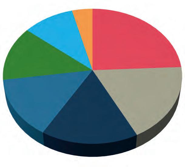
The anticipated level of investment per area for the year 2024.
Top investment priority 32% 21% 17% 16% 7% 7% Training & competency development
There is a strong demand for accurate and reliable geospatial data due to the unprecedented boom in infrastructure and construction projects. (Image courtesy: Fugro)
The combination with Lidar is one of the main reasons why drones can count on renewed interest, and this is reflected in respondents’ plans to purchase new equipment. (Image courtesy: MSDI/Arnaud Denisot)

Additionally, trends such as the energy transition and ongoing digital transformation require so-called rare earth metals for use in wind turbines, electric cars, electronic devices and much more. This too is creating opportunities for industry players, as highlighted by comments such as: “The need for rare earth materials is driving the increase in demand for multispectral data, resulting in more work for our company,” and “For our company, satellite imagery and analysis presents a large growth area. The geospatial industry has risen to the challenging issues ravaging the world, and imaging and analysis has come a long way to assist in this regard.”
In the survey, environmental and climaterelated surveys based on remote sensing are also cited multiple times as a signifi cant market. One respondent shares the following view on climate change: “The planet is in a crisis and each country has its own challenges to address. Surveying is in the critical path of all big projects that either negatively or positively impact climate. Climate fi nance is readily available.”
Tools to get the job done
The impressive technological evolution that has been underway in the geospatial industry since the turn of the century has resulted in today’s wide choice of tools – hardware and software solutions, often presented as an entire workflow – to help surveyors get the
More than 10% growth
+2-5% growth
Not applicable
+5-10% growth
No growth and no decline
+0-2% growth
A decline in growth
job done. All these advanced survey instruments and methods are opening up a multitude of new opportunities: “The advancement of new and efficient tools based on remote sensing is leading to the acquisition of new survey projects for us,” states one participant. Other responses echo this: “Due to new survey instruments, we can accept more projects,” and “The market is growing and we have access to new technologies to anticipate on this.”
Remote sensing
Due to recent technological developments, remote sensing methods have come within reach for a broader group of users, and this year’s GIM International geospatial industry survey reveals a breakthrough regarding the number of smaller surveying companies that seem to be seizing them with both hands. As one of them points out: “Because we now have technology that’s able to easily survey through and around, people are going to capitalize on it.” Another geospatial expert notes: “The integration of scanning and 3D modelling is instrumental in driving the expansion of our company. With the rapid advancements in technology, our capacity to capture and process vast amounts of data will streamline the creation, manipulation and analysis of 3D models, setting a new standard in our industry.”
In recent years, hardware manufacturers have launched a whole category of remote sensing equipment at an affordable price. These solutions often provide decent quality and therefore
Issue 1 2024 11
Growth
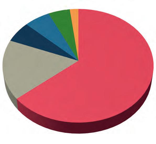
Growth rate Percentage More than 10% growth 24 +2-5% growth 18 Not applicable 16 +5-10% growth 14 No growth and no decline 13 +0-2% growth 10 A decline in growth 4 24.1% 18.6% 16.2% 14.2% 13.4% 9.9% 3.6%
rate as expected by companies in the geospatial field between 2024 and 2029.
make them suitable for various applications, as one participant points out: “Handheld laser scanners provide rapid and precise 3D scanning capabilities for capturing detailed as-built information.” Handheld laser scanning is indeed one example of the new survey methods that have entered the market, offering flexibility for small survey companies. Utilizing Lidar technology in a portable device, it is an ideal approach for projects prioritizing speed over precision.
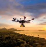
Drones
The hype around uncrewed aerial vehicles (UAVs or ‘drones’) was at fever pitch around a decade ago. Since then, the drone has progressed beyond the hype and become part of the standard equipment in a surveyor’s toolkit. Yet the high number of drone-related responses in this year’s survey indicate renewed interest in this airborne device. For example, one participant comments: “We are experiencing a strong increase in new contracts as a result of our expanded use of drone surveying.”
So why the resurgence? Certainly, the improved efficiency and precision of drones in combination with today’s payloads mean that sites can be measured swiftly and precisely, even in the case of extensive infrastructure or challenging, inaccessible or hazardous terrain. This can largely be attributed to the growing availability of eversmaller and affordable yet highly accurate sensors for a larger user group.
Each application area in which a drone is used for mapping and surveying purposes has its own specific needs and requirements. Nowadays, these can be met more and more effectively. When outlining the advantages of incorporating UAVs into their operations, one respondent cites the ability of drones to accelerate mapping procedures and efficiently collect large volumes of data. Meanwhile, another survey company owner reveals plans to invest in UAV technology, particularly to leverage Lidar sensors and high-resolution cameras
Valuable insights
As is customary each year, this edition of the GIM International industry survey once again delivered us a wealth of information, serving as a treasure trove of valuable insights for all stakeholders within the geospatial sector. This article provides a mere peek at the revealing results. Other noteworthy fi ndings include the burgeoning interest in remote sensing solutions and other areas that are perceived as off ering the most growth potential. The survey also explored the impact of the expanding array of accessible surveying solutions. For example, how do respondents expect budget-friendly universal RTK GNSS receivers and handheld laser scanners, combined with advanced software, to change the face of the surveying profession? And how will these developments aff ect the prioritization of investments within industry organizations over the next three years? At GIM International, we will provide you with further insights derived from our industry survey throughout the year.
Issue 1 2024 12
Many geospatial experts acknowledge AI as a novel tool enabling the faster processing of survey data. (Image courtesy: Nearmap)
Experience level Percentage Senior or executive-level 64 Mid-level 17 Intermediate 6 Retired 6 Student 5 Entry-level 2 64.4% 17.4% 5.9% 5.9% 4.7% 1.6% Senior or executive-level Mid-level Intermediate Retired Student Entry-level
Breakdown of participants in this year’s edition of the GIM International annual industry survey according to professional experience.
for data capture. This emphasizes the critical role these tools – in combination with the essential data-processing software – play in fulfilling clients’ geospatial data requirements.
One key development in recent years has been the rise in the number of Lidarequipped drones entering the market. Such systems empower surveyors to capture highly precise 3D data, rendering them invaluable for a multitude of client projects. Indeed, this is underlined by this year’s survey, with a large number of companies and organizations expressing strong interest in investing in the combination of UAV and Lidar technology.
High-end vs low-end solutions
Optimal survey hardware and software solutions can significantly reduce project costs by facilitating efficient project management. The specific survey requirements should dictate whether a high-end or low-end solution is needed. For example, there is increasing demand for cost-effective and scalable mapping solutions tailored to fit-forpurpose land administration. Similarly, while Lidar solution manufacturers have made significant strides in promoting accuracy as a key feature, achieving millimetre-level precision is not always needed. In many cases, such a level of precision may be excessive for the intended scope of projects.
However, the rise in the availability and affordability of lower-end mapping techniques such as drones – putting them within reach of many non-surveyors – is sparking some discussion, as evidenced by the findings of our industry survey. One respondent urges: “Surveyors and other geospatial professionals should up their game to produce the added value vs some ‘dude’ with a €2k laser scanner.” Another participant comments: “It is true that the growing number of accessible surveying solutions have impact on the surveying profession, but unfortunately to some extent negatively with respect to recruitment of equipment operators with no specific survey training, thus killing the industry.”
Artificial intelligence
Whereas UAVs were on everyone’s lips in the previous decade, it is evident that artificial intelligence (AI) has now emerged as the latest buzzword – and not just
in the geospatial industry, of course. So what do members of our community expect from AI in the geospatial sector? “Reducing time and the amount of staff required to do tasks with AI will be a game changer for the industry,” comments one participant, which is representative of many of the responses. Another positive respondent states: “AI can enhance the analysis of geospatial data by automating processes such as image recognition, object detection and pattern identification. This c an lead to more accurate and timely insights from satellite imagery, aerial surveys, points clouds and other geospatial data sources, and thus will be a very helpful tool.”
The majority of the geospatial community seem to welcome AI, and some are even deploying it already. However, others are somewhat sceptical and believe that common sense should be applied when considering these developments. “Expectations are high but unrealistic in a practical sense,” believes one participant. Another respondent compares AI to previous hypes: “MOOCs (massive open online courses, Ed.) were gonna kill universities. They didn’t. EDM (Electronic Distance Measurement, Ed.) was gonna kill surveying. It didn’t. GPS would revolutionize surveying. We’re still here.”
Whether our readers are enthusiastic or more hesitant about welcoming AI, there seems to be little concern that geospatial professionals will become redundant. “AI is another tool to help out with some things. But we’ll still need experts to manipulate the tools and take responsibility for decisions,” believes one respondent. “We can’t replace a land surveying professional with AI. The latest surveying instruments must be operated with a human being,” says another. That sentiment is echoed succinctly by a similarly optimistic proclamation: “I still have faith in human intelligence.”
Conclusion
The power of geospatial technology gives governmental bodies and private enterprises alike the opportunity to orchestrate comprehensive infrastructure planning for mass transit, public spaces and ecofriendly development initiatives. This makes it possible to foster the growth of intelligent, resilient communities, ultimately enhancing the overall quality of life while promoting economic prosperity. As illustrated by some of the responses in this year’s GIM International geospatial industry survey, shifts such as the boom in infrastructure and construction, the sustainability trend, the energy transition and the ongoing digital transformation are creating a lot of new and interesting projects for land surveyors and other specialists in our field. In terms of the adoption of new technology, the focus is often on remote sensing technology, with extra emphasis on UAV-Lidar solutions and portable mapping systems.
However, the survey also reveals various concerns about the impact of geopolitical and economic issues on the world in which the industry operates. Moreover, various respondents question how our profession – which is already under pressure – will be able to deal with the growing workload in view of the current shorta ge of competent staff and the lack of young talent entering the industry. To rise to this challenge, the industry itself will need to take the lead in a strategic and collaborative approach, and remain openminded to how technological advancements such as AI and automation can help.
About the author

Wim van Wegen is head of content at GIM International and Hydro International. In his role, he is responsible for the print and online publications of one of the world’s leading geomatics and hydrography trade media brands. He is also a contributor of columns and feature articles, and often interviews renowned experts in the geospatial industry.
Issue 1 2024 13 Feature
From startup struggles to market nuances
Why hasn’t the Earth observation industry taken off?
By Adam Keith
The Earth observation industry seems to be on a slow burn – but why? Brace yourself for a ‘rollercoaster ride’ through Earth observation as this article unravels the mysteries behind the muted growth: from startup struggles to market nuances.
I first considered the question of why the Earth observation (EO) industry hasn’t taken off around five years ago. Back then, the EO sector was starting to receive a lot of attention; governments and the private sector were investing more and more, and new operators and service providers were emerging with new types of sensors and ideas for innovative applications. However, commercial growth (for EO data and services) remained slow. Whilst investment and the supply side looked positive, traction for actual uptake of solutions was sluggish. Fast forward to today, and we could still ask the same question.
On the face of it, not too much has changed. The short and simple answer to the question is that the data supply still isn’t there to meet various industry requirements and thus expand the market. The longer answer is somewhat more complex.
The current situation
At first glance, the commercial EO industry certainly still hasn’t taken off. The same two companies are responsible for over 50% of data/ imagery sales, and the value-added services industry has slow growth and remains fragmented. Established companies such as Airbus and Maxar have pointed out that growth from EO has been challenging. Maxar was not helped by the failure of WorldView-4 and delays to Legion. For someone who has spent nearly 25 years in EO, and most of that in the commercial aspects of the business, that could sound a little depressing.
Much is made of new companies emerging, with new constellations of satellites with various sensors, but the simple truth is that the majority of these companies are not up to full satellite capacity. Without a full complement of satellites, they cannot deliver on the goals they set out to achieve, which are aligned to the requirements of various end-user customers. Downstream, new EO services companies building analytics and delivering information also need this data supply to feed their algorithms to build solutions. Therefore, they cannot achieve all they set out to do either.
This means we’re still ‘as we were’. There are excellent commercial data sources out there from the aforementioned Maxar and Airbus, plus e-GEOS, MDA and so on, but they are not focused on building low-cost, high-revisit and/or coverage constellations which much of the anticipated market expansion will look to utilize. Indeed, most of the market for commercial EO procurement still remains for defence purposes (particularly US defence). It is only relatively
recently that companies such as Planet and Iceye have started coming up to full capacity.
The challenges to face
For companies to achieve their goals, more financing is needed in many cases. At the same time, we’re being told that the financial environment for raising funds is more challenging. But without more funding, companies cannot get to where they need to be. And without the data these companies collect, new service areas cannot emerge and revenue generation remains stunted. Add to this a more crowded field of even more companies – both operators and services companies – emerging and competing for funds, and the likely outcome is only in one direction: a consolidation of the sector, either through acquisition or simply due to companies running out of funds.
How to develop the EO market
What was true five years ago, and still remains the case, is that Earth observation demand by vertical markets should be considered in two different, but connected camps: new ways of meeting the requirements of existing vertical markets (i.e. the experienced or ‘established’ end user), and the potential to open up into new areas. There is a key difference requiring the need for some separation here: the end users with longer-term usage of EO solutions have a better understanding of its capabilities; on the other hand, the ‘new’ markets have not been exposed to EO and thus do not really understand (or care) about its capabilities. Whatever the differences, end-user requirements would still centre around receiving cost-effective information based on high-frequency change detection, irrespective of the application. Delivering this in a regular fashion to multiple end users and, in doing so, opening up EO to a mass market would shift it from a business-to-government (B2G) to a business-to-business (B2B) solution. This shift has been slow to occur, however, and this is unlikely to change significantly in the short to medium term.
From B2G to B2B
The difficulties in developing B2B is reflected in the business plans of new EO companies. ‘Established’ customers in existing vertical markets (in defence, mining, oil & gas and, to a degree, civil government, agriculture, etc.) understand data/imagery and the EO industry better, so selling into these industries is seen as lower-hanging fruit. Customers in oil & gas and agriculture have worked with EO data since the onset of Landsat, and SAR/AIS has
Issue 1 2024 14
been used to track ships for decades. Potential new ‘big ticket’ markets for EO, such as in finance, carbon trading, environmental social governance (ESG) and the like, may appear attractive, but it is hard to demonstrate the path to revenue generation. To some degree, this has been one of the issues hindering expansion of the commercial base for EO; in order to generate revenue as soon as possible, existing markets are the first targets for sales. If new EO companies can get off the ground, then they can look to new areas to exploit. These new end-user markets care less about EO imagery and more about information. But this also means that if the information cannot be delivered when it is needed, then it will not take off as an application. These end users do not understand (and will be turned off by being told): “You can’t have your information today because the satellite didn’t pass”.
The myth of oversupply
Building these markets is a challenge without the desired satellite infrastructure being in place. The simple fact of the matter is few companies are there yet. Not many EO companies have significant revenue generation and/or are up to full capacity. I often read of EO ‘oversupply’, but that is simply not true. There may be a lot of new companies, but most do not have many satellites. The ‘oversupply’ claim comes from looking to a future (unlikely) scenario whereby all companies will be up to full capacity. Perhaps a case could be made for 1m multispectral data being available from multiple sources. But lower-cost SAR is only just getting there, hyperspectral and emissions monitoring companies are just starting, one or two thermal infrared satellites have gone up, a couple more companies are getting into 10cm data, there is still no high (~5m) short-wave or Lidar… so where exactly is the oversupply?
This creates a kind of ‘chicken and egg’ conundrum. The market is there to be exploited, new (and existing) EO companies know their potential future customer needs well, now they just need to get there. And to do that, more investment is going to be needed, and some companies will fail. I can think of over 20 companies in EO alone that will go for try to secure more funding this year. It simply won’t work out for all of them.
The market potential
Various market figures illustrate EO potential. Euroconsult states that the total market for EO data and services in 2022 is US$4.64 billion (and a five-year compound annual growth rate [CAGR] of 5%). Of this, the market for EO commercial data only was US$1.78 billion. It is driven by submetric resolution usage. In total, all optical data finer than 1m ground resolution accounted for US$1.2 billion in 2022, or nearly 65% of total revenue. This also indicates the importance of the defence sector to the EO industry. However, despite the emergence of new companies over the last five years, only a small number of EO operators generate over US$100 million in revenue.
The remaining US$2.86 billion is related to the delivery of valueadded solutions (including products, services and analytics/ information.) More moderate-resolution datasets tend to be utilized more to build solutions rather than represent significant revenues as imagery alone, particularly for applications in which greater coverage and spectral capacity are key requirements (such as in natural resources monitoring, agriculture and environmental applications.)

Few EO customers spend more than US$1 million per year on valueadded services (VAS). Although EO is applicable across numerous verticals, the number of customers procuring significant amounts of data and services remains low. Most of these users are governments. Services emerging based on low-cost supply have a more limited average revenue per user but greater mass-market appeal, with price points measured in thousands as opposed to millions. (Image courtesy: Euroconsult)

EO commercial sales by data type. (Image courtesy: Euroconsult, Earth Observation, Data & Service Market, 16th edition,
The total addressable market (TAM) for EO is challenging to establish for ‘the whole of EO’ across all verticals. It is also hard to do at a company level, but at least there are some numbers out there. The three EO companies which went public through a special purpose acquisition company (SPAC) released company-specific TAMs in investor reports prior to the public offering. These numbers stated TAMs at between US$40 billion and US$140 billion. Obviously, the TAMs will differ depending on which markets each company wants to serve, but just taking these as is, it means a market penetration today of only 3%-10%. In other words, there is still plenty of margin for growth.
The light at the end of the tunnel
That’s where the investment community comes in. We’re being told that it is a challenging investor environment for EO, and indeed the space industry in general. According to analysis from early-stage investor Space Capital, space industry investment plummeted from a US$47 billion peak in 2021 to US$20 billion in 2022. The stock performance of SPAC’d companies since their public offering hasn’t helped matters. However,
Issue 1 2024 15 Perspectives
Mobile mapping, surveying and autonomous vehicle solutions with pinpoint accuracy.
LEARN MORE info@applanix.com

From initial funding of optical multispectral solutions, investment has since diversified into various sensor technologies and value-added services (VAS) companies. (Image courtesy: Euroconsult, Earth Observation, Data & Service Market, 16th edition, 2023)
investors need to invest to make money, so they invest in perceived ‘safer’ industries and technology. The investments are still there to be made in EO, but the technology needs to look like a safer bet. This perhaps means greater scrutiny of business cases compared with a few years back. Nevertheless, on a positive note, several companies (Blacksky, Capella, Pixxel, Wyvern Satellite Vu, Kuva Space, etc.) all managed significant raises in the last year. Indeed, the EO sector has raised US$5.5 billion over the last decade, and most of that was raised in the last five years, albeit with a recent slowdown.
At Euroconsult, we have taken part in many EO due diligence processes over the years. This has been mostly for private equity, banks and debt deals, but we are starting to more interest from venture capital too. I now also work with startups leading into the due diligence process. As a broad generalization, most investors I’ve encountered tend to believe the company can build the technology that they are setting out to do, but they are less convinced about the path from this technology to revenue generation. This includes what the company is selling (just imagery, imagery plus analytics, just analytics…) and how these products are developed.
There still seems to be a gap in language between the EO community and investors. To become a safer bet, work is required on explaining how data from the satellites can be converted into products that customers want. One way to get around this is for the EO company to focus on what it knows, or the new bit of technology it is developing, whether a new type of sensor, a new way of processing data, etc. This also streamlines capital expenditure (CapEx), reducing risk. Why build a new analytics platform or your own satellite bus if it’s not your core business or part of a wider business strategy? There are plenty of solutions already out there. This is also giving rise to new space/ satellite-as-a-service companies, such as Loft Orbital or Muon, which offer quicker ways to space. And for EO companies, that can mean quicker ways to generate revenues.
I also suspect new EO operator companies will eventually fall into one of two camps: general data suppliers of whatever types of data they are collecting, or vertically integrated companies focused on data delivery and service generation in a couple of markets. Trying to target numerous markets for data and services from your dataset may have seemed like a good way of generating big addressable markets to look attractive to venture capitalists in the past, but the
reality is that this is hard to achieve and perhaps even unfeasible. There will be some compromise in the data – the data needed for mapping could be used for agriculture, but it is unlikely to be the ideal imagery – and it also means the need to hire specialists and sales teams in each of the vertical markets you are aiming to address, all of which increases the costs. It is more likely that the EO operator may acquire specialist service providers in the future if it wants to double-down on a specific vertical. We have already seen a little of this activity, e.g. a couple of Planet acquisitions in the agriculture space in the last couple of years.
Looking ahead
A paradigm shift is unlikely to occur over the coming year. In fact, on a negative note, I think some EO operators and even some analytics companies will restructure/consolidate or simply cease operations. However, others will continue to emerge, resulting in more and varied satellites and sensors.
Realistically, the industry probably still needs a couple more years of development and investment before it starts to reach its full potential. During 2024, low-cost SAR operators will start to reach full capacity. Companies such as Iceye are already making strides in the market, and Umbra’s open-data policy and transparent pricing is encouraging. Wyvern, Pixxel and OSK will continue to roll out hyperspectral satellites, and we may see 5m ground resolution SWIR, but none of these operators will become close to full capacity within the year. Meanwhile, Satellite Vu will launch further units for thermal imaging, and we may even see the launch of NUVIEW’s first commercial Lidar satellite. This in itself would all be great to see. It will allow companies to test what can be done with the different datasets, but it won’t lead to an immediate shift in market expansion. These companies need to come to full fruition.
If we consider EO’s current position in the growth cycle, apart from a couple of exceptions – such as optical datasets in support of defence, or SAR in maritime domain awareness – I think it is fair to say that the sector is still in the take-up phase. A little perspective is needed. In the satellite communications business, for example, the operators were government entities for years prior to being fully commercialized. But now, no one thinks of communication/ TV/broadband as being ‘government-orientated’. Perhaps what is needed for the EO sector to further develop is a little less hype, and a little more patience.
About the author

Adam Keith has worked in the Earth observation sector for 25 years, with experience spanning government, academia and industry. He initiated Euroconsult’s dedicated activity in the Earth observation sector, and remains an affiliate to the company. He is also an advisor to hyperspectral operator, Wyvern Inc., and provides independent services to space companies and investors globally.
Issue 1 2024 17 Perspectives

Push the boundaries of 3D laser scanning.
You make the impossible possible—going where others don’t want to go and achieving what others can’t. You lead the way in capturing and documenting the world around us with unparalleled accuracy and detail.
Push the boundaries of 3D laser scanning with powerful in-field automated registration, on-the-fly measurements, and annotations. Trimble® 3D laser scanning systems enable you to visualise and verify your projects before leaving the site, so you can capture complex real-world data with the confidence of getting it right the first time.
Find out more at:
geospatial.trimble.com/3D-laser-scanning-solutions
© 2024, Trimble Inc. All rights reserved. GEO-229-en-UK (01/24)
CHC Navigation
CHC Navigation (CHCNAV) creates innovative mapping, navigation and positioning systems and solutions. With a global presence and distributors in over 130 countries and more than 1,700 employees, CHCNAV is today recognized as one of the fastest growing and leading companies in geomatic technologies. From drone Lidar survey to machine control: leveraging its proprietary GNSS, INS, Lidar and drone technology platforms, CHCNAV offers a wide range of geospatial solutions for land surveying, construction, machine control, GIS, hydrographic surveys, deformation monitoring, precision agriculture and 3D mobile mapping for mass data acquisition. With solutions for companies of all sizes, CHCNAV’s mapping, positioning and navigation solutions are affordable, easy to use and designed to dramatically improve productivity and provide an exceptional return on investment for its customers and business partners.

Emesent
Building on a decade of pioneering research at the Commonwealth Scientific and Industrial Research Organisation (CSIRO), Emesent offers state-of-the-art autonomous SLAM-based Lidar mapping and data analytics solutions specifically designed for challenging and GPSdenied environments. Providing fast, accurate and longrange scanning, Emesent Hovermap helps businesses map the unknown, minimizing operational downtime while improving worker safety.

CHC
+86 21 5426 0273
+61 7 3548 9494
Gexcel
GEXCEL is a dynamic and independent company with over 15 years of experience as a trusted player in the geospatial and 3D mapping markets. We develop and provide hardware and software solutions aimed at revolutionizing 3D surveying and Lidar data processing. Our primary focus is to enhance the efficiency and effectiveness of geospatial technologies, continuously striving to deliver unparalleled solutions to our clients. Our flagship product, the HERON portable 3D mapping system, exemplifies our commitment to innovation. With its advanced capabilities, HERON empowers users to effortlessly capture detailed 3D data, streamlining workflows and achieving superior results. We offer support and training directly from our offices in Italy and Vietnam or through our international network of distributors. We collaborate with leading international partners and actively participate in numerous R&D projects, driving innovation and contributing to progress in the geospatial domain.

Gintec
Founded in 2013, Guangzhou Geosurv Information Technology Co Ltd (Gintec) is a high-tech company that specializes in R&D and highaccuracy geographic and geotechnical instruments and software. Its products are widely applied in the surveying, mapping and deformation monitoring industries. The company also offers professional technical services.

Adhering to the concept of ‘Based on Integrity, Success in Quality’, Gintec is devoted to supplying high-quality, stable and reliable products for customers. Thanks to years of focused effort and integrity management, Gintec now operates in over 60 countries around the world and has built a good reputation and won the trust of its clients and partners.
The Gintec team will continue to innovate. By further improving its products and services, the company continuously enhances the user experience to make surveying and deformation monitoring more efficient and convenient.
Issue 1 2024 19 Silver Premium Members
Navigation chcnav.com
gexcel.it
030 6595 001 sales@gexcel.it
emesent.com
marketing@chcnav.com GEXCEL
+39
Emesent
marketing@emesent.io
gintec.cn/
208 251 4956 overseas@gintec.cn
Gintec
+86

Lidaretto Phase One
Lidaretto is a flexible and compact Lidar scanning system developed since 2015 and uniquely designed to be used in a way that best fits the user’s specific application. Lidaretto can be easily mounted and swapped between multiple platforms, such as a UAV, car, backpack, bike, train or USV. The highest quality point cloud is ensured by using best available technologies from Lidar and GNSS/IMU manufacturers and Lidaretto’s own state-of-the-art processing algorithms. Lidaretto allows its users to carry out a wide range of operations faster, more comfortably and safer than ever before.
Lidaretto’s flexibility means it can be used in many applications in industries where accurate and reliable 3D data needs to be captured. It can be used by surveying or construction companies, foresters, archaeologists or mining crews and for GIS mapping or BIM modelling.
Lidaretto can significantly increase the productivity, and therefore the competitiveness, of its owner.
Lidaretto
+421 903 443 981 info@lidaretto.com
Pythagoras
Pythagoras BV has been developing software solutions for the geospatial industry for more than 30 years. Our Pythagoras CAD software is specifically designed for land surveyors. It comes with intuitive tools so you can get started without undergoing lengthy training. Moreover, our friendly support team, adored by thousands of users worldwide, is always ready to help. Pythagoras CAD integrates with all industry file formats, brands and devices, whether you are using traditional survey equipment or cutting-edge scanners.

Phase One is a global leader in digital imaging technology, providing unrivalled imaging quality for a wide range of applications from professional photography to heritage digitization, industrial inspections, aerial mapping, security and space.

For more than 30 years, Phase One has developed core imaging technologies and digital cameras and imaging modules, setting new standards for image quality in terms of resolution, dynamic range, colour fidelity and geometric accuracy.
Based in Copenhagen, Denmark and with regional offices strategically located in Denver, Cologne, Tel Aviv, Saku, Tokyo, Beijing, Shanghai and Hong Kong, Phase One nurtures longterm relationships with customers, technology partners and its global network of distributors, often playing the role of digital imaging partner to customers with unique requirements. It is with this passion for service that Phase One exceeds expectations and drives the imaging industry forward.
We deliver Imaging Beyond Imagination.
Phase One
+45 36 46 01 11 info@phaseone.com
SBG Systems
SBG Systems, a leading provider of navigation technology, presents its latest inertial navigation system: Quanta Plus.
Quanta Plus: optimized SWaP and stellar performance in harsh environments

If you are passionate about scanners and point clouds, meet Pointorama! Pointorama is your go-to platform to visualize, share and edit your point clouds easily. With the help of AI, your point clouds will be cleaned, filtered, downsized and classified in minutes, without the need for bulky storage or heavy processors. You can access it on any device, as long as you have a browser.
Contact us or visit us at Intergeo or GEO Business to learn more!
Pythagoras BV
+32 14 61 32 70
Quanta Plus delivers accurate and reliable navigation data even in the most demanding environments. It combines a high-performance miniature tactical IMU with a GNSS receiver that is resilient to harsh covering conditions, providing RTK fixes even in challenging situations (0.015° roll/pitch, 0.04° heading, 1cm positioning in RTK).
New Qinertia 4: post-processing made easy for all surveyors’ projects
SBG Systems’ post-processing software Qinertia gives access to offline RTK corrections from over 10,000 base stations in 164 countries. Trajectory and orientation are then greatly improved by processing inertial data and raw GNSS observables in forward and backward directions.
SBG Systems
Qinertia 4 is packed with many innovative features, such as the extended CORS network support and Ionoshield PPK mode.
Issue 1 2024 20
lidaretto.com
pythagoras.net
info@pythagoras.net
phaseone.com
sbg-systems.com/ +33 1 80 88 45 00 sales@sbg-systems.com
Trimble GNSS for OEMs

Dedicated to the world’s tomorrow, Trimble is a technology company delivering solutions that enable our customers to work in new ways to measure, build, grow and move goods for a better quality of life. Core technologies in positioning, modelling, connectivity and data analytics connect the digital and physical worlds to improve productivity, quality, safety, transparency and sustainability.
Trimble GNSS technology delivers position integrity and localization as it relates to the overall safety and accuracy of operations. With the increase in demand for high-quality, reliable positioning, Trimble has developed leading highprecision solutions to ensure the application can operate successfully in all conditions.
Positioning – and so much more
There’s more to solving today’s industry challenges than accuracy alone. We’ll empower you with customized solutions that work whenever you need them, now and into the future. And we make them easy for anyone to use.
+1 720 887 6100
YellowScan
At YellowScan, we design, develop and build Lidar solutions for professionals who require performance, robustness and accuracy. Our hardware and software solutions are easy-to-use data collection tools that come with training and support from our experts. Our products include embedded laser scanners, INS, GNSS receivers and onboard computing. Each system is designed to meet the highest precision and accuracy needs for 3D mapping. Founded in 2012 in the south of France, we have sales, customer training and support representatives around the globe. Our products are used worldwide in surveying, bathymetry, forestry, environmental research, archaeology, civil engineering, mining sectors and more.

Vexcel Imaging
Combine expertise in aerial cameras, mapping systems and photogrammetry software with the largest aerial imagery and geospatial data programme in the world, and you get the industry leaders in aerial imaging.
Vexcel Imaging develops best-in-class aerial cameras, mapping systems and photogrammetric processing software with constant product upgrades and world-class support. The broad UltraCam line-up offers optimized cameras for all applications in airborne photogrammetry. UltraCam data is processed with the UltraMap photogrammetry software, providing an end-to-end processing workflow for the highly automated generation of quality data products, including point clouds, digital surface and terrain models, orthophotos and 3DTINs. The Vexcel Data Program (VDP) features the most comprehensive and accurate off-the-shelf library of aerial content in 35+ countries. VDP offers eight different products, including Elements for the most up-to-date property and building attributes.
ZZCOMM Technology Co., Ltd.
Founded in 2017, ZZCOMM Technology is a high-tech enterprise pioneering highly versatile and adaptable solutions using 3D SLAM (simultaneous localization and mapping) and Lidar (light detection and ranging) multifused autonomy technology.

ZZCOMM Technology’s geospatial hardware and software solutions provide rapid and high-accuracy geospatial data for BIM, mining AEC, survey and mapping industries, whether they are indoor, outdoor or even underground – all without GPS navigation.
Cybermap-X Lite, which provides high-quality 3D point cloud and millimetre-level accuracy mobile mapping solutions with multiple platforms, is ZZCOMM’s flagship product and is integrated with our self-designed world-leading ReLIEF SLAM algorithm.
Issue 1 2024 21 Silver Premium Members
oemgnss.trimble.com
Trimble
YellowScan yellowscan.com
411 931 400 contact@yellowscan.com
Imaging vexcel-imaging.com
ZZCOMM Technology zzcomm.com
512 6299 0699 info@zzcomm.com
+33
Vexcel
+43 0316 849 0660 info@vexcel-imaging.com
+86
Zoller + Fröhlich
Beyond being a leader in the fields of ferrules, wire harnessing technology and laser measurement technology, Zoller + Fröhlich (Z+F) is known worldwide as a manufacturer of innovative products in the areas of switch cabinets and special machinery. All products have been developed and produced exclusively in Germany, where the company employs more than 280 people. Z+F is an internationally operating company and cooperates with dealers in more than 40 countries. It also has a permanent subsidiary in the USA. Besides the business success, human beings have always been at the heart of the corporate philosophy. This principle can be seen in the company’s various social and cultural commitments, which always share the objective of regionality and strengthening the company’s locations.
Geo-matching
Geo-matching.com is the leading global product news and sourcing platform for surveying, mapping and autonomy. With an extensive catalogue of over 4,000 products from 1,000 leading manufacturers, the platform enables professionals to compare products, read insightful case studies, watch informative videos and directly contact manufacturers.
Geo-matching helps professional users and buyers save time and make informed decisions when selecting equipment and software, while supporting suppliers in reaching their target audience and achieving their sales and marketing goals.
Zoller + Fröhlich zf-laser.com
+49 (0)7522 93080


Geo-matching geo-matching.com
+31 (0)514 56 18 54 info@geo-matching.com


Issue 1 2024 22
sales@zf-laser.com
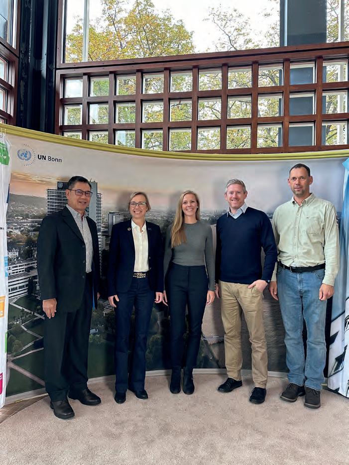
New UN organization to highlight the value of geodesy
By Frédérique Coumans, contributing editor, GIM International
The brand-new United Nations Global Geodetic Centre of Excellence (UN-GGCE) is now operational at the United Nations campus in Bonn, Germany. Nicholas Brown, head of office of the UN-GGCE, is dedicated to realizing a world where strong political support for geodesy is the new normal. That will accelerate the investments in a modern global geodetic reference frame to drive a multitude of social, environmental and economic benefits.
The United Nations Global Geodetic Centre of Excellence (UN-GGCE) did not arrive in our sector overnight. Back in 2012, geodetic experts from Asia and the Pacific wrote a report stating that “without high-quality connection to a global geocentric frame, full benefit of GNSS and its applications cannot be obtained. [..] Governments should take the responsibility for providing a common global frame to facilitate geospatial activities”. That report was submitted to the United Nations Committee of Experts on Global Geospatial Information Management (UN-GGIM). This committee is composed of governmental experts, including high-level leaders
of many geodetic organizations, from around the world. It acts as an intergovernmental mechanism for making joint decisions and setting directions with regard to the production, availability and use of geospatial information.
The UN-GGIM decided that a global geodetic reference frame was necessary and proposed a resolution, entitled ‘The Global Geodetic Reference Frame for Sustainable Development’, to the United Nations General Assembly in New York. In 2015, the resolution was adopted. “This was the first-ever resolution recognizing the importance of a globally coordinated approach to geodesy. That is of great significance, because many people rely on geodesy every day without even realizing it. We need to make sure governments know how dependent we are on it, so we can better support the global infrastructure needed: a Global Geodetic Reference Frame,” says Nicholas Brown, summing up his goal in a nutshell. Although he only recently started as head of office of the UN-GGCE in Bonn, thanks to his background and experience he is fully aware of the challenges. He is the former director of national geodesy at Geoscience Australia and led the development of the Australian Geospatial Reference System.
Degrading accuracy due to weak links
The ‘Global Geodetic Reference Frame’ is a collective term which includes a global geodesy supply chain, frames of reference and capacities and capabilities [for more details, see the box on page xx]. When asked
Issue 1 2024 23 Feature
An introduction to UN-GGCE
Kowal, technical advisor (on secondment from the German Federal Agency for Cartography and Geodesy), Nicholas Brown, head of office (former director of National Geodesy at Geoscience Australia and former co-chair of the UN-GGIM Subcommittee on Geodesy), and Jan Dostal, technical advisor (on secondment from the German Federal Agency for Cartography and Geodesy).
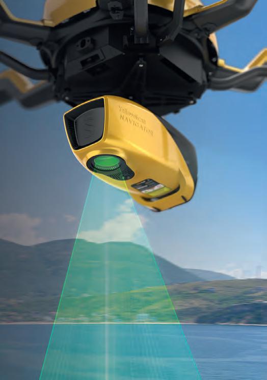
YellowScan Navigator.
An innovative bathymetric LiDAR solution for exploring underwater and ground topography.

Join us for a 2-day conference and discover this product live on April 18-19, 2024.


which elements are most at risk, Brown answers: “The supply chain we rely on to measure changes in the Earth’s shape, orientation, gravity field and movements of satellites is weak. More than 50% of the geodetic ground infrastructure is ageing and degrading. We need more, newer and better geodetic infrastructure. The consequence of weak links in the geodesy supply chain is that the positioning, navigation and timing applications on which we rely every day will degrade in accuracy. In turn, this will degrade the quality of our decision-making. This also impacts on our ability to measure, monitor and mitigate the impacts of global challenges like climate change and natural hazards.”
Additionally, he signals that a significant number of those applications exist thanks to scientific organizations like the International Association of Geodesy. “However, they do not have large budgets and must lean heavily on national geodesy agencies to allow their staff to perform complex analysis in-kind to create the needed products and services.”
Need for governance
Brown also sees governance problems. “There are currently only a few formal agreements in place which require governments to share or contribute geodetic information. In contrast, for example, the World Meteorological Organization has strong governance arrangements on sharing weather and climate information. This ensures it is noticed and adequately governmentally resourced. Today, much of the geodetic infrastructure is operated by a coalition of the willing in the academic realm which is hidden from government

What is the Global Geodetic Reference Frame?
A reference frame provides a baseline. It allows you to measure where you are relative to other places, and also allows you to monitor how much an object moves over time (e.g. to accurately measure sea level variations). Many different types of reference frames have been adopted of the years. Some reference systems are small-scale – even local – and two dimensional, e.g. for ownership rights on land parcels. Other reference frames are global in scale, like the International Terrestrial Reference Frame 2020 or the World Geodetic System 1984. These three-dimensional reference frames are aligned with global navigation satellite systems to uniquely identify a latitude, longitude and height anywhere on, above or below the Earth’s surface. The total amount of reference frames in use is unknown, but it is clear that the world would benefit from as much quality and consistency

The Global Geodetic Reference Frame is a collective term which includes:
a. A global geodesy supply chain of: geodetic infrastructure (e.g. global navigation satellite systems, very long baseline inter-ferometry, satellite laser ranging, doppler orbitography and radio-positioning integrated by satellite, gravimeters, etc.)
- data collection (e.g. international and regional data centres) data analysis (e.g. international, regional and national product development (e.g. clock and orbit products, atmospheric models, gravity models)
- product transmission (e.g. real-time data streams).
b. Frames of reference: realizations of international terrestrial, celestial and geopotential reference frames.
c. Capacities and capabilities residing in countries and organizations (like the services of the International Association of Geodesy) who perform the work in the global geodesy supply chain to analyse, compute, create and sustain the frames of reference.
Issue 1 2024 25 Feature
The UN Global Geodetic Centre of Excellence is located at the United Nations campus in Bonn. (Image courtesy: Volker Lannert)
eyes. Can you imagine operating multitrillion-dollar industries based on in-kind contributions, ageing infrastructure, and standards which are not fit for some users? That’s what we’re doing. Every day.”
Brown and his team – which it is hoped will grow to 20 people – are working across five focus areas: evidence, resources, governance, capacity, and awareness. The UN-GGCE will improve the evidence to quantify the importance of geodesy for societal and environmental benefits. The presentation of strong business cases can stimulate governments to improve weak links in the geodesy supply chain and assist geodetic infrastructure ‘owners’ in efforts to advocate for an increase in dedicated people and in international arrangements. Enhancing geodetic capacity and training opportunities, especially in developing countries, is certainly a priority. Offering methods to improve policymakers’ awareness of the importance of geodesy supports all of the above.
Listening to stakeholders’ needs
The priorities in the first three years are to reach out to the community first and then work together to make a global geodesy development plan. First of all, a ‘Listening World Tour’ is on the agenda, according to Brown: “We have a series of virtual engagements in our first few months to listen to many of the 193 UN Member States and geospatial organizations to better understand how we can support them. This is our way of introducing ourselves and listening to the needs of our stakeholders.”
The UN-GGCE will subsequently use information from this tour as one of the sources for a Global Geodesy Development Plan. “This consensus-driven plan will outline the global and regional user needs and will provide guidance on how to address critical operational gaps in the global geodetic reference frame,” he says. In the meantime, the UN-GGCE will cooperate with others in this field to develop policy and educational communication materials to explain the importance of geodesy and the role it plays in our everyday lives [see the example on page xx]. “The results can also be used by anyone in the geospatial sector at their convenience. So we’ll keep GIM International updated”, promises the UN-GGCE chief.
Ground infrastructure stays critical
The focus of the communication efforts will be on the ever-increasing but subliminal reliance on geospatial information. When explaining this decision, Brown concentrates on the threedimensional reference frames aligned with global navigation satellite systems. “We have to make clear to people who have probably never heard of geodesy that any error in knowing the precise position of satellites orbiting the Earth translates into errors in measurements used from – or made by – the satellites,” he says. “When the precise orbits of satellite altimeters and Earth observation satellites can’t be monitored, it impedes the accuracy with which anything that changes on Earth can be measured. An accurate and accessible coordinate reference frame is the key to measuring sea level change, land uplift and subsidence, volcanoes and earthquakes with millimetre-level precision.”
How to explain geodesy in layman’s terms
Most industry professionals are familiar with the problem of trying to explain precisely what their work in geodesy entails. Perhaps this example of how UN-GGCE does it will come in useful.
What is geodesy?
Geodesy is the science of measuring changes in the Earth’s size, shape and gravity field over time. The Earth is dynamic. It is hurtling through space in orbit around the Sun and being pulled in various directions by the Moon and other planets. This complex relationship with the Sun, the Moon and other planets causes the surface of the oceans and Earth to rise and fall over time. For example, did you know the gravitational pull from the Sun and the Moon cause the land height to vary by up to 55cm throughout the day? Or that the rotation speed of the Earth changes over time according to changes in the Earth’s mass distribution from movement of ice and material in the mantle? On top of all this, Earth experiences surface deformation due to earthquakes, volcanoes and subsidence.
How do we benefit from the geodesy?
In the past few days, you’ve probably switched on a light, paid for something with a credit card, or used your phone’s navigation app to avoid traffic. Did you know these applications and numerous others are dependent on our precise knowledge of where and when, like the angle of Earth’s axial tilt and how fast the Earth is spinning? Wait, what!? We need to know the spin rate of the Earth for our power grids to operate? Yes! The science of geodesy underpins all positioning, navigation and timing applications like precision agriculture, smartphone applications, improved weather predictions and disaster modelling, navigation assistance for the blind, as well as synchronizing our power grid and financial transactions.
Your GPS needs geodesy
In most cases the way we access positioning, navigation and tim ing information is through global navigation satellite systems (GNSS) like the Global Positioning System (GPS). However, have you ever stopped to think what GNSS needs to operate? GNSS satellites have vital information uploaded to the m about the Earth as it is moving through space, including how fast the Earth is spinning on its axis and the position and orientation (tilt) of Earth in space. Also , geodesists need to know the precise position of GNSS satellites in orbit around th e Earth, the centre of the mass of the Earth (that satellites are orbiting), the posit ion of the Earth relative to the Sun, Moon and other planets, the changes in the gravitat ional field of the Earth, and the position of ground infrastructure spread across the Earth’s surface. As the Earth is constantly moving and changing, geodesists need to continuously make a lot of measurements of the Earth and transmit that infor mation to GNSS satellites to enable them to work.
Issue 1 2024 26
“We also have to explain that, without an accurate global geodetic reference frame, it gets difficult to measure and monitor time,” he continues. Users expect geospatial information to be timely accurate to support industrial or defence applications and so on. Time synchronization is used by GPS, BeiDou, Glonass and Galileo to maintain cellular networks, financial transactions, power grids and suchlike. “Take telecom: it gets more difficult to operate the almost three billion mobile phone applications which rely on position-navigation-time information. Also real-time positioning, including driver assistance in vehicles, depends on it,” he adds.
Although space-based positioning standards are becoming popular nowadays, Nicholas Brown is resolute: “You cannot operate satellites, including space-based positioning, Earth observation, communication satellites and so on, without geodetic ground infrastructure. This is why it’s so critical to enhance and sustain our ground station network of satellite laser ranging and very long baseline interferometry infrastructure. Those techniques deliver Earth orientation parameters and universal time which is critical for the banking, power and telecom industries,” he concludes.
Other new UN-GGIM organizations
The Geodetic Centre of Excellence is not the UN-GGIM’s only new offspring aimed at making use of the rapidly evolving technologi cal
About the author

Frédérique Coumans is contributing editor for GIM International. For more than 25 years, she has been covering all aspects of spatial data infrastructures as editor-inchief of various magazines on GIS, data mining and the use of GIS in business. She lives near Brussels, Belgium.
landscape to create a sustainable geospatial ecosystem for the future. The committee has also established the United Nations Global Geospatial Knowledge and Innovation Centre in Deqing, China. In addition, the Kingdom of Saudi Arabia has committed to host a United Nations Global Geospatial Ecosystem Centre of Excellence in Riyadh. They will undertake research and development in integrating geospatial data with digital transformation, artificial intelligence, digital twins, and the Internet of Things..
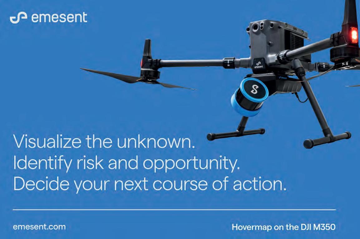
Issue 1 2024 27 Feature
The need for strategic action to enhance surveying education and attract new talent
Tackling the geospatial talent crunch
By Wim van Wegen, head of content, GIM International
The lack of new talent has been an issue in the geospatial industry for some time. This is noticeable not only within companies and organizations, but also in the pipeline expected to supply future mapping and surveying professionals: educational institutions. It seems to be a persistent and difficult-to-solve problem, and its consequences are increasingly felt in our sector. So what is the underlying issue, which solutions are needed, and what can the industry itself do to overcome this apparent stagnation?
The accurate acquisition of geodata requires a deep understanding of geospatial concepts. A decline in this expertise could have significant consequences for the geospatial data chain. Without accurate data acquisition, effective data analytics and visualizations are not possible. And without the involvement of surveyors, no construction or infrastructure project can commence, let alone be successfully concluded. Moreover, the lack of qualitative geodata is an obstacle to tackling important spatial challenges, such as the energy transition and climate change.
Real reasons for concern
All these advancements – and even seemingly routine activities that require data collection – will be hampered or delayed if no solution is found to the current talent shortage. In 2023 Geonovum – a Dutch government foundation aimed at improving government performance with geoinformation and better accessibility of geospatial data – presented a study entitled ‘Exploring the Geodetic and Surveying Labour Market and Education’. It reveals a significant quantitative disparity between the demand for surveyors and geodesists,

and the availability of trained professionals. Primarily, this imbalance stems from a lack of new skilled entrants into the surveying and geodesy field. Besides the lack of quantity, there is also a qualitative shortage caused by the growing scarcity of expertise. Due to the aging of current specialists and the diminishing number of training and education programmes, there is a real threat that the profession will fade into obscurity. The consolidation of dedicated degree courses into broader education programmes further worsens the issue by diluting specialization within the field. Consequently, valuable knowledge is gradually vanishing from the sector, endangering the process of knowledge transfer.
These results show strong similarities with the global picture, and also correspond with the findings from previous editions of GIM International’s annual industry survey among its global readership. The large number of comments in the most recent edition [see page 8] expressing worries about recruiting new personnel with an appropriate knowledge level is a clear indication that there are real reasons for concern.
Education challenges
For example, the industry survey clearly highlights the ongoing decline in student applications for geospatial courses –particularly in Western countries. This is making it increasingly difficult for companies to reinforce their skilled workforce with fresh geospatial studies graduates. A declining
Issue 1 2024 28
Students at the School of Surveying and Spatial Science, a division of the Technical University of Kenya. In numerous African nations, there is a noticeable surge in both the emergence of new geospatial professionals and the interest in pursuing studies related to geomatics. (Image courtesy: Technical University of Kenya)
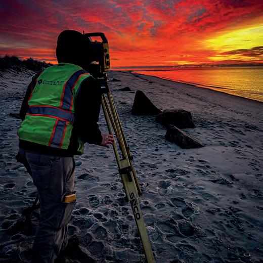
With collaborative efforts and a unified strategy, it must be possible to reshape the surveying profession’s image and highlight the attractive career prospects in the geospatial sector. (Image courtesy: Control Point Associates)
number of students are enrolling in civil engineering and geomatics programmes, opting instead for fields like computer science and mechanical engineering. This has created a scarcity of skilled surveyors, and on a global level the lack of professionals shows little sign of improvement. However, there are exceptions where the picture is more positive, such as many African nations and a number of countries in the Middle East
and Asia.
Stagnation in the number of students starting out on a geospatial (or related) course will lead to serious problems, threatening the vitality of the courses, the departments and the educational institutions themselves. Besides negatively impacting on student motivation levels, this also means that fewer students will be able to actively engage with modern industry equipment to gain the necessary proficiency. Additionally, educational institutions seeking fresh teaching and research talent face significant recruitment challenges. These issues, combined with financial constraints, make it a constant struggle to keep education programmes relevant and contemporary. To foster a new generation of scholars trained for success, it is imperative to attract students by reigniting interest in geospatialoriented education. And once students have enrolled, the education on offer must be of sufficiently high quality to retain them until they complete their studies successfully, and subsequently enter the industry. The road ahead demands strategic action and collaboration. By addressing those challenges head-on, we can safeguard continued relevance and success of academic institutions in an ever-evolving landscape.
An image problem
Geomatics and its related fields have always occupied a somewhat peculiar position, perhaps due to being less clearly defined than other domains. For example, construction focuses on solving housing problems or accommodating companies. Civil engineering is responsible for road construction and water management. But what does geodesy actually contribute? Herein lies the image problem of the field, in a nutshell. While other disciplines make tangible contributions to society, the value of the surveyor often goes unnoticed. This sense of underappreciation is echoed in our most recent geospatial industry survey. However, although many aspects of survey positioning, data acquisition and processing have evolved into automated processes, the perception of surveying as a blackbox, push-button discipline or procedure is increasingly unfair. As one respondent in the survey notes, today there is significant interest
E GeoFort presents an innovative take on Minecraft with GeoCraftNL, a virtual rendition of the Netherlands complete with roads, rivers, lakes and buildings, all recreated in stunning 3D detail. (Image courtesy: GeoFort)
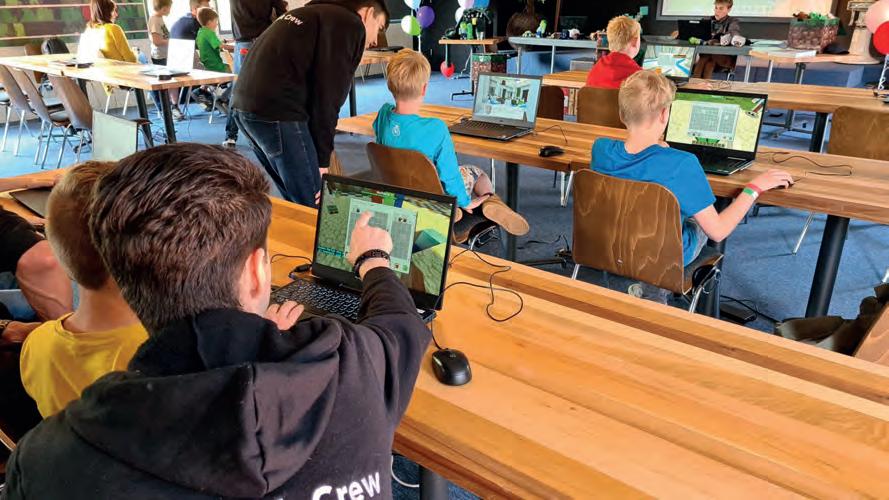
Issue 1 2024 29 Feature
E Organized to ignite enthusiasm for geospatial learning in children, the Young Geospatial Scientist Badge programme is a collaboration between SLA and Science Centre Singapore. (Image courtesy: Singapore Land Authority)
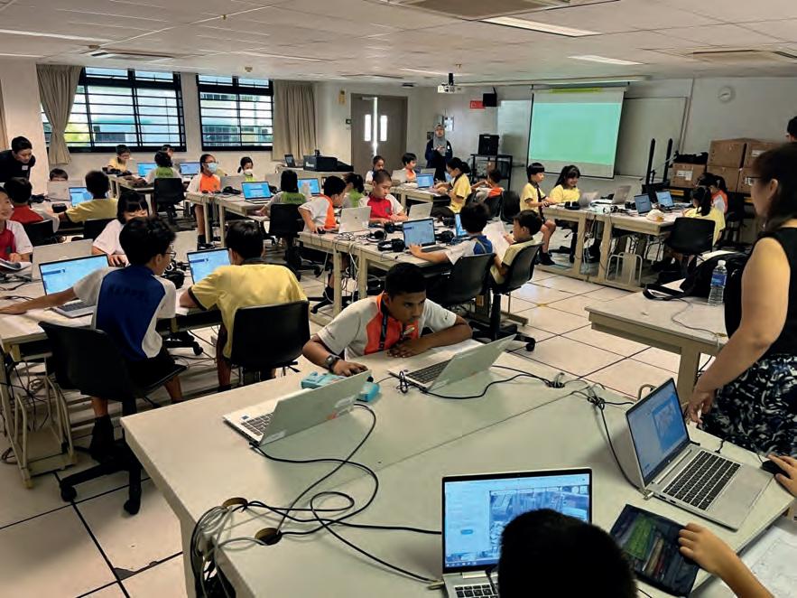
in applications that surveying has pioneered for decades, including automation, data processing, analytics, visualization, digital twins, AI and more. The respondent ends with the remark: “We are certainly not the ‘baggy pants’ profession that we often get to be portrayed as!”.
The Finnish Ministry of Agriculture and Forestry (MAF) recently published a study called ‘The Role of Geospatial Data in Data Economy’. The aim was to review the state-of-the-art and the needs regarding geospatial data and positioning in today’s data economy, as well as the impact of geospatial data and positioning. The findings underscored a sentiment commonly echoed among surveyors, namely the notion that few individuals outside the industry realize the origins of surveying data. Therefore, it is imperative for the surveying industry to engage with other sectors and articulate the significance of high-quality geospatial data in underpinning the essential elements of the data economy. However, the true challenge here lies in how to promote the message of the vital importance of geospatial data – and by extension the work of the surveyor – to a wider audience in a way that attracts more young people to the sector. Because let’s be honest, the only truly sustainable solution is to ensure that more graduates enter the industry with the right education and skills. The abovementioned Geonovum report strikes a similar tone, claiming that the industry has no time to sit back and relax. To ensure sufficient new surveyors in the future, it is necessary to get started now
on generating more influx from secondary schools into vocational and higher-education surveying and geomatics-oriented courses. The report states: “The professional profile for collectors is not yet sufficiently attractive. Drone pilots still sound like a much more attractive option than a surveyor. There is work to be done here for the sector. If the lobby for expanding the training opportunities is successful, then that is absolutely no guarantee that young people will also choose those directions; it has become painfully clear from the past that a social demand for geodesists and surveyors is no guarantee of sufficient inflow. Here again, long-term efforts are needed to influence the choices of young people.”
Turning the tide
On a positive note, the geospatial sector offers attractive prospects and career opportunities. So with combined thinking power and a joint strategy, surely it must be possible for us to turn the tide and transform the surveying profession’s image? One effective approach could be to introduce secondary-school pupils to various aspects of the field, thereby arousing their interest and increasing awareness of the degree courses on offer. Inspiring initiatives such as Get Kids into Survey deserve support to stimulate enthusiasm for the surveying profession among younger generations. Meanwhile, in the Netherlands, GeoFort is an interactive science museum where children of all ages can experience and explore the world of geoinformation technology and its applications.
When it comes to the slightly older age group, there appears to be a logical task for the International Federation of Surveyors (FIG), which represents the interests of the surveyors community worldwide. FIG Commission 2, which is dedicated to education, is focused on enhancing various facets of educational practices. This includes the development of curricula, exploration of effective learning and teaching methodologies, utilization of educational technologies, as well as the development of strategies for educational management and marketing. Furthermore, the commission is committed to promoting continuing professional development opportunities and fostering networking within the realm of education and training. The commission is currently chaired by Dimo Todorovski,
Issue 1 2024 30
who coordinates the master’s specialization in geoinformation management for land administration at the University of Twente/ ITC in the Netherlands. Todorovski admits that interest among adolescents in doing a surveying engineering-oriented degree varies around the world. He acknowledges the general decline in interest, specifically in Western countries. “But everywhere else, surveying education is core for national sustainable development and will as such be supported. When the students get attracted by the impact that they could make in the future, by the latest technological developments in our field and via student-centred interactive education, I believe there will be no shortage of well-educated surveying and land administration specialists to fulfil all the good work to be done.”
What are the underlying reasons for Todorovski’s optimism? “IT and geo are converging, as in every aspect of our life. Young people who do not see the big picture may choose the IT sector, developing and testing all kinds of prototypes. But I am convinced more people will become interested in modern geomatics studies – either early or later in their career – and will want to contribute to sustainable living conditions based on more extensive knowledge and a longer-term vision. Then the tables will turn; IT graduates will have a hard time competing with ‘our’ graduates,” he comments.
Perhaps the FIG Young Surveyors Network (YSN) could play a pivotal role in this context too. The network fosters an inclusive environment, bringing together young surveyors from varied cultural, academic and professional backgrounds worldwide. Through a range of meetings, workshops and conferences held across the globe, participants have the opportunity to engage in enriching exchanges that contribute to the sustainable development of the surveying profession.
Engaging with Generation Z
So where exactly does the new influx of geospatial professionals need to come from? Roughly speaking, we are talking about youngsters in Generation Z: people born between around 1995 and 2010. These individuals are often described as having grown up with a smartphone in one hand and an iPad in the other. Moreover, this generation has been shaped by the climate-change debate, economic uncertainty and let’s not forget the huge impact of the Covid restrictions on daily life during their formative years. Generation Z do indeed tend to spend a large part of their day online. To engage this target group with our sector, it therefore makes sense to take this into account and to approach them through relevant social media and apps. TikTok, Snapchat and Instagram are particularly popular. We can find inspiration from an initiative in Germany. ‘Weltvermesserer’ (which translates literally as ‘world surveyor’) is a play on words with ‘Weltverbesserer’ (the German word for idealist; literally, ‘world improver’). This commendable effort, aimed at igniting the interest of young individuals in the field of geodesy, is not merely about surveying landscapes but also about inspiring positive change. This endeavour can serve as a model for other nations to attracting much-needed young talent motivated to bring about a radical transformation.
Conclusion
While the surveying profession is very interesting and the job opportunities in the industry are excellent, the geospatial profession suffers from a lack of awareness among young people, resulting
About the author

Wim van Wegen is head of content at GIM International and Hydro International. In his role, he is responsible for the print and online publications of one of the world’s leading geomatics and hydrography trade media brands. He is also a contributor of columns and feature articles, and often interviews renowned experts in the geospatial industry.
in insufficient new entrants and a shortage of talent, especially in the Western world. This lack of new talent is affecting companies, organizations and educational institutions alike. Quantitative and qualitative disparities persist, threatening the sector’s vitality and knowledge transfer. If we are honest, the industry’s image requires a makeover. Thankfully, we have plenty of ‘ingredients’ to work with. After all, surveying professionals have evolved into geodata managers, leveraging innovative technologies and advanced data collection methods. Indeed, surveyors are positioned at the forefront of a rapidly evolving world. Amidst the increasing demand for renewable energy parks, upgraded power grids and carefully maintained green spaces, surveyors play a critical role in harnessing the data essential for shaping a sustainable future. Those skilled professionals in geospatial technology specialize in reality capture and creating and managing datasets, thus laying the foundation for resilient infrastructure and a smart digital reality. They are instrumental in providing innovative and cost-effective solutions that democratize data accessibility, facilitating the transition towards more sustainable practices, particularly within the realm of building construction. Put simply, they are an indispensable link in meeting the challenges the world will face in the coming decades. This presents exciting opportunities to underscore a convincing narrative that should resonate with the younger generation, igniting their interest in the field. Inspired by various strategic initiatives around the world, and based on collaborative efforts, it is time to act to ensure a sustainable future for the industry.
An
Issue 1 2024 31 Feature
example from the dynamic marketing campaign for the Weltvermesserer initiative, aimed at inspiring young individuals to explore the fields of geodesy, geomatics and surveying.
SMART SUBSEA SOLUTIONS
• Delivering data in most adverse conditions: underwater acoustic modems with advanced communication technology and networking
• Accurate USBL, LBL and hybrid positioning of underwater assets, navigation for divers
• Modem emulator and multiple cost-saving developer tools
• Sonobot 5 - the autonomous surface vehicle for bathymetry, monitoring, search & rescue, and AUV support
• Quadroin - the novel bionic AUV for surveys and monitoring


sales@evologics.com sales-us@evologics.com EvoLogics.de Meet us at OCEANOLOGY INTERNATIONAL 2024! 12 - 14 March London, ExCel STAND G300
The case for natural capital accounting
By Andrew Coote and Veronica I. Castillo
When gauging living standards, there is a strong case to be made for natural capital accounting to complement gross domestic product. So what is natural capital, and how can geospatial professionals play a role in its quantification?
As illustrated by case studies in the Philippines, natural capital accounting is imperative in harmonizing environmental sustainability with economic exigencies, and timely geospatial information is crucial.
Gross domestic product (GDP) indicates how much monetary income or output a country creates in a year. When politicians talk about the standard of living, growth or recession, and make comparisons with other countries, they tend to rely heavily on GDP as one of the key indicators in the ‘national accounts’. The
factors like health, environmental quality and social well-being. In other words, GDP is only a partial indicator of a nation’s wealth over the long term, and rising GDP does not necessarily mean that living standards are improving.
As illustrated by a number of recent books, realization is dawning that GDP does not go far
Credit, Covid and How We Focus on What Matters, by Mark Carney, asks why it is that the things we value most – from the environment to frontline workers to keeping children well fed and educated – are so often neglected by politicians and the financial markets.

Issue 1 2024 33 Perspectives
Mangroves on Palawan, the Philippines. (Image courtesy: Andrew Coote)
Saving the planet using geospatial information
solution. It complements GDP to provide a fuller picture of trends in living standards, allowing us to value the changes in natural capital through the changes on the value of ecosystem services it can offer. Accounting for changes in natural capital allows us to measure the magnitude of environmental depletion in moving towards a sustainable economy, centred on providing for the needs of both the present and future generations. Furthermore, the economic recovery after the COVID-19 pandemic is an opportunity to rethink the sustainable economic path, focused on all forms of capital: human, natural, human-made and social.
Why should you care?
First and foremost, you should care because our stewardship of the planet on which we live has been abysmal since the industrial revolution and it is our primary duty as human beings to do what we can to fix it. If rising GDP today comes at the expense of declining natural capital, then the world’s economic trajectory will be unsustainable. Further depletion of the natural ecosystems
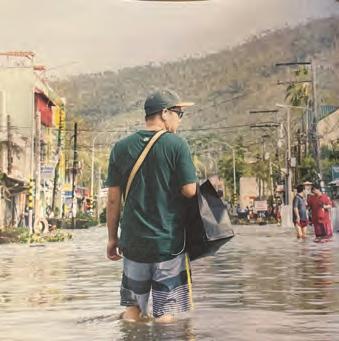
would undermine the provision of the basic social welfare: potable water, clean air, public health, food. Unless we all do something about the impacts of climate change, the most vulnerable populations will be further disadvantaged. More specifically, however, we – as geospatial, Earth observation and hydrospatial information professionals – can do something about the fact that we are currently not measuring the right things. Peter Druker, the famous management consultant and modern philosopher, once said “You can’t manage what you don’t measure”. In a nutshell, our role in society is about measuring our most important asset: the planet on which we live.
The need for lots of geospatial data
The role of geospatial data in natural capital accounting lies in its ability to provide accurate, comprehensive and consistent location intelligence to determine the impact of development on ecosystem services. There are several reasons why we cannot produce authoritative natural capital accounts without geospatial information:
• Spatial context: Without knowing the location and distribution of natural assets, it is impossible to fully assess the socio-economic impact of any investment project. The more accurate that information is, the better the assessment of the total costs and benefits will be.
• Monitoring changes over time: With increasingly frequent revisits by Earth observation satellites, it is easier than ever before to monitor what economists refer to as ‘benefits realization’: are the improvements predicted at the beginning of a project actually being delivered?
• Risk assessment and management: Geospatial data aids in identifying where project risks need to include factors such as climate change, natural disasters or human activities, and how these risks can be best managed.
• Integration with economic data: Geospatial data has unique attributes that enable natural capital to be linked to economic activities, e.g. extent of health districts, location of mangroves, marine protected areas. This integration helps in understanding the dependencies of various economic sectors on natural resources and ecosystems.
• Decision support: Geospatial information provides a basis for better informed decisionmaking. Policymakers, investors, land managers and conservationists can all gain greater insights from analysis using geospatial data so that their decisions better balance economic development with the sustainable use and conservation of natural capital.
Case studies in the Philippines
The Philippines is ranked as one of the countries most at threat from sea level rise. It has been at the forefront of global efforts to create natural capital accounts. It was an early participant in the global World Bank-led ‘Wealth Accounting and the Valuation of Ecosystem Services’ (WAVES) initiative. The PhilWAVES report highlights the role that geospatial data
What is natural capital?
The term ‘natural capital’ has come to the fore in the climate change debate. However, at a recent meeting of commercial geospatial industry leaders, less than 50% raised their hands when asked who had heard of it. Natural capital refers to the elements of the natural environment that currently receive insufficient consideration when making choices about managing the planet, e.g. land, forests, rivers, soil and other resources that businesses rely on to function. The depletion of the world’s natural capital hinders poverty reduction and sustainable development objectives. Environmental assets, such as timber or fisheries, and ecosystem services, such as water filtration and carbon sequestration, are critical for human well-being and provide significant economic and social benefits.
The World Bank estimates that the global economy could lose US$2.7 trillion by 2030 (compared to business as usual) if certain ecosystem services collapse (pollination, carbon sequestration and storage, fisheries, and timber provision). In low-income countries, GDP could decline annually by 10% on average. Understanding the value of a country’s environmental assets is therefore key to sustainable development and economic growth.
Issue 1 2024 34
Reality of climate change. (Image courtesy: World Bank)
Large-scale coastal reclamation, Manila Bay. Natural capital accounting enables consideration of the carbon sequestration potential of destroyed mangroves. (Image courtesy: Andrew Coote)
Depletion of Natural capital as percent of GDP. (Image courtesy: World Bank)
plays in addressing the issues on the provision of ecosystem services brought about by the changes in natural capital. Two highlights from this work are:
• Reducing flood risks and improving water quality in Laguna de Bay Laguna de Bay is a large lake in the middle of an increasingly densely urbanized area just south of the capital city, Manila. Water and ecosystem service accounts for the watershed that feeds the lake conclusively demonstrated that rapid soil erosion was the primary source of sediments pouring into the lake. These accumulating sediments were altering the lake’s total volume and ability to contain greater inflows, potentially affecting flood control. This scenario was exacerbated by the large number of people migrating into the area. The effects extend beyond the shoreline, as this ecosystem protects nearby Manila from flooding. Ecology and water accounts additionally showed that home sewage is by far the main source of contaminants in the lake. When debated with politicians and citizens, the natural capital accounts provided evidence that led to changes in planning regulations, behaviours of farmers and fisheries, and other targeted initiatives, such as connecting more residences to the sewer system. These changes are predicted to cut pollution by up to 80%.
• Monitoring threats to carbon sequestration in Palawan
The island of Palawan is one of the premier tourist destinations in the Philippines, but also an area of intensive agricultural expansion.
The WAVES land account developed for South Palawan revealed a 150% increase in perennial crops (mainly oil palm and coconut plantations) between 2003 and 2014. During the same time period, the forest accounts showed that areas with closed canopies
Geospatial-related outcomes of COP28
At COP28, there were two agreements pointing to the need for improved geospatial evidence to underpin decisionmaking. The first concerned setting global targets to triple capacity from renewable sources, most prominently wind energy and solar power, both of which rely heavily on geospatial data analysis to determine optimum sites for generation. The second was that the loss and damage fund to support developing countries most heavily impacted by disasters resulting from climate change will start to be distributed during 2024. The mechanisms used to ensure just and equitable distribution will be heavily based on geospatial data.
About the author

Andrew Coote (FRGS, MRICS, MBCS) is chief executive and principal consultant at ConsultingWhere. He has a BSc in Land Surveying and Geography, an MSc in Computer Science, and over 30 years’ experience in the development and use of information systems, specializing in the management of location-enabled applications. He has held senior management positions in both the public and private sector in the UK and Africa, and has undertaken assignments in Asia, Africa, Europe, the Middle East, Australasia, North America and the Caribbean.

Veronica I. Castillo is assistant professor at University of the Philippines Los Baños. She has a BSc in Economics (Natural Resource Economics) and an MSc in Economics (Environmental Economics). An environmental economist and a geospatial data enthusiast, she has been a consultant in both local and international institutions, offering technical expertise on quantitative methods in economics. Her work includes the integration of economy, environment and geospatial data in studies including valuation and economic analysis.
dropped sharply, causing a detrimental effect on carbon stocks. These changes, evaluated using geospatial data, value the annual carbon sequestration in Southern Palawan at between US$18 million and US$52 million. The data is being used to measure, report and verify efforts to lower emissions from deforestation and mangrove destruction. It is also informing decisions as part of the National Greening Program and to improve the Philippine Greenhouse Gas Inventory Management and Reporting System.
Conclusion
Natural capital accounts enable policymakers to strike a better balance between environmental sustainability and economic demands. Comprehensive, timely and more accurate geospatial information significantly improves the quality of natural capital accounts. In the Philippines, case studies illustrate how geospatial data has played an essential role in managing ecosystem services including water provision, carbon sequestration and flood prevention. However, there is still a huge understanding gap between geospatial practitioners and global decision-makers. It is hoped that the terms in this article will help industry professionals to speak the language of the economists and politicians, and step up to seeing them as key stakeholders.
Issue 1 2024 35 Perspectives
Adapting to change, fostering diversity and strengthening partnerships
Ongoing contributions to resilient and impactful surveying
By Ryan Keenan, chair of FIG Commission 5: Positioning and Measurement
How can surveying become more resilient as a profession and an industry? To answer this question, FIG established a task force focused on international trends and the future geospatial information ecosystem. The association is committed to ensuring that surveying remains relevant, productive, collaborative and viable.
The post-pandemic times have been fruitful for reflecting on past achievements, as well as renewing focus on purpose and future aspirations. The greater surveying community has been pondering such issues with arguably more energy than ever before. All genres of surveying – including both geospatial and hydrospatial – are asking how we can become more resilient as a profession and industry.
As part of the post-pandemic recovery initiatives, nations pledged new roads, railways, ports, energy supply infrastructure and suchlike that are now finally being delivered. These essential multi-sector infrastructure projects have clearly helped to provide resilience to their respective economies. Thankfully, surveying features heavily in such projects, no matter whether they are greenfield, brownfield or greyfield sites.
The onward march of technology Technologies and applications involving surveying and spatial are evolving at a rapid pace, and rightly so, as they consistently feature in most of the biggest buzzword ideas over the last 10-20 years. Some examples of technologies and sectors evolving include big data, which became informed with machine learning and is now generative with artificial intelligence. Smart cities quickly outgrew their boundaries and are now located under rapid urbanization. Digital twins, once synonymous with smart cities, morphed into digital transformations and are often considered in a national context, with nearly every nation having one

or more sovereign digital initiatives. For the space sector, CubeSats preceded New Space, and is now preparing its advances to the Moon (again) and Cislunar space. Resilience and security are no longer exclusively the domain of the defence sector, but are now deeply entrenched in critical infrastructure, telecommunications and utilities, including satellite-based PNT techniques and the Earth observation sector.
Issue 1 2024 36
The primary advantage of utilizing Lidar technology lies in its ability to capture detailed spatial data of the immediate surroundings, empowering surveyors to excel in their work. (Image courtesy: Existing Conditions)
Whilst driverless cars, extreme weather events, Starlink celestial trains and AI are regularly making headlines, one might think that the real-world opportunities for surveyors to demonstrate their skills and strengths are dwindling. I would argue this is quite the opposite. Every single application, project, sector or technology start-up featuring a question starting with ‘Where…?’ is an opportunity for surveyors and surveying to provide value and ply their trade.
Surveying technology industries are continuously innovating and commercializing spatial technologies, introducing greater efficiency, productivity and performance levels at breakneck rates. ‘Smaller, faster, cheaper’ is an oft-used mandate driving product roadmaps. Take the example of Lidar technology. One of its first civilian applications was in large-scale airborne mapping projects, and yet it is now commonplace in cars, smartphones and – in many cities –integrated into traffic lights, speed cameras and pedestrian crossings.
The ability of surveyors to see the ‘big map’ (more than just the big picture) should not be underlooked
Admittedly, there can be significant differences in SWAP-C across the range of Lidar devices available. However, the main benefit of using Lidar technology is that it provides spatial data describing the immediate environment around the device. It is with this spatial data element that surveyors can excel thanks to their fundamental expertise in quantitative data analysis: the related tasks of data and information, identifying trends, applying models, objectivity and integrity – all the things we know very well.
Overall, the traditional skills of surveyors have easily evolved into those facilitating today’s highly connected digital world (and metaverses
too). Our inherent abilities to collect data using a variety of different technologies and techniques (from analogue through to digital) from different vantage points (land, air, water, space) and to extract value courtesy of various software solutions and approaches (GIS, point cloud, bathymetry, remote sensing, etc.) will stand us in very good stead. So long as the world is still enquiring and requiring the position and location of ‘things’ in a timely and precise manner, then surveying will still have a key role to play. Lastly, the ability of surveyors to see the ‘big map’ (more than just the big picture) should not be underlooked.
Consulting a crystal spheroid on future geospatial trends
As a means to ensuring surveying remains relevant, productive, collaborative and viable, FIG established the ‘Task Force on the Role of FIG in International Trends and Future Geospatial Information Ecosystem’. Its objectives are to assess and improve the impact of FIG for its members and partners (existing and new ones), and further to assess and improve the role of FIG in international trends and the future geospatial information ecosystem, as well as the role of its members in the global geospatial market. In summary, this task is about acknowledging the reality of our present situation, recognizing the urgency and need for change, determining a realistic plan for action, and marketing the benefits and value surveying affords to our
FIG: Voicing the global needs of surveyors and the geospatial sector
The International Federation of Surveyors (FIG) was founded in 1878 to listen to the individual concerns of surveying associations from around the world, to amplify them and to raise them to a global level. Consisting of national member associations, cadastral and mapping agencies and ministries, universities and corporates from over 120 countries, it is a United Nations and World Bankrecognized non-governmental organization.
FIG covers the whole range of professional fields within the global surveying community, including surveying, cadastre, valuation, mapping, geodesy, hydrography, geospatial and quantity surveyors. The holistic perspectives afforded by such a broad group of professions is advantageous when working on challenges as mentioned in this article, thanks to the diverse cultural volunteers from around the world.
Surveyors at all stages of their careers have the opportunity to get involved personally with FIG and its work at several levels: by contributing to one of the ten commissions, or by attending or even presenting at FIG’s annual Working Week, Congress or regional events taking place around the globe. There are regional networks in Asia Pacific, Europe, Africa and the Americas as well as task forces covering important topics of concern and relevance. Apart from the two mentioned elsewhere in this article, there is the FIG Climate Compass Task Force working on the Surveying Profession’s Global Response to Tackling the Climate Agenda, and another looking into how FIG and the surveying profession can work towards the Sustainable Development Goals.
Issue 1 2024 37 Perspectives
Paul Digney, director of the Geospatial Council of Australia, taking the stage to present the FIG Working Week 2025.

global economy and environment. The Task Force is set to deliver its findings and formal recommendations for the FIG Council at the FIG Working Week 2025 in Brisbane.
Declining capability and capacity
Much has been written in recent years about the geodesy crisis –specifically the declining number of geodesy graduates and the mutually linked rarity of curricula covering geodesy in its pure and applied forms. A clear decline in the number of surveying and geospatial-related courses at higher education institutions has been seen globally and is due cause for concern. What is less transparent is whether there has been an increase in the number of non-spatial courses incorporating surveying and geospatial-related topics as part of their programmes. Recently I have learned that in several higher education establishments on different continents, their robotics departments/schools are now offering positioning and localization semesters as part of their specialisms – something that surveying departments would have previously been assumed to be offering. It is clearly evident such spatial topics are in demand, given the march of automation and integrated systems. Yet what is unclear is the exact tipping point at which the surveying industry no longer represented positioning and localization to those outside of it.
Unfortunately, the decline of surveying capacity and capability is the way of the modern world. We rely upon professionals who practice and apply their skills across a multitude of sectors, and they have a finite working career. Simply put, as non-surveying professionals familiarize themselves with survey tools and skills, this reduces their reliance on – and need for – professional surveyors.
Filling the pipeline of capable surveyors
There are two evergreen challenges here: firstly, ensuring that there are enough trained surveyors coming into the job market, and secondly, valuing the worth of surveying and surveyors in both financial and societal terms. FIG recognizes that addressing the workforce shortage in surveying — an area of critical need – is vital to our member associations and the industry in general. In nearly every nation, there are common visions for a locally developed, highly skilled workforce to deliver complex outcomes in surveying. This includes bridging the skills gap and filling entry-level vacancies, particularly in the new departments of developing countries. FIG has a number of ongoing capability-development initiatives offering
education, training and mentoring on technical topics, helping especially those developing countries and regions working to build their own capacity. One such FIG initiative is Commission 5’s wellattended Reference Frame in Practice (RFIP) workshop. This has been running alongside most FIG annual events since 2014, thanks to strong support from members and international partners.
The ability to grow and prosper, and find sustainable solutions to the many issues around shortages of surveyors, is being addressed through a FIG Task Force on the Surveyor’s Profession: Evolutionary Diversity and Inclusion. This task force aims to promote diversity and inclusion within the surveying profession, not only in terms of race, gender and ethnicity, but also in terms of age and generational diversity, including Generations X, Y, Z and Alpha. This is important because it ensures that the surveying profession is sustainable and can continue to thrive in the long term. A further goal of this task is to identify how to attract pan-generationals to the profession. Ideas include highlighting the exciting and innovative technologies and tools used in surveying, and emphasizing the importance of sustainability and environmental stewardship in the field.
Stronger together:
the value of partnerships
The importance of international partnerships has never been stronger, and FIG’s outreach continues to extend with collaborations with sister organizations, United Nations, World Bank and other important stakeholders. These partnerships demonstrate effective leadership solutions for the surveying sector, and FIG is privileged to participate in and contribute to some truly global initiatives. An outstanding example is that w ith the United Nations Committee of Experts on Global Geospatial Information Management (UN-GGIM) where international stakeholders such as FIG provided valuable contributions and insights to the Integrated Geospatial Information Framework (IG IF), and continue to promote it across FIG member associations. A second example is of Commission 5’s working partnership with the newly founded United Nations Global Geodetic Centre of Excellence (UN-GGCE). This exemplifies how the international community – federal government, academic and industry – has championed the vision of a future where all countries have stro ng political support for geodesy, enabling them to sustain the glo bal geodetic reference frame (GGRF) to accelerate the achievements of the Sustainable Development Goals to derive social,
Issue 1 2024 38
UN-GGIM convenes experts from Member States and international stakeholders to foster global collaboration in geospatial information management. (Image courtesy: Anne Jørgensen)
environmental and economic benefits. This goal for a sustainable GGRF has significant and positive consequences for nearly every surveyor, no matter what discipline they are involved in. As a partner to the UN-GGIM and the UN-GGCE, FIG continues to add its voice and efforts to promoting the relevance of surveying an d geospatial information at a global level.
Looking ahead
To secure our future prosperity, FIG and the industry must actively contribute to improving the surveying sector’s competitiveness and ensuring surveying remains relevant, productive, collaborative and viable. This article is intended as the beginning of a conversation across the global surveying community on how to increase the resilience of our shared community. FIG welcomes all thoughts, ideas and efforts from surveyors across the world on how industry, governments and the association can work together with academia to build resilience around the surveying education and training supply chain. Volunteers are warmly welcomed to contribute to the activities of all of the FIG task forces.
More information: www.fig.net
Conclusion
In summary, the post-pandemic landscape has sparked both introspection and forward-thinking in the surveying community. As we navigate infrastructure projects and embrace evolving technologies, resilience remains key. Initiatives like the FIG task force highlight the importance of collaboration and innovation. Addressing workforce shortages and promoting diversity are vital steps toward ensuring the profession’s sustainability. Together, we can chart a course for a prosperous future in surveying, enriching both our industry and the global community.
About the author

Ryan Keenan is Chair of FIG Commission 5 Positioning & Measurement, member of the International Trends Task Force, the AP CDN, and FIG representative to the United Nations’ Sub-Committee on Geodesy. Dr Keenan is principal consultant at Positioning Insights, and an individual member of the UN-GGCE’s International Advisory Committee.

Coverage so much greater than GNSS
Precise, Consistent Performance
Trimble ProPoint® GNSS technology leverages all constellations and frequencies with tight INS integration and sensor fusion to deliver unparalleled performance under challenging
Longer Product Life Cycles
Global Support
Get expert help through the entire lifecycle, wherever you are
Flexible Integration
Scalable technology platforms for the full autonomy stack and faster go-to-market implementation
Issue 1 2024 39 Perspectives LEARN MORE
A complete suite of
that exceed your farthest goals
precise positioning solutions
Durable, completely supported future-proof solutions that last as you grow
cellular/IP
Centimeter-Level Positioning Accuracy, Anywhere With local RTK base stations, VRS networks and Trimble’s worldwide CenterPoint® RTX correction service via satellite or
| sales.gnssoem@trimble.com
GNSS Division, 10368 Westmoor Drive, Westminster, CO, USA
environments oemgnss.trimble.com
OEM
The world’s most complete digital twin of Alcatraz
How mapping experts built the biggest 3D dataset of Alcatraz Island
By Stuart Hill
The rugged 22.5-acre site of the notorious US island prison Alcatraz has been digitally captured in a world-leading project involving multiple mapping technologies. With the team camped in the jail’s infamous cells for three weeks during the cold San Francisco winter, this historically, biologically and architecturally important location was recorded in unprecedented 3D detail. We discussed the project with project head Pete Kelsey and team member Dr Jeremy Sofonia.
What was the Alcatraz project and who was it for?
Pete Kelsey: The Alcatraz project was conducted for the United States National Park Service, to obtain a baseline survey that can be used for change detection analysis. By mapping all the structures inside and out, a baseline could be established that future surveys can be measured against.
Alcatraz – it’s a lot of things – but what most people don’t realize is that it’s a very dynamic environment. The Park Service was keen to understand the effects of climate change, sea-level rise and over one million visitors a year on the historic site. Alcatraz is located in San Francisco right on the San Andreas Fault, so it’s also seismically active. There are a lot of things going on that present challenges for what is arguably the most notorious prison on earth.
As a result, the Park Service was very keen to get that baseline survey done. From there, the conversation changed to the creative ways in which this kind of reality capture digital twin type data could be applied.


What pre-planning was involved?
PK: The planning took nine months. The first thing that comes to mind was the permit process as two permits were required: a scientific permit to do the work and, as no drones are allowed in US national parks, a permit to fly a drone.
The plans included an airborne and a terrestrial component, and an interior and an exterior component. On the ground, we had Emesent Hovermap and terrestrial laser scanning. We also had photogrammetry and we flew multispectral because some of the biologists were interested in the plant life on the island as well. Once those two permits were issued, things happened quickly.
Jeremy Sofonia: I don’t think anybody truly anticipated what it was going to be like on Alcatraz. A typical day entailed waking up at 5 a.m. and leaving the cells we were sleeping in straight away, as we only had a couple of hours before the tourists and staff turned up. It was important that we captured the data before the crowds started coming in. We can capture data with people, but it can add time
40 Issue 1 2024
The team was granted access to almost all areas of the facility, including restricted spaces such as the cells made famous in the 1962 escape.
The team also had access to areas off limits to the public, including the famous lighthouse.


About the contributors
to our post-processing to clean them out. Another reason was that the Park Service, and therefore we too, were very keen not to impact the tourist experience.
How did you organize the large volumes of captured data?
PK: I put together an amazing team who were well versed in the IT back office file management component of organizing data. Without a scan plan, a naming convention and some form of standardization, this wouldn’t have worked as it would have been chaos.
We had a single airborne GNSS Lidar flight, a single multispectral flight and a single photogrammetric flight. Where it got challenging was with the volume of Emesent Hovermap scans to capture all the interiors and those outside not seen from an aerial perspective. Ultimately, we completed more than 100 scans, which I’ll bet is a first in this type of space.
I knew that having Dr Jeremy Sofonia from Emesent onboard was going to be key, with the Hovermap work falling to him. He had to create a system that would make sense to all of us, but most importantly work for him. And he did it, we’ve had no issues and it’s been fantastic.
Did you do any data processing on site?
JS: Absolutely…the sheer volume of data means it’s great to keep up with it so that you don’t have a massive backlog, but it’s also about quality assurance, quality control. We wanted to make sure that we captured what we came for as we collected it because of the relatively limited time we had on site for such a unique opportunity. It’s prudent to check that what you’ve got is true and correct as you go.
All of the Hovermap data was processed in Emesent’s Aura software. With that initial processing, you can use the visualization tool to load the point cloud and can check for any issues. This allowed us to validate a scan and move forward in real time.
What were the project’s biggest challenges?
PK:
Every room had a lock. Have we got the key, or who does? Do we know where they are on the island so that we can find them, borrow the key and then return it? We knew right away that this was going to be a problem, but the Park Service were great. I explained the problem to the facilities manager on Alcatraz and she didn’t blink, she just got up, went into a safe and handed me the keys to Alcatraz.
JS: My primary objective was to conduct handheld mapping of the interiors, which was Emesent Hovermap’s role in the project. Handheld mapping was used most of the time, but because many of the spaces were not well lit – or not lit at all – we had a special lighting rig that snapped onto my Hovermap unit. This illuminated the field of view of the GoPro that was there to obtain RGB true colour data. We also utilized the Hovermap’s versatility for those times when handheld wasn’t the best option. This included our polemount and even Boston Dynamics Spot robot. So, not only were we looking to capture Lidar data, but also in true colour so that people could have a more realistic experience when looking at the data. Adding that element definitely increased the challenge in many dark spaces; however, the lighting rig worked great and I think the results will speak for themselves.
People don’t realize this, but rather than the prison guards living in San Francisco and commuting back and forth, their entire families lived on the island. Today, those structures are still there, some in ruin, others needing restoration. One of these, large, multi-story and complex, is closed to the public with signs on the door reading: Danger Lead, Danger Asbestos. This is, for example, where we used Hovermap on Spot. It would have taken us far longer to put the PPE on and take it off again than it did for us to do the whole job with Spot, let alone the health and safety approval process. This is a great example of how we can use robotic systems not just to keep ourselves safe, but also to minimize the red tape and time involved, to get the job done.
The full version of this story is available at emesent.com/alcatraz.
Sponsored article 41 Issue 1 2024
Cell block – Peter Kelsey (left), Jeremy Sofonia and other te weeks.
A crucial yet overlooked element in business success
Rethinking service in the surveying industry
By Moritz Lauwiner, Hexagon’s Geosystems division
The latest measurement sensors and software, decades of collective experience and expertise, and a track record of quality work and professionalism… To most people, this reads like the recipe for business success in surveying. However, one crucial yet often overlooked element is missing innovative services.
Surveyors are proud professionals who know the value of their expertise. Shaping that expertise into services forms the core of a successful surveying firm. However, the barriers and risks surrounding innovation mean that the importance of service development is frequently ignored. Despite uncertainties, it is essential to innovate your services. Strategic planning and partnerships can help you to overcome challenges and find the motivation to do more than just survive; they can put you on a path to serving and thriving.
Embracing innovation
To prevent stagnation and even decline, innovation should be a central part of everyday culture across all layers of any business, and surveying firms are no exception. While companies like Hexagon put industry-disrupting hardware and software solutions on the market, the surveyor’s innovation journey should lead them to unique service offerings that leverage those cutting-edge technologies.
ISGroup, a geospatial business in Australia, is one example of a company that has fostered growth by incorporating emerging technologies to create fit-forpurpose, innovative solutions for its clients. “Technology is a great enabler of geospatial data – not only the sensors we use to capture data, but also software and visualization tools – so it’s a big part of what we do as our business,” explains Bruce Baker, CEO at ISGroup. “Being an early
adopter comes with risks, but success is about identifying how technology can solve problems for clients. Getting the relationship right between technology and solutions will create the opportunity.” By supplying reliable, specialized sensors and software,
Hexagon helps ISGroup develop and expand its strengths in technology-driven services so that clients benefit from high-quality deliverables. A reciprocal relationship between technology suppliers and surveying service providers drives progress.
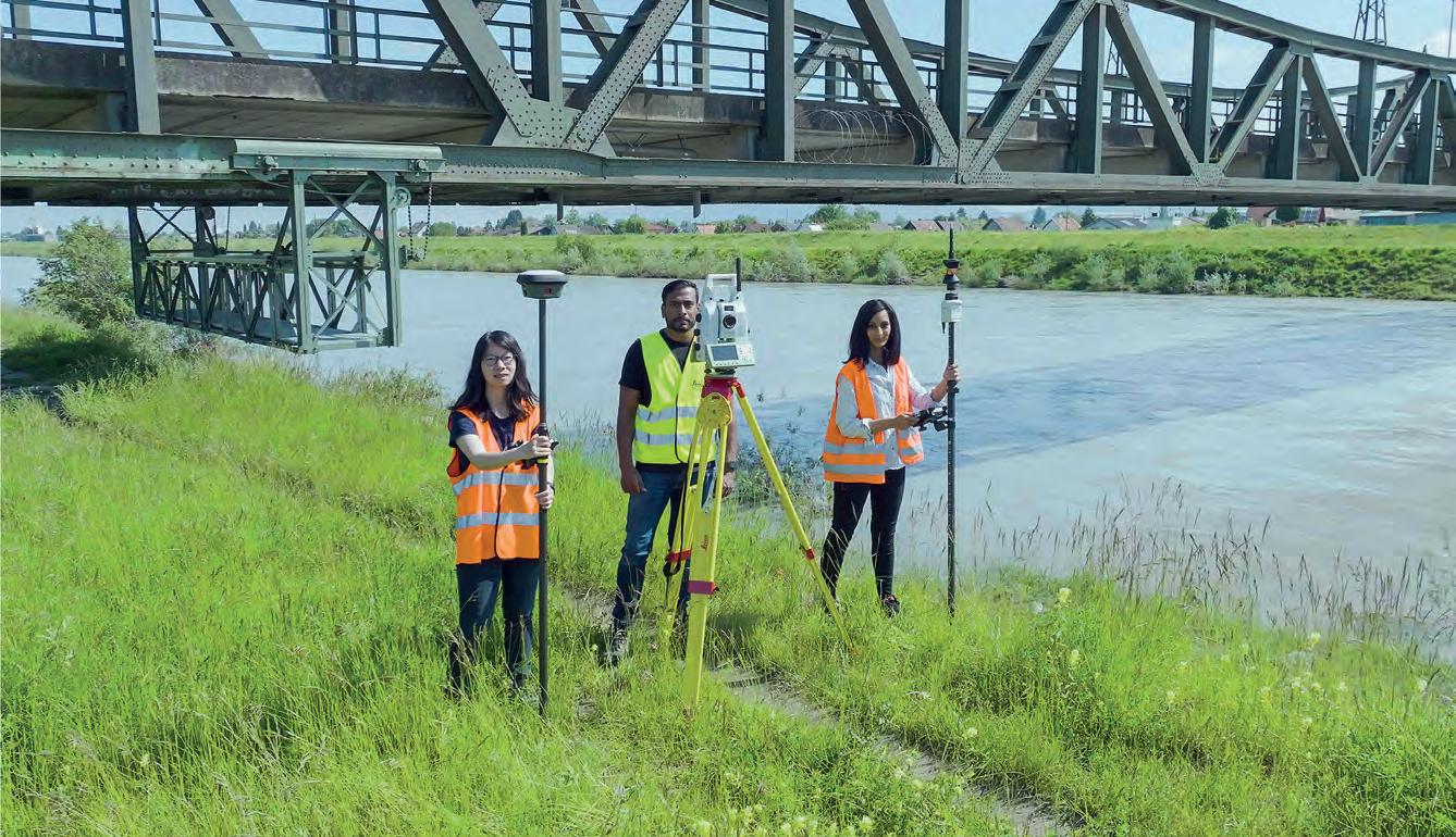
Issue 1 2024 42
The essence of services
Services only exist in the moment they are consumed. This intangible nature creates timing and capacity challenges for surveying service providers, who must remain available and capable of delivering services on demand without precisely knowing where and when. Technology that collects, processes and shares data faster and more accessibly offers a way to mitigate these challenges. For example, Hexagon’s cloud services portal, HxGN GeoCloud powered by HxDR, allows access to data whenever it is needed. Additionally, innovations like the Leica AP20 AutoPole speed up robotic total station surveying workflows, freeing up resources to enhance capacity.
However, service innovation is more than the adoption of new technology. Accurate sensors and intelligent software are merely ingredients in a business, not the full recipe for successful services. Innovating at the service level should be based on a deep understanding of client needs and the company’s own resources: the magic web of people, processes and technology.
A competitive advantage
The reality capture arena shows this principle clearly. As innovative laser scanning technologies democratize opportunity by becoming more affordable and intuitive, the distinguishing factor becomes how surveyors deploy that technology in the service of their clients. It is not only about capturing and processing highaccuracy data faster with limited and less specialized personnel, but also about innovating services to deliver that data to clients in a format that helps them solve their problems. That’s how surveying firms can demonstrate value and create a competitive advantage. 3DS Technologies, a North American company working with high-resolution 3D laser scanning, has expanded into new sectors by connecting its clients with more accessible reality capture experiences. “We want to bring 3D scanning to everybody –architects, engineers, contractors – so they don’t have to make huge investments,” says Travis Sachs, COO of 3DS Technologies. “With the way things are evolving now, and with the software becoming more and more user-friendly, we’re finding that it’s easier to help teams onboard their 3D scanning departments and divisions.” Accessible reports mean that 3DS Technologies does not have to translate the data for its customers. Instead, they can look at the visual data and see immediately, e.g. in a heat map, if any issues require further investigation. “Software provides instant visualization in the field that’s critical for project success,” Sachs continues. “Customers are really impressed when you can show them what you’ve captured while you’re still on site.”
Strategies for creating unique services
The stony path to value creation is subject to strong forces of change. Therefore, to create resilient, unique services, you must continually rethink the way you serve your clients. A range of strategies and approaches can help you do so. Start by going to the source to learn what your clients need, expand perspectives on how you can provide a solution, and make a plan to clearly communicate this value to clients.
The case of Derek Twente, an innovative geospatial manager at the US firm TWM, provides a clear example of these principles in
action. When first incorporating reality capture technology at the engineering-focused firm, Twente found that customers could not work with the datasets, which diminished the usability and perceived value of the point cloud deliverables. To solve this problem, he and his colleagues helped clients learn to use processing software for their project needs. As a result, clients clearly understood the value of the services, ultimately contributing to exponential business growth. To ensure their capacity could meet this growing demand, Twente and his team invested in and integrated Hexagon’s mobile mapping technology, enabling them to successfully scale up their innovative services.
Navigating risk with courage and optimism
The history of surveyors has always been intertwined with innovation to serve clients, communities and the planet. Yet despite careful research, planning and investments, innovating unavoidably comes with some risk of failure. Nevertheless, when this vulnerable position is approached with courage and optimism – grounded in preparation, realism, determination and domain expertise – the spark of creativity and force of innovation can emerge and provide a transformative path forward.
Above all, remember you are not alone in this mission to innovate. Technology providers are partners in the surveying industry ready to support surveyors in this undertaking. They bring tradition, experience, strength and resilience to help surveyors face uncertainty and mitigate risks. By working collectively, the entire ecosystem pushes progress forward, innovating for a better future and contributing to a better world through advancement in surveying practices and technologies.
About
the

Issue 1 2024 43 Perspectives
Moritz Lauwiner is executive vice president and president of the Geomatics division at Hexagon’s Geosystems division. In this role, he oversees research and development, business strategy and overall management of the market-leading offering of total stations, GNSS and monitoring solutions and related surveying software. Lauwiner joined the company in 1994. In his previous roles, including various leadership positions, he built up and led a global product management organization responsible for sensors, software and services. Lauwiner has an MBA from the University of Strathclyde, Glasgow (Scotland), and a master’s degree in surveying and rural engineering from the École Polytechnique Fédérale de Lausanne (Switzerland). author


www.vexcel-imaging.com THE GLOBAL LEADERS OF AERIAL IMAGING l.ead.me/gim2402
Hydrography industry survey 2024
Trends and perspectives in the hydrographic sector
By Wim van Wegen, head of content, Hydro International
Similar to our annual survey in the geospatial industry, we also conduct one for our sister publication, Hydro International, which focuses on the hydrographic profession. This article outlines the insights gathered from this investigation.
How do you perceive prospects in the hydrographic surveying industry in 2024,compared to the past couple of years?
When contemplating the hydrographic sector holistically, which areas of investment do you foresee experiencing the most noteworthy developments in the coming years? Will there continue to be a surveyor on board at any stage of the survey process?
How do you plan to select and retain new surveyors for the next decade? In what ways do developments such as climate change and sustainability impact your organization’s
operations? How can the hydrography sector draw insights from other industries? What are the most significant challenges currently facing businesses? Which phase of the survey project poses the greatest challenges for companies?
All these questions were discussed in our annual industry survey. In this article, we present a comprehensive overview of the findings – quite a challenge given the amount of data! –emphasizing the common threads that emerged and highlighting striking results for which we have sufficient indication of their significance to you as a reader active in the hydrographic sector and related areas.
The hydrographic industry is undergoing considerable transformation, driven by technological advancements that include the ongoing progress in digitization, computer vision and data processing capabilities. This is evident in the miniaturization of sensors and the growing

Issue 1 2024 45
the east coast of Yorkshire, England, in the North Sea, this offshore wind farm has the capacity to generate renewable electricity for up to 3.4 million UK homes annually. Encompassing an array area of approximately 1,000km² and featuring over 100km of proposed export cable routes, the project required an extensive survey effort, covering a total scope exceeding 20,000km of survey lines. This serves as a compelling example of the high potential of renewables, as also reflected by this year’s industry survey. (Image courtesy: Fugro)


phaseone.com Imaging beyond Imagination Maximize productivity with unrivaled image quality – the Phase One Aerial Systems portfolio
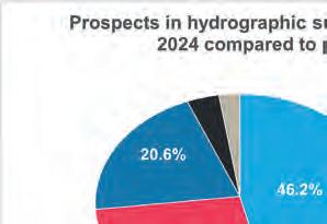


influence of artificial intelligence, marking just the beginning of innovations in hydrography. Is this already having a noticeable impact on the way in which survey companies operate? And, how do hydrographic professionals foresee the trend towards autonomous and remote technologies influencing their work?
No surveyor on board?
“There will always be the need for a ‘human’ oversight for operations at sea and along our coast as the environment is dynamic and everchanging. Machine learning and automation is a powerful response, but can never match the capacity for agility and adaptation of a human brain,” said one respondent to this year’s industry survey, summarizing the tone of many others. Of the respondents, 31.5% think there will be no surveyor on board at any stage of the survey in ten years’ time, while 68.5% do not believe in this scenario.
Technological change also encompasses the human dimension, as how individuals engage with technological possibilities and establish trust in them are crucial considerations. One respondent commented that on-board survey technicians face challenges in adapting to a vessel’s electronic chart system and that ship officers are hesitant to engage with ECDIS track control. The prevailing culture suggests resistance to change, and a complete technical overhaul appears even less likely.
To refer to the much-praised article ‘New Horizons for Hydrography’ by Mathias Jonas (see text box): “As ongoing digitalization is one side of the coin, communications will be the other one. As we know from our daily life, internet access has become the ‘fifth element’. If it becomes widely available at sea, this will definitely be a game changer.” Everyone would agree that the increased investment in and development of a variety of internet-connected sensor technologies have accelerated the capabilities of uncrewed and autonomous offshore vessels. One survey respondent agrees that there will be fewer surveyors on board, but points out that: “Satellite links are not yet sufficient to transfer all the data. In ten years’ time, based on past evolution, there will still be surveyors out there.” There is also a group that regards the satellite internet revolution as a facilitator of no surveyors on board. “Uncrewed systems and improved global, high-speed communications networks such as Starlink will dramatically advance the ability to conduct autonomous, remote survey operations,” one participant writes. But does no surveyor on
board really mean there are no surveyors needed? Virtually no one backs that point of view. “If all the equipment is calibrated and in good condition, and the internet connection has excellent reception, the remote surveyor can do his job,” states a survey participant. Another respondent believes that modern survey crews will be technically oriented to maintain systems controlled remotely from the office.
Interested in accessing the complete article?
Simply navigate to hydro-international.com and enter ‘Trends and Perspectives in the Hydrographic Sector’ into the search bar.
Charting the obstacles: hydrographic survey project hurdles
The survey reveals a myriad of challenges encountered by organizations across various phases of hydrographic survey projects. For companies specializing in uncrewed vessel operations in a primarily crewed environment, operational hurdles arise from a shortage of personnel and high fuel and maintenance costs for boats. The procurement process proves intricate due to its extensive nature, demanding meticulous planning to ensure high-quality selection, impartiality and fairness.
The surge in data resolution presents a formidable challenge, requiring extensive time for charting. ECDIS training on ships exposes officers’ hesitancy to use ENCs, often due to inadequate surveys, highlighting the need for comprehensive depth information. Challenges also emerge from competition-driven commercial terms and client misconceptions, posing communication and bidding challenges. Limited information on ‘other’ locations and ambiguous customer needs make survey design unpredictable.
Client expectations, at times quite unrealistic, hinder the adoption of best practices and the complexity of the tendering process varies across clients, demanding diligent pricing conversion. Furthermore, importing technology becomes challenging due to cost considerations and the complexity of navigating challenging marketing conditions. The ultimate challenge for hydrographers lies in precisely identifying and meeting stakeholders’ requirements.
Operating in a competitive environment and adapting to leading edge technologies such as USVs remain challenging, especially when clients have not fully embraced these innovations. The tendering process’s complexity, coupled with potential oversights by less-experienced personnel, may impact project outcomes. Overcoming challenges related to uncrewed vessels, big data handling and conducting projects under challenging conditions relies on creativity, a versatile team and a constant lookout for technological advancements.
Issue 1 2024 47
Understanding and adapting to a transforming world
How can aerial surveying help to monitor climate change?
By Ada Perello, EAASI
In the ever-evolving landscape of climate change, geospatial science emerges as a key player in navigating the complexities of our transforming world. The European Association of Aerial Surveying Industries (EAASI) propels aerial surveying into the spotlight, shedding light on its fundamental role in climate change monitoring.
Over the last two decades, there have been significant advancements in aerial survey technology, revolutionizing crewed aerial surveying operations. These advancements have enhanced the accuracy, efficiency and versatility of aerial surveys, expanding their applications across various sectors. In parallel, an alarming acceleration of climate change has been observed. According to the World Meteorological Organization (WMO), 2023 was the warmest year on record. Remarkably high land and sea-surface temperatures have been prevalent since June, coupled with an unprecedented decrease in Antarctic Sea ice levels. Disturbingly, the areas impacted by drought have surged by 29% since the turn of the millennium. The frequency of extreme weather events is soaring, painting a gloomy picture. Unless greenhouse gas emissions are curbed, these impacts will intensify, bringing even graver consequences.
How can aerial surveying help? Aerial surveying plays a crucial role in climate change monitoring. Modern aerial platforms can gather diverse data, enabling tracking of changes in land cover, vegetation health and other climate variables over large spatial scales. Aeroplanes and helicopters provide access to difficult or dangerousto-reach areas, essential for monitoring remote areas like glaciers, ice sheets and coastal regions. The frequency of data collection is high, allowing consistent tracking of climate variables over time, and aiding in a more comprehensive understanding of changes in the climate.
Climate change monitoring and crewed aerial surveying intertwine
In fact, the integration of aerial surveying into climate science dates back to 1947 when a US Navy aircraft embarked on the inaugural aerial survey of the Arctic ice sheet. Since then, scientific and government organizations have frequently used aerial surveying to capture data about changes in the environment. One of the most illustrative examples is the IceBridge Operation conducted by NASA to meticulously measure parameters like height, depth, thickness, flow and changes in sea ice, glaciers and ice sheets. From 2009 to 2019, IceBridge – the most extensive polar airborne survey of its kind – was meticulously crafted to dissect annual thickness alterations in ice formations. Moreover, it aimed to bridge the crucial data gap
between the ICESat and ICESat-2 polar observing satellites. Over this timespan, ICE Bridge accomplished an astounding 1,056 scientific missions, amassing a wealth of data that has not only redefined but also revolutionized the comprehension of the cryosphere. Through accurate mapping obtained by remote sensing, airborne data and other geospatial data sources, stakeholders gain insights into climate patterns and vulnerabilities, enabling strategic interventions. Various concrete examples are available from member companies of EAASI, as highlighted in this article.
Aerial surveying for forest and vegetation monitoring
In recent years, Lidar and hyperspectral imaging have been progressively integrated into aerial survey aircraft. Lidar sensors emit laser pulses to measure the distance to objects on the ground, creating dense point clouds that can be used to generate highly accurate 3D models. Hyperspectral imaging sensors capture images across a wide range of wavelengths, beyond the visible spectrum, which can be used to identify different types of materials and objects. Crewed aerial surveying equipped with these kinds of sensors has emerged as a game-changer in monitoring changes in vegetation. Lidar, for instance, enables precise 3D mapping of forests, aiding in quantifying vegetation density and assessing the impact of deforestation. Multispectral imaging allows for comprehensive analysis of vegetation health, detecting stress and degradation. This invaluable data guides conservation efforts and informs policies to mitigate deforestation and enhance carbon sequestration (see Cases 1 and 2).
Case 1: The preservation of forest heritage in Chile (GEOFIT and HELIGRÀFICS)
Whether native or planted, forests represent invaluable reservoirs of biodiversity that demand protection. Native forests house a wealth of indigenous species, including the Chilean Araucaria, which is a national emblem and a living fossil due to its ancient origins. The company Arauco seeks precise information for resource utilization while preserving the fauna and flora. In collaboration with HELIGRÀPHICS CHILE, GEOFIT conducts airborne Lidar surveys and aerial photography missions. The collected data is
Issue 1 2024 48
used to create inventories, including volumetric calculations and georeferencing of operational forests. Each year, between 350,000 and 600,000 hectares are meticulously mapped, highlighting the dedication to sustainable forest management and conservation of Chile’s unique biodiversity. Traditional methods of vegetation assessment require extensive hours of fieldwork and human resources. Airborne Lidar technology streamlines this process, with aircraft scanning and photographing hundreds of hectares of forest per hour, emitting laser pulses that capture both vegetation and terrain. After data processing, a detailed three-dimensional representation is generated, enabling precise estimation of timber volumes based on tree locations, vegetation density and terrain characteristics.
Subsequently, the team create an orthomosaic by merging aerial images with Lidar surveys (the sensor used is a RIEGL Vux-240), providing highly accurate geographic and visual representations of the forests. This information contributes to more efficient forest management, reducing clear-cut areas.
By combining Lidar, hyperspectral data and on-site investigations, each species and tree can be identified and georeferenced, facilitating precise monitoring of vegetation changes. (Image courtesy: GEOFIT and HELIGRÀPHICS)
Case 2: Green infrastructure in a compact city – ecological indexing as an instrument of resistance to climate change (Teledyne Geospatial and Mapsoft)
Mapsoft recently completed a high-profile project for the Association of Landscape Architects in Serbia. The goal was to quantify the greenery in Belgrade in response to the loss of porous surfaces over the past years. Through that quantification and geospatial scenario modelling (e.g. the impact of planting more trees of a certain height in a certain location), it would be possible to derive urban planning bylaws for future development (e.g. maintaining a minimum number of trees in certain areas). Through these measures, decision-makers ultimately aim to improve urban quality of life and diminish air pollution.
To provide answers, Mapsoft used the Teledyne Geospatial Optech Galaxy on a fixed-wing aircraft to map the entire city. This resulted in a map of urban land cover, 3D models and footprints of buildings, rooftops classified by slope, and tree locations and crowns. The analysis leveraged the richness of the data to derive the Ecological Index, describing the health of a city plot.
Lidar-derived vectors of one of the neighbourhoods of the study. The map shows various features. The greyscale map shows low Ecological Index (grey) and high Ecological Index (green). It is interesting that areas with the highest vegetation had the highest Ecological Index. The large grey area (low Ecological Index) reaffirms the motivation of this project, which is that urban spaces lack greenery and require it to reduce pollution and increase quality of life. (Image courtesy: Mapsoft and Teledyne)
Surveying the cryosphere
Climate change is having a significant impact on the cryosphere: the frozen part of the Earth’s system which includes ice sheets, glaciers, sea ice, snow cover, permafrost, and frozen lakes and rivers. The cryosphere plays an important role in the Earth’s climate system by reflecting sunlight back into space, regulating sea levels and storing freshwater. In the field of monitoring changes in the cryosphere, crewed aerial surveying employing remote sensing technologies like synthetic aperture radar (SAR) and thermal infrared imaging is pivotal (see Case 3). SAR can penetrate cloud cover and darkness, providing detailed data on ice movement and structure. Thermal infrared imaging aids in analysing the surface temperatures of glaciers, ice caps and polar regions. These insights are crucial in understanding ice melt patterns and predicting sea-level rise to facilitate informed adaptation and mitigation strategies.
Case 3: Combined thermal/RGB-image flight in Pasterzenkees/ Großglockner (AVT Airborne Sensing)
AVT Airborne’s combined thermal/RGB-image flight project over Austria’s Pasterzenkees/Großglockner exemplifies the utility of aerial imagery in monitoring mountain glaciers. The project responded to the urgency of understanding and addressing glacier decline in the face of climate change. The high speed of deglaciation is pushing conventional methods of glacier observation to their limits. The thermography of glaciers is a good tool to determine the thickness of debris layers on the glacier surface. In addition, thermographic images can be used to validate energy balance models, classify glacier surfaces and determine
Issue 1 2024 49 Feature
glacial surface meltwater runoff. Satellites and uncrewed aerial vehicles (UAVs) are often used for this purpose. However, there are certain restrictions. Satellites enable large-scale coverage of glaciated areas, but only provide products with a coarse spatial resolution. Meanwhile, UAVs provide high-resolution data but are severely limited in spatial coverage. This test project was intended to demonstrate the feasibility of airborne thermal flights. It may be possible to close the gap between satellite and UAV data by using airborne thermography in glaciology. In addition, possible further applications should be identified in the context of monitoring the cryosphere.
AVT flew this area with two different resolutions. The resolution of the thermal flight was 60cm and 120cm. The resolution of the RGB images was much better (10cm and 25cm). It should be noted that the thermal data does not represent the surface temperatures but rather the recorded long wavelength infrared (LWIR) or thermal infrared range (TIR) radiation of the surface, the intensity of which is ‘translated’ by the sensor into a temperature value (°C or Kelvin). This project supports the addressing of climate challenges by contributing to glacier research and the understanding of cryosphere changes. AVT’s project demonstrates the significance of aerial surveys in monitoring mountain glaciers in the context of climate change.
AVT Group funded a test project involving a combined thermal flight and RGB flight over the Pasterzenkees in Austria’s Hohe Tauern. The ongoing data processing collaboration includes various universities and university-affiliated institutions. (Image courtesy: AVT Group)
A critical tool in disaster risk management, response and recovery efforts
Aerial surveying plays a crucial role in disaster risk management, response and recovery (see Case 4). Hyperspectral imaging can identify subtle environmental changes, aiding in risk management, post-disaster damage assessment and recovery planning. Photogrammetry facilitates the creation of high-resolution 3D models, assisting in disaster impact analysis and recovery strategy formulation. Rapid and accurate post-disaster data acquisition is instrumental in effective response and resilience-building.
Case 4: Risk assessment for properties in wildfire-prone areas (Vexcel Imaging)
As the world’s climate changes, geospatial technology can help map, analyse and visualize information to better understand and
mitigate key global challenges such as wildfire risk. Vexcel Imaging collects high-resolution aerial imagery in more than 30 countries using its UltraCam sensors, pairs it with artificial intelligence (AI) analytics, and uncovers key property information in wildfireprone areas such as California, USA. Multiple pieces of data are delivered, including valuable defensible space information that determines how safe and protected a property is from fire danger. In California, defensible space is broken up into four buffer zones that lead out from a property in 5, 30, 100 and 200-foot (1.5, 9, 30.5 and 61-metre) increments. Using this analysis, homeowners and insurers can work together to create a detailed property risk assessment of where overgrowth of trees or proximity of buildings in each zone could lead to wildfire damage or danger to a property or home.
Using this analysis, homeowners and insurers can work together to create a detailed property risk assessment per zone. (Image courtesy: Vexcel Imaging)
Coastal and river monitoring
For monitoring changes in coasts and rivers, crewed aerial surveying employs bathymetric Lidar and photogrammetry (see Case 5). Bathymetric Lidar provides precise underwater topography mapping, essential for studying coastal erosion and its impact on habitats. Photogrammetry aids in monitoring riverbank erosion and sediment transport. These insights contribute to sustainable coastal and riverine management to address climate change-induced challenges.
Case 5: Bathymetric projects (Woolpert)
Woolpert was contracted to acquire topo-bathy Lidar data of Saint Lucia’s entire landmass and coastal zone. The contract was signed under the World Bank’s Disaster Vulnerability Reduction Project (DVRP), which aims to measurably reduce vulnerability to natural hazards and climate change in Saint Lucia and the Eastern Caribbean Region.
In 2022, Woolpert was contracted by The Pacific Community to collect topo-bathy Lidar data and aerial imagery for the Kingdom of Tonga. The data was collected to support nautical charting for navigation safety, infrastructure planning and rehabilitation, and disaster resilience and recovery. This project is part of The Pacific Community’s Pacific Resilience Program, also funded by the World Bank. It is working to strengthen early warning systems and enhance natural disaster and climate change resilience across
Issue 1 2024 50
Pacific Island countries prone to natural disaster events such as cyclones, storm surges, coastal inundation, earthquakes and tsunamis.
Woolpert has supported several US organisms, including the Joint Airborne Lidar Bathymetry Technical Center of Expertise (JALBTCX), National Geodetic Survey, National Oceanic and Atmospheric Administration (NOAA NGS), Office for Coastal Management, National Oceanic and Atmospheric Administration (NOAA OCM) and United States Geological Survey (USGS), with topo-bathy Lidar data acquisition in the Pacific Region and the USA for coastal resilience, modelling and post-storm response. Most recently in Alaska, such data supported JALBTCX and NOAA NGS in their poststorm response aerial surveys after Typhoon Merbok.
In the USA, Woolpert collects high-density Lidar of the coastline for multiple counties in Florida at the beginning of each hurricane season. In the event of a hurricane or strong storm, Lidar is captured again and a comparative analysis conducted. To assist authorities to better plan and mitigate erosion along the coastline, elevation changes are then modelled between the two datasets and a volumetric analysis created of where the sand loss and gain occurred. This aerial-derived data enables coastal communities to assess vulnerability and plan their next steps to resilience.
consistency and accuracy of survey results. These technological leaps collectively contribute to a comprehensive and precise geospatial dataset, ultimately empowering society to combat climate change more effectively. However, it is not only about data collection nowadays. As mentioned in a previous article by GIM International, the geospatial and surveying industry is experiencing a profound evolution, transitioning from its traditional focus on data collection to a newfound emphasis on data analysis. While data collection remains integral, the power of analysing geospatial information is now more critical than ever in deciphering the intricate impacts of climate change. Surveyors have transformed into specialized data analysts and are an essential addition to the fight against climate change. Scenario simulations, particularly digital twins, have the potential to revolutionize climate-resilience decision-making. These models can simulate diverse climate-related scenarios, offering insights into vulnerabilities and necessary adaptations. Digital twins enable proactive planning and management, safeguarding both people and planet from the escalating impacts of climate change.
While airborne data collection remains a cornerstone, the true power lies in the ability to seamlessly combine and harness data from diverse sources. This synergy is a game-changer, enabling society to unravel the multifaceted impacts of climate change and land degradation with unparalleled precision. By fusing insights from aerial surveys, satellite imagery, ground-based data and advanced sensor technologies, we gain a comprehensive understanding of our changing world. It is through this multi-layered approach that we can equip ourselves to address the challenges posed by climate change, armed with the knowledge needed to make informed decisions, adapt to shifting circumstances and work towards a more sustainable future.
Leading geospatial specialist Woolpert delivers aerial survey services including topographic and bathymetric Lidar data around the globe to assist governments and local communities in making informed decisions to mitigate the impact of natural disasters. (Image courtesy: Woolpert)
Conclusion
As climate change continues to reshape the world, the union of crewed aerial surveying and geospatial science stands as an indispensable force. The evolution of aerial surveying is underpinned by remarkable advancements that have revolutionized the geospatial industry. The integration of cutting-edge sensor technologies like Lidar, hyperspectral and thermal imaging has empowered surveyors to create high-resolution 3D models and accurately identify materials. Extended endurance and range have expanded the capacity to cover vast areas without interruption, while sophisticated data acquisition systems efficiently manage large data volumes. The incorporation of advanced stability and vibration control mechanisms ensures the
About the author

Ada Perello is communications manager at the European Association of Aerial Surveying Industries (EAASI). Established in 2019, EAASI has been working to promote the use of aerial surveying data and increase the influence of this industry on political and administrative decisions that affect it. Now, with over four years of operation, EAASI unites 50-plus companies, serving as a cohesive force for Europe’s key players in the aerial mapping industry.
Further reading
The role of surveyors in building climate resilience, GIM International [issue 7, 2023] https://www.gim-international. com/content/article/the-role-of-surveyors-in-buildingclimate-resilience
Issue 1 2024 51 Feature


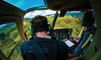


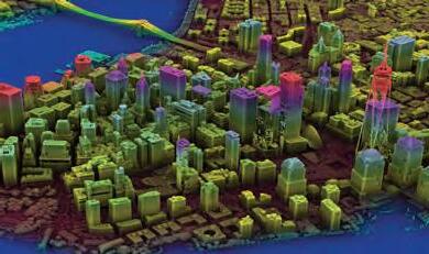


Organizations Solve
From data acquisition to analytics to answers, NV5 applies geospatial science to deliver end-to-end solutions. Our geospatial experts empower our clients to mitigate risk, plan for growth, better manage resources, and advance scientific understanding. Contact us and let’s discuss how NV5 can help you solve challenges faster, more efficiently, and more effectively. þ NV5GeospatialSoftware.com * Geospatialinfo@NV5.com
Helping
Mission-Critical Challenges With Geospatial Data and Solutions
3D Target
3D TARGET was founded as a trading company and official distributor of non-destructive measuring instruments. In 2016, we created an internal R&D division dedicated to system integration and designed a universal device that could finally provide an answer for everyone: Scanfly – the world digitally twinned! 3D TARGET solutions are designed to be deployed in as little as five minutes, even by non-expert users, and can be configured to survey any landscape. Whether surveying a highway tunnel in a vehicle, a riverbed by boat, a warehouse on foot or farmland by plane, advances in 3D mapping with Lidar technology have made these once timeconsuming surveying projects faster and more efficient than was previously possible. Scanfly by 3D TARGET offers a reliable, ready-to-use, all-in-one Lidar system for complex geospatial applications on aerial, land and marine platforms. Scanfly, the lightweight and ultra-compact solutions for 3D Lidar mapping.

Bluesky International Limited
Bluesky International is a leading aerial survey company producing and maintaining seamless digital aerial photography and height data on a national scale in Great Britain and the Republic of Ireland, as well as conducting surveys for overseas customers. The US sister company, Bluesky Geospatial, operates out of Massachusetts, delivering custom projects.

With innovation at its core, Bluesky has developed a suite of products and services that deliver a level of detail designed to support new ways of working and a need for enhanced data. MetroVista, for example, supports the growth of digital twin/ smart city applications for numerous sectors. Data is captured using the Leica Citymapper 2, which allows the simultaneous collection of vertical and oblique imagery and Lidar data.
With two wholly owned production facilities in India, Bluesky is in the enviable position of providing customers with unique and cost-effective geospatial solutions.
ComNav Technology Ltd.
ComNav Technology is dedicated to being an innovator and leader in high-precision GNSS technologies and applications. It sells its products and solutions in 140+ countries and in over ten different industries, including land survey, machine control, UAV, UGV, deformation monitoring, personnel positioning, precision agriculture and marine.
As an R&D-driven company that owns 70 technology patents and 70 software copyrights, ComNav Technology continues to invest at least 20% of its annual revenue in R&D yearly to pursue the best. Each product is subject to strict quality control and has been certified by international certification authorities. Located in Shanghai, the 26,000m2 ComNav Technology GNSS Industrial Park accommodates 500+ employees. With a dedicated team that is passionate about GNSS technology, it is committed to providing best-in-class positioning solutions for various applications to delight clients with high-precision requirements.
GreenValley International

GreenValley International Inc (GVI), headquartered in Berkeley, California, is a leading innovator of 3D mapping technologies. GVI provides a wide range of advanced aerial, terrestrial and mobile Lidar survey and mapping hardware systems and cutting-edge software as well as turnkey solutions. Our portfolio includes airborne, handheld, mobile and backpack laser scanning platforms, as well as point cloud processing software such as the LiDAR360 Lidar data processing platform. GVI focuses on Lidar and image fusion technology, specializing in Lidar, UAV, SLAM, photogrammetry and other technologies to achieve an accurate digital representation of 3D space. To date, our solutions have been adopted by users in over 130 countries, including the United States, Australia, Europe, Japan and Singapore. As we continue to expand our reach and technological capabilities, GVI remains committed to driving innovation and pushing the boundaries of what is possible in the Lidar space.
Issue 1 2024 53 Bronze Premium Members
3D TARGET scanfly.it/ +39
535 7677 info@scanfly.it ComNav Technology Ltd. comnavtech.com +1 852 172 2385 sales@comnavtech.com Bluesky International Limited bluesky-world.com enquiries@bluesky-world.com GreenValley International greenvalleyintl.com +1 510 345 2899 info@greenvalleyintl.com
030
Harxon
Founded in 2008, Harxon Corporation is a subsidiary of BDStar, the first listed company in China’s satellite navigation industry. As a leading brand of GNSS positioning antenna solutions, Harxon focuses on the R&D, production and sales of GNSS antennas, vehicle antennas, wireless data radios and smart antennas, and is committed to providing high-performance positioning solutions for global customers in various industries, including surveying and mapping, geodetic reference networks, unmanned aerial vehicles, precision agriculture, autonomous vehicles, robots, construction and mining and timing applications.

Beijing Hydro-Tech Marine Technology Co., Ltd.

Hydro-Tech Marine is a leading developer of underwater and hydrographic survey equipment for survey vessels, engineering vessels, science & research vessels, USVs (uncrewed surface vessels) and unmanned underwater vehicles such as ROVs (remotely operated vehicles) and AUVs (autonomous underwater vehicles). Our product line covers multibeam echosounders, sidescan sonars, imaging sonar, sound velocity sensors and profilers. All Hydro-Tech products have shown great performance and high quality, which is why we win customers’ loyalty and so many industry awards. We are very proud of the increasing market share of Hydro-Tech sonars in the international market. We are experts in acoustic and sonar technology and, in addition to our off-the-shelf products, we leverage our strong research and development capabilities to create bespoke underwater surveying solutions to meet unique and demanding requirements.
Harxon en.harxon.com/
+86 189 0245 0568 sales@harxon.com
Inertial Labs
Inertial Labs stands at the forefront of position and orientation technology for commercial, industrial, aerospace and defence sectors. Boasting a global network of distributors and representatives that extends to over 20 countries on six continents, Inertial Labs offers a comprehensive range of products from inertial measurement units (IMUs) to complete GPS-aided inertial navigation systems (INS). The company’s technology portfolio encompasses land, air and sea applications, demonstrating a broad mastery of inertial technologies. Inertial Labs is committed to upholding high-quality standards while continuously working towards developing innovative product solutions that are cost-effective, compact and energy-efficient across various performance classes within its product lines.

Beijing Hydro-Tech Marine Technology Co.,
Ltd. hydro-techmarine.com
+86 10 5727 5310 info@hydro-techmarine.com
ReSe Applications
Inertial Labs
inertiallabs.com/
+1 703 880 4222 sales@inertiallabs.com
ReSe Applications is a specialized Swiss company focused on high-end processing of optical and thermal remote sensing data. The company is dedicated to the development of remote sensing software applications for preprocessing of multispectral and hyperspectral images. Over the last 20 years, ReSe has continued to advance the development of its premium range of software applications, delivering top-performing off-the-shelf solutions: for direct orthorectification with PARGE, for atmospheric correction with ATCOR and for radiometric processing with MODO. A special focus is on imaging spectroscopy, including both satellite and airborne imagery. With the software application DROACOR, the company goes one step ahead in the area of drone imagery. DROACOR is a new fully automatic drone-based atmospheric correction and reflectance retrieval package suited for multispectral and hyperspectral image datasets. ReSe Applications stands ready as ever to address new challenges and to deliver powerful solutions for processing improvements. ReSe
Issue 1 2024 54
Applications rese-apps.com
71 565 47 84 info@rese-apps.com
+41
SOMAG AG Jena
SOMAG AG Jena is a worldwide operating specialist for high-precision gimbal systems. Since 2004, the company, consisting of hand-picked experts in the fields of electronics, mechanics and software, has been focused on the development of gyro stabilization mounts for data acquisition and surveillance applications. SOMAG is an ISO 9001-certified company and maintains a strict quality control system. All products are assembled and tested with the highest precision at the headquarters in Jena, Germany, and at independent test facilities. The gimbal specialist works as an OEM partner to well-known camera and Lidar manufacturers but has always maintained its status as an independent supplier in the market. SOMAG’s clients include commercial, governmental and defence organizations as well as research institutions. The uniqueness of their customer projects and the multitude of different applications drives the SOMAG team to provide customized solutions and to improve performance with each newly developed device. This is why SOMAG’s mounts set the pace for gyro stabilization devices worldwide.
SOMAG AG Jena somag-ag.de +49 3641 633 68 0 info@somag-ag.de
TI Asahi
TI Asahi was established in 2009 and inherited the business of manufacturing Pentax-branded surveying instruments. The origin of these dates back to 1933, when Fuji Seisakusho started producing surveying products in Japan. As a leading company in developing and manufacturing state-of-the-art surveying instruments, TI Asahi has been continuously introducing various high-precision and high-quality products such as optical levels, total stations, GNSS receivers and 3D scanning systems. These have been used and appreciated by countless professionals in various fields of surveying and construction worldwide. The company’s mission is to develop and provide products that fully meet surveyors’ needs by focusing on true performance. At TI Asahi, they believe the products they provide can offer substantial solutions to both technological and economical obstacles. They acknowledge it is essential that they continuously learn and develop their products and practices to match customers’ needs.
Ti Asahi pentaxsurveying.com/en
+81 487930118 international@tiasahi.com
Stonex
Stonex, an Italian company, is a world leader in measurement and surveying. Our head office is near Milan and our American headquarters are in Concord. We also have a network of over 200 qualified distributors around the world, allowing us to be present in all markets and satisfy consumer needs. Stonex products combine the most advanced technologies with a practical design to simplify your daily work. In addition to our expertise, Stonex offers a wide range of high-quality services to satisfy all pre- and post-sales requirements. Thanks to the integration of different technologies and positioning software, the wide range of solutions allows us to satisfy the needs of multiple fields and applications, including building and construction, cadastral survey, GIS data collection, 3D scanning and BIM, agriculture and smart farming, territory and structure monitoring, GNSS technology solutions for solar fields, and machine control.

stonex.it +39 02 7861 9201 info@stonex.it


2024 55 Bronze Premium Members
Stonex
BECOMEOURNEXT PREMIUMMEMBER! Moreinfo:sales@gim-international.com
Innovation and hurdles in revealing our environment
3D geospatial visualization
By Simon Buckley, Virtual Outcrop Geology Group, Norway
3D visualization is at the heart of many geospatial data applications. Progress in 3D visualization has drastically reduced barriers to entry for new products based on large datasets, thanks to improved hardware and software. Challenges persist, but the adoption of tiled 3D models and standards such as 3D Tiles promises easier data consumption and sharing, driving down costs and enabling deeper integration for impactful geospatial applications. This article summarizes progress in visualizing large 3D datasets for geospatial and reality capture applications, and ongoing issues and considerations required for this powerful technology.
The geospatial revolution has seen major advances in acquisition hardware, processing software and cloud technology over the last decade. New users are finding geospatial technology increasingly accessible. As data availability (either new acquisitions or open public archives) has increased, so too has the need to communicate results. No longer is 2D (or 2.5D) the only option. 3D visualization has become the icing on the cake, creating both novel ways to inspect and analyse complex datasets and attractive outputs for presentation of results to stakeholders, collaboration, promotion and publication.
Flood mapping and simulation, BIM, city modelling, digital twins and natural resources are examples of major domains requiring visualization, although, as elsewhere in the geospatial world, the number of applications is truly diverse. As such, current visualization is driven by user needs and the industry’s growing awareness of its potential.
State of the art
3D graphics technology has been gaining interest since the 1980s. With developments such as OpenGL, Direct3D and scene graphs in the 1990s, and the introduction of programmable shading pipelines in the 2000s, engineers were able to leverage increasingly powerful
graphics processing units (GPUs) on desktop PCs to visualize large and complex 3D models. More recently, browserbased graphics (through WebGL), game engines (such as Unity and Unreal) and a new generation of graphics application programming interfaces (APIs) such as Vulkan, Metal and WebGPU offer the industry new opportunities and a roadmap for placing visualization at the centre of products and services.
Despite these advances, 3D geospatial visualization has historically been characterized by ad hoc or custom solutions, developed at high cost for specific application needs. While many vendors now
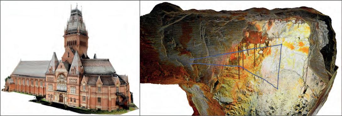
Issue 1 2024 56
Figure 1: Viewing large 3D point clouds and meshes is a basic requirement for modern geospatial software solutions. Left: handheld reality capture of Harvard University’s Memorial Hall viewed with RGB point colour. Right: underground scan of mine stope (Dargues gold mine, New South Wales, Australia) captured using the Emesent Hovermap drone platform and coloured by reflectance. (Images courtesy: Emesent)
provide software for generating 3D models from photogrammetry or Lidar, the next step for value addition in applications is still a challenge.
Data and standards
Spatial data in many 3D visualization applications is often either point clouds (XYZ point coordinates, optionally with properties such as colour or reflectance; Figure 1) or meshes (XYZ vertices, triangle connectivity and optional surface normal, colour or material information). In reality capture, meshes are often augmented with photorealistic texture, obtained from increasingly high-resolution digital imagery. In addition to vertex and triangle data, these have texture coordinates per vertex and associated packed texture images.
Interoperability of 3D data between visualization solutions is crucial
Interoperability of 3D data between visualization solutions is crucial. For point clouds, dedicated formats have been developed by the geospatial industry: LAS and E57. For meshes, it has been customary to adopt common 3D graphics data standards, such as the OBJ, FBX or, more recently, glTF formats. The main advantage of such formats is that they can easily be parsed by most 3D graphics software, with open-source code libraries available for developers to integrate into their own solutions. However, an important drawback is that they are monolithic: a complete dataset is stored as a single geometry file (with accompanying material or texture image files in the case of textured meshes). Furthermore, these formats were not designed for use with geospatial coordinate systems, requiring additional treatment in the rendering pipeline.
The large data question
An ongoing challenge for geospatial visualization is dataset size. Outputs from laser scanning or photogrammetry, either point clouds, meshes or textured 3D models, often comprise many millions – even billions – of points or triangles, and increasingly high-resolution texture images. Traditionally, real-time 3D visualization was limited by the computing hardware available, with high-specification workstations being a prerequisite, and heavy data (and therefore accuracy) reduction being necessary to ensure interactivity.
Several techniques have been developed to aid real-time visualization of large 3D datasets. Level of detail (LOD) approaches allow detailed 3D models to be intelligently simplified, resulting in lower resolution versions that can be rendered faster without losing visual fidelity.
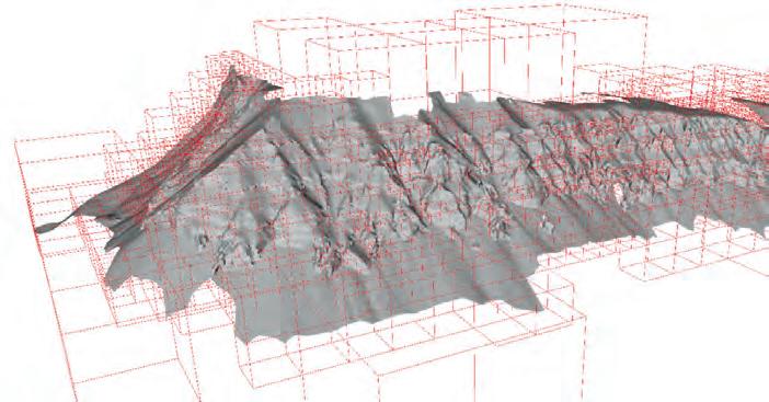
Likewise, mipmapping helps reduce the load on the rendering pipeline by optimizing the resolution of texture images depending on the distance between the model and virtual camera position in the 3D scene. A further method, normal mapping, encodes the detailed geometry of a 3D model into an image-like data structure, which is then rendered simultaneously with a coarse version of the model to give a realistic visual appearance. Taken individually, such techniques involve a trade-off between resolution and accuracy to ensure interactive rendering. However, when they are combined with one further, important data structure – tiled 3D models – and out-ofcore memory management, a visualization pipeline for almost unlimited data sizes can be realized.
Tiled 3D models
Acceleration data structures, such as octrees or kd-trees, allow 3D datasets to be hierarchically segregated based on their internal geometric density. For an original, high-resolution 3D model, a set of LODs is determined, with each level partitioned into spatial nodes, or tiles (Figure 2). The node tree is filled with the corresponding geometry for each level, before being saved to disk. The resulting hierarchy of disk files – a tiled 3D model – is linked by file references, and can be easily traversed by a 3D viewer equipped with a suitable memory management scheme. This ensures that the amount of data loaded at any instant is balanced based on the user’s current viewing position, meaning that large areas and highly detailed models can be performantly handled even on standard computers.
Until recently, there were few available standards for 3D tiled models, especially for web visualization, with the OpenSceneGraph (OSGB) format being one of the few in common use. The landscape has now changed, with revised Open Geospatial Consortium (OGC) Community Standards for 3D Tiles and Indexed 3D Scene Layer (i3S/ SLPK) formats now gaining traction across the industry. These formats are designed for geospatial coordinate systems and suitable for streaming both point clouds and 3D models over the internet.
Cloud-aware 3D model access
A tiled 3D model may comprise many hundreds or thousands of small disk files,
Issue 1 2024 57 Feature
Figure 2: Segmentation of a 3D mesh using an octree structure. Cube size reflects the density of the highest resolution data in each part of the mesh. This is used to create a tiled 3D model as a hierarchy of LODs and disk files.
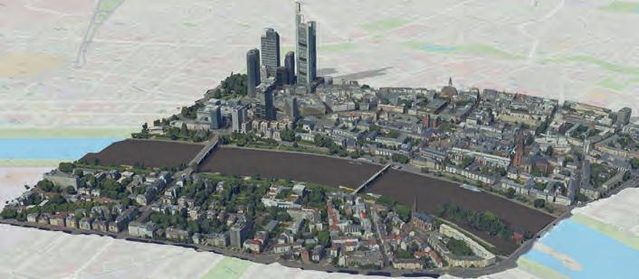
which can be challenging to share using conventional file copyin g. Cloud storage and repositories are instead a convenient way to distribute high-resolution 3D data, analogous to raster WMS or WCS standards. Making tiled 3D models accessible through APIs hides the dataset size and complexity for users, who can consume 3D data over the internet using cloud-aware software. Geometric and image texture compression, such as Draco and KTX, reduce storage needs and the amount of data that needs to be transferred. The power of 3D model streaming is now being realized through industry solutions (such as the ArcGIS or Cesium platforms) or tailored data repositories, such as V3Geo in the earth science domain.
Although highly convenient, data safety and security are essential considerations for organizations working with cloud 3D models. Local deployment can be important to ensure cloud agnostic storage, especially for government agencies that are constrained by national or organization boundaries. Popular cloud solutions from providers such as Amazon or Microsoft may not be appropriate for these organizations. IT system integration and security are challenges related to large data and visualization that must be handled sensitively.
Data integration
Large 3D point clouds and textured meshes are often the spatial framework for a wealth of supplementary data that can be used to communicate applicati on-specific information. This may be additional georeferenced data, such as thematic maps, elevation models or vector files, as well as measurements, results from other analys is methods, time series
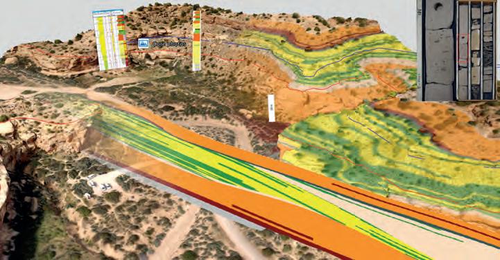
and real-time sensor data, simulation results and more (Figure 4). This approach forms the basis for digital twins for managing data assets, as well as being essential in education and for stakeholder communication. A further important area of growth is the fusion of datasets from multiple sensors, especially from drones. Thermal, multi/hyperspectral or geophysical sensors mounted on drones add additional mapping capabilities, where visualization of combined 2D–3D outputs aids interpretation and validation of results.
Visualization hardware
Visualization is no longer restricted to high-end hardware requiring high expertise, resources and even physical space for Powerwall or CAVE facilities. Current computing hardware encompasses desktop, mobile and web, as well as devices offering immersive experiences, such as VR, AR and mixed reality. 3D visualization can therefore be deployed in a plethora of situations, from traditional work on a desktop PC to monitoring real-time acquisition or performing measurements and analysis of 3D data while in the field, as well as collaborative teamwork using immersive devices.
3D stereo viewing was once restricted largely to digital photogrammetric workstations or showcasing datasets in short presentations. For ‘real work’, stereo was often low resolution, dark and uncomfortable for long periods. Today’s passive stereo monitors are bright, sharp and have resolution up to current 4k standards. Increasingly, software is optimized for stereo users, with mouse cursors and even user interfaces that can be deployed seamlessly between conventional mouse/2D monitor and stereo/tracking device setups.
Final thoughts
Progress in 3D visualization has been dramatic, with the entry threshold for starting new products based on large 3D datasets now greatly reduced. Improved hardware, gaming engines and web graphics APIs facilitate high-performance rendering without the need for advanced workstations. The growing adoption of tiled 3D models and data standards such as 3D Tiles, together with cloud storage, offer a step change in how large 3D datasets can
Issue 1 2024 58
Figure 3: Tiled 3D model (i3S/SLPK format) of Frankfurt city centre, served from the cloud and visualized in a web browser (output product from ArcGIS Reality Capture Studio tutorial; Esri, 2023).
Figure 4: Digital twin of a geological outcrop in Utah, US, co-visualizing a photogrammetric 3D model with supplementary analysis. The outcrop 3D model is cloud-based and streamed from V3Geo (Thompson Canyon (2017), VOG Group, https://v3geo.com/model/9). Additional geological subsurface data, digitized mapping, photographs, overlays and modelled sections are arranged in the 3D scene to aid application understanding.
be consumed, shared and published. For the geospatial industry, this lowers the cost for development teams and users, who can now focus resources more on integrating disparate datasets and achieving application results.
Challenges remain, with rapidly changing visualization technology requiring frequent updates and expertise development. Although graphics hardware, APIs and data formats have moved towards standardization, the overall picture in 3D visualization is still one of fragmentation, often with different approaches required for desktop, mobile and web development and for different operating systems. No single technology will fit all situations. However, progress continues, with crossplatform and desktop-web solutions such as WebGPU in development, and gaming engines increasingly accessible across multiple devices. The future of 3D geospatial visualization for creating engaging and attractive experiences is assured.
References
Esri, 2023, https://learn.arcgis.com/en/projects/get-started-with-arcgis-reality-studio, last accessed 14 December 2023.
OGC 3D Tiles format, https://www.ogc.org/standard/3dtiles, last accessed 12 December 2023.
OGC I3S format, https://www.ogc.org/standard/i3s, last accessed 12 December 2023. V3Geo, https://v3geo.com, last accessed 13 December 2023.
About the author

Simon Buckley, PhD, has a background in geospatial science. He has worked at the interface between geomatics, 3D visualization and earth science for over 20 years, as a researcher in the Virtual Outcrop Geology Group (Bergen, Norway). During this time, he initiated the 3D visualization and mapping software LIME, and has contributed to many R&D projects and community initiatives within virtual geoscience.

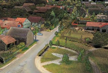


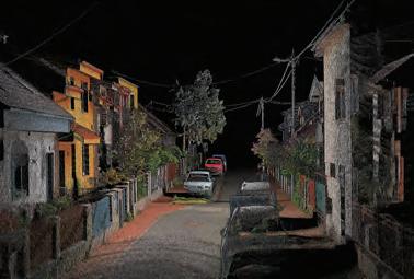
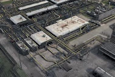

info@lidaretto.com
www.lidaretto.com
Issue 1 2024 59 Feature
Make Laser Scanning More Efficiently with Lidaretto
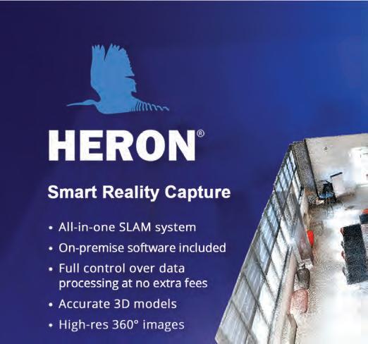
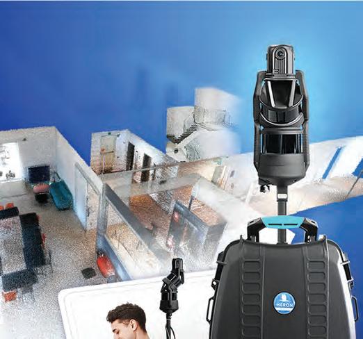


The era of smart manufacturing: why you need a good data strategy
As we enter the era of smart manufacturing, the reliability of data is growing in significance and data standardization is becoming increasingly important. According to JP Kelly, associate director and head of manufacturing at Murphy Geospatial, businesses need a good data strategy to succeed.
We are entering the era of smart manufacturing, where we can automate and simulate updates to processes and facilities virtually. The rapid adoption of automation, driven by a significant exodus of workers from the manufacturing sector over the past decade, will prompt substantial efforts to establish smart factories. Digital twins operate as virtual replicas of real-world systems, made up of geospatial data, and are used to enhance manufacturing systems and products.
Artificial intelligence (AI) tools are now being integrated into digital twins, making these data-hungry systems even hungrier as they rely heavily on the l arge volumes of ‘big data’ coming from sensors and Internet of Things (IoT) devices that m irror physical objects or systems in real time. The sheer volume of data required for digital twins is experiencing exponential growth. Simultaneously, technology’s capacity to ca pture data is expanding at an incredibly rapid pace. As AI increasingly enhances the capab ilities of digital twins, the reliability of data is growing in significance and data standard ization is becoming more and more important.
Inaccurate data can result in AI recommending unnecessary manufacturing processes
The modern vision of a manufacturing ecosystem – where the IoT and sensors offer real-time insights and intuitive digital twins bridge the gap b etween physical and digital realms – holds promises of enhanced efficiency, waste reduction, error elimination and prolonged asset longevity. However, achieving this future way of working means manufacturers need a clear data strategy that outlines stringent measures for data standardization and governance. As data volumes grow, maintaining visibility into the location and content of information becomes increasingly challenging. While big data is indispensable for insights, challenges arise when organizations lack an accurate understanding of their stored data. The escalating data volume poses a risk of reduced control when it comes to safeguarding the data.
Good or bad data?
In manufacturing, the implications of being able to identify good and bad data cannot be overstated. Bad data, characterized by inaccuracies, incompleteness, inaccessibility, inconsistency or untimeliness, poses a significant danger to the entire production process. Similarly, faulty information hampers the ability to gain a comprehensive understanding of a manufacturing facility, hindering strategic planning and timely responses to challenges.
Many players in the manufacturing sector rely on complex supply chains comprising a diverse selection of sites and stakeholders. Disparate stakeholders and the need for quick and concurrent decision-making can exacerbate the impact of poor data. Trusting inaccurate or incomplete information can lead to misunderstandings about project status, which can have a knock-on effect and cause mistakes with widespread consequences.
Good data, however, is fundamental to the success of integrating AI tools and the use of digital twins. Good data enables informed decision-making, reduces inaccuracies and ensures the completeness and consistency of data throughout an entire asset lifecycle. Without good-quality data, you cannot create an intuitive digital twin and therefore a truly smart factory.
So how do you know the difference? It’s all about how the data was collected, how it was labelled, and how it is managed. It starts with an accurate digital record of an
Column Issue 1 2024 61
asset, via forensic data capture and the process of Scan-to-BIM (building information modelling). Then, implementing a geospatial management plan allows the strategic handling and analysis of spatial data using technologies like GIS, AR and VR to support informed decision-making, planning and resource management of the asset.
AI and autonomous workflows
Autonomous workflows have been proven to offer strong competitive advantage, time savings and improved business processes. But with AI making decisions based on the data, it has been fed, it’s easy to see why the accuracy of data included in the many layers of the digital systems matters so much. Inaccurate data can result in AI recommending unnecessary manufacturing processes. This not only wastes valuable time, but also incurs additional costs. While the immediate benefits of having accurate data within the architecture of a digital twin might not be apparent in small-scale projects, the true value unfolds over time.
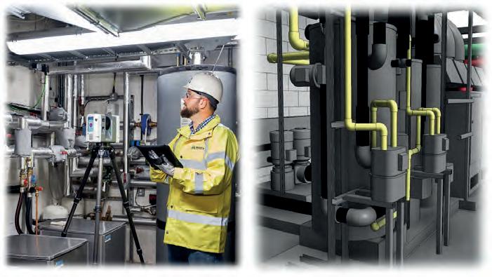
Capturing assets with precision through Scan-to-BIM. (Image courtesy: Murphy Geospatial)
About the author
JP Kelly serves as the associate director and head of manufacturing at Murphy Geospatial, bringing extensive experience with nearly 25 years in the geospatial sector. His expertise lies in navigating complex manufacturing assets, consistently delivering informed geospatial solutions across all projects.

62 Issue 1 2024

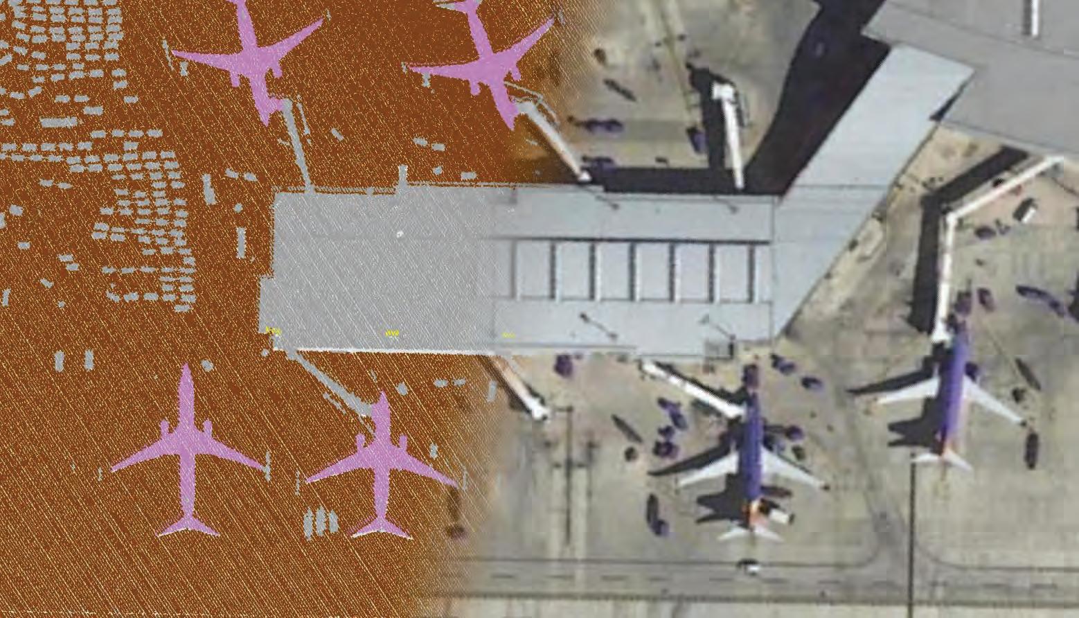


Global Mapper Pro is an all-in-one GIS package for analyzing and processing vector, terrain, image, and point cloud data. Compatible with 380+ different file formats and Python scripting, Global Mapper can be seamlessly brought into your existing workflow. The latest version of the software includes updates to the award-winning custom point cloud classification training tool, increased photogrammetric processing speeds, mesh cropping, a 3D print file exporter, an improved path profile tool for visualizing and editing elevation data, and much more.
Pixels to Points is Global Mapper Pro‘s photogrammetric processing tool that creates photo-textured 3D models, orthoimages, and high-resolution point clouds. Using overlapping UAV/Drone-collected images, Global Mapper can use these generated data models to measure terrain volume, forest height, create base maps, and more.


Global Mapper Pro v25.1 Features New Automatic Ground Control Point Identification for Processing Drone Imagery
Ground control points (GCP) are used to improve positional accuracy in photogrammetric processing and, in most software, must be manually associated with an image pixel, an essential process that can be tedious. Using a method of shape detection, the new GCP Manager can locate and place markers on clearly identifiable targets, streamlining the process of using ground control points.


Global Mapper’s custom point cloud classification training tool won the 2023 Outstanding Innovation in Lidar award from GeoWeek and Lidar Magazine. This machine learning tool lets users create an automatic method for identifying unique features in point clouds based on shared attributes, allowing subclassifications to refine further each point feature type being classified. For example, roads and sidewalks can be subclassifications of the ground class. Subclassifications are distinct in color and label without losing the functionality of the parent class.
Try Global Mapper Pro v25.1 with a free trial today!
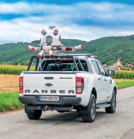
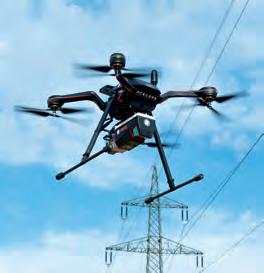
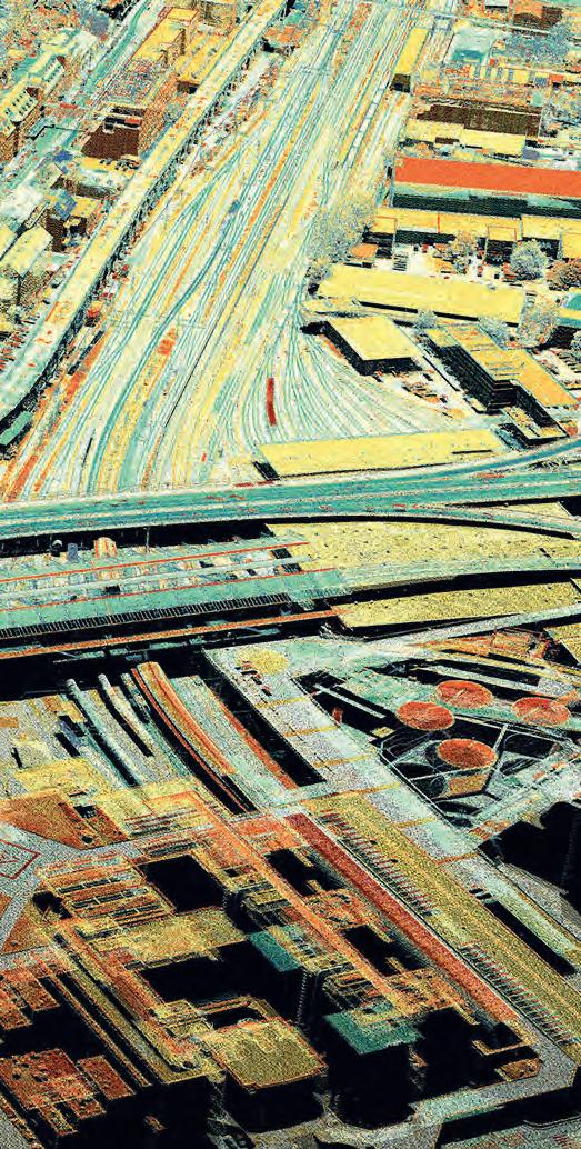
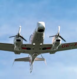

Austria | USA | Japan | China | Australia | Canada | United Kingdom | South America TERRESTRIAL UAS/UAV MOBILE AIRBORNE Explore the RIEGL Ultimate LiDARTM Technology www.riegl.com Digitize the World Fast. Precise. Efficiently. RIEGL 3D LASER SCANNING
