INTERGEO
by ABDULVAHIT TORUN
Intergeo 2017: Transition from Providing Solutions to Value Partnerships The world’s leading fair and conference on geodesy, geoinformation and land management, recently took place in Berlin and provided an open global environment for the geo-information community and geomatics technology sector to see the current state of the art and look into the future.
In addition to Intergeo’s role as a marketplace for the geomatics industry, it helps the global sector to position itself in the changing world economy set in a digitalised world. CHARACTERISTICS Compared to the last three events, Intergeo 2017 was the first to attract more than 18,000 visitors from 107 countries, with about 1,400 conference delegates participating in parallel sessions of 200 talks and presentations. There were 577 companies from 37 countries exhibiting, a quarter of these for the first-time. In spite of the variety of communication channels such as the internet and social media in a
networked, business environment, where access to information is at your fingertips, the expanding Intergeo reflects the growth in the geospatial sector and demonstrates the importance of face to face communication, on site presentations and the excellent link between trade fair and conference. It should be noted that an increased programme in English would be a big plus. With all its unique characteristics, Intergeo provided a natural platform for showcases, live interaction, promotion of new products, networking between customers and technology producers, and extending global marketing and reselling networks. In addition to the main topic of digitalisation, Intergeo provided the
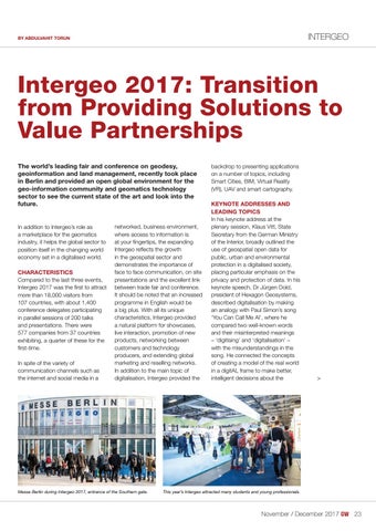
Messe Berlin during Intergeo 2017, entrance of the Southern gate.
backdrop to presenting applications on a number of topics, including Smart Cities, BIM, Virtual Reality (VR), UAV and smart cartography. KEYNOTE ADDRESSES AND LEADING TOPICS In his keynote address at the plenary session, Klaus Vitt, State Secretary from the German Ministry of the Interior, broadly outlined the use of geospatial open data for public, urban and environmental protection in a digitalised society, placing particular emphasis on the privacy and protection of data. In his keynote speech, Dr Jürgen Dold, president of Hexagon Geosystems, described digitalisation by making an analogy with Paul Simon’s song ‘You Can Call Me Al’, where he compared two well-known words and their misinterpreted meanings – ‘digitising’ and ‘digitalisation’ – with the misunderstandings in the song. He connected the concepts of creating a model of the real world in a digitAL frame to make better, intelligent decisions about the
>
This year’s Intergeo attracted many students and young professionals.
November / December 2017
23-24-25_intergeo.indd 23
??
23
01-11-17 12:14