UAVs
by CHARLTON BLAND
Drones - A Surveyor’s Tool Drone technology is becoming widespread. On suitable projects drones enhance the speed and safety of site work. Once the imagery is captured, the deliverables that can be produced photogrammetrically are exceptionally versatile and easily fall into existing CAD, GIS, BIM and Virtual Reality workflows. Surveyors play a crucial role in embedding new technology and techniques into established ‘best practice’ ways of working. This article describes a recent project to demonstrate how the UAV was incorporated into a survey and the significant time, safety and cost value it added to the client and the contractor. Satellites, Drones and Lasers In 2017, SNC-Lavalin’s Atkins business undertook a survey of a disused gas holder site for National Grid. The client required a 1:200 CAD topographic map and an orthophotograph mosaic of the 2 hectare site. They also needed a site video showing the condition of the gas holders themselves. The site was in a major city centre and all site work was completed within four hours. In simple terms the site work had three major components. Firstly,
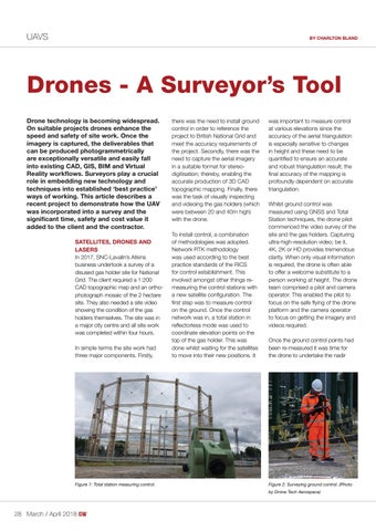
Figure 1: Total station measuring control.
there was the need to install ground control in order to reference the project to British National Grid and meet the accuracy requirements of the project. Secondly, there was the need to capture the aerial imagery in a suitable format for stereodigitisation; thereby, enabling the accurate production of 3D CAD topographic mapping. Finally, there was the task of visually inspecting and videoing the gas holders (which were between 20 and 40m high) with the drone. To install control, a combination of methodologies was adopted. Network RTK methodology was used according to the best practice standards of the RICS for control establishment. This involved amongst other things remeasuring the control stations with a new satellite configuration. The first step was to measure control on the ground. Once the control network was in, a total station in reflectorless mode was used to coordinate elevation points on the top of the gas holder. This was done whilst waiting for the satellites to move into their new positions. It
was important to measure control at various elevations since the accuracy of the aerial triangulation is especially sensitive to changes in height and these need to be quantified to ensure an accurate and robust triangulation result; the final accuracy of the mapping is profoundly dependent on accurate triangulation. Whilst ground control was measured using GNSS and Total Station techniques, the drone pilot commenced the video survey of the site and the gas holders. Capturing ultra-high-resolution video; be it, 4K, 2K or HD provides tremendous clarity. When only visual information is required, the drone is often able to offer a welcome substitute to a person working at height. The drone team comprised a pilot and camera operator. This enabled the pilot to focus on the safe flying of the drone platform and the camera operator to focus on getting the imagery and videos required. Once the ground control points had been re-measured it was time for the drone to undertake the nadir
Figure 2: Surveying ground control. (Photo by Drone Tech Aerospace)
28 March / April 2018
28-29_drones-asurveyorstool.indd 28
01-03-18 13:23