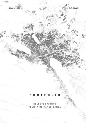
U R B A N I S M P O R T F O L I O S E L E C T E D W O R K S F E L I C I A O L I V A R E S G A R Z A D E S I G N
D e g r e e i n U r b a n P l a n n i n g
ABOUT ME
I am a recent graduate with a keen interest in socio-spatial justice and nature-based strategies for addressing contemporary urban challenges Lately I have been focus on communicating complex projects on social media
SKILLS
Technical skills: Qgis, AutoCad, SketchUp, Tableau, Photoshop, Illustrator, Revit, Google Maps and Earth, Office 365.
Soft Skills: Teamwork, Proactive, Passionate for Research, Creativity, Problem Solving, Time Management
EDUCATION
Monterrey Institute of Technology and Higher Education.
Bachelor´s Degree in Urban Planning
Relevant Coursework: City
Entrepreneurship, Territorial Diagnosis, Urban Ecology, Sustainable Metropolis: Mitigation, Resilience, and Adaptation
Nanyang Technological University.
Study Abroad in Singapore
Second Half of 2022
Relevant Coursework: Integrated Urban Managment, Public Administration, Social Class and Inequality
COMPETITION
Twelfth Architecture Competition (First Half 2023)
Proposal for a lineal park design in Mexico City
Grand Prize for Young Architecture (Second Half 2022)
True Spatial Justice Post- Pandemic design proposal for downtown Monterrey, Mexico.
RESEARCH
feli7marzo@gmail com
Social media: citadin a
feli7marzo@gmailcom
+52 8182599108
Phone: +52 (81)81599108
Monterrey, Mexico
Monterrey, Mexico
Urbanistica (2024) Comparative analysis of urban planning instruments between Municipal Plan of Monterrey and Madrid
Nuevo Norte.
Research Assistant
Nature- Driven Machine Learning (2023)
Research Assistant
ACADEMIC FORMATIVE EXPERIENCES
Secretariat of Innovation and Open Government of Monterrey (First Half 2023)
Proposal for Improving Participatory Budgeting Monterrey
Street Intersection Space Recovery Strategy
Capital Natural (2022)
Conscious Real Estate Business Manual
Perkins & Will (2021)
Master Plan for mitigation of several risk in the Campana- Altamira District
COMMUNITY SERVICE
Safe and Sustainable Mobility MOVAC (Summer break 2023)
Office work facilitator for summer initiatives
Social Cartography GEOSTATS (First Half of 2023)
Mapping citizen initiatives in Nuevo Leon to facilitate the search and connection of organizations working for the public good and fostering support between them
TECHO (2018-2019)
Vice President of the organization in high school, coordinating students
ADITIONAL INFORMATION
¨Architecture and Context¨ Seminar (2021)
Participation as a speaker
English U r b a n P l a n n i n g S t u d e n t LANGUAGES
Spanish
CV
Essence recovery of Penny Riel 9-11
Sensory analysis 12-14
Content Nature-driven research
2-4 Base map Public Space in Ferrimar 5-8
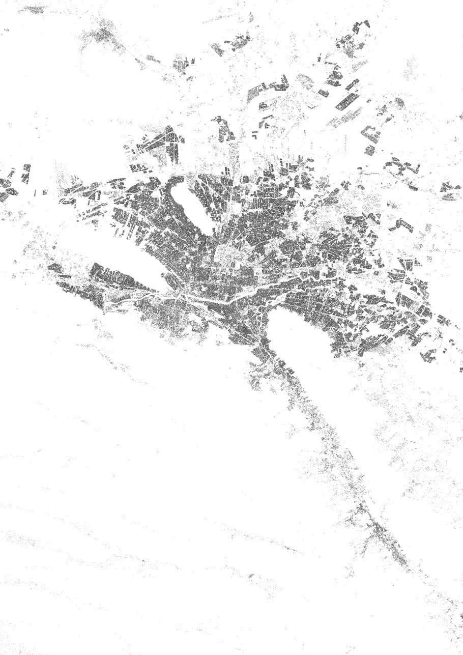
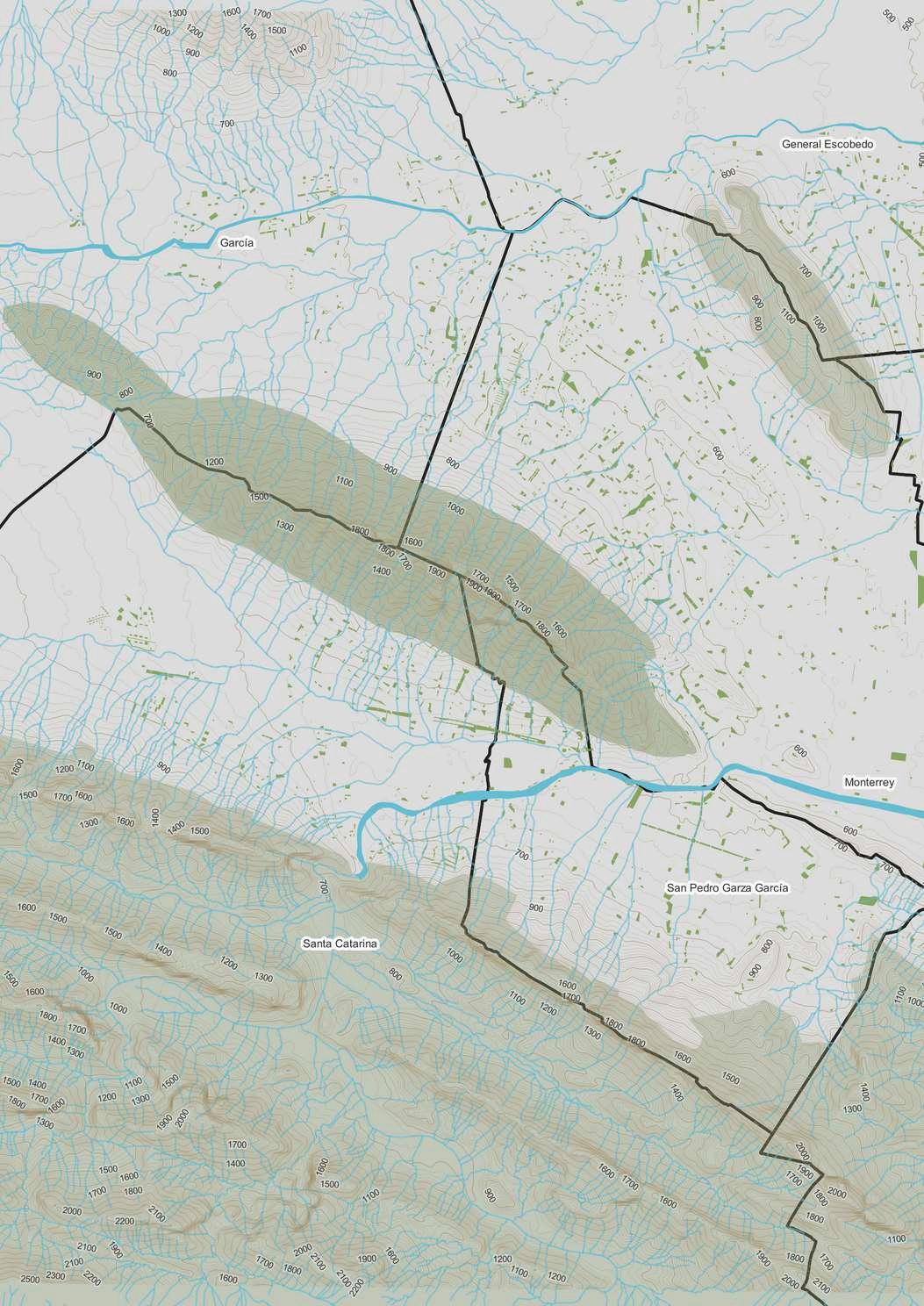
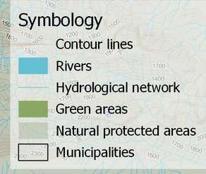
1
Research
Year: 2023
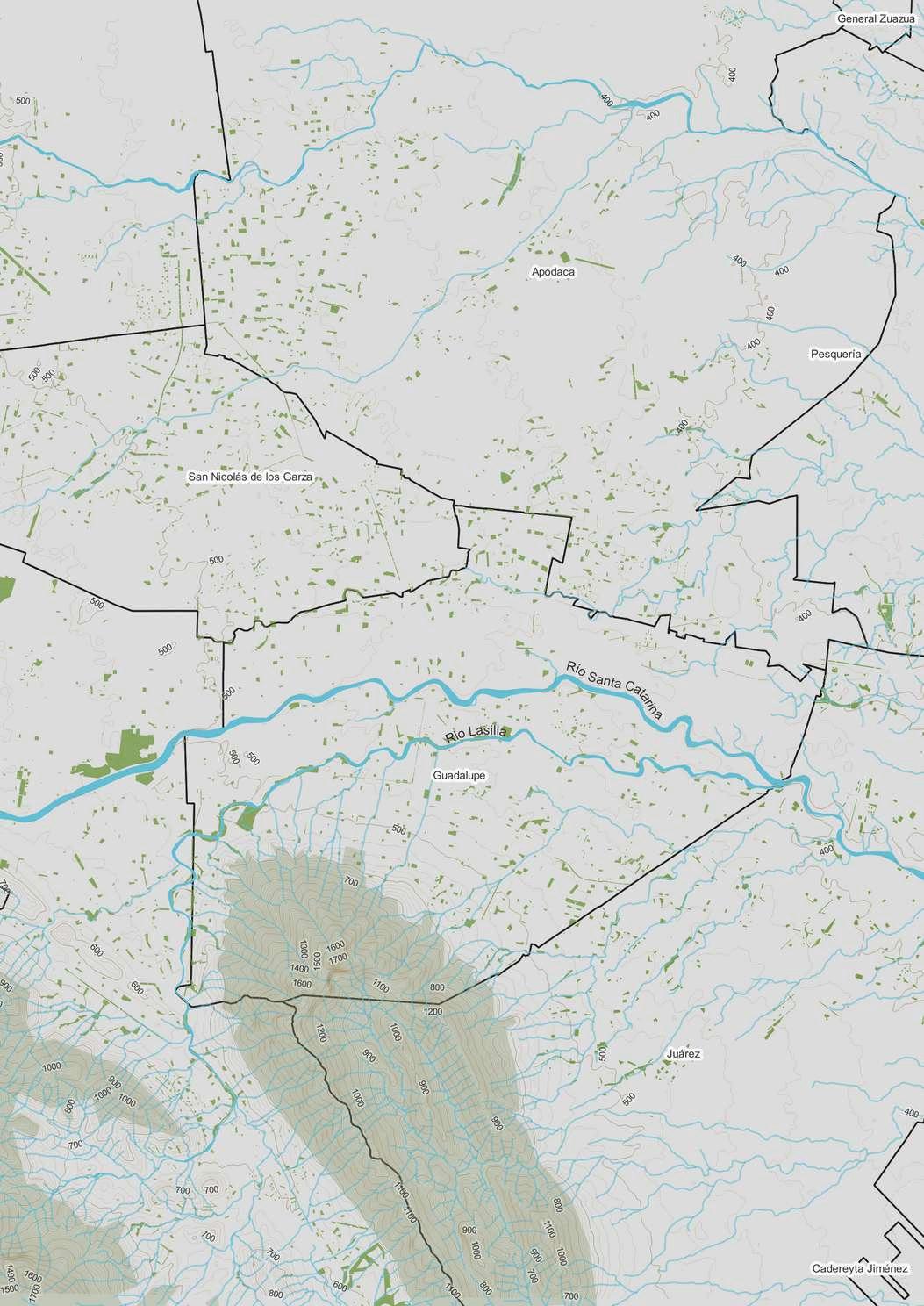
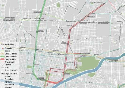
The map that will be seen below was the base map for the research that sought to use the behavior of an animal species to identify where they lived and what they did to reduce their vulnerability to natural disasters. This map identified the most crucial natural aspects to take into account in the Metropolitan Area of Monterrey
1 Nature-driven research Location Monterrey
3
4
Public space in Ferrimar
12th Architecture
Competition
Neighborhood Linear Park
Mexican National Railways
Team work
Arturo Balvanera Garza
Marina Ramirez Suarez
Location: Mexico City
Year: 2022
ABSTRACT
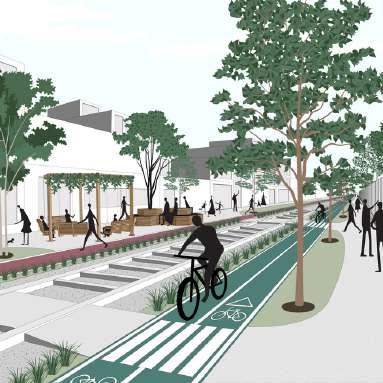
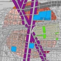
The lineal park proposal arises from the need to intervene in the forgotten built environment to provide spaces that protect and promote mental health in the face of the growing prevalence of the professional burnout syndrome This condition is caused by prolonged stress due to emotional and interpersonal factors in the workplace. Some of the causes include long working hours, excessive workload, a hostile work environment, and an imbalance between work, social, and family life. The design premises are oriented towards creating creative spaces that foster imaginability and generate memorable experiences Similarly, the goal is to promote social interaction and introspection as an escape from work life This is achieved through a diversity of spaces that encourage the use of public spaces at different times of the day, catering to different users and their needs
5
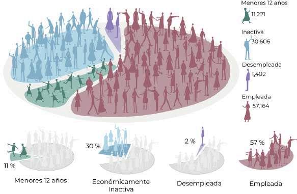
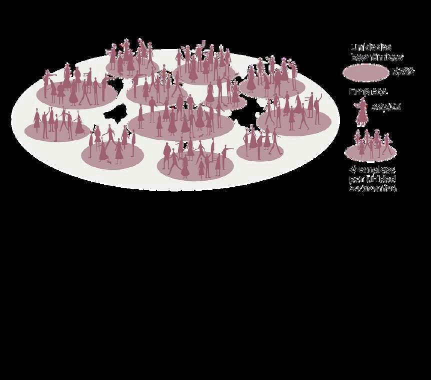
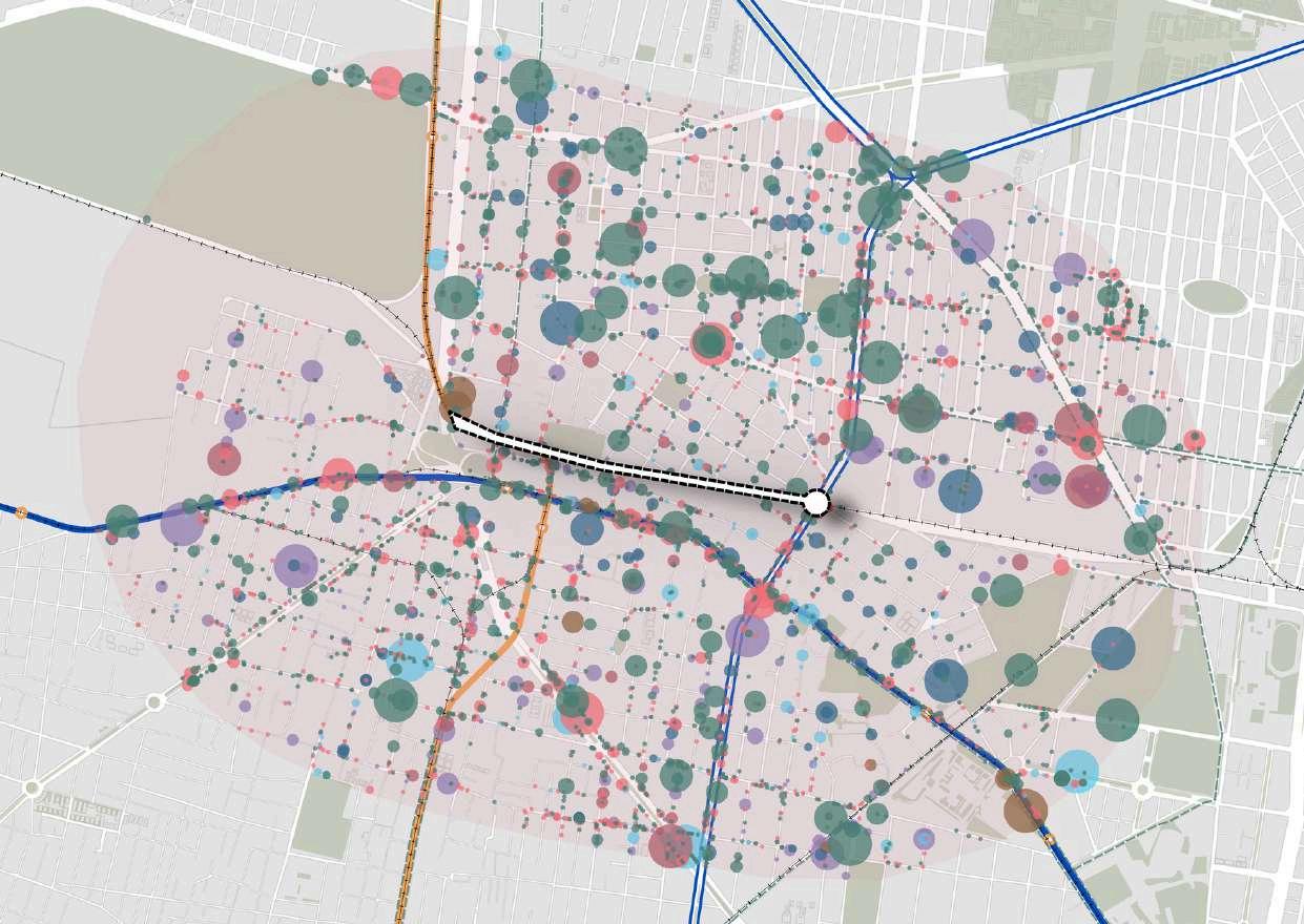
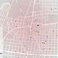
Intervention zone Wholesale trade Retail trade Services Health services Educational services Government Industry Line 2 Line 7 Trolleybus Railways Bike lanes Number of employees per economic unit Simbology Economic
active population within a 1200- meter radius Longer working hours compared to OECD countries(2019)
Affectedworkers 75% Affected workers inthesiteanalysis 42,870
Unemployed Workers Childrenunder 12yearsold Economically inactive Unemployed Workers Economicunits Employment 8employment pereconomicunit 6
and Connectivity Analysis Economically
Hoursperyear 2,124
Childrenunder12yearsold Economicallyinactive


Workers Residents Walk
Students
Cultural visitors
Athletes
Cultivate Rest
Cowork Rest
Socialize
Mixed-use housing
Leisure
Organic workshops
Concerts/ theater
Local art
Interactive installations
Skaters
Clisthenics
Runners
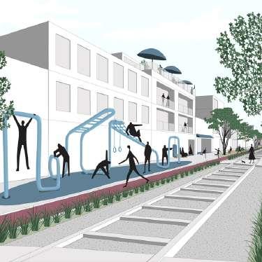
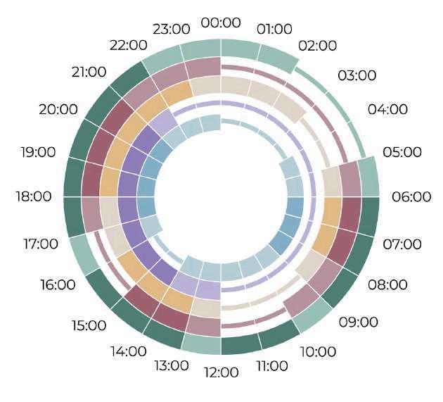
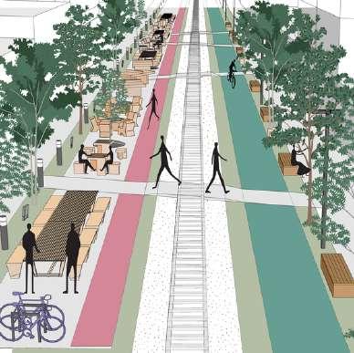
A B Traffic calming Introspection Skatepark Playground Garden Out Oasis Zen Plataform Plataform
A OASIS ZENIntrospection B GYM C Introspección Traffic calming F NACIONALES X AZCAPOTZALCO A Proposal for space utilization 7
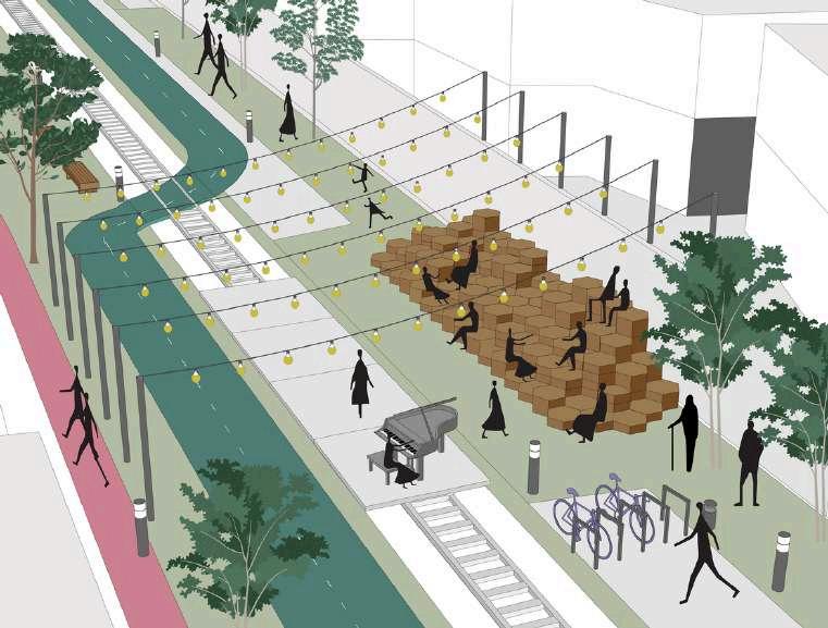
The plataform was designed to be the core of the park and capable of being multifunctional depending on the needs of the space users with the purpose of providing a movable stage to promote deliberation in public space and social interaction
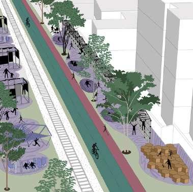
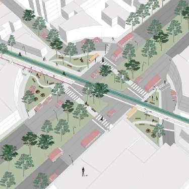
OUTDOOR OFFICES E F NACIONALES X CUITLÁHUAC F C D E F Imaginativeness Social interaction door gym Art installations Coexistence Outdoor offices Lecture Social interaction Traffic calming INTERACTIVE INSTALLATIONS D Imaginativeness 8
Emergent cities
Eight-semester class
Individual work
ABSTRACT
The objective of this project was to make visible, complement, and delve deeper into the winning solutions of the Participatory Budget proposed by one of the neighbors in the area In this specific case, the historical context and the community's memory were crucial. In the 1960s, the market in the area called Penny Riel was a regional landmark In the early 2000s, the elevated metro was an imposed and poorly executed project that resulted in the invisibility of the market, businesses, and society a loss of presence and forgetting of the city The fundamental questions were: How can infrastructure enhance the iconic activities of the place?
Location: Monterrey,
Essence
Mexico Year: 2023
recovery of Penny Riel
9
Site analysis
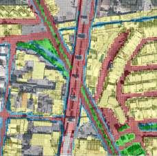
24% allocates to motorized transport, while only 9% for pedestrians 13% is unused and 5% is designed for vegetation
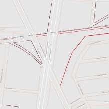
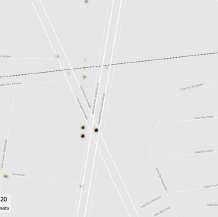


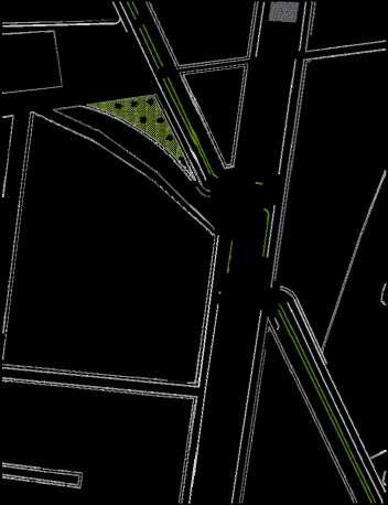
Underutilized space Zoning Industrial corridor Low density residential Low mixed residential Facilities Open space Medium mixed residential Facilities Penny Riel Religion temple Plaza Educational Metro station Medical assistance Traffic flow Pedestrian Vehicular Crowds at bus stops Multipe informal crossings Sidewalks Available Not available Not applicable Luminaires Available Not available Not applicable Trees Available Not available Not applicable Invades by the entrances of vehicle garages and obstructions from urban element Caused by an intersection with underutilized space, multiple directions, and sparse signage Traffic incidents The lack of streelights is the main cause of insecurity There is lack of spaces that allow water infiltration or natural and animal connectivity
construction
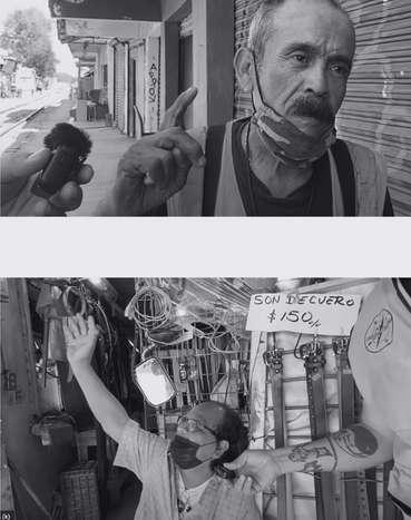
the Metro destroyed the entire place
said they would finish it
2 years, and it took 7
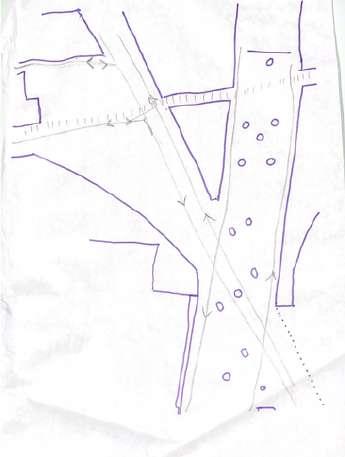
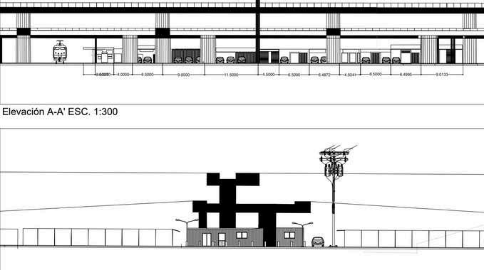
used to be many businesses that have now gone bankrupt The businesses are not visible Nowadays, it's a place for theft It's not like it was 10 years ago " 1 0 L o n g i t u d i n a l s e c t 07 2071m 2377m 1498 32 38 151 309m1166m 128 C C h 10 4474m 23895m Á b 6578m Á T r a n s v e r s e s e c t i o n
"The
of
They
in
There
Proposal- potentialities of the space
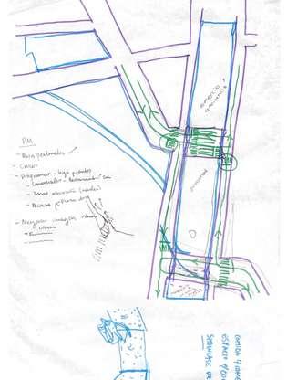


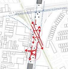
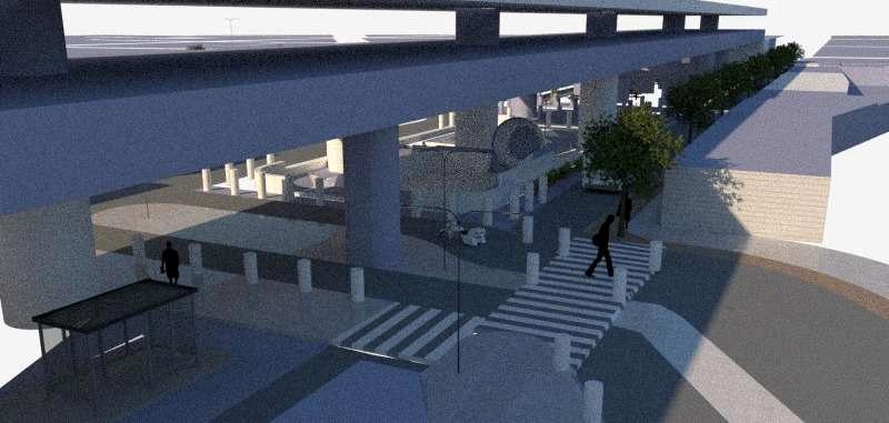
The project 'Recovery of Penny Riel and Félix U Gómez Spaces' aims to pacify the road and regenerate currently underutilized spaces under the overpass and metro. These spaces aim to provide areas for commerce and interaction for the area's users
1 1 B
Luminaires Traffic redistribution Bus stops with resting and protection facilities L o n g i t u d i n a l s e c t i o n T r a n s v e r s e s e c t i o n Action Lines: Enhancement of road safety 1 Softens the design of the space for pedestrians, cyclists, children, and older adults 2. Enables flexible space for recreational activities 3. Increases visibility for Penny Riel and regains its customer base 4 Encourages social, environmental, and economic interaction 5
Skatepark
(Sensoory analysis)
Quality of life
Fourth-semester class
Team work
Katia Aldaba
Sergio Daniel Aguero
Arturo Balvanera
Pablo Emiliano
Castillo
Rodrigo Junco
Andrea Martinez
Macarena Pena
Paola Nohemi Ramirez
Juan Jose Rodriguez
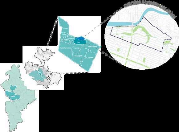
Location: Monterrey, Mexico
Year: 2021
ABSTRACT
What is quality of life? Guillermo Westreicher explains that it is a set of factors that contribute to a person's well-being The factors that can define it are based on physical, material, social, and emotional well-being.
Our challenge is to conduct a diagnosis of the Fuentes del Valle neighborhood to create proposals that promote the quality of life of the individuals involved in the area, based on resilient aspects. As a motivation for our work, we want (from our discipline) to contribute knowledge to boost current urban and social capacity. We consider it essential to adapt to the trends and pressures in the area to maintain and enhance the quality of the zone From our point of view, the neighborhood possesses many positive qualities; however, it is necessary to implement actions that safeguard a more sustainable future
1 2
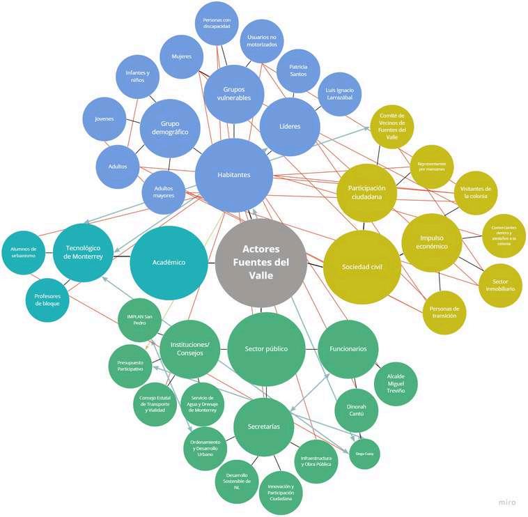
Mapping of actors
Technique that seeks to identify key actors in a system and allows for the analysis of their interests, importance, and influence on the outcomes of an intervention
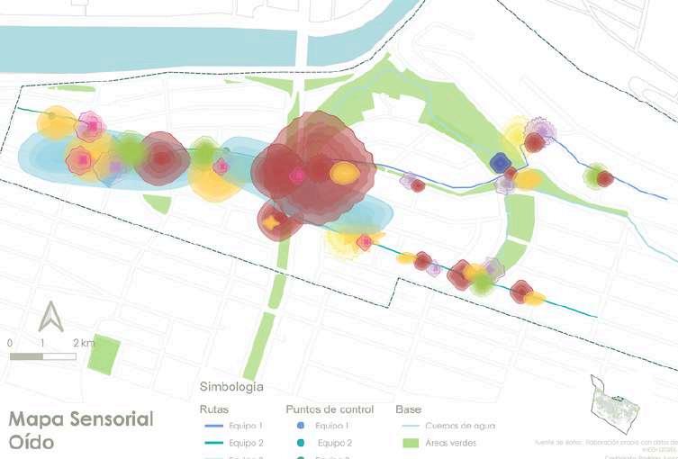
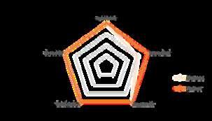
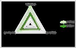
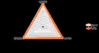
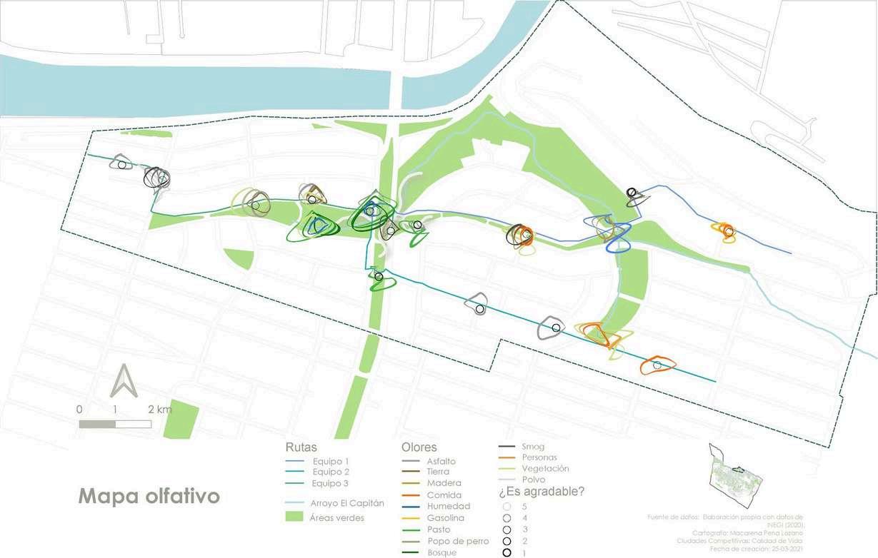
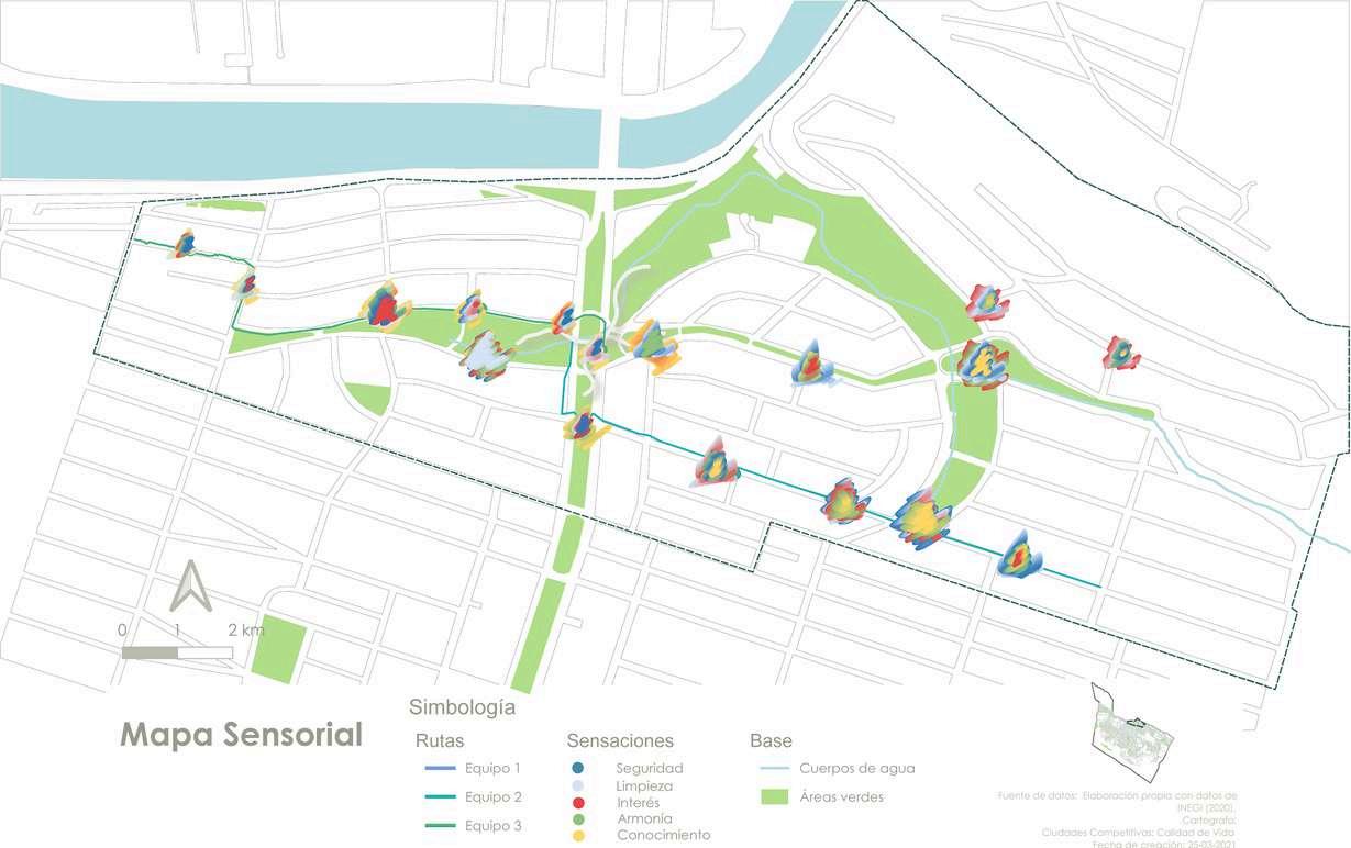
Sensory analysis
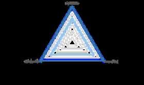
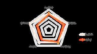
3 routes and 17 reference points were proposed to carry the analysis We determined three main categories (Smell, Hearing, and Sensation), from which different indicators were derived. During a site visit and after analyzing each location, we assigned a rating to the various indicators using a Likert scale, with values ranging from 1 to 5, where 1 is very poor and 5 is excellent Finally, a sensory survey was conducted with a group of 21 residents from the neighborhood to observe their individual perceptions and to compare between the residents and external individuals
Security
Cleanliness
Interesting
Harmony
Familiar
Senseof hearing
Humans
Nature
Cars
Constructio
The smells were resized based on their intensity of odor Similarly, sounds changed in size depending on their perceived intensity Sensations have different sizes, shapes, and color organization, which depend on the score in each of the evaluated categories
The colors used to represent smells, sounds, and sensations arise from a survey conducted among the students to analyze and understand with which color they associate each one
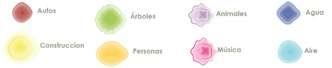
Asphalt
Animal
Forest
People
Vegetation Dust
1 3 Academic Professors Urban planning students Tecnologico de Monterrey Civil society Civil participation Economic momentum Transtona indivduas Real state Traderswthin andaroundthe neighborhood Visitors Vistorsper block Neghborhood committee Residents Seniors Adults Youth Infants Infants Leaders Women People with disablites Non-motorized users Patricia Santos Luis Ignacio Larrazabal Public Sector Institutions/ councils Government officials Participatory budgeting StateTransport and RoadAuhoriy Waterand DranageService Urbanplannng anddeveopment Sustanabe development o NL Innovation and citzen partcipaton Infrastructure andpublc works Diego Cuesy Dnorah Cantu Mayor
Pleasant 1- Little 5- A lot Intensity 1- Little 5- A lot Satisfaction 1.- Little 5.- A lot Sense of hearing Pleasant 1- Unpleasant 5- enjoyable Intensity 1- Little 5- A lot Satisfaction 1- Annoying 5- Pleasant Frequency 1- Little 5- A lot Familiar 1- Unknown 5Acquainted Sensation Security 1- Unsafe 5- Safe Cleanliness 1- Disrty 5- Clean Interesting 1- Little 5- A lot Harmony 1- Chaos 5- Peaceful Familiar 1- Unknown 5- Familiar
Studen t#1
Avarag ecolor
Smell
Sensation
#2 #3 #4 #5
n Smell Student #1 #2 #3 Avarage color
Food Humidity Gasoline
Dirt Wood
Grass
poop
Smog


Harmony Knowledge Water b Green a Cars 1 4
Construction Trees People Animals Musica Familiar Satisfaction Frequency Intensity Pleasant Students Neighbors Familiar Intensity Pleasant Students Neighbors Students Neighbors Familiar Harmony Interesting Cleanliness Security Students Neighbors Familiar Harmony Interesting Cleanliness Security Students Neighbors Pleasant Students Neighbors Pleasant Students Neighbors Pleasant Satisfaction Intensity Students Neighbors Students Neighbors
Auditory sensory map Simbology
References
Karen Hinojosa
National Director of Urban Planning Program Tecnologico de Monterrey khinojosa@tec.mx
Talia Gonzalez
Campus Director of Urban Planning Program Tecnologico de Monterrey tgonzalezc@tec.mx
Eldife Mariela Rivas
Research professor at Tecnologico de Monterrey m rivas gomez@tec.mx
Natalia Cervantes
Research professor at Tecnologico de Monterrey nataliagcervantes@tec.mx