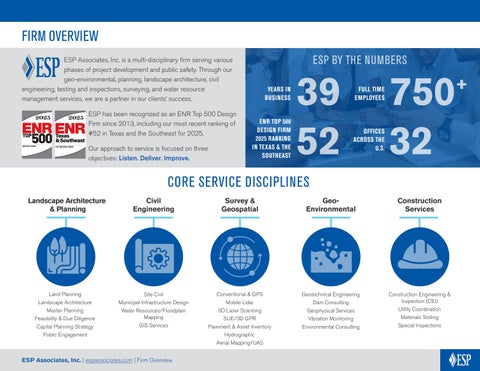
ESP Associates, Inc. is a multi-disciplinary firm serving various phases of project development and public safety. Through our geo-environmental, planning, landscape architecture, civil engineering, testing and inspections, surveying, and water resource management services, we are a partner in our clients’ success.
ESP has been recognized as an ENR Top 500 Design Firm since 2013, including our most recent ranking of #52 in Texas and the Southeast for 2025.
Our approach to service is focused on three objectives: Listen. Deliver. Improve.
Landscape Architecture & Planning
YEARS IN BUSINESS
ESP BY THE NUMBERS
FULL TIME EMPLOYEES
ENR TOP 500 DESIGN FIRM 2025 RANKING IN TEXAS & THE SOUTHEAST
52
CORE SERVICE DISCIPLINES
Civil Engineering
Survey & Geospatial
GeoEnvironmental
32 OFFICES ACROSS THE U.S.
Construction Services
Land Planning
Landscape Architecture
Master Planning
Feasibility & Due Diligence
Capital Planning Strategy
Public Engagement
Site Civil
Municipal Infrastructure Design
Water Resources/Floodplain Mapping
GIS Services
Conventional & GPS
Mobile Lidar
3D Laser Scanning
SUE/3D GPR
Pavement & Asset Inventory
Hydrographic
Aerial Mapping/UAS
Geotechnical Engineering
Dam Consulting
Geophysical Services
Vibration Monitoring
Environmental Consulting
Construction Engineering & Inspection (CEI)
Utility Coordination
Materials Testing
Special Inspections
LAND PLANNING & LANDSCAPE ARCHITECTURE
ESP is dedicated to creating vibrant, connected spaces that are unique to their place, tell a story of their history, and preserve the natural environment. As communitybuilders and stewards of the land, we focus on health and well-being, sustainability, and social and ecological equities within every community we touch.
In doing so, we stress the importance of collaboration with clients, multi-disciplinary colleagues, and the public so that everyone has a voice in the process. From this collaboration, we create accurate, detailed designs that speak to the collective and stand the test of time as functional, sustainable, and beautiful spaces.
Planning Services:
Site Planning
Design Guidelines
Site Analysis & Environmental Inventory
GIS, Site Analysis, & Inventory
Master Planning
Entitlement/ Rezoning Coordination
TND/TOD Site Planning
Public Hearing Presentation
Neighborhood Meeting Facilitation
Landscape Architecture Services:
Planting Plans
Hardscape Plans
Irrigation Plans
Project Branding/ Signage
Wayfinding/ Monumentation Design
Construction Documentation
Construction Administration
Public Engagement
3D Renderings & Illustrations
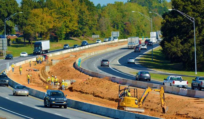
CIVIL ENGINEERING
Roles & Responsibilities:
ESP’s civil engineering team is a talented group of professionals who take pride in serving our clients.
We continually strive to consider and evaluate alternative solutions to complex engineering issues while also maintaining focus on impacts to budget and schedule. Our team is strengthened by ESP’s diverse project experience and collaboration with other service area professionals who can be called upon to provide feedback on specific alternatives.
ESP provides design services for public infrastructure and water resources projects as well as residential, commercial/retail, and business/industrial developments.
Due diligence/feasibility
Preliminary site evaluation
Project team coordination
Construction document design
Stormwater design/ analysis
Governmental review coordination/permitting
Bidding administration
Construction observation
Value engineering
Cost estimate opinions
Project schedules
Lot-fit matrix
Detailed lot grading
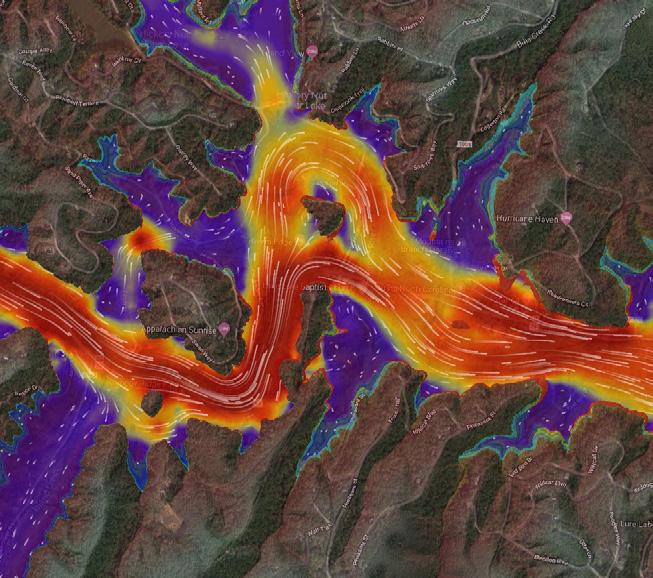
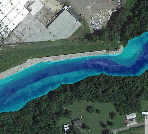
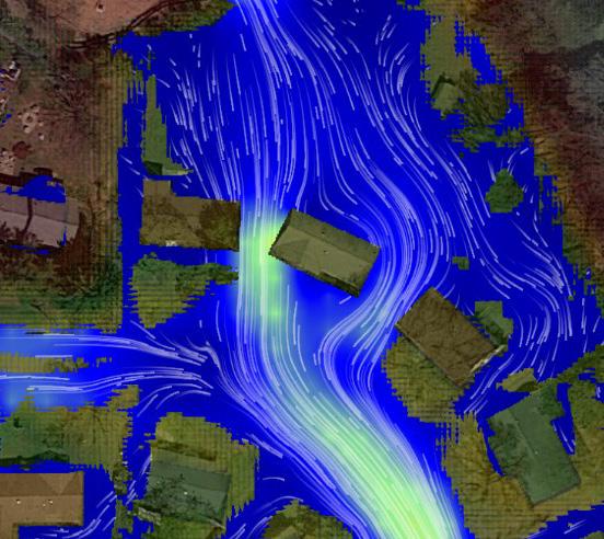
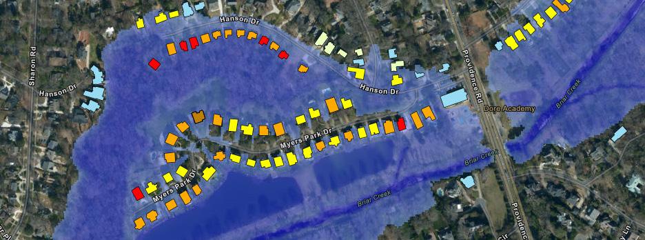
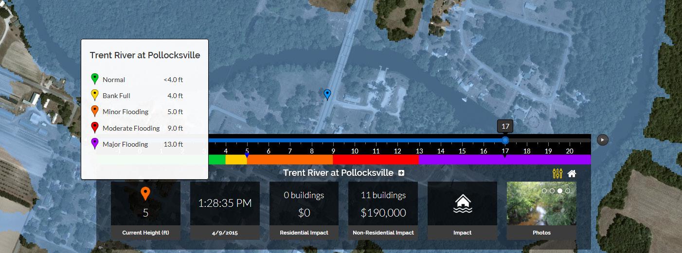
WATER RESOURCES / FLOODPLAIN MAPPING
ESP is a leader in water resources engineering, stormwater management, and floodplain mapping with tremendous expertise and resources.
Our team has a complete understanding of the mapping project approach. We use state-of-the-art GIS-based modeling and mapping tools, and we have a proven track record of success with hydrologic and hydraulic analysis and natural hazard risk assessments for FEMA, states, municipalities, and private clients.
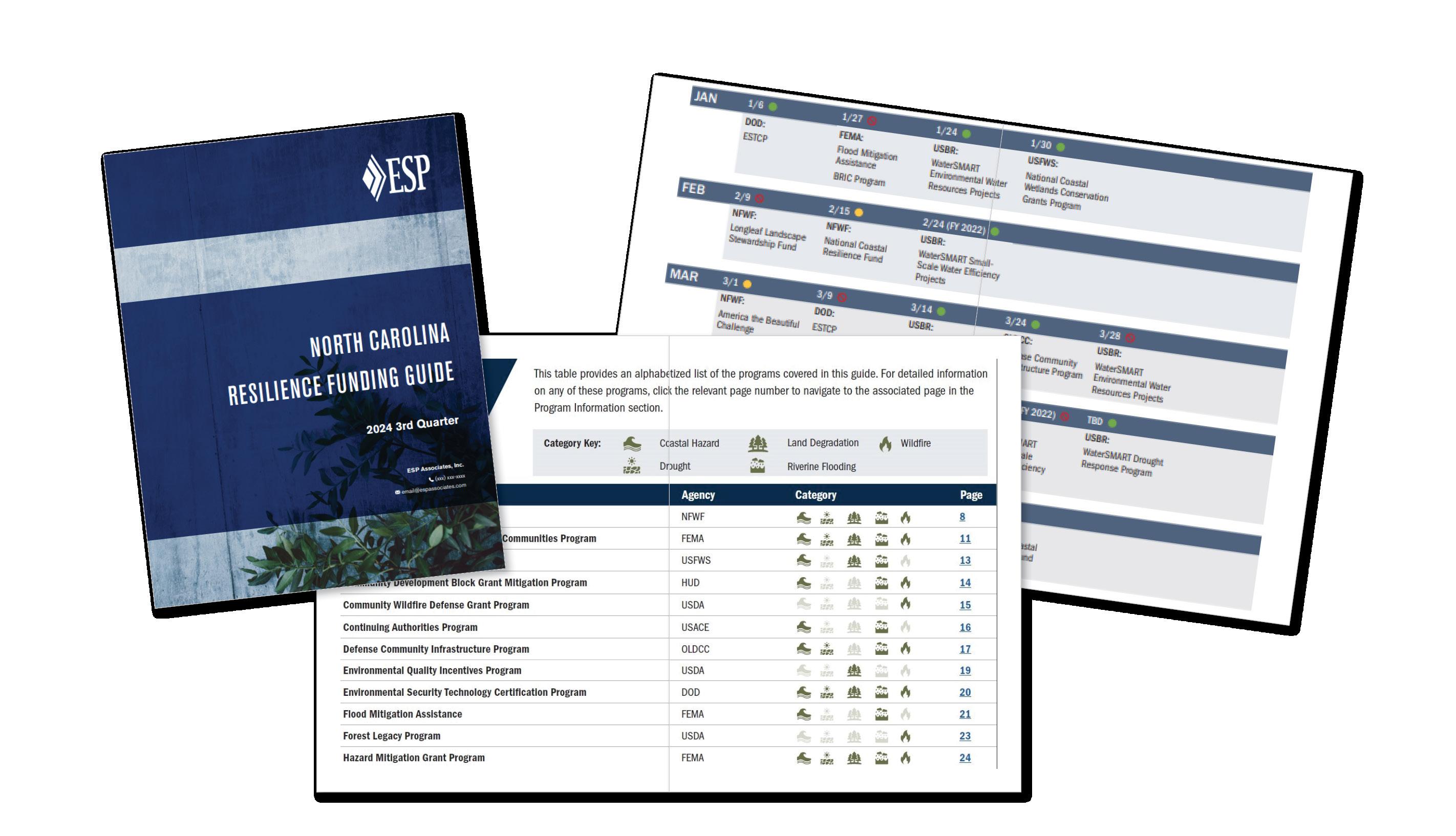
STRATEGY & PLANNING comprehensive funding guide capital improvement plans partnership agreements letters of support
4
GRANT APPLICATION grant writing benefit-cost analysis graphics & documentation submittal design & preparation
GRANT ADMINISTRATION regulatory reporting budget & schedule oversight review of plans & paperwork code, policy, & procedure adherence
From initial planning to grant administration, ESP provides step-by-step guidance and support to help clients develop a comprehensive approach to pursuing federal, state, local, and foundation grants that best fit the short- and long-term vision of a project.
To be well-positioned before grant windows open, our approach begins early by determining funding availability and requirements and identifying strategies to maximize grant opportunities through a holistic analysis of partnerships, funding overlaps, project phasing, and design and implementation options.
Throughout the process, we coordinate with clients, stakeholders, and agencies to balance the goals, schedules, and budgets of each funding source and help your project come to fruition.
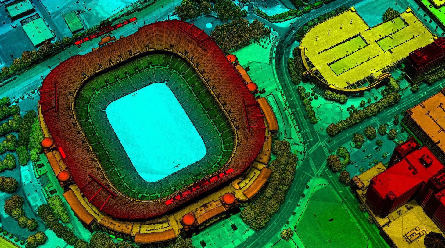
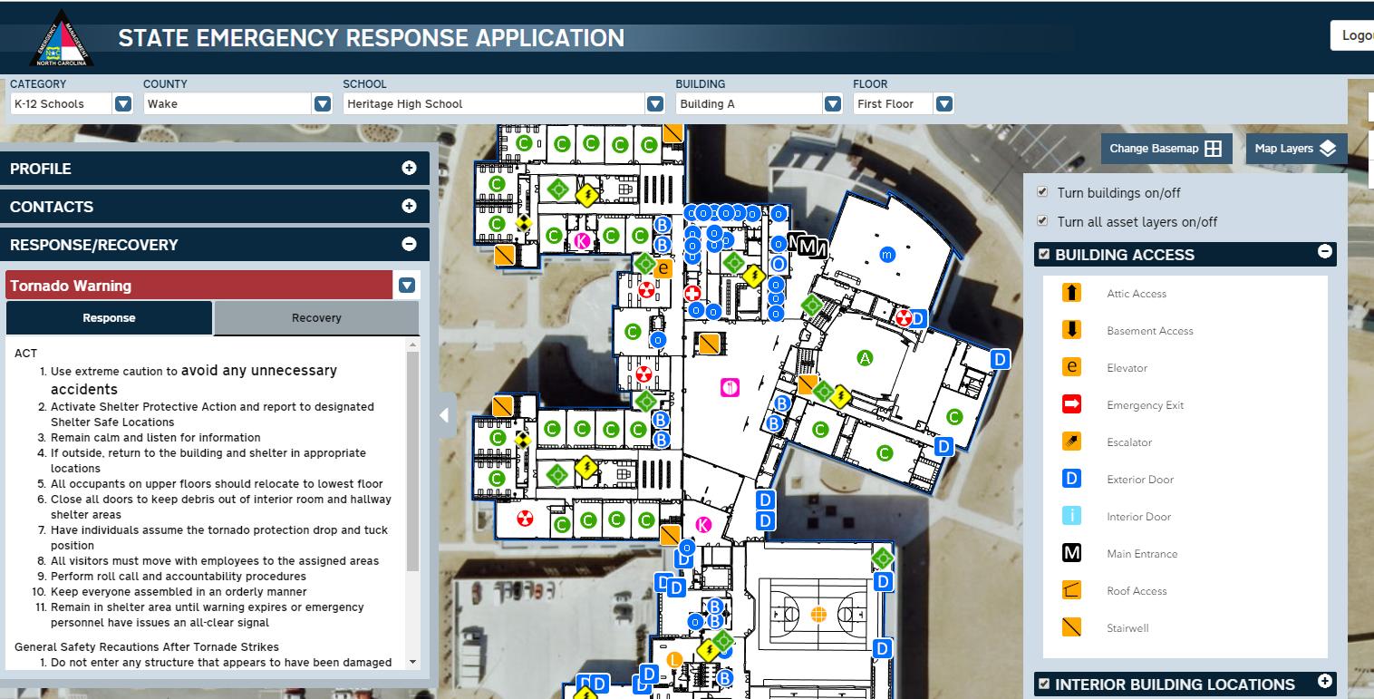
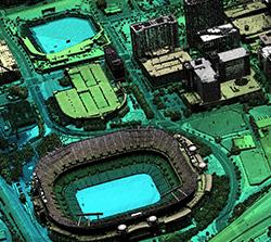
GIS / GEOSPATIAL SERVICES
ESP’s GIS and geospatial groups leverage the latest technology and methodology to create custom solutions that exceed our client’s goals, requirements, and expectations. We serve local, state, and federal clients in GIS and geospatial development in a variety of emergency management applications.
ESP uses the ArcGIS Server Platform to maintain a corporate enterprise solution to GIS. ArcGIS Server allows ESP to centrally organize, maintain, and distribute GIS data, maps, and geo-processing routines. It also provides for built-in security and quality control measures as well as the ability to support the concurrent multiuser editing environment, GIS Model Development, streamlining and automating geo-processing routines to allow for efficient and cost-saving geospatial solutions.
GIS Services:
Geospatial analysis & modeling
Thematic mapping
Digital image & lidar processing
Application development
Geodatabase design
APPLICATIONS DEVELOPMENT
ESP has developed numerous IT systems and web/mobile applications. We support all aspects of the software development lifecycle, including enterprise architecture design and implementation, application development, and cloud-hosting capability.
Applications Development:
Intranet/internet site design
Relational database design
Spatial data management
Real-time data integration
Web & mobile applications
WebEOC integration & custom board development
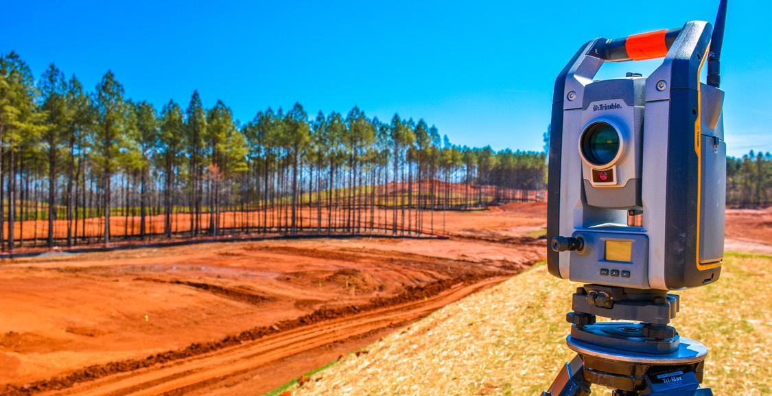
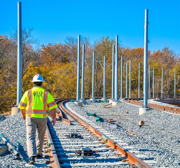
LAND SURVEYING
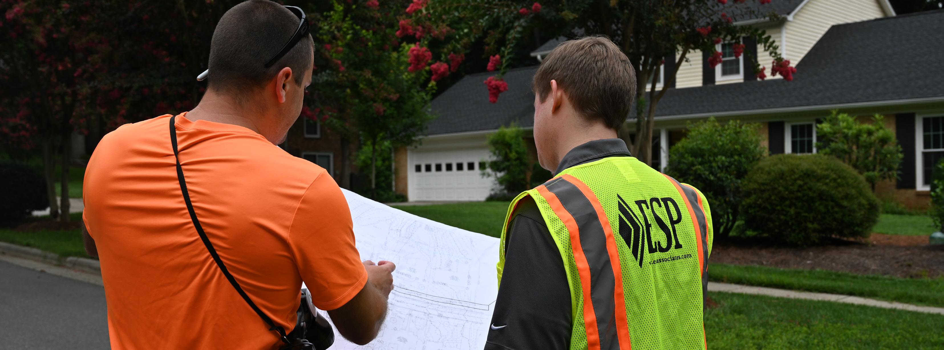
ESP combines the strength of capacity with a staff of highly-trained professionals to provide quality surveying services to our clients.
Our commitment to the use of state-of-the-art equipment, along with a diversity of market share, allows ESP to provide services to a wide range of clientele.
ESP’s surveying departments function both as partners to our other professional disciplines as well as valued consultants to those clients requiring only surveying.
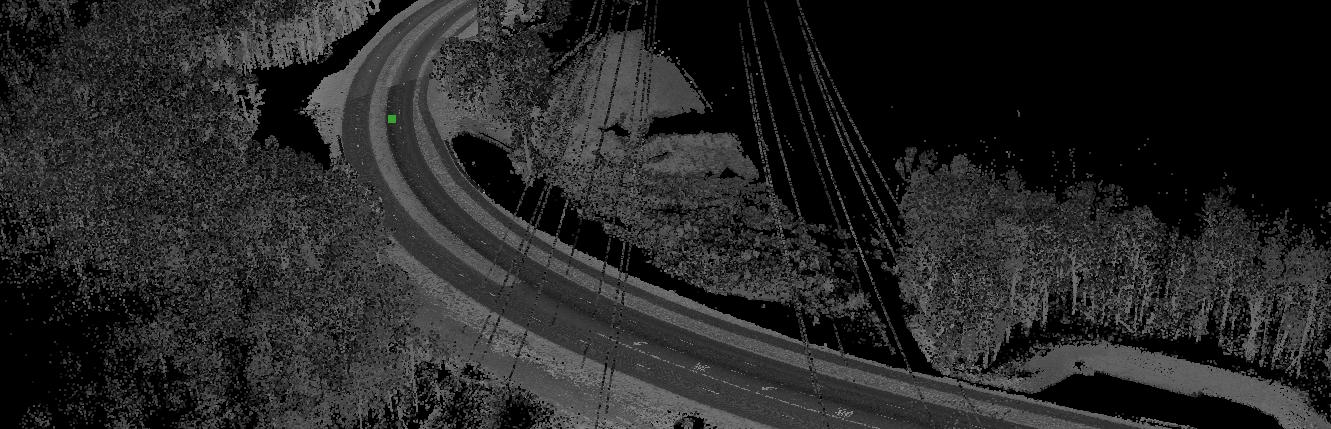
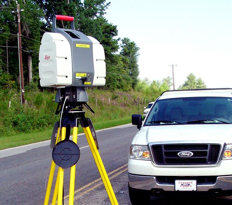
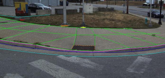
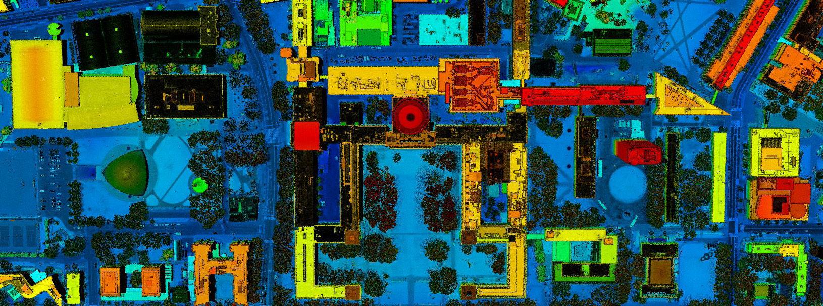
Mobile lidar is an innovative technology used to collect mass quantities of street/railway-perspective, highly accurate 3D point cloud data, and high resolution imagery that can be used for various high-accuracy survey and mapping applications, GIS asset inventory and management, and analysis and assessment of various existing roadway and safety conditions.
Since 2011, ESP has successfully implemented this technology on various projects throughout the country to help clients find the most efficient and appropriate methods to successfully complete projects of all magnitudes. With four in-house mobile lidar systems, we have applied this technology to hundreds of highway, roadway, and railway projects, as well as hydrographic survey projects and overland topographic survey projects using all-terrain vehicles.
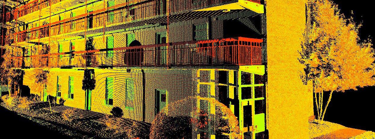
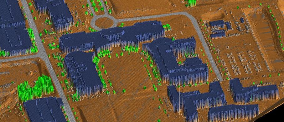
Also referred to as ground-based or terrestrial lidar, 3D laser scanning is a cuttingedge technology allows us to collect spatial data from a site, structure, or object rapidly and remotely.
The information from a 3D laser scan provides extremely accurate data in the form of a dense point cloud that can easily be modeled, geo-referenced, and surveyed virtually. These point clouds can be used to create everything from 2D floorplans to 3D BIM models, and much more.
Relevant Services:
Site & engineering surveys
As-built surveys
Detailed intersection surveys for traffic studies
Volume & area calculations
Topographic & detail surveys
Fabrication & construction inspection
Quantity surveys
3D modeling & visualization
Pavement DTM’s for hydroplaning analysis
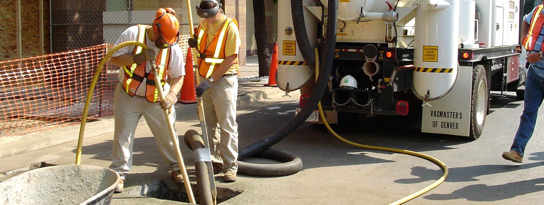
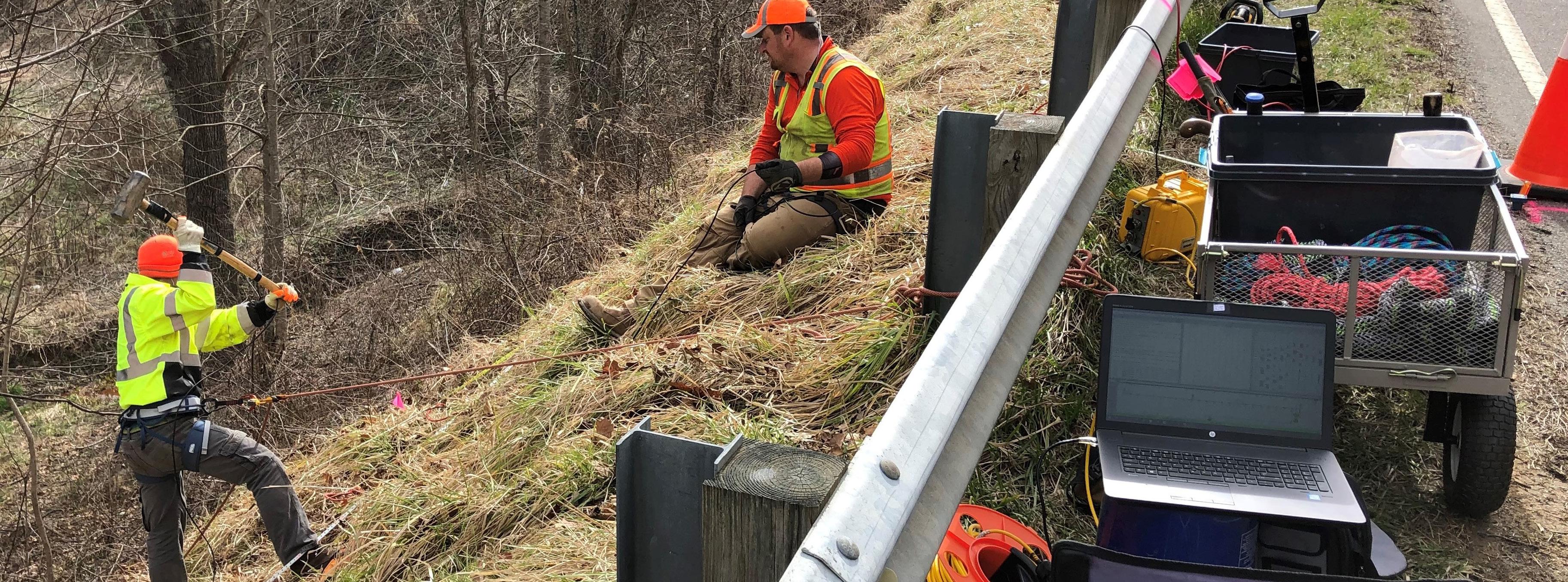
SUBSURFACE UTILITY ENGINEERING
ESP’s subsurface utility engineering (SUE) division applies the latest technology and methods to map underground utilities for design and construction projects.
In addition to investment in non-destructive vacuum excavation equipment and geophysical/remote-sensing devices like ground-penetrating radar, ESP employs professional staff with more than 200 combined years of experience performing SUE services.
Our high-tech equipment and qualified professional staff allow ESP to provide clients with accurate and efficient subsurface utility mapping in accordance with ASCE Standard 38-02.
SUE Services:
Utility records research
Surface feature utility surveys
Utility designation
Utility mapping
Vacuum excavation
Ground Penetrating Radar (GPR)
Raptor® 3D GPR Array
Utility impact analysis
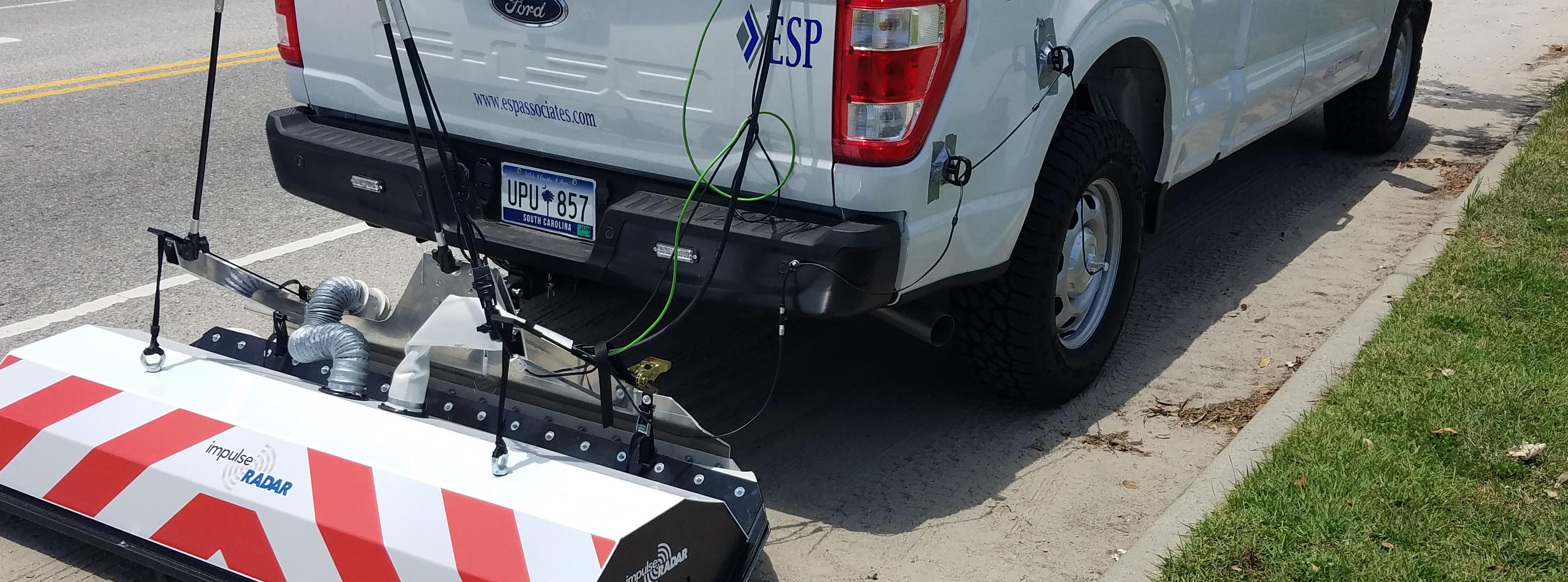
3D GROUND PENETRATING RADAR
Reduces cost & time for efficient data collection
High-Speed Raptor® 3D GPR Services:
Highway projects demand an accurate and complete understanding of subsurface data, with safety and efficiency at the forefront.
ESP employs a high-speed Raptor® ground penetrating radar (GPR) array, the first real-time-sampling (RTS) system capable of collecting 3D GPR images at posted speed limits. Through its speed of data acquisition, this tool increases production capability on large-scale urban utility mapping projects while also improving safety margins for site personnel.
With the ability to integrate data with survey and other SUE mapping deliverables, ESP delivers fast and accurate 3D data to mitigate utility conflicts and keep projects on schedule.
Collects large volumes of 3D subsurface data at posted speed limits
Survey-grade position via RTK/GPS or total station
Post-processed 3D data can be converted to line data for CAD export to depict utilities in a 3D survey
Benefits:
Eliminates the need for traffic control
Minimizing time that field personnel spend in the traffic corridor
Increases safety for consultants & the general public
Reduces cost & time for efficient data collection
Applications:
Subsurface utilities
Voids
Archaeological artifacts
Buried debris
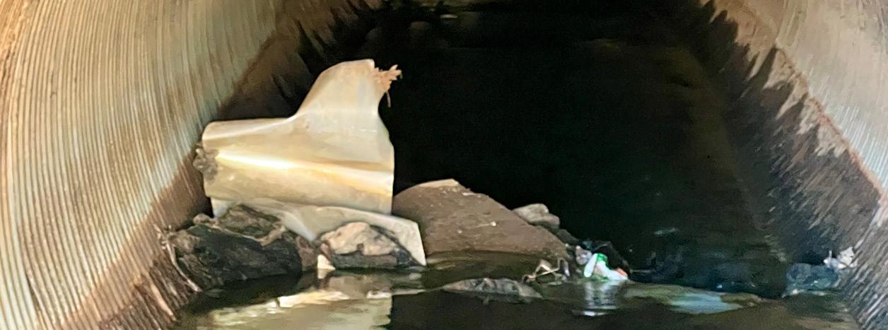
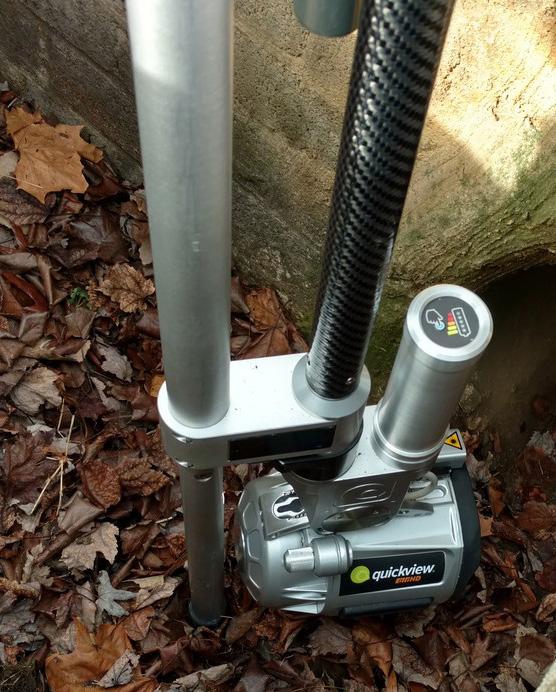
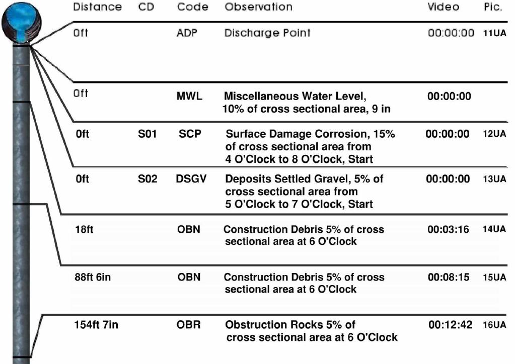
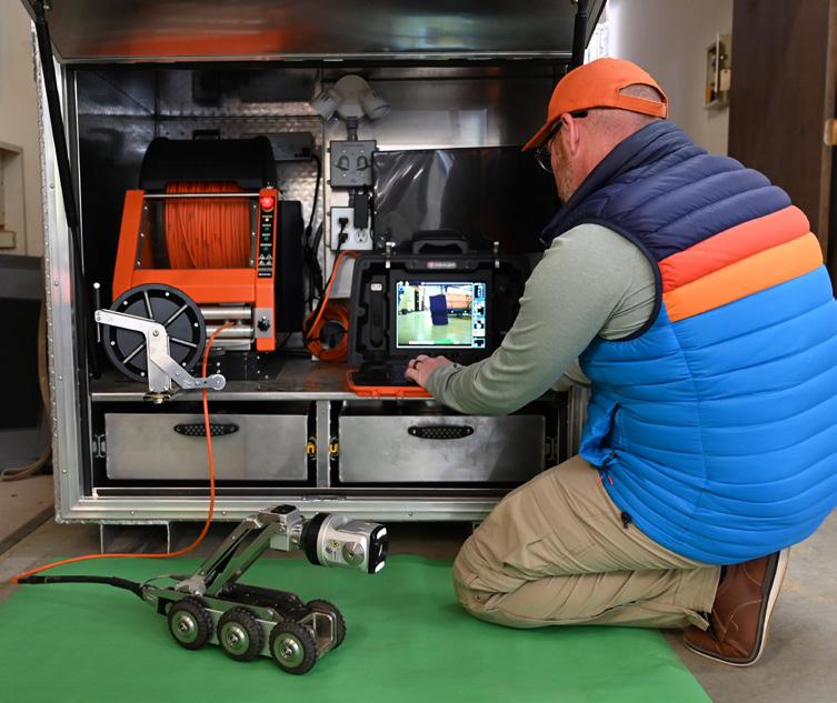
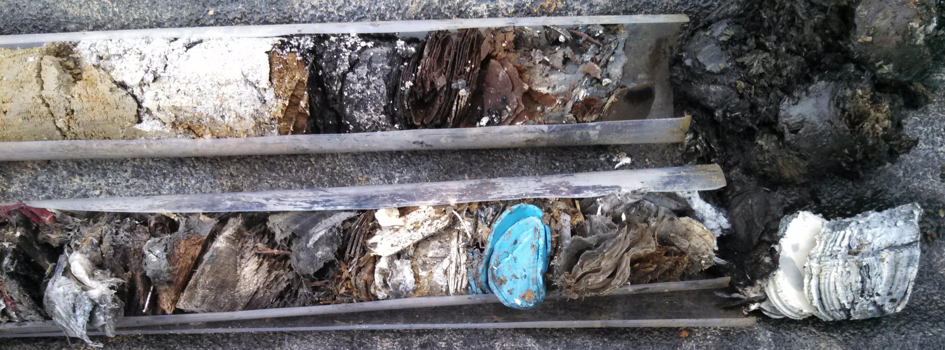
CCTV VIDEO PIPE INSPECTION
Features & Benefits:
From residential storm lines to large-scale drainage infrastructure, our NASSCOcertified staff use Envirosight® pole cameras and Minicam Proteus® crawlers to locate, inventory, and assess conditions within otherwise inaccessible water and stormwater pipes. These systems provide detailed reports, including video, images, and measurements.
Provides detailed visual evidence of pipe conditions
Eliminates need for field crews to enter drainage structures
Allows inventory and assessment of otherwise inaccessible pipes
Pinpoints pipe defects before they become a problem or further escalate
Minimizes unnecessary excavation by precisely identifying problem areas
Helps mark utilities otherwise unlocatable via vacuum excavation or 3D GPR
Offers an affordable tool for regular assessment and preventative maintenance
Detects inflow/infiltration problems, lateral connections, and pipe size changes
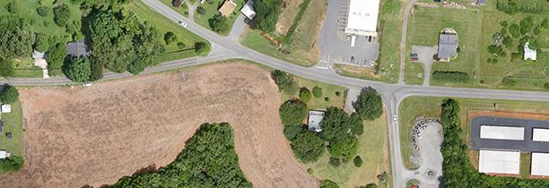
PAVEMENT & ASSET INVENTORY
Equipment:
2D/3D pavement imaging system
Transverse & longitudinal profile, roughness, & rutting system
Mobile mapping laser scanner
Survey-grade GPS with inertial movement sensor
Dual Ladybug 5+ 360 cameras
Capabilities:
ESP invested in vehicle-based scanning in late 2010, with the purchase of the first Trimble MX8 system ever produced in the U.S. We have since added 4 additional systems to meet our clients’ needs for mobile scanning services. In 2020, we added an IrisPRO Pave data collection vehicle for comprehensive roadway condition assessments.
Today, we combine state-of-the-art pavement collection and survey-grade mobile mapping sensors in one vehicle, which allows us to gather imagery and location of your assets, for your entire network of roads, in a single mobilization.
Assessment & monitoring of pavement quality
Mapping of all roadway assets inside the right-ofway
Automatic pavement crack/distress detection
Fast, automated PCI reporting to all common pavement management formats
Survey-grade deliverables available with post project ground control
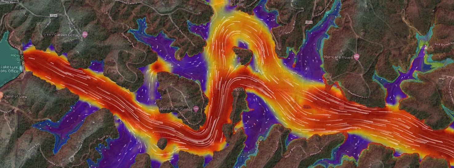
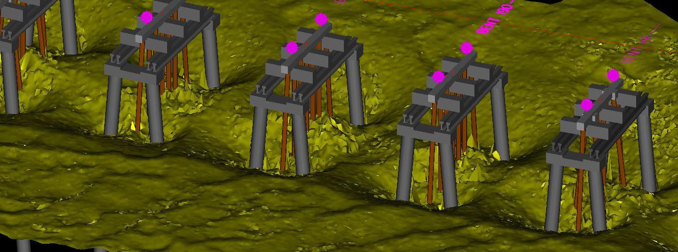
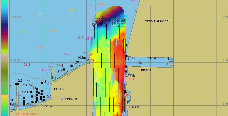
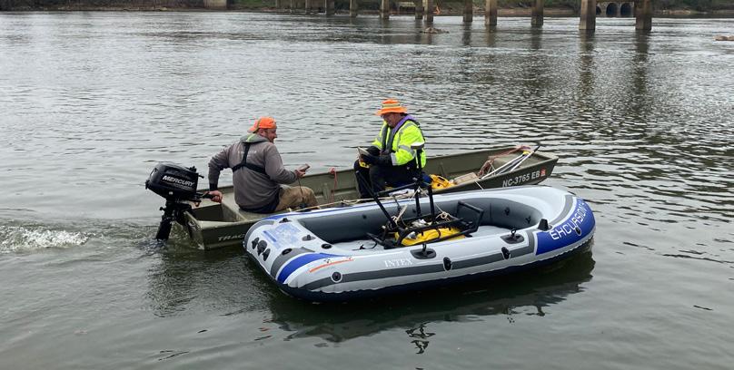
HYDROGRAPHIC SURVEYING
With the effects of wind, waves, and changing land and sea levels constantly altering our nation’s coastlines and navigable waters, precise positioning and data acquisition are vital to maintain and preserve these treasured natural resources.
ESP utilizes the latest hydrographic surveying technology and software, including RTK GPS and robotic tracking to provide survey-grade horizontal and vertical positioning where feasible.
Additionally, our team brings a wide range of hydrographic surveying experience, ranging from full bottom bathymetry, riverine cross sections, lake cove sediment surveys, various pond underwater DTM surveys, coastal Port scour surveys, quantity surveys for pre and post dredging projects, and various hydrologic and hydraulic cross section surveys for floodplain mapping.
Service Solutions:
Interferometric swath bathymetryEdgetech 6205
Co-registered side scan imageryEdgetech 6205
Critical scour condition surveys for highway bridges
Single-frequency
Dual-frequency
Riverine studies
Coastal studies
Pond/lake studies
Full-bottom bathymetry
Sediment monitoring
Harbor-bed scouring
Dredging studies
Volumetric surveys
Remote-control bathymetric surveys
Over-water GPR
Magnetometer scans
Search & recovery
Sidescan mosaics
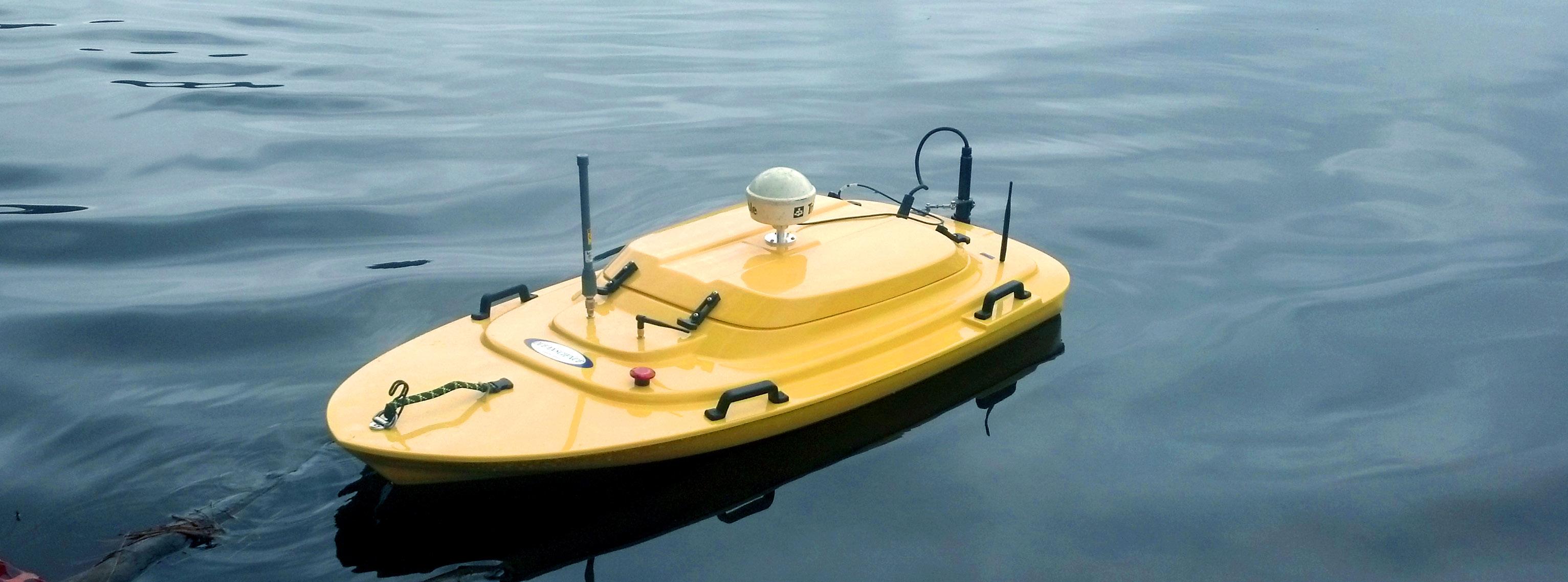
ROV HYDROGRAPHIC SURVEYS
Oceanscience Z-Boat
ESP utilizes the latest hydrographic surveying technology and software, including RTK GPS and robotic tracking to provide survey-grade horizontal and vertical positioning where feasible. Compared to a manned boat, our remote-operated Oceanscience Z-Boat echosounder launches by a single on-shore operator in a fraction of the time and avoids inherent hazards and safety risks of manned mobilizations. The Z-Boat and GPS are also integrated with a radio modem data transmission system, allowing the on-shore operator to view the boat track in real-time.
Additionally, the ESP team brings a wide range of hydrographic surveying experience, including full-bottom bathymetry, riverine cross sections, lake cove sediment surveys, various pond underwater DTM surveys, coastal Port scour surveys, quantity surveys for pre- and post-dredging projects, and various hydrologic and hydraulic cross section surveys for floodplain mapping.
Features:
Autonomous operation with on-board data-logging
Shallow-water singlebeam survey system
Ideal for hazardous survey locations
Easy to mobilize & operate
Portable; under 80lbs
Standard or high-speed (10kts) propulsion options
Up to 5m/s (16fps) performance for fast river cross-sections
ESP’s geospatial department has a highly-efficient production and independent QA/QC workflow using a combination of standard and proprietary software.
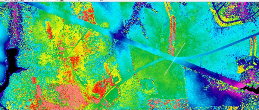
Working with strategic acquisition partners, ESP has collected and processed geospatial data for numerous projects involving both aerial lidar and photogrammetric data deliverables. ESP’s in-house processing capabilities include lidar calibration and processing, image processing, independent quality control, and the development of derivative products such as contours, hydro-flattened DEMs, and terrain models.
Geiger-mode lidar
Independent lidar & photogrammetric QA/QC
Management & oversight of aerial data acquisition services
Lidar calibration & processing
Lidar classification
Lidar-derived product development, such as contours & planimetric mapping
Photogrammetric mapping
UAS imagery collection & processing
Consultation on geospatial specifications
UAS SERVICES
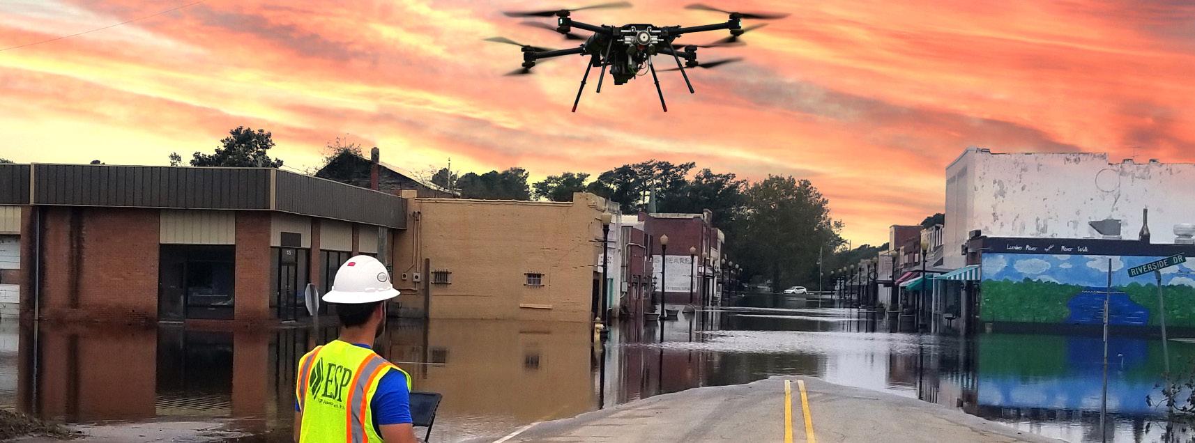
Utilizing unmanned aircraft systems (UAS), ESP delivers superior products through a full data collection and processing workflow that mimics manned flight operations. Our UAS team provides efficient and cost-effective solutions for small to mid-sized projects and a rapid-response option for emergency management tasking. These service capabilities fill the gap between expensive manned aircraft used for large-area projects and time-consuming conventional survey used for small-area projects.
From project design to post-processing and mapping, our UAS workflow follows ASPRS best practices, ensuring our products meet or exceed current ASPRS positional accuracy standards. Our FAA Part 107 pilots are licensed, insured, and certified to operate UAS equipment, and our flagship Pegasus hybrid platform is engineered with redundant subsystems to reduce the risk of system failure.
Applications:
Infrastructure damage assessments
Inspections (power, bridge/structure)
Digital mapping (DTM, PLAN, contours, orthos)
High-density lidar
High-resolution imagery
Rapid-response assessments
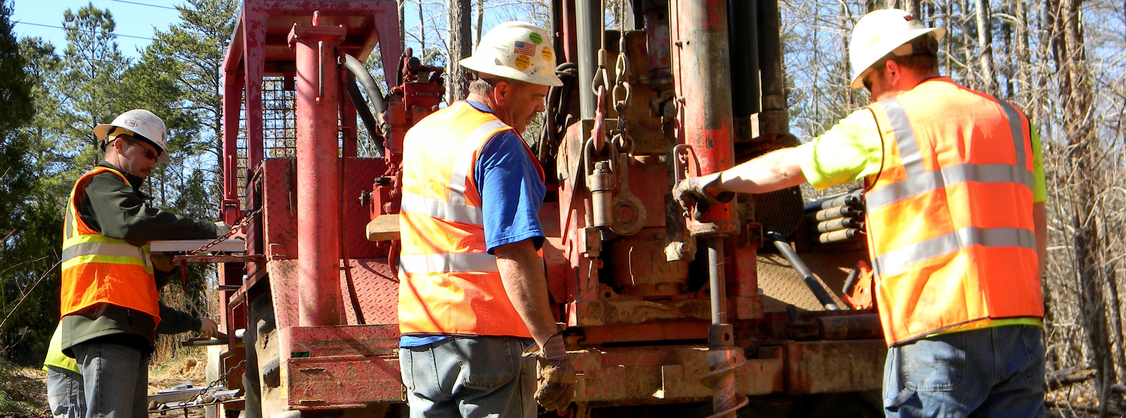
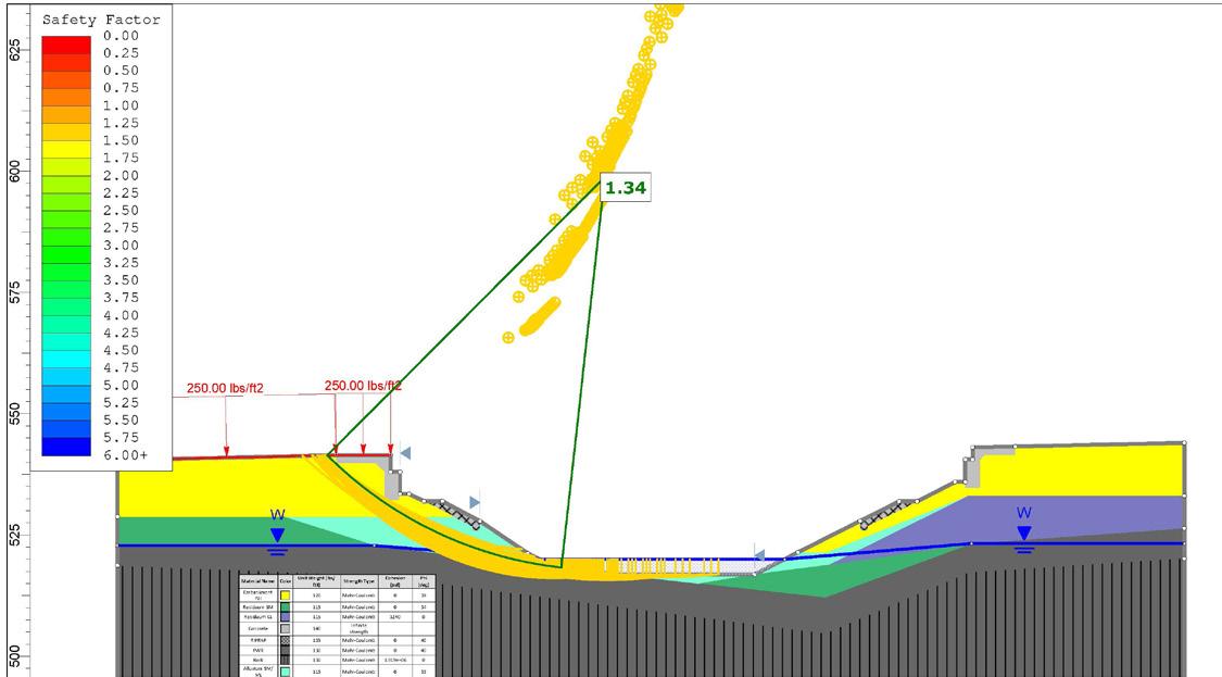
GEOTECHNICAL ENGINEERING
ESP provides consultative geotechnical engineering services regarding subsurface conditions to assist our clients. Using various exploratory means, our engineers obtain subsurface data to analyze site and soil conditions, communicate recommendations to our client, and aid in decisions related to the support of our client’s projects and the economic impact foundations can have on a project.
Our engineers are experienced with local conditions and the various geotechnical challenges presented by the geological regions within which we work.
Common Geotechnical Analysis:
Deep & shallow foundation analysis
Foundation settlement analysis
Seismic site class analysis
Alternative foundation & soil improvement consultation
How we move through the world matters. Our transportation systems allow us to travel, explore, and provide safe and efficient movement of people and goods across the country. Whether working on rail, bridge, or highway projects, ESP understands that the geotechnical engineering needs of transportation projects are different and unique compared to commercial and residential projects.
With experienced professionals possessing extensive department of transportation (DOT) experience on our staff, we know the myriad of special procedures, requirements, and methodologies that must be followed when performing transportation work. We have built a group of talented technical professionals that are well respected within the industry and are dedicated to providing geotechnical engineering services for the transportation industry.
ESP employs industrystandard software utilized by many DOTs. If you require specific software, we will work with you to find a solution.
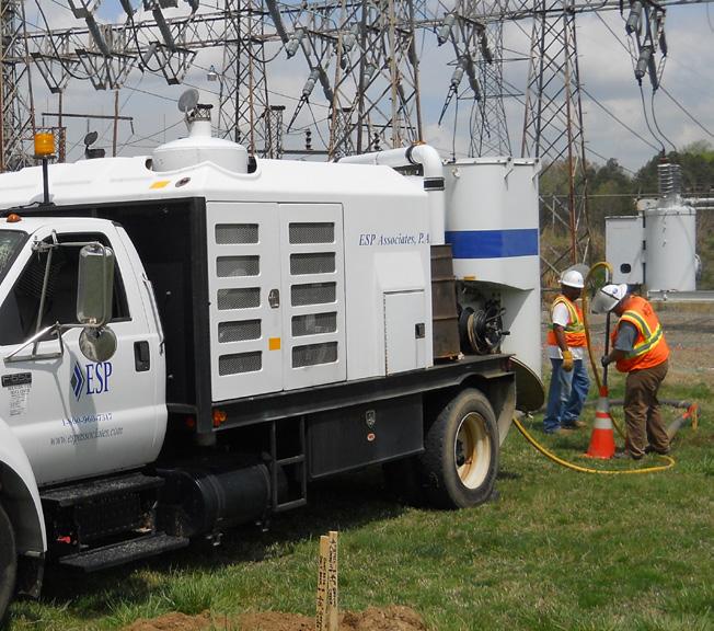
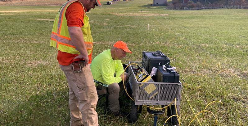
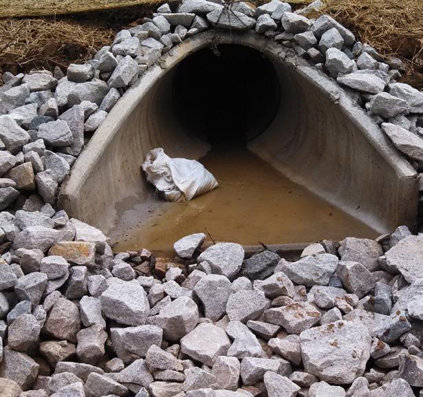
GEOPHYSICAL SERVICES
ESP’s geophysical services are proven to help solve problems and add value to environmental and engineering projects. Our goals are to help reduce risk and lower design and construction costs.
Example Applications:
Mapping depth to bedrock
Locating Underground Storage Tanks (USTs)
Collecting surface wave seismic data for IBC site class
Delineating buried waste
Exploring the extent of sinkholes & karst features
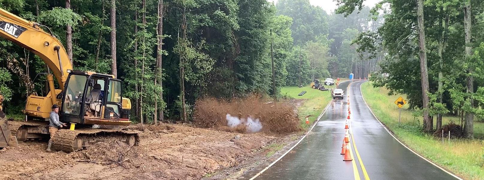
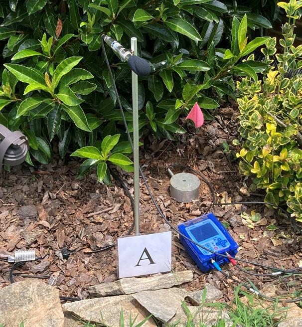
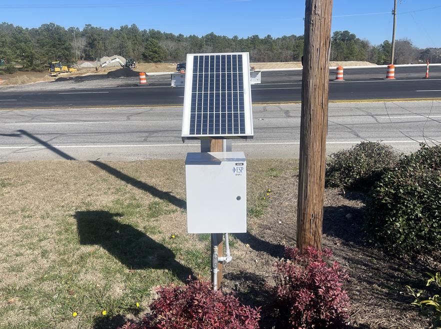
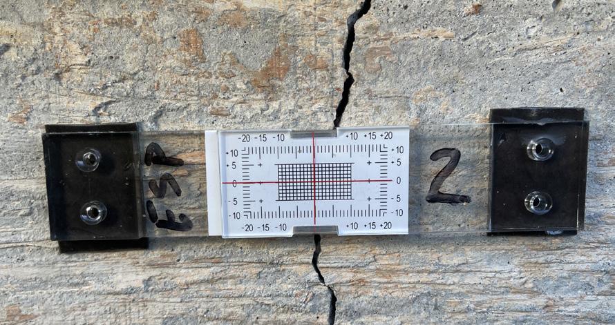
ESP provides vibration monitoring services for blasting and heavy construction operations using portable and remote seismographs. Results are compared to vibration criteria to document compliance with specified limits.
Pre-construction Condition Assessments
Crack Monitoring
Portable Vibration Monitoring
Remote Vibration Monitoring with Real-time Notifications
Daily, Weekly, and Monthly Reporting
Post-Construction Condition Assessments to Address Complaints
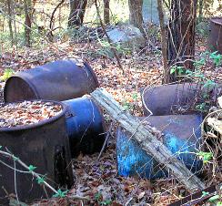
ENVIRONMENTAL SERVICES
ESP provides environmental consulting services to private, commercial, industrial, and governmental agency clients. Our staff includes professional geologists, geophysicists, engineers, and other staff and technicians trained and experienced in the regulatory-driven environment of compliance management.
Remedial system design, permitting, & implementation
NEPA & noise studies
Brownfields assessments
Asbestos, leadbased paint, mold, & indoor air studies
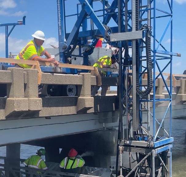
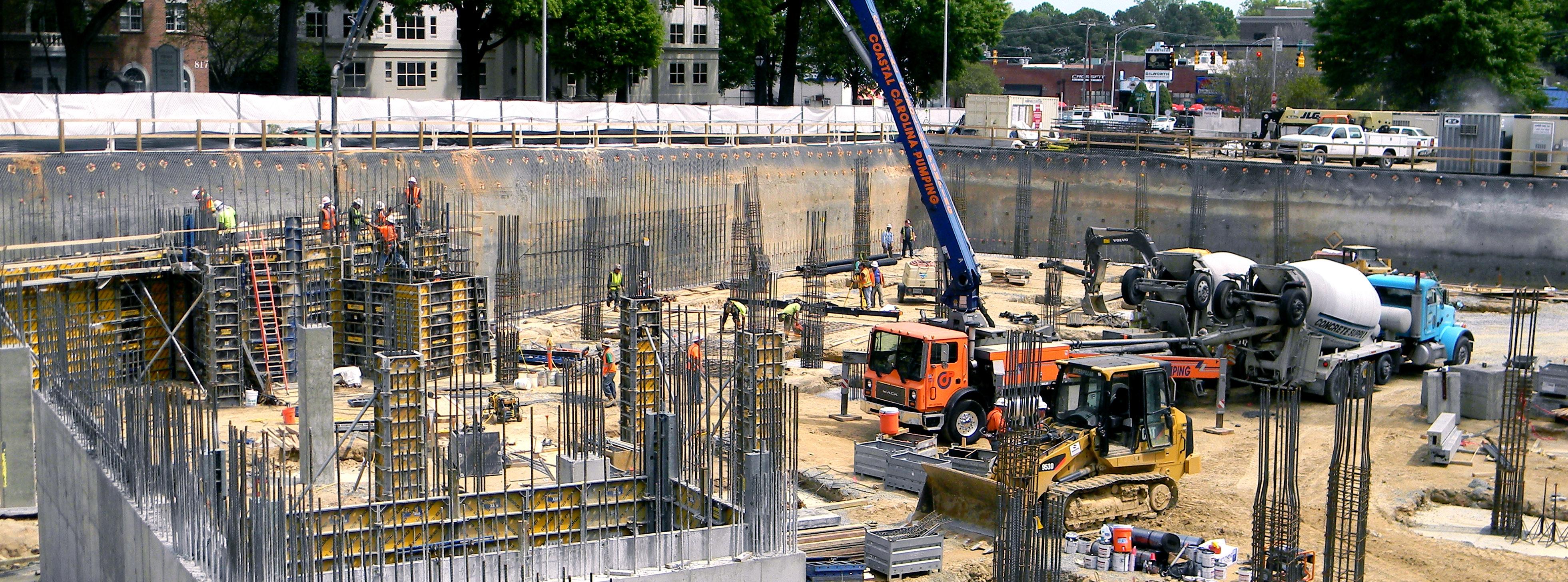
CONSTRUCTION ENGINEERING & INSPECTION (CEI)
ESP’s construction engineering and inspection staff work diligently on the owner’s behalf to verify that a project is built as intended.
Our primary responsibility is to monitor work performed by the contractor, record all pertinent information, and verify the project is constructed within general conformance with approved plans and specifications.
Our experience includes all types of construction methods, including General BidBuild, Design-Build, and Public-Private Partnerships (P3).
CEI Market Types: Highway & bridge
Rail & transit
Tollways
Municipal trails
Streets & roads
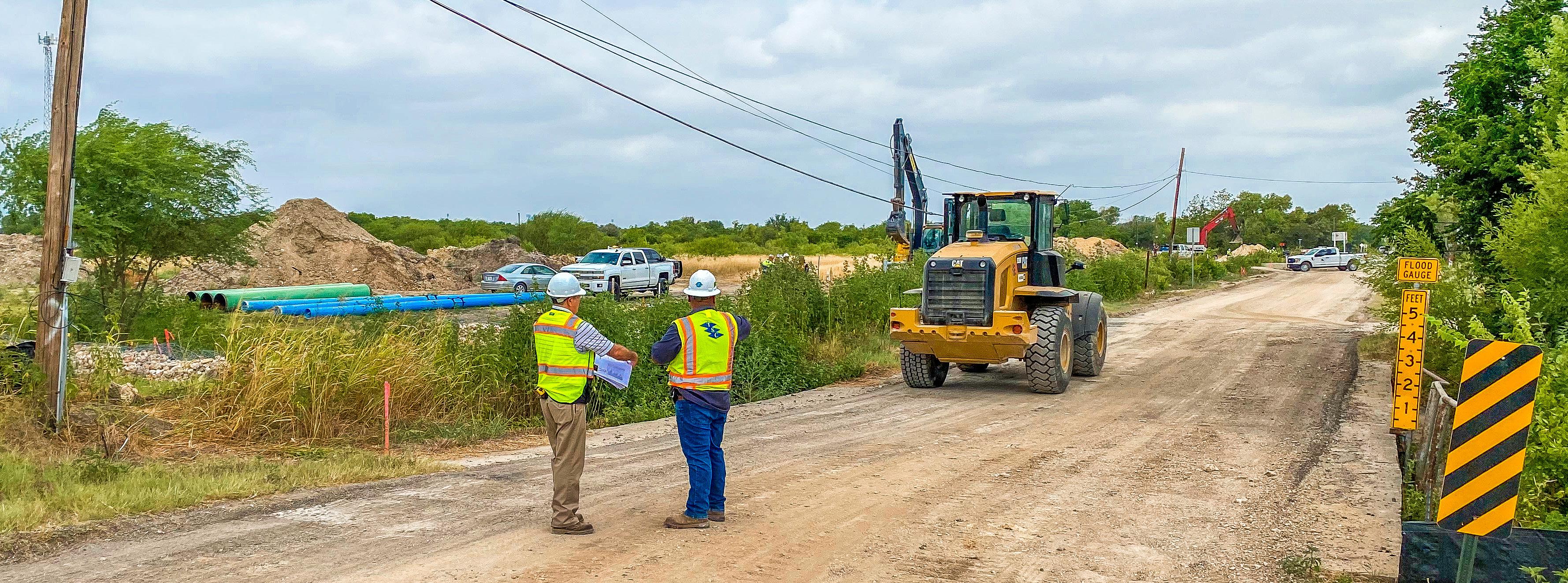
UTILITY COORDINATION
Services:
During any roadway project, daily communication and coordination with governments along with utility representatives help prevent unnecessary delays.
For transportation projects, it’s especially imperative to maintain open lines of communication between utility providers, departments of transportation, local municipalities, and enigneers.
ESP has more than a decade of experience coordinating with DOTs, Municipalities and utility companies to discuss design, scheduling/phasing and find reliable, cost-effective solutions to mitigate utility issues.
Early & Preliminary Utility Coordination
Final Utility Coordination
Coordinate design and construction efforts among utility owners and stakeholders
Recommend subsurface utility engineering
Coordinate federal, state and municipal regulatory and permitting processes
Collect Utility Agreements and Utility Relocation Plans
Monitor project progress to identify and resolve utility issues
Utility Daily Diaries with utility relocations during roadway construction
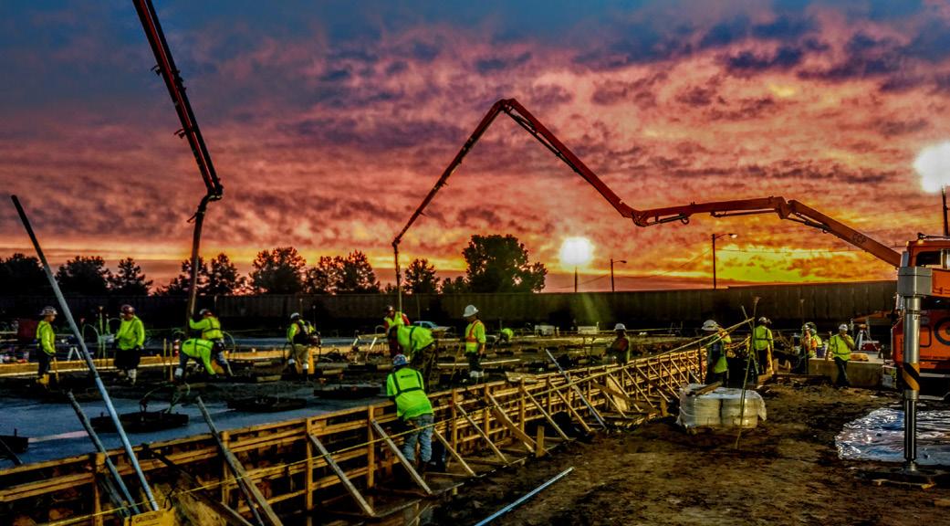
CONSTRUCTION MATERIALS TESTING
ESP provides materials testing services during the construction of a project as part of site quality control and quality assurance efforts.
Our engineering technicians are certified by the American Concrete Institute (ACI), International Code Council (ICC), American Welding Society (AWS), and Departments of Transportation (DOTs), to name a few.
Laboratory testing is performed in-house at our AASHTO-accredited laboratories located in Fort Mill (SC), North Charleston (SC), Morrisville (NC), and Concord (NC). Our laboratories in North Carolina and Fort Mill, SC are also NCDOT-certified.
Construction Materials Testing:
Earthwork monitoring & testing
Reinforcing steel inspection
Post-tensioned concrete inspection
Non-destructive testing of welds
Structural steel & weld inspection
Foundation construction monitoring
Pavement systems evaluation & testing
Asphalt testing
Concrete testing
CQA/CQC testing
Aggregate testing
Masonry inspection & testing
Floor-flatness testing
Fireproofing inspection & testing
LABORATORY TESTING
Laboratory Testing:
ESP operates four in-house materials testing laboratories to save our clients time and money.
As part of AASHTO accreditation, all of our laboratories are periodically inspected by AASHTO re:source and CCRL to ensure our quality control program, equipment calibrations, and sample testing are performed as outlined by ASTM and/or AASHTO standards.
To provide accurate results and quick turn-around on lab samples, we employ a sufficient staff of certified employees who perform testing under the supervision of professionals experienced with the use of accredited laboratories and adherence to DOT requirements.
To explore each lab’s scope of testing, visit https://aashtoresource.org/aap/accreditation-directory
Standard & modified proctors
Moisture content
Atterberg limits
Grain-size analysis
Grain-size with hydrometer
Permeability
Triaxial shear
One-dimensional swell
CBR
Unit weight
Specific gravity
Loss on ignition
Consolidation
Compressive strength testing
Soil classification
SPECIAL INSPECTIONS
ESP has provided Special Inspections services for many years (dating back to previous versions of the Unified Building Code) on a wide variety of projects of varying sizes and scope. Since the adoption of the Special Inspections portion of the International Building Code (IBC), ESP has developed an expert command of Chapter 17 of the IBC Codes, as well as other state-specific codes.
ESP personnel are trained extensively in the performance of Special Inspections. Our staff routinely pursues and obtains certifications in the various inspection fields, including concrete, asphalt, masonry, soils, and steel.
Special Inspections:
Earthwork
Structural steel framing, welding, and bolting
Fabrication plant
Post-tensioned concrete
Reinforced concrete/ reinforcing steel
Cold-formed steel framing
Pre-cast concrete
Masonry
Fireproofing
Wood framing
Seismic & wind resisting members
EIFS (exterior insulation finish systems)
Shallow & deep foundation
Fire stopping
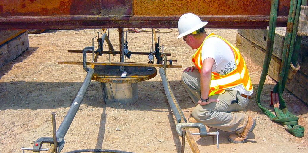
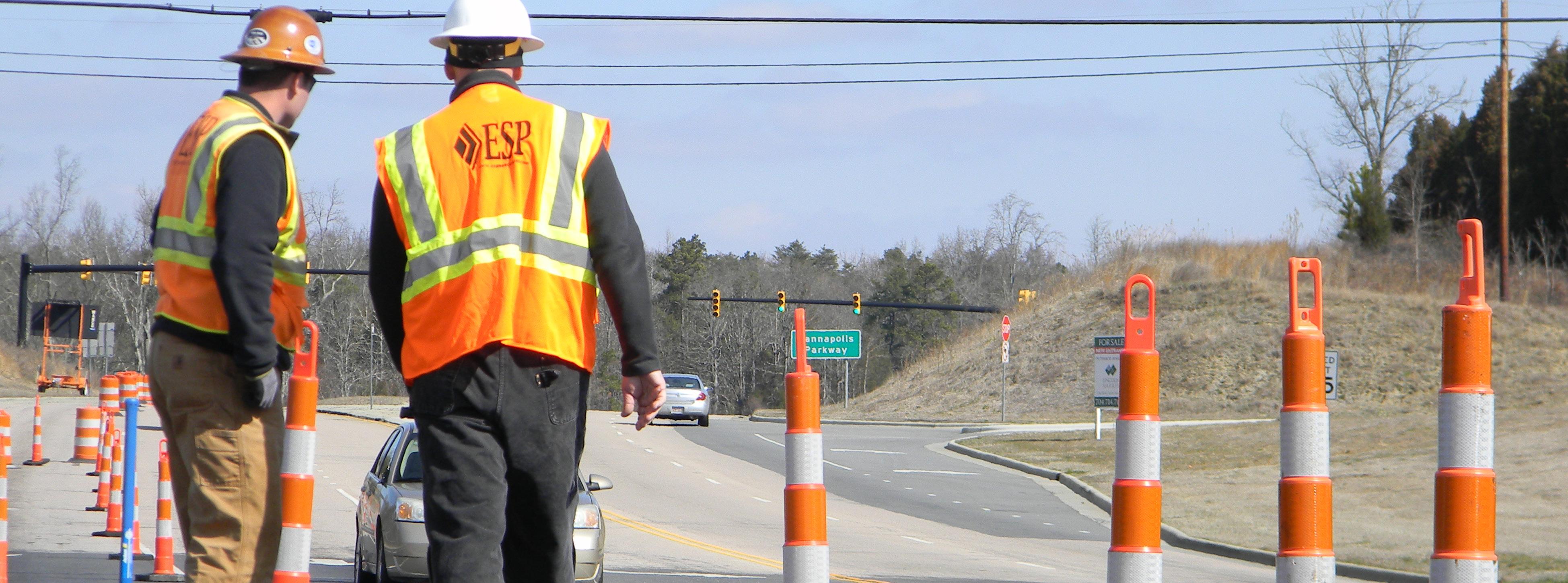
HEALTH & SAFETY
ESP is committed to accident prevention and the safety of our employees, clients, and the public.
Dedicated to constant improvement, ESP’s full-time Director of Safety and dedicated safety team are solely focused on leading our enterprise-wide safety program, drafting and implementing site-specific health and safety plans, and ensuring compliance with OSHA requirements.
From toolbox safety meetings prior to fieldwork to required OSHA 10 and FA/CPR training, ESP’s work practices and procedures follow safety and health regulations, laws, and ordinances established by federal, state, and local governments as well as those set forth by clients.
Safety Initiatives:
Providing personal protective equipment (PPE) necessary for each task
Maintaining a culture of transparency and centralized resources
Developing safety-minded behaviors across the enterprise
Learning and growing from safety events and near misses
Promoting employee health and wellness at work and at home
Enhancing the value of safety in recruiting and retention efforts
Valuing the full cycle of a successful return-to-work program
Providing regular, ongoing safety training and education