ESP Associates, Inc. is a multi-disciplinary team of companies working together to provide innovative engineering, planning, and geospatial services in partnership with valued clients in Florida, across the Southeast, and beyond.
As a trusted partner dedicated to strong client relationships, we have been recognized as an ENR Top 500 Design Firm since 2013, including our most recent ranking of #52 in Texas & Southeast for 2025.
Success is a team effort, and we are always proud to partner with valued clients on projects that help shape, improve, and protect the communities we love and serve.
• 32+ years of
• Experience transportation
• 29+ years of
• Manages transmission across Florida
• 35+ years in • Expertise in
YOUR DEDICATED CLIENT MANAGER
Jim Avitabile, PE, FDBIA
Transportation Engineering Director - East
• 42+ years of industry experience
• Extensive experience directing programming, planning, and design for complex highway, bridge, toll road, interchange, rail, and transit facility projects, including for FDOT (407) 421-7662
javitabile@espassociates.com
DISCIPLINE LEADERS
John C. Adams, PE
Transportation Practice Leader of industry experience with high-profile, multi-modal transportation planning and design in FL
Tim Sutherland, PSM Design Survey of industry experience transmission line corridor projects Florida for FPL and Duke Energy
Scott Brookhart, PE
Resources Engineering
in complex hydraulics
DOT roadway, floodplain, and control projects, including for FDOT
Michael Ulmer, PE
Geotechnical Engineering
• 35+ years of industry experience
• Specializes in transportation geotechnical engineering in the Southeast
Jesse Price, PSM Design Survey
• 30+ years of industry experience
• Specializes in roadway, bridge, and hydrographic surveys
Mike Costello, PE
Municipal & Site Civil Engineering
• 27+ years of industry experience
• Experience working with FDOT on turn lanes, bridges, intersections, and roadways
Steve Cook, PE*
Construction Engineering & Inspection
• 35+ years of industry experience
• Former NCDOT staff with expertise in bridge and culvert design management
Gary Warner, PLA, ASLA, AICP
FDOT Community Infrastructure
• 32+ years of industry experience
• Experience with planning and design of streetscapes, greenways, and trails in FL
Tiffany May, PLA
Private Sector Community Infrastructure
• 20+ years as a Florida landscape architect
• Specializes in municipal development, resort/hospitality, and community planning
TRANSPORTATION SERVICES
INCLUDE:
Civil Engineering
• Roadway Design
• Greenways, Trails, & Sidewalks
• Site Civil Design
• Bridge Design
• Structural Engineering
• Port Engineering
• Stormwater Capital Improvements
• Water/Wastewater Planning & Design
Geo-Environmental
• Geotechnical Engineering
• Geophysical Services
• Vibration Monitoring
• Environmental Consulting
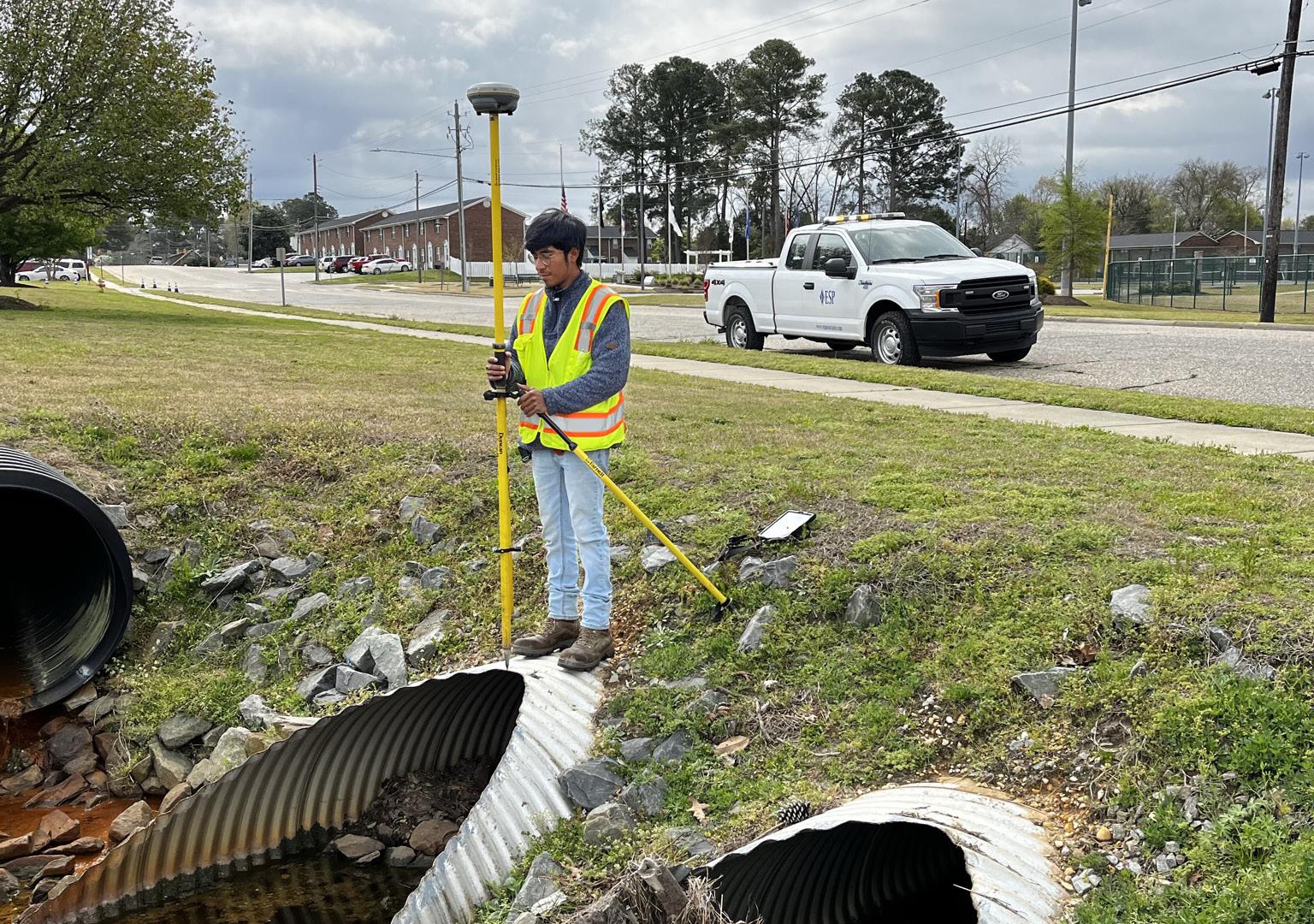
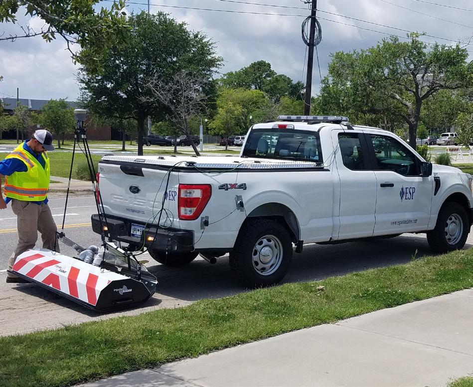
Survey & Geospatial
• UAS Services
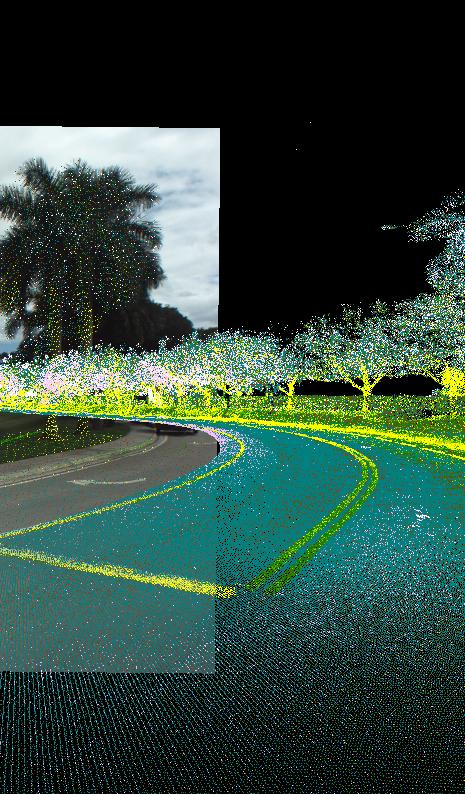
• Aerial Lidar & Photogrammetry
• Mobile Lidar Scanning
• Pavement & Asset Inventory
• Subsurface Utility Engineering & 3D GPR
• Hydrographic/Bathymetric Survey
• Conventional & GPS Surveying
• 3D Laser Scanning
Construction-Phase Services
• Construction Materials Testing
• Special Inspections
• Utility Coordination
• Construction Engineering & Inspection
Water Resources
• Flood Studies
• Stormwater Management
• GIS Modeling & Mapping
• Applications Development Planning
• Grant Administration & Support
• Streetscapes & Urban Design
• Hazard Mitigation Planning
• Landscape Architecture
• Branding, Visioning, & Wayfinding
• Parks/Recreation Planning & Design
• Feasibility & Due Diligence
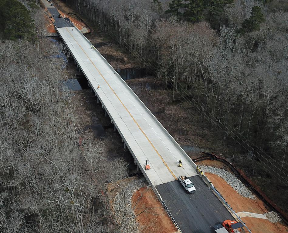
FEATURED TRANSPORTATION PROJECTS
Mobile Bay I-10 Hydrographic Survey Mobile Bay, AL
ESP served as a subconsultant in support of ALDOT to provide single and multibeam bathymetric data collection along the existing I-10 dual-bridge 8-mile alignment crossing Mobile Bay, including data collection within a portion of the Port of Mobile.
Services: Hydrographic/Bathymetric Survey
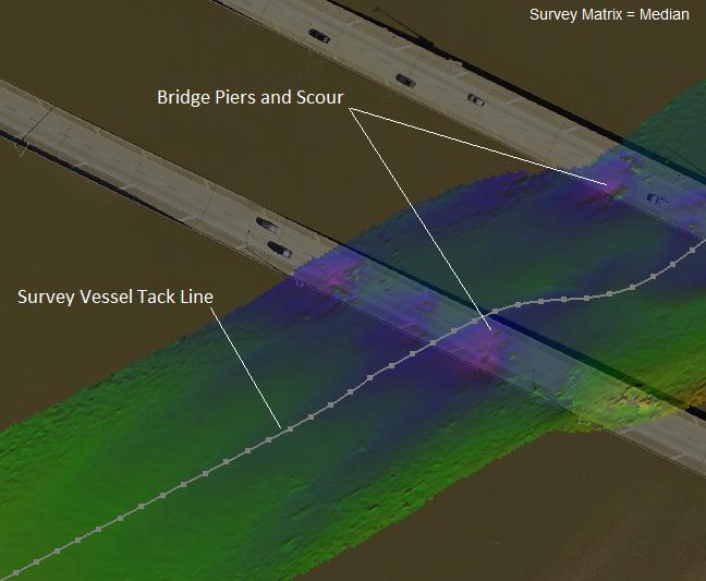
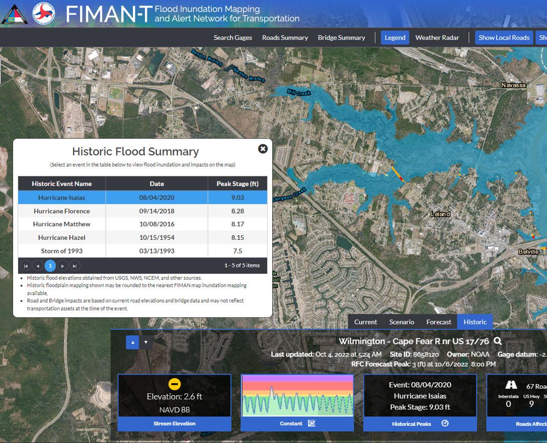
NCDOT Flood & Surge Alert System Statewide, NC
Recipient of the 2024 Federal Highway Administration Environmental Excellence Award, this suite of web-based tools offers real-time and forecasted flood data to help transportation and emergency management officials plan for and respond to storms.
Services: Flood Studies, GIS & Applications Development
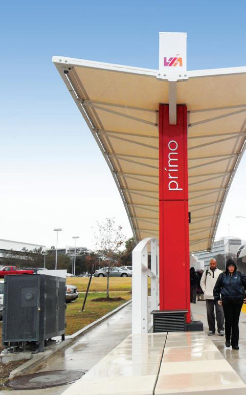
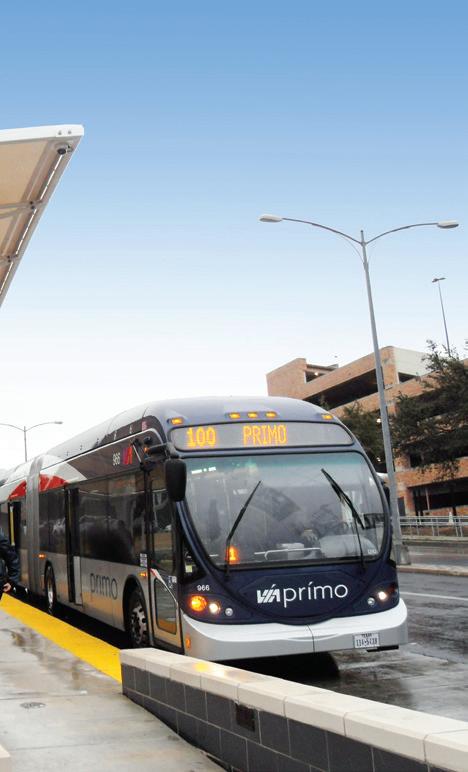
As the city’s first high-capacity this 20-mile bus rapid transit connects two transit centers stations. In 2013, it was TX Engineering Excellence Medal for Surveying &
To create a grander pedestrian entrance while also addressing issues, ESP proposed future locations for a 38-acre mile corridor. This project comprehensive branding
Services: Streetscape Site Civil, Geotechnical,
VIA Primo Fredericksburg San Antonio, Town of Seabrook
Seabrook Island,
PROJECTS
Fredericksburg Rd Corridor Antonio, TX
high-capacity transit mode, transit (BRT) line centers and 15 inline was awarded the ACECExcellence Award, Gold Mapping Technology.
Design, Stormwater, Coordination
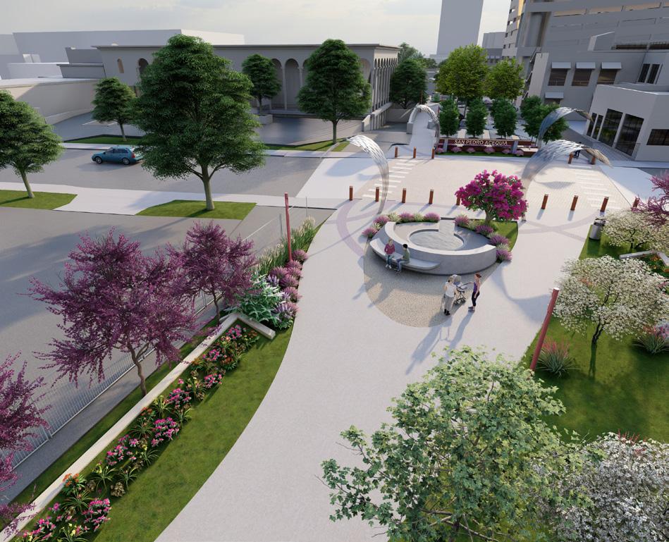
LINK
Connection San Antonio, TX
This quarter-mile, $100M linear park will create a pedestrian gateway from the San Antonio River to the San Pedro Creek Culture Park and a closed-loop trail to enhance circulation downtown.
Services: Roadway Design, Site Civil, Landscape Architecture, Stormwater, Survey
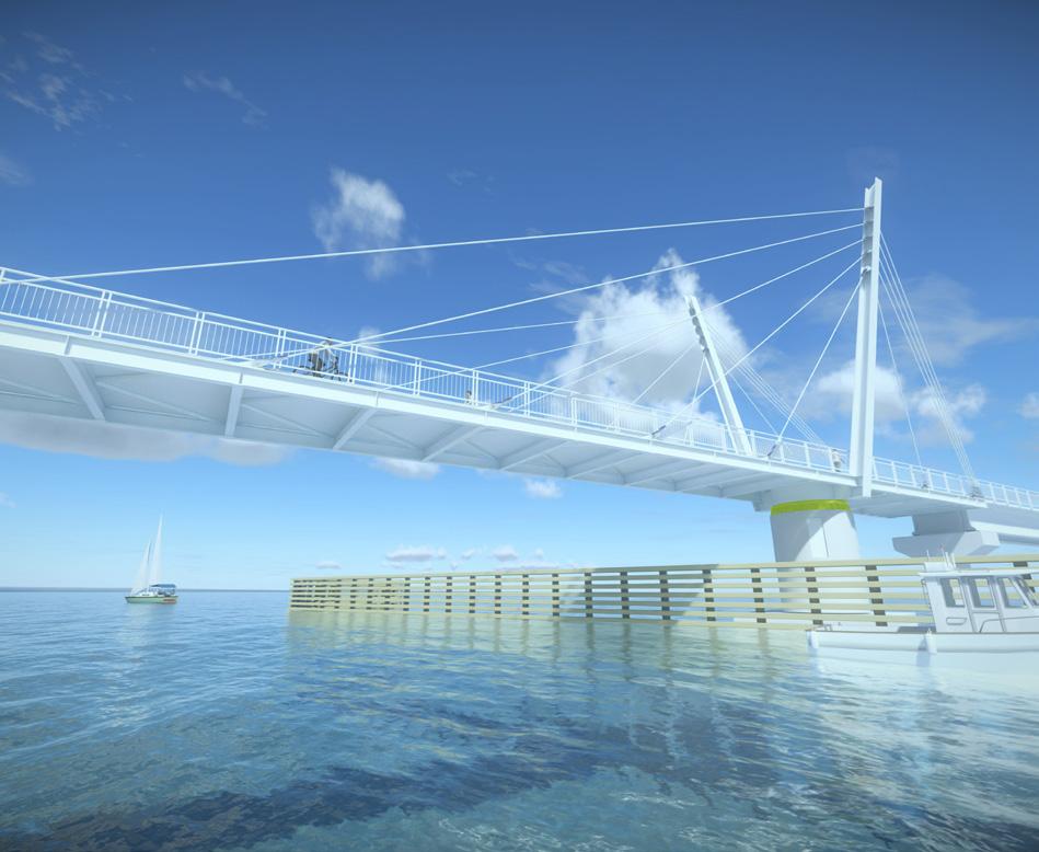
Ashley River Crossing Charleston, SC
As the first of its kind in the US, this $72.6M bridge will be 4,100 feet long with a 225-foot bobtail, cable-stayed swing span to allow passage of marine traffic. It will create a safe bike-ped connection between West Ashley and downtown Charleston and serve as a missing link for the East Coast Greenway.
Services: Geotechnical, Survey
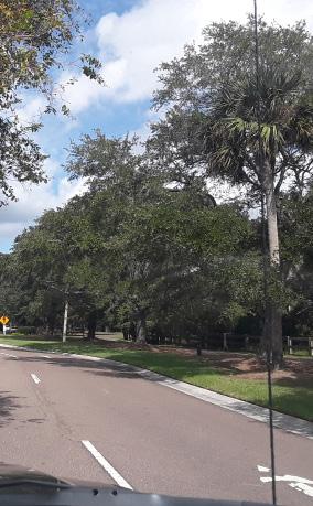
Island Entry Road Island, SC
pedestrian and vehicular addressing traffic
future land uses and site along a oneproject also included branding and design.
Design, Branding, Geotechnical, Survey, SUE
IDOT I-90 / I-94 Mobile Lidar
Chicago, IL
For the mobile lidar data collection of a 5-mile stretch of a major urban highway that runs through downtown Chicago, ESP devised a plan to station fixed scanning equipment on elevated bridges for increased safety and efficiency while still achieving required accuracy levels.
ESP served as a subconsultant in support of SCDOT for this emergency design-build replacement after significant structural deficiencies abruptly closed the bridge to traffic. This project was awarded the 2023 ACEC-SC Engineering Excellence Award for excellence on an accelerated schedule.
Services: Geotechnical, Utility Coordination
The
Pedestrian
FEATURED FLORIDA PROJECTS
City of Bradenton Stormwater & Utility Mapping On-Call Bradenton, FL
Since 2018, ESP has provided survey services in support of City of Bradenton’s roadway, sidewalk, and utility improvements, including water main replacement projects, stormwater drainage projects, 25+ miles of roadway, and 8 miles of sidewalk for the city’s Safe Routes to Schools program.
Services: Survey, Terrestrial Scanning, SUE
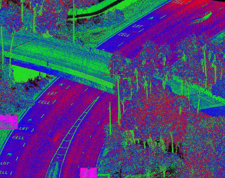
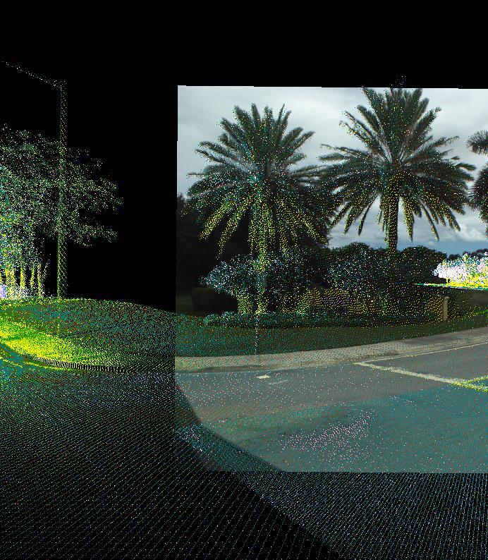
Orlando International Airport Loop Road Orlando, FL
For this resurfacing project, ESP collected survey-grade mobile lidar data for pavement DTMs and used 88 panels and 35 validation points to process and register point cloud data. To minimize traffic interference and provide the cleanest point cloud possible, data collection took place at night.
Services: Mobile Lidar
ESP completed mobile lidar surveys for the Creek to support field data collection of approximately within city right-of-way. To deliver a topographic relevant surface features, ESP collected as-built roadways and provided it in AutoCAD and
Services: Survey, Mobile Lidar
FDOT
SR 19 Milling & Resurfacing
Leesburg, FL
As part of a survey and mapping contract for FDOT District 5 and District 6, ESP provided Level A SUE services for SR 19 from Golden Gem Drive to 75 feet south of Palmetto Street for a milling and resurfacing project, including updates to curb ramps to meet ADA standards.
Services: SUE
Amtrak CorridorMacDill
ESP completed site underground utility work areas in support power feed construction Crews established topographic data including for the site
Services: Survey,
City of Coconut Creek Mobile Coconut Creek, FL
ESP’S FLORIDA PRESENCE
Mobile Lidar FL
the City of Coconut approximately 17 miles topographic survey depicting as-built point cloud data of and GIS formats.
MacDill Air Force Base
Infrastructure Mobile Lidar
Tampa, FL
site surveys and utility location for 12 on-base support of a commercial construction and repair project. established control and collected and utility designations, site of Tanker Way.