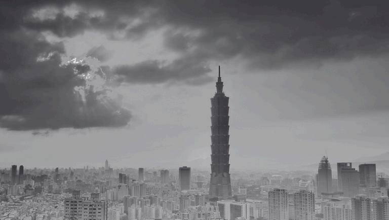
UHI Inside Taipei.

Advisor: Dr. Lucky S. J. Tsaih


"Did you know that humans possess a remarkable superpower—the ability to influence the environment and even alter the weather?"


Advisor: Dr. Lucky S. J. Tsaih


"Did you know that humans possess a remarkable superpower—the ability to influence the environment and even alter the weather?"


National Taiwan University of Science and Technology Associate Professor Department of Architecture
Lucky Tsaih is an Associate Professor in the Department of Architecture at NTUST, specializing in green building and urban space design strategies Her current research focuses on implementing and mitigating urban heat islands to enhance sustainability within built environments.


Structures such as buildings, roads, and other infrastructure absorb and re-emit the sun’s heat more than natural landscapes such as forests and water bodies Urban areas, where these structures are highly concentrated and greenery is limited, become “islands” of higher temperatures relative to outlying areas These pockets of heat are referred to as “heat islands.” Heat islands can form under a variety of conditions, including during the day or night, in small or large cities, in suburban areas, in northern or southern climates, and in any season
A review of research studies and data found that in the United States, the heat island effect results in daytime temperatures in urban areas about 1–7°F higher than temperatures in outlying areas and nighttime temperatures about 2–5°F higher Humid regions (primarily in the eastern United States) and cities with larger and denser populations experience the greatest temperature differences Research predicts that the heat island effect will strengthen in the future as the structure, spatial extent, and population density of urban areas change and grow
Heat islands form as a result of several factors:
Reduced Natural Landscapes in Urban Areas. Trees, vegetation, and water bodies tend to cool the air by providing shade, transpiring water from plant leaves, and evaporating surface water, respectively Hard, dry surfaces in urban areas – such as roofs, sidewalks, roads, buildings, and parking lots – provide less shade and moisture than natural landscapes and therefore contribute to higher temperatures.
Urban Material Properties. Conventional human-made materials used in urban environments such as pavements or roofing tend to reflect less solar energy, and absorb and emit more of the sun’s heat compared to trees, vegetation, and other natural surfaces Often, heat islands build throughout the day and become more pronounced after sunset due to the slow release of heat from urban materials
Urban Geometry. The dimensions and spacing of buildings within a city influence wind flow and urban materials’ ability to absorb and release solar energy In heavily developed areas, surfaces and structures obstructed by neighboring buildings become large thermal masses that cannot release their heat readily. Cities with many narrow streets and tall buildings become urban canyons, which can block natural wind flow that would bring cooling effects.
Heat Generated from Human Activities. Vehicles, airconditioning units, buildings, and industrial facilities all emit heat into the urban environment These sources of humangenerated, or anthropogenic, waste heat can contribute to heat island effects
Weather and Geography. Calm and clear weather conditions result in more severe heat islands by maximizing the amount of solar energy reaching urban surfaces and minimizing the amount of heat that can be carried away Conversely, strong winds and cloud cover suppress heat island formation Geographic features can also impact the heat island effect. For example, nearby mountains can block wind from reaching a city, or create wind patterns that pass through a city.
Heat islands are usually measured by the temperature difference between cities relative to the surrounding areas Temperature can also vary inside a city Some areas are hotter than others due to the uneven distribution of heat-absorbing buildings and pavements, while other spaces remain cooler as a result of trees and greenery These temperature differences constitute intra-urban heat islands. In the heat island effect diagram, urban parks, ponds, and residential areas are cooler than downtown areas
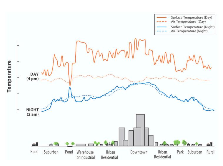
Surface temperatures vary more than atmospheric air temperatures during the day, but they are generally similar at night. The dips and spikes in surface temperatures over the pond area show how water maintains a nearly constant temperature day and night because it does not absorb the sun’s energy the same way as buildings and paved surfaces Parks, open land, and bodies of water can create cooler areas within a city Temperatures are typically lower at suburban-rural borders than in downtown areas.


Soaftergainadeeperunderstanding aboutUrbanHeatIsland,doyou guyshaveanyquestions?
Wearecuriousifthere’sanything thatwecandoasafuturearchitect tofighttheurbanheatisland!


Ofcoursetherearealotofthingsthatyou iguyscando.Asafuturearchitect,itis mportanttounderstandthegrowing importanceofsustainablepracticesand environmentalresponsibilityinthebuilt environment.Withtheriseofgreen buildingcertifications,twoprominent Rsystemsstandout:BREEAM(Building esearchEstablishmentEnvironmental AssessmentMethod)andLEED(Leadership inEnergyandEnvironmentalDesign).


LEED (Leadership in Energy and Environmental Design)
LEED is designed specifically for buildings in the United States, and takes its cues from the American ASHRAE standards
LEED uses a point-based system, where projects must achieve a minimum number of points for certification

BREEAM (Building Research Establishment Environmental Assessment Method)
BREEAM originated as a British certificate, meaning it is adapted to the British and European construction law and British best practices
BREEAM uses a weighted scoring system, where different sustainability issues carry different weights
LEED is considered to be simpler in its approach BREEAM is more academic and rigorous
LEED certification applicants must gather the relevant information and submit the evidence to the USGBC, who examines it and issues the certificate if it meets their demands
BREEAM uses licensed assessors who examine the building’s evidence against the credit criteria and report it to BRE to assess


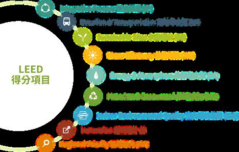
LEED standards contain disciplines across different sustainable issues, including site ecology and stormwater management, energy efficiency, water resources, materials, and indoor environmental quality Relevant areas of expertise include architecture, landscape design, eco-system design, renewable energy, HVAC systems, and interior design The expected highlights of obtaining LEED certification are as follows:
Overall energy efficiency is 20% higher than ASHRAE 90 1 standard
Lighting Power Density (LPD) is at least 30% lower than ASHRAE 90 1 standard
Water savings are over 35%.
Mechanical ventilation exceeds international standards by 30% and above
Construction waste recycling rate is as high as 90%
Increase the use of recycled content and the use of local building materials by more than 20%
Please note that the specific data may vary depending on the level of LEED certification pursued and the project’s unique characteristics
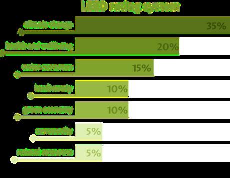


The current BREEAM assessment is broken down into 10 categories: Energy, Health & Wellbeing, Innovation, Land Use, Materials, Management, Pollution, Transport, Waste, Water
Each of these categories is further divided into a range of assessment issues, each with its own aim, target and benchmarks

To get certified with BREEAM, you have to go through the following steps:
Decide which BREEAM standard applies to your development
Appoint a licensed BREEAM Assessor
Register your project for assessment through the Assessor
Carry out a pre-assessment with the Assessor
Collect and pass on all necessary information to the Assessor during the project and the assessment progresses
The BREEAM expert Assessor will review all information and submits it to the certification body
Receive your listed BREEAM certificate








I took some photos of the NTU experimental farm to find out the effect of urban farm on Urban Heat Island (UHI) Urban centers have a higher population density than rural areas. According to Ladan et al (2022), By 2050, two-thirds of the world's population is expected to live in cities, with a 144 percent increase over the next decade
What I noticed from that photo are:
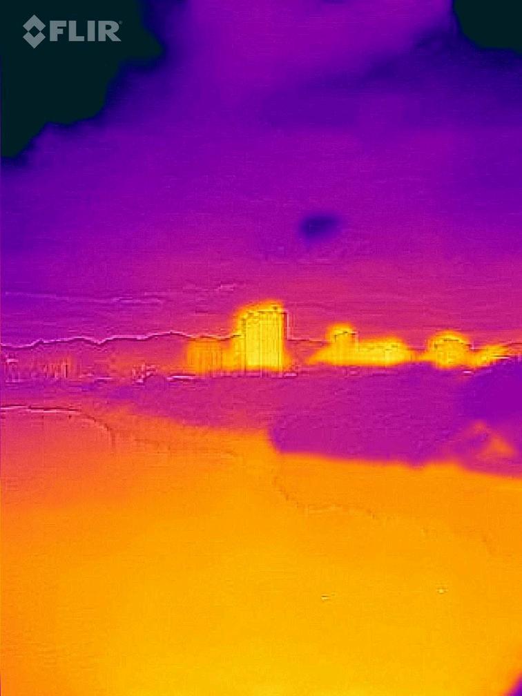
During the daytime, the building shows a similar temperature to the surrounding area, but nighttime photos reveal a significant difference between the building and the surrounding temperatures
The water surface temperature are colder than the buildings and surrounding environment in the daytime and nightime photos
However, when its raining, the water surface shows a warmer temperture compared to the surrounding area

So, what do you think are the key factors that contribute to the various points mentioned in the photos?

servations I've described indeed are closely related to the phenomenon of Heat Island (UHI) Here's an analysis of the key factors contributing to the ature differences observed in the photos, considering the UHI effect:
the first point, during the daytime, urban buildings typically absorb solar radiation and heat up, much like the surrounding urban environment Factors contributing to this include building materials Urban buildings often use materials like concrete, asphalt, and glass, which absorb and retain heat (thermal mass effect) At night, urban areas tend to retain more heat than rural areas, resulting in higher nighttime temperatures. Key factors include:
Water surfaces generally absorb less solar radiation compared to urban surfaces, resulting in cooler temperatures during both day and night.
When it rains, water surfaces can absorb heat from the surroundings and from rainwater itself, leading to a temporary increase in temperature compared to the surrounding environment

Good points! It’s also interesting that the water somehow also not only reflect the building’s reflection but also it’s temperature!

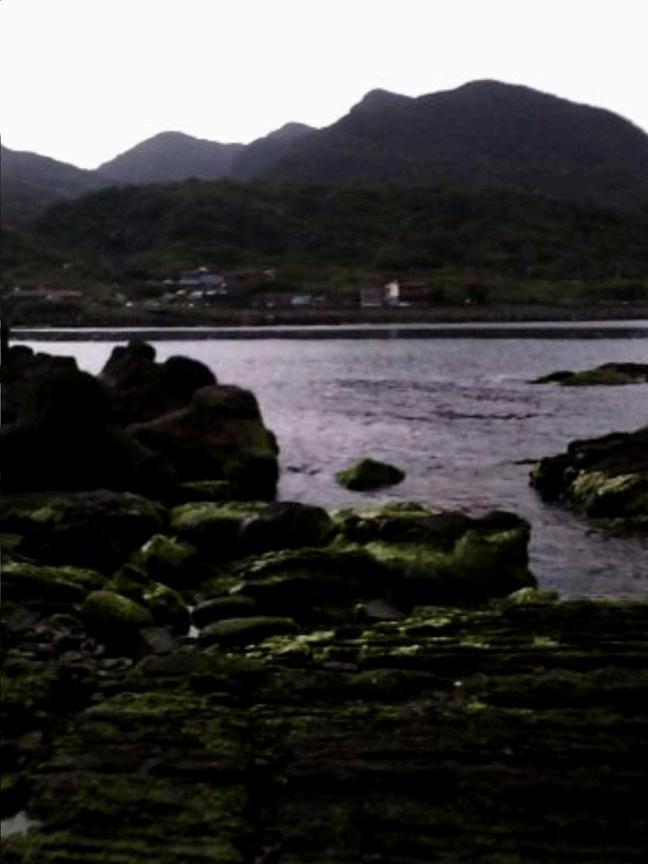
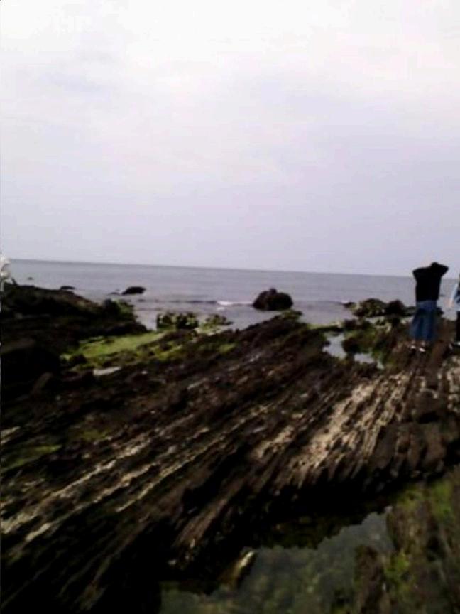
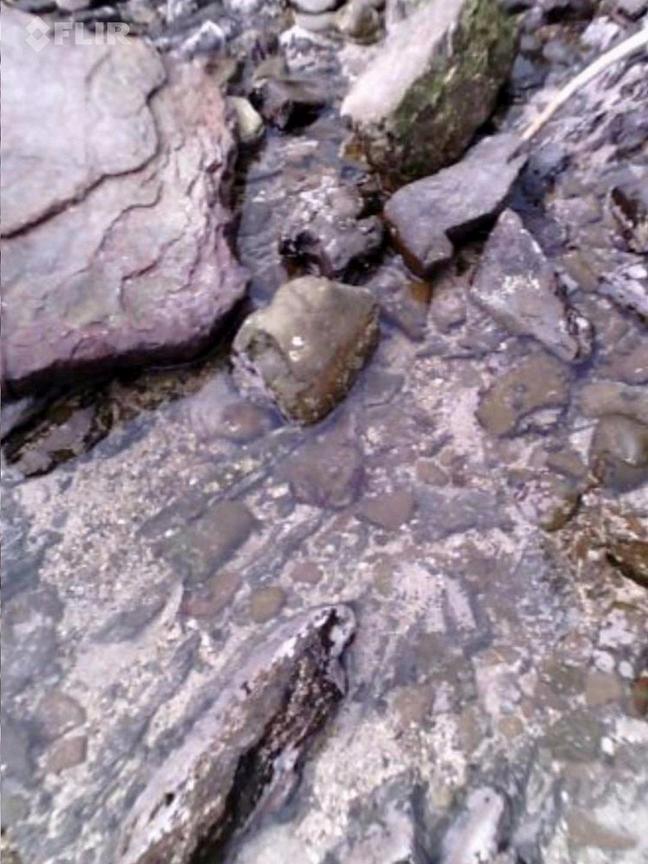
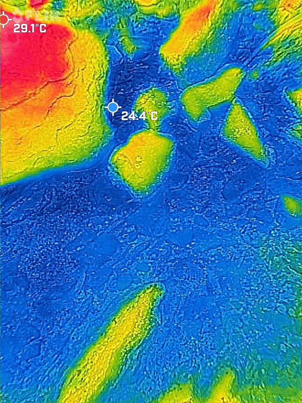
IcapturedtheMAOAOCoastin photographsattwodistinct moments,onebeforethesunrise directlyhitandanotherafterit.

2024/3/16,1548

2024/3/16,1546

2024/3/16,1543
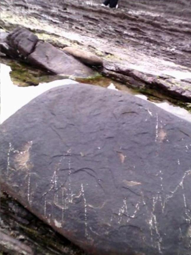
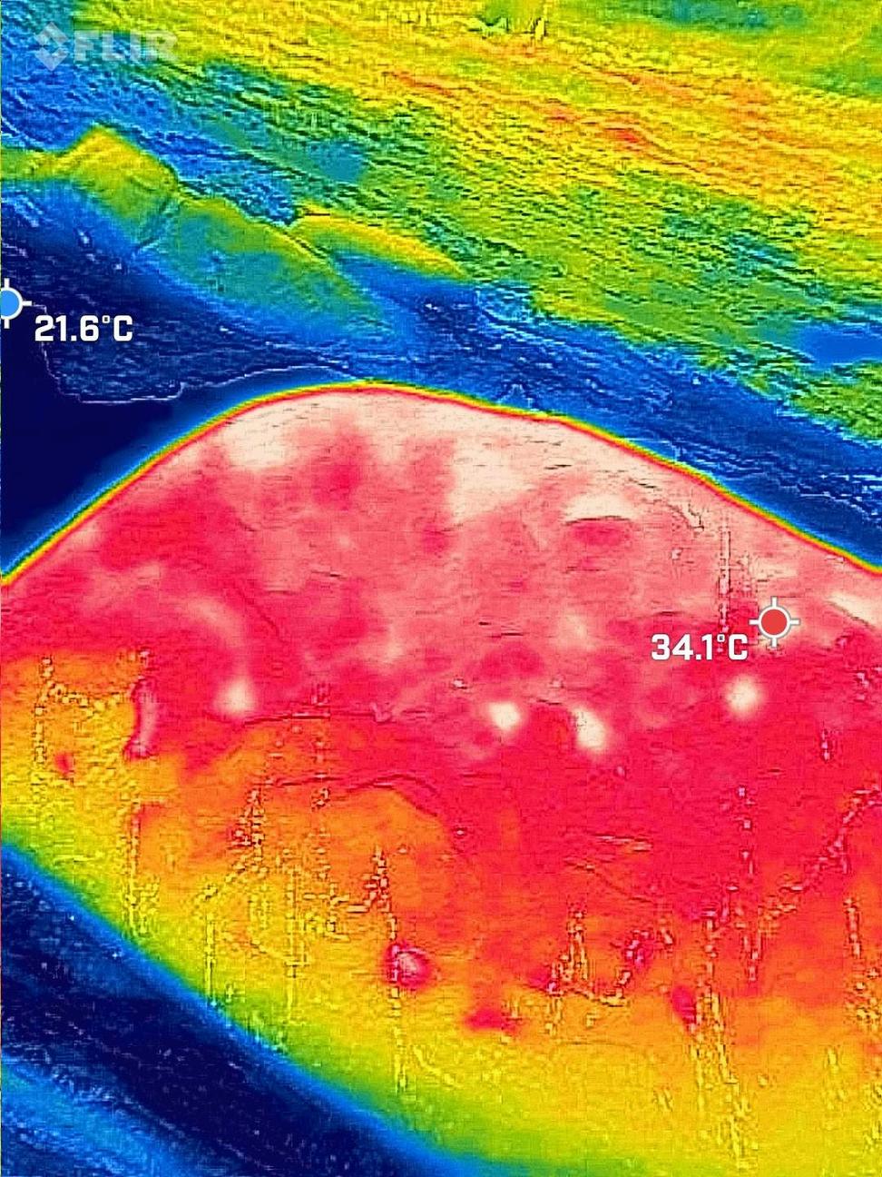


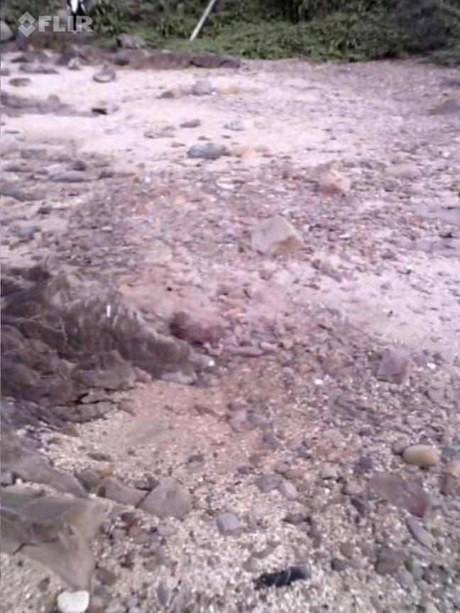
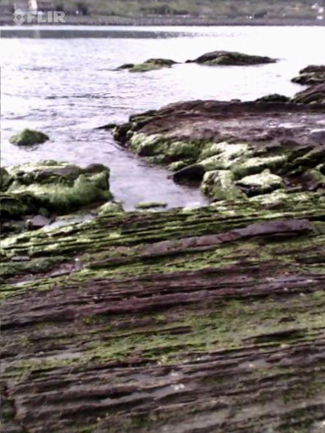
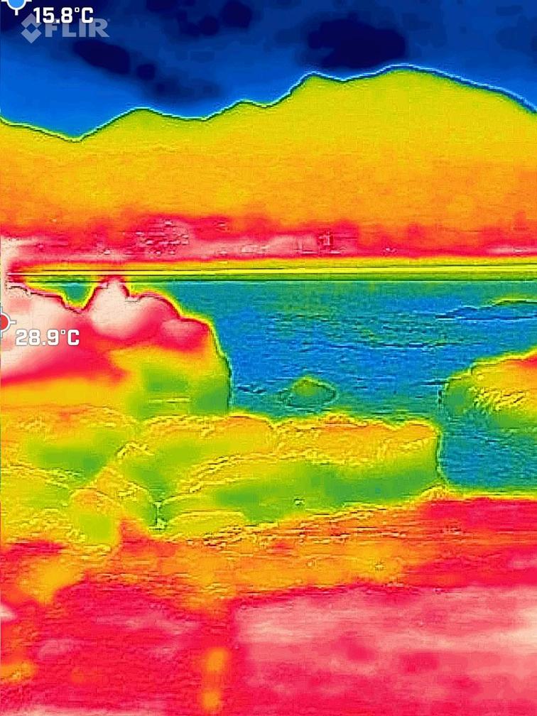
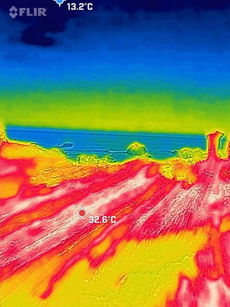
The observations from the photograph indicate a stark contrast in temperatures: the air is considerably cooler than the rock surfaces. During cloudy conditions, the general temperature remains under 30 degrees, as seen with readings like 291 and 28.9. Conversely, when it's cloudy, the temperature often exceeds 30 degrees, with examples being 326 and 341 Notably, there is a significant difference in temperature before and after the sunrise.


So, what do you think are the key factors that contribute to the various points mentioned in the photos?
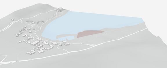
In the investigation at Maou Bay, I discovered some interesting phenomena. From the analysis of pictures, it can be observed that in areas with rocks (marked in red), the temperature significantly increases under direct sunlight, due to the rocks absorbing a large amount of heat Conversely, when rocks are not directly exposed to sunlight, their temperature remains relatively lower.
In the coolest parts, we can observe that the temperature of the water (marked in blue) is generally lower Additionally, shaded areas where sunlight doesn't directly reach also have lower temperatures.
Further observations reveal that areas of the rocks covered with local aquatic plants such as seaweed and algae (marked in yellow) have lower temperatures compared to areas without vegetation cover Therefore, we can infer that plants and water are two key factors in reducing environmental temperatures.

Excellent! It’s a fantastic finding The temperature between the direct sunrise and indirect can make it really different Also, the water and green creatures effectively lower the temperature.
Itooksomephotosofmysitein ATouchengTownship,YilanCounty! longwithsomephotoscomparing thesurroundingsbeforeandafterrain!

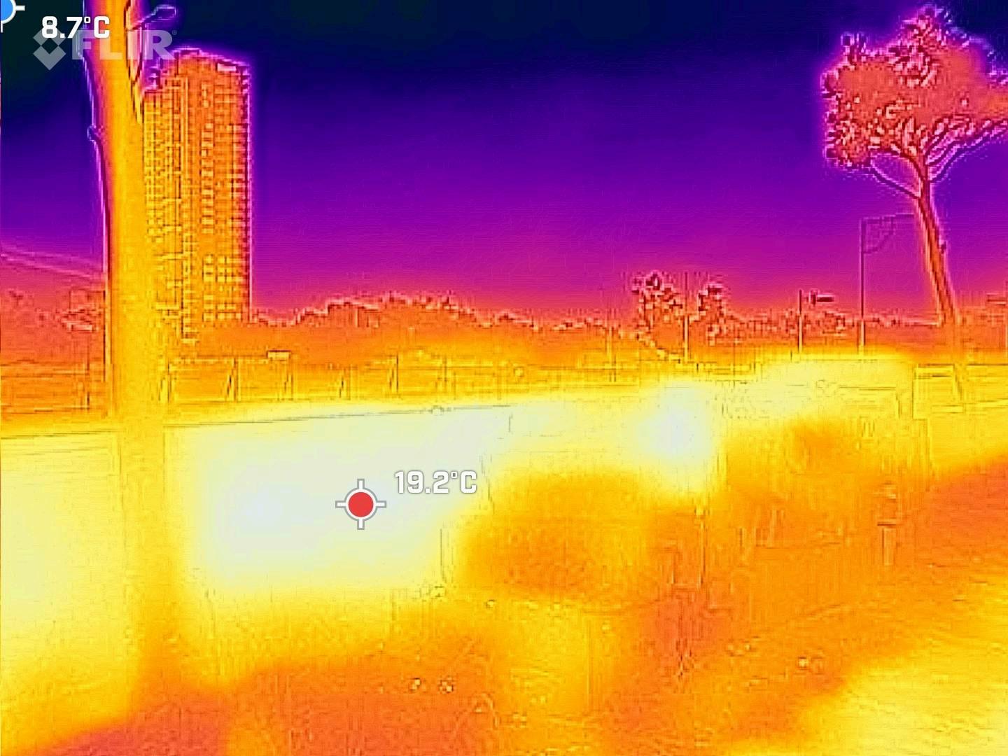
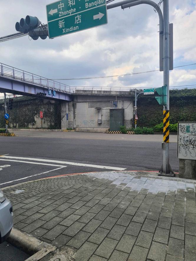
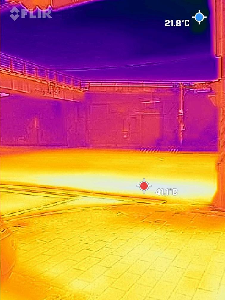
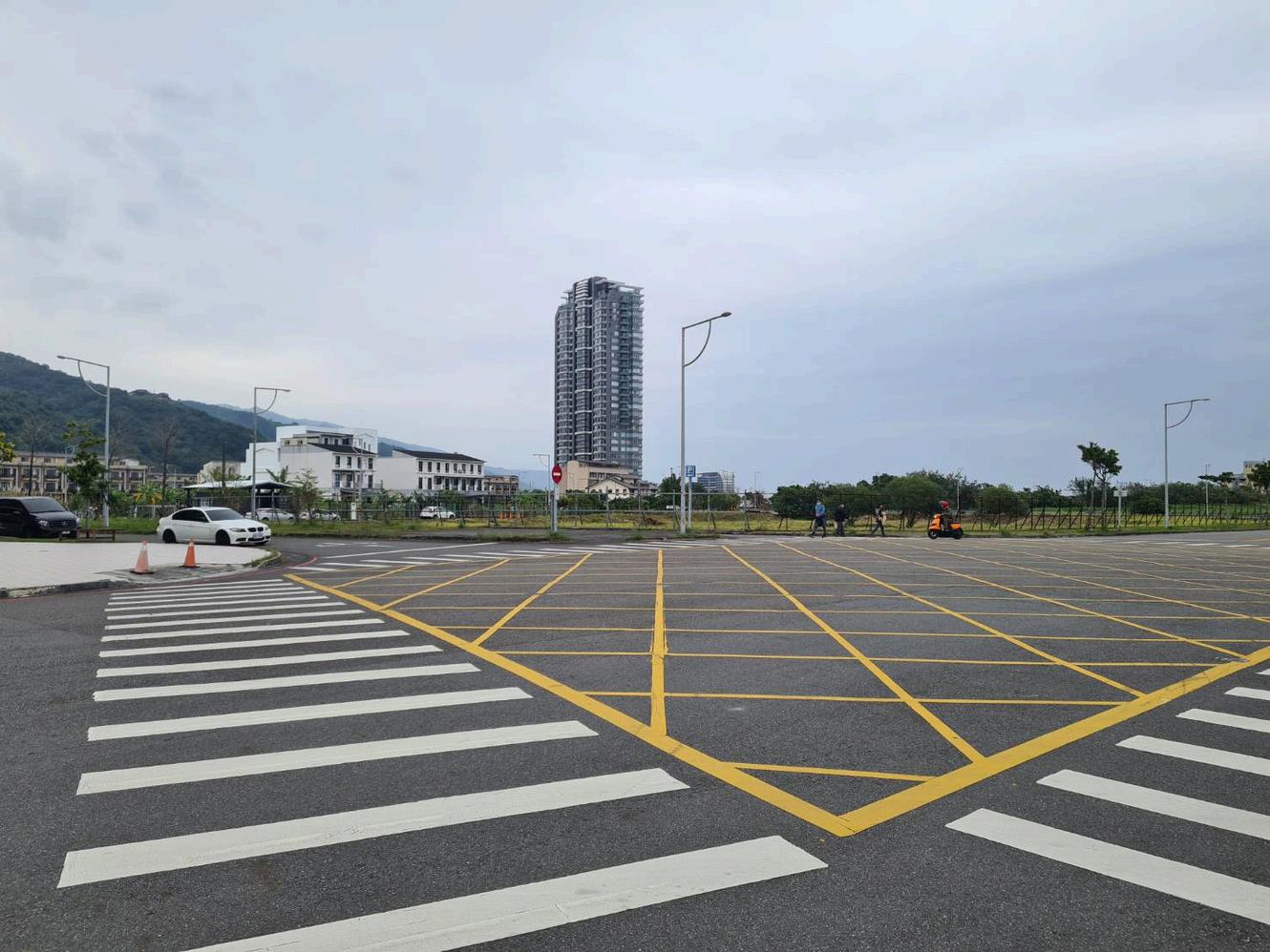

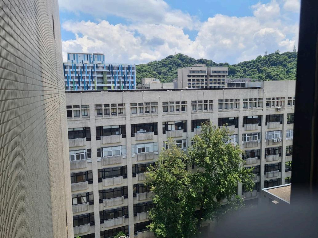
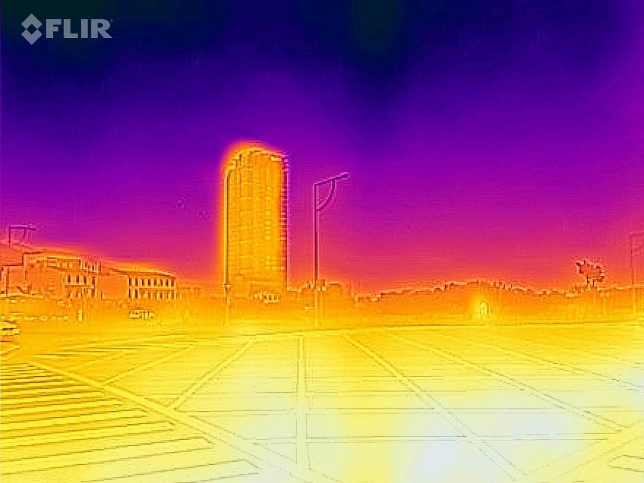
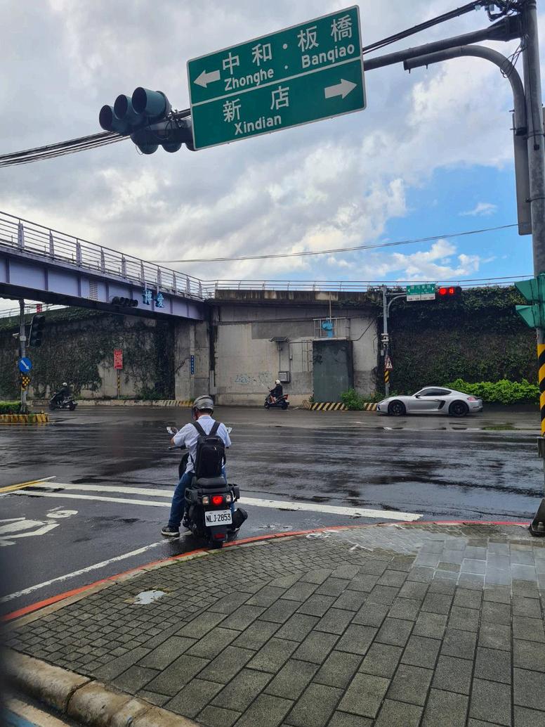
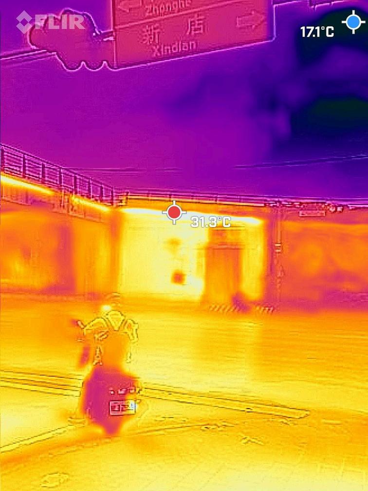
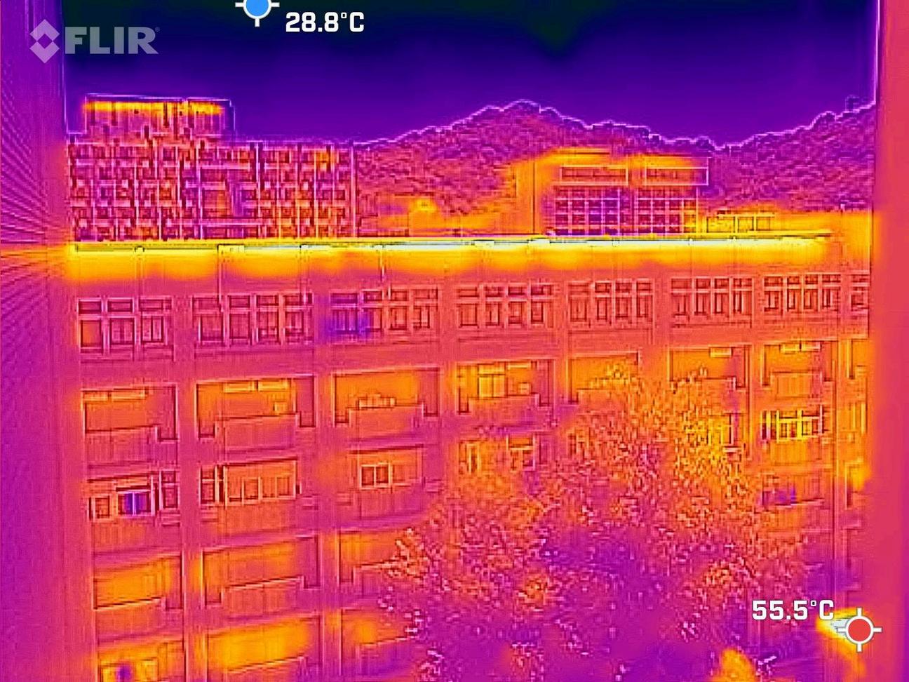
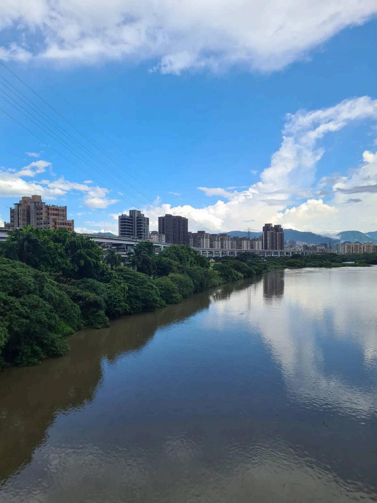
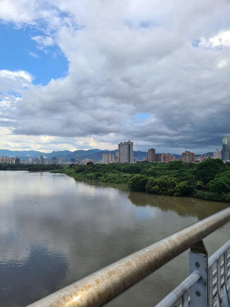
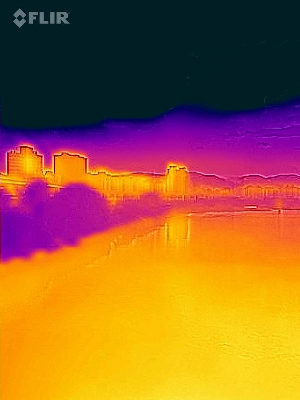

What can be observed in the top three thermal images is the distribution of heat throughout the environment In the first photo, the asphalt road surface is shown to hold the most heat during the day being at nineteen degrees Celsius, a significant amount hotter than the surrounding environment especially the areas with vegetation, appearing at dark orange colour, the sky is very clearly seen to be the coolest part in all thermal images, and the radiating heat off the ground can be clearly observed as the gradient of colour turning from orange to dark purple. Interestingly the lighter shaded concrete blocks have a lower temperature compared to the dark asphalt road surface

Interesting, why do you think that is? What aspects of these different objects causes these phenomenons?
That photo was taken at around 11 A.M. in the morning, just when the surroundings was being heated up by the sun, it has yet to reach the peak temperature of the day and I believe the higher thermal density and more reflective colour of the concrete blocks means it heats up slower causing that result
Something else I noticed in the comparison between the thermal images taken before and after rain, is how different materials and vegetation affect the heat gain and loss. Before rain, the hottest surface is the uncovered asphalt road while after rain the road has cooled down significantly while the sheltered concrete barrier wall remains similar to its original temperature having only lost a few degrees, additionally the concrete wall with vegetation covering it is even cooler. Furthermore the the metal bridge is significantly hotter than the concrete wall before the rain but after the rain the temperature becomes much cooler compared to the wall. This suggests the material of the surroundings is very significant in regards to how it reacts to different situations within the city.

Yes, the materials used in construction is very important when dealing with heat absorption and dissipation, and the presence of vegetation is even more important Along with colour, you can use these as design strategies when working on your own architectural designs

Ihavephotographedthedifferencesinroad pavementchoices,theimpactofroofcoloron heatabsorption,andthetemperature differencesofmaterialswithorwithoutshade.
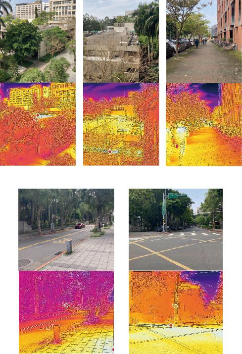


I have photographed the differences in road pavement choices, the impact of roof color on heat absorption, and the temperature differences of materials with or without shade
What I noticed from that photo are:
The temperature of a building's roof will be affected by the color and material of the roof
Street trees can effectively reduce the heat absorbed by roads and provide sufficient shade
Asphalt pavement is a material that tends to absorb heat.

what do you think are the key factors that contribute to the various points mentioned in the photos?


The main factors include:
Roof Color and Material: Roof color affects sunlight absorption Lighter colors reflect more heat, while darker colors absorb it.
Street Trees and Shade: Trees reduce direct sunlight on roads, lowering temperatures. Their shade and transpiration cool the surrounding area.
Asphalt Pavement Heat Absorption: Asphalt's dark color and material composition cause it to absorb and retain heat.

So, we now know that color, material, and vegetation all affect heat absorption and temperature in the environment Understanding these factors helps in designing urban environments that reduce heat absorption and mitigate the urban heat island effect
"Afterourdiscussionabout UrbanHeatIslands,the mitigationmethods BsuggestedbyLEEDand REEAM,andthethermal imagesyoualltook,Ibelieve


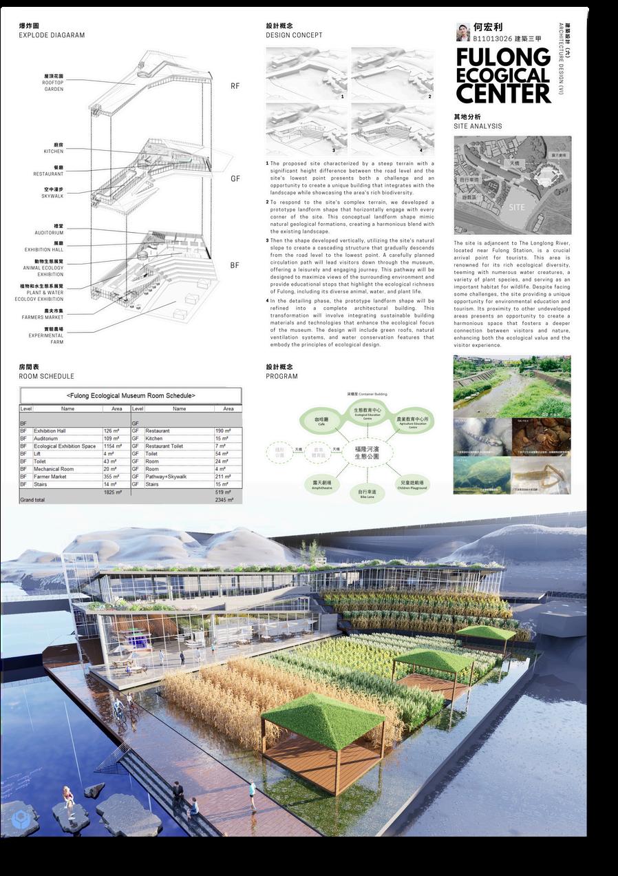
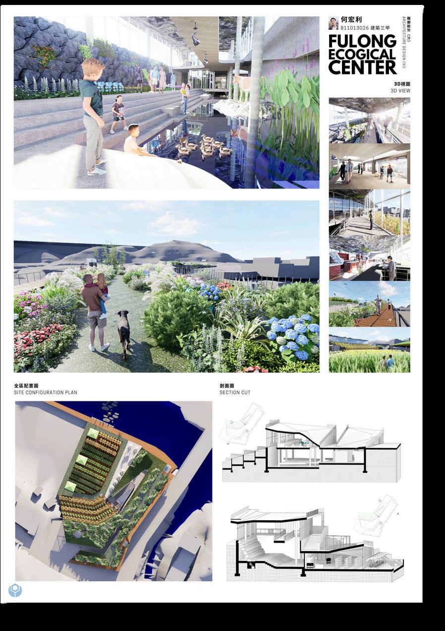


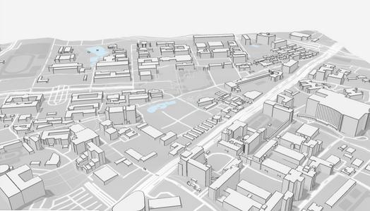
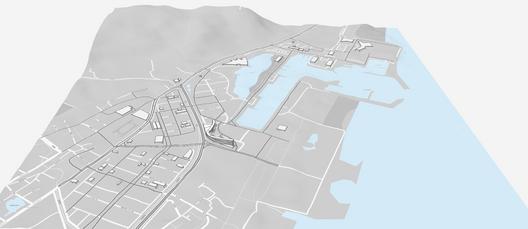
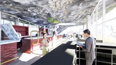
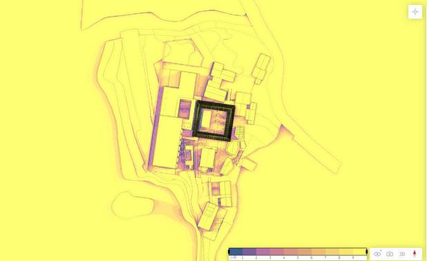
Based on the Forma Sun Hours Analysis, it can be concluded that our building will receive ample sunlight throughout the day. Since my building is designed to integrate the natural landscape of Fulong, I have decided to incorporate numerous openings to allow light to enter. This will create a "cave light" effect, providing visitors with a spatial experience that simulates exploring an underground cave




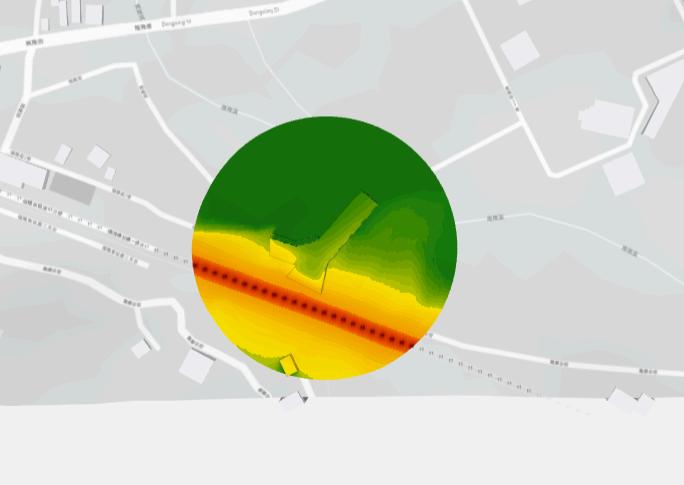

Based on the Forma Noise Analysis, part of our building will experience noise issues from a nearby train rail, with noise levels ranging from 55 to 65 dB Although these levels are deemed acceptable, such noise can negatively impact the experience of people entering the building and their overall spatial perception. To address this issue, I have made significant design changes.
To mitigate noise at the ground and facade areas, I designed a unique entrance that allows the noise to disperse before reaching the interior Additionally, a landform adjacent to the entrance directs noise towards the roof, where it is further dispersed by plants covering the entire roof area
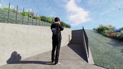
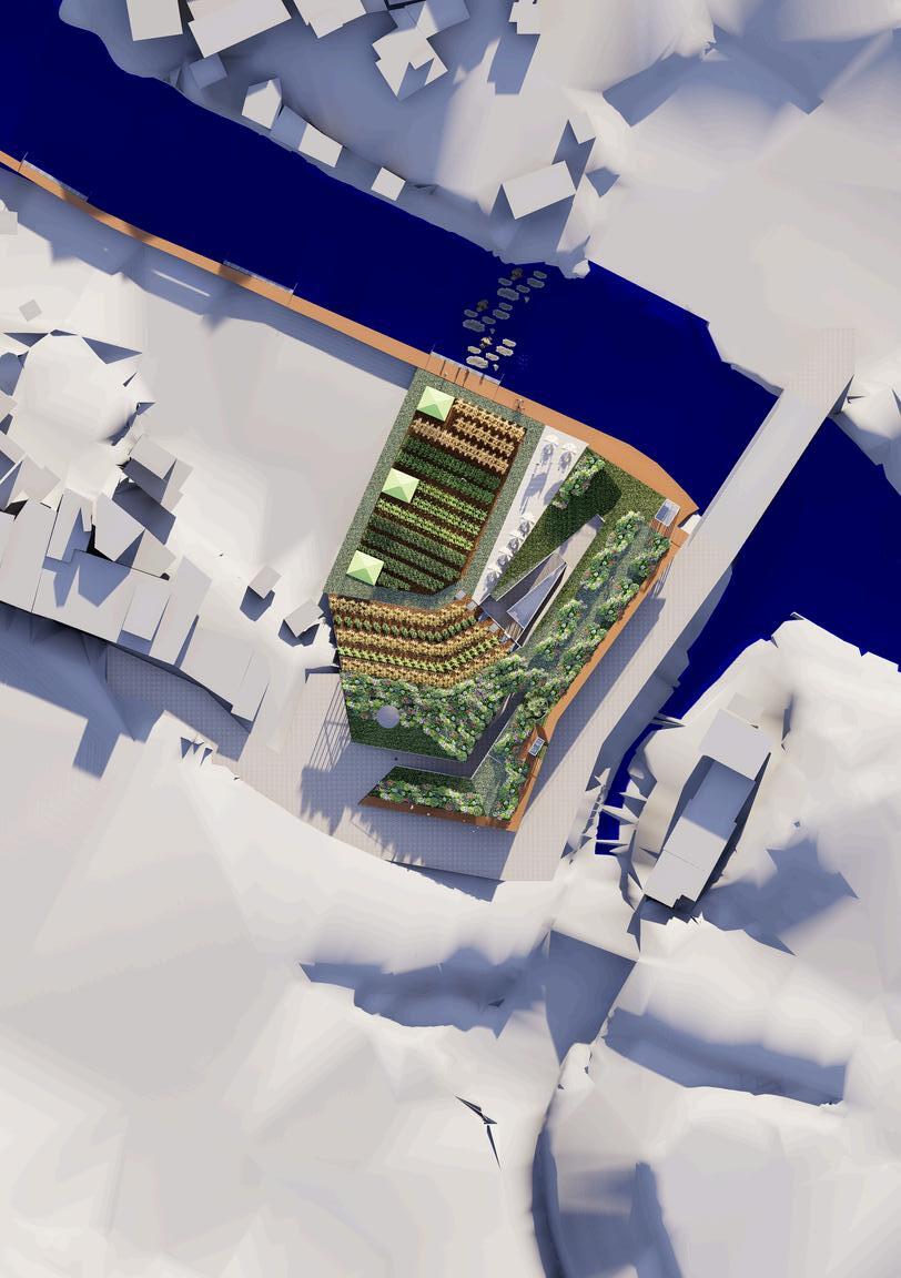

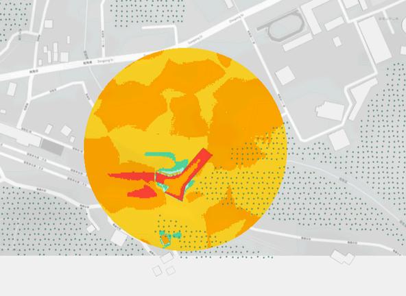

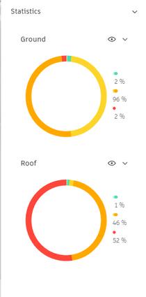
Based on the Forma Wind Analysis, it can be concluded that our building will experience strong winds on the roof, which could negatively affect visitors walking there To mitigate this issue, we designed the building with a landform shape that allows wind to flow naturally from the south and north without obstructing or negatively impacting visitors Additionally, we have placed numerous plants on the roof to help disperse the wind, while also aiding in the pollination process This design is in line with my concept of creating buildings that can blend with nature, by becoming part of nature itself, helping to reduce the Urban Heat Island effect.
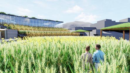
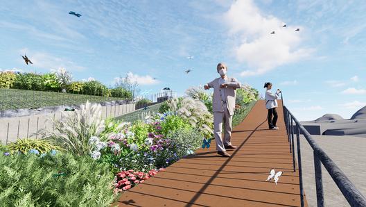

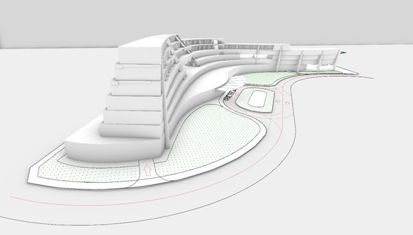
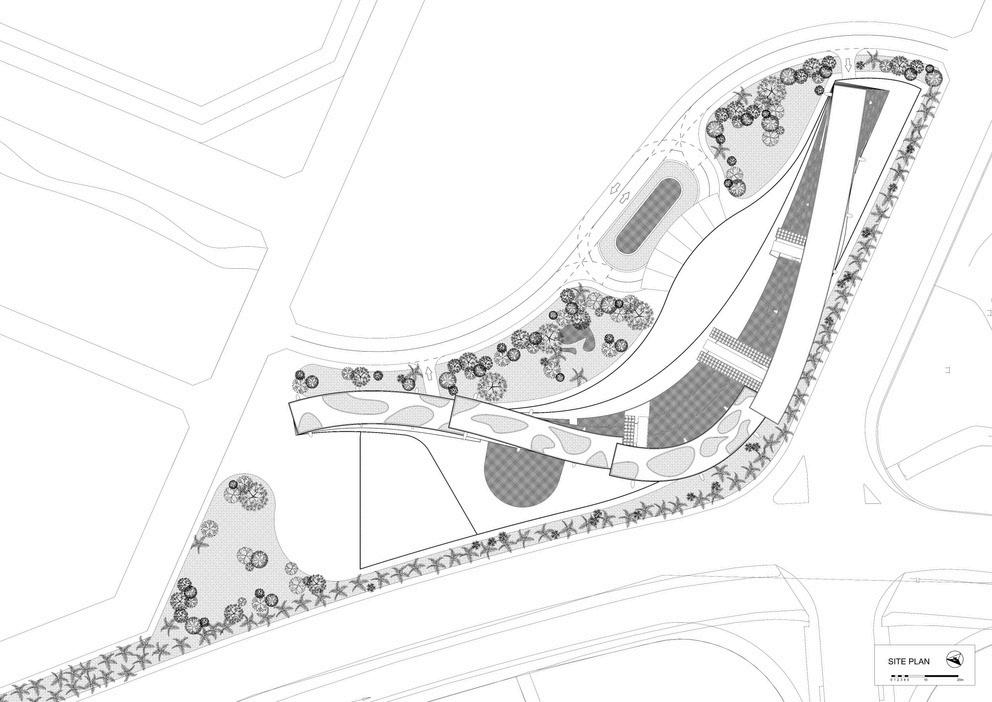


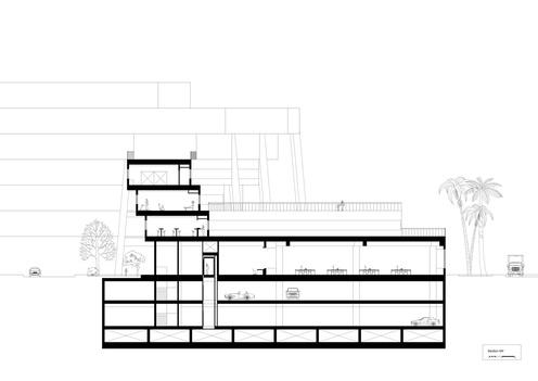


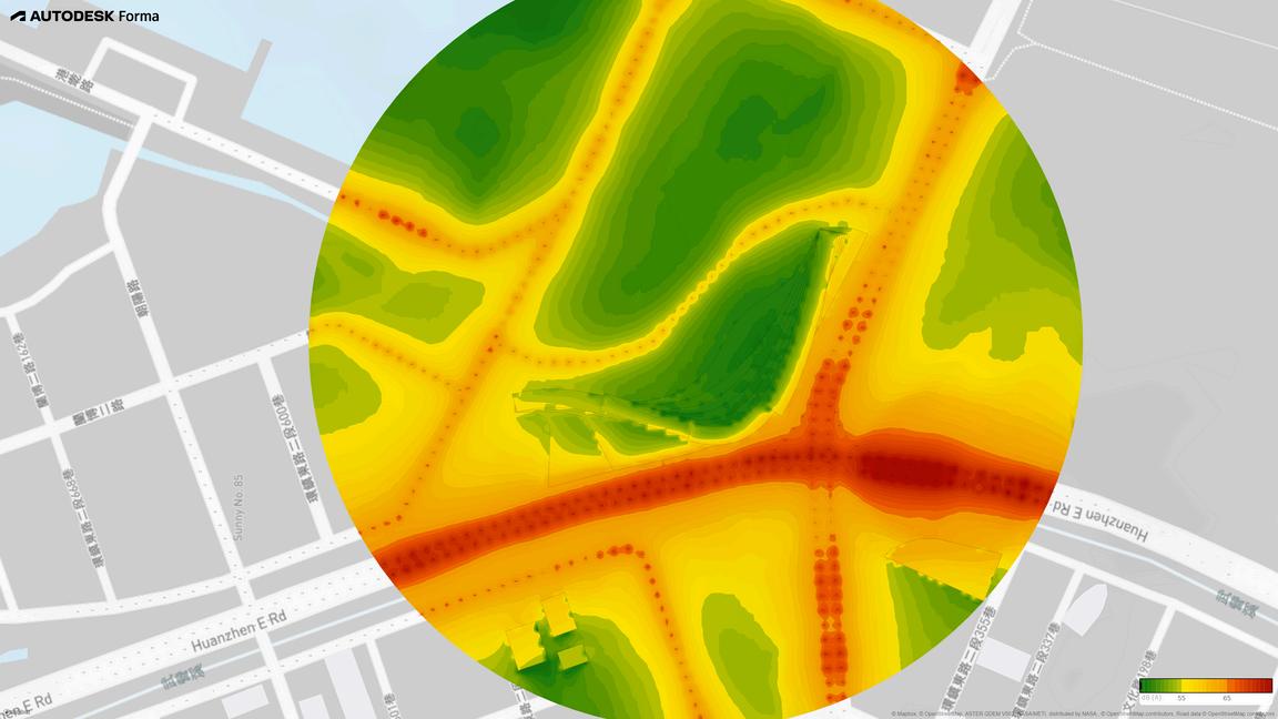
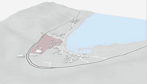
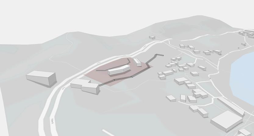
Set beside an arterial road, the site is subject to large amounts of noise pollution throughout the day which further affects the surrounding areas. Although the noise level is deemed acceptable, it negatively impacts the comfort of customers staying at the hotel, leading to a lower standard of satisfaction. In addition, it furthermore impacts the facilities which require a high standard of noise quality adjoining the site As such, certain steps were taken during the design and planning phase to address this issue
Using the uniquely shaped facade to reduce and reflect the noise, along with using hallways as buffer zones in the interior layout planning, with the addition of roadside vegetation and tree lines to dampen the noise, the building effectively reduces the impact of noise pollution not only for the residents inside the building but also for the surrounding sites. Creating pockets of serenity for outdoor leisure activies

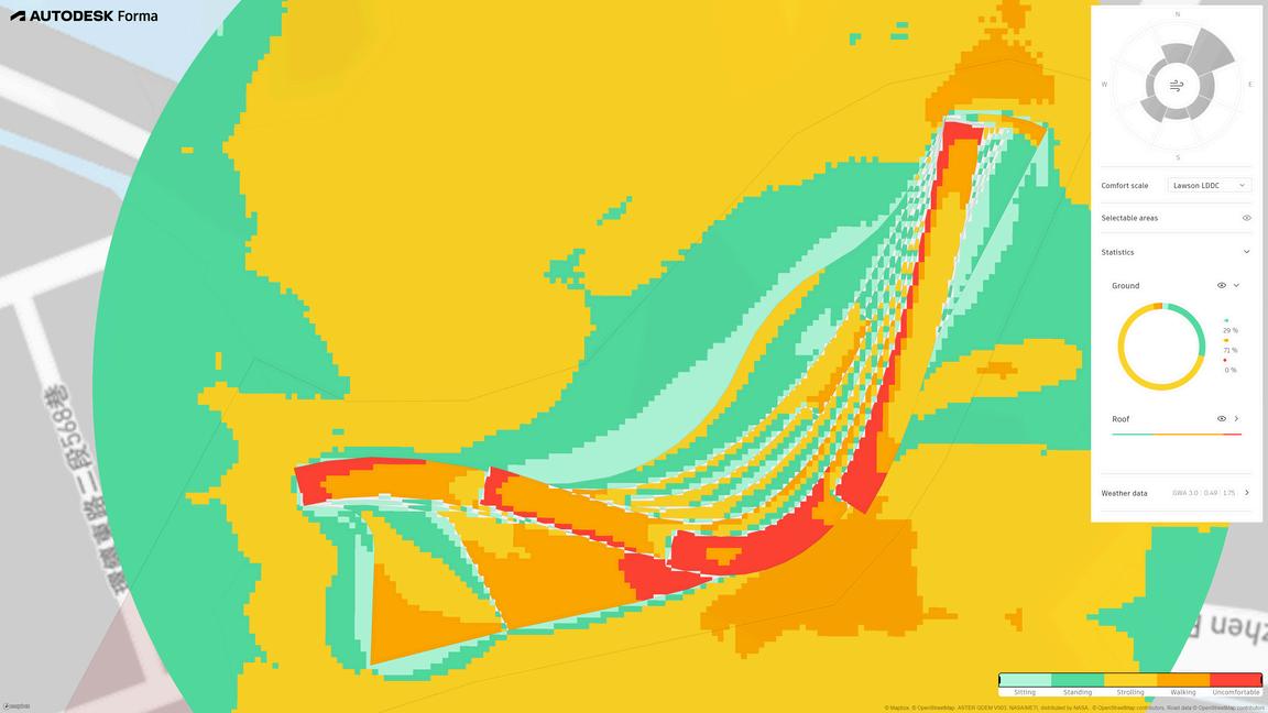
From the wind analysis, it can be observed that the site generally has comfortable outdoor areas on the ground floor, created by the harbour-like nature of the building form, creating an alcoved obstacle against the prevailing wind
As observed from the analysis, the roof of the building will experience strong winds usually during prevailing northern winds where wind speeds reach over 5m/s. In response to this, wind shades and obstacles facing north are placed on the rooftop garden, creating comfortable sitting areas.
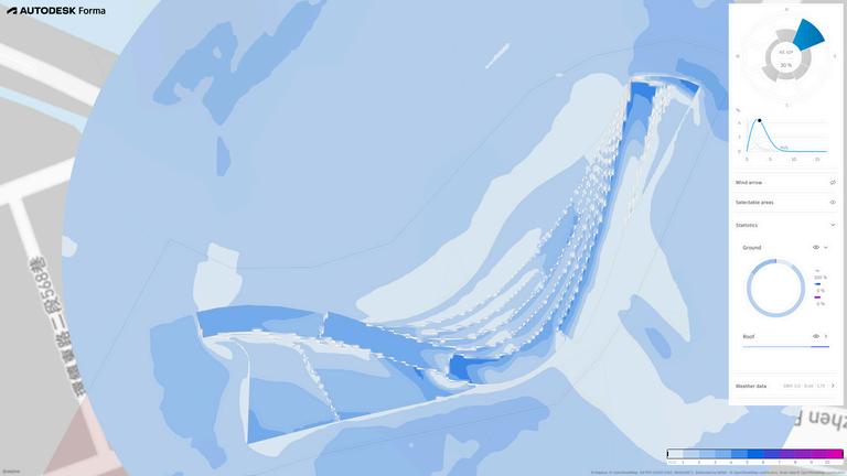
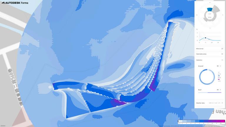
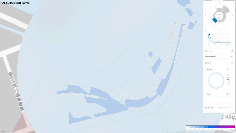
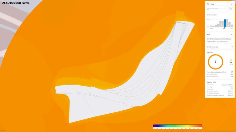
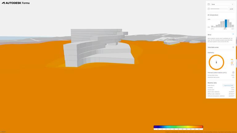
Microclimate analysis of the site shows the effects of having the building mass located on the site, and how it affects the surrounding temperature, creating zones of lower, more comfortable exterior spaces as a consequence of the shade cast by the building The programme being an international resort hotel with a heavy emphasis on spaces for exterior activities, requires larger areas with lower temperatures and shade
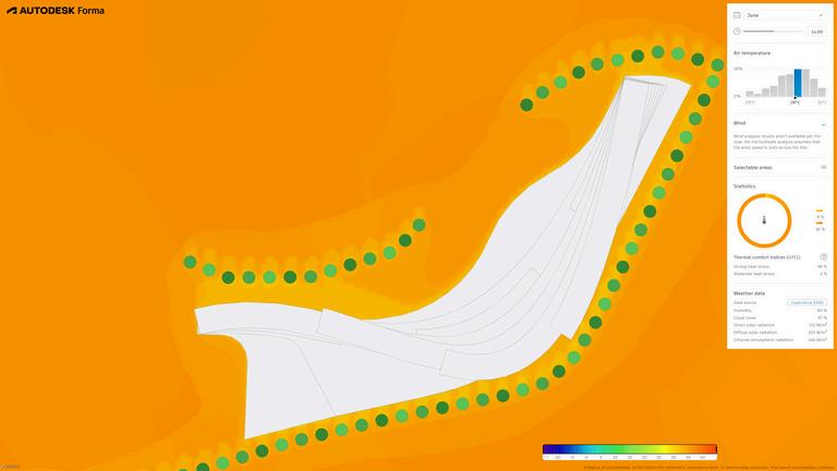
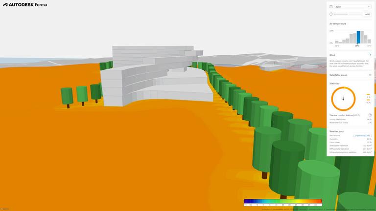
Using Forma, we can test and observe the implementation of different design strategies and their effects on the site. Using the street tree line and additional vegetation, it is possible to extend the affected zones of reduced temperature, creating pockets of comfort and courtyards for activities between the building and tree line, water features can further be implemented to increase the contrast between the temperatures of these areas


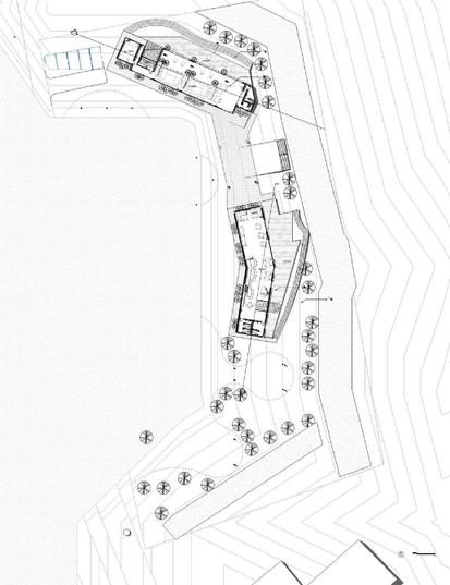
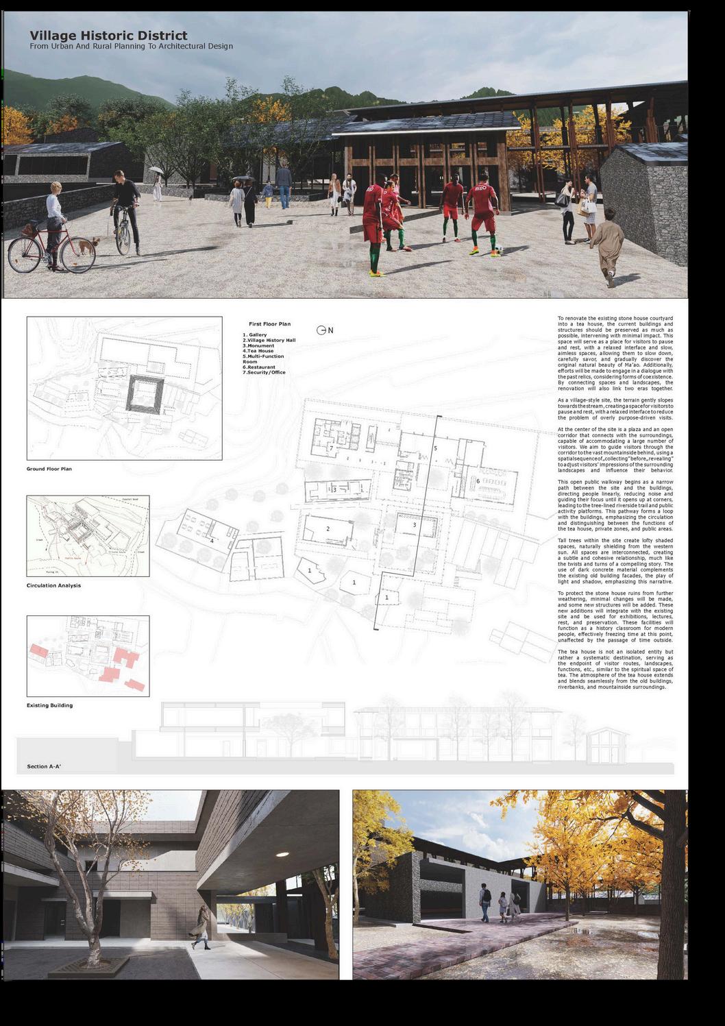
THE First-floor plan
Mr.CHI Bar
Mr CHI Restaurant

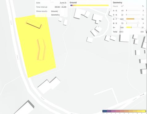
Date 6/21
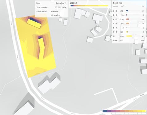
Date 12/21
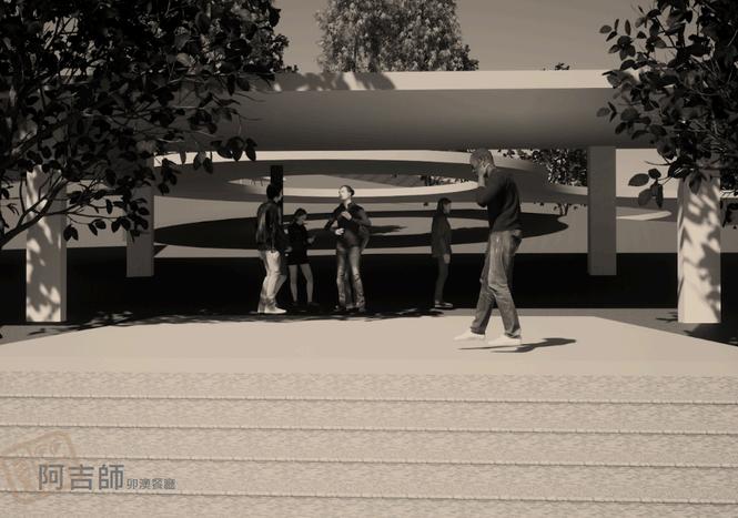
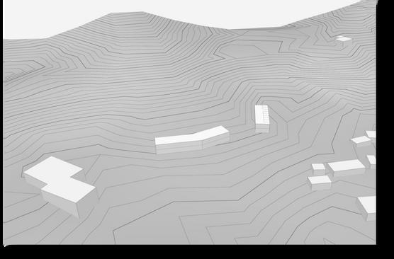
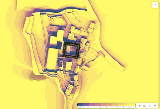
Based on the Forma Sun Hours Analysis, it can be concluded that our building will receive ample sunlight throughout the day. Since my building is designed to integrate the local residence and visitors of Maoao, I have decided to find out the location and direction of the whole to reduce light to enter and create sufficient space for people to rest during their journey This will provide visitors with a full experience that people willing to come to my restaurant

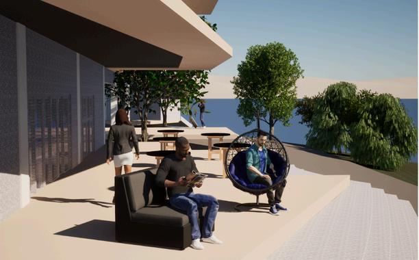
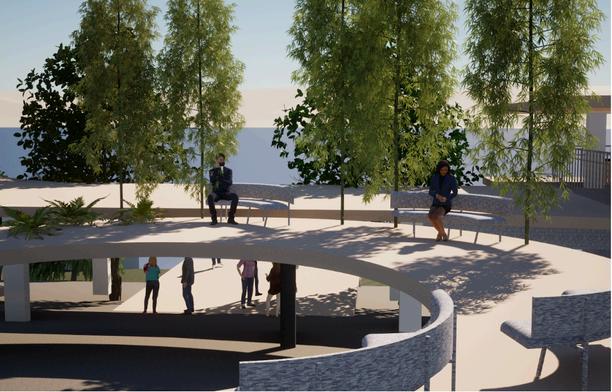

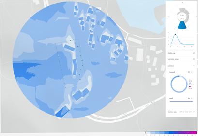
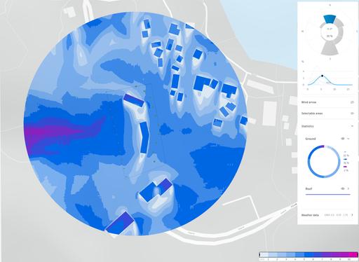
Based on the Forma Wind Analysis, it can be concluded that our building will experience strong winds on the roof, which could negatively affect visitors walking there To mitigate this issue, we designed the building with a landform shape that allows wind to flow naturally from the south and north without obstructing or negatively impacting visitors Additionally, we have placed the outdoor planets to avoid the effect on winds
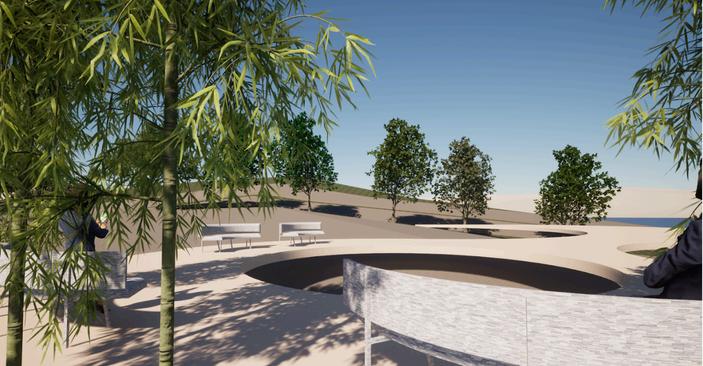


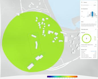
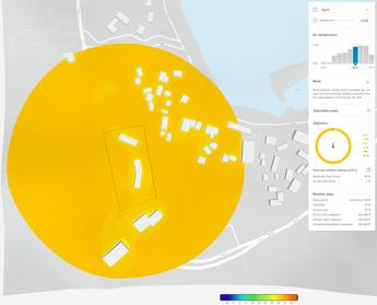
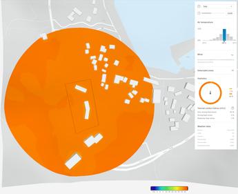

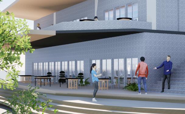
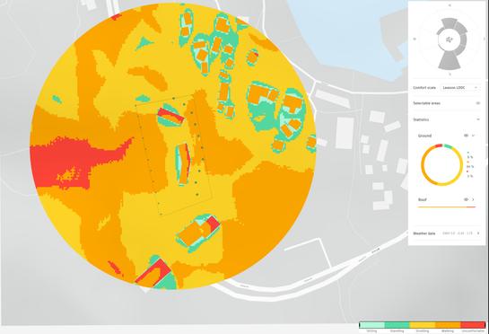
Based on the Forma Microclimate Analysis, it can be concluded that our building will experience comfortable weather from January to April and uncomfortable weather from August to October To optimize this extreme climate change we designed more winding corridor Not only to build some open space to outdoor activities, also provide a huge shelter to prevent the heavy raining




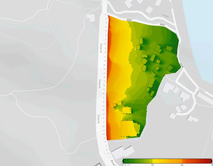

Based on the Forma Noise Analysis, The traffic on the coastal highway brings noise, so to address this impact, the site is set back a certain distance from the road, allowing the existing vegetation and trees to serve as a natural noise barrier The seafront side is used as the main access route With the Forma Noise Analysis, it is easy to understand how noise affects our site, enabling us to solve the problem effectively
Date 6/21
Date 12/21
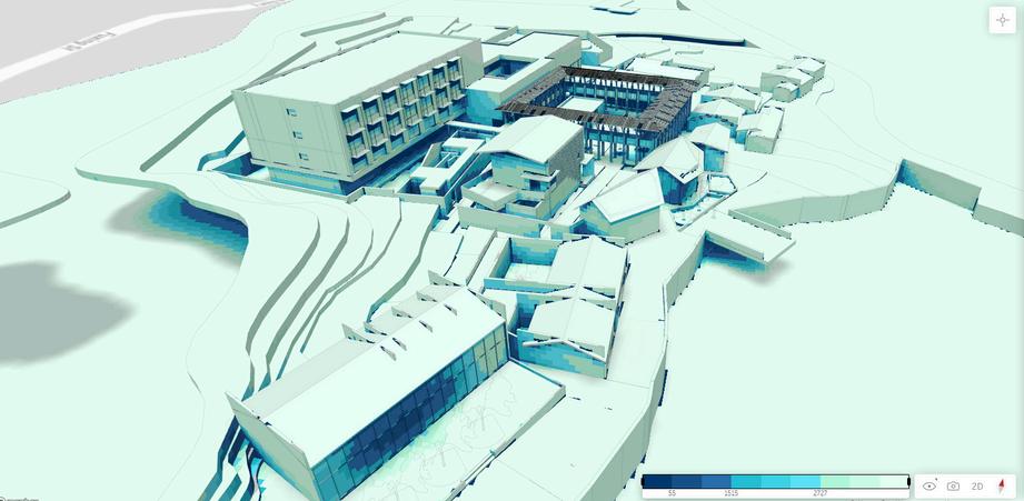
Forma sunshine hour analysis shows that our buildings receive ample sunlight throughout the dayTherefore I need to create more shade within my design to increase the comfort of my building, use corridors and planting to connect the buildings, and ensure that enough light is providedWe can also use daylight data to design the window opening positions of our buildings

Ladan, T.A. Ibrahim, .M.H. Ali, S.S.B.S. & Saputra, A. (2022). A geographical review of urban farming and urban heat island in developing countries. IOP Conf. Series: Earth and Environmental Science 986 (2022) 012071 IOP Publishing Ltd
https://www.usgbc.org/ https://breeamcom/ https://wwwcimio/blog/breeam-vs-leed-understanding-key-differences-in-green-buildingcertifications
https://wwwsegreenecom/en/leed-certification/ https://wwwsustainuclaedu/leed-lab/ https://www.oldenburgerfritom.nl/en/logistic-solutions/warehousing/breeam https://www.stonecycling.com/news/what-is-breeam/




書名
作者
指導教授
總編輯
發⾏
UHI Inside Taipei
楊敬和 Irving Yang
何宏利 Erick Ho
曹楚献 Marc Tsau
張中奐McCaw Chang
蔡欣君副教授
Dr Lucky S J Tsaih
何宏利 Erick Ho
國⽴臺灣科技⼤學 設計學院 建築系
NTUST College of Design Department of Architecture
