DERWATERR
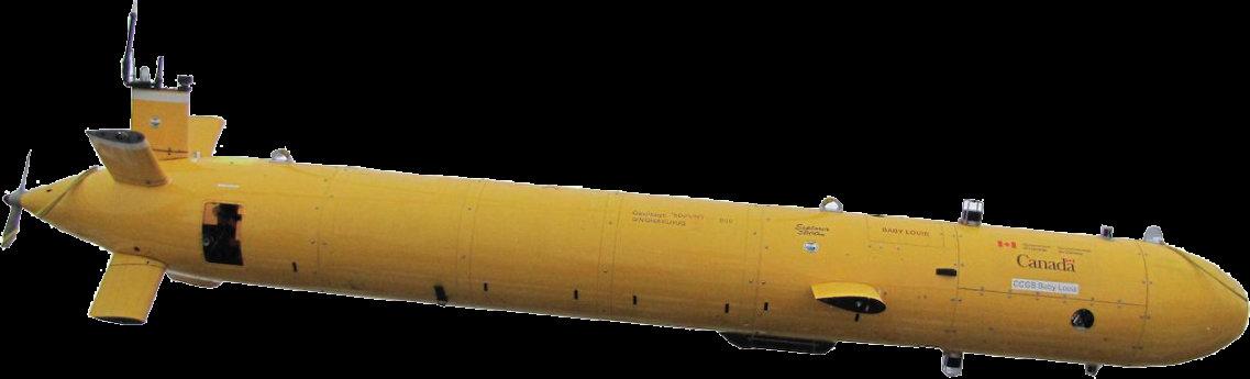
ecoSUB POLAR AUVs
Connecting What’s Needed with What’s Next™

ecoSUB POLAR AUVs
Connecting What’s Needed with What’s Next™
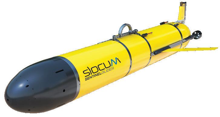
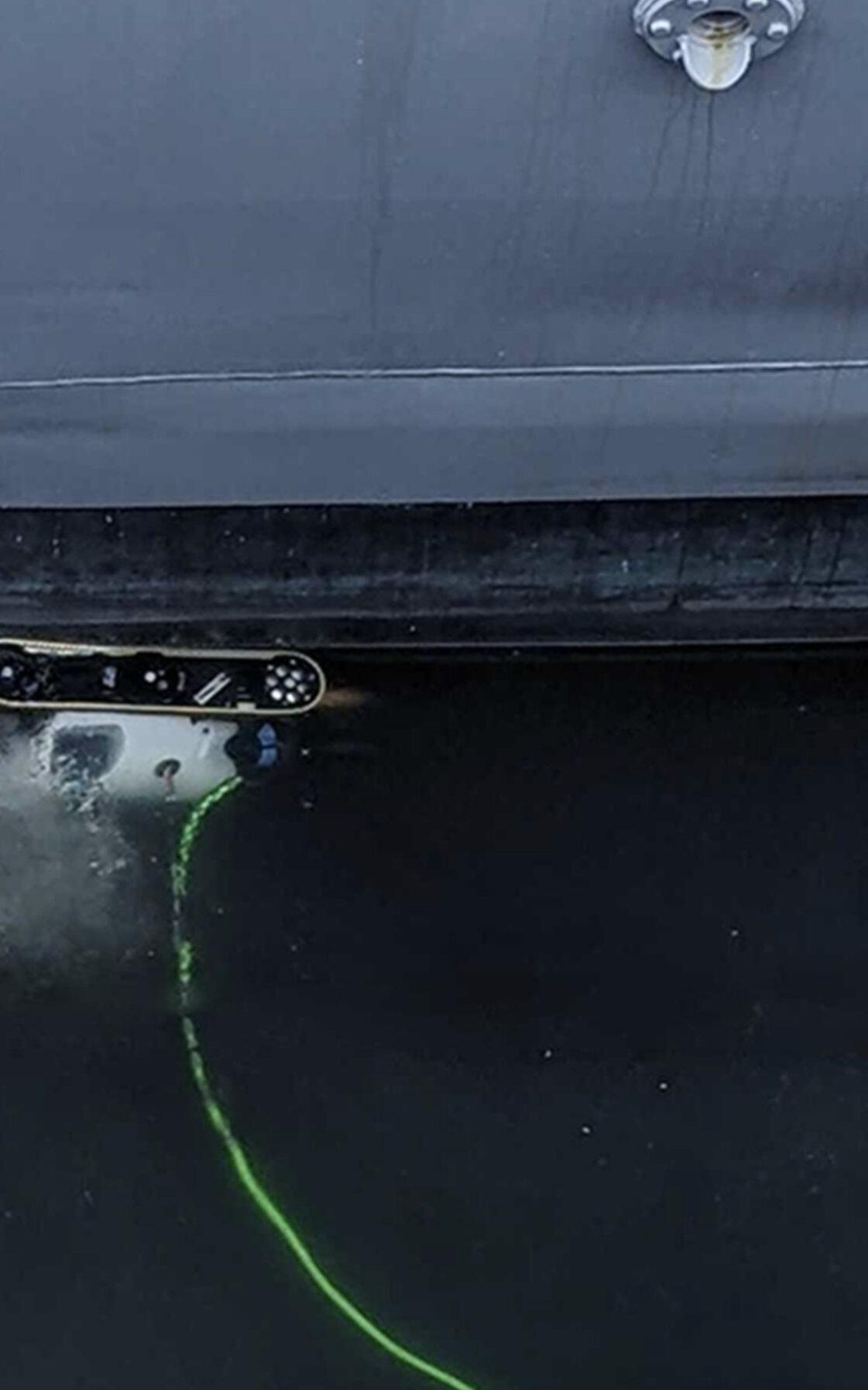
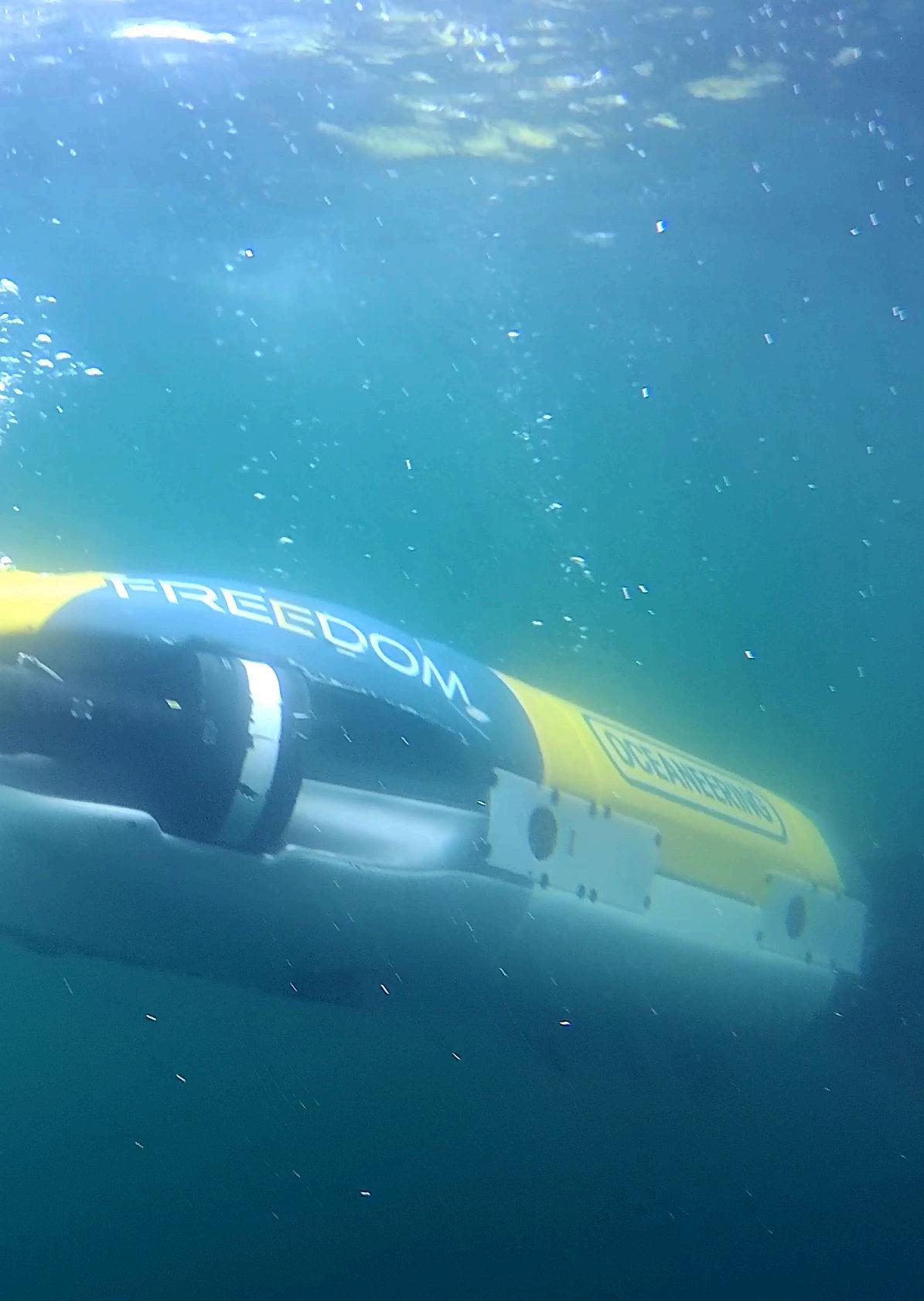
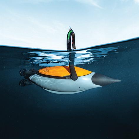
The Freedom™ AUV is the most advanced, resident-capable underwater vehicle, offering the data resolution and completeness of coverage in a single pass usually only obtainable using an ROV – but with the speed and mission efficiency of a traditional AUV.


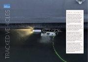
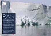
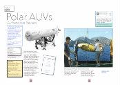
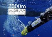
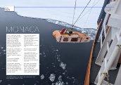
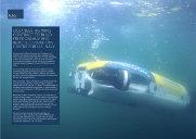
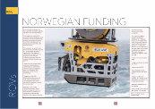
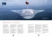

Image: Jeff Orlowski, VideoRay
Editor: John Howes John@ut-2.com +44
Editorial Assistants: Neil Downe
Production: Sue Denham
Advertising: Zinat Hassan UT3subsea@gmail.com
Tel: +44 (0) 845 6522 483 Mobile: +44 (0) 781 1200 483
Published by UT2 Publishing for and on behalf of the Society for Underwater Technology. Reproduction of Underwater Robotics in whole or in part, without permission, is prohibited.
The publisher and the SUTassumes no responsibility for unsolicited material, nor responsibility for content of any advertisement, particularly infringement of copyrights, trademarks, intellectual property rights and patents, nor liability for misrepresentations, false or misleading statements and illustrations.
These are the sole responsibility of the advertiser. Opinions of the writers are not necessarily those of the SUTor the publishers


National Oceanography Centre
MATS is a key event in the marine technology calendar, attracting delegates from around the world, hosted at the National Oceanography Centre’s dockside location in Southampton.
Join us for a packed three days of insightful presentations and networking opportunities, focusing on new developments and innovations.
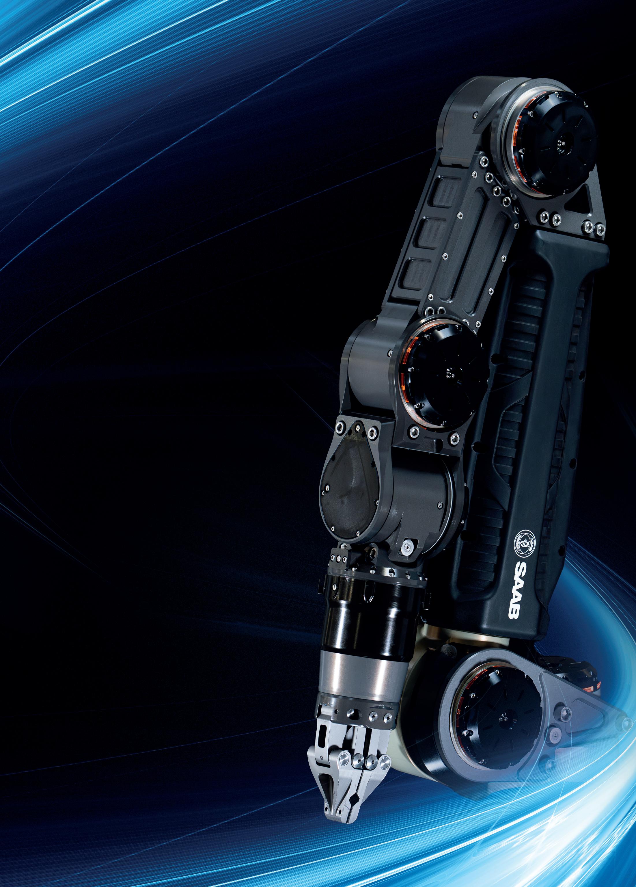
Electric Manipulator
• Seven function work class manipulator
• Compatible with most work class ROVs
• Maximum reach 1,990mm
• Lift capacity 122kg/454kg (max/min reach)
• Precise position and force feedback
• Modular self-contained joints
• Wrist camera option
• Diagnostic power and status LEDs
• Interchangeable parallel and intermeshing jaw options
• On-board processing for advanced kinematics
saabseaeye.com
Kraken Robotics has received several orders totalling approximately $3 million for Miniature Synthetic Aperture Sonar (MINSAS) systems from three separate customers.
The Man-Portable SAS (MP-SAS) and MINSAS 120 systems have been ordered for integration on uncrewed underwater vehicles for international naval customers.
Kraken’s MINSAS offers
resolutions of up to 2 cm x 2 cm (post-processed) at 200 meters per side in a compact, lightweight form factor.
It is designed to be easily integrated on a variety of platforms including UUVs, remotely operated vehicles, and Kraken’s KATFISH towed SAS. Kraken has been selling MINSAS systems since 2015 to defense and commercial customers in more than 15 countries.
● Recently, the MINSAS was evaluated by five NATO navies at the Portuguese Navy annual Robotic Experimentation and Prototyping with Maritime Unmanned Systems (REPMUS) exercise, which took place in Sesimbra and Troia, Portugal.
Five Kraken MINSAS modules were integrated onsite to American, Dutch, Swedish, Belgian, and Portuguese uncrewed underwater vehicles
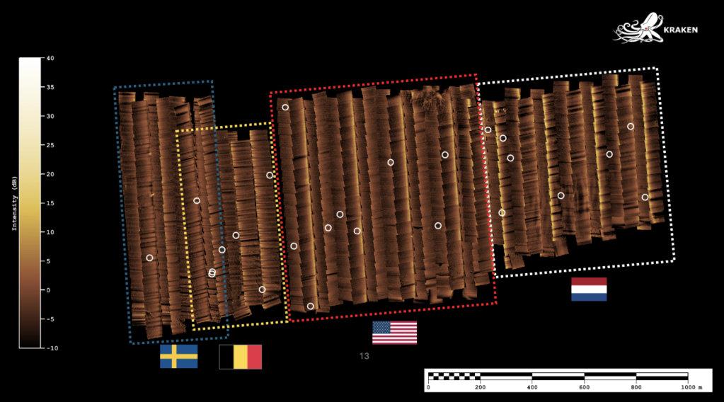
During REPMUS, data from four different MP-SAS modules integrated on REMUS 100 UUVs were combined to identify 25 mine-like targets across 1.6 km².
(UUVs). These systems combined were able to locate more than 50 mine-like targets over the course of the exercise (including redundant coverages).
Kraken’s MINSAS was used for a wide range of tasks during the exercise including area search and reacquire/identify. Real-time beamforming and georeferencing facilitated the rapid recovery of acquired data from payloads, enabling immediate post-mission analysis of data when the UUVs
returned to shore using SeeByte’s SeeTrack C2 System.
Kraken SAS was also used in a multi-national collaborative autonomy exercise to survey mine-like objects in a full ‘FindFix-Finish’ mission.
SeeByte’s SeeTrack and Neptune collaborative autonomy software, combined with the U.S. Navy’s C2 and TAK (Team Awareness Kit), were used to plan and execute the exercise.
Additionally, SeeTrack provided the tasking of a VideoRay Defender remotely operated vehicle to conduct an in-stride digital ‘Finish’.
The 2024 REPMUS exercise in September 2024 brought together more than 30 nations, 2000 participants, and 100 autonomous assets to enable collaborative development and testing of concepts and requirements in support of multidomain operations.

Teledyne Marine has unveiled the Intrepid, a GNSS/Inertial Navigation System. The system is integrated with the SeaBat T20-ASV processor and comprises a compact inertial measurement unit (IMU) and two GNSS antennas, delivering reliable and precise positioning.
With the Intrepid on board, no manual interfacing between sensors is required, as the system automatically streams data to third-party software. This eliminates the need for manual sensor interfacing and reduces downtime.
Teledyne Marine’s unified approach combines hardware and software into one single, intuitive interface for monitoring and controlling the mapping system.
Moreover, the centralised system streamlines firmware and software updates, providing users with effortless access to the latest features and enhancements. The new Intrepid GNSS/Inertial Navigation System combines immediate feedback

The Intrepid System
with the consistent and precise results of the SeaBat T20-ASV, delivering a seamless mapping experience.
The Intrepid GNSS/INS benefits all users in marine surveying applications by providing the precise navigation necessary for operational efficiency.
Due to its intuitive design, it is easy to configure and monitor, allowing even entry-level operators to quickly set up the system and receive immediate feedback on navigational status - essential for dynamic marine operations.
NOVACAVI will supply the Rebikoff-Niggeler Foundation (FRN), a non-profit organisation whose mission is to facilitate marine research and in-situ observation and documentation of deep-sea environments by means of submergible technology.
During the development of their new remotely operated camera system, which will be used for documentary filming and research in the pelagic zone down to depths of 1000-1200m, they asked NOVACAVI to design a custom-made neutral buoyant fibre optic cable with high tensile strength, perfectly suited to their specific requirements.
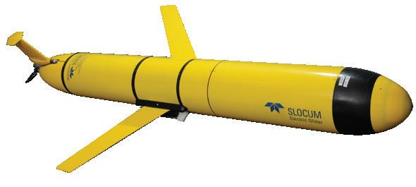
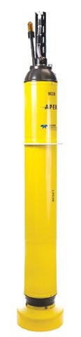

Teledyne Marine manufactures a wide selection of uncrewed vehicles operating throughout the water column from the surface to the seafloor, including shallow and deepwater modular AUV’s for military, commercial and scientific applications, Oceanscience USVs capable of carrying an array of survey instrumentation along with Slocum autonomous underwater gliders and APEX profiling floats for long duration and persistent oceanographic research and environmental monitoring.
Our Passion Runs Deep

Greensea IQ has launched the newly enhanced underwater hull inspection robot for EverClean IQ. This first-of-its-kind hybrid solution combines the hull crawling robot and underwater flight capabilities of its EverClean hull cleaning robot with multiple integrated ultrasonic metal thickness sensors and cameras to create a powerful new underwater inspection tool capable of fully leveraging EverClean IQ as a cloud data management system.
The EverClean IQ robot also expands the capabilities of other potential customers, such as Marine Surveyors and Shipyards, through access to purchase this powerful inspection data platform and workflow system for their own ship inspections – all enabled by this unparalleled data collection robot.
As the Maritime industry moves into an era of using robotics and AI to increase their performance, lower costs and operate safer vessels the need for quality data increasingly grows to inform the algorithms driving these advances. EverClean IQ takes the next step in this data collection process and delivers a solution ready to meet today’s needs of the shipping industry, informing important decisions by providing them with the data they need, when they need it.
Inspection data collected on EverClean IQ is now capable of delivering a even more complete picture of the vessel, including coverage maps detailing cleaned sections, fouling ratings, images and high quality video of points of interest including niche areas such as sea chest or inside tunnel thrusters and ultrasonic inspection of hull plate thickness to provide key insight for making decisions on hull repairs, monitor changes and planning predictive maintenance.
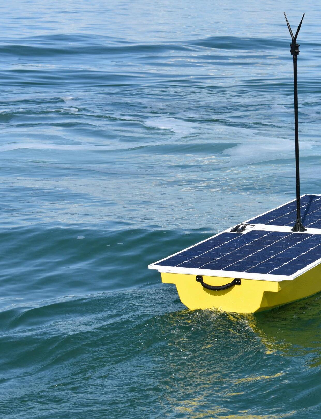

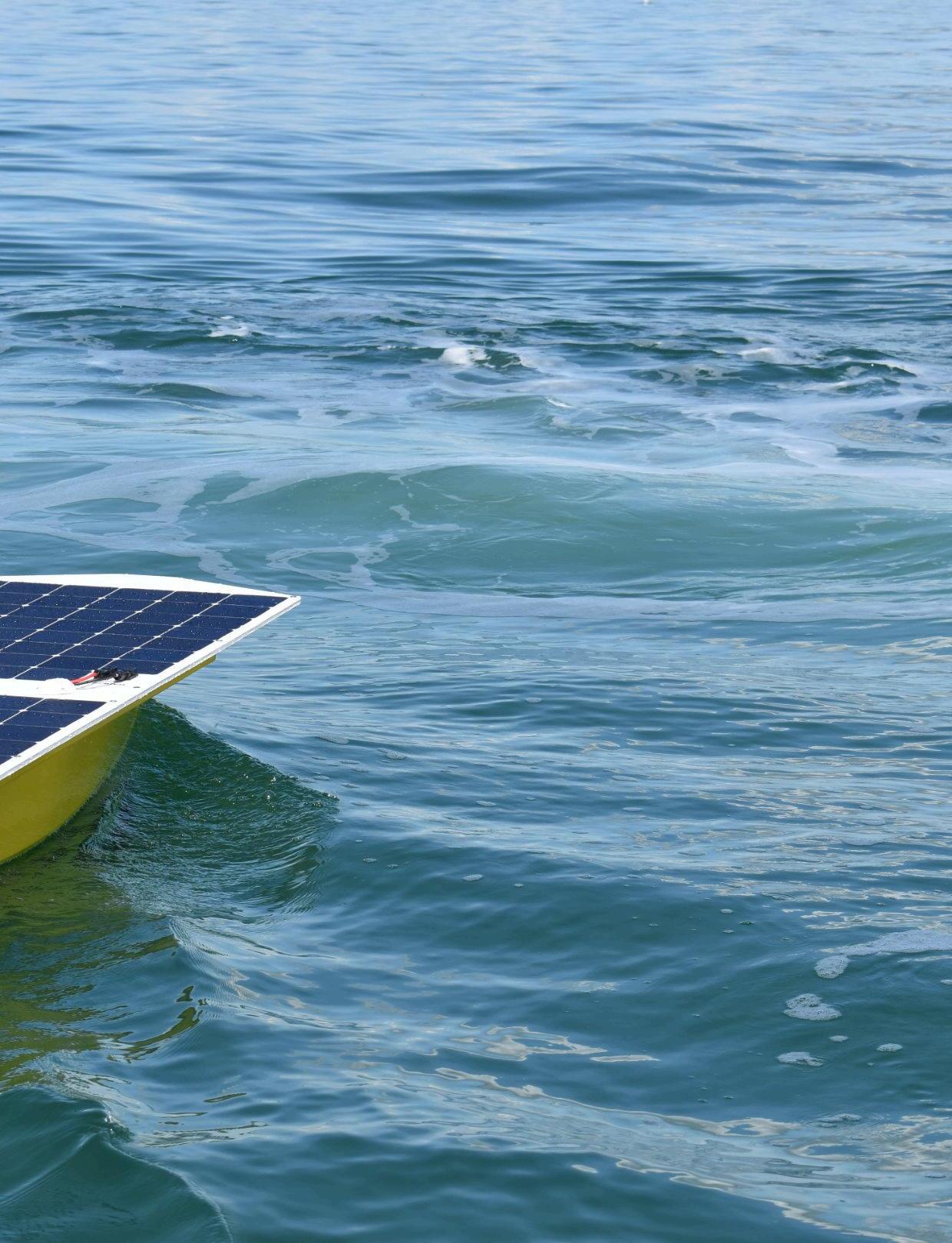
Online Oceans has developed a new small uncrewed vessel called Solar Scout. The Keynote of this longendurance fully-electric vessel is its simplicity and considerably low cost base.
“I started getting interested in USVs years ago when I saw wave gliders being used for oil spill detection in Southampton, where we are based,” said Online Oceans founder George Morton. “They clearly had significant operational advantages in certain applications compared with crewed operations but I thought the overall costs were still considerable.
“Around the time of Covid, I became aware of the Microtransat Challenge, a transatlantic race, aiming to stimulate the development of autonomous boats. This novel race was restricted to vessels less than 2.5m in length. It became clear that small but highly efficient and manoeuvrable vehicles could confer advantages in many offshore inspection and data gathering work, even when compared against some of the latest generation of sophisticated units being developed.
“After moving to Ocean Infinity to lead the marine decarbonisation effort , myself and a number of exemployees decided to focus on the development of these smaller USV. I'd always considered that solar electric vehicles would give a more full, consistent performance than small sail or wave powered vessels in all but the most extreme latitudes.
“The first task was to select the most appropriate dimensions. Vessels with a length of 2.4 metres, originally a stipulation in the microtransat, appeared to be a very good starting point. More recently, the MGA has declared MGN 702 as an exemption for vessels less than 2.5 metres. This effectively means that these small vessels do not have to comply with the same workbook code that governs larger vessels.
This gives us the ability to go out and operate in UK waters, which until recently has been very restrictive.
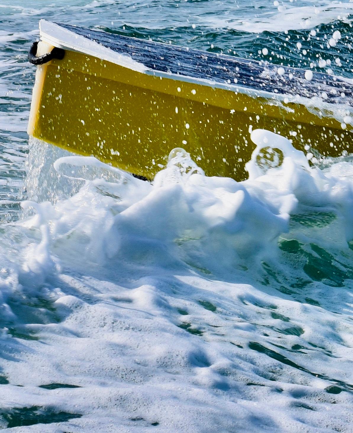
“We engineered the Solar Scout from the propeller up to achieve dependable offshore operations . Its advanced composite hull is designed for stability and efficiency to provide an unparalleled sensor platform within its class. It’s basic design is able to ride out hostile weather systems.”
For simplicity, the vehicle is propelled by a single electric thruster located deep in the stern to keep it away to from obstacles that might come past on the surface.
To prevent fouling, part of the control system involves looking for any kind of fouling event nearby.
The solar scout is fed from solar panels at the top of the hull. It has an installed solar capacity of 340 W. This power is stored in a large battery located down in the base of the structure to keep the weight low. It is designed to operate at top speed of 3.5 kt, but normally moves to the cruising speed o of 2 to 2.5 kt .
“The whole powertrain is
extremely efficient,” said Morton. ‘There's no gears, no seals. It's very little by way of friction or losses. The whole design is aimed to be extremely efficient , especially being able to operate in pretty low solar scenarios, particularly in typical North Sea latitudes.
Given reasonable weather, the battery is large enough to cruise at that speed for 2 to 3 days up to 130n nautical miles without solar energy. This is because it uses so little power.
In a more realistic application, however , its persistence can be measured in months.”
“At the centre protrudes an antenna, which provides a local radio control facility during the testing stage, but the complete version will have an iridium system.
This gives it a low bandwidth SATCOM to communicate with a remote telemetry control system. We are in the process of integrating some high bandwidth satellite solutions for actual data retrieval.
“We see typical applications as MET Ocean data collection Acoustic sensor harvesting
Maritime situational awareness and Offshore energy lifecycle monitoring. This is very compatible with windfarm monitoring and it will be able to provide relevant data at lower cost than many of the current range of vehicles operating offshore. It has a payload capacity of 50kg.
At present, we are carrying
out advanced prototype tests and the vessel could be ready to go into full production shortly. We've already done multi-month sea trials thought we will need to do more before we are satisfied. By next summer, however, we'll be in a position where it's more fully validated as a platform.
We are, however, currently having some discussions with potential users, mainly in the offshore wind sector , possibly deploying hydrophones as part of the environmental monitoring phase of consenting.

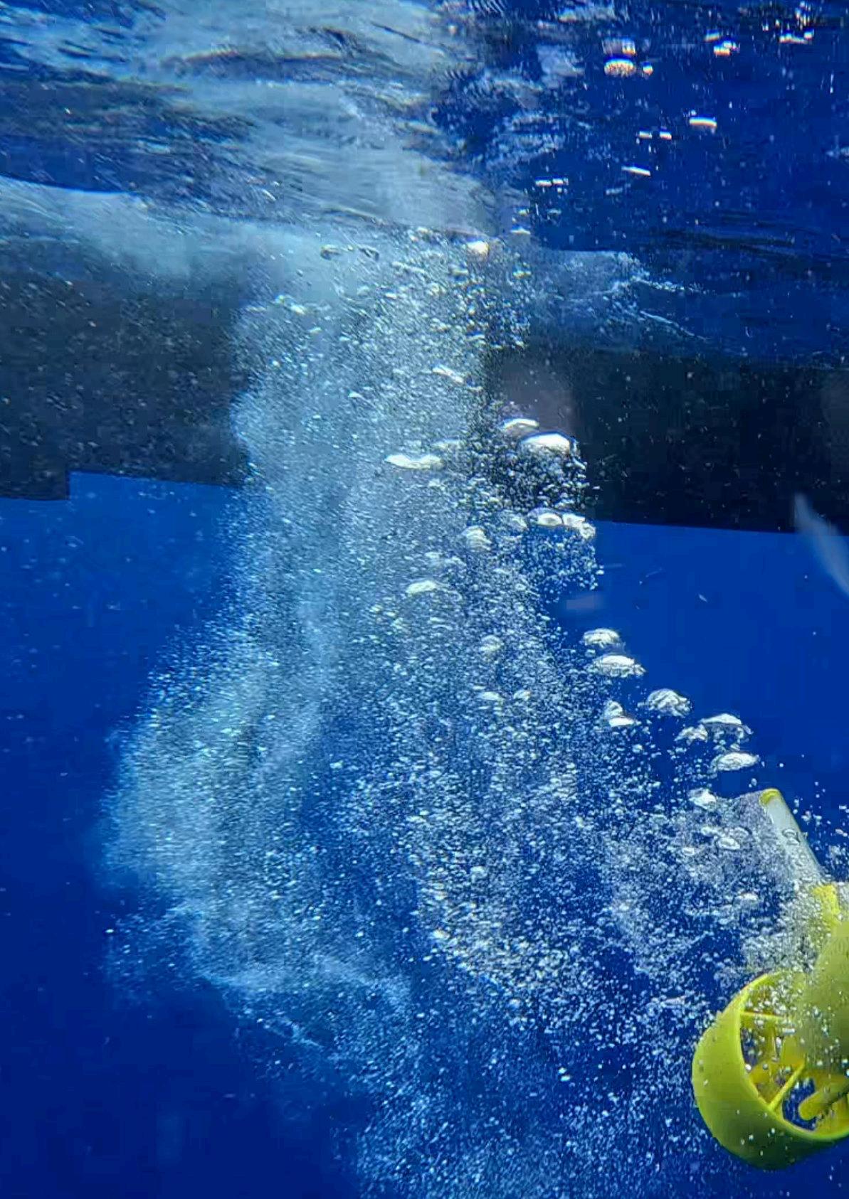
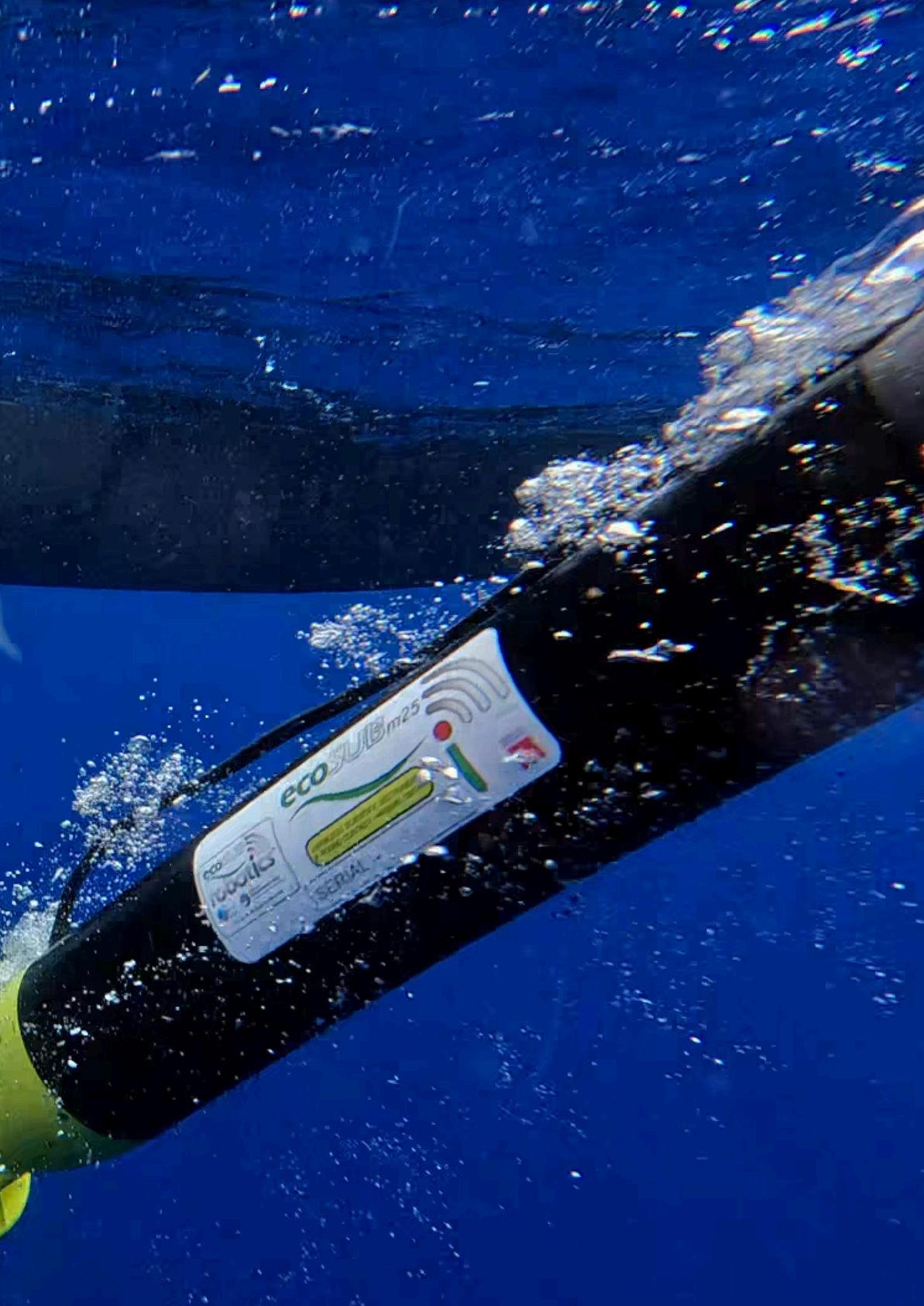
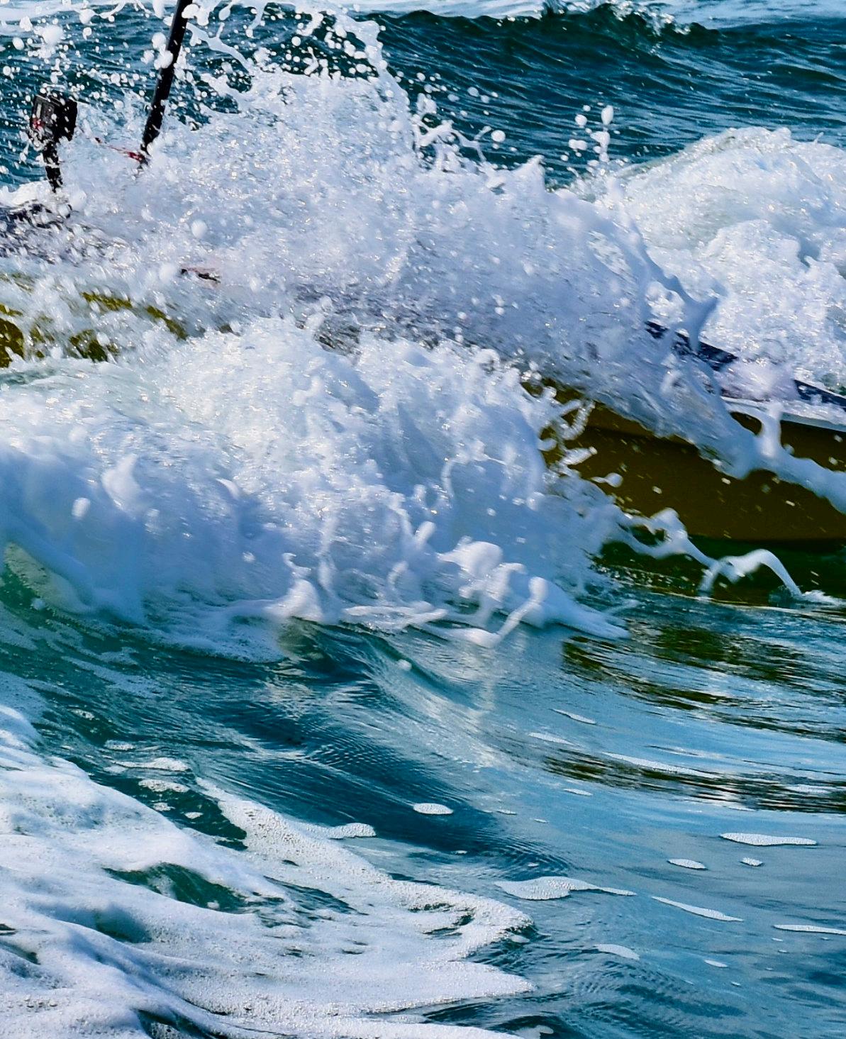
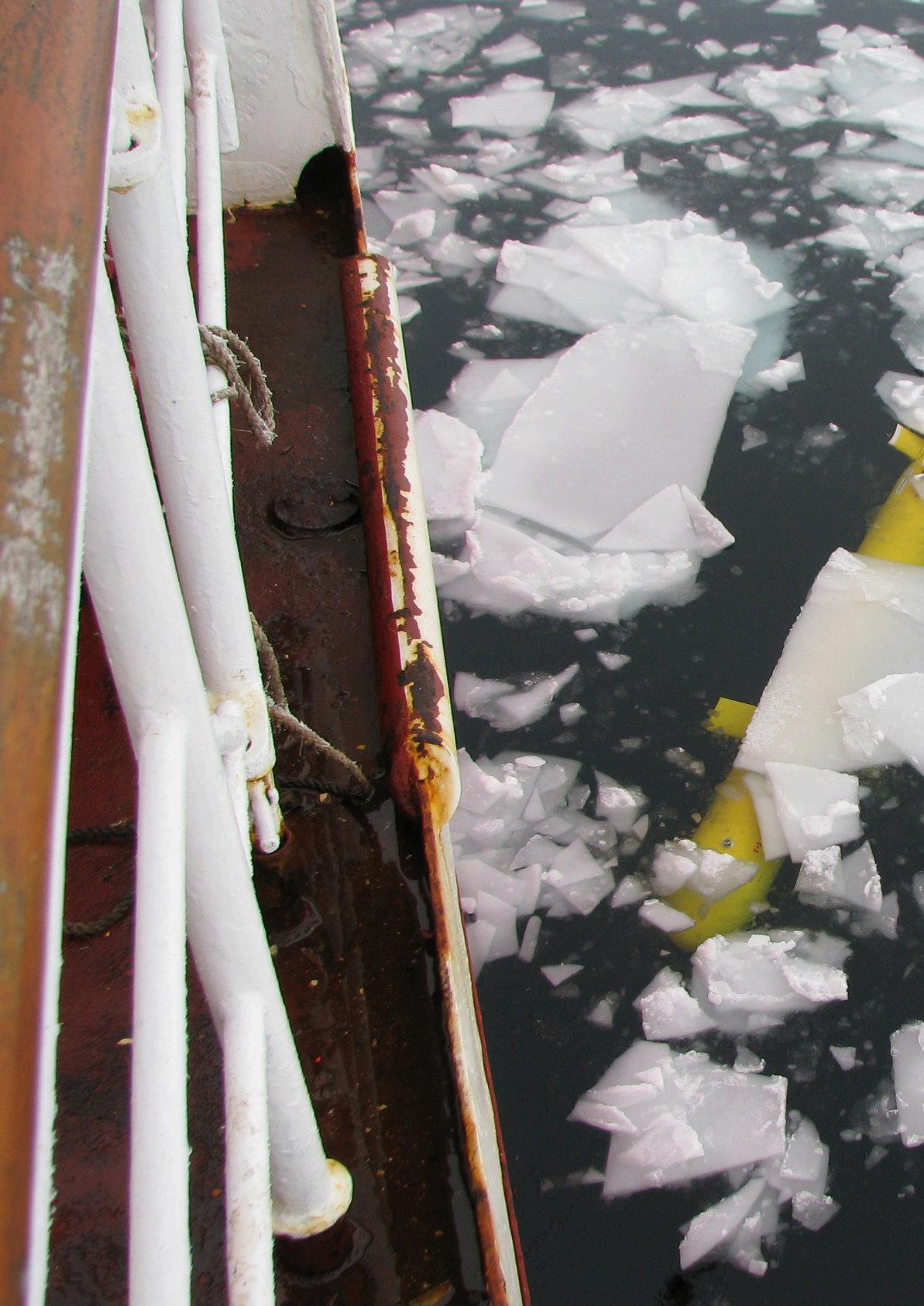
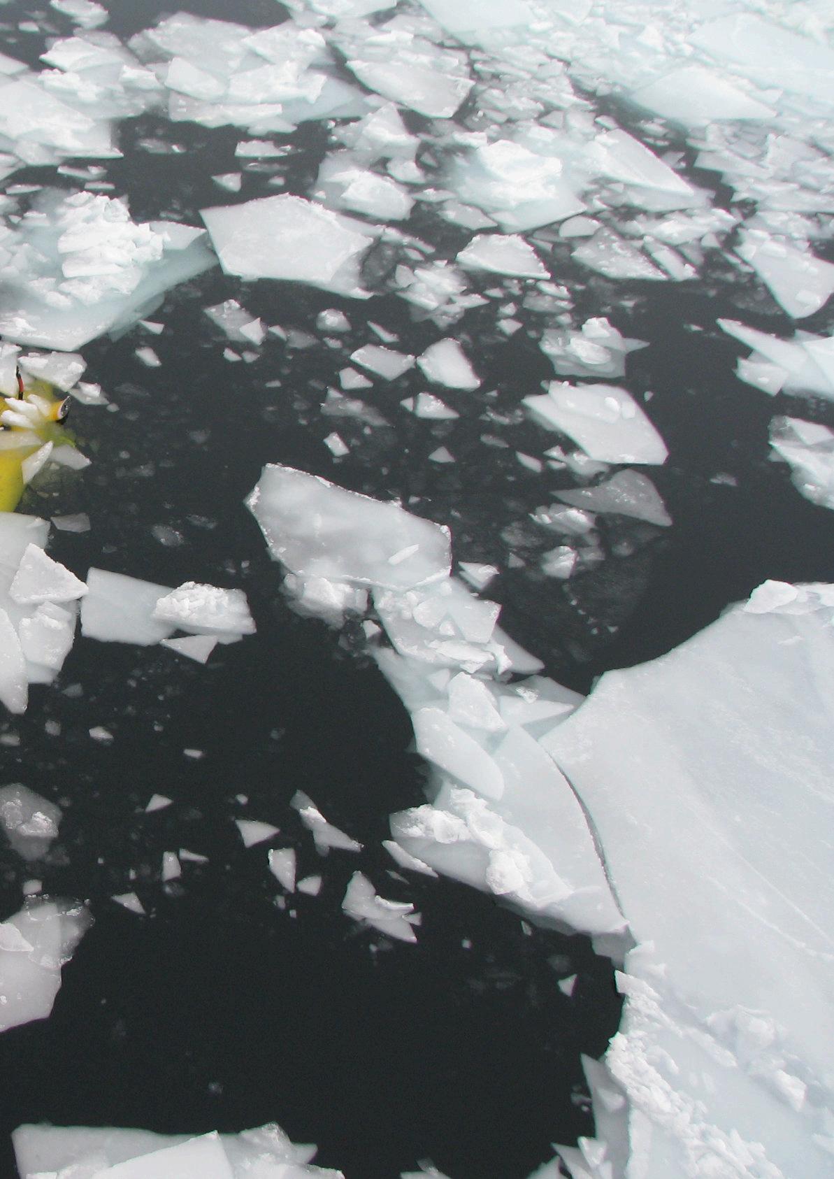
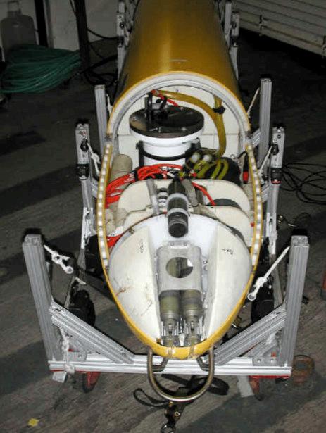
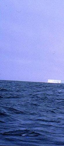
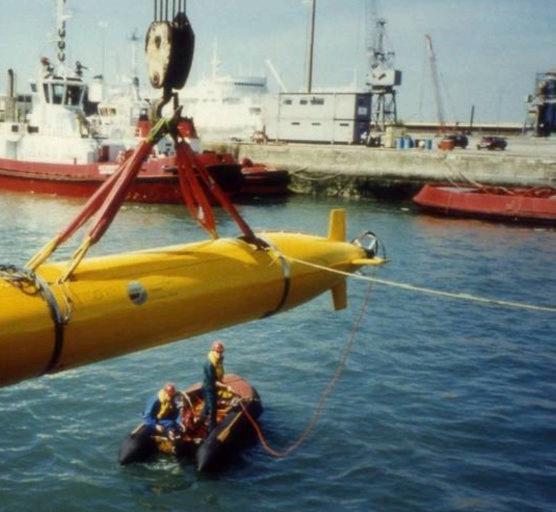
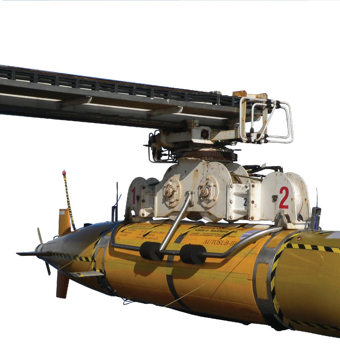
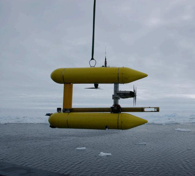
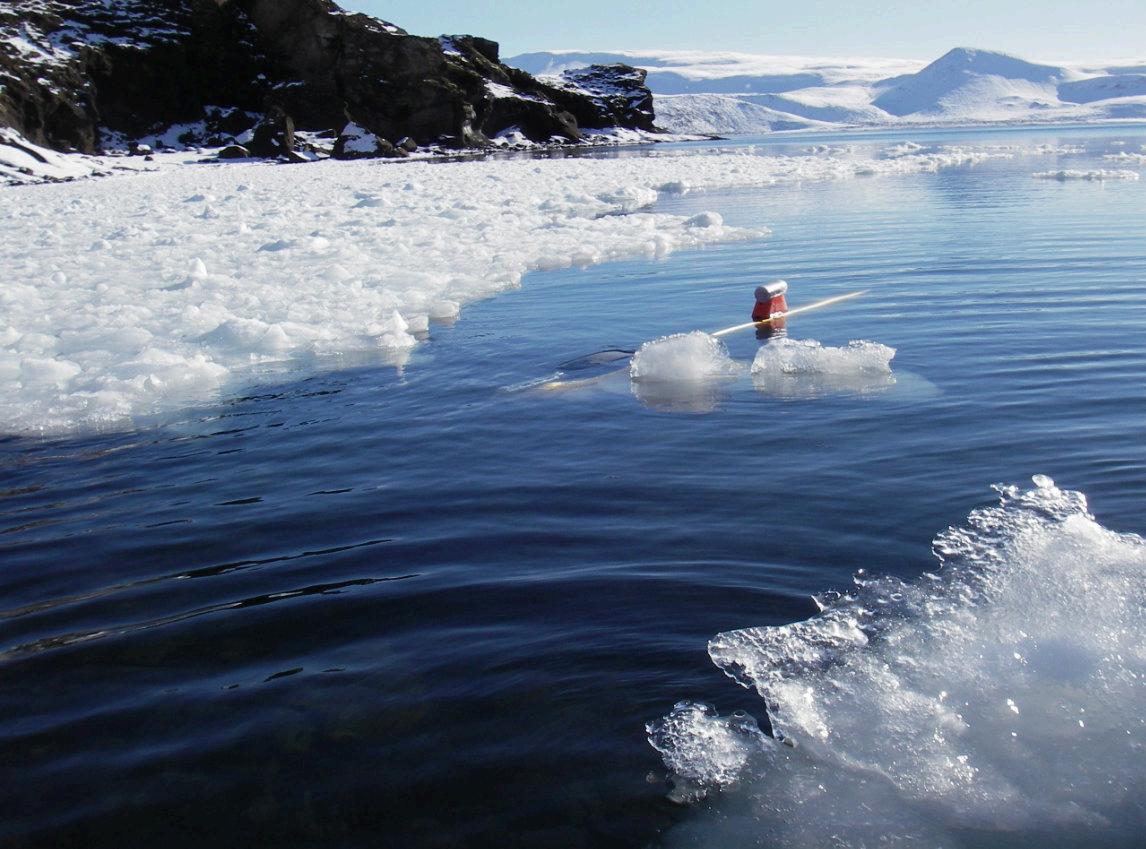
During a recent deep water trials campaign in Madeira, an ecoSUBm25-Science
Autonomous Underwater Vehicle (AUV) was launched and successfully completed a spiral behaviour to provide vertical profiling of the water column down to 2,000m depth, and back again.
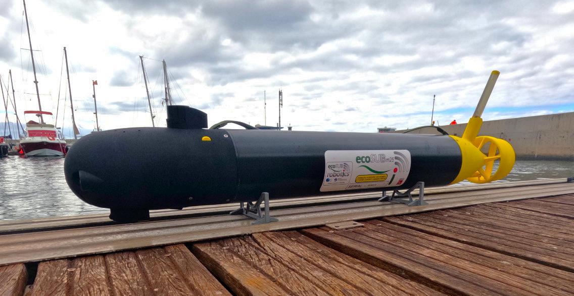
The ecoSUBm25-Science AUV is a disruptive technology, based on the extremely affordable ecoSUBm series AUV platform, it weighs just 12kg and is depth rated to 2,500m.
Whilst most deep rated AUV technology is based on large and
expensive platforms, costing millions of dollars, the ecoSUB platform is in the tens of thousands, providing a stepchange in accessibility to autonomous ocean data collection for te marine science community and others.
The ecoSUBm25-Science AUV was equipped with a CTD and a Chelsea Technologies TriLux sensor, providing measurements of Conductivity, Temperature, Chlorophyll, Turbidity and Phycoerythrin.
The m25 platform is also capable of hosting sensors to measure Dissolved Oxygen, CDOM, pH, Oil in Water, as well as navigation sensors such as altimeters and DVL, along with acoustic coms for underwater communications.
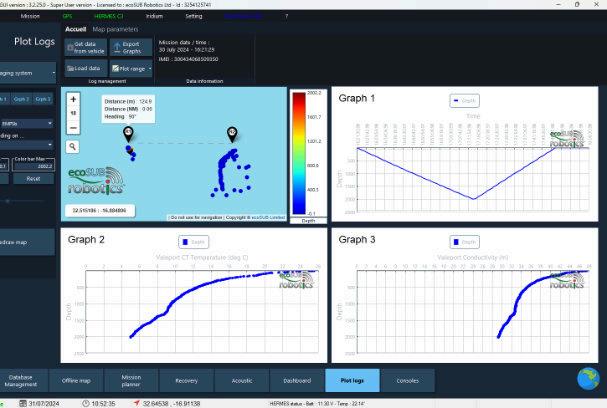
The 2,000m depth mission was completed on 30 July 2024. Launch and recovery was from Observatoio 1, a fast RIB
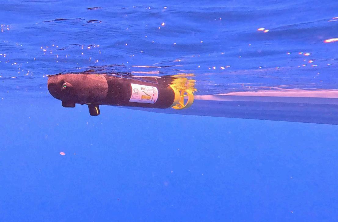
research vessel, kindly provided by the Oceanic Observatory of Madeira, who generously supported the trials providing workshop and vessel support.
This mission marks a world-AUV-first, industry leading 2,000m deployment for a micro-AUV system – proving real world technology to aid ocean data collection.
Furthermore, on board navigation and mission parameters maintained a launch point and recovery point separation of just 125 meters, demonstrating the systems ability to maintain a straight down and straight up capability.
Total mission length was 1h 40m. Maximum depth recorded was 2,002 meters.
Oceaneering’s Subsea Robotics and Aerospace and Defense Technologies segments were awarded a multimillion dollar contract by the Defense Innovation Unit (DIU) of the U.S. Department of Defense to build a Freedom Autonomous Underwater vehicle (AUV) and establish an Onshore Remote Operations Centre (OROC) for the U.S. Navy.
The award highlights Oceaneering’s ability to leverage technology originally developed to support the offshore energy industry into other markets, including the defense industry. The vehicle will be manufactured at Oceaneering’s Morgan City, Louisiana facility.
Peter Buchanan, Senior Director for Oceaneering’s Subsea Robotics segment, stated: “Oceaneering is excited to partner with the DIU and the U.S. Navy. This award allows us to deliver commercial technology driven by energy industry needs to the U.S. Department of Defense to address subsea security needs.”
Martin McDonald, Oceaneering’s Senior Vice President for Subsea Robotics stated: “Our global footprint and worldwide supply chain allows Oceaneering to maintain a 99% uptime for the world’s largest fleet of work class subsea robotic vehicles. Oceaneering is able to leverage our existing facilities and supply chain to manufacture vehicles at scale, as we have done and continue to do for the energy industry.”
Oceaneering has conducted remote operations of commercial subsea robotic systems from OROCs since 2015 and has performed over 120,000 hours of remote operations to date. This recent contract award will bring this commercial capability to the U.S. Navy.

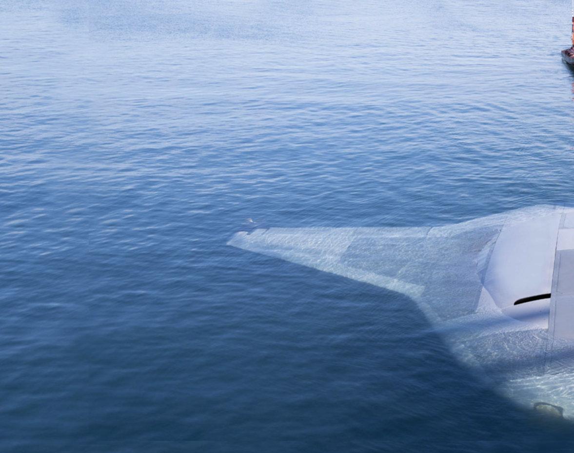
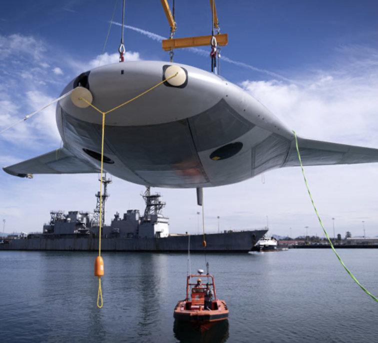
Earlier this year Northrop Grumman’s Manta Rayprototype uncrewed underwater vehicle (UUV) completed full-scale, in-water testing off the coast of Southern California.
Manta Ray was built through a Defense Adcanced Research Projects Agency (DARPA) programmeaimed at advancing key technologies to benefit future UUV designs, including techniques to manage energy, increased payload capacity, low-power propulsion and more.
The testing demonstrated at-sea hydrodynamic performance, including submerged operations using all the vehicle’s modes of propulsion and steering: buoyancy, propellers, and control surfaces.
“Our successful, full-scale Manta Ray testing validates the vehicle’s readiness to advance toward real-world operations after being rapidly assembled in the field from modular subsections,” said Dr Kyle Woerner, DARPA programme manager for Manta Ray.
“The combination of crosscountry modular transportation, in-field assembly, and subsequent deployment demonstrates a first-of-kind capability for an extra-large UUV.”
Northrop Grumman shipped the Manta Ray prototype in subsections from the build location in Maryland to its test location in California. The demonstrated ease of shipping and assembly supports the possibility of rapid deployment throughout the world without
crowding valuable pier space at naval facilities.
“Shipping the vehicle directly to its intended area of operation conserves energy that the vehicle would otherwise expend during transit,” said Woerner.
“Once deployed, the vehicle uses efficient, buoyancy-driven gliding to move through the water. The craft is designed with several payload bays of multiple sizes and types to enable a wide variety of naval mission sets.”
Manta Ray aims to develop and demonstrate a new class of longduration, long-range, payloadcapable UUVs ready for persistent operations in dynamic maritime environments. DARPA is engaging with the U.S. Navy on the next steps for testing and transition of this technology.
A second Manta Ray performer, PacMar Technologies, is continuing testing of its full-scale energy harvesting system in 2024.
Undersea missions can be very
difficult, with challenges like high pressure, low temperatures, spotty communications and power supply for long missions, especially when operating far from port.
What was needed was an advanced UUV that was bigger, more efficient and autonomous, or able to act independently without human supervision.
Northrop Grumman listed four benefits of this new technology.

Manta Ray has a unique size and shape that allows it to save power and energy for long missions. It is classified as an extra-large glider UUV, or XLUUV.
GIiders are a type of UUV that have been used since the 1960s to explore the ocean. Organisations like DARPA, the U.S. Navy and the National Oceanic and Atmospheric
Administration use gliders to gather data on lengthy missions.
“A glider has a really intriguing propulsion mechanism, falling forward [with purpose] through the water all the time, both upward and downward,” said Brian Theobald, principal investigator and chief engineer for Manta Ray at Northrop Grumman. “When Manta Ray needs to go up or down, it changes buoyancy by pumping
sea water to change the weight of the vehicle.”
Gliders only need to change buoyancy for a few minutes at the top or bottom of their path. The rest of the time, they glide forward using minimal power and energy. This technology makes gliders operate more efficiently, which will enable Manta Ray to save power for long missions.
The U.S. Navy defines XLUUVs as vehicles that are too large to launch off a ship or submarine; instead, they are launched from a pier.
Manta Ray’s extra-large size provides endurance, with more room for power systems, and the ability to carry critical payloads or sensors for a variety of long-range, longduration missions.
“Our team had to be creative and innovative to find solutions that would work for a glider UUV as big as Manta Ray,” said Structural Engineer Hayley Sypniewski. “It’s not a one-toone scale with typical glider UUVs; because of its size, we added more buoyancy engines, a bigger payload bay, an enhanced towing system and an extremely efficient and large hull system.”

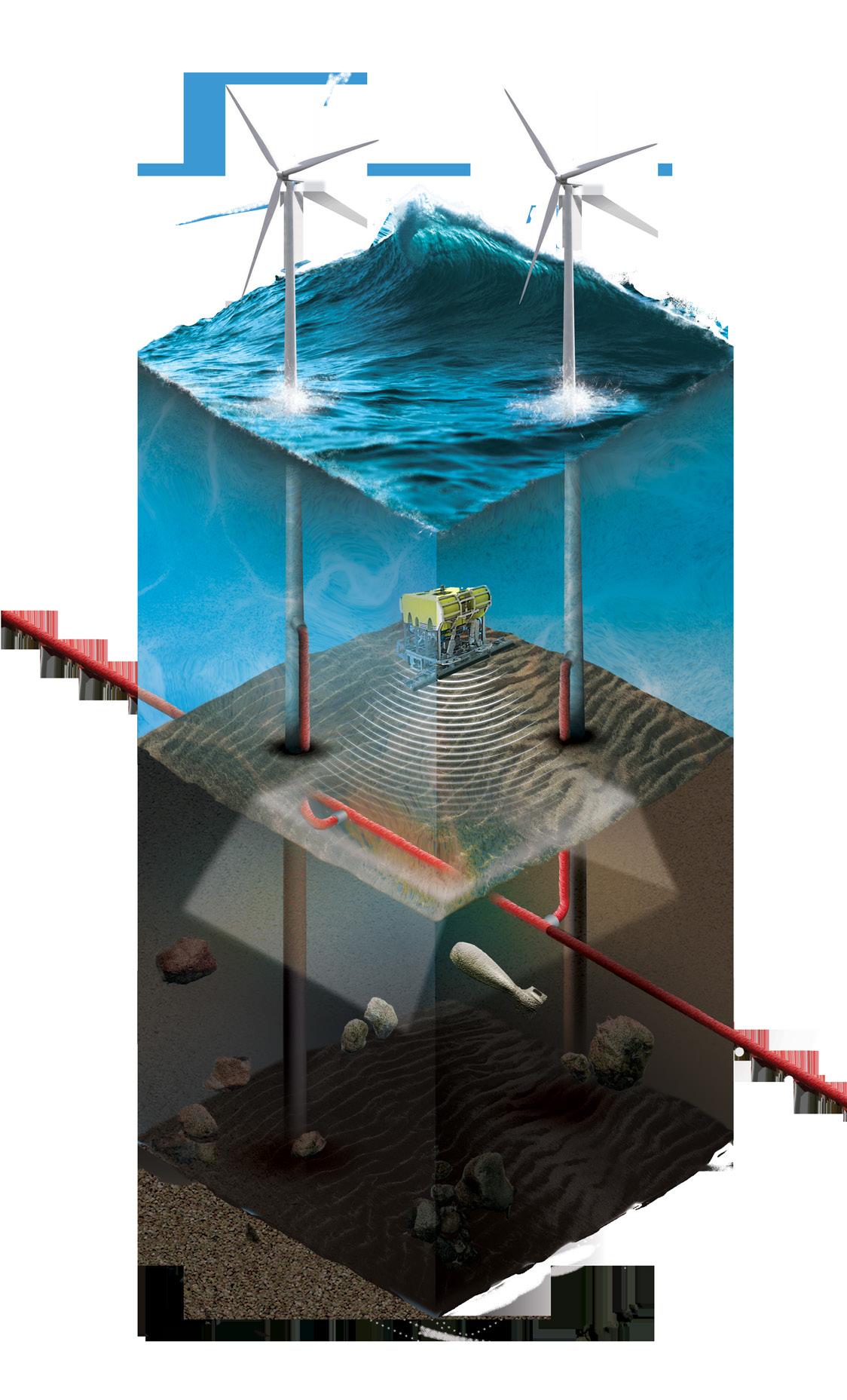
Kraken’s 3D acoustic cable route surveys are designed to provide wind farm developers, cable owners and cable installation contractors with the most detailed subseabed images available in the market.

Robotics | Underwater. Understood.™
krakenrobotics.com
3) CONDUCTING MISSIONS WORLDWIDE
How can a UUV of this size around the world for missions? The answer is that it is split up.
Most large undersea vehicles, like submarines, are so big when fully assembled that they can’t be put on a truck or ship to transport. Northrop Grumman’s engineers designed Manta Ray with these considerations in mind. Thanks to its modular design, Manta Ray can be separated into parts for easy shipping. Then, it can be assembled in-field.
With missions around the world, the U.S. military and our allies must be expeditionary. Manta Ray allows them to bring critical capabilities wherever they are needed.
4) OPERATING AUTONOMOUSLY TO KEEP OUR MILITARY SAFE
In January 2024, our team in Maryland shipped Manta Ray to Southern California for in-water testing.
During the tests, Manta Ray demonstrated its ability
to glide, ascend anddescend, turn, hover and anchor. It can do some of these skills autonomously, avoiding the need for on-site human logistics or a human captain.
“Manta Ray’s uncrewed capability is critical because we want to keep humans out of harm’s way during long missions in potentially dangerous environments,” said Joe Deane, Manta Ray program manager.


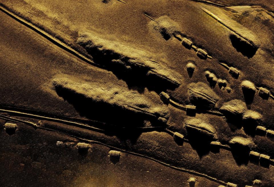
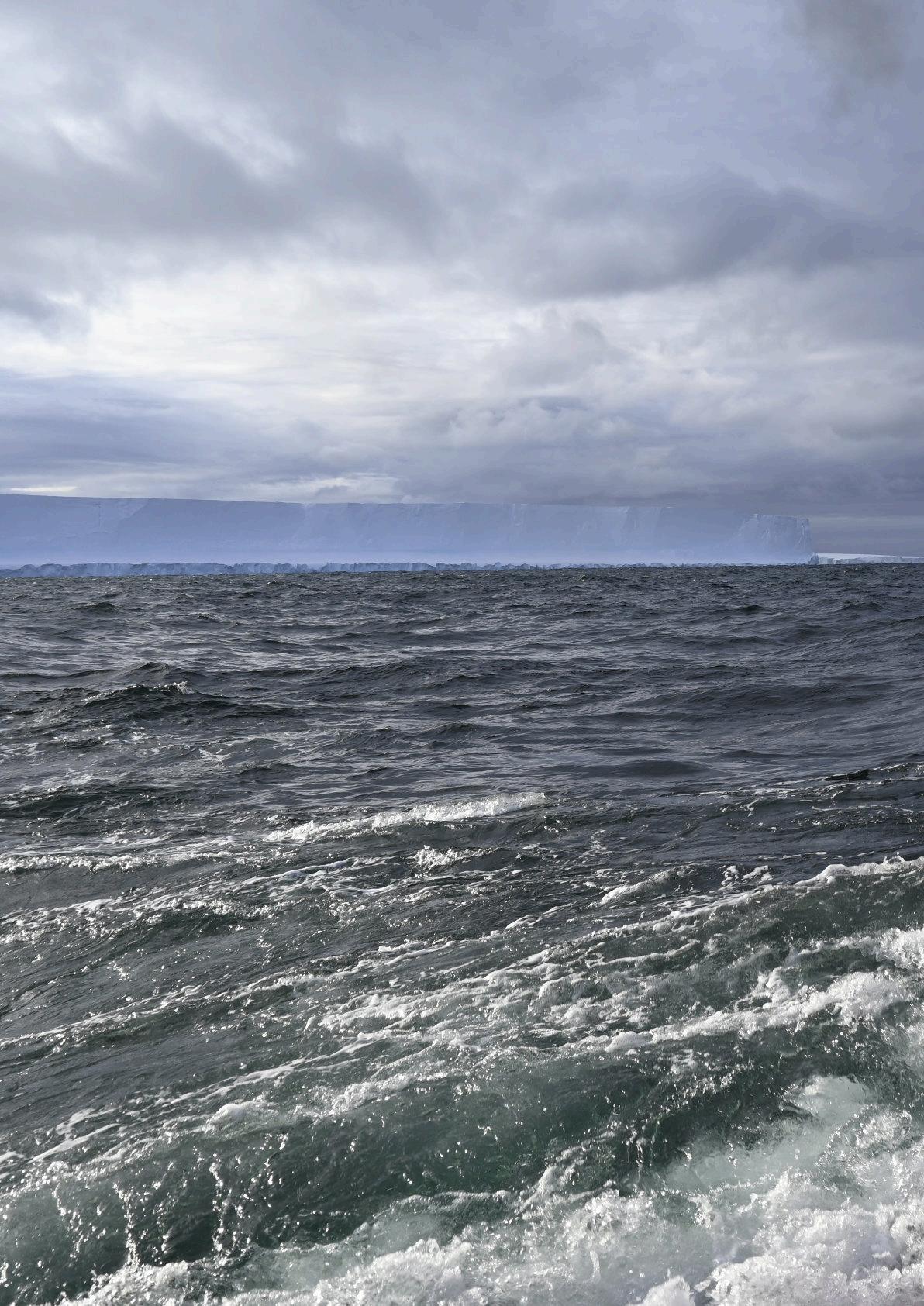
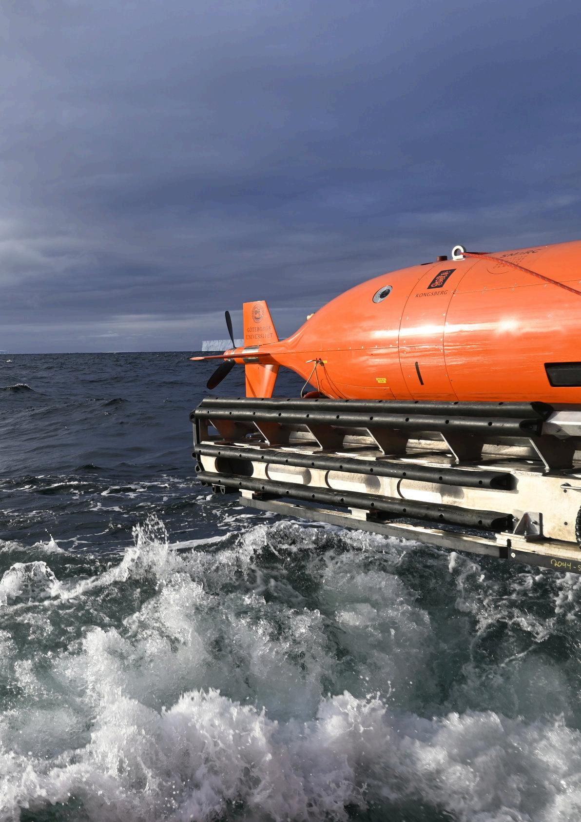
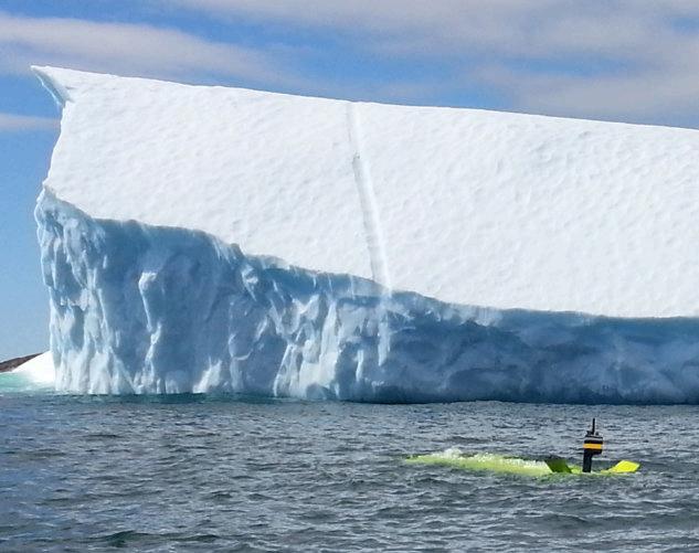
The University of Gothenberg’s AUV RAN has assisted in producing the first detailed maps of the underside of Antarctic ice-shelf. This fills major blindspot in ice-sheet understanding.
Mapping of swirls and scoops in the ice raises questions about ice-sheet melt, which has implications for future seallevel rise.
The mapping will help interpret and calibrate satellite data to better track ice-sheet melt.
The international research expedition supported by National Oceanography Centre (NOC) scientist Dr Tiago Segabinazzi Dotto.
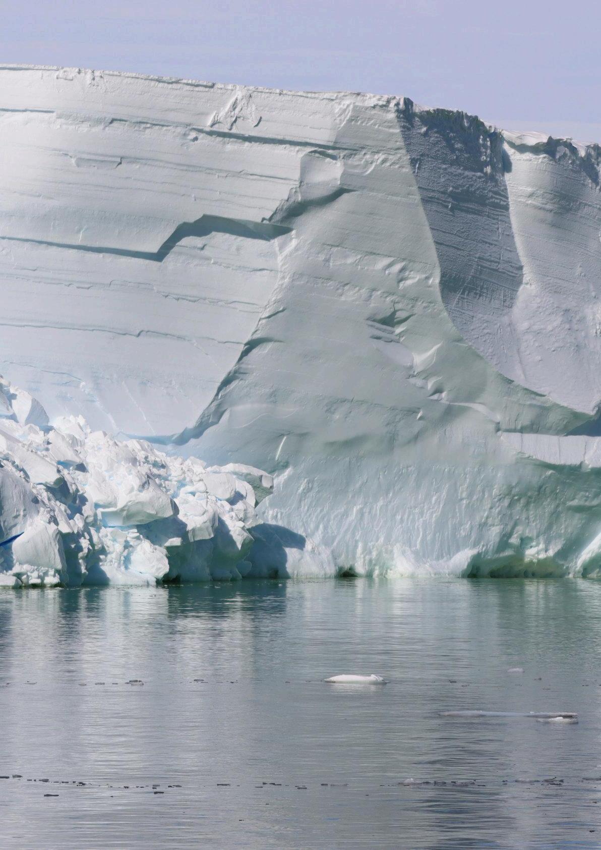
Clues to future sea level rise have been revealed by the first detailed maps of the underside of a floating ice shelf in Antarctica.
The maps, showing swirls and scoops on the underside of the huge Dotson Ice Shelf, in West Antarctica, were gathered using the University of Gothenburg’s autonomous underwater vehicle Ran.
Ran was sent on a 1000km-long mission, travelling back and forth for 27 days under 350m of thick ice.
Using advanced multibeam sonar technology, pointing upwards, the vehicle was able to gather the very first detailed maps of the underside of a glacier.
"Being able to map the underside of the glacier in this way fills in what has otherwise been a major blind spot in our understanding of this part of the West Antarctic ice sheet, the melting of which could have a potentially large impact on future sea level rise,” says Dr Dotto who was on the 2020 expedition to the Dotson Ice Shelf while working at the University of East Anglia, and who processed some of the hydrographic data involved.
“We will continue to study these processes at the NOC to help inform our understanding of how fast ice shelves will melt in the future.”
The Dotson Ice Shelf is part of the West Antarctic ice sheet. It is thought it could have a potentially large impact on future sea level rise due to its size and location.
Thanks to the imagery from the underside of the ice shelf, scientists will be better able to interpret and calibrate the data they get from the satellites that helps them track icesheet melt.
"We have previously used satellite data and ice cores to observe how ice shelves change over time,” explains Anna Wåhlin, Professor of Oceanography at the University of Gothenburg, lead author on a paper published on the research in Science Advances.
“By navigating the submersible into the cavity, we were able to get high resolution maps of the ice underside. It’s a bit like seeing the back of the moon for the first time.”
Some of the findings were as expected. For example, the glacier melts faster where strong underwater currents erode its base. Using the submersible, scientists were able to measure the currents below the glacier for the first time and prove why the western part of Dotson Ice Shelf melts so fast.
They also saw evidence of very high melt at vertical fractures that extend through the glacier.
But the researchers also saw new patterns on the glacier base that

and below:
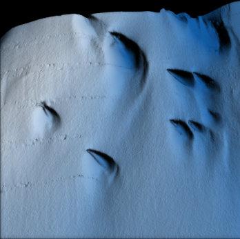

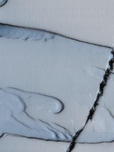
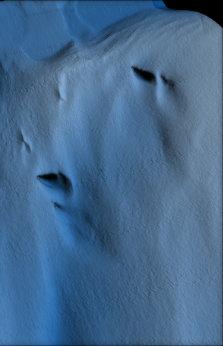
raised questions. The base is not smooth – there is a peak and valley ice-scapv
resembling sand dunes. The researchers hypothesise that these may have been formed by flowing water under the influence of Earth’s rotation.
Dr Karen Alley, a glaciologist from the University of Manitoba and co-author of the study, says, “The maps that Ran produced represent a huge progress in our understanding of Antarctica’s ice shelves. We’ve had hints of how complex ice-shelf bases are, but Ran uncovered a more extensive and complete picture than ever before.”
“The mapping has given us new data that we need to look at more closely,” adds Professor Wåhlin. “It is clear that many previous
assumptions about melting of glacier undersides are falling short. Current models cannot explain the complex patterns we see. But with this method, we have a better chance of finding the answers.
“Better models are needed to predict how fast the ice shelves will melt in the future. It is exciting when oceanographers and glaciologists work together, combining remote sensing with oceanographic field data. This is needed to understand the glaciological changes taking place – the driving force is in the ocean.
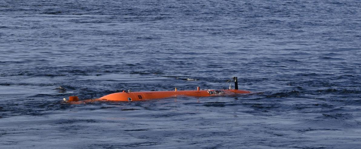
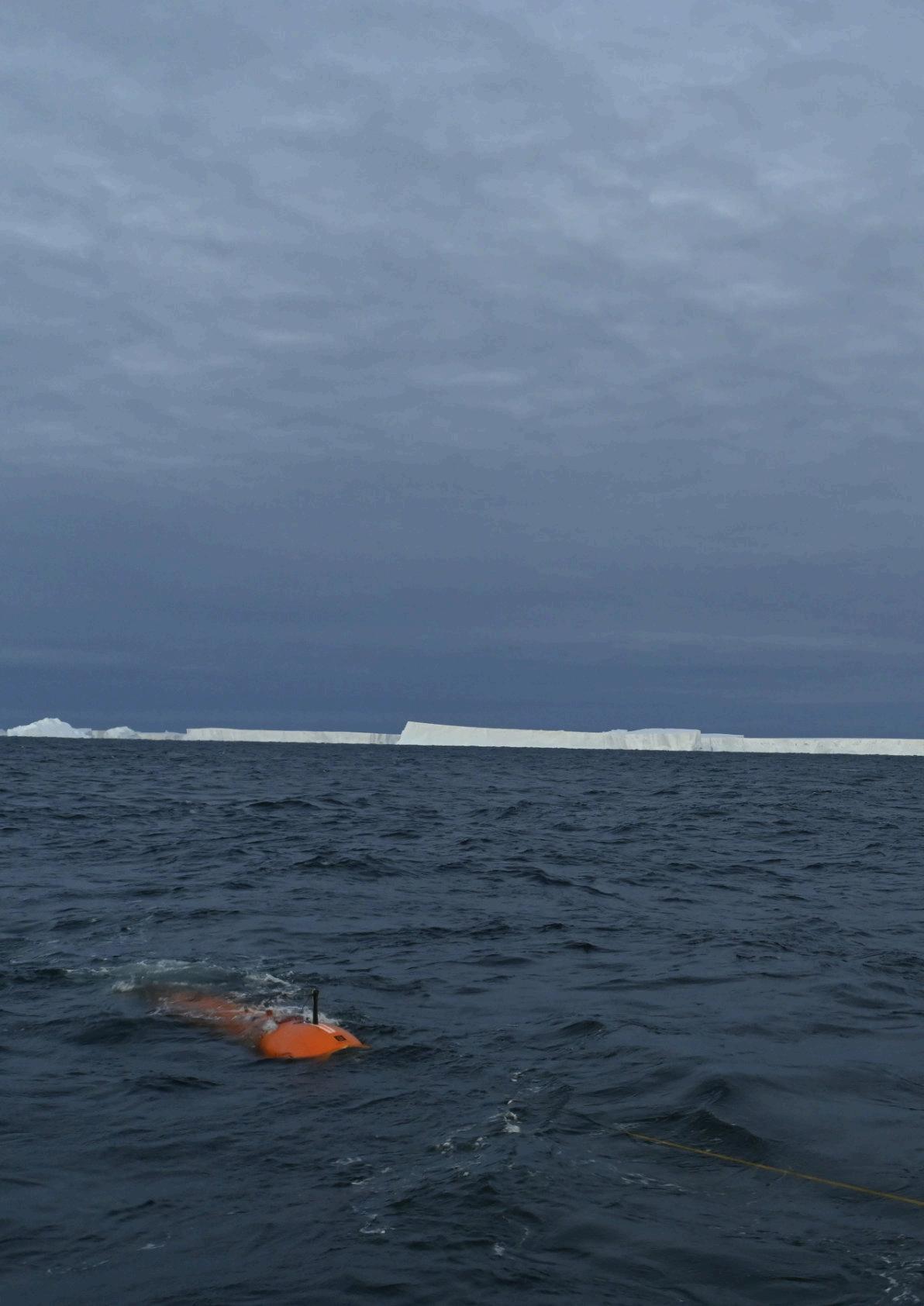
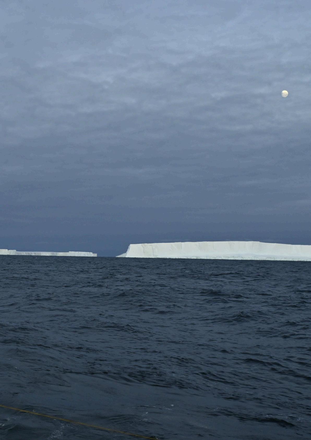
"There are not many uncharted areas left on Earth. To see Ran disappear into the dark, unknown depths below the ice, executing her tasks for over 24 hours without communication, is of course daunting. Experience from over 40 missions below ice gave us confidence but, in the end, the challenging environment beat us."
The field work for this study was conducted in 2022. In January 2024, the group returned with Ran to Dotson Ice Shelf to repeat the surveys, hoping to document changes.
They were only able to repeat one dive below Dotson ice shelf before Ran disappeared without a trace.
“Although we got valuable data back, we did not get all we had hoped for,” says Professor Wåhlin. “These scientific advances were made possible thanks to the unique submersible that Ran was.
This research is needed to understand the future of Antarctica’s ice sheet, and we hope to be able to replace Ran and continue this important work.”
Introducing Ally—VideoRay’s latest Mission Specialist underwater robot
Compact yet powerful, VideoRay’s new four-thruster Remotely Operated Vehicle (ROV) offers top-notch agility with speeds of 4 knots.
Compatible with our full line of Mission Specialist topsides and vehicles, Ally is the ideal tool for your day-to-day operations and/or fleet expansion.
Earlier this year, Shuangshuang Fan, Neil Bose and Zeming Liang presented a comprehensive review of The development and progression of autonomous underwater vehicles (AUVs) in polar regions, aiming to synthesise past experiences and provide guidance for future advancements and applications.
Part of the paper consisted of a historical review of AUV deployments.

The complete paper can be downloaded here
Affiliations
School of Marine Sciences, Sun Yat-Sen University, Zhuhai 519082, China
Southern Laboratory of Ocean Science and Engineering, Zhuhai 519082, China
Memorial University, St. John's, NL A1B 15, Canada
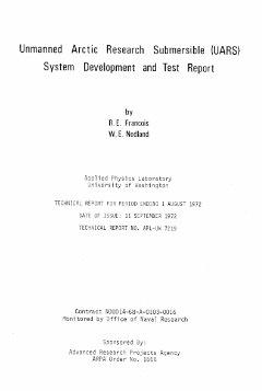
The UARS vehicle and report. Image: University of Washington
Early Years (1970s–2000s)
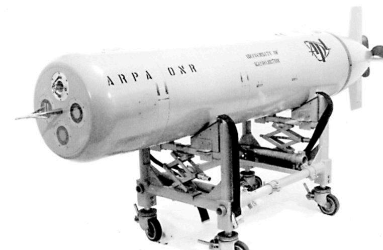
The first AUV surveys beneath ice took place in the Beaufort Sea in 1972 using the Unmanned Arctic Research Submersible (UARS) developed by the Applied Physics Laboratory (APL) at the University of Washington.
The UARS, equipped with three narrow-beam upward-looking sonars, delivered unprecedented and directly correlated underwater ice topography measurements, offering the most comprehensive insights into underwater ice surface topography at that time.

For more information about polar AUVs, look at ‘AUVs under ice: a four year retrospective’ by Gwyn Griffiths, click here
https://www.ingentaconnect.com/ contentone/mts/mtsj/2024/00000058/ f0020001/art00006
After a 20-year interval,APL also developed the Autonomous Conductivity Temperature Vehicle (ACTV).
Equipped with a high-grade CTD sensor, it provided refined measurement of water profiles within its two-hour mission limit. It was deployed in the Beaufort Sea during the winter Lead Experiment (LeadEx) in
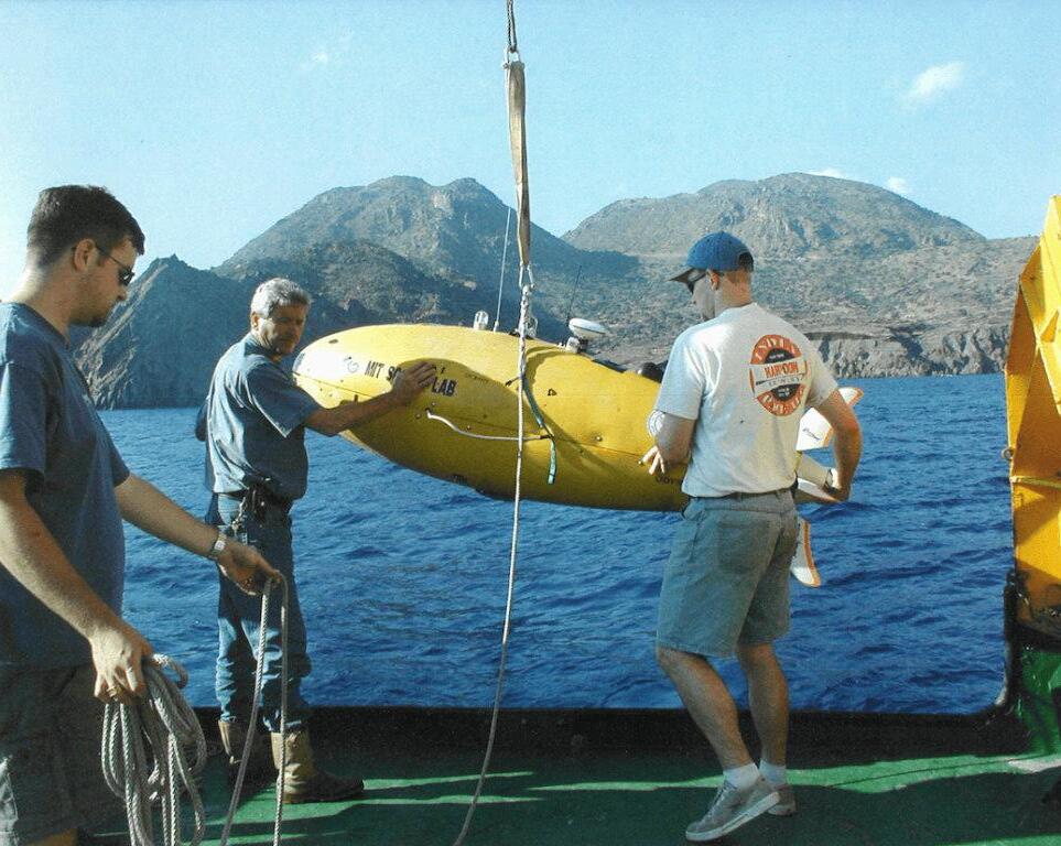
MIT’s Odyssey II AUV. Image: AUV Lab MIT Sea Grant
1992, and in the eastern Weddell Sea for the Antarctic Zone Flux Experiment in 1994.
Subsequently, a more sophisticated variant, the Autonomous Microconductivity Temperature Vehicle (AMTV) was launched by the Woods Hole Oceanographic Institution (WHOI).
Based on the REMUS AUV, it was used in the Beaufort sea for the Surface Heat Balance of the Arctic Ocean (SHEBA) programme in 1998, to study turbulent vertical velocity and heat and salt fluxes in the upper ocean.
The Odyssey II AUV, developed by MIT’s AUV Laboratory, was deployed in the spring of 1994 to gather data on the topography of the underside of the ice in the Beaufort Sea. This deployment aimed to enhance understanding of Arctic sea ice mechanics.
All AUV operations took place inside a 15 ft by 15 ft tent, which enclosed a hydrohole cutting through five feet of ice. This groundbreaking approach laid the foundation for a novel capability to examine transient phenomena within the ice environment.
In 1996, International Submarine Engineering (ISE), in collaboration with the Canadian Defence Research Establishment Atlantic (DREA) developed its large Theseus AUV.
Its primary mission was to lay 220km of optical fibre cable from Ellesmere Island to a scientific acoustic array in the ice-covered Arctic. It highlighted the significant potential of large AUVs for extensive under-ice exploration over long ranges.
The Monterey Bay Aquarium Research Institute (MBARI) also began to work on the Atlantic Layer Tracking Experiment (ALTEX). Their AUV collected data on the warm Atlantic Layer water mass flowing into the Arctic Ocean via the Fram Strait.
Their AUV was an adaptation of ISE’s Dorado but
engineered for extended unattended operations. It featured a unique data relay system where some collected data were intermittently stored on internal buoys. These buoys were designed to be released to burn through the ice cover and then transmit the data back to shore.
For its Arctic operations, the ALTEX AUV was outfitted with an ice profiling sonar, which was successfully used to measure ice draft during a test cruise from Tromso, Norway, to the Arctic Circle in 2001.
Continued Series AUV Deployments (2000s–2020s)
Following these groundbreaking efforts, UK researchers initiated a systematic and continuous research programme.
The AUV Autosub 1 successfully navigated regions rarely visited due to challenging year-round ice conditions. This initiative marked a significant

Autosub 1 on its first official mission in Portland Harbour in 1996. Image: National Oceanography Centre and Greenland ice shelves, navigating increasingly challenging ice-covered environments.
In February 2001, it was deployed in the marginal ice zone of the northern Weddell Sea. Targeted goals included measuring Antarctic sea ice thickness over tens of kilometres using singlebeam upward-looking sonar, surveying beneath different types of icebergs, assessing the abundance of Antarctic krill under sea ice versus open water, and measuring downwelling irradiance beneath the ice.
Autosub 2 in Antarctica, 1999. Image: National Oceanography Centre
A year later in February 2002, the Polar Ocean Physics Group at the University of Cambridge also began significant work with the Maridan MARTIN 150 AUV as part of the EU CONVECTION program in. This was aimed at studying Greenland Sea convection.
Apart from a CTD and an ADCP, the vehicle was also equipped with a sidescan sonar and captured the first 2D imagery of multi-year ice off the coast of East Greenland.
In 2004, the same team advanced to 3D ice underside mapping using multibeam sonar. The Autosub 2 AUV, off NE Greenland, achieved groundbreaking swath sonar measurements that detailed the three-dimensional structure of the under-ice surface and water measurements beneath.
In February 2005, the Autosub 2
AUV was deployed to collect multibeam sonar data under the Fimbul Ice Shelf in the Antarctic as part of the Autosub Under Ice Programme.
The AUV revealed a complex oceanographic environment, including an ice base characterised by significant
Inaugural issue of UT2 showing Autosub
roughness variability and areas within the cavity periodically encountering water temperatures well above the freezing point of the surface.
Tragically, the Autosub 2 AUV was lost on its next mission under the same ice shelf, leading to a comprehensive and transparent investigation, which resulted in increased focus on enhancing

AUV reliability for polar operations
The following Autosub 3 AUV was deployed under Pine Island Glacier (PIG) in West Antarctica in 2009.
Data from this mission indicated

Explore the depths with precision and power
KPA-20 Pan Unit
KPT-20 Pan&Tilt Unit
KPA-45 Pan Unit
KPT-45 Pan&Tilt Unit
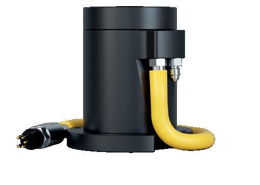
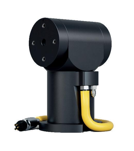
Unmatched in ruggedness and power, these PAN&TILT units are engineered to conquer depths of down to 11,000 meters, providing unparalleled reliability and performance for your underwater missions. kystdesign.no
sales@kystdesign.no
that the glacier had previously been anchored on a transverse ridge on the seafloor and that a subsequent retreat allowed warmer water to flow beneath the glacier, causing rapid melting of the thick ice on the newly exposed upstream half of the ice shelf.
This finding is crucial to understanding the potential for rapid ice-sheet collapse due to
climate change, highlighting the importance of the glacier’s retreat dynamics.
In total, the AUV executed six missions, covering 510 km under the PIG during this campaign. In 2014, as part of the UK’s Ice Sheet Stability Programme (iSTAR), Autosub 3 revisited Pine Island Glacier, mapping another 460 km beneath the ice shelf. These missions provided critical data on velocity, temperature, salinity, turbulent kinetic energy dissipation rate, and thermal variance dissipation rate under the shelf.
Notably, the highest turbulent kinetic energy dissipation rate was recorded near the grounding line, and the observations of mixing and dissipation rates
bolstered confidence in prior basal melting rate estimates.
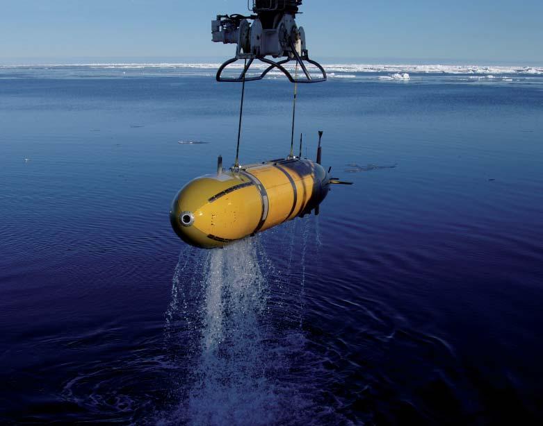
Autosub3 was retired in 2017. Subsequent under-ice missions being undertaken by the Autosub Long Range (ALR) AUV, affectionately known as “Boaty McBoatface”.
In January 2018, the ALR took on a challenging mission beneath the Filchner–Ronne Ice Shelf (FRIS), the world’s largest ice shelf by volume and a critical regulator of Antarctica’s impact on global sea level rise.
The ALR successfully navigated under the ice shelf for over three days, covering more than 25 km in regions where the ice exceeded 500 m in thickness.
In order to explore the influences of atmospheric and oceanic processes on the behaviour of the Thwaites and Dotson Ice Shelves, the International Thwaites Glacier Collaboration (ITGC) initiated the TARSAN (Thwaites-Amundsen Regional Survey and Network Integrating Atmosphere-Ice-Ocean Processes) project.
As an early component of the TARSAN project, the University of Gothenburg’s Kongsberg Hugin AUV Ran was deployed beneath the Thwaites Glacier in 2019, undertaking short excursions within 10 km.
During its mission, Ran was outfitted with an array of oceanographic sensors alongside comprehensive geophysical instruments. It provided unprecedented direct measurements of ocean temperature, salinity, and oxygen levels beneath the Thwaites Ice Shelf, delineating the pathways and modification of warm water circulating under the ice shelf.
Additionally, Ran captured detailed (sub-meter scale) multibeam bathymetry and sidescan sonar imagery. These data chronicled the seabed’s history of the glacier’s retreat past a seabed ridge, unveiling patterns of sedimentary ridges created by daily tidal movements at the grounding line when the Thwaites Glacier extended further than its current position.
In the summer of 2021–2022, the NOC contributed its ALR AUV to the Thwaites Glacier expedition, part of the TARSAN project. The ALR AUV’s mission was to investigate the factors driving ice loss from the glacier and to enhance predictions about its contribution to sea level rise.
Challenged by the unusually thick and dense sea ice around Thwaites, the expedition redirected its focus to the neighbouring Dotson Ice Shelf. In this adjusted mission, the ALR AUV traversed more than 40 km beneath the ice shelf, capturing data on currents, turbulence, and water properties.
In a collaborative effort, the Seagliders from the University of East Anglia profiled the open water areas to the north; meanwhile, the Ran AUV from the University of Gothenburg mapped the ice’s underside with multibeam sonar and collected water samples .
Ran was lost in early February 2024, failing to re-surface at the planned rendezvous point. During the cruise, the vehicle had been engaged in 20-hour missions at two critical sites, undertaking combined seafloor mapping, and mid-water column profiling and sampling tasks.
See separate story
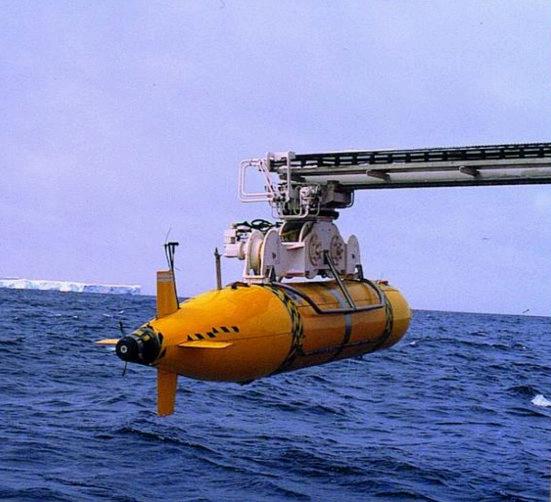
Over the past 20 years, WHOI’s SeaBED class twin-hulled AUVs have conducted a series of research expeditions in polar regions, including missions focused on biological and geological mapping, alongside sea ice studies, in both the Arctic and Antarctic environments.
A highlight was the utilisation of SeaBED Jaguar and Puma AUVs for comprehensive surveys of the water column and ocean floor during the Arctic Gakkel Vents Expedition (AGAVE) to explore the Gakkel Ridge in the Arctic Ocean in the summer of 2007. This pioneering mission, aimed at discovering hydrothermal vents, was notable for being the first to successfully deploy and recover AUVs through ice into the deep ocean (depths exceeding 3500m).
These SeaBED class AUVs, enabled the first-ever coincident high-resolution 3D mapping of both upper and lower surfaces of Antarctic sea ice.
Above: Puma being deployed by ship's crane
Photo: Hanumant Singh
Image: Woods Hole
Oceanographic Institution
Below: Jaguar being deployed by ship's crane
Photo: Christopher Murphy
Image: Woods Hole
Oceanographic Institution

This was achieved during two significant expeditions: the UKled Ice Mass Balance in the Bellingshausen Sea (ICEBell) voyage, which explored the Weddell and Bellingshausen Seas in November 2010, and the Australian-led Sea Ice Physics and Ecosystem Experiment II (SIPEX II), which journeyed to East Antarctica from September to November 2012.
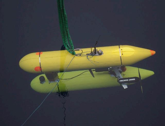
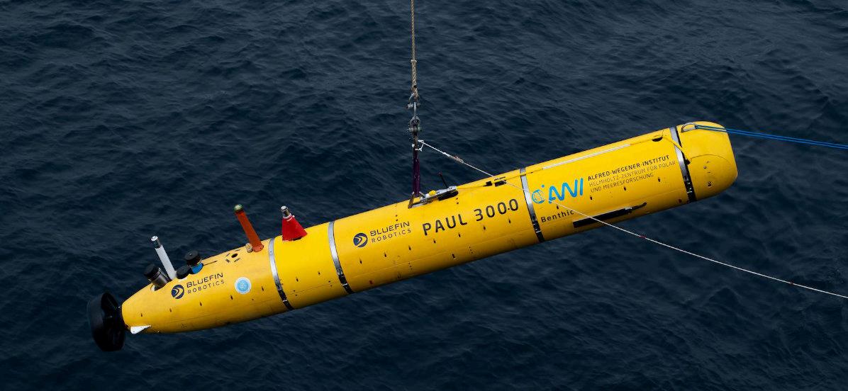
The Alfred Wegener Institute for Polar and Marine Research
(AWI), Germany, customised and deployed a 21-inch class AUV named PAUL, manufactured by Bluefin Robotics.
The primary goals were to investigate biogeochemical processes in surface waters, study the stratification of the upper water column in the marginal ice zone, and examine the dynamic interactions between ice and the vocean.
Since 2008, PAUL has been outfitted with an array of biogeochemical sensors,
including those for nitrate, oxygen, and fluorescence, along with a water sampler designed specifically for operations in icy waters.
The PAUL AUV is still in operation.
The PAUL, a Bluefin 21 AUV, equipped with physical and biogeochemical oceanographic sensors and a water sampler, observed biogeochemical processes at high resolution in the marginal ice zone of Fram Strait. Image: Alfred Wegener /AUV team.
In March and April 2010, an ISE Explorer AUV, commissioned by Natural Resources Canada (NRCan), undertook a significant mission in Canada’s high Arctic. The AUV autonomously navigated back to the remote camp, where it was secured using a small remotely operated vehicle (ROV).
Remarkably, the AUV was recharged and its survey data downloaded directly through a 1.3m by 2m hole in the ice, without being removed from the water.
It operated beneath the ice for 10 days prior to successful retrieval. Throughout the course of three missions, roughly 1000 km of under-ice survey was completed.
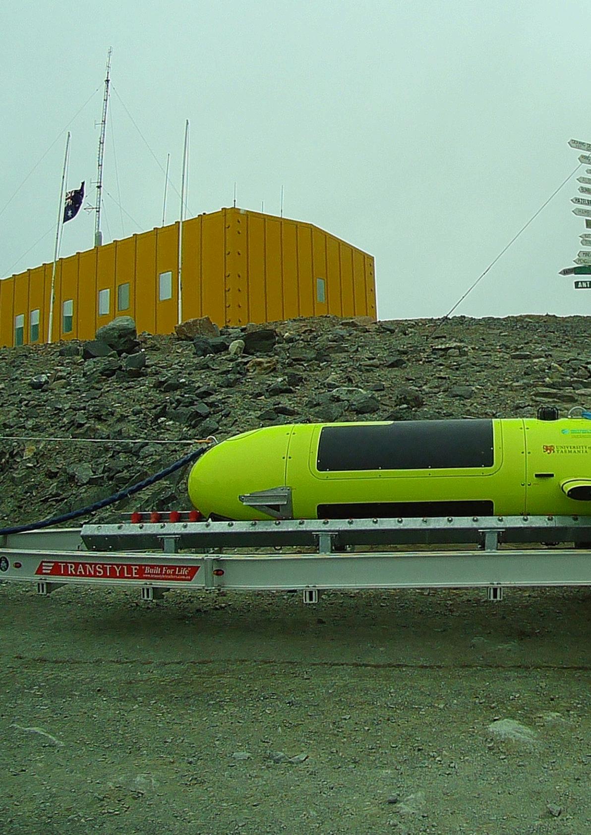
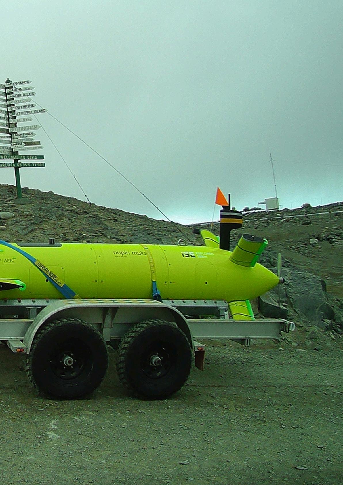
The University of Tasmania, Australia, used the nupiri mukaan, an ISE Explorer AUV,to gather data from beneath sea ice and ice shelves.
This effort, undertaken as part of the Antarctic Gateway Partnership (AGP), aimed to elucidate the complex interactions between the oceans and Antarctic ice shelves.
In its second Antarctic summer, in February 2020v, the nupiri muka AUV was launched from the Korean research icebreaker Araon and successfully
completed six missions in West Antarctica including a 60 km round trip along the seabed beneath a sea ice barrier adjacent to the Thwaites Glacier,
To facilitate AUV launch and recovery, small AUVs are sometimes preferred in certain polar missions, which can be deployed from ice holes or boats near sea ice edges.
These compact AUVs, typically 2–3 m long and weighing 50–80kg in air, are ideal for mapping smaller areas of ice, approximately 2–4 km2.
The Gavia AUV, for instance, was deployed in the Beaufort Sea in 2007 and the Lincoln Sea in 2008, successfully capturing under-ice images with a multibeam sonar. The Sea Ice Experiment: Dynamic Nature of the Arctic (SEDNA) involved multiple deployments in the Beaufort Sea in 2007. During the missions, the vehicle operated at various depths to avoid
collision with ice ridges: 50m depth in areas with multi-year ice, 30m with first-year ice, and 20m in melt regions.
Elsewhere, coupled with a surface vessel’s sidewall survey, the Gavia has facilitated the generation of a 3D terrain map of the underwater portion of the ice island. The mapping data acquired could provide the baseline to understand the drift, melt, and deterioration processes of ice islands.
Similarly, in January 2010, a REMUS-100 AUV equipped with a bathyphotometer was deployed in the high Arctic Kongsfjord, Svalbard, Norway, during the polar night to study the bioluminescence among zooplankton.
Following this, in March 2010, a modified REMUS-100 AUV designed specifically for under-ice operations was deployed beneath coastal sea ice off Barrow, Alaska.
Icefin, a custom-designed ROV/ AUV developed by the Georgia Institute of Technology, is tailored for sub-ice applications in Antarctica. Its design prioritises portability for remote field deployments and modularity to support diverse payloads for under-ice environmental characterisation.
Icefin was integral to the multidisciplinary MELT project (Melting at Thwaites grounding zone and its control on sea level) under the ITGC.
The project focused on investigating rapid changes at the Thwaites Glacier’s grounding zone, especially basal melting.
In January 2020, Icefin made history as the first vehicle to explore the grounding line of the Thwaites Glacier. During its 15 km round-trip mission, this hybrid ROV/AUV gathered crucial environmental data, along with sonar and optical imagery.
The mission unveiled a variety of basal conditions and complex geometries ranging from fine
sediments to boulders, as well as diverse animal communities residing on the seafloor and under the ice.
The deployments of Icefin represented a significant advancement in our understanding of one of the most critical and rapidly changing areas in the Antarctic.
With the cooperation of more than 10 companies in Japan, the Japan Agency for Marine-Earth Science and Technology (JAMSTEC) led the development of a small AUV prototype, called the Retrievable Arctic Icy edge observation Vehicle (RAIV), for Arctic environmental change research.
JAMSTEC started the prototype
Recovery of the COMAI AUV (used with permission from JAMSTEC)
development in October 2015 with the goal of conducting test observations under the three themes: round-trip selfnavigation (no positioning), acquisition of measurements (salinity, temperature, and depth) as an observation device, and collection of images under sea ice.
RAIV was deployed during a research cruise in the Arctic Ocean by JAMSTEC’s oceanographic research vessel Mirai from August to October 2016, as part of the Arctic Challenge for Sustainability (ArCS) Project.
The vehicle succeeded in
autonomous navigation under sea ice in the Arctic Ocean for the first time in Japan, acquired observation data such as salinity and temperature of sea water, and captured under-ice camera imagery. Using the knowledge gained this time, JAMSTEC is strategically planning the development of advanced AUVs for full-scale Arctic observations in the near future.
During the Arctic Challenge for Sustainability II (ArCS II) Project, JAMSTEC conducted the first trial of an in-water drone during the RV Miral MR21-05C Cruise from August to October 2021.
The drone, named COMAI, is a middle-sized AUV for under-ice observation in the Arctic. The trial focused on the evaluations of items affected by the Arctic environment as it was the first deployment of the drone in a polar region.
A software bug caused an anomaly in the position derivation of the inertial navigation system (INS).
Additionally, magnetic field distortions on the deck and the diminished strength of the Earth’s magnetic field’s horizontal components at high latitudes compromised the hybrid INS’s ability to accurately
determine the vehicle’s heading.
Consequently, the team had to resign the autonomous cruising test that relied on heading and absolute positions for control. The outcomes of these tests were crucial for identifying and rectifying issues, enhancing the drone’s functionality for anticipated under-ice surveys in 2022.
During the RV Mirai MR22-06C Cruise from August to September 2022, the second trial of COMAI was conducted, focusing on evaluating its navigation system and observational capabilities beneath sea ice.
This phase involved tethered safety tests to ensure recovery, as the AUV’s autonomous retrieval functions were still under review.
Notably, discrepancies were observed between the tracks derived by the hybrid navigation system and those determined by ultra-short baseline (USBL) positioning, particularly when the Doppler velocity log (DVL) failed in deeper sea areas.
This unexpected outcome signaled the need for further investigation and refinement.
Despite these challenges, COMAI successfully executed a dive beneath a significant expanse of sea ice, covering a distance of over 200 m along the ice edge.
The AUV operated in a headingdepth control pattern at a target depth of 50 m, enabling the collection of vertical profiles of temperature and salinity near the ice, alongside measurements of underwater ice thickness.
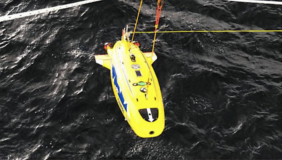
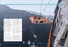
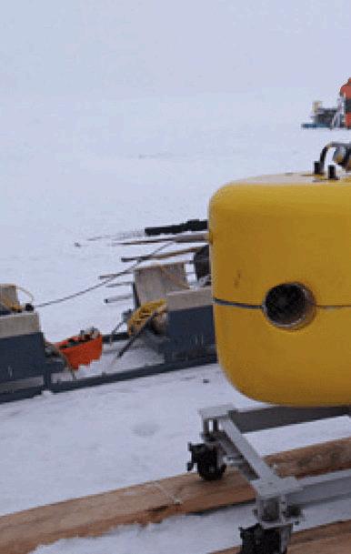
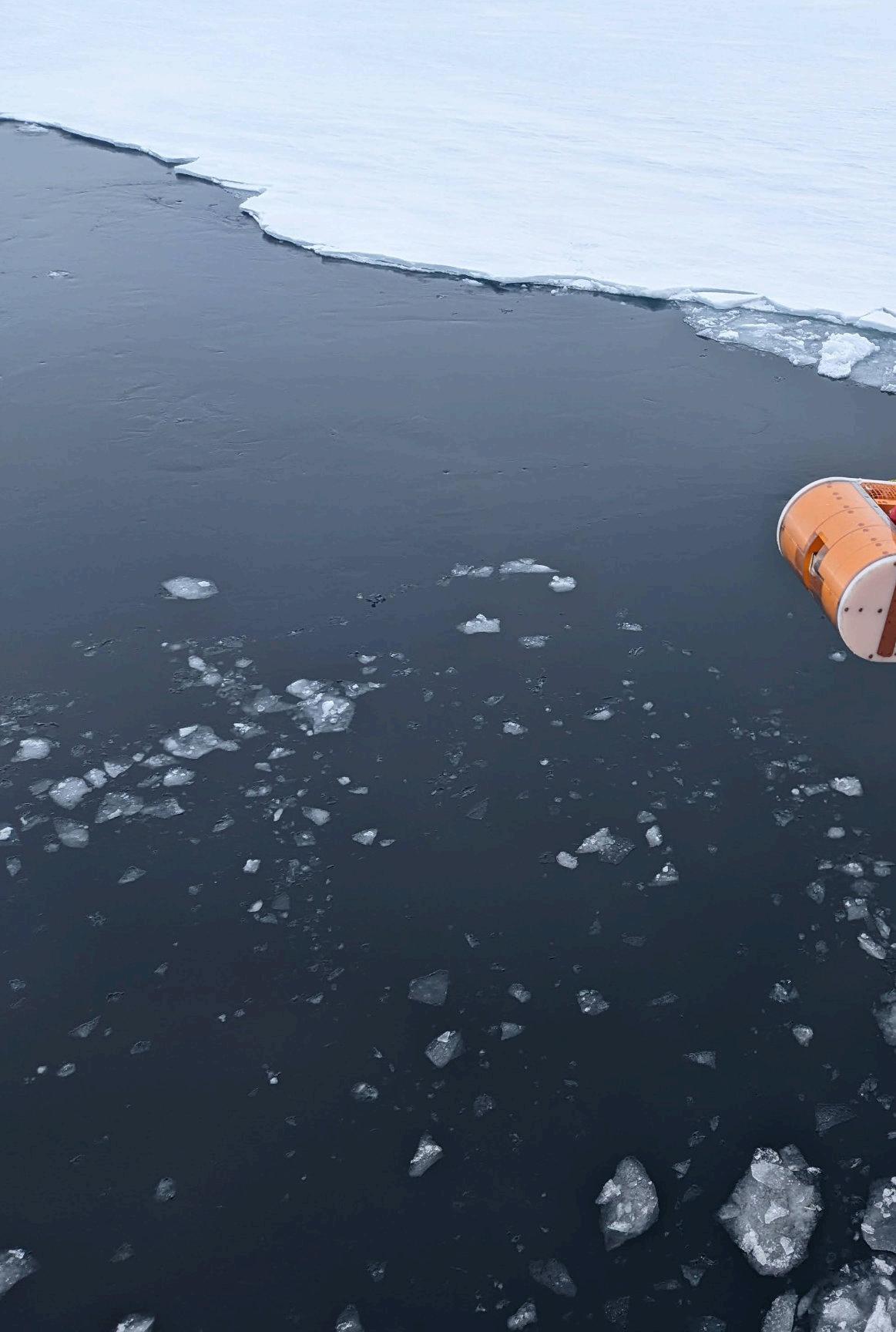
Researchers at the University of Tokyo have developed an AUV named the Mobility Oriented Nadir AntarctiC Adventurer (MONACA)It is a hover-capable platform for observing sea ice and the grounding region of ice shelves in the Antarctic Ocean.
See separate article
In February 2023, the vehicle was deployed for the first time in the Antarctic by the Ocean Observing Team of Expedition 64, National Institute of Polar Research (NIPR), Japan, from the RV Shirase anchored off the coast of Langhovde in Lütso Holm Bay.
In total, 20 dives were conducted with six sub-ice surveys, two mid-ocean explorations, five submarine
topographic surveys, and one observation of the ice shelf edge of the Langhovde Glacier.
Data such as bathymetry, seawater temperature, and salinity were obtained. The knowhow gained from these deployments is expected to lead to future missions aimed at observing the deep sea under glacial ice shelves.
The Polar ARV, developed by the Shenyang Institute of Automation (SIA) of the Chinese Academy of Sciences (CAS), is a versatile


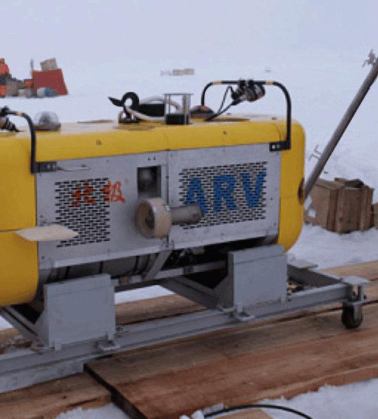
vehicle capable of both autonomous and remote operation via an optical fibre link.
This vehicle was deployed for underwater surveys beneath Arctic sea ice on three occasions during the Chinese National Arctic Research Expeditions in 2008, 2010, and 2014.
Equipped with a comprehensive scientific payload, the Polar ARV features a radiometer, an altimeter, a pressure sensor, a suite of CTD sensors, and two cameras.
These instruments enable it to measure spectral irradiance, ice draft, temperature, and conductivity, as well as to record images and videos beneath the ice. The data collected by the Polar ARV are crucial for understanding the underice environment and contribute significantly to Arctic research. SubCtechGmbH
Polar ARV. Chinese AUVs deployed in the Arctic and Antarctic (used with permission from the SIA, CAS).
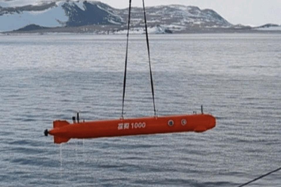
TS-1000 AUV
The TS-1000 AUV, another pioneering development by the SIA, CAS, is designed for extended fixedpoint profile observations. Featuring an innovative variable ballast system, the AUV can navigate vertically in a yo-yo pattern across predetermined waypoints, capable of enduring underwater journeys exceeding 1000 km for 30 days or more.
Deployments in January 2019 and January 2020 saw the TS-1000 AUV undertaking missions in the Ross Sea, positioned at approximately 75°S, where it gathered thermohaline profile data as part of the 35th and 36th Chinese National Antarctic Research Expeditions.
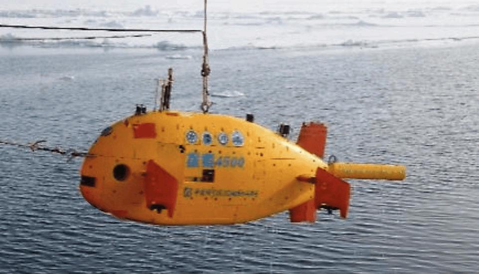
Additionally, the SIA developed the TS-4500 AUV,
TS-4500 AUV. Image used with permission from the SIA, CAS
tailored for deep ocean exploration up to depths of 4500 m. In 2021, this advanced vehicle participated in the 12th Chinese National Arctic Research Expedition. It undertook scientific missions in icecovered regions of the high Arctic latitudes, focusing on studying the characteristics of sea ice and sub-glacial waters. This marked China’s first use of an AUV for near-seabed exploration in the Arctic.
To date, the SIA has deployed a diverse fleet of six underwater robots, encompassing four different
models, in eight polar expeditions in recent years. This fleet includes the notable Haiyi underwater glider, showcasing China’s growing capabilities in this field and commitment to polar research and exploration.
In 2022, MBARI undertook an expedition deploying two Seafloor Mapping AUVs and a ROV to examine the seafloor beneath the Canadian Beaufort Sea. The Seafloor Mapping AUVs were a variant of the Dorado class AUVs, which were respectively equipped with an array of four mapping sonars for simultaneous operation.
These included a swath multibeam sonar, dual sidescan sonars, and a sub-bottom profiler, all rated for depths up to 6000m. The expedition aimed to explore the impacts of melting submarine permafrost in this seldom-explored Arctic region. The gathered mapping information was expected to provide essential insights into the decomposition
TS-4500 AUV Image: SIA, CAS
of relict permafrost under the sea, enhancing our understanding of the Arctic’s evolving underwater landscape.
In 2023, the XH1000 AUV developed by the Harbin Engineering University in China successfully conducted under-ice environmental detection operations near the Chukchi Sea as part of the 13th Arctic Ocean scientific expedition.
The vehicle mapped an area of 7000 square meters beneath the Arctic ice, gathering detailed data on ice tomography and water properties. The scientific goal of this mission was to enhance our understanding of the dynamic changes occurring in the sea ice and oceanic conditions of the region.
The data collected are pivotal in providing essential support for effectively addressing the impacts of global climate change in China.
In 2017, researchers from the University of Tokyo, the Japan Agency for Marine-Earth Science and Technology (JAMSTEC), the National Institute of Polar Research (NIPR) assembled to develop a new AUV named Monaca as a response to better understand the changing global climate.
Recognising the melting ice and changing Antarctic conditions, the group wanted to measure sea ice and ice shelves, bathymetry, and ocean currents. This would require an AUV.
The result was the Mobility Oriented Nadir AntarctiC Adventurer (MONACA)
The group were particularly interested in measuring the sea ice the Antarctic Ocean ice shelf, the seafloor topography formed by the advance/retreat of the ice, and the movement of the warm seawater that promotes melting.
They particularly wanted to measure this in three dimensions and reasoned that while using satellites, boreholes and radar are useful, the only real way of investigating the ice, water quality and seafloor topography would be to use an AUV.
They started by considering various potential strategies.
One possibility was highperformance cruise-type AUV used for long-distance and long-time observations, eg, ISE’s Theseus or NOCS’ Autosub series as well as various commercially available large AUVs.
While these come equipped with many sensors such as Doppler velocity log (DVL), inertial navigation system (INS), multibeams and conductivity temperature depth (CTD), along with the facility to collect large amounts of data,
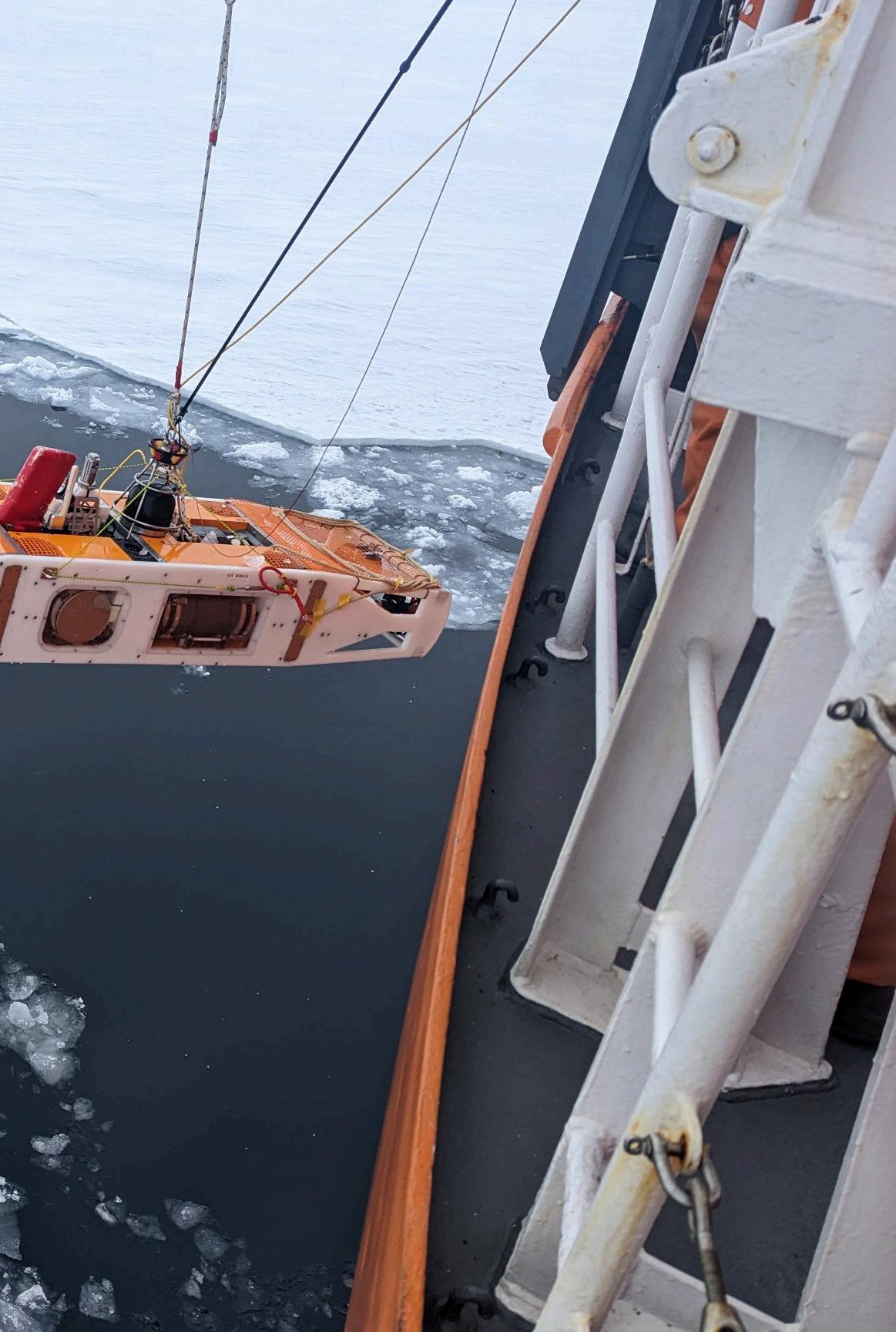
This photo was taken during the initial trial at Antarctica in 2023.
the downside is that these are both heavy and expensive to operate, and come with a large element of risk.
A possible alternative was a medium-sized AUV with a length of around 2m. The shorter cruising range would still allow detailed observations of a specific area, but the operational costs would be lower because it could be deployed without a heavy crane or LARS and the risk would be lower.
One consideration was that the vehicle would be operated from the Japanese ice breaker Shirase, which has high freeboard near 10m. Deck space is also narrow compared with a conventional research vessel.
The third option was a glider-type AUV such as the commercial Seaglider or Slocum. While these
Information taken from:
Development of AUV MONACA – Hover-Capable Platform for Detailed Observation Under Ice –
Hirokazu Yamagata, Shuma Kochii, Hiroshi Yoshida, Yoshifumi Nogiand Toshihiro Maki
Journal of Robotics and Mechatronics Vol.33 No.6
have a much longer range cost and risk, they have limited mobility and power.
After considertion, they decided to develop their own AUV to be used as part of the “GRAntarctic” project.
The prototype MONACA was launched in 2019. It originally operated with a tether cable while conducting functional tests but by the end of 2020, it was successfully moving autonomously.
At the start of the design process, it was decided to incorporate both cruising and hovering features, the latter being useful for detailed close range observations of ice and seafloor and potentially allowing sampling.
It focussed on three main design criteria
A) Ice tracking. The vehicle should navigate at a fixed distance from the bottom to measure the shape of the ice by multibeam
B) Seafloor tracking
C) Depth tracking. It should navigate at a fixed depth or able to switch between multiple depths while measuring the water temperature, salinity and current.
The resultant MONACA vehicle has a length of 2.1m and has a
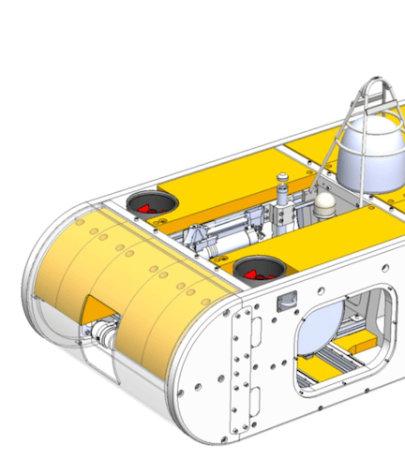
235 kg mass – relatively small compared with the existing AUVs designed for under ice exploration.
Specifications
Length 2.1 m
Width 0.65 m
Height 0.4 m
Weight (in water) 235 kg (0 kg)
Duration 8 h
Depth rating 1500 m
Range 20 km
Cruising speed 2 kt
Payload 3 kg (3 L)
Sensors
INS (iXBlue Phins Compact C3)
DVL (Nortek DVL1000)
CTD (Sea-Bird)SSBL (Evologics S2C M 18/34)
Multibeam (Imagenex Delta-T837B)
It is, however, very manoeuvrable with five degrees of freedom: surge, heave, roll, pitch, and yaw, enabled by four vertical and two horizontal thrusters.
Its flattened body reduces the forward projected area while the distance between the centre of gravity and the centre of buoyancy is reduced to improve mobility.
This means that while the static stability is lower than that of a typical hovering-type AUV, the vehicle can compensate for this by controlling the roll and pitch angles using the four heave thrusters.
The frame of is constructed using high-density polyethylene
and aluminium alloy with the required rigidity and strength being achieved by combining the internal aluminium frame with the external resin frame.
Inside, the vehicle has three pressure hulls, – the main hull for electronic devices and two battery hulls. These are fixed to the internal frame via slide rails so that they can be easily pulled out. This improves maintainability and reduces downtime for replacing batteries, realising the concept of multiple dives
To support various missions with a limited payload, MONACA adopts a flippable sensor unit and module system.
The unit comprises vital sensors for navigation and sensing but as it is flippable, the vehicle can measure the shape of both the seafloor and sea ice/ice-shelf without installing two identical sensors on the top and bottom, similar to a conventional AUV.
The forward and backward sections have interchangeable modular sections, allowing the expansion of the body and the addition or modification of the equipment as required.
The scanning sonar can detect obstacles up to 100 m ahead. It can also be used to look at the seafloor and ice to track paths by our potential method based algorithm.
The CTD sensor and the antennas are mounted on the top. It has a temperature accuracy of ±0.002◦C, conductivity of ±0.0003 S/m and ±0.1% depth.
There are three antennas: Wi-Fi for short-range communication, LoRa for long-range comms and GNSS for positioning. Wi-Fi is used to retrieve observation data, input mission programmes and perform remote control. LoRa is used to obtain the internal status (telemetry) and perform simple remote control.
The acoustic positioning and communication system is located at the upper centre. During autonomous missions, MONACA periodically sends telemetry to vvthe topside and receives commands for emergency surfacing.
Positioning is based on Super Short Base Line (SSBL) and can not only be performed from the topside, but using MONACA itself as an inverted super short base line.
The sensor unit, mounted behind the acoustic device, houses the INS, DVL and multibeam sonar. The multibeam has a maximum measurement range of 100m and a swath width of 120deg and it can measure up to 480 points.
The swath width is approximately 170m at a distance of 50m from the seafloor or ice.

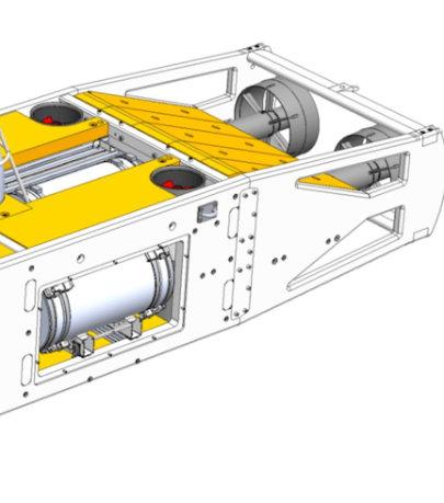
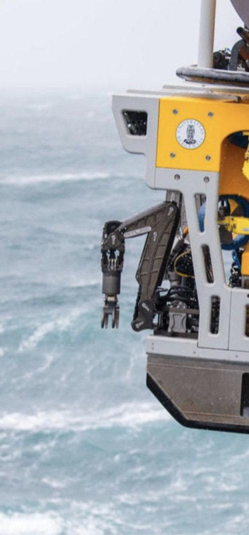
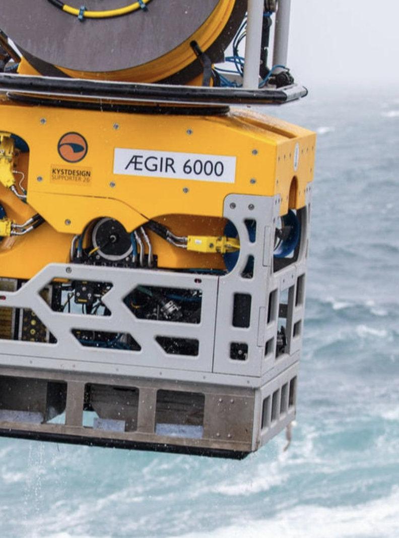
The University in Bergen has been granted funding to upgrade the deep-sea ROV Ægir 6000.
The upgrade is important to extend the systems lifespan, add important new functionality and improve operational efficiency. The ROV is manufactured by Kystdesign and was first put in service in 2015.
The funding is secured via the Research Council of Norway and is 1 of 28 project receiving funding from the research infrastructure programme. The project is headed by the University of Bergen, with the Institute of Marin Research as partner.
“State-of-the-art infrastructure and close interdisciplinary collaboration is important to advance deep sea research,” says Jon Hellevang R&D Manager in GCE Ocean Technology.
“Upgrade of this ROV infrastructure was one of our main recommendations in a report together with Ocean Innovation Norwegian Catapult Centre last year.”
Last year, GCE Ocean Technology wrote a report recommending six short term infrastructure investments to strengthen the knowledge related to the resource potential
and the deep-sea environment and its ecosystem.
The report noted that seabed minerals are emerging as a potential source of minerals to help meet the growing demand resulting from the energy transition. Investment in specific areas would reduce risk and make an important contribution to advance Norway's deep sea research activities in years to come.
The six recommendations were:
• Upgrade of national deepsea ROV
• New national AUV
• Increased access to research vessel with AUV/ ROV
• Adapt existing test facilities and coastal areas for testing of equipment for mapping and coring
• Expand test facilities for processing
• Evaluate the possibility for test area in the deep-sea
Photo credited: Cedric Hamelin, UiB
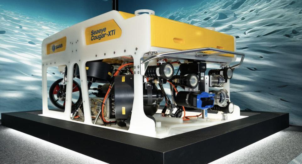
Saab’s Seaeye Cougar-XTi stood out due to its remarkable carrying capacity, a crucial factor for HBC Group’s operations. The Cougar-XTi is a highly flexible and extremely powerful electric ROV, depth rated to 2000m. The ROV is fitted with six 500 Volt, DC thrusters that provide exceptional thrust for stable vehicle operations in high current environments.
These features allow the transport of survey equipment that was previously too large for HBC Group’s existing ROVs, catering to the specific needs of clients, particularly those in offshore wind farms.
The versatility of the Cougar-XTi extends to carrying specialised tools for hydrographics and geophysical services. HBC Group utilises PMAC Group’s system for cathodic protection measurements, and the manipulator arms play a crucial role in non-destructive testing.
Looking ahead, HBC Group plans to deploy the Cougar-XTi for daily inspections, allowing them to bid on tenders that were previously inaccessible due to payload constraints.
The order/capability is expected to open new avenues for the company in the offshore wind sector.In addition to the Cougar-XTi, HBC Group highlighted the success of its previous ROV purchase with Saab, the Seaeye Tiger.
The company noted its reliability and higher uptime compared to previous ROVs. The Tiger has played a crucial role in recent inspections on offshore wind farms in Denmark, the UK, and Germany, particularly in waveform inspections.
The addition of the Cougar-XTi to HBC Group’s fleet signifies the company's commitment to staying at the forefront of technology in the offshore inspection services sector.


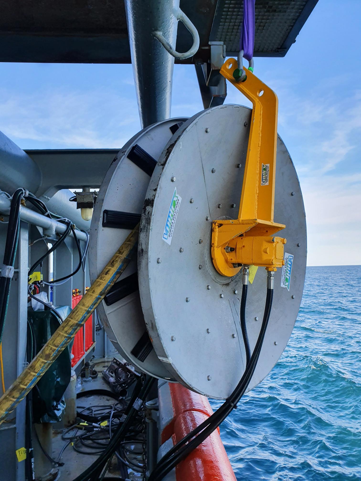
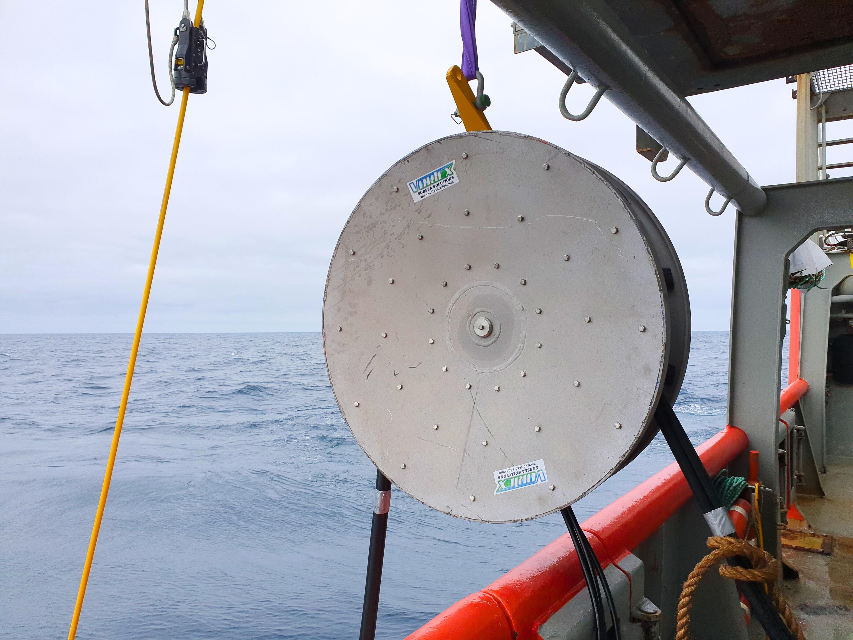
Vortex Subsea Solutions fleet of offshore support tooling continues to grow with the addition of our hydraulic operated Work Wheel.
Designed and built specifically to assist deck operations overboarding and retrieving diving umbilicals, hydraulic hose bundles, electrical cables, ropes and more Working smarter, not harder Vortex is making the back deck safer for crew and equipment.
Contact your regional Ashtead Technology sales team for all of your tooling needs from the deck to the depths

Oceaneering has secured an Inspection, Maintenance, and Repair (IMR) Support Services Contract with Aker BP.
The initial contract duration is for three years with two, two-year options to extend. Oceaneering will mobilise in August to provide onshore and offshore IMR project support to vessels contracted by Aker BP operating on the Norwegian Continental Shelf.
Eli Løberg Mellgren, Director of Oceaneering’s Offshore Projects Group, Europe and the Middle East (EME), said, “Being awarded the IMR support services contract from Aker BP is a significant achievement. It enables us to leverage our advanced product and service portfolio to deliver a cost-effective solution with a reduced carbon footprint and minimized HSE risk. We are excited about the opportunity to work closely with Aker BP and are confident that this project will lead to mutual success and opportunities for innovation.”
Oceaneering has been operating in Norway for more than 50 years, setting a benchmark for delivering high-quality professional services across industries including Life of Field Services, Controls, IMR, Decommissioning, Intervention, Flow Assurance, Subsea Engineered Solutions, Asset Integrity Management, Data and Communication Solutions, Subsea Equipment, and ROV Services.
New AI technology reduces inspection times, lowers costs, and improves the accuracy of inspections compared to traditional diver-led methods that are labor-intensive and subject to human error.
Deep Trekker is to lead the AI ROV Ship Modelling and Detection Project.
This groundbreaking initiative, in collaboration with Canada’s Ocean Supercluster (OSC), Qii. AI, The Department of National Defence, Kongsberg Discovery Canada Limited, and ABS Global Canada, harnesses cutting-edge ROV technology integrated with advanced artificial intelligence to redefine ship hull inspections for greater precision and efficiency,
setting a new standard in the industry.
“By co-investing with the industry in the important advancement of AI in the ocean sector, we are also contributing to advancements in ship modelling and detection as well as increased safety, environmental protection, economic efficiency, and job creation,” said Kendra MacDonald, CEO of Canada’s Ocean Supercluster.
At the core of this project are Deep Trekker’s ROVs, designed with ultra high-resolution 4K cameras, multibeam imaging sonar and robust sensor arrays, which allow for detailed and accurate data collection in real time.
The use of AI software plays a pivotal role in processing the data. By leveraging sophisticated machine learning algorithms, the software analyses sonar and video footage to
• Front & rear HD cameras standard
• 7 thruster, vectored system
• 15.6” LCD display monitor
• 12.1” LCD touchscreen Control Monitor
• Speeds up to 3.5 knots
• Operating depth of 1,000’ (305m)

detect structural defects, corrosion, or biofouling, as well as any other critical features.
Inspection results will be consolidated into a detailed data dashboard, which includes 3D models, video, sonar clips, and high-resolution images, offering a thorough assessment tool by providing inspectors and engineers with a comprehensive visualisation of the hull's condition.
Key to the system’s performance is its integration of advanced positioning sensors, which enable precision navigation even in areas with poor visibility or difficult underwater conditions.
This positioning capability is essential for ensuring the ROV
maintains a stable course along the hull, minimising drift and improving data accuracy.
The integration of ROV GPS, USBL, and dead reckoning technology allows for continued tracking when external GPS signals are lost, ensuring consistent operation in confined or murky waters.
Deep Trekker’s ROVs provide real-time data to operators, reducing the need for lengthy post-inspection analysis. The Qii. AI software integrates with the ROV to automatically analyze the data while the inspection is ongoing.
The software’s ability to flag issues in real-time streamlines the inspection process, helping operators make informed decisions quickly.
The project also supports the creation of a comprehensive inspection dashboard, which allows users to access, store, and share 3D models, sonar data, and annotated imagery with ease.
With a project value of $8,108,000, and a $3,405,306 contribution from Canada’s Ocean Supercluster, the AI ROV Ship Modelling and Detection Project stands to revolutionise the maritime industry’s approach to hull inspections.
It not only enhances the safety and operational reliability of ships but also supports environmental stewardship by identifying issues before they escalate.
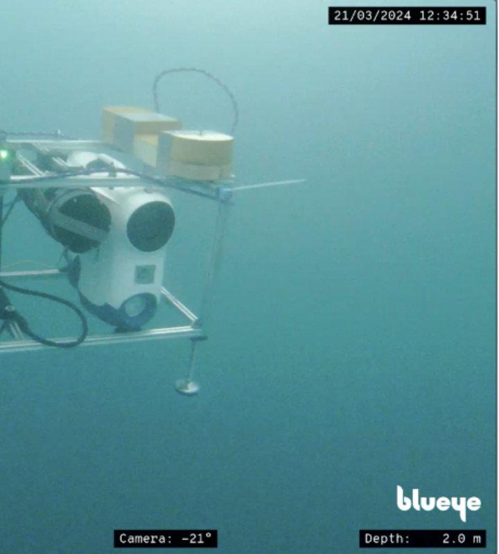
Scientists from the Norwegian University of Science and Technology (NTNU) and the University Centre in Svalbard (UNIS) recently conducted a mission in Svalbard to investigate sub-surface ice structures.The team deployed a dual Blueye Remotely Operated Vehicle (ROV) system, along with a single Blueye ROV equipped with an Aqua TROLL multiparameter sensor.
Svalbard serves as a hub for diverse research activities, both on land and beneath the ice. NTNU and UNIS have collaborated for years to study environmental changes in the region, linking them to broader global climate shifts.
Traditionally, sea ice studies have relied on in situ measurements and remote sensing via satellites and airborne platforms
In their winter 2024 expedition, NTNU and UNIS researchers focused on the sub-ice processes in Van Mijenfjorden, using ROVs to gather data. The mission's key goal was to investigate various sea ice features during the winter season.
The team employed a double Blueye ROV setup, a third Blueye ROV for enhanced situational awareness, and an Aqua TROLL sensor to capture critical oceanographic data. The reliability of these systems was
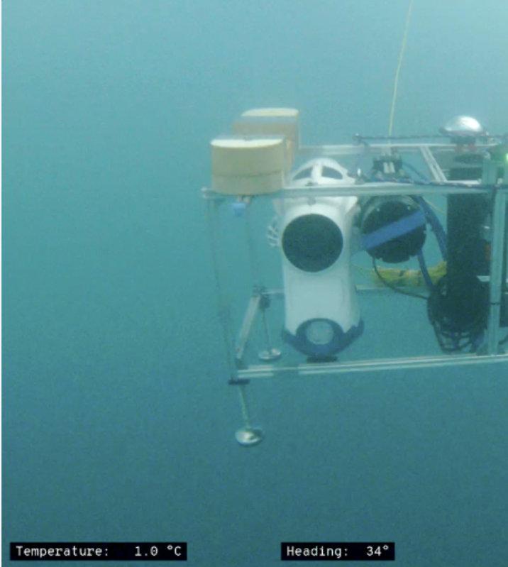
crucial for the mission's success, given the harsh Arctic conditions.
These vehicles proved instrumental in capturing detailed images of the ice's underside, as well as collecting water temperature and salinity data, which is essential for
understanding ice mechanics and the thermal properties of the water column beneath the ice.
INTEGRATION OF HYPERSPECTRAL
Central to this mission was the deployment of a hyperspectral
camera, which captures a full spectrum of visible light, ranging from infrared to ultraviolet wavelengths. This technology, integrated with the Blueye ROVs, enabled the team to detect various pigments, such as chlorophyll and beta carotene, assisting in species identification
and ice feature analysis.
The hyperspectral data is also valuable for applications beyond Earth, aiding in the exploration of environments on icy moons.
This collaboration between NTNU, UNIS, and NASA's Jet
Propulsion Laboratory (JPL) supports future exploration under ice-covered planetary bodies, such as Jupiter’s and Saturn’s moons, by leveraging hyperspectral imaging for navigation and environmental analysis.
Although satellite remote sensing offers valuable insights into sea ice, estimating ice thickness and sub-ice algae populations remains a challenge. NTNU and UNIS researchers aim to enhance these measurements by correlating hyperspectral imaging with satellite data, improving sensor capabilities in Arctic conditions.
After completing the expedition, the team reviewed their findings and identified areas for future improvements, including integrating a Doppler Velocity Log (DVL) for more precise navigation.
Despite some challenges, NTNU and UNIS successfully achieved all objectives, with a focus on improving data processing techniques, ice thickness estimation, and optimising the spectral signatures gathered by the Aqua TROLL sensor and the Blueye ROVs.
Information provided by Blueye
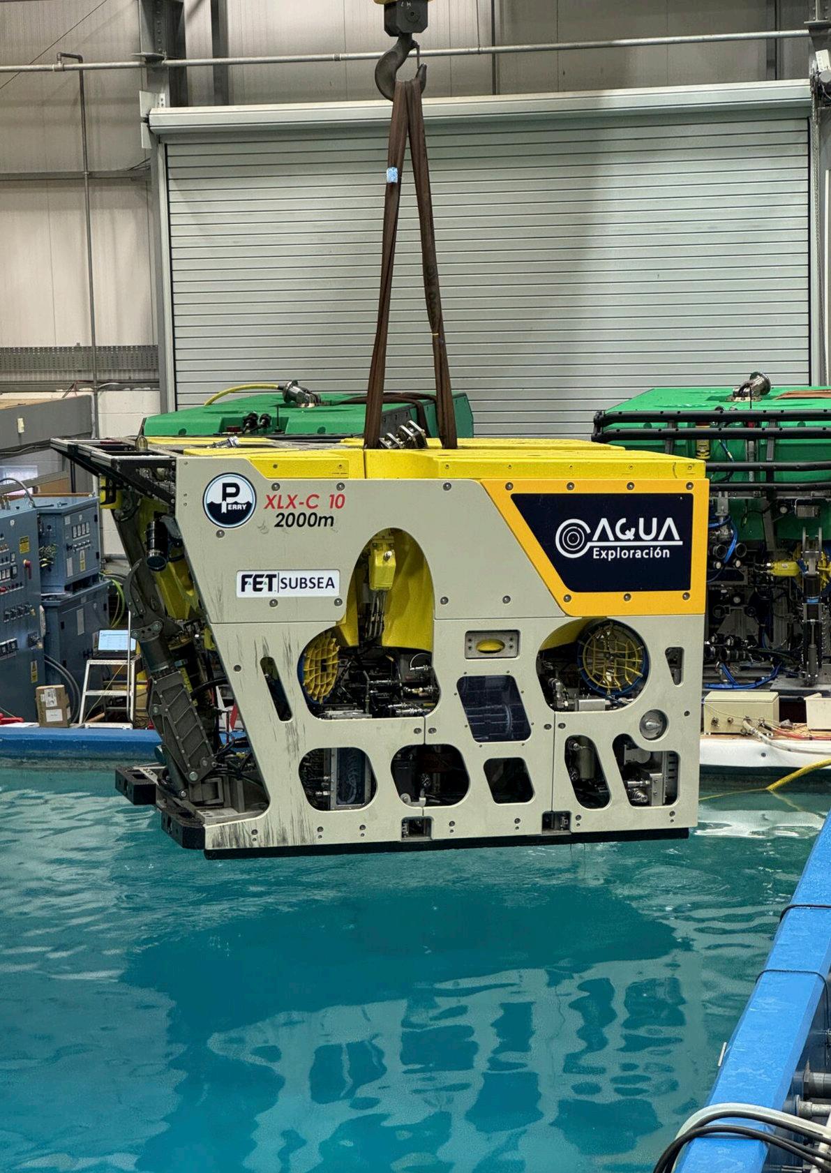
Aqua Exploración has successfully completed Factory Acceptance Test (FAT) for our ROV XLX-C at the Forum Energy Technologies facilities in Kirkbymoorside. This advanced system is now set to be shipped to Mexico, where it already has its first GVI project secured, with a potential second contract on the horizon once the initial campaign is completed.
The 150HP ROV is equipped with a tooling skid and a fully integrated survey MUX, allowing seamless integration of all tools necessary for pipeline surveys. Additionally, being a compact XLX-C system, it offers faster mobilisation and requires less deck space, making it incredibly efficient.
Vortex Subsea Solutions now has a very effective 4 and 6 inch dredge solution for the water/ glycol hydraulic system on the Schilling GEMINI WROV.
With 4 and a 6 inch versions with 68kpa and 46kpa suction vacuum respectively, customers
currently with GEMINI - or in the market for one of these systems now have an extra tool to keep their vehicles in the water working where they belong.
Day to day tooling such as dredges increase the capacity for your WROV to spread
capabilities across more work scopes further increasing earning capacity of these high value assets and vessels.
Vortex new water/glycol power system has further capabilities powering suction anchor pumps such as the Vortex Anchor Boss.


• Delivering data in most adverse conditions: underwater acoustic modems with advanced communication technology and networking
• Accurate USBL, LBL and hybrid positioning of underwater assets, navigation for divers
• Modem emulator and multiple cost-saving developer tools
• Sonobot 5 - the autonomous surface vehicle for bathymetry, monitoring, search & rescue, and AUV support
• Quadroin - the novel bionic AUV for surveys and monitoring
sales@evologics.com
sales-us@evologics.com