
DOUGLASVILLE NORTH SIDE TRAIL PLAN


1. INTRODUCTION
1.1 Project Purpose
In recent years Douglasville has experienced economic development and commercial and institutional momentum in their downtown area. Directly north of the downtown is an area that is locally referred to as the North Side. This area is comprised of a collection of older homes and new larger suburban subdivisions, churches, schools, and some commercial. With the construction of the new alignment for State Route (SR) 92 and completion of a recent Livable Centers Initiative (LCI) study, Douglasville saw the opportunity to focus on this area and conducted the North Side Redevelopment Plan. The goal of the study was to identify steps that would stabilize and revitalize the area. The four major objectives identified through the community visioning activities were centered around Connectivity, Preservation, Goods, and Services.
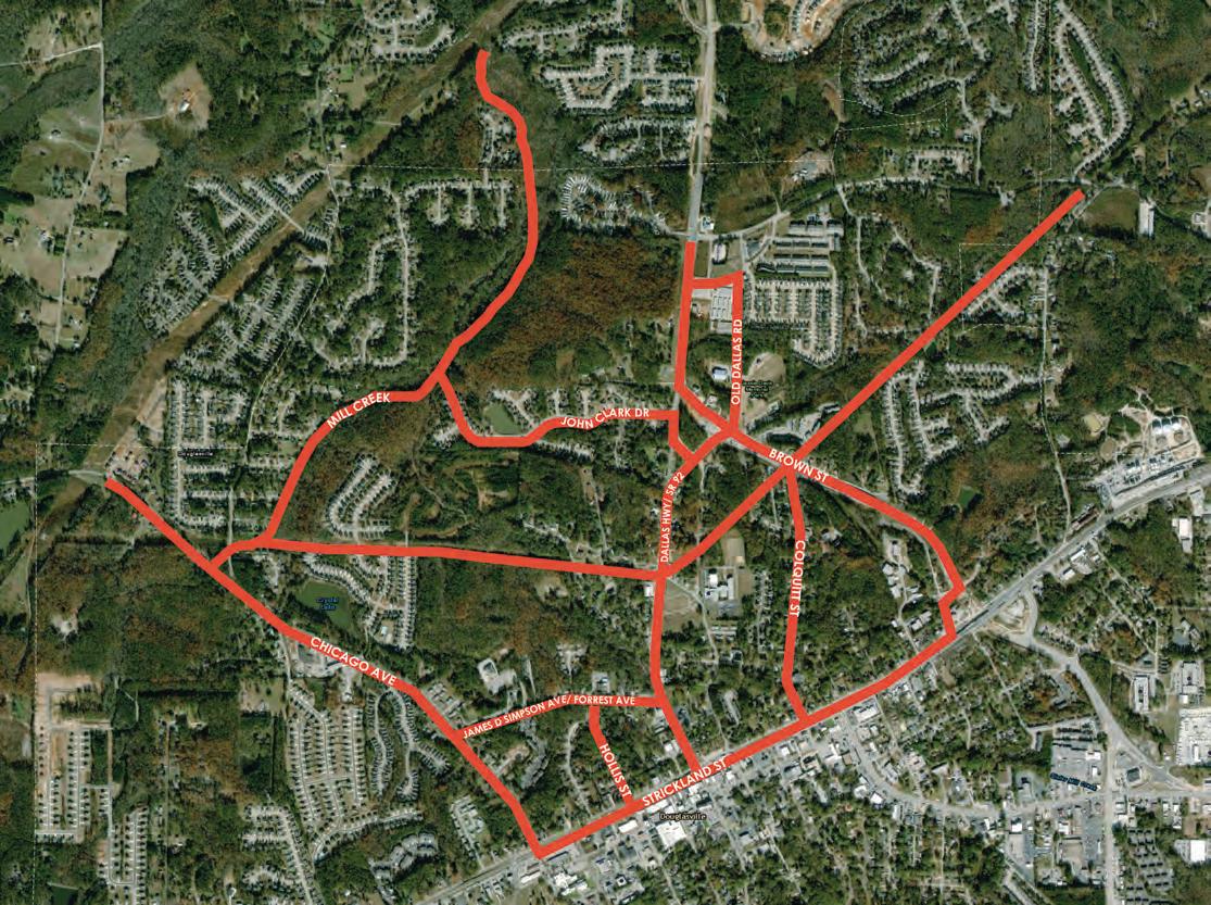
To advance the Connectivity objective from the North Side Redevelopment Plan, Douglasville embarked on this Trail Plan Study. The goal is to perform a concept study, identify trail projects, and develop design recommendations articulating the associated costs. The outcomes from the North Side Trail Study will establish a framework for investing in non-vehicular infrastructure that promotes pedestrian and bicycle connectivity between the area’s homes, parks, schools, and commercial. A secondary benefit to supporting healthier lifestyles with infrastructure for pedestrian and bicycle mobility will be to stimulate catalytic projects that promote the economic development objectives of the North Side Redevelopment Plan.
1.2 Study Goals
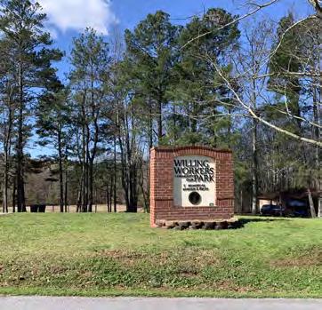
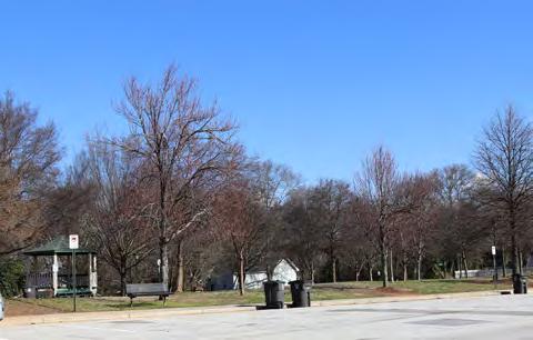
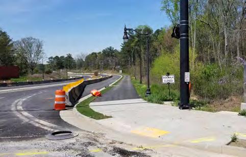
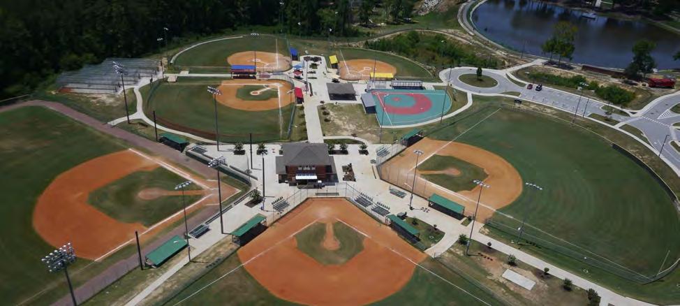
Through public engagement efforts, residents were asked to identify their desired purpose for using walking and biking facilities in the North Side and the the top three places within the City limits that they would like to walk or bike to. 19% identified ‘commuting’ to be their desired purpose; while 81% identified ‘recreation’ as their desired purpose. The top ten desired destinations identified by the residents in order of the desirability are listed below. The photo grid on the following page identifies these locations.
1. Downtown Douglasville
3.
6.
7.
8.
9.
Using the public outreach comments, input from the Project Advisory Group, and insights from the City Council and City staff; the four primary goals identified for this study include:
• Focus on Pedestrian and Bicycle Strategies in the North Side area
• Promote Non-vehicular Mobility
• Improve Connectivity to homes, schools, parks and businesses
• Improve Quality of Life by focusing on Healthy Lifestyles
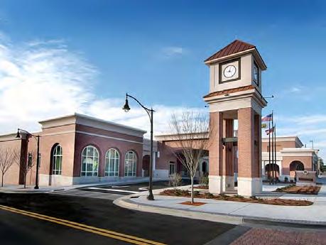
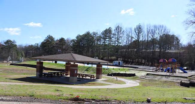

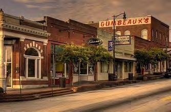
Douglasville
Arbor Place Mall
Douglasville Conference Center Jesse Davis Park Willing Workers Park
Worthan Park Dallas Hwy./ Hwy. 92
Gumbeaux’s
Hunter Park
2. EXISTING CONDITIONS
2.1 Review of Plans and Studies
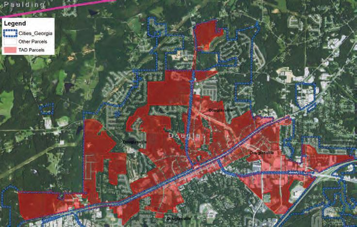
Douglasville Redevelopment Plan - Tax Allocation District #1: 2019
Goal: Attract more private investment to the redevelopment area and help fund public improvements which have been identified in prior plans and have been consistently supported by residents.
• Adopting this redevelopment plan makes the tool of tax increment financing available to help accomplish the ambitious community goals and objectives which have already been established for the area.
Community Needs: Described in O.C.G.A Section 36-44-3, the following criteria qualifies downtown and the north side to be a potential redevelopment area:
• “Predominant number of substandard, vacant, deteriorated, or deteriorating structures; the predominance of a defective or inadequate street layout or transportation facilities; or faulty lot layout in relation to size, accessibility, or usefulness”
• “Evidence of pervasive poverty, defined as being greater than 10 percent of the population in the area as determined by current data from the United States Bureau of the Census, and an unemployment rate that is 10 percent higher than the state average”
• The presence of older buildings that have no historic significance or “the predominance of structures or buildings of relatively low value compared to the surrounding vicinity”
• Deteriorating or inadequate parking, roadways, bridges, pedestrian access…; or deteriorating or inadequate utility infrastructure either at present or following redevelopment
Recommendations: Several potential redevelopment projects within the proposed TAD #1 were identified which are in various stages of consideration, and could be started and completed within the next 5 to 10 years. This included North Side Redevelopment Projects:
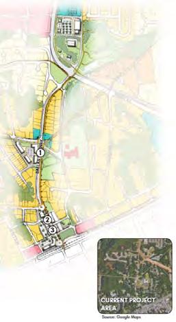
• The North Side Redevelopment Plan focuses on improving and connecting existing city parks, which are then expected to stimulate investment in abutting properties.
• The plan calls for the creation of a “Dallas Highway/Gateway North”, introducing increased residential density, neighborhood-scale retail and services, all supported by interconnected parks and pedestrian improvements.




City of Douglasville North Side Redevelopment Plan: 2018
Goal: Link new residential development with the neighborhood and the broader downtown area through walking and biking infrastructure to make the North Side more attractive to new residential development and improve its quality.
• The Greenspace Strategy: increase investment in North Side parks and create new biking and walking paths and trails that connect the area’s greenspace and amenities.
• The Pedestrian Strategy: promote infrastructure investment to connect the North Side’s many homes, schools, and parks together and allow safe and easy pedestrian access to Downtown Douglasville.
Community Needs: Two major barriers restrict pedestrian and biking movement within the North Side – the future six-lane Highway 92 and the CSX train track running through downtown. Making sure pedestrians can safely cross these barriers is essential to securing safe access to the proposed North Side park system and future development. The North Side has a large inventory of civic and community assets, yet they are disconnected from one-another or give preference to vehicle access.
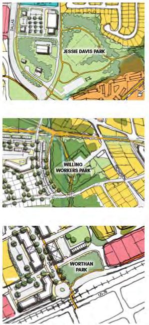
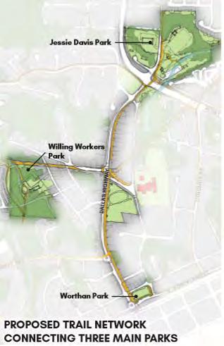
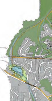
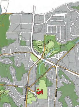
Recommendations: A new system of walking and biking trails and paths are proposed that will connect the North Side’s three major parks, shown in the image below in their recommended improved form. Each of the parks will be accessible by a 15-minute walk or a 5-minute bike ride from the other. The network will provide connections for existing and future residential subdivisions and streets. Trails that provide destination points are utilized with greater frequency than those that do not.
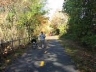
• Nature Trails/Greenways - established to provide walking, biking, and recreational routes through improved and unimproved greenspace. These trails rely on abundant natural scenery to provide a pleasant environment for users and contain little to no commercial or residential development.
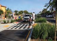
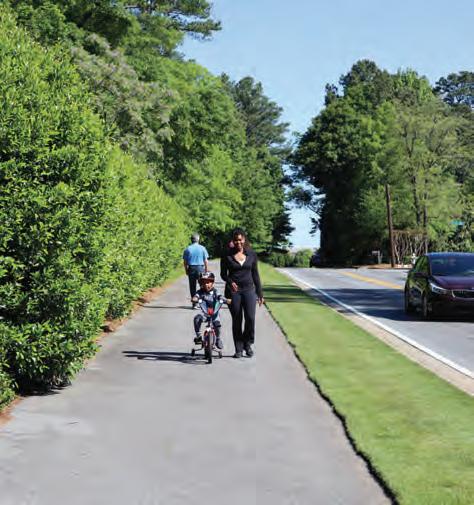
• Multi-use Paths Along Roads - these paths provide a 10-12 foot wide route for both cyclists and pedestrians that is separated from an adjacent road by a protective planting strip. For safety reasons, these routes often contain few curb cuts to reduce potential vehiclepedestrian collisions.
• Multi-use Paths in Utility Right of Way - these paths utilize existing utility corridors and benefit from readily available and cleared right of way. They are often less expensive and take less time to build than other walking and biking infrastructure.








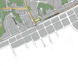


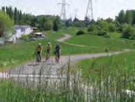
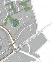


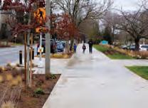




Dallas Highway LCI Study: 2019
Goal: Reimagine Dallas Highway as a complete street, with the vision of building a “safe, pleasant, pedestrian and bike-friendly corridor that seamlessly connects the North Side’s parks, schools, churches, businesses, and residents to Downtown Douglasville, serving as a gateway that establishes the community as a unified ‘downtown neighborhood.’”
• The five major Guiding Principles established through this work are: Connectivity, Diversity, Placemaking, Safety, and Multi-Modal Transportation.
Community Needs: The widening and realignment of State Route Highway 92 brings a series of challenges and opportunities for Dallas Highway, which will be converted from a state highway to a city-owned and operated road at the completion of the State Route Highway 92 project. Additionally, the continued growth of Downtown Douglasville as a highly-valued community amenity and the planned investments for the Downtown area provide momentum for the Dallas Highway LCI Study to carry forward.
Recommendations: The following three recommendations apply to the entire Dallas Highway LCI study area:
• Implement Shared Use Path along the entire Dallas Highway corridor from E. Strickland Street to the new Bypass. The Shared Use Path should range between 10-feet to 14-feet in width, with pedestrian-scaled lighting and street trees.
• Install On-Street Parking Along Dallas Highway at Proposed Mixed- Use Nodes
• Use Intersections as Gateway Features – State Route Highway 92, Upshaw Mill Road, E. Strickland Street.
Transportation Infrastructure recommendations include:
• Expand Sidewalk to become a Shared Use Path - Dallas Highway realignment between the existing right of way extending to the new State Route Highway 92 alignment.
• Install Shared Use Path from Malone Street to Upshaw Mill Road
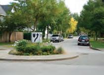
• Install Roundabout at the Upshaw Mill Road Intersection
• Enhanced Public Realm between E. Strickland Street and Ridge Avenue: Long-term vision - mixed-use development with on-street parking, wide sidewalks, pedestrian amenities, street trees, and a separated two-way bicycle facility. Short-term solution - implementation of a Shared Use Path.
• E. Strickland Street and Dallas Highway Raised Intersection




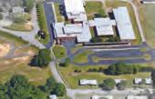

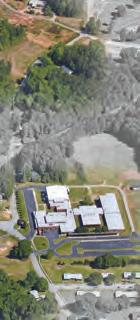
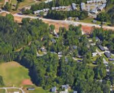


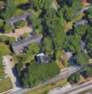


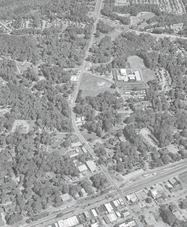







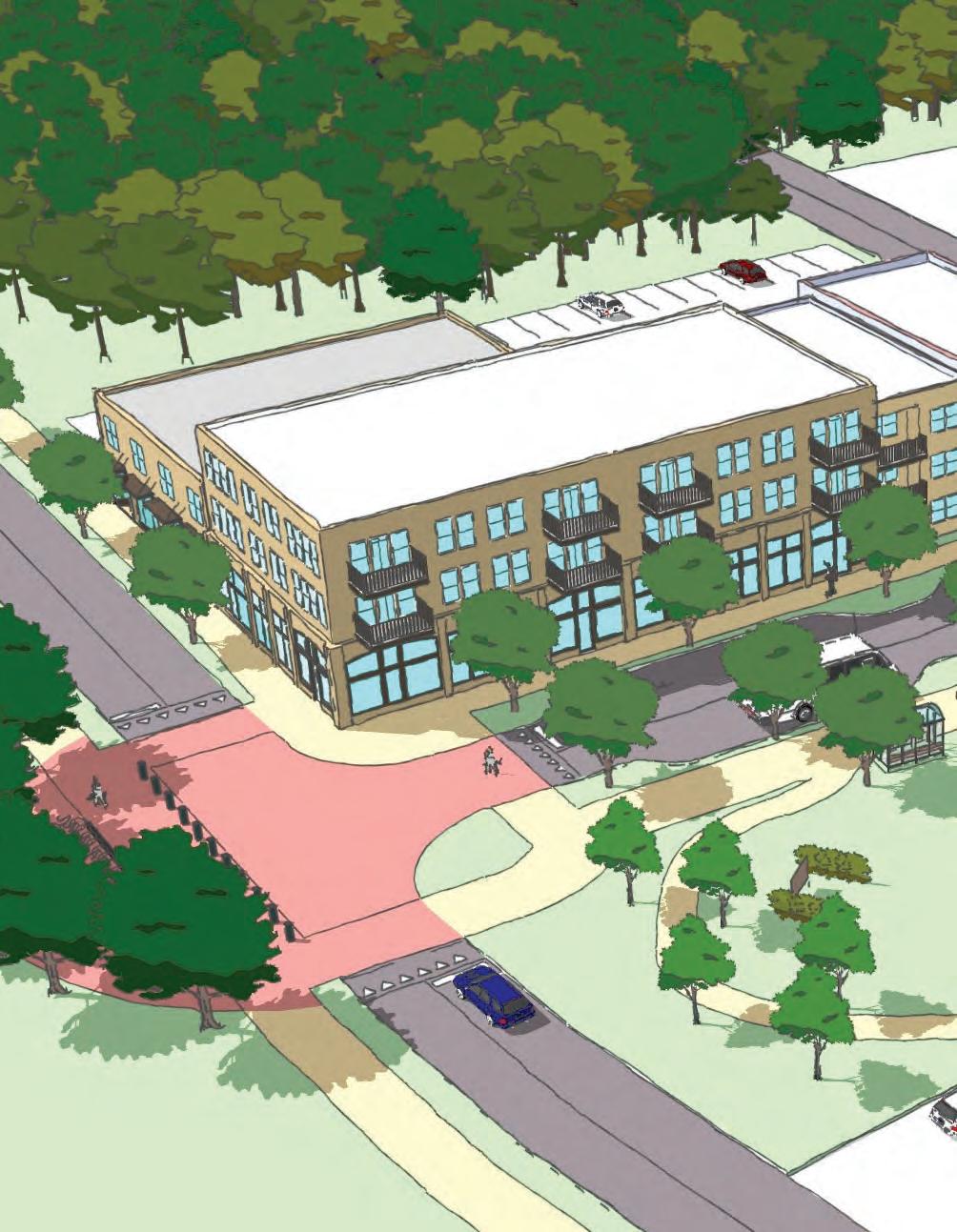

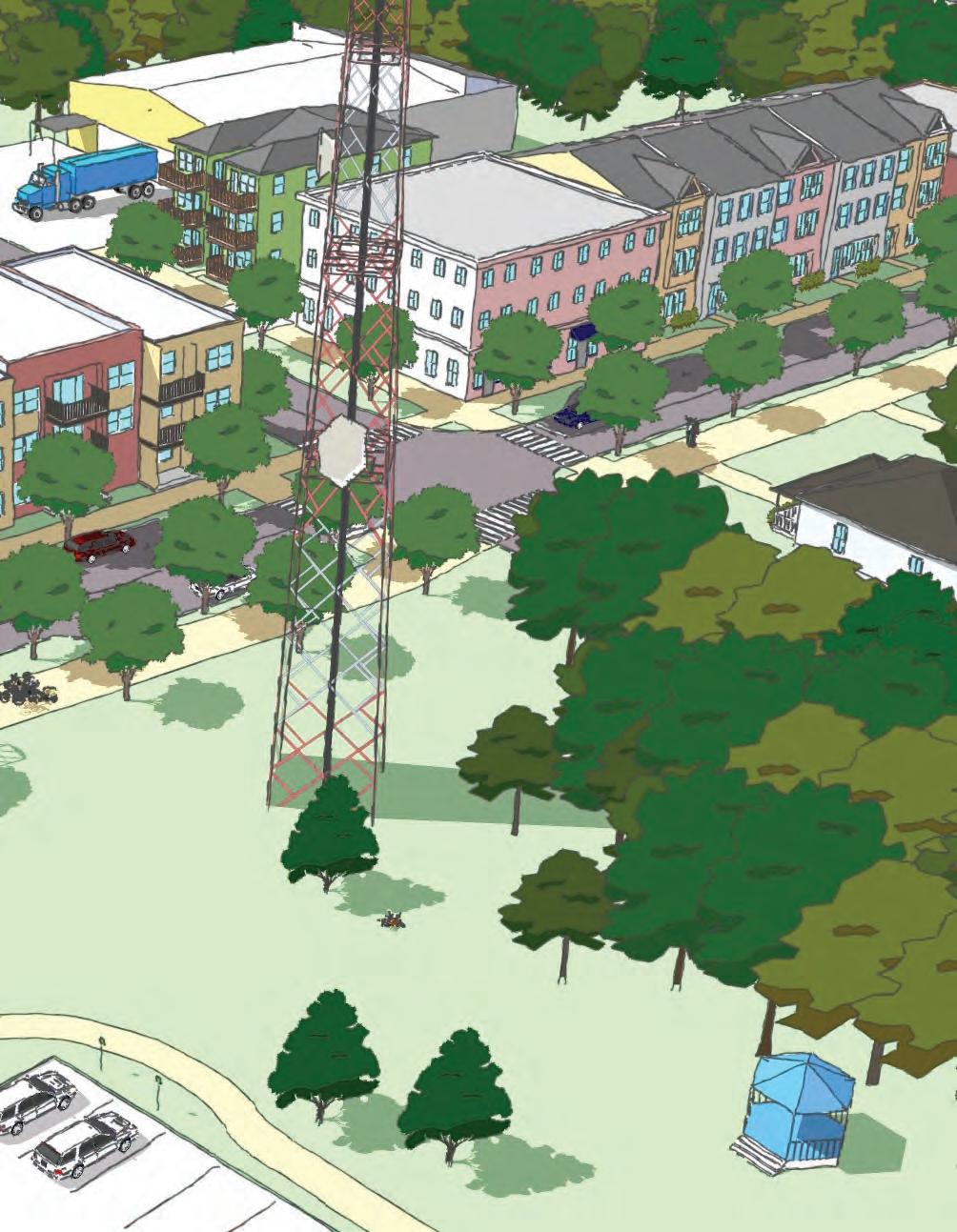

Figure
City of Douglasville Comprehensive Parks & Recreation Master Plan: 2018
Goal: To assist the City of Douglasville Parks and Recreation Department in guiding its plans for future improvements to parks, recreation, greenspace and trails within the City of Douglasville over the next ten years.
Community Needs: The plan highlights community desire for bicycle and pedestrian connectivity within the city, providing connectivity to parks, neighborhoods and points of interest, such as Downtown Douglasville. The statement “add more multi-purpose trails in the city and provide more trails in the parks” was indicated as the greatest need by survey respondents in both surveys. Additionally, 67% of the random sample respondents and 48% of the community-wide survey respondents indicated they would be willing to walk up to 2 miles to parks if safe multi-use trails, sidewalks or bicycle lanes were provided throughout the city. Respondents also indicated a willingness to bike to parks and recreation facilities. Further supporting the desire for trails is the strong desire for walking and running programs and groups.
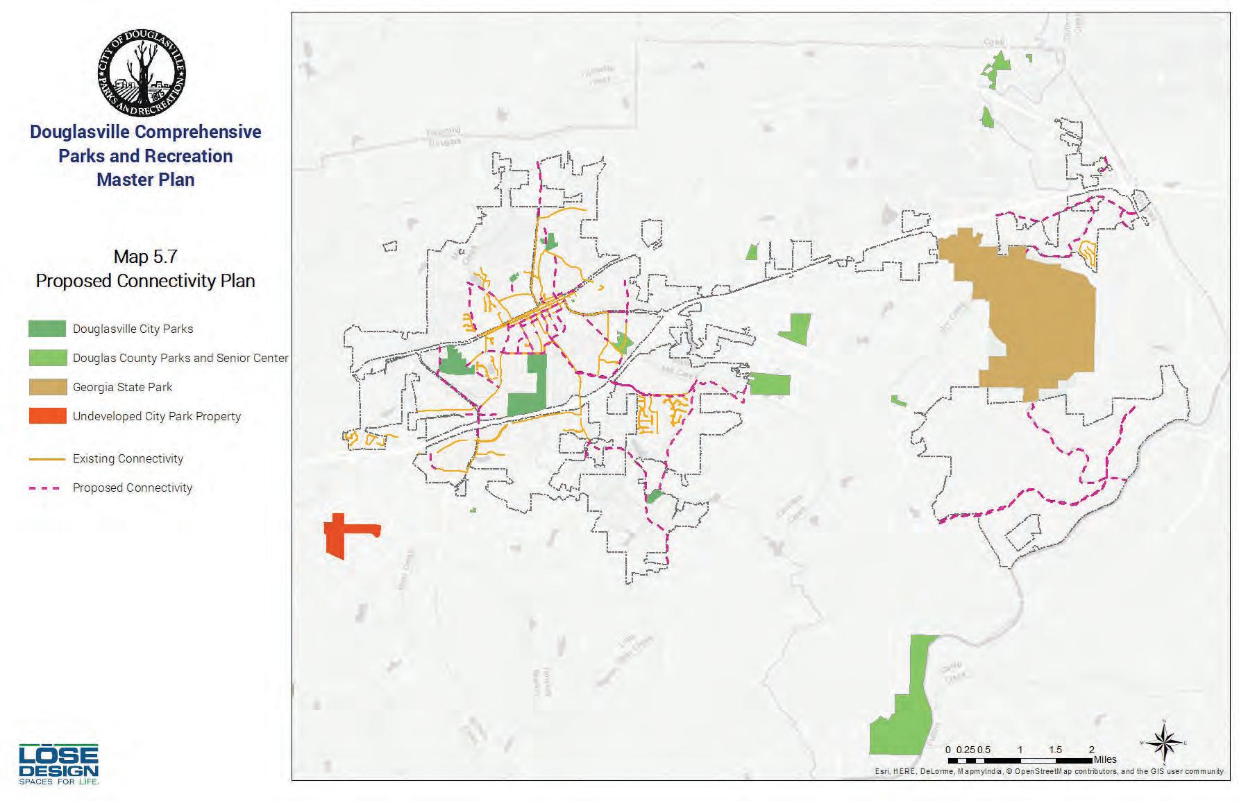
Recommendations: The proposed trails include current City-proposed trails, as well as additional proposed trails that were identified as part of this master plan process. A total of 7 miles of multi-purpose trails are shown in the plan, in addition to several miles of bikes lanes and sidewalk connections in the city’s plans. If constructed, these would provide additional trail connections to parks and points of interest in the city, providing additional recreational opportunities to residents, as well as alternative modes of transportation to places within Douglasville, and connecting to the larger region.
Douglasville Downtown Master Plan & 10-Year Strategic Plan: 2017
Goal: Downtown Douglasville should become a place where residents and visitors want to be, and should be comparable to other historic suburban downtowns in the Atlanta region. Transportation goals include:
• Build on downtown Douglasville’s walkability by improving the streetscapes in the downtown area.
• Work with GDOT to improve the current design of W. Broad Street in order to maintain and enhance walkability and provide adequate onstreet parking for businesses fronting the street.
• Create a network of connected bicycle facilities to give residents and visitors an alternative option in downtown.

Community Needs: This plan builds upon previous planning opportunities and challenges facing downtown: the Georgia Department of Transportation (GDOT)’s plan to reconfigure West Broad Street that will take away 90 public parking spaces, the relocation of Highway 92, the eventual sale and redevelopment of the former county jail site, and a lack of nightlife and daytime attractions. Moreover, the plan strives to make recommendations that can be easily achieved with what resources the City and its partners have in order to attract the interests of developers, business owners, prospective residents, and tourists to downtown Douglasville.
Recommendations: Transportation recommendations include:
• Redesign the Church Street streetscape to include narrower travel lanes, a cycle track, landscape strips, wider sidewalks (minimum 8’ width), and on-street parking, space permitting.
• Redesign the Club Drive streetscape to include narrower travel lanes, a multi-use trail, landscape strips, and on-street parking, space permitting.
• Redesign the Campbellton Street streetscape to include narrower travel lanes, a multi-use trail, landscape strips, and sidewalks.
• Fill in the gaps in the sidewalk system to create a more complete network.
• Create an alternative streetscape design for W. Broad Street to replace GDOT’s plan.
• Construct bicycle infrastructure on Church Street, Club Drive, and Campbellton Street that connect to the bicycle lanes on Selman Drive and Selman Avenue and create the Bicycle Loop.
92 DOUGLASVILLE
• Create wayfinding and additional information that provide visitors to downtown Douglasville information about parking to increase awareness of where parking is permitted/not permitted.
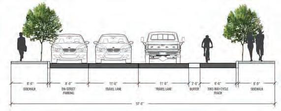
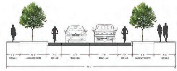
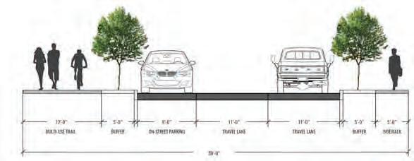
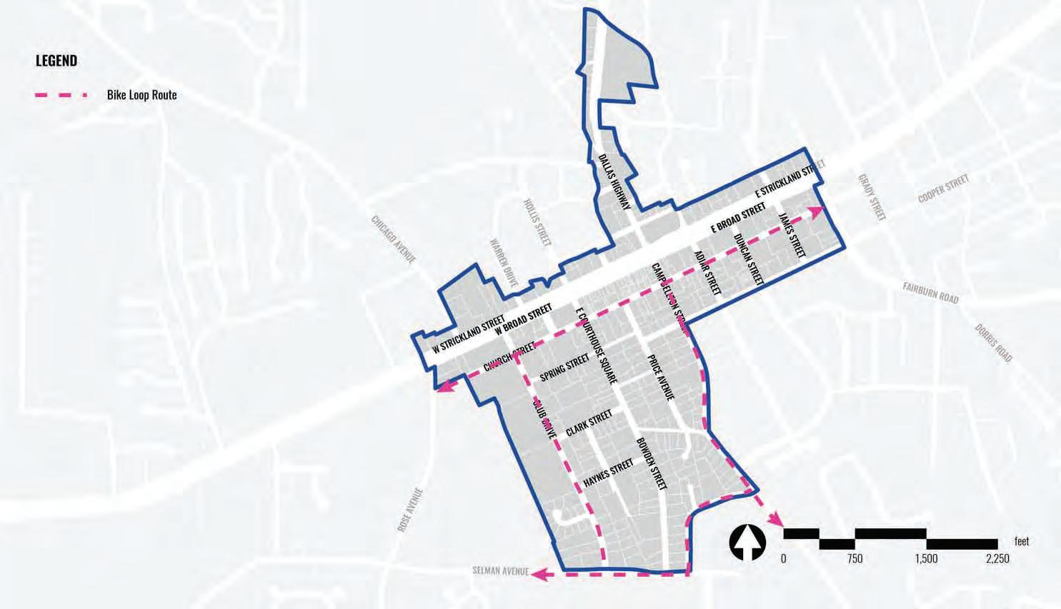

The City of Douglasville Comprehensive Plan Update: 2018
Goal: The transportation supplement to the Douglas County CTP focuses on improving the ability for residents of Douglasville and surrounding Douglas County to move within, to/from, and through the City of Douglasville. The goals include –
• Provide improvements geared towards efficient utilization of existing infrastructure and addition of infrastructure necessary to reduce traffic congestion and provide mobility for all users.
• Address various modes of transportation, including: automobile, bicycle, pedestrian, transit, and high occupancy vehicle (HOV) lanes.
Community Needs: Identified transportation needs include roadway safety and capacity; pedestrian and bicycle needs; and provision of transit and high occupancy vehicle (HOV) lanes.
Recommendations: The recommendations identified in the plan update includes enhancing safety; providing mobility while retaining quality of life in downtown Douglasville; providing effective access to Arbor Place Mall area; and providing alternatives to single occupant automobile traffic. Other recommendations include building a linear park along Highway 92 with a new parallel trail and local road system; connecting multiple local neighborhood streets to form a more cohesive street grid; increasing the amount of green space and preserve local natural systems; and focusing on commercial development around village nodes, based around a 5-minute walk shed.
Key Takeaways from the Plans and Studies
• Provide trail connections to parks and points of interest in the city; creating additional recreational opportunities to residents, as well as alternative modes of transportation to places within Douglasville; and connecting to the larger region.
• Improve connectivity to City parks by a 15-minute walk or a 5-minute bike ride from the other.
• Support economic redevelopment through interconnected parks and pedestrian improvements.
• Create a trail network system to provide connections for existing and future residential subdivisions and streets.
• Establish trail network through improved and unimproved greenspace, relying on abundant natural scenery
• Provide 10-12 foot wide multi-use paths to accommodate both cyclists and pedestrians along roadways and separated by a protective planting strip.
• Utilize existing utility corridors and benefit from readily available and cleared right of way.
• Enhance safety; provide mobility while retaining quality of life in downtown Douglasville; providing effective access to Arbor Place Mall area; and providing alternatives to single occupant automobile traffic.
2.2 Review of Existing Conditions
Located in north-central Douglas County, the City of Douglasville is located approximately 20 miles west of Atlanta and is part of the Atlanta Metropolitan Area. Highway access can be obtained via three interchanges along Interstate 20. Spread over 22.6 square miles, the City is divided by the Norfolk Southern railroad. The area north of the railroad, also known as the North Side, encompasses an area of approximately 1.95 sq. miles.
As per the American Community Survey of 2015, the North Side has a population of 5,782; with a population density of 4.2 individuals per acre. The study area has a total of 1,855 households. Majorly, the population of the North Side is African American, comprising of 70.7% of the total racial composition; followed by 10.9% white and 9.5% Hispanic population. The neighborhood has an average household income of $52,579; and a poverty rate of 35%. Of the total acreage in the study area, about 90% is zoned residential. The Three major zoning categories include: Single Family Residential, Planned Use Development, and Planned Residential Development.
Overall, the difference in topographic range of the Study Area is about 310 feet. The low point is 926 feet above sea level while the high point is 1,236 feet above sea level. Highway 92/Dallas Highway corridor, a major thoroughfare and a principle arterial, has the highest Average Annual Daily Traffic (AADT) in the study area; followed by Chicago Avenue.
The AADT recorded for Highway 92 is 14,800. As per GDOT, Chicago Avenue is classified as a major collector and has an AADT of 8,180. A total of 809 crashes were recorded in the North Side Study Area for the 2015-2019 5-year crash period, the highest crash frequency in the was recorded at Highway 92/Dallas Highway (389 crashes). A total of 170 injuries and 1 fatality was recorded. Highest frequency of crashes can be attributed to rear-end crashes, followed by angle crashes.
The utilities analysis windshield survey for all seven corridors revealed an extensive list of utilities. These included water vaults; fire hydrants; signal cabinets; gas line markers and flagging; and stormwater drainage among others. The City of Douglasville must conduct a detailed analysis prior to any construction.
An environmental due diligence survey was conducted for the North Side are to include the study corridors, including Mill Creek which was identified in the North Side Redevelopment Study as a potential trail site. Watersheds, streams, wetlands and floodplains were assessed and identified crossing or in proximity to the corridor. Preferred habitats of federal and state protected species were identified. In addition potential historic resources were recognized. Investigation of the corridor included assessing publicly owned parks, recreation area or wildlife or waterfowl refuge. Additionally, USTs or potential contamination sites such as landfills or potential hazardous waste sites were also identified. Ultimately, prior to any construction activities detailed studies would need to be conducted and coordination completed with the appropriate environmental reviewing agencies.
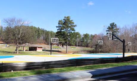
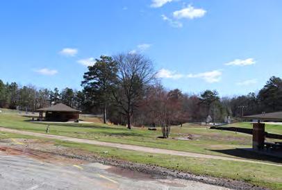
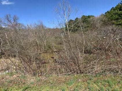
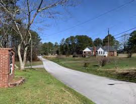
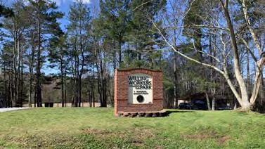
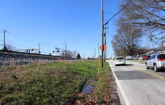
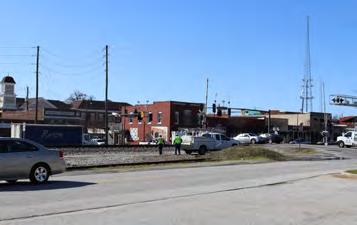
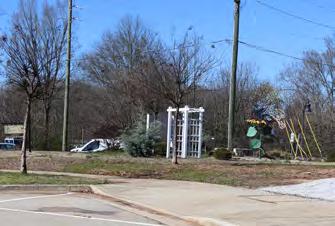
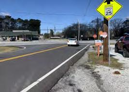
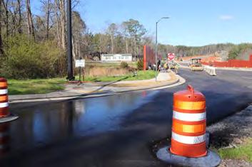
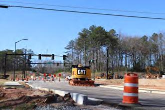
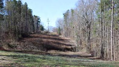
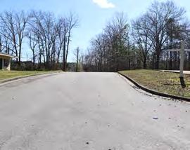
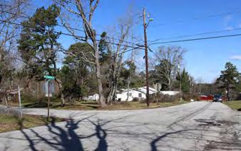
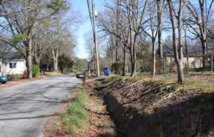
A windshield survey of the study area was conducted; a photo gallery of significant locations is displayed on the following page.
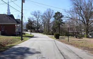
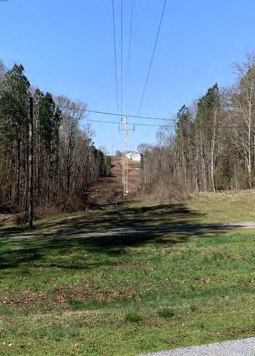
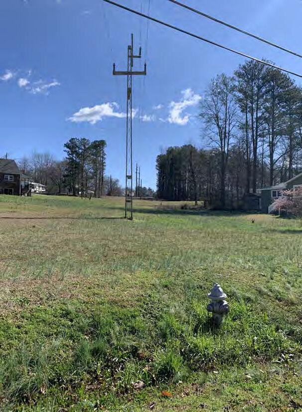
Douglasville North Side Trail Study
MILL CREEK
COLQUITT ST.
GA POWER EASEMENT
DALLAS HIGHWAY/ HWY 92 RE-ALIGNMENT
JESSE DAVIS PARK
STRICKLAND ST./ WORTHAN PARK
WILLING WORKERS PARK
Demographic Analysis
The North Side Redevelopment Plan identifies and analyzes in detail the demographic character of the area. For this analysis, the 2017 American Community Survey (ACS) – 5 year estimates data was used at the block group level, which is the smallest scale of data availability.
ACS is conducted every year and provides the most current information about the social and economic needs of the community. The census is conducted once every 10 years to provide an official population count. Demographic information was pulled from two census block groups (803.1 Block Group 2 & 3). All data presented are estimates and do have a margin of error value associated with it.
Atlanta Regional Commission Equity Analysis
• The Protected Classes Model
Title VI of the Civil Rights Act identifies 9 population categories that must be protected. These include Ethnic Minority: Hispanic or Latino Origin by Race, Females, Foreign Born individuals, persons with Limited English Proficiency, Low-Income populations, Older Adults, People with Disabilities, Racial Minority and Youth. The Protected Classes Model is an analysis index created by Atlanta Regional Commission, to help counties, governments and private organizations ensure inclusion and equity for these 9 population groups.
The model uses American Community Survey 5-Year population estimates for 2012-2016. Percentage of each of the protected population groups is calculated at the census tract level. A cumulative numeric score of 0 to 36 is calculated based on the concentration of a population identified across all nine criteria, 0 being a low score and 36 being a high score. More information can be found on the ARC dashboard. https:// atlantaregional.shinyapps.io/equity/
• Racial Minority, Ethnic Minority, and Low-Income Model
The Racial Minority, Ethnic Minority, and Low-Income Model is an adaptation of the Equitable Target Areas (ETA) model, with an index methodology similar to the Protected Classes Model. ARC considers these 3 inputs to be indicators of the greatest potential inequality in the Atlanta region.
This updated model is used by the ARC Transportation Improvement Program (TIP) Project Evaluation Framework to conduct equity analysis and rank proposed projects. The model also uses American Community Survey 5-Year population estimates for 2012-2016. Percentage of each of the protected population groups is calculated at the census tract level. The cumulative numeric score ranges from 0 to 12, and is calculated based on the three input criterion. The low score is 0 and 12 is a high score. More information can be found on the ARC dashboard. https:// atlantaregional.shinyapps.io/equity/
• Area Analysis
The North Side area lies in Douglas County’s census tract 803.1. The tract has an average cumulative score of 21 for the Protected Classes Model and an equity score of 8 for the Racial Minority, Ethnic Minority, and LowIncome Model. This means that according to the index, the corridor study area has a moderate rank, and is placed not too high or too low in the index.
Of the residents in the tract, 34.5% are under 18 years of age; 8% of residents are 65 years or older; 52.68% of residents are female; and residents with disabilities account for 13.58 % of the population in the tract. While 80.23% of residents identify as one or more racial minority, only 6.33% of residents identified themselves as being of Hispanic or Spanish origin.
The tract has a small population of foreign born nationals, with 6.66% of residents being born outside of the United States and only 1.21% of residents report having English proficiency below “very well.” Of the households, 55.33 % have an income below 200% of the national poverty level. The Census defines a household to be composed of one or more people who occupy a housing unit. The 2019 Federal Poverty Level for a household of two individuals is $16,460.
The study area includes seven zoning categories: Single Family Residential, Public-Semipublic, Planned Use Development, Light Industrial, General Commercial, Planned Residential Development And Regional Marketplace. Of the total acreage in the study area, about 90% is zoned residential. Single family residential zoning includes - R-2 - Single-Family Detached Residential District; R-3 - Single-Family Detached Residential District; R-4 - SingleFamily Detached and Attached (Townhouse and Apartment) Residential District; and R-6( -T) - Single-Family Attached Apartment (Townhouse) Residential District.
Along SR 92/ Dallas Hwy, some parcels are zoned General Commercial, Light Industrial, Public-Semipublic And Single Family Residential. Considering the SR 92 re-alignment/ relocation project currently under construction, zoning along Brown Street is zoned for Right-of-Way acquisition. The only industrial category found in the study area is Light Industrial, which accounts for approximately 2.1% of acreage and is located in three clusters: two along Dallas Highway and one near the future State Route 92 alignment.

Douglasville, GA
SIDE STUDY AREA
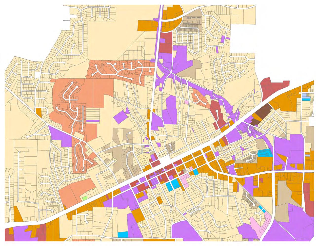
Map 2.2b displays the zoning classification in the study area.
As per the 2024 Future Land Use Plan, the study area includes four future land use classification categories:
• Community Activity Center: To provide for areas that can meet the immediate needs of several neighborhoods or communities. Typical land uses for these areas include low to mid-rise office buildings and department stores.
• Mixed-Use Design: To encourage the best possible site plan and building arrangements under a unified plan of development. The mixed-use design concept is intended to encourage ingenuity and resourcefulness in land planning, to ensure the provision of park and recreation land, and facilities for the use of the occupants of the development. A mixed-use design is required to include at least two types of land use that are otherwise not allowed together or at least two types of residential density, in order to promote unique solutions to growth issues.
• Medium Density Residential: To protect and promote a suitable environment for family life, to discourage any use which would generate other than normal residential area traffic on minor streets, to meet the needs and demands of residents.
• Recreation: To acknowledge the need to preserve open space and land that will encourage the best possible environment for family use of passive and active recreational opportunities.

Douglasville, GA NORTH SIDE STUDY AREA FUTURE LAND USE ANALYSIS
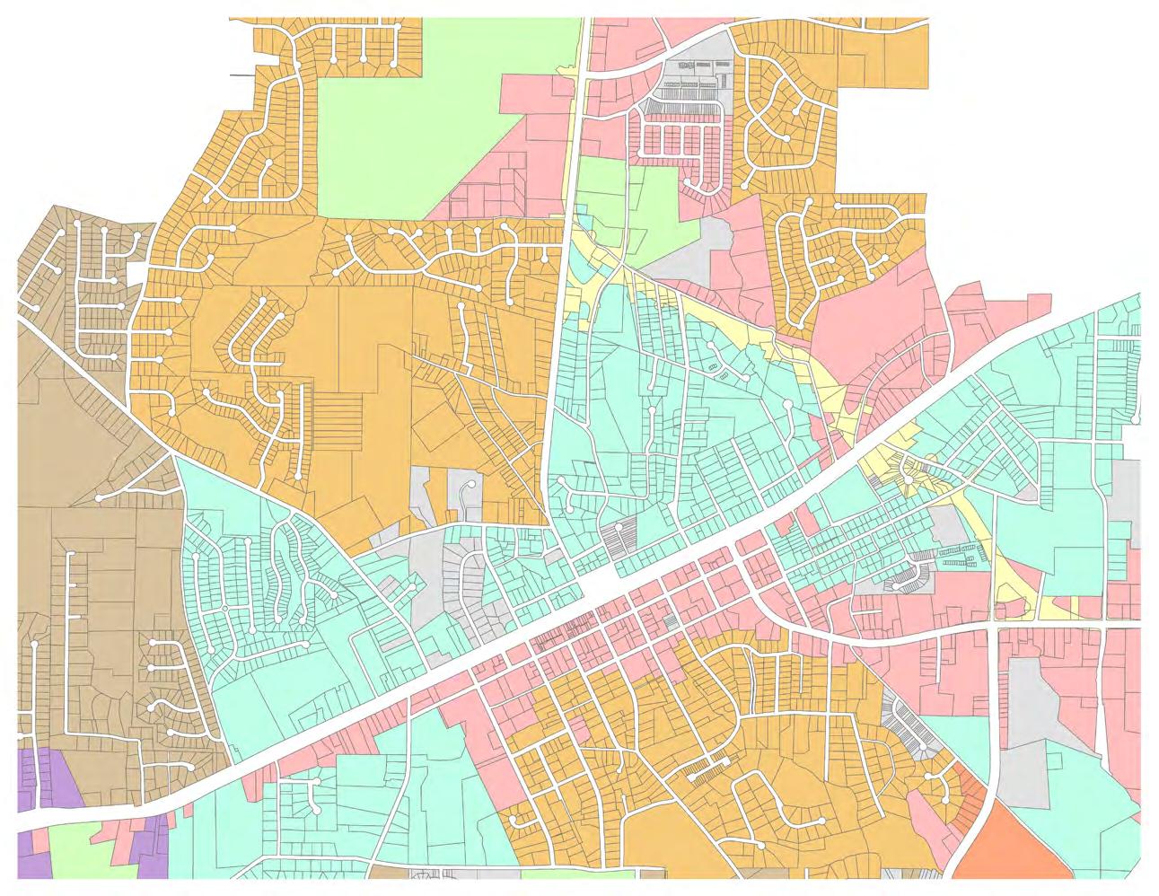
Map 2.2c displays the future land use classification in the study area.
Topography
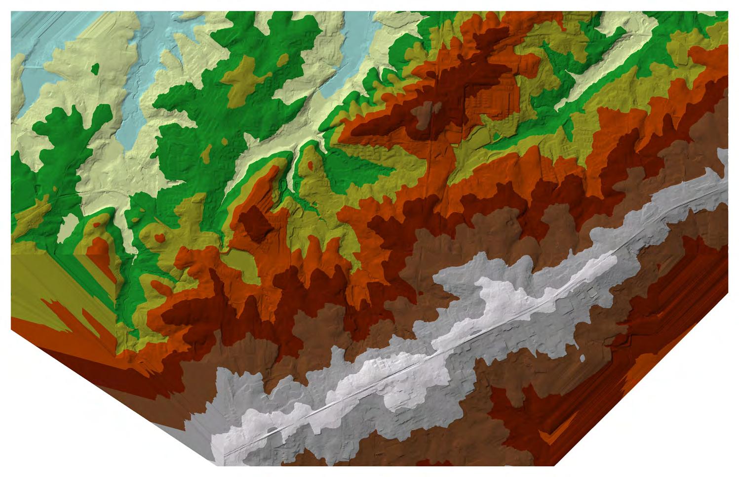
Topography, especially the occurrence of significant elevation changes, is important to consider in trail design because it influences the alignment and cost of building trails. A trail’s chosen route across varied terrain can also have direct impacts on its popularity. For example, the choice to build a bridge across a valley and minimize elevation change, or to follow the earth’s natural contours down and up. The Douglasville North Side Study Area has a varied topography. This variation is illustrated in Map 2.2d, which divides the Study Area into nine elevation ranges, each with a 33-34’ elevation change.
Overall, the topographic range of the Study Area is about 310 feet. The low point is 926 feet above sea level while the high point is 1,236 feet above sea level. This varied elevation range may create some challenges when designing the Trail to be ADA accessible, particularly in areas where the Trail would travel perpendicular to the topography.
The southern boundary of the Study Area is along a ridge that the railroad, Strickland Street, and Broad Street all follow. Everything north of the ridge generally slopes down for roughly a quarter mile, before rising again at various locations, particularly along SR 92. The northwestern corner of the study area is a low point, where Mill Creek flows north. These concepts will be considered further during the concept design of the Trail.
Douglasville, GA NORTH SIDE STUDY AREA TOPOGRAPHY

Similar to topography, topographical slopes are important to consider in trail projects because they influence the alignment and cost of implementing trails, and ultimately have a major impact on the user experience. Like the topography, the topographical slopes of the Douglasville North Side Study Area are varied.
This variation is illustrated in Map 2.2e, which organizes the Study Area’s slopes into five slope ranges - slopes under five percent, slopes between five and eight percent, slopes between eight and ten percent, slopes 10 to 25 percent, and slopes above 25 percent. Ideally, the Trail would be located in areas with a slope that is below five percent. This slope range would facilitate ADA access and would minimize construction costs.
As illustrated in Map 2.2e, gradual slopes typically occur along the largest streets, while smaller streets tend to experience steeper slopes. Nearly all streets experience slopes over 5 percent, with many areas also over 10 percent. The Study Area includes some very steep slopes (over 25 percent) in the northwestern section around Lakeland Court. This area would present significant challenges for construction. It will be important to explore opportunities to align the Trail in areas with gradual slopes during the concept design of the Trail.

Douglasville, GA
Understanding how traffic engineers categorize roads is a fundamental component required when seeking to make pedestrian/bicycle improvements in the right-of-way (ROW). The Georgia Department of Transportation (GDOT) provides a ranking system for roads based on their number of lanes and traffic volume called the Functional Class. Within the Douglasville North Side study area, two roads met the requirements for classification, with an additional road (US 78) just beyond the southern boundary:
1. GA SR 92 / Dallas Highway – Principal Arterial
2. Chicago Avenue – Major Collector
3. *US 78 / Veterans Memorial Highway / Broad Street – Minor Arterial
Additionally, GDOT monitors traffic counting devices, which provide Annual Average Daily Traffic (AADT) information, on roads throughout the state to ensure appropriate grading of the Functional Class system. There are five traffic counting devices currently within the study area:
1. E. Strickland Street west of Colquitt Street
2. Colquitt Street between Maxwell and Bay Street
3. Chicago Avenue at Pounds Circle
4. GA SR 92 / Dallas Highway at Autry Circle
5. Malone Road between Linecrest Drive and Huey Drive
Map 2.2f displays this analysis.
Currently, GDOT is in the process of a major engineering project to relocate and widen SR 92 / Dallas Highway through downtown Douglasville, including the Study Area. The new route will follow the Brown Street right of way to a bridge that will pass under the Norfolk Southern railroad tracks. The purpose of this road improvement is to ultimately reduce pass-through traffic in downtown Douglasville. It will be important to consider how this project will influence and incorporate bicycle and pedestrian connectivity along the corridor.
Findings from this analysis will be used to inform the Level of Traffic Stress (LTS) + Intersection Pedestrian/Bicycle Infrastructure Evaluation.

Douglasville, GA
Level of Traffic Stress (LTS) + Intersection Pedestrian/Bicycle Infrastructure Evaluation
Level of Traffic Stress (LTS) mapping helps to identify streets that are most suitable for bicycling. Ensuring that intersections have appropriate pedestrian and bicycle infrastructure elements facilitates safe crossing. An LTS street analysis was conducted for the Douglasville North Side Study Area. This analysis classifies streets into four categories that range from LTS 1, which identifies streets that are suitable for all ages and abilities to LTS 4, which identifies streets that are most suitable for only the most experienced and confident riders. To complete this analysis, roadways are first separated into three categories:
1. Physically Separated Bike Infrastructure and Trails
2. Roadways with Bike Lanes without Physical Separation
3. Shared Travel Roadways
Then, each roadway segment’s LTS is determined by various factors depending on the category. Table 2.2g shows the LTS criteria developed for these types of roadways. More than 90 percent of roadways in the Study Area are Shared Travel Roadways.
In addition to the LTS streets analysis, intersections in the Study Area were also evaluated for the presence of pedestrian and bicycle infrastructure elements. Table 2.2i includes the list of intersections, the elements evaluated, and the findings. Map 2.2h displays the results of both street and intersection analyses. These findings are valuable for consideration during the concept design of the Trail.
GA

Crash Analysis
In order to identify crash trends and safety characteristics for the corridors being analyzed in the North Side area, crash data was obtained from the Georgia Electronic Accident Reporting System (GEARS) database. Crash records were collected between January 2015 and December 2019.
Crash Data by Type and Crash Severity are shown in Table 2.2j. Bike-Ped Crash Synopsis and Five-Year Crash History are shown in Table 2.2k. Property Damage Only (PDO), injuries, and fatalities resulting from car crashes along the corridors for this five-year period are shown in Table 2.2j.
Crash analysis indicates that 674 crashes were recorded in the area for the 5-year analysis period. The majority of crashes in the area were attributed to rear-end and angle crashes. 170 of these crashes resulted in an injury, and one fatality was recorded at the intersection of
at Malone Road involving a
and passenger car due to a failure to yield.
Although not in the primary study area, a fatality was also recorded at the intersection of Cedar Mountain Road and Cave Springs Road, which was caused by a driver losing control of their vehicle while negotiating a curve. Assessing the bike-pedestrian crashes along the corridors, 6 accidents were recorded. Of these crashes, 1 involved a bicycle. Additionally, assessing the crash history for the 5-year period it can be noted that the year 2019 experienced a decline in the number of crashes within the study area.
arrest. Contributing factors include dark clothing and time of crash.
Bicyclist
Crash Synopsis and Crash History
Crash Records by Corridor
Crash analysis demonstrates that there has been a substantial number of crashes along the corridors, with the majority of the crashes being attributed to rear end and angle crashes. The average number of crashes occurring along the corridors in the North Side area is 162 crashes per year. Highway 92/Dallas Highway corridor, a major thoroughfare and a principle arterial, has the highest crash frequency compared to other corridors, its Average Annual Daily Traffic (AADT) is recorded to be 14,800.
Contributing factors to the number of crashes in the study area include the numbers of access points along the corridor, high turning volumes from single shared lane, or restricted sight distance among other factors. These crash records indicate that there is a recognizable need to implement techniques to reduce the frequency of crashes along the corridor.
Table 2.2m highlights the type of crashes by corridor. Detailed specifics on each corridor are provided in the following section.
1. Each corridor was analyzed individually; thus, some of the crashes fenced at intersecting routes may be duplicated.
Analysis by Intersection
All major intersections along the corridors were analyzed to identify crash locations. Highway 92/ Dallas Highway at Malone Road has the highest number of intersection crashes followed by Highway 92/Dallas Highway at Strickland Street and Chicago Avenue at Strickland Street.
Crash Analysis by Corridor
Strickland Street
Strickland Street is a 1.1 mile roadway, mainly classified as a local road by the Georgia Department of Transportation (GDOT), and extends from Chicago Avenue to Brown Street. The roadway section from Highway 92/ Dallas Highway to Camp Street is classified as Principle Arterial.
Strickland Street is an undivided 2-lane roadway, with one lane in each direction. The roadway has a 30 miles per hour (mph) posted speed limit.
A 4-5 feet sidewalk exists on the north side of Strickland Street. Assessing the 5-year crash history by GEARS, Strickland Street has experienced 170 crashes. Figure 2.2p represents number of crashes by type along the roadway. Strickland Street’s highest crash frequency is rear end and angle crashes.
James D Simpson Avenue/ Forrest Avenue
James D Simpson Avenue/ Forrest Avenue is classified as a local road by GDOT, and runs between Chicago Avenue and Highway 92/Dallas Highway. Forrest Avenue is an undivided 2-lane section with 1 lane in each direction.
Forrest Avenue is approximately half a mile roadway with a posted speed limit of 25 mph. A 6 feet sidewalk exists on Forrest Avenue along the southside from Chicago Avenue to Simpson and Daughters Mortuary and along the northside up to the Highway 92/Dallas Highway. Assessing the 5-year crash history by GEARS, Forrest Avenue has experienced 28 crashes, the highest frequency being attributed to rear end and angle crashes.
Hollis Street is classified as a local road by GDOT, and extends from James D Simpson Avenue/ Forrest Avenue to W Strickland Street. Hollis Street is an undivided 2-lane roadway with 1 lane in each direction, and measures approximately 0.27 miles with a posted speed limit of 25 mph.
There are no existing sidewalks along the roadway. Crash records from GEARS suggests that Hollis Street experienced 31 crashes over the past 5 years, the highest frequency being attributed to angle crashes.
Brown Street
Brown Street is classified as a local road by GDOT. Brown Street is a two road segment, one runs eastbound from Highway 92/Dallas Highway to a dead end and the other runs westbound from Strickland Street to a dead end.
Brown Street has a total length of about 1 mile and a posted speed limit of 25 mph. Crash records from GEARS suggests that Brown Street experienced 31 crashes over the past 5 years, the highest frequency being attributed to rear-end and angle crashes.
Strickland
Hollis Street
Colquitt
As per GDOT classification, Colquitt Street is classified as a local road and is 10 feet wide. The 0.61 mile roadway extends from Brown Street to Strickland Street and has a posted speed limit of 30 mph.
There are no existing continuous sidewalks along the roadway. For the 5-year period, data from GEARS estimates 12 crashes on Colquitt Street, the highest frequency being attributed to angle crashes.
John Clark Drive is classified as a local road by GDOT. John Clark Drive is about 0.6 miles runs from Highway 92/Dallas Highway and ends at a subdivision cul-de-sac, providing residential access. The roadway has a posted speed limit of 25 mph.
A 4 feet sidewalk exist along both sides of John Clark Drive. As per the GEARS estimate, over the five year period the roadway has witnessed 31 crashes, the highest frequency being attributed to rear-end crashes.
Chicago Avenue
As per GDOT, Chicago Avenue is classified as a major collector. The 2-lane undivided roadway is approximately 1-mile in length extending from Strickland Street to the intersection of Cave Springs Road and Cedar Mountain Road. Chicago Avenue has a posted speed limit of 35 mph.
Sidewalks with a varying width of 4 feet to 5 feet exists along the west side of Chicago Avenue from Strickland Street to Alexandra Court.Crash records were collected along Chicago Avenue and assessed for the 5-Year period. Crash types for the roadway are shown in Figure 2.11. Chicago Avenue experienced 117 crashes, rear end and angle crashes being the highest frequency. None of these crashes entailed a pedestrian or bicycle in the last 5 years.
Highway 92/Dallas Highway
Highway 92/Dallas Highway is classified as a Principle Arterial by GDOT and has an average annual daily traffic of 14,800. Highway 92/Dallas Highway is an undivided 2-lane roadway, with separate turn lanes at major intersections. The highway extends from Strickland Street into Paulding County; the length of the highway up to Malone Street is about 1.27 miles with a posted speed limit of 35 mph.
A sidewalk exists on the east side of Highway 92/Dallas Highway from East Strickland Street to Ridge Avenue. The sidewalk continues on both side of the road from Ridge Avenue to Old Dallas Road new realignment. MultiUse path exists on the east side of Highway 92/Dallas Highway from Brown Street and ends at Malone Road. Highway 92/Dallas Highway corridor has experienced 389 crashes, the highest number as compared to other corridors in the study.
John Clark Drive
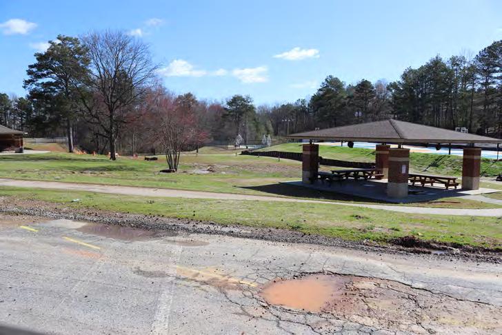
Old Dallas Road is classified as a local road and extends from Brown Street to Jesse Davis Park. The 10 feet undivided, 2 -lane roadway has a posted speed limit of 25 mph.
There are no existing continuous sidewalks along the roadway. The eastside of the corridor provides angular, on-street parking for the Jesse Davis Park. No crashes have been recorded for the 5-year period.
Georgia Power Transmission Line
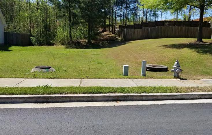
The Georgia Power Transmission Line is a 170ft wide power line and about 2.4 miles from Cave Springs Road to Malone Street.
Utilities Analysis
The accessibility of any utilities could have an impact on the schedule, cost, and overall concept design of the trail network. A windshield survey was conducted to create an inventory of existing utilities along the corridors in the area. All seven corridors were analyzed for this purpose; the list of utilities identified includes but is not limited to-
• Water Vaults
• Fire Hydrants
• Sync Global Fiber Optic Markers
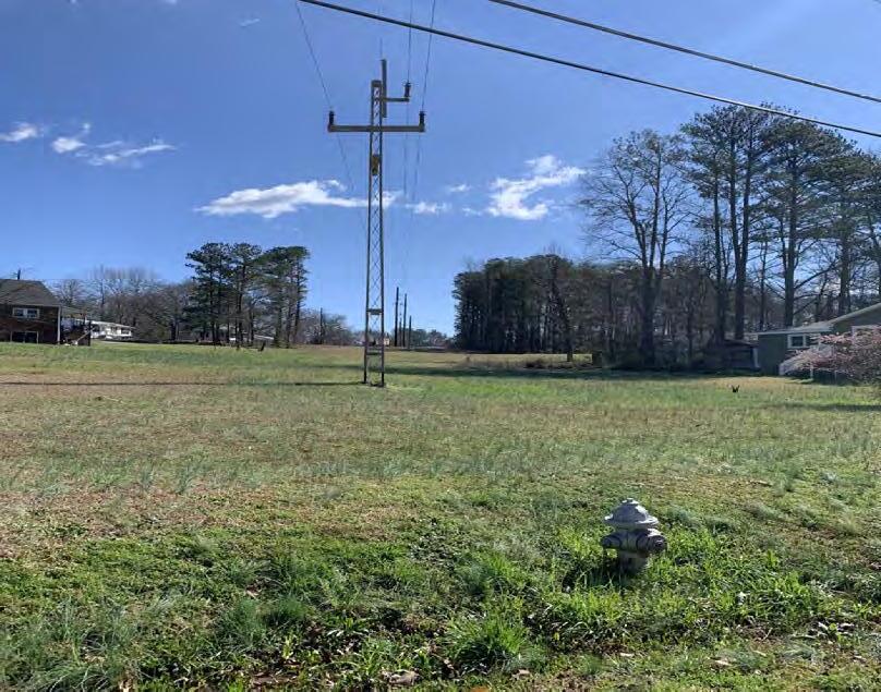
• Sanitary Sewer Manhole
• AGL Solar
• Comcast Cabinet
• GAPC Panels
• Alpha Cabinets
• Signal Cabinets
• Gas Line Markers and Flagging
• Stormwater Drainage
These utility locations are detailed and mapped in Appendix A and will help create feasible concepts in order to avoid conflicts with potential construction activities. The City of Douglasville must conduct a detailed analysis prior to any preliminary engineering design.
Environmental Due Diligence
The purpose of the environmental due diligence is to identify sensitive environmental and historic land uses that may provide improvement opportunities and/or constraints. The survey included agency database research, as well as on site reconnaissance of the corridor. Sensitive environmental land uses were surveyed along the corridor to include:
• Natural resources identified include watershed; streams; wetlands; floodplains; and threatened and endangered species.
• Cultural resources identified include historic and archaeological resources.
• Community resource assessments include parks and recreation areas; churches; cemeteries; Section 4(f) resources; and any other resources.
• Physical resources include Potential Contamination Sites (PSC) or Potential Hazardous Waste Sites.
Environmental due diligence analysis for all corridors including Mill Creek (identified as a potential site from the Redevelopment Study) are detailed in Appendix B and will help create feasible concepts in order to avoid conflicts with potential construction activities. The City of Douglasville must conduct a detailed analysis prior to any preliminary engineering design.
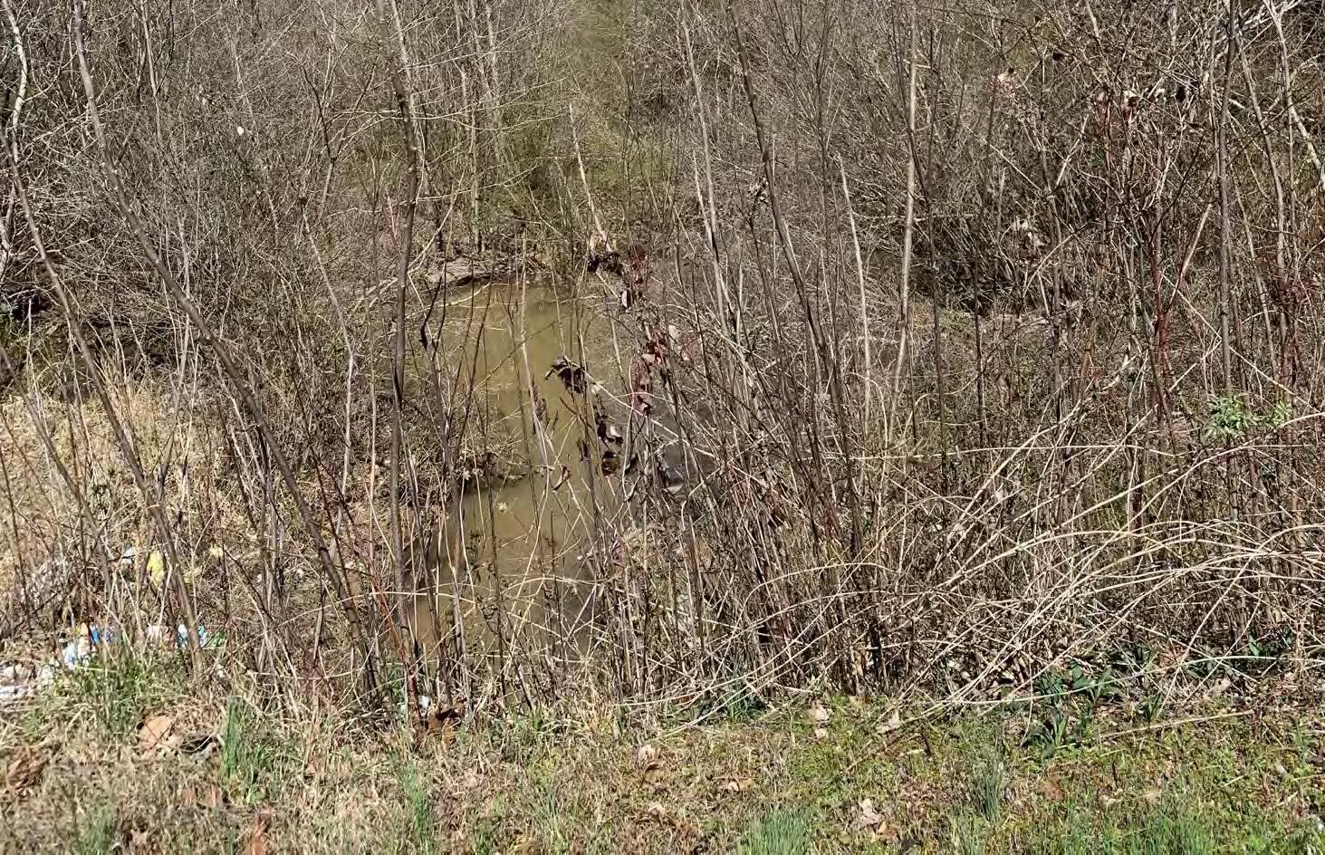
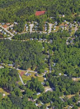
Image 2.2y: GA Power Transmission Line
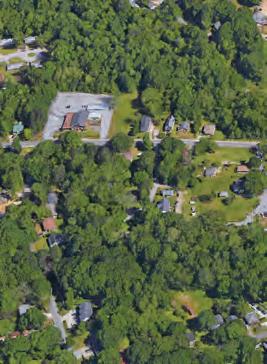
Image 2.2x: View of Jesse Davis Park from Old Dallas Road
Image 2.2z: Utilities identified along John Clark Drive
Image 2.2aa: Mill Creek

3. COMMUNITY ENGAGEMENT
“Successful public participation is a continuous process, consisting of a series of activities and actions to both inform the public and stakeholders and to obtain input from them which infl uence decisions that affect their lives.
- Federal Highway Administration
Project successes are achieved when we develop plans that are implementable; and, these plans are created when the planning process builds in opportunities for close coordination with key audiences. The core of any planning study are the users of the system: residents and stakeholders form an important voice for the existing and anticipated future challenges with the system.
The community engagement strategy seeks to meaningfully engage with these important contributors, which includes the City Council, Project Management Team (PMT), the Project Advisory Group (PAG), key stakeholders, and the general public.
These key audiences were provided multiple platforms and avenues to engage in the development of the study, including traditional public meetings, stakeholder meetings, online surveys and an interactive project website. These efforts formed the basis of the qualitative analysis, which used a combination of tools to capture citizen views.
Project Management Team (PMT)
The PMT consisted of the Project Manager (PM), City of Douglasville departmental staff, and the consultant team. The purpose of this PMT was to help identify goals and guiding principles for concept development. Team members discussed the progress of the process through status updates; performed QA/QC on research and findings; and provided support and insight throughout the study process.
The PMT also brainstormed on solutions and strategies, to help address challenges and needs, and to plan community engagement opportunities at a high level. Regularly scheduled interaction via bi-weekly calls and summary reports with the Douglasville PM and the PMT helped establish two-way honest communications allowing the project to progress onschedule and result in high quality study outcomes.
Project Advisory Group (PAG)
The PAG consisted of key stakeholders, such as City departmental staff, business owners, operators and tenants, and community organizations in the North Side area. Representatves from the following organizations were on the PAG team including:
• City Council
• Georgia Power
• Bicycle Pedestrian Advisory Committee
• Douglasville Parks Advisory Board
• New Horizons Community
The PAG was involved in workshop format meetings and was responsible for validating existing conditions data; identifying needs and desires; attending brainstorming workshops; and providing feedback throughout the study process.
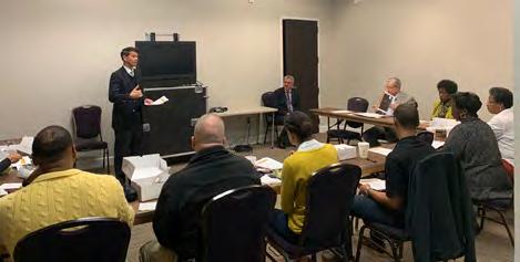
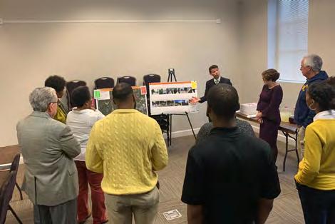
The first Project Advisory Group meeting was held on Thursday, February 20, 2020 at Conference Room C, 6701 Church Street, Douglasville, GA 30134. In attendance were 12 members, including City Council officials, City staff, stakeholders and citizen representatives.
Comment highlights captured during the meeting included building on the vision for the North Side based on the redevelopment plan by activating space with art and amenities and providing opportunities for creative placemaking and economic development among others. Additionally, comments were made to improve safety in mobility for residents and promote good health thereby improving the Quality of Life for all citizens. Detailed summary is attached in Appendix C.

City Council
The Mayor and City Council were regularly updated on the progress of the study and their feedback was solicited. In-person and phone call interviews were conducted at the onset of the study. The goal of the interviews was to:
• Review the Scope and Schedule
• Identify the Vision, Goals and Objectives of the trail study
• Identify Areas of Concern and Challenges
• Recognize Funding Options and Implentation Challenges
An interim presentation was made to the City Council on July 16, 2020. The presentation included an introduction to the consultant team and outlined the study goals, process, schedule and outcomes. Additionally, outcomes from Phase 1 of the Online Survey was presented. The concept development process was explained and preliminary draft concepts for some corridors were shown. Comments and concerns were solicted from the City Council.
The final presentation to the City Council was made on October 15, 2020 with the goal to adopt the Study. City staff presented the comments from the final report and the implementation plan. Additionally, the final completed report including comments solicited from the 30-day public comment period was provided to the City Council for adoption.
Douglasville Parks and Recreation Board Presentation
A presentation was made via Zoom to the City of Douglasville Parks and Recreation Board on April 23, 2020. The presentation included an introduction to the consultant team and outlined the study goals, process, schedule and outcomes. Additionally, an update on the status of the Existing Conditions Analysis was also provided to the Board and comments and concerns were solicited.
The second Project Advisory Group meeting was held virtually via Zoom on May 28, 2020. In attendance were 12 members, including City Council officials, City staff, stakeholders and citizen representatives. Owing to the impacts of COVID-19, an updated schedule and public involvement strategy was presented to the PAG. The concept development process was explained to the group and the preliminary potential trail network and draft concepts for each corridor were shown. Potential amenities and infrastructure elements to be included were also presented to the PAG. The meeting was closed by identifying next steps and action items.
Urban Redevelopment Agency Presentation
A presentation will be made via Zoom to the City of Douglasville Urban Redevelopment Agency on September 9, 2020. The presentation will outline the study goals, process, schedule and outcomes. The concept development process will be explained and finalized concepts will be presented.
Image 3.2a: Project Advisory Group Meeting 1
3.3 Outreach and Tools
Extensive outreach tools were used to ensure maximum citizen engagement and feedback. Description of these methods are detailed below.
Online Surveys
Two rounds of surveys were used during the public outreach, one in each phase. Making considerations for COVID-19, only online format surveys were made available. The first round of survey focused on understanding the overall vision for the trail network in the North Side area. The second round of survey focused on determining preference and priorities for potential proposed concepts. Highlights from the surveys are presented in Graphic 3.3a. Detailed information on survey outcomes can be found in Appendix D and E.
Website
The City of Douglasville website was used to host information on the Northside Trail Study. Information on the project was provided to the City Communications staff for posting on the site. The aim of the website was to provide stakeholders and City residents a forum to allow continuous feedback on the trail study, learn about the virtual public meetings, and keep up to the date on the progress of development of the project. Both rounds of online survey were also updated on the webpage. A sample website post is displayed in Image 3.3b. City of Douglasville webiste information is as follows: https://www.douglasvillega.gov/

Media Outreach
City and community Facebook pages were used to inform the community of upcoming events, access to the online suvey, and plan updates during the planning process.
A virtual public forum was held via Zoom on July 27, 2020 to educate the citizens about the Study goals, process and schedule. Outcomes from Phase 1 of the online survey was presented. In addition to the proposed trail network, graphical illustrations of concepts for each corridor section and proposed trail amenities were presented. The forum was then opened for citizen questions. Phase 2 of the online survey was opened at the commencement of the meeting to allow residents to provide comments on the presented preliminary concepts.
Email blasts were pushed out during the plan’s development to inform citizens of the virtual public forum and provide information to the survey links. Email blast updates included information on the plan status, dates and information on upcoming events and alerts to take the online surveys.
Fliers were created to be distributed to the citizens using the support of community leaders and and dispensed at major locations like the library and County offices. However, due to the COVID-19 contactless policy, the fliers were posted on the website, social media pages and were pushed through blast emails to the community. The flier used for the virtual public forum is shown in Image 3.3c.

The final public comment period soliciting feedback on the draft final report was opened on September 14 and closed on October 14. Highlights from the comments recieved are shown in Image 3.3d.
https://www.surveymonkey.com/r/NorthSideTrail


Virtual Public Forum

4. CONCEPT DEVELOPMENT
“The National Association of City Transport Officials (NACTO) says they are seeing an “explosion in cycling” in many American cities. Eco-Counter, which collects bike data, reports that bicycle counts have “significantly increased” across most of North America compared to usual. In the two weeks to 4 May 2020, it found the US region with the most growth was the south-west, which was up by over 100%.
- Planetizen
After the current and projected future trail needs in the North Side area were analyzed, feedback was compiled from the initial Project Advisory Group meeting and the first round of online surveys. This analysis was directed to identify trail concepts and amenities to address citizen concerns in alignment with the goals and vision for the North Side area as identified in the North Side Redevelopment Plan.
Potential trail network and preliminary draft concepts were presented to the citizens at the Virtual Public Forum. Citizens were given the opportunity to provide feedback on the draft concepts via the second phase of the online survey. After compiling the second round of public feedback through the outreach efforts, preferred recommendations for each corridor were determined.
Post establishing the preferred trail alternatives for each corridor; cost estimates, funding sources, and implementation timelines were identified. Details of the implementation plan are identified in the next section.
Project Management Team, Project Advisory Group, Online Surveys, Public Information
Existing Conditions Analysis
Review of Plans & Studies; Analysis of Demographics, Land Use, Topography, Slope, Traffic, Crashes, Utilities; Environmental Due Diligence Recommendations
A well-connected transportation network reduces the distances traveled to reach destinations, increases the options for routes of travel, and can facilitate walking and bicycling. Well-connected, multimodal networks are characterized by seamless bicycle and pedestrian infrastructure, direct routing, accessibility, few dead-ends, and few physical barriers. Increased levels of connectivity are associated with higher levels of physical activity from transportation. Connectivity via transportation networks can also improve health by increasing access to health care, goods and services, etc.
- U.S. Department of Transportation
The proposed Douglasville North Side Trail Network has the potential to provide the area with a multitude of social, economic, and environmental benefits. The proposed trail network is based on findings from the existing conditions analysis combined with the thoughts, ideas, and concerns of residents, stakeholders, and City staff collected through a collaborative partnership throughout the project. Informed by these factors, the proposed 10-mile trail network is poised to transform eight vehicular centric roadways into multi-modal green infrastructure corridors that connect residents to City amenities including activity centers, parks, and schools. Figure 4.1a illustrates this network. This network is comprised of the following corridors:
Chicago Ave
Strickland Street
James D. Simpson Ave
Dallas Highway
Parker Street and Maxwell Street
Malone Street
Colquitt Street
Malone Road
Georgia Power Easement Segment 1
Georgia Power Easement Segment 2
Georgia Power Easement Segment 3
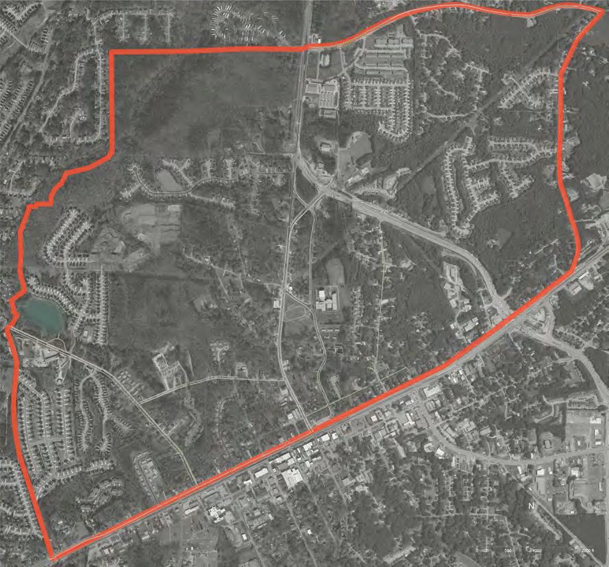
While focused within the City’s north side, this network is planned to facilitate future expansion that could extend to other areas of the City, County, and even state.
The following pages provide a description of the proposed trail network. The chapter is organized into nine sections, based on the nine corridors identified in Figure 4.1a. The sections include proposed plan views, perspective-section images that illustrate existing and proposed condition, and perspective images to illustrate proposed conceptual conditions.
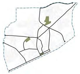
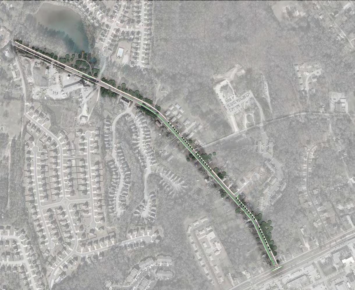
Chicago Avenue extends for approximately 0.82 miles from Strickland Street on the south to Cedar Mountain Road to the north within the study area.
Informed by the North Side Redevelopment Plan, three areas along the corridor were analyzed and used as examples for how pedestrian and bicycle connectivity could be improved along the corridor. These sections are identified in Figure 4.2a and described in subsequent pages.
1. Chicago Avenue-Section 1
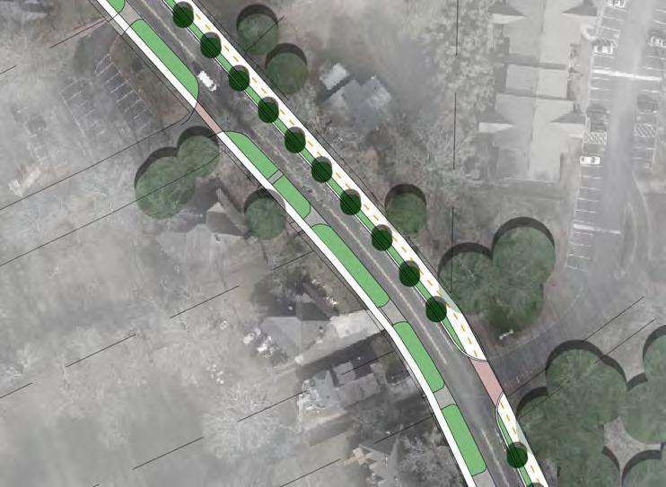
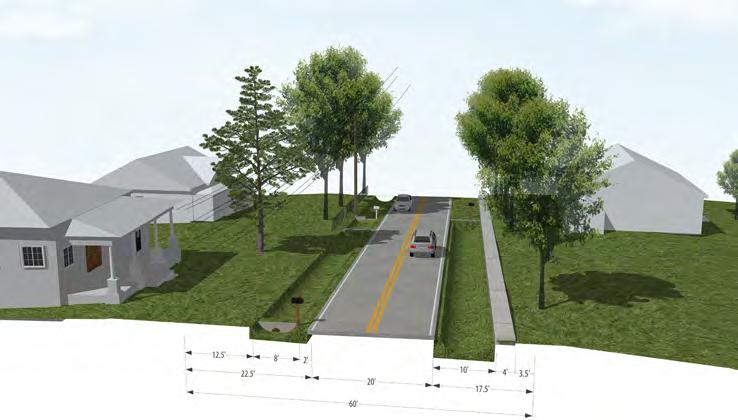
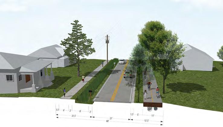
Figure 4.2b shows a close-up plan view of proposed Section 1 of Chicago Avenue and Figure 4.2c illustrates the existing conditions of the section. The Right-of-Way (R.O.W.) is approximately 60’-wide with two 10’-wide travel lanes and power lines along the west side of the corridor. There is one four-foot wide sidewalk on the east side of the street, no pedestrian facilities on the west side, and drainage swales on both sides.
Figure 4.2d illustrates the proposed condition of the corridor. A 6’-wide sidewalk is proposed on the west side of the corridor separated from the roadway by a planted 8’-wide bio-swale to address stormwater quality. The sidewalk is proposed to meander around existing utility poles. An 11’-wide trail is proposed on the east side of the corridor separated from the roadway by a curbed 5’-wide landscape buffer with canopy trees. Conduit and pipes for stormwater are also proposed to be built under the trail. The conduit can potentially serve as a revenue opportunity for the City. Should a third-party utility provider desire to connect the neighborhood with fiber or another type of utility, the City would be able to rent conduit space to the provider for a fee.
2
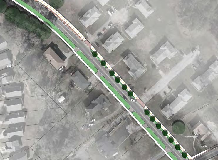
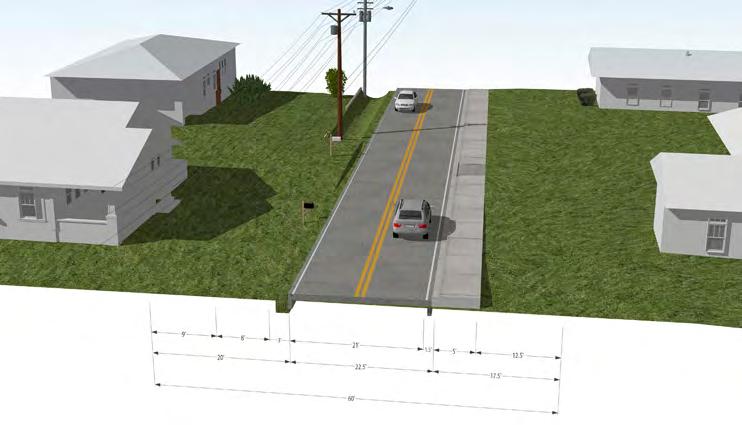
Figure 4.2e shows a close-up plan view of proposed Section 2 of Chicago Avenue and Figure 4.2f illustrates the existing conditions of the section. The R.O.W. is also approximately 60’-wide with two 10’-wide travel lanes and power lines along the west side of the R.O.W. There is a 5’-wide sidewalk on the east side of the corridor, no pedestrian facilities on the west side, and drainage swales on both sides.
Figure 4.2g illustrates the proposed condition of the corridor. A 6’-wide sidewalk is proposed on the west side of the corridor separated from the roadway by an 8’-wide planted bio-swale to address stormwater quality. The sidewalk is also proposed to meander around existing utility poles. A 12’-wide trail is proposed on the east side of the corridor separated from the roadway by a curbed 5’-wide landscape buffer with canopy trees. Conduit and underground pipes for stormwater are also proposed to be built under the trail.
3. Chicago Avenue-Section 3
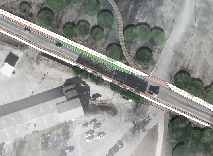
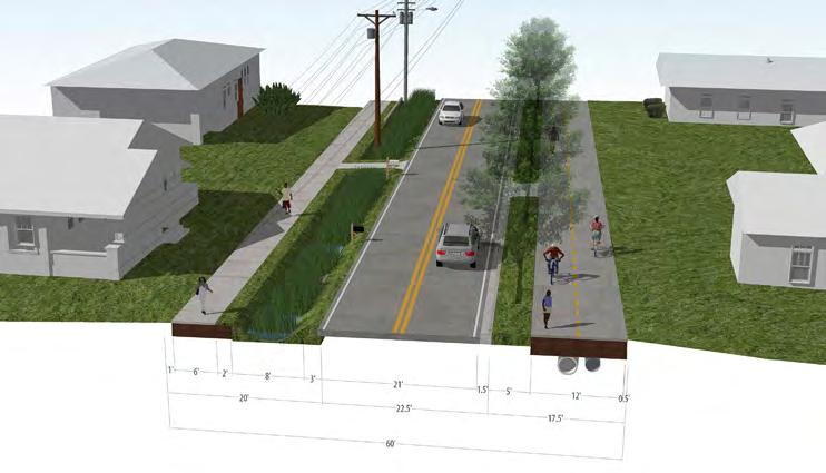
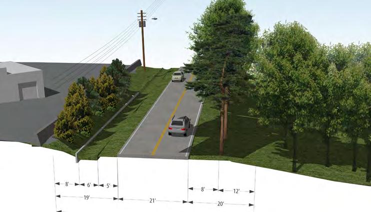
Figure 4.2h shows a close-up plan view of proposed Section 3 of Chicago Avenue and Figure 4.2i illustrates the existing conditions of the section. The R.O.W. is also approximately 60’-wide with two 10’wide travel lanes and power lines along the west side of the R.O.W. There are no pedestrian facilities along this section of the corridor. Drainage swales are located on both sides of the corridor. The east side of the corridor contains a forest wetland owned by an adjacent Homeowner’s Association.
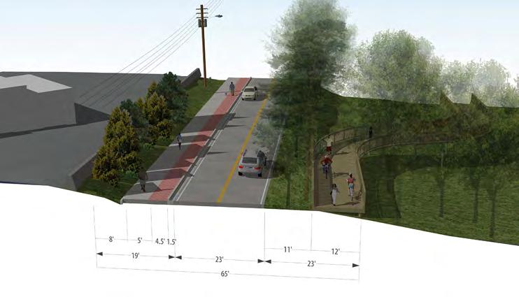
Figure 4.2j illustrates the proposed condition of the corridor. A 5’wide sidewalk is proposed on the west side of the corridor separated from the roadway by a 4.5’-wide paved buffer. The sidewalk is also proposed to meander around existing utility poles. A 12’-wide trail is proposed on the east side of the corridor separated from the roadway by an 11’-wide landscape buffer with canopy trees. The forested wetland provides a unique opportunity for the trail to meander into the space as a boardwalk trail to provide trail users with a brief natural experience.

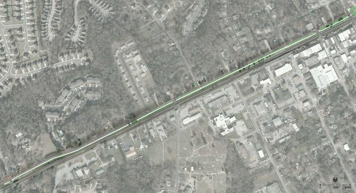
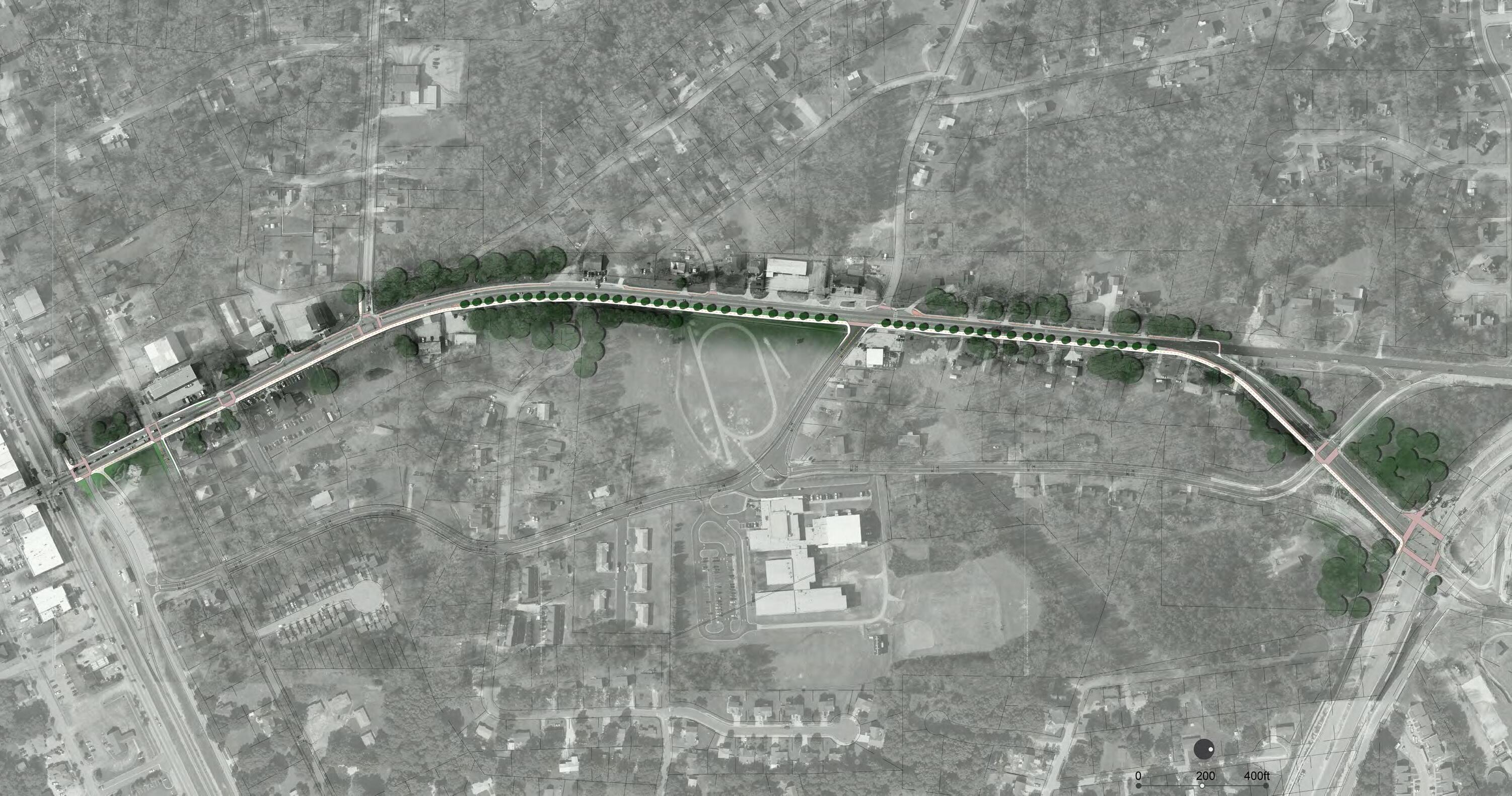
Strickland Street extends for approximately 1.02 miles from Cedar Mountain Road on the west to Malone Street on the east within the study area.
Informed by the North Side Redevelopment Plan, one area along the corridor was analyzed and used as an example for how a trail could be implemented along the corridor. This sections is identified in Figure 4.3a and described in subsequent pages.
1. Strickland Street-Section 1
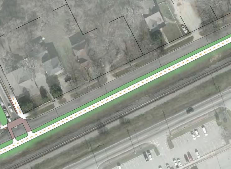
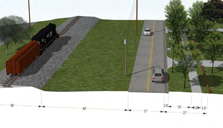
Figure 4.3b shows a close-up plan view of proposed Section 1 of Strickland Street and Figure 4.3c illustrates the existing conditions of the section. The R.O.W. contains two 10’-wide travel lanes and power lines along the south side of the R.O.W. There is one 4’-wide sidewalk on the north side of the street, no pedestrian facilities on the south side, and drainage swales on both sides.
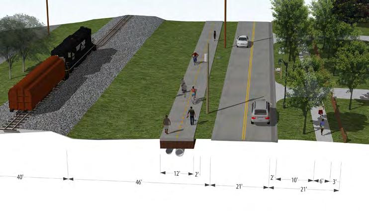
Figure 4.3d illustrates the proposed condition of the corridor. Sidewalk connectivity and conditions should be improved on the north side and street trees planted where appropriate. An 11’-wide trail is proposed on the south side of the corridor separated from the roadway by a landscape buffer. Conduit and underground pipes for stormwater are also proposed to be built under the trail. The City would have to coordinate with Norfolk Southern for the implementation of this trail.
ChicagoAve

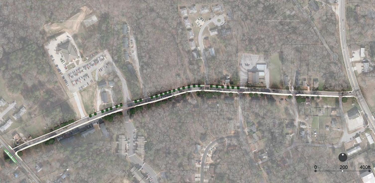
The soon to be Old Dallas Highway, extends for approximately 1.27 miles from Strickland Street on the south to the new Dallas Highway to the north within the study area.
Informed by the North Side Redevelopment Plan, two areas along the corridor were analyzed and used as examples for how pedestrian and bicycle connectivity could be improved along the corridor. These sections are identified in Figure 4.4a and described in subsequent pages.
1. Dallas Hwy-Section 1
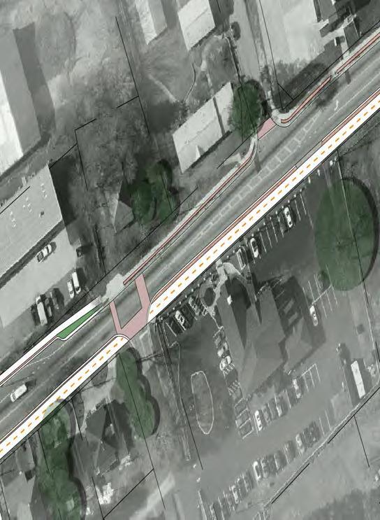
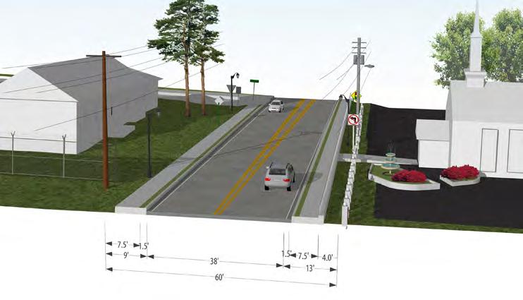
Figure 4.2b shows a close-up plan view of proposed Section 1 of the Old Dallas Highway and Figure 4.4c illustrates the existing conditions of the section. The R.O.W. is approximately 60’-wide with two 10’-wide travel lanes. In this particular location, the roadway becomes wider to facilitate the inclusion of a left-turn lane. Power lines are located along both sides of the R.O.W. There are two 5’-wide sidewalks on both sides of the street separated from the roadway by a 1.5’-wide paved buffer.
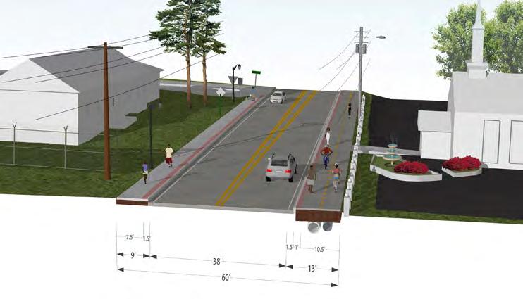
Figure 4.4d illustrates the proposed condition of the corridor. A 6’-wide sidewalk is proposed on the west side of the corridor separated from the roadway by a 1.5’-wide paved buffer. An 10.5’-wide trail is proposed on the east side of the corridor separated from the roadway by a curbed 1.5’-wide paved buffer. Conduit and underground pipes for stormwater are also proposed to be built under the trail.
As this area redevelops in the future, the City may explore expanding the R.O.W to create more separation between trail users and vehicles and adding on-street parking as recommended in the North Side Redevelopment Plan.
4.5 James D. Simpson Avenue
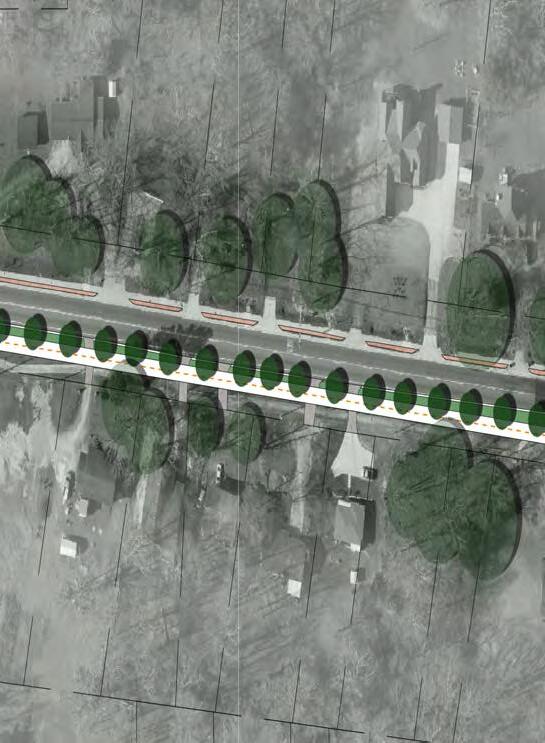
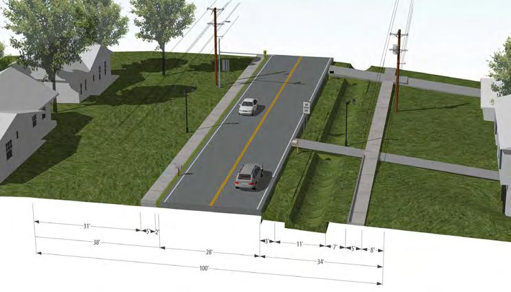
Figure 4.4e shows a close-up plan view of proposed Section 2 of Old Dallas Highway and Figure 4.4f illustrates the existing conditions of the section. The R.O.W. is approximately 100’-wide with two 12’-wide travel lanes and power lines along both sides of the R.O.W. There is a 5’-wide sidewalk on the west side of the corridor and drainage swales on both sides. The drainage swale on the east side is more pronounce than the drainage swale on the west side.
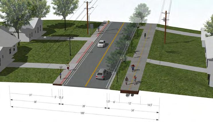
Figure 4.2g illustrates the proposed condition of the corridor. A 5’-wide sidewalk is proposed on the west side of the corridor separated from the roadway by a 2’-wide paved buffer. The sidewalk is located to minimize impact to existing overhead utilities. An 11’-wide trail is proposed on the east side of the corridor separated from the roadway by a curbed 6’wide landscape buffer with canopy trees. Conduit and underground pipes for stormwater are also proposed to be built under the trail.

James D. Simpson Avenue extends for approximately 0.50 miles from Chicago Avenue on the west to the Old Dallas Highway on the east.
Informed by the North Side Redevelopment Plan, an area along the corridor was analyzed as an example for how pedestrian and bicycle connectivity could be improved along the corridor. This section is identified in Figure 4.5a and described in subsequent pages. Due to the suggested low traffic volumes and speeds along this roadway, two alternative conditions were explored for this corridor. Since no clear preferred alternative was identified through the survey, the final preferred alternative would be identified during detail design of the corridor.
43%
Figure 4.5a– James D.
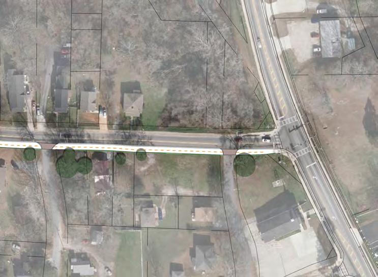
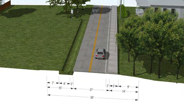
Figure 4.5b shows a close-up plan view of proposed Alternative 1 for James D. Simpson Avenue. Figure 4.5c illustrates the existing conditions of the section. The R.O.W. is approximately 50’-wide with two 10’-wide travel lanes and power lines along the north side of the R.O.W. There is a 5’-wide sidewalk on the north side of the corridor and a drainage swale on the south side.
Figure 4.2d illustrates the proposed Alternative 1. A 12’-wide side-path/ trail is proposed on the south side of the corridor separated from the roadway by a 1.5’-wide and 6” high curb. Conduit and underground pipes for stormwater are proposed to be built under the trail.
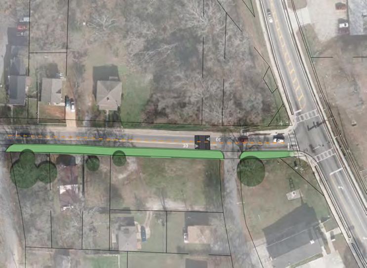
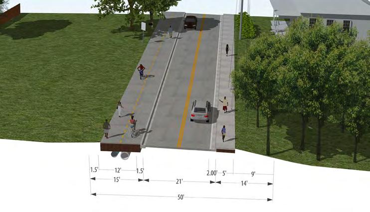
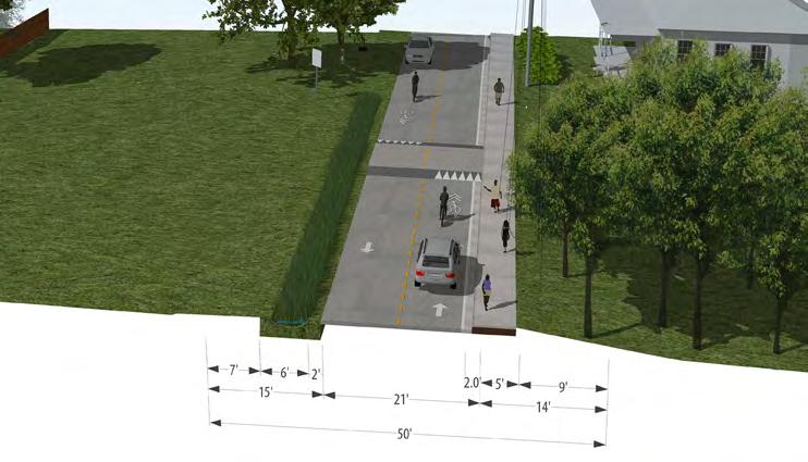
Figure 4.5e shows a close-up plan view of the proposed Alternative 2 and Figure 4.5f illustrates a proposed perspective-section. This alternative explores implementing traffic calming devises to maintain traffic speeds low along the roadway. These low speeds would enable cyclist to share the roadway with vehicles. Pedestrians would use the existing sidewalk on the north side of the corridor and sidewalk condition improvements and missing sidewalk linkages would be added to ensure pedestrian connectivity along the entire length of the corridor. The existing swale on the south side of the corridor would be planted to become a bioswale.
Figure 4.5e–
James D. Simpson Ave

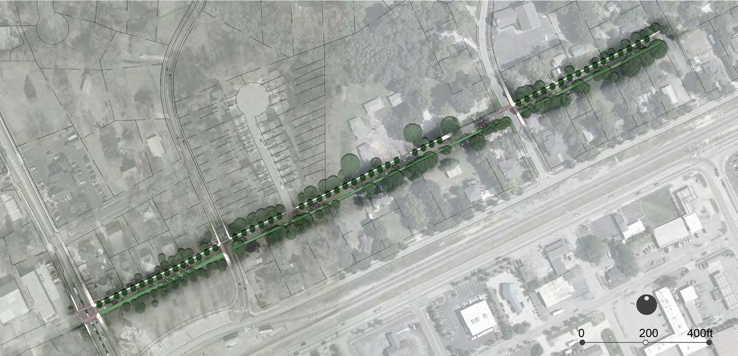
1. Parker and Maxwell Street-Section 1
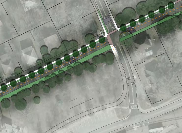
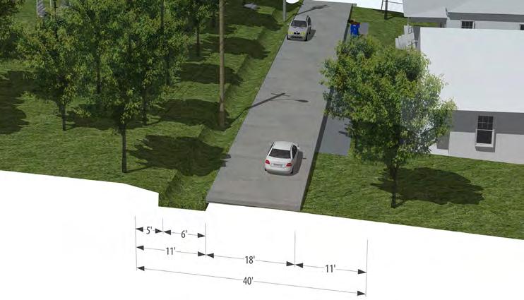
Figure 4.6b shows a close-up plan view of proposed Park/Maxwell Street section and Figure 4.6c illustrates the existing conditions of the section. The R.O.W. is approximately 40’-wide with two 9’-wide travel lanes and power lines along the south side of the R.O.W. There are no pedestrian facilities along the corridor and the roadway appears to have low traffic volumes and speeds. A pronounce swale is located on the south side of the corridor.
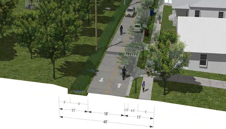
Figure 4.6d illustrates a proposed perspective-section of the road. Traffic calming devises are proposed along the roadway to maintain traffic speeds low. These low speeds would enable cyclist to share the roadway with vehicles. A 5’-wide sidewalk would be located on the north side of the corridor and the existing swale on the south side of the corridor would be planted to become a bio-swale.
Parker/Maxwell Street extends for approximately 0.37 miles from Old Dallas Highway on the west to Eunice Street on the east.
Informed by the North Side Redevelopment Plan, an area along the corridor was analyzed and used as an example for how pedestrian and bicycle connectivity could be improved along the corridor. The section is identified in Figure 4.6a and described in subsequent pages.

1. Malone
Street Section
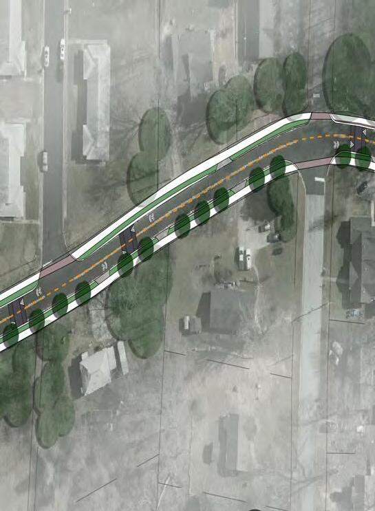
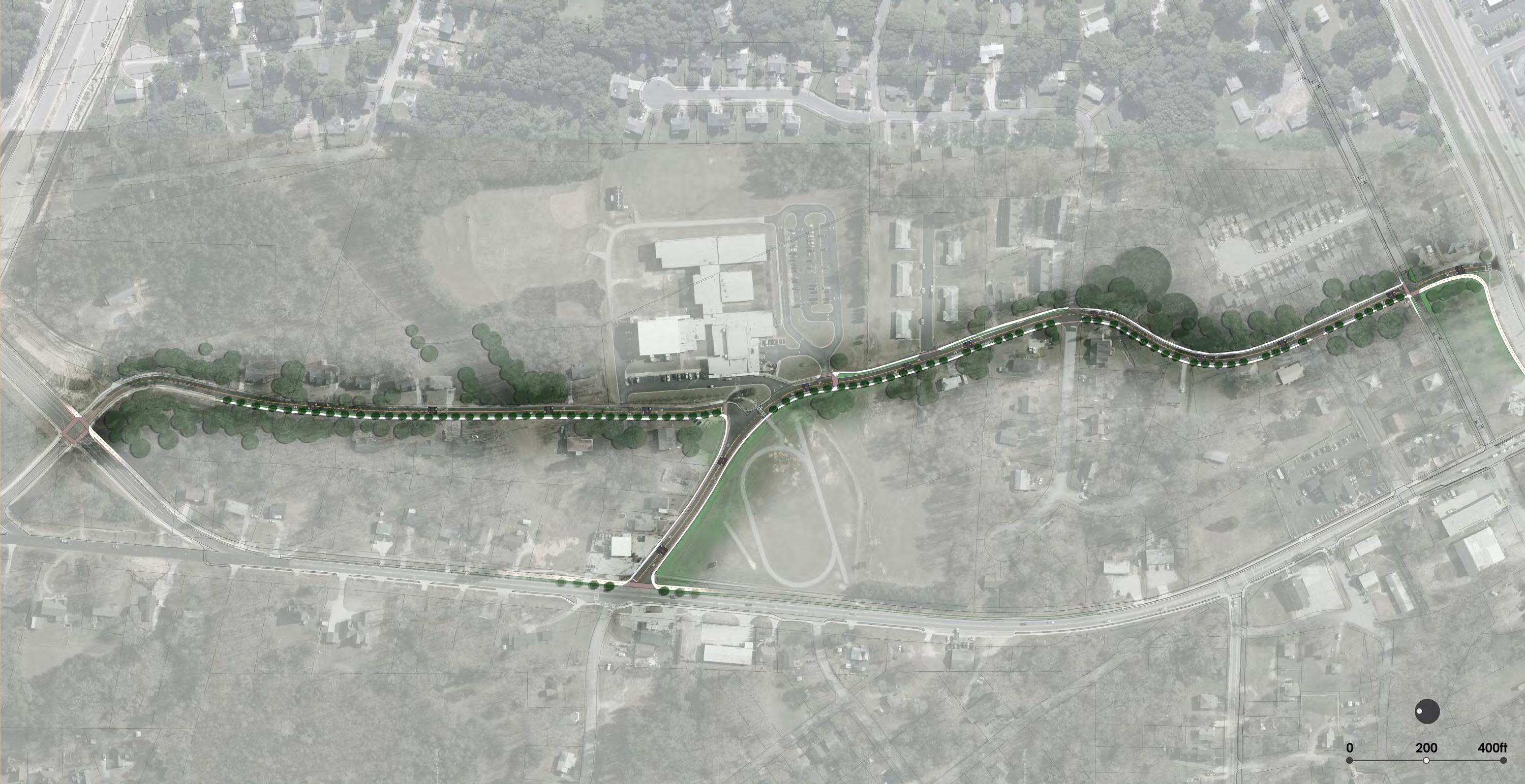
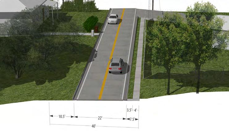
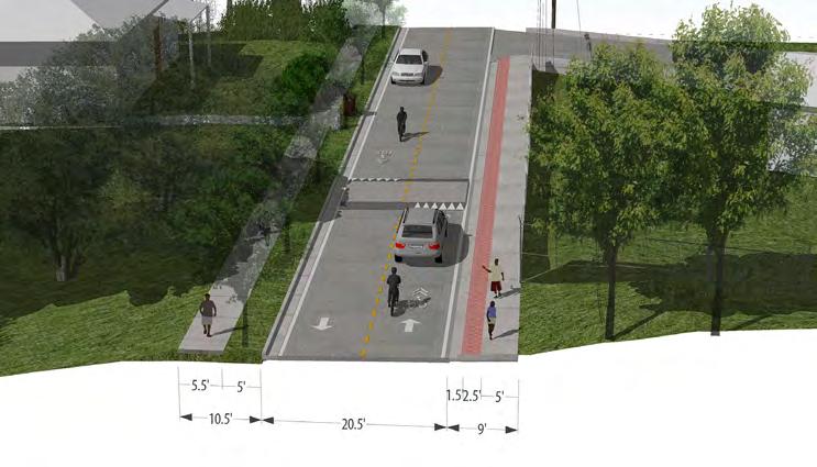
Figure 4.7b shows a close-up plan view of proposed Malone Street section and Figure 4.7c illustrates the existing conditions of the section. The R.O.W. is approximately 40’-wide with two 10’-wide travel lanes and power lines along the north side of the R.O.W. There is a 5’-wide sidewalk on the north side of the corridor separated from the roadway by a 3.5’wide grass buffer.
Figure 4.7d illustrates the proposed condition of the corridor. Traffic calming devises are proposed along the roadway to maintain traffic speeds low. These low speeds would enable cyclist to share the roadway with vehicles. Sidewalk improvements along the corridor are proposed to facilitate pedestrian connectivity. A 5’-wide sidewalk would be located on the south side of the corridor separated from the roadway by a 5’-wide landscape buffer with canopy trees. The 3.5’-wide grass buffer between the sidewalk and the roadway on the north side of the road would be replaced by a paved buffer to reduce maintenance costs and improve the appearance of the corridor.
Malone Street extends for approximately 0.7 miles from Maxwell Road on the south to the New Dallas Highway on the north.
Informed by the North Side Redevelopment Plan, an area along the corridor was analyzed and used as an example for how pedestrian and bicycle connectivity could be improved along the corridor. The section is identified in Figure 4.7a and described in subsequent pages.

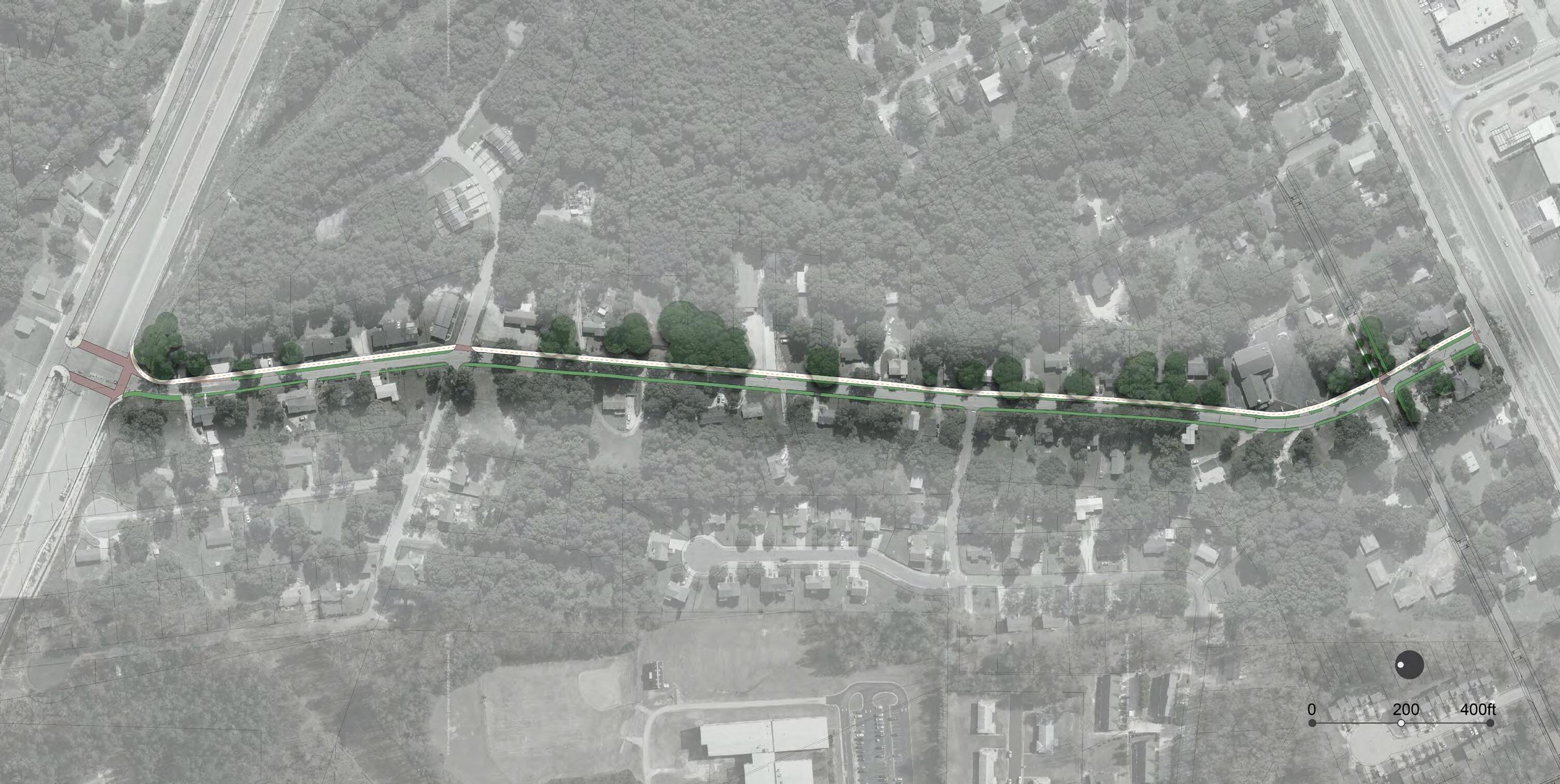
Colquitt Street extends for approximately 0.58 miles from Strickland Street on the south to the New Dallas Highway on the north.
Informed by the North Side Redevelopment Plan, an area along the corridor was analyzed and used as an example for how pedestrian and bicycle connectivity could be improved along the corridor. The section is identified in Figure 4.8a and described in subsequent pages.
1. Colquitt Street-Section 1
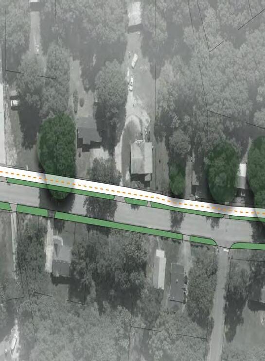
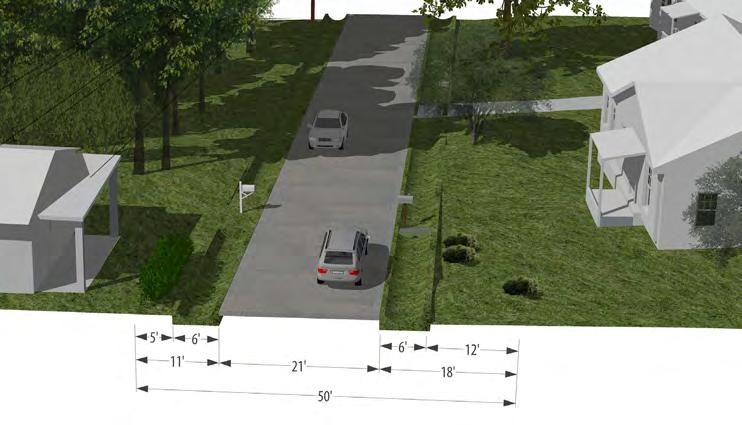
Figure 4.8b shows a close-up plan view of proposed Colquitt Street section and Figure 4.8c illustrates the existing conditions of the section. The R.O.W. is approximately 50’-wide with two 10’-wide travel lanes and power lines along the south side of the R.O.W. There are currently no pedestrian facilities along the corridor. Two pronounced swales are located along each side of the roadway.
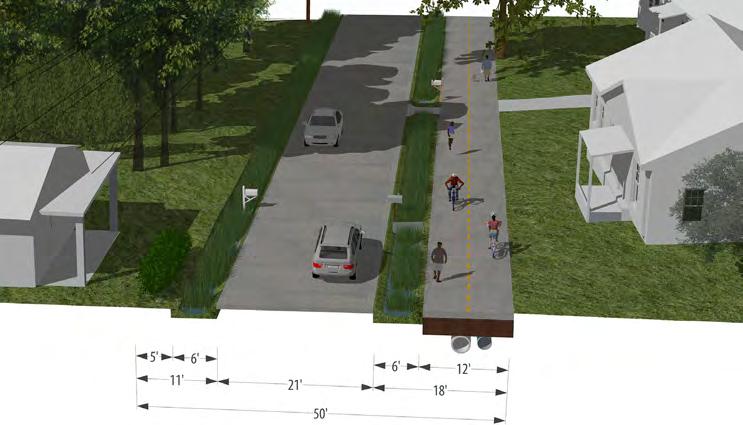
Figure 4.8d illustrates the proposed condition of the corridor. A 12’wide trail is proposed on the north side of the corridor separated by the roadway by a 6’-wide bio-swale to help address water quality along the corridor. A bio-swale is also proposed along the south side of the corridor. Conduit is proposed to be built under the trail.


Road extends for approximately 0.58 miles from Strickland Street on the south to the new Dallas Highway to the north within the study area.
Informed by the North Side Redevelopment Plan, two areas along the corridor were analyzed and used as examples for how pedestrian and bicycle connectivity could be improved along the corridor. These sections are identified in Figure 4.9a and described in subsequent pages.
1. Malone Road-Section 1
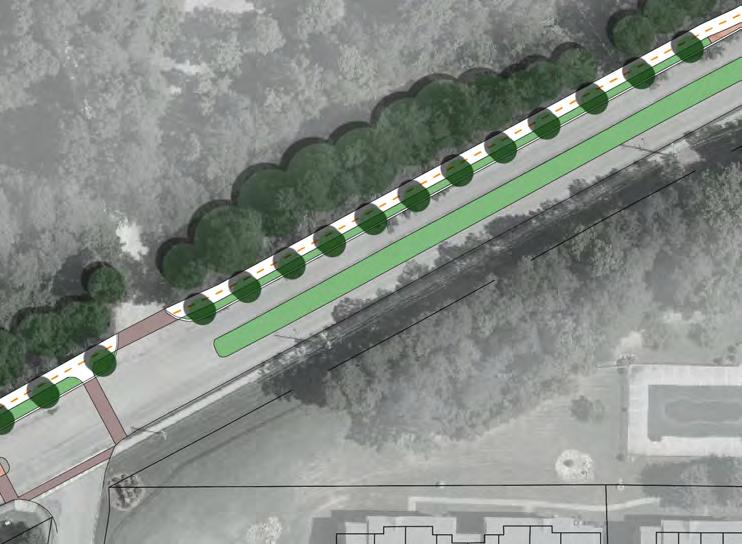
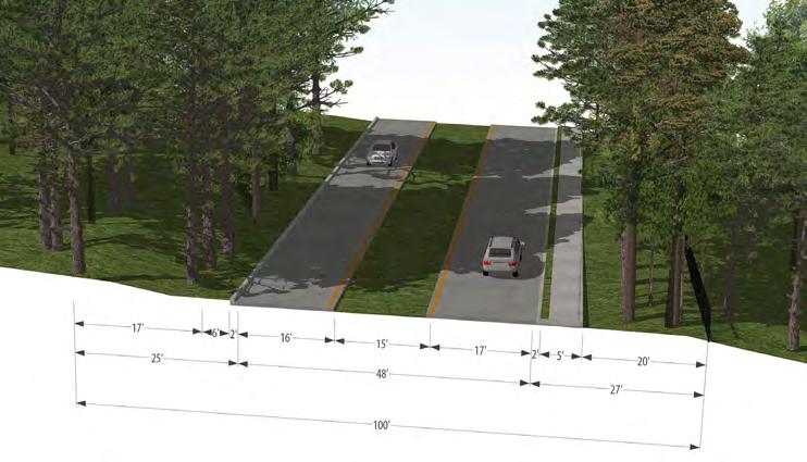
Figure 4.9b shows a close-up plan view of the proposed Section 1 of Malone Road and Figure 4.4c illustrates the existing conditions of the section. The R.O.W. is approximately 100’-wide with two 16’ and 17’wide travel lanes separated by a 15’-wide median. There is a 5’-wide sidewalk on the south side of the corridor separated from the roadway by a 2’-wide landscape buffer.
Figure 4.4d illustrates the proposed condition of the corridor. A 12’-wide trail is proposed on the north side of the corridor separated from the roadway by a curbed 5’-wide landscape buffer with canopy trees. Conduit and underground pipes for stormwater are proposed to be built under the trail. The 2’-wide grass buffer between the sidewalk and the roadway on the south side of the road would be replaced by a paved buffer to reduce maintenance costs and improve the appearance of the corridor.
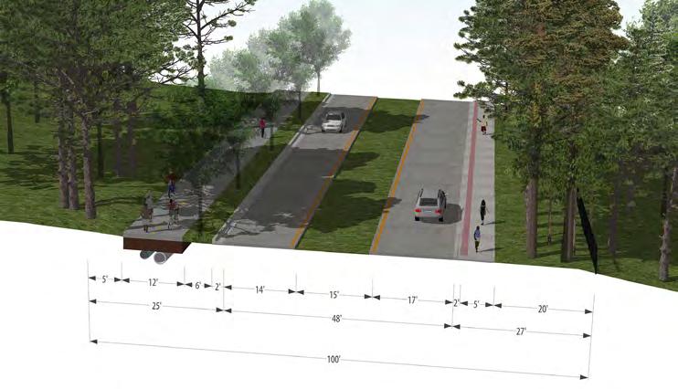
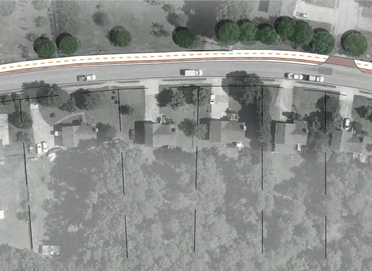
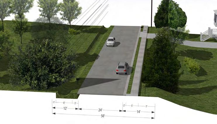
Figure 4.9e shows a close-up plan view of the proposed Section 2 of Malone Road and Figure 4.9f illustrates the existing conditions of the section. The R.O.W. is approximately 50’-wide with two 12’-wide travel lanes. There is a 5’-wide sidewalks on the south side of the corridor separated from the roadway by a 2’-wide landscape buffer. The north side of the corridor contains a pronounced swale.
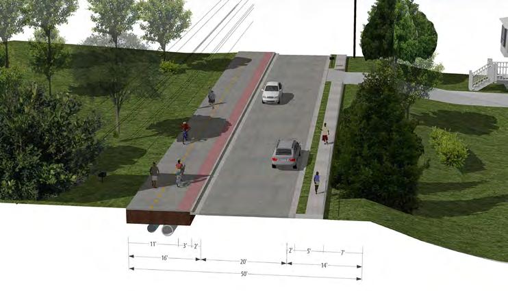
Figure 4.9g illustrates the proposed condition of the corridor. A 12’-wide trail is proposed on the north side of the corridor separated from the roadway by a curbed 3’-wide paved buffer. Conduit and underground pipes for stormwater are proposed to be built under the trail.


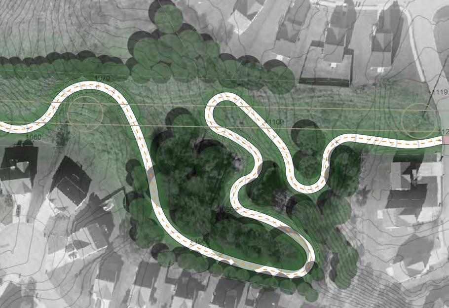
The proposed trail along the Georgia Power easement has the potential to serve as the back-bone of the North Side Trail Network. The trail extends for approximately 2.24 miles from just north of Skippingstone Way on the western portion of the study area to Malone Road on the eastern portion of the study area. The design of the proposed trail considers Georgia Power’s General Guidelines for Bicycle and Pedestrian Trails on Georgia Power Transmission Rights-of-Way.
Figure 4.10a illustrates the 0.87 mile trail segment that extends from Skippingstone Way on the west to Old Dallas Highway on the east. Given the topography along this portion of the easement, the slopes of the trail vary between 5-8 percent. One particular section of the trail contains 10 percent slopes. In order to minimize slopes above 5 percent, the trail is proposed to meander outside of the easement as illustrated in Figure 4.10b. Given the slopes and the route of the trail, Figure 4.10b also provides an example of how a Georgia Power vehicle might navigate the corridor.
Figure

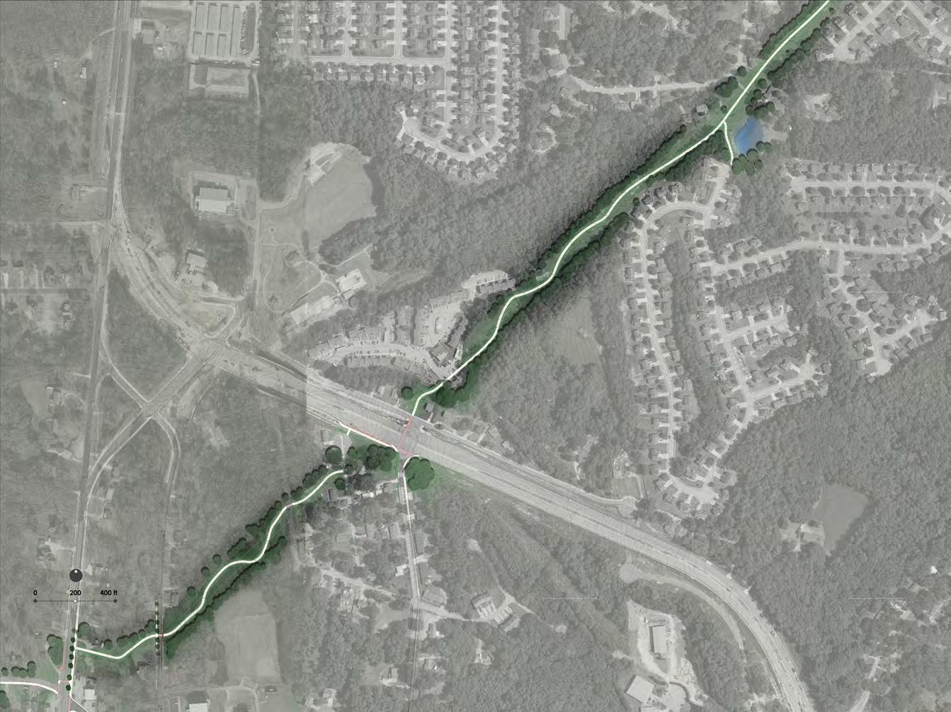
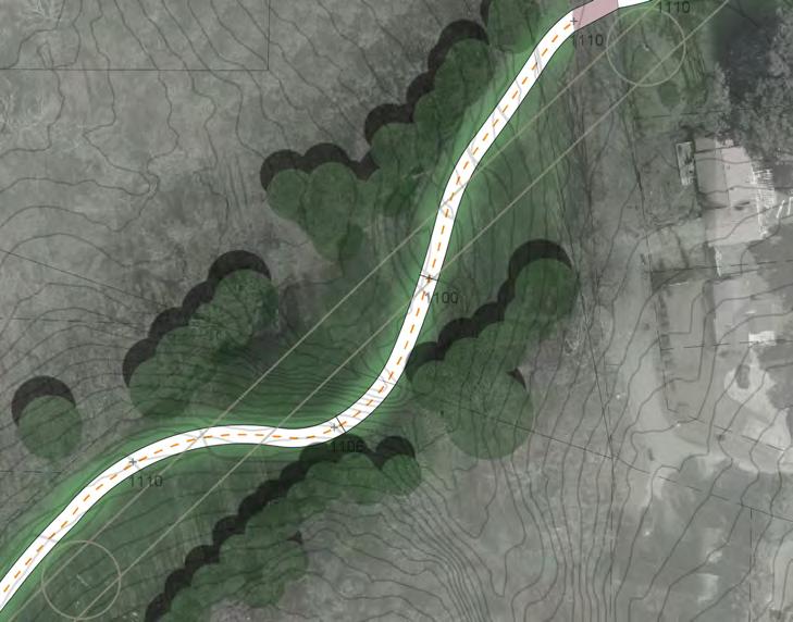
Figure 4.10c illustrates the 0.73 mile trail segment that extends from Old Dallas Highway to where Harvest Circle approaches the easement. This proposed trail segment will require a trail crossing at the New Dallas Highway.
Similar to Segment 1, the slope of the trail varies between 5-8 percent due to the topography in this portion of the easement. The trail is proposed to meander through the easement as illustrated in Figure 4.10d in order to reduce the amount of trail with slopes over 5 percent. The meandering of the trail considers various factors:
• Trail user experience
• Georgia Power Company’s (GPC) requirements of:
• Maintaining the trail least 25’ from any GPC facility or equipment, including poles, guy wires, and towers
• Minimizing the crossings and location of the trail under the wire zone
• Maintaining the trail along the edges of the easement
• Crossing the wire zones at an angle that facilitates the placing of lights at an adequate spacing
Figure 4.10d also identifies the location of a perspective image discussed in subsequent pages.
Figure 4.10c– Easement Trail Segment 2 Proposed Condition Plain View
Figure 4.10d– Easement Trail Segment 2-Section 1Proposed Condition Plain View
2. Georgia Power Easement Segment 2-Perspective
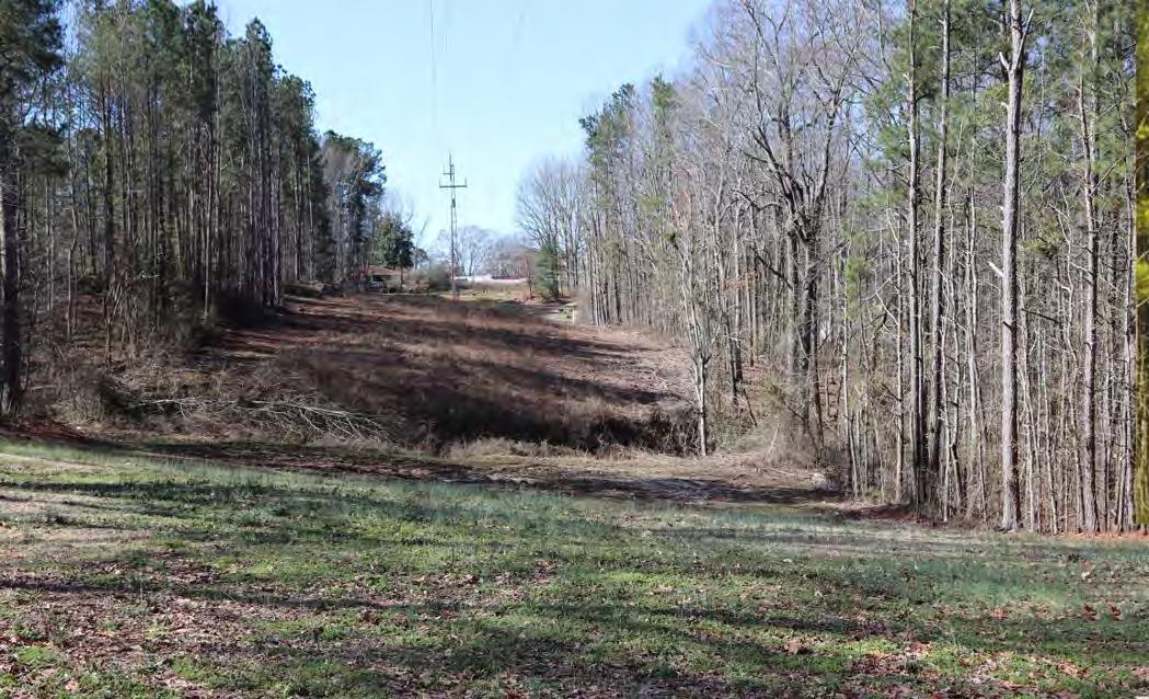
Figure 4.10e shows the existing condition of the easement in the location identified in Figure 4.10d.
Figure 4.10f illustrates what the trail may look like. In addition to the trail, lighting, and signs, there may be opportunities to add amenities such as public art, community gardens, urban agriculture plots, and exercise equipment consistent with the parks and recreation needs and priorities of the community.
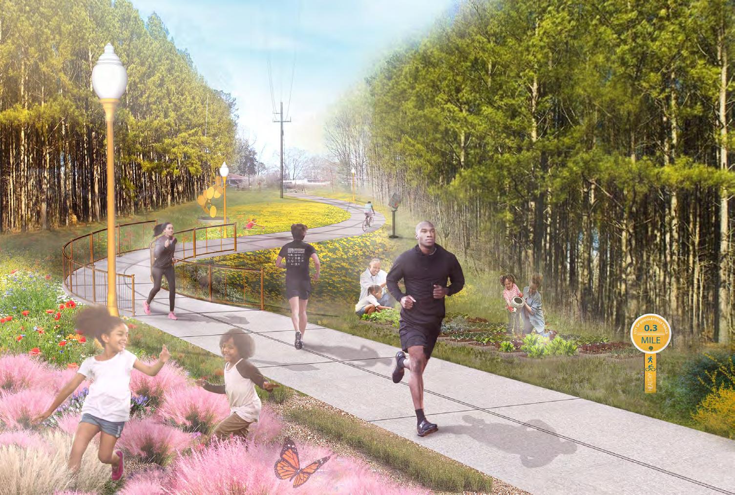
Figure 4.10e– Easement Trail Section 2 Existing Condition (Before)
Figure 4.10f– Easement Trail Section 2 Proposed Condition 3D Rendering (After) 2.

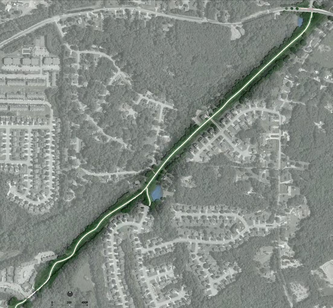
Figure 4.10g illustrates the 0.64 mile trail segment that extends from New Harvest Circle on the west to Malone Road on the east.
The topography in this segment facilitates the development of a trail with 5 percent slopes. Additionally, the topography north of Mountain Creek Way allows for the development of the trail to remain along the northern side of the power lines minimizing the location of the trail under the wire zone.
4.11 Trailheads
Convenient, safe, and accommodating access is critical to the success of the North Side Trail Network. Two trailhead types are proposed for corridor
Major Trailhead - Major Trailheads will serve as the primary access points into the North Side Trail Network. They are proposed at Willing Workers Community Park and Jessie Davis Park. Users will find an increased variety of trail related amenities that assist with personal comfort, bicycle maintenance, trail navigation, or user safety.
In addition to providing a safe and easy way to access the trail, major trailheads may provide users with additional recreational opportunities such as sports courts, playgrounds, and picnic shelters.
In certain cases, they may be integrated into existing buildings using the vending areas, parking spaces, and even the parking spaces of surrounding buildings.
Typical Size: 1 – 5 acres
Typical Amenities:
• 5-10 paved parking spaces (on-street when applicable)
• Restrooms
• Trash/recycling bins
• Bike rack
• Water fountain(s)
• U-fix it station
• Space for concessionaire
• Informational kiosk
• Picnic shelter(s)
• Picnic/seating area(s)
• Emergency contact station
Minor Trailhead - Minor trailheads provide a public access point to the trail corridor between major trailhead locations and/or in areas with less space. These sites are typically smaller in size and offer fewer amenities. Users should expect to find limited parking, directional signage, and basic bicycle maintenance facilities. All trailheads should provide an emergency contact station and water access if feasible. Worthen Park will serve as a Minor Trailhead for the North Side Trail Network.
Typical Size: 0.15 – 1.5 acres
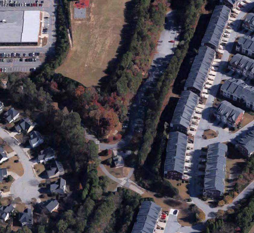
Trailhead Building
• Restrooms
• Trash/Recycling Bins
• Bike Rack
• Water Fountain
• Space for Concessionaire
• Informational Kiosk
• Picnic Shelters
• Picnic/Seating Area
• Emergency Contact Station
Pedestrian and Bicyclist Access Point
Typical Amenities:
• 2-5 paved parking spaces (on-street when applicable)
• Trash/recycling bins
• Bike rack
• Water fountain
• Informational kiosk
Figure 4.10g– Easement Trail Segment 3 Proposed Condition Plain View
Figure 4.11a - Major Trailhead Example Silver Comet Trail Major Trailhead Cobb County, Georgia
North Side residents were asked what type of amenities they would prefer to see along the North Side Trail Network. Following are images of the top trail amenities that residents selected. These included:
• Water Fountains
• Benches
• Trash Receptacles
• Signs and Wayfinding
• Em regency Call Box
• Lights
• Security Cameras 4.13 Programs 4.14 Public Art
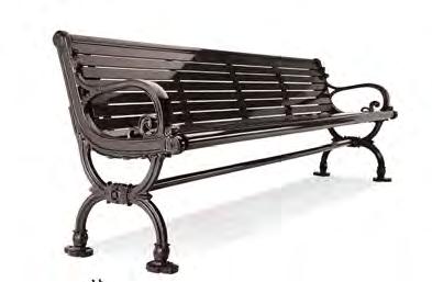

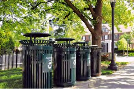
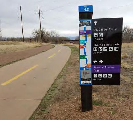


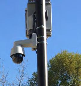
North Side residents were asked what type of programs they would prefer to see along the North Side Trail Network. Residents identified Family Biking Programs and Car Fee Street Events as the top two events. As the City builds the trail network, they should consider programing segments of the trail with these types of programs


As the City builds the trail network, they should consider including public art throughout the corridors. Below are some examples of different types of public art that should be considered.
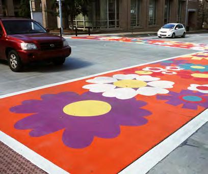



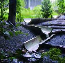
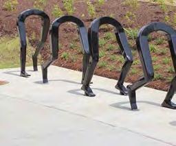
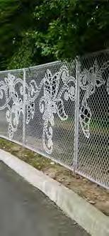
Family Biking Programs
Car Free Events

IMPLEMENTATION PLAN
5.1 Project Costs
The first step of the implementation planning process was to identify high-level cost estimates for each corridor. It is to be noted that a very conservative approach to cost estimates was taken; and cost estimates may vary due to multiple reasons including site conditions. Cost estimates for each corridor are listed in Table 5.1a.
5.2 Funding Sources
Implementing projects such as the North Side Trail Network, typically require a variety of funding sources over a number of years.
Figure 5.2a contains a list of typical funding sources for walking and biking projects categorized by the time frame of implementation as well as the relative size of the project budget.
Additionally, Figure 5.2b identifies a variety of grants that the City should considering applying for. Grant amounts, match requirements, eligible elements, and application deadlines are also included in the figure.
The funding options identified in Figure 5.2b are based on the City’s eligibility to apply for the listed funding opportunities. Prior grant awards or current projects may affect the ability of the City to obtain the listed grants. Additionally, grant amounts are based on the maximum award possible. The cost of elements will ultimately determine the maximum amount to be obtained.
The integration of stormwater and other emergency management features into projects such as a recreation center or recreation trail can significantly increase the grant funding opportunities available to the City. Examples of design features that would introduce additional grant opportunities would include the construction of parking areas to act as drainage basins for severe weather events, stormwater retention ponds that alleviate localized flooding as part of park or trail project, and the hardening of an indoor facility such as a recreation center to act as a shelter and/or public outreach center before and after a disaster.
Before applying for the grant, the City should schedule an appointment with the granter to discuss the project and receive direction related to its eligibility and any specific requirements that the granter might have for the grant.
Neighborhood Association
• Community Improvement
• Crowd sourcing
• Non-Profit Grants
• Impact Fees
• Infrastructure Bonds
• Governor’s Office of Highway Safety
• Local taxes
• Local health departments
• Foundation grants
• Individual donors
• Foundation grants
• Individual donors
• Community Improvement Districts
• Public-Private Partnerships
• Infrastructure Bonds
• Local taxes
Federal Transportation Funds
Capital Improvement
Budget Funds
State Programs:
• Georgia Department of Transportation
• Recreational Trails Program (Department of Natural Resources)
• Community Development Block Grant (CDBG)
• Federal Transportation Funds
• Congressional Earmarks
Land & Water Conservation Fund (LWCF)
American Academy of Dermatology (AAD)
Urban & Community Forestry (U&CF)
Transportation Alternative Program
Stormwater/Water Quality/Environmental Education
and
that support
such as restrooms, shelters, signage, support facilities, infrastructure, and design November
100% Trails, trailhead facilities, restrooms, shelters, signage, support facilities, infrastructure, and design
0% Shade structures November
100% Landscaping (tree planting)
0% Bicycle/pedestrian facilities, landscaping, and traffic calming Fall 2016
Section 319(h) Grants $400,000 40% Stormwater, water quality, and education projects October
Pre-Disaster Mitigation $3,000,000 25% Stormwater including open space, and hardening October
Urban Waters Grant $60,000 5% Signage, public education, and innovative water quality projects February Environmental Education Grants
education related facilities and programming
The Atlanta Region benefits from over $1.5 Billion of philanthropic givings every year. Some of these organizations fund trail and linear park projects similar to the Chamblee Rail-Trail. In order to apply for philanthropic funding, the City would need to work with residents to establish a 501c3 for the Chamblee Rail-Trial and for Rail-Trail Parks. Below is a list of a variety of foundations in the Atlanta Metro Area that may be available to assist in the implementation of the Rail-Trail.
• Arthur M. Blank Family Foundation
• Community Foundation for Greater Atlanta
• The Coca-Cola Foundation, Inc.
• Georgia Power Foundation, Inc.
• Home Depot Foundation
• James M. Cox foundation of Georgia, Inc.
• J.Bulow Campbell Foundation
• Lettie Pate Whitehead Foundation, Inc.
• O. Wayne Rollins Foundation
• Robert W. Woodruff Foundation
• Turner Foundation, Inc.
• UPS Foundation
• CDC Foundation
• The AFLAC Foundation, Inc.
• Bradley-Turner Foundation, Inc.
• The Courts Foundation, Inc.
• North Georgia Community Foundation
• Community Foundation of Central Georgia
• Georgia-Pacific Foundation, Inc.
• Carlos and Marguerite Mason Trust
• The Sartain Lanier Family Foundation, Inc.
• Gay and Erskine Love Foundation
• The Peyton Anderson Foundation, Inc.
• Community Foundation for Northeast Georgia
• William I. H. and Lula E. Pitts Foundation
• The Abraham J. and Phyllis Katz Foundation
• Dorothy V. and Logan Lewis Foundation, Inc.
• Callaway Foundation, Inc.
• Luther and Susie Harrison Foundation, Inc.
• The Savannah Community Foundation
• Anncox Foundation, Inc.
• Healthcare Georgia Foundation
• The Tull Charitable Foundation
• AGL Resources Private Foundation
• The Community Foundation of Northwest Georgia
• Williams Family Foundation of Georgia, Inc.
It is important to note that philanthropic organizations typically look to leverage their dollars with other funding sources. Ideally, they expect the public sector to provide a minimum of 75% of the project funding.
5.3 Implementation Timeline Alternatives
Figure 5.3a illustrates three different implementation timeline scenarios based on different funding strategies. The first strategy considers incrementally designing, biding, and building the trail network. If design and construction happens incrementally, it would increase the cost of the project by about 20 percent. This is due to the start-up design costs (survey, site visits, construction document organization, etc.) and contractor mobilization costs that would be incurred every time a new phase begins.
If the design for the entire project is completed at once and construction is completed incrementally, it would increase the cost of the project by about 18.5 percent. Assuming that $1.1 million may be available each year to pay for the design and construction of the project, it would take approximately sixteen years to complete the project.
On the opposite end of the spectrum, if the City were to consider an extraordinary funding source that would pay for the design, bid, and build of the project at one time, the project could be completed in approximately five-and-half years. This assumes two-and-half years to secure the funding and three years to design, bid, and build the project.
A third scenario considers a combination of Pay-As-You Go and Grants. The timeline for this strategy may vary between three years at the short end to over sixteen years at the long end depending on the amount of funding that is obtained.
5.4 Implementation Plan
This section focuses on strategic actions that the City of Douglasville should take to implement the North Side Trail Study. Strategic actions are based on the City building the trail network using the Pay-As-You Go strategy discussed in Section 5.3 - Implementation Timeline Alternatives and organized around the following specific time frames:
• A 100-Day Action Plan needed to keep momentum going and keep stakeholders involved and sharing responsibility for the plan’s success
• One-Year Action Plan
• Five-Year Action Plan
• Ten-Year Action Plan
Following are descriptions of specific actions associated with these time frames.
100-Day Action Plan
• The City to should approve and adopt the North Side Trail Study
• This will enable the project to be eligible for some of the federal funding sources identified in Figure 5.2a and 5.2b. Specifically, the Transportation Alternative Program (TAP).
• The City should identify a City staff person to be the steward of the trail network’s implementation
• This staff person would function as the vision keeper of the project and lead the implementation of the project.
One-Year Action Plan
• The City should allocate recurring annual funding for the trail network that the City can use to leverage additional grant and philanthropic funding
• If the City does not have one already, the City should hire a full-time grants writer or grants consultant to assist the City in pursuing grants for the Douglasville North Side Trail Study
• The City should evaluate the cost-benefit of hiring a full-time grants writer versus a grants consultant. A grants consultant typically charges a fee per grant application that can vary between $3,000 to $4,000 per grant application depending on the complexity of the grant application. This equates to about 0.05 percent to 3 percent of the total grant amount, depending on the size of the grant.
• The City should coordinate with ARC to apply for funding through TAP
• The City should work with residents to establish a 501c3 for the Douglasville North Side Trail Study
• This will enable the City to pursue philanthropic funds that the City would otherwise not be eligible to pursue.
• The 501c3 could also function as the champion of the project and continue to work with the City, stakeholders, and residents to continue the momentum for the project.
• The City should consider implementing incentives for development areas along the trail network. This will enable the City to establish policies that incentive developers to assist in the implementation of the trail network or establish Trail Oriented Development (TrOD) that will foster the development of a vibrant network. Incentives to consider include:
• Allowing residential land uses on the ground floor in appropriate areas and adjusting building setbacks to create TrOD spaces along the Rail-Trail corridor
• Density bonus
• State and/or local tax abatement
• Expedited permitting / waiver of permitting fees
• Discounted transit passes and implementation of individual Rider accounts for pre-tax income and payroll tax savings
• Reduced minimum parking requirements
• Reduced minimum open space / community space requirements
• Based on available funding, the City should complete the design for the first phase of North Side Trail Study along the Old Dallas Highway Corridor
Five-Year Action Plan and Beyond
• The City should permit, bid, and build the Old Dallas Highway Trail Segment
• The City should coordinate with Georgia Power Company and appropriate properties owners to secure access for the trail corridor. It is important to note that coordination with Georgia Power Company may add between 3 to 6 months to the project planning and design schedule due to Georgia Power’s review of the plans.
• The City should design, bid, and build the following three segments in the following potential order:
1. Georgia Power Transmission Line Segment 2
2. Georgia Power Transmission Line Segment 1
3. Georgia Power Transmission Line Segment 3
Ten-Year Action Plan and Beyond
• The City should permit, bid, and build the Old Dallas Highway Trail Segment
4. Strickland Street
5. Chicago Avenue
6. James D. Simpson Avenue
Malone Street
Malone Road 9. Colquitt Street
10. Parker and Maxwell Street
5.5 Management and Considerations
The following section provides on overview of trail operations, maintenance, and security considerations that the City of Douglasville should be mindful of as the trail network enters into more detailed design.
Operations
Most trails in the metropolitan Atlanta area operate from dawn to dusk. This means that during the times that trails are closed, any activity that occurs in the trail is illegal and could lead to prosecution. However, as the popularity of trails in the metro area has increased, many trail users have expressed a desire to see trails lighted and opened for extended hours. This is consistent with the desires of City of Douglasville residents expressed through the public engagement phase and particularly relevant for the trail along the Georgia Power easement. This could mean keeping the trail open 24 hours per day, or closing it at a specific time in the evening.
As the trail network enters detailed design phases, final operating hours along the Georgia Power easement should be established to be consistent with resident desires and the City’s ability to police the corridor. Additionally, the design of the final trail lighting may include lighting timers that turn off trail lights at a designated time and security cameras at strategic locations.
Maintenance
Trail maintenance may include landscape, hardscape, facility, and amenity upkeep; emptying trash receptacles, periodic surface pressure washing, cleaning the trail, and possible repair of vandalism. Landscaping should be designed to require little watering, once established.
Maintenance costs for the trail network may vary depending on the final design as well as the City’s desired maintenance level of service. Based on national benchmarks, trail and associated greenspace maintenance costs may very between $4,000 per acre at a lower range to $18,000 per acre at an upper range. Lower range may represent municipalities with a lower maintenance level of service while upper range may represent municipalities with a higher maintenance level of service. Based on these ranges and the trail network’s total acreage of about 18 acres, maintenance costs may range between $72,000 to $324,000 per year.
Safety and Security
Participants during the public engagement process expressed potential security concerns along the trail. The City may consider the implementation of security cameras along the corridors that could be monitored by Police Department and emergency call boxes along the trail. Finally, police officers on bicycles patrolling the trail would provide a significant crime deterrence. The combination of these elements along with designing the trail with Crime Prevention through Environmental Design (CPTED) principles that encourage citizens “eyes-on-the-trail” should minimize trail security problems.
Return on Investment
Implementing the trail network is an investment in the City’s economic, social, and environmental future. Specific Return On Investments (ROI) that the City of Douglasville may experience include:
• Increased tax revenue for the City as a result of increases in property values for properties adjacent to the trail as well as increases in redevelopment of properties into higher density mixed use developments. Property values within 1,300 feet of the trail may increase anywhere from one percent to over twenty percent over current values
• Increased occupational tax revenue due to possible increases in the number of businesses within the commercial and mixed-use areas
• Increase in social capital and volunteerism
• Reduction in air pollution and an increased air quality
• Reduction in local congestion for drivers
• Reduction in wear and tear on roads and vehicles
• Reduced health care costs for residents due to the potential increase of active lifestyle
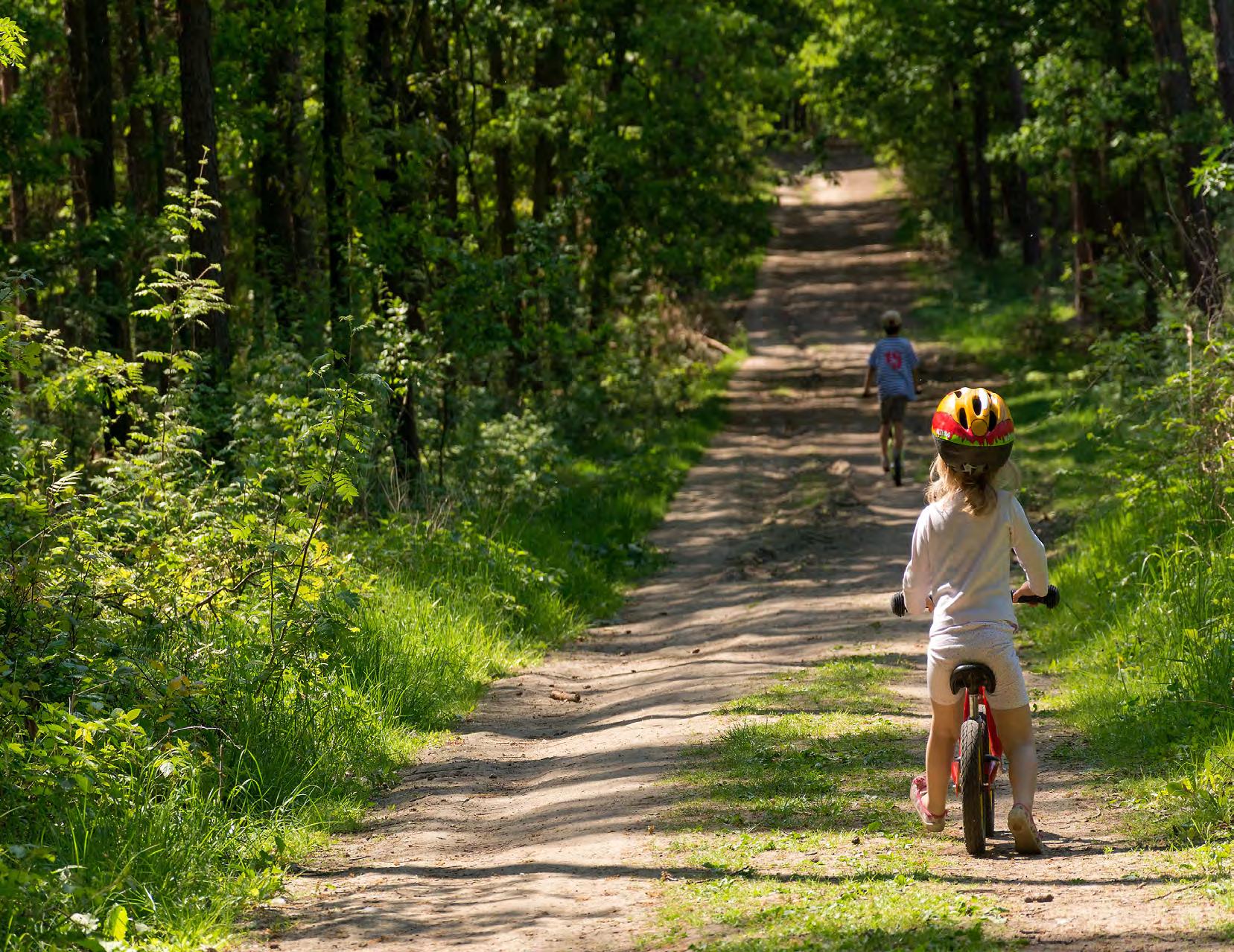
APPENDIX A
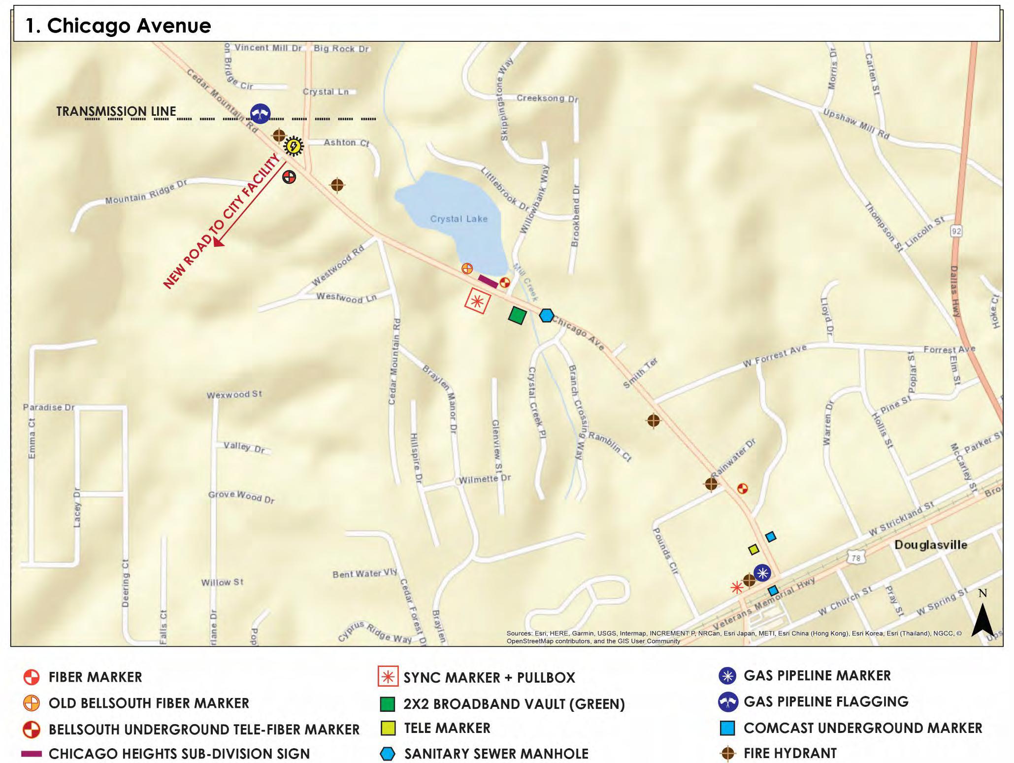
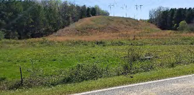
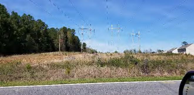
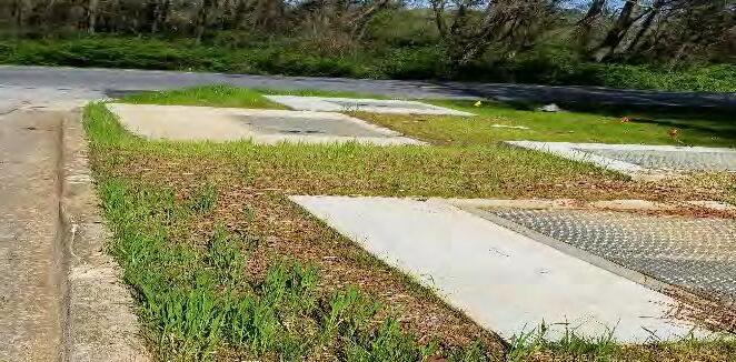
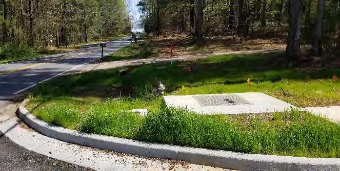
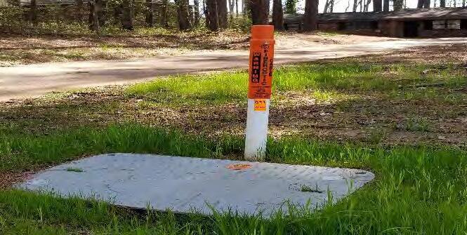
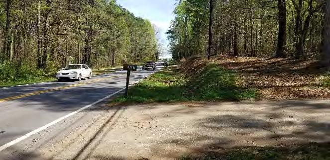
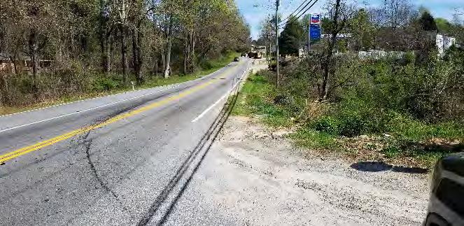
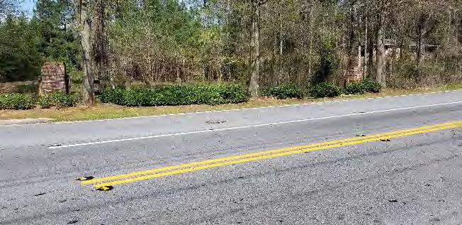
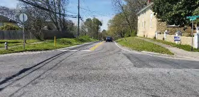
1. Transmission Lines (West)
2. Transmission Lines (East)
3. Water Vaults @ _ Rd (Southside)
4. Water Vaults & Fire Hydrant
5. Sync Global Fiber Optic Cable Marker 6. Chicago Ave (SE Bound)
7. Chicago Ave (SE Bound, before Chevron)
8. Sanitary Sewer Manhole: North into Chicago Apartments Entrance
9. Chicago Ave @ Strickland Street (Looking North)
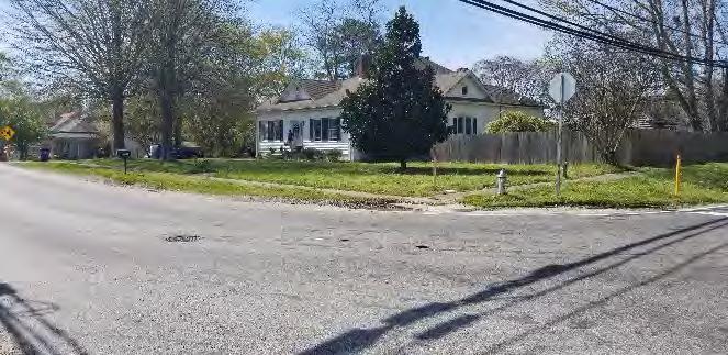
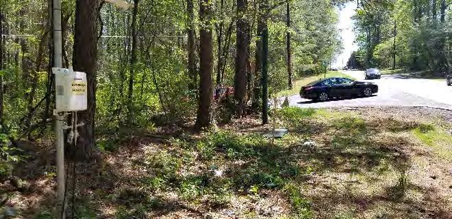
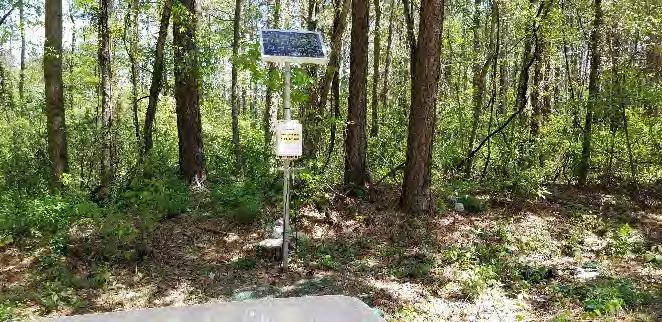

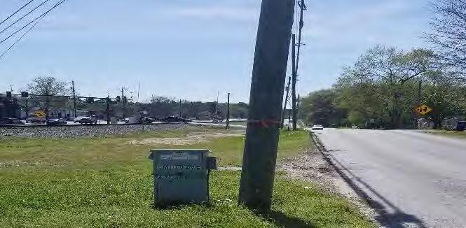
10. Chicago Ave at Strickland St (Looking Northwest)
11. Chicago Ave & Cave Springs Intersection
12. AGL Solar: Chicago Ave (North of Cave Springs)
13. AGL Solar: Chicago Ave (North of Cave Springs)
14. Comcast Cabinet: Chicago Ave at Strickland St
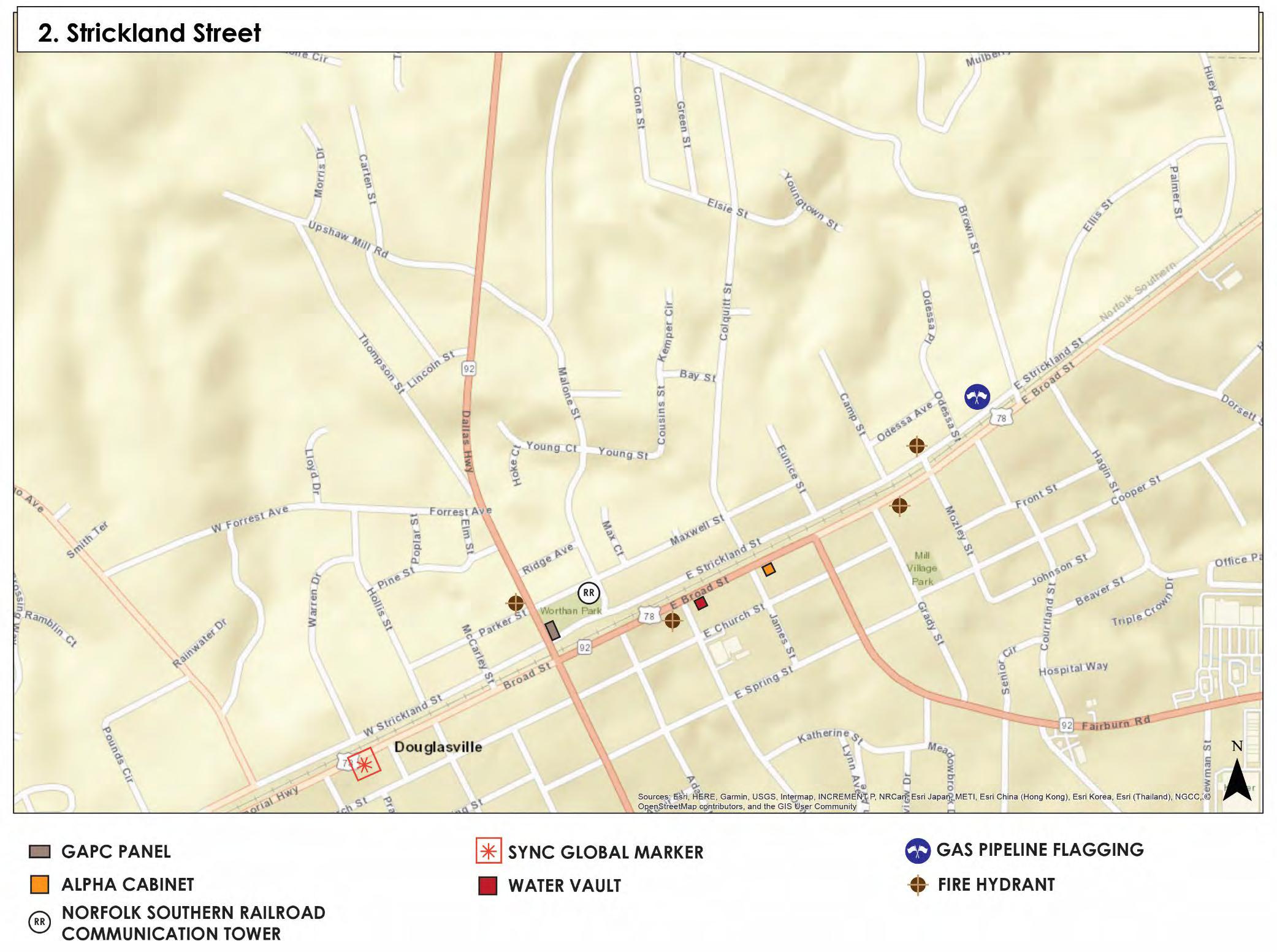
Strickland Street Utilities
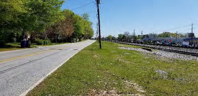
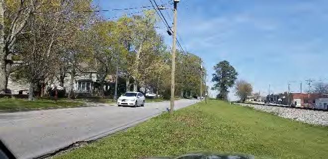
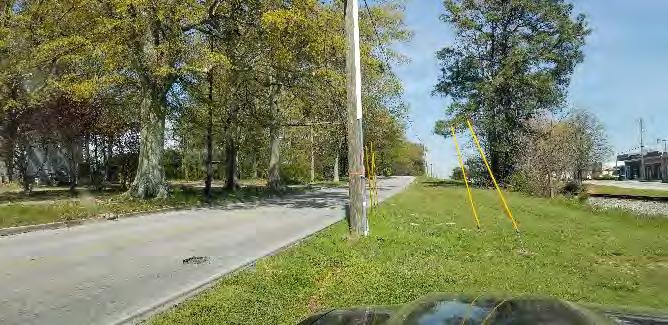
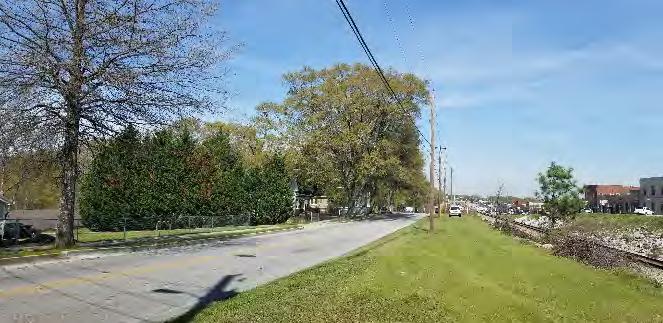
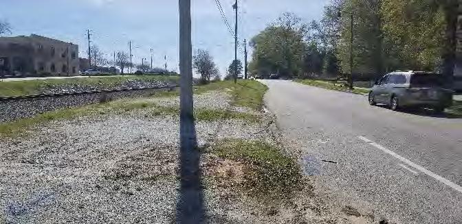
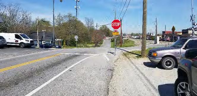
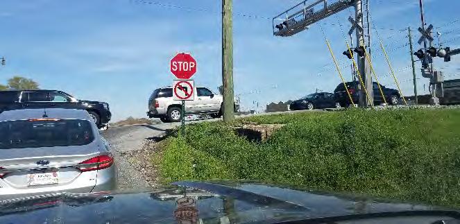
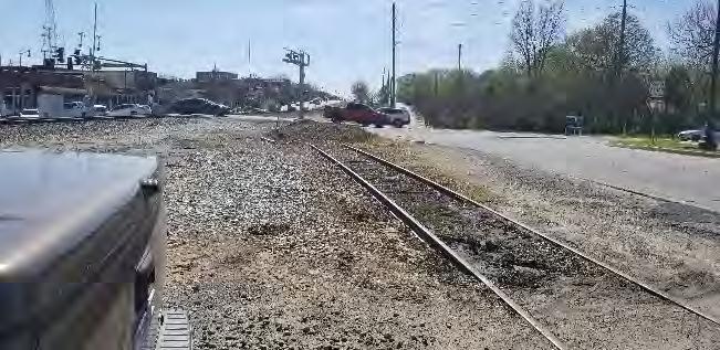
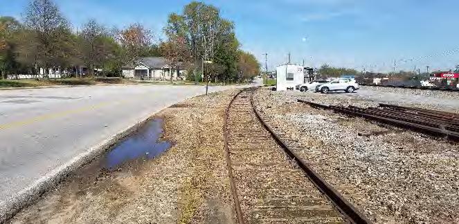
1. Strickland St (Looking East)
2. Strickland St (Looking Northeast)
3. Pole & Sync Global Marker to Loft: Strickland St (Looking Northeast)
4. Strickland St (Looking Northeast)
5. Gravel Parking, Railroad ROW: Strickland St (Looking Southwest)
6. Strickland St at McCarley St (Looking Northeast)
7. Strickland St at SR 92 (Looking Northeast)
8. Strickland St at Norfolk Southern Railroad Crossing (Looking Southwest)
9. Strickland St at Norfolk Southern Railroad Crossing (Looking Northeast)
Strickland Street Utilities
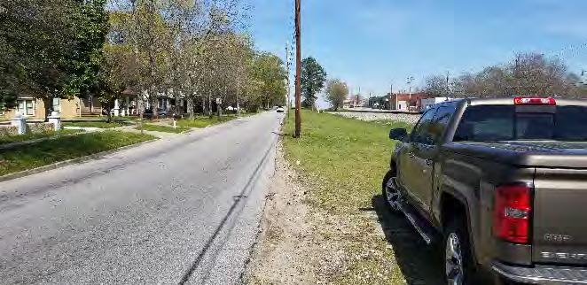
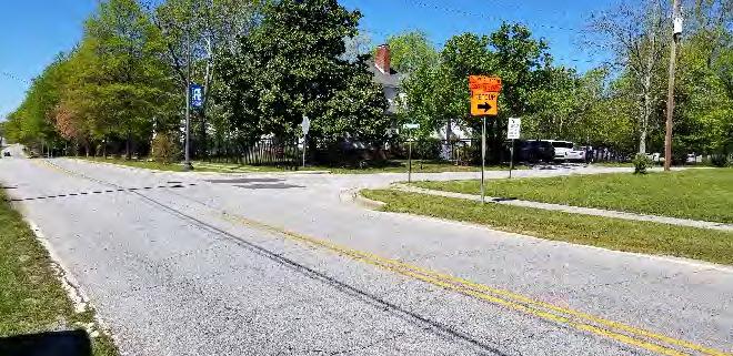
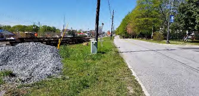
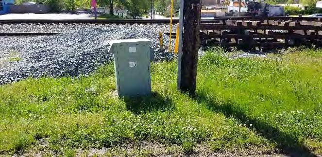
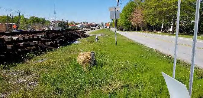
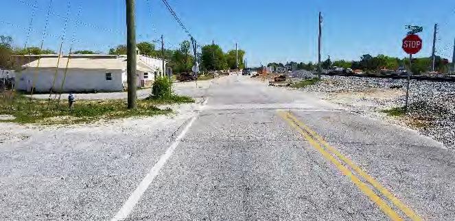
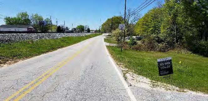
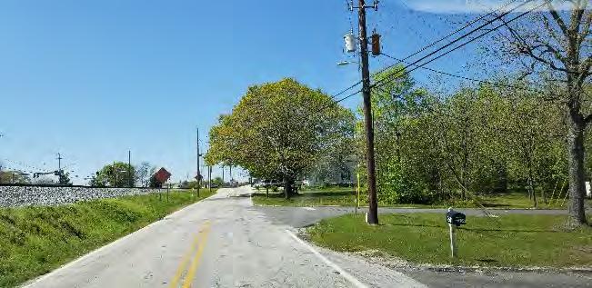
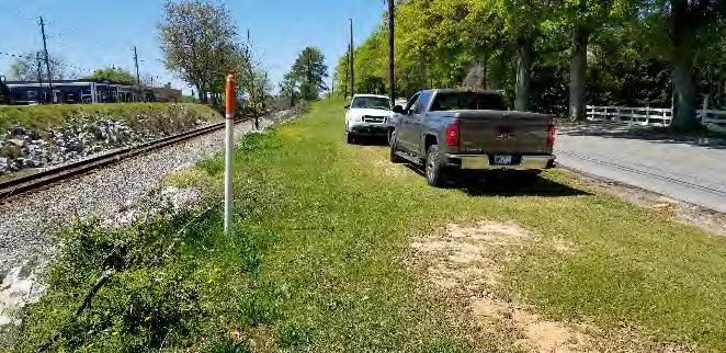
10. Strickland St at Chicago Ave (Looking Northeast)
11. Strickland St at Colquitt St
12. Alpha Cabinet, Fire Hydrant, Water Vault, Gas Marker : Strickland St (West)
13. Alpha Cabinet: Strickland St (Looking South)
14. Fire Hydrant, Water Vault: Strickland St (Looking West)
15. Strickland St at Brown St (Looking Northeast)
16. Gas Line Flagging: Strickland St at Brown St (Looking Southwest)
17. Strickland St (Looking Southwest)
18. Strickland St at Hollis St (Looking Southwest)
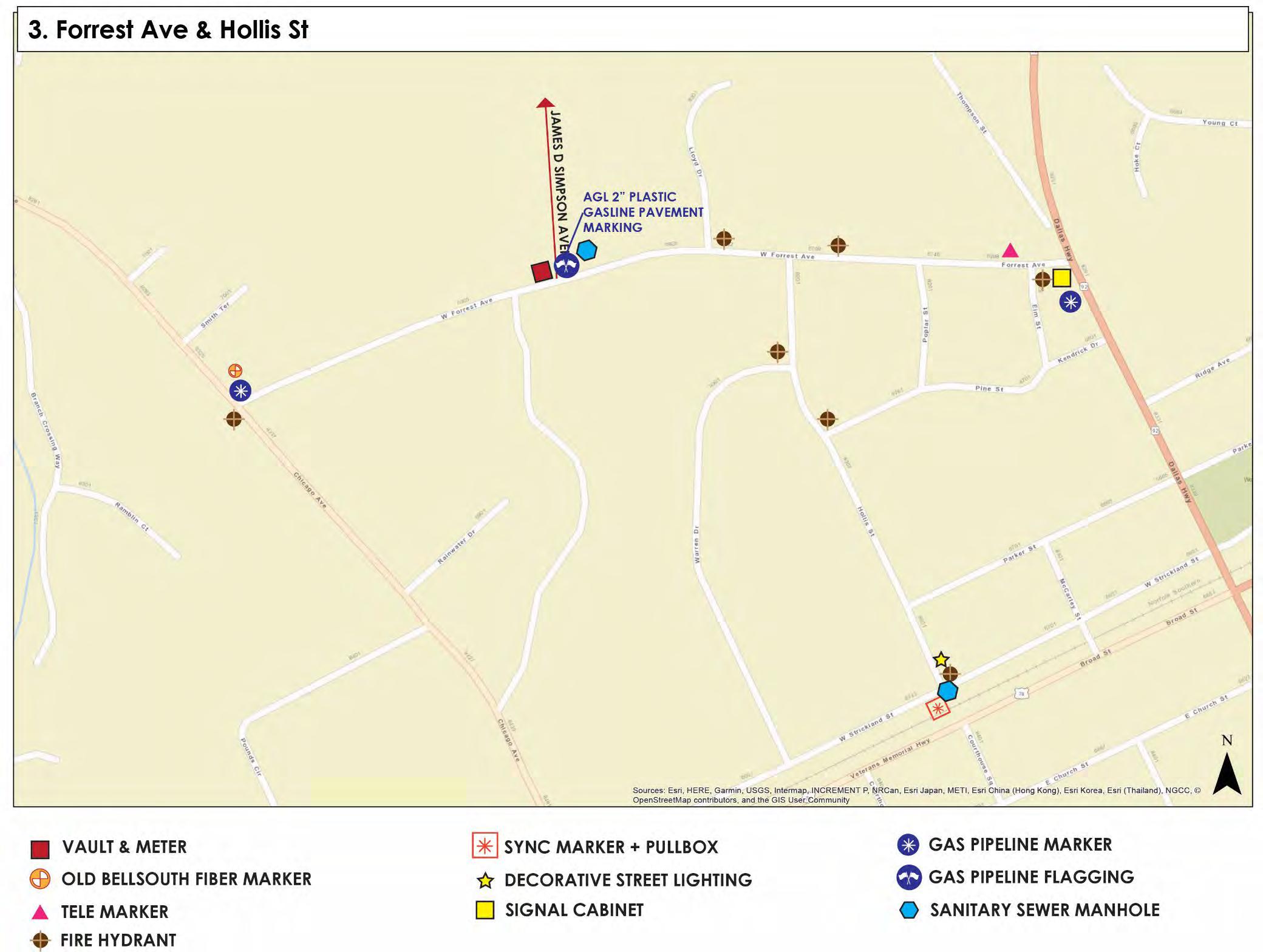
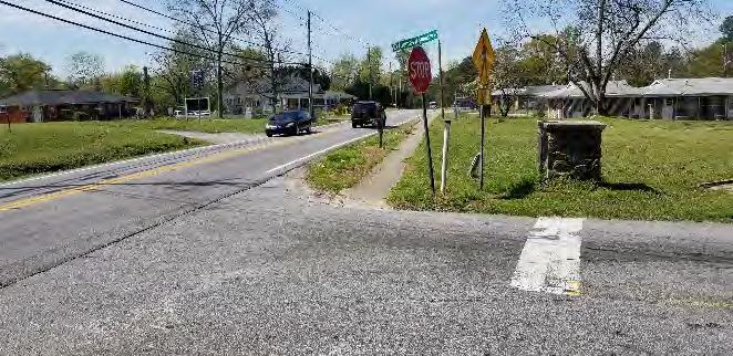
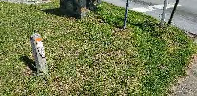
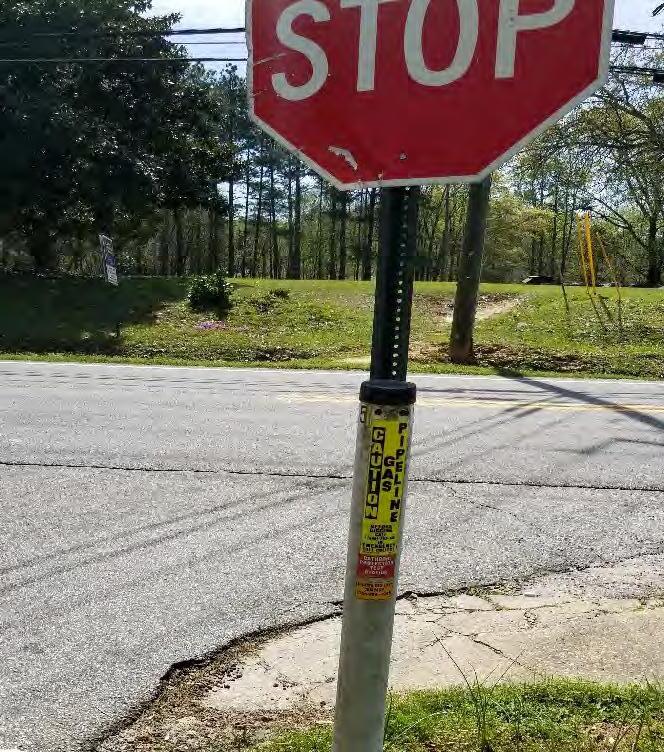
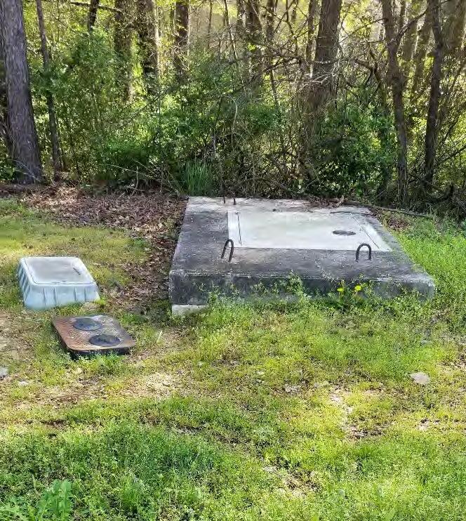
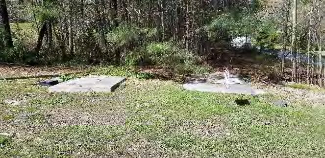
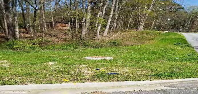
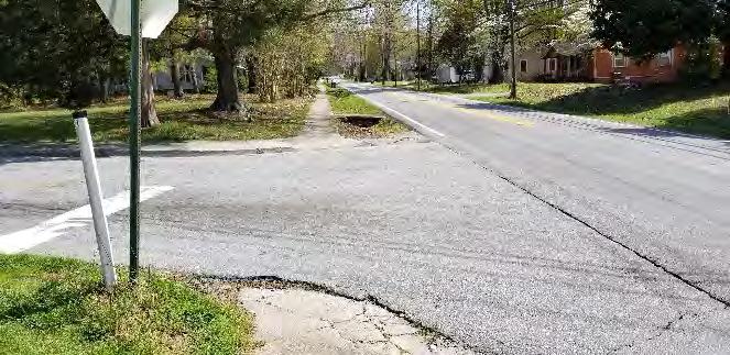
James D. Simpson Avenue/ Forrest Avenue Utilities
1. Intersection @ Chicago Ave (Looking Northwest)
3. AGL Gas Line Marker
4. Water Vault
2. Bellsouth Marker
5. Large Vault
8. Gas Marking & SSMH (Looking East on Forrest Ave @ Simpson Ave)
9. Chicago Ave @ Simpson Ave (Looking Southeast)
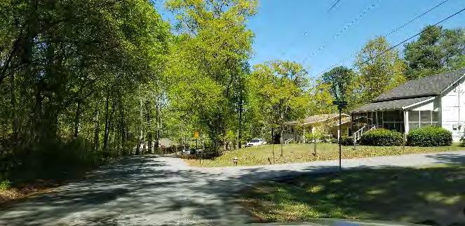
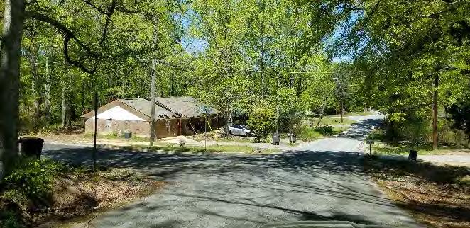
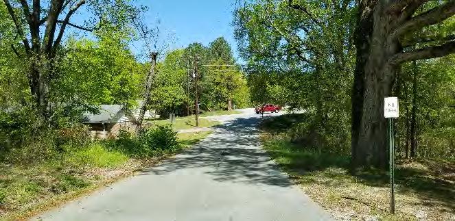
Hollis Street Utilities
1. Hollis Street at Pine Street (Looking North)
2. Hollis Street at Warren Dr. (Looking Northwest)
3. Hollis Street at James D. Simpson/Forrest Avenue (Looking North)
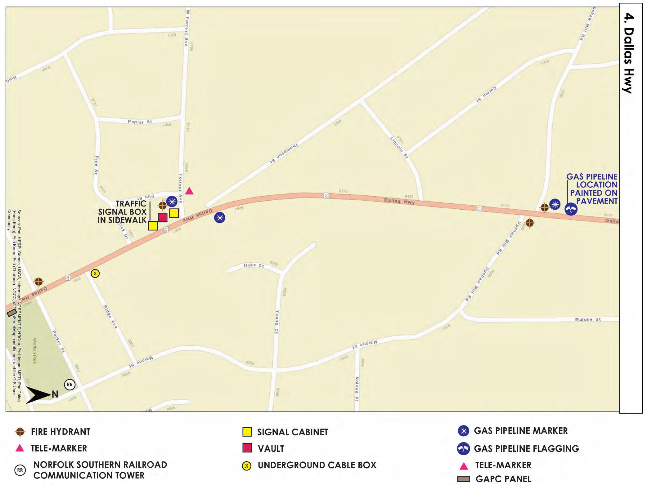
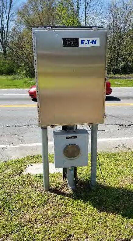
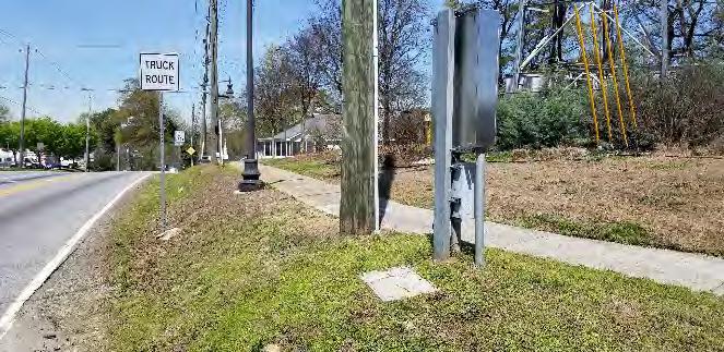
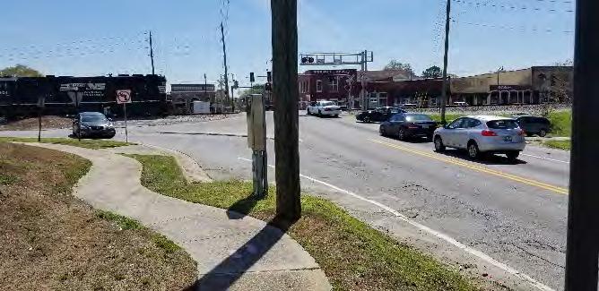
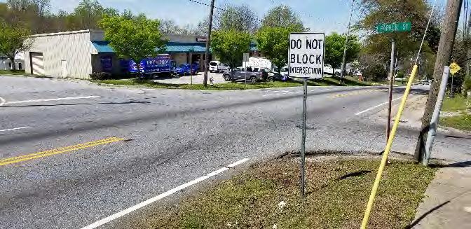
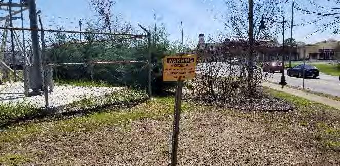
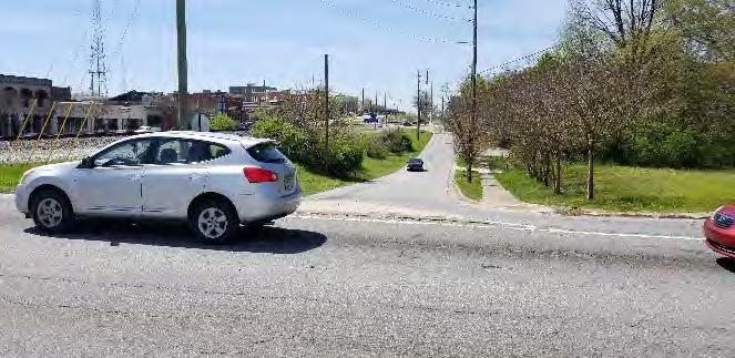
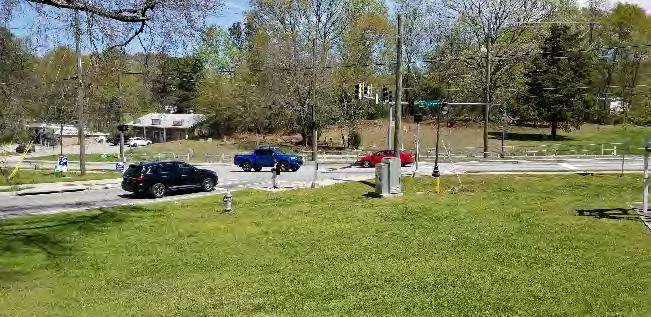
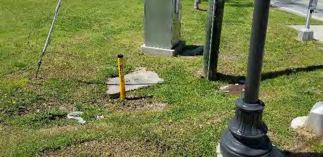
SR 92/ Dallas Highway Utilities
1. GAPC Corridor Lighting Panel
2. Dallas Hwy at Strickland St (Looking North)
3. Dallas Hwy at Strickland St (Looking South)
4. Dallas Hwy at Parker St
5. Railroad Tower Underground Cable Sign: Off Dallas Hwy at Parker St
6. Dallas Hwy at Strickland St (Looking Southwest)
7. Dallas Hwy at James D Simpson Ave (Looking North)
8. Dallas Hwy at James D Simpson Ave (Looking South)
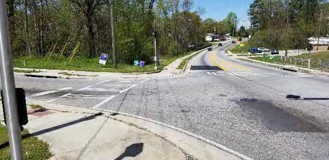
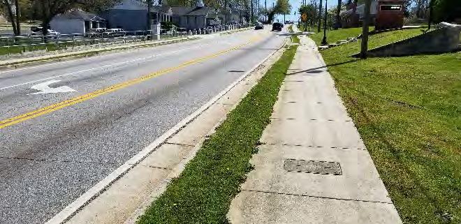
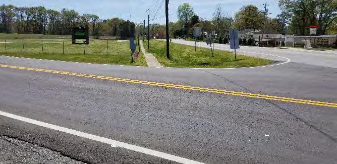
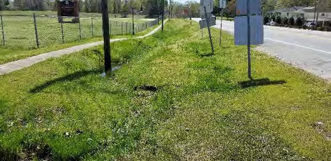
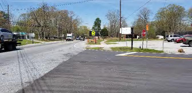
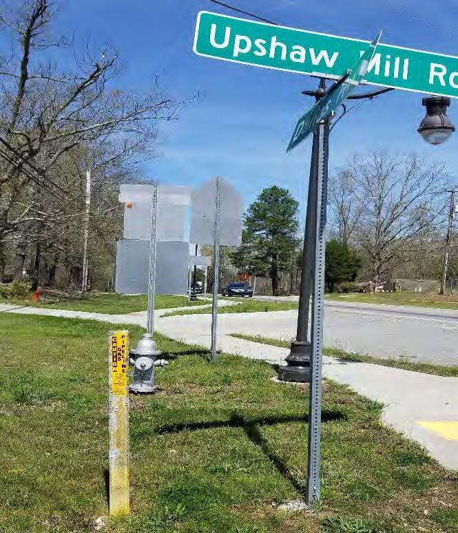
9. SSMH: Dallas Hwy at James D Simpson Ave (Looking Northwest)
10. Water Meter Box : Dallas Hwy at James D Simpson Ave (Southeast)
11. Dallas Hwy at Upshaw Mill Rd Intersection
12. Dallas Hwy at Upshaw Mill Rd Intersection
13. Dallas Hwy at Upshaw Mill Rd Intersection
14. AGL Marker: Dallas Hwy at Upshaw Mill Rd Intersection
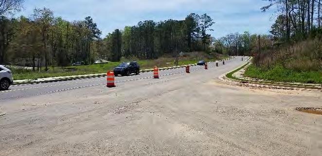
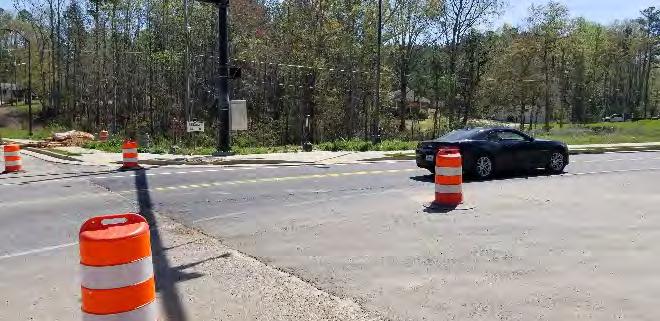
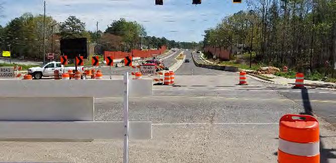
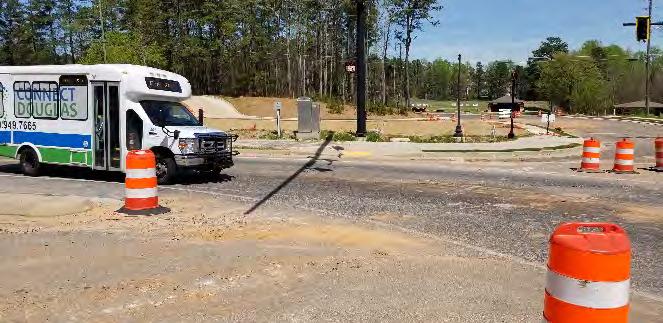
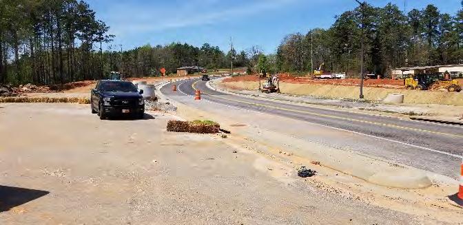
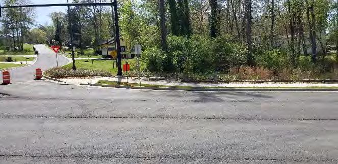
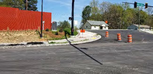
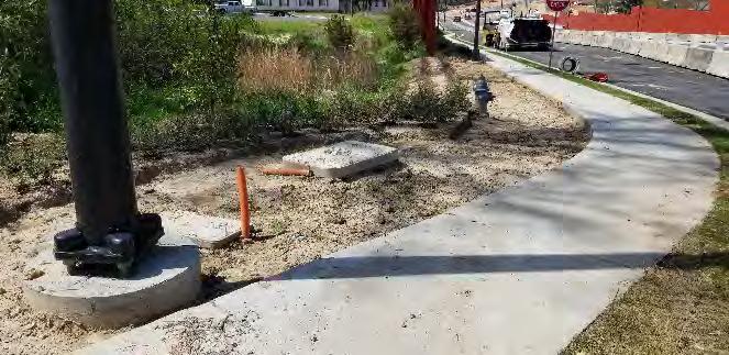
1. New Dallas Rd (Looking Southwest)
New Dallas Rd (Looking Southeast)
New Dallas Rd (Looking Southeast)
4. New Dallas Rd (Looking Northeast) 5. New Dallas Rd (Looking Northwest) 6. New Dallas Rd (Looking Southwest)
7. Fire Hydrant: At Colquitt St (Looking South)
8. Cabinet & Vaults: At Colquitt St (Looking Northeast)
9. At Colquitt St (Looking Northwest)
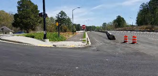
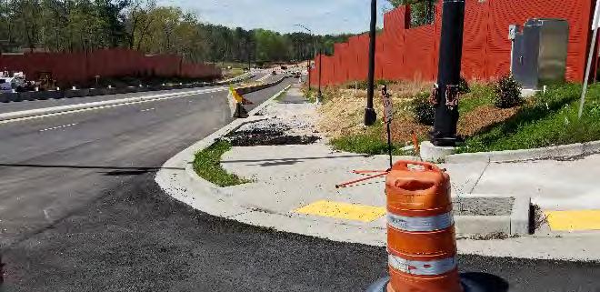
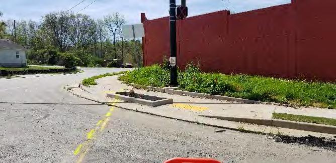
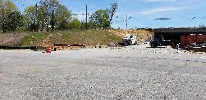
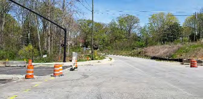
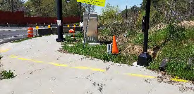
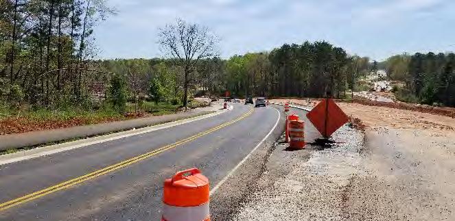
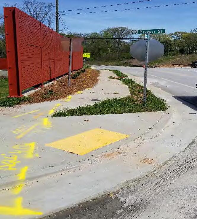
10. At Colquitt St (Looking Southeast)
11. At Colquitt St (Looking Northwest)
12. Markings: At Ellis St (Looking Southwest)
13. At Ellis St (Looking South)
14. At Ellis St (Looking Northeast)
15. At Ellis St (Looking Northeast)
16. At Ellis St (Looking Southwest) 17. To Old Dallas (Looking South)
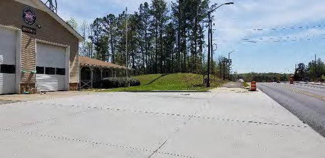
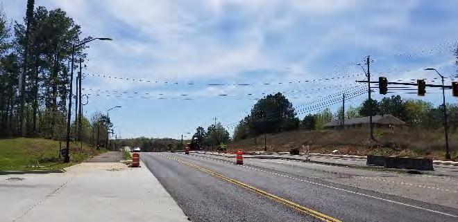
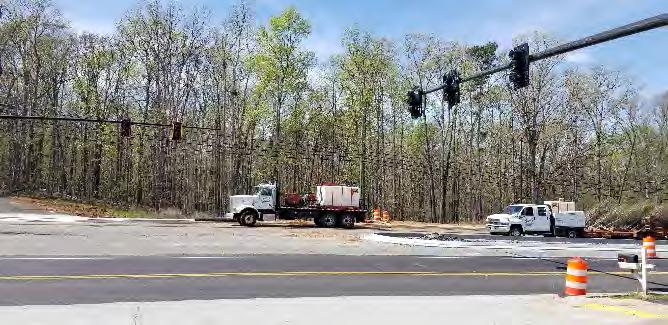
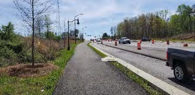
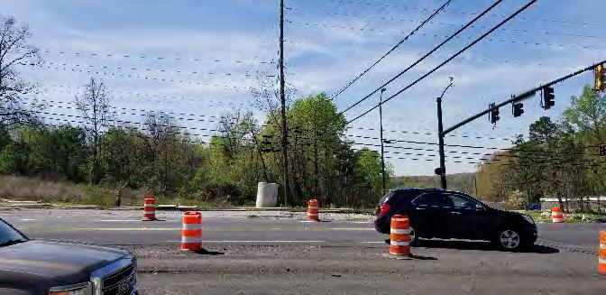
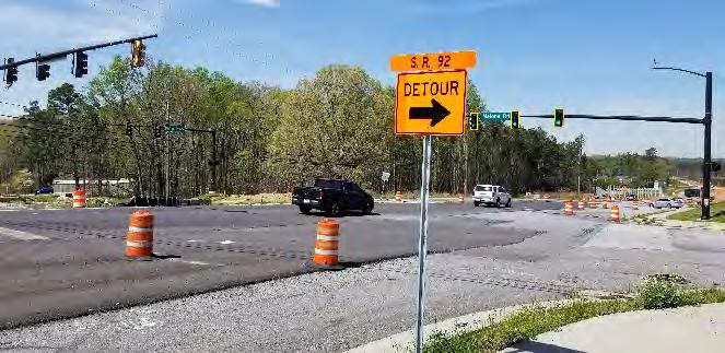
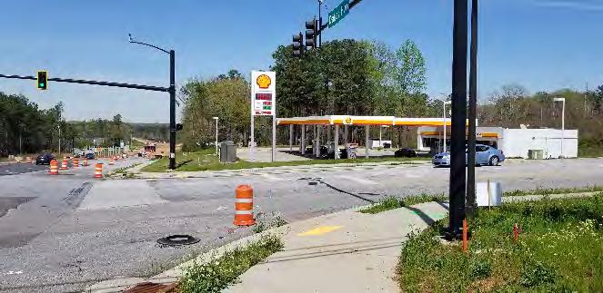
18. Douglas County Fire Station #11
19. Looking South from Fire Station
20. Looking West from Fire Station
21. Towards Fire Station
22. Malone Rd Intersection (Looking Northwest)
23. Malone Rd Intersection (Looking Northwest)
24. Malone Rd Intersection (Looking at Shell Gas Station)
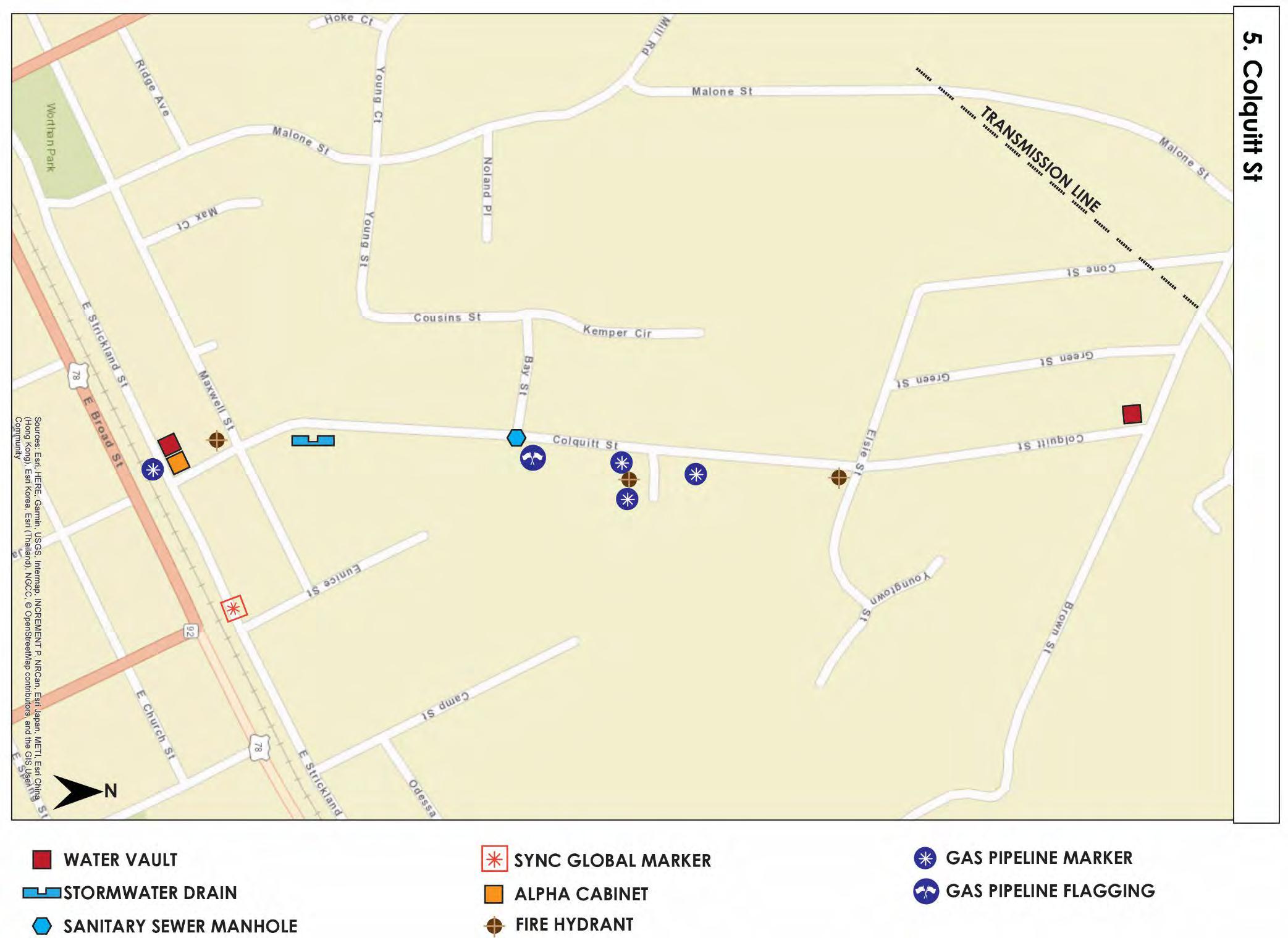
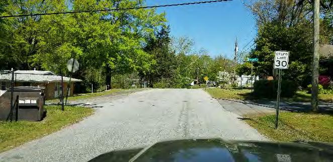
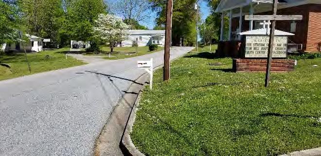
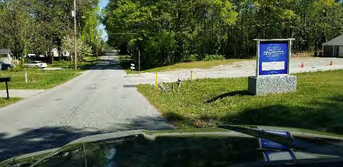
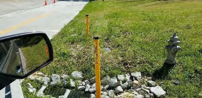
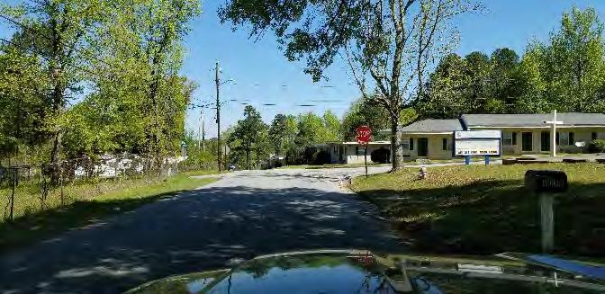
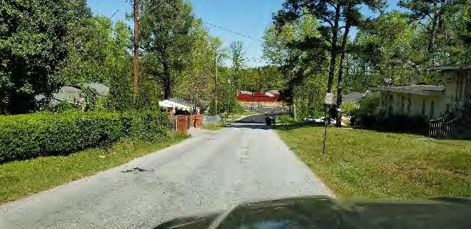
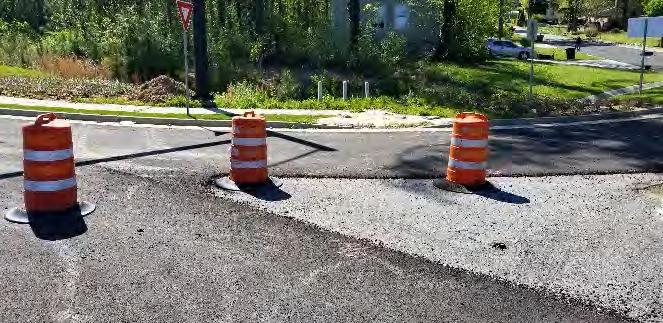
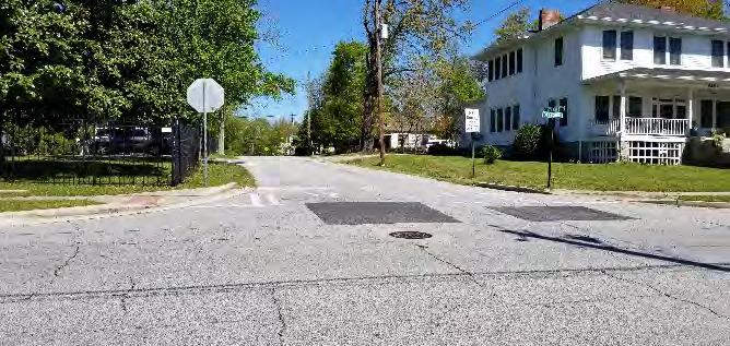
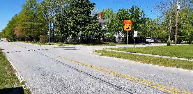
Colquitt Street Utilities
1. Colquitt St at Maxwell St Intersection
2. Colquitt St at Zion Hill Baptist Church
3. Fire Hydrant, Water Vault, Sewer & Gas Line Marker
4. Gas Line Marker & Fire Hydrant: Colquitt St (Looking East)
5. Colquitt St at Elsie St Intersection
6. Colquitt St towards Dallas Hwy
7. Water Vault Markers: Colquitt St at Dallas Hwy (Looking Southeast)
8. Sanitary Sewer Manhole: Colquitt St at Strickland St Intersection
9. Colquitt St at Strickland St Intersection
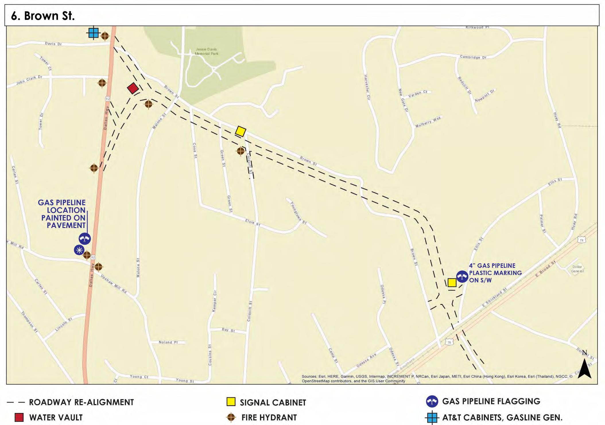
Brown Street Utilities
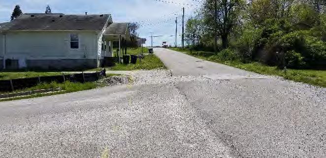
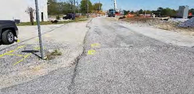
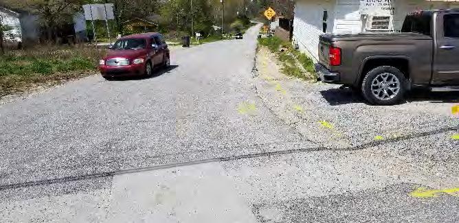
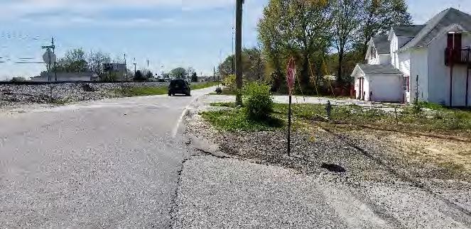
1. Flagging: At Ellis St (Looking South)
2. Brown St at Strickland St Intersection (Looking Northeast)
3. Brown St at Strickland St Intersection (Looking Northwest)
4. Brown St at Strickland St Intersection (Looking Southwest)
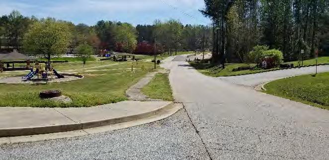
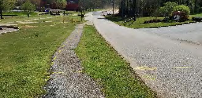
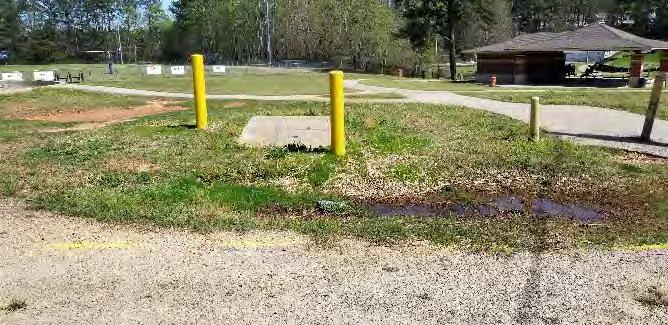
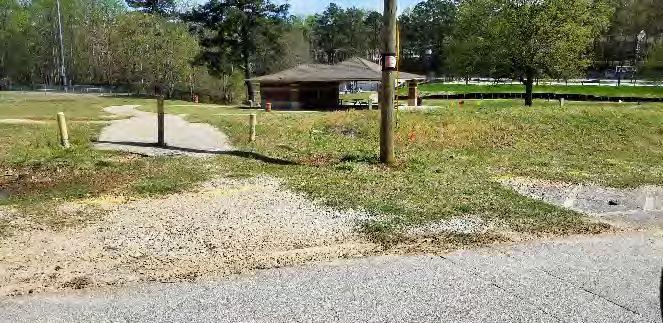
Old Dallas Road Utilities
1. SSMH across from Jesse Davis Park Recreation Center
2. AGL 6” Gas Line Markings: Jesse Davis Park
3. Water Vault: Jesse Davis Park
4. Power Pole & Water Mater: Jesse Davis Park
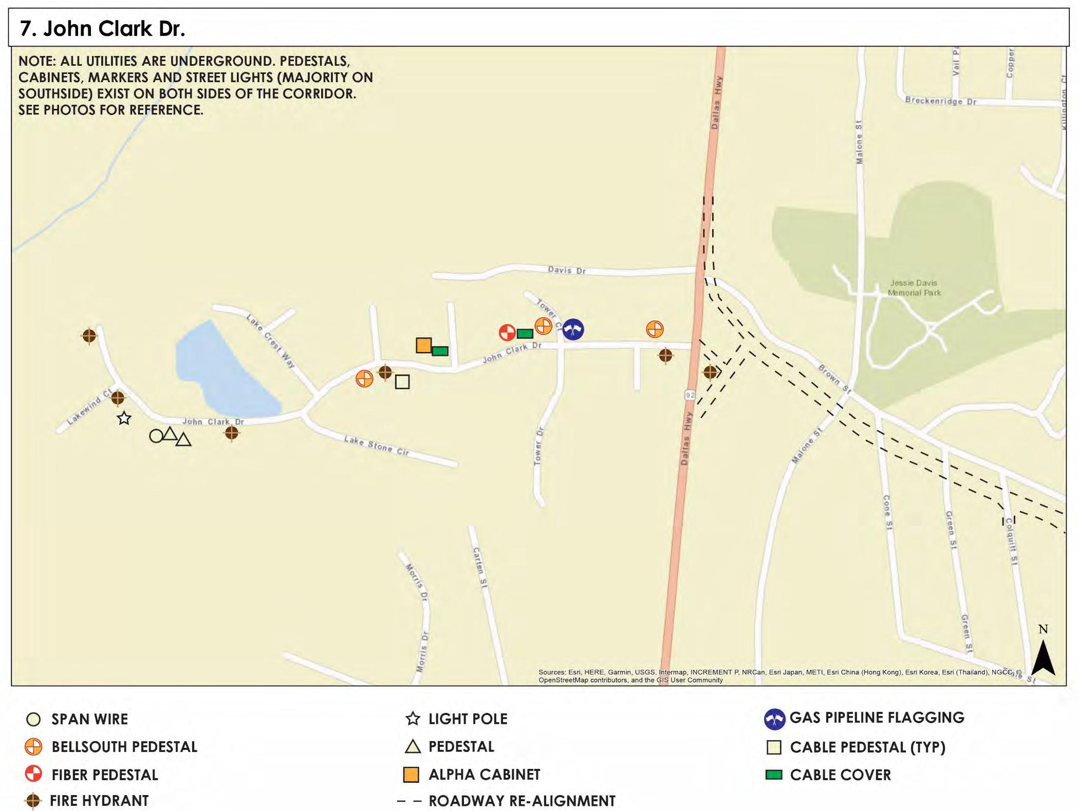
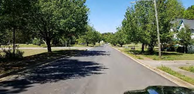
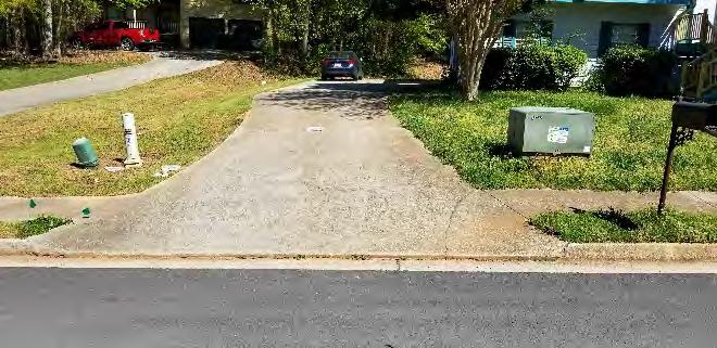
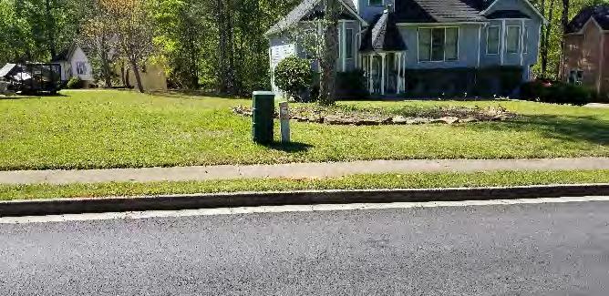
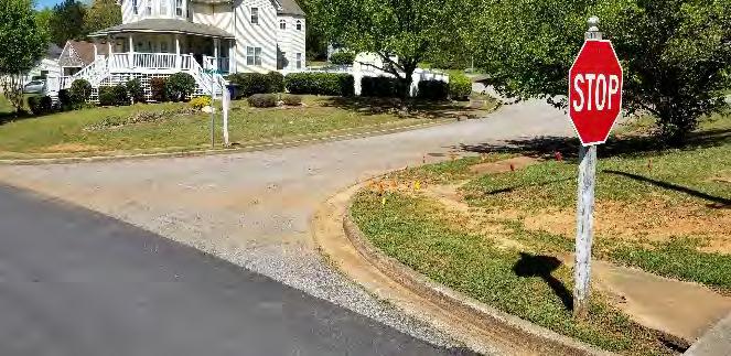
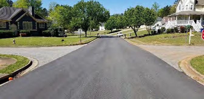
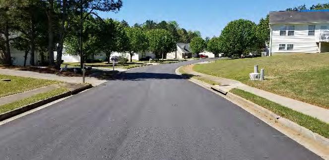
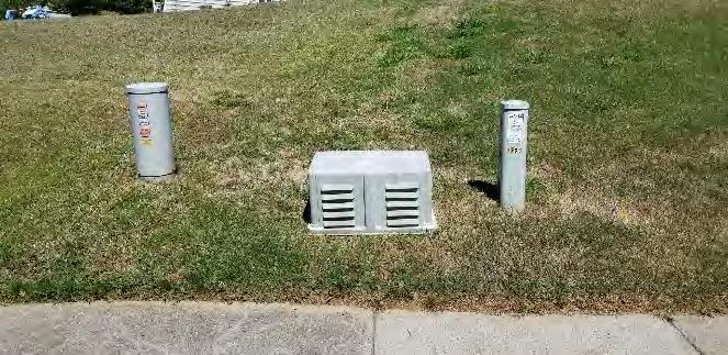
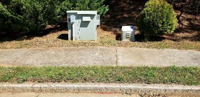
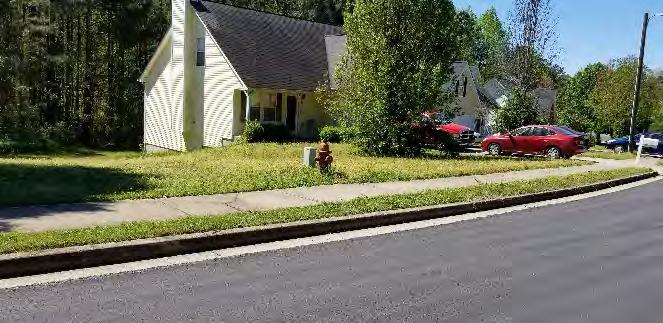
John Clark Drive Utilities
1. John Clark Drive (Looking West)
Power Cabinet & Comcast Pedestal
Underground Pedestal
4. Gas Line & Electrical Flagging: John Clark Drive at Tower Drive (Northwest)
5. John Clark Drive at Tower Drive (West)
6. Pedestal & Fire Hydrant: John Clark Drive (Looking West)
7. Pedestal: John Clark Drive (Looking North)
8. Alpha Cabinet & Comcast Cover (Housing)
9. Pedestal & Fire Hydrant: John Clark Drive (Looking South)
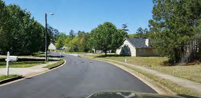
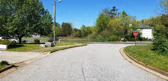
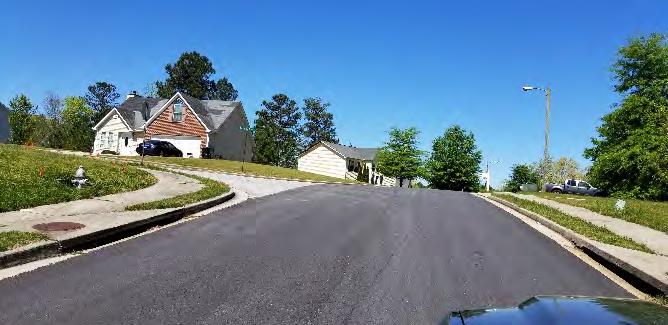
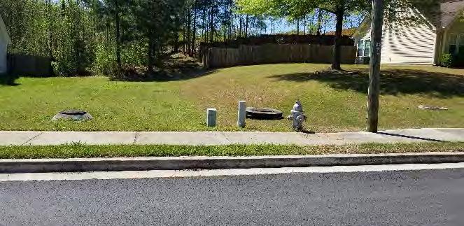
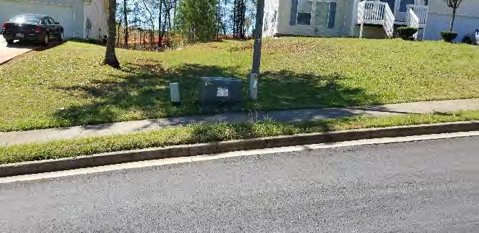
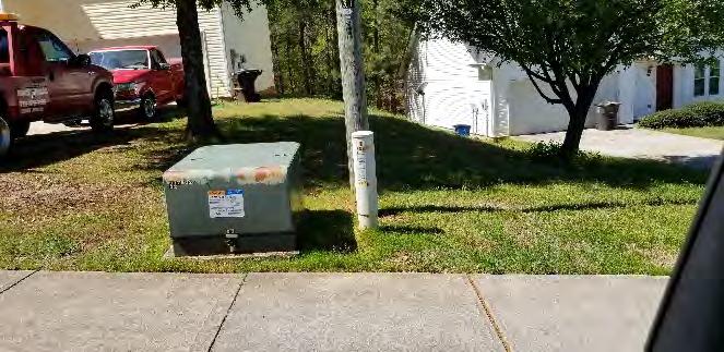
John Clark Drive Utilities
10. John Clark Drive at Lake Crest Way
11. John Clark Drive at Lake Stone Cir
12. John Clark Drive at Lakewind Dr
13. SD, Pedestal & Fire Hydrant: John Clark Drive across the Lake
14. Power Cabinet & Pedestal: John Clark Drive across the Lake
15. Power Cabinet & Comcast Pedestal: John Clark Drive (Cul-de-sac)

APPENDIX B

Environmental Due Diligence Summary
To: Chris Rideout
From: Michelle McIntosh
CC: Dan Dobry
Date: April 15, 2020
Re: Northern Trail Study, City of Douglasville – Colquitt Street Corridor
The City of Douglasville is considering the construction of a bicycle boulevard on the entire length of Colquitt Street from East Strickland Street to the proposed new SR 92 corridor currentlyunderconstruction,intheCityofDouglasville. AnEnvironmentalDueDiligenceStudy has been performed to accommodate the preliminary planning for the project under consideration. The total length of the study corridor is approximately 0.62 mile (3,255 feet)
The existing Colquitt Street study corridor consists of two undivided approximate 10-foot lanes (one in each direction), with rural shoulders on both sides Land use along the Colquitt Street study corridor is primarily residential (single-family and multi-family); however, there are also three (3) churches located along the corridor.
The purpose of the survey was to identify sensitive environmental land uses that may provide corridor improvement opportunities and/or constraints. The survey included agency database research, as well as on site reconnaissance of the corridor conducted on April 4, 2020. Sensitive environmental land uses that were surveyed for include natural, cultural, community, and physical resources in the general vicinity of the Colquitt Street study corridor. The area surveyed for environmental resources includes the view shed from the existing travel corridor.
Sensitive environmental land uses that were identified along the Colquitt Street study corridor are itemized in the proceeding paragraphs.
Natural Resources:
Watershed – The Colquitt Street study corridor is located within the Middle Chattahoochee –Lake Harding (Hydrologic Unit Code [HUC] 8 #0313002) and the Sweetwater Creek HUC10 Watershed (#0313000202).
Streams – No (0) streams were identified along the study corridor.
Wetlands – No (0) wetlands were identified along the study corridor.
Floodplains – No (0) floodplain areas were identified along the study corridor.
Threatened and Endangered Species – Coordination with the U.S. Fish andWildlife Service (USFWS), through their ECOS-IPaC web-site, identified only one federally protected species
that may occur in the general project area, little Amphianthus (Amphianthus pusillus). The GeorgiaDepartmentofNaturalResources(GDNR)listseleven(11)federalandstateprotected species, including the little Amphianthus, known to occur in Douglas County. The identified speciesarelisted inTable 1alongwithfederalandstatedesignations,descriptionsofpreferred habitat, and information concerning potential habitat along the survey corridor.
Table 1 – Protected Species Known to Occur in Douglas County Scientific Name Common
Animal Species:
Cambarus howardii Chattahoochee Crayfish
US: None GA: Threatened
Cyprinella callitaenia Bluestripe Shiner US: None GA: Rare
Clear, free-flowing waters, often in riffle habitat; a range of stream sizes from small tributaries to the main-stem of the Chattahoochee River
Main-stem reaches of rivers & large streams; in riffles & runs with rubble or sand substrate; often in areas with swift current
No
No Haliaeetus leucocephalus Bald Eagle US: None GA: Threatened
Concentrated mostly along the coast & near major rivers, wetlands & reservoirs, always nesting near open water
No Myotis septentrionalis Northern Myotis US: Threatened GA: Threatened
Notropis hypsilepsis
Plant Species:
Highscale Shiner US: None GA: Rare
Amphianthus pusillus Pool Sprite US: Threatened GA: Threatened
Cypripedium acuale Pink Ladyslipper US: None GA: Unusual
Summer roosts: tree cavities, exfoliating bark, in buildings & behind shutters. Winter habitat: hibernate in tight crevices in caves and mines. Foraging: hillsides and ridges.
Tributary streams, often near stream confluences with large rivers; runs & pools over sand & bedrock substrates.
Shallow, flat-bottomed depressions on granite outcrops; with thin gravelly soils & winter-spring inundation; deep enough to hold water for several weeks & in full sun
Upland pine and mixed pine-hardwood forests with acidic soils; in the mountains, near edges of rhododendron thickets & mountain bogs.
Cypripedium parviflorum Yellow Ladyslipper US: None GA: Rare Rich, cove hardwood forests in the mountains.
Schisandra glabra Bay Starvine US: None GA: Threatened
Symphyotrichum georgianum Georgia Aster US: None GA: Threatened
Waldsteinia lobata Piedmont Barren Strawberry US: None GA: Threatened
Cultural Resources:
Moist, deciduous hardwood forests, often with beech; usually on lower slopes, stream terraces, or floodplains.
Edges & openings in rocky, upland oak-hickory-pine forests, and rights-of-way through these habitats; circum-neutral soils
Stream terraces, floodplain forests, & rocky lower slopes with oakhickory-pine forests; often with mountain laurel
No
No
No
No
No
No
No
No
HistoricResources–Approximatelythirty-four(34)structuresatleast50yearsofageorolder have been identified along the Colquitt Street study corridor, which are potential historic resources. Fifteen (15) are located on the east side of Colquitt Street and nineteen (19) are located on the west side of Colquitt Street.
Archaeological Resources – The environmental due diligence survey was non-invasive; therefore, an archaeological survey was not conducted. An archaeological study would be required prior to project implementation if there is federal funding.
Page 2
Community Resources:
Parks and Recreation Areas – There have been no (0) parks or recreation areas identified along the Colquitt Street study corridor.
Churches – There are three (3) churches located on the Colquitt Street study corridor: Zion Hill Baptist Church Truth Center located at 8256 Colquitt Street on the east side; Seed First Christian Ministries located at 6494 Colquitt Street on the east side; and, Second Baptist Church located at 8074 Colquitt Street on the east side.
Cemeteries – There are no cemeteries located on the Colquitt Street study corridor.
Section 4(f) Resources – Section 4(f) of the USDOT Act refers to the temporary and/or permanent use and constructive use of land from a significant publicly owned park, recreation area,orwildlifeandwaterfowlrefuge,oranyhistoricsite. Section4(f)wouldapplytotheproject if federal funding is used for project implementation.
Investigation of the project study corridor has identified thirty-four (34) potential historic resources. Any historic resources that are determined to be eligible for the National Register of Historic Places (NRHP) would be considered Section 4(f) resources. However, the project could be designed to minimize impacts to any NRHP eligible resources and obtain a Finding of No Adverse Effect. A Finding of No Adverse Effect would result in a de minimus finding and minimize the requirements under Section 4(f).
No(0)publicparks,recreationareas,wildliferefuges,orwaterfowlrefugeswereidentifiedalong the Colquitt Street study corridor.
Other – No (0) other community resources such as schools, fire stations, libraries, or community centers were identified along the Colquitt Street study corridor.
Physical Resources:
Potential Contamination Sites (PSC) or Potential Hazardous Waste Sites – Certain sites are considered potential contamination or hazardous waste sites if they would be likely to involve the use, treatment, storage, disposal or generation of hazardous substances or petroleum products. No (0) potential hazardous waste or contamination sites such as underground storage tanks, dry cleaning facilities, paint stores, automotive shops, or landfills have been identified along the study corridor.
Environmental Summary and Recommendations:
Surveys for historic and archaeological resources and coordination with the GDNR, Historic Preservation Division (HPD), to determine eligibility in the NRHP would need to be conducted prior to project implementation.
From an environmental perspective, it is recommended that the bicycle boulevard be constructed on the east side of Colquitt Street. The east side has less potential historic resources and would provide improved bicycle access to the churches and multi-family housing, all of which are located on the east side of the road.
Page 4

Environmental Due Diligence Summary
To: Chris Rideout
From: Michelle McIntosh
CC: Dan Dobry
Date: April 15, 2020
Re: Northern Trail Study, City of Douglasville – Existing SR 92/Dallas Highway, Old Dallas Road, and Autry Circle Study Corridor
The City of Douglasville is considering the construction of a shared use path and/or protected bicycle facility along certain portions of existing SR 92/Dallas Highway, Old Dallas Road, and Autry Circle. The corridor extends on existing SR 92/Dallas Highway from East Strickland Street to just north of the proposed new SR 92 corridor currently under construction. The corridor then extends along Old Dallas Road northward to the intersection of Autry Circle, where thecorridorcontinueswestonAutryCircle tothenewSR92 corridor. AnEnvironmental Due Diligence Study has been performed to accommodate the preliminary planning for the project under consideration. The total length of the study corridor is approximately 1.38 mile (7,285 feet), all within the City of Douglasville
The existing SR 92 portion of the study corridor consists of two undivided approximate 12-foot lanes (one in each direction), with two-foot paved shoulders on both sides and right-turn lanes, left-turnlanes,curbandgutter,andsidewalksasneeded. TheexistingOldDallasRoadportion of the study corridor consists of two approximate 10-foot travel lanes (one in each direction), with rural shoulders. The existing Autry Circle portion of the study corridor consists of two approximate 10-foot travel lanes (one in each direction), with rural shoulders on the south side and curb, gutter, and an approximate 5-foot sidewalk on the north side. Land use along the entire study corridor is mixed use with residential, commercial, and institutional land use.
The purpose of the survey was to identify sensitive environmental land uses that may provide corridor improvement opportunities and/or constraints. The survey included agency database research, as well as on site reconnaissance of the corridor conducted on April 4, 2020. Sensitive environmental land uses that were surveyed for include natural, cultural, community, and physical resources in the general vicinity of the existing SR 92/Dallas Highway, Old Dallas Road,andAutryCirclestudycorridor. Theareasurveyedforenvironmentalresourcesincludes the view shed from the existing travel corridor.
Sensitive environmental land uses that were identified along the existing SR 92/Dallas Highway, Old Dallas Road, and Autry Circle study corridor are itemized in the proceeding paragraphs.
Natural Resources:
Watershed – The existing SR 92/Dallas Highway, Old Dallas Road, and Autry Circle study corridor is located within the Middle Chattahoochee – Lake Harding (Hydrologic Unit Code [HUC] 8 #0313002) and the Sweetwater Creek HUC10 Watershed (#0313000202).
Streams – No (0) streams were identified along the study corridor.
Wetlands – No (0) wetlands were identified along the study corridor.
Floodplains – No (0) floodplain areas were identified along the study corridor.
Threatened and Endangered Species – Coordination with the U.S. Fish andWildlife Service (USFWS), through their ECOS-IPaC web-site, identified only one federally protected species that may occur in the general project area, little Amphianthus (Amphianthus pusillus). The GeorgiaDepartmentofNaturalResources(GDNR)listseleven(11)federalandstateprotected species, including the little Amphianthus, known to occur in Douglas County. The identified speciesarelisted inTable 1alongwithfederalandstatedesignations,descriptionsofpreferred habitat, and information concerning potential habitat along the survey corridor.
Animal Species: Cambarus howardii Chattahoochee Crayfish
Cyprinella callitaenia Bluestripe Shiner
US: None GA: Threatened
US: None GA: Rare
Haliaeetus leucocephalus Bald Eagle US: None GA: Threatened
Myotis septentrionalis Northern Myotis US: Threatened GA: Threatened
Notropis hypsilepsis
Plant Species:
Highscale Shiner
Amphianthus pusillus Pool Sprite
Cypripedium acuale Pink Ladyslipper
Cypripedium parviflorum Yellow Ladyslipper
US: None GA: Rare
US: Threatened GA: Threatened
US: None GA: Unusual
US: None GA: Rare
Schisandra glabra Bay Starvine US: None GA: Threatened
Symphyotrichum georgianum Georgia Aster US: None GA: Threatened
Waldsteinia lobata Piedmont Barren Strawberry
Page 2
US: None GA: Threatened
Clear, free-flowing waters, often in riffle habitat; a range of stream sizes from small tributaries to the main-stem of the Chattahoochee River
Main-stem reaches of rivers & large streams; in riffles & runs with rubble or sand substrate; often in areas with swift curren t
Concentrated mostly along the coast & near major rivers, wetlands & reservoirs, always nesting near open water
Summer roosts: tree cavities, exfoliating bark, in buildings & behind shutters. Winter habitat: hibernate in tight crevices in caves and mines. Foraging: hillsides and ridges.
Tributary streams, often near stream confluences with large rivers; runs & pools over sand & bedrock substrates.
Shallow, flat-bottomed depressions on granite outcrops; with thin gravelly soils & winter-spring inundation; deep enough to hold water for several weeks & in full sun
Upland pine and mixed pine-hardwood forests with acidic soils; in the mountains, near edges of rhododendron thickets & mountain bogs.
Rich, cove hardwood forests in the mountains.
Moist, deciduous hardwood forests, often with beech; usually on lower slopes, stream terraces, or floodplains
No
No
No
No
No
No
No
No
No
Edges & openings in rocky, upland oak-hickory-pine forests, and rights-of-way through these habitats; circum-neutral soils. No
Stream terraces, floodplain forests, & rocky lower slopes with oakhickory-pine forests; often with mountain laurel
No
Cultural Resources:
Historic Resources – Approximately eighteen (18) structures at least 50 years of age or older have been identified along the existing SR 92/Dallas Highway, Old Dallas Road, and Autry Circle study corridor, which are potential historic resources. Twelve (12) are located on the east side of existing SR 92/Dallas Highway and six (6) are located on the west side of existing SR 92/Dallas Highway.
Archaeological Resources – The environmental due diligence survey was non-invasive; therefore, an archaeological survey was not conducted. An archaeological study would be required prior to project implementation if there is federal funding.
Community Resources:
Parks and Recreation Areas – There are four (4) parks and recreation areas located along the existing SR 92/Dallas Highway, Old Dallas Road, and Autry Circle study corridor: Worthan Park located on the east side of existing SR 92/Dallas Highway just north of East Strickland Street; the race tracks and fields associated with Stewart Middle School located on the east side of existing SR 92/Dallas Highway and just south of Malone Street; Jesse Davis Park located on the east side of Old Dallas Road and just north of the new proposed SR 92 corridor currently under construction; and, the Douglasville Parks Department City of Douglasville Pool located on the west side of Old DallasRoad, approximately 515feet north of the newproposed SR 92 corridor currently under construction.
Churches – There is one (1) church located on the existing SR 92/Dallas Highway, Old Dallas Road, and AutryCircle studycorridor, the Saint JamesA.M.E. Church located in the southwest quadrant of the James D. Simpson Avenue and SR 92/Dallas Highway intersection.
Cemeteries – There is one (1) cemetery located on the existing SR 92/Dallas Highway, Old Dallas Road, and Autry Circle study corridor. There is a cemetery located on the east side of SR 92/Dallas Highway, across from James D. Simpson Avenue.
Section 4(f) Resources – Section 4(f) of the USDOT Act refers to the temporary and/or permanent use and constructive use of land from a significant publicly owned park, recreation area,orwildlifeandwaterfowlrefuge,oranyhistoricsite. Section4(f)wouldapplytotheproject if federal funding is used for project implementation.
Investigation of the project study corridor has identified four (4) parks and recreation areas and eighteen (18) potential historic resources. Any historic resources that are determined to be eligible for the NRHP would be considered Section 4(f) resources. However, the project could be designed to minimize impacts to any NRHP eligible resources and obtain a Finding of No Adverse Effect. A Finding of No Adverse Effect would result in a de minimus finding and minimize the requirements under Section 4(f). The project could also be designed to minimize impacts to the parks and recreation areas to obtain a de minimus finding and minimize the requirements under Section 4(f).
Page 3
No (0) wildlife refuges or waterfowl refuges were identified along the existing SR 92/Dallas Highway, Old Dallas Road, and Autry Circle study corridor
Schools – Two (2) schools have been identified along the existing SR 92/Dallas Highway, Old Dallas Road,and AutryCircle studycorridor. Stewart Middle Schoolis locatedontheeast side of existing SR 92/Dallas Highway, on both sides of Upshaw Mill Road. Also, Victorious Kidz Academyisanon-profitprivateschoolthatspecializesinearlychildhoodeducation. Thefacility is located on the north side of Autry Circle, just east of the study corridor.
Other–No(0)othercommunityresourcessuchasfirestations,libraries,orcommunitycenters were identified along the existing SR 92/Dallas Highway, Old Dallas Road, and Autry Circle study corridor.
Physical Resources:
Potential Contamination Sites (PSC) or Potential Hazardous Waste Sites – Certain sites arePSCsorhazardouswastesitesiftheywouldbelikelytoinvolvetheuse,treatment,storage, disposal or generation of hazardous substances or petroleum products.
Three (3) PSCs have been identified along the existing SR 92/Dallas Highway, Old Dallas Road, and Autry Circle study corridor. There are two (2) gas stations located on the study corridor with underground storage tanks: one (1) located on the east side of existing SR 92/Dallas Highway just north of Upshaw Mill Road and one (1) located on the west side of existing SR 92/Dallas Highway just south of Upshaw Mill Road. There is also one (1) funeral home, which is considered to likely involve the use and storage of hazardous substances, located on the east side of existing SR 92/Dallas Highway just north of Ridge Avenue.
No (0) other potential hazardous waste or contamination sites such as dry cleaning facilities, paint stores, automotive shops, or landfills have been identified along the study corridor.
Environmental Summary and Recommendations:
Surveys for historic and archaeological resources and coordination with the GDNR, Historic Preservation Division (HPD), to determine eligibility in the NRHP would need to be conducted prior to project implementation.
From an environmental perspective, it is recommended that the shared use path and/or protected bicycle facility along certain portions of existing SR 92/Dallas Highway, Old Dallas Road, and Autry Circle be constructed on the west side of existing SR 92/Dallas Highway, the west side of Old Dallas Road, and the north side of Autry Circle.
Regarding existing SR 92/Dallas Highway, the cemetery is located approximately 10 feet east of the existing edge of pavement. Furthermore, there are twelve (12) potential historic resources, two (2) parks and recreation areas, one (1) school, and one (1) PCS located on the east side of the road while there are only six (6) potential historic resources, zero (0) parks or recreation areas, zero (0) schools, and zero (0) PCSs on the west side of the road. For these
Page 4
reasons, project implementation is recommended on the west side of existing SR 92/Dallas Highway.
Regarding the Old Dallas Road portion of the study corridor, Jesse Davis Park is located on the east side of the road and the Douglasville Parks Department City of Douglasville Pool is located on the west side of the road. Approximately 675 feet of Jesse Davis Park fronts Old Dallas Road and the park’s parking facilities are located immediately adjacent to the roadway. Approximately 340 feet of the pool facility fronts Old Dallas Road and the facilities, including the parking are set back approximately 35 feet from the roadway. As such, project implementation on the west side of would result in less impacts to parks and recreational facilities and is recommended.
Regarding the Autry Circle portion of the study corridor, there are no environmental constraints since the identified school is located just east of the study corridor. Project implementation is recommended on the north side of Autry Circle to utilize the existing sidewalk and minimize land use changes.
Page 5

Environmental Due Diligence Summary
To: Chris Rideout
From: Michelle McIntosh
CC: Dan Dobry
Date: April 15, 2020
Re: Northern Trail Study, City of Douglasville – Hollis Street Corridor
The City of Douglasville is considering the construction of a bicycle boulevard on the entire length of Hollis Street connecting Strickland Street and James D. Simpson Avenue, in the City of Douglasville. An Environmental Due Diligence Study has been performed to accommodate the preliminary planning for the project under consideration. The total length of the study corridor is approximately 0.26 mile (1,385 feet).
The existing Hollis Street study corridor consists of two undivided approximate 10-foot lanes (one in each direction), with rural shoulders on both sides. Land use along the Hollis Street study corridor is primarily single-family residential with some multi-family residential.
The purpose of the survey was to identify sensitive environmental land uses that may provide corridor improvement opportunities and/or constraints. The survey included agency database research, as well as on site reconnaissance of the corridor conducted on April 4, 2020 Sensitive environmental land uses that were surveyed for include natural, cultural, community, and physical resources in the general vicinity of the Hollis Street study corridor. The area surveyed for environmental resources includes the view shed from the existing travel corridor.
Sensitive environmentalland usesthat were identified alongthe Hollis Street studycorridorare itemized in the proceeding paragraphs.
Natural Resources:
Watershed – The Hollis Street study corridor is located within the Middle Chattahoochee –Lake Harding (Hydrologic Unit Code [HUC] 8 #0313002) and the Sweetwater Creek HUC10 Watershed (#0313000202).
Streams – No (0) streams were identified along the study corridor.
Wetlands – No (0) wetlands were identified along the study corridor.
Floodplains – No (0) floodplain areas were identified along the study corridor.
Threatened and Endangered Species – Coordination with the U.S. Fish andWildlife Service (USFWS), through their ECOS-IPaC web-site, identified only one federally protected species that may occur in the general project area, little Amphianthus (Amphianthus pusillus). The
GeorgiaDepartmentofNaturalResources(GDNR)listseleven(11)federalandstateprotected species, including the little Amphianthus, known to occur in Douglas County. The identified speciesarelisted inTable 1alongwithfederalandstatedesignations,descriptionsofpreferred habitat, and information concerning potential habitat along the survey corridor.
Table 1 – Protected Species Known to Occur in Douglas County
Animal Species:
Cambarus howardii
Cyprinella callitaenia
Chattahoochee Crayfish
US: None GA: Threatened
Bluestripe Shiner US: None GA: Rare
Bald Eagle
Clear, free-flowing waters, often in riffle habitat; a range of stream sizes from small tributaries to the main-stem of the Chattahoochee River
Main-stem reaches of rivers & large streams; in riffles & runs with rubble or sand substrate; often in areas with swift current
No
No Haliaeetus leucocephalus
Myotis septentrionalis Northern Myotis
Notropis hypsilepsis
Plant Species:
Amphianthus pusillus
Highscale Shiner
Pool Sprite
Cypripedium acuale Pink Ladyslipper
Cypripedium parviflorum Yellow Ladyslipper
US: None GA: Threatened
US: Threatened GA: Threatened
US: None GA: Rare
US: Threatened GA: Threatened
US: None GA: Unusual
US: None GA: Rare
Concentrated mostly along the coast & near major rivers, wetlands & reservoirs, always nesting near open water.
Summer roosts: tree cavities, exfoliating bark, in buildings & behind shutters. Winter habitat: hibernate in tight crevices in caves and mines. Foraging: hillsides and ridges.
Tributary streams, often near stream confluences with large rivers; runs & pools over sand & bedrock substrates.
Shallow, flat-bottomed depressions on granite outcrops; with thin gravelly soils & winter-spring inundation; deep enough to hold water for several weeks & in full sun.
Upland pine and mixed pine-hardwood forests with acidic soils; in the mountains, near edges of rhododendron thickets & mountain bogs.
Rich, cove hardwood forests in the mountains.
No
No
No
No
No
No Schisandra glabra Bay Starvine US: None GA: Threatened
Symphyotrichum georgianum Georgia Aster US: None GA: Threatened
Waldsteinia lobata
Piedmont Barren Strawberry
Cultural Resources:
US: None GA: Threatened
Moist, deciduous hardwood forests, often with beech; usually on lower slopes, stream terraces, or floodplains
Edges & openings in rocky, upland oak-hickory-pine forests, and rights-of-way through these habitats; circum-neutral soils
Stream terraces, floodplain forests, & rocky lower slopes with oakhickory-pine forests; often with mountain laurel.
Historic Resources–Approximatelyeight (8)structuresat least50 yearsof age orolderhave been identified along the Hollis Street study corridor, which are potential historic resources. Three (3) are located on the west side of Hollis Street and five (5) are located on the east side of Hollis Street.
Archaeological Resources – The environmental due diligence survey was non-invasive; therefore, an archaeological survey was not conducted. An archaeological study would be required prior to project implementation if there is federal funding.
Community Resources:
Parks and Recreation Areas – There have been no (0) parks or recreation areas identified along the Hollis Street study corridor.
No
No
No
Page 2
Churches and Cemeteries –There have been no (0) churches or cemeteries identified along the Hollis Street study corridor.
Section 4(f) Resources – Section 4(f) of the USDOT Act refers to the temporary and/or permanent use and constructive use of land from a significant publicly owned park, recreation area,orwildlifeandwaterfowlrefuge,oranyhistoricsite. Section4(f)wouldapplytotheproject if federal funding is used for project implementation.
Investigation of the project study corridor has identified eight (8) potential historic resources. Any historic resources that are determined to be eligible for the National Register of Historic Places (NRHP) would be considered Section 4(f) resources. However, the project could be designed to minimize impacts to any NRHP eligible resources and obtain a Finding of No Adverse Effect. A Finding of No Adverse Effect would result in a de minimus finding and minimize the requirements under Section 4(f).
No(0)publicparks,recreationareas,wildliferefuges,orwaterfowlrefugeswereidentifiedalong the Hollis Street study corridor
Other – No (0) other community resources such as schools, fire stations, libraries, or community centers were identified along the Hollis Street study corridor.
Physical Resources:
Potential Contamination Sites (PSC) or Potential Hazardous Waste Sites – Certain sites are considered potential contamination or hazardous waste sites if they would be likely to involve the use, treatment, storage, disposal or generation of hazardous substances or petroleum products. No (0) potential hazardous waste or contamination sites such as underground storage tanks, dry cleaning facilities, paint stores, automotive shops, or landfills have been identified along the study corridor.
Environmental Summary and Recommendations:
Surveys for historic and archaeological resources and coordination with the GDNR, Historic Preservation Division (HPD), to determine eligibility in the NRHP would need to be conducted prior to project implementation.
From an environmental perspective, it is recommended that the bicycle boulevard be constructed on the west side of Hollis Street. The potential historic resources on the west side of Hollis Street are less likely to be determined eligible for the NRHP and there are fewer potential resources on the west side.

Environmental Due Diligence Summary
To: Chris Rideout
From: Michelle McIntosh
CC: Dan Dobry
Date: April 15, 2020
Re: Northern Trail Study, City of Douglasville – John Clark Drive and New Location Corridor
The City of Douglasville is considering the construction of a bicycle boulevard along a portion of John Clark Drive and a multi-use trail on new location from the western terminus of the bicycle boulevard northwest to Mill Creek. An Environmental Due Diligence Study has been performed to accommodate the preliminary planning for the project under consideration. The total length of the study corridor is approximately 0.65 mile (3,445 feet), all within the City of Douglasville.
The existing John Clark Drive portion of the study corridor consists of two undivided approximate 12-foot lanes (one in each direction), with curb, gutter, and sidewalks on both sides of the roadway. Land use along this portion is single family residential. Land use along the new location portion of the study corridor is forested and unused.
The purpose of the survey was to identify sensitive environmental land uses that may provide corridor improvement opportunities and/or constraints. The survey included agency database research, as well as on site reconnaissance of the corridor conducted on April 4, 2020. Sensitive environmental land uses that were surveyed for include natural, cultural, community, and physical resources in the general vicinity of the John Clark Drive and new location study corridor. The area surveyed for environmental resources includes the view shed from the existing travel corridor.
Sensitive environmental land uses that were identified along the John Clark Drive and new location study corridor are itemized in the proceeding paragraphs.
Natural Resources:
Watershed – The existing John Clark Drive and new location study corridor is located within the Middle Chattahoochee – Lake Harding (Hydrologic Unit Code [HUC] 8 #0313002) and the Sweetwater Creek HUC10 Watershed (#0313000202).
Streams – One (1) stream has been identified along the study corridor, Mill Creek. Mill Creek is located at the north terminus of the proposed multi-use trail. Mill Creek is not located on the GeorgiaEnvironmentalProtectionDivision’s(GEPD’s)listofimpairedstreamsthatdonotmeet criteria for their designated use.
Wetlands and Open Waters – No (0) wetlands were identified along the study corridor. One (1) small pond is located on the north side of John Clark Drive, just west of Lake Stone Circle.
Floodplains – One (1) Special Flood Hazard Area and Regulatory Floodway has been identified along the study corridor, the floodplain associated with Mill Creek.
Threatened and Endangered Species – Coordination with the U.S. Fish andWildlife Service (USFWS), through their ECOS-IPaC web-site, identified only one federally protected species that may occur in the general project area, little Amphianthus (Amphianthus pusillus). The GeorgiaDepartmentofNaturalResources(GDNR)listseleven(11)federalandstateprotected species, including the little Amphianthus, known to occur in Douglas County. The identified speciesarelisted inTable 1alongwithfederalandstatedesignations,descriptionsofpreferred habitat, and information concerning potential habitat along the survey corridor.
Animal Species:
Cambarus howardii Chattahoochee Crayfish
Cyprinella callitaenia Bluestripe Shiner
US: None GA: Threatened
US: None GA: Rare
Haliaeetus leucocephalus Bald Eagle US: None GA: Threatened
Clear, free-flowing waters, often in riffle habitat; a range of stream sizes from small tributaries to the main-stem of the Chattahoochee River
Main-stem reaches of rivers & large streams; in riffles & runs with rubble or sand substrate; often in areas with swift current.
Concentrated mostly along the coast & near major rivers, wetlands & reservoirs, always nesting near open water
No
No
No Myotis septentrionalis Northern Myotis US: Threatened GA: Threatened Summer roosts: tree cavities, exfoliating bark, in buildings & behind shutters. Winter habitat: hibernate in tight crevices in caves and mines. Foraging: hillsides and ridges.
Notropis hypsilepsis
Plant Species:
Highscale Shiner
US: None GA: Rare
Amphianthus pusillus Pool Sprite US: Threatened GA: Threatened
Cypripedium acuale Pink Ladyslipper
Cypripedium parviflorum Yellow Ladyslipper
US: None GA: Unusual
US: None GA: Rare
Schisandra glabra Bay Starvine US: None GA: Threatened
Symphyotrichum georgianum Georgia Aster US: None GA: Threatened
Waldsteinia lobata Piedmont Barren Strawberry
Cultural Resources:
US: None GA: Threatened
Tributary streams, often near stream confluences with large rivers; runs & pools over sand & bedrock substrates.
Shallow, flat-bottomed depressions on granite outcrops; with thin gravelly soils & winter-spring inundation; deep enough to hold water for several weeks & in full sun
Upland pine and mixed pine-hardwood forests with acidic soils; in the mountains, near edges of rhododendron thickets & mountain bogs.
Rich, cove hardwood forests in the mountains.
Moist, deciduous hardwood forests, often with beech; usually on lower slopes, stream terraces, or floodplains
Edges & openings in rocky, upland oak-hickory-pine forests, and rights-of-way through these habitats; circum-neutral soils.
Stream terraces, floodplain forests, & rocky lower slopes with oakhickory-pine forests; often with mountain laurel
No
No
No
No
No
No
No
No
Historic Resources – No (0) structures at least 50 years of age or older have been identified along the proposed John Clark Drive and new location study corridor, which would be considered potential historic resources.
Page 2
Table 1 – Protected Species Known to Occur in Douglas County
Archaeological Resources – The environmental due diligence survey was non-invasive; therefore, an archaeological survey was not conducted. An archaeological study would be required prior to project implementation if there is federal funding or if a U.S. Army Corps of Engineers permit is required for impacts to aquatic resources.
Community Resources:
Parks and Recreation Areas – No (0) parks or recreation areas are located along the John Clark Drive and new location study corridor
Churches and Cemeteries – There are no (0) churches or cemeteries located along the John Clark Drive and new location study corridor.
Section 4(f) Resources – Section 4(f) of the USDOT Act refers to the temporary and/or permanent use and constructive use of land from a significant publicly owned park, recreation area,orwildlifeandwaterfowlrefuge,oranyhistoricsite. Section4(f)wouldapplytotheproject if federal funding is used for project implementation. Investigation of the project study corridor has identified no (0) Section 4(f) resources.
Other – No other community resources such as fire stations, schools, libraries, or community centers were identified along the John Clark Drive and new location study corridor.
Physical Resources:
Potential Contamination Sites or Potential Hazardous Waste Sites – Certain sites are considered potential contamination or hazardous waste sites if they would be likely to involve the use, treatment, storage, disposal or generation or hazardous substances or petroleum products. No (0) potential contamination of hazardous waste sites have been identified along the John Clark Drive and new location study corridor.
Environmental Summary and Recommendations:
Surveys for historic and archaeological resources and coordination with the GDNR, Historic Preservation Division (HPD), to determine eligibility in the National Register of Historic Places (NRHP) would need to be conducted prior to project implementation.
From an environmental perspective, it is recommended that the bicycle boulevard along John Clark Drive be constructed on the north side of John Clark Drive. There are no (0) environmental constraints; however, provision of the new bicycle boulevard on the north side of JohnClarkDrivewouldprovideaccesstotheproposedmulti-usetrailwithoutrequiringusers to cross John Clark Drive. For these reasons, project implementation is recommended on the north side of the John Clark Drive and new location study corridor.
Page 3

Environmental Due Diligence Summary
To: Chris Rideout
From: Michelle McIntosh
CC: Dan Dobry
Date: April 15, 2020
Re: Northern Trail Study, City of Douglasville – Mill Creek Corridor
The Cityof Douglasville is consideringthe construction of a multi-use trail along a portion of the southeast side of Mill Creek from Chicago Avenue northeasterly and then turn due east to connect with SR 92/Dallas Highway just south of Malone Road. An Environmental Due Diligence Study has been performed to accommodate the preliminary planning for the project under consideration. The total length of the study corridor is approximately 1.53 miles (8,060 feet), all within the City of Douglasville.
Land use on both sides of the Mill Creek corridor is primarily unused and forested with some residential use near the termini.
The purpose of the survey was to identify sensitive environmental land uses that may provide corridor improvement opportunities and/or constraints. The survey included agency database research, as well as on site reconnaissance of the corridor conducted on April 4, 2020 Sensitive environmental land uses that were surveyed for include natural, cultural, community, and physical resources in the general vicinity of the Mill Creek corridor. The area surveyed for environmental resources includes the view shed from the existing corridor.
Sensitive environmental land uses that were identified along the Mill Creek study corridor are itemized in the proceeding paragraphs.
Natural Resources:
Watershed – The Mill Creek study corridor is located within the Middle Chattahoochee – Lake Harding (Hydrologic Unit Code [HUC] 8 #0313002) and the Sweetwater Creek HUC10 Watershed (#0313000202).
Streams – Two (2) streams have been identified in the vicinity of the Mill Creek study corridor: Mill Creek that longitudinally parallels a portion of the study corridor and an unnamed tributary toMillCreekthattransverselycrossestheMillCreekstudycorridorjustnorthwestofJohnClark Drive. Neither Mill Creek nor the unnamed tributary of Mill Creek are listed on the Georgia Environmental Protection Division’s (GEPD’s) list of impaired streams that do not meet criteria for their designated use.
Wetlands and Open Waters – One (1) wetland and one (1) open water were identified along the Mill Creek study corridor. Crystal Lake and an associated wetland area are located on the
east side of the study corridor, just north of Chicago Avenue. Delineations of the wetland and lake will need to be determined so as to minimize impacts to these resources.
Floodplains –There are two (2)Special Flood Hazard Areasand two (2) regulatoryfloodways located within the Mill Creek study corridor which are associated with Mill Creek and the unnamed tributary to Mill Creek.
ThreatenedandEndangeredSpecies – Coordination with the U.S. Fish andWildlife Service (USFWS), through their ECOS-IPaC web-site, identified only one federally protected species that may occur in the general project area, little Amphianthus (Amphianthus pusillus). The GeorgiaDepartmentofNaturalResources(GDNR)listseleven(11)federalandstateprotected species, including the little Amphianthus, known to occur in Douglas County. The identified speciesarelisted inTable 1alongwithfederalandstatedesignations,descriptionsofpreferred habitat, and information concerning potential habitat along the survey corridor.
Animal Species: Cambarus howardii Chattahoochee Crayfish
Cyprinella callitaenia Bluestripe Shiner
US: None GA: Threatened
US: None GA: Rare
Clear, free-flowing waters, often in riffle habitat; a range of stream sizes from small tributaries to the main-stem of the Chattahoochee River.
Main-stem reaches of rivers & large streams; in riffles & runs with rubble or sand substrate; often in areas with swift current
Concentrated mostly along the coast & near major rivers, wetlands & reservoirs, always nesting near open water
Yes
No Haliaeetus leucocephalus Bald Eagle US: None GA: Threatened
Myotis septentrionalis Northern Myotis US: Threatened GA: Threatened
Notropis hypsilepsis Highscale Shiner
Plant Species:
US: None GA: Rare
Amphianthus pusillus Pool Sprite US: Threatened GA: Threatened
Cypripedium acuale Pink Ladyslipper
US: None GA: Unusual
Schisandra glabra Bay Star-vine US: None GA: Threatened
Symphyotrichum georgianum Georgia Aster
Cypripedium parviflorum Yellow Ladyslipper
Page 2
US: None GA: Threatened
US: None GA: Rare
Summer roosts: tree cavities, exfoliating bark, in buildings & behind shutters. Winter habitat: hibernate in tight crevices in caves and mines. Foraging: hillsides and ridges.
Tributary streams, often near stream confluences with large rivers; runs & pools over sand & bedrock substrates.
Shallow, flat-bottomed depressions on granite outcrops; with thin gravelly soils & winter-spring inundation; deep enough to hold water for several weeks & in full sun
Upland pine and mixed pine-hardwood forests with acidic soils; in the mountains, near edges of rhododendron thickets & mountain bogs.
Moist, deciduous hardwood forests, often with beech; usually on lower slopes, stream terraces, or floodplains
Edges & openings in rocky, upland oak-hickory-pine forests, and rights-of-way through these habitats; circum-neutral soils
Rich, cove hardwood forests in the mountains.
No
No
No
No
No
No
Yes
No
Table 1 – Protected Species Known to Occur in Douglas County
Cultural Resources:
Historic Resources – No (0) structures at least 50 years of age or older have been identified adjacent to the proposed Mill Creek study corridor, which are potential historic resources and within the view-shed of the study corridor.
Archaeological Resources – The environmental due diligence survey was non-invasive; therefore, an archaeological survey was not conducted. An archaeological study would be required prior to project implementation if there is federal funding or if a U.S Army Corps of Engineers permit is required for impacts to aquatic resources.
Community Resources:
Parks and Recreation Areas – No (0) parks or recreation areas are located along the Mill Creek study corridor
Churches and Cemeteries – There are no (0) churches or cemeteries located along the Mill Creek study corridor.
Section 4(f) Resources – Section 4(f) of the USDOT Act refers to the temporary and/or permanent use and constructive use of land from a significant publicly owned park, recreation area,orwildlifeandwaterfowlrefuge,oranyhistoricsite. Section4(f)wouldapplytotheproject if federal funding is used for project implementation. Investigation of the Mill Creek study corridor has identified no (0) Section 4(f) resources.
Other – No (0) other community resources such as fire stations, schools, libraries, or community centers were identified along the Mill Creek study corridor.
Physical Resources:
Potential Contamination Sites or Potential Hazardous Waste Sites – Certain sites are considered potential contamination or hazardous waste sites if they would be likely to involve the use, treatment, storage, disposal or generation of hazardous substances or petroleum products. No (0) potential hazardous waste or contamination sites have been identified along the Mill Creek study corridor.
Environmental Summary and Recommendations:
Surveys for historic and archaeological resources and coordination with the GDNR, Historic Preservation Division (HPD), to determine eligibility in the NRHP would need to be conducted prior to project implementation. The decision on the location of the multi-use trail should not
Page 3
be made until protected species surveys have been conducted and the potential habitat sites are coordinated with appropriate agencies. Field delineations of aquatic habitats would also be required and coordinated.
Page 4

Environmental Due Diligence Summary
To: Chris Rideout
From: Michelle McIntosh
CC: Dan Dobry
Date: April 15, 2020
Re: Northern Trail Study, City of Douglasville – Proposed SR 92 Corridor
The City of Douglasville is considering the construction of a shared use path along certain portionstheproposedSR92transportationcorridor,whichiscurrentlyunderconstruction. The corridor extends on new location from Ellis Street to existing SR 92/Dallas Highway then extends on existing location north to Malone Street. An Environmental Due Diligence Study has been performed to accommodate the preliminary planning for the project under consideration. The total length of the study corridor is approximately 1.19 mile (6,290 feet), all within the City of Douglasville.
The existing SR 92 portion of the study corridor consists of two undivided approximate 12-foot lanes (one in each direction), with two-foot paved shoulders on both sides and right-turn lanes as needed. Land use along the new location portion of the study corridor is residential and the existing location portion of the study corridor is mixed use with residential, commercial, and institutional use.
The purpose of the survey was to identify sensitive environmental land uses that may provide corridor improvement opportunities and/or constraints. The survey included agency database research, as well as on site reconnaissance of the corridor conducted on April 4, 2020 Sensitive environmental land uses that were surveyed for include natural, cultural, community, and physical resources in the general vicinity of the proposed SR 92 study corridor. The area surveyed for environmental resources includes the view shed from the existing travel corridor.
SensitiveenvironmentallandusesthatwereidentifiedalongtheproposedSR92studycorridor are itemized in the proceeding paragraphs.
Natural Resources:
Watershed – The proposed SR 92 study corridor is located within the Middle Chattahoochee – Lake Harding (Hydrologic Unit Code [HUC] 8 #0313002) and the Sweetwater Creek HUC10 Watershed (#0313000202).
Streams – One (1) stream has been identified along the study corridor, Huey Creek. Huey Creek flows under the proposed SR 92 corridor just west of Cone Street. Huey Creek is not located on the Georgia Environmental Protection Division’s (GEPD’s) list of impaired streams that do not meet criteria for their designated use.
Wetlands – No (0) wetlands were identified along the study corridor.
Floodplains – One (1) Special Flood Hazard Area and Regulatory Floodway has been identified along the study corridor, the floodplain associated with Huey Creek.
Threatened and Endangered Species – Coordination with the U.S. Fish andWildlife Service (USFWS), through their ECOS-IPaC web-site, identified only one federally protected species that may occur in the general project area, little Amphianthus (Amphianthus pusillus). The GeorgiaDepartmentofNaturalResources(GDNR)listseleven(11)federalandstateprotected species, including the little Amphianthus, known to occur in Douglas County. The identified speciesarelisted inTable 1alongwithfederalandstatedesignations,descriptionsofpreferred habitat, and information concerning potential habitat along the survey corridor.
Animal Species:
Cambarus howardii
Chattahoochee Crayfish
Cyprinella callitaenia Bluestripe Shiner
Haliaeetus leucocephalus
US: None GA: Threatened
US: None GA: Rare
Bald Eagle US: None GA: Threatened
Myotis septentrionalis Northern Myotis US: Threatened GA: Threatened
Notropis hypsilepsis
Plant Species:
Highscale Shiner
Amphianthus pusillus Pool Sprite
Cypripedium acuale Pink Ladyslipper
Cypripedium parviflorum Yellow Ladyslipper
US: None GA: Rare
US: Threatened GA: Threatened
US: None GA: Unusual
US: None GA: Rare
Clear, free-flowing waters, often in riffle habitat; a range of stream sizes from small tributaries to the main-stem of the Chattahoochee River
Main-stem reaches of rivers & large streams; in riffles & runs with rubble or sand substrate; often in areas with swift current
Concentrated mostly along the coast & near major rivers, wetlands & reservoirs, always nesting near open water
Summer roosts: tree cavities, exfoliating bark, in buildings & behind shutters. Winter habitat: hibernate in tight crevices in caves and mines. Foraging: hillsides and ridges.
Tributary streams, often near stream confluences with large rivers; runs & pools over sand & bedrock substrates.
Shallow, flat-bottomed depressions on granite outcrops; with thin gravelly soils & winter-spring inundation; deep enough to hold water for several weeks & in full sun
Upland pine and mixed pine-hardwood forests with acidic soils; in the mountains, near edges of rhododendron thickets & mountain bogs.
Rich, cove hardwood forests in the mountains.
No
No
No
No
No
No
No
No Schisandra glabra Bay Starvine US: None GA: Threatened
Symphyotrichum georgianum Georgia Aster US: None GA: Threatened
Waldsteinia lobata Piedmont Barren Strawberry US: None GA: Threatened
Cultural Resources:
Moist, deciduous hardwood forests, often with beech; usually on lower slopes, stream terraces, or floodplains
Edges & openings in rocky, upland oak-hickory-pine forests, and rights-of-way through these habitats; circum-neutral soils
Stream terraces, floodplain forests, & rocky lower slopes with oakhickory-pine forests; often with mountain laurel
Historic Resources – Approximately eleven (11) structures at least 50 years of age or older have been identified along the proposed SR 92 study corridor, which are potential historic resources. Seven (7) are located on the east side of the study corridor and four (4) are located on the west side of the study corridor.
No
No
No
Page 2
Table 1 – Protected Species Known to Occur in Douglas County
Archaeological Resources – The environmental due diligence survey was non-invasive; therefore, an archaeological survey was not conducted. An archaeological study would be required prior to project implementation if there is federal funding or if a U.S Army Corps of Engineers permit is required due to aquatic impacts.
Community Resources:
Parks and RecreationAreas – There is one (1) park located along the proposed SR 92 study corridor, Jesse Davis Park located on the east side of Old Dallas Road and just north of the proposed SR 92 study corridor.
Churches and Cemeteries – There are no (0) churches or cemeteries located along the proposed SR 92 study corridor.
Section 4(f) Resources – Section 4(f) of the USDOT Act refers to the temporary and/or permanent use and constructive use of land from a significant publicly owned park, recreation area,orwildlifeandwaterfowlrefuge,oranyhistoricsite. Section4(f)wouldapplytotheproject if federal funding is used for project implementation.
Investigation of the project study corridor has identified one (1) park and eleven (11) potential historic resources. Any historic resources that are determined to be eligible for the National Register of Historic Places (NRHP) would be considered Section 4(f) resources. However, the project could be designed to minimize impacts to any NRHP eligible resources and obtain a Finding of No Adverse Effect. A Finding of No Adverse Effect would result in a de minimus finding and minimize the requirements under Section 4(f). The project could also be designed to minimize impacts to the park to obtain a de minimus finding and minimize the requirements under Section 4(f).
No (0) wildlife refuges or waterfowl refuges were identified along the proposed SR 92 study corridor.
Fire Stations – One (1) fire station has been identified along the proposed SR 92 study corridor. Douglas County Fire Station #11 is located on the east side of existing and proposed SR 92, approximately 310 feet south of Autry Circle.
Other – No (0) other community resources such as schools, libraries, or community centers were identified along the proposed SR 92 study corridor.
Physical Resources:
Potential Contamination Sites or Potential Hazardous Waste Sites – Certain sites are considered potential contamination or hazardous waste sites if they would be likely to involve the use, treatment, storage, disposal or generation of hazardous substances or petroleum
Page 3
products. No potential contamination of hazardous waste sites have been identified along the proposed SR 92 study corridor; however, one (1) gas station with underground storage tanks is located just north of Malone Road on the east side of existing SR 92, just north of the study corridor.
Environmental Summary and Recommendations:
Surveys for historic and archaeological resources and coordination with the GDNR, Historic Preservation Division (HPD), to determine eligibility in the NRHP would need to be conducted prior to project implementation.
From an environmental perspective, it is recommended that the shared use path along the proposed SR 92 study corridor be constructed on the west side of the study corridor. There are seven (7) potential historic resources, one (1) park, and one (1) fire station located on the east side of the road while there are only four (4) potential historic resources, zero (0) parks, and zero (0) fire stations on the west side of the road. For these reasons, project implementation is recommended on the west side of the proposed SR 92 study corridor.
Page 4

Environmental Due Diligence Summary
To: Chris Rideout
From: Michelle McIntosh
CC: Dan Dobry
Date: April 15, 2020
Re: Northern Trail Study, City of Douglasville – Unnamed Tributary to Mill Creek Corridor
The City of Douglasville is considering the construction of a multi-use trail along a portion of an unnamed tributary to Mill Creek from James D. Simpson Avenue, just east of Forest Avenue, north to the utility line corridor and then curving northeasterly to connect with Mill Creek just northeast of John Clark Drive. An Environmental Due Diligence Study has been performed to accommodate the preliminary planning for the project under consideration. The total length of the study corridor is approximately 0.88 mile (4,665 feet), all within the City of Douglasville.
Landuseonbothsidesof theunnamedtributarytoMillCreekstudycorridorisprimarilyunused and forested with some residential use near the termini.
The purpose of the survey was to identify sensitive environmental land uses that may provide corridor improvement opportunities and/or constraints. The survey included agency database research, as well as on site reconnaissance of the corridor conducted on April 4, 2020. Sensitive environmental land uses that were surveyed for include natural, cultural, community, and physical resources in the general vicinity of the unnamed tributary to Mill Creek corridor. The area surveyed for environmental resources includes the view shed from the existing corridor.
Sensitive environmental land uses that were identified along the unnamed tributary to Mill Creek study corridor are itemized in the proceeding paragraphs.
Natural Resources:
Watershed – The unnamed tributary to Mill Creek study corridor is located within the Middle Chattahoochee–LakeHarding(HydrologicUnitCode[HUC]8#0313002)andtheSweetwater Creek HUC10 Watershed (#0313000202).
Streams – Two (2) streams have been identified in the vicinity of the unnamed tributary to Mill Creek study corridor: the unnamed tributary to Mill Creek that longitudinally parallels the majority of the study corridor and Mill Creek located at the north terminus of the study corridor, just northwest of John Clark Drive. Neither Mill Creek nor the unnamed tributary of Mill Creek are listedon theGeorgia EnvironmentalProtection Division’s (GEPD’s)list of impairedstreams that do not meet criteria for their designated use.
Wetlands and Open Waters – No (0) wetlands or open waters were identified along the unnamed tributary to Mill Creek study corridor
Floodplains –There are two (2)Special Flood Hazard Areasand two (2) regulatoryfloodways located within the unnamed tributaryto Mill Creek study corridor, which are associated with the unnamed tributary to Mill Creek and Mill Creek.
ThreatenedandEndangeredSpecies – Coordination with the U.S. Fish andWildlife Service (USFWS), through their ECOS-IPaC web-site, identified only one federally protected species that may occur in the general project area, little Amphianthus (Amphianthus pusillus). The GeorgiaDepartmentofNaturalResources(GDNR)listseleven(11)federalandstateprotected species, including the little Amphianthus, known to occur in Douglas County. The identified speciesarelisted inTable 1alongwithfederalandstatedesignations,descriptionsofpreferred habitat, and information concerning potential habitat along the survey corridor.
Table 1 – Protected Species Known to Occur in Douglas County
Animal Species: Cambarus howardii Chattahoochee Crayfish
Cyprinella callitaenia Bluestripe Shiner
US: None GA: Threatened
US: None GA: Rare
Clear, free-flowing waters, often in riffle habitat; a range of stream sizes from small tributaries to the main-stem of the Chattahoochee River
Main-stem reaches of rivers & large streams; in riffles & runs with rubble or sand substrate; often in areas with swift current
Yes
No Haliaeetus leucocephalus
Myotis septentrionalis
Notropis hypsilepsis
Plant Species:
Bald Eagle US: None GA: Threatened
Northern Myotis US: Threatened GA: Threatened
Highscale Shiner
US: None GA: Rare
Amphianthus pusillus Pool Sprite US: Threatened GA: Threatened
Cypripedium acuale Pink Ladyslipper
US: None GA: Unusual
Schisandra glabra Bay Star-vine US: None GA: Threatened
Symphyotrichum georgianum Georgia Aster
Cypripedium parviflorum Yellow Ladyslipper
Page 2
US: None GA: Threatened
US: None GA: Rare
Concentrated mostly along the coast & near major rivers, wetlands & reservoirs, always nesting near open water
Summer roosts: tree cavities, exfoliating bark, in buildings & behind shutters. Winter habitat: hibernate in tight crevices in caves and mines. Foraging: hillsides and ridges.
Tributary streams, often near stream confluences with large rivers; runs & pools over sand & bedrock substrates.
Shallow, flat-bottomed depressions on granite outcrops; with thin gravelly soils & winter-spring inundation; deep enough to hold water for several weeks & in full sun
Upland pine and mixed pine-hardwood forests with acidic soils; in the mountains, near edges of rhododendron thickets & mountain bogs.
Moist, deciduous hardwood forests, often with beech; usually on lower slopes, stream terraces, or floodplains
Edges & openings in rocky, upland oak-hickory-pine forests, and rights-of-way through these habitats; circum-neutral soils
No
No
No
No
No
No
No
Rich, cove hardwood forests in the mountains. No
Cultural Resources:
Historic Resources – No (0) structures at least 50 years of age or older have been identified adjacent to the proposed Mill Creek study corridor, which would be potential historic resources and within the view-shed of the study corridor.
Archaeological Resources – The environmental due diligence survey was non-invasive; therefore, an archaeological survey was not conducted. An archaeological study would be required prior to project implementation if there is federal funding or if a U.S. Army Corps of Engineers permit is required for impacts to aquatic resources.
Community Resources:
Parks and Recreation Areas – No (0) parks or recreation areas are located along the unnamed tributary to Mill Creek study corridor.
Churches and Cemeteries – There are no (0) churches or cemeteries located along the unnamed tributary to Mill Creek study corridor.
Section 4(f) Resources – Section 4(f) of the USDOT Act refers to the temporary and/or permanent use and constructive use of land from a significant publicly owned park, recreation area,orwildlifeandwaterfowlrefuge,oranyhistoricsite. Section4(f)wouldapplytotheproject if federal funding is used for project implementation. Investigation of the unnamed tributary to Mill Creek study corridor has identified no (0) Section 4(f) resources.
Other – No (0) other community resources such as fire stations, schools, libraries, or community centers were identified along the unnamed tributary to Mill Creek study corridor.
Physical Resources:
Potential Contamination Sites or Potential Hazardous Waste Sites – Certain sites are considered potential contamination or hazardous waste sites if they would be likely to involve the use, treatment, storage, disposal or generation of hazardous substances or petroleum products. No (0) potential hazardous waste or contamination sites have been identified along the unnamed tributary to Mill Creek study corridor.
Environmental Summary and Recommendations:
Surveys for historic and archaeological resources and coordination with the GDNR, Historic Preservation Division (HPD), to determine eligibility in the NRHP would need to be conducted prior to project implementation. The decision on the location of the multi-use trail should not be made until protected species surveys have been conducted and the potential habitat sites
Page 3
are coordinated with appropriate agencies. Field delineations of aquatic habitats would also be required and coordinated.
Page 4

Environmental Due Diligence Summary
To: Chris Rideout
From: Michelle McIntosh
CC: Dan Dobry
Date: April 15, 2020
Re: Northern Trail Study, City of Douglasville – Utility Line Corridor
The City of Douglasville is considering the construction of a multi-use trail along a portion of an existing utility line corridor from Mill Creek easterly, just past existing SR 92/Dallas Highway and then northeasterly to Malone Road. An Environmental Due Diligence Study has been performed to accommodate the preliminary planning for the project under consideration. The total length of the study corridor is approximately 2.21 miles (11,685 feet), all within the City of Douglasville.
Land use on both sides of the utility line corridor is primarily residential with some commercial use.
The purpose of the survey was to identify sensitive environmental land uses that may provide corridor improvement opportunities and/or constraints. The survey included agency database research, as well as on site reconnaissance of the corridor conducted on April 4, 2020 Sensitive environmental land uses that were surveyed for include natural, cultural, community, andphysicalresourcesinthegeneralvicinityoftheutilitylinestudycorridor. Theareasurveyed for environmental resources includes the view shed from the existing corridor.
Sensitive environmental land uses that were identified along the proposed utility line study corridor are itemized in the proceeding paragraphs.
Natural Resources:
Watershed – The utility line study corridor is located within the Middle Chattahoochee – Lake Harding (Hydrologic Unit Code [HUC] 8 #0313002) and the Sweetwater Creek HUC10 Watershed (#0313000202).
Streams – Five (5) streams have been identified in the vicinity of the utility line study corridor. Mill Creek is located just west of the study corridor’s western terminus and would not be impacted by project implementation An unnamed tributary to Mill Creek transversely crosses theutilityline studycorridorapproximately610feet (0.12mile)west ofThompsonStreet. Huey Creek longitudinally parallels the utility line study corridor to the northwest from just north of Wynford Lane to Malone Road and would not be impacted by project implementation. Finally, there are two (2) unnamed tributaries to Huey Creek located just south of Malone Road, which transversely cross the utility line study corridor.
Neither Mill Creek, the unnamed tributary of Mill Creek, Huey Creek, nor the two unnamed tributaries to Huey Creek are listed on the Georgia Environmental Protection Division’s (GEPD’s) list of impaired streams that do not meet criteria for their designated use.
Wetlands and Open Waters – No (0) wetlands were identified along the utility line study corridor; however, one (1) wetland area and one (1) small pond, both associated with Huey Creek, are located just northwest of the study corridor and just south of Malone Road.
Floodplains–Therearefive(5)SpecialFloodHazardAreaslocatedwithintheutilitylinestudy corridor which correspond with the five (5) streams identified above. All of these Special Flood Hazard Areas encroach upon the utility line study corridor. In addition, there are three (3) regulatory floodways that transversely cross the study corridor. These regulatory floodways are associated with the unnamed tributary to Mill Creek, and the two (2) unnamed tributaries to Huey Creek.
ThreatenedandEndangeredSpecies – Coordination with the U.S. Fish andWildlife Service (USFWS), through their ECOS-IPaC web-site, identified only one federally protected species that may occur in the general project area, little Amphianthus (Amphianthus pusillus). The GeorgiaDepartmentofNaturalResources(GDNR)listseleven(11)federalandstateprotected species, including the little Amphianthus, known to occur in Douglas County. The identified speciesarelisted inTable 1alongwithfederalandstatedesignations,descriptionsofpreferred habitat, and information concerning potential habitat along the survey corridor. Table 1 – Protected Species Known to Occur in Douglas County
Animal Species:
Cambarus howardii
Cyprinella callitaenia
Chattahoochee
Crayfish
Bluestripe Shiner
Bald Eagle
US: None GA: Threatened
US: None GA: Rare
Clear, free-flowing waters, often in riffle habitat; a range of stream sizes from small tributaries to the main-stem of the Chattahoochee River.
Main-stem reaches of rivers & large streams; in riffles & runs with rubble or sand substrate; often in areas with swift current
Yes
No Haliaeetus leucocephalus
Myotis septentrionalis Northern Myotis
Notropis hypsilepsis
Plant Species:
Highscale Shiner
US: None GA: Threatened
US: Threatened GA: Threatened
US: None GA: Rare
Amphianthus pusillus Pool Sprite US: Threatened GA: Threatened
Cypripedium acuale Pink Ladyslipper
Cypripedium parviflorum Yellow Ladyslipper
Page 2
US: None GA: Unusual
US: None GA: Rare
Concentrated mostly along the coast & near major rivers, wetlands & reservoirs, always nesting near open water
Summer roosts: tree cavities, exfoliating bark, in buildings & behind shutters. Winter habitat: hibernate in tight crevices in caves and mines. Foraging: hillsides and ridges.
Tributary streams, often near stream confluences with large rivers; runs & pools over sand & bedrock substrates.
Shallow, flat-bottomed depressions on granite outcrops; with thin gravelly soils & winter-spring inundation; deep enough to hold water for several weeks & in full sun.
Upland pine and mixed pine-hardwood forests with acidic soils; in the mountains, near edges of rhododendron thickets & mountain bogs.
No
No
No
Yes
No
Rich, cove hardwood forests in the mountains. No
Scientific Name
Table 1 – Protected Species Known to Occur in Douglas County – Continued
Schisandra glabra Bay Star-vine
US: None GA: Threatened
Symphyotrichum georgianum Georgia Aster US: None GA: Threatened
Waldsteinia lobata Piedmont Barren Strawberry
US: None GA: Threatened
Moist, deciduous hardwood forests, often with beech; usually on lower slopes, stream terraces, or floodplains.
Edges & openings in rocky, upland oak-hickory-pine forests, and rights-of-way through these habitats; circum-neutral soils
Stream terraces, floodplain forests, & rocky lower slopes with oak-hickory-pine forests; often with mountain laurel
No
Yes
No
Cultural Resources:
Historic Resources – Approximately fifteen (15) structures at least 50 years of age or older have been identified adjacent to the proposed utility line study corridor, which are potential historic resources and within the view-shed of the study corridor. Nine (9) of the structures are located to the north andwest of the utilitystudy corridor and six (6) are located to the south and east of the utility line study corridor.
Archaeological Resources – The environmental due diligence survey was non-invasive; therefore, an archaeological survey was not conducted. An archaeological study would be required prior to project implementation if there is federal or state funding.
Community Resources:
Parks and Recreation Areas – No (0) parks or recreation areas are located along the utility line study corridor.
Churches and Cemeteries – There are no (0)churchesor cemeteries located along the utility line study corridor.
Section 4(f) Resources – Section 4(f) of the USDOT Act refers to the temporary and/or permanent use and constructive use of land from a significant publicly owned park, recreation area,orwildlifeandwaterfowlrefuge,oranyhistoricsite. Section4(f)wouldapplytotheproject if federal funding is used for project implementation.
Investigation of the project study corridor has identified fifteen (15) potential historic resources. Any historic resources that are determined to be eligible for the National Register of Historic Places (NRHP) would be considered Section 4(f) resources. However, the project could be designed to minimize impacts to any NRHP eligible resources and obtain a Finding of No Adverse Effect. A Finding of No Adverse Effect would result in a de minimus finding and minimize the requirements under Section 4(f).
No(0)publicparks,recreationareas,wildliferefuges,orwaterfowlrefugeswereidentifiedalong the utility line study corridor.
Other – No (0) other community resources such as fire stations, schools, libraries, or community centers were identified along the utility line study corridor.
Physical Resources:
Potential Contamination Sites or Potential Hazardous Waste Sites – Certain sites are considered potential contamination or hazardous waste sites if they would be likely to involve the use, treatment, storage, disposal or generation of hazardous substances or petroleum products. One (1) potential hazardous waste site has been identified along the utility line study corridor. There is a gas station located on the west side of existing SR 92/Dallas Highway and immediately south of the utility line study corridor.
Environmental Summary and Recommendations:
Surveys for historic and archaeological resources and coordination with the GDNR, Historic Preservation Division (HPD), to determine eligibility in the NRHP would need to be conducted prior to project implementation.
From an environmental perspective, it is recommended that the multi-use trail along the utility line study corridor be constructed on the north and west sides of the corridor to minimize impacts to potential historic resources and the potential hazardous waste site. However, the decisiononthelocationofthemulti-usetrailshouldnotbemadeuntilprotectedspeciessurveys havebeenconductedandthepotentialhabitatsitesarecoordinatedwithappropriateagencies.

APPENDIX C

City of Douglasville North Side Trail Study Project Advisory Group Meeting: Summary
The first Project Advisory Group meeting was held on Thursday, February 20, 2020 at Conference Room C, 6701 Church Street, Douglasville, GA 30134. In attendance were 12 members, including City Council officials, City staff, stakeholders and citizen representatives. The following comments were captured during the meeting.
1. Comments on Potential Study
Outcomes:
• Building on the vision for the North Side based on the redevelopment plan
• Activating space with art and amenities
• Creative placemaking opportunities
• Economic development opportunities
• Not a one size fits all perspective
• Promoting good health, positive energy and inspiration
• Get the community out to play or ride to school
• Safety for residents – safe sidewalks (especially Chicago Avenue where the sidewalk randomly ends)
• Promote sustainability
• Connectivity to parks/ downtown
• Improve Quality of Life for all citizens
• Vibrant communities
• Social component – look forward to meeting people
2. Current Projects and Initiatives
• Conversation with GA Power around overhead and underground power lines
• Lighting plan to convert to current lighting to LED at Church Street
• GA Power Plan: 3 phases
o Phases 1&3 are being worked on
o Collaboration with AT&T and Comcast
o Patrice Williams to send GA power plans
o Leverage opportunity for paths
• Renovation of parks
o Hunter Memorial, Willing Workers, and Jesse Davis Park to be renovated
o Travis Landrum to share timelines
• Douglasville Comprehensive Transportation Plan
• SR 92 Bypass project
o As GDOT finishes bypass how will the trail component add to it
3. Potential Opportunities
• Create a well-defined network, once the trail network is in place begin to construct the first phase


• Help the Parks and Recreation community - identify where the parks are and how to improve movement within the community
• Position the trail network to provide stimulus to the community and see what the future holds
• Use of electrical easements to connect west to east side
• Connect the Golden Valley community to Jesse Davis Park via Chicago Avenue
o Chicago Avenue has highest potential for bike pedestrian facilities
• Create a synergistic network
• Identify opportunities for putting in a bike ped ordinance
o Bird/ scooter boundaries/ ordinance
• Coordinate with signage plan, public art study, and bike ped plan in the future
4. Potential Areas of Concern
• Focus on safety
o Acknowledge and address the safety concerns around the multi shared use of roads with vehicles
o Understand the safety requirements of both modes
• Potential bicycle boulevard marked on the trail map provided will require widening
o Streets are narrow, impacted traffic operations
o Speed on Hollis Street
• Perception of crime in the area
o Dogs on leashes – some areas to avoid
o Enforcement of leash law; city patrol for the bigger dogs
5. Additional Public Engagement Boards to be Considered
• Preferred trail - separated vs multiuse
• Shoulders with soft materials vs no shoulders
• Preferred trail amenities
o Street furniture, cameras, signage, etc.
• Preferred trail heads
o Potential locations and types - parks can be trailheads too
o What trailhead would you support?
• Board that is intentional about safety and includes a variety of potential safety issues including traffic including traffic speeds, traffic volumes, turning movements, personal safety, dogs off leashes, crime, etc.
• Programs board
o What type would you like – safety, social
6. Additional comments
• Increase the size of the aerial image boards
• Include a plain flip chart to provide opportunity to include any issues, opportunities or concerns that were missed in the previous boards


APPENDIX D


Total Responses
78 Residents of the North Side
59 Provided Email Address to stay Updated on the Study
What
street within the City of Douglasville do you LIVE on?
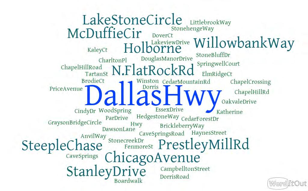
List the TOP THREE PLACES within the City limits that you would like to walk or bike to.
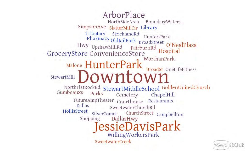
Which street(s) on the North Side would you prefer to WALK/ BIKE on?
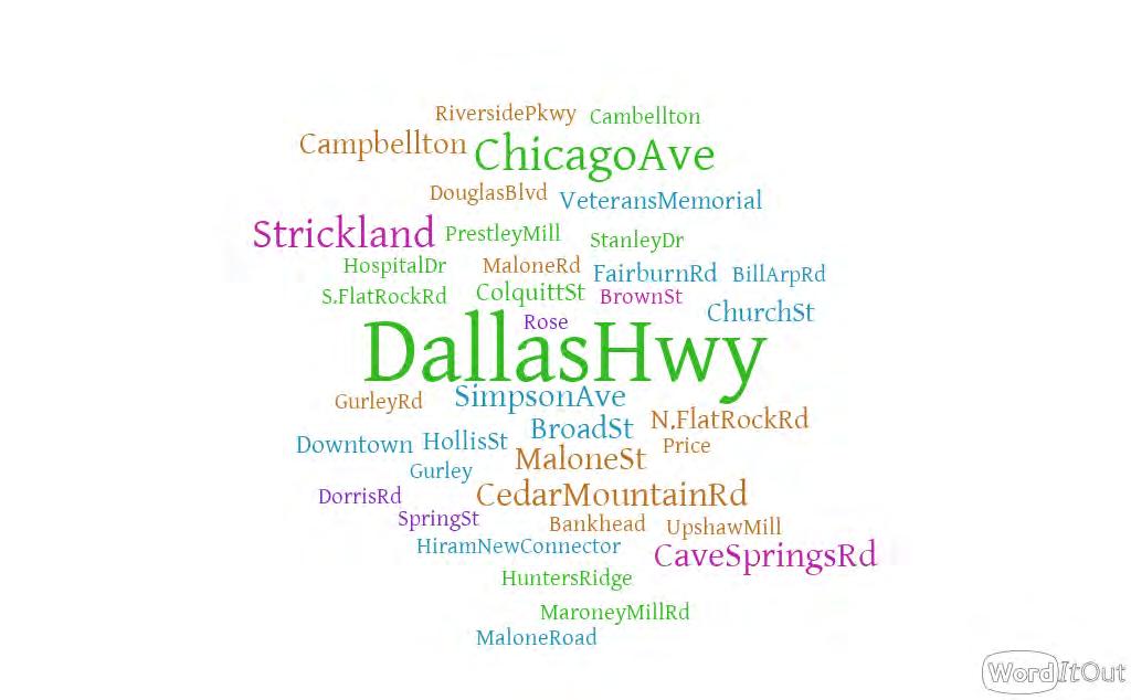


Commuting: Walk/bike to school
Commuting: Walk/bike to work
Recreation: Walk/bike for other reasons
Commuting: Walk/bike to City Hall
Commuting: Walk/bike for other reasons
Commuting: Walk/bike to complete errands
Recreation: Walk/bike to a friend's house
Recreation: Walk/bike to a recreation program
Recreation: Walk/bike for fun
Recreation: Walk/bike to a park
Recreation: Walk/bike to exercise
Which trail type do you prefer?


Multi-Use Trail Separated Trail
Please write down the PRIMARY REASONS THAT IMPEDE you from walking + biking in the North Side?
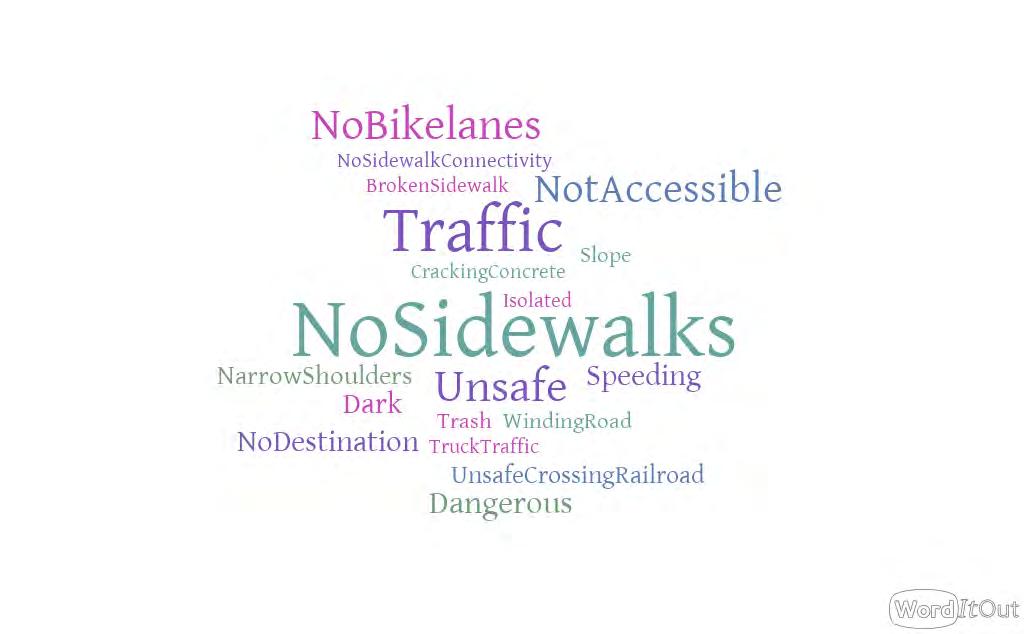
What BARRIERS keep you and your household from using outdoor spaces including parks, trails, sidewalks and attending special events in the North Side Area?
Facilities or Amenities are Not Appropriate for my…
Tell us what type of TRAIL ACCESS POINTS you would like to see along the trail network by selecting the preferred options.
What PROGRAMS would have the greatest impact on walking and bicycling on the North Side of Douglasville?
Other (please specify)
Employer-based encouragement Diversion class
Personal travel encouragement programs
Interpretive signage
Trail user etiquette campaign
School-based trail activities
Happy trails to healthy foods
Wayfinding signage Senior programs
Bicycle and pedestrian resource website
Guided nature walks and rides
Bicycle and pedestrian safety campaign
Launch parties for new bikeways

APPENDIX E

DOUGLASVILLE NORTH SIDE TRAIL STUDY
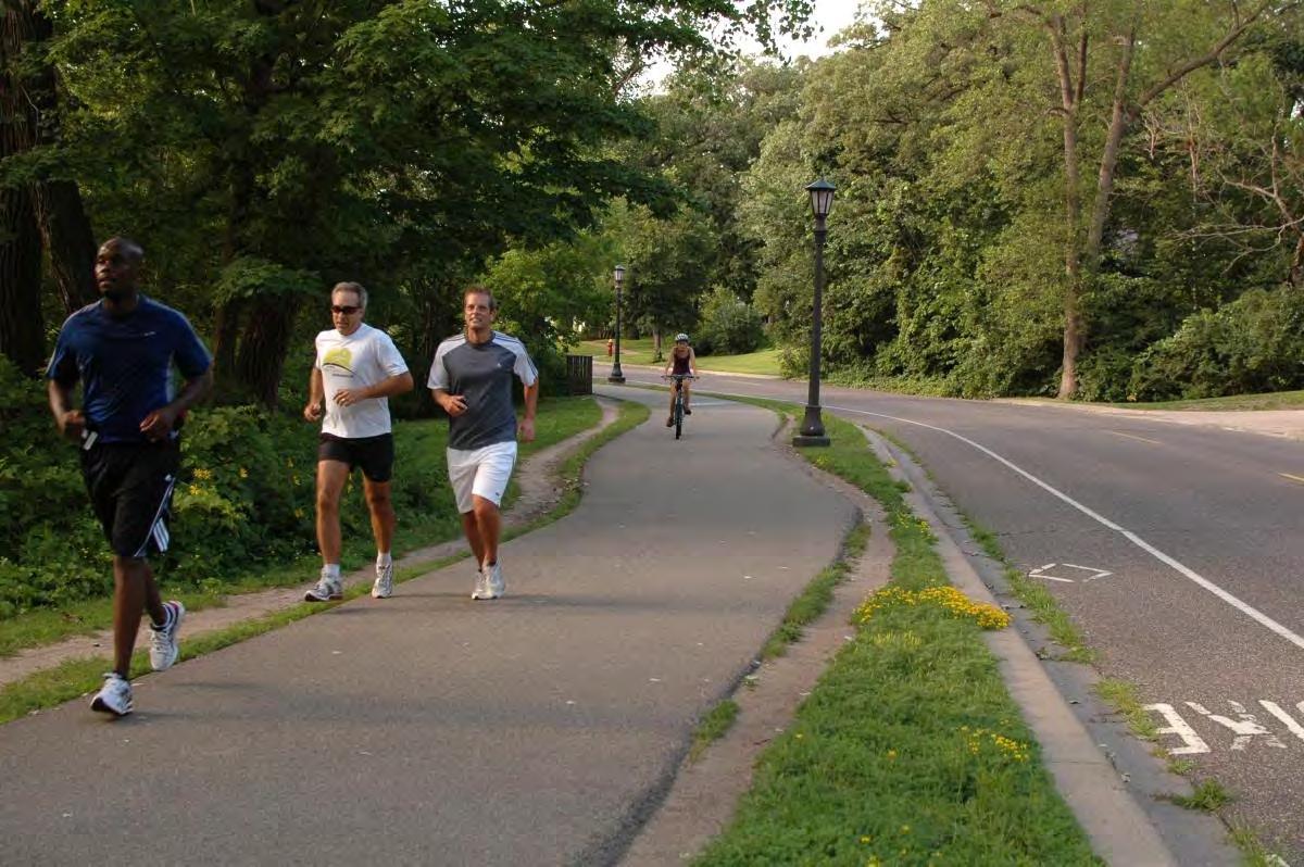


21 Residents of the North Side
Do you like the proposed TRAIL NETWORK?


Yes No
• How does this link up to the new town green at the old jail site?
• I would love the trail along with a grocery store and other eatery
• I would like to see the trail succeed and expand to Campbellton St around the new amphitheater park as well.
• Want to make sure that the road next to Worthan Park is used as a plaza to promote the trail along Strickland and use the overgrown area on the other side of that street as Mark Bree space.
• I like a natural path compared to concrete
• Jesse Davis Park would be a good trailhead.
• This is unnecessary use of taxpayer funds.
• Will there be lighting on the trail itself. Could put up solar led lights for safety concerns and will a bicycle officer be assigned during peak hours of use say 4pm until 8pm. I think anything is better than nothing. But I do not want to see it littered with graffiti and gang signs. Keep it clean needs to be a priority. Could use inmates to keep it up.
• How will it affect houses nearby? What safety measures will be in place? Police call boxes? Will the trails be closed at dark? If they are lights will they be directed down to limit light pollution. How will local wildlife be impacted?
• Will it connect to downtown?
Do you agree that the proposed trail network PROMOTES CONNECTIVITY?
Strongly Disagree
Neither Agree nor Disagree Disagree
Strongly Agree Agree
Chicago Avenue: Section 1


• I do have a concern about the condition of Crystal Lake. Safety and appearance are issues that need to be addressed
• Provide crosswalks
• Crime
• I like that there will be designated area down Chicago Ave for walking/running
• Waste of taxpayer funds
• Upkeep and cleaning should be priority
• I really like the streets chosen for the bike/walk trails


Chicago Avenue: Section 2

• Sidewalk and bike trail combination is good
• I like how it looks
• Provide crosswalks
• Crime
• Signage along the trail for amenities
• Looks good
• Waste of taxpayer funds
Chicago Avenue: Section 3


• This section appears to be around Crystal Lake. I do not see it in the image. Curious if this will fall short
• It would make a difference
• Crime
• Having a natural wooded area to walk/bike through is an improvement and adds enjoyment to the trail
• I do not have a clear understanding of how the crossing the street will be handled since the trail is on the opposite side of the street in this section


Strickland Street
• It is a great idea
• Safety concern - too close to tracks.
• Provide crosswalks
• Too close to railroad tracks and will promote more pedestrian deaths
• Looking at who will use it and what activities will be there
• I am not clear about how we will cross the railroad track and busy streets to access the businesses.
• My only concern is the buildup of traffic on this road and those walking needing to use crosswalks (crossing the street or the railroad) if they live in the area.
• But will it connect with downtown in any way?
Dallas Highway: Section 1


• Too much traffic
• I like alternative 2
• Gives it a better look
• Provide crosswalks
• What will happen with the blighted business properties along this street?
• Will it be safe with the traffic on this route?
• Unnecessary

Dallas Highway: Section 2


• Looks clean
• Provide crosswalks
• Will it be safe with the traffic?
• More greenery along the trail is better.
• This is an important drop in point.
• Would prefer that this area be prioritized first. Very little walk ability here despite being so close to the park.


James D. Simpson Ave: Alternative 1


• Looks clean
• It is a great connection
• There are some shady areas on that street- what is being done to provide safety
• Just how often the trail will be used and if it will remain clean

James D. Simpson Ave: Alternative 2


• I think it helps the neighborhood
• My concern is that there isn’t a sidewalk for both sides of the street. This is a safety concern.


Maxwell Street
• I like it
• There should be a sidewalk on both sides of the street.
• The more greenery along the trail, the better.
Malone Street


• Better connection; please trim the grass


Colquitt Street
• Think it will help this area
• Needs a sidewalk on both sides of the street.


Malone Road: Section 1

• I think it would have a nice impact
• The more greenery along the trail, the better.
• Just concerned about crossing the street to continue the trail.
• Will there be cross walks on Malone Road & the other streets along the trail?
Malone Road: Section 2


• Looks good • Too close to traffic
GA Power Transmission Line


• Great idea the land would be use good
• Key benefit!
• Can any amenities be in this area?
• Bathrooms/wash stations, dog refuse bags will be needed along the way
• May need cameras or security in this area.
• I am not exactly sure where this is located. Will there be safety/security for this area?


Future Developments: Alternative 1

• The North Side needs some new development
• The more greenery along the trail, the better.
• I especially like the buffer of trees between the trail and the road/traffic which will provide safety and needed shade.

Future Developments: Alternative 2


• The more greenery along the trail, the better.
Do
you like the proposed amenities recommended for the MAJOR TRAILHEADS?


• If possible, provide an off-street Parking Lot. Have on Street for backup, maybe 6. Lot could be 10 to 12. Getting Bikes and other Gear would be more suitable for off road Parking.
• Bike rental would be a nice addition - adult tricycles would be super
• Jesse Davis needs an update
• Water bottle water fountains
• Unnecessary use of taxpayer funds - who asked for this?

Do you like the proposed amenities recommended forthe


MINOR TRAILHEADS?
• Again, for Safety’s sake and convenience an off-street Parking Lot for 10 Vehicles and 4 to 6 on Street Parking.
• It needs some work
• Bike rentals that include adult tricycles would be great!
• Jesse Davis is a great option.
• Unnecessary use of taxpayer funds - who asked for this?

APPENDIX F

General Specifications and Requirements for Trail Installation on Right-of-Way*
1. All gravel access spurs/roads shall comply with the typical access road section detail and written specifications (attached). The minimum inside turning radius required is 50’. Maximum longitudinal slope is 16%. Maximum cross slope is 2%.
2. Trail shall be constructed with heavy duty concrete capable of supporting commercial vehicles and construction equipment. All concrete materials and placement should conform to applicable GDOT specifications. GDOT approved jointed Portland cement concrete mix minimum depth of 7 inches with a minimum compressive strength of 4000 psi and a minimum 28-day flexural strength (modulus of rupture) of at least 600 pounds per square inch, based on three point loading of concrete beam test samples. Graded aggregate base (GAB) minimum 6” depth. Concrete joints and reinforcement per applicable ACI and ASTM standards. Trail width must be a minimum of 12’ wide concrete with 2’ side shoulders consisting of gravel or other suitable surface capable of supporting commercial vehicles and equipment.
3. Provide all construction drawings and specifications for GPC review and approval, including:
a. Site Development (Civil) Drawings
b. Erosion, Sedimentation, and Pollution Control Plan
c. Project Specifications
d. Tree Protection and Replacement Drawings
4. GPC may access and/or close the trail at any time for maintenance and trouble calls with or without prior notice or consent to any individuals, the public, or business entities.
5. Site erosion control in compliance with the Georgia Erosion and Sedimentation Act of 1975, as amended.
a. Cut and fill slopes graded to a slope of 2.5:1 or flatter, protected from erosion by appropriate erosion control, such as grass sod, seed and mulch, riprap, etc.
b. Adequate storm water diversions, such as ditches, berms, etc. at the top of all cut or fill slopes to prevent water from running down slopes.
6. Site storm water system design in compliance with all federal, state, and local requirements.
7. Ditch slopes constructed with a centerline slope of 0.5% minimum and stabilized with cover to minimize long-term erosion in accordance with the Manual for Erosion and Sedimentation Control in Georgia (Green Book).
8. Trees, brush, stumps, roots, topsoil, organic materials, asphalt, foundations, and other debris to be removed from the site, including cut and fill areas.
9. A suitable site free of any environmental hazards, contaminants, or concerns:
a. Copies of environmental site assessments, studies or investigations performed on the site and the GPC lease/easement area
b. Copies of any environmental permit and regulatory correspondence pertaining to the site or GPC lease/easement area
10. Applicant must obtain all applicable local, state, and federal approvals and/or permits prior to beginning land disturbance activity for development of the trail area. Applicant is responsible for any fees associated with applicable approvals and/or permits.
11. Provide copies of Erosion and Sedimentation Control Plan and National Pollution Discharge Elimination System (NPDES) Notice of Intent.
12. The site should be prepared for inspection at least 4 weeks in advance of planned commencement of construction. GPC will inspect the site for conformance with its requirements and the encroachment agreement after notice from applicant.
13. Any approved deviations or variances from these requirements will be documented in the encroachment agreement between GPC and applicant.
* These guidelines are for informational purposes only and the information set forth herein is subject to change at any time in whole or in part, without notice, in Georgia Power’s sole discretion. It is not practical to list every possible scenario or use of a transmission right-of-way, and these guidelines do not include every requirement that may be applicable to a specific request. All requests are reviewed on a case-by-case basis to determine compatibility of the use with Georgia Power’s rights and applicable law and standards.
General Guidelines for Lighting & Signs Georgia Power Rights-Of-Way
1. Signs and lighting features no higher than fifteen (15) feet may be located within the right-of-way, but not within the wire zone.
a. The wire zone refers to the area directly under the conductors (wires), plus ten (10) feet out from the outside conductors.
2. All lighting standards and metallic objects within the right-of-way should be properly grounded to prevent exposure to induced currents and voltages.
3. Lights should not be attached to transmission poles on cross country rights-of-way.
4. Electrical service for lights or signs should be from a dedicated service point.
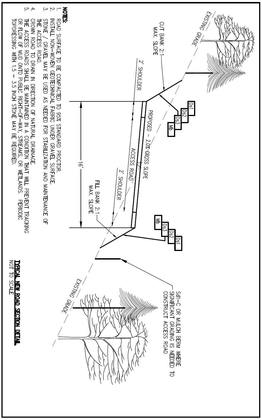
General Guidelines for Bicycle and Pedestrian Trails on Georgia
Power Transmission Rights-of-Way
General guidelines* for placement of bicycle and pedestrian trails within GPC’s transmission rights-of-way are set forth below.
Applicant will be required to enter into a written agreement for use of the right-of-way for a trail. Please note that the agreement for use may include additional terms not set forth in the below guidelines.
1. Scope of Use: Trails may only be used for bicycles or pedestrian use. No motorized vehicles are permitted.
2. Location: Trails must be located at least 25’ from any GPC facility or equipment, including without limitation poles, guy wires and towers. Applicant must submit to GPC an engineered drawing prepared by a licensed engineer or surveyor identifying the proposed location of the trail, and the width and length of the trail on the right-ofway with respect to property lines and structures. Once approved, no changes may be made to the location of the trail without GPC’s prior written approval.
3. Required Consents:
a. Applicant may not make any improvements without GPC’s prior written consent.
b. Where GPC owns the right-of-way in fee simple, Applicant must obtain written consent from the property owners located immediately adjacent to GPC’s rightof-way. Applicant must obtain GPC’s consent to any documents used in connection with such third-party consent, and such consent must be obtained at Applicant’s sole cost and expense. Applicant is responsible for determining who holds title to the property immediately adjacent to GPC’s right-of-way.
c. Where GPC has easement rights for the right-of-way, Applicant must determine who holds title to the underlying fee simple property and must obtain an Easement from such property owner(s). Applicant must obtain consent by GPC to any documents used in connection with such easement, and such consent must be obtained at Applicant’s sole cost and expense.
d. Applicant is responsible for obtaining any necessary city, county, state and/or federal permits.
4. Surface Material: The composition of surface material used for the trail is subject to GPC’s prior written approval. The trail must be constructed in accordance with Georgia Department of Transportation roadway specifications such that it is of a strength sufficient to withstand passage of GPC’s construction and maintenance vehicles and equipment
5. Landscaping: Proposed landscaping must be shown on the drawing submitted to GPC. Only landscaping approved in advance by GPC may be installed on the right-
of-way. No shrubbery or trees are permitted that are capable of exceeding fifteen feet (15') in height at maturity
6. Signage: All necessary signage must be installed by Applicant at its sole expense and is subject to GPC’s prior written approval. Signage may not exceed fifteen feet (15') in height or be located within the wire zone. Applicant is required to post opening and closing hours of the trail.
7. Outdoor Lighting: The installation of outdoor lights along the path of the trail is subject to GPC’s prior written approval. Outdoor lights must be owned and maintained by an electrical utility. Installations may not exceed fifteen feet (15') in height or be located within the wire zone. Applicant will be responsible for the cost of installing and maintaining outdoor lights.
8. Environmental: Applicant must abide by all local, state and federal laws regarding wetlands, protected species and stream buffer protection. Applicant must install and maintain the trail using environmental best management practices to ensure proper erosion control. Applicant may not place any hazardous material on the right-of-way.
9. Construction, Maintenance and Repairs: Applicant is responsible for constructing, maintaining, and repairing the trail at its sole cost and expense. GPC retains the right to temporarily or permanently prohibit or restrict access to all or any portion of the trail and is not responsible for any damage to the landscaping, trails or paths caused by or resulting from exercise of any rights by GPC. Neither the trail nor its use may at any time inhibit GPC’s access to the right-of-way, including without limitation during construction of the trail, making landscape improvements, and installation of signs and/or lighting. Mechanical grade work during installation must not impact the ground grid located on the right-of-way. Applicant must notify GPC of the construction schedule and the equipment that will be used during construction.
10. General Cleanliness: Applicant will be responsible for routine removal of trash and debris, and for routine maintenance of landscaping along the trail. Alternatively, Applicant may enter into an agreement with the City or County in which the trail is located, whereby the City or County agrees to be responsible for the foregoing
11. Termination of Agreement: The agreement for use is subject to termination upon the following:
a. if, at any time, GPC deems it necessary to have the unrestricted use of the rightof-way for current or future needs
b. trail is not constructed within 2 years
c. trail is not maintained in a condition acceptable to GPC
d. general cleanliness along the path of the trail is not acceptable to GPC
e. trail is utilized for purposes outside the scope of the agreement with GPC
Either party may terminate the agreement with 30 days’ written notice. In the event of termination, Applicant will have 60 days to remove all improvements from the
right-of-way and restore the right-of-way to its original condition, all at Applicant’s sole cost and expense. If the improvements are not removed within 60 days, GPC may remove them and bill Applicant, and Applicant must make full payment GPC within 30 days from the date of the invoice.
12. Insurance: Applicant must at all times maintain general liability insurance in an amount determined by GPC. GPC must be named as an additional insured by policy holder.
13. Liability: Use of the right-of-way by Applicant will be at its sole risk and expense, and GPC must be specifically relieved of any liability for injury to persons or damage to property resulting from the use of the right-of-way. Applicant must covenant not to sue GPC and must indemnify GPC for all claims associated with Applicant’s use.
14. Retention of Land Rights: GPC will retain all of its property rights, whether granted to it by written deeds or easements, or obtained by prescription.
Right-of-Way Encroachment Application
NOTE:
No work may commence within a right-of-way until an agreement has been executed by both parties.
Request Date
Applicant Information (Complete this section using the legal name of the person or entity that will be responsible for execution of any documents or agreements associated with the request to encroach.)
Property Location Information
Project Name Nearest
Owner of Record of the Encroachment Area*
Tax Assessor Parcel ID Number, if Known
County Land Lot District
Major Intersection
Project Address
City, State, Zip Code
GMD
Section
*NOTE: If applicant is not the owner of record, permission must be obtained from the underlying property owner in addition to the owner of the utility right-of-way.
Have you had contact with a Georgia Power representative or other ITS representative regarding this project? Y N
Name of Representative
Phone Number
Date(s) of Contact
Drawing
Company
Georgia Power
Georgia Transmission MEAG
Dalton Utilities EMC
Other
To expedite the approval process, please provide a drawing with the following information labeled (if available). Acceptable Formats Include: JPEG, PDF, TIFF, etc.
Name of T/L
Land Lot, District, Section or GMD
County
GPS Coordinates
Encroachment Location between Identified Structures with Structure Numbers
Location of all nearby transmission or distribution facilities with Name and Structure Number
Location of Centerline
Distance between Structures, Guy Wires and Anchors, and Encroachment
Overhead Clearance at Maximum Sag (If Applicable)
Distance between Encroachment and Edge of Right-of-Way
Angle of Crossing
Grading, Maximum Depth of Cut, Maximum Slope, Distance to Structure
Grading Plans showing Proposed Maximum Depth of Cut Max Slope & Fills (If Applicable)
Fills, Vertical Clearance of Conductors to Ground Based on Maximum Sag
Ingress and Egress for Operation and Maintenance
Additional Comments:
Encroachment Information (Check all boxes that apply and complete the information on the following pages. Include a map, plan, or sketch.)map, plan, or sketch.)
What is the proposed use of the property? Please describe in detail.
Do you plan to do any cutting or filling on the property? If so, explain.
What type of equipment will be used?
Dragline Trencher
Bulldozer Front End Loader
Estimated Begin and End Date of Completion
Crane Other to
Encroachment Will Be
Approximate Height Permanent Temporary Expected Expiration Date
Excavation, if Required Width Depth
Do you know of any other utilities on the property? If so, please identify.
Does this project involve the possible relocation of a structure? If so, please explain.
Right-of-Way (If applicable, attach name, company address, and a contact person for all utilities involved in project.)
Draw in the space provided below the location of the proposed use. (Identify structures and show distances and angles from structures). Diamonds on the line represent structures on the right-of-way. Copy the series of numbers and/or letters from the upper half of each structure (see example below) and enter into the structure identification boxes. Indicate which direction is “North” in relation to the right-of-way.
Structure Number (‘30’ & ‘35’) STRUCTURE IDENTIFICATION
Identify structures and show distances and angles from structures:
