3 minute read
RESERVE PLOTTED NEIGHBOURHOOD MASTER PLAN

from Work Profile
by Diksha Singh

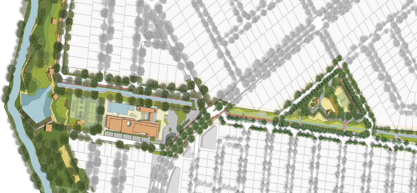
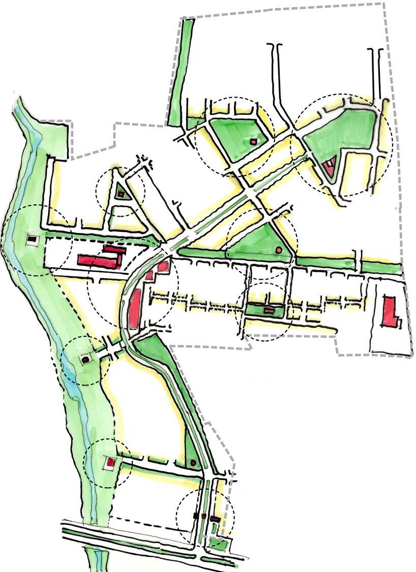
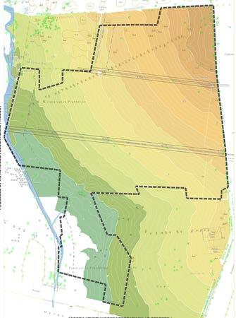
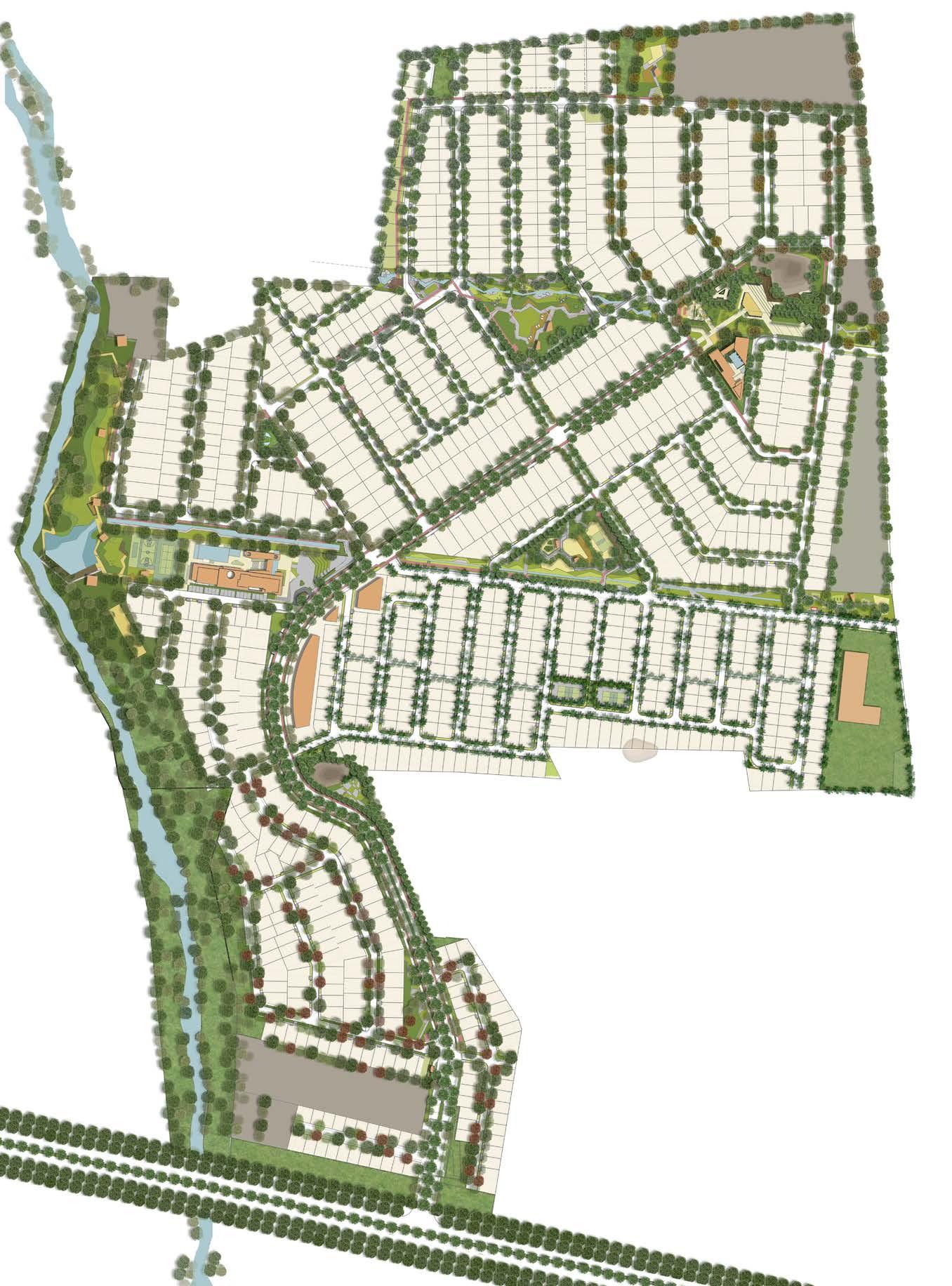
The structure for the master plan primarily emerges from a deep understanding of the unique landform of the site. The main armature of the plan is city-wide boulevard which meanders and ascends the site from lowest part, along the entry point, and culminates at the foot of the proposed Nandi Hill Park; the highest precinct of the site. The secondary street network emerges from this spine and is aligned so as to hug the contour levels/ lines of the site.
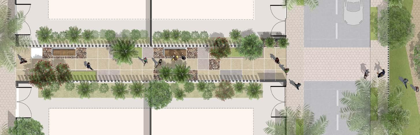
Subtle street and block manipulations also help generate surprising array of small neighbourhood parks and plazas throughout the township. Vistas, terminuses, enclosures,street edges, and intersections, have been designed carefully in terms of perception of residents moving along the street. In a way the street design is a balanced coupling of engineering, water management, and pictorial setting.
Advertisement
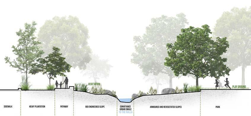
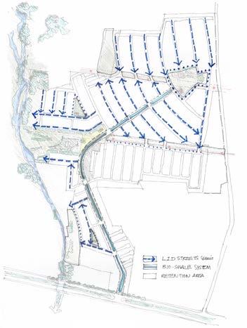
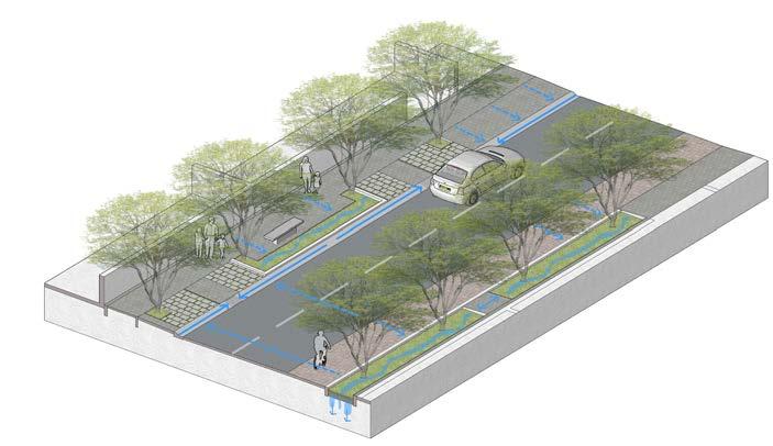
The streets at Godrej Reserve have been designed as per LID or Low Impact Development streets guidelines. LID or ECO-streets are designed favouring ‘soft engineering’ and vegetated treatment to manage rainfall conveyance
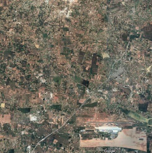
Location: Devanhalli, Bangalore
Plotted Master Plan
Principle Master Planner : Mukul Arora
Team : Diksha Singh | Saurabh Syal
Landscape Architect : Landart Architects
Professional | Group | 2018
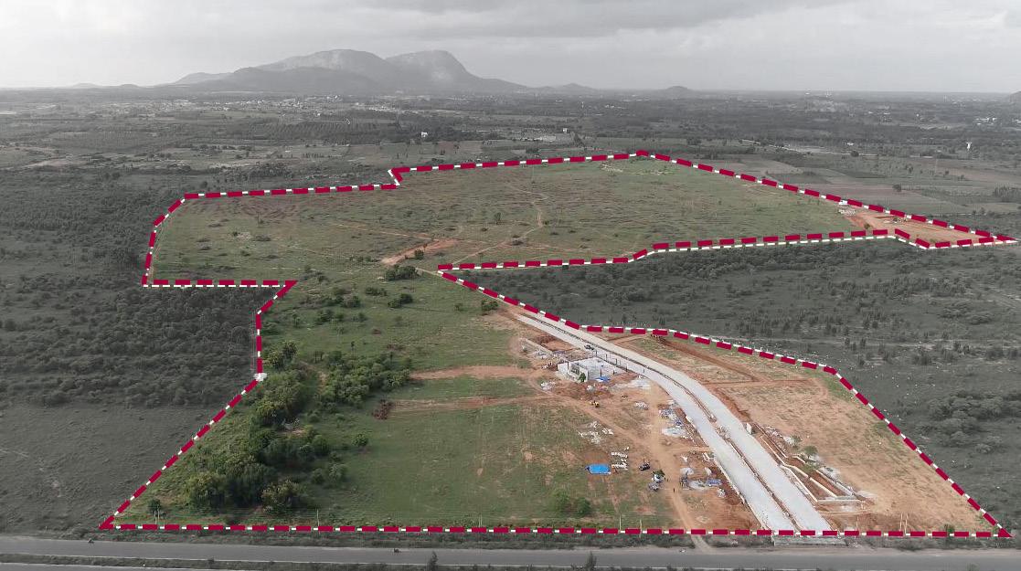
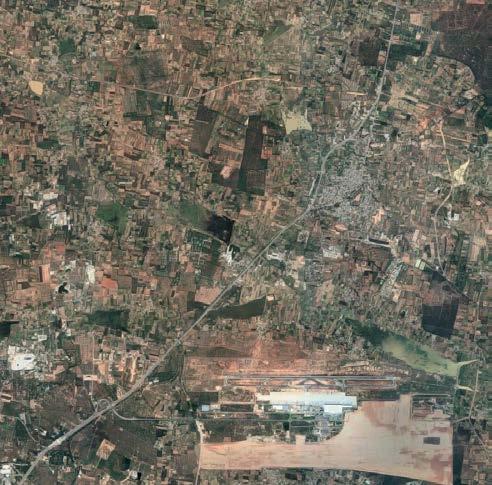
Godrej Reserve is a 100 acre proposed master planned community situated along 80m wide NH 648 , just north of Bangalore Airport. The land parcel is a picturesque setting of a consistently rising terrain dotted with local granite outcrops. The site also offers spectacular view of the Nandi Hill towards the north as well as the Kaggali Hanuman Temple along the Southwest tip. Two HT lines run across the site along the E -W direction.
The project offers a net built-up area of around 1,77,500sqm in the form of 950 plots with an average density of 10 plots to an acre. These plots offer a sustainable mix of small-to-mid-to-large sizes varying from 110sqm to 300sqm.
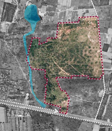
A seasonal drain runs N-S along the western edge of the site, which also is the lowest part of the landform. Given the average gradient of around 1:50, the site drains into this natural system and to manage this, a stormwater collection system was introduced.
The Urban Stromwater infrastructure enhances the ecological functioning to serve as a civic asset without being a environmental liability.
Low Impact Development (LID) is an ecologically based stromwater management approach favouring soft engineering to manage rainfall on site through a vegetated treated network.
01 A Plan That Works With Contours
The structure or framework emerges from a deep understanding of the unique landform of the 100 acres
02 Conveyance
Water conveyance shall be the generator of landscape design and low-impact infrastructure design
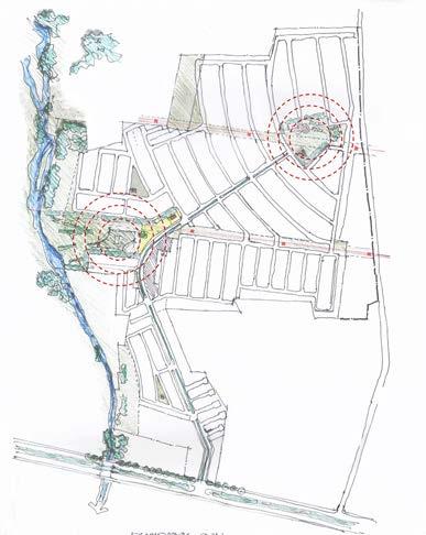
03 PLACEMAKING - 2 ANCHORS
The plan is an assemblage of an iconic spine- the boulevard- and two anchors- the club and Nandi hill park. HIGHEST WITH THE LOWEST POINT
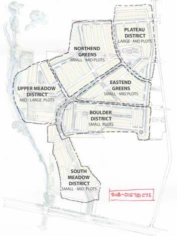
04 Sub Districts
Creates multiple special addresses or subneighbourhoods in the township each with its own unique identity
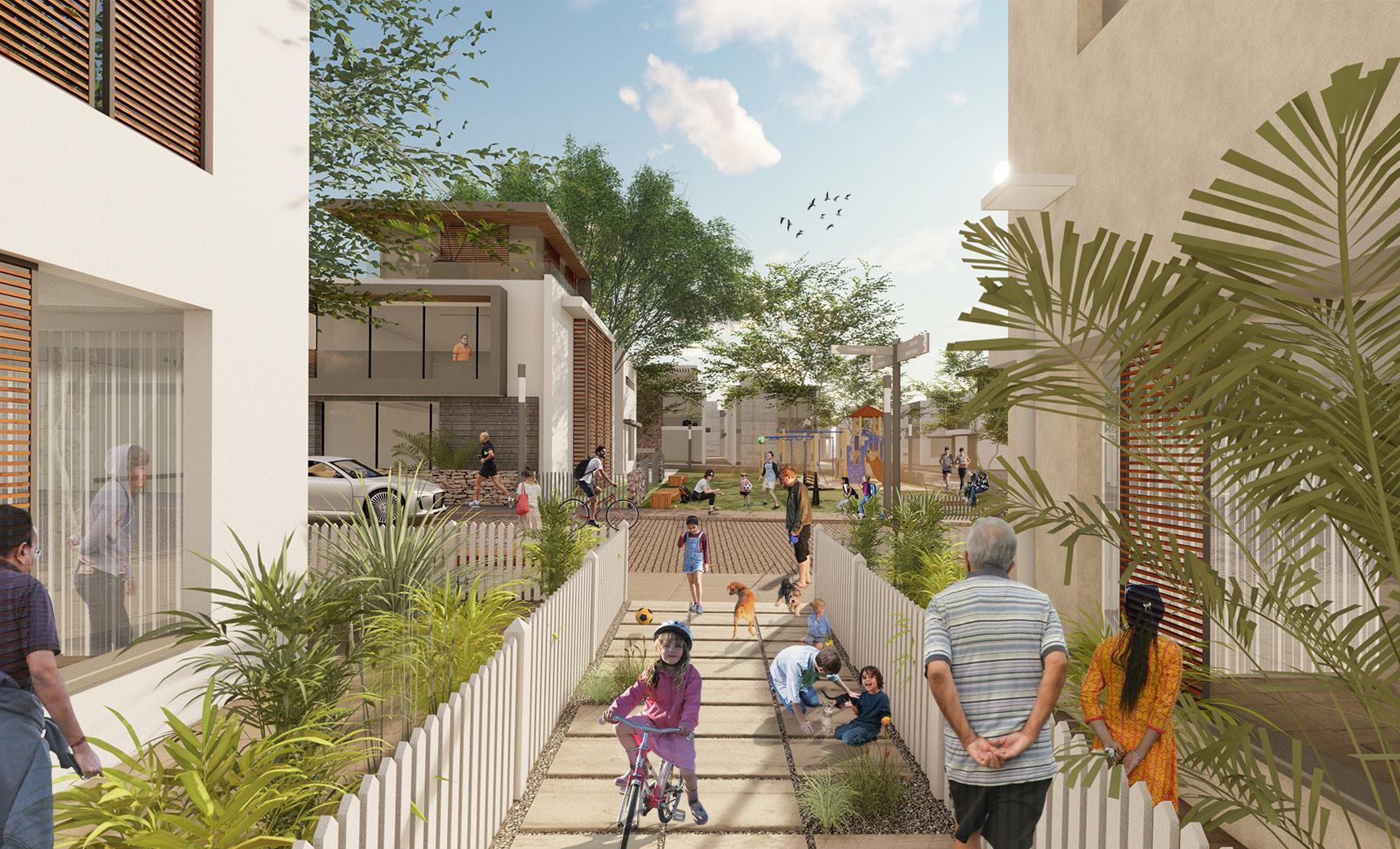
Creating well defined and an intensely interconnected OPEN SPACE AND SAFE environment
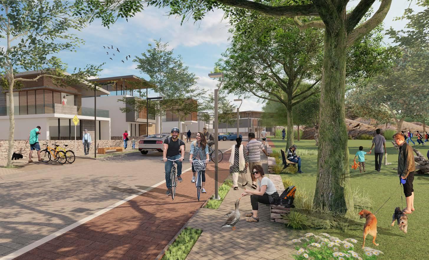
A series of well landscaped promenades, progressive street-way systems, and a generous park system has been designed as the framework for the township. The high quality streets and fragile block pattern has been consciously designed to create a porous and interconnected community.
This allows for the many activities of daily living to happen within walking distance, allowing independence to those who do not drive; especially the elderly and the young; and enable neighbours to know each other and protect their communities
Green Connections
Given the concern for environment and especially water, rainwater conveyance has been the generator of streetscape and lowimpact infrastructure design.
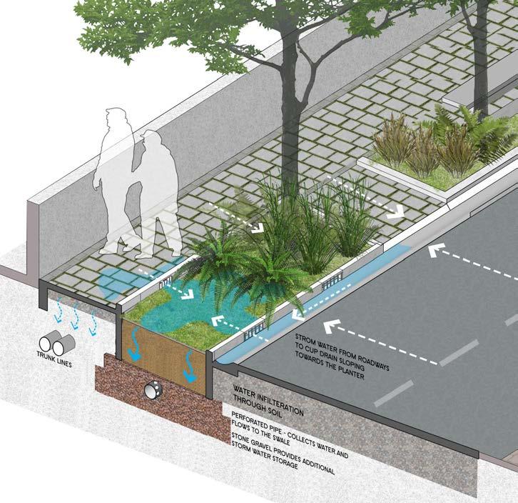
Lid or eco-streets are designed favouring soft engineering and vegetated treatment to manage rainfall conveyance instead of conventional concretized piped system that uses curbs and gutters.
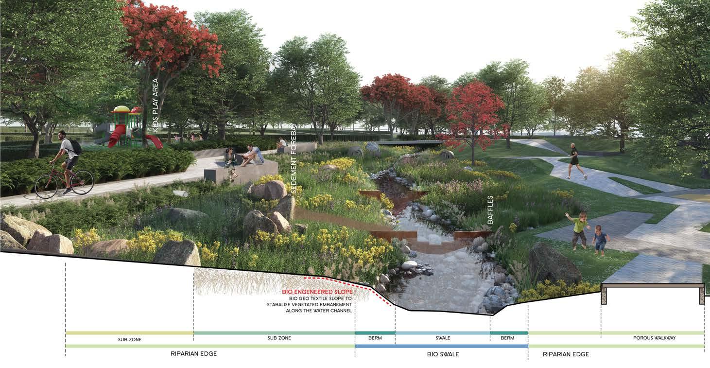
The intent is to capture the rain as and where it falls and reduces the runoff before it enters the trunk lines.The excess water from the lid street is conveyed Using surface flow to the bio-swales.
The park is located centrally to the west-end green park district. It has the north swale linear park running along one side and peripheral access roads along the other sides. It acts as a green wooded edge, a relief place from the built environment. The park offers multi-activities and also passive recreation zones. It has pedestrian links across, connecting the farthest peripheral points.