3 minute read
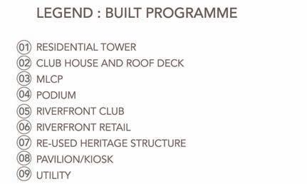
RIVERHILLS MIXED-USE RIVERFRONT NEIGHBOURHOOD

from Work Profile
by Diksha Singh

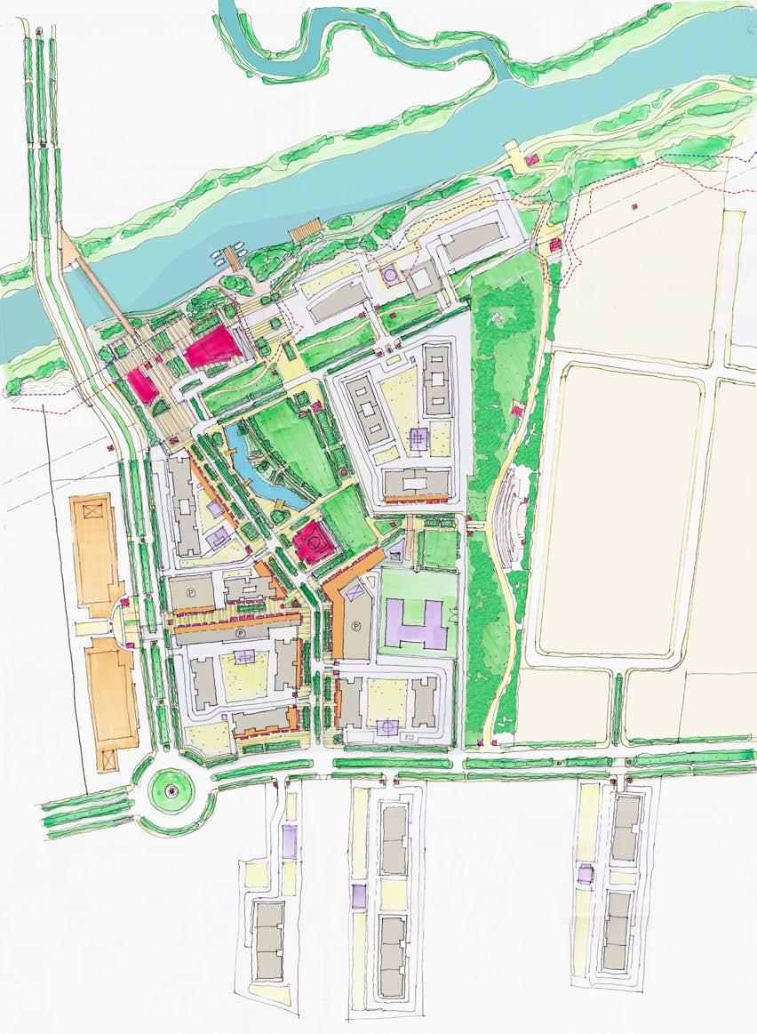
URBAN DESIGN - MASTER PLAN
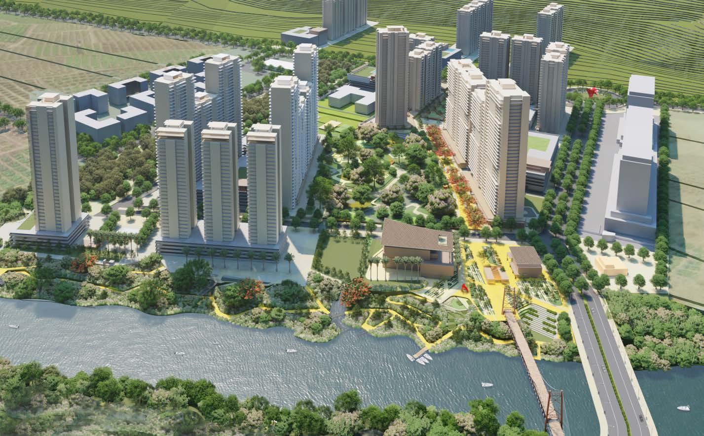
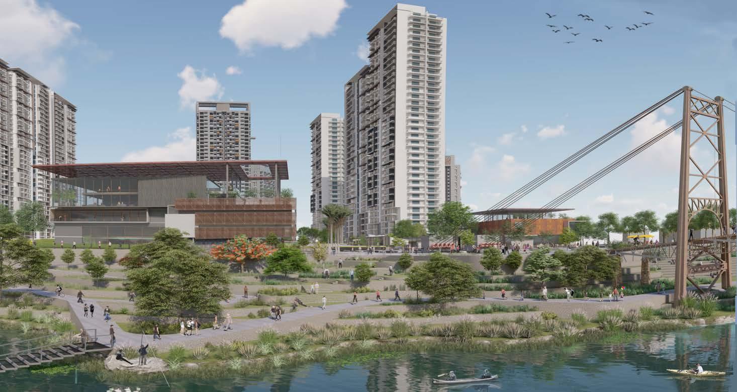
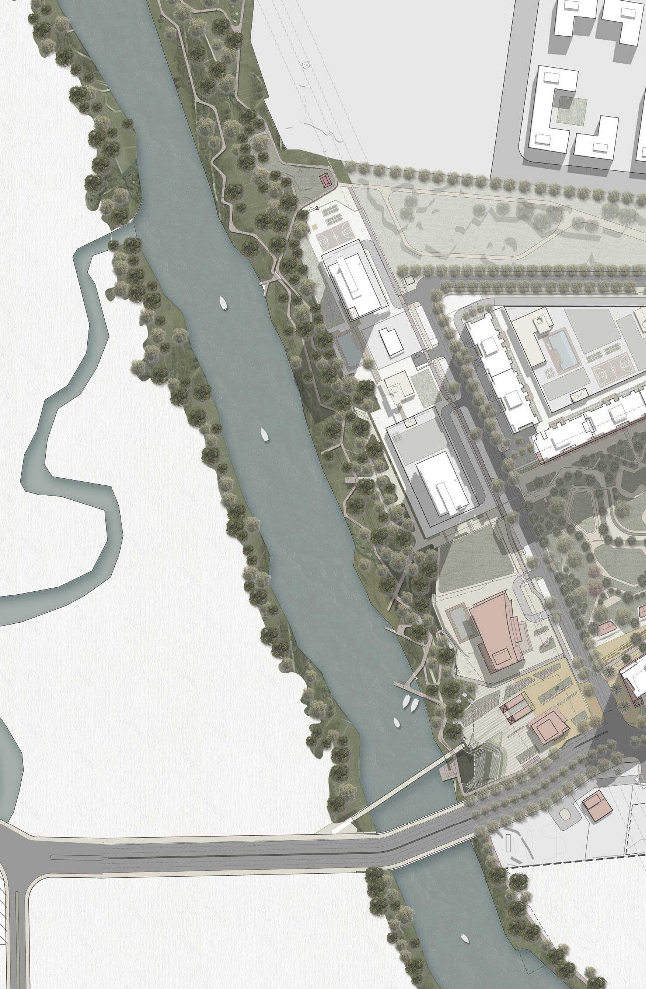
The Mula riverfront is a collective experience of the articulated edge of the Upper waterfront promenade, the ecological floodplains at the lower levels, as well as the rivers water-sheet.
Advertisement
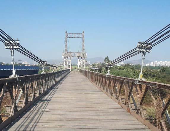
The Heritage metal footbridge, the iconic clubhouse, and public marketplace act as the anchoring element for this waterfront edge.
Location: Pune, Gujrat, India
Master Plan | Mixed Use Development
Design Team (DADA Partners): Mukul Arora, Diksha Singh
Consultants: Stupio POD (Landscape)
Client : Godrej Properties Ltd.
Gross built area: 1.2 million sqft / 67 acre land parcel
Professional | Group | 2019
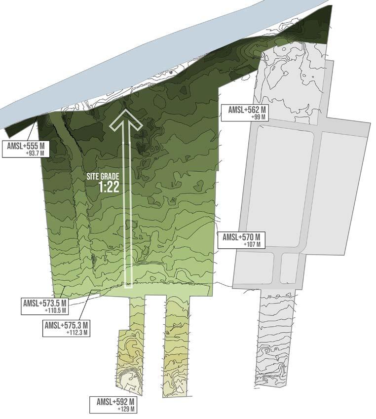
The Site And Context
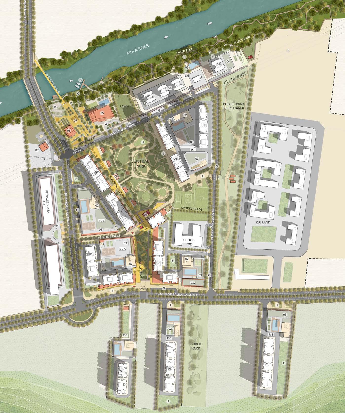
This project site is book ended by the tekari towards the south and river towards the north. The land has a significant and perceivable drop of around 30 metres along its full length.
Two major arterial DP roads bring easy access to the site from the Pune Mumbai highway from across the river from Hinjewadi.
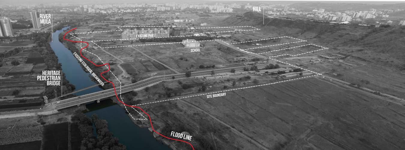
The site is mostly devoid of natural or built context along its southern edge however on the northern edge the river, its floodplain, and the densely canopied embankment set up a strong context for the proposed layout plan.
Site And Surroundings
CREATING AN INTIMATE INWARD RIVERWALK EXPERIENCE ANCHORED BY A STRONG DESTINATION “TOWN CENTER “
"WHERE COMMUNITIES ARE FOCUSED AROUND NEIGHBOURHOODS"
A compact and socially diverse city where economic and social activities overlap and where communities are focused around neighbourhoods.
Vision And Principles
AN EXCLUSIVE HIGH-QUALITY COMMUNITY ‘HIGH ON GREEN’
The township weaves the qualities of adjacent neighbourhoods into a rich tapestry of unique places. The precinct offers a wide variety of housing typologies and a network of open spaces.
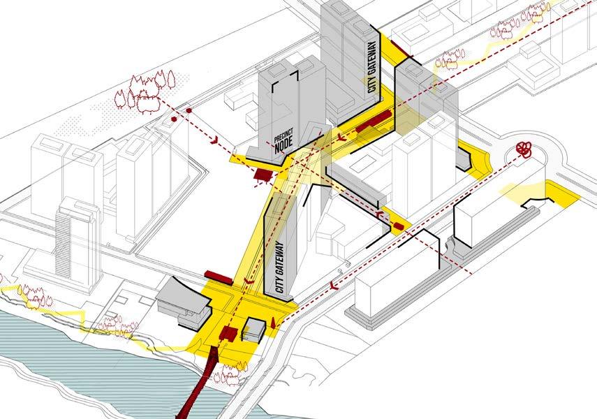
VIEW CORRIDORS AND NODES that act as keystones or multiple Public armatures; critical building surfaces or street walls that define the primary movement experiences; Tower locations acting as REGIONAL BEACONS for the project
Riverwalk
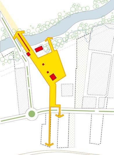
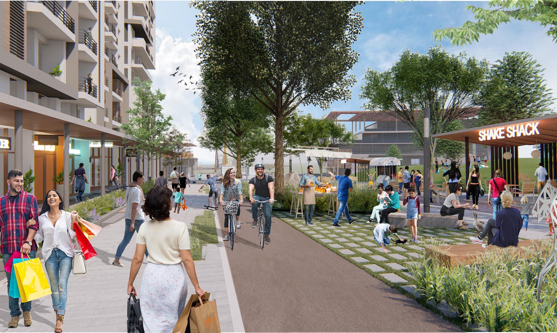
The RIVERWALK along the Main Street boulevard connects the riverfront and the Central Park with the urban front door of the project. This primarily pedestrian retail experience will be defined by inviting built edge as well as landscape gestures. Multiple kiosks dotting the edges of the ecological bands and other landscape spaces such as amphitheater would allow for diverse set of activities.
River walk south defines the gateway along the DP road and a pedestrian mixed-use retail experience that is defined equally by the very urban spatial build quality as it is by the gently terracing open space design.
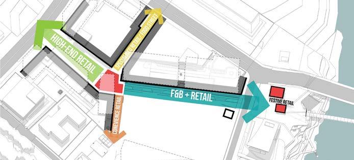
River walk north is the one sided retail transitions into the large community green on the other side. The riverine inspired central landscape is punctuated by outdoor cafes and informal markets along its length.
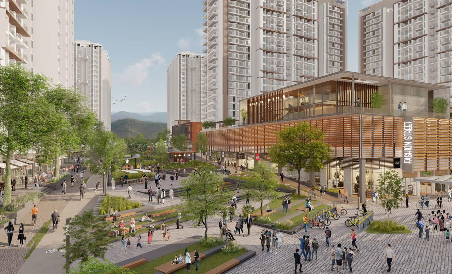
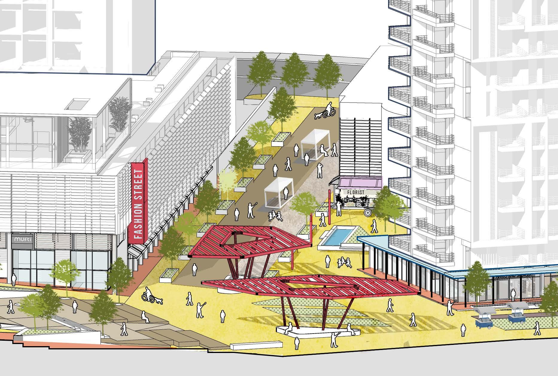
FASHIONSTREET
NORTH RIVERWALK SOUTHRIVERWALK
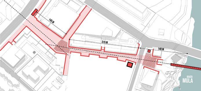
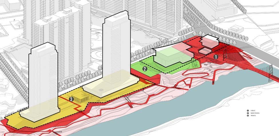
Assembling a 400m PUBLIC pedestrian spine
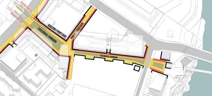
Programmed, safe, and animated MIXED-USE GROUND PLANE
Diversity of programming means multiple GO-TO SPACES
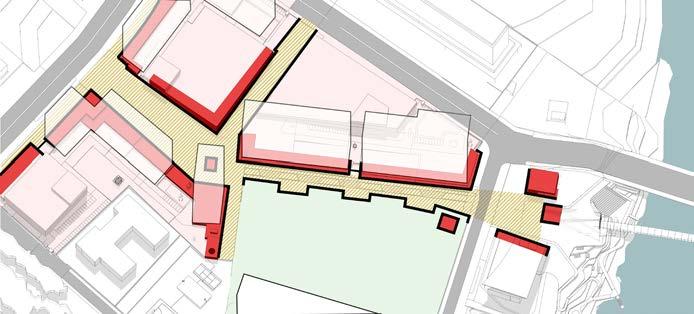
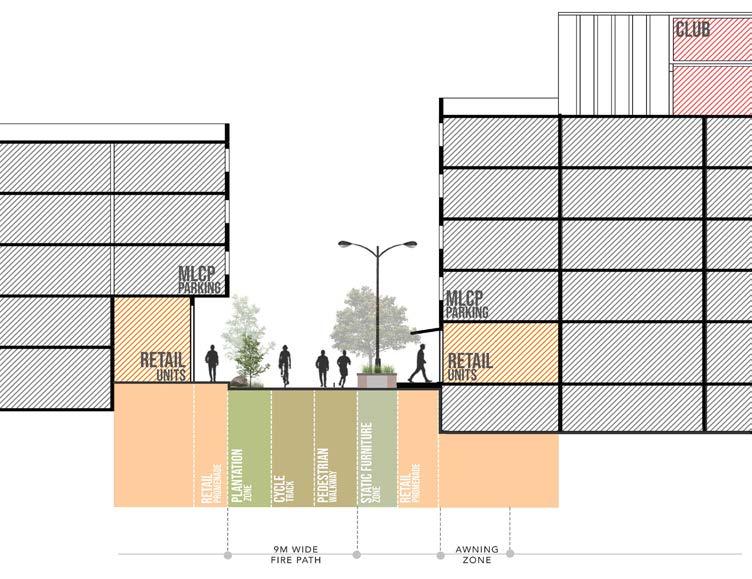
Assembling The Pedestrian Riverwalk
TRIPARTITE delineation of the space with middle zone as the eclogocal reserve
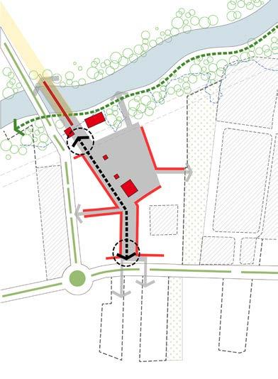
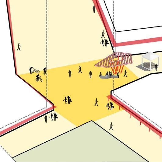
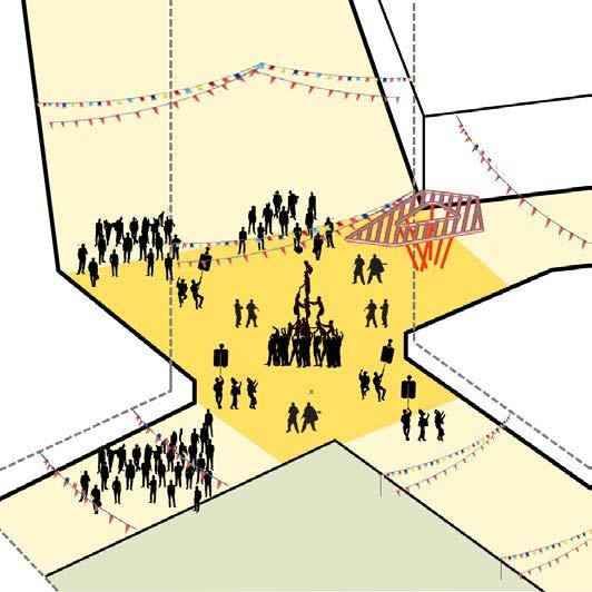
The 24X7 SOCIAL HUB of mahalunge. A pivotal point in the township that rivets ones gaze to the city spine and the hills above and the looming metal bridge over river Mula towards the north.
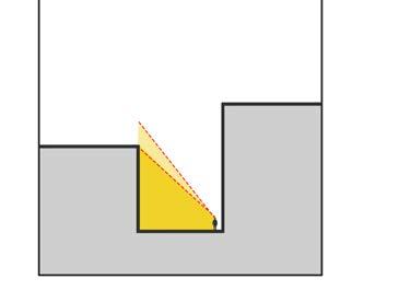
The chowk is where all pedestrian routes converge and it’s significance emerges from a pinwheel movement diagram which is a pattern commonly seen in our historic city fabric.
The narrow and shaded, Fashion Street is another such spatial device that is popular in the context of our social and climatic conditions. Part of the pin-wheel movement system, Fashion streets provides an important connect with the DP road along the west edge and the expected footfall form the SEZ parcel.
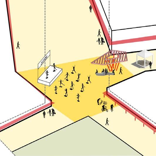
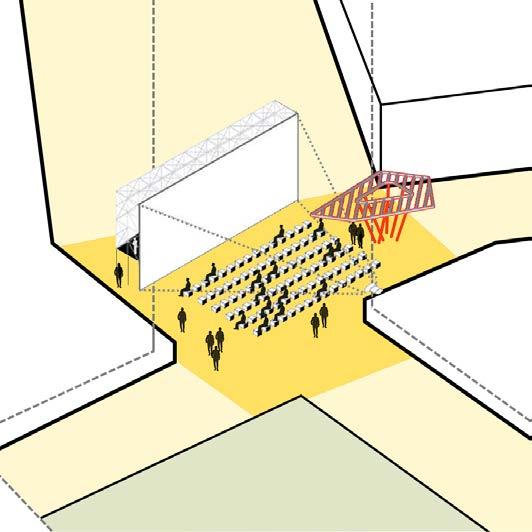
MONTHLY - OUTDOOR MOVIE/SPORTS MATCH SCREENINGS
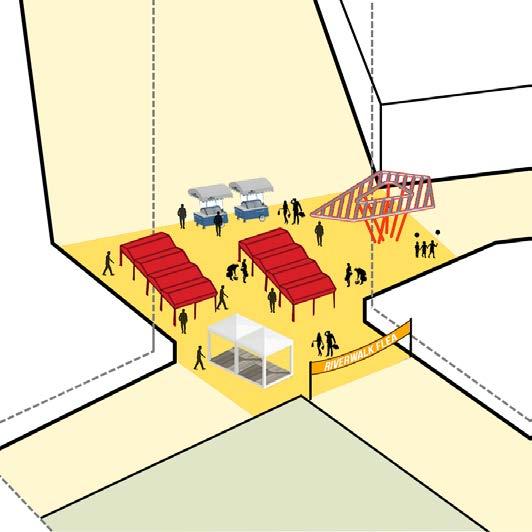
MONTHLY- FLEA MARKETS/FAIRS
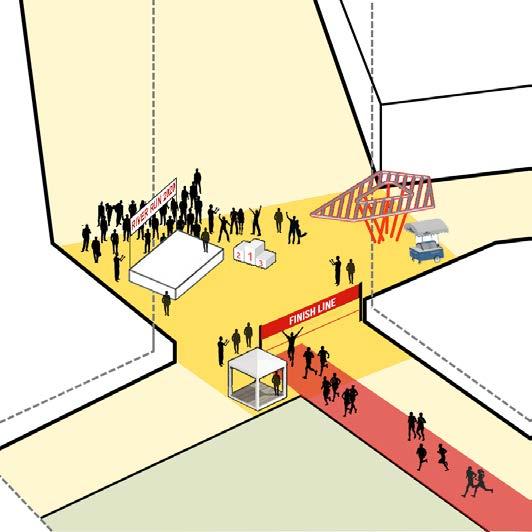
ANNUALLY- MARATHONS
ANNUALLY- FESTIVAL CELEBRATIONS a
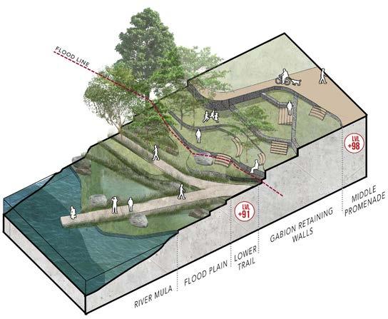
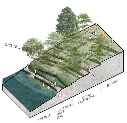
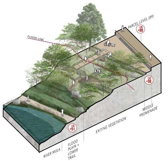
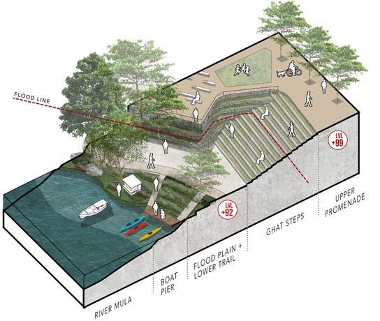
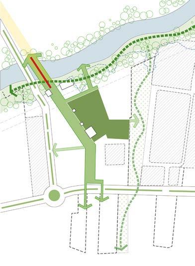
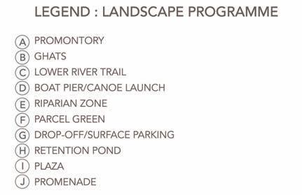
Of all the districts this one has the most ecologically sensitive zone Elements such as the ghats, and ramps act as the important connecting devices for this undulating rivers edge. They also allow users to access the river water from the upper parts of the promontory.
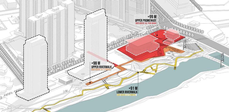
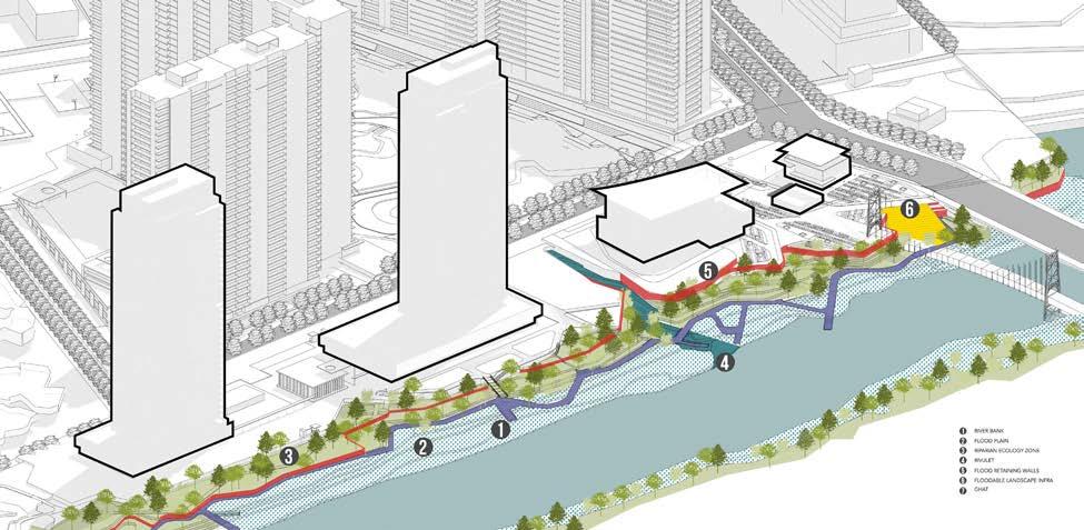
The Rivers watersheet is also considered as a hydrological extension or appendage to the ecological land-based system described above. Activities such as religious rituals, leisure, boating, swimming, etc are all everyday activities that have been programmed in the master plan.
Componenets Of A River Edge
Godrej Garden City master plan creates a blueprint for a high density community at the periphery of Ahmedabad’s urban city core. The plan primary draws inspiration from the way of life in which residents still embrace mixed-use fabric; a way of life where public open spaces and bazaars are frequented by the community year round, a nod to the very essence of urban coexistence
At the most fundamental level the plan firmly sets the intent for a new town that is held together by a genuine and active public realm, while optimising the insatiable and prosaic demand for high density development parcels.