3 minute read
CITY OF VILLAGES AN INTEGRATED LANDSCAPE

from Work Profile
by Diksha Singh

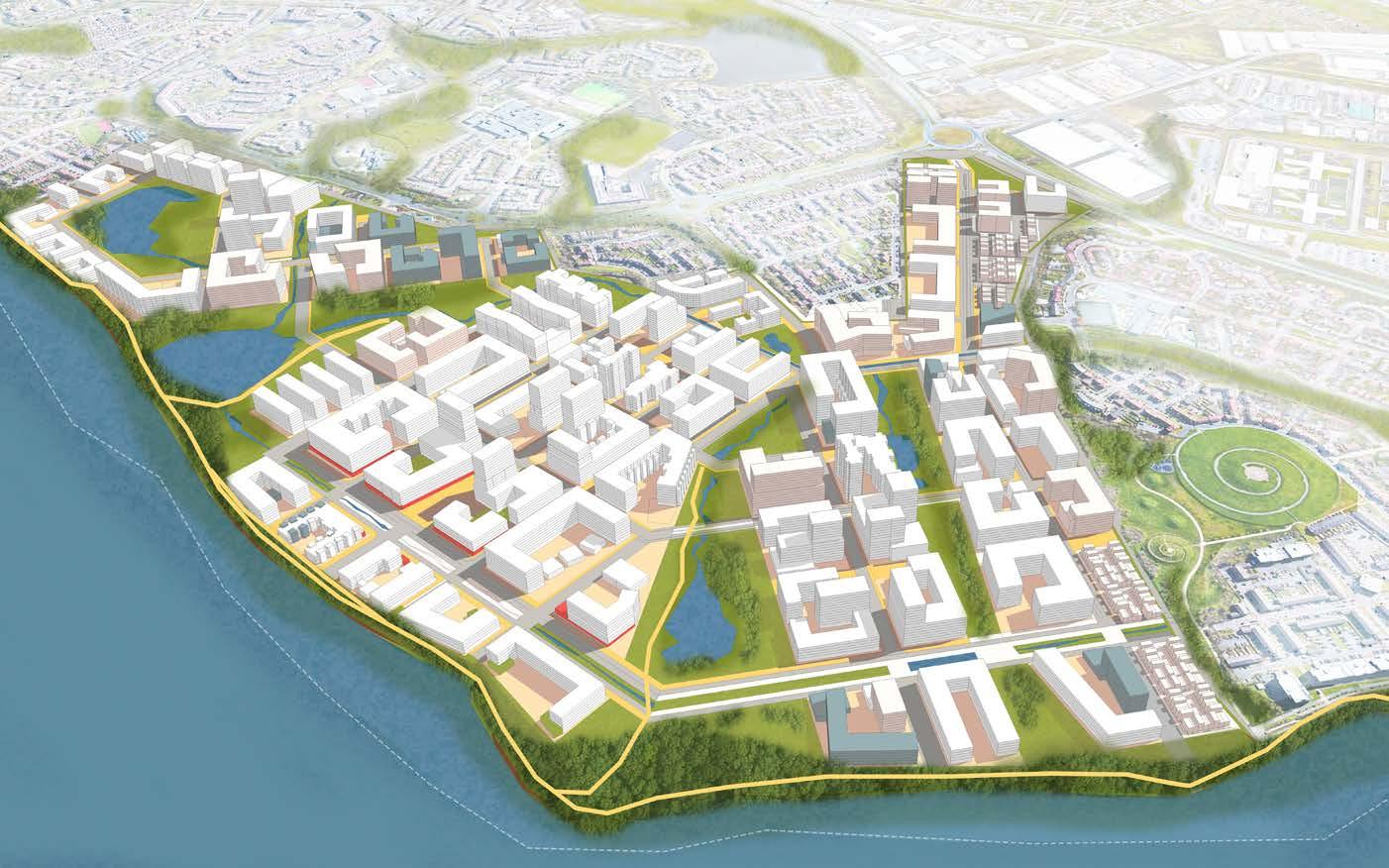
Master Plan For Thamesmead
Advertisement
. . . connected by a robust network of blue & green infrastructure. . . . . . linking multiple welcoming neighborhoods . . . . . . integrated with its surroundings . . . . . . that Londoners today and tomorrow can call home.
In an effort to plan for a community that is situated within the greater London region, we startd with the the question “What is London?”.
While exploring the city streets, experiencing the sites and tastes, and speaking with Londoners, we came to understand why people call London a City of Villages .IRREGULAR ∙ INFORMAL ∙ .INTIMATE ∙ INVITING
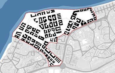
The idea was to create cluster of villages, using a the intersecting grid that allows us able to which creates these informal irregularities that can embrace the informality .
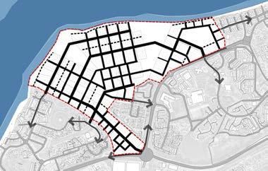
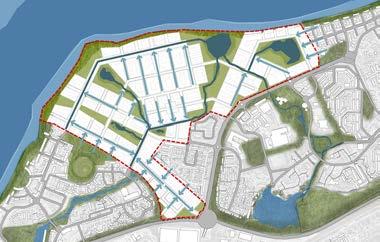
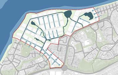
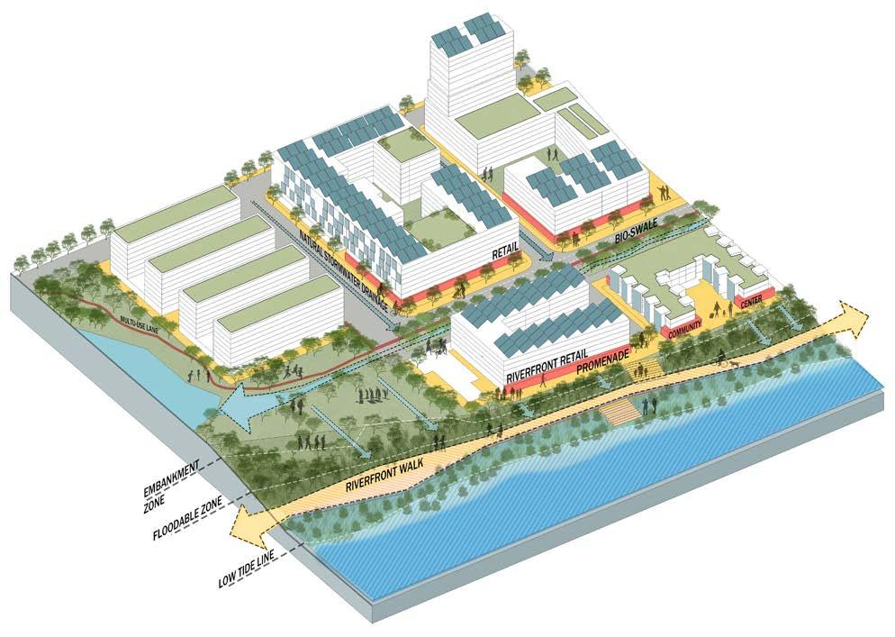
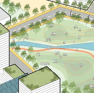
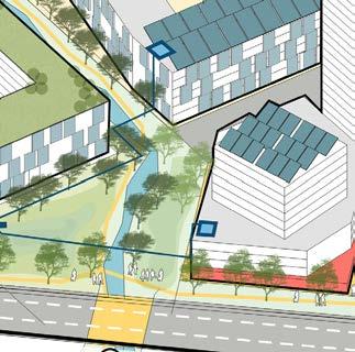
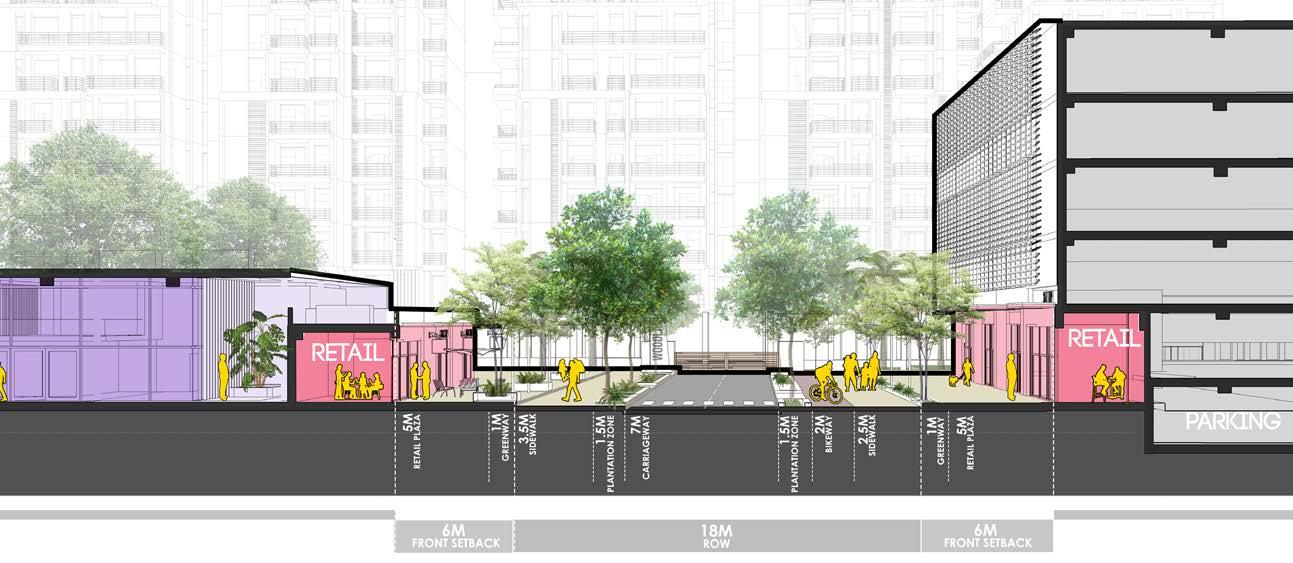
For the master plan, firstly, the existing canal network was restored to mimic natural processes and reestablishing their connection to the floodplain of the river. Secondly a system of greenways throughout the entire district was established following existing drainage patterns and the once inactive and ditatched riverfront edge becomes a new public space.
Location: Thamesmead, London
Mixed Use Development
Guide: John Ellis
2nd Semester MUD | 2022 Academic | Group animating the public realm:
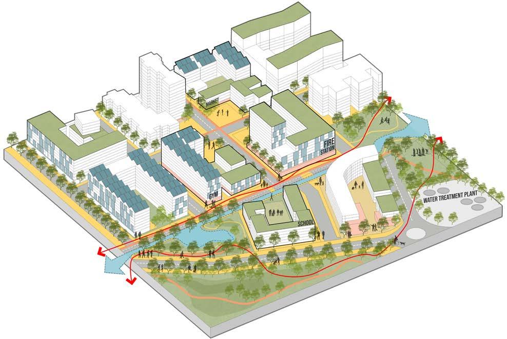
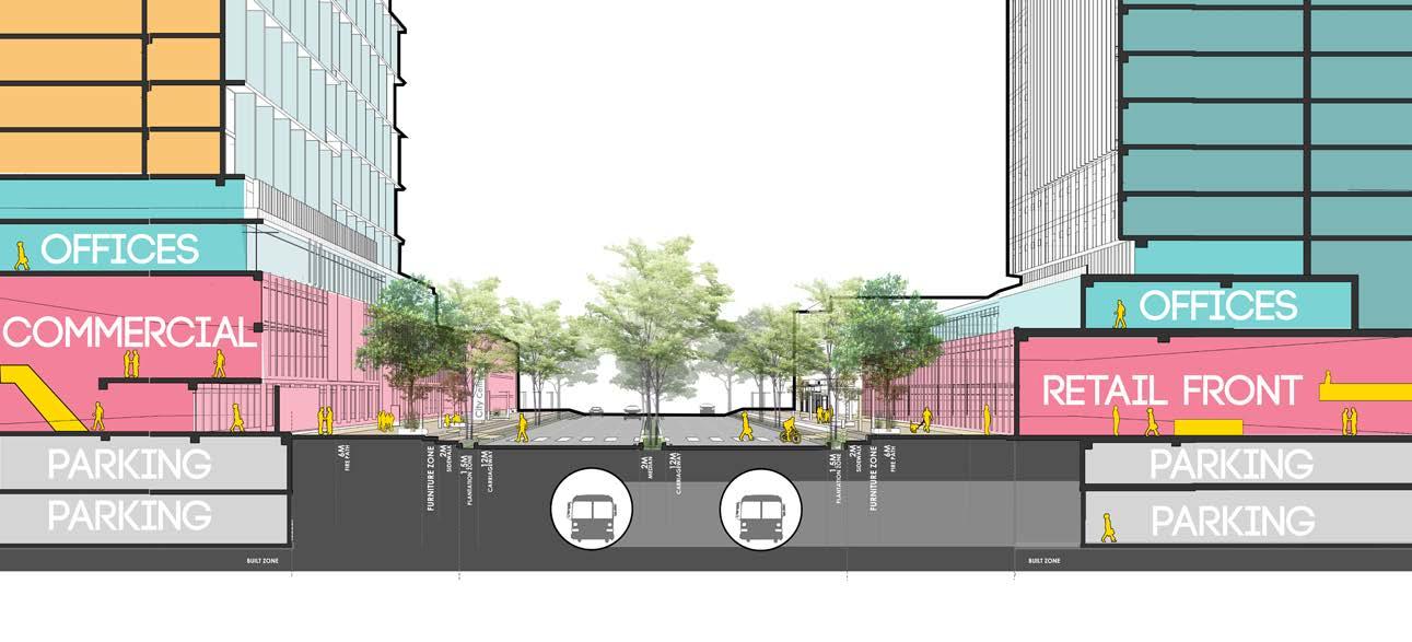
Our clusters of villages are tied with a series of multi use pathway that then is captivated with retail and community amenities at these nodes in between framing the plazas:
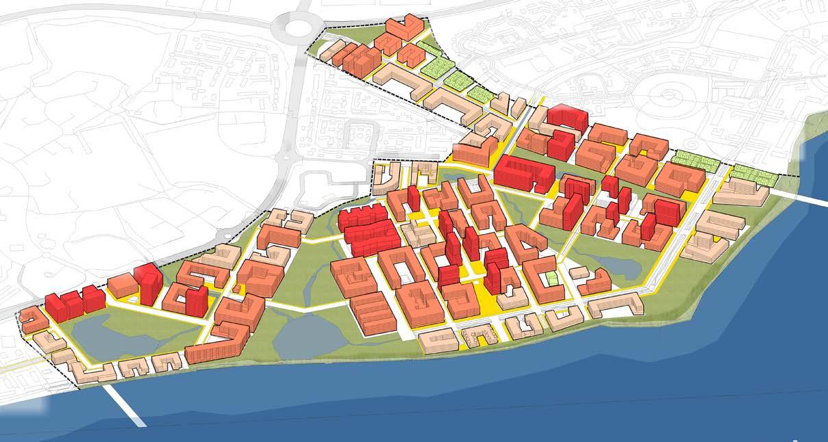
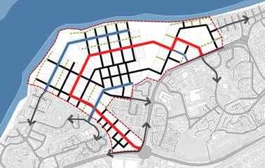
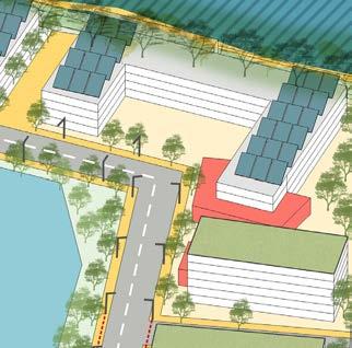
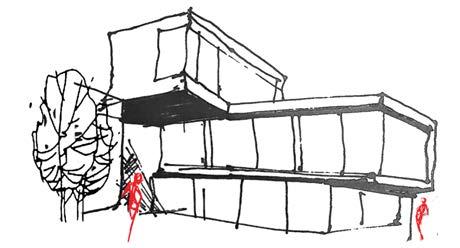
The massing of buildings is gradually stepping down in height towards the sensitive water frontage,and existing development, helping in integration with the existing development.
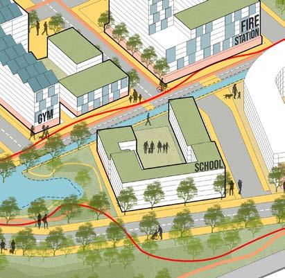
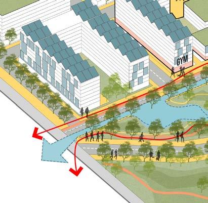
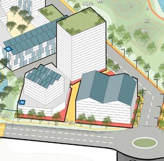
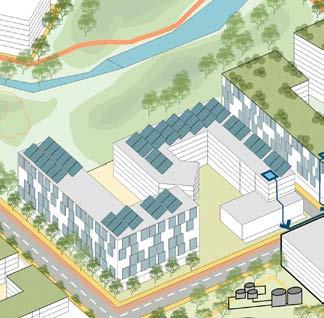
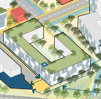
The built form tries to create these smaller pocket plazas and greens : Village-like quality of the interior of each block. The master plan recognises the need to break down the urban blocks and edges to promote permeability and allow visually accessible residential buildings.
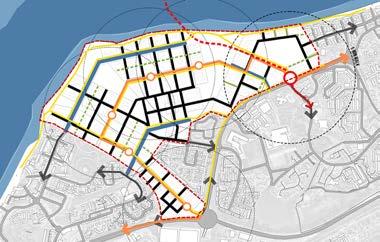
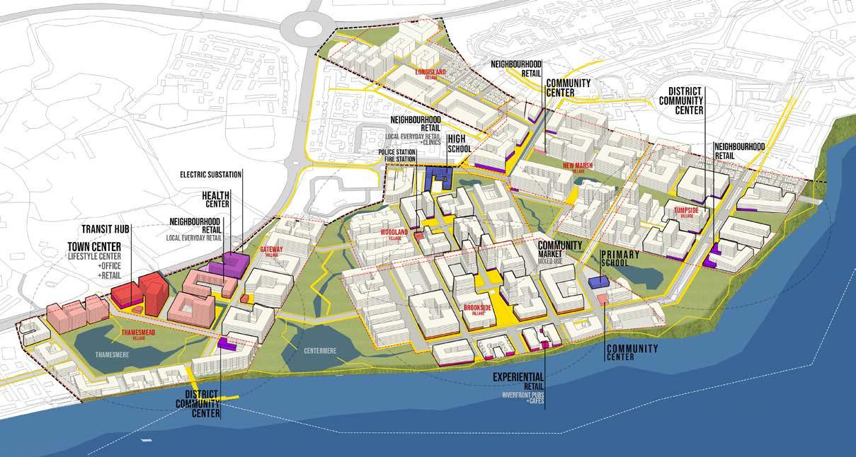
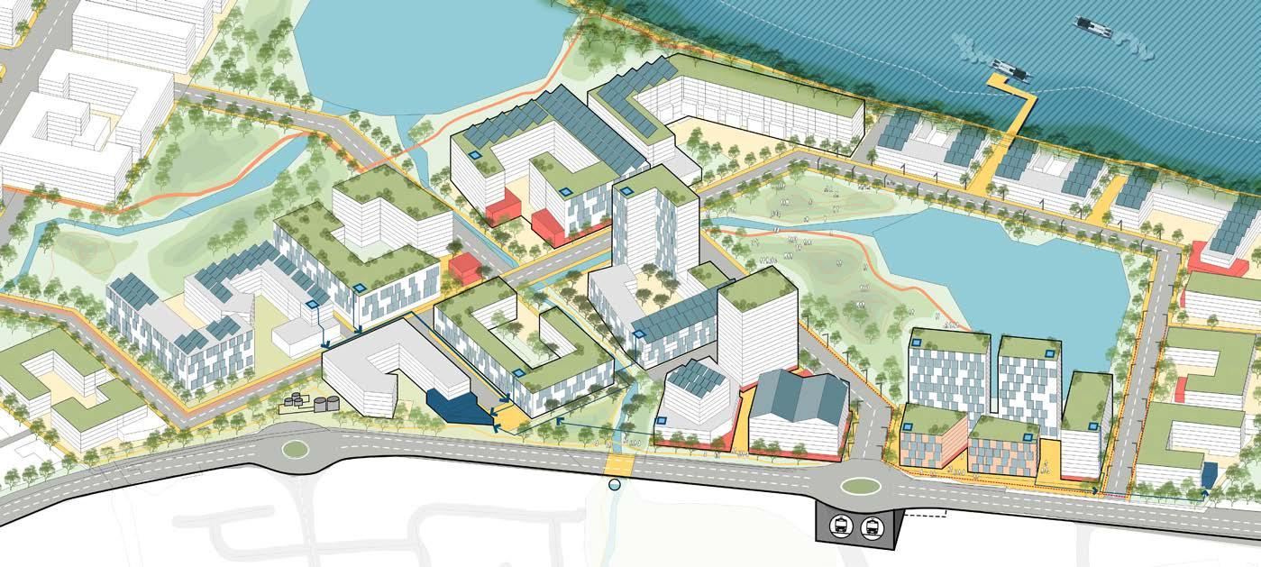
Weaving The Neighbourhoods Master Plan
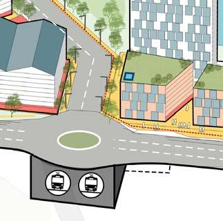
Transit hub is located at the east corner of the site which allows it to become part of the larger context. Bike connection to the Thames path and greater London. Further loops around the villages as well.
Each Village has its own market center that helps us divide the commerce density all over the development animating the ground floor realm everywhere.
1- TRANSIT HUB
2- LIFESTYLE CENTER
3- INSTITUTE OF INNOVATION
4- THAMESMERE PARK
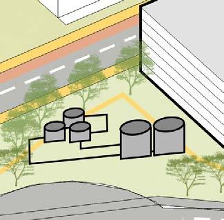
5- WATER TREATMENT PLANT
6- HEALTHCARE CENTER
7-ELECTRIC SUBSTATION
8- DISTRICT COMMUNITY CENTER
9-COMMUNITY MARKET
10-EXPERIENTIAL RETAIL
11-PRIMARY SCHOOL
12-SECONDARY SCHOOL
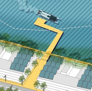
13-FERRY TERMINUS
14-BROOKSIDE PLAZA
15-WOODLAND PLAZA
16-HISTORIC DERELICT STRUCTURES
17-THAMES CANAL BOULEVARD
18-LOOP BOULEVAR
Total area: 101 ha / 250 ac
Green area: 30 ha / 75 ac
Riverfront: 6 ha / 15 ac (6%)
Buildable area: 43 ha / 107 ac (48%)
Residential area: 1.9M sq. m. / 20.1M sq. ft.
Residential units: 13,950 DU
Density: 2 FAR
Commercial area: 138,000 sq. m. / 1.5M sq. ft.
Retail area: 57,000 sq. m. / 615,000 sq. ft.
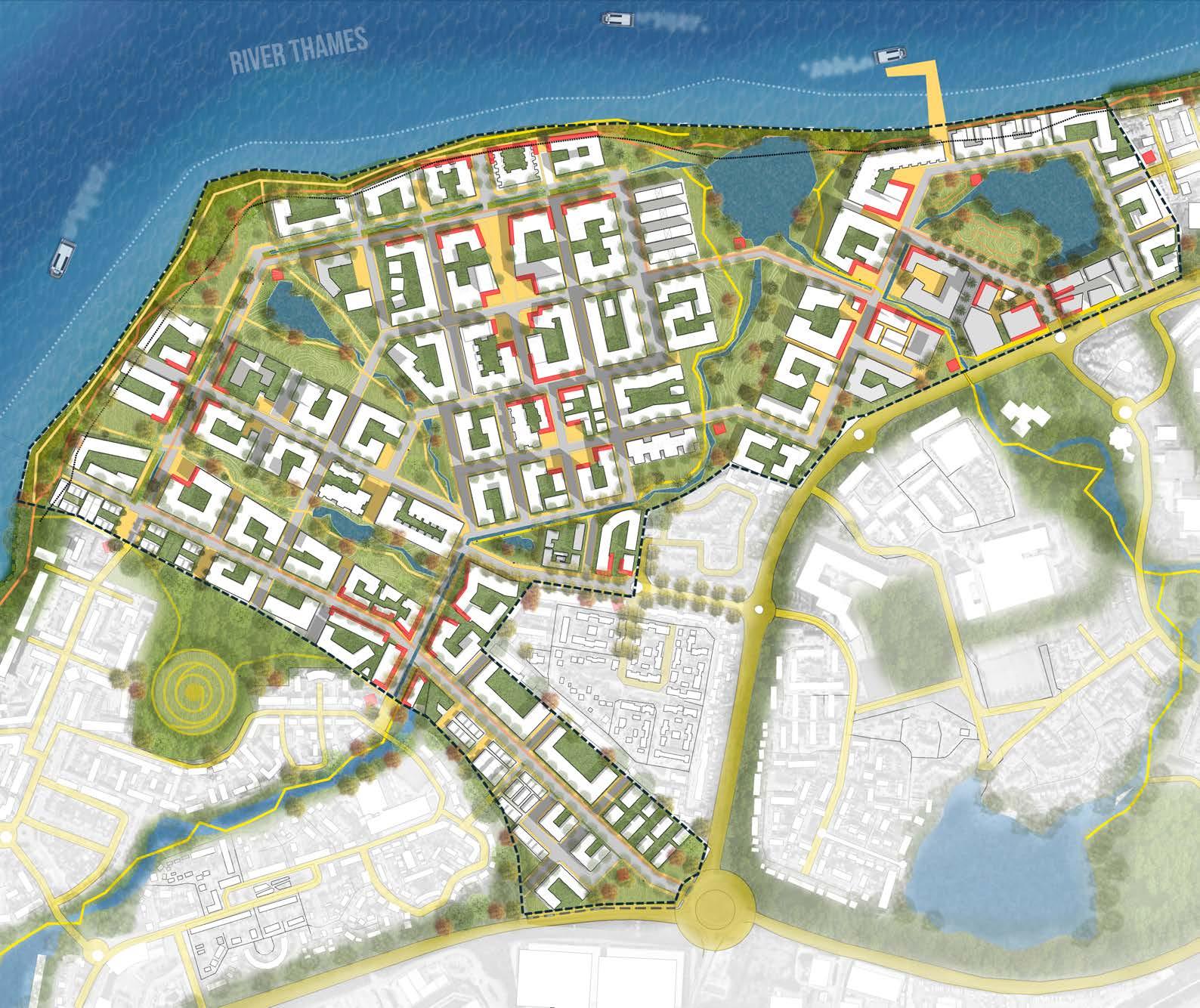
The two bio swales running along the main streets, helps in capturing the run off water, clean it and lead to the retention ponds on both ends.
The Riparian zone of the river is divided into 2 levels, floodable embankment and non floodable retail promenade.
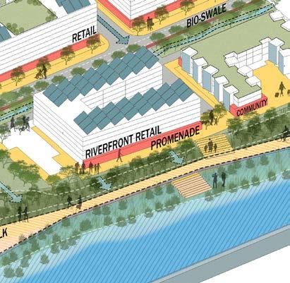
The riv er edge is treated in two types : Hard edge and a softer edge with a berm as a flood mitigation method. This helps in creating variety of space and preserving the natural ecology of the place
So building on the sustainability strategy for the site, we recognize that the success of a master planned community of the scale we’re envisioning must be anchored by a mission-aligned economic driver.
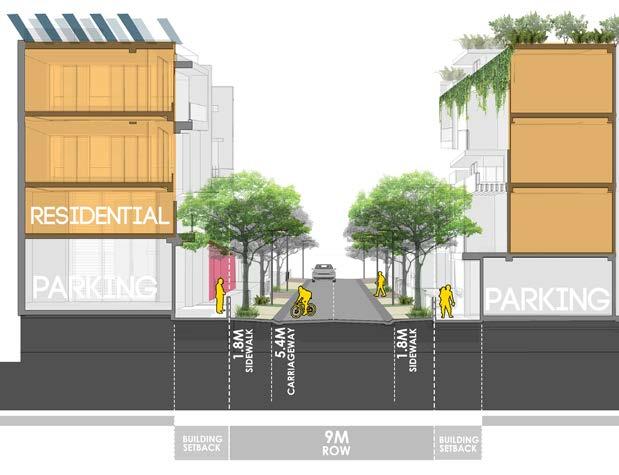
In the first phase of our development, we’re proposing an institute for innovation in sustainable building design. The Institute will drive job growth, public realm activation, and make a “there” there, serving as a proof of concept for future phases residential street with partial on street parking building roofs consisting of solar panels and vegetation street through the brookside village retail front street with minimal carriage way and maximised public walkway and dedicated bikelanes street through the gateway village. underground line running under the road, with underground parking for the lifestyle center and institute local farmers local food market green space water management habitat creation

economic Ecological social
urban-rural communication nutrition education youth program
Agricultural sector plays a strategic role in the process of economic development of a country. The agricultural land has continued to shrink due to rapid urbanization. Urbanisation results in transformation of land-use, environment and culture of communities, specifically, in the interface, thereby, altering the city-region’s ecology.
The interface is the territory of urbanising villages with different intensities and different scales of urbanisation. The process leads to the formation of ‘urban villages’, which, more than often turns into back drop of the city/slums?