2 minute read
THE URBAN LINK

from Work Profile
by Diksha Singh

Mixed Use Development
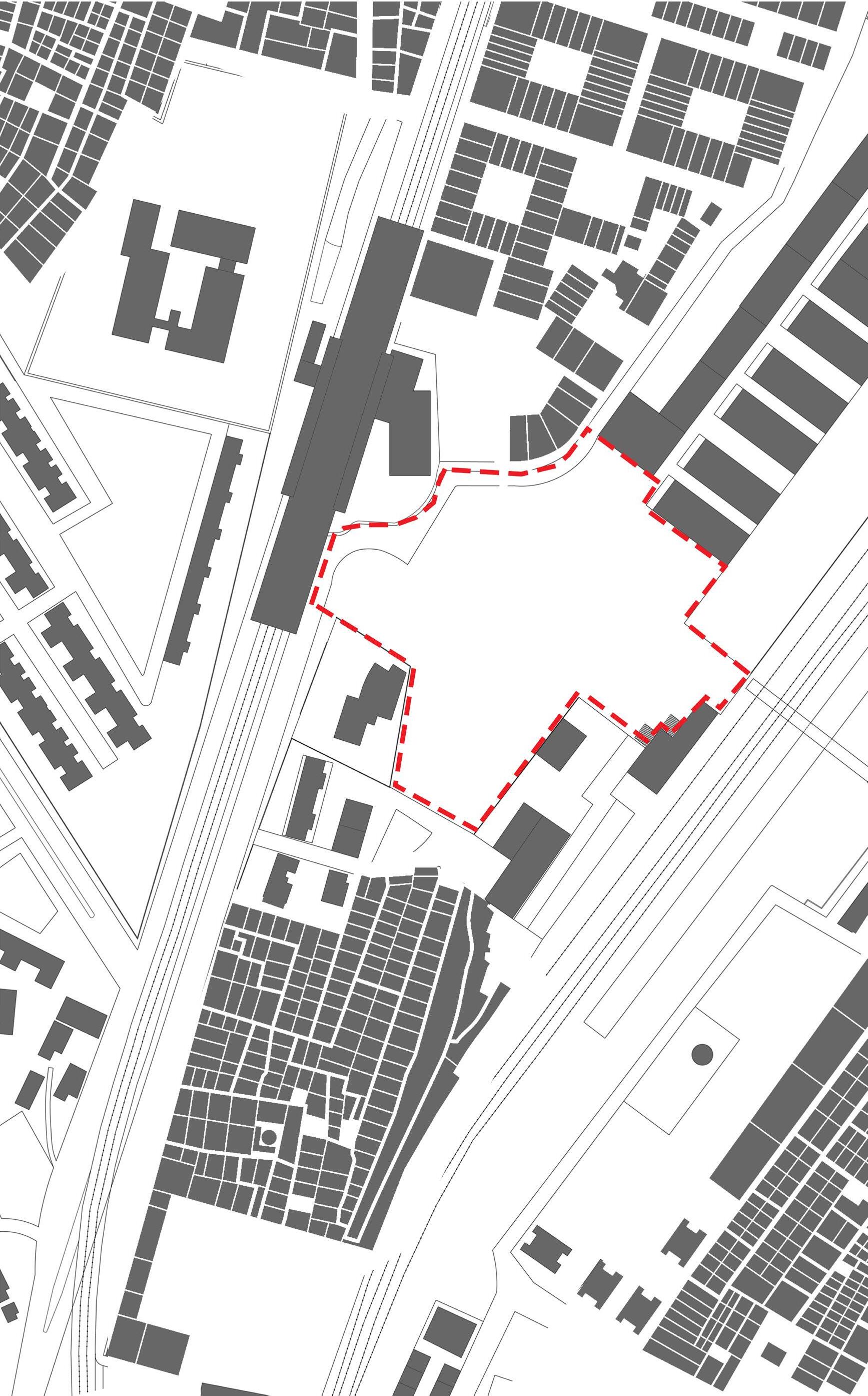
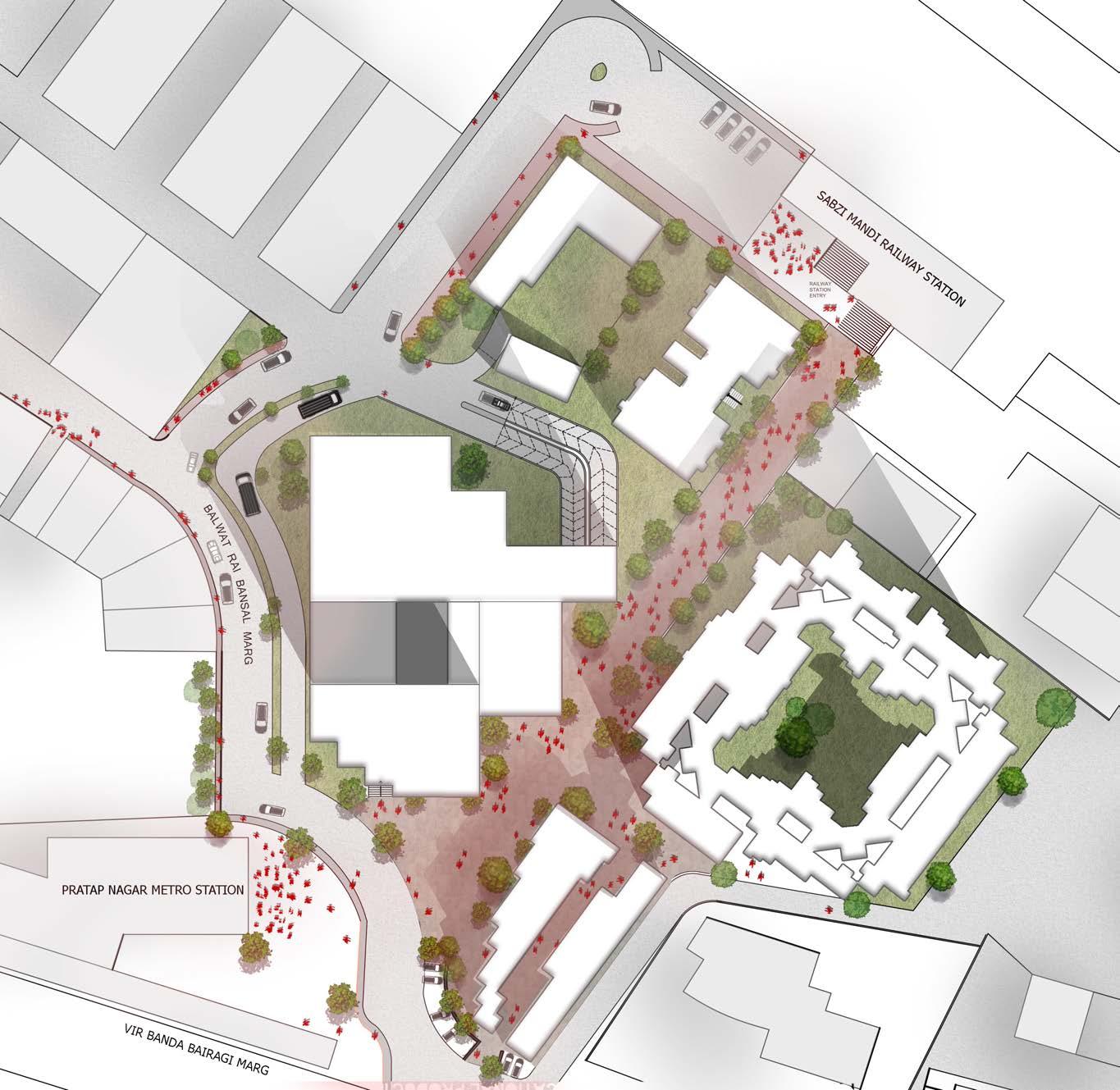
Location: Sabzi Mandi Railway Station, New Delhi
Advertisement
Mixed Use Development | Transit Oriented Development
Guide: Manas Murthy | Saurabh Banerjia
3rd Year STUDIO | 2015
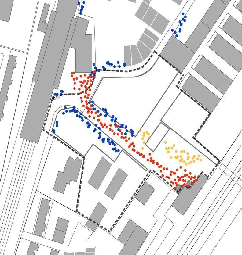
Academic | Individual street vendors living in the slum area; they rely on the pedestrian traffic between the two stations auto drivers live in nearly areas majorly bagichi pirji; pedestrian commuters people going from the railway station to the metro station; these people create a daily cycle
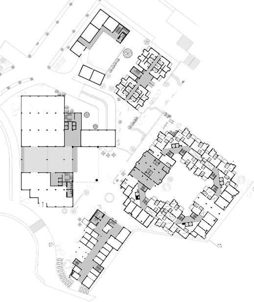
Railway Colony
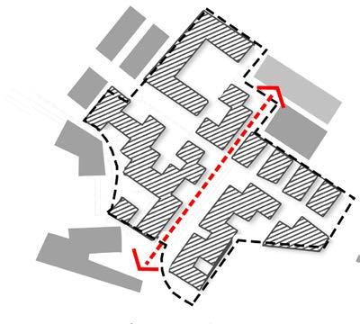
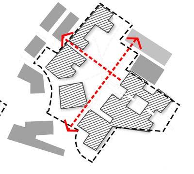
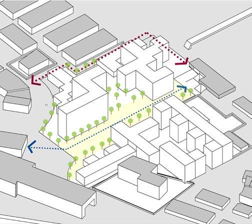
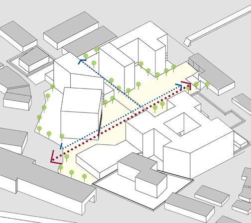
Through footfall analysis, volumetric and spatial surveying and studying different typologies of housings of the area, the requirements for the proposal were derived. The focus while planning the proposal was the pedestrian axis that connects the railway station to the metro station, and to smaller axis roads connecting different residential colonies of the area.
Goal
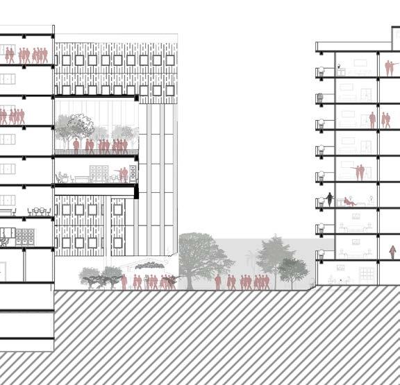
• Provide better life style to the present dwellers in the slum.
• Commerce run by these dwellers, act as a source of income.(presently mostly work as street hawkers or are unemployed)
• School, community space for the residents as most of them are uneducated and do not go to school.
• Maintaining the axis will give maximum and easier pedestrian movement.
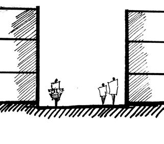
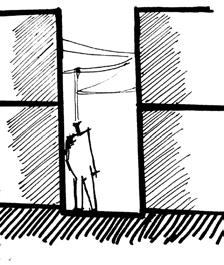
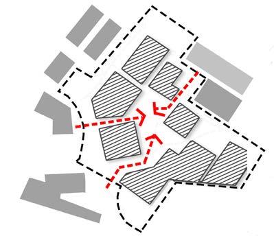
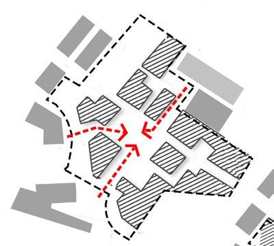
While exploring different massing and place making strategies
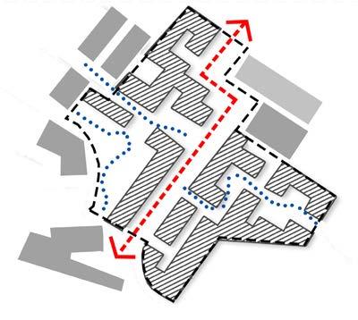
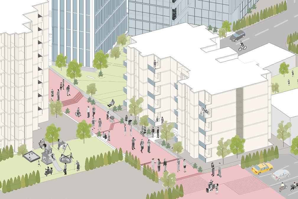
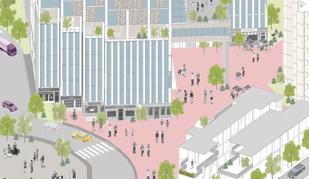
Pedestrian movement given priority.
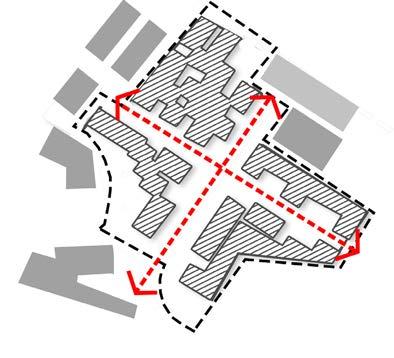
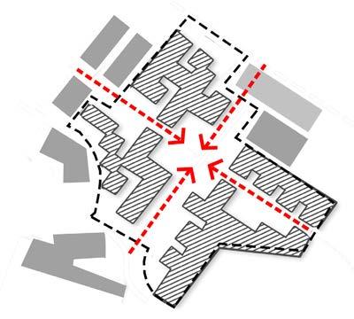
• Central Plaza is an interface between all the different functions.
• Two major connections; between the railway station and metro station and the existing residential areas
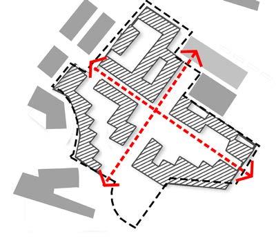
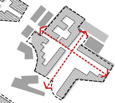
• The front facade faces the main road at the periphery of the site to attract more footfall.
• The vehicular movement for the site shifted to the periphery of the site.
Through strategic integration of interstitial spaces and use of local streets to act as a multi-use spaces, informal activities such as, vegetable markets, weekly bazaars, etc. are given legitimacy and the residents in-turn offered a full spectrum of amenities. At a design level, ensuring flexibility of such spaces is central to their success. So, from a formal citywide retail spine to the informal retailing spaces, the design begins to address the notions of operating between ‘order and spontaneity’
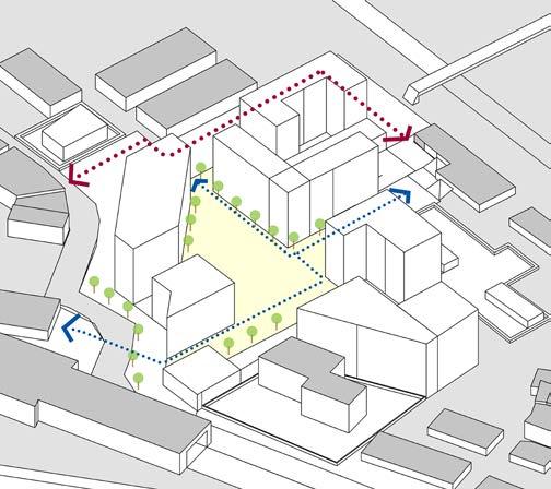
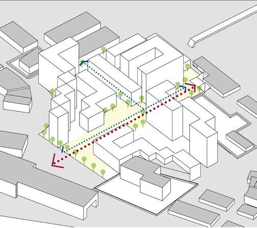
The plan recognizes that mobility is about getting people to where they want to go, efficiently, conveniently, and safely. Mobility can be provided through high quality public realm, sensitivity to local context, high capacity public transport, and not necessarily by using wide street sections.
The proposed neighbourhood will be diverse in its use and population. The intent is to connect the different uses and make them universally accessible. The central spine is framed by architecture and open spaces, that celebrate the existing local neighbourhood structure and its people.
RIVERHILL PUNE creates a blueprint for a 80 acres high density community at the edge of Pune city. The plan departs from the typical privatized insular built typology and instead proposes a bold new Public open-space system for the cityThe RIVERWALK.
This highly public urban-device primarily sets out to meaningfully connect the site with the Riverfront and its envisions and the foothills onto the South side.