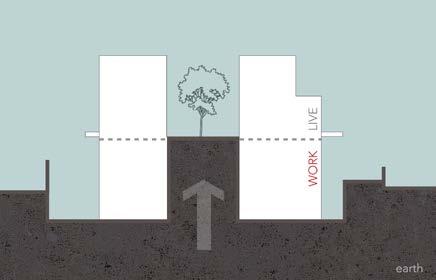
modulation 02 : earth pulled up to the upper floors
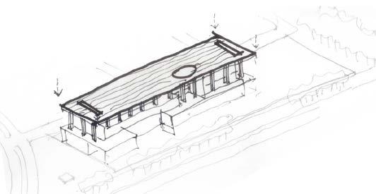
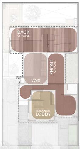
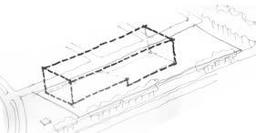
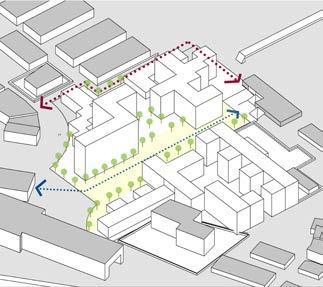
Designing a new studio space for a long established and leading environmental graphics firm meant creating a spatial experience that provided continuity with their work ethic and yet explored new inter-relationships that could foster creative thinking
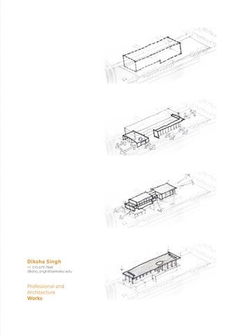
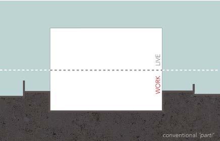
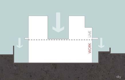
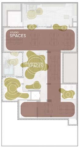
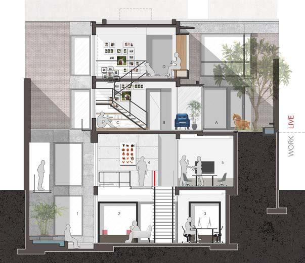
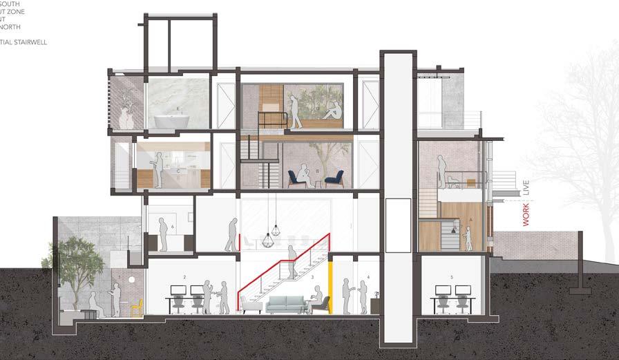
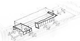
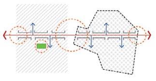
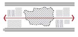
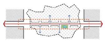
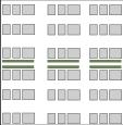
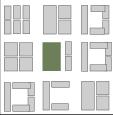
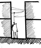
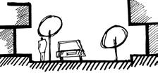
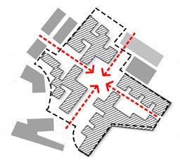
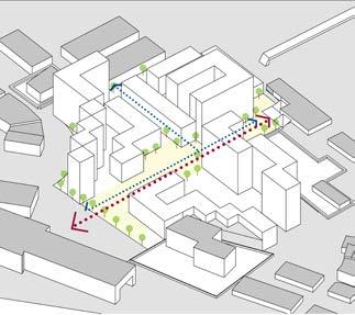
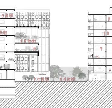
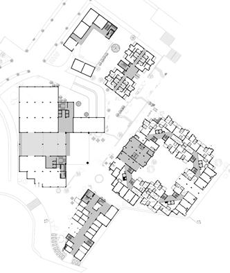
Urban Plot is programmed as a sustainable live-work setup with the lower two levels as the studio space and the upper two as a residence. The two-level office for a non-hierarchical design studio called for strong integration between the two floors. A central void acts as an interactive heart for the office.
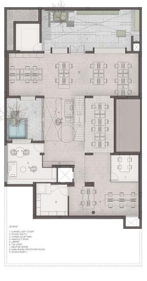
plan
ground
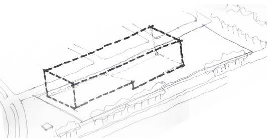
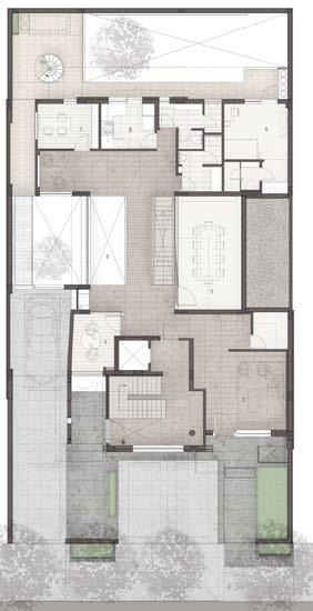
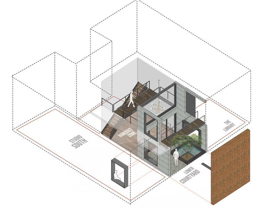
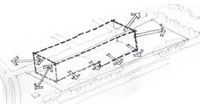
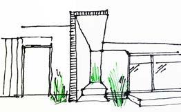
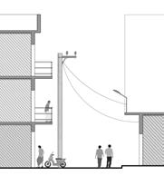
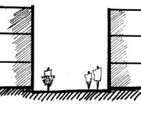
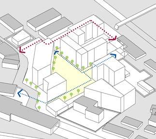
The eastern light well, bringing light to the lower two levels of the live-work unit
The metalgrate bridge connects the front and back yard
The eastern light well, bringing light to the lower two levels of the live-work unit
The metalgrate bridge connects the front and back yard
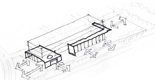
the connecting void
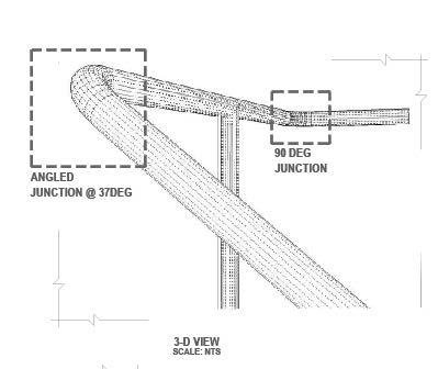
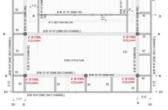
PLAN OF STEEL WORK SCALE: 1:25
STRUCTURAL M.S BASE PLATE AS/ REQ. ANCHORED TO COLUMN
STRUCTURAL M.S FLATS WELDED OVER 12MM THK STEEL PLATE FOR BRACING
CANTILEVERED 6"- 'I'SECTION BEAM AS SUPPORT FOR LANDING
STRUCTURAL M.S BASE PLATE AS/ REQ. ANCHORED TO COLUMN
M.S BRACKETS FOR ADDITIONAL SUPPORT TO CANTILEVERED 'I'SECTION BEAM
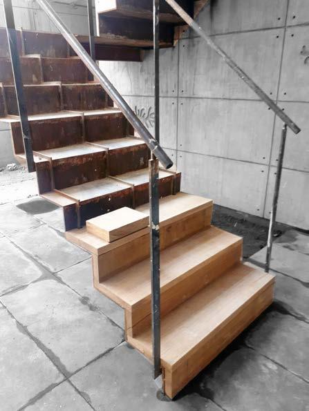
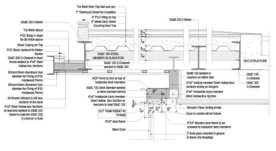
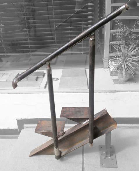
staircase section : metal detail
SECTION AA' OF STEEL WORK SCALE: 1:25
INTO 8 EQUAL PARTS)
STRUCTURAL M.S BASE PLATE AS/ REQ. ANCHORED TO COLUMN/BRICKWROK
STRUCTURAL M.S FLATS WELDED OVER 12MM THK STEEL PLATE FOR BRACING
TYPICAL TREAD ELEVATION D
SCALE: 1:5
typical tread elevation typical tread detail
TYPICAL TREAD DETAIL C
SCALE: 1:5
Main Staircase: connecting the foyer to First floor
Aim was to create a sleek look that can be admired from the main gate.
To make it sturdy, a 12mm metal plate reinforced with flat MS pieces was folded and then cladded with hard wood planks.
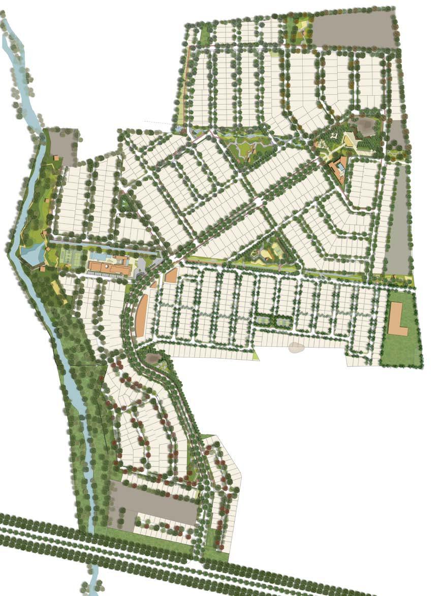
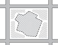
RESERVE PLOTTED NEIGHBOURHOOD
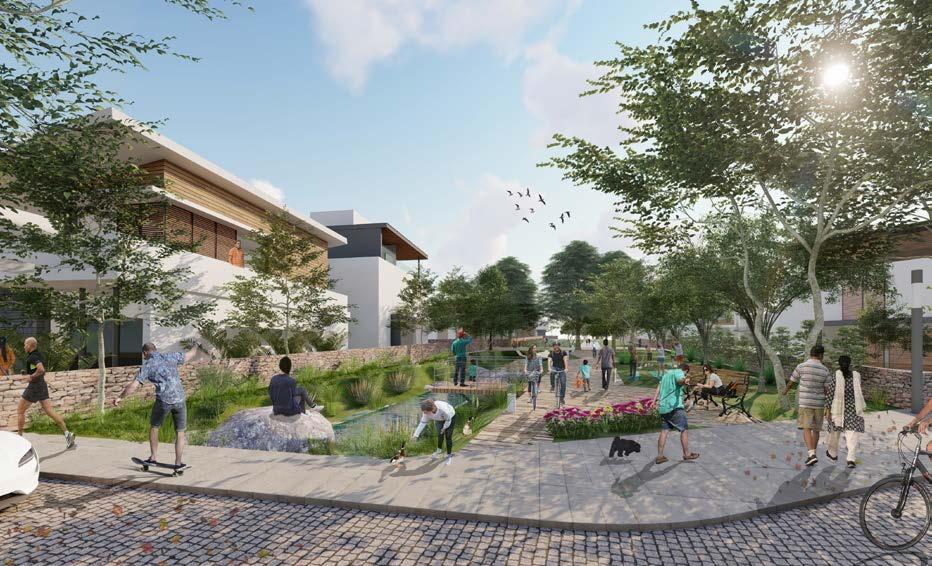
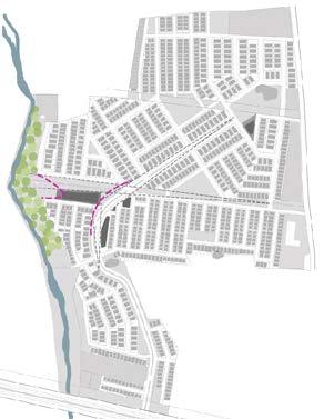
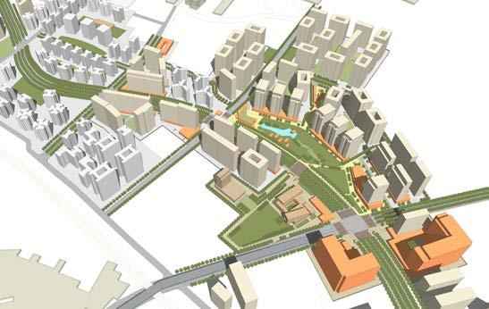
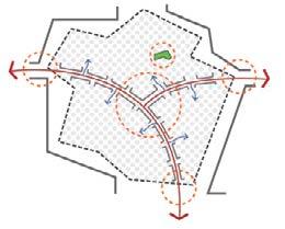
The structure for the master plan primarily emerges from a deep understanding of the unique landform of the site. The main armature of the plan is city-wide boulevard which meanders and ascends the site from lowest part, along the entry point, and culminates at the foot of the proposed Nandi Hill Park; the highest precinct of the site. The secondary street network emerges from this spine and is aligned so as to hug the contour levels/ lines of the site.
Subtle street and block manipulations also help generate surprising array of small neighbourhood parks and plazas throughout the township. Vistas, terminuses, enclosures,street edges, and intersections, have been designed carefully in terms of perception of residents moving along the street. In a way the street design is a balanced coupling of engineering, water management, and pictorial setting.
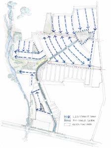
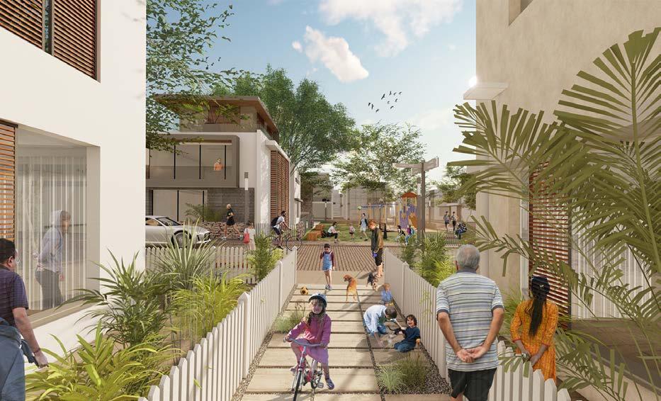
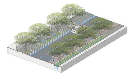
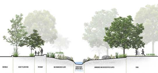
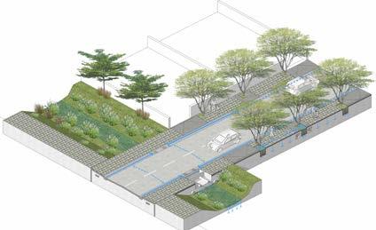
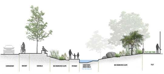
The streets at Godrej Reserve have been designed as per LID or Low Impact Development streets guidelines. LID or ECO-streets are designed favouring ‘soft engineering’ and vegetated treatment to manage rainfall conveyance
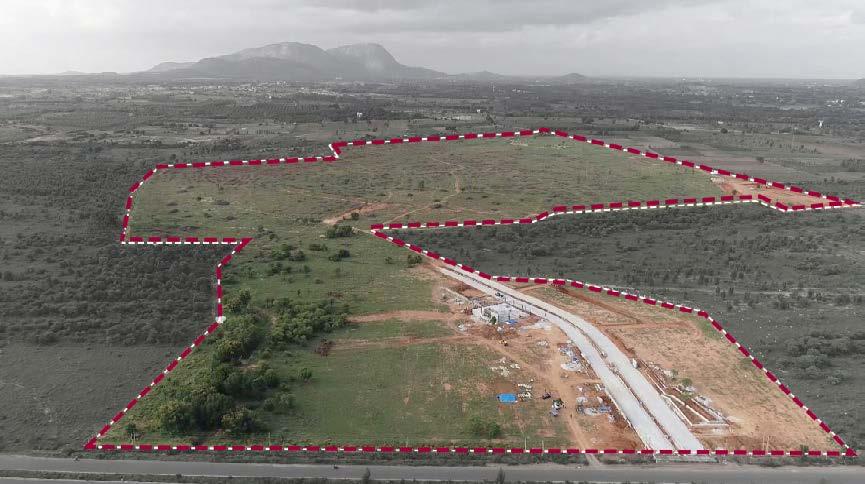
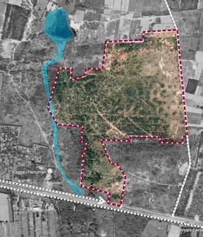
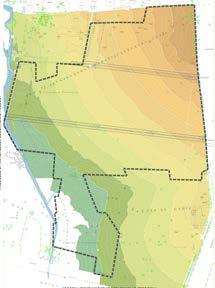
Godrej Reserve is a 100 acre proposed master planned community situated along 80m wide NH 648 , just north of Bangalore Airport. The land parcel is a picturesque setting of a consistently rising terrain dotted with local granite outcrops. The site also offers spectacular view of the Nandi Hill towards the north as well as the Kaggali Hanuman Temple along the Southwest tip. Two HT lines run across the site along the E -W direction.
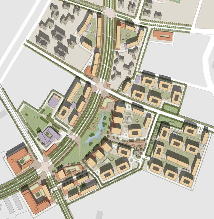
The project offers a net built-up area of around 1,77,500sqm in the form of 950 plots with an average density of 10 plots to an acre. These plots offer a sustainable mix of small-to-mid-to-large sizes varying from 110sqm to 300sqm.
A seasonal drain runs N-S along the western edge of the site, which also is the lowest part of the landform. Given the average gradient of around 1:50, the site drains into this natural system and to manage this, a stormwater collection system was introduced.
The Urban Stromwater infrastructure enhances the ecological functioning to serve as a civic asset without being a environmental liability.
Low Impact Development (LID) is an ecologically based stromwater management approach favouring soft engineering to manage rainfall on site through a vegetated treated network.
NANDI HILL
Landart
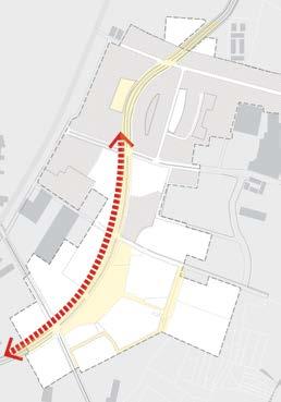
01 A PLAN THAT WORKS WITH CONTOURS
The structure or framework emerges from a deep understanding of the unique landform of the 100 acres
02 CONVEYANCE
Water conveyance shall be the generator of landscape design and low-impact infrastructure design
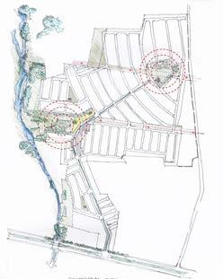
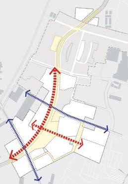
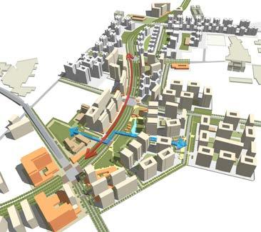
03 PLACEMAKING - 2 ANCHORS
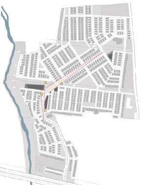
The plan is an assemblage of an iconic spine- the boulevard- and two anchors- the club and Nandi hill park. HIGHEST WITH THE LOWEST POINT
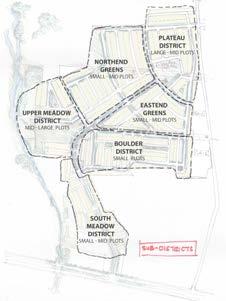
04 SUB DISTRICTS
Creates multiple special addresses or subneighbourhoods in the township each with its own unique identity
Creating well defined and an intensely interconnected OPEN SPACE AND SAFE environment
A series of well landscaped promenades, progressive street-way systems, and a generous park system has been designed as the framework for the township. The high quality streets and fragile block pattern has been consciously designed to create a porous and interconnected community.
This allows for the many activities of daily living to happen within walking distance, allowing independence to those who do not drive; especially the elderly and the young; and enable neighbours to know each other and protect their communities
OPEN SPACE NECKLACE CONNECTING SUBDISTRICT NODES
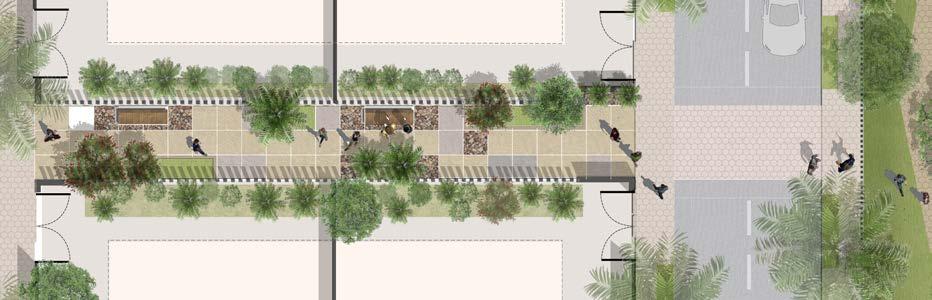
SIDEYARD
Given the concern for environment and especially water, rainwater conveyance has been the generator of streetscape and lowimpact infrastructure design.
Lid or eco-streets are designed favouring soft engineering and vegetated treatment to manage rainfall conveyance instead of conventional concretized piped system that uses curbs and gutters.
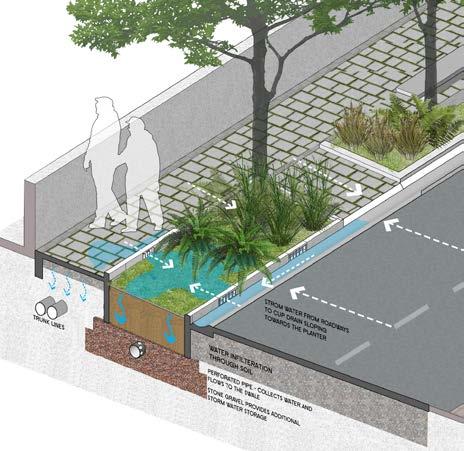
The intent is to capture the rain as and where it falls and reduces the runoff before it enters the trunk lines.The excess water from the lid street is conveyed Using surface flow to the bio-swales.
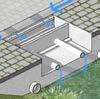
Rain Water Infilteration Trench
Cup Drain Channel Grass Pavers
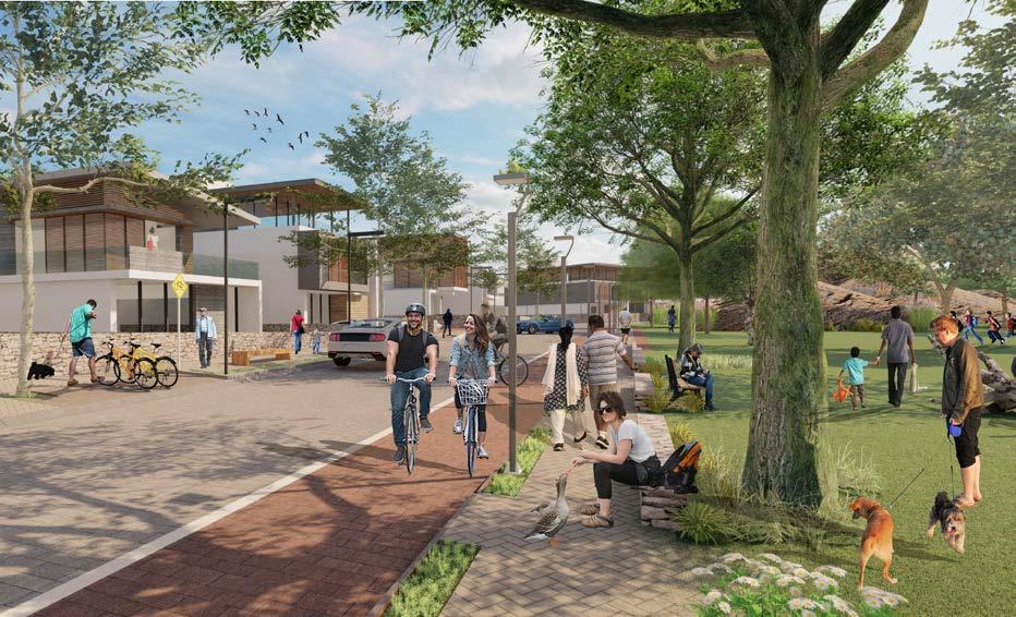
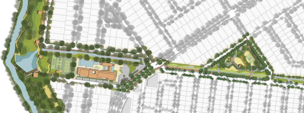
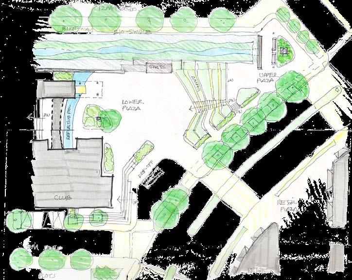
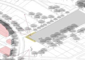
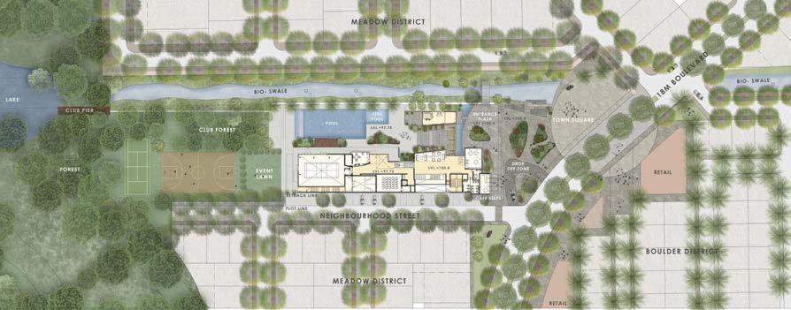
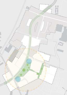
The park is located centrally to the west-end green park district. It has the north swale linear park running along one side and peripheral access roads along the other sides. It acts as a green wooded edge, a relief place from the built environment. The park offers multi-activities and also passive recreation zones. It has pedestrian links across, connecting the farthest peripheral points.
LAKE
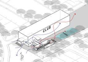
CLUB
SOUTH GREENWAY PARK PARK
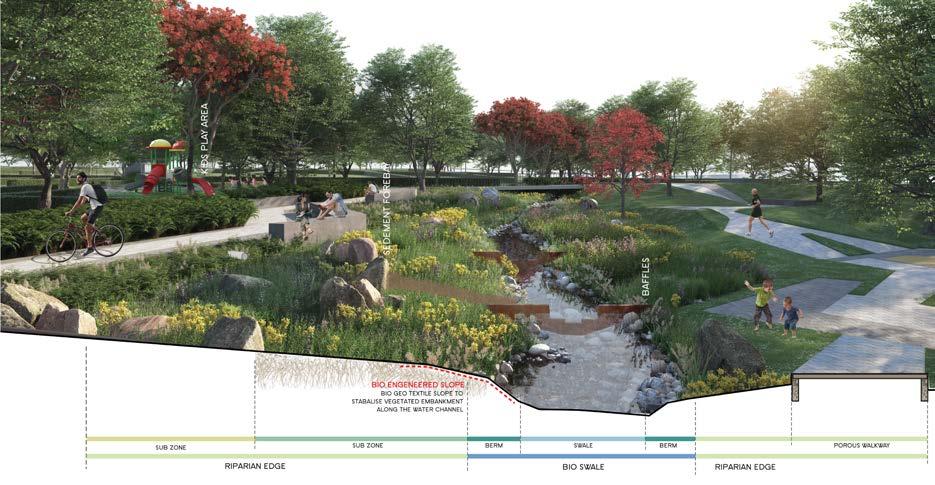
BIO SWALE
SOUTH BIO-SWALE
The open space system is designed to manage rainfall conveyance instead of the conventional ‘concretized system’
This gently sloping multi-layered ecological device detains, cleans & filters, and infiltrates part of the run-off before releasing it into the proposed pond at the western end of the clubhouse as well as the rivulet at the edge of the site.
The bio-swales or greenways not only act as water channels but also become a haven for nature oriented uninterrupted outdoor walk trails, bikeways, and lead the residents to the forest at the western edge.
Rain Water Infiltration Trench
Rain Water Chamber Outflow Cup Drain Channel Bio-Swale open space swale system
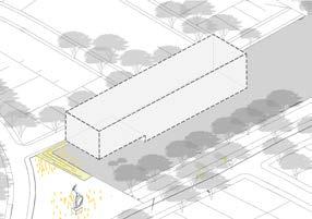
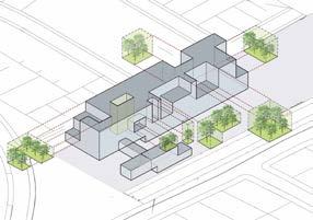
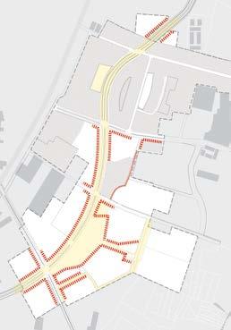
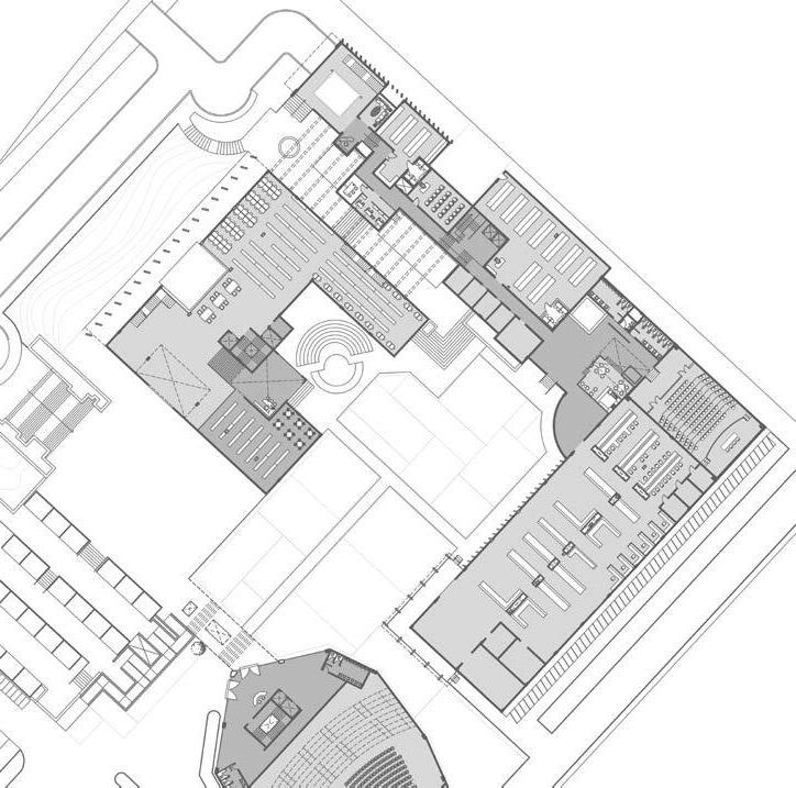
CLUB PORTICO RESERVE PLOTTED NEIGHBOURHOOD
COMMUNITY CLUB
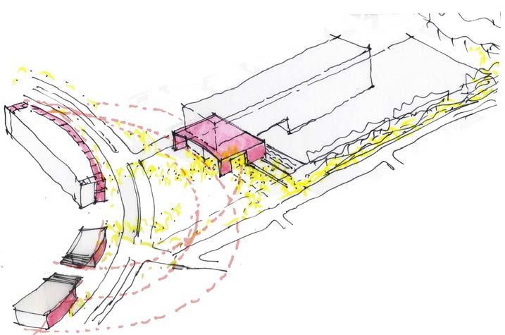
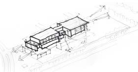
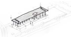
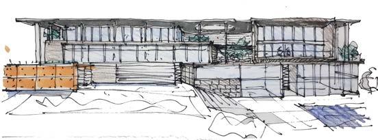
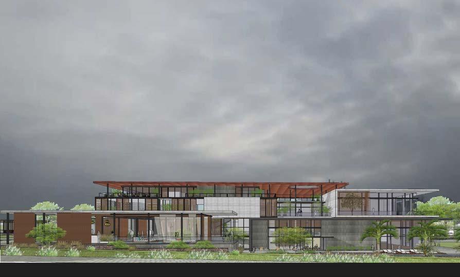
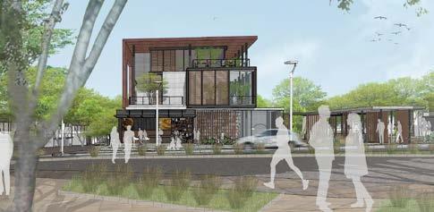
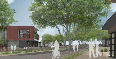
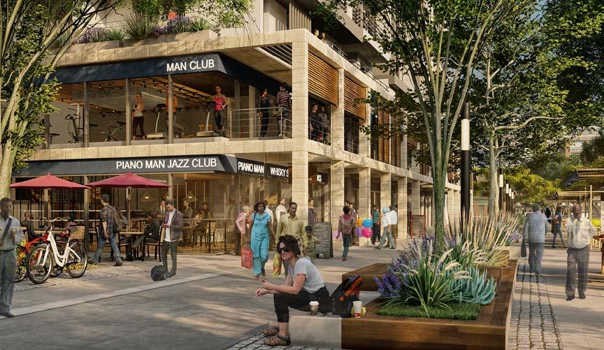
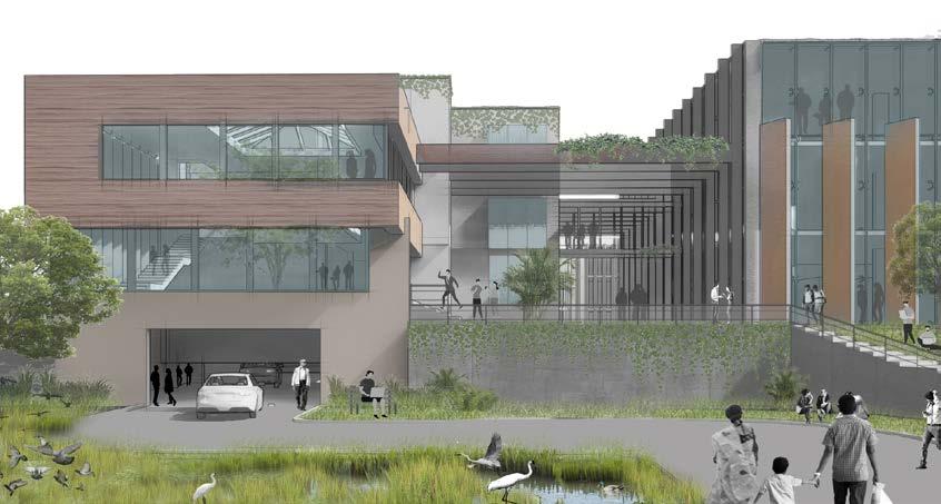
An urban club: The threshold of the club with the city plaza and retail plaza
Location: Devanhalli, Bangalore, India
Architecture | Social Hub
Design Team (DADA Partners): Mukul Arora, Diksha Singh
Consultants: Landart (Landscape)
Client : Godrej Properties Ltd.
Gross built area:
Professional | Group | 2018 - Present inside out
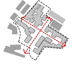
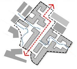
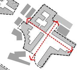
TWO AXIS AND FOLLIES
Two clubs and its dialogue with the city : the plan is an assemblage of a iconic spinethe boulevard - and the two anchors - the club and nandi hill park
urban building built with landform
3 fronts
porticos wrap the landscape at ground plane
proposal
SHAFT OF VIEW
A plan that works with the contours. The structure or framework emerges from the deep understanding of the uniques landform of the site
CURIOUS DYNAMICS OF URBAN SPACES
Creating a public interface between the city forest and the main street. an urban building that would sit hugging the sloping landform
terrace above
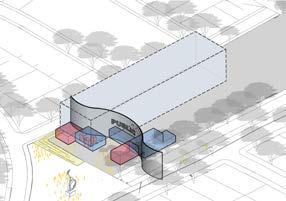
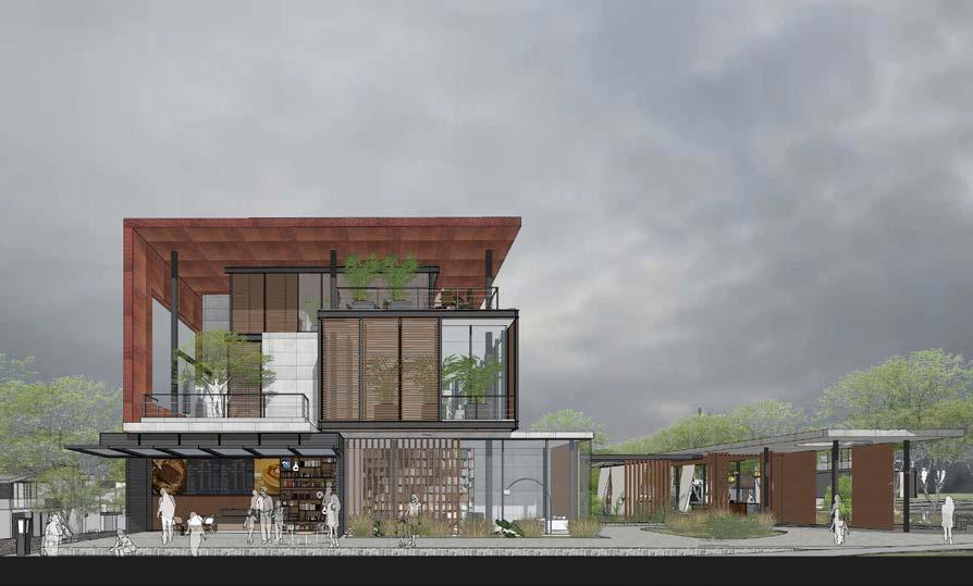
iconic red roof
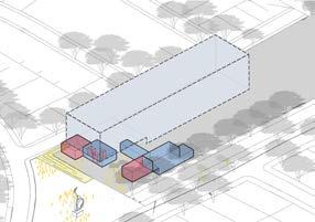
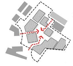
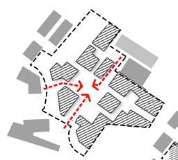
PROGRAMMING
PROGRAMMING the public threshold
curious dynamic of urban spaces
CLUB sight lines
CLUB ALONG A PLAZA
SPLIT:
GREEN VOIDS AND ICONIC ROOF
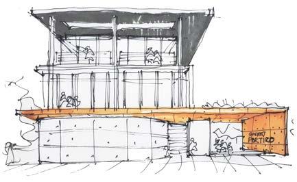
PORTICO
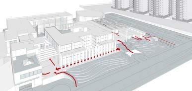
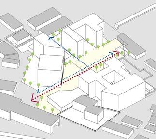
The key design feature in this club building is the interlocking of volumes and planes on its façade as an interface to the very busy street to its front. Defined by its volumetric language and with careful use of material palette the form changes its character during the course of day with its ever changing light and shadow.
front elevation
This originates from the desire to create a larger volume in relatable proportions combined with the search for optimum use of light. This led to an contemporary, finely detailed building.
There are a series of smaller courts/ voids punctuated on all levels bringing in light and ventilation to the spaces and serving as lungs of the building.
The open to sky courtyard creates an efficient airflow providing a comfortable microclimate that influences all the spaces of the club.
side elevation
metal roof detail finish : epe cladding
To achieve a lighter tectonic a composite structure was adopted, allowing a delicate finale
construction details
*all presented drawings, illustrations are produced by me.
metal roof partial plan
tread detail : metal detail
prototype : metal work
substructure plan reflected plan tread detail : framework
TREAD SUBSTRUCTURE PLAN AT C SCALE: 1:10 DETAIL B -
page left blank intentionally
Godrej Garden City master plan creates a blueprint for a high density community at the periphery of Ahmedabad’s urban city core. The plan primary draws inspiration from the way of life in which residents still embrace mixed-use fabric; a way of life where public open spaces and bazaars are frequented by the community year round, a nod to the very essence of urban coexistence
At the most fundamental level the plan firmly sets the intent for a new town that is held together by a genuine and active public realm, while optimising the insatiable and prosaic demand for high density development parcels.
EXTENDING THE CITY MIXED-USE DYNAMICS
The design process entailed formulation of detailed urban design codes and guidelines as an essential companion to the masterplan.
UD guidelines here would become a critical tool that will ensure coordinated incremental action, by various stakeholders over a long term timelines.
Since design is not a science, this approach ensures that the seam between the private and public has clear definition
Location: Ahmedabad, Gujrat, India
Master Plan | Mixed Use Development
Design Team (DADA Partners): Mukul Arora, Diksha Singh
Consultants: BDP (Landscape)
Client : Godrej Properties Ltd.
Gross built area: 17 million sqft / 85 acre land
parcel
Professional | Group | 2018
SITE
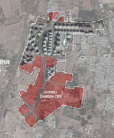
The already built early phases at GGC, totaling around 70 acres has emerged from an earlier SOM master plan. This district comprises of six well established mid density housing communities totaling 4500 apartments, school, and marketplace. The residents also enjoy two well designed public parks along with a centralized clubhouse. The highlight of this development though is the curvilinear grand boulevard that runs North-south through the middle of the site
REGIONAL
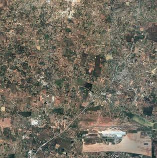
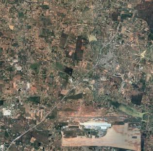
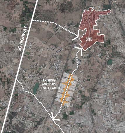
GGC is a 160 acre township located in Jagatpura, which lies in North West of Ahmedabad within the Municipal Corporation city limits. The long linear land parcel is nestled between railroad spurs on either side, through the proposed railroad bridge connector along new SG road, the site shall be closely connected with the S.G Highway to the west. The site is 7km away from the Sabarmati railway station while the international Airport is 18 Km away.
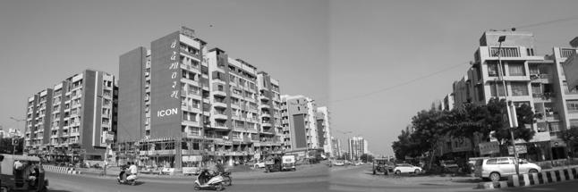
Unlike the other greenfield sites across the country, the new growth area abutting the site, especially towards the south is remarkable in the way each new incremental city block is creating a well anchored mixed-use neighbourhood with a balanced street and block pattern.
site and surroundings
MIXED USE DEVELOPMENT AROUND THE SITE
2 KM LESS BOUNDARY WALLS
Highly accessible mixed-use edges to define the 85 acre township so as to revive the wisdom of the traditional settlement patterns, both, in east and the west.
1.25 ACRES COMMUNAL HUB
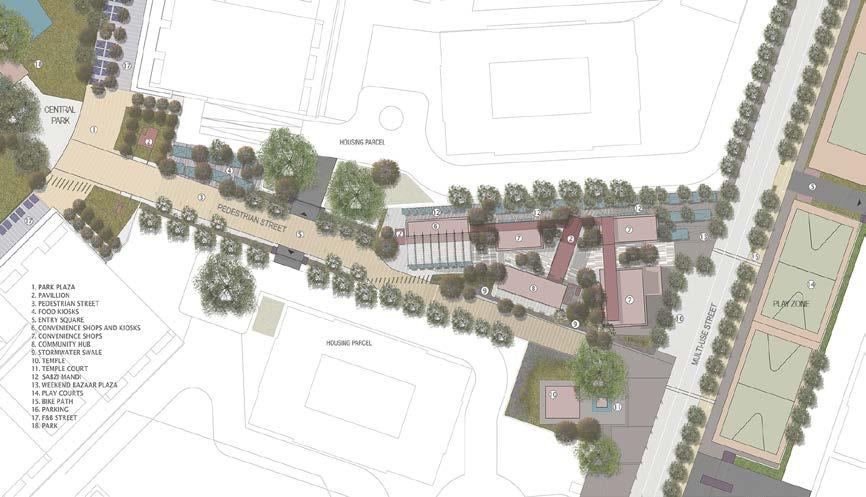
Fully pedestrianized Cross Armature allows the residents to move efficiently, conveniently, and safely.
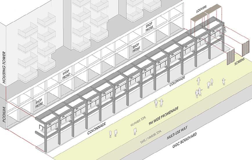
1 KM SHADED COLONNADE
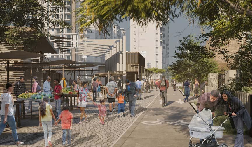
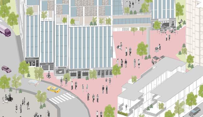
The one km long curvilinear highly image able retail colonnade that acts as a ‘civic’ insert and a climate sensitive amenity for the residents and visitors
6 ACRES PLUS CITY LUNGS
The Intensely programmed six acre central park with animated retail along its edge becomes the playground and entertainment hub for the township
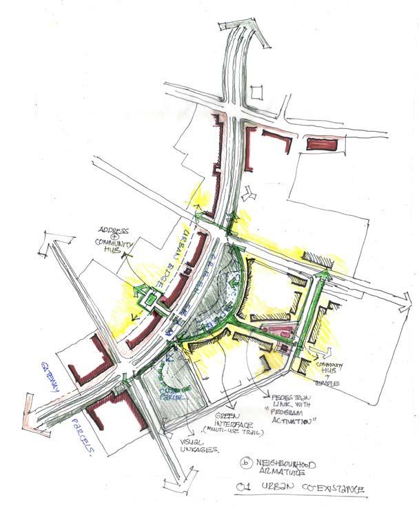
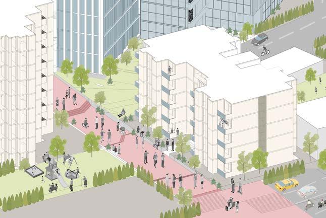
A one kilometer long shaded retail colonnade lines the western edge of this urban space while the opposite edge is defined by well-articulated mixed-use built podium edge with housing towers above. This primary north-south citywide armature is crossed by a scaled-down neighbourhood connector.
A fine textured street-block pattern creates the appropriate physical setting for a community driven lifestyle in close adjacency to a very high energy urban corridor. These spaces are activated by allocating a diverse range of active programing for the public edges.
primary and secondary city armatures
At one end of this cross-armature is the large city level clubhouse, and as one moves across the Central Park it transitions into an intensely used pedestrian environment surrounding high density housing blocks.
This neighbourhood Armature is strategically activated by the positioning of a convenience retail block, a small temple plaza, and a linear outdoor sports plaza for active recreation; all held together by a pedestrian precinct.
Multiple housing parcels are designed to have their pedestrian gates open directly onto the precinct, making it an ideal family centric place.
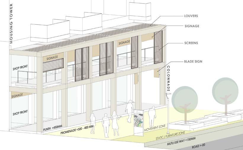
Segregated roof allows for exploring lighter design for the colonnade roof, offers privacy of a segregated balcony to housing unit above, and might allow for services on the retail roof.
The sections (above) capture the variations possible within the threshold zone.
The residential towers building type and its structural bay shall inform the structural rhythm of the retail podium and hence the colonnade. Given the colonnade needs to work with a singular-or near singular- structural rhythm; the typical housing floorplate has been organized in a grid of 3M.
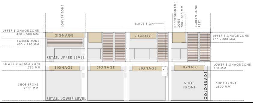
COLONNADE : ELEMENTS AND SIGNAGE
COLONNADE ELEVATION : OPTIONAL CONFIGURATION
Lower retail shops to have signage on top of the storefront itself. However smaller ‘Blade signage’ might be permitted for lower shops along the colonnade outer columns
Upper shops shall have signage along the outer colonnade face. These shall strictly adhere to the signage zone as suggested in the elevation above.
To create a harmonious experience the Building plinth as well as promenade levels need to be consistent across the project. The following levels have suggested for parcels along the GGC boulevard with the intent of creating a seamless landscape and building threshold experience.
ASSEMBLING THE COLONNADE
The master plan carefully calibrates the ‘built and open relationships’ or edge types for the township so as to bring imageability and cohesion to the urban fabric and also variety where necessary.
The edges that have been appropriated at GGC also play an important part in providing safe and comfortable outdoor movement spaces for the pedestrians all year round.
local farmers
Ecological
local food market green space water management habitat creation
economic
social
urban-rural communication nutrition education youth program
Agricultural sector plays a strategic role in the process of economic development of a country. The agricultural land has continued to shrink due to rapid urbanization. Urbanisation results in transformation of land-use, environment and culture of communities, specifically, in the interface, thereby, altering the city-region’s ecology.
The interface is the territory of urbanising villages with different intensities and different scales of urbanisation. The process leads to the formation of ‘urban villages’, which, more than often turns into back drop of the city/slums?
WEAVING AGRICULTURE INTO
URBAN LAND-USE
CENTER FOR FOOD AND AGRICULTURE
Urbanisation is inevitable. And in the process of development the farmers are neglected and their source of income is lost. Both peri-urban and urban agriculture contribute to a regional dynamic that connects urban and rural residents in the pursuit of a sustainable food ethic.
Farmers markets connect people to local farmers, creating a sense of community between rural and urban.
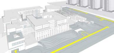
The proposed Center for Sustainable Food and Agriculture envisions a place where researchers, farmers and the community work for the economic, social, and ecological benefits of a regional food system
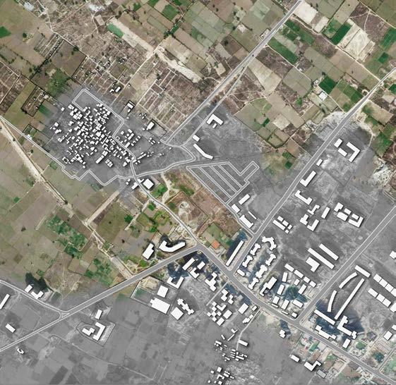
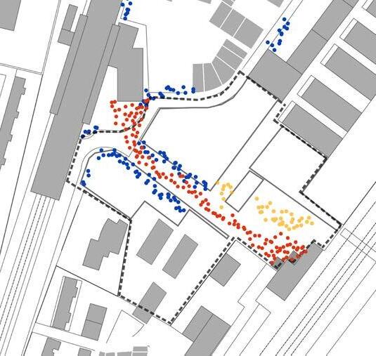
Chakkarpur village is a high density village with an approximate population of 16500 and an area of 34 ha., completely surrounded by diverse residential colonies and has no connection with the external city.
Jharsa village has an approximate population of 2500 and an area of 5.7 ha. and it acts as one of the link between planned residential neighborhoods around it and the main sector road. Most of the people, pass through the central street of village to go into surrounding residence
At its interface:
Small, low cost residence has positive interface with the village and use the shops in it. High end residence on the other hand make boundary walls to cut of access to the village.
At its interface:
The central spine of the village is used by surrounding residence, it gives an opportunity to the village to cater to the needs of surrounding neighborhoods. A lot of grocery & other utility stores can be seen on the main street of the village
Sukhrali village has a population of 10,000 living in an area of 30 ha. Unlike any other village in Gurgaon, Sukhrali village has a major arterial road passing through it. The village is therefore well connected with the whole city and caters to the need of the whole city.
current scenarios of urbanism story of the villages near us
At its inter face:
There is destination market at the ground level with commercial floors over it. People from all over the city come to Sukhrali as it has variety of shops. Inside the village, there are lots of paying guest accommodations because of the good connectivity with the nearby IT hub.
Case A : Chakkarpur Village
Case B : Jharsa Village
Case C : Sukhrali Village
The urban villages of developed cities were studied to understand their transformation over the years and problems faced by the people. This led me to select my site in per-urban area that is still under the process of urbanisation.
The site is located on the exterior of the town Ghaziabad. The Fertile Agriculture land is being converted to different land uses at a fast pace.
Ghaziabad has a strong foundation for food and agriculture awareness and hence makes for a fitting place to research Sustainable Metropolitan Urban Agriculture
The nature of metropolitan region agriculture can be planned or opportunistic, scattered or cohesive. Planning large tracts of land designated for agricultural use, as in the peri-urban farms surrounding Ghaziabad’s urban growth boundary, creates opportunities for large scale production in close proximity to the city, supporting a local economy with a strong rural-urban relationship in food production and consumption.
The even closer relationship of agriculture within dense urban environments creates the opportunity for a different scale of relationship: neighbor to neighbor, garden to restaurant, student to learning garden.
Integrated Green Spaces:The building directs its users out into nature in order to get to other offices or parts of the structure. The gardens act as an informal meeting space for researchers and consists of test beds.
Massing:The building was designed not to dominate its rural setting, but to embrace the landscape, with all workplaces in direct contact with indoor and outdoor gardens.
Create a U-Shaped buildings that will frame indoor and outdoor farming areas, as well as retail spaces and distribution facilities.
• Market square where farmers can sell fresh produce;
• A farming demonstration area and accompanying classrooms;
• A kitchen incubator for startup catering and wholesale food businesses;
• A library
• Retail area for food trucks.
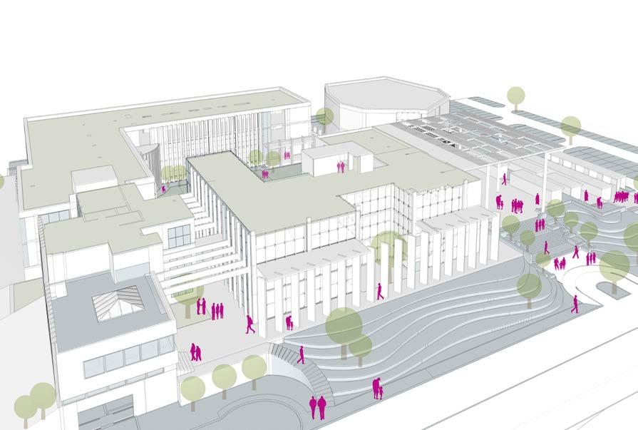
1. Entrance Podium Reception, entrance to the library and a viewing deck for the common growing space
An informal meeting areas for the researchers.
3. Institutional Block Entrance 1
4. Library Block
An auditorium with a capacity of 300
6. Covered Growing Space
A growing garden to test plants in a controlled environment
7. Green Pockets small growing spaces directly connected to the working areas
8. Parking Entry exploring the form
9. Parking space for food trucks and spill out zone for the market
5. Auditorium
2. Common Growing space
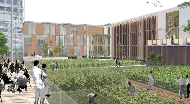
By providing outdoor educational and social spaces for visitors and the public, the plan simultaneously improves the local ecology, creates a campus identity, strengthens connectivity, and extends the campus’s growing conservation work in the region.
Farmer’s markets connect people to local farmers, creating a sense of community between rural and urban.
The proposed Center for Sustainable Food and Agriculture envisions a place where researchers, farmers and the community work for the economic, social, and ecological benefits of a regional food system.
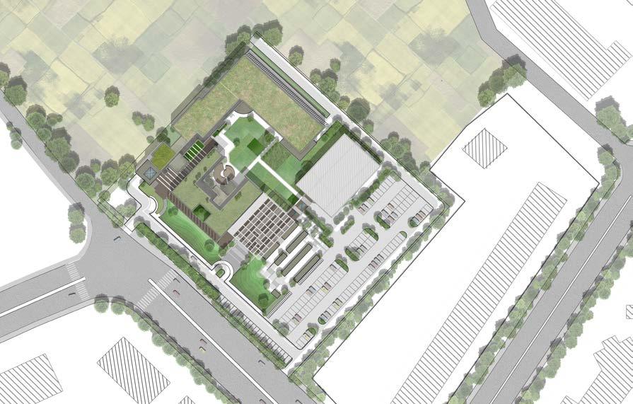
ground floor plan
1 . Reception
2 . Public Library
3 . Amphitheater
4 . Central Growing Space
5 . Institutional Wing
6 . Admin Block
7 . Green PocketsControlled growing areas
8 . Lecture Rooms
9 . Laboratory
10. Auditorium
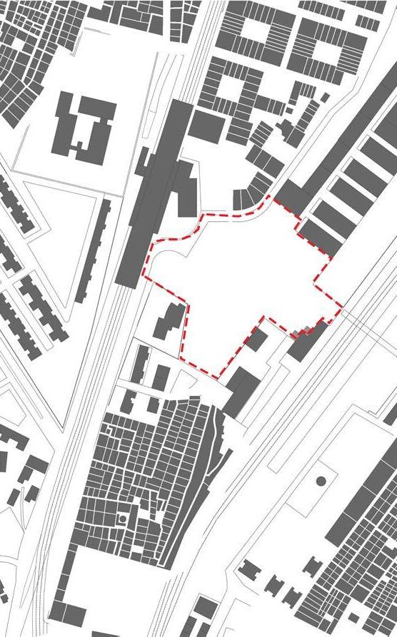
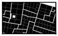
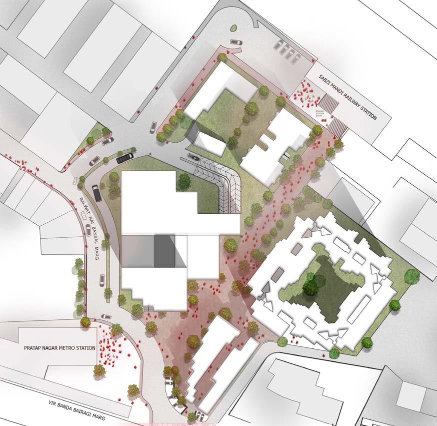
The site of approx 4 acres is located between Sabzi Mandi railway station and Pratap nagar metro station. The area nearby consists of different residential typologies and have adapted to the site differently.
The proposal focused in helping to connect the communities and also work for the betterment of the people and the commuters. A mixed use intervention works towards serving to different needs of different sections of the society and helps in bringing them together as a community.
THE URBAN LINK
Location: Sabzi Mandi Railway Station, New Delhi
Mixed Use Development | Transit Oriented Development
Guide: Manas Murthy | Saurabh Banerjia
3rd Year STUDIO | 2015 Academic | Individual
PRATAP NAGAr
railway colony
bagichi pirji
site
railway station
metro station
railway colony
Planned government colony with a common unit plan and large open spaces and common community halls.
street vendors living in the slum area; they rely on the pedestrian traffic between the two stations
auto drivers live in nearly areas majorly bagichi pirji;
pedestrian commuters people going from the railway station to the metro station; these people create a daily cycle
Through footfall analysis, volumetric and spatial surveying and studying different typologies of housings of the area, the requirements for the proposal were derived. The focus while planning the proposal was the pedestrian axis that connects the railway station to the metro station, and to smaller axis roads connecting different residential colonies of the area.
pratap nagar
private residential colony with small shared courtyards surrounded by 2 to 3 floor houses.
bagichi pirji
High density organic settlement with narrow streets 1m wide and 1 to 2 floors high.
Goal
• Provide better life style to the present dwellers in the slum.
• Commerce run by these dwellers, act as a source of income.(presently mostly work as street hawkers or are unemployed)
• School, community space for the residents as most of them are uneducated and do not go to school.
• Maintaining the axis will give maximum and easier pedestrian movement.
While exploring different massing and place making strategies
Pedestrian movement given priority.
• Central Plaza is an interface between all the different functions.
• Two major connections; between the railway station and metro station and the existing residential areas
• The front facade faces the main road at the periphery of the site to attract more footfall.
• The vehicular movement for the site shifted to the periphery of the site.
Through strategic integration of interstitial spaces and use of local streets to act as a multi-use spaces, informal activities such as, vegetable markets, weekly bazaars, etc. are given legitimacy and the residents in-turn offered a full spectrum of amenities. At a design level, ensuring flexibility of such spaces is central to their success. So, from a formal citywide retail spine to the informal retailing spaces, the design begins to address the notions of operating between ‘order and spontaneity’
The plan recognizes that mobility is about getting people to where they want to go, efficiently, conveniently, and safely. Mobility can be provided through high quality public realm, sensitivity to local context, high capacity public transport, and not necessarily by using wide street sections.
The proposed neighbourhood will be diverse in its use and population. The intent is to connect the different uses and make them universally accessible. The central spine is framed by architecture and open spaces, that celebrate the existing local neighbourhood structure and its people.