1 minute read
Describing a route from Portugal to India

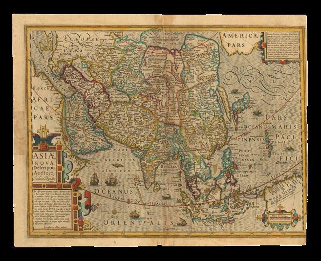
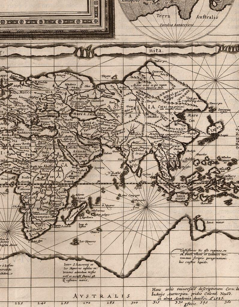
Although Sebastian Münster’s map of the continent of Africa, is based on the Ptolemaic principles, it incorporates both Portuguese and Arabic sources, and parts of both countries appear at the extremities of the map. Crucially, an informative caption appears lower left, “A’ Lisitania ad Calechut Orientis imperii, hoc itinere per mare devenitur…”, giving crucial instructions on how to sail from Lusitania, the Roman province approximating to much of modern Portugal and part of Spain, to Calechut (i.e. Calicut, India), mostly avoiding Africa. A large caravel, in which to make such a voyage, not unlike those sailed by the Portuguese, and Columbus, appears off the southwest coast. The Portuguese have named the Cape of Good Hope “Caput Bonespei”, and “Zaphala Aurifodina”, a group of islands associated with King Solomon’s mines. The Arabian kingdoms of “Quiola” and “Melinde” appear in eastern Africa, and “Hamarich”, the seat of Pester John, at the source of the Nile.
Other curious features of the map include: “a one-eyed giant seated over Nigeria and Cameroon, representing the mythical tribe of the “Monoculi”; a dense forest located in today’s Sahara Desert; and an elephant filling southern Africa. The Niger River begins and ends in lakes. The source of the Nile lies in two lakes fed by waters from the fabled Mountains of the Moon, graphically presented as small brown mounds. Several kingdoms are noted, including that of the legendary Prester John, as well as “Meroë,” the mythical tombs of the Nubian kings. Few coastal towns are noted, and there is no Madagascar yet… One of the intriguing aspects of this map is the loop of the Senegal River, which is shown entering the ocean in today’s Gulf of Guinea. Actually, this is the true route of the Niger River, but that fact will not be confirmed until the Lander brothers’ expedition in 1830. Strangely, this loop disappeared from subsequent maps of Africa for the next two hundred years[!!]” (Delaney).
Published in Munster’s ‘Geographia universalis, vetus et nova complectens... Succedunt tabulae Ptolemaicae, opera Sebastiani Munsteri novo paratae modo’, the first Latin edition of Münster’s version of Ptolemy, which contained the first “set” of maps of the four continents. For his map of Asia, see item 7.
DALRYMPLE,
Alexander
A Copy of Part of an Antient M.S. Map in the British Museum.
Publication London, London, Dalrymple, August 24th, 1787 [but 1790].
Description
Double-page engraved map, with fine handcolour in full, laid down.
Dimensions
530 by 630mm (20.75 by 24.75 inches).
References
National Library of Australia, ‘Mapping our World: Terra Incognita to Australia’, 2014, page XX, 78-81.