1 minute read
Mercator’s vision of Asia

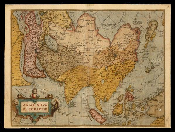
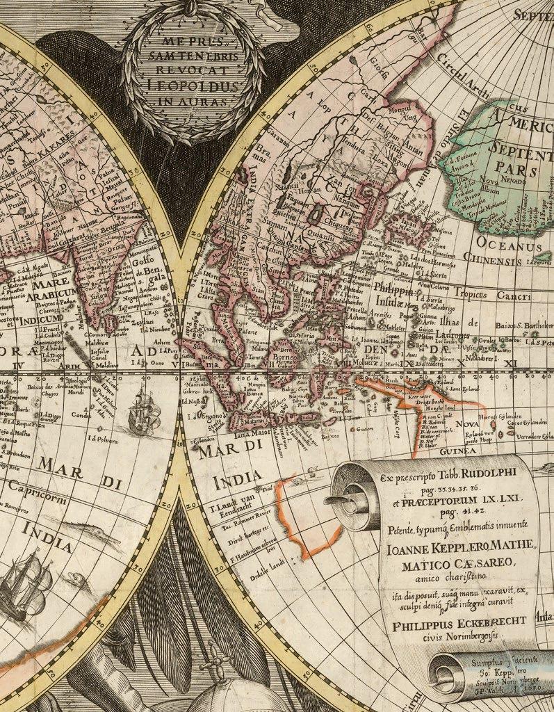
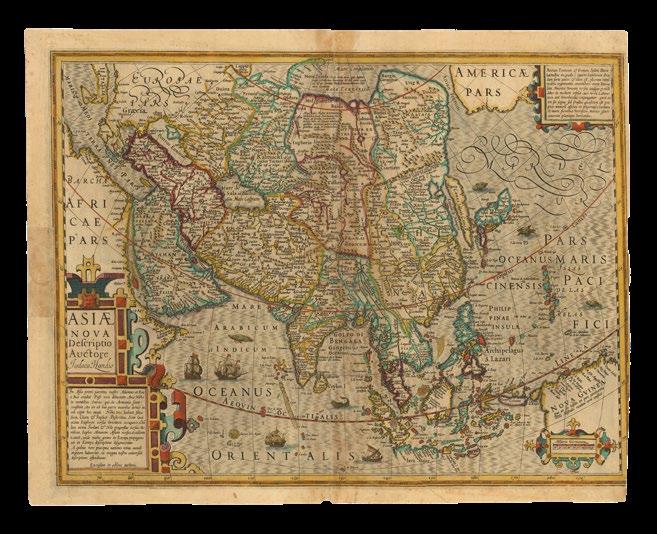
The Mercator – Hondius map of all of Asia, first published in Gerard Mercator’s ‘Atlas’ of 1595, is derived from the northeastern sheets of Gerard Mercator’s large wall-map of the world, ‘Nova et Aucta Orbis Terrae Descriptio…’ (1569). It was included for the first time in the Mercator atlas of 1595, and the plate altered, when Jodocus Hondius acquired Mercator’s plates, and issued the atlas in 1606.
In the north, a Strait of Anian – “El streto de Anian” separates Asia and America, with the galleon at the mouth of the strait referring to the possibility of a trade route through the, as yet, still mythical northwest passage; to the left, there is a large and rather featureless Africa. Japan is shown as a kite-shaped archipelago, with a trailing string of small islands. To the south, there are two visible promontories of “Terra Australis Pars”, with no indication as to whether they are joined, and a speculative New Guinea.
The islands of Southeast Asia are all well delineated, and filled with toponyms. The all-important Spice Islands are highlighted in a caption: “Molucce vocantur 5 insule ordine posite iuxta Gilolo, quarum suprema, Tarenate, Sequentes deinceps Tidore Motir Machiam et insima Bachian” - The so-called Moluccas are 5 islands placed in order next to Gilolo, the most important of which is Tarenate, followed by Tidore, Motir, Machiam, and the least, Bachian. As are islands further north: “Barusse insule precipue sunt 5 iste Min.danao Calon Subut cum reliquis duabus Circium versus. Sinde autem 3 precipue Celebes Gilolo et Ambon”.
DE JODE, Gerard; and Cornelis DE JODE Totius Orbis
Cogniti Universalis Descriptio Cui etiam eandem orbis terrae delineationem, duorum circulorum capacitate huius descriptionis mundi longitudinem documento admirantibus adiecimus anno MDLXXXIX.
Publication
Antwerp, Gerardus Iudeous exeudet,... Hanc orbis universal descriptioneni Corn: de Iudoejs Antwerpen pridie calend. noveb in alma Academia Duacesi Ao. 1589 pfecit [but 1593].
Description
Double-page engraved map on a rectangular projection, Latin text on verso.
Dimensions
420 by 555mm (16.5 by 21.75 inches).
References
Clancy, ‘The Mapping of Terra Australis’, 1995, 5.10; Shirley, ‘The mapping of the world: early printed world maps, 14721700’, 2001, 165.