


A rare opportunity to purchase approximately 3,196 hectares (7,898 acres) covering two contingent properties in one of NSW most beautiful and fertile rich valleys west of Sydney.
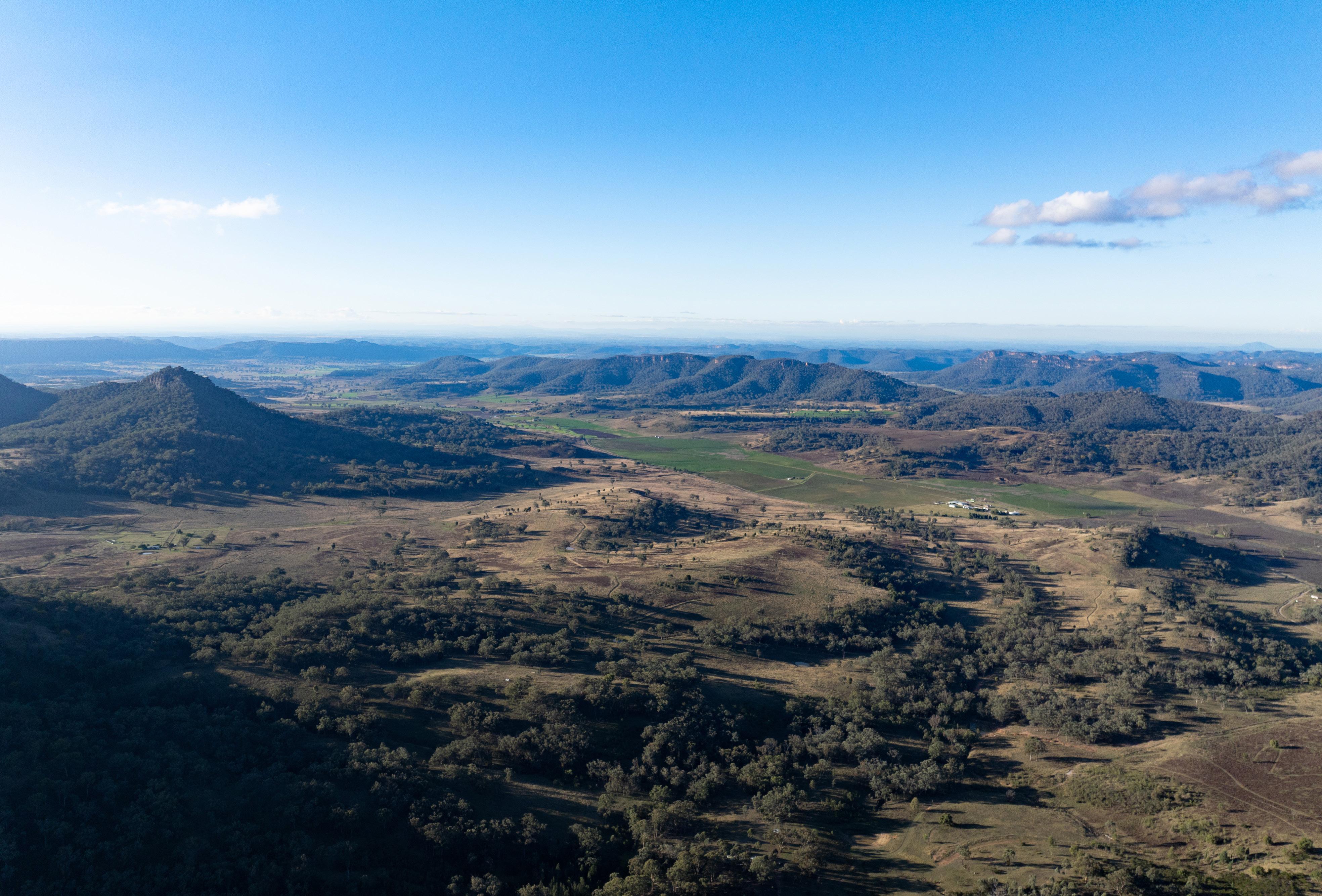
Bylong Valley is renowned for its fertile soils, spectacular scenery, sandstone escarpments and rich productive valleys. It has a long history of breeding and fattening outstanding livestock and horse breeding.
The option is now available to purchase in one-line or as two separate property transactions.
Burrumbelong Aggregation: 2,545 hectares (6,288 acres) Carrying capacity of 600—700 cows plus calf.
Ringwood: 651.8 hectares (1,610 acres) plus 464ML irrigation water licence. Carrying capacity of 110 cows plus calf.
Located approximately 80km east of wine and food hotspot Mudgee, 37km north of the boutique township of Rylstone and approximately 280km north-west of the Sydney CBD.
Bylong Valley is a scenic and winding valley in New South Wales, nestled between the Goulburn River National Park and Wollemi National Park. It crosses the Great Dividing Range and is renowned for its picturesque countryside, escarpments, rich cultural heritage, and sightings of native wildlife; including wombats, wallabies, and kangaroos.
The valley is home to Bylong Village, which has a small population, and is known for its horse studs and productive farmland.
The Bylong Valley Way, a popular route for travellers, runs through the valley, offering stunning views and access to nearby attractions.
The nearest major town is Mudgee, which is a Mecca for weekender’s enjoying cosy escapes, great local wines and food. Rylstone is also a popular destination for its boutique shops and extraordinary street-scape.
Budden to the following destinations (By road)
Source: Google.com/maps (Approximate only)


Bylong Valley experiences a temperate climate with distinct seasonal variations. Historically, summers tend to be warm, with average maximum temperatures reaching around 31.4°C in January. Winters are cool, with July being the coldest month, averaging a minimum temperature of 2.4°C.
Rainfall is moderate, with an annual average of 659mm, spread fairly evenly throughout the year. The wettest months are typically December and March, while May and August tend to be drier.
The climate is favourable to winter and summer forage crops and suitable for sub-tropical pastures, clover and Lucerne production.
Source: Bureau of Meteorology (Australian Government)
The Burrumbelong Aggregation is currently run as a cattle grazing, breeding and fattening enterprise with approximately 40% of the land is considered to be arable and suitable for improved pastures and farming. In the past, commercial crops have been grown successfully on the aggregation. The remaining land is timbered grazing with fertile soils.
The farm currently runs approximately 600—700 cows plus calf with additional trade cattle when season conditions permit.
Water for livestock is sourced from paddock dams, creeks and the addition of concrete trough and tank system.
Currently the Burrumbelong Aggregation is run by the current owners as a family operation.
Finished livestock are sent to nearby saleyards in Mudgee (87*km), Scone (130*km) and Singleton (157*km).
*Approximately


The Burrumbelong Aggregation has a current carrying capacity of approximately 600 700 cows plus calf.
There is additional scope to increase the carrying capacity with ongoing pasture development, enhanced water and fertiliser application.
The rich soil type, and arable land, are highly suitable for cropping and Lucerne production which would further increase the aggregations carrying capacity.
The fencing over the aggregation can be best described as being adequate and stock proof.
The fencing is a mixture of timber posts, steel pickets with plain and barbed wire.
The aggregation has a mixture of paddocks, all varying in different size and shape.
The paddocks size, and shape, reflects the natural topography and access to water.


The Burrumbelong Aggregation has a mixture of improved and native pastures with approximately 40% (1,011ha/2,500ac) considered to be arable and suitable for improved pastures, 37% (955ha/2,360ac) heavier timber grazing with the remaining 23% (577ha/1,428ac) classified as light timbered grazing, all with fertile rich soils.
Bylong soils are considered, by some, to be in the top 2—3% in NSW. Ranging from deep dark brown to red basalt which are highly suitable for cropping and improved pastures.
The topography ranges from creek flats, and terraces, to rolling hillside and escarpments with timbered ridges. The topography is visually striking with the most beautiful scenery and changing landscape colours.
Land Type Classification
Source: Agents estimate using Google Earth & NSW Government Spatial Services.
Livestock water on the Burrumbelong Aggregation is via a combination of the following sources;
• Seven stock and domestic bores - three equipped
• Approx 19 paddock dams
• Tanks and concrete trough system
• Burrumbelong Creek (Approximately 5km)
The average rainfall is approximately 659 millimetres with rainfall evenly spread throughout the year.
There is a reticulated water system comprising concrete troughs, holding tanks and bore/aquifer water.

The infrastructure includes three houses of mixed condition which are all located in strategic positions. The infrastructure is considered to be workable.
Montoro - Residence (Needs renovation) 4-bed, 1-bath, 4-bay shed
Thornvale - Old cottage (Needs renovation) 2-bed and shed
Thornvale - Main brick residence (Front gate) 3-bed, 1-bath, 1-car
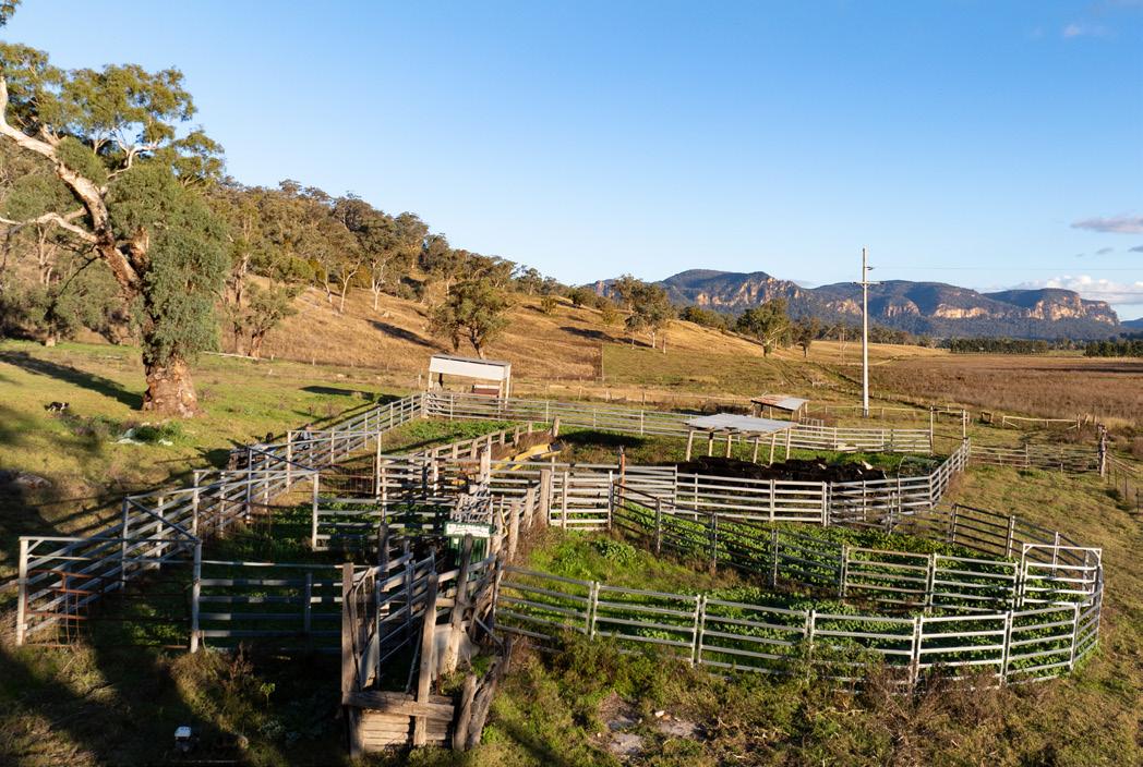
Thornvale Cattle Yards - Steel panels, timber and loading ramp
Burrumbelong Cattle Yards - Steel panels, timber and loading ramp
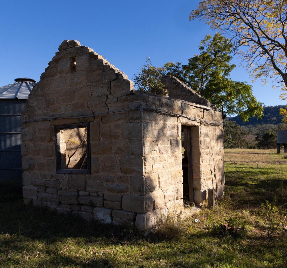
Burrumbelong - Old sandstone homestead (remnants) & old sheds


Burrumbelong Montoro, Thornvale
Referred to as the “Burrumbelong Aggregation”
Lot 1/DP1084102; 4/DP1175935; 1/DP254433; 2/DP580900; 2/DP634100; 38, 41-47, 58-60, 77-79, 88-90, 104/DP755417; 19, 20, 32-40, 80, 81, 87, 91, 92, 97, 99, 100, 103/DP755419 2,545 6,288
Total Aggregation Land 2,545 hectares 6,288 acres
Land sizes are approximate and subject to survey and the final Contract for Sale.
2,545 Hectares (6,288 Acres)


Ha
Property Address
3 Killens Road, Budden NSW 2849
Local Authority
Mid-Western Regional Council
Land Area
2,545 hectares (Approx. 6,288 acres)
Livestock Water
Bores, creeks, dams and storage tanks
Certificates of Title
Noted on page 20
Zoning
RU1 - Primary Production
Internet & Phone
Satellite
Domestic Water
Rainwater and storage tanks
Power Supply
Single phase 240v mains power
Waste Water
On-site sewerage management systems


Ringwood is currently run as a cattle grazing, breeding, fattening and cropping enterprise with a 464 megalitre groundwater irrigation licence. The irrigation, river flats and rich soils are ideal for growing Lucerne, hay production and fodder crops.
Ringwood currently runs approximately 110 cows with calf plus a number of trade cattle when seasons permit.
The irrigation and river flat paddocks could be developed, and utilised, for additional fattening/finishing options or hay production.
Ringwood is currently run by one of the family owners who brings in additional help when required.
There are two homes on the property of which only one is suitable for owners or staff accommodation. The other requires a full renovation or knockdown rebuild.
Carrying Capacity
The Ringwood has a current carrying capacity of approximately 110 cows plus calf.
For the last two years Ringwood has run approximately 150 weaners ranging from 250kg to 450kg, without pastoral improvement or irrigation.
There is additional scope to increase the carrying capacity with ongoing pasture improvement and fodder cropping.
The fencing over the aggregation is best described as being adequate and stock proof. The main fencing is a mixture of timber posts, steel pickets, plain and barbed wire.


Ringwood has a mixture of improved and native pastures with approximately 105 hectares (261 acres/16%) productive river flats.
Approximately 153 hectares (372 acres/23%) is considered to be arable open grazing and lightly timbered grazing with the remaining land being 392 hectares (977 acres/60%) of heavily timbered grazing.
Soil & Topography
Bylong soils are considered, by some, to be in the top 2—3% in NSW. Ranging from deep dark brown fertile alluvial to red basalt. The soils are highly fertile and suitable for cropping, Lucerne & improved pastures.
The topography ranges from creek flats, and terraces, rising to scattered timber hillside and high escarpments with a mixture of open and timbered grazing.
Land Type Classification
Source: Agents estimate using Google Earth & NSW Government Spatial Services.
Ringwood has an active irrigation water licence of 464 megalitres.
The irrigation water is extracted via a shallow well, and pump, which is located on the fertile river flat country located on the western side of the property.
The perennial Growee River winds its way through the property for approximately 3km offering additional stock water and waterholes.
The existing irrigation system on Ringwood presents a strong foundation for further development.
The fertile alluvial soils of the river flat country, coupled with a reliable water access licence, create ideal conditions for Lucerne production or other crops.

Source:
Lot 5 & 6 DP1175935
Lot 6, 7, 9, 10, 12, 13, 82, 83, 100 DP755417
Land sizes are approximate and subject to survey and the final Contract for Sale.


The infrastructure on Ringwood is adequate for the current enterprise but would unlock value and efficiencies with upgrades and capital works.
Overview of the main infrastructure on Ringwood


Ha
Property Address
6166 Bylong Valley Way, Budden NSW 2849
Local Authority
Mid-Western City Council
Land Area
651.8 hectares (Approx 1,610 acres)
Irrigation Water Licenses
WAL17730 - 464 Megalitres
Certificates of Title
Noted on page 32
Zoning
RU1 - Primary Production
Internet & Phone
Satellite
Domestic Water
Rainwater and storage tanks
Power Supply
3-Phase power to sheds and irrigation wells
Waste Water
On-site sewerage management systems


Aggregation
This map is for illustration purposes only and not drawn to scale
Source: nsw.gov.au (SEED) & google.maps
2,545 Hectares (6,288 Acres)

Hectares (7,899 Acres)
651.8 Hectares (1,610 Acres)
For Sale
Expressions of Interest
Closing 5pm (AEST) Thursday 10 July 2025
Inspections
By private appointment
Inclusions & Exclusions
Both properties are offered for sale bare of livestock & machinery. Any surplus plant and equipment will be offered to the successful purchaser/s at the time of sale.
Contact Agents
Please contact Richard Royle or Hamish Firth
Richard Royle
CullenRoyle
+61 418 961 575 richard@cullenroyle.com.au
Hamish Firth
Ray White Scone
+61 499 881 585 hamish.firth@raywhite.com

NON-BINDING FORM.
We hereby submit our Expression of Interest for Burrumbelong Aggregation &/or Ringwood, Bylong Valley NSW.
1. Registrant’s Details
Purchaser/Company:
ABN/ACN (If applicable):
Contact/Representative:
Postal Address:
Telephone:
Email:
2. Indicative Offer Price
Vendors will consider selling ‘as a whole’ or as separate transactions
Burrumbelong: $
Ringwood: $
Combined Properties: $
3. Proposed Purchase Terms
Deposit ($):
Balance ($):
Settlement Period (Days):
FIRB Approval Required?
(If applicable): Yes | No
Special Conditions (If any):
4. Registrant’s Solicitor/Conveyancer
Company Name:
Contact Person: Address: Telephone: Email: DX:
6. Funding Does this purchase require funding approval? Yes | No (If yes please provide details):
7. Signatory of Registrant
Signed By:
Dated:
Please send the completed form to either: Richard Royle Hamish Firth E:: richard@cullenroyle.com.au E: hamish.firth@raywhite.com M: +61 418 961 575 M: +61 499 881 585
Terms and Conditions: The vendor reserves the right to negotiate with any party at any time. The vendor reserves the right to remove the properties, and any associated assets for sale, at any time. By submitting this EOI form you are agreeing to these terms and conditions.

Disclaimer: The information provided in this document is for general purposes only and does not purport to contain all of the information purchasers may require. Purchasers should satisfy themselves as to the accuracy and completeness of this information through physical inspections, enquiries, surveys and searches. All areas, amounts, measurements, distances and other numerical information are approximate only. Purchasers should make their own enquiries and obtain their own independent advice in order to verify the accuracy of the information in this document.