Rebellion Way


Discover Norfolk’s hidden stories on a 370km bikepacking tour Guy Kesteven
Maps produced by Sophie Gordon and Kieran Foster Map data by Ordnance Survey © Crown copyright 2022 OS 100045061
Development of the Rebellion Way and the production of this route guide have been funded through EXPERIENCE, a €23.3 million project co-financed by the European Regional Development Fund (ERDF, €16 million) through the Interreg VA France (Channel) England Programme 2014-2020. This project will harness the experiential tourism trend to extend the season (October – March), generating 20 million new off-season visitors spending €1 billion across six pilot regions in England and France by June 2023.
With thanks to:
The EXPERIENCE team at Norfolk County Council
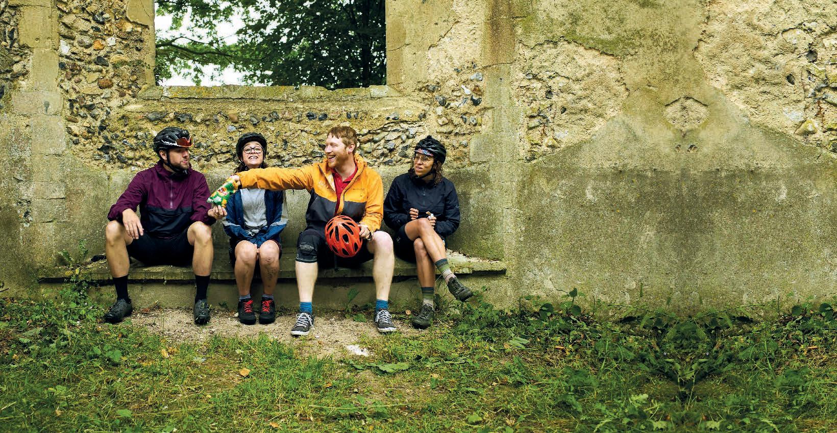
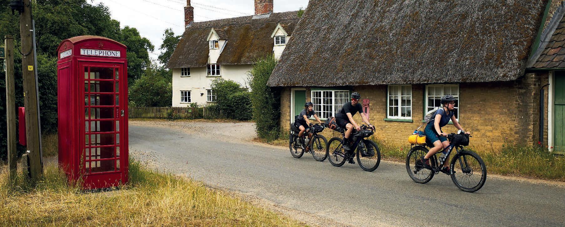
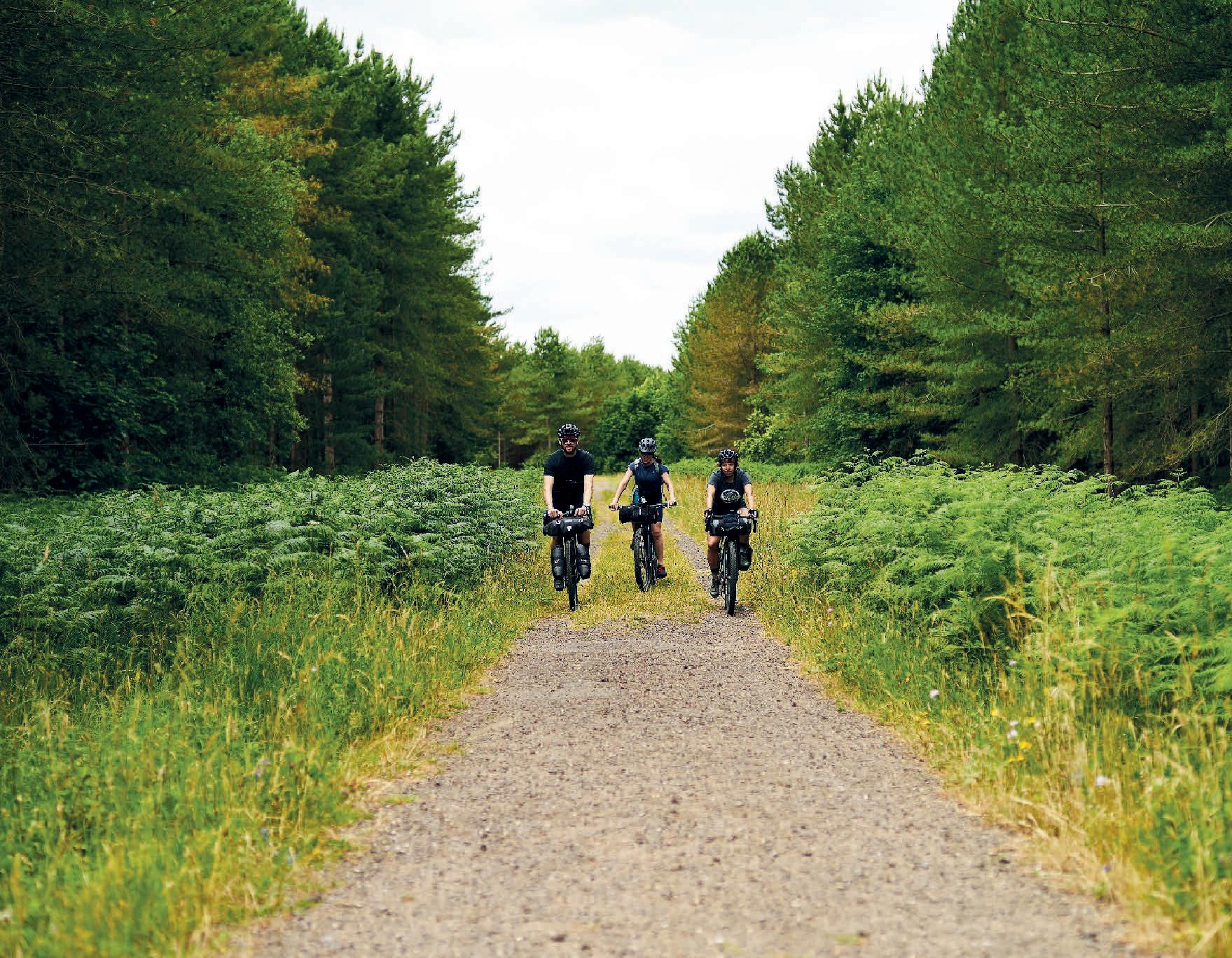
Open Sky Cycles, Snettisham Burnham Cycles, Burnham Market Volunteer riders for images
All rights reserved. No part of this publication may be reproduced or transmitted in any form or by any means, electronic or mechanical, including photocopy, recording or any other information storage and retrieval system, without prior permission in writing from the publisher. Printed and bound in the UK
Welcome
The name of the Rebellion Way is inspired by two of Norfolk’s most fascinating uprisings: those of Boudicca and Robert Kett.
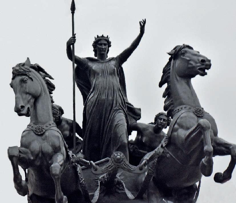
The Queen of the Iceni tribe, Boudicca led her people in a revolt against Roman rule almost 2,000 years ago. The iconic image of the warrior queen riding her chariot into battle has become a cultural symbol of resistance.
More recently, Kett’s Rebellion dates to 1549 when local tenants started destroying fences that wealthy landowners had used to close off previously common land. One of these landowners – Robert Kett of Wymondham – listened to his tenants’ concerns and instead of fighting the rebels, he offered to lead them as they marched on Norwich.
Kett’s Rebellion may not have been successful, but it finds echoes down the centuries in the ongoing fight for public access to the countryside in England.
Cycling UK has long been at the forefront of increasing off-road access for cycling –from gaining the right to cycle on bridleways in 1968, to successfully campaigning for the right to responsible access in Scotland in 2003 and a commitment to increase access in Wales in 2019. Alongside this, we’ve been developing rideable routes for England’s National Trails to enable more people to enjoy them.
By buying this guidebook or joining Cycling UK you help us to continue this work. We hope the Rebellion Way will encourage you to discover Norfolk’s surprising and tumultuous history, and take the time to experience and enjoy all that this fascinating county has to offer.
Sarah Mitchell Chief executive of Cycling UK

EXPERIENCE project
As one of 14 partners on the EXPERIENCE project, Cycling UK is working to deliver sustainable new off-season tourism experiences and supporting businesses to attract cyclists with the Cycle Friendly Places accreditation.
The €23.3 million project is co-financed by the European Regional Development Fund (ERDF, €16 million) through the Interreg VA France (Channel) England Programme 2014-2020, and aims to boost visitor numbers in six pilot regions including Norfolk, Cornwall and Kent. cyclinguk.org/experience
3
Think of Norfolk and you may imagine wide-open landscapes stretching away beneath huge skies, tranquil waterways and birds soaring over the coastline. But this peaceful image belies a surprisingly turbulent history.
Contrary to popular perception, Norfolk isn’t totally flat, but it’s not far off. The route doesn’t climb above 100m at any point and when it does it’s almost always very gentle.
4 Cycling UK
Contents How your support helps ..................................................... 6 Overview map ............................................................................ 8 Introduction ................................................................................ 10 Part 1: Norwich to Thetford .............................................. 16 Part 2: Thetford to King's Lynn ....................................... 28 Part 3: King's Lynn to Wells-next-the-Sea ............. 38 Part 4: Wells-next-the-sea to Sheringham ............. 50 Part 5: Sheringham to Norwich ..................................... 60 Places and facilities ........................................................... 72 Explore more day routes in Norfolk ........................... 74 Cycle hub locations ............................................................ 75 Suggested itineraries ....................................................... 76 Image credits ......................................................................... 77 Afterword ...................................................................................... 78 About the author ...................................................................... 79 5
Your support enables us to open up more traffic-free trails

Imagine being able to cycle the length and breadth of the country on connected off-road trails, through fascinating places and amazing landscapes.

Recent years have seen many of us discover the simple joy of exploring the countryside by bike, and the sense of escape that can be found within the confines of our islands. Our vision is to make this adventure and connection to nature accessible to all.
As the UK’s cycling charity, Cycling UK is working to make this a reality by campaigning for wider off-road access for cycling and developing new longdistance trails to link existing routes. But this work is only made possible by our members and donors.
If you want to support wider access to the outdoors and the creation of more long-distance trails, join Cycling UK today and help more people discover the joy of off-road riding.
By joining Cycling UK, you will enable us to bring about real change, while benefiting from our fantastic membership package, including insurance, retailer discounts and much more.
cyclinguk.org/join
Help us open up the countryside by joining
our 70,000 strong membership today, and together, we’ll make a better world by bike.
Cycling UK 6
We are the UK’s cycling charity
Cycling is amazing, which is why we want everyone to enjoy the thrill of the ride. We’re making positive changes for cycling across the UK, from the corridors of power to the wildest upland moors. We’re making our streets safer, opening up new traffic-free routes and inspiring more people to get on their bikes.

Becoming a member is just one way you can help us achieve our vision, plus you’ll receive:
Free third-party liability insurance and legal assistance on and off-road
Discount on cycle insurance (includes mountain bikes and e-bikes) with Yellow Jersey
Retailer discounts and benefits Free subscription to Cycle magazine every two months for inspiring routes, advice, news and reviews
cyclinguk.org/join
If membership isn’t for you, please consider a donation to help Cycling UK to continue our work in opening up more rural access for cycling and campaigning for improving conditions for those who cycle all over the UK.


7
cyclinguk.org/donate
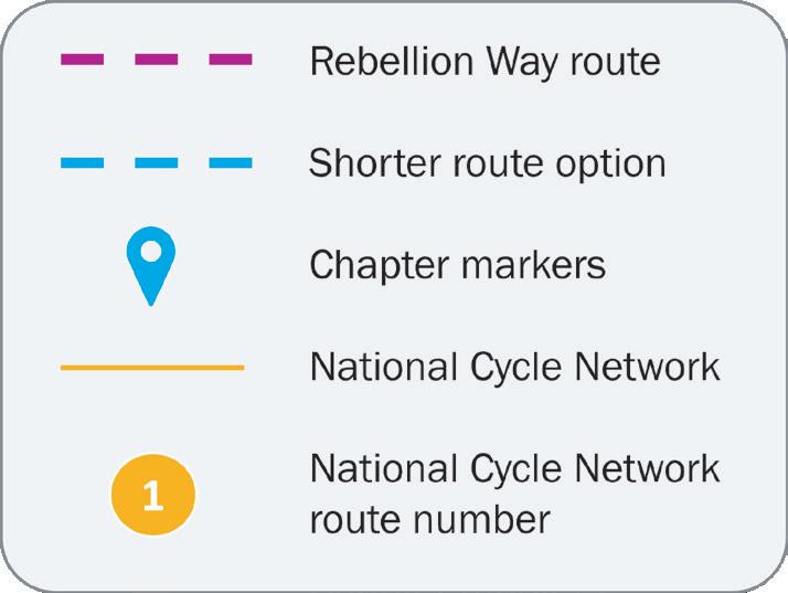
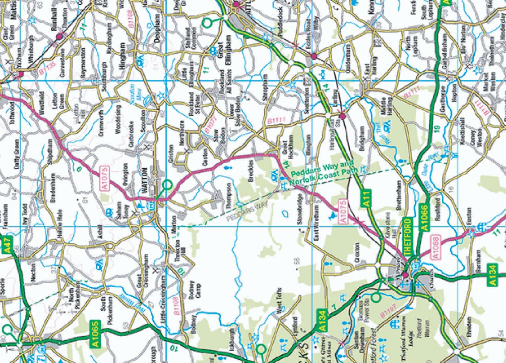
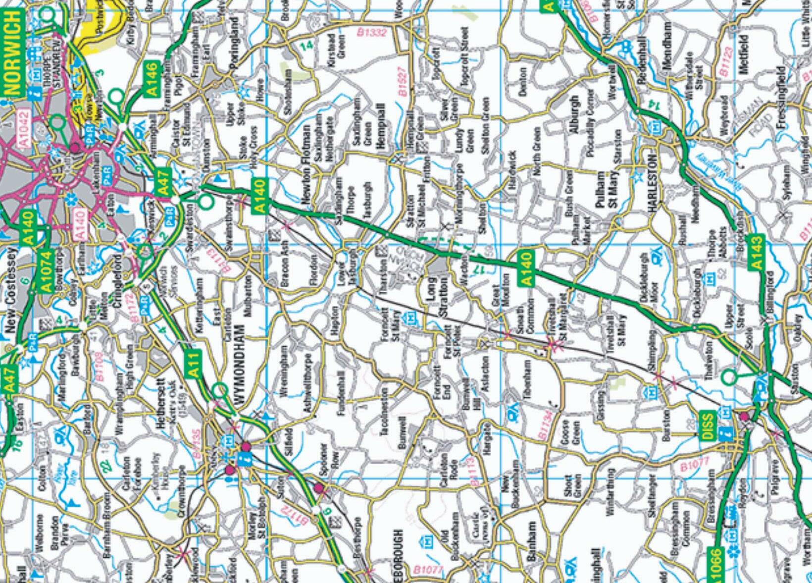
8 Rebellion Way route Shorter route option Chapter markers National Cycle Network National Cycle Network route number1 13 13 11 1 1
Overview map
9 0 10 km 0 6 miles
full route 1
Rebellion Way
The Rebellion Way is a 225 mile/365km cycling adventure around Norfolk. Meandering along a mix of quiet, mostly flat back roads, byways, cycle paths and bridleways under huge panoramic skies, it’s a fantastic introduction to multi-day, on- and off-road adventuring for anyone.

The Rebellion Way name comes from the fact that while this ancient county is now characterised by a relaxed, timeless, pastoral charm, it actually has a fascinatingly turbulent history from the Iron Age onwards. Exploring the stories, ancient sites, stunning vistas and thriving wildlife of this unique area enriches every mile of this easy but rewarding loop.
While the overall distance might seem large, there is minimal climbing on slopes that are never steep. The off-road sections are fast, non-technical and largely weatherresistant, so those miles come very easily. Norfolk’s weather is usually fairly mild and there are a huge number of places to stop and eat, drink, recharge or stay overnight on the route. That makes it easy to segment into as many days as you want to take and there are multiple shortcut options should you want to shorten the route or just bypass some of the gravel sections.
While it’s a still a surprisingly rewarding ride for experienced adventurers, this route has been specifically designed to be not just achievable but very enjoyable for riders of all levels.
Route overview
The Rebellion Way starts from the county capital of Norwich with its dramatic castle keep, beautiful cathedral and lively atmosphere, but you’re soon out into beautiful wide-open countryside.
Passing the dramatic earthworks of the Roman town at Caistor St Edmund, the route heads south through beautiful villages and medieval farmlands. Deserted back roads, farm tracks and grassy commons join the dots between ancient stone churches, manor houses and half-timbered barns you’ll never find

10
otherwise as you head towards Diss, and cross over into the neighbouring county of Suffolk past rewilded heaths and windmills. Then it’s into the forest tracks and prehistory either side of the charming town of Thetford.

Following ancient Roman roads you roll past incredible priory and castle ruins before turning west along timeless farm tracks and the dramatic, sandy lakeland landscape of Bawsey Country Park to the bike-loving, historical river port of King’s Lynn.

From King’s Lynn it’s a blissfully traffic-free journey past dramatic castle ruins and rich churches through perfect parkland to take tea with the Queen at her Sandringham country home.
Deserted lanes skirt 10,000-year-old storied settlements as you run up the coast to the traditional seaside resort of Hunstanton. A gently rolling ride delivers you to the poshest part of the route, where the delicatessens and boutiques of beautiful Burnham Market compete with the huge Palladian stately home of Holkham Hall.
You’ll then swap aristocratic grandeur for the teeming nature reserves and haunting tidal landscape of Holkham Bay, looping round reclaimed marshland into the old seaport and seaside town of Wells-next-the-Sea.
Fast flinty gravel follows the restored steam railway down to the fascinating pilgrimage site of Walsingham, which claims to be
the Nazareth of the UK. A web of forgotten lanes and gravel shortcuts take you to the bustling market town of Holt, followed by a loop up to seaside Sheringham before tackling the only notable climb on the whole route to enjoy panoramic coastal views.
Woodland and gravel trails take you south past Felbrigg Hall towards possibly the most typically English village ever at Aldborough. Then the vast National Trust estate of Blickling Hall offers a last aristocratic indulgence before the busy town of Aylsham.
The last leg of the Rebellion Way follows the freshly surfaced path alongside the Bure Valley railway into the heart of the Norfolk Broads at Hoveton and Wroxham. Here we take a quiet loop into this unique lowland landscape past breweries and yet more unspoilt villages before the final roll back into Norwich. You’ll finish with a head full of fond memories of an often overlooked but wonderful county, and legs much fresher than they would be riding this far anywhere else in the UK.
11
...this route has been specifically designed to be not just achievable but very enjoyable for riders of all levels.
Format of the guide
We have split the route into five sections. They are mostly of roughly similar length (70km/43 miles) and have a town or village as a start or break point. Each section has a chapter of its own describing the character and landscape, with historical, natural or useful highlights detailed separately.
To help you plan your trip, we’ve included a cumulative distance chart as well as a table of the facilities in each town and village. We’ve also suggested itineraries for a two-, three-, four- or five-night schedule.
We know plans don’t always go smoothly, so we’ve flagged where the route has obvious shortcuts to make up time.
If you don’t have time to do the full Rebellion Way route in one go, there is also an option to cut across the middle between Stoke Holy Cross and Swaffham to create two shorter loops (see map on p.8).
• Rebellion Way north loop: 304km
• Rebellion Way south loop: 171km
Terrain
Contrary to popular perception, Norfolk isn’t totally flat, but it’s not far off. The route doesn’t climb above 100m at any point and when it does it’s almost always very gentle. While it can be affected by headwinds, a lot of the route is sheltered by trees and thick hedges so the pedalling is never painful.

In terms of what’s under your wheels, this is a mixed-surface route, but not a technical one. Most of the off-road surfaces are on hard-packed gravel that rides well in all weathers but some sections can be sticky or slippery if it’s been wet. There’s also a section of sand near King’s Lynn and a steeper off-road climb near Sheringham where you might need to push. We’ve highlighted those in the route notes and provided alternative road routes in case it’s been raining particularly hard.
The off-road sections are fast, non-technical and largely weather-resistant, so those miles come very easily.
Cycling UK 12
Navigation
The Rebellion Way is not a signposted route. However it overlaps in places with National Cycle Network route 1 and the Boudicca Way walking trail so in parts those signs can be followed. Thankfully the maze-like cycle route into King’s Lynn and then out again to Castle Rising and Sandringham is well signposted too. Otherwise, joining up the most fascinating and forgotten parts of Norfolk while staying away from traffic inevitably means the route meanders in places and there are a couple of turns or trail entrances which are easily missed. That means we’d recommend using a GPS with good screen resolution and as comprehensive mapping as possible, as many parts of the route won’t show up on a ‘road map’. The video overview that covers the route will also highlight some of the tricky navigation spots (search for ‘Rebellion Way GuyKesTV’ on YouTube).
Bike and kit

The non-technical, gently rolling nature of the off-road terrain and the sometimes scruffy road surfaces of the Rebellion Way make it perfect for a gravel bike, hybrid or touring bike with larger tyres. It will be totally fine on a mountain bike too if you want maximum comfort and confidence. Plenty of places to stop and recharge make it easy to keep an e-bike topped up. The route is largely compatible with a tricycle too, but we’ll highlight any pinches or gates which might be an issue for wider cycles.
In terms of bike equipment choice, there’s a lot of flint all the way round the route. That’s great if you’re a prehistoric person making sharp tools, but they can be hard on delicate tyres so take an extra tube and patch kit. There are several bike shops on or very close to the route, so you’re never far from a save.

On a plus note, the Norfolk countryside is an absolute web of tiny lanes running in all directions, so if you do overshoot –or just want to dodge on off-road section or take a shortcut – then there will usually be several options. We have directed the route through towns and villages to provide opportunities for frequent stops. Apart from King’s Lynn, midsummer Hunstanton and Norwich, they’re all very quiet and you’ll generally be able to bypass them easily if it’s complete quiet you’re after.
While Norfolk’s position in the east of the country means it is generally blessed with better weather than the rest of the UK, it is still in the UK. That means things can get wet or windy quickly at any time of the year, so bring appropriate gear. The big skies mean you’ll normally have plenty of warning to get your jacket ready though, and there are lots of churches, pubs, hedges and woods for shelter.
13 Introduction
Safety
Watch out for the points where the route unavoidably crosses main roads: we’ve chosen traffic calmed or lower speed limit sections as much as possible, but the majority of the route is so quiet that seeing multiple vehicles again can be quite startling. Norfolk’s agricultural focus means you should be prepared to meet all sorts of weird and wonderful farm machinery which can be wider than the lanes themselves, so always take care.
Other parts to note are crossing the car park at Old Hunstanton, where free-range kids can sprint towards the beach as soon
as car doors open. The shared use path behind Holkham Bay and the Bure Valley railway path can also be very busy with walkers and dogs at the weekend, and Sandringham and any of the National Trust estates have a high proportion of elderly visitors who might not hear you approaching, so remember to slow down and ring your bell or say hello.
Finally, please don’t risk eternal damnation by nobbling a nun or mowing down a priest or pilgrim in Walsingham (the otherwise very comprehensive Cycling UK members’ insurance doesn’t have a ‘smiting’ policy).


Cycling UK 14
The shared use path behind Holkham Bay and the Bure Valley railway path can also be very busy with walkers and dogs at the weekend.
Responsible access
It’s important to remember that the welcome cyclists receive in the countryside, the growth of facilities and the support from local authorities to create routes like these will always depend on how we behave. And while Norfolk seems idyllic and relaxed you will also be travelling through a hard-working agricultural landscape so please be an ambassador for us all.

• Ride safely, carefully and respectfully and within the limits of your skill and bike
• Say ‘hi’ and slow down when approaching other trail users, and stop if necessary Take special care to avoid startling horses – ask the rider if it’s all right for you to pass
• Please leave the few gates on the route exactly as you find them
• Take care when going through the handful of farmyards en route
• Don’t leave bikes in awkward places when you stop
• Support local businesses along the route to show the power of the ‘pedalling pound’ and strengthen the case for more future routes
• If you see another cyclist with a problem or a lost hiker, please stop and offer to help

• Take it easy and enjoy the journey –chasing Strava segments or fastest known times can cause accidents and create negative perceptions of cycling, which makes it harder to campaign for more off-road access in the future

Where to start and how to get there
The official start of the Rebellion Way is Norwich, with the GPX route starting at the railway station for convenience. However, you could also start in King’s Lynn or Thetford if you’re coming from the west or south.
There are railway stations at Thetford, King’s Lynn, Sheringham and Cromer which will get you back to Norwich
(eventually) if you want to do the route in separate segments or need a bailout option.
There are long-stay car parks in King’s Lynn which permit multi-day stays. You can purchase a ROVER parking ticket which is valid for seven days, or just pay at the machine for the amount of time you would like to park for.
15 Introduction
Norwich to Thetford
ONE
PART
17 Rebellion Way route Shorter route option Chapter markers National Cycle Network National Cycle Network route number 13 13 13 0 4km 0 2 milesOverview map: Part 1
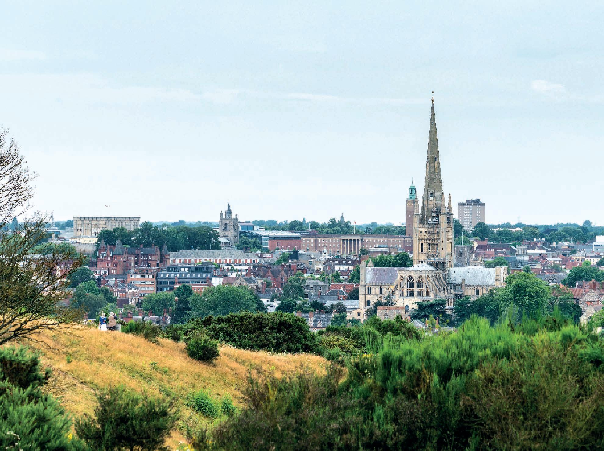
Rebellion Way starts from the county capital of Norwich with its dramatic castle keep, beautiful cathedral and lively
Norwich to Thetford
Be aware
city centre
Norwich skyline
and nearby trails
18 Part 1
Distance: 79km (49 miles) Highlights • Idyllic, easy rural riding • Norwich riverside • Venta Icenorum Roman town • Beautiful back lanes and timeless trackways • Prehistoric mounds and earthworks • Ancient churches – alive and ruined • Secret manor houses and tithe barns • Delightful medieval villages and Georgian market towns
• Norwich
is busy with several main roads, so use the excellent cycle path network where you can • Be careful of the crossings of the A140 and the A1066 main roads • Wacton Common
are grassy pasture which can be slow going after a lot of rain The
atmosphere, but you’re soon out into beautiful wide-open countryside.
Scene setter
While the start in Norwich is definitely the busiest part of the whole route, it only takes a couple of kilometres before the relaxed pace of rural Norfolk life welcomes you into its embrace. You’ll soon come to realise that picture perfect villages, often with thatched or half-timbered highlights, are the default setting for this drowsy landscape – but that doesn’t stop the signature brick and flint buildings and churches making a delightful first impression.
While it seems far from anarchy now, the rebellion-related stories of the area are first showcased at the huge Roman town at Caistor St Edmund. You follow the Pye Road rampage route of Boudicca on a mix of wandering back roads and ancient tracks, ticking off more snapshots of fascinating history and some remarkable hidden gems all the way down to Diss.
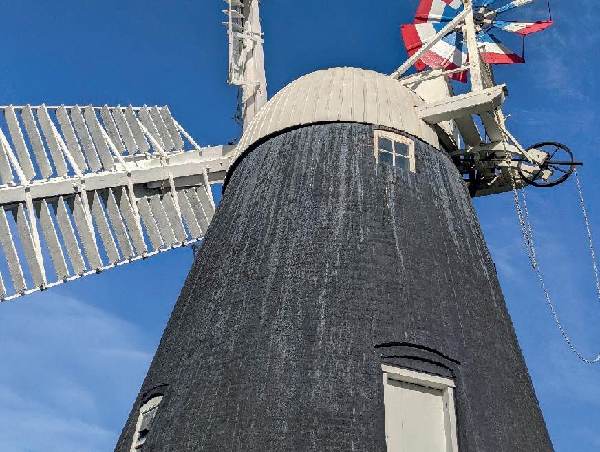
We strongly suggest you stop a while to take in the lovely atmosphere and architecture of Diss before crossing the river for some meandering on the Suffolk side of the county line. Heaths, fens, windmills, prehistoric earthworks and forgotten villages of the south Brecklands give way to the first sections of Thetford Forest, which cloak you in the dense cover, rich wildlife and prehistoric stories that typify the next 50km or so of riding.
Then it’s into historic Thetford for a quick loop around the castle and into the pretty town square, to end the first part of your Rebellion Way adventure.
Norwich
The county city of Norfolk is also the largest in East Anglia and it has one of the largest medieval cathedrals in the country. While confirmed occupation only dates from the early Saxon period, it rapidly became a very important trading centre with finds of coins and pottery from all over Europe and its own coin production mint from the 10th century.
Norvic continued to grow in importance through the Viking period and is listed as one of the largest cities in England in the Norman Domesday Book audit. The book also records that nearly 100 homes were demolished to make space for the Norman castle with the Cathedral being built from Normandy limestone shortly afterwards.
The turbulent history of the city includes a religious riot that makes it the only English city to be excommunicated by the Pope. It’s also witnessed a horrific 12th-century massacre of the Jewish community, been sacked by the Flemings and the French, and had its castle captured in the Kett Rebellion uprising. The largest explosion of the 17th century occurred in Norwich when Royalists accidentally set often a gunpowder store during a riot against Parliamentarian troops.
Throughout all the chaos it still remained a very prosperous wool trading centre though, with a reputation for good living, political protest and high spirits. That’s upheld by the locals and students to this day and Norwich is always a fun and lively place to visit.
19 Part 1: Norwich to Thetford
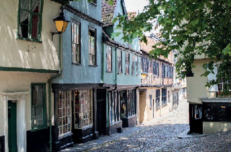
Elm Hill, Norwich
Starting the Rebellion
The Rebellion Way route starts at Norwich railway station, but we’d definitely recommend spending some time exploring and enjoying this lively city either before you set off or as a reward when you finish. Don’t be put off by the busy town centre roads, as you’ll see there are plenty of cycle paths and you’ll soon be using them to connect quiet, characterful streets south out of the city.
The Iceni
The Celtic Iceni tribe aren’t mentioned in Julius Caesar’s invasion accounts in 54BC, but by 10BC they’d begun producing their own coins with horse and boar emblems and had established a kingdom across Norfolk, Suffolk and much of Cambridgeshire. They initially allied with the Romans after the Claudian invasion, but King Prasutagus rebelled while the Romans were fighting the Silures in South Wales and the Brigantes in the north. The Iceni were beaten in battle, though, and then behaved themselves until the bigger Boudiccan rebellion.
Post-rebellion, it seems the Celts largely dispersed, with the area being colonised early by Angles and Saxons during the late/post Roman period.
Cross the river and you’re immediately into the old picture-perfect village and wide open, fertile landscape mix that typifies this whole route. It’s not long before you’re into serious history either. Arminghall isn’t directly on the route, but it’s well worth mentioning as a very important place to both the Iron Age Iceni tribe and the people who occupied this area for the 8,000 years beforehand. The remains of the Romano-British period are unmissable at Caistor St Edmund, where the parish church sits inside the huge ramparts that still mark the site of Venta Icenorum.
Visit Norwich market for last-minute supplies!
Cycling UK 20
The ruined church of Tivetshall St Mary
Boudicca’s rebellion
While he’d played nice through the later part of this reign, Prasutagus, King of the Iceni, refused to entirely bequeath control to the Romans on his death, instead passing the kingdom jointly to his Queen Boudicca and the Roman emperor. The local procurator was incensed by this defiance, and had Boudicca flogged and her daughters raped in front of her while calling in excessive taxes on the Iceni.
Revenge is allegedly a dish best served cold, though, and it wasn’t until the Roman army was on campaign in Wales in AD 61 that the formidable Queen Boudicca (very tall, harsh of voice and fierce of eye, according to Roman historian Cassius) led a Celtic army of Iceni, Trinovantes and other tribes south. They attacked and destroyed Colchester, St Albans and London, killing a reported 80,000 civilians and legionaries in the process and nearly caused Nero to abandon the Roman conquest of Britain.
The Roman Governor Suetonius marched back from Wales and the giant tribal army was defeated, although where and how Boudicca died is unknown. While she crops up in history, her legend was robustly revived as ‘Britannia’ in the Victorian period and the image of her with shield and spear has become a patriotic icon.
Arminghall
The first humans in Norfolk were hunters who crossed from the continent, and they left their flint scrapers and blades for archaeologists to find at Arminghall. The site’s importance had clearly increased by the Neolithic period when the first farmer settlers marked the passing of the seasons with a huge horseshoe henge. The darker soils of the 75m-diameter double ditch were first spotted in crop marks during aerial surveys, but the site also has a ring of foundation holes for giant 1m diameter posts. There’s a Bronze Age burial barrow nearby as well as Iron Age and Roman finds. The hill which the henge and sunset are aligned on may have also had an ancient White Horse sculpture like those around Wiltshire and the Ridgeway. That could explain why the nearby track is known as White Horse Lane.
21 Part 1: Norwich to Thetford
Boudicca and her daughters statue in London
Venta Icenorum
Literally the ‘Marketplace of the Iceni’, Venta was set up as a model town by the Romans after Boudicca’s rebellion –presumably to encourage the remaining Celtic population to be model citizens. This 2nd-century Milton Keynes was massive, too, with a huge defensive bank and ditch that can still be seen very clearly today.
The tower of the parish church of St Edmund's can be seen peeping over the ramparts of the south-east corner of the old Roman town too and is likely to be on the site of an older temple. Caistor St Edmund’s
importance is clear from its sheer size but it also appears on the Roman road atlas the Antonine Itinerary.
Despite (or maybe because of) its Roman significance, Venta was soon abandoned in favour of Saxon settlements around the Norwich area and was largely forgotten until the 1920s. More recent archaeological excavations have underlined the importance of the site but also confirmed that it’s not superimposed on top of an Iron Age settlement. That means we’re still not sure where the original capital of the Iceni was.
Following Boudicca
Quiet back roads through the gently rolling countryside parallel the A140 heading southwards from Norwich to Colchester. Previously known as ‘Pye Road’, this route was definitely part of the Roman road network, but given the amount of earlier finds and sites all along this alignment it’s likely to overlay a prehistoric trackway. It’s almost certainly the route taken by Boudicca and her Icenic army as they headed south towards Colchester and then on to burn St Albans and London. Be careful where the Rebellion Way crosses the road at Newton Flotman, as even after just 15km, you’ll have become
used to almost deserted roads through quiet villages. You’ll be well acquainted with Norfolk’s signature flint cobble-built houses and barns – often with bonus thatched roof or half-timbered construction points. You’ll already be well into your tally of ancient churches by now as well. In fact from here on in, we’ll only point out the particularly pretty or otherwise notable ones or this guide will never end. The round-towered one at Tasburgh is a beauty though, especially as, like Caistor St Edmund, it sits in the corner of an even older earthwork. These ramparts date from at least the Viking period, if not a lot earlier.
Cycling UK 22
Time-travel gravel
After Long Stratton, it’s time to head off-road, and the prairie farm track soon opens up into the medieval common of Wacton, where you’ll take the grassy trail diagonally across the open pasture that’s a rare surviving example of land that’s been communal grazing for centuries. While this is likely to be soggy or sticky in winter and rattling hard in summer, the moated manor house of Wacton Hall, with its converted half-timbered barn, it's a perfect example of the hidden gems that exploring off-road can reveal.
More grassy trail takes you south through what will be golden farmland with skylarks and lapwings singing overhead in summer, and a golden line of trees in autumn. Then you'll join tiny gravel-centred back roads again towards Tivetshall St Margaret and St Mary. In fact, those lapwings we just mentioned are probably the Old English ‘tewhit’ who gave the village its forename. This area is also part of Norfolk’s Quiet Lanes program, where vehicles are discouraged to make roads safer for cyclists, walkers and horse riders, and as you turn left at the ruined church of St Mary’s (well worth a stop for a gothic photo) the riding couldn’t get more perfectly rural.
Tasburgh
While the most striking remains at Tasburgh are the Saxon round-tower church set in the low ramparts of an earth fort, flint remains from the Mesolithic era and pottery from the Neolithic and Bronze Age have been found at the village. Roman pottery, tiles, coins and burials continue the tale of Tasburgh and there’s pottery evidence of continual occupation that ramps up dramatically with the Danish invasion in the late 9th and 10th century. Tasburgh’s importance tailed off for several centuries, until the toll road to Norwich started to create some income. It was also home to a German spy in WWII whose radio was found wedged up the chimney of the cottage he lived in after the local Home Guard spotted someone signalling to aircraft on their way to attack Norwich.
Tivetshall St Margaret
If you’re still enjoying the recent Jubilee vibe then be sure to stop at the church of Tivetshall St. Margaret. This superbly preserved medieval building has a mural of the original Elizabethan coat of arms, flanked by a lion and dragon with ‘God Save Our Quene Elizabeth’ painted underneath. The ruined church of Tivetshall St Mary sits alongside the route just to the south too.
23 Part 1: Norwich to Thetford
Dickleburgh
While Norfolk was awash with European invaders from the late Roman period onwards, some of them were intent on spiritual rather than sword-based conquest. These included Dicul, a 6th-century Irish monk who set up a settlement here that was significant enough to be mentioned by early religious historian Bede in the 7th century.
The off-road sections are fast, non-technical and largely weather-resistant, so those miles come very easily.
Frenze Hall and church
Frenze Hall is a Grade II listed long hall on account of its early-17th-century half-timbered structure. Unfortunately you won’t see that from the front as it was hidden by a brick facade in 1880 when it was bought by William Betts – who manufactured bricks.
St Andrew’s church sits wonkily in the corner of the farmyard, lacking its tower and relying on massive buttresses holding the remaining building up. Inside are no less than seven medieval brasses of various members of the Blenerhaysett family dating from 1475 to 1521. There’s a medieval mensa on the stone altar, a Stuart Royal arms painted on boards and two ancient monkeys surveying all the unlikely riches in this tiny treasure trove.
Cycling UK 24
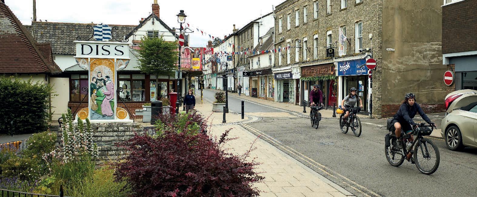
Diss
While Norfolk is full of charming towns, we have to say Diss is particularly lovely, and gained worldwide fame when hip-hop superstar MC Hammer came to the same conclusion in his smash hit ‘You can’t touch Diss’. Surprisingly Diss doesn’t have much early archaeology, but as the Anglo-Saxon name comes from ‘ditch’ or ‘rampart’ it definitely suggests this was a significant
defended site in earlier times. The many medieval and Georgian buildings today show it’s been a prosperous town for over a thousand years. The town is also one of Cycling UK’s EXPERIENCE hubs, with three separate cycle routes radiating out from it for those who want to stay longer. experience.cyclinguk.org/norfolk/diss
25
Crossing the River Waveney
Skimming Suffolk
Climbing (don’t worry, we’re still just in Norfolk so it’s only a few metres of elevation) up the very pretty high street of Diss you’ll turn onto a short section of B road and then across an A road, so be careful of traffic. You’re soon onto deserted back roads again, through a heathland nature reserve. Fans of steam fairs, miniature railways and the WWII Home Guard comedy ‘Dad’s Army’ might want to divert back over the river to Bressingham Steam Museum.
The Rebellion Way continues along the River Waveney to its source. It then picks up the Little Ouse, which has its source in almost the same spot but flows in the opposite direction. From here tiny roads that are almost gravel tracks carry you westward past ancient churches, crosses and even some windmills. The picturesque villages of north Suffolk seem determined to try and compete with those of south Norfolk, laying on the thatched roofs, half-timbered halls and honeysuckle- and ivy-wrapped cottages particularly thickly before you turn north at Knettishall.
The striking heath landscape here has the remains of several Bronze Age barrow burials and is currently being rewilded with Exmoor ponies whose ancestors likely brought those Bronze Age settlers here. You’ll pass close to more barrow sites
and the ancient linear earthwork of the Devil’s Dike as you head north across the A1066 too, but the lane you’re on actually follows a Roman road alignment.
Then it’s time to dive into the first part of Thetford Forest, which will be our wonderful wooded companion for a lot of the next 30km or so of the route. Fire road gives way to back road after crossing the River Thet, and from here it’s a fast final furlong into Thetford past the Grade II manor of Kilverstone Hall. Use the hall as notice to dive onto the grass-track cycle path into Thetford that’s tucked into the corner of the garden centre.
Sneak past the supermarket and follow a quiet road towards the centre, where you’ll take a circuit of the main castle site and then head into the very continental-feeling town square.
Windmill 3, Diss
Cycling UK 26
Picture-perfect villages
...dive into the first part of Thetford Forest, which will be our wonderful wooded companion for a lot of the next 30km or so of the route.
Thetford
Thetford’s story begins with Neolithic flint spreads, but it was an important site for the Iron Age Iceni with a fort acting as a key staging post on the Icknield Way. It was enough of a regular battleground between locals and invaders in the early medieval period to grow another castle site, and by the 10th century it was a mint. That made it a target and rallying point for the Viking ‘Great Army’ of Ivar the Boneless, but it prospered during the reign of Edward the Confessor with both a school and priory being established and the Normans started building a castle here within a year of their invasion.
The dissolution of the monasteries had a disastrous effect on Thetford, and attempts to revive it as a spa town in the 1820s failed too. The area around it was
very important for training in both world wars, though, and a planned migration of people and businesses from London in the 1950s restored life to this pretty and welcoming town.
A railway station and its position at the south-west corner of the route make it a potential alternative start and finish point of the Rebellion Way, and a good refuelling point wherever you start from.
27
Thetford to King's Lynn
PART TWO


29 Overview map: Part 2 0 4km 0 2 miles Rebellion Way route Shorter route option Chapter markers National Cycle Network National Cycle Network route number13 30 30 30 13
Thetford Forest
Part 2
Thetford to Kings Lynn
Distance: 89km (56 miles)
Highlights
• Deserted forest trails
• Blissfully quiet Breckland back lanes under huge skies
• Prehistoric mines, tank memorials and arboretums
• Stunning medieval castles, priories and manor houses
• Roman roads and sandy lakelands
• Historic King’s Lynn
Be aware
• Main road crossings north of Thetford and east of King’s Lynn
• The first 30km is sparse on refuelling stops, so stock up on snacks
• Forests contain both ticks and sticks. So be sure to check yourself for the evil burrowing bugs after riding through long grass, and be careful of any pointy branches that might poke through spokes or skewer your gears
Scene setter
This section of the Rebellion Way is the most remote and includes a lot of gravel, mostly through different sections of the huge area of Thetford Forest. That includes fast double track and fun singletrack as you wiggle north from Thetford and past the prehistoric mining centre of Grime’s Graves. The beautiful trees of Lynford Arboretum are next on the menu, then it’s more ‘you could be anywhere in the world’ forest wildness past the Desert Rats memorial before diving back into even more woods and even some old tank roads.
You’ll finally break out into classic Brecklands rural landscape, joining the dots of prehistoric, Roman and Tudor history to the charming Georgian town of Swaffham and the unspoilt Norman time capsule of Castle Acre.
You follow the sandal prints of long-lost legions north on Peddars Way before turning east through remarkably diverse and rapidly changing countryside. Then it’s into King’s Lynn itself, as it unveils the beautiful buildings and historic waterfront which remind us that it was one of the most prosperous and important towns in England for nearly a thousand years.

Cycling UK 30
Thetting Forth
We’d love to be able to take you into Thetford Forest straight from the town. If you don’t mind 2km of main road from the town centre then you can indeed just head west, across the busy roundabout and straight onto the Forest Drive. However, our mission to minimise busy traffic takes you north out of town on

a quiet back road for the first 6km. At the village of Croxton you turn left onto a broad but deserted road through the forest, carefully crossing the main road onto a mix of forest road, gravel track and singletrack around the edges of military firing ranges to the amazing prehistoric site of Grime’s Graves.
Thetford Forest
Covering almost 20,000 hectares, Thetford Forest is the largest man-made lowland forest in the UK. Like most Forestry Commission land, planting began in the 1920s and expanded during the 1930s to help combat the Depression and unemployment. It’s still a working forest, with a large area also given over to military training, but it also attracts over a million visitors a year. It has a network of mountain bike trails for various skill levels, and hosts MTB, gravel and even husky racing on a regular basis, as well as concerts and a high rope Go Ape course at the High Lodge Visitors’ Centre.
Grimes Graves
This English Heritage site contains over 400 separate mine shafts up to 14m deep and 12m wide together with interconnecting galleries between them. What’s remarkable is that they were dug by Neolithic people mining flint for blades and axes between 4,000 and 5,000 years ago using antler picks and shoulder-blade spades. They dug out an estimated 18,000 tonnes of material from the known shafts (others may be covered by later work) to find the nodules needed for the flint axes so vital for the clearance of forest by the first farmers. The sophistication of the Neolithic
locals is shown not only by how carefully they backfilled the emptied shafts and galleries but also by how far the axes and blanks were traded across the UK and through Europe.

31 Part 2: Thetford to Kings Lynn
Trees, tanks and Tudors

Heading back across the main road, more zig zag twists and turns await on and off back roads and forest tracks. While not all these paths are public bridleways, there is unofficial but generally accepted cycling access on fire roads within Forestry England-managed woodland, so you’ll probably see a fair few other riders using them too. Remember it’s a working forest so tracks may occasionally be closed for logging operations, but it’s fairly easy to find an alternative way around.
Lynford Arboretum

This small but beautiful part of the Lynford Estate contains a remarkable amount of tree and shrub species, including an avenue of giant sequoia planted in the 1800s to commemorate the Duke of Wellington’s victory at Waterloo. It’s particularly spectacular in autumn as the leaves turn golden brown and the many rare fungi bloom. It’s well worth parking up and taking a walk around at any time of the year though. There’s also a small coffee shop and toilet.
We continue north to the amazing trees, birdlife and autumn fungi of the Lynford Arboretum at 20km in (97km overall). Pedalling carefully through the picnic area takes you into a maze of criss-crossing singletrack south of the River Wissey. As long as you head east and then north when you get to the road that marks the edge of more military ranges of the Stanford Battle Area, you’ll be fine.
32
You’ll continue north along the range perimeter on a mix of sinuous singletrack and deliciously deserted forest double track, flanked by ancient and modern woodland with only deer, hares and birds for company.
Turning west brings you back to the main road and a sobering reminder of the importance of this area as a military training centre. Twenty-eight tons of lovingly preserved WWII Cromwell tank sits atop a stone memorial to the ‘Desert Rats’ 7th Armoured Division, not far from where the first tanks were tested in secret nearly 30 years previously. The remains of the concrete roads and temporary barrack sites still peek out from the grass and trees as you head west and then north through a patchwork of wildlife-rich woodland. Breaking cover briefly at Foulden you’re soon back into the trees at the Site of Special Scientific Interest nature reserve of Foulden Common.
Thirty kilometres of idyllic isolation comes gently to an end as you roll into Oxborough,


Desert Rats memorial
The centrepiece to the famous 7th Armoured Division with their jerboa ‘desert rat’ badge is a full Cromwell tank sat on a large stone plinth. There's also a Desert Rats museum in an old WWII Nissen hut which is a relic of the formations brief time training in Thetford Forest after victorIes in North Africa and Italy and before the final push into Europe from D-Day onwards.

Oxborough
The village of Oxborough might be tiny now, but the large brick hall with moat, perimeter wall and ornate gardens is an outstanding example of Tudor architecture and well worth a trip round. The curious half-ruined church also contains two unique terracotta coffins, and a very rare Bronze Age dagger was found locally too.
with its beautiful manor house, remarkable half-ruined church and rich archaeology potentially providing an excuse to stop at the Bedingfeld Arms, the first pub you’ll have been past in a while.
33 Part 2: Thetford to Kings Lynn
...the curious half-ruined church at Oxborough also contains two unique terracotta coffins, and a very rare Bronze Age dagger was found locally too.
Beautiful Brecklands
You’re now fully into the Breckland area of the route too, where open fields stretch between pockets of dense trees and the countryside rarely rises or falls enough to provoke a gear change. That means the 12km cruise north-east to Swaffham through the linear village of Gooderstone and the ancient, excellently named settlement of Cockley Cley is a very easy one. And if you want a rougher alternative there are plenty of farm track options to the north through a mix of quiet woodland and open prairie.
Despite the flatness of the approach, Swaffham itself is on a slight rise, and at a dizzying 75m above sea level it’s actually one of the highest points on the route. That’s why it was one of the first places in the UK to get a wind turbine – which you pass on the quiet lane northwards after enjoying the comprehensive resupply and refuelling options and exploring some of the history of this lovely Georgian ‘party’ town.
The effort to climb another whole 7m of elevation onto the old Roman road and then dive down and heave up a significant dip on loose gravel is richly repaid as you crest the rise overlooking the Nar Valley. The amazingly preserved medieval landscape of Castle Acre is laid out clearly ahead and from here it's downhill all the way to the extensive ruins of the priory. Be careful of the tight turn by the old stone barn and the steepening slope down to the deep ford (with welcome footbridge), though, or you’ll be an extensive ruin yourself.
Cockley Cley
Unfortunately the ‘Iceni village’ at Cockley Cley has now closed after complaints that the round house that was the main attraction wasn’t archaeologically correct. The church is one of the earliest in the UK though, with a history back to 628 AD, and it also contains a lead coffin.

While it’s been a while since the portcullis in the old bailey gatehouse has been shut, you’ll still need to attack the short climb up into the village harder than most slopes on this route. The chance to explore this unspoilt medieval oasis is undoubtedly worth it though. Once you’ve taken in all the sights it’s another gentle climb along the dead-straight Roman road alignment of Peddars Way. While the full Rebellion Way route turns off Peddars Way after 5km, continuing to follow the legionary sandal steps north is a way to bypass the King’s Lynn to Hunstanton part of the journey and rejoin the lap at 196km in.
...Swaffham itself is on a slight rise, and at a dizzying 75m above sea level it’s actually one of the highest points on the route.

Cycling UK 34
Swaffham
Meaning ‘home of the Swabians’ in Old English, Swaffham gets its name from invaders from south-west Germany, but its elevated position in the Breckland landscape makes it likely a settlement was here before. The Peddars Way Roman Road also passes very close by. Its position on the pilgrimage route from King’s Lynn to Walsingham and north-south routes to and from the coast made it an increasingly important town through the Middle Ages. It flourished again in the Georgian period when it was seen as a place to come and ‘take the airs’ above the surrounding flatlands. The racecourse,
theatres, assembly rooms, many inns and beautiful historic buildings date from its time as the place to be seen in Norfolk, and even Nelson’s wife moved here because the family home on the north coast was too boring.
As well as being a pretty town to explore, Swaffham sits just over halfway through this section of the route and

a third of the way round the overall circuit. Its full range of feeding spots, shops and other facilities around the town square with its classical bandstand make it an excellent staging post. It’s also one of Cycling UK’s Norfolk EXPERIENCE hubs, complete with three routes of various lengths radiating out to Downham Market, Dereham and King’s Lynn. experience.cyclinguk.org/norfolk/swaffham
Castle Acre
Castle Acre was already a settlement and church under the control of local nobleman Toki, before the Normans invaded and Toki’d it off him. They immediately set about creating a complete planned settlement, including a castle, village, parish church and even a defensive gate with portcullis. This very rare example of
almost totally intact medieval planning also includes Castle Acre Priory, one of the best-preserved monastic sites in England, complete with ornate gatehouse, prior’s lodgings and chapter house in beautiful gardens reaching down to the River Nar. There’s a family trail to enjoy around the site if you’re riding with kids too.

35 Part 2: Thetford to Kings Lynn
Sand and seafaring
We did consider making that short cut along Peddars Way the official route too, but recceing the area made it clear we’d be missing out on perhaps the most surprising part of the whole Norfolk lap.
If the Roman road wasn’t old enough for you, the bewitching Breckland areas of Massingham Heath and Gayton Thorpe Common are studded with prehistoric barrow burial mounds. Flint farmhouses, manors, halls and windmills reinforce the age-old feeling as back roads become ancient cobbled tracks through mysterious woodland that could surely tell many tales.
Turning north at the grass airstrip just before East Winch, with its RSPCA wildlife hospital, you follow the B road to a right-angled corner where you start probably the most challenging riding terrain of the whole route.
That’s not to say it’s death-defying in any way, but as you head west you’ll find the track getting sandier and more slithery the further you go. In fact it’s about the only part of the route where the fatter tyres of a mountain bike make more sense than a faster gravel bike, but you may well end up pushing whatever you’re riding. However,
the unique sandy geology that creates this challenge has also seen the area heavily quarried and then flooded to create the huge lagoons of Bawsey Country Park. The result is a unique landscape that we guarantee will take your breath away far more than any slight struggle with the surface.

The same is true of the next section too: while the farm track can be muddy, you’ll be riding through so much history that this area even had its own episode of the Time Team TV archaeology show. The only obvious remaining relic of the lost village of Bawsey are the evocative ruins of St Mary’s church, but this low mound has a long story that starts when King’s Lynn was still under the sea.

Cycling UK 36
King's Lynn Harbour
Bawsey
‘Beaws Island’ was so called because this low hill was once a coastal island stronghold with a harbour and causeway, while the site of King’s Lynn was still under water. The current church was founded as a monastic site in the Saxon period, but most of the surviving ruins date from the Norman period when St Mary’s became the parish church of Bawsey. It was even the site of an episode of the ‘Time Team’ archaeological TV show. This confirmed the fact it was an island, and the existence of a large ditch and bank enclosure that lasted into the medieval period. They also found Bronze Age flint arrowheads, European coins from the Saxon period, a metalworking site, a Norman pottery hoard and several burials including
Once you’re carefully across the main road, there’s a short suburban wriggle before, on the edge of King’s Lynn, you soon connect to the town’s ultra-comprehensive cycle path network. In fact there’s such a maze of possible routes that we’d strongly advise giving up trying to follow your GPS and just follow the clearly marked blue signs towards St James Park. Here modern sculptures
King's Lynn
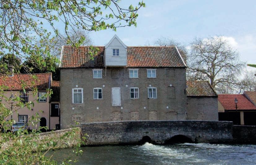
Unfairly overlooked as a touring destination, King’s Lynn really surprised us when we first visited. Not only does it have a remarkably comprehensive cycle path network but it’s also full of some amazing buildings. These include the Red Mount Chapel, which was built for foreign pilgrims landing at King’s Lynn before heading to Walsingham, but has spent most of its life as a stables, gunpowder store and observatory. There’s also a theatre where Shakespeare is likely to have performed and a stunning guildhall, customs house and large Minster church. These all date from King’s Lynn’s time as a member of the Hanseatic League, a medieval trading federation of several major European cities and towns that made it one of the most important ports in the UK. The
a skull with a lid sliced out of the top. This is either evidence of the startling medical procedure of ‘trepanning’, where a disc or discs were cut out of the skull to relieve pressure, or a sword-inflicted head injury. Either way, the patient/victim didn’t survive the experience, as the hole was unhealed.
mix with eclectic medieval remains such as the Red Mount Chapel and remains of the old city walls and gatehouses.

From here it’s a quick jink across another main road and then down to the historic waterfront of King’s Lynn for a short lap of the best-preserved part of this historically very important town.
historic riverfront with its cafés, sculptures and old warehouses is a great place to stop before exploring the cobbled streets behind.
Its position as the nearest point of the route for those coming from the north and Midlands, and its railway station, also make it a potential alternative start/finish point.

37 Part 2: Thetford to Kings Lynn
King's Lynn Guildhall
King’s Lynn to Wells-next-the-Sea
THREE

PART


39 Overview map Part 3 0 4km 0 2 miles 1 1 1 Rebellion Way route Chapter markers National Cycle Network National Cycle Network route number 1
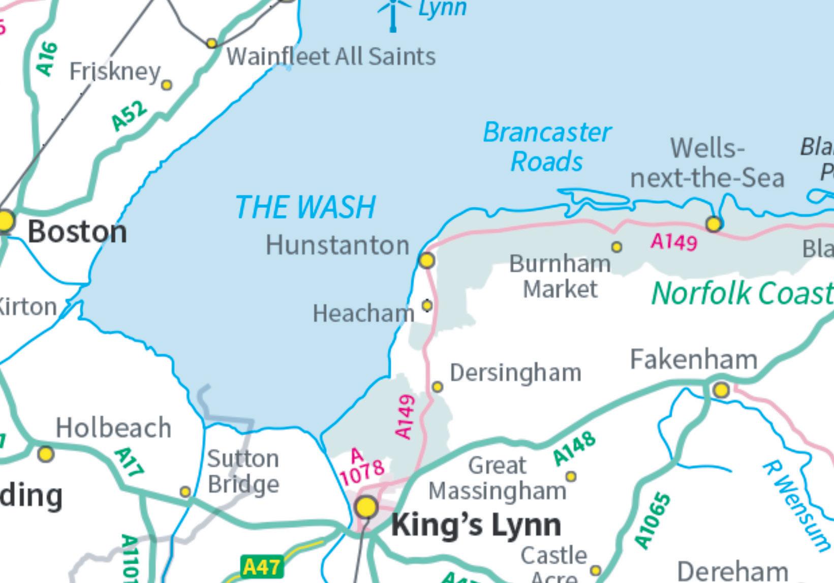
King’s Lynn to Wells-next-the-Sea
Be aware
The maze-like cycle route into

Lynn and then out again to Castle Rising
Sandringham
Cycling UK 40 Part 3
Distance: 71km (44 miles) Highlights • 10,000 years of history, including superb castles and spectacular stately homes • Gravel tracks through coastal nature reserves • One of England’s ‘most beautiful villages’ • Tea with the Royals • Traffic-free estate road splendour • Gently rolling back roads • Traditional seaside delights • Spectacular sunsets
• Main road crossings near Sandringham, Old Hunstanton and Holkham • Meandering tourists at Sandringham, the seaside, Burnham Market, Holkham Hall and Wells-next-the-Sea
King’s
and
is well signposted... Castle Rising
Scene setter
This delightful part of the route only has a few kilometres of gravel but a mix of deserted back roads and smooth cycle paths takes you through the distinctive, gently rolling landscape of coastal north Norfolk.

Starting by sneaking out of King’s Lynn on a maze of cycle paths you’re spirited straight into a medieval wonderland then through the royal parkland of Sandringham. Skirting villages steeped in history, you’ll swing onto the coast behind traditional beach huts and seaside entertainment of Heacham and Hunstanton.
Things become posher at Old Hunstanton with its endless beaches, and posher still as you ride the back roads into beautiful Burnham Market. Then it’s off the scale of sumptuous as you roll majestically towards the obelisk which marks the approach to the splendour of Holkham Hall. You swap the ultimate in Palladian palaces for wild tidal seascape and a gravel track through sand dune nature reserves before hooking round into the eclectic, storied miniature sea port of Wells-next-the-Sea.
Kings and Queens
As it’s King’s Lynn there are various cycle path routes out of town, but some of them are better than others. That means after a quick lap of the historic centre we double back over the live railway, past the ‘Lynnsport’ sports centre (useful to know for signage) and then onto the old railway alignment out of town.
You can stay traffic-free through the leafy suburbs of North and South Wootton but there are lots of sneaky twists and turns to watch out for, so keep your eyes peeled for signs to Castle Rising and National Cycle Network route 1.
The conservation village of Castle Rising represents a real step change in the vibe, with its beautiful houses, cottages and
massive church sitting amidst broadleaf trees. Make sure you divert round the short one-way loop to Castle Rising itself, as crossing its moat and going through the gatehouse in the huge earthen banks reveals an enchanting castle keep that’s fit for a fairy tale. You’ll often find re-enactment displays and concerts in the castle grounds too.
Completing the village loop, take the ‘no through road’ down past the church and you’ll find yourself rolling along a traffic-free road through the castle’s deer park that stretches all the way to the Sandringham Estate. Be careful as you cross the main road that divides the two as it can be busy.
As you’d expect, the royal holiday home at Sandringham Estate is a regally manicured landscape of immaculate, nearly deserted roads with broad, vivid grass verges butting onto dense woodland full of deer and birdsong. While it’s a short walk to see the house itself you roll straight into the appropriately aristocratic courtyard café area, which is the correct priority as far as we’re concerned. It’s also the halfway point around the whole Rebellion Way route, so a very suitable stopping point for a brew. We suggest you keep any anarchist thoughts the history of this route might be stirring to yourself if you want to avoid a storm in a teacup though.
41 Part 3: King’s Lynn to Wells-next-the-Sea
Beach huts at Wells-next-the-Sea
Castle Rising
Rolling up to Castle Rising it’s the huge moat and 18m-high banks of the inner Bailey that take your attention. But as you cross the stone bridge and pass through the keyhole gatehouse you’ll then see one of the finest and most intact 12th-century castle keeps in England. The inner bailey also has the remains of the early Norman church built before the stone keep. Interestingly, while it was home to Queen Isabella for some time, the castle is now back under the ownership of direct descendants of William d’Albini, the Norman lord who started the build.

Sandringham
While the Sandringham area has prehistoric flint and Roman villa remains, the house only really came to prominence when Albert, Prince of Wales, picked it as a potential country retreat in 1862. The old house was soon demolished in 1870 to make way for the current building, with the estate and ornamental gardens being extended by subsequent royal residents.

The gardens were first opened to the public in 1908, with the house being opened by Queen Elizabeth II in her Silver Jubilee year, 1977. She regularly stayed here, traditionally celebrating Christmas at the house.
As well as the house, gardens and courtyard café/shop area, the estate also has waymarked walking and cycling trails if you fancy an extra bit of exploring.
Cycling UK 42
History to Hunstanton
After your toff’s tea and tiffin, the route jinks across a junction marked by spectacular wrought iron memorial gates. Then it’s past the Royal Sawmill before heading north up the Admirals Way. The landscape is noticeably more rolling (you might even have to change gear occasionally) as you skirt around Dersingham and Ingoldsthorpe with their mighty churches. The elevation means you’ll get your first glances of the sea through hedge gaps as you roll along the ridge.
Snettisham and Sedgeford are archaeology hot spots with a long running excavation project unearthing finds from the late Mesolithic to WWI. A short detour east of Sedgeford will take you to the prettiest ammunition store we’ve ever seen. It’s also the obvious jumping off point if you want to head cross-country to save a few kilometres, as otherwise we’re heading off around the coastline of the north-west corner of the county.
Snettisham
Flint finds prove Snettisham had hunter gatherer occupation as long ago as 10,000 BC, with Neolithic and Bronze Age burial mounds in the area too. It was clearly a very important area for the Iron Age Celts and Iceni too, with 180 gold torcs (giant bracelets worn on the bicep or round the neck) found between 1948 and 1973 and collated as the Snettisham Hoard. High status Roman occupation (and a local habit for burying treasure) is also suggested by a later discovery, known as the Snettisham Jeweller’s Hoard. This collection of jewellery and the materials to make more were found in a pot dated to around 155 AD. The exceptionally tall (52m) spire of the 14th-century St Mary’s church was a key landmark for sailors navigating The Wash, and Snettisham Beach RSPB Nature Reserve is a beautiful coastal spot. If you’re in need of a tune up or spares, Snettisham is also home to Open Sky Cycles, who helped with this route.

43
Sedgeford

The pretty village of Sedgeford is absolutely heaving with archaeology and history. This starts with Neolithic flint tool scatters from when the area was first farmed but these are followed up by golden Iron Age torcs, Roman villa remains, an Anglo-Saxon cemetery, and even a WWI airfield. An archaeological training excavation has been running most summers since 1996. You can even book to join the dig team for the day if you want to swap pedals for a trowel for a while.
Both the Roman Peddars Way and earlier Icknield Way roads also skim the village, and a quick detour to the east will let you visit Magazine Cottage. This delightful building wasn’t designed to catch the cover of a lifestyle glossy (although it easily could). In this instance ‘Magazine’ actually refers to the fact it’s a cunningly disguised Civil War gunpowder store, complete with a rumoured secret escape tunnel linking it to the village church.
Wafting through the scents of the Norfolk Lavender farm, the deep history of the various people who’ve called Heacham home is hidden beneath more recent holiday-home developments. The village still has a cheeky charm, though, and as you ride up to the back of the sea defences that keep them safe from the waves of the Wash, you’ll turn behind those most traditional structures of the British seaside – a row of wooden beach huts. This changes to an eclectic collection of bigger beachfront houses before you hoick over the sea wall and into Hunstanton itself.

Rolling up past the fairground to the stub of the old pier brings you to the sloping green of this purpose-built Victorian vacation village.
The Wash
The Wash is the large square estuary that separates the north-west coast of Norfolk and the south-east coast of Lincolnshire. This distance is only 24km at the narrowest point and you can see the other county clearly on most days. The shallow waters are cold in winter but can be very warm in summer and the whole area is a fantastic home for a diverse population of wildlife, with an estimated 2 million birds living here or migrating through at different times of the year. That’s why the Wash is a Site of Special Scientific Interest, with Special Protection Areas and an RSPB nature reserve at Snettisham beach too.
44 Cycling UK
Norfolk Lavender farm
Norfolk Coast AONB
The whole stretch of the North Norfolk coast from Hunstanton to Mundesley (beyond Cromer) was designated an Area of Outstanding Natural Beauty in 1968. The 450km2 area covers a diverse range of landscapes from marsh to sand dunes to cliffs and includes several nature reserves, SSSIs and Heritage Coast designated sections.

Hunstanton
Heacham
Positioned on the edge of the Wash with its fantastic hunting and fishing potential and fertile rolling hills, this whole area is rich in early prehistoric remains and Heacham is another Neolithic hotspot. Bronze Age, Iron Age, Romano-British and Anglo-Saxon periods are all represented in the archaeology, and it was a key trading port for eastern England, the Low Countries and Scandinavia throughout the medieval period. Heacham’s ale and bread market was renowned for the number of female traders, and Native American marital hostage Pocahontas visited here as her husband was a local aristocrat.
While its roots are much deeper than Hunstanton to the north it grew in size and popularity as a railway holiday destination in Victorian times and the kind weather, endless beaches and beautiful sunsets mean it’s still very popular today.


While most villages you’ll pass through on this route are prehistoric or at least Saxon in origin, ‘Sunny Hunny’ is barely 150 years old. It was created purely as a railway holiday destination by splendidly named local aristocrat Henry Le Strange, whose sculpture overlooks the big sloping green in the centre of the village. It was a massive success too, although unfortunately the original pier with its miniature railway has been lost to storms and fires.
Hunstanton still has a theatre, a fairground, aquarium and seal sanctuary as well as other traditional seaside entertainments and eateries creating a cheery, unpretentious character. You and Henry will get to enjoy panoramic views out over the Wash to Lincolnshire, and if you time it right the sunsets are spectacular.
45 Part 3: King’s Lynn to Wells-next-the-Sea
Old Hunstanton


The original Hunstanton village sits just north of its holiday upstart and has been looking out over the Wash from the north-east corner of Norfolk since it was a Neolithic village 5,000 years ago. It was also the point where St Edmund landed to do battle with Viking invaders in 855. Unfortunately the battle didn’t go well, but Edmund’s resulting martyrdom saw him named as England’s first patron saint, and the ruins of his chapel sit near the disused lighthouse. The original Saxon cross was swiped and taken to New Hunstanton though. The village still has several excellent places to eat and has a much quieter (dare we say distinguished) vibe than its brasher sibling just down the coast.
From party to posh
Heading north along the high promenade takes you past the old chapel ruins and lighthouse with sweeping panoramic views right across to Lincolnshire. Time it right and you’ll see the sun set into the sea –the only stretch of East Anglian coast where this happens. Holidaymakers –particularly sea-giddy urchins – hurrying to the huge beaches from their cars mean the sandy car park needs careful traversing, but once you’re into the original village of Old Hunstanton the pace slows down significantly. With its warm, dry climate and beautiful beaches we can see why this is clearly a very popular retirement spot and it’s the ideal genteel gateway for the second upper-class phase of this section.
There’s a very short dog-leg across the coastal main road, but the traffic is usually slow at this point and there’s a protected zone in the centre where you make the turn. Raising your pulse a little with a very rare dose of traffic will possibly help as you climb gently up over the brow of the ridge towards Ringstead, past the stump of an old windmill. You only clip the top of the village before turning east and following
the signs for NCN1 along yet another gravel-centred singletrack road. The almost complete lack of traffic leaves you free to totally appreciate the vast views over the rich farmland to the south and rolling away to the sea in the north.
There’s potential to divert to the coast again a couple of times if you want to visit the award-winning fish and chip shop, deli and unspoilt beaches of Thornham or the dramatic Roman and WWII history of Brancaster and its beaches. That does involve some short sections of main road though, so we’ve kept those optional.
Cycling UK 46
Brancaster beach
Burnham Market
The posh holidaymakers’ paradise of Burnham Market was voted one of the most beautiful villages in the UK by Condé Nast Traveller magazine. Its independent boutiques, eateries and foodie shops housed in gorgeous Georgian buildings make it a luxury riding oasis too. There’s even a small back-garden bike-repair shop, Burnham Cycles, run by Daryl, who saved us from a blown tyre during the recce ride for this guidebook. Burnham Thorpe, just down the road, is the birthplace of Admiral Lord Nelson too, so keep an eye out for statues and paintings of the one-eyed, one-armed military icon all over the place from pub signs to the village playground.
Thornham and Brancaster

Because they sit on the busy coastal road (which we’ve done our best to avoid wherever possible) these two villages are optional diversions off the pure Rebellion Way route.
Thornham beach is a much-loved local secret as it’s far quieter than the beaches at Brancaster but just as beautiful, with huge stretches of sand bordered by grassy dunes. It’s a gorgeous little village too, with three pubs, a sumptuous deli and an award-winning fish and chip shop that uses local beer batter and homemade sauces.
In theory, stopping to look around the pretty boutiques or refuel at the multiple food shops, delicatessens and cafés of Burnham Market is optional too – but you’d be daft not to stop for a while in this beautiful, award-winning, mostly Georgian village, as it’s definitely a high-society highlight of the route. That said, it’s going to feel like a commoners’ collective shortly, as you pass through the timeless tranquillity of the Burnham Thorpe, where Admiral Nelson was born and Norfolk’s celebration of his memory hits its peak.

Brancaster and Brancaster Staithe sit either side of the site of the large Roman ‘Saxon Shore’ fort of Branodunum. As the name suggests, this was one of several forts built in the later Roman period to act as bases for the Roman army and fleet as they tried to fight off increasing numbers of Continental raiders and invaders. The latest archaeological digs on the site suggest there was a timber fort on the site before though, possibly dating from the Boudiccan rebellion.
Nearly 2,000 years later, Brancaster Bay was also crucial to invaders heading in the other direction for the D-Day invasions as its beaches proved a near-perfect match for those targeted for landing in Normandy. As a result they were extensively used for testing and training by Commando engineers and the modified ‘funny tanks’ of the 79th Armoured Brigade.
47 Part 3: King’s Lynn to Wells-next-the-Sea
Holkham to Wells


Crossing the old main road to the coast brings you to the ornate south gate of Holkham Hall. It’s worth noting that the main gates are often locked, and while the little side gate will almost certainly be open, it is quite narrow. That means it may be an issue if you’re running a particularly wide load and certainly if you’re on a trike. If your cycle is too wide to squeeze through, there is a button on the gate keypad to call Visitor Reception (during opening hours, 10-5pm every day) and ask them to open the large gate for you.
The processional road through the deep park is a dead straight fall-and-rise lane to the towering obelisk ahead. Rolling round the monument and coasting downwards unlocks the dramatic vista of Holkham Hall itself, with its purist Palladian frontage, boating lake and fabulous fountains. The estate even has dedicated bike loops to take in the bits you might miss, so it’s a marvellous place to spend some time in very fine style. Topped up with toff life you’ll roll out of the estate and through Holkham itself with its ornate brick buildings. Then it’s across the main road and up Lady Anne’s Drive (watch out for drivers more preoccupied with parking than
other people), past the ‘Lookout’ wildlife observation hide and towards the evocative coastal landscape of Holkham Gap.
From the Gap it’s onto the cycle path through the Holkham Pines nature reserve. Be aware that this area is popular with tourists and local dog walkers so it can be really busy. Please be patient and polite and you will get to the Beach Café at the end eventually. Then it’s down alongside the sea wall embankment protecting the reclaimed land you’ve just looped around and into Wells-next-the-Sea itself to finish this section.
48 Cycling UK
Deer in the grounds of Holkham Hall
Holkham Hall processional road
Holkham Hall
While we’re not sure the royal family would agree, we reckon Holkham Hall is easily the most spectacular house and estate on the whole route. Built in the Neo-Palladian style it’s quite pure architecturally (especially on the north side), but in the almost untouched interior the decorations are still opulent enough to include a pink Derbyshire alabaster
Holkham Gap
entrance hall and a red velvet walled saloon. The 100km2 estate has a boating lake formed from an old creek, walled gardens, a large estate farm, a church and temple and obelisk ‘follies’ which can be visited on the various signposted cycle routes. It has a museum and café and regularly hosts concerts and other events including triathlons.
Holkham Gap is a naturalist’s (and naturist’s on some parts of the beach) paradise, centred around a horseshoe bay which floods in and out with the tide so quickly it’s guarded with an old air raid siren. The beaches, dunes and woods to either side are a nature reserve and there’s an eco café, visitor centre and bird spotting hide at The Lookout which looks across the reclaimed marshland behind the bay. The marshland also has Iron Age earthworks from the times of the Iceni as well as the remnants of the creek that once linked Holkham village to the sea.

Wells-next-the-sea

The estate (Holkham Hall) even has dedicated bike loops to take in the bits you might miss, so it’s a marvellous place to spend some time in very fine style.
Wells (or Guella at the time) first appears in the Domesday Book in 1086 and was the busiest port on this part of the Norfolk coast in the medieval period. Boats fished for herring and cod as far away as Iceland and they traded corn and malt all around the North Sea coast. A large warehouse still dominates the waterfront but the obvious facade of Wells is now much more about giving visitors a good time than shipping goods back and forth. Make sure you explore the narrow streets behind the waterfront as they’re packed with all sorts of interesting shops, galleries, cafés and foodie delights.
49 Part 3: King’s Lynn to Wells-next-the-Sea
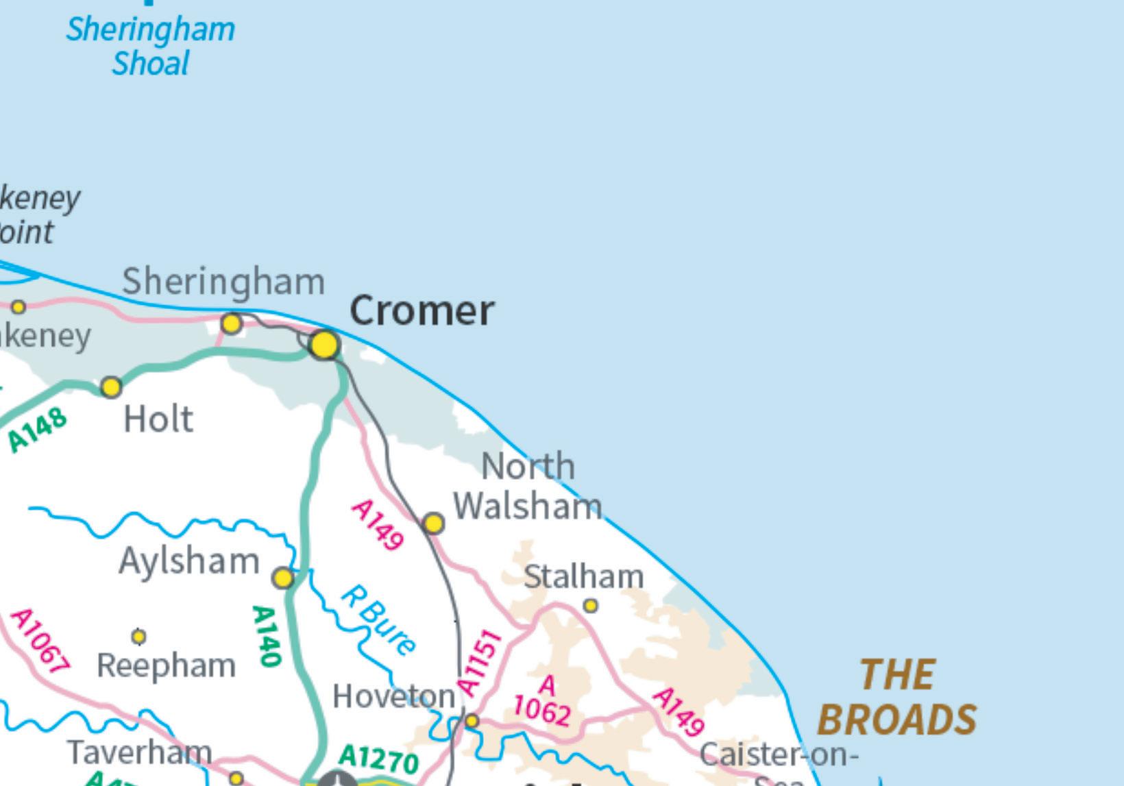
Wells-next-the-Sea to Sheringham

PART FOUR


51 1 1 0 4km 0 2 miles Overview map Part 4 Rebellion Way route Chapter markers National Cycle Network National Cycle Network route number 13
Part 4 Wells-next-the-Sea to Sheringham
Distance: 58km (36 miles)
Highlights
• Blessed pilgrimage perfection
• Seaside mammoths at Sheringham
• Chuffing railways and mouthwatering farm shops
• Deserted gravel tracks
• Picture perfect fords
• Yet another lovely Georgian town
• Tudor manors and phone-box libraries
• All the hooting, tooting steam music you could want
Be aware
• Pilgrim, nun and priest jams in Walsingham
• Three main road crossings
• The descent into Sheringham is quick and can be busy

Scene setter
This is the shortest section of the Rebellion Way, but looping inland and then back to the seaside, it’s also the hilliest (in comparative Norfolk terms), and has more gravel than the previous section. It’s also packed with places you might want to stop and really appreciate. That starts with an optional diversion to an unsurprisingly rare Iron Age ‘hillfort’ that breaks up the pilgrimage to the religious epicentre of marvellously medieval Walsingham. Then there’s a parade of stunning manor houses, Snoring airfields, steaming organs and gravel tracks through nature reserves, across a picture-perfect ford next to an artisan shopping oasis to yet another lovely, lively Georgian town at Holt. The desire to dodge main roads requires a rolling woodland loop on quiet back roads before wriggling north over Bodham Hill through unspoilt villages. Then it’s a dive back down to the coast to the always surprising and welcoming seaside town of Sheringham.
Cycling UK 52
Rough stuff...
Norfolk’s Nazareth
Weaving through the narrow historic back streets of Wells-next-the-Sea past all sorts of eclectic shops and eateries takes you to the slow-moving main road. You head down Market Lane past Manor Farm, the high school and then onto the tree-lined gravel track south to the low rise of Gallow Hill. Hard left here and the flinty track will take you another couple of very enjoyable, rapid-rolling ‘rough stuff’ miles up and over the Wells and Walsingham Light Railway line to Warham.
Rolling past flint cobble farmhouses you’ll turn south at the church towards Wighton. Look out for a metal gate on the right after 800m, where you’ll find the path to Warham Fort. Icenic Iron Age appetite sated, you’ll wiggle through Wighton and then into the pretty green of Great Walsingham, before
Wells and Walsingham Railway

Warham fort
This 212m-diameter bank and ditch enclosure is the site of a late Iron Age ‘hill’ fort that archaeology suggests was occupied into the early Roman period too. It’s now clipped by a realignment of the River Stiffkey, but it’s definitely worth the walk up the footpath to see the ramparts of the best preserved Icenic site in Norfolk. The site is also an SSSI noted for its herbs and butterflies.

scooting through the broad ford and up past more half-timbered buildings and an ancient shabby-chic farm to Little Walsingham. Loop past the nunnery and through the quaint and quirky village centre with its pepperpot well house and welcoming, traditional pub. You’ll then scoot past the friary gatehouse and towards the priory ruins down a wonderfully preserved medieval street of cantilevered half-timbered houses before popping out into the rolling countryside again.
Watch out for free range – and sometimes barefoot – worshippers as you head down past the Slipper Chapel and big basilica before looping up, down and around to East Barsham with its fancy hotel and stunning Tudor manor house.
This is the shortest section of the Rebellion Way, but looping inland and then back to the seaside, it’s also the hilliest (in comparative Norfolk terms), and has more gravel than the previous section.
53 Part 4: Wells-next-the-Sea to Sheringham
Walsingham


Approaching from the north, Walsingham just seems like another picture-perfect Norfolk medieval village from the Rebellion Way playbook. If the signs to the ruined priory and friary, the current nunnery and monastery, several Christian relic and book shops plus the four churches (including a Russian Orthodox one in the
The Slipper Chapel
The Basilica of Our Lady of Walsingham was built as the last chapel on the pilgrimage route to Walsingham in 1340. This small but charming building escaped destruction during Henry VIII’s church ‘Reformation’ and was reused as a forge, poor house and cowshed before being recognised and restored in 1863. It’s now the centrepiece of ‘The Nazareth of the UK’ which attracts quarter of a million visitors per year, so be careful of pilgrims and the coaches delivering them as you pedal past.
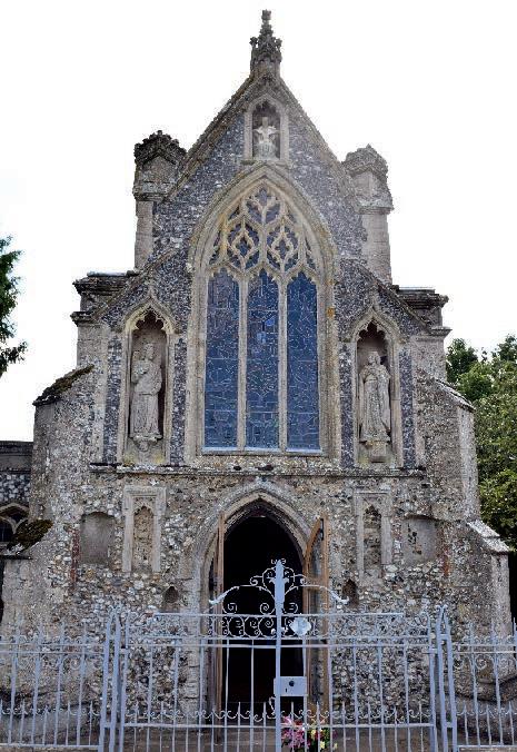
old railway station) aren’t a giveaway, the amount of nuns, priests and pilgrims might be a sign things just got seriously sacred.
That’s because the lady of the manor had a vision of the Virgin Mary here in 1061 who instructed her to build a model of the House of the Annunciation in Nazareth. This made it the second most popular pilgrimage site in the UK after Canterbury, attracting pilgrims from all over Europe. It still attracts an average of 250,000 every year and you’ll often find pilgrims walking the ‘Holy mile’ from the Slipper Chapel and Basilica to the village barefoot, so mind you don’t run over any devout digits.
Even if visions of Mary aren’t your thing there’s still a whole lot to explore around the narrow medieval and Georgian streets and some great places to eat (including the excellent farm shop) in Walsingham, making it one of the highlights of the whole trip.
East Barsham Manor
East Barsham Manor is a very early and very important example of a Tudor ‘Prodigy house’, so called because of their deliberately ornate decoration and architecture. In East Barsham’s case that included castellations, coats of arms moulded into the brickwork and ten chimneys. It was visited many times by Henry VIII and his wives, but after falling derelict in the 19th century it was restored in the 1920s. Unfortunately it’s a private house now so you’ll have to be content with peeping over the wall.
Cycling UK 54
Walsingham Bridewell

The Bridewell, or House of Correction, was a prison built in 1787 which operated until 1861. During the 1830s several inmates were imprisoned there for ‘riotous behaviour’ following Norfolk’s version of the ‘Swing’ riots (named after ‘Captain Swing’, the fictitious name often signed on threatening letters to figures of authority). Unhappy with increasing mechanisation which was putting them out of work, workers broke into paper mills and destroyed machinery. The prison is open to the public – ask at the Shirehall Museum for the key.

55 Part 4: Wells-next-the-Sea to Sheringham
Thursford
Snoring and steaming
You’re now back onto properly deserted, grass-centred lanes too, heading east through Great Snoring and past the weird and wonderful steam-powered attractions of Thursford. You then hop over the main road onto more deserted lanes and gravel sections, past the luxury landscaped gardens of Gunthorpe Park and the National Trust historic woodland nature reserve of Bullfer Grove.

Peak rural romanticism continues through Sharrington, back over the main road and up to the artisan, semi-amphibious and ultra-aesthetic joys of Glandford with its farmyard shopping centre and broad river crossing. Then it’s over the gentle hump of Bayfield Brecks before rolling into the historic heart of Holt through a time-travel architectural transition from modern villas to Georgian terrace.
Great and Little Snoring
Not actually named for their rural drowsiness but after Snaer, the Anglo-Saxon who helped found them. A medieval church and Tudor manor house are the historical highlights, but a WWII airfield also sits between the two villages from where Mosquito, Lancaster and Beaufighter aircraft flew attack missions over Europe.

56
St Andrew's church
Cycling UK
Thursford
Named after the Giant or Demon’s Ford, this picturesque village is now best known for the Thursford Collection. This museum is a celebration of all things steam, with a massive collection of hot-water-powered machinery from steam and traction engines to fairground organs, roundabouts and the fourth-largest Wurlitzer organ in Europe. It also has Christmas Spectacular and Santa’s Magical Journey attractions if you’re riding past at Rudolf time.
Glandford
The tiny hamlet of Glandford is still big enough to be home to an eclectic selection of shops, a coffee roaster and a delightful shell and fossil museum. The broad ford it’s named after is also pretty enough to look like an Old Master’s painting, but don’t worry: there’s a footbridge if you don’t fancy wet feet.

Holt
Sitting on the main road to Cromer and packed with shops and places to eat, the largely Georgian town of Holt is a popular and vibrant spot as well as a great place to stop for a break yourself. That does mean the narrow streets can be busy with traffic, so go carefully.
Back to the sea
While the centre of Holt is a bustling and busy place, things quieten down quickly as you turn right at the war memorial and then duck through the main road underpass. A few hundred metres later it’ll feel like you’re in the middle of nowhere as you drop down through dense woods past the deserted watermill. A gentle climb takes you up to Baconsthorpe, a classic medieval linear village of low whitewashed and ivy-covered cottages before turning up Castle Lane for a quick detour if you want to visit the 15th century moated ruins with their unusual story.
A web of forgotten lanes and gravel shortcuts take you to the bustling market town of Holt, followed by a loop up to seaside Sheringham before tackling the only notable climb on the whole route to enjoy panoramic coastal views.


57
Part 4: Wells-next-the-Sea to Sheringham
There’s also a large mural alongside the award-winning beaches depicting the area in prehistoric times when mammoths roamed what’s now the coastline.

Baconsthorpe Castle
While it’s called a castle and the square walled site with tall surviving gatehouse and broad moat certainly look like a castle, Baconsthorpe is really a fortified hall. The intrigue continues as it wasn’t started by a titled aristocrat but by a very successful 15th century merchant and his lawyer son who made enough powerful enemies to justify adding fortifications. His son and subsequent generations swapped law and politics for sheep farming and wool, and the site ended up as part country house and part weaving mill.

Cycling UK 58
The gradual climb continues to the top of Bodham Hill, where a solar farm and twin transmitter masts make the most of the dizzying elevation at 98m above sea level. Then it’s a quick shimmy through West Beckham with its large medieval barn and ornate village sign before you cross the main road opposite the entrance to Sheringham Hall.

From here it’s a rare chance to enjoy a proper descent in Norfolk as you curve right then left through the sweeping corners of Upper Sheringham. Don’t get too carried away, though, as the edge of town is quite busy, especially around school opening or closing time.


Head straight across at the junction when you get the green light and you’ll hump over the North Norfolk Railway line to finish your roll into town. Be ready on your brakes here as drivers tend to get confused about which way they should go when they get to the shopping area. On a bike you can go straight ahead but in summer it probably makes more sense to walk rather than cycle the last few hundred metres to the seafront. That’s not only because it’s a deservedly busy destination any day of the year, but there always seems to be something on at Sheringham bringing extra visitors to the charming maze of streets (it was a Morris dancing festival when we rode the route recce).
Sheringham
This former Saxon and medieval fishing village burst into life as a very popular holiday destination when the railways arrived in the 19th century. Thankfully it’s stayed traditional rather than tacky, with a wonderful selection of cafés (seafood is unsurprisingly a speciality) pubs and a particularly eclectic selection of shops. There’s a lifeboat and coastal life museum and it’s a stop on the North Norfolk heritage railway which connects it to the national network. There’s also a large mural alongside the award-winning beaches depicting the area in prehistoric times when mammoths roamed what’s now the coastline
59 Part 4: Wells-next-the-Sea to Sheringham
Sheringham Hall
View over Sheringham
Sheringham to Norwich

PART FIVE


61 Rebellion Way route Chapter markers National Cycle Network National Cycle Network route number13 0 4km 0 2 miles Overview map Part 5 13
The last leg of the Rebellion Way follows the freshly surfaced path alongside the Bure Valley railway into the heart of the Norfolk Broads at Hoveton and Wroxham.
Part 5
Sheringham to Norwich
Distance: 76km (48 miles)
Be aware
• There’s a main road crossing south of Sheringham
• Steep/slippery climb onto Beeston Regis common
• Busy traffic in Hoveton/Wroxham and Norwich
• Look out for walkers on the narrow section of the Bure Valley Path
Highlights
• Panoramic coastal views
• Beautiful estates and stately homes at Felbrigg and Blickling
• Bure Valley railway path
• The heart of the Norfolk Broads
• Varied back road, gravel and singletrack riding
• Hidden landscape and architectural gems
Scene setter
We’ve saved the most diverse section of the Rebellion Way for last and it’s packed with fascinating places and features all the way into Norwich.
Starting from the coast at Sheringham you’ll be onto gravel almost straight away. You’ll climb all the way up onto Beeston Regis common off-road too, so be prepared to push if it’s slippery or too steep.
The spectacular panoramic coastal view from the top is a real surprise though, as is the easy but fun singletrack that takes you through the woods. The next highlight is the beautiful house and estate of Felbrigg Hall, and then a mix of gravel and back roads take you to the ultimate Englishness of Aldborough. Deserted back roads and hidden stream crossings join the timeless village dots around to the beautiful bike-friendly estate of Blickling Hall.

Cycling UK 62
Overlooking Sheringham
From here it’s on to the town of Aylsham, where you join the recently refreshed Bure Valley Path to chuff alongside the steam railway towards the heart of the Norfolk Broads at Hoveton. The route takes a mini tour of the unique Broads landscape around Ranworth, and then it’s a final reluctant turn towards Norwich for a quiet roll in, contemplating not just the amazing sights of the last section, but this whole fascinating route. You’ll even cross Mousehold Heath, which was at the heart of the Kett Rebellion, before dropping back into the historic city centre on traffic-dodging cycle paths.
Uncommon views
Make sure you’ve topped up your energy levels at Sheringham, as the first few kilometres of this section are all uphill, and steep by local standards too. Pulling up out of town you drop down a bridleway to cross the main road and
Deep History Coast
The North Norfolk coast is formed from a hard rock base and an upper layer of glacial debris that sandwiches an incredibly rich layer of Paleolithic (Old Stone Age) fossils and artefacts. So far these include the oldest evidence of humans in north-western Europe (350,000 years earlier than previously thought) and the most complete fossilised mammoth found in the UK. Both these finds are celebrated by the giant mural on Sheringham sea wall.

The coastline here is eroding rapidly, constantly uncovering fascinating remains from the lost world of ‘Doggerland’ beneath the North Sea and furthering our knowledge of deep history.
You can play a part in recording this fascinating past landscape by downloading the DHC Explorer App on your phone and submitting GPS tagged photos to the archive.
then continue off-road up past the horse sanctuary. The ground can be soft and slippery up through the woods, so be prepared to hop off and push if you need to. We promise the panoramic views out over the Deep History Coast are definitely worth it. If you’re not convinced, you can do this whole direction on road with a simple diversion via West Runton, but if you do that you’ll also miss out on the fun, twisty singletrack through the wooded heath which takes you past the site of the old Roman Camp and ancient iron workings. Then you’ll drop down off the Cromer ridge, carefully across the main road and down the splendidly named and wonderful to ride ‘Lion’s Mouth’ gully before turning through the gates of Felbrigg Hall. This National Trust estate is well worth a tour, and it’s also a wonderful piece of park road to ride. A brief section of relatively busy road takes you to the next section of gravel down to Marble Hill, with a pair of charming gate houses that you’d never find otherwise.
63 Part 5: Sheringham to Norwich
Picture perfect
Then it’s a gentle roller coaster along forgotten dust-centred back roads past moated farmhouses and old halls south to Aldborough. This was where we had our most English experience of the whole recce ride as a cricket match was in full flow on the beautiful green outside the village pub. It’s another pub you need to look out for after rolling through more time-forgotten farms and hamlets.
Leaving Aldborough, the meandering route will take you past the Saracens Head pub
as you wander westwards, looping round the edge of Wolterton Park with its Hall and ruined church. Then you head southwards towards the young River Bure and the charming village of Itteringham with its wonderful community shop.
Shortly after leaving Itteringham comes another notable Norfolk climb (it only rises 20m but it is on loose gravel) which brings you to the highpoint of the beautiful Blickling Park. From here it’s a lovely kilometre-long descent to the café, pub, car park and stunning Tudor Hall of Blickling itself. This is your last opportunity for a stately home tour or proper posh afternoon tea on the routes too, so fill your boots with fancy if you feel the need.
Felbrigg hall

Beeston Regis Common

The north end of the glacial debris that forms the 100m-high Cromer ridge is covered by the National Trust heathland nature reserve of Beeston Regis Common. This area has always been quarried for gravel and minerals and various ages of mine remains can be found. There’s also a ramparted fort at the midpoint of the ridge which doesn’t have a confirmed date but has always been referred to by locals as Roman Camp.
This National Trust-owned house, dating from Tudor times, is not only architecturally beautiful but also home to a wonderful collection of different treasures including architectural drawings, wallpaper, paintings and very ornate French furniture. It sits in a beautifully landscaped park estate which has several very quirky places to stay such as Mustard Pot Cottage, Cromer Lodge and apartments in the old stable block. Being a National Trust property, it obviously has a cracking tearoom as well. While cycle access is unrestricted, the house is only open on certain days, so check beforehand to avoid disappointment.
64 Cycling UK
Felbrigg Hall
Blickling Hall
The earliest origins of Blickling Hall are unknown but it was a mighty manor house by the 15th century and became home to the Boleyn family, whose daughter Anne was one of Henry VIII’s infamously beheaded wives despite being mother of the first Queen Elizabeth. The current Jacobean hall was built in 1616 and sits at the centre of a large, landscaped estate with famous formal and informal gardens and several random architectural surprises. The National Trust has also built dedicated multi-use trails around the estate to help visitors work up an appetite for the two cafés on site.
Aldborough

Voted one of the top ten villages in the UK by ‘The Sunday Times’, Aldborough could easily be a template for the perfect English village. The large, triangular village green has a cricket pitch in the centre and is ringed by the medieval Black Boys pub, a remarkably well-stocked village shop, a doctor’s surgery and even a massage therapist. That makes it a perfect spot for a stop and snack refill, or even a rub of tired muscles from the 300km you’ve clocked up so far.
Itteringham Community Shop
This oasis of essentials and local produce has been the hub of Itteringham since 1637 and became a volunteer-run Community Shop in 1994. As a much-loved stopping point for local cyclists and passing tourers, it was recently accredited as a Cycle
Friendly Place by Cycling UK. The shop has been supplied with equipment including tools and bike security gear, so the friendly shop folk will be able to repair any small issues as well as refuel you before you head on towards Blickling and Aylsham.


65 Part 5: Sheringham to Norwich
Aylsham

The story of Aylsham on the River Bure starts in prehistory and the area was busy with industry in the Roman period. The current town is rooted in the very early Anglian period (500 AD), and by medieval times it was a very rich cloth and wool trading town. The market is still very busy today. The picturesque, mostly Georgian town is also the self-appointed centre for Norfolk’s ‘slow food’ movement, dedicated to delicious, locally sourced ingredients.
Full steam ahead

That’s not to say that the mainly Georgianbuilt, foodie and market hub of Aylsham hasn’t got some lovely places to stop, but you might find the return to real life seems extra busy after so many miles of almost deserted time-travel gravel. You’re soon away from anything but the chance of a chuff alongside a steam train though as you roll into the Aylsham terminus of the Bure Valley Railway. Much of the cycle path that runs alongside the railway has been recently upgraded too. Breezing past old stations, over and under bridges with only the occasional walker to politely pass is a pleasant rest from the normal twist and turn navigation of rural Norfolk. There are still some narrow sections and small parts which can be damp after wet weather, though, so don’t be totally distracted by the passing villages and beautiful countryside. If you want to shortcut the route at this point you can also take the line in the other direction and loop around straight into Norwich.
Take a quiet loop into this unique lowland landscape past breweries and yet more unspoilt villages before the final roll back into Norwich.
Otherwise the track drops you right into Hoveton and Wroxham, the ‘Capital of the Norfolk Broads’ and the final really big change in both the landscape and the character of your surroundings. After so long since the last sight of the sea, the huge quantity of pleasure boats reminds you how water-based this county is. It’s also the perfect place to hire one yourself and explore the fascinating maze of meres and channels that make up the huge Broads area spreading east and north. The huge amounts of holidaymakers also make it a bright and lively shock to the system after the rural wanderings since Sheringham, but if it’s ice cream or fast food you’re after (there’s even a McDonald’s) as a change from National Trust tearooms you won’t be disappointed.
Cycling UK 66
Bure Valley Railway
The Bure Valley Railway is a wonderful example of people pouring their passion into a project. This volunteer-run attraction chugs and chuffs over 100,000 passengers the nine miles between Aylsham and Wroxham every year. The multi-use track that runs

alongside the old Great Eastern track has recently been resurfaced too, making it a fantastic traffic-free link to the capital of the Norfolk Broads. Do be careful of other users though and always stop and say hi to make sure we get more facilities like this in future.
Wroxham and Hoveton
‘The Capital of the Norfolk Broads’, these two villages sit each side of the crucial bridge over the river Bure before it expands into this incredible and unique landscape. While the Broads might have large expanses of incredible, dramatic isolation, this epicentre of the holiday and boating businesses is a very busy and lively place.

The local ‘Roys of Wroxham’ retail empire and all sorts of fast (and slower) food spots make it a great place to top up energy
levels for the last bit of the ride. Or you could take some time out and join the swans and other diverse wildlife on the water by hiring a boat yourself. As well as the heritage railway to Aylsham, it’s connected to the national rail network. If you want to explore the Broads more by bike, it’s also a Cycling UK EXPERIENCE hub with three different routes reaching into the heart of this fascinating area and its thousands of years of history.
experience.cyclinguk.org/norfolk/wroxham-and-hoveton 67 Part 5: Sheringham to Norwich
Biking the Broads
Don’t worry if it’s all a bit much though, as once you’ve sneaked along the short section of main road over the bridge you’ll drop straight back into rural bliss on and off-road as you track the edge of Wroxham and Hoveton Great Broads around to Woodbastwick. Here you’ll even find an award-winning brewery to start your final-furlong celebrations early before rolling on to Ranworth with its ‘Cathedral’ and rare wildlife-packed Broad. A quick loop past old barns full of reeds stored for thatching and an ancient farm track and woodland loop alongside South Walsham Broad brings you to the spooky solo church tower of Panxworth.


Norfolk Broads
While the wetlands of the Broads have a primeval, deep history feel, they’re actually the result of medieval peat excavations by local monasteries which then flooded as the sea levels rose. The 120 miles/200km of navigable waterways made them a useful transport artery from the coast deep into Norfolk at Hoveton and Wroxham for centuries. Since the arrival of the railways in the 19th century, it has primarily been a very popular area for boating holidays and was given National Park designation in 1988. It also contains several nature reserves and SSSIs.
Bridge over the River Bure
Cycling UK 68
Panxworth Church tower
Ranworth
The first thing you’ll spot in Ranworth is the 30m-high tower of St Helen’s Church which earned it the title of ‘Cathedral of the Broads’ and gives views all the way to the coast from the top. Ranworth also has a
picture-perfect pub and a café and moorings at the edge of Ranworth Broad, which is managed by Norfolk Wildlife Trust and includes several SSSIs which are home to many rare species.


Final furlong
Then it’s the last section of signature gently rolling back road as the road signs tick off the last few miles to Norwich. Time to relax and replay so many memories of the wonderful adventure you’ve hopefully had under the vast skies of this unique and very underestimated historical cycling paradise.
Woodbastwick
Viking-named Woodbastwick is one of the most perfect villages on the Rebellion Way with untouched cottages surrounding a big village green with a well in the centre. While the well doesn’t work anymore, the award-winning Woodforde’s Brewery is perfectly placed to quench your thirst and even holds a music festival in summer.
69 Part 5: Sheringham to Norwich
Wild geese
Jinking north into Rackheath dodges the suburbs and rolls you through Norwich’s green heart at Mousehold Heath where you might even pause to acknowledge the last bit of rebellious history that gave this route its name. Then it’s time to saddle up one last time and roll down into the heart of Norwich itself, ready to treat yourself to a well-earned tour of the castle, cathedral, museums and of course the
wonderful food and drink opportunities that this celebrated centre of ‘good living’ prides itself on.
To finish your ride on a suitably rebellious theme, we recommend going up to have a look at the woodland area now known as Kett’s Heights, from where Robert Kett and his ‘army’ besieged the city in 1549. It’s a beautiful, secluded spot and provides a great view over Norwich.


Kett’s Rebellion
We started this route with the story of Boudicca’s Rebellion, but there’s another very important and short-lived moment of significant ‘commotion time’ (as it was known locally) in Norfolk’s history. Kett’s Rebellion dates to July 1549 when local tenants started destroying fences that wealthy landowners had used to close off previously common land. One of these landowners – Robert Kett of Wymondham – listened to his tenants’ concerns and instead of fighting the rebels he offered to lead them. Gathering a 16,000-strong militia from the surrounding area and Norwich itself he stormed the city and then defeated the first Royal Army sent to quell the unrest. Unfortunately for Kett, the second Royal Army was a tougher opponent and he ended the year hung from Norwich Castle walls as a ‘decorative’ deterrent.
70 Cycling UK
Kett's Heights
Mousehold Heath

While it’s now only a small area of heath and woodland surrounded by the suburbs of Norwich, Mousehold Heath once stretched right out into the Broads beyond Woodbastwick. It was used as common ground for grazing and wood cutting during the prehistoric and Roman period until it was almost bare by medieval times. Over time that left space for a priory church, a chapel, a horse racecourse and a military
Access for all
While Kett’s story may have ended badly, the fight for access to the countryside in England still resonates today. Only 22% of public rights of way have access for cycling, and the bridleway and byway network is often fragmented and inconsistent, making it difficult to put together a route. Cycling UK is continuing its work begun in 1968 when we secured access to bridleways for cycling and in 2003 with cycling’s inclusion in Scotland’s Land Reform Act (2003). We want to see increased off-road access for cycling, to make it easier for people to get outdoors and explore the countryside. Developing new routes like the Rebellion Way forms part of our vision for more connected long-distance trails, to show the benefits that off-road routes can bring.
barracks. It also played a significant part in Norwich’s anarchic history, hosting large gatherings during ‘The Peasants’ Revolt’ of 1381 and it was also where Robert Kett’s ‘army’ camped when they occupied Norwich during Kett’s Rebellion. It was still the scene of riots and unrest in the mid-19th century, but now it’s a peaceful wildlife conservation area on the edge of the city.
Forest track near Sheringham
You’ll finish with a head full of fond memories of an often overlooked but wonderful county, and legs much fresher than they would be riding this far anywhere else in the UK.

71 Part 5: Sheringham to Norwich
Places and facilities
Distance from start (km) Distance between (km) B&B/Hotel Hostels
Norwich 0 0
Caistor St Edmund (Venta Icenorum) 6 6
Stoke Holy Cross (shorter route splits) 8 2
Long Stratton 23 15
Diss 44 21
Hopton 58 14
Thetford 79 21
Foulden 112 33
Oxborough 116 4
Swaffham (shorter route splits) 128 12
Castle Acre 137 9
Gayton 149 12 East Winch 153 4
King's Lynn 168 15
Castle Rising 178 10 Sandringham 184 6 Dersingham 186 2
Snettisham 190 4 Heacham 197 7 Hunstanton 202 5
Burnham Deepdale (3km off route) 217 15 Burnham Market 222 5
Holkham Hall 231 9
Wells-next-the-Sea 239 8
Little Walsingham 251 12
Blakeney (3km off route) 276 25 Holt 282 6
Sheringham 297 15
Cromer (3km off route) 307 10
Aylsham 329 22
Hoveton & Wroxham 344 15 Norwich 373 29
Shorter option between Stoke Holy Cross and Swaffham
Stoke Holy Cross 8 0
Mulbarton 13 5
Wymondham 24 11 Hingham 31 7
Swaffham 59 28
72 Cycling UK
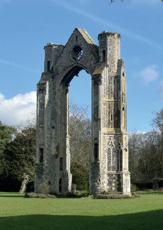
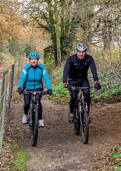
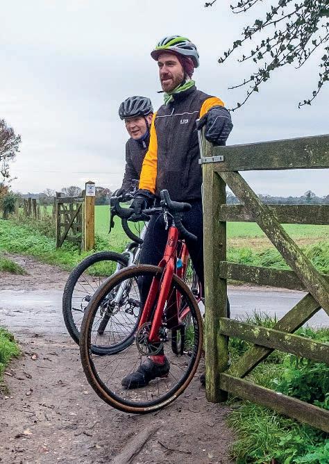
73
Campsite Pub/ restaurant Café Shop Bike shop Train station
Walsingham Priory
Explore more of Norfolk by bike
As well as accredited Cycle Friendly Places, Cycling UK has also developed and promoted day routes in each cycle hub location. Why not stay a little longer and explore more of the area?
Discover the routes at experience.cyclinguk.org/Norfolk
Diss
While Norfolk is full of charming towns, we have to say Diss is particularly lovely. The many medieval and Georgian buildings today show it’s been a prosperous town for over a thousand years, and nowadays they are keen to welcome cycling visitors too.
Thetford
Thetford is an ideal base for exploring the huge area of Thetford Forest and The Brecks, and discovering prehistoric mines, tank memorials and a beautiful arboretum.
Swaffham
This pretty market town has a centre full of old Georgian houses and plenty of pubs, old coaching inns and coffee houses. The surrounding Breckland landscape is a wonderful area for easy riding both on road and off.

Hunstanton
Hunstanton is only small but it’s got a big heart that beats a bit faster than most places in sleepy Norfolk, and there are plenty of places to stay. Our routes around Hunstanton provide a varied road and gravel experience that makes the most of the super quiet, rolling countryside of north-west Norfolk.
Fakenham
Fakenham sits on a rise in the more rolling coastal landscape that typifies north Norfolk, so while you won’t climb over 85m above sea level at any point on these rides, there’s definitely more rise and fall than in areas like the Broads.
Cromer
With a fabulous Victorian pier and seafront architecture to match, Cromer is the perfect example of a traditional English seaside resort and thoroughly deserves its ‘Gem of the Norfolk coast’ tag. The surrounding area has a distinct historical and natural character, with a wealth of fascinating quirks to explore.
Wroxham & Hoveton
Known as the ‘capital of the Broads’, the villages of Wroxham and Hoveton have flourished as a boaters’ paradise. The lack of hills and some of the best weather in the UK mean it’s also a perfect base for restful riding around the unique wetland ecology and multi-faceted history.
74 Cycling UK
St Peter's, Hoveton
C ycle hub
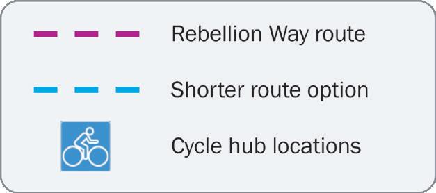
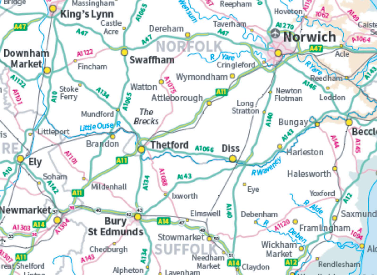
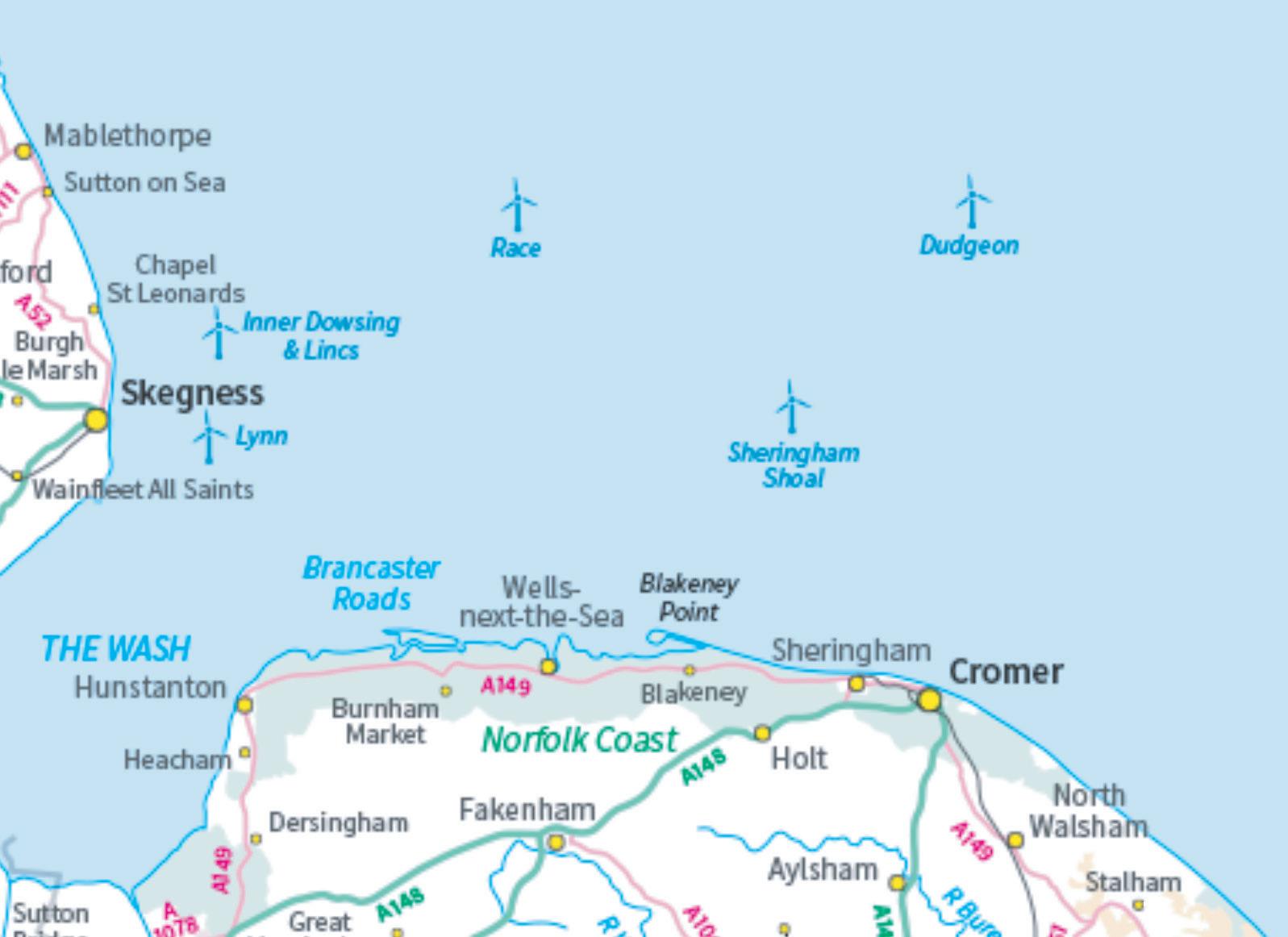
75 Swaffham Thetford Diss Wroxham & Hoveton Hunstanton Fakenham Cromer
locations Rebellion Way route Shorter route option Cycle hub locations
Suggested itineraries
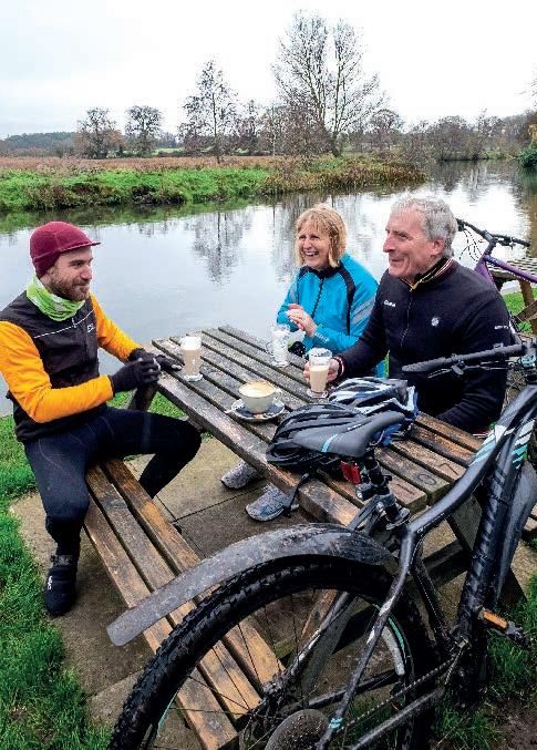
Two nights
nights
nights
nights
Through
Cycle
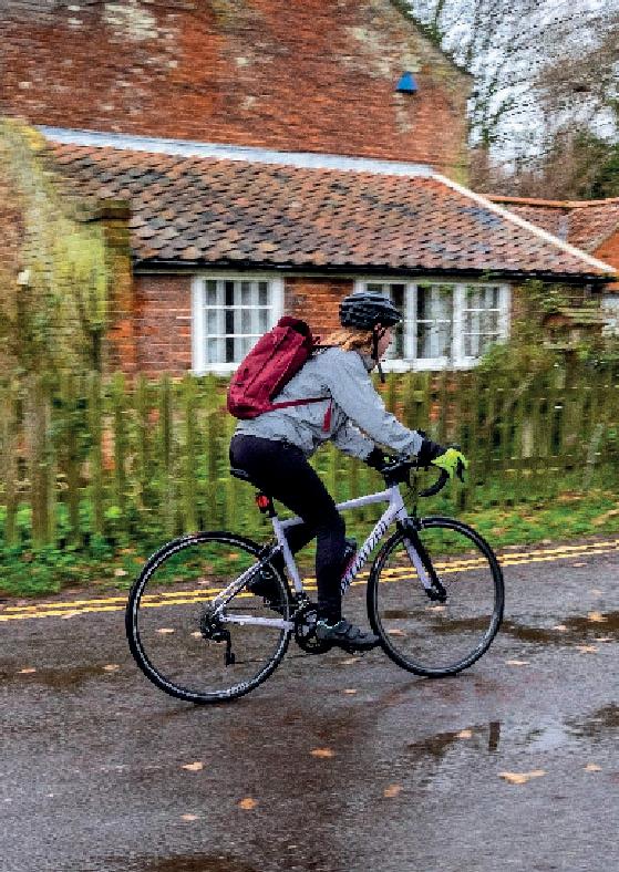
with a warm
become
you know you will be
you need.
76 Cycling UK
the EXPERIENCE project, Cycling UK has developed several cycle hub locations in Norfolk. We are supporting hospitality businesses in these hub locations and along the Rebellion Way route to
accredited
Friendly Places, so
greeted
welcome and everything
experience.cyclinguk.org/norfolk
Here are our suggested overnight stopping points to help you plan your trip (starting and finishing in Norwich). The total distance for the full route is 373km.
– 130km per day Distance from start (km) Swaffham 128 Wells-next-the-Sea 238 Three
– 90km per day Distance from start (km) Oxborough 116 Hunstanton 202 Sheringham 290 Four
– 75km per day Distance from start (km) Thetford 79 King’s Lynn 168 Wells-next-the-Sea 239 Cromer 307 Five
– 60km per day Distance from start (km) Hopton 58 Swaffham 128 Snettisham 190 Little Walsingham 251 Cromer 307
Image credits
Front cover image by Jordan Gibbons/Pannier
All images by Jordan Gibbons/Pannier except:
Front pages
p.3 by Rob Spanring/Cycling UK; p.5 top image by Jason Bye/Cycling UK; p.7 top left by Joolze Dymond/Cycling UK and bottom left by Julie Skelton/Cycling UK.
Introduction
p.10 main image by Robert Pittman (CC BY-ND 2.0), windmill by Martin Pettitt (CC BY 2.0); p.13 top image by Jason Bye/Cycling UK; p.15 by Jason Bye/Cycling UK.
Part 1
p.18 by Ker Russell (CC BY 2.0); p.19 top image by Geoff Henson (CC BY-ND 2.0) and Elm Hill by daisy-daisy; p.20 market by Andres Garcia; p.21 Boudicca statue by Peter Tully (CC BY-SA 2.0) and Arminghall Church by David (CC BY 2.0); p.23 Tasburgh Church by John Salmon (CC BY-SA 2.0); p.26 windmill by Cory Doctorow (CC BY-SA 2.0); p.27 Thetford by Jim Linwood (CC BY 2.0).
Part 2
p.28 by Stefan Amato/Pannier, p.31 Grimes Graves by Nic McPhee (CC BY-SA 2.0); p.32 Lynford Arboretum by Karen Roe (CC BY 2.0); p.33 Desert Rats memorial by Adrian S Pye (CC BY-SA 2.0) and Oxburgh Hall by Steve Knight (CC BY-SA 2.0); p.34 Cockley Cley by David (CC BY 2.0); p.35 Swaffham by Bob Palin (CC BY-SA 2.0) and Castle Acre by John Fielding (CC BY 2.0); p.37 King’s Lynn by pauws99.
Part 3 p.38 by Stefan Amato/Pannier, p.41 by Chris Combe (CC BY 2.0); p.42 Castle Rising by Elliott Brown (CC BY 2.0) and Sandringham by Airwolfhound (CC BY-SA 2.0); p.43 Snettisham hoard by Portable Antiquities Scheme (CC BY 2.0); p.44 lavender by Martin Pettitt (CC BY 2.0) and The Wash by Rob Simmonds (CC BY-SA 2.0); p.45 Norfolk Coast AONB by Fernando Butcher (CC BY 2.0), Heacham by Jon Bunting (CC BY 2.0) and Hunstanton by flotsom; p.46 Old Hunstanton by Alan Parkinson (CC BY 2.0)
and Brancaster Beach by Martin Pettitt (CC BY 2.0); p.47 Burnham Market by Michael John Button (CC BY 2.0) and Brancaster by Ashlyn G (CC BY-ND 2.0); p.48 deer by Winniepix (CC BY 2.0); p.49 Holkham Gap by Hugh Venables (CC BY-SA 2.0) and Wells-next-the-Sea by David Merrett (CC BY 2.0).
Part 4 p.53 Warham Fort by Peter Hurford and railway by Steve Knight (CC BY 2.0); p.54 Walsingham by Amanda Slater (CC BY-SA 2.0), Slipper Chapel exterior by Haydn Blackey (CC BY-SA 2.0) and interior by Pamela Kelly (CC BY 2.0), East Barsham Manor by Ian (CC BY-NC 2.0); p.55 Walsingham Bridewell by Elliott Brown (CC BY 2.0); p.56 St Andrew’s Church by David (CC BY 2.0); p.57 Glandford by Michael John Button (CC BY 2.0) and Holt by Chris (CC BY-SA 2.0); p.58 Baconsthorpe Castle by Haydn Blackey (CC BY-SA 2.0); p.59 Sheringham Hall by Michael John Button (CC BY 2.0), view over Sheringham by Guy Kesteven, Sheringham beach by Steve Walker (CC BY-ND 2.0).
Part 5 p.60 by Jason Bye/Cycling UK; p.63 by Andrew Stawarz (CC BY-ND 2.0); p.64 Beeston Regis Common by Michael John Button (CC BY 2.0) and Felbrigg Hall by Guy Kesteven; p.65 Aldborough by Adrian S Pye by (CC BY-SA 2.0); p.66 Aylsham by Michael John Button (CC BY 2.0); p.67 Wroxham and Hoveton by Richard Szwejkowski (CC BY-SA 2.0); p.68 Panxworth Church tower by Guy Kesteven and Norfolk Broads by Roger Green (CC BY 2.0); p.69 Ranworth and Woodbastwick by Michael John Button (CC BY 2.0) and geese by Caroline Legg (CC BY 2.0); p.71 Mousehold Heath by Michael John Button (CC BY 2.0).
Back pages p.73 top image by Fr. Gaurav Shroff (CC BY-NCND 2.0), other images by Jason Bye/Cycling UK; p.74 by Jason Bye/Cycling UK; p.76 by Jason Bye/Cycling UK; author image by Guy Kesteven.
77
Afterword
Imagine being able to cycle the length and breadth of the country on connected off-road trails, through fascinating places and amazing landscapes.
As the UK’s cycling charity, Cycling UK is working to make this a reality by campaigning for wider off-road access for cycling and developing new longdistance trails to link existing routes.
We started with the North Downs Way riders’ route, and followed that up with the Great North Trail, King Alfred’s Way, the West Kernow Way and the Cantii Way. The Rebellion Way is the next step on that journey.
Exploring our forests, moors and valleys by bike is inspiring and spirit-lifting. It’s the best way to discover new places, and a great boost for rural tourism. We believe everyone should have the opportunity to ride from their door on connected traffic-free trails.
If you share our vision, do something incredible and join Cycling UK today. Because together, we can make a better world by bike.
We are the UK’s cycling charity
Cycling is amazing, which is why we want everyone to enjoy the thrill of the ride by making our streets safer, opening up new traffic-free routes and inspiring more people to get on their bikes.
We have more than 140 years’ experience of supporting cyclists and campaigning for their rights.
We believe everyone has the right to ride a bike, have access to safe routes and to be given the skills to cycle with confidence.
But we need can’t bring about change alone. Our community of passionate members and supporters give us a louder voice to lobby government and inspire millions more people to cycle.
Become a member of Cycling UK

Join over 70,000 members and receive:
• Free third-party liability insurance and legal assistance
• Discount on cycle insurance (includes mountain bikes and e-bikes) with Yellow Jersey
• Retailer discounts and benefits
• Cycle magazine every two months for inspiring routes, advice, news and reviews
• Your membership directly supports the work we do to make a better world by bike
cyclinguk.org/join
If membership isn’t for you, please consider a donation to help Cycling UK to continue our work in opening up more rural access for cycling and campaigning for improving conditions for cyclists all over the UK. cyclinguk.org/donate
Cycling UK 78
cyclinguk.org/offroadcampaigns
cyclinguk.org/join
About the author
Guy Kesteven has been exploring historic England by bike ever since his mum used to stick him in his child seat along with the groceries for trips into York. A qualified and time-served archaeologist, he’s stayed amongst mud on a daily basis as a professional bike tester for leading global websites and magazines. He also has his own YouTube channel GuyKesTV where you can find a rough guide to the Rebellion Way filmed during the creation of this guidebook.
79

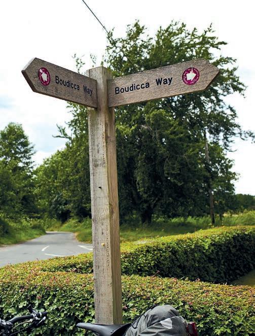
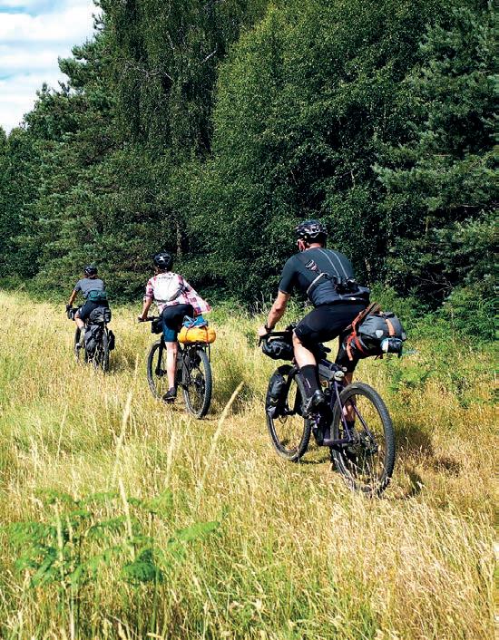

T: 01483 238301 cyclinguk.org Cycling UK, Parklands, Railton Road, Guildford, Surrey GU2 9JX Cycling UK is a trading name of Cyclists’ Touring Club (CTC) a company limited by guarantee, registered in England no: 25185. Registered as a charity in England and Wales charity no: 1147607 and in Scotland charity no: sco42541. Registered office: Parklands, Railton Road, Guildford, Surrey GU2 9JX.
