
TABLE OF CONTENTS
UNIT 8 INTRODUCTION
THEORETICAL FRAMEWORK
Floating Piers
Zaishu Art Museum
The Floating Village
Gaza Humanitarian Aid Pier
MODELING THE VAAL MARINA
History of the Pier
Analysis of the Vaal Marina
Conventional uses of the pier
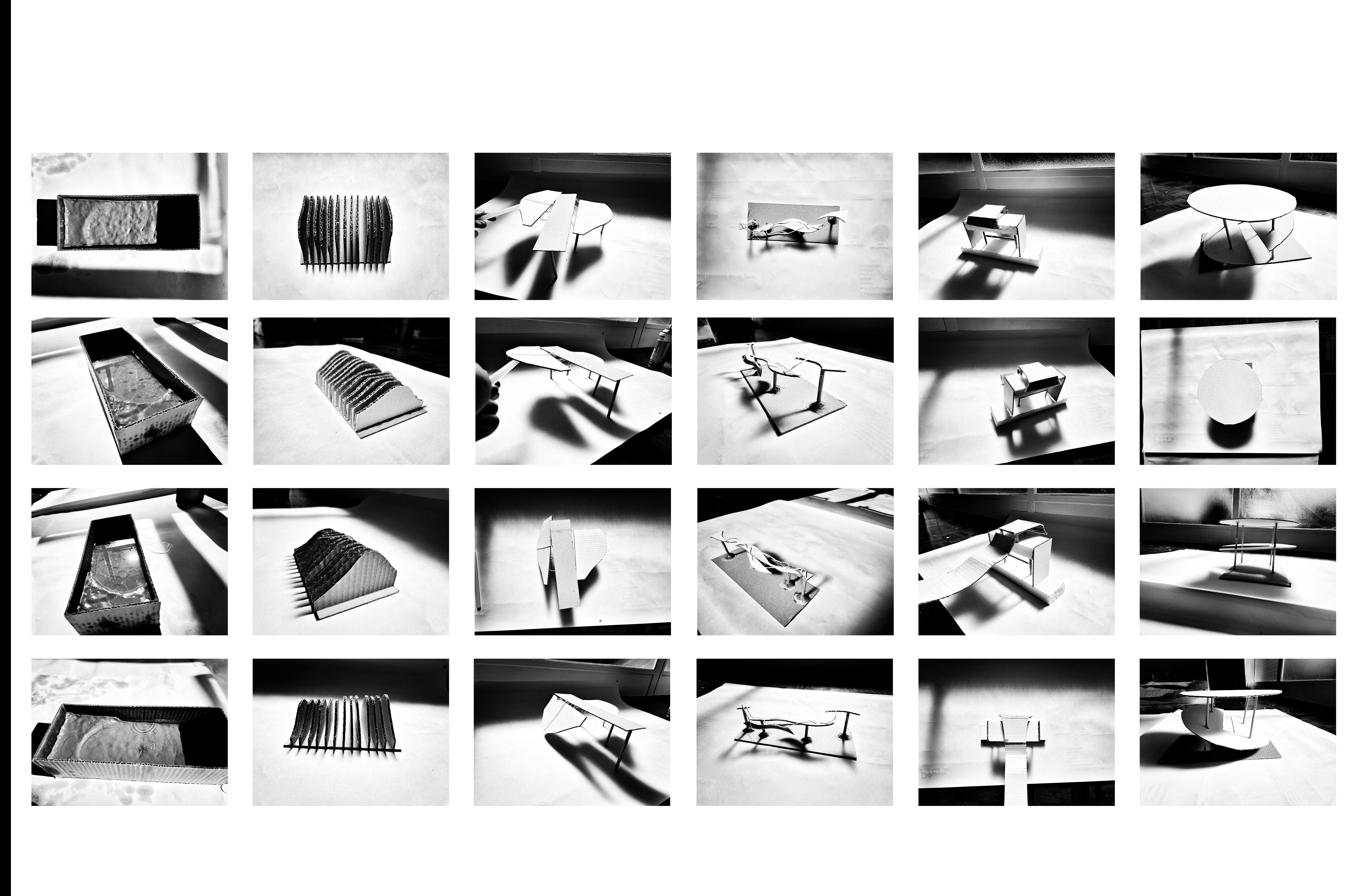
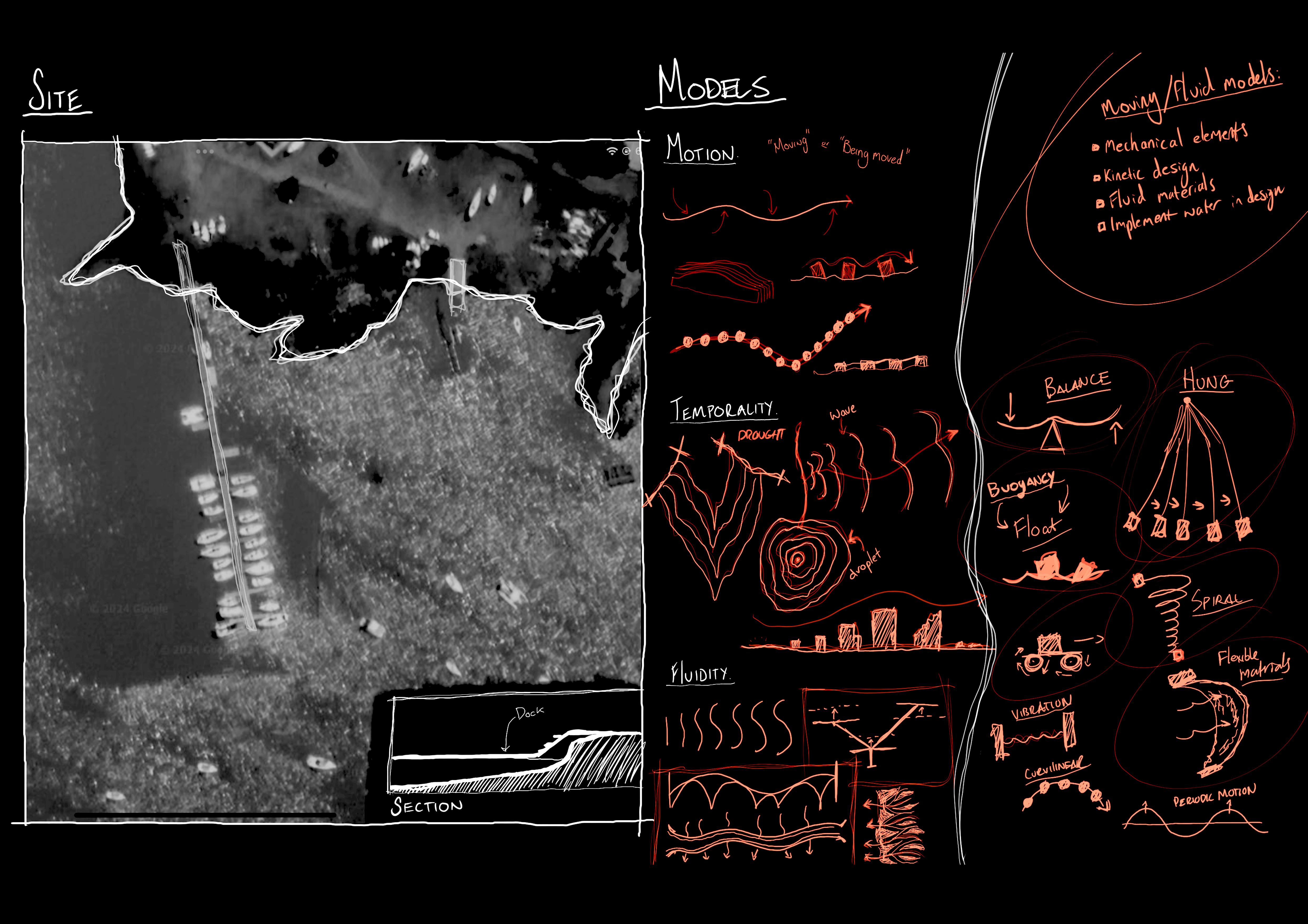
Model making and site exploration
REINVENTING THE PIER
Conceptual Development
Structural models
Ground Floor Plan
Moments of Space
Axonometric and Perspectives
DATUM, DROUGHT,
DISASTER
Site and sectional models
Adaptation to flux
REFERENCE LIST
UNIT 8_FLUID FUTURES
UNDERSTANDING ARCHITECTURE IN THE CONTEXT OF THE VAAL LAKE
CONTEXT OF THE RESEARCH
Unit 8’s focus is established on the intersection between Water, Architecture and Generative Design to examine and understand the relationship between Water and its context. With a broader focus on the Vaal Dam/Basin, our goal is to address challenges and opportunities that arise through fluctuations in the terrains of water.
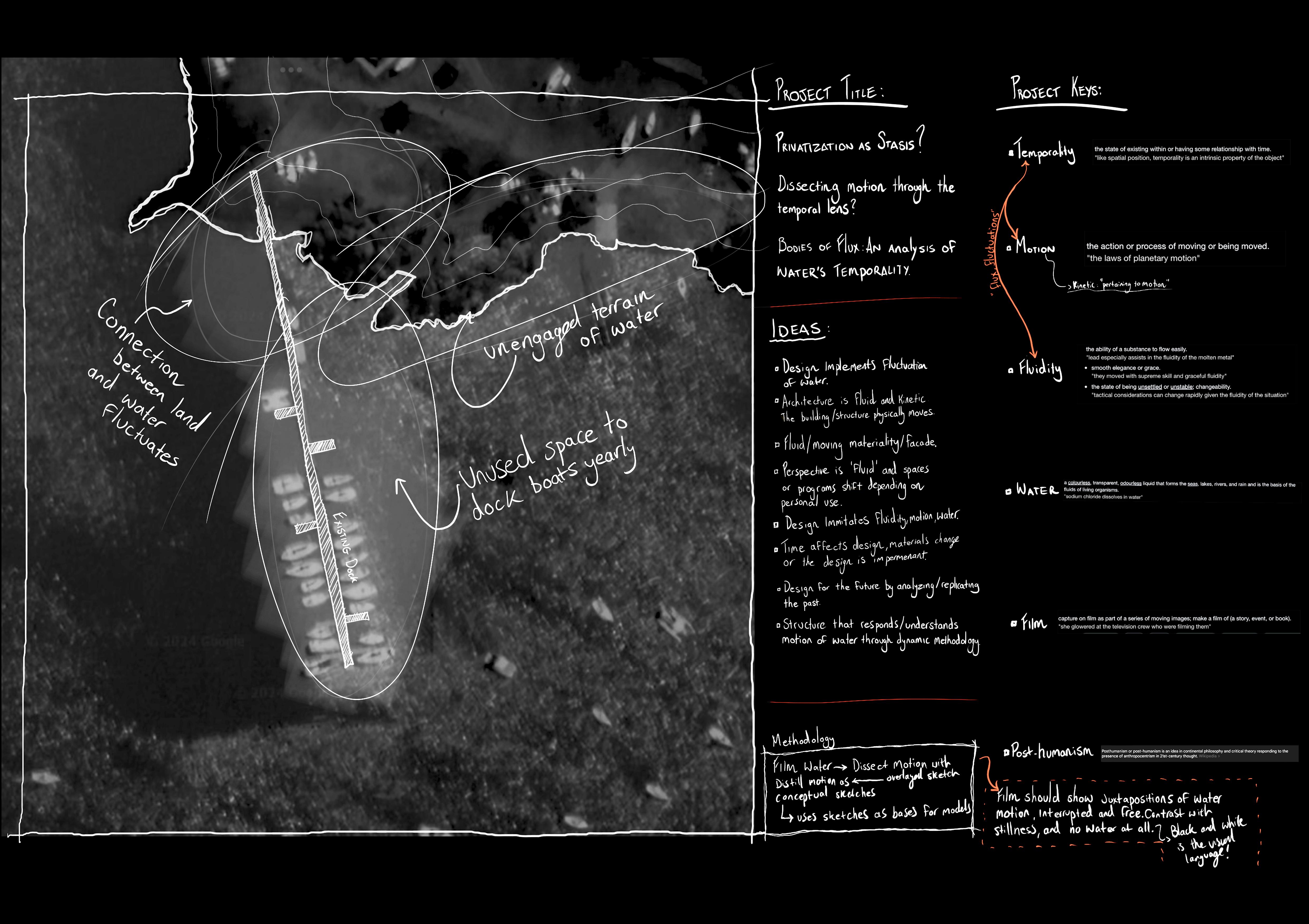
Water as an entity is necessary to the existence of all lifeforms yet is often overlooked and misunderstood. Unit 8’s goal is to broaden our understanding of Terrains of Wetness and water through the cone of Architectural Design as to provide insight towards more careful and ethical means of using, celebrating and design around water in the future. Examinations of the Emmarentia Dam, Orlando Dam and the Vaal Basin had our units exploring the ways in which water interacts with its surroundings. Opening up our perspectives on the concept of Wetness as a representation of the visible and invisible and how these Terrains of Wetness influence the lives of those who place themselves near and around them. The understanding of how water presents itself in streams, rivers, dams, lakes and many more had our Unit questioning the unpredictable nature of bodies of water and how we may be able to map/represent such fluid and dynamic entities. My own experience at initially attempting to portray the variance of water in a static way, namely though text, sketching, drawing and digital media taught me that perhaps the most effective and powerful way to represent the idea of flux would be to use a Methodology that allows an effective representation of data over time.
Thus, my own research process will be understanding various bodies/terrains of water through the use of the Methodology of Film, animation and stop-motion to Map, Trace, Analyze and Explore the dynamic nature of water and its innate “Flux”. Due to the way water behaves and acts in various terrains, my focus on film allows opportunities to examine, compare and juxtapose the nature of water over Time. Furthermore, understanding time as an intrinsically woven part of the being of water enables further examination into the understanding/perception of time and how the myths of past, present and future may affect design around bodies of water.
The Vaal lake is a large area that provides a rich and important tapestry of historical relevance in the context of South Africa, with the current state of the greater area being culturally and ethnically varied and dynamic. Many site visits and analysis will allow me to understand the politics of the land, and the moment to moment problems facing the broader community. As a man-made body of water that provides Johannesburg with it drinkable water, its importance and relevance cannot be understated and should be carefully considered.
Through Film, I may better understand notions of private vs public, nature vs man-made, history vs and future in a way that benefit the Vaal Basin and its residence, whether that be human, wildlife or the water that runs through the terrain. It is with this methodology that I intend to produce a short film in which I can merge these subtopics into a piece that provides a clear vision into the Vaal as an entire entity.
Although conceptually the intersection of concepts of Water and Architecture have been explored to a certain extent by previous Architectural scholars, the greater intersection between water and time is something I believe provides a gap within academic study and is something I find will be interesting to explore. Furthermore, through my own investigations I found that the Methodology of Film within the Architectural landscape is something I believe has room to be further explored, represented and refracted in new and interesting ways that may provide context and basis for my interests holistically.
UNIT 8_FLUID FUTURES
UNDERSTANDING ARCHITECTURE IN THE CONTEXT OF THE VAAL LAKE
AIMS OF THE RESEARCH
The aim of my Research is to examine the relationship between Architecture and Water through the lens of Film, Understanding the dynamics and fluidity of water and how our current understanding of contemporary architecture may need to be readjusted at the intersection between the two. With this I intend to examine the innate flux of water in the Vaal and understand the intersectionality between the history and past of the Vaal in hopes of addressing concerns of residents and visitors regarding Flood, Drought, Cleanliness and Flow.
PRELIMINARY LITERATURE/REFERENCE REVIEW
As I will be using Film as my primary Methodology in examining the Vaal, I have referenced various academic papers that explain the benefits of using video as a source of academic research. These papers include:
• “An introduction to using video for research byCarey Jewitt, MODE node, Institute of Education, London”,
• “Research as storytelling: the use of video for mixed methods research by Erica B. Walker and D. Matthew Boyer”,
• “Who’s Behind the Lens? A Reflexive Analysis of Roles in Participatory Video Research by Rebecca Whiting, Gillian Symon, Helen Roby, and Petros Chamakiotis”.
I intend to reference these papers to formulate an understanding of the process of video and film within academic research and its benefits.
As to understand the intersectionality between concepts of Time, Architecture and Water; I have sourced:
• “Temporality Dimensions in Architecture: The intervention of time perception by Maitai Kunawong”
• “Between Space & Time: Transformable Architecture in Early Design Education
• Negar Kalantar + Alireza Borhani”
And varied works by Architect and Philosopher Juhani Pallasmaa whom has a great understanding of how Time and Architecture can come together to create powerful narratives
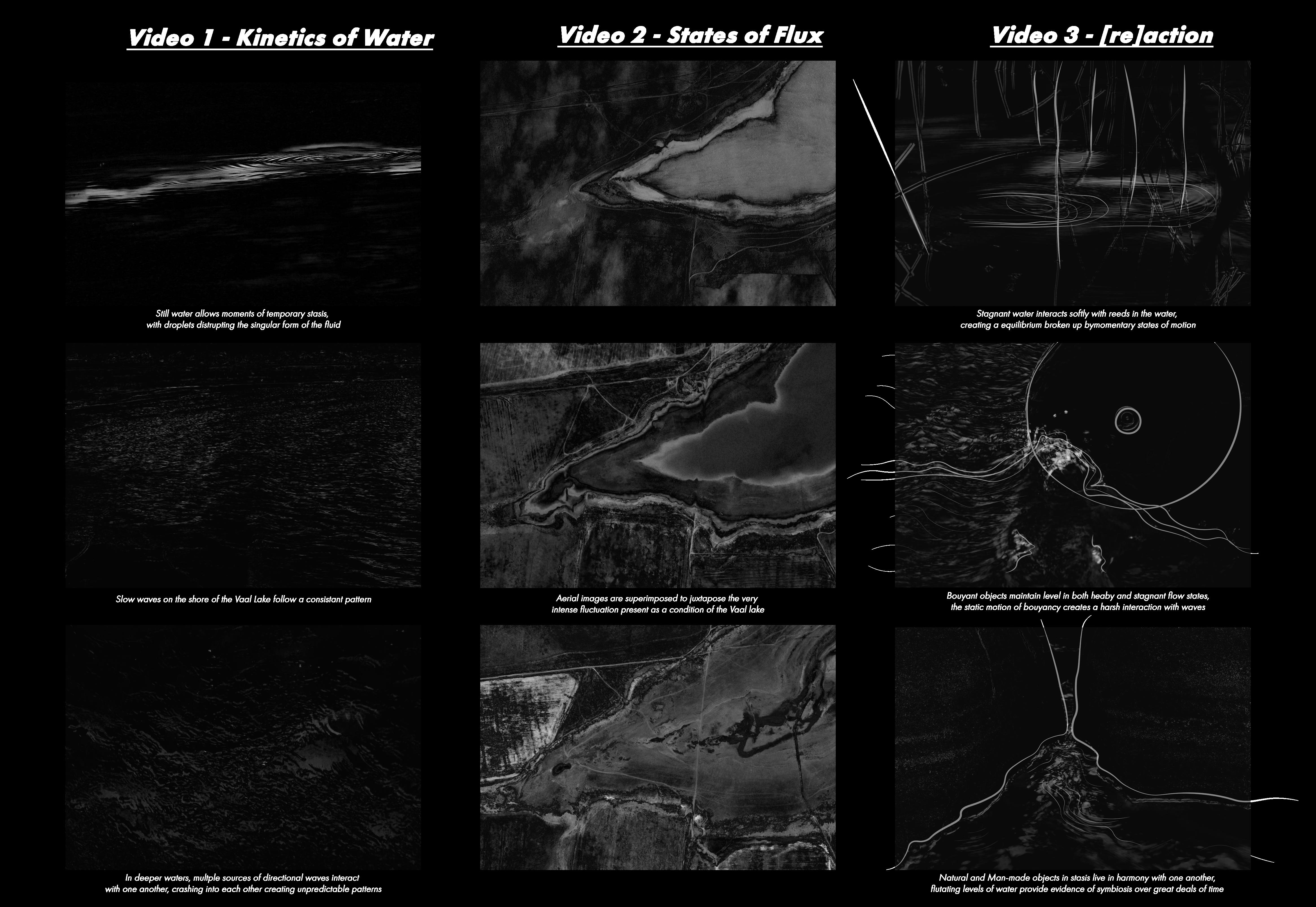
Play Video 1
Kinetics of Water
ANALYSIS OF FRAMES OF MOTION EXTRACTION:
Through examining the way water moves, behaves, reacts and retracts, We are able to better understand the nature of being present in Water within the context of the Vaal River/Dam.
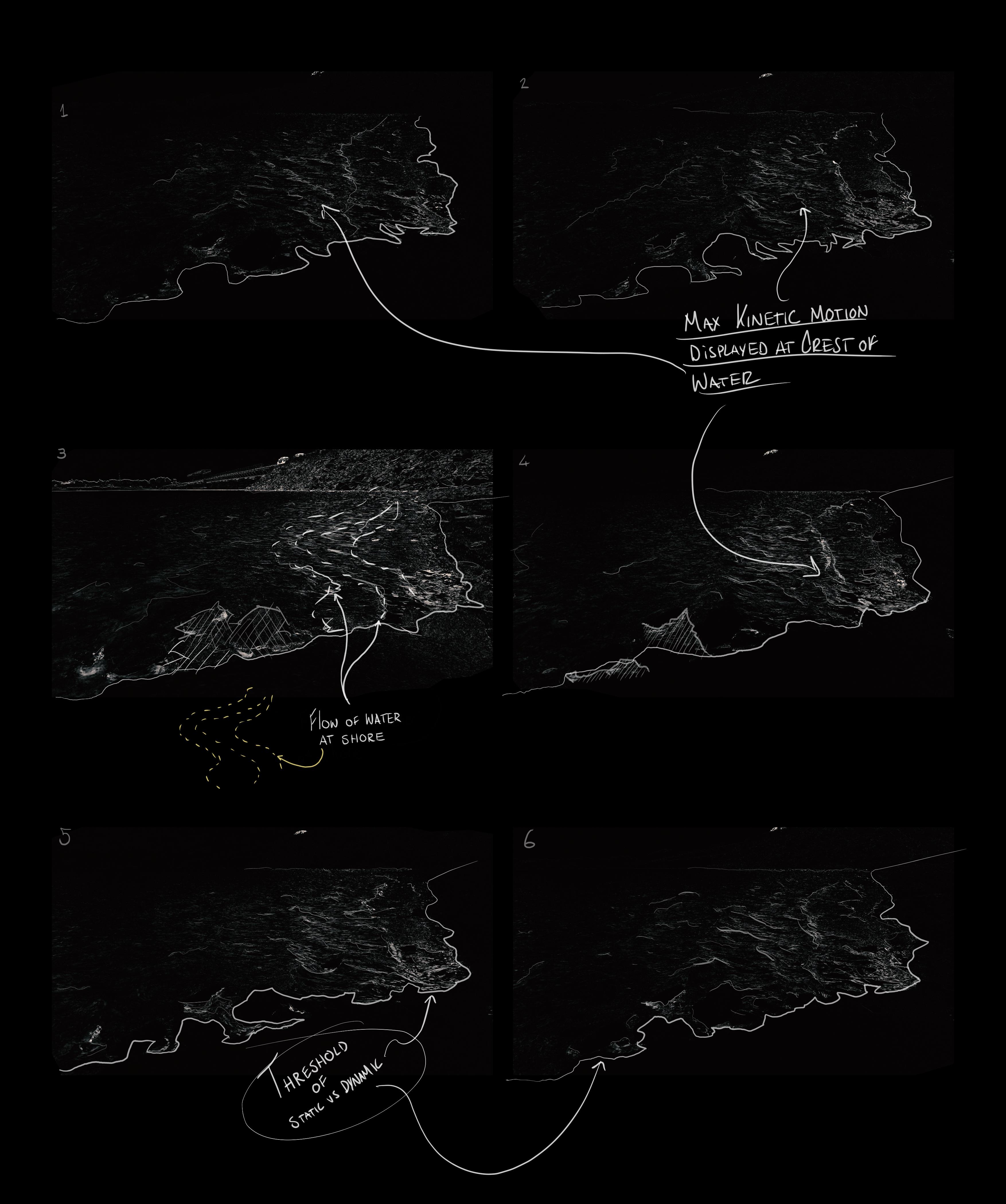
FLUIDS AND MOTION
FILM AS A METHODOLOGY TO PERSONIFY BODIES OF WATER
Understanding the Body of Water as an ontological form provides a strong case for its preservation and rehabilitation.
In a Post -Human world, how will this body of Water be affected?
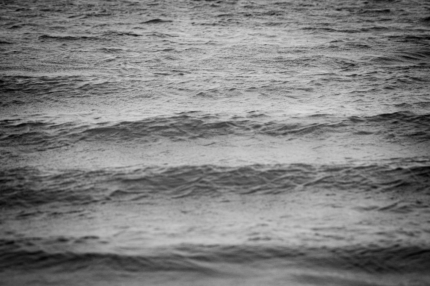
Through analysis of Frames of Superinposed stop motion, The inherent flux of water is visually represented. We are presented with the idea that a River, Dam, Lake cannot be cannot be contained, predicated and colonized due to its fluid nature.
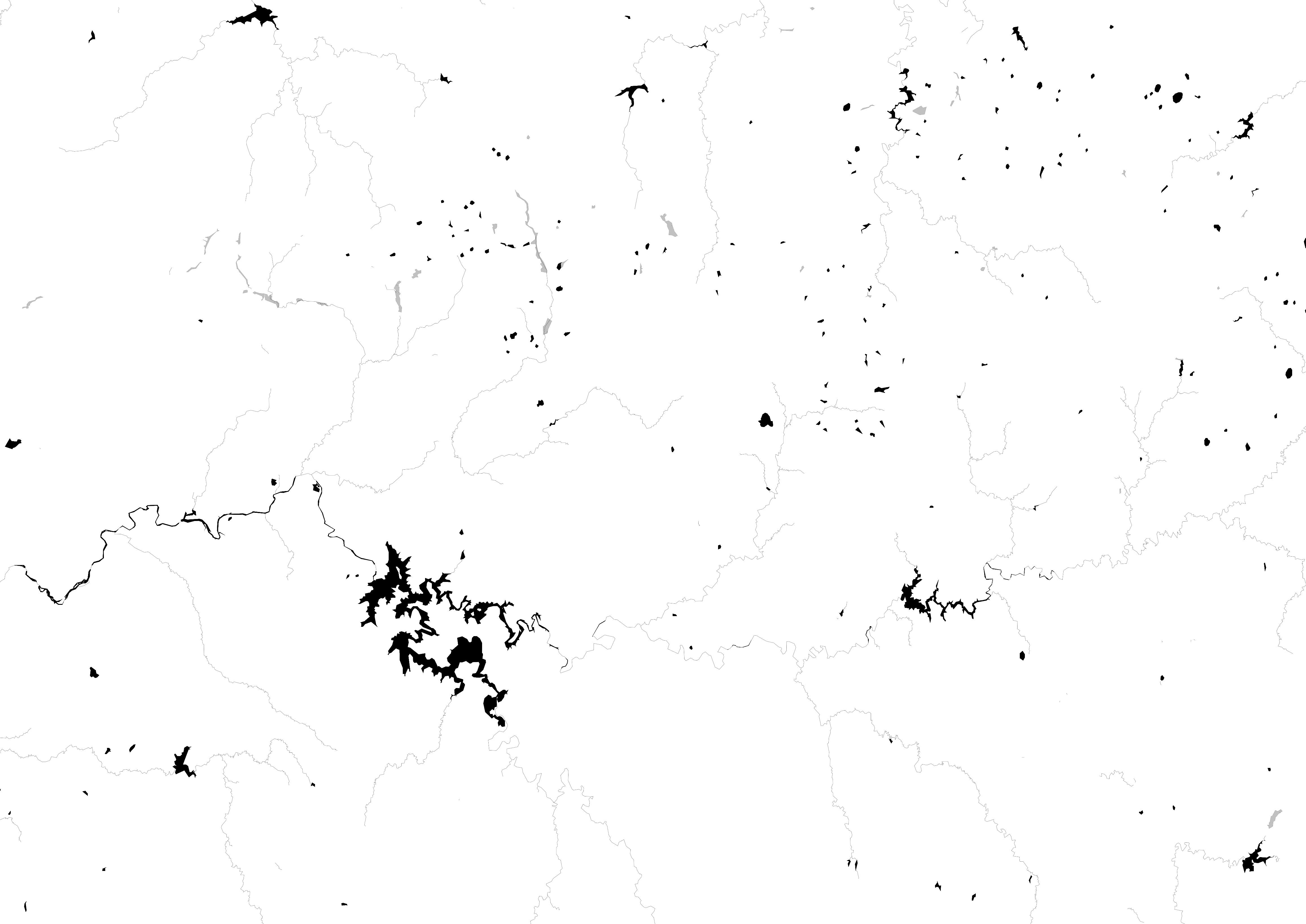
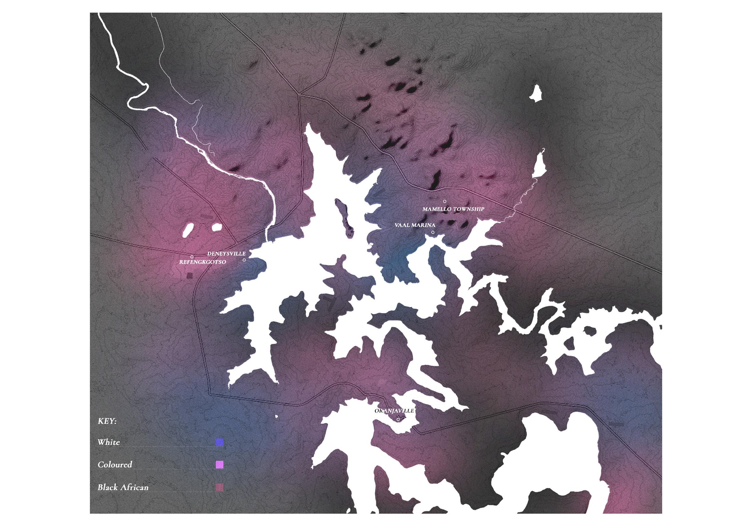
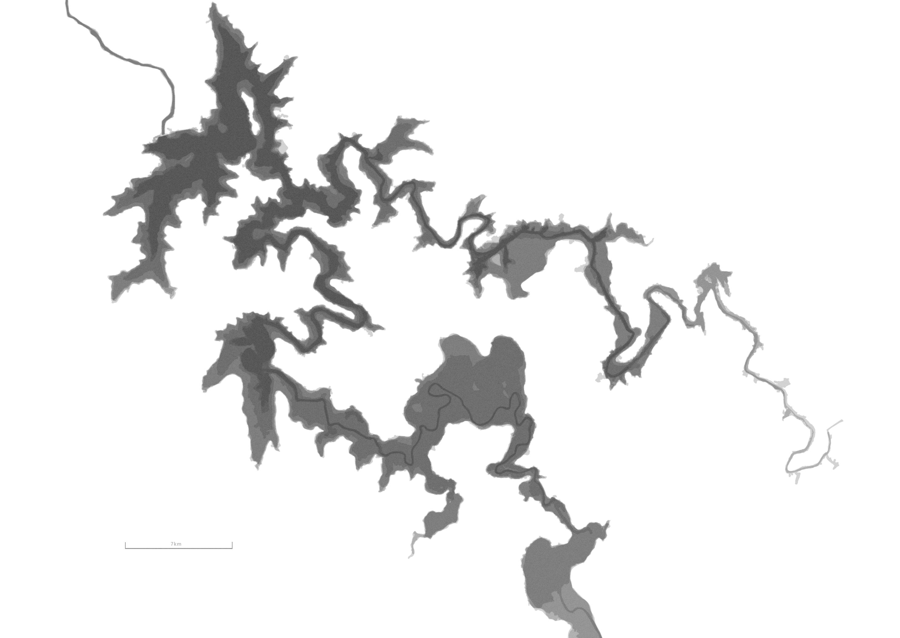
THE VAAL BASIN
AND HOW LAND IS CURRENTLY USED
This Map Represents Gauteng and surrounding areas only described through Water.
As the Vaal Dam is evidentially the largest body of water, its usage for Public, Industrial and Agricultural purpose should be carefully considered.
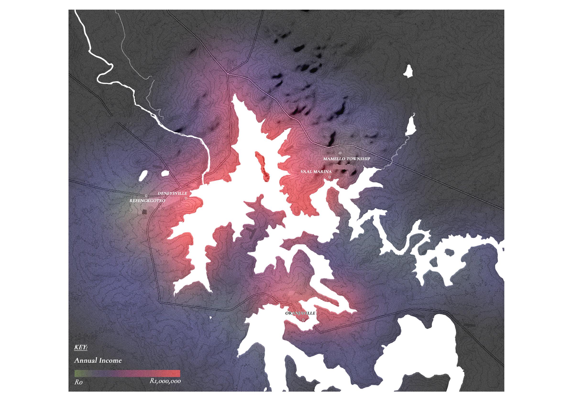
THE VAAL BASIN
PRIVATIZATION
AND HOW LAND IS CURRENTLY USED
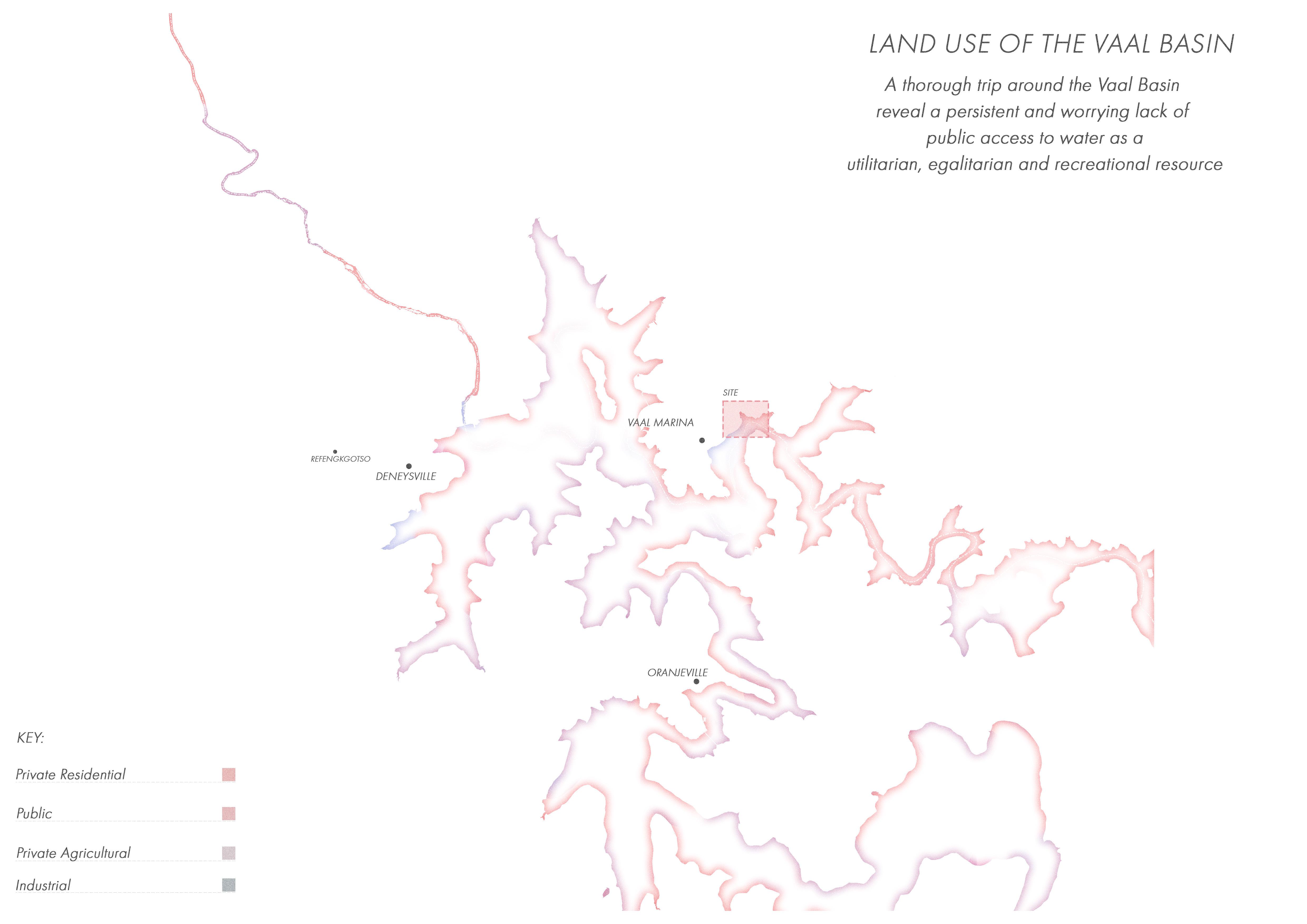
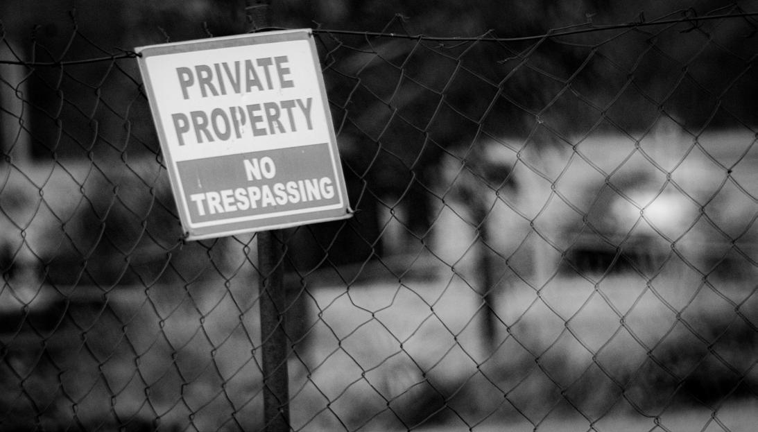
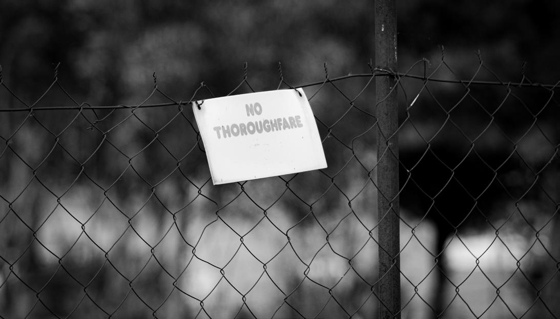
Examination of the Vaal basin and its current land use reveals a resounding amount of private and industrial spaces consuming the majority of the banks of the lake, with minimal spots that act as public available areas to access the water.
This lake of public access lends questions to the privatization and classicist systems in place to prevent access to what is and should be considered a human right.
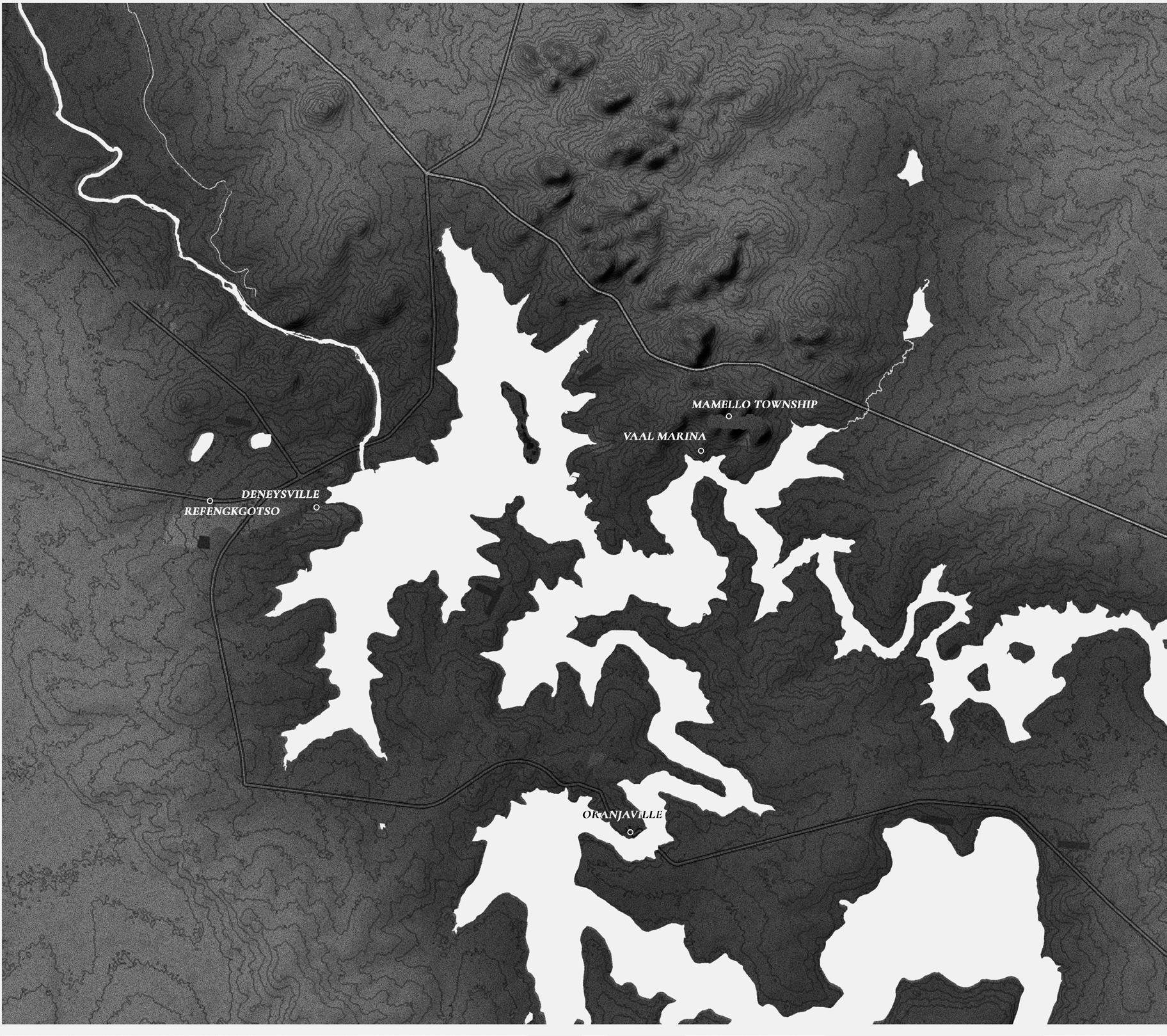
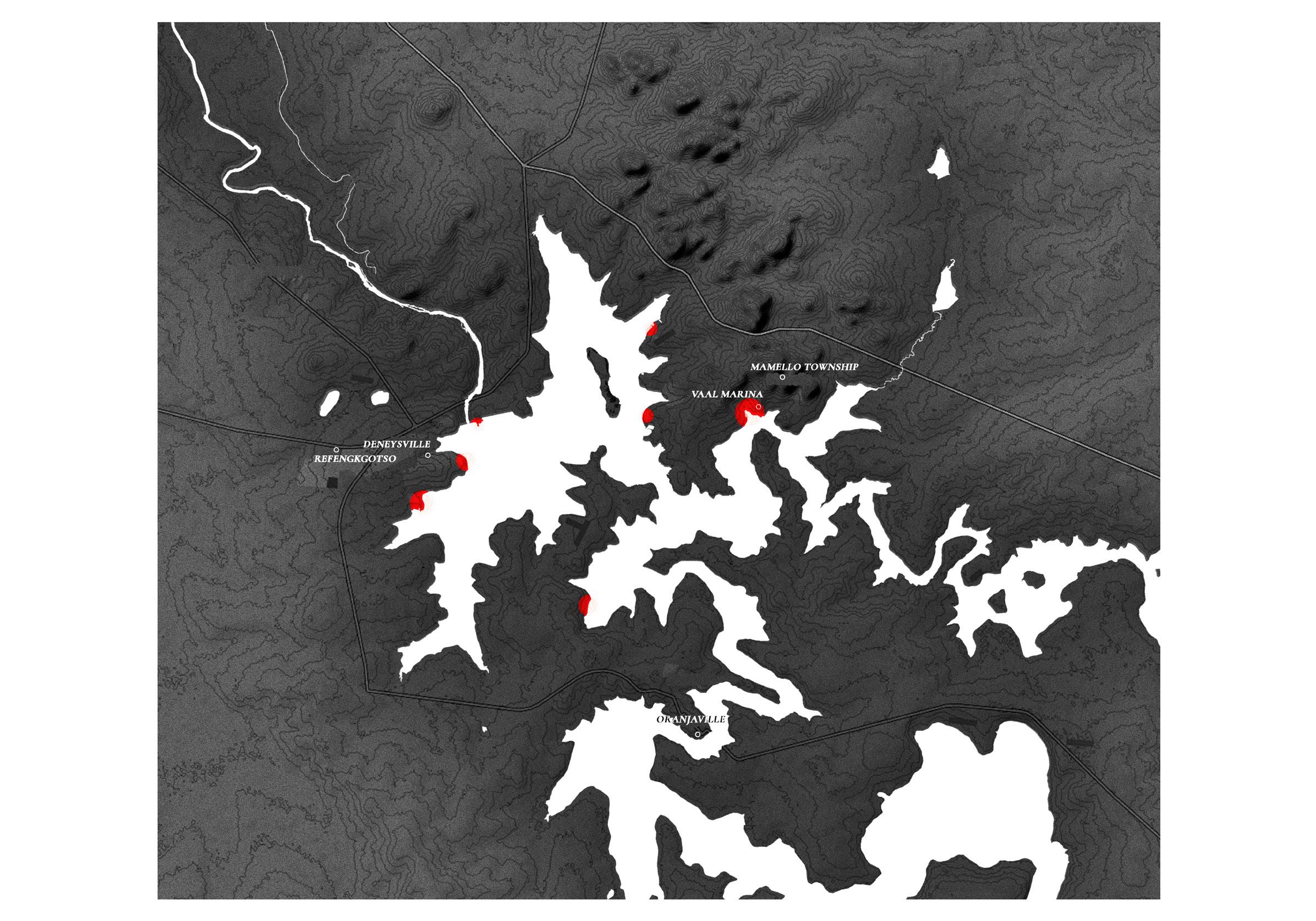

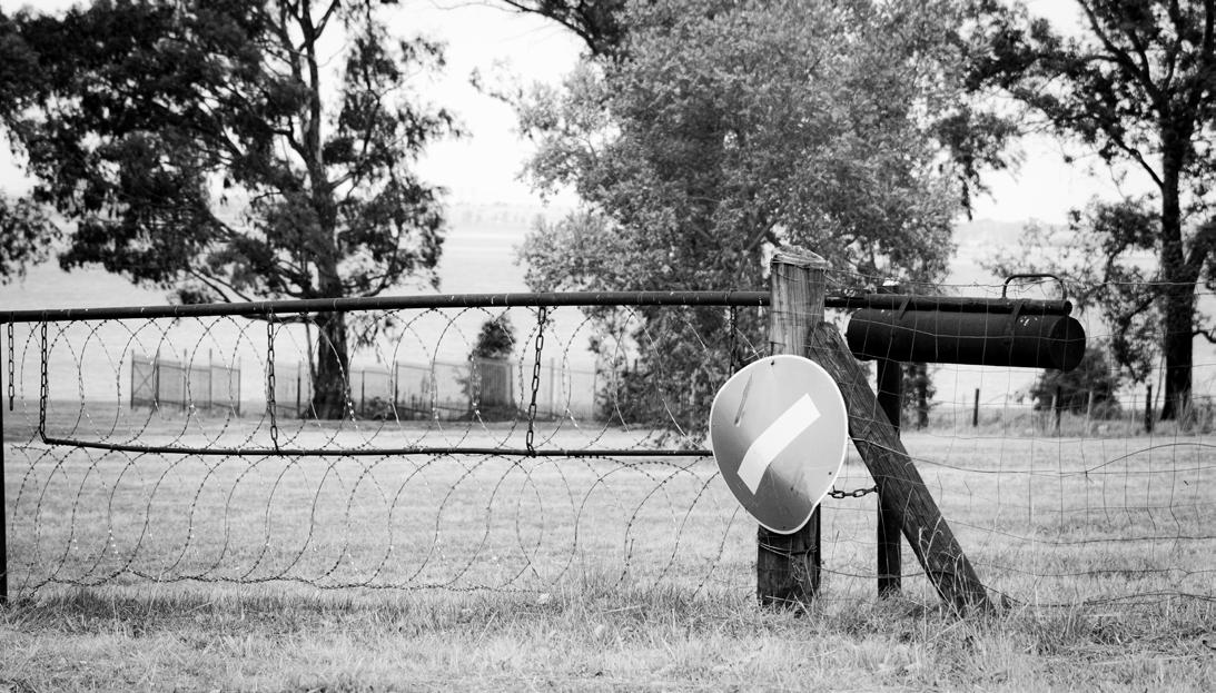
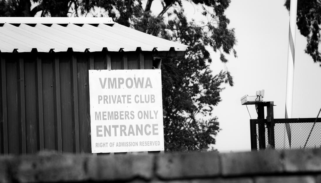
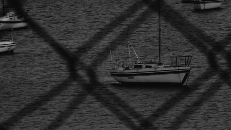
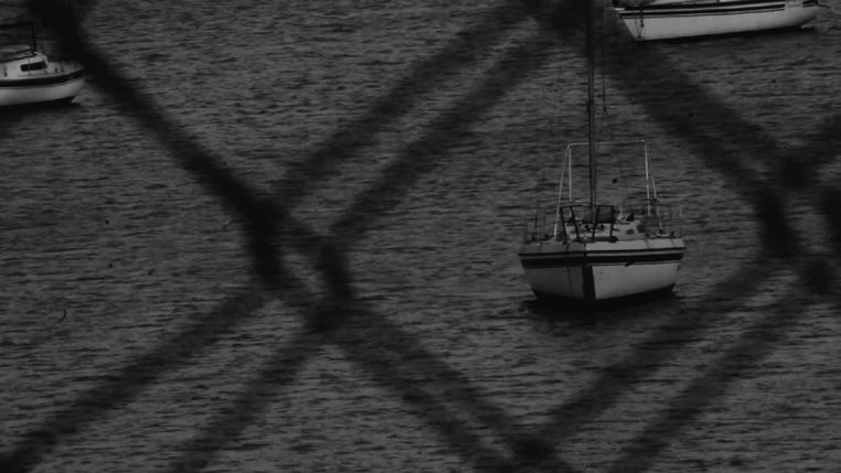
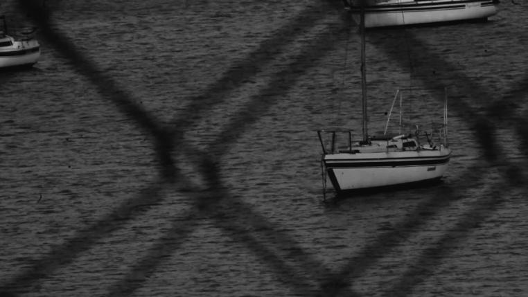
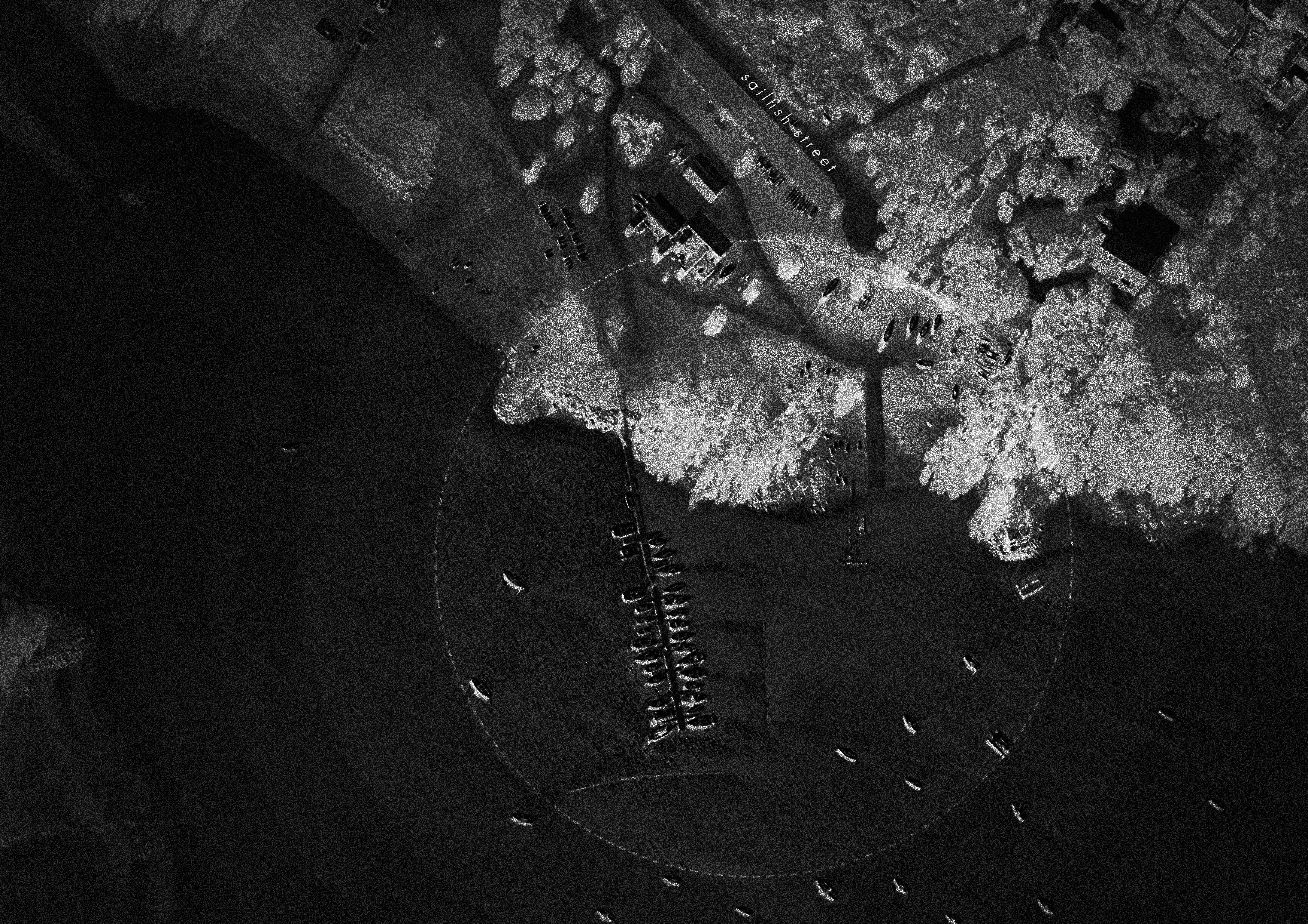
SITE CONDITIONS AND OUTLYING
PROBLEMS
From a site visit, access proved to be a vital problem facing the Vaal Marina, with the complete inability to access any waterfront.
Questions begin to raise about access for those who cannot afford Memberships to clubs and private areas.
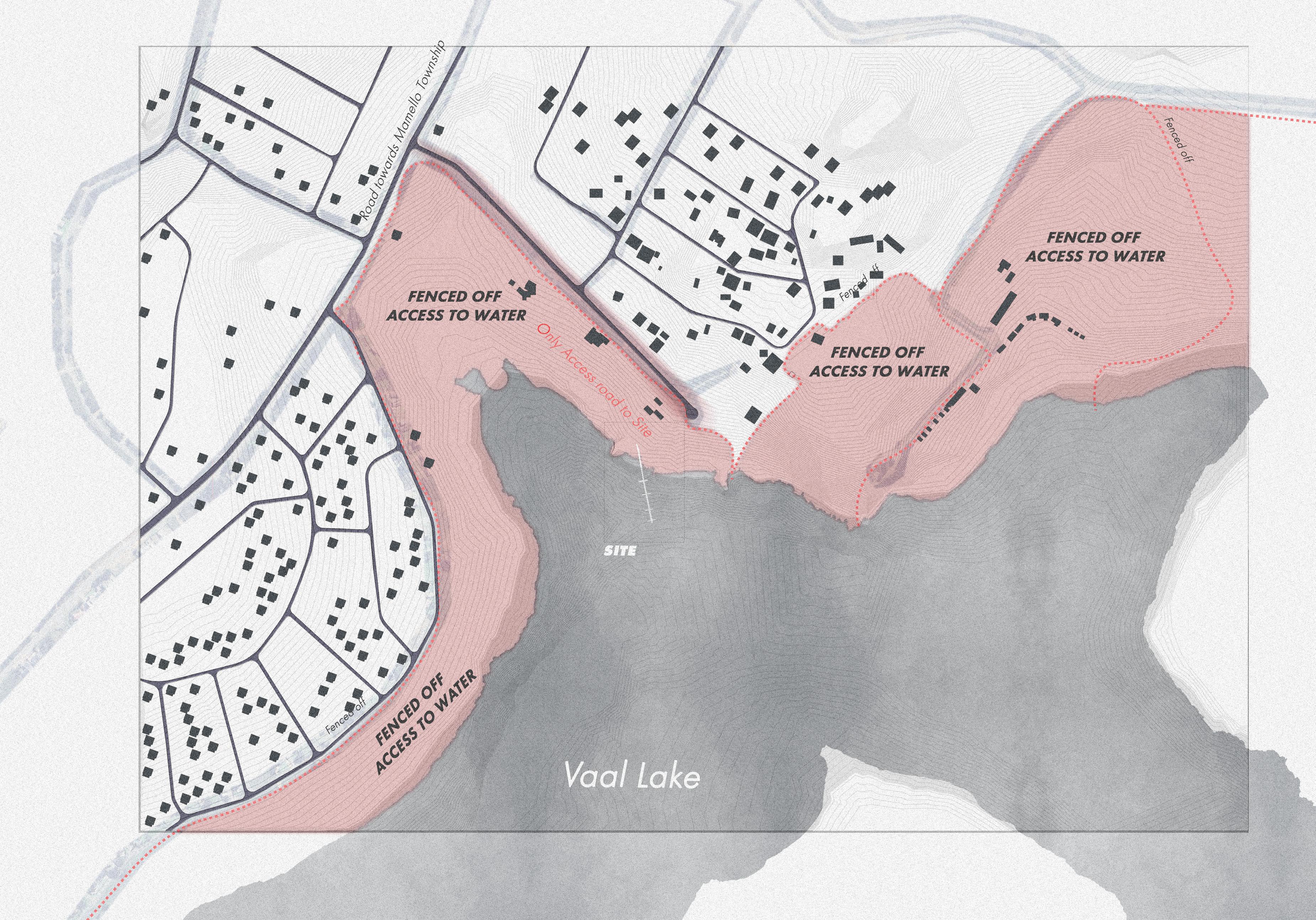
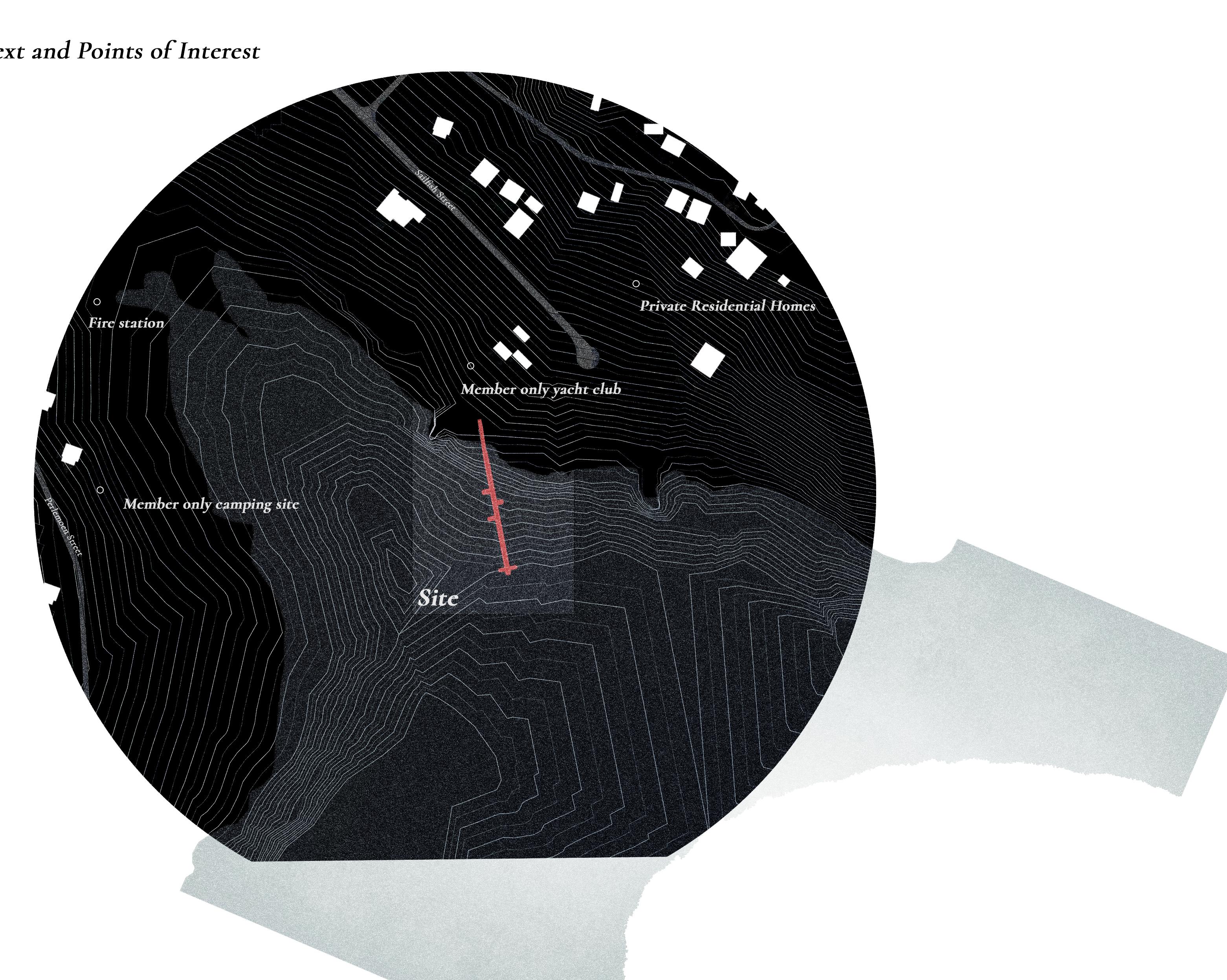
SITE ANALYSIS AND ACCESS
RESTRICTING A HUMAN
This Map Represents Gauteng and surrounding areas only described through Water.
As the Vaal Dam is evidentially the largest body of water, its usage for Public, Industrial and Agricultural purpose should be carefully considered
Nearby points of interest include camping sites, clubhouses, resturants, accomodations, a fire station and private residences.
Visiting as a non-residential or paying outsider brings many eyes and questions to ones intentions and wherabouts.
Video 2
States of Flux
Play
Constant fluctuations and changes make a the perspective of architctural intervention difficult in the context of the vaal
FLUCTUATIONS
THE ONTOLOGICAL NATURE OF WATER BODIES
WATER CAPACITY FLUCTUATIONS

The Vaal is known to be in consistant motions of flux, drought and flood always a potential situation facing residents.
By examining the historical patterns of flow, we can more faithfully extrapolate information in an attempt to understand what the future may hold for the Vaal Basin.
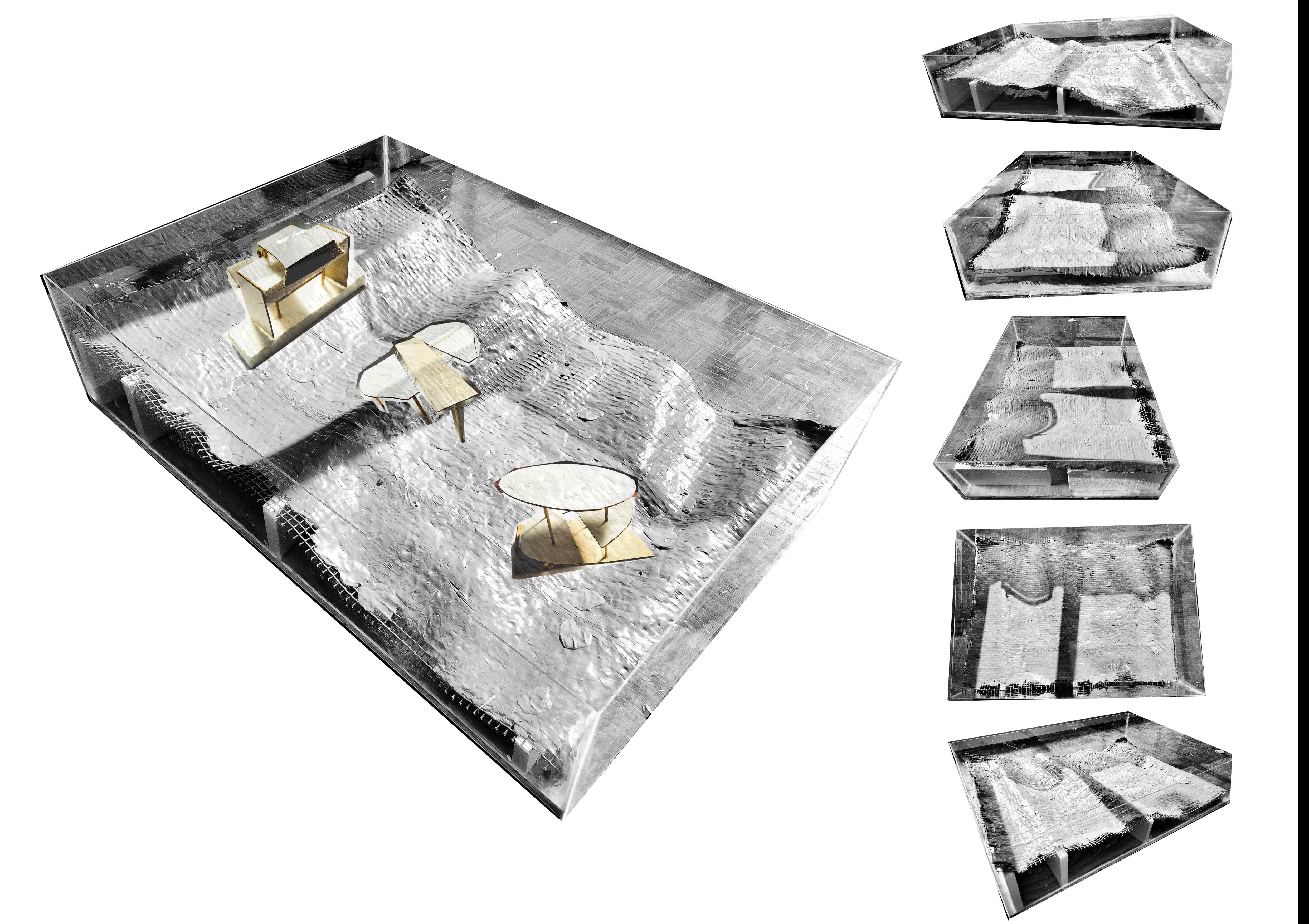
HOW THE VAAL REACTS TO FLUX
AND HOW ARCHITECTURE CAN ADAPT
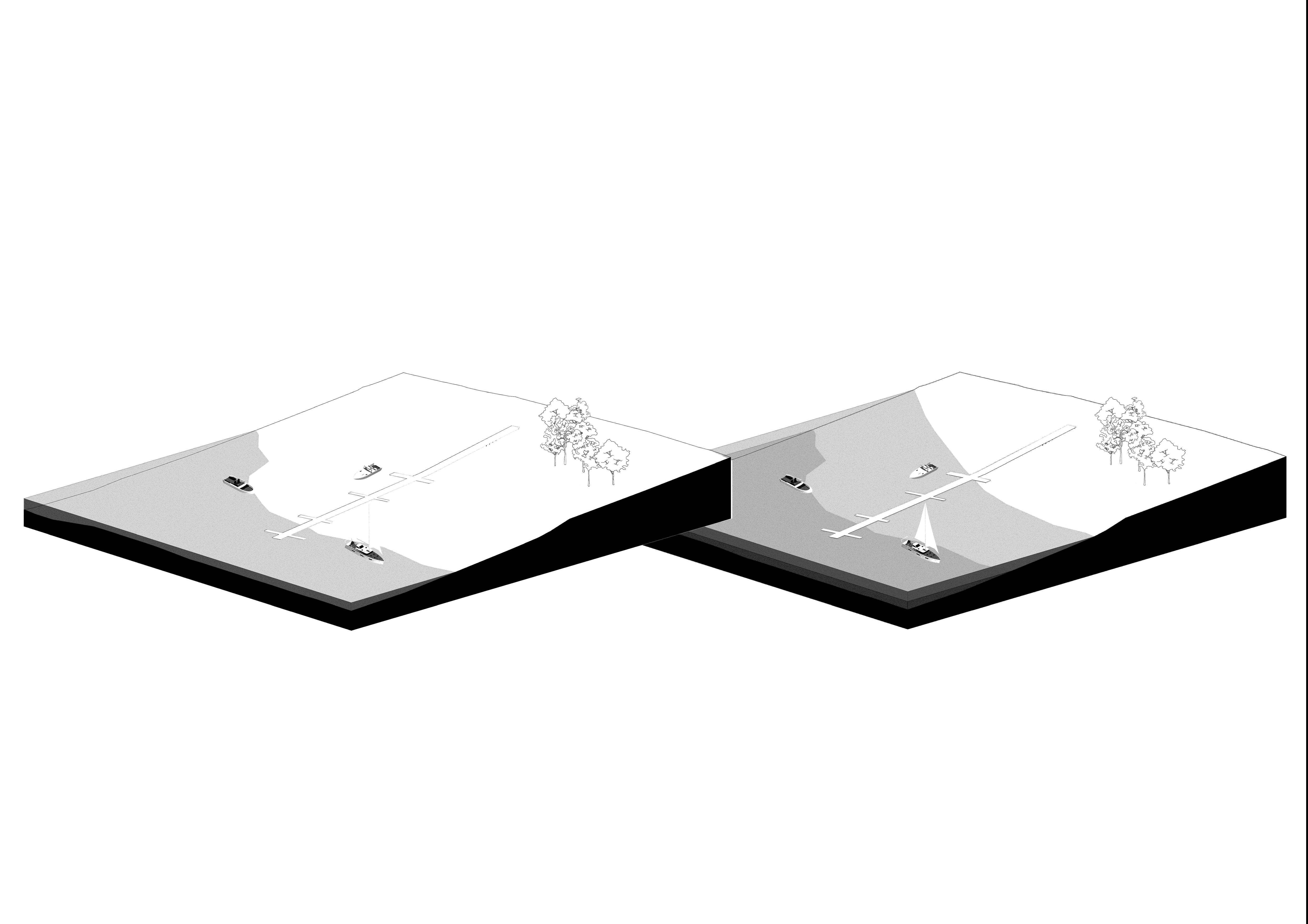
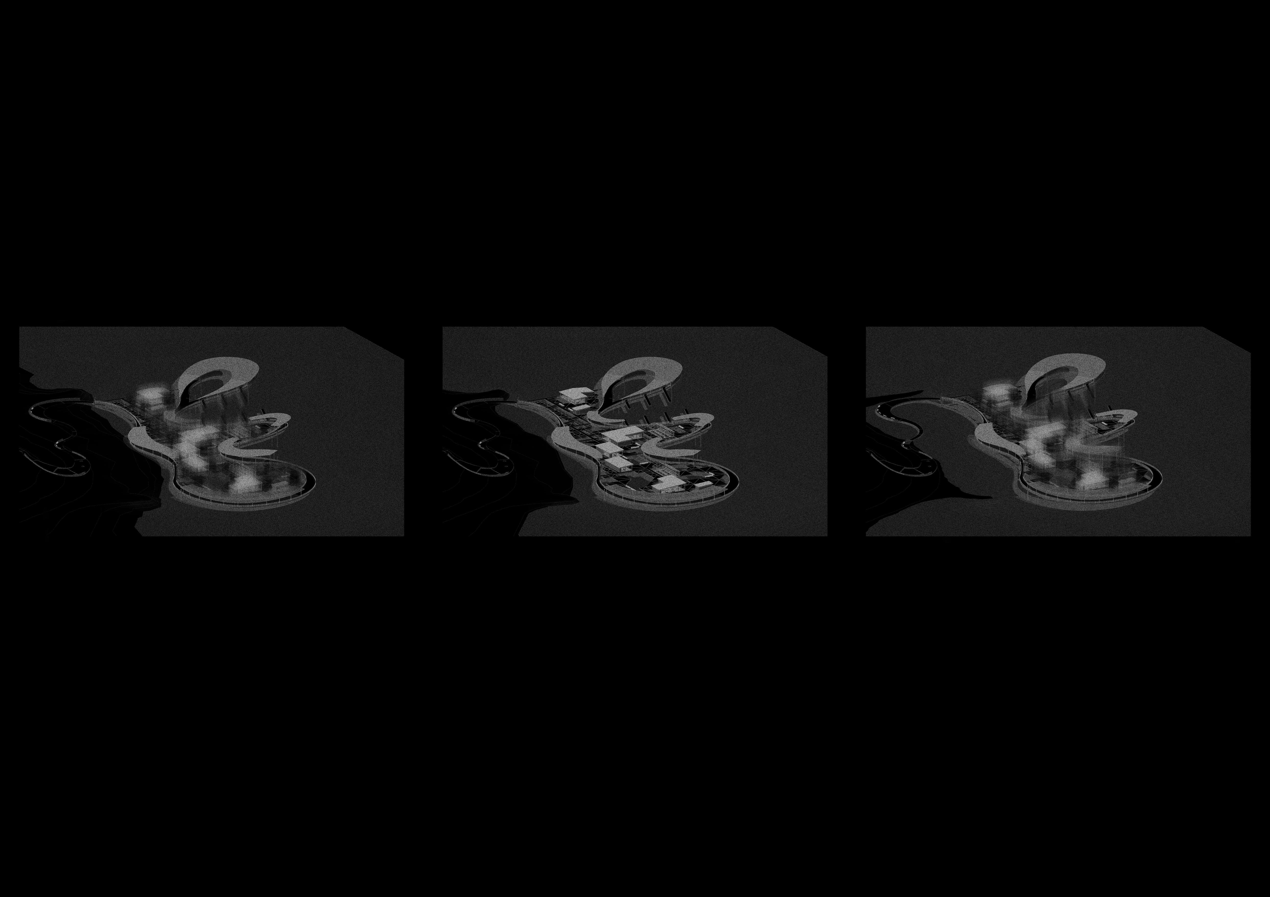
The below diagrams take existing geographic data from mapping in an attempt to understand how the Architecture and infrastructure in the Vaal currently reacts to the constant flux of water levels in the Vaal Basin.
As the water levels have the potential to fluctuated at multiple points every year, ranging from 20% to 115%, it must be understood how the residents of the Vaal must change their routines and schedules to adjust
to the changes, and how these fluctuations affect current infrastructure.
LAKE CAPACITY - 23%
LAKE CAPACITY - 65%
HOW THE VAAL REACTS TO FLUX
AND HOW ARCHITECTURE CAN ADAPT
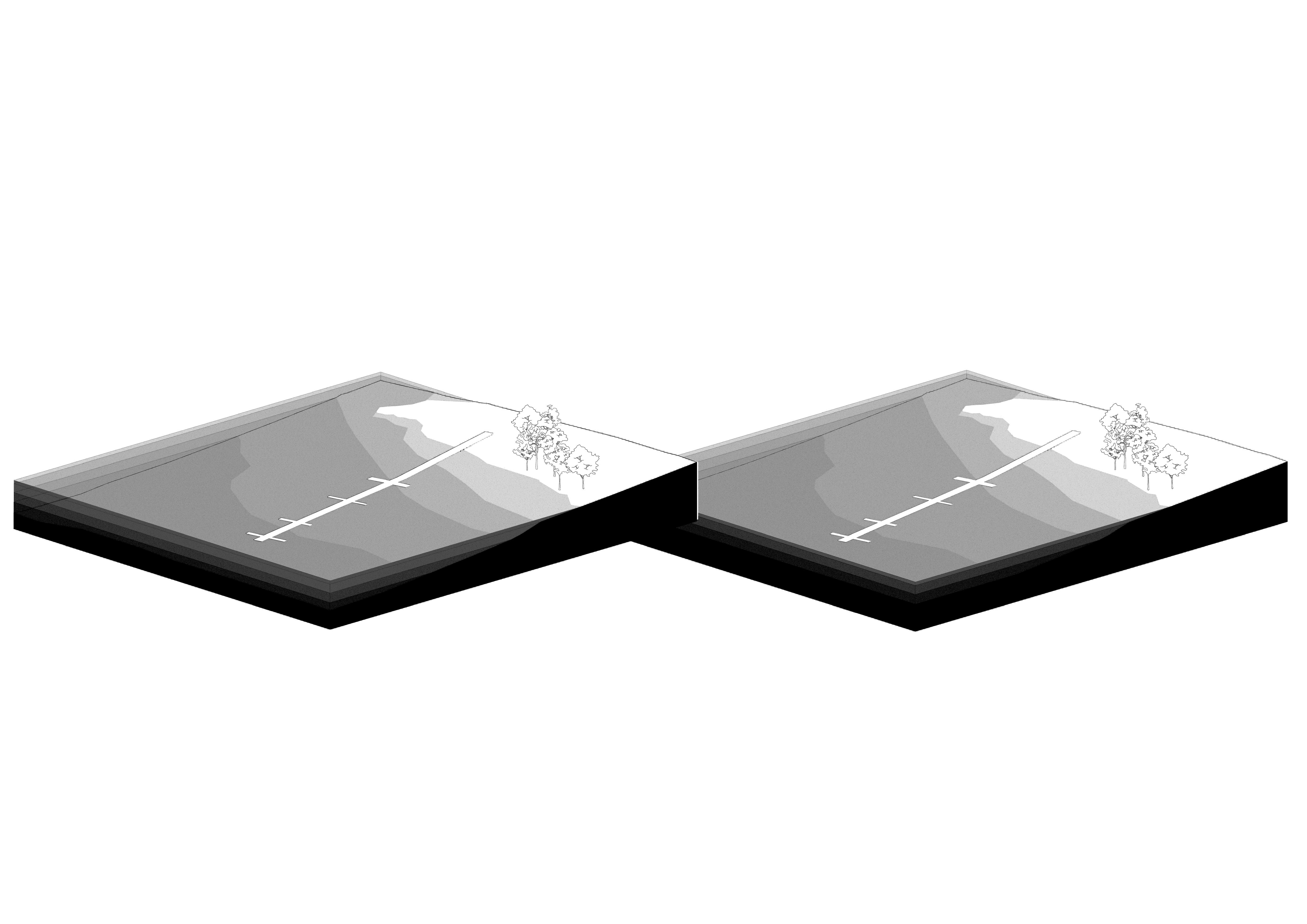
Through these diagrams it is evident that the existing architectural precedent at the Vaal must go to great lengths to adapt to the fluctuations, floating structures such as piers react to the changes dynamically, while homes and more grounded structures must be taken apart and rebuilt at water exceeds expected heights
LAKE CAPACITY -100%
LAKE CAPACITY - 115%
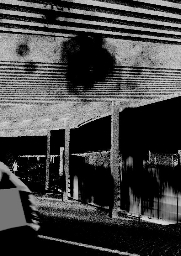
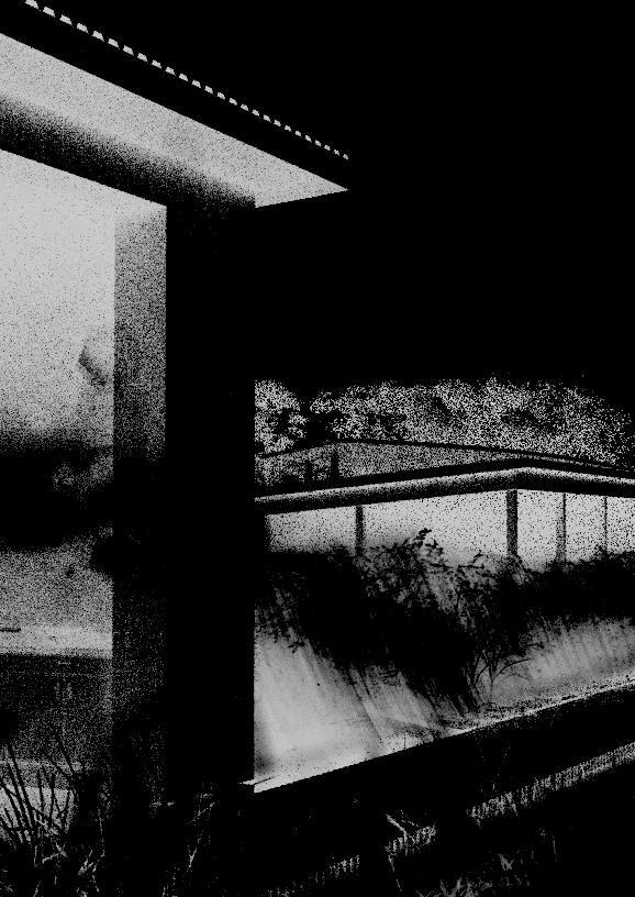
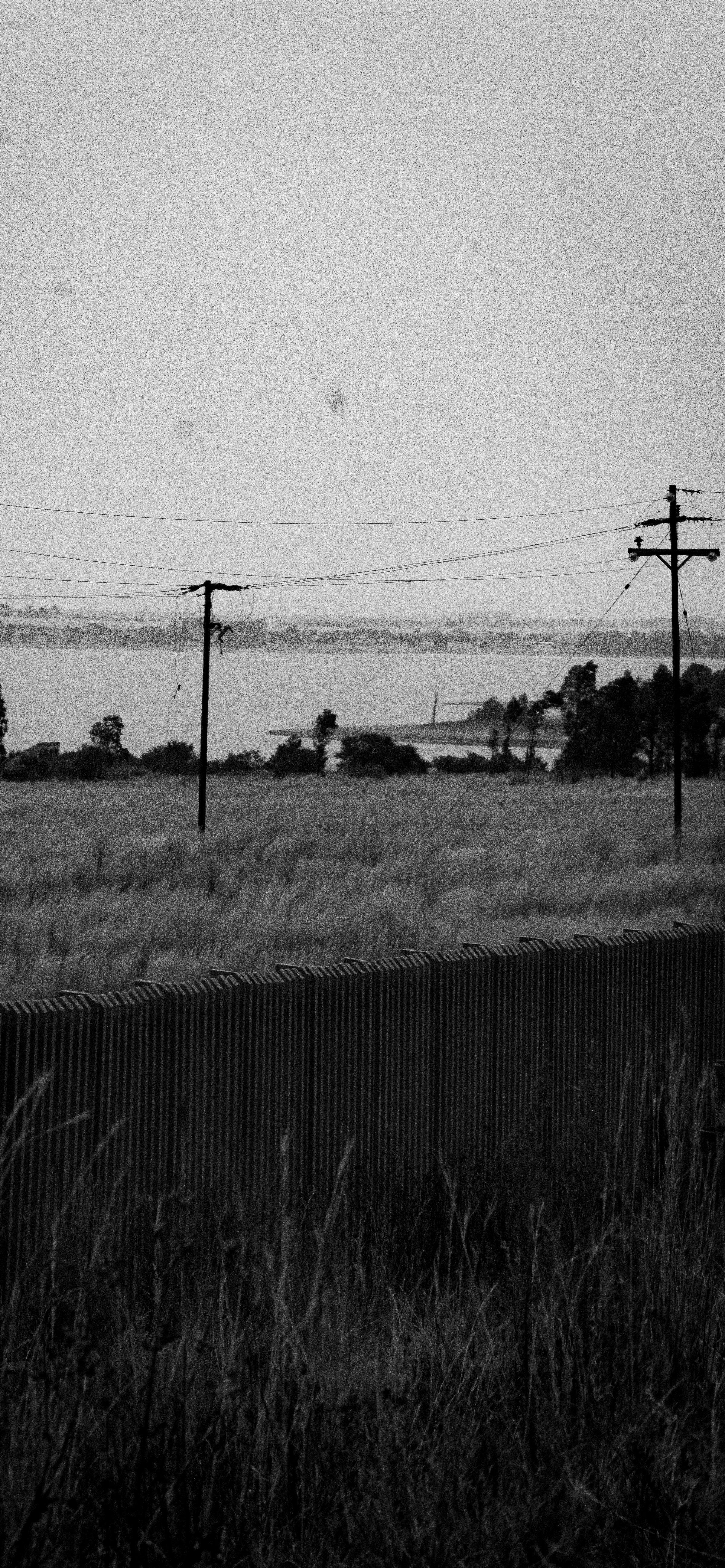
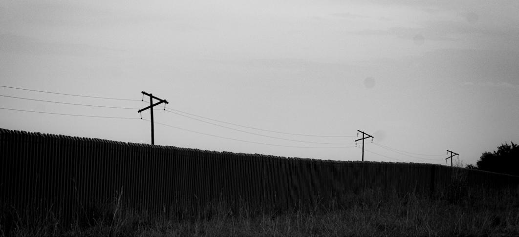
CONCRETE , WATER, TIME
THE VAAL’S NATURAL AND MAN-MADE ARCHITECTURE AND HOW IT REACTS/ADAPTS TO WATER FLUCTUATION
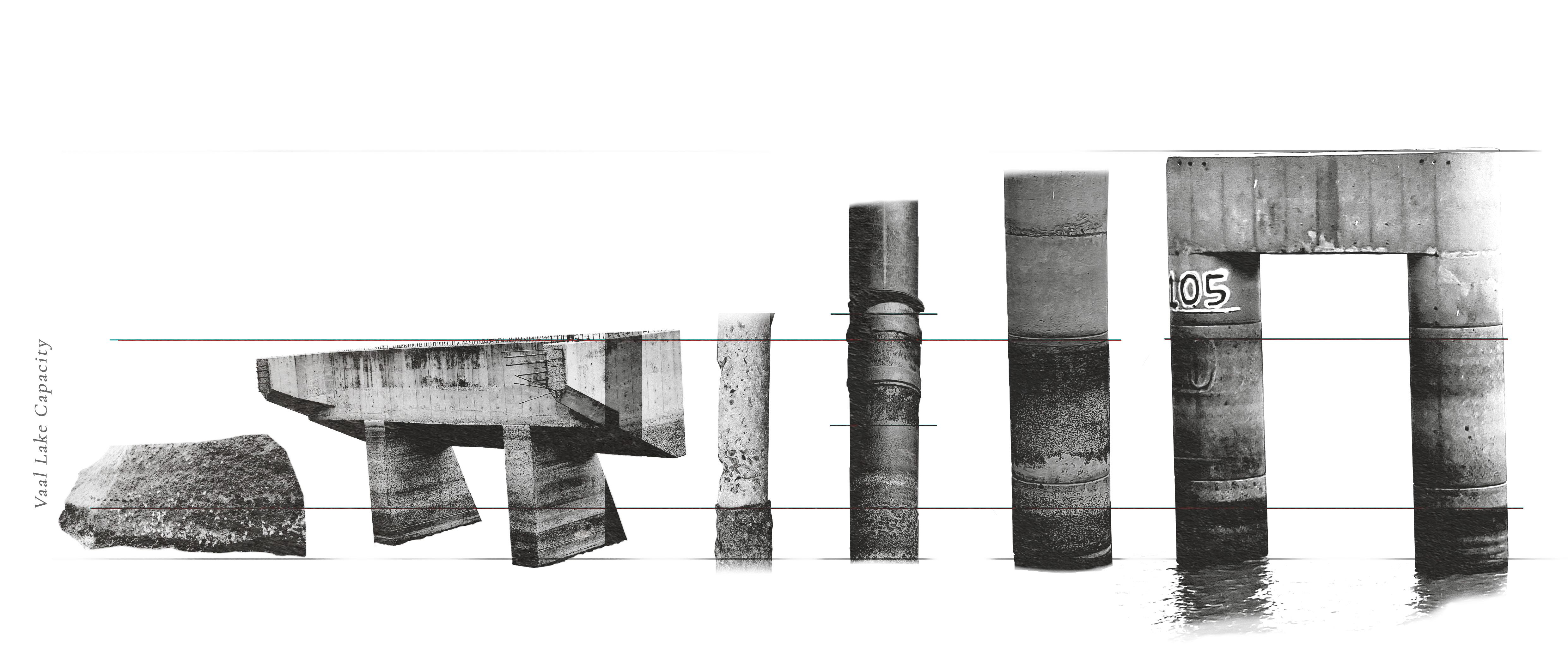
“The markers of Time” showing how water reacts to infrastructure and its decomposition, while leaving
Site visits and analysis allowed me to take photos of various architectural and natural structures which often come into contact with the water, as water is inherently a reductive force, all theoretically pennant structures are stripped down and slowly decomposed.
For architecture to work in the context of water, it must be temporary, adjustable and reactive to its environment. Materiality must be considered, as concrete will degrade over time.
THEORETICAL FRAMEWORK
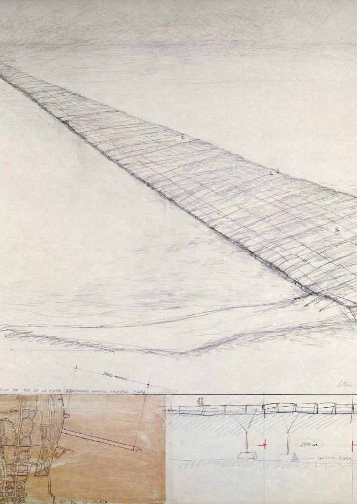
THE FLOATING PIERS - CHRISTO AND JEANNE-CLAUDE
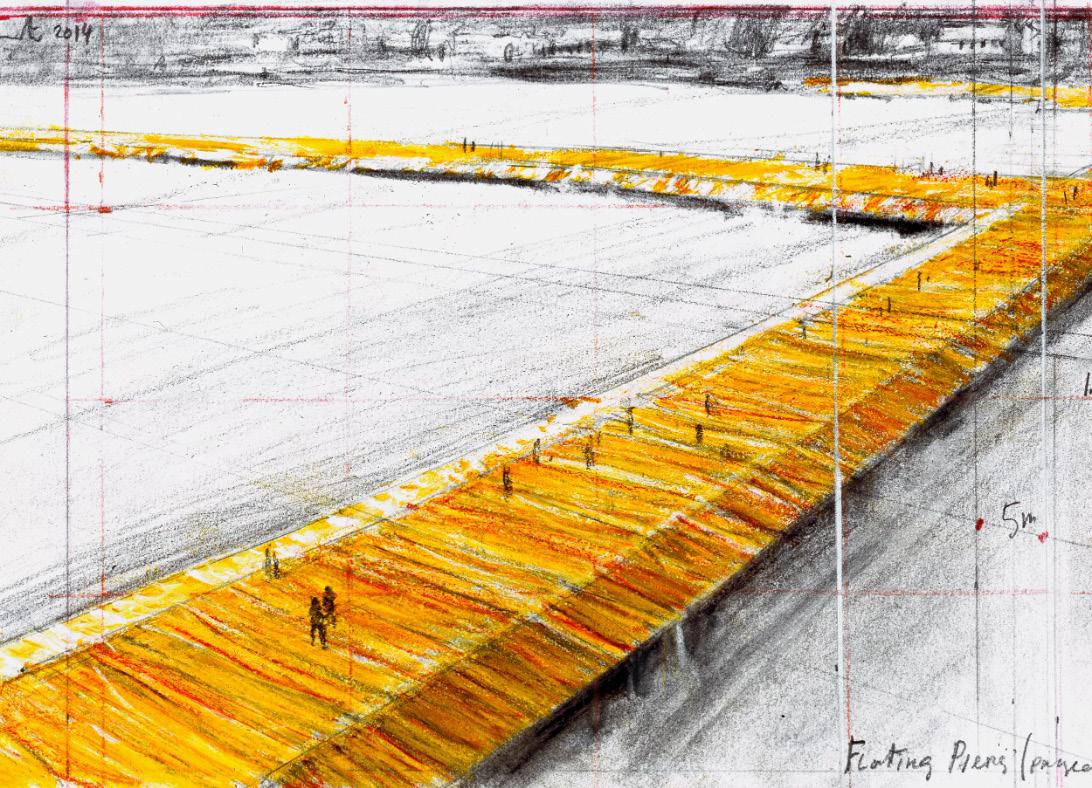
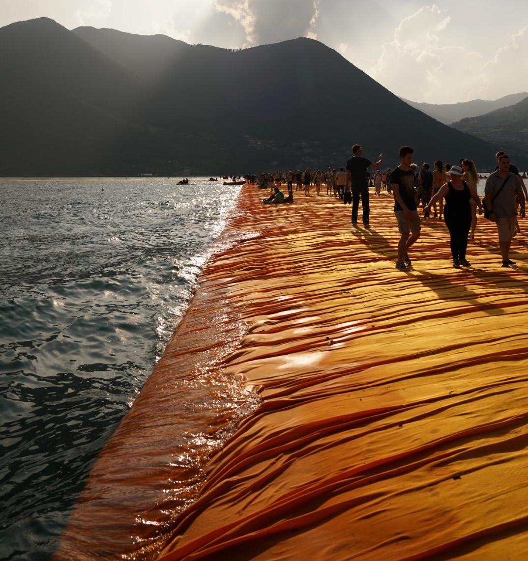
Location: Province of Brescia, Italy
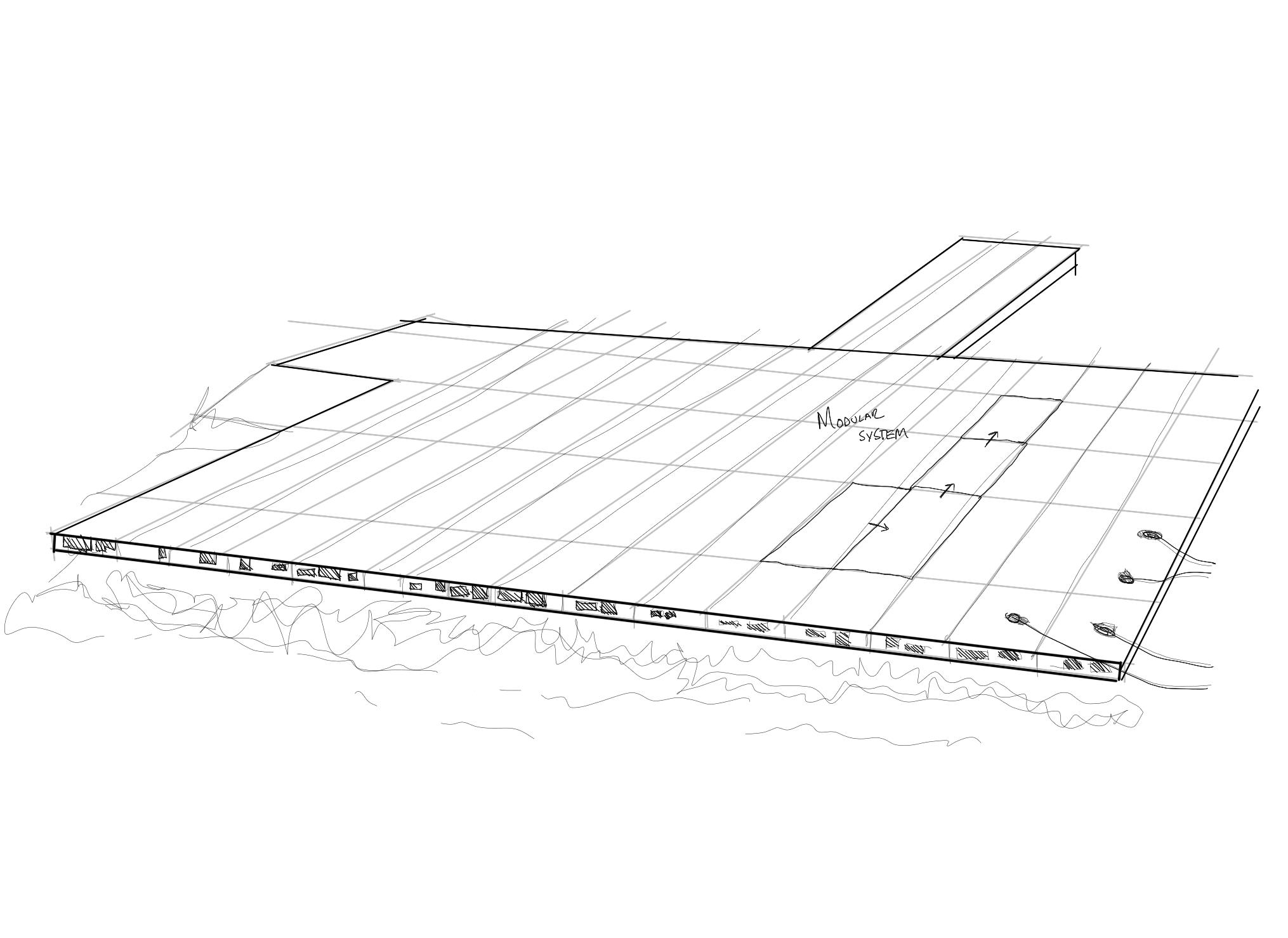
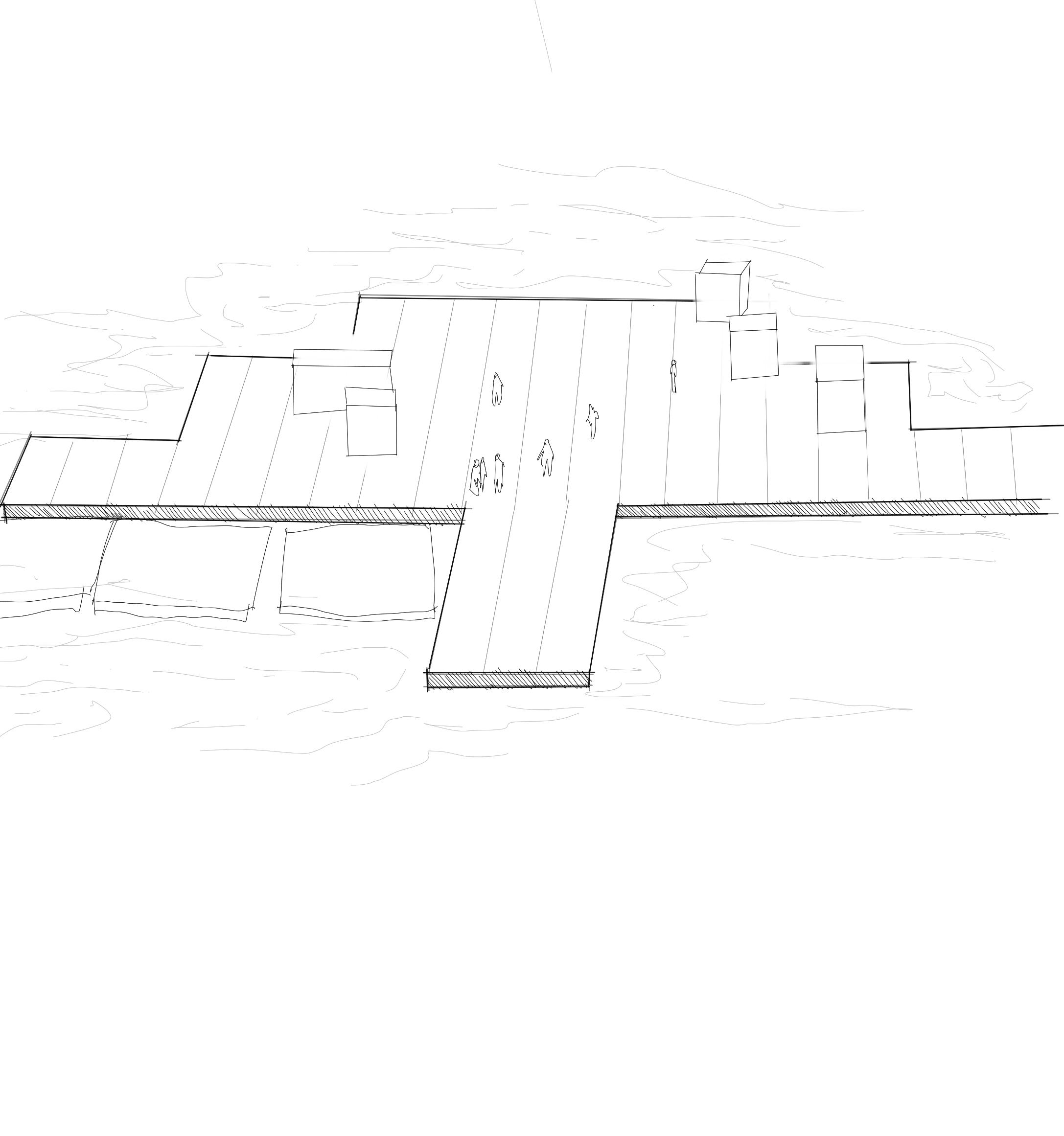
Consisting of 70,000 square meters of yellow fabric, carried by a modular floating dock system of 226,000 high-density polyethylene cubes installed in 2016 at Lake Iseo near Brescia, Italy. The fabric created a walkable surface between Sulzano, Monte Isola and the island of San Paolo.
“Like all our projects, The Floating Piers was absolutely free and open to the public, There were no tickets, no openings, no reservations and no owners. The Floating Piers were an extension of the street and belonged to everyone.”
The Project presents thoughtful analysis on the function of public Architecture, and the presence of Performative Art within the Architectural Landscape.
As one of the most prominent examples of Floating piers, the porject questions the functions and uses of tradition piers and their designs.
Through the public centred design, the public may freely access the water near San Paolo, and stands in stark contrast to the Vaal Lake.nonse eium
THEORETICAL FRAMEWORK
Location: Rizhao, China Architect: Junya Ishigami + Associates Year: 2023 Program: Cultural Architecture, Museum
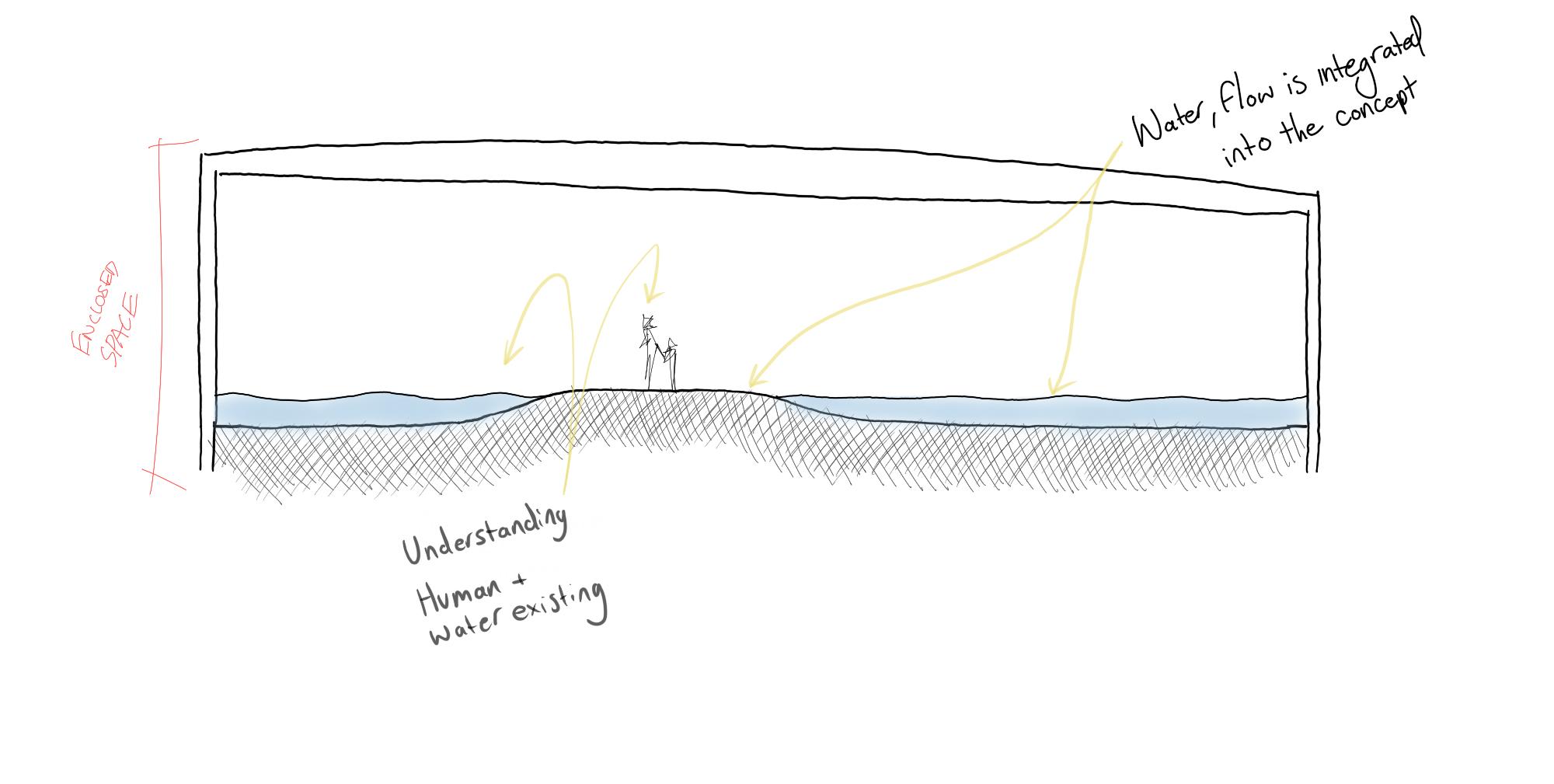
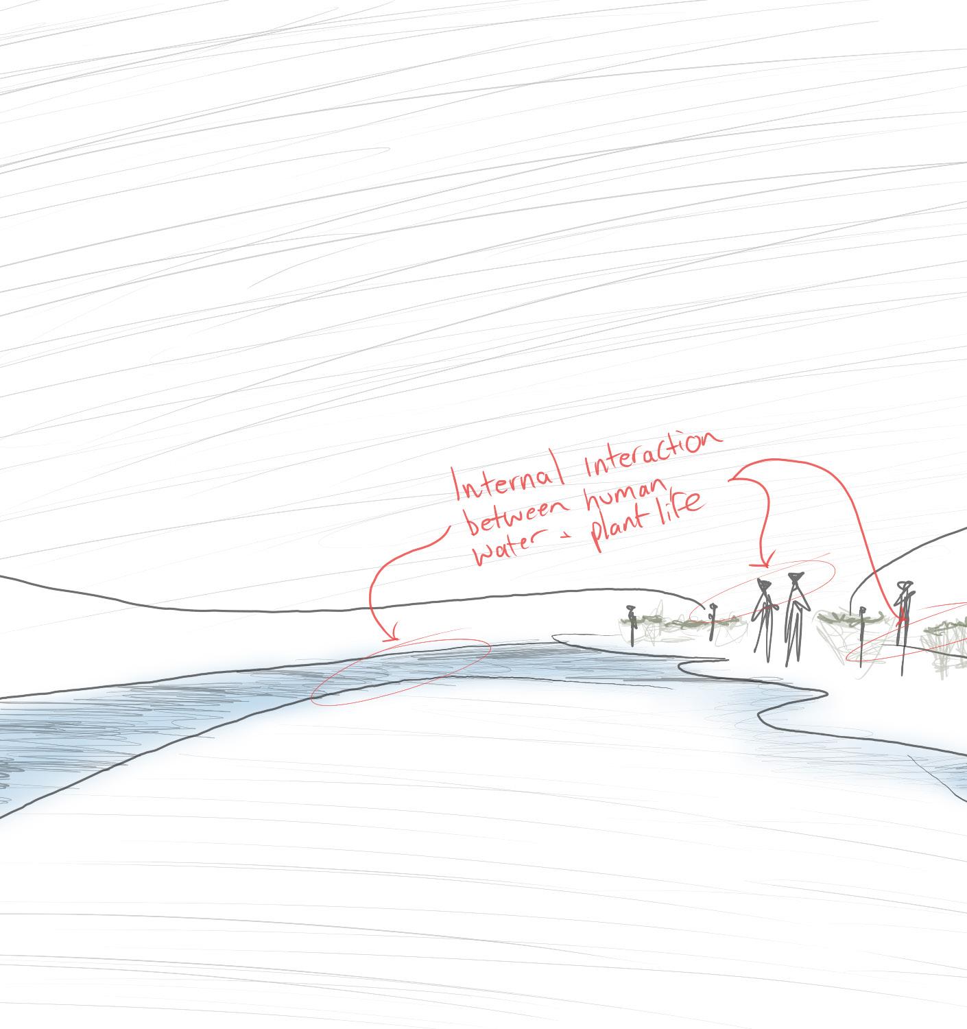
Driven by the ostracization of nature within Chinese cities, the Architects of this project were driven to create an integration between nature and the built environment.
“So, the question is, how to treat environment and architecture as equals in the Chinese context? How to bring environment and architecture as close as possible to each other, how to make the boundary between them as ambiguous as possible, how to make nature the gentlest presence possible for us humans? Such are the themes for this project.”
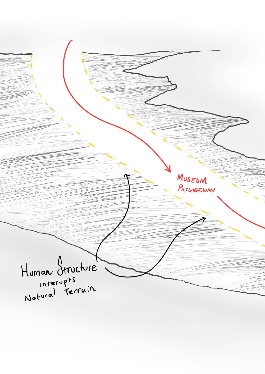
The Museum Creates a Monolithic Structure, interrupting the natural landscape. The integration between Natural material and the body of water creates a new Terrain of Water which blurs the lines between external and internal.
Shown through the diagrams, the architects attempted to minimize floor space to only the necessary passageways. In Floor Plan, we can understand the relationship between water, man and wildlife.
THEORETICAL FRAMEWORK
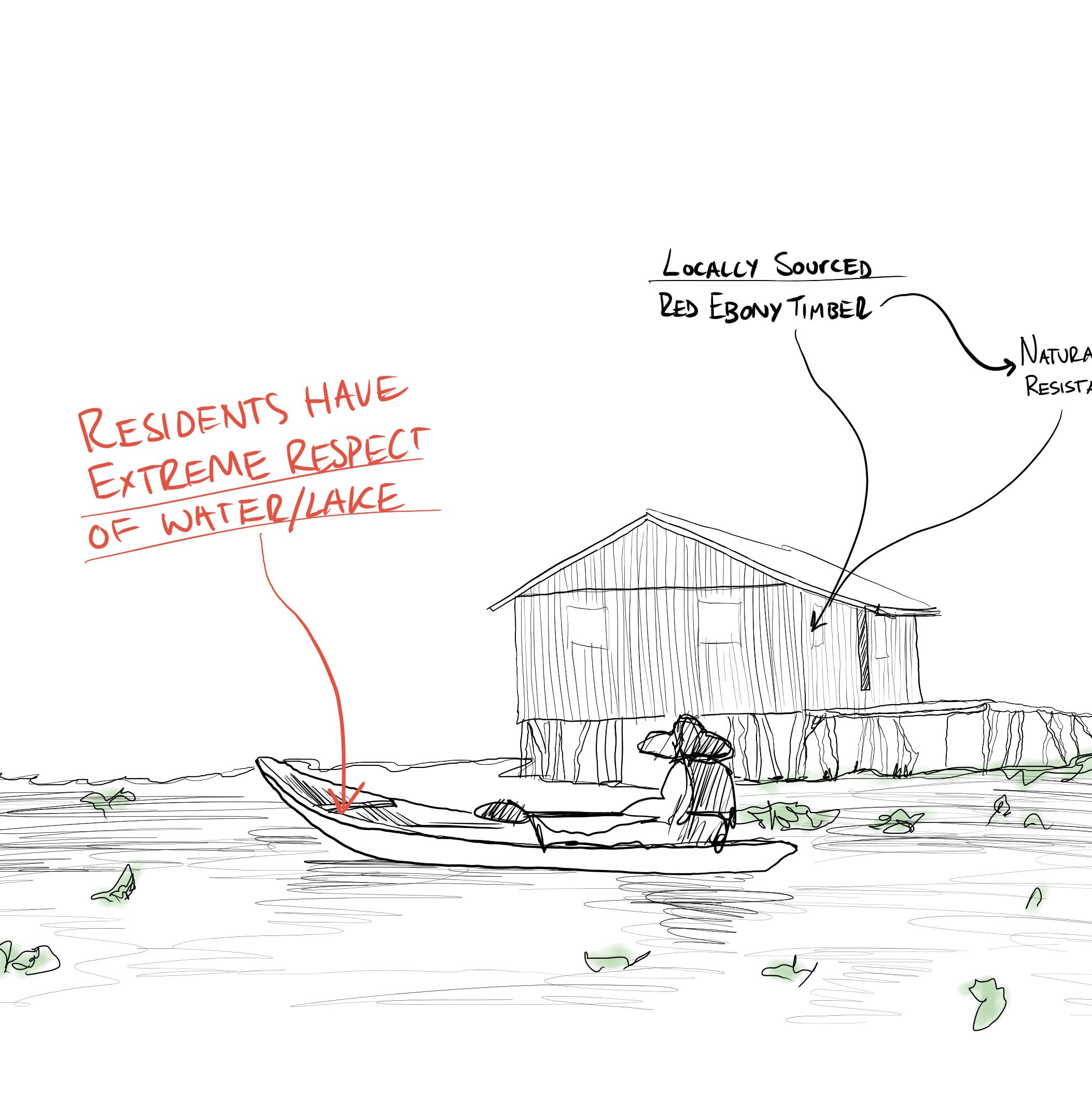
THE FLOATING VILLAGE OF GANVIE
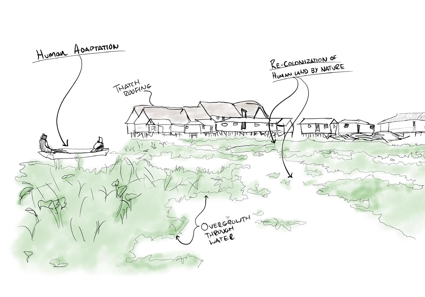
Location: Ganvie, Benin, North Africa
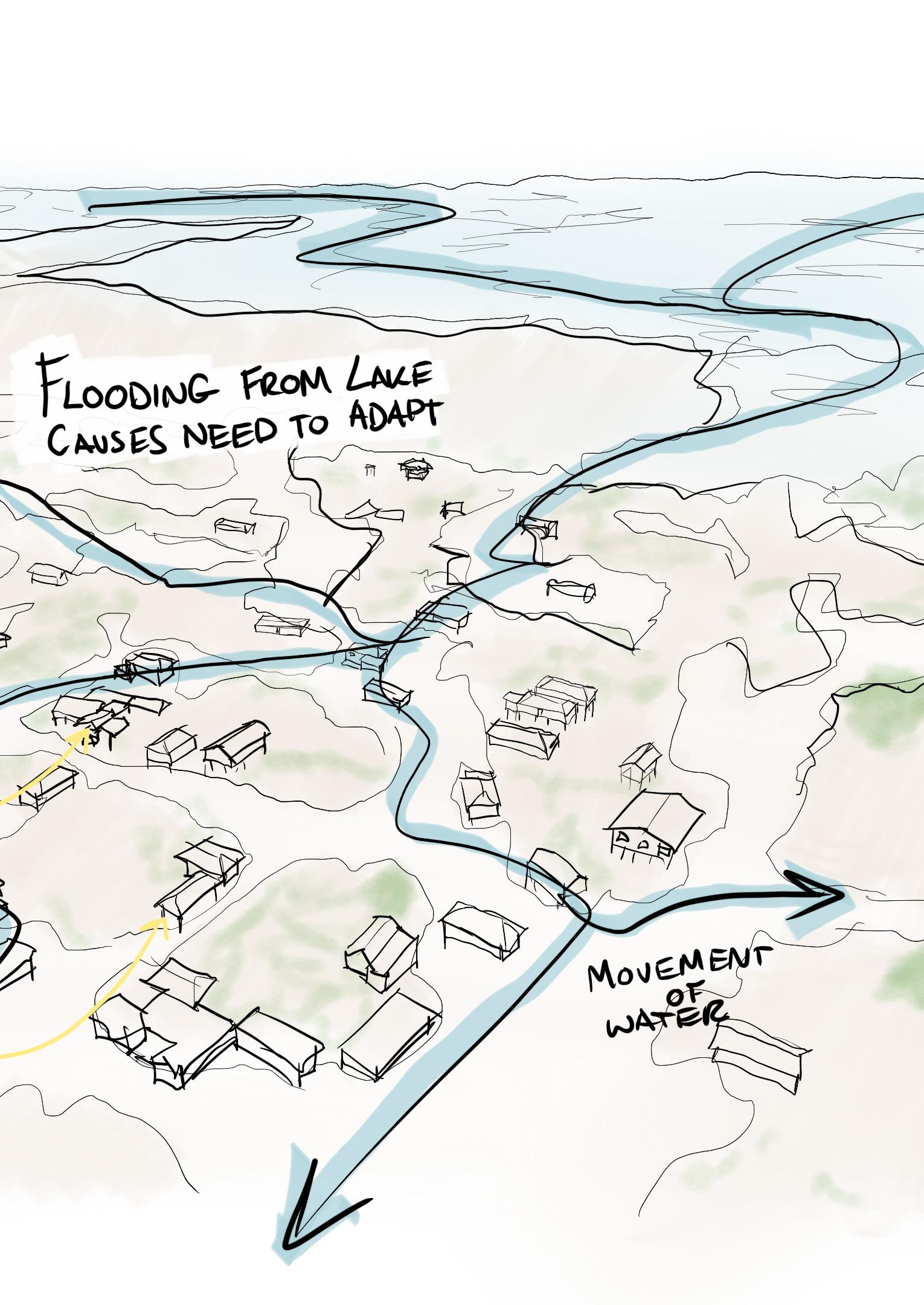
Ganvie, the largest floating village in Africa, located in Benin, was founded by the Tofinu tribe in the 17th century as a refuge from the slave trade.
Its unique architecture and urban layout, characterized by colorful stilt houses and artificial islands, reflect the tribe’s history and relationship with Lake Nokoué. The village’s socio-ecological systems, including aquaculture and traditional building practices, have sustained it for centuries.
The overgrowth of plant life due to the surrounding water provides a glimpse into the potential future of human integration with nature.
Residents Adaption to the Natural Landscape of the Area is derived from a cultural respect for the Lake and bodies of Water.
Reknowned as a sustainably designed village, Homes are built on timber stilts and craeated from locally sourced materials such as Red Wood timber, Reused corrugated steel sheeting and Thatch Roofing
THEORETICAL FRAMEWORK
UNITED STATES, GAZA HUMANITARIAN FLOATING
Location: Gaza Strip, Palestine
Following the ongoing war and humanitarian crisis engaged in the Gaza strip, The US military attempted to create corridor of humanitarian aid that could be used to accommodate shipments of food, water, medical supplies and more that could be used to help the people ing aza who are currently facing famine, thirst, medical emergency and mass relocation.
With a design stretching over 550m into the depths of the Mediterranean Sea, and using a Joint-Logistics-Over-TheShore (JLOTS) modular floating system that can be extended and reduced according to the site conditions and needs of the user. The pier is an example of using a pier in an unconventional way to act as a tool for providing access to aid for vulnerable communities.
Although initially successful, the pier would eventually capsize due to harsh weather conditions, affecting the turbulence of the waves of the ocean. Despite this, the pier would be repaired and would continue use, operational for 20 days and delivering 8,800 tonnes of aid. It would eventually be retied from use, for a third and final time due to high sea states affecting its ability to be successfully used.
As a prominent, topical and poignant example of the potential use of a pier, and the floating mechanics that can be used (sometimes unsuccessfully) to counteract the violent fluctuations of the waves, the Gaza Humanitarian Pier fits as a precedent I can use to further explore the relationship present between egalitarian programs existing on the typology of
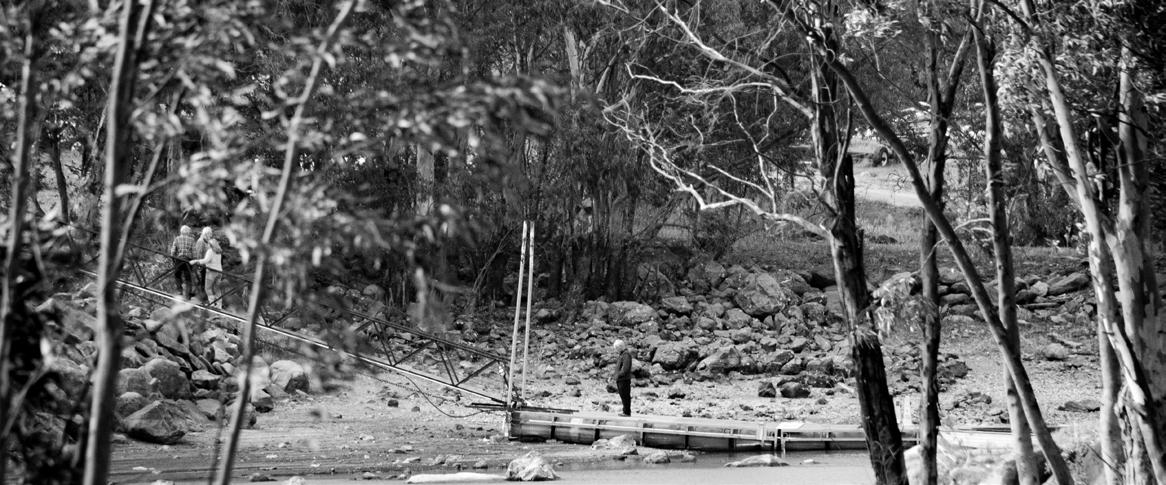
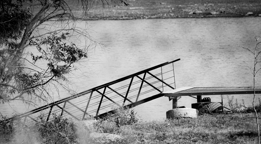
ANALYSIS OF THE VAAL MARINA:
WHO USES THE EXISTING PIER?
HOW IS IT USED?
Existing uses of the Pier include storage and mooring for existing Yachts, and member only events and camping.
THE VAAL MARINA AND HOW LAND
IS CURRENTLY USED
The land use of the existing Pier/ Yacht club shows an overwhelming amount of private land. Only accessible through membership and an ostensibly classicist perspective on the right to access the waterfront.
Other spaces around in fenced off, unused land waiting to be bought and presumably used for more clubhouses, camping grounds or restaurants.
CONVENTIONAL USES OF THE PIER
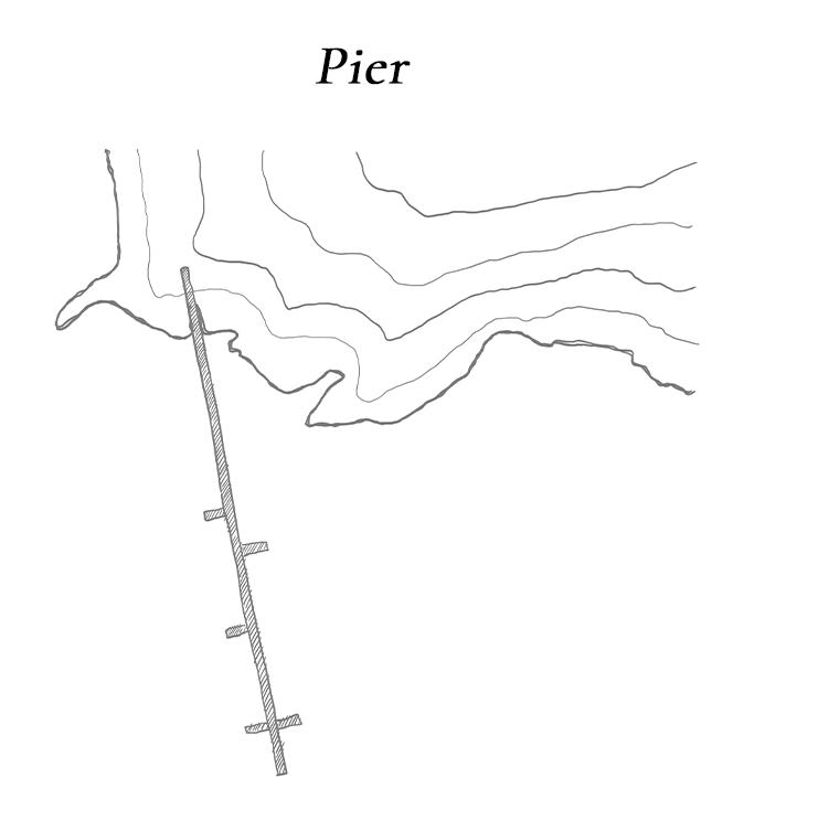
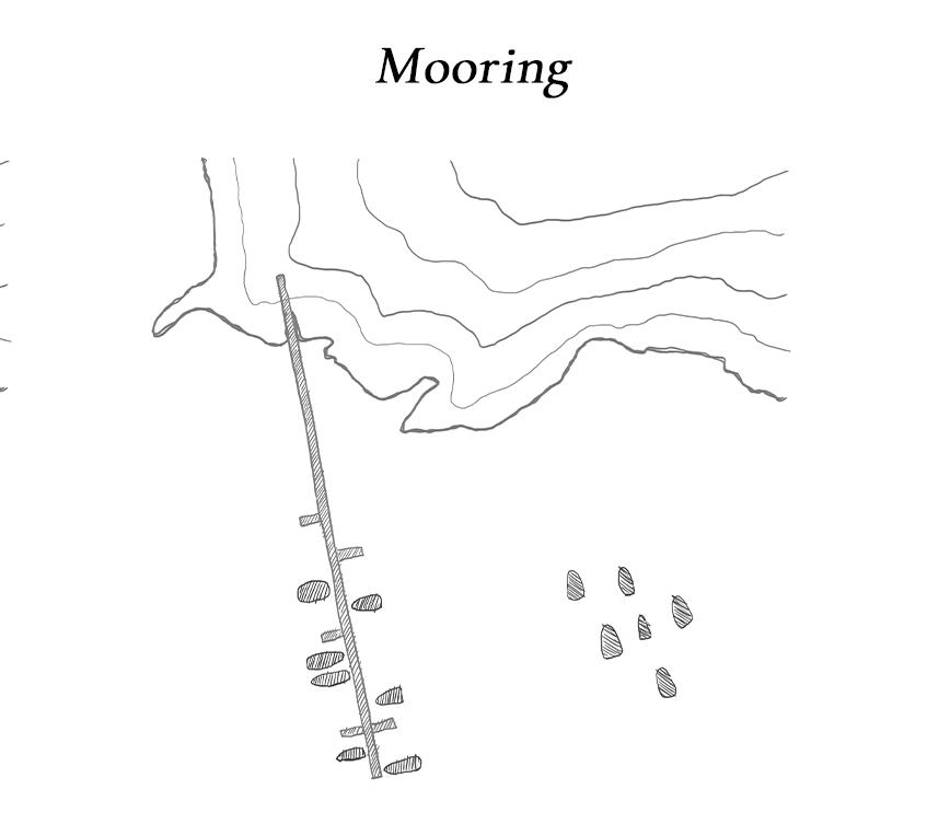
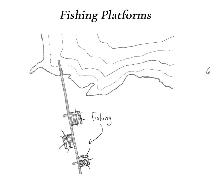
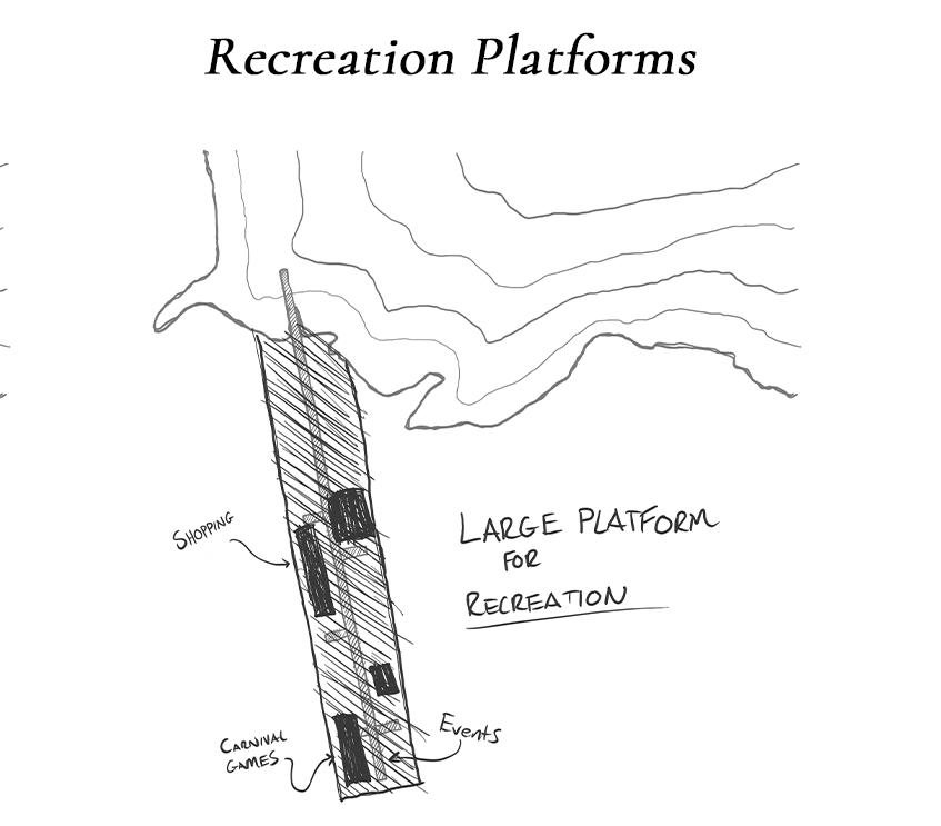
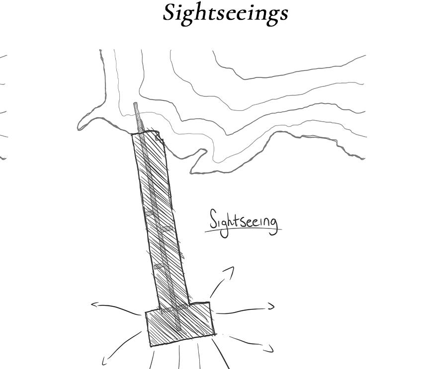
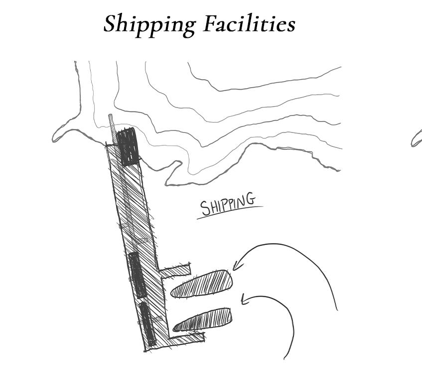
Current uses of piers in the Vaal Basin perform to serve singular or restricted programs. Namely yacht mooring, racing and repair. Other piers in the Vaal are used for fishing and sight seeing. Through the above diagrams I mapped out the most common uses for piers to our current understanding of pier design, and how the typologies are affected based on the program.
It is clear that most pier designs are pragmatic in order to serve the singular purpose they may have.
THE SPECULATIVE POWER OF THE ‘PIER’
USING COLLAGE AND IMAGE GENERATION TO IMAGINE A COMMUNAL PIER SYSTEM
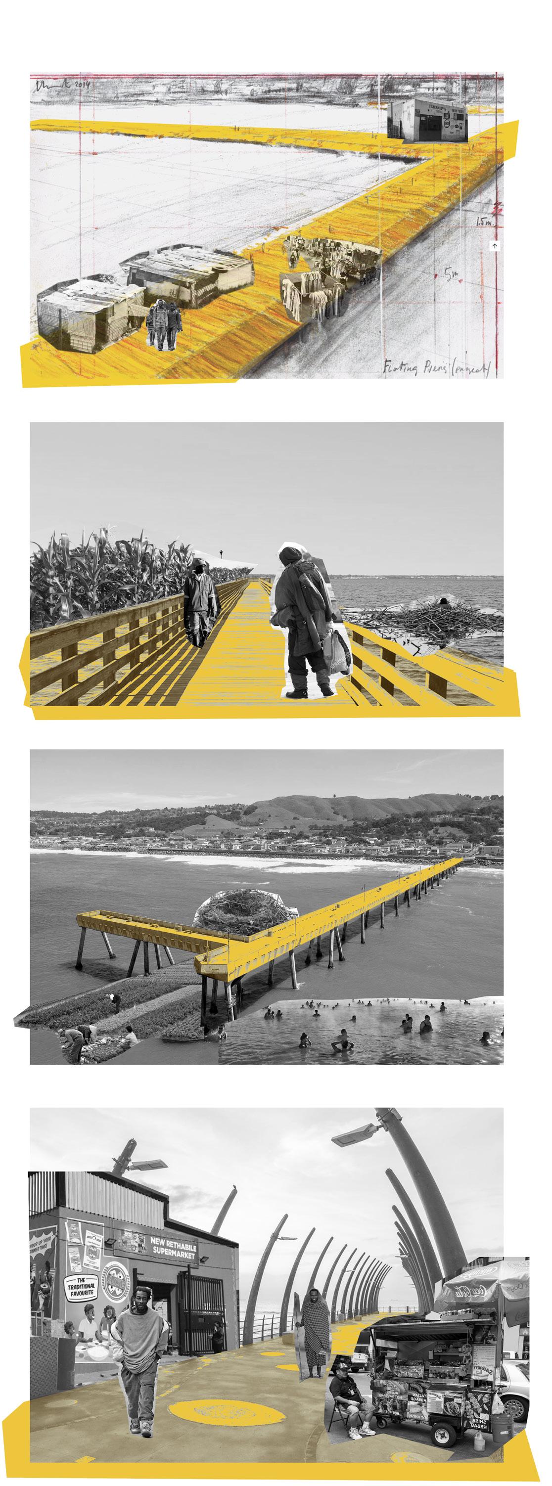
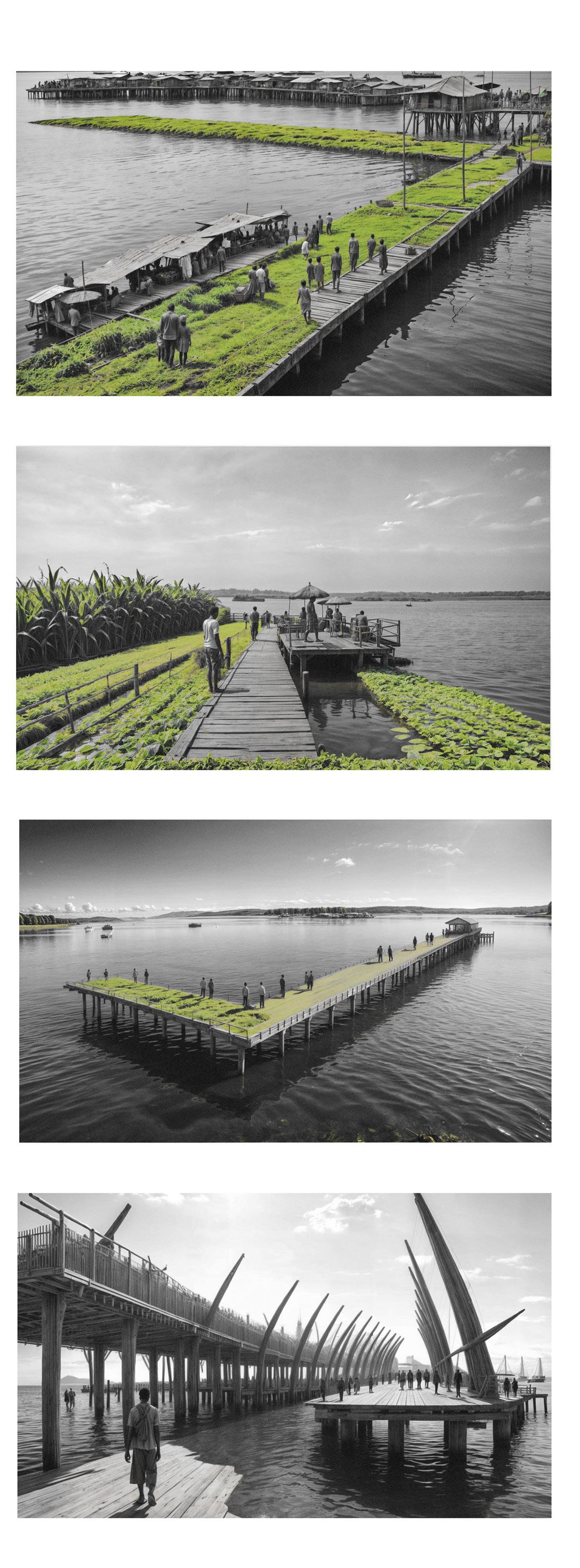
To begin speculation on unconventional and existing uses of a pier structure that are not yet widely used or conceptualized, I began thinking of contradictory and abstracted programs that may provide an exciting challenge from the program of a pier. Furthermore, I wanted to design a space that functions as a multi-cultural and classless public system that works to the needs of the community.
Collages of unconventional programs on existing piers are fed into machine learning generative programs and help visualize new and exciting speculative Piers.
MODEL MAKING AND SITY EXPLORATION
Putty, mesg and support create a sectional representation of the chosen site contoutrs
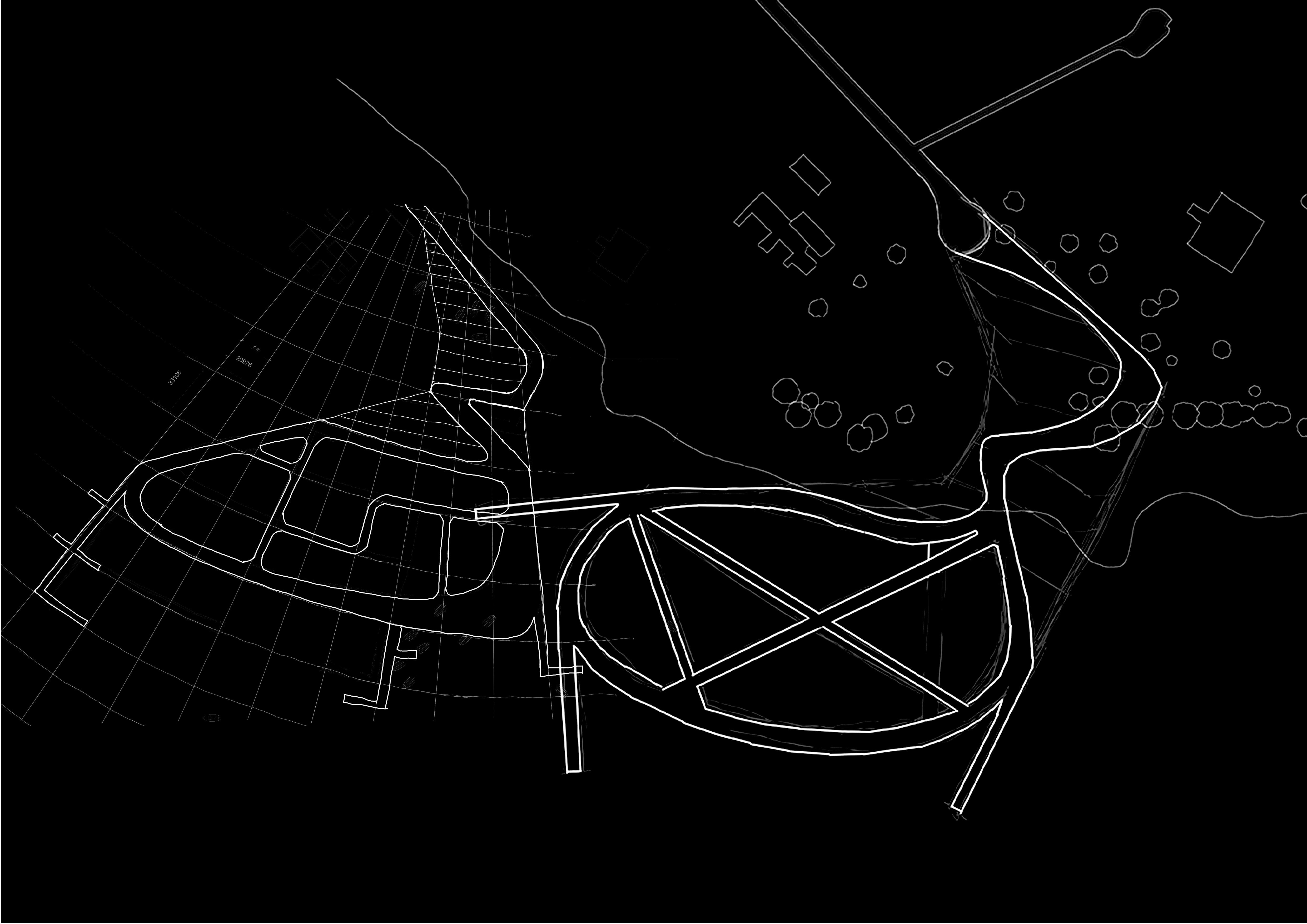
REINVENTING THE PIER
ARCHITECTURE AT THE INTERSECTION OF AGRICULTURE, ECOLOGY AND COMMERCE
After the process of visiting, examining and analyzing the Vaal Lake and the people who reside in its context, the process soon moved to designing an intervention that sat in the intersection of our interests and what the community lacks.
What most interests me was combating the intense privatization of the Vaal’s water fronts through a design that emphasizes public access and communal activity. As the Vaal marina acts as a holiday destination for wealthy holiday-homeowners and those who can afford the luxury of a yacht, I felt an interesting drive to engaging in dissolve the contextual areas as a spot for those in a higher income bracket.
Initial considerations and potential design challenges arose from the concept of removing the current programs existing on my chosen site. As the existing Yacht club provides current members with storage for their boats, spaces for events and camping, sailboat racing and other family activities, I had to consider either completely removing the current uses of the site for my intervention, or adapting the existing programs and combining them within the design of the new pier. Ultimately designing a space that is multi-use, and adjusts to the needs of the entire community.
For this reason I felt the architectural typology of the pier felt the best foundation to began exploration in an intervention that could act in egalitarian purposes while being able to react to fluctuations experienced by the community of the Vaal Marina on a fairly regular level. As the typology of the pier
is still quite unexplored in the architectural sphere, I felt there would be some interesting opportunities and gaps in current research that would provide me with a greater experience in developing my concept.
Furthermore, I felt that engaging with the pier was best to explore the kinetics and dynamics that are so prevalent through the motions and fluctuations of water, as a potential architectural device that is so intrinsically connected to water and its adaptation to it.
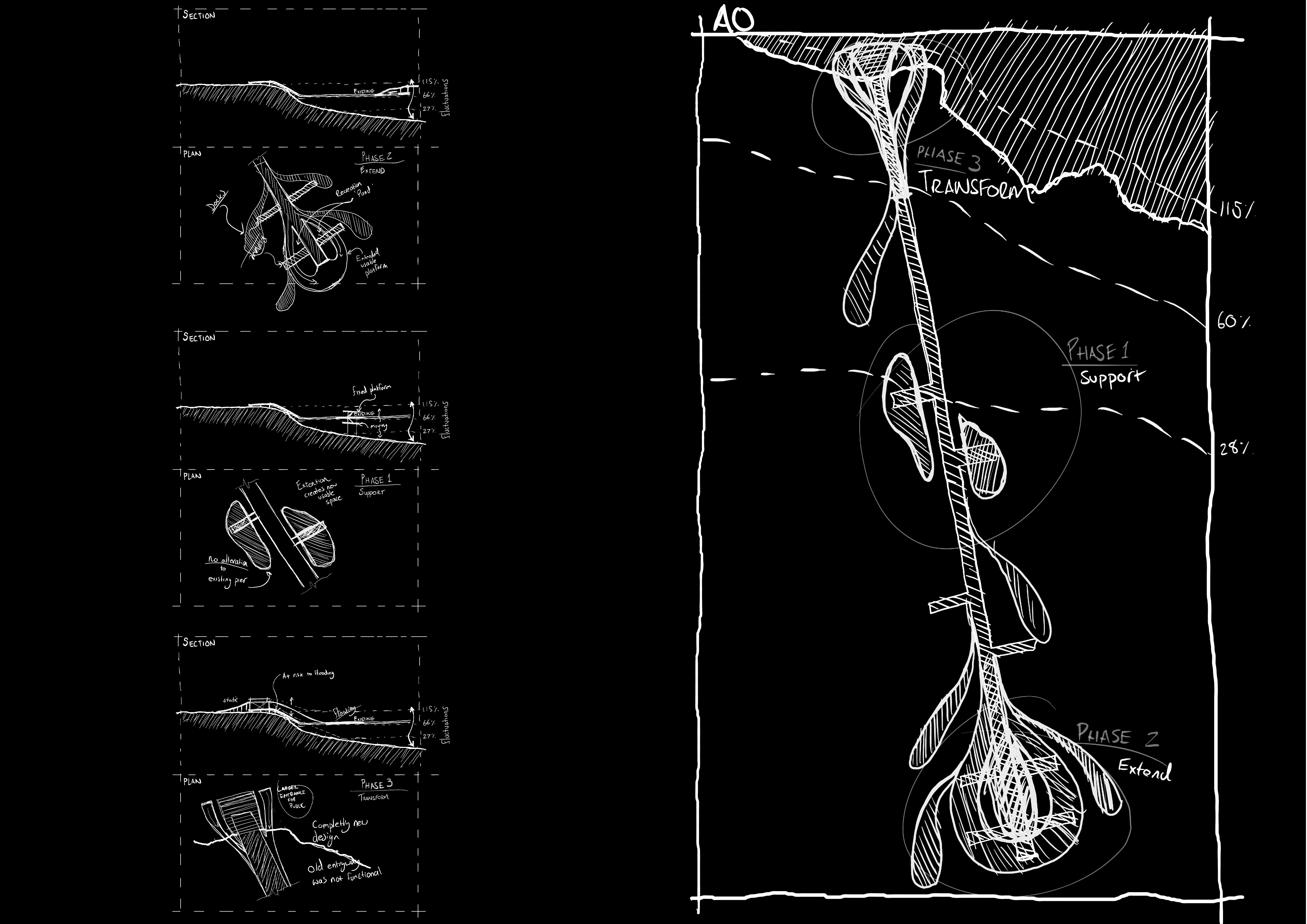
The intial concept for the pier began as a experimentation on phasing and adapting the existing pier on site. Each phase would be at a difference stage of redesign. Support, Extend and Transform, with each phase undergoing a larger change in structure and aesthetic.
PIER ITERATION #1
Q2 DESIGN
The conception of my pier design was based on existing precedent and pragmatic designs. Around the end of Quarter 1 I conceptualized a pier stretching out into the lake, providing access for fishermen and holiday goers alike.
I found this design to be ineffective it truly opening up the water for public access, so I sought to redesign it with a greater emphasis on engaging the shore line.
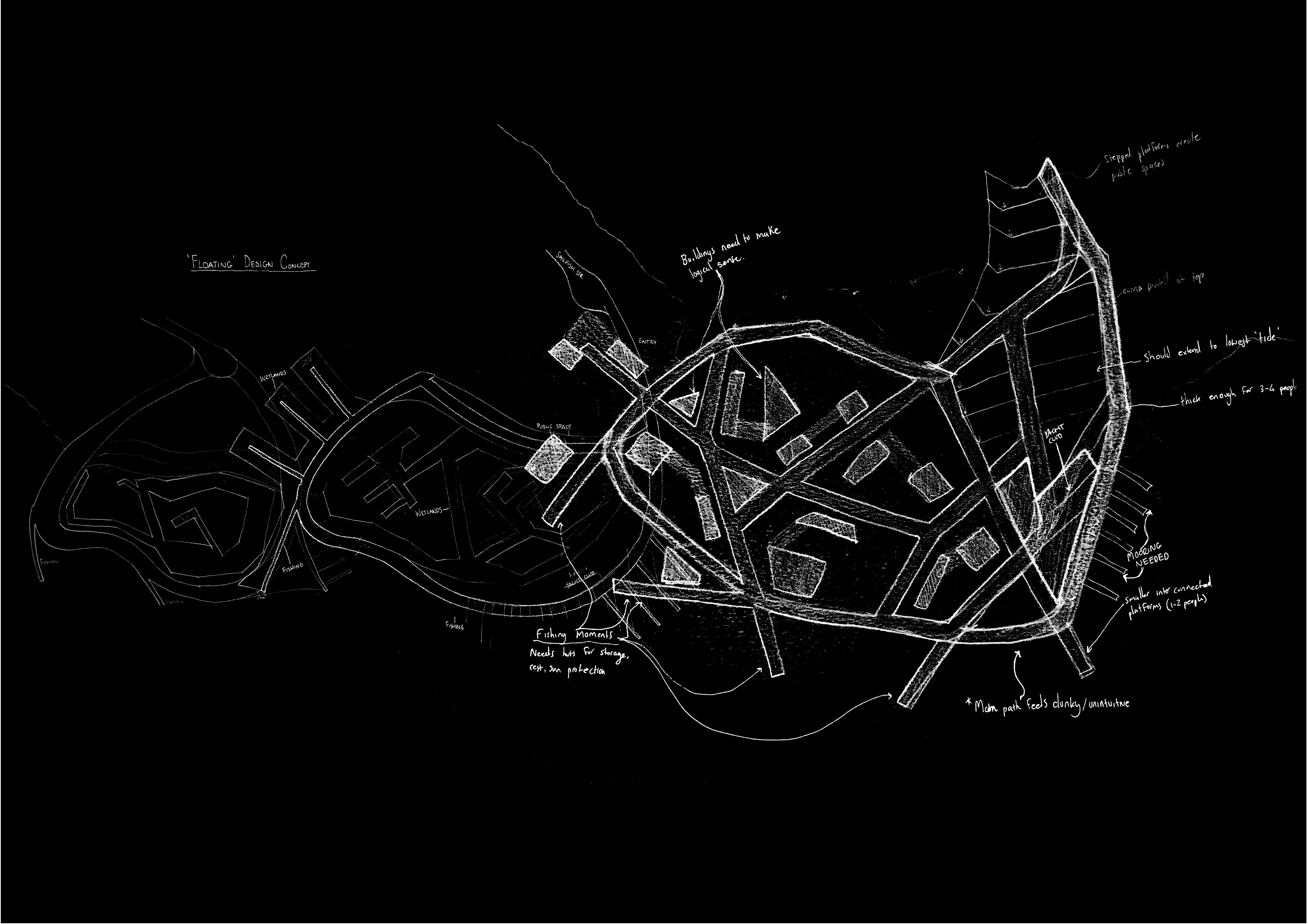
As I began to further develop my concept, I continued my interest in engaging the waterfront now along with more egalitarian programs such as farming, shelters, and markets while still maintaining a spot for the yacht owners.
Experimenting with modular based designs, the pier became larger with each iteration, as I found a balance between agricultural programming and structural pier designs that stretched out into the depths of the lake.
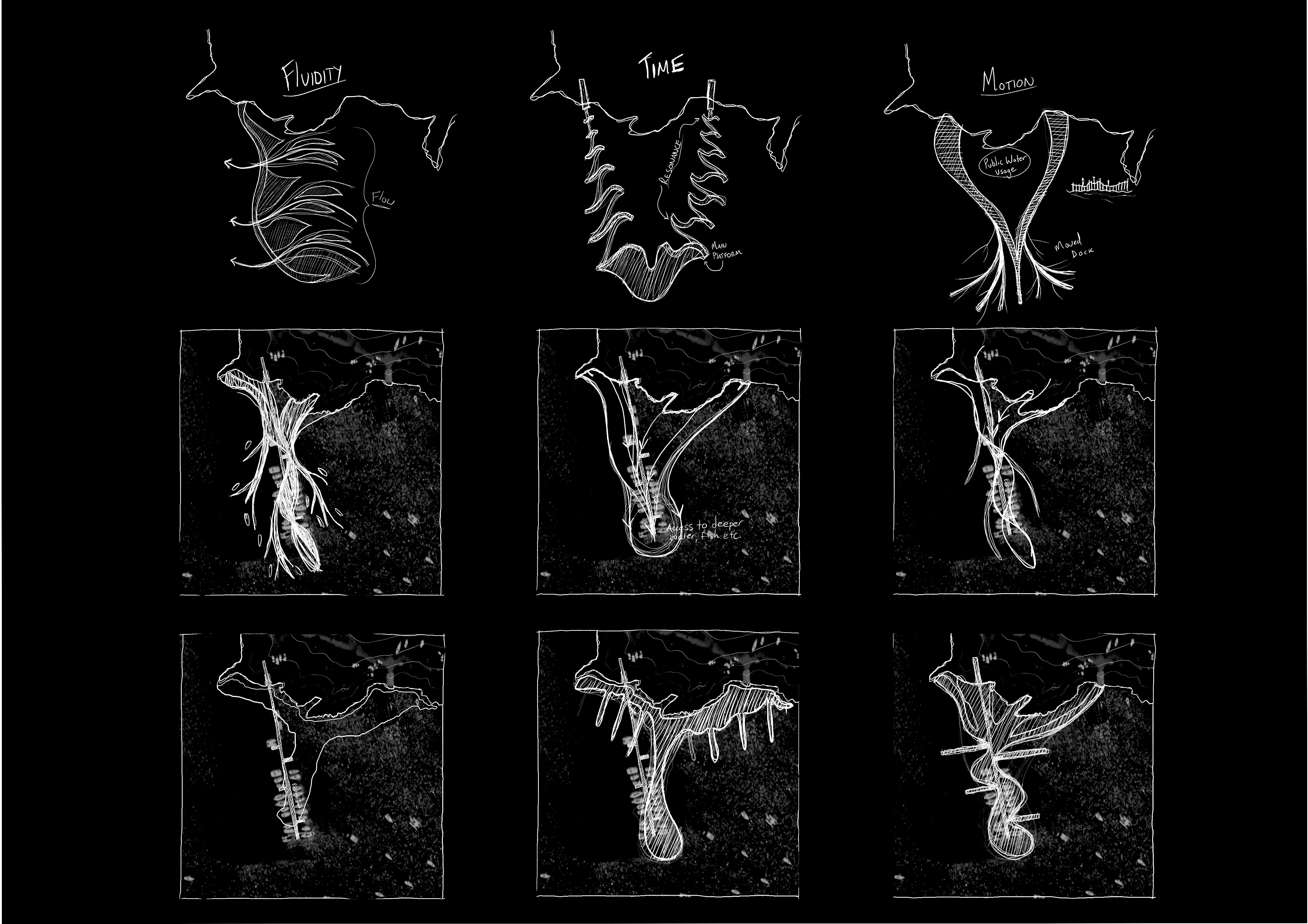
With a now larger scope and understanding of the piers functinalities, towards the middle of the year my pier engaged in a loop shaped design that provided ample access to the water from all angles, with floating mycelium modular units making up the agricultural wetlands, and floating pathways guiding users throughout
Where I felt this design failed was the large structural and rigid pier design on the south side. It bulky and abrasive design took away from the lightweight, dynamic, floating deisgn that followed the agriculture and hut areas. This design felt like a step away from the fluid and performative experience portrayed through my films.
Moreover it didnt provide a succesful passage to and from the entrance of the site, feeling disengaged.
As I continued through the year, I began to more realistically ground my deisgn into the contextual elements of the site, using a grid and the existing road to act as guidng elements.
I attempted to continue with emphasising the access to the waterfront, however the pier dsign began to feel buly and acting at too large a scale.
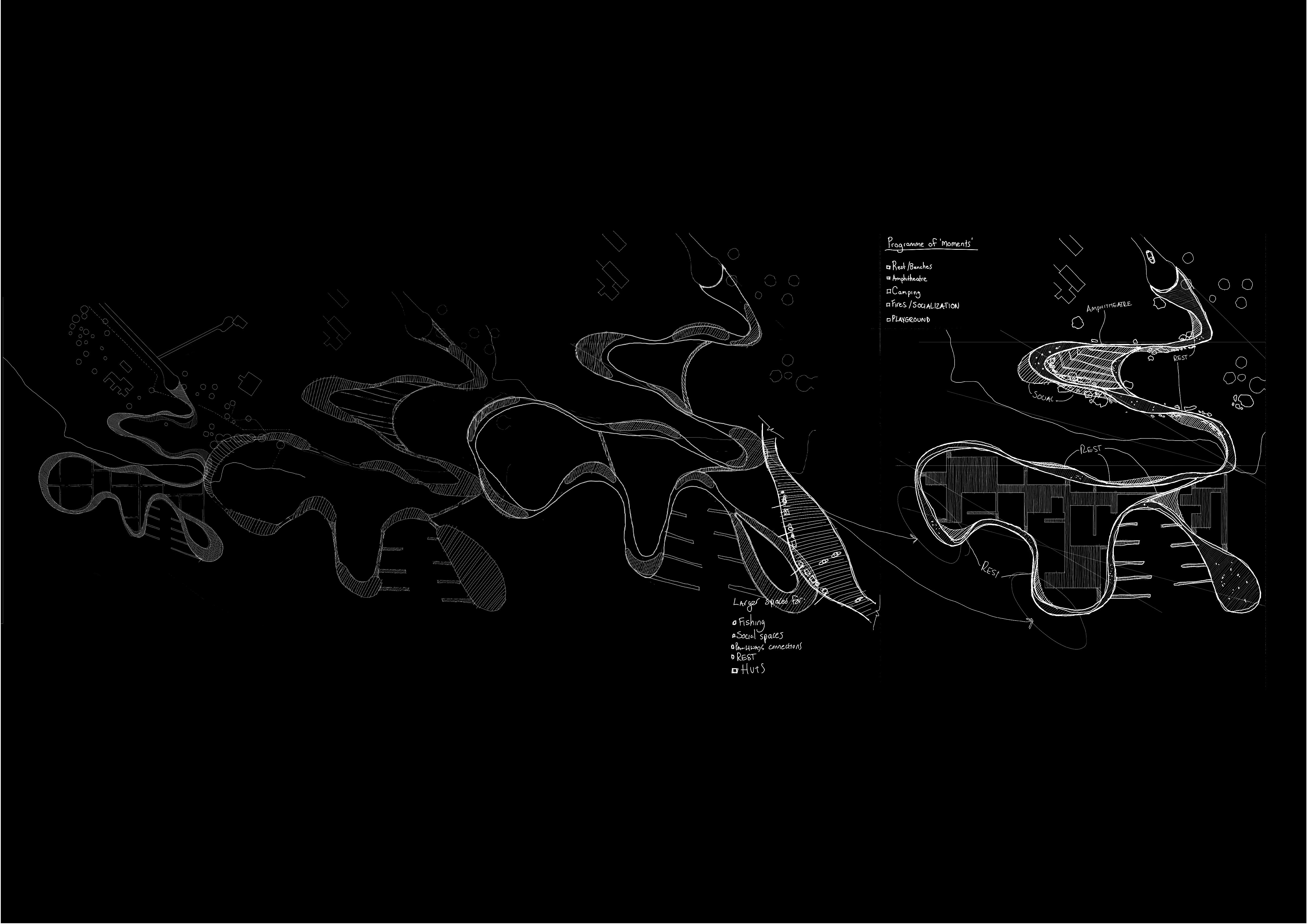
Through a iterative process, began experimenting with a more fluid pathway design that lent itself to an adaptive pier where nessesary, This would be more inspired by my analysis of my films, as I wanted to emphasize the motion and fluidity of the water.
The whole design would be seamless and use floating structural elements that helped further engage the connection to water the user would experience.
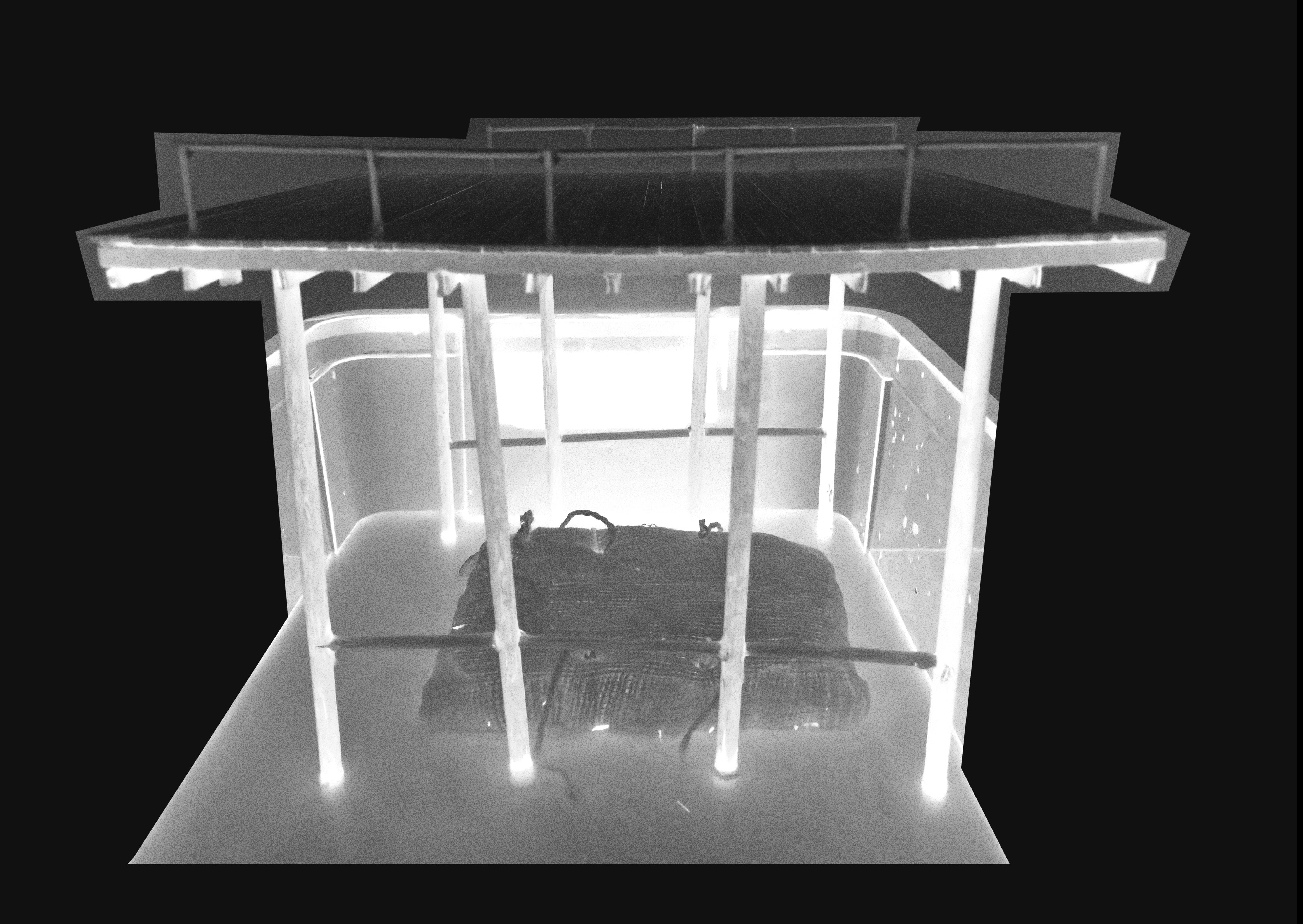
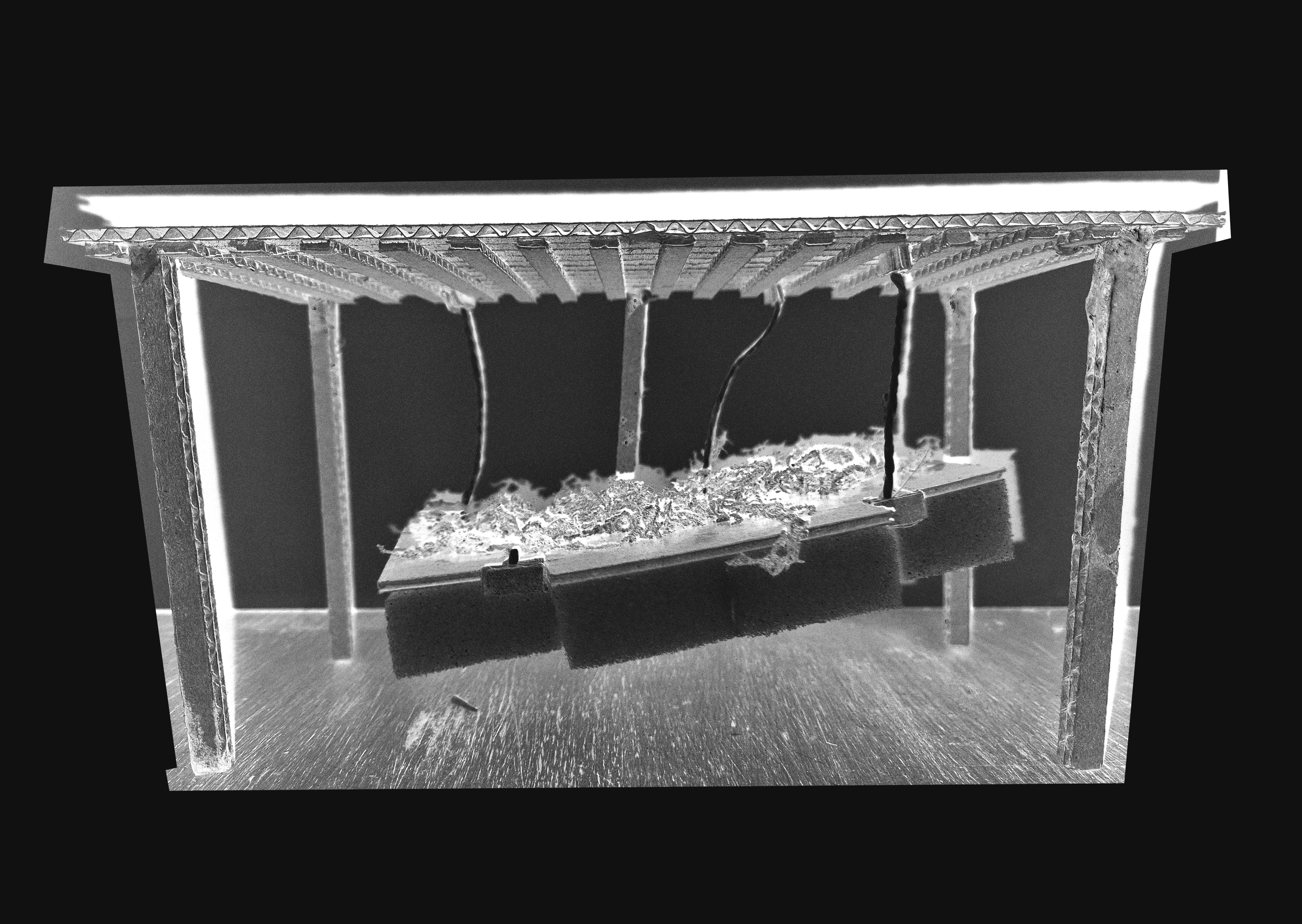
STRUCTURAL MODEL EXPERIMENTATION
LARGER FLOORS FOR FISHIN AND SIGHTSEEING
WORKSHOPS AND RECREATION SPACES
MEANDERING PASSAGEWAY
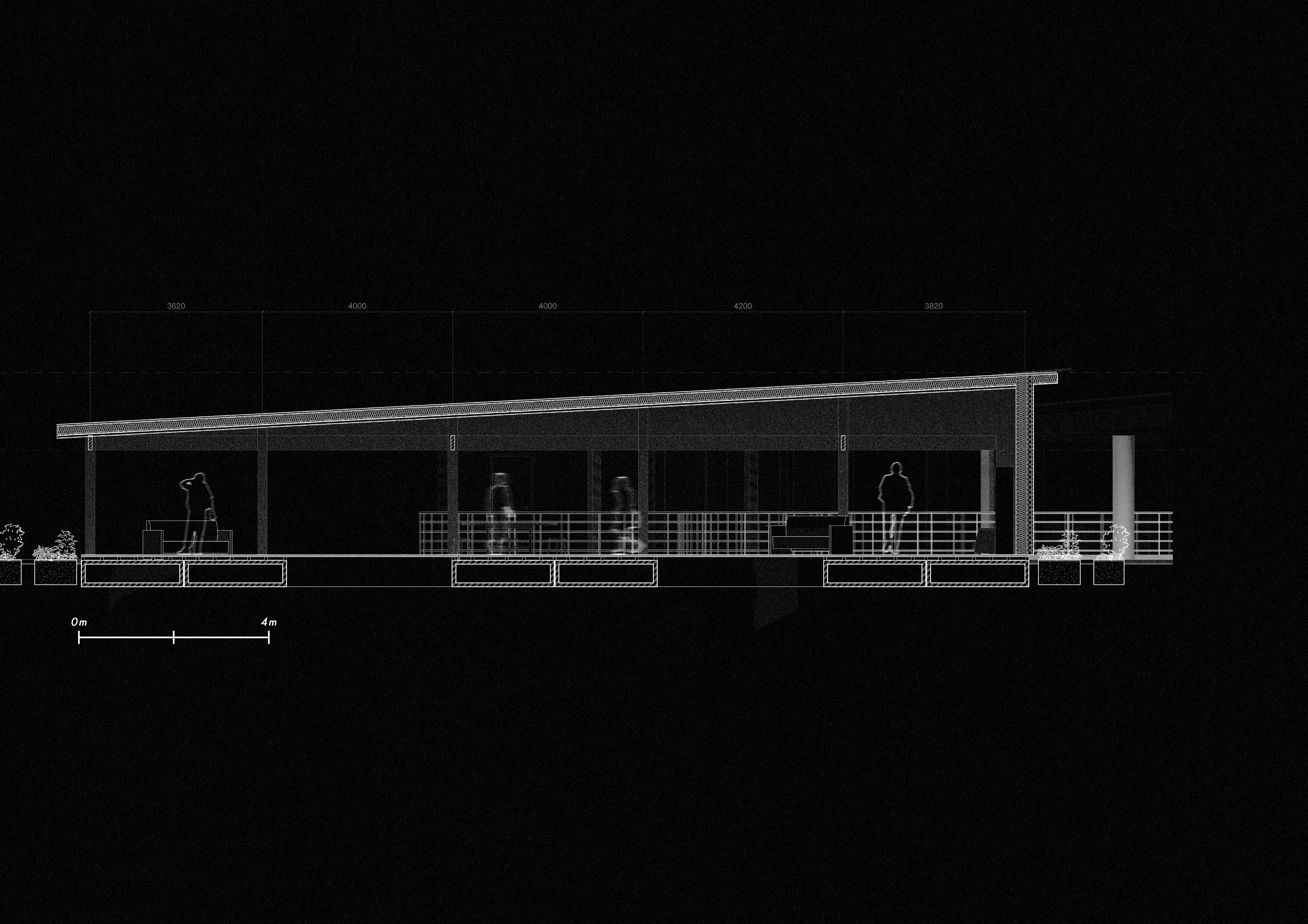
FINAL PIER DESIGN

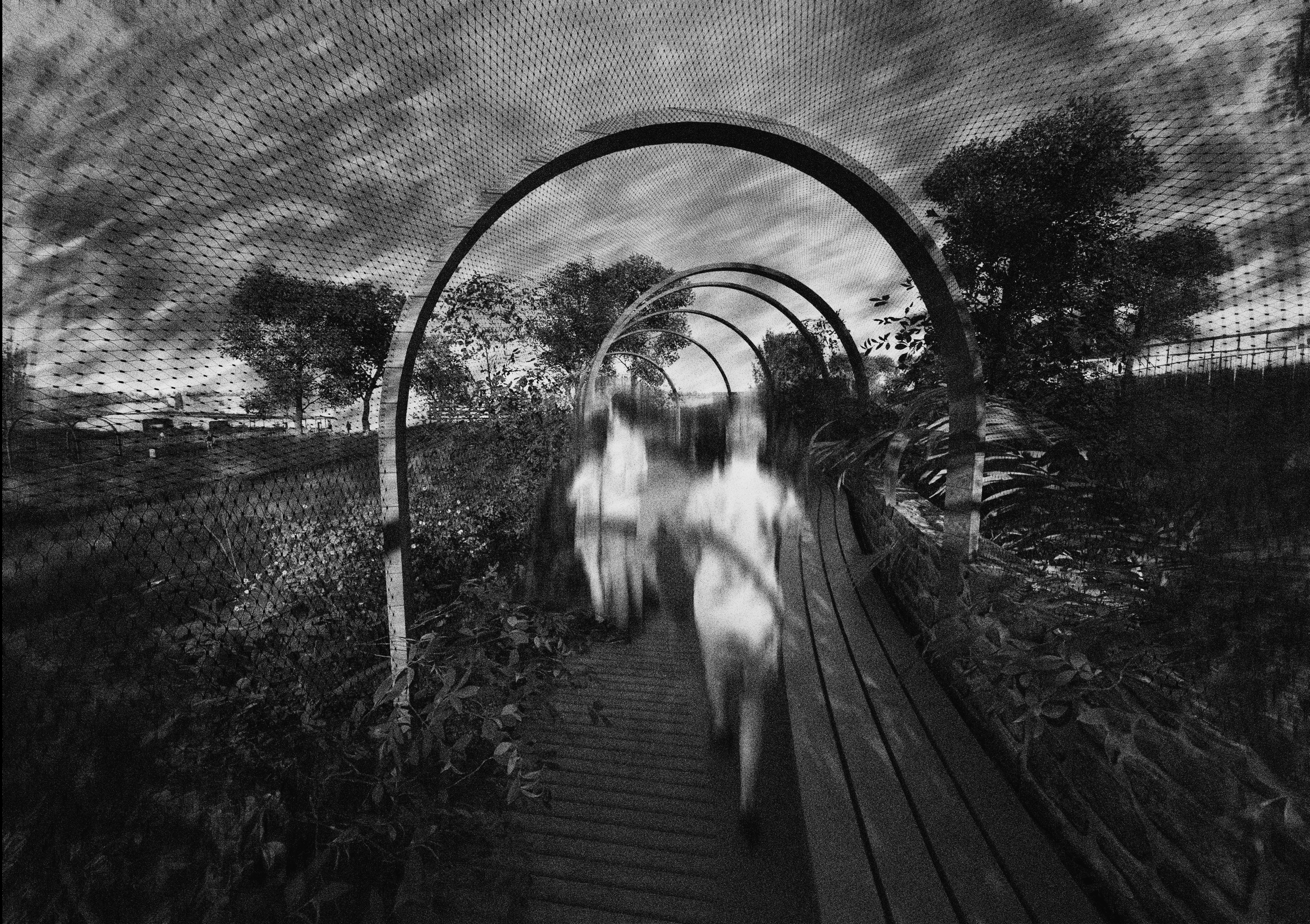
TIMBER CANOPIES AND MESH TUNNELS
ARCHITECTURE AT THE INTERSECTION OF AGRICULTURE, ECOLOGY AND COMMERCE
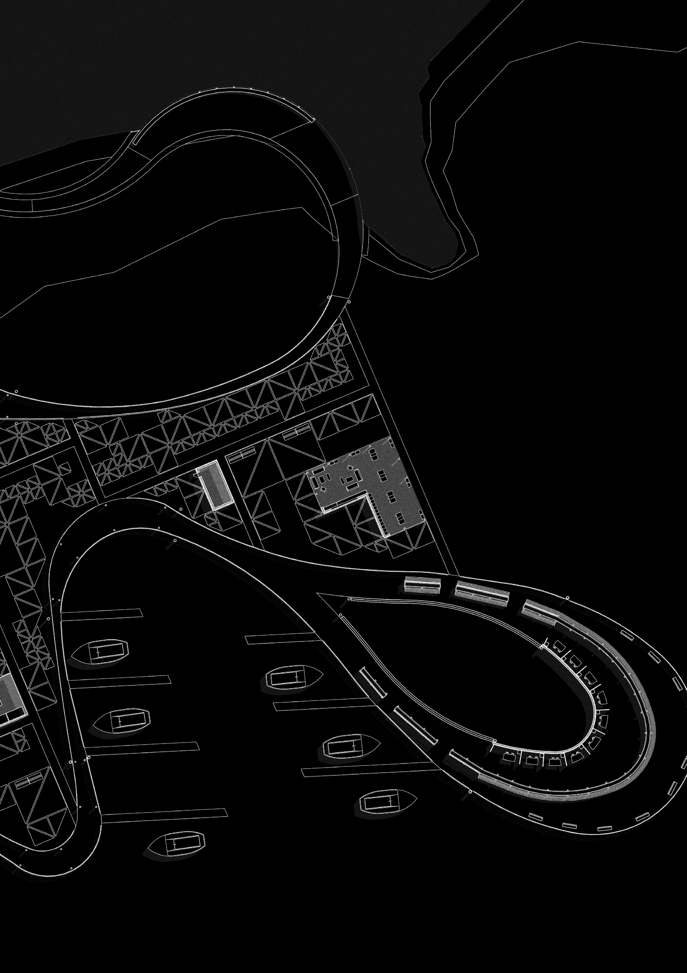
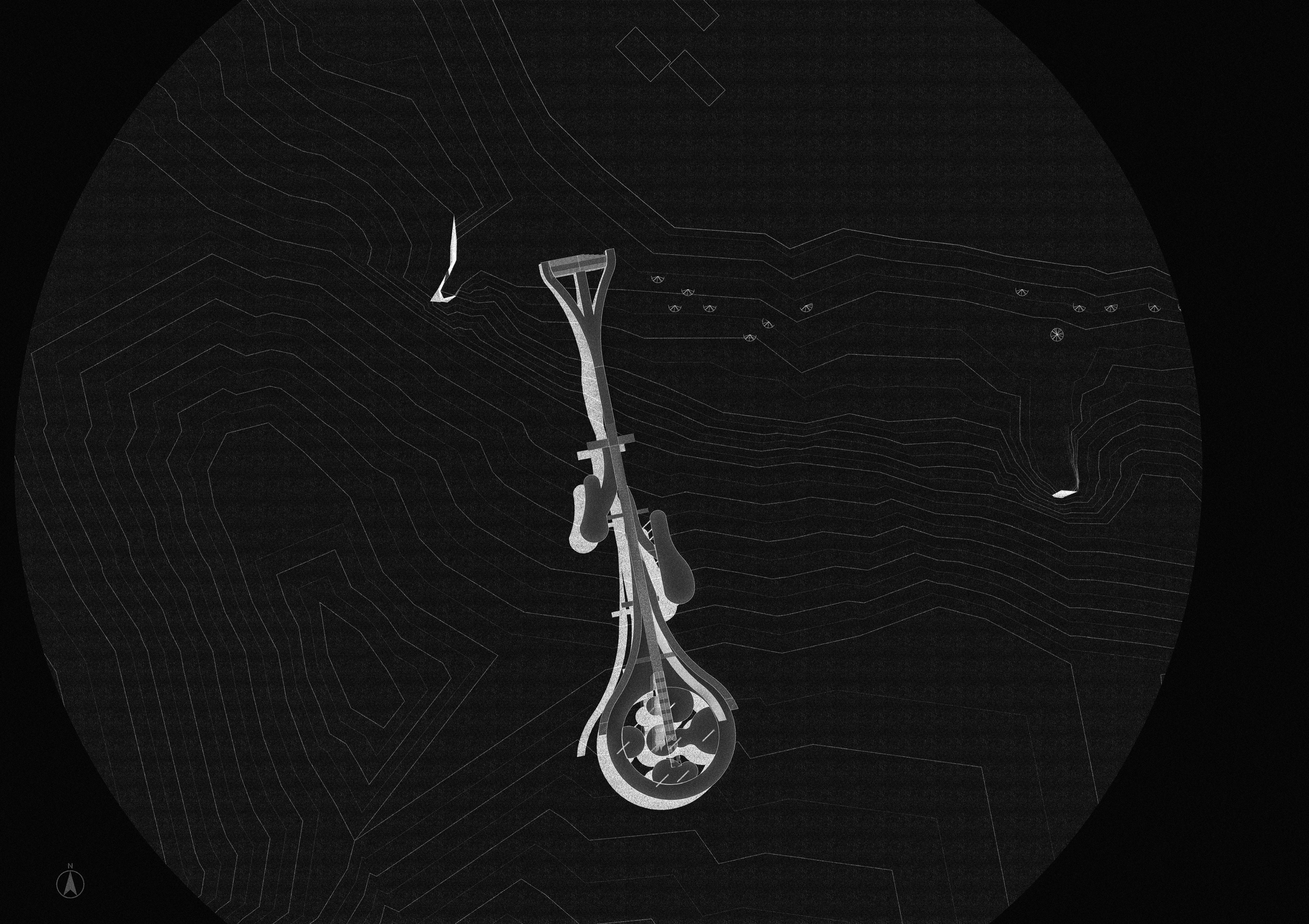
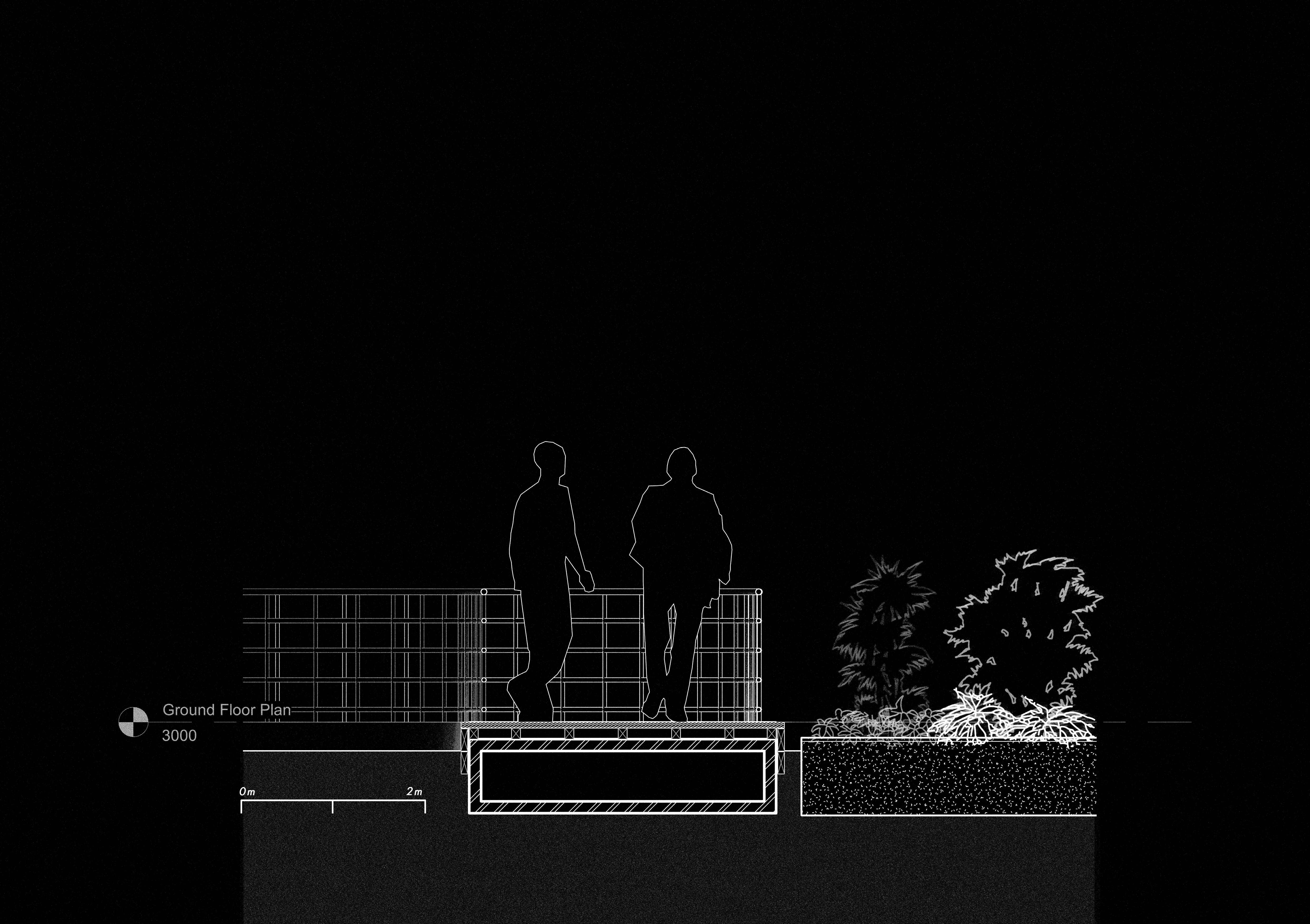
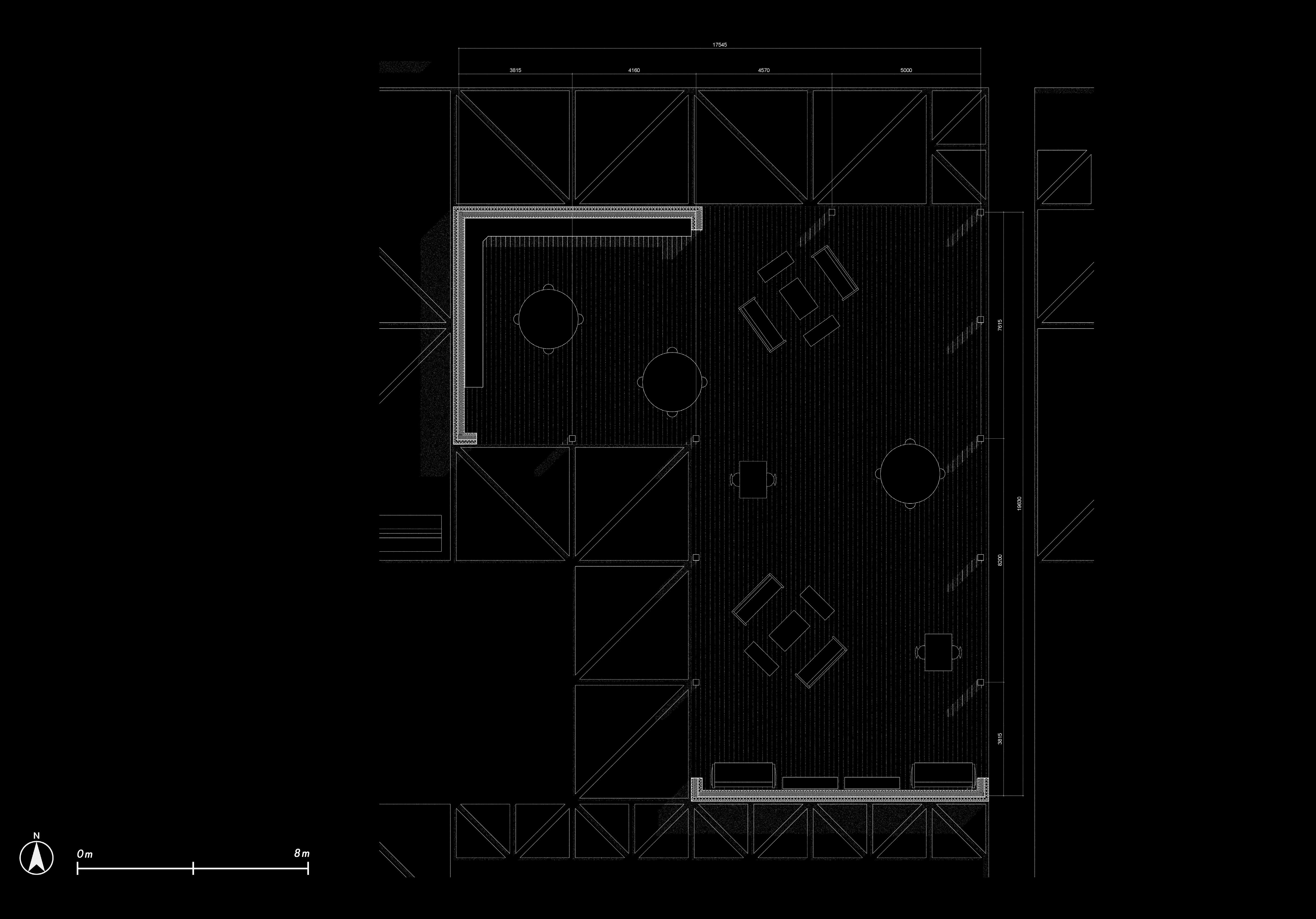
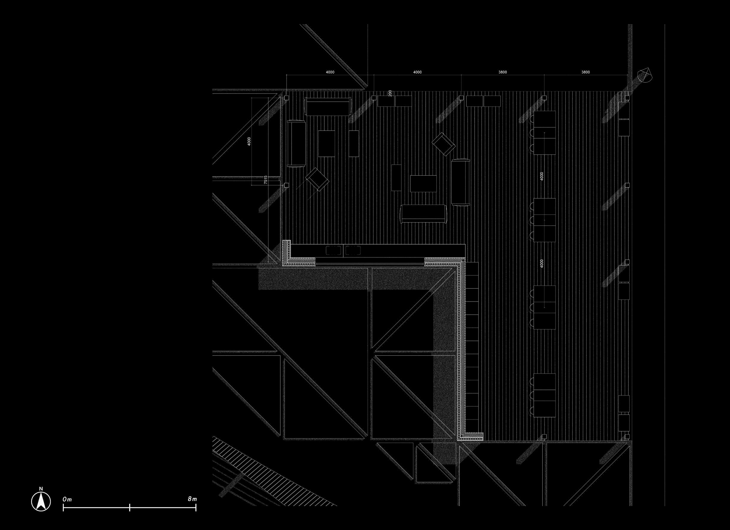
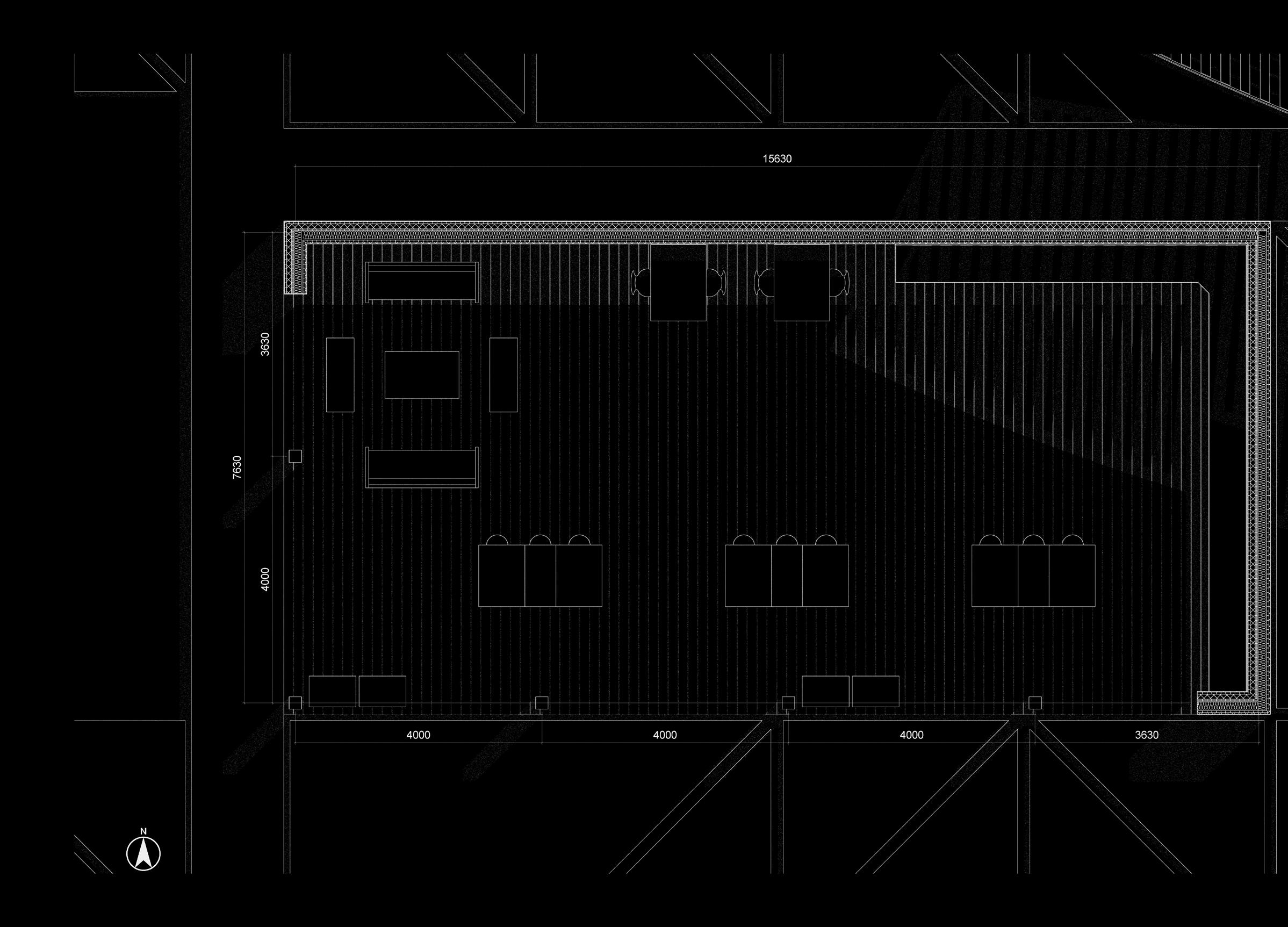
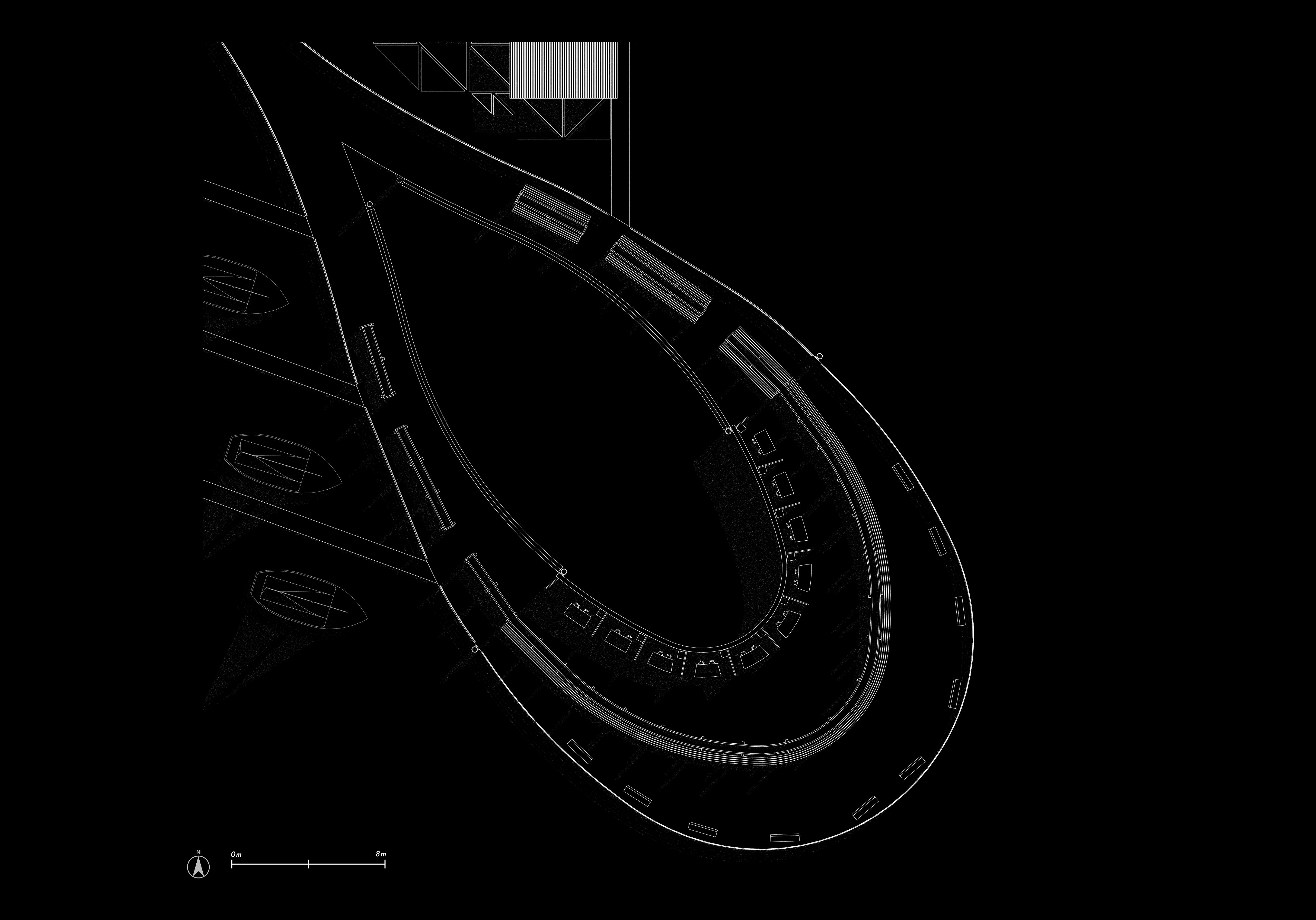
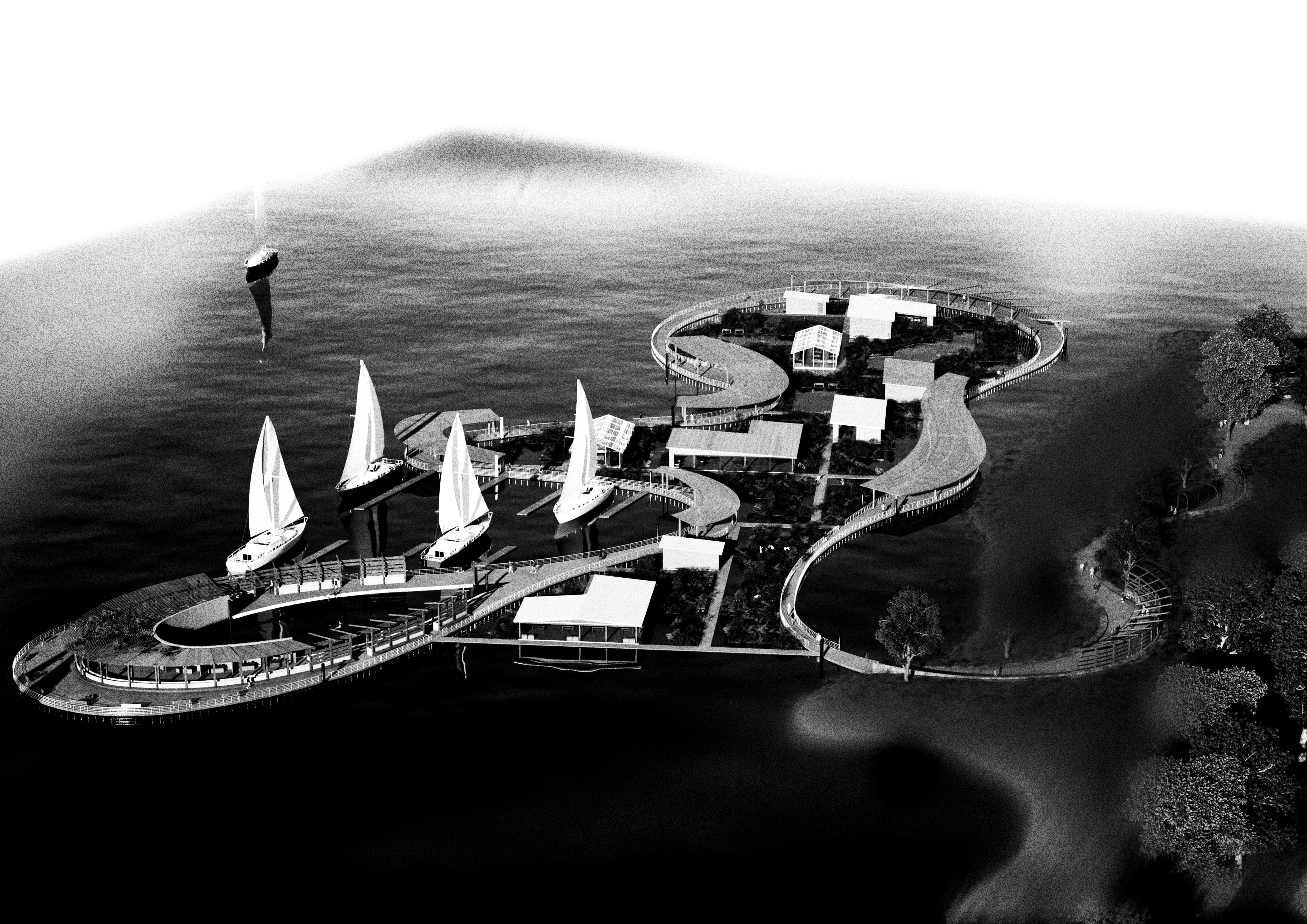
GROUND FLOOR PLAN
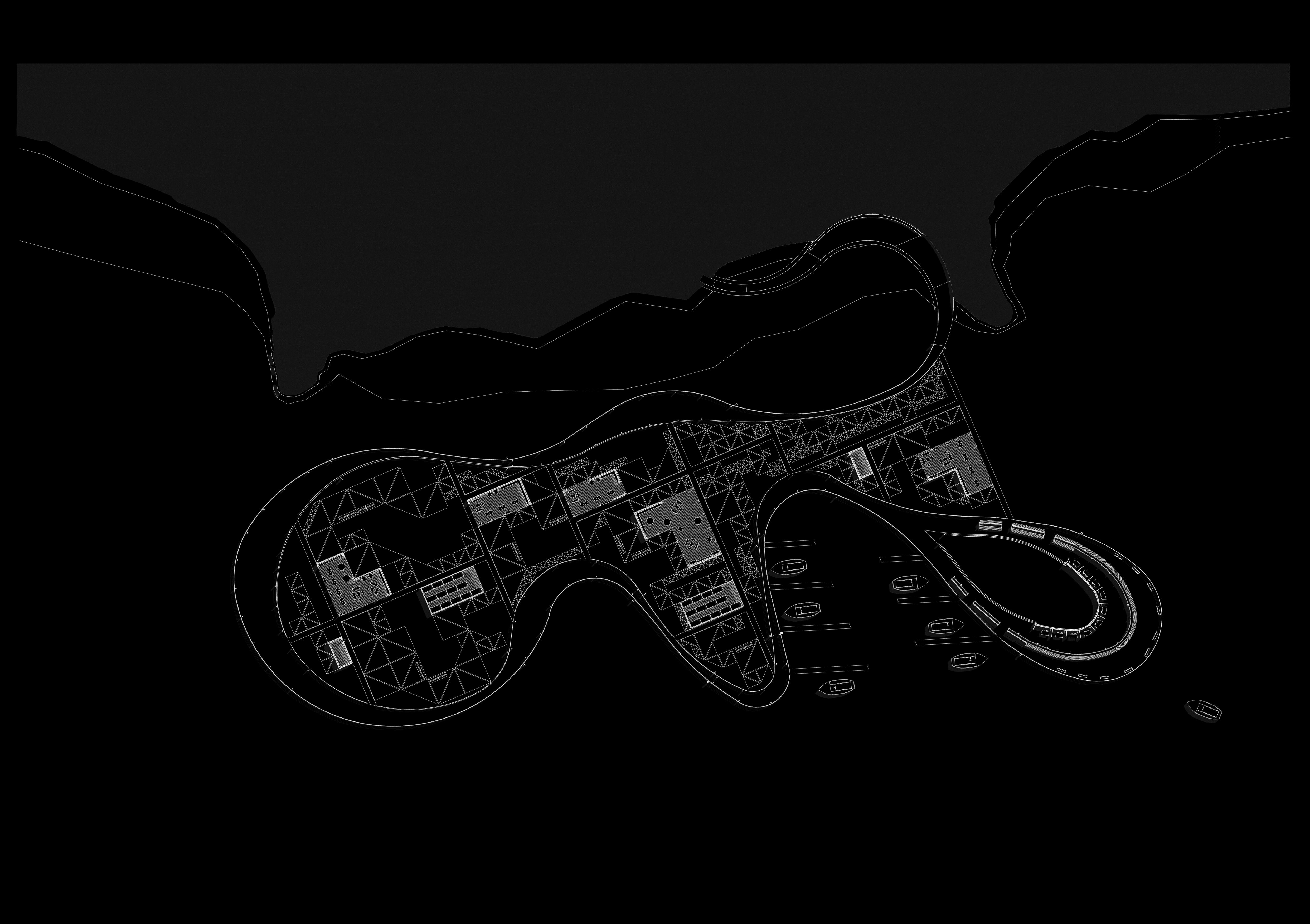
Taking the form of a careful meander, the design begins as a pathway to the waterfront. Due to the large slope of the site, the pathway makes sure to sit at a comfortable angle for the users. Following the passage into the lake, the walkway becomes a floating component of the design, acting as the central circulation unit that forms a loop. The walkway forms ‘moments of larger spaces at multiple points which act as areas for people to rest, fish and socialise with the community.
For my design, I wanted to really engage in the idea of a pier being used for aid in its surrounding community. My goal was to understand the current uses of the waterfront in the Vaal Lake and incorporate them into my design to create a communal and adaptive space suiting the needs of the community surrounding it. Through various iterations of the design, I was eventually able to develop a plan that worked pragmatically for the community in beneficial way, but also reacted to the flux of the water and mimicked its fluid form as detailed in the videos.
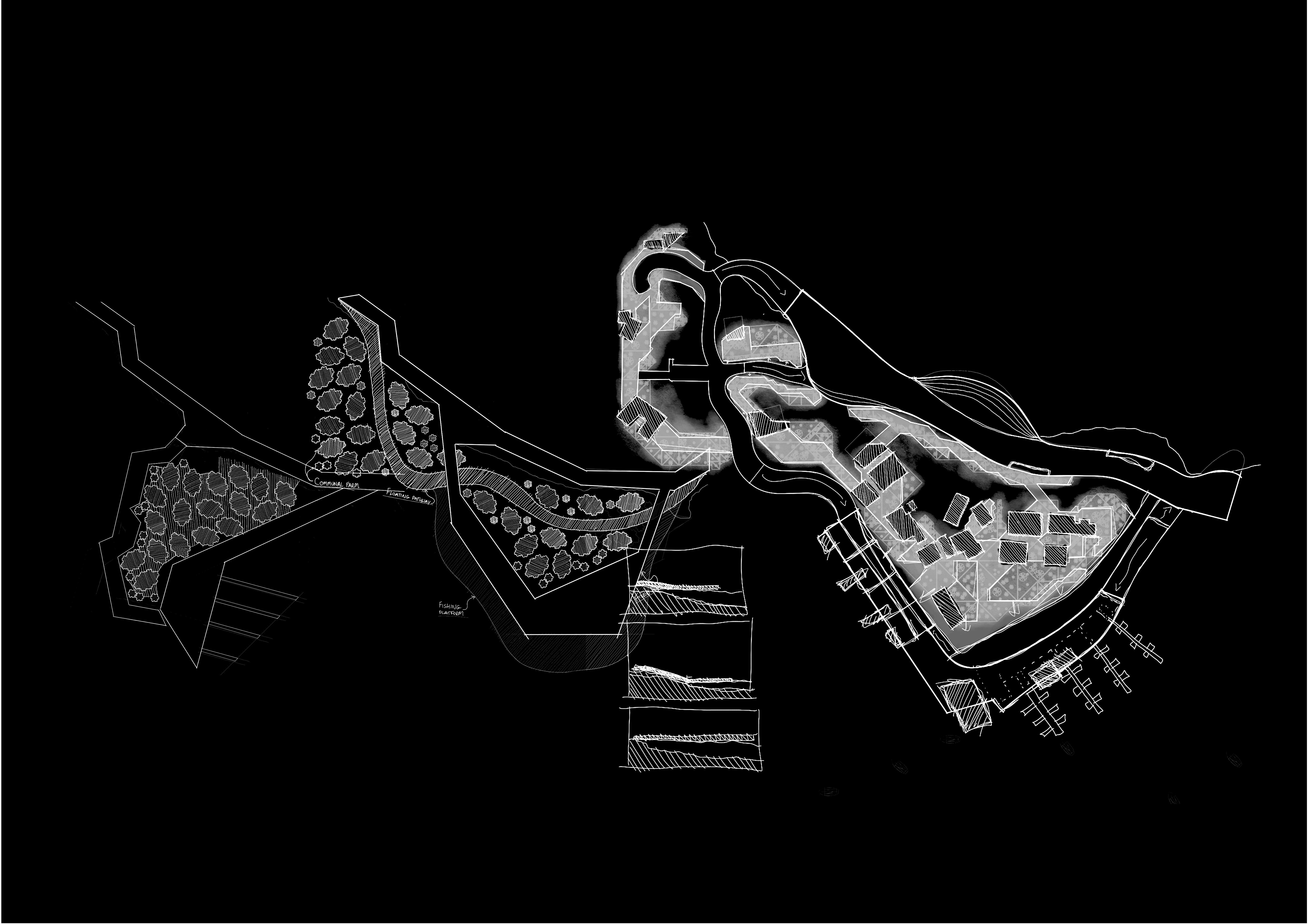
PIER DESIGN
Due to the great slope of the site leading into the water front, the challenge was to designs a public pathway which could comfortably allow the user to access the pier while going through experiential moments mimicking the fluidity and dynamic nature of the movement of water.
As the walkway meanders, it goes through various moments of rest and relaxation, allowing the user to experience the vast variety of plant life found in the Vaal Lake area.
Eventually the design connects to the floating pier in a seemless movement from public to agricultural space, allowing the entire design to function as a seamless pathways into the water.
FLOATING WALKWAY
WALKWAY AS MULTI-STATE FUNCTION
As the Vaal Lake sees the potential to floor every year or so, the pathway needed to be designed to react and adapt to changing water levels. Sitting on a structural steel section that functions as a buoyancy mechanic, as the water levels raise, the pier and thus the pathway will raise together.
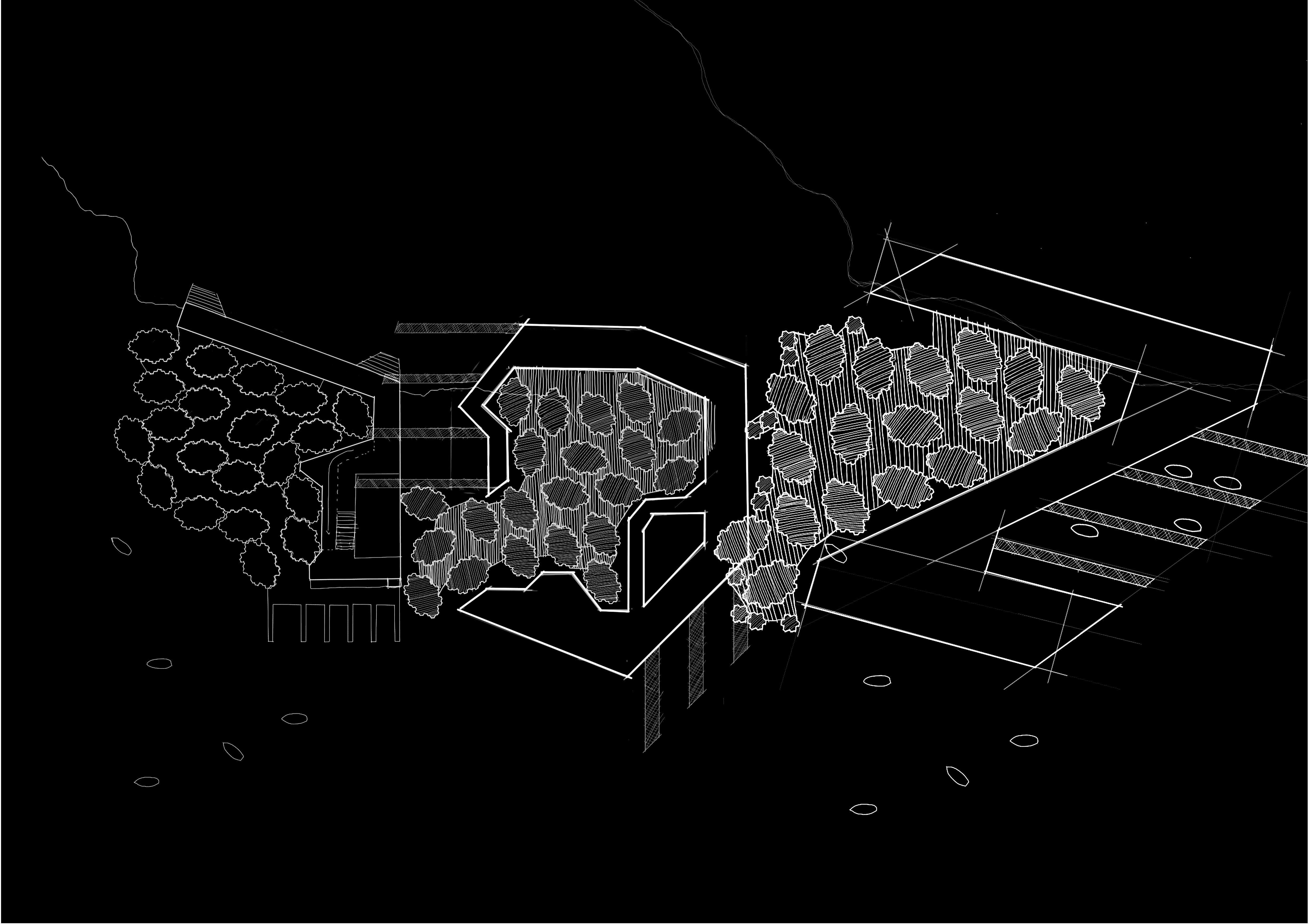
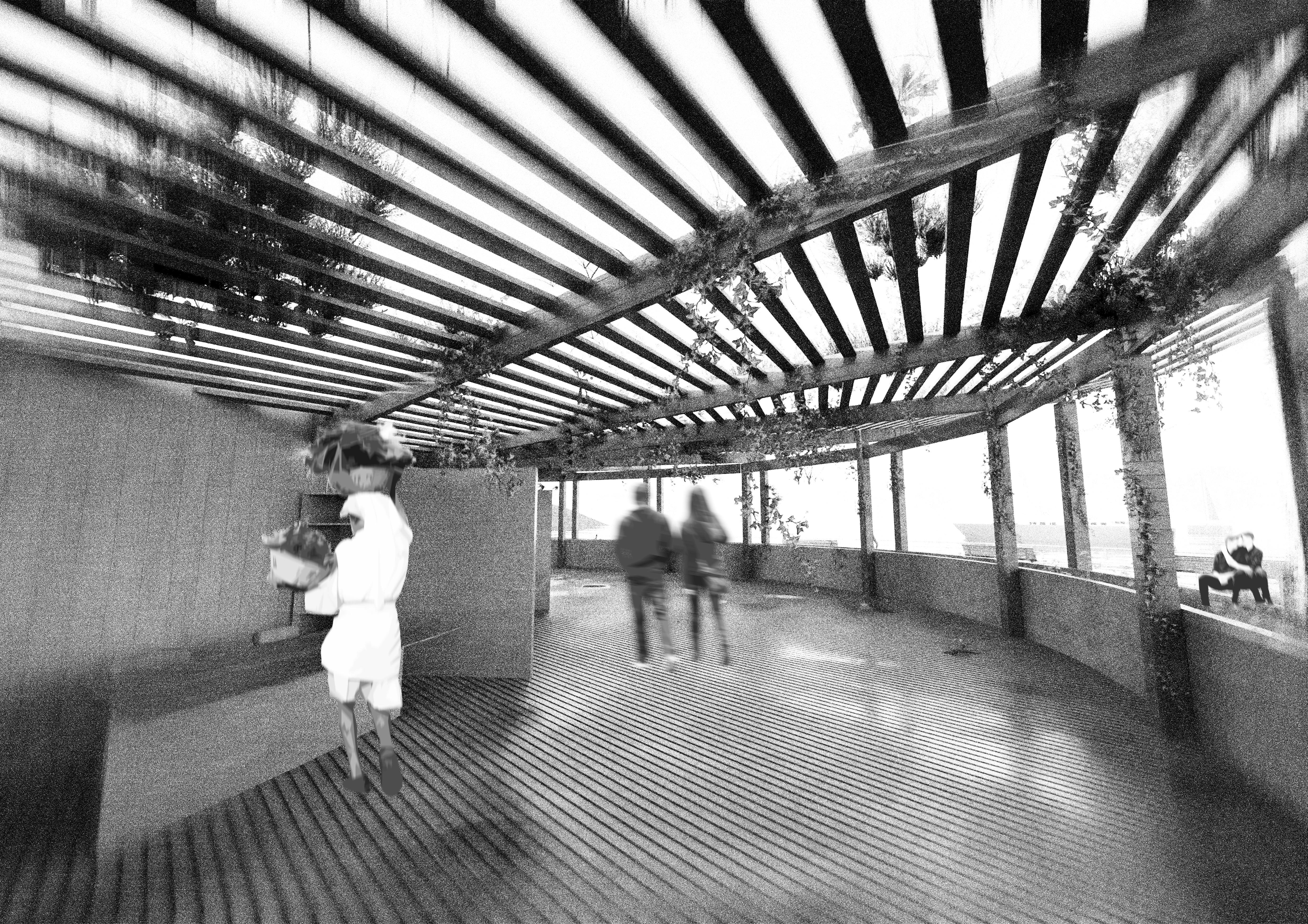
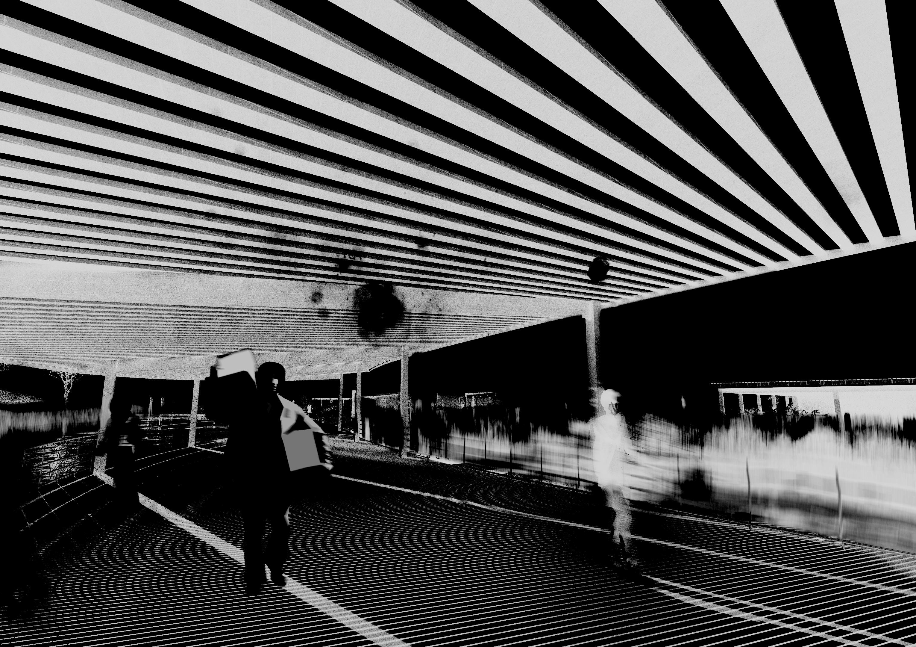
On the pathway to the pier are designed moments of motion and plant life seamlessly integrated into the experience of the public space. With timber pergolas and wire mesh tunnels that function as the basis for plant life to grow and react to the structure. With various deciduous plants growing across the designs and providing solar shading in the summer.
FLOATING WALKWAY
WALKWAY INTERACTION WITH WATER
Designing with the inherent flux of the Vaal Lake in mind, the entire design functions as a floating system that reacts to the water levels. Large, buoyant steel sections act as foundational flooring for the pathways and covered spaces, and large steel columns are fixed to multiple points of the design that function as anchoring points for the design to allow vertical movement but prevent rotational and lateral movement.
1000mm height galvanised steel balustrade
44x150mm timber decking
38x38mm timber battons
2500x800mm bouyant steel section floating foundations
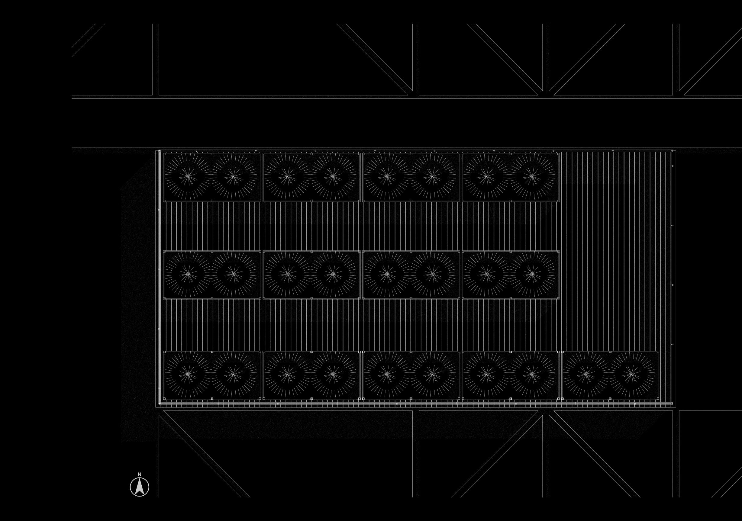
800mm mycelium wetland modular agricultural blocks
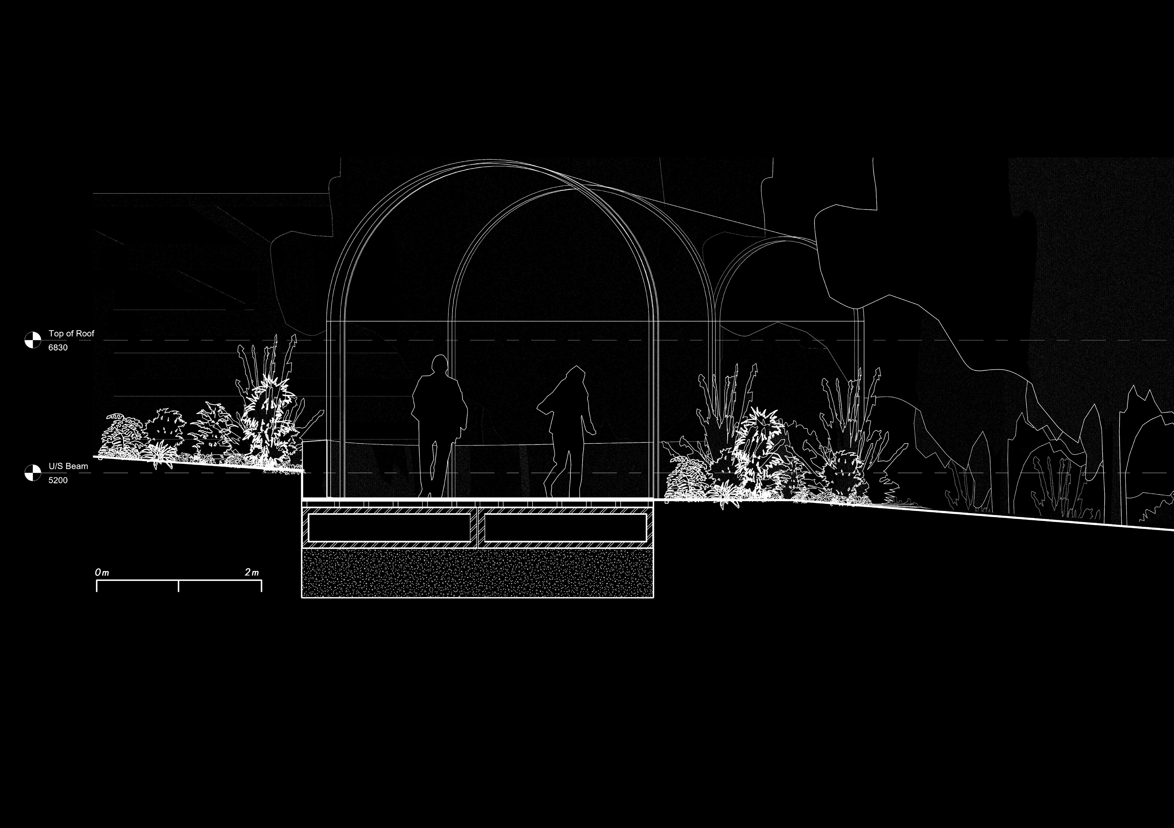
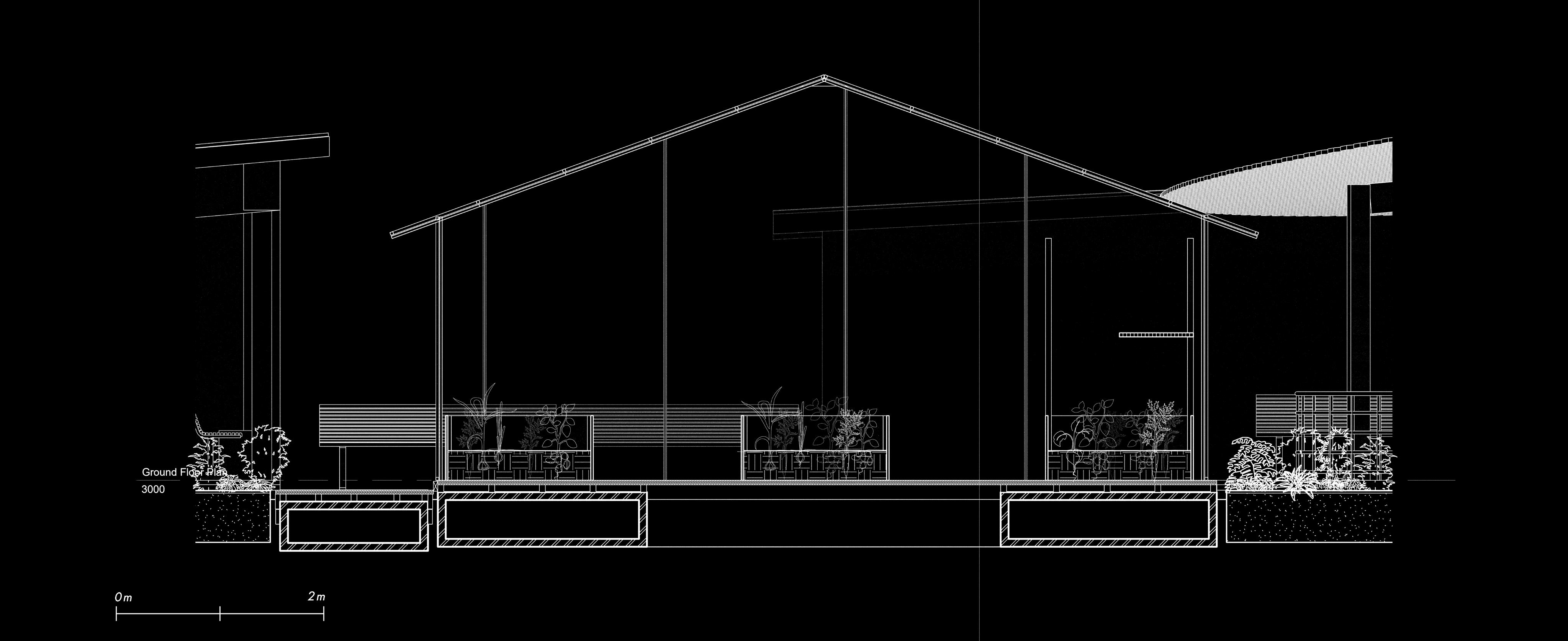
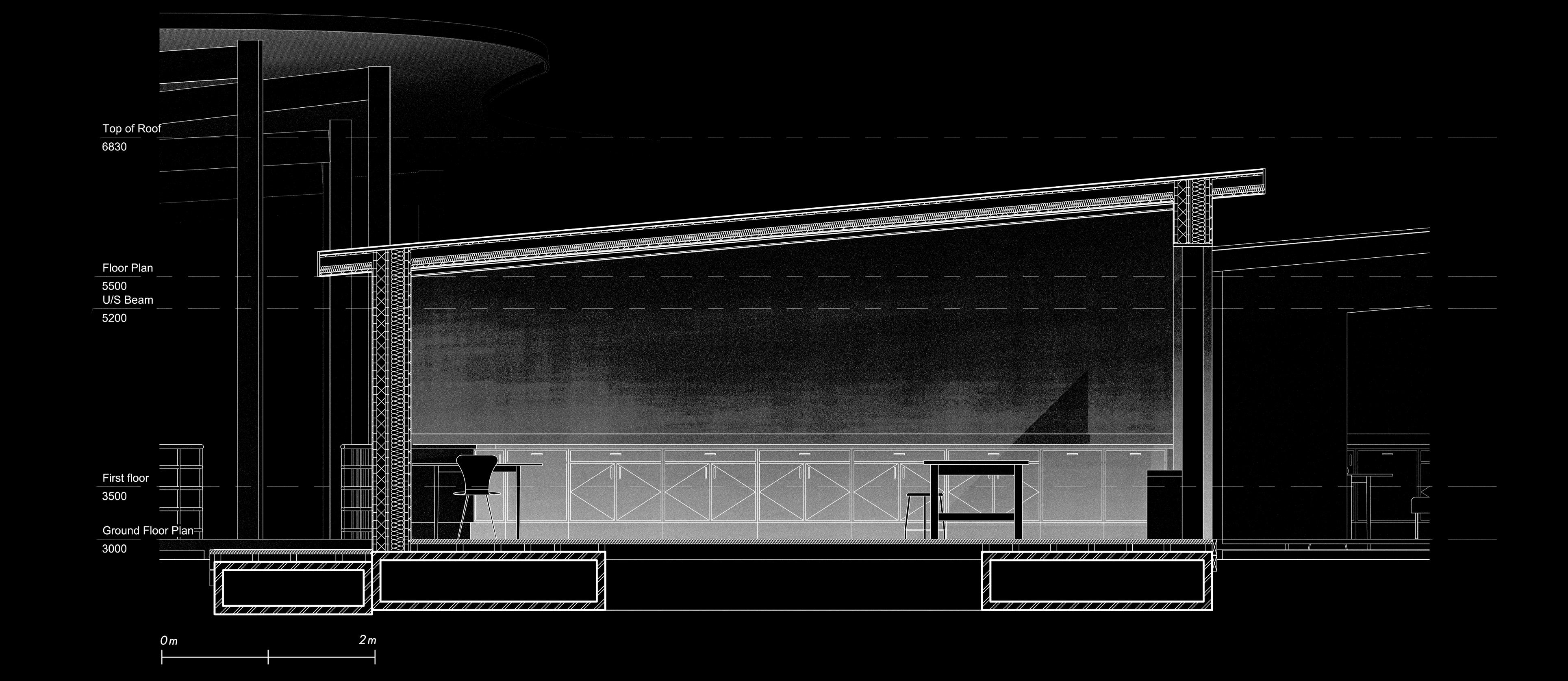
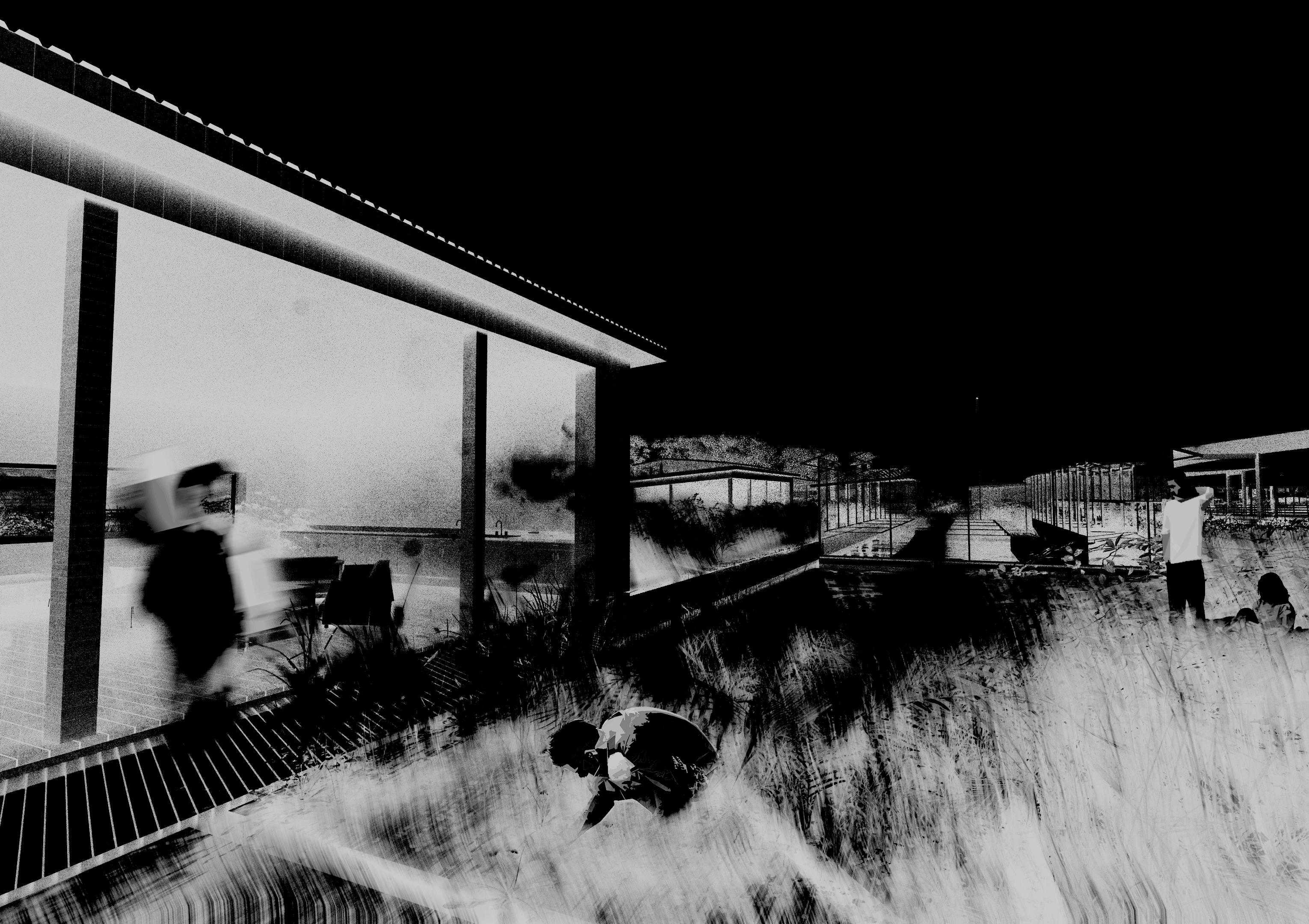
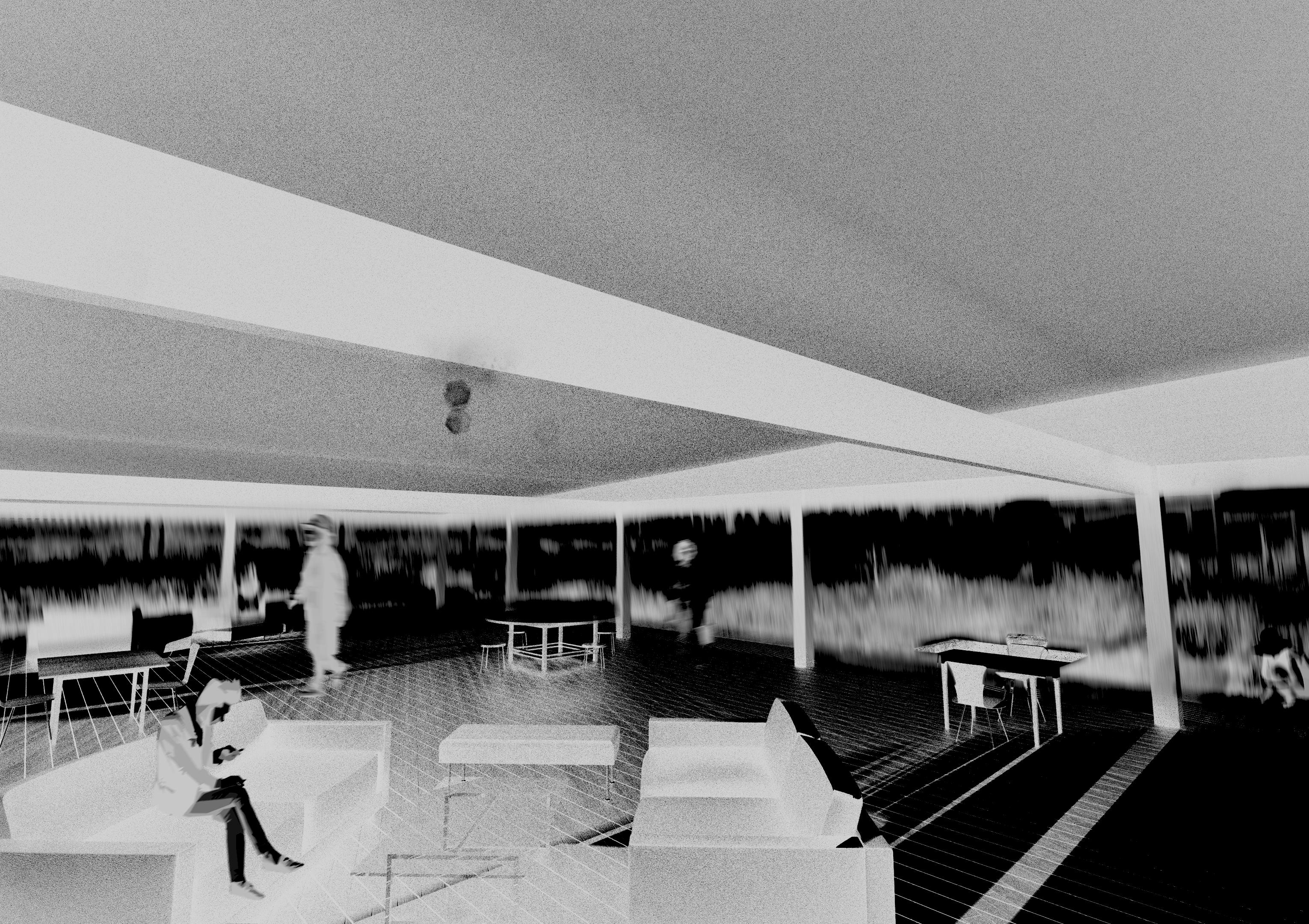
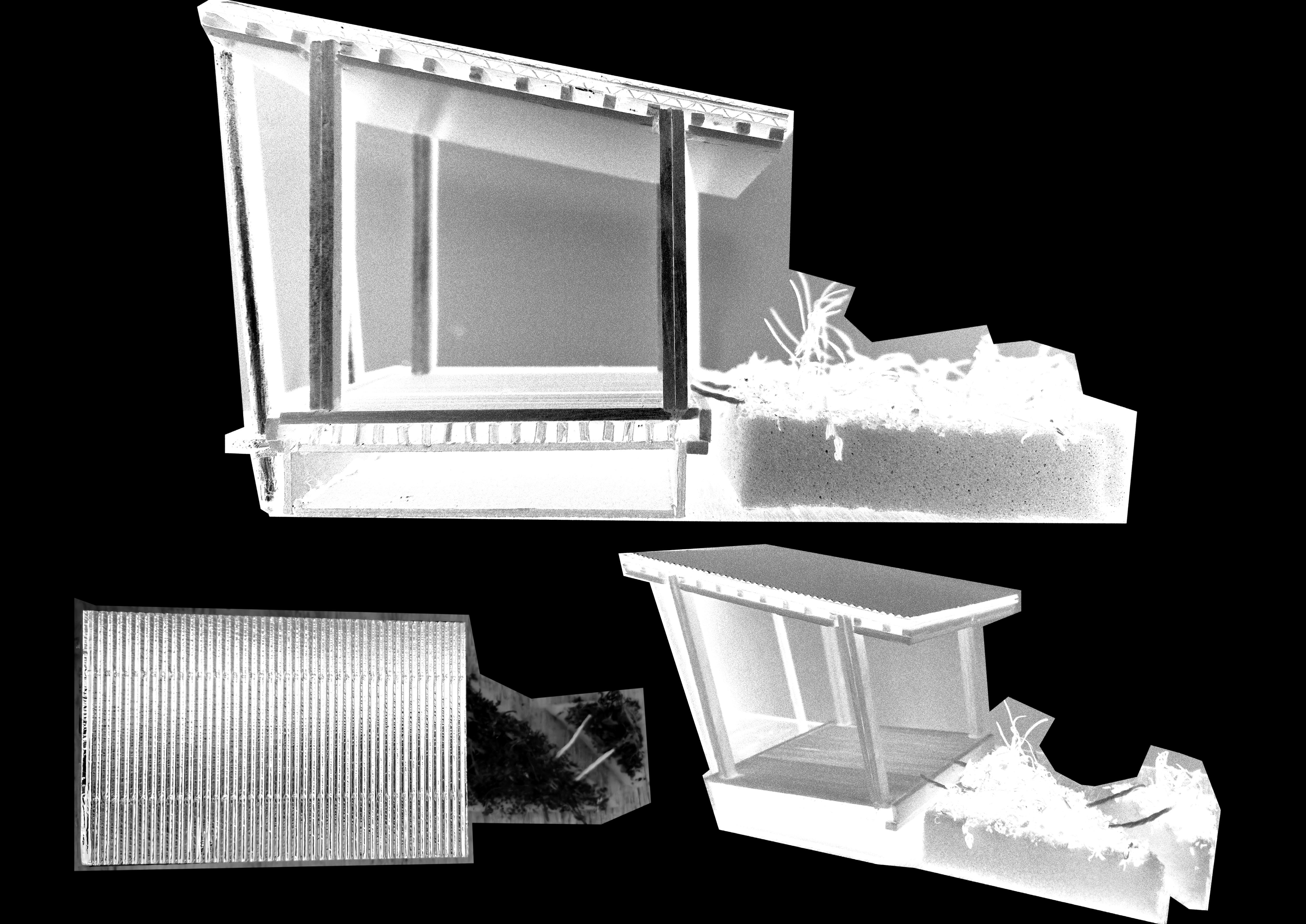
“ MOMENTS OF SPACE ”
bouyant steel section floating foundations
370mm cross laminated timber wall with 120mm rigid insulation
500mm circular steel section anchor connected to reinforced concrete foundation below 800mm mycelium wetland modular agricultural blocks
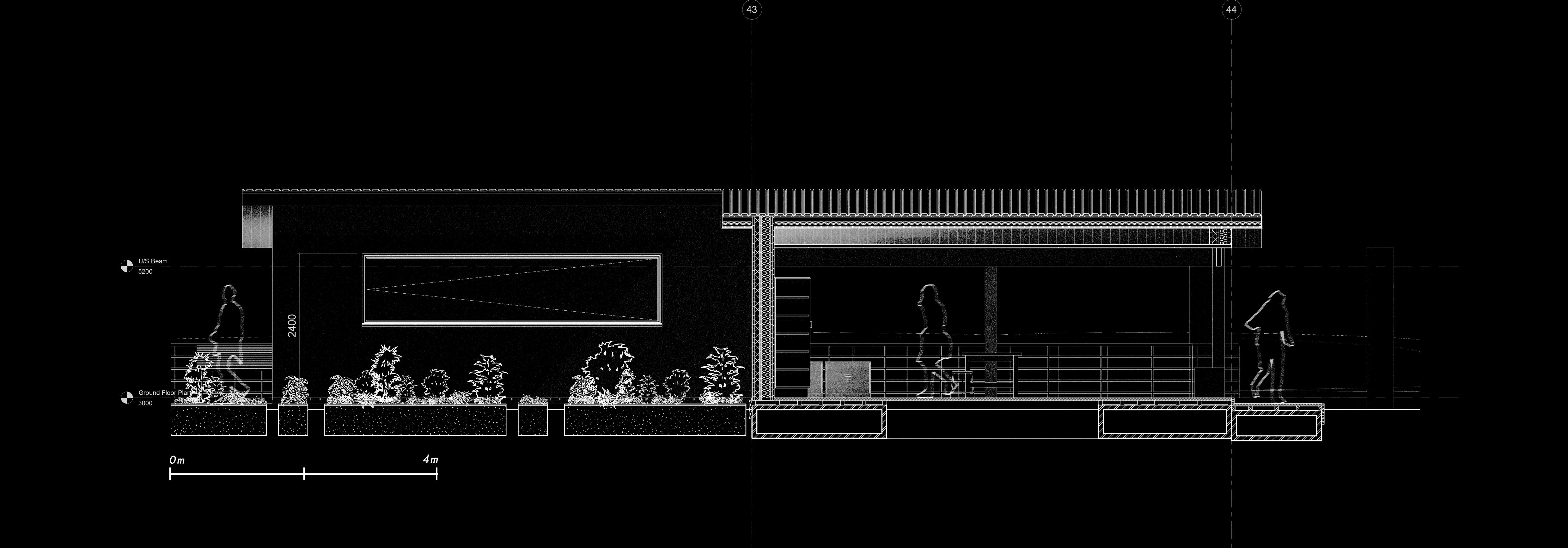
MOMENTS OF SPACE ”
The 2 greenhouse spaces provide the opportunity to expand the variety of fruits and vegetables that can be grown in the wetlands, creating spaces with more humid environments allowing for a overall more nutritional and rich combination of agriculture
“ MOMENTS OF SPACE ” WORK
+ REST ‘STATIONS’
Multiple work and rest stations are scattered throughout the agricultural wetlands, providing moments of rest and productivity for the users no matter where they are situated within the design.
These stations are crucial to prevent fatigue and possible injury from sun exposure and dehydration.
The meander of the walkway eventually lands at the market space at the end, this marketplace acts as a public use area that may be used for the selling of good produced within the pier such as fish, vegetables and grains. The market at the end provides a logical end point to the meandering pathway, but furthermore functions as an eating and socialisation space, allowing greater community involvement.
The market functions as the cohesive culmination of all functions of the pier, allowing those who visit to participate in a family friendly market space, enjoying the surroundings and access to the waters for swimming and existing water based activities.
The market also acts as the mooring point for yachts, bringing all activity out into the water space blurring the lines between class as currently exists in the Vaal Lake.
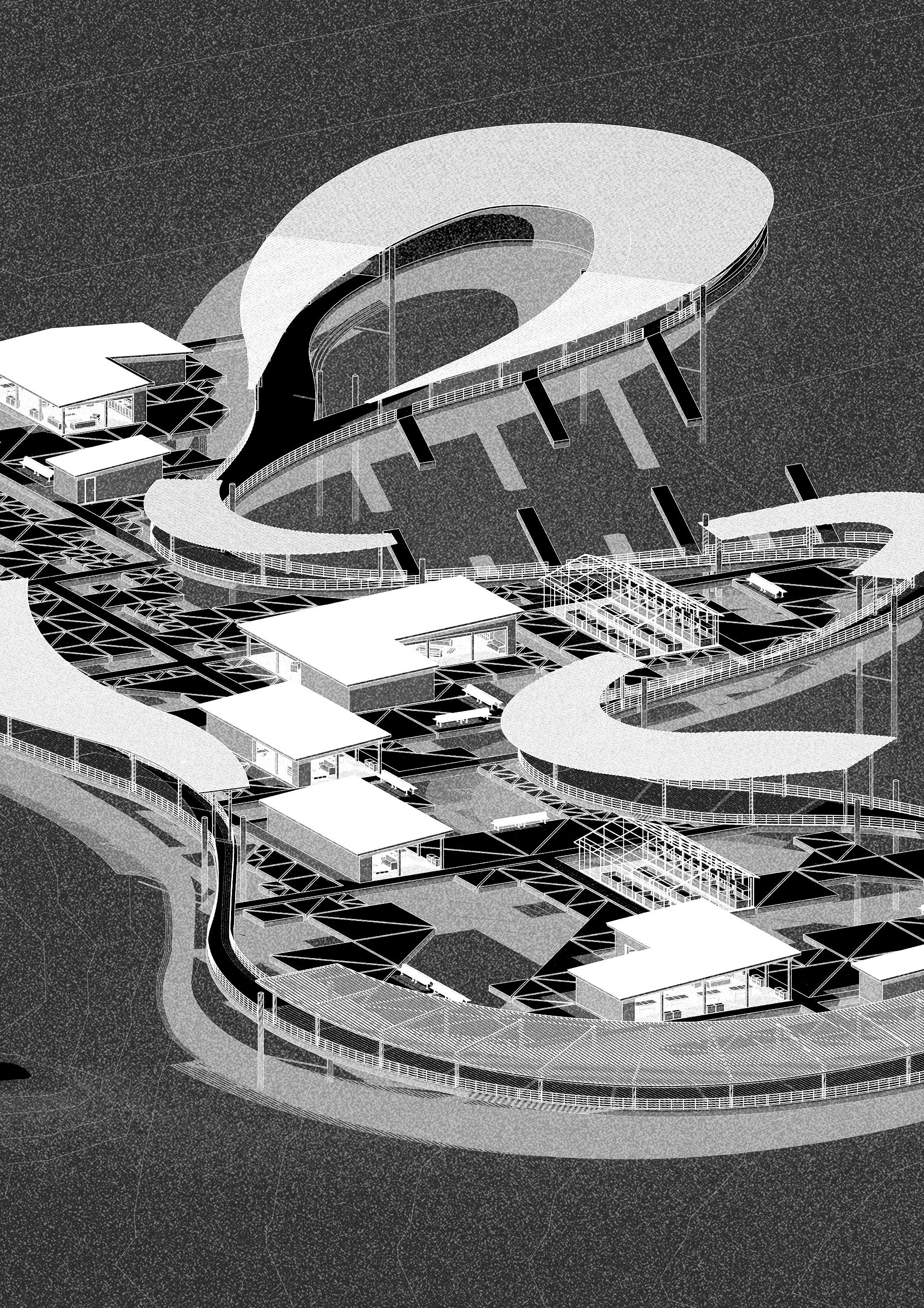
KINETIC AXONOMOMETRIC
MOTION OF THE PIER
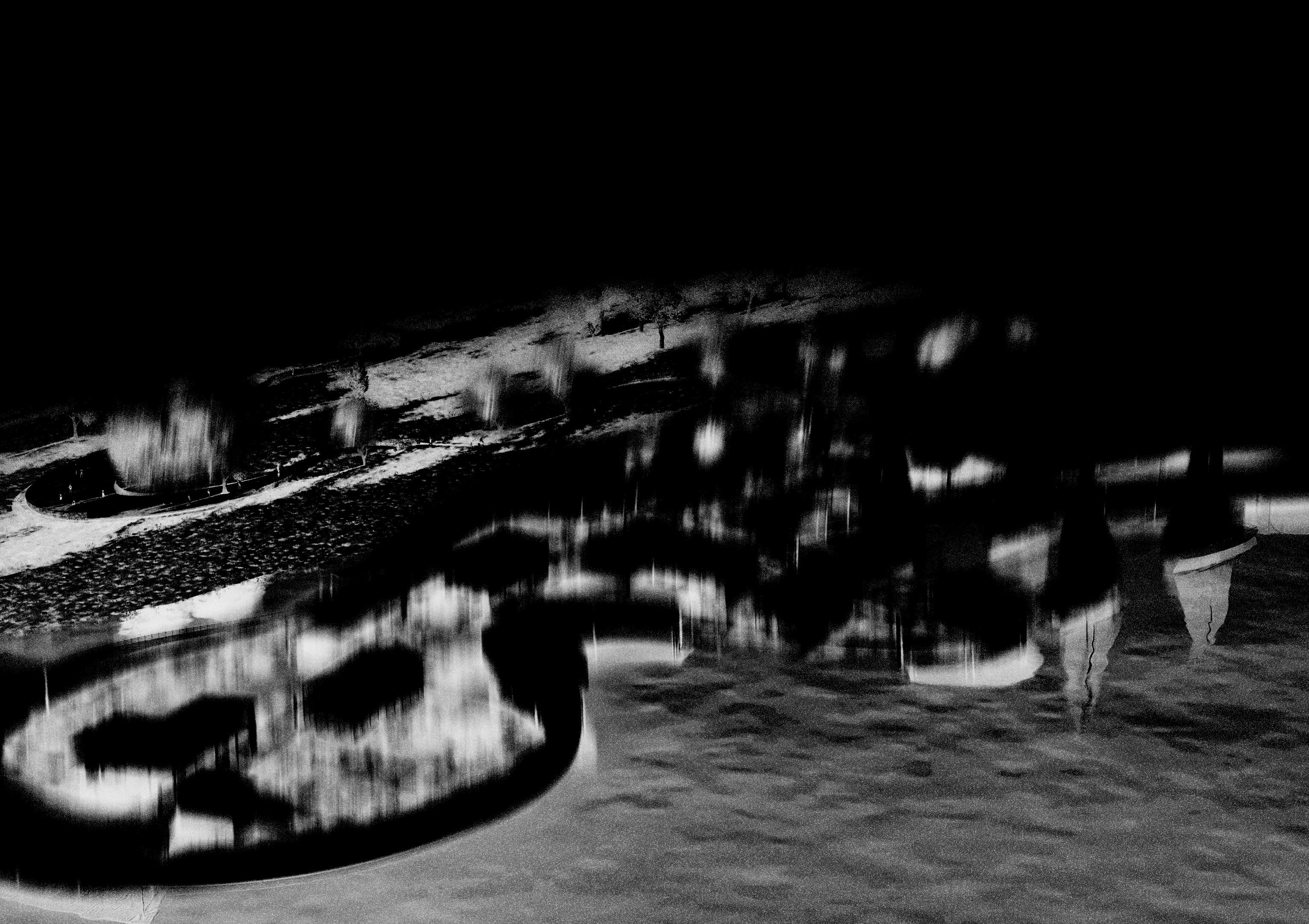
KINETIC AXONOMOMETRIC
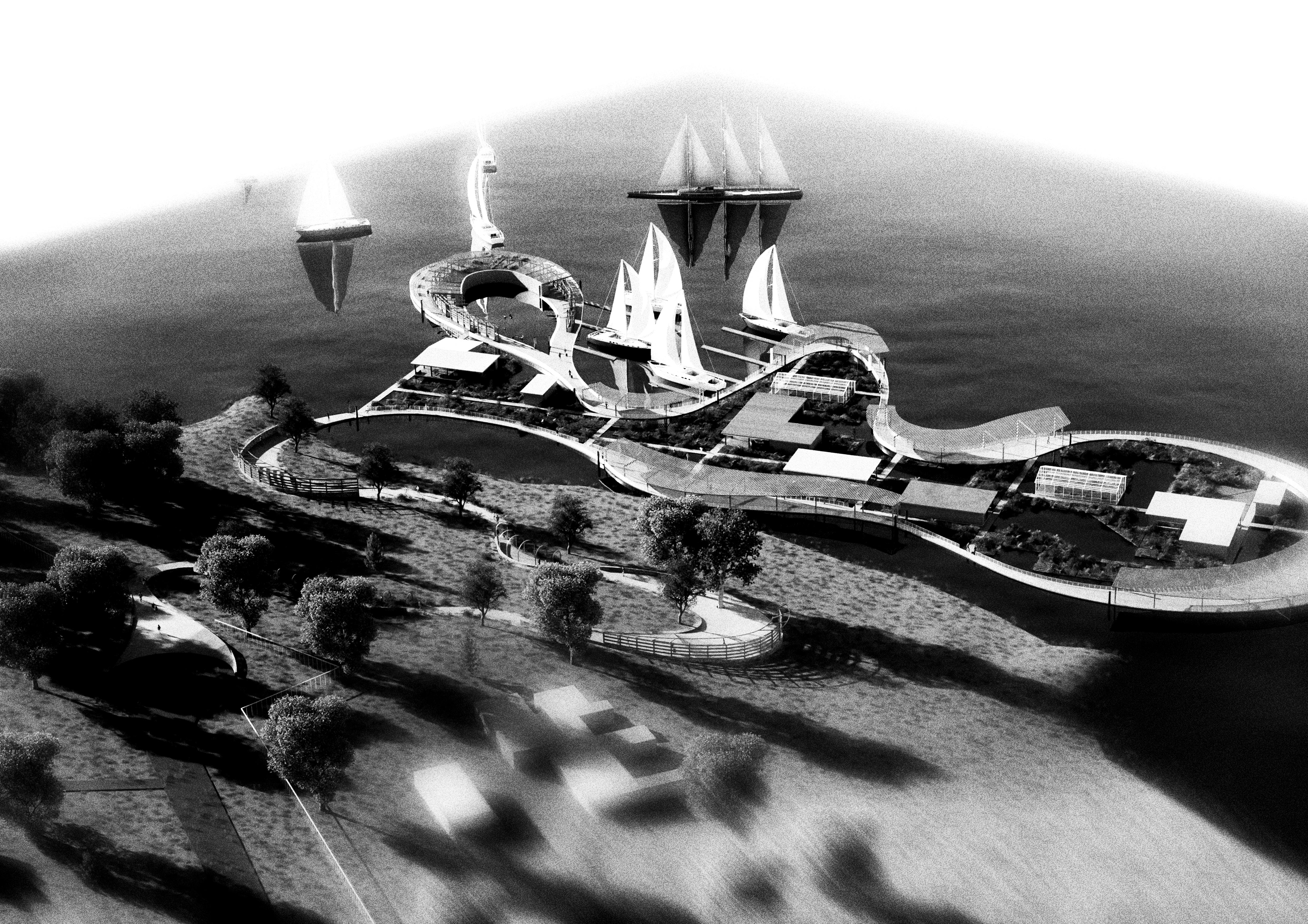
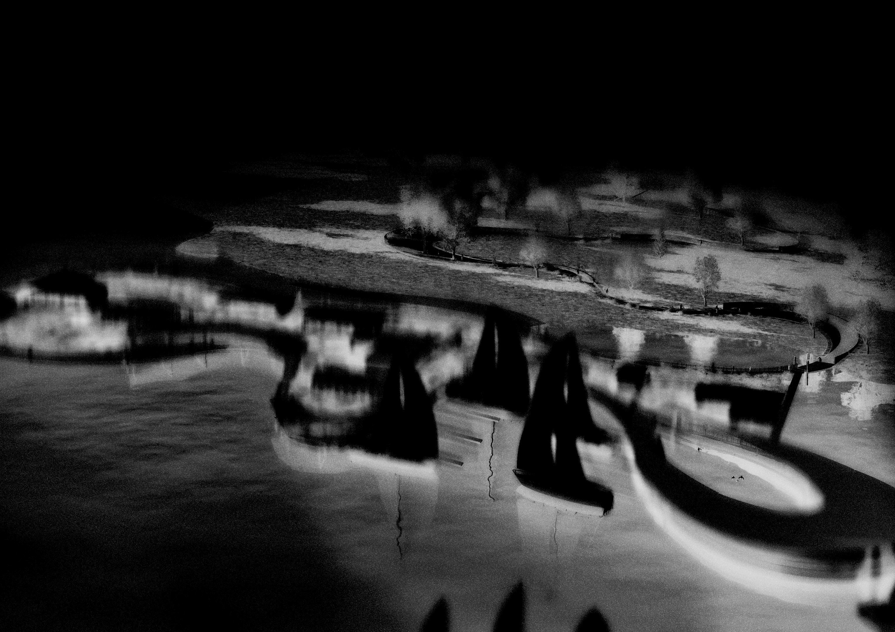
KINETIC PERSPECTIVE
AGRICULTURAL WETLANDS
SNAPSHOT PERSPECTIVE
KINETIC PERSPECTIVE
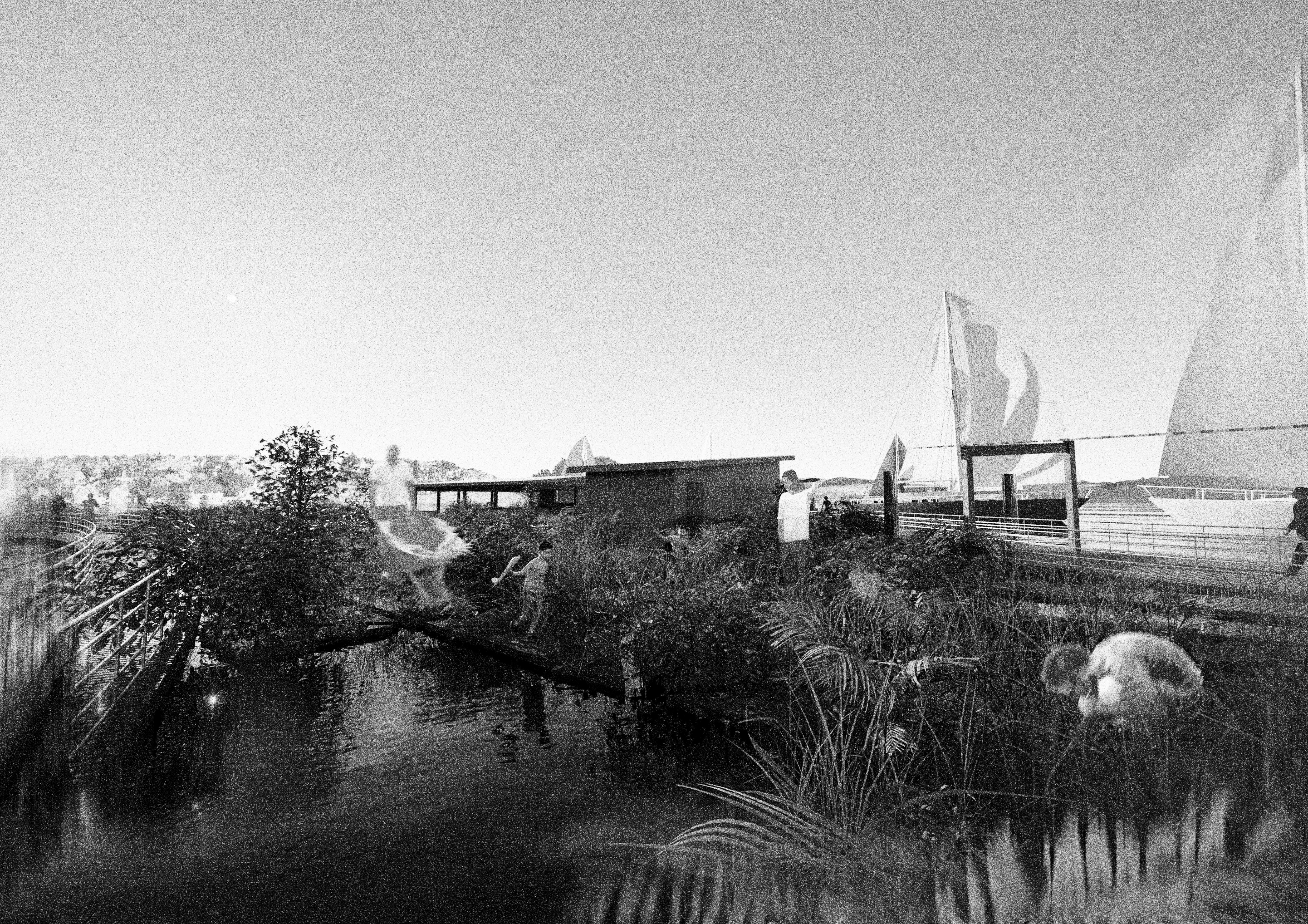
SNAPSHOT PERSPECTIVE
WETLANDS AND YACHT MOORING
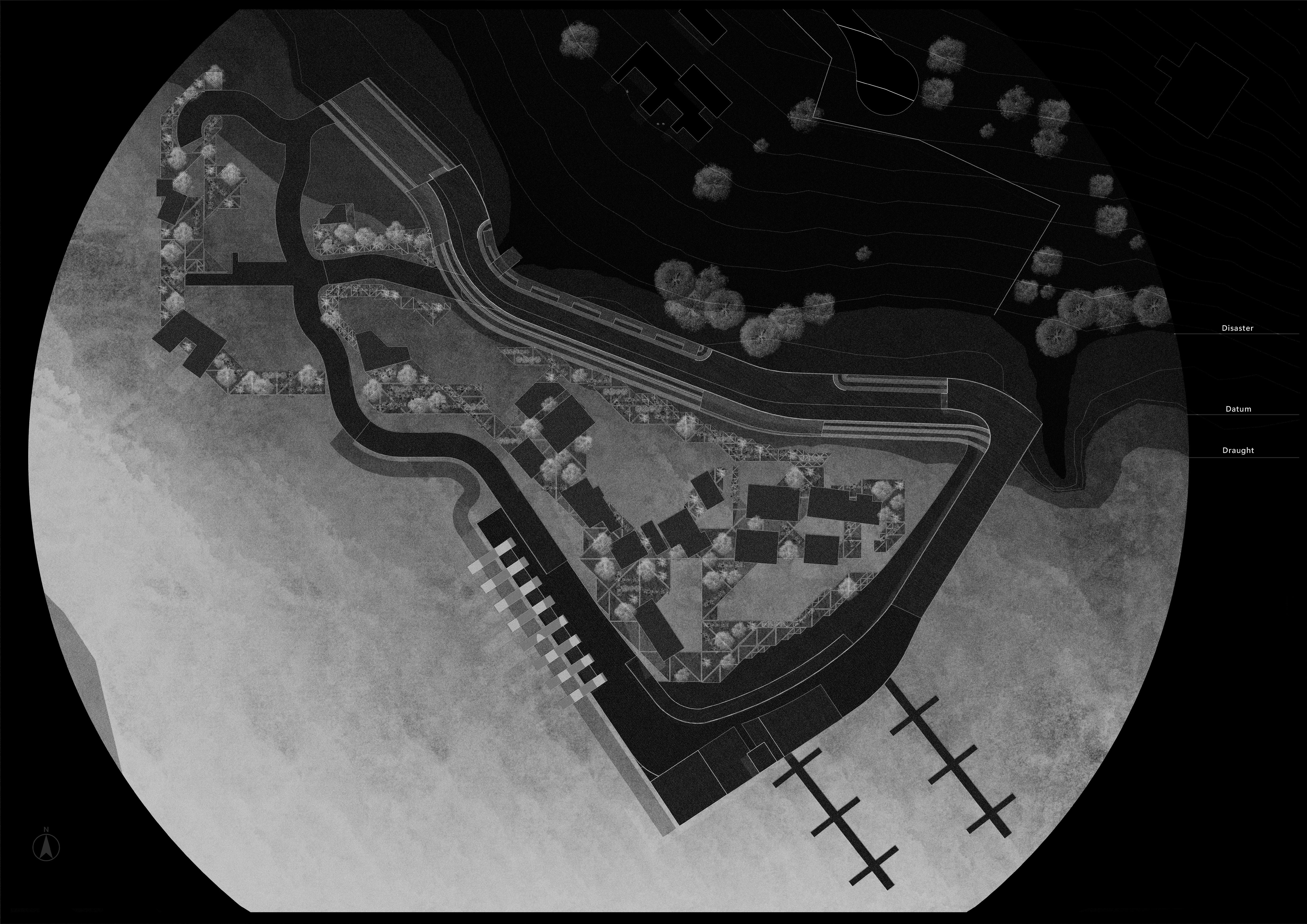
DATUM, DROUGHT, DISASTER
ARCHITECTURE THAT UNDERSTANDS AND REACTS TO THE FLUX OF WATER
The Vaal lake experiences a level of fluctuation that is not commonly seen in lakes across the world. Research into historic water levels of the Vaal allowed me to understand to what extent these fluctuations occur and the difference in height that could be expected while creating an intervention that reacts to the water of the lake.
With fluctuations that can exceed multiple meters, the residents of the Vaal are constantly adapting and re-ordering their spaces of living and lifestyles in accordance with the water level at a given point. For example, those who fish, participate in sailboating or simply enjoy time relaxing by the water may have to change where they go and how they access water depending on the capacity of the lake.
This provides an interesting challenge for the basis of an architectural design, as conventional architecture is rooted in the static, permanent and unmovable connotations that it rests itself upon. To make something flexible, fluid, adaptive, one must challenge traditional conceptions of architecture and how it can be conceptualized.
As the pier sits on the precipice between these ideals, as a lightweight, sometimes temporary, and reactive typology of water based architecture, I am given the opportunity to really explore what consists of the generic pier and how we may learn from these lessons to incorporate into our architecture in an ever destabilized and fluctuating climate.
With my pier design, I wanted to use the idea of a lightweight, reactive and dynamic structure that is semi-permanent, allowing itself to change over time, and adjust to its environment.
To be able to react to the flux of the water its sits in, I had to carefully consider the floating structural elements that lay the foundation of the design, allowing it to be lightweight but sturdy enough to be anchored in place to prevent lateral movement
Play Video 4
Modeling Motion
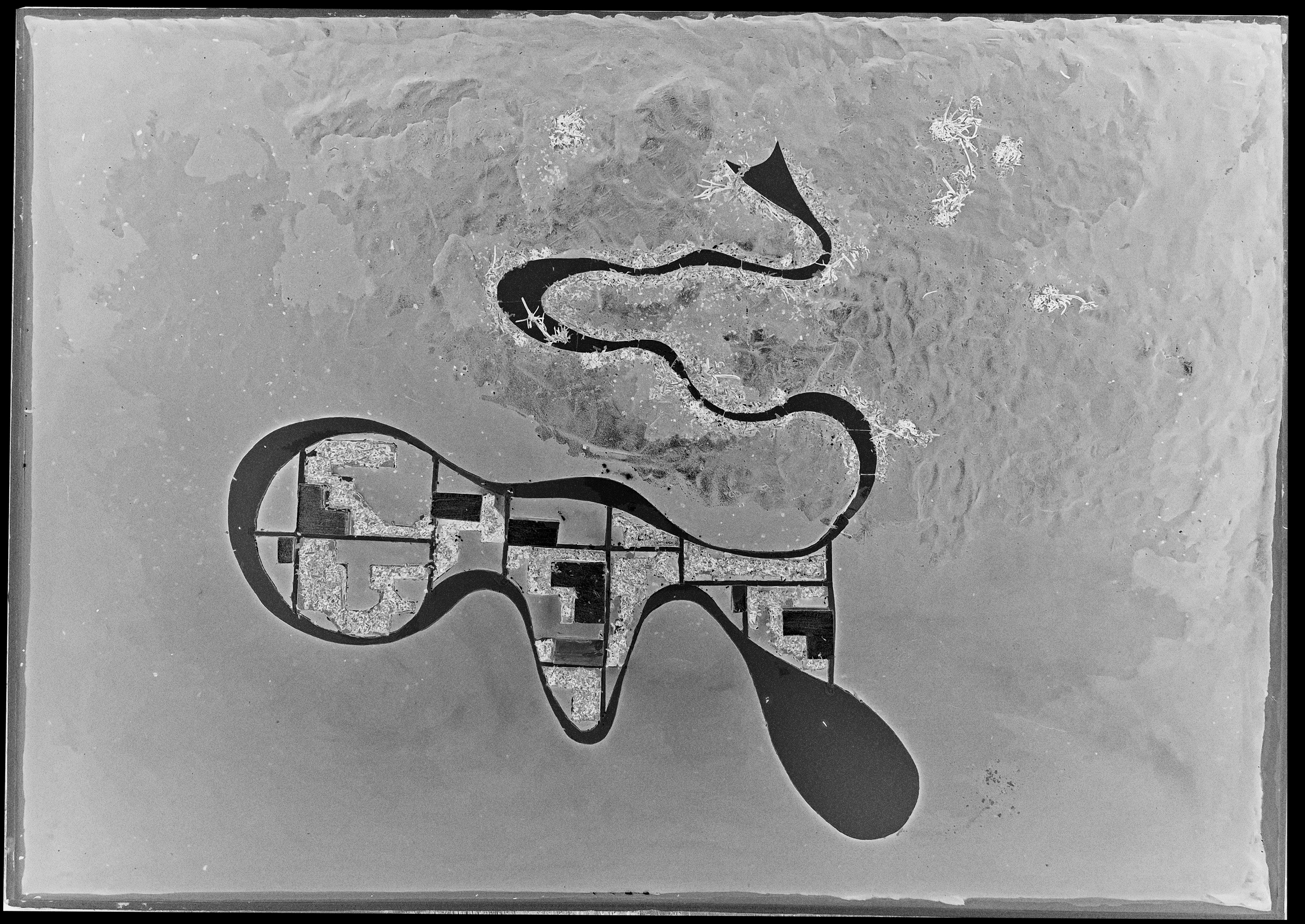
FINAL SITE MODEL
ADAPTIVE 1:500 SITE MODEL ENGAGING WITH WATER FLUCTUATIONS
STRUCTURAL WALKWAY MODEL SHOWING FLOATING COMPONENTS AND CONNECTION TO WETLAND
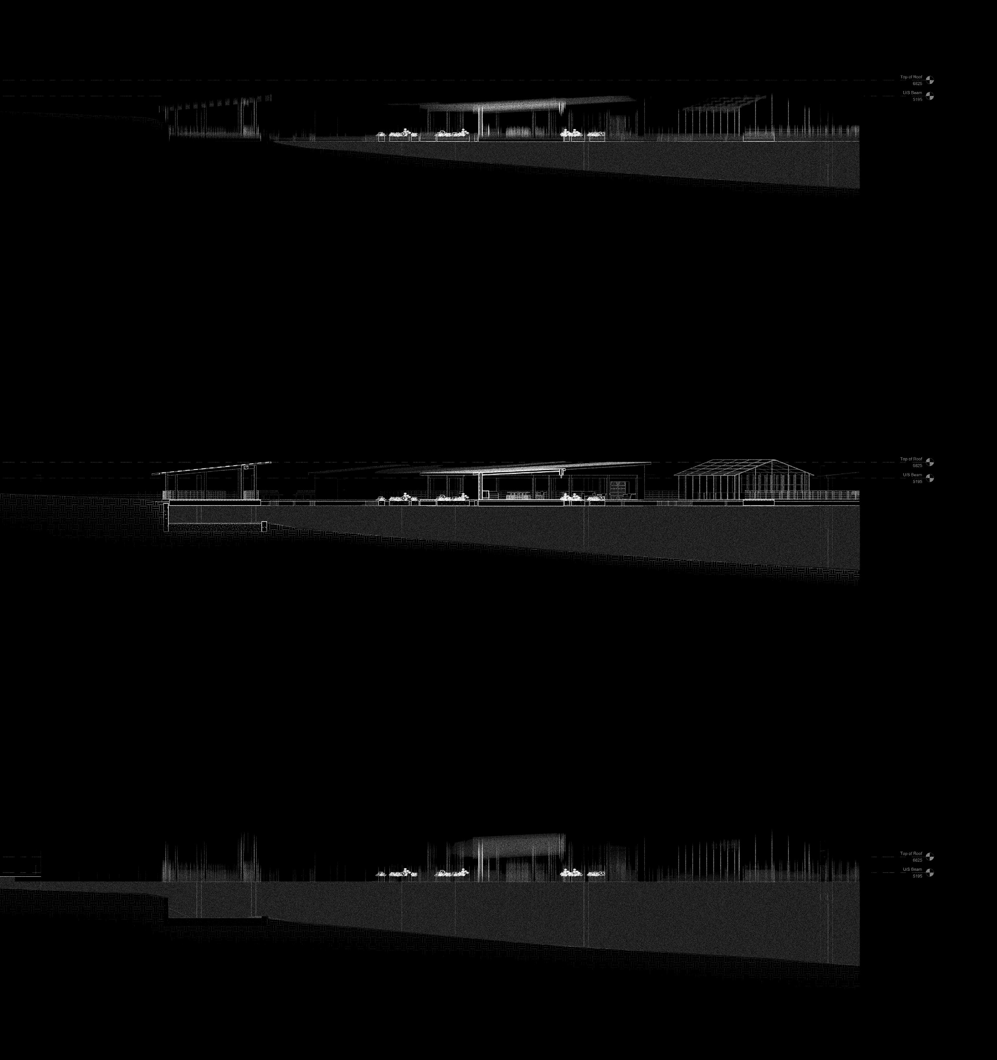
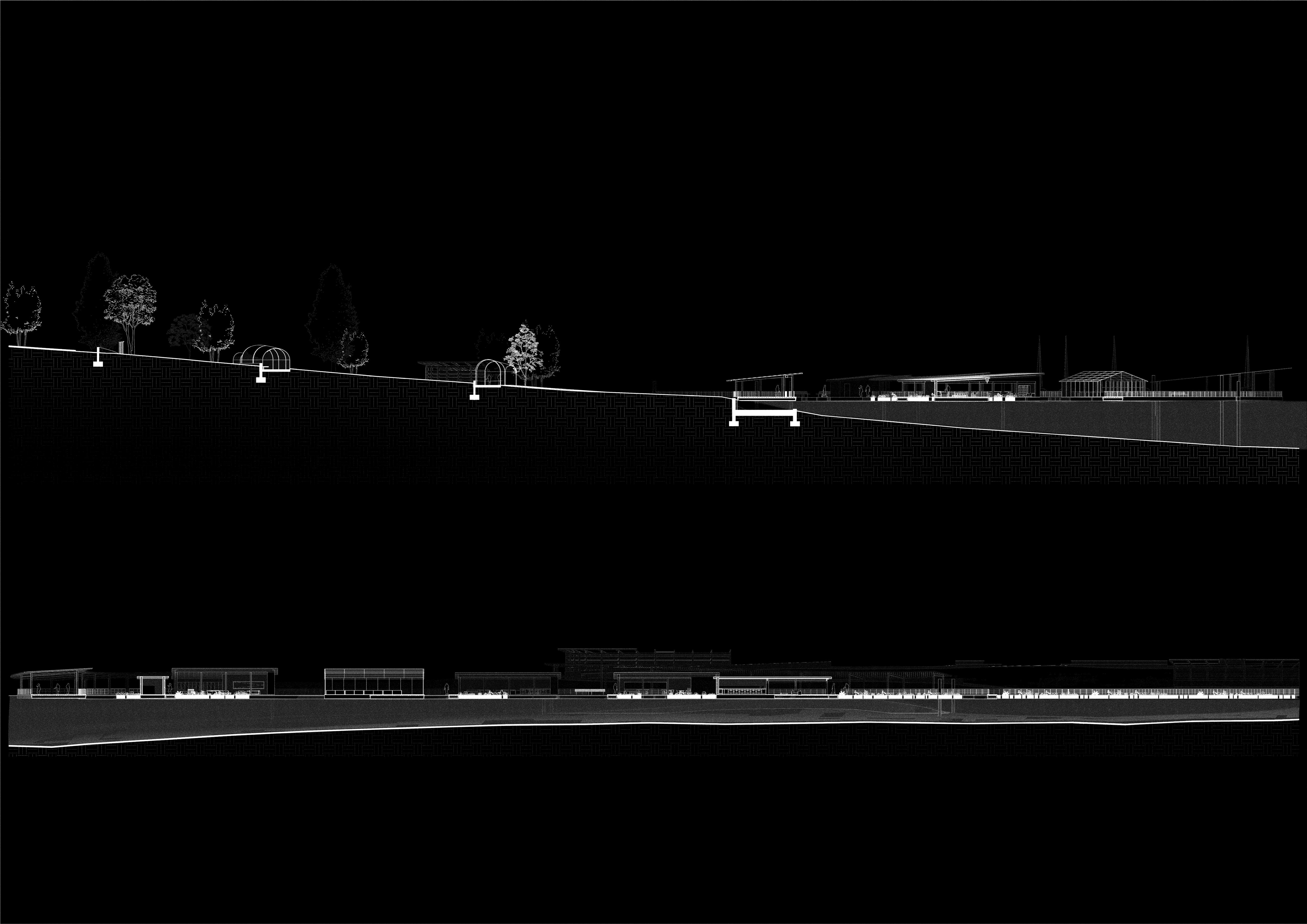
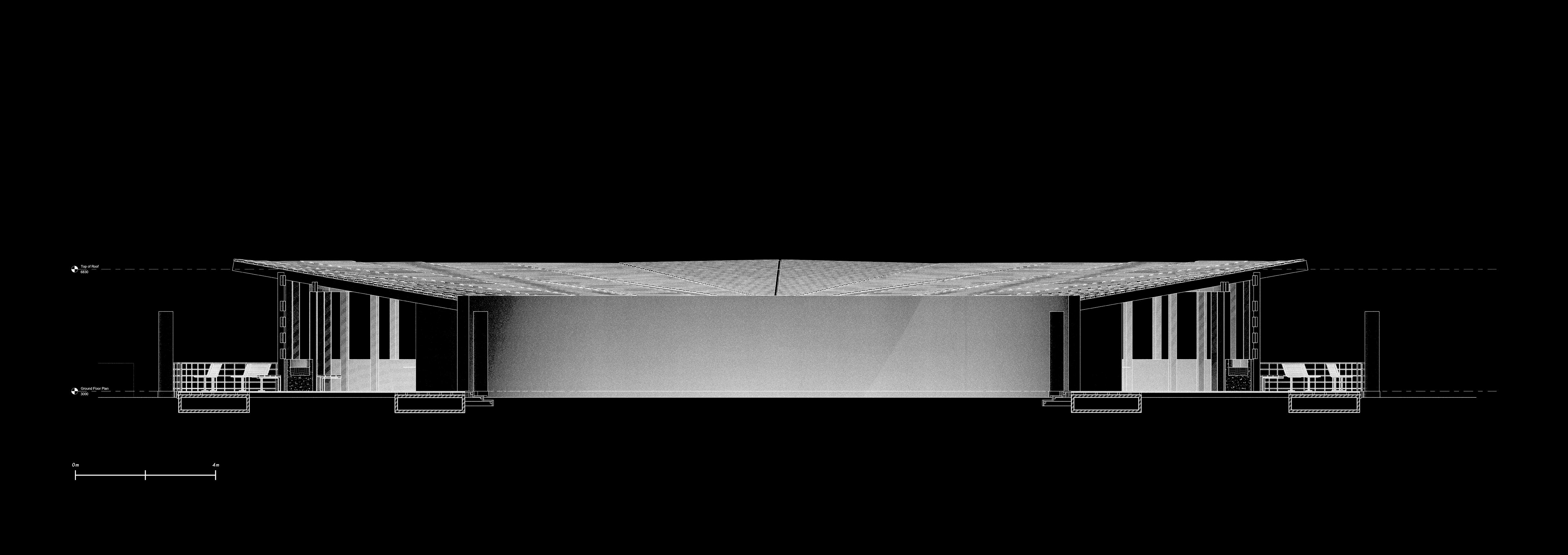
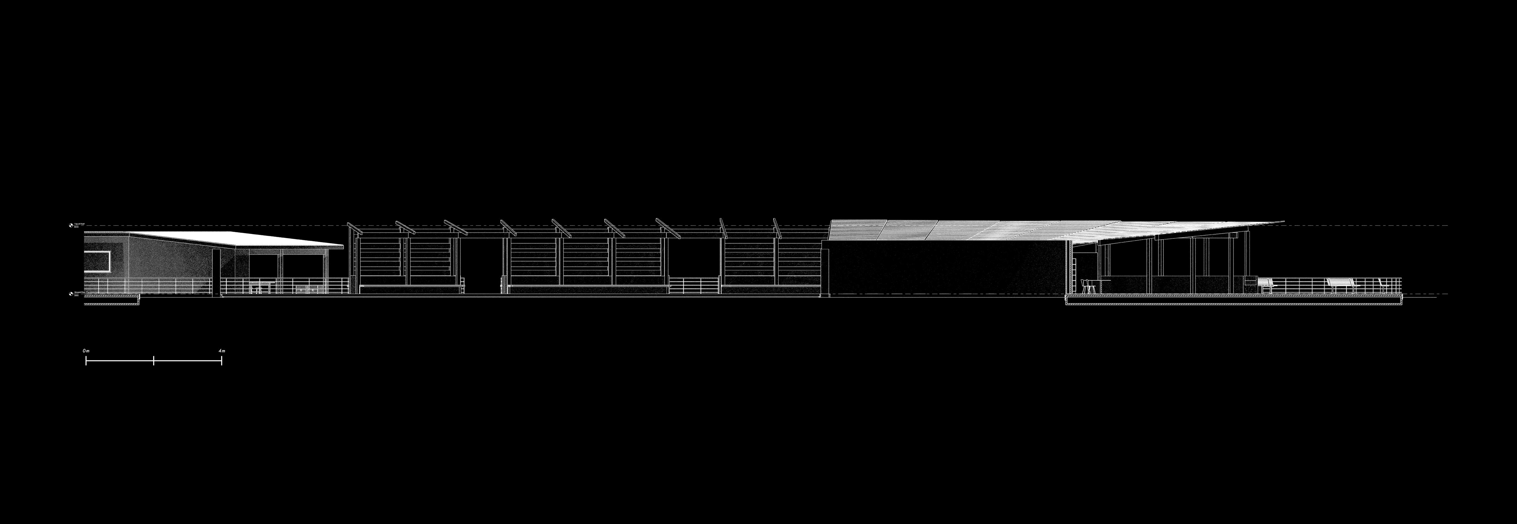
FLUX ADAPTATION - SITE SECTIONS
To address the flux in water levels that are intrinsic to the nature of the Vaal, the pier design needed to understand how to react and adapt to constantly changing water levels and rapid streams.
To adjust to these design issues, the pier was made to be completely floating, with buoyant steel sections fixed to circular steel section anchors that allow vertical movement but not lateral movement.
The floating design means the pier is accessible at any time of the year, while the crucial programs of the design remain operational and functional due to their proximity to water. Allowing for year long agricultural growth
PIER DESIGN
FLUX ADAPTATION - SITE AXONOMETRICS
BIBLIOGRAPHY:
HARRISON, A.L. (2012) ‘The Parameters of the Posthuman’, in 100th ACSA Annual Meeting Proceedings, Digital Aptitudes. Yale University, pp. 618–624.
Harrison, A.L. (2020) ‘Architecture and Analogous Habitats’, 2020 AIA/ACSA Intersections Symposium | DESIGN FOR CLIMATE ACTION [Preprint].
Kacar, A.D. (2002) The Effects of Time Perception on the Design and use of Architectural Space. thesis. METU.
Kalantar, N. and Borhani, A. (2018) ‘Between Space & Time: Transformable Architecture in Early Design Education’, The 34th National Conference on the Beginning Design Student, (NCBDS), Vol. 34(No. 1).
KUNAWONG, M. (2019) Temporality Dimensions in Architecture The intervention of time perception [Preprint].
Mathur, A. and Cunha, D. da (2001) Mississippi floods: Designing a shifting landscape. New Haven Conn.: Yale University Press.
Mathur, A. and Cunha, D. da (2009) Soak: Mumbai in an Estuary. New Delhi: Rupa & Co.
Annual report 2021 (2024) Arup. Available at: https://www.arup.com/about-us/corporate-reports/annual-report-2021/ (Accessed: 27 October 2024).
Past exhibition (no date) Architekturmuseum der TUM. Available at: https://www.architekturmuseum.de/en/exhibitions/african-mobilities-not-refugee-camp-exhibition/ (Accessed: 27 October 2024).