Although the North Rim is only about 10 miles as the crow flies from the South Rim, it’s about a 220-mile drive and a world apart in terms of terrain, temperature and vibe. In summer, when the temperature at the South Rim can reach 100 degrees in the shade, the North Rim is a cooler, quieter option that offers the same spectacular canyon views, along with good hiking opportunities and scenic drives.
At an elevation of 8,297 feet (about 1,000 feet higher than the South Rim), the North Rim features a unique “high subalpine” terrain with meadows, and dense fir, ponderosa pine, and aspen forests.
On average, only about 10 percent of Grand Canyon National Park visitors venture to the North Rim, according to National Park Service statistics. In 2021, an estimated 221,000 visitors came through the North Rim entrance when it was open May through mid-October, compared with approximately 2.2 million visitors who entered the park via the South Rim’s Desert View and South entrances during that period.
North Rim visitors are still privy to the breathtaking canyon views that define one of the most popular U.S. national parks. It’s only about a quarter-mile walk along a paved path from the Grand Canyon Lodge to Bright Angel Point, G R A N D C A N Y O N N O R T H R I M
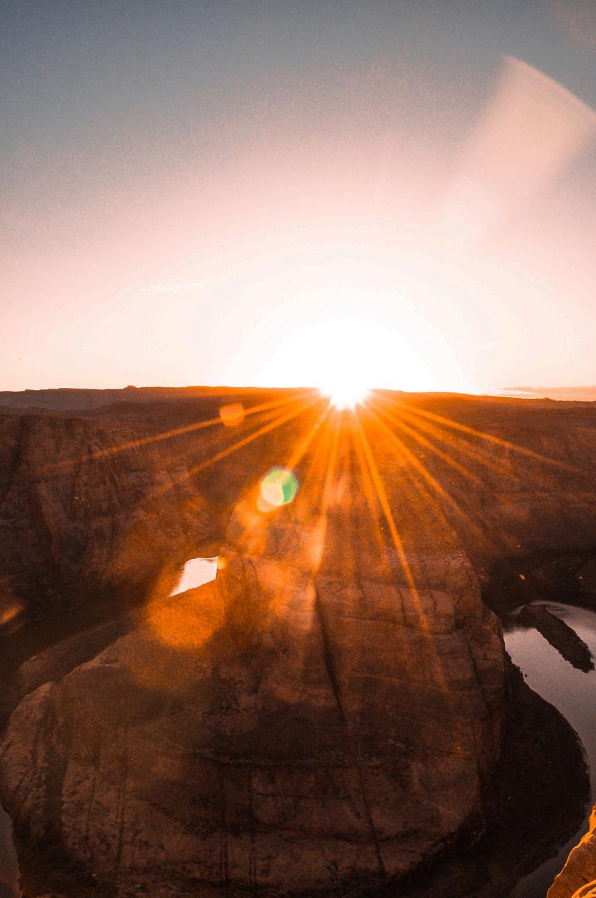
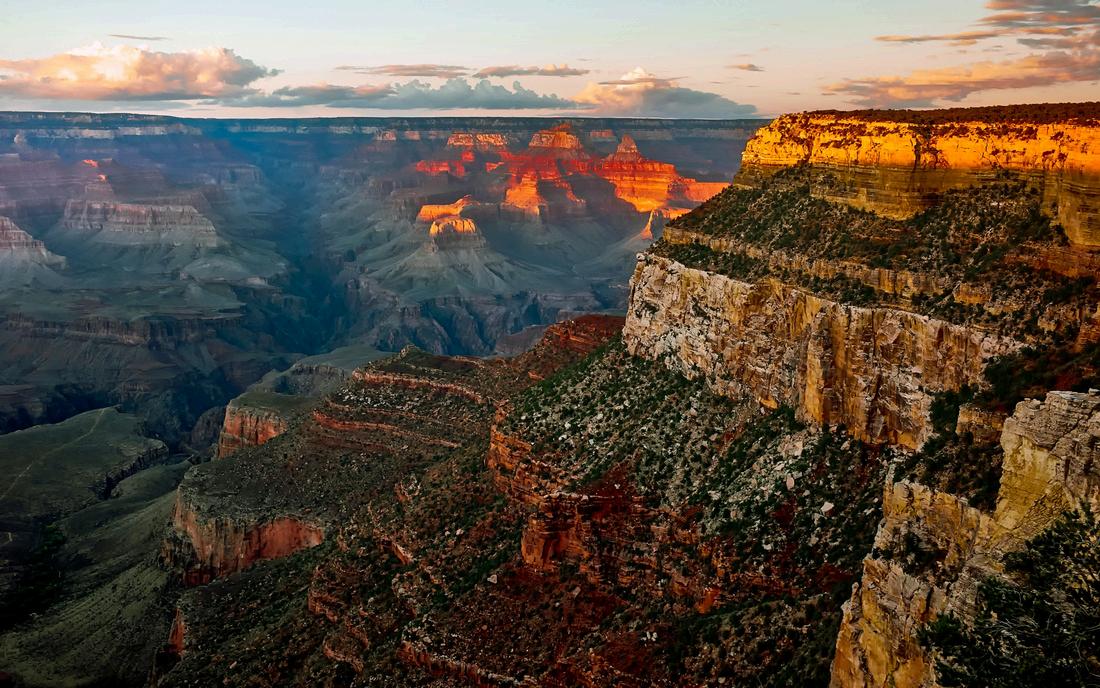
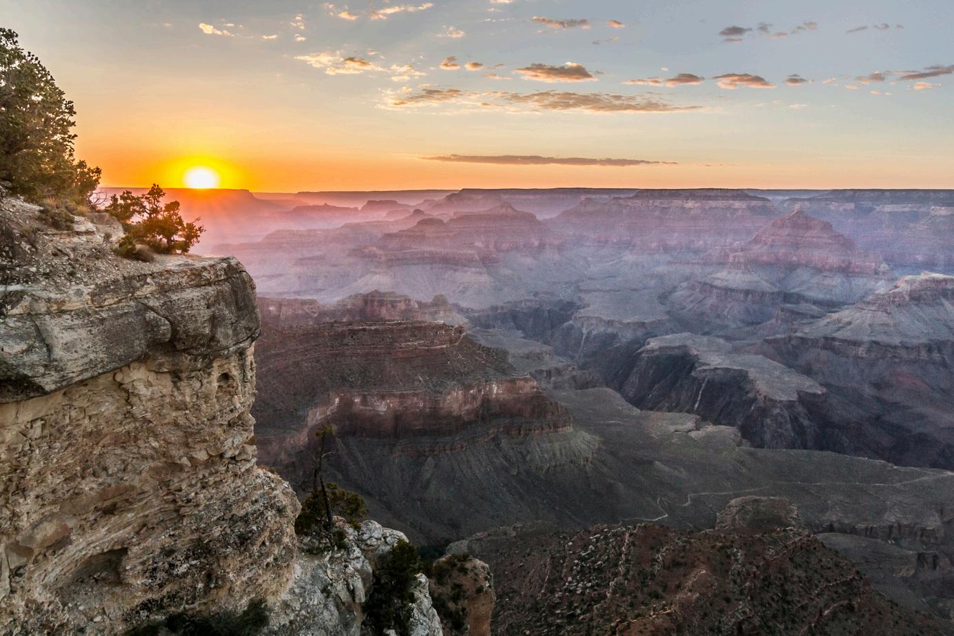
which offers up-close views of the Deva, Brahma and Zoroaster temples. (The Adirondack chairs on the lodge patio provide similar photo ops.) Other highlights: The sunset view from Point Imperial, near the park’s northern boundary (at 8,803 feet, it’s the highest point in the park), and Cape Final Trail, a moderate 4.2-mile hike featuring a striking mix of ponderosa pines, meadows and sweeping canyon views.
Things to keep in mind before visiting the North Rim: All amenities are typically closed from December through mid-May because of winter weather. (Hiking, snowshoeing and cross-country skiing in the park are allowed year-round but require a backcountry permit.) Food options include a casual deli and the lodge’s stately dining room, known for regional dishes such as local trout and venison meatloaf. (Reservations are strongly recommended.)
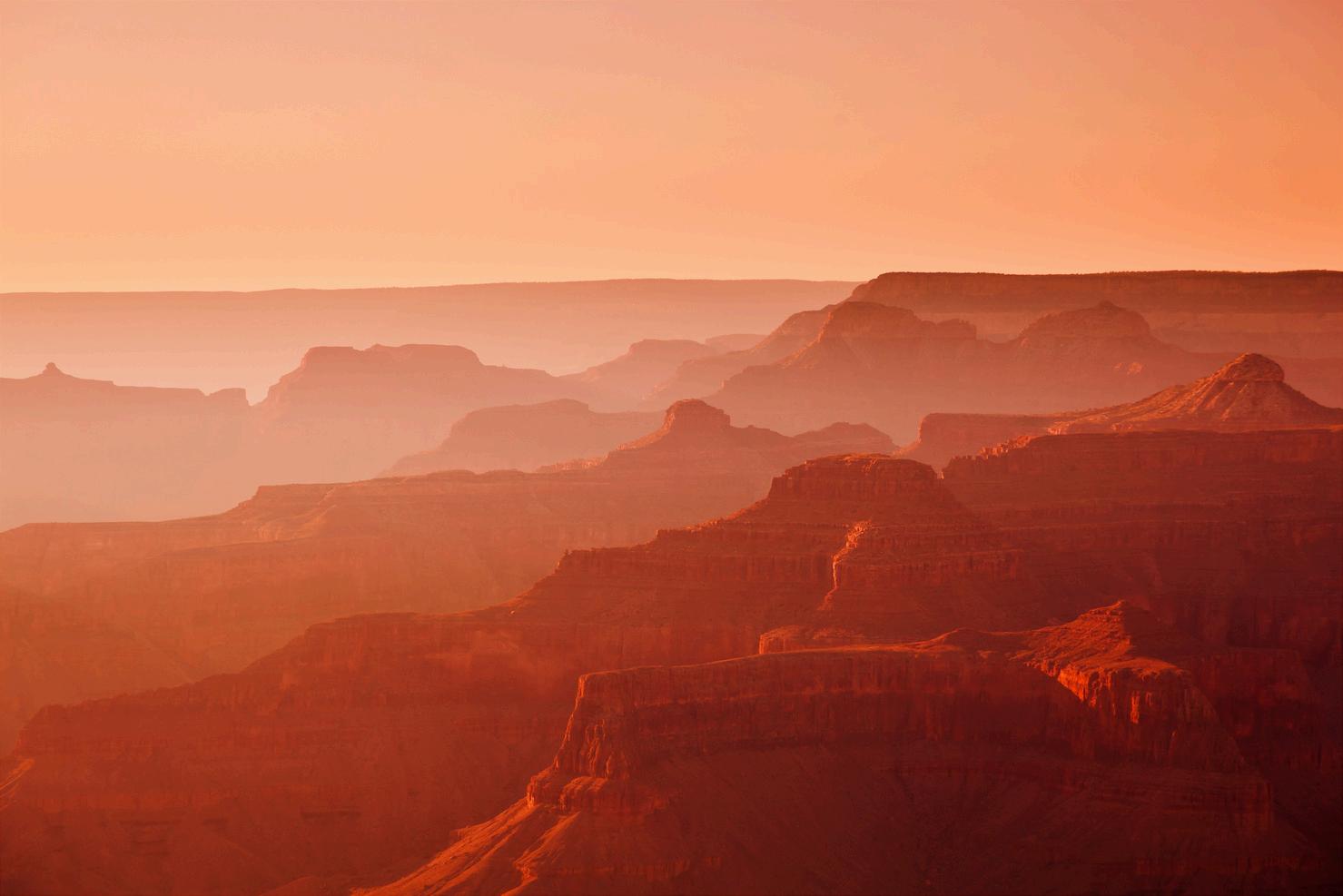
The North Rim of the Grand Canyon is an experience wholly separate from the South Rim. A more remote, rugged and individual opportunity to see what John Wesley Powell described as, “ledges and cliffs where the soaring eagle is lost to view before it reaches a summit.”
Travelers in the know stop at Jacob Lake Inn for homespun meals and fresh-baked cookies on their way to or from the North Rim. The property sits 31 miles from the North Rim’s entrance, G R A N D C A N Y O N N O R T H R I M
but it’s the closest brush with civilization for miles. With its folksy hospitality and rustic décor, it makes a complementary waypoint to any North Rim visit.
Many other options exist in the North Kaibab Forest. The Kaibab Plateau-North Rim Scenic Byways winds through meadows and forests ending at Grand Canyon National Park’s North Rim. Over 300 miles of trails, some clinging to the rim of the Grand Canyon, offer a diversity of challenge and solitude – and spectacular views only shared by local wildlife. Some trails include bike routes, some go to cool streams and hidden waterfalls. Fire Point, Jump Up, Crazy Jug, Rainbow Rim Trail. G R A N D C A N Y O N N O R T H R I M
Beyond the park, you can also explore the national forest. The visitor center for the North Kaibab Ranger District, Kaibab National Forest, is located in Jacob Lake and is open mid-May through midOct. The staff can answer questions about North Rim forest roads, and trails.
THENORTHRIM
The North Rim has the highest concentration of plateau-top trails in the Grand Canyon, so hikers new to the 8,000′ altitude (or with baby carriages), are able to enjoy a walk with a view.
Easily reached via a quarter-mile, paved walkway, Bright Angel Point has spur trails with spectacular views of distinctive canyon buttes and rock temples. Early morning, and sunset views from Bright Angel are a rave with photographers. Vista Encontada, another stopping point, is a great place for a picnic lunch.
Other more remote, stunning overlooks include Point Imperial, Walhalla Plateau, Cape Royal, and Point Sublime. The drive to Cape Royal has great views of the canyon that can be seen along the road. Be sure to stop at Roosevelt Point, and take the short loop hike with a view of the Little Colorado River as it enters its confluence with the greater Colorado River. Access to the well-named Point Sublime is only possible with a 4WD, but is well-worth the extra effort. Information on all locations is available at the Visitors Center.
MULE RIDES
North Rim mule trips are offered from mid May to mid October. One-hour rides along the rim and 1/2 day rim or inner canyon trips are usually available. Full-day trips into the canyon include lunch (The full-day trip does not reach the river.) Register in the lobby of the Grand Canyon Lodge at the Grand Canyon Trail Rides desk; open 7 a.m.-5 p.m. daily.
For reservations, call Grand Canyon Trail Rides, (435) 679-8665, or visit them at www.canyonrides.com/pkgr andcanyon.html.
CHOOSING WHICH GRAND CANYON RIM TO VISIT
The Grand Canyon touches four states: Arizona, Nevada, Utah, and Colorado. The most accessible and popular state to see the Grand Canyon is Arizona (South Rim) and Nevada (West Rim).
South Rim will provide you with the classic national park experience with ranger talks, free hop-on-hop-off shuttles, and concessionaires.
West Rim is run by the Hualapai Tribe. There is a per-person entrance fee that provides guests with a shuttle to the West Rim from the parking area. Guests may add on a Grand Canyon Skywalk ticket for additional purchase. A helicopter ride from Las Vegas is another popular way to get here.
North Rim is the more remote side of the Canyon loved by hikers, backpacking campers and the like. You'll find the North Rim to be the least busy, but also the most difficult to access. The North RIm is closed October-May due to winter conditions.
A V A S U P A I
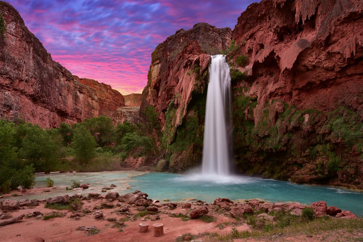
Havasu Falls is the most famous of the aqua-blue Havasupai Waterfalls that spill over deep-orange, travertine cliffs in a desert oasis of stunning beauty. The stark contrast between the arid desert landscape of the Havasu Canyon and the lush vegetation near the water is a juxtaposition of harsh desert and a sumptuous tropical paradise. The five Havasupai Falls include: Navajo Falls, Fifty Foot Falls, Havasu Falls, Mooney Falls and Beaver Falls. All are located on the Havasupai Indian reservation in a side canyon of the Grand Canyon. The waterfalls of the Grand Canyon are like no other in the world, and visiting them is the opportunity of a lifetime.
In order to maintain the pristine beauty of this isolated desert paradise, the Havasupai tribe limits the number of visitors allowed to visit the reservation. There is no day hiking permitted in the canyon.
Havasu canyon is open to visitors year round; however, peak tourist season is May through September. Water temperatures average 60 -70 degrees Fahrenheit during these months. Monsoon season in Arizona begins in midJuly and extends through August. Heavy rains cause flash floods during this time and evacuation of visitors due to high water is not unheard of. The shoulder season of September through November, March and April tend to have comfortable air temperatures; however, the water will be chilly. Winter months of December through February are cold despite the dry climate and swimming and camping are only for the bravest and toughest visitors. Staying in the lodge during the winter is a more comfortable option for the not-so-hotblooded individuals.
HAVASU FALLS & HAVASUPAI FALLS
ABOUT THE HAVASUPAI TRIBE
H A V A S U P A I
The Havasupai Tribe currently sits on 188,077 acres of land in the southwest part of the Grand Canyon. When the Grand Canyon was originally established in 1919, the Tribe was allotted 518 acres in a nearby side canyon, but have since returned back to their original homelands, which includes the beautiful blue-green waterfalls they share with us today. These lands are sacred to them and they draw their strength and spirituality from it.
The population for the Havasupai Tribe is 640 and tourism is their main industry. Packing animals for trips, accommodating guests and providing other services for the tribal enterprise is their main source of revenue. The nearest community to the Reservation is Peach Springs, 64 miles southwest from Hualapai Hilltop. The Havasupai Reservation consists of plateaus dissected by deep canyons, most notable geographic features include “The Great Thumb,†Long Mesa, and Tenderfoot Mesa, which converge on the Coconino Plateau at the south end of the reservation. Havasu (Cataract) Canyon, which is where the waterfalls are located, has a varied topography of the plateaus, gentle, rolling slopes, to escarpments of Kaibab Limestone.