

SPELTHORNE DESIGN CODE
SPELTHORNE BOROUGH COUNCIL

Prepared for Spelthorne Borough Council by


The Spelthorne Design Code Project Team would like to acknowledge everyone in the community in Spelthorne who has given up time to contribute to the development of this Code, whether through walking tours, school and youth groups, online feedback, public events or as part of the Citizens Panel. Your assistance, expertise and enthusiasm has been invaluable and is much appreciated.
Introduction
WHAT IS THE SPELTHORNE DESIGN CODE?
The Spelthorne Design Code has been produced to provide a framework to support high quality design in the borough, that is reflective of local character and design preferences. It sets out the design requirements for proposed new development to ensure that it is locally supported, sustainable and functions well for all.
It has been drafted to accord with national planning policies and guidance, including the National Model Design Code.
It is underpinned by an overarching Vision and Principles and more detailed Visions for each place within the Borough. The Design Code covers a range of Area Types that share similar design characteristics and issues. It places a particular focus on Areas of Change, identified by the Local Plan which are subject to more detailed Design Requirements.
The Design Code is based on wide-ranging inputs including that from the Spelthorne community, other stakeholders and a wider understanding of the places within the borough, to ensure it is locally-supported, robust and can be used in practice. The process has prioritised and been based around local engagement at every stage, including the use of an innovative Citizens Panel (a demographically representative group of Spelthorne residents), to ensure that the Code reflects and responds to community views and visions for the Borough.
The Design Code will be used to determine whether planning applications are acceptable in design terms and will support the emerging Spelthorne Local Plan It contains simple, concise, illustrated design requirements for streets, open spaces and buildings. It also sets out expectations for the process to be followed when proposals are designed.
The Code is not intended to stifle design creativity and the highest quality design, but to ensure that all development is Spelthorne demonstrates and delivers good design.
Status – either SPD or Supplementary Plan –section to be completed once adoption route agreed. The aim for the Design Code is to be adopted as a Supplementary Plan, however this requires the requirements for adoption to be published by MHCLG, anticipated Spring 2025.
USERS
The Spelthorne Design Code is intended to be used by the following groups of users:
• Developers applying for planning permission and their design teams
• Planning officers and planning committee members assessing the suitability of proposed designs
• The wider community, seeking to understand what sort of development is supported in their local area
HOW IT WILL BE USED TO DETERMINE PLANNING APPLICATIONS
Applicants for planning permission will need to demonstrate adherence to the Design Requirements in their proposals and planning applications. Whether a development meets the Design Code requirements will then be a material consideration in the determination of the planning application.
The Design Code has been produced in parallel with, and to support, the Spelthorne Local Plan Together, the Local Plan and Design Code, will support the delivery of high quality development and infrastructure in the most appropriate location.
HOW WAS IT CREATED?
The Design Code was created through extensive community and stakeholder engagement, and in-depth urban design analysis of the existing borough and anitcipated future development.
A full account of the process is set out in Appendix B.
What does the Design Code include?
The Spelthorne Design Code sets out the design requirements for proposed new development in the borough. It will ensure that new development is locally supported, sustainable and functions well for all its users.
The Design Code will be used to determine whether planning applications are acceptable in design terms, and will support the emerging Spelthorne Local Plan. It contains simple, concise, illustrated design requirements for streets, open spaces and buildings. It also sets out expectations for the process to be followed when proposals are designed. It is based on wide-ranging input including that from the local community, other stakeholders and wider understanding of the places within the borough, to ensure it is locallysupported, robust and can be used in practice.
The Spelthorne Design Code includes:
• A vision for development in the borough and its key places
• Design principles across a range of topics
• Expectations for a comprehensive and considered approach to the design process
• Tailored design requirements for different area types within the borough, covering Buildings, Open Spaces, Streets and Public Realm, Landscape and other physical aspects of the design of proposals.
Other local policy documents deal with different areas of the built and natural environment in Spelthorne.
The Local Plan covers:
• The amount and location of development
• The delivery of supporting infrastructure
• Policies that deal with flooding, developer obligations, affordable housing and others
Surrey County Council’s Local Transport Plan 4 covers:
• Transport policies, schemes and other transport matters
Surrey County Council also publishes the Healthy Streets Design Code, which sets out the requirements for the design of streets and highways. Its key requirements have been included in this Code.
The Spelthorne Local Cycling and Walking Infrastructure Plan identifies networks and priorities for investment to support walking, cycling and other forms of active travel in the borough.
The Spelthorne Local Plan is supported by a number of Supplementary Planning Documents (SPDs), that provide further guidance on how to implement Local Plan policies. These include:
• Climate Change SPD
• Flooding SPD
• Housing Size and Type
INFORMATION IN APPENDICES
The Design Code is supported by a series of Appendices:
Appendix A: Understanding Spelthorne Today
This appendix sets out relevant background design information about the borough today, including:
• Historic Development
• Green and Blue Infrastructure
• Movement
• Built Form
• People & Places
• Future Development
• Detailed characterisation of Spelthorne’s Area Types
Appendix B: Community Engagement
This appendix sets out how the Code was created in collaboration with the community in Spelthorne.
Appendix
C: Residential Extensions Guidance
This appendix adds further information to the key dimensional guidance for residential extensions. It is drawn from the previous ‘Design of Residential Extensions and New Residential Development’ Supplementary Planning Document (SPD).
How to use the Design Code
FINDING THE INFORMATION YOU NEED
The Design Code is divided into five key chapters, plus this Introduction chapter. These are to be referred to at the different stages of preparing or assessing a design proposal as set out in the diagram on the following page.
This icon in the Code highlights areas and themes identified as particularly important to the community.
This icon in the Code highlights where you can find out more about a subject in supporting appendices.
This highlighted and underlined text indicates that this is a key term that is defined in the glossary and elsewhere in the document.
AREA TYPES AND AREAS OF CHANGE
The Design Code sets out Design Requirements for developments in different Area Types in Chapter 4. They are denoted by purple text (e.g TC-S1 for Town Centre Neighbourhoods, Street requirement 1), for ease of cross-reference.
In some parts of the borough, such as Stainesupon-Thames town centre, it is anticipated that there will be significant new development and change. These Areas of Change have additional detail and Design Requirements set out in Chapter 5.
DESIGN REQUIREMENTS
Design Requirements are set out as follows:
Aim: an explanation as to why this set of requirements is important, and what outcome should be achieved. This Aim is particularly important for non-standard design proposals that propose innovative and high-quality approaches to achieve the same outcome (see ‘Comply or Justify’).
Requirements are then arranged as follows:
• Must: all proposals must comply
• Should: all proposals should comply unless non-compliance can be justified, and demonstrating compliance will add supporting weight to the design element of the planning application decision
ADVISORY DESIGN GUIDANCE
Some parts of the Code sets out guidance, best practice or design inspiration from elsewhere that could provide the basis for the development of design proposals. These are design ideas that development could implement, and are highlighted as such.
COMPLY OR JUSTIFY
The Design Code is to be used following a principle of ‘Comply or Justify’. Deviation from requirements set out will only be permitted with robust and evidence-based justification that any proposed design solutions still achieve the underlying Aim of the requirement.
Deviation from ‘must’ requirements will require a very high level of justification.
Proposals that do not comply with these principles and fail to provide compelling justification are likely to be refused
What is a good design process? STAGE
Learn about how design is considered and assessed in the planning system.
Understand how to approach the design process in a way that will achieve good outcomes and Design Code compliance.
CONTEXT
Where is the site?
Find out about the places that the site falls within, and learn about its history, present and future vision.
Consider the community’s design principles and objectives that new development should achieve.
REQUIREMENTS
What are the design requirements?
Find the Area Type that the site sits within, which sets the Design Requirements for the development.
3 Places Past, Present & Future
SUBMISSION
Some parts of the borough are designated ‘Areas of Change’ and have additional design requirements as well as their general Area Type Requirements.
What needs to be submitted with the planning application?
Learn about what needs to be submitted with a planning application to show Code compliance.
Fnd out how Spelthorne Borough Council can work with you to achieve well-designed development.
CHAPTER 4 Area Type Design Requirements
CHAPTER 5 Areas of Change
CHAPTER 6
Preparing your Application
About Spelthorne
Spelthorne is a borough in the north of Surrey, on the fringes of London, with a population of around 100,000 people. It sits on the northern banks of the River Thames, and to the south of Heathrow Airport.
Until the late 19th century, the area was a predominantly rural part of the former county of Middlesex, with Staines as the main market town. The arrival of the railway and growth of London sparked several waves of suburban growth, transforming the existing towns and villages into the suburban fringes of London, balancing the attractiveness of living near a city with the green open spaces of the countryside, common to much of ‘urban’ Surrey today. Since the creation of the Metropolitan Green Belt in the early 1970s, the built-up area has changed very little. The borough’s built character is very strongly related to its historic development patterns.
The borough hosts major infrastructure, particularly reservoirs, water supply and motorways that support London and the wider south-east. Kempton Park, Shepperton Studios and BP’s offices in Sunbury are significant landmarks and destinations.
Spelthorne is likely to see significant residentialled development in the future, particularly in its well-connected town centres. Well-designed development offers a significant opportunity to create new, integrated and valued places and neighbourhoods that could provide benefit to new and existing communities.


Find out more background information about the borough in Appendix A ‘Understanding Spelthorne Today’.
Stainesupon-Thames
Sunbury-on-Thames
Shepperton
Stanwell
Ashford
Laleham
Heathrow Airport
Feltham
Egham
Key features of Spelthorne

Green Belt


Much of the borough is covered by the Metropolitan Green Belt, placing a strong focus on development in existing built up areas.

Water
Bounded by the River Thames to the south, Spelthorne hosts major reservoirs and water supply infrastructure for the wider London and southeast, as well needing to manage flood risks.
Urban Morphology

Many parts of Spelthorne bear the hallmark of the era in which they were developed, with strong patterns of regular plots, straight streets and suburban development.

Attractive green open spaces
Green open spaces are much valued by the community and there are a wode variety, from parks to spaces for nature.
The River Thames

The River Thames provides an opportunity for leisure, exercise and breathing space, but in places the frontage is underused and could be improved.
Busy High Streets

Spelthorne’s places are focused on bustling and vibrant high streets that provide local distinctiveness and valued retail and community provision.
The Design Vision & Borough-Wide Principles
The Design Code has drawn on the views of the local community to define what good design is in Spelthorne, and the vision for how places should look, function and engage the community (both present and future) in coming years. The vision is set out across five themes, with supporting design principles to help make it happen.
BOROUGH-WIDE DESIGN VISION
All development in Spelthorne will contribute to achieving the vision for future design of places in the borough.
BOROUGH-WIDE DESIGN PRINCIPLES
All proposals for new development in the borough must apply the following design principles.
WHERE DID THIS COME FROM?
The Vision for the future and Principles for change were developed by the Spelthorne Design Code Citizens Panel and wider community through the engagement process.


Sustainable Urban Design
Blend modern infrastructure and development with heritage through sustainable, high-quality and timeless architecture and design, reflecting the borough’s historic identity on the edges of both city and countryside.
• Use the Design Code and your own studies to understand what is important to conserve, what new development can learn from the past, and what the priorities for change are in the local area, before considering how to address these in your design proposals.
• Design for longevity, adaptability, ease of maintenance and to make a long-term contribution to the places of Spelthorne.
• Reflect key characteristics such as building grain, roofscapes, detailing and building lines, and avoid abrupt changes in character without a clear transition between existing and new.

Commitment to Green Space
Protect, maintain and rejuvenate green spaces, with a focus on the importance of integrating natural areas into urban environments for residents’ well-being and improved biodiversity.
• Spelthorne’s historic development is strongly tied to the desire healthy urban living, being connected to both city and nature. New development should continue to enhance this approach, with usable, accessible and welcoming green open spaces.
• Make connections to the rivers of Spelthorne for both people and nature, and provide a range of green open spaces for new and existing residents to improve provision for all.
• Respect and retain riverside settings that provide amenity, placemaking and functional benefits.
• Make streets green spaces with trees and planting to provide shade and access to nature.


Connectivity
Enhance access to and the quality of public transport links, and improve the quality and safety of routes for pedestrians and cyclists.

Strong, Mixed Communities
Create inclusive places and spaces that cater to all, using design to physically and socially unite existing and new communities.


Climate Change Resilience
Mitigate the impact of development and adapt to varied risks that may be worsened by climate change, through thoughtful design and natural solutions, that can also enhance the quality of open spaces for people and nature.
• Create streets and enhance existing streets that reduce car dominance and prioritise active travel movement, particularly major arterial roads and town centre roads.
• Include supporting facilities such as cycle hubs, cycle parking, seating, water refill points
• Daily uses should be within walking distance of all homes, and all uses designed so that they can co-exist with each other, especially in Spelthorne’s town centres.
• Encourage the use of riversides for walking, cycling, leisure and recreation
• Create connections between existing and new neighbourhoods
• Create healthy spaces for people, that encourage the development of a community and a range of social interaction.
• New development should feel part of the surrounding area, and encourage social interaction
• Homes and buildings should be adaptable for the future, and reflect the diversity of living needs of Spelthorne’s existing and new communities. They should be practical, with enough storage and outdoor amenity space for modern living.
• Ensure all public space is safe, comfortable and secure for all.
• Reuse and refurbish existing buildings first where this will reduce lifetime carbon emissions
• Use natural and sustainable design solutions to manage increased intensity of surface water flooding events
• Seek betterment for surrounding areas where possible through the replacement of existing impermeable surfaces with more permeable materials and planting
• Design drainage features that can be managed and maintained over the long term
• Use a diverse and robust mix of native species in planting that can withstand changes in climactic conditions

The Design Process
The Design Process
The Role of Design in the Planning Process
The National Planning Policy Framework (NPPF) sets out the importance of design within the planning process to achieving the goal of high quality, beautiful and sustainable buildings and places. Key to this is a common understanding of design expectations, with design guides or design codes being a vital tool that all local planning authorities should prepare.
Design within the planning process is considered within the framework established by the National Design Guide (2019).
National Design Guide


Locally-specific design codes, prepared through a process of effective community engagement such as the Spelthorne Design Code, should take into account the guidance set out in the National Model Design Code, which is based on the framework of the ten characteristics established in the National Design Guide.


The Spelthorne Design Code has been prepared in line with the National Model Design Code’s guidance, and makes reference throughout to the ten characteristics of well-designed places. Design coding is one tool available to ensure high design quality. The NPPF recognises the importance of other tools and methods available to support a good design process. Early engagement between applicants, the community and the local authority is supported and will lead to more successful design outcomes.
National Model Design Code
Approach
No two sites or proposals are the same, and the design process for each will vary depending on circumstances. Larger, more complex sites with more ambitious proposals will require more design thinking than smaller, simpler proposals. Design is an iterative process – you may not get the right answer on the first try! There may be multiple ways of addressing an issue or opportunity, and many different competing requirements by different stakeholders. Use of community engagement and the council’s preapplication services are encouraged to help you find the optimum solution.
However, there are a number of guiding principles to an effective design process within the planning system, that should be followed by all applicants. This section sets out those key principles. The following section on Key Steps sets out how to practically undertake an effective process, and how to integrate it within the planning application process.
All designs should be inspired first by learning about the place and its wider context. The Design Code sets out key information about each of the places and area types within the borough for context, and the ‘Understanding Spelthorne Today’ appendix provides a further, deeper understanding of place. This information should be supplemented by site visits, research, community engagement and analysis.
Think about who you are designing for to ensure that places are inclusive and work well for all. Different social and ethnic groups, genders, ages, abilities and other characteristics all use and experience the built environment in different ways. This can be particularly important in ensuring that places feel safe, secure and welcoming to all.
Appropriate engagement should run throughout the process, with technical stakeholders, the community and the local authority. The right engagement at the right time can inform and influence design proposals to be better and widely supported by all stakeholders. Good engagement should seek to build consensus and help applicants to learn from the existing and potential new community that they seek to serve.
Be opportunity-led and positive with proposals. Mitigating any potential harm is important, but needs to be balanced against maximising the opportunity present on a site.
Environmental sustainability should be woven throughout all design, with the expectation that development in Spelthorne is of high standards in climate change mitigation and adaptation, sustainable water management, green infrastructure and biodiversity. The Climate Change Supplementary Planning Document which sets out design approaches and a design checklist.
A strong design brief and process and starts with testing whether the reuse and refurbishment of existing assets is feasible. Re-use of existing buildings can both reduce embodied carbon emissions from construction of new buildings, but also retain the existing character and heritage of a place.
The built environment can have a significant impact on the health and wellbeing of it users. The creation of places that can help people to live physically active and mentally stimulating lives is of vital importance. This includes ensuring physical accessibility for all ages, prioritising active travel, making homes and buildings adaptable for all stages of life, and considering how neurodivergence needs can affect people using the public realm. It also extends to mental wellbeing: ensuring that people can meet, interact, and also relax in safety and comfort.
Often, the details matter even at an early stage of design. This can be particularly important if there are key technical constraints that need to be overcome to deliver a scheme, which should be tested early in the process. It can also be important in engaging the community, where what is important to them may be quite specific.
All open spaces should have a clear and well-defined use carried through their design, which should be set out in the design proposal. Landscape design input should be integrated into the overall design process for a site, and should be able to influence the built form as it relates to open spaces. Landscape and open space design, when considered as a holistic part of the design of schemes, can have a significant impact on the quality and success of new development.
When considering details and architectural style, this can take a number of forms that may be appropriate to the context. The Design Code sets out key parameters for different area types but does not prescribe architectural styles, which should be considered carefully by applicants and design teams, as it may be an area of particular interest to the local community. The architectural style and language chosen should be applied consistently. Considerations for different architectural approaches are set out in the diagram to the right. It is also possible, with a degree of design sophistication and subtlety, to blend different approaches in a transitional approach where this suits the context, picking up and re-interpreting key vernacular or traditional contextual characteristics in a modern way.
Design teams should anticipate what aspects of their proposals will need ongoing stewardship and management. This may be as simple as ensuring that there is accessible and sufficient storage for facilities management, or designing to ensure that highways, drainage and open space can be adopted by the local authority, through to working with wider teams to ensure long-term management financial arrangements are put in place for buildings and spaces.
Explaining your proposals to stakeholders, the community and as part of your application can make a huge difference in how they are received, and also in reaching clarity in design thinking. A wide range of graphical communication techniques are available which should be employed at various stages. Hand-drawn sketches can be helpful early on in exploring ideas, before resolving to detailed plans and computergenerated visualisations.
TRADITIONAL
Reflects existing buildings and architectural vernacular, often with more detailing.
Well-suited to areas of heritage significance.
Can be unimaginative or risk pastiche if executed poorly.


CONTEMPORARY
Simpler architecture that is clear about the period in which it is built, with simpler detailing although retaining texture.
Efficient to design and construct.
Can lack connection to context if not executed well.


INNOVATIVE
Unusual, eye-catching and experimental.
Creative, interesting and can advance what is possible.
Requires high degree of design sophistication for success.


A scale of potential architectural design approaches with examples showing different applications of the approach to recent development in England.
Key Steps
An effective design process should demonstrate (as part of its submission materials within the Design & Access Statement) that it has undertaken the following key steps. They should be undertaken and supported with studies at an appropriate level of detail for the scale and context of the proposal.
Step 0: Setting the brief and appointing the team
The most important step in a good design process is the creation of a flexible, design-led project brief that responds to all planning policy, national legislation, the site and its context. This should set key parameters and expectations but also allow flexibility for change once design teams have had a chance to assess the site for capacity and potential.
As part of setting a brief, on larger proposals applicants will need to put together a specialist team appropriate to the project, with a strong design background, and all skills involved from an early stage. A co-ordinating lead will need to be put in place to ensure that trade-offs and decisions between different priorities are handled consistently and in line with the project brief. All disciplines should be involved in regular multidisciplinary sessions to ensure that technical and other inputs into the design process are heard and considered throughout the process.

Example of a site analysis plan highlighting the most important spatial features of a site and its surrounding context. These key features should influence the resulting design.
Step 1: Understanding the site and context
A full understanding of the site from a range of perspectives is vital for developing high-quality proposals that respond properly to the context and needs of the site. This should include as a minimum an understanding of the site and local context in relation to the following themes:
Environmental and Physical Constraints:
• Water and flood issues, including surface water, fluvial flood risk and groundwater issues
• Existing Utilities
• Protected Habitats and Ecology
• Existing Green Infrastructure
• Noise, Air Quality, Contamination
Heritage, Context and Placemaking:
• Heritage Assets
• Built form and urban typologies
• Heights, floor area ratios, grain and key dimensions
• Historic mapping and street patterns
• Land uses
• Connectivity and Mobility:
• Active travel and public transport connectivity
• Street hierarchy
As part of this understanding and analysis process, community engagement is a vital tool to learn more about a place, its context and local ambitions or priorities. This can take a number of forms from informal meetings, to drop-in events and co-design workshops.
Designers are encouraged to look beyond the boundary of the site and consider how their proposals will fit within the wider context. This may help inform where key uses, streets, open spaces and built form are located more effectively than looking at a site in isolation. Drawings will be expected to include an appropriate level of contextual information on them.
Step 2: The Vision
A clear vision of what the future development will be is a vital tool to keep projects on track and delivering on their promise. This could include a vision of character, function and what it might do for the existing and new community. Effective design visions are often backed up by a coherent narrative and effective, engaging concept diagrams, making reference to the surrounding context.
Community engagement to co-develop and test visions can be an important part of this step, establishing a shared approach to a site from the outset, in line with the Design Code.

Example of concept diagrams showing clearly the key structuring elements that drive the design, and why
Step 3: Developing and Testing Options
Design options to achieve the design vision should be prepared and explored iteratively. This will typically initially focus on massing, location of key uses, broad spatial arrangement of open spaces and relationships with surrounding areas.
Options testing through community engagement and with technical stakeholders can be a valuable part of the design process, helping everyone become involved before decisions are fixed.
Options should be appraised against the design vision, the Design Code, planning policy, their ability to achieve site opportunities, priorities learnt from community engagement and the wider brief. Engagement with the local authority through the pre-application process is encouraged.


Example options testing for a site, exploring different approaches to retaining/replacing buildings and the resulting layout changes needed.
Step 4: Site Parameters
Once a preferred option is chosen, key site parameters such as the built form envelope, access, green infrastructure and open spaces should be established and communicated through the design team, to form a basis for further work and design development. These parameters could be agreed with the council through the pre-application process, or even through an outline planning application. A sitespecific Design Code may need to be prepared to guide future design teams.
Further community engagement at this stage can explain why and how this option has been chosen, and how community involvement has helped to influence this.

Step 5: Resolving the Details
For a full or reserved matters application, design teams will then begin to resolve details such as façades, materials, detailed landscape and public realm proposals and other matters. These should be within the parameters established earlier, especially if those parameters have been agreed as part of an outline planning application or other method.
At this stage more complete visualisations may help the community to understand a scheme, its materials, architectural treatments and façades, and landscape proposals.
Find out more background information about the borough in Appendix A ‘Understanding Spelthorne Today’.

Example storey heights parameter plan
Example visualisation for a residential street. clearly demonstrating proposed character and use

Places Past, Present and Future
Staines-upon-Thames
Staines-upon-Thames is the largest town of the borough, a market town on the River Thames in the northwest of Spelthorne. Historically known simply as Staines (being renamed in 2012), the town is the largest in Spelthorne with the largest shopping area, key facilities and a growing population.

PAST
The location of Staines is likely to have originated from the position of a Roman bridge across the Thames. The earliest records of Staines as a settlement are from the town’s first market, held in 1218. Construction of the current Staines bridge was completed in 1832 representing the first major development since medieval times; substantially changing the town’s street pattern to accommodate the new bridge location.
The arrival of the railway in 1848 stimulated growth of the town, including residential development along London Road and Kingston Road. In 1864, the Hale Mill linoleum factory opened, becoming a key economic driver to the town and occupying up to 20 ha of land at its height in the 1920s.


The town grew southeast in the early to mid20th century, with widespread construction of suburban semi-detached housing which remains today. Some of the post-WWII housing was built specifically to accommodate Heathrow Airport workers, as the airport rapidly expanded.


Later 20th century development was increasingly car-oriented, and infrastructure projects included construction of the A30 bypass in the 1960s.


The Elmsleigh Shopping Centre opened in 1980, along with a multi-storey car park. The closure of the Hale Mills linoleum plant in 1973 opened up availability of this site which was redeveloped in the late 1990s to become the Two Rivers Shopping Centre, along with large swathes of surface-level car parking.


PRESENT
Today’s urban form of Staines town centre is heavily influenced by 20th century car-oriented development, resulting in large block forms comprising shopping centres, office blocks, logistics and warehousing uses. The four-lane A308 road (Clarence Street / Thames Street) adds to the centre’s car dominance, causing severance between the High Street and the Market Square. In contrast to these modern additions to the town, the High Street contains a many smaller older buildings, providing a more traditional town centre character. The High Street has also been pedestrianised, improving the pedestrian experience.
Notable buildings in the town include the Renaissance style Town Hall built in 1880. Also, a large vacant department store building (formerly Debenhams) is located on the corner of the High Street and Thames Street (A308). Twenty-first century development includes the two towers (15 and 13 stories) currently being constructed on the former Masonic Hall and Telephone Exchange sites, representing some of the highest site densities in the borough to date.
In contrast, Church Street (west of the centre) has retained a distinct ‘village’ character despite its close proximity to 20th and 21st century developments. A fine urban grain, mixture of building types, and proximity to the Grade II* listed St Marys Church and cemetery provide a rural village feel.
A large part of Staines is protected through Conservation Area status, extending along the bank of the Thames to include St Mary’s Church in the northeast, Church Street, Bridge Street, and Clarence Street. This covers the Market Square (with town hall), the entrance to the High Street, and the (currently vacant) department store building on Thames Street.

The remainder of Staines comprises largely of suburban dwellings from a range of eras; from typical 1930s semi’s through to more modern, 1990s cluster-style residential layouts. The predominant housing layout in the older, southeastern part of Staines is typically regular and linear.
Find out more background information about the borough in Appendix A ‘Understanding Spelthorne Today’.
Laleham
Egham Ashford
River Thames
Staines Village Conservation Area
Laleham Conservation Area
Staines Moor
The Design Vision & Principles for Change
Staines-upon-Thames will be an inclusive, well-connected urban centre with improved riverside access, better design, and flood mitigation. Key priorities include balancing heritage, enhancing connectivity, and transforming the area into a modern, safe town with green spaces and a public riverfront.
Sustainable Urban Design
• Conserve the street-level and townscape experience of areas with strong place identity
• Create new town centre neighbourhoods that are integrated with their surroundings and improve the townscape of the area
Commitment to Green Space
• Improve connections to the rivers, physically and visually, with improved safety and quality of spaces adjacent to the Thames
• Create new urban public open spaces to enhance the town centre
Connectivity
• Create new walking and cycling connections through new town centre neighbourhoods
• Improve the safety and security of existing paths and cycle routes
Strong, Mixed Communities
• Development that integrates new residents into the existing community, through physical links and new shared infrastructure and facilities
• Improve safety in public spaces
Climate Change Resilience
• Improve surface water permeability by converting impermeable hard surfaces to softer, permeable and planted spaces
• New development must not worsen fluvial, surface water or groundwater* flood risks
WHERE DID THIS COME FROM?
The Vision for the future and Principles for change were developed by the Spelthorne Design Code Citizens Panel and wider community through the engagement process.
* Research paper on groundwater flooding in Staines – Paul, J.D. et al. (2025) ‘Groundwater flooding of superficial gravels in an urbanized catchment,’ Journal of Flood Risk Management, 18(2) This academic paper was not commissioned by Spelthorne Borough Council.
Ashford


Ashford is a large town located centrally within Spelthorne. The town is predominantly suburban with a high proportion of semi-detached homes. Ashford has a well-used high street (Church Road), a railway station, and several local / neighbourhood centres spread throughout the suburban area.

PAST
Ashford was originally recorded as Exeforde on the Middlesex Domesday map. The land was held by Robert, Count of Mortain, a half-brother to William the Conqueror.
The modern-day name of Ashford derives from a crossing point over the River Ash. In 1789, this crossing was upgraded to a stone bridge by the Hampton and Staines Turnpike Trust. Today, the river is located to the south of Ashford meandering north of Staines bypass and passing under Fordbridge Roundabout.


Before the 19th century, Ashford Common was a large area of common land found in the south and east of the town. This was used during the reign of King George III for British military displays. Public rights were removed from this land in 1809 through the Inclosure Act, and much of the land is now developed.


In 1902, Ashford Manor Golf Club was established within Ashford’s manorial estate. In the same year, the construction of Staines Reservoir was completed. In 1924, construction of the Queen Mary Reservoir was completed. At the time, it was the largest reservoir in the world. The reservoir was used to test submersibles during World War II.


PRESENT
Ashford’s land use is largely suburban residential. The predominant housing type is low-rise detached and semi-detached; mainly built between 1885 and 1960. A recent development north of Church Road introduces some higher densities with apartment blocks up to five stories high.
The town centre is predominantly linear in form along Church Road, extending east-west from St Matthew’s Parish Church to Ashford railway station. The centre includes a wide range of shops and services including several convenience stores, takeaways, coffee shops, hairdressers, health & beauty salons, a library and a bank.
Ashford includes eight primary schools and two secondary schools. Ashford Hospital is located northwest of the A30 London Road, providing mostly day surgical and outpatients services. The prison HMP Bronzefield is also located on the edge of Ashford. This is the largest female prison in Europe.
Ashford includes several churches, including CofE churches St Matthew’s (Church Road) and St Hilda’s (Woodthorpe Road); and Roman Catholic church St Michael’s (Fordbridge Road). The latter was designed by Sir Giles Gilbert Scott in a distinctive Romanesque Revival style, built in several stages between 1927 and 1960.
Access to green space in Ashford is limited to several relatively small green areas. These include Hengrove Park, Woodthorpe Road Play Area, Ashford Recreation Ground, and Feltham Hill Road Recreation Ground. Notably, Ashford Manor Golf Club constitutes a large proportion of the overall green space; however, this is not publicly accessible.

Find out more background information about the borough in Appendix A ‘Understanding Spelthorne Today’.
Town Centre
Sunbury Common
Sunbury Cross
Queen Mary Reservoir
Hospital A308
BP Offices
The Design Vision & Principles for Change
Ashford will be a safe, community-focused area with green spaces, a revitalised High Street, local parks, and minimal high-rise development. Community feedback emphasises keeping Ashford family-friendly with a focus on youth and vibrant public spaces.
Sustainable Urban Design
• Prioritise apartment development close to public transport and main streets
• A wide mix of different types of homes in new development, that integrate well and are inspired by the existing character of the town
Commitment to Green Space
• Trees, planting and street greening throughout the High Street, major roads and all public realm
Connectivity
• Improve walking and cycling space, especially around the High Street and station
• Successful car parking arrangements that do not add to the car dominance of streets
Strong, Mixed Communities
• Include space for local independent businesses as a core part of the appeal and vibrancy of the town centre
• Improve safety in public spaces
Climate Change Resilience
• Improve surface water permeability by converting impermeable hard surfaces to softer, permeable and planted spaces
• Create more shade and cooling in streets and open spaces
WHERE DID THIS COME FROM?
The Vision for the future and Principles for change were developed by the Spelthorne Design Code Citizens Panel and wider community through the engagement process.
Sunbury-on-Thames
Sunbury-on-Thames is located in the east of Spelthorne Borough. It has a number of distinct areas including Lower Sunbury, Sunbury Common and the Sunbury Cross shopping centre. Sunbury is well provisioned with open green spaces, schools, shops and services. Sunbury train station provides direct services to central London. The town is divided by the M3 motorway.

PAST
The name ‘Sunbury’ has an unclear origin with variations of the name included in two AngloSaxon charters and the later Domesday Book of 1086.
An important early development was Sunbury Park located close to the River Thames, being the site of a Tudor Manor House built for a courtier of Elizabeth I. The area along the river became a gentrified area with many large properties built by wealthy residents. These included a group of Huguenot refugees, and it is possible that French Street is named after these settlers.
Sunbury was historically based around this area. To the north, Sunbury Cross is an historic intersection of five main roads, along with

scattered/linear development along Green Street connecting to the River Thames. Until the railway arrived in Sunbury in 1864, the wider area was mainly open fields and common land. Much development took place in the interwar and postwar periods, developing Sunbury Common into a suburb with a predominance of detached and
Significant change took place in Sunbury Cross during the 1970s with the construction of the M3 junction, and of several high-rise buildings and the


PRESENT
Sunbury’s land use is predominantly suburban residential, with some urban areas and industrial areas. To the northwest this includes the British Petroleum (BP) International Centre for Business & Technology, a research and office campus.
Sunbury Cross has a more urban development form with several high-rise buildings and a shopping centre. There are a range of shops, fast food outlets, health & beauty services, convenience stores, supermarkets, and a Premier Inn hotel. Community buildings include a library and church.
There are a range of green spaces across Sunbury including Medhurst Sports Ground, Groveley Road Recreation Ground, Kenyngton Manor Recreation Ground, Cedars Recreational Ground, Sunbury Park, and Lower Hampton Road Park. Sporting venues include the Gaflac Sports Ground, Kempton Cricket Club, Sunbury Cricket Club and Sunbury Sports Bowls Club. Adjacent to the east of Sunbury is also Kempton Park Racecourse, an 85-hectare site with equestrian racecourse involving adjoining inner and outer courses for flat and National Hunt racing.
Lower Sunbury, along the River Thames, has a contrasting ‘village’ feel compared to the wider area, with a range of historical properties, a finer urban grain, and adjacency to the historic Sunbury Park. Some of this area has Conservation Area status, incorporating much of Thames Street, Church Street, Sunbury Court, and part of French Street. While the manor house of Sunbury Park was demolished in post-war years, the parkland and walled gardens remain and add to the historic character of the area.
Find out more background information about the borough in Appendix A ‘Understanding Spelthorne Today’.
Sunbury Cross
Sunbury Common River Thames BP Offices
Lower Sunbury
Sunbury Park
A308
Kempton Park
Lower Sunbury Conservation Area
Upper Halliford Conservation Area
Upper Halliford
The Design Vision & Principles for Change
The different areas of Sunbury-on-Thames will maintain their distinctive and varied characters and a comfortable, well-designed environment with ample common spaces, reduced congestion and a welcoming atmosphere. Key priorities include improving accessibility for all, particularly those with reduced mobility. Sunbury Cross will become a safer, more human-scale place for residents and visitors, with reduced impact from vehicles, and reduced severance caused by infrastructure.
DESIGN PRINCIPLES
Sustainable Urban Design
• Prioritise apartment development close to public transport and main streets
• Built form that creates human-scale environments with improved safety
• Ensure sensitive intensification of existing suburban areas
Commitment to Green Space
• Trees, planting and street greening throughout major roads and all public realm
• Reflect existing ‘green’ and verdant characters
• New well-maintained green spaces that are designed positively
Connectivity
• Reduce severance caused by infrastructure
• Improve walking and cycling provision in streets and to the rail station
• Reduce the dominance of cars in the streets
• Enhance walking and cycling connections to, from and along the River Thames
Strong, Mixed Communities
• Improve safety in public spaces
• Include a wide mix of homes, supported by community facilities
Climate Change Resilience
• Improve surface water permeability by converting impermeable hard surfaces to softer, permeable and planted spaces
• Create more shade and cooling in streets and open spaces
WHERE DID THIS COME FROM?
The Vision for the future and Principles for change were developed by the Spelthorne Design Code Citizens Panel and wider community through the engagement process.
Shepperton
The village of Shepperton is located to the south of the borough, characterised by a thriving high street and many attractive tree-lined residential streets. Shepperton can be divided into two distinct areas with the main built-up area to the north, and Old Shepperton to the south. The town includes various shops and cafés, as well as a railway station providing direct trains to London Waterloo.

PAST
There is evidence of human activity in Shepperton since the middle-Neolithic period, from the discovery of a penannular ring ditch in the 1980s. In 1086, the Domesday Book recorded a population of 25 households in Shepperton (then referred to as ‘Scepertone’).
Shepperton is strategically located nearby the River Thames which has been a vital transport route since the late 13th century. Products including grain, vegetables, and building materials were transported by the river. To aid river navigation, Shepperton Lock and Sunbury Lock were built near Shepperton in the 1810s.
Shepperton originally developed as a settlement on the River Thames; the area known as Old

Shepperton today. Church Square in Old Shepperton served as the original settlement nucleus. The square has a range of historic buildings, most notably the St Nicholas Parish Church, built in 1614. Sir Nikolaus Pevsner described the square, with its glimpse of the River Thames, as “one of the most perfect village pictures that the area has to offer”.
The construction of the Shepperton branch line in 1864 led to a new focus of development away from the existing village and 1 mile to the north where Shepperton station had been constructed. This led to the formation of Shepperton town, connecting south to Old Shepperton via the high street and Church Road.


PRESENT
Shepperton’s high street is a thriving centre with a wide range of shops and cafés, including independent businesses. The high street is a wide road with parking roads either side. However, there is a good sense of enclosure owing to the mature trees which line the street. There is a large mix of land uses including housing, offices, a library and a church; adding to the vibrancy of the area.
The residential areas in Shepperton are suburban developments mostly constructed in a linear pattern. Houses are mostly detached and semidetached, along tree-lined streets. Broadlands Avenue is an attractive area with generous plot sizes and large, detached houses.
Shepperton includes three conservation areas: Old Shepperton, Lower Halliford, and the Manygate Lane estate. Old Shepperton includes several historic buildings such as the parish church, two public houses, an 18th century riverside manor, and a Grade II* listed timber framed Old Rectory building built c.1500. Lower Halliford includes several detached classical 18th century riverside houses, and the meadow along Russell Road. The Manygate Lane estate is a contrasting modernist development characterised by modular rectangular, white-painted houses from the mid20th century.
There are several accessible green spaces in Shepperton, including Shepperton Recreation Ground and Manor Park. Unlike other areas in Spelthorne, Shepperton has close proximity to surrounding fields and rural areas, as well as Public Rights of Way providing a variety of walking routes.
Find out more background information about the borough in Appendix A ‘Understanding Spelthorne Today’.
Shepperton Studios
Littleton
Shepperton
Shepperton Green
Lower Halliford Conservation Area
Manygate Lane Conservation Area
Shepperton Conservation Area River Thames
M3
The Design Vision & Principles for Change
Shepperton will preserve its village charm while embracing welldesigned new development. The community supports a new square in the centre, better cycling infrastructure along the Thames, and a semi-pedestrianised High Street that retains independent shops while supporting sustainable growth and transport.
Sustainable Urban Design
• Ensure sensitive intensification of existing suburban areas reflects the existing street scene and architecture
Connectivity
• Improve walking and cycling provision in streets and to the rail station
• Reduce the dominance of cars and highway infrastructure in the streets
Commitment to Green Space
• Reflect the existing ‘green’ and verdant character of the place
• Include planting, seating and high quality materials throughout the public realm
Strong, Mixed Communities
• Improve safety in public spaces
• Include a wide mix of homes, supported by community facilities
Climate Change Resilience
• Improve surface water permeability by converting existing impermeable hard surfaces to softer, permeable and planted spaces
WHERE DID THIS COME FROM?
The Vision for the future and Principles for change were developed by the Spelthorne Design Code Citizens Panel and wider community through the engagement process.
Stanwell

Stanwell is a predominantly residential suburban area in the north of Spelthorne Borough, located east and northeast of the Staines Reservoirs. It is the northernmost settlement in Surrey. There is a small village centre to the north of Stanwell, with a village green, pub, church, and small range of shops and services. Stanwell is in close proximity to Heathrow Airport to the north.

PAST
The Domesday book of 1086 records ‘Stanwelle’, unusually retained by a man with an AngloSaxon name. In 1603, the manor of Stanwell was granted to Thomas Knyvet who helped to foil the attempt of Guy Fawkes to blow up the Houses of Parliament. Up until the 20th century the area was mainly farmland and moor land surrounding the village of Stanwell.
The extent of Stanwell was cut substantially during the 20th century with the construction of the Staines Reservoirs in 1902 and the development of Heathrow Airport (originally Harmondsworth Aerodrome) which became operational in 1930. Additionally, some land was taken west of Stanwell Moor for the construction of the M25 in the 1980s.


Large-scale construction of new homes began following World War II. Over 300 prefabricated houses were built between Town Lane and Long Lane between 1945 and 1948. Several smaller developments of terraced and semi-detached houses, including those either side of Park Road, were built since 1954 by the British Airways Staff Housing Society.
PRESENT
The suburban residential areas today comprise largely of semi-detached and terraced housing built between the 1950s to 1970s, with some early 21st century development. The urban form involves regular perimeter blocks with areas of green space distributed throughout the development.
The historic centre of Stanwell, a Conservation Area, retains a distinctive village feel from the surrounding 20th century suburban development. The urban form is nucleated, with St Mary the Virgin Church and the village serving as focal points. A variety of historic properties from different time periods adds to the village character. The centre benefits from several shops and services including a convenience store, public house, a range of takeaways and a florist.
The wider area of Stanwell also includes Stanwell Moor, a distinct settlement located north of King George VI Reservoir. Residential properties are predominantly from the mid-to-late 20th century. Stanwell Moor offers several facilities including a village hall, parade of shops, and public house.
There is a good provision of green space throughout Stanwell. This includes Village Park, Lauser Road Park, West Bedfont playing fields, Clyde Road Park, and Stanwell Moor playing fields.
While Stanwell is in close proximity to Heathrow Airport, there is limited access between the settlement and the airport due to the perimeter road and adjacent watercourses. In January 2025, the government invited Heathrow Airport to bring forward proposals for a third runway. While details of the proposed airport expansion are not yet known, these plans have the potential to impact the future character of Stanwell.

Find out more background information about the borough in Appendix A ‘Understanding Spelthorne Today’.
Heathrow Airport
Staines Reservoirs
King George VI Reservoir
Stanwell Moor
Stanwell Village
Ashford
Stanwell Conservation Area
The Design Vision & Principles for Change
Stanwell will develop a clearer place identity and have better integration with the rest of Spelthorne. Development should focus on addressing infrastructure gaps, prioritise healthy placemaking and create more connected spaces, both green and built, to foster community cohesion and opportunity.
Sustainable Urban Design
• Ensure that edges between different land uses successfully manage any impacts from one use to another
• Create places that have sufficient density to be vibrant, sustainable and safe
Commitment to Green Space
• Extend and enhance existing green spaces, with green corridors into new development
• Create new green spaces that can host community events and become places to meet, socialise and relax
Connectivity
• Enhance walking and cycling connections to existing streets and the wider context, including Heathrow and employment areas
• Improve the safety, security and attractiveness of existing links
Strong, Mixed Communities
• Prioritise health and wellbeing as a key design driver for new development
• Improve safety in public spaces
• Include a wide mix of homes, supported by community facilities
Climate Change Resilience
• Improve surface water permeability by converting impermeable hard surfaces to softer, permeable and planted spaces
• Create more shade and cooling in streets and open spaces
WHERE DID THIS COME FROM?
The Vision for the future and Principles for change were developed by the Spelthorne Design Code Citizens Panel and wider community through the engagement process.
BLANK PAGE

Area Type Design Requirements
Spelthorne’s Area Types
Spelthorne has a number of different Area Types, which are distinctive from each other in urban design characteristics and their future patterns of development.
Different Area Types have different Design Requirements for future development that are appropriate to the area. Find the Area Type your proposal is in on the Area Types Plan to the right to see which requirements apply.
Designated ‘Areas of Change’ have more detailed coding requirements in addition to their Area Type Design Requirements. These are found in Chapter 5.
Most proposals in Spelthorne will be covered by the Code. Other Area Types, and some development types, do not have detailed coding These design proposals should be in accordance with:
• Requirements for Design Process (Chapter 2)
• Design Code Vision and principles for the borough (Chapter 1)
• Design Code Vision and principles for the place (Chapter 3)
• Policy requirements as set out in the Local Plan and other valid policy or guidance


High
Town Centre N’hoods


Places See Chapter 3
Areas of Change See Chapter 5 Village Inner Suburban Suburban
Neighbourhoods High Streets
Business Park Light Industrial Retail Park
Waterbodies
High Streets
OVERVIEW
High Streets are the vibrant heart of Spelthorne, and are both functional places and a core part of the borough’s place identity.
There are four identified High Streets within Spelthorne. They are distinct in character from each other but have a number of common features.
• Staines-upon-Thames
• Ashford
• Sunbury Cross
• Shepperton
Staines-upon-Thames has a thriving High Street which is pedestrianised along its core length. Others remain busy streets for vehicles as well as people.
Staines and Ashford are the most historic High Streets, well-developed by the end of the 19th Century. Shepperton and Sunbury Cross develop further in the Inter-War and post-War period.
CODED DEVELOPMENT TYPES
All development along High Streets in Spelthorne is anticipated to be of the form of mixed use buildings, with retail or commercial ground floors and residential dwellings or office space on floors above.
AREAS OF CHANGE
Staines-upon-Thames and Sunbury Cross High Streets are both parts of Areas of Change. As well as the requirements set out in this section, they are subject to further spatial coding requirements set out in Chapter 5.
Development in Ashford and Shepperton High Street is anticipated to be incremental and governed by the design requirements set out in this section.
LOCATIONS
Locations of High Streets in Spelthorne are shown on the following page.
DESIGN AIMS
Development in High Streets will:
• Be incremental in form, being guided by existing dimensions of height, width, set back and building line
• Include retail and commercial uses on the ground floor to ensure the continued vibrancy and importance of High Streets as key places in Spelthorne
• Support a transformation in the public realm to prioritise active travel
• Be attractively and thoughtfully detailed and articulated with appropriate materials to integrate visually with the context and surrounding place Spelthorne’s High Streets are distinctive and important to the community. Development must ‘fit in’.


Ashford
Sunbury Cross
Shepperton
HS-1 BUILDING HEIGHTS
Maximum heights of new development must comply with the requirements set out in the diagram to the right , and not exceed the maximum heights specified below.
• Staines-upon-Thames: 6 storeys (approx 18m).
Further detail in Chapter 5, Areas of Change.
• Ashford: 5 storeys (approx 15m)
• Shepperton: 5 storeys (approx 15m)
• Sunbury Cross: 5 storeys (north side, approx 15m), 8 storeys (south side, approx 24m).
Further detail in Chapter 5, Areas of Change.
Development between different heights may:
1. Have one storey higher than the lower adjacent building, up to the maximum heights specified.
2. Have one storey higher than the taller adjacent building, provided it is set back from the building line and the flank facing the lower adjacent building, and does not exceed the maximum heights specified.
HS-2 BUILDING LINES
Spelthorne’s High Streets have a consistent building line, with most buildings built up to the front of the plot and joining adjacent buildings.
New development must
• Match the surrounding building line and build to the front of the plot
• Ensure where possible at least a 2m footway width in front of the building
• Join adjacent buildings with a party wall
• Where there is a change in building line from one side of a plot to another address the change as shown to in the diagram to the right
Site with change in building line
Continuous join of building line
Development between similar heights may:
3. Be one storey higher than adjacent buildings, up to the maximum heights specified.

Overlooking and positive use of space created
‘Leftover space’ with no overlooking
HS-3 BUILDING GRAIN
The plot structure of Spelthorne’s High Streets typically leads to relatively narrow buildings, referred to as a fine urban grain. It is also common to see buildings that are wider than this typical grain subdividing the frontage so as to match.
Buildings must visually match the prevailing building width of:
• Staines-upon-Thames: 6-10m
• Ashford: 5-10m
• Shepperton: 6-20m, with most buildings wider than 10m subdivided visually
• Sunbury Cross: 6-10m, with most buildings wider than 10m subdivided visually

Ashford - plots and building figure ground showing fine grain of built form

Subdividing the frontage of a single building to match the prevailing grain and rhythm of a HIgh Street (Lower Marsh, Waterloo)
HS-4 VERTICAL MIX OF USES
High Streets are defined by their varied ground floor uses. Buildings on High Streets are expected to be mixed-use vertically.
Buildings must:
• Have a commercial ground floor suitable for flexible retail use, with a storey height of at least 4.3m to allow for future changes in use
• Have either office or residential dwellings (apartments) on upper floors, with storey heights typically lower, of around 3m
• Have separate entrances for upper floor offices or dwellings, from the High Street Buildings should:
• Locate servicing for retail units to the rear of the building. If servicing is necessary from the street this should be outside of retail hours.
HS-5 HIGH STREET PUBLIC REALM
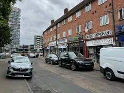
Ashford, Shepperton and Sunbury Cross have High Streets with through vehicle traffic, service lanes and occasional streets. They are typically between 25-35m in width.
With phased changes in the design of the public realm, these streets can provide more space for pedestrians, cyclists and active uses of the public realm, while still accommodating car parking and vehicle movement successfully.
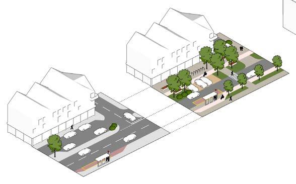
Existing
Future
The quality of the public realm, and poor facilities for walking and cycling, detracts from High Streets today.
Public realm changes to High Streets must follow the principles of Surrey’s Healthy Streets Design Code.
Spelthorne’s High Streets should:
1. Include dedicated cycling provision to LTN 1/20 standards
2. Provide dedicated passenger waiting space at bus stops that does not block footways
3. Limit vehicle carriageway widths to the minimum required
4. Provide on-street parking as bay, parallel or angled arrangements off the main carriageway, with differentiated surface treatments and a maximum of six parking spaces in a run
5. Integrate parking bays into a flexible planting and street tree strip, which can also accommodate seating, lighting, cycle parking and wayfinding
6. Provide frequent pedestrian crossings at key desire lines
7. Provide continuous footways at junctions with side roads
8. Include frequent cycle parking at gateways and junctions along the street
9. Include seating at least every 50m
10. Use streets and landscape design to mark key nodes in the street
HS-6 SHOP FRONTS
The design of shop fronts and building façades will make a strong contribution to the character of the High Street.
Shop fronts must:
• Adopt a unified approach to shop front design where buildings are architecturally in the same group within a terrace (e.g. the same building) (diagram centre right)
• Adopt an individual approach to shop front design buildings are individual (diagram far right)
• Reflect the width of historic plot pattern in their design
HS-7 FACADES
Above shop fronts, High Street façades must:
• Have a roof visible from the street, e.g. a gable end, pitched roof or mansard roof. Flat roofs will not be accepted.
• Have a base of a single storey, used as a shop front
• Be visually proportioned so that floor and window heights decrease vertically
• Match the rhythm of windows along the street
• Use materials with texture or decorative detail visible at close distances, such as brick, to create visual interest
Rich, detailed building façades which have parameters in common with adjacent buildings are popular.
Unified approach to shop frontages on the same terrace of buildings
Individual approach to shop frontages on individual buildings

A > B > C
Proportions of base, middle and top floors in relation to each other
Matching the rhythm of windows along a High Street

Example of decorative detail separating shop front from upper floors (Wellington House, MATT Architecture)
Town Centre Neighbourhoods
OVERVIEW
Staines-upon-Thames and Sunbury Cross are town centres where a significant increase in homes is anticipated close to or within the town centre. This development will form new mixed-use neighbourhoods, where facilities and amenities are within walking distance of homes, and other destinations can be accessed by frequent public transport.
Town centre neighbourhoods will be of higher residential density than is typically seen in Spelthorne. They will have residential dwellings and supporting commercial and community facilities, as well as retail space that integrates with the rest of the town centre.
Some parts of town centre neighbourhoods have already been built, for example along London Road in Staines-upon-Thames. As neighbourhoods develop or are regenerated, it will be important to integrate these neighbourhoods into the surrounding town centre, with new streets and open spaces that can bring the existing and new community together.
CODED DEVELOPMENT TYPES
All development in Town Centre Neighbourhoods is anticipated to be in the form of medium to high density residential-led mixed use buildings, with some retail or commercial ground floors. This will include a range of densities and development types from townhouses to towers.
AREAS OF CHANGE
All Town Centre Neighbourhoods in Stainesupon-Thames and Sunbury Cross are designated as parts of Areas of Change. As well as the requirements set out in this section, they are subject to further spatial coding requirements set out in Chapter 5.
LOCATIONS

DESIGN AIMS
Due to the importance of design quality in new and emerging Town Centre Neighbourhoods, Design Aims and corresponding Requirements are set out across six themes:
• The Street & Ground Floor
• Scale & Massing
• Open Spaces
• Homes & Practicalities
• Detail & Richness
• Climate Change & Sustainability
New neighbourhoods must be a part of the existing place, helping new residents be part of the community.
High quality open spaces, affordable, attractive new homes, and appropriate development scale are priorities.
Variety of types of home - duplexes, maisonettes, apartments and others

Getting about by walking and cycling is the most attractive option
Space for nature as well as people
Range of private and shared amenity spaces
Safe, attractive and green public open spaces
Local facilities and shops
The Street & Ground Floor
The street and public spaces are how most people will experience Spelthorne’s town centre neighbourhoods, and are of vital importance to the identity of places, and successful integration with their surrounding town centres and neighbourhoods.


DESIGN AIMS
The Street & Ground Floor of Town Centre neighbourhoods will:
• Maximise active frontages at ground level, whether they be commercial or residential
• Connect the indoors with the outdoors, with appropriate ground floor uses aligned to the adjoining public realm or outdoor space
• Use the built form and design of the public realm to ensure all space has a positive purpose
• Provide a network of streets that prioritise people and active uses over cars, designed on ‘superblock’ principles
• Include street trees and planting in the public realm
TC-S1 ACTIVE FRONTAGES
The ground floor connects the street with the activity within the building, and creates safe and secure environments through passive surveilliance. Different frontages and design requirements are set out on the next page.
Development must:
• Locate frontages with a higher level of activity on busier streets
• Locate active frontages to provide passive surveillance of surrounding areas which lack overlooking from other buildings
• Not have more than 10m length of continuous inactive or low activity frontage
• Have ground-floor entrances to homes, retail or commercial space at least once every 10m
TC-S2 SPILL-OUT SPACE
Active ground floor uses such as retail, cafes, restaurants, community spaces and leisure uses can further animate the street by providing ‘spillout’ public realm space for tables, activities and events.
Development must:
• Provide ‘spill-out’ space of at least 2m width on high activity retail and commercial frontages where there is direct sunlight and shelter from winds
• Demarcate spill-out space, e.g. by a change in surface materials
• Development should:
• Align internal uses (e.g. cafes) with external spaces (e.g. squares and open spaces)
• Provide shelter of spill-out space through temporary or retractable awnings
A feeling of safety and security in the public realm at all hours of the day is a key community priority.
Residential active frontage
Spill-out space for cafe seating on walking route
(TC-S1 / TC-S2) Types Of Frontage and Spill-Out Space
This diagram sets out the different types of frontage in town centre neighbourhoods. Proposed frontages must achieve these design requirements.
Apartment Entrances
Provide a safe, comfortable and welcoming threshold that feels like home.
Homes
Promote interaction between neighbours and a welcoming, safe threshold space.
Medium Activity
Service / Parking Access
Minimise the visual impact and lack of activity around these frontages
Inactive / Low Activity
Retail Frontages & Commercial Entrances
A source of activity and vibrancy on main streets. Allow indoor uses to ‘spill out’ onto the street with a demarcated space extending the public realm.
High Activity

Flexible ‘spill-out space’ of 2m+ width with differentiated materials
Retractable awnings may be used
Commercial Provides overlooking from ground floor offices and other commercial uses.
Medium Activity
Medium Activity
Glazing to provide visibility to public realm
Seating and planting at interface with street
Minimise width of this frontage type, maximum 10m continuous width
Entrances flush with frontage Continuous footway past entrance
Front gardens of 1m+
Front doors grouped together
Front doors have covered threshold
Bin storage space adjacent to front door
Covered threshold of 1.5m+ depth
Adjacent to retail entrances where possible
Cycle storage at entrance
Planting and seating to enclose threshold space
TC-S3 STREET NETWORKS AND DESIGN
New town centre neighbourhoods must be designed on the principle of prioritising the movement of people and active travel within and through the neighbourhood, with vehicle traffic directed onto suitable streets away from peoplefocused hearts of neighbourhoods.
• Streets within town centre neighbourhoods should be designed as Pedestrian Priority Streets, to prioritise active travel, and the use of the street for play, relaxation, socialising and active uses such as cafes or similar.
• Streets at the edge of town centre neighbourhoods, which are today designed as large traffic-dominated roads, should be reimagined as Multi-Modal Streets.
Design requirements for these two key street types are set out on the following page. These follow the principles of Surrey’s Healthy Streets Design Code.
Limited access for servicing and parking access Continuous movement for active travel modes
Neighbourhood street network design approach
TC-S4 STREET TREES AND PLANTING
Street trees provide multiple benefits, including shade, shelter, improvements to air quality, water handling, urban habitats and aesthetic contribution to the character of streets. Other planting can make contributions to some of these aspects and is encouraged.
Where development creates new public realm or streets, they must be tree-lined and planting should be integrated throughout the public realm.
Further requirements for landscape and street tree selection are found under TC-O5.


Street trees and planting in a residential streetTrees providing shade in public open space
Vehicle Movement + Active Travel Movement Street Types
Vehicle Movement + Active Travel Movement
(TC-S3) Types Of Street
Limited access for servicing parking access
This diagram sets out design requirements for the different street types within town centre neighbourhoods.
Continuous movement for active travel modes
Types
Multi-Modal

Pedestrian Priority Street
TC-S3a Pedestrian Priority Streets will vary in character to reflect the surrounding built form and intended vision of the town centre neighbourhood. At a minimum they must
1. Have a shared surface area of at least 5m wide to provide occasional service access or limited access to car parking
2. Have a planting or landscape strip e.g. of at least 3m wide to be able to accommodate street trees, cycle parking, seating, lighting, planted areas, informal play features and surface water management
3. Have a minimum 2m wide footway between the landscape strip and built form front boundary
4. Use differentiated surface materialat junctions between pedestrian priority streets
Street Types
Multi-Modal Streets
Pedestrian Priority Street
Few (if any) schemes will create new multi-modal streets in town centre neighbourhoods. Most new town centre neighbourhoods will redevelop existing sites and be adjacent to existing major streets. These streets can be redesigned to reduce the dominance of vehicle traffic and provide more space for people and other modes, as shown below.
TC-S3b Multi-Modal Streets must:
1. Be fronted by built form with active ground floor frontages
2. Include dedicated cycling space to LTN 1/20 standards
3. Have regular pedestrian crossings that connect with desire lines
4. Be tree-lined and include planting areas, retaining existing street trees
5. Include a flexible strip of planting, seating, cycle parking to help delineate movement modes from each other
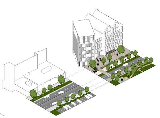
Scale and Massing
Scale and massing must be contextuallysensitive and successfully manage transitions to surrounding areas whilst ensuring an efficient use of land. High density does not need to mean highrise, and well-designed medium-rise schemes are strongly encouraged in all of Spelthorne’s town centre neighbourhoods.
TC-M1 NEIGHBOURHOOD MASSING APPROACH
Views from existing streets with defined character define massing envelope
Taller buildings located at heart of new neighbourhood, stepped back from street
Heights transition from edges
DESIGN AIMS
The scale and massing of Town Centre Neighbourhoods will:
• Consider and minimise the impact on how they will be perceived from the street and areas of local distinctiveness and importance
• Make a positive choice of massing typology that balances integrating with the existing context with the need for efficient use of land in accessible, sustainable locations
• Ensure massing, especially of tall buildings:
• has a varied elevation over their height
• does not to overwhelm the scale of the surrounding street
• breaks up elevations through use of materials and facade design
• keeps a street level microclimate, daylight levels and wind effects that is comfortable
Existing low-rise town centre or residential area
Finer grain of buildings closer to town centre
New public realm or open space
An overall approach to massing of new town centre neighbourhoods is set out in the diagram above. Scale and massing includes both the vertical (height) and horizontal (grain) measurements of buildings.
New neighbourhoods may be delivered through a number of different sites. The overall principles will apply across sites, and are defined in detail in Chapter 5, ‘Areas of Change’.
Coarser grain buildings further from town centre or facing open spaces
Existing low-rise residential area
New town centre neighbourhoods must
• Transition in height and urban grain from surrounding areas
• Locate taller buildings away from existing lowrise areas
The effect of change on the skyline and character of Staines-upon-Thames is important to the community.
Existing tall buildings in Sunbury Cross create a poor environment which could benefit from mid-rise development.
DENSITY IN SPELTHORNE’S TOWN CENTRE NEIGHBOURHOODS
Spelthorne’s town centre neighbourhoods will vary in prevailing density, measured both in dwellings per hectare and in floor area ratio Anticipated categories of development, their typical density characteristics, and the places in which they are considered appropriate are set out below.
As set out in the ‘Design Process’ chapter, the appropriate density for a site will be design-led, responding to constraints, the existing context, and the requirements set out in this Design Code for Areas of Change.
CATEGORY


Mews, Back-to-Backs
TC-M2 DEVELOPMENT TYPOLOGIES
Lower or medium-rise development typologies are preferred in Spelthorne’s town centres. These typologies:
• More closely reflect prevailing character
• Can integrate a wide variety of dwelling types
• Retain a more human scale to streets and the built environment
• Retain a closer connection between residents in dwellings and the surrounding public realm
In some locations taller buildings might be appropriate. Due to their sensitivity, additional design requirements apply.
Four different development typologies appropriate to development in Spelthorne are presented on the following pages, including:
• Key dimensional requirements
• Design requirements addressing the design themes of the town centre code
• Where they might be considered and are most appropriate
Within larger sites that may have multiple buildings or character areas, a range of development typologies will be needed to provide a mix of housing types, character and appropriate transitions to surrounding places and spaces. Two appliedexamples of the use of different development typologies across a larger site are set out later in this section.
and


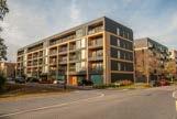
Design Requirements under TC-M2a


Design Requirements under TC-M2b
Design Requirements under TC-M2c


Design Requirements under TC-M2d
Terraces, Back-to-Backs
Mews Houses
Linear Blocks LOWER RISE HIGHER RISE
Villa Blocks
Podiums and Towers Tall Building Design Requirements
MEDIUM RISE
TC-M2a Low-Rise: Terraces, Back-To-Backs And Mews Houses
Terraces, back-to-backs and mews houses can provide relatively high densities of houses within low-rise streets that can blend well with the existing character of Spelthorne’s town centres and streets. They can help bridge the transition between lower and higher-density development. Care should be taken to ensure sufficient green space, parking and privacy for residents are maintained.
Dimensions this type must observe:
• Height up to 3 storeys (approx 15m)
• Typically 2-4 bed homes
• Building depth 8-10m
• Frontage width 5-8m
Most Suitable Locations where this type should be located:
• Edges of higher density sites as part of transition to surroundings
• Quieter side streets
• Near areas with strong existing character to be preserved
• Mews streets inserted into centre of perimeter blocks in new neighbourhoods

DESIGN REQUIREMENTS
Terraces, back-to-backs and mews must include:
Street and Public Realm
• Typically no commercial ground-floor frontages or uses
• Shared space or pedestrian-priority streets
Scale and Massing
• Limited variations in height
Providing family homes within town centre neighbourhoods is strongly supported.
• Mix of contemporary and traditional pitched roof types
Open Spaces
• Private gardens and terraces, including roof terraces
• Any shared open spaces delivered as part of public realm
Homes and Practicalities
• Front doors on street for all homes
• Car parking on-street, in off-plot parking areas or integral to homes
• Single-aspect types not located facing primarily north or south, to prevent overheating or lack of access to daylight
Terraces
Back-To-Backs
Mews
TC-M2b Medium-Rise: Linear Blocks
At medium densities and heights, linear blocks can accommodate a range of housing types within a mid-rise town centre neighbourhood. These can often fit into relatively narrow blocks and create a legible urban environment with a mix of quieter and busier frontages and streets.
Dimensions this type must observe:
• Height typically 4-6 storeys (approx 18m)
• Deck access heights limited to 5 storeys (approx 15m).
• Mix of duplexes, maisonettes and apartments
• Building depth 8-12m to ensure dual-aspect dwellings throughout
• Frontage widths flexible, typically articulated at 6-10m intervals to align with dwellings
• For point access, a maximum of two dwellings served on each floor per core
• For deck access, a maximum of six dwellings served on each floor per core
Most Suitable Locations where this type should be located:
• Edges of higher density sites as part of transition to surroundings
• Larger infill sites on the peripheries of town centres
• Near areas with strong existing character to be preserved
• Sites that have a lower proportion of commercial uses

Duplex and maisonette types can be incorporated
Shared amenity space at rear
Access Clear entrance to residential dwellings All units dual-aspect
Street
Entrances
Gardens
DESIGN REQUIREMENTS
Linear blocks must include:
Street and Public Realm
• Residential active frontages
• Any commercial ground-floor active frontages or uses located only on key corners or facing onto busier streets
Scale and Massing
• Mix of roof types to differentiate buildings
• A minimum of 2 hours direct sunlight on 21st December to all units, ensured by the spacing of buildings
Open Spaces
• Private gardens and terraces, including roof terraces for maisonettes and duplexes
• Shared gardens for duplexes and apartments
Homes and Practicalities
• Both deck access or internal (point/walk-up) access possible.
• Front doors on street for maisonettes ground floor units
• Car parking on-street or integral to homes for maisonettes, shared off-plot provision required for other forms Deck Access
Internal Circulation
TC-M2c Medium-Rise: Villa Blocks
This typology can provide a flexible mix of higher density apartment buildings and ground-floor commercial uses set within a network of open space or as part of other typologies. They are typically double-fronted at ground level enabling them to be flexibly used, but care needs to be taken to ensure frontages are active and servicing is located in the right places.
Dimensions this type must observe:
• Height typically 5-10 storeys (approx 15-30m)
• Floors above 8 storeys (approx 24m) should be set back
• Mix of 1, 2 and 3 bed apartments
• Building depth 16-20m
• Building width 20-30m
• Subdivision of frontage to create finer visual grain on larger buildings
• No more than eight dwellings on each floor served by a single core
Most Suitable Locations where this type should be located:
• On key corners and busier streets
• Adjacent to green open spaces, ensuring views for residents
• As the main component in many mediumhigh density developments away from sensitive edges
Street
Entrances
Gardens
Commercial Space
Internal Circulation
Most units dual-aspect
Clear entrance to residential dwellings
Commercial use of ground floors at key corners or street frontages

DESIGN REQUIREMENTS
Villa blocks must include:
Street and Public Realm
• Commercial ground-floor active frontages or uses at key nodes
Scale and Massing
• Within larger sites with multiple buildings, lower heights used on southern sides of sites to ensure daylight access to open spaces
• Incorporate plant within the roof design
Open Spaces
• Private balconies and terraces
• Shared amenity open spaces between buildings need to be on a podium or have some change in levels from the public realm to provide separation from the street
Homes and Practicalities
6 Dwellings Per Core Shared amenity space at rear
• Shared entrances for apartments can be provided on both sides of building
• At least half of units dual-aspect
• Central core providing access to all upperfloor units
• Shared refuse and cycle storage at ground level
• Individual entrances to units located on the ground floor
• Private gardens for units fronting onto shared amenity spaces
• Car parking either underground or housed offplot
TC-M2d Medium To High-Rise: Podiums And Towers
Towers with apartments provide the highestdensity option for new residential development. They can also be the most impactful on surrounding areas due to their scale, can deliver a large number of high-quality new homes in town centres, and can have impacts on the street due to overshadowing and wind effects. As such they require careful design.
Due to safeguarding restrictions for Heathrow Airport, the maximum height of any development in Spelthorne is 45m (approximately 15 storeys).
Further requirements for tall buildings are set out under ‘Tall Building Design Requirements’ later in this section.
Dimensions this type must observe:
• Towers sit on and are set back from a podium or base building
• Heights: towers of between 10-15 storeys, lower base/podium up to 6-8 storeys
• 1-2 bed apartments, some 3-bed apartments possible
• Tower width and depth typically 20-30m
• No more than eight dwellings on each floor served by a single core
Most Suitable Locations where this type should be located:
• The highest density town centre areas
• As part of town centre neighbourhoods where an appropriate transition has been achieved, in line with the overall approach to massing set out earlier in this section
Street
Entrances
Gardens
Parking
Commercial Space
Internal Circulation
Shared amenity space on podium

Car parking within podium and/or underground
DESIGN REQUIREMENTS
Podiums and towers must include:
Street and Public
Realm
• Commercial ground-floor uses within podium
• Podium to provide strong edge to street, with no open space without a clear use or ownership (public/private) around the tower base
Scale and Massing
• Towers to comply with the tall building requirements set out on the following pages
Differentiated top of tower, integrating plant within roofscape
Open Spaces
• Private balconies and terraces, including roof terraces
• Balcony types to comply with tall building requirements on following pages
• Shared podium gardens to provide amenity space for residents
Homes and Practicalities
• Shared entrances for apartment blocks located on the street, with a connection through to any shared podium garden
• Car parking underground, within podium, or a combination of both.
Podium
Tower
Applied Example 1
Approx 200dph, Floor Area Ratio 1.85
The site below is 100m x 60m, adjacent to a busy commercial street and surrounded by lower-rise side streets, that transition to existing residential areas. The example maximises the potential of the site by selecting typologies on side streets that provide moderate intensification of built form, and locate the densest typologies along the main street. To increase the variety of provision a mews street is inserted into the centre of the block.
Applied Example 2
Approx 330dph, Floor Area Ratio 3.2
The site below is 105 x 80m, adjoining an existing High Street of 3-4 storeys linking through to an existing open space. The example transitions from the existing area by building heights from the High Street with fine-grain buildings into the centre of the new neighbourhood. A tower is located adjacent to new public realm at the centre of the neighbourhood. Coarser grain Villa Blocks overlook the open space.


Mews Terraces Linear Blocks Linear Blocks Villa Blocks
Villa BlocksPodium and Tower with car parking
TC-M3 TALL BUILDING DESIGN REQUIREMENTS
When designed well, tall buildngs can make valuable contributions to the character of a place, can accommodate significant numbers of new dwellings and can be positive new landmarks.
Tall buildings are defined in Staines-upon-Thames and Sunbury Cross as buildings over 8 storeys (around 24m).
The generally acceptable locations for tall buildings in Staines-upon-Thames and Sunbury Cross are set out in the heights plans in the Areas of Change coding later in this chapter. They are located so as to:
• Respect the scale of existing streets and areas that are valued and form part of the identity of place
• Be within coherent new neighbourhoods, following the overall approach to massing set out earlier in this section, creating an overall rhythm of height variation across the town centre, with taller heights grouped together
• Be adjacent to spaces that can ‘absorb’ their scale
Each of the distinct parts of a tall building must be designed as set out below and in the principles set out on the following page..
Taller buildings have their place but must not overwhelm streets with an existing traditional character.
Activated ground floor relating strongly to street/ public realm
Taller heights (typically 4.3m) to provide future flexibility of use
High levels of glazing when commercial uses specified
Main part of street facade elevation Visibly differentiated top of street facade
Balconies facing street should be inset or partially inset
High levels of detailing and articulation to ensure visual interest
Reduced storey height or levels of glazing to ‘cap’ facade
Maximum height should ensure visual connection between floor and street (typically 6 storeys, appx 18m)
Set back mass of tower, arranged to not dominate street
Visibly differentiated top of the building for longer views
Balconies should be inset Plant integrated within roof design
Set tower back from plot edge
‘Penthouse’ accommodation can be incorporated within crown
TC-M3a Breaking Up Massing
Facades for podium/base buildings must be broken up through vertical articulation such as pillars, changes in material and other architectural features to match the prevailing grain of the street and area.
Material choices must ensure that the tower is visually subservient to the base. This is usually achieved through selecting a paler material that recedes when viewed from the street, and the design of façades to be less visually prominent.
If needed to fit the prevailing urban grain, podium/ bases should be designed so as to appear to be two or more independent buildings,
TC-M3b Scale Of The Street
The use of a setback and ‘shoulder’ for the tower element of a taller building creates a street environment that is not overwhelmed by the massing of the tower.
Shoulder heights on existing streets must be set at or one storey above the prevailing heights. For new streets, shoulder heights are a maximum of 6 storeys (approx 18m).
Setbacks must be a minimum of 3m but larger setbacks are encouraged, and the impact of a tower on the existing street scale and townscape will be assessed on a site-by-site basis.
TC-M3c Microclimate
Taller buildings can have significant effects on wind and sunlight at street level and in the surroundings.
Sunlight analysis must be undertaken to demonstrate that surrounding public spaces and dwellings retain access to sunlight for at least two hours per day during winter.
With an appropriate setback above a podium, ‘wind tunnel’ effects on public spaces are likely to be limited. Stepped, rounded or chamfered corners and massing are approaches that can be used to further reduce these effects at ground level.
Open Spaces
Open spaces in town centre neighbourhoods are vital relief for relaxation, socialising, nature and general health and wellbeing. Spelthorne’s town centres generally have few public open spaces, and new development should maximise opportunities to include them, as well as providing space for residents to use.
DESIGN AIMS
Open Spaces in Town Centre Neighbourhoods will:
• Be safe and secure (and perceived to be so) for all user groups at all times of day
• Encourage physical activity, enable social interaction, provide access to nature and be inclusive
• Be of a variety of types appropriate to a town centre context and their intended use
• Include provision of shared amenity space for residents to use regardless of tenure
TC-O1 NEIGHBOURHOOD OPEN SPACE APPROACH
Open Space Typologies
Green Open Space
Entrance Spaces
Communal / Shared Gardens
Private Gardens
Green spaces form a vital part of Spelthorne’s identity, but the town centres lack good provision.
An overall approach to the arrangement of open spaces in relation to each other and built form is set out in the diagram above. Each typology has detailed requirements on following pages.
New neighbourhoods may be delivered through a number of different sites. The overall principles will apply across sites, and are defined in detail in Chapter 5, ‘Areas of Change’.
New town centre neighbourhoods must:
• Clearly define public and private spaces
• Ensure the intended character of open spaces reflects the activity of connecting streets, with busier spaces on busier streets
Streets / wider public realm
Busiest Public Route
Building Street Frontages
Building Courtyard Frontages
1. Busier, more formal public square or park at key node in neighbourhood on busy pedestrian route
2. Quieter neighbourhood incidental ‘pocket park’ away from main routes, with seating, informal play areas and a less formal character
3. Ground-level communal garden
4. Podium-level communal garden with private gardens for dwellings at edges
5. Building entrances at key corners and onto open spaces
6. Regular entrances to activate street
7. Shared roof terrace in setback area above street
TC-O2 SAFETY AND SECURITY
Open space typologies are defined on a continuum of public to private use, which defines their role and key uses within an open space network.
Alll open space must implement the principles set out in Secured by Design.


TYPE OF SPACE
ROLE AND KEY USES
Outdoor amenity
Exercise
Social interaction
Movement
Primarily provided by street activity, passive surveillance and lighting
Transition from public to private
Welcome and safety
Cycle storage
Waste management
Design and layoutdefensible space
Passive surveillance and lighting
Active measures (access control, CCTV)
Relaxation
Exercise
Friends and family
Children’s play
Community interaction
Access control from public realm, through entrance spaces
Access from internal circulation
Relaxation
Gardening and hobbies
Private space
Private access from homes
TC-O3 PUBLIC OPEN SPACES
Public open spaces must
• Be overlooked by surrounding built form, with active frontages at ground level
• Provide seating at least once every 50m along active travel routes
• Provide visitor cycle parking
• Be universally accessible to all abilities
• Be well-lit with no concealed spaces
• Include planting and trees for shade and shelter
• Include surface water management systems and solutions including permeable paving, permeable planted areas, rills, drains and other water management features
• Connect to and extend active travel routes through the space to LTN 1/20 standards
• Be protected from vehicle traffic through bollards or other boundary treatments
Depending on character and intended use, public open spaces could include:
• Events space in larger, busier open spaces
• Gathering and socialising spaces
• Community garden space in quieter, neighbourhood spaces
• Informal and designated play areas, outdoor gyms and trim trails
Suitable public open space typologies and key design requirements within the Town Centre Neighbourhoods area type are set out on the following page.


‘Play on the way’ in streetsSeating, movement, gathering and relaxation space as an integral part of landscape design

Flexible use of existing open space for events and temporary seating
TC-O3a Squares and Parks
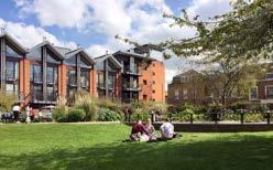

Located at key nodes within the town centre active travel movement network. Squares and parks must have:
• High levels of enclosure by surrounding built form, with a width:height aspect ratio of between 1.5:1 and 3:1
• A mix of hard and soft landscaping, seating, trees for shade and a focal point of interest
• Typical maximum dimensions of around 5070m along the edges
TC-O3b Courtyards, Incidental Spaces and Pocket Parks


Courtyards, incidental spaces and pocket parks enclosed by built form must:
• Be used positively for functions such as cycle parking, surface water management, informal play space and biodiversity enhancement
• Be smaller in size than squares and parks, and typically quieter in feel and character
• Have passive surveillance and good lighting
• Have sufficient daylight to avoid spaces become dark and unpleasant
TC-O3c Linear and Transit Spaces
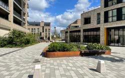

Linear parks and extended green open spaces can successfully bring together development along key active travel routes. They must:
• Have high levels of enclosure by surrounding built form with active frontages throughout
• Have a maximum width of around 30-40m
• Be varied in character along their length to ensure legibility
• Clearly delineate through active travel routes
TC-O4 SHARED/COMMUNAL OPEN SPACES
Shared open spaces must:
• Be universally accessible to all abilities
• Be overlooked by surrounding dwellings, with levels of lighting so as not to disturb residents
• Be separated from residential units by a minimum of 1.5m of defensible buffer space (e.g. a private garden) or boundary treatment to provide privacy
• Provide regular seating, mixed in groups for socialising and individually for relaxation
• Include planting and trees for shade and shelter, and to provide permeable surfaces
• Achieve a minimum of 2hrs sunlight covering at least 50% of their usable area on March 21st
• Be a minimum of 21m wide to provide privacy between dwellings. Subject to daylight requirements, this may be reduced if windows and built form are arranged in a manner so as to provide privacy between facing dwellings.
Depending on character and intended use, shared open spaces could include:
• A mix of different gathering and socialising spaces, and more secluded spaces for relaxation
• Community gardens and food production
• Informal play areas, outdoor gym equipment
• New habitats and natural spaces
Shared open space typologies and requirements within the Town Centre Neighbourhoods area type are set out on the following page.


Ground-level gardens can be both communal or provide access to the public with sufficient design consideration. They must:
• Be separated from the public realm by built form or other features that provide privacy, access control and visual separation
• Have a clear buffer and boundary treatment of up to 1.2m high to homes fronting or backing onto the space


Communal gardens sat on top of podiums that house parking, servicing or other development are an efficient way of using space. They must:
• Be planted with plants with smaller rooting requirements
• Be connected directly to vertical circulation and entrances in surrounding buildings
• Have a clear buffer and boundary treatment of up to 1m high to homes fronting or backing onto the space


Roof gardens and terraces can be both communal or private spaces. They must
• Be sheltered (by surrounding built form or other features in their design) from prevailing and northern winds, and make the most of solar gain through their aspect
• Be planted with species of a lower height that can survive at height and with less soil
TC-O4b Podium Gardens
TC-O4a Ground-Level Gardens
TC-O4c Roof Gardens and Terraces
TC-O5 LANDSCAPE CHARACTER
Town centre neighbourhoods will typically have a more urban, managed character than suburban areas. Busier areas will have a high proportion of hard landscape. There will be opportunities to incorporate softer landscape and planting throughout, and smaller, incidental spaces should be greener and calmer than busier spaces.
The integration of street furniture so as to avoid clutter and complement the overall landscape scheme is an important component of the landscape character of town centre neighbourhoods.
Material selection in the adopted public realm must be in compliance with the Surrey Healthy Streets Design Code.
TC-O5a Hard Landscape
Hard landscape materials must be selected to be long-life, attractive and delineate different uses effectively.


Changes in material can help to delineate movement areas from seating , utility, gathering and other spaces.
TC-O5b Soft Landscape
Soft landscape features must be incorporated throughout the public realm to provide new habitats, shade, cooling, surface water absorption and to soften the appearance of the built environment.

Planted beds can separate different spaces within the public realm.
Patterns within public realm surfacing at key nodes can reinforce importance of location and memorability

Planted strips can provide flexible areas to accommodate uses that activate a street, such as seating or informal play equipment
Species should be varied to ensure resilience to climate change and invasive species.
Management and maintenance should be minimised where possible.

Seating can be integrated with planting beds

Changes in level can be informal seating areas

Low-level bollard lighting performs multiple functions

Ensure street furniture is installed where it does not block movement
TC-O5c Street Furniture
TC-O5d Street Trees
All streets must be tree-lined. In general trees will be integrated with hard landscape or planted beds and associated street furniture within the street scene. Suitable approaches include:


Trees installed within hard landscape
TC-O5e Surface Water Drainage Features
All development must manage surface water through the use of Sustainable Drainage Systems (SuDS). Suitable design features include:
Trees installed within small planted areas


Source Control / Initial Absorption Features
• Street ‘rain gardens’
• Planted verges and general soft landscape cover
• Green roofs and walls
• Permeable surfaces and details


Trees installed within planting beds and street furniture

Trees must have sufficient space to grow and thrive, following guidance set out by the Trees Design Action Group (see reference in Chapter 6).
Using a variety of street tree species ensures resilience to climate change and invasive species.


Conveyancing Features
• Rills and other channels
• Planted street swales
• Incorporation into public realm features
Attenuation Features
• Larger rain garden features as part of incidental spaces
• Underground crate storage (where no other options available)
Homes and Practicalities
Town centre dwellings should be welcoming, safe and convenient places to live, with all the pleasures and conveniences of modern urban living to hand. Enough space, a mix of homes and well-designed essentials will make new homes in town centres built to last.
DESIGN AIMS
Homes in Town Centre Neighbourhoods will:
• Be sized to Nationally Described Space Standards and include a flexible mix of storage space
• Be of a mix of dwelling types to create inclusive and balanced new places
• Be mostly dual-aspect dwellings
• Have safe, welcoming entrances from the street with essentials such as waste, recycling and cycle storage close to the front door
• Provide sufficient private outdoor amenity space for all residents
• Accommodate vehicle and cycle parking
TC-H1 SPACE STANDARDS
All homes must be at least the sizes specified in the Nationally Described Space Standards (Local Plan policy H1). The March 2015 standards are set out below for reference.
Dwellings must offer a mix of flexible internal storage and secure outdoor areas of storage for items such as pushchairs. In apartment buildings such larger storage areas are best accommodated adjacent to dwelling front doors.

Spelthorne’s communities want to see spacious and high quality homes provided for new residents.
TC-H2 MIX OF HOMES
A wide mix of types of dwelling are encouraged in all developments. These are closely related to the Development Typologies in ‘Scale and Dwellings must:
• Be designed to be tenure-blind with no differentiation between affordable and market tenures.
• Not have ‘poor doors’ or other selectively gated forms of development.
TC-H3 DWELLING ASPECT
Dwellings which have dual aspects have several benefits for residents, including:
• Sunlight at multiple times of day for passive heating and access to natural daylight
• Passive cooling in hotter weather from breezes through the building Development must:
• Maximise dual aspect dwellings
• Size dwellings with aspects on opposing sides to be no more than 12m deep
• Size dwellings with aspects at right angles to be no more than 8m deep from a window

• Size single-aspect dwellings to be no more than 8m deep
• Orient single-aspect dwellings along an east/ west direction to ensure access to daylight without excessive build-up of heat.
Dwelling
Circulation & Access
Private Outdoor Space
Shared Outdoor Space
Dwelling Aspect
APARTMENTS
Single or dual aspect, units typically accessed via central circulation cores
MAISONETTES AND DUPLEXES
Single or dual aspect, front door for ground floor unit, upper floors accessed separately
TERRACE/TOWNHOUSE
Front door, back garden, dual aspect
MEWS HOUSE
Single aspect, inserted into larger block
Types of Dwelling, Aspect, Access and Arrangement
TC-H4 RESIDENTIAL ENTRANCES AND CIRCULATION
Entrances to residential buildings are frequently used, functional spaces that also set the tone for a development. They should be safe, welcoming and convenient, with daily uses such as cycle storage and waste disposal close by.
Within fluvial flood risk areas, all entrances, shared or private, must have a universally accessible dry pedestrian evacuation route.

TC-H4a Shared Entrances
Shared residential entrances must:
• Be located with a front door onto the street for legibility and to activate the street.
• Have an accessible level access entrance area which is safe, welcoming, durable, well-lit and at least partially glazed onto the street.
• Have lifts and stairs within sight of the entrance area or clearly signposted.
• Have external windows for daylight and ventilation.
• Include facilities for deliveries that does not require giving access to the whole building
Shared entrances should locate a range of key uses close by.
• Secure residents’ cycle parking, which may be accessed from the communal entrance lobby as long as there is a direct access off the lobby, or from a direct secure link to the street
• Waste and recycling stores should be located as close to residential entrances as possible, with an access to the street to enable possible collection directly from the store, rather than as a managed collection.
• Waste and recycling stores should not connect to the core internally as this poses a security risk and allows smells to enter the building.


TC-H4b Private Entrances
Single-dwelling residential entrances must:
• Face the street or shared courtyard space for legibility and to activate the street/space.
• Be provided for ground-floor apartments and maisonettes from the street.
• Provide a sheltered, inset defensible space adjacent to the front door of at least 1m deep by 1.5m wide
• Include a covered space to store bins
• Include secure space to store cycles
• Be accessible to users of all abilities with a variety of mobility needs
Podium Communal Garden
Waste and recycling store
Entrance lobby
Front garden for ground floor unit
Front garden for ground floor unit Cycle store
TC-H5 PRIVATE AMENITY SPACES
TC-H5a Balconies
Balconies must:
• Be provided for all dwellings that do not have other forms of private outdoor space
• Have a minimum depth of 1500mm
• Have a minimum of 5m2 of private outdoor space for all 2 person dwellings and an extra 1m2 provided for each additional occupant.
• Have level access from a habitable room, ideally a living room or living area
• Comply with the acceptable locations for different forms of balcony set out on the right
• Where inset, be able to be at least partially closed from wind and rain
• Where overhanging, include a privacy screen between dwellings of 1.8m high
Private amenity space in town centre neighbourhoods may be provided by balconies (or roof terraces), or in private gardens, which may back onto communal gardens.
TC-H5b Private Garden Space
Private garden spaces must
• Directly adjoin and have level access from the dwelling’s living area
• Have a minimum depth of 2m
• Have a minimum of 5m2 of private outdoor space for all 2 person dwellings and an extra 1m2 provided for each additional occupant.
• Be the same width of the dwelling it serves
• Be clearly identified by boundary treatments, including railings, low wall, a hedge
• Have a privacy screen between dwellings of up to 1.8m


Privacy screens on protruding balconies
Private gardens between dwellings and communal garden
TC-H6 VEHICLE AND CYCLE PARKING
Living close to the town centre offers an opportunity to encourage active travel as a regular choice over frequent use of the car. In town centre neighbourhoods the aim should be to have fewer than one resident parking space per dwelling.
Car parking, where it needs to be provided, needs to be accommodated using an appropriate typology that limits the impact on the surrounding area and street scene.
All town centre development must:
• Include visitor cycle parking
• Include convenient and secure cycle parking for residents, at a provision level of 1 space per 1-2 bed dwelling or 2 spaces per 3+ bed dwelling
• Include car parking designed to the requirements for the appropriate typology as set out on the following page
• Provide at least 10% of car parking spaces as disabled spaces of at least 3.6m x 5.0m within 50m of the relevant building entrance
• Provide a fast EV charging point for each dwelling
All town centre development should:
• Identify space of at least 2.5m x 6.0m close to shared residential entrances for delivery vans to park and drop off items
• Identify cycle parking space close to retail units that may host cafes, restaurants and food takeaways for delivery cycles to park when picking up items
TC-H6a Visitor Cycle Parking
Visitor cycle parking must:
• Be located close to entrances of residential and commercial buildings, or at accessible points within courtyards
• Be overlooked and well-lit
• Be covered when not on the street
• Be of typical Sheffield stand construction


TC-H6B Residents’ Cycle Parking
Residents’ cycle parking must:
• Be located close to entrances of residential and commercial buildings, or at accessible points within courtyards
• Be secure and lockable, with no visibility into the parking area from the street
• Be overlooked and well-lit
• Be enclosed, dry and protected from the weather
• Be more convenient to access for daily journeys than the car park
• Be accessible to users of all abilities with a variety of mobility needs

Visitor cycle parking within the public realm
Secure cycle parking garage
Visitor cycle parking within a residential courtyard
TC-H6c Underground Parking
Undergound parking offers a space-saving option for town centre car parking. They must
• Be well-lit, ideally with some natural light
• Be well-ventilated
• Not compromise the provision of high-quality trees and planting in communal gardens above them
• Be accessed from an entrance on a side or service street, rather than from a main street
• Have direct, secured access to internal circulation cores
• Have no negative impact on groundwater flows through an evidenced engineering solution, demonstrated as part of the planning application
• Be accessible to users of all abilities with a variety of mobility needs
TC-H6d Podium Parking
Podium parking offers a flexible option for town centre car parking within higher-density developments. They must:
• Be well-lit, ideally with some natural light, and secure
• Be well-ventilated
• Not compromise the provision of high-quality trees and planting in communal gardens above them
• Be accessed from an entrance on a side or service street, rather than from a main street
• Have direct, secured access to internal circulation cores
• Have no negative impact on groundwater flows through an evidenced engineering solution, demonstrated as part of the planning application
• Be accessible to users of all abilities with a variety of mobility needs


TC-H6e Integrated Parking

For typologies such as mews or terrace houses, integrated parking within the building can be a good option. Homes with integrated parking must:
• have no more than 50% of the frontage used for parking access
• at least one streetfacing window on the ground floor to provide passive surveillance
TC-H6f Surface or On-Street Parking
Surface or on-street car parking must only be used in very limited circumstances, for example to provide disabled, visitor or accessible parking spaces.
Any surface or on-street parking must
• Incorporate trees or planting at least once every five parking spaces
• Be surfaced with permeable paving

Detail and Richness
Town centre buildings are part of the identity of a place. New buildings can complement their surroundings by being attractive, having visual richness at all scales and fitting with the materiality of the context.
DESIGN AIMS
Town Centre Neighbourhoods will:
• Be designed to enhance the townscape of Spelthorne’s places, providing interest, legibility and identity
• Have buildings with façades and elevations with richness, depth and detail, adopting an approach appropriate to the chosen architectural language of the building
TC-D1 TOWNSCAPE
‘Townscape’ is a term that characterises the richness and quality of the built environment, and how it can be successfully tied together.
Town Centre Neighbourhoods will have a rich and attractive townscape. They should make use of features either seen in Spelthorne or that would be suitable for the town centre context.
Screened & Terminated Vistas

The end of a view is terminated by a marker building. Using trees to screen the vista increases the sense of distance.
& Recession Enclosure

A building line with bays, variation and intricacy rather than a single flat frontage.

Spaces which are surrounded by built form, providing a quieter ‘escape’ from adjacent busier streets that are more open.
Rich, detailed building façades are popular with the community.
Incident & Punctuation

Features breaking up the street view or interrupting the alignment of the street to create interest and separation.

Views partially terminated by a building set at an angle, suggesting a further space round the corner.
Narrowing and Views Through

Differentiating between two spaces by emphasising the transition through constricting the width between the two.
Projection
Deflection
TC-D2 DISTINCTIVE BUILDINGS
The street environment must be easy to navigate for those who may be less familiar with it, and easy to remember for those who are. The arrangement and prominence of buildings relative to one another make a valuable contribution to the legibility, memorability and cohesiveness of the overall townscape of Spelthorne’s town centres.
‘Legibility’ is the ability of people to ‘read’ a street environment to understand how to navigate a place successfully without resorting to signage or maps.
Two key types of building should be considered to aid legibility and townscape in important locations: marker buildings and landmark buildings.
Marker and landmark buildings will be important and long-lasting parts of the overall townscape and should be considered with care. The design process for such buildings could make use of:
• Architectural design competitions
• Design review panels that include community representatives
TC-D2a Marker Buildings
Marker buildings are memorable buildings that stand out from the surrounding built form. They can help people to navigate and make the townscape more distinctive and interesting.
Marker buildings should be located:
• To terminate key views along streets
• At nodes, public spaces or meeting points
• To draw attention to key entrances or uses within an arrangement of buildings
Marker buildings must:
• Be of similar grain and dimensions to surrounding built form and complement the wider townscape.
• Be differentiated and distinctive from surrounding built form through the use of detailing, materiality, architectural treatment or orientation.
TC-D2b Landmark Buildings
Landmark buildings are prominent buildings that are easily recognisable and have significant cultural or historical value.
Landmark buildings should be used sparingly in development.
Landmark buildings should be located:
• At major nodes or public spaces within a town centre
• As an anchoring focal point within new neighbourhoods, housing distinctive uses that define the new neighbourhood
Landmark buildings must:
• Include distinctive, town-wide uses of wider importance, not just residential use
• Be of distinctive and exceptional architectural quality, materiality and massing approach, differentiated from their surroundings


Landmark building in prominent location
TC-D3 DESIGN OF ELEVATIONS
Buildings need to have variation, depth and texture on their elevations, as well as façades that are proportioned well and reflect features in the local context. This can be accomplished in traditional and contemporary ways.
Key elevation aspects for town centre neighbourhood buildings are:
• Overall facade composition
• Arrangement of windows
• Window detailing and reveal depths
• Treatment of balconies
• Corners of buildings
• Roofs and building tops
Example implementation of design code elevation requirements

TC-D3a Bases, Middles and Tops
Buildings must
• Have a base, middle and top floors that are differentiated visually through the use of materials and proportional heights
• Have a base that is traditionally treated with a highly textured materiality, e.g. rough-hewn brick or other visually textured materials, of one or two storeys , with proportionally taller storey heights
• Treat each elevational aspect of the building according to its setting, which may differ across the same building

TC-D3b Proportions
The overall composition of an elevation must
String course detail to separate roof
Visually subservient top of the building, shorter window heights
Unified middle of elevation, prominent window surrounds
Textured and differentiated base
Boundary treatment matching overall materiality
• Have proportions informed by the general context of the site and the immediate surrounding environment. For example, buildings in a fine grained immediate context should utilise a tall, narrow, vertically proportion.
• Emphasise horizontal or vertical components of the facade to reflect context and grain of building
• Have component parts (massing volumes, doors, windows etc) that clearly relate to each other in terms of size, position and separation
Emphasis on horizontal components of facade, visually widening and shortening building
Emphasis on vertical components of facade, visually narrowing building
TC-D3c Building Tops and Roofs
The roofscape has an effect on both longdistance views of the town centre and the perception of buildings from the street. They terminate the elevation vertically and balance the overallc composition. They can include dwellings and building plant.
Buildings in town centre neighbourhoods
• Distinguish the top of the building from the rest of its facade using one of the roof types specified on this page
• Adopt a roof that reflects the grain of the building as specified

• Incorporate any building plant within the design of the roof, so it is hidden from the street and distance views
Buildings in town centre neighbourhoods could:
• Include roof terraces within setbacks
• Include balconies within gable end roofs
incorporating accommodation
Most appropriate for fine-grained buildings <10m wide


Mansard roof with or without dormers
Most appropriate for medium-grained buildings <20m wide

Setting back of upper storeys, with change in materials or window expression
Appropriate for coarser-grained buildings 15m+ wide


Separating horizontal element - cornice, string course, change of material or texture
Appropriate for coarser-grained buildings 15m+ wide

The skyline and tops of buildings are important to the community, especially when viewed from a distance.


TC-D3d Balconies
Balconies for apartments have a significant effect on how the elevation and resulting street scene are perceived.
In addition to the dimensional requirements set out under TC-H5 detailed design of balconies must
• Ensure adequate daylight levels within the home when inset or partially inset balconies are used
• Have edge treatments that balance privacy for occupants, views out, and also provide screening of furniture etc when viewed from the public realm.
• Ensure shading to windows below, assisting with the avoidance of overheating issues.
• Be clad to all sides including the underside, to maintain a high quality appearance from all aspects.


TC-D3e Corners
Buildings addressing street corners must have:
• Passive surveillance and active frontages facing both elevations
Street corners could include:
• Inset balconies
• Shared residential entrances
• Retail corner units
• Different material treatments to surrounding elevations
• A single storey rise in height
• A distinctive roof form


Differentiated corner Rise in heights, distinct roof and corner entrance
Use of inset balconies to break up facade
Corner inset balconies
Use of privacy screen that also provides shading to apartment and balcony
Use of rich, complementary materials to unify balconies to facade
TC-D3f Windows and Fenestration
Windows, window surrounds and other fenestration within an elevation must:
• Only use flush windows for ground floor retail
• Have other window reveals at least 75mm in depth to provide richness to the elevation, and deeper if the surrounding context has deeper depth of façades
• Balance the need for internal daylight penetration with thermal performance, overheating, privacy and views out.
• Have glazed coverage on façades that complies with the proportions set out in TCC1 under Climate Change and Sustainability. To achieve a well-proportioned facade, use of a secondary grid of features within overall window reveals can be used.
Secondary grid within window reveal to emphasise horizontal components of facade

Secondary grid within window reveal to emphasise vertical components of facade


Grouping of windows to reduce perceived height of building


Climate Change & Sustainability
Town centre dwellings should be of the highest standards of environmental sustainability, in construction and operation. This includes mitigating their impact on climate change and the local environment, and also adapting to a future with more frequent and more extreme weather events.
Further guidance is set out in Spelthorne’s Climate Change Supplementary Planning Document (SPD).
DESIGN AIMS
Climate Change & Sustainability in Town Centre Neighbourhoods will be ensured through:
• Layout and orientation to minimise energy needs by orienting for solar gain and passive ventilation
• Absorption and slowing of surface water runoff by the use of Sustainable Drainage Systems (SuDS) and achieving a high Urban Greening Factor (UGF)
• Demonstrating no impact to groundwater flows through an appropriate engineering approach
TC-C1 MITIGATION: REDUCING ENERGY USE
Building energy use is a significant contributor to carbon emissions.
New buildings must:
• Be heated by electricity, and not include gas boilers or other carbon-emitting heat sources
• Achieve a 31% reduction on the Dwelling Emission Rate (DER) against the Target Emission Rate (TER) based on the 2013 Edition of the Building Regulations (Part L), as per Local Plan policy PS1.
• Orientate buildings as much as possible within +/- 30° of a south-facing aspect to maximise solar gain and passive heating
• Include a form of shading on windows, ideally external, and ensure windows can be opened
• Target a window coverage for residential dwellings as set out on the right
New developments should:
• Include on-site photovoltaic (PV) energy generation where possible
• Use low-temperature heat networks powered by zero-carbon heat sources such as Air Source Heat Pumps or Ground Source Heat Pumps
• Use heat sources within or adjacent to the development such as supermarket fridges to augment heat network sources
• Locate Air Source Heat Pumps away from areas where the noise could cause nuisance to other users. When located on roofs, they should be enclosed within the roof design.

The Climate Emergency will particularly affect Spelthorne and high standards of sustainability are expected.

Flush photovoltaic panels incorporated into a roof
TC-C2 MITIGATION: REDUCING EMBODIED CARBON
Embodied carbon is the emissions generated by the construction of buildings.
New development should:
• Prioritise the re-use of existing buildings and parts of buildings, such as foundations, frames and other carbon-intensive components
• Use locally-sourced recycled materials
• Minimise the use of high-carbon materials such as aluminium, steel, glass and concrete
• Maximise the use of low-carbon and reusable materials such as brick, cross-laminated and soft timber
TC-C3 ADAPTATION: PREPARING FOR A CHANGING CLIMATE
Increased frequency of extreme weather events will mean:
• More intense storm events, with associated surface water runoff management requirements
• More intense heat events, which will particularly affect built-up areas
An increase in permeable surfaces, tree cover and planting can make a substantial contribution to mitigating these effects.
New development must
• Achieve an Urban Greening Factor of at least 0.4, calculated using Natural England’s Green Infrastructure Framework standards, through the use of green roofs and walls, planting and permeable surfacing, and urban sustainable drainage system featuress such as swales and rain gardens
• Provide an increase in tree canopy cover within the public realm when compared to the existing situation
• Include a safe pedestrian evacuation route from all circulation cores to a dry gathering area in the event of fluvial flood events
• Demonstrate no harm on groundwater flows from foundations or underground levels through an evidenced engineering solution
Low Urban Greening Factor
Mostly impermeable surfaces

For more detailed technical guidance on reduction of embodied carbon, consult the LETI Climate Emergency Design Guide

High Urban Greening Factor
Green roofs / Green walls
Street trees, swales and planting
Rain gardens and water on site
Permeable paving
Shared, drained gardens on internal podiums
Inner Suburban
OVERVIEW
The Inner Suburban areas of Spelthorne were developed predominantly pre-WW1 and in the early inter-war period. They have comparatively high densities compared to the rest of the borough, and are closely related to their nearby town centre.
These areas have a distinctive and replicable urban form, with tight gridded streets, mostly semi-detached homes on relatively narrow plots, and a variety of architecture along streets.
Intensification in Inner Suburban areas is supported but it must be done carefully, respecting the context.
AREAS OF CHANGE
There are no areas of significant planned change in the Inner Suburban area type. Development is expected to be small-scale, incremental change governed by the codes for the Development Types above.
DESIGN AIMS
Development in Inner Suburban areas will:
• Respect the existing street grid
• Reduce the visual and functional impact of car parking on the public realm
• Prioritise the walking and cycling potential of these areas
• Retain the rhythm and key dimensional characteristics of streets and buildings
• Sensitively intensify residential density without compromising the existing character of the area
LOCATIONS

WHAT CODE SHOULD I USE?
The design requirements you need to apply will depend on the type of development you are proposing. New homes or apartments on existing streets
IS-A1 › IS-A8
Key requirements for Residential Extensions are coded, with further guidance contained in Appendix C.
IS-X1 › IS-X5
Typical heights of 2-2.5 storeys on residential streets
Mix of front boundary treatments - hedges, low walls, fences
Occasional more modern out-ofcharacter development that does not respect building line and setbacks
Mostly on-street car parking
Pitched roofs
Continuous building line
Chimneys
Buildings have high levels of decoration and detail

Tightly arranged semidetached or small rows of terraces, variety between but clear common parameters
Straight streets, with only carriageway and pavements - few verges or street trees
Right-angled grid of streets with small corner radius on turn
Well-contained - street heights to width ratio of around 1:1.5
Find out more background information about the borough in Appendix A ‘Understanding Spelthorne Today’.
Existing characteristics of inner suburban areas
Narrow front gardens <2.5m
New Homes or Apartments on Existing Streets
New apartments within existing Inner Suburban residential streets are a common form of development in Spelthorne. When designed well they can complement the existing street scene while delivering high quality new homes in locations close to High Streets and other facilities.
DESIGN AIMS
All Inner Suburban apartment development on existing streets will:
• Comply with Nationally Described Space Standards
• Address the needs of different design zones for street frontage, access, servicing and gardens
• Respect the existing street scene by observing the key design parameters, including:
• the existing building line, rhythm of windows and separation distances, and the existing visual grain of the street
• car parking placed to the rear of the built form, with vehicle access not dominating the frontage
• adding any additional height sensitively
• Use materials and articulation to provide richness to the street scene
IS-A1 LAYOUT PRINCIPLES
New development on existing streets in Inner Suburban Area Types should follow the overall layout principles set out below. Coding requirements for different areas are set out on the following pages.
The diagram shows a typical layout for this type of development but the Code does not require development to be of this form. Layout should respond to the particular requirements of the site, considered through an appropriate design process.
Front Door
Neighbouring Property
Building Heights typically up to height of highest adjacent building
Reflect existing street rhythm of gaps and built form
Regular building line along a street

Building lines for corner plots

IS-A2 BUILT FORM PARAMETERS
New development on existing streets must observe the following key built form parameters:
• Roofline up to height of highest immediately neighbouring building
• Plot coverage that is broadly within the range of the existing area, typically 30-50%
• Match neighbouring building line on streets with regular building line
• Sites on street corners to match the building line of both adjoining streets and provide passive surveillance to both aspects
• Reflect the existing street rhythm of gaps and built form
IS-A3 ROOF FORM
New development on existing streets must
• Have pitched roof forms, reflective of surrounding prevailing form, e.g. gable ends or street-facing pitch
• Avoid flat roof forms facing streets on main roofs
• Ensure dormers are set in a minimum of 1m from the roof edge, down 0.5m from the ridge and up 1m from the eaves, and not be dominant and out of proportion
• Flat-roofed dormers facing the street may be acceptable if the overall architectural design language of the development is contemporary, otherwise they must Incorporate a roof which is compatible with the main roof
Front boundary treatments in Inner Suburban areas are typically small front gardens with formal edges, such as railings, low walls or fences. Planting can be used to enhance the street scene and soften built form.
IS-A4 FRONT BOUNDARY TREATMENT
New development on existing streets must have:
• A defined front boundary that separates public realm from private space
• A clear pedestrian path to the front door
• A boundary treatment such as a low wall or railings, making reference to prevailing styles on the street
• A front door that faces the street
• Sheltered, defensible threshold space at the front door of at least 0.5m x 1m
• An accessible covered space to store waste and recycling
• Accessibility to users of all abilities with a variety of mobility needs
Maintain appropriate distances to existing properties
Left: Back to Back 21m (30m for 3 storey) (distance 2 on left diagram)
Right: Back to Flank 13.5m (21m for 3 storey) (distance 1 on right diagram)

Ensure a 25° vertical line of sight to neighbouring properties to ensure daylight
IS-A5 DAYLIGHT, PRIVACY AND OVERLOOKING
New development on existing streets must:
• Have a minimum back to back distance to properties at the rear of 21m (30m for 3 storey buildings)
• Ensure built form of two storeys or above is clear of a 45° line drawn from the centre of a habitable room in neighbouring properties, both horizontally and vertically
• Ensure a 25° vertical line of sight to neighbouring properties to ensure daylight
• Ensure a minimum back to flank distance 13.5m (21m for 3 storeys)
• Ensure a minimum boundary set-in distance 1m (2m for 3 storeys), or more to suit the context and prevailing street scene
IS-A6 ACCESS, CYCLE AND VEHICLE PARKING
New development on existing streets must have:
• Secure and integrated cycle parking within building, e.g. for apartments within a circulation core on ground floor
• One of side, rear (shared) or integrated car parking.
• Brick paving or permeable gravel for car parking
• Planting and permeable surfaces within shared car parking areas (for apartments)
• Pedestrian access to rear gardens
IS-A7 APARTMENT DEVELOPMENT
All new apartment development on existing streets must ensure:
• Dual aspect apartments are maximised
• Single aspect apartments are no deeper than 6m from an external window
• There are no single aspect apartments on north-facing aspects
• Balconies face the street and rear, avoiding balconies facing towards adjacent properties to sides
• That recessed or partially projecting balconies are used
Where no other private outdoor space is provided, balconies must:
• Have a minimum depth of 1500mm
• Have a minimum of 5m2 of private outdoor space for all 2 person dwellings and an extra 1m2 provided for each additional occupant.
• Have level access from a habitable room, ideally a living room or living area
IS-A8 DETAIL, RICHNESS AND MATERIALITY
New buildings on existing streets should demonstrate how they have incorporated common features seen in Inner Suburban areas into their detailed design to enhance richness and variety in the street scene.


To enhance the richness of the street scene, new buildings on existing streets could incorporate features such as sheltered seating with a boundary to the street, projecting bay windows (both traditional and contemporary in form), and integrated bin and cycle storage as part of the front garden.

New development on existing streets must:
• Use a single material for the elevation or;
• Have one clear change in materials between the ground floor and upper floors
• Use materials of high quality and long life, ideally with visible texture such as brick


Projecting windowsIntegrated bin and cycle storage
Roof line featuresBay windows and projections
Sheltered seating
Roof dormers Gable ends Changes in brickwork
Residential Extensions
IS-X1 CONTEXT & CHARACTER
Designs should be mindful of key dimensions of the wider context that will ensure an extension fits within and complements that character of the area. These include:
OVERVIEW
The key design considerations for residential extensions on existing plots in Inner Suburban areas are set out on this page.
All new residential extensions must comply with these requirements.
This section sets out an overview of the key dimensional requirements for residential extensions. More detailed guidance on design for this type of development is contained in Appendix C, drawn from the previously adopted “Design of Residential Extensions and New Residential Development Supplementary Planning Document (SPD)” (April 2011).
• Set-in distance: the distance from plot edge to the flank side of the building. It defines the characteristic width between properties along a street. Care should be taken to reflect the existing street scene.
• Set-back distance and prevailing building line
Minimum requirements for key dimensions are set out on these pages.
Key characteristics to observe that extensions should respond to in architectural design include:
• Prevailing materials of the area
• Prevailing roof forms and features
• Rhythm of windows and location of front doors on façades
IS-X2 PRIVACY & OUTLOOK
Find out more background information about the borough in Appendix A ‘Understanding Spelthorne Today’.
1. Minimum garden length 10.5m (15m for 3 storeys)
2. Minimum back to back distance 21m (30m for 3 storeys)
1. Minimum back to flank distance 13.5m (21m for 3 storeys)
2. Minimum boundary set-in distance 1m (2m for 3 storeys), or more to suit the context
• Two-storey extensions must be clear of a 45° line drawn from the centre of a habitable room in neighbouring properties, both horizontally and vertically
• Inline side extensions are acceptable
• Subordinate multi-storey side extensions must be set back by at least 1m (1) and set in from the plot boundary (2)
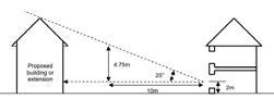
• Development must maintain a 25° vertical line of sight to neighbouring properties to ensure daylight
• Subordinate multi-storey side extensions must be set in from the plot boundary by a minimum of 1m (2m for 3 storey development), or more to suit the context
Dormers must:
1. Be located centrally or symmetrically on a roof
2. Be set in a minimum of 1m from the roof edge, down 0.5m from the ridge and up 1m from the eaves
3. Incorporate a roof which is compatible with the main roof
4. Not be dominant and out of proportion
Suburban
OVERVIEW
Spelthorne’s post-war suburban areas, typically laid out in the period 1945-1970, are characterised by lower-density housing on a street grid. While semi-detached houses are most common; terraced and detached homes as well as bungalows are found across the borough.
Many of Spelthorne’s suburban locations benefit from proximity to green spaces and larger plot sizes. There is often less distinctive identity between the areas. Because they tend to be further from their core town centres, they often host small local parades of shops at key nodes.
At the edge of existing built-up areas or within larger infill sites, new residential neighbourhoods are anticipated of between 15-200 homes at a range of potential densities, with a mix of homes or apartments.
New residential neighbourhoods must provide well-designed homes that are integrated into their surroundings.
AREAS OF CHANGE
Development in existing suburbs is expected to be small-scale, incremental change governed by the codes for the relevant Development Types.
Development of New Residential Neighbourhoods will be a change in character and is governed by the Coding set out in this chapter.
DESIGN AIMS
Development in Suburban Areas will:
• Integrate new development into existing places positively
• Create new residential neighbourhoods with green spaces and attractive streets
• Maximise opportunities for green infrastructure on street and frontages
• Prioritise walking and cycling potential
• Retain the rhythm and key dimensional characteristics of streets
• Take opportunities to sensitively intensify residential density without compromising the existing character of the area
LOCATIONS

WHAT CODE SHOULD I USE?
The design requirements you need to apply will depend on the type of development you are proposing.
New Residential Neighbourhoods either on the edge of the existing built up area or as larger sites within the existing built-up area.
S-U1 › S-U6
New buildings on existing streets
S-A1 › S-A8
Key requirements for Residential Extensions are coded.
S-X1 › S-X3
Many front gardens converted to large areas of car parking
Fewer front boundary treatments, typically drives or open onto mown grass
Extensions and porches to front of homes
Most houses have been extended and adapted

Large turning radius at junction corners encourages higher vehicle speeds
Existing characteristics of suburban areas
Grid of straight streets remains, but with corner arrangements as shown
Large spaces defined by highways and front parking
Mostly semidetached or detached homes
Large front gardens, typically >6m
Less variety in buildings and materials, with fewer decorative features
Streets more likely to have verges, still limited street trees
Find out more background information about the borough in Appendix A ‘Understanding Spelthorne Today’.
New Residential Neighbourhoods
Coding for larger areas of residential development in, or on the edge of the existing suburban area, is set out in this section. This may include:
• Allocated small sites that have been released from the Green Belt as part of the Local Plan
• Other sites adjacent to existing built-up area
• Larger infill sites within existing built-up area It is anticipated this coding is to be applied typically for developments of between around 15200 homes.
New residential neighbourhood sites that are not allocated in the Local Plan must also comply with the requirements set out in this section.
DESIGN AIMS
All new residential neighbourhoods will:
• Be inspired by and reflective of the place
• Integrate with and complement their surrounding areas through the consideration of edges and looking beyond the site boundary
• Have legible, connected streets that prioritise walking and cycling, and with car parking integrated so that cars do not dominate the street scene
• Have public green open spaces that are safe, well-managed, ecologically rich and complementary in scale and design to the surrounding built form
S-U1 ENSURING DISTINCTIVENESS
New residential neighbourhoods will be clearly inspired and influenced by their surroundings. New residential neighbourhoods should demonstrate as part of the design process how they have observed, studied and responded to:
• Typical local block structure, dimensions and grain of built form
• Scale, character, use and built form enclosure of local open spaces
• Typical materials and architectural features such as roof forms and elevational treatments used in the local area
• Distinctive local landscape features (e.g. Spelthorne’s distinctive cedar trees)
• Historic uses and users of the site and context
• Absences from the local area that could enhance it (e.g. a need for more play provision, different approaches to housing provision, open space, food production or access to nature)
S-U2 EDGES
On sites extending the existing built up area, how edges are considered will make a significant difference to how the scheme integrates with its surroundings. Addressing edge conditions successfully can:
• Make new developments healthier by enabling new walking and cycling connections
• Integrate the scheme visually and physically so that in future it becomes a coherent part of the surroundings
• Reduce any impacts on surrounding buildings
• Minimise ongoing management issues
• Maximise site capacity by using land at the edges productively
Trees & Hedgerows
Find out more background information about the borough in Appendix A ‘Understanding Spelthorne Today’.

Safe, well-managed car parking approaches are an important part of what makes places successful.
Example green field development site west of Sunbury Cross with edges highlighted
Residential (backing onto site)
Open Space (Sports Field)
Dual Carriageway (Staines Road West) Watercourse (Staines Aqueduct) Industry (Water Treatment Works)
Edges: Green And Blue
S-U2a Trees, Woodland and Hedgerows

Passive surveillance Natural planting for habitat creation Standoff for root protection Typically = height of trees
Lane type street including active travel
Development must
• Retain and protect existing green infrastructure already on site
• Limit removal of existing green infrastructure to enable safe, overlooked access points
• Retain hedgerows and trees within public space, accessible for management
• Enhance existing hedgerows with additional diverse native planting
• Not place existing hedgerows or tree belts at the back of new properties. This will hinder access for future maintenance.
S-U2b Open Spaces

Passive surveillance Natural planting for habitat creation
New active travel link
Lane or Local type street Standoff to any MUGA or sports facilities for noise mitigation
Development must:
• Front new development to face towards existing open spaces
• Provide views towards existing open spaces from key nodes or spaces
• Connect open spaces to new development through active travel links, and provide new active travel links along the edge of existing open spaces with enough lighting to ensure safe use all year round
• Increase biodiversity by providing planted edges such as wildflower areas.
S-U2c Watercourses and Water Bodies

Passive surveillance Natural planting for habitat creation SuDS features (e.g. swale) to prevent unfiltered runoff
Lane type street including active travel
Development must:
Maintenance access Existing watercourse
• Provide new active travel links along the edge of existing watercourses with enough lighting to ensure safe use all year round
• Front development towards watercourses or drainage features so they are accessible for management
• Ensure surface water runoff is filtered by at least one stage of SuDS before entering the watercourse
• Increase biodiversity by providing planted edges such as wildflower areas, or integrated with SuDS features
Edges: Transport And Movement
S-U2d

S-U2e
Carriageways

Dual carriageways that are also urban roads (e.g. A316 Staines Road West in Sunbury Cross)
S-U2f Railways

Min. 3m shared foot/cycleway
verge including SuDS
Development must
• Front new development towards existing streets and roads
• Set new development back in a way that respects the existing characteristic dimensions of the street or road
• Include street trees and planting along the street edge, and provide linear ecological habitats such as wildflower verges
• Improve pedestrian and cycling provision on existing roads adjacent to the site, potentially providing a new off-road connection through the site
Dual carriageways designed as bypasses (e.g. M3 and Upper Halliford bypass)
Development must:
• Concentrate higher density development close to railway stations
• Provide lighting and overlooking towards any pedestrian footbridges or underpasses that enter or are adjacent to the site
• Place new tree planting at a sufficient distance from the railway tracks so as to not create autumnal leaf-fall impacts on the rail network
• Reduce access between development and the railway line, but where this is not possible or appropriate, ensure good lighting and passive surveillance to prevent anti-social behaviour
Min. 3m shared foot/cycleway
species-rich verge including SuDS
trees Inset balconies on street side
Edges: Existing Built Form
S-U2g Residential (Backing onto and Facing onto)

Existing Residential Backing onto the Site


back onto
Existing Residential Facing the Site across an Existing Street
Development must:
• Make walkable connections to nearby local facilities
• Co-locate any new facilities or uses adjacent to existing facilities
• Concentrate development density close to relevant local facilities, e.g. local shopping
• Prevent overspill parking near local facilities through the design of streets or enforced parking restrictions
Lane or Local type street Gardens back onto edge Lighting spill away from dwellings
Development must:
• Set new homes a sufficient distance from noise-emitting uses to ensure a maximum outdoor residential noise level of 55dB during the day and 45dB at night
• Provide screen planting to prevent industrial light sources from spilling into homes
S-U3 MOVEMENT: LEGIBLE, CONNECTED STREETS

New streets will be designed in a way that provides a sense of place as well connectivity and accessibility to surrounding areas.
Streets will be designed around people, not vehicles. They should bring communities together and enhance their quality of life. Streets will be designed with flexibility and sustainability in mind, so that they will last for future generations.
Street types are determined by the importance of their place and movement functions, not their desired capacity or design speed. The decision on street typology is a collective decision with designers, planners, transport engineers and the local community. It must not be the sole decision of transport engineers.
Streets should be accessible to all abilities and ages through the use of drop kerbs, tactile paving, regular seating and clear sightlines and sufficient lighting for visibility and safety.
Street layout and design must be in compliance with the Surrey Healthy Streets Design Code.
Street layouts must
• Have a clear street hierarchy drawing on the types set out in this Code

• Create blocks of between 60-100m, with crossroads arrangements supported to align blocks
• Use filtered permeability, with active travel prioritised and having a continuous grid of routes, and private vehicles required to take more circuitous routes to access homes
2. Have verges at least 2.5m wide, to incorporate street trees, planting and bus stop laybys
3. Have a footway on each side at least 2m wide, and a cycleway on each side at least 2m wide
4. Have continuous footways across junctions with streets lower in the hierarchy
5. Have a width:height enclosure ratio of between 2:1 (more urban) and 4:1 (minimum)
Where development fronts onto existing main streets, it must
6. Safeguard sufficient land for future walking and cycling improvements
7. Align active travel links with existing or planned crossings
S-U3b Main Streets
S-U3a Street Layout Approach
S-U3c Secondary Streets

S-U3d Local or Residential Streets
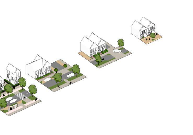
S-U3e Mews and Lanes
Include occasional planting, trees and features
Include in-street drainage features such as rills
Have a width:height enclosure ratio of between

S-U4 MOVEMENT: CAR PARKING

Developments must be designed around people not the car. When poorly-designed, car parking can have a significantly detrimental effect on the quality of a street and place.
The parking typologies set out on this page are supported in New Residential Neighbourhoods in Spelthorne, provided they are designed in compliance with the Design Requirements.
Vehicle parking must:
• Be provided at a level that complies with Surrey County Council’s parking standards
• Have bay parking spaces at least 5.0m x 2.5m
• Have on-street parking spaces of at least 6.0m x 2.5m, with additional space on the ends of runs to allow for a kerb return
• Have at least 10% of parking spaces as disabled spaces, of 3.6m wide, located within 50m of the relevant building entrance
• Provide at least 0.2 visitor spaces per dwelling in on-street or otherwise unallocated spaces
S-U4a On-Plot Parking
On-plot parking should be used in lower-density areas of new residential neighbourhoods, typically of 35 dwellings per hectare or lower.

Frontage parking must:
• Have planting at least every four spaces in a run
• Include trees to soften views along longer runs of parking
• Be differentiated in surface material from the carriageway
• Retain footway or planted front garden area of least 1.5m behind the parking space
Side parking must:
• Be a minimum of 3.3m wide
• Maintain level footways and cycleways when accesses cross, using quadrant kerbs to provide a drop to the carriageway, as shown below

Integral parking must:
• Be a minimum of 6.0 x 3.0m internally
• Have a garage opening of at least 2.7m wide
• Have a garage door no more than 50% of the building frontage width
• Ensure a ground floor window is provided in addition to the front door and garage door
S-U4b On-Street and Shared Parking
On-street parking and shared parking approaches should be used in higher-density areas of new residential neighbourhoods, typically between 4075 dwellings per hectare.
On-street parking must:
• Have runs of no more than four spaces
Parking squares must:
• Have planting at least every four spaces in a run
• Must not exceed 12 spaces
• Include trees within some planted areas
Rear parking courts must
• Be overlooked from dwellings

• Leave no unallocated space to prevent nuisance parking
• Have kerb returns of between 45° or 90°
• Be differentiated in surface material from the carriageway
• Be contained within verge/planted areas at the edge of carriageways, with planting or street trees at the ends of runs
• Be overlooked from surrounding dwellings
• Be differentiated in surface material from the surrounding streets, with permeable paving recommended
• Be lit to provide security at all times of day. Lighting spread should be designed so as not to disturb neighbours. Motion-sensitive lighting is supported for its reduced energy use and impact on ecology
• Have planting or trees at least every five spaces in a run
• Be mostly surfaced with permeable paving
• Provide overlooked, safe access to apartment circulation cores via an overlooked route
Safe, well-managed car parking approaches are an important part of what makes places successful.
S-U5 SAFE, ATTRACTIVE AND MULTIFUNCTIONAL OPEN SPACES

All development of New Residential Neighbourhoods in the Suburban area type must provide public open space at the levels, standards and accessibility specified in the latest Open Space Assessment, currently:
• Amenity Green Space: 0.6ha / 1000 people, within 480m of all homes
• Parks and Recreation Grounds: 0.8ha / 1000 people, within 400m of all homes
• Provision for Children and Teenagers: 0.1ha / 1000 people, within 400m of all homes
• Natural Green Space: 1.0ha / 1000 people for new development including amenity green space, within 500m of all homes
• Allotments: 0.25ha / 1000 people, within 800m of all homes
Additional Code requirements for two different types of open space are set in this section.
Meeting Points: Open Spaces Amongst Homes

Open spaces amongst homes must:
A. Have high levels of enclosure from surrounding built form
B. Have traffic calmed surrounding streets with a change in carriageway materials
C. Be overlooked from surrounding homes
D. Include sufficient lighting for safety
E. Include cycle parking and seating
F. Be accessible to and inclusive of all users
Open spaces amongst homes could include:
1. Planting and habitat creation
2. Traffic-free active travel links
3. Rain garden and surface water management features
4. Community garden and food production
5. Small events space
6. Childrens play features
S-U5a
S-U5b
Outdoors: Open Spaces on the Edge of the Built-up Area

Open spaces at the edge of built-up areas must:
A. Be overlooked from surrounding homes
B. Have a transition in character from managed to natural, with uses such as play areas closer to homes
C. Include sufficient lighting for safety on any active travel routes that pass through the space
D. Include features such as bollards that prevent vehicles from entering or parking on the space from surrounding streets
E. Be accessible to and inclusive of all users
Open spaces at the edge of built-up areas could include:
1. Natural habitat creation
2. Surface water management features that also function as natural habitats
3. Traffic-free active travel links and connections to surrounding open spaces and other destinations
4. Childrens play areas
5. Seating along footpaths
6. A distinctive built form edge with views across the open space, with the potential for taller heights to address the space
S-U6 LANDSCAPE CHARACTER
New residential neighbourhoods will blend built form with planting, soft landscape and green infrastructure, to create a softer, less formal environment than town centres and inner suburbs. There will be proportionally more soft landscape than hard landscape.
S-U6b Soft Landscape
Soft landscape features play an important part in the quality of the built environment. In more formal areas, such as busier streets and areas with more hard landscape, a more ornamental palette is appropriate.
S-U6a Hard Landscape
Hard landscape features will typically be within streets, including footways, cycleways and carriageways. It will also include incidental hard landscape features and squares within open spaces or at key nodes within the street network.


Brick paving can provide a cohesive and traffic-calmed environment on smaller residential streets and key nodes or junctions
Resin-bound gravel can provide an attractive and practical surface for informal leisure paths through open spaces
Material selection in the public realm must be in compliance with the Surrey Healthy Streets Design Code.


Closer to the edge of the built-up area and larger open spaces, a more informal mix of native species, including trees and hedgerows, should be used, maximising habitat creation opportunities.
A mix of grasses and lowmaintenance evergreen species

Wildflower planting within verges or larger areas of open space
Evergreen shrub species planted within verges to prevent verge parking

‘Play on the way’ features within retained mature tree corridor
Including mown amenity grass ensures open spaces can be flexible for different uses
Species selection should be varied to ensure resilience to climate change and invasive species.
Management and maintenance should be minimised where possible for most areas, saving more maintenance-intensive species for small areas of high impact.
S-U6c Street Trees
All streets must be tree-lined. In general trees will be integrated within verges and as part of the street green infrastructure, as set out under S-U3 and S-U4. Suitable approaches include:

Lines of trees within verges
S-U6d Surface Water Drainage Features
All development must manage surface water through the use of Sustainable Drainage Systems (SuDS). Suitable design features include:


Trees installed to aid traffic calming features


Source Control / Initial Absorption Features
• Street ‘rain gardens’
• Planted verges and general soft landscape cover
Trees installed to break up frontage parking or parking squares
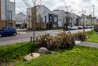
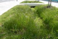
Conveyancing
Features
• Planted street swales
• Other overland flow features with minimal culverting or piping
Trees must have sufficient space to grow and thrive, following guidance set out by the Trees Design Action Group (see reference in Chapter 6).
Using a variety of street tree species ensures resilience to climate change and invasive species.


Attenuation Features
• Surface attenuation basins, planted to create new habitats
• Attenuation ponds with permanent water
New Homes or Apartments on Existing Streets
Development of new dwellings or apartments on plots on existing Suburban residential streets will be designed to complement the existing street scene and character of the area, while delivering high quality new homes throughout the borough.
In contrast to Inner Suburban locations, Suburban areas have more space between buildings and typically larger front garden areas, allowing more flexibility for the design of new development.
DESIGN AIMS
All Suburban development on existing streets will:
• Comply with Nationally Described Space Standards
• Address the needs of different design zones for street frontage, access, servicing and gardens
• Respect the existing street scene by observing the key design parameters, including:
• the existing building line, rhythm of windows and separation distances
• car parking not dominating the frontage
• respecting heights and scale of streets
• Use materials and articulation to provide richness to the street scene
S-A1 LAYOUT PRINCIPLES
New development on existing streets in Suburban Area Types should follow the overall layout principles set out below. Coding requirements for different areas are set out on the following pages.
The diagram shows a typical layout for this type of development but the Code does not require development to be of this form. Layout should respond to the particular requirements of the site, considered through an appropriate design process.
Property Behind
Front Door
Building Heights typically up to height of highest adjacent building
Regular building line along a street
Building lines for corner plots
Reflect existing street rhythm of gaps and built form
Irregular building line establishes zone for new building front
S-A2 BUILT FORM PARAMETERS
New development on existing streets must observe the following key built form parameters:
• Roofline up to height of highest immediately neighbouring building
• Plot coverage that is broadly within the range of the existing area, typically 25-40%
• Match neighbouring building line on streets with regular building line
• Where building line is irregular, use neighbouring buildings to establish zone for building line
• Sites on street corners to match the building line of both adjoining streets and provide passive surveillance to both aspects
• Reflect the existing street rhythm of gaps and built form
S-A3 ROOF FORM
New development on existing streets must
• Have pitched roof forms, reflective of surrounding prevailing form, e.g. gable ends or street-facing pitch
• Avoid flat roof forms facing streets on main roofs.
• Ensure dormers are set in a minimum of 1m from the roof edge, down 0.5m from the ridge and up 1m from the eaves, and not be dominant and out of proportion
• Flat-roofed dormers facing the street may be acceptable if the overall architectural design language of the development is contemporary, otherwise they must Incorporate a roof which is compatible with the main roof


Front boundary treatments in suburban areas typically include planting and landscape to soften the built form and parking arrangements
S-A4 FRONT BOUNDARY TREATMENT
New development on existing streets must have:
• A defined front boundary that separates public realm from private space
• A clear pedestrian path to the front door, clearly defined from any frontage parking
• A boundary treatment such as a low wall, ornamental hedge or railings, making reference to prevailing styles on the street
• A front door that faces the street
• Sheltered, defensible threshold space at front door of at least 1m depth and 1.5m width
• An accessible covered space to store waste and recycling
• Accessibility to users of all abilities with a variety of mobility needs
Maintain appropriate distances to existing properties
Left: Back to Back 21m (30m for 3 storey) (distance 2 on left diagram)
Right: Back to Flank 13.5m (21m for 3 storey) (distance 1 on right diagram)
Ensure a 25° vertical line of sight to neighbouring properties to ensure daylight
S-A5 DAYLIGHT, PRIVACY AND OVERLOOKING
New development on existing streets must:
• Have a minimum back to back distance to properties at the rear of 21m (30m for 3 storey buildings)
• Ensure built form of two storeys or above is clear of a 45° line drawn from the centre of a habitable room in neighbouring properties, both horizontally and vertically
• Ensure a 25° vertical line of sight to neighbouring properties to ensure daylight
• Ensure a minimum back to flank distance 13.5m (21m for 3 storeys)
• Ensure a minimum boundary set-in distance 1m (2m for 3 storeys), or more to suit the context and prevailing street scene
S-A6 ACCESS, CYCLE AND VEHICLE PARKING
New development on existing streets must have:
• Secure and integrated cycle parking within building, e.g. for apartments within a circulation core on ground floor
• One of side, rear (shared), integrated or frontage car parking
• Hardstanding for frontage car parking that occupies no more than 50% of frontage
• Brick paving or permeable gravel where car parking is on frontage
• Planting and permeable surfaces within shared car parking areas (for apartments)
• Pedestrian access to rear gardens
S-A7 APARTMENT DEVELOPMENT
All new apartment development on existing streets must ensure:
• Dual aspect apartments are maximised
• Single aspect apartments are no deeper than 6m from an external window
• There are no single aspect apartments on north-facing aspects
• Balconies face the street and rear, avoiding balconies facing towards adjacent properties to sides
• That recessed or partially projecting balconies are used
Where no other private outdoor space is provided, balconies must:
• Have a minimum depth of 1500mm
• Have a minimum of 5m2 of private outdoor space for all 2 person dwellings and an extra 1m2 provided for each additional occupant.
• Have level access from a habitable room, ideally a living room or living area
S-A8 DETAIL, RICHNESS AND MATERIALITY
New buildings on existing streets should demonstrate how they have incorporated common features seen in Suburban areas into their detailed design to enhance richness and variety in the street scene.


edge detailing
To enhance the richness of the street scene, new buildings on existing streets could incorporate features such as integrated garages and terraces, inset balconies for upper-floor apartments, and a variety of textures within elevation design.

Integrated garages and roof terrace design
New development on existing streets must:
• Use a single material for the elevation or;
• Have one clear change in materials between the ground floor and upper floors
• Use materials of high quality and long life, ideally with visible texture such as brick


Variety of textures and finishes on facade
Softening built form with planting
Gable ends
Roof dormers Hip roofs Brickwork
Inset balconies on maisonette upper floors
Residential Extensions
S-X1 CONTEXT & CHARACTER
Designs should be mindful of key dimensions of the wider context that will ensure an extension fits within and complements that character of the area. These include:
OVERVIEW
The key design considerations for residential extensions on existing plots in Suburban areas are set out on this page.
All new residential extensions must comply with these requirements.
This section sets out an overview of the key dimensional requirements for residential extensions. More detailed guidance on design for this type of development is contained in Appendix C, drawn from the previously adopted “Design of Residential Extensions and New Residential Development Supplementary Planning Document (SPD)” (April 2011).
• Set-in distance: the distance from plot edge to the flank side of the building. It defines the characteristic width between properties along a street. Care should be taken to reflect the existing street scene.
• Set-back distance and prevailing building line
Minimum requirements for key dimensions are set out on these pages.
Key characteristics to observe that extensions should respond to in architectural design include:
• Prevailing materials of the area
• Prevailing roof forms and features
• Rhythm of windows and location of front doors on façades
S-X2 PRIVACY & OUTLOOK
Find out more background information about the borough in Appendix A ‘Understanding Spelthorne Today’.
1. Minimum garden length 10.5m (15m for 3 storeys)
2. Minimum back to back distance 21m (30m for 3 storeys)
1. Minimum back to flank distance 13.5m (21m for 3 storeys)
2. Minimum boundary set-in distance 1m (2m for 3 storeys), or more to suit the context
• Two-storey extensions must be clear of a 45° line drawn from the centre of a habitable room in neighbouring properties, both horizontally and vertically
• Inline side extensions are acceptable
• Subordinate multi-storey side extensions must be set back by at least 1m (1) and set in from the plot boundary (2)
• Development must maintain a 25° vertical line of sight to neighbouring properties to ensure daylight
• Subordinate multi-storey side extensions must be set in from the plot boundary by a minimum of 1m (2m for 3 storey development), or more to suit the context
Dormers must:
1. Be located centrally or symmetrically on a roof
2. Be set in a minimum of 1m from the roof edge, down 0.5m from the ridge and up 1m from the eaves
3. Incorporate a roof which is compatible with the main roof
4. Not be dominant and out of proportion

Areas of Change
Staines-upon-Thames Town Centre
OVERVIEW
This section sets out detailed Design Requirements and guidance for development in Staines-uponThames town centre.
EXTENT AND CONTEXT

Area of Change
Boundary
Centre
DEVELOPMENT CONTEXT
Staines-upon-Thames town centre will see significant change in coming years. The Local Plan allocates around 3,500 new homes to be built, mostly at higher densities and resulting floor area ratios than the prevailing built form. The Design Code sets out the requirements for these to be delivered as part of coherent, well-designed Town Centre Neighbourhoods, that complement and enhance the existing High Street.


Find out more background information about the borough in Appendix A ‘Understanding Spelthorne Today’.
Find out more about the Conservation Area in the Staines Village Conservation Area Appraisal (2023).
A clear vision for town centre neighbourhoods and the future ‘look’ of the town centre is a community priority.
DESIGN AIMS
New development in Staines-upon-Thames town centre will:
• When within the ‘Historic Core’, respect and complement the context of the High Street, Clarence Street, Conservation Area and river frontage
• When within new town centre neighbourhoods, form part of coherent new places for people to live and enjoy that encourage connection, health and sustainable living
• Prioritise the quality, safety and attractiveness of the public realm, open spaces and streets
• Make the most of the river frontage and help to connect the town to the Thames, Colne and Wraysbury
• Be resilient to the anticipated effects of climate change, and ensure that new places do not adversely affect existing places in terms of flooding, microclimate and quality of life
Recent development in Staines town centre: London Square (left), River Town (right)
Area Types

Within the Area of Change, more detailed requirements are set out by finer-grain Area Types. Each Area Type in the town centre is considered by whether it will largely retain its existing character and contribution to overall place identity, or whether it is likely to change substantially in character and has the opportunity to newly contribute to the town’s identity.
Incremental Change
Retaining existing character and place identity Design requirements strongly reflect context.
HISTORIC CORE STAINES VILLAGE
General requirements for the High Street Area Type (Chapter 4) apply.
MEMORIAL GARDENS
STATION PATH
LONDON ROAD
TWO RIVERS
ELMSLEIGH
RAILWAY EDGES
Transformative Change
General requirements for the Town Centre Neighbourhoods Area Type (Chapter 4) apply.
Defining a new character and place identity. Design requirements set key parameters only.
A SPATIAL APPROACH FOR STAINES-UPON-THAMES TOWN CENTRE
It is anticipated that the town centre of Staines-upon-Thames will see substantial new development in the coming years. The spatial approach sets out an overview of how this might be accomplished in line with the vision set out in Chapter 3. Although it is illustrative, it guides the detailed design requirements set out later in the Design Code.
The spatial approach’s key aims are:
• To reflect the ambition of the community to preserve what makes the town special and familiar to them by identifying key streets and areas for incremental, small-scale change
• To define connected new town centre neighbourhoods that can accommodate new open spaces, new high-quality homes and new mixed-use facilities
• To enhance the character and future sustainability of the town centre
The spatial approach is a composite of a number of layers and design thinking that work together to guide development in the future in a coherent way. These are explored further on the following page.


River Thames
Staines Bridge
Staines Village
Two Rivers High St
London Road
Rail Station
Bus Station
Protecting the historic core
New green and blue spaces
Better spaces and connections
New homes and streets for people
PLACE IDENTITY

The places that are valued by the community and define the identity of Staines-upon-Thames form the core of the spatial approach.
STREET CONNECTIONS

New neighbourhoods are linked and integrated to the High Street and surroundings through new walking and cycling street connections.
GREEN LINKS

Areas of anticipated growth form new neighbourhoods, linked to their surrounding green open spaces and rivers through new green links.
BUILT FORM AND
USES

New built form is related to surrounding neighbourhoods by ensuring transitions in height. The existing retail core is strengthened and extended.
Staines Moor
NEIGHBOURHOODS - LINKED, GREEN AND CONNECTED TO THE RIVERS
Elmsleigh
Staines Village (existing Business Park)
NEW NEIGHBOURHOODS - CONNECTED AND PART OF THE TOWN
NEIGHBOURHOODS - BUILT FORM AND USES IN CONTEXT
OVERALL TOWN CENTRE CODING STRATEGIES
Informed by the spatial approach, a range of strategies guide the detailed coding requirements across the town centre. The minimum requirements for individual schemes to implement these strategies are set out in the detailed Area Type Coding.
Continuous green networks for people or nature

Green & Blue Networks
The town centre is surrounded by green and blue assets but is poorly connected to them. New development will join up and enhance the existing networks of green and blue infrastructure, for both people and nature to use.
This strategy will be implemented by creating and enhancing open spaces, new green streets, street transformations to include more planting, and enhancements to ecological networks.

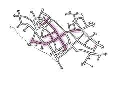
Movement
The town centre is broken up by railway lines, major dual carriageway roads and large buildings that prevent movement. New development will enhance the existing street grid so that people can find their way and move around easily, and by more sustainable modes.
This strategy will be implemented by creating new street connections, enhancing the quality of existing streets and joining up the dots of existing active travel provision.
Uses & Facilities
The town centre has a strong existing High Street and retail offer, and new neighbourhoods will connect to and enhance them. New neighbourhoods will connect to and enhance the existing core of the town centre.
This strategy will be implemented by ensuring new streets and places have active commercial ground floors in the right places.
Retail and commercial core streets
New connections
New areas and principles of enhanced townscape

Areas of high quality existing townscape
Townscape

Varied leisure uses activating spaces along the river
The new town centre neighbourhoods strongly correspond to areas with poor existing townscape, where new development could significantly enhance how the town centre is experienced overall.
This strategy will be implemented by the requirements for the arrangement of new open spaces, streets, heights, marker and landmark buildings and the implementation of town centre neighbourhood townscape principles (Chapter 4).
Natural Character
Green open spaces, trees and quieter spaces
Gateway Character Busy, active, entertainment, evening economy
RAILWAY BRIDGE
Connections to the town centre
Building frontages facing the river
Completing the Thames Path
Town Park Character Events, activity, meeting and a safe, attractive riverfront park
River Frontage
The River Thames that flows past Staines-uponThames is a vital part of the identity of the town. The overall strategy will be to establish or reinforce existing zones of activity, with attractive connections to the town centre, and development that fronts onto key spaces with complementary uses.
This strategy will be implemented by requirements for building heights, frontages, locations of open spaces, public realm priorities and key connectivity.
Relevant precedent examples for character of spaces and buildings are set out under ‘Historic Core’ and ‘Memorial Gardens’ Area Types.
Staines Village: Conserving a Valued and Attractive Place
AOC-ST1 DESIGN REQUIREMENTS

DESIGN AIMS
New development will protect the existing attractive character of this area, with green space and small-scale urban grain.
Existing Context & Place Identity
Staines Village is a quiet, attractive area centred around St. Mary’s Church and Church Street, becoming progressively greener as Church Street approaches the River Thames at its western end. There are many small, domestic, historic houses which are terraced and of red or buff brick or render with slate or tiled roofs. The character is residential and small-scale.
Much of the built form has a tight grain to it, which is set against the green open space around the Church. Towards the eastern end of Church St building heights rise, with a notable landmark at Courage Tower.
Staines Village is covered by the Staines Village Conservation Area, and new development must take into account the existing character and context of this area. Development in this area type must comply with the following additional design requirements.
Where design requirements have a spatial requirement (e.g. location of key frontages) these are set out on the Area Type coding plan on the following page.
The Conservation Area covers the whole of this Area Type. Development in Staines Village should therefore preserve or enhance the character of the Conservation Area.
The characteristics of the Conservation Area must inform the approach to:
• Built Form Massing
• Building Line
• Built Form Grain
• Open Space Character
• Street Design and Public Realm
• Materials and Landscape
• Detailing and Architectural Approach
All designs must observe a rigorous design process that sets out why and how the above parameters have been arrived at from an appraisal of the existing Conservation Area.
The Area Type coding plan sets out key spatial considerations, particularly for the Staines Business Park allocated site.


View west along Church Street showing tight urban grain, curve of street and continuous building line Church Street curves and opens slightly, to allow for softening from front gardens and a varying width of space.
Find out more about the Conservation Area in the Staines Village Conservation Area Appraisal (2023).

St Mary’s Church anchors the western end of the Village with a generous churchyard and hinted views towards the River Thames.
AREA TYPE CODING PLAN
This plan sets out where design requirements apply within this Area Type.
Allocated site in Local Plan
THE STREET & GROUND FLOOR
Allocated site in Local Plan

Allocated site in Local Plan
THE STREET & GROUND FLOOR
Heights typically up to:

Thames Path
Key View to Retain
THE STREET & GROUND FLOOR SCALE & MASSING
New active travel street connection
SCALE & MASSING
Key View to Retain Sensitive Edge
Edge Thames Path New active travel street connection
New active travel street connection
SCALE & MASSING
Key View to Retain Sensitive Edge Thames Path
3-4 storeys (approx 12m)
5-6 storeys (approx 18m)
Heights are to be measured from pavement level to the eaves.
Typical storey heights for different uses are:
• Residential: 3m
• Commercial / Office: 4m
• Ground Floor Retail / Commercial: 4.5m


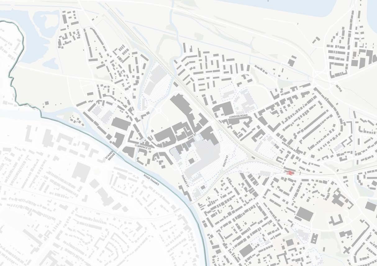
Historic Core: Retaining the Character of the Town’s Heart
AOC-ST2 DESIGN REQUIREMENTS
DESIGN AIMS
New development will strongly reflect the context, respecting its surroundings and retaining, not changing, the existing character.
Existing Context & Place Identity
The heart of Staines-upon-Thames is a vibrant and successful High Street. This grew up on the historic Roman road crossing Staines bridge leading towards London. It is primarily a retailing street, with high activity levels, on-street uses such as the market and local events and is at the heart of the identity of the town. The Conservation Area covers the western half of this Area Type.
The built form throughout this area is primarily 3-4 storeys (approx 12m), with a fine urban grain and attractive townscape. There are some onstreet trees and only one major open space in the Market Square.
The public realm is bisected by a major road, and the overall built form historically turns its back on the river.
General requirements for the High Street Area Type (Chapter 4) apply. Part of the area is covered by the Staines Village Conservation Area, and new development must take into account the existing character and context. Development in this area type must comply with the following additional design requirements.
Where design requirements have a spatial requirement (e.g. location of key frontages) these are set out on the Area Type coding plan on the following page.
AOC-ST2a Building Heights
• Heights of between 3-6 storeys (approx 1018m), to comply with the heights plan on the following page
• Protect the scale of and characteristic aspect ratios of existing streets and spaces with development not dominating the street scene or materially altering its street section (shown in Sections 1, 2, 3).
AOC-ST2b Building Line
• Building line is continuous, with buildings set at the front of the plot
AOC-ST2c
Building Grain
• Building widths of between 6-15m
• Building frontage grain of between 6-10m, with wider buildings visually subdivided
AOC-ST2d
Vertical Mix of Uses
• Ground floor retail and flexible commercial uses included in designs where this frontage type is specified
AOC-ST2e Public Realm
• Create a river front open space as part of development adjacent to Staines Bridge, requirements set out under ‘Key Open Space Requirements’ on following page..
• Enhanced planting and trees along river frontage to provide shade and ‘soft edge’ to town centre
• Improvements to pedestrian crossing point between High Street and Market Square
AOC-ST2f Facades, Detail & Richness
• Retention of existing façades, where they are of historic or local importance, or are of distinctive and attractive architecture, and where this is technically feasible
• Roofs to be pitched, with a variety of forms acceptable (see Chapter 4) and informed by contextual study
• Windows on frontage to match surrounding rhythm and characteristics
• Materials and architectural detailing to respond to prevailing form
Find out more about the Conservation Area in the Staines Village Conservation Area Appraisal (2023).
• Views along Clarence Street terminated with marker buildings
AREA TYPE CODING PLAN
This plan sets out where design requirements apply within this Area Type.
Allocated site in Local Plan
Active Frontage
View to Retain Marker Building
Allocated site in Local Plan Public realm enhancements
Thames Path and connecting paths
Heights typically up to: 3-4 storeys (approx 12m) 5-6 storeys (approx 18m)
Locations where additional building height may be accepted, subject to:
• Review by an independent design review panel that includes community representation
• Additional height being set back from the street and sensitive edges
• Additional height complementing the wider townscape
Heights are to be measured from pavement level to the eaves.
• Residential: 3m
• Commercial / Office: 4m
• Ground Floor Retail / Commercial: 4.5m


Typical storey heights for different uses are:


Gable end roof forms
Double-height window articulation
Decorative ironwork
Corner brickwork detailing and brick variation
Cream and yellow brick
White render
Shades of red brick
Market Square - colonnades
Proposals for a new open space must include:
1. Thames Path running through space
2. Additional tree planting along frontage
3. Accessible connection between Clarence St and River Thames frontage
4. Opportunity for commercial reuse of bridge arches, with associated spill-out public realm
5. Active frontages at lower level facing river, with associated spill-out public realm
6. Active frontage at street level facing Bridge Street, with associated spill-out public realm
7. Open space with a mix of planted, treed and hard landscape

Illustrative approach to applying the key design requirements
EXAMPLES AND PRECEDENTS
Development in this area could implement the following design features, character and opportunities.

Providing spill-out space in the public realm through materials, planting, surface finishes and retractable canopies.

Creating new incidental spaces such as courtyards within development off main streets.


Creative use of existing heritage assets, frontages and spaces to bring back life and activity, such as the arches under Staines Bridge.

Activate the river frontage with planting, accessible landscape and lighting
Memorial Gardens: Improving and Respecting the River Thames Frontage
AOC-ST3 DESIGN REQUIREMENTS
frontage will face the river, relate to and help to animate the green open space, and create new connections to the rest of the town centre. Any development will be of exceptional architectural quality and enhance the existing townscape.
Existing Context & Place Identity
The River Thames, and the bridge across it, is the primary reason for the existence of Staines-uponThames, and is a much valued asset.
Historically, the town ‘turned its back’ on the river, primarily seeing it as a location for industry and other marginal uses, and it has only been in the latter stages of the 20th century that its value as a leisure and recreation asset has been recognised, with the creation of Memorial Gardens and the Thames Path national long-distance footpath running through the town.
General requirements for the Town Centre Neighbourhoods Area Type (Chapter 4) apply. Development in this area type must comply with the following additional design requirements. Where design requirements have a spatial requirement (e.g. location of key frontages) these are set out on the Area Type coding plan on the following page.
The Street & Ground Floor
Building line to be continuous along Thames Street. Setback from plot edge of at least 2m to provide additional public realm for use as
Extend the Thames Path along the full extents of river frontage from Memorial Gardens to the
• Planting and trees accommodated along Thames St in areas of extended public realm.
• Ground floor retail and flexible commercial useswhere this frontage type is specified.
• Frontages to activate Memorial Gardens
AOC-ST3b Scale & Massing
• Heights to comply with the maximum heights plan and key principles in Sections 1 and 2 on the following pages
• Building widths of 10-25m
• Appropriate development typologies include Villas and linear blocks
AOC-ST3c Open Spaces
• Buildings to face Memorial Gardens
• Extend Memorial Gardens onto the existing car park, design requirements set out under ‘Key Open Space Requirements’ on following page.
• Extend the green open space network from Memorial Gardens towards the northwest
AOC-ST3d
Detail & Richness
• Roofs to contribute to townscape with pitched form, and with variation when viewed from a distance.
• Building frontage grain of 10-15m, with wider buildings visually subdivided
• Marker buildings at key locations to provide legibility and townscape interest. See coding plan.
• 3-4 storey landmark mixed-use building opportunity adjacent to Memorial Gardens, anchoring the extended space
AREA TYPE CODING PLAN
This plan sets out where design requirements apply within this Area Type.

Section location
Allocated site in Local Plan
BUILDING HEIGHTS PLAN
Building Line
New Active Frontage
Retail / Flexible
Commercial Ground Floor
Key Overlooking Location
Street Planting & Greening THE STREET & GROUND FLOOR
Existing path or active travel street to connect to
New active travel street connection
SPACES
New green open space
Extension to public realm
DETAIL & RICHNESS
Marker Building
Landmark Building
Heights typically up to:
3-4 storeys (approx 12m)
5-6 storeys (approx 18m)
8 storeys (approx 24m)
See Sections 1 and 2 on following page for explanation and key principles on heights.
Heights are to be measured from pavement level to the eaves.
Typical storey heights for different uses are:
• Residential: 3m
• Commercial / Office: 4m
• Ground Floor Retail / Commercial: 4.5m
(AOC-ST3b) HEIGHTS AND SCALE PRINCIPLES
This diagram illustrates overall principles and rationale for the scale and massing in the river frontage area. These are set out to protect the scale and character of the riverside frontage.
For locations of sections see Coding Plan on previous page.
Key principles for massing are that development must
• Have a frontage along Thames Street should at a maximum of 8 storeys (approx 24m) to retain an appropriate scale to Memorial Gardens, and to reduce the impact of taller buildings set back behind Thames Street
• Have maximum heights on the river side of Thames Street should be similar to those already in existence (up to 6 storeys, approx 18m, immediately adjacent to Thames Street)
• Have maximum heights on the river side of Thames Street should step down towards the river frontage, at a maximum of 3 storeys (approx 10m) if immediately adjacent to the river
• Have building mass that is broken up with variety in heights, roofscape and articulation of façades
Taller buildings visible behind frontage but do not define scale of space
Space bounded by Thames St frontage (8 storeys)
8 storeys (approx 25m)
Existing building further NW on Thames St (6 storeys)
Extension to Memorial Gardens Existing Car Park extents Existing hotel Extended Public Realm Memorial Gardens
‘River Town’ towers behind Thames St frontage
Maximum height of Thames St frontage 8 storeys (approx 25m)
Overall envelope for new built form, stepping down to 3st closer to river edge
Proposals for a new open space must include:
1. Thames Path running through space, extended along river front with overlooking from built form
2. Accessible connections and improved crossing across Thames St
3. West or Southwest facing active frontage facing river and green open space with associated spill-out public realm
4. Active frontage on Thames St
5. Extension of existing green open space
6. Additional tree planting

Illustrative approach to applying the key design requirements
EXAMPLES AND PRECEDENTS
Development in this area could implement the following design features, character and opportunities.

Use of hard landscape public realm to support active ground floor uses on the edge of Memorial Gardens, with trees for shade and to provide a transition to greener open space in Memorial Gardens.

Activating open space with play and landscape features to encourage the use of Memorial Gardens as a destination, with play, seating and other activities available.

Fine-grained, varied frontages that address the river, open up views and connections, and provide overlooking to Memorial Gardens without overwhelming the scale of the space.


Use of gable-end and set back roofs to provide interest and variety to building tops, and usable private outdoor space facing the river.
Station Path: Improving Connections and Integrating Development Sensitively
AOC-ST4 DESIGN REQUIREMENTS
General requirements for the Town Centre Neighbourhoods Area Type (Chapter 4) apply. Development in this area type must comply with the following additional design requirements. Where design requirements have a spatial requirement (e.g. location of key frontages) these are set out on the Area Type coding plan on the following page.
AOC-ST4a The Street & Ground Floor
Match and repair existing building lines.
Provide a setback along Station Path for seating and planting.
DESIGN AIMS
New development in this area will realise the potential of the sustainable location close to the railway station. It will benefit the surroundings by enhancing the Station Path, providing safe and attractive links between the path and Kingston Road, and reducing areas of severance and discontinuity. It will relate respectfully in scale and massing to the residential area to the north.
Existing Context & Place Identity
The Station Path is an important gateway to the town and has an attractive green character, but is bordered by car parks and underused spaces that can make it feel unsafe.
Community and commercial uses, along with apartments, are located on Kingston Road. A mix of Victorian and Edwardian homes are interspersed with more modern, less wellintegrated development and surface parking.
Provide passive surveillance of Station Path, particularly the railway underpass and surrounding area
Pedestrian and cycle links between Kingston Road and the Station Path
Street network to respect and connect to existing street grid and characteristic blocks of 55-75m width
AOC-ST4b Scale & Massing
• Heights to transition to surrounding built form as set out on the transitional edges plan and key principles in Section 1 on following pages
• Building widths or frontage grain of between 7-15m to reflect existing built form
• Appropriate development typologies include terraces, mews, linear blocks, villas and occasional towers on podiums.
AOC-ST4c Open Spaces
• Create a square in front of the Oast House which provides an appropriately-scaled space for this building. Requirements are set out under ‘Key Open Space Requirements’ on following page.
AOC-STd Detail & Richness
• Roofs up to 5 storeys (approx 15m) to be pitched with gable ends and dormers acceptable.
• Roofs of taller buildings to provide visual interest with distinctive form, and with variation when viewed from a distance.
• Marker buildings at key locations to provide legibility and townscape interest. See coding plan.
AREA TYPE CODING PLAN
This plan sets out where design requirements apply within this Area Type.
Transitional Edge, where heights step down to blend with prevailing built form and preserve street scale.
See Section 1 on following page for explanation and key principles on transitional edges.
(AOC-ST4b) HEIGHTS AND SCALE PRINCIPLES
This diagram illustrates overall principles for the scale and massing in the Station Path area.
For section location see Coding Plan.
Oast House for context (Heights to step down approaching building to maintain quality of public space)
Existing London Road built form for context
Stepped height to maintain Kingston Road scale
Overall envelope for built form
Existing building further NW on Kingston Road (4 storeys)
Stepped height to maintain Kingston Road scale
Proposed building line to match prevailing line on Kingston Road
Key principles for massing are that development must
• Step down to 3-4 storeys (approx 12m) to meet Kingston Road towards the east, preserving its scale and views from the street and buildings to the north
• Step down to 5-6 storeys (approx 18m) to meet Kingston Road towards the west, closer to London Road
• Step down to 5-6 storeys (approx 18m) create a human scale adjacent to Station path
• Step down to meet the public space in front of the Oast House as set out in the Key Open Space Requirements on the following page
Elmsleigh
AOC-ST4e KEY OPEN SPACE REQUIREMENTS
Proposals for a new open space must include:
1. Improved overlooking of Station Path
2. Walking and cycling connection between Kingston Road and Station Path
3. Public space created in front of Oast House with new surrounding built form scaled and set back at taller heights, as shown in section inset.
4. ‘Spill-out’ public realm immediately in front of Oast House
5. Tree planting within public realm to provide shade and character to space
6. Overlooking and active frontages to all spaces from new built form
EXAMPLES AND PRECEDENTS
Development in this area could implement the following design features, character and opportunities.

Streets that prioritise people and limit vehicle speeds, and reflect the existing structure and key dimensions of blocks and streets in the surrounding context.

Illustrative approach to applying the key design requirements

Use of mews streets to ensure high densities within blocks whilst maintaining a mix of house types in developments.

Use of artwork in the public realm to provide legibility and a distinctive character to this area, particularly on new pedestrian links past the Oast House.
London Road: A New Gateway Neighbourhood for the Town Centre
AOC-ST5 DESIGN REQUIREMENTS
General requirements for the Town Centre Neighbourhoods Area Type (Chapter 4) apply. Development in this area type must comply with the following additional design requirements. Where design requirements have a spatial requirement (e.g. location of key frontages) these are set out on the Area Type coding plan on the following page.
The Street & Ground Floor
Building line to be set back from plot edge along London Road to provide additional public realm, planting and spill-out space.
Retail and commercial ground floor uses to be located along London Road frontage
Scale & Massing
Heights to transition to surrounding built form as set out on the transitional edges plan and key principles in Section 1 on following pages
General presumption of high residential densities and Floor Area Ratio of 3.0 or above.
Appropriate development typologies include occasional podiums and towers, villas and
AOC-ST5c Open Spaces
• Create a linear green open space from London Road/Kingston Road towards the north. Requirements are set out under ‘Key Open Space Requirements’ on following page.
AOC-ST5d
Detail & Richness
• Roofs of taller buildings should provide visual interest with distinctive form, and with variation when viewed from a distance.
• Marker buildings at key locations to provide legibility from London Road towards other developments further north. See coding plan.
is an extension of the High Street. It has some secondary and local retail and service uses, as well as being a focus for a number of larger high-density residential schemes, with associated ground floor retail uses.
London Road is an important gateway location for the town and is a major new neighbourhood for Staines-upon-Thames.
Transitional Edge, where heights step down to blend with prevailing built form and preserve street scale.
See Section 1 on following page for explanation and key principles on transitional edges.
(AOC-ST5b) HEIGHTS AND SCALE PRINCIPLES
This diagram illustrates overall principles for the scale and massing in the London Road area.
For section location see Coding Plan.
views from surrounding suburbs
Telephone Exchange Building
Overall envelope for built form
Furlong Road/ Fairfield Ave Waters Drive Existing tree belt
Sensitive Edge
Key principles for massing are that development must
• Step down towards the northern edge bordering Waters Drive to approximately match the heights of the existing tree belt (5/6 storeys, approx 18m)
• Heights to peak in the centre of the neighbourhood at 12 storeys (approx 36-40m)
• Heights on London Road to be no higher than the currently prevailing heights of recent developments (approx 10 storeys / 32m)
• Be generally lower in height on the southwestern side of London Road to transition to this lower-rise existing residential area
Square
Road / Station Path Area London Road
Proposals for a new open space must include:
1. Connections to wider open spaces and neighbourhoods to the north
2. Retention of existing trees
3. Overlooked public realm at key node
4. Connection from London Road to former Telephone Exchange site and public realm
5. Overlooked linear green open space
6. Improved pedestrian and cycling connections at London Road / Kingston Road junction
7. Retail frontage and associated ‘spill-out’ public realm on London Road
8. Marker building to terminate views along linear green open space
EXAMPLES AND PRECEDENTS
Development in this area could implement the following design features, character and opportunities.

Well-overlooked green open spaces with trees, seating and a choice of walking routes.

Illustrative approach to applying the key design requirements

Urban character of public realm with trees, cycle parking and hard landscape at key nodes, such as along London Road or at the public realm square opportunity set out on the coding plan.

Active commercial ground floors that have a strong relationship with a pedestrian-friendly public realm.
Two Rivers: A New Neighbourhood with access to Nature
AOC-ST6 DESIGN REQUIREMENTS
DESIGN AIMS
New development in the Two Rivers area will create a new, integrated primarily residential neighbourhood strongly related to the watercourses running through it. Opportunities to reflect the grain or character of the historic industrial uses of the site are supported.
Existing Context & Place Identity
To the north-west of the core of the historic town centre sits the Two Rivers Retail Park, which occupies land previously used for the linoleum industry. The area is dominated by a large surface car park and associated highway infrastructure and edged by modern retail and leisure units. The retail park integrates well with the core High Street and strengthens the overall town centre offer.
General requirements for the Town Centre Neighbourhoods Area Type (Chapter 4) apply. Development in this area type must comply with the following additional design requirements. Where design requirements have a spatial requirement (e.g. location of key frontages) these are set out on the Area Type coding plan on the following page.
The Street & Ground Floor
New street layouts designed on ‘superblock’ principles to prioritise active travel, with vehicle movement limited to parking and service
New streets to connect to and extend the street grid of the town centre from the
Enhance the safety of the existing pedestrian bridge towards the west by locating of built facing it
Connect new streets to existing footpaths
Retention and extension of retail, leisure and other commercial uses along key NW-SE axis.
• General presumption of high residential densities and Floor Area Ratio of 3.0 or above.
• Terraces and linear blocks to be used close to sensitive edges.
• All development typologies may be appropriate in other locations
AOC-ST6c
Open Spaces
• Create a new linear park and public spaces along a restored River Colne. Requirements are set out under ‘Key Open Space Requirements’ on following page.
• Enhancement of the habitats and watercourses of the Rivers Wraysbury and Colne, including potential for river restoration approaches along the Colne.
AOC-ST6d
Detail & Richness
• Heights to transition to surrounding built form as set out on the transitional edges plan and key principles in Section 1 on following pages
• Massing led by creating a comfortable street scale with the tightest width:height ratio of around 1:1. Heights that would break this street aspect ratio are permitted through the use of a ‘shoulder’ where heights step back from the street edge.
• Roofs of taller buildings should provide visual interest with distinctive form, and with variation when viewed from a distance.
Section location
Allocated site in Local Plan
TRANSITIONAL EDGES PLAN
Building Line
New Active Frontage
Retail / Flexible
Commercial Ground Floor
Key Overlooking Location
Existing path or active travel street to connect to
New active travel street connection
SCALE & MASSING
Sensitive Edge
THE STREET & GROUND FLOOR OPEN SPACES
New green open space
River restoration opportunity
DETAIL & RICHNESS
Marker Building
Landmark Building
Transitional Edge, where heights step down to blend with prevailing built form and preserve street scale.
See Section 1 on following page for explanation and key principles on transitional edges.
(AOC-ST6b) HEIGHTS AND SCALE PRINCIPLES
This diagram illustrates overall principles for the scale and massing in the Two Rivers area. For section location see Coding Plan.
Key principles for massing are that development must
• Step down towards the neighbouring residential area to the northwest, with heights at the edge approximately as high as the existing tree belt on the River Wraysbury (~1518m, 5-6 storeys)
• Have heights of up to 8 storeys (approx 24m) immediately adjacent to the new linear park, with taller heights set back with a ‘shoulder
Wraysbury Gardens
Proposals for a new open space must include:
1. Connections across existing bridges to town centre streets into open space and towards the north and west
2. Crossing point to provide walking and cycling access to open space
3. Overlooked, activated public realm at node
4. Marker building to terminate view from town centre
5. Retail active frontage around key node and overlooking of open space from built form
6. Strengthening of existing trees and planting to create varying landscape character Accessible green open space around river
7. Walking and cycling links through open space
EXAMPLES AND PRECEDENTS
Development in this area could implement the following design features, character and opportunities.

Views maintained through development to provide a visual connection to surrounding areas and natural spaces.

Illustrative approach to applying the key design requirements

Use varied and attractive landscape and public realm features to make use of the River Colne as the heart of a new open space, reactivating this area for both nature and people.

Using the design and materiality of bridges as important connection points and features.
Elmsleigh: A Bustling Town Centre Neighbourhood for all
AOC-ST7 DESIGN REQUIREMENTS
General requirements for the Town Centre Neighbourhoods Area Type (Chapter 4) apply. Development in this area type must comply with the following additional design requirements. Where design requirements have a spatial requirement (e.g. location of key frontages) these are set out on the Area Type coding plan on the following page.
The Street & Ground Floor
New street layouts designed on ‘superblock’ principles to prioritise active travel, with vehicle movement limited to parking and service access to buildings. South Street to become a multi-modal street (chapter 4).
Retain existing NW-SE High St to bus station connection as a pedestrian priority street
• Massing led by creating a comfortable street scale with the tightest width:height ratio of around 1:1. Heights that would break this street aspect ratio are permitted through the use of a ‘shoulder’ where heights step back from the street edge.
• General presumption of high residential densities and high Floor Area Ratio of 3.0 and above.
facing built form to one of streets, open spaces and individual buildings, with much better connections to the river frontage and surrounding neighbourhoods and facilities.
Existing Context & Place Identity
The area to the south-east of the High Street is a covered 1970s shopping centre with a large multistorey car park and service entrances on main streets. It is a part of the town’s retail offer.
This part of the town centre is also an important gateway for public transport users, arriving by rail or bus, and for those walking or cycling, as the majority of homes in Staines-upon-Thames located within walking or cycling distance of the town centre are located to the south-east.
Retention and extension of existing retail, leisure and other commercial uses along key NW-SE axis, connecting to High Street and bus station. See Coding Plan.
• Mix of retail and commercial unit sizes to provide opportunities for smaller and independent businesses
• Create new NE-SW pedestrian priority connection towards river frontage
• Active frontage onto South Street and bus station
AOC-ST7b
Scale & Massing
• Heights to transition to surrounding built form as set out on the transitional edges plan and key principles in Section 1 on following pages
• Appropriate development typologies include podiums and towers, villas and linear blocks closer to edges.
AOC-ST7c
Open Spaces
• New green open space at heart of new neighbourhood, where streets cross. Requirements are set out under ‘Key Open Space Requirements’ on following page.
AOC-ST7d
Homes & Practicalities
• Retain existing public car parking provision within consolidated deck structures, with attractive façades or sleeved by other development
AOC-ST7e
Detail & Richness
• Roofs of taller buildings should provide visual interest with distinctive form, and with variation when viewed from a distance.
Section location
Allocated site in Local Plan
THE STREET & GROUND FLOOR
Building Line
New Active Frontage
Retail / Flexible
Commercial Ground Floor
Key Overlooking Location
Existing path or active travel street to connect to
New active travel street connection
OPEN SPACES
New open space/ public realm
Street Planting & Greening
DETAIL & RICHNESS
Marker Building
TRANSITIONAL EDGES PLAN
Transitional Edge, where heights step down to blend with prevailing built form and preserve street scale.
See Section 1 on following page for explanation and key principles on transitional edges.
(AOC-ST7b) HEIGHTS AND SCALE PRINCIPLES
This diagram illustrates overall principles for the scale and massing in the Elmsleigh area.
For section location see Coding Plan.
Key principles for massing are that development must
• Step down towards the permitted heights in the High Street (5-6 storeys, approx 18m)
• Ensure that views from street level in the High Street are not interrupted by new built form in the Elmsleigh Area
• Have a podium or base facade of up to 8 storeys (approx 24m) surrounding any new public open spaces, with taller buildings set back above a ‘shoulder’
Existing ‘River Town’ development
Overall envelope for built form
Shoulder step-down for open space
Existing heights of Elmsleigh Centre
Progressive rise in heights to aid transition between High St and new neighbourhood
AOC-ST7f KEY OPEN SPACE REQUIREMENTS
Proposals for a new open space must include:
1. Key connections to High Street, Bus Station and Memorial Gardens
2. Potential secondary connection to the northeast
3. Green open space or new public realm with trees and planting
4. Retail active frontages facing space with associated ‘spill-out’ public realm
5. Built form to create active edge along southwestern frontage
6. Tree-lined, overlooked connection towards the river and Memorial Gardens
EXAMPLES AND PRECEDENTS
Development in this area could implement the following design features, character and opportunities.

Variety in materials, architecture and roof types to provide variation while maintaining fine grain, human-scale streets.

Illustrative approach to applying the key design requirements

Use of patterns, materials and detailing in the public realm to create attractive pedestrianpriority streets that lead people through the neighbourhood.

Creation of an open space with a distinct urban character, variety of spaces and uses within.

Railway Edges: Improving the Quality of Streets and Spaces
AOC-ST8 DESIGN REQUIREMENTS
General requirements for the Town Centre Neighbourhoods Area Type (Chapter 4) apply. Development in this area type must comply with the following additional design requirements. Where design requirements have a spatial requirement (e.g. location of key frontages) these are set out on the Area Type coding plan on the following page.
The Street & Ground Floor
Create a strong street edge with a podium or continuous base building to limit impact of railway on wider town centre neighbourhoods. See following pages for principles.
Safeguard potential new link across Egham railway tracks towards railway station. See Coding Plan.
AOC-ST8c
Open Spaces
• Create a gateway space at edge of Elmsleigh neighbourhood. Requirements are set out under ‘Key Open Space Requirements’ on following page.
AOC-ST8d
Homes & Practicalities
residents. They should create good quality street environments and ensure that any existing or new connection points across the railways are safe, overlooked and become part of the wider street network.
Existing Context & Place Identity
Two busy railway lines divide Staines-uponThames town centre from its surrounding suburbs. On the river/town centre side of these lines are a series of car parks and other areas where new development is proposed. There is little existing built form but on the other side of the railway lines are primarily existing suburbs.
Incorporate new street trees and planting along main roads, particular South St to aid transformation to multi-modal street.
AOC-ST8b Scale & Massing
• Heights to transition to surrounding built form as set out on the transitional edges plan
• Massing led by creating a comfortable street scale with the tightest width:height ratio of around 1:1. Heights that would break this street aspect ratio are permitted through the use of a ‘shoulder’ where heights step back from the street edge.
• General presumption of high residential densities and high Floor Area Ratio of 3.0 and above, particular close to major roads such as South St.
• Retain existing public car parking provision within consolidated deck structures, with attractive façades or sleeved by other development
AOC-ST8e
Detail & Richness
• Roofs of taller buildings should provide visual interest with distinctive form, and with variation when viewed from a distance.
AREA TYPE CODING PLAN
This plan sets out where design requirements apply within this Area Type.
Allocated site in Local Plan
New Active Frontage
Key View to Retain
Key Overlooking Location
Key View to Retain
Key Overlooking Location
Existing path or active travel street to connect to
TRANSITIONAL EDGES PLAN
New active travel street connection
SCALE & MASSING
Sensitive Edge
Railway Edge
SPACES
Public realm enhancements

Existing path or active travel street to connect to
New active travel street connection
SCALE & MASSING
Sensitive Edge
Railway Edge
Street Planting & Greening THE STREET & GROUND FLOOR OPEN SPACES
Street Planting & Greening
DETAIL & RICHNESS
Marker Building
Transitional Edge, where heights step down to blend with prevailing built form and preserve street scale.
Public realm enhancements
DETAIL & RICHNESS
Marker Building
Allocated site in Local Plan
THE STREET & GROUND FLOOR
New Active Frontage
AOC-ST8f RESPONDING TO A RAILWAY LINE
This diagram sets out overall principles and an illustrative example for arranging built form along a railway edge.
Key principles for massing are that development must
• Have a continuous podium, plinth or base building along the street edge that provides good enclosure and active frontage to the street
• Arrange taller massing above this in a way that provides residents with a variety of views to both town centre and across surrounding areas and the railway lines

• Service access
• Back of podium
CREATING A STREET EDGE
This diagram sets out overall principles for how the use of a base podium with active frontage can create an attractive street environment, vertical integration of different uses, and how massing should relate to the street and the railway lines.

e.g. South
Use of ‘shoulder’ set back at height
Terrace edge to top floors
Shared garden on top of podium
Rear servicing Access
Street frontage
KEY OPEN SPACE REQUIREMENTS
Proposals for a new open space must include:
1. Connection to Station Path through underpass, with improved overlooking and attractive green space environment
2. Improved crossing point and public realm for walking and cycling
3. Built form to overlook streets and public realm
4. Retail and activated frontage facing towards bus station and railway station connection, with associated ‘spill out’ public realm
5. Street tree planting and progressive change of South Street to a ‘boulevard’
6. Consideration of potential future connection across railway tracks to the southeast
EXAMPLES AND PRECEDENTS
Development in this area could implement the following design features, character and opportunities.

Rear/railway side to provide quality amenity space for residents through changes in levels.

Illustrative approach to applying the key design requirements


Multi-storey car parks with facade treatments, ideally located above active commercial ground floors.
Activated street edge with balconies and more distinctive built form to mark corners.
Sunbury Cross
OVERVIEW
This section sets out further Design Requirements and guidance for development in Sunbury Cross town centre.
EXTENT AND CONTEXT

Town Centre Neighbourhoods High Streets
Suburban Business Park
Light Industrial Retail Park Area of Change Boundary
DEVELOPMENT CONTEXT
Sunbury Cross could see significant change in coming years. The Local Plan allocates around 1,000 new homes to be built, mostly at higher densities and resulting floor area ratios than the prevailing built form, and on sites that are poorly connected within a challenging location.
Some new homes will be on sites that are currently undeveloped and others will be redevelopment sites. The Design Code sets out the requirements for all these areas, and also sets out a vision of how to transform the area over time.

Find out more background information about the borough in Appendix A ‘Understanding Spelthorne Today’.
Personal and road safety, noise, air quality and quality of life are priorities for the community in Sunbury Cross.
The varied existing context of low and high-rise development in Sunbury Cross
DESIGN AIMS
New development in Sunbury Cross town centre will:
• Create connections between areas of new development and the core of Sunbury Cross
• Improve the road safety and personal security of the public realm and streets
• Reduce severance created by infrastructure
• Link the railway station to the main shopping area
• Create a more human-scale place and street environment
• Create much-needed green open spaces for residents and the community
Area Types

Within the Area of Change, more detailed requirements are set out by finer-grain Area Types. Each Area Type in the town centre is considered by whether it will largely retain its existing character and contribution to overall place identity, or whether it is likely to change substantially in character.
Incremental Change
Retaining existing character and place identity Design requirements strongly reflect context.
THE PARADE
STAINES ROAD WEST
General requirements for Suburban Area Type (Chapter 4) apply.
STATION AREA
HANWORTH ROAD
CENTRAL AREA
General requirements for the High Street Area Type (Chapter 4) apply. General requirements for the Town Centre Neighbourhoods Area Type (Chapter 4) apply.
Transformative Change
Defining a new character and place identity Design requirements set key parameters only. The Cross itself, now the M3 junction, lies mostly outside of the scope of the Design Code. Principles for change are set out in the Spatial Vision on the following pages.
THE CROSS
A FUTURE VISION FOR SUNBURY CROSS
Sunbury Cross is a place negatively impacted by a complex mix of major roads, railways and water supply infrastructure. It was transformed in the late 1960s and early 1970s by the M3 motorway and grade-separated junction, which continues to detract from its quality as a place, and causes severance, noise, safety and air quality issues.
Sunbury Cross can be more than a motorway junction with hard edges, railway and road severance, aqueduct edges, wedges of land, a retail mall and section of frontage shops and disconnected residential neighbourhoods. The spatial vision sets out the possibilities that could be pursued through wider work with multiple planning, highway and transport authorities as well as individual schemes.
The Design Code explores how new development can help to make this happen through incremental change. Major change at Sunbury Cross requires further work and co-ordination amongst all parties to move towards a transformative masterplan.
The vision’s key aims are:
• Connect existing and new neighbourhoods with each other and creating a sense of place
• Reuniting East and West Staines Road
• Connect the centre with the railway station
• Create new green spaces and links
Many of the key changes at Sunbury Cross will be beyond the scope of individual applications, requiring wider co-ordination on changes to infrastructure. Designs should respond to the potential for change in the future and make appropriate provision.
Concept
Key Themes and Projects

Short Term
Linking the centre and the station
Medium Term
Transforming Staines Road West
New links between neighbourhoods
Human-scale built form
New green spaces and networks
Long Term
M3 junction reconfiguration

Re-imagining how people could move through Sunbury Cross, with lighting, artwork, planting and surface street crossings

Short Term
Linking the centre and the station


Medium Term
Transforming Staines Road West


Medium
Term
New green spaces and networks


Long
Term
M3 junction reconfiguration


Providing an attractive, safe and clear surface route through existing space under the M3 would improve the ease of walking and cycling movement for all between Sunbury Common / the centre and Lower Sunbury / the station. This can be accomplished through the use of artwork, improved lighting, activated useful spaces and passive surveillance from surrounding built form.
Staines Road West is currently a major dual carriageway and a barrier for moving between shops and neighbourhoods. New green infrastructure, public realm changes and a transformation to a ‘boulevard’-style environment would create a healthier, more attractive street environment.
The Staines Aqueduct is a major piece of infrastructure severing links between neighbourhoods. Although access to the aqueduct may need to remain restricted, it could form the basis of a future green network linking neighbourhoods together and contributing to a greener, healthier Sunbury Cross.
The M3 junction and flyover dominate Sunbury Cross today. Long-term, this should change, following precedent from other cities across the world who have successfully reconsidered the need for urban motorways
Top: Phoenix Flowers, M8, Glasgow (7N Architects)
Bottom: Toronto Gardiner Freeway Park
Exchange St ‘Grey-to-Green’ transformation, Sheffield
Mayfield Park, Manchester
Masshouse Circus transformation to Masshouse Plaza, Birmingham

The Parade: The Historic Link to the Past in Sunbury Cross
AOC-SC1 DESIGN REQUIREMENTS
General requirements for the High Streets Area Type (Chapter 4) apply. Development in this area type must comply with the following additional design requirements.
DESIGN AIMS
New development in this area will respond to the strong existing building line and low-rise built form, with some intensification along Staines Road West.
AOC-SC1a Building Heights
• Heights of up to 4 storeys (approx 12m), plus 1 dormer/mansard storey integrated in roof, in compliance with maximum heights plan
AOC-SC1b Building Line
• Match existing building line along Staines Road West
AOC-SC1c Building Grain
• Typical building frontage grain of 6-10m
AOC-SC1d Vertical Mix of Uses
• Ground floor commercial space
• Apartments located aove ground floor uses
AOC-SC1e Public Realm
• Incorporate new street trees and planting along Staines Road West
• Future-proof designs for potential removal of frontage service access road
AOC-SC1f Facades, Detail & Richness
• Pitched roofs facing the street or gable-end, to reflect adjacent buildings
from the Centre to the south.
• Rear parking courts overlooked by built form

• Minimise access points to rear parking courts through main frontage
• Entrances to dwellings from the street
BUILDING HEIGHTS PLAN
Heights typically up to:


5 storeys (approx 15m)
Heights are to be measured from pavement level to the eaves.
Typical storey heights for different uses are:
• Residential: 3m
• Commercial / Office: 4m
• Ground Floor Retail / Commercial: 4.5m
Staines Road West: Connecting new Development to the Surroundings
AOC-SC2 DESIGN REQUIREMENTS
General requirements for the Suburban Area Type (Chapter 4) apply. Development in this area type must comply with the following additional design requirements.
DESIGN AIMS
New development in this area will front onto Staines Road West and address the Sports Club fields to the west. Intensification of densities and built form over the prevailing area is supported, provided there is a transition in built form to existing areas within and adjacent to the area.
and the Staines Aqueduct. It contains two lowrise cul-de-sac style developments divided by Windmill Road, and the eastern boundary is an inactive frontage onto Escot Road.
AOC-SC2a Edges
• Active frontage facing onto Staines Road West following ‘Dual Carriageways, Urban Road’ edge type (Chapter 4)
• Active frontage overlooking sports field to the west following ‘Open Spaces’ edge type (Chapter 4)
• Active frontage facing aqueduct to south, following ‘Watercourses’ edge type (Chapter 4)
• Built form on allocated site backing onto existing residential gardens to the west following ‘Residential, Backing Onto’ edge type (Chapter 4)
AOC-SC2b Streets
• New streets to comply with street types set out under ‘New Residential Neighbourhoods’ (Chapter 4)
• Continuous grid of new streets within allocated site, no use of cul-de-sacs
• Connections from new development to existing streets and cul-de-sacs
AOC-SC2c Open Spaces
• At least one new open space within allocated site, within homes
• Potential for new open space adjacent to aqueduct at southern edge of allocated site
AOC-SC2d Built Form
Heights to comply with the maximum heights plan
Heights typically up to:
3-4 storeys (approx 12m)
6 storeys (approx 18m)
Station Area: Improved links to public transport
DESIGN AIMS
New development in this area will enable better accessibility of the station for pedestrians and cyclists, provide frontage to surrounding roads, and create a more consistent built form. Significant intensification is possible here in the context of the railway station as an important public transport link.
Existing Context & Place Identity
The area around Sunbury Station is a small pocket of development cut off from its surroundings by the M3, railway line and the feeder roads to Sunbury Cross roundabout. Land uses are largely commercial with no consistent architectural style, building line or grain.
AOC-SC3a
The Street & Ground Floor
• Provide walking and cycling access to the station from Green Street and Staines Road East.
• No on-street and frontage parking on Station Road to make it a safer, more welcoming space for walking and cycling.
• Limit the number of vehicle accesses across footways from Station Road.
• Provide more pedestrian public realm along Station Road
• A consistent building line on Station Road with no ‘leftover’ spaces
• Incorporate new street trees and planting along Station Road
• Active frontages and passive surveillance facing Green Street and Staines Road East
AOC-SC3b
Scale & Massing
• Heights to transition to surrounding built form as set out on the transitional edges plan
• Grain of Station Road frontage 6-10m wide
AOC-SC3c
Detail & Richness
• Roofs of taller buildings should provide visual interest with distinctive form, and with variation when viewed from a distance.
TRANSITIONAL EDGES PLAN

Transitional Edge, where heights step down to blend with prevailing built form and preserve street scale.

Gateway Edge, where heights step up to meet The Cross or provide an edge to the M3
Hanworth Road: Changing uses and the quality of spaces around
AOC-SC4 DESIGN REQUIREMENTS
General requirements for the Town Centre Neighbourhoods Area Type (Chapter 4) apply. Development in this area type must comply with the following additional design requirements.
AOC-SC4a The Street & Ground Floor
• Active frontage to face Staines Road East
• Active frontage to face Hanworth Road
• Planting and street trees on Staines Road East and Hanworth Road
DESIGN AIMS
New development in this area will improve connections to the rest of Sunbury, and create more attractive and inspiring places for people to live. High-density development fronting onto the roundabout will make efficient use of land in a well-connected location.
Existing Context & Place Identity
The area to the north of Staines Road East is bounded by the railway line and the M3. Early 2000s apartment buildings and other coarsegrain development is changing the use of a former commercial and industrial area, but the area is severed from the surroundings by major infrastructure, and is dominated by surface car parking.
TRANSITIONAL EDGES PLAN
• Direct pedestrian access from new development to Sunbury Cross roundabout
AOC-SC4b Scale & Massing
• Heights to transition to surrounding built form as set out on the transitional edges plan, with heights greatest near the roundabout
• Building typologies of linear block, villas and podiums with towers
AOC-SC4c Open Spaces
• Open space to be screened from the M3 and Sunbury Cross roundabout by interposed built form
AOC-SC4d Homes & Practicalities
• Podium or shared rear courtyard car parking, accessed from Hanworth Road
AOC-SC4e Detail & Richness
• Roofs of taller buildings should provide visual interest with distinctive form, and with variation when viewed from a distance.
Transitional Edge, where heights step down to blend with prevailing built form and preserve street scale.
Gateway Edge, where heights step up to meet The Cross or provide an edge to the M3
Central Area: New and Renewed Connected Neighbourhoods
AOC-SC5 DESIGN REQUIREMENTS
General requirements for the Town Centre Neighbourhoods Area Type (Chapter 4) apply. Development in this area type must comply with the following additional design requirements. Where design requirements have a spatial requirement (e.g. location of key frontages) these are set out on the Area Type coding plan on the following page.
AOC-SC5a
The Street & Ground Floor
• Street trees on Staines Road West
• New development to provide active frontages and passive surveillance along all streets, particularly at locations highlighted on plan
• Repair building line along Staines Road West (see diagram below)
DESIGN AIMS
New development in this area will create new connections, improve the quality surveillance and road safety of the public realm. It will create a more human-scale place with fewer opportunities for crime or unused leftover space. New homes will have access to safe green open spaces on their doorsteps.
Existing Context & Place Identity
The Central Area of Sunbury Cross contains a wide mix of uses and built form, with a number of taller towers and a poor, car-dominated and broken-up street environment. To the northeast, the shopping centre is designed for access by car and turns its back on surrounding streets. To the south, a large supermarket sits within surface parking and with poor, pedestrian accessibility that feels unsafe. In the northwest, a number of residential developments are bounded by infrastructure and lack connectivity sand quality open space.
AOC-SC5b
Scale & Massing
• Heights to transition to surrounding built form as set out on the transitional edges plan, with heights greatest near the roundabout and M3
• Building typologies of linear block, villas and podiums with towers
AOC-SC5c Open Spaces
• Relocate existing open space in Spelthorne Grove to be surrounded and overlooked by built form, providing public pedestrian link through to supermarket
• Small overlooked green open space to provide connection from supermarket to shopping centre
AOC-SC5d
Detail & Richness
• Use marker buildings to terminate views as noted on plan and provide legibility
• Roofs of taller buildings should provide visual interest with distinctive form, and with variation when viewed from a distance.
Comparison
of existing building lines on Staines Road West. Broken up building line with tall buildings to the south overlooking creates spaces that lack passive surveillance or are unused ‘leftover’ spaces, creating opportunities for antisocial behaviour and a poor public realm. Continuous building line to the north creates a ‘High Street’ type environment. Shopping Centre
Spelthorne Grove
AREA TYPE CODING PLAN
This plan sets out where design requirements apply within this Area Type.

MASTER
TRANSITIONAL EDGES PLAN
Allocated site in Local Plan
THE STREET & GROUND FLOOR
New Active Frontage
Repaired Building Line
Key Overlooking Location
Existing path or active travel street to connect to
New active travel street connection
OPEN SPACES
New green open space
Public realm enhancements
Street Planting & Greening
Transitional Edge, where heights step down to blend with prevailing built form and preserve street scale.
DETAIL & RICHNESS
Marker Building
Gateway Edge, where heights step up to meet The Cross or provide an edge to the M3

Preparing your Application
What you need to do now
When submitting your planning application, you will need to demonstrate that you have complied with the necessary requirements set out in the Code. You will also need to demonstrate that you have followed an appropriate and comprehensive design process
To demonstrate compliance, you will need to submit:
• A completed copy of the relevant Design Code checklist for the Area Type your application falls within. These can be found at the end of this chapter.
• For major applications (i.e. 10 dwellings or more, or where the floorspace is 1000 sq. metres or more, or the site is 1ha or more) a Design and Access Statement which sets out the design process undertaken
DESIGN CODE CHECKLISTS
A Design Code Checklist must be completed for all applications, to self-assess compliance with the Code and to clearly signpost where information about compliance is held within the submitted application documents.
You should submit the relevant Area Type checklist with your application (e.g. Town Centre Neighbourhood), based on where your application is. In Inner Suburban or Suburban Area Types, you should submit the relevant checklist for your development type (e.g. Residential Extension or New Residential Neighbourhoods).
All Checklists can be found at the end of this Chapter, and are available for separate download on the Spelthorne Borough Council website.
DESIGN AND ACCESS STATEMENT
Design and Access Statements (DAS) are required for major applications, i.e. 10 dwellings or more, or where the floorspace is 1000 sq. metres or more, or the site is 1ha or more.
Through the Design and Access Statement applicants need to explain and justify the choices made which will achieve high quality outcomes by providing a contextual survey and analysis, showing how this has informed the design proposals.
The Design and Access Statement will vary in its detail and coverage depending on the type and scale of application. It could include the following, aligned to the Design Process set out in Chapter 2:
Step 1: Understanding The Site and Context
Plans and diagrams showing an understanding of the surrounding character, features, movement, planned change and other baseline information set out in Chapter 2. This should inform plans of site constraints and opportunities for the proposal and wider area.
Step 2: The Vision
An overview of what the proposal intends to achieve, with a narrative and key visualisations.
Step 3: Developing and Testing Options
An explanation of the design development taken as part of the proposal’s design, including input and changes derived from community and stakeholder engagement.
Step 4: Site Parameters
For larger proposals, the key parameters and strategies for movement, green and blue infrastructure, sustainability, built form and land use that underly the detail proposals, and have been informed by the site analysis.
Step 5: Resolving the Details
Plans, elevations, visualisations, sections and other annotated technical diagrams that show clearly what is being proposed, to an appropriate level of detail.
How to get further help
Spelthorne Borough Council will support developers and applicants to deliver highquality design and place-making, through a comprehensive design process that aims to deliver the outcomes set out in the Design Code.
The Council offers a number of services to help support the design process set out in Chapter 2.
PRE-APPLICATION SUPPORT
This is the starting point for all proposals. Come to us at an early stage to discuss your proposal, obtain feedback on your emerging scheme and how best to to improve the design. We will be able to ensure that wider council teams are able to feed into early discussions to ensure integrated thinking and better design outcomes.
Although there is a cost to applicants, you will benefit from a better-quality application and a clearer route to the determination of your planning application. The iterative nature of design means that, particularly for larger applications, a number of pre-application reviews are advised as you progress your design proposals.
PLANNING PERFORMANCE AGREEMENTS (PPAS)
These are voluntary agreements between the applicant and the Spelthorne Council that set out the actions, resources and timescales for handling a particular planning application. They can be used to support good design through a continuous and iterative process of officer engagement across the council, and may include dedicated design workshops.
They can be used for any type of planning application but usually for large-scale, complex proposals. They can be used at any stage from early brief development through to conditions and reserved matters. Fees for PPAs depend on the size and complexity of the proposal.
DESIGN REVIEW
Design Review is an independent and impartial evaluation of proposals best undertaken at preapplication stage. It is a collaborative process, where constructive feedback can be given to improve the design quality of proposals.
Local Plan policy PS2 encourages Design Review to be undertaken for proposals that have significant impacts in relation to design or public interest.
FURTHER GUIDANCE
A wide range of further guidance has been published by other organisations addressing in more detail particular aspects of design. They can provide further assistance to applicants.
• Surrey Healthy Streets Design Code
• Manual for Streets
• Trees and Design Action Group – guidance on street trees and green infrastructure
• Secured by Design
• Natural England Green Infrastructure Planning and Design Guide
• Active Design (Sport England)
• Building with Nature
• Building for a Healthy Life
• LTN 1/20 – Cycle Infrastructure Design
• Spelthorne Climate Change SPD
• LETI Climate Emergency Design Guide
• CoMoUK – guidance on Mobility Hub design
• Surrey Sustainable Drainage System Design Guidance
• Research paper on groundwater flooding in Staines – Paul, J.D. et al. (2025) ‘Groundwater flooding of superficial gravels in an urbanized catchment,’ Journal of Flood Risk Management, 18(2). This academic paper was not commissioned by Spelthorne Borough Council.
• Ciria UK – The SuDS Manual
Glossary
Above Ordinance Datum (AOD)
Vertical datum used by the Ordinance Survey as the basis for deriving altitude. Building heights and parameter plan height limits are expressed in terms of AOD.
Access
This term has two broad meanings: The route(s) to a site and the route layout within a site, related to different modes of movement (foot, cycle, vehicular), and the inclusive approach to design, which aims to create a built environment which is accessible to everyone, regardless of age or ability.
Active frontage
A building frontage to the public realm which is characterised by entrances and windows (residential, commercial or retail), allowing interaction between the public realm and the use facing the street, as well as passive surveillance of the public realm.
More information on active frontages in town centre neighbourhoods is found under TC-S1.
Area type
Parts of the local area that share common features and characteristics. For example, a suburban area type might bring together a number of different streets with common densities, heights, building line, under the umbrella term “Inner Suburbs”. Common rules and parameters can then be applied to the “Inner Suburbs” area type in the design code. Example area types are provided in the National Model Design Code, but area types should be defined locally.
The borough’s area types are defined at the start of Chapter 4. Staines-upon-Thames and Sunbury Cross Areas of Change have more detailed Area Types defined in Chapter 5.
Boundary treatment
The physical interface that delineates the public realm from a private building, crossing which enters a defensible zone before reaching the building entrance. Treatments can include planting, low fences or walls.
Borough-wide
Relating to the borough of Spelthorne.
Block
A building or set of continuous buildings within a plot.
Building line
The linear definition of a building’s frontage facing the street. Usually shared by different building typologies and sizes to organise the definition between the public street and private internal space of the building and urban block.
Building height
The height of a building measured AOD. For the purposes of determining the prevailing height in the area, the number of storeys can be also used.
Character
The combination of features of a building or a place that give it a distinctive identity compared with other buildings or areas.
Contemporary development
Contemporary development is the architecture of the 21st century. It is characterised by efficient layouts that use a combination of low rise, midrise and tall buildings in perimeter blocks to optimise capacity. These tend to be set within gridded street networks that are highly permeable and legible.
Conserve
Enhancing and protecting the existing character.
Context
The surrounding environment of a proposed development, including existing buildings, landscape and consented schemes.
Defensible space
The area occupying space between a building entrance and the boundary treatment. Typically associated with residential buildings, they provide a sense of spatial separation and visual privacy between the public street and private home at ground floor.
Density
In the case of residential development, a measurement of either the number of habitable rooms per hectare or the number of dwellings per hectare.
Design code
A set of illustrated design requirements that provide specific, detailed parameters for the physical development of a site or area. The graphic and written components of the code should build upon a design vision, such as a masterplan or other design and development framework for a site or area.
Design-led approach
Using urban design and architectural processes to prepare proposals that represent the optimum design response to a site, responding to the surrounding context of massing, connections, open spaces and other factors. This process should be evidenced through exploring a range of options.
Design process
The process of developing a proposal for a site. The design process is expected to follow good urban design principles set out in the National Design Guide and the National Model Design Code.
A full explanation of what is expected is contained in Chapter 2.
Dual aspect
A habitable unit with windows on two walls facing different directions.
Elevation
A vertical projection of one side of a building, showing a single façade.
Enclosure
The extent to which streets and open spaces are visually defined by buildings, walls and trees.
Façade
The external faces of a building, characterised by a choice of materials, windows, doors, entrances, and openings.
Fenestration
The arrangement of entrances, windows, balconies, and other openings on a building facade.
Formal / informal
A formal layout of streets and building groups is characterised by symmetrical or geometric plans and elevations. The features of an informal design include layout and elevations which are asymmetrical, winding and which relate to natural site characteristics.
Floor Area Ratio (FAR)
A metric used to calculate the density of developments regardless of building type and use. FAR is expressed as the ratio of a building’s total floor area to the size of the plot upon which it is built.
Frontage
The front face of a building articulated with entrances and windows. Well defined frontage enables overlooking from the building out into the street or space, creating a positive relationship between the two.
Gateway
The marking of a point of entry to an area of character or to a specific development through a change built form, landscape materials or a key view to signify and reinforce the transition.
Grain
The general shape and direction of building footprints. Fine grain refers to the higher intensity of smaller plots or streets. Coarse grain refers to larger scale plots with fewer roads.
Green infrastructure
A network of multi-functional green space, urban and rural, which is capable of delivering a wide range of environmental and quality of life benefits for local communities.
Gridded Street Network
A style of street network defined by a repetition of streets and urban blocks intersecting at right angles, comprising an overall grid structure. Regular grid patterns allow for ease of accessibility and legibility.
Hierarchy
A logical sequence of spaces, streets or building forms, increasing or decreasing in size or density throughout a development.
Impermeable
An unconnected street or pedestrian network with a low frequency of routes, inhibiting easy passage of movement. Often associated with coarse urban grain patterns or illegible layouts such as cul-desacs or free form block estates.
Innovative development
A departure from both the traditional and modern approaches. Innovation could be technological or design-related.
Landmark building
Landmark buildings are prominent buildings that are easily recognisable and have significant cultural or historical value. Landmark buildings do not have to be tall, and they should be used sparingly in development.
More information on landmark buildings in town centre neighbourhoods is found under TC-D2.
Layout
The layout of a block relates to the arrangement of buildings, open spaces and streets and the relationship between these components in creating an efficient, positive and legible environment.
Legible
The combination of buildings, streets, trees, and open spaces that use visual cues to create an intuitive and easily navigable environment.
Linear block
A building consisting of stacked apartments and maisonettes organised in a linear urban form. Can be stand alone and running parallel with a street to form a contemporary terrace, or form part of a block that forms the perimeter between the public street and private internal space.
More information on linear blocks in town centre neighbourhoods is found under TC-M2.
Listed Building
A building that is included on the List of Buildings of Special Architectural or Historic Interest administered by Historic England on behalf of the Secretary of State for Digital, Culture, Media and Sport. Listed buildings are graded I, II* or II with grade, I being the highest. Buildings within the curtilage of a listed building constructed before 1948 are also protected. The significance of a listed building may be external and/or internal.
Local Plan
The plan for the future development of the local area, drawn up by the local planning authority in consultation with the community. In the context of the Spelthorne Design Code, this refers to the Spelthorne Local Plan 2022-2037.
Low-rise buildings
Low-rise buildings are classified as buildings up to and including 3 storeys e.g. up to 9 metres.
Marker building
Marker buildings are memorable buildings that stand out from the surrounding built form. They can help people to navigate and make the townscape more distinctive and interesting.
More information on marker buildings in town centre neighbourhoods is found under TC-D2.
Massing
The three-dimensional volume and structure of a building’s urban form. Massing is expressed through the size, shape and scale of its different components. Commonly understood as the expression of a building without any finer architectural elements and details. Massing can influence the ways in which a building is perceived, particularly in regards to reducing the impact of visual bulk.
Mews
Traditionally a stables at the rear of a building along a back (service street). The term now typically describes quiet streets of smaller homes inserted within a larger block, with an intimate character and semi-private atmosphere.
More information on mews in town centre neighbourhoods is found under TC-M2.
Mid-rise buildings
Mid-rise buildings are classified as buildings between 4 and 6 storeys e.g. between 12 and 18 metres.
Mixed-use / mixed-use development
Provision of a mix of complementary uses, such as residential, community and/or leisure uses, on a site or within a particular area.
National Model Design Code
The National Model Design Code provides detailed guidance on the production of design codes, guides and policies to promote successful design.
Overlooking
A term used to describe the effect when a development or building affords an outlook over adjoining land or property, often causing loss of privacy.
Over shadowing
The effect of a development or building on the amount of sunlight presently enjoyed by a neighbouring property, resulting in a shadow being cast over that neighbouring property.
Parade
A continuous row of shops or commercial units, typically in the town centre. They sometimes have residential accommodation above.
Passive surveillance
Design that increases the occupation and/or visibility of a space to deter crime.
Perimeter block
A perimeter block is an urban form that concentrates the development of a city block along its outermost - or public - edges to strongly define a boundary between public and private or semi-private space. This form is highly efficient by making best use of available land and avoiding surplus spaces that lack clear role of function. The blocks themselves are impermeable but are set within a highly permeable street network.
Permeable
A connected street or pedestrian network with a high frequency of routes that allow easy passage of movement, often associated with fine urban grain patterns.
Place
A space in the built environment that has some meaning for people due to the activities and uses which characterise the space, or the quality of the space itself.
Plot
An area of developable land less public open space, primary road infrastructure, and nondevelopable areas.
Plot coverage
The proportion of a site that is occupied by a building’s footprint. The plot ratio of a development is calculated by dividing the building’s footprint by the total area of a site.
Prevailing height
The average or typical building height within an area. Please see Building height above.
Primary Street
The principle route or main access. Dominant to the secondary street network joining it. Often wider and carrying more significant traffic volumes or a route for public transport.
Public realm
The public realm is any part of a site, area, village, town or city that everyone can use and enjoy, including streets, squares and parks. The public realm is very important for pedestrian movement, as it connects various places and buildings.
Rhythm
The repeated pattern of an element such as a building, street or architectural detail.
Roofline
The profile of the top edge of a building.
Roofscape
The appearance of buildings as seen along the skyline, as well as the uses and occupancies as seen from tall buildings.
Roof Form
The type of roof based on its three-dimensional size and shape, often belonging to and characteristic of different typologies. Roof forms can include fat, gabled, hipped, mansard, butterfly, saw-tooth and more.
Scale
Most commonly understood as building height, though scale is relative to another (usually neighbouring) building’s height. It can also relate to the size of a building’s different elements e.g. massing, fenestration, rather than purely its absolute building height.
Secured by Design
The national police scheme which aims to minimise crime and opportunities to commit crime through better design of buildings and places.
Secondary Street
Subordinate to the primary street. Often more local routes, within residential areas.
Setting
The physical (built and landscape), community and economic surroundings in which the development takes place.
Set back
A step-like recess in massing of upper storeys, used where proposed building heights exceed the shoulder height of street. This strategy can preserve the established street width ratio and allow daylight to reach lower storeys.
Shoulder
The part of a taller building where a set back occurs. It should be treated as a distinct part of an elevation, to crown the lower part of a building visible from the street. See also set back above.
More information on the use of shoulders can be found under TC-M3.
Single aspect
A habitable unit with windows on one walls facing a single direction.
Storey / number of storeys
Number of storeys is described as the number of floors in the building that have all internal perimeter walls of full floor height. If there is additional accommodation in the roofspace that is created within a pitched or similar style roof, where all perimeter walls are not of full floor height, this would not count as a full storey.
A building containing X number of full storeys with additional accommodation in the roofspace would be called ‘X storeys with rooms in the roofspace’. If there are multiple (Y) floors within the roofspace this would be described as ‘X storeys with rooms in the roofspace contained in Y floors’.
Street hierarchy
A system of classifying different routes within a movement network. This is principally based on the type and volume of movements a route supports, as well as its characteristics in terms of neighbouring building scale, use and enclosure. The character of a route can change along its length e.g. High Street along an arterial route.
Suburban
An area on the edge of a large town or city, typically residential in character. Suburbs became common in the UK during the 19th and 20th centuries when the development of rail and road transport made commuting viable.
Taller building
Building that exceeds prevailing height of the surrounding area (please see chapter 6.3).
Traditional development
Directly reflects the local vernacular and historic architectural styles, materials and features.
Townscape
The urban equivalent of landscape: the overall effect of the combination of buildings, changes of level, green spaces, boundary walls, colours and textures, street surfaces, street furniture, uses, scale, enclosure, views etc.
More information on townscape in town centre neighbourhoods is found under TC-D1.
Typology
The classification of buildings into typical and easily recognisable types, based on shared characteristics such as scale, massing, layout, architectural style and period. This organisational device can also apply to urban blocks e.g. Perimeter Block, Free Form Block.
Urban Greening Factor (UGF)
A tool used to evaluate the quality and quantity of natural features proposed as part of a development, such as planting, waterbodies and green roofs, collectively referred to as urban greening.
More information on calculating the Urban Greening Factor is found in Chapter 6.
Villa blocks
A building consisting of stacked apartments. A villa block is characterised by a central core and efficient circulation arrangement, typically with three to five dwellings per floor, per core. This enables habitable rooms to have views in multiple directions..
More information on villa blocks in town centre neighbourhoods is found under TC-M2.
Wayfinding
The process of navigating through and around the development, using spatial and visual clues and/ or markers.
High Streets
Design Code Checklist
Development proposed within High Street Area Types must complete this checklist to self-assess compliance with the Spelthorne Design Code. Submit the completed checklist with your planning application.
If Partially or No, provide a reference to where in your planning application you have provided an evidenced justification If N/A please state why.
Town Centre Neighbourhoods
Design Code Checklist
Development proposed within Town Centre Neighbourhoods must complete this checklist to self-assess compliance with the Spelthorne Design Code. Submit the completed checklist with your planning application.
JUSTIFICATION
If Partially or No, provide a reference to where in your planning application you have provided an evidenced justification If N/A please state why.
TC-M2b Linear Blocks
TC-M2c Villa Blocks
TC-M2d Podiums and Towers
FullyPartiallyNoN/A
FullyPartiallyNoN/A
FullyPartiallyNoN/A
TC-M3 62 Tall Building Design FullyPartiallyNoN/A
TC-M3a Breaking Up Massing
TC-M3b Scale of the Street
TC-M3c Microclimate
FullyPartiallyNoN/A
FullyPartiallyNoN/A
FullyPartiallyNoN/A OPEN SPACES
TC-O1 64 Neighbourhood Open Space ApproachFullyPartiallyNoN/A
TC-O2 65 Safety and Security FullyPartiallyNoN/A
TC-O3 66 Public Open Spaces FullyPartiallyNoN/A
TC-O3a Squares and Parks
TC-O3b Courtyards, Pocket Parks
FullyPartiallyNoN/A
FullyPartiallyNoN/A
TC-O3c Linear and Transit Spaces FullyPartiallyNoN/A
TC-O4 68 Shared / Communal Open Spaces FullyPartiallyNoN/A
TC-O4a Ground-Level Gardens FullyPartiallyNoN/A
TC-O4b Podium Gardens
FullyPartiallyNoN/A
TC-O4c Roof Gardens and Terraces
TC-O5 70 Landscape Character
TC-O5a Hard Landscape
TC-O5b Soft Landscape
TC-O5c Street Furniture
TC-O5d Street Trees
FullyPartiallyNoN/A
FullyPartiallyNoN/A
FullyPartiallyNoN/A
FullyPartiallyNoN/A
FullyPartiallyNoN/A
FullyPartiallyNoN/A
TC-O5e Surface Water Drainage Features FullyPartiallyNoN/A HOMES AND PRACTICALITIES
TC-H1 72 Space Standards
TC-H2 73 Mix of Homes
FullyPartiallyNoN/A
FullyPartiallyNoN/A
TC-H3 73 Dwelling Aspect FullyPartiallyNoN/A
TC-H4 74 Residential Entrances and CirculationFullyPartiallyNoN/A
TC-H4a Shared Entrances
TC-H4b Private Entrances
TC-H5 75 Private Amenity Spaces
TC-H5a Balconies
TC-H5b Private Garden Space
FullyPartiallyNoN/A
FullyPartiallyNoN/A
FullyPartiallyNoN/A
FullyPartiallyNoN/A
FullyPartiallyNoN/A
TC-H676 Vehicle and Cycle Parking
TC-H6a Visitor Cycle Parking
TC-H6b Residents’ Cycle Parknig
TC-H6c Underground Parking
TC-H6d Podium Parking
TC-H6e Integrated Parking
TC-H6f Surface or On-Street Parking
DETAIL AND RICHNESS
TC-D1 78 Townscape
TC-D2 79 Distinctive Buildings
TC-D2a Marker Buildings
TC-D2b Landmark Buildings
TC-D3 80 Design of Elevations
TC-D3a Bases, Middles and Tops
TC-D3b Proportions
TC-D3c Building Tops and Roofs
TC-D3d Balconies
FullyPartiallyNoN/A
FullyPartiallyNoN/A
FullyPartiallyNoN/A
FullyPartiallyNoN/A
FullyPartiallyNoN/A
FullyPartiallyNoN/A
FullyPartiallyNoN/A
FullyPartiallyNoN/A
FullyPartiallyNoN/A
FullyPartiallyNoN/A
FullyPartiallyNoN/A
FullyPartiallyNoN/A
FullyPartiallyNoN/A
FullyPartiallyNoN/A
FullyPartiallyNoN/A
FullyPartiallyNoN/A
TC-D3e Corners FullyPartiallyNoN/A
TC-D3f Windows and Fenestration FullyPartiallyNoN/A
CLIMATE CHANGE AND SUSTAINABILITY
TC-C1 84 Mitigation: Reducing Energy Use FullyPartiallyNoN/A
TC-C2 85 Mitigation: Reducing Embodied CarbonYes PartiallyNoN/A
TC-C3 86 Adaptation: Preparing for a Changing Climate Yes PartiallyNoN/A
Areas of Change
All Town Centre Neighbourhoods are within defined Areas of Change. Proposals must comply with the spatial coding requirements for the detailed Area Type that they fall within.
What Area of Change Area Type is your application within? (tick multiple if across boundaries)
STAINES-UPON-THAMES TOWN CENTRE SUNBURY CROSS
AOC-ST3 Memorial Gardens p128
AOC-ST4 Station Path p132
AOC-ST5 London Road p136
AOC-ST6 Two Rivers p140
AOC-ST7 Elmsleigh p144
AOC-ST8 Railway Edges p148
Historic Core is part of the High Streets area type. Please complete the High Streets checklist.
Staines Village is part of the Villages area type. Please set out the detailed Design Process in your Design & Access Statement.
AOC-SC3 Station Area p158
AOC-SC4 Hanworth Road p159
AOC-SC5 Central Area p160
DOES YOUR PROPOSAL COMPLY?
Does your proposal comply with the specific Area Type Design Requirements set out under the below categories, including spatial requirements on Area Type Coding Plan?
The Street & Ground Floor
Scale & Massing
The Parade is part of the High Streets area type. Please complete the High Streets checklist.
Staines Road West is part of the High Streets area type. Please complete the relevant Suburban checklist.
Open Spaces
Homes & Practicalities
Detail & Richness
If No (or partially no), please provide a reference to where in your planning application you have provided an evidenced justification
If N/A please state why.
Inner Suburban
Design Code Checklist: New Homes Or Apartments on Existing Streets
Development of new homes or apartments on existing streets proposed within Inner Suburban Area Types must complete this checklist to self-assess compliance with the Spelthorne Design Code. Submit the completed checklist with your planning application.
JUSTIFICATION
If Partially or No, provide a reference to where in your planning application you have provided an evidenced justification If N/A please state why.
Inner Suburban
Design Code Checklist: Residential Extensions
Development of residential extensions proposed within Inner Suburban Area Types must complete this checklist to self-assess compliance with the Spelthorne Design Code. Submit the completed checklist with your planning application.
JUSTIFICATION
If Partially or No, provide a reference to where in your planning application you have provided an evidenced justification If N/A please state why.
Suburban
Design Code Checklist: New Residential Neighbourhoods
Development of new residential neighbourhoods proposed within Suburban Area Types must complete this checklist to self-assess compliance with the Spelthorne Design Code. Submit the completed checklist with your planning application.
JUSTIFICATION
If Partially or No, provide a reference to where in your planning application you have provided an evidenced justification If N/A please state why.
S-U2e
S-U2f
S-U2g
S-U3 100 Movement: Streets
S-U3a Street Layout Approach
S-U3b Main Streets
S-U3c Secondary Streets
S-U3d Local or Residential Streets
S-U3e Mews or Edge Lanes
S-U4 102 Movement: Car Parking
S-U4a On-Plot Parking
S-U4b On-Street and Shared Parking
S-U5 104 Open Spaces
S-U5a Open Spaces Amongst Homes
S-U5b Open Spaces on Edge of Built-up Area
S-U6 106 Landscape Character
S-U6a Hard Landscape
S-U6b Soft Landscape
S-U6c Street Trees
S-U6d Surface Water Drainage Features
FullyPartiallyNoN/A
FullyPartiallyNoN/A
FullyPartiallyNoN/A
FullyPartiallyNoN/A
FullyPartiallyNoN/A
FullyPartiallyNoN/A
FullyPartiallyNoN/A
FullyPartiallyNoN/A
FullyPartiallyNoN/A
FullyPartiallyNoN/A
FullyPartiallyNoN/A
FullyPartiallyNoN/A
FullyPartiallyNoN/A
FullyPartiallyNoN/A
FullyPartiallyNoN/A
FullyPartiallyNoN/A
FullyPartiallyNoN/A
Suburban
Design Code Checklist: New Homes Or Apartments on Existing Streets
Development of new homes or apartments on existing streets proposed within Suburban Area Types must complete this checklist to self-assess compliance with the Spelthorne Design Code. Submit the completed checklist with your planning application.
JUSTIFICATION
COMPLY?
If Partially or No, provide a reference to where in your planning application you have provided an evidenced justification If N/A please state why.
Suburban
Design Code Checklist: Residential Extensions
Development of residential extensions proposed within Suburban Area Types must complete this checklist to self-assess compliance with the Spelthorne Design Code. Submit the completed checklist with your planning application.
JUSTIFICATION
COMPLY?
If Partially or No, provide a reference to where in your planning application you have provided an evidenced justification If N/A please state why.
Prepared for Spelthorne Borough Council by


