
5.2 Connectivity and Movement 5.0 Masterplan Framework
A well-connected, sustainable town centre is crucial for revitalising Basildon, enhancing residents' quality of life, and attracting businesses and investment. The regeneration aims to strengthen transport infrastructure and provide safe, attractive routes for pedestrians, cyclists, and public transport users.
Strong rail links to Central London lay a solid foundation for the Town Centre as a key transport hub. However, local public transport and boroughwide accessibility requires improvement. By providing easier access to amenities through diversifying and densifying uses in the Town Centre, and better integrating existing transport networks, the aim is to reduce car dependency, offering environmental and health benefits, and the release of land for more productive uses.
Enhancing Public Transport and Sustainable Mobility
Although Basildon Train and Bus Stations are in close proximity, wayfinding and visual connectivity need significant improvement. The train station is further separated from the Town Centre by Southernhay and Roundacre, creating a fragmented transition. The regeneration of both stations will focus on prioritising pedestrians and reducing vehicle dominance in this area. Key initiatives include:
• Enhancing visual connectivity between the train and bus stations.
• Relocating the bus station closer to Southernhay to create a more cohesive transport hub.
• Upgrading wayfinding and the public realm around the stations, as well as the connections to the Town Centre.
• Downgrading the ring road to prioritise pedestrians and cyclists.
• Addressing poorly designed and unwelcoming underpasses.
• Clearly defining taxi drop-off zones.
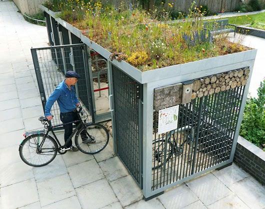
• Upgrading and securing cycle storage.
This is further discussed in Chapter 6.8: Southernhay and Stations.
Prioritising Pedestrian and Cyclist Accessibility
The ring road is perceived as a barrier between residential areas and the Town Centre, dominated by cars and with poor environmental quality, especially in the underpasses.
Developers should coordinate with the Highway Authority, local authorities, landowners, business owners, and the community to explore downgrading Southernhay, Roundacre, and Broadmayne and create new level crossings. Pedestrian routes should improve connections to residential areas, schools, and parks, promoting a more walkable environment and align with BBC’s Local Cycling and Walking Infrastructure Plan.


Policy: Connectivity and Movement
A more accessible town centre will attract residents and visitors, boosting footfall, supporting local businesses, and driving economic and social growth.
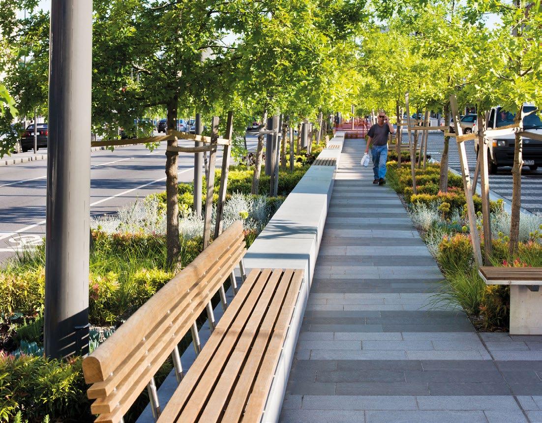
To promote active travel, walking and cycle routes should be the most attractive and accessible option. Development plans should align with the Healthy Streets framework and incorporate the following initiatives:
1. Major development shall:
a. Create walkable, wheeling-friendly and cycle-friendly neighbourhoods by providing high-quality movement routes that enhance connectivity and reduce obstacles;
b. Ensure that cycle routes set out in Basildon Local Cycling and Walking Infrastructure Plan (LCWIP) are continuous, minimising interruptions requiring cyclists to dismount or navigate dropped curbs, promoting a smoother and safer journey in accordance with policy D1;
c. Install secure cycle storage facilities at strategic locations;
d. Design active travel routes to be attractive, accessible at all hours, and provide adequate shelter during adverse weather, ensuring
seamless connectivity throughout the Town Centre;
e. Routes should provide places to stop and rest, should have things to see and do, and should be convenient;
f. Implement traffic-calming measures to reduce speed and traffic flow, improving the safety and comfort of pedestrians and cyclists. The success of this initiative will depend on securing the necessary support and approval from the Highway Authority; and
g. Contribute to the development of a highquality, accessible and integrated public transport hub for bus, train taxi and cycle transport.
2. To maximise sustainable forms of transport in Town Centre all residential developments shall:
a. Adopt a car-lite approach, integrating blue badge parking and car club provisions; and
b. Submit Transport Assessments and Travel Plans as required by the Highway Authority’s relevant guidance.