


Mark Allen, Mayor
T.G. Benson, District 1
Randy Roberts, District 2
Robert Mahoney, District 3
Katie Cunningham, District 4
Norma Sanchez-Stephens, District 5
Dick Hetzel, District 6
Joel Hicks, District 7, Mayor Pro Tem
Patricia Qaiyyim, District 1, Secretary
Stosh Boyle, District 2
Kenderlynn Christophe, District 3
Derek Ottman, District 4
Marcus Mattingly, District 5, President
Cody Hicks, District 6, Treasurer
Justin Triesch, District 7, Vice President
Jennifer Greve, Chair
Jacqueline Garcia , Vice Chair
Diana Weimer
Angela Dodd
Maria Fishback
Rian Thompson
Allison Beaver
Terry Hinze
Yvette Hubbard
Wayne Reed, City Manager
Kelsee Jordan Lee, Director of Planning & Economic Development
Timothy Fousse, Public Works Director
Eron Spencer, Senior Planner
Alora Wachholz, Economic Development Manager
Isabella Ellis, Economic Development Specialist
William Arellano, GIS Manager
Chris Otto, City Engineer
Jeanette Gonzalez, Communications Manager
Consultant Team
Kimley-Horn and Associates
The Interstate Highway 10 (IH-10) Corridor runs southeast to northwest along the southern limits of Cibolo, providing convenient access to nearby San Antonio to the west and Seguin to the east. It is made up of property located both within the legal City limits and outside of those limits in the Extra-Territorial Jurisdiction (ETJ) of Cibolo. The ETJ is the unincorporated area that is contiguous to the boundaries of the City for a distance of up to two miles. Land within the ETJ is eligible for annexation through a formal process outlined by Chapter 42 of Texas Local Government Code. Because ETJ has the potential of becoming City land, it is important to include this area as part of this study.
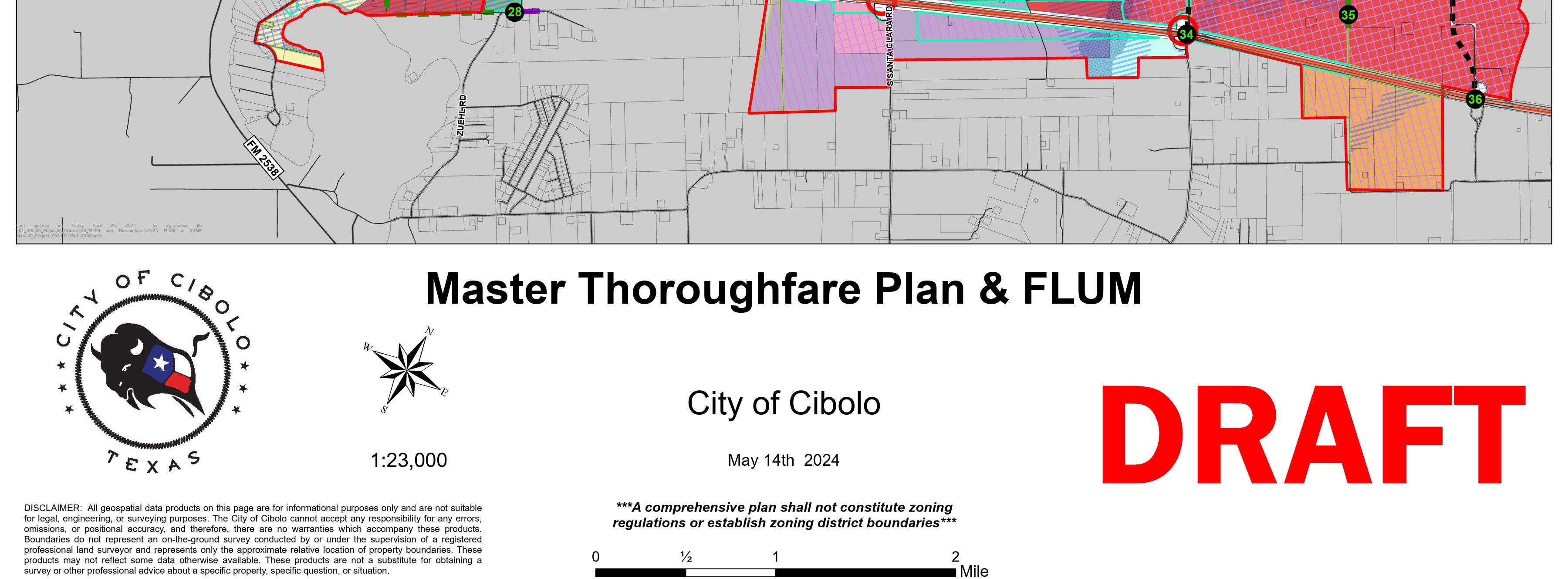
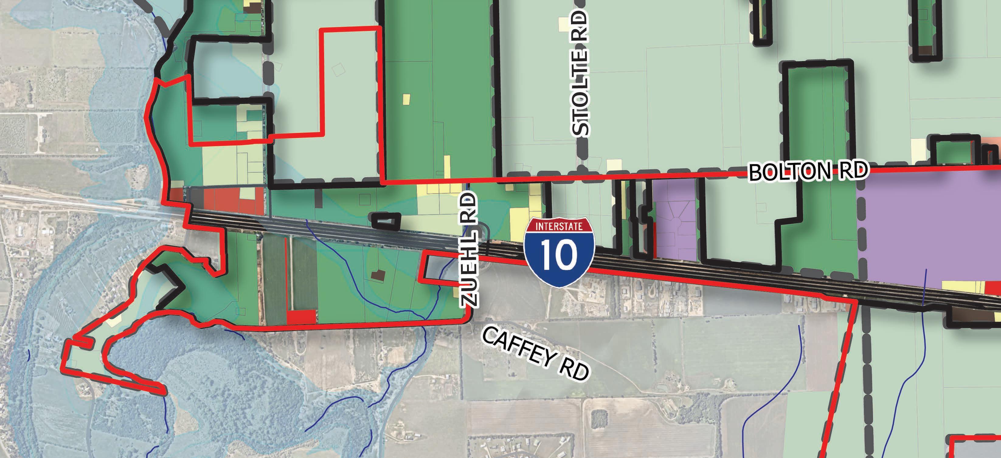
Due to the extents of the IH-10 Corridor, the opportunity exists for Cibolo to establish a presence along this regional highway connection. IH-10 is owned and managed by the Texas Department of Transportation (TxDOT) and the portion of this roadway identified in the IH-10 Corridor Study Area offers multiple access points (Zuehl Road,
Santa Clara Road, Linne Road, and Schwab Road) and frontage roads on both sides. Figure 1.1 shows the boundary of the IH-10 Corridor in red.
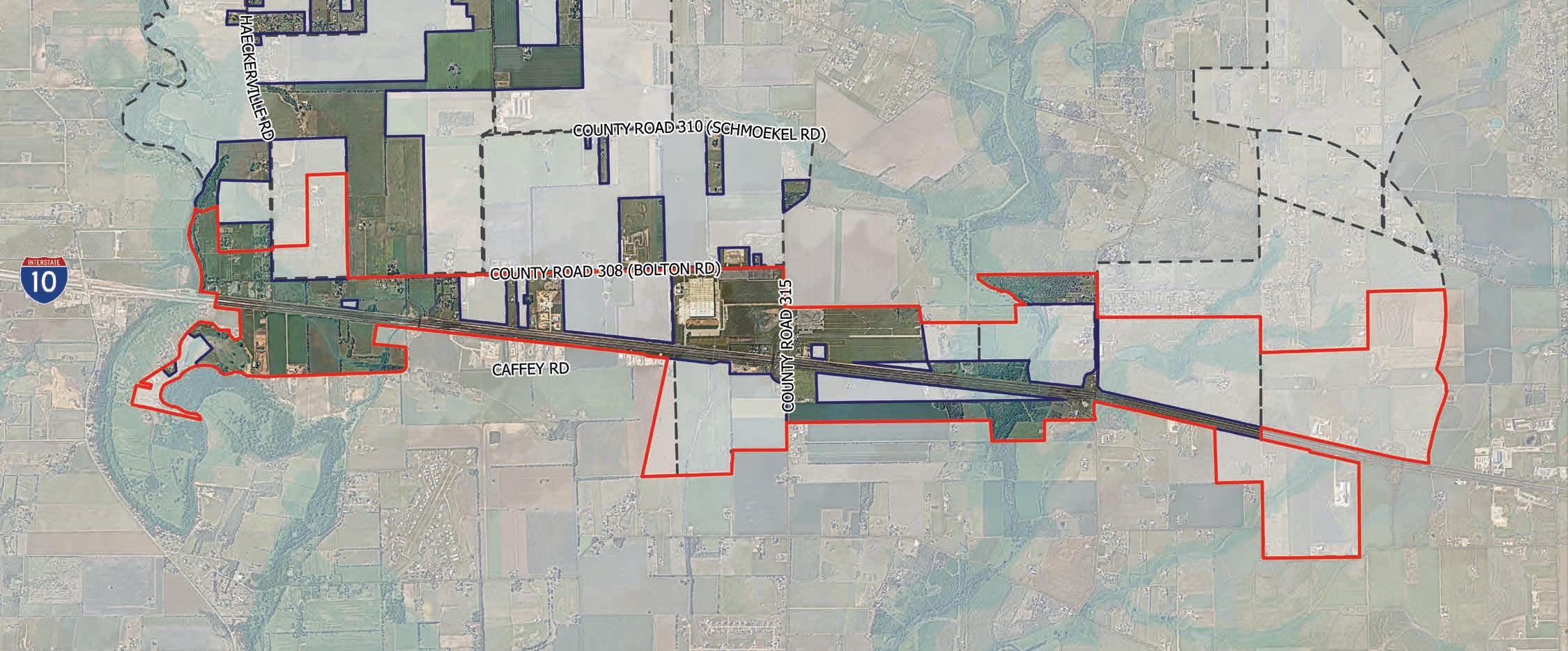
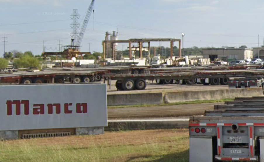
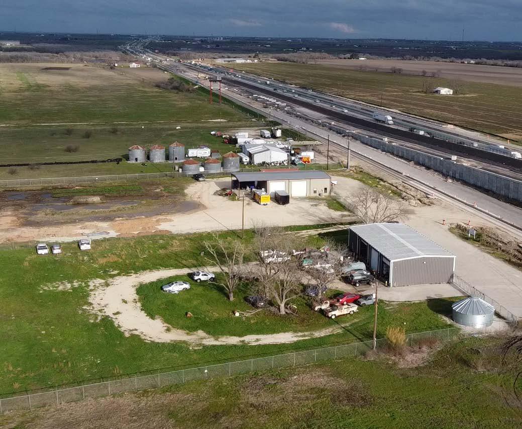
The IH-10 Corridor comprises approximately 2,931 total acres of land. In 2016, a minimal amount of development occurred in the corridor. Since then, an additional 364 acres of land has developed as primarily small scale industrial and commercial uses that include warehousing and contractor shops. 2,376 acres of land remains undeveloped. In addition, the IH-10 Corridor is limited with respect to infrastructure and roadway connections that link north to the rest of the City. As the Corridor builds out, it is anticipated that improved access and connectivity will be needed to ensure a cohesive development pattern with the rest of Cibolo.
Undeveloped Land (93.5%)
Developed Land (6.5%)
Undeveloped Land (81%)
Developed Land (19%)
The IH-10 Corridor Plan was developed through a robust public engagement process that included collaboration and coordination with various stakeholders and entities, whose plans have an impact on the future of the corridor. This Plan reflects and factors in key planning efforts either already conducted or in the process of being conducted for entities and organizations such as: The Alamo Area Metropolitan Planning Organization (AAMPO), the Texas Department of Transportation, Guadalupe County, and the City of Schertz.
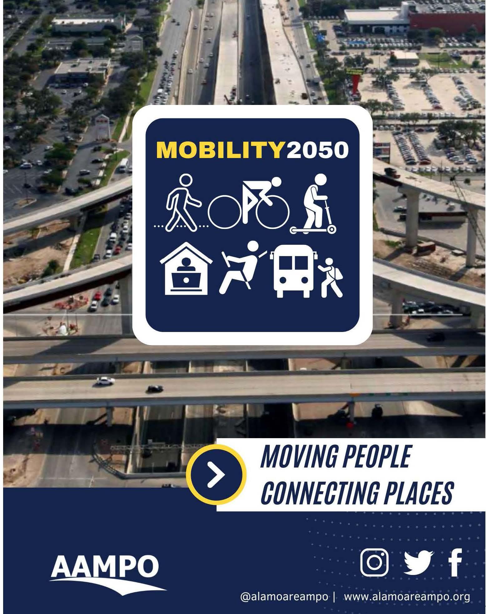
The intent of collaborating with members from these stakeholder groups was to ensure that the vision and elements of the IH-10 Corridor Plan would not be in conflict with other plans that could affect the corridor. As an example, the AAMPO Mobility 2050 Plan contains a list of projects that reflect ongoing planning efforts, projects, and policies for the metropolitan region. TxDOT’s construction of additional lanes on IH-10 in Cibolo is an approved project that is listed in the AAMPO’s Mobility 2050 Plan. The design includes newly configured frontage roads and access crossings at Zuehl Road and Santa Clara Road that influenced land use decisions adjacent to those improvements.
The IH-10 Corridor is Cibolo’s primary frontage opportunity along a mostly undeveloped regional roadway facility. Cibolo is at a critical point in its history where development opportunities are starting to emerge on IH-10. Because of its prime location in the region and potential for development over the next 25 years, it is important to pro-actively plan for Cibolo’s future in this area. Since the adoption of the last Comprehensive Plan in 2016, Cibolo has seen a tremendous amount of growth both in the City and Extra-Territorial Jurisdiction (ETJ).
The IH-10 Corridor Plan was created as a tool to inform and guide the land use and development pattern of the Study Area. It was crafted to realize the vision of the Plan by implementing the tools found at the end of this report. The implementation chapter identifies both actions and priority projects and assigns planning level costs, responsibilities, and time frames that can be appropriately tracked.
Chapter 1 | introduction The introduction chapter of the report provides a high-level overview of the IH-10 Corridor Study Area and seeks to describe the existing conditions of the area. In addition, the first chapter provides a project overview and details the public engagement effort that went into the creation of this document.
Chapter 2 | strategic vision The second chapter provides an overview of the direction that was established through community input and guided by the Economic Development Corporation (EDC) Steering Committee. In addition, it provides insight on the overall framework of the Plan and introduces a land use strategy that outlines various PlaceTypes.
Chapter 3 | economic analysis Chapter three provides a snapshot of the tapestry segmentation of the corridor and details the market and economic analysis that was conducted to help inform decisions for IH-10.
Chapter 4 | framework plan Chapter four introduces a framework plan that addresses overarching themes including, land use, transportation, housing, open space, wayfinding, etc. This Plan helps form the strategy for the IH-10 Corridor and is broken into three Sub-District Areas.
Chapter 5 | implementation The implementation chapter is broken into two parts that act as a tool to track plan actions and goals. The first section identifies priority projects that are critical to the Plan’s success and a rough order of magnitude cost for each component, and provides potential funding resources to tap into. The second section identifies Plan actions and links them with the overarching themes that can be easily tracked to ensure effective execution of the Plan.
The planning process spanned 5-phases that lasted approximately 15-months in total. Each phase had significant milestones, including crucial public events. Each milestone built upon the preceding ones, integrating community-wide feedback and input into the Plan. The planning process provided a structured framework for decision-making, fostered community engagement, and ensured that future development aligns with the needs and aspirations of the residents. Below is the 5-phase planning process of the IH-10 Corridor Plan.
The initial phase involved an analysis of the current state of the Corridor and included a mapping exercise and workshop of existing conditions.
The second phase included public outreach and strategic engagement of the community through launching the project website, branding efforts, and conducting community meetings and stakeholder interviews. This phase included a robust community engagement effort for the corridor.
In the third phase, a comprehensive analysis was conducted of all prior input in order to establish an overall Strategic Direction for the Plan. Throughout this analysis, the EDC Steering Committee and City staff assisted in determining the emergent themes.
In this phase, the final Plan report was outlined in detail and a Development Framework Plan and preferred direction were finalized. The Plan’s components were then structured and formed around SubDistricts.
In the final phase, the Implementation Plan was created that incorporated all plan actions and strategic direction for the IH-10 Corridor. A final draft was presented to the EDC, and Planning and Zoning Commission for their recommendation and then to the City Council for final adoption.
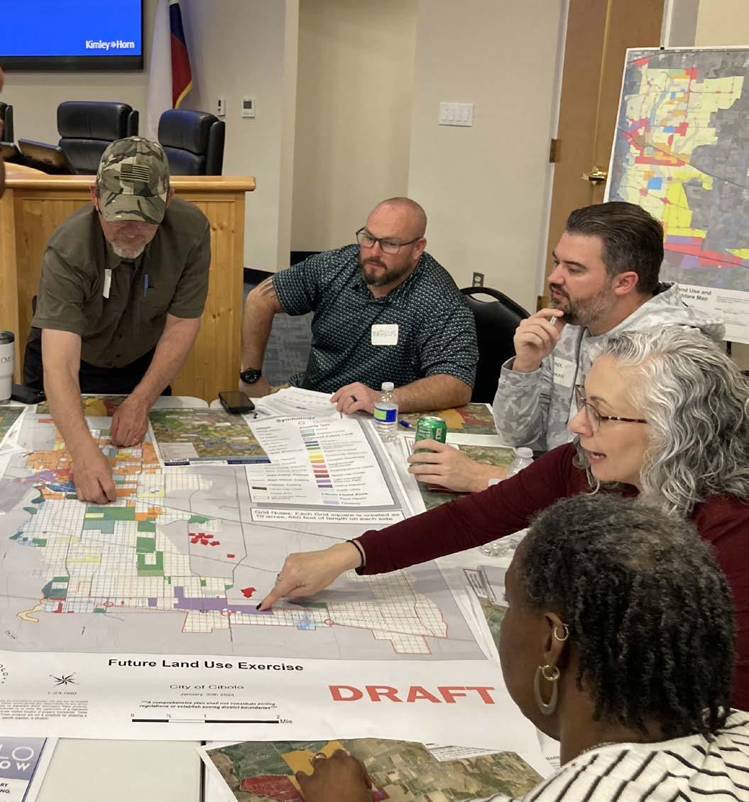
The creation of the IH-10 Corridor Plan was a component and major complement to the Cibolo Tomorrow Comprehensive Plan. Both plans were conducted simultaneously with overlapping community engagement efforts that spanned the length of the projects. Outreach was facilitated for the creation of the IH-10 Corridor Plan through stakeholder interviews, public meetings, the project website, and community surveys. The objective of the engagement process was to conduct transparency whereby community support was established, a strategic vision was developed, and high quality recommendations were brought forward for the implementation into the Plan.
Public engagement is critical to the planning process because it informs and guides the direction of the plan and helps establish a vision that is created by the community. This section outlines the engagement strategy that was utilized and summarizes key takeaways from those events.
The engagement strategy included a robust face-to-face approach that utilized different venues for citizens to participate and engage. Because this plan was created in conjunction with the Comprehensive Plan Update, a wide offering of opportunities were given to the community to find out about the project, and provide input throughout the process. Open Houses and regular meetings with the EDC Steering Committee led to a comprehensive input stream that ensured people had the opportunity to engage and let their opinions be heard and documented.
Representational involvement refers to the type of engagement that includes a range of groups and people who have a stake in the community. From elected officials to individual citizens, public outreach was tailored to capture a broad representation of the community at large, and helped represent different experiences and perspectives.
The EDC Steering Committee was comprised of members who had significant interest in championing the plan and working with the community to build consensus through the process. They served as a group of representatives to help guide the plan and work with the community, city, and consultants to drive the vision forward. This advisory body often engaged in collaborative discussions and offered recommendations to ensure that the plan aligned with the needs and aspirations of the community.
Stakeholder interviews were conducted to gain specific insight on issues surrounding the IH-10 Corridor. Stakeholders were identified early in the process as key individuals or groups who had a particular interest in the area. The interviews were formatted as a total of four, one-on-one conversations, where a broad series of questions were asked to help develop a deeper understanding of the area and establish a clear direction forward.
City diagnostic meetings were collaborative sessions that were conducted to ensure accurate mapping data was collected and documented for land use, infrastructure, thoroughfares, city facilities, etc. These meetings were essential to ensure that information was obtained in the most accurate and timely manner possible, and helped map existing conditions of the Corridor.
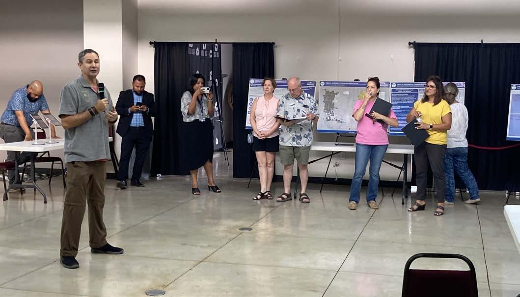
A series of three joint workshops were conducted with the Master Plan Advisory Committee (MPAC), EDC, Planning and Zoning Commission and City Council throughout the plan to provide an opportunity for collaborative sessions to build consensus and ensure consistency with community leadership. This process was essential in establishing a clear direction and vision for the plan.
For the IH-10 Corridor Plan, engagement opportunities were provided that included pop-up events at community venues such as at Cibolo Market Days and Cibolofest. In addition, open houses were conducted where people could come and learn about the project and provide their input accordingly.
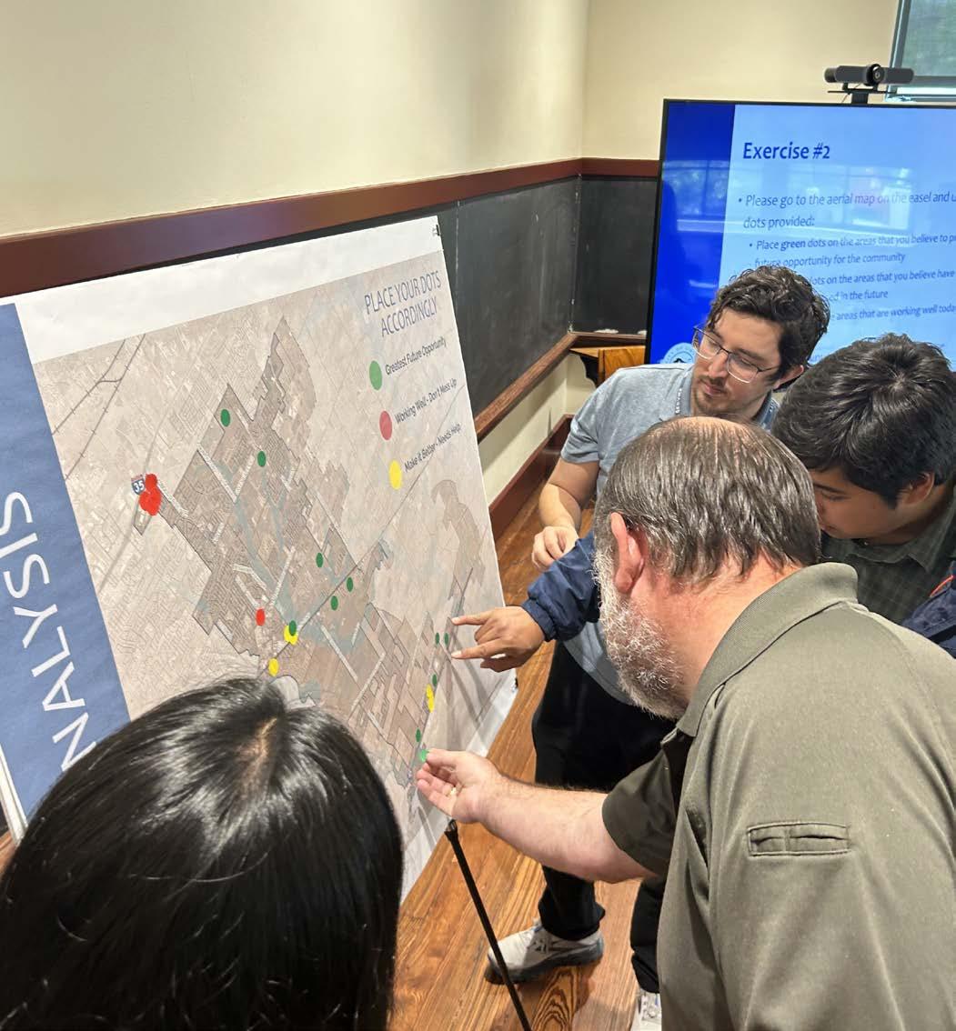
Three open house workshops were held to garner a high level of feedback from the community. The first open house focused on gaining input on the overall vision of the plan. Participants were asked about Cibolo’s strengths, weaknesses, opportunities, and threats. The second and third open houses focused on gathering feedback regarding the preferred land use scenario and master thoroughfare plan, as well as weighing in on the direction and overall strategy for the IH-10 Corridor.
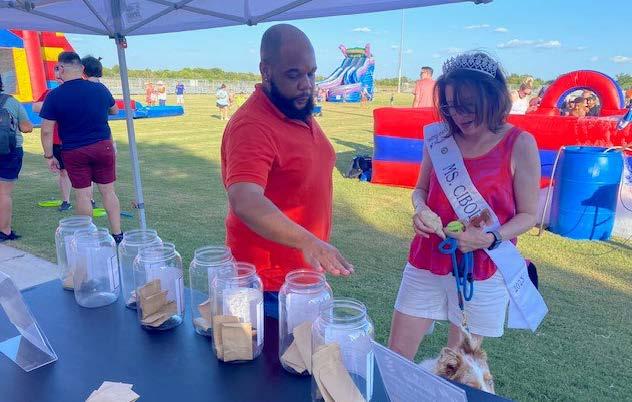
Booths were set up at a variety of community events throughout the year. These pop-ups were used to spread awareness about the Plan and participate in a few visioning activities. The events included:
• Cibolo Summer Nights
• Cibolo Market Days
• Cibolofest
To provide a robust offering of opportunities for the community, online engagement was utilized to reach those who could not attend or would prefer to engage virtually.
CiboloTomorrow.com was the project website created to serve as a one-stop shop for all project information including: project updates, past presentations, upcoming events, and documents regarding the plan. The website was used for engagement opportunities such as online surveys, and was instrumental in building community consensus.
Two online surveys were hosted on the Cibolo Tomorrow IH-10 Corridor Plan project website. Each addressed a key topic of the planning process including the overall strategic vision for the corridor as well as obtaining input and feedback for the Framework Plan.
The following statements are from participants who provided input throughout the public engagement process from online, in-person, and community events over the 15-month period:
• The IH-10 Corridor should be more of a destination
• The IH-10 Corridor should be the center for jobs and production
• People should know they are in Cibolo when they are in the Corridor
• Welcoming. The Corridor should be noticeable and welcoming
• The Corridor should contain commercial businesses that serve employees and residents
• The Corridor should be well planned, organized, and exhibit high building standards
• The Corridor should connect to Cibolo and the region
• The development pattern (of the IH-10 Corridor) should take advantage of natural resources and amenities
• The Corridor should attract entertainment
• Housing should be focused on high-density, high-quality residential units as a transition from commercial to rural land
Three alternative development trends were analyzed for the community – current trend development (Scenario A), corridor development (Scenario B), and nodal development (Scenario C). These scenarios were evaluated across the City and ETJ and encompassed the IH-10 Corridor. At their joint meeting the Economic Development Corporation (EDC), Master Plan Advisory Committee (MPAC), Planning and Zoning Commission (P&Z) and City Council evaluated and provided consensus on the direction for the desired pattern of growth. The following diagram is an early exhibit that was used during the creation of the Plan to help generate the final land use framework for the Study Area.
As a companion document to the Cibolo Tomorrow Comprehensive Plan, the IH-10 Corridor Plan is founded on shared principal strategic elements as it relates to three major components: Vision Statement, Guiding Principles, and Preferred Scenario.
The Vision Statement, Guiding Principles and Preferred Scenario are the foundation upon which all the Plan’s actions and recommendations are built. These components provide a basis to help prioritize and inform growth, development and investment decisions within the IH-10 Corridor.
The strategic direction that led to the development of the Vision Statement and Guiding Principles was informed by community input and guided by the Master Plan Advisory Committee in conjunction with touchpoints in joint work sessions with the EDC, Planning and Zoning Commission, and City Council over the span of the project.
The Vision Statement for the Cibolo Tomorrow Comprehensive Plan and IH-10 Corridor Plan is presented below.
“Cibolo is a community where residents collaborate to shape their civic future by promoting its rich history, preserving a small-town feel, and investing in balanced development.”
The Guiding Principles for the Cibolo Tomorrow Comprehensive Plan and IH-10 Corridor Plan are presented below.
1. Prioritize infrastructure to support existing needs and future growth.
2. Plan for and promote the health, safety, security, and general welfare of all residents.
3. Balance growth through responsible planning of city assets and land to promote a community environment.
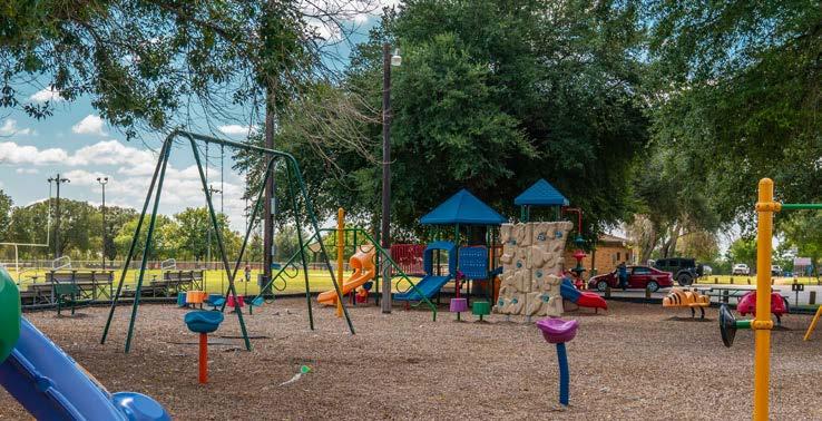
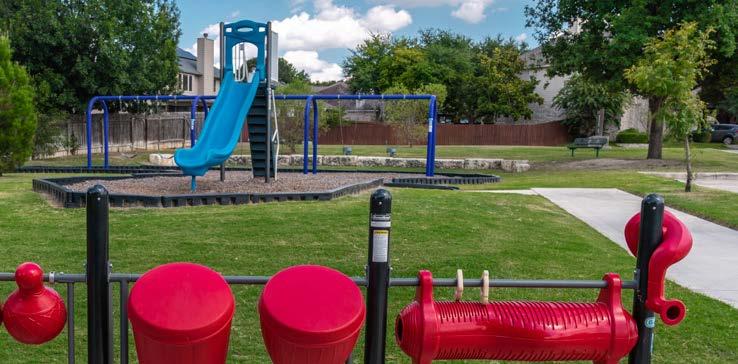
4. Provide parks, recreation, trails, and open space to serve citizens and visitors while protecting the natural environment and wildlife.
5. Preserve the history of cibolo and promote the friendly small town feel through community programs and events.
The following figure shows the preferred scenario and Future Land Use Map (FLUM) as it relates to
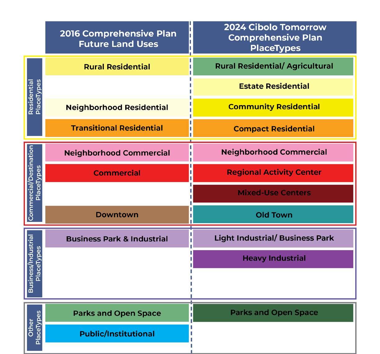
Rather than designating or assigning zoning categories for districts, PlaceTypes are a land use planning tool that is used to help describe the predominant character, scale, and spirit of a place. Because they are more broad than zoning categories, PlaceTypes can be used to establish the intent of a district, and give guidance for land use decisions as zoning and development applications come forward.
Throughout the planning process, PlaceTypes were vetted to ensure alignment with the future vision of the community. They are arranged by color and are described in detail in the Land Use and Character chapter of the Comprehensive Plan. The Comprehensive Plan outlines 11 PlaceType categories as shown in the following diagram.
character and intent
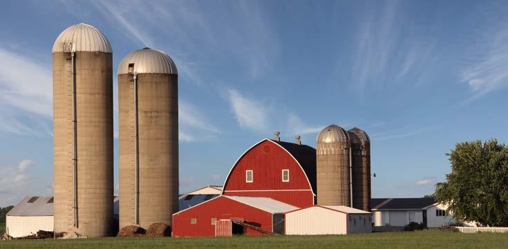
Rural Residential/Agricultural is intended for areas within the Citywhichwillmaintainaruralcharacterduringtheplanhorizon and beyond. These areas are comprised of natural undeveloped area, agriculture, and large lots with large lot minimums.
land use considerations
PRIMARYLANDUSES-Single-FamilyDetachedHomes, Agricultural, Parks and Open Space
SECONDARY LAND USES - Civic and Institutional, Agricultural Business
INDICATORS & ASSUMPTIONS - Lot size more than 2 acres
EXAMPLE LOCATIONS
Large tracts of undeveloped land between FM 78 & IH-10, Borgfeld property on Cibolo Valley Drive
character and intent
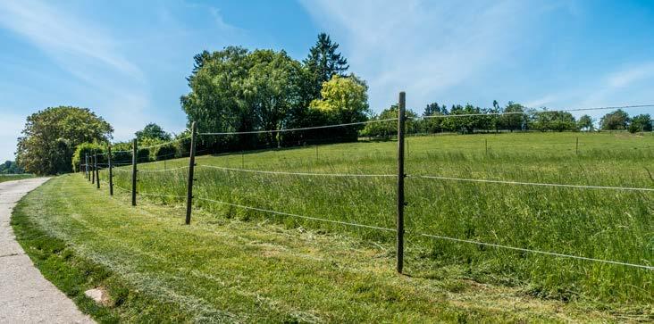
Predominantly single-family housing on large lots located throughout the community. Residential uses are oriented with the front of the home facing the street and typically in a subdivisionlayoutwithaccesstosomeutilitiesandmayinclude farm and livestock uses. Cluster development, which involves theconservationofsharedopenspace,naturalareas,andscenic views, in exchange for smaller lot sizes, may be an alternative approach in certain circumstances.
land use considerations
PRIMARYLANDUSES-Single-FamilyDetachedHomes,Cluster Development, Parks and Open Space
SECONDARY LAND USES - Civic and Institutional
INDICATORS & ASSUMPTIONS - Lot size (range) 1/2 to 2 acres
EXAMPLE LOCATIONS
Single-Family Detached Homes: Persimmon Drive (south of Green Valley Road) - Cluster Development: Spring Mesa in Arvada, CO

character and intent
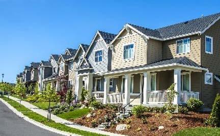
Predominantly single-family housing developments located throughout the community. Homes are in subdivisions with all utilities, residential streets, sidewalks, and parks/or connections to neighborhood parks. May have an elementary or middle school in the neighborhood. Convenience commercial businesses may be found around the perimeter with appropriate transitions to support the neighborhood. Homes are typically buffered from non-residential developments via transitional uses or landscaping.
land use considerations
PRIMARY LAND USES - Single-Family Detached Homes
SECONDARY LAND USES - Civic and Institutional, Parks and Open Space
INDICATORS & ASSUMPTIONS - Lot size (range) 9,000 sq ft to 1/2 acre (21,780 sq ft)
EXAMPLE LOCATIONS
character and intent
Mesa Western Provides a variety of housing types, including small-lot single-family detached, patio homes, townhomes, and duplexes in a compact network of complete, walkable streets that are easy to navigate by car, bicycle, or foot. This PlaceType also supports multifamily. Homes are in subdivisions with all utilities, residential streets, sidewalks, and parks/or connections to neighborhood parks. Neighborhoods may be adjacent to neighborhood-oriented businesses. Key intersections (i.e., FM 78 and FM 1103), and areas within walking distance of local commercial, are the most appropriate locations for this PlaceType, except between residential neighborhoods and communities (infill development).
land use considerations
PRIMARY LAND USES - Single-Family Detached Homes, SingleFamily Attached Homes, Patio Homes, Townhomes, Multifamily Complex
SECONDARY LAND USES - Civic and Institutional, Parks and Open Space
INDICATORS & ASSUMPTIONS - Single Family lot size (range) up to 9,000 sq ft
EXAMPLE LOCATIONS
Single Family Detached Homes: Bentwood Ranch, Cibolo Valley Ranch - Duplexes: Sydney Cove - Multifamily Complexes: Grand at Cibolo, Trophy Oak
character and intent
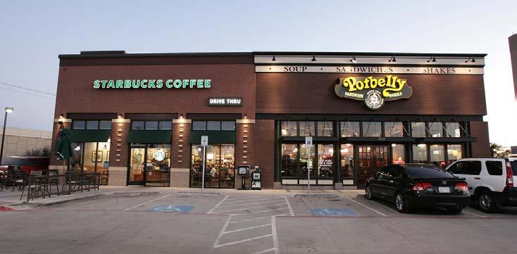
Neighborhood Commercial development is characterized by small, free-standing buildings containing one or more businesses. Neighborhood Commercial primarily provides family-oriented services for the surrounding neighborhoods and city. They are generally located within walking distance of surrounding residential uses and neighborhoods. Business types may include restaurants, local retail, medical offices, banks, and other retail and service uses.
land use considerations
PRIMARY LAND USES - Neighborhood Retail, Office
SECONDARY LAND USES - Civic and Institutional, Parks and Open Space
EXAMPLE LOCATIONS
Cibolo Valley Square, Shops at Cibolo Bend, Chipotle/City Vet Complex
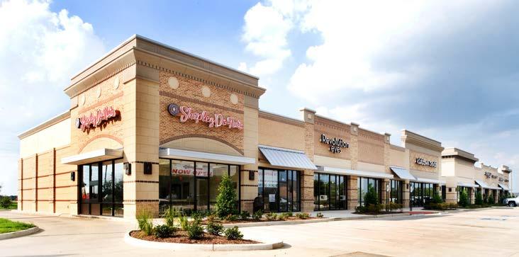
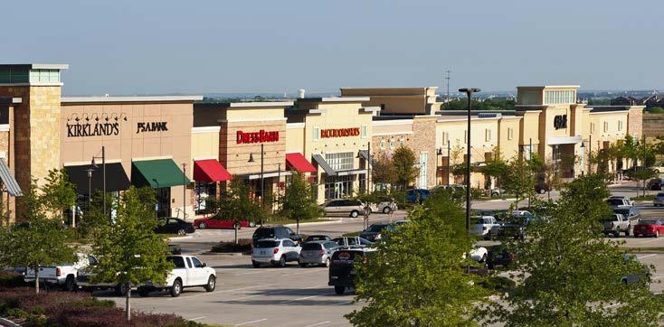
Regional activity center
character and intent
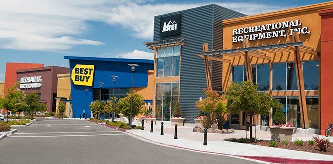
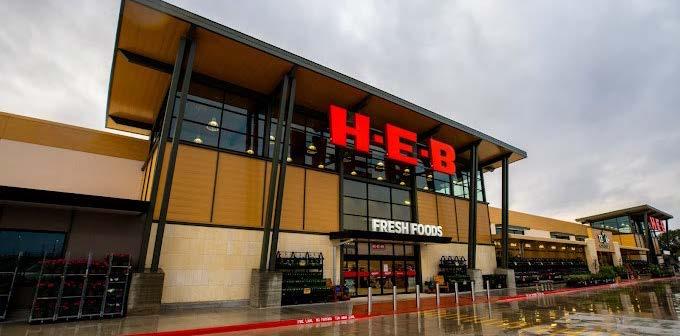
Regional Activity Center developments are larger in scale and attract regional traffic for shopping and retail needs. These commercial centers are anchored by mid-to-big box retailers located along major thoroughfares (i.e., freeways and arterial roads). National retailers and grocery stores would typically be located in this PlaceType. Regional Activity Center can also contain smaller retail or office destinations as well, such as medical offices or boutiques, but are typically anchored by several national vendors. Business types may include restaurants, national retailers, discount stores, grocery stores, fast food, and other retail and service uses.
land use considerations
PRIMARY LAND USES - Community and regional-serving retail and commercial
SECONDARY LAND USES - Civic and Institutional, Medical, Small Scale Retail, Hotel, Parks and Open Space, Office
EXAMPLE LOCATIONS
Crossing Shopping Center, Walmart, H-E-B
character and intent
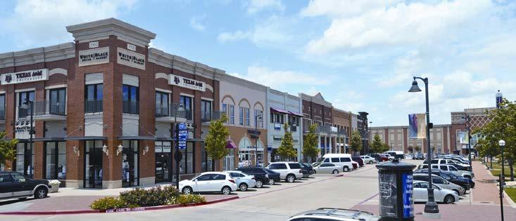
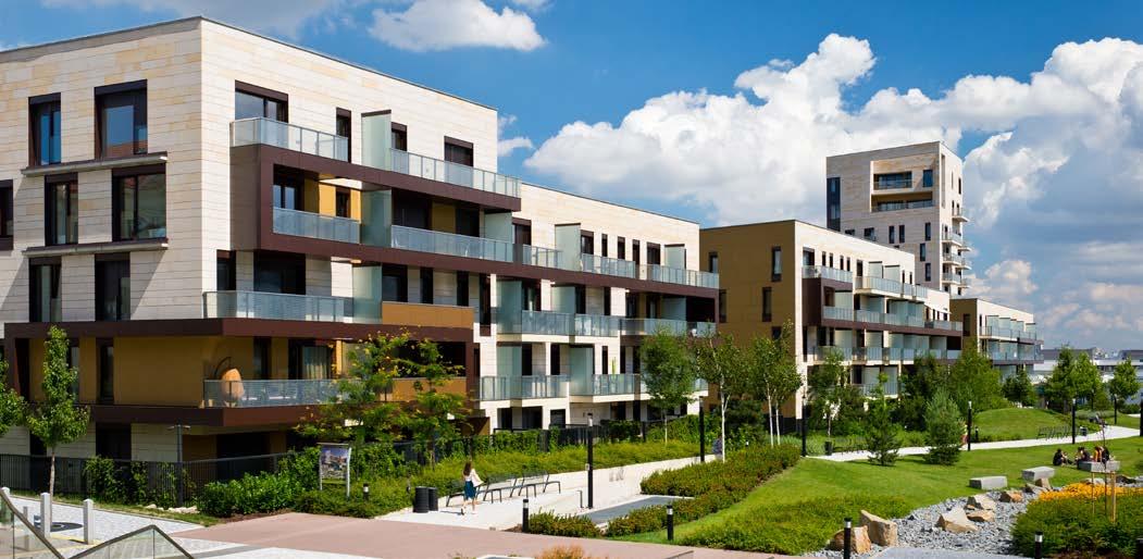
Mixed-Use Centers are master planned to offer the ability to live, work, and play in one geographically compact area with a high intensity of uses organized around nodes of activity. This PlaceType includes a mixture of different housing options within close proximity to goods and services and may serve as an employment center and shopping destination for adjacent neighborhoods. Buildings typically built to the sidewalk located on internal local streets to create a pedestrian-oriented environment, and can be one, two or more stories with residences or offices located above street-level storefronts. Includes a space for recreation and gathering. The design and scale of development in a Mixed-Use Center encourage active living through a comprehensive network of walkable, complete streets.
land use considerations
PRIMARY LAND USES - Retail, Large Scale Commercial, Condominiums, Mixed-Use Multifamily, Offices, Hotel, Entertainment Venues
SECONDARY LAND USES - Civic and Institutional, Offices, Parks and Open Space
EXAMPLE LOCATIONS
City of Southlake Town Center, The Quarry
character and intent
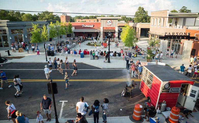
Centrally located area containing a mix of residential, commercial, civic and entertainment uses. It is a destination for shopping and entertainment that promotes independently owned, family-friendly businesses that attract patrons from surrounding neighborhoods, and cities that has a traditional, small-scale downtown built form that coexists harmoniously with surrounding residential uses. The design and scale of development is pedestrian-oriented, can be one to two stories, and encourages active living and a mix of uses within an interconnected network of blocks and streets.
land use considerations
PRIMARY LAND USES - Single-Family Detached Homes, Garden Homes, Small Scale Retail, Office, Bed and Breakfast
SECONDARY LAND USES - Civic and Institutional, Parks and Open Space, Small Scale Entertainment Venues, Personal Services
EXAMPLE LOCATIONS
character and intent
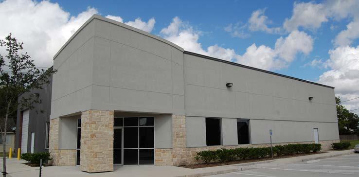
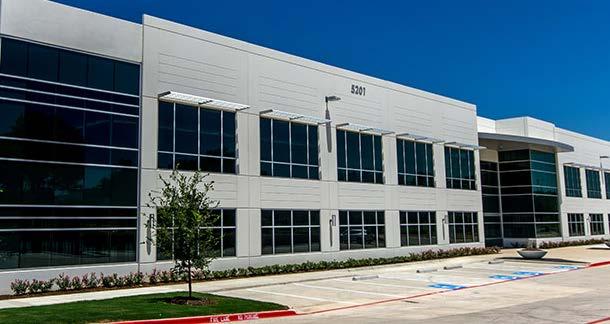
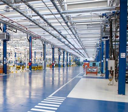
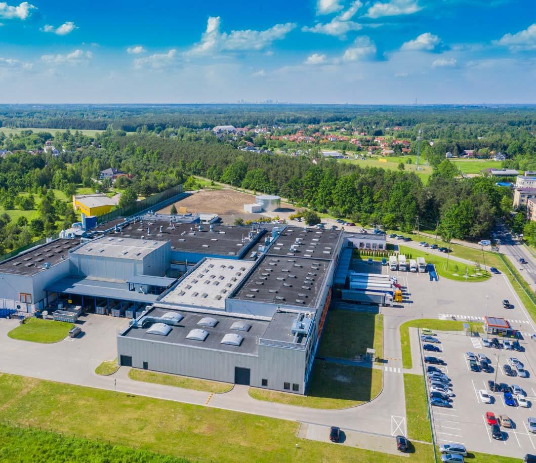
Light Industrial/Business Park includes business and officerelated land uses, warehousing, and light industrial and manufacturing uses that occur indoors and do not include the processing of raw materials. Office and business park land uses may be supported by nearby retail and restaurant uses.
land use considerations
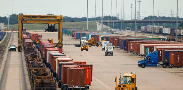
PRIMARY LAND USES - Business Parks, Technology/Data Centers, Flex Offices/Warehousing, Office, Light Manufacturing (i.e., Clothing and Fabric Manufacturing, Electronics and Appliance Manufacturing, Food and Beverage Product Manufacturing, etc.), Call Centers, Logistics
SECONDARY LAND USES - Small Scale Retail, Civic and Institutional, Parks and Open Space, Hotel
EXAMPLE LOCATIONS
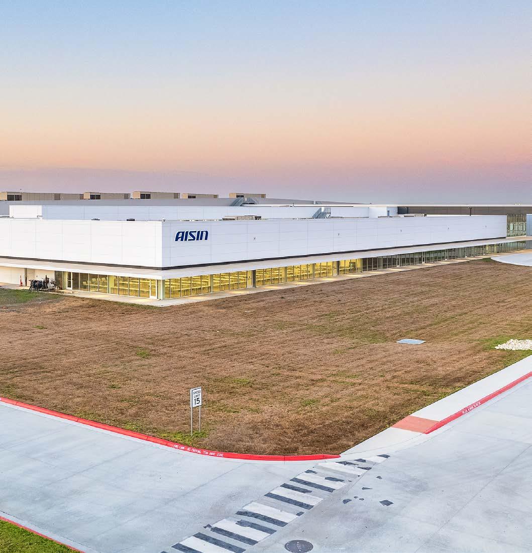
AISIN, Schneider Industrial Park, Jorgensen Industrial Park
character and intent
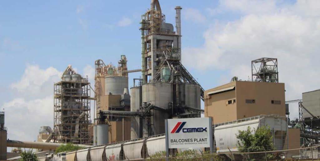
Heavy Industrial areas provide jobs and keep people in the city. This PlaceType is generally found near major transportation corridors (i.e., highways and railways) and may include heavy manufacturing and production uses that occur outdoors and involve the processing of raw materials.
land use considerations
PRIMARY LAND USES - Manufacturing, Major Utility Facilities, Mining, Extraction Services, etc.
SECONDARY LAND USES - Civic and Institutional, Parks and Open Space
EXAMPLE LOCATIONS
Heavy manufacturing and industrial uses on FM 78, FM 1518, IH10, etc.
Open Space indicates existing and future planned parks. Future parks are allowed in all PlaceTypes, but this designation protects existing parks and recreational facilities as such and preserves land that is intended to be dedicated for parkland development in the future or areas that may be preserved due to the influence water may have on development in the area.
land use considerations
PRIMARY LAND USES
Parks and Open Space, Trails, Floodplain Management
Schlather Park, Niemietz Park, Veterans Memorial Park, Al Rich Park, Cibolo Sports Complex, Ron Pedde Community Garden
A market and economic analysis was conducted for the IH-10 Corridor Study Area to understand existing conditions and project growth forward to 2050. As a companion to the Comprehensive Plan, the IH-10 Corridor Plan benefited from the collection and analysis of overarching data. In addition, having this dataset provides the ability to draw connections and understand the context of the Corridor within the City. The following section is an overview of that analysis.
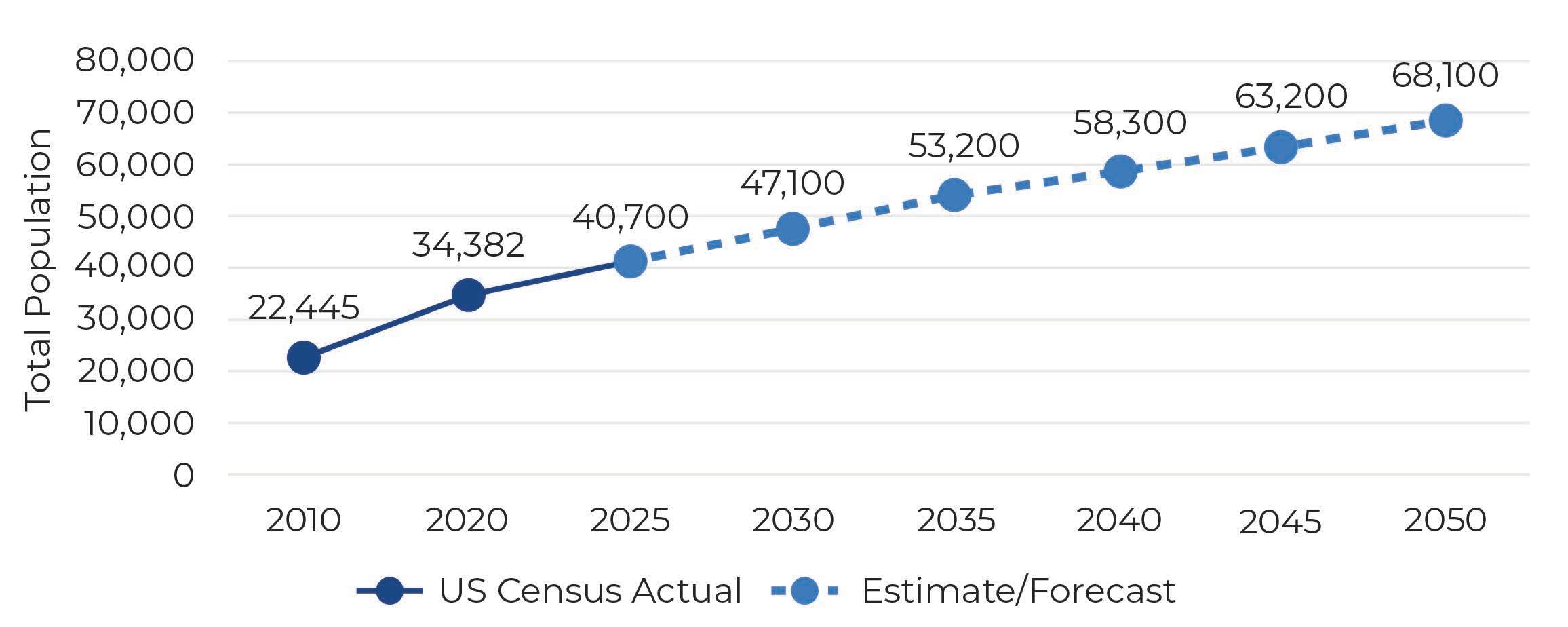
The population projections from this plan look out to the plan horizon of the year 2050. When looking at the entire city and ETJ, Cibolo is expected to grow by 78.6% through 2050, reaching a total population of approximately 68,100 residents. This equates to nearly 30,000 new residents through 2050. When looking at the future land use of the IH-10 Corridor, 32% is comprised of residential uses, with approximately 545 acres of land. This number represents 6.25% of the land that is designated for residential use city-wide. Because of its anticipated density, the IH-10 Corridor may comprise up to 12% - 17% of the expected population increase (4,000-6,000 new residents) by the year 2050.
Average annual growth rate
Currently, there are approximately 1,200 employees across 20 businesses within the IH-10 Corridor. Employment is emerging in the corridor today, with lots of developable land remaining. The primary employee classification within the corridor is Manufacturing (89%), followed by Professional, Scientific & Tech Services (3%), and Arts, Entertainment & Recreation (1.7%). Additional employment classifications include Construction (1.6 %), Wholesale Trade (1.3%), and Retail Trade (1%). The table below displays the share of employees by industry in the IH-10 Corridor.
When looking at the City as a whole, Cibolo is expected to have an increase to about 10,200 total jobs by 2050. Retail Trade and Education are expected to be the largest industries by 2050, hosting more than 3,200 jobs combined. The next largest sectors in 2050 are expected to be Accommodation and Food Services and Health Care. Understanding how the distribution of jobs may change in the future helps to estimate future demand for these jobs, whether they gravitate to retail, office, or industrial buildings.
Because the IH-10 Corridor is anticipated as one of the main areas for growth in Cibolo a focus on ensuring an adequate amount of land for absorption was a main objective during the land use planning of this corridor. A more detailed breakdown of that study is included in the Land Use and Character chapter of the Comprehensive Plan as it relates to employment, retail, and industrial.

Data Source: ESRI (Note: at the time the map source does not account for AISIN ~ 1000 jobs)
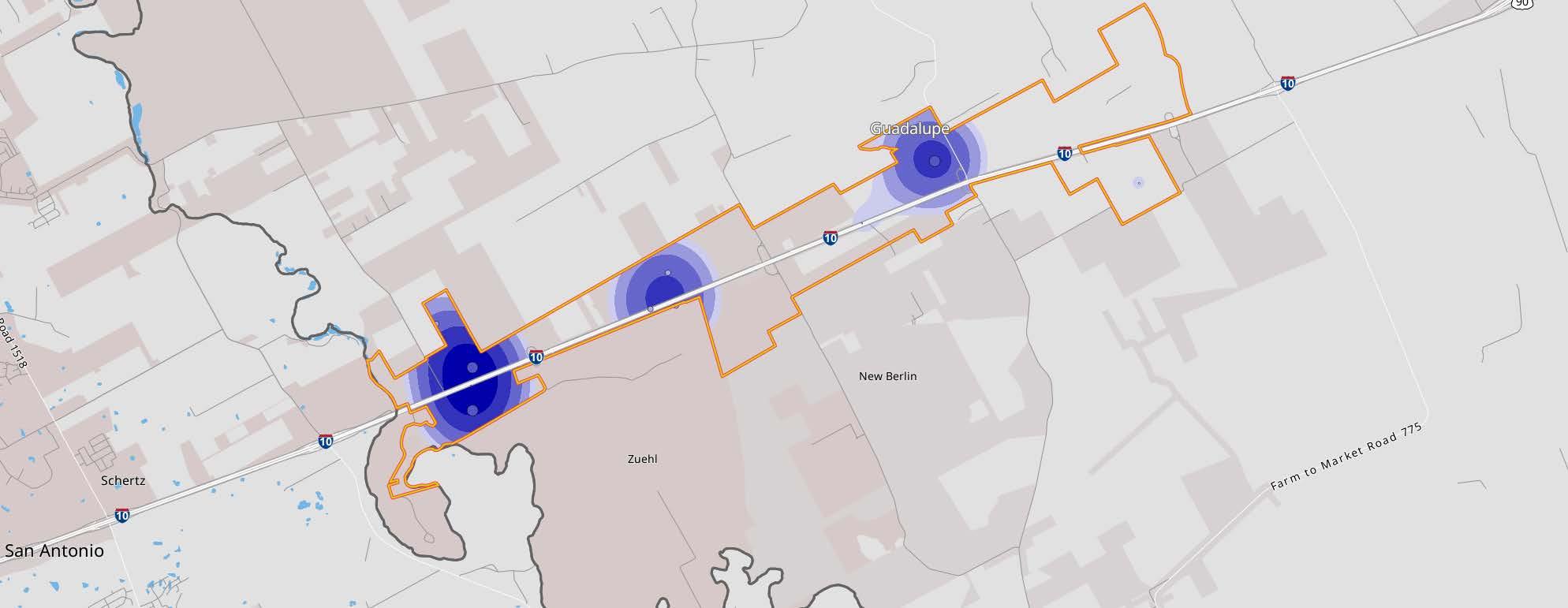
There is estimated to be only 1 owner-occupied household within the entire IH-10 Corridor that does not have a vehicle (ESRI). Similarly, the U.S. Census indicates that every resident who is employed within the IH-10 Corridor travels outside of the corridor for work. This is indicative of a community that is heavily reliant on their vehicles for everyday activities. This also indicates an opportunity to closely align future employment growth in the corridor with the existing skills and professions that residents are leaving Cibolo and the IH-10 Corridor to fulfill. Figure 3.1 displays the job density for the IH-10 Corridor.
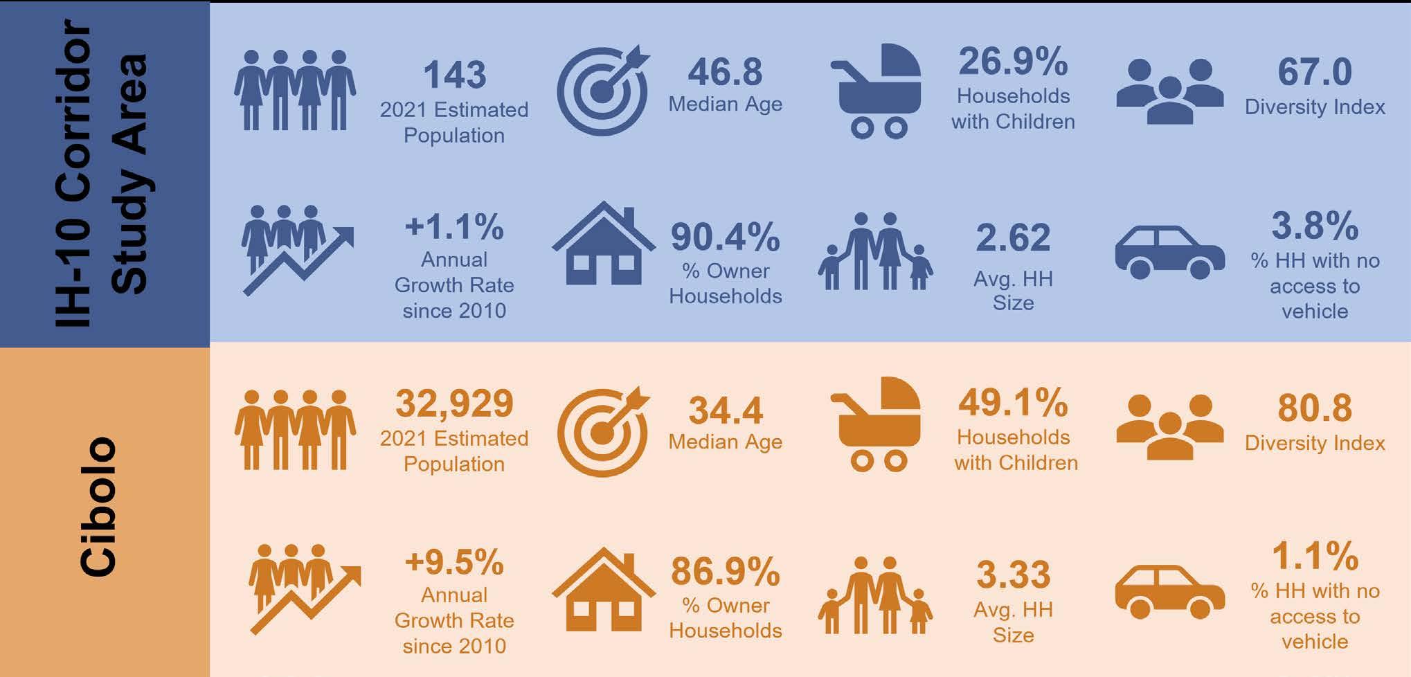
Figure 3.2 shows a demographic snapshot of the IH-10 Corridor Study Area in comparison to the overall City. As of 2024, most of the residents that live within the area are White (76.9 percent), followed by 12.6 percent being another race, 10.5 percent of the residents being two or more races, and 0.7 percent being Black or African American. 23.8 percent of residents in the Study Area are of Hispanic origin. The Diversity Index provides a score between 0 to 100, the percentage represents the likelihood that two people chosen at random are from two different racial groups. The Study Area has a diversity Index of 67.
The median age of the people that live in the Study Area is 46.8. This is older than the median age of the City of Cibolo (34.4) by 12 years. 26.9 percent of the households in the Study Area have children under the age of 18 and the average household size is just under three. When looking at the region, household sizes and homes with children are smaller in the Study Area than in the City. Household earnings in the Corridor are lower than in the City. The median household income in the Study Area is $76,148 compared to the median household income for the City at $106,654. As the Corridor grows and new types of housing is introduced, these numbers are anticipated to change and become increasingly diverse by 2050. Below are more demographic facts about the IH-10 Study Area.
The Environmental Systems Research Institute (ESRI), a nationally recognized information and data system software company, identifies different demographic categories for communities across the country, or “psychographic” groups. These categories reflect the median age, household size, income, shopping habits, and other common traits of people in similar economic and demographic groups. These characteristics are utilized by developers and retailers to understand the character and lifestyle habits of communities. The top psychographic group within the IH-10 Corridor was analyzed and compared to the two most prominent groups across Cibolo below.
Tapestry Segmentation classifies US neighborhoods into 67 unique segments, based on demographics and socioeconomic characteristics.
100% of households within IH-10 Corridor

• Married couples, few with children at home
• Affordable single-family housing outside the city
• Median household income slightly below-average
• High labor force participation with long commute times


Households:
Average Household Size: Median Age: 45.2
Median Household Income: $42,300
• New families in new housing subdivisions
• Primarily single-family homes with longer commute times
Rooted Rural is heavily concentrated in the Appalachian mountain range as well as in Texas and Arkansas. Employment in the forestry industry is common, and Rooted Rural residents live in many of the heavily forested regions of the country. This group enjoys time spent outdoors, hunting, fishing, or working in their gardens. Indoors, they enjoy watching television with a spouse and spending time with their pets. When shopping, they look for American-made and generic products. These communities are heavily influenced by religious faith and family history.
ih-10 corridor
• Most households have two or more workers
• This market is dominated by married couples, few with children at home.
• 80% of homes are owner occupied: primarily single family (73%) or mobile homes (24%).
• Hardworking labor force, with high participation rate
• Nearly one in five housing units is vacant, with a high proportion for seasonal use.
• Growth markets in the suburban periphery
• Young families are married with children
• Primarily single-family homes with high mortgage rates
• Shoppers use coupons frequently and buy generic goods.
• Well-educated young professionals with longer commute times
• Home values are very low—almost half of owned homes are valued under $100,000.
• Do-it-yourself mentality; grow their own produce and work on their cars and ATVs.
• Pay bills in person and avoid using the internet for financial transactions.
• Often find computers and cell phones too complicated and confusing.
• Clothes a necessity, not a fashion statement; only buy new clothes when old clothes wear out.
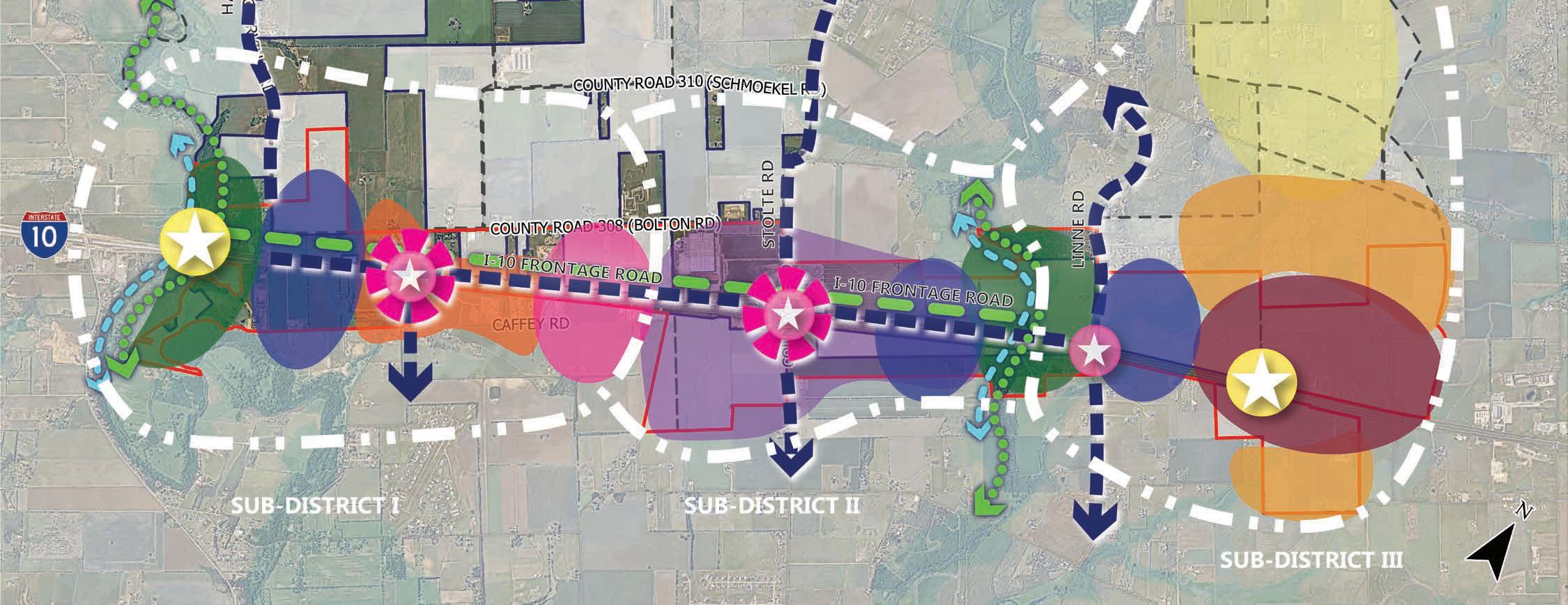
The IH-10 Framework Plan establishes direction for the future land use of the corridor. As a plan, it conveys several key considerations that should be factored into the implementation of the vision of the plan with respect to land uses, transition zones, catalyst sites for future development, gateways, placemaking and identity nodes, thoroughfare and mobility considerations, and trails and open space. The IH-10 Corridor Framework Plan is depicted below in Figure 4.1.
This chapter breaks the corridor into three sub-districts and is organized to put forth a Land Use, Transportation, Placemaking & Wayfinding, Housing & Neighborhoods, and Community Facilities and Public Services Strategy. In addition, each subsection details action items and an implementation plan for each sub-district.
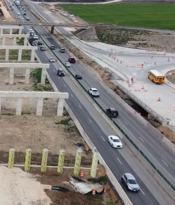
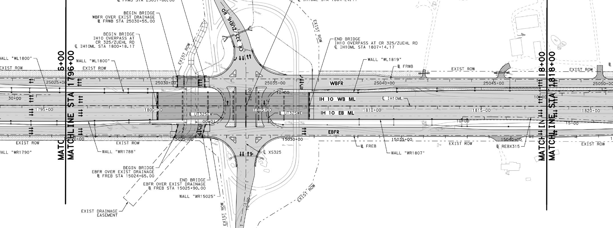
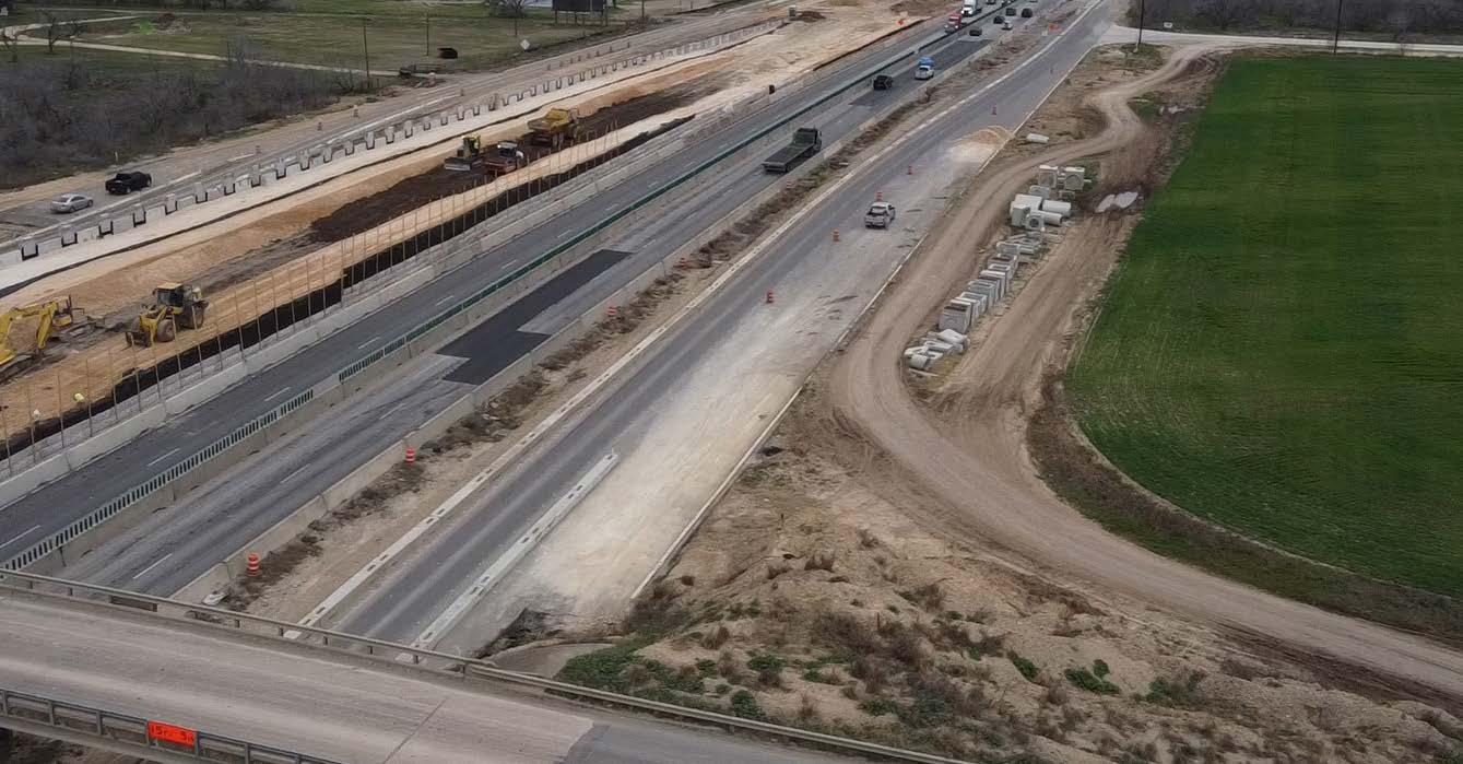
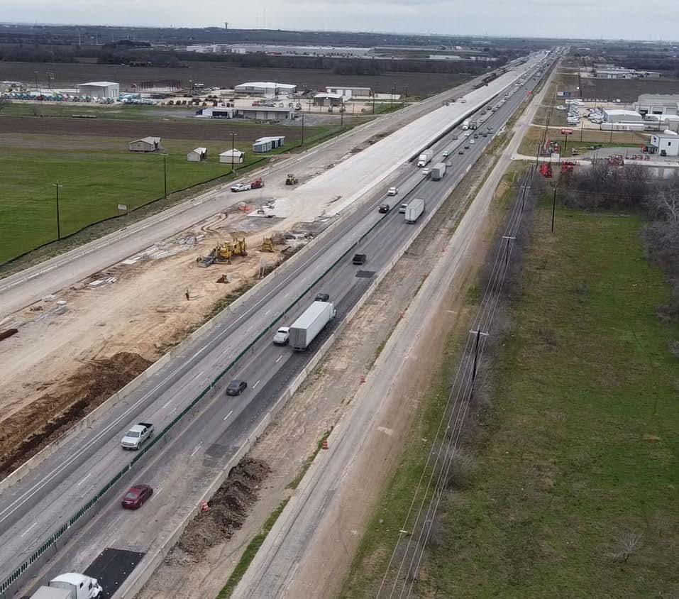
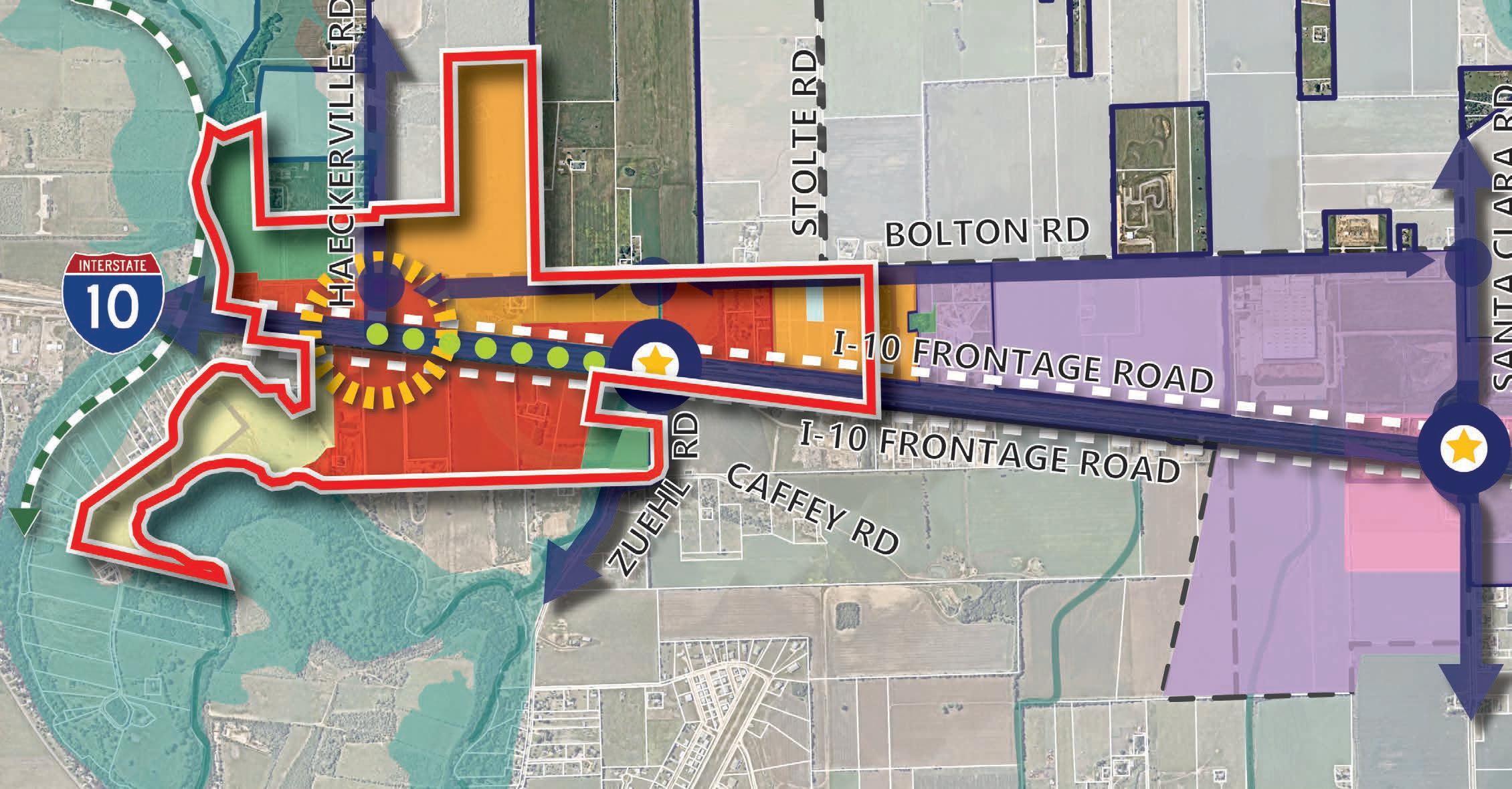
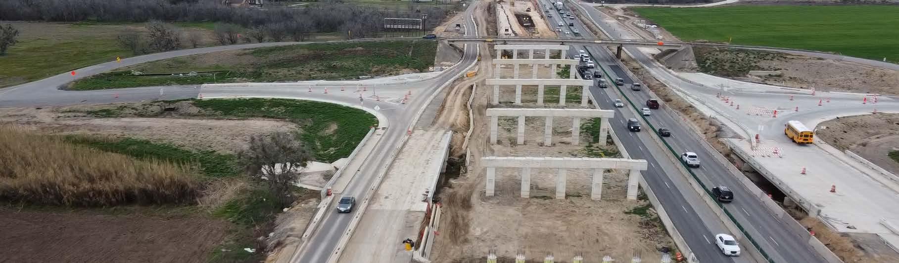
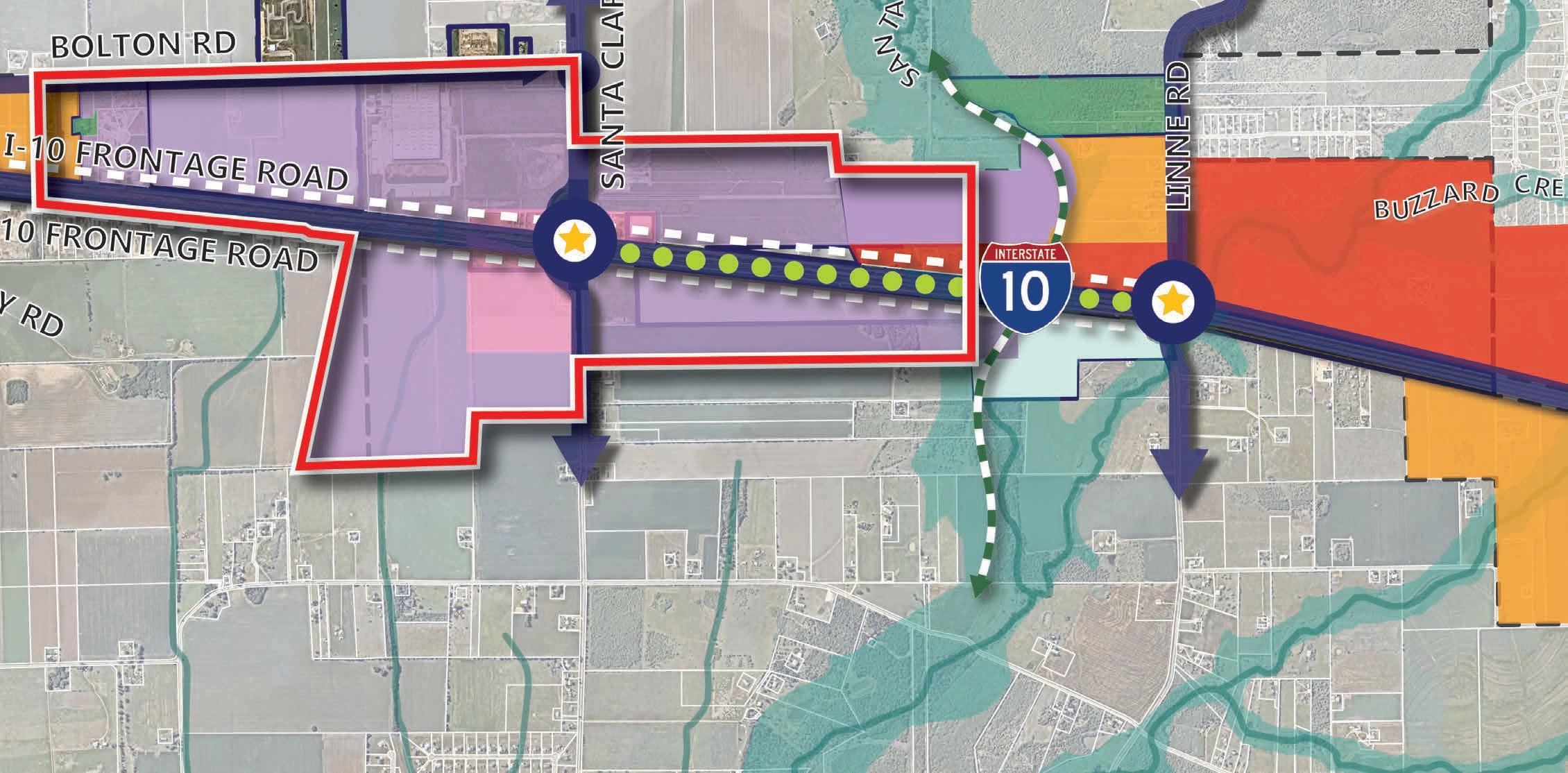
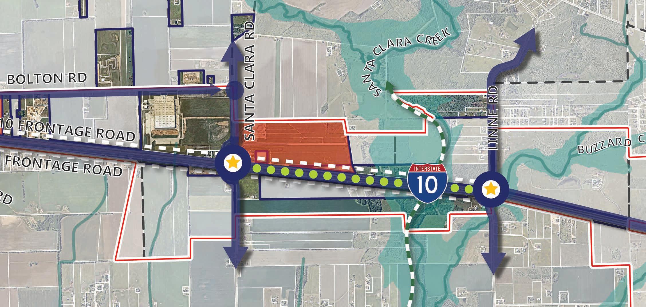
The IH-10 Corridor currently contains two-lane undivided roads for all of the roadways except for the highway itself. The highway is currently under construction but will transition to a six-lane freeway, with three-lane, one-way frontage roads on either side. There are three enhanced interchanges planned along IH-10 at Zuehl Rd, Santa Clara Rd, and Linne Rd.
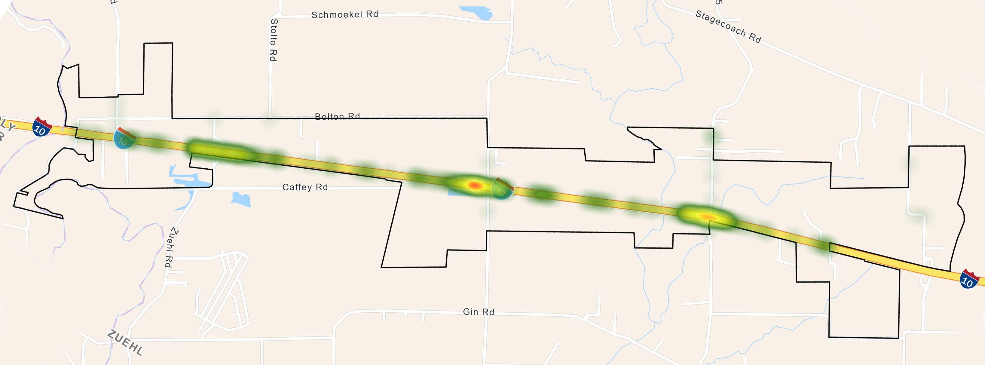
Data Source: TxDOT’s Crash Record Information System (CRIS)
An analysis of crash data was conducted for the IH-10 Corridor, that helped to establish a framework of understanding surrounding the intersections present in the area. The resulting heatmap of all crashes within the corridor reflects only one crash within the industry standard measured timeframe of five years (2019-2023). Both a single commercial vehicle and fatal event came from that same crash. Though this crash is notable along IH-10, the data reflects the rural nature of the remaining corridor with limited intersections that are non-signalized. Although TxDOT’s upgrade of the highway is underway, common (HSIP) countermeasures can be noted as aspects that would help improve safety along the corridor:
1. Milled, Profiled and Raised rumble strips at edge lines of main lanes.
2. Transverse rumble strips on main lanes when approaching an on or off ramp.
3. Install median barrier (Concrete barrier between the two main lanes of travel).
4. Install safety lighting along the entire corridor.
5. Install sidewalks along frontage roads.
6. Install warning/guide signs.
Another element of safety was analyzed as it relates to pedestrians and bicyclistssidewalks and trails. Currently, the district is lacking facilities for pedestrians and bicyclists, as the only area with sidewalk infrastructure is located along Motts Parkway (Figure 4.3). In addition, the TxDOT improvements along IH-10 Frontage Road have sidewalks planned, although they are not continuous. As the corridor develops, it will become increasingly important to accommodate for alternate means of travel to ensure future vitality and safety. Recommendations for proposed sidewalks and trails are detailed in further sections of the report.
The properties shown in Figure 4.3 are along Motts Parkway. This area is currently zoned MIxed Use Regional Employment Center (MURE) District. As detailed further in Chapter 3 of the Comprehensive Plan, the MURE District has not resulted in the environment it was zoned for. Therefore, the recommendation to remove this district is being proposed.
A baseline analysis for intersections and street segments was conducted for the corridor as it relates to existing levels of service and future conditions based on growth. There are two distinct types of intersections in the IH-10 corridor today, non-signalized intersections on two-lane undivided roads and highway specific roadway crossings.
Because of the limited and rural nature of roadways in this area, these intersections currently function well. In the future, however, improvements will need to be made as development occurs, and roadway segments accommodate higher levels of traffic. The primary intersections where future growth is anticipated to have the greatest impact are along Bolton Road at Haeckerville, Zuehl Road, Stolte Road, and Santa Clara Road. When future development occurs and the roadway segments are upgraded to the MTP, an additional study of intersections is recommended to ensure adequacy of those facilities.
Highway specific intersections include roadways that cross or intersect with IH-10 and include intersections at Zuehl Road, Santa Clara Road, Linne Road, and Schwab Road. These intersections have been studied extensively by TxDOT, who has reconfigured these crossings and will result in a completely different condition. As roadways are upgraded that interact with TxDOT enhanced interchanges, such as with Santa Clara Road, future studies should be conducted to ensure traffic patterns and intersections remain adequately designed.


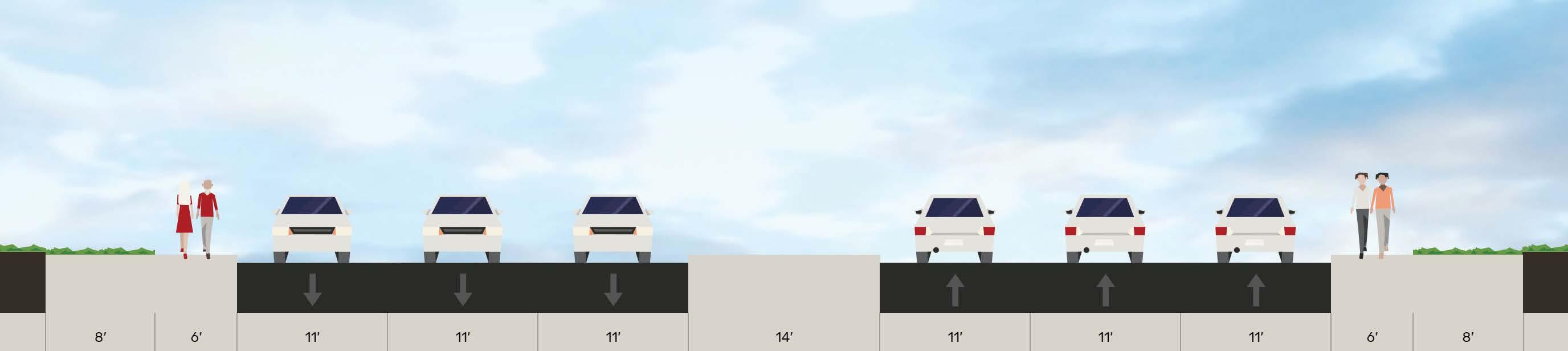
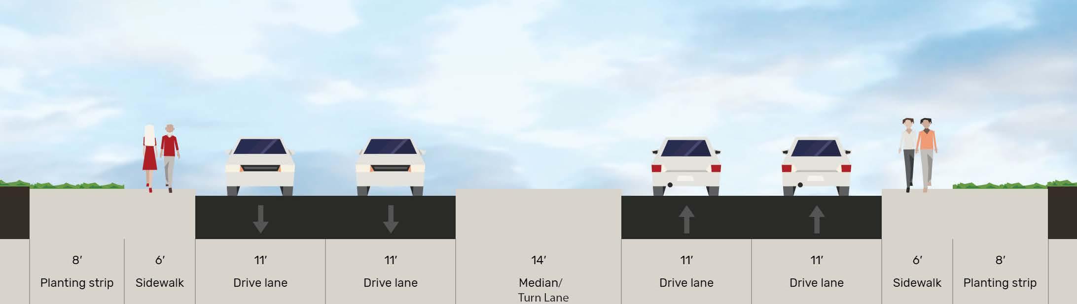
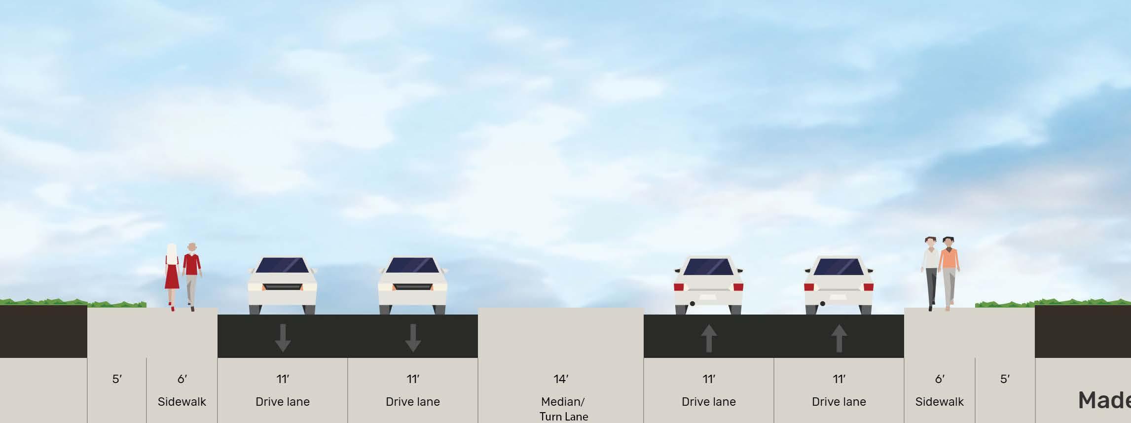
Updated cross-sections were developed and are displayed on the following pages. The Thoroughfare Plan consists of six functional classifications, including Freeways, Parkways, Major Arterials, Minor Arterials, Collectors, and Local Streets. Freeways are outside of the city’s jurisdiction; however, collaboration with TxDOT, AAMPO, Guadalupe County, and surrounding cities should be prioritized to ensure alignment with the Master Thoroughfare Plan. The words “urban” and “rural” shown next to some of the cross-sections on the following pages reflect context sensitive street configurations to fit the character of different areas in Cibolo. Urban in this report does not represent heavy density, instead it represents developed areas of the community like residential areas, commercial areas, or mixeduse developments. Rural represents the more undeveloped areas of Cibolo.
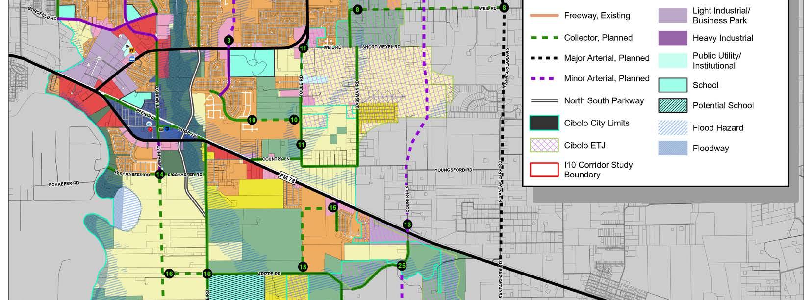

The following cross-sections depict the roadways that are classified on the MTP that exist within the IH-10 Corridor. A full list and description of all roadway types can be found in Chapter 4 of the Comprehensive Plan.
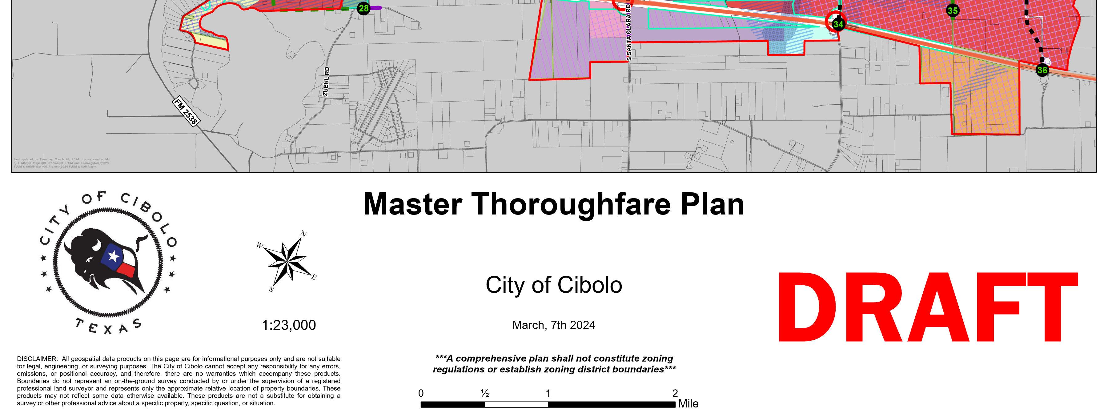

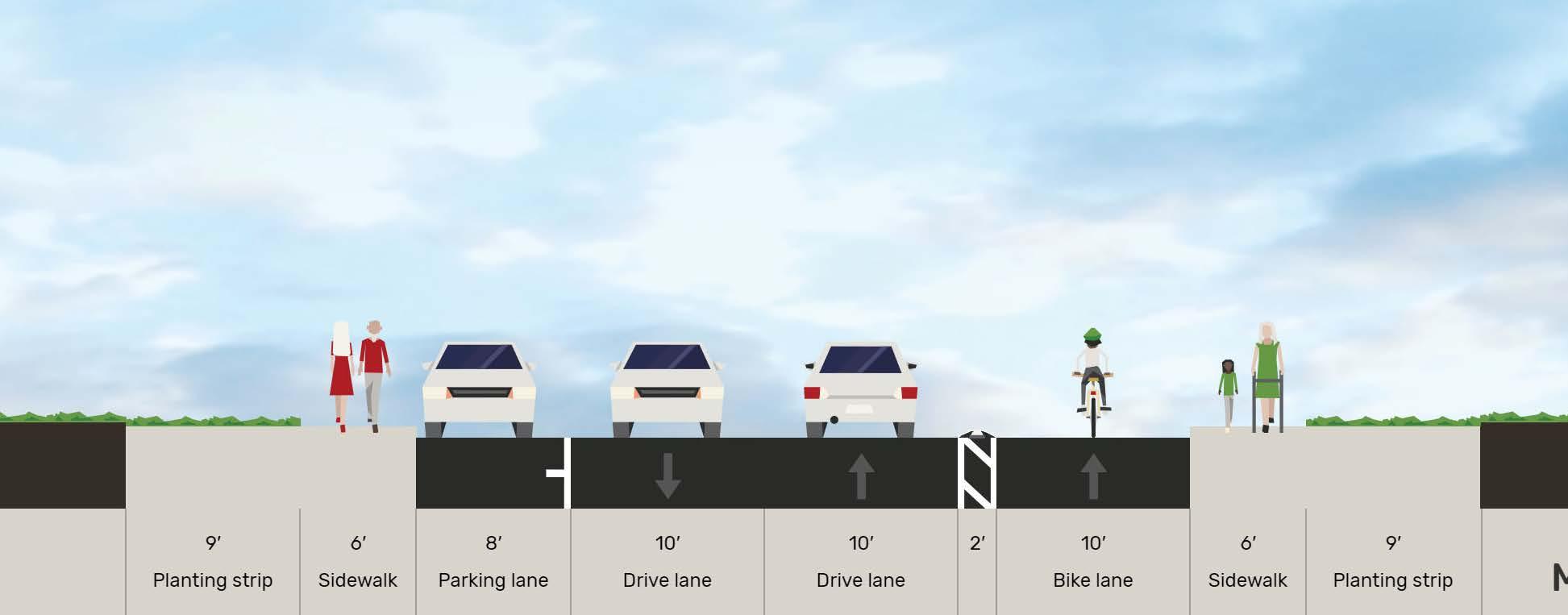
Arterial streets are designed to convey heavy volumes of traffic, often in peak conditions. They serve adjacent properties with direct access in a limited or controlled means. Arterial streets are also often grouped into two classifications: major arterials and minor arterials. Major Arterials move traffic throughout various parts of the city or the surrounding area. Examples of Major Arterials in the corridor are Santa Clara Road and Schwab Road. Major Arterials in the IH-10 Corridor study area, including Santa Clara Road and Schwab Road, traverse outside of Cibolo’s jurisdiction and will require coordination with other governmental entities. The current right-of-way requirement for a Major Arterial road in Cibolo is at least 120/150 feet. Minor Arterials balance connectivity and local access by both moving people throughout the city and connecting to adjacent neighborhoods or adjacent streets of higher or lower functional class. They have lower speeds than Major Arterials but typically still have multiple lanes. An example of a Minor Arterial in the corridor is Bolton Road. The right-of-way requirement for a Minor Arterial in Cibolo is currently 86 feet. Although 6 foot sidewalks are shown in the figures below, this road segment can accommodate 10 foot sidepaths if there is available right-of-way (R.O.W.). Sidepaths are shared use trails located adjacent to a roadway. Utilizing sidepaths can help connect trails and neighborhoods, further promoting active transportation. In situations where there is a constricted R.O.W. we recommend following Cibolo’s Unified Development Code (UDC).
Collectors can vary widely in function and character but are often the ‘last mile connections’ between the local street network and arterials. They have low speeds and wider pedestrian facilities based on the surrounding land use context. Examples of Collectors in the corridor include Haeckerville Road and Stolte Road. A major collector in Cibolo has a right-of-way requirement of 80 feet. The right-ofway requirement for a minor collector is 70 feet.
Common PlaceTypes along Major Collectors - Community Residential, Estate Residential, Compact Residential, and Neighborhood Commercial
Common PlaceTypes along Minor Collectors - Estate Residential and Rural Residential/Agriculture
Local streets primarily serve the immediate neighborhood and provide access to residential and small-scale commercial properties. Typically characterized by lower traffic volumes and reduced travel speeds, local streets prioritize the accommodation of pedestrians, residents, and businesses. These roads are integral to the internal circulation of a community, connecting homes and establishments with collector and arterial roads. Local streets are designed to prioritize safety, minimize traffic, and foster a sense of community, making them essential components of the local transportation network. In situations where there is a constricted R.O.W. we recommend following Cibolo’s UDC of 5 foot sidewalks. The right-of-way requirement for a local street is 50 feet.
4.10 | Local, Rural
Common PlaceTypes along Local, and Rural Streets - Rural Residential/Agricultural, Compact Residential, Community Residential
Freeways
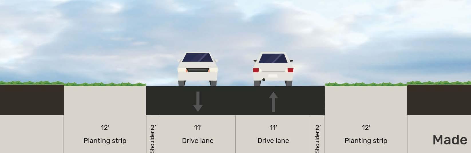
Freeways are major arterials intended for high volume, speed, mobility, and low access. Interstate Highway 10 (IH-10) and Interstate Highway 35 (IH-35) are the two freeways that pass through Cibolo. However, the city is not involved in the construction or maintenance of these freeways, as these are administered by TxDOT. The right-of-way for freeways in Cibolo is 200 feet. To ensure Cibolo is planning for its future along these corridors close coordination with regional entities and TxDOT should occur when planning occurs along these thoroughfares.
Common PlaceTypes along FreewaysRegional Activity Center, Light Industrial/ Business Park, and Compact Residential
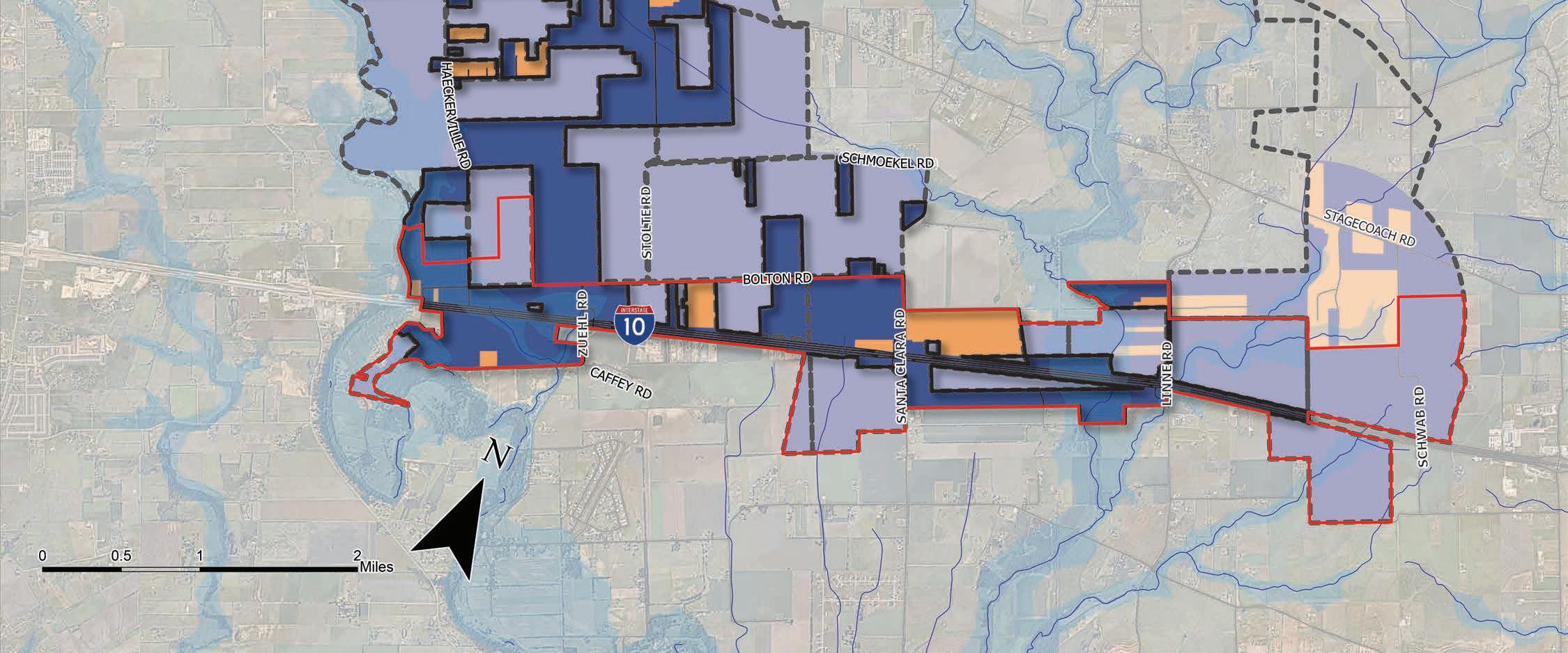
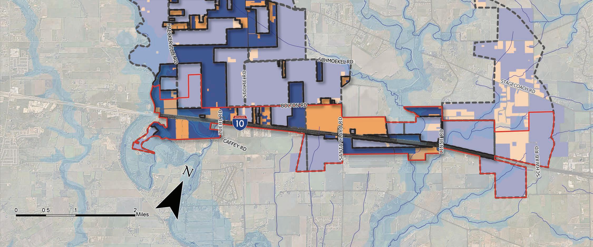
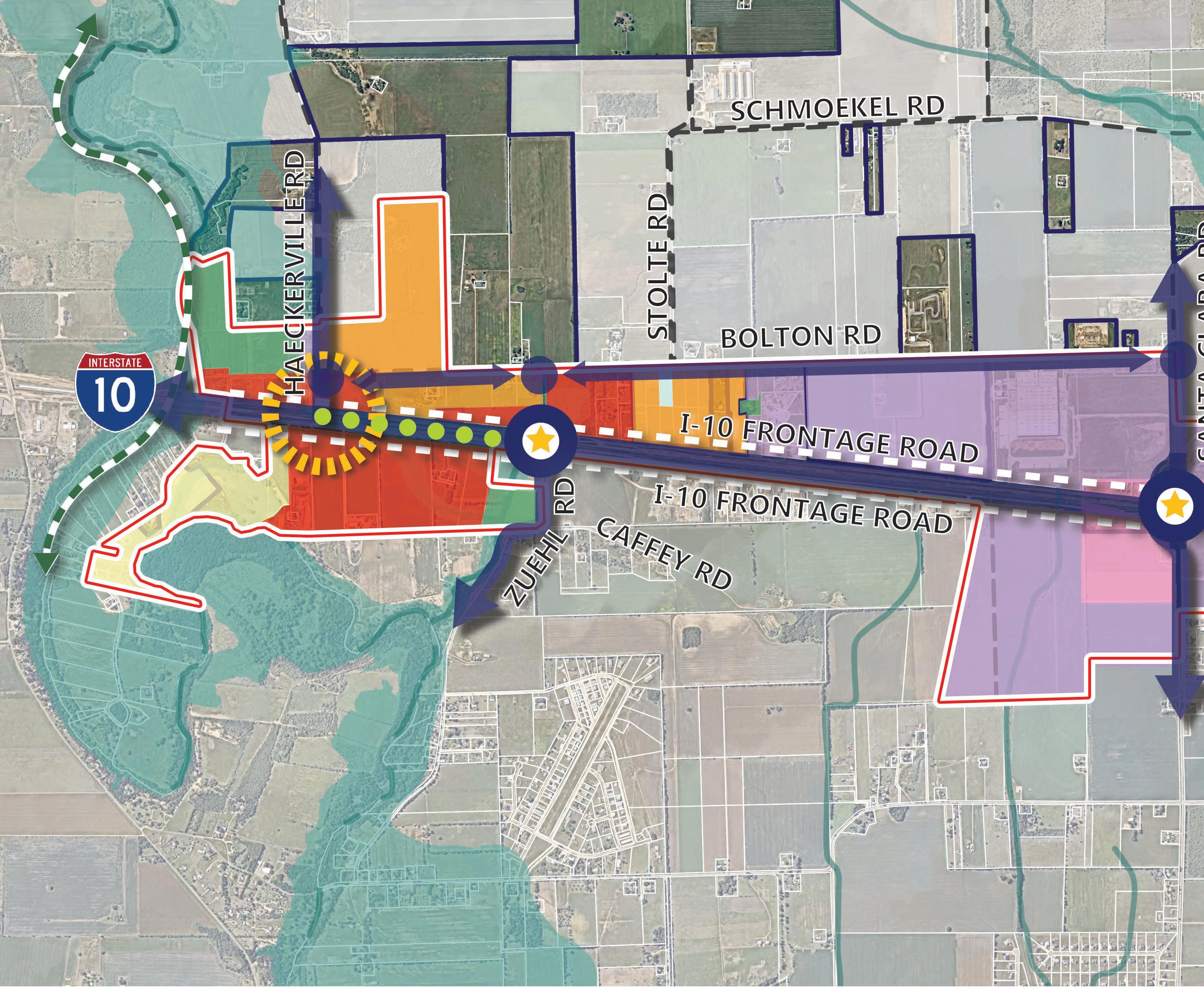
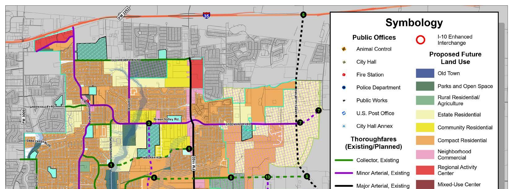
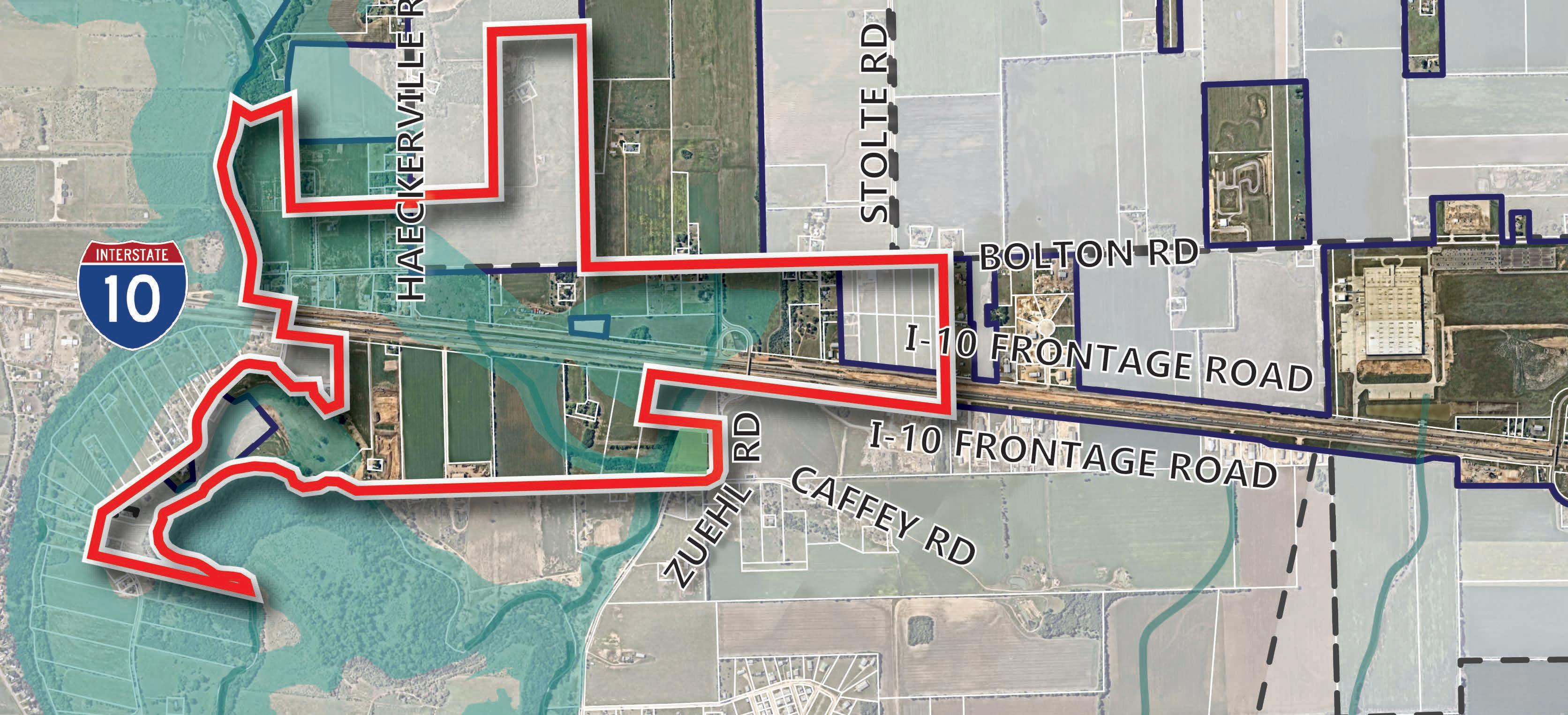
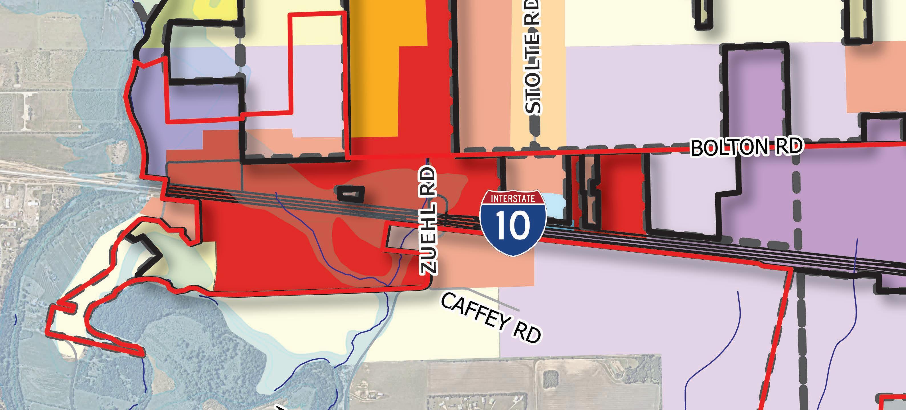
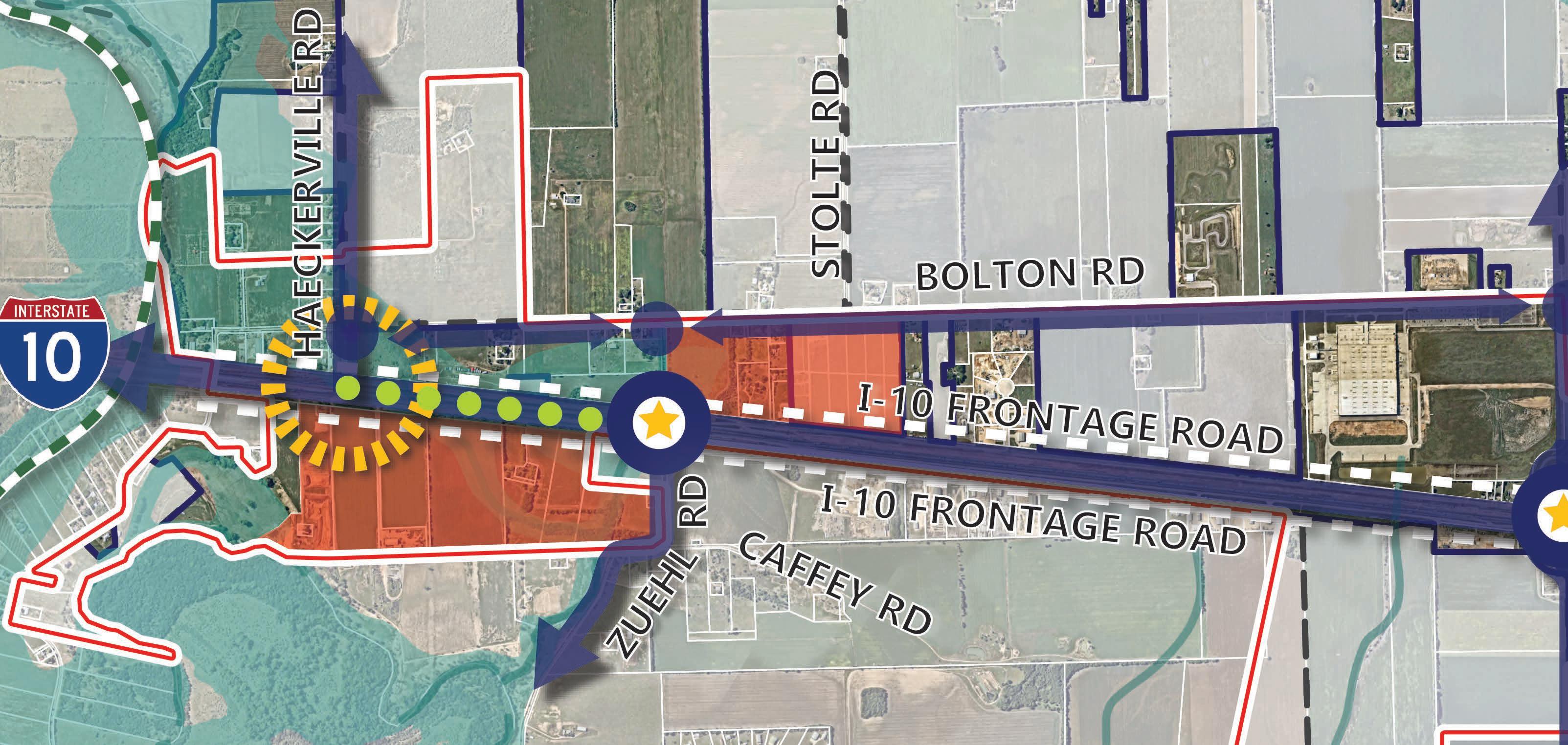
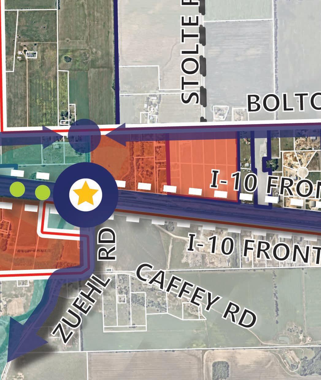
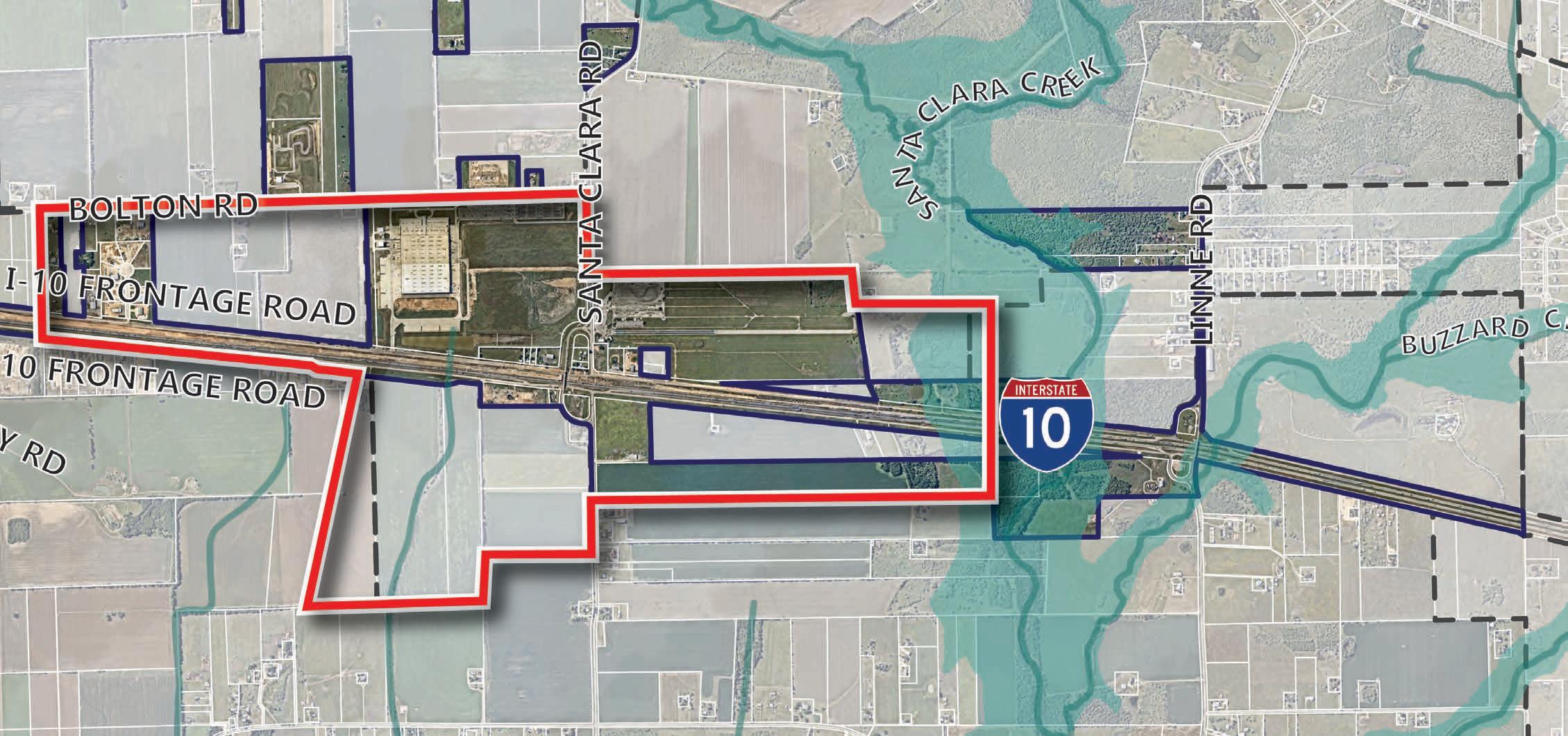
Sub-district I is located on the western side of the corridor, extending from Cibolo Creek on the west to Stolte Road on the east. This area comprises 483 acres of land with approximately 340 acres situated in the floodplain. The primary north-south routes in this area are Haeckerville Road and Zuehl Road and east-west routes include the IH-10 Frontage Roads as well as Bolton Road. This low-lying area is relatively flat, sloping southwest toward Cibolo Creek.
Cibolo City Limits
Cibolo ETJ Limits
Cibolo City Limits
Cibolo ETJ Limits
Current Land Uses
Rural Residential/ Agricultural
Estate Residential
Regional Activity Center
The primary land use pattern within this district is rural and undeveloped land with limited commercial uses along the IH-10 frontage. On the west, this area is flanked by floodplain with long rural residential lots continuing further to the southwest. It should be noted that there are several businesses and homes within this sub-district that are developed within the floodplain that may experience future challenges in relation to the redevelopment of that land.
Future land use (from previous Map in 2022)
Previously, the Future Land Use Map designated land within the Sub-district I study area boundary as primarily commercial with a secondary mix of business park/industrial and rural residential. In addition, there were a couple smaller areas with neighborhood residential and public/institutional. Of the land designated for commercial land uses, 178 acres were reflected in the floodplain and would be undevelopable. In addition, 42 acres of business park/industrial land was shown in the floodplain and cannot be developed for those uses.
The Sub-district I Framework Plan (as shown in Figure 4.14 below) reflects the preferred land use scenario and plan components that represent the overall strategic vision developed for the area. In addition, the table below shows the previous land use type distribution for the sub-district in comparison with the proposed PlaceTypes by acreage and percentage.
Trail
Sidewalk
Gateway
Public
While the previous land uses and PlaceTypes vary in the way they function (as previously described on page 17) comparisons can still be drawn. In Sub-district I, the proposed Framework Plan and Future Land Use Map portrays a significant reduction in the amount of land designated for commercial (now classified as Regional Activity Center) from 433 acres to 242 acres. In addition, industrial land uses (now Light Industrial/Business Park) is not present in this Sub-district and Compact Residential is introduced in areas to the north of IH-10.
sub-district i - strategic plan considerations
Sub-district I is situated on the western side of the IH-10 Corridor in Cibolo. One of the major characteristics of the sub-district is that it contains a significant amount of floodplain to the west, complicating the provision of direct access to the frontage road for development. Despite the access and floodplain challenges, this sub-district is anticipated to develop the fastest due to access to public utilities. To maximize frontage and capture the most development potential along IH-10 in this district, commercial is designated along the highway. To the north and east, compact residential is designated as a transition to areas further away from the highway with estate residential in areas that are challenged by access and floodplain to the southwest.
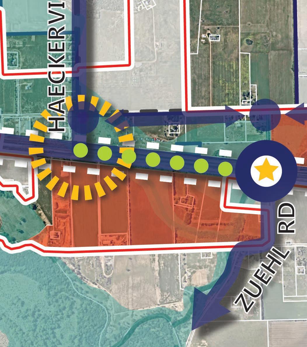
As you enter from the west along IH-10 there is an opportunity to signify entry into Cibolo where the highway crosses Cibolo Creek. The creek provides a natural buffer and transition and a planned trail connection adjacent to open space provides an opportunity for outdoor recreation. From a mobility perspective, direct access to and across IH-10 is limited and located at Zuehl Road. Because TxDOT plans to continue access and improve connectivity at this point, placemaking efforts should be made to enhance what was planned to create a safe multi-modal crossing and design. Since Haeckerville Road provides the most direct access to the north into the rest of Cibolo, efforts should be made to establish a convenient and adequately scaled transition to Zuehl Road.
During the planning process it was noted that Bolton Road should function as a ring road that links key access points to and from the highway, since direct north-south linear connections are limited. In this instance, a ring road is a continuous thoroughfare that functions as a secondary east to west connection that runs parallel with IH-10. Also, roundabouts can be incorporated along Bolton Road to ensure a smooth flow of traffic as directions change along that stretch of roadway. Roundabouts are circular roadway intersection configurations that allow free-flowing traffic in a counterclockwise direction. Because of these improvements, Bolton Road is anticipated to become the central spine of development activity.
As this area builds out it will be important to ensure adequate public utilities and public facilities are in place to ensure the area can be served well. A prime example of how Cibolo is planning for future infrastructure in the area and the sub-district is that it is becoming the wastewater provider for about 3,200 acres south of FM 78 and north of IH-10. More information on this project can be found in the Community Facilities and Public Services chapter of the Cibolo Tomorrow Comprehensive Plan.
sub-district i - plan strategies/actions
Land Use. The overarching land use strategy in this area is to leverage the opportunities along IH-10 with Regional Activity Center uses for highway commercial.
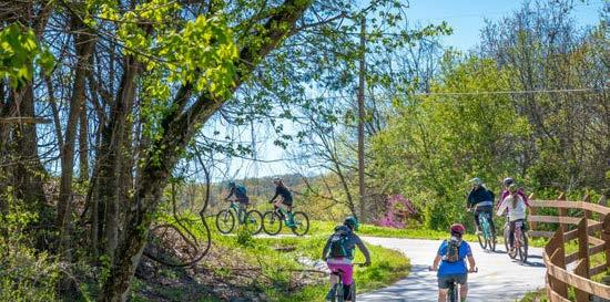
Transportation. The transportation strategy in this area provides a convenient and vibrant frontage along IH-10 and targets key thoroughfares to help establish an ideal multi-modal network of north-south and east-west circulation. In addition, the optimal use of trails and open spaces along the Creek provide an opportunity for outdoor recreation and pedestrian connections.
Placemaking & Identity. Placemaking opportunities to create a distinct sense of place and signify arrival exist throughout the sub-district and can be made through improvements such as: gateway features, freeway crossing enhancements, district signage, urban design, branding and landscape theming.
Housing & Neighborhoods. The housing strategy for this sub-district emphasizes an appropriate residential transition from more intense highway corridor uses to the more rural setting where it is possible. Through the use of PlaceTypes, the more dense Compact Residential category is calibrated to help transition from Neighborhood Commercial, and Regional Activity Center.
Community Facilities and Public Services. The community facilities and public services strategy provides essential needs for the corridor as it builds out. This strategy includes keeping pace with development through the provision of water, sewer, roads, EMS, and public safety and maintaining a high level of service throughout the sub-district. The proposed Public Safety Facility and Fire Station #4, which is to be located near the intersection of Bolton Road and Stolte Road, is a recent example of how Community Facilities and Public Services are being planned for in this sub-district.
Priority projects help support the vision outlined for the area and are calibrated to drive growth and ensure vitality for the corridor. They are designed to be diverse in scale and type to maximize a broad range of opportunities. These projects are detailed in the implementation chapter of this report and describe each project, a planning level scope and probable cost to complete, and provide a framework for funding opportunities.
The following Priority Projects have been identified for this corridor, with a general identification of where these would be appropriate in the sub-district:
1. Trail / Open Space (along Cibolo Creek)
2. Roadway Improvements (along Zuehl Road, Bolton Road, Haeckerville Road)
3. Intersection Crossing Enhancements (at Zuehl Road and IH-10)
4. Sidewalk Infrastructure (along the IH-10 Frontage Road)
5. Roundabout (at Bolton Road and Haeckerville Road and Bolton Road and Zuehl Road)
6. Open Space (within the Cibolo Creek floodplain)
7. Wayfinding and Branding (throughout the sub-district)
8. Illumination (along trails and sidewalks)
Legend
Study Area
Trail
Sidewalk
Gateway Opportunity
Identity Node/Key Intersection
Enhanced Multimodal Access
Catalyst Site
catalyst sites
Throughout the IH-10 Corridor, catalyst sites were selected as areas with the highest potential for future development and growth. While several factors went into the selection of these sites, the primary drivers that were considered were ease of access, utilities, adjacency to IH-10, anticipated future land use, traffic, property values, lot sizes, and ownership patterns.
Although Sub-district I is characterized by significant floodplain coverage, this can also serve as a natural amenity for the Regional Activity Center PlaceType. Catalyst Site #1 is located south of IH10, and Catalyst Site #2 is located north of IH-10 in Sub-district I. Both sites benefit from proximity to existing utilities and potential future City gateway improvements at Haeckerville Road. Most parcels in these catalyst sites are undeveloped and agriculturally oriented, facilitating development potential. However, parcel assemblage will pose a challenge to future development, as most are individually owned. Placemaking and branding opportunities exist in Sub-district I, given the presence and potential to integrate Cibolo Creek with future development. While the Regional Activity Center PlaceType in this sub-district would enable Cibolo to establish and further its commercial reach, the utilization of both catalyst sites would solidify the southern portion of the city limits.
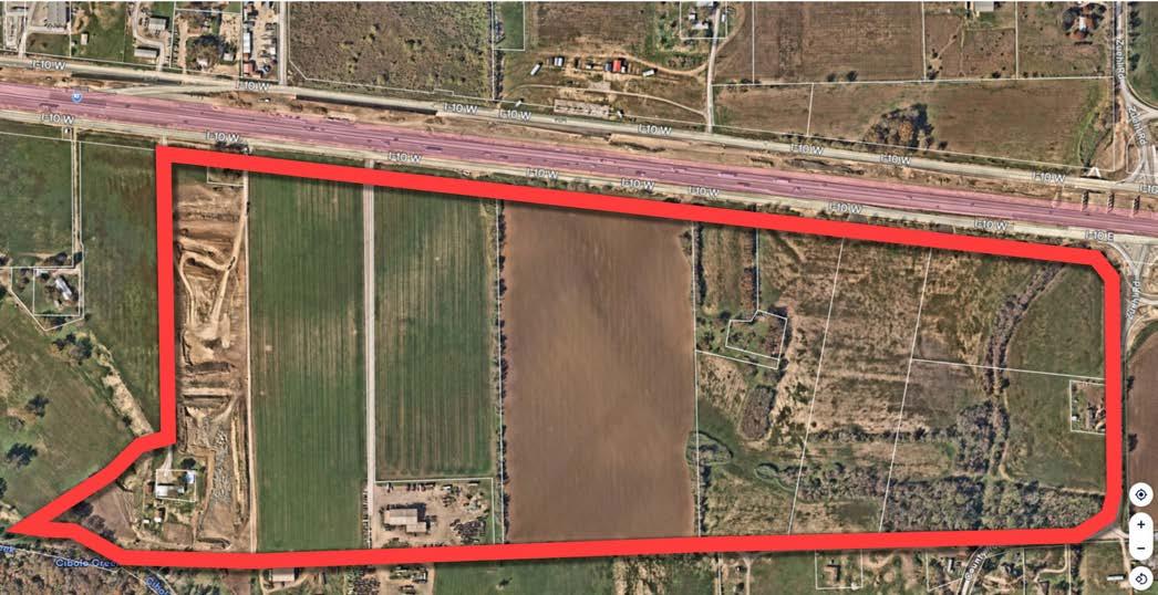
catalyst site #1
Catalyst Site #1 is located in the southern portion of Sub-district I and is approximately 200 acres. Primarily agricultural in nature, the site remains mostly undeveloped. IH10 Frontage Road bounds this area to the north while Zuehl Road is on its far east. Cibolo Creek is on its immediate south with a significant amount of floodplain traversing the site. From a development standpoint, this area is challenged with respect to floodplain and its ability to access IH-10 and Zuehl Road. Lots range from 13-30 acres with multiple property owners within this area. The Future Land Use Map designates this land as the Regional Activity Center PlaceType. For this site to develop as such, utilities would need to be provided and properties would likely need to be combined in a development pattern that works around the floodplain boundary.
catalyst site #2
Catalyst Site #2 is comprised of 90 acres of land on the east side of Sub-district I. It is bounded by IH-10 on the south, Bolton Road on the north, and Zuehl Road on the west. The site also remains mostly undeveloped and has direct and easy access to IH-10. Lots range from 3-20 acres but are mostly made up of the smaller lot sizes with a mix of property owners, including one City-owned property. The City of Cibolo owns a 3.49 acre parcel of land located near the intersection of Bolton Road and Stolte Road, which is the site of the future Public Safety Facility. From a land use perspective, this catalyst area is designated with the Regional Activity Center PlaceType on the west and Compact Residential PlaceType on the east. For the site to develop cohesively in accordance with those PlaceTypes, utilities will also need to be provided to the area and property assemblage of individual lots will be necessary.
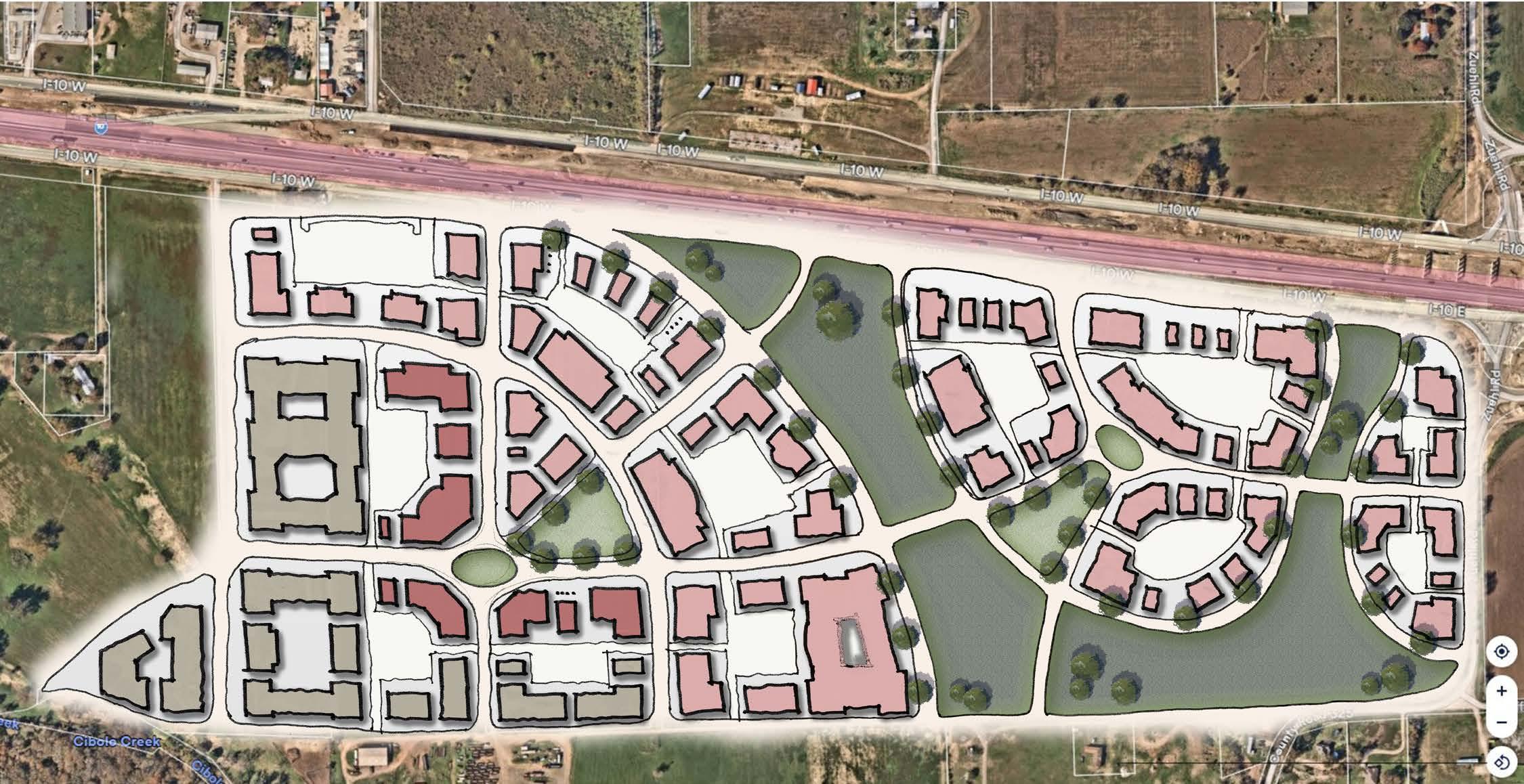
An illustrative concept of Catalyst Site #1 is reflected below. It portrays a full build-out scenario for the site that would accommodate uses typical to the Regional Activity Center PlaceTyp1e. Guidance for district character and recommendations for that PlaceType are found in the following section.
There are several key aspects of the illustrative concept to highlight. While Catalyst Site #1 is challenged with the floodplain, key points of connectivity link the site together and provide access and visibility to IH-10. Open Space is centralized and an important component of the plan. Blocks are formed by a network of local roadways that facilitate ease of movement and accommodate the range of uses permitted. The uses reflected in Figure 4.20 conceptually transition from commercial and retail activity along the highway to multifamily on the south-west.
The following describes typical characteristics and conditions present in Sub-district I. In addition to the general character established by each PlaceType, additional recommendations are incorporated in the descriptions below.
Open Space indicates existing and future planned parks. Future parks are allowed in all PlaceTypes, but this designation protects existing parks and recreational facilities as such and preserves land that is intended to be dedicated for parkland development in the future or areas that may be preserved due to the influence water may have on development in the area.
TRAILS
12’ min width | Interconnected, amenitized trail system (along Cibolo Creek) | Enhanced nodes | Pedestrian level lighting (1-ft candle min average along path of travel recommended) | Park/ Pedestrian furniture
ACCESS Ensure connectivity and extension of planned trails
STREETS Tree lined with 5’ min sidewalks
LIGHTING Well lit for pedestrian safety
Predominantly single-family housing on large lots located throughout the community. Residential uses are oriented with the front of the home facing the street and typically in a subdivision layout with access to some utilities and may include farm and livestock uses. Cluster development, which involves the conservation of shared open space, natural areas, and scenic views, in exchange for smaller lot sizes, may be an alternative approach in certain circumstances.
SETBACK Large to accommodate larger single family lots
ACCESS Ensure connectivity and extension of planned trails
STREETS Tree lined with 5’ min sidewalks
LIGHTING Well lit for pedestrian safety (0.5-ft candle min average along path of travel recommended)
Regional Activity Center developments are larger in scale and attract regional traffic for shopping and retail needs. These commercial centers are anchored by mid-to-big box retailers located along major thoroughfares (i.e., freeways and arterial roads). National retailers and grocery stores would typically be located in this PlaceType. Regional Activity Center can also contain smaller retail or office destinations as well, such as medical offices or boutiques, but are typically anchored by several national vendors. Business types may include restaurants, national retailers, discount stores, grocery stores, fast food, and other retail and service uses.
USE A mix of community and regional-serving retail and commercial at key Intersections
SETBACK Zero lot line | Buildings brought close to the street (minus convenience parking)
ACCESS
PARKING
Easy access to arterials and frontage road | Ensure connectivity and extension of planned trails
Convenience parking along frontage | Parking lots located in rear/mid-block | When internal, away from the highway, on-street parking permitted
SIDEWALKS Sidewalks along rights-of-way 6 ft min | Along building storefronts 10 ft min
STREETS Tree lined | Primarily focused on vehicular access
LIGHTING Well lit (2 ft candle minimum average for sidewalks and parking lots)
Provides a variety of housing types, including small-lot single-family detached, patio homes, townhomes, and duplexes in a compact network of complete, walkable streets that are easy to navigate by car, bicycle, or foot. This PlaceType also supports multifamily. Homes are in subdivisions with all utilities, residential streets, sidewalks, and parks/or connections to neighborhood parks. Neighborhoods may be adjacent to neighborhood-oriented businesses. Key intersections (i.e., FM 78 and FM 1103), and areas within walking distance of local commercial, are the most appropriate locations for this PlaceType, except between residential neighborhoods and communities (infill development).
USE A mix of higher density detached and attached residential housing
SETBACK
Zero lot line | Buildings brought close to the street | Ground level units front and open to street/open space
ACCESS Ensure connectivity and extension of planned trails
PARKING Parking lots located in rear/mid-block | On-street parking permitted
SIDEWALKS Sidewalks along rights-of-way 5 ft min
STREETS Tree lined | Primarily focused on pedestrian connectivity
LIGHTING
Well lit (1-ft candle min average along path of travel recommended), especially in parking areas and along sidewalks and paths
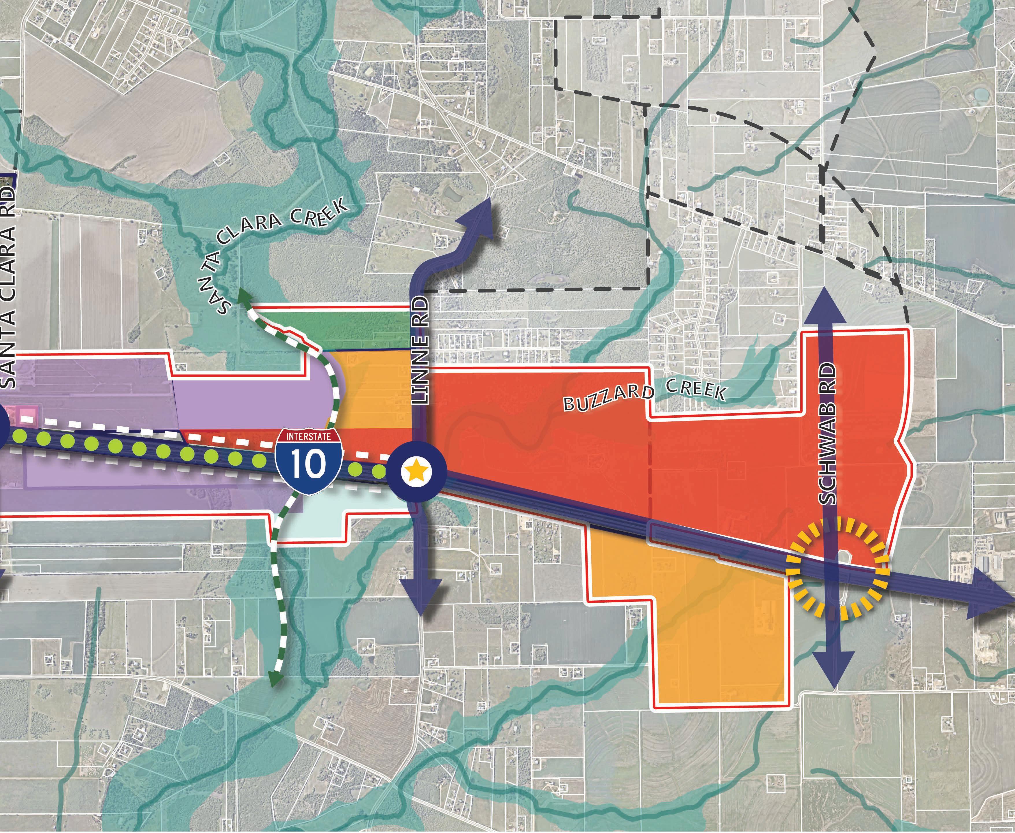
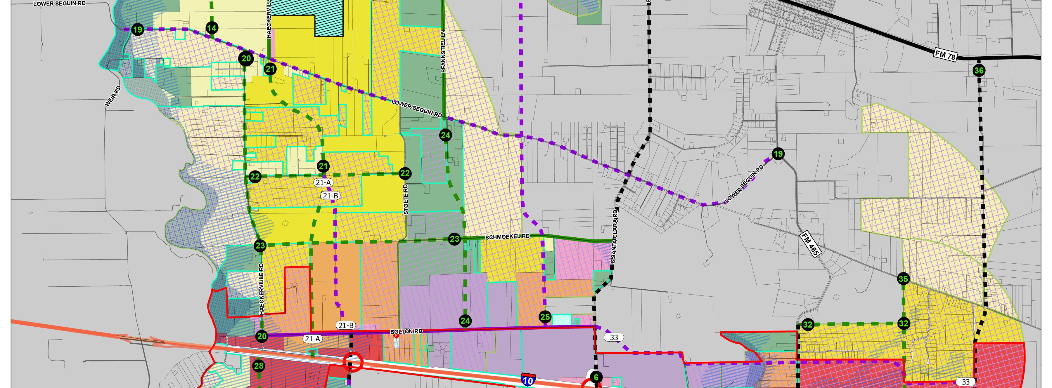
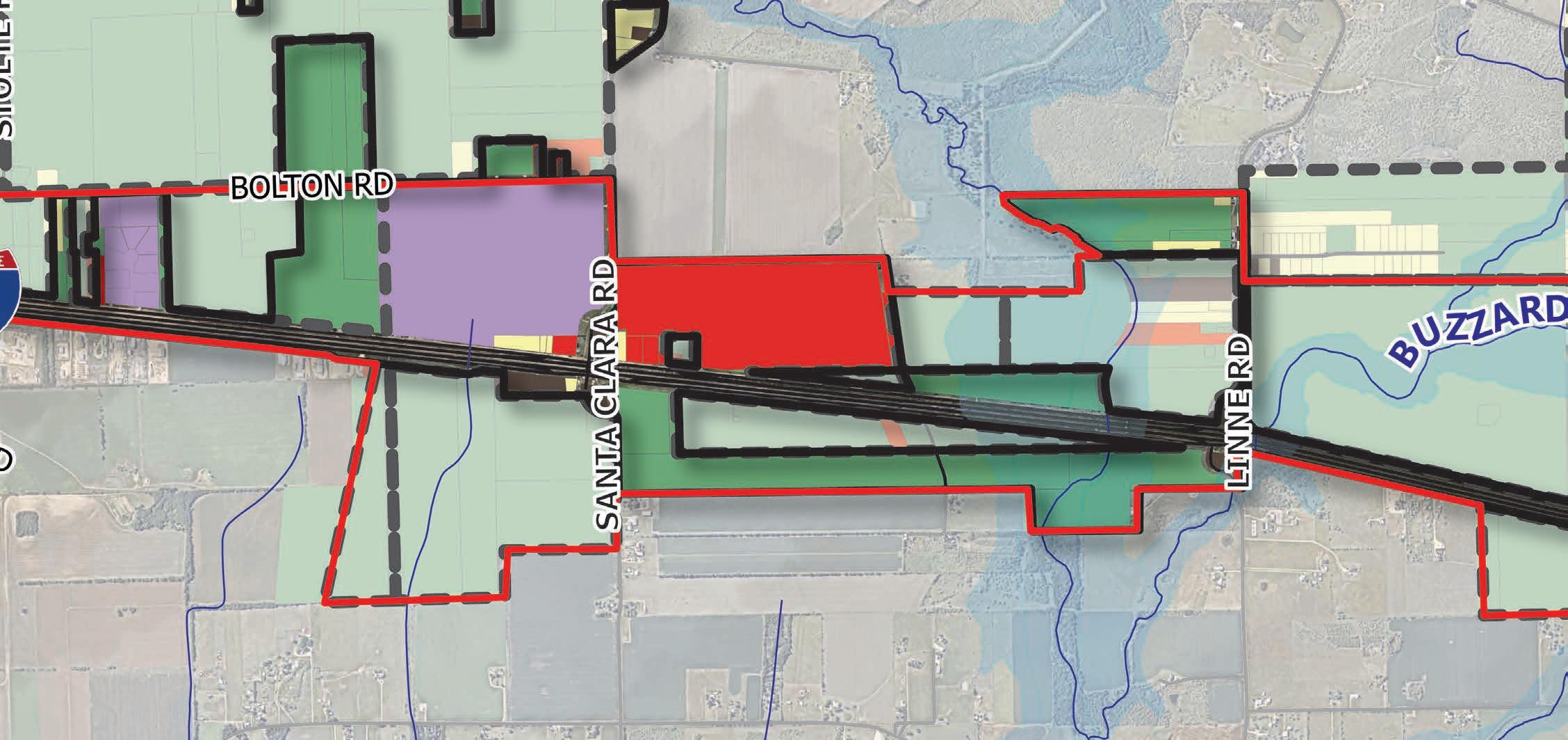
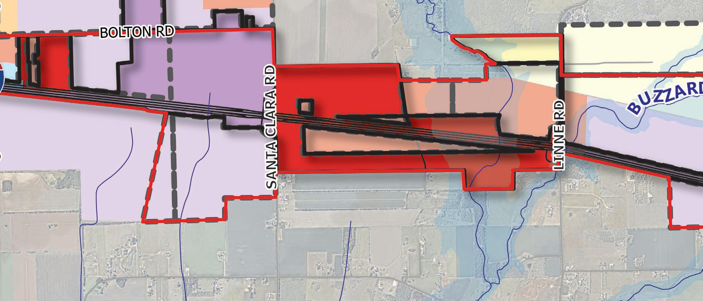
Sub-district II is located in the center of the IH-10 Corridor, running from Stolte Road on the west to Santa Clara Creek on the east. This area comprises about 963 acres of land. The primary northsouth route in this area is Santa Clara Road; and east-west routes include the IH-10 Frontage Roads as well as Bolton Road. This low-lying area is relatively flat, sloping southeast toward Santa Clara Creek.
Legend
Study Area
Cibolo City Limits
Cibolo ETJ Limits
Legend
Study Area
Cibolo City Limits
Cibolo ETJ Limits
Current Land Uses
Rural Residential/ Agricultural
Estate Residential
Light Industrial/Business Park
Regional Activity Center
The land use pattern within this sub-district is a mix of industrial uses along IH-10 with some commercial and limited rural residential with undeveloped and vacant parcels dispersed regularly throughout.
Previously, the Future Land Use Map designated land within the Sub-district II study area boundary as primarily a combination of business park/industrial and commercial. The industrial land was located to the west of Santa Clara Road with the commercial land primarily to the east of Santa Clara Road. Just beyond the study area to the north, rural residential was identified. Of the land designated for commercial land uses, 78 acres were reflected in the floodplain and could not be developed without improvements.
The Sub-district II Framework Plan (as shown in Figure 4.24 below) reflects the preferred land use scenario and plan components that represent the overall strategic vision developed for the area. In addition, the table below shows the previous land use type distribution for the sub-district in comparison with the proposed PlaceTypes by acreage and percentage.
In Sub-district II, the proposed Framework Plan and Future Land Use Map portray a major reduction in the amount of commercial (now classified as Regional Activity Center) from 491 acres (in 2022) to 32 acres. The reduction of commercial future land use on the IH-10 Corridor is due to attempting to right-size the excess amount of commercial that was concluded in the market analysis referenced on page 25. In addition, the proposed shows industrial (now classified as Industrial/Business Park) increasing from 615 acres to 985 acres.
Sub-district II is the central area of the IH-10 Corridor situated between Stolte Road on the west and Santa Clara Creek on the east. This sub-district is identified as the industrial hub of the corridor both along and adjacent to the IH-10 Frontage Road because of its direct access to the highway and the size of the larger undeveloped lots. To the north, beyond the IH-10 Corridor the industrial land use pattern continues, while to the south it extends to the City and ETJ limits. The floodplain of Santa Clara Creek on the east is a distinguishing feature and natural buffer that can be utilized for frontage, open space, and trail opportunities.
From a placemaking standpoint, the grade separated interchange at Santa Clara Road and IH10 is significant as it establishes a second major access point and major highway crossing. Santa Clara Road continues north outside of Cibolo’s ETJ and is intended to connect to IH-35. Future TxDOT plans for this interchange include a reconfiguration to a more direct and efficient circulation pattern, as well as a highway underpass that allows an uninterrupted flow north-south under IH-10. As in Sub-district I, Bolton Road is an important east-west ring road in this sub-district providing vital access to the highway and to routes that link north to Cibolo.
Land Use. The overarching land use strategy in this area is to leverage the opportunities along IH-10 and Santa Clara Road with Light Industrial/Business Park uses for industrial.
Transportation. The transportation strategy in this area provides a convenient and vibrant frontage along IH-10 and targets key thoroughfares to help establish an ideal multi-modal network of north-south and east-west circulation. In addition, the optimal use of trails and open spaces along the Creek provide an opportunity for outdoor recreation and pedestrian connections.
Placemaking & Identity. Placemaking opportunities to create a distinct sense of place and signify arrival exist throughout the district and can be made through improvements such as: gateway features, freeway crossing enhancements, district signage, urban design, branding and landscape theming.
Housing & Neighborhoods. Housing within this sub-district is minimal and is limited to the west side. The Compact Residential PlaceType transitions to Light Industrial/Business Park as lots grow smaller along IH-10.
Community Facilities and Public Services. The community facilities and public services strategy provides essential needs for the corridor as it builds out. This strategy includes keeping pace with development through the provision of water, sewer, roads, EMS, and public safety and maintaining a high level of service throughout the sub-district.
The following Priority Projects have been identified for this corridor, with a general identification of where these would be appropriate in the sub-district:
1. Trail / Open Space
2. Roadway Improvements (along Bolton Road)
3. Intersection Crossing Enhancements (at Santa Clara Road and IH-10)
4. Sidewalk Infrastructure (along the Frontage Road)
5. Roundabout (at Bolton Road and Santa Clara Road)
7. Wayfinding and Branding (throughout the sub-district)
8. Illumination (along Frontage Road)
catalyst site #3
Legend
Study Area
Trail
Sidewalk
Gateway Opportunity
Identity Node/Key Intersection
Enhanced Multimodal Access
Catalyst Site
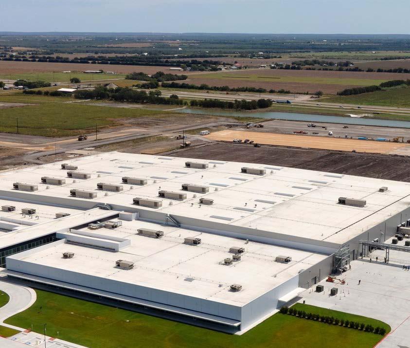
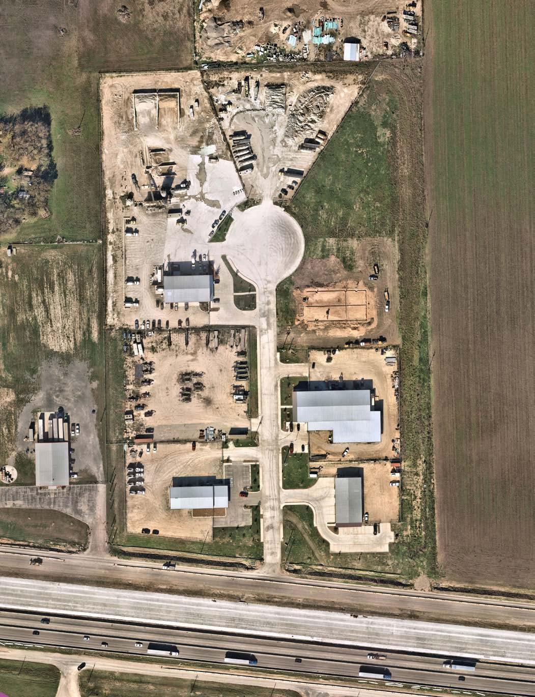
The existing character of Sub-district II varies from Sub-district I in that it’s primarily characterized by industrial and commercial uses. However, this poses a significant opportunity to redevelop Catalyst Site #3, the ~125-acre former racetrack site. Adjacent to AISIN Texas Corporation, a recently developed manufacturing facility, this site is well positioned to leverage the existing talent pool and build employment synergy. Similarly, there’s ample opportunity to develop additional amenities for employees through open space integration and additional residential development to the east spanning towards Santa Clara Creek.
The following describes typical characteristics and conditions present in Sub-district II. In addition to the general character established by each PlaceType, additional recommendations are incorporated in the descriptions below.
Provides a variety of housing types, including small-lot single-family detached, patio homes, townhomes, and duplexes in a compact network of complete, walkable streets that are easy to navigate by car, bicycle, or foot. This PlaceType also supports multifamily. Homes are in subdivisions with all utilities, residential streets, sidewalks, and parks/or connections to neighborhood parks. Neighborhoods may be adjacent to neighborhood-oriented businesses. Key intersections (i.e., FM 78 and FM 1103), and areas within walking distance of local commercial, are the most appropriate locations for this PlaceType, except between residential neighborhoods and communities (infill development).
USE A mix of higher density detached and attached residential housing
SETBACK
Zero lot line | Buildings brought close to the street | Ground level units front and open to street/open space
ACCESS Ensure connectivity and extension of planned trails
PARKING Parking lots located in rear/mid-block | On-street parking permitted
SIDEWALKS Sidewalks along rights-of-way 5 ft min
STREETS Tree lined | Primarily focused on multi-modal accommodation (auto-mobile and pedestrian)
LIGHTING Well lit (1-ft candle min average along path of travel recommended), especially in parking areas and along sidewalks and paths
Light Industrial/Business Park includes business and office-related land uses, warehousing, and light industrial and manufacturing uses that occur indoors and do not include the processing of raw materials. Office and business park land uses may be supported by nearby retail and restaurant uses.
USE Potential for a mix of retail, office, and business park uses at key intersections
SETBACK Zero lot line | Buildings brought close to the street (minus convenience parking)
ACCESS
Easy access to arterials and frontage road | Ensure connectivity and extension of planned trails
PARKING Convenience parking along frontage | Parking lots located in rear/mid-block
SIDEWALKS Sidewalks along rights-of-way 6 ft min | Along building storefronts 10 foot min
STREETS Tree lined | Primarily focused on vehicular access
LIGHTING Well lit (1-ft candle min average along path of travel recommended), especially in parking areas
Neighborhood Commercial development is characterized by small, free-standing buildings containing one or more businesses. Neighborhood Commercial primarily provides family-oriented services for the surrounding neighborhoods and city. They are generally located within walking distance of surrounding residential uses and neighborhoods. Business types may include restaurants, local retail, medical offices, banks, and other retail and service uses.
USE Potential for a mix of retail, office, and business park uses at key intersections
SETBACK Zero lot line | Buildings brought close to the street (minus convenience parking)
ACCESS Easy access to arterials and frontage road | Ensure connectivity and extension of planned sidewalks
PARKING Convenience parking along frontage | Parking lots located in rear/mid-block | When internal, away from the highway, on-street parking permitted
SIDEWALKS Sidewalks along rights-of-way 6 ft min | Along building storefronts 10 foot min
STREETS Tree lined | Primarily focused on vehicular access
LIGHTING Well lit (2 ft candle minimum average for sidewalks and parking lots)
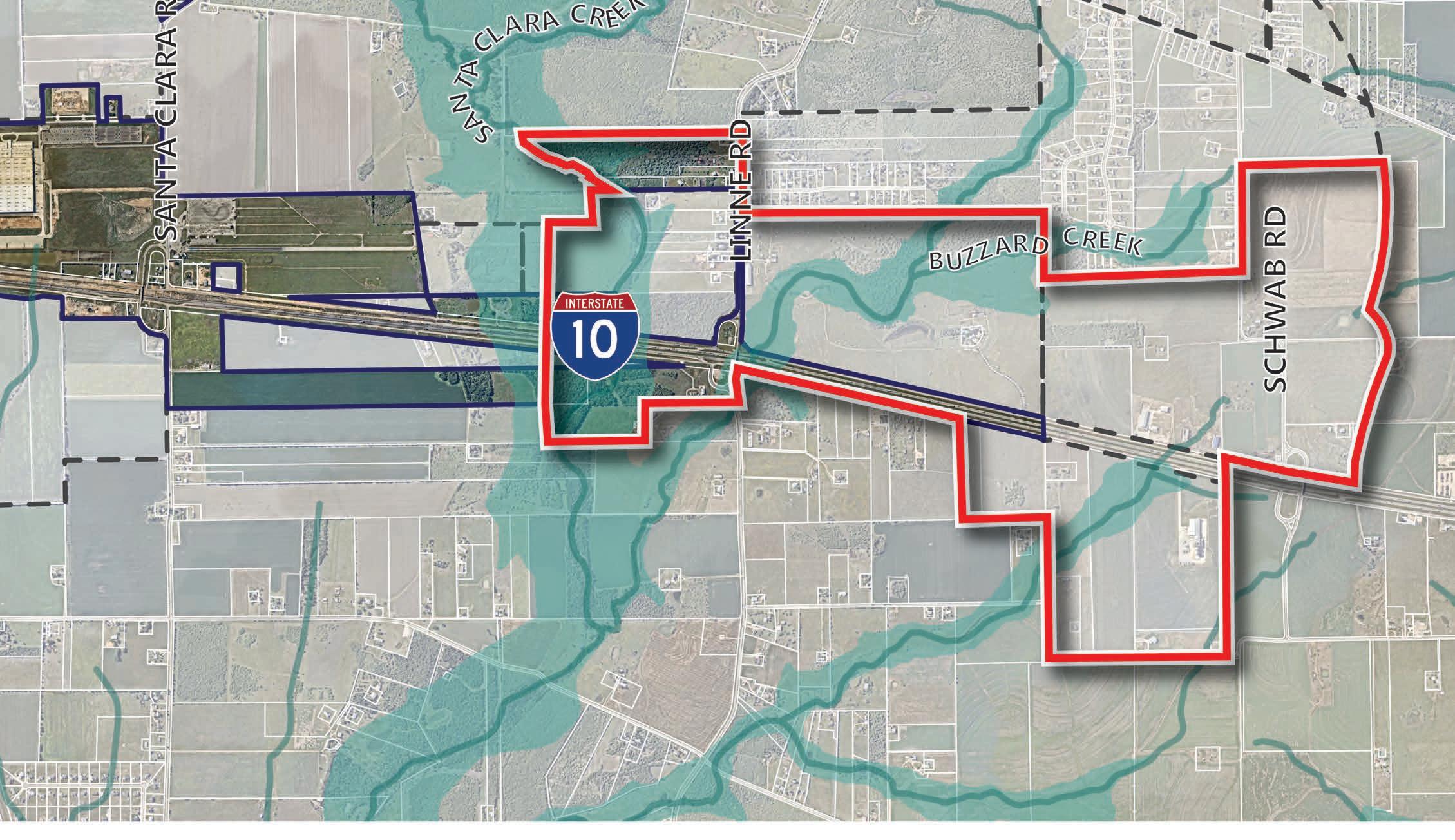
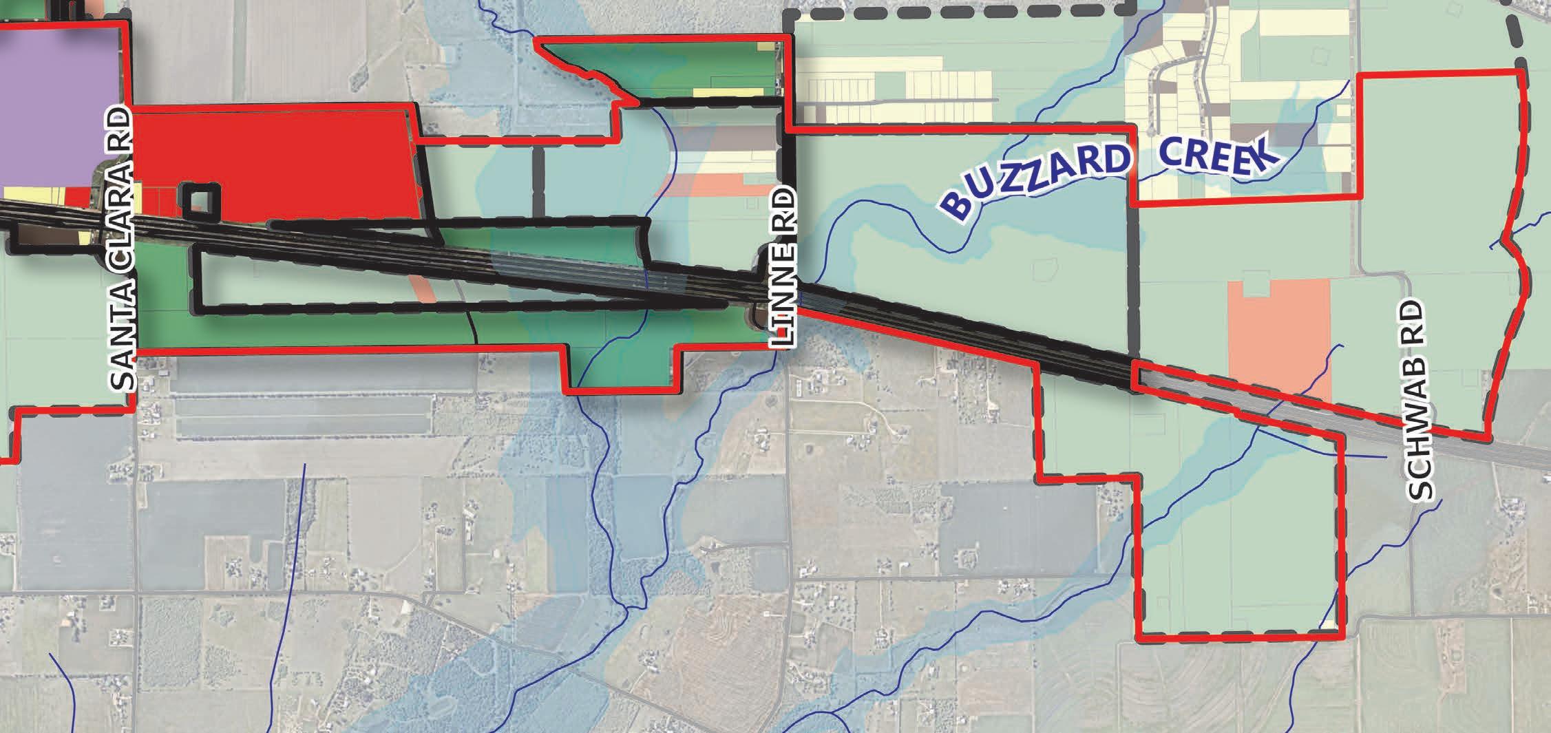
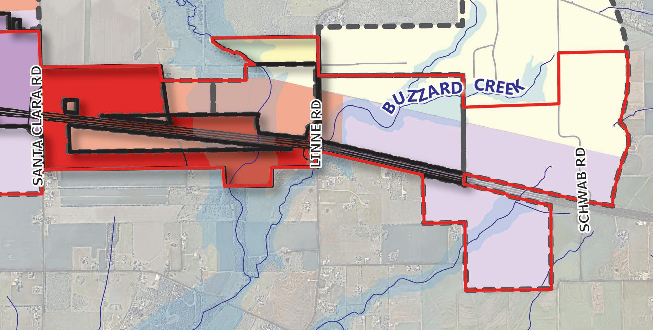
Sub-District III is located on the eastern side of the IH-10 Corridor, spanning from Santa Clara Creek on the west to Schwab Road on the east. This area comprises about 1351 acres of land. The primary north-south routes in this area are Linne Road and Schwab Road; and east-west routes include the IH-10 as well as Partnership Road to the south. This area has the greatest change in elevation through Santa Clara Creek and Buzzard Creek, but still contains developable area along IH-10.
Legend
Study Area
Cibolo City Limits
Cibolo ETJ Limits
Legend
Study Area
Cibolo City Limits
Cibolo ETJ Limits
Current Land Uses
Rural Residential/ Agricultural
Estate Residential
Regional Activity Center
While there are a couple of instances where commercial properties are developed in Sub-district III, the primary land use pattern is relatively undeveloped or utilized as agricultural land.
future land use (from previous plan in 2022)
Previously, the 2022 Future Land Use Map designated land within the Sub-District III study area as primarily business park/industrial along the IH-10 Corridor. The west side transitions to commercial with a significant amount of that area located in the floodplain of both creeks. In addition, to the north of the district, the previous land use designated the remaining land as neighborhood residential.
The Sub-district III Framework Plan (as shown in Figure 4.29 below) reflects the preferred land use scenario and plan components that represent the overall strategic vision developed for the area. In addition, the table below shows the previous land use type distribution for the sub-district in comparison with the proposed PlaceTypes by acreage and percentage.
Study
In Sub-district III, the proposed Framework Plan and Future Land Use Map portray a shift in thinking from mostly industrial land use (now classified as Industrial/Business Park) to primarily commercial land use (now classified as Regional Activity Center). Regional Activity Center now comprises 730 acres of the sub-district. The second largest future land use in this sub-district is Compact Residential, which encompasses 302 acres of land.
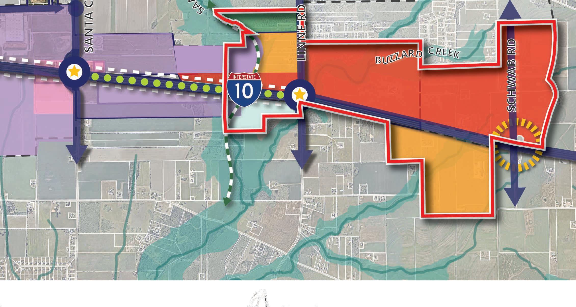
Sub-district III is located on the eastern side of the corridor, extending from Santa Clara Creek on the west to just beyond Schwab Road on the east. As you enter Cibolo from the east along IH-10 there is a gateway opportunity to signify entry into Cibolo through the use of signage, lighting, monumentation, and landscaping. A key intersection in this district is at Schwab Road which provides direct north-south access and links to IH-10. From a public infrastructure standpoint, this area is the most remote in the corridor with limited utility service. For this area to develop, adequate infrastructure is needed to serve development. With its large undeveloped lots and convenient location along the corridor and frontage road, this area has the potential to attract users who are capable of delivering high-quality master planned development. This plan designates Regional Activity Center north of IH-10 with Compact Residential transitioning to the south.
Another important crossing and intersection is at Linne Road further to the west. Although there is floodplain surrounding this intersection from the convergence of Santa Clara Creek and Buzzard Creek, it does provide a means to cross IH-10 and establish a network of circulation for the area. There is an opportunity on the west along Santa Clara Creek as it is planned with a trail and open space sequence that connects further to the north.
Land Use. The land use strategy for this sub-district is to establish a vibrant area at the intersection of Schwab Road and IH-10, align the corridor with Regional Activity Center to the north and west, and utilize the floodplain for outdoor recreation and open space amenities along Santa Clara Creek.
Transportation. The transportation strategy in this area provides a convenient and vibrant frontage along IH-10, and targets key thoroughfares to help establish an ideal multi-modal network of north-south and east-west circulation. In addition, the optimal use of trails and open spaces along the Creek provide opportunity for outdoor recreation and pedestrian connections.
Placemaking & Identity. Placemaking opportunities to create a distinct sense of place and signify arrival on the east, exist throughout the district and can be made through improvements such as: gateway features, freeway crossing enhancements, district signage, urban design, branding and landscape theming.
Housing & Neighborhoods. The housing strategy for this sub-district emphasizes an appropriate residential transition from more intensive uses of the highway corridor to the more rural setting on its northern extents.
Community Facilities and Public Services. The community facilities and public services strategy provides essential needs for the corridor as it builds out. This strategy includes keeping pace with development through the provision of water, sewer, roads, EMS, and public safety and maintaining a high level of service throughout the district.
The following Priority Projects have been identified for this corridor, with a general identification of where these would be appropriate in the sub-district:
1. Trail / Open Space (along Santa Clara Creek)
2. Roadway Improvements (extension of Bolton Road)
3. Intersection Crossing Enhancements (at Schwab Road and IH-10)
4. Sidewalk Infrastructure (along the Frontage Road)
5. Roundabout (at Linne Road and the extension of Bolton Road)
6. Open Space (between Santa Clara Creek and Linne Road in the floodplain)
7. Wayfinding and Branding (throughout the sub-district)
8. Illumination (along trails and sidewalks)
catalyst site #4
Catalyst Site #4 serves as a bookend to the eastern portion of the IH-10 Corridor, also representing an identified City gateway opportunity. It is bisected by Schwab Road and has easy access along IH-10 frontage road on its south. The site is comprised of 102 acres and 6 properties, most of which exceed 16 acres in size. A major asset to this catalyst area is that there is a limited number of property owners, which makes it easier to assemble property for development. The biggest challenge of this site is the provision of utilities, as it is in a remote location.
Building on the opportunity to capitalize on future Schwab Road and gateway improvements, the site could serve as a destination for visitors and residents alike. Primarily devoid of floodplain coverage, Catalyst Site #4 could also serve as an amenity to potential employees added to Subdistrict III. Building synergy throughout the IH-10 corridor and minimizing leakage from existing residents will strengthen Cibolo’s regional draw as well.
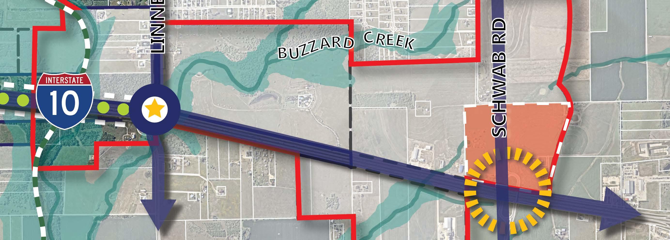
An illustrative concept of Catalyst Site #4 is reflected below. It portrays a full build-out scenario for the site that would accommodate uses typical to the Regional Activity Center PlaceType. Guidance for district character and recommendations for that PlaceType are found in the following section.
There are several key aspects of the illustrative concept to highlight. This catalyst site has a favorable ownership pattern, since there are only a few lots with large, undeveloped areas of land. Direct access to IH-10 can be obtained via Schwab Road. This area is designated for Regional Activity Center, where commercial/ retail activity happens along the highway and transitions to the north. Blocks are formed by roadways that provide circulation and connect from open spaces to create neighborhood scale pedestrian circulation. In addition, the opportunity exists for gateway and placemaking opportunities as you enter from IH-10 at Schwab Road.
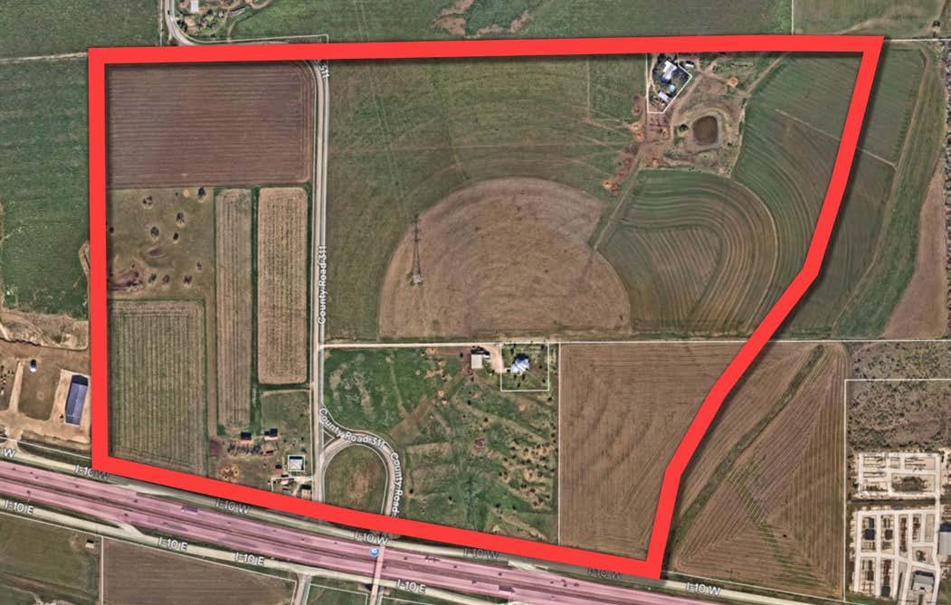
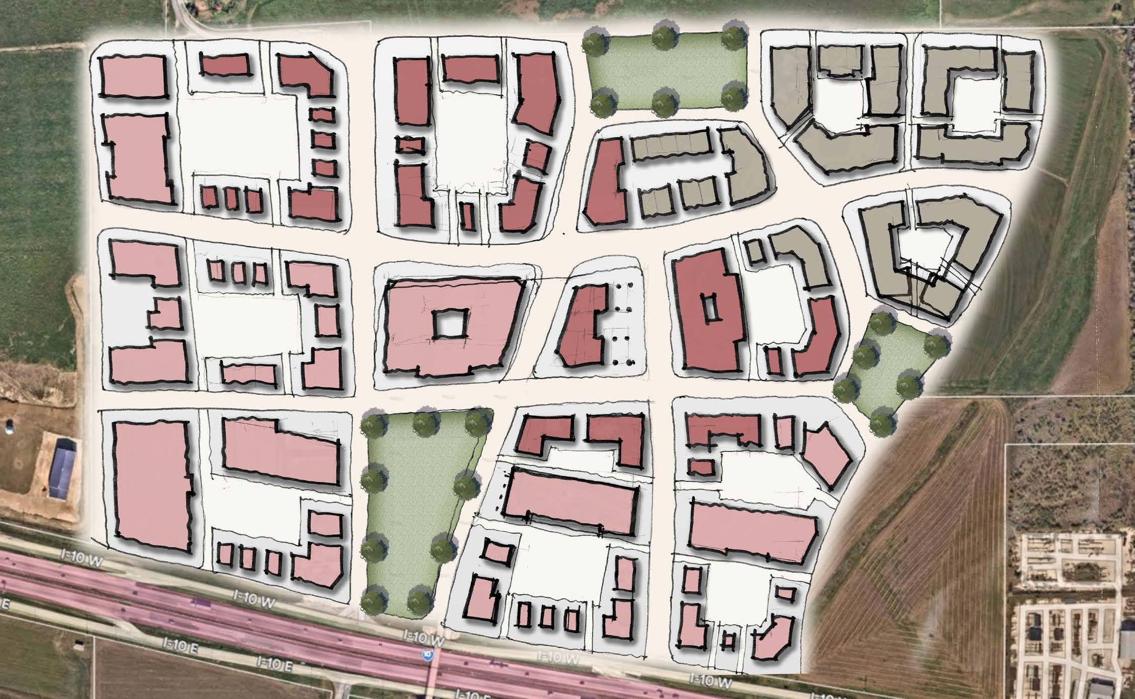
The following describes typical characteristics and conditions present in Sub-district III. In addition to the general character established by each PlaceType, additional recommendations are incorporated in the descriptions below.
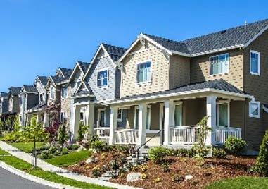
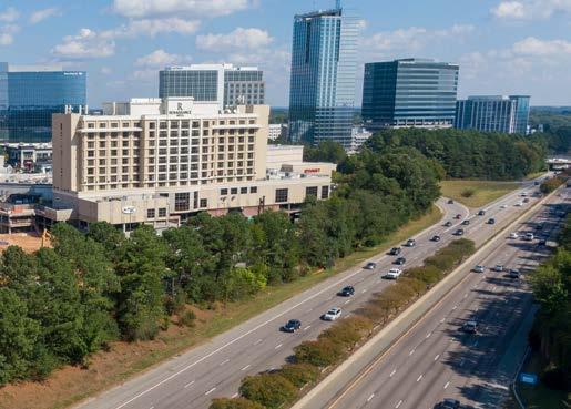
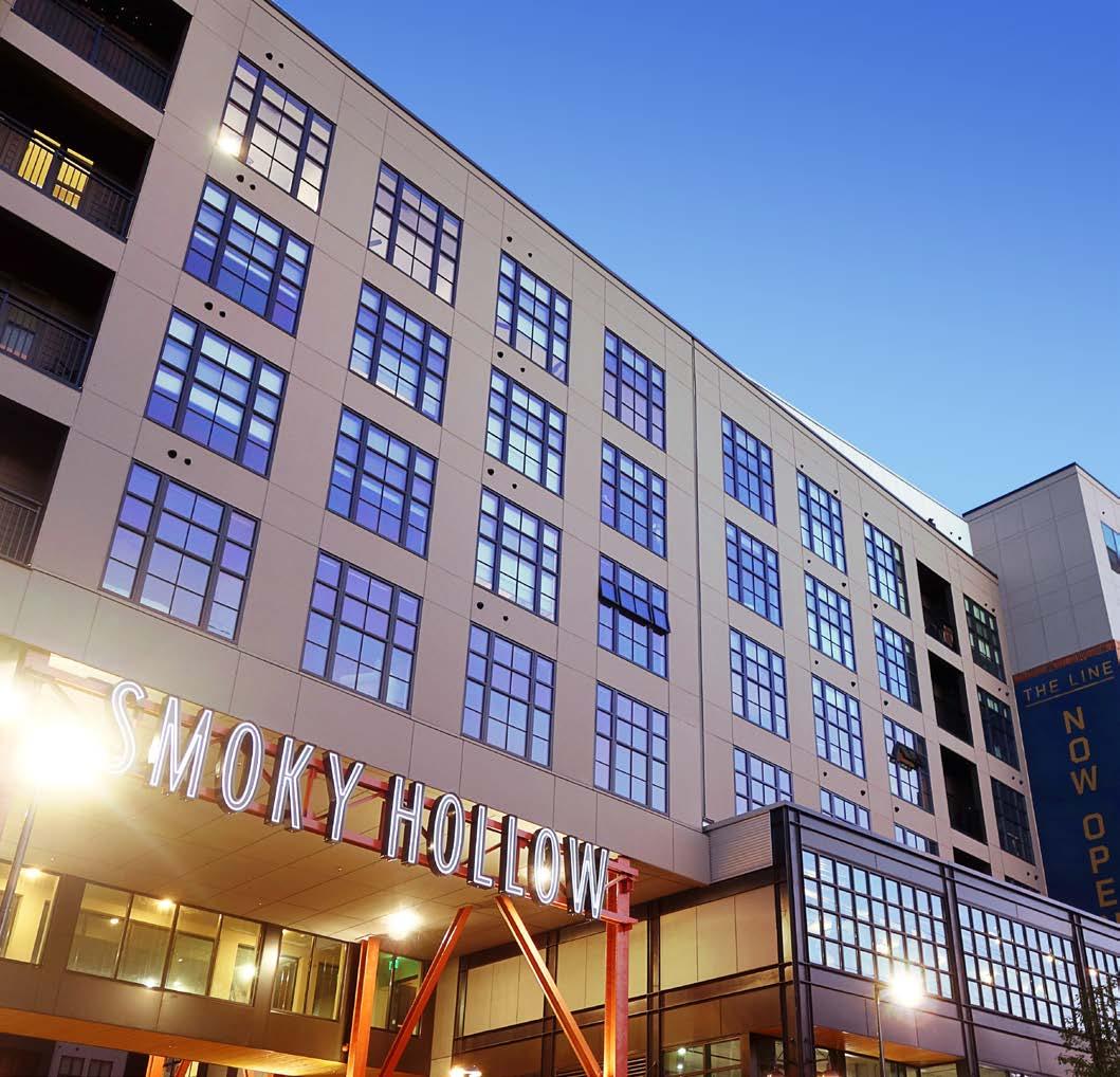
Parks and open space
Open Space indicates existing and future planned parks. Future parks are allowed in all PlaceTypes, but this designation protects existing parks and recreational facilities as such and preserves land that is intended to be dedicated for parkland development in the future or areas that may be preserved due to the influence water may have on development in the area.
12’ min width | Interconnected, amenitized trail system (along Santa Clara Creek) | Enhanced nodes | Pedestrian level lighting (1-ft candle min average along path of travel recommended) | Park/Pedestrian furniture
OPEN SPACE Passive open space along Santa Clara Creek
PARKING Parking facilities provided at trial heads and open space locations
LIGHTING Well lit for pedestrian safety
Regional Activity Center developments are larger in scale and attract regional traffic for shopping and retail needs. These commercial centers are anchored by mid-to-big box retailers located along major thoroughfares (i.e., freeways and arterial roads). National retailers and grocery stores would typically be located in this PlaceType. Regional Activity Center can also contain smaller retail or office destinations as well, such as medical offices or boutiques, but are typically anchored by several national vendors. Business types may include restaurants, national retailers, discount stores, grocery stores, fast food, and other retail and service uses.
USE A mix of community and regional-serving retail, office, and commercial at key Intersections
SETBACK Zero lot line | Buildings brought close to the street (minus convenience parking)
ACCESS
PARKING
Easy access to arterials and frontage road | Ensure connectivity and extension of planned trails
Convenience parking along frontage | Parking lots located in rear/mid-block | When internal, away from the highway, on-street parking permitted
SIDEWALKS Sidewalks along rights-of-way 6 ft min | Along building storefronts 10 ft min
STREETS Tree lined | Primarily focused on vehicular access
LIGHTING Well lit (2 ft candle minimum average for sidewalks and parking lots)
Provides a variety of housing types, including small-lot single-family detached, patio homes, townhomes, and duplexes in a compact network of complete, walkable streets that are easy to navigate by car, bicycle, or foot. This PlaceType also supports multifamily. Homes are in subdivisions with all utilities, residential streets, sidewalks, and parks/or connections to neighborhood parks. Neighborhoods may be adjacent to neighborhood-oriented businesses. Key intersections (i.e., FM 78 and FM 1103), and areas within walking distance of local commercial, are the most appropriate locations for this PlaceType, except between residential neighborhoods and communities (infill development).
USE A mix of higher density detached and attached residential housing
SETBACK Zero lot line | Buildings brought close to the street | Ground level units front and open to street/open space
ACCESS Ensure connectivity and extension of planned trails
PARKING Parking lots located in rear/mid-block | On-street parking permitted
SIDEWALKS Sidewalks along rights-of-way 5 ft min
STREETS Tree lined | Primarily focused on multi-modal accommodation (auto-mobile and pedestrian)
LIGHTING
Well lit (1-ft candle min average along path of travel recommended), especially in parking areas and along sidewalks and paths
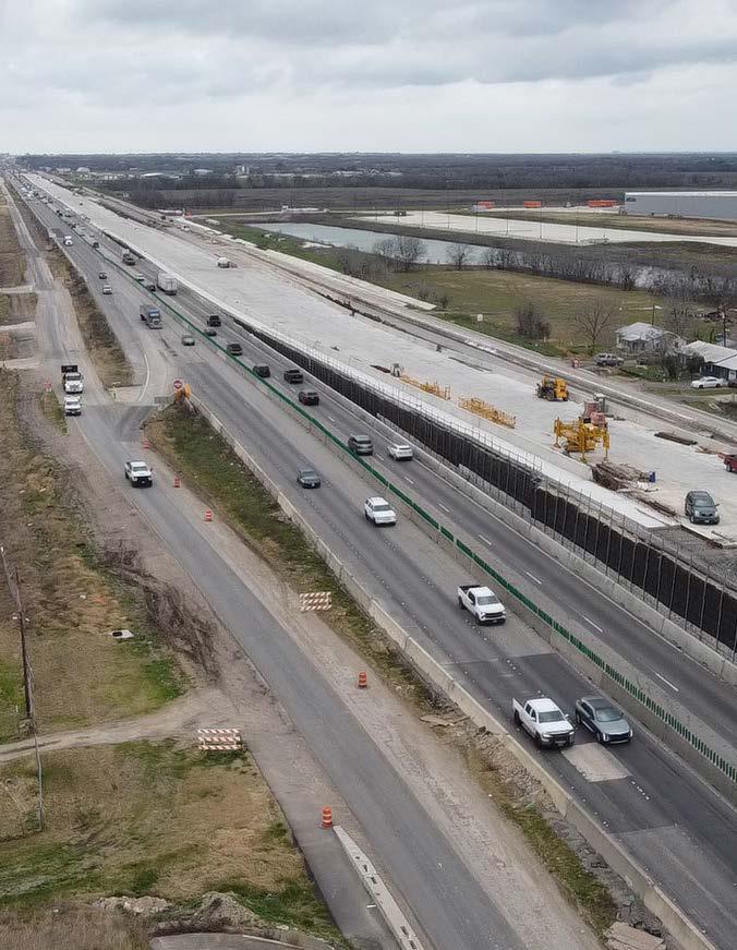
Throughout the planning process, several projects were identified as critical to the success of the district. These projects will have a significant impact and drive forward the vision outlined by the community. These projects should be the highest priority when it comes to implementation. The following is a list of projects identified to realize the vision of the IH-10 Corridor:
1. Trail / Open Space
2. Roadway Improvements
3. Intersection Crossing Enhancements
4. Sidewalk Infrastructure
5. Roundabouts
6. Gateway and Identity Features
7. Wayfinding and Branding
8. Illumination
implementation matrix and action items
Following the section on priority projects, a list of action items have been identified for the IH-10 Corridor. These actions are organized as a tracking tool for the City to use as it implements the Plan. Key attributes of the implementation matrix include the description of the action, estimated time to complete, cost, and responsible party. The following is a description of what each symbol indicates in the implementation matrix.
Time is tracked in three columns as follows:
1-5 yrs 6-10yrs
The costs are broken down by the dollar ($) symbol and represent three ranges of cost as follows: $ = 0-99k $$ = 100k-499k
Finally, designated parties range from City Staff (CS) to the EDC or key partners and stakeholders such as the AAMPO or TxDOT.
project background
Key locations exist along the corridor where creeks cross under IH-10 both at Cibolo Creek and Santa Clara Creek. These areas were identified as places where the incorporation of open space and trail amenities can help create a unique identity and destination for people seeking outdoor recreational opportunities and maximize the use of undevelopable land in the floodplain. These trails can link to other open spaces and trails throughout the community and provide a pedestrian network that is beneficial to those living in the corridor needing access to outdoor space.
project description
A 10’ wide linear pedestrian trail is proposed that runs along the floodplain with pedestrian-level lighting, park benches, and furniture running along its extents. The intent is to ultimately create a loop that gives people access to other areas beyond the corridor. Trail heads are situated adjacent to IH-10 where it meets the floodplain. In addition, trails in this area are intended to create a safe pedestrian connection under IH-10.
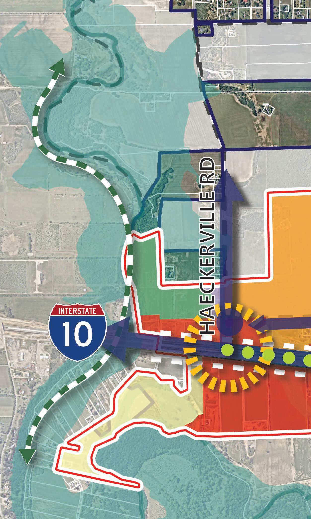
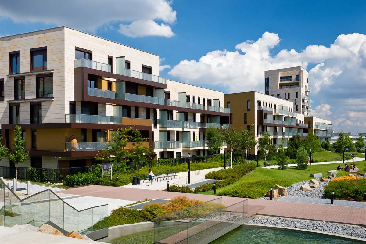
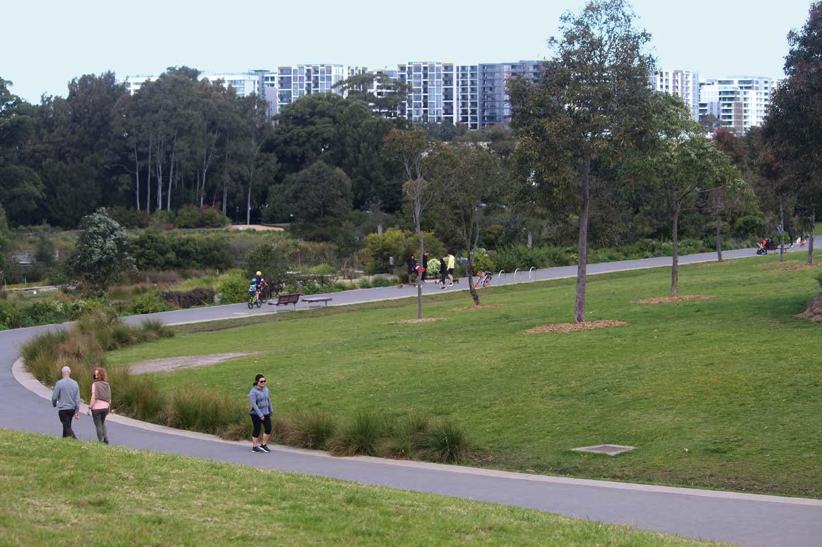
PRIORITY PROJECT #1 - PEDESTRIAN TRAIL
ROUGH ORDER OF MAGNITUDE COSTS
Project Components
+/- 1500 linear ft of paved trail (10’ wide)
Limited Utility Work, Drainage, and Irrigation
Pedestrian-level lighting Park Benches and Furniture
Estimated Cost +/- $400,000 - 500,000 PROJECTED TIMEFRAME
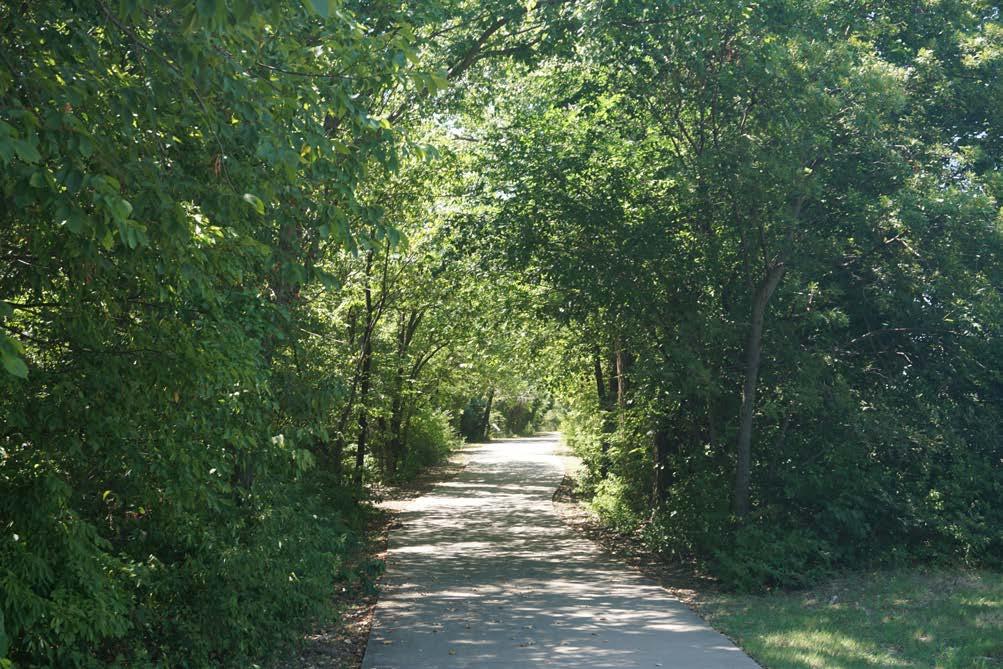
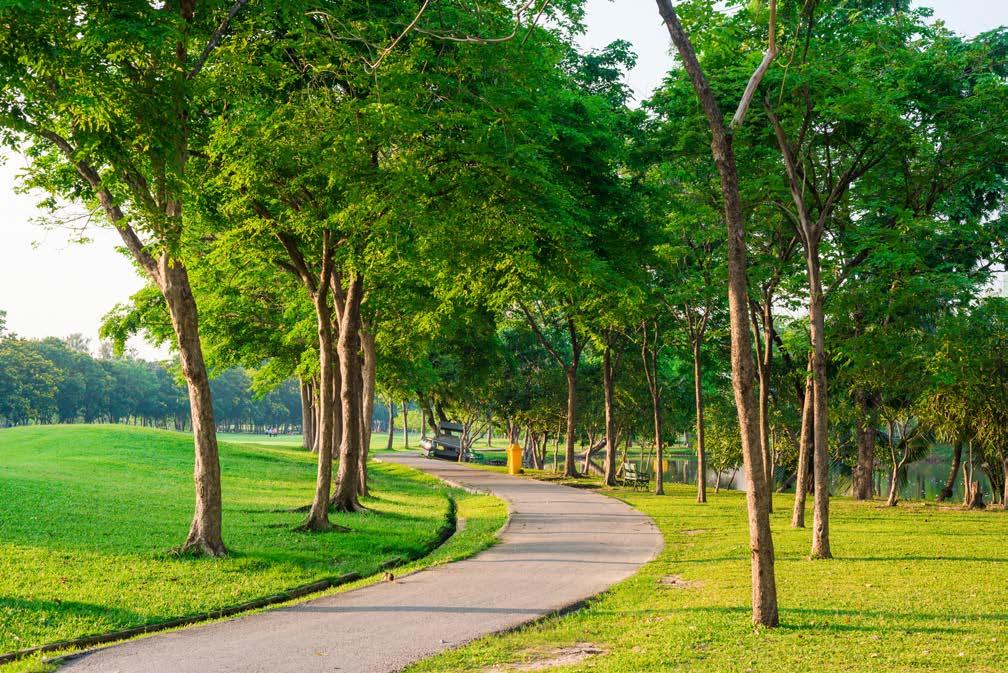
Funding
Initiatives
AAMPO - STBG/ CMAQ/TA Federal-Aid Highway Program that provides funds for Transportation Projects contributing to Clean Air Act Fiscal Years 2023 through 2026
project background
In order to plan for the efficient movement of travel throughout the corridor, several roadway improvements are needed. Bolton Road is a primary east-west ring road that has been identified as a priority roadway that should be upgraded to a Minor Arterial road section. This is because the future circulation pattern of the corridor will flow through Bolton Road both to and from the highway. Haeckerville Road, Zuehl Road, Stolte Road, and Santa Clara Road all converge along this roadway. Both roadway extension and reconstruction are necessary to ensure continued vitality of the area.
project description
Currently, Bolton Road traverses both City and ETJ limits as County Road 308, and runs approximately 3 miles from the west to Santa Clara Road on the east. The proposed street section as reflected below incorporates sidewalks, street trees, four lanes of travel, roadway drainage, pavement markings, and traffic control devices. For estimation purposes, the proposed rough order of magnitude cost is calculated for a 1,000 linear foot roadway segment.
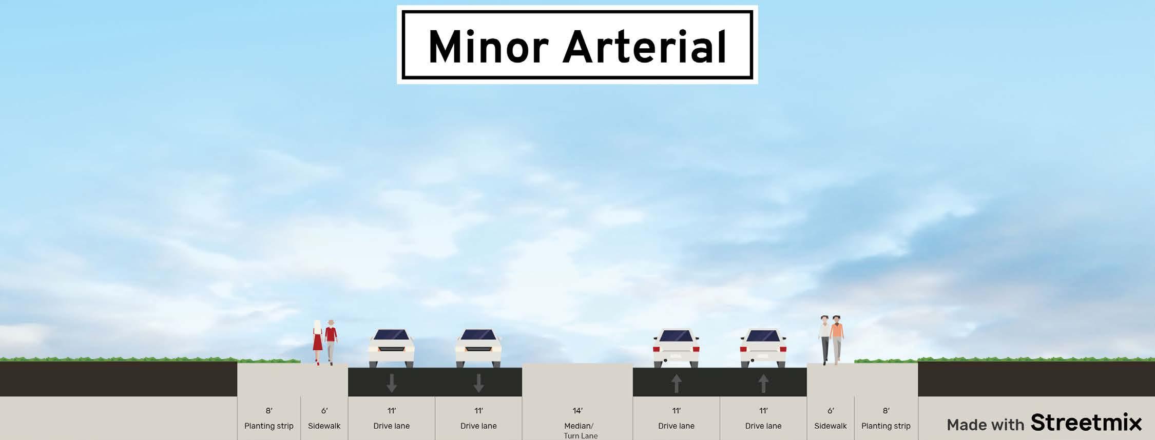
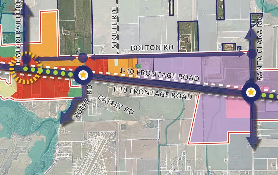
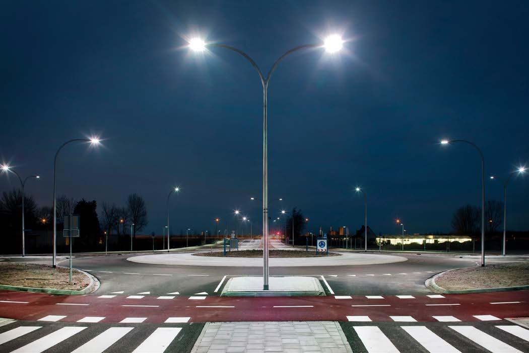
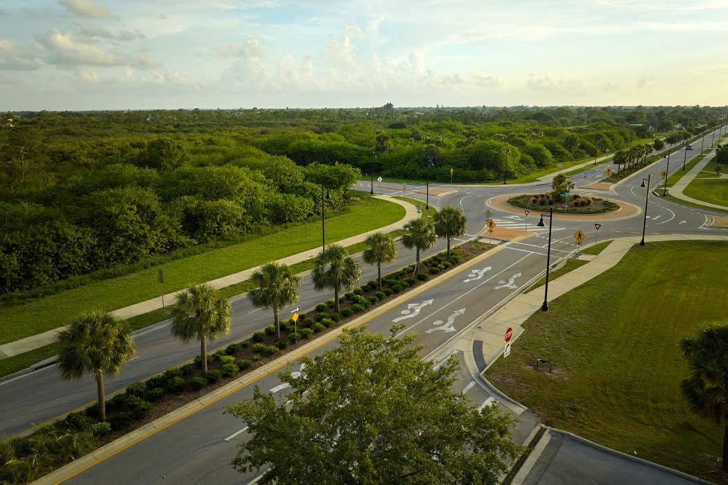
PRIORITY PROJECT #2 - BOLTON ROAD RECONSTRUCTION
ROUGH ORDER OF MAGNITUDE COSTS
Project Components and Description
Complete Pavement with Enhanced Pavers Banding
Traffic Control Devices
Pavement Markings/Markers
Roadway Drainage/Landscape and Irrigation
Illumination (Ped Street Lights 60’ o.c.)
Limited Utilities
Traffic Signal
Construction Contingency, Mobilization, General Site Prep and 12% Inflation Contingency to 2026
Professional Services
Estimated
project background
Gateway features can help signify entry into the City and create a sense of arrival into the corridor. Through the use of landscaping and monumentation, these elements can be utilized as a placemaking tool that celebrates the unique character of Cibolo and speaks to its identity. Illuminated signage can ensure that this important feature is visible at all times of the day and night. Gateway features are designated on the far east and west ends of the IH-10 Corridor, as reflected in the Framework Plan, and are intended to be clearly visible from IH-10. To successfully implement gateway features, coordination is needed with TxDOT since they own and maintain the right-of-way along IH-10.
project description
Gateway features include decorative banners, lighting, and structures, that speak to the unique character of Cibolo. They are intended to be located directly adjacent to the roadway and can be themed by color, scale, and type.
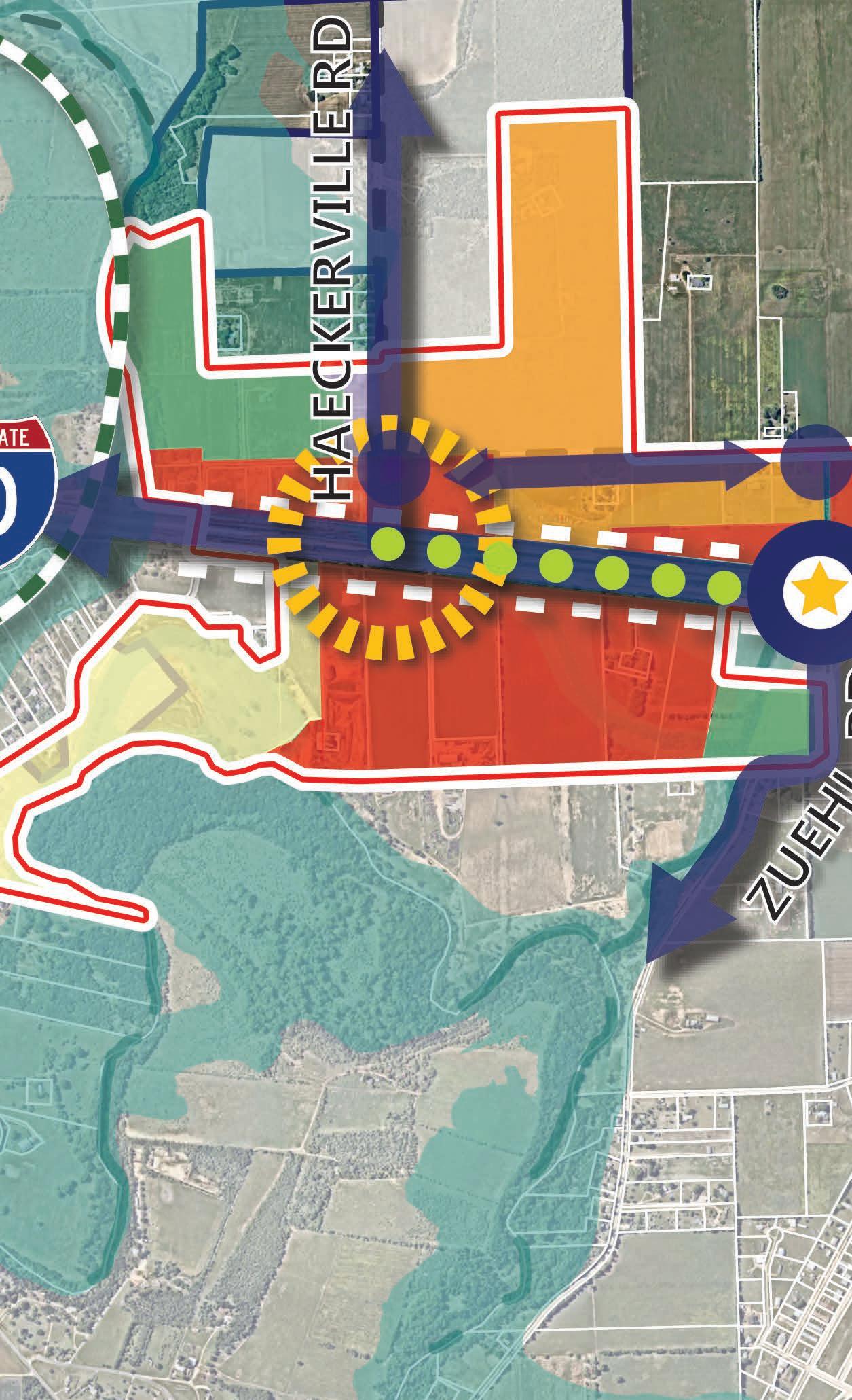
PRIORITY PROJECT #3 - GATEWAY FEATURES
ROUGH ORDER OF MAGNITUDE COSTS
Project Components and Description
Mast Components
Decorative Banners
Pedestrian Level Lighting
Gateway Structures
Estimated Cost +/- $1.5-2 Million (Per Intersection)
PROJECTED TIMEFRAME 3-5 Years
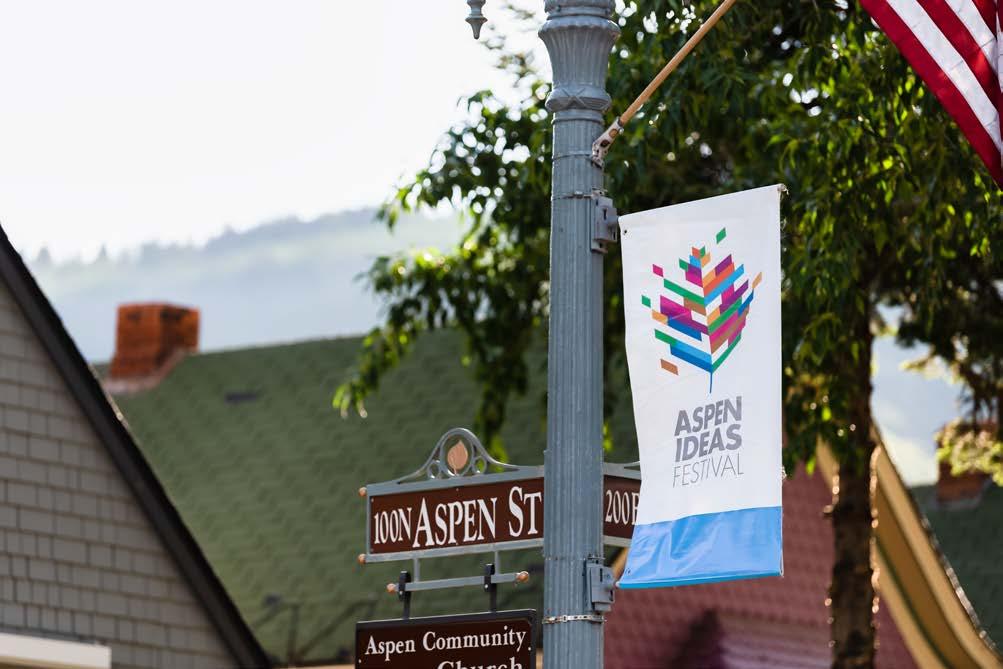
POTENTIAL FUNDING SOURCES
Funding Source Description
Frequency of Opportunity
Incentives on a case-by-case basis (i.e. tax investments, rebates, public improvement district, TIRZ, etc.) Annual
project background
Because there are limited access points to and from the highway, the design of these intersections should be geared toward multiple users of the right-of-way. These multi-modal users include pedestrians, bicyclists, and motorists at different scales. Overdesign for vehicles may result in a less than ideal condition for pedestrians, and vice versa so a balance must be struck to ensure safety for all. Because TxDOT is the owner of the right-of-way on IH-10, collaboration and partnership is essential to the success of an improved intersection. The intersections of Zuehl Road and Santa Clara Road are critical for future connectivity across the highway.
project description
The proposed intersection improvements include pavers, lane striping, lighting, signals, landscaping, sidewalks, and curb and gutter treatments.
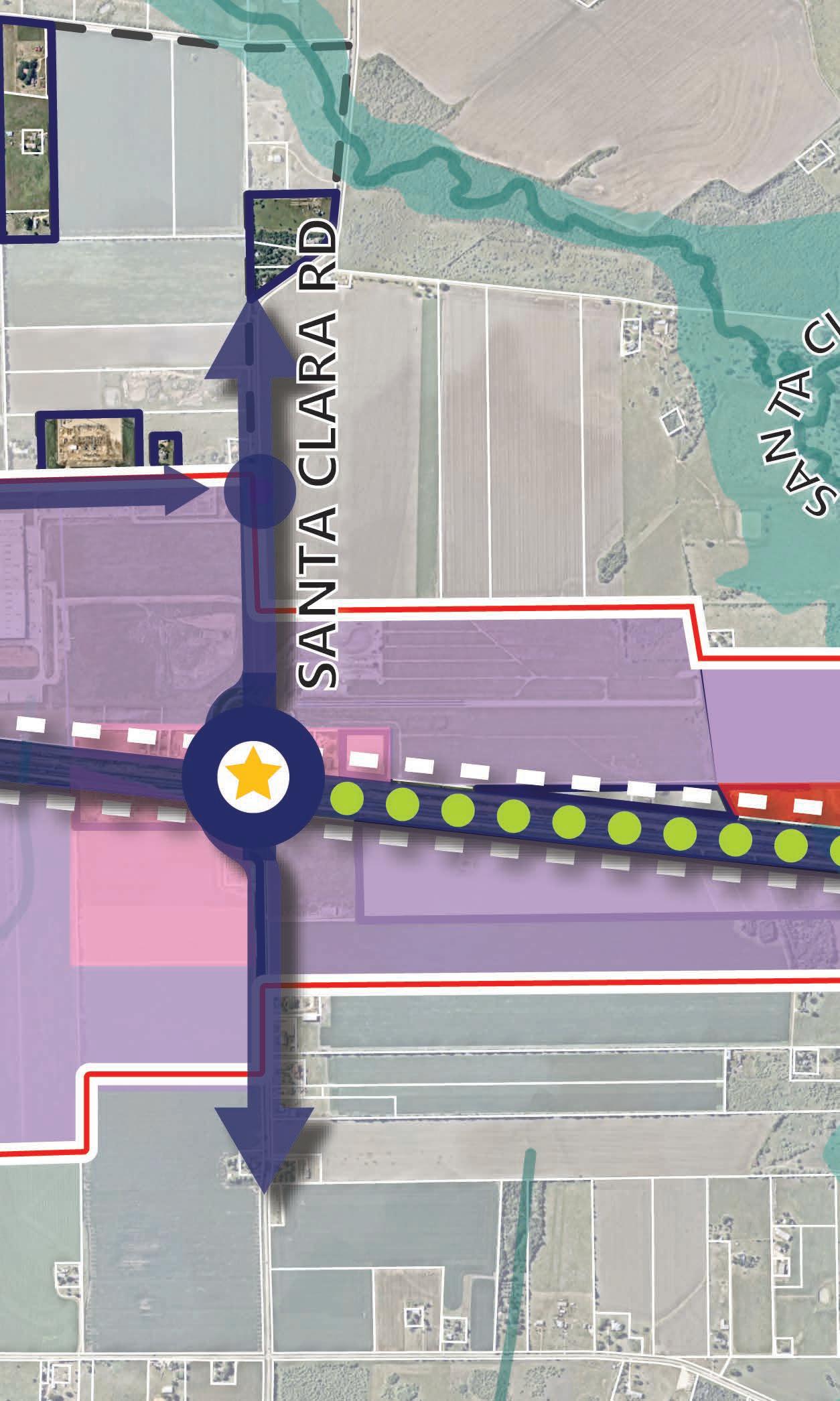
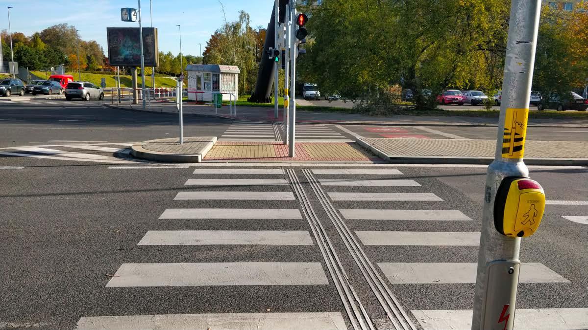
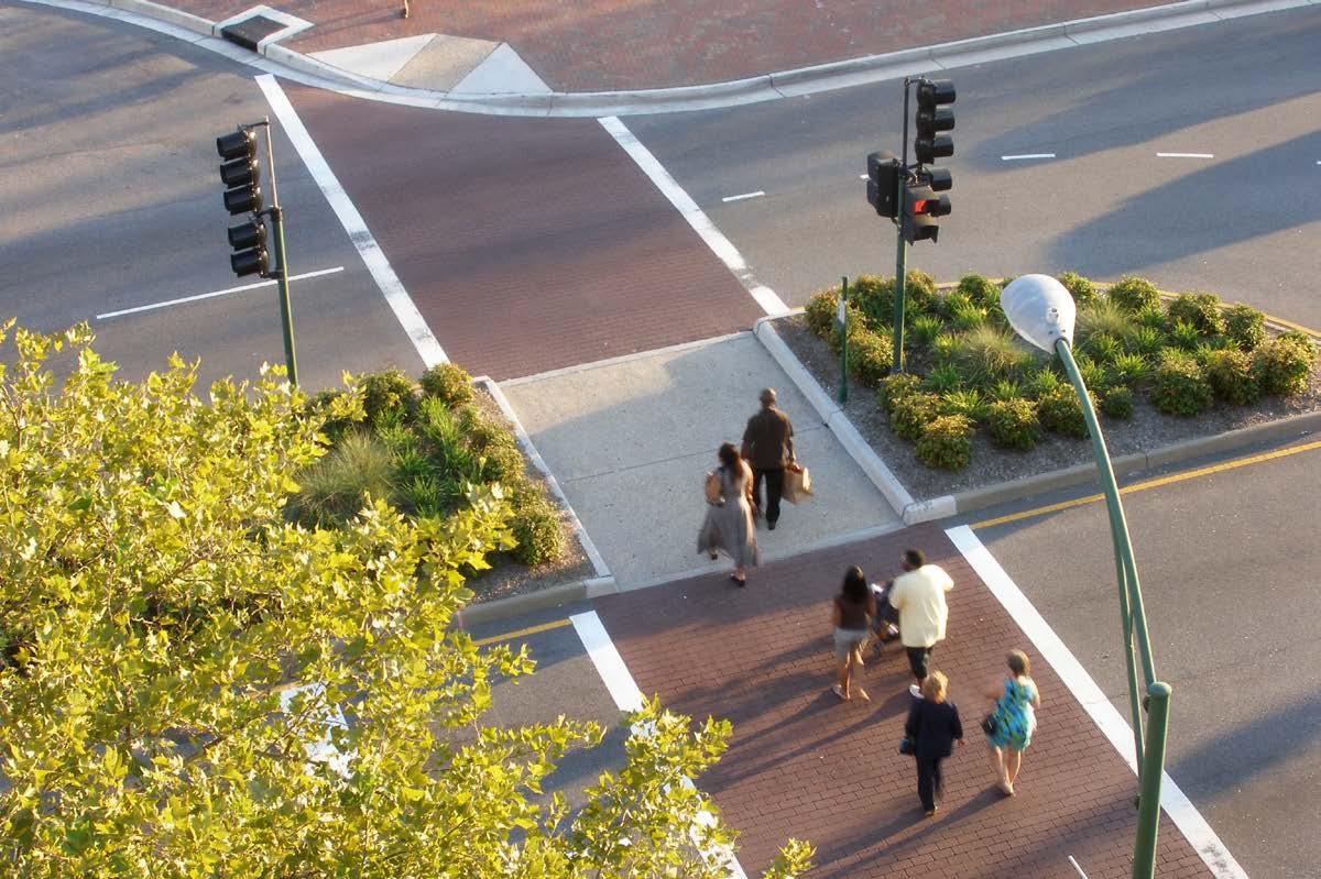
PRIORITY PROJECT #4 - INTERSECTION CROSSING ENHANCEMENTS
ROUGH ORDER OF MAGNITUDE COSTS
Project Components and Description
Crosswalk Pavers, Intersection Pavers, and Lane Striping
Lighting and Signals
Landscaping
Sidewalks and Drive Lanes
Curb and Gutter
Estimated Cost +/- $650,000$850,000
PROJECTED TIMEFRAME 3-5 Years
Funding Source
TXDOT Transportation Alternatives
Highway Infrastructure Program
Highway Safety Improvement Program
Description
Federal funding programs related to TxDOT’s Bicycle and Pedestrian Program for transit in Texas. Various programs available with specific eligibility and funding requirements
Federal-Aid Program and Special Funding
Federal-aid program with the purpose to achieve a significant reduction in traffic fatalities and serious injuries on all public roads, including non-State-owned roads
Frequency of Opportunity
project background
Improvements from TxDOT along the IH-10 Frontage Road provide an adequate vehicular means of travel but do not address or ensure sidewalks along its extents. Because this corridor is intended to become more vibrant in the future, it is important to plan for pedestrian travel so that multiple users can benefit from this facility.
project description
The proposed 10-foot sidewalk infrastructure is scaled to 1,000-foot segments for ease of estimation and are wide enough to support the anticipated level of activity and density in this corridor.
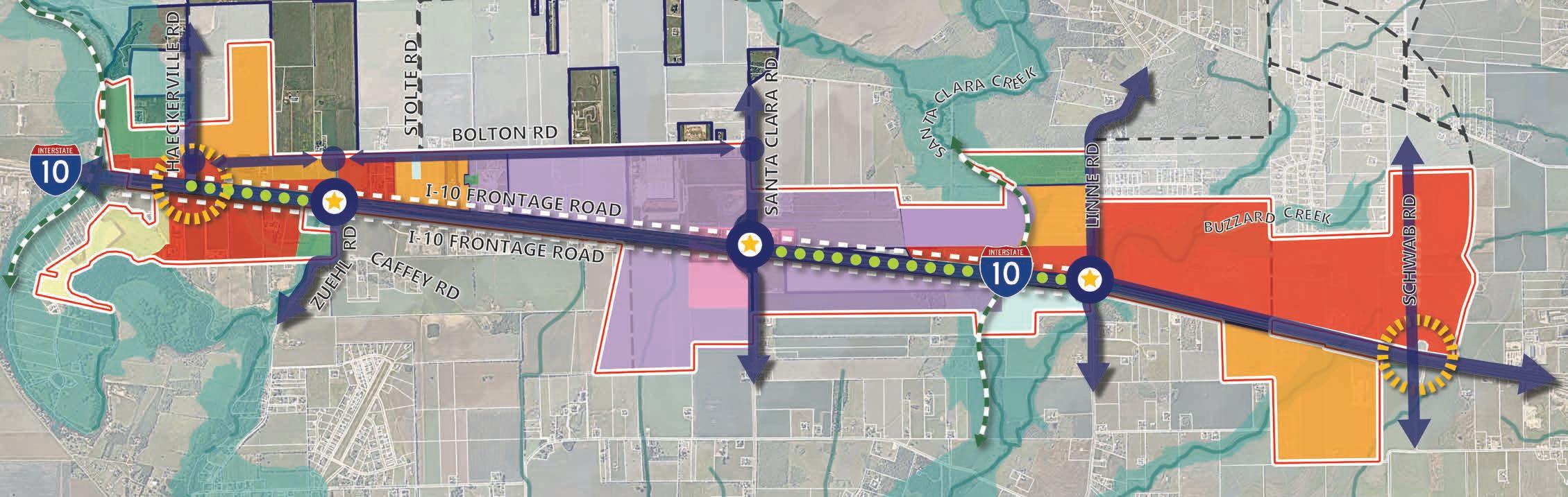
PRIORITY PROJECT #5 - SIDEWALK INFRASTRUCTURE
ROUGH ORDER OF MAGNITUDE COSTS
Segment 1 - Project Components +/- 1,000 Linear Ft. of paved 10’ sidewalk
PROJECTED TIMEFRAME 3-5 Years
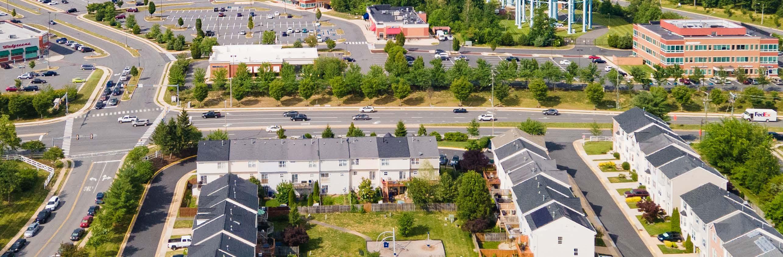
POTENTIAL FUNDING SOURCES
Roundabouts have gained popularity because of the efficient and effective means by which they allow a continuous flow of high-volume traffic. They have shown to significantly reduce fatality rates at intersections by limiting the potential for head-on collisions. Roundabouts are also useful for channeling the main flow of traffic in another direction. Roundabouts are proposed along Bolton Road, as several previously mentioned roadways converge and intersect at this roadway, and would be an efficient means of directing traffic flow in multiple directions.
The proposed roundabout intersection contains four lanes of travel, intersection striping, lighting, sidewalks, signage, drainage, and landscaping.
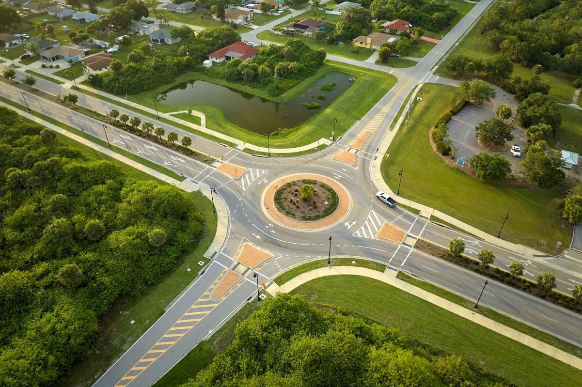
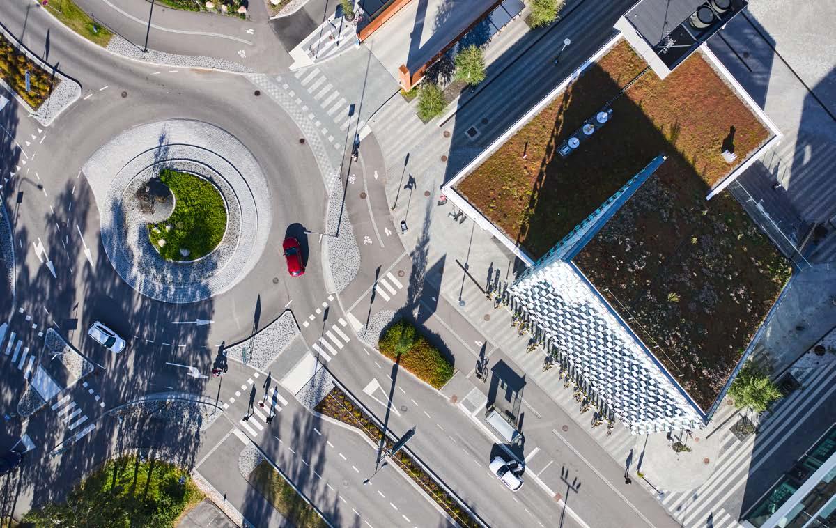
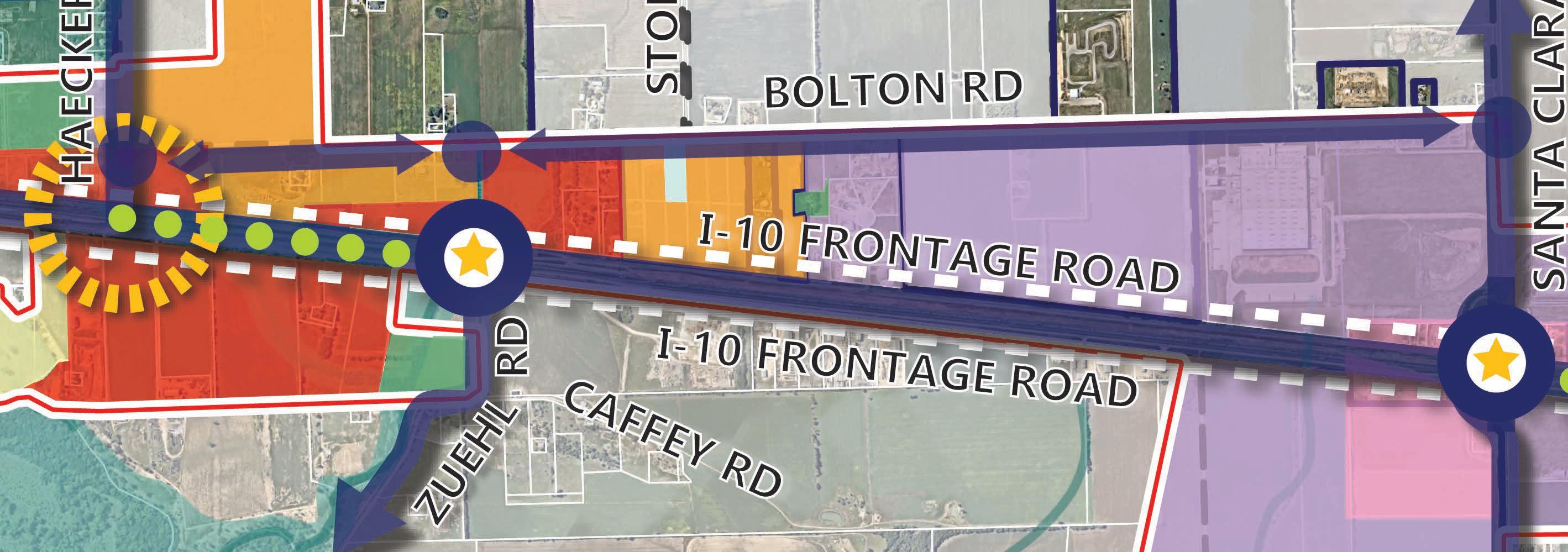
PRIORITY PROJECT #6 - ROUNDABOUTS
ROUGH ORDER OF MAGNITUDE COSTS
Project Components and Description
Crosswalk Pavers, Intersection Pavers, and Lane Striping
Traffic Control Devices
Landscaping
Sidewalks and Drive Lanes
Curb and Gutter
Estimated Cost +/- $650,000$850,000
PROJECTED TIMEFRAME
Years
Funding Source Description
TXDOT Transportation Alternatives
Federal funding programs related to TxDOT’s Bicycle and Pedestrian Program for transit in Texas. Various programs available with specific eligibility and funding requirements
Highway Infrastructure Program Federal-Aid Program and Special Funding
Highway Safety Improvement Program
Federal-aid program with the purpose to achieve a significant reduction in traffic fatalities and serious injuries on all public roads, including non-State-owned roads
Frequency of Opportunity
Beyond the main gateway features, the IH-10 Corridor can further enhance its sense of place by utilizing wayfinding and branding opportunities throughout the corridor. From district signage to banners and art pieces, Cibolo can create an identity that is unique to the IH-10 Corridor.
The proposed wayfinding signage for the IH-10 Corridor study area is an offering of 8-10 district specific identity markers that range in scale and help people navigate the corridor. These can be scaled-up based on need, and should include programs for art pieces and larger signage as it gains momentum.
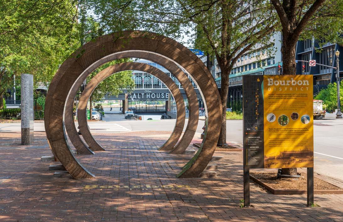
PRIORITY PROJECT #7 - WAYFINDING AND BRANDING
ROUGH ORDER OF MAGNITUDE COSTS
Project Components
8-10 sub-district specific identity wayfinding signs in strategic locations
TOTAL ESTIMATED PROJECT COST +/- $70,000150,000
PROJECTED TIMEFRAME
1-3 Years
Funding Source Description
Economic Development Initiatives
Incentives on a case-by-case basis (i.e. tax investments, rebates, public improvement district, TIRZ, etc.)
Frequency of Opportunity
Annual
Illumination can help establish a high-quality environment, especially at night, and improve both pedestrian and vehicular safety. Some of the areas where illumination is proposed in the study area include public sidewalks, trails, and open space as well as locations along primary routes such as Bolton Road.
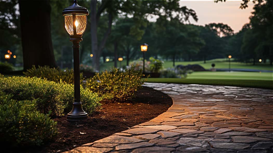
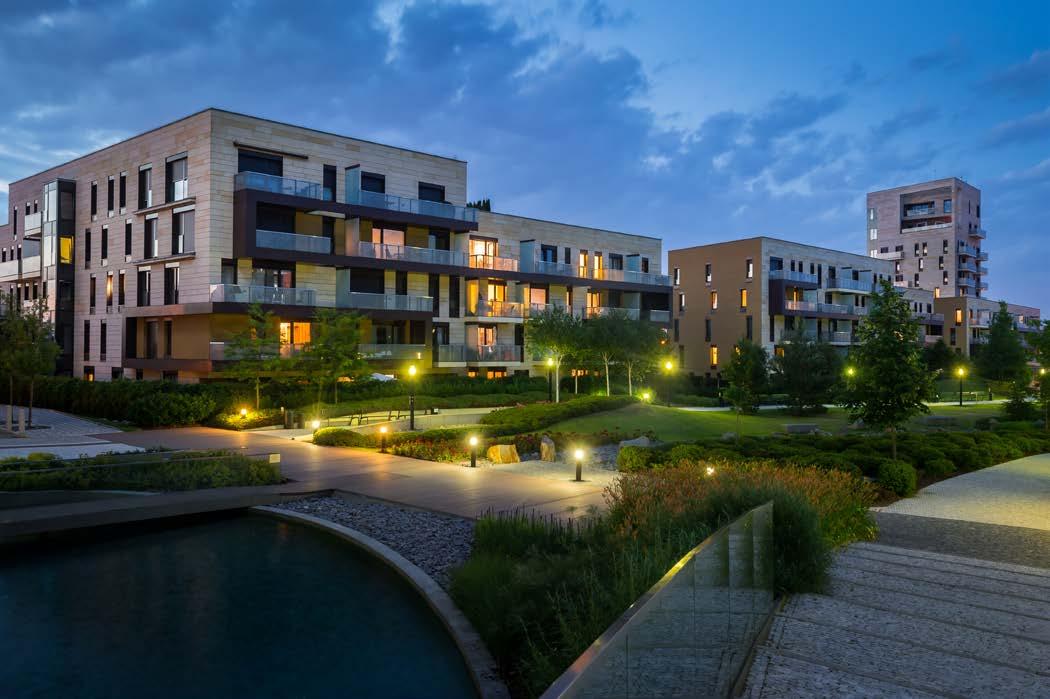
Pedestrian-level street lights are proposed at approximately 1500 linear feet spaced at 60to 80-foot increments along the sidewalks or roadways. The primary locations where these illumination projects are proposed are along future trails, and along Bolton Road.

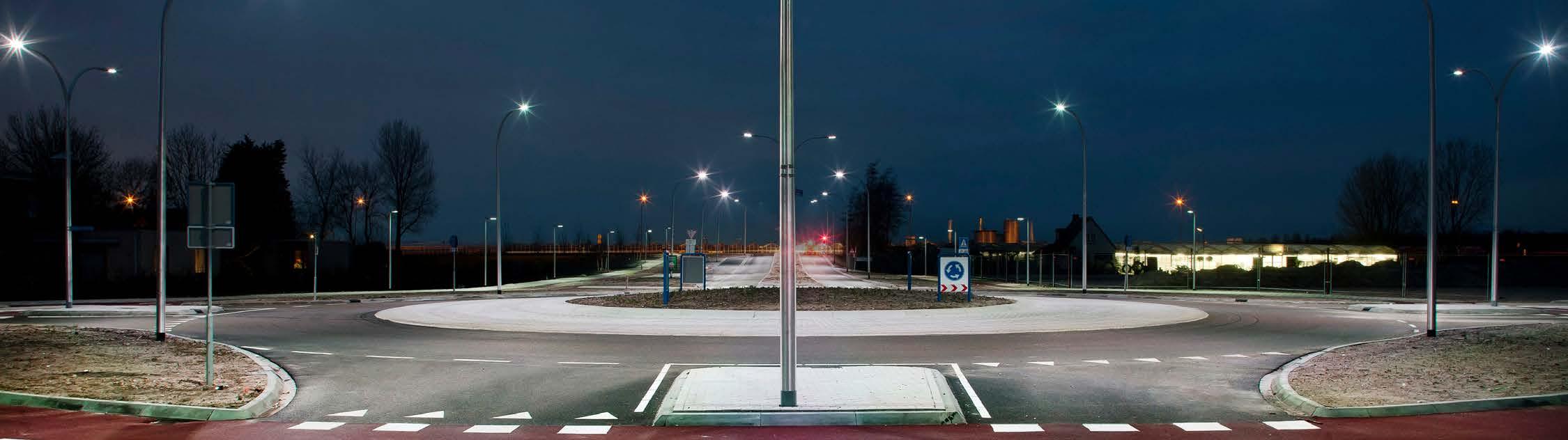
PRIORITY PROJECT #8 - ILLUMINATION
ROUGH ORDER OF MAGNITUDE COSTS
Project Components
Pedestrian Level Street lights +/- 1500 Linear Ft. at 60’ - 80’ o.c. (19-25 poles) Including cost to extend electricity
TOTAL ESTIMATED PROJECT COST +/- $200,000300,000
PROJECTED TIMEFRAME 1-3 Years
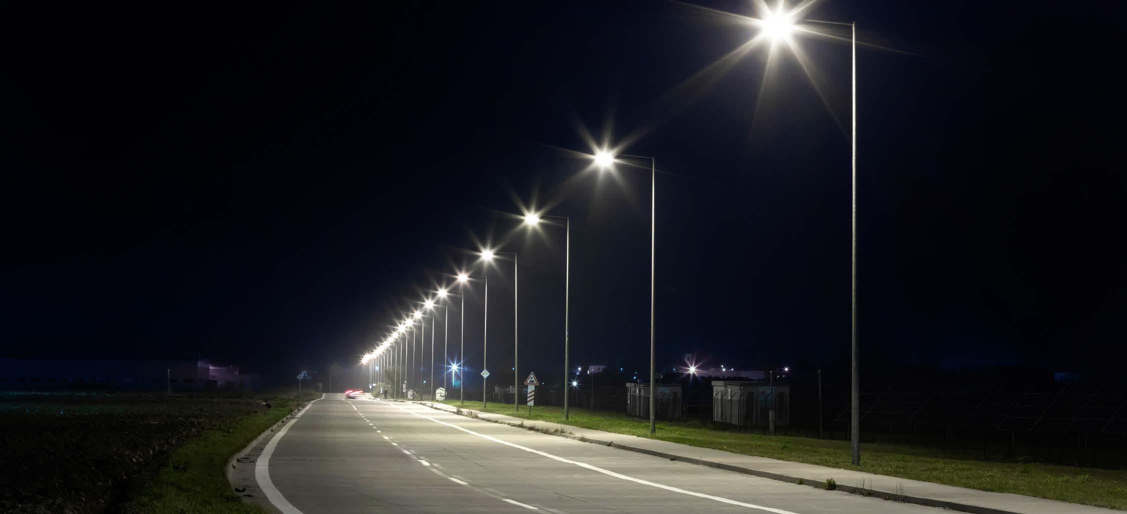
POTENTIAL FUNDING SOURCES
Funding Source
Highway Safety Improvement Program
Description
Federal-aid program with the purpose to achieve a significant reduction in traffic fatalities and serious injuries on all public roads, including non-State-owned roads Annual
Time is tracked in three columns as follows:
The costs are broken down by the dollar ($) symbol and represent three ranges of cost as follows:
$ = 0-99k
$$ = 100k-499k
$$$ = 500k+
Finally, designated parties range from City Staff (CS), Engineering (Eng) to the EDC or key partners and stakeholders such as the AAMPO or TxDOT.
The action items on the following pages are derived from recommendations of the plan as they relate to each major area of focus and flow from its vision statement and guiding principles:
Vision Statement. Cibolo is a community where residents collaborate to shape their civic future by promoting its rich history, preserving a small-town feel, and investing in balanced development.
Guiding Principles.
1. Prioritize infrastructure to support existing needs and future growth.
2. Plan for and promote the health, safety, and general welfare of all residents.
3. Balance growth through responsible planning of city assets and land to promote a community environment.
4. Provide parks, recreation, trails, and open space to serve citizens and visitors while protecting the natural environment and wildlife.
5. Preserve the history of Cibolo and promote the friendly, small-town feel through community programs and events.
L1 Require sidewalks and shared drives along the IH-10 Frontage Road to ensure a compatible development pattern that supports commercial activity along the corridor.
L2 Leverage Sub-District II as the center for industrial uses and job creation.
L3 Amend the Unified Development Code to align with uses and vision outlined in the IH10 Corridor Plan.
L4 Identify property owners and potential partners for each of the four catalyst sites and collaborate with them to gauge interest in redevelopment and their willingness to form partnerships through a Memorandum of Understanding (MOU) or other means.
T1 Improve and upgrade Bolton Road to a Minor Arterial to improve the transition from Zuehl Road to Haeckerville Road.
T2 Install roundabouts along Bolton Road at key intersections to enhance and improve flow of traffic.
T3 Upgrade Santa Clara Road to handle the anticipated flow of traffic and industrial uses that are designated in the district.
$$$ Eng GP1, GP2, GP3
$$$ Eng GP1, GP2, GP3
Eng GP1, GP2, GP3
T4 Install a trail along Cibolo Creek and Santa Clara Creek to enhance the pedestrian connectivity under the highway and ensure outdoor recreation opportunities are afforded to residents and visitors of the area. $$ CS/Eng/ TxDOT/ AAMPO/ Guadalupe County GP4
T5 Extend Bolton Road beyond Santa Clara Road to connect further to the east, providing a ring road configuration and alternate means of east-west circulation in the area.
$$$ CS/Eng/ TxDOT/ AAMPO/ Guadalupe County GP1, GP2, GP3
Project Planned Completed
cFunds Requested
Project Cancelled
Funds Budgeted On-Going
In-Progress Not Applicable
P1 Install a primary gateway feature on the western and eastern boundary of the IH-10 Corridor to signify entry and create a sense of arrival.
P2 Develop and implement wayfinding and branding for the corridor to create a sense of place and orient visitors to notable locations in the corridor and city.
P3 Develop and implement good urban design principles throughout the IH-10 Corridor and ensure the public realm encourages the creation of publicly accessible open spaces.
PROJECT STATUS LEGEND
Project Planned Completed
cFunds Requested Project Cancelled Funds Budgeted On-Going In-Progress Not Applicable
H1 Ensure compact residential uses serve as a transitional buffer between commercial and rural residential uses.
H2 Restrict residential uses when using the Mixed-Use PlaceType, to provide a mix of other use types as they build out.
H3 Focus compact residential uses along Santa Clara Creek to take advantage of the natural features of that area.
PROJECT STATUS LEGEND
Project Planned Completed
cFunds Requested Project Cancelled
Funds Budgeted On-Going In-Progress Not Applicable
C1 Ensure adequate water, sewer and wastewater infrastructure is installed to support the anticipated level of development in the IH-10 Corridor study area.
C2 Develop and implement a community facility and public services plan that tracks development to provide the level of service that is needed as the corridor builds out.
C3 As the corridor builds out, program public spaces with activities and city events that help foster community pride in the area.
Project Planned Completed
cFunds Requested Project Cancelled
Funds Budgeted On-Going In-Progress Not Applicable
Community Summit #1 kicked off late March. Engagement included meetings with targeted stakeholders, pop-up events, and community workshops. Online engagement included the launch of the Cibolo Tomorrow website on April 24th and online surveys. Below outlines the total participation and responses from each meeting completed in Community Summit #1.
Cibolofest October 28th, 2023
#1
– July 2023
Community Survey #2 August 2023 –October 2023
The following pages are a few key summary visualizations of engagement that were heard throughout the Community Summit #1 engagement process. Below is an outline of feedback heard:
- Strengths, weaknesses opportunities and threats
- Dot analysis Map
- Visioning Questions
- Priority Spending
- Land Use
- Mobility and Thoroughfares
Strengths, weaknesses, opportunities, and threats of Cibolo
The strengths, weaknesses, opportunities, and threats (SWOT) of Cibolo were discussed throughout the engagement process. The feedback reflected in the word clouds below are from: MPAC SWOT analysis meeting, Community Survey #1, Community Open House #1, and MPAC, P&Z, and City Council Work Session #1.
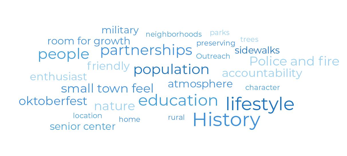
Weaknesses
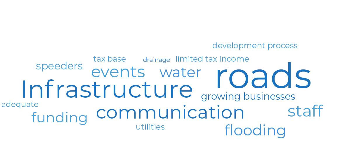
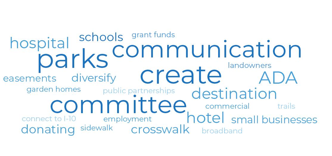
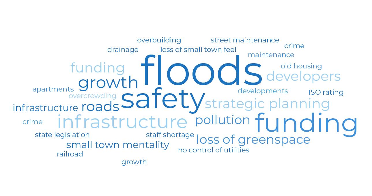
The planning team gave City Staff two dots of each color. They were asked to place their green dots on areas of Cibolo they thought were the greatest future opportunities for the City, red dots for areas that were working well, and yellow dots on areas of the city that need help to make it better. This exercise allowed the planning team and City Staff to identify key clusters of different areas of the city and discussed their impact on the city today. This exercise was done at the State of the City meeting with City staff.
The photo on the following page displays the results of this analysis. Several highlights from this exercise are detailed below:
• Greatest Future Opportunity:
o Undeveloped land in the northeast portion of Cibolo – development opportunities
o Bird Sanctuary
o Downtown Cibolo/Original Town Center Zone
o Infrastructure improvements south of FM 78 (water/sewer/bridge/road infrastructure)
o I-10 Corridor Development Opportunities
o Racetrack redevelopment
• Working Well – Don’t Mess Up:
o Cibolo Crossing
o Linear park and trail connections
o Quality commercial at the intersection of Green Valley Road and FM 1103
o HEB
o Cibolo Valley Drive and existing commercial area
o Industrial park and commercial area
o AISINTX – attracting similar businesses along I-10 corridor
• Make It Better – Needs Help:
o Veteran’s Park
o FM 78 – infrastructure and safety improvements needed along railroad
o Downtown Cibolo – zoning and compatibility issues with surrounding neighborhoods
o Hackerville Road – need better north/south access throughout Cibolo from I-10 to FM 78.
Infrastructure improvements also needed for Hackerville Road
o Mixed Use Overlay along I-10 Corridor where the existing industrial park is located
o Racetrack
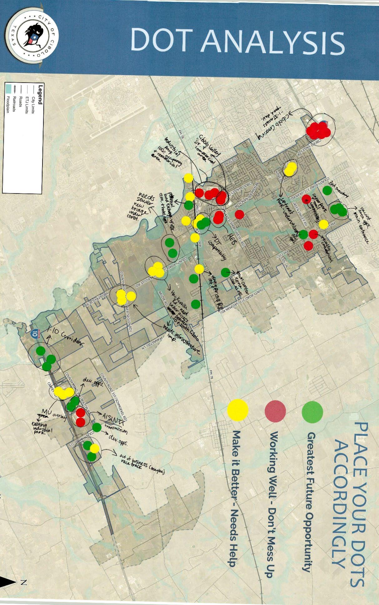
Throughout the engagement process, the public was asked different questions about their thoughts on Cibolo. The input may include how the community sees Cibolo today, how they want to see Cibolo in the future, and why they love their community. The word cloud below reflects the most common words used by community members when describing Cibolo. The larger the word, the more often it was mentioned. These phrases and words are then used to craft a vision statement and guiding principles for the final plan. The following questions were asked:
- I love Cibolo because…… (Cibolo Summer Night)
- What one word or phrase would you use to describe Cibolo today? (Open House #1)
- What one word would you use to describe your vision of Cibolo in 2050? (Open House #1, Joint MPAC, P&Z, and City Council Work Session #1)
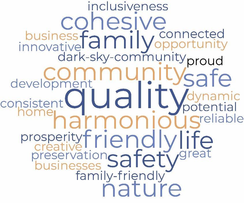
The goal of this exercise is for participants to prioritize what changes are important to them in Cibolo. At the Cibolo Summer nights events City residents were given 5 gold coins, while residents of the ETJ were given 5 silver coins. At the Cibolo Summer nights event there were 8 priority topics the participants had to choose from. This exercise was also conducted at the first Community Open House. At the open house there were 11 priority topics. Below organizes the topics at both events into categories and counts the total votes at both events.
The first step of land use planning for Cibolo was to establish which growth scenario is preferred by the community. At the first community open house participants were asked to read three different growth scenarios (A, B and C). Each story represented a different growth strategy for the community. After reading the growth stories, participants could vote using colored dots on the elements of the story they had a positive reaction to or a negative reaction to.
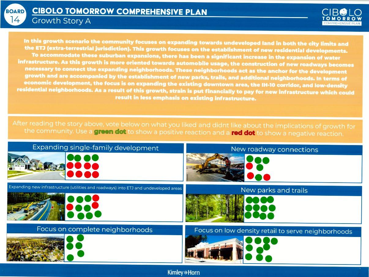
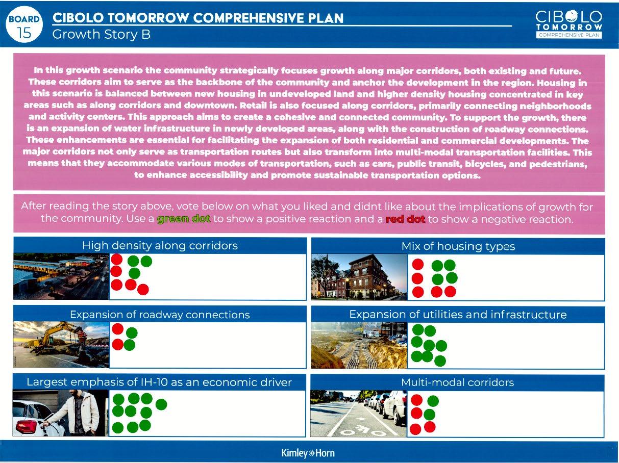
The second step of land use planning was working with stakeholders to build three scenarios using PlaceTypes established for Cibolo. The below tables show the results from the Joint MPAC, P&Z, EDC, and City Council Work Session #2.
Scenario 1: Current Trend/Growth Story A
Table 1
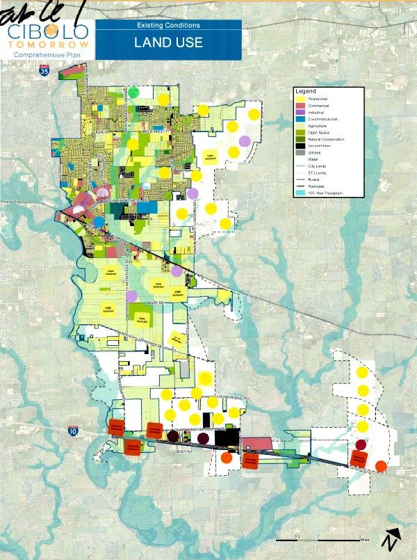
Table 2
Takeaways
- Estate Residential between the railroad and County Road
- Suburban Residential in the ETJ east of the city with Neighborhood commercial
- Larger retail and industrial along IH-10 to serve as an employment center
- Activity Center along IH-10 and compact residential
Takeaways
- Community commercial along FM78
- Industrial and higher density residential along IH-10
- Estate Residential in the ETJ
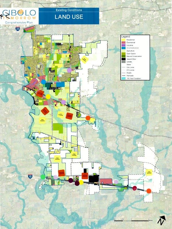
Table 3
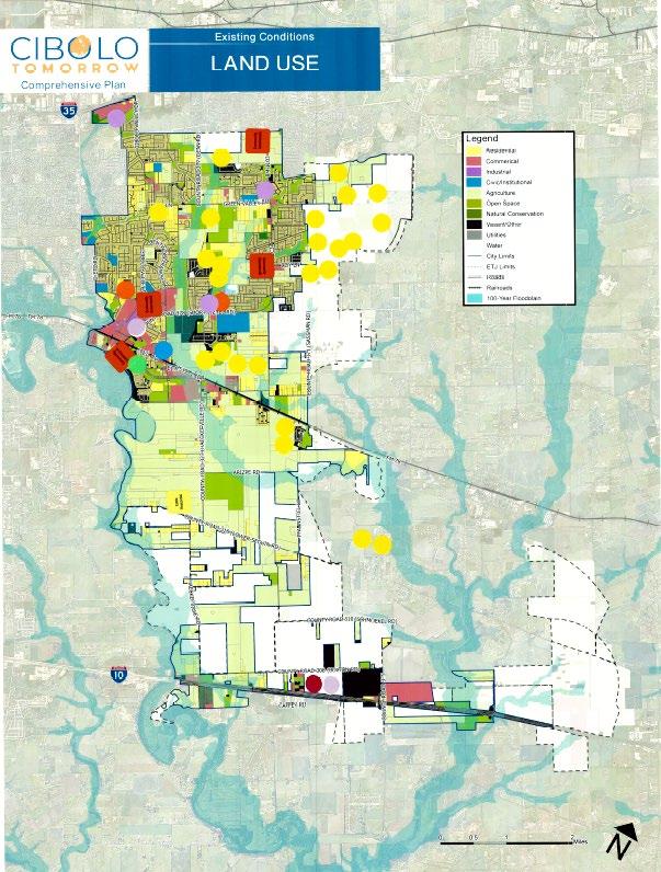
Table 4
Takeaways
- Established Residential in the ETJ in the northeast area of the city
- Community commercial in the northern part of the city
- Activity Center along IH-10 Corridor
- Neighborhood commercial in vacant parcels in the northern part of the city
Takeaways
- College campus along IH-10
- Update infrastructure along the IH-10 corridor / focus on
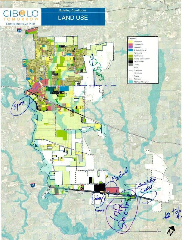
Table 5
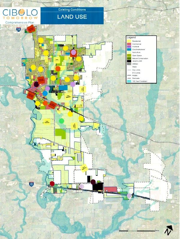
Combined map from all Groups
infrastructure that supports commercial
- Cultural center along the IH-10 Corridor
- More areas to conserve
- Estate residential/ large ag lots between FM 78 and Lower Seguin Rd
- Community commercial and compact residential located on the west side of FM 78
- Industrial along IH-10
Scenario 2: Nodes/Growth Story B
Table 1
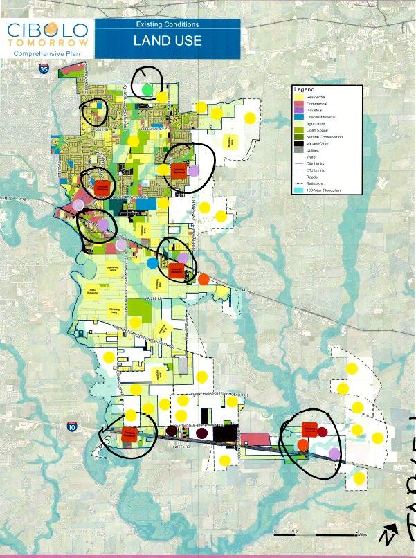
Table 2
Takeaways
- Black circles indicate nodes/primary locations within the city
- Business parks located along FM 78
- Community commercial along FM 78 with compact commercial supporting the commercial uses
- Heavy industrial along IH-10
- Residential in the ETJ areas of the city and lower density residential like estate residential
- Using the nodes be commercial nodes throughout the city
Takeaways
- Industrial centered along the IH10 on the west side of the corridor
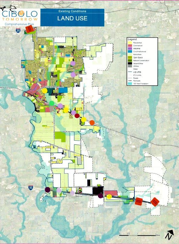
Table 3
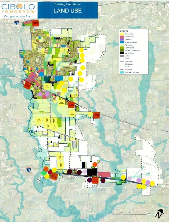
Table 4
- commercial and medical along the east side of the IH-10 corridor
- Compact residential and community commercial along FM 67
Takeaways
- Established residential in the ETJ on the east side of town
- Community commercial along FM 78 with light industrial
- Low density residential and neighborhood commercial along the east side of IH-10 corridor
Takeaways
- Mixed-Use center along FM 78 with community commercial and compact residential to support
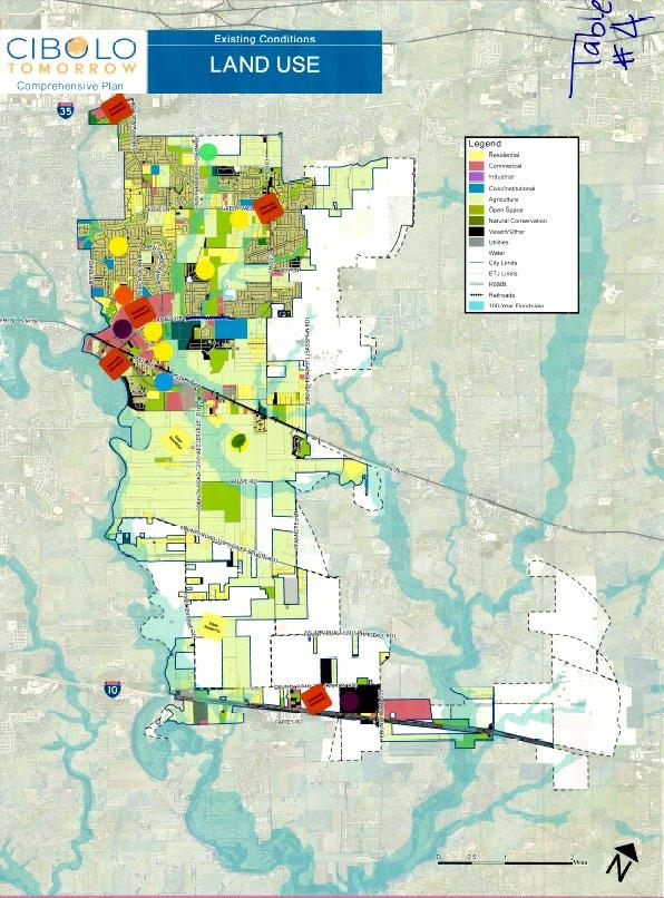
Table 5
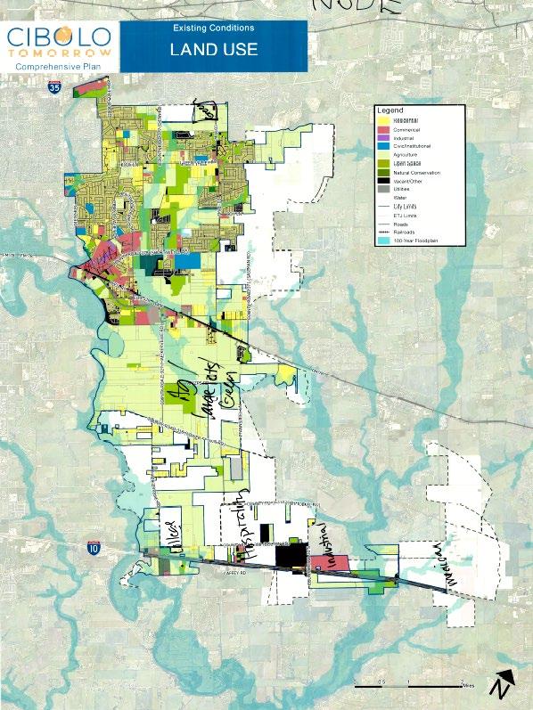
Combined map from all groups
- Community commercial along IH-10 corridor and mixed-use center
- Community commercial along FM 1103 and Green Valley
- Agriculture/large lots and green space between FM 78 and lower Seguin Rd
- Following industries located along IH-10: College Campus, Hospital, Medical district, and business park
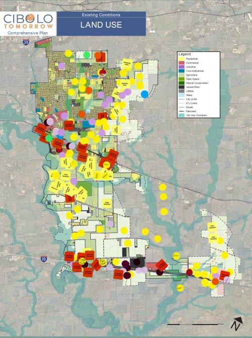
Scenario 3: Corridor/Growth Story C
Table 1
Takeaways
- The red lines and black lines indicate primary corridors in Cibolo
- Estate residential between FM 78 and County Road 318
- Community commercial used as a gateway coming east bound along IH-10 Corridor
- Activity center in the middle of IH-10
- Community commercial and light industrial along FM 78
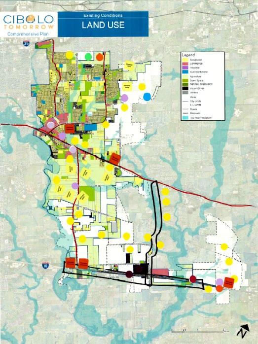
Table 2
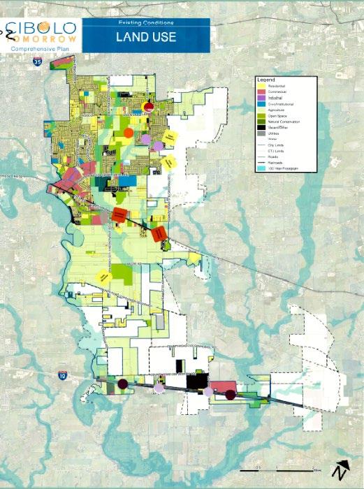
Table 3
Takeaways
- Industrial along IH-10 Corridor
- Community Commercial along FM 78
- Compact residential near community residential
Takeaways
- Established Residential along the east side of the IH –10 corridor
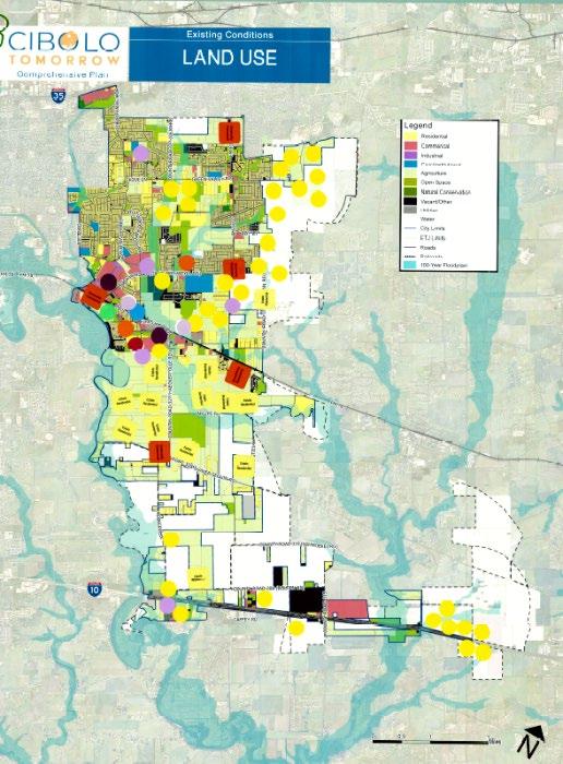
Table 4
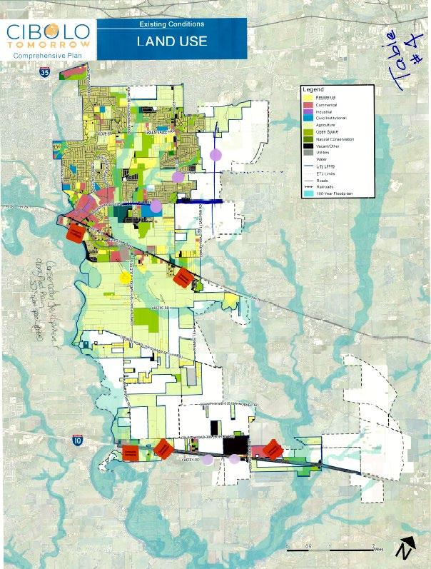
Table 5
- Estate residential between FM 78 and Lower Seguin Rd
- Activity center along FM 78
- Higher density residential to support activity center along FM 78
- Established retail in the east side of the city in the ETJ
- Conservation development along floodplain
- More open space opportunities between FM 78 and the Lower Seguin Rd
- Neighborhood commercial located in the existing neighborhoods in the developed part of the city
Takeaways
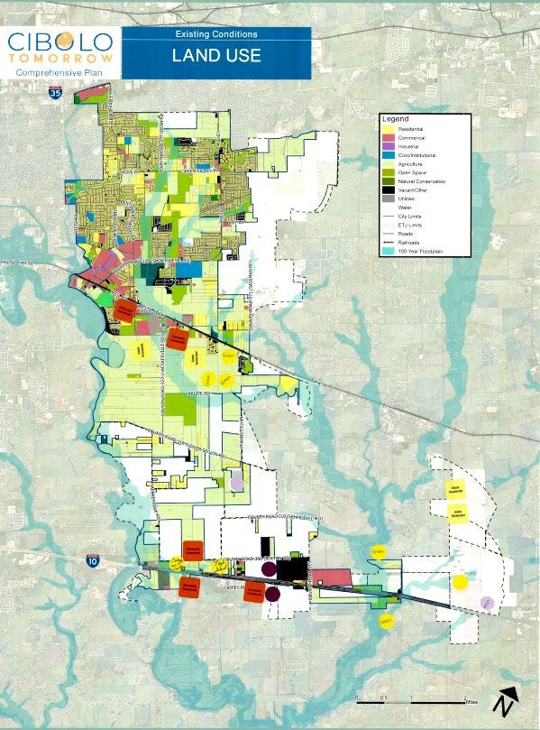
Combined map from all groups
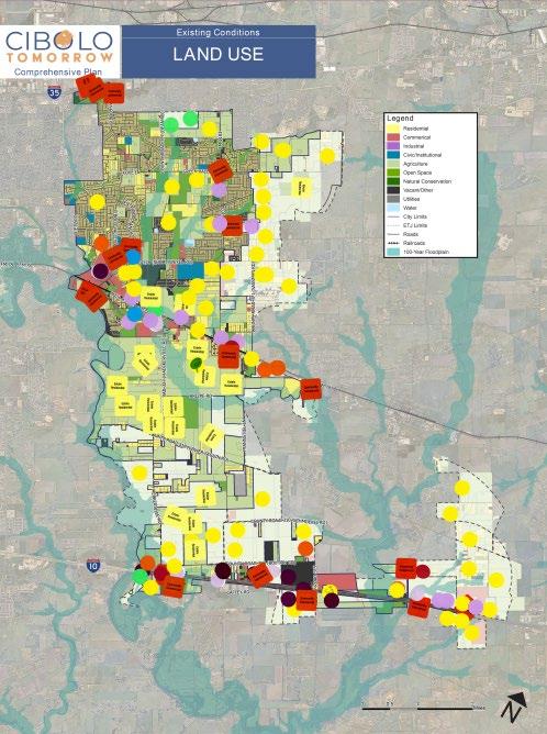
- Green space and estate residential between FM 78 and lower Seguin rd.
- Community commercial located along major corridors (FM 78 and IH-10)
- Mixed-use center in the middle of the IH-10 corridor
- College campus and tech school along the IH-10 corridor
The exercise below was conducted at the Joint MPAC, P&Z, EDC, and City Council Work Session #2 to identify mobility priorities within Cibolo.
Individual Result Summary
TOP TIER PLACEMENT VOTES
(Most Important/Highest Priority for Cibolo) (Spot 1)
SECOND TIER PLACEMENT VOTES
(Most Important/Highest Priority for Cibolo) (Spots 2 and 3)
THIRD TIER PLACEMENT VOTES
(Most Important/Highest Priority for Cibolo) (Spots 4,5,6)
Community Open House #2 Recap Document
Cibolo Community Open House #2 Recap Document
November 8, 2023
Introduction:
Community Open House #2 took place on November 8th, 2023 from 6:30 P.M. – 8:30 P.M. The purpose was to gain insight from the community for the Cibolo Tomorrow Comprehensive Plan. The Open House consisted of 7 stations that asked participants for their input. A summary of the stations and their responses are below.
The focus of this station was to get clarification from participants of the vision statement that was derived from Community Summit #1.
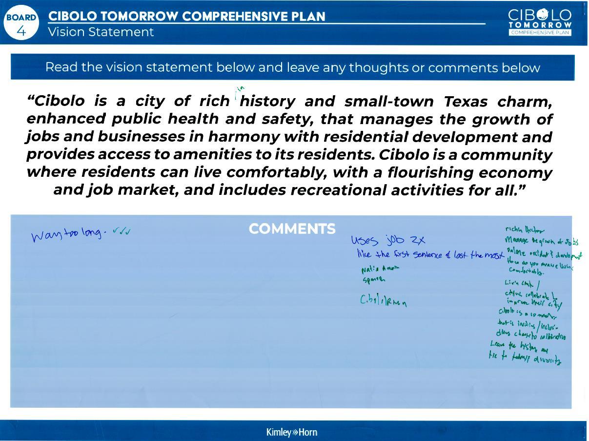
Comments:
• Way too long ✔✔✔
• –
•
•
• How do you measure living comfortably?
• Living comfy/citizens collaborate to improve their city. Cibolo is a community that is inviting and inclusive.
• Leave the history and tie to todays diversity.
The focus of this station was to sort the guiding principles in the plan. Preliminary guiding principles were displayed and participants were asked to identify if they agree, disagree, or are neutral on each guiding principle.
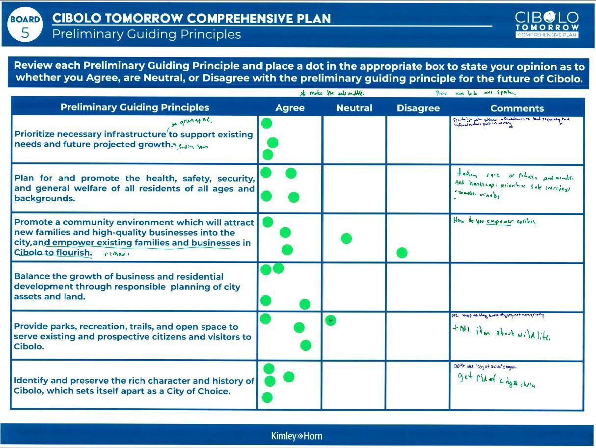
Comments:
• Make these actionable
• These need to be made [in] Spanish
Prioritize necessary infrastructure (and greenspace) to support existing needs and future projected growth. *(Illegible)
Plan for and promote the health, safety, security, and general welfare of all residents of all ages and backgrounds.
Promote a community environment which will attract new families and high-quality businesses into the city and empower existing families and businesses in Cibolo to flourish.
remove
Balance the growth of business and residential development through responsible planning of city assets and land.
Provide parks, recreation, trails, and open space to serve existing and prospective citizens and visitors to Cibolo.
Identify and preserve the rich character and history of Cibolo, which sets itself apart as a City of Choice.
Comments
• Not just new infrastructure, but repairing bad infrastructure put in wrong.
• Taking care of (illegible) and animals
• Add handicap: Prioritize safe crossings
• Domestic animals
• How do you empower existing [families and businesses]?
• Keep as they currently are, not more priority.
• + add idea about wildlife.
• Don’t like “City of Choice” slogan.
• Get rid of “City of Choice”
This station asked participants to look at the preferred land use scenario board and place a green dot on areas that they agree with and a red dot for areas they do not agree with. They were then asked to explain on the following board.
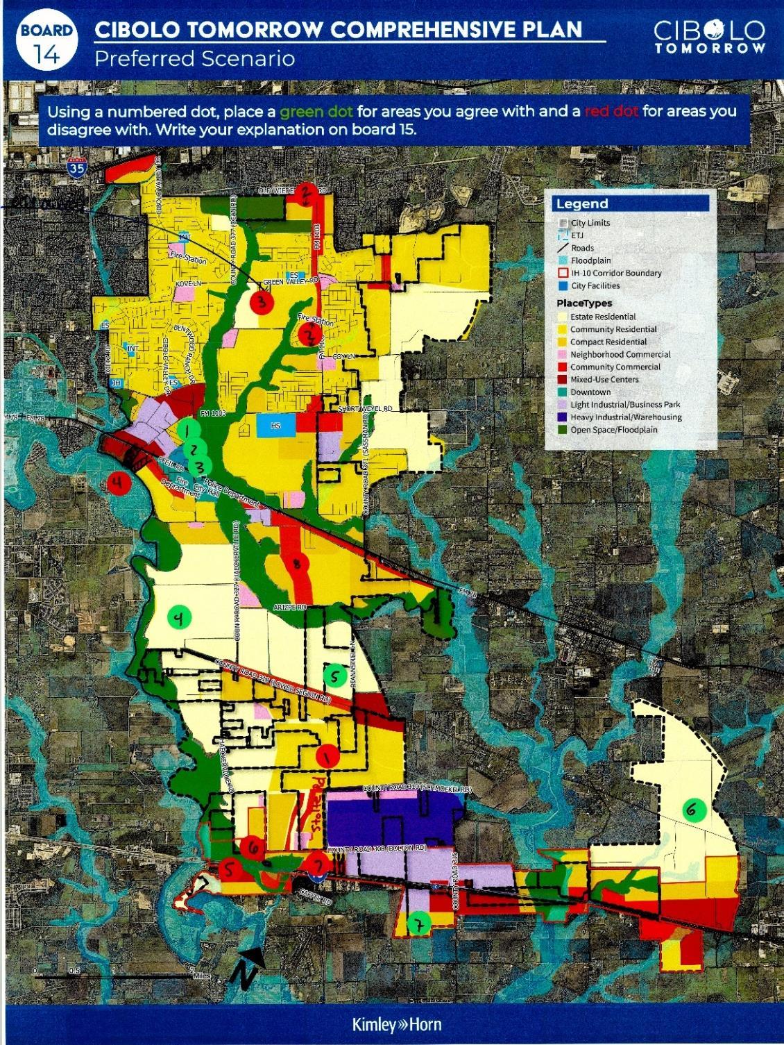
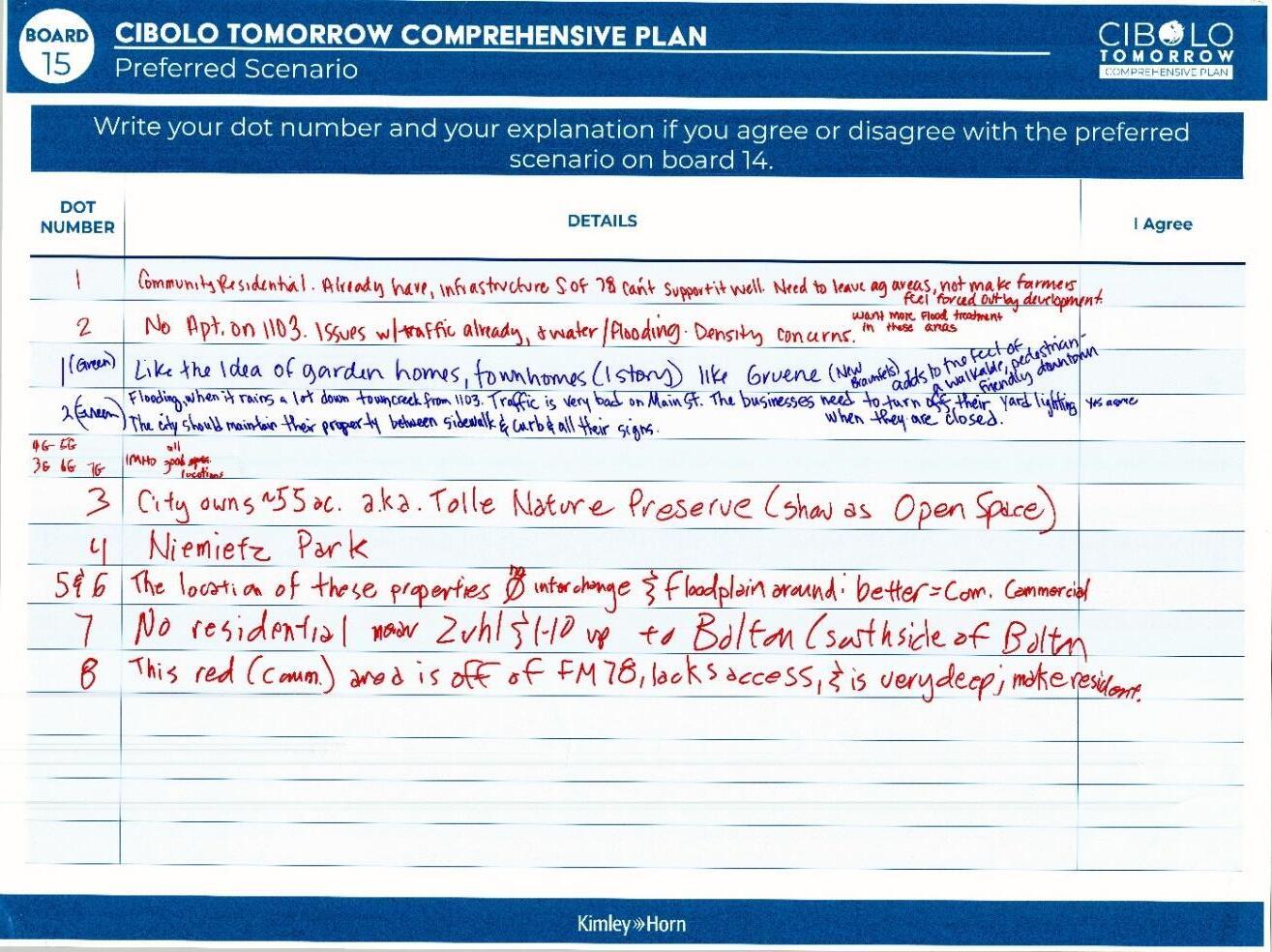
Comments:
• 1. Community Residential: Already have infrastructure S. of 78.can’t support it well. Need to leave [agricultural] areas, not make farmers feel forced out by development.
• 2. No apt. on 1103. Issues w/ traffic already, + water/flooding. Density concerns. W ant more flood treatment in these areas .
• 1 (Green): Like the idea of garden homes, townhomes (1 story) like Gruene (New Braunfels)
• 2 (Green): Flooding, when it rains a lot downtown creek from 1103. Traffic is very bad on Main St. The businesses need to turn off their yard lighting. The city should maintain its property between sidewalks, curbs, and all their signs. Yes, I agree.
• 4G, 5G, 3G, 6G, 7G: IMHO all good locations
• 3. City owns 55 ac. a.k.a Tolle Nature preserve (show as Open space)
• 4: Niemietz Park
• 5&6: The location of these properties no interchange & floodplain around: better = better com. Commercial
• 7: No residential near Zuhl & I-10 up to Bolton (Southside of Bolton)
• 8: The red (Comm.) area is off of Fm 78, lacks access, and is very deep, make resident.
This station asked participants explained missing middle housing to participants and asked what types of missing middle housing they thought would be appropriate as a supporting use in Cibolo’s proposed PlaceTypes. The results are summarized below: Board 1
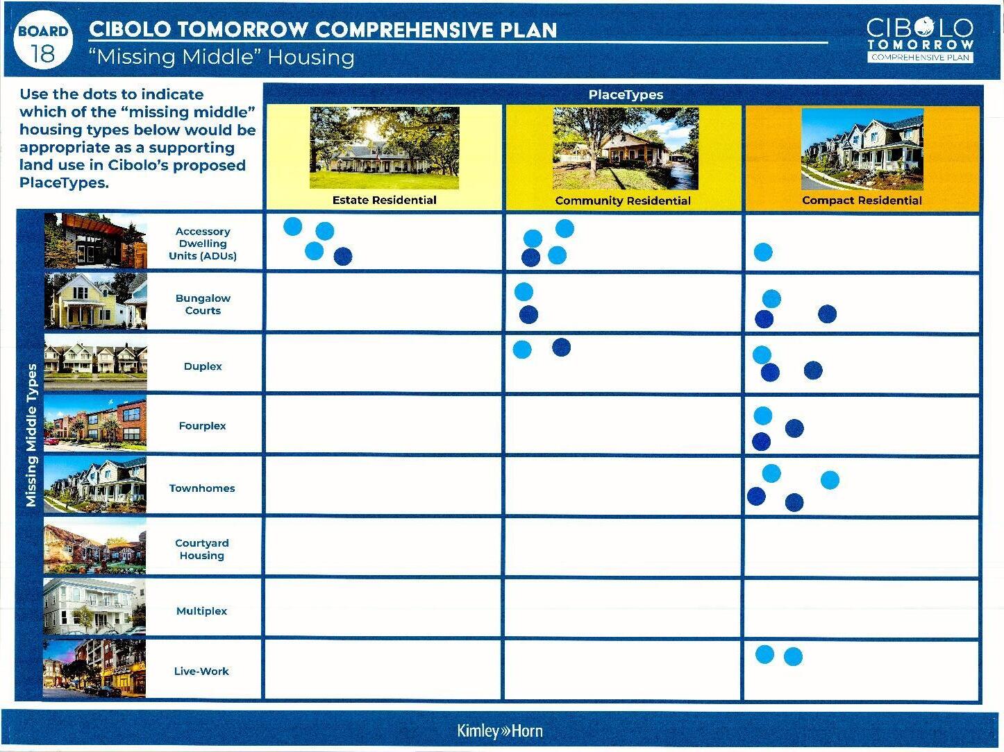
Results:
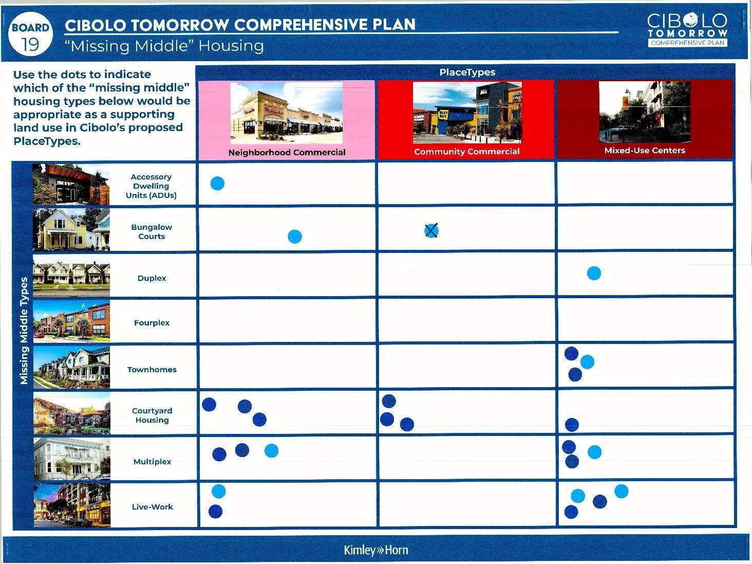
Results: Neighborhood Commercial
Commercial
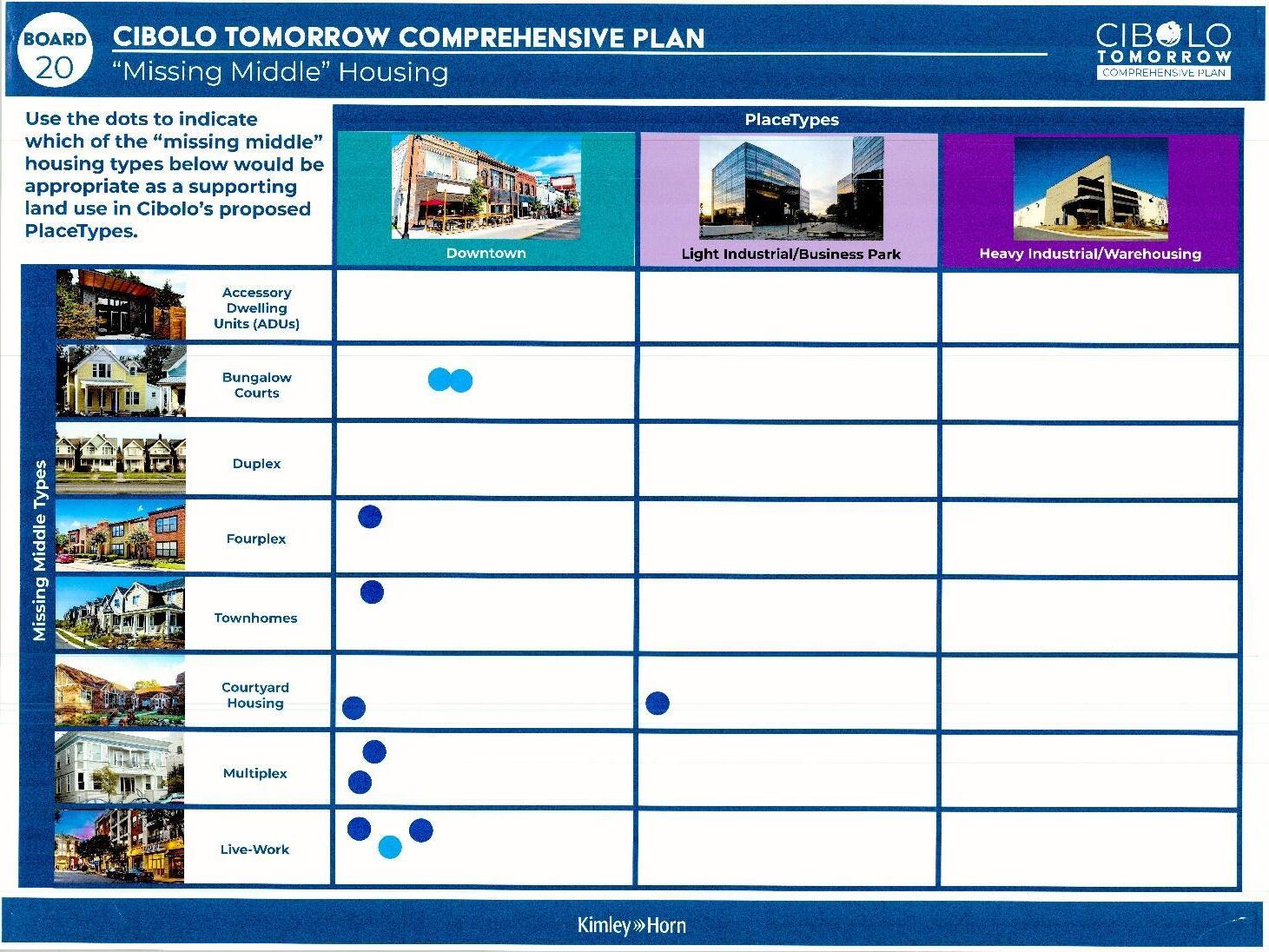
This station asked participants about their thought s and concerns about existing housing and neighborhoods in Cibolo. The responses are below:
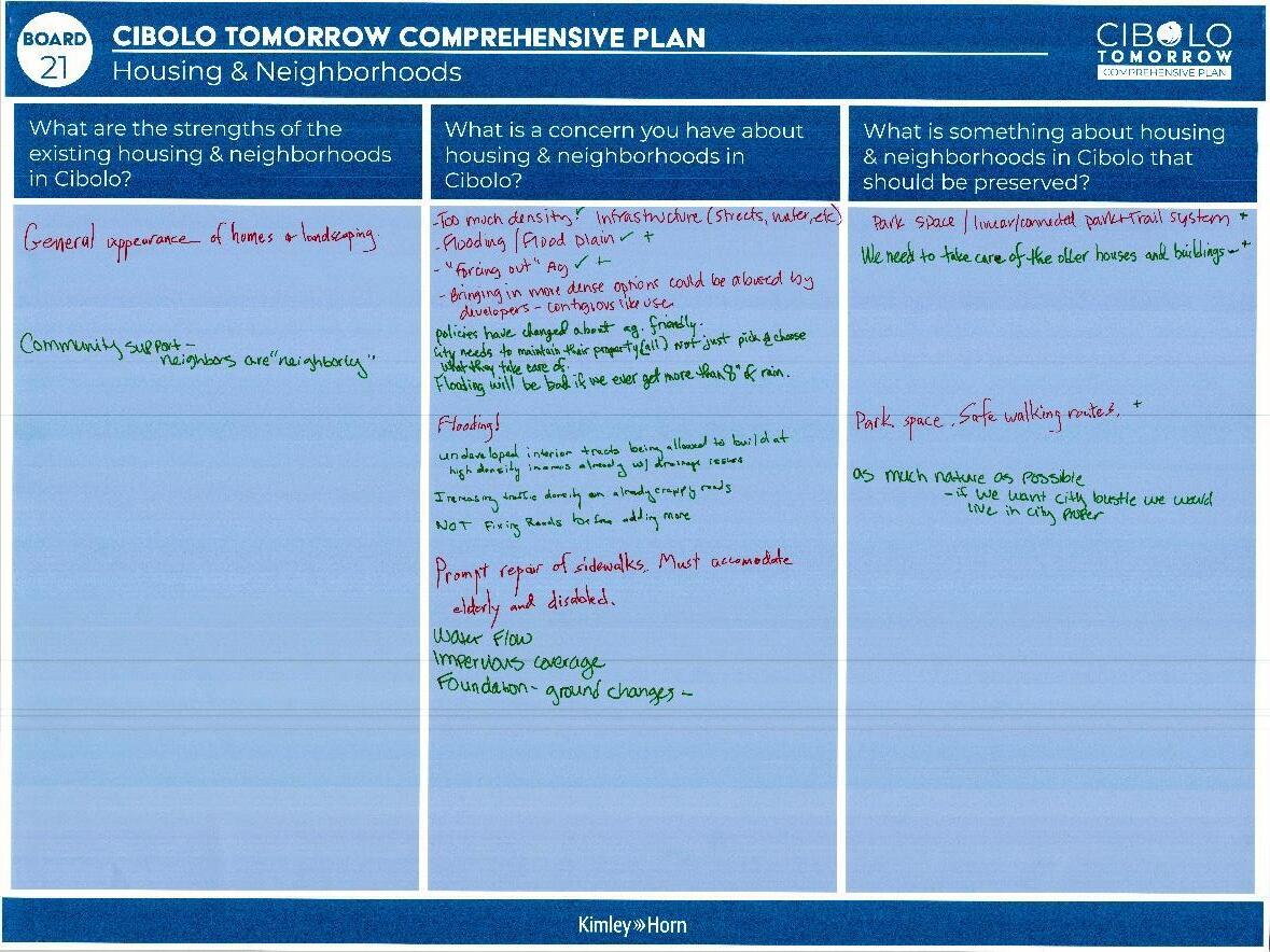
What are the strengths of existing housing and neighborhoods in Cibolo?
• General appearance of homes & landscaping.
• Community Support – neighbors are “neighborly”
What is a concern you have about housing & neighborhoods in Cibolo?
• Too much density. ✔ Infrastructure (streets, water, etc)
• Flooding/Floodplain ✔✔
• “Forcing out” Ag ✔✔
• –
• get more than 8” of rain.
•
•
•
• Water flow
• Impervious coverage
• Foundation -ground changes-
What is something about housing & neighborhood in Cibolo that should be preserved?
• Park space/linear/connected park + trail system ✔
• ✔✔
• ✔
• –
This station asked participants to use colored dots to indicate:
• (Blue) Where is it difficult to travel North/South or East/West
• (Yellow) Where do you most often cut through to avoid traffic?
• (Green) Which roads do you use to get to San Antonio and other places outside of Cibolo?
• (Red) Where do you experience congestion?
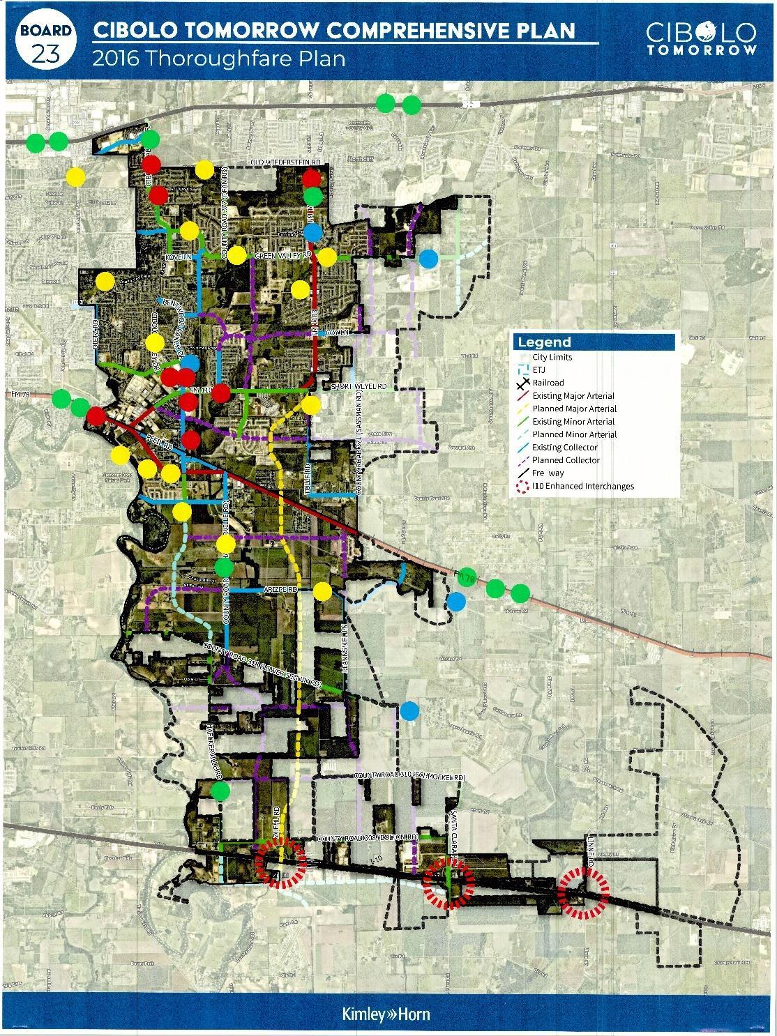
Board: Comments and concerns on existing thoroughfare:
Comments:
• Safety – lighting & sidewalks
• Would you like walking bridge over 1103 by Schlather Park and 78 by Niemietz Park.
• The light 1103 & main needs to stay longer so more than 3 cars can get thru light. (by HEB)
• Striping gets worn away quickly on main roads. Pavement buckles, and potholes grow!
• Lone markers can’t be seen if rained on or at night
• Parking on streets
• Striping fades
• Everyday way & CVD – next to premier physicians turning left
• Stop light @ S main & 78 – left turn signal.
This station asks participants whether they think the stated service or facility is implemented well within the city, and to provide their additional thoughts on the next board.
Voting
• Police – Implemented Well
• Fire – Implemented Well
• Transit Services – Not implemented Well
• Community Center – Neutral
• Recreational Facilities – Implemented Well
• Animal Control – Not Implemented Well
• City Services (Permits, Utilities) – Implemented Well
• Roads – Not Implemented Well
Additional Thoughts
Comments:
• 3 – Tolle, Haeckerville, and 1103 – all unfinished/need repairs
• 4 – Want sidewalks on both sides of street, crossing is dangerous, cra cks + uneven spots. Meandering, hard to get on destination.
• 6 – Good facility, Good parking
• 25 – Too many police cars -> not enough policing. Police will respond, but too much community theft from outside for a community without 10 + patrol cars
• 36 & 37 – Fix the roads in the communities!
o ^Yes. Royal Troo n & Wood Ranch Drive by Carnousty – manholes.
Comments:
• The facilities at Niemietz Park should be fixed. The faucets leak in restrooms, thus wasting our tax $. You should take care of things you have; it costs less in the long run.
Public Infrastructure and Services. Roads are a huge priority for residents. Participants mentioned repairing and maintaining existing infrastructure and finishing up large projects before focusing on growth. This includes striping and maintaining roads, fixing up park facilities, and focusing on existing structures with ing Cibolo.
Connectivity and Accessibility. Participants emphasizes the expansion and enhancement of sidewalks and trails within Cibolo. Ensuring that pedestrian and bike ways are connected and accessible to those of all abilities.
Parks and Open Space. Participants expressed their enjoyment of the existing parks and trails within Cibolo and how important they are in the plan. Residents want to expand and preserve greenspace for recreation and natural wildlife.
Introduction:
Recap Document
November 9, 2023
The MPAC Meeting #2 took place on November 9th, 2023 from 6:30 P.M. – 8:30 P.M. The purpose of the meeting was to guide committee members through a workbook to receive feedback regarding the Vision Statement, Guiding Principles, Placetypes and Land Use for the Comprehensive Plan. Due to time constraints, the discussion on Light Industrial/Business Park, Heavy Industrial/Warehousing, Open Space/Floodplain PlaceTypes and Land Uses had to be tabled for the next meeting. A summary of the notes taken is below. Author notes clarifying the short hand will be written in italics.
Section 1 had the committee evaluate the vision statement that was derived from Community Summit #1.
MPAC Workbook Page 8 - Vision Statement
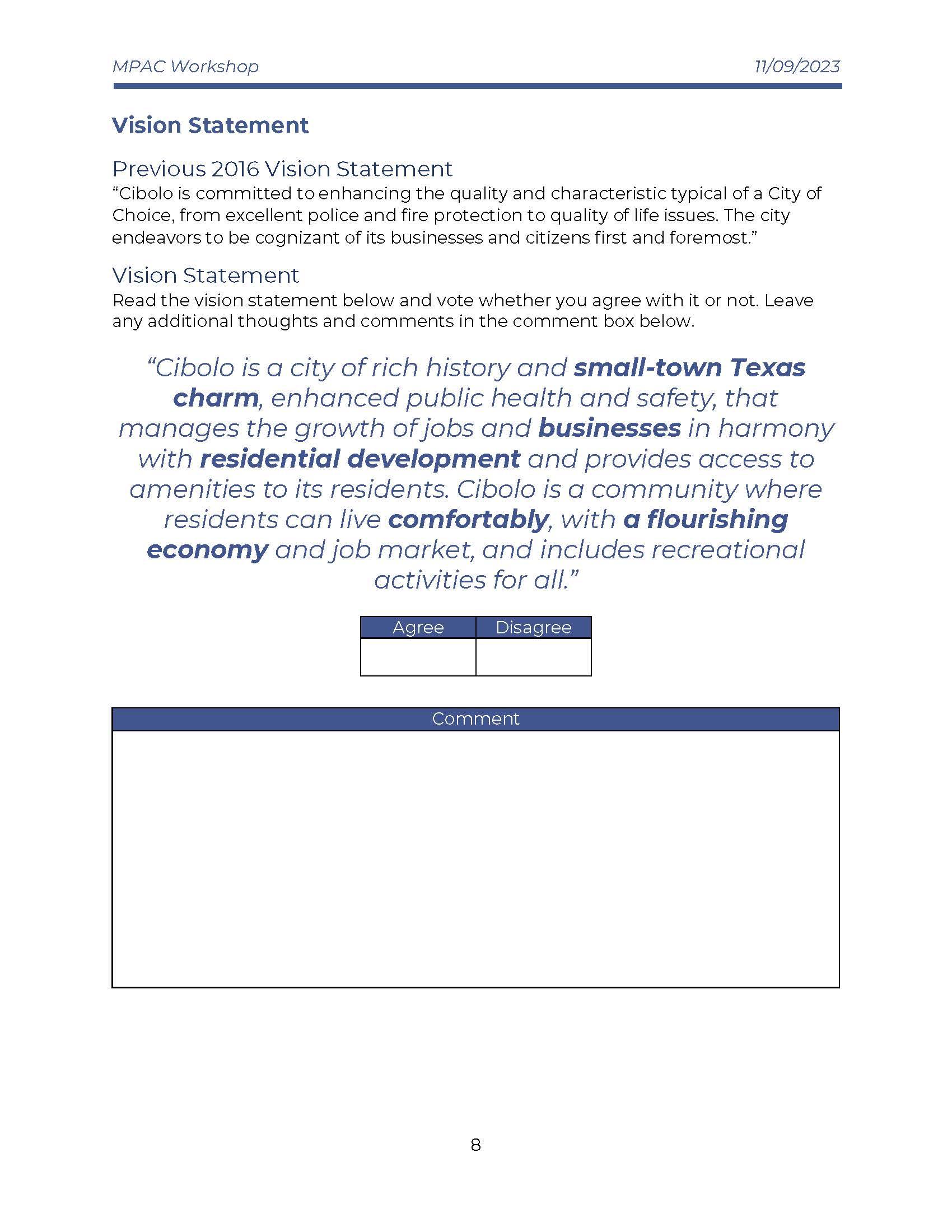
Written Notes
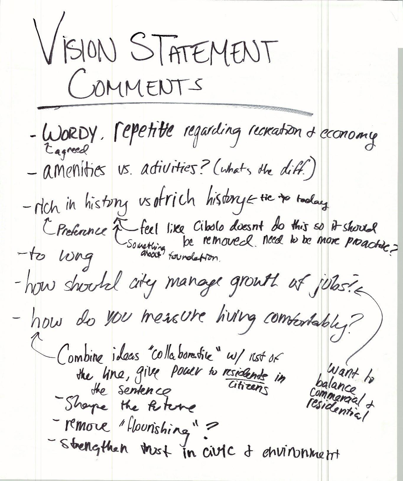
Notes:
• Wordy, repetitive regarding recreation and economy
o agreed
• Amenities vs activities? (what’s the difference?)
• “Rich in history” vs “of rich history”
o tie to today
o Rich in history is the preferred phrase
o Feel like Cibolo doesn’t do this so it should be removed. Need it to be more proactive
o Amend the statement to include something about foundation
• Too long
• How should the city manage growth of jobs?
o Want to balance commercial and residential
• How do you measure living comfortably?
o Combine ideas “collaborative” with rest of the line, give power to residents/citizens in the sentence
o Shape the future
o Potentially Remove “flourishing”
o Strengthen trust in civic and environment
The focus of this sections was to refine the guiding principles in the plan. Preliminary guiding principles were listed in the workbook and committee members were asked to identify if they agree or disagree, on each guiding principle and give comments on what they want to see changed
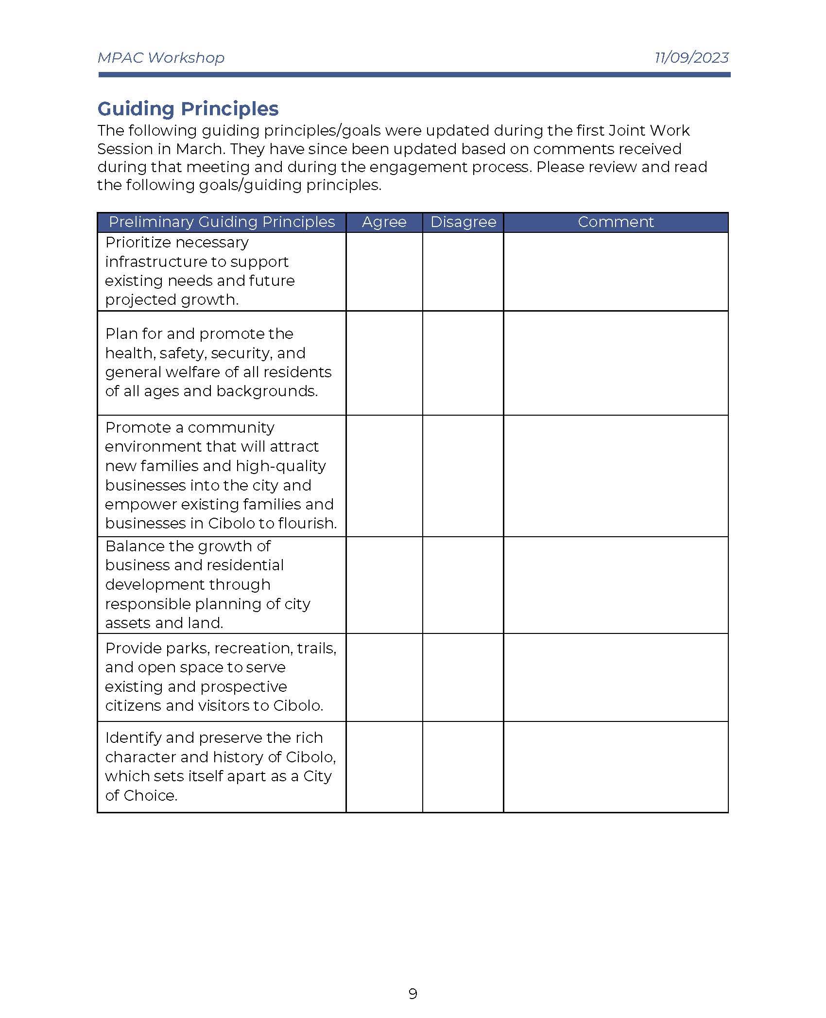
Written Notes
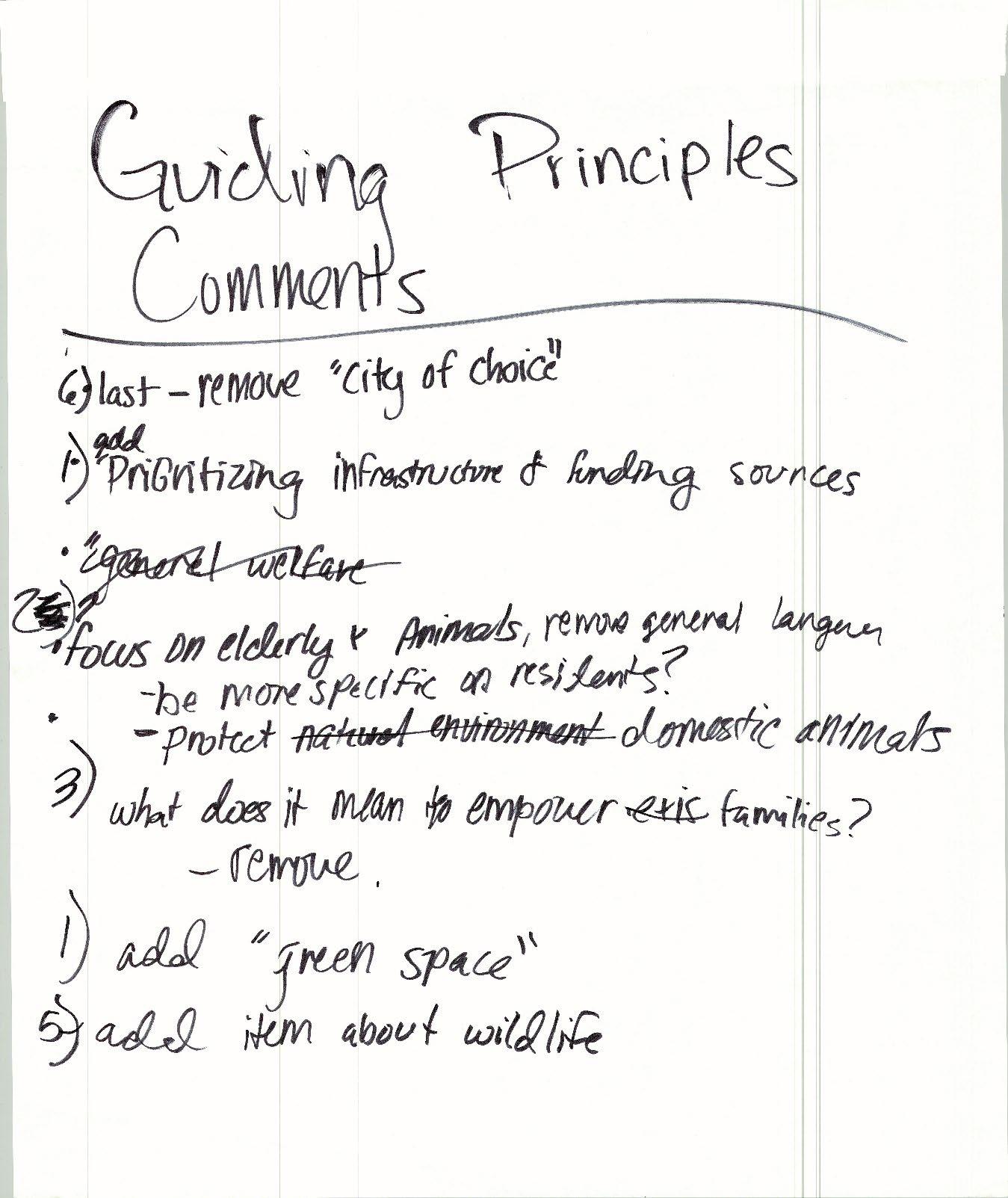
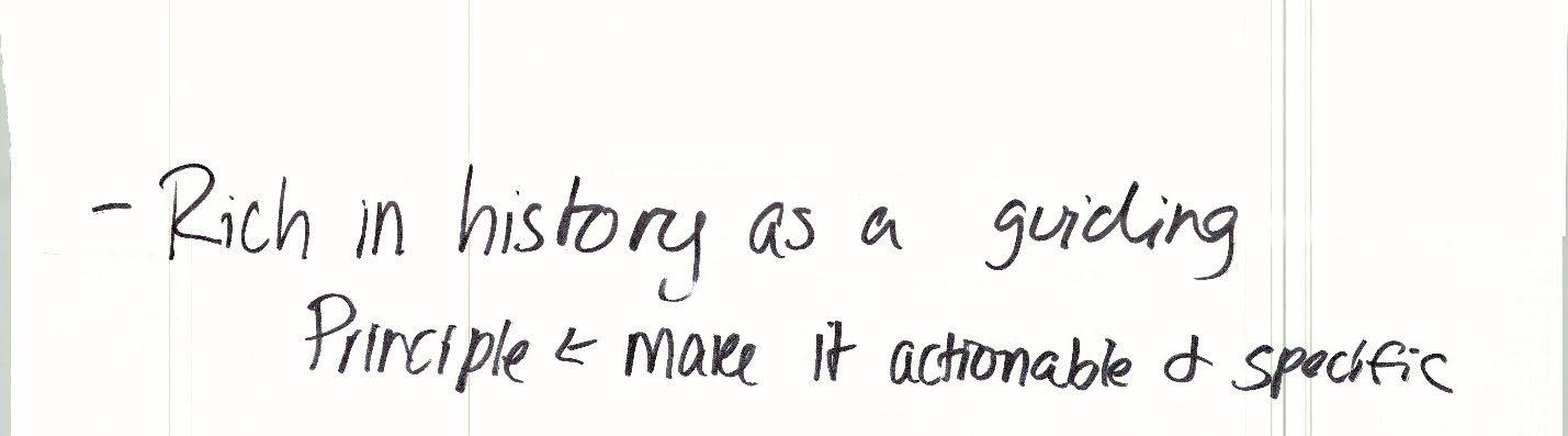
Notes:
• 6) last – potentially remove “city of choice”
• 1) add prioritizing infrastructure and funding sources
• 2) focus on elderly and animals, remove general language
o Be more specific on residents?
o Protect domestic animals
• 3) what does it mean to empower families
o Potentially remove the committee wants to potentially remove all wording after the phrase “empower families”
• 1) add “green space” the committee would like the guiding principle to be rephrased to include green space, such as “…support existing needs, green spce, and future growth.”
• 5) add item about wildlife
• Rich in history as a guiding principle
o Make it actionable and specific
This section asked the committee to look at the preliminary PlaceTypes and give feedback on the PlaceType Character & Intent descriptions and Land Use considerations.
MPAC Workbook Page 10 - PlaceTypes
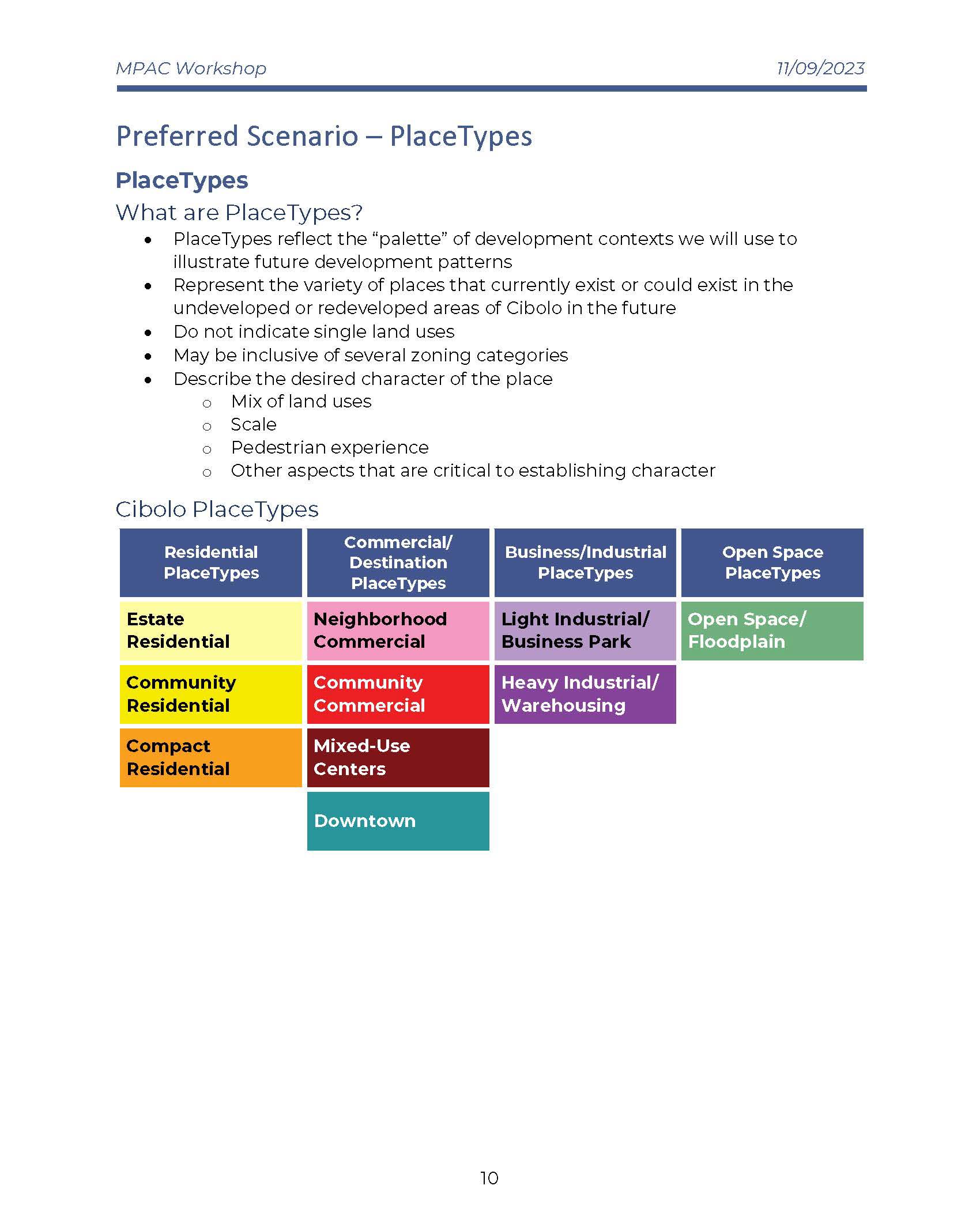
Example of PlaceType description page in the Workbook
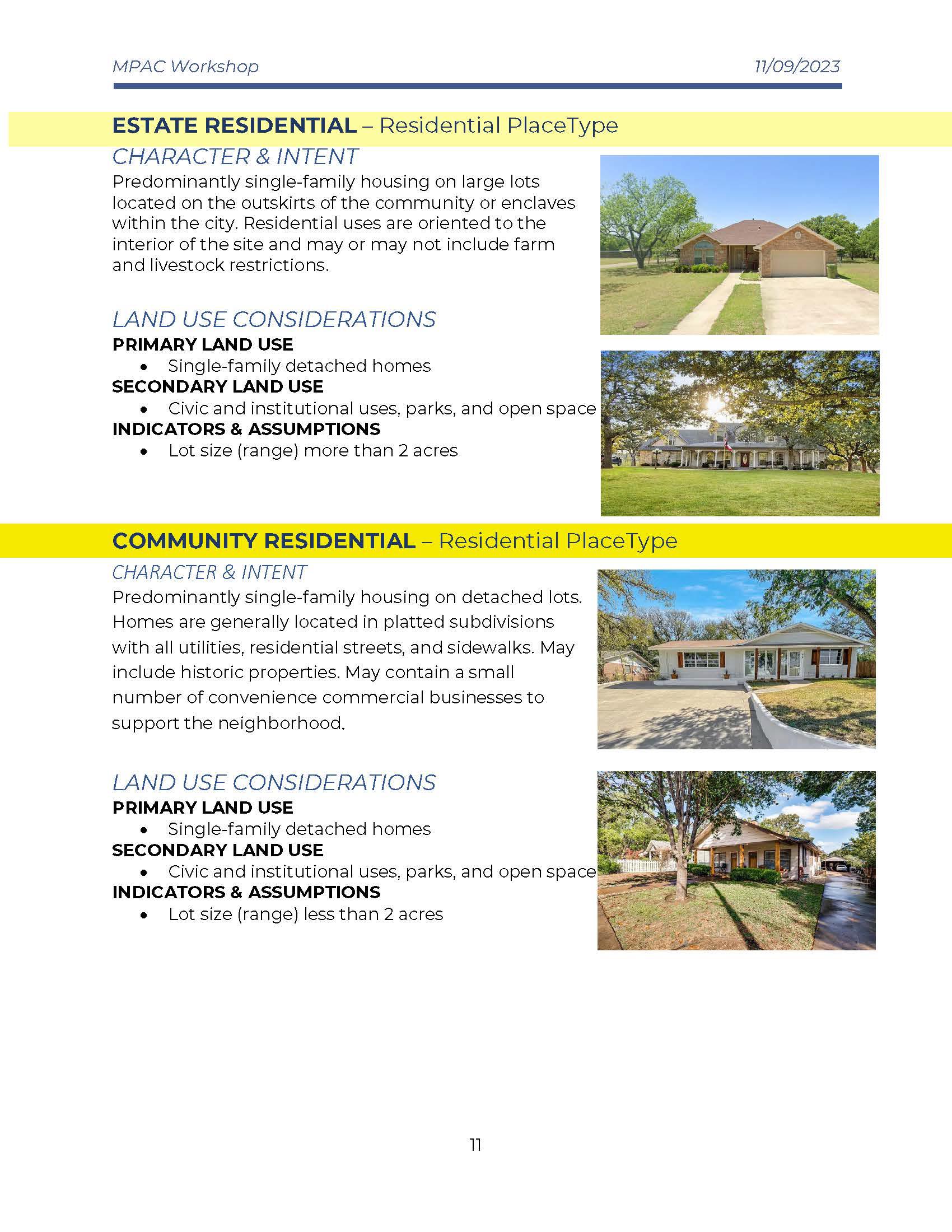
Written Notes

Notes:
• Need updated floodplains. The committee felt that the PlaceType maps presented in the meeting couldn’t be properly evaluated until it was confirmed that the floodplain map was up to date and was Atlas 14
o Verify those are Atlas 14
• Need our uses table
• PlaceTypes
o Estate Res. (Residential)
Cluster development allow on large acres
“conservation” instead of compact
• Put in name or as a land use as a primary
Prefer the rural residential description
• Make another category? The consensus decided by the committee was to create another PlaceType above Estate Residential called “Agricultural/Rural”
• 5-10+ acres, see Guadalupe county
Agriculture/homestead?
Modify to (1-5 acres)
Rural/ag = 5+ acres
• Below 75
• Put ag definition in UDC
o Comm. Resi. (Community Residential)
Homesteading?
Not Ag.
Less than 1 acres
o Compact Resi. (Residential)
PLU
Good with apartments, townhomes, condos
Don’t want duplex/narrow housing/small lot
“multi-family” or “TF1” Townhomes
Rename? Remove?
No single family
Put next to commercial
Add language about flood prevention/open space
Remove lot size, do density qualifier instead
o Neighborhood Comm. (Commercial)
Don’t like strip malls
Need detention/flooding treatments, open space
I&C: “consideration of flooding/water”
Reuse language from old guide, use access of road
Implement landscaping rules
Family oriented, no bars
o Community Commercial
Bars. The committee determined that adult venues such as bars would be acceptable in community commercial.
o Mixed Use
No freestanding apartments
Specify multi-family
Business on bottom and live on top is ok
o Downtown
No hotel
Old town is the separate from Downtown
• Downtown is across from Walmart
• Old town is historic downtown
• SF (single Family) detached home
• Res (Residential)
• Look at overlay
o Light industrial, heavy ind. And Open space – Tabled for next meeting
Meeting-in-a-box Recap document
November 16, 2023
One public engagement tool used to gather feedback during the Community Summit #2 portion of the Cibolo Tomorrow Comprehensive Plan was a technique called Meeting -in-a-Box. A toolkit of materials was provided to Project Ambassadors community members who volunteered to facilitate small group discussions for use in meetings with their neighborhood associations, cultural groups, business associates, etc. Questions were provided to the Ambassadors to encourage targeted discussion among residents and stakeholders on the future of Cibolo.
Six (6) discussions involving approximately 38 individuals were held between June to August of 2023. Twenty-six (26) questions going over twelve (12) topics were provided in the Meeting -ina-Box materials. Ambassadors were encouraged to work through as many questions as possible in their discussions but to focus on those that seemed most important to their groups if they were not able to cover them all. The topics included:
• Demographics
• Vision
• Land Use & Character
• Transportation
• Housing and Neighborhoods
• Community Facilities & Public Services
• IH-10 Corridor
• Downtown
• Environmental and Sustainability
• Economic Development
• Parks and Open Space
• Arts, Entertainment, and Historic Preservation
Disclaimer: Comments in this document were transcribed in accordance with the statements submitted in reports from the Meeting -in-a-Box discussions without regard to grammatical errors.
In your experience, how would you describe the makeup of the City of Cibolo?
• Diverse population ethnically and culturally - opportunities to learn from each other younger community but not large college group. college students are going elsewhere. not a large 20 something population. Not attracting that group .
• Well-rounded diverse community comprised heavy military-centric
Over the next 30 years, what gr oups of people should Cibolo plan on having as part of their community? Examples include youth, seniors, college students, etc.
• More retired using the services of military-retirees like to live close to medical and away from the city
• Seniors
What types of services will the community need in the future to best serve its population?
• Don't need more dental offices.
• More social spaces for 20+ year olds
• more medical services
• Better public transportation or dependable services like Alamo Regional Transit
• Complex for indoor walking trail around a community center for indoor activities in the heat of summer.
As the City builds out and the population grows over the next 30 years, what are some key considerations that need to stay at the forefront?
• Business to attract the 20 something age group.
• City is family-oriented which brings them back to Cibolo. Otherwise, we will have an aging population.
• Kids are planting elsewhere and did not return with their families.
• Military families at Randolph are transient and may not be as active as others in setting up businesses and in community.
• Infrastructure to connect communities, street maintenance.
• Permanent City owned Senior Center and additional recreational programs to serve them
Give one word or phrase that would best describe Cibolo in 2050:
• Desirable, growing, modern with old school values, thriving, modern .
Since 2016, how has this vision changed?
• Opened avenues for lower-income families to be part of the community i,.e. jobs that would appeal to them - HEB, Walmart, apartments.
• Continue to grow without growing too much.
• Diversified our population - not all middle-class families anymore.
What elements have stayed the same?
• Seeing a lot of families
• Rallying around the schools
• Theater programs in the schools
• Constant growth
What new elements should be incorporated?
• Businesses should not come before citizens
• Inclusive
• Take out the word - typical - we are not a basic town.
• Add the word "community." community needs to be highlighted.
• Better transportation
• Leveraging technology
What are some key characteristics that ensure as Cibolo grows it maintains a high -quality environment for all its residents?
• Restaurants
• Wider streets to accommodate cars on both sides of the street and a firetruck
Are there areas in Cibolo that you would consider inaccessible, whether by vehicle, transit, biking or walking?
• Stonebrook is locked in = can't get out onto FM1103
In what areas do you experience the greatest traffic congestion/safety issues in Cibolo?
• Cibolo Valley Drive
• FM1103
• Construction happening at the same time.
• Speeding in neighborhoods
• Cibolo Valley Drive- need crosswalk between Walmart and Firestone. Too many pedestrians are trying to cross there and holding up traffic.
• Bentwood Ranch has street racers.
Do you ever have issues getting to work/school/home/etc.? What transportation issues do other groups in the community face?
• Street maintenance
• Stonebrook streets are full of dips.
• Need public transportation.
• Need partnership with SCUID to allow more parking sp aces for the Cibolo senior center participants. Employees are taking parking spaces near the senior center, requiring seniors to walk really far.
What would you like to see in terms of connectivity associated with I -35 to I-10?
• Not a toll road
What does a healthy, thriving neighborhood look like to you?
• Safe, clean, harmonious living environment (neighbors that value and respect individuality)
• HOA Boards that are active within the neighborhoods.
What types of housing ar e missing or needed in Cibolo?
• No more apartment complexes.
What do you feel affects the health of your neighborhood the most?
• FM 1103 sidewalks
• Connectivity to other places, public roads.
Which community facilities do you use the most?
• Cibolo Senior Center
Which public services are essential to your community today?
• Community Center with indoor walking track and special events
• Police/Fire - appreciate the services and additional attention
As Cibolo grows, what facilities and services will the city need in order to make sure an appropriate level of services are provided?
• Public transportation
• Increase the number of employees - very low compared to other cities.
• Special needs programs - POC: David Weaver, Grange Hall.
When you think of Cibolo and the ETJ today, where is the greatest need for additional community facilities and public services?
• Animal Shelter needs to be expanded and updated.
• Larger Senior Center, permanent City building.
What are some of the assets of the IH -10 Corridor as it relates to the future of Cibolo?
• Conference center
• Shopping
• Restaurants
How can IH-10 best capitalize on its opportunities as a major throughfare in Cibolo?
• Hotel conference center, restaurants, shopping
• Needs a connection
What does a vibrant Downtown Cibolo look like to you?
• Innovative historically preserved Old Town
• Like the Old Town charm
• Main Street needs to fix up the buildings. Can still maintain history, can be unique but doesn't have to look run down.
• Business signs you can read.
What types of places and businesses are missing that you would like to see added to Downtown in the future?
• More boutiques, shopping opportunities
• Additional emphasis minority owned business.
What types of projects should the City prioritize for City funding? Why should the City prioritize them? Project examples include, but are not limited to: Streetscape improvements (including sidewalks, lighting, benches, landscaping) , Features like water fountains, sculptures, and murals, Grants to fund building restoration, Housing, Parking, Open spaces (including plazas and small parks)
• Mural wall painted - signature for Cibolo not always timely.
• Grants for improving historic buildings.
• Art Walk, murals painted on the buildings.
What areas or places Downtown face accessibility issues? What ideas do you have for addressing those issues?
• Sidewalks on both sides of the street
• More crosswalks
• Businesses need handicap ramps.
How important is it to you that the environment in and around Cibolo is protected?
• Protect Wobbler nesting grounds.
• Future water usage for growth.
Are there places or neighborhoods in Cibolo that are currently negatively affected by the environment and/or sustainability practices? Some examples include but are not limited to: A neighborhood consistently floods, A place is not walkable because it does not have shade to protect from the heat, and Sewage issue s.
• Better road access
• Flooding for area on FM 1103 near Steele HS and Town Creek HOA
How might we improve economic opportunities for current residents, reduce barriers to starting and expanding businesses, and attract/retain/expand major employers? Come up with at least 2 ideas.
• More timely with approvals.
• Explore business incubator to grow the next generation of businesses in the city.
• Create an environment for businesses to make it easier to come to the city.
• Talk to residents on strategic planning on short topics, face to face.
• Work group to develop a workbook of what a business needs to come to the community - resources etc. to make it easier to come.
• Strategic planning to bring in the correct number of businesses of one type to ensure they survive
• Spread out the businesses, don't lump them all in the same place .
What amenities or facilities do you like that are currently provided in parks and open spaces? What amenities or facilities are needed that are not currently provided in parks and open spaces?
• Pickleball
• Basketball courts
• Walking trails
• Develop pond at HEB
• Something wet - splash pad or pool
• Restrooms in all facilities
• Lighting
• Basketball courts
How might we maintain and expand greenspace, natural resources, and conservation efforts for the benefit of all of Cibolo? Please come up with at least 5 ideas.
• Preserve green spaces
• Plant trees
• Mini botanical area as an example of what people can do in their own yards.
Are you able to access and feel safe using the parks, playgrounds, trails, and/or open spaces in Cibolo? Why or why not?
• Yes, but would like to have the lights fixed at Neimitz Park to prevent car break ins and vandalism.
• Court resurfaced at Neimitz.
• Future consideration: appropriate security features are in place (i.e. monitors, cameras) not just the 911 boxes.
• Need more police presence.
Do you use park and recreation facilities outside of Cibolo? If so, where and why?
• Chicken and Pickle - no pickleball courts in Cibolo
• Crescent Bend
• Pickle ball
• Nice parks
What types of visual arts, performing arts, and entertainment events have the greatest potential for growth in Cibolo?
• More special events like Schertz but not the same so we don't compete.
• Expand on our existing events
• Focus on attracting local artists to present their works through the city . (i.e. Murals, art work, etc.)
• Have a community center to have events
• Have the building walls etc. to showcase local artists.
• Art Walk
• Murals painted on the buildings downtown
How might we make visual arts, performing arts, and entertainment events more accessible to more people in the community? Come up with at least 5 ideas.
• More Summer Nights type events
• Concerts in the park
• Movies in the park
• Events that draw people to our businesses
• Community Center for large events - i.e. pageants
• No hotels to draw large conferences etc.
Are there groups, areas or cultures that are not represented in our historic preservation and/or cultural events?
• Historical makeup needs to be included in the City events.
Responsible Growth. Participants emphasized the desire to preserve greenspace but also wanted to see new opportunities for activity in the City Examples of activities included community centers, restaurants, and retail opportunities. Participants expressed need for preserving the small town feel of Cibolo but wanted to approach growth slowly over time.
Connectivity. Participants expressed a need for better overall connectivity in Cibolo. For pedestrians, the need for improved sidewalks and closing sidewalk gaps is emphasized in neighborhoods and to local activity anchors . For vehicular travel, participants expressed need for better north to south mobility connections.
Downtown, Business, and Entertainment. Participants expressed wanting more options to shop local and stay local. They brought up incen tivizing small businesses, capitalizing on downtown, and the inclusion of art and culture within downtown. They mentioned wanting more events at parks and the community center for movies, art shows, and concerts.
Maintenance and Infrastructure Improvements. Participants saw a huge need for maintenance and refresh in the city. This included streets, parks, and potential for a refresh of Old Town Fl ooding is a major concern for residents and improvements to mitigate flooding in Cibolo is a high priority.
* 1. Mixed-Use Center (Developmentthathasmorethanonelanduseandcantypicallyactasanactivitycenterforadistrict) has been identified as an appropriate PlaceType for this District.
Which Image below shows the type of Mixed-Use Center you want to see in this District?
* 2. Community Commercial (Community Commercial are developmentsthatare largerinscaleandattract regionaltrafficforshoppingand retail needs) has been identified as an appropriate PlaceType for this District.
Which Image below shows the type of Community Commercial you want to see in this District?
35 Respondents
* 3. Compact Residential (Avarietyofhousingtypes,includingpatio/gardenhomes,multi-family,small-lotsingle-familydetached,patio homes, townhomes,andduplexesinacompactnetworkofcomplete,walkablestreets that areeasytonavigatebycar,bicycle,orfoot) has been identified as an appropriate PlaceType for this District.
Which Image below shows the type of Compact Residential you want to see in this District?
34 Respondents
* 4. Estate Residential (Predominantlysingle-familyhousingonlargelotslocatedontheoutskirtsofthecommunityorenclaveswithinthe city) has been identified as an appropriate PlaceType for this District.
Which Image below shows the type of Estate Residential you want to see in this District?
37 Respondents
* 1. Mixed-Use Center (Developmentthathasmorethanonelanduseandcantypicallyactasanactivitycenterforadistrict) has been identified as an appropriate PlaceType for this District.
Which Image below shows the type of Mixed-Use Center you want to see in this District?
31 Respondents
* 2. Community Commercial (Community Commercial are developmentsthatare largerinscaleandattract regionaltrafficforshoppingand retail needs) has been identified as an appropriate PlaceType for this District.
Which Image below shows the type of Community Commercial you want to see in this District?
28 Respondents
* 3. Compact Residential (Avarietyofhousingtypes,includingpatio/gardenhomes,multi-family,small-lotsingle-familydetached,patio homes, townhomes,andduplexesinacompactnetworkofcomplete,walkablestreets that areeasytonavigatebycar,bicycle,orfoot) has been identified as an appropriate PlaceType for this District.
Which Image below shows the type of Compact Residential you want to see in this District?
27 Respondents
* 4. Light Industrial/Business Park (Business and office-relatedlanduses,aswellaslightindustrialusesthatrequire limited raw material, space,andpower) has been identified as an appropriate PlaceType for this District.
Which Image below shows the type of Light Industrial/Business Park you want to see in this District?
30 Respondents District 3
* 1. Mixed-Use Center (Developmentthathasmorethanonelanduseandcantypicallyactasanactivitycenterforadistrict) has been identified as an appropriate PlaceType for this District.
Which Image below shows the type of Mixed-Use Center you want to see in this District?
* 1. Mixed-Use Center (Developmentthathasmorethanonelanduseandcantypicallyactasanactivitycenterforadistrict) has been identified as an appropriate PlaceType for this District.
Which Image below shows the type of Mixed-Use Center you want to see in this District?
28 Respondents
* 2. Community Commercial (Community Commercial are developmentsthatare largerinscaleandattract regionaltrafficforshoppingand retail needs) has been identified as an appropriate PlaceType for this District.
Which Image below shows the type of Community Commercial you want to see in this District?
27 Respondents
* 3. Compact Residential (Avarietyofhousingtypes,includingpatio/gardenhomes,multi-family,small-lotsingle-familydetached,patio homes, townhomes,andduplexesinacompactnetworkofcomplete,walkablestreets that areeasytonavigatebycar,bicycle,orfoot) has been identified as an appropriate PlaceType for this District.
Which Image below shows the type of Compact Residential you want to see in this District?
26 Respondents
* 4. Community Residential (Predominantlysingle-familyhousingondetachedlots.Homesare generallylocatedinplattedsubdivisionswith all utilities, residential streets, and sidewalks.Mayincludehistoricproperties.) has been identified as an appropriate PlaceType for this District.
Which Image below shows the type of Community Residential you want to see in this District?
27 Respondents
* 4. Open Space/Floodplain (OpenSpace/Floodplainindicatesthe floodplainsandexistingandfutureplannedparks) has been identified as an appropriate PlaceType for every District.
Which Image below shows the type of Open Space/Floodplain you want to see in this District?
31 Respondents
Is there anything we missed? Please leave any additional thoughts or comments down below:
I don't understand the purposes or value of the various photos in each of the groups above. The plan when developed will lead to zoning of the various areas and the planning committee will look at wether or not the project meets the zoning laws. We need to utilize the space along the corridor for light industrial use. Look at Schertz along I 35. Warehouses and a commercial construction all the way out to New Braunfels. The area between this planning area and FM 78 can be used for planned housing and city centers with commercial development. People looking for Estate Residential properties don't want to be near a busy interstate. Most important is who controls the two areas where this planning area does not go south of the interstate. Please don't tell me Schertz.
Don't short-change residential areas by assuming they will never change. It is crucial to have adequate parking, and roads wide enough for maneuvering a school bus.
Is there anything we missed? Please leave any additional thoughts or comments down below:
I don't understand the purposes or value of the various photos in each of the groups above. The plan when developed will lead to zoning of the various areas and the planning committee will look at wether or not the project meets the zoning laws.
We need to utilize the space along the corridor for light industrial use. Look at Schertz along I 35. Warehouses and a commercial construction all the way out to New Braunfels. The area between this planning area and FM 78 can be used for planned housing and city centers with commercial development. People looking for Estate Residential properties don't want to be near a busy interstate.
Most important is who controls the two areas where this planning area does not go south of the interstate. Please don't tell me Schertz.
9 days ago
Don't short-change residential areas by assuming they will never change. It is crucial to have adequate parking, and roads wide enough for maneuvering a school bus.
one month ago
No
one month ago
About time someone realized how that area will transform Cibolo once all that IH10 work is done.
It would be great to see the item Corridor built up like this in our area. Right now when you enter on I-10 through Guadalupe County, there is nothing that attracts me to the area until we reach San Antonio. And this will be amazing to see the city of Cibolo and turn this area into something welcoming for residents and for visitors.
No apartments. Restrictions on architecture and materials.
Is there a plan to increase police, fire and emergency services presence with the growth? Also, I would like to see an infrastructure improvement plan that coincides with growth.
Traffic, noise, congestion! What more can you ask for? People can't leave a little bit for the wild animals?
2
where are all the deer, raccoons, etc going to live? None of this is what I'd like. All the land is going to be bulldozed and filled with blacktop and buildings. Do we really need this? Can't we have a rural, farm area?
2
I recommend looking at what Tulsa did with building the “Gathering Place” area. It is multi use/faceted and a great community space.
2