


Mark Allen, Mayor
T.G. Benson, District 1
Randy Roberts, District 2
Robert Mahoney, District 3
Katie Cunningham, District 4
Norma Sanchez-Stephens, District 5
Dick Hetzel, District 6
Joel Hicks, District 7
Jennifer Greve, Chair
Jacqueline Garcia , Vice Chair
Diana Weimer
Angela Dodd
Maria Fishback
Rian Thompson
Allison Beaver
Terry Hinze
Yvette Hubbard
Kara Latimer, Chair
Claudia Walker, Vice Chair
Cody Hicks
Marcus Mattingly
Judy Womack
Mark Schupp
Malcolm MacLauchlan
Carole Herr
Shane Merillat
Ashley Zimmermann
Kara Latimer
Christi Ellard
Claudia Walker
Wayne Reed, City Manager
Kelsee Jordan Lee, Director of Planning & Economic Development
Eron Spencer, Senior Planner
Bryan Hugghins, Executive Director of Safety and Infrastructure
Timothy Fousse, Public Works Director
Chris Otto, City Engineer
Jeanette Gonzalez, Communications Manager
William Arellano, GIS Manager
Thedrick Andres, Chief of Police
Kimley-Horn and Associates
This page is intentionally blank
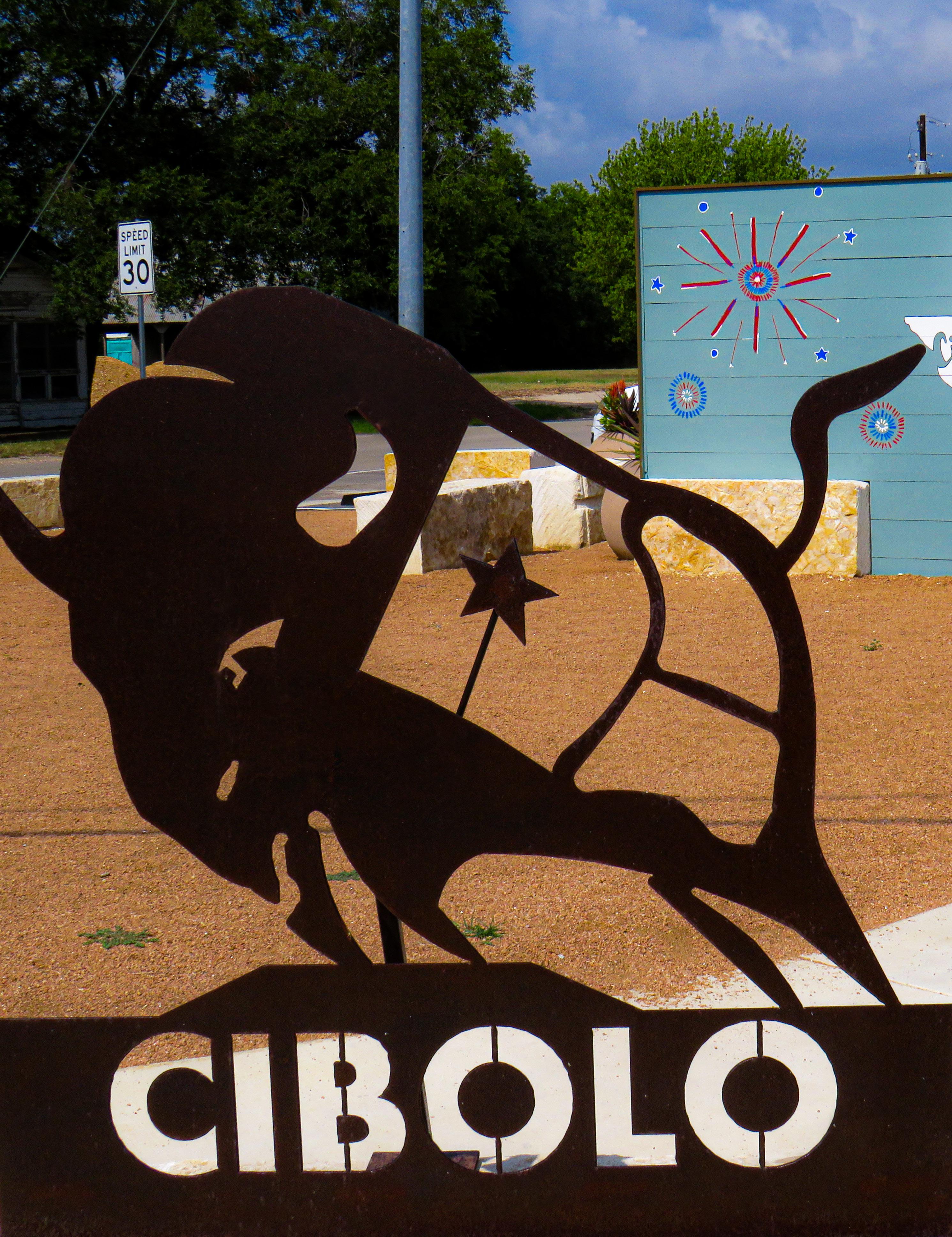
Cibolo Tomorrow Comprehensive Plan Chapter 1: Cibolo Today
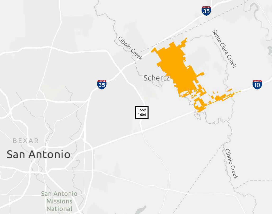
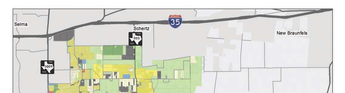
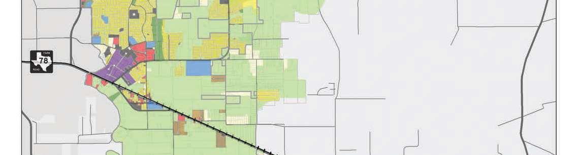
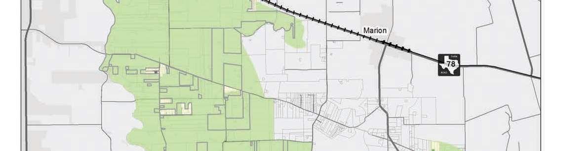
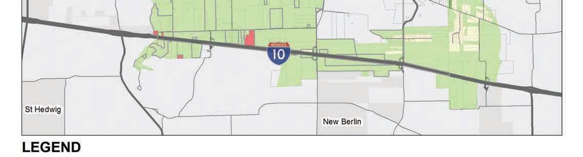
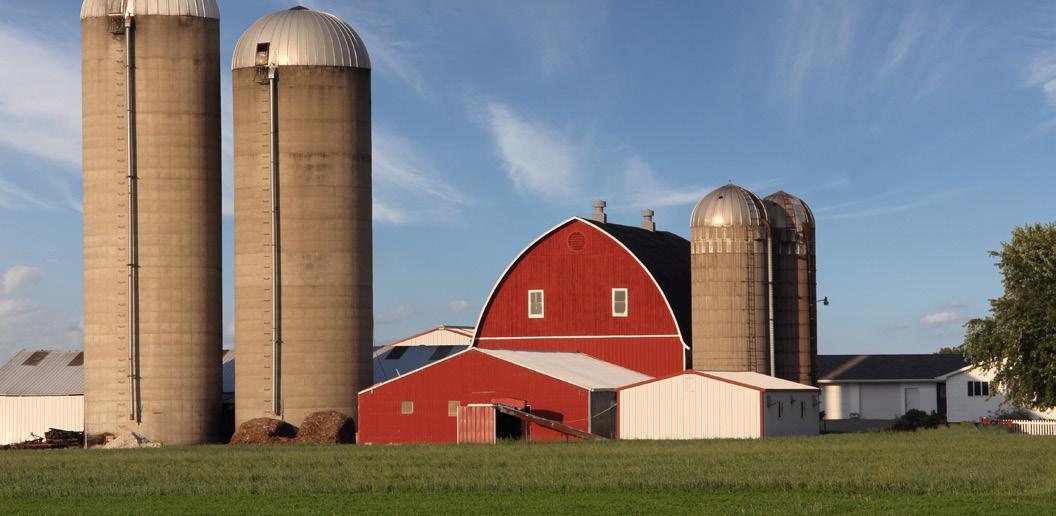
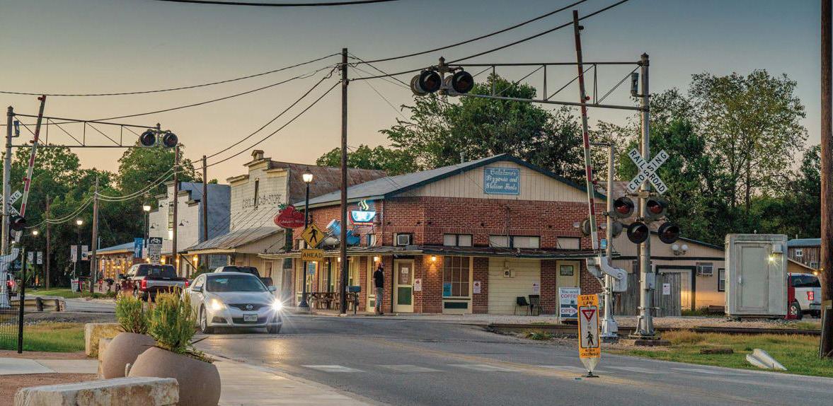
Situated in the heart of South-Central Texas, Cibolo is a growing city known for its smalltown charm. The city is positioned along the Interstate 35 corridor to the north and Interstate 10 corridor to the south, which facilitates connectivity to San Antonio. Figure 1.1 displays the regional context of Cibolo. The city’s proximity to natural features and major highways positions it as a key player in the regional economy. Although Cibolo Creek is dry, it’s floodplain footprint offers potential recreational opportunities like hiking and biking trails. Cibolo is mindful of its topography, and this comprehensive plan places a strong emphasis on sustainable development practices that consider floodplain management.
Founded on the banks of Cibolo Creek in the mid-19th century, Cibolo is deeply rooted in the rich, historical tapestry of the American frontier. The city’s origins can be traced back to the establishment of local ranches and the arrival of settlers who sought fertile land in the region.
The area was inhabited by the Comanche and other tribes, with the name derived from a Native American word meaning “buffalo.”
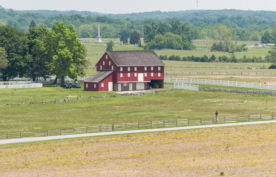
The city of Cibolo was named by Mr. Schlather in 1876 when the Southern Pacific Railroad connected the area to larger cities. The region experienced agricultural prosperity with cotton as the primary cash crop, benefiting from fertile land and Cibolo Creek. Over the years, Cibolo evolved into a close-knit community, and by the early 20th century, it had established itself as a small but resilient town with a unique blend of agricultural heritage and growing commerce.
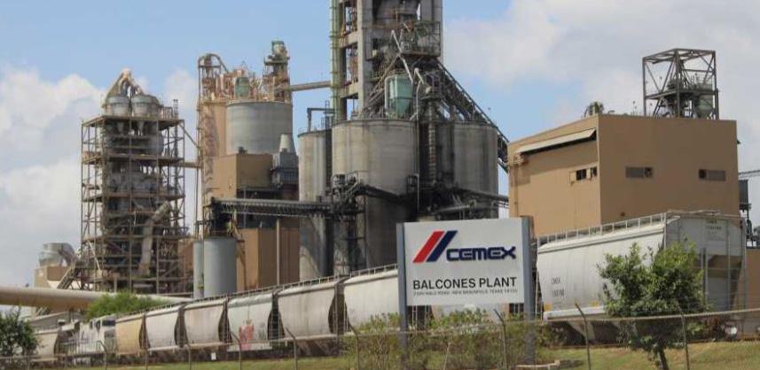
In the latter half of the 20th century, Cibolo experienced a transformative shift. The expansion of nearby metropolitan areas, notably San Antonio, brought new opportunities and challenges to Cibolo. The city adapted to this changing landscape and embraced growth while preserving its smalltown charm. Subsequent decades witnessed a population surge and the development of infrastructure turned Cibolo into a dynamic suburban community. As a result of it’s proximity to Randolph Air Force Base, the city has seen growth in businesses and industries like services and retail trade. Today, the city’s history is a testament to its ability to balance progress with the preservation of its cultural and historical roots, making it a distinctive and vibrant place to live.
Population growth in Cibolo has been driven by factors such as job opportunities and the city’s strategic location. A demographic and psychographic analysis was conducted to better understand trends in growth based on historical and forecasted data sets from several key sources including the U.S. Census Bureau, Center for Economic Studies, the State of Texas, TxDOT, and ESRI.
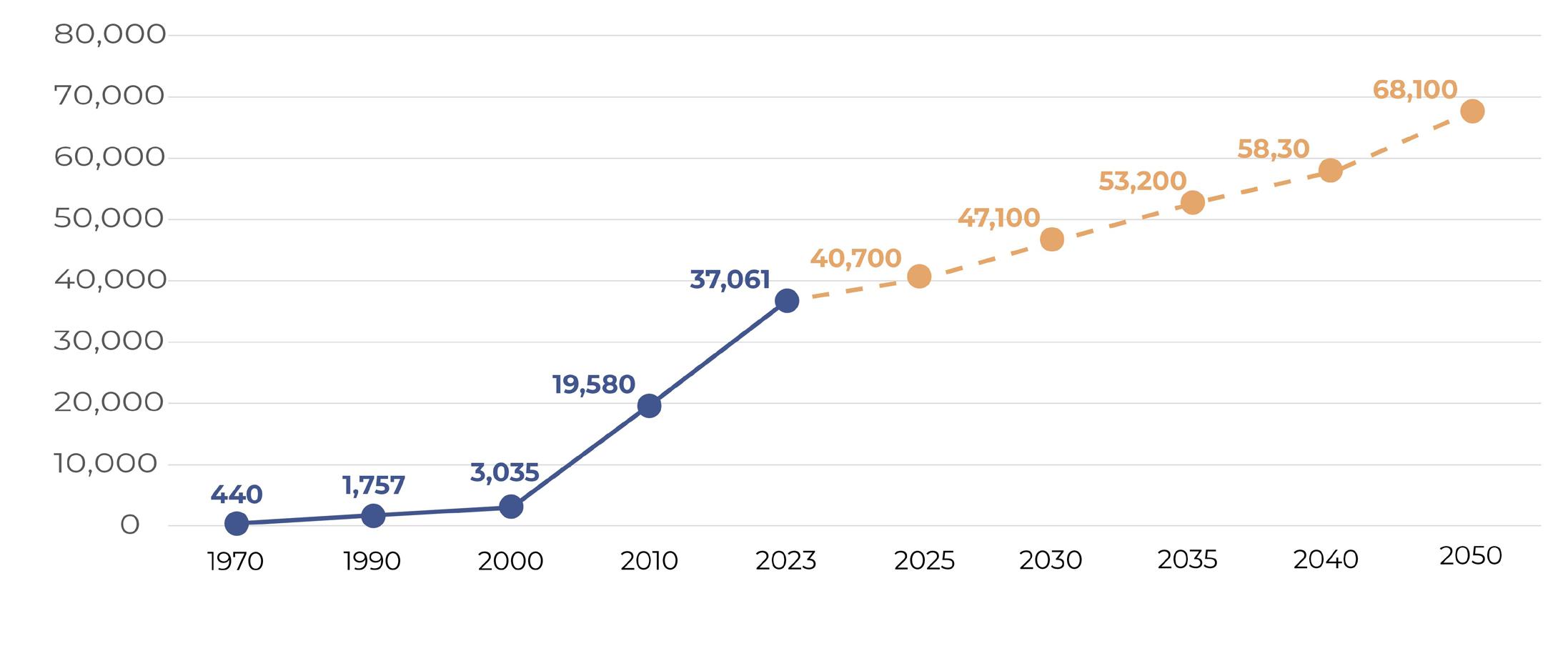
Figure 1.2 on page 8 displays the City of Cibolo’s historic population change. In 2000,
Cibolo was home to about 3,000 people. Over the following 10 years, Cibolo saw a 552.7% percent increase in its population, increasing to 19,580 by 2010. The city continued to see an increase in its population, having an estimated population of 37,061 in 2022. (Source: U.S Census)
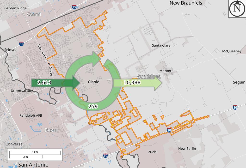
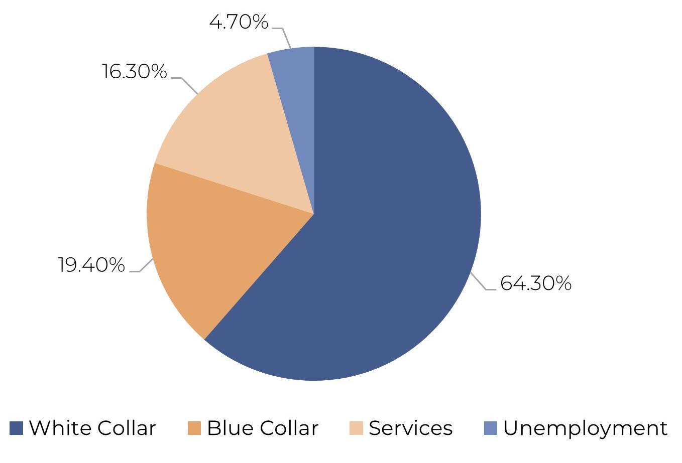
A majority of Cibolo’s residents work outside of the City (78.3%) as reflected in Figure 1.3 However, since 2016, a greater percentage of people (19.8%) are now commuting into Cibolo for work (11.7%). This increase in percentage reflects the aforementioned growth that the city is experiencing in both jobs and daytime population.
Employment opportunities, residential neighborhoods, and a diversified economic landscape are just a few of the factors accounting for growth over the past 10 years. However, growth can also present challenges that the city must balance. Cibolo aims to shape a future that can proactively address challenges and take advantage of opportunities associated with growth. This comprehensive plan serves as a guiding framework for city officials, landowners, developers, and other governmental entities.
Figure 1.2 | City of Cibolo Historic Population
Figure 1.3 |
MapLegend
MapLegend
SelectionAreas SelectionArea Inflow/Outflow EmployedandLiveinSelectionArea EmployedinSelectionArea,Live Outside LiveinSelectionArea,Employed Outside
SelectionAreas SelectionArea Inflow/Outflow EmployedandLiveinSelectionArea EmployedinSelectionArea,Live Outside LiveinSelectionArea,Employed Outside
Note:Overlayarrowsdonotindicate directionalityofworkerflowbetween homeandemploymentlocations.
Note:Overlayarrowsdonotindicate directionalityofworkerflowbetween homeandemploymentlocations.
Source: US Census Bureau, Center for Economic Studies 2021, http://onthemap.ces.census.gov/
Page1of3
Page1of3
Source: Historical Census Data, State of Texas, TxDOT, and ESRI 2023


$127,339
A comprehensive plan functions as a strategic road map guiding the city’s development over the next 20 years. This detailed document reflects the community’s vision, goals, and policies, providing a valuable resource for city officials in their decision-making processes related to development and redevelopment. A comprehensive plan includes holistic recommendations for land use, transportation, housing, and infrastructure. It is important to note that while the Comprehensive Plan articulates the community’s vision for the future, it does not establish zoning regulations or zoning district boundaries. Implementing this plan signifies Cibolo’s commitment to responsible growth. Typically, a comprehensive plan is updated every 5 years.
The primary objective of this plan is to facilitate Cibolo’s growth and development in a predictable, and economically responsible way, providing an outlook for the year 2050. The vision and goals outlined in the Cibolo Tomorrow Comprehensive Plan aim to ensure that the city’s resources are strategically aligned with the identified needs and desires of the community. The Comprehensive Plan serves as a transparent framework for both current and future decision-makers, offering a clear structure for assessing proposed projects and initiatives. A comprehensive plan’s importance lies in ensuring that a city can attain its full potential while safeguarding its distinctive identity.
Section 213 of the Texas Local Government Code (TLGC) establishes the legal foundation for comprehensive planning. It states that “the governing body of a municipality may adopt a comprehensive plan for the long-range development of the municipality. A municipality may define the content and design of a comprehensive plan.
(b) A comprehensive plan may:
(1) include but is not limited to provisions on land use, transportation, and public facilities;
(2) consist of a single plan or a coordinated set of plans organized by subject and geographic area; and
(3) be used to coordinate and guide the establishment of development regulations.
(c) A municipality may define, in its charter or by ordinance, the relationship between a comprehensive plan and development regulations and may provide standards for determining the consistency required between a plan and development regulations.”
The 2016 Comprehensive Plan for Cibolo served as a strategic blueprint outlining the city’s vision and goals for sustainable development. This comprehensive document addresses various aspects, including land use, transportation, housing, economic development, parks, and community services. Emphasizing community engagement, the plan reflects the aspirations of Cibolo’s residents and businesses. The Cibolo Tomorrow Comprehensive Plan is an update to the 2016 Comprehensive Plan, which reflected the needs of residents at that time. With significant growth and development over the past eight years, the Cibolo Tomorrow Comprehensive Plan Update aims to address the updated needs of residents today.
This report is broken up into plan components. The plan components are the detailed sections that form a comprehensive strategy for the city’s development.
The introduction chapter of the Comprehensive Plan provides a concise overview of the document’s purpose and outlines key aspects of the planning process and community engagement effort that went into crafting this plan.
The strategic direction chapter outlines the city’s vision and guiding principles. It sets the tone for the plan, introducing the key principles and objectives that will be explored in detail throughout the subsequent chapters.
The land use and character chapter delves into the strategic allocation of land for various purposes and the desired aesthetic of areas in the community. It outlines recommendations that aim to shape the physical and visual aspects of the community, ensuring a cohesive development that aligns with the overall vision of the city.
The transportation chapter addresses the city’s mobility infrastructure, roads, and alternative transportation modes. It outlines strategies for efficient transportation systems, connectivity, and accessibility to accommodate current and future needs, fostering a well-integrated and sustainable mobility framework.
The housing and neighborhoods chapter provides recommendations about housing options in Cibolo. It addresses issues such as housing stock, attainability, and hazard mitigation. The goal of the chapter is to foster vibrant, inclusive communities that cater to the diverse needs of residents.
The community facilities and public services chapter outlines strategies for providing essential services such as healthcare, education, and public safety. It also addresses the development and maintenance of recreational facilities, cultural amenities, and public spaces to enhance the overall quality of life in the community. This chapter addresses strategies for mitigating and managing flood risks within the community.
The implementation chapter outlines the specific steps, policies, and mechanisms to turn the vision and guiding principles into actionable reality. It provides a road map for coordinating various stakeholders, allocating resources, and monitoring progress to ensure the effective execution of the Plan.
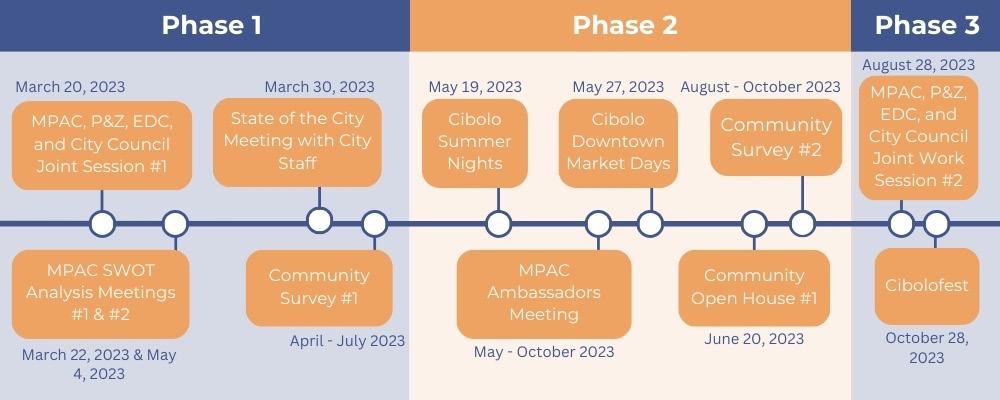
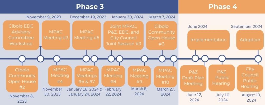
The Cibolo Tomorrow Comprehensive Plan involved a 4-phase process that lasted approximately 16 months. Each phase had significant milestones, including crucial public events. Each milestone builds upon the preceding ones, integrating community-wide feedback and input into the plan. The planning process provided a structured framework for decision-making, fostered community engagement, and ensured that development aligns with the needs and aspirations of residents. Below is the 4-phase process of the Cibolo Tomorrow Comprehensive Plan.
The initial phase included project kickoff meetings to get the project underway and established direction going forward. This phase included the first work session of the Master Plan Advisory Committee (MPAC), a group of diverse stakeholders appointed to provide expertise and guidance for plan development and implementation.
The data collected in this phase included the community’s social, economic, and physical qualities, as well as its current population, housing, and transportation options. This allowed for a high-level understanding of Cibolo’s existing conditions, opportunities, and challenges. This phase also included a majority of the community engagement for the plan. Residents, property owners, business leaders, and other stakeholders contributed to the Comprehensive Plan through in-person and webbased engagements, open houses, surveys, and community events.
In this phase, the plan is outlined and drafted. The data collected from previous phases are pieced together in an integrated fashion. Actions for the plan were generated and selected to address opportunities and challenges that were identified early in the planning process.
Adoption and Implementation is the final phase and involved creating an implementation tool that is integrated with the strategic direction. A final draft was presented as part of the adoption process and had to go through the Planning and Zoning Commission as a workshop for community and Commission comments. These additional comments were added and then presented to the City Council for approval and adoption.
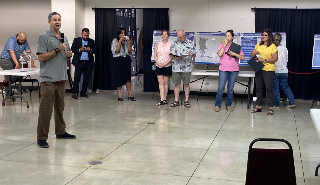
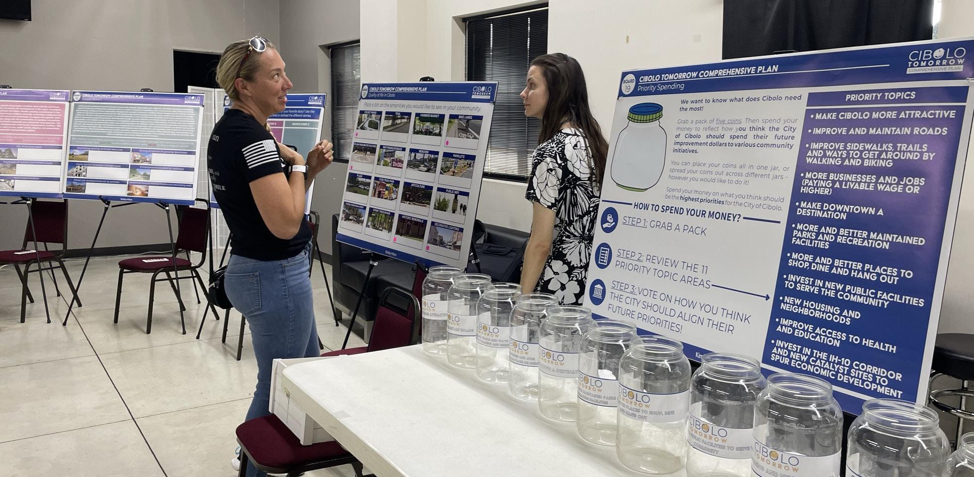
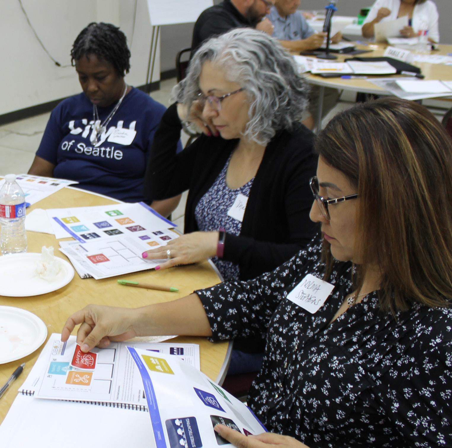
Community engagement is significant for a comprehensive plan. By creating communication channels, conducting public forums, and utilizing digital platforms, engagement gathered diverse perspectives and local knowledge. A successful comprehensive plan is not just a product of expert analysis but a collaborative effort that reflects the collective aspirations and priorities of the community. Community engagement acts as a bridge between the city’s leadership and its residents. Figure 1.5 on page 16 displays the complete timeline of community engagement held for the Cibolo Tomorrow Comprehensive Plan.
For the Cibolo Tomorrow Comprehensive Plan, face-to-face meetings were heavily utilized to gain insightful feedback about the community. Open Houses and regular meetings with the Master Plan Advisory Committee (MPAC) led to a deeper understanding of diverse perspectives, ensuring that the Comprehensive Plan is tailored to the specific needs of the community. Diverse user groups were reached out to, including high school groups, business owners, and neighborhood groups.
Representational involvement refers to engagement opportunities with elected officials, appointed officials, and individuals to help represent different experiences.
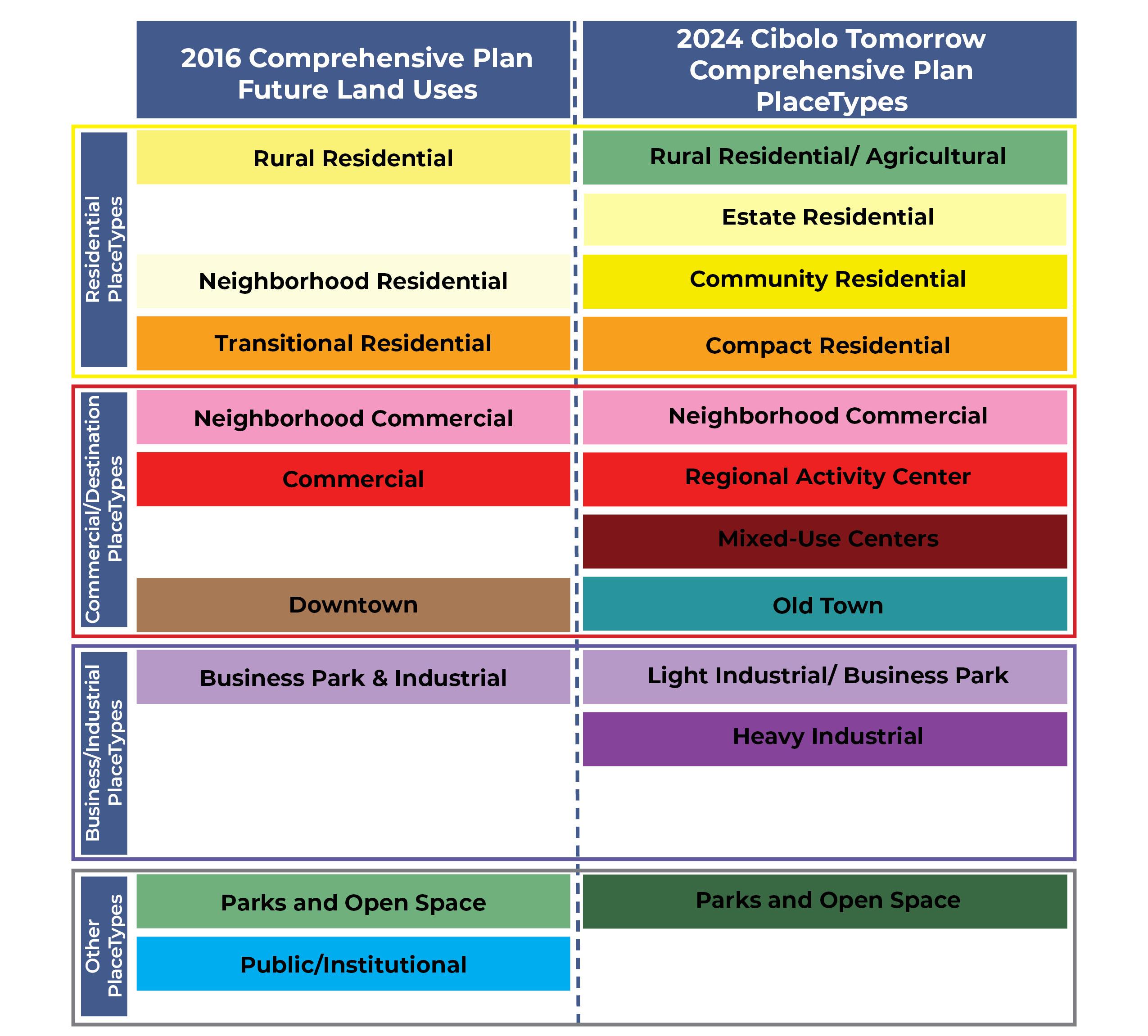
The Master Plan Advisory Committee (MPAC) was appointed by City Council to provide expertise, guidance, and input in developing and implementing the Comprehensive Plan. They were composed of diverse stakeholders, including community members, experts in relevant fields, and representatives of the Planning and Zoning Commission (P&Z), Economic Development Corporation (EDC), the Parks & Recreation Commission, and the Historic Committee. The MPAC played a crucial role in shaping the long-term vision and goals outlined in the plan. This advisory body often engaged in collaborative discussions and offered recommendations to ensure that the plan was aligned with the needs and aspirations of the community. Examples of recommendations that resulted from the MPAC meetings include the vision statement, guiding principles, PlaceTypes, the Future Land Use Map, the Master Thoroughfare Plan, and action items.
Stakeholder interviews were conducted to gather specific insights about the community regarding different topics. These interviews involved direct one-on-one or group conversations with key stakeholders to understand their expectations, priorities, and concerns. These interviews helped identify common goals and ensure that the diverse interests of relevant parties are considered in the planning process. For flexibility, some meetings were conducted virtually. Examples of groups that were interviewed included:
• High School Students
• Business Groups
• Neighborhood Groups
Diagnostic Meetings with City Staff City diagnostic meetings are collaborative sessions held to assess and analyze the current state of Cibolo and the challenges faced by those who encounter and address key issues on a day-to-day basis. The Staff workshop helped identify Cibolo’s strengths, weaknesses, opportunities, and threats.
Joint workshops are collaborative sessions that involve the participation of multiple city groups to work together towards a common goal or objective. The input gathered at these sessions were crucial in establishing a clear direction and vision for the plan. The groups engaged to attend workshops for the Comprehensive Plan were:
• Master Plan Advisory Committee
• Economic Development Corporation
• Planning and Zoning Commission
• City Council
Project ambassadors are volunteers who act as liaisons between the project team and the community. They play a vital role in communication and advocacy for the Comprehensive Plan. Project ambassadors were encouraged to conduct meetings with their cohorts to help facilitate conversations on a more personal level in the community.
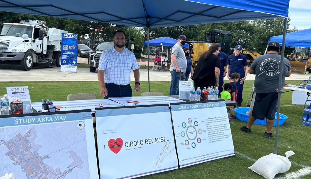
For the Cibolo Comprehensive Plan, additional feedback was gathered through community-wide events. These events included pop-up engagement opportunities at existing events happening in the city and open houses where community members could share their feedback. It was essential to include a variety of meeting forums, locations, times, and types to meet people where they were and get as many viewpoints and opinions as possible.
Three open house workshops were held to cultivate a high level of participation from the community. The first open house focused on gaining feedback on the overall vision of the plan. Participants were asked about Cibolo’s strengths, weaknesses, opportunities, and threats. The second open house focused on gathering feedback regarding the preferred land use scenario and master thoroughfare plan. The third open house focused on gaining feedback for the plan components recommended by the MPAC.
A booth for the Cibolo Comprehensive Plan was set up at a variety of community events in the community. These pop-ups were used to spread awareness about the plan and participate in a few visioning activities. The events included:
• Cibolo Summer Nights - Touch-A-Truck
• Cibolo Downtown Market Days
• Cibolo Summer Nights – Splash Zone
• Cibolofest
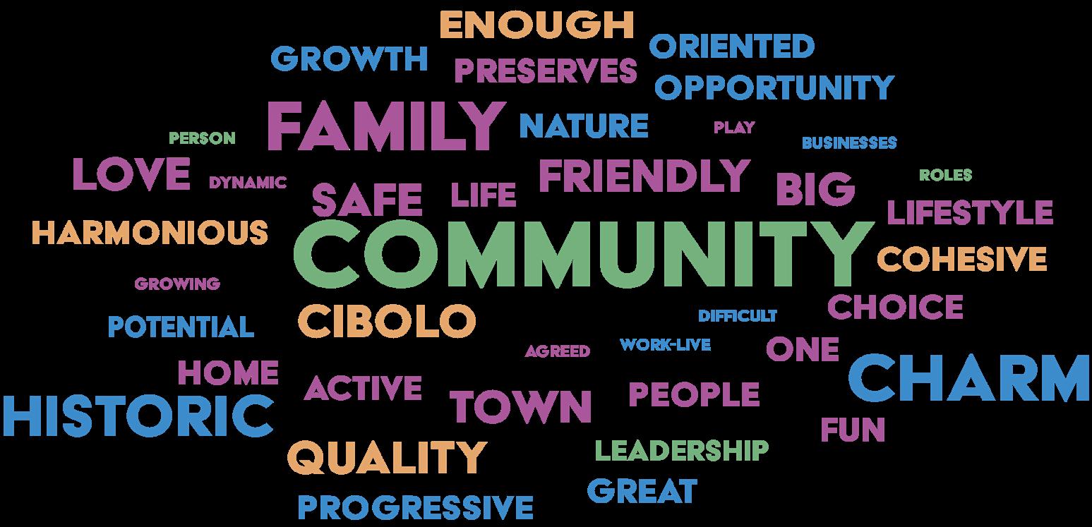
Participants of the community events were asked to provide one word that described what the future of Cibolo looked like to them. The following word-cloud was generated using those phrases.
Online engagement methods were used to increase accessibility for people unable to attend meetings in person.
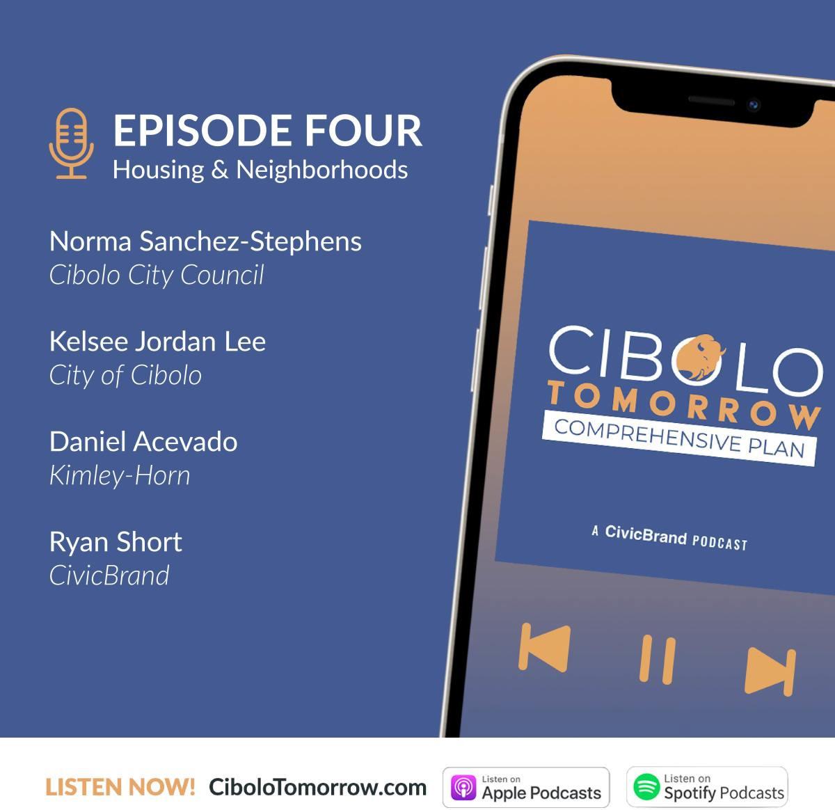
CiboloTomorrow.com is the project website that serves as a home base for all project updates, presentations, events, and documents regarding the plan. The website was used for online engagement opportunities like online surveys. Over the course of the project, podcasts were recorded with Council Members, City Staff, and project managers for an in depth conversation on the open chapters. The podcasts were available to the public on popular platforms including Apple and Spotify.
Two online surveys were hosted on the Cibolo Tomorrow Project website. Each survey addressed a key phase of the planning process. They garnered a total of 2,423 views, a combined total of over 200 participants, and over 8,000 individual responses.
*Does not include the IH-10 Corridor surveys
The online surveys included questions regarding current conditions, such as zoning, educational opportunities, housing accessibility, city facilities, and what participants want to see improved. This gave the planning team more insight when making recommendations and thinking about implementation.
• Maintenance and infrastructure improvements. Floodplain management and the aging infrastructure were major themes heard during the engagement process. Responsible planning practices to mitigate further flood risk was a top priority, as well as thinking about future growth and how the existing infrastructure will be impacted.
• Connectivity. Many participants emphasized the need for better north-to-south connectivity. The expansion and development of a roadway that would conveniently connect I-35 to FM 78 and then FM 78 to IH-10 should be prioritized.
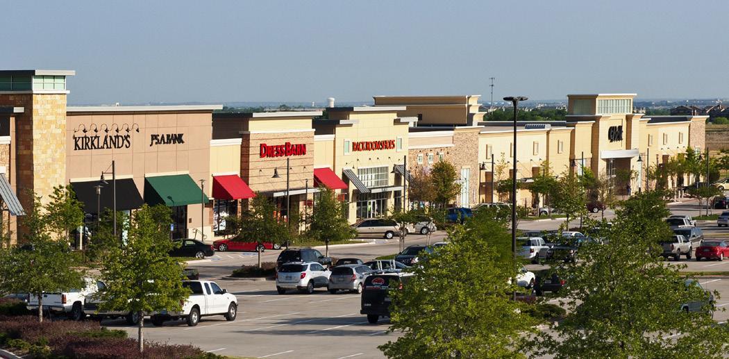
• Attracting new businesses. Residents want to see more offerings when it comes to places to gather, eat, and shop. They also want these places to be well connected.

Tomorrow Comprehensive Plan
The Cibolo Tomorrow Comprehensive Plan establishes a long-term vision for future growth, development, and investment in the community. The strategic direction provides the foundation upon which all the Plan’s actions, policies, and recommendations are based. It sets the overall framework for a more specific policy direction included in each chapter, and informs stakeholders of what the Plan seeks to achieve. Each of the Plan’s chapters include actions that should help the city achieve its vision in a manner that is consistent with the vision statement and guiding principles.
The strategic direction aims to guide recommendations by city staff and decisions by elected and appointed officials on future development and character of the community. The Cibolo Tomorrow Comprehensive Plan’s strategic direction includes three important components:
• Vision Statement
• Guiding Principles
• Preferred Scenario
The vision statement describes the community’s desired future physical, social, and economic conditions. As an aspirational statement, it is not intended to describe the current situation; rather, it is designed to create and deliver an image of the future that the community has stated that they want to achieve. The vision statement is structured to:
• Describe where the community wants to go (i.e., the result, not the process to get there)
• Be succinct and memorable
• Focus on essential elements of success
The vision statement for the Cibolo Tomorrow Comprehensive Plan is presented below. It describes the future of Cibolo that leaders and community members want to see by 2050.

Cibolo is a community where residents collaborate to shape their civic future by promoting its rich history, preserving a small-town feel, and investing in balanced development.
Guiding principles provide overall guidance across plan components, articulating the important general principles that should be followed to achieve the vision. These guiding principles apply at both the city-wide level and for smaller geographic areas of the community (e.g. the IH-10 Corridor), and they shape the more detailed policies that apply to specific chapters, such as mobility or infrastructure. The guiding principles for the Cibolo Tomorrow Comprehensive Plan are presented below.
1. Prioritize infrastructure to support existing needs and future growth.
2. Plan for and promote the health, safety, security, and general welfare of all residents.
3. Balance growth through responsible planning of city assets and land to promote a community environment.
4. Provide parks, recreation, trails, and open space to serve citizens and visitors while protecting the natural environment and wildlife.
5. Preserve the history of Cibolo and promote the friendly small town feel through community programs and events.
The Cibolo Tomorrow comprehensive planning process considered three alternative scenarios for the community – current trend development (Scenario A), corridor development (Scenario B), and nodal development (Scenario C). These scenarios were calibrated to accommodate expected future growth in Cibolo and were produced based on the input of staff, community stakeholders, and the MPAC.
Scenario A assumes that new development focuses on undeveloped areas within both the city limits and the ETJ. Scenario B assumes that new development is focused along major corridors like FM 1103, FM 78, and the IH-10 Corridor. Scenario C assumes that new development is focused inside the city limits and creates activity nodes as anchors for the community. All three scenarios were taken to the MPAC, EDC, P&Z, and the City Council, and
feedback was provided to yield a preferred scenario that contains the preferred attributes of scenarios A, B, and C. The preferred scenario depicts the desired pattern of growth, development, and reinvestment through the plan horizon of 2050.
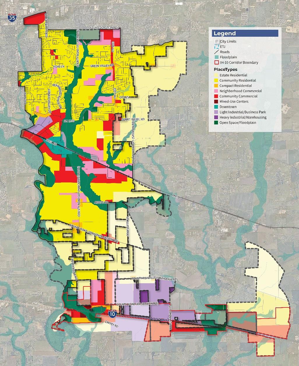
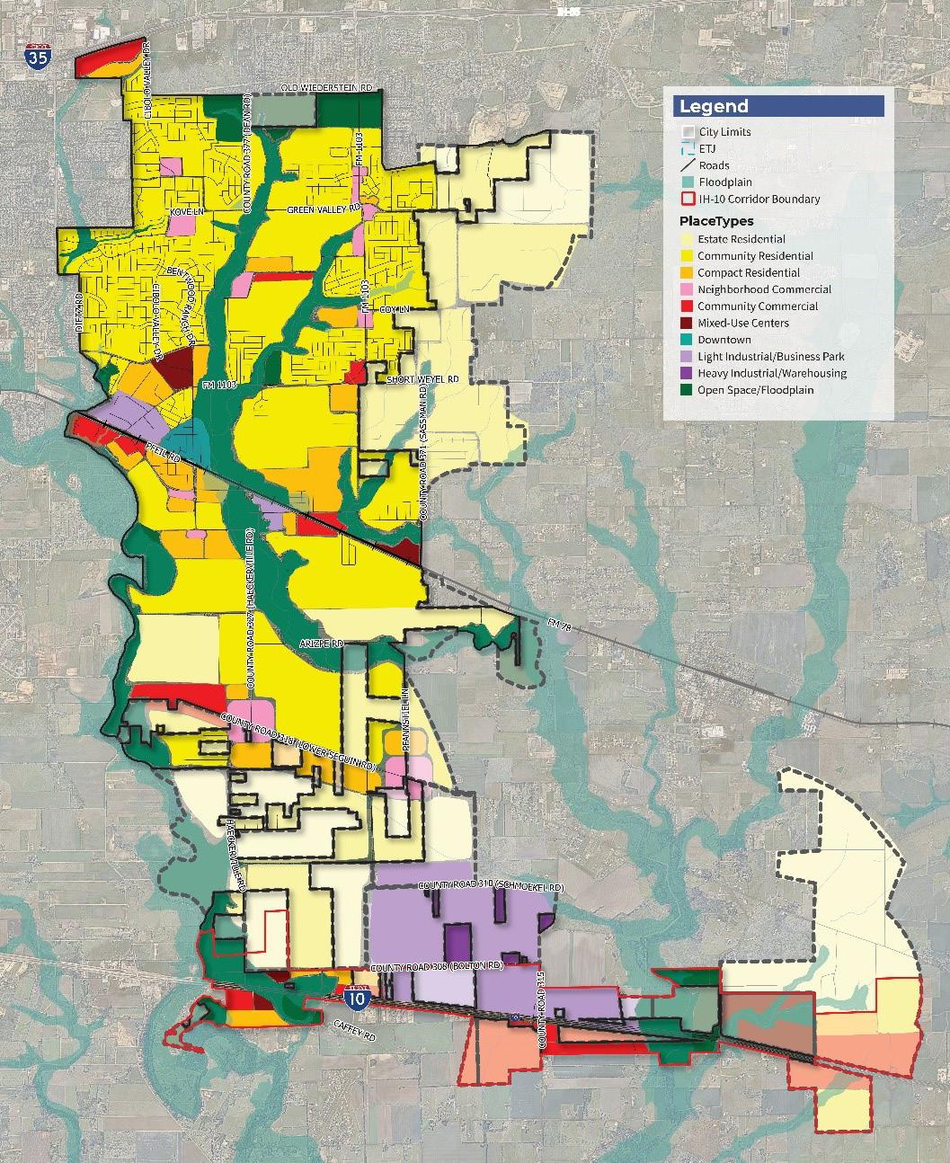
The scenario uses a set of PlaceTypes to describe the character of places that exist or will be created in the Cibolo Study Area (the existing incorporated city and the current ETJ). The PlaceTypes are described generally on page 24; the detailed descriptions of all Cibolo Tomorrow PlaceTypes are found in Chapter 3: Land Use and Character. Figure 3.12 the Future Land Use Map, portrays the overall development vision and preferred development scenario expressed by the community and follows the guiding principles presented above.
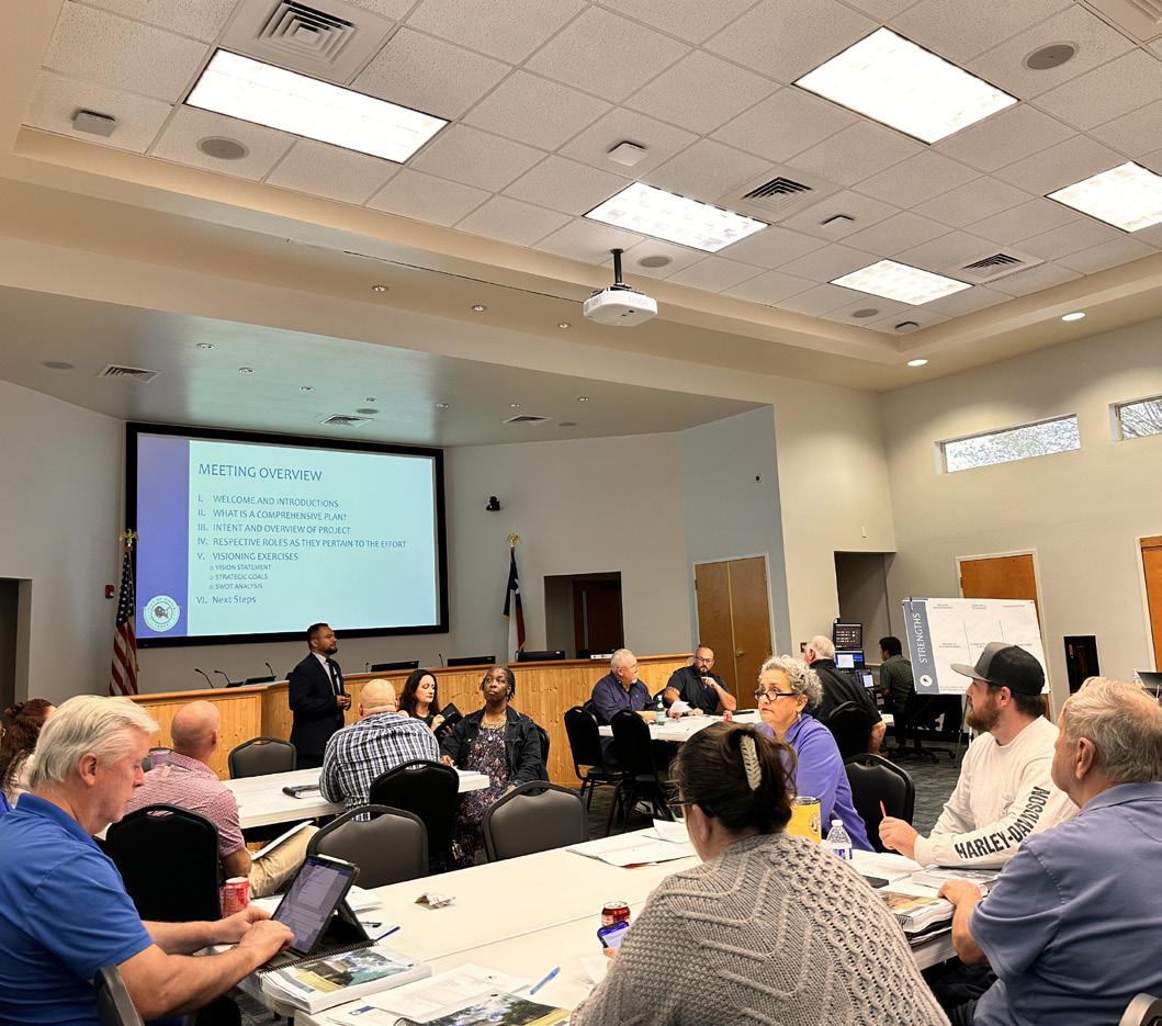
State of the City Meeting
PlaceTypes are the “color palette” used to represent the different places that could exist in Cibolo. Instead of referencing a single land use, they describe character and the quality of the place to be created. This can include what the mix of land uses, scale, and character would be in the PlaceType. PlaceTypes focus on overall development character and how future development aligns with the community’s broader goals, rather than basing decisions solely on land use. This gives city staff, the Planning & Zoning Commission, and City Council more flexibility in reviewing and assessing development proposals for specific properties. When making decisions on rezonings, Future Land Use Map Amendments and other types of development proposals, PlaceTypes can help provide direction and guidance.
The eleven PlaceTypes that follow were used in the alternative scenarios analysis phase of this process. PlaceTypes are summarized on the following pages. More detail related to each PlaceType is provided in the future land use strategy, found in Chapter 3: Land Use and Character. In Chapter 3, each PlaceType is represented by a set of characteristics, including the name, map color, a brief description, and a discussion of primary and secondary land uses, development densities, and supporting images.
Cibolo Tomorrow Comprehensive Plan
As Cibolo continues to experience rapid growth, one of the City’s main objectives is to be proactive in creating a well-balanced, sustainable, and quality-built environment. One of the ways in which Cibolo can accomplish this goal is to develop a strategy for land use that provides for predictable development. This land use strategy can also describe the character of the community and encourage development patterns that create a dynamic sense of place. As it moves into the plan horizon of 2050, it will be important to preserve Cibolo’s small-town identity and rich history, but also accommodate a robust city with increasing and everchanging needs. This chapter provides a land use framework that describes the existing conditions and character of the City and provides guidance for the future development pattern of Cibolo.
Similar to previous plans, an analysis of existing land use was conducted to help understand and predict growth patterns through 2050. In essence, property located within a city is comprised of various land uses, which when combined, create a diverse and functional environment. For Cibolo, the City utilizes various residential, commercial, industrial, public and institutional, and open space uses. Figure 3.1 displays Cibolo’s existing Land Use Map.
To assign differing areas of land use, aerial imagery was used in conjunction with zoning and other GIS spatial data to determine how properties would be classified. For the purposes of evaluating land use distribution against previous Cibolo Comprehensive Plans (1995, 2005, & 2016), this analysis uses categories that were previously established to best draw comparisons. Since these land uses were originally created, the approach to land use has shifted. These categories were revisited and extensively overhauled throughout the Cibolo Tomorrow comprehensive planning process and are reflected later in this report. The land use categories being compared and analyzed include:
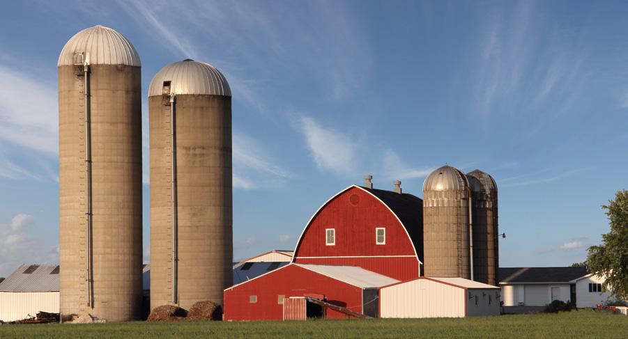
• Rural / Agriculture / Undeveloped (RAU). Properties comprised of undeveloped land or rural farmsteads and residences are classified as rural/agriculture/undeveloped. Many of these areas contain large undeveloped tracts or have been subdivided into a few small minor parcels along the road frontage. Almost all of these areas are served by rural roadway crosssections (i.e., no curb and gutter), wells, and on-site septic. Some of these properties contain active agricultural uses; others are just undeveloped open space.
• Vacant (VA). Properties located within the City limits which are currently undeveloped are classified as “vacant.” These areas are where existing public infrastructure and services are already readily available and could support active development. In some cases, sites may be platted as part of an active development but that specific lot is not yet developed. Generally, vacant property indicates that development is imminent or possible in the short-term.
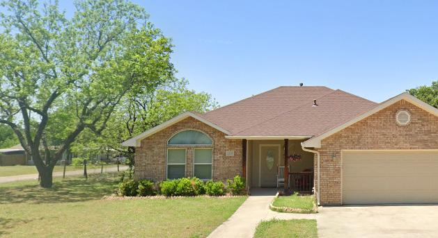
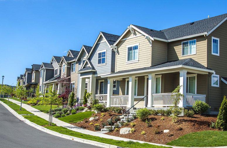
• Residential (LDR, MDR, HDR, MH). Properties located within the City limits or ETJ which are comprised of residential uses are classified into one of four subdistricts: low-density residential, medium-density residential, high-density residential, or manufactured housing / mobile home. These classifications are intended to enable better planning for compatibility with surrounding uses and utility requirements, while providing a basis of comparison to previous land use assessments. The four classifications can be further defined as:
• Low-Density Residential uses (LDR) are dwellings situated on parcels ranging from 0.5 acres to 10 acres.
• Medium-Density Residential uses (MDR) are dwellings situated on parcels ranging from approximately one-eighth to one-half-acre in size. These include most standard single-family residential uses (R-2 and R-3 zoning classifications). Individual vacant lots in actively developing subdivisions are considered occupied for the purposes of this analysis.
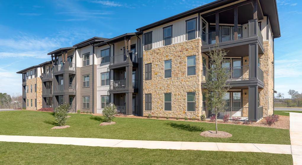
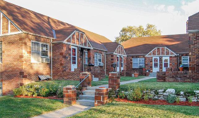
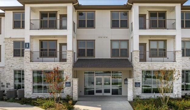
• High-Density Residential uses (HDR) include duplex, triplex, and apartment types.
• Manufactured Housing / Mobile Home uses (MH) are determined by the presence of a home commonly known as such, and as regulated by the Department of Housing and Urban Development. The size of the lot or parcel that these homes are situated on is not considered in this classification, with the exception of those instances in which the definition of “Rural / Agricultural / Undeveloped” is more appropriate.
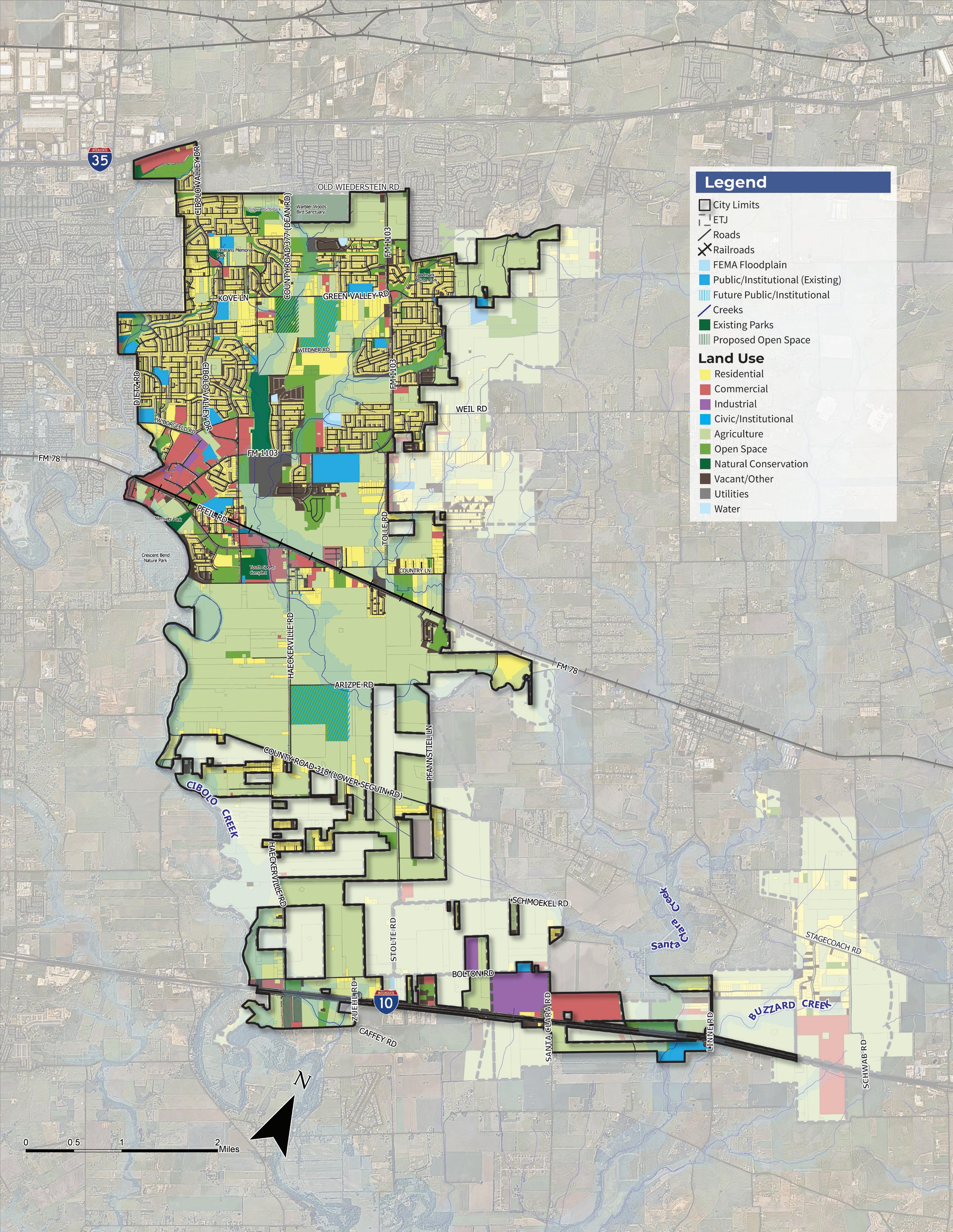
Figure 3.1 | 2024 Existing Land Use Map
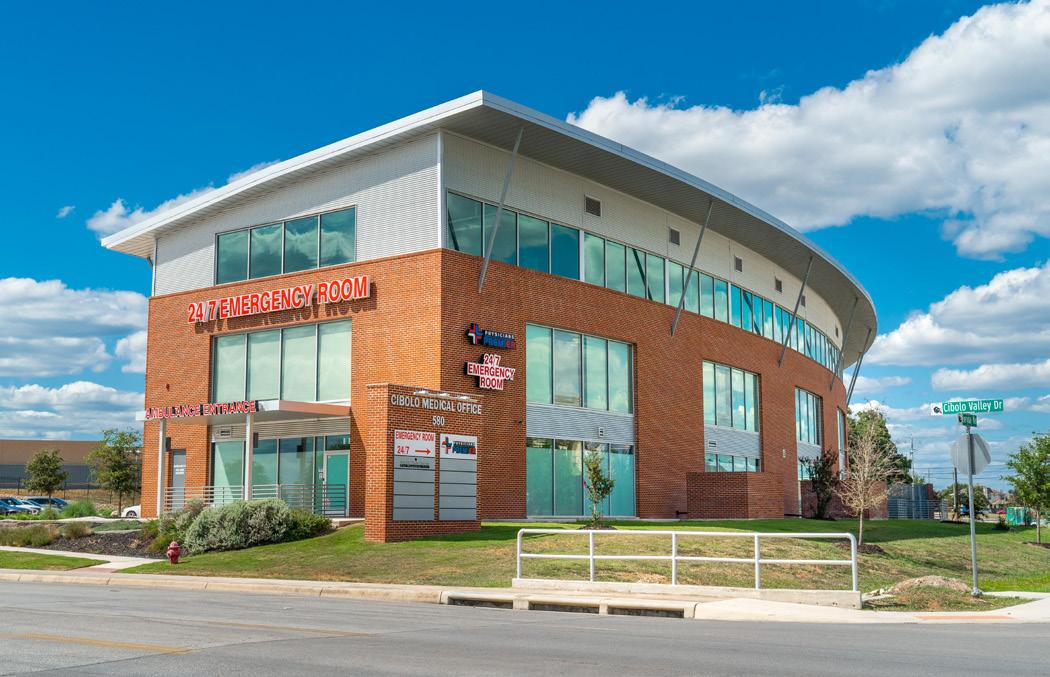
• Public / Institutional (PI). Properties located within the City which are comprised of public governmental or utility facilities are classified as “public / institutional.” In most cases, these areas are owned by public entities. Public use does not imply that the general public has access to the facilities; rather, it is intended to identify those uses which are under the control of a public body. In some cases, non-profits and/or private entities are also included in this category (e.g., private schools).
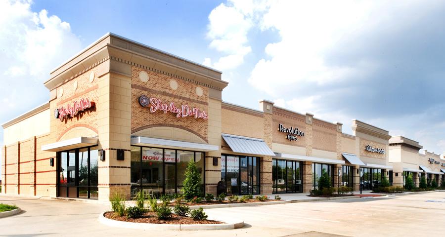
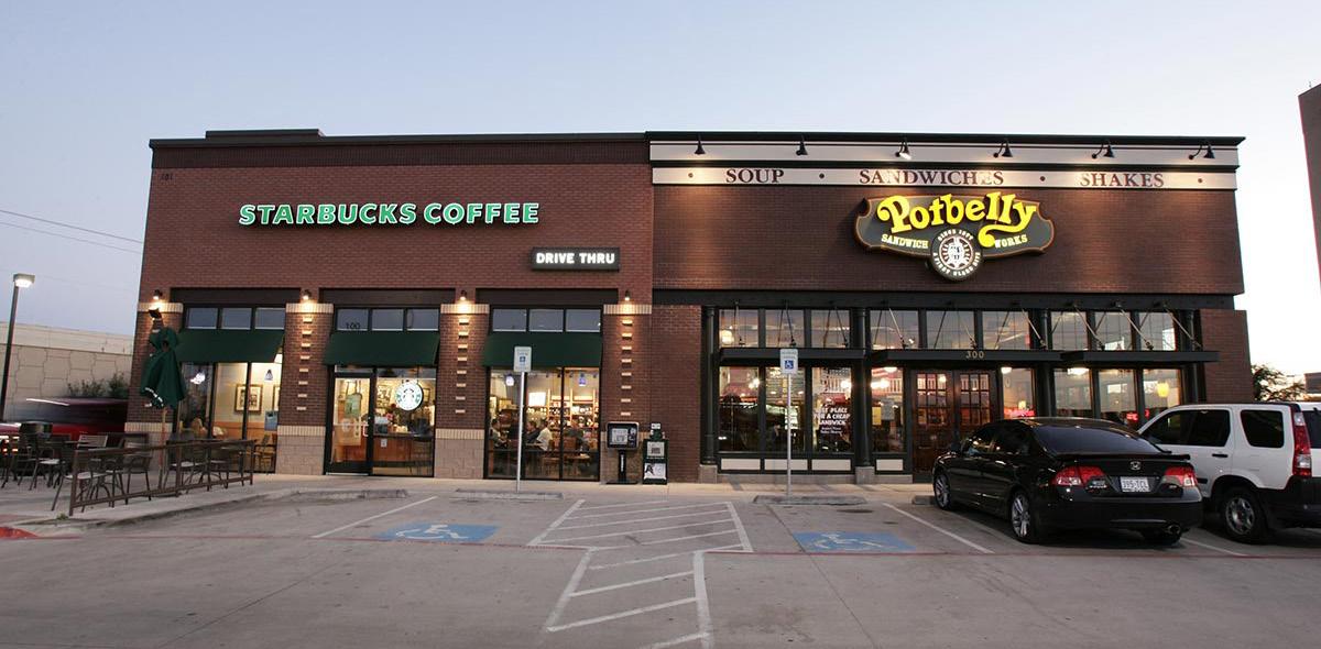
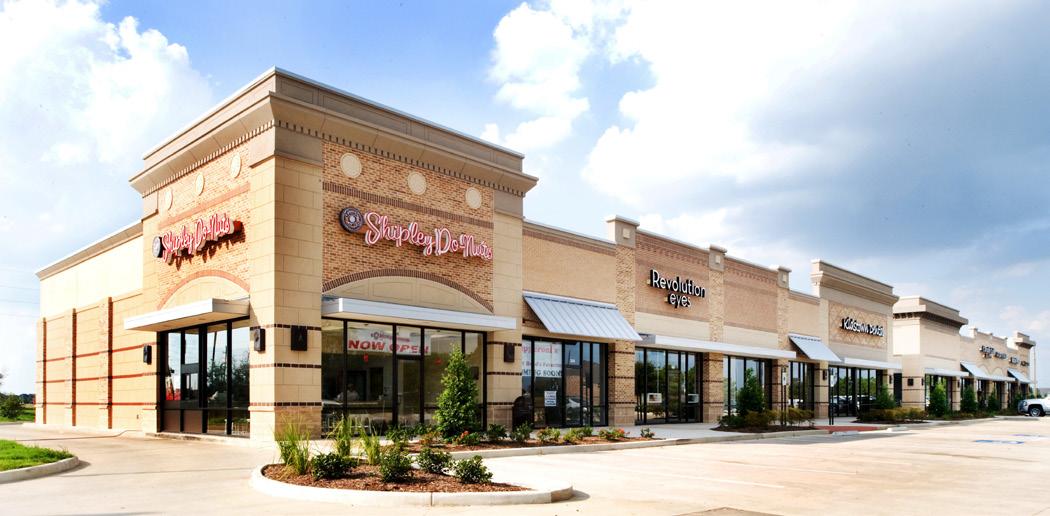
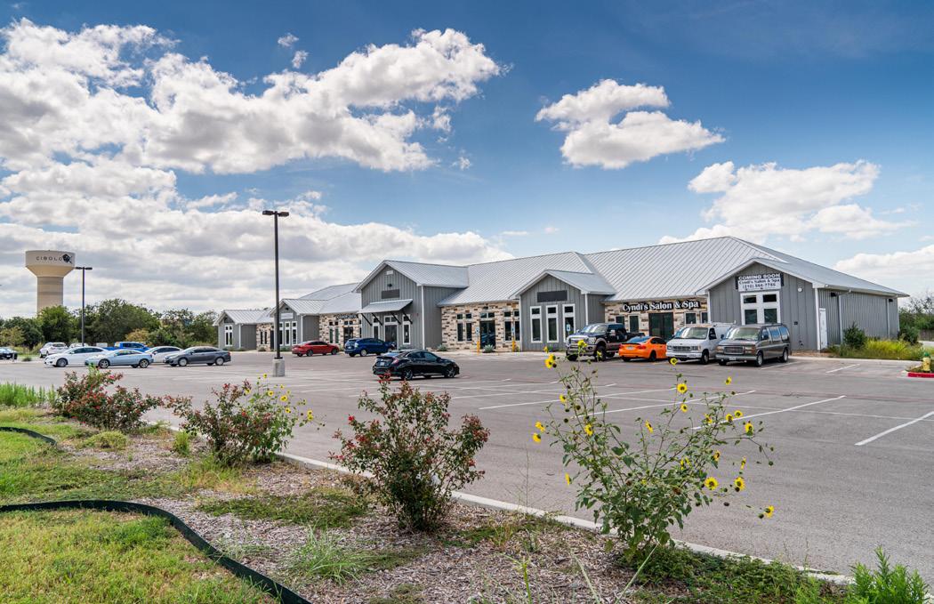
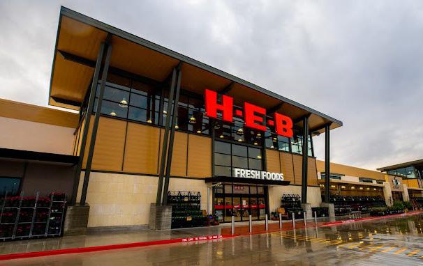
• Commercial / Retail (CR). Properties located within the City which offer the sale of products, goods, or services are classified as “commercial / retail.” Typical uses include: retail and wholesale sales of products, personal and non-personal services, offices, etc.
• Industrial (I). Properties located within the City which are comprised of industrial and business park uses are classified as “industrial.” Industrial use includes those business types which are generally considered either basic industry or resource extraction, custom or light manufacturing, stockyards, scrap and salvage operations, or vehicle storage.
• Parks (PK). Properties located within the City which are comprised of parkland and/or facilities which may be either publicly or privately owned and for which the primary use is intended for recreation, either passively or actively.
• Right-of-Way (ROW). Areas within the City which are not associated with a parcel of development is classified as “right-of-way.” These areas include public streets, rights-of-ways, and the railroad.
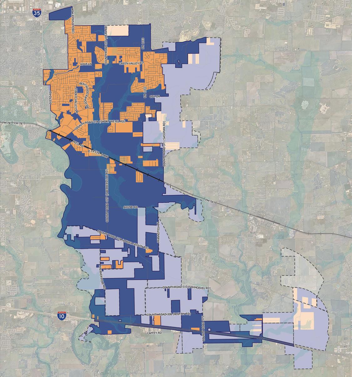
As indicated by Figure 3.3, the City still is partially undeveloped even with the exponential growth that has occurred over the past decade and a half. This is because the geographic extent of the City limits has also expanded rapidly. Consequently, 33 percent of the land area within the city limits of Cibolo is still undeveloped. When comparing this against development within Cibolo’s ETJ, nearly half of Cibolo’s full geographic area remains undeveloped. This undeveloped area has allowed City residents to maintain a “small town feel” despite all of the suburban growth that has occurred. As the City fully develops over time, Cibolo will need to place effort into preserving that character, if it wishes to maintain that same feel.
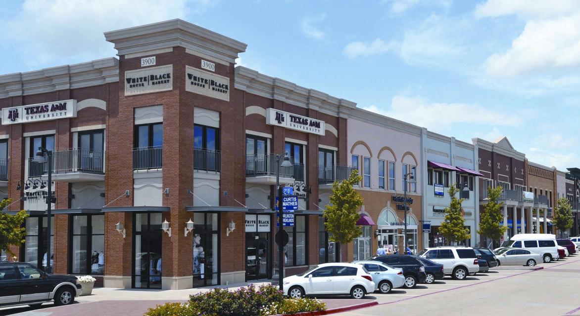
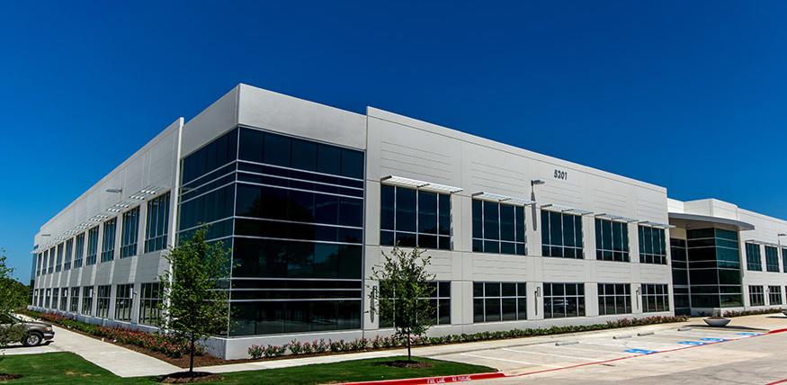
The City of Cibolo first developed as a traditional, railroad and agricultural town located along the Cibolo Valley. Parts of the Old Town grid still exist today with the oldest residential neighborhoods surrounding the core. While Main Street maintains its original character and feel as a walkable, small-town, mixed-use district, it is surrounded by and integrated with single-family residential housing. Just outside of the Old Town district, primarily to the north and west, the area is developed with commercial and industrial uses that locally support the City. Cibolo is mostly developed north of Farm-to-Market Road 78 (FM 78) and most of its infrastructure, neighborhoods, facilities, and amenities are in that area. The extents of the northern portions of Cibolo reach to Interstate Highway 35 (IH-35), providing regional connectivity to San Antonio and Austin. Part of the boom in residential development over the past couple decades can be attributed to the growth that has occurred along this corridor. While Cibolo does not have a significant amount of frontage along IH-35, it experienced a steady demand for residential development. Due to its adjacency to JBSARandolph just west of Cibolo, along FM 78, the City is also largely comprised of members of the military community.
In the southern portion of Cibolo, the character of the area that extends to Interstate Highway 10 (IH-10) is primarily rural. IH-10 is a regional facility that connects Cibolo to San Antonio and Houston. While IH-10 is not as developed as IH-35, future growth is anticipated to occur along this corridor as it matures. Because Cibolo has significant frontage along IH-10 that remains mostly undeveloped, the future of this corridor is of special interest to the community. The creation of a vision and plan for the district is outlined later in this chapter. Since the previous 2016 Comprehensive Plan, there has been an increase in development along this corridor, primarily for industrial uses.
Figure 3.3 | 2016 vs. 2024 Development Comparison
Undeveloped
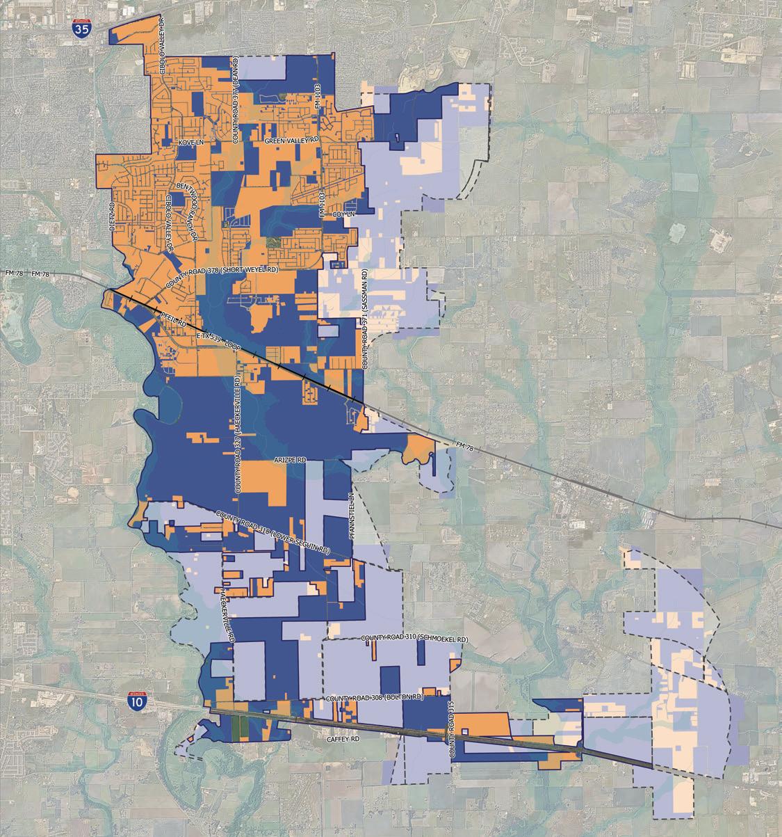
Figure 3.4, Existing Land Use Historical Comparisons, uses the 1995, 2005, and 2016 Comprehensive Master Plans and compares them to the 2024 land use areas. Some of the highlighted trends are as follows:
• There was a decrease in Rural/Agricultural/Undeveloped Land (RAU) over the span of the past 8 years (2016-2024), with a shift in the way this land is being tracked. Previously, LowDensity Residential was captured in the RAU category, as the Rural Residential land use and is now shifted into the appropriate category, showing an impact as well.
• From 2016-2024, there was a major increase in the amount of acreage of low density and high density residential.
• From 1995-2024, there was a steady increase in land being used for commercial.
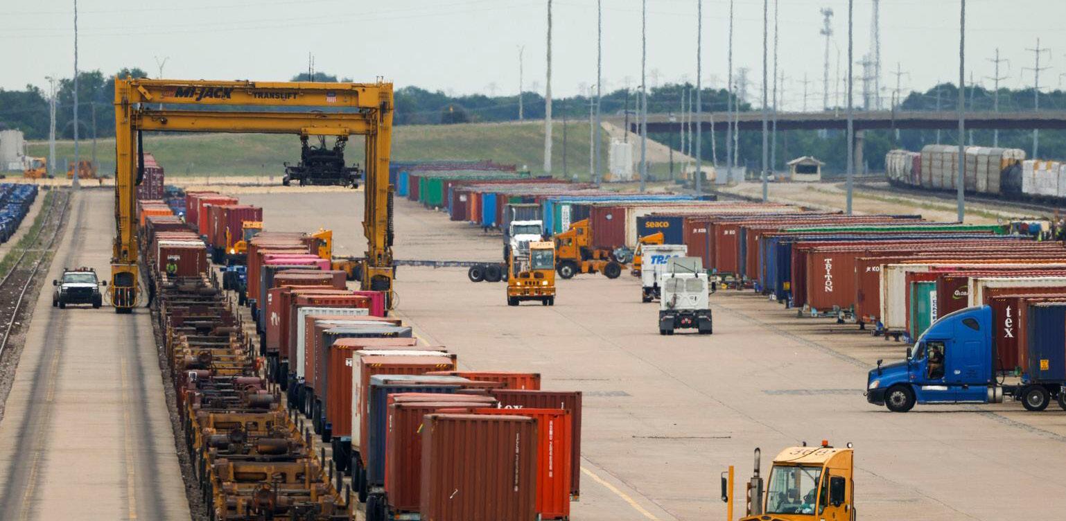
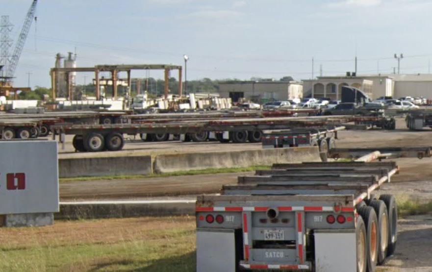
• From 2016-2024, there was a dramatic increase in industrial especially along the Interstate Highway 10 (IH-10) Corridor.
3.4 | Existing Land Use Historical Comparisons (City and ETJ)
Due to a strong Texas economy, close proximity to San Antonio, and easy access to Interstates 10 and 35, Cibolo has experienced unprecedented growth over the past decade and a half, placing it as one of the fastest growing cities in the country. The total population of the Study Area (City of Cibolo + ETJ) has increased by nearly 70 percent between 2010 and 2023, adding an estimated 15,695 residents. This has resulted in a 2023 population of approximately 38,140 people. By comparison, over the same period, Guadalupe County increased by 8.5 percent and the San Antonio metropolitan region grew by 25.9 percent. Since 2010, the Cibolo Study Area alone captured 20.4 percent of the population growth across the entire metropolitan region.
Although the number of residents living in the Cibolo Study Area in 2010 only made up approximately 13.0 percent of the overall population in the San Antonio metropolitan region, since 2010, that same Study Area has captured 20.4 percent of all new population growth. This points to this area’s increasing attractiveness for growth within the region. As a point of comparison, residents of the Study Area are, on average, younger with higher levels of educational attainment when compared to both the County and the metropolitan region. (Source: ESRI Business Analyst Online, US Census Data).
The population projections included in this analysis look out to the plan horizon of the year 2050. The Study Area (Cibolo and its ETJ) is expected to grow by 78.6 percent by 2050, reaching a total population of approximately 68,100. This equates to nearly 30,000 new residents added within the next 26 years. Over time, the average annual growth rate is anticipated to decrease as available land becomes more scarce and more challenging to develop. Although between 2010-2020 the average annual growth rate was 5.3 percent, this is projected to drop to 1.5 percent by 2050. These numbers are considering local sources, like the State of Texas and TxDOT, as well as third-party national socioeconomic forecasting companies like Woods & Poole.
Consistent with trends seen across the country, between the years 2010 and 2019, the San Antonio region experienced positive net job growth year-over-year, posting annual net job gains averaging more than 21,000 jobs annually. The onset of the COVID-19 pandemic led to another significant net loss of jobs in 2020; however, the region experienced rapid recovery, adding more than 85,000 jobs back to the economy in 2021 and 2022 combined. Cibolo benefits from being part of a growing local economy.
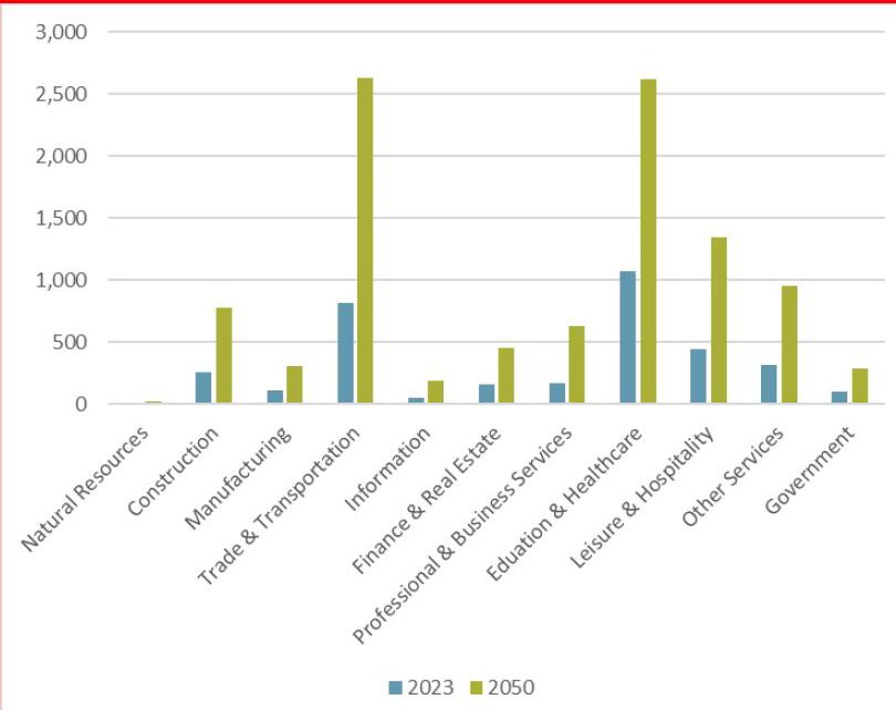
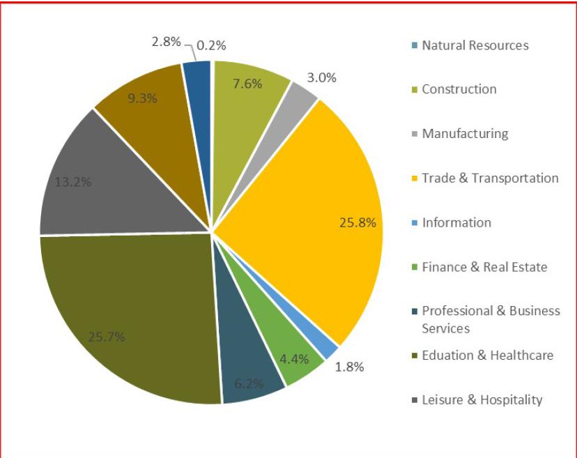
To provide a snapshot of jobs in the Study Area, data from ESRI’s Business Analyst Online was reviewed. ESRI utilizes data points from a company called Data Axle, Inc., which counts both the number of businesses and employees within custom geographies. Based on this dataset, the Study Area contains an estimated 3,500 jobs. The largest sector represented is Education, accounting for 22.6 percent of all jobs, followed by Retail Trade (16.3 percent) and Leisure & Hospitality (12.7 percent). Leisure & Hospitality includes restaurant, recreation, and hospitality workers. Combined, these three sectors comprise nearly half of all jobs in the Study Area.
Employment in the Cibolo Study Area is expected to increase by approximately 6,600 new jobs through 2050. These forecasts take into consideration the slow down during the COVID-19 pandemic, followed by accelerated recovery in 2021 and 2022. Based on these projections, the Cibolo Study Area could reach approximately 10,200 jobs by 2050.
Understanding how the distribution of jobs may change in the future helps to estimate future demand for these jobs, whether they gravitate to retail, office, or industrial buildings.
Residential demand is based on projected Study Area population and household growth through 2050. Based on population growth of 29,960 people, the Study Area could support approximately 10,400 new housing units (across single-family and multi-family housing types). Housing demand considers a continuation of average household sizes and the current housing vacancy rate, which is estimated at approximately 4.6 percent. A variety of housing products will be attractive in the Study Area, representing the current inventory and the known development pipeline. Given the low forsale and rental vacancy rates, both types will be in demand in the Study Area in the future.
Retail demand forecasts rely on a variety of data points that ultimately estimate future space needs based on anticipated levels of consumer spending. Key data points consulted in this forecast for the Study Area include past and current performance of existing retail space, the impact that COVID-19 and online shopping has had on the delivery of retail space, projected household and income growth, inflow demand from non-Study Area residents, and estimated leakage into other areas of the larger region based on travel patterns. It should be noted that Cibolo’s explosive growth in recent years may have influenced demand projections based on data from third-party sources. Population forecasts for the Study Area project an increase of 29,960 people through 2050, a slower growth rate than 2010-2023, but still notable.
Using defined retail categories that are most likely to be represented in modern retail developments, like food, dining, and entertainment, apparel and personal goods, and home furnishings, the expenditure potential of local households could increase from $428 million in 2023 to nearly $7.3 billion in 2050. These forecasts are derived from population projections presented previously, as well as average percentages of income spent on specific types of goods and services as reported by ESRI from interpreted U.S. Census data. These projected expenditure totals also consider the performance of retail already existing in the area, as well as impacts from spending by employees and visitors. The influx of spending from travelers along major regional thoroughfares will also have an impact on retail demand in the future, particularly along the less developed IH-10 corridor.
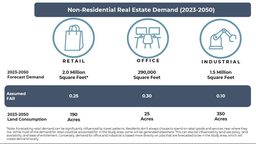
As shown in Figure 3.9, the net consumer spending increase through 2050 is estimated at $534 million for households within the Study Area. Based on average sales per square foot figures, this increase in spending potential would equate to a net square footage demand of over 2 million. This household-generated demand could be spent anywhere (including outside of the Study Area), but a substantial portion would be spent within or close proximity, particularly for food, convenience, and drug store purchases. This analysis assumes that for most categories, between 30% and 50% of the spending potential would be spent locally, resulting in a net Study Area demand of approximately 850,000 square feet. The balance of the future spending potential will occur outside the Study Area; however, the local amount will ultimately be informed by future land use policy and development codes. The business categories with the highest square footage demand include Food at Home (grocery stores), Food Away from Home (dining establishments), Household Improvement, and Automotive.
Office demand is forecasted for the Study Area based on the number of future jobs that would likely require office space. This projection considers the changing landscape of office usage in a period where hybrid work arrangements are increasingly more common across many industries. With office demand recorded at an average space of 200 square feet per employee, this equates to approximately 290,000 square feet of new office space needed through 2050. Using a similar methodology but with a space assumption of 1,000 square feet needed per employee, industrial demand could total at least 1.5 million square feet, assuming higher rates of space needed per employee, particularly for Transportation, Warehousing, and Logistics users.
The industrial forecasts presented here are likely conservative and should be revisited following the completion of the Strategic Economic Development Plan, which will inform future target markets for Cibolo and refine estimates that rely on the amount of square footage required per employee.
Industrial projections are based on incremental job growth. It is highly difficult to predict larger scale relocations, which could add to future demand. This is also applicable to industries that seek to be near larger employers, which is particularly relevant for the automotive industry that is currently influencing economic development in the region.
Based on demand forecasts, the Study Area could support a variety of real estate sectors (singlefamily and multi-family) through 2050. The demand summary listed in Figure 3.9 provides estimated units or square footage that could be supported through 2050. For non-residential sectors, the acreage needed to support the forecasted demand is also provided. Land consumption for nonresidential uses is based on typical floor area ratios specific to each development type.
The 2022 FLUM contains a combined total of approximately 3,700 acres of property that is classified under either the Neighborhood Commercial or Commercial categories. This is more than 20 times what the 2023 to 2050 forecasts for retail space have shown a need for. This stark contrast highlights the currently overly aggressive commercial designations in the FLUM, which far exceed the projected need for retail space through 2050. Similarly, Business Park and Industrial acreage in the current FLUM totals more than 1,800 acres, although based on demand, only 375 acres are needed to support forecast development through 2050. It should be noted that larger industrial users, including warehouse and transportation companies that would be attracted to the IH-10 corridor, are hard to accurately forecast for, so having some additional Business Park and Industrial acreage to support larger users is advised.
Figure 3.10 | Non-residential Real Estate Demand
PlaceTypes are designations for the Future Land Use Map that describe the predominant use and character of an area. Rather than point to a single use or zoning category, PlaceTypes portray a development pattern that is established through scale, density and the way it is used.
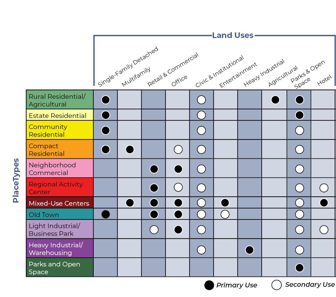
Early in the planning process a development pattern matrix was provided to analyze the relationship between PlaceType categories and their potential land uses as reflected in Figure 3.11 below.
The following pages depict PlaceType descriptions for each category including their name, designated color, character and intent, primary and secondary uses, development densities, supporting images and example locations.
Rural Residential/ Agricultural is intended for areas within the City which will maintain a rural character during the plan horizon and beyond. These areas are comprised of natural undeveloped space, agriculture, and large lots with large lot minimums.
land use considerations
PRIMARY LAND USES
Single-Family Detached Homes, Agricultural, Parks and Open Space
SECONDARY LAND USES
Civic and Institutional, Agricultural Business
INDICATORS & ASSUMPTIONS
Lot size (range) more than 2 acres
EXAMPLE LOCATIONS
Large tracts of undeveloped land between FM 78 & IH-10, Borgfeld property on Cibolo Valley Drive


Predominantly single-family housing on large lots located throughout the community. Residential uses are oriented with the front of the home facing the street and typically in a subdivision layout with access to some utilities. These kinds of lots may include farm and livestock uses. Cluster development, which involves the conservation of shared open space, natural areas, and scenic views, in exchange for smaller lot sizes, may be an alternative approach in certain circumstances.
land use considerations
Single-Family Detached Homes, Cluster Development, Parks and Open Space
Civic and Institutional
INDICATORS & ASSUMPTIONS
Lot size (range) 1/2 to 2 acres
EXAMPLE LOCATIONS
Single-Family Detached Homes: Persimmon Drive (south of Green Valley Road)
Cluster Development: Spring Mesa in Arvada, CO


Predominantly single-family housing developments located throughout the community. Homes are in subdivisions with all utilities, residential streets, sidewalks, and parks, or have connections to neighborhood parks. May have an elementary or middle school in the neighborhood. Convenience commercial businesses may be found around the perimeter with appropriate transitions to support the neighborhood. Homes are typically buffered from non-residential developments via transitional uses or landscaping.
land use considerations
PRIMARY LAND USES
Single-Family Detached Homes
SECONDARY LAND USES
Civic and Institutional, Parks and Open Space
INDICATORS & ASSUMPTIONS
Lot size (range) 9,000 sq ft to 1/2 acre (21,780 sq ft)
Mesa Western

Provides a variety of housing types, including small-lot single-family detached, patio homes, townhomes, and duplexes, in a compact network of complete, walkable streets that are easy to navigate by car, bicycle, or foot. This PlaceType also supports multifamily. Homes are in subdivisions with all utilities, residential streets, sidewalks, and parks, or have connections to neighborhood parks. Neighborhoods may be adjacent to neighborhood-oriented businesses. Key intersections (i.e., FM 78 and FM 1103) and areas within walking distance of local commercial, are the most appropriate locations for this PlaceType, except when between residential neighborhoods and communities (infill development). This PlaceType aims to maintain the charm and integrity of existing single-family neighborhoods while thoughtfully integrating different housing types. It focuses on preserving the character of these neighborhoods, ensuring that any increase in density is seamless and respectful of the existing community.
PRIMARY LAND USES
Single-Family Detached Homes, Single-Family
Attached Homes, Patio Homes, Townhomes, Multifamily Complex
SECONDARY LAND USES
Civic and Institutional, Small Scale Office, Parks and Open Space
INDICATORS & ASSUMPTIONS
Single Family lot size (range) up to 9,000 sq ft
EXAMPLE LOCATIONS
Single Family Detached Homes: Bentwood Ranch, Cibolo Valley Ranch
Duplexes: Sydney Cove
Multifamily Complexes: Grand at Cibolo, Trophy Oak
Character and Intent
Neighborhood Commercial development is characterized by small, free-standing buildings containing one or more businesses. Neighborhood Commercial primarily provides family-oriented services for the surrounding neighborhoods and city. They are generally located within walking distance of surrounding residential uses and neighborhoods. Business types may include restaurants, local retail, medical offices, banks, and other retail and service uses.
land use considerations
PRIMARY LAND USES
Neighborhood Retail, Office
SECONDARY LAND USES
Civic and Institutional, Parks and Open Space
Cibolo Valley Square, Steele Plaza, and Turning Stone Animal Hospital
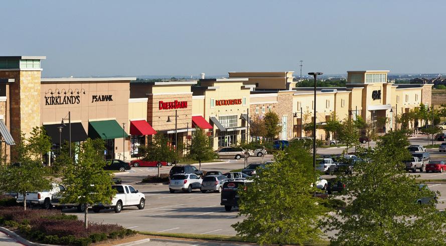
Regional Activity Center developments are larger in scale and attract regional traffic for shopping and retail needs. These commercial centers are anchored by mid to big-box retailers located along major thoroughfares (i.e., freeways and arterial roads). National retailers and grocery stores would typically be located in this PlaceType. Regional Activity Centers can also contain smaller retail or office destinations as well, such as medical offices or boutiques, but are typically anchored by several national vendors. Business types may include restaurants, national retailers, discount stores, grocery stores, fast food, and other retail and service uses.
land use considerations
PRIMARY LAND USES
Community and regional-serving retail and commercial
SECONDARY LAND USES
Civic and Institutional, Medical, Small Scale Retail, Hotel, Parks and Open Space, Office
Cibolo Crossing Shopping Center, Walmart, H-E-B, Shops at Cibolo Bend, Chipotle/City Vet Complex
Mixed-Use Centers are master planned to offer the ability to live, work, and play in one geographically compact area with a high intensity of uses organized around nodes of activity. This PlaceType includes a mixture of different housing options within close proximity to goods and services and may serve as an employment center and shopping destination for adjacent neighborhoods. Buildings are typically built to the sidewalk and located on internal local streets in order to create a pedestrian-oriented environment. They can be one, two or more stories with residences or offices located above streetlevel storefronts. This PlaceType includes a space for recreation and gathering. The design and scale of development in a MixedUse Center encourages active living through a comprehensive network of walkable, complete streets.
land use considerations
PRIMARY LAND USES
Retail, Large Scale Commercial, Condominiums, Mixed-Use Multifamily, Offices, Hotel, Entertainment Venues
SECONDARY LAND USES
Civic and Institutional, Offices, Parks and Open Space
EXAMPLE LOCATIONS
City of Southlake Town Center, The Quarry
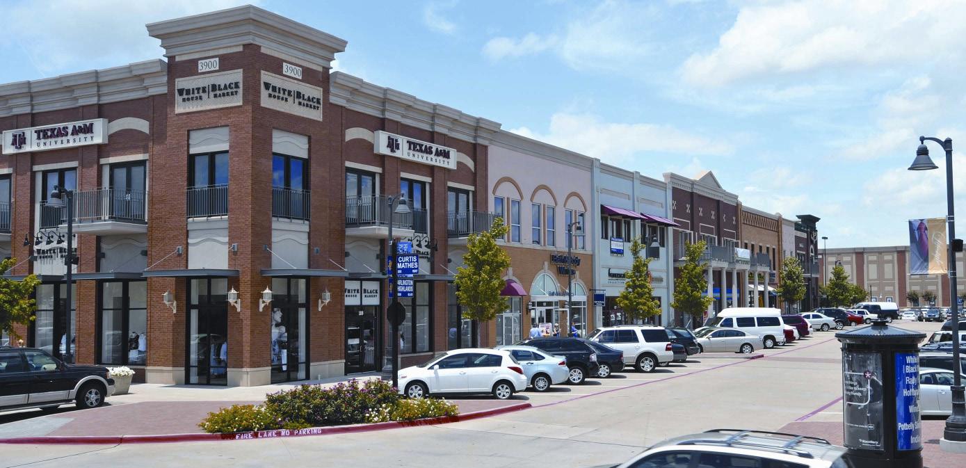
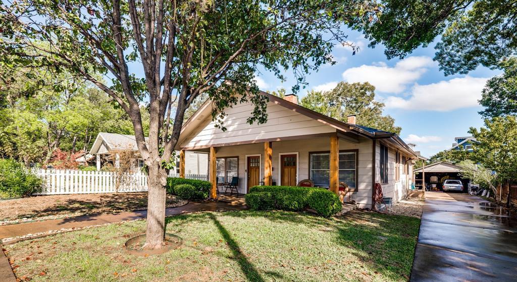
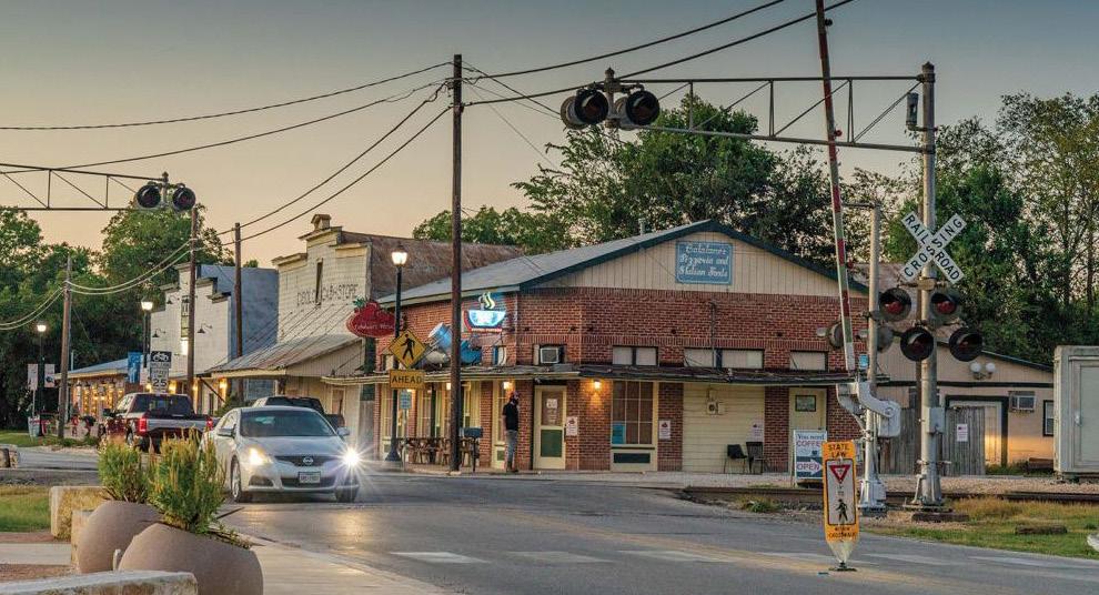
The Old Town is a centrally located area containing a mix of residential, commercial, civic and entertainment uses. It is a destination for shopping and entertainment and promotes independently-owned, familyfriendly businesses that attract patrons from surrounding neighborhoods and cities. These areas are built in traditional, small-scale downtown forms and coexists harmoniously with surrounding residential uses. The design and scale of development is pedestrianoriented, can be one to two stories, and encourages active living and a mix of uses within an interconnected network of blocks and streets.
land use considerations
PRIMARY
Single-Family Detached Homes, Garden Homes, Small Scale Retail, Office, Bed and Breakfast
Civic and Institutional, Parks and Open Space, Small Scale Entertainment Venues, Personal Services
Old Town
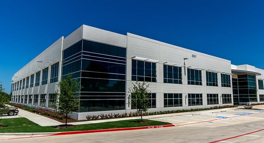
Light Industrial/Business Park includes business and office-related land uses, warehousing, and light industrial and manufacturing uses that occur indoors and do not involve the processing of raw materials. Office and business park land uses may be supported by nearby retail and restaurant uses.
land use considerations
Business Parks, Technology/Data Centers, Flex Offices/Warehousing, Office, Light Manufacturing (i.e., Clothing and Fabric Manufacturing, Electronics and Appliance Manufacturing, Food and Beverage Product Manufacturing, etc.), Call Centers, Logistics
Small Scale Retail, Civic and Institutional, Parks and Open Space, Hotel
EXAMPLE LOCATIONS
AISIN, Schneider Industrial Park, Jorgensen Industrial Park
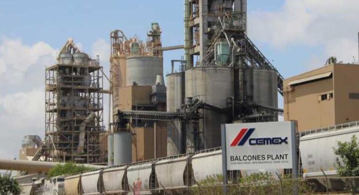
Heavy Industrial areas provide jobs and keep people in the city. This PlaceType is generally found near major transportation corridors (i.e., highways and railways) and may include heavy manufacturing and production uses that occur outdoors and involve the processing of raw materials.
land use considerations
PRIMARY LAND USES
Manufacturing, Major Utility Facilities, Mining, Extraction Services, etc.
SECONDARY LAND USES
Civic and Institutional, Parks and Open Space
Heavy manufacturing and industrial uses along regional thoroughfares

Open Space indicates existing and future planned parks. Future parks are allowed in all PlaceTypes; however, this designation protects existing parks and recreational facilities from assumed future development. It also helps earmark land that is intended to be dedicated for parkland in the future and preserve areas that may have water retention or flood concerns.
Parks and Open Space, Trails, Floodplain Management
Schlather Park, Niemietz Park, Veterans Memorial Park, Al Rich Park, Cibolo Sports Complex, Ron Pedde Community Garden
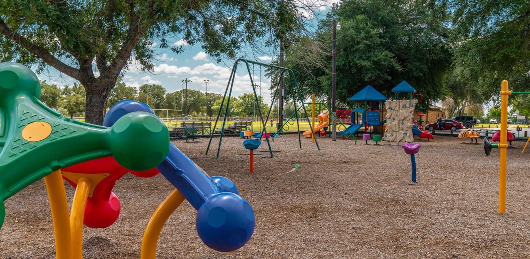
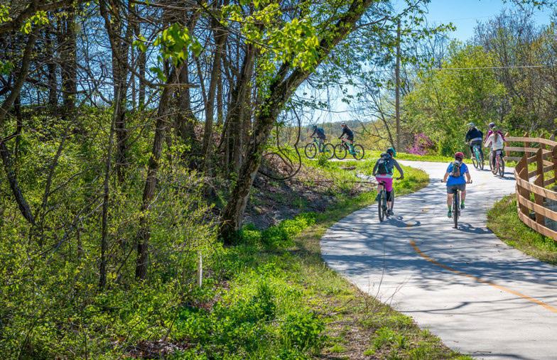
Figure 3.12 depicts the 2024 Future Land Use Map for Cibolo and graphically represents the collective future vision and development framework for the community by 2050.
2016 future land use categories vs 2024 Placetypes
The table below makes a high-level comparison between the future land uses identified in the 2016 Comprehensive Future Land Use Map to the PlaceTypes that have been defined for the 2024 Comprehensive Future Land Use Map. It is important to remember that the land uses from 2016 function differently than the 2024 PlaceTypes. Previously future land uses were more tied to specific uses, whereas PlaceTypes describe the predominant character and provide a wider range of uses that would fit within that designation.
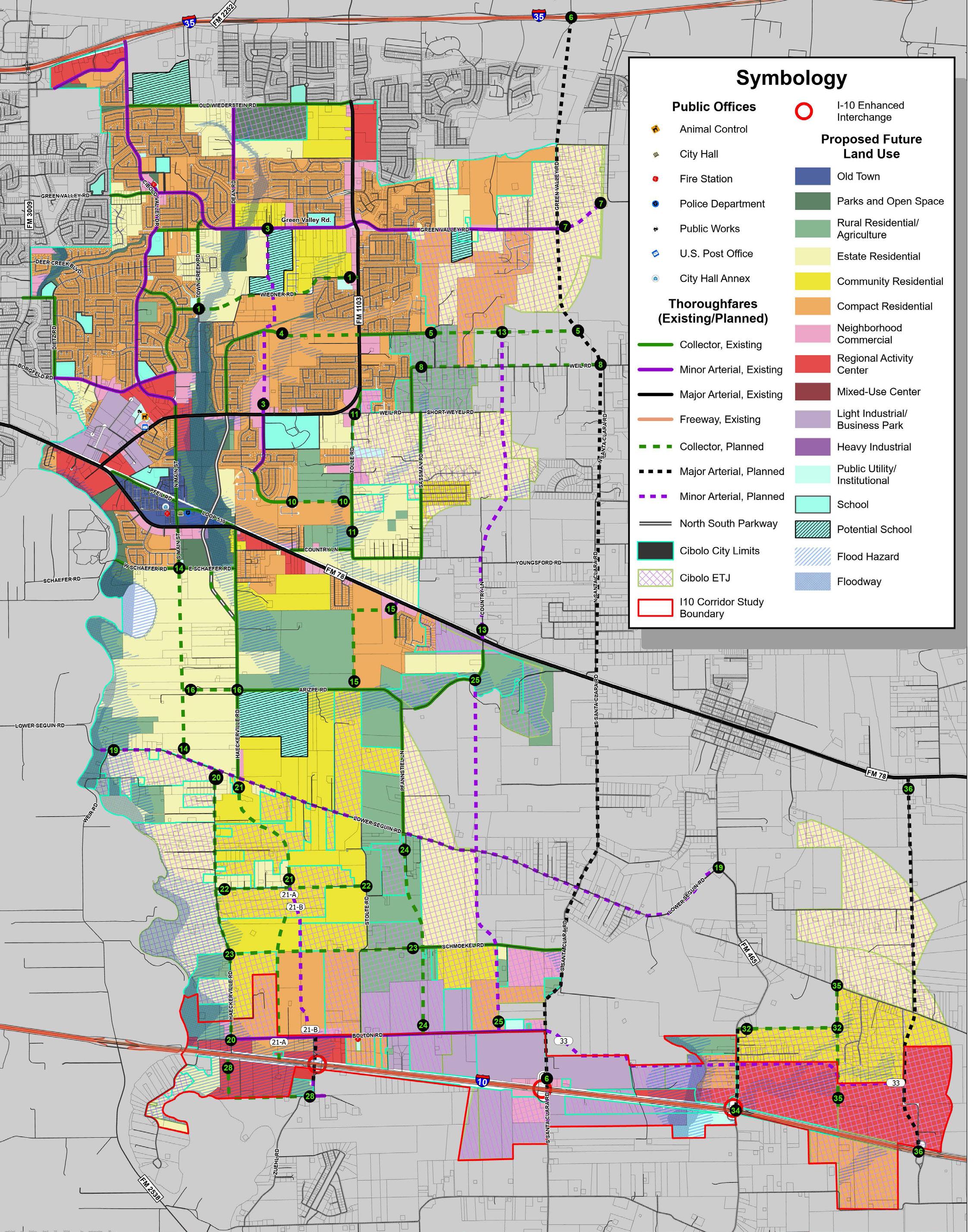
3.12 | 2024 Future Land Use Map
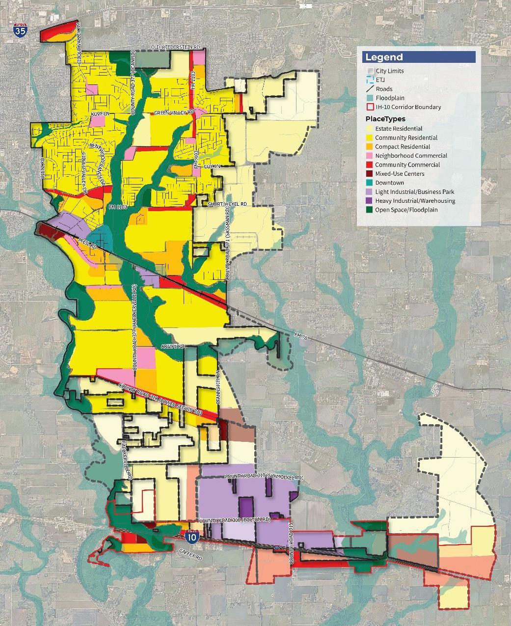
Through the process of re-calibrating the previous land use categories from the 2016 Future Land Use Map (Figure 3.13) into the PlaceType classifications outlined herein (Figure 3.14), a shift in thinking occurred regarding how residential distribution should look as Cibolo moves into the future. In addition, a reduction in the projected demand for future commercial and industrial uses was uncovered through a market analysis of the Study Area. The 2024 FLUM addressed this analysis by right-sizing an appropriate amount of commercial and industrial uses based on those findings. These factors played key roles in the development of the current Future Land Use Map (Figure 3.13) and the projected outlook for 2050.
3.14 | 2022 Future Land Use Comparisons
Note: Heavy Industrial and Mixed-Use Centers are not reflected in this chart because they are not currently shown on the FLUM.
The land use chapter plays a pivotal role in establishing guidelines for future development in Cibolo. As the City continues to evolve and expand, it is imperative to adopt strategies that balance the need for development with the preservation of Cibolo’s natural resources and quality of life. This section outlines a series of recommendations and land use actions designed to guide the community toward a sustainable and resilient future. The land use action listed on page 58 should be implemented following the Future Land Use Map on page 51. The common themes heard during the engagement process that pertained to land use and character were:
• Responsible Growth
• Diversify Land Use
• Preservation of Open Space
Cibolo, like many other cities, is experiencing significant population growth, resulting in increased demand for public infrastructure and services. As the population expands, the City faces the challenge of accommodating new residents while ensuring that essential amenities such as water, sewage, roads, and public safety services are readily available. To address this challenge, Cibolo may decide to develop a comprehensive annexation policy that aligns with the provision of adequate public infrastructure and services.
An effective annexation policy will enable the City to strategically expand its boundaries to accommodate population growth while ensuring that the necessary infrastructure supports new development. This policy should consider factors such as existing infrastructure capacity, projected population growth, land use patterns, and service delivery capabilities. By carefully planning and coordinating annexation efforts, Cibolo can avoid overextending its resources and ensure that new residents have access to the same level of public services as existing residents. Figure 3.15 displays the existing water lines in Cibolo, combined with the Future Land Use Map, to identify areas in the City where future infrastructure investment will be needed to support anticipated land uses. Future policy should also include more in-depth analysis for prioritizing areas with the greatest need for infrastructure improvements. In addition, coordinating with existing service providers can ensure a seamless transition of utility services for new residents.
To accommodate for new growth, strategic planning along major corridors and anchors for the community can help maximize economic opportunities for new developments and reinvestment areas. These areas include:
• Old Town
• FM 1103
• FM 78
• IH-10
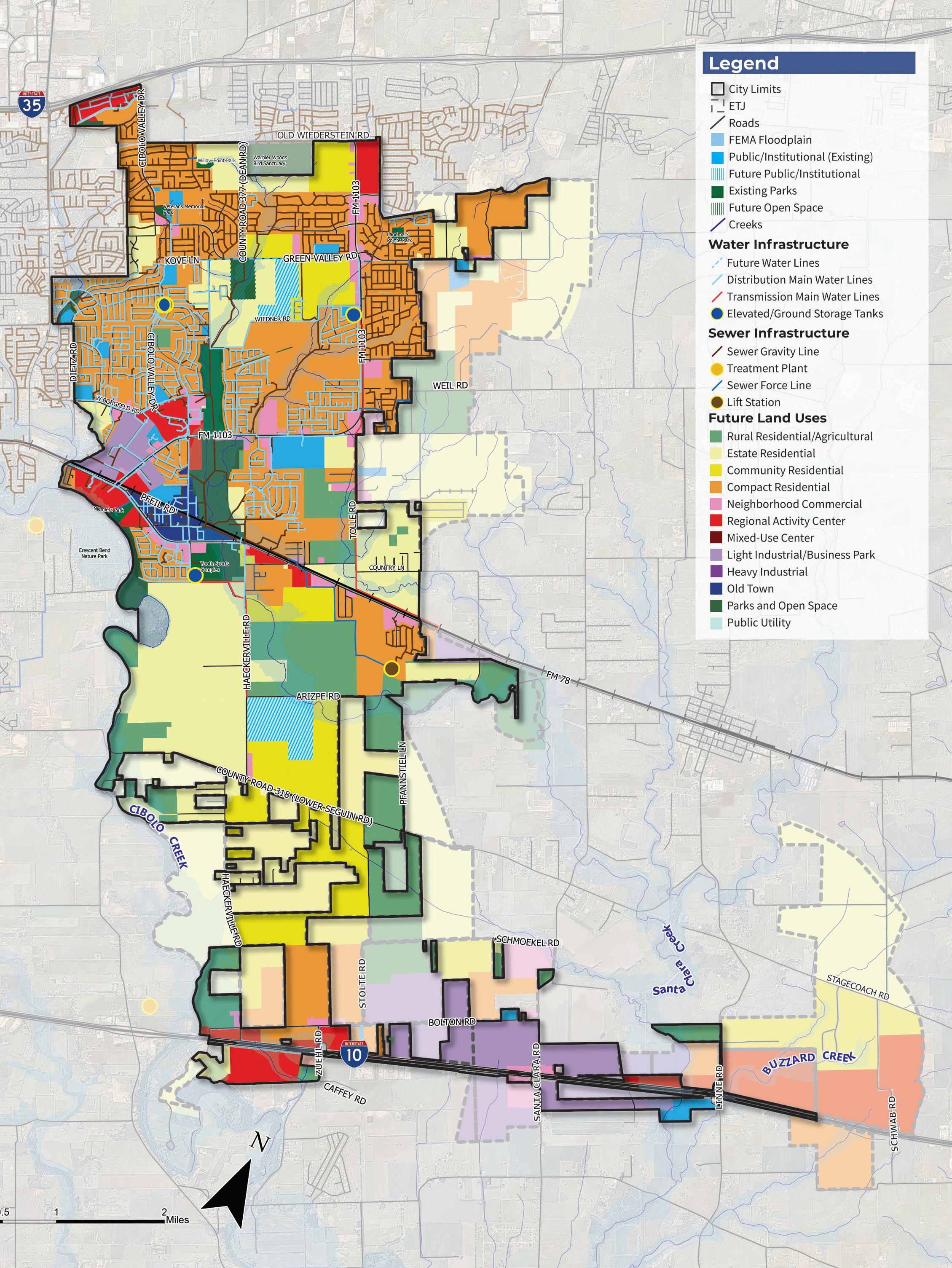
3.15 | Utilities Diagram
While Old Town itself is a single PlaceType, development within this area should be a thoughtful mix of uses, including residential, commercial, and cultural amenities that preserve the current character. Development should focus on walkability to ensure pedestrian connectivity throughout the district, due to its close proximities of varying uses and street network. Currently, Old Town is an anchor for the community and any future development should continue to prioritize the area as a dynamic hub where residents and visitors alike can live, work, and play. Clear transitions between residential and business areas can enhance the overall livability of the neighborhood. With an emphasis on historic preservation, the architectural heritage of Old Town should be celebrated and integrated into new developments, creating a sense of place rooted in the past. Clear guidelines within the Unified Development Code (UDC) should direct the design and development of Old Town, ensuring that new projects align with the vision for a vibrant, active, and historically preserved district. Additionally, fostering partnerships with preservation organizations and historic commissions can provide valuable expertise and resources to support the conservation of Old Town’s architectural heritage. Through these measures, Old Town can evolve into a dynamic and culturally rich destination while preserving its unique character and history for future generations. For a more indepth analysis of guided recommendations for Old Town, the development of a Master Plan will serve as a guiding document that outlines specific strategies and actions to achieve a desired development vision. It can provide a comprehensive framework for land use, transportation, urban design, and economic development initiatives, ensuring that all aspects of the district’s growth are coordinated and aligned with the community’s goals and aspirations.
As a key access corridor, IH-10 serves as a vital link between Cibolo and nearby cities, and acts as a community anchor for regional commerce. Because of its strategic location, the future vision of this corridor is to support a high mix of uses, including industrial, commercial, and mixed-use development. The IH-10 corridor is poised to become a vibrant economic hub and a focal point for the community. More information on the vision for this corridor can be found in the IH-10 Corridor Plan.
The vision for FM 1103 focuses on ensuring that this major arterial is a connector for the community and offers a diverse mix of uses. The City should focus on creating lively streetscapes conducive to pedestrian activity along this thoroughfare and encourage small-scale business growth. Additionally, the northern section of FM 1103 is envisioned as including a regional activity anchor, offering amenities and attractions that draw visitors from surrounding areas. To ensure integration with adjacent neighborhoods, development should gradually transition to lower-density residential zones, promoting a mix of housing options and preserving community character. Attention should also be given to maintaining well-manicured buffer zones between denser residential and retail areas and neighboring communities, promoting visual appeal and mitigating conflicts between differing land uses. Moreover, strategies should be implemented to balance development density with flood mitigation measures, particularly in areas prone to low water crossings. These considerations can help to safeguard both infrastructure and residents from potential hazards. Lastly, in the southwest quadrant of FM 1103, there should be a deliberate transition toward a diversified employment mix that can
foster synergy with the downtown core while supporting economic vitality and job growth.
The vision of FM 78 emphasizes its role as a regional commercial hub. This corridor is positioned to support a mix of land uses, but focuses primarily on those that align with industrial operations, employment activities, and commercial centers. Allowing for highdensity residential development along the corridor presents an opportunity to optimize land use efficiency and accommodate population growth. By locating residential units near employment centers, residents can enjoy shorter commute times, reduced traffic congestion, and increased access to job opportunities. This not only enhances convenience for residents but also promotes economic productivity and supports local businesses. The FM 78 Corridor Plan, adopted by the City of Cibolo in 2016, is set to be updated as part of the City Council’s Strategic Plan for FY24-27. This update aims to align the plan with current needs and future growth projections, ensuring that FM 78 promotes balanced development and economic vitality.
A major priority amongst residents was the need to diversify the current offerings in Cibolo. Residents would like to see more restaurants and places to visit. Allowing for a mix of uses in areas helps to create more unique destinations for the community. By incorporating a mix of uses such as residential, commercial, industrial, recreational, and institutional, Cibolo can optimize land efficiency, promote economic vitality, and enhance overall quality of life. Diversifying uses additionally encourages a higher need for connectivity in environments where neighborhoods and areas of employment, amenities, and services drive a need for easy cross access and walkablity.
To successfully implement diversification of land use in the community, it is essential to provide a regulatory framework that supports a mix of uses throughout each PlaceType. Rather than limiting PlaceTypes to a single use, each category describes a primary and secondary list of uses that are appropriate for that classification. By incorporating PlaceTypes into the UDC, Cibolo can align land uses with zoning categories to help guide development. By portraying character, density requirements, and allowable uses, the city can provide clarity for developers and ensure consistency when making land use decisions. Additionally, updating the UDC to reflect PlaceTypes also reinforces responsible growth.
Additionally, Mixed-Use Centers are distinct as a PlaceType because they are intended for master planned areas that intentionally mix uses, more fitting for urban, walkable, environments. These areas typically mix uses vertically, within the same structure, versus simply allowing a range of uses within a designated area.
The City currently has a zoning district intended for mixed-use called the Mixed Use Regional Employment Center (MURE) District. This district functions as a zoning overlay with its own design standards that, when implemented, would establish a mixed-use district. Initially, it was very limited in location and has not resulted in development in accordance with its standards. Due to the intent of this zoning category not being realized and its limited location in the City, it is recommended that the MURE district be eliminated. Additionally, it is recommended that the Mixed-Use PlaceType be established as a broader and more flexible category for future use. MURE district property would most appropriately transition to zoning that is compatible with the designated PlaceType guidance, per the Future Land Use Map.
Incorporating nature preservation and mitigation standards into the City’s development code is essential for sustainable land use practices. As growth occurs, implementing policy that aims to help support the preservation of natural resources and open spaces can help in mitigating common threats to Cibolo. By establishing requirements for nature preservation and mitigation measures, the City can minimize the ecological footprint of new developments. These standards can help protect natural habitats and water resources while also enhancing the resilience of Cibolo.
Preserving natural areas, such as Cibolo Creek, for floodplain management and recreation for all is a strategic approach to land use planning that prioritizes the conservation of valuable ecosystems and community amenities. By safeguarding natural areas like Cibolo Creek through zoning regulations, the City can protect against flood risks, maintain water quality, and provide residents with access to recreational opportunities and green spaces. Furthermore, preserving natural areas enhances the overall quality of life for residents, fosters a sense of place and identity, and contributes to the longterm sustainability and resilience of the community.
The following actions are recommendations to achieve the vision for the Cibolo Tomorrow Comprehensive Plan as they relate to land use and character.
Create a City annexation policy that aligns with the provision of adequate public infrastructure and services.
Utilize the Future Land Use Map to diversify uses and character within Cibolo.
L-3
Develop an Old Town Master Plan that will include an implementation plan and recommendations to update the City’s Unified Development Code (UDC) with custom-tailored regulations for Old Town to help preserve and guide existing and future development and activity.
Review and update the City’s existing ordinances, where necessary, to accommodate the types of development envisioned in the Future Land Use Map.
Address the addition of new PlaceType categories, development standards, and requirements to preserve open space and floodplain management related to new developments.
Develop a tool for determining the consistency of development proposals and zoning applications with the Cibolo Comprehensive Plan.
land use types along major corridors support appropriate commercial, industrial, and institutional development.
natural areas, such as Cibolo Creek, for floodplain management and recreation for all.
Tomorrow Comprehensive Plan
Chapter 4: Transportation
Mobility and transportation was commonly heard from residents and stakeholders during the planning process. This chapter outlines the recommendations and actions the City can take over the next 30 years to address the immediate and future needs to the city’s transportation network. In a joint workshop that included Master Plan Advisory Committee (MPAC), Planning and Zoning Commission (P&Z), Economic Development Corporation (EDC), and City Council, participants were asked to rank their top mobility priorities. The options included shared-use paths and trails, safety, maintenance, sidewalks, traffic flow, crossings, intersections, connectivity, and streetscaping. Two public surveys were conducted via the Cibolo Tomorrow website to determine the public’s priorities in regards to transportation and planning. Detailed recaps of both engagements can be found in the Appendix. The highest-ranked mobility priorities are:
• Traffic Flow (Highest Priority)
• Maintenance
• Safety
• Connectivity
• Sidewalks
Cibolo is experiencing substantial population growth, and the city has seen a 70 percent increase in its population over the past ten years. As the population continues to increase and development accelerates, Cibolo is facing escalating challenges, notably the strain on existing infrastructure. The increased demand for housing, businesses, and amenities can lead to overburdened transportation networks, resulting in mobility issues and traffic congestion. Transportation and mobility decisions can also influence land use patterns. The location and design of transportation infrastructure can shape how land is used and developed. For instance, the construction of a new highway or a public transit line can spur development in previously uncultivated areas or influence the type of progress that occurs along a corridor.
In addressing the challenges of increased development, special attention should also be given to mitigating flooding risks within the city. The comprehensive plan recognizes the importance of strategic land use planning and infrastructure design to prevent and manage flood-related issues. Rapid development without careful planning may exacerbate flooding concerns, as impervious surfaces replace natural drainage areas. By aligning the recommendations in this chapter and the recommendations in Chapter 3: Land Use and Character, Cibolo can work toward more sustainable, accessible, and livable environments. This may involve aligning transportation investments with land use goals and the overall vision of the community.
This comprehensive strategy aims to create a well-integrated and accessible transportation network that caters to the diverse needs of the community while addressing the challenges posed by increased urban development.
The City of Cibolo has three significant regional facilities: Interstate Highway 10 (IH10), Interstate Highway 35 (IH-35), and Farmto-Market Road (FM 78). Figure 4.1 displays the existing thoroughfares in Cibolo. IH-35 runs east to west on the northern boundary of Cibolo, IH-10 runs east to west on the southern boundary, and FM 78 runs east to west through the center. These facilities provide access to San Antonio to the west, Seguin to the east, and many other activity centers in and around Cibolo.
Interstate Highway 10 (IH-10), also referred to as U.S. Highway 90, is a four-lane freeway, separated by a grass median and is a Texas Department of Transportation (TxDOT) facility. IH-10 includes two frontage roads, or access roads, that allow for two-way traffic. IH-10 connects Cibolo to the central city of San Antonio as well as the major Texas metropolitan areas of Houston and El Paso. There are three enhanced interchanges planned along IH-10 at Zuehl Rd, Santa Clara Rd, and Linne Rd. In addition, IH-10 is planned to be upgraded to a six-lane freeway, with three-lane, one-way frontage roads on either side. This route is the southernmost major interstate highway in the United States. The segment within the city limits and ETJ of Cibolo is about 4.9 miles long. At the time of the planning process, a IH-10 Corridor Study was conducted as a concurrent planning effort ( a summary of the IH-10 Corridor Study can be found in Chapter 3: Land Use and Character).
Interstate Highway 35 (IH-35) is a six-lane freeway that is separated by a concrete divider and is a TxDOT facility. IH-35 includes frontage roads that allow for one-way traffic paralleling the segment of the freeway for which it provides access. IH-35 is a north-south freeway (that runs east to west as it passes through Cibolo) that connects Cibolo to the central city of San Antonio, as well as the major Texas metropolitan areas of Austin and Dallas-
Fort Worth. Although IH-35 parallels the city for a longer segment, only less than a mile is within the city limits. The I-35 NEX Central Project is currently underway for the road to be expanded to 10 lanes.
Farm-to-Market Road (FM 78) is a fivelane roadway, which includes a center turn lane. Travelling east, FM 78 tapers down at Haeckerville Road to two lanes and this configuration continues east towards the adjacent municipality of Marion. FM 78’s west end is located near the IH-35 junction in San Antonio and the eastern terminus is located at the U.S. 90 junction in Seguin, Texas. Within the City of Cibolo and Cibolo’s ETJ, FM 78 spans approximately 3.7 miles.
In addition to the regional facilities previously mentioned, FM 1103 is a significant roadway in Cibolo, serving as a north to south arterial that connects residential neighborhoods in Cibolo to Interstate 35 (IH-35). This thoroughfare plays a vital role in facilitating commuter traffic, providing access to residential neighborhoods, commercial establishments, and essential services. As Cibolo continues to experience growth and development, FM 1103 will likely undergo further enhancements and expansions to accommodate increasing traffic demands and ensure efficient mobility further south of the city.
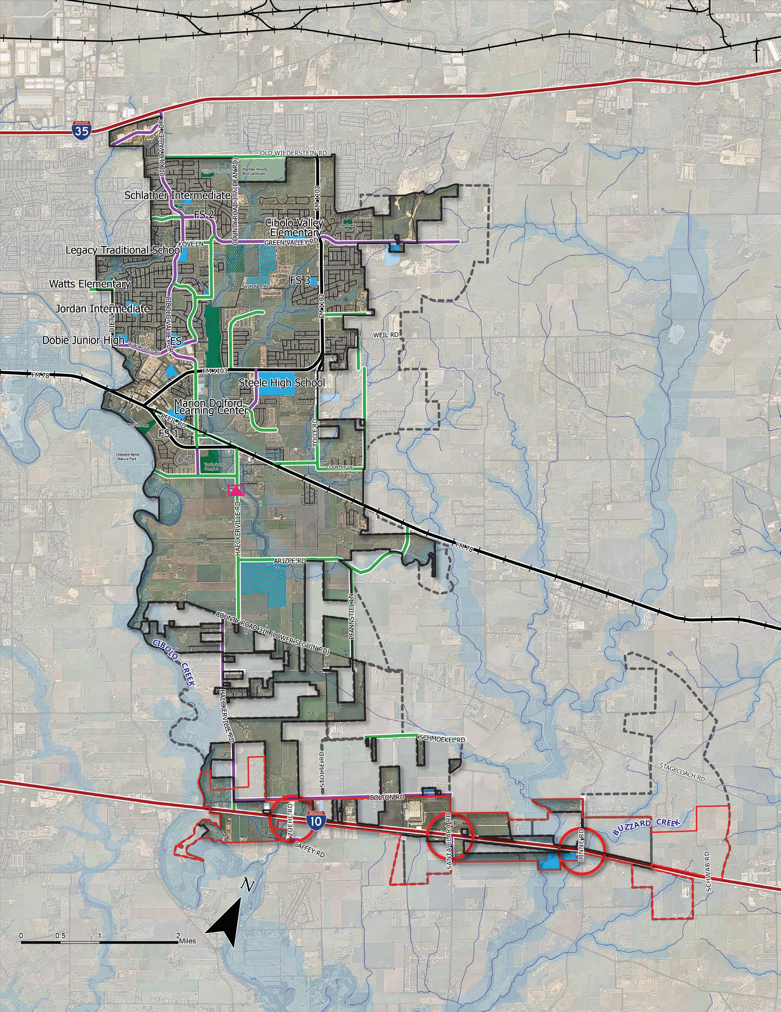
Figure 4.1 | Existing Thoroughfare Network
Agency coordination is crucial to ensure efficient use of resources by avoiding duplication of efforts and optimizing the overall transportation system. Additionally, coordination allows for seamless connectivity between different modes of transportation, improving the travel experience for commuters. Coordinated planning also helps identify and address safety and reliability issues, reducing accidents and congestion. Essential agencies to coordinate with include TxDOT, AAMPO, and the cities of Schertz, Marion, and Santa Clara.
Alamo Area Metropolitan Planning Organization (AAMPO)
TxDOT projects being coordinated with the AAMPO and the City of Cibolo include the FM 1103 expansion and IH-35 expansion. The Alamo Area Metropolitan Planning Organization (AAMPO) is responsible for coordinating transportation planning efforts across the greater San Antonio region. Comprising local governments, transportation agencies, and community stakeholders, AAMPO plays a central role in developing comprehensive plans and strategies to address the evolving transportation needs of the area. Metropolitan Planning Organizations (MPOs) are mandated to submit both long-range and short-range plans to maintain eligibility for federal transportation funds. Mobility 2050 is a long-range transportation plan developed by AAMPO to coordinate with regional partners to address existing constraints and create a framework for future opportunities. On June 27, 2022, the AAMPO Transportation Policy Board adopted Mobility 2050. The plan provides for the efficient, safe, and convenient transportation of people and goods while helping to achieve the metropolitan area’s overall economic, social, energy, and environmental goals. The Transportation Improvement Program (TIP) is a short-range plan that outlines roadway, transit, bicycle, pedestrian and rideshare projects that will be let to contract over the next four years. The TIP was adopted by the Transportation Policy Board on June 27, 2022. The project team coordinated with AAMPO to ensure that plan recommendations aligned with regional planning efforts.
Throughout the planning process, several connections were identified as regionally significant and is reflected in the Master Thoroughfare Plan, Figure 4.5. An example project identified is the proposed north-south connector that links FM 1103 to Haeckerville Road. This project that should be coordinated with AAMPO to ultimately be submitted during the call for projects for the next TIP. Initially however, the City will need to conduct a north-south connector feasibility study with preliminary engineering work, environmental analysis, and public engagement to qualify for local, state, or federal funding sources and/or grant programs..

The Guadalupe County Thoroughfare Plan is a strategic blueprint that outlines the vision and goals for transportation in the Guadalupe County region. This Plan encompasses a comprehensive analysis of current and anticipated transportation needs, focusing on improving connectivity, reducing congestion, and enhancing overall mobility within the county. By identifying key thoroughfares, road improvements, and traffic management strategies, the plan aims to guide future development and ensure a well-integrated transportation network that aligns with the region’s growth and economic aspirations. The Guadalupe County Thoroughfare Plan serves as a crucial tool for local authorities, stakeholders, and community members to make informed decisions about transportation infrastructure that will contribute to sustained prosperity and livability of the Guadalupe County region. Guadalupe County is currently working on updating its Major Thoroughfare Plan. The City of Cibolo should continue to coordinate with Guadalupe County to ensure there are no conflicts between the City’s and County’s thoroughfare plans.
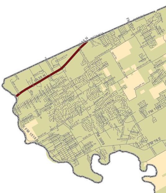
Between 2018-2022 there have been 1,213 crashes in Cibolo. Figure 4.2 displays the crash totals by year and severity. Out of 1,213 crashes there were 2,383 crash units (vehicles, bicycles, pedestrians, etc.) involved. Out of the 2,383 crash units, 2,289 (96 percent) involved motor vehicles, 13 (0.54 percent) involved pedestrians, and 6 (0.25 percent) involved cyclists. Out of 1,213 crashes, 77 occurred during rain or snow events and 347 occurred during dawn, dusk, or dark lighting conditions. 56 percent (682) of crashes occurred on TxDOT roadways while 44 percent (531) did not.
It is important to note that crash data collected is from TxDOT’s Crash Record Information System (CRIS) which is made up of police reports. This data has limitations as only crashes where a police report was recorded will be included in the dataset. Additionally, different ways in which policing agencies report data can affect data outcomes. Safety was a high priority amongst Cibolo residents during the engagement process. More specific recommendations related to safety are outlined later in this chapter.
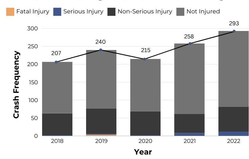
A consistent challenge heard amongst residents and stakeholders was the threat of flooding in Cibolo. Flooding can lead to road closures and disrupted systems causing significant human and economic losses. Floodwaters can weaken and damage road pavement and soil around bridges and culverts, disrupt public transportation services, and can cause essential routes to become unsafe to travel. Figure 4.3 displays the existing natural constraints in Cibolo that contribute to excess flooding. These existing constraints include:
• Topography. A region’s topography plays a pivotal role in influencing flooding patterns and constraining development. Figure 4.3 displays the 2 foot contour lines of Cibolo in orange. Contours, often referred to as contour lines, are lines on a map connecting points of equal elevation or depth. The spacing between contour lines indicates the steepness of the terrain— closer lines indicate steeper slopes, while lines spaced farther apart suggest gentler inclines. The natural slope and elevation of the land can significantly impact the drainage patterns, determining how water accumulates and moves during rainfall or flood events. Low-lying areas, for example, may be more susceptible to flooding, while elevated regions may face challenges in managing runoff.
• Creeks. The potential for flooding near creeks is a primary concern when planning for future density within a community. Creeks may experience increased water flow during heavy rainfall, leading to a heightened risk of overflow in nearby areas. Development along creek banks may be restricted due to the need to maintain buffer zones for flood control and environmental preservation. The City should consider development regulations that buffer development from the creek.

The San Antonio River Authority (SARA) is a regional entity in South-Central Texas, responsible for managing and protecting the San Antonio River Basin. Established in 1937, SARA plays an important role in water resource management, flood control, and environmental stewardship across its expansive jurisdiction. The authority actively engages in a range of initiatives, including watershed protection, water quality improvement, and the development of recreational amenities along the San Antonio River. By collaborating with local communities, government agencies, and stakeholders, SARA works to balance the region’s water needs while preserving the ecological integrity of the river basin, contributing significantly to the sustainability and resilience of the surrounding communities.
• Low Water Points. Low water crossings can significantly affect a transportation network in several ways. Firstly, during periods of heavy rain or flooding, low water crossings can become impassable, disrupting the flow of traffic and potentially isolating certain areas. This can lead to delays, detours, and increased travel times for commuters and goods transportation. Cibolo and nearby transportation authorities must address these issues by implementing proper drainage systems, monitoring weather conditions, and providing alternate routes when necessary. Considering the prevalence of low water crossings and roadways within floodplains in Cibolo, special attention should be paid to policies surrounding the design and construction of these roadways. See the recommendations section of this chapter for further strategies.
• Floodplain. Floodplain has significant implications on the development of Cibolo, shaping urban landscape and infrastructure planning. It can determine land use patterns and control development outcomes. Existing and future developments are confronted with the challenge of mitigating the risks associated with potential flooding events. The floodplain shown in Figure 4.3 utilizes two sources of data to help delineate the different floodplain data for the community: Atlas 14 and FEMA.
• Atlas 14: Officially known as the “Atlas 14 Volume for Texas,” Atlas 14 is a comprehensive rainfall frequency developed by the National Oceanic and Atmospheric Administration (NOAA) in collaboration with state and local agencies. Specifically focused on Texas, Atlas 14 provides updated and refined precipitation frequency estimates for various durations and return periods across the state. This data offers valuable data to assess flood risks, design resilient infrastructure, and make informed decisions regarding land use and development. Source: San Antonio River Authority (SARA)
• Flood Hazard Areas from the Flood Insurance Rate Map: The Federal Emergency Management Agency (FEMA) produces Flood Insurance Rate maps and identifies Special Flood Hazard Areas as part of the National Flood Insurance Program’s floodplain management. Special Flood Hazard Areas have regulations that include the mandatory purchase of flood insurance. Source: Federal Emergency Management Agency (FEMA), 2022.
More information on specific hazard mitigation efforts for the community can be found in Chapter 6: Community Facilities and Public Services
Figure 4.3 | Natural Constraints Map
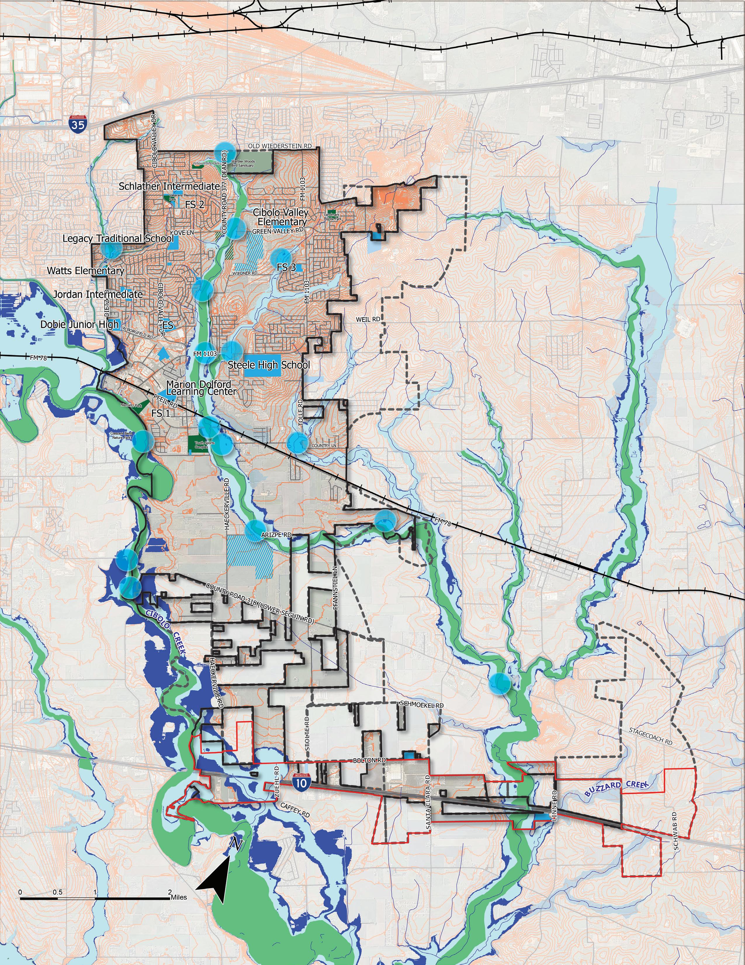
Cibolo’s Thoroughfare Plan serves as a crucial tool for future roadway corridors and can help secure the necessary right-of-way for enhancing the transportation system. This plan incorporates details concerning roadway classifications, right-of-way specifications, fundamental design criteria (such as lane and parkway widths), and the optimal number of through-traffic lanes for each thoroughfare within the city. Cibolo’s thoroughfare system comprises diverse streets with standardized functional classifications, ensuring a well-organized and efficient network that aligns with the city’s vision for sustainable and accessible transportation infrastructure.
While certain proposed thoroughfares in rural areas may not see immediate construction, the plan’s primary purpose is to enable the city to preserve vital transportation corridors, securing right-of-way for future connectivity as development progresses. The implementation of individual street improvements may involve various entities, including private developers, the City of Cibolo, county authorities, TxDOT, or a combination of these, with prioritization based on enhancing local circulation and regional connectivity. Other recommendations include identifying roads that either have or shortly will reach their intended capacities. This results in a change in functional classification to better fit the context of the desired future land use and plan for increased travel. This plan strategically addresses traffic generated by PlaceTypes identified in the Future Land Use Map, proposing new roadway connections adjacent and in contact with these areas.
House Bill 3699 prohibits the city from requiring property owners to dedicate public right of ways, including streets and parks, in their development if they do not intend for the property to be used by the public and are not included, funded, and approved in a capital improvement plan. This makes it increasingly challenging to create a cohesive or interconnected roadway network as the City grows and further channels traffic to existing arterials and collectors. Because of this dramatic change, more attention will need to be placed on the appropriate sizing of existing roadways and rights-of-way to handle community wide travel patterns. In addition, for roadways that are planned on the MTP to become a reality, more effort will need to be placed on including, funding, and approving them via the Capital Improvement Plan.
The Master Thoroughfare Plan (MTP) is developed for both the city and its ETJ (extraterritorial jurisdiction) area. This means that close coordination with surrounding cities, counties, and metropolitan organizations is essential for achieving the desired vision for the transportation network. The Master Thoroughfare Plan introduces six distinct street types, including Freeways, Parkways, Major Arterials, Minor Arterials, Collectors, and Local Streets. The diagram below displays the functional classification hierarchy and the relationship between mobility and access. The higher capacity roads have high levels of mobility and less access while lower capacity roads have lower levels of mobility and high access.
Typically the highest traffic volume corridors with longer trip distance demands
A specialized roadway designed to convey traffic efficiently along an open space where connectivity is limited
Provides cross-town connectivity between IH-10 and IH-35, surrounding communities, and major activity centers
Provides service primarily for local trips of moderate length and enhanced connectivity to the Major Arterials
Collects and distributes traffic from the local streets to the arterial network. Provides connectivity through and between neighborhoods
Provides direct access to adjacent destinations. Not intended for significant amounts of through traffic
The comprehensive planning process for Cibolo involved an assessment of the recently adopted Master Thoroughfare Plan. This process aimed to identify necessary changes in connectivity or functional classification to align with the updated Future Land Use Map and the vision for the city. The updated Thoroughfare Plan was based on existing and anticipated future traffic patterns and account for major traffic movements along major east-west and north-south routes including: IH35, IH-10, FM 78, and FM 1103.
Figure 4.4 below displays a revision table that outlines changes from the previous 2016 Master Thoroughfare Plan to the current Master Thoroughfare Plan. The Thoroughfare Plan update for Cibolo identified potential connectivity issues, specifically focusing on north-to-south connections.
4.5
In Cibolo, the planning and design of thoroughfares are directed by specific crosssections outlining preferred street elements and widths for each roadway. While many streets in Cibolo adhere to a standard design, referred to as a typical cross-section, the city recognizes that alternative designs may be more suitable in certain areas. Cibolo’s approach to street design prioritizes context sensitivity, allowing variations in cross sections based on factors like existing physical constraints, land use characteristics, and multi-modal facilities, such as pedestrian amenities or bike lanes. Several examples of corridors that are ideal for multi-modal design are FM 1103, Haeckerville Road, Bolton Road, and Cibolo Valley Drive.
The objective with multi-modal street design is to create “Complete Streets,” where the design accommodates all users, facilitating efficient travel for both vehicles and pedestrians. In contrast to conventional streets primarily designed for vehicular traffic, complete streets emphasize the integration of pedestrian walkways, bike lanes, public transportation, and other amenities to accommodate various modes of transportation. This approach aims to enhance access, reduce travel times, and improve overall safety. For each of the thoroughfare functional classes, a set of recommended typical cross sections and alternative cross sections have been developed (for all roadways except for freeways) to provide options to address existing conditions and meet future needs.
Several cross-sections were developed to update and replace the existing City of Cibolo crosssections displayed on the following pages. The Thoroughfare Plan consists of six functional classifications, including Freeways, Parkways, Major Arterials, Minor Arterials, Collectors, and Local Streets. Freeways are outside of the city’s jurisdiction; however, collaboration should be prioritized to ensure alignment with the Master Thoroughfare Plan. For the Comprehensive Plan, the words “urban” and “rural” shown next to some of the cross-sections on the following pages reflect context sensitivity for different areas in Cibolo. Urban in this report does not represent heavy density, instead represents developed areas of the community like residential areas, commercial areas, or mixeduse developments. Rural represents the more undeveloped areas of Cibolo.
Freeways are major arterials intended for high volume, speed, mobility, and low access. Interstate Highway 10 (IH-10) and Interstate Highway 35 (IH-35) are the two freeways that pass through Cibolo. However, the city is not involved in the construction or maintenance of these freeways, as these are administered by TxDOT. The right-of-way for freeways in Cibolo is 200 feet. To ensure Cibolo is planning for its future along these corridors close coordination with regional entities and TxDOT should occur when planning occurs along these thoroughfares.
Common PlaceTypes along FreewaysRegional Activity Center, Light Industrial/ Business Park, Compact Residential
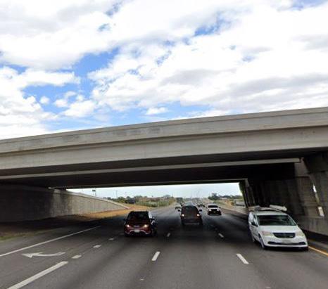
Interstate Highway 35
Parkways are a specialized roadway designed to convey traffic efficiently along an open space where connectivity, right-of-way width, and constructability is limited due to floodplain or site constraints. Parkways create an alternative option from typical arterial or collector roadways, by establishing a vehicular thoroughfare that is at least 50 feet wide. An example of a Parkway is shown on the MTP as a north-south connector from FM 1103 to Haeckerville Road along the Town Creek floodplain.
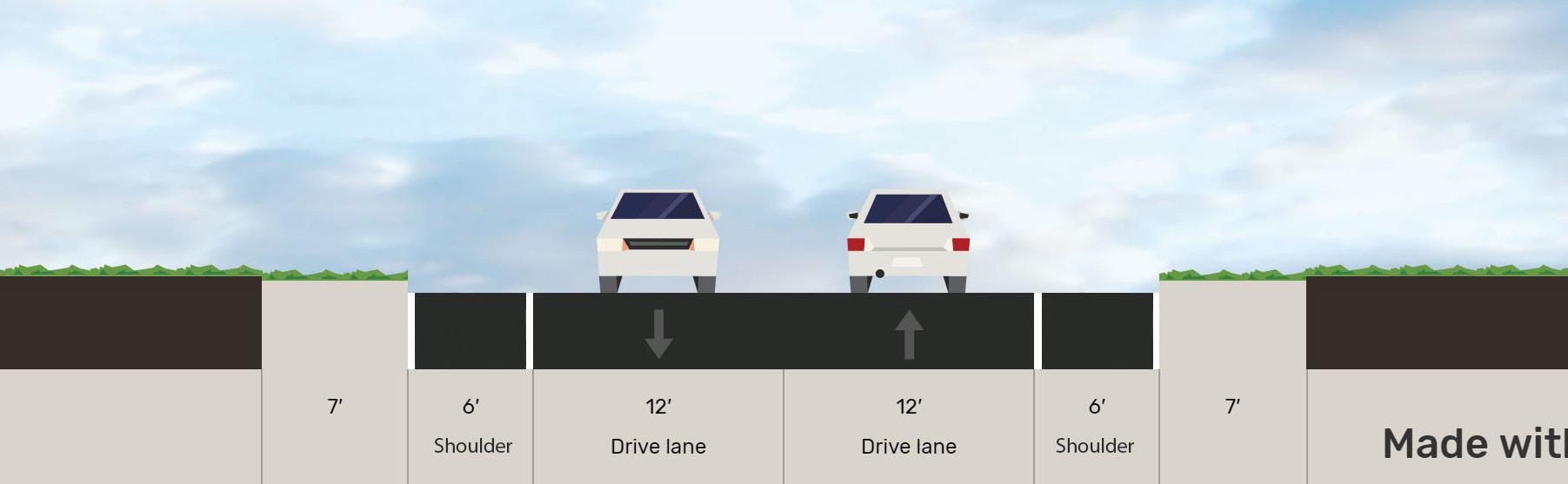
Arterial streets are designed to convey heavy volumes of traffic, often in peak conditions. They serve adjacent properties with direct access in a limited or controlled means. Arterial streets are also often grouped into two classifications: major arterials and minor arterials. Major Arterials move traffic throughout various parts of the city or the surrounding area. Examples of Major Arterials in Cibolo are FM 1103 and FM 78. The current right-of-way requirement for a Major Arterial road in Cibolo is at least 120/150 feet. Minor Arterials balance connectivity and local access by both moving people throughout the city and connecting to adjacent neighborhoods or adjacent streets of higher or lower functional class. They have lower speeds than Major Arterials but typically still have multiple lanes and modes of travel. Examples of Minor Arterials in Cibolo are Cibolo Valley Drive and Green Valley Road. The right-of-way requirement for a Minor Arterial in Cibolo is currently 86 feet. The figures below can accommodate 10 foot sidepaths if there is available R.O.W. Sidepaths are shared use trails located adjacent to a roadway. Utilizing sidepaths can help connect trails and neighborhoods, further promoting active transportation. In situations where there is a constricted R.O.W. we recommend following Cibolo’s UDC.
4.7 | Major Arterial - 6 lanes, divided
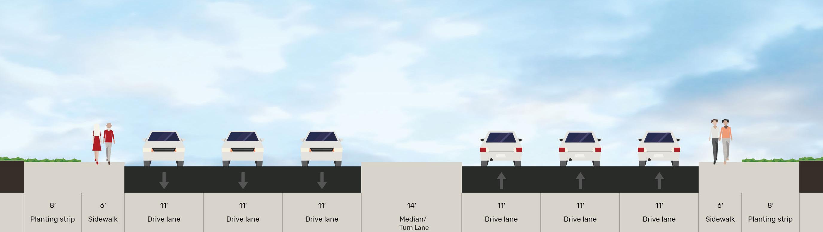
4.8 | Minor Arterial - 4 lanes, divided Common PlaceTypes along Major Arterials - Compact Residential, Regional Activity Center, Neighborhood Commercial, Light Industrial/Business Park Common PlaceTypes along Minor Arterials - Compact Residential, Light Industrial/Business Park, Regional Activity Center, Neighborhood Commercial
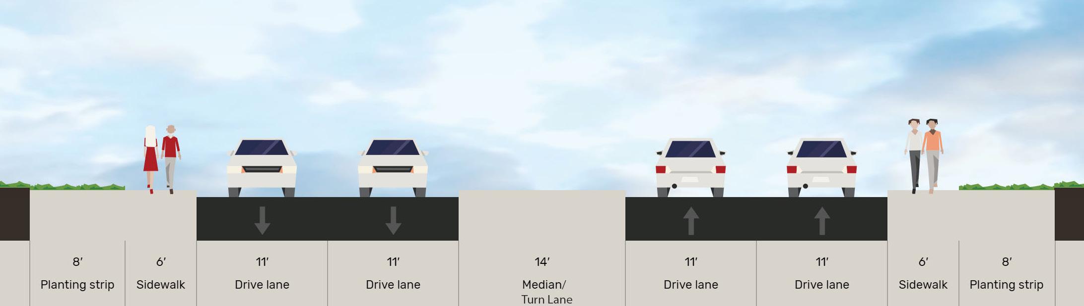
Collectors can vary widely in function and character but are often the ‘last mile connections’ between the local street network and arterials. They have low speeds and wider pedestrian facilities based on the surrounding land use context. Examples of Collectors in Cibolo include Bentwood Ranch Drive and Main Street.
4.9 | Major Collector - 4 lanes, divided
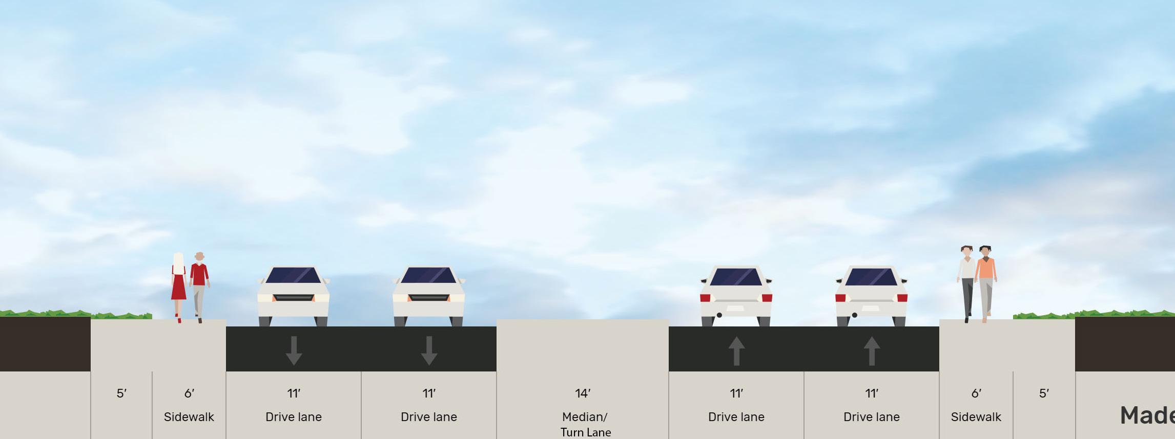
Common PlaceTypes along Major Collectors - Community Residential, Estate Residential, Compact Residential, Neighborhood Commercial
| Minor Collector,
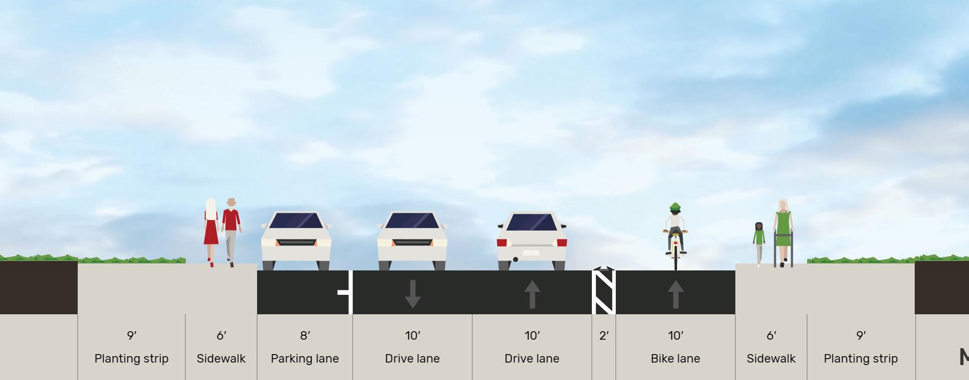
Common PlaceTypes along Minor Collectors - Estate Residential, Rural Residential/Agriculture
Local streets primarily serve the immediate neighborhood and provide access to residential and small-scale commercial properties. Typically characterized by lower traffic volumes and reduced travel speeds, local streets prioritize the accommodation of pedestrians, residents, and businesses. These roads are integral to the internal circulation of a community, connecting homes and establishments with collector and arterial roads. Local streets are designed to prioritize safety, minimize traffic, and foster a sense of community, making them essential components of the local transportation network. In situations where there is a constricted R.O.W. we recommend following Cibolo’s UDC of 5 foot sidewalks.
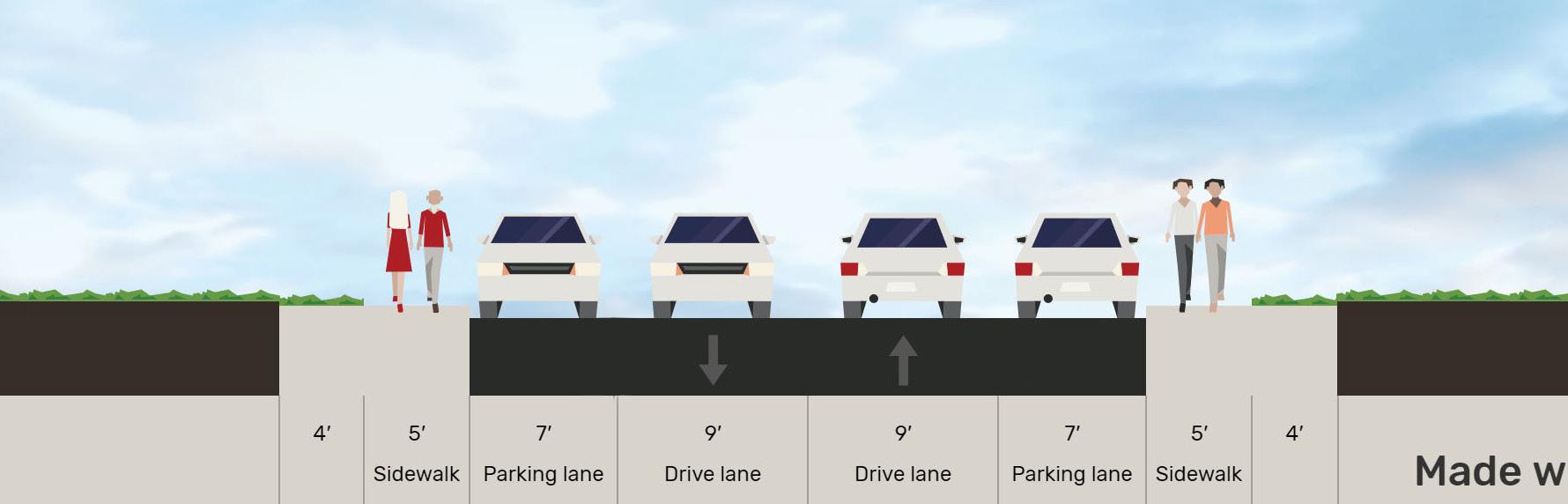
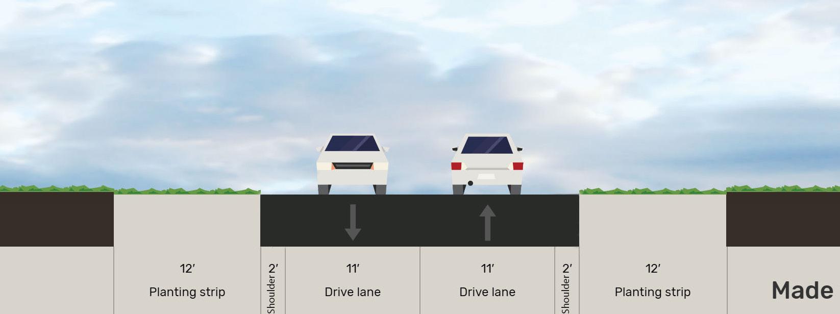
An alley is a narrow passageway and minor right-of-way, often situated between or behind residential housing, providing secondary access for pedestrians, vehicles, or services. Typically smaller in width compared to streets, alleys serve various functions such as facilitating service access, waste collection, and pedestrian shortcuts.

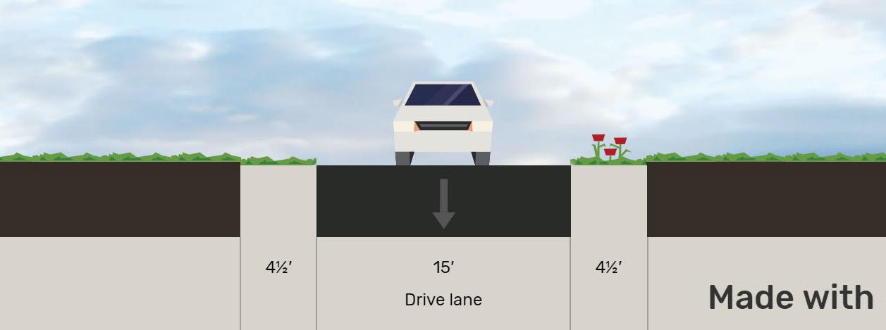
Common PlaceTypes along Residential Alleys - Compact Residential
As Cibolo continues to grow, maintenance is of particular concern for city staff and residents. This process of growth will eventually cause maintenance to be one of the largest budget expenditures for a city. This is due to aging infrastructure, increased usage, public safety, and quality of life. Regular maintenance and repairs are crucial to ensure the functionality, safety, and longevity of the city’s infrastructure, especially as the population and development grow. Proactive maintenance helps identify and address issues before they become major problems, saving money in the long run. It also ensures public safety by identifying and mitigating potential hazards. Below are some mechanisms the city can utilize to help pay for infrastructure maintenance:
• Taxes. Cities can allocate a portion of property taxes or sales taxes towards infrastructure maintenance. These funds can be specifically earmarked for maintenance and repair projects. This is a mechanism Cibolo is already doing.
• Fees and Charges. Cities can impose fees and charges related to specific infrastructure services, such as water and sewer fees, road tolls, or parking fees. The revenue generated from these fees can be used to fund maintenance efforts.
• Bonds. Cities can issue bonds to finance infrastructure maintenance projects. These bonds are typically repaid over time through tax revenues or user fees.
• Grants and Federal Funding. Cities can seek grants and funding from federal or state governments to support infrastructure maintenance initiatives. These funds are often allocated for specific projects or targeted towards infrastructure improvements in underserved areas.
• Public-Private Partnerships (PPPs). Cities can enter into partnerships with private entities to fund and manage infrastructure maintenance. In PPPs, private companies provide the necessary funding and expertise in exchange for long-term contracts or revenue-sharing agreements.
• Special Assessment Districts. Cities can create special assessment districts where property owners within a designated area contribute additional funds for infrastructure maintenance. These funds are collected through additional property taxes or special assessments.
It is important for cities to evaluate and implement a combination of these mechanisms to ensure a sustainable and adequate funding source for infrastructure maintenance. The specific approach will depend on factors such as the City’s financial capacity, legal framework, and community priorities.
Hazard mitigation in the context of road maintenance involves proactively identifying and addressing potential risks to infrastructure integrity. This strategic approach aims to reduce the vulnerability of roadways to various hazards such as natural disasters, extreme weather events, or other unforeseen challenges. Incorporating hazard mitigation into road maintenance practices ensures that infrastructure remains resilient and capable of withstanding adverse conditions. This may involve reinforcing road structures, implementing drainage solutions to mitigate flooding, or incorporating resilient materials to withstand environmental stressors.
Establishing specific design and construction standards for low water crossings is paramount to their resilience and safety. These standards should be meticulously crafted to ensure that these crossings can withstand flooding events while providing secure passage under normal conditions. Criteria encompassing bridge deck elevation, roadway alignment, and the selection of durable materials are crucial components of these standards.
Another way of ensuring safety at low water crossings is adopting a comprehensive maintenance and inspection policy. Implementing routine inspections, debris removal, and prompt repairs can address potential issues before they escalate, ensuring these crossings remain in good condition. Regular checks on drainage systems are essential to prevent clogging or malfunction. Additionally, integrating closure policies based on predetermined water level thresholds or real-time monitoring of weather conditions can further enhance safety. Temporary closures during high water or flooding events prevent accidents and safeguard motorists from perilous conditions, showing a proactive approach to ensuring public safety in transportation infrastructure.
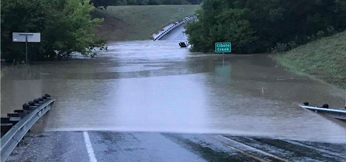
Active transportation refers to a non-motorized mode of travel, such as walking, cycling, scooters or skateboards, as a means of commuting or recreation. Unlike traditional motorized transportation, active transportation promotes a healthy and eco-friendly lifestyle while reducing dependence on automobiles. It contributes to improved personal fitness, reduced environmental impact, and enhanced community well-being. Active transportation relies on multi-use trails and bike lanes as its network to connect the community to activity areas, businesses, work, and their homes. Cibolo currently has pockets of disjointed bike facilities. Dedicated bike lanes are present on Main St from north of Buffalo Trail to the railroad tracks to the south, Bentwood Ranch Dr from Cibolo Valley Dr to W Borgfeld Rd, and the entirety of Bentwood Pass. Off street trails are present along Bison Ln in Schlather Park and other small green spaces in and around neighborhoods. An Off-Street Trails and Side-Paths Plan created as a part of the 2016 Comprehensive Plan currently includes planned facilities along north-south roads including Cibolo Valley Dr, Main St, and Haeckerville Rd and eastwest roads including Lower Seguin Rd, FM 78, and Green Valley Rd. AAMPO’s TIP (FY 2023-2026) includes the Town Creek Trail project which extends from Schaefer Road to Schlather Park.
In Cibolo, it is important to incorporate bicycle and pedestrian infrastructure into street design, aligning with the proposed cross sections outlined in this chapter. Figure 4.5 outlines the Master Throughfare Plan and anchors around the city. The cross sections on page 75- 79 outline the road classifications that would include potential sidewalk and trail connections. Future development based on context and land use should consider designing cross-sections to be multi-modal. Future studies should be conducted to examine feasibility of existing ROW for expansion of pedestrian and bikeway facilities along existing roadways. Any available funding designated for new standalone bicycle and pedestrian projects should be strategically concentrated in areas where the usage is anticipated to be high. This approach ensures that the development of infrastructure aligns with the specific needs and preferences of the community, fostering a safe and accessible environment for cyclists and pedestrians throughout Cibolo. Below are examples on where pedestrian and bicycle infrastructure should be emphasized:
• Connect to Schools. A great first step to promote walkability within neighborhoods would be to construct new sidewalks that connect residents to nearby schools. See Figure 4.15 for more information on key pedestrian paths to construct. Future schools should prioritize identifying opportunities for safe pedestrian routes. This would include closing sidewalk gaps and linking trails in the city.
• Connect to Destinations. New sidewalk or trail improvement projects should connect central neighborhoods surrounding Old Town and activity centers.
• Connect to the Existing and Proposed Trail Network. New trail networks should seek to connect residents to existing park and trail systems.
Micromobility refers to the use of small, lightweight vehicles for short-distance travel. Examples include bicycles, electric scooters, and small electric cars. It is a sustainable and efficient mode of transportation, reducing congestion and pollution. However, there are challenges in terms of infrastructure, safety, and regulations. Currently, Cibolo does not have any policies regarding the use of micromobility. As these devices gain popularity in the future, the Cibolo Code of Ordinances should incorporate language regarding the types of devices permitted on facilities such as roadways, bicycle lanes, sidewalks, and trails to prevent potential conflicts between users.
4.15 | Conecptual Neighborhood Walkability and Connectivity Priority Areas
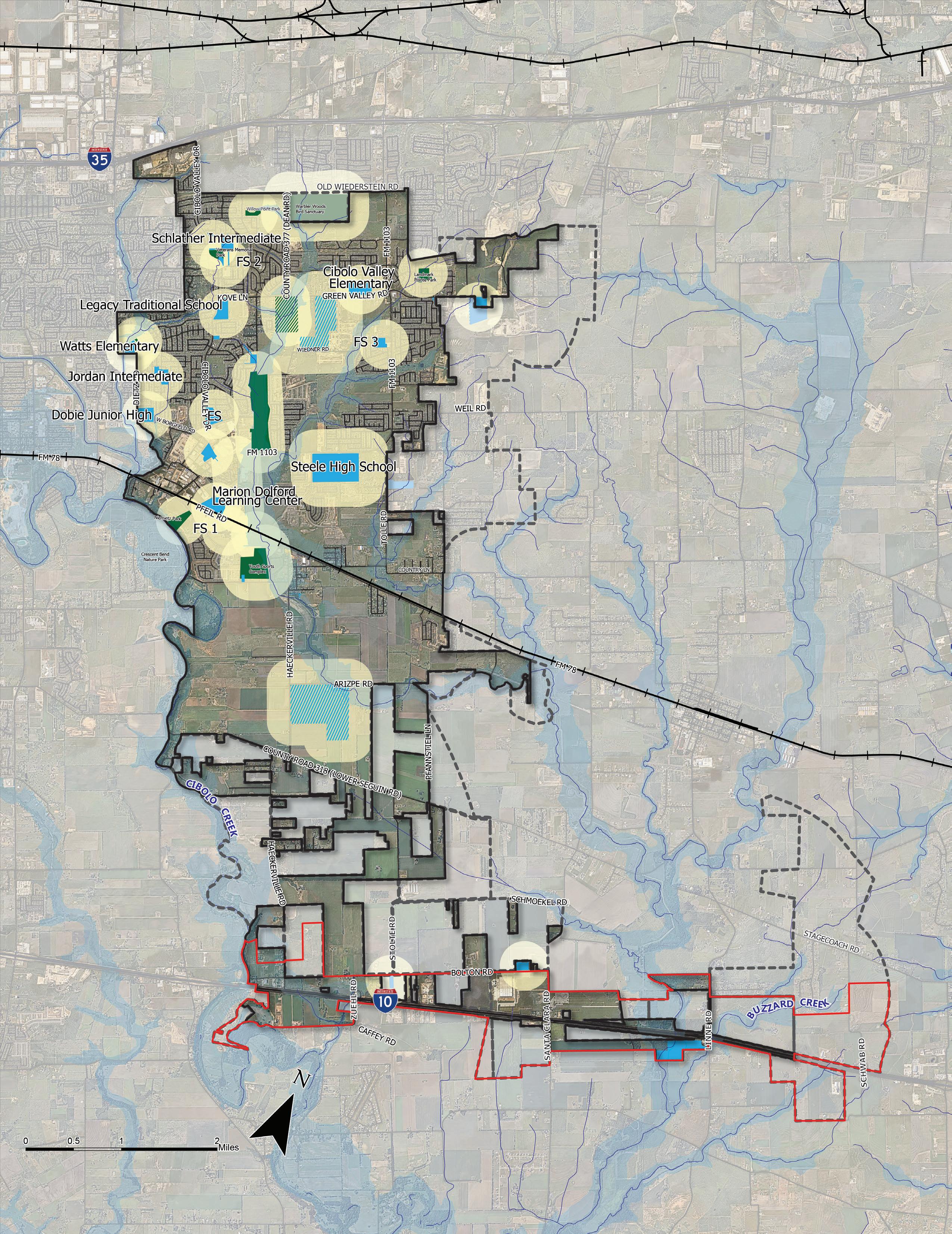
Mobility hubs serve as centralized points where various modes of transportation converge. Mobility hubs can integrate different transportation services like bicycles, scooters, and car-sharing. By promoting multimodal transportation and reducing reliance on single-occupancy vehicles, mobility hubs contribute to alleviating traffic congestion and enhancing overall mobility within Cibolo. Mobility hubs can also provide amenities to users travelling. They can offer WI-FI services, bicycle storage and repair facilities, weather information, and open space. Depending on the land use of the mobility hub, they can be scaled to meet the community’s needs.
Figure 4.15 outlines the anchors of Cibolo and .25-mile walksheds. First and last-mile connections are essential to ensure the functionality of a mobility hub. Future mobility hubs in Cibolo should be centered around key anchors of the community and existing vehicular, trail, and bikeway networks. An example of a prime location for a mobility hub would be Cibolo’s Old Town District. A future mobility hub should be scaled appropriately to fit the character and context of Old Town and also encourage visitors to take alternative modes of transportation.
Mobility hubs can also function as rest stops for those travelling. With the increasing demand for electric vehicles (EVs), cities recognize the necessity of integrating electric charging stations into mobility hubs. With two interstates being within Cibolo boundaries, the city can prepare for this shift by incorporating EV charging stations into future mobility hubs, ensuring that they are strategically located and equipped to meet the growing demand. Mobility hubs can also incorporate retail and open spaces, that encourage longer rest time for people traveling through Cibolo.
As Cibolo continues to grow, it will be important to further manage resources and the provision of services in innovative and forward-thinking ways. Smart City is a term used to describe how a municipality leverages its technological resources to provide for its community. While future technological advances are difficult to predict and are unique to each community, it is important for Cibolo to plan for them nonetheless. The following are some Smart City recommendations to consider as Cibolo plans for its future:
• The City of Cibolo should consider planning for their first Intelligent Transportation System (ITS) Master Plan prior to the 2040 census when it is anticipated that the City will reach a population of over 50,000 and then will be required take over the traffic signals from TxDOT. This ITS master plan can develop strategies that lead the City of Cibolo towards a smart city.
• The City of Cibolo should take full advantage of data derived from cell phones, navigation systems, and other devices with location-based applications.
• The City should leverage existing contracts that TxDOT and AAMPO have forged to acquire data. Cibolo should continue to monitor the availability of transportation data from big data sources and identify opportunities to improve transportation planning and system management.
• To better enhance emergency response times, the City of Cibolo should work toward updating traffic signal hardware to include emergency pre-emption panels.
• The City should install fiber optics along new corridors to provide a significantly higher bandwidth capacity than traditional cables. Fiber optics can handle large volumes of data generated by transportation systems, such as traffic signal timing, sensors, and other control systems. Fiber optics along the corridor would also increase internet speed, reliability, and quality for homes and businesses.
The following actions are recommendations to achieve the vision for the Cibolo Tomorrow Comprehensive Plan as they relate to transportation.
Proactively participate in state and regional transportation planning activities affecting Cibolo.
Proactively pursue partnerships to improve Cibolo’s city‐to‐city connectivity.
Ensure developers implement the thoroughfare network concurrent with new development.
Continue to coordinate all educational service providers, including” the Schertz-Cibolo-Universal City Independent School District (SCUCISD) to develop safe bicycle and pedestrian connections between schools and neighborhoods.
Improve sidewalk connectivity that prioritizes pedestrian safety and ADA compliance.
Create a parks and trails master plan to ensure a coordinated parks and trails system.
Improve north/south connectivity through additional roadway connections between FM 1103 and FM 78, and FM 78 and IH‐10.
and pursue transportation grants to supplement funding gaps.
and implement recommendations in the Pavement Management Study to prioritize roadway improvements.
Implement low water crossing improvements into the transportation impact fees and include in the 5-year CIP Plan.
Prioritize roadway safety when implementing street infrastructure projects, such as with traffic calming, roadway sizing, and intersection enhancement.
Conduct a north-south connector feasibility study with preliminary engineering work, environmental analysis, and public engagement to qualify for local, state, or federal funding sources and/or grant programs.
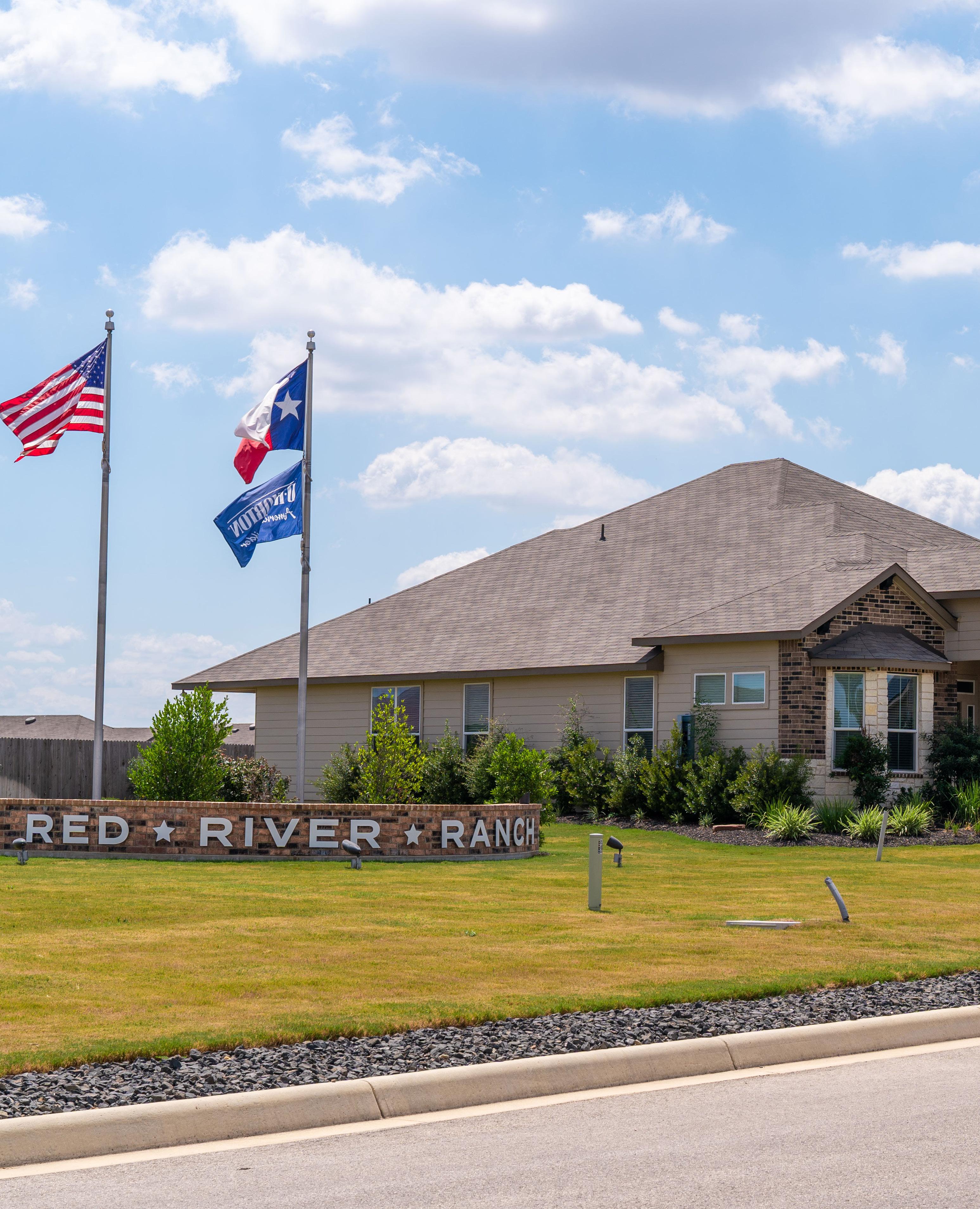
Tomorrow Comprehensive Plan
An important component of the Cibolo Tomorrow Comprehensive Plan is the assessment of both current and future housing and neighborhood demands. The city has seen an increase in new residential developments. It is crucial to develop specific plans that will aid the city in effectively managing and accommodating anticipated growth. Population growth can reshape the fabric of housing and neighborhoods in the community. As the population grows, the demand for housing intensifies, leading to increased construction and development. This surge in housing needs can influence the character of neighborhoods, prompting changes in housing density and community amenities. The challenges of accommodating a growing population also extends to ensuring housing affordability, addressing infrastructure demands, and maintaining a balance between residential and green spaces. Through targeted initiatives and thoughtful planning, Cibolo aims to navigate the changing landscape of residential development, ensuring that it aligns with the city’s vision for a vibrant and sustainable future.
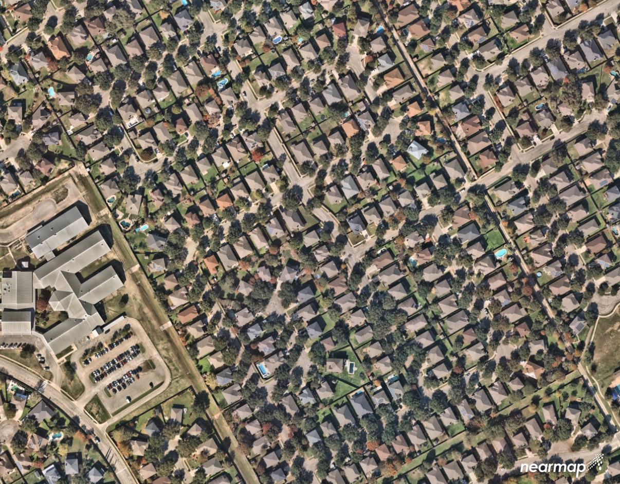
Between 2010 and 2022, the housing landscape in the community saw significant growth, with the total number of housing units increasing from 4,458 to 10,735. The latest available data from the American Community Survey (ACS) 5-Year Estimates, is from 2022. Figure 5.1 displays the household characteristics of Cibolo over the past 10 years. This expansion was accompanied by a rise in the average household size from 3.07 to 3.24, reflecting an increase in family household size as well. Despite the growth, the vacancy rate fluctuated over the years, reaching its highest point of 6.17% in 2022. Owner-occupied units remained dominant throughout the period, although there was a slight decrease from 88.8% in 2010 to 84.4% in 2022. Interestingly, while owner vacancy rates experienced fluctuations, renter vacancy rates remained relatively stable, reaching 2.2% in 2022.
The data highlights a significant growth trajectory in the housing sector of Cibolo, indicating a steady increase in demand for residential units over the years. With the total housing units nearly tripling from 2010 to 2022, it suggests a rising population and a sustained influx of residents into the area. The uptick in average household size and family household size underscores a growing need for housing suitable for families, potentially driven by demographic shifts or lifestyle preferences. Despite fluctuations in vacancy rates, the overall trend points towards a dynamic housing market with varying degrees of occupancy. The dominance of owner-occupied units suggests a preference for homeownership within the community. Moreover, the steady increase in median household income indicates a positive economic outlook, which could further fuel housing demand, particularly for higher-end properties.
Source: 2010 - 2022 American Community Survey, 5-Year Estimates. DP04 Selected Housing Characteristics
Figure 5.2 displays the housing type and unit breakdown. The data reveals significant shifts in the composition of housing types in the Cibolo area over the specified time periods. Notably, there has been a substantial increase in the number of single-family detached homes, which constituted 97% of the total housing stock in 2010 and grew by 121% by 2022, comprising 92% of the total housing units. There was a steady incline in single-
family attached homes and duplexes during this period, with single-family attached homes experiencing a notable increase by 113% from 2010 to 2022 but remaining a small fraction of the total housing inventory. The data also indicates a significant increase in multifamily units and other housing types, although their share of the total housing stock remains relatively low compared to single-family detached homes.
Source: 2010 - 2022 American Community Survey, 5-Year Estimates. DP04 Selected Housing characteristics
Figure 5.3 displays the age of housing units in Cibolo over the past years. Single-family homes, including both attached and detached dwellings, represent the majority of housing units, with 9,629 units, primarily constructed between 2000 and 2019. The data also indicates a notable presence of multifamily units, accounting for 573 units, primarily
constructed between 2000 and 2019 or later, suggesting a mix of housing types catering to diverse residential needs. Additionally, other housing types, comprising 331 units, show a varied distribution across construction periods, with significant numbers built between 1980 and 1999 and 2000 to 2019, reflecting the community’s housing diversity and evolving development trends over time.
Source: U.S. Census Bureau.2022 ACS 5-Year Estimates, B25127: Tenure by Year Structure Built by Units in Structure.
Figure 5.4 presents median household income figures for Cibolo, Guadalupe County, the San Antonio-New Braunfels Metropolitan Statistical Area (MSA), and Texas across three time points: 2010, 2014, and 2022. Notably, Cibolo experienced a substantial increase in median household income over the specified period, rising from $85,305 in 2010 to $116,510 in 2022, marking a remarkable 62.9% growth from 2010 to 2014 and a subsequent 33.0% growth from 2014 to 2022. Comparatively, Guadalupe County and Texas also witnessed notable income growth, with Guadalupe County experiencing a 33.87% increase from 2010 to 2014 and a 42.0% increase from 2014 to 2022, and Texas observing a 61.18% increase from 2010 to 2014 and a subsequent 37.5% increase from 2014 to 2022. However, the San Antonio-New Braunfels MSA recorded a contrasting trend, with a median household income of $52,786 in 2014 declining to $49,854 in 2022, reflecting a -5.6% decrease over the specified period, highlighting differing economic trajectories across regions.
Source: U.S. Census Bureau.2022 ACS 5-Year Estimates, B25127: Tenure by Year Structure Built by Units in Structure.
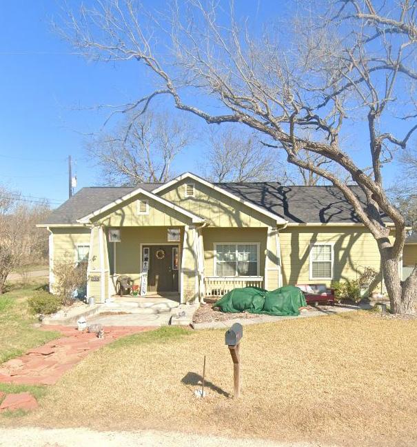
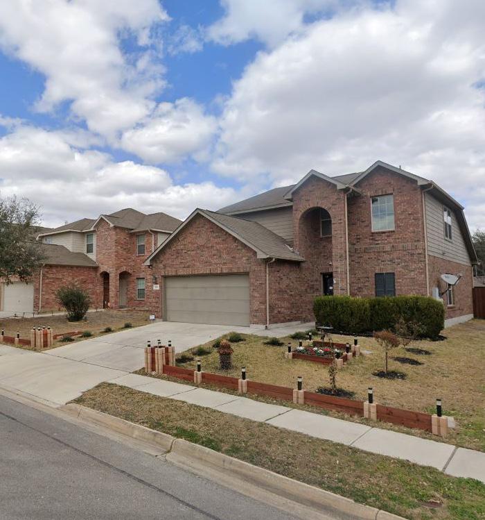
Figure 5.5 outlines income categories along with their corresponding Area Median Income (AMI) limit levels and the number of households falling within each income bracket. The income categories range from Extremely Low, constituting households earning less than 30% of the AMI limit, to High, encompassing households with incomes exceeding 120% of the AMI limit. Among the identified categories, the largest proportion of households falls within the High income bracket, representing 58.2% of the total, indicating a significant segment of the population with incomes surpassing 120% of the local AMI limit. Conversely, households classified as Extremely Low, Very Low, and Low collectively constitute a smaller percentage of the total, indicating a potential need for targeted assistance or affordable housing initiatives to address the housing affordability challenges faced by these lower-income segments of the community.
Figure 5.4 reveals an increase in median household incomes across all regions, with Cibolo experiencing growth from $85,305 in 2010 to $116,510 in 2022. According to the Bureau of Labor Statistics (BLS) Consumer Price Intex (CPI) inflation calculator, $85,305 in 2010 has the same buying power as $113,184, indicating a minor increase in purchasing power. Figure 5.5 sheds light on the distribution of households across different income categories in Cibolo. It indicates that a significant proportion of households fall within the High income bracket, comprising 58.2% of the total. However, there are also notable percentages of households classified as Extremely Low, Very Low, and Low income, highlighting the presence of lower-income segments in the community. These findings underscore the diverse income landscape within Cibolo and emphasize the importance of catering to the housing needs of households across various income levels. While a considerable portion of the population may have the financial means to afford housing at higher price points, there remains a need to address housing attainability for lowerincome households.
Note*: Housing assistance is an income-based program and programs are available to populations and households at varying levels of income in order to ensure access to everyone. Income limits are set by the U.S. Department of Housing and Urban Development (HUD) at multiple points representing various levels of income and are established annually based on local area median income levels (AMI). Cibolo’s AMI limits are established by the San Antonio-New Braunfels Metropolitan Statistical Area (MSA).
Source: *Department of Housing and Urban Development, FY2015 Income Limits. Limits shown are for a 4-person household. Estimated number of households at each income level is based on the closest delineation of the census data. †U.S. Census Bureau. 2014-2022 ACS 5-Year Estimates, B19001: Household Income in the Past 12 Months (in 2022 Inflation-Adjusted Dollars).
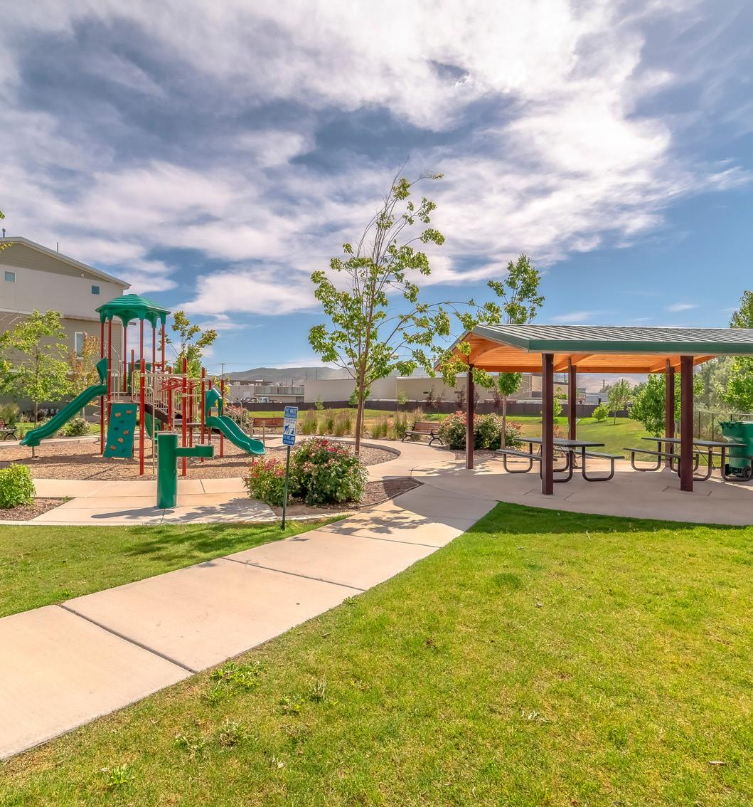
Neighborhood Park
One of the major concerns regarding housing and neighborhoods heard during the public engagement process was ensuring high-quality housing. From revitalizing and enhancing the charm of established communities to strategically planning for vibrant and sustainable neighborhoods, recommendations aim to cultivate a housing environment that meets the diverse needs of the community. This section organizes recommendations by existing and future housing and neighborhoods. Balancing growth and maintaining the character of the housing and neighborhoods in Cibolo will take a united effort towards implementing policy that fits the community’s desired vision. While this section outlines city-wide actions that can be taken to encourage complete communities in Cibolo, below are the main ideas that were heard during the engagement process for housing and neighborhoods:
• Strengthening Existing Neighborhoods. There should be investment in promoting the long-term vitality of existing housing and neighborhoods. Neighborhood reinvestment helps to maintain a competitive housing market. Ways to reinforce existing neighborhoods can include public realm improvements, such as streetlights, streetscape improvements, benches, and other like projects.
• Prioritizing Access and Mobility. Access to better mobility is fundamental to creating inclusive and connected neighborhoods. Improving mobility involves enhancing transportation infrastructure such as sidewalks, bike lanes, and road networks.
• Connectivity to Park and Trail Amenities. A priority among residents was safety. Identifying new trails and sidewalks can improve connectivity within neighborhoods to nearby points of interest. A study should be conducted to identify and prioritize needed connections throughout the community. Additionally, providing safe crosswalks that are accessible for all residents can greatly improve walkability to neighborhoods, schools, and City facilities.
• Flood and Hazard Mitigation. Flooding poses significant risks to communities, causing property damage, infrastructure disruption, and public safety concerns. Implementing effective flooding prevention and mitigation measures is essential for safeguarding neighborhoods against the impacts of extreme weather events.
• Retaining Character. Retaining the character of rural residential areas and housing in the Old Town district is essential for preserving the unique charm and historical significance of a community.
• Enhanced Maintenance. By prioritizing regular maintenance activities such as landscaping, street sweeping, and graffiti removal, communities can create attractive and inviting environments that promote resident satisfaction and contribute to the overall quality of life.
• Neighborhood Community Events. Organizing events such as block parties, picnics, and holiday celebrations, communities can strengthen bonds among neighbors, promote civic pride, and create a vibrant and supportive local environment.
• Diversity in Housing Mix. A diverse housing mix enriches communities by catering to the varying needs and preferences of residents. By offering a range of housing options like missing middle housing, future housing can cater to a diverse set of needs and lifestyles. Missing middle housing solutions are explored and defined further in the chapter.
• Designing With the Land. In areas with topographic constraints and flooding, implementing cluster developments is an innovative planning technique to protect natural features, create visually interesting neighborhoods, encourage outdoor recreation, aid in floodplain stormwater management, and more.
Cibolo can effectively identify existing housing demands by collecting comprehensive housing data from various sources and conducting thorough analysis. This includes gathering information on demographics, income levels, household size, and housing preferences through surveys, Census data, and housing market reports. Additionally, tracking housing market trends, vacancy rates, and housing affordability indicators can provide insights into the current housing landscape and identify areas of need. Utilizing Geographic Information Systems (GIS) technology to map housing supply, demand, and spatial distribution can further enhance data visualization and analysis. By leveraging this data-driven approach, Cibolo can gain a deeper understanding of housing needs, prioritize resource allocation, and develop targeted strategies to address housing challenges and ensure access to safe, attainable, and quality housing for all residents.
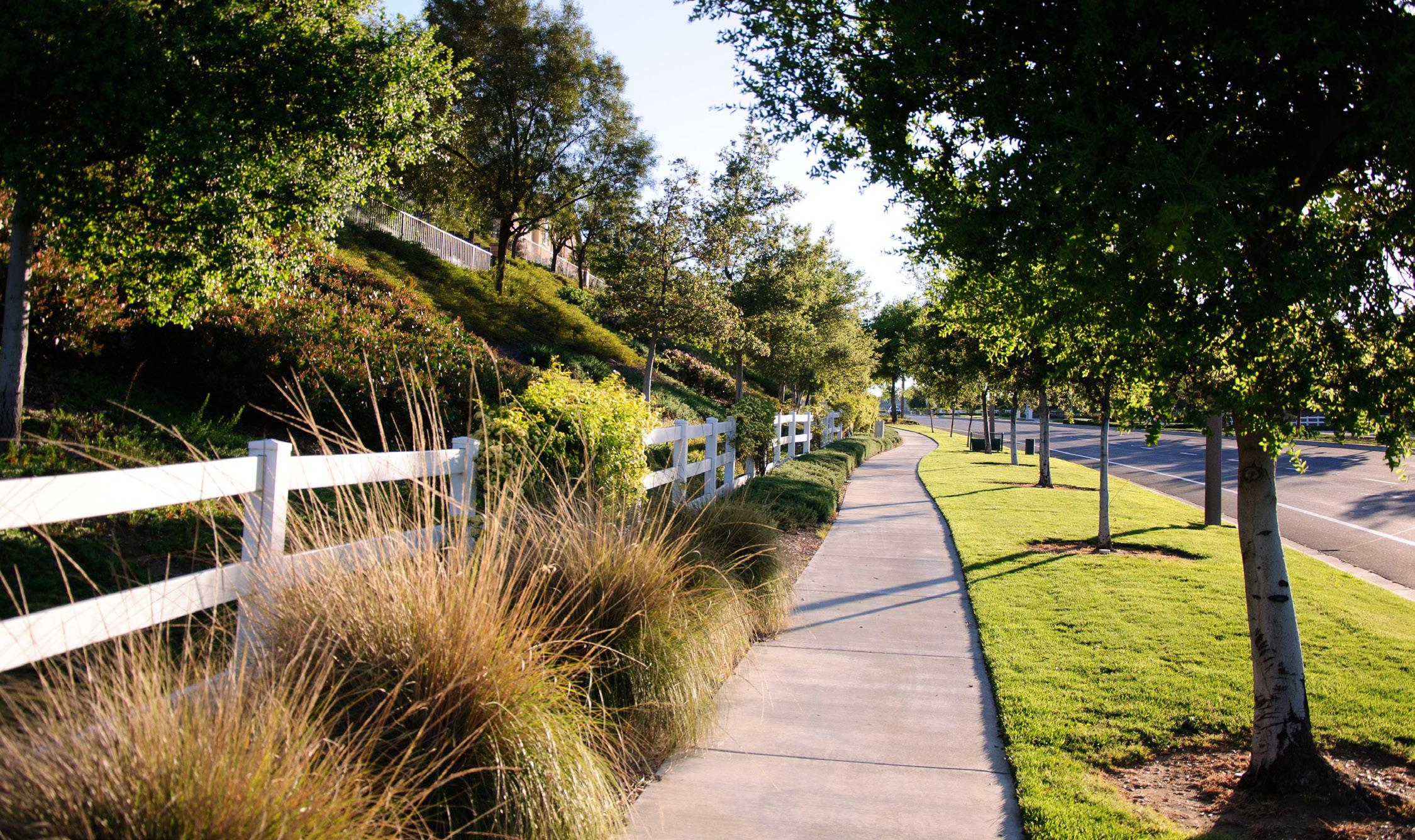
Today in Cibolo, 93.8 percent of the community is in owner-occupied housing units and mostly single-family detached. Such a housing landscape reflects stability, as homeownership typically implies long-term commitment and investment in the community. Suburban or semi-rural settings make up the majority of the housing landscape for the city. This suggests residents prioritize more spacious lots and a focus on privacy and autonomy. High ownership rates further indicate a sense of permanence and pride within the community, as homeowners are more likely to be invested in maintaining and improving their properties.
This high rate of ownership also fosters a sense of community cohesion, as homeowners tend to have a vested interest in the well-being of their neighborhood and may actively participate in local initiatives and associations aimed at enhancing the quality of life for all residents. Strengthening existing neighborhoods by fostering a sense of community pride and engagement is imperative. Encouraging homeowners to take an active role in neighborhood initiatives, such as neighborhood watch programs, community clean-up efforts, or social gatherings can help achieve high-quality neighborhoods.
Code compliance contributes to the aesthetic appeal of neighborhoods by regulating the appearance and maintenance of properties. Well-maintained and aesthetically pleasing neighborhoods are often more attractive to residents and potential buyers, contributing to overall property values. Complying with code regulations can create difficulties for residents with disabilities or those facing barriers in their daily lives. One opportunity to help with code compliance in the community is to setup programs for volunteers to help enhance the community. Partnering with the school district, local non-profits, and religious groups can make the beautification of Cibolo neighborhoods a collective community priority. A prime example of code compassion in practice is with the city of Arlington. The City has established a system that provides Arlington neighborhoods with free resources to help with property maintenance and repair tasks. This is beneficial for many residents amid rising inflation and other financial challenges. Through partnerships with local groups and volunteers, Arlington provides resources to its residents to create civic pride and build community trust.
Below are some of the programs the City offers to aid in code compliance:
• Tool Sharing Program: Arlington residents are able to check out a mower or a variety of other tools and equipment for free to assist with property cleanup and improvement.
• Neighborhood Enhancement Team: The Neighborhood Enhancement Team is a council driven initiative with the mission of improving the quality of life, aesthetic appeal, and economic vitality of Arlington neighborhoods. The Neighborhood Enhancement Team collaborates with residents and hosts clean up days to improve the appearance of neighborhoods. The Neighborhood Enhancement Team assists with property clean up, debris removal, fence repair, and yard maintenance.
For more information on Code Compliance Cares, check out the City of Arlington website: https://www.arlingtontx.gov/city_hall/ departments/code_compliance/about_us/code_compliance_cares
Chapter 4: Transportation outlined recommendations regarding the Master Thoroughfare Plan (MTP). The goal of the MTP is to increase mobility throughout the community to ensure access to existing neighborhoods and key areas. Many of the major arterials make sure to connect established residential areas to commercial areas. Enhancing connectivity within and between neighborhoods aims to offer residents increased flexibility in accessing the city-wide thoroughfare network. Often, subdivisions are designed with limited access points, minimizing travel options for residents commuting to work, school, or running errands. This concentration of traffic at single entry points, particularly during peak congestion periods, exacerbates traffic congestion, perpetuates a perception of transportation issues within the city, and heightens frustration with the overall transportation network. Introducing multiple access points can alleviate congestion and enhance satisfaction with the city’s thoroughfare system.
traffic calming measures, such as speed bumps, raised crosswalks, and narrowed streets, help to make roads safer for all users. Overall, prioritizing active transportation infrastructure and encouraging nonmotorized modes of travel play a vital role in creating safer and more livable neighborhoods for residents of all ages. See page 96 on the benefits active transportation can have on residential areas.

Roadways near neighborhoods should not only prioritize vehicular mobility but also connectivity to pedestrian amenities like sidewalks and trails. Chapter 4: Transportation outlined recommendations on how the community can promote better active transportation through Cibolo. Designing streets to be pedestrian-friendly give residents options on how to move about their city. As a result, active transportation can improve safety near neighborhoods and reduce traffic congestion. Including active transportation on streets near neighborhoods increases the visibility of pedestrians and cyclists on streets, alerting motorists to their presence and encouraging cautious driving behaviors, thereby reducing the risk of accidents. Creating designated pedestrian crossings, bike lanes, and sidewalks, active transportation infrastructure provides clear pathways for non-motorized travel, minimizing conflicts between different modes of transportation and improving overall traffic flow. Additionally, Pedestrian Crossing
Active transportation in residential areas offer numerous benefits:
• Improved Health and Well-being. Walking or biking for transportation promotes physical activity, leading to better cardiovascular health, reduced risk of chronic diseases like obesity and diabetes, and improved mental well-being.
• Reduced Traffic Congestion. By encouraging walking and biking, active transportation can alleviate traffic congestion on roads, especially during peak hours, leading to smoother traffic flow and reduced commute times for all road users.
• Environmental Sustainability. Choosing active transportation over motor vehicles reduces greenhouse gas emissions, air pollution, and reliance on fossil fuels, contributing to a cleaner and more sustainable environment.
• Enhanced Safety. Active transportation infrastructure, such as sidewalks, bike lanes, and crosswalks, improves pedestrian and cyclist safety by providing designated spaces and reducing conflicts with motor vehicles, thereby decreasing the risk of accidents and injuries.
• Improved Accessibility. Active transportation enhances access to essential services, amenities, and recreational facilities within residential areas, making them more livable and inclusive for residents of all ages and abilities.
• Cost Savings. Walking and biking are cost-effective modes of transportation that require minimal expenses compared to owning and operating a vehicle, leading to savings on fuel, maintenance, and parking fees for individuals and households.
Case Study: The University of Cincinnati conducted research examining the impact of proximity to nature trails, specifically the Little Miami Scenic Trail, on residential property values in Hamilton County, Ohio. Researchers found that homes located closer to the trail entrance experienced a significant increase in property values, with housing prices rising by nine dollars for every foot closer to the trail. This equated to an average premium of $9,000 for homes located 1,000 feet closer to the trail. The study, supported by an interdisciplinary grant, utilized a database of housing characteristics for over 1,700 residential properties within 10,000 feet of the trail to isolate the effects of trail proximity on property values. The findings suggest that investment in infrastructure and public amenities like nature trails can yield positive returns for communities, highlighting the importance of such amenities in urban planning and development.
https://www.uc.edu/news/articles/legacy/enews/2011/10/new-research-finds-that-homeowners-and-city-planners-should-hitthe-trail-when-considering-property-values.html
Addressing flooding and hazard mitigation in neighborhoods is a critical priority for Cibolo. A multifaceted approach is essential, encompassing various actions tailored to the unique challenges and characteristics of neighborhoods in the community. One key strategy involves implementing floodplain management measures, including stringent land-use regulations to limit development in flood-prone areas and preserving natural floodplains as buffer zones. By safeguarding these vulnerable areas, cities can mitigate the risk of flood damage to properties and infrastructure while preserving the ecological integrity of the surrounding environment.
Investing in stormwater management infrastructure is another vital component of effective flood mitigation efforts. Cities can enhance resilience by developing a comprehensive network of retention ponds, green infrastructure, and drainage systems designed to manage the impacts of heavy rainfall events. These infrastructure improvements not only help reduce the risk of flooding but also contribute to improved water quality, increased groundwater recharge, and enhanced urban biodiversity.
In addition to infrastructure investments, cities can establish flood early warning systems and emergency response plans to enhance preparedness for flood events.
A flood early warning system is a system that helps to detect and predict the occurrence of floods in advance by using monitoring sensors to measure environmental data such as rainfall, water levels in rivers, and soil moisture. Once a potential flood event is detected, the system issues early warnings to the relevant authorities. By leveraging real-time data, authorities can provide timely alerts to residents, facilitate evacuations in vulnerable areas, and coordinate emergency services effectively. Promoting community education and outreach initiatives is essential for raising awareness about flood risks. Collaboration and partnerships are also critical, as cities work with neighboring jurisdictions, government agencies, non-profit organizations, and community stakeholders to coordinate flood mitigation efforts.
Today, Cibolo has already coordinated with the San Antonio River Authority (SARA) on flood risk assessments on a regional level. Implementing flood risk assessments enables cities to identify high-risk areas, assess potential hazards, and prioritize mitigation actions based on the severity of risk, ensuring resources are allocated efficiently to address the most pressing needs. Continued partnership with similar agencies should be prioritized.

Strengthening existing housing and neighborhoods begins with a thorough understanding of the desired character and intent of the community - for instance, one component of the Cibolo Tomorrow Comprehensive Plan’s vision is preserving the small-town feel. The look and feel of existing housing in Cibolo add to the overall charm of the community. The small-town aspect is prominent in areas within the city limits and ETJ of Cibolo that contain large lots for rural residential, and some of the City’s oldest housing stock in Old Town. The Rural Residential/Agricultural and Old Town PlaceTypes are outlined in Chapter 3: Land Use and Character and are unique aspects of the housing landscape in Cibolo.
The Rural Residential/Agricultural PlaceType is designed to provide residents with a diverse range of lifestyle options. The rural residential areas support traditional ranching and compatible residential uses. These areas and neighborhoods accommodate the demand for larger lot residential communities, including rural ‘ranchettes,’ thereby offering diverse residential and lifestyle choices. By refraining from extending urban-scale infrastructure into the area, the rural residential areas prevent excessive strain on fiscal resources. Preserving these areas helps add to the overall character of the community and also serve as a buffer from higher density residential areas and the floodplain.
The character of housing in Old Town Cibolo is unique. The housing is situated in an urban area that contains a mix of uses, primarily along Main Street, in context with storefront restaurants and shops. The adjacency to those uses, are a part of the character and charm of this primarily residential district and create opportunities and challenges that are multifaceted and complex. The housing stock in the Old Town is some of the oldest in the City and traces back to Cibolo’s roots as a railroad town. These older buildings tend to be smaller scaled and have inviting front porches and facades in the style of traditional Old Town housing. As housing ages in this district, reinvestment becomes necessary and will be needed for the continued vibrancy and success of the area.
Throughout the planning process it was apparent that the community is very passionate about the future of Old Town housing and what role it plays in the area. One of the major efforts on the horizon is an update to the Cibolo Downtown Revitalization Plan to dive into the various complexities of the district and establish a actionable plan going forward.
To regulate Airbnb rentals in the community, Cibolo can implement actions aimed at ensuring compliance with local regulations and addressing potential concerns. One approach is to establish clear zoning ordinances and licensing requirements specifically tailored to short-term rental properties, including Airbnb listings. This can help ensure that rentals are located in appropriate areas and meet safety and health standards. Additionally, the city can enforce occupancy limits, noise regulations, and other rules to mitigate potential disturbances to neighboring residents. Implementing a registration or permitting system for Airbnb hosts can also provide the city with better oversight and enable them to monitor and address issues more effectively. Furthermore, the city can collaborate with Airbnb to collect occupancy taxes and fees, ensuring that short-term rentals contribute to the local economy and infrastructure. Overall, proactive regulation of Airbnb rentals can help strike a balance between accommodating visitors and preserving the quality of life for residents in the community.
With the increase in population and developments, ensuring high-quality housing is important. High-quality housing not only enhances residents’ overall well-being but also contributes to the attractiveness and competitiveness of the city. High-quality housing catalyzes economic growth, attracting new residents, businesses, and investments to the area. It creates a positive cycle of development, where improved housing stock leads to increased property values, higher tax revenues, and greater municipal resources for essential services and infrastructure.
High-quality housing is essential for addressing the diverse needs of a growing population. By providing a range of housing options, including attainable and accessible housing, cities can accommodate the needs of individuals and families at different life stages and income levels. While single-family homes are integral to Cibolo’s housing landscape, it is necessary to incorporate ‘missing middle’ housing options, such as duplexes, cottages, workforce housing, housing tailored for
seniors, and residences within mixed-use developments, all strategically situated throughout the city.
Action item HN-4 entails securing financial resources to support workforce housing for essential workers earning lower than the median income by researching funding sources such as government grants, tax credits, and private partnerships and developing comprehensive project proposals. Action item HN-6 requires establishing a rental registration program that will require landlords to register their properties to ensure compliance with safety and building codes. This involves defining registration requirements and enforcing compliance standards. The implementation includes landlord outreach, managing penalties for non-compliance, supporting landlords, and educating tenants. These actions aim to enhance affordable workforce housing availability and ensure rental property safety and quality.
Affordable housing typically refers to housing that is priced below the median market rate and is within the financial means of low- to moderate-income households. Affordable housing initiatives often involve government subsidies, tax incentives, or other forms of financial assistance to make housing more affordable for those who might otherwise be priced out of the market.
On the other hand, attainable housing refers to housing that is within the financial reach of a broader range of income levels, including middle-income households. Attainable housing initiatives focus on creating housing options that are priced at levels that are attainable for working families, professionals, and other individuals who may not qualify for traditional affordable housing programs but still face challenges in finding housing that meets their budget constraints.
In essence, while affordable housing targets low- to moderate-income households specifically, attainable housing aims to address the housing needs of a broader spectrum of income levels, including middle-income earners. For most of the Cibolo Tomorrow Comprehensive Plan, attainable housing is the primary focus to address a more diverse set of needs for the community.
Population growth often necessitates new developments within a community to accommodate the increasing demand for housing, infrastructure, and services. Many of these developments occur on the north side of Cibolo and into the ETJ. New developments can encompass a variety of projects, including residential subdivisions, commercial centers, industrial parks, and public amenities such as parks, schools, and healthcare facilities. These developments not only provide additional housing options for residents but also stimulate economic activity. However, it is essential for new developments to be carefully planned and executed to ensure they are resilient and compatible with the existing character of the community.
Traffic Impact Analysis (TIAs) and Preliminary Impact Assessments (PIAs) can be crucial processes for new housing developments, ensuring that the impacts of these projects are thoroughly evaluated and addressed. TIAs focus on assessing the potential traffic impacts of new housing developments on the surrounding road network, including increased vehicle trips, changes in traffic patterns, and safety concerns. By identifying these impacts early in the planning stages, TIAs enable developers and local authorities to implement appropriate mitigation measures, such as road improvements or alternative transportation options, to minimize congestion and enhance traffic flow. On the other hand, PIAs assess the broader impacts of new housing developments on the surrounding community, including land use compatibility, environmental considerations, and infrastructure needs. By conducting PIAs, the City can identify potential challenges or opportunities associated with the development and ensure that it aligns with the community’s goals and values. While the City already utilizes TIAs, it is recommended that the City also utilize PIAs as a tool to help broaden the scope of its evaluation process. Together, TIAs and PIAs play a crucial role in guiding the planning and implementation of new housing developments and promoting sustainable growth.
Rental communities are residential developments consisting of multiple housing units that are leased to tenants rather than owned by individual homeowners. These communities can vary widely in size and style, ranging from small apartment complexes to large-scale rental neighborhoods with townhomes, duplexes, or single-family homes. In rental communities, tenants typically pay a monthly rent to the property owner or management company in exchange for the right to occupy the housing unit. Rental communities offer a range of amenities and services. These amenities include shared recreational facilities, maintenance services, and security features, providing residents with a convenient and comfortable living experience. Rental communities are particularly popular among individuals or families seeking flexibility in their housing arrangements or those who may not be ready or able to commit to homeownership. Additionally, rental communities can accommodate other populations, such as students, young professionals, and individuals relocating for employment opportunities. Rental communities contribute to the overall housing supply, helping to alleviate housing shortages and mitigate the impact of rising housing costs. As such, they play a vital role in promoting housing attainability and ensuring that residents have access to safe, stable, and quality housing options within the community.
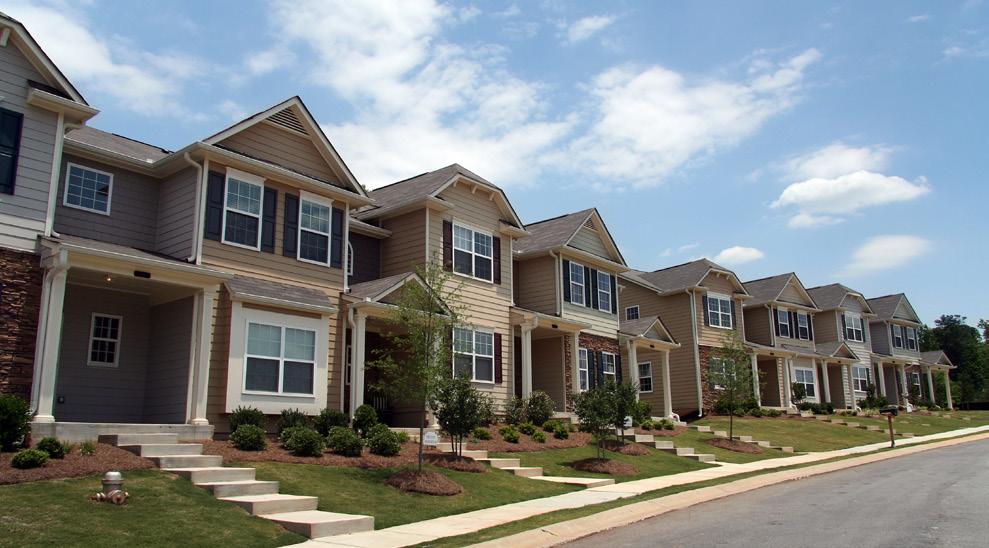
The increased demand for housing presents a significant challenge for the City to meet the diverse housing needs of residents. Diversifying the housing stock is a priority to accommodate varying household sizes, incomes, and lifestyle preferences. One critical aspect of this diversification is the incorporation of “missing middle” housing, which refers to a range of housing types that bridge the gap between single-family homes and large apartment buildings. Missing middle housing includes duplexes, triplexes, townhouses, and small-scale apartment buildings, providing more housing options within neighborhoods and contributing to a more inclusive and resilient housing market. Strategically locating missing middle housing developments can help fill the gap in housing needs by providing attainable, yet high-quality housing options near amenities, services, and transportation hubs. This form of smart development can help revitalize underutilized areas and contribute to the overall vibrancy and sustainability of the community.
Missing middle housing can enhance neighborhood character and foster social cohesion. These housing types often blend seamlessly with existing single-family homes, preserving the scale and aesthetic appeal of neighborhoods. The provision of missing middle housing promotes socioeconomic diversity within communities, fostering inclusive neighborhoods where residents from different backgrounds can live and interact. Embracing missing middle housing as part of a diversified housing strategy is essential for meeting the evolving needs of growing communities. Figure 5.6 displays what kind of missing middle housing could be appropriate from the PlaceTypes outlined in Chapter 3: Land Use and Character.
Different types and scale of Missing Middle Housing:
• Duplex. A structure containing two side-by-side dwelling units, both located on the same lot.
• Courtyard Housing. A medium to large-sized (1-to 3-story) detached structure consisting of multiple side-by-side and/or stacked dwelling units oriented around a courtyard or series of courtyards.
• Bungalow Courts. A group of small (1-to 2-story) detached structures arranged around a shared court visible from the street.
• Live-Work. A small- to medium-sized (1- to 3-story) attached or detached structure consisting of one or more dwelling units located above or behind a ground floor space that can accommodate a range of non-residential uses.
• Fourplex. A detached (2- to 2.5-story) structure with four-dwelling units, two on the ground floor and two above, with shared or individual entries from the street.
• Accessory Dwelling Units (ADUs). A secondary residential dwelling unit located on the same lot as a primary single-family dwelling unit, either within the same building as the single-family dwelling unit or in a detached building.
• Townhomes. A small- to medium-sized attached structure (2- to 3-story) that consists of several multi-story dwelling units placed side-by-side, qach located on an individual lot.
https://missingmiddlehousing.com/

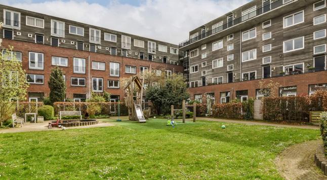
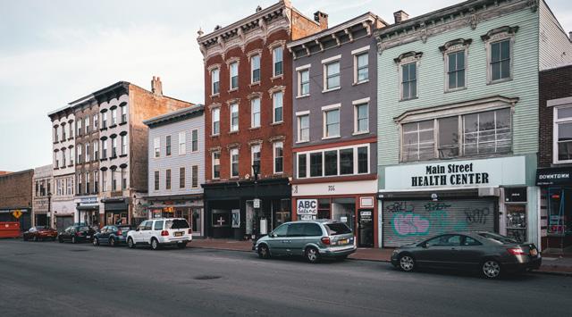
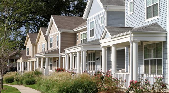
New housing developments can take proactive measures to mitigate flooding and minimize the risk of water-related damage. These actions include implementing effective stormwater management practices, such as detention ponds, permeable pavements, and rain gardens, which help capture and retain excess rainwater on-site. This reduces runoff and alleviating pressure on drainage systems. Proper site grading and elevation techniques ensure that building foundations are situated above the base flood elevation (BFE), strategically positioning structures on higher ground to protect properties from potential flood damage and ensure resident safety.
Preserving natural floodplains and wetlands within and around the development area serves as a crucial strategy to mitigate flooding. By safeguarding these ecological features, developers can create natural buffers against flooding, as floodplains and wetlands absorb excess water, mitigate flood risk, and contribute to the overall health of the watershed. Integrating green infrastructure elements, such as swales, bioswales, and vegetated buffers, into the design of the development further enhances stormwater management and water infiltration.
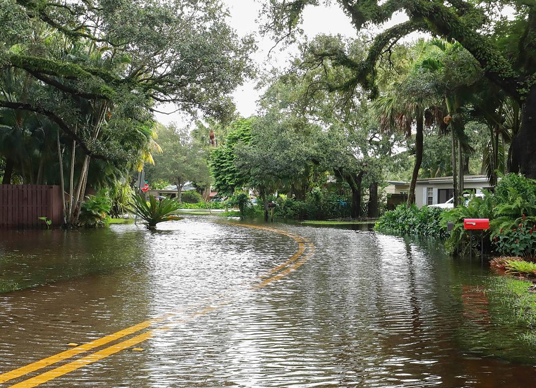
Cluster developments, characterized by grouping housing units together while preserving open space, offer an additional opportunity to mitigate flooding. By concentrating development in specific areas and preserving natural vegetation and permeable surfaces, cluster developments minimize impervious surfaces and reduce stormwater runoff. This approach promotes more efficient land use, maximizes green space, and minimizes the impact of development. Through the integration of these strategies, new housing developments can enhance community resilience, reduce flood vulnerability, and create sustainable neighborhoods that prioritize both human and environmental well-being.

Another concern heard amongst residents during the engagement process was the fear of growing too rapidly and losing the feel of Cibolo. Design standards serve as a crucial mechanism for preserving a community’s character by establishing consistent guidelines for the physical and visual elements of development. Chapter 3: Land Use and Character outlined some design guidelines for ensuring the preservation of Cibolo’s look and feel. Below are some specific guidelines to neighborhoods the city can take to ensure the preservation of Cibolo’s character:
• Street and Sidewalk Design. Specify standards for road widths, sidewalks, street furniture, lighting, and landscaping, aiming for pedestrian-friendly spaces.
• Open Space and Green Areas. Outline requirements for parks, green spaces, and recreational areas, promoting a balance between built-up and natural environments for community wellbeing.
• Signage and Wayfinding. Regulate the design, size, and placement of signs to ensure clarity and consistency, contributing to a visually cohesive and navigable community.
• Parking Standards. Establish guidelines for the design and location of parking facilities, balancing the need for parking with the desire for aesthetically pleasing and functional spaces.
• Historic Preservation. Provide regulations for the preservation and restoration of historic structures, maintaining the cultural and architectural heritage of the community.
• Density and Building Setbacks. Specify the permissible density of development and the required distance between buildings and property lines to control the urban form and preserve neighborhood character.
• Accessibility Standards. Ensure that community spaces and facilities comply with accessibility standards, accommodating people with disabilities and promoting inclusivity.
While the above standards can be applied to the overall design of neighborhoods, there are legal limitations as it pertains to architectural standards for the city. House Bill 2439 is a state bill that passed on September 9, 2019, which limited what cities in Texas could control when it comes to architectural standards. HB 2439 prevents local governments from regulating the materials used for new construction, maintenance, and renovations. Instead of localized rules regarding building products and methods, the new law sets nationally accepted codes as the only standards for cities to regulate material for construction within their boundaries. With those limitations in mind, design standards can ultimately be established within the UDC, incorporating the aforementioned guidelines listed above.
The following actions are recommendations to achieve the vision for the Cibolo Tomorrow Comprehensive Plan as they relate to housing and neighborhoods.
and amend the Cibolo Unified Development Code (UDC) to provide public access to parks and other public open spaces in neighborhoods.
Review and amend the Cibolo Unified Development Code (UDC) to encourage access between neighborhoods and neighborhood‐serving commercial areas.
Review and amend the Cibolo Unified Development Code (UDC) to allow for and encourage a greater variety of housing types.

Cibolo Tomorrow Comprehensive Plan
The impact that community facilities and public services have on a community is substantial and can greatly influence the experience of its residents. The availability and access to serve the needs of the residents is an important factor that the City should consistently track and be aware of. These services and facilities are diverse in type, but include essential services (e.g. public safety) and the physical infrastructure that people utilize (e.g. drainage and streets). As Cibolo grows and demographic shifts occur, there is an expected dynamic of shifting priorities that create the need to be responsive, effective, and adaptive over time.
This chapter provides an overview of the current provision of community facilities and public services and describes what present and future anticipated needs are expected by 2050. It also provides a framework to plan and prioritize as the City seeks to deliver the highest and best level of service that it can provide to its residents.
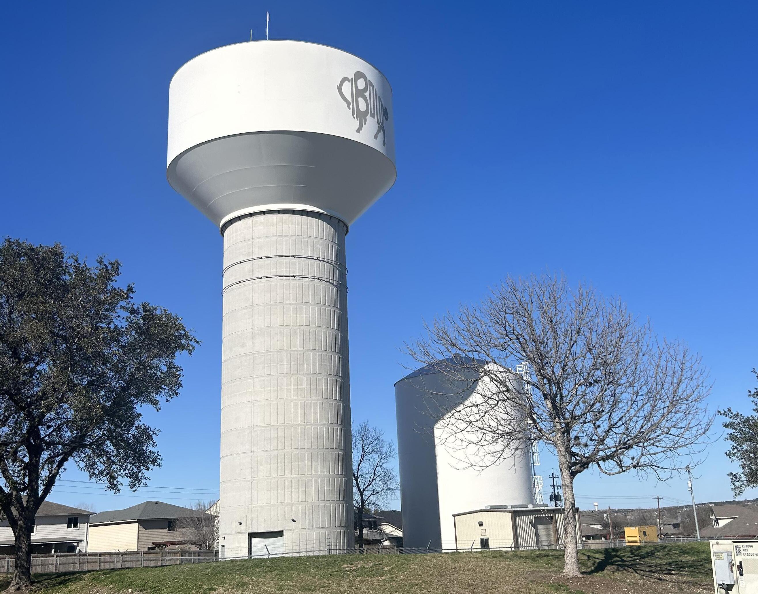
The 2016 Comprehensive Plan provided a 20-year policy framework for “growing and maintaining quality community facilities and pubic services”. Nearly 8 years later, this framework is still applicable and a valid representation of the vision for this plan element:
• Efficient and responsive governmental offices. As Cibolo continues to grow, City offices and staffing will also need to grow and improve to provide efficient and responsive services to the citizens, businesses, and visitors of Cibolo.
• Effective and sustainable public infrastructure. As the City grows over time, the extent of public infrastructure will also grow. Much of this will be built and financed in partnership with the private sector as part of new development. However, once operational, it becomes the City’s responsibility to maintain and upgrade it in perpetuity. Moving forward, the City will need to ensure that new infrastructure is durable, expandable, and efficiently maintainable over time.
• Exceptional police and fire protection. Above all else, continued provision of exceptional police and fire services is paramount to protect the public health, safety, and welfare of the community.
• Responsive other public services. In addition to providing exceptional police and fire protection, residents and business owners will increasingly demand expanded or improved public services (e.g., animal control) as the City continues to grow.
The City of Cibolo manages a number of community facilities and provides a range of public services. Public services discussed in this chapter include:
• Municipal building and government services;
• Fire and police protection services;
• Animal control;
• Utility services;
• Water and wastewater services;
• Drainage and flood protection; and
• Development and permitting services.
In order to establish a clear picture of what improvements and expansions would be beneficial and necessary to Cibolo’s provision of community facilities and public services, an existing inventory is needed to help determine the base level of service for the City (see Figure 6.1, Existing Community Facilities, on the next page). Generally, the existing inventory depicts City facilities located around the core of the Old Town and extending from there, to the developed areas North of FM-78. Most of the City facilities and roadways are also concentrated on the north side of the city with aging infrastructure located around the core and along the older highways. Some of these roadways indicate the need for Cibolo to balance its efforts to keep pace with growth while providing for the maintenance of roadways, sewer, and water infrastructure facilities. In addition to reflecting cityowned facilities, this analysis also depicts schools that are subject to the control of the Board of Trustees of the Schertz-Cibolo-Universal City Independent School District (SCUCISD).
After establishing a base level of service, an evaluation of community needs and desires can help City leaders understand whether current needs are being met and how future demand may change as the community grows.
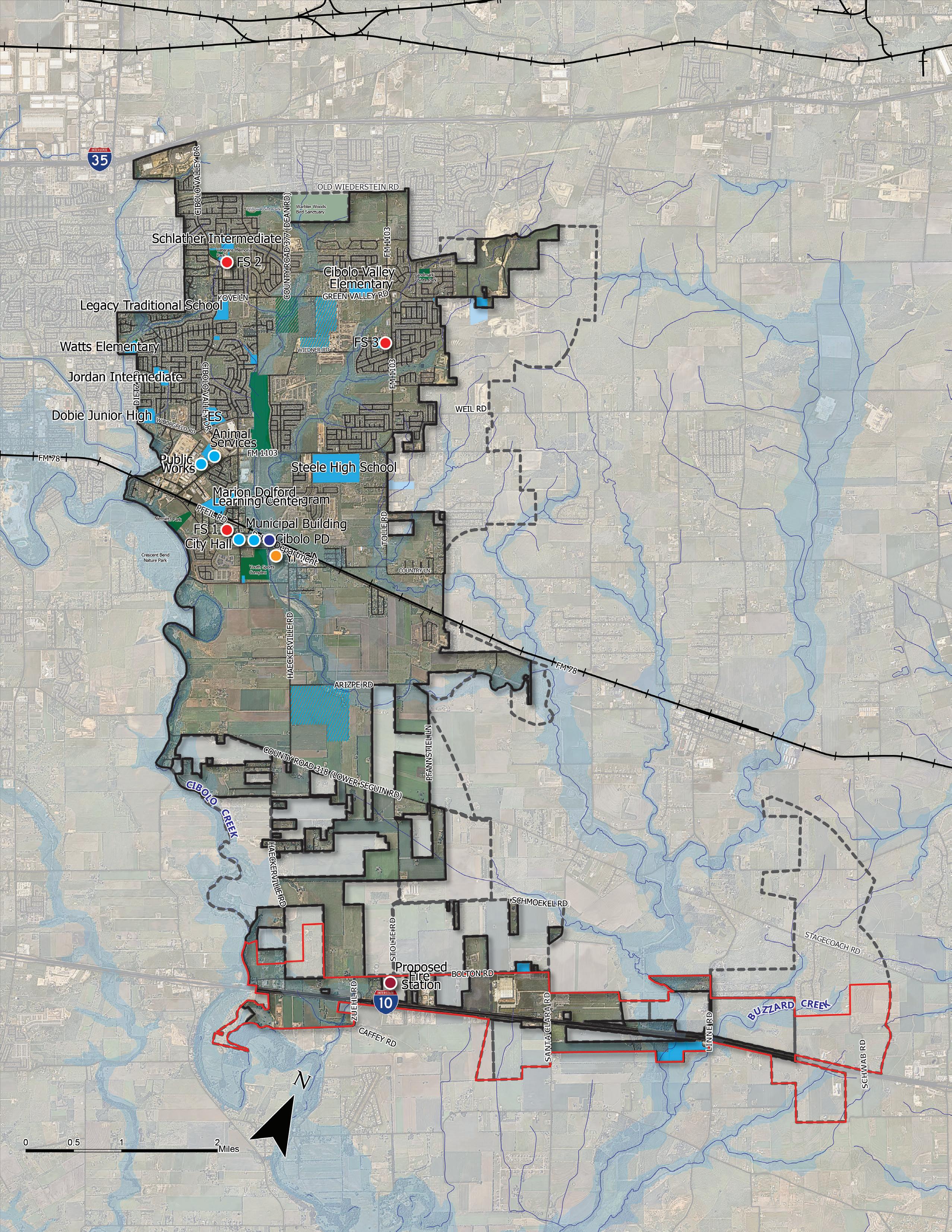
Constructed in 2005, the 10,000 square foot City of Cibolo Municipal Building located at 200 South Main Street remains the primary government building in Cibolo. Many city services are housed out of this building including the City Manager’s Office, Finance and Purchasing, etc.
In 2005, when the building was constructed, the City’s population was approximately 7,623 persons which is almost 5 times less than today’s estimated population of 34,857 persons. Over the past 10 years, the population has increased by 70 percent. This increase, as projected in the 2016 Comprehensive Plan, has created the need for additional services, facilities, and space.
Recently, the city completed the renovation of the Municipal Building, where space was
repurposed to address growing demand. Additional programing created by the renovation includes two new offices, a new conference room, expanded break room, updated foyer, and council chambers. Document and supply storage has been moved off-site to provide more usable space within the building for employees. In addition, office printing equipment has been strategically located within the building to provide easy access to all employees. The recent renovation has provided space for 21 current employees and room to accommodate seven more.
The offices of the City Manager and City Secretary ensure the delivery of public services through the community. These offices include eight staff persons.
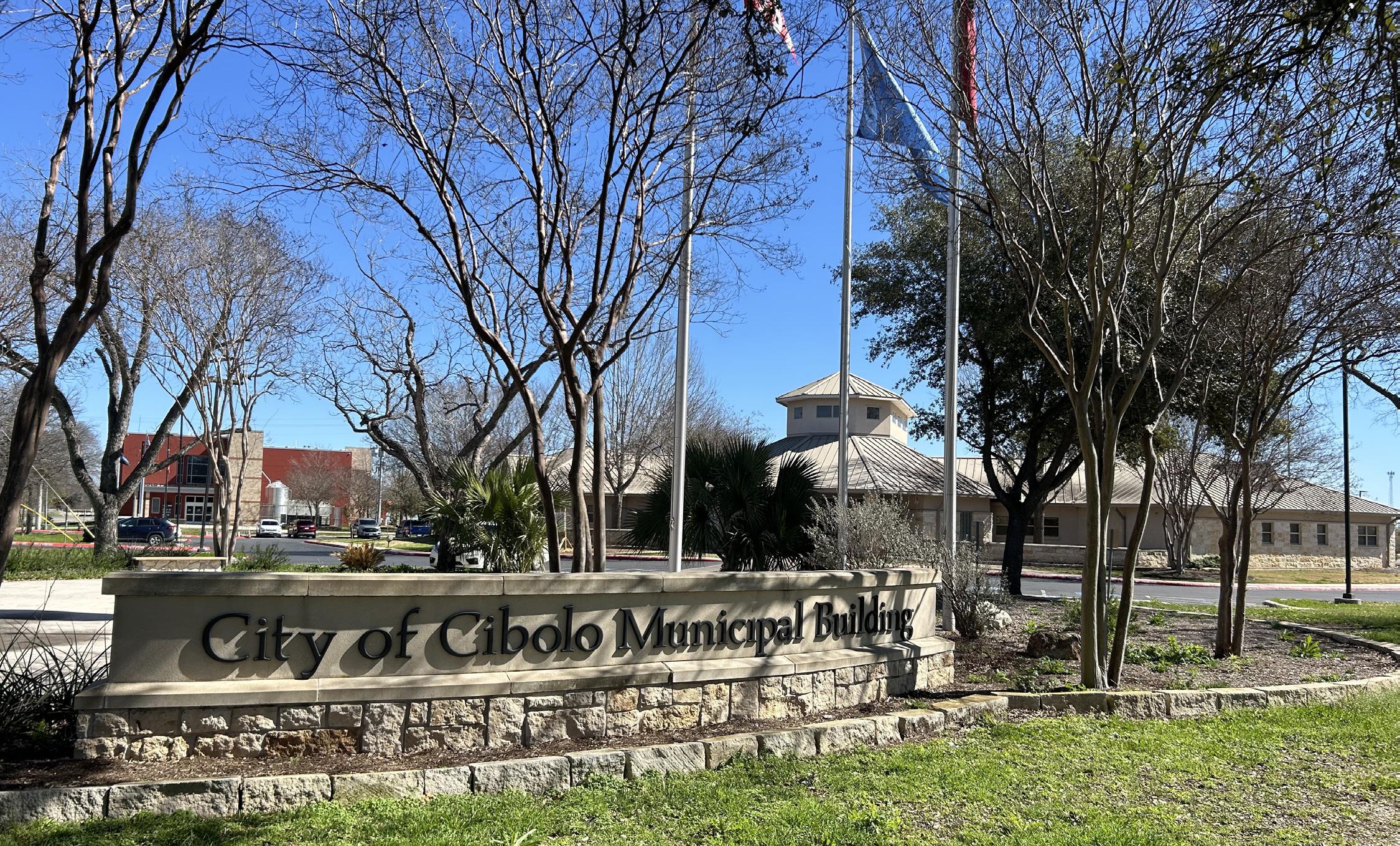
The Finance and Purchasing Department maintains the City’s accounting and financial system and is also responsible for oversight of utility billing. The department consists of eight staff persons who are located in two offices.
Utilities Administration is responsible for the billing and collection of the utility accounts. This office includes four staff persons. With the renovation of City Hall, this office was relocated to a larger space with a dedicated office for the supervisor (Utility Billing Administrator).
Cibolo’s Municipal Court rules on citations issued by the Police Department. It also maintains accurate records of cases processed by the court, sets court hearings and notifies individuals to appear, issues warrants, and summons citizens for jury duty. The Cibolo Municipal Court is the first level of the judiciary. The Municipal Court has jurisdiction over State law and City ordinances, class “C” misdemeanor violations, punishable by fine only, that occur within the territorial limits of the City of Cibolo. Currently, the Municipal Court is supported by two full-time staff persons. Court hearings occur twice a month and meet in the Council Chambers.
The Information Services Department works specifically with technology needs of the City and includes information technology and the GIS department. It consists of two employees that include the GIS Coordinator and the Information Services Director and is based out of the Municipal Building at 200 S Main Street. Like many forward thinking cities, the IT department has identified a number of technology needs for the City, including: a City Data Center (to provide access to City data); network fiber connectivity to all City facilities; a Disaster Recovery Plan and site (in the event of a disaster to ensure continuity
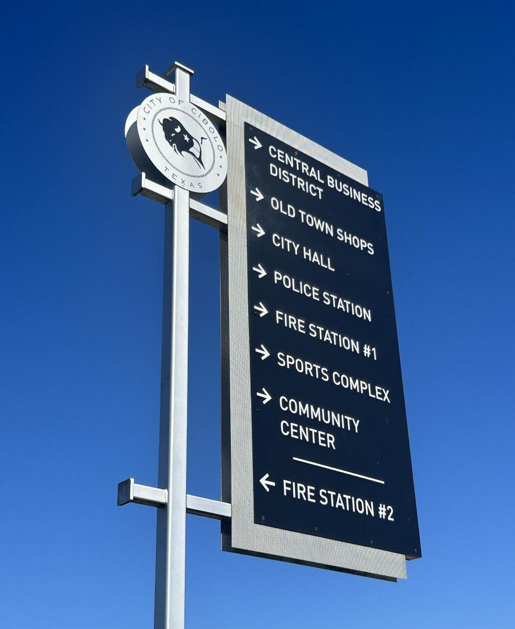
of City business); improved access control to City facilities; and the installation of security cameras on certain City facilities.
The Cibolo City Hall Annex was originally an elementary school built in 1915. The building was remodeled in 2022 to accommodate the growing staff at City Hall. The building is currently occupied by 24 full time employees. The first floor is occupied by the Building Department. The second floor is occupied by the Planning Department, People and Performance Department, Code Enforcement, Communications, and Economic Development.
The People and Performance Department is a five-person department, tasked with supporting the City of Cibolo through recruitment and retention of a highly qualified, diverse workforce. The department also requires secure storage and printing/faxing equipment as it deals with private and personal information about City employees.
Development Services includes three departments: Building, Planning, and Engineering. Each department assists the community, including citizens and property owners of Cibolo, to plan for the use and development of land and buildings. The Planning Department not only performs longrange planning functions, but also zoning, subdivision, and plan review. The department employs seven staff persons and is located in the City Hall Annex Building. This includes the Planning and Economic Development Director, Assistant Director of Planning, Senior Planner, Permit Technician, and more. The City currently outsources engineering services for plan reviews and inspections of public infrastructure.
Code Enforcement ensures the inspection and enforcement of environmental hazards to protect public health safety and welfare. The main function of the Code Enforcement Division is to ensure that all city and State laws are upheld, to protect the health, safety, and welfare of all citizens within the city of Cibolo. There are two staff persons in this division.
The Economic Development Department consists of three staff persons and occupies space in the City Hall Annex Building located at 201 W Loop 539.
The Communications/Public Relations office is located out of the City Hall Annex and ensures direct and robust communication to the community through various means and methods including virtual and online platforms. This office consists of one staff person, the communications manager.
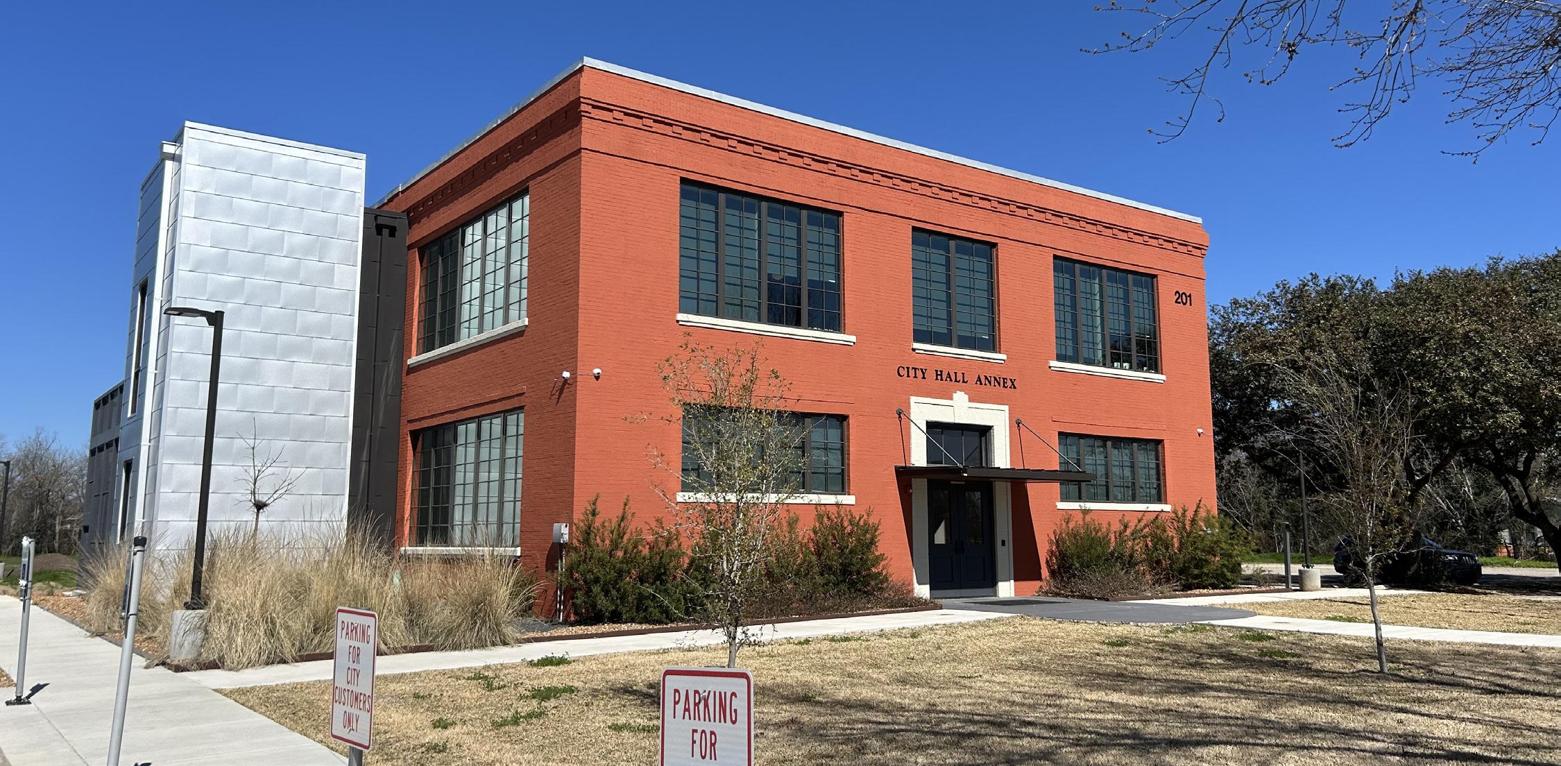
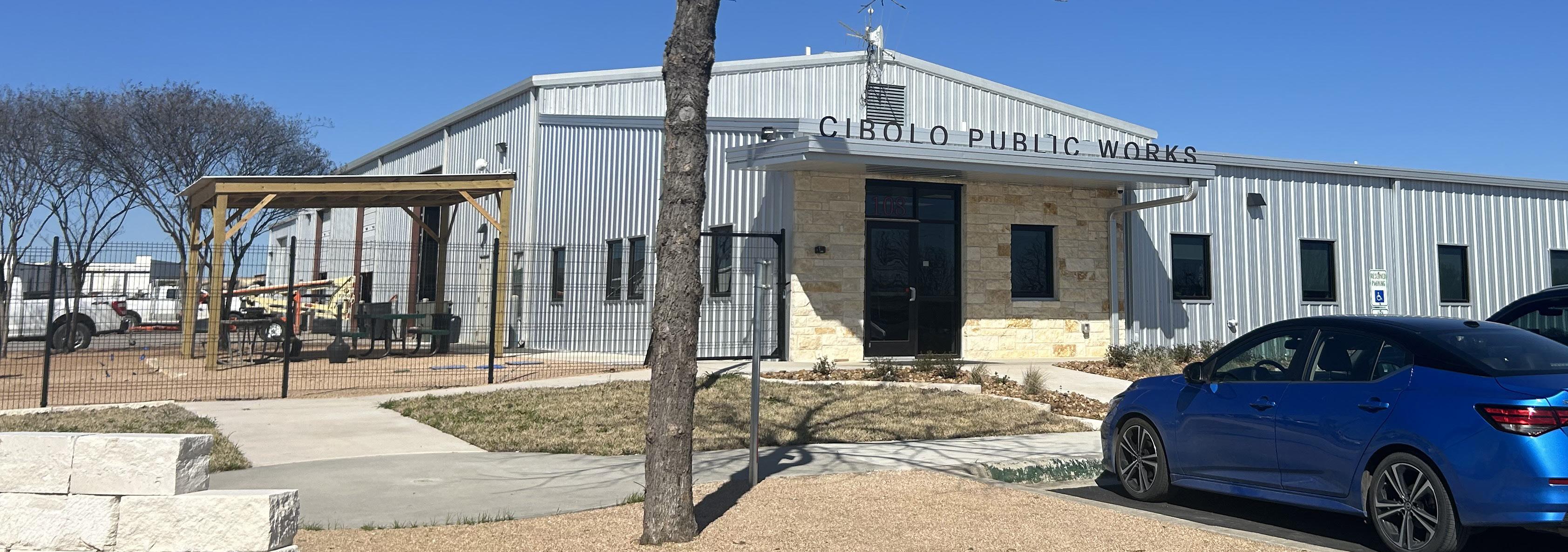
The Public Works Department oversees the planning, design, construction, maintenance and repair of streets, sidewalks, parks, drainage ways, stormwater collection systems, and water/wastewater systems. The Public Works Building is located at 108 Cibolo Drive in a newly renovated 12,800 sq foot building, of which 4,000 square feet was added in 2023. The department consists of a total of 57 staff persons, over five operating divisions, including a department director, superintendents, maintenance foremen, crew leaders, crew members, technicians, and workers.
Public Works receives its funding through a variety of sources including the general fund, service and utility fees, and impact fees. Impact fees require a periodic study to establish the appropriate fee to be assessed. The latest impact fee study was conducted in 2021, by which Service Area 3 was added to the Transportation Impact Fees. Figure 6.2, Cibolo Impact Fees, shows a comparison of fees from 2013 and the impact fee rates that have been in effect since 2021.
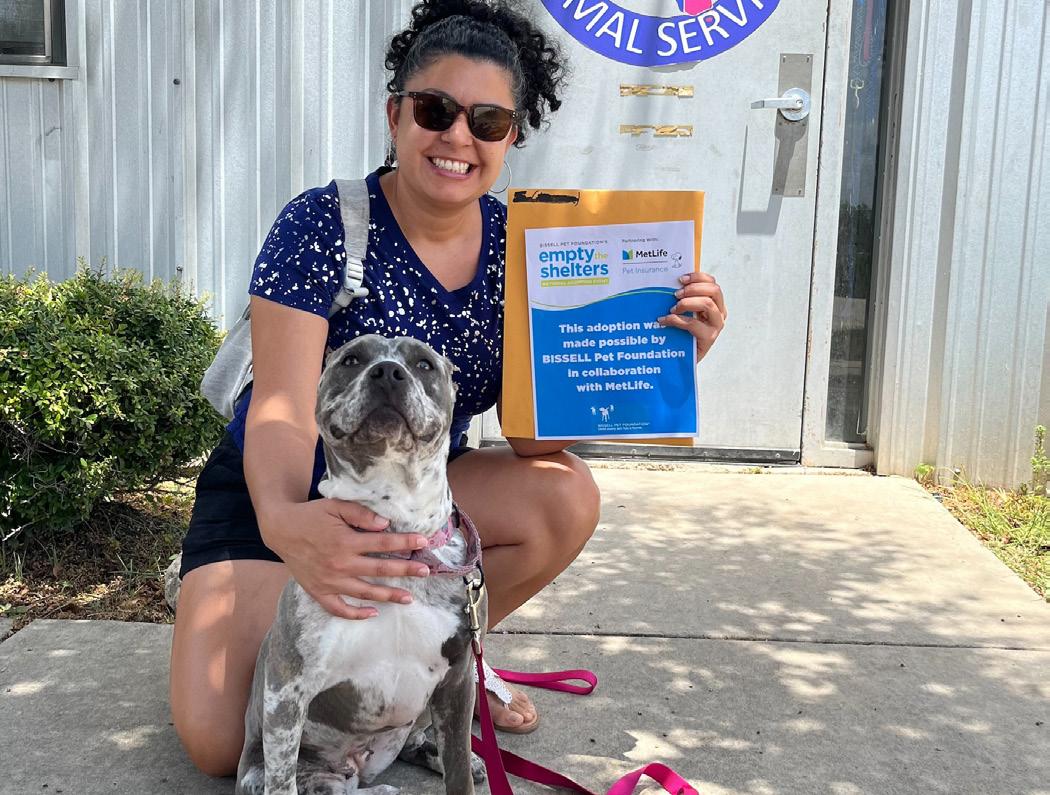
Located at 108 Cibolo Drive, the City of Cibolo Animal Services Department provides a needed service that aims to protect the public health and welfare of the community. This is accomplished by providing safe and humane shelter for stray and abused animals, but also by educating the community about animal care to proactively reduce the number of animals who are unwanted or neglected.
Constructed in 2009, the Cibolo Animal Services facility is located adjacent to the Public Works building and has a main modular building that houses five Animal Service Officers (ASO)s and volunteers. In addition there is one restroom. The current space does not allow for separate kennels and cats are housed in the same room as small dogs, with laundry medical and intake evaluations in the same space. In addition to the main building there is another 250 square foot trailer and a 120 sq foot mobile adoption trailer. There are twelve indoor dog kennels, four outside temporary kennels, and a cat room that can accommodate fifteen cats. The Animal Services fleet is comprised of three trucks.
In 2023, design work for a new facility was conducted and is being brought forward for consideration in the 2024 bond program. This new facility would accommodate approximately 10,500 square feet of space and will allow for future expansion if ever needed. The new facility would have several key features:
• Entry plaza and lobby space
• Large break room and training room
• Workspace and offices to accommodate full staff and volunteers
• Separate cat rooms and dog kennels for adoptions, stray, laundry, and quarantine
• Indoor cat playroom
• Separate facility workroom for food prep, laundry, and grooming
• In-house food storage area
• Drive-thru sallyport
• Medical room
Additionally, during their Fiscal Year 2024 budgeting process, City Council approved $500,000 to make minor accommodations to improve the current facility, including the addition of portable kennels and office space to accommodate staff and current intake numbers. The structures were ordered in Spring of 2024. Below is a reference image of an animal shelter in Pearland, Texas.
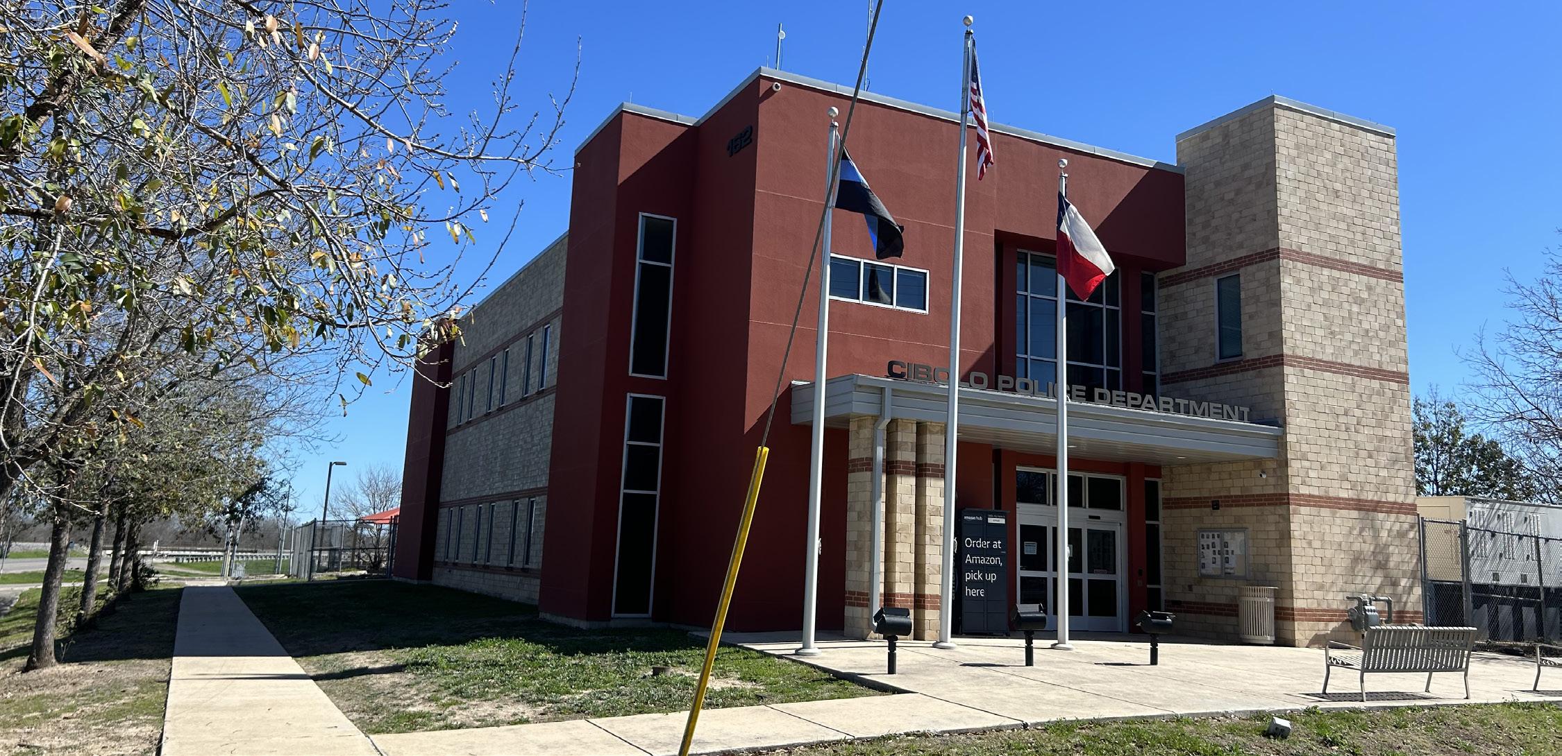
The Cibolo Police Department (CPD) ensures a safe environment for residents, businesses, and visitors and contributes to a positive quality of life in Cibolo. Cibolo enjoys a lower crime rate than many other cities in Texas of similar size and population.
Cibolo continues to be recognized as one of the safest cites in the state and has received multiple recognitions of note:
• 50 Safest Places to Live in Texas by Elite Personal Finance. FBI crime statistics in the United States in 2016 for cities over 10,000 in population were used for the ranking criteria. Cibolo ranked #25
• NerdWallet ranked Cibolo #9 out of 239 Texas cities with a 10,000+ population on its list of “Best Places for Young Families in Texas.”
• The National Council for Home Safety and Security released its list of safest cities in Texas for 2018. Cibolo ranked the highest for the local area at #17
• HomeSnacks analyzed over 23 places around San Antonio to identify the most in-demand places to live. Cibolo ranked #8 on their, “10 Best Suburbs Around San Antonio for 2018”
• Niche ranks Cibolo #8 on its “2019 Suburbs with the Best Public Schools in the San Antonio Area”
• Backgroundchecks.org named Cibolo as #39 on its “Safest Cities in Texas, 2019” report
• Alarms.org “Safest Cities in Texas – 2020” - Cibolo ranked #28

The Cibolo Police Department (CPD) provides full law enforcement and first responder service within the incorporated area of the City. Additionally, CPD provides first responder service to areas in Cibolo’s ETJ as well as communities and areas in the county and other jurisdictions when requested to assist by the respective responding agency. Cibolo has inter-local agreements with SCUCISD, the City of Schertz, Guadalupe Family Violence Shelter, and Guadalupe Children’s Advocate Center, among others. They also have interjurisdictional mutual aid agreements with the cities of New Braunfels, Schertz, Selma, Live Oak, and the Alamo Area Council of Governments (AACOG).
There are currently 48 employees in the Cibolo Police Department, many of which are law enforcement officers. Specialized functions of the CPD include Animal Services, Criminal Investigations, and Patrol Division, School Resource Officer Unit, Traffic and Warrant Unit and the CPD Drone Program. In addition, the professional standards and records divisions also play a role in the department. The administration division is comprised of executive leadership that includes the Chief of Police, Leiutenants, Executive Assistant and Administrative Sergeant.
The Cibolo Police Department operates two facilities: the main police department building
at 162 E Loop 539 and an animal services facility at 108 Cibolo Drive. The main police station serves as the Emergency Operations Center (EOC). It was built in 2010, when Cibolo had a population of approximately 20,456. Because of the continuing trend in population growth and the desire to improve coverage and response times, a new Public Safety Facility is being planned south of FM-78 near Interstate 10 to address the growing needs of the Police Department as described later in this chapter.
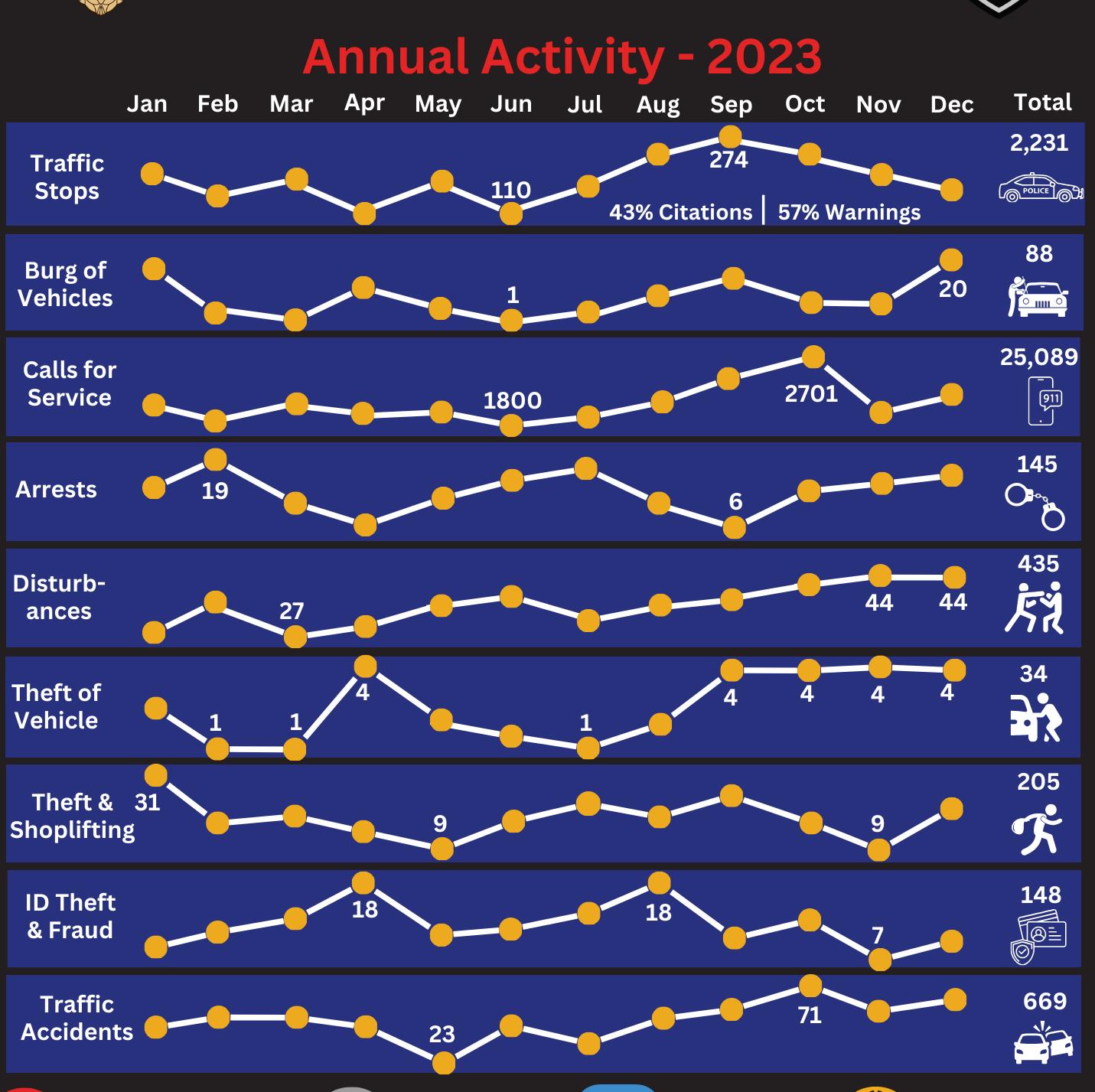
Over the past year, the Police Department responded to over 25,000 calls for service
as summarized in the annual activity report above. This is up from just under 20,000 in 2015. These reports are vital to understanding tracking and responding to trends as they emerge and help position the Police Department to be as responsive and proactive as possible.
The Cibolo Police Department is very active in engaging the community, a practice and policy that likely contributes to the satisfaction of these services among residents. The police department participates in numerous programs and services including National Night Out, Citizens Police Academy, Junior Police Academy, Movies in the Park, Child Seat Check, Coffee with a Cop, Bicycle Rodeos, Career Days, and various speaking events throughout the year.
The Cibolo Police Department prides itself in leading the field in innovation and technology. One area that is new to law enforcement is the use of small unmanned aircraft systems (sUAS). Currently, CPD has a fleet of eight drones with uses including aerial video/photo reconnaissance, thermal imaging for nighttime operations, large building indoor operations, public service announcements, and search and rescue in inclement weather. The CPD drone team also assists other law enforcement agencies as well as the City’s Public Works and Fire Departments. Clearances for flight operation at various above ground level (AGL)s for sUAS have been provided by JBSA-Randolph. There are currently eight officers who have an FAA Certified Drone Pilot (Part 107) license.

The Cibolo Fire Department has seen steady growth over the years since the last Comprehensive Plan. It operates out of three fire stations and employs 39 members comprised of 37 full-time Firefighters, 1 Fire Marshal, and 1 Executive Assistant. The department is a 24 hour on-duty emergency service provided to the residents of Cibolo and the citizens of the Guadalupe County/ ETJ Area. Beyond fire emergency response, the Fire Department is equipped and capable of providing first responder rescue response, wildland firefighting, hazardous material response and cleanup, and technical rescues such as swift-water, high and low angle rope, heavy extrication, confined space, and trench rescues. Like police services, fire protection services is considered a strong community asset, community respondents saying they were satisfied or very satisfied with fire and emergency medical services.
Fire Station #1 & Fire Administration. Fire station #1 is located at 204 West Loop 539, and is the original Cibolo fire station built in 1956. This station was renovated in 2015 to increase programming and accommodate future growth from 5,800 square feet to 11,000 square feet.
Fire Station #2. Fire Station #2 is located at 3864 Cibolo Valley Road, and was constructed in 2009 with a voter approved bond. The station is approximately 10,700 square feet.
Fire Station #3. Fire Station #3 held its grand opening in January 2022 and is located at 1846 Weidner Road. This 7,800 square foot station is a four-bay facility with living quarters for a six-person crew and EMS providers. The station expanded from its original three bay facility to integrate an ambulance for the EMS response team. The EMS bay, storage, and living quarters make up 1400 sf of the 7800 sf facility.
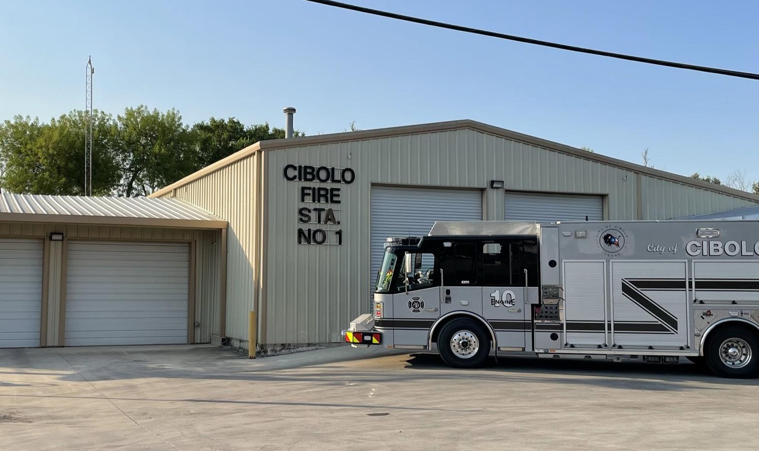
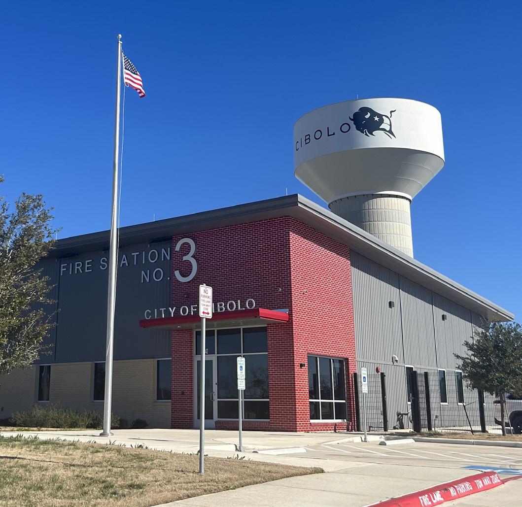
In 2023, City Council approved funding for design options for a Public Safety Facility to be located near the intersection of Bolton Road and Stolte Road. This facility would serve the area south of FM 78 along Interstate 10 with fire and police coverage and would greatly improve emergency service response times from 11 minutes to under 5 minutes. Currently, the southernmost areas of the city are serviced by the closest Fire Station #1, located at Loop 539. The addition of the new Public Safety Facility would ensure a more consistent level of coverage citywide, and free up resources that are currently used to cover that area. The maps on the left show coverage with no facility and the images on the right show coverage with the new facility.
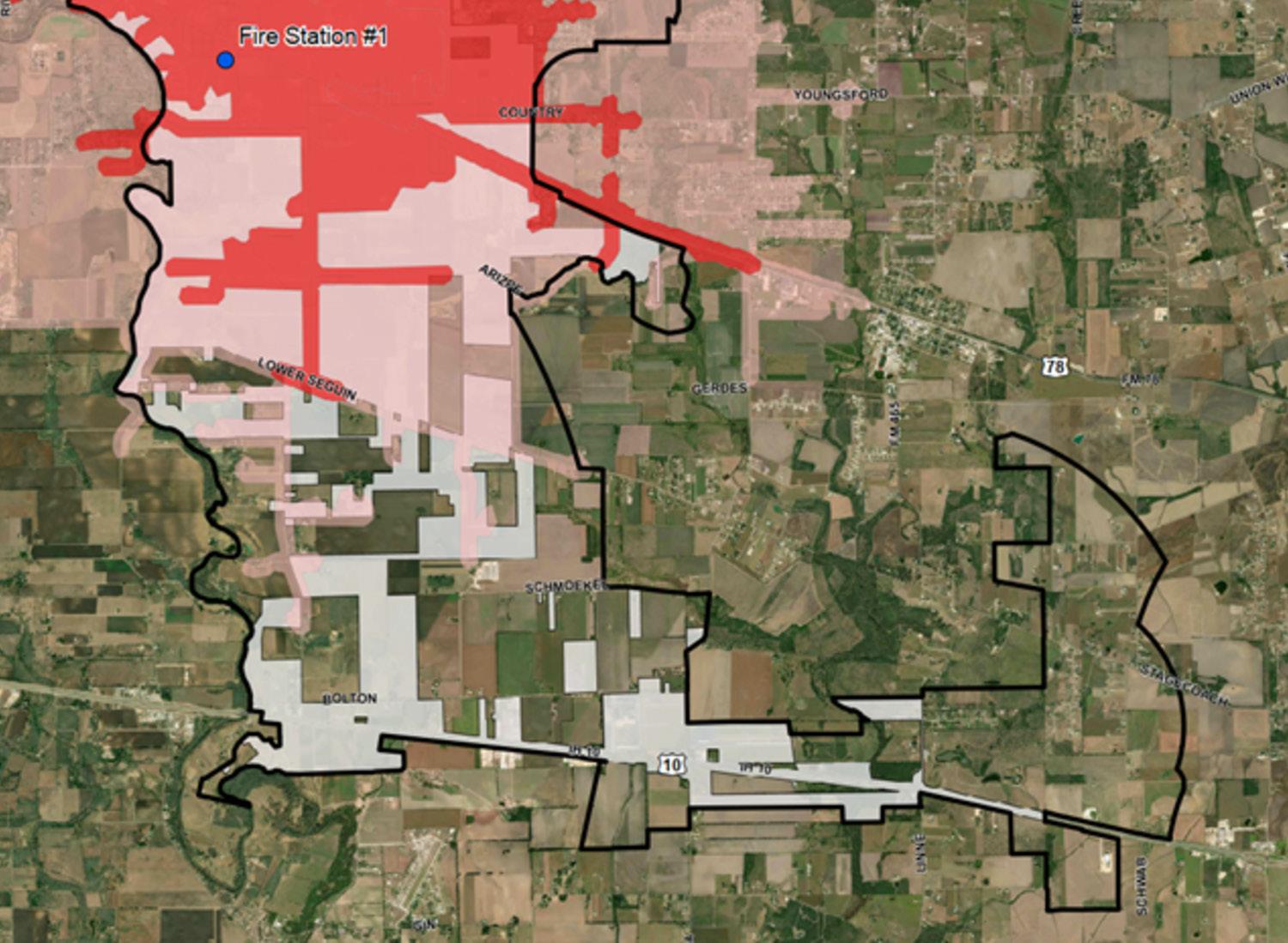
The red highlighted area depicts a five (5) minute response time for the Fire Department without the proposed Public Safety Facility.
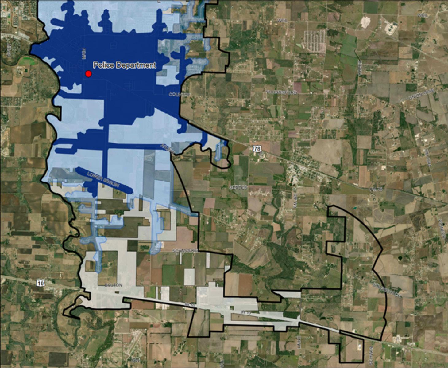
The blue highlighted area depicts a five (5) minute response time for the Police Department without the proposed Public Safety Facility.
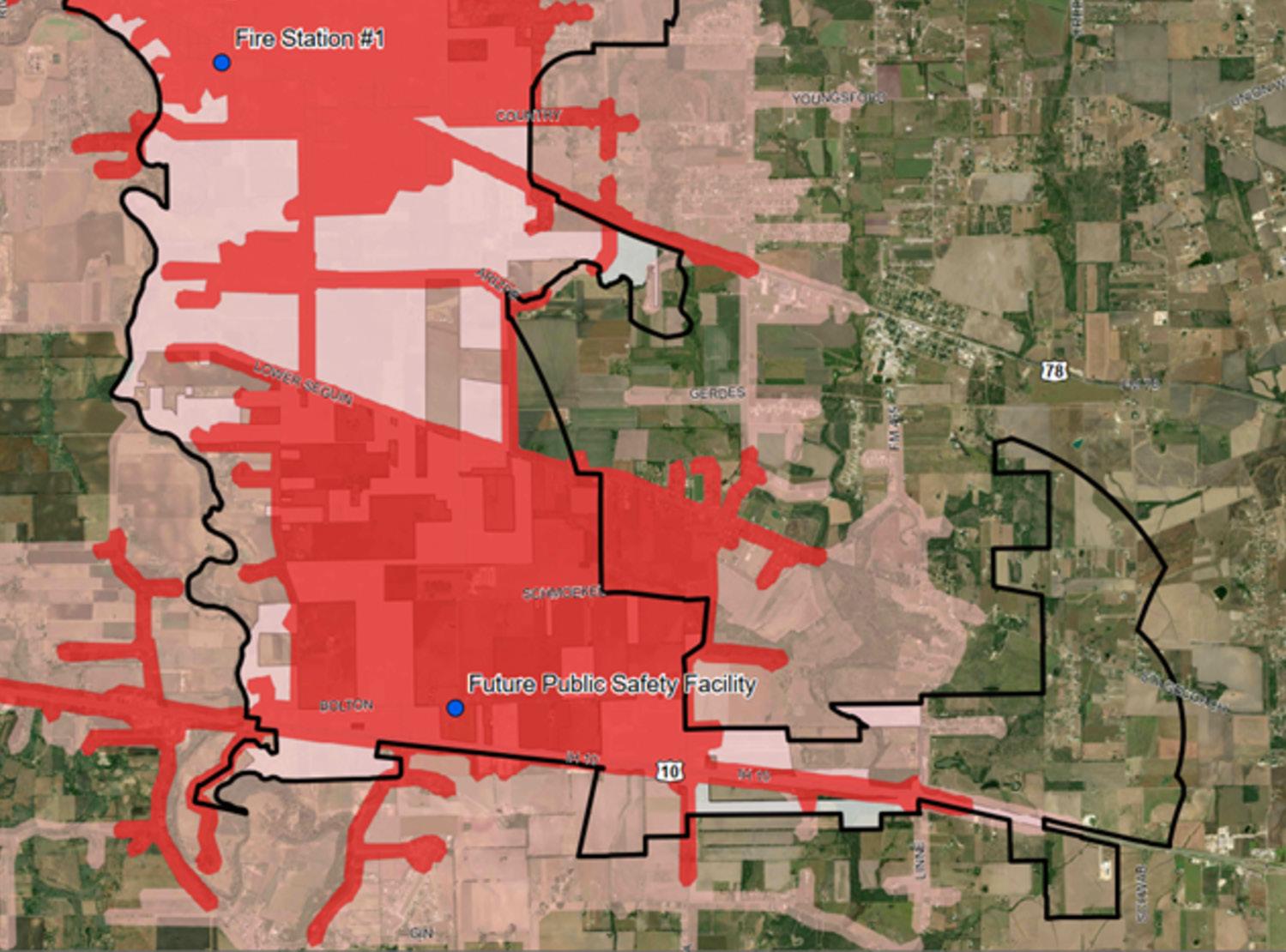
The red highlighted area depicts a five (5) minute response time for the Fire Department with the proposed Public Safety Facility.
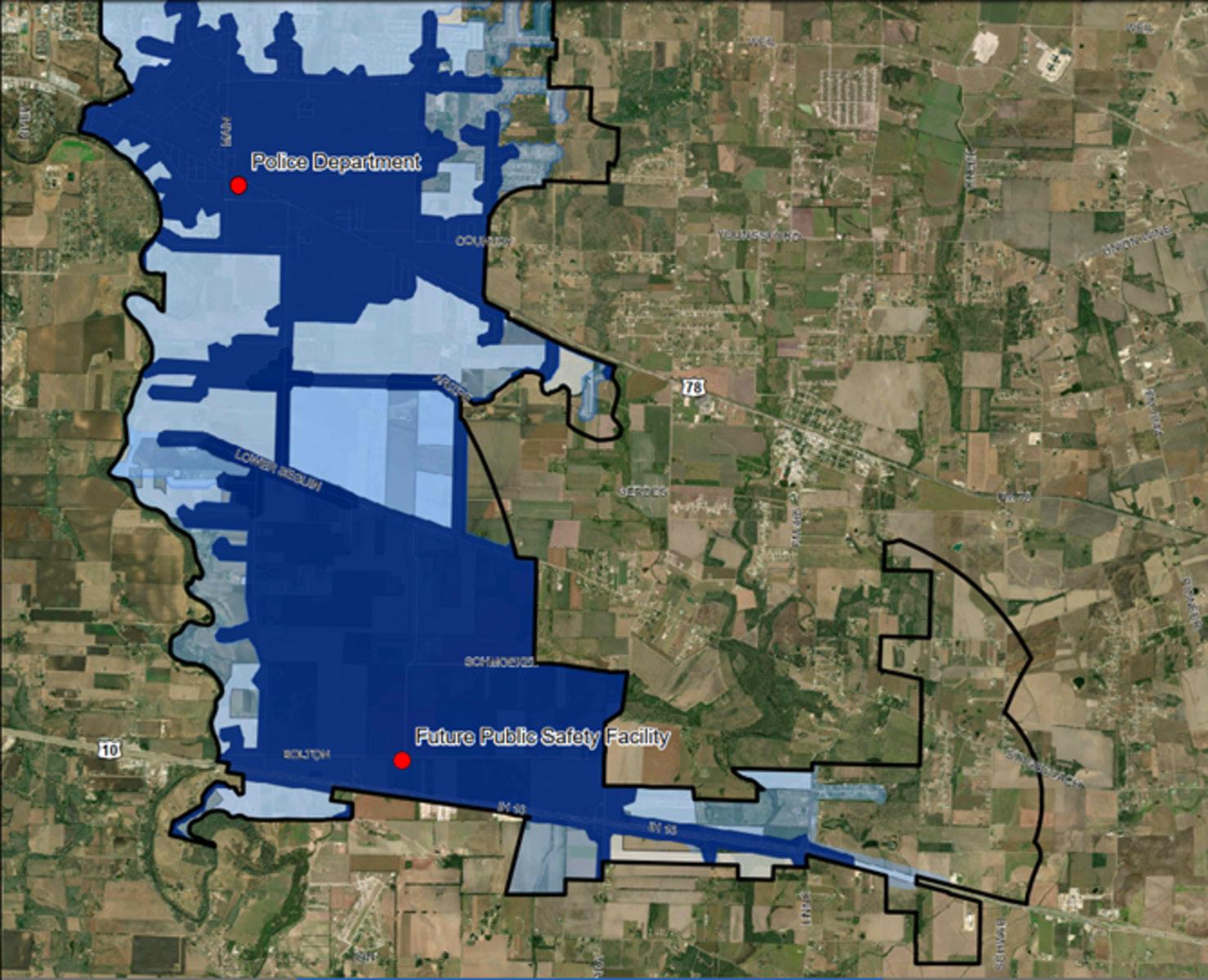
The blue highlighted area depicts a five (5) minute response time for the Police Department with the proposed Public Safety Facility.
The proposed Public Safety Facility includes a four-door pull through apparatus bay, 12 bunk rooms, a captains office and bunk room, kitchen, dining, and dayroom facilities, EOC/Training room, fitness room, four offices, exam room, lobby, and plenty of mechanical and storage space rooms.
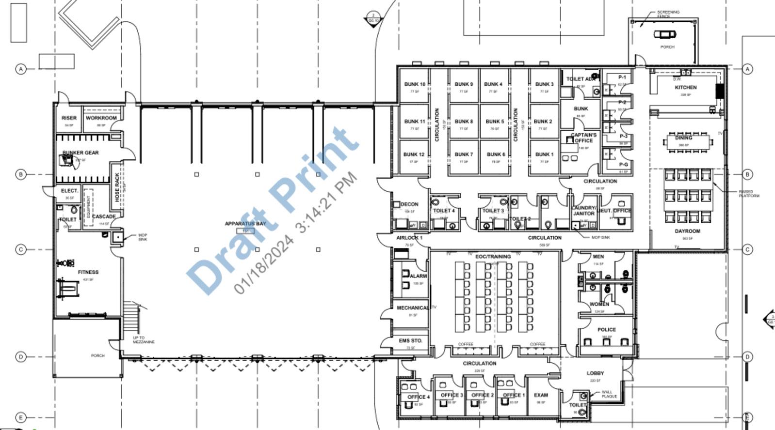
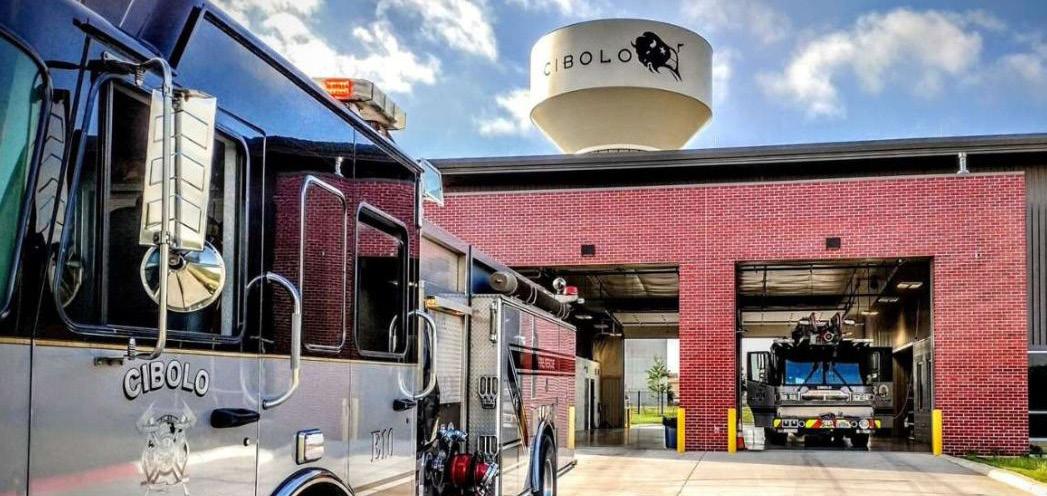
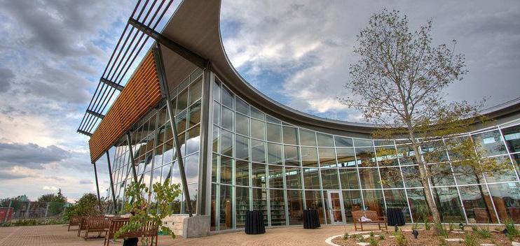
Cibolo does not have a library within its incorporated City limits, but residents have access to the Schertz Public Library. The library serves not only the City of Cibolo, but areas of the City of Selma and Guadalupe County as well. Instead of providing its own library services, the City donates funds to the Schertz Public Library to ensure the needs of Cibolo residents are fulfilled. It is an arrangement that has worked well.
The Schertz Public Library is located at 798 Schertz Parkway, just west of Cibolo. Like most community services and facilities, the Library went through several changes as the area grew rapidly at the end of the 20th century and into the new millennium. The Library opened in 1978 in a 1,500 square foot facility. By 1983, with the assistance of grants, donations, Guadalupe County, and Schertz Lions Club, the Library moved to a 6,000 square foot building, and by 1988 expanded by 3,000 square feet. The Library remained in its modest facility despite significant growth in the surrounding communities. Discussions of a new library began in the mid-2000s, but little action was taken as Schertz and other cities struggled financially during the recession. In late 2005, a local businessman, Eric White, and his wife, Carolyn, donated $1 million to construct a new library, and in May 2006 a $6 million bond was approved. After extensive design and planning, the Library opened a 30,000 square foot facility in 2009. In addition to its materials collection, the Library has 50 public access computers, a reference desk, public meeting space, and printing, copying, scanning, and faxing services.
The Schertz Public Library participates in Connecting Texas Libraries Statewide, Inc., a nonprofit corporation that sponsors continuing education programs for Texas libraries. The library has a collection of over 70,000 items, including books, newspapers, audio books, music, and movies. In addition, the library offers digital resources including eBooks and eAudiobooks, language learning programs, tutoring programs, genealogy research, and educational databases. Additionally, the library offers an extensive list of adult and youth programs including story times, reading clubs, volunteer programs, technology and craft programs, and literacy and education programs.
History summarized from Schertz Public Library website, Library History. http://schertzlibrary.org/ about-the-library/library-history/
In partnership with the Comal County Senior Citizens Foundation, the City of Cibolo opened the Cibolo Senior Program to provide a space for Cibolo’s active senior community. The Cibolo Senior Program’s purpose is to enrich the minds, bodies, and souls of seniors through social engagements, community involvement, and activities. The program has quickly grown to just under 200 members in its first year and partnerships with Meals on Wheels provide lunch to its members Monday through Friday. The Cibolo Senior Program is located at Grange Hall #1541, 413 N. Main Street.
Daily activities include exercise classes, quilting, bingo, creative art, gardening, chair volleyball, rock painting, dominoes, cards, puzzles, games, and other groups and classes of interest, contests, special speakers, and activities.
The Cibolo Community Center is owned by the City of Cibolo and managed through a public license agreement with the Cibolo Family YMCA. Built in 2019, the 30,000 square foot community center, located at 176 FM 78, houses a large gymnasium that fits two regulation basketball courts that are convertible for volleyball courts. There is a large wellness center, catering kitchen, group exercise studio, lockers and showers, a child watch area, and digital library.
Water service is provided by the City of Cibolo or by Green Valley Special Utility District (GVSUD). The City’s water service area includes portions of the City limits and portions of the extraterritorial jurisdiction (ETJ).
Over the past year more than 720 million gallons of high-quality drinking water was delivered to over 6,425 water customers. The water system includes three water storage and distribution plants, and a distribution system that is made up of 8-inch or larger water lines. The City has oversizing requirements for water lines and cost sharing is available when oversizing is required.
Cibolo is a member of Canyon Regional Water Authority (CRWA) and obtains wholesale water from two sources: surface water from Lake Dunlop on the Guadalupe River and ground water from the Carrizzo Aquifer in Guadalupe and Gonzales County. Cibolo receives nearly all drinking water from CRWA while just over 2.5% comes from the City of Schertz. The GVSUD provides water service to some areas within the City limits as well as in the ETJ. GVSUD is also a member of and contracts with CRWA for wholesale water and also obtains ground water from the Edwards Aquifer in Comal County.
The utilities division has 15 positions of which all are required to be licensed in their specific field by the Texas Commission of Environmental Quality. The utility division operates and maintains three elevated water storage tanks which store 4 million gallons in total and two ground storage tanks which store 2 million gallons in total. In addition, the utility division also maintains two water pumping stations which have eight high service pumps each capable of moving 1,500 gallons per minute. They also provide routine maintenance, repairs and installation on all of water mains, water meters, fire hydrants, and water control valves.
As Cibolo continues to grow, water use will also increase. Future plant expansions will be needed to store and distribute additional water, and possible updates to the distribution system may be necessary to efficiently distribute water. The Public Works Department has identified looping of dead-end lines as an issue that needs to be addressed. Additionally, there will be a need for additional water supply.
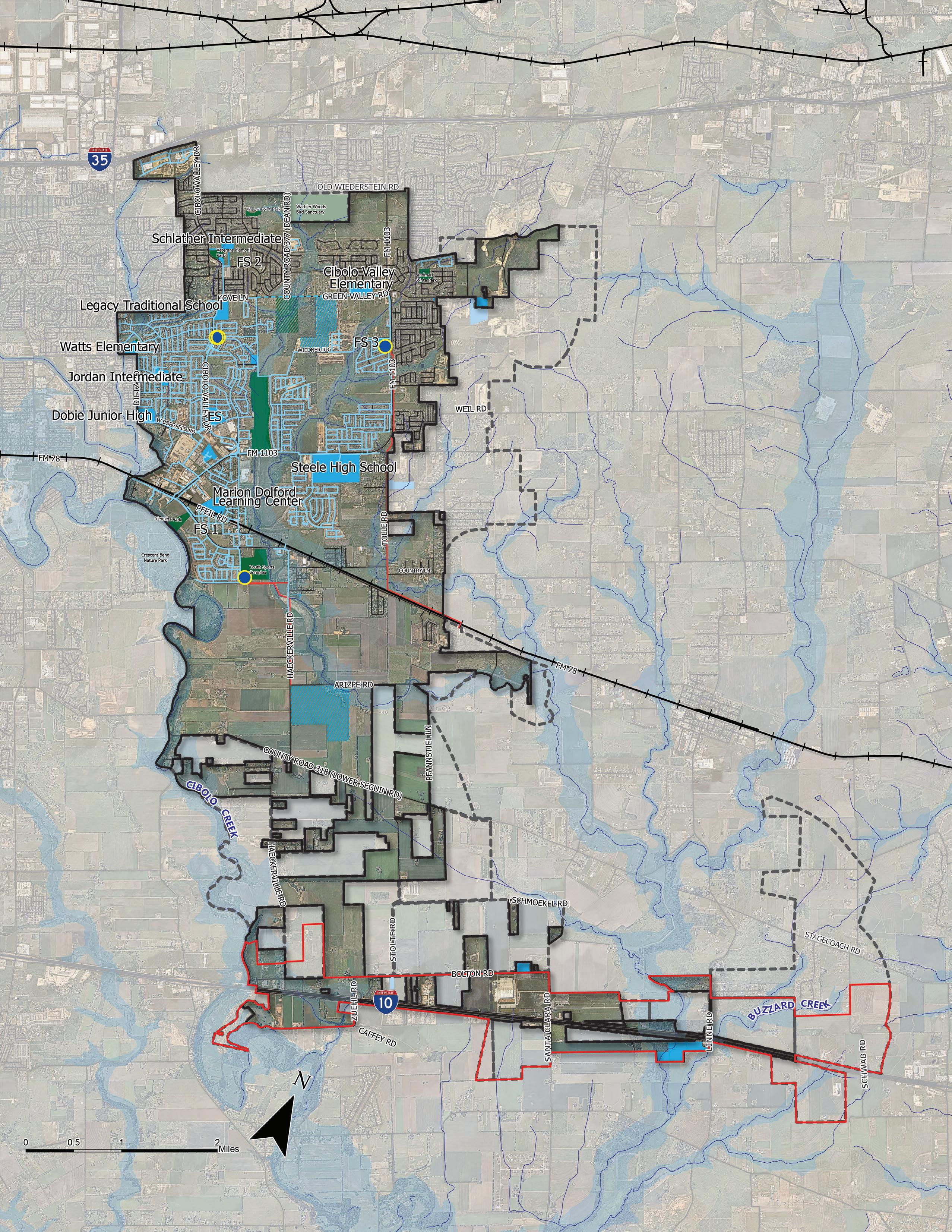
Currently, Cibolo is a member of the Cibolo Valley Local Government Corporation (CVLGC) along with the City of Schertz. The Corporation was formed by local cities to explore and develop an alternate water source to meet the future water demand of the region. The development of a new water source will require the City’s participation in the costs of drilling new water wells, construction of new water plants, and water transmission lines.
As an alternate to, or in conjunction with, increasing water supply, the City provides an
incentive to increase water conservation efforts as part of new development or redevelopment. In this regard, the City’s Unified Development Code (UDC) allows for a reduction in landscape area with the use of xeriscaping design and plants. Although the Cibolo Creek Municipal Authority provides an opportunity to purchase reclaimed wastewater for irrigation use, the City currently does not purchase reclaimed water.
The City of Cibolo operates three water storage and distribution plants:
Plant No. 1 is located on Cibolo Valley Drive, just north of the intersection on Bentwood Drive. The plant contains one 1.25 million gallon (MG) elevated composite tank (160’ tall); one 1 MG ground storage standpipe; a pump station with four hi-service pumps rated a 1,000 GPM each; and one standby generator;
Plant No. 2 is located at the corner of FM 1103 and Wiedner Road. The plant has one 1.5 MG elevated composite tank (165’ tall);
Plant No. 3 is located at the corner of South Main Street and Schaefer Road. The plant includes a 1.25 MG elevated composite tank (195’ tall) and one 1 MG ground storage tank; a pump station with four hi-service pumps rated a 1,000 GPM each; and one standby generator that has the ability to be expanded to two 1-1.25 MG.
The City of Cibolo is a customer of Cibolo Creek Municipal Authority (CCMA), a regional wastewater service provider. The City’s wastewater service area includes portions of the City limits and portions of the ETJ. Portions of Cibolo’s City limits and the ETJ are in the GVSUD CCN service area, but they currently have no wastewater infrastructure.

Currently, the City provides wastewater services to residents, businesses, and municipal facilities. Displayed in Figure 6.6, Existing Lift Stations in Cibolo, are the existing lift stations located within the City. Wastewater treatment is provided by the CCMA and Cibolo, which also provides service to Schertz, Selma, Randolph Air Force Base, and portions of Live Oak, San Antonio, and Universal City. The CCMA wastewater facilities include a treatment plant, lift stations, gravity sewer trunk or outfall lines, and force mains all owned and maintained by CCMA. Wastewater is treated at the Odo J. Riedel Regional Water Reclamation Plant in Schertz. The plant is currently being expanded from an annual average flow of 6.2 MGD to 10 MGD.
As this area builds out it will be important to ensure adequate public utilities and public facilities are in place to ensure the area can be served well. As reflected in Figure 6.7, the City of Cibolo’s Wastewater CCN has increased to include the addition of approximately 3,200 acres south of FM 78 to IH-10. This area was obtained in the second quarter of 2024 and is not currently served by the City. Additional planning and engineering will be required to determine placement of wastewater infrastructure to best serve this area. Figure 6.8, is a planned wastewater infrastructure map that was produced for discussions between GVSUD and the City of Cibolo during mediation/settlement. Per Resolution No. 1656, one of the next major steps is for Cibolo to seek an engineer to design the list of projects (1-4) referenced in this map.
Stormwater Management and Drainage is a critical element for protecting the health, safety, and welfare of the community that was emphasized throughout the planning process. The drainage system’s primary function is to move and store stormwater and includes natural areas and waterways, creeks, rivers, tributaries, ponds, floodplains, etc. The secondary drainage system consists of man-made infrastructure that controls stormwater runoff into the natural areas, such as streets, ditches, culverts, retention ponds, gutters, etc. Failure of any part of the drainage system can result in flooding and destruction of property, buildings, infrastructure, and even life.
The City is within the Cibolo Creek watershed, meaning that stormwater that drains from land in Cibolo ultimately ends up in Cibolo Creek. Within the watershed, areas are divided into several drainage basins based on which tributary or branch the area drains to. Several creeks and tributaries bisect the Cibolo community, including Town Creek and its tributaries north of FM 78, portions of Dietz Creek and its branches north and south of FM 78, and Cibolo Creek south of FM 78. The main drainage channels are East Town Creek, from FM 1103 to northwest corner of Cibolo Valley Ranch; West Town Creek, from FM 1103 to Wiedner Rd (Schlather Park); and Dietz Creek, from Dietz Road to north of Deer Creek Boulevard. Cibolo also maintains one detention basin located near the intersection of Cibolo Valley Drive and Borgfeld Road near the Cibolo Valley Ranch subdivision.
Development practices and regulations will significantly influence stormwater drainage, which is why it is critical to evaluate drainage plans and both positive and negative impacts on drainage for all projects, including private development, transportation projects, even park and recreation projects. Because flooding issues were a major concern heard throughout the public engagement process, an emphasis was placed in the transportation chapter of this report that deals with flooding and storm water management issues.
In Chapter 4: Transportation, Figure 4.3 shows an identification of creeks and floodplains and shows critical points where low-water crossings are present. This data point can be used to help understand the significance and quantity of low-water crossings and be used as a tool to prioritize mitigation efforts.
Community facilities and public services are essential resources that support the quality of life of residents. Ensuring the efficiency and effectiveness of these services is paramount for meeting the diverse needs of a growing population and fostering a sense of community cohesion. Investing in the enhancement and maintenance of community facilities and public services is essential for ensuring the long-term sustainability and vibrancy of the community. From enhancing the functionality of existing facilities to strategically planning for the development of new amenities, the recommendations aim to address the needs of Cibolo. This section provides recommendations based on current and future public service and facility needs.
Maintaining city infrastructure is essential for ensuring the continued functionality, safety, and resilience of Cibolo. Chapter 4: Transportation outlined specific recommendations on thoroughfares in the city, this focuses on other city assets such as water and wastewater systems, public buildings, and future infrastructure needs like broadband. Upkeeping city infrastructure involves regular inspection, maintenance, repair, and, when necessary, replacement of these assets to prevent deterioration, address deficiencies, and accommodate changing needs. By investing in infrastructure upkeep, cities can enhance public safety, promote economic growth, and improve the overall quality of life for residents.
Creating a future utility and infrastructure plan that aligns with land use and growth projections is crucial for the sustainable development and efficient functioning of a city. As population increases and land use patterns evolve, it becomes imperative to anticipate and accommodate the corresponding demand for essential services such as water, sewer, and electricity infrastructure. By aligning utility and infrastructure planning with projected growth, the city can proactively address future needs, minimize disruptions, and ensure that residents have access to reliable and efficient services.
The city can integrate principles of sustainability and resilience into its utility and infrastructure planning to address environmental concerns and mitigate risks associated with flooding which is a major threat to Cibolo today. This may involve incorporating green infrastructure practices, such as rainwater harvesting, permeable pavement, and energy-efficient technologies, into new infrastructure projects to reduce environmental impacts and enhance community resilience. These priorities can be at the forefront when planning for Capital Improvement Projects and be incorporated into their framework to ensure funding and execution of those elements. Additionally, the city can explore innovative financing mechanisms, public-private partnerships, and grant opportunities to fund infrastructure improvements and ensure that the plan is financially feasible and sustainable in the long term.
An important aspect of resiliency for Cibolo is ensuring a sustainable and reliable water supply. With growing population demands and potential climate uncertainties, securing sustainable sources of water becomes increasingly crucial. Prioritizing the procurement of sustainable water sources can mitigate the risks associated with water scarcity and ensure the well-being of its residents both now and in the future. This action not only safeguards against potential water shortages but also fosters
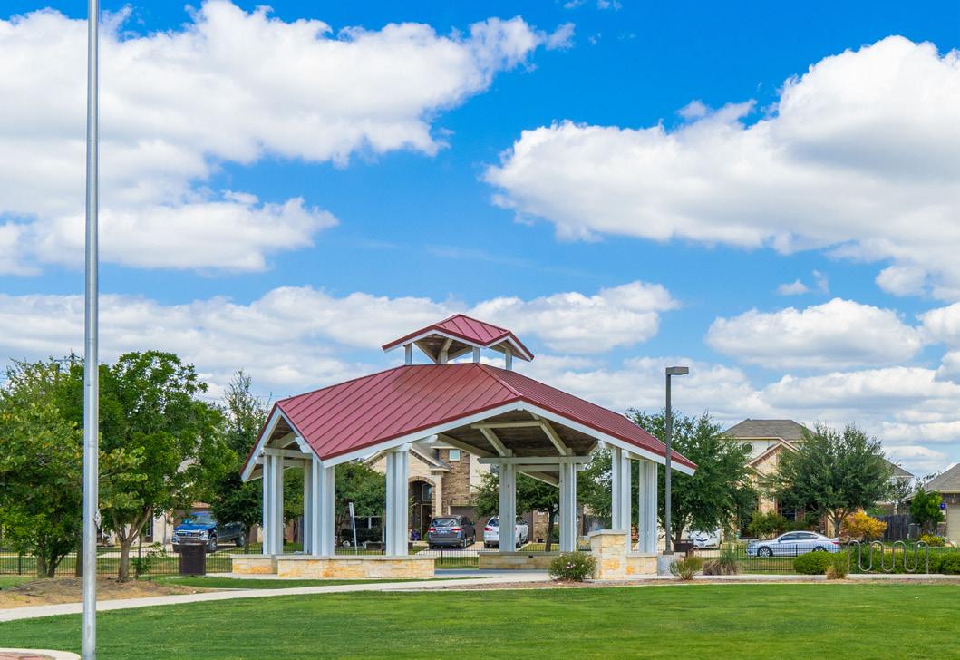
resilience against environmental changes. The implementation of this action requires a multifaceted approach that encompasses both fiscal responsibility and environmental stewardship. The city can explore options such as investing in water conservation measures, promoting the use of reclaimed water for nonpotable purposes, and diversifying its water sources through initiatives like rainwater harvesting or groundwater recharge projects. Partnering with neighboring communities or regional water authorities can facilitate the development of shared water resources, enhancing the city’s resilience to droughts or other water-related challenges.
As Cibolo continues to face increasing challenges from population growth and aging infrastructure, adopting new technologies has become even more critical for enhancing resilience and sustainability. To leverage these advancements effectively, the City should modernize its utilities, including electric, Internet, and water infrastructure. Additionally, investing in a renewable energy park can be a hub for renewable energy companies and research institutions, fostering innovation and economic growth. Innovative solutions are emerging that leverage advanced technologies to address critical infrastructure needs, improve operational efficiency, and mitigate risks associated with natural disasters and other disruptions. From smart sensors and data analytics to renewable energy systems and decentralized water management, cities have a wealth of cutting-edge tools at their disposal to build more resilient infrastructure networks. Embracing these new technologies strengthens cities’ ability to withstand shocks and stresses and paves the way for more adaptive, interconnected, and sustainable urban environments..
Promoting investment in broadband, fiber, and internet infrastructure is crucial for supporting future development and ensuring the city’s competitiveness in the digital age. In today’s interconnected world, reliable highspeed internet access is no longer a luxury
but a fundamental utility that underpins economic growth, innovation, and social equity. Expanding broadband infrastructure can attract businesses, thus driving job creation and fostering a vibrant economy.
The city can leverage partnerships between the public and private sectors. The city can incentivize investment in broadband infrastructure through partnerships with internet service providers (ISPs), offering tax breaks, grants, or streamlined permitting processes to encourage deployment in underserved areas. Additionally, the city can leverage its assets, such as utility poles or rightsof-way, to facilitate the deployment of fiberoptic networks. Engaging with community stakeholders and conducting comprehensive broadband assessments can help identify areas with insufficient coverage and prioritize investments where they are needed most, ensuring equitable access to high-speed internet for all residents. Furthermore, the city can explore innovative financing mechanisms, such as public-private partnerships or municipal broadband networks, to accelerate broadband deployment and reduce the digital divide.
Community facilities play a pivotal role in enhancing the quality of life and fostering a sense of belonging within a community. These facilities, ranging from parks and recreation centers to libraries and community centers, serve as vital gathering spots where residents come together to socialize, engage in recreational activities, and access essential services. Beyond their functional utility, these spaces also serve as the heart and soul of a neighborhood, providing venues for cultural events, educational programs, and civic gatherings. Investing in the development and maintenance of these facilities is not just about infrastructure; it’s about nurturing vibrant and connected communities where residents can thrive and flourish.
To ensure these spaces meet the demands of the growing population, the city can evaluate
existing and future desired community events and programs. By assessing the needs and preferences of residents regarding recreational activities, cultural events, and public programs, the city can tailor community facilities to serve the community’s diverse interests better. This proactive approach ensures that resources are allocated efficiently and effectively, maximizing the benefits of public investments in recreational amenities and programming. Additionally, the city could develop a business center to host events and attract residents and visitors by showcasing local history and cultural attractions. This center would not only serve as a hub for business activities but also enhance community engagement by highlighting the unique heritage and culture of the area.
In light of ordinances (Ord. #1368 & 1380) previously passed by the City regarding minimum standards for public facilities, it is recommended that the UDC be amended to provide safeguards for establishing adequate public infrastructure in the future. In order to serve the demands created by new development, these standards can help ensure that infrastructure is sufficiently installed and utilized without degrading or diminishing the service level to existing users. Ordinance #1368 and #1380 address wastewater provision and platting regulations to promote sound planning and consistent rules, which protect the public health, safety, and welfare of the community. In addition to incorporating the two ordinances into the UDC amendment, another recommendation is to require all new waterlines to meet minimum fire flow requirements and are sized to handle both domestic and fire flow use.
Safety is a concern that requires active participation across multiple sectors and is crucial for preserving Cibolo’s quality of life. Prioritizing safety promotes a thriving community where residents can live and work securely. Maintaining law enforcement, fire protection, and emergency medical services is essential. Adequately staffed and equipped police and fire departments ensure prompt emergency response, law enforcement, and critical aid, enhancing public safety. The City should also invest in a healthcare facility or medical campus with training and healthcare services. This will improve healthcare access and emergency preparedness, contributing to community safety and health. Investing in public services and community facilities fosters trust, resilience, and well-being.
Conducting a thorough assessment of existing services in the city can identify potential risks and develop strategies to mitigate them. This can enhance the City’s capacity to maintain critical services independently. Relying heavily on external agencies for essential services exposes the city to vulnerabilities, such as delays in response times or disruptions in service delivery during emergencies or natural disasters. To identify where these gaps are today, Cibolo can collaborate with relevant stakeholders, including neighboring jurisdictions, utility providers, emergency response agencies, and other service providers. The city can initiate discussions with these entities to assess the extent of dependency and identify areas where redundancies or alternative solutions may be needed to mitigate risks. Additionally, the city can invest in building internal capabilities and infrastructure to reduce reliance on external agencies, such as investing in backup power systems, enhancing communication networks, or training city staff to handle emergency response tasks.
Regularly evaluating the demand for police
and fire protection services is essential for maintaining public safety and ensuring that adequate resources are available to meet the needs of the community. The city can identify potential gaps or areas of concern in the provision of these critical services by closely monitoring trends in crime rates, emergency calls, and population growth. To implement this action Cibolo can establish data collection and analysis mechanisms within the Police Department and Fire Department to track service demand and response times accurately. The city can utilize advanced analytics tools and software systems to compile and analyze data on incident reports, response times, call volumes, and other relevant metrics.
Addressing the need for an Emergency Operations Center (EOC) is paramount for ensuring effective emergency response and management during crises. An EOC serves as a centralized facility where key stakeholders can coordinate resources, communicate critical information, and make timely decisions to mitigate the impact of disasters and emergencies on the community. The EOC would encourage collaboration and coordination among fire departments and emergency services from surrounding areas by serving as a regional hub. Additionally, the EOC could host community events, fire safety demonstrations, and educational programs, fostering stronger relationships between emergency services and the public. The city can enhance its preparedness and response capabilities by establishing a dedicated EOC.
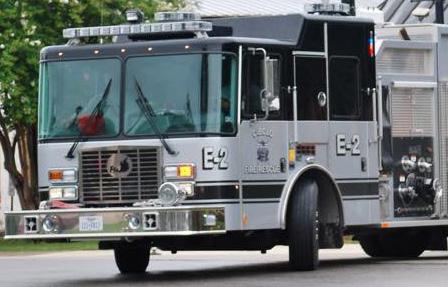
Cibolo can initiate a comprehensive assessment of its current emergency management infrastructure, including existing facilities, equipment, and operational procedures. This assessment should identify any gaps or deficiencies in the city’s ability to effectively manage emergencies and disasters, such as inadequate space, outdated technology, or limited connectivity with partner agencies. Based on the findings of this assessment, the city can develop a strategic plan for establishing a dedicated EOC that meets the needs of its emergency management program and aligns with industry best practices. The implementation of an EOC may involve securing funding, identifying suitable locations for the facility, procuring necessary equipment and technology, and establishing protocols for staffing, training, and activation. Collaboration with relevant stakeholders, including local government agencies, emergency services providers, community organizations, and private sector partners, is essential throughout the planning and implementation process.
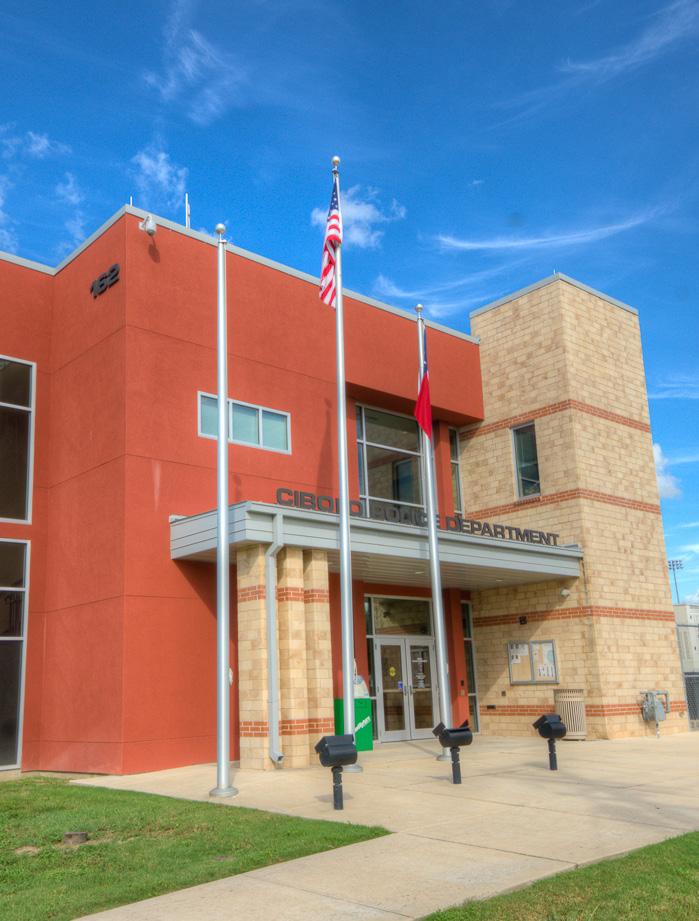
Development of the Future Land Use Map and Master Thoroughfare Plan Map included analyzing existing public facilities and services and mapping where future growth is anticipated to go based on various factors that are detailed throughout this report. The water and wastewater maps were key inputs to both understand the current picture of what facilities are provided, and also determine target areas where future growth will drive the need for additional services. A key attribute of Cibolo is that it generally serves water and wastewater in the northern portions of the city, while utility infrastructure is limited and mostly not present in the south. Several growth scenarios for public facilities are possible based on these factors and are reflected in target growth areas as shown in Figure 6.9. Growth Areas 1-3 are prioritized numerically based on current conditions and in alignment with the FLUM and MTP for anticipated growth. The following are some baseline considerations for each Growth Area:
• In Growth Area 1, the pursuit and execution of utility provision should remain a primary focus to serve the area, particularly as it reaches to IH-10.
• In Growth Area 2, utilities are extended beyond FM 78 to facilitate growth along that corridor and provide adequate services that it would provide.
• In Growth Area 3, as development extends eastward into the ETJ, provision for services would accompany future development.
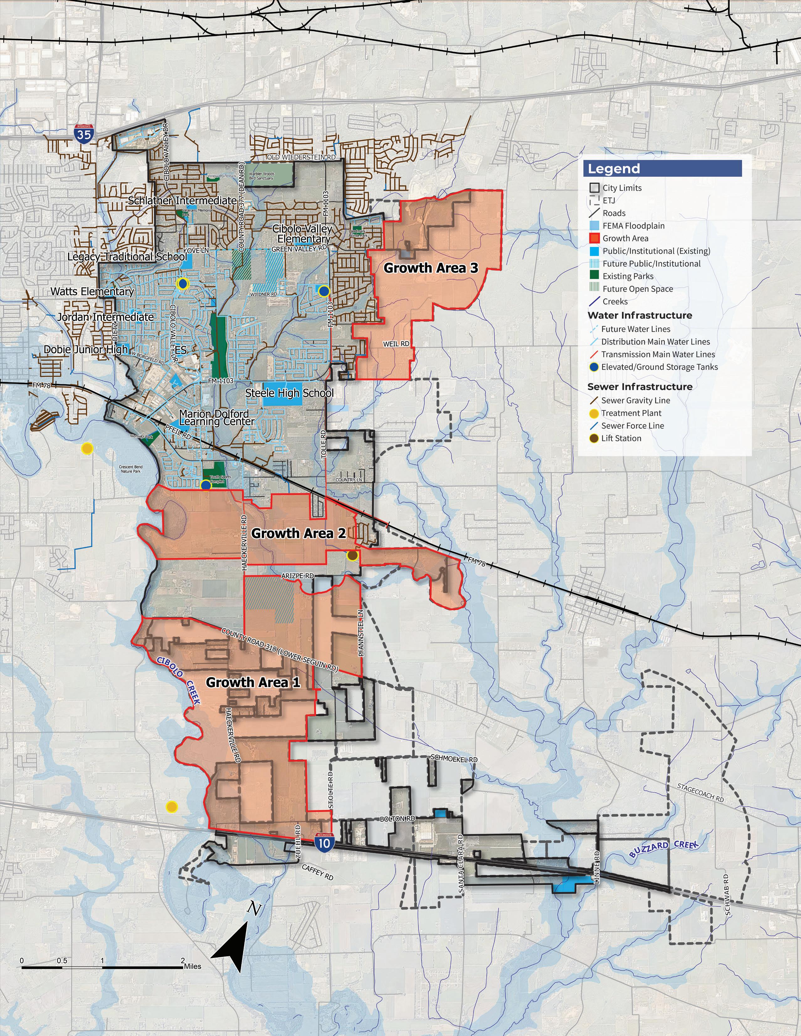
Ensuring adequate staffing levels is crucial for cities to effectively deliver essential services and maintain efficient operations. From public safety to administrative functions, every aspect of municipal governance relies on a skilled and sufficient workforce. The staffing needs of a city encompass a diverse array of roles, including police officers, firefighters, administrative staff, public works personnel, and specialized professionals. These individuals are the backbone of city operations, responsible for everything from responding to emergencies and maintaining infrastructure to providing administrative support and planning for future growth. A well-staffed city not only ensures the smooth functioning of day-to-day operations but also enables proactive planning and effective response to emerging challenges.
Completing an office and staffing professional needs assessment is crucial for ensuring that the city’s workforce is adequately equipped with the skills, knowledge, and resources needed to fulfill its duties effectively. This assessment involves evaluating the current composition of the city’s workforce, identifying any gaps or deficiencies in staffing levels or qualifications, and projecting future staffing needs based on anticipated changes in workload, technology, regulations, and other factors. By conducting a comprehensive assessment of professional needs, the city can align its staffing resources with its strategic goals, optimize organizational efficiency, and enhance service delivery to the community.
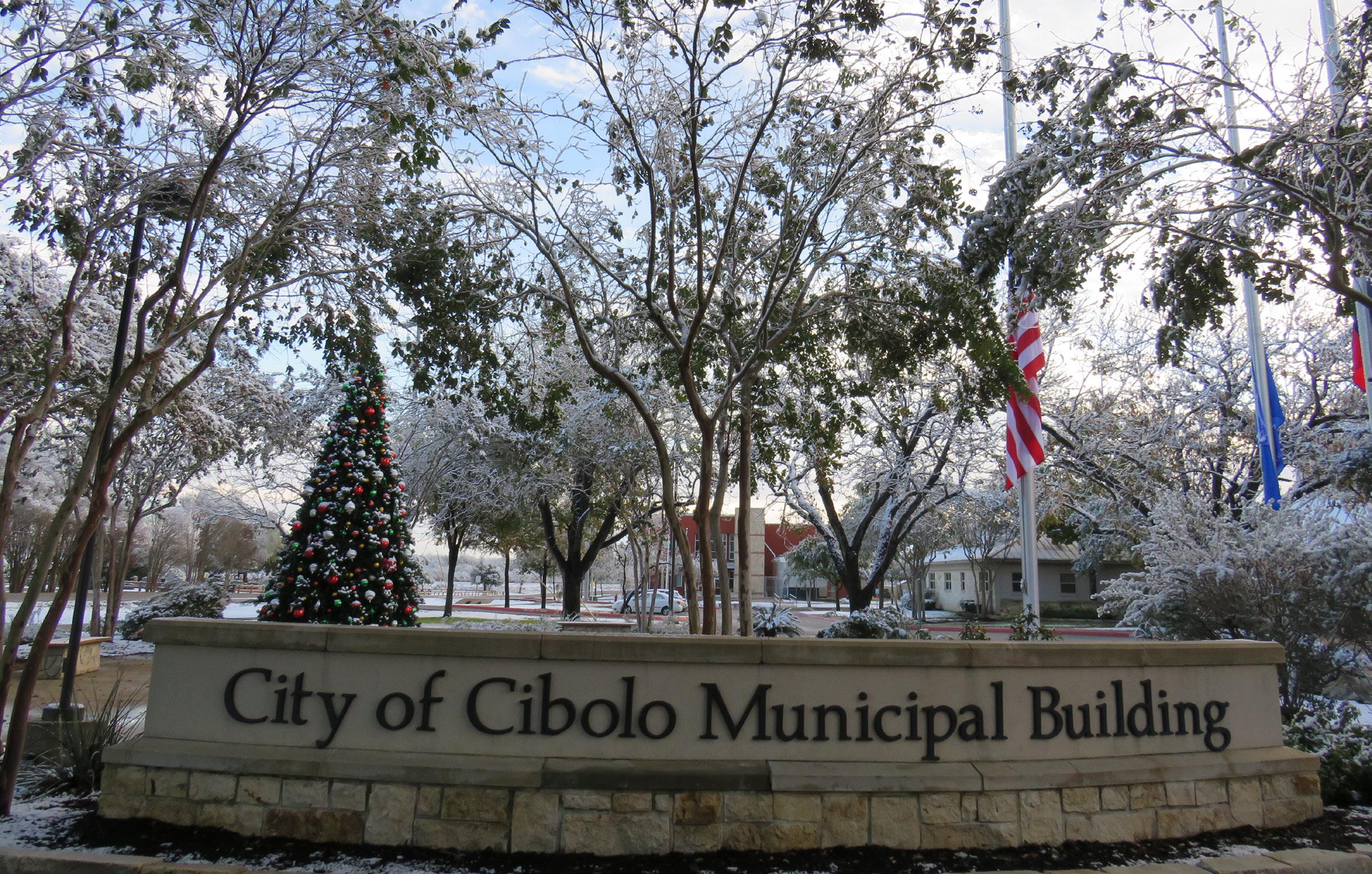
The following actions are recommendations to achieve the vision for the Cibolo Tomorrow Comprehensive Plan as they relate to community facilities and public services.
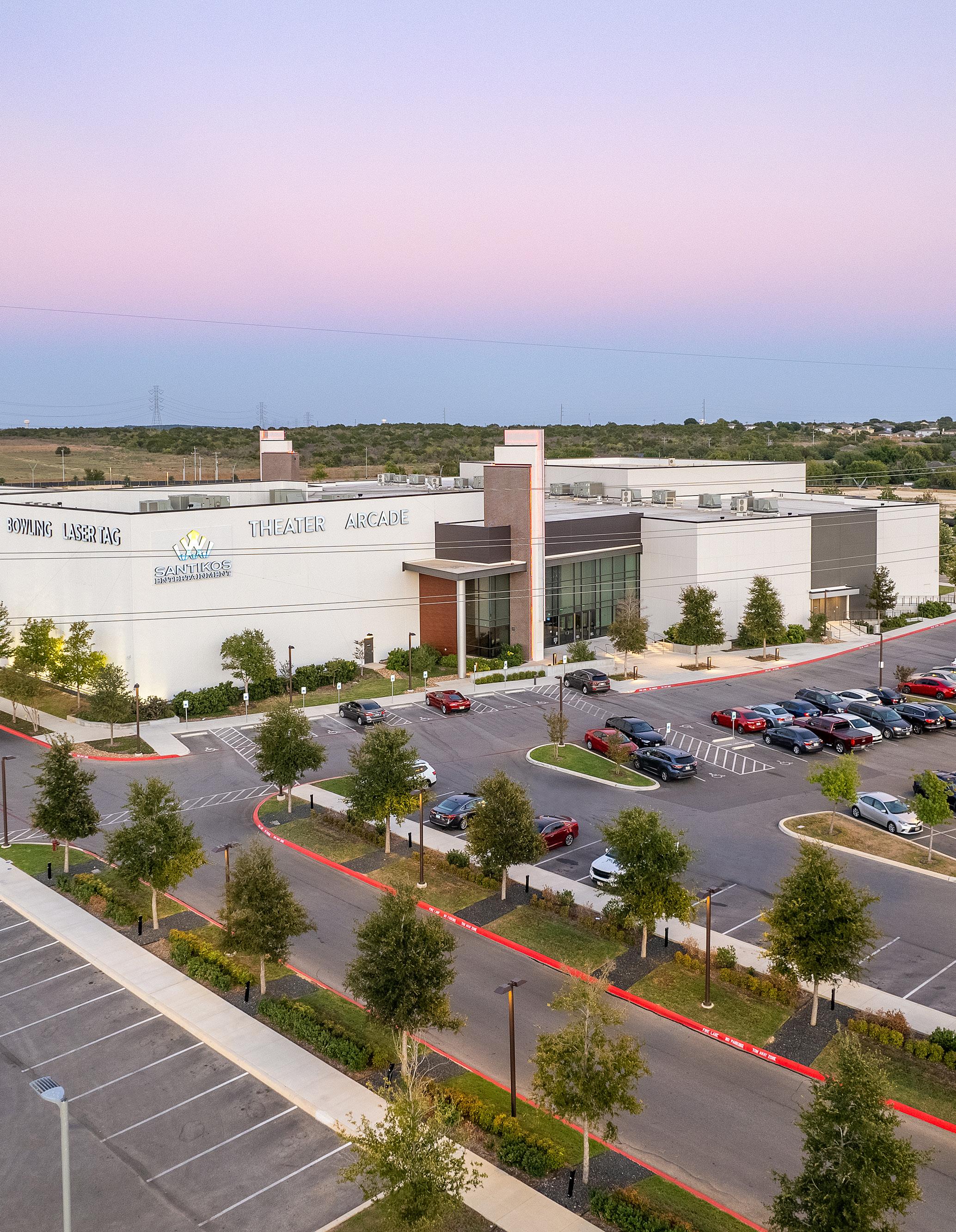
To effectively adopt the Cibolo Tomorrow Comprehensive Plan, a well-defined implementation strategy is essential. This strategy outlines the necessary steps to achieve the plan’s vision. This strategy includes outlining relevant stakeholders, time required, necessary resources, and a monitoring and adjustment method to guide the implementation of the plan’s action items over a set time period. This implementation strategy provides the community with the tools to track the progress of the Cibolo Tomorrow Comprehensive Plan. The following pages provide additional insight into each key aspect of the implementation strategy.
City Staff will be responsible for executing and implementing the Cibolo Tomorrow Comprehensive Plan. The City will actively communicate with stakeholders, prioritize actions, develop work plans, allocate resources, identify and obtain funding, collaborate with agencies and organizations, and monitor implementation progress.
Success also requires that elected officials (particulary Planning and Zoning Commission and City Council) will make decisions in
accordance with the plan’s strategic vision including its vision statement, guiding principles, Future Land Use Map, MTP, and action items.
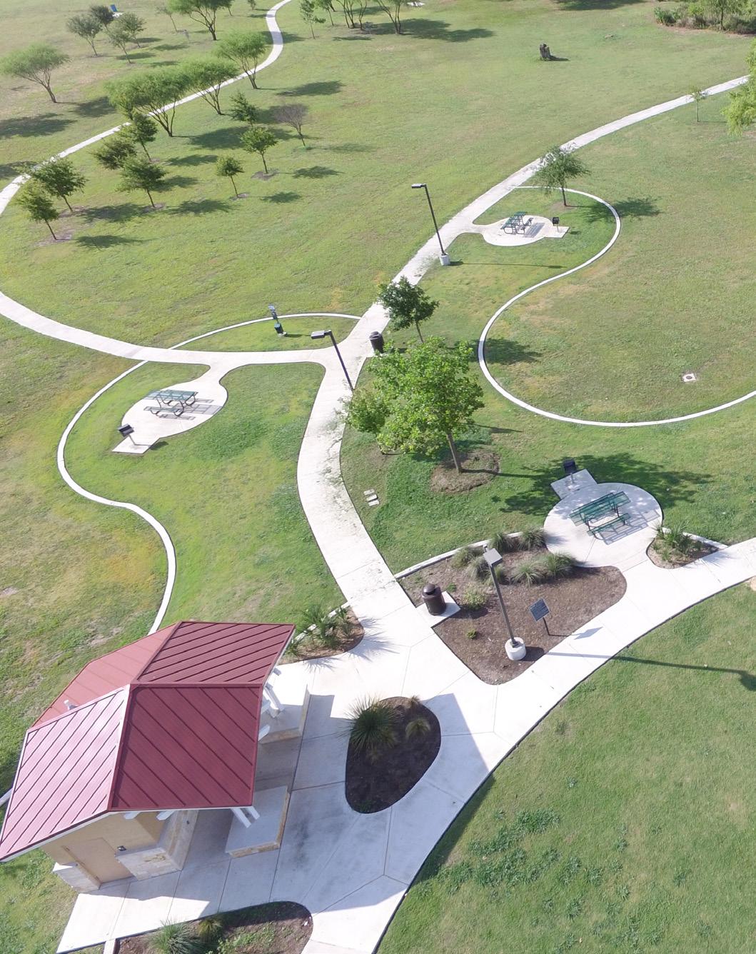
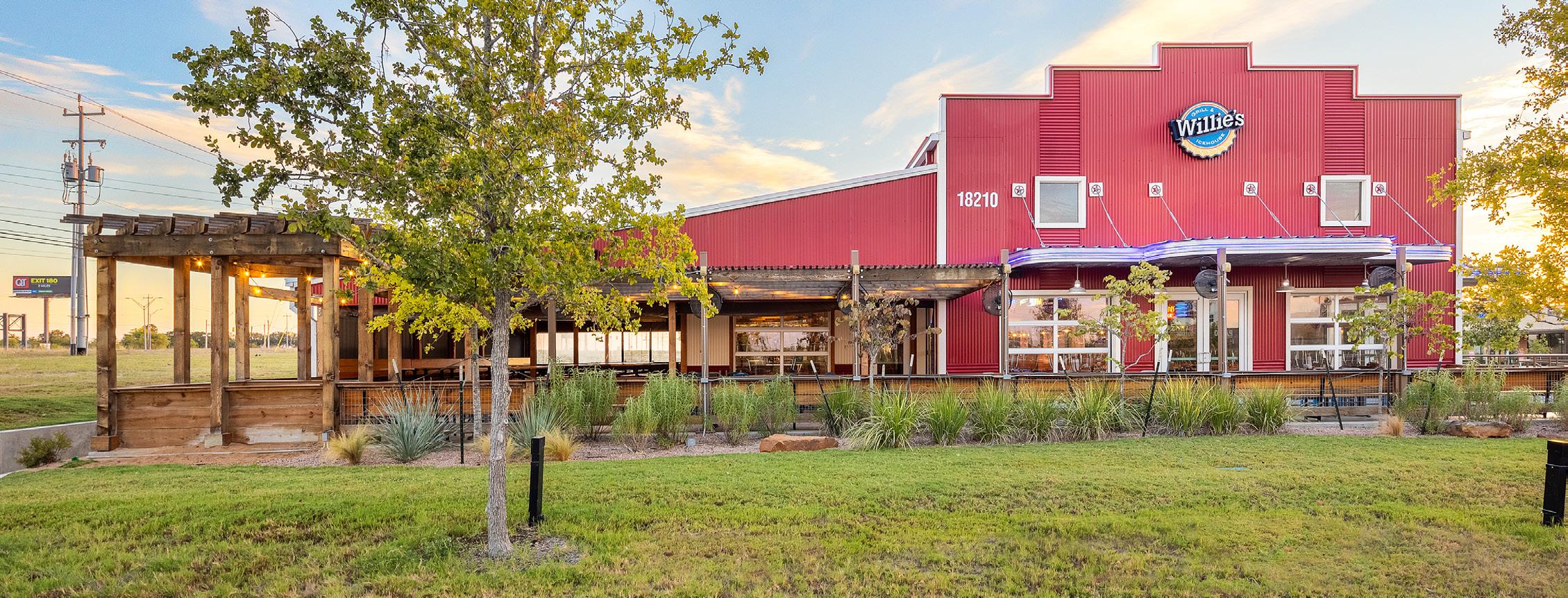
The City will collaborate with a variety of agencies, organizations, and individuals in both the public and private sectors. These agencies, organizations, and individuals include:
Partnerships between the City and governmental or quasi-governmental agencies can provide the City with funding, educational resources, and perform economic development functions, including but not limited to:
• Guadalupe County
• Bexar County
• State of Texas, including the Texas Department of Transportation (TxDOT), Texas Commission on Environmental Quality (TCEQ), and Texas Parks and Wildlife Department (TPWD)
• Federal Government, including the Department of Transportation, Department of Commerce, Environmental Protection Agency, and Department of Defense.
• Schertz-Cibolo-Universal City Independent School District (SCUCISD)
• Alamo Area Metropolitan Planning Organization (AAMPO)
Private sector partnerships are critical for job creation and ensuring that goods and services are delivered to the community. Private sector entities increase the local tax base and are important for attracting other businesses to the community. They control the land and capital for improvements on existing properties and new developments. Private sector partners include:
• Businesses and business owners
• Landowners and property owners
• Real estate developers and brokers
• Financial institutions
Non-profits and community associations fill in the gaps that local government cannot address because of its diverse set of priorities and funding limitations. These entities tend to focus on a specific aspect of community life or area of interest. Members contribute time, resources, and talent to issues most important to them. These entities include:
• Faith-based organizations
• Athletic leagues
• Civic groups
• Homeowners associations
City Staff will continuously monitor the status of the plan implementation to ensure that ongoing progress aligns with the Plan’s goals. Any necessary adjustments to the plan will be made as needed. City staff will periodically evaluate the implementation plan and relevant regulations and work programs to ensure effective allocation of policies, finances, and staff resources to achieve the community’s vision.
It is important to recognize that no plan, however thorough, can anticipate every possible postadoption scenario. Therefore, it is recommended that the community conduct periodic reviews of the Comprehensive Plan approximately every five years to ensure its alignment with changing conditions, evolving community values, and emerging opportunities.
Successful implementation of the Cibolo Tomorrow Comprehensive Plan would include:
• Committed City leadership.
• Communication and cooperation between Cibolo and its stakeholders, private sector partners, governmental agencies, non-profits, civic/community groups, and residents.
• Removal of obstacles that interfere with achieving the vision.
• Multiple diverse funding sources from local, state, and federal entities.
The action items on the following pages are derived from recommendations of the plan as they relate to each major area of focus and flow from its vision statement and guiding principles:
Vision Statement. Cibolo is a community where residents collaborate to shape their civic future by promoting its rich history, preserving a small-town feel, and investing in balanced development.
1. Prioritize infrastructure to support existing needs and future growth.
2. Plan for and promote the health, safety, and general welfare of all residents.
3. Balance growth through responsible planning of city assets and land to promote a community environment.
4. Provide parks, recreation, trails, and open space to serve citizens and visitors while protecting the natural environment and wildlife.
5. Preserve the history of Cibolo and promote the friendly, small-town feel through community programs and events.
As reflected in each chapter’s summary table, action items tie to the plan’s strategic direction.
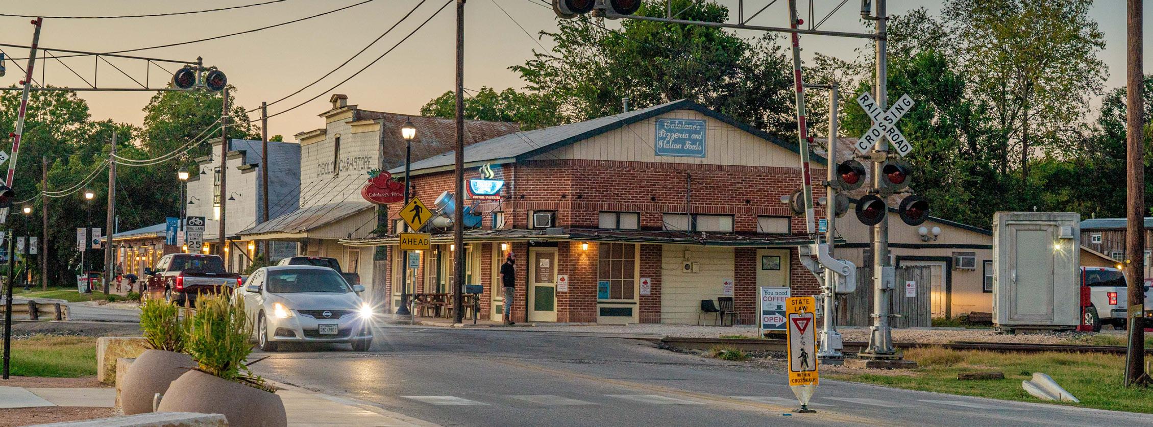
An action item is a specific task that must be completed to achieve the plan’s goals. Each action item in the matrix has characteristics that specify the type of action, as well as where and when it will be applied. The concept and categories are briefly explained below. The implementation matrix is arranged so that it can be utilized as a tool to help continually prioritize actions as decisions are made and projects are completed. Through its major categories of timeframe, cost, and party responsible, it is possible to weigh and prioritize which actions take precedence.
This column categorizes the nature of the action items. Categorization helps in grouping similar or related items for efficient implementation and ensuring each item is completed in the correct order. The description of each action type is provided below.
• Capital Investments (CI). The repair and construction of major public facilities and utilities are important long-term investments in the community. It is crucial to coordinate these projects with the future land use strategies of the Comprehensive Plan to optimize the use of resources, including public funds.
• Studies (ST). To ensure that public funds are used responsibly and effectively, it is often necessary to conduct studies on complex and costly public projects. These studies may require the expertise of external consultants or specialists.
• Education and Engagement (E). To ensure the successful adoption of the new Comprehensive Plan, it is important for residents, businesses, non-profits, and agency and institutional partners to understand its impacts and view the community in a new way.
• Financial Incentives (FI). Financial incentives can serve as a valuable tool in attracting desired development. The City has several options at its disposal,
such as: fee reductions or waivers, tax abatements, and infrastructure investments. These incentives can be used to entice the type of development that aligns with the community’s vision.
• Partnerships (P). Cities often have a list of programs and projects that they hope to implement. However, the success of these initiatives often relies on the cooperation of other parties and agencies. This cooperation can take the form of joint planning, coordination, provision of land or funding, construction of physical assets, project management, and more. By forming collaborative partnerships with outside entities, cities can increase the likelihood of success for their programs and projects, making them more effective and timelier.
• Regulations and Guidelines (RG). Regulations, such as zoning and subdivision ordinances, ensure community health, safety, and welfare during construction and development. Following these ordinances is crucial for maintaining a desirable community. Guidelines may also exist to preserve assets or create a unique environment. While not mandatory, it is generally recommended to follow guidelines unless there is a valid reason not to. If existing regulations or guidelines hinder important aspects of a Comprehensive Plan, cities may need to create, refine, amend, or repeal them. Consultants are often sought after if cities lack the resources for this task.
This category is broken into five segments:
• Immediate (I) - High-priority actions that should be completed in 2 years or less. (2024-2026)
• Short-Term (S) - Actions that should be completed within the next 3 to 5 years. (2027-2029)
• Medium-Term (M) - Actions that are estimated to be completed within the next 6 to 10 years. (2030-2034)
• Long-Term (L) - Actions that are anticipated to take longer than 7 years to complete. (2035 and beyond)
• Ongoing (O) - Actions that span the length of the plan and are ongoing items.
In additon, the following project status legend shows a color-coded frame of reference for level of completion:
This category specifies the individuals or organizations responsible for completing the action item. The item may require one entity to take full responsibility for the success of the action item, or they may take the lead with support from other agencies, organizations, or individuals.
This column also identifies key partnerships with other entities that can support an item. If an action item requires a partnership with another agency, organization, or individual, it will be listed in the Responsible Party column.
The implementation matrix on the following pages are designed as the primary tracking tool to be utilized as action items are completed. Action items are arranged such that tracking metrics are complimentary with other city plans, namely with the City’s Fiscal Year (FY) 2024-2027 Strategic Plan. Ranging from how actions are labeled to similar timeline styles and attributes the matrix provides familiarity and compatability with other established City tracking mechanisms. In this way, action numbers, action types, timing, cost and responsible parties are aligned.
Public Sector Cost is the range of which a action item can fall within. It represents a planning level estimate of the cost to perform that action.
• $ - up to $150,000
• $$ - $150,001 - $500,000
• $$$ - $500,001 and up
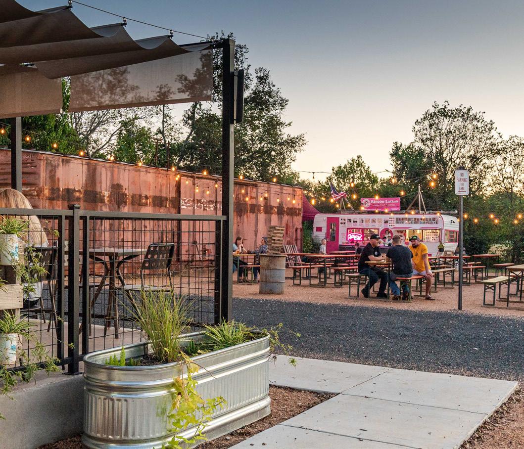
Patio Bar
Create a City annexation policy that aligns with the provision of adequate public infrastructure and services.
L-2 RG Utilize the Future Land Use Map to diversify uses and character within Cibolo.
L-3 ST
L-5 RG
Develop an Old Town Master Plan that will include an implementation plan and recommendations to update the City’s Unified Development Code (UDC) with custom-tailored regulations for Old Town to help preserve and guide existing and future development and activity.
Review and update the city’s existing ordinances where necessary to accommodate the types of development envisioned in the Future Land Use Map.
Address the addition of new PlaceType categories, development standards, and requirements to preserve open space and floodplain management related to new developments.
L-6 RG
Develop a tool for determining the consistency of development proposals and zoning applications with the Cibolo Comprehensive Plan.
Incorporate nature preservation and mitigation standards in the City’s Unified Development Code (UDC).
Amend the UDC to align zoning districts to reflect PlaceTypes.
Foster partnerships that will help achieve desired land use outcomes as outlined in the Comprehensive Plan.
Ensure land use types along major corridors support appropriate commercial, industrial, and institutional development.
L-11 RG Preserve natural areas, such as Cibolo Creek, for floodplain management and recreation for all.
T-1 P
Proactively participate in state and regional transportation planning activities affecting Cibolo.
CAO T-2 P
Proactively pursue partnerships to improve Cibolo’s city‐to‐city connectivity.
City
T-3 RG
T-4 P
T-5 CI
T-6 ST
T-7 CI
Ensure developers implement the thoroughfare network concurrent with new development.
Continue to coordinate all educational service providers, including the Schertz-Cibolo-Universal City Independent School District (SCUCISD) to develop safe bicycle and pedestrian connections between schools and neighborhoods.
Improve sidewalk connectivity that prioritizes pedestrian safety and ADA compliance.
Create a parks and trails master plan to ensure a coordinated parks and trails system.
Improve north/south connectivity through additional roadway connections between FM 1103 and FM 78, and FM 78 and IH‐10.
Identify and pursue transportation grants to supplement funding gaps.
Update and implement recommendations in the Pavement Management Study to prioritize roadway improvements.
Implement low water crossing improvements into the transportation impact fees and include in the 5-year CIP Plan.
Prioritize roadway safety when implementing street infrastructure projects, such as with traffic calming, roadway sizing, and intersection enhancement.
Conduct a north-south connector feasibility study with preliminary engineering work, environmental analysis, and public engagement to qualify for local, state, or federal funding sources and/or grant programs.
City
City
HN-7
Review and amend the Cibolo Unified Development Code (UDC) to provide public access to parks and other public open spaces in neighborhoods.
Review and amend the Cibolo Unified Development Code (UDC) to encourage access between neighborhoods and neighborhood‐serving commercial areas.
Review and amend the Cibolo Unified Development Code (UDC) to allow for and encourage a greater variety of housing types.
and pursue funds to help finance work force housing efforts.
Review and amend the subdivision regulations to encourage the development that preserves the floodplain and open space.
a rental registration program to ensure code compliance and safety.
Strengthen zoning regulations and building codes that prioritize flood‐resistant construction and design features for housing and neighborhoods.
Create and implement a comprehensive floodplain management plan that prioritizes and preserves open space to guide development in flood‐prone areas.
Create a short‐term rental policy to ensure compatible land uses with established residential neighborhoods.
regulations regarding the use of Accessory Dwelling Units (ADUs).
Create a Neighborhood Vision Booklet to define quality standards for Cibolo’s neighborhoods.
CAO
Continue to procure sustainable sources of water that are both fiscally and environmentally responsible.
Regularly evaluate demand on police and fire protection services and ensure adequate staffing levels and facility capacity in Police Department and Fire Department.
Complete an office and staffing professional needs assessment.
Incorporate an Emergency Operations Center in the new Public Safety Facility.
Evaluate existing and future desired community events and programs through a future parks and open space master plan.
Create a future utility and infrastructure plan that aligns with land use and growth projections.
Promote investment in broadband, fiber and internet infrastructure throughout the city to support future development.
Evaluate existing and implement new City sponsored events to ensure they meet the civic and social needs of the community as it grows.
Conduct a comprehensive branding strategy to include signage, art, and wayfinding to create a unified sense of place.
Evaluate dependency on other agencies to provide services within the City.
Tomorrow Comprehensive Plan
Community Summit #1 kicked off late March. Engagement included meetings with targeted stakeholders, pop-up events, and community workshops. Online engagement included the launch of the Cibolo Tomorrow website on April 24th and online surveys. Below outlines the total participation and responses from each meeting completed in Community Summit #1.
Cibolofest
#1
28th, 2023
– July 2023
Survey #2 August 2023 –October 2023
The following pages are a few key summary visualizations of engagement that were heard throughout the Community Summit #1 engagement process. Below is an outline of feedback heard:
- Strengths, weaknesses opportunities and threats
- Dot analysis Map
- Visioning Questions
- Priority Spending
- Land Use
- Mobility and Thoroughfares
Strengths, weaknesses, opportunities, and threats of Cibolo
The strengths, weaknesses, opportunities, and threats (SWOT) of Cibolo were discussed throughout the engagement process. The feedback reflected in the word clouds below are from: MPAC SWOT analysis meeting, Community Survey #1, Community Open House #1, and MPAC, P&Z, and City Council Work Session #1.
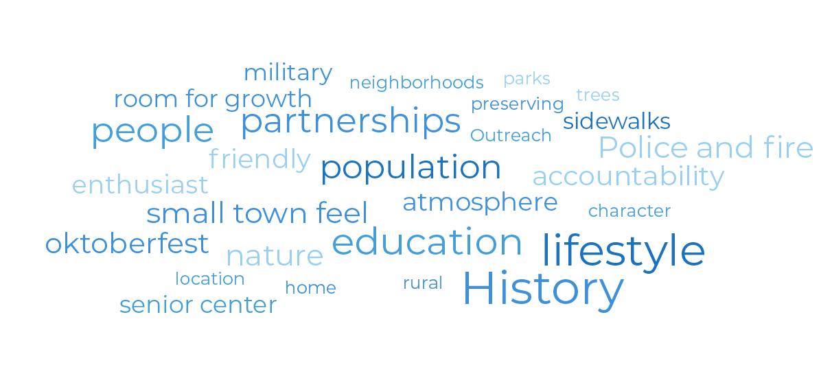
Weaknesses
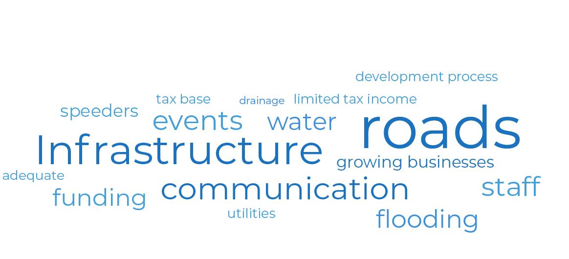
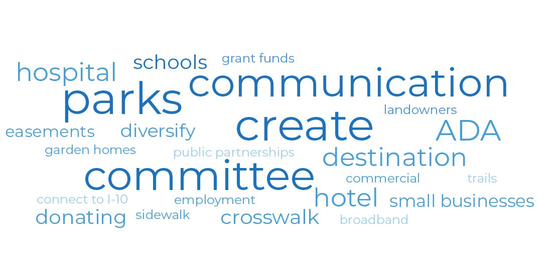
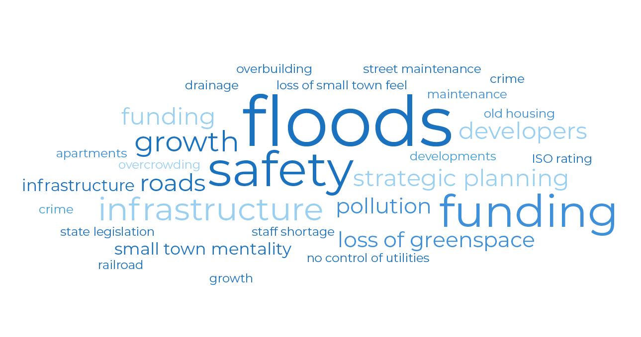
The planning team gave City Staff two dots of each color. They were asked to place their green dots on areas of Cibolo they thought were the greatest future opportunities for the City, red dots for areas that were working well, and yellow dots on areas of the city that need help to make it better. This exercise allowed the planning team and City Staff to identify key clusters of different areas of the city and discussed their impact on the city today. This exercise was done at the State of the City meeting with City staff.
The photo on the following page displays the results of this analysis. Several highlights from this exercise are detailed below:
• Greatest Future Opportunity:
o Undeveloped land in the northeast portion of Cibolo – development opportunities
o Bird Sanctuary
o Downtown Cibolo/Original Town Center Zone
o Infrastructure improvements south of FM 78 (water/sewer/bridge/road infrastructure)
o I-10 Corridor Development Opportunities
o Racetrack redevelopment
• Working Well – Don’t Mess Up:
o Cibolo Crossing
o Linear park and trail connections
o Quality commercial at the intersection of Green Valley Road and FM 1103
o HEB
o Cibolo Valley Drive and existing commercial area
o Industrial park and commercial area
o AISINTX – attracting similar businesses along I-10 corridor
• Make It Better – Needs Help:
o Veteran’s Park
o FM 78 – infrastructure and safety improvements needed along railroad
o Downtown Cibolo – zoning and compatibility issues with surrounding neighborhoods
o Hackerville Road – need better north/south access throughout Cibolo from I-10 to FM 78.
Infrastructure improvements also needed for Hackerville Road
o Mixed Use Overlay along I-10 Corridor where the existing industrial park is located
o Racetrack
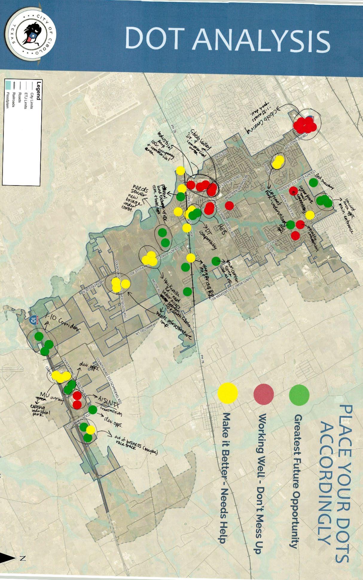
Throughout the engagement process, the public was asked different questions about their thoughts on Cibolo. The input may include how the community sees Cibolo today, how they want to see Cibolo in the future, and why they love their community. The word cloud below reflects the most common words used by community members when describing Cibolo. The larger the word, the more often it was mentioned. These phrases and words are then used to craft a vision statement and guiding principles for the final plan. The following questions were asked:
- I love Cibolo because…… (Cibolo Summer Night)
- What one word or phrase would you use to describe Cibolo today? (Open House #1)
- What one word would you use to describe your vision of Cibolo in 2050? (Open House #1, Joint MPAC, P&Z, and City Council Work Session #1)
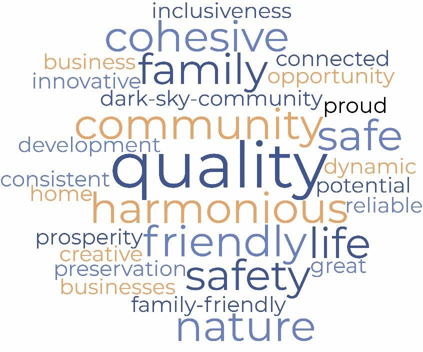
The goal of this exercise is for participants to prioritize what changes are important to them in Cibolo. At the Cibolo Summer nights events City residents were given 5 gold coins, while residents of the ETJ were given 5 silver coins. At the Cibolo Summer nights event there were 8 priority topics the participants had to choose from. This exercise was also conducted at the first Community Open House. At the open house there were 11 priority topics. Below organizes the topics at both events into categories and counts the total votes at both events.
The first step of land use planning for Cibolo was to establish which growth scenario is preferred by the community. At the first community open house participants were asked to read three different growth scenarios (A, B and C). Each story represented a different growth strategy for the community. After reading the growth stories, participants could vote using colored dots on the elements of the story they had a positive reaction to or a negative reaction to.
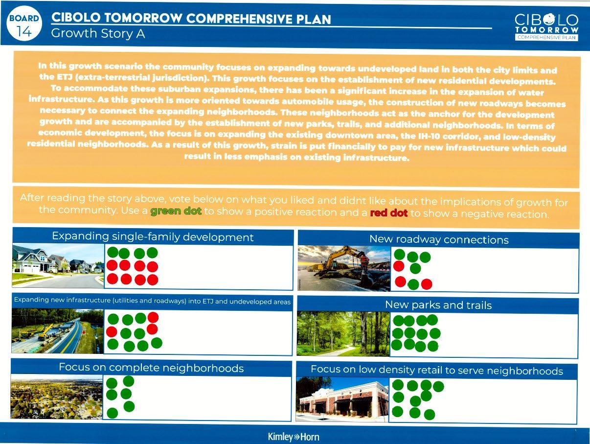
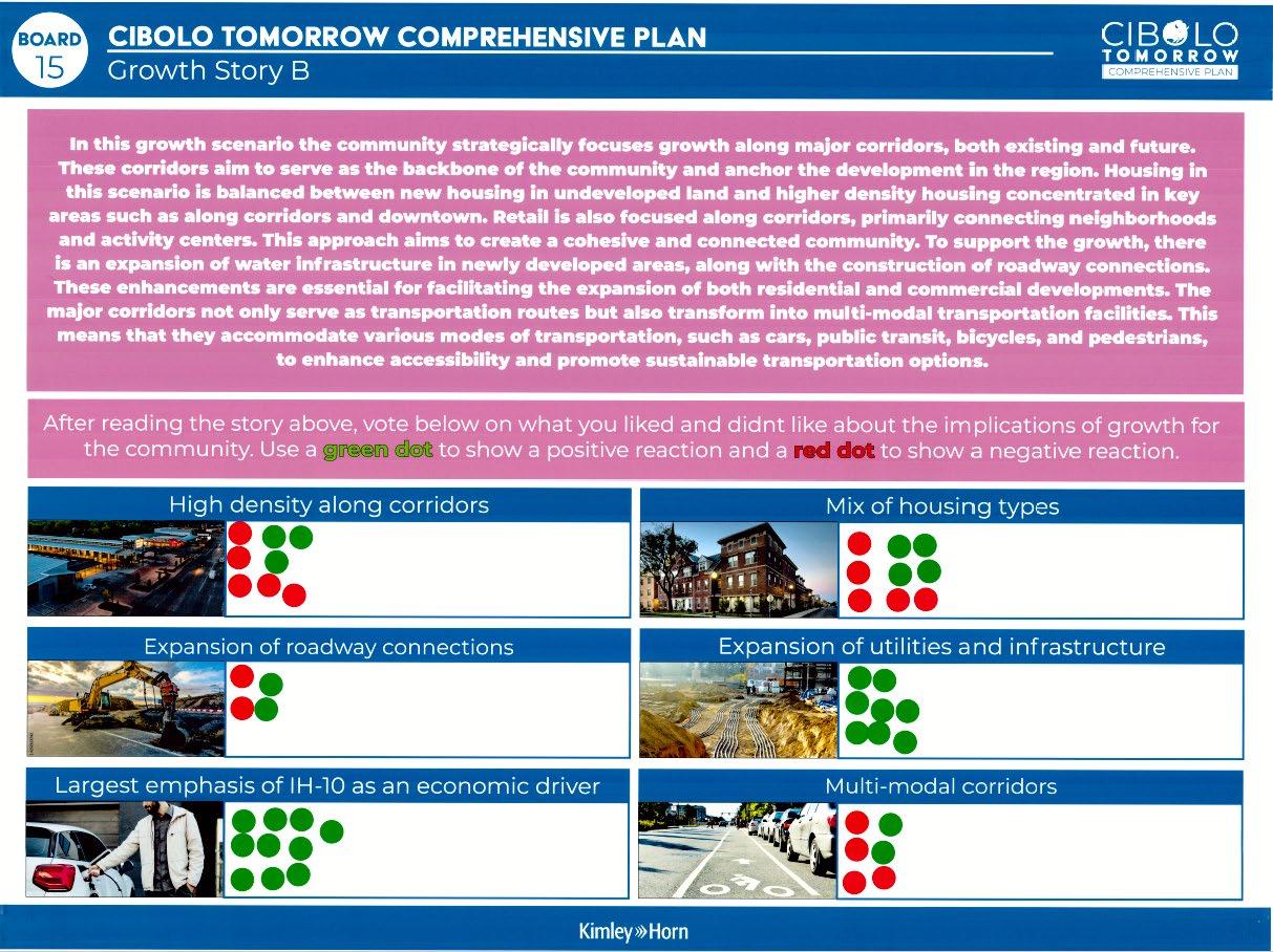
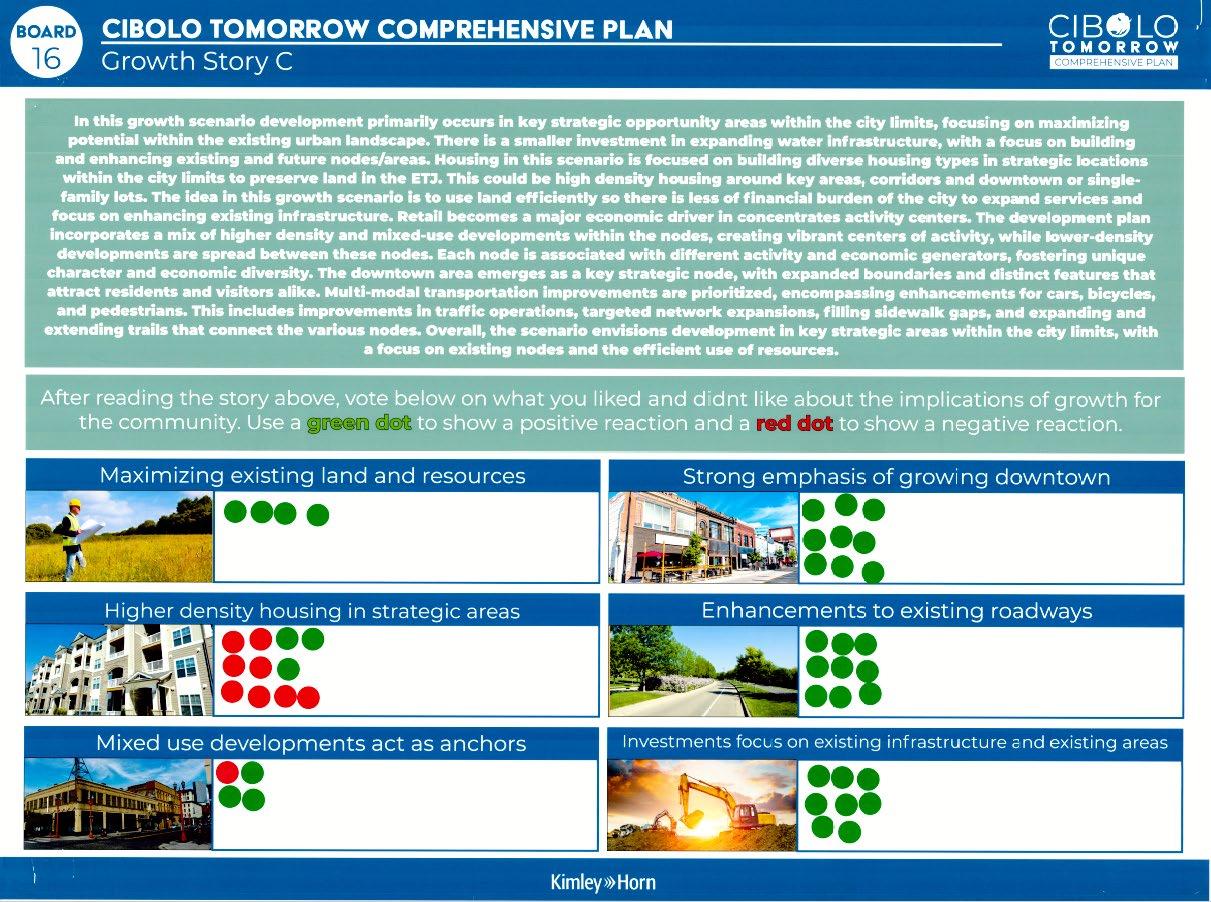
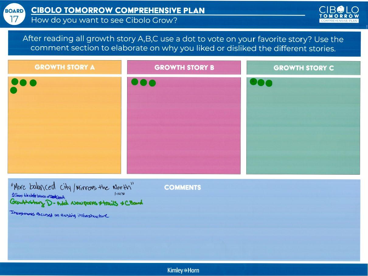
The second step of land use planning was working with stakeholders to build three scenarios using PlaceTypes established for Cibolo. The below tables show the results from the Joint MPAC, P&Z, EDC, and City Council Work Session #2.
Scenario 1: Current Trend/Growth Story A
Table 1
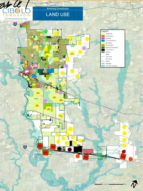
Table 2
Takeaways
- Estate Residential between the railroad and County Road
- Suburban Residential in the ETJ east of the city with Neighborhood commercial
- Larger retail and industrial along IH-10 to serve as an employment center
- Activity Center along IH-10 and compact residential
Takeaways
- Community commercial along FM78
- Industrial and higher density residential along IH-10
- Estate Residential in the ETJ
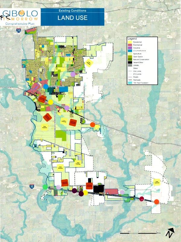
Table 3
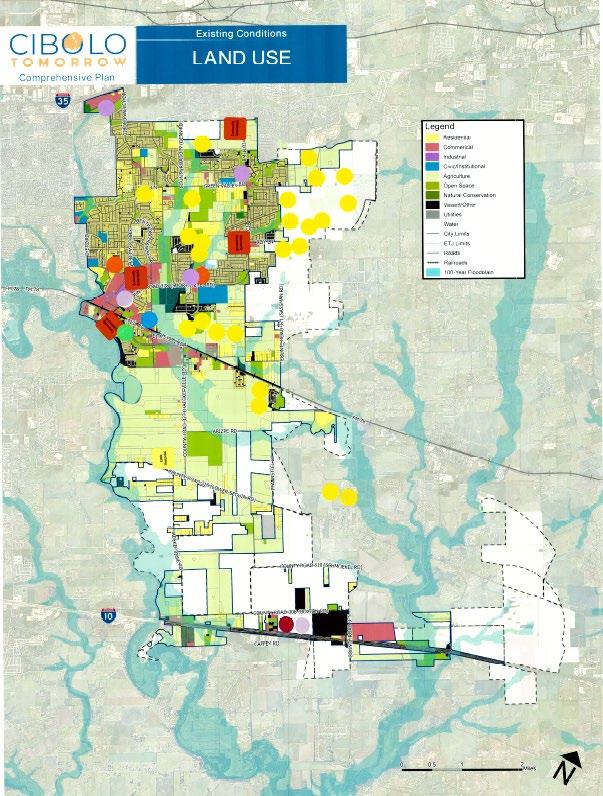
Table 4
Takeaways
- Established Residential in the ETJ in the northeast area of the city
- Community commercial in the northern part of the city
- Activity Center along IH-10 Corridor
- Neighborhood commercial in vacant parcels in the northern part of the city
Takeaways
- College campus along IH-10
- Update infrastructure along the IH-10 corridor / focus on
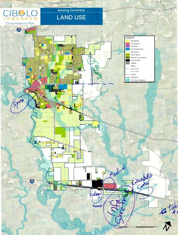
Table 5
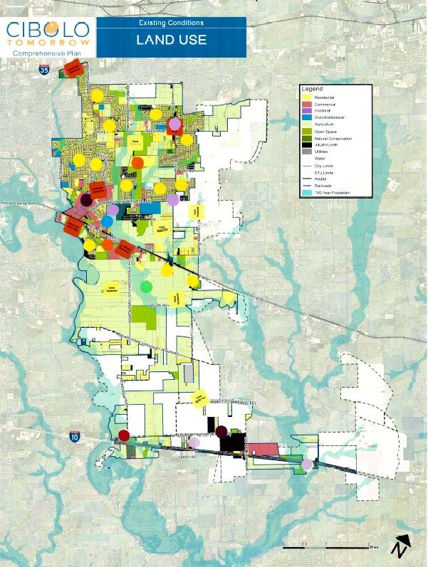
Combined map from all Groups
infrastructure that supports commercial
- Cultural center along the IH-10 Corridor
- More areas to conserve
- Estate residential/ large ag lots between FM 78 and Lower Seguin Rd
- Community commercial and compact residential located on the west side of FM 78
- Industrial along IH-10
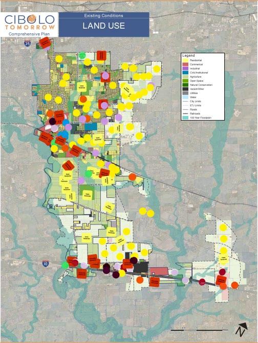
Scenario 2: Nodes/Growth Story B
Table 1
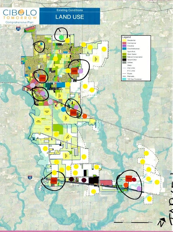
Table 2
Takeaways
- Black circles indicate nodes/primary locations within the city
- Business parks located along FM 78
- Community commercial along FM 78 with compact commercial supporting the commercial uses
- Heavy industrial along IH-10
- Residential in the ETJ areas of the city and lower density residential like estate residential
- Using the nodes be commercial nodes throughout the city
Takeaways
- Industrial centered along the IH10 on the west side of the corridor
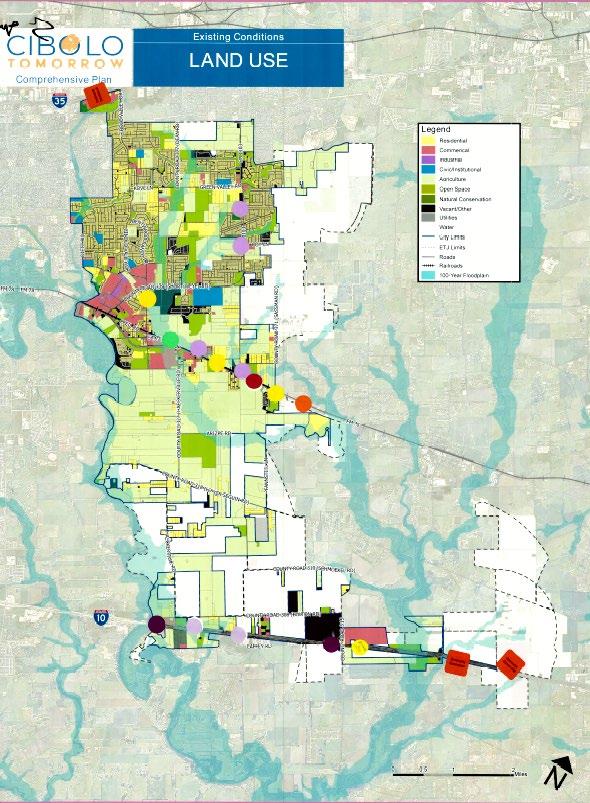
Table 3
Table 4
- commercial and medical along the east side of the IH-10 corridor
- Compact residential and community commercial along FM 67
Takeaways
- Established residential in the ETJ on the east side of town
- Community commercial along FM 78 with light industrial
- Low density residential and neighborhood commercial along the east side of IH-10 corridor
Takeaways
- Mixed-Use center along FM 78 with community commercial and compact residential to support
Table 5
Combined map from all groups
- Community commercial along IH-10 corridor and mixed-use center
- Community commercial along FM 1103 and Green Valley
- Agriculture/large lots and green space between FM 78 and lower Seguin Rd
- Following industries located along IH-10: College Campus, Hospital, Medical district, and business park
Scenario 3: Corridor/Growth Story C
Table 1
Takeaways
- The red lines and black lines indicate primary corridors in Cibolo
- Estate residential between FM 78 and County Road 318
- Community commercial used as a gateway coming east bound along IH-10 Corridor
- Activity center in the middle of IH-10
- Community commercial and light industrial along FM 78
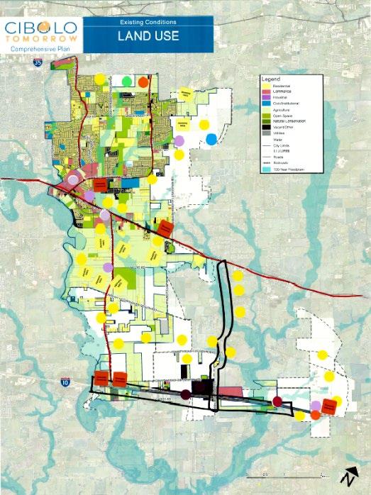
Table 2
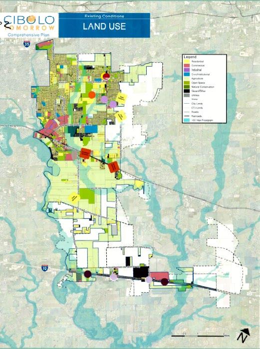
Table 3
Takeaways
- Industrial along IH-10 Corridor
- Community Commercial along FM 78
- Compact residential near community residential
Takeaways
- Established Residential along the east side of the IH –10 corridor
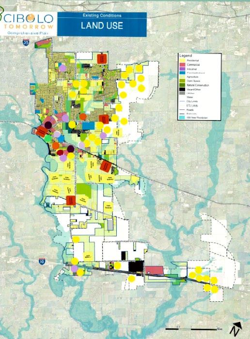
Table 4
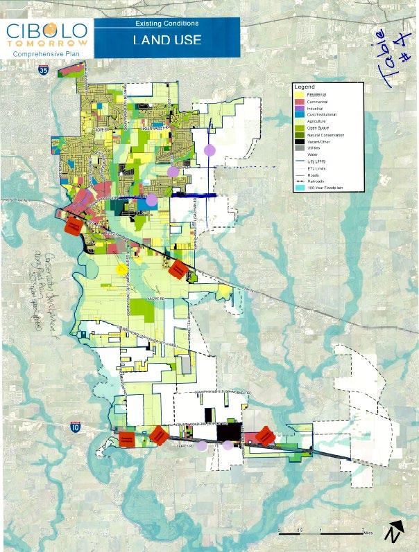
Table 5
- Estate residential between FM 78 and Lower Seguin Rd
- Activity center along FM 78
- Higher density residential to support activity center along FM 78
- Established retail in the east side of the city in the ETJ
- Conservation development along floodplain
- More open space opportunities between FM 78 and the Lower Seguin Rd
- Neighborhood commercial located in the existing neighborhoods in the developed part of the city
Takeaways
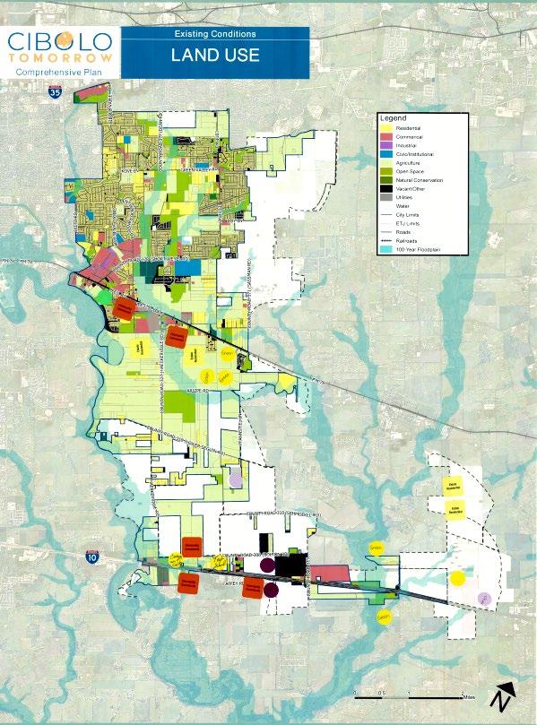
Combined map from all groups
- Green space and estate residential between FM 78 and lower Seguin rd.
- Community commercial located along major corridors (FM 78 and IH-10)
- Mixed-use center in the middle of the IH-10 corridor
- College campus and tech school along the IH-10 corridor
The exercise below was conducted at the Joint MPAC, P&Z, EDC, and City Council Work Session #2 to identify mobility priorities within Cibolo.
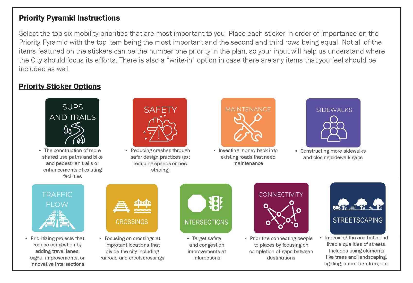
Individual Result Summary
TOP TIER PLACEMENT VOTES
(Most Important/Highest Priority for Cibolo) (Spot 1)
SECOND TIER PLACEMENT VOTES
(Most Important/Highest Priority for Cibolo) (Spots 2 and 3)
THIRD TIER PLACEMENT VOTES
(Most Important/Highest Priority for Cibolo) (Spots 4,5,6)
Community Open House #2 Recap Document
Cibolo Community Open House #2 Recap Document
November 8, 2023
Introduction:
Community Open House #2 took place on November 8th, 2023 from 6:30 P.M. – 8:30 P.M. The purpose was to gain insight from the community for the Cibolo Tomorrow Comprehensive Plan. The Open House consisted of 7 stations that asked participants for their input. A summary of the stations and their responses are below.
The focus of this station was to get clarification from participants of the vision statement that was derived from Community Summit #1.
Comments:
• Way too long ✔✔✔
• –
•
• How do you measure living comfortably?
• Living comfy/citizens collaborate to improve their city. Cibolo is a community that is inviting and inclusive.
• Leave the history and tie to todays diversity.
The focus of this station was to sort the guiding principles in the plan. Preliminary guiding principles were displayed and participants were asked to identify if they agree, disagree, or are neutral on each guiding principle.
Comments:
• Make these actionable
• These need to be made [in] Spanish
Prioritize necessary infrastructure (and greenspace) to support existing needs and future projected growth. *(Illegible)
Plan for and promote the health, safety, security, and general welfare of all residents of all ages and backgrounds.
Promote a community environment which will attract new families and high-quality businesses into the city and empower existing families and businesses in Cibolo to flourish.
remove
Balance the growth of business and residential development through responsible planning of city assets and land.
Provide parks, recreation, trails, and open space to serve existing and prospective citizens and visitors to Cibolo.
Identify and preserve the rich character and history of Cibolo, which sets itself apart as a City of Choice.
Comments
• Not just new infrastructure, but repairing bad infrastructure put in wrong.
• Taking care of (illegible) and animals
• Add handicap: Prioritize safe crossings
• Domestic animals
• How do you empower existing [families and businesses]?
• Keep as they currently are, not more priority.
• + add idea about wildlife.
• Don’t like “City of Choice” slogan.
• Get rid of “City of Choice”
This station asked participants to look at the preferred land use scenario board and place a green dot on areas that they agree with and a red dot for areas they do not agree with. They were then asked to explain on the following board.
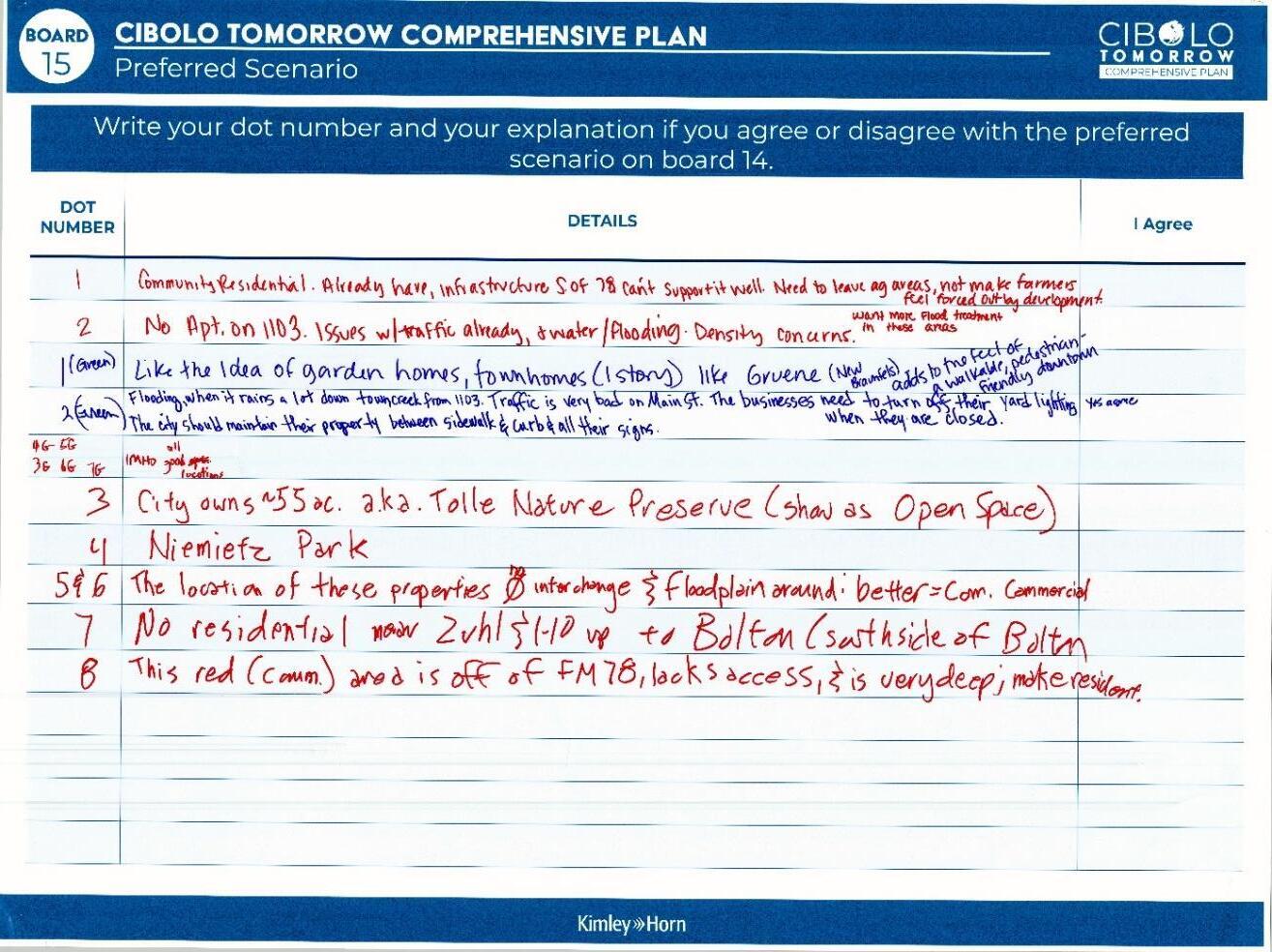
Comments:
• 1. Community Residential: Already have infrastructure S. of 78.can’t support it well. Need to leave [agricultural] areas, not make farmers feel forced out by development.
• 2. No apt. on 1103. Issues w/ traffic already, + water/flooding. Density concerns. W ant more flood treatment in these areas .
• 1 (Green): Like the idea of garden homes, townhomes (1 story) like Gruene (New Braunfels)
• 2 (Green): Flooding, when it rains a lot downtown creek from 1103. Traffic is very bad on Main St. The businesses need to turn off their yard lighting. The city should maintain its property between sidewalks, curbs, and all their signs. Yes, I agree.
• 4G, 5G, 3G, 6G, 7G: IMHO all good locations
• 3. City owns 55 ac. a.k.a Tolle Nature preserve (show as Open space)
• 4: Niemietz Park
• 5&6: The location of these properties no interchange & floodplain around: better = better com. Commercial
• 7: No residential near Zuhl & I-10 up to Bolton (Southside of Bolton)
• 8: The red (Comm.) area is off of Fm 78, lacks access, and is very deep, make resident.
This station asked participants explained missing middle housing to participants and asked what types of missing middle housing they thought would be appropriate as a supporting use in Cibolo’s proposed PlaceTypes. The results are summarized below: Board 1
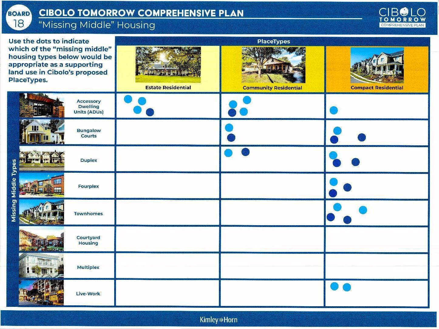
Results:
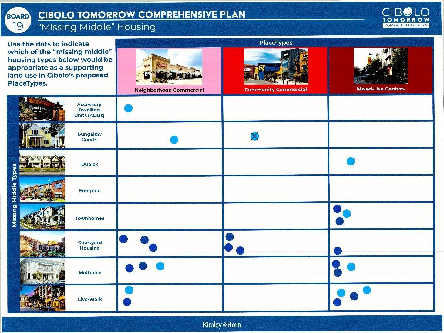
Results: Neighborhood Commercial
Housing
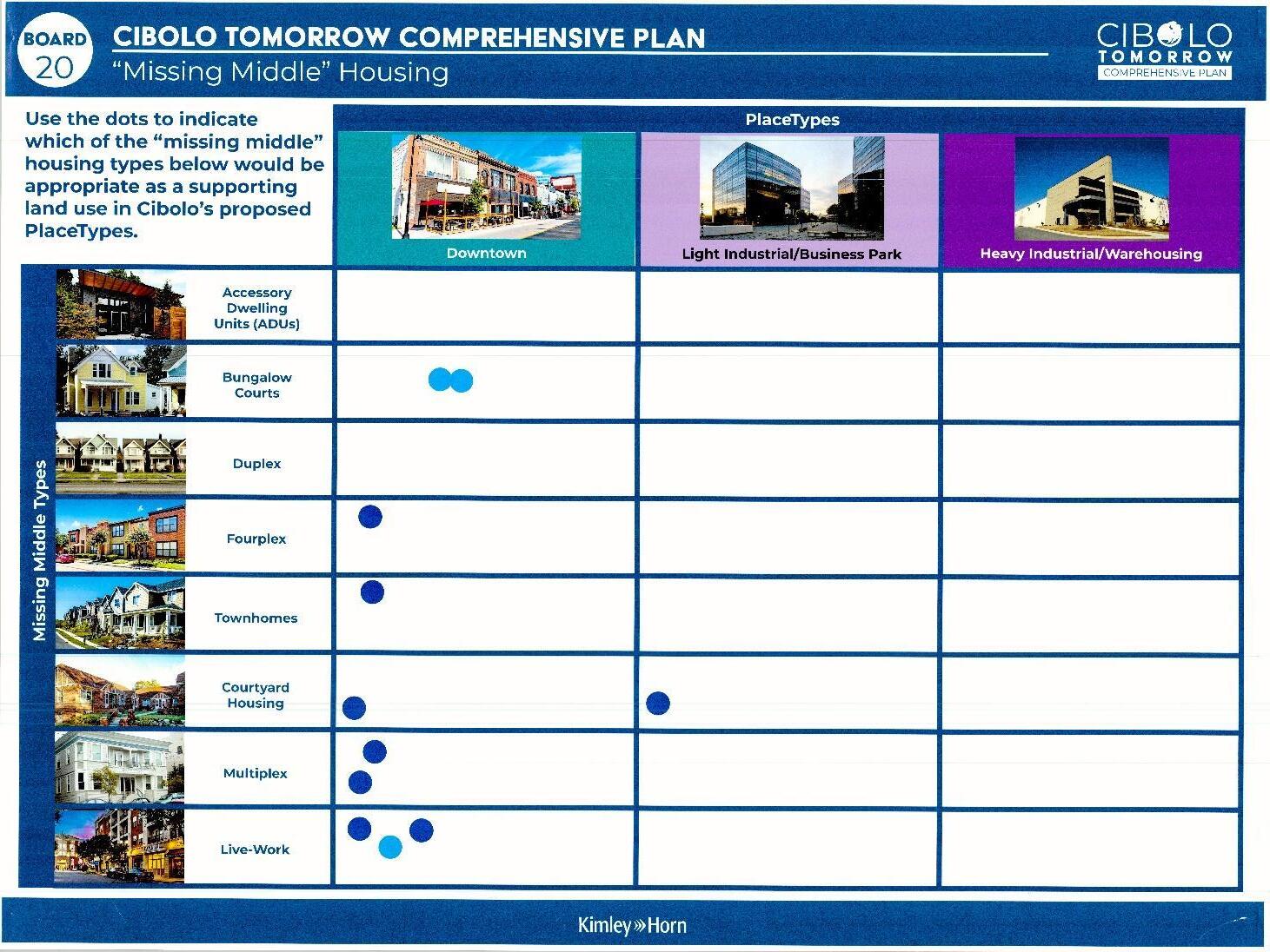
This station asked participants about their thought s and concerns about existing housing and neighborhoods in Cibolo. The responses are below:
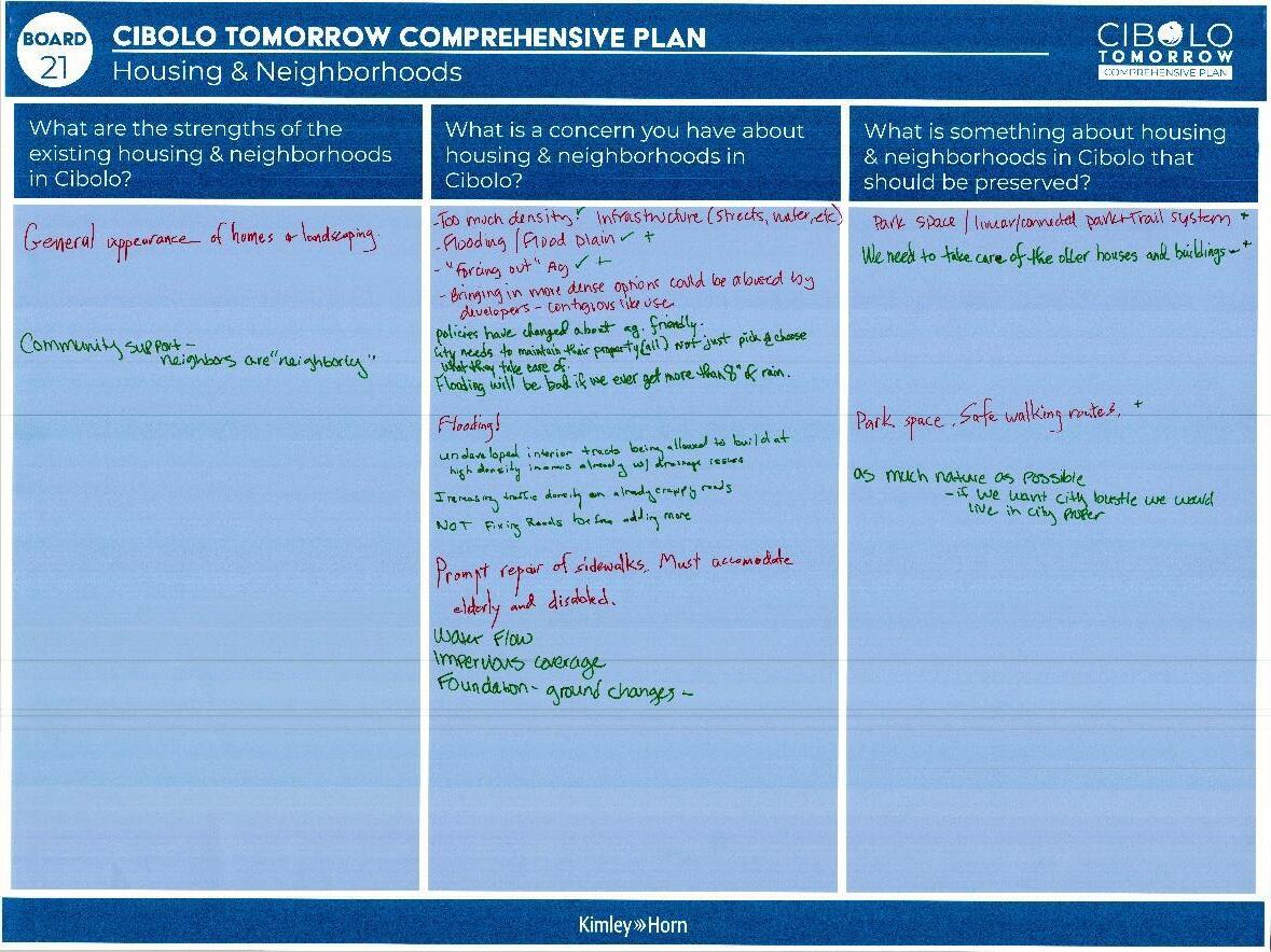
What are the strengths of existing housing and neighborhoods in Cibolo?
• General appearance of homes & landscaping.
• Community Support – neighbors are “neighborly”
What is a concern you have about housing & neighborhoods in Cibolo?
• Too much density. ✔ Infrastructure (streets, water, etc)
• Flooding/Floodplain ✔✔
• “Forcing out” Ag ✔✔
• –
• get more than 8” of rain.
•
•
•
• Water flow
• Impervious coverage
• Foundation -ground changes-
What is something about housing & neighborhood in Cibolo that should be preserved?
• Park space/linear/connected park + trail system ✔
• ✔✔
• ✔
• –
This station asked participants to use colored dots to indicate:
• (Blue) Where is it difficult to travel North/South or East/West
• (Yellow) Where do you most often cut through to avoid traffic?
• (Green) Which roads do you use to get to San Antonio and other places outside of Cibolo?
• (Red) Where do you experience congestion?

Board: Comments and concerns on existing thoroughfare:
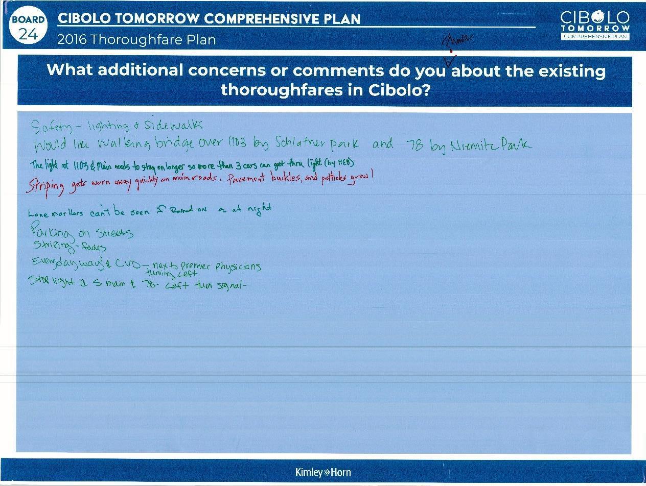
Comments:
• Safety – lighting & sidewalks
• Would you like walking bridge over 1103 by Schlather Park and 78 by Niemietz Park.
• The light 1103 & main needs to stay longer so more than 3 cars can get thru light. (by HEB)
• Striping gets worn away quickly on main roads. Pavement buckles, and potholes grow!
• Lone markers can’t be seen if rained on or at night
• Parking on streets
• Striping fades
• Everyday way & CVD – next to premier physicians turning left
• Stop light @ S main & 78 – left turn signal.
This station asks participants whether they think the stated service or facility is implemented well within the city, and to provide their additional thoughts on the next board.
Voting
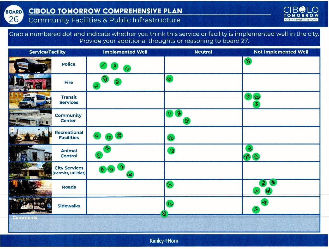
• Police – Implemented Well
• Fire – Implemented Well
• Transit Services – Not implemented Well
• Community Center – Neutral
• Recreational Facilities – Implemented Well
• Animal Control – Not Implemented Well
• City Services (Permits, Utilities) – Implemented Well
• Roads – Not Implemented Well
Sidewalks – Not Implemented Well
Additional Thoughts
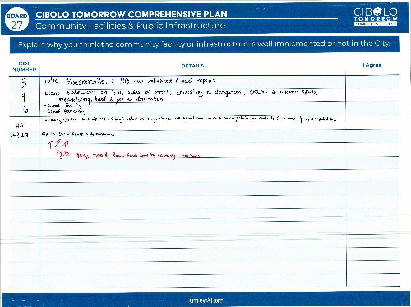
Comments:
• 3 – Tolle, Haeckerville, and 1103 – all unfinished/need repairs
• 4 – Want sidewalks on both sides of street, crossing is dangerous, cra cks + uneven spots. Meandering, hard to get on destination.
• 6 – Good facility, Good parking
• 25 – Too many police cars -> not enough policing. Police will respond, but too much community theft from outside for a community without 10 + patrol cars
• 36 & 37 – Fix the roads in the communities!
o ^Yes. Royal Troo n & Wood Ranch Drive by Carnousty – manholes.
Comments:
• The facilities at Niemietz Park should be fixed. The faucets leak in restrooms, thus wasting our tax $. You should take care of things you have; it costs less in the long run.
Public Infrastructure and Services. Roads are a huge priority for residents. Participants mentioned repairing and maintaining existing infrastructure and finishing up large projects before focusing on growth. This includes striping and maintaining roads, fixing up park facilities, and focusing on existing structures with ing Cibolo.
Connectivity and Accessibility. Participants emphasizes the expansion and enhancement of sidewalks and trails within Cibolo. Ensuring that pedestrian and bike ways are connected and accessible to those of all abilities.
Parks and Open Space. Participants expressed their enjoyment of the existing parks and trails within Cibolo and how important they are in the plan. Residents want to expand and preserve greenspace for recreation and natural wildlife.
Introduction:
Document
November 9, 2023
The MPAC Meeting #2 took place on November 9th, 2023 from 6:30 P.M. – 8:30 P.M. The purpose of the meeting was to guide committee members through a workbook to receive feedback regarding the Vision Statement, Guiding Principles, Placetypes and Land Use for the Comprehensive Plan. Due to time constraints, the discussion on Light Industrial/Business Park, Heavy Industrial/Warehousing, Open Space/Floodplain PlaceTypes and Land Uses had to be tabled for the next meeting. A summary of the notes taken is below. Author notes clarifying the short hand will be written in italics.
Section 1 had the committee evaluate the vision statement that was derived from Community Summit #1.
MPAC Workbook Page 8 - Vision Statement
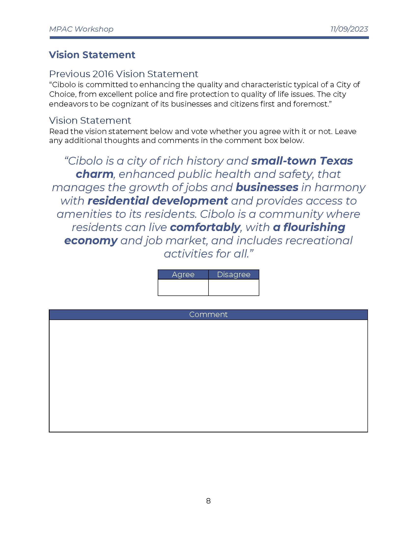
Written Notes
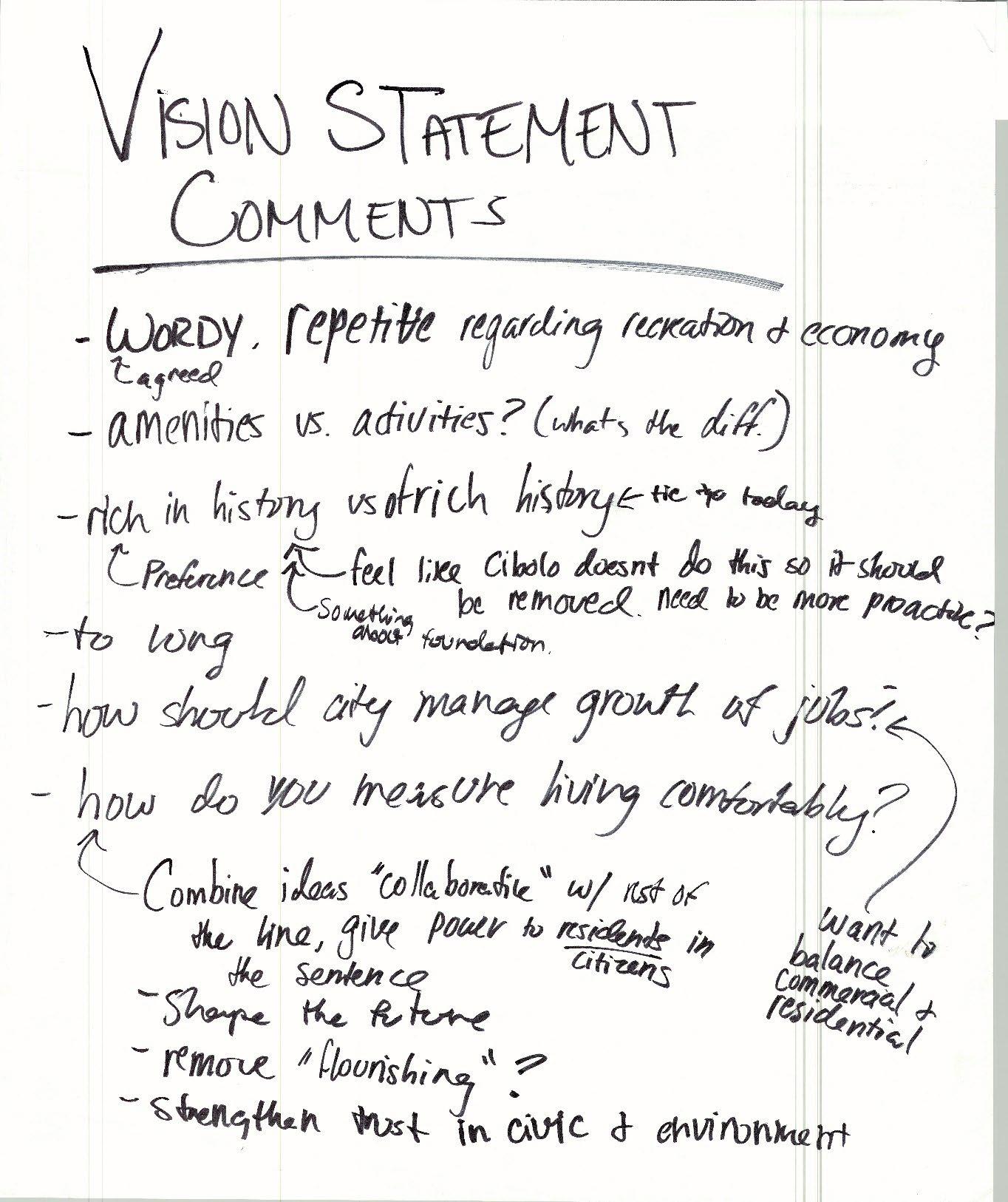
Notes:
• Wordy, repetitive regarding recreation and economy
o agreed
• Amenities vs activities? (what’s the difference?)
• “Rich in history” vs “of rich history”
o tie to today
o Rich in history is the preferred phrase
o Feel like Cibolo doesn’t do this so it should be removed. Need it to be more proactive
o Amend the statement to include something about foundation
• Too long
• How should the city manage growth of jobs?
o Want to balance commercial and residential
• How do you measure living comfortably?
o Combine ideas “collaborative” with rest of the line, give power to residents/citizens in the sentence
o Shape the future
o Potentially Remove “flourishing”
o Strengthen trust in civic and environment
The focus of this sections was to refine the guiding principles in the plan. Preliminary guiding principles were listed in the workbook and committee members were asked to identify if they agree or disagree, on each guiding principle and give comments on what they want to see changed
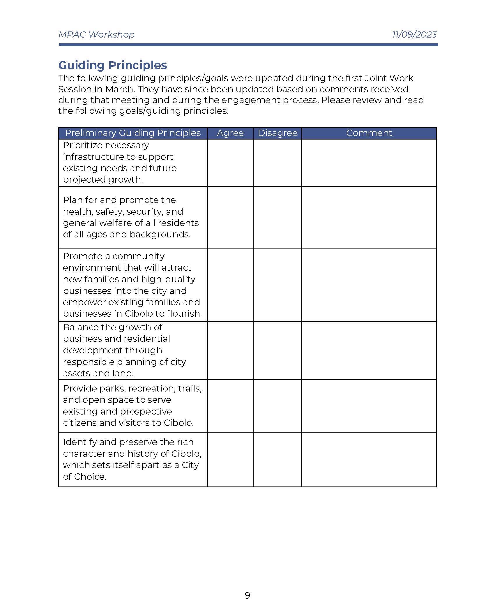
Written Notes
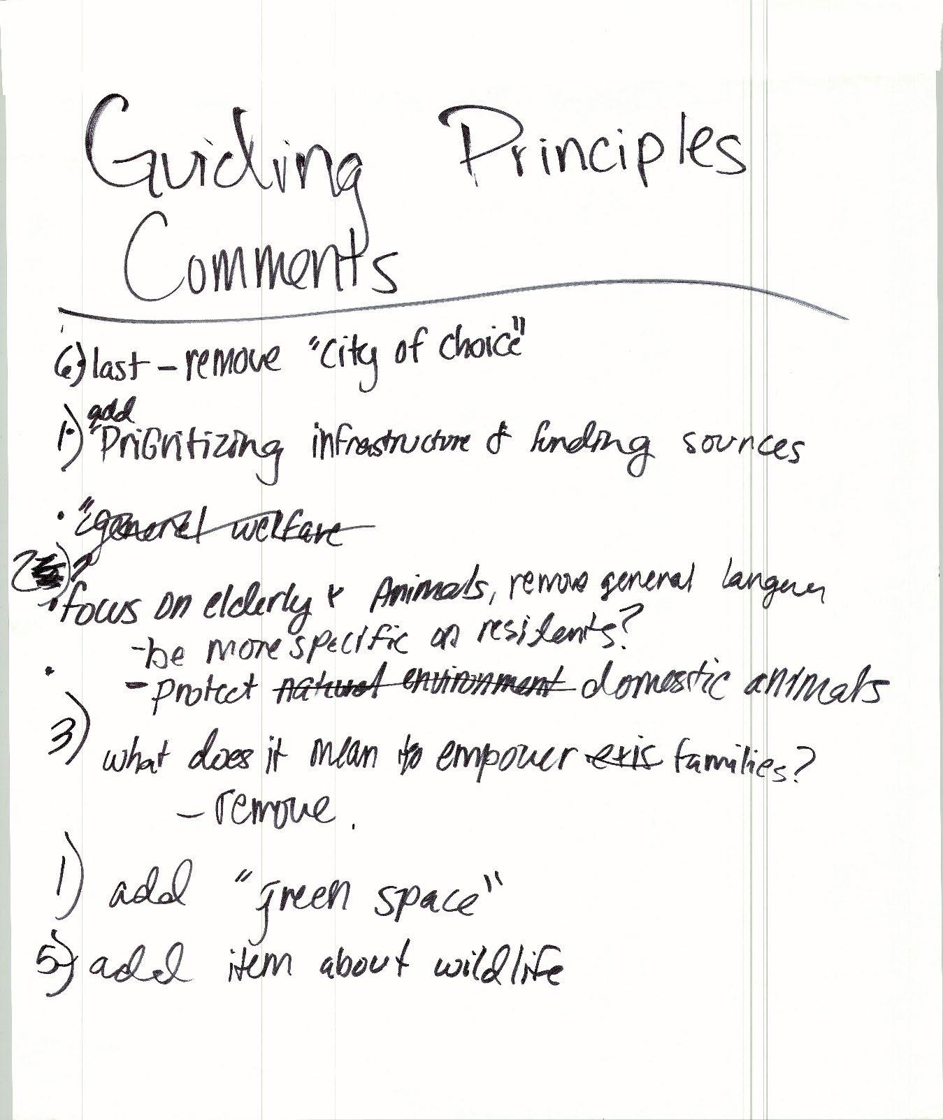

Notes:
• 6) last – potentially remove “city of choice”
• 1) add prioritizing infrastructure and funding sources
• 2) focus on elderly and animals, remove general language
o Be more specific on residents?
o Protect domestic animals
• 3) what does it mean to empower families
o Potentially remove the committee wants to potentially remove all wording after the phrase “empower families”
• 1) add “green space” the committee would like the guiding principle to be rephrased to include green space, such as “…support existing needs, green spce, and future growth.”
• 5) add item about wildlife
• Rich in history as a guiding principle
o Make it actionable and specific
This section asked the committee to look at the preliminary PlaceTypes and give feedback on the PlaceType Character & Intent descriptions and Land Use considerations.
Workbook Page 10 - PlaceTypes
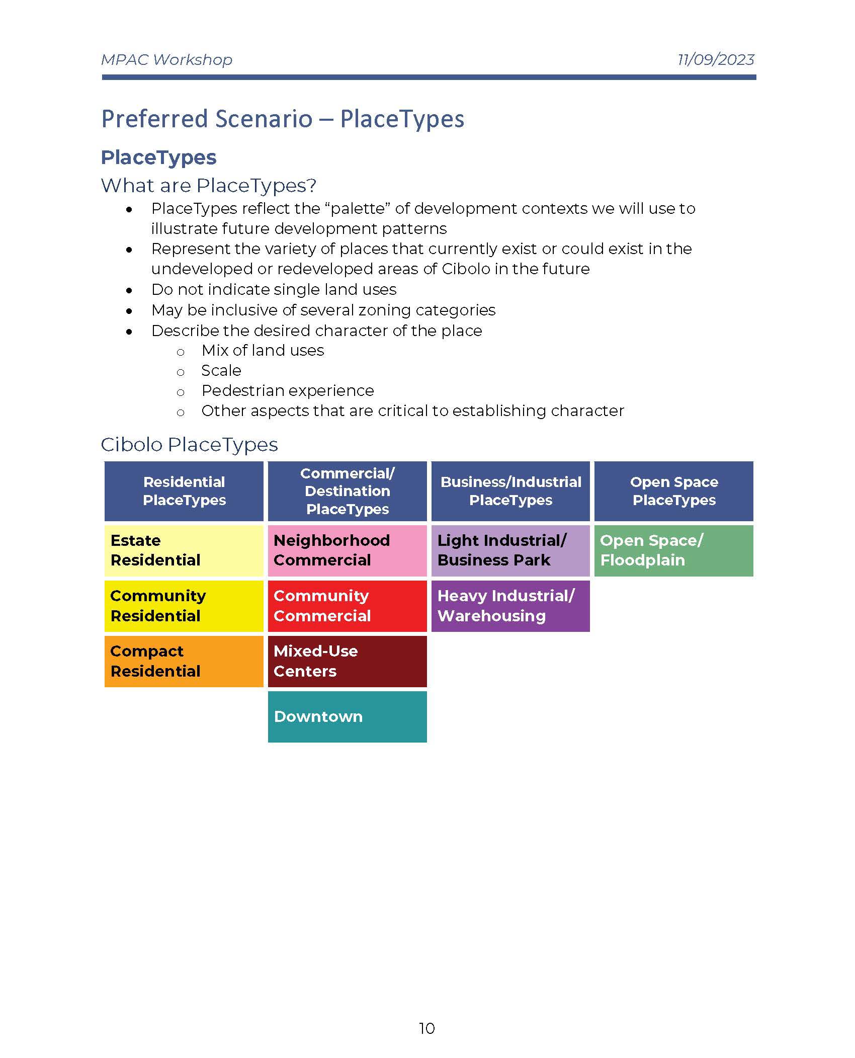
Example of PlaceType description page in the Workbook
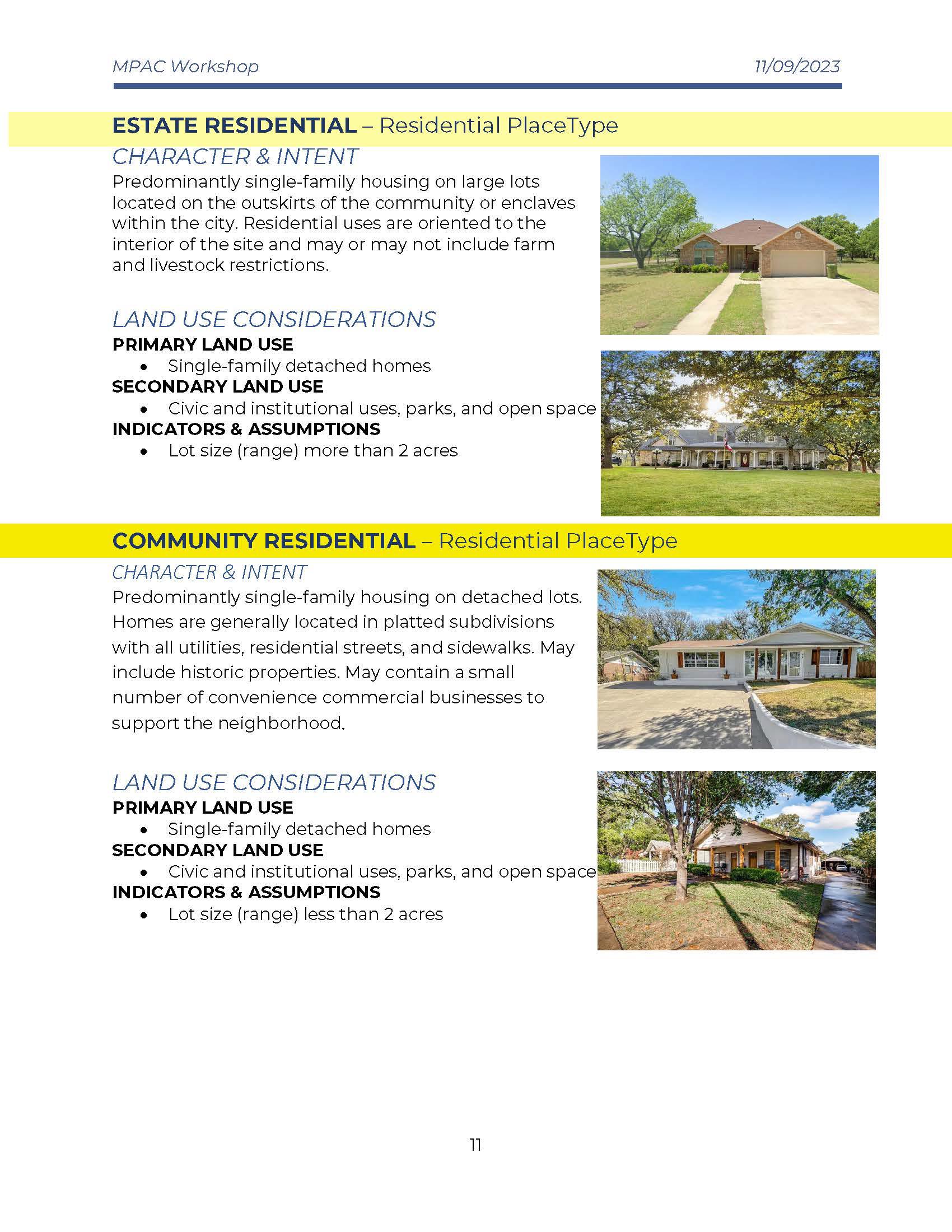
Written Notes
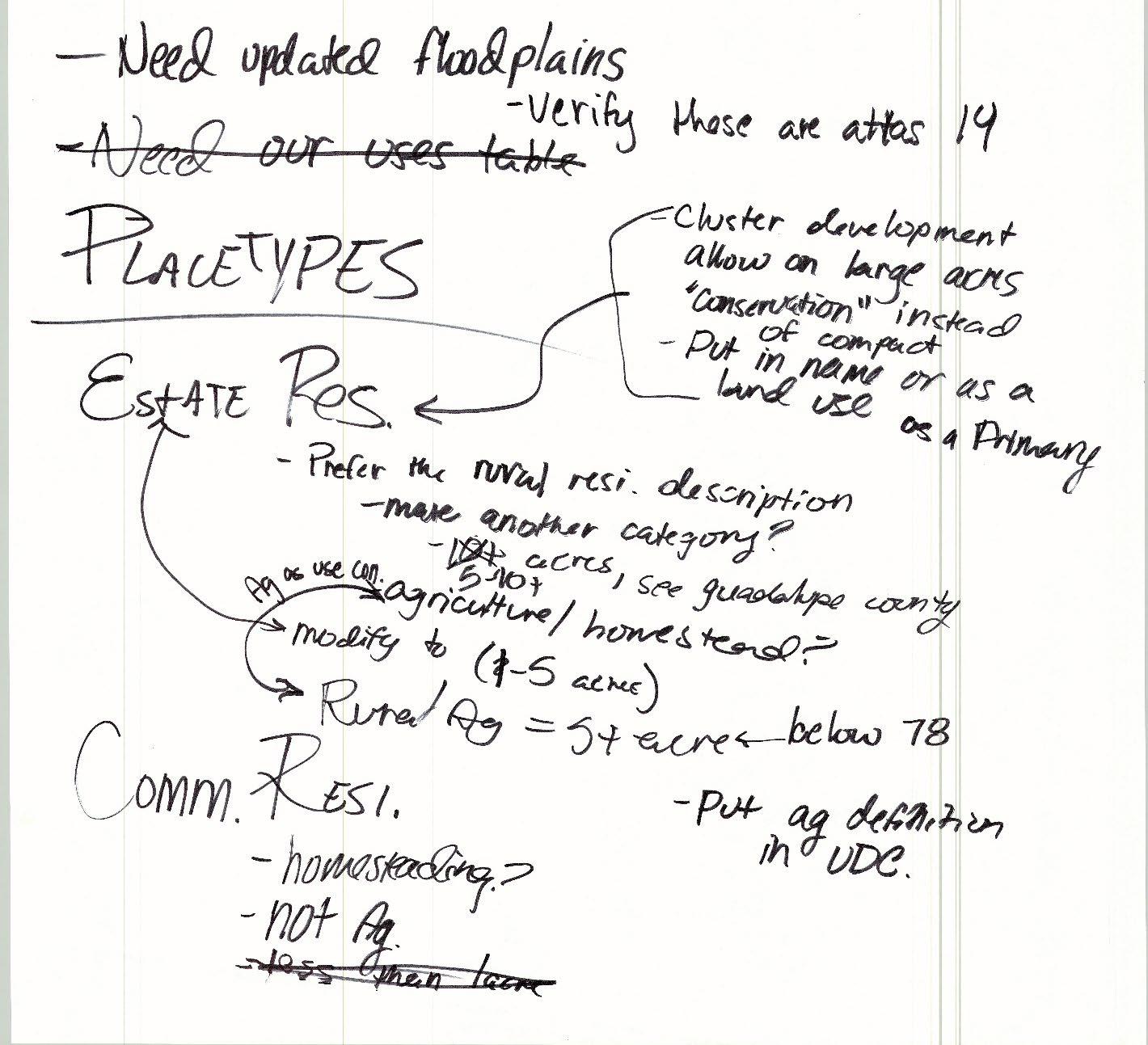
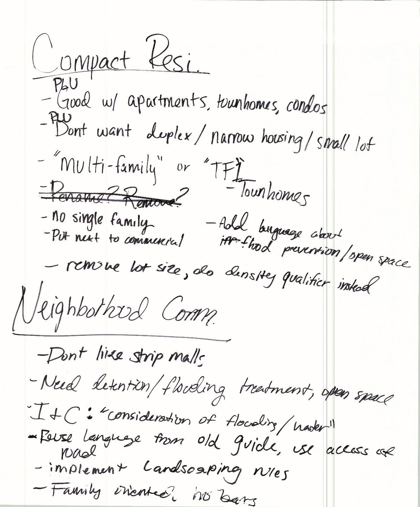
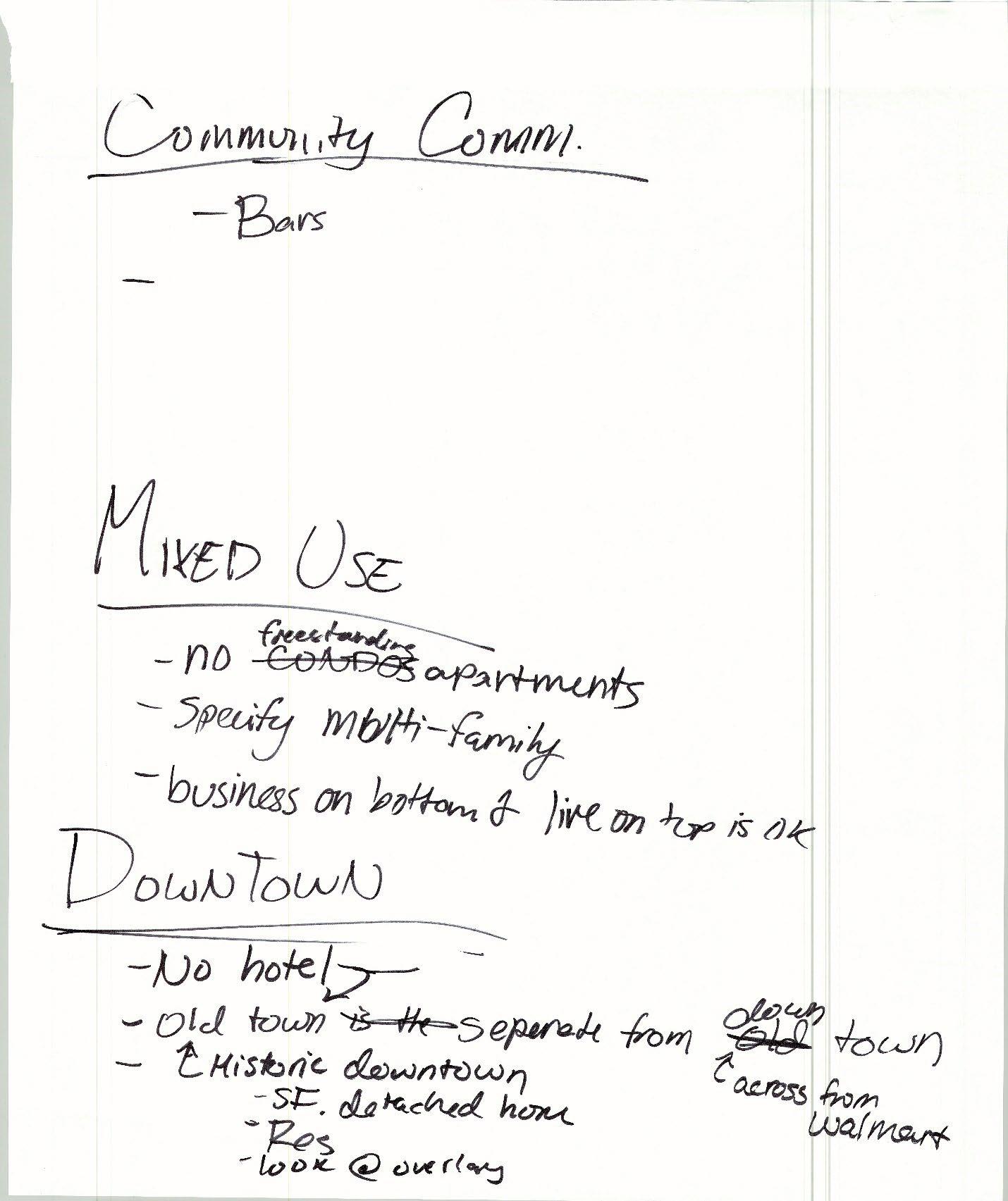

Notes:
• Need updated floodplains. The committee felt that the PlaceType maps presented in the meeting couldn’t be properly evaluated until it was confirmed that the floodplain map was up to date and was Atlas 14
o Verify those are Atlas 14
• Need our uses table
• PlaceTypes
o Estate Res. (Residential)
Cluster development allow on large acres
“conservation” instead of compact
• Put in name or as a land use as a primary
Prefer the rural residential description
• Make another category? The consensus decided by the committee was to create another PlaceType above Estate Residential called “Agricultural/Rural”
• 5-10+ acres, see Guadalupe county
Agriculture/homestead?
Modify to (1-5 acres)
Rural/ag = 5+ acres
• Below 75
• Put ag definition in UDC
o Comm. Resi. (Community Residential)
Homesteading?
Not Ag.
Less than 1 acres
o Compact Resi. (Residential)
PLU
Good with apartments, townhomes, condos
Don’t want duplex/narrow housing/small lot
“multi-family” or “TF1” Townhomes
Rename? Remove?
No single family
Put next to commercial
Add language about flood prevention/open space
Remove lot size, do density qualifier instead
o Neighborhood Comm. (Commercial)
Don’t like strip malls
Need detention/flooding treatments, open space
I&C: “consideration of flooding/water”
Reuse language from old guide, use access of road
Implement landscaping rules
Family oriented, no bars
o Community Commercial
Bars. The committee determined that adult venues such as bars would be acceptable in community commercial.
o Mixed Use
No freestanding apartments
Specify multi-family
Business on bottom and live on top is ok
o Downtown
No hotel
Old town is the separate from Downtown
• Downtown is across from Walmart
• Old town is historic downtown
• SF (single Family) detached home
• Res (Residential)
• Look at overlay
o Light industrial, heavy ind. And Open space – Tabled for next meeting
Meeting-in-a-box Recap document
November 16, 2023
One public engagement tool used to gather feedback during the Community Summit #2 portion of the Cibolo Tomorrow Comprehensive Plan was a technique called Meeting -in-a-Box. A toolkit of materials was provided to Project Ambassadors community members who volunteered to facilitate small group discussions for use in meetings with their neighborhood associations, cultural groups, business associates, etc. Questions were provided to the Ambassadors to encourage targeted discussion among residents and stakeholders on the future of Cibolo.
Six (6) discussions involving approximately 38 individuals were held between June to August of 2023. Twenty-six (26) questions going over twelve (12) topics were provided in the Meeting -ina-Box materials. Ambassadors were encouraged to work through as many questions as possible in their discussions but to focus on those that seemed most important to their groups if they were not able to cover them all. The topics included:
• Demographics
• Vision
• Land Use & Character
• Transportation
• Housing and Neighborhoods
• Community Facilities & Public Services
• IH-10 Corridor
• Downtown
• Environmental and Sustainability
• Economic Development
• Parks and Open Space
• Arts, Entertainment, and Historic Preservation
Disclaimer: Comments in this document were transcribed in accordance with the statements submitted in reports from the Meeting -in-a-Box discussions without regard to grammatical errors.
In your experience, how would you describe the makeup of the City of Cibolo?
• Diverse population ethnically and culturally - opportunities to learn from each other younger community but not large college group. college students are going elsewhere. not a large 20 something population. Not attracting that group .
• Well-rounded diverse community comprised heavy military-centric
Over the next 30 years, what gr oups of people should Cibolo plan on having as part of their community? Examples include youth, seniors, college students, etc.
• More retired using the services of military-retirees like to live close to medical and away from the city
• Seniors
What types of services will the community need in the future to best serve its population?
• Don't need more dental offices.
• More social spaces for 20+ year olds
• more medical services
• Better public transportation or dependable services like Alamo Regional Transit
• Complex for indoor walking trail around a community center for indoor activities in the heat of summer.
As the City builds out and the population grows over the next 30 years, what are some key considerations that need to stay at the forefront?
• Business to attract the 20 something age group.
• City is family-oriented which brings them back to Cibolo. Otherwise, we will have an aging population.
• Kids are planting elsewhere and did not return with their families.
• Military families at Randolph are transient and may not be as active as others in setting up businesses and in community.
• Infrastructure to connect communities, street maintenance.
• Permanent City owned Senior Center and additional recreational programs to serve them
Give one word or phrase that would best describe Cibolo in 2050:
• Desirable, growing, modern with old school values, thriving, modern .
Since 2016, how has this vision changed?
• Opened avenues for lower-income families to be part of the community i,.e. jobs that would appeal to them - HEB, Walmart, apartments.
• Continue to grow without growing too much.
• Diversified our population - not all middle-class families anymore.
What elements have stayed the same?
• Seeing a lot of families
• Rallying around the schools
• Theater programs in the schools
• Constant growth
What new elements should be incorporated?
• Businesses should not come before citizens
• Inclusive
• Take out the word - typical - we are not a basic town.
• Add the word "community." community needs to be highlighted.
• Better transportation
• Leveraging technology
What are some key characteristics that ensure as Cibolo grows it maintains a high -quality environment for all its residents?
• Restaurants
• Wider streets to accommodate cars on both sides of the street and a firetruck
Are there areas in Cibolo that you would consider inaccessible, whether by vehicle, transit, biking or walking?
• Stonebrook is locked in = can't get out onto FM1103
In what areas do you experience the greatest traffic congestion/safety issues in Cibolo?
• Cibolo Valley Drive
• FM1103
• Construction happening at the same time.
• Speeding in neighborhoods
• Cibolo Valley Drive- need crosswalk between Walmart and Firestone. Too many pedestrians are trying to cross there and holding up traffic.
• Bentwood Ranch has street racers.
Do you ever have issues getting to work/school/home/etc.? What transportation issues do other groups in the community face?
• Street maintenance
• Stonebrook streets are full of dips.
• Need public transportation.
• Need partnership with SCUID to allow more parking sp aces for the Cibolo senior center participants. Employees are taking parking spaces near the senior center, requiring seniors to walk really far.
What would you like to see in terms of connectivity associated with I -35 to I-10?
• Not a toll road
What does a healthy, thriving neighborhood look like to you?
• Safe, clean, harmonious living environment (neighbors that value and respect individuality)
• HOA Boards that are active within the neighborhoods.
What types of housing ar e missing or needed in Cibolo?
• No more apartment complexes.
What do you feel affects the health of your neighborhood the most?
• FM 1103 sidewalks
• Connectivity to other places, public roads.
Which community facilities do you use the most?
• Cibolo Senior Center
Which public services are essential to your community today?
• Community Center with indoor walking track and special events
• Police/Fire - appreciate the services and additional attention
As Cibolo grows, what facilities and services will the city need in order to make sure an appropriate level of services are provided?
• Public transportation
• Increase the number of employees - very low compared to other cities.
• Special needs programs - POC: David Weaver, Grange Hall.
When you think of Cibolo and the ETJ today, where is the greatest need for additional community facilities and public services?
• Animal Shelter needs to be expanded and updated.
• Larger Senior Center, permanent City building.
What are some of the assets of the IH -10 Corridor as it relates to the future of Cibolo?
• Conference center
• Shopping
• Restaurants
How can IH-10 best capitalize on its opportunities as a major throughfare in Cibolo?
• Hotel conference center, restaurants, shopping
• Needs a connection
What does a vibrant Downtown Cibolo look like to you?
• Innovative historically preserved Old Town
• Like the Old Town charm
• Main Street needs to fix up the buildings. Can still maintain history, can be unique but doesn't have to look run down.
• Business signs you can read.
What types of places and businesses are missing that you would like to see added to Downtown in the future?
• More boutiques, shopping opportunities
• Additional emphasis minority owned business.
What types of projects should the City prioritize for City funding? Why should the City prioritize them? Project examples include, but are not limited to: Streetscape improvements (including sidewalks, lighting, benches, landscaping) , Features like water fountains, sculptures, and murals, Grants to fund building restoration, Housing, Parking, Open spaces (including plazas and small parks)
• Mural wall painted - signature for Cibolo not always timely.
• Grants for improving historic buildings.
• Art Walk, murals painted on the buildings.
What areas or places Downtown face accessibility issues? What ideas do you have for addressing those issues?
• Sidewalks on both sides of the street
• More crosswalks
• Businesses need handicap ramps.
How important is it to you that the environment in and around Cibolo is protected?
• Protect Wobbler nesting grounds.
• Future water usage for growth.
Are there places or neighborhoods in Cibolo that are currently negatively affected by the environment and/or sustainability practices? Some examples include but are not limited to: A neighborhood consistently floods, A place is not walkable because it does not have shade to protect from the heat, and Sewage issue s.
• Better road access
• Flooding for area on FM 1103 near Steele HS and Town Creek HOA
How might we improve economic opportunities for current residents, reduce barriers to starting and expanding businesses, and attract/retain/expand major employers? Come up with at least 2 ideas.
• More timely with approvals.
• Explore business incubator to grow the next generation of businesses in the city.
• Create an environment for businesses to make it easier to come to the city.
• Talk to residents on strategic planning on short topics, face to face.
• Work group to develop a workbook of what a business needs to come to the community - resources etc. to make it easier to come.
• Strategic planning to bring in the correct number of businesses of one type to ensure they survive
• Spread out the businesses, don't lump them all in the same place .
What amenities or facilities do you like that are currently provided in parks and open spaces? What amenities or facilities are needed that are not currently provided in parks and open spaces?
• Pickleball
• Basketball courts
• Walking trails
• Develop pond at HEB
• Something wet - splash pad or pool
• Restrooms in all facilities
• Lighting
• Basketball courts
How might we maintain and expand greenspace, natural resources, and conservation efforts for the benefit of all of Cibolo? Please come up with at least 5 ideas.
• Preserve green spaces
• Plant trees
• Mini botanical area as an example of what people can do in their own yards.
Are you able to access and feel safe using the parks, playgrounds, trails, and/or open spaces in Cibolo? Why or why not?
• Yes, but would like to have the lights fixed at Neimitz Park to prevent car break ins and vandalism.
• Court resurfaced at Neimitz.
• Future consideration: appropriate security features are in place (i.e. monitors, cameras) not just the 911 boxes.
• Need more police presence.
Do you use park and recreation facilities outside of Cibolo? If so, where and why?
• Chicken and Pickle - no pickleball courts in Cibolo
• Crescent Bend
• Pickle ball
• Nice parks
What types of visual arts, performing arts, and entertainment events have the greatest potential for growth in Cibolo?
• More special events like Schertz but not the same so we don't compete.
• Expand on our existing events
• Focus on attracting local artists to present their works through the city . (i.e. Murals, art work, etc.)
• Have a community center to have events
• Have the building walls etc. to showcase local artists.
• Art Walk
• Murals painted on the buildings downtown
How might we make visual arts, performing arts, and entertainment events more accessible to more people in the community? Come up with at least 5 ideas.
• More Summer Nights type events
• Concerts in the park
• Movies in the park
• Events that draw people to our businesses
• Community Center for large events - i.e. pageants
• No hotels to draw large conferences etc.
Are there groups, areas or cultures that are not represented in our historic preservation and/or cultural events?
• Historical makeup needs to be included in the City events.
Responsible Growth. Participants emphasized the desire to preserve greenspace but also wanted to see new opportunities for activity in the City Examples of activities included community centers, restaurants, and retail opportunities. Participants expressed need for preserving the small town feel of Cibolo but wanted to approach growth slowly over time.
Connectivity. Participants expressed a need for better overall connectivity in Cibolo. For pedestrians, the need for improved sidewalks and closing sidewalk gaps is emphasized in neighborhoods and to local activity anchors . For vehicular travel, participants expressed need for better north to south mobility connections.
Downtown, Business, and Entertainment. Participants expressed wanting more options to shop local and stay local. They brought up incen tivizing small businesses, capitalizing on downtown, and the inclusion of art and culture within downtown. They mentioned wanting more events at parks and the community center for movies, art shows, and concerts.
Maintenance and Infrastructure Improvements. Participants saw a huge need for maintenance and refresh in the city. This included streets, parks, and potential for a refresh of Old Town Fl ooding is a major concern for residents and improvements to mitigate flooding in Cibolo is a high priority.
9/13/23, 11:13 AM Cibolo, TX - Report Creation
All participants
Survey 1 Results
Filtered by Date
Project Engagement VIEWS 1,471
PARTICIPANTS 15 RESPONSES 4 COMMENTS 64
SUBSCRIBERS 4
https://publicinput.com/report?id=21086
All participants - Custom Date Range
Filtered by Da
In a couple words, as it stands today, tell us what are the primary Strengths of Cibolo?
ExamplesofStrengthscanbethingssuchaswhatCibolodoeswell,whatsetsCiboloapartfrom o communities,orphysicalassetssuchasskilledstaff, location, or resources.
Old town turning into a tourist destination.
2 months ago
Strips of commercial buildings mixed within residential areas (so there are nearby things to every neighborhood).
2 months ago
Downtown still has small town feel.
2 months ago
Location is in close proximity to IH35
2 months ago
Military community of neighbors who are accustomed to change, and city should utilize their engagement as they have great perspective from various parts of the world.
3 months ago
Current restaurants,subdivisions, retirement homes and stores fit the community needs.
3 months ago
Excellent Police Department, Family
3 months ago
Cibolo does not feel over populated. It has great school options (great for families and home value. The grocery stores/ stores that are present meet every need; Again, shops etc are not over done, but still allows room to grow. The nightlife available is perfect. Its close to I35. Cibolo is perfectly distanced from San Antonio. I love the small town feel. The comm seems like one that will support local small businesses. The communication between residents and county staff seems great. Disclaimer, I just moved to Cibolo and these are things I loved.
3 months ago
All participants - Custom Date Range
Filtered by Da
From a location standpoint, on the map below, pin the areas where these strengths exist.
No data to display
https://publicinput.com/report?id=21086
9/13/23, 11:13 AM
All participants - Custom Date Range
How can we capitalize on each strength you listed? Please be specific.
Grow downtown and make it a place people want to come and visit.
2 months ago
Access to IH35 via FM1103 would be ideal, except for the fact that construction on FM1103 has completely stopped and road is almost undriveable
2 months ago
Options through out the city
3 months ago
Support small businesses. Don’t allow too many big corporations to become established, do not over populate. Create n outdoor areas that encourage healthy life styles, its great for the culture and mental health of residents. Please keep engaging residents in Cibolo community plans and events. I love it.
3 months ago
https://publicinput.com/report?id=21086
Filtered by Da All participants - Custom Date Range
In a couple words, as it stands today, tell us what are the primary Weaknesses of Cibolo? ExamplesofpotentialweaknessescanbewhatCibololacks,thingsyourcompetingcitiesdobetter you, or resource limitations.
Too many cheap and poorly built housing developments. Cheapens the looks of the city and future homeowners will suff on home value.
2 months ago
Our parks are not as nice as other parks. Play areas are generic and lack newer features of other places.
2 months ago
Roads, parks
2 months ago
Follow up on communication with residents needs improvement. Several other local cities have a program that allows volunteers to clean up/repair older neighborhoods. This tells me those cities are concerned about those residents and willing to make their neighborhoods better, rather than just choose to ignore problem areas. Streets in older neighborh in Cibolo need attention due to disrepair, rather than excuses why repairs cannot be done
2 months ago
The Cibolo Animal Shelter is small & underfunded. It ’s capacity does not currently meet the need & our city continues to grow & the need will also grow.
3 months ago
ROAD MAINTENANCE IN SUBDIVISIONS affected by the fast growth
3 months ago
Road projects need to be built to DOT standards. We are growing and need this infrastructure now. Housing developme need to assist in these projects also. No more subdivision unless they are on the same tracks we have now or even large Schools are needed now, public safety, emergency management, police and fire all need support too.
3 months ago
More restaurants and we need more policing in our neighborhoods and streets regarding safety measures against spee
3 months ago
Cibolo doesn’t have enough green space with trees. We need a nature park. We need more than one, actually. No playgrounds, no sports fields in them: just shade to walk under and native plants to learn about while we enjoy some fre air and hope to see some wildlife. Schertz has Crescent Bend and draws birdwatchers and nature lovers from miles arou
3 months ago
https://publicinput.com/report?id=21086
9/13/23, 11:13 AM
The roads, specifically FM 1103, has many pot holes.
3 months ago
Roads, r
m
lack of e aw people to come to Cibolo fr
m
om a location standpoint, on the map belo eas wher
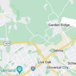

https://publicinput.com/report?id=21086


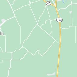
All participants - Custom Date Range
How can we best mitigate those weaknesses you listed? Please be specific.
Build newer, better parks.
2 months ago
Improve roads, create a position to promote downtown and champion growth
2 months ago
A portion of Cibolo North abuts to heavy industrial and the concerns of the residents in the affected area need to be he and addressed by the City, as well as maintaining of streets on a timely basis. Communication, follow up and more communication builds good relationships instead of rancor
2 months ago
Adequate funding for a larger facility, supplies & more staffing is imperative.
3 months ago
Unfortunately Cibolo is behind, the only way to catch up is to slow growth.
3 months ago 3 months ago
Speeders need to have heftier fines and or there license taken away!
We need huge swaths of open public spaces now, and we need to keep watching out for opportunities to gain some mo the future. Quick, grab some land before more strip malls and subdivisions wreck it all.
3 months ago
Consider Dean Road to be as highly traveled as Green Valley or Weiderstein. Stop delaying resurfacing based on anothe neighborhood coming in. We live here NOW, in 400k+ homes that generate a significant amount of revenue. The very lea our city should do is have safe roads to travel or exercise on.
4 months ago
series of events on a monthly basis to draw people to Cibolo
4 months ago
https://publicinput.com/report?id=21086
All participants - Custom Date Range
Looking forward, tell us what major Opportunities you think er can best take advantage of for Cib Potentialopportunityexamplesinclude:strengthsthatmightbevaluabletopotentialpartners underserveddemographicsinCibolo,orwaystobringgreatermediaattentiontothecity.
Clean up the Cibolo creek area at the low water crossing.
2 months ago
Build a beer hall behind the city hall annex and host an annual Oktoberfest.
2 months ago
I would like to see Cibolo strive to maintain the small city atmosphere and be cognizant to retaining as much green spac possible rather than endless concrete and pavement. If the underserved areas (Cibolo North being one) were given attention, as people drove through the City, it would present a better image of their possible future home, as well as ind the City has a stake in preserving older neighborhoods, which would be attractive to potential buyers. I would like to see more updated Senior Citizen center rather than the old Grange, as there is an aging population and this would be attrac to the elderly population. I don't think more media attention is necessary as people are flocking here anyway
2 months ago
Alamo City Motorplex could bring the city money and tax dollars. As a former racer and motor enthusiast their is interes still.
3 months ago
Let ’s do Nature better than everybody else. Greener is the place everyone would love to live in. More trees everywhere. friendly streets. Safe pedestrian paths. Cut down light pollution to help the birds and stargazers. Discourage boring lawn help people learn to garden, grow food or native plants to save water. Why not collect household food waste: cut down landfill while creating usable compost. Do something now to keep natural land open before it ’s all gone.
3 months ago
Healthy restaurant and food options! Panera, Whole Foods, Trader Joe’s, Salada, etc! Stop with the shopping strips full of random retail- especially Dental Offices! It ’s all the same- Target, Main Event, outdoor fun for families- Fischer Park quali Cibolo.
4 months ago
All participants - Custom Date Range
Filtered by Da
From a location standpoint, on the map below, pin the areas where these opportunities exist
No data to display
https://publicinput.com/report?id=21086
9/13/23, 11:13 AM
All participants - Custom Date Range
How can we best optimize our potential to maximize those opportunities that you listed? Please specific.
2 months ago
Build the roads to proper DOT specs, and slow growth until roads, schools, and jobs catch up to Cibolo needs.
3 months ago
I don’t know much about finance but can we do a bond issue to buy land for new natural areas? Or, are we reaching out landowners to help them at least create conservation easements, if not outright donating land to the city ?
Create a Green Committee. Give them a budget. Let them research all the greenest ideas from everywhere and get goin implement them.
As an aside I was thinking about serving on Parks & Rec but what that committee seems to do is a bunch of event plann That ’s okay, but is a different focus than a committee looking to improve our natural surroundings.
3 months ago Communication, communication, communication
https://publicinput.com/report?id=21086
All participants - Custom Date Range
Looking forward, what major Threats do you see for the future of Cibolo?
Potential threats examplescanbeenvironmentalchanges,toughjobmarkets, problems that if l unresolvedwillbecomeunmanageable.
Bad roads. Not controlling growth. The infrastructure is not here to support growth.
2 months ago
There is the threat of losing existing green space, and open areas. I don't believe Cibolo should be an inner City type community full of apartments and strip centers. Underserved areas are at risk of becoming "broken window " neighborhoods and disrepair of streets in those areas only serve to indicate the City is ok with the decline. With all the n developments, where crime had been almost unheard of, is now a common occurrence. Possibly increasing the police fo would help address this as well as continuation of "Coffee with a Cop" or other such initiatives.
2 months ago
The size & the lack of funding the Animal Shelter will cause more animals to be euthanized or for the Shelter to dissolve
3 months ago
As a Safety Professional, Cibolo is not ready for floods like 1998, or even a hurricane like Harvey. Even wi Terry storms po threat. Planning, and hiring skilled people needs to occur before something happens.
3 months ago
Overcrowding and lack of city resources.
3 months ago
Running out of water. Floods.
3 months ago
The random shopping strips vacant or full of the off the wall shop and retail- we will end up with abandoned buildings t only attract economic, visual and safety burdens for our city
4 months ago
All participants - Custom Date Range
From a location standpoint, on the map below, pin the areas where these threats exist.
No data to display
https://publicinput.com/report?id=21086 9/11
All participants - Custom Date Range
How can we best address those threats you listed? Please be specific.
Filtered by Da
Put all efforts on roads. With increased growth roads will just get worse, cibolo will be more congested and people will le
2 months ago
City to take seriously any concerns of citizens and to the best of their ability, address those concerns so that citizens actu see their voice made a difference. Many residents don't speak up because they feel their concerns are just dismissed an the City listens to big money rather than them. A community that feels included, heard and protected will thrive.
2 months ago
3 months ago
Funding Its starts by preparing now
3 months ago
1. Building more townhomes or mid rise apartments. Adding another police precinct and or fire department
3 months ago
Open green areas help to refresh aquifers and mitigate flooding due to all the development. Educate citizens to quit throwing water and chemicals on their lawns.
3 months ago
Be mindful of the repetitiveness that has become the norm. We need higher end shops to be the majority in each strip m
4 months ago
All participants - Custom Date Range
Filtered by Da
What are the major issues we should focus on and/or know about as they relate to this chapte
traffic on 1103
2 months ago
https://publicinput.com/report?id=21086
9/13/23, 11:13 AM
All participants - Custom Date Range
Filtered by Da
What are the major issues we should focus on and/or know about as they relate to this chapte
2 months ago green space needs to be protected and expanded
All participants - Custom Date Range
What are the major issues we should focus on and/or know about as they relate to this chapte ����
tra
ffic is a huge issue, daily. This is a black mark on our beautiful city
2 months ago
����
All participants - Custom Date Range
Filtered by Da
Filtered by Da
What are the major issues we should focus on and/or know about as they relate to this chapte
2 months ago
2 months ago attracting unique business to improve tax base and make our city attractive to residents more business, less multi family units
https://publicinput.com/report?id=21086
How important is it for you to have a vibrant downtown with a mix of businesses, entertainment options, and cultural activities in Cibolo?
participants Project Engagement
954
Survey Date: July 25 to November 3 2023


overall quality of life?
overall image and reputation?
as a place to play ?
Prefer not to answer
3rd Gender/non-binary/genderfluid
Do not identify as male or female
203 Respondents
45-54 years
35-44 years
55-64 years
64+ years
20-34 years
<19 years
202 Respondents
Are you a resident of Cibolo?
Yes
No
199 Respondents
If you selected no on the previous question, where do you reside?
County
Bexar County
Other
81 Respondents
How long have you lived in Cibolo?
1-3 years
11-20 years
4-7 years
8-10 years
20+ years
<1 year
Not applicable
197 Respondents
No, Guadalupe County
Is traffic congestion an issue in Cibolo?
Are there adequate facilities for walking in the City ?
Are there adequate facilities for biking in Cibolo?
How would you rate the quality of life in Cibolo compared to other cities in the region?
How satisfied are you with current development patterns in Cibolo (e.g. zoning regulations, mixed use development, etc)?
How satisfied are you with current education resources and opportunities in Cibolo?
Are there any specific land use changes you would like to see in Cibolo?
How accessible and affordable do you find current housing in Cibolo?
Is the Housing Type you are interested in available in Cibolo?
Which transportation issues are the most important for the City to address in the near future? Please rank the issues, with the highest being your top choice.
Street condition and maintenance
Tra
c congestion
Pedestrian accommodation (e.g. sidewalks, crosswalks, trails, etc.)
Safety
Street connectivity (more options to get into and through Cibolo)
Intersection safety and access across the railroad
Bicycle accommodation (e.g. on-street bike lanes, trails, etc.)
Connecting FM 1103 from I-35 to I-10
Wayfinding Signage (i.e. small signs identifying locations of important civic buildings
Public transportation
141 Respondents
Which neighborhood challenges are the most important for the City to address in the near future? Please rank the issues, with the highest being your top choice.
Reducing crime
Infill of Vacant lots
Improving or adding sidewalks/places to walk
Addressing too much on-street in my neighborhood
Providing additional parks or recreation amentities in close proximity
Increasing code enforcement
Addressing stray animals
Providing additional trails in close proximity
Addressing the overall condition of housing
Addressing the overall conditions of properties
Infill of vacant housing
131 Respondents
Which parks, recreation, and trails challenges are the most important for the City to address in the near future? Please rank the topics, with the highest being your top choice.
Increasing shade opportunities in existing parks (e.g., trees, pavilions, playscape shade structures, etc.)
Improving pedestrian and bicycle connectivity to important destinations (e.g., parks, schools, downtown, etc.)
Providing additional trails and sidewalks
Providing additional active amenities (e.g. playscapes, exercise equipment, dog parks, etc.)
Upgrading existing facilities in existing parks
Providing additional public recreation opportunities such as summer concerts and/or outdoor movies
Adding or enhancing outdoor space for community special events (e.g., an outdoor amphitheater)
Providing additional passive amenities (e.g, benches, picnic tables, walking trails, etc.)
Providing additional family-oriented recreation classes and opportunities
Providing additional youth-oriented recreation classes and opportunities
Providing more pavilions for public use
Providing additional senior-oriented recreation classes and opportunities
Providing additional athletic game fields
Developing a sports complex
5.54
5.81
6.80 Rank: 7.03 Rank: 7.95 Rank: 8.12
Rank: 8.78
Rank: 8.95
Which economic factors are most important to you? (Pick 3)
What type of employers would you like to see expand or locate in Cibolo? (Pick 3)
Creative
Software
Government
Tourism
As the city builds out, what would you like to see preserved?
Small town feel and green space
10 days ago
Small town feel.
21 days ago
Not having to many apartment buildings.
21 days ago
Historic downtown area
21 days ago
Green space, older neighborhoods
24 days ago
Old Town. The Bird sanctuary
24 days ago
Green belts
25 days ago
Downtown Cibolo needs to stay looking like downtown Cibolo
27 days ago
The small town feel with upgraded amenities and access
27 days ago
Green spaces and the small town home feel.
one month ago
one month ago
Children Hospital
one month ago
Police station 2#
one month ago
Target
one month ago
Having a Library and Expand the Animal Shelter also Remodel Downtown to bring Country Field Attraction More Country Bars and BBQ Restaunts
one month ago
Community Development and Department Stores such as Target and a Upgrade on Downtown also Expand the Cibolo Animal Shelter facility also in need More Restaurants and Retail Space
one month ago
Green spaces, HOAs and city laws. There is no point in having really nice places and parks to go to in Cibolo along with homes - if personnel do not take care of them or know how to take care of them.
one month ago
Agri/rural, don’t try to increase city income by installing more buildings than trees
one month ago
one month ago
one month ago
one month ago
one month ago
Green spaces and not so many strip malls and liquor stores.
one month ago
as much nature as possible, small town feel and low taxes!
one month ago
As much nature as possible, low taxes, small town feel.
one month ago
As much nature as possible
one month ago
one month ago
one month ago
one month ago
one month ago
Green space, parks, walking trails and sidewalks
one month ago
Older homes
one month ago
Parks, and outdoor green spaces.
one month ago
Green space and land. An empty lot doesn’t mean a building is needed
one month ago
Green spaces/land. Just because an lot is empty doesn’t mean it needs a building
one month ago
Open spaces, old town Cibolo
one month ago
Downtown entertainment
one month ago
Keep the small town atmosphere and stop construction of housing developments. We need more quality-of-life businesses.
one month ago
The history and green spaces. The trees and older buildings
one month ago
Old Town Cibolo
one month ago
There is way too much housing going in without accounting for the lack of roads and the condition of the roads. It ’s almost impossible to get out of my neighborhood during rush hours and school zone hours because 1103 backs up so badly. Yet more houses and apartments keep being built. It ’s very frustrating and makes me want to move.
one month ago
Small town nature. No more big retail entities. There are enough nearby
one month ago
Old Town
one month ago
Green spaces, farms, wildlife areas, small town feel- stop making it a mirror image of Converse.
one month ago
Open space or at least slowing down further retail development. There is way too much retail development going on and it 's turning Cibolo into far Northeast San Antonio.
one month ago
Small Town Feel, More Variety of sit down Restraunts
one month ago
Small town feel. More small businesses, fewer “chain” businesses.
one month ago
Small town feel. More small businesses and fewer “chain” type businesses.
one month ago
Green space
one month ago
Old trees and buildings, green spaces
2 months ago
Small town feel
2 months ago
Green spaces- less density of houses being built. Less fast food chains
2 months ago
small town feel
2 months ago
Green spaces around neighborhoods, trees
2 months ago
Aesthetics. Just keep Cibolo beautiful.
2 months ago
Less congestion & less school zones
2 months ago
Green space and natural habitats
2 months ago
Green space & natural environment!
2 months ago
Open land, Farm land
2 months ago
Natural areas, green spaces, historical buildings and places
2 months ago
Green Spaces. Stop trying to make a profit. We like the small town vibe.
2 months ago
All the green space. There is too many being lost to homes and businesses.
2 months ago
Green space, small town feel, single family homes on large lots.
2 months ago
Our green spaces, our parks, places to walk and get away from commercial areas.
2 months ago
Small town feel, slow down or temporary stop on city build out. Take care of what we have now.
2 months ago
Small town feel, don’t build out so quickly let ’s put a temporary stop to building out and take care of what we have.
2 months ago
Small town feel, Old downtown, identity of Cibolo as a cattle farming town, no apartments,
2 months ago
Really what is going to be done? Lives here over 20 years, vote and still nothing gets done. Voted on our sidewalks to be done it passed 15 years ago and we are still waiting, Northcliff area
2 months ago
More land! Stop building because the infrastructure cannot sustain the growth. Create better opportunities for small businesses to expand.
2 months ago
Green spaces/ ranch land. Keep the small town feel and quit filling the landscape with rooftops.
2 months ago
Small town feel
2 months ago
Slow down the building out! Cibolo is becoming just another San Antonio suburb, and is losing its uniqueness! Stop putting in the exact same shops and restaurants that Schertz has! At the rate it 's going, there won't be a space of green between here and Austin!
2 months ago
Small town, unique feel. Less chain restaurants more diverse scene that the rest of San Antonio is known for! More options nearby so we can play where we live and avoid traffic
2 months ago
The small town feel & energy of a tight knit community.
2 months ago
My childhood memories of the bowling alley
2 months ago
M home
2 months ago
Old growth trees
2 months ago
Old homesteads remembered and stories preserved/shared
2 months ago
Open spaces with natural growth areas.
2 months ago
Green space. Charm of country feel.
2 months ago
Focus on road improvement
2 months ago
Let 's focus on parking and road conditions
2 months ago
We need to focus on the infrastructure of our city
2 months ago
Green spaces, farms, walkable trails and bike paths
2 months ago
Green space, Cibolo used to be quiet and quaint. Please keep it that way
2 months ago
Old town feel as we expand.
2 months ago
More green space! I did not move to this area to end up living in a concrete jungle.
2 months ago
small town feel
2 months ago
Better roads to handle the traffic
2 months ago
My family moved across the country a little over 2 years ago to take a job in New Braunfels. One thing we like about Cibolo there was undeveloped property scattered throughout the city. Not everything was concrete. Keep as much green space as reasonably possible, keep things walkable, don't lose the small town feel as you grow
2 months ago
Land, stop building, stop trying to make us a big city we moved here to be part of a small town and now it ’s starting to turn into a big city that ’s not why we moved here. Also before allowing more housing to be built think about where the children are going to go to school. Our schools are already over capacity in classrooms.
2 months ago
2 months ago
land owners rights, large acreage properties, farm land, open spaces, trees, the environment, natural habitats for the wildlife, and Cibolo as a semi rural town not as a city extension of San Antonio
2 months ago
The old way of life in Cibolo where people could walk to meet downtown to gather and talk, exchange goods and services, and celebrate together.
2 months ago
All of the endangered species that we have come through, along with their habitats, and as many trees as possible.
2 months ago
We need more options like local stores in Cibolo crossing, maybe a deli or retail clothing, arts & crafts, sprouts type market, an alternative food place like green vegetarian or something. The small town feel of main street but with more diverse options not chains and open space and farm/livestock properties
2 months ago
2 months ago
2 months ago
2 months ago
2 months ago
Love the preservation of Old Town Cibolo, protect Warbler 's Wood Sanctuary, add a well designed skatepark for kids to use...could be added near Veterans' Park [anything is better than the pitiful one at Schertz; there are grants to help with the cost]]
2 months ago
Green spaces and the small town home feel. The history. More Mom and Pops places to eat and shop. Not the all of the chain stores or restaurants. See some affordable housing to help the younger 20 somethings to live here and stay here to raise their families.
2 months ago
Bird sanctuary, we also need a public pool
2 months ago
Old Main Street - I would like to see the current style of businesses remain for the rest of the street. It should be reasoned as commercial, but no more chain-type retail and restaurants. Authentic and local businesses only
2 months ago
Small town feel, fewer homes, more green
2 months ago
Green space
2 months ago
Old trees and more land for wild life
2 months ago
Green spaces
2 months ago
Green spaces
2 months ago
Farming/Historical buildings
2 months ago
Green/natural spaces
2 months ago
Farms and historical buildings/sites
2 months ago
I’m not sure there’s anything left to preserve.
2 months ago
Farms / Land / Culture
2 months ago
Green spaces
2 months ago
Natural areas.
2 months ago
Older houses and buildings
2 months ago
2 months ago
Parks and recreation
2 months ago
the flood plain, the rural feel.
2 months ago
Keep the "smaill town Feel"
2 months ago
still the "small town feel"
2 months ago
More trees and historic homes.
2 months ago
Wildlife & greenspace areas, & native trees
2 months ago
Green spaces and historic buildings
3 months ago
Small town living! Keeping a small town community feel. Stop bringing chains and strip malls.
3 months ago
Green Spaces
3 months ago
Green Spaces!
3 months ago
Wildlife areas, nature areas, small town feel
3 months ago
How important is it for you to have a vibrant downtown with a mix of businesses, entertainment options, and cultural activities in Cibolo?
Would you like to see more events or festivals held in downtown Cibolo to attract visitors and residents?