

BLPN0042 URBAN DESIGN : PLACE MAKING 24/25

BLPN0042 URBAN DESIGN : PLACE MAKING 24/25
DECEMBER 11, 2024
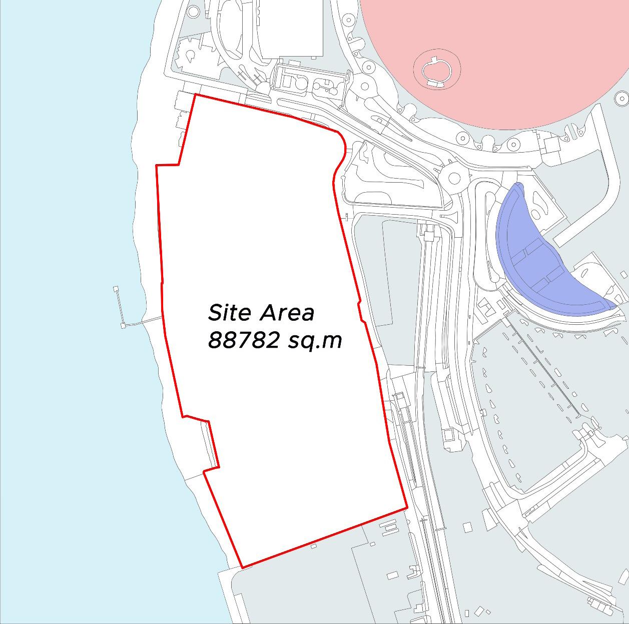
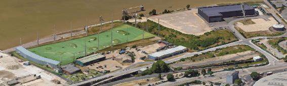
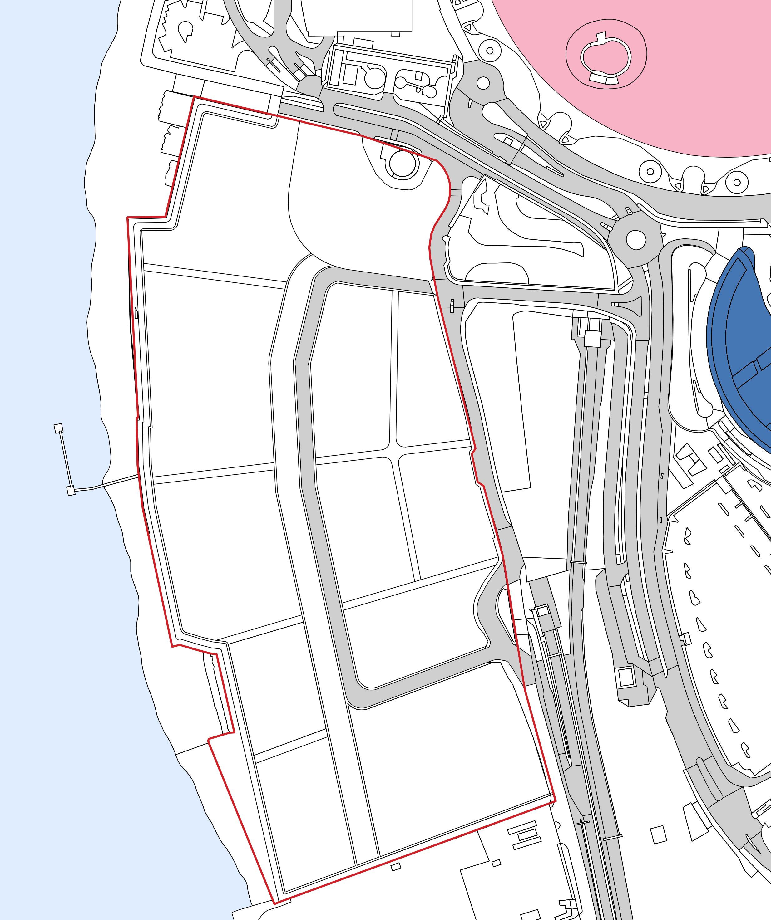
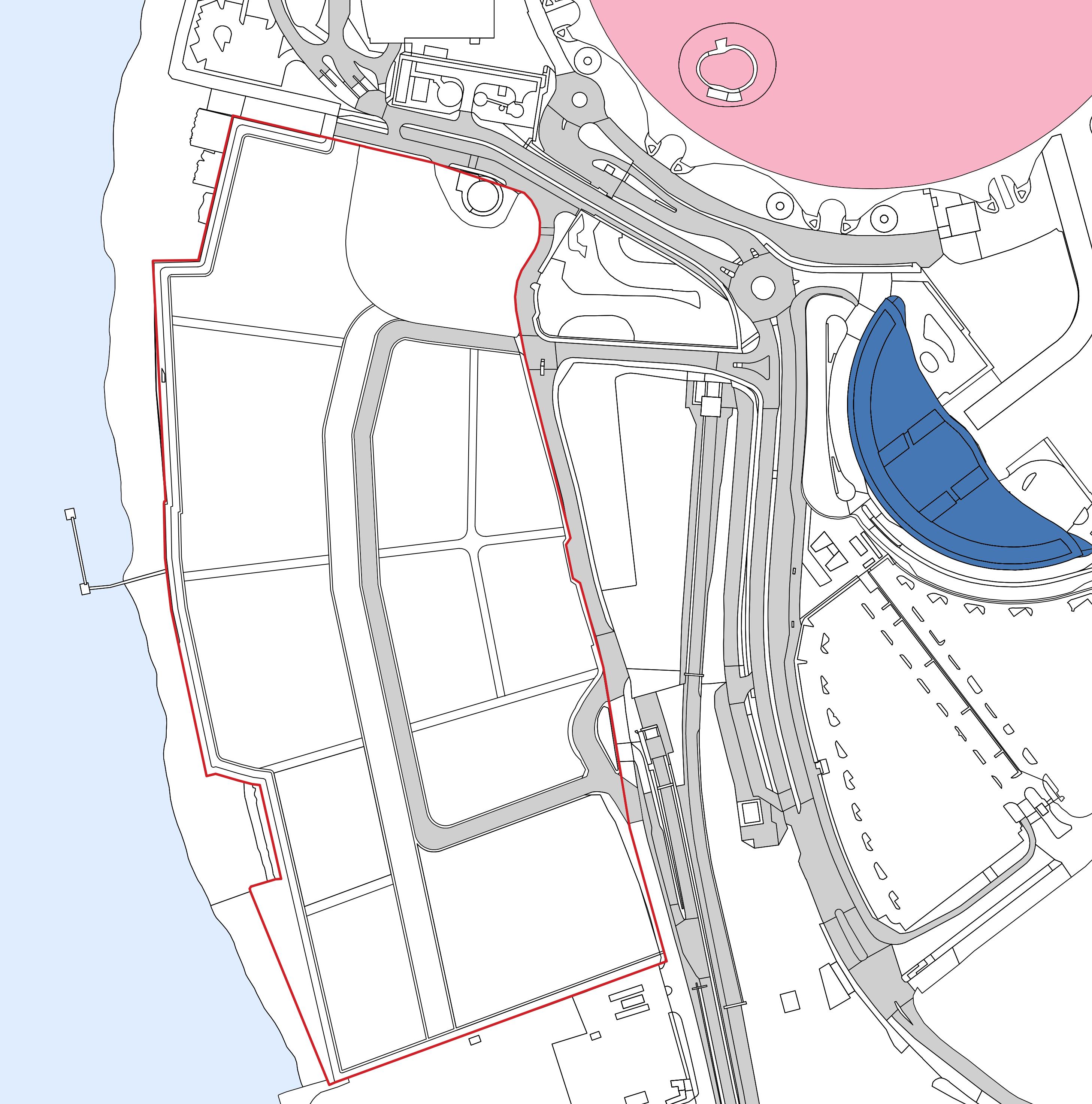
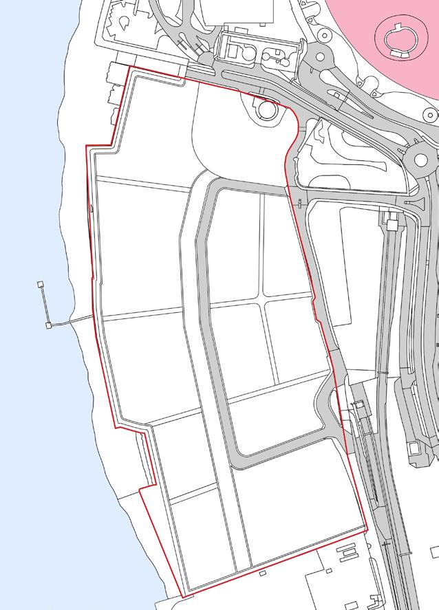
1.1.1 This design brief concerns a brownfield site allocated in the western side of North Greenwich Peninsula for ‘proposed Residential-led, mixed-use plan’. The site presents a strategic opportunity to enhance the area’s urban fabric and waterfront appeal.
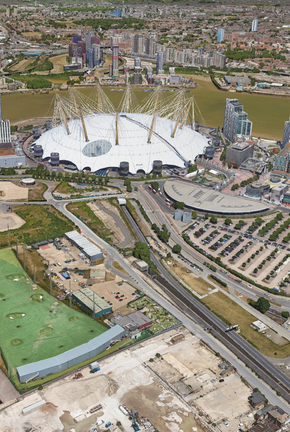
1.1.2 LOCATION: Adjacent to Tunnel Avenue and Drawdock Road, offering connectivity to key transport and infrastructure networks.
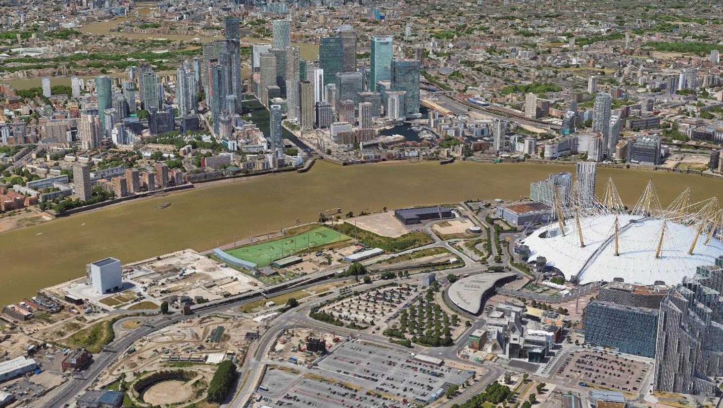
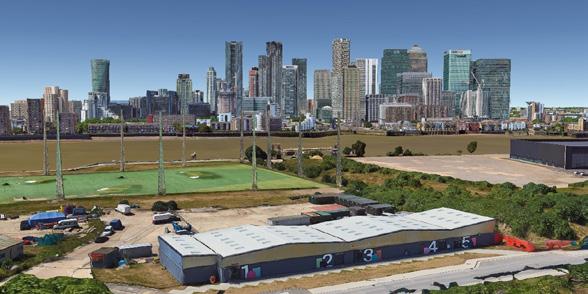
1.1.3 KEY ASSETS: Flanked by the River Thames to the west, providing significant waterfront potential, and directly facing Canary Wharf, emphasizing visual and economic synergy.
1.1.4 The development is part of the ongoing regeneration of Greenwich peninsula by the developer 'Knight Dragon'.
1.2.1 The design brief sets out guidelines aligning with the Royal Greenwich Core Strategy, guiding the site's development scale and use mix.
1.2.2 It outlines how residential and commercial uses can be integrated into a comprehensive redevelopment, supporting the regeneration of Greenwich Peninsula while addressing environmental constraints like noise and air quality.
1.2.3 The purpose of the development is :
''To shape a thriving North Greenwich Peninsula centered on wellbeing, with healthy residences, active travel, tranquil green spaces, and restorative spaces for creativity and culture."
1.2.4 This vision draws from the comprehensive analysis we did of the existing development in the area. It attempts to address some of the shortcomings of the exisiting development while building upon its strengths, providing a strategic response to enhance peninsula's wellness, connectivity, and cultural identity.
1.2.5 Implementation of the brief helps deliver a varied land uses aligned with the principles of wellness, sustainability and community inclusivity.
The policy context ensures the proposed urban design aligns with broader strategic goals while addressing the specificities of the North Greenwich Peninsula's unique location, character, and opportunitites.
1.4.1 National Policy Planning Framework
The following sections of the NPPF are of particular relevance to the development of this site:
Section 2 : Achieving sustainable development
Section 6 : Building a strong, competitive economy
Section 8 : Promoting healthy and safe communities
Section 12 : Achieving well-designed places
1.4.2 Royal Borough Greenwich Local Plan ( Core Strategies)
A. Designated as an Opportunity Area, the peninsula has specific goals for housing, employment, and mixed-use development.
B. Guidelines for protecting views, integrating public spaces, and responding to the area's unique riverfront character.
This document comprises of following structure:
SECTION 01 : Sets out the Constraints and Opportunities
SECTION 02 : Sets out the Vision and Objectives for the site.
SECTION 03 : Outlines the development's design principles for the site.
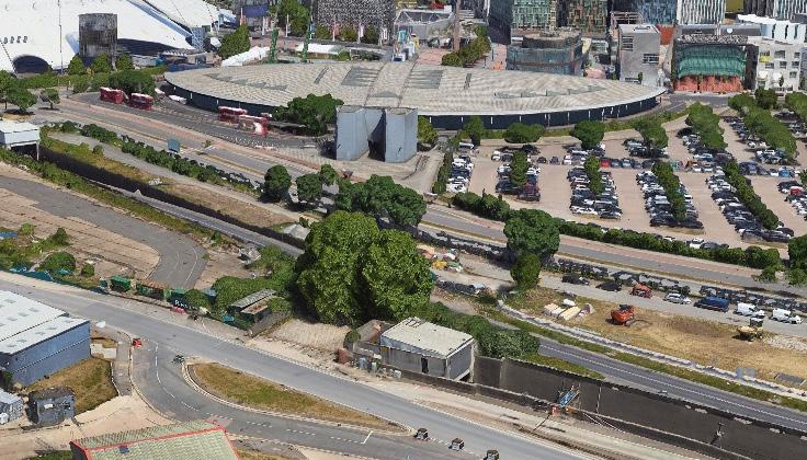
2.1.1 Poor Accessibility
Despite proximity to North Greenwich underground Station, the site’s accessibility is limited due to its location near the A102 road, resulting in a very low Public transport Access Level (PTAL).
2.1.2 Pedestrian and Cycling infrastructure
Existing routes alongside the waterfront edge are poorly maintained, reducing their safety and appeal for users.
2.1.3 Noise Pollution
The Blackwall Tunnel Road (A102) and Tunnel Avenue on the eastern side generate significant traffic noise, with the O2 Arena adding further noise impact on the future development.
2.1.4 Air Pollution
Surrounding brownfield sites pose potential air quality issues due to dust and noise from ongoing or future construction.
2.1.5 Landuse
Greenwich Peninsula West has a lack of variety in Land use as its primarily designated as a Strategic industrial Location.
2.1.6 Views
The existing development fails to capitalize on valuable sightlines toward Canary Wharf, a missed opportunity for enhancing market appeal.
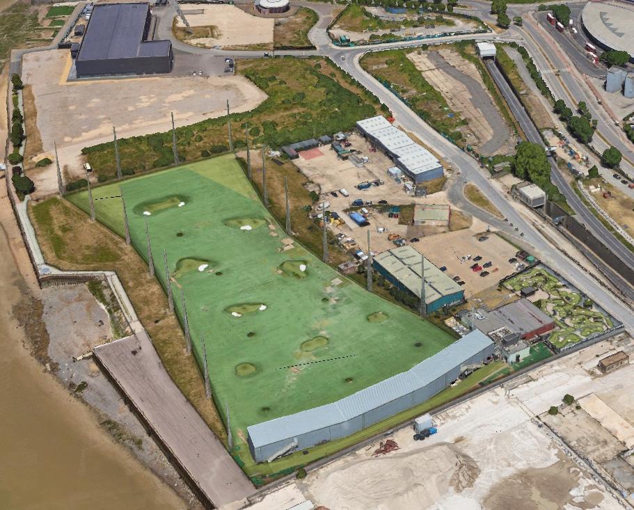
2.1.7 Ecology and Trees
There are number of trees and vegetation present across the site, which should be retained or reprovided within the future development.
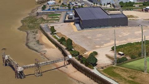
2.2.1 Blackwall Point Draw Dock
An area that is potential to connect the Olympian Way and can be further developed into a wider and more proper public space.
2.2.2 Dockside
The dockside offers great potential for people to enjoy the waterfront, complemented by vibrant commercial and retail spaces.
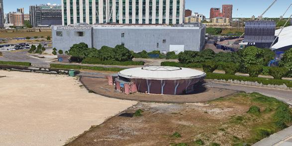
2.2.3 Empty field with unknown building and sulpture
The northern area could be transformed into open green spaces, serving as a natural buffer between the O2 and the site.


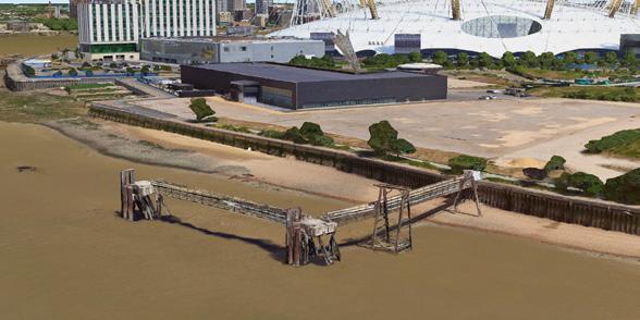
2.2.4 Reactivating abandoned River Pier
The pier offers opportunities for reactivation, enhancing the transport network and connectivity to and from the site.
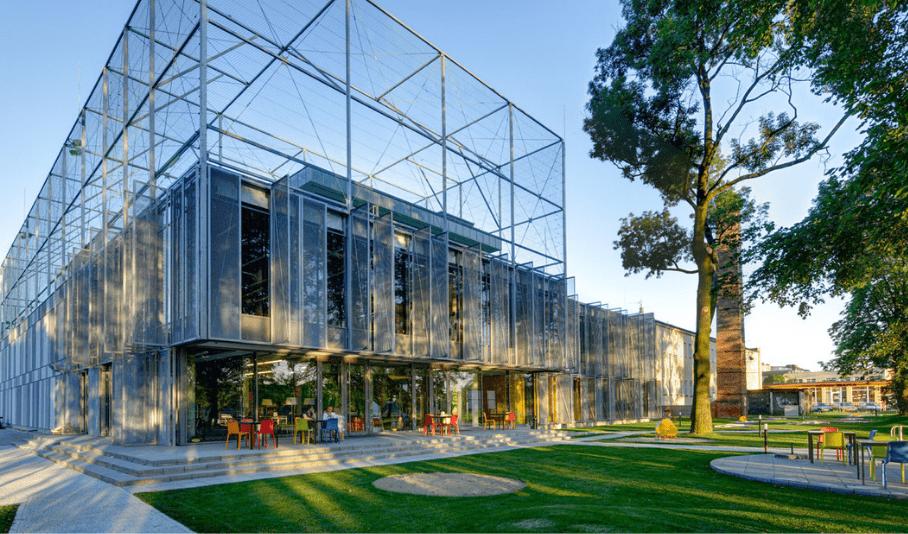
Repurposing abandoned building
Improved pedestrian linkages
Improved waterfront promenade
Improved pedestrian and buffer
"To shape a thriving North Greenwich Peninsula centered on wellbeing, with healthy residences, active travel, tranquil green spaces, and restorative spaces for creativity and culture."
OBJECTIVES
To deliver RESIDENTIAL LED-MIXED USE DEVELOPMENT
» Blend of residential, commercial, and cultural spaces through a variety of mix-use developments
» Housing options, including affordable, family-friendly, and co-living spaces
» Incorporate a mixture of retail and co-working spaces on ground floor to activate frontages 1
To create PUBLIC REALM WITH PEDESTRIAN ACTIVATION
» Provide a large central square with spaces for outdoor sports, leisure, community events, walking trails, and outdoor exercise stations.
» Introduce seasonal markets, food festivals and pop-up shops to activate public spaces.
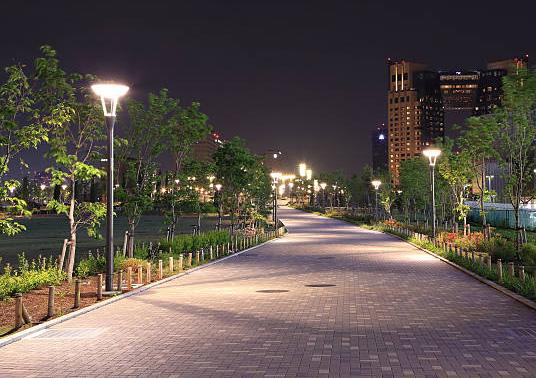
» Implement smart lighting and traffic systems to improve safety. 2
To cultivate RECREATION AND CULTURAL AMENITIES
» Develop cultural landmarks to foster community interaction.
» Develop community hubs and shared spaces such as libraries and community centres
» Design flexible-use spaces that can be repurposed over time as community needs evolve. 3
To activate WATERFRONT
» Develop a continuous promenade along the Thames, with pedestrian and cycling pathways that connect key attractions
» Develop dining hubs with waterfront-facing restaurants, cafes, and boutiques to create a lively and attractive destination. 4
» Create floating deck, piers, and marinas that offer spaces for outdoor community events and floating gardens to enhance the natural beauty and ecological value of the riverfront.
» Design flood-resilient landscapes with urban wetlands and rain gardens to manage stormwater and support biodiversity.
5
To prioritize HEALTH AND WELLBEING
» Inclusive and interconnected infrastructure to ensure a neighbourhood with good accessibility and pedestrian links prioritizing walkability and cycleabiliity.
» Improve public transport options, such as shuttle services, water taxis, and connections to the North Greenwich Underground Station.
4.1 This brief envisions transforming the western side of North Greenwich Peninsula, near the promenade, into a vibrant and healthy area which could accomodate a mix uses residential, health and wellbeing facility, recreation, waterfront activation, and link to other green infrastructure and open space where possible
4.2 The development principles set out below divide the site into a series of functions which should underpin the preparation of development proposals. The functions are assigned with UK's planning portal class references.
4.3 Redevelopment of this part of the site should seek to create a sense of identity for the new development through encouraging social interaction and community cohesion (Use Class F2).
4.4 Redevelopment of this area presents a significant opportunity to create spaces for collective activities, featuring an active frontage along the promenade to foster community engagement and connection for both residents and the public (Use Class E(a) and E(b)).
4.5 The need of healthcare facility in this area presenting a clear opportunity for development. This area is positioned near the main road, the site offers excellent accessibility, making it an ideal location to establish a healthcare and wellbeing facility to serve the community effectively (Use Class E(e)).
4.6 Redevelopment of this part of the site should offer opportunities for relaxation, leisure, children's play, and community engagement, strengthening ties to the natural environment. Connecting the site’s open areas with nearby green infrastructure will establish an integrated and accessible network that promotes biodiversity and supports active, healthy living.
4.7 Redevelopment of this part of the site should seek to create a new residential quarter comprimising a mix of typologies including low to mid-rise block buildings for families or couples (Use Class C3).
4.8 Residential development fronting the river should seek to enhance the environment and improve the activity along the promenade (waterfront activation).
4.9 Supplementary leisure and community-oriented uses that enhance and support the primary residential character of the area will be welcomed.

The Development would be required to prioritise sustainable and active modes of travel by:
a. enhacing accessibility and street experience along the proposed footways. This approach supports the aim to offer healthier lifestyle, where people would prefer to walk, cycle or use other active transport to reach places.
b. delivering a well-defined, safe and legible public realm.
c. ensuring a good integration between street experience and active frontages along the proposed buildings.
d. reflecting the street sections as depicted in “street activation” and complying to pedestrian comfort guidance
e. offering safe and inviting shared space as the main north-south connection, and pedestrian paths as the west-east conncection.
f. featuring a continuous promenade along the west boundaries of the site, providing extensive views to the River Thames and Canary Wharf.
h. integrating cycle routes to offer a dynamic experience, balancing urban vibrancy with scenic tranquility. The route will pass through the promenade and main north-south, west-east street network.
The Development would be required to deliver well-defined, safe and inclusive public realm by:
a. featuring a continuous path on the linear park to offer a scenic walking experience.
b. reflecting the dimensions and sections as depicted in “street activation” and complying to Streetscape Guidance and Expanding London’s Public Realm Design Guide.
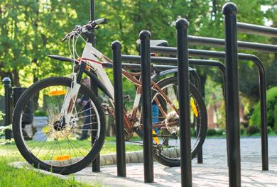
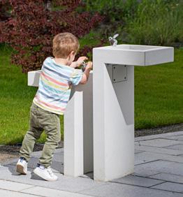
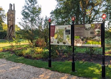
c. delivering street furnitures such as benches, street lights, wayfinding signage, bicylce parks, canopies, and other appropriate furnitures in offering a safe and legible public realm.
d. including elements of greenery to support and improve biodiversity.
5.3 Shared space Road (vehicular links)
The Development of shared space road would be required to deliver safe and inviting shared space by:
a. ensuring accessibility to the site
b. reflecting the street sections as depicted in “street activation” and Manual for Streets documents
c. providing safe shared space to accommodate and prioritise pedestrian and cyclist
5.4 Public Transport
The Development should introduce a new and improved access to public transport by:
a. adding bus stops in 3 spots consisting of southern access, central area, and in the northern access to improve connectivity.
b. ensuring the ease of reaching health and wellbeing services, potentially located at the centre of the site.
c. integrating with the wider public transport network, especially to the North Greenwich Underground Station.
6.1 Framework Guidance
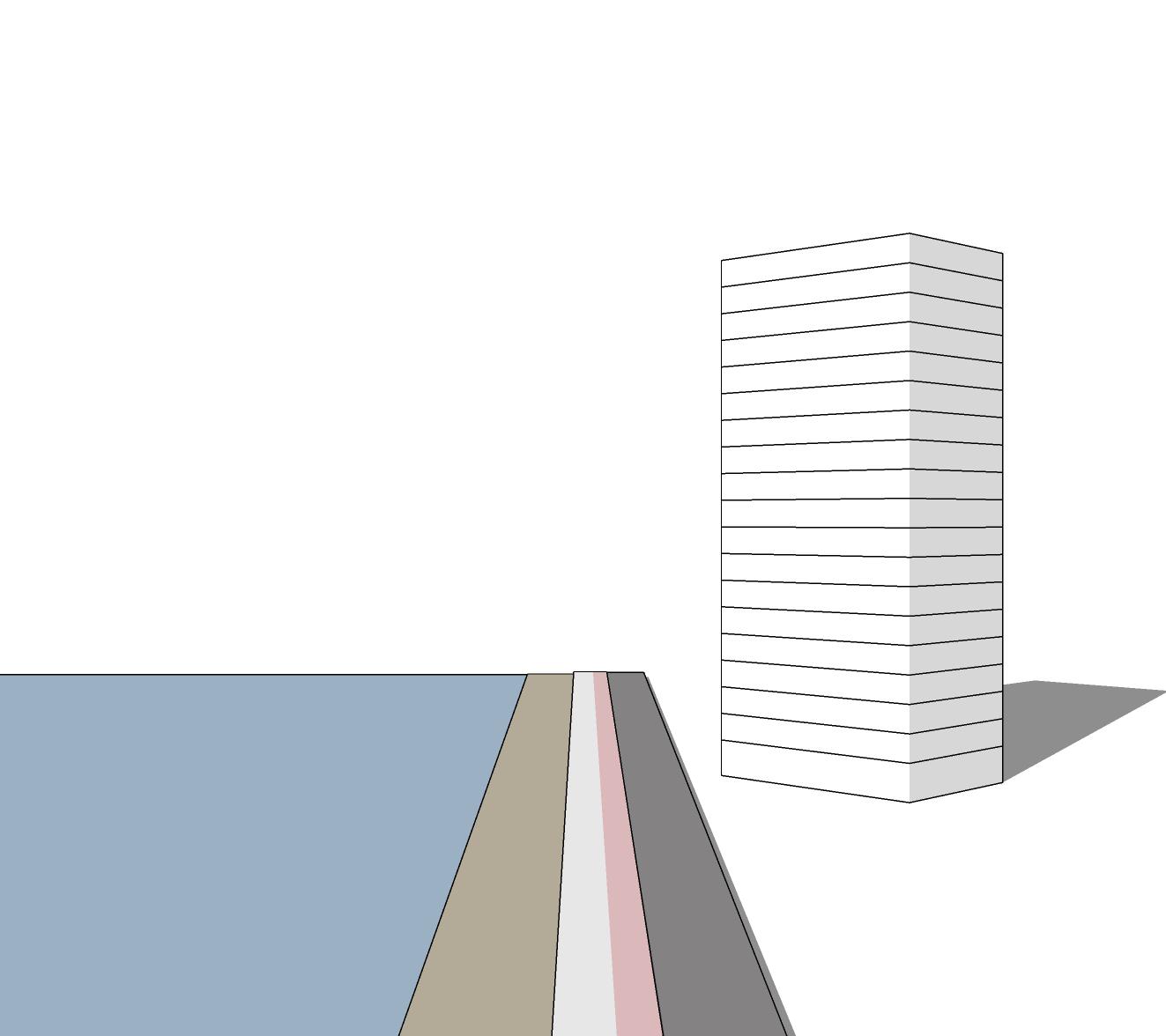
The building height to reinforce the proposed linear route along the river guiding users to adjacent uses.
The highest buildings to be located on the river front, increasing its potential to serve as a landmark.
Heights generally to fall from high point on waterfront to 2/3 storeys fronting tunnel avenue road.
6.2 Residential Typology
6.2.1 Landmark Buildings
Tall buildings of 15 to 18 storeys are encouraged towards the western edge of the site, to serve as focal points.
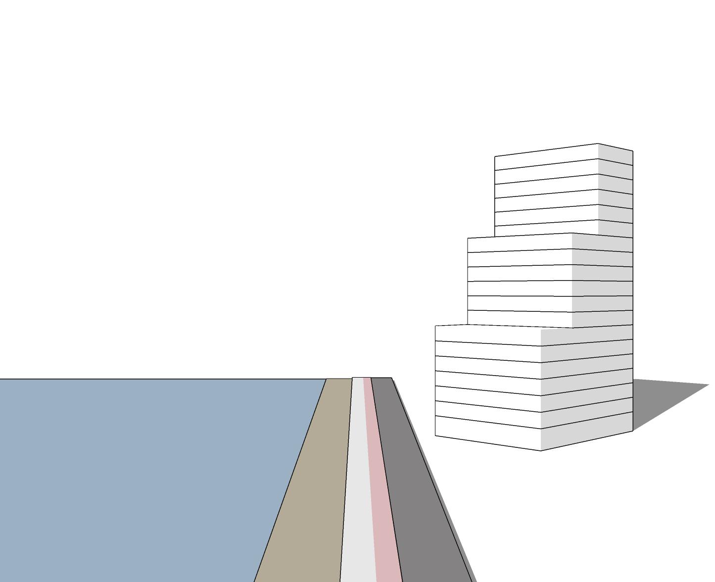
6.2.2 Height transition
Heights should transition gradually, stepping down from the taller landmark buildings towards the O2 and the southern areas of the site comprising of 6 to 8 storeys. This ensures a smooth visual and spatial relationship with the surrounding context.
6.2.3 Skyline integration
- Proposal’s must consider the skyline’s visual coherence, with taller elements positioned to frame views of Canary Wharf and align with existing height patterns.
- The height strategy should aim to create a dynamic and layered skyline that reinforces the development’s role as a restorative urban district.
6.3 Health and Community facility Typology
6.3.1 Human Scale
The facility should remain at 2-3 storeys, ensuring a low profile that does not dominate the inland area or overshadow adjacent developments.
6.3.2 Contextual Fit
The height and form should create a harmonious relationship with nearby mid-rise residential developments, acting as a visual and functional transition between the waterfront towers and lower density areas further south.
7.1 Building Setback
7.1.1 Building setbacks’ minimum requirements differ depending on the building typology and adjacent infrastructure and land uses such as road, open space or other buildings.
7.1.2 The minimum setback for buildings depends on the building height and adjacencies. Building setback requirements as illustrated in the Table sets out the setbacks in different settings.
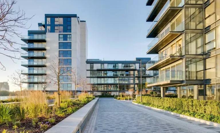
8.1 Residential Development - Waterfront
8.1.1 Proposed new developments should address the riverside walk properly by providing appropriate ground level animation and supervision.
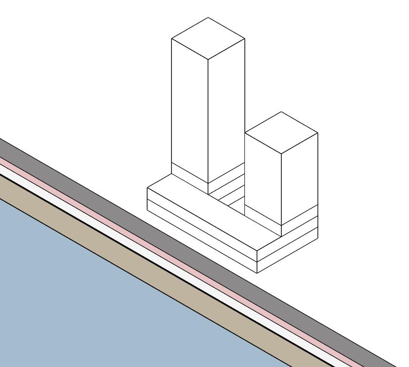
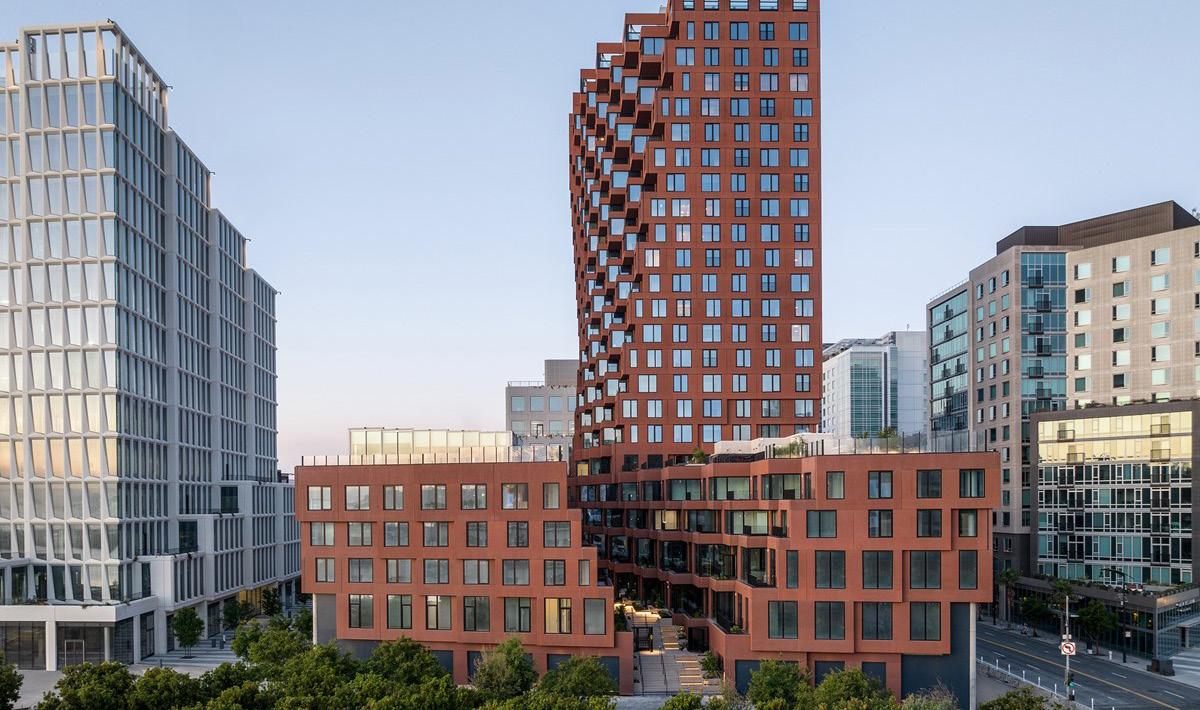
8.1.2 Careful consideration should be given to the design and layout of buildings to minimise the potential for permanent shading in some areas. This can be achieved from the following consideration through contextual study of existing developments:
-Tapered Orientation: Orienting the building at 45 degrees to maximize views, solar access and wind flow. This angle also enhances visual permeability to canary wharf and Thames. Precedent example: South Quay Plaza, Berkeley Development
- Podium + Tower typology: Use podium (2 to 4 storeys) with retail, commercial, or public uses, topped by residential towers. The podium defines a human-scale streetscape, while towers offer density and landmark potential.
8.3 Wellness, Healthcare and Community Facility Development
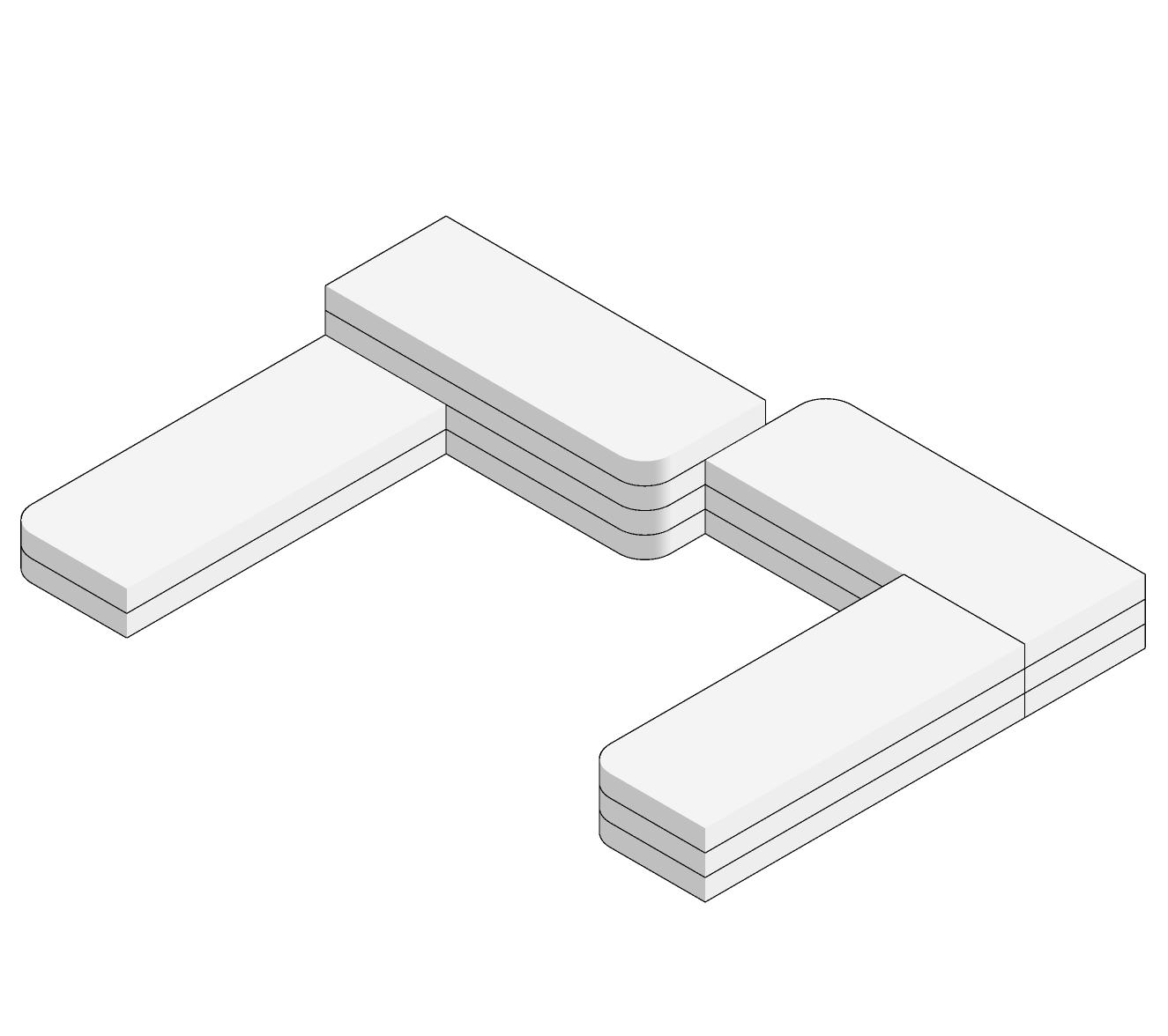
8.3.1 Horizontal Emphasis
7.1.3 Building Setback illustrative examples based on adjacencies
- Staggered massing: Incorporate a staggered design where building mass insets, ensuring minimal overshadowing and better viewing access. It also allows for public realm activation in the upper terrace.
8.2 Inland developments
8.2.1 Apartment Typology: Inland developments should adopt a mid-rise apartment typology, ranging from 6-8 storeys. This typology complements the taller waterfront towers while offering a more human-scale residential experience.
8.2.2 Compact and Linear Forms: Buildings should follow compact, linear forms with a focus on efficiency and functionality. The design should include varied rooflines and articulated facades to create visual interest.
The wellness and healthcare facility should reflect human-scale function and distinguish it from the verticality of the nearby residential towers.
A low-rise structure with a maximum of 2-3 storeys is recommended, featuring extended rooflines, landscaped terraces, and wide, glazed facades.
8.3.2 Organic layout
Consider an organic layout, with interconnected volumes arranged around courtyards or gardens, fostering a calming, immersive environment ideal for wellness activities.
8.3.3 Public integration
Ensure the wellness facility contributes to the public realm by incorporating outdoor spaces such as meditation gardens, shaded seating areas, walking paths that are accessible by the visitors and the community.
In delivering the massing, developments should ensure people have the ability to view the
docks and open spaces.
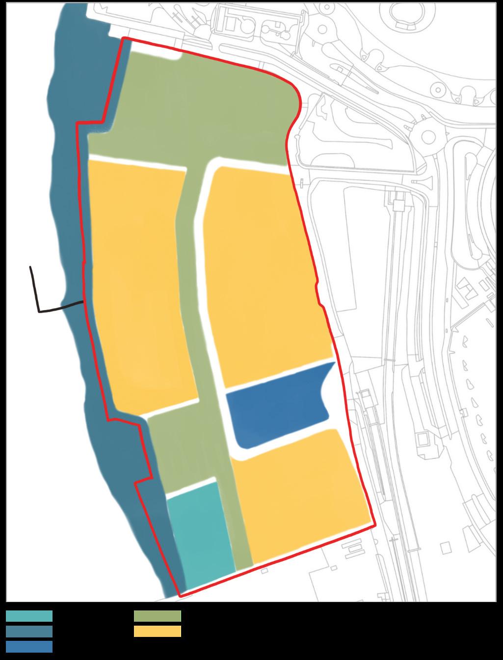
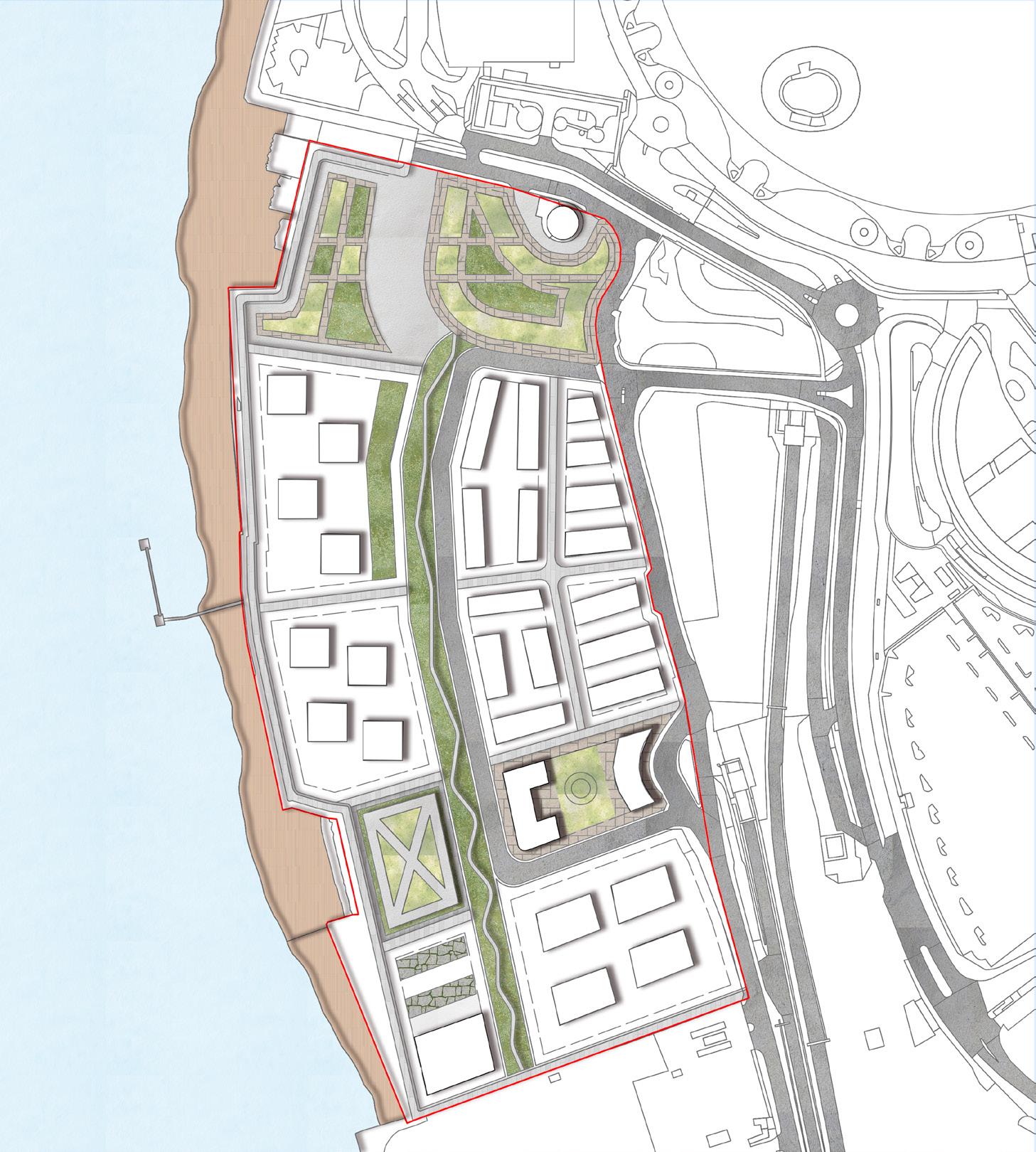
9.3.2 Potential Residential Street Frontage
This outlines the potential land uses and street frontage types for the chosen site located in North Greenwich Peninsula. The site is a mixeduse development with a variety of functions including residential, retail, community, healthcare, and recreational spaces, designed to enhance the vibrancy and livability of the area.
9.2 Connectivity & Integration
Ensure all frontage types and zones are well-integrated through pedestrian walkways and public transport access points.
9.3 Frontage Types & Key Considerations
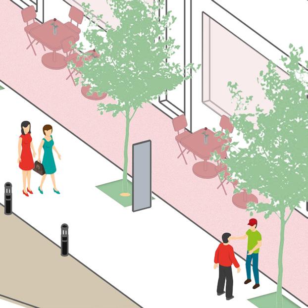
9.3.1 Potential Retail Street Frontage
To activate streets and generate footfall with commercial activity.
Should be positioned along key thoroughfares to ensure high visibility.
Should encourages a mix of small retail shops, boutiques and brands.
Should supports the integration of pedestrian-friendly streetscapes.
Design Considerations:
Provison of ground-level units with transparent facades to foster engagement.
Provide opportunities for outdoor seating and street events.
To provide high-quality housing along quieter streets.
Focus on creating a sense of community with family-friendly layouts.
Encourage residential-only or mixed-use developments with upper-level housing.
Design Considerations:
Provision for front gardens on ground floor for residential only frontages.
Opportunity for enhanced landscaping for aesthetics and livability.
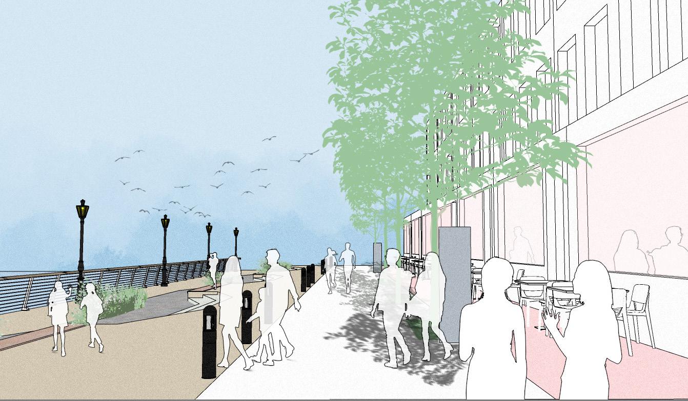
9.3.3 Potential F & B Waterfront Frontage
To maximize the potential of the waterfront for leisure and dining.
Opportunity to utilize the prime locations for restaurants, cafes, and bars with river views.
Promote tourism and local engagement through iconic waterfront spaces.
Design Considerations:
Provision for creating terraces and pathways for strolling.
Ensure flood resilience and environmental sensitivity.
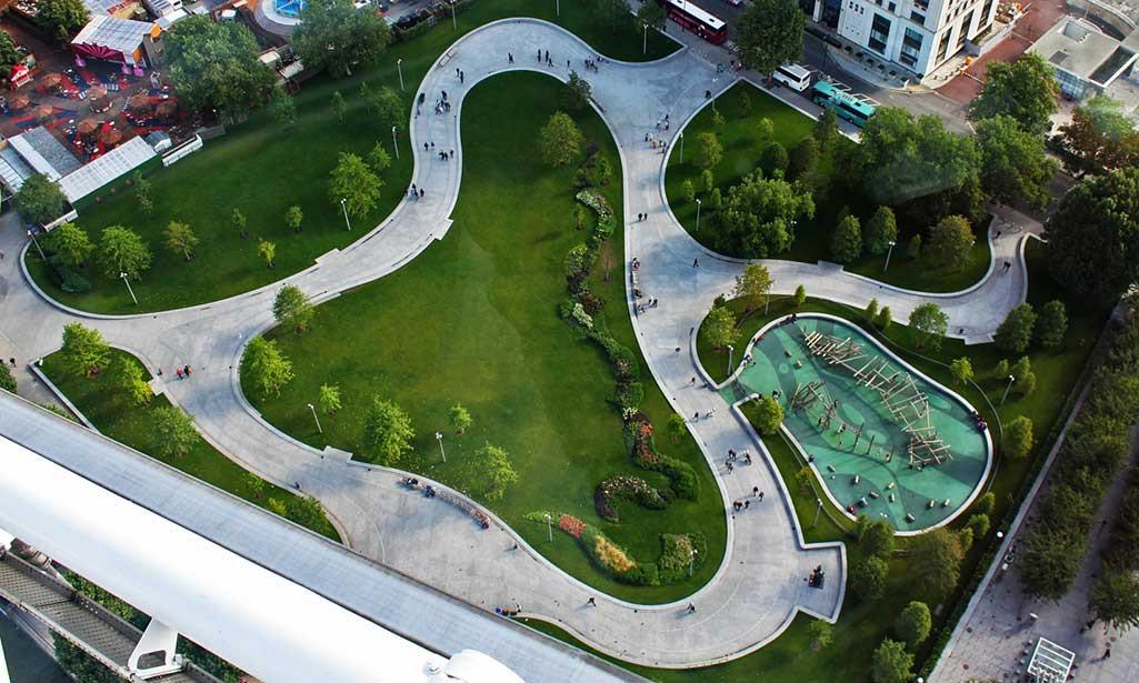
10.1 Public Plaza and Park
Purpose: To serve as a gathering space for social and cultural activities and offer green spaces for relaxation.
Location: Central to the development, connected by walking trails to promote easy accessibility.
10.2 Walking Trail
Purpose: To enhance pedestrian connectivity, encourage active lifestyles, and link key community facilities.
Design: Should integrate seamlessly with the waterfront promenade and internal circulation network.
10.3 Healthcare and Wellness Hub
Purpose: To meet primary healthcare needs of residents and provide wellness services.
Catchment Area: Central location to serve the entire population within the maximum travel distance.
10.4 Community Facility
Purpose: To host events, community programs, and recreational activities.
Location: Close to residential clusters to encourage frequent use.
10.5 Restaurants and Cafés
Purpose: To provide dining options and promote local business activity.
Location: Along the waterfront promenade and public plazas for vibrant, active spaces.
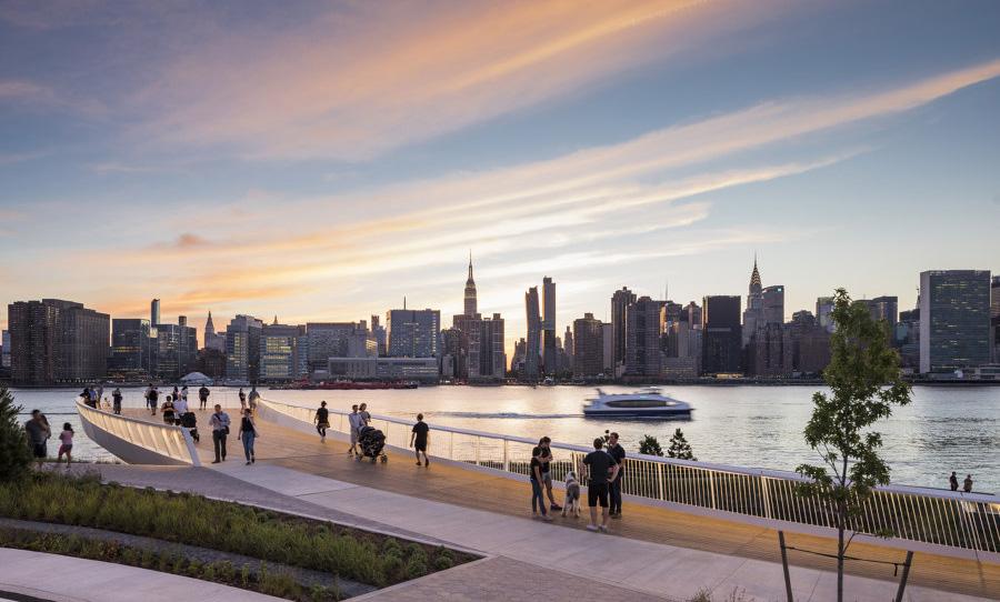
10.6 Waterfront Promenade
Purpose: To maximize public enjoyment of the water's edge, offering leisure spaces and connectivity.
Design: Incorporates pedestrian and cycling paths with opportunities for recreational activities.
10.7 Pier for Water Transport
Purpose: To provide sustainable transit options and connect the site with other parts of the city via water.
Location: Adjacent to key residential and commercial areas for convenience.
10.8 Bus Stop Location
Purpose: To ensure public transport accessibility and reduce dependence on cars.
Design Considerations: Sited strategically to link with walking trails and the internal street network.
Key Considerations
Accessibility: All facilities must be within walking or cycling distance, adhering to maximum catchment areas.
Flexibility: Design spaces for multifunctional use to adapt to changing community needs.
Sustainability: Integrate green building practices and prioritize sustainable transit options.
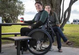
Inclusivity: Ensure that facilities cater to diverse demographics, including children, elderly, and individuals with disabilities.
Below picturised of open spaces on the site through sketches:
11.1 Overview
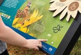
The site has the potential to create multifunctional, inclusive open spaces that serve all ages and abilities year-round. These spaces will support diverse leisure and fitness activities, encouraging both active and passive engagement across the area. By connecting with nature and enhancing public art installations, the development will foster a healthier, more vibrant community.
11.2 Plaza
The plaza is envisioned as a serene, passive area designed for relaxation and quiet reflection. Surrounded by residential and community spaces, it will provide a tranquil environment featuring seating areas, catering to those seeking a peaceful retreat away from busy crowds.
The linear park is envisioned as a green ecological corridor that serves as a pedestrian-friendly trail connecting different parts of the site. Acting as a buffer between the promenade and nearby roadways, it will provide a healthy and safe walkway for pedestrians. The park will be thoughtfully designed with lighting and benches to enhance comfort and usability.
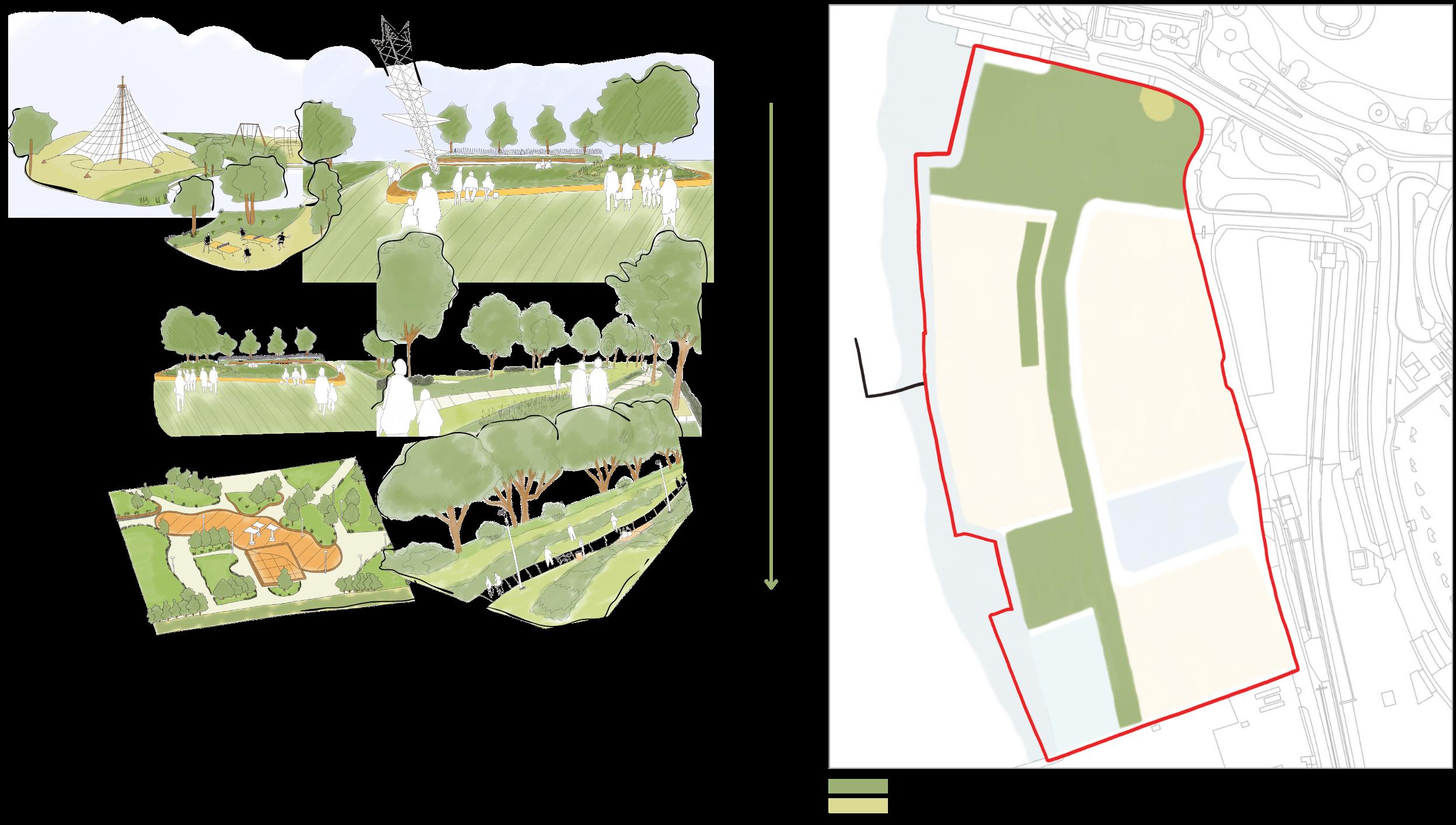
The 'I' park is designed as an extension or alternative to the main public park, offering additional space for public enjoyment. Featuring ample seating, it provides a semitranquil setting near the promenade, with views of O2 Arena and proximity to waterfront activities.
This main park will feature multifunctional, inclusive spaces designed to support a variety of activities, including sports, children’s play, and relaxation. With its attractive landscape, it offers views of the O2 Arena and cityscapeThe park will also include a public art sculpture and essential amenities such as a public toilet, enhancing its accessibility and appeal.
Making the place as a "destination" by :
12.1 Overview
The waterfront area is highly potential to accommodate collective activities, fostering a sense of community in the area.
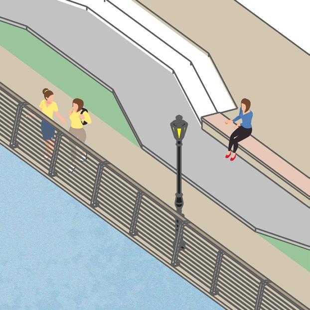
12.2 Floating Deck
Floating decks may extend up to a maximum of 8 meters into the river, and should provide extensive views to the River Thames to enhance walking experience.
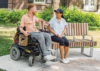
12.3 Street furnitures
Proposals should provide seating for the users to sit and rest. Sufficient lighting from the stores and street lightings to offer safety and security during the evening. Provide greenery as a buffer between circulation zone and active frontages, while still offering transparency. SIgnanges are to be installed to provide the users ease of navigation. Railings along the floating deck to increase feeling of safety, especially for children and seniors, as well as avoiding accidents
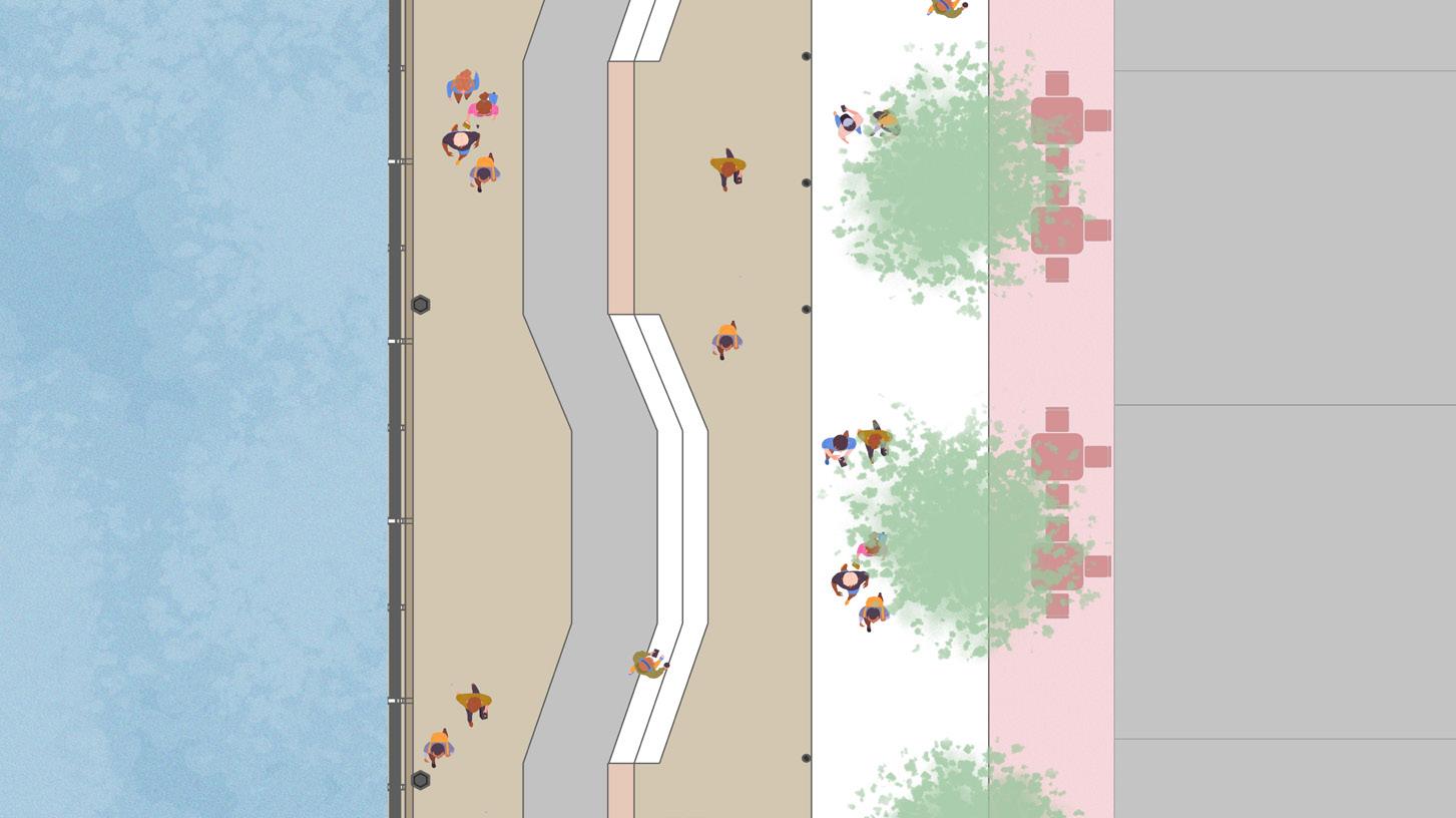
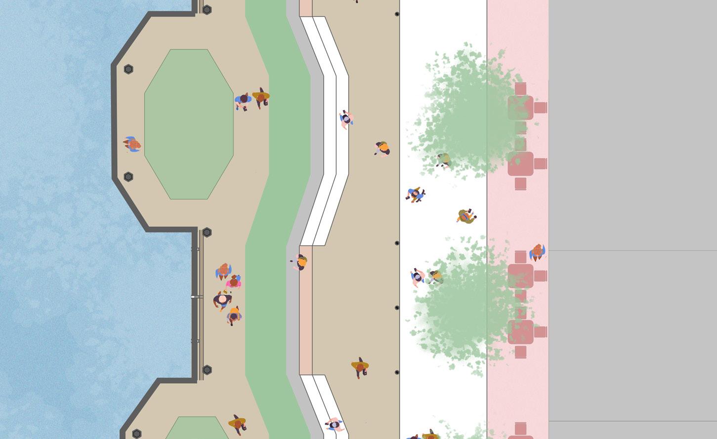
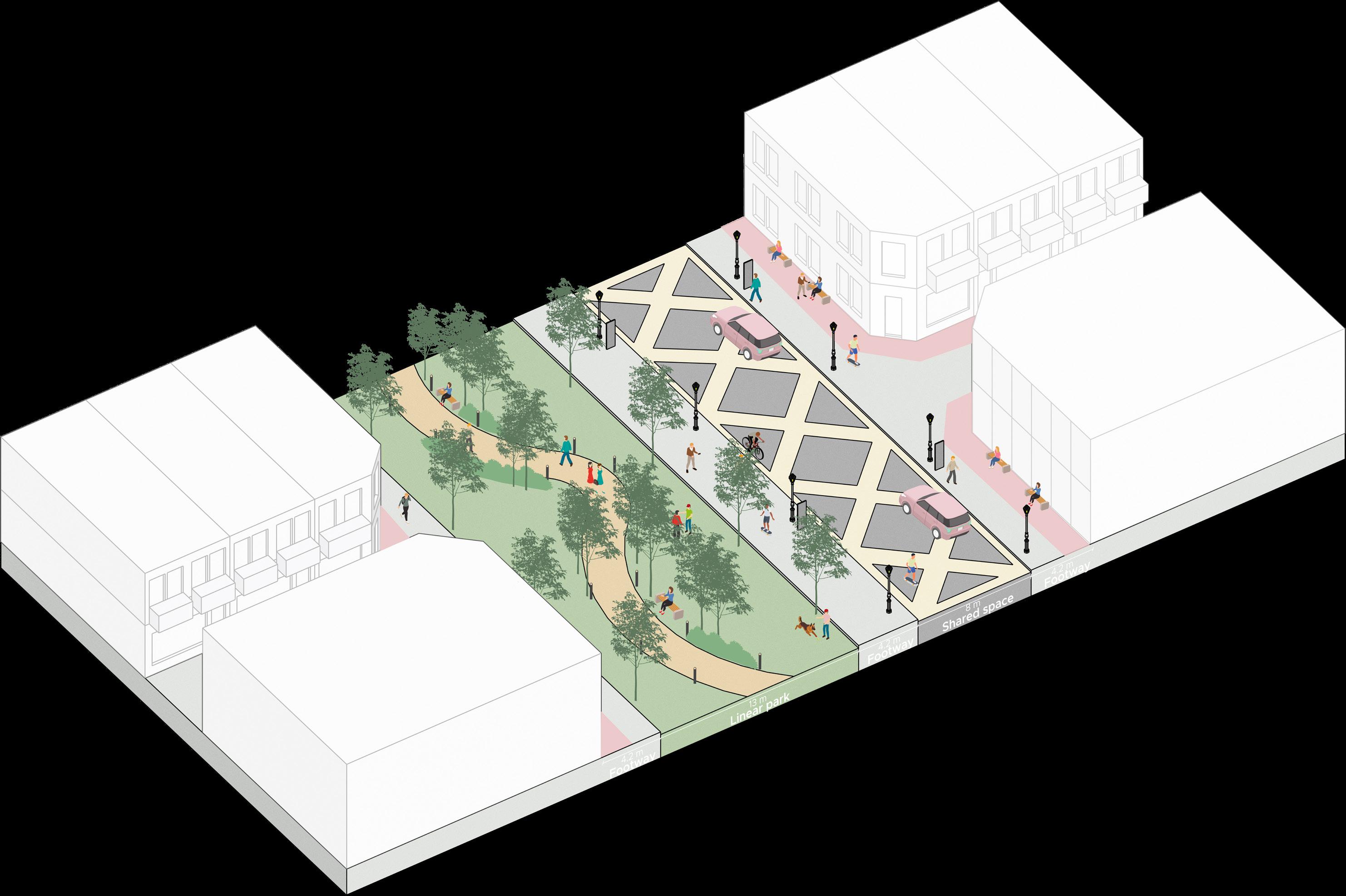
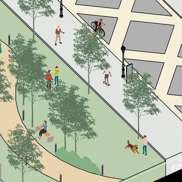
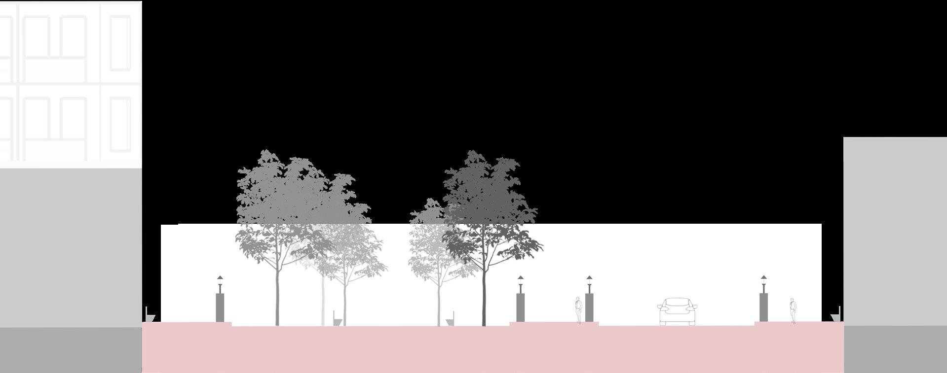
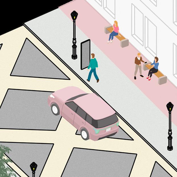

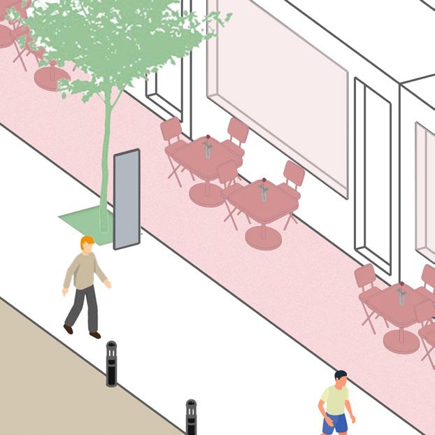
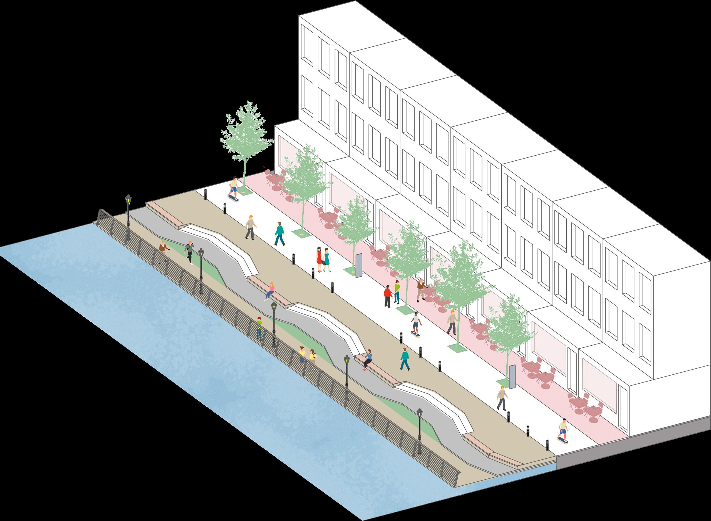
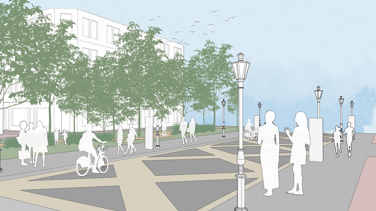
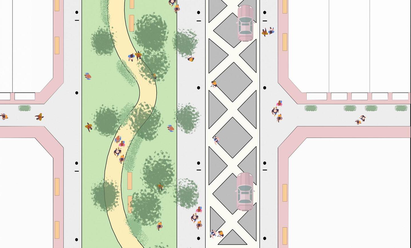
13.1 Street Activation
Street Activation includes the linear park in the centre of the development area, connecting the users while providing continuous linear greenspace.
13.2 Linear Park Function
The park acts as buffer between the vehicular circulation and buildings. Proposals should offer layered landscaping and appropriate and sustainable drainage system in the linear park.
13.3 Footways
Footway follows the Pedestrian Comfort Guidance, with the width of 4,2 meters including street furnitures. Essential Street furnitures includes wayfinding signages, benches for people to sit and rest, and street lamps as well as decorative landscape lighting to provide safety and legibility during the evening.
13.4 Shared space road
Shared space is provided for vehicular access while also cater to pedestrian and other active modes of travel, including wheeling
14.1
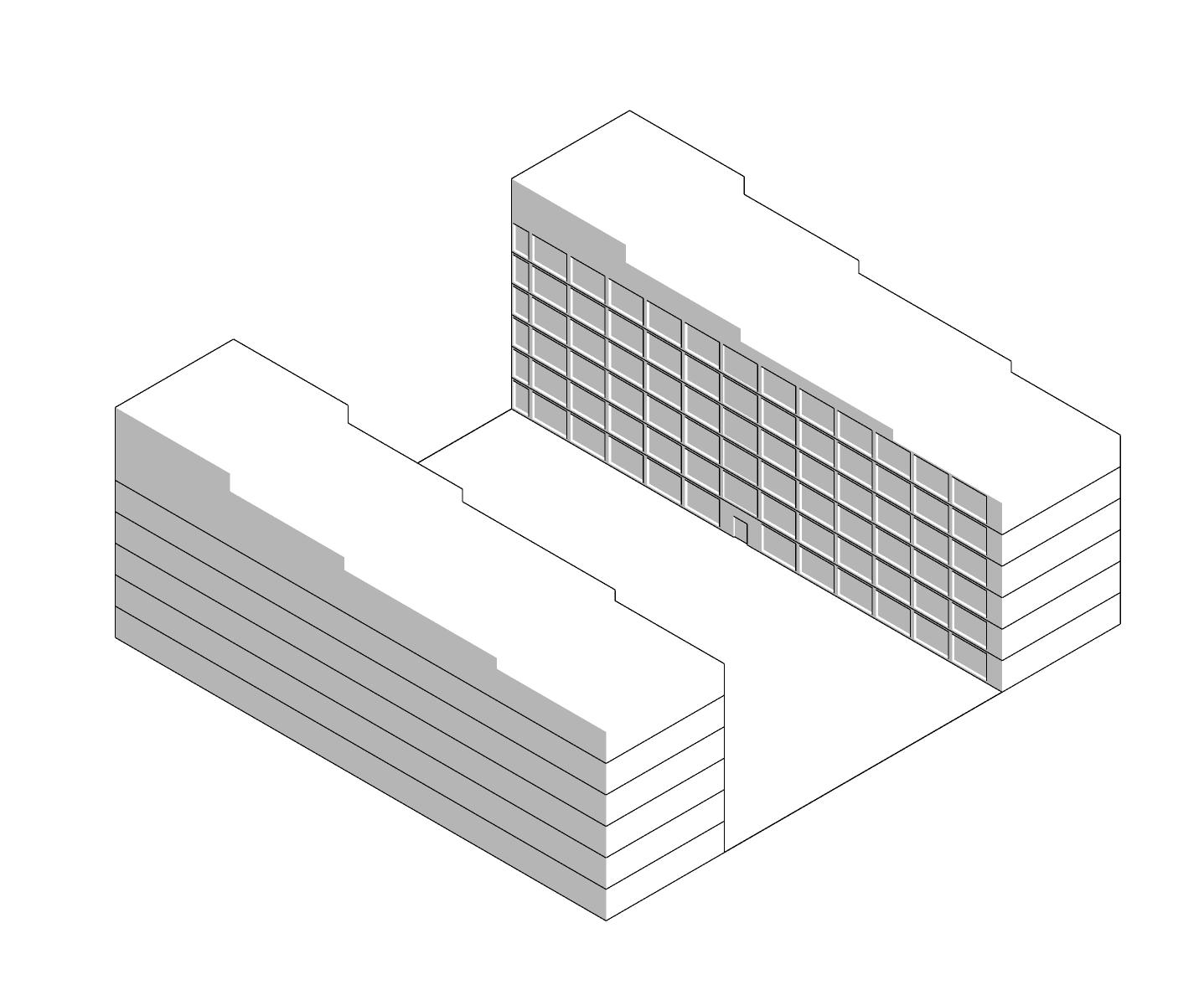
The buildings should feature verticality in design that complements the Canary Wharf skyline, with dynamic, staggered massing or stepped facades to reduce bulk and enhance visual appeal.
The design should balance mass and void, using cantilevered structures, horizontal and vertical lines, and recessed areas to create spacious interiors and a striking exterior that aligns with the area's modern character.
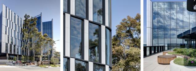
Glass facades and windows should enable visual connection with the surroundings, with large openings to maximize natural light and provide unobstructed views, incorporating up to 60-70% window glazing suitable for the site context.
14.2
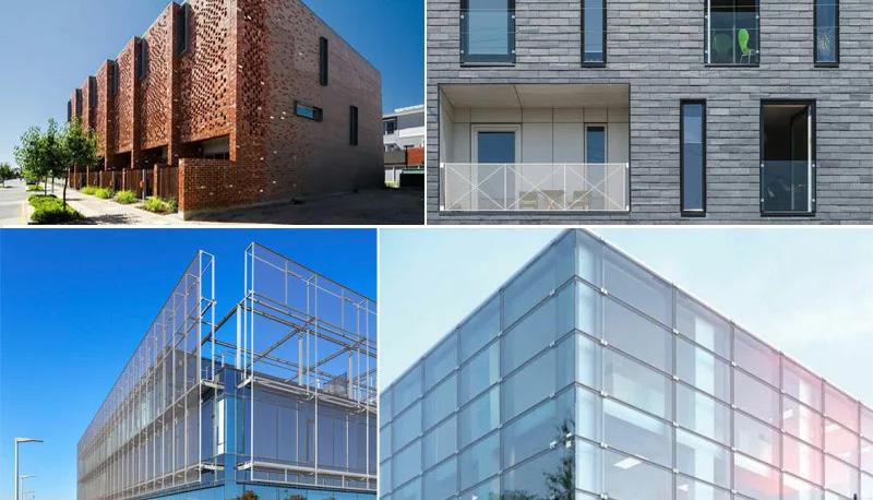
The buildings should embrace a minimalist aesthetic, featuring clean lines, geometric forms, and a focus on simplicity, functionality, and proportion, while avoiding excessive decoration.
The development should use sleek, durable materials like concrete, glass, steel, and stone, with a focus on sustainability through locally sourced materials such as recycled steel, timber, and brick, and high-performance glass for energy efficiency and UV protection.
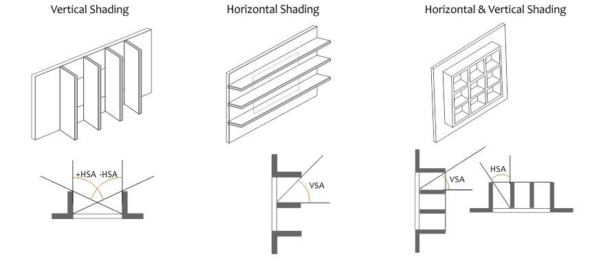
The facade should respond to climate conditions, incorporating shading devices like louvers or brise-soleils to reduce solar gain and improve energy efficiency, while adding dynamic shadow play.


The building should be oriented to maximize Thames views, with floor-to-ceiling windows, balconies, and terraces on higher floors offering residents a visual connection to the river and Canary Wharf skyline.

The design development brief's vision of enhancing health and well-being must be seamlessly incorporated into the master planning process.
To achieve this, aforementioned design principles must be adhered to, which involves encouraging pedestrian and cycling mobility through the establishment of a walking trail and an interconnected network of pathways, fostering accessibility and community engagement.
The waterfront should be transformed into an active, lively space through the creation of a waterfront promenade that offers opportunities for recreation and relaxation. Residential-led mixed-use developments should aim to establish a dynamic and harmonious urban environment.
Furthermore, dedicated spaces such as the Healthcare & Wellness Hub, Community Hub, and parks should be prioritized to promote both physical and mental health, complemented by sports and recreational facilities. Together, these features should shape an inclusive and well-integrated masterplan that supports vibrant social interactions, and an active, healthy lifestyle.
I initially worked on gathering data for the opportunities and constraints of the chosen site and collaborated with my teammates to finalize the vision and objectives. My responsibilities included producing graphics and maps to effectively illustrate these goals. I also set up base maps on AutoCAD and Illustrator, which were crucial for preparing parameter sheets.
My focus was on research and graphic development, to produce detailed sheets on active development edges, community facilities, architectural styles, and design implementation. Additionally, created an indicative masterplan layout to demonstrate the application of the established parameters and assisted a teammate in structuring and compiling the final submission document.
Throughout the project, I engaged actively in discussions, offering and incorporating feedback to ensure the content aligned with the project’s objectives. I collaborated with my teammates to create shared resources, including maps, photos, and graphics, and participated fully in all meetings and tutorial sessions, contributing meaningfully to the group effort.
My initial responsibility was to compile the strength and opportunity of the area, collaborating with my team members to produce a SWOT map and analysis. Then, I focused more on the mobility and accessibility of the area, researching on planning policies and supplementary design guidelines of London, ensuring that the guideline aligns with the broader London design guides.
produced narration, maps, indicative graphics and visualisation on the SWOT, Mobility, Waterfront, and Street Activation pages, and contributed ideas to the open space, land use and architectural sections. I am actively involved in providing and receiving suggestions and feedback on the overall content of this group project, ensuring it aligns seamlessly with the project’s objectives. I participated in producing collective resources including maps, photos and graphics with my teammates. I fully attended offline and online meetings, and was actively engaged in all discussions and tutorial sessions throughout the project.
My contributions to the project covered various responsibilities. Initially, I focused on identifying opportunities for the site by specifically analysing its current usage and condition. Then I mainly contributed to the land use and open spaces section of the proposal by creating narrations, maps, graphics, and visualisations to support our ideas. To ensure the proposal met required standards, I conducted research on relevant guidelines and samples.
In addition to my specific tasks, I contributed in developing the vision section by sharing ideas and actively engaging in discussions. I regularly provided and received feedback, helping to refine the overall content and maintain alignment with the project’s goals. Lastly, fully participated in offline and online meetings, engaging actively in discussions and tutorial sessions, demonstrating commitment and teamwork throughout the project.
My contributions to the project were diverse. I initiated the base template file, including the cover page and introduction sheet with contextual analysis and policy framework. I co-produced the SWOT map and analysis, focusing on the weaknesses and threats of the area. I contributed to the vision section, developing the overarching concept and diagrams.
My focus was on building massing, typology, heights, and plot setback guidelines, informed by research on London precedents and planning guidelines. I created 3D diagrams, 2D graphics, sections, and visualizations for various sheets, including the cover, introduction, SWOT, building typology, and height guidelines. Additionally, I contributed to the indicative masterplan, land use, and frontage sheets.
I edited and compiled all project sheets, while actively collaborating with teammates to produce collective resources such as photos, graphics, and precedents. I participated fully in all meetings, tutorials, and discussions, contributing consistently throughout the project.